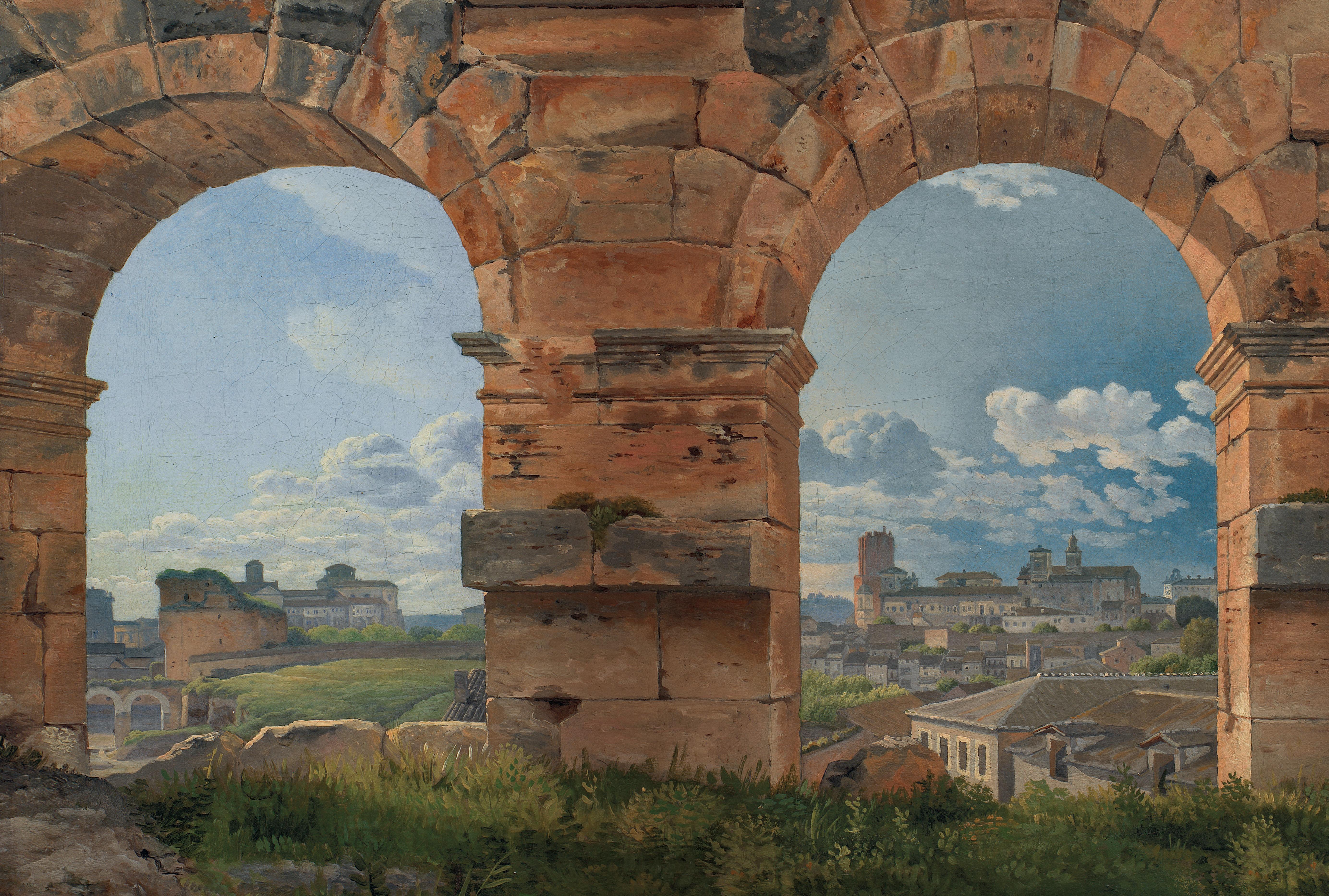
‘Erudite, entertaining and infinitely readable’
HELENA ATTLEE
‘Erudite, entertaining and infinitely readable’
HELENA ATTLEE


Also
by
Catherine Fletcher
Our Man in Rome: Henry VIII and his Italian Ambassador (also published as The Divorce of Henry VIII: The Untold Story) Diplomacy in Renaissance Rome: The Rise of the Resident Ambassador
The Black Prince of Florence: The Spectacular Life and Treacherous World of Alessandro de’ Medici
The Beauty and the Terror: An Alternative History of the Italian Renaissance
The Bodley Head, an imprint of Vintage, is part of the Penguin Random House group of companies whose addresses can be found at global.penguinrandomhouse.com
First published by The Bodley Head in 2024
Copyright © Catherine Fletcher 2024
Catherine Fletcher has asserted her right to be identified as the author of this Work in accordance with the Copyright, Designs and Patents Act 1988 Map by Bill Donohoe penguin.co.uk/vintage
Typeset in 10.5/14pt Sabon LT Std by Jouve (UK), Milton Keynes Printed and bound in Great Britain by Clays Ltd, Elcograf S.p.A.
The authorised representative in the EEA is Penguin Random House Ireland, Morrison Chambers, 32 Nassau Street, Dublin d 02 YH 68
A CIP catalogue record for this book is available from the British Library
HB ISBN 9781847928030
TPB ISBN 9781847928047
Penguin Random House is committed to a sustainable future for our business, our readers and our planet. This book is made from Forest Stewardship Council® certified paper.
To those who wore out life and limb to cut through marsh and forest.
2. Journeys through the empire
Early Christian travel
6. Crusaders and the Via Militaris
Seville / Italica
Cádiz
Tangier
The Antonine Wall
St. Mary, Whitekirk
Corbridge
Manchester
Wroxeter
Cirencester
Wall
London York
Bath
Paris
Bern
Valence
Avignon Orange
Milan
Turin
Pavia
Nice Monaco Genoa Nîmes
Arles
R Douro
Barcelona Tarragona
Valencia Córdoba
Vienna / Carnuntum
Ravenna Viterbo
Rimini
Furlo
Monte Sant’Angelo
Anzio
Terracina
Montecassino
Benevento Pozzuoli
Bari
Timgad
Budapest
1. Via Aurelia
2. Via Cassia
3. Via Flaminia (to Rimini)
4. Via Salaria
5. Via Tiburtina
6. Via Casilina/Latina
7. Via Appia (to Brindisi)
8. Via Ostiense
Bucharest
Durrës
ALBANIA
Brindisi
Thessaloniki Sofia Plovdiv
Constantinople/ Istanbul
Tarsus Antioch Hierapolis Cairo
Alexandria
‘All roads lead to Rome.’ It’s a medieval proverb: its first recorded expression is found in the works of a French poet, Alain de Lille. ‘A thousand roads lead men forever to Rome,’ he wrote, almost a millennium ago. Mille vie ducunt homines per secula Romam. An English version came a century later, in Chaucer: ‘right as dyvers pathes leden dyvers folk the right weye to Rome’.1 The proverb has a broader meaning, of course, but for the ancient Romans it had a rather literal truth. Sometime after 20 BCE , the Emperor Augustus inaugurated a monument known as the Golden Milestone in the Forum. This was, wrote Plutarch, ‘the point at which all roads ended’.2 One way or another, those roads led to Rome.
The queen of the roads – to quote another ancient writer, Statius – was the Appian Way, leading south and east from Rome to the Adriatic port of Brindisi on Italy’s heel.3 It runs now between glorious ruins and famous pines, amid the remnants of suburban villas and aqueducts, its picturesque pavements above the corridors of catacombs, their niches of memory filled with the bones of the dead. There’s a backdrop of mountains, a view towards the city; its palette shifts with the weather from soft mist to stark sun. It has the sort of calm beauty a Grand Tourist might have drawn or painted. There’s a special light here, a pink haze that clears to reveal ruins in red brick, their lines interrupted by intricate patterns, the secrets of their engineering. Sometimes the trees sway in a breeze: sometimes the prevailing winds impart to them a permanent direction. There are never many people in the pictures of this quintessential landscape, just a traveller or two, or a peasant in his vineyard. This is a world of layers, a palimpsest of history. Travellers have come here, walked or ridden or driven, for
over two millennia. Here I am, you may think, with everyone who walked this path before me, their footsteps imagined over flagstones. There are ghosts along these roadsides, in the memorials and tombs. Here are the lost, the missing, the crossroad haunts. Along the way were shrines to those who watched over the travellers: the goddess Hekate first, St Christopher later. For all the beauty of the Roman campagna, the roads were dangerous places.
The Appian Way has a soundtrack, too. Ottorino Respighi’s tone poem Pines of Rome, written a century ago, recalls the trees of Rome’s romantic settings, from the Borghese Gardens to the catacombs and Gianicolo hill. In its final movement a legion marches in triumph towards the city, down the Via Appia. Robert Graves’ 1934 novel Claudius the God describes the eponymous emperor standing outside the Temple of Capitoline Jove, pointing towards the Appian Way. ‘Do you see that?’ he asks. ‘That’s part of the greatest monument ever built, and though monarchs like Augustus and Tiberius have added to it and kept it in repair, it was first built by a free people. And I have no doubt that it will last as long as the Pyramids, besides having proved of infinitely more service to mankind.’ He goes on:
The Roman Road is the greatest monument ever raised to human liberty by a noble and generous people. It runs across mountain, marsh and river. It is built broad, straight and firm. It joins city with city and nation with nation. It is tens of thousands of miles long, and always thronged with grateful travellers.4
Some decades later, when the characters of Monty Python’s Life of Brian discussed what on earth the Romans had ever done for us, the roads came high up the list: ‘Well, yes, obviously the roads . . . the roads go without saying.’ Many roads do go without saying. They’re not aesthetically exciting. They’re functional and mundane. We notice roads when they have problems – a traffic jam or accident. When the journey is smooth they’re not worthy of comment. (I noted, while researching, how rarely the word ‘road’ is indexed.) And yet for centuries the Roman roads have been a source of fascination.
This book is about how that fascination came to exist, and about its implications in both past and present. Besides the obvious practical
uses, why have Roman roads been such a persistent cultural presence across so much of Europe? In part, it’s because the Romans themselves decided that they should be. Graves’ Claudius had a point when he called the roads monuments: the milestones beside them kept the names of patrons and emperors alive long after the Romans were gone. The longevity of the road network is remarkable, and its staggering scale conveys Roman power on a level no individual building, however grand, can match. I recall, as a child, in between games of I-Spy noting these roads from the sticky back seats of my parents’ old Renault 12. As we drove through England, every time we reached a straight stretch my father would announce it as a Roman road. He had read Classics at Oxford and I suppose at the very least that should equip you to know a via romana when you’re driving down one. One such road was called Watling Street, though I later learnt that it predated the Romans and they’d remodelled an older, British route. The name ‘Watling’ didn’t sound very Roman to me, but its status could be verified by unfolding the map, memorising the order of the folds so as to close it properly later, and checking for the sans serif capitals that in the Ordnance Survey marked each ROMAN ROAD , sometimes beside its proper name. It mattered, this history, to the mapmakers of the British state. As Britain conquered its own empire, its rulers sought to cultivate a link to ancient Rome and the roads provided physical proof of that connection.
Over the centuries, the roads have been a model for more than one aspiring great power. Together with river and sea routes, the original network enabled the very existence of a Roman Empire, and became essential to its management. Effective government depends on communication. Replacing old packed-earth tracks, roads topped with compressed gravel (or ‘metalled’) made travel for Rome’s governors and officials newly efficient and feasible. By switching horses at each posthouse, couriers could travel fifty to sixty miles a day. An army marching on a metalled road, even in poor weather, could manage twenty-five. Distance is a problem for an imperial order if troops can’t get there for a month, so for potential rebels, the knowledge that an imperial force is only twenty-four hours away is a sobering deterrent. Claudius’ ‘greatest monument to human liberty’ clearly needs some qualification.
Precise figures for the extent of the Roman road network are hard to come by, and depend on which roads are counted. Around 100,000 kilometres seems a fair estimate. Certainly the network extended across Europe, through the Near East and all around the Mediterranean, and perhaps as important as its exact size was the impression it made on contemporaries.5 Along with aqueducts and drains, roads were one of the three features of the Roman Empire that according to Dionysius of Halicarnassus, a Greek historian and contemporary of Augustus, marked its ‘extraordinary greatness’.6 In the eighth and seventh centuries BCE the Assyrians had a substantial road network, but the precedent most familiar to the Romans was in Persia, the Royal Road constructed in the fifth century BCE under King Darius the Great. It ran between Susa and Sardis, crossing the area now covered by Turkey, Iraq and Iran.7 There were major road projects in China, too, under the Han Dynasty (c.200 BCE to 200 CE ), which likewise had long, straight roads built. They were not paved, however, so there is less archaeological evidence to complement the surviving descriptions, which place them at perhaps fifty feet (15.2 m) wide, far more substantial than the Roman standard of eight to sixteen feet (2.4–4.8 m).8
The Roman project, however, would outlast that of the Han. Begun in 312 BCE , the Via Appia initially ran the 132 Roman miles to Capua, a pre-Roman settlement a little way north of Naples. This was a distance of 196 km: the Roman mile, at 1,478 metres, is a little shorter than the modern mile, at 1,609. The first 90 km stretch of the Appia, to Terracina, completed in five or six years,9 was almost exactly straight. (Today’s equivalent, the Strada Statale or state road 7, still is.) Following further conquests in southern Italy, around a halfcentury later the Appia was extended to cross the peninsula from Capua to Barletta on the Adriatic coast, then running south along that coast to Brindisi, which made its full length 385 Roman miles (569 km).10 The Via Appia is the first of the Roman roads to bear the name of its creator: earlier highways had been named for their destination or purpose. Appius Claudius, censor of Rome, is memorialised in the manner of a Macedonian king.11 His nickname Caecus indicates he became blind in later life, and there’s a story – though it’s not confirmed in the ancient sources – that he tested his new pavements by walking along them in bare feet.12 Whether or not that’s true, this
was not his only infrastructure project: he was also responsible for an aqueduct, the Aqua Appia. So significant was the road initiative, however, that it prompted one of the earliest issues of currency in the name of the Roman state – in order to pay for it – while Appius was rewarded with a statue in the Forum. The development of roads created a shift in the mental world of Romans: it became possible to move both people and things at greater speeds and in new ways. Roads changed understandings of space and expanded the horizons of empire. Settlements that had once been divided were now connected. Once complete, the Appia ensured that anyone travelling from southern Italy to Rome would, even prior to arrival, gain a sense of Roman power.13
Even in these early years, the roads’ symbolism mattered in making newly conquered territories Roman,14 and long after the empire had gone they remained written into its landscapes. For thousands of miles across Europe and around the Mediterranean, modern motorways shadow their routes. On a cultural level, too, this heritage has been important over centuries. In much of Europe, the eastern Mediterranean and North Africa, there’s no need to travel abroad to find a physical connection with this deep past: its stones are buried in a local field or nearby town. Time after time, writers have used the Roman roads as a metaphor to inform tales of imperial might and European identity, have had fictional characters stride and stroll their pavements. Artists have painted them. Archaeologists have dug them up, measured them, recorded their inscriptions. Rulers have planned their own new roads to stand in the great Roman tradition. Though the roads’ symbolism fades from the medieval records, travellers were evidently still making use of them in the millennium between the Gothic Wars and the Renaissance, and since at least the fifteenth century the Via Appia has found a place on tour itineraries. Leading as they do to the empire’s surviving monuments and the ruins of its towns, the roads transport us to the past, into the history and geography of Rome.
Some twenty-odd years after those journeys with my family, I had the dubious privilege of driving the rather battered minibus belonging to the British School at Rome. We’d make the circuit of the GRA , the
Grande Raccordo Anulare that rings the city, counting off the ancient street names as we went. Via Cassia, Via Salaria, Via Nomentana, Via Flaminia, Via Tiburtina. It’s a strange experience to be so sharply conscious of the history of the routes you take, even if you’re taking them at a speed inconceivable to their builders. (Or a perfectly recognisable speed, should it happen to be rush hour.) On the other hand, sometimes the old roads are reconfigured into a space for stressed-out modern lives to slow down, for weekend walks along Sunday’s pedestrianised Via Appia towards the cycle routes of its country park, a space to recapture leisure and pleasure, or to experience the spinetingling catacombs, as tempting as any white-knuckle theme-park ride. Even before I came to the Via Appia I had heard of its most famous monument, the tomb of Caecilia Metella. I don’t recall whether this daughter of a consul existed in a textbook or in the stories of my Latin teacher, but I can visualise her tomb now, a circular mausoleum clad in marble. More than a millennium after its erection, the Caetani barons of Rome built a castle to adjoin it, the better to control who passed along the road. It was threatened with demolition in the later sixteenth century, but city officials intervened to save it and in 1808 the sculptor Antonio Canova built his own monument to preserve remains discovered nearby.15 The roads may be ancient, but they’re not unchanged.
Yet even as the stone erodes, new travellers make new memories as they come to see the sights, to trade, to migrate and move, to enjoy escape and enlightenment, to resist, to conquer. With roads come all manner of people. They bring tourists and traders and government officials; walking itself becomes an act of piety for pilgrims. Some people do not travel but rather work the roadsides: innkeepers and chambermaids, ostlers, toll-men, the labourers who mend the metalling, the highway robbers, highway police, guides and spies. And they’ve done so over centuries. Flights and motorways have been with us less than a hundred years; railways only 200. For much of Europe’s history this road network has been the means of national and international travel.
I travelled the roads too, looking at the way their remains are presented today. The Via Augusta, the Via Militaris or Diagonalis, the Via Egnatia, the Via Appia, the Via Flaminia, and more, from Manchester
introduction to Cádiz, to Istanbul, and back to Rome. The Roman road network stretched further, of course, but modern public transport – at least on the ground – doesn’t match it, and then there’s present-day politics. For the Romans it was twenty-seven miles down the coast from Tyre to Acre, but today the crossing between Lebanon and Israel is closed, and travellers are obliged to drive via Syria and Jordan, more than ten times the distance. Nor did any tour operator offer a trip along the North African highway within my research schedule, which ruled out one chapter I had hoped to write. This journey has been my way of exploring the physical links between past and present, of seeing for myself the continuing cultural presence of the ancient routes.
Across Europe there have been lively public debates about how to deal with the legacies of modern empires, from the Sarr-Savoy report in France on the restitution of African cultural heritage, to research in Britain on the colonial connections of National Trust properties, to a project in Italy that maps public monuments with links to empire. Yet Roman roads were the work of an empire too, and by looking at how travellers related to that empire, we can better understand how they related to others, whether Holy Roman, French, British or Italian. Perhaps by standing back and taking a long view of the foundational European empire, we might find new perspectives.
Despite the scale and longevity of the road network, when I began writing this book, I found less existing research than I’d expected. There is a good deal of scholarship on the Roman roads in the ancient period itself and some outstanding work on Fascist-era road projects. For the centuries in between, however, the references tend to be tangential. I found my mentions of roads in passing, in books about the Renaissance or Grand Tour, in biographies of Napoleon and Garibaldi, and went back to the sources for myself to understand the detail. I look at what these travellers say about roads, and also feature some whose interest lies elsewhere. Absences can be as significant as presences. Because the roads go without saying, ideas about them are often found in the margins of a broader cultural phenomenon, the journey to Rome. The two are so far intertwined that I have found it impossible to tell the story of the roads without also considering how that story fits into the wider experience of travel.
Given that all sorts of histories attract researchers, it’s worth asking why so much of the roads’ history has gone without studying. My suspicion is that it is lost in a gap between the many archaeological studies of their routes and construction on the one hand, and an emphasis in works of later centuries on the impact of high classical culture – art, literature and philosophy – on the other.16 Nor do roads sit comfortably in the realm of ‘memory studies’, which has tended to focus on those memories with a recent or continuous genealogy. There are collective memories attached to certain sites on the Roman roads, often for their twentieth-century importance, but the cultural significance of the road network also operates at a deeper level, more mythologised and more visceral.
To understand the roads, I turned to an idea expressed by two authors in the early nineteenth century. One is Germaine de Staël, whose 1807 novel Corinne, or Italy, inspired by her own travels, tells the story of a love affair between the half-Italian Corinne, a poet, and Oswald, Lord Nelvil. Corinne is a personification of Italy and the work is centrally concerned with recent politics and the European past.17 Visiting the Forum, Corinne declares:
The eyes are all powerful over the soul; after seeing the Roman ruins, we believe in the ancient Romans as if we had lived in their day. Intellectual memories are acquired by study. Memories of the imagination stem from a more immediate, more profound impression, which gives life to our thoughts and makes us, as it were, witnesses of what we have learned.18
Samuel Rogers, writing a journal of his travels to Italy in 1814, likewise wrote of imagination:
Of Antient Rome its roads, & aqueducts its walls & watchtowers, its seven hills its campagna, & the mountains that skirt it, the river that crosses it & the sea that opens beyond it, still remain to us. Many of these things are not only unchanged but unchangeable. The snow at this moment shines on Soracte, the Tiber winds along from the Apennines to the Tyrrhene sea, & the sun still continues to rise & set in the same places. What materials then are left for the Imagination to work with!19
The journey to Rome can be about historical study, but the roads are also a place to imagine, perhaps to dream. Some writers will cite their ancient sources but many more summon up hazier ghosts of the past. They do so, however, with a shared repertoire of visual references. (Rogers’ snowy Mount Soracte is an allusion to the Roman poet Horace.) The journey to Rome is a performance: it has a script. Or rather, it has two: one is focused on the ancient pagan sites, and one is a Christian pilgrimage. Many travellers incorporate both, the emphasis changing with politico-religious circumstance as well as personal preference. In the more modern period these scripts are adapted. Every generation gives the journey a new twist. As the world became modern, the presence of roads became a marker of civilisation and progress. Yet while some stories of the roads endorsed imperial projects, others resisted them. If the stones themselves are unchanged (beyond their slow erosion) the tales of them are not. This is not quite history, and not quite memory. We might call it collective historical imagination.20
A millennium and a half after the last Roman emperor was deposed, the roads continue to matter. Barely a week goes by without a report on a newly discovered Roman road. It’s perhaps because the roads are so omnipresent in our culture that we rarely ask why they have this grip on our imagination. Many travellers simply look ahead to their destination. Beyond those roads that have been picked out for preservation (like the section of the Via Appia immediately south of Rome) or formalised as cultural routes (the Via Francigena), they don’t offer tourists a spectacle like the Colosseum or Hadrian’s Wall, the Arena at Nîmes or the theatre in Cádiz. Still, we’re intrigued. As I follow the roads from north to south and east to west, and through more than two millennia of history, I’m going to look down and ask how and why – across the centuries – these simple slabs of stone have retained such power. Reflecting on his own walk on the Appian Way, Charles Dickens observed that here is ‘a history in every stone that strews the ground’.21 He was right. The story of the Roman roads is the story of Europe and its neighbours, told from beneath our feet.
To understand why the Roman roads came to carry such significance, we need to start with the basics: the practicalities of their construction and their imprint on the natural and cultural landscape. The first Roman road known to have been paved was not a long-distance route, but a shorter stretch in town, the Clivo dei Publicii, which can still be walked today. Named for Lucius and Marcus Publicius, the public officials who established it in 238 BCE (during the Republican period, nearly two centuries before Julius Caesar came to power), it leads up onto the Aventine hill from the Circus Maximus, though the original Clivus Publicius continued further down to the Forum Boarium, Rome’s cattle market.1 The commission of a road put the name of these men quite literally on the map. The modern road is not inspiring: the flagstones are gone, or buried, and busy traffic at a nearby intersection clogs the air with exhaust fumes. This is one of the cheaper central places to park and cars are lined up on both sides of the street, miniature Smart two-seaters turned nose-in, against what might be ancient walls. There a line of people has formed waiting to peer through the famous keyhole that frames a view of St Peter’s Basilica. The view, not the street, is the highlight of this part of town. There’s nothing to mark the road’s interest.
The Circus Maximus is ready with staging for an upcoming rock concert. I cut down around the Palatine hill to the Forum, where all that remains of the Golden Milestone is a plinth marked with a plaque. Archaeologists aren’t convinced that these unassuming chunks of stone are even related to the monument: they seem too large for something in the shape of a milestone, unless it was absolutely giant. Nor are they sure what exactly was inscribed on it. The theory that it
an imperishable monument, 350 bce– 500 ce gave roads and distances is a modern one. One possibility is that it listed those roads leading from Rome and the curatores viarum responsible for their upkeep.2
Whatever the Milestone looked like, ancient Rome depended on an effective transport network to bring in supplies from the surrounding area, from food to building materials. The Via Salaria provided a route in one direction to the coastal salt marshes of Ostia (in Latin sal means salt), and in the other led up into the Apennines, the mountainous spine of Italy.3 Some essential goods could be transported by river, for example, along the Anio (now Aniene) from the hilltop town of Tivoli that lay to Rome’s east. But in 30 BCE the road to Tivoli, the Via Tiburtina, was widened, suggesting that the river was no longer an adequate means of transport for the travertine produced by its quarries for projects like the Colosseum.4
In building the roads, the Romans did not start from nowhere. There were significant networks already on the Italian peninsula, and in some places, such as southern Etruria, road engineers had a level of skill to match the early Romans. The Etruscan town of Marzabotto, for example, near Bologna, has a street design on a grid with drains to either side of its roads. Where the Romans departed from these predecessors was in the development of longer-distance routes linking Rome to its newly conquered territories.5 The Via Latina, which led south to Benevento, connected the city with Latium (now Lazio). While the Via Appia is better known, the Via Latina – established a few years earlier – was the first ‘planned’ Roman road.6 (It formed part of what is now the Via Casilina.) Those who benefited most from the road network in its earliest stages, the sixth to fourth centuries BCE , were the people who travelled to Rome for political reasons. Road building also redistributed resources back to the regions, but the main early links were between the centres of western and central Italy, particularly the wealthy coastal cities. Metalled roads made the largest difference to those who used wheeled transport, that is, the better-off, and moreover guaranteed their safety thanks to the administrative role of the army in road management. Roads helped, in short, to unify the Italian elites.7
Roads were also vital in the conduct of war, which saw many less wealthy people travel extended distances. As the Greek historian
Polybius’ account of the Punic Wars between Rome and Carthage makes clear, they were the means of moving masses of soldiers across the lands of the growing empire (numbers during the Second Punic War of 218–201 BCE are estimated at 700,000). During the siege of Eryx in western Sicily (244 BCE ), the Carthaginians found themselves ‘between two hostile armies, and their supplies brought to them with difficulty, because they were in communication with the sea at only one point and by one road, yet held out with a determination that passes belief’.8 Leading his troops through Gaul and into northern Italy, the Carthaginian commander Hannibal thwarted the locals’ attempts to block the Alpine passes thanks to intelligence that at night the Gauls left their posts and retreated to the nearest town, allowing him to sneak men through. At one point the Carthaginian army built a new road to help in their descent of the Alps. It took a single day to make a path for horses, but three days’ ‘difficult and painful labour’ to get it fit for Hannibal’s famous elephants.9
During peacetime, soldiers worked on road construction and in fact road-building was largely the responsibility of armies, although enslaved labourers were also sometimes employed, especially in the aftermath of conquest. The Via Appia, built primarily by Roman citizens and freedmen, was in this regard unusual, yet even it has military connections: its route followed that of soldiers returning from the first Samnite War (343–340 BCE ) and took in the town of Terracina, originally a Roman army colony, located on a vital pass.10 Moreover, while the Appia linked Rome with its allies, it avoided potentially hostile cities in Lazio.11
I take a walk out from Rome towards the Appia over worn sampietrini – the flat, square cobbles that cover Rome’s roads. A double archway bids me farewell at the city walls; I cross beneath imposing red brick towers, on to what’s now called the Via Appia Antica: the Ancient Appian Way. (The New Appian Way is a dual carriageway.) To my right, a column presses into the wall. This is the first milestone, in fact a replica, marking the distance of one mile from the Golden Milestone in the Forum and the road’s restoration in the late first century CE . It’s a fair walk to find the picturesque section that begins at the church of Santa Maria in Palmis, located at the junction of the Via Appia and Via
an imperishable monument, 350 bce– 500 ce Ardeatina. This is where you’d turn off to visit the memorial to the victims of the Nazi reprisals at Fosse Ardeatine. Santa Maria is better known by its nickname ‘Domine Quo Vadis?’ – acquired from an apocryphal legend of St Peter that echoes Peter’s denial of Christ in the Crucifixion story. The saint, fleeing persecution in Rome, encounters Christ on the road. He asks the question that gives the church its name, ‘Lord, where are you going?’ Christ replies that he is going to Rome to be crucified again, prompting Peter to turn round and face his own fate. A paving stone said to bear the imprint of Christ’s foot is now in the nearby Basilica of St Sebastian; most likely it’s an earlier votive offering, and not a Christian relic at all.
A little further down a dangerous stretch of road (there’s no pavement and high walls on either side) this intermingling of pagan and Christian is to be found in the catacombs. Long associated with persecution of Christians, they’re now understood quite differently, as burial places for Romans of all religions: pagans, Christians and Jews. They’re an important site of pilgrimage nonetheless: at least fourteen popes are buried at the catacombs of St Callistus and tour buses bring parties to pay homage. That is not to say, however, that the Via Appia lacks a bloody history. In 73 BCE , following the defeat of Spartacus’ army, the remaining 6,000 men were ‘captured and crucified along the whole road from Capua to Rome’.12
Yet the Via Appia was by no means only a site of death and memory. It was a place of pleasure too. Not far from the catacombs are the remnants of the Villa of Maxentius, the pagan emperor defeated by the Christian Constantine at the Battle of Milvian Bridge. Alongside them lies a stadium that accommodated about 10,000 visitors to the chariot races. (Its obelisk is now in Rome’s Piazza Navona.) It’s 310 Roman feet (92 m) wide and more than three times as long, covered in grass, clover, fungi, and twigs that crunch underfoot. A carpet of pink-tinged daisies covers one part of the old track, big ones, flowers an inch across, interrupted by the occasional molehill. A clattering of jackdaws, grey and black, shifts as I make the circuit. Eventually they take off for the trees, where they perch cawing as a thread of aeroplanes descends overhead to Ciampino.
Back on the road, the tomb of Caecilia Metella lies soon beyond, and now the sampietrini give way briefly to old flagstones as I step
into the iconic landscape: an old stone road between Roman pines and cypress trees. I take it down to the Parco Appia Antica, a big country park that sprawls beside it. Green parakeets fly out screeching from a tree. This land was taken over in the sixteenth century by the Caffarelli family of Rome, who built themselves an ample farmhouse. I’m not here for the Caffarelli, though, but to find the nymphaeum of Egeria: a ruin that attracted travellers including Goethe and Byron. The latter wrote in Childe Harold’s Pilgrimage of the spring and its nymph:
The mosses of thy fountain still are sprinkled With thine Elysian water-drops; the face
Of thy cave-guarded spring, with years unwrinkled, Reflects the meek-eyed genius of the place, Whose green, wild margin now no more erase
Art’s works, nor must the delicate waters sleep, Prison’d in marble; bubbling from the base
Of the cleft statue, with a gentle leap
The rill runs o’er, and round, fern, flowers, and ivy, creep.13
The ivy still creeps up the ruins today, and the nymphaeum remains glorious with the sound of running water from its spring and the slight breeze in the canopy of trees that hangs above its diagonal patterns of brick, though its delicate waters may be struggling to sleep under the Ciampino flight path. Past another milestone and I arrive at the Villa of the Quintilii. Once the luxurious home to a senatorial family – two of whom were killed for allegedly conspiring against the Emperor Commodus – it now has only a handful of fully standing walls.
With an area’s incorporation into the Roman Empire, roads attracted broader use,14 serving for governance, facilitating trade and economic development. As public works projects they provided employment. These later roads connecting recently subdued areas with the imperial centre are often referred to as the ‘consular’ roads after the officials responsible. By the first century CE , according to Siculus Flaccus, a surveyor, they were ‘under the charge of administrators [curatores viarum ]’, who would commission repairs, and local landowners were required to contribute to the cost of maintenance. These major roads existed alongside minor ones, built for access to
an imperishable monument, 350 bce– 500 ce villages and likewise maintained by local landowners, and private roads, used to reach private estates and not for public use.15 A milestone now in the Capitoline Museums, from the first century BCE , marks a private road owned by the Camilla tribe.16 Other routes known as the calles publicae were used primarily for the movement of flocks of sheep.17 (Calle remains the name for streets in the city of Venice.) Indeed, even some major roads were associated with the movement of sheep flocks. The Via Tiburtina, which connected Tivoli and Rome, incorporated a tunnel underneath the sanctuary of Hercules outside Tivoli in which sheep would be counted for tax purposes.18
A poem by Statius, also from the first century CE , describes (if perhaps with some artistic licence) the labour needed for roadbuilding: How numerous the squads working together! Some are cutting down woodland and clearing the higher ground, others are using tools to smooth outcrops of rock and plane great beams. There are those binding stones and consolidating the material with burnt lime and volcanic tufa. Others again are working hard to dry up hollows that keep filling with water or are diverting the smaller streams.19
There are no accurate figures for the number of workers involved in the construction of the road network: one transportation specialist has estimated that a workforce of 25,000 to 36,000 would have been needed to complete the initial 185 km of the Via Appia to the recorded five-year schedule.20 In the absence of mechanised equipment, it was an astonishing achievement, requiring sophisticated skills from surveyors and masons as well as plain heavy labour. Road materials were adapted to local conditions: volcanic tufa on the Via Appia, but elsewhere whatever came to hand. Straight, level roads were famously preferred, as in that stretch of the Via Appia south of Rome, which traversed the steep Alban Hills as well as the Pontine Marshes. For military purposes straight roads made sense: they meant shorter marches. They saved on the cost of materials and were simpler to survey, but also created technical challenges. Natural rock strata sometimes provided a solid foundation but in other cases one had to be artificially constructed. On marshy ground causeways were built
with timber; elsewhere, such as on the Via Appia near Terracina, cuttings were required to ease the route; hills were flattened and valleys filled. Even the more routine elements of roadbuilding were taxing. Sometimes gravel could be obtained from the drainage ditches that were dug on either side of the road; sometimes stone had to be transported from some miles away.
The documentation for the early stages of road-building is limited. No one left behind a ‘how-to’ guide for Roman engineers, and the constant rebuilding and maintenance of the roads has complicated their archaeology. In their simplest form, the roads were not paved but consisted simply of a raised section (the agger) with ditches to either side and two layers of metalling on top. The first of these consisted of larger stones, then came the glarea – gravel that traffic would compress to a smooth surface. Culverts under roads were used to avoid fords.21 Exactly how the Roman surveyors planned their roads is a matter of debate. There are numerous theories, involving a range of surveying instruments including one called a dioptra, similar to a modern theodolite, as well as a groma, a simple instrument consisting of a right-angled cross on top of a stake from which plumb-lines were hung, enabling straight lines to be accurately laid. Geometrical skills were reasonably widespread thanks to the tax system that required precise measuring of land parcels. These survey methods may have led to the preference for straight roads, simply because (to quote Hugh Davies, a highway engineer and historian of the roads) it was more ‘mathematically convenient’.22
Subsequent ancient writers often attributed to Appius Claudius the project of paving the Via Appia. A Greek historian, Diodorus Siculus, credited him with having ‘paved with brilliant stone the greater part of the road that from him bears its name of Appia, from Rome to Capua, for a distance of one thousand stadia, levelling heights and filling holes and depressions in the land with appropriate works; and although he exhausted the public purse, he left behind an imperishable monument in memory of himself, having aspired to the common good’.23 In fact, however, the archaeological evidence suggests that there was little paving prior to the first century CE . 24 Early on (even up to the reign of Trajan, 98–117 CE ) the southern sections were paved with glarea. 25 The description by another Greek writer,
an imperishable monument, 350 bce– 500 ce
Plutarch, of the works of Gaius Gracchus in 123–121 BCE is in fact very close to what Diodorus thought Appius had done:
The roads were carried straight across the countryside without deviation, were paved with hewn stones and bolstered underneath with masses of tight-packed sand; hollows were filled in, torrents or ravines that cut across the route were bridged; the sides were kept parallel and on the same level – all in all, the work presented a vision of smoothness and beauty.26
These images of the roads as an ‘imperishable monument’ to the ‘common good’, even ‘beautiful’, were thus already present, at least to outside observers, in Roman times. From the start, roads made both connections and reputations. Far in the future, they would become material for modern imaginations, as writers penned their reflections on both the Roman Empire and their own contemporary worlds.
Following the construction of the Via Appia, there was a hiatus of more than half a century in long-distance road-building before work on the Via Aurelia, leading north along the coast from Rome, commenced around 241 BCE . It was followed about two decades later by development of the Via Flaminia, which crossed the peninsula from Rome to Ariminum (Rimini), a colony on the Adriatic coast.27 Like the Via Appia, the Via Flaminia linked Rome with existing colonies: not only Rimini, but also the earlier and closer colony of Narnia (Narni). (C. S. Lewis, author of children’s books about the mythical land of Narnia, is supposed to have picked the name from a classical atlas.)28 Some of the milestones that later stood on or near the Via Flaminia can be seen in the museum at Fano today. Formerly Fanum Fortunae, a colony so named for its temple to the goddess Fortuna, Fano lies south-east of Rimini on the Adriatic coast. These unassuming but distinctive stone columns vary from waist- to shoulder-height and date from the fourth century CE . They include in one case the distance – 179 miles – to Rome, and in all cases the name of the ruling emperor.29 It was as important – if not more so – for travellers to know who was in charge as how far they had to go.
Over the centuries, as the network was extended across the growing empire, there were some remarkable feats of engineering. Over the
Carapelle river, near Foggia in Puglia, a 700-metre-long viaduct was built with ten arches to allow the road to pass through. At Cumae, near Naples, a 1,000-metre tunnel known as the Grotta di Cocceio connected the town to the Roman naval base at nearby Lake Averna. Surveying techniques, involving theodolites and sundials, were sufficiently advanced to allow tunnels to be dug from both ends, although a water tunnel in Saldae (Béjaïa in modern Algeria) had to be rebuilt because the ends didn’t meet at the first attempt.30 Such spectacular projects, however, were not ubiquitous. Elsewhere, and especially outside Italy, terracing allowed roads to curve around hillsides, avoiding river valleys with their risk of flooding, and cuttings were used sparingly.31 In the centuries to come, tourist after tourist would gaze in fascination at the bridge over the Nera river in Narni, built under Augustus to carry the Via Flaminia across its deep valley. Elsewhere, ancient engineering remained in use for millennia. A forty-metre tunnel at Furlo in the Apennines, built under Vespasian to accommodate the Via Flaminia, was still in routine use until the 1980s when a modern bypass was built.32
I’m far from the first tourist to make the Furlo trip. In the sixteenth century, French essayist Michel de Montaigne visited on his travels through Italy, noting an inscription in honour of Vespasian (hidden by later construction). ‘All along this road, the Via Flaminia, which leads to Rome,’ Montaigne wrote, ‘are traces of the great stones used for paving, but most of these are buried; and the road, which was originally forty feet wide, is now not more than four.’33 Occupying the narrow gorge between the Pietralata and Paganuccio mountains, beside the Candigliano river, the Furlo Pass is a spectacular drive, if not always an easy one, especially with a poorly-programmed GPS . Nets and fencing have been put up to catch rocks falling from the cliffs that soar above the narrow road; signs require drivers to carry snow tyres between November and April. In September, though, the mountains are green and lush, and the water below a clear aquamarine, although its level is now much higher than it would have been when the tunnel was originally constructed. The river was dammed between 1919 and 1922 when a hydroelectric power plant was built, its concrete wall curving round across the valley. Notices remind visitors: no boating, no bathing, no fishing, no drones. We park the car
an imperishable monument, 350 bce– 500 ce and walk the tunnel. There are two, in fact, the larger and still passable one commissioned by Vespasian, and the smaller probably built under Augustus but currently closed to pedestrians. The first might just have accommodated two carts side by side, but now it’s controlled by traffic lights, with cars taking their turn in each direction beside the sightseers. It’s remarkable to think that our modern vehicles, steel and aluminium and plastic, are speeding through the same tunnel that the Romans once cut.
Further along, minus the unhelpful GPS , we’re heading back to Rimini on the SS 16, the present-day Via Flaminia. The dissonance between past and present sharpens. There are signs to Lidl at no. 387. For a little while we follow an advertising van, its billboards promising that Giorgia Meloni, leader of the Brothers of Italy party, variously labelled post- or neofascist, certainly on the populist right, is ‘Ready to Reawaken Italy’.34 Elections are less than a fortnight away and Meloni is front-runner in the polls. Back in Rimini itself, an arch (properly, a gate in the city walls) pays tribute to Augustus, ‘son of the divine Julius, acclaimed victorious commander seven times, consul seven times, and consul-elect for an eighth time, for having restored, on his own decision and authority, the Via Flaminia as well as the other most splendid roads of Italy’.35 The remains of the inscription can be seen above the pediment, while below it are four sculpted heads representing Jupiter, Apollo, Neptune and the personification of Rome. Fluted pilasters with leafy Corinthian capitals complete the grand entrance. The inscription’s authenticity is confirmed by coins dating between 18 and 16 BCE which refer to the road-building project.36 Today, the arch stands grand and isolated. Only a remnant of the old city walls remains to either side, and a line of battlements above, their red brick a contrast with the marble of the gate. A nearby panel explains that this is thanks to clearance works in the 1930s. Now, the arch is a perfect spot for selfies as tourists enter the old town. Not far away, a little rectangular pillar, its origins uncertain though it was known by 1555, purports to mark the spot where Julius Caesar addressed his troops after they had crossed the Rubicon (the river lies just north of the city), a reminder of the road’s military significance.
By that time, however, the Via Appia was almost 300 years old, and even the queen of the roads was not immortal. Shortly after the turn
of the first to second century CE , the Emperor Trajan initiated a programme of major improvements to the roads between Rome and the south. His new route, known as the Via Appia Traiana or simply the Via Traiana in the emperor’s honour but largely following the route of the then 300-year-old Via Minucia, departed from the old Via Appia at Benevento. There a triumphal arch, marking Trajan’s victories in Dacia (now primarily Romanian territory), and incorporating a relief of the sacrifice made for the new road, still stands. Rather than the old southerly approach to Brindisi via Taranto, the Traiana took a more northerly and more direct route, crossing to Bari via Canosa before continuing down the coast.37
Writing in the second century CE , the Greek physician and philosopher Galen described the improvements:
[Trajan renovated the] muddy roads covered with stones and brambles, overgrown, steep, marshy, dangerous to ford, overly long and difficult . . . by raising them up with viaducts and paving them, removing all encumbrances and endowing them with bridges, shortening the route where it had been excessively long, cutting into the land to lower the road where it had been too sharply inclined, avoiding mountainous, wooded, or desert areas, and favouring inhabited sites.38
Further to the north, where the empire was expanding, a milestone erected in the Danube region during the reign of Trajan celebrated not only the emperor but also the engineering:
Emperor Caesar Nerva Trajan Augustus Germanicus, son of the deified Nerva, pontifex maximus, in his fourth year of tribunician power, father of his country, consul for the third time, mountains having been cut through and the bends removed, constructed this road.39
How, then, did a Roman traveller experience the roads? For a start, with offerings to the gods in the hope of safe passage. In the Capitoline Museums, I find a votive tablet engraved with pairs of feet pointing in both directions to represent outward and return journeys, along with an inscription to the goddess Caelestis in fulfilment of the vow from the man who made it, Jovinus.40 It’s a simple object, but an evocative one. I wonder whether the maker drew around Jovinus’
an imperishable monument, 350 bce– 500 ce own feet, whether his journey left him with blisters, if he made it in a blaze of sun or a cooling breeze or had to plough on through heavy showers as dusty gravel turned to mud or water planed on rutted stone, counting off the milestones as he passed. At one roadside shrine at Ponte di Nona, a small crossing point on the Aniene river on the road from the hill town of Tivoli to Rome, numerous votive offerings of clay feet have been found, left perhaps in the hope that no accident would befall the traveller’s lower limbs.41 Speeds of travel varied considerably. Walkers might manage twenty Roman miles a day (29.6 km). When litigants were summoned to appear in court, the dates of hearings were set on the basis that they could travel at that speed.42 It was physically hard work, however, especially over long distances. My longest single day walking on my travels is a twenty-four-kilometre stretch, taking in part of the old Via Cassia, and after that I definitely need a day off. Probably would have lost my court case. It was easier and faster to ride, if one could: messengers probably managed between fifty and eighty miles a day, which meant most Italian towns would receive letters from Rome within five days. These were the equivalent of today’s public postal workers or private courier services. Train and coach drivers, and chauffeurs, all have ancestors on these roads, though their stories are rarely reported in the ancient sources. The biographies of emperors, in contrast, offer records: Julius Caesar apparently managed a hundred miles a day over eight days, and Tiberius Nero an astonishing 182 miles in a day in an urgent case of family illness.43 More realistically, non-professional travellers with the luxury of a horse or wheeled transport might do thirty-five to forty miles a day on the fast roads.44 Those who could afford it had litter-bearers, or drivers on their staff.45 The raeda (an open carriage that could also transport goods) was a popular option with elite men; women typically travelled more slowly in the closed carriage known as a carpentum. Indeed, women faced punitive taxes for using expensive vehicles: more than ten times the usual rate.46 Another option, slower again, was the litter, where the number of bearers showed off the occupant’s status: eight was definitely a mark of prestige. Retinues were essential to the identity of the elite. An entourage of thirty enslaved attendants, working to clear the road ahead of a wealthy traveller, was about normal in the late first century BCE . 47 The
staffing of Rome’s road network reflected the fact that this was a slave society.
There were all sorts of reasons to travel to ancient Rome. During the Republic travel was necessary in order to vote, and that’s still true in Italy today. Postal voting is limited to those living abroad. Taking trains ahead of the election I hear advertisements for discount tickets for students, or people in temporary jobs, returning to their official home address for polling day. One had to judge the issue worthwhile in order to bother setting out, but plenty of people do and did.48 The journey of Mary and Joseph to participate in a Roman census is at the heart of the Christmas story. Others travelled for private business reasons: to take goods to market, for example. (Though it was generally much cheaper to send merchandise by river or sea, and of course the Roman Empire was centred on the Mediterranean, sellers still had to get it to a port.)49 People went to visit religious sites, where they might consult an oracle; they attended festivals. Some journeyed further afield, to Greece, for example, and its shrines and schools. Travel was an onerous business, so if it became necessary for work, or political participation, travellers might choose to mix in other activities en route.50
It was, however, elites who had the time and luxury to best enjoy a new form of travel pioneered by the Romans: the annual holiday. This was generally a trip to the seaside or the mountains, though a handful of adventurous souls went off to explore.51 Inevitably, there were debates about the merits of travel. Seneca in particular thought that it was not a good thing to be restless and unsettled.52 More happily, good transport routes helped villa life become integral to Roman high society. Ideally, one needed two villas: a place on the coast and another in the mountains for those days when even the seaside got too hot.53 Pliny the Younger had a seafront villa, which he described to a friend:
It is seventeen miles from Rome, so that it is possible to spend the night there after necessary business is done, without having cut short or hurried the day’s work, and it can be approached by more than one route; the roads to Laurentum and Ostia both lead in that direction, but you must leave the first at the fourteenth milestone and the other at the eleventh. Whichever way you go, the side road you take is sandy for
an imperishable monument, 350 bce– 500 ce some distance and rather heavy and slow-going if you drive, but soft and easily covered on horseback. The view on either side is full of variety, for sometimes the road narrows as it passes through the woods, and then it broadens and opens out through wide meadows where there are many flocks of sheep and herds of horses and cattle driven down from the mountains in winter to grow sleek on the pastures in the springlike climate.54
It was not only the destination that mattered, then, but the journey itself with its pleasant views, while the existence of milestones allowed Pliny to issue precise directions.55 Ideally a villa should be close not only to a road but also to a town (for markets and labour) and a port or river (for export). Those along the busy coastal strip south of Rome were well placed for all three.56 Such was the fashion for villa life that late in the first century CE , Martial joked about farm owners who kept country estates merely for the look of things and had to bring food with them when they visited. The target of his epigram, Bassus, was ‘carrying with him all the riches of a favoured country spot’: cabbages, leeks, lettuces and beetroots, thrushes, a hare and a suckling pig. He even had his footman bring a supply of eggs.57
Not far from Pliny’s villa, another Roman site gives an even better impression of the kind of facilities travellers might have enjoyed in a larger town. Ostia Antica is located on the Tiber at the intersection of the Via Ostiense and Via Laurentina. It connected not only roads but also sea routes, and at its peak was home to 50,000 residents and hosted offices of multiple trading firms. So big is the archaeological site today that even in high season it can still feel quiet as the sea breeze kicks up needles dropping from the Roman pines. In the ‘Square of the Corporations’ one floor mosaic with a picture of a ship advertises ‘Navi Narbonenses’, with leaves to either side indicating wishes for a safe journey. That should mean something like Narbonne ships, though the Latin isn’t quite right and it turns out the ‘Navi’ was inserted by a restorer who’d clearly skipped a lesson on the rules for abbreviations.58 Those arriving at the sea port could pick up the Roman equivalent of a taxi: a two-wheeled gig drawn by a pair of mules. These are illustrated on a mosaic in the ‘bathhouse of the coachmen’, where the mules are given names including Pude[n]s
(‘Modest’), Podagrosus (‘Arthritic’), Potiscus (perhaps ‘Thirsty’), and Barosus (‘Silly’).59 While waiting for a carriage, travellers might have enjoyed Ostia’s well-preserved wine bar, the Thermopolium (literally, hot food spot) di Via di Diana. Behind its three arches are a dining room with a black and white geometric mosaic floor, a bar area, kitchen space and courtyard for outdoor food, all easily imagined filled with chattering diners and the chime of drinking cups. Set into the floor is a round stone compartment for keeping items cool, while above a set of shelves perhaps meant for storage are images of a drinking cup and food, including what looks like a carrot. I’m wondering if this refers to crudités with the drinks, but one ancient recipe suggests cooking carrots with cumin, so it could also have been a hot and spicy veggie snack.
Slumming it in bars could be avoided if, like Cicero, you owned at least six out-of-town properties. I head south from Rome via one place associated with him, Bovillae. About eleven miles south-east of the city and now known as Frattochie, it was the site of the clash between Cicero’s client Milo and Milo’s political rival Clodius in which the latter was killed.60 Conventions of travel were a point of contention in the subsequent trial. In Milo’s defence, Cicero argued that because Clodius was travelling without an entourage, he must have been up to no good. Others, however, pointed out that in fact Clodius and his three companions had a retinue of thirty slaves armed with swords, typical for a traveller of his rank.61 Cicero’s defence proved unsuccessful and Milo was exiled.
Today, Frattochie is at the far end of the walkable/cyclable section of the Via Appia Antica. The track – only a small section of it paved at this stage – leads down a hill, straight as ever, the busy main road screened off by pines and poplars. To one side stands a stone mausoleum, marble cladding long lost, topped by a nineteenth-century brick tower that served as a trig point. (The tomb of Caecilia Metella was similarly used by surveyors.) A better illustration of a Roman road, however, is to be found beneath ground level. Across the current Strada Statale or SS 7, it lies beneath a branch of McDonald’s, visible through the restaurant’s specially constructed glass floor. A side street that fell out of use and was buried early in the Appia’s life, it’s remarkably well preserved, showing the distinct camber and drainage channel