PORT FOLIO

Sirintra Sumonvarangkul
LANDSCAPE ARCHITECTURE & RESEARCH 2023
Sirintra Sumonvarangkul
landscape architect & researcher


Bangkok, Thailand
(+66) 82 779 2358
sirintra.sumon@gmail.com
My intention, after graduating with a master’s degree from the landscape architecture school, is to find approaches to deal with negative impacts and enhance the quality of life. For the seven years that I have studied in the school of architecture at Chulalongkorn University, I have developed crucial skills and environmental perceptions, and I strongly believe that this profession is at the spearhead of solving environmental cataclysms.
With the concern of impact on the landscape, As a landscape architect and researcher, I found my interest in using the landscape approach as a basis for solving design problems, dealing with ecological complexity, and enhancing the quality of life.
skills
Software Language
Thai (Native Language)
English
education
2020 - 2022
Master of Landscape Architecture, Chulalongkorn University
2015 - 2020
experiences
Bachelor of Landscape Architecture, Chulalongkorn University
Internship
Landscape Designer (2019)
Nyee Phoe Flower Garden Pte Ltd., Singapore
Freelance
Concept Artist (2022)
Orasasintavee Co.,LTD., Thailandไ
Publication
Defining Connectivity between human footprint and riverscape in Chiang Mai city, Thailand: A Landscape Approach, Sarasatr
(Accepted Article, Publish on 17th October 2022)
Research Assistance
Research Report : The study of landscape changes from the northern railway, Thailand (
Mingkwan Nantavisai, Danai Thaitakoo (2021) [unpublished]
การศึกษาการเปลี่ยนแปลงภูมินิเวศระหว่างเส้นทางรถไฟสายเหนือ),
contents
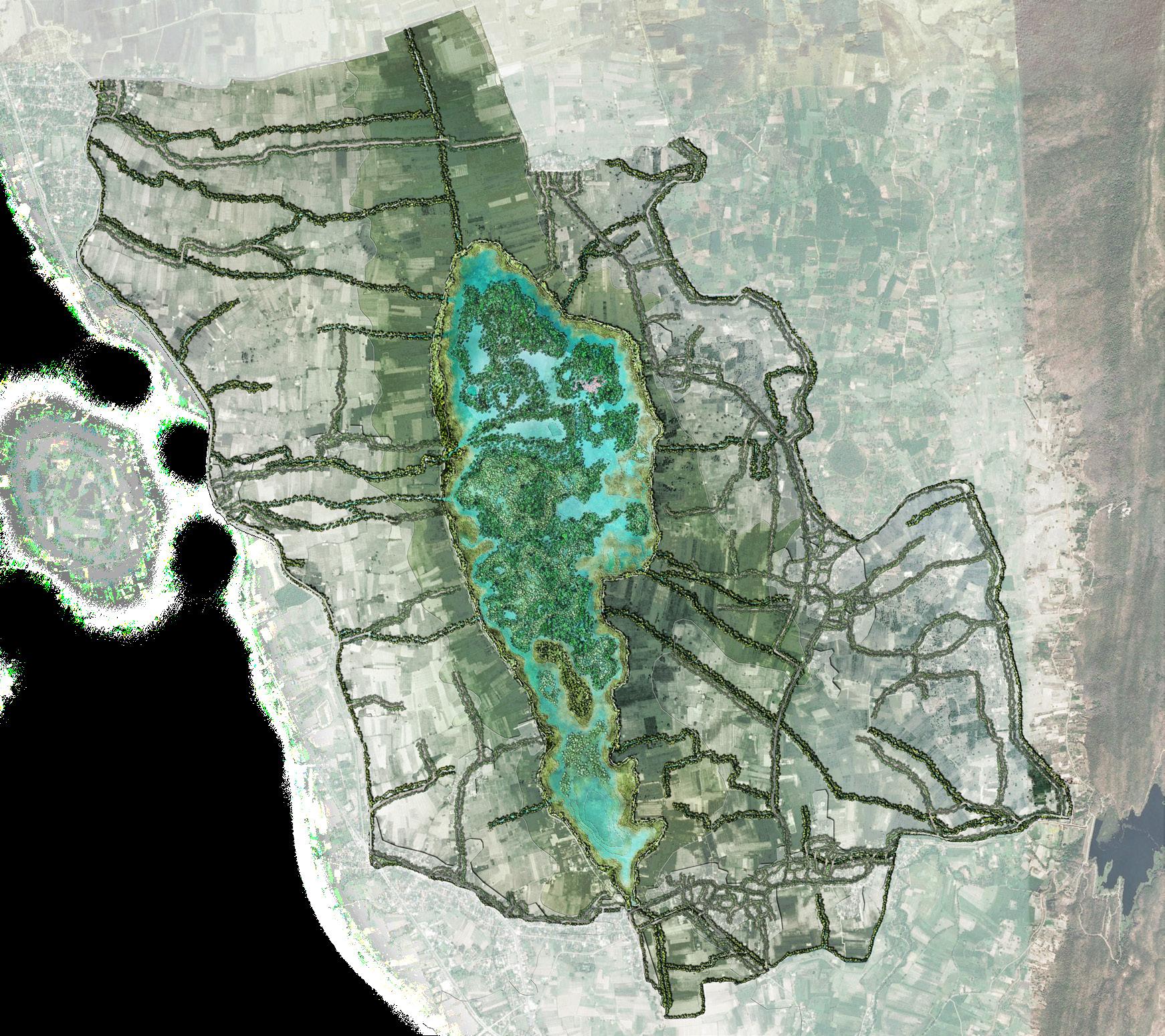
Nong Leng Sai
Phayao, Thailand
landscape ecological planning and design
Chulalongkorn
Bangkok, Thailand
campus design
Asok District
Bangkok, Thailand
urban landscape design
Ping River
Chiang Mai, Thailand
landscape research and analysis using GIS
01 02 03 04
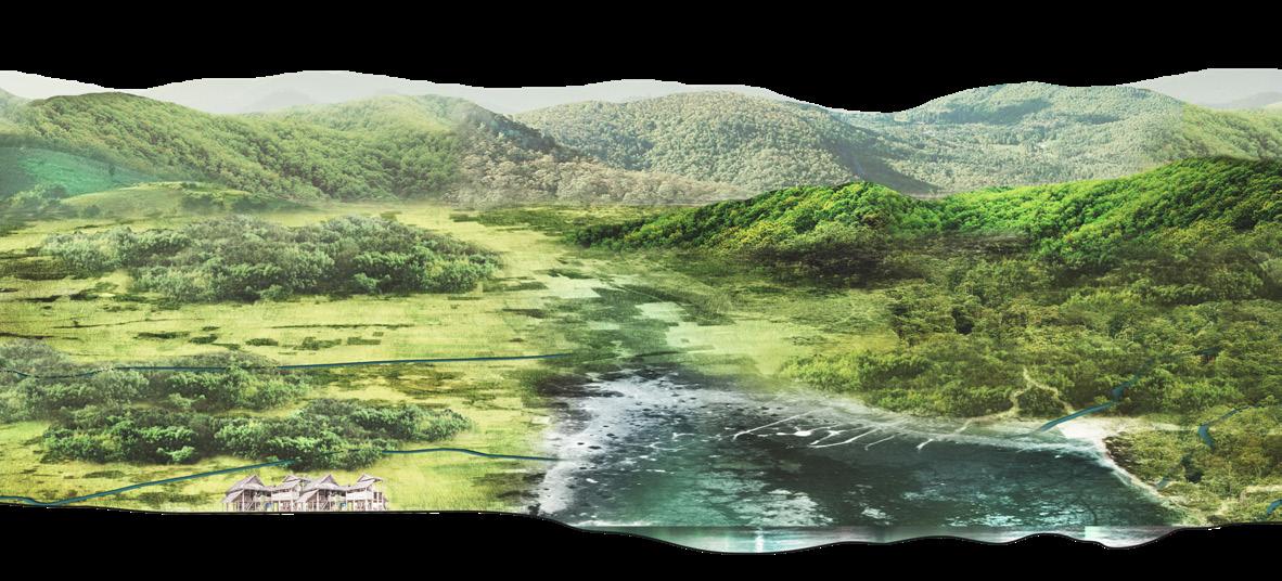
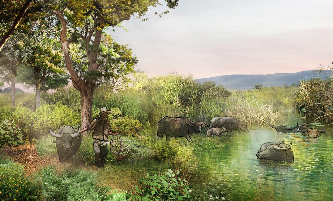
01 NONG LENG SAI
Dynamic resilience & landscape stewardship
(Thesis) Landscape ecological planning and design
Location : Phayao, Thailand
Area : 33,846,400 sqm.
Project year : 2020
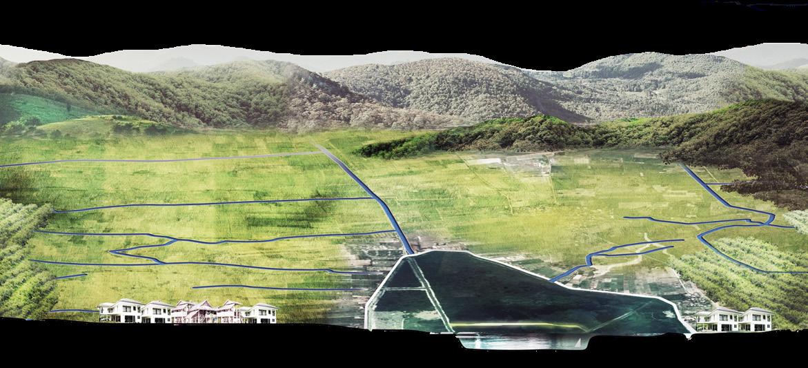
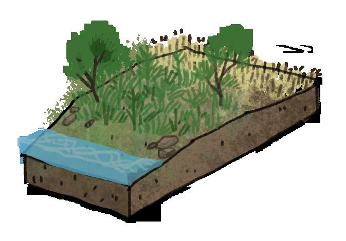
With the bonding of water and human life in tropical regions, there is the issue of resilience, the key to live with landscape dynamic during the wet and dry seasons. In upper northern Thailand, Phayao province, Nong Leng Sai is a wetland which is inextricably associated with a human by being an abundant natural resource, especially water resource, the foundation of settlement and livelihood in a rural area. Moreover, Nong Leng Sai also provides a variety of productive landscapes through water dynamics in wet and dry seasons which is damaged by urban development approaches, including industrial agriculture, dam construction, and trespassed property in the wetland that cause water dynamic disconnection. Understanding the landscape process and value is an implement to design solution. Reconnecting hydrological dynamics is the key to increase the biodiversity of wetland, and landscape stewardship is a crucial factor developing sustainability to live with this dynamic on the landscape.
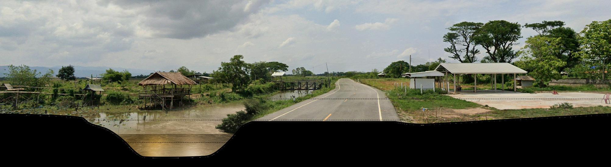
Landscape Changes in Nong Leng Sai
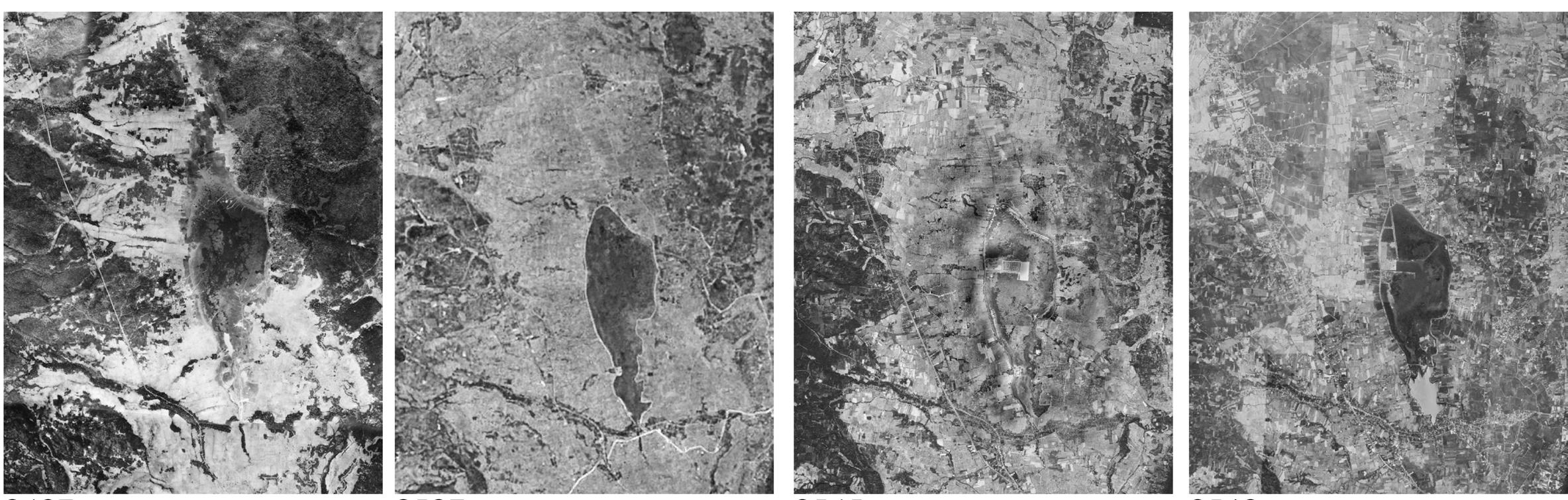
Nowadays, deforestation in the upstream forest area is taking place for the benefit of the agricultural industry, while the conversion from rainfed rice agriculture to double-crop agriculture and the encroachment in the wetland area to develop Nong Leng Sai as a tourist attraction are causing the disconnection of water dynamics during flood and drought seasons and leading to ecosystem devastation.

The negative impact of these landscape changes in the Upper Ing basin, particularly in the Nong Leng Sai area, has driven the design objectives towards ecological restoration, aimed at mitigating the adverse effects, increasing biodiversity, and sustaining the livelihoods that rely on the landscape.


Channelization Land-use Change River-lake
Filling
in 1954 1984 2002 2020 มีการเปลี่ยนแปลงลําหวย ธรรมชาติ เปนพื้นผิวคอนกรีต กลายเปนคลองชลประทานและ คลองระบายน้ํา ความเปลี่ยนแปลงของรูปแบบ การเกษตรเปนพืชไรและพืช สวนมากขึ้น พื้นที่ปาไมลดลง รูปแบบชุมชนทองถิ่นเปลี่ยน รูปแบบเปนสังคมเมืองในตําบล แมใจ มีความหนาแนนของที่อยู อาศัยมากขึ้น เสนแมน้ําอิงที่เชื่อมตอกับหนอง เล็งทรายมีการสรางประตู ระบายน้ําเพื่อเก็บน้ําไวใชเปน น้ําประปาชุมชน พื้นที่ชุมน้ําถูกเปลี่ยนแปลงจาก การขุดและถม กลายเปนทุง หญาเลี้ยงสัตวและบอเก็บน้ํา
Disconnection
and Dredging
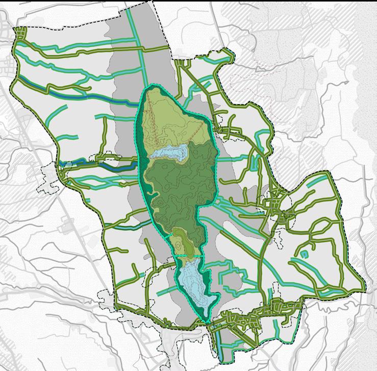
Landscape Planning Concept

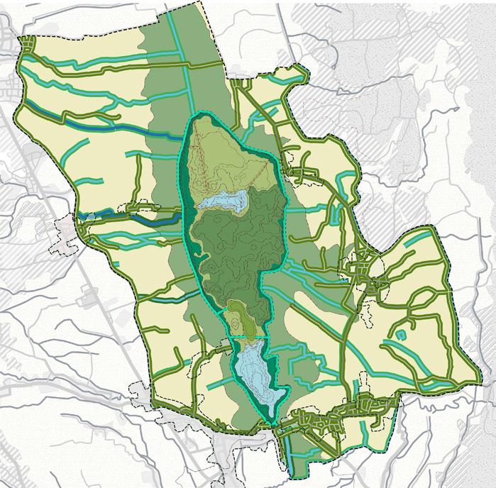
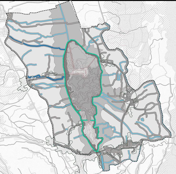
Nong Leng Sai and the surrounding rural areas have the potential for policy planning to increase the abundance of the wetland’s ecosystem while also raising concerns about landscape preservation. Therefore, this project’s emphasis is on reconnecting water dynamics in order to bring back enrichment of biodiversity and establish a strong foundation for livelihood.
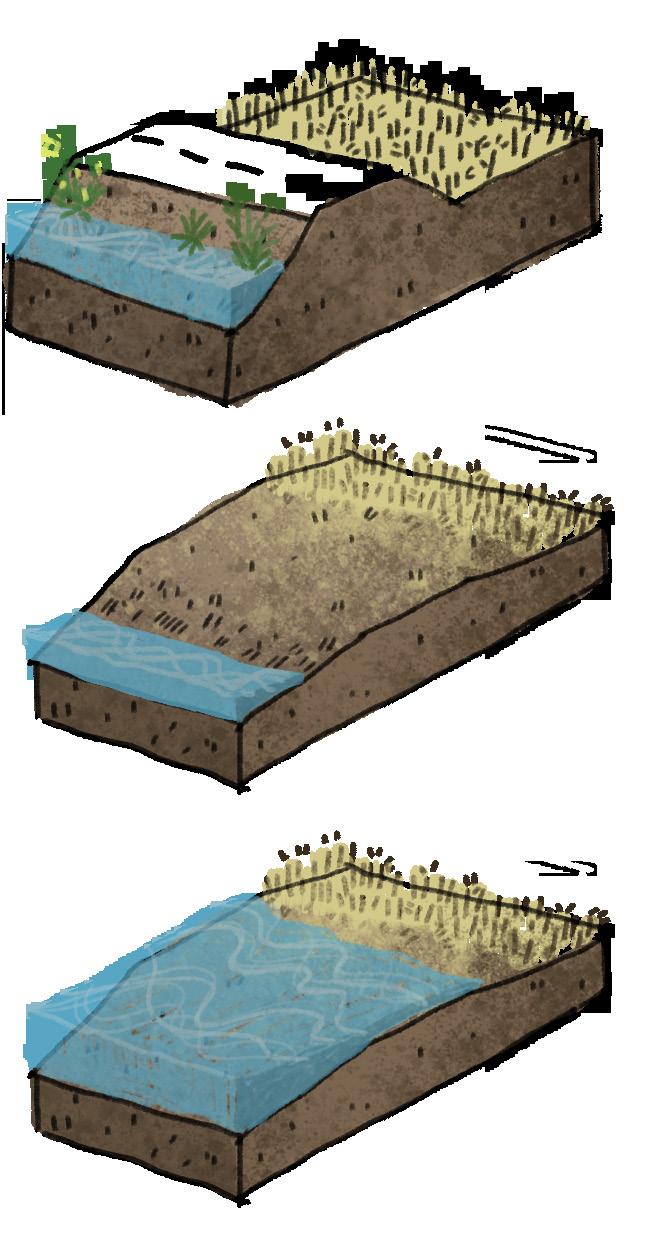
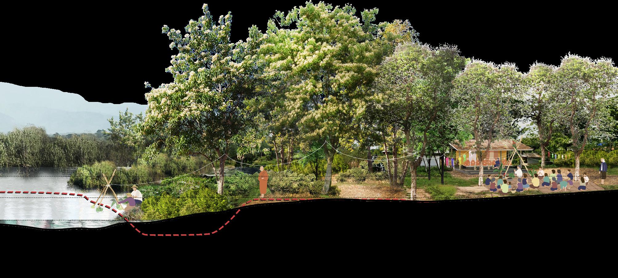
Action
Master plan YEAR 0 Water
plan
dynamic disrupted by road construction
Grading on riparian area to reconnect water dynamic
YEAR 1 YEAR 2 YEAR 5
Annual flooding season will recover native species on riparian area Monitoring and eliminating invasive alien species, bring riparian area back to stream banks
The design part is considered on landscape assessment to purpose suitable zoning for each area, which is divided into 3 phases of landscape restoration planning.
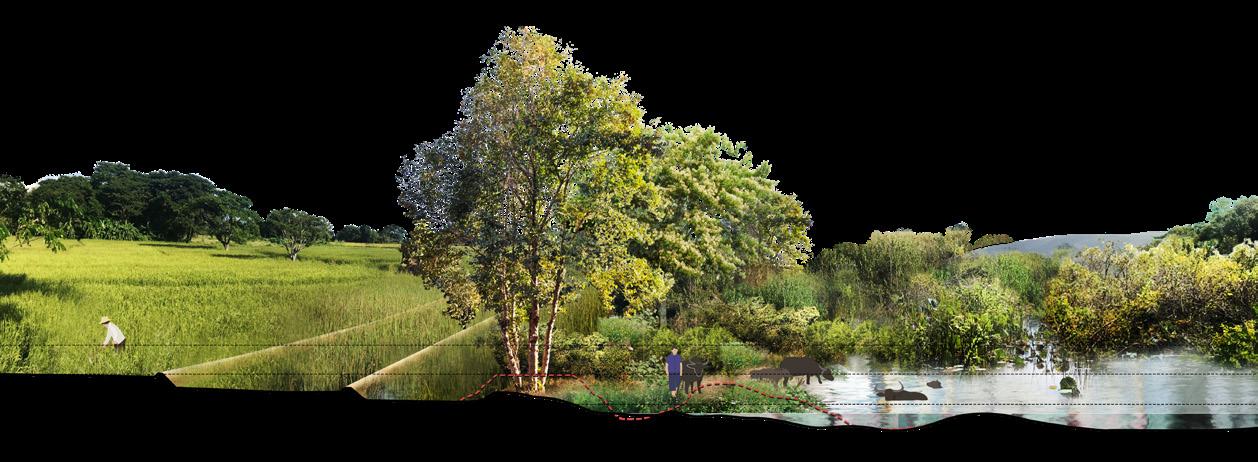

1) Dynamic restoration to provide service on the rich landscape.
2) Ecological conservation to limit accessibility and fishery restriction in mating season.
3) Resilience rural and landscape stewardship planning to develop the community along with the wetland restoration.
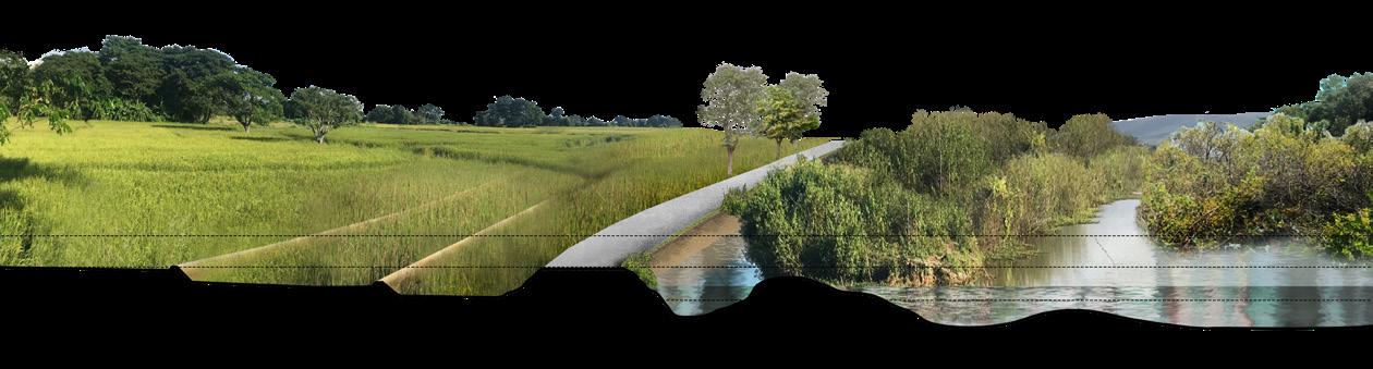
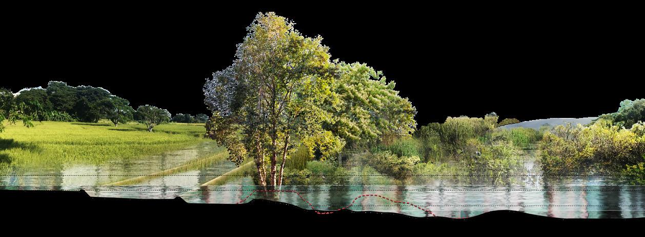
 RICE FIELD
WETLAND ROAD
STREAMSIDE ZONE
MIDDLE ZONE INNER ZONE RIPARIAN BUFFER RICE FIELD WETLAND
RICE FIELD
WETLAND ROAD
STREAMSIDE ZONE
MIDDLE ZONE INNER ZONE RIPARIAN BUFFER RICE FIELD WETLAND
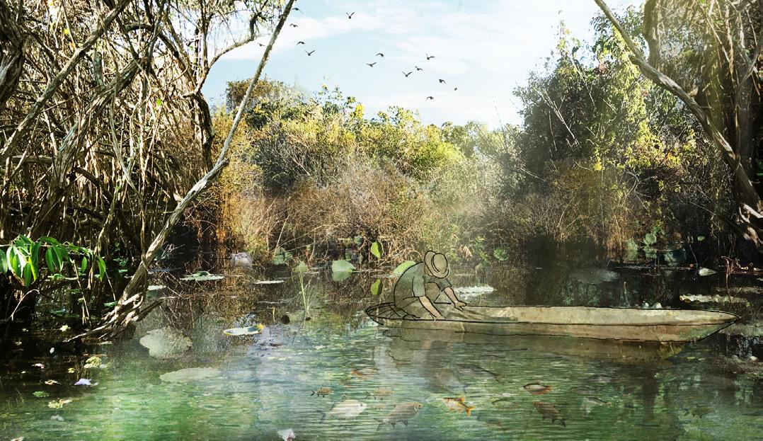
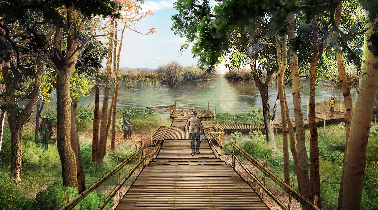
Socio-Cultural Space: provide community public space for gathering people as a recreation area and for ritual activities which interact with the annual flood in the upstream river and Nong Leng Sai, to preserve cultural heritage and appreciation of the ecological value of the basin.
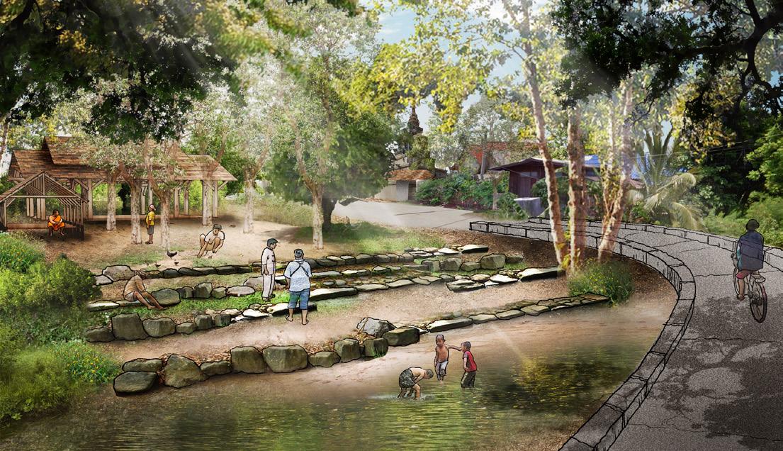
RIPARIAN BUFFER COMMUNITY SPACE INNER ZONE MIDDLE ZONE STREAMSIDE ZONE ROAD COMMUNITY SPACE SEDIMENT TRAP PAVILION
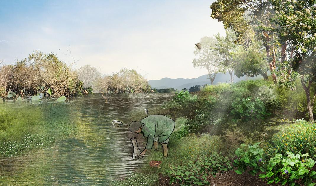
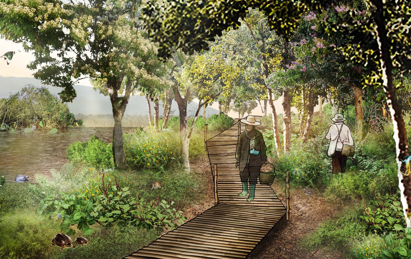
Educational space: Create educational spaces along a riparian route that allow visitors to explore and learn about the biodiversity of the Nong Leng Sai area. This will encourage people to understand, appreciate, raise awareness of, and conserve the importance of landscape dynamics in wetland areas.
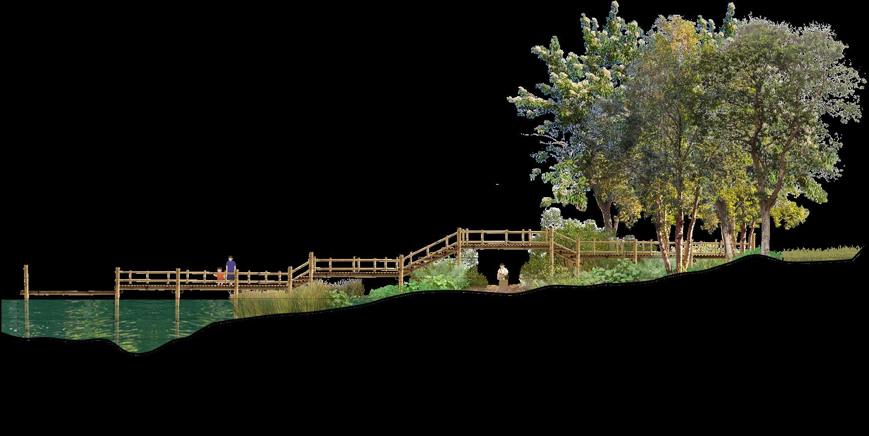
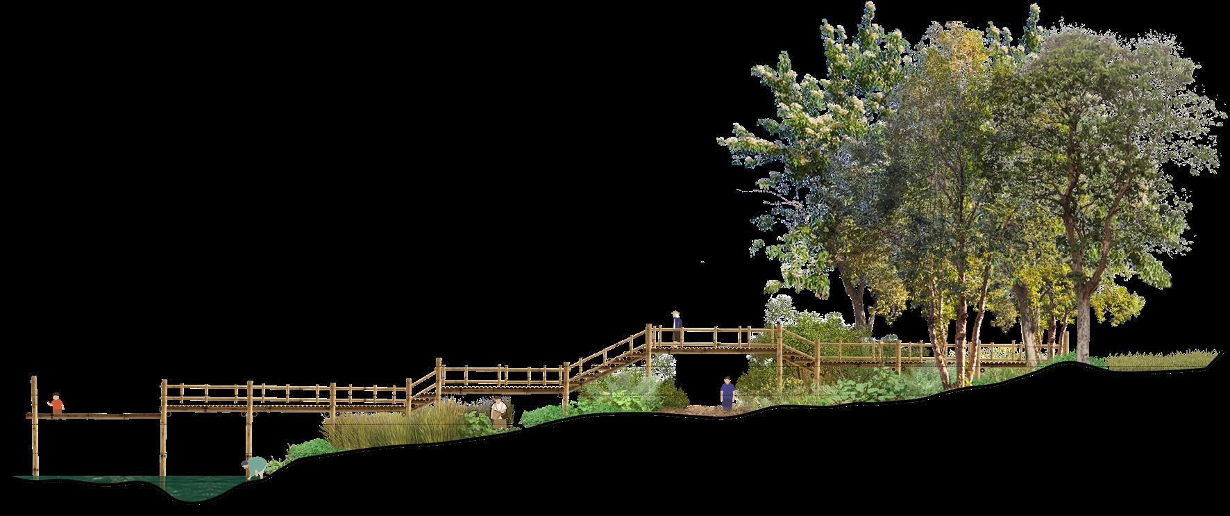
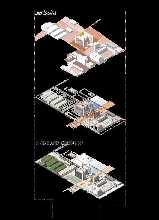
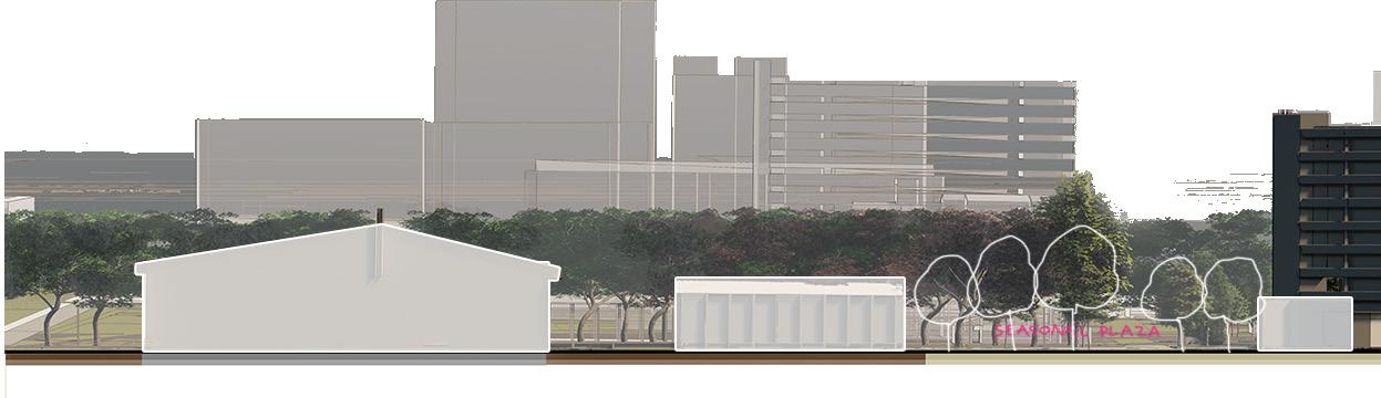
02 CHULALONGKORN
Nexus: core area of chulalongkorn university
Campus design
Location : Bangkok, Thailand
Area : 76,551 sqm.
Project year : 2019
group project members :
Purich Thavornkij
Sirintra Sumonvarangkul
Chulalongkorn University is Thailand’s first University in Thailand which located in the center of Bangkok. Founded in 1917 by the royal policy of King Chulalongkorn (Rama V) and King Vajiravudh (Rama VI)
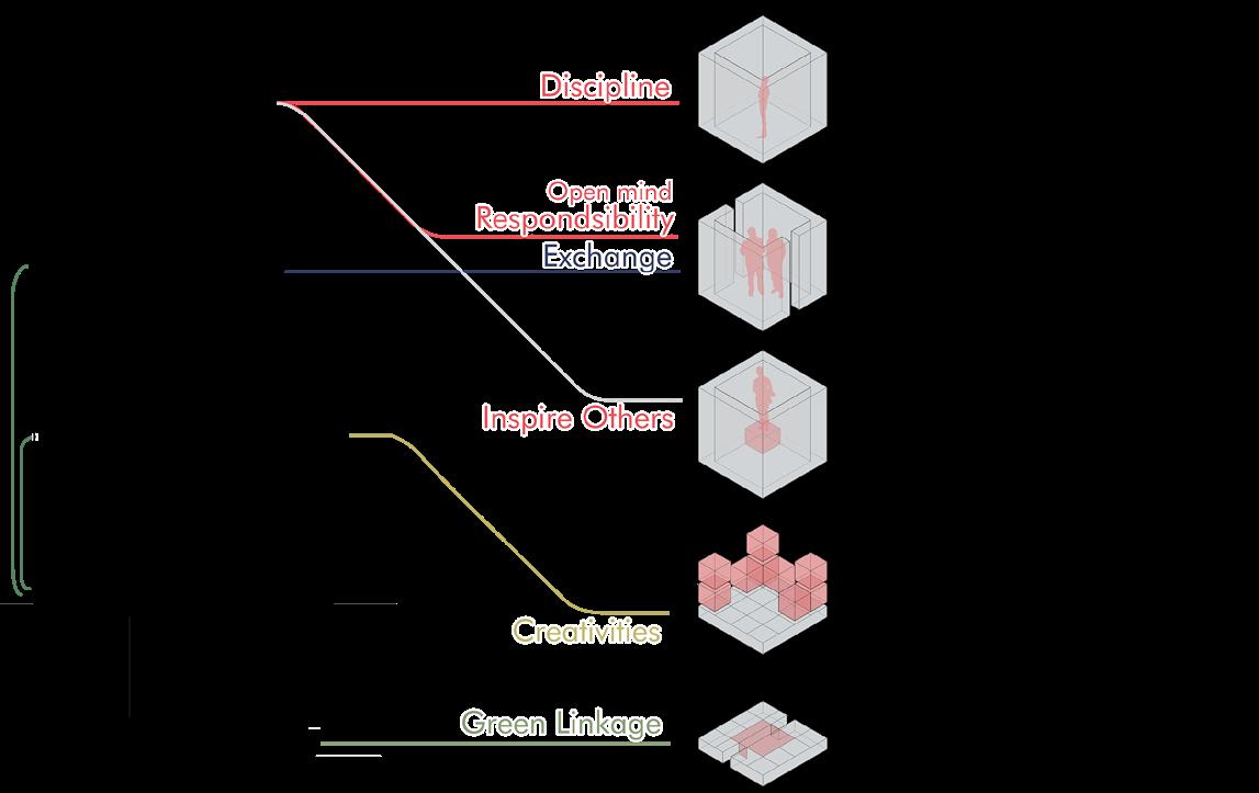
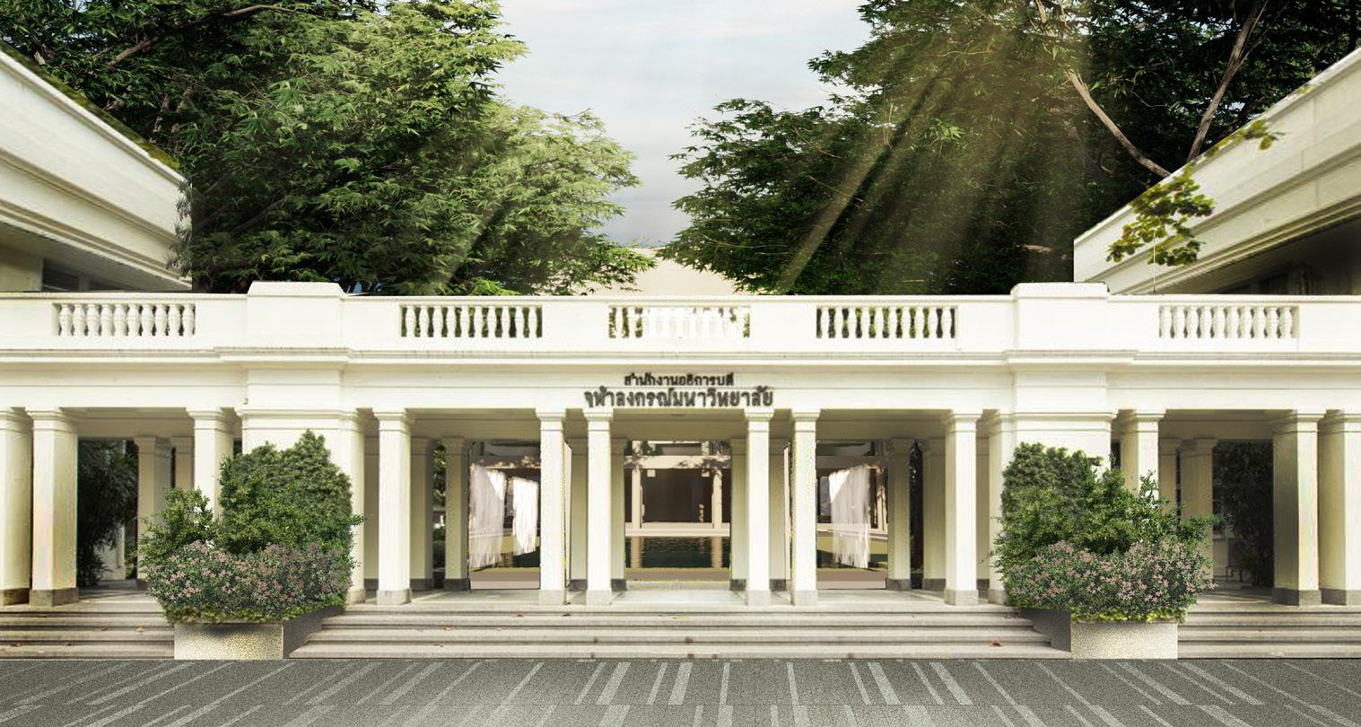
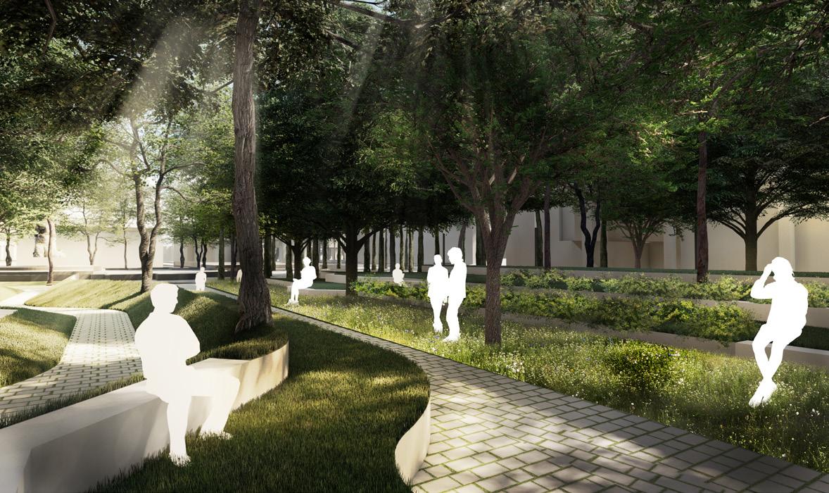
For Chula 2040 Masterplan, there is a new suggestion for development to achieve the goal of an innovative university, within the overall concept of “Leading Together”to represent the way to generate knowledge and innovation, then also lead the creativity and sustainability transformation of Thai society. The core of Chulalongkorn University is divided into three main parts, with the west part serving as the project area. This area showcases the university’s quality through its array of facilities and serves as a connecting point between the east part, which represents identity, and the innovation-focused west part of the CU Centenary Park. The core area of the west part is referred to as the “Nexus”, reflecting its central and crucial role in the university system.
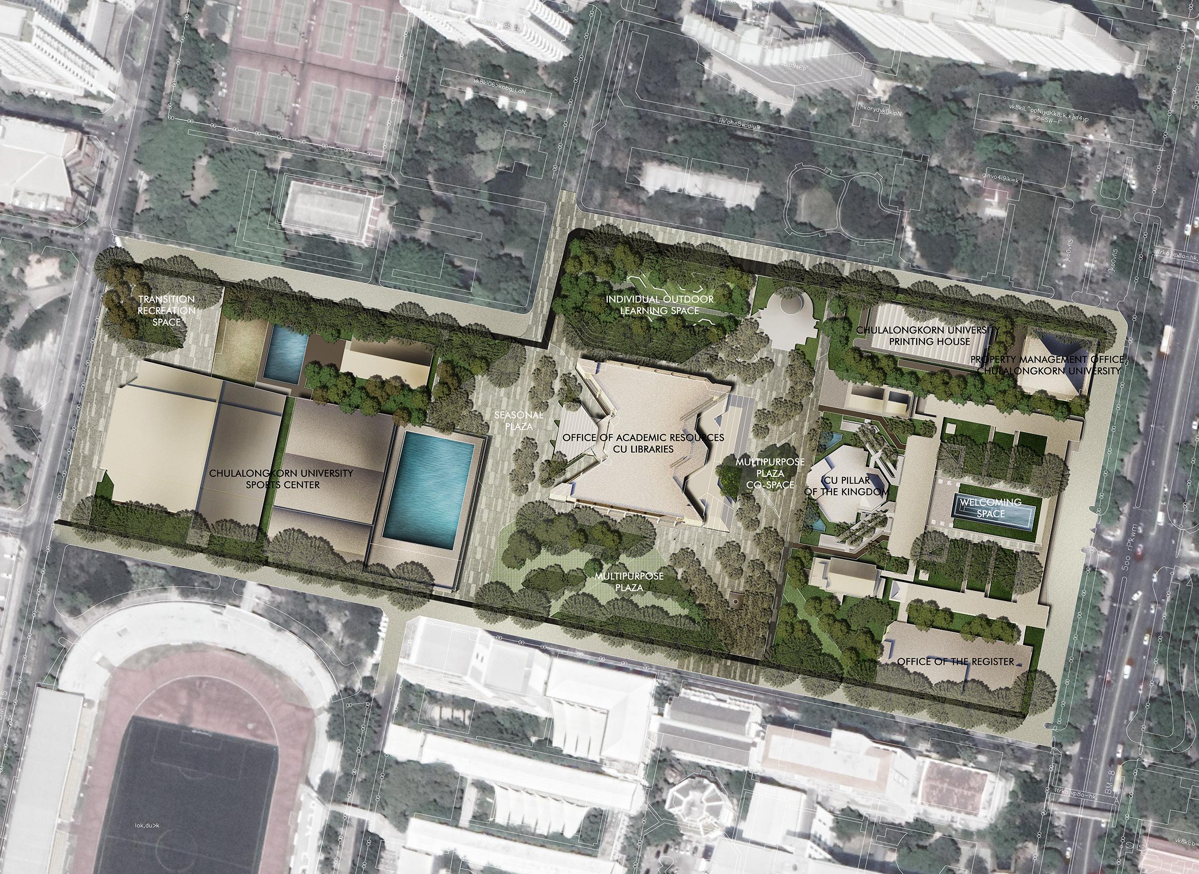
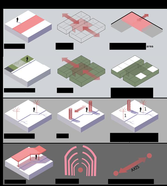
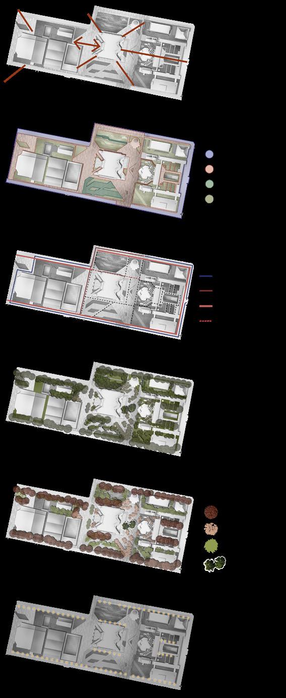
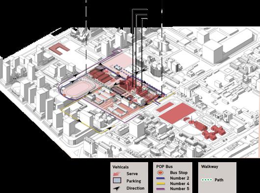
Master plan
Main entrance (left): keep the original axial for the main entrance. A waterwall is a design feature that is used to create a sound sensation in welcome area.
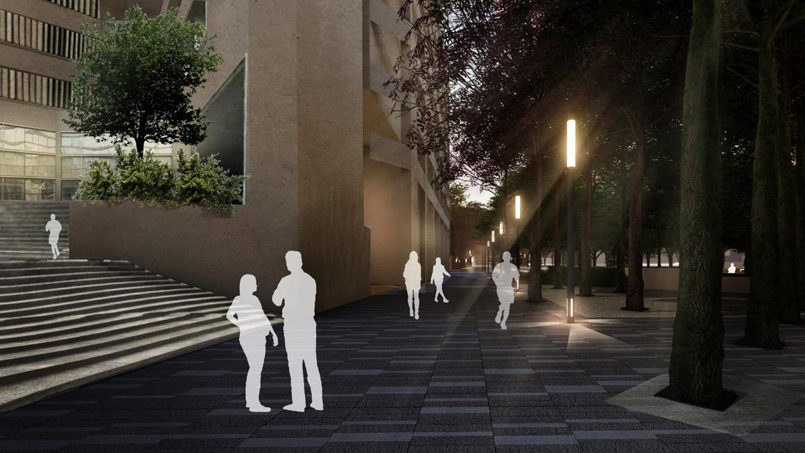
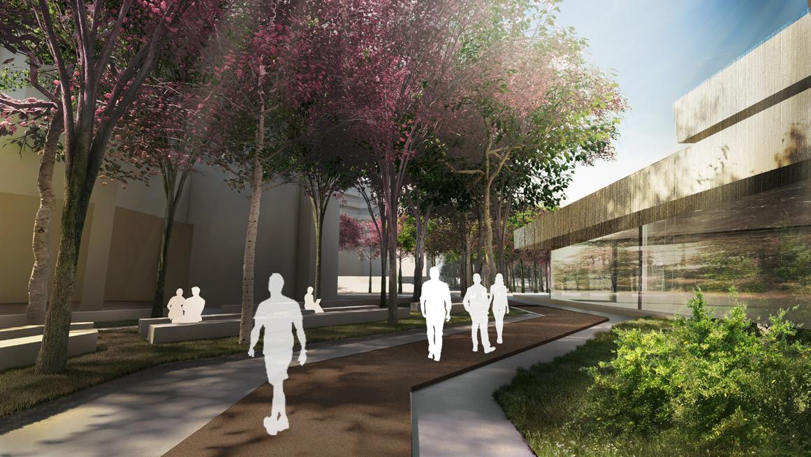
Connecting zone (below): The seasonal colored trees and light poles were used in this area to make the leading line and to make people feel connected between each zone.
Multipurpose plaza: create a pavement pattern and additional shady areas with seasonal colored trees to encourage activities like cheerleading practice in this area.
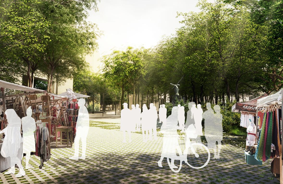
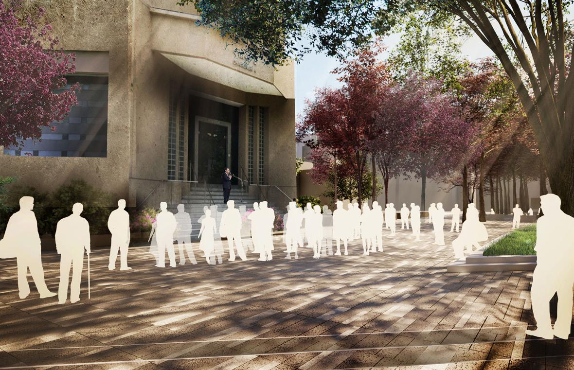
Making space: since this space is primarily used for parking, an additional activity that should be offered in this area should be something movable, such as a flea market.
Personal space: design routes and a seating area to create a good environment for studying in various group sizes.
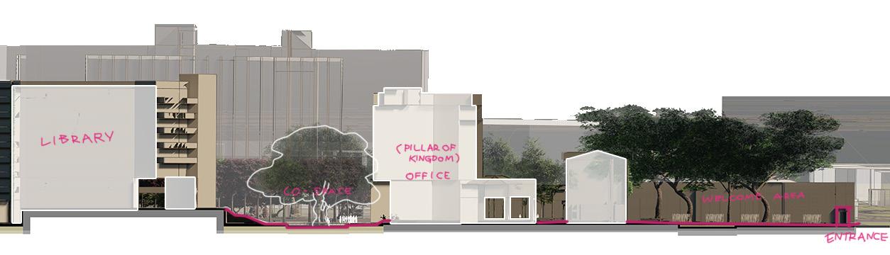
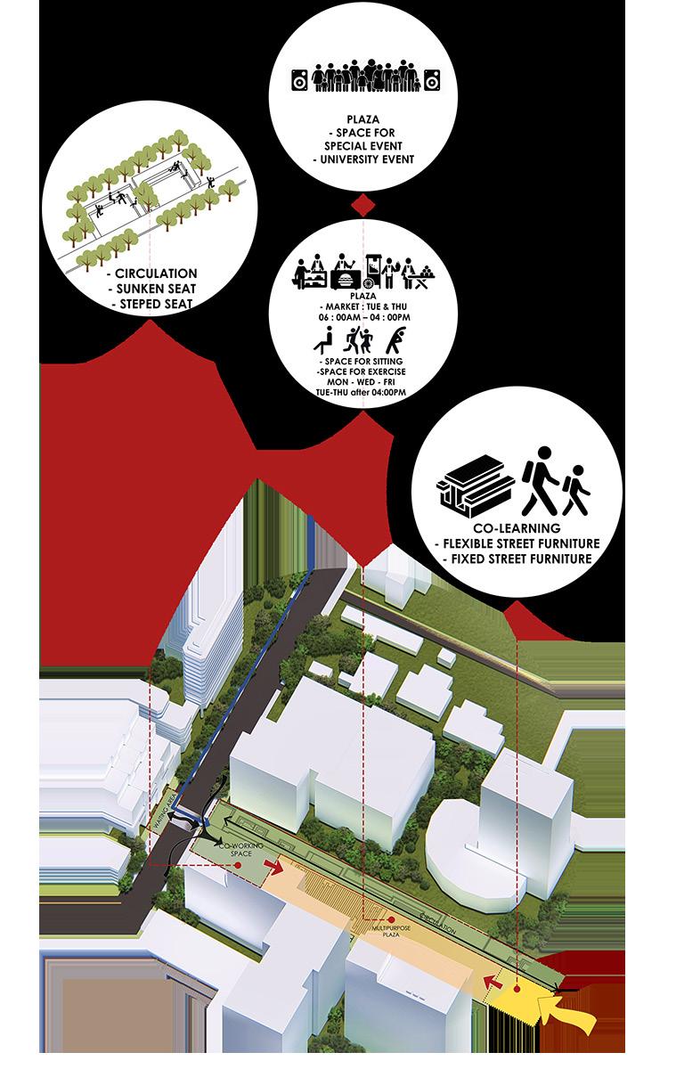
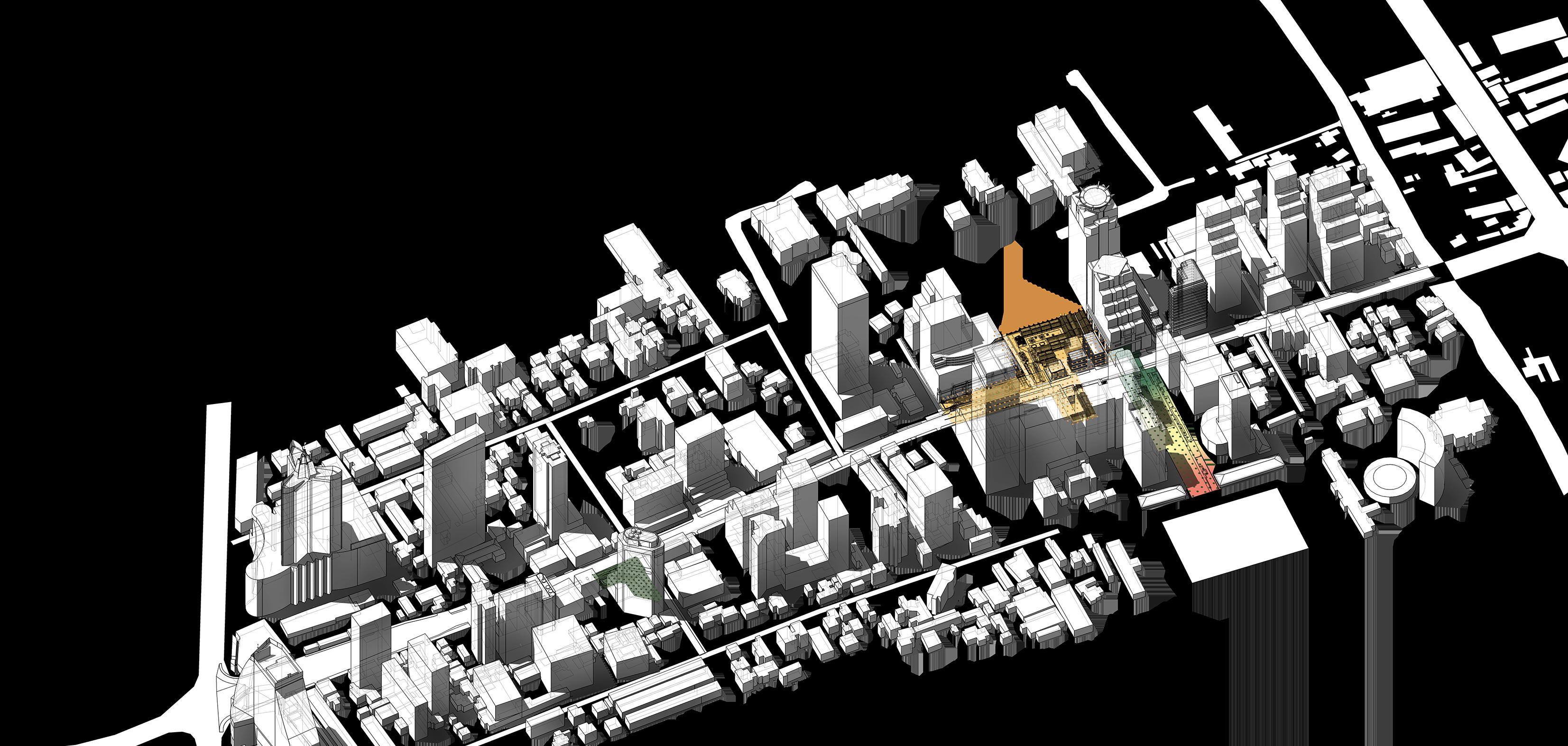
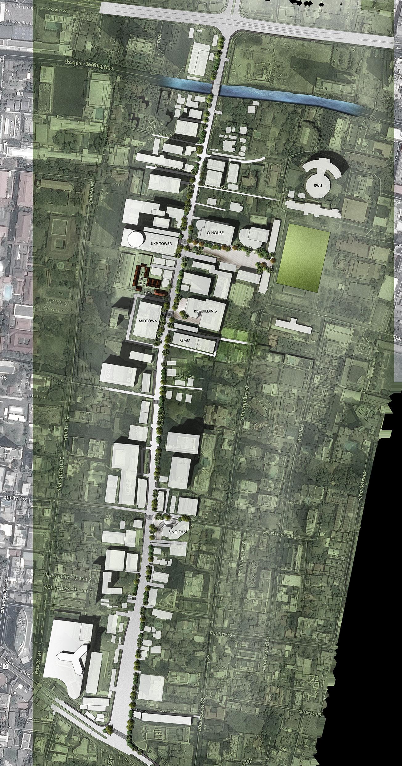
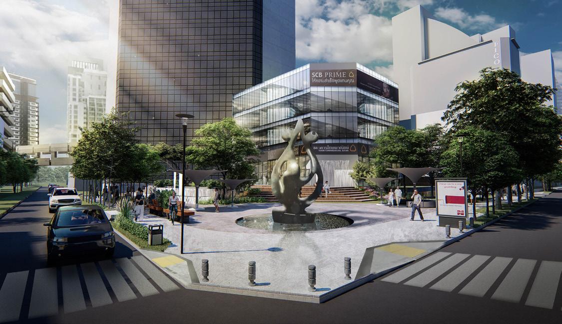
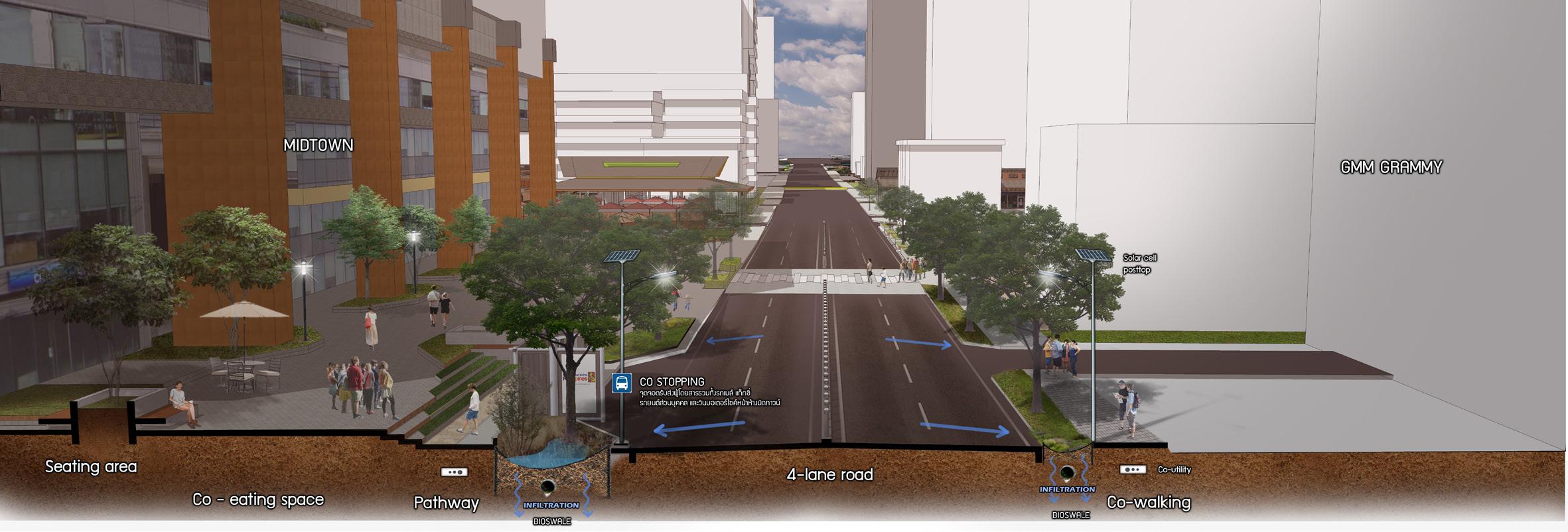
03 ASOK DISTRICT
Asok Co-asis
Urban landscape design
Location : Bangkok, Thailand
Project year : 2019
group project members : Phacharapon Chuepaivasn
Sirintra Sumonvarangkul
Asok area, which extends from Asok Skytrain station to Asok Railway station along Asok Montri road, comprises dense building blocks with distinct cultures and functions. Residential buildings, educational institutions, and office buildings, for example.
Due to a lack of suitable walkways due to obstacles and the narrowness of the pathway in this area, people use more cars, which leads to the issue that the Asok district is currently experiencing traffic congestion.
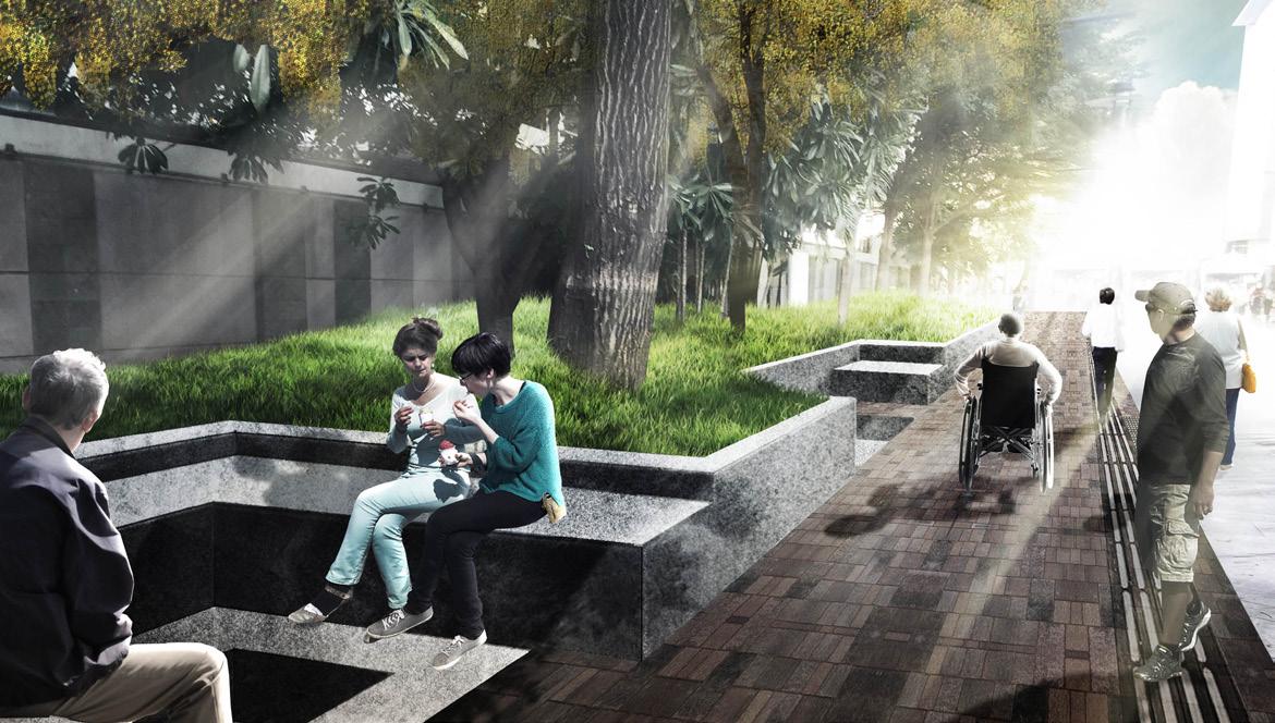
The Co-asis goal aims to create a walkable city in order to improve the quality of the environment in the Asok neighborhood. By increasing the width and quality of walkways and reorganizing public plazas by function, the city can become a more suitable gathering place for people and reduce stress. Furthermore, another goal of this project is to improve the number of green spots and features, providing many ecological benefits while also preventing flood risk from the city’s high density of building areas.

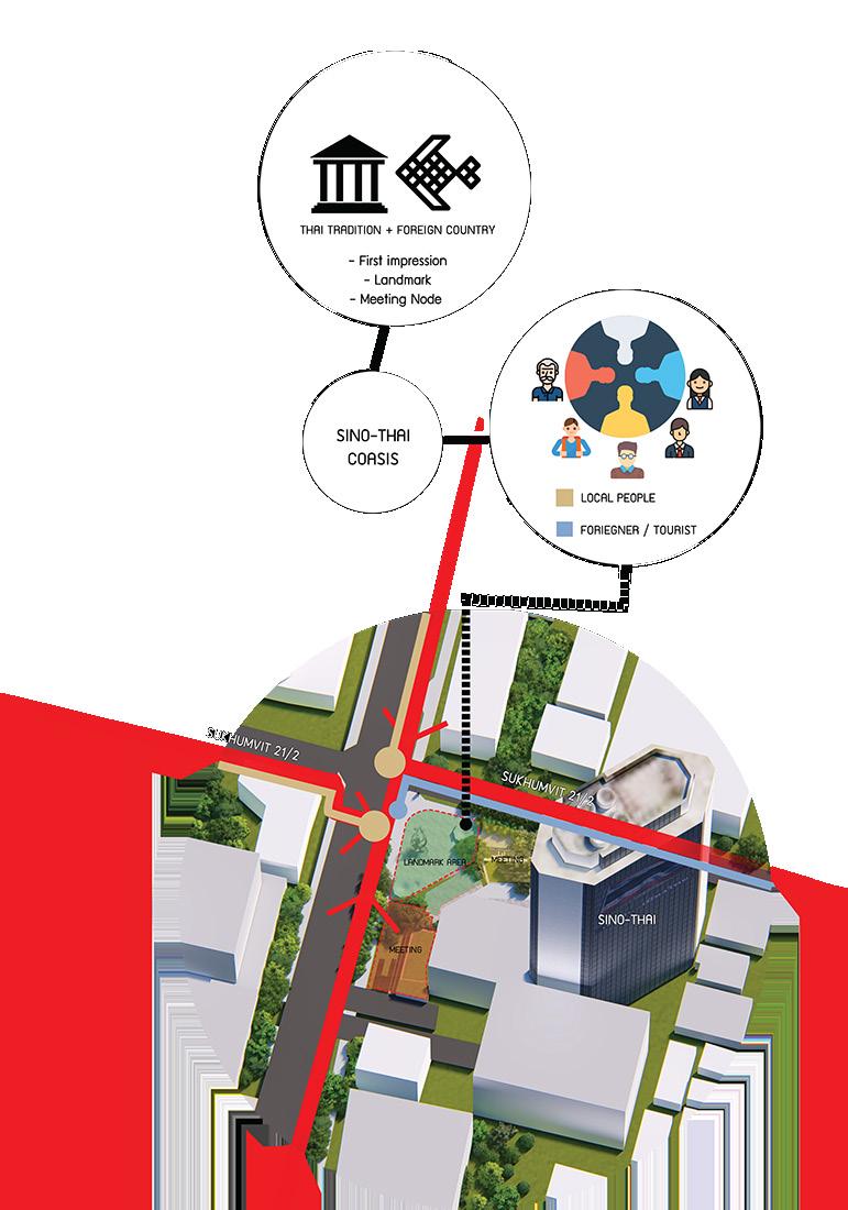
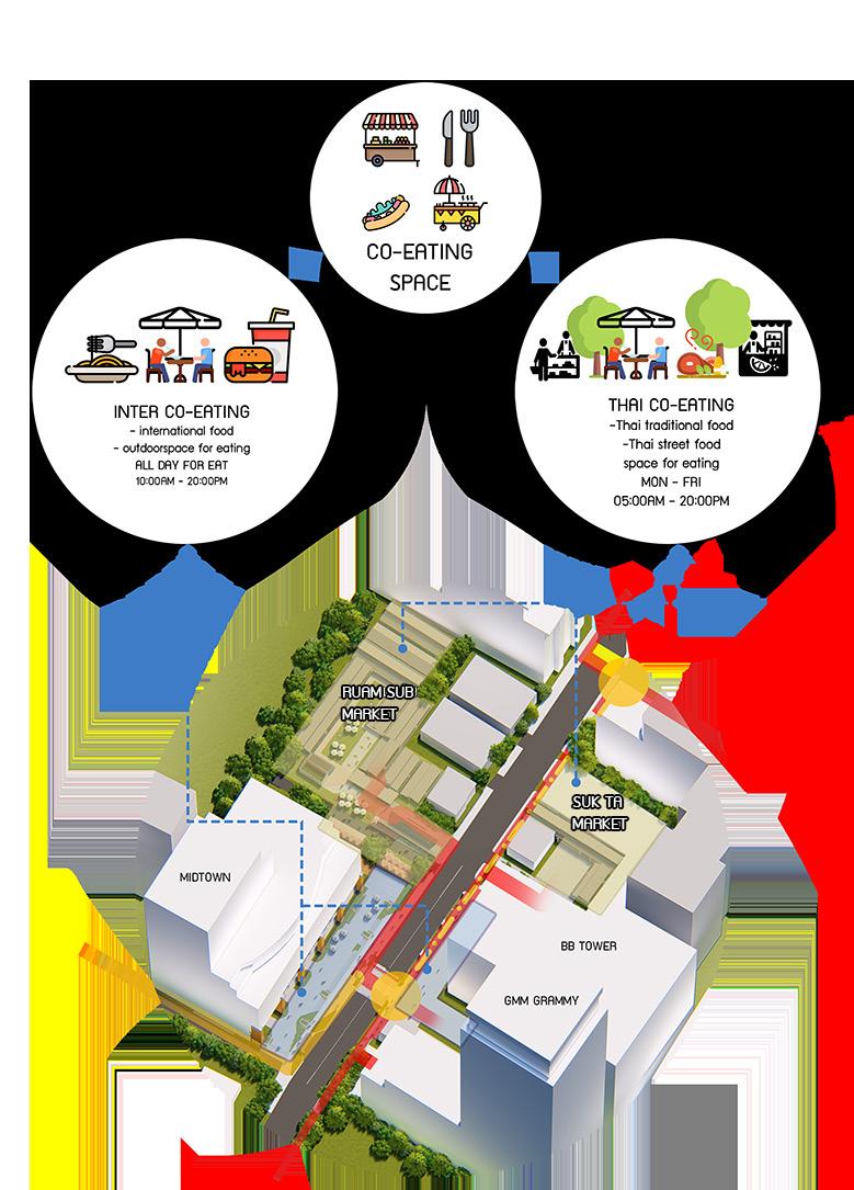
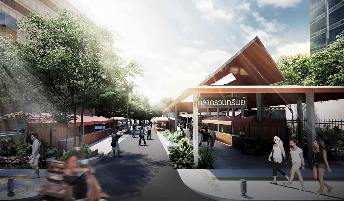
 Sino Thai Co-asis Terrace Co-eating Complex
SWU-asis plaza
Sino Thai Co-asis Terrace Co-eating Complex
SWU-asis plaza
Co-eating Complex
Create a street food plaza
Co-eating Complex
Organize and provide street food and international food space
Redesign the gathering plaza to support crosswalk circulation around a T-junction to improve safety and connectivity.
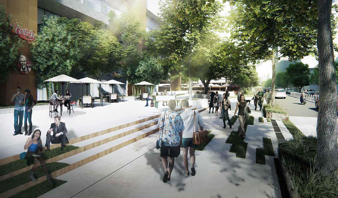
Master plan
Sino Thai Co-asis Terrace
SWU-asis Plaza
Create a mixed-use area as a co-working space and a flea market.
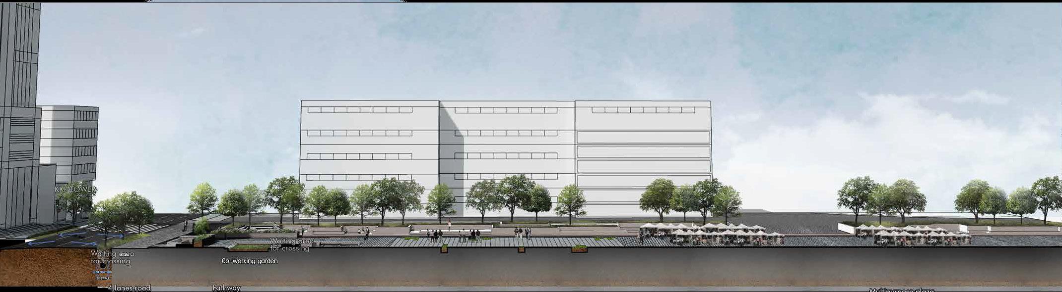
Co-eating Complex Section : shown infiltration function in bioswale and universal design in Asok Co-asis area
SWU-asis Plaza Section : divide into co-working space, flexible area and flea market
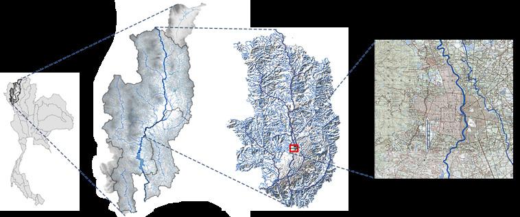
04 PING RIVER
The
changes of riverscape
(Thesis) Landscape research and analysis using GIS
Location : Chiang Mai, Thailand
Project year : 2020-2022
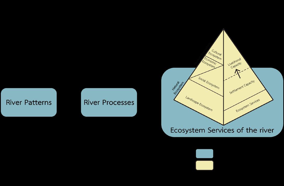
The study aimed to understand and define the riverscape in dimensions of the structure, process, and the role that is the human foundation of livelihood, including indicating the change and effect that happened from riverscape change, which impact livelihood and quality of life. Land Use and Land Cover Classification Mapping and Historical Repeat Photography Methods were performed to analyze landscape structure, and changes in the Ping riverscape in Chiang Mai city and vicinity. The study discovered that the Ping riverscape’s characteristics in terms of river structure and dynamics constitute the foundation of the local people’s livelihood Meanwhile, recent development has altered channel structures without consideration of natural processes or river patterns. These modifications in the structure of the Ping River have a negative impact on ecosystem services.
The Upper Ping River Basin is considered as one of the main watersheds in Thailand and has long been associated with the way of life of Chiang Mai residents. The abundance of resources is a significant factor that determines the boundary of the settlement area, the foundation of agricultural society and local cultural traditions.
For the time being, changing land use to invest more resources in serving denser populations has had an impact on the physically of the existing landscape (Berdenis van Berlekom, 1969; Nassauer, 1997; Wohl, 2004).
The framework of this research, therefore, is based on landscape ecology and riverscape theory, which are fundamental concepts for understanding about how the landscape forms, processes, and how it influences human livelihood.
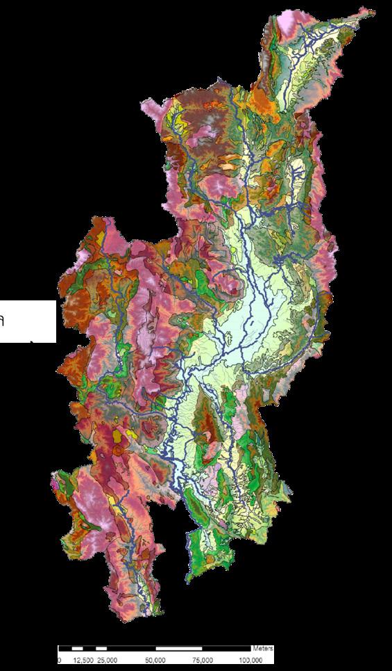
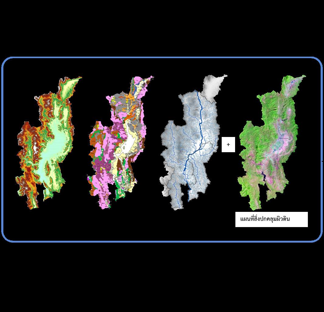
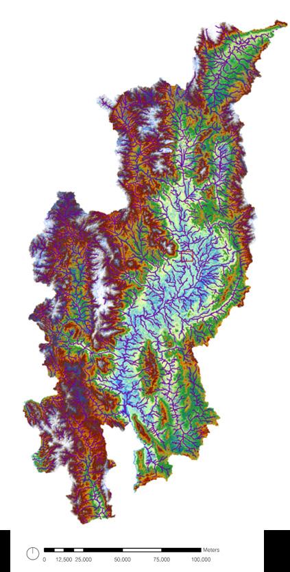
Ping Riverscape structure
Using Overlay Mapping methods to study the physical characteristics of the Ping riverscape at a watershed scale.
Boundary of study area in watershed, sub watershed, and local scale
Topography Geology Hydrology Human
Framework (adapted from Dunham et al., 2018, Thaitakoo, 2021)
Overlay
Landscape structure of Ping Riverscape
One of the most significant of the river processes is flow. From analysis of Ping Riverscape processes, the pattern of stream order and flow direction shows the connectivity of the river in longitudinal from headwater on the mountain to the river basin area.

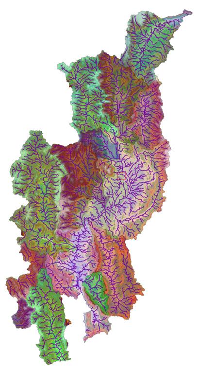
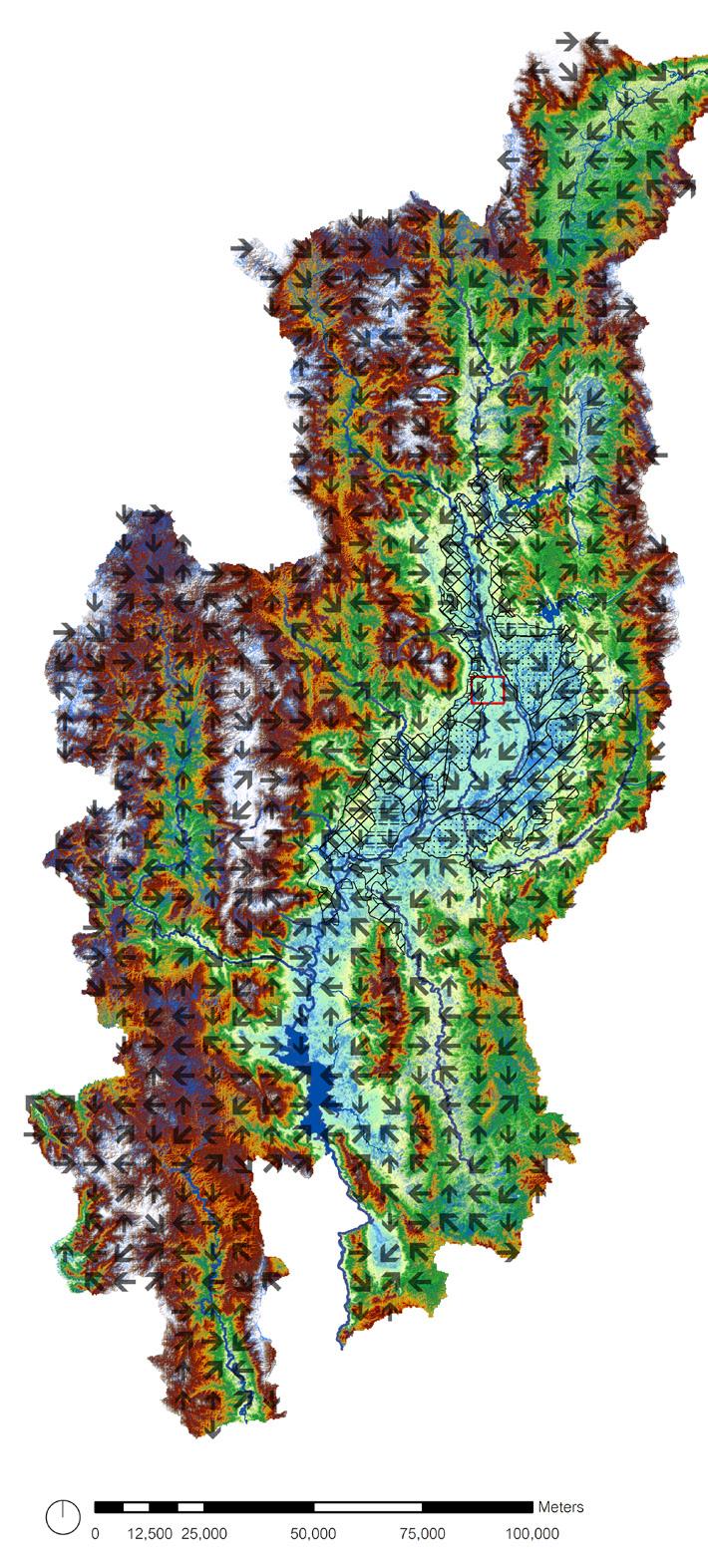
Stream order Flow direction Sub watershed
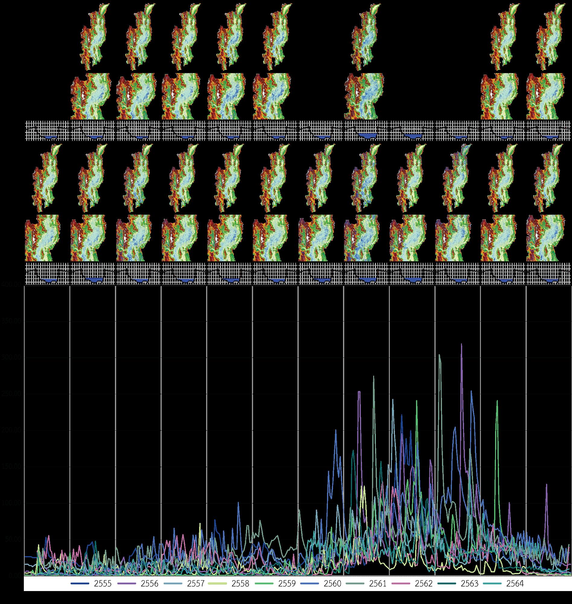
Ping Riverscape function
Surface water classification and hydrograph shows the pattern of river dynamics on the Upper Ping River Basin
Interrelationship between human and Ping River
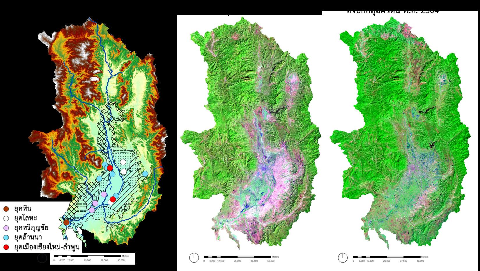
Stone Age

Iron Age
Hariphunchai Kingdom
Lanna Kingdom
Chiang Mai-Lamphun city
There is a long history in the Chiang Mai-Lamphun basin since the settlement occurred along the river area. The boundary was defined by subbasins that influenced the way of life in Chiang Mai and Lamphun city.
After that, the territories expanding and utilizing the various characteristics of the river, floodplain, and highlands developed Chiang Mai-Lamphun basin and became the agricultural society.
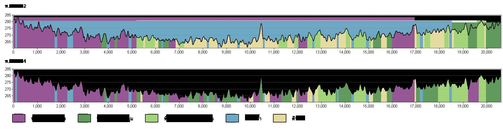
Settlement in Land Cover in 1989 Land Cover in 2021
1984 CE 2021 CE build up area vegetation (tree) vegetation (shrub) water body bare soil
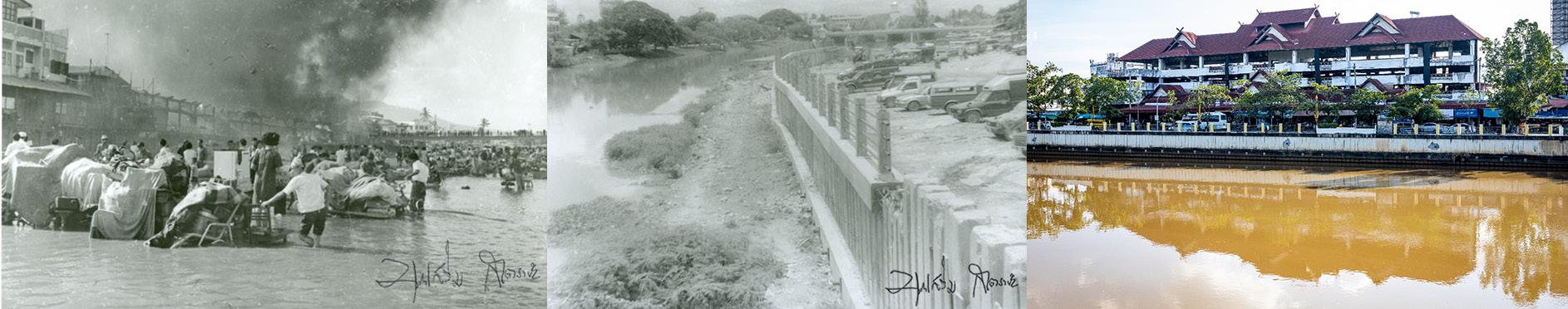
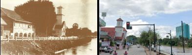
Ping Riverscape changes
The recent developments, which increase the rapid land use and land cover change on the floodplain area and the riverside, directly impact ecosystem service value and cause the disconnection between humans and the Ping Riverscape.
The purpose of comparing previous and present land use maps is to describe the changes that occurred on the river.

The Historical Repeat Photography Methods were also employed to illustrate the physical modification along the Ping River.

Thank you for your consideration Sirintra Sumonvarangkul sirintra.sumon@gmail.com

