3 minute read
04 PING RIVER

The changes in the riverscape
Advertisement
(Thesis) Landscape research and analysis using GIS
Location : Chiang Mai, Thailand
Project year : 2020-2022
The study aimed to understand and define the riverscape in dimensions of the structure, process, and the role that is the human foundation of livelihood, including indicating the change and effect that happened from riverscape change, which impacts livelihood and quality of life. Land Use and Land Cover Classification Mapping and Historical Repeat Photography Methods were performed to analyze landscape structure and changes in the Ping riverscape in Chiang Mai city and its vicinity. The study discovered that the Ping riverscape’s characteristics in terms of river structure and dynamics constitute the foundation of the local people’s livelihood Meanwhile, recent development has altered channel structures without considering natural processes or river patterns. These modifications in the structure of the Ping River have a negative impact on ecosystem services.
The Upper Ping River Basin is considered as one of the main watersheds in Thailand and has long been associated with the way of life of Chiang Mai residents. The abundance of resources is a significant factor that determines the boundary of the settlement area, the foundation of agricultural society, and local cultural traditions.
For the time being, changing land use to invest more resources in serving denser populations has had an impact on the physically of the existing landscape (Berdenis van Berlekom, 1969; Nassauer, 1997; Wohl, 2004).
The framework of this research, therefore, is based on landscape ecology and riverscape theory, which are fundamental concepts for understanding about how the landscape forms, processes, and how it influences human livelihood.
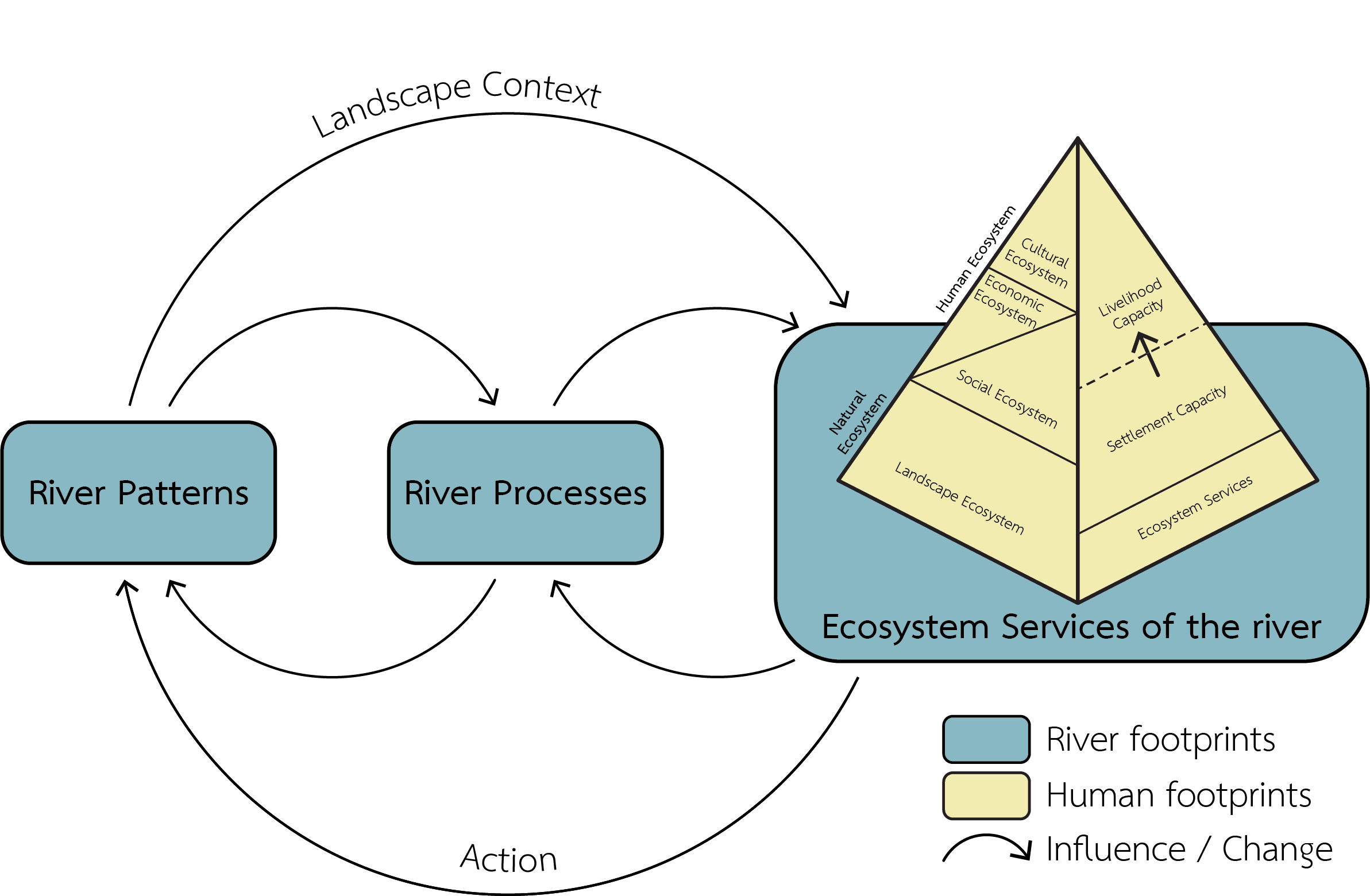
Research framework
Adapted from Dunham et al., 2018, and Thaitakoo, 2021
Interrelationship between human and Ping River
There is a long history in the Chiang Mai-Lamphun basin since the settlement occurred along the river area. The boundary was defined by subbasins that influenced the way of life in Chiang Mai and Lamphun city.
After that, the territories expanding and utilizing the various characteristics of the river, floodplain, and highlands developed Chiang Mai-Lamphun basin and became an agricultural society.
Ping Riverscape changes
The recent developments, which increase the rapid land use and land cover change on the floodplain area and the riverside, directly impact ecosystem service value and cause the disconnection between humans and the Ping Riverscape.

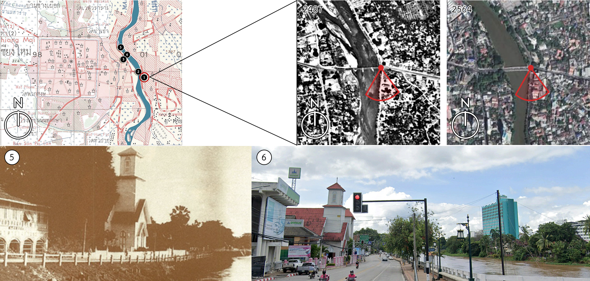
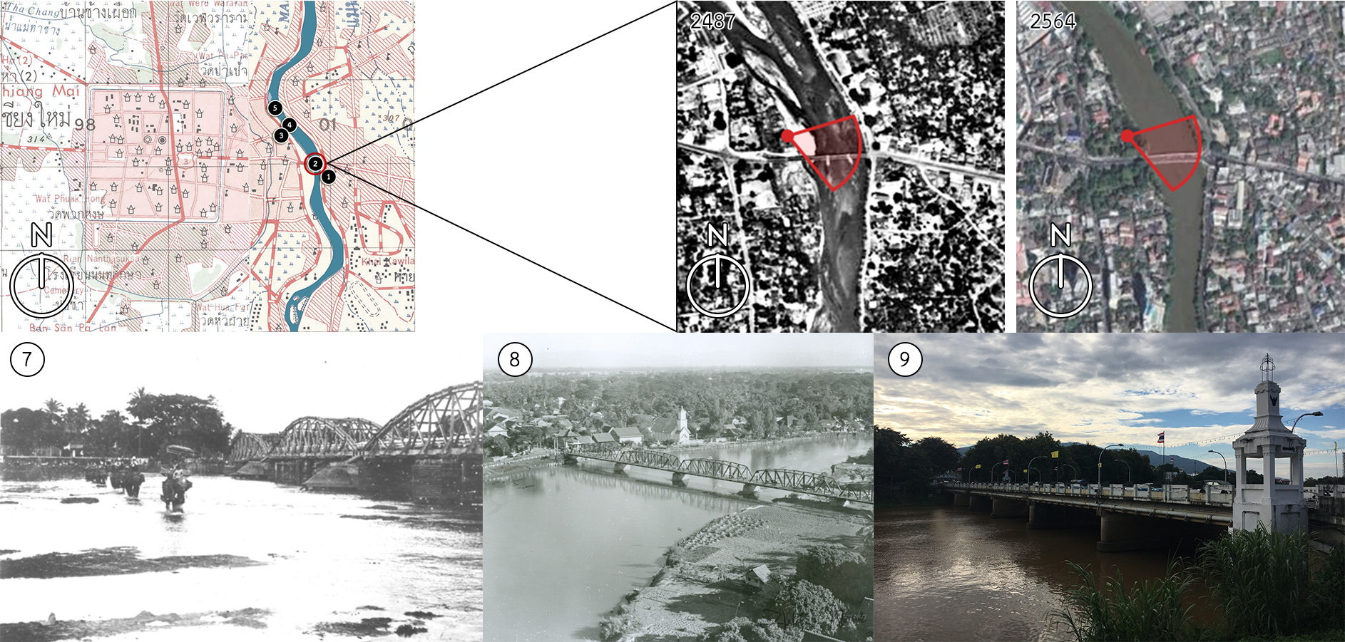
Land Use map comparison between 1959 (Left) and 2012 (Right)
The purpose of comparing previous and present land use maps is to describe the changes that occurred on the river.
The Historical Repeat Photography Methods were also employed to illustrate the physical modification along the Ping River.