


Shubhra Kansal PORTFOLIO


Patepur, Bihar India
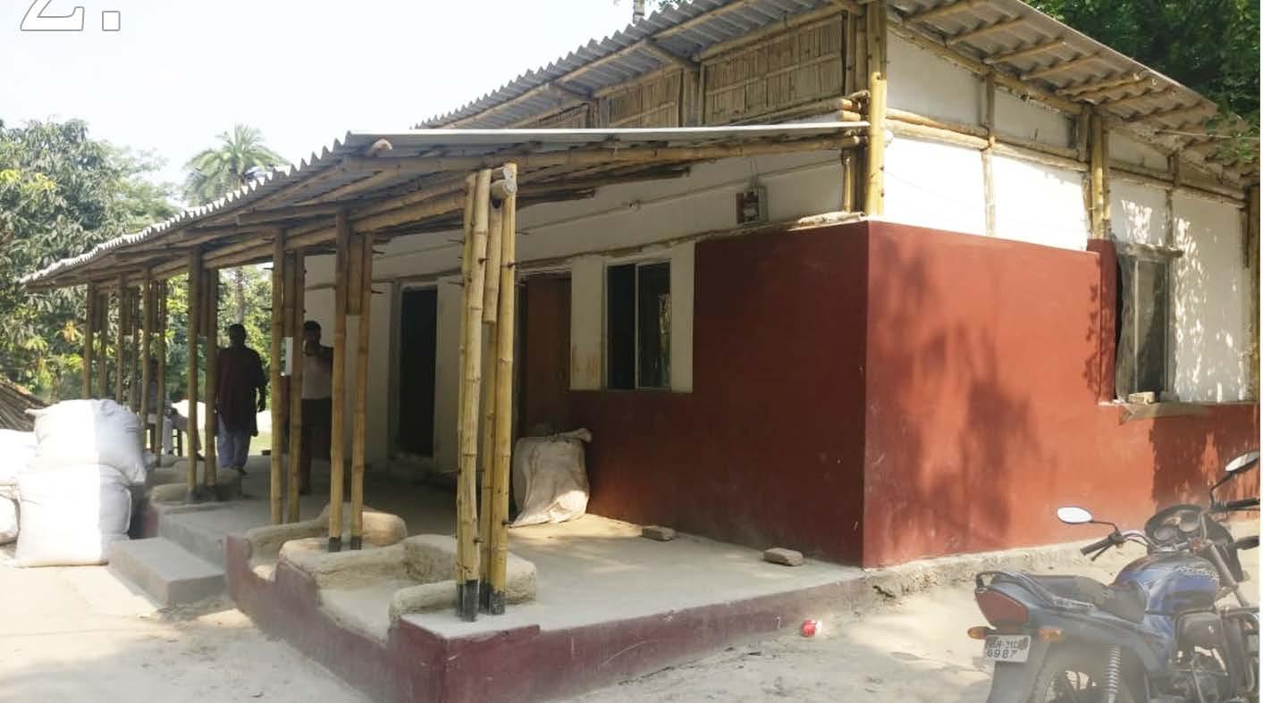
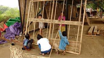
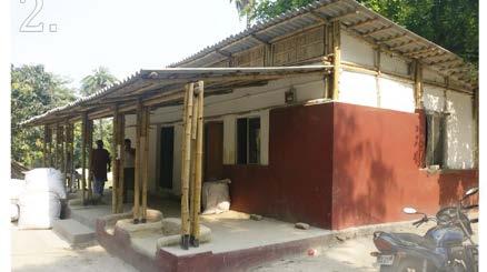
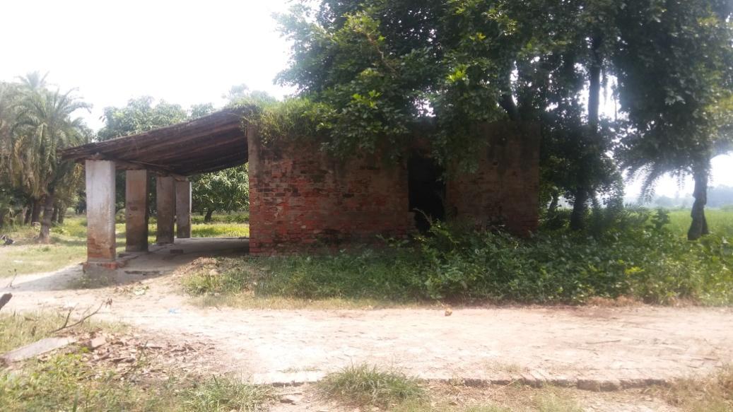
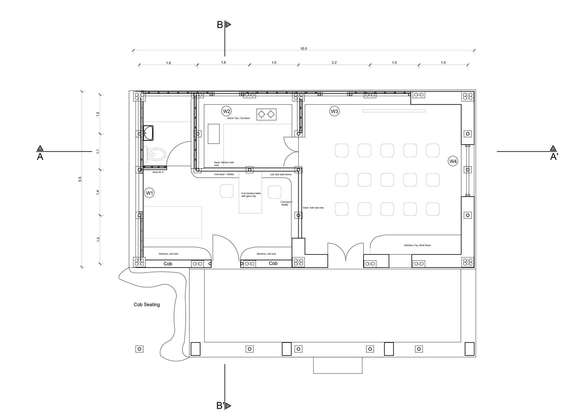
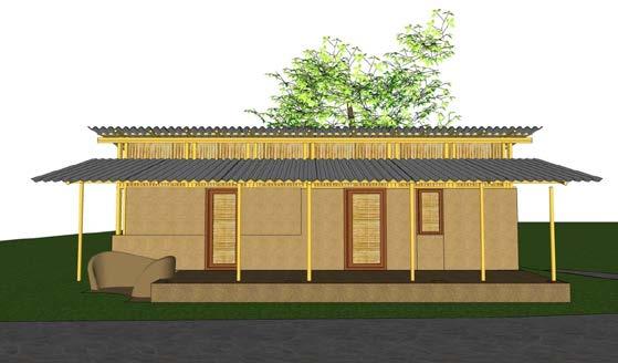
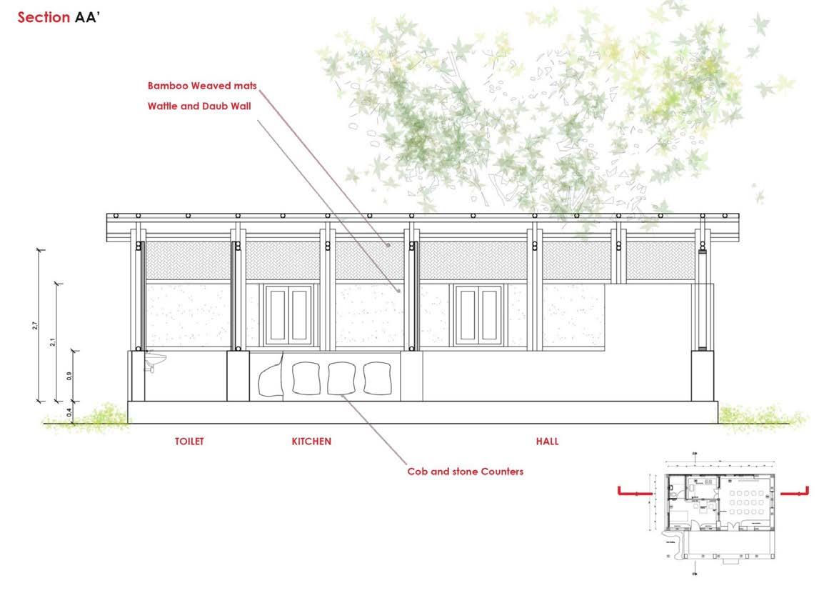
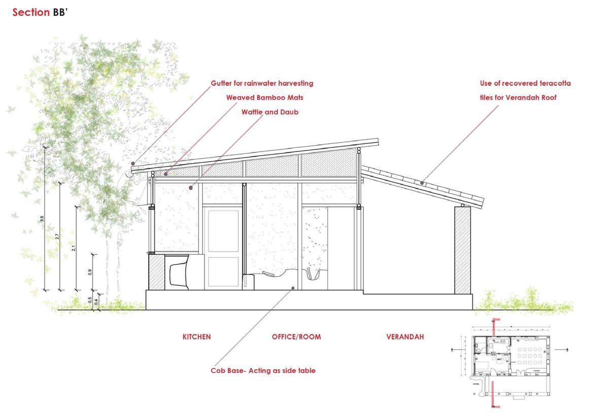
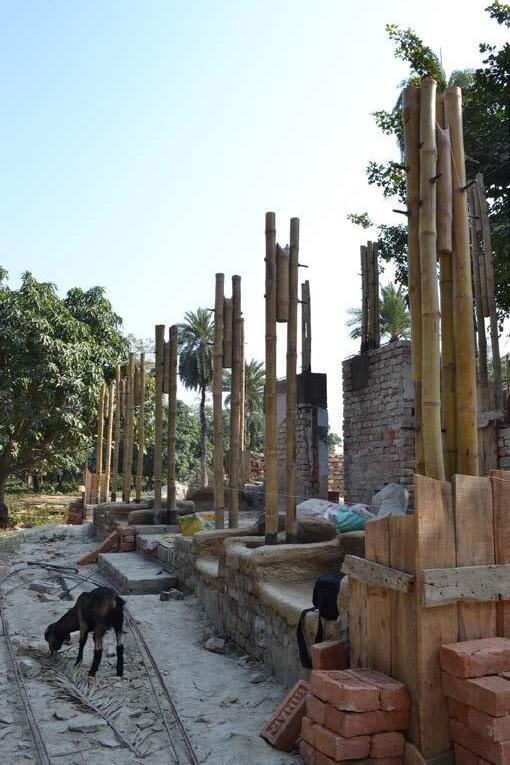
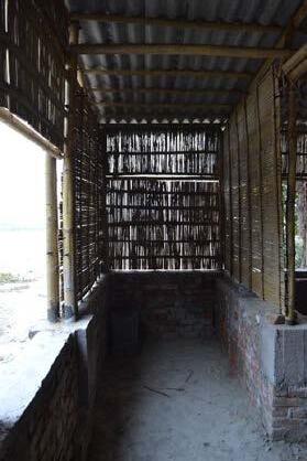
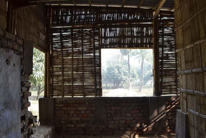
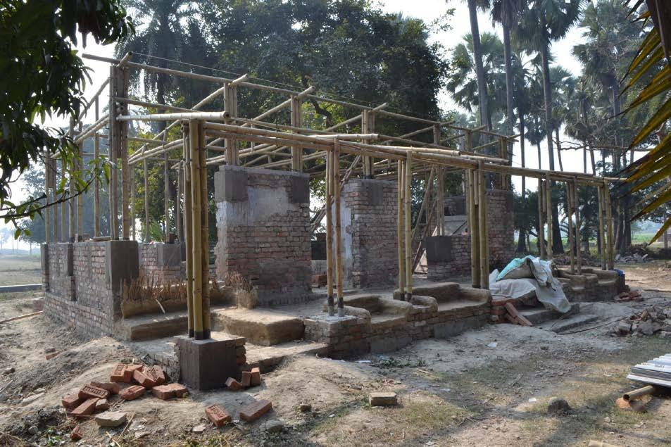
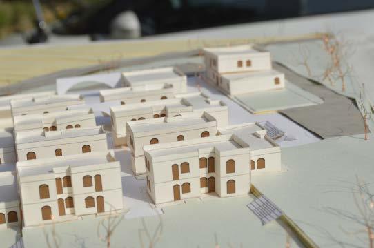
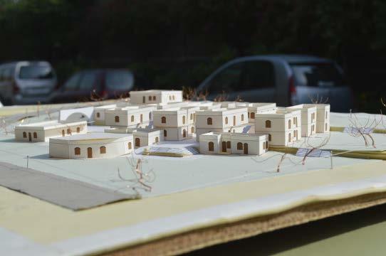
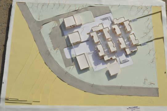
Initiated by an indian rural infrastructure organisation called PUCCA, the bamboo farm centre is designed to act as a supporting infrastructure for training farmers in modern agriculture practices in rural Bihar.
I was hired as a young architect to design and con struct this treated-bamboo structure. Retro-fitting an existing mud mortar brick structure and re-building it into a humble building made of the widely available resource of Bamboo was deeply inspiring to me as a designer. I learnt a lot from the Bamboo craftsmen/ builders whose expertise was crucial to the project.
ASSESSING THE EXISTING STRUCTURE
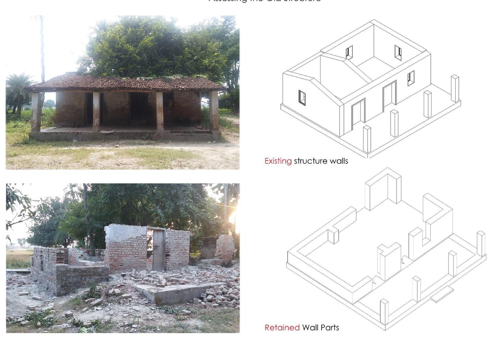
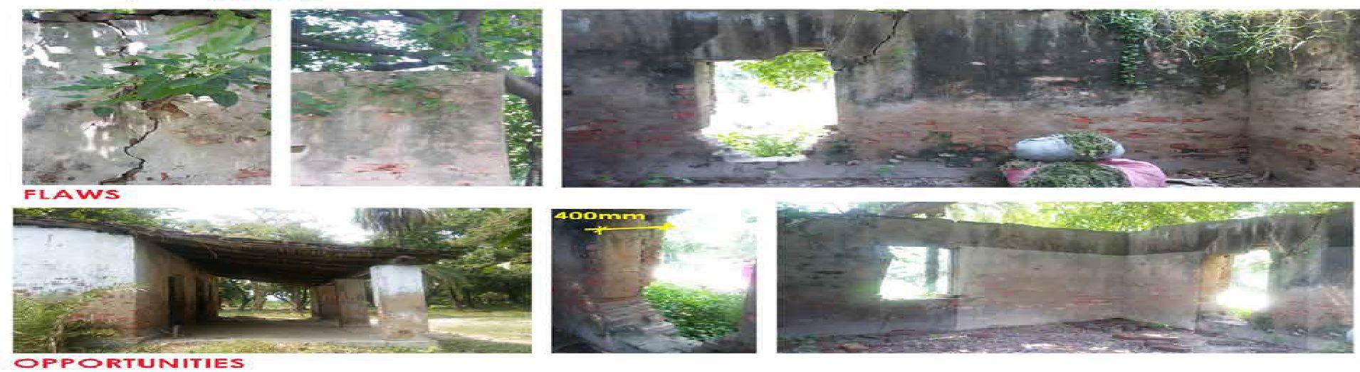
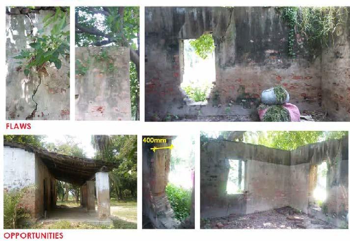
OPPORTUNITIES
Assessing the existing structure
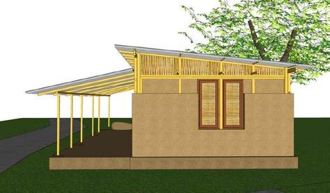
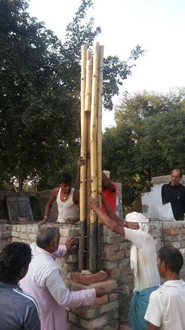
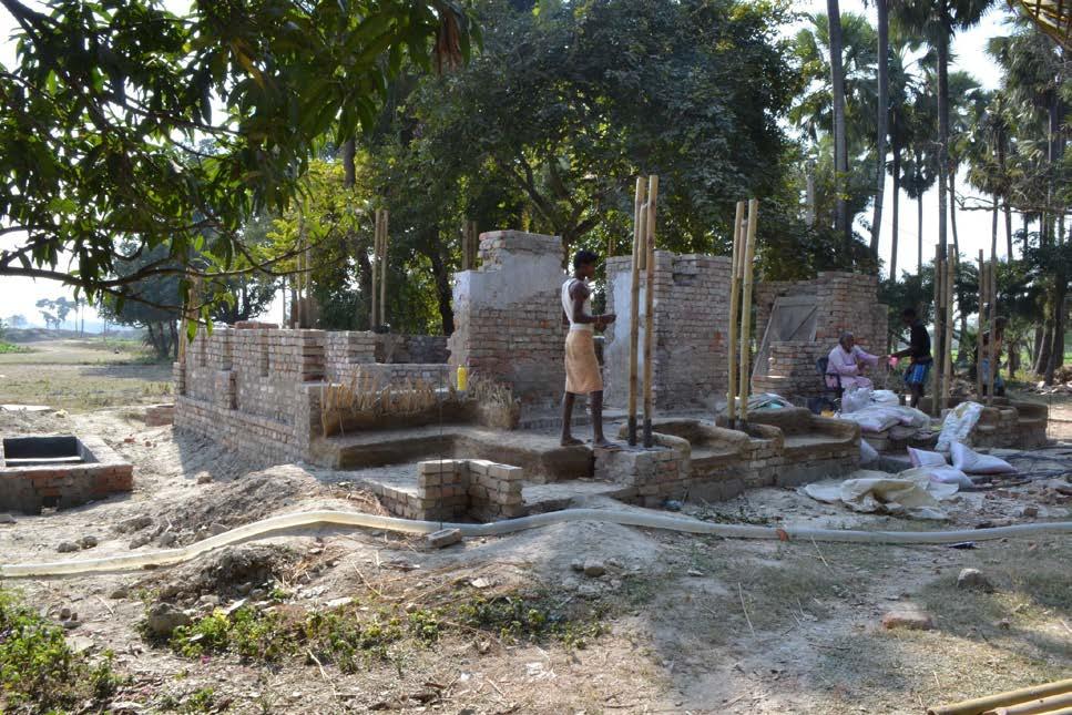
On-site supervision and execution of the project by coordinatting with bamboo craftsmen, building masons, contractor and the project manager.

Newlyn, Victoria, Australia
Independent project
December 2024
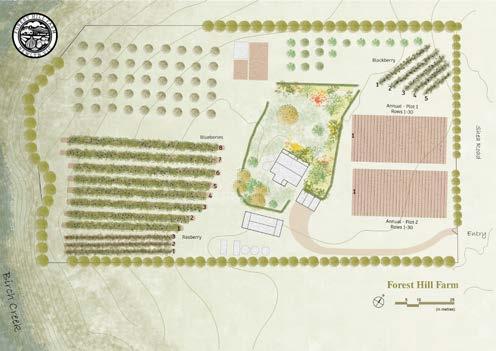
Jharkhand, India
During a week long farming experience at Forest Hill Farms, I creating layout plans for the farm to help them to apply for a planning permit to convert the land to Agriculture landuse from a Residential zone.
While working at Firki Studio (an architecture and interior design firm in India), I created electrical and false ceiling plans for a variety of projects.
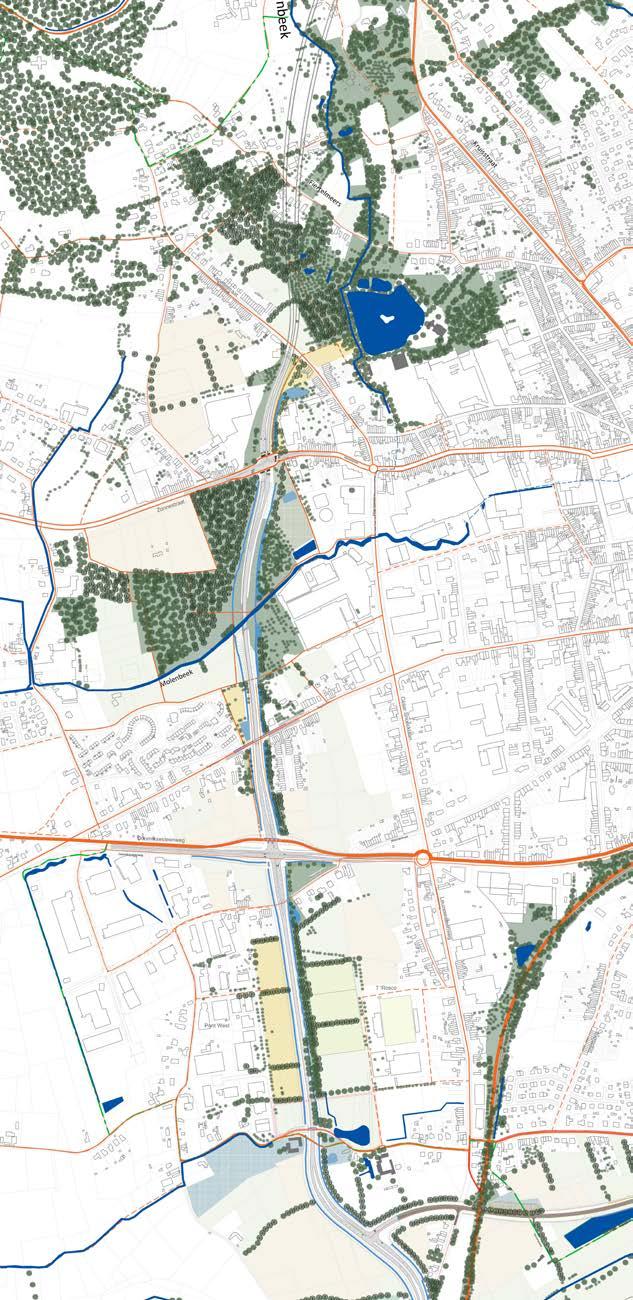
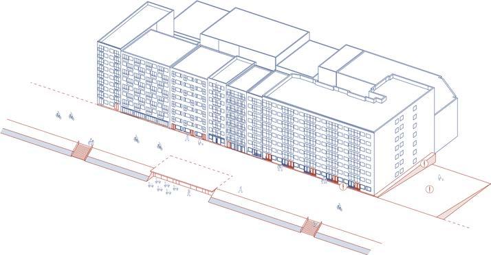
Ronse, Belgium
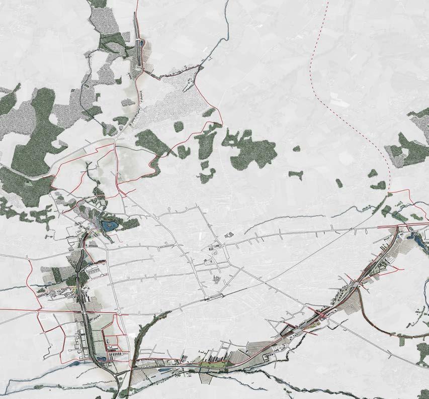
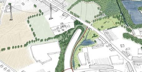
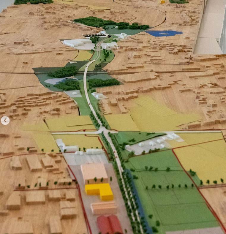
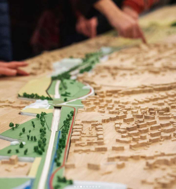
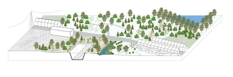
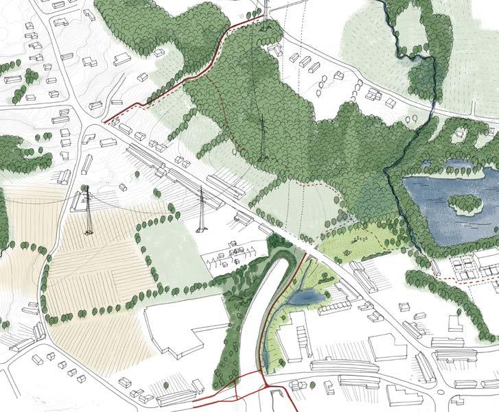
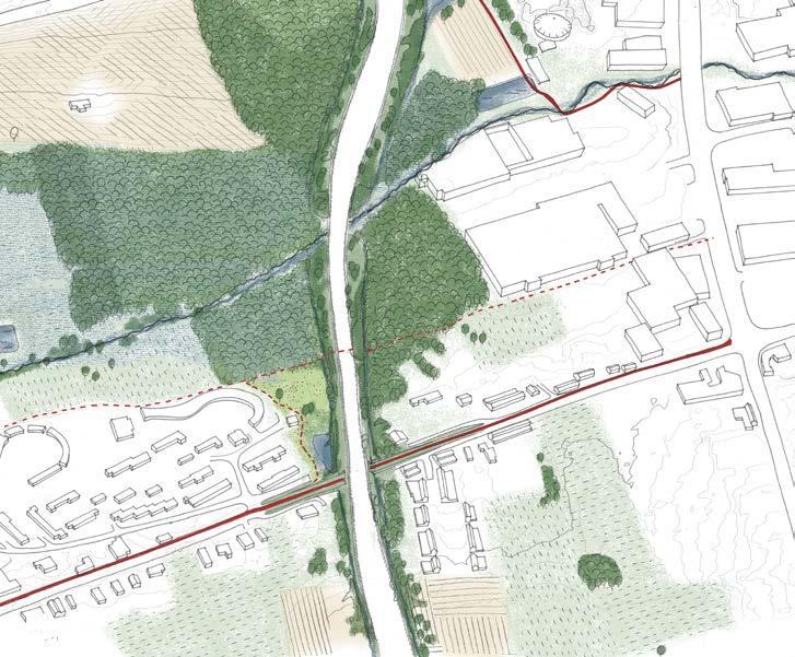
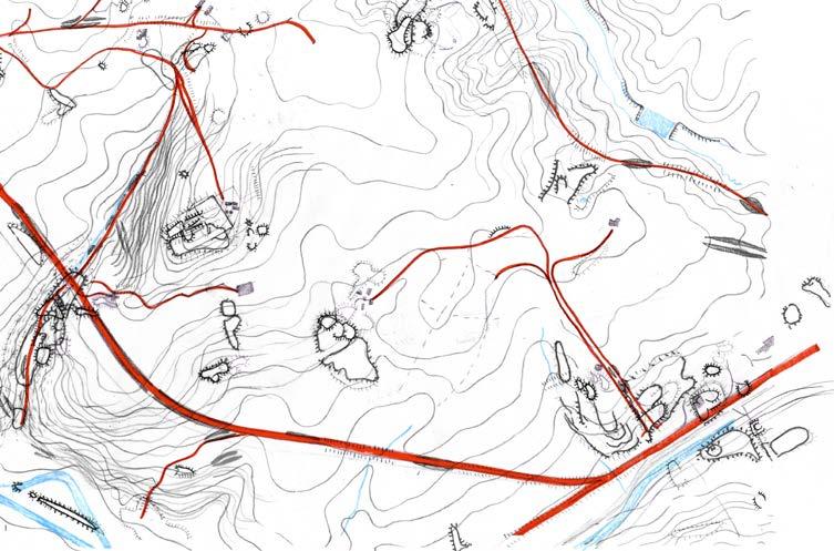
Rond Ronse is a road infrastructure project that creates a by-pass route for the city of Ronse. The team looked at the road as landscape itself that needs to be shaped keeping in mind the networks of ecology, soft mobility, noise and water. The intention is to create social and ecological value for the city while the road link project is hugely impacting its morphology by creating barriers.
The drawing above shows the different shades of ecology that the project aimed to create. In red are marked the soft mobility routes for biking and walking. In addition, the project aimed to create greater linkages make sure the road does not act as a barrier for urban movement but rather as an opportunity to connect the neighbourhoods.
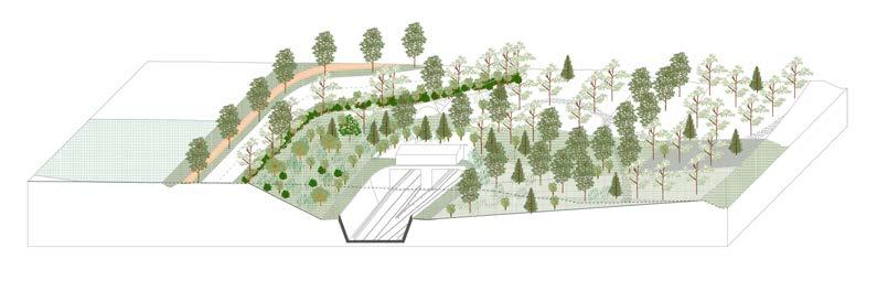
The sketches on the right were created to cohesively communicate to all stakeholders in the project, including the road engineers and the general public on what the urban vision for the new road is. These were drawn out by the author on different layers of tracing paper and collated on Adobe Photoshop.
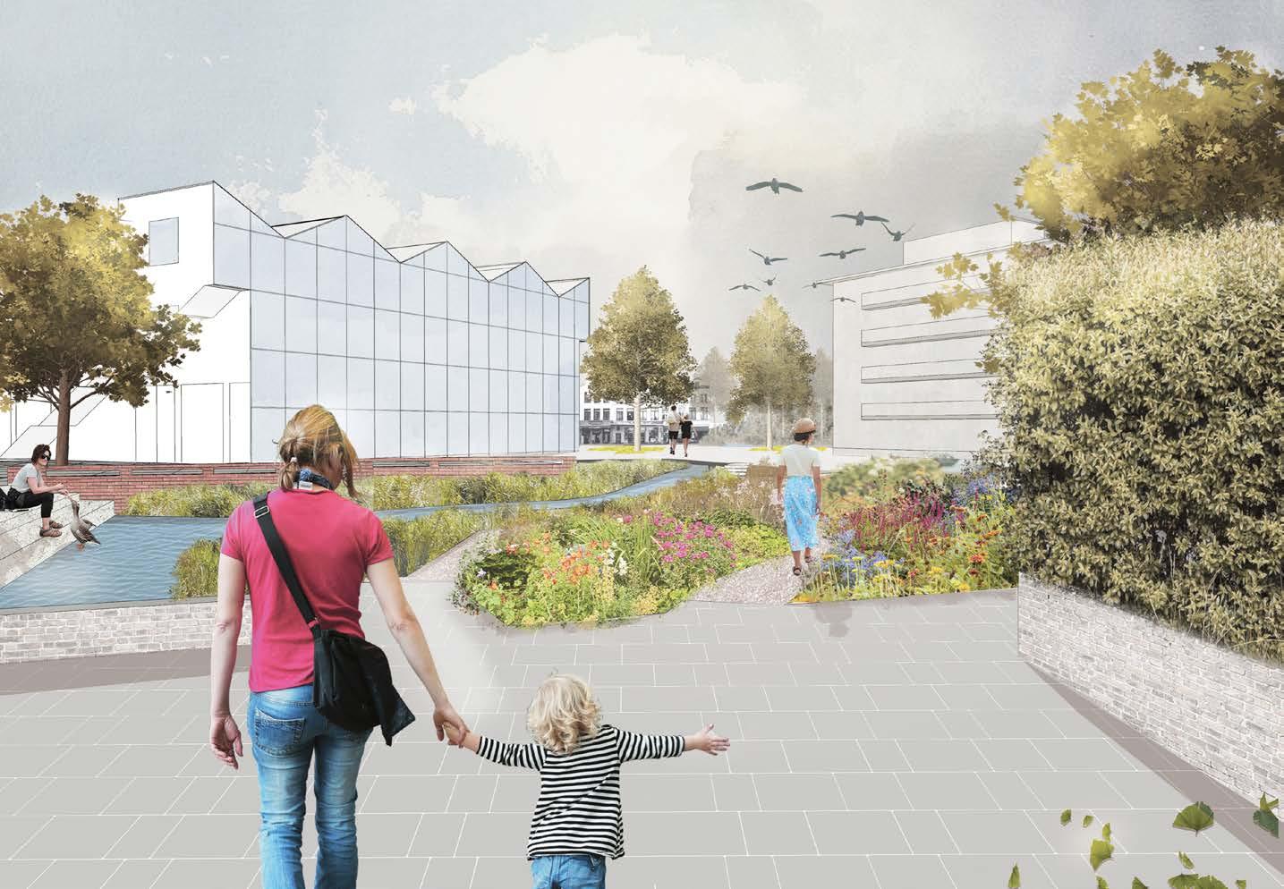
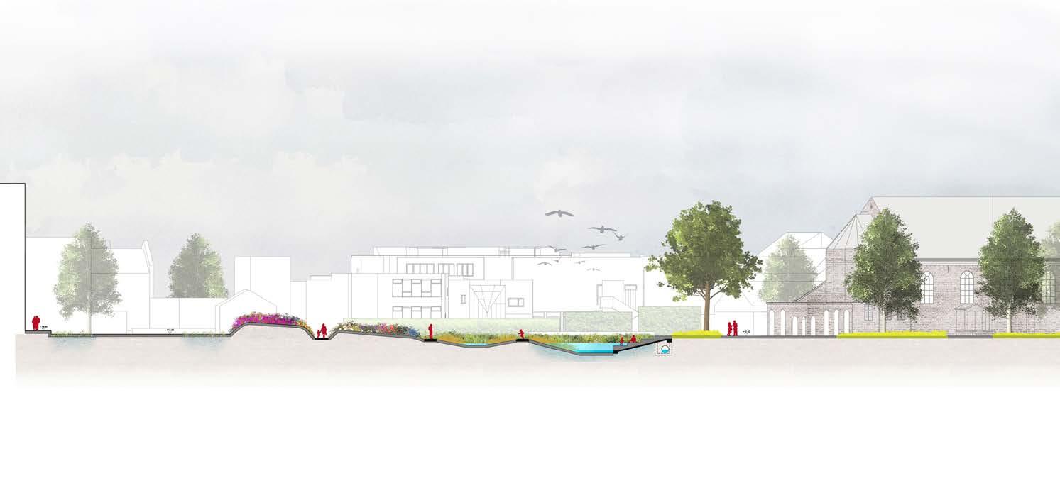
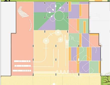
The drawings were created as part of a public space design competition that aimed to redesign a parking lot in the middle of a church sqaure in Gullegem. The proposed design maximised the green area to provide as much softscaping as the site allows. The intention was to make it the complete opposite of what it represented and make it a space for biodiversity, play, reflection and community.
The 3D view , sectional drawings and renderings shown here have all been done by the author
Belgian coast , Belgium
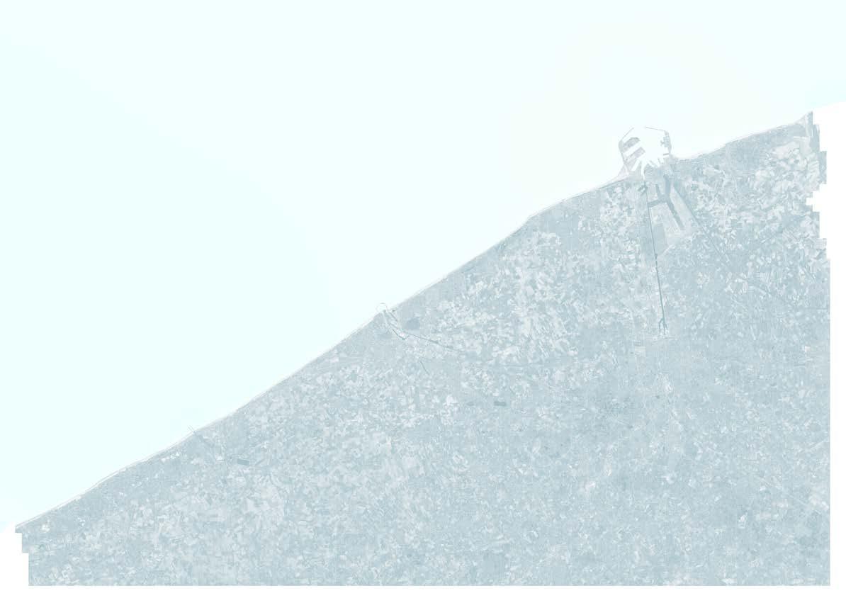
Different types of building clusters- each with their own opportnities and challenges to adapt them to the sea level rise and consequential flooding
The study was aimed at spatially defining the different building typologies that exist on the belgian coast and how they must adapt to cope with the rising sea levels and storm surges. The different types of housing are located in the map above to understand the distribution of these houses on the coastline. They form a part of the first line of defense in case of extreme climate events.
Different cases of housing clusters were then identified and drawn to create various scenarios of protective interventions that could happen at a building block level.

Charleroi, Belgium
Academic Masters- KU Leuven
Independent Thesis 2021

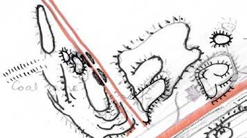
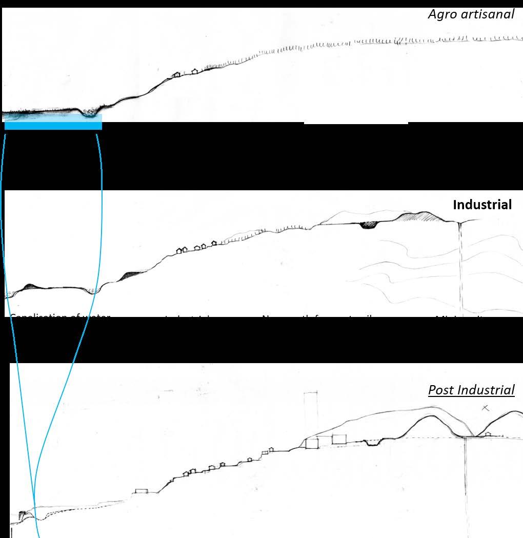
The industrial era of Charleroi- The map shows how the entire territory of Charleroi was put to work for the extraction of coal
56% of the population of Charleroi lives in difficult neighbourhoods while the city suffers from high unemployment rates. The thesis takes the side of neo-nature and topographical conditions to envision a ‘found’ landscape frame for Charleroi.
Through mapping, the region is studied in it’s different life cycles as an agro-artisanal region to an industrial zone and now to it’s inherited post industrial reality. This is done to arrive at a new relation between the city and its territory to take it towards a new direction.
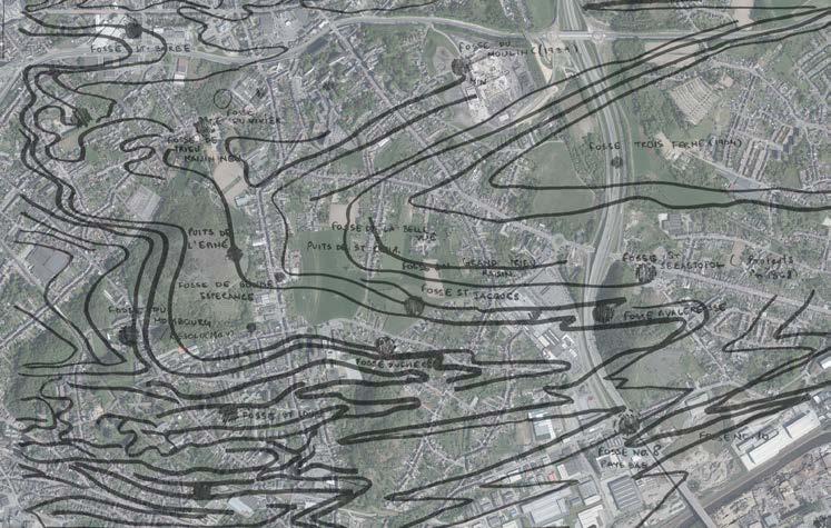
industrial mining infrastructure leading to an altered topography
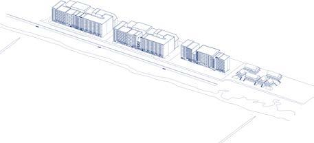
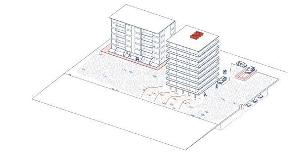
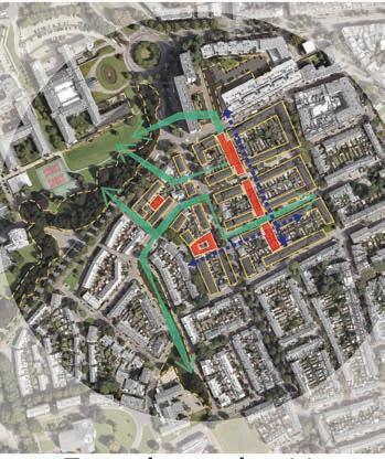
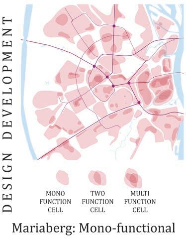
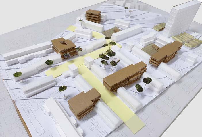
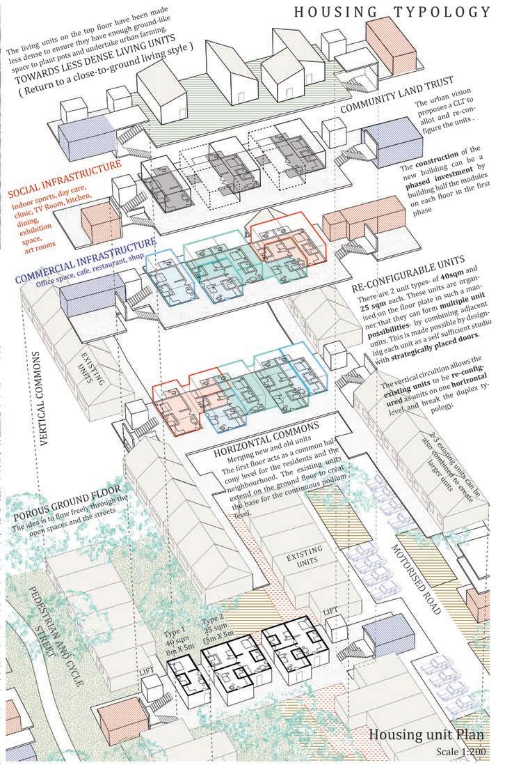
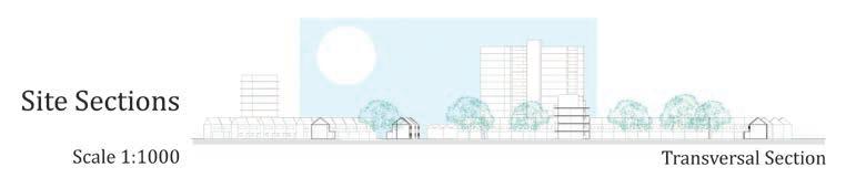
Mariaberg, Netherlands
Academic Masters- KU Leuven
Independent project 2019
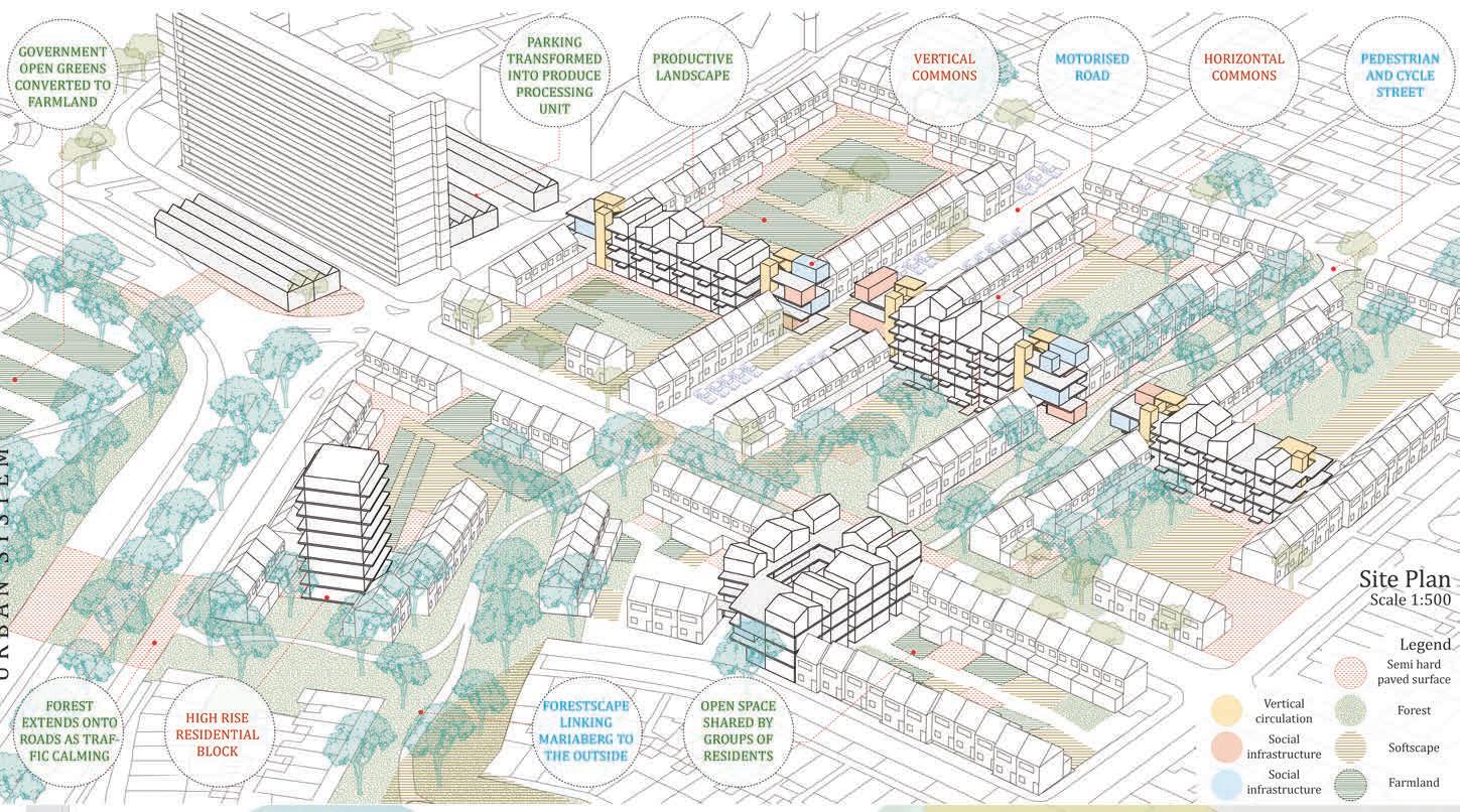
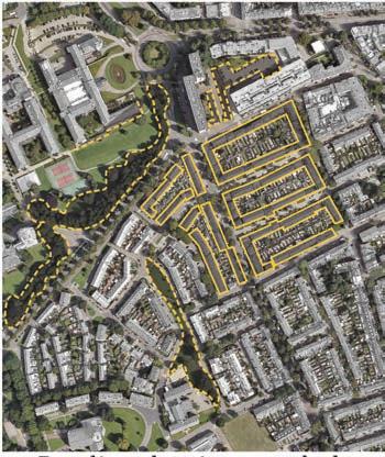
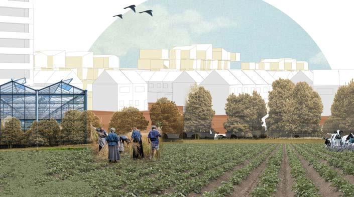
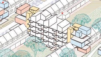
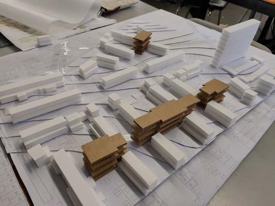
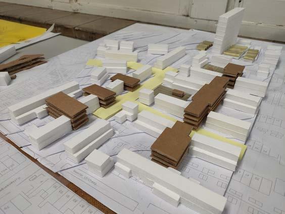
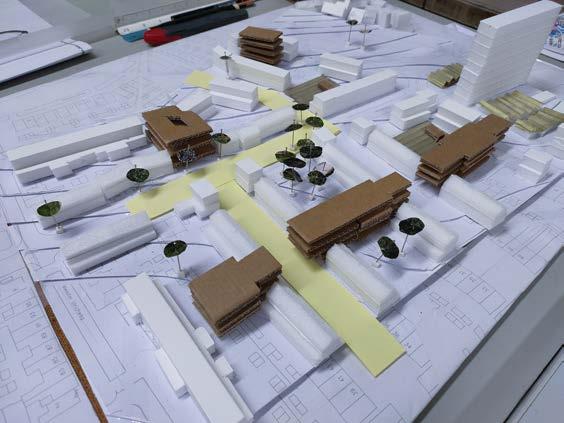
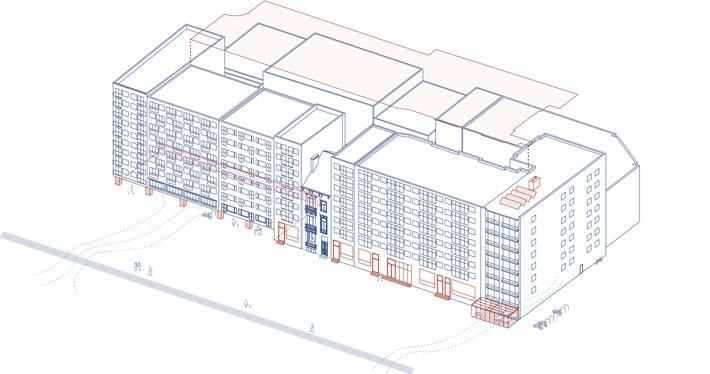
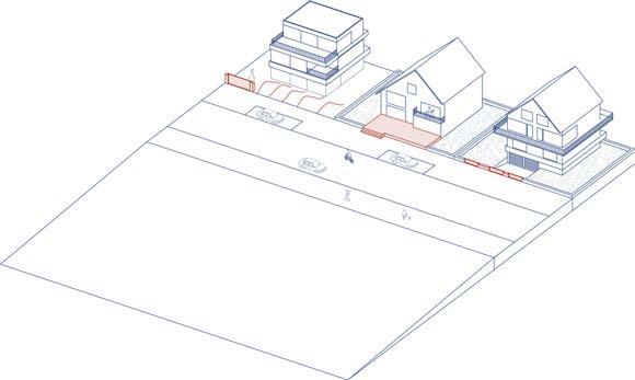
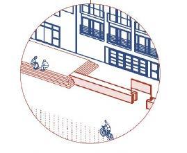
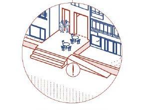
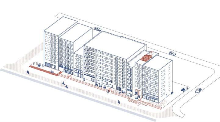
Rethinking housing towards a new contemporary way of living. The proposed housing units are introduced in the existing built form in sucha way that new opportunities for collected livign are created. New common spaces refered to here as vertical and horizontal commons are created to increase social interaction and provide spaces for community activities.
The ground floor is imagined as a big urban park with a variety of open spaces. In the process, road infrastructure is redefined as not just a place for mobility, but for meeting, relaxing and enjoying.
Hyderabad, India
Professional- Hyderabad Urban Lab
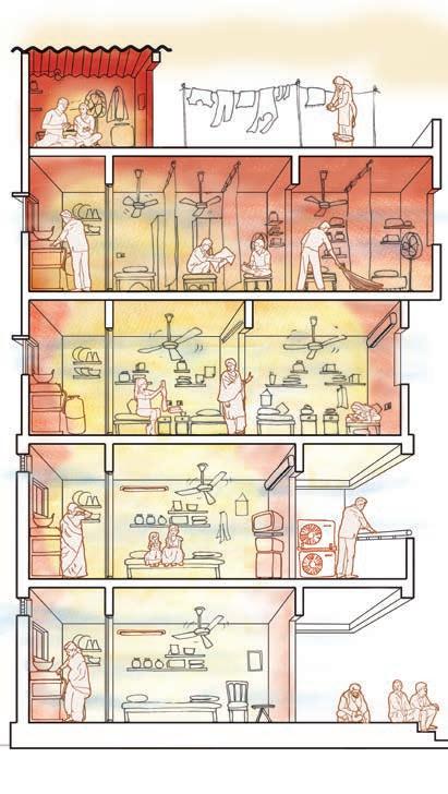
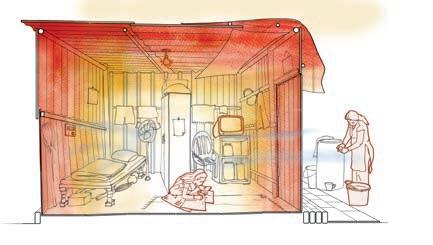
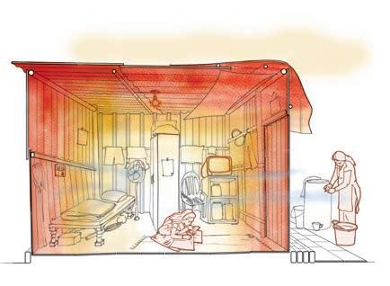
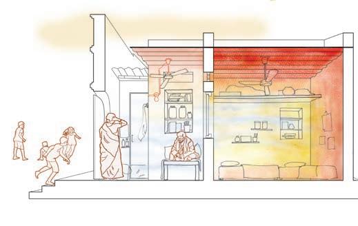
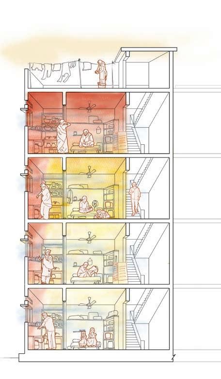
In collaboration with Hyderabad Urban Lab, the heat study aims to study and document the experience of heat in the informal settlement of Singareni Colony in Hyderbad, India.
The sections above show the 6 housing typologies that were identified. The shades of red to white demonstrate visually the heat signatures in the house during peak summers.
(All sections visualised by the Author)
Professional- Hyderabad Urban Lab
2023-2024
Hyderabad, India
2023-2024
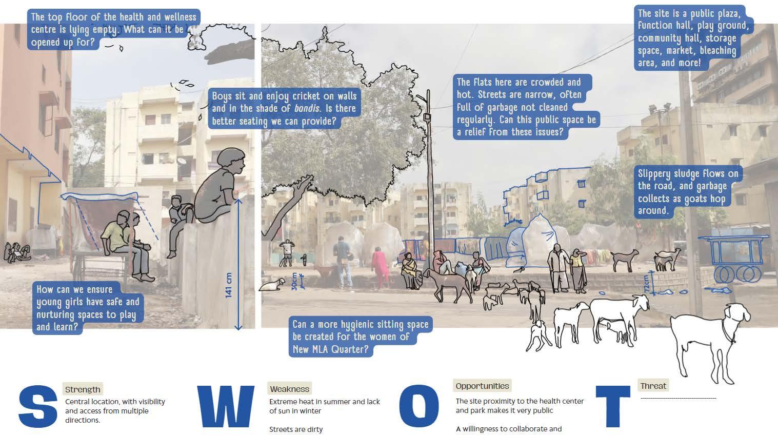
iLocal Design Idea Competition is an attempt to create a unique design competition in India that puts more emphasis on the multi-disciplinarity of the teams and the intensity of the idea than the actual proposal submitted.
The Author created the site study drawings and collages for the 10 sites selected for the competiton.
Logo Design Link to website
Co-compiled the competition into a compendium to be printed into a book
Mumbai, India
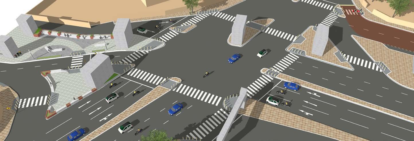
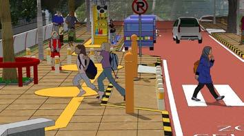
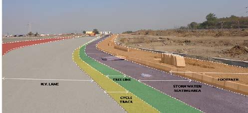
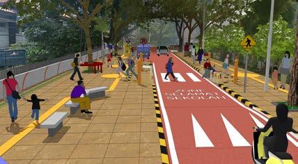
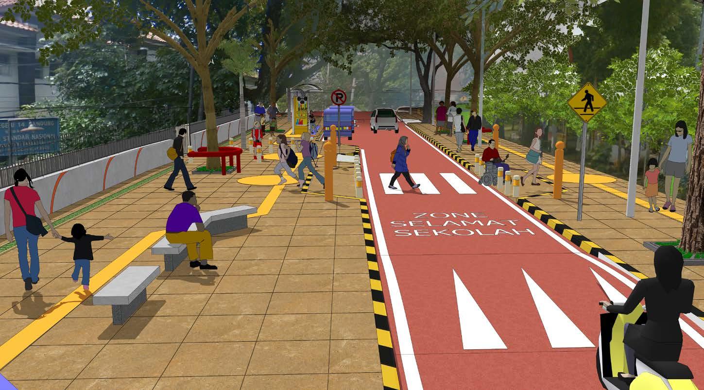
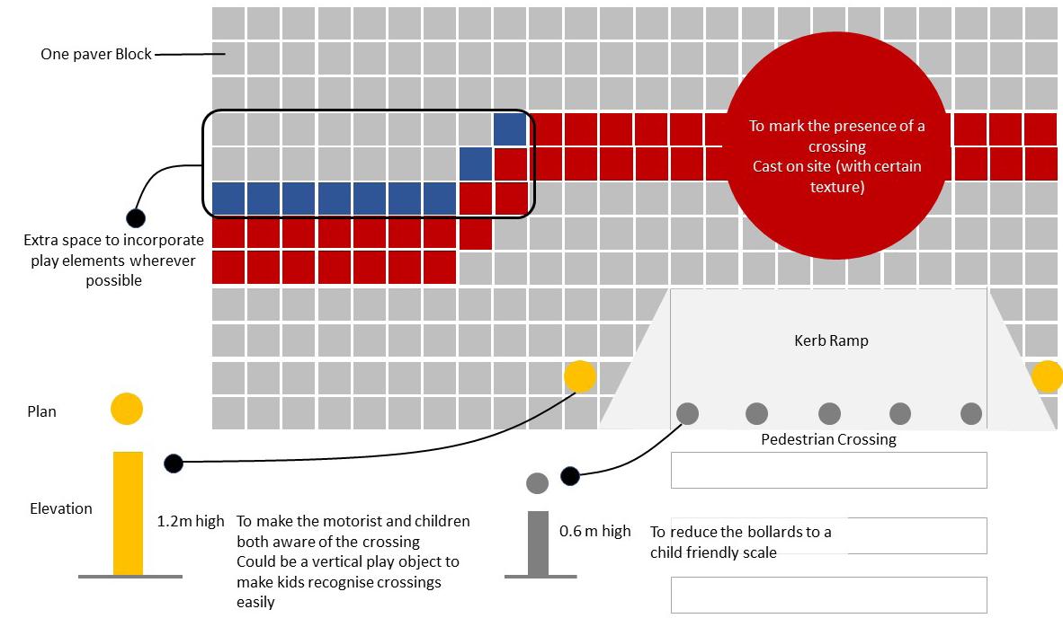
Intersections in Mumbai, India are undefined large ambiguous crossings that lead to high fatalities and make streets unfriendly for pedestrians and cyclists. WRI India is working with the local government to push for compact, safer, streamlined intersections. Equitable road space sharing for all users is a concept that takes time to be grasped, especially in a city like Mumbai, where road space for cars is already considered limited.
The project redistributes the road section to create a more equitable environment for school children and provide more space for public transport. The design radically transforms the road into a street.
Hence, a playful safe street with wider footpaths and sitting spaces for parents.
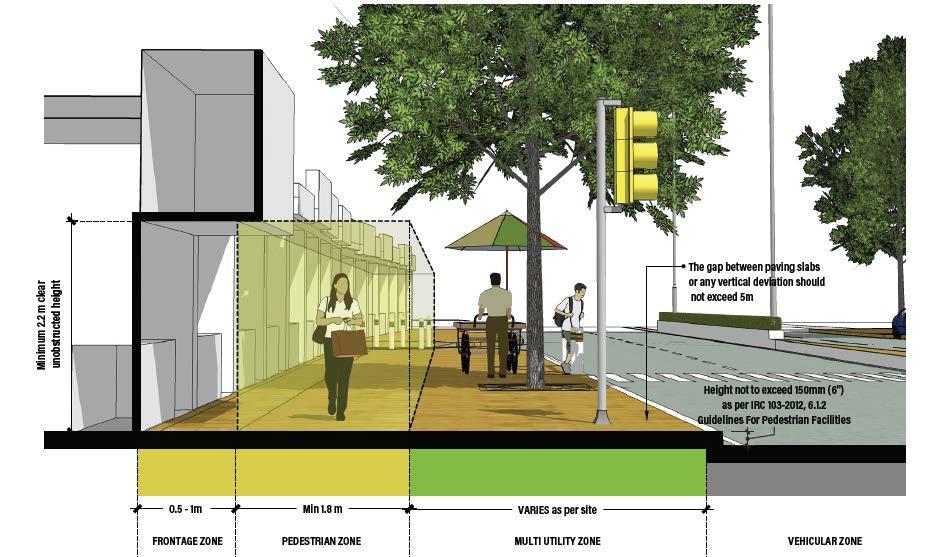
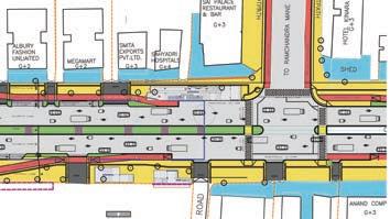
WRI India is working with the local government to push for compact, safer, streamlined intersections. This street majual was developed specifically for the street conditions of the roads in Mumbai. It is aimed at informing the governement executives and civil engineers of the options available even when there is very little footpath space which is often the case/ in Mumbai.
Infographic Design
Leuven, Belgium
Collage/ Infographic
Academic Masters- KU Leuven
Cantho, Vietnam Team effort + Individual component 2020 Team effort + Individual component 2020
Academic Masters- KU Leuven
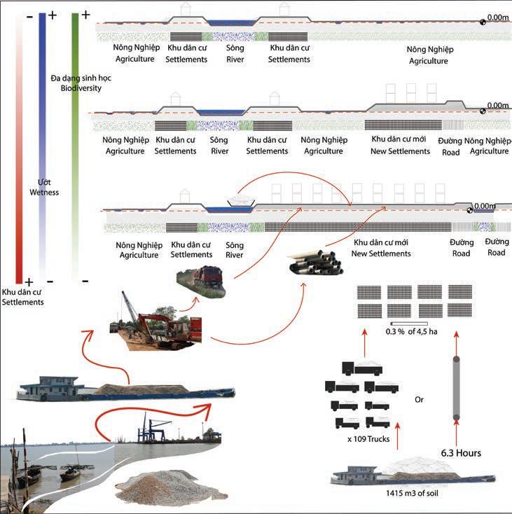
Professional- Lokal Habitat Labs
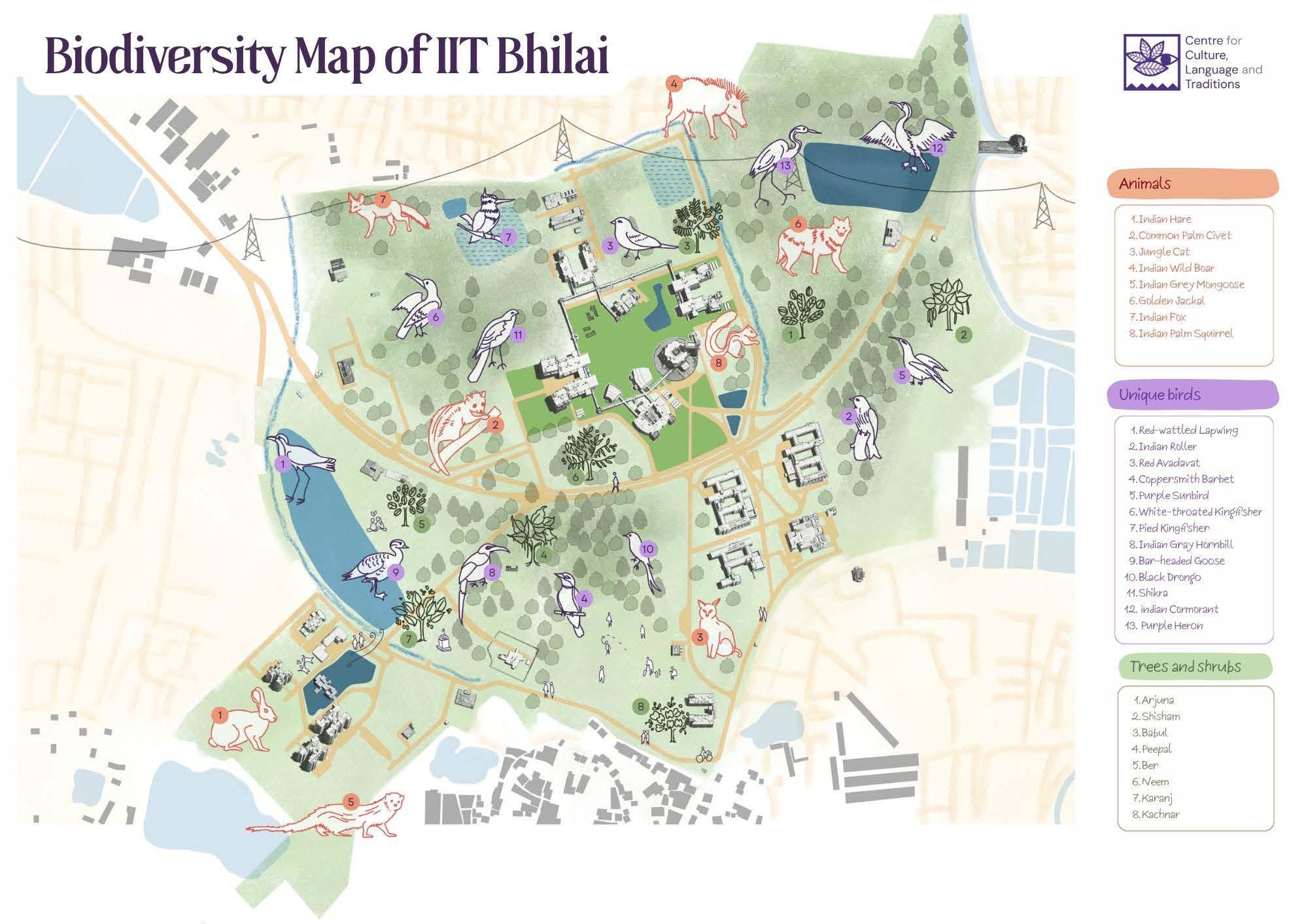
In an attempt to document, advocate and make present the biodiversity on the campus of IIT Bhilai, the senior staff took the initiative and generated funding to create a map brochure of the birds and other animals/trees/butterflies on site. A field visit with ecological consultants was conducted after which our team analysed the data and came up with a graphic style.
DESIGN RESPONSE
Our unique reading of the brief, made us create a map that shows not just the animal and bird biodiversity on the campus but also represent the diversity of the natural habitats on campus. The wetlands, ponds, old water streams along with forests and grasslands.
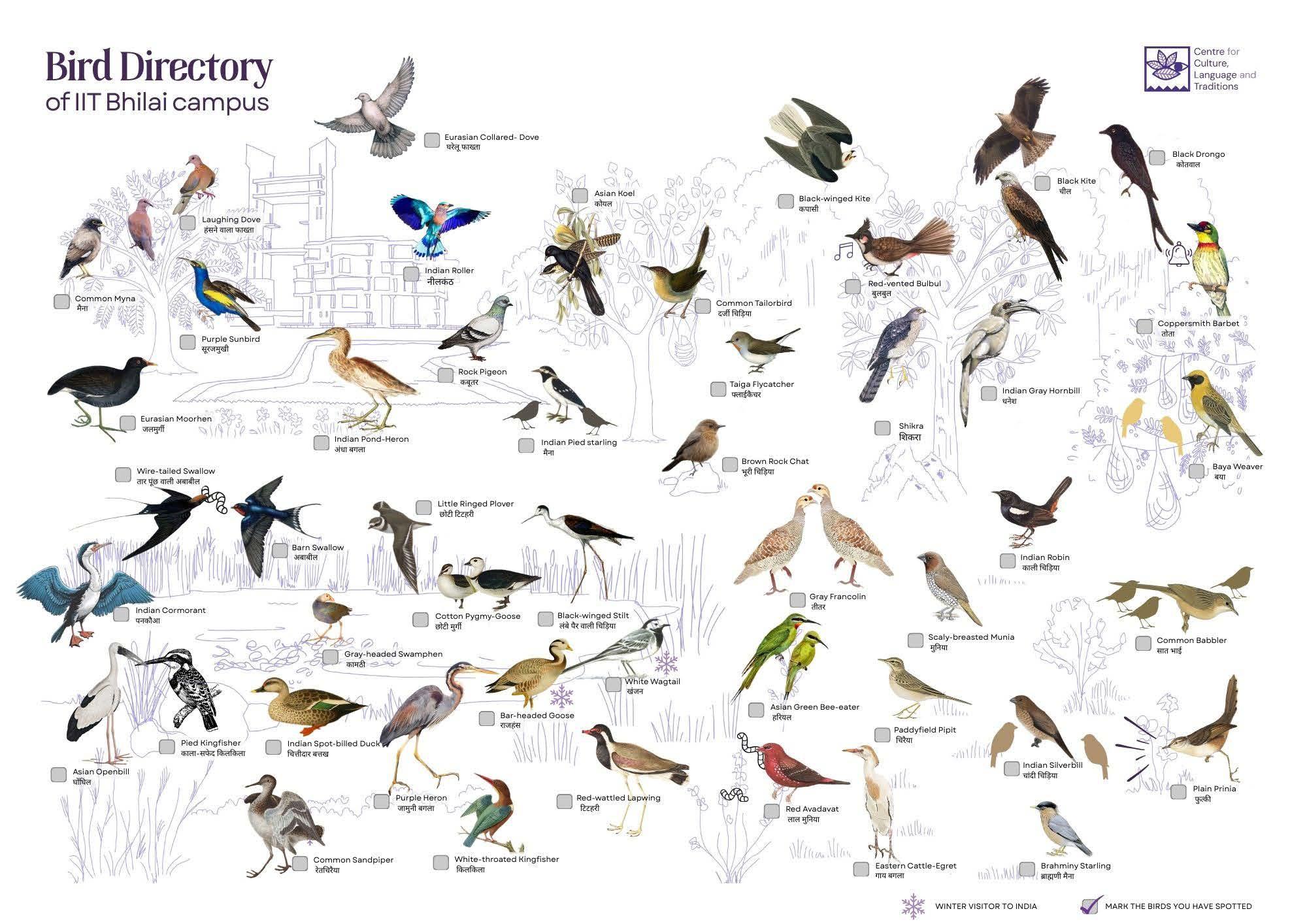
A similar concept has guided the bird directory graphic. The 45 species of birds are spread on the page according to which habitat they are mostly cited in.