How Can We Live without Water?
More than half of the tomato is water
More than half of human is water More than half of the earth is water Sometimes need it, and sometimes avoid it
Water is live-being that reacts to whatever around it acts Sometimes can be harsh and most of the time is kind It heals and gives life to the desert But can drown someone in the deep
It flows through our ecosystem Which we should take care of One broke, entirely swept Which we must prevent And give them lives
Contents
2 3 4 6 8 12 14 20 22 26 28 42 43 43
How Can We Live with Water? Contents
The Rising Sea Level and Den Helder Experiencing Den Helder The Development of Den Helder
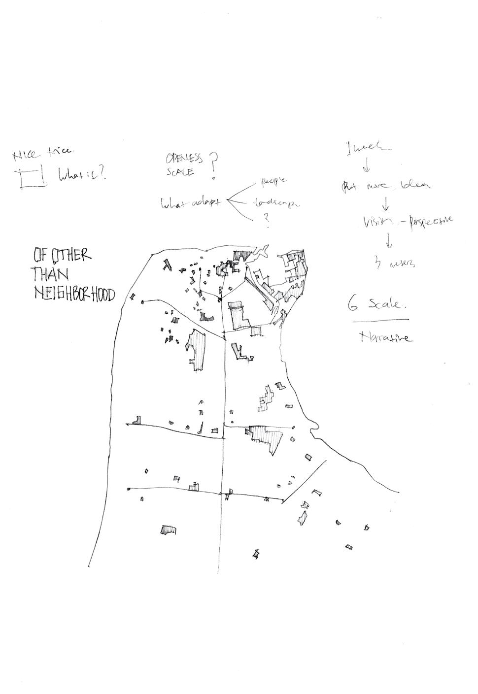
Rising Seawater: Adaptive Guiding Theme Rising Seawater: Learning Through Urban Form How Can We Live with Water: Design Perspective Adaptability Tools Imagining Den Helder 2100
Synthesized Three Structure Plan
Reflective Conclusion: Towards Urbanism Scales References Appendix
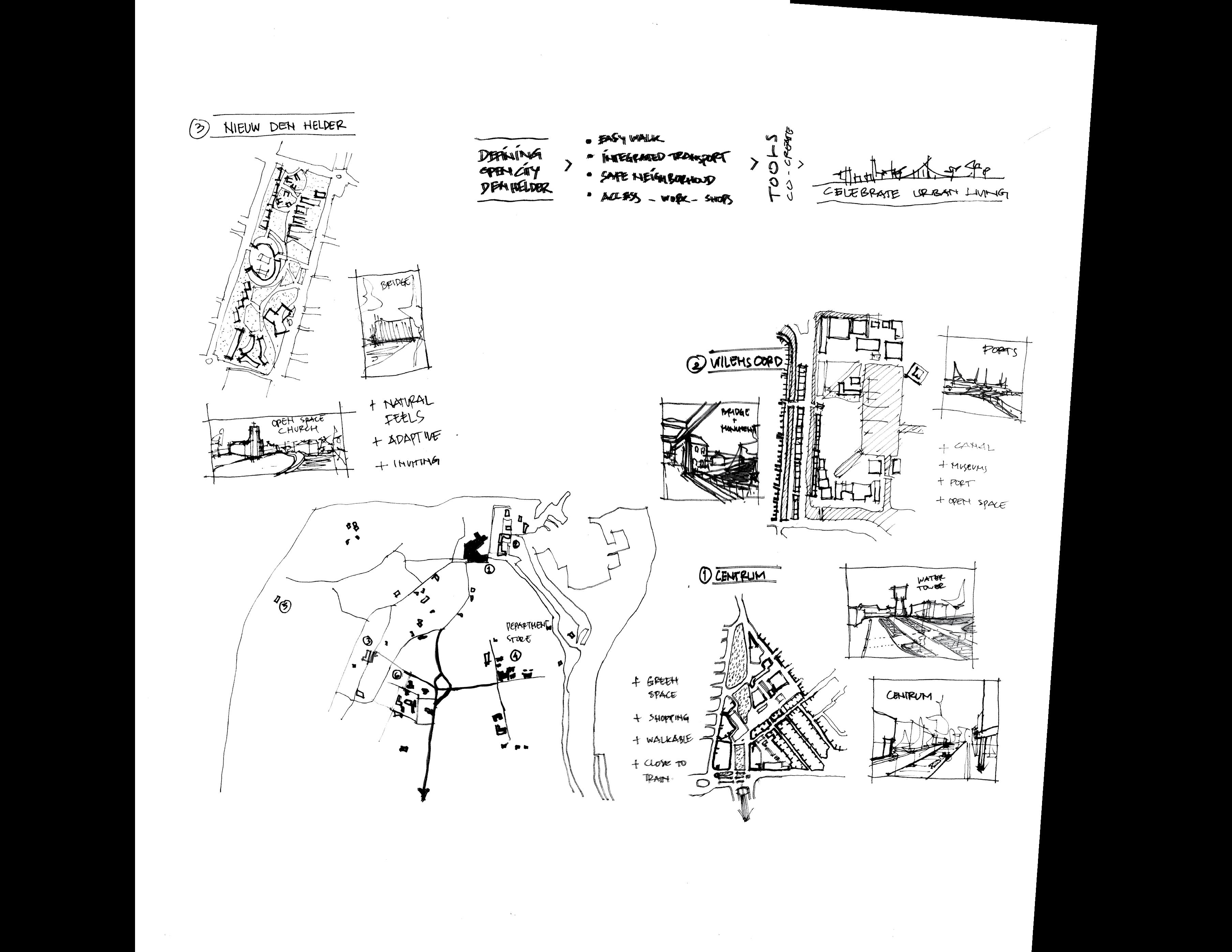
Den Helder 2100: Live with Water
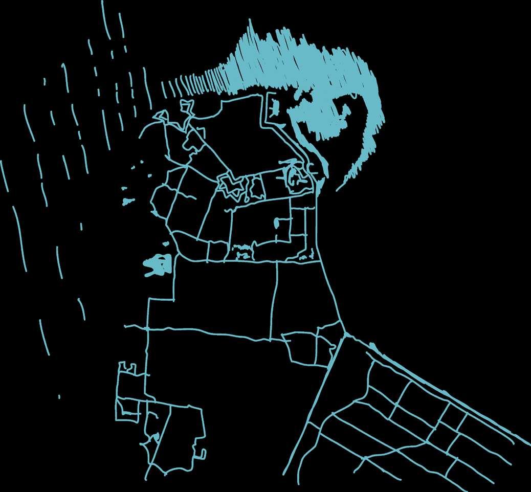
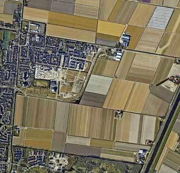
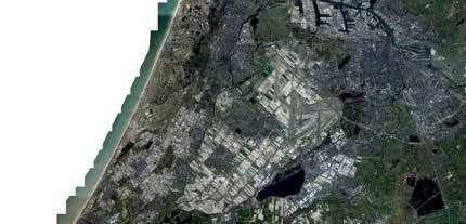
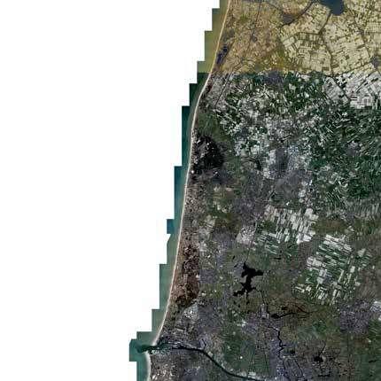
The Rising Sea Level and Den Helder
The future of Netherlands’ low lands is still uncertain. The projected extreme 3 meter sea level rise by 2100, stormwater surges, housing challenges, climate crisis, and another possible worst case might lead the cases become reality. Furthermore, 70 upcoming years will be significant transition of dynamic changes, whether we are ready or not.
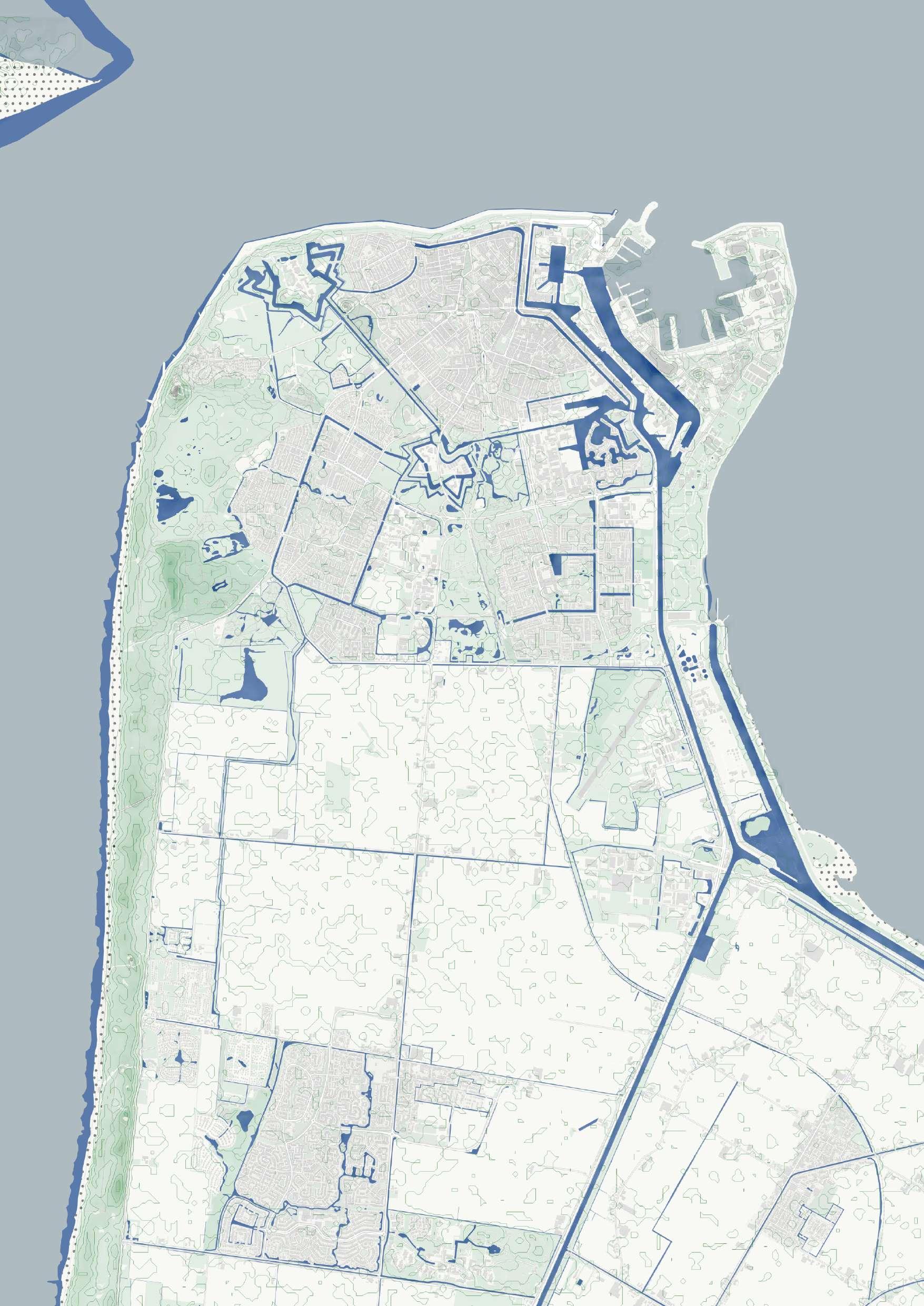
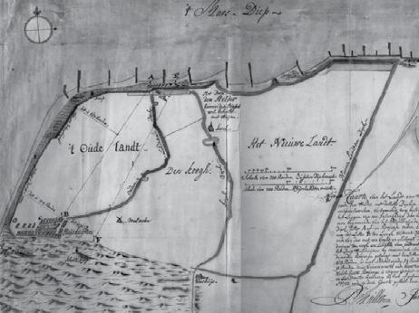
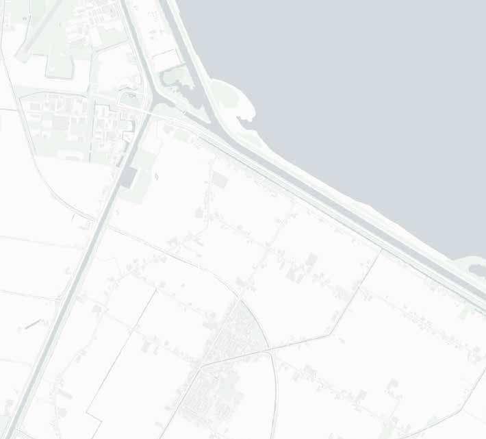
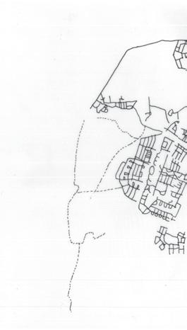
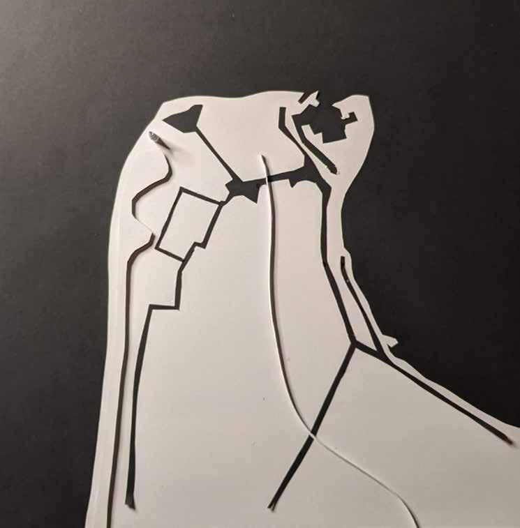
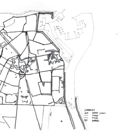
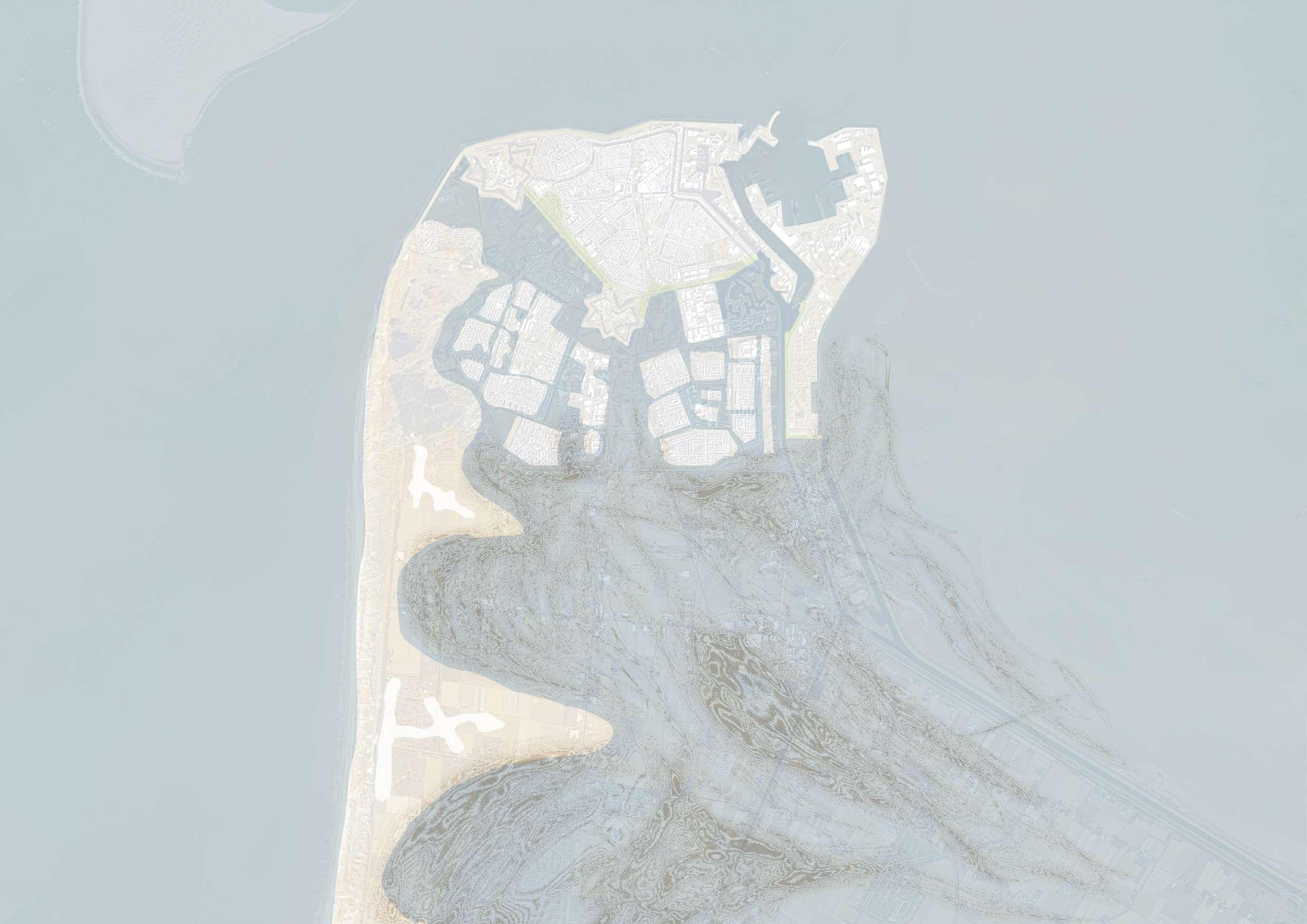
Den Helder transformation through the time showed how the human alterered the significant part in shaping the island. Most historical notable part is the Stelling Den Helder, or the defence line Napoleon built in 18th century. Divide the island in polygon shape line from northwest to east by canal and dike corridors.
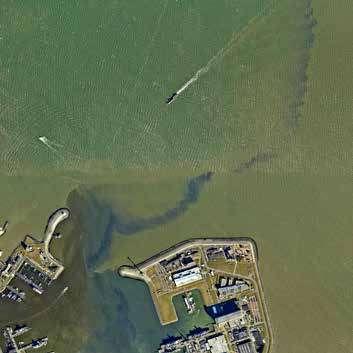
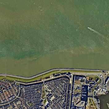
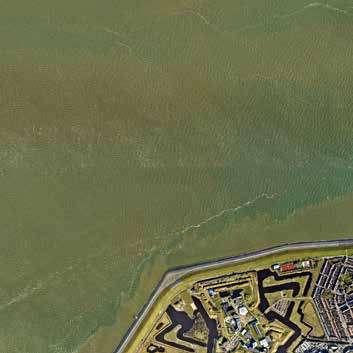
Geographically, Den Helder is almost flat and in the same height level as sea water.
This discourse brings the design and research works on how Den Helder will face the dynamic challenge. Can half of the Netherland can survive of 3 meter sea level rise? Can we?
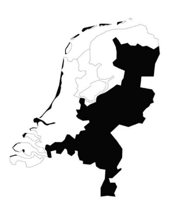
Den Helder 100km Amsterdam
Netherland NAP +0.00m
Den Helder 100km Amsterdam
Netherland NAP +3.00m
Den Helder 2100: Live with Water
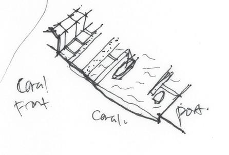
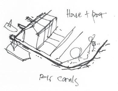
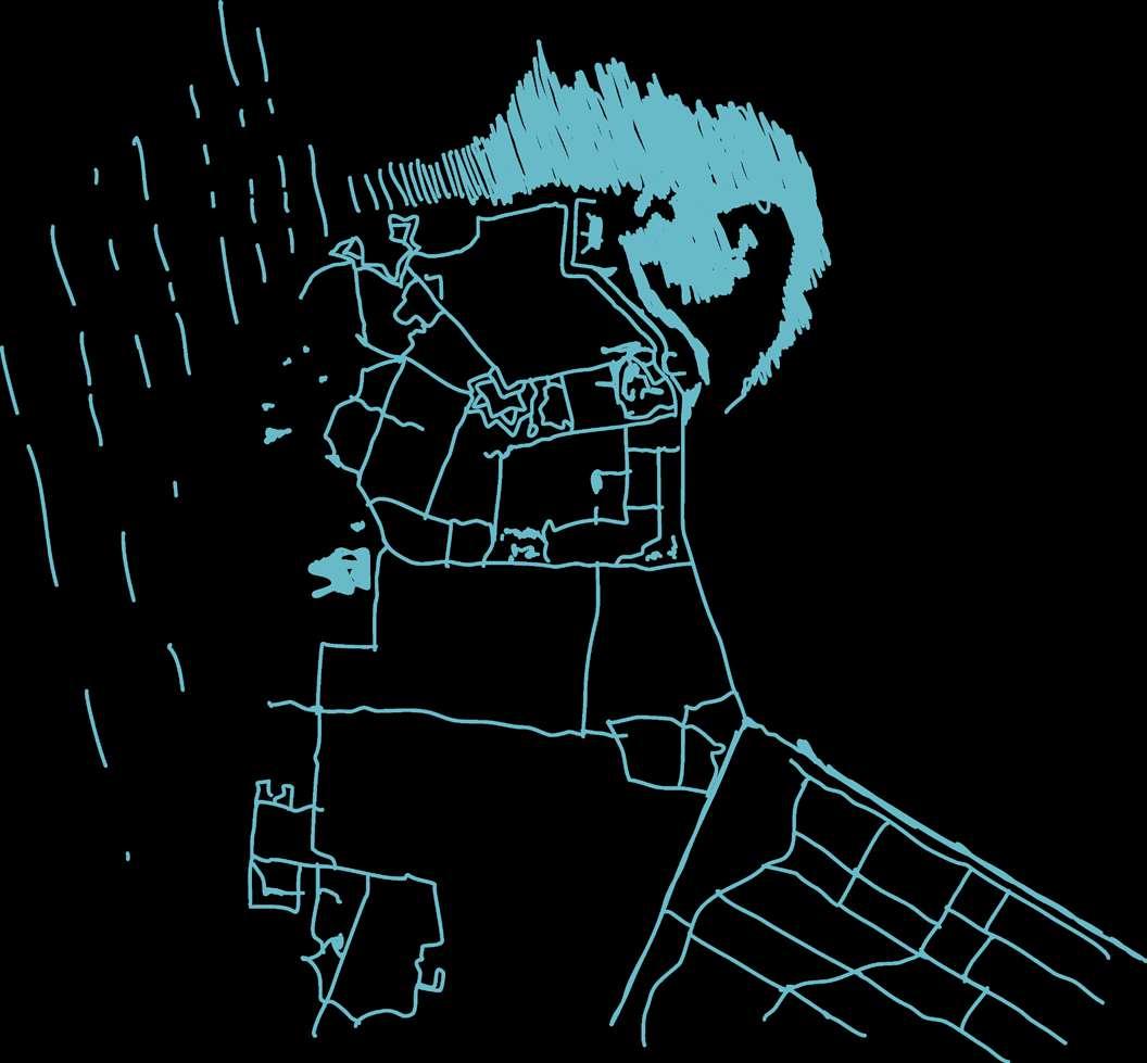
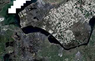
Experiencing Den Helder
There is something I realised after exploring the city in one day. Den Helder consists of multiple layers (urbanised, rural, natural, port, and defence base) which, I would say, is suitable for living in old age (since the neighbourhood is nice and calming). Yet, the relationship and the role of Den Helder as the northern coastal area in the Netherlands (have a lot of wind and as a sea-level rising defence), invites indefinite possibilities to face the future ahead.
By standing at the top of the 17-meter height dike, we can assume that we can survive the 3-meter sea level rise. However, when we see the whole Netherlands, vulnerable low lands are likely in the centre and spread evenly to the other parts, leaving the coastal line the only safer part besides the high lands.


Den Helder 2100: Live with Water
The Development of Den Helder
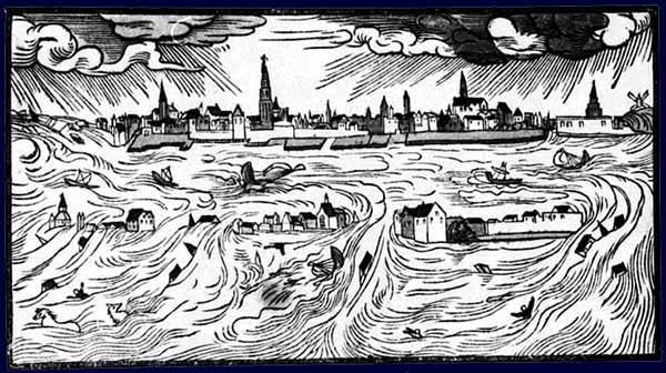
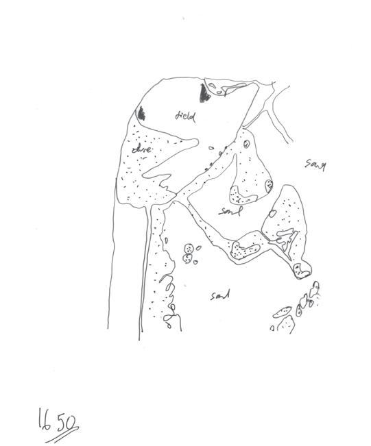
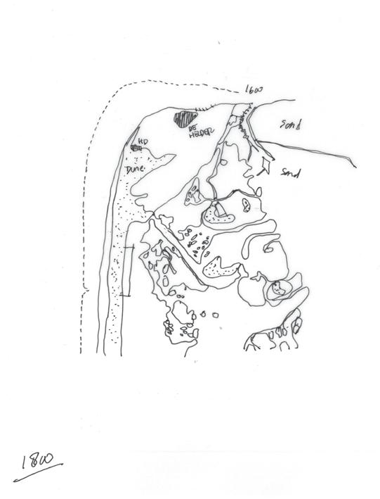
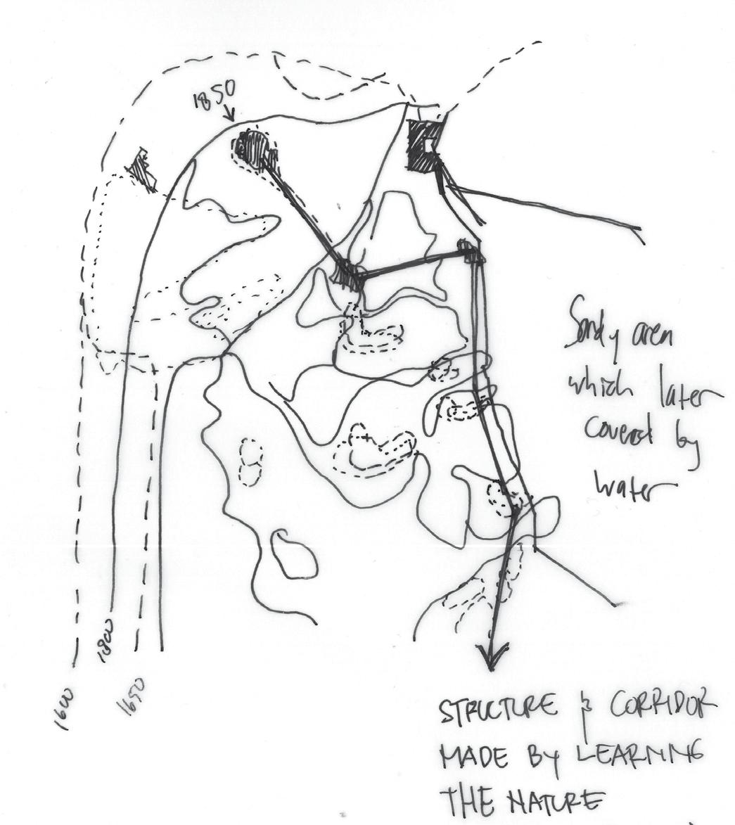
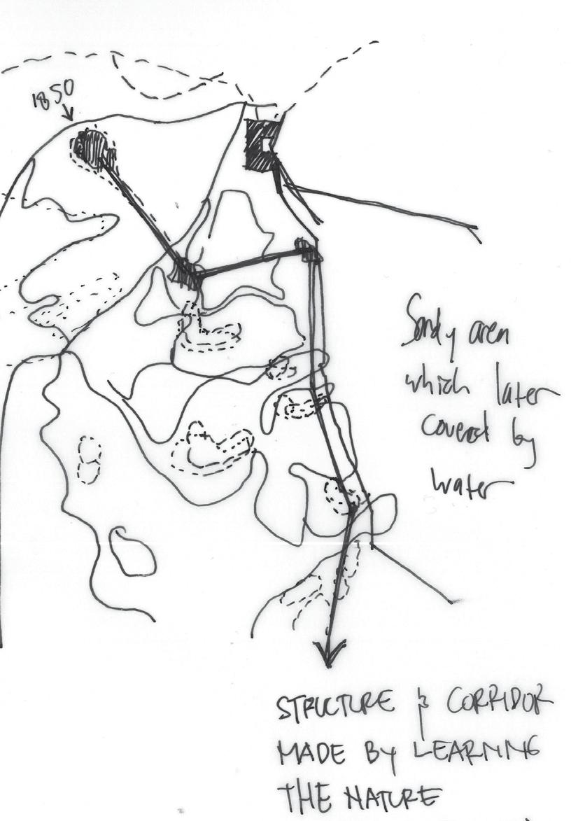
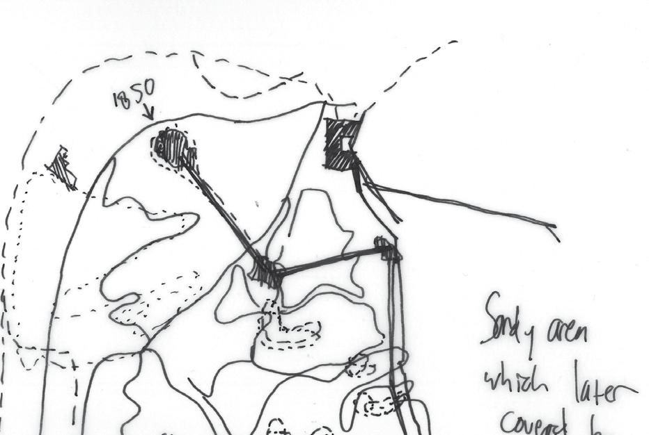
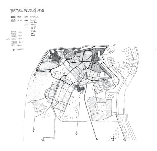
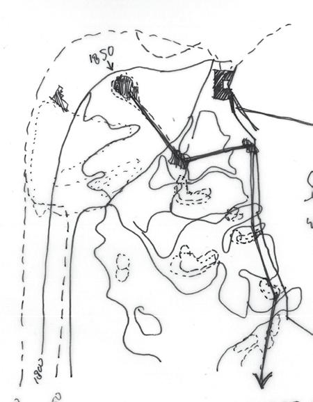
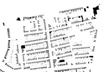
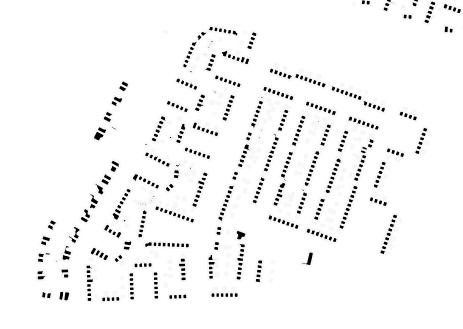
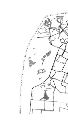
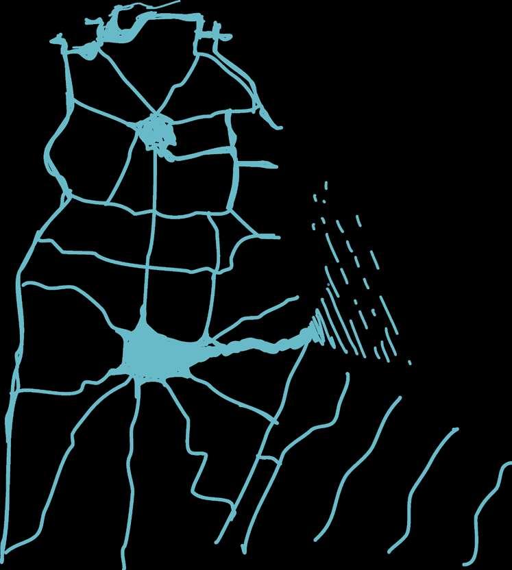
Through these 250 years’ timelines, we can see how Den Helder developed with its turbulent historical evolution. Started long ago in the 7th century when the first village and farm was built, the Huidsduinen. Then wiped away because of the huge flood that happened in 1570. We can see the significant losing part of the island at the edges. Interestingly, the terrain resembled island-like, but with sand. The eastern part of the island was filled with sand dunes but gradually sunk because of the rising sea level. It did leave a trace in further development.
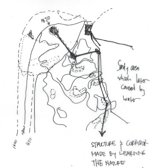
The hard soil part, therefore, becomes a suitable area to become a civilised town. We can learn from the recent past, from 1800 to 1850, how the fort development takes the natural form of the island through hard soiled parts while developing it to become more level. Through time, the island become smaller, the island-like part in the inner area slowly covered become flatlands, and the defence line create canals to Amsterdam.
1600 All saints flood completely washed away all built structure in Den Helder, including the old Huidsduinen (oldest part of Den Helder, built arround 8th century. Then they rebuilt the settlement and started a new living.
1650
Newer part were built and they constructed more dikes in order to have a proper protection. The village, then, become landlocked.
1800 In 17th to 18th century, the village residents made a good living from whaling, merchant shipping, and piloting ships through Marsdiep.
1850 150 years later, Napoleon Bonaparte saw a great potential to make these area as one of defender during the French occupation. Fort Kijkduin was built and Fort Erfprins later.


Den Helder 2100: Live with Water
1850 marked an influential part of the development of Den Helder. After the forts were built, it then grew as a trading city because of its strategic location. They opened canals and built a harbour to make goods transportation from here to Amsterdam became more convenient.
After World War II ended, a newer naval port was built on the northwest side of the Island. Continuously made this concentrated area become the centre, which later bigger town grew surrounding this centre. Eventually, a greater technology of dikes was built and made this city more protected by the sea. Then in 1900 afterwards, the influence of modernism reached the city and experimentation of various architectural development happened. For example, from row houses to flat houses, until experimental landscape.
1570-1722
There was huge storm in 1570. After the flood, residents rebuilt the villages, created more dikes, then the villages became landlocked.
1815
Napoleon (1811) instructed constructions of defense work, then forts Kijkduin, Falga, Dirks Admiraal, Oostoever and Erfprins were created with canal surrounded them. King William (1814) carried the plan then make canal to Amsterdam.
1722
1632
1598
1815-1900
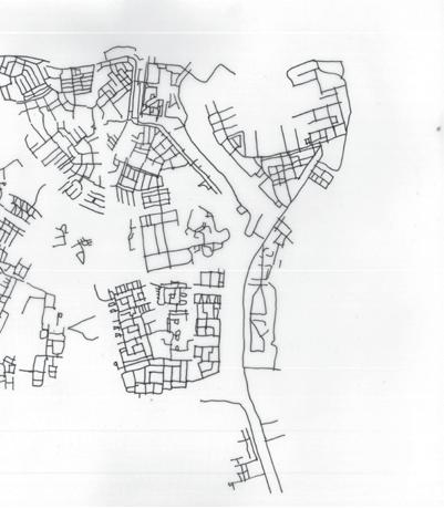
The infrastructure and corridors were started to grow into a network after the railway built. Marked as one industrial revolution advancement to this age. Den Helder, therefore, became an economic and naval port cluster.
1901-2000
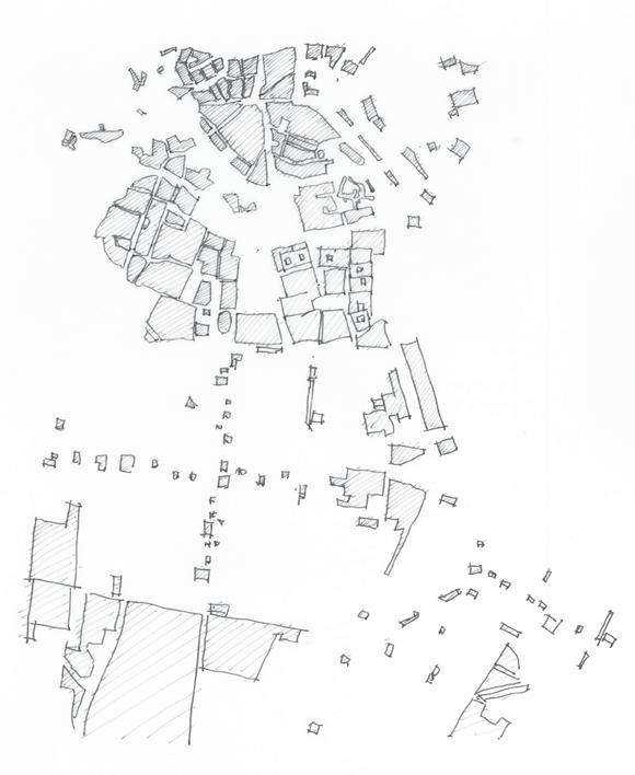
As the network spread, largescale neighborhood development happened in this era. Overall pattern grew inside the urban island patches made from the canals. The patterns also showed Den Helder resembles the garden city and/or sattelite city form with the port and old town as center.
Lesson Learned: Nature and Human-made Interventions
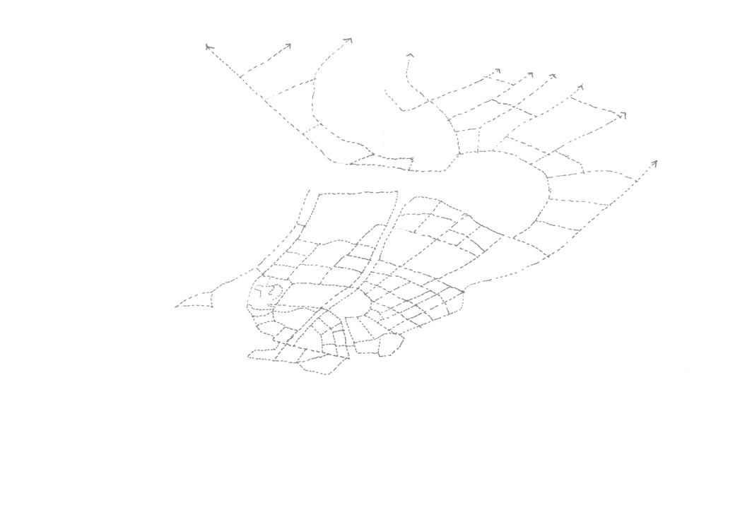
Historical Evolution Layer6 Layer 5 Layer4 Layer3 Layer2 Layer1 Railways Den Helder copy Water Den Helder copy cbs wijk 2021 niet gegeneraliseerd
Historical Evolution Layer6 Layer 5 Layer4 Layer3 Layer2 Layer1 Railways Den Helder copy Water Den Helder copy cbs wijk 2021 niet gegeneraliseerd
The maps illustrate how humans and nature alter the island. Through time, the island become smaller, the island-like part in the inner area slowly covered become flatlands, and the defence line create canals to Amsterdam. 1926-1950 1951-1975 1976-2000 2001-2022 1900-1925 Water
Historical Evolution Layer6 Layer 5 Layer4 Layer3 Layer2 Layer1 Railways Den Helder copy Water Den Helder copy cbs wijk 2021 niet gegeneraliseerd
Historical Evolution Layer6 Layer 5 Layer4 Layer3 Layer2 Layer1 Railways Den Helder copy Water Den Helder copy cbs wijk 2021 niet gegeneraliseerd
Historical Evolution Layer6 Layer 5 Layer4 Layer3 Layer2 Layer1 Railways Den Helder copy Water Den Helder copy cbs wijk 2021 niet gegeneraliseerd
Historical Evolution Layer6 Layer 5 Layer4 Layer3 Layer2 Layer1 Railways Den Helder copy Water Den Helder copy cbs wijk 2021 niet gegeneraliseerd
Before 1900 Railway
0 1 2 km N
Historical Evolution Layer6 Layer 5 Layer4 Layer3 Layer2 Layer1 Railways Den Helder copy Water Den Helder copy cbs wijk 2021 niet gegeneraliseerd
Historical Evolution Layer 5 Layer4 Layer3 Layer2 Layer1 Railways Den Helder copy Water Den Helder copy cbs wijk 2021 niet gegeneraliseerd
To Amsterdam To Amsterdam To AmsterdamRising Seawater: Adaptive Guiding Theme
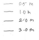
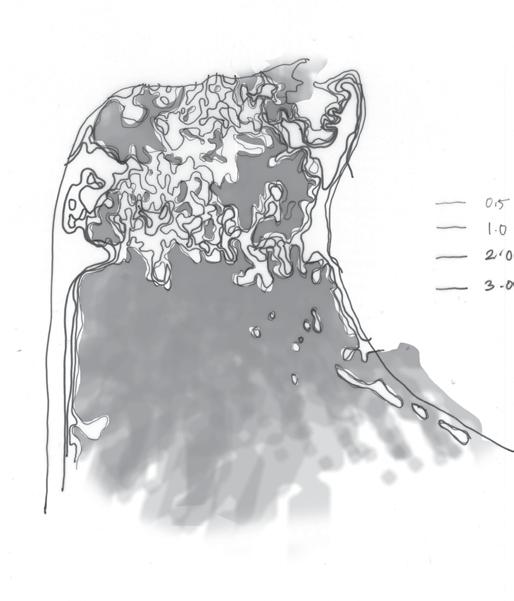
As global warming and climate crisis awareness risen, we face a great challenge with the seawater rises. It is projected that we will deal with an extreme 3 meters height of sea level rise. It is important to note that most parts of the Netherlands were below sea level. Therefore, significant research and idea development are desired.
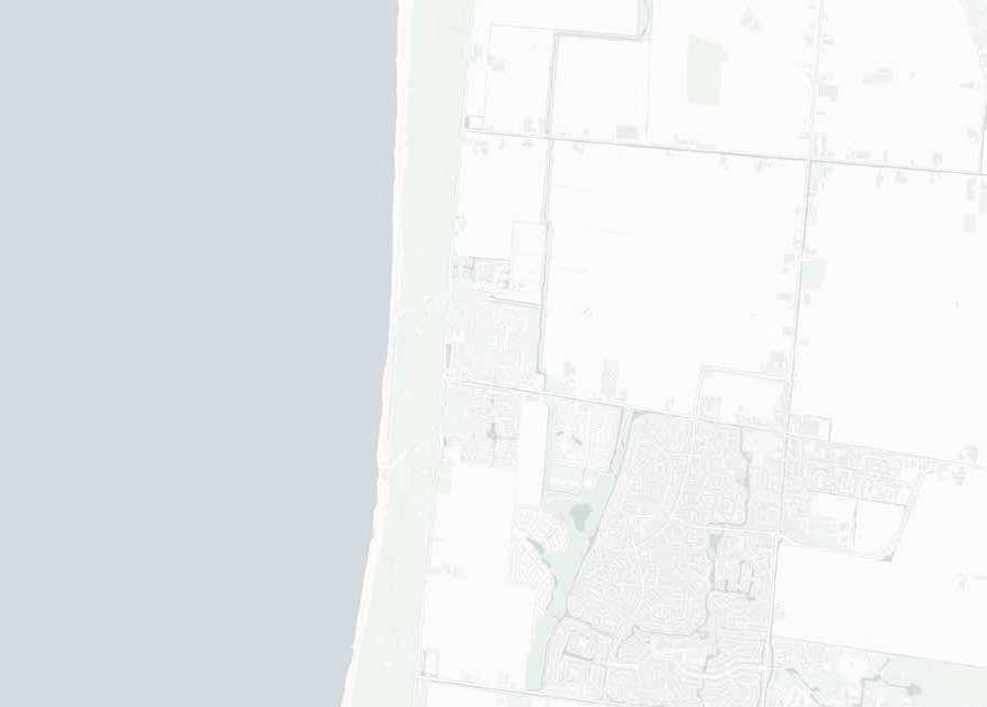
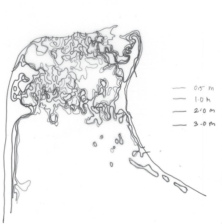
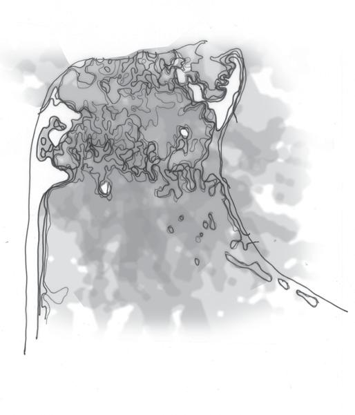
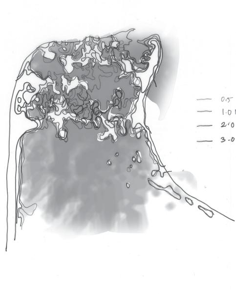
Den Helder mostly has flat lands with the same level as the sea, protected by dikes and dunes surrounding it. From the projections below, we must take note of the sea rise scenario between 50cm to 100cm as the most significant phase to develop solutions before everything is flooded.
The municipality of Den Helder consists of the following cities, towns, villages and/or districts. It also coexist with the Naval Base. To face this challenge, learning from the historical development of Den Helder, from defending, surviving, and adapting, we will retrace the journey of adaptability as a tool to face the 2100 rising sea water challenge.
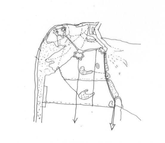
To continue my intention to prevent and adapt to the sea level rise, I collected ideas from normative to extreme examples I found. Firstly, it comes from the story of Noah’s ark, a gigantic boat to save the life from a huge flood. Floating structure and land reclamation. Looking back to nature, we have powerful mangrove protection to break the sea waves, then we have a sponge that is structurally firm with water inside, and then ultimately the spider web that collects the dews. Spider web reminds me of city forms, collective networks filled with different functions.
What if.. the voids and corridors act as seawater-rise adaptive machines?
Den Helder 2100: Live with Water
Defense mechanism: Lighthouse, dikes, inner dikes.
Adaptive mechanism: Settled in various nature land structure
50 cm 100cm 300cm
Den Helder 2100: Live with Water
Rising Seawater: Learning Through Urban Form
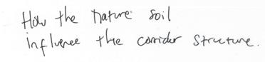
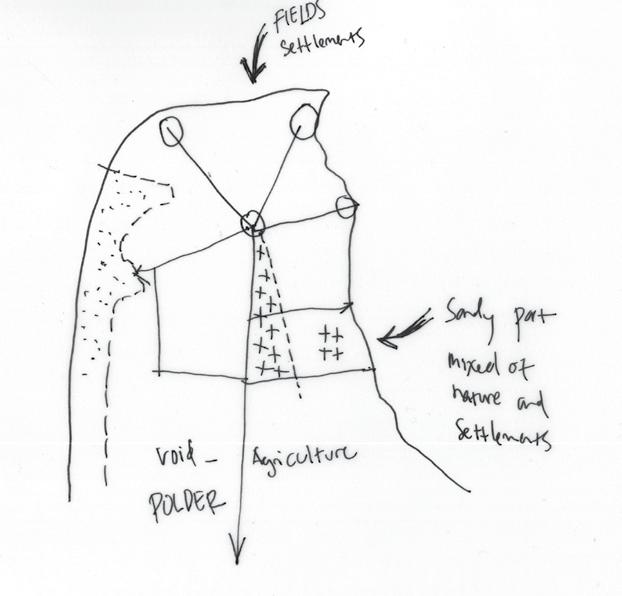
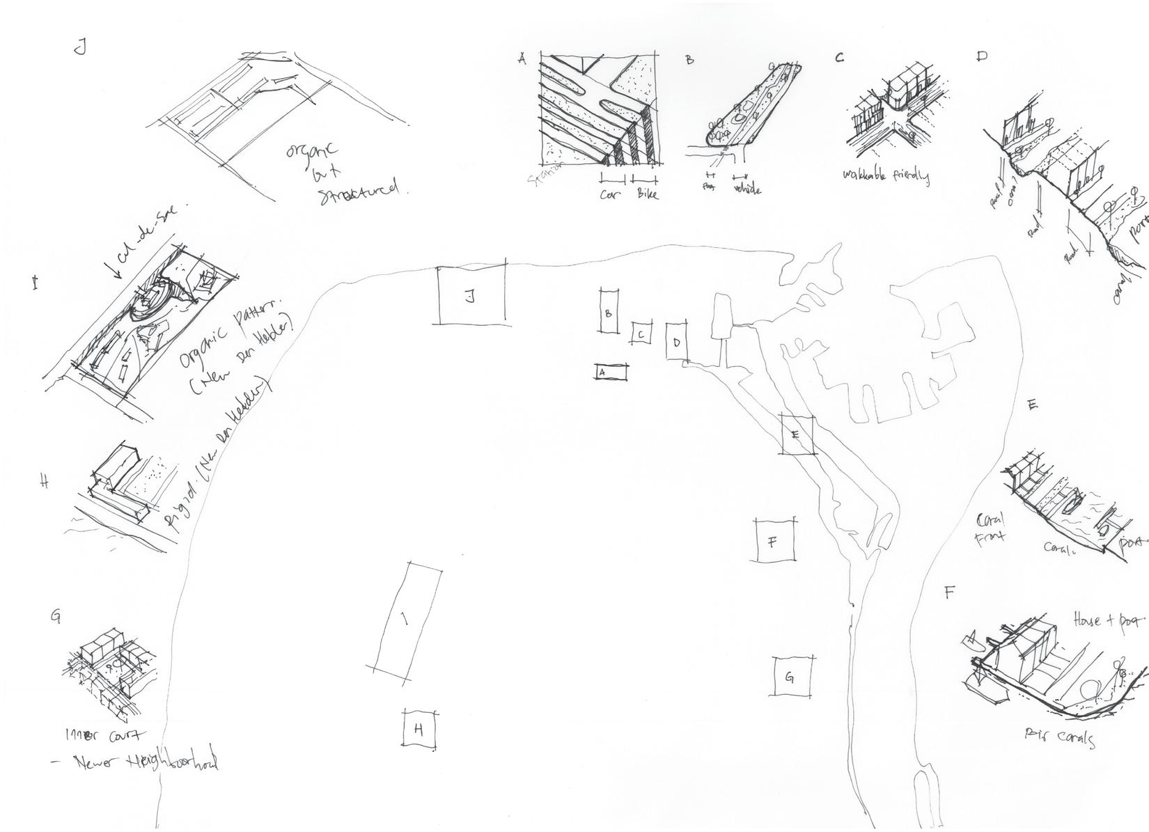
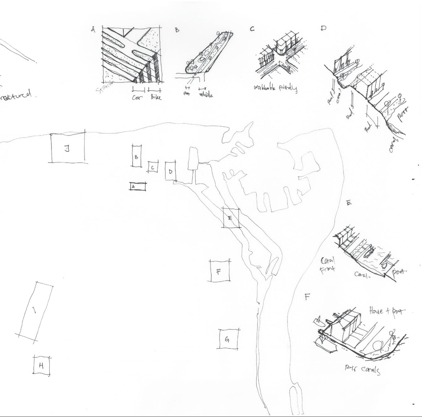
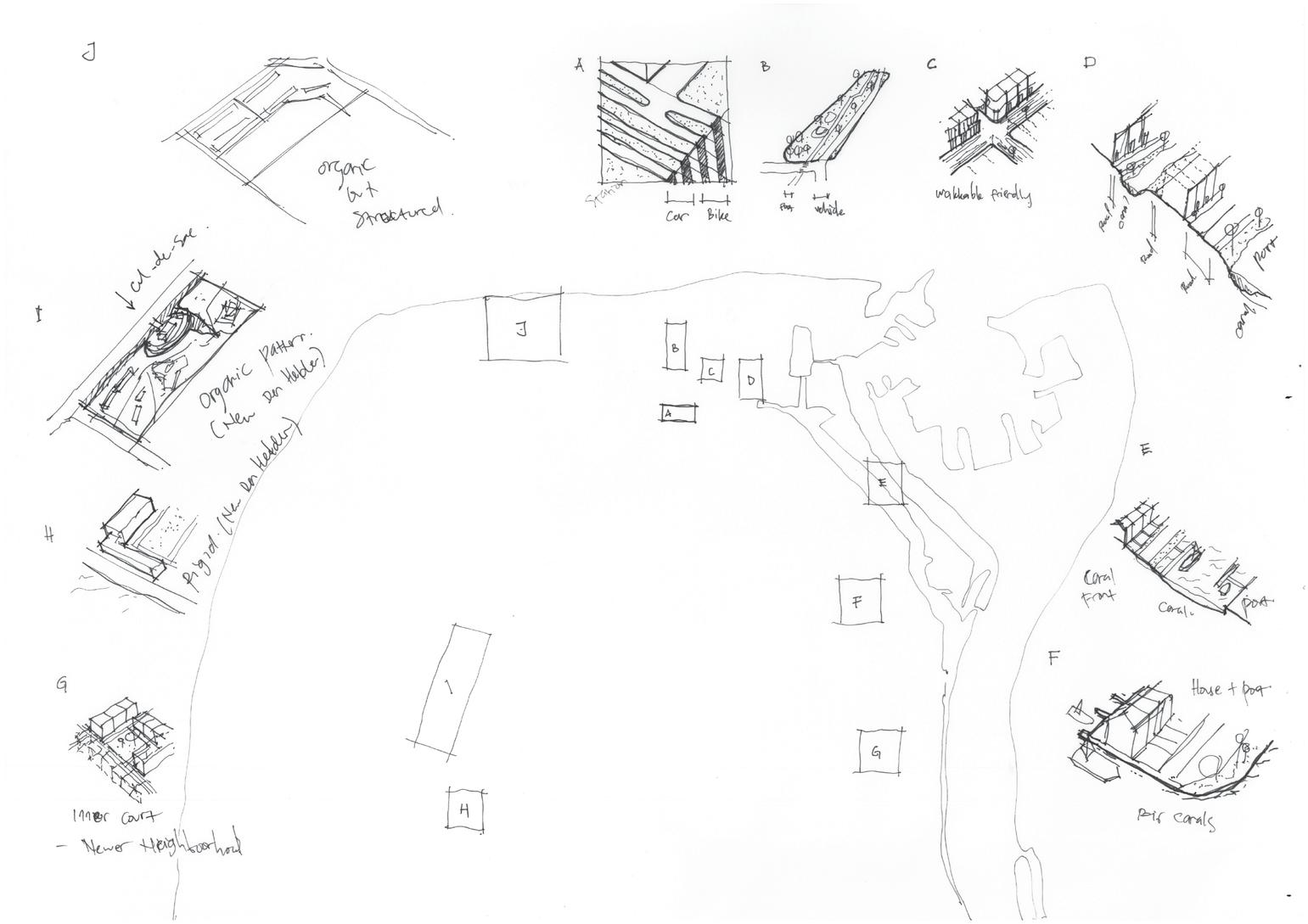
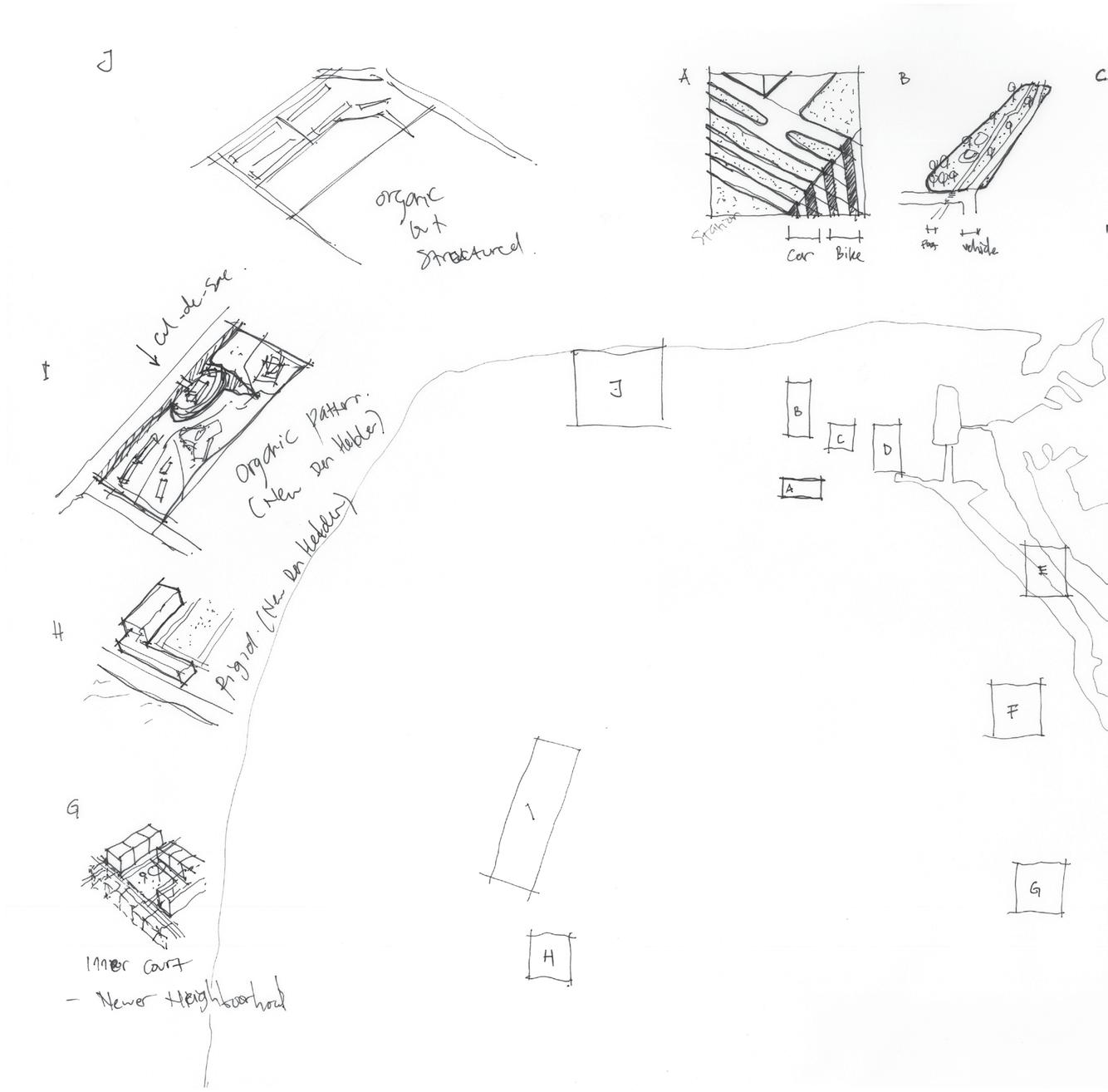
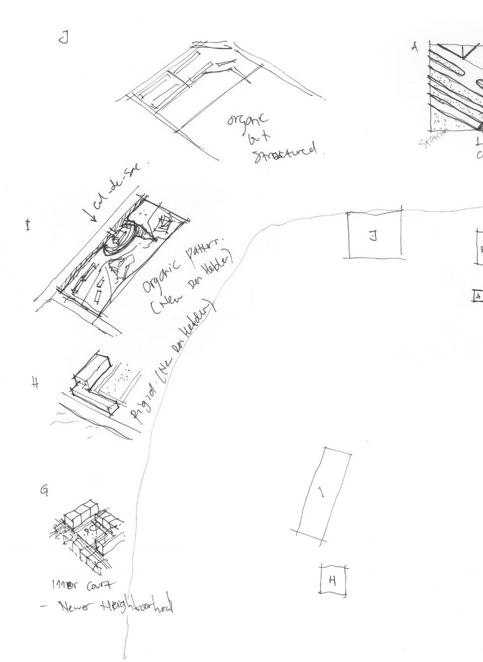
Finding a proper solution to sea level rise is yet challenging. We can predict, but we cannot fully understand how the sea level rise will impact the city as a whole. It takes a thousand years to determine the real impact. However, I do believe a collection of small ideas will improve each other and lead us to the right decision in situations we face. I always believe it is better to prevent rather than to cure, like an old man always said, “bring an umbrella before getting rain”. Therefore, a preventive theme is more desirable to me, personally. From historical research of the Den Helder development, I see the pattern of the following nature first, then settlement could build after. In between, there are infrastructures, which was the corridors. That later filling the city with center and its surrounding.
In the architectonic expression. We can see normative pattern that consist of neighborhood form filling the corridors and later corridor that built the settlement floating in the water.

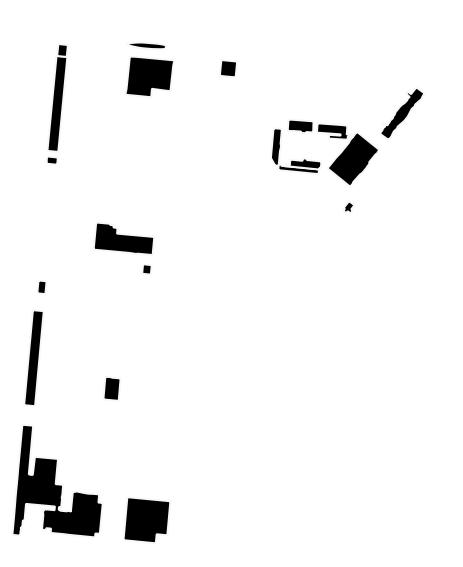
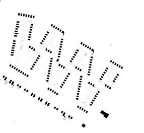
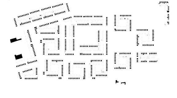

 Building Patches (except residential)
Den Helder 2100: Live with Water
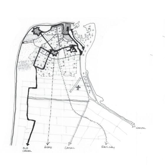
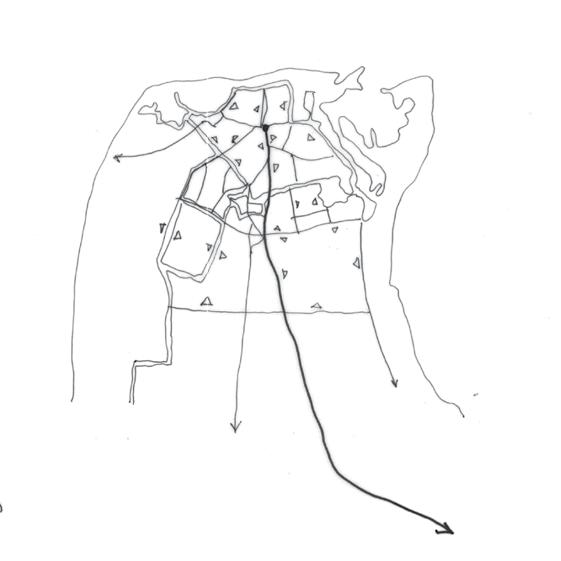
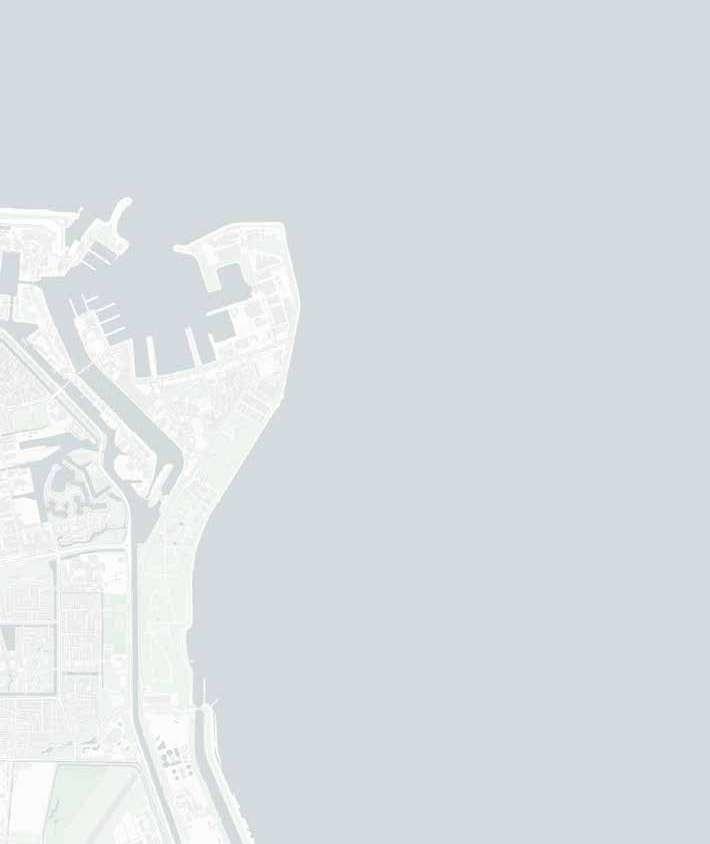
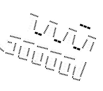
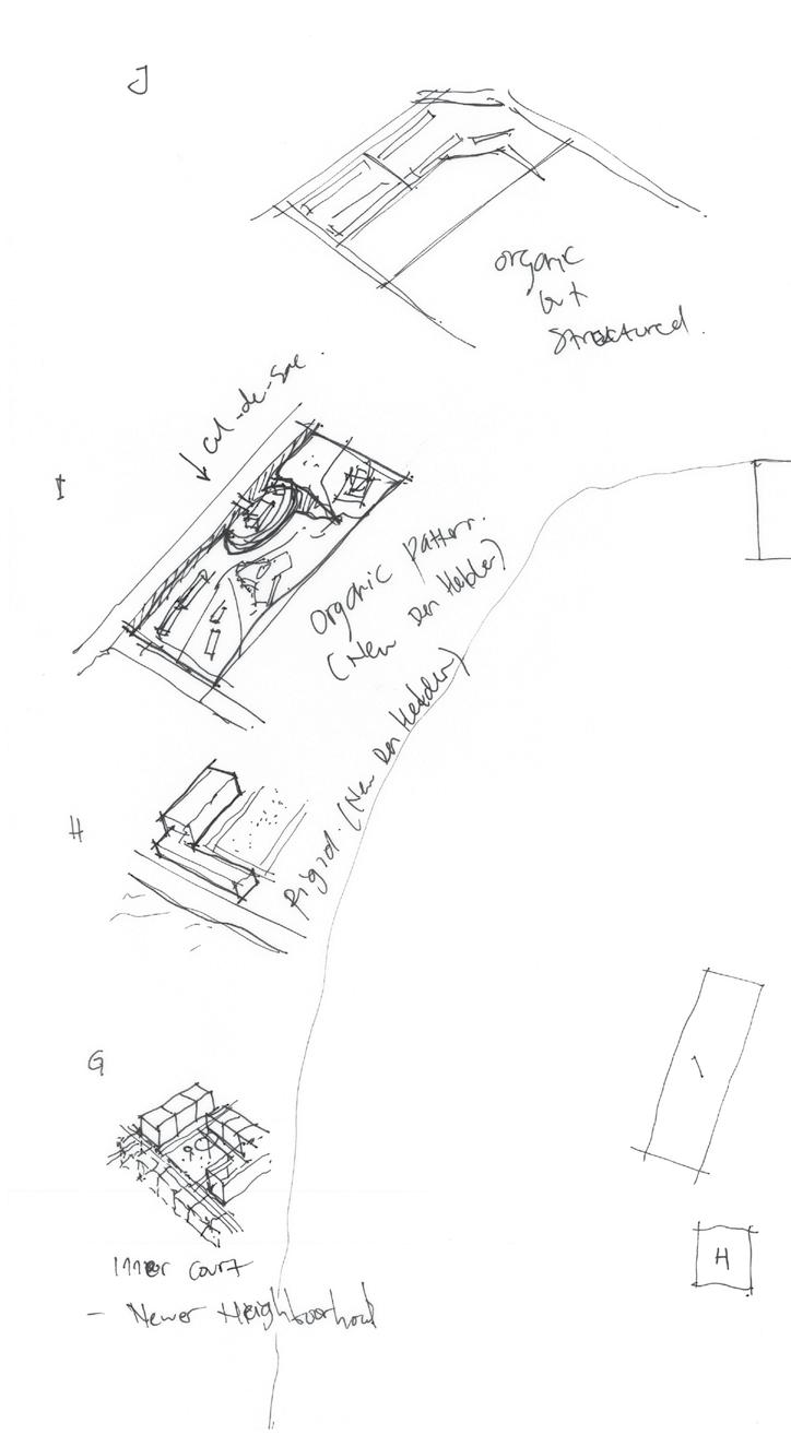
Corridor lines were influential actors in the development of Den Helder. Started with defence lines, and canals, and then the road was built. People mostly use private vehicles as the main transportation mode rather than public line since the residential area is scattered. Canals used to be dominant, but since the vehicular era came, it was not likely to be used within the city. However, the port is still functioning well.
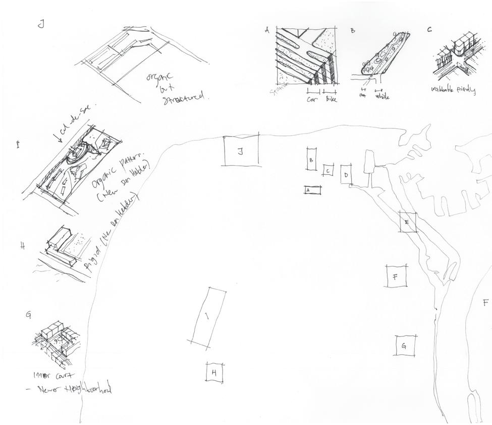
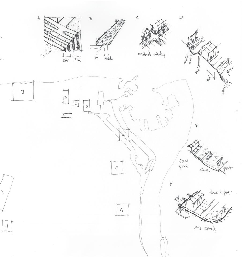
There are four patterns of the corridor in Den Helder, namely the defence line, centralised, organic, and linear. Each typology composes the tree-like form with the linear corridor as the trunk.
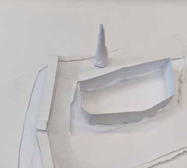
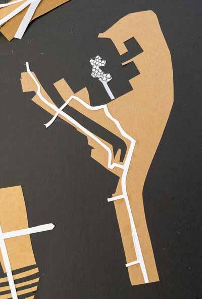
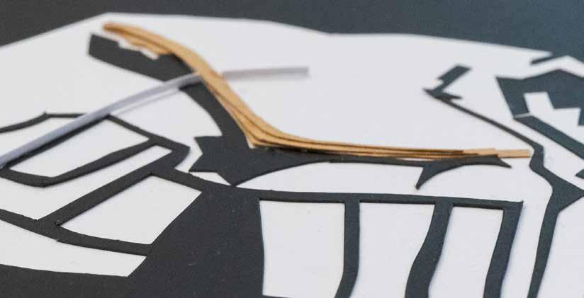
Mockup Exploration
The mockups illustrates the development of built-form and design possibilities of using water patches and corridor as adaptive mechanism.
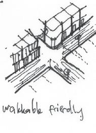
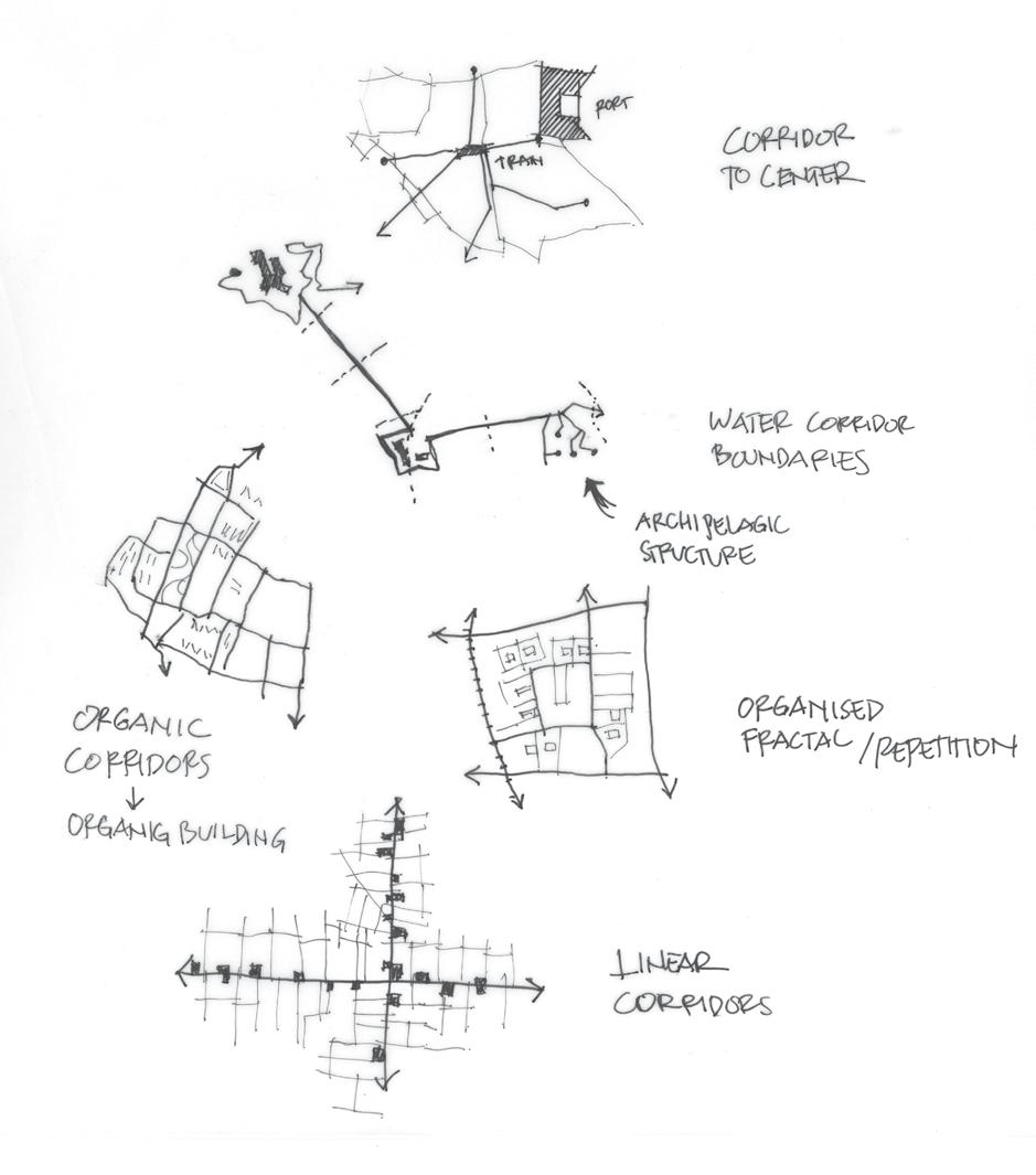
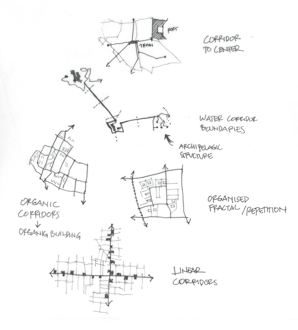
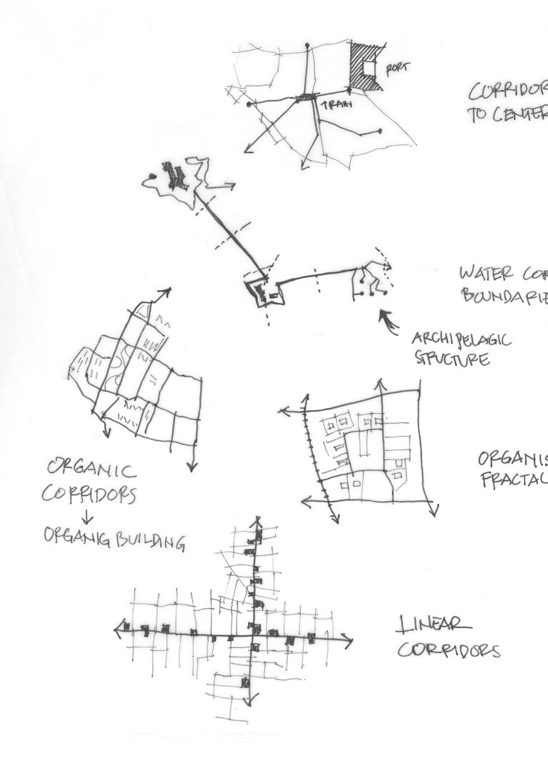
Looking more into the details, though private vehicle mode is more desirable, it does not rule out the possibility of making the city open. Distributed attractions are still in linear lines, and approachable. The centrum is also walkable and has great access because of its strategic location, which is also close to the old port, the Wilemsoord. Experimenting with architectural features in newer parts also breakthrough the regular pattern of connectivity, bringing nature close to the habitat.


Den Helder 2100: Live with Water
How Can We Live with Water: Design Perspective
This comes to our great question for the whole project, how will Den Helder survive the 3-meter sea rise? Based on the analyses we went through, it is important to note the early phase of sea level rise is crucial. We should be ready whenever the sea water is rising. It is always easy to just protect it with big dikes like a castle, however, it would not stand for long. Why we must adapt to it because we cannot prevent future and worse scenarios might happen. By learning about the natural ecosystem, we can give and introduce water to the city just like Den Helder used to be. Enhancing its cultural potential, establish economic and societal effects through the adaptability of the city.
Therefore, I divide the development into three phases. The first phase is to invite the island nearby to have a greater defence on a national scale while preparing the infrastructure of creating barriers and buffer zones for water to come through. The second phase, when the rising sea level reached one meter. We have to survive to the next level of 2 meters rising by creating a buffer corridor to guide the water to the right spot. Create more absorption land and water lines. And finally, in the third phase, the extreme scenario might happen, we have to adapt to upcoming water that comes to the city. From city scale to architecture scale. Work together, digging more room for the water, more corridors, and lifting the building. To allow more biodiversification on the land live.
Principal idea on how water will be distributed evenly through the city.


Den Helder 2100: Live with Water
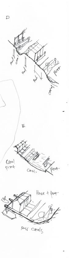
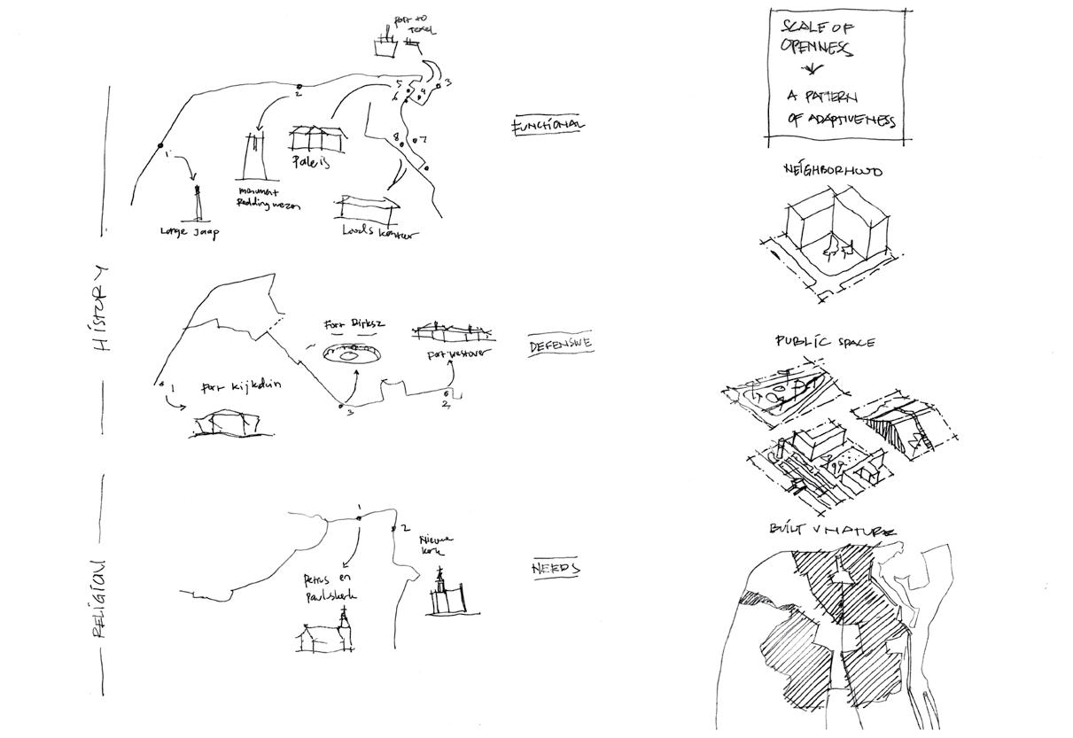
Adaptability Tools
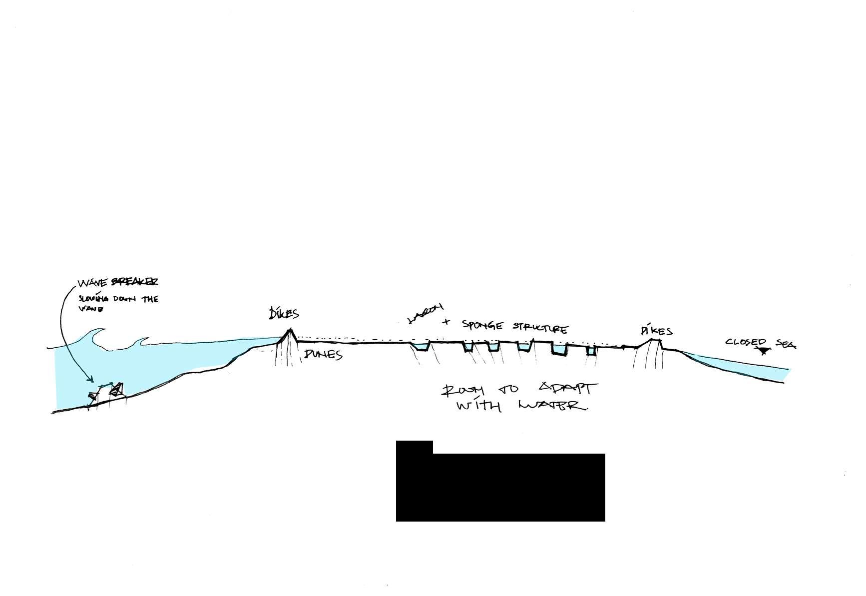
The design perspective should further inviting more ideas on how to realise it in a real case. In the section below, we can see that Den Helder is already defended by the dikes. But the water is projected to flor from the inner island part of the Netherlands. The adaptive tools illustrate the city of sponge. Having porous surfaces as well as a solid features to keep it firm and stable.
In this case, I explored on a neighbourhood scale the implementation of the ideas. Nevertheless, I keep the structure open, therefore more possibilities are allowed.

Den Helder 2100: Live with Water
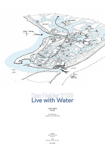
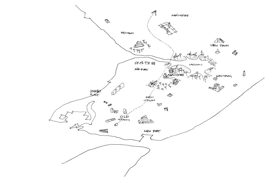
Imagining Den Helder 2100
Let us imagine what Den Helder will be in 2100. The world will be going through an enormous climate crisis which will be made the sea level rise. Netherlands’ low lands, were especially impacted at most. Den Helder, at the top of the coast, will accept water from the south and try to live with it. We might hope it will not happen, but we should prepare for the worst, just in case.

After the sea level rises, we have to cope with water everywhere. Embrace it. Water will be a catalyst for further technological advancement, such as amphibious transportation modes. It is hard to decide which one should be protected or leave it to the floods. With consideration, Den Helder will protect its oldest part and try to make the other area adapt. The oldest parts mainly act as economic boosters because of their valuable historical artefacts. Roads rise to allow more water to flow. Island established and protects what is inside by extending porous buffer zones. And agriculture is adapting to new technology, allowing more production with limited land, allowing the soil to regenerate itself to its natural state.

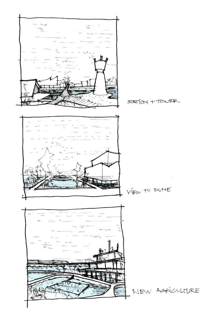
Rail Station and Water Toren surrounded by hybrid landscapes
Adaptive lifted housing in the residential neighborhood New-kind of agriculture, intertwined with water-based farming ecosystem
Den Helder 2100: Live with Water
Synthesized Three Structure Plan
To come to a unified structure plan as a group, the first step was to draw simplified diagrams of our individual plans and overlay those to see the spatial similarities and differences, while discussing our thematic approaches. All three of us dealt with the rising sea level through managed flooding by partially protecting the land, though in different ways. Timon let the water in from the east, converting a large part of the city into a hybrid area where people would live on the Wadden and sedimentation would guarantee a dynamic landscape, while protecting a portion of the city centre with a new dike. Satria also let the water in from the east, but in a much more controlled way, through a series of locks to guarantee a lower and more controlled water level in a network of new canals. Tomas, like Satria, also opted to strengthen the eastern dike, bundling the railway, road and dike as one wall to protect both the city and the hinterland. Tomas and Timon both placed a dike around the old city centre (albeit in different places) and gave the military port a new function (albeit in a very different way).
We could then look at taking the best ideas from our three plans and fit them together into one common structure plan. As a starting point we took the canals of Satria with the flooding and dynamic sedimentation of Timon, the transformation of the port area from Tomas. From that, a new vision formed.
Thomas’s idea to strengthen the eastern dike, bundling the railway, road and dike as one wall to protect both the city and the hinterland.
Timon’s idea to let the water in from the east, converting a large part of the city into a hybrid area
Satria’s idea to let the water in from the east, but in a much more controlled way, through a series of locks
Conflict overlayered map, shows the intersection between the three perspectives.
Den Helder 2100: Live with Water
Helder 2100
Integrating the city and the port with water through adaptation and embracing the dynamic landscape.
For centuries we have protected and hardened our coast as a way to deal with and defend ourselves from water. Instead of trying to maintain this one hard line of defense between the domain of humans and that of water, we shift into a new paradigm in which we live with the water in a more integrated way.
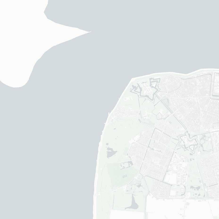
In our extreme scenario the sea-level will have risen by 3 metres in 2050. Den Helder, with its location on the tip of Noord-Holland and the south-western starting point of the Wadden sea, provides an ideal testbed for this new way of achieving flood resilience rather than just flood resistance, while future-proofing Den Helder’s economy and embracing its character as part of the wadden islands.
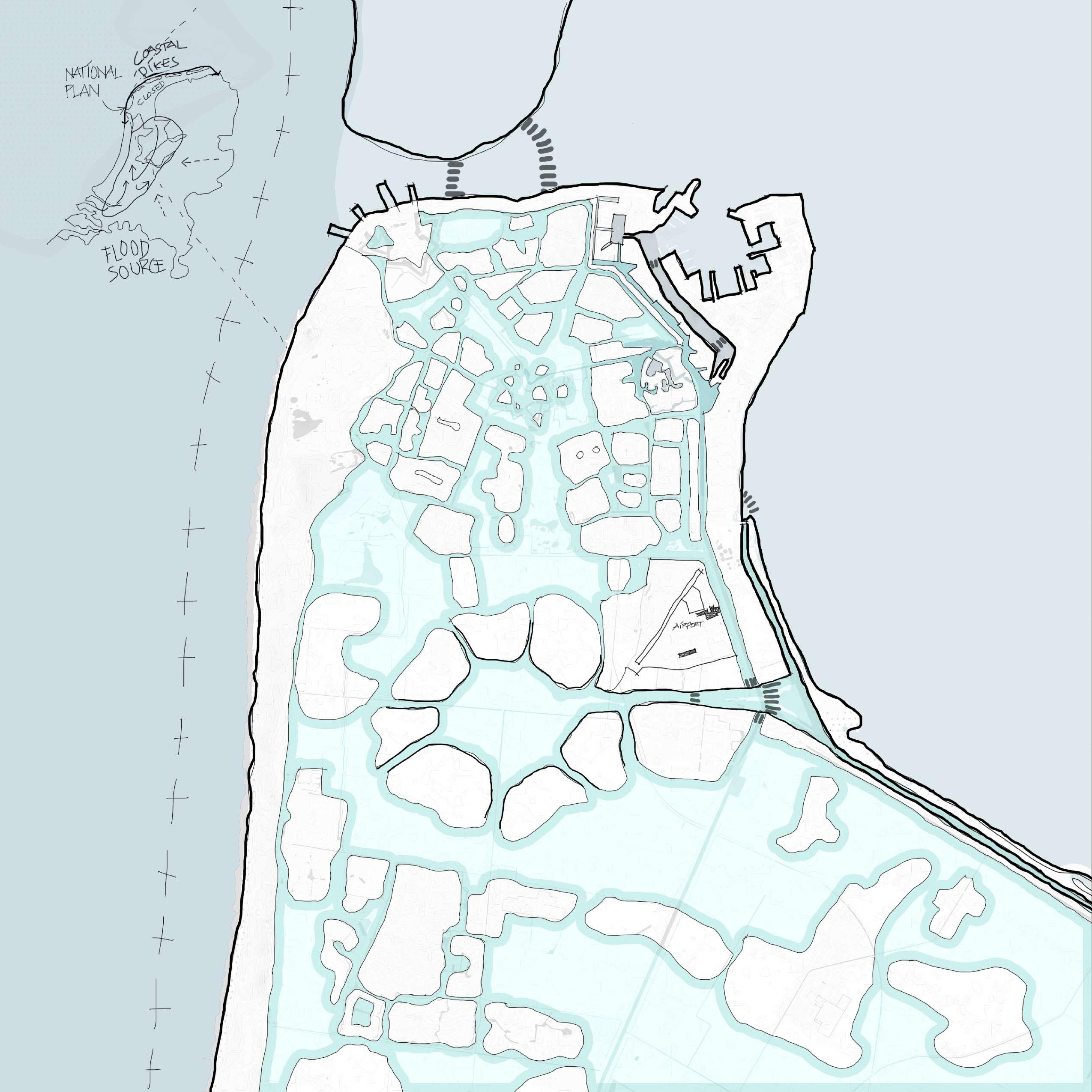
The old city centre can be protected from flooding by repurposing the fortification line around Den Helder to create a new dike. Around the forts this can look like a regular sea-dike, but the linear parts can be a green ribbon, a park that is accessible and forms a destination for people to go rather than just a wall that separates. On the eastern side this park is connected to the port-area. The dike here, which nowadays carries a road and has no connection with the buildings on either side, can be widened, heightened, and transformed into a multi-use area and become a part of the city.
In a future where we have to deal with climate crisis, the military will play a much smaller role, and the military harbour area can be home to a variety of new industries. The dike to the south of the industrial area will not be strengthened and in time the water will break come in from this side, flooding a large part of the land. In the newer parts of Den Helder to the south of the fortifications many new canals are dug in preparation for this, so a large amount of water can move through this area easily, while the new islands in-between can be elevated using the soil from the new waterways. This area would facilitate a much more adaptive way of living with the water, as these new canals also play a large role in the transportation around this area. A new transit line connects the island structure from the redeveloped port in the east to a new train station in the west. The railway, along with a road, is moved to the dune strip in east, and forms the sole land connection of Den Helder to the south. This will also enable a strengthening of this dune area.
While a large portion of land to the south of Den Helder will flood, this will also bring in new sedimentation, resulting in a dynamic landscape that will also grow the land in some areas over time. Along the new railway new settlements can form, and through enabling and working with sedimentation, the land around these settlements can grow.
residential / commercial areas mixed areas
industrial areas
park - dike dunes hard dike road railway transit route
The synthesised design perspectives address the extreme climate change of three meter sea rises where some of dikes unable to hold the water flow and make areas flooded. However, eventually the flooded area will be sedimented naturally. Whereas, the adaptive and protected scenario will survive some parts of the island.
Den Helder 2100: Live with Water
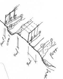
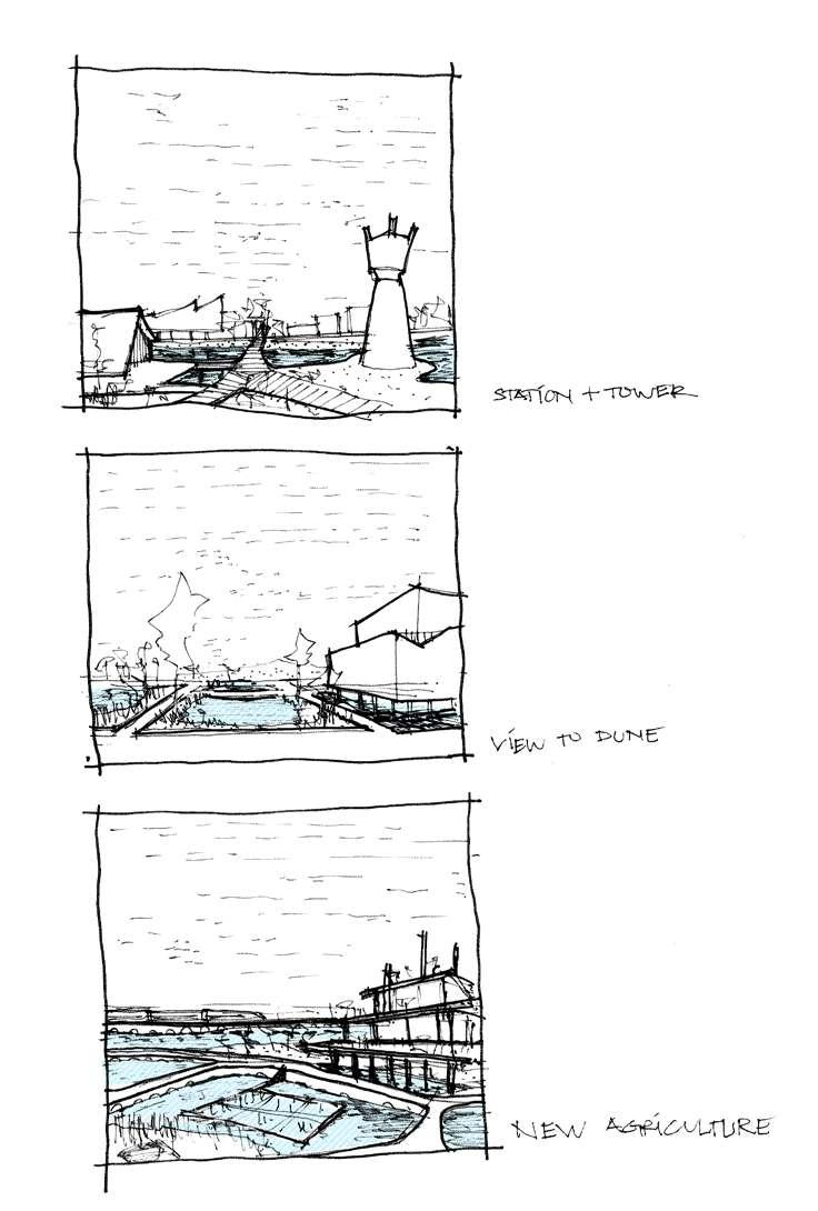
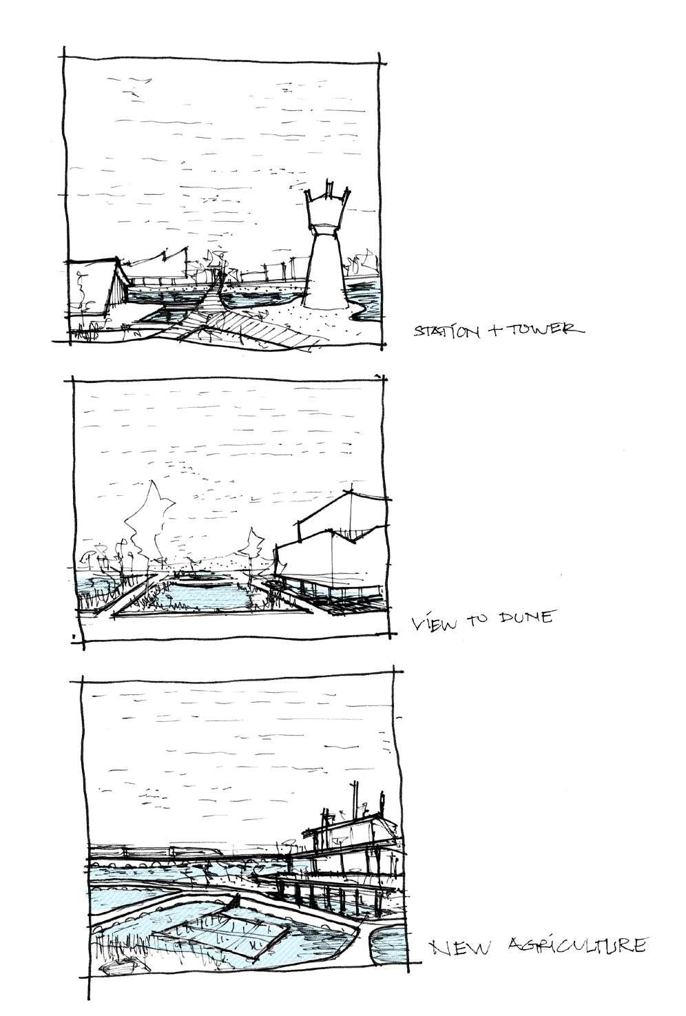
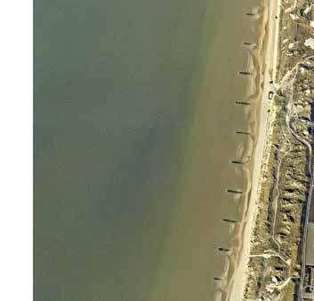
Adaptation – Salt marshes catch sediment and heighten the ground
The Dunes
The heightened dunes and dikes along the coast of the Netherlands play significant roles in protecting the whole area within the dunes, as well as in our scenario. Dunes will be connectors and further development lines surrounding it and a sedimented land will form.
We expect flooding in the areas south of Den Helder. We took a “build with nature” approach and decided to create vast areas of marshland, which will help break the tides and catch sediment carried by the floods. Over the years new beaches will form along the new coastline – the east edge of the existing dunes.
As most of the land south of Den Helder will be flooded, we decided to place the railway and national road leading to Den Helder on the dudes. Dunes are the most suitable placeholder for national corridors as they will not flood at any point in the scenario, keeping the city connected to other cities along the coasts, the city of Alkmaar, and finally Amsterdam. The railway connection is especially advantageous, and as the sediment builds up and creates new land along these corridors, we expect new developments to form alongside it. The Dune Settlements will live in symbiosis with the rising sea levels and will prove resilient in the uncertain future. They adapt over time as they raise together with the water.
functions functions paved park
Legend:
Salt marsh
Dune / Sand
Train station
Industrial functions Train tracks Road
Railway National road Railway station
Sediment-formed island lines of development
Den Helder 2100: Live with Water
Harbor Areas
The scenario we are working with will inevitably flood a sizeable portion of land in northern Holland. A portion of the population from around Den Helder is expected to lose their homes. Furthermore, agricultural land will flood with salt water, lowering the agricultural potential of the region and causing a food shortage in the country. The Harbor in Den Helder will be well protected against flooding and thus, present a safe haven for new residential, commercial, and industrial activities. We decided to urbanize and integrate these islands, which were previously separated from the city due to military functions, by connecting them to the rest of the city, especially the historical centre.
Legend:
Water
Soft dike
Residential functions
Industrial functions
Public space - paved
Public space - park
Public transport Road
Hard dike
We designed a hard dike, lifting the harbor and creating two distinct levels. The lower level is used by commercial and industrial activities, while the layer above features a bike road and greenery woven into a public space. People can gather and interact in this new “city park”. Transformation of the harbor help the new harbor, previously fenced off to the public, to grow. The New Harbor stands on reclaimed land used primarily for military purposes. We decided to heighten the existing soft dike and create public space and greenery on top of it. Instead of military, The New Harbor will feature residential functions as well as sustainable food industries such as vertical farms, aquaponics, hydroponics, offshore farms, etc. The New harbor will become a futuristic centre – promoting circular economies and serving as a foundation for natural city growth for decades to come.
Connections – the connection to and from the islands is reinforced, increasing the centrality. The Harbor now serves as a “bridge” between the New Harbor and the historical centre.
The New Harbor stands on reclaimed land used primarily for military purposes. We decided to heighten the existing soft dike and create public space and greenery on top of it. Instead of military, The New Harbor will feature residential functions as well as sustainable food industries such as vertical farms, aquaponics, hydroponics, offshore farms, etc. The New harbor will become a futuristic centre – promoting circular economies and serving as a foundation for natural city growth for decades to come.
Public space – Doubling the levels allows the harbour to keep its economic significance while also featuring public space bringing in “life”
Protection – Dikes are heightened to future-proof the coastlines in case of an extreme scenario
Zoning – Areas for sustainable industries and commerce are created on the lower level.
Connections – New connections to the rest of the city are created. Joining the identity of the harbour to the city
New Typologies – Integrating the New Harbor with the rest of the city will create a demand for housing on the island. Natural urban growth with varying typologies is expected to take place over the upcoming decades.
Protection – Dikes are heightened to future-proof the coastlines in case of an extreme scenario. Soft dikes create parks.
Zoning – areas for sustainable industries, commerce, and residential functions are created, densifying these areas, and providing a shelter for the displaced
Existing road on hard dike
New hard dike creating two levels
Park-dike

The fortifications of the Stelling of Den Helder will have a new role of protecting the city within from water. Placed along the route of the old fortifications, a new dike will be built to protect the old city centre. A hardened dike will outline the recognisable star-shaped fort structures, and in the east, a set of locks will provide access to ships, and form the connection between the dike and the redeveloped military area. I between these nodes the dike will take a different shape, as it will form the basis of an accessible park, with paths meandering though this green ribbon, connecting to various roads on either side. Instead of a separating wall, a border that limits the view, it can be a destination from which to look out over the new flooded and hybrid area to the south. In a few places the ribbon will be intersected by important connections to the adaptive islands to the south, the most important of which is the western bridge, which connects the old city to the new railway station.
Housing new park/dike with paths
flooded areas
hard dike around fort


 Adaptive Island
Sediment Catchment
Preserved Dunes
Huidsduinen
Adaptive Island
Sediment Catchment
Preserved Dunes
Huidsduinen


