3 minute read
locks dike/park

Lifted road to Centrum
SedimentFormedIsland
Advertisement
LiftedRoad +3.00m
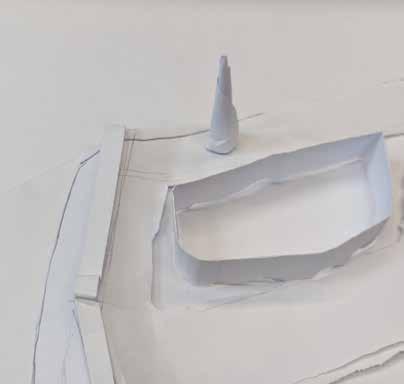
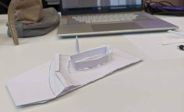
The adaptive islands work as transition machine to allow some part of the patches to become a way for the water flows, evaporates, and be absorbed to become a groundwater catchment. In general, we cannot predict what will happen when the sea level rises. History teaches us how floods will impact buildings and society in an extreme way, spontaneously. What if, we can guide the flood, tame them, and take advantage of it?
Principally, the idea is to create some room for the upcoming water and at the same time protect the buildings with various strategies, such as making a sediment catchment on the ground floor, or radically lifting the buildings and island-like structure. Eventually, the surrounding area will be a buffer zone to hold and reintegrate the relationship with water.
In the neighbourhood scales, the islands will form a network of connectivity, which will integrate one into another. Therefore, distributing the economic centre in each coverage is important. Each centre is aided by transit station and public function, making it open and inclusive.
SedimentFormedIsland
Lifted road to toRail Station island-bu er bup ic/commercialresidential connector ribbon adaptive room for water
SedimentFormedIsland
HybridLiftedBuilding
SedimentFormedIsland
Lifted road to Centrum toRail Station island-bu er bup l ic/commercialresidential
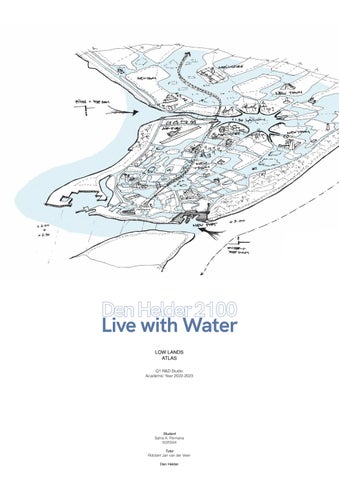
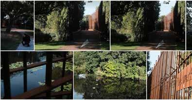
Den Helder 2100: Live with Water
2022RegularBuilding+0.00m
CoveredBuilding+0.50m
SedimentFormedIsland
RegularBuilding
OpenedPlinth WidenedCorridor
Retention Patch +0.50m
RegularBuilding connector ribbon adaptive room for water SedimentFormedIsland
Lifted road to Centrum toRail Station island-bu er bup ic/commercialresidential
SedimentCatchment+3.00m
LiftedRoad +3.00mHybridLiftedBuilding
Retention Patch +0.50m
LiftedRoad +3.00mHybridLiftedBuilding
OpenedPlinth WidenedCorridor 2022Regular 2022WaterCorridor+0.00m
2022Courtyard+0.00m connector ribbon adaptive room for water
RetentionCourtyard+3.00m
ConnectedBuilding+3.00m
SedimentCatchment+3.00m 2022WaterCorridor+0.00m
CoveredBuilding+0.50m
2022Courtyard+0.00m 2022RegularBuilding+0.00m
LiftedRoad +3.00mHybridLiftedBuilding ConnectedBuilding+3.00m
SedimentCatchment+3.00m
+0.50mWidenedCorridor
Urban Form
Design
2022RegularBuilding+0.00m
CoveredBuilding+0.50m
2022Courtyard+0.00m
RetentionCourtyard+3.00m
Den Helder 2100: Live with Water
Integrating the city and the port with water through adaptation and embracing the dynamic landscape.
Helder 2100
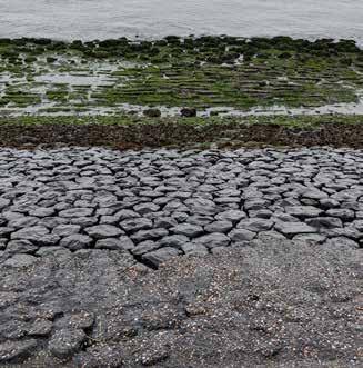
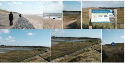
In our extreme scenario the sea-level will have risen by 3 metres in 2050. Den Helder, with its location on the tip of Noord-Holland and the southwestern starting point of the Wadden sea, provides an ideal testbed for this new way of achieving flood resilience rather than just flood resistance, while future-proofing Den Helder’s economy and embracing its character as part of the Wadden islands.
While a large portion of land to the south of Den Helder will flood, this will also bring in new sedimentation, resulting in a dynamic landscape that will also grow the land in some areas over time. Along the new railway new settlements can form, and through enabling and working with sedimentation, the land around these settlements can grow.
Den Helder 2100: Live with Water
Reflective Conclusion: Towards Urbanism Scales
Shifting perspective from architecture to urban scale is challenging for me. In architecture, I used to work with detailed scales to create poetry space yet simple and effective. Here, in urbanism, urban scale works toward different scales and people. One thing impacts another, like a network. Through this 10-week process of understanding the grammar of urban forms, such as lines, patches, boundaries, and mosaics, I realised how we must compose and create life within. Not only about humans but also about ecological, economic, cultural, and societal aspects.
Complexities in contemporary cities are in dire need of interdisciplinary work, and as urbanists see the whole thing is a framework to adapt the city to the evolving landscape. Unravel the forms, encompassing political, ecological, economic, and social aspects, to weave the boundaries and ribbons of the city. Noting the interactions of movements, scales, networks, and spaces makes it open and inclusive.
Working with the lowlands, therefore, finding a state where heterotopia terms live. Heterotopia is a dynamic and balanced system, constantly changing. A state between utopic and dystopian scenarios might happen. As global warming and climate crisis awareness risen, we face a significant challenge with the seawater rises. It is projected that we will deal with an extreme 3 meters height of sea level rise. It is important to note that most parts of the Netherlands were below sea level. Therefore, significant research and idea development are desired.
I see urbanism as a catalyst. A catalyst to reform and reintegrate the built environment issues, which weaved through scales, aided with awareness of creative and balanced minds.
Maps
3D BAG by tudelft3d https://3dbag.nl
PDOK https://www.pdok.nl/
Actueel Hoogtebestand Nederland https://www.ahn.nl/ahn-viewer
Old Maps Online https://www.oldmapsonline.org/
Datas
Stelling Den Helder https://stellingdenhelder.nl/
Images
All Saints’ Flood (1570)
Drawing
Regional Archives Alkmaar https://www.regionaalarchiefalkmaar.nl/