
Sahil Kadiwar PORTFOLIO
Nexus Click Future Forward CMR Contents Click
Neo - Connect Miscellaneous Click Click Agrogenesis Click Art-Scape Click

Calgary Metropolitian Region: Canada
Academic : Group (Strategy and Policy Making, Presentation) : 2023
Professor: Liisa Tipman, Jamal Ramjohn
The project focuses on updating the Growth Plan for the Calgary Metropolitan Region (CMR). Through comprehensive analysis, it identifies key qualityof-life elements essential for regional prosperity, addressing risks and vulnerability. The proposed strategies prioritize diverse housing, strategic infill development, and enhanced transit systems, aiming to create more sustainable and connected region. By implementing the policies under these strategies, the project seeks to achieve a future-forward vision for CMR, fostering economic growth, social equity, and environmental sustainability. Overall, it represents a holistic approach to urban planning aimed at ensuring the long-term well-being and resilience of the region.

CMRB’s Vision:
“Building on thousands of years of history, we welcome everyone to join us in living happy, healthy and prosperous lives in a spectacular natural environment. We are a world leading region built on hard work, resilience, helping others and a deep respect for nature. We use our land wisely, share our services and care for our wildlife, air and water. We grow together.”


Current Population: 1.57 Million People

50 Years Projected: 3 Million People
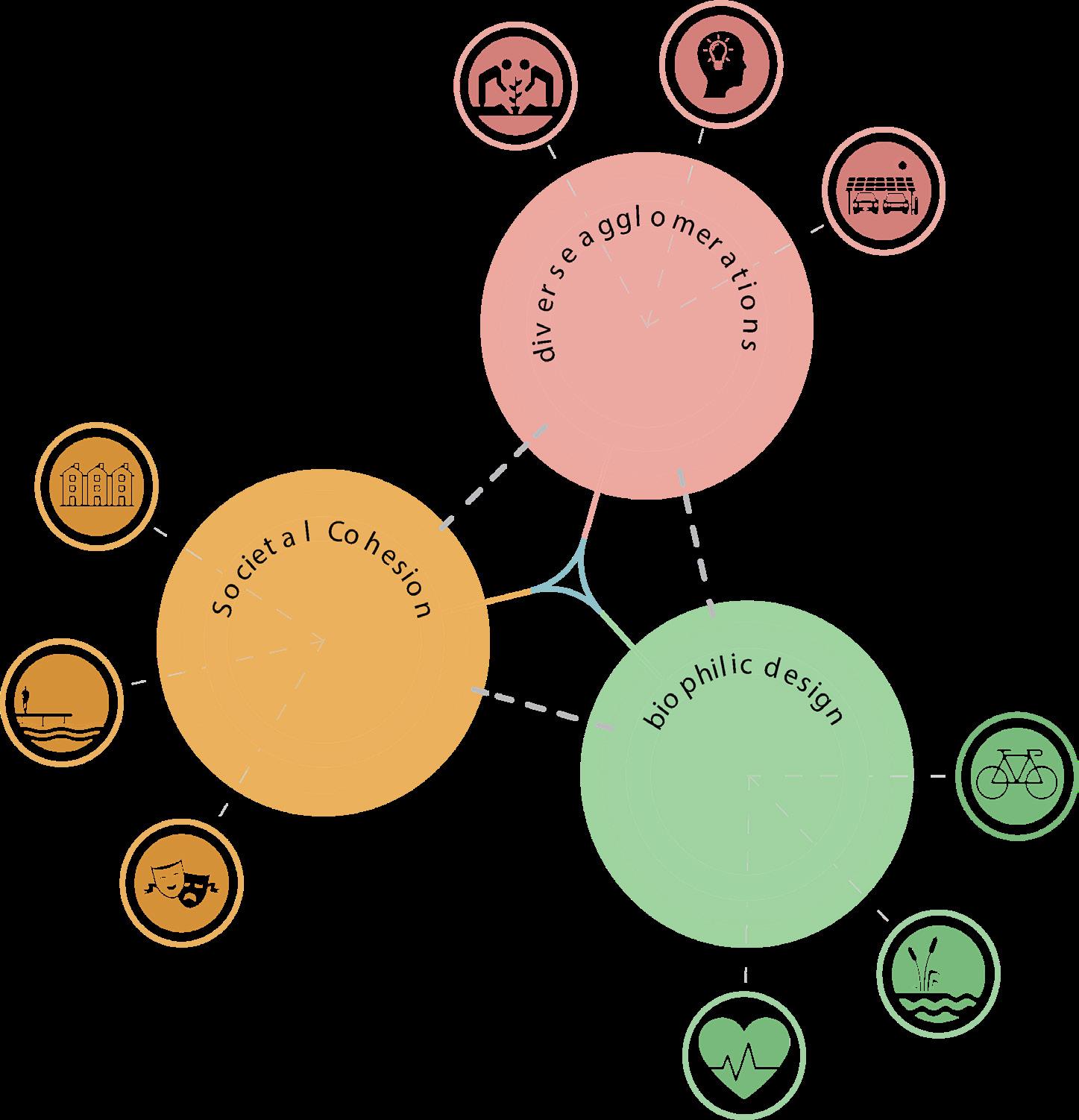
Healthy And Equitable Region
Prosperous And Safe Region
Resilient And
Connected Region

Indicator Local Food Accessibility

Housing Options for all
Connected Mobility Options
R3-V2
R3 R3-V1
R2-V3
R1
R3-V3
R1-V1

R2-V2
R1
R1-V1
R1-V2
R1-V3
- Evolving Needs of Housing Types - Lack of Diverse Housing Types - Rise in Immigration - Housing Price and Annual Income
R2-V3
- User Preference - Lack of Public Transportation Options - Suburban Greenfield Development - Maintenance and Infrastructure Costs
R1-V2
R2
R2-V1
R1-V3
R3
R3-V1
R3-V2
R3-V3
- Draught - Lack of Diverse Agriculture Practice - Change in Demand for Food - Ageing of Farmers


Strategy 1: Mixed-Use and Housing Diversity
Provide diverse housing options to cater to evolving population needs by implementing location appropriate density targets and mixed use land zoning.
Strategy 2: Infill Development
Develop denser communities within existing fabric by implementing strategic infill development.
Strategy 3: Transit Ridership
Increase the transit ridership to make public transit a more efficient alternative to private automobiles by improving the current user experience.
Strategy 4: Increase Housing Supply
Improve the overall efficiency of bringing new housing to the market that addresses evolving population needs by incorporating technology for the approval and construction process.
Strategy 5: Modern Technology in Agriculture
Implement a holistic approach aimed at advancing local agriculture by promoting the adoption of modern technology and fostering a culture of ongoing research and knowledge-sharing.
Suburban Development UnaffordabilitySuper Strategy: Doing More With Less Density Design Mixed-use
Strategy 3: Transit Ridership

Synthesis Scenario

Time
Policy 1: Frequency
The CMRB shall collaborate with member municipalities’ transportation providers to increase the number of transit fleet accommodating higher demand during peak hours.
Short Term 2 - 5 Yrs

Improved Peak Hour Service
Outcomes

Increased Ridership

Increased Transit Revenue
Municipalities shall change the travel times by:
- Adopting Transit signal priority along transit routes such that travel time for public transit is reduced by 15%
- Incorporating applicable landscape and road design strategies to reduce single passenger vehicle speed by 15-25%
Policy 3: Parking
Member municipalities shall reduce private car trips in the area of high transit connectivity by:
- Increasing parking prices.
- Eliminating parking minimums in local zoning bylaws.
All member municipalities and private transit service providers shall ensure a secure and efficient transit experience by implementing safety measures, including but not limited to, surveillance, communication, and emergency response systems


-


 - Reduction in transit travel time
Increase in canopy area on specified routes.
-
- Reduction in transit travel time
Increase in canopy area on specified routes.
-
Shaganappi Golf-course: Canada
Academic : Group (Concept Development, Presentation) : 2023
Professor: Teresa G, Joseli M, Justin B.

Nexus is a comprehensive and fulfilled community for the next us. Designed to reflect the relationship between nodes and the intricate connections between them, Nexus incorporates density, sustainability, and innovation to reflect the future of urban design. Within Nexus, you will experience capacious and high-quality park spaces, pleasant multi-modal streetscapes, and vibrant economic and social hubs. Through our networks we achieve a sustainable and accessible community with long lasting connections between people and places.


Mending the communities by redesigning Bow Trail

Establishing greens spaces in the community

Creating multi-modal connectivity network
 Nex-Ag
Nex-Change
Nex-Together
Nex-Seed
Nex-Rec
Nex-Art
Nex-Ag
Nex-Change
Nex-Together
Nex-Seed
Nex-Rec
Nex-Art


 Establishing Vehicular Circulation
Zoning
Visual Connections
Connecting Green Spaces
Innovation District for Tomorrow
Establishing Vehicular Circulation
Zoning
Visual Connections
Connecting Green Spaces
Innovation District for Tomorrow

Legend:
1. Commercial Mixed-use
2. Public Art Plaza
3. Commercial Mixed-use
4. Exhibition area
5. Experience Center
6. Incubator
7. Hotel
8. Westbrook LRT Station
9. Live Work Units
10. Cinema
11. Commercial Mixed-use
12. Existing Library
13. Food Truck Arena
14. Mid-Day Break Area
15. Multi-use Parkade


North Charleston: US
ULI Competiton : Group (Concept Developement, Presentation) : 2023
Honorable Mention
Agrogenesis is a community design project in South Carolina - US, blending environmental sustainability, economic innovation, and social inclusivity. The project is a Agrohub —an emblem of future-focused resilience, economic vitality, and ecological harmony, encapsulating a vision for equitable and vibrant living post-COVID-19. It merges as a flood-resilient landscapes with biophilic architecture, utilizing solar power and urban farming for sustainability. The development addresses housing shortages while preserving neighborhoods and historical identity. Public amenities like river front parks and retail spaces foster community interaction.


A significant portion of North Charleston leaves low income residents more than ½ mile (urban) or 10 miles (rural) from the nearest supermarket.

Many low income residents of North Charleston do not have a vehicle and are more than ½ mile from the nearest supermarket.

During the COVID 19 pandemic, online grocery delivery became an easy alternative to in person shopping. Unfortunately, this is not an option for many low income residents who do not access to the internet

Vertical farms within the North Charleston region. There is a growing urban agriculture industry and an opportunity for us to put the United States of America at the forefront of

The proposal responds to existing site conditions such as poor soil conditions for growing food and flood vulnerability along the riverbank.

Our site is prime location for this development as it is within North Charleston’s economic development corridor.

AgroGenesis takes advantage of the many existing opportunities on this site, while simultaneously addressing the unique challenges.


Optimized vehicle movement through the development to improve circulation.

The development takes advantage of beautiful waterfront views. addressing site obstacles.


Prioritized pedestrian access to and within the site, creating a walkable neighbourhood.
Diversity of uses throughout the development offers a comprehensive live, work and play model.


Key landmarks and amenities throughout the neighbourhood create a highly Legible and desirable community.
Community Engagement Strategies
Equity in Agriculture Workshop, Spring Seed Festival Farmers Market Pop Up Agro Technology Convention Community Garden Tours Potluck Drinks at the Brewery


1. Sustenance Plaza
2. The Centre for Innovation
3. River Front Park
4. The Roost Hotel
5. The Brewery
6. The Geranium Community Gardens
7. Mixed-use Residential
8. Commercial Offices
9. Charleston Food Hall
10. The Indigo Community Gardens
11. The Bluestar Community Gardens
12. Local Harvest Market
13. Residential Podium
14. Innovation Way Board walk
15. Solar Parking Lot
16. Vertical Farming Complex
17. Agro Tech hub
18. Mixed-use Residential
19. Recreation Facility
20. Shipping Container Plaza
21. Affordable Housing
22. Town houses
23. Existing Industrial Parcel
24. Railroad
 Vertical Farming Complex
Section through Food Hall
Vertical Farming Complex
Section through Food Hall


Calgary: Canada
Academic : Group (Public Engagement, Concept Development, Presentation) : 2024
Professor: Fabian N, Sven K
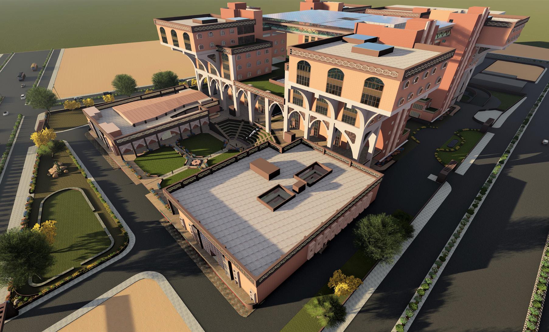
The project Art-Scape aims to revolutionize Calgary’s elevated streetscape (Plus 15) into an awe-inspiring tapestry of creative brilliance. The vision is to expand and encompass a distinguished district that prioritizes ecological innovation and creative education while fostering a developing and innovative synergy. This vibrant hub will attract the dynamic youth population that downtown Calgary needs, contributing to the densification and vitality of the western part of the area.


 River- Scape
Park-Scape
River- Scape
Park-Scape
New Delhi: India
Neo-Delhi Competiton : Group (Concept Developement, Presentation) : 2019 Public Choice Award
The project Neo-Connect aims to transform Connaught Place in New Delhi into a dynamic, inclusive hub for social, political, and cultural activities while preserving its historical significance. Addressing structural decay and inefficiencies, the redesign prioritizes public access to green spaces. By re-imagining CP as a mixed use development, the project seeks to mitigate urban sprawl and provide a vital lung for Delhi’s densely populated landscape. This will foster connectivity, sustainability, and vibrancy, ensuring Connaught Place remains a central focal point of public life, accessible to all, and adaptable to future needs

1.Panckuian Marg
2.State Entry Road
3.Minto Road
4.BaraKhamba Road
5. K.G .Marg
6. Janpat
7.Parliament Street
8.Baba Kharak singh Marg
9.Shaheed Bhagat singh Marg

Cannaught Place : New Delhi
-Central park, which is a pedestrian zone, can only be accessed by haphazard crossing in the inner circle.
-Inward looking Plan

Open Space

-Outward looking plan is proposed making people from all background to feel invited.
-The amount open green area increased enormously.
-Absence of footpath
-Encroachment on the footpath.
-Insufficient Footpath

Pedestrian Pathway

-The area is proposed to be a completely pedestrian friendly with no movement of vehicles inside.
-Internal Movement is encourage only by use of LSV’s, cycles and boats in the canal. Provisions of the same are provided.
-Vehicular circulation within Connaught Circus is one - way in all three circles as well as the connecting radials.
-There are no signals/ Signages within CP directing vehicular movement.

Vehicular Circulation

-vehicles are restricted only on the outer circle.
-Provision for movement of service vehicle with service area is provided.
Vehicular circulation Path for service vehicle.
-Pedestrian circulation blocked in outer circle by parked vehicles.
-Unauthorised Parking, loading and unloading by building tenants and visitors in middle road.

Parking Area

-Two levels underground parking with ramps and exit from the parking area along the periphery.


Abstract: Phases and Faces
Medium: Poster on Jute

Medium:

Sketch: Notre Dame
Medium: Pen on Paper
SAPL T-Shirt Design: City Innovation CAD, Illustrator Painting: The immortal love
Medium: Oil on canvas
Painting: The immortal love
Medium: Oil on canvas

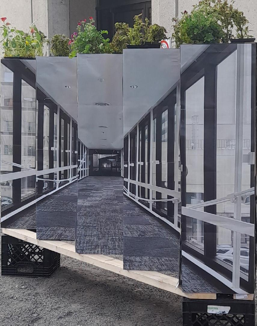

 Illusion - Plus 15 Public Engagement Medium : Installation from crates and paper
Photgraphy - Aga Khan Museum - Toronto
Illusion - Plus 15 Public Engagement Medium : Installation from crates and paper
Photgraphy - Aga Khan Museum - Toronto
Rendering: The Hub-Architecture Design Thesis
Medium: Lumion

Perspective - Mapping Colaba Street in Mumbai Medium: Physical City Mapping Device
Sahil Kadiwar
+1-587-968-3613
sahilkadiwar96@gmail.com
sahil.kadiwar@ucalgary.ca