• Mailboats, Mileage Markers & Messages in Bottles
• Rest in Post...or Long Live the Letter?
• Postcodes, Postal Paths & Past Travels
• First Class to St Helena
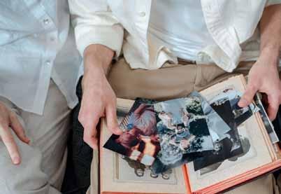
• Never Mind the Photos
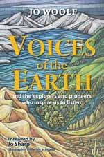
• Reader Offer: Jo Woolf’s Voices of the Earth
“A Postman’s bag is always heavy because it carries life itself: all the sorrows and all the joys, all the worries and all the hopes!”
Mehmet Murat Ildan, Turkish playwright
plus news, books and more...
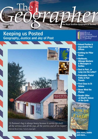
The Geographerthe geography, justice and joy of post
About a year ago, when the RSGS team met to discuss future topics for The Geographer, I had just received a postcard from a friend who was on a kayaking trip in Slovenia. She wrote about being dunked in the Soča River and blamed the Scots in her life that she could no longer stand the heat.
I’ve received countless travel photos from friends by text, yet for some reason, it was so much easier to imagine the landscape and the feeling of a place from that small A6 piece of card. I could imagine the wind through the trees, the splashing river, and her manic laughter as she paddled to avoid rocks. So, with this feeling in mind, I suggested Postal Services as a future topic - and now, here we are.
This magazine began as a way to explore the variety and joy of letters and post, and of course its geography - delivery routes from the city centres, to the remotest of islands. However, as many of our topics do, it soon branched out, covering everything from the history of postal services to its changing trends and future. A long look at postal services is, in many ways, a history and story of communication itself. The Royal Mail, as one of the UK’s oldest institutions, provides a fascinating lens into the ever-shifting political and social landscape of the UK.
Postal services are a part of daily life so deeply ingrained that we often overlook them. Yet behind every letter and parcel lies countless stories - and, of course, the people in the country who knock on our doors more often than friends or family: the posties, who have become fundamental figures within our society.
Today, postal services are in a state of upheaval. New ownership & rapidly changing communication trends all raise questions about the future of post. After last year’s high-profile revelations about the Post Office scandal, we were also keen to understand whether these issues have now been resolved.
But postal services are not just about challenges - they also reflect enduring affection. Knitted post box toppers, unusual post offices, and kind letters sent to strangers across the globe signify the deep fondness many of us still hold for the post. Postal services are a story of history and the small yet meaningful threads that tie communities together.
We hope you enjoy reading this edition, as much as we enjoyed bringing it together, and wish you all a wonderful Christmas and Hogmanay when it comes.
Holly McNair, Communications Officer
RSGS, Lord John Murray House, 15-19 North Port, Perth, PH1 5LU
tel: 01738 455050
email: enquiries@rsgs.org www.rsgs.org
Remember a Charity Week
Thank you to everyone who engaged with us during Remember a Charity week this year - a week dedicated to raising awareness of the importance of legacy giving for small charities like RSGS.
A particular thank you to Azets Wealth Management, our auditors, who ran a special on-line event for Members on taxefficient giving. Thank you again for your ongoing support. Legacies are vital in allowing us to continue our work.
If you’d like to learn more or get in touch, you can do so via www.rsgs.org/legacies
Dr Jane Goodall
We were deeply saddened to hear of the passing of legendary primatologist and anthropologist Dr Jane Goodall, who dedicated her life to protecting nature and wildlife, and inspiring generations through her unwavering commitment to conservation at any and every opportunity. The Jane Goodall Institute, founded by Dr Goodall in 1977, has sparked a global movement and stands as an enduring testament to her passion and lifelong dedication, which is why we offered her our prestigious Scottish Geographical Medal in 2023. Dr Goodall delivered several talks for RSGS back in the mid-1990s, titled ‘Time is Running Out’ - a prescient statement that remains just as relevant 30 years later.
The Scottish Arctic Club
The Scottish Arctic Club has a fund to support young people, Scots by birth or residence and under 30 years old, to travel to the Arctic. The fund supports independently organised and selfled scientific, adventurous, educational and artistic expeditions. The closing date for applications is 31 January each year. Application forms and details can be found at www.arcticclub.scot
Sir Alan Bates pay out
In November Post Office campaigner Alan Bates finally agreed a multi-million-pound compensation figure from the Post Office, more than 20 years after he started campaigning for justice for victims of the Horizon scandal. Between 1999 and 2015, more than 900 sub-postmasters were wrongly prosecuted after the faulty Horizon IT system indicated shortfalls in Post Office branch accounts.
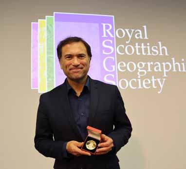
Aldo Kane FRSGS
We were thrilled to present RSGS Honorary Fellowship to Aldo Kane following an inspiring conversation with Mandi Stark at AK Bell Library in Perth, talking about the journey that led him into a life of exploration, and sharing stories from his adventures in some of the most remote and extreme places on Earth.
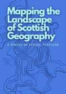
Mapping Scottish geography
A team of academic geographers and school geography teachers, led by Geographer Royal Prof Jo Sharp, designed a survey to discover the way that geography is taught in primary and secondary schools in Scotland. The survey aimed to understand who is delivering geography content and how they define geography, the extent to which the curriculum enables or constrains this teaching, and what sorts of support would be most helpful. The initial report from the survey can be read here: www.rsgs.org/schools-education
Remapping the Future!
Over the summer the Wardlaw Museum at the University of St Andrews ran an exhibition called “Rewrite the future”.
This exhibition showcased a range of sustainability-facing research from across the university in collaboration with the new St Andrews Centre for Critical Sustainability. Alongside the exhibition, the Museum and the RSGS Education Committee ran a competition for geography pupils at Scottish schools called “Remap the future”. Pupils were challenged to create posters about what a sustainable future would look like for their community.
The submitted posters adopted a range of different approaches to mapping and demonstrated imagination and creativity in highlighting the ways in which the pupils’ familiar landscapes could be made sustainable. A collection of “highly commended” maps will be displayed in the Fair Maid’s House in Perth until Christmas. You can also see the highly commended maps on the RSGS website here: www.rsgs.org/ remap-the-future
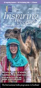
Inspiring People 2025-26
Since September, it has been fantastic to see so many of our members and supporters attending the Inspiring People talks hosted by our 13 Local Groups across Scotland.
The excitement isn’t over yet, as we have a brilliant line-up of speakers for the second half of the programme after Christmas, including broadcaster Paul Murton, adventurer Alice Morrison, and author Jen Stout.
There are still plenty of fascinating stories to discover, including how a nuclear fallout exposed a fake ‘antique’ whisky; how salt fish from Shetland became one of Europe’s staple foods, powering an economic boom and inspiring artists, writers and musicians; and the dramatic history of two remarkable vessels, the S.S. Active and S.S. Scotia, and their vital roles in Scotland’s polar legacy. You can also look forward to learning about the joys of wild swimming, how to transform your garden into a haven for biodiversity, and the origins of Glasgow’s Gaelic place names.
Other highlights include biologist and filmmaker Dan O’Neill reflecting on a snow leopard conservation mission through the mountains of Kyrgyzstan; writer and climber Dawn Hollis exploring the history of mountaineering; environmentalist Laura Young reflecting on her work to engage people about the climate crisis; and adventurer Jack Capener reflecting on his trip to the Andes, which led him to spend a year and a half living in remote Indigenous communities in Ecuador and Peru.
Admission to any of these talks is free for RSGS members, students, and under-18s, and £15 for others. Tickets are available through www.rsgs.org/events or at the door –please book in advance to be sure of your seat.
We were sorry to see two of our long-standing staff step back from their roles in the autumn. Lindsey’s role has fallen foul of the difficult financial circumstances facing RSGS and most other charities, so our outreach in particular has taken a step backwards with her departure. Staff gave Lindsey a send-off at the end of August, and whilst we were very sorry to have to let her go, we are pleased she has picked up work with the RSPB. She very fittingly gave the office a toy parrot for the Explorer’s room, as it has become a tradition for leaving staff to gift something to the rest of the team. “Lindsey has been a terrific team member, and I’m sure many of you will have seen her brilliant outreach work... I’m so pleased she has found another role so quickly.” After an incredibly full and busy 16 years at RSGS, Susan retired at the end of September. She has been wrestling with illness for the past 18 months, and we wish her all the best for a long and happy retirement. Mike has worked with Susan for a long time: “Susan has worked for me on and off since the late 1990s, and for sixteen of those at RSGS where she has been invaluable in helping drive the quality of communications, raising money for key projects and managing much of the background governance and record keeping so essential to a small but complex charity. To say she deserves a long and fruitful retirement is an under-statement – she’s certainly earned a rest from me.”
Dumfries local group support local gardens
The RSGS Dumfries Local Group donated £500 to NTS Threave Gardens to help replace some of the many trees destroyed by storm Eowyn in January 2025. Despite the rain, 9 members enjoyed a guided tour of the gardens, and Chairman, Colin Mitchell, planted a Cornus tree on our behalf.
Pen pals meet after 43 years!
Michelle Anne Ng from Singapore and Sonya Clarke Casey from Newfoundland began exchanging letters in 1983 through a school project. Over 43 years, their correspondence became a record of their lives.
The two women met for the first time in Newfoundland earlier this month. For both women, not even technology replaces the feeling of receiving a handwritten letter.
SAGT Conference 2026
RSGS Vice Chair, Ken Muir, and Deputy Chief Executive, Clare Hamilton, attended the SAGT annual conference at Marr College in Troon on 25th October. The theme of this year’s conference was Skills and Pathways in Geography, and the keynote speaker was Luisa Hendry, who was also part of this year’s Inspiring People programme (in Dumfries, Borders, Ayr and Helensburgh). As well as providing a CPD session at the conference, Ken and Clare took along 250 duplicate maps from RSGS’s collection to give to teachers for use in their classrooms.
FMH closes for the season
The Fair Maid’s House is now closed for the winter and will reopen in April 2026. We were delighted to welcome many visitors to the centre this year, who came to explore the fascinating history of the building, discover the stories of geography within, and see our exhibition Portraits of the Past, showcasing a collection of striking and rarely seen glass slide images from our archives. We’re already looking forward to preparing an exciting new exhibition for our reopening next year.
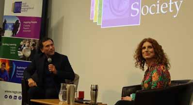
Ros Atkins Shackleton Medal
Ros Atkins, the BBC’s first ever Analysis Editor, received the prestigious Shackleton medal during an RSGS “Evening with…” event at Perth Library in October. In interview with Dr Vanessa Collingridge (RSGS Vice President) he explained that the role was created to reinforce the BBC’s ability to challenge misinformation and provide audiences with verified, contextual journalism. Even before that appointment, Ros had made a name for himself through his distinctive style of journalism, breaking down complex news stories into clear, fact-driven, and accessible narratives. As a result, Ros has become one of the most important current voices in mainstream broadcasting for upholding science and evidence-based reporting and as the BBC’s “explainer-in-chief” represents, we believe, some of the best of public service journalism.
As RSGS Chief Executive Mike Robinson said in presenting the award: “In this modern age of misinformation and disinformation, of truths, halftruths and truth social, we have a greater need than ever for impartial, intelligent, accurate journalism but it takes courage and determination to pursue science and sense, in amongst a cacophony of noise and rage bait… So how do you remain impartial without fear and clear about what is fact and what is conjecture or disinformation? Well with “assertive impartiality” according to Ros. And for us at RSGS, by championing those who do stand up and offer light in this confusing time. And that is why we are so pleased to be able to make this award. “
Ros, speaking afterwards, told us: ‘It was a lovely surprise to hear from the RSGS about this award and it is, of course, a huge honour to receive it. We all benefit from access to information about our world that is impartial, trustworthy and evidencebased and my BBC News colleagues and I remain committed to providing that. It means a great deal to have our work acknowledged in this way.’
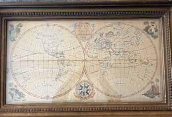
Embroidering the past
A chance meeting at the recent filming of the Antiques Roadshow at Hill of Tarvit led to a recent visit to RSGS HQ from Colin and Sue Roworth, owners of an 18th century embroidered sampler map.
Entitled A New Map of the World, the sampler had been in the same family since its creation in 1794 and the silk embroidery remained remarkably colourful. Consisting of two large hemispheres denoting the Old and New Worlds, it reflected the geographical understanding of the time.
Sampler maps were popular with young women to display both their needlecraft and geographical knowledge. RSGS holds both an embroidered map of a similar date and a paper pattern entitled A new map of Scotland for ladies(sic) needlework, dated 1797. The latter is a rare survivor of the commercial templates available at the time which, by their very nature, would usually have been discarded on completion. A collection of modern cross stitch maps of Scotland, have also been kindly donated to RSGS by Fiona Dempster, volunteer at FMH.
Oman 3165
On 13th November, explorer Mark Evans embarked on a 70-day journey by kayak along the coastline of Oman. Mark will be gathering data to support research by expert marine scientists focusing on EDNA sampling, ocean acoustics and recording cetaceans. Modern technology is allowing Mark to remain in touch throughout his expedition, and you can track his journey via the expedition website (www.oman3165.com).
Mark will also be giving two live ‘campsite conversations’ for RSGS members where he will talk about his journey and his discoveries. These will take place at 4pm on Thursday 11th December and at 4pm on Thursday 22nd January. Keep an eye out for details of how to join.
Climate Change Plan
Royal Mail drones
Royal Mail is trialling drones to deliver mail to remote Scottish islands, enhancing delivery speed, accessibility and sustainability while reducing costs. In 2021, UAVs were being used to carry up to 100 kg of post between Kirkwall and North Ronaldsay in under 20 minutes. In Argyll and Bute, Royal Mail, Skyports and the local council are testing smaller drones carrying up to 6 kg between islands. They are also looking to extend trials to include flying medicines, but this relies on the current restriction on flying drones beyond line of sight being removed.
The Scottish Government’s long awaited Climate Chang Plan was finally released on 6th November and is now out for consultation. It attempts to lay out the pathway for Scotland to deliver against its emissions reduction targets for 2045 and will impact every sector – particularly agriculture and transport. This is a vital plan, and will determine our approach to climate for the next critical decade as a nation. People are being invited to respond to the consultation, which is open until January 29th, and can be accessed at www.gov.scot/publications/scotlands-climate-change-plan-2026-2040
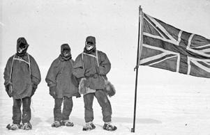
Shackleton Museum Athy
The Shackleton Experience in Athy, County Kildare has now opened to the public following a €7.5 million redevelopment. The museum has been transformed into a world-class visitor attraction that combines the largest collection of Shackleton artefacts in the world with cutting-edge technology and immersive, interactive exhibits. Born in Kilkea, just outside Athy in 1874, Ernest Shackleton’s extraordinary story is brought to life at the Shackleton Experience through digital storytelling, sensory effects and recreated environments that offer visitors the chance to step into his world.
Visitors can trace Shackleton’s inspiring journey from his Kildare roots to the vast Polar ice caps, capturing the determination and leadership that defined his legacy.
Adaptation is common sense
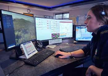
Ordnance Survey data used to help emergency services save lives
Mike Robinson, Chief Executive, and Clare Hamilton, Deputy Chief Executive, RSGS
Two start-ups are using Ordnance Survey (OS) data to transform how emergency services reach people in need. Former emergency responders Nick Sutton and Henry Sternberg have developed innovative apps that could shave vital seconds off response times.
Sutton’s app, EmergencyLocate, built during the COVID-19 pandemic, enables control rooms to pinpoint 999 callers through smartphone location pings, even when they can’t speak. It supports two-way messaging; 3D mapping and integrates with the OS Emergency Services Gazetteer to improve precision. The tool has already assisted over 45,000 responses across the UK, Canada, and Australia. Meanwhile, Sternberg’s Blue Light Maps uses OS data to calculate the fastest legal routes for emergency vehicles, factoring in exemptions such as bus lanes and restricted areas. Dorset and Wiltshire Fire and Rescue Service report it has already improved response efficiency.
What next for the Sustainable Development Goals?
In September, RSGS supported Aberdeen-based Action for a Fairer World in bringing former UN Assistant Secretary General, Satya Tripathi, to Scotland to discuss the future of the sustainable development goals (SDGs). Satya visited Balerno High School in Edinburgh, accompanied by RSGS Vice-Chair, Ken Muir, to hear from pupils. He then met with Gillian Martin, MSP, before speaking to MSPs and guests at an event hosted by Ross Greer, MSP, and chaired by RSGS Deputy Chief Executive, Clare Hamilton.
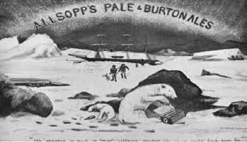
Allsopp’s Arctic Ale
An Edinburgh-based brewer plans to open a 150-year-old bottle of beer, to create a modern version of the ale. The original bottle is one of a handful still in existence which were made for the 1875 expedition of Sir George Nares, whose team set out to reach the North Pole.
Brewed at Samuel Allsopp & Sons in Burton-on-Trent, Arctic Ale was designed to provide sustenance for sailors, having six times the calorie content of conventional beer. It was said to resist freezing because of its unfermentable sugars.
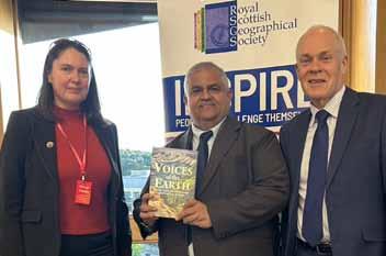
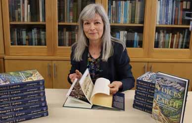
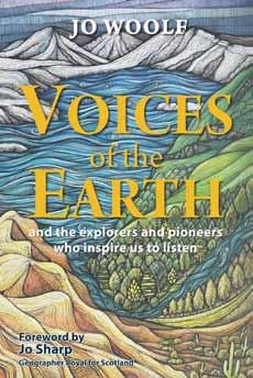
Voices of the Earth launch
We had a lovely day for the launch event of RSGS Writer-inResidence Jo Woolf’s latest book Voices of the Earth where we were delighted to welcome those who had pre-ordered a copy of the book along with many of the people featured in the book.
You can buy a copy of Jo’s latest book using the reader offer on the back page. buy a copy!
Postal Deliveries - from Beginning to End…
Mike Robinson, Chief Executive, RSGS
Royal Mail has been a public service since at least the time of Charles I, beginning as a formal message carrying service for royal messages (literally Royal Mail) from at least the time of Henry VIII.
It was a vital means of communication, but deliveries were patchy and unreliable and expensive, and post was very much for the wealthy elite, who widely believed that the poor were too illiterate to write letters anyway. Through various civil wars and upheavals people recognised the essential value of the mail system. It became not just a vital link for commerce and society, but also the centre of spying in the UK, staff steaming open envelopes in the Lombard Street head office and passing on gossip to the monarch. It was a major source of income and revenue to the Treasury but as such it was inconsistent and open to corruption and profiteering, and a target for highwaymen.
Early routes were along specific major arterial routes out of London – to Edinburgh, the west, the north-west (and Dublin) and south to the continent – but the network was eventually developed further, incorporating east to west routes and adding intercity postal services. Deliveries sped up, with overnight express horse-driven coaches, incorporating limited seats (a sort of early postbus). By the end of the 18th century, post from London to Edinburgh took only 4 days or so by horse-drawn cart. Despite the near monopoly, with increased complexity, the costing structure grew increasingly confusing and over-complicated over time.
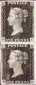
It was the intervention of a disgruntled user and teacher, Rowland Hill, in the 1830s that truly turned it into the national institution it became. He won support for his radical plans to simplify the post, predicated on the principle that a single cheap price for postage would increase volumes to such a degree that this alone would drive profitability and deliver wider economic benefits. He also introduced the first stamp, the Penny Black, in May 1840, so people paid to send (and not to receive) letters. In the year it was introduced volumes of letters doubled (from 82 million letters to 169m), doubling again by 1850 and continued to grow substantially decade on decade. Despite this growth, Hill had predicted a much bigger surge, and therefore more revenue, so it wasn’t the success he’d promised. However this is the moment Royal Mail became a benefit for everyone, setting the principles on which the Post Office was then taken forwards.
The original intention was that the price be held steady at the equivalent of a penny, but perhaps unsurprisingly it has fluctuated since. It was most expensive between the 1860s through to 1900 (equivalent of 1.6 times the original value) and cheapest in the 1920s and 1960s (around 70% of the original value). The current second-class stamp (£0.88) is actually equivalent to the Penny stamp from 1840, according to the Bank of England inflation calculator, although the cost of first class is much higher and overseas post has quadrupled in cost over the past 15 years. Perhaps most significantly, the over-complexity of postal pricing has reemerged with a vengeance.
I wonder what Hill and other contemporaries would make of growth since? Postal volumes continued to grow, reaching 5.5 billion letters/year in 1920, and 11 billion by the 1970s (more than 130 times the levels in 1840).
“...a single cheap price for postage would increase volumes to such a degree that this alone would drive profitability and deliver wider economic benefits.”
Hill’s principle still resonates today. Privatisation started to unravel the simple, affordable and efficient principle, by breaking the monopoly the public body had held for centuries, and focusing more than ever on short-term profit. It was though the internet, in the early 2000s, which had the greatest impact. Although parcel deliveries have exploded since online shopping, the volume of letters, which peaked at 20 Bn/year in 2005/6 have reduced massively since. By 2023 these had fallen to around 6 billion and are still falling.
At its height in 2006, people in the UK were getting on average a letter a day. According to Ecotricity each letter had a carbon footprint of circa 29 grams, so the per capita postal carbon footprint was less than 29g/day. Most of this volume has been replaced with email. Latest estimates show that in the UK we now collectively send and receive more emails a day (8.3Bn) than letters in a year (6Bn), so although their carbon footprint is much lower (4g for a simple email, 19g for one with attachments) the volume has exceeded postal letters by several factors and therefore our carbon footprint associated with email far outstrips the one we had from letters even at their peak. With 120 emails/day each on average our email carbon footprint is between 480g and 780g (between 16 and 27 times higher than post at its 2006 height).
With some countries shutting down postal services completely, and ever more rationalisation and changes of ownership, there is a great deal of uncertainty around the future of mail services. So is the age of the letter past us? I’d like to think not. But then when did any of us last write a letter?
Restorative Justice in the Post Office Horizon IT Scandal
David Enright, Partner and Karen Nelligan, Solicitor, Howe + Co Solicitors
The Post Office Horizon IT Inquiry has shone a light the Restorative Justice Council appointed. They, with our help, arranged meetings in Belfast, Glasgow, Cardiff and London; with further meetings to be held in Birmingham and Leeds. Online meetings were also held for those who could not attend in person. Those meetings heard account after account of the devastation of lives and families.
In the course of the meetings the Restorative Justice Council learnt of the extent, and destructive and continuing effect of the Scandal – the intense shame carried by postmasters for events that may have happened as long ago as 20 years, loved ones lost without seeing their family name cleared in tight-knit communities, children bullied and dropping out of education and postmasters and their families ostracised by communities. The consequences persist: visa refusals because of past convictions which have been overturned, the knock-on effect of poor credit ratings, continuing exclusion from local communities and re-traumatisation.
“Restorative Justice aims to go beyond punishment and compensation, to seek healing.”
Restorative justice aims to go beyond punishment and compensation, to seek healing. A creative and flexible approach is required to address immediate and longer term wants and needs of victims but also to provide for unanticipated impacts. At the core of any meaningful apology for those harmed by the Scandal is the fundamental question of how Post Office, DBT and Fujitsu demonstrate a genuine recognition of the harm done to each and every person impacted by the Scandal. Tied in with this recognition is the restoration of the family name in the wider community. In particular, the impacts on the family unit in parts of Northern Ireland or in South Asian communities can be multigenerational.
Measures of restorative justice could include assistance in returning to education or vocational training. Postmasters, many of whom are skilled entrepreneurs could secure the opportunity for retraining or assistance with job references. The devastating impact on the mental health of postmasters and their families is well documented; a flexible and inclusive approach to counselling and therapy is an imperative.
Ways must be found to unpick the destructive mantra that “you’re the only one”, something that was said to hundreds of postmasters during the course of the Scandal. They were not, and through the large scale group meetings, postmasters came to see that they were not alone, but part of a national group of law-abiding citizens, upon whom the sky had fallen.
The restorative justice process has just begun; the Restorative Justice Council has provided its first report to Sir Wyn Williams with early recommendations to build on in ensuring a national and long-term programme to rebuild and restore the dignity and good name of postmasters from every community in the UK.
This is perhaps the first time that restorative justice has been embarked upon on a national scale. Its outcome may point the way for other victims groups.
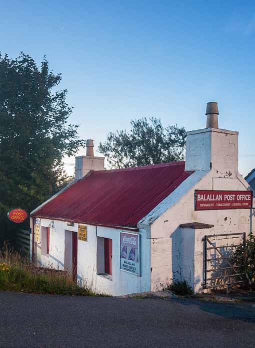
World’s Most Improbable Post Offices
Peter Watson, Communications Officer, UK Antarctic Heritage Trust
UKAHT has been involved in some rather extraordinary postal records over the years. This includes the first letter from Antarctica to space and the first postcard sent from the world’s southernmost post office at Port Lockroy to the world’s northernmost post office at Ny-Ålesund in Svalbard, Norway. This has prompted this article reflecting on seven of the world’s most improbable post offices.
Underwater Post Office, Vanuatu
The Pacific Island nation of Vanuatu, lying 1,750km to the east of Australia, is home to the world’s only underwater post office. The fully functional, submerged post office is located off the island of Mele at the Hideaway Island resort, a vacation spot popular with scuba divers and snorkellers. To post a letter, customers have to purchase waterproof postcards and stamps and have them embossed on land before travelling 50m offshore by boat. From there, you will either scuba or free dive down 3m below the surface to the post office. Operational since 2003, the post office receives an estimated 100,00 visitors/year and has its own special edition stamp issue. Postal staff take it in turns to scuba down to meet customers.
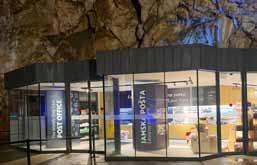
Postojna Cave, Slovenia
The jaw-dropping Postojna Cave system, in southwestern Slovenia, is made up of a series of caverns, halls and passages around 24km long and two million years old. It is Europe’s most visited cave and has been a popular tourist attraction since 1819, when Ferdinand I of Austria visited the caves. Since then, over 40 million people have come to see the fantastical crystalline galleries dripping with needle-like stalactites and columns of improbable stalagmites. Today, the cave comes with an array of attractions including a railway line, a concert hall and, most significantly, a post office. In 1899, the world’s first and only cave post office was opened in Postojna Cave. In its first year, it processed around 7,000 letters, but by 1927, when it was renovated and relocated to the much larger Concert Hall, that number had risen to over 90,000. It still stands today.
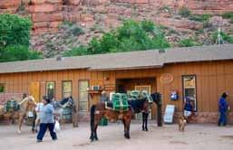
Supai Post Office, Arizona, USA
In the Grand Canyon, the US Postal Service still delivers mail by mule. Deliveries by mule first began in the 1930s and continue today. Six days a week, between 10 and 22 mules carry mail, food and supplies down a 9-mile trail to the Havasupai people at the bottom of the Grand Canyon.
The journey takes around 3 hours to get down and 5 hours to get back up. On the return journey, the wrangler untethers the mules and sends them back up on their own. Each pack animal can carry up to 90kg, and the weight is loaded equally on each side for balance.
The Supai Post Office, located in Supai Village at the bottom of the valley, has a special Mule Train postmark to celebrate its title as the only mule-led mail route in the USA. According to Daniel Piazza, chief curator of philately at the Smithsonian’s National Postal Museum, it is the last official mail-bymule route in the country, and probably one of the last in the world.
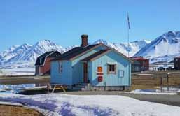
Ny-Ålesund, Svalbard, Norway
The world’s northernmost post office is in Ny-Ålesund, a small town in Svalbard, Norway, located well inside the Arctic Circle at 78°56′N. NyÅlesund is the world’s northernmost permanent settlement as well as the world’s northernmost year-round research station. Ny-Ålesund has a permanent population of 35 year-round and 114 in the summer, with its residents predominantly hardy scientists and researchers.
The settlement also has a pedigree in polar exploration. It was here that legendary Norwegian polar explorer Roald Amundsen launched his 1926 expedition to the North Pole aboard the airship Norge. Amundsen reached the Pole and flew on to Teller in Alaska. It was the first verified trip of any kind to reach the North Pole and the first crossing of the Arctic Ocean.
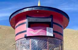
Hikkim Post Office, India
Nestled in the folds of the Himalayas in northern India, the Spiti Valley is one of Earth’s most uninhabited places. Defined by barren mountains, treacherous passes and winding rivers, the high-altitude, cold desert landscape looks almost otherworldly.
At an elevation of 4,440m (14,400ft), the tiny post office in the village of Hikkim is believed to be the world’s highest post office that operates year-round. Two postmen carry the mail by foot on a demanding round-trip of 46km across mountain passes each day to connect a cluster of small villages in this region isolated from the rest of India and the wider world.
First opened in 1983, the post office was renovated in 2022 to attract more tourists to the village. The new office now occupies a bright-red, letterbox-shaped structure.
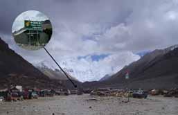
Tibetan Paradise Post Office
The trek to Everest base camp in Nepal is regularly top of many people’s travel bucket lists, but Earth’s highest mountain shares a border with China, where the world’s highest temporary post office is located. Everest base camp, China, at an altitude of around 5,100m (16,730ft) above sea level, is home to the Tibetan Paradise Post Office.
Set up in 2001 to meet the needs of tourists who wanted to send postcards and letters to their families from the Everest base camp, the first China Post office was an old military tent next to the tent guesthouses. In 2008, the post office was
upgraded so the Olympic Flame could pass through the station en route to the 2008 Beijing Olympics.
Then, in 2017, it was upgraded to the Tibet Paradise Post Office, complete with modern facilities, local information and more comfortable amenities. Unlike the Hikkim Post Office in India, the Tibetan Paradise Post Office only opens for the trekking and climbing season from mid-April until mid-October.
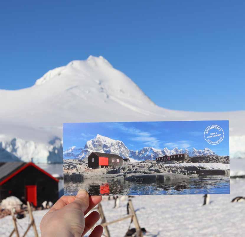
Penguin Post Office, Port Lockroy, Antarctica
Okay, so maybe we’re a little biased with this one, but at UKAHT we think our beloved Penguin Post Office at Base A, Port Lockroy, is one of the world’s most extraordinary post offices.
The location has been a safe anchorage since it was first named in 1903. For this reason, in 1944 it was selected as Base A – the first continuously occupied British base in Antarctica as part of the secret wartime mission, Operation Tabarin. Over the ensuing years, Port Lockroy witnessed the birth of British Antarctic science while it operated as an atmospheric research base until 1962.
Abandoned for three decades, Port Lockroy was restored in 1996 with support from UKAHT, who then took over full management of the site in 2006. Since then, we’ve been welcoming visitors to the museum and the world’s southernmost public post office, while capturing important data on our resident gentoo colony.
On 11 February 2024, our penguin post office celebrated its 80th birthday. From secret mission to penguin post office, Port Lockroy is an ever-evolving story. We’re looking forward to what the next 80 years have to say.
Perambulations on Postal Paths
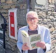
Alan Cleaver, Former Journalist, Regional Newspaper Editor and Writer of The Postal Paths.
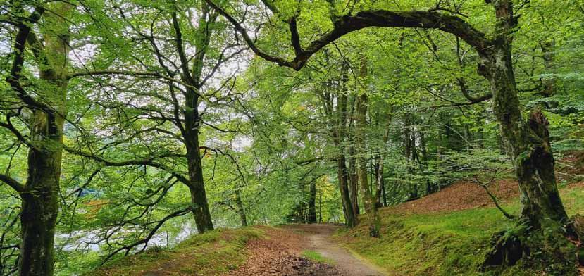
Etched all over the surface of the planet, like grooves on a record, are footpaths marking out the movements of man and beast. Each path was created for a particular purpose. Each path has its own memories. Each has a tale to tell. If, like me, you spend much of your spare time walking the country’s footpaths, it is worth stopping every now and again to ask: ‘Why is this path here? Who created it and what was its original purpose?’ Sometimes it was just a shortcut to get from A to B but there are also corpse roads used in medieval times to take the dead to the mother church for burial, drovers roads to take livestock to market, miners’ trods to enable miners to get to work, even smugglers’ routes deliberately carved out to avoid the prying eyes of customs’ officers.
week, in all weathers. A bike was occasionally used but the more mountainous or boggy terrains often made the use of a bike impractical.
“An army of rural posties was established in the 1850s to ensure mail could reach all homes, no matter how remote.”
One that you will occasionally stumble across is the Postman’s Path (though walked by both men and women). These were short-cuts created, or at least well-used, by rural posties delivering mail to remote farms and homes. Occasionally they were legally created but more frequently they were paths permitted by a gentleman’s agreement between farmer and the postman but which then became a recognised public footpath. An army of rural posties was established in the 1850s to ensure mail could reach all homes, no matter how remote, and this system continued until the 1970s when deliveries by van superseded the walking (and sometimes cycling) routes.
Rural posties often spent all their working lives serving their community. Hannah Knowles, for example, started working in Eskdale Green, Cumbria in 1912 and continued until 1973 taking only three days off ill in that 62 years. La’al Hannah as she was affectionately known (la’al is Cumbrian dialect for ‘little’) was a popular figure in the community. In 1966, she was awarded the British Empire Medal for her services to the community. She died in 1974 but is still fondly remembered. Most rural postal routes were about 15 miles long but it is possible to find some (such as Heptonstall in Yorkshire) which stretched to 30 miles. That is 30 miles each day, six days a
It is perhaps not too surprising that a number of these rural posties took more than a passing interest in the natural history they walked through each day, some becoming quite famous as naturalists. Charles Macintosh, for example, walked along the banks of the River Tay at Dunkeld, Scotland. He began in 1858 and retired due to ill health 32 years later. He was delivering mail to homes and farms but also took a special interest in the fungi he spotted growing beside his path. He went on to identify 13 species of fungi previously unknown in the British Isles and in 1873 was made an associate member of the Perthshire Society of Natural Science. He died in 1922 but is still renowned locally as ‘the Perthshire Naturalist’. You can just about follow his ‘postal path’ today but the A9 has sadly carved through much of it. Most postal paths were superseded by vans in the mid-1970s but there was one postal path that survived in use until the late 1980s. It stretched the seven miles along the cliffs from Tarbert to Rhenigidale on the Isle of Harris and continued to be walked three times a week until 1989 for one very simple reason: There was no road to Rhenigidale. In fact it was postman Kenny MacKay who successfully championed the building of the road that opened early in 1990. The former path is now a tourist trail honouring those who so faithfully served their community. Scotways (the Scottish Rights Of Way & Access Society) has listed a number of former postal paths on their website that can still be walked and a couple have recently been opened in England. It can only be hoped that many more postal paths are promoted in this manner, ensuring this important piece of social history is not forgotten.
The Handwritten Letter Appreciation Society
Dinah Johnson, Founder, The Handwritten Letter Appreciation Society
Where better can we learn about people and places than via handwritten letters? It’s a bold claim, especially when we can access the vast digital world of the internet and find out everything we need to know about anyone and everywhere in nanoseconds with a tap of a keyboard, but is it really the same connection and insight as that of a personal letter that has travelled actual miles across counties or countries via real postal services? It’s worth giving it some thought –although equally, where do we get time to think deeply these days without a constant bombardment of attention-grabbing headlines, clickbait and devices? I would say “while writing a letter”, but then I have pondered letter writing a lot.
Luckily at The Handwritten Letter Appreciation Society we aren’t against the digital world. That would be daft and the founding of the Society was never to try and get rid of it. It was more to untangle ourselves from it a bit; to not be so reliant on it; to pick up a dictionary once in a while to check a word; to see that AI and ChatGPT, and all the rest of them, make us lazy and duped; but more than anything it was to give us back some of the one-to-one connection and privacy we’ve so happily and willingly thrown out. The novelty of writing something without a spellcheck or ‘how to’ prompt. The freedom and rebelliousness of sending something without leaving a digital footprint or the use of electricity, or without anything tracking or monitoring or harvesting whatever we’ve written.
And before long, if we don’t occasionally send a letter in the post the option to even do that may be lost forever. Denmark, for example, are ceasing to deliver letters at the end of 2025 making its citizens go completely digital. Some may say “What!?”, others may say “So what?”, but imagine if the only correspondence or message you could send to a friend or loved one was digitally? Doesn’t that leave you feeling a little depressed, with a sense that that isn’t really progress at all, and more a step back in time to being ‘owned’ somehow – by the big tech companies of the world.
And yes, the seemingly extortionate cost of stamps might appear prohibitive but 87p for a physical piece of mail to travel anywhere in the country is still impressive. We just need to be sold the idea that letter writing matters, and preferably by the postal services whose business it is, but as most of those seem set on not doing that, it’s fallen to the dedicated letter writers still in our midst, including nearly 2,000 members of THLAS, to say writing letters really does still matter.
One of the reasons the Society came about was because lots of people might never have received a letter and known the utter joy and wonder of seeing one arrive just for them.
Something tangible, that can transport you to another time and place, that doesn’t get buried in a wall of emails and spam and advertising or become inaccessible because of forgotten passwords, or just forgotten full stop, but which sits on a shelf or fireplace or between the pages of a favourite book to be frequently looked at and touched and revisited. The sender’s handwriting is such a direct connection to them. Seeing someone’s writing brings them back into the room or back to life like nothing else no matter when the letter was written. Two wonderful and poignant examples are the Vindolanda tablets, and George Mallory’s last letters written on Everest. The thought that so many of us might not leave behind any thoughts or feelings in our own fair hand feels terrible.
“...to give us back some of the one-to-one connection and privacy we’ve so happily and willingly thrown out.”
But even with the need for primary source material to exist for future researchers, the writing of letters isn’t just about that. It’s about the here and now as well. It does get labelled as hobbyish or a novelty but again, that’s because those who should’ve promoted the practice let people forget how much it gave to us in terms of meaningful communication. There was a brief period of time when the production of real books was in the balance with the arrival of the Kindle, but thankfully book publishers, authors, bookshop owners, TV, radio, and literary prize organisers went out of their way to sell us the idea that buying paper books was far more pleasurable and enjoyable. We didn’t need much persuasion because we instinctively knew that turning the pages of a book feels much nicer, but selling a lifestyle idea at the same time definitely helped. No-one would argue the production or transportation of books was a waste of energy and resources but I sadly hear this about letters. To me letters and letter writing are as culturally important as reading books and gives us equal amount of personal growth. Where else can we reclaim writing for ourselves or be flawed without the eyes of the world getting ready to correct or judge or pile on? It also turns out the digital world isn’t that environmentally friendly after all anyway.
I feel so strongly that our letters are our own, that they are unique and don’t need to be rated, that I always struggle to find ‘perfect’ examples. It’s the imperfection that makes them perfect. I don’t like reading other people’s letters to start with, and only the recipient can really have any views on whether it’s a good letter or not. All I would say is don’t make your letters just a journal of your life. You want to connect with the person you’re writing to rather than show off to them. No-one wants to receive a Christmas roundrobin-esque letter. Ask questions, write from the heart, picture the person as you put words on paper, write as you talk but above all send a letter. In a world where we’re told measurable data is all that matters, it’s a chance to send something with immeasurable benefits. Your letter might also help save a postal service or two, and better than that it might just save us from being slaves to the digital world.
From a cheerier perspective, I promise you really will make someone’s day, including your own.
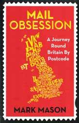
Mail Obsession: A Journey Round Britain by Postcode
Mark Mason, Author of Mail Obsession (2014)
Back above ground… an idea has formed. We’ve mentioned that a first-class stamp costs 62 pence these days, but that for this sum the Royal Mail will deliver your letter anywhere in the UK. Not just to the next town, not even the next county –right to the other end of the kingdom. ‘Where is that furthest address?’ we find ourselves saying. ‘How much value can you squeeze from those sixty-two pennies?’
Back at home in Suffolk, the answer appears. An initial glance at a map confirms we’re talking the Shetland Islands. Further searching on the internet reveals that the most northerly house in the UK – and therefore the most distant address to which the Royal Mail will travel to earn my custom – is a cottage called The Haa, at the top of Unst, the northernmost of the islands that make up Shetland.
A crow departing from the postbox at the centre of my village and heading straight for The Haa would clock up 611 miles, almost all of them over the North Sea. According to an online routefinder the journey by car would cover 918 miles. Or rather a little more – the site won’t believe that the cottage can be reached by road, and keeps depositing me a couple of miles short. Then it emerges that the ferry to Shetland leaves from Aberdeen, meaning it takes you from AB to ZE –alphabetically the first and last of the UK’s postcodes. When you stumble across a fact like this, you know that things are written in the stars. Harry puts me in touch with someone from the Royal Mail’s Scottish office, and soon everything is in place: I am going to post a letter to The Haa, then travel
to Unst and accompany the local postwoman as she delivers it. Yes, I know that’ll mean I could have saved myself the 62 pence. But you get the idea…
We dock in Lerwick at seven… The plan, Bruce explains, is to catch the ferry from the mainland to Yell, then one from Yell to Unst, getting us to Baltasound for mid-morning…
The ferries which island-hop us to Unst are much smaller than the overnight one, with room for just a few cars and no inclination to annoy my intestines... We reach Baltasound, where a day of the UK’s ‘most northerly’s begins. Every post office in the kingdom is south of this small single-storey building which doubles as a shop. There’s a bungalow next to it, and another slightly larger shop 30 yards away, but other than that Baltasound is what you might term ‘geographically dispersed’ – in other words it doesn’t really exist.
“Michelle knows whether or not she has anything for a particular house or collection of houses, and so improvises accordingly.”
We have reached a part of Britain where rural really does mean rural.
Inside, Bruce introduces me to Michelle, who’s sorting the post ready for her round. Including, she shows me, the envelope I posted in Suffolk several days ago. “We’ve been holding it back for you,” she says. Bruce explains its journey: by van to my local town, then Chelmsford Mail Centre, then Stansted airport . . plane to Edinburgh . . road to Aberdeen Mail Centre, then Aberdeen airport . . plane to Sumburgh (on Shetland’s main island) . . road to Lerwick . . and finally the same road/ferry combination that brought me from Lerwick to Baltasound today.
Northern Gannets at Hermaness, Shetland. Image from Alamy
“Obviously Amazon deliveries are a huge part of the job now,” says Michelle. “Them and eBay.”
“I suppose you could be delivering anything with eBay, couldn’t you? There must be a maximum size of parcel you don’t go beyond?”
“Aye, but that doesn’t mean I haven’t delivered some strange stuff. Car parts, a hen house – I even had to deliver a radiator once.” Nice to be trusted, I suppose. In 1905, when the Cullinan diamond (to this day the largest ever found) was transported from South Africa to Britain as a present for Edward VII, detectives travelled by ship carrying a decoy jewel – the real one was sent by ordinary post. Registered, mind you. Stones cut from the diamond ended up in the Crown Jewels. Though not the crown on the side of Michelle’s van: Scotland has a separate crown, sceptre and sword (known as the Honours of Scotland), brought out when the Queen opens the Scottish Parliament. To reflect this the crown in the Royal Mail’s Scottish logo is also different.
Once Michelle has finished her sorting we’re on our way. It’s soon clear that there’s no rigid route to follow – having sorted the mail herself Michelle knows whether or not she has anything for a particular house or collection of houses, and so improvises accordingly. A lot of people on Shetland leave their front doors open, which lets her place oversized letters inside. As she walks back from one house she opens the door of a car parked outside and leaves a bundle of letters inside. “That’s the lady’s daughter,” she explains. “She’s usually here seeing her mother this time of day, so I leave her mail in her car for her.” Several times Michelle has parcels requiring a signature, and knows the recipient won’t be at home until later. “We’ll leave that one now,” she’ll say, weighing up her options at a T-junction. “Catch them at the end of the round when they’re in.”
Eventually we reach Haroldswick. It was from this tiny settlement that my friend David telephoned through to The Times on General Election day in 1997 with his piece about getting as far away from Westminster as possible without leaving the United Kingdom. In fact it’s David who has furnished my Shetland fact: ZE (Shetland): If you live at the northernmost tip of the island of Unst, your nearest IKEA
is in Norway. Bergen, to be exact. Well over a hundred miles closer than your second-nearest option of Edinburgh. Finally, in the early afternoon, we reach the building I’ve been waiting for: the most northerly house in the United Kingdom. The Haa is yet another modern bungalow, but whitewashed to fit in with the centuries-old drystone building to its left. A few other buildings of both vintages cluster round to make up a farm, and standing waiting for us is Alison, the woman who along with her husband owns that farm. Michelle has kindly arranged for Alison to be here – she actually lives a couple of miles to the south. (The Haa these days is home only to some lambs.) Alison takes us into the small kitchen to show us the cans of condensed milk with which she feeds them, and the cooker on which she heats the milk up. “We’ve a new cooker going in soon,” she adds. These are some well-catered-for animals. My letter simply explained what the book’s about and why I wanted to visit, but even though Michelle has already forewarned Alison it still seems proper that the envelope is officially handed over. In return Alison shows us the second visitors’ book of the day. People from all over Britain have been coming to see The Haa for decades – the book’s earliest entries date from 1961.
Alison and Michelle and I are joined after a while by Bruce, who’s going to take me back to Lerwick in time for this evening’s ferry. We talk about nearby Out Stack and Muckle Flugga, the two uninhabited rocks which form the northernmost points of the UK. Soon it’s time to go. I depart with a subtly altered sense of what ‘Britain’ means to me. It has to change your picture of the country, knowing it includes somewhere that has bonxies and where the nearest place you can buy Scandinavian flat-pack furniture is Scandinavia. And yet still, as far as the Royal Mail are concerned, this place fits underneath a first-class stamp.
Michelle heads off to complete her round, and Bruce and I bid farewell to Alison. The last thing we see as we drive away is her disappearing into the main house, followed excitedly but obediently, their tails wagging, looking for all the world like new schoolchildren following their teacher into a classroom, by two tiny lambs.
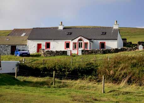
Extract from Mail Obsession (2014) by Mark Mason
The Haa Skaw, Unst, Shetland - the most northery house in Great Britain.
Image from Alamy
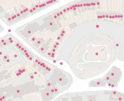
Stitching Communities Together: The St Albans Postboxes Story
Clare Suttie, St Albans Postboxes
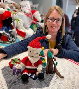
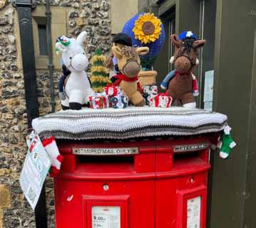
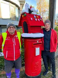
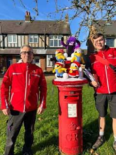
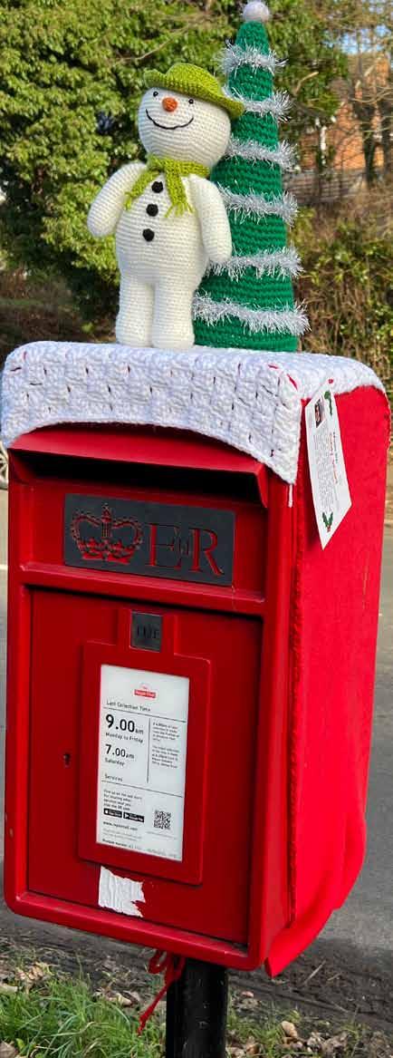
Every December, the streets of St Albans and surrounding areas are transformed. Amid the usual Christmas lights and window displays, a quieter, quirkier kind of magic appears: postboxes display crocheted snowmen, penguins, elves, Christmas trees and more – what festive surprise awaits at the next corner?
This is not the work of mischievous elves. It is the St Albans Postboxes project – a volunteer-driven, city-wide celebration that has turned the most ordinary of street furniture into yarnbombed landmarks of joy, while raising more than £165,000 for local charities since 2018. With donations already topping £7,000 this year, the project is on track to pass the milestone of £200,000 by Christmas 2025.
From one topper to a city tradition
The idea began in 2018. Clare Suttie was working on fundraising campaigns to help her husband, who was raising money for Cancer Research by walking to the North Pole. She mentioned postbox toppers to her friend Candy Stuart who rustled up a polar bear prototype topper in no time.
Clare and Candy focussed on the fundraising angle, with 23 toppers, each bearing information tags and QR codes for donations. What started as a small act of festive cheer has now grown into a city-wide tradition, eagerly awaited each year. St Albans could well be the unofficial home of the Christmas postbox topper!
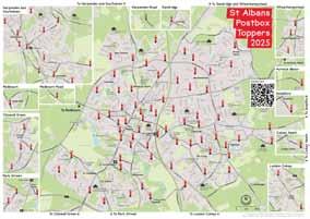
A map of joy
geography meets imagination. Families, tourists, runners, and seasoned locals find themselves exploring new corners of St Albans, guided by knitted woolly penguins and crocheted Christmas puddings. In doing so, the toppers alter the mental map of the city itself, reminding us that geography is not just about landforms and borders, but about how people move, gather, and connect in shared spaces.
The project’s success lies not just in the toppers themselves, but in how they re-imagine the city. St Albans’ postboxes –usually passed without a second glance – become points of discovery, stitched together by beautifully drawn maps that guide people on trails through the streets.
Local cartographer Clare Seldon of Event Maps creates userfriendly maps, turning the city into an open-air gallery where
“In an age often described as fractured and hurried, these small, wool-covered postboxes remind us of our capacity to gather, create, and care.”
A community stitched together
The toppers are created by a diverse network of makers – groups and individuals, from children to retirees, neighbourhood groups, and even first-time crafters who decide to have a go. But the project reaches far beyond wool and needles.
Each postbox is ‘sponsored’ through donations from individuals, families, businesses, schools, pubs, care homes, dog walkers and many more. The range of sponsors says something profound about the social fabric of St Albans: this is not charity confined to boardrooms or chequesigning ceremonies, but something in which anyone can take part.
For makers, the project provides purpose and pride. For sponsors, it is a way to support both the community and local charities. For everyone else, it is a gift – a reason to step outside, map in hand, and rediscover the streets around them.
More than decoration
The numbers are impressive: eight Christmas seasons, over £165,000 raised so far, and a goal to exceed £200,000 by the end of this year.
The toppers also spark ripple effects. They draw visitors from neighbouring towns, give local businesses extra footfall in December, and inspire other communities to start similar initiatives, such as the Mail Trail in Exmouth, Devon, which Clare is also involved in. What began as a handful of woolly postbox hats has become a model of local fundraising, creativity, and community spirit. A postbox becomes a place
There’s a deeper resonance here too. The postbox is itself a symbol of connection: designed to carry words, news, and love across distances. In the digital age, its role has shifted, but its presence on our street corners still anchors us to a tradition of communication and community. By transforming postboxes into canvases, the St Albans project taps into that symbolism. Each topper is both playful and profound – a reminder that our shared spaces can carry meaning far beyond their practical function. In an age often described as fractured and hurried, these small, wool-covered postboxes remind us of our capacity to gather, create, and care.
Looking ahead
As the city gears up for its eighth year of toppers this December, makers have been busy behind the scenes since March. Designs are sketched, wool is stockpiled, and sponsors are being lined up. Nobody outside the core team knows exactly what will appear, and that element of surprise is part of the magic.
What is certain is that, come December, St Albans will once again be threaded together by colour, creativity, and generosity. Each topper will stand not just as decoration, but as proof that small, joyful acts can weave an entire city into community. Because at heart, the St Albans Postboxes project is not about wool, or even about postboxes. It is about what happens when people take something ordinary and make it extraordinary – together.
Find out more and donate to this year’s campaign, fundraising for Herts Domestic Abuse Helpline and Comfort Cases UK: www.stalbanspostboxes.org.uk
Event Maps: https://eventmaps.co.uk/
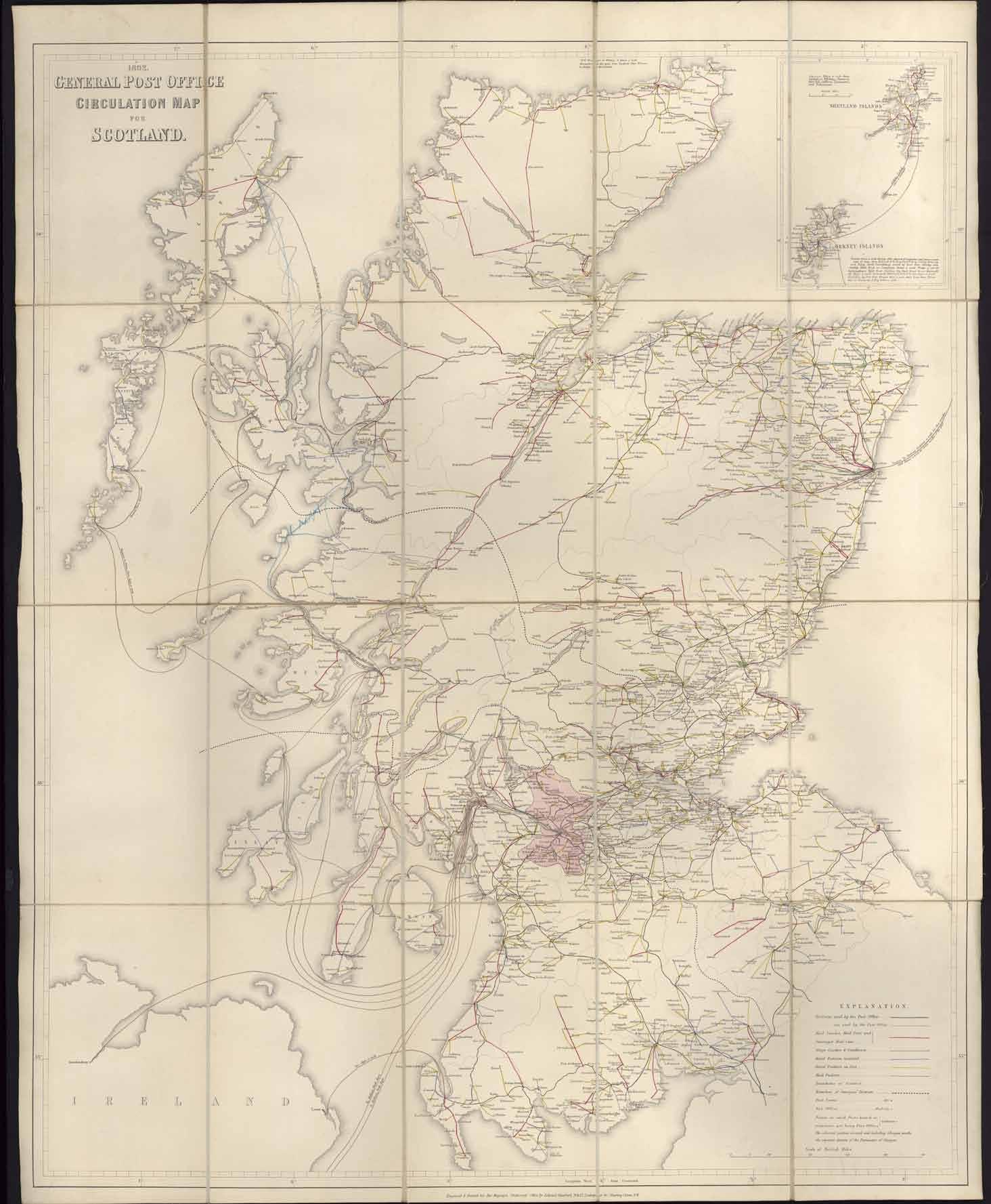
Postal Mileage Markings in the Early 19th Century
Mathilde Jourdan, Archives Assistant, The Postal Museum
In the early 19th century, the British postal service was highly complex and very expensive. Letters were charged by distance and weight. Rather than the sender, the recipient was expected to pay for the letter. Additionally, some items travelled free-of-charge, such as newspapers or letters to and from Members of the Houses of Parliament. It wasn’t until 1840 that pre-paid postage stamps were introduced, which democratised access to the post.
Adhesive postage stamps didn’t exist yet, but letters would receive various postal markings to indicate the price to pay, a ‘missent’ mark in case of a lost letter, the destination or if it was sent by ship. One of the most used postal markings in the early 19th century was the mileage mark.
marks also showed a capital letter to indicate which postal route the mail travelled on: B for Berwick, C for Carlisle, D for Dumfries, E for Edinburgh, G for Glasgow and L for Leith. The 1808 Scottish mileage marks favoured a circular design with a straight number for the distance, with several later types of markings using straight lines.
“One of the most used postal markings in the early 19th century was the mileage mark.”
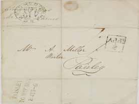
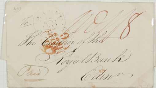
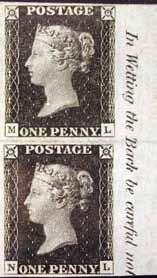
The mileage mark showed the name of the post town and a number. This number indicated the miles between London and the post town, as all mail at the time was sorted in London. Looking at ‘TAVISTOCK / 209’ on the example below, the town of Tavistock was supposedly 209 miles from London. ‘Supposedly’ due to the many errors in distances that existed at the time. The distance indicated on the mileage mark determined the postage rate the recipient was required to pay.
The earliest English mileage mark recorded to date was struck at Arundel on 1 October 1784. However, the distances on those early mileage marks soon proved to be inaccurate and they became obsolete by 1790. In the mid-1790s, Anthony Todd, then Secretary of the Postmaster General, requested of John Cary, a famous London engraver and map seller, to make a survey of the principal roads of England, Wales and Scotland. He measured the distances between London and the town posts, and he measured the crossroads used by the General Post Office (GPO), using a surveyor’s wheel. This mammoth task involving nine thousand miles of survey took several years to complete and Cary employed many workers to measure the routes. In 1798, he published in his own name Cary’s New Itinerary which contained a map and indexes of the roads from London and the crossroads. Cary’s New Itinerary kept being improved until the end of the 1920s.
The maps produced by John Cary provided the official measures for all mail coach routes and determined the postage rate on letters. In 1801, using Cary’s measurements, the second series of mileage marks were introduced. They were initially used in harbour towns for overseas mail but from 1802 onwards, examples for inland post towns became more common. There were several types of mileage marks with various designs, for example with the distance framed or lined, or the entire postmark in a circular shape.
The first Scottish town to initiate a mileage postmark was Dumfries in 1801. Seven years later, Scotland developed its own mileage mark program. In addition to the post town and distance, the Scottish mileage
The Irish Post Office had been functioning under the control of the GPO until it became a separate entity in 1784. The first Irish mileage mark was stamped in January 1808, for the post town of Mullingar. The mileage was between Dublin and the post town. Unlike the Scottish mileage marks of 1808, the Irish postmarks followed an English model of straight lines. Two circular formats were also issued between 1818 and 1824 for a few post towns.
The mileage marks officially came to an end in 1829, but they kept being used in some areas until the 1850s. The improved survey by John Cary offered the GPO a more accurate set of distances between London and the post towns, which led to an increase in postage rates on several occasions. Due to the high cost of sending letters, the use of mail remained a privilege for a few, until the 1840 postal reform which introduced the first stamp in the world, at a uniform postage rate, the Penny Black.
Zoomed in mileage mark of Glasgow, from the above wrapper. (PH152A/12)
The Geography of Email: Past, Present, and Future
Bruce Gitting FRSGS, Institute of Geography, University of Edinburgh
In the past 30 years almost everyone on the planet has become dependent on email. That gives unheard of opportunities for even those living in remote communities and the Internet gave us a new space, a new geography, to explore. More than 8 billion emails are estimated to be sent every day in the UK alone. Postal services reached a peak in 2005, with 54 million letters delivered per day, and numbers have subsequently collapsed by two-thirds, a trend which will undoubtedly continue.
Of course, much less thought goes into an email than a letter, we care less about the contents and too many unnecessary emails are sent – at this point I have to own up to being a ‘80-a-day man’ a phrase which no longer refers to nicotine intake, but rather the number of emails received. I also have to admit that there are 94,382 messages lying in my mailbox (despite my attempts at management), with 31,355 unread –sincere apologies if this includes yours! System changes mean that my messages before 2013 are gone, so whatever history lies within these will never be known!
I sent my first emails in 1981, on the University of Edinburgh’s EMAS mainframe computer, mostly sent locally but even then messages could be sent nationally and internationally. Universities and research institutes were in the forefront; commercial use of email was limited. Email was intended as a practical hack but went on to become the Internet’s first killer app. Long before the web, researchers on early computer networks needed a way to leave messages for one another across time and machines. What started as ad hoc tools for asking questions and sharing notes evolved into a universal system for communication, collaboration and identity, now so pervasive that an email address is critical to existence in the modern world.
Email began in the mid-1960s on time-sharing systems at the Massachusetts Institute of Technology (MIT), where multiple users shared a single large computer. These systems were not networked, but familiar concepts were established, such as the sender, recipient, subject and storage, that would echo through decades of design.
Networked mail came in 1971 when Ray Tomlinson, an American software engineer, established himself as the father of email by modifying existing programs so messages could move between ARPANET hosts. ARPANET was the precursor of the Internet, developed in the late 1960s by the US Department of Defense’s Advanced Research Projects Agency (ARPA).
Tomlinson chose the @ symbol to separate the user from the destination machine (i.e. user@host), an addressing convention that soon became global. Uniquely the British academic network (JANET) used reversed host addresses (‘uk.ac.ed’ rather than ‘ed.ac.uk’) until the early 1990s
when international standards were adopted. A ‘gateway’ was required to rewrite addresses for every message coming into or leaving the UK.
Standards were key to success and transformed scattered email tools into a coherent international system. Message formats were defined by the early 1980s, and SMTP (the Simple Mail Transfer Protocol) specified how servers relay messages from computer to computer. It was not until the 1990s that the Multi-Purpose Mail Extensions (MIME) were introduced, extended email beyond plain text, allowing attachments, rich text, and international character sets, turning email into a medium for transmitting documents, spreadsheets and photos.
The geography of the Internet at this time was interesting. It is perhaps not surprising that countries like the USA, UK, Canada, Hong Kong, Japan, Norway, the Netherlands and Australia were at the centre, yet others including France, Spain and Ireland were at the periphery – geographical distance was not a factor in terms of Internet connectivity. For many countries and organisations, the continuous connections we take for granted today did not exist, and thousands of emails were queued waiting for periodic dial-up connections. Communities developed around thousands of topic-specific mailing lists, while a ‘netiquette’ emerged to manage tone, quoting, and the use of cc and bcc.
The late early 1990s brought mass adoption, familiar client software began to appear on desktop computers. Webmail lowered the barriers further, through Hotmail (1996) and Yahoo Mail (1997) which made email accessible from any browser, while Gmail (2004) reframed expectations with regard to search, conversation threading, and massive storage, all available for free. Meanwhile, mobile devices, such as BlackBerry in the early 2000s and the smartphone revolution made inboxes a constant companion.
Email is not renowned for its security; messages can easily be read en route, but techniques to encrypt messages, prevent forgeries and reduce spam remain an arms race between email users, criminals and even governments.
Without email we could never have regained control of communications and brought about the digital transformation necessitated by COVID-19. Yet, how often do we archive emails? For a time we printed the important ones, but no longer do we have a permanent record of important conversations, the context for world-changing science or how compromises were reached. Arguably history will stop in the 1980s.
While systems such as WhatsApp, X, Facebook, Teams and Telegram might bring interactivity to online conversations, email is not going to go away. It might be written by AI, but my inbox will still be full. I suspect I’m not alone here.
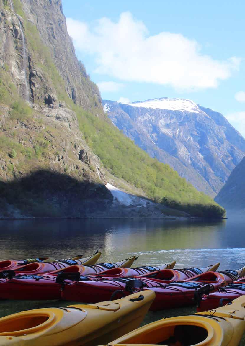
The 17th-Century Postal Route That Ran Through the Fjords
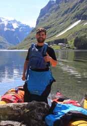
Stuart Kenny, Outdoor & Sustainable Travel Journalist
In 1647, a new postal route was established from Oslo to Bergen. The only problem? It had to get through the fjords... In his 1892 Handbook for Norway, Thomas Bennet documented his picturesque journey from Oslo to Bergen. He took a steamboat to Gudvangen, a beautiful town at the mouth of the Nærøyfjord, and wrote of how “the scenery is most enchanting by its imposing grandeur. The mountains rise 5000 feet nearly perpendicularly on both banks of the Fjord, and waterfalls of most picturesque beauty shoot and leap down the mountain sides.”
Bennet wasn’t the first to take this beautiful, if arduous, route, from the Norwegian capital of Oslo to Bergen. The route had been travelled thousands of times before – though by postal workers and Oslo’s mail, rather than by tourists.
Morian established postal routes from Oslo to Copenhagen, Trondheim (from where mail was carried on up to Finnmark, far north of the Arctic Circle) and to Bergen, now Norway’s second biggest city. The only issue with establishing such a postal route from Oslo to Bergen was the topography between the two.
Bergen is the gateway to the fjords in the west of the country, and the fjords may be beautiful, with their enormous crystalline rock walls and narrow inlets of water, but the terrain is not easy to navigate quickly.
“...the postal service would be executed not by full-time professionals. Instead, it would be passed on by a series of ‘postal farmers’ along the routes.”
In the mid-1600s, King Christian IV of Denmark and Norway faced a problem. He had founded various new cities, from Kristianopel in Sweden to Glückstadt, now in modern day Germany, to Christianshavn, in modern day Copenhagen, to Christiania – the old city of Oslo, which he moved and renamed after a devastating fire in 1624. But ruling over such a large stretch of land, and so many remote locations, how was he to get word of his orders out to the kingdom?
“The initiative for the establishment of postal service in Norway was taken by the Danish viceroy in the country, Hannibal Sehested,” writes William Dawson, in The Scandinavian Year Book. “He deputed the organisation of the new institution to an immigrant Dutchman, Henrik Morian.”
With a royal decree from King Christian IV, on 17th January, 1647, “the postal service was transferred to Henrik Morian as a Royal privilege to him and the successors for 20 years,” writes Dawson.
Morian “had to organise and conduct the postal service at his own expense,” Dawson writes, but he also had the right to all income he made from the service. So the incentive was there. It was decided that the postal service would be executed not by full-time professionals. Instead, it would be passed on by a series of ‘postal farmers’ along the routes - who “were not paid for conveying the post but were exempted from certain civil duties, among other things military service.”
Mike Bent writes that prior to this 1647 postal network, “correspondence usually travelled by private courier or by brevbarer (letter-carrier) – an obligation which was an unrewarded burden shouldered by the fishing and farming communities.” The new networks relied heavily on the development of main roads, but in the fjord systems, this community help was still required.
Today, the Nærøyfjord is known as the ‘pearl of the fjords’ in western Norway. UNESCO praise the “numerous waterfalls and free-flowing rivers, deciduous and coniferous woodlands and forests, glacial lakes, glaciers, rugged mountains.”
The narrow nature of the Nærøyfjord accentuates these huge
walls, but back in 1647, the width of the Nærøyfjord – and the fact that it led out to Gudvangen, which could then be easily connected to Voss and the road network to Bergen –meant that it was ideal for the King’s Postal Route.
Farming communities would trek between postal stops, often over mountain passes, and the mail would be loaded onto boats to be taken to Gudvangen.
The fjords are sheltered from much of the wind that hits the Norwegian coast thanks to their high walls, but deep snow often sits on much of the network, and so the specific postal route taken was weather dependent.
The Nærøyfjord World Heritage Park write that “if the ice settled on the fjord, the route would change and go along the road from Gudvangen to Bakka, over the ice from Bakka to Bleiklindi, and from there along the postal route to Styvi.”
Styvi is one of the four small hamlets on the Nærøyfjord, and it became Norway’s smallest stop on the new postal route.
Today, Styvi remains the smallest area in Norway with its own postal code. By proxy, the farmers that worked in Styvi became ‘postal farmers’, who “had to deliver the post that horseriders brought them to Lærdalsøyri by going through the Nærøyfjord, the Aurlandsfjord, the inner Sognefjord and the Læderaldfjord,” writes Bernhard Pollman.
When the ferry crossing wasn’t possible due to ice, a unique vehicle would be used to cross the fjord – a mixture of a boat and a sledge. You can still see an example of such vehicle at the Styvi farm museum. A. Heaten Cooper described the scene in winter as “a highway for sledge traffic to and from the steamer.”
The new postal service allowed “handwritten newsheets to flourish,” writes Hans Fredrik Dahl in A History of the Norwegian Press. Newspapers grew in importance, and connected remote areas to the politics of the rest of the country.
“The dissemination of news by the postal service brought with it an increasing demand for accountability,” writes Dahl. The completion of the 11.4km Gudvangen tunnel in 1992 between the Nærøyfjord and the Aurlandsfjord revolutionised the way that people move through this beautiful region, but today, the walking route once used by the postal workers back in the 17th century serves as a remarkable hiking trail through the area.
Starting from Styvi, which despite challenging terrain has been inhabited since the Vikings, walkers can follow the old postal route for 6km to Bleiklindi.
From Gudvangen to the church in Bakka, you walk on a trail almost built into the fjord. You’ll pass hazel bushes, and lime forest, while every opening along the way grants you immense views of the mighty Nærøyfjord walls.
This is still a farming region, and you’ll pass the Odnes alluvial fan, which for thousands of years helped farmers in the region make hay, for cattle. The huge wall of Breiskrednosi sits beyond. Rising to 1,189m from sea level, you can hike to the summit from further round the inlet –though it takes a night of camping, and 10 hours of walking up the mountain, often in deep snow, to reach the summit. Looking down on waterfalls from the high fjords you get a humbling sense of our minuscule place in the world. As you walk for leisure, and enjoy the beauty, it’s worth remembering the miraculous, tough lives of all those who made a living farming – and passing on the post – in such an environment. While approaching Skarsvotni lake, or looking out on the glimmering water, spare a thought for those who did so without Gore-Tex hiking boots – and with a bag of mail.
The Intriguing Clues in Scotland’s Postboxes
Bob Drummond and Robert Cole, The Letter Box Study Group
Bright red postboxes unify the urban landscape and rural built environment in Scotland. It’s the same in the other parts of the UK. Scotland’s postboxes, however, have qualities which give depth and texture to specific studies of human geography north of the border. Though the qualities and quantities of Scotland’s postboxes may appear indistinct to most passersby, close observation gives rise to a variety of insights.
Meanwhile, a recent development – solar-powered ‘digital’ boxes – shows there are fresh stories to be told by these ostensibly unremarkable pieces of street furniture. UK-wide numbers
Across the UK, there are about 115,000 postboxes in use. Most – about two-thirds – date from the reign of the recently deceased Queen Elizabeth. The next most-common, accounting for around 15% of the total, bear the markings of George V. Boxes from the reigns of Victoria, Edward VII, and George VI each make up between 5 and 10% of the total there are tiny number – just 140 – from the abdication-curtailed 1936 reign of Edward VIII. Overall, just more than two-in-five are pillarstyle boxes. A few fewer sit on lampposts or poles and the remaining 20% are set into walls.
The Scottish Crown
geographical and otherwise – there’s value in the hints given by our red-breasted national treasures.
Other clues
In Glasgow, as in all parts, postboxes leave clues about housing history and development. For the most part, boxes are located in built-up areas. It is when the people arrive, in other words, that the boxes appear.
The shape and size of boxes of different types of box may provoke further deliberation. There’s an example of the hexagonally elegant so-called ‘Penfold’ overlooking the Firth of Forth. On a macro scale, one may also look at the relationship between roadside postboxes and the agricultural and industrial revolutions of the 18th, 19th and 20th centuries. Migration, driven by Highland Clearances and the search for work in cities, created the need among populations to correspond over previously unimagined distances. At the same time, network expansion was related to advances in education. To post letters, after all, one needs to be able to read and write.
“In Glasgow, as in all parts, postboxes leave clues about housing history and development.”
One of the distinctive aspects of the Scottish story comes out of the cipher or royal insignia worn by postboxes manufactured under the reign of the last queen. In most cases, they are different in Scotland. Boxes of the era in England Wales and Northern Ireland bear the ‘EIIR’ crest, those north of the border bear instead one of a number of slightly different stylised interpretations of the heraldic version of the ancient Scots Crown. Why? Elizabeth the Second of England was the first queen of that name in Scotland.
Edward VIII
Of the mere 140 Edward VIIIs operational across the UK, as many as 20 are in the Glasgow postal districts. If the rare Edward VIIIs were spread evenly across the UK, Glasgow would have only two. There is a rough correlation between postbox installation and the timing of urban development. Installations also relate to the development of the postal network and other issues, and it is hard to disentangle the factors from each other. Further investigation is required if any observations were to stand as facts, but as stepping stones for enquiries –
Wildlife
On a micro scale, the activity of birds, bees, snails and other wildlife have an impact. Nesting birds, swarming bees, and the occasional escargatoire (or ‘rout’, to use an alternative collective noun for a group of snails) sometimes lead to temporary box closures and sometimes prompt the addition of aperture flaps to deter the intruders.
Digital design
Royal Mail’s new solar-powered parcel postboxes constitute one of the most significant design changes in the 175-year history of the bright red roadside collection points. After a successful trial in April 2025, Royal Mail is installing what it calls “postboxes of the future” in Scotland and across the UK. The new solar powered boxes, created with burgeoning demand for parcels in mind, will in most cases adapt or remodel existing larger pillar boxes. The features include a modified aperture with a small slot for letters; a drop-down drawer for parcels which opens when a valid barcode has been scanned; and a solar panel and aerial on the cap to power the scanner and validate the codes. The drawer is intended to accept packages up to the size of a shoebox.
Cities including Edinburgh, as well as Manchester, Nottingham, Sheffield and Sunderland have the new so-called digital boxes. More are appearing nationwide. The program is a clear signal of how postboxes look to the future by adapting the inheritance from the past.
WHAT IS THE LBSG?
The Letter Box Study Group (www.lbsg.org) is an independent charity dedicated to creating and maintaining a comprehensive database of the UK’s 115,000 roadside postboxes. Contact Robert Cole at: robertspcole@gmail.com
The Battle of the Cypher
Chris Taft, Head of Collections, Postal Museum
How did a royal cypher cause a significant, but often forgotten, dispute at the start of Queen Elizabeth II’s reign? In keeping with the tradition of new monarchs, King Charles III recently released his royal cypher which will feature on new post boxes across the United Kingdom. The King will certainly be hoping that his cypher causes less controversy north of the border than his mother’s, Queen Elizabeth II, after her accession to the throne in 1952. Queen Elizabeth II’s cypher was designed with E R for Elizabeth Regina (Latin for Queen) and her reginal number II fitting between the two letters. However, it was the inclusion of the two Roman numerals that proved problematic to some in Scotland, especially when the cypher appeared on post boxes. What was the controversy?
However, that was not the end of it, as a short time later a second bomb was found, which could have exploded but didn’t. This second threat resulted in the Post Office taking decisive action, ordering that any new boxes required for Scotland were to be bear the cypher of the late King George VI until the tensions were resolved.
No backing down
Elizabeth II was not recognised as the second queen by the name of Elizabeth in Scotland. The Tudor Queen Elizabeth I was crowned Queen of England and Wales only. Mary Queen of Scots had a turbulent relationship with Elizabeth I during their adulthood. It was only when Elizabeth I died without an heir that the English crown passed to Mary’s son, James VI of Scotland. He therefore became James I of England and Wales. New post boxes revealed In 1952 the first post boxes bearing the new cypher were unveiled, initially in London at Whitehall and closely followed by Edinburgh. In December of that year, a letter was sent to The Chief of Scotland’s Police demanding that steps be taken against the Postmaster General for their ‘historical inaccuracy’ in using the cypher EIIR. The letter was headed ‘The Scottish Patriots’ (POST 122/1090). Attacks began to take place on the first post box in Edinburgh. Tar was poured over the pillar box and the cypher was attacked with a hammer. The repair was dealt with promptly, but it came at a cost of £66 and 9 shillings. In today’s money that’s an eye-watering £2,200. The costly repair also did nothing to change the growing popular opinion that the boxes should be changed. In February 1953, the perpetrators wrote to the Post Office threatening not only the newly repaired post box, but all Post Office property in Scotland. The letter, signed by the Scottish Republican Army, finished with the line: Have you English Police to guard every pillar box and post office in Scotland (POST 72/105)
Another letter followed on 12 February, stating simply that Objective No.1 had been achieved – the destruction of the EIIR box. It was claimed that a bomb had been posted inside the new box, but no further damage had been reported. According to experts who investigated the scene, the bomb was never at risk of detonating. Instead, they concluded that the bomb had been made by someone who understood how to make a viable explosive device, but had chosen to ensure it did not actually go off.
It was only a matter of time until the government decided to step in, and in April 1953, that’s exactly what happened. However, rather than standing down, Prime Minister Winston Churchill insisted that they would not back down. He announced that no changes would be made, despite the protests. As a result, the rising tide of protest grew. In December 1953, a post box in Glasgow which bore the cypher of Edward VII was targeted by an arson attack. A note placed in the keyhole of the box warned We’re not finished yet.
A change in approach
Just two months later, the UK government backed down and the Scottish campaign proved to be ultimately successful. In February 1954, it was decided that a new cypher was to be used for post boxes and vehicles in Scotland. The new cypher would use the Crown of St Andrew, part of the regalia of the Honours of Scotland and otherwise known as the Scottish Crown Jewels. This image of a crown was to be used alone, without an accompanying monarch’s cypher.
The Crown of St Andrew was included on Queen Elizabeth II’s coffin during her lying at rest in Edinburgh in September 2022. Throughout the reign of Queen Elizabeth II, the Scottish Crown remained on postal vehicles, post boxes and even within the Royal Mail company logo.
If you want to find out more about cyphers and cypher spotting, read our blog Royal Cyphers on Letter Boxes
Top image: Scottish crown cypher Note found in keyhole of a letter box. Letter regarding destruction of pillar boxes.
Oifis a’ Phuist
John Maher, Photographer and Drummer
1. Ness Post Office – Isle of Lewis | 2. Public telephone box inside the former post office. Stockinish, Isle of Harris | 3. Crulivig – Isle of Lewis, opposite the old post office. The phonebox is equpped with an extremely rare set of storm doors. | 4. Caroline the Postie –Isle of Lewis, December 2024. Originally published in Courier – Royal Mail’s in-house magazine. | 5. Amhuinnsuidhe Post Office-Isle of Harris. Since demolished. | 6. Billy Connolly and Santa in Manish – Isle of Harris. | 7. Postmistress Diane on the last day of Leverburgh Post Office-Isle of Harris. October 2017. | 8. Scarista Post Office – Isle of Harris, Christmas 2010. | 9. Ardhasaig Post Office – Isle of Harris. No longer standing. | 10. Balallan Post Ofiice – Isle of Lewis. Still in operation. | 11. The Magic Phonebox – Finsbay – Isle of Harris. So-called because for a period in the 1990s a 10p call would last forever. | 12. Borve post box. www.johnmaher.co.uk
The Cultural Heritage of Scotland’s ‘Postie Paths’
Craig Reilly, Information Officer, Scotways
The ScotWays Heritage Paths Project records the history of hundreds of culturally rich paths strewn across Scotland: Coffin Roads, Drove Roads, Military Roads, Roman Roads, and more. However, none are so unappreciated as the humble ‘Postie Path’.
The introduction of the Penny Post in 1840 saw a boom in mail delivery, not just in the cities and towns but also in small rural communities that now had access to communications like never before. Existing path networks became used by the posties travelling along them by foot, and now these old routes have many stories to tell about the heritage of our rural Scottish communities.
The Postie’s Path is one such route. Starting at Ullapool, the route goes by way of Strath Canaird to Achiltibuie. The route is so named because it was regularly walked by local postie Kenneth McLennan of Blairbuie, who would walk the original route which went by the east side of Creag na Feola, but is now submerged because of damming. For 2/3d a time, Kenneth would walk the 23km route not once, but twice a week, to deliver mail as part of the regular postal service established in the 1860s to serve the area.
A similar Heritage Path is the Loch Maree Post Road, mentioned in Osgood Mackenzie’s book “A Hundred Years in the Highlands”. This route from Poolewe to Kinlochlewe is an intense 30km walk, which was used to deliver the post for the whole of Lewis and Harris (which arrived by sailboat). In the nineteenth century, it was trekked by a post-runner called Iain Mor am Posda (Big John the Post), who would traverse the crags of Creag Tharbh (Bull Rock) on the north side of Loch Maree and through Ardlair and Letterewe. Travelling such difficult routes, it’s not difficult to presume that posties needed a high level of endurance. For example, Big John regularly walked the Loch Maree Post Road while also carrying the letters for the whole of Gairloch and Aultbea in one big bag thrown over his shoulder.
“...these old routes have many stories to tell about the heritage of our rural Scottish communities.”
Not only this, but reportedly on one occasion he also had to carry a fainted Post Office overseer on top of his mailbag for several miles!
The stamina required of posties to travel such distances to deliver their mail is remarkable, but not wholly surprising when we consider just how important they were to far-flung rural communities. A route’s history illustrative of this is the Rhenigidale Post Road. Reinigeadal (Rhenigidale) is a small settlement in Harris, which, before 1990, had no tarmac road leading to it. Instead, the main land access to the village was the steep Rhenigidale Post Road, so named because it was regularly walked by postie Kenny Mackay. He would walk the route of around 10km between Reinigeadal and Tarbert three times a week to deliver letters, medicines, shopping, and bring news from further afield.
Throughout the centuries, many settlements in the Western Isles had been abandoned as the way of life became too difficult. Whereas Reinigeadal had survived into the 20th century, the community still faced challenges due to just how isolated the village was from the outside world, even with Kenny dedicatedly maintaining contact. For example, if injured or taken ill, residents had to be airlifted by helicopter to a hospital in Stornoway (such was the case with Kenny’s aunt). Perhaps then it is no surprise then that he became invested in the long-term survival of the community; between 1975 and 1990, Kenny campaigned for the construction of the Reinigeadal road through lobbying and fundraising. Ultimately successful, the public road to Reinigeadal was officially opened on 20th February 1990. The project cost £1.5 million and served around 10 residents, whose lives were forever changed by the opening of the new road. Today, the Rhenigidale Post Road remains a magnificent historic path which can still be walked on foot to visit the village and even stay in its hostel.
This article features only a selection of ‘Postie Paths’ that are part of the Heritage Paths Project. While the Postie’s Path, the Loch Maree Post Road and the Rhenigidale Post Road are all culturally rich routes that can still be explored today, visit the Heritage Paths webpages at scotways.com/heritage-paths for more stories which follow the footsteps of posties of bygone times.
The Postie Perspective
Declan Friel, Photographer and former Postie
Still, glassy water reflects the sharp edged mountains like they’re made from ripped bits of cardboard. Distant baaahs of sheep echo and hang in the air. The stone ruins of an old crofting black house climb from the ground like a hand reaching from its grave. That is the scene today as I sit for my meal break on my rural post route on the Isle of Skye. I’ve been a postie with Royal Mail for just over two years. Before becoming a postie, I worked various jobs around the UK and Europe: from a farm hand on a Swedish small holding, a bicycle courier in Amsterdam, a brewery delivery driver in the French alps, to a taxi driver in Geneva. But none of these jobs have been part of an establishment as renowned and historic as Royal Mail. Royal Mail is a British institution, a pillar of society, a highly regarded service that is used and appreciated by all. Stepping into this role, I thought it would be like no other job I have had before. Sadly, I was wrong. I must start by saying this is my own personal opinion from my experience as a postie and does not reflect the feelings or opinions of all posties or Royal Mail. I cannot talk about our postal service without bringing attention to the detrimental impact that free market policies have had on the service. The shift of public assets into private hands has stripped the reliability of the service, not only for customers, but for the posties that work to keep the service running going under desperate working conditions. I was shocked to find that duties fail regularly, that mail sits on the shelf for days, then posties are expected deliver days of backlogged post and parcels in one day. We currently work under a two-tier system of pay and working conditions for posties. Workers under ‘Legacy Contracts’ are paid considerably more than those with ‘New Entrant Contracts’. They also receive additional benefits, including paid meal breaks and supplementary pay for additional deliveries. There is no way for a ‘New Entrant’ to get promoted to ‘Legacy’ status, however the Communication Worker’s Union is trying to equalise these contracts. I feel this two-tier system is insidiously clawing back the rights of its workers without compromising the older postie’s contracts.
In the two and half years I have worked for Royal Mail in our small rural delivery office, I’ve seen roughly 10 people join
“...hiring staff is not the problem. Retaining them is.”
and leave. That is a huge turnover for a job that used to be known as a job for life. We are told duties are failing due to difficulty hiring staff, but hiring staff is not the problem. Retaining them is. In a free market, if staff availability is scarce then conditions and pay must be improved to obtain and retain staff. Unfortunately, the joys of the free market are reserved only for shareholders pockets. The supply and demand economic model does not seem to extend to labour, instead the service is allowed to fail and those left on board are forced to pick up the slack with no compensation for that additional work.
I’m lucky enough to deliver to the former postie of my area. The job is unrecognisable from when he was on the round. He ran the post bus which was an integral part of life in the area. He would take people to and from the main town while delivering post, groceries, newspapers, laundry and even dropping the local kids off at school. Now, instead of delivering groceries from the local shop, parcels come from Amazon. Instead of laundry, customers receive fast fashion from ASOS. The world we live in now is a very different one from the Post Bus days, so it is natural that the job would change with it.
What does this all mean for the future of the service? Regrettably, I don’t expect to see any positive changes to the way workers are valued in the future. Not all essential services are capable of returning the kind of huge profits shareholders expect to see. To keep these shareholders happy somebody has to be squeezed, whether it’s the customers paying more and more for stamps or the posties delivering four days of backlogged mail in one day. Royal Mail will never go away, just like those old stone ruins climbing from their grave, reminding us of a way of life now lost. Old post vans will continue to climb up and down every road, a relic of a time when people came before profits and being a postie was a job for life.
The Turkish Embassy Letters of Lady Mary Wortley Montagu
Jo Woolf, RSGS Writer in Residence
Lady Mary Wortley Montagu wrote to her sister, Frances Pierrepont: “I make no complaints, and if I continue to like travelling as well as I do at present, I shall not repent my project.” This was a statement of defiance as well as reassurance. In the summer of 1716, Lady Mary had decided to take herself and her three-year-old son from London to Constantinople in the company of her diplomat husband. Friends and family feared for their safety; but according to a contemporary, Lady Mary “had always delighted in romances and books of travels,” and was “charmed with the thoughts of going into the East.”
The complex demands on Lady Mary’s husband, as the new Ambassador to the Ottoman Empire, meant that their overland route across Europe was long and convoluted. Wrapped up in furs as their cavalcade of horse-drawn coaches swayed and jolted through the Ore Mountains on the border of Bohemia, Lady Mary gazed in horror at the river far below: “I could not discern an inch of Space between the wheels and the precipice… I have been told since, tis common to find the bodys of Travellers in the Elbe…” But there was more distress to come. At Peterwardein or Petrovaradin (now Novi Sad in Serbia), a battle had taken place between the Ottoman and Austrian armies and the bodies of thousands of men were still strewn on the ground. Deeply shocked, Lady Mary wrote: “I could not look without horror on the Injustice of War, that makes murther not only necessary but meritorious.”
This was, in fact, the beginning of the Austro-Turkish War, and the new government of King George I had tasked Edward Wortley Montagu with negotiating a peaceful settlement. (His efforts at mediation were ineffective, although a peace treaty was signed in July 1718.) But meanwhile, as he and his family took up residence in the Turkish cities of Adrianople (Edirne) and then Constantinople, Lady Mary could at last shake the dust off her clothes and gaze about her. “I am now got into a new world,” she wrote to an unnamed female correspondent, “where everything I see appears to me a change of scene…”
Lady Mary was largely unimpressed by ancient buildings or ‘antiquities’ as she called them, but her first sight of camels was a revelation, and merited a lengthy passage in a letter to her friend Anne Thistlethwayte: “…though I have seen hundreds of pictures of those animals I never saw any that was resembling enough to give me a true idea of them… I do take them to be of the stag kind; their legs, bodies and necks are exactly shaped like them, and their colour very near the same. ’Tis true they are much larger, being a great deal higher than a horse, and so swift that, after the defeat of Peterwardein, they far out-ran the swiftest horses and brought the first news of the loss of the battle to Belgrade.”
In the interests of practicality and comfort, Lady Mary adopted garments that she called her “Turkish habit”, describing in detail her “smock of fine white silk gauze”, her entari or waistcoat of white and gold damask, her brocade robes and her tasselled headdress. As the wife of a foreign dignitary, she circulated among the court of the Sultan, Ahmed III, paying social visits to harems and observing the daily lives of Muslim women. To her sister, she wrote that these women, who never appeared in public unless they were fully veiled, benefited from the resulting anonymity. Her argument rested partly on the realisation that a woman wishing to conduct an “intrigue” could do so unrecognised, unlike her counterparts in Britain. “’Tis very easy to see,” she wrote, “they have more liberty than we have…”
To her good friend, the poet Alexander Pope, she wrote: “I am at this present moment writing in a house situated on the banks of the Hebrus, which runs under my chamber window. My garden is full of tall cypress trees upon the branches of which several couple of true turtles [turtle doves] are saying soft things to one another from morning to night…. for some miles round Adrianople the whole ground is laid out in gardens, and the banks of the rivers set with rows of fruit trees…”
Already, Lady Mary had visited the hammam or thermal baths in the city of Sofia, and found them occupied by about two hundred women, who greeted her with “all the obliging civility possible.” She had declined their invitation to join them in the water, but despite their surprise at her unfamiliar attire she detected “none of these disdainful smiles or satirical whispers that never fail in our assemblies when anybody appears that is not dressed exactly in fashion.” Now, she learned that the women of Constantinople regarded childbearing as a matter of pride, and she was struck by the freedom enjoyed by a woman who had just given birth, in contrast to the insistence on lengthy confinement in Western Europe. She wrote: “They see all company the day of their delivery and at the fortnight’s end return visits, set out in their jewels and new clothes.” Her interest was more than academic, because she herself was expecting a child. When her daughter, Mary, was born, she wrote to her sister: “I must own that it is not half so mortifying here as in England… and I am not so fond of any of our customs to retain them when they are not necessary.”
Portrait by Godfrey Kneller, c.1715-1720
Having lost a brother to smallpox, and suffered a severe bout of it herself while living in London, Lady Mary was particularly struck by the practice in Constantinople of inoculating people against the disease by a process they called ‘engrafting’: this involved the insertion into a vein of a small amount of material taken from a smallpox sore. She wrote to her friend, Sarah Chiswell: “There is no example of any one that has died in it, and you may believe I am well satisfied of the safety of the experiment, since I intend to try it on my dear little son.” True to her word, Lady Mary asked the British Embassy’s surgeon to carry out the procedure, which proved effective. (On her return to Britain she campaigned for inoculation against smallpox, initially in the face of strong resistance.)
As a noted essayist and literary critic, Lady Mary studied the Ottoman Turkish language and began translating traditional fables. To an anonymous lady, she wrote: “I am in great danger of losing my English. I find it is not half so easy to me to write in it as it was a twelve month ago… I live in a place that very well represents the Tower of Babel; in Pera [a district of Constantinople] they speak Turkish, Greek, Hebrew, Armenian, Arabic, Persian, Russian, Slavonian, Walachian, German, Dutch, French, English, Italian, Hungarian…”
right notion of life; while they consume it in music, gardens, wine and delicate eating, while we are tormenting our brains with some scheme of politics or studying some science to which we can never attain, or if we do, cannot persuade people to set that value upon it we do ourselves.”
“Lady Mary was particularly struck by the practice in Constantinople of inoculating people against the disease.”
While Edward Wortley Montagu expected to remain in Constantinople for at least five years, he was recalled after less than two. During that time, and despite taking with her some prevailing prejudices, Lady Mary had opened her eyes and her mind to Ottoman society and culture. She wrote to the Italian philosopher, Abbé Antonio Conti: “Thus you see sir, these people are not so unpolished as we represent them. ’Tis true their magnificence is of a different taste from ours, and perhaps of a better. I am almost of opinion they have a
Lady Mary was not uncritical of some aspects of court society. In a letter to the Countess of Bristol she described the “unlimited power” of the Sultan’s household troops, known as Janissaries. Members of this “inviolable league”, she wrote, were “bound to revenge the injuries done to one another… the greatest man at court never speaks to them but in a flattering tone.” It was a perceptive remark, because in 1730 a rebellion supported by Janissaries resulted in the abdication of the Sultan, and revolts continued into the 1800s until they were forcibly disbanded.
Very few of Lady Mary’s original Turkish Embassy letters have survived. However, on her return to London, she compiled a ‘letter-book’ based on her correspondence, and this manuscript, in keeping with the practice of her era, was circulated around close acquaintances. Women writers, however boldly they might be challenging preconceptions, were cautious about venturing into print which exposed them to public censure. Lady Mary’s letter-book was eventually published in 1763, a year after her death, and was greeted with great acclaim.
A View of Constantinople, by Antoine de Favray, 1770
Portrait by Charles Jervas, after 1716
The Ship that Brought the World
Lisa Honan CBE, former Governor of St Helena, Ascension and Tristan da Cunha
When I was appointed Governor of the British overseas territory of St Helena, Ascension and Tristan da Cunha, I also inherited responsibility for a rather special vessel – the last working Royal Mail Ship in the world. The RMS St Helena, built in Aberdeen in 1989, connected these remote South Atlantic communities to each other and to the outside world.
A Royal Mail Ship had served St Helena since the Union-Castle Line era in the 19th century, but the RMS St Helena was the last of her kind: a mixed cargo, passenger and postal vessel making regular voyages between Cape Town, St Helena, Ascension and, occasionally, Tristan da Cunha.
“Postal services have always reflected the character of these islands: practical, resourceful, and sometimes eccentric.”
There was always a buzz when the RMS was in the harbour. At St Helena, she anchored off Jamestown and mailbags were brought ashore by lighter, then sorted at the Post Office. The island’s Post Office is now in Main Street. But it was previously in ‘the Castle’ – which also housed my office. Islanders queued to collect their letters and parcels, waiting for their name to be called by the Postmaster, just as they had for generations.
In earlier times, Tom Bruce, the postmaster for thirty years, was a central figure in island life. He led a brass band that played from the Post Office balcony, timing performances to the full moon so the players could read their scores. It’s an image I’ve always loved the idea of.
When I was on the island, the postal rhythm shaped life. Shops filled with Christmas stock in the summer so that islanders could post Christmas parcels months in advance to catch the last sailing. I remember opening a Christmas card in July because the weather or schedules had intervened. Honours such as MBEs came by ship too. As Governor, I performed these ceremonies, and I remember being on tenternhooks hoping that the medal would arrive as the recipient was leaving on the next ship.
In 2016, during the RMS’s farewell visit to the UK, a group of Cardiff schoolchildren wrote letters to children on St Helena. I helped Captain Rodney and Purser Alan hand them out at the Post Office. One little boy hadn’t received a letter and began quietly crying. Later, I wrote to him myself and invited him to the house for tea.
The ship’s postal role stretched across all three islands. Tristan da Cunha has the most remote population in the world: during the First World War, no mail arrived for years, and the islanders didn’t even know the war had ended until a ship called in 1919. Long before the RMS offered a regular link, Tristan islanders developed their own postal ingenuity – rowing out through heavy seas to passing ships to hand over mailbags packed in oilcloth or biscuit tins. Sometimes the bags were hoisted aboard by rope; at other times, ships dropped waterproof tins overboard for later collection. These ‘offshore swaps’ kept the island in contact with the outside world and left a fascinating philatelic trail of letters ‘posted at sea’.
Tristan also has a personal place in my story. Before I left for St Helena, my aunt told me she’d had a school pen pal on Tristan – a girl named Vivien, the same as hers. On my first outward
voyage on the RMS, we called at Tristan and I met Vivien’s brother Ernest. He remembered my aunt’s letters arriving by post and how excited his sister was. He told me how, after the 1961 volcanic eruption, the entire community had been evacuated to Southampton. When the island was deemed safe again, they voted to return – and made a pact to all go back together. But Vivien had fallen in love in Southampton and returned there, where she lived for the rest of her life.
Postal services have always reflected the character of these islands: practical, resourceful, and sometimes eccentric. I heard stories of islanders sending almost anything if it could fit in a sack – frozen fish, furniture, even birds.
As Governor I had responsibility for the prison. I was told the tale of a Boer prisoner who, in 1901, posted himself! He hid himself in a crate marked “Boer Curios” to escape, only to become ill and break out mid-voyage.
I also approved the island’s postage stamps – a legacy of St Helena’s philatelic tradition. During my time, we issued commemorative sets for the last voyage of the RMS and I approved a set for Jonathan - the world’s oldest land animal. A tortoise living in my front garden.
The postal story also has an economic chapter. In the mid-20th century, St Helena’s main export was flax, grown across the island and processed into string for the British Post Office, which used it to bundle mail. When, in 1965, the Post Office switched to synthetic materials, the industry collapsed almost overnight. Flax mills closed, workers lost their jobs, and the plant now spreads invasively across the island. Locally, people still say “the Post Office bankrupted the island” – an exaggeration, but one with a sting of truth about how a single change in postal practice rippled through such a remote economy.
Today, the island’s mail comes by air. But the RMS lives on in St Helenians’ memories. And when I do my walking tours in London about the East India Company – an organisation which ruled St Helena for 200 years – I always talk proudly of ‘my’ ship. The Royal Mail Ship St Helena. She was more than a ship. She was a floating post office. She was a life-line. She was the link that connected three islands with the rest of the world.
Lisa’s walking tours in the City of London can be booked here: www. walkinglondontours.co.uk/
Mysteries from the Sea - Messages in Bottles
Clint Buffington, Message in a Bottle Hunter
My name is Clint Buffington and I have the unusual hobby of finding messages in bottles – 140 so far, and counting. This strange pastime began in 2007 with a single find in the Caribbean. I was hooked, convinced that if I could find one message in a bottle, surely, I could find more. Lured by the intoxicating blend of science and mystery and magical connection with total strangers that messages in bottles offered, I did just that.
Many of the oldest messages in bottles ever found were Scottish either in origin or destination, or both. For example, the 98-yearold message in a bottle found by Andrew Leaper, skipper of the Scottish fishing vessel Copious, which hauled the message in while fishing in 2012. The message had been sent by the Glasgow School of Navigation in 1914 to study ocean currents. Amazingly, the previous record, a 93-year-old message, had been caught by the very same Copious in 2006, captained by Leaper’s friend, Mark Anderson. Anderson’s message had also been sent in 1914 by the Marine Laboratory of Aberdeen, again to study ocean currents. To this day, messages in bottles (and variations on the same idea) are still used to study ocean currents and provide real results that may differ from computer modelling.
commemorate swimming this far, having no idea whether they would actually finish. These amazing women kept going, and reached France 54 days after they started out from Canada. They set the world record for longest journey by paddleboard. I found their message in a bottle 10 years after their incredible achievement, on an uninhabited Caribbean island.
“Many of the oldest messages in bottles ever found were Scottish either in origin or destination, or both.”
What these women did was so incredibly difficult, so physically exhausting, that no one had even attempted to do it before them, and no one has since. Except themselves, that is – for Stephanie and Alex teamed up again in 2023 to paddle an even greater distance across the southern pacific from Peru to French Polynesia, setting yet another record.
I’ve been deeply inspired by their achievements, which are as impressive mentally as they are physically: Imagine the mental and emotional grind of getting back in the water every few hours, around the clock, day and night, knowing that there will be storms, sharks, jellyfish, and you have to just keep going, keep paddling – and actually doing it, 54 days in a row.
Among the bottled letters I have personally found are passionate confessions of love, records of heartbreaking losses, wishes for the future, scientific inquiries into ocean currents, messages celebrating incredible achievements, and more. When I am asked which is my favorite, spoiled with riches, I am at a loss.
But hands down, the most inspiring message in a bottle I have ever found was sent by a French filmmaker and the three French women she was documenting as they crossed the Atlantic ocean on a paddleboard from Canada to France in 2009. Not a standup paddleboard, which allows the use of a paddle, but rather a standard paddleboard, requiring the user to propel it with their arms. When Stephanie Barneix, Alexandra Lux, and Flora Manciet reached the halfway point of their record-setting journey across the Atlantic, they sent a message in a bottle along with filmmaker Lucie Robin to
This level of teamwork and commitment and dedication to a shared goal demonstrate how we can do all kinds of important things, even things so difficult that no one else has tried to do them or thought them possible.
There seems to be something about the magic of messages in bottles that attracts adventurous souls – people whose exploits would be just as amazing if they never sent a message in a bottle. It makes me think about the massive power involved in the humble written word, and the ability to transmit words over distance. At its core, that’s what sending a message in a bottle is – it is the act of making a record, of saying, “I was here, and this is what I did with my fleeting time on earth,” and of sending that record, in a leap of faith, out into the wild blue unknown in the hope that the message will reach someone far away. In this way, the ‘postal service’ of the ocean’s currents brings together people who are far apart. Strangers become friends; previously unknown deeds inspire us to our own adventures, to our own acts of recording, reaching out, and exploring this endlessly fascinating world.
From GP to Climate Activist: a Letter
Patrick Hart, GP and Climate Activist
When I was 30 I aspired to live a quiet life as a rural GP. At the time the idea of prescribing activities instead of drugs was in the ascent. I hoped to start a community garden where my patients could seek physical and mental wellbeing outside of a bottle of pills. This was before I understood the climate crisis. I mean really understood it, in my body as well as my intellect. Some of you reading this will know what I mean. To absorb and truly feel the abject horror of what fossil fuel polluters are doing to our world is a transformative experience. You understand that nothing will ever be the same. That your life will never be the same. So it was that, by the age of 36, I found myself at an ESSO brand petrol station at 5am, with a group of activists, all of us wearing the orange hi-viz of Just Stop Oil.
Our aim was to disable petrol pumps around the M25 in a coordinated action involving multiple groups, disrupting the supply of fuel. That morning I cracked 16 plastic digital display screens, each about the size of a greetings card. I walked from pump to pump, working calmly but quickly. Then I sat down with the rest of the group and waited for the police to come and arrest me. I was charged, convicted and sentenced to a year in prison. I served 4 months inside before being released with an ankle tag. I was suspended from practising as a GP, temporarily whilst in prison, then formally by tribunal after my release. It is unlikely I will ever be allowed to work as a doctor again.
It is not self evidently clear what the best course of action is to create this necessary change, but it is clear that doing nothing is unacceptable. There is a historical precedent for civil disobedience, including property damage and other forms of protest, as a mechanism for bringing about social change. This type of work is unpleasant, and there is always a shortage of people willing to undertake it, but the more who do, the more likely it is to be successful. Chances of success appear low, but if we are trying to avert a mass extinction then slim odds are worth taking. As a person with something to lose, I stand more chance of making people stop and listen, rather than dismiss me as a mere agitator. So what am I prepared to lose in this bargain? My time? Yes. My liberty? Yes. My career? Yes. All of these are worth trading for a chance to not spend the rest of my life watching everything die. Am I prepared to trade my life? No. I want to live. In fact, I want to flourish, and I want others to do so. This is why I act in the first place, in defence of life itself.
“Why would a GP with a meaningful career and a comfortable life choose to do something like this?”
Why would a GP with a meaningful career and a comfortable life choose to do something like this? Precisely in the hope that you the reader will be induced to ask yourself this question, and be sufficiently troubled by the incongruence to ponder over the answer. Did I lose my mind? Did I suddenly discover a criminal urge that had remained dormant up until my mid 30s? Or had I perhaps understood something terribly important and resolved to act on it? My reasoning went thus: We are undeniably at a unique juncture in human history. Either we radically change our economic and political system in order to deliver the drastic emissions cuts that are needed, or we break through global temperature safety limits and enter a world of unrelenting, unstoppable calamity and collapse.
When I decided to make this trade it was 2022. The world was still considered to be at 1.2 degrees of warming above pre-industrial levels. There was still some hope of limiting temperature rise to 1.5 degrees. It’s now 2025. In the intervening period there has been as one climate scientist described it an ‘absolutely gobsmackingly bananas’ acceleration in warming. No serious person believes warming can be kept to 1.5 degrees any more. It’s unlikely that even the commitment to stay below 2 degrees will be honoured, though it’s still technically feasible if drastic emissions cuts were delivered.
It feels as if we are crossing an event horizon into an unknown alien world. Climate tipping points and widespread failure of carbon sinks will likely ensure we no longer have any control of where our climatic system ends up. As Antonio Gutierrez put it, we are entering the era of global boiling. So I am forced to admit: the climate movement, in which I played a tiny part, has failed. Was it worth it? In answer, I recall Seamus Heaney: ‘The way we are living, timorous or bold, will have been our life’.
Members’ Tales: Dr Jonathan Cossar
Dr Jonathan Cossar, RSGS Member
I am writing in response to your request to “Share your stories and help build a legacy” in the Summer 2025 edition of The Geographer
My interest in geography started at Bearsden Academy, where I had an inspirational geography teacher. It was a subject which I thoroughly enjoyed and continued up to Higher. However, I left this interest in hibernation when I pursued a medical career. In 1972 I began full-time as a Principal in General Practice in the west-end of Glasgow. This was a traditional, family medicine orientated practice with a one in three out-of-hourss on call rota (days/weekends), increasing to one in two for 12 weeks of the year to cover partner holidays. These were the days before mobile phones so a lot of the time on call was spent at home or in the garden to access the landline.
The opportunity to rekindle my geographical interest occurred in 1978 when I noted an advert for a part-time research post to explore illness in returning travellers at the Centre for Infectious Diseases Unit Scotland (CDSU), Ruchill Hospital, Glasgow, now called Health Protection Scotland (HPS), just a 10-minute drive from the surgery. I thought I could integrate this role into my working schedule at Ruchill Hospital, thus conducting the research in between times and when not on call. This satisfied the research supervisors, Professors Norman Grist and Daniel Reid, and I was duly appointed. The rationale for this research emanated from a returning plane load of package holidaymakers arriving back to Glasgow from Benidorm in 1973. The pilot made contact requesting medical assistance to stand by for ill passengers after landing. By the time the plane landed a passenger was deceased and another two died following admission to the infectious diseases ward at Ruchill Hospital. They died from an overwhelming, fulminant, pneumonic illness but no causative organism could be identified.
of them reported illness, only a small percentage tested positive for Legionella, a similar percentage to a communitybased study in the UK. Thus, the good news was that although the disease could be contracted abroad the risk was no greater than that in the UK.
I was excited by this research in the light of travel abroad being the biggest growth industry at that time, the undefined risk of illness and its consequences in terms of both individual harm and the potential for global, epidemiological outbreaks of infection.
I felt this previously unquantified aspect of travel-related illnesses required further investigation. With the support of Professors Grist and Reid I embarked on a 5-year part-time study of this subject culminating in my MD Thesis – Illnesses Associated with Travel (1987). This study involved 13,816 travellers, the largest database of its kind at the time.
“They died from an overwhelming, fulminant, pneumonic illness but no causative organism could be identified.”
In 1976 Professor Reid heard a news item detailing the outbreak of a flu-like, pneumonic illness affecting 182 attendees at a conference of American Legionnaires in Philadelphia with 29 deaths. This sparked a major epidemiological investigation conducted by The Centers for Disease Control (CDC), Atlanta resulting in the discovery of a previously unidentified organism named as Legionella Pneumophila, the causative organism of the eponymously named ‘Legionnaires Disease’.
Because of the similarity with the symptomatology recorded in the package holidaymakers who died in 1973, Professor Reid liaised with CDC Atlanta to obtain antiserum from the cases of Legionnaires Disease. This neutralized with the stored serum from the deceased holidaymakers, confirming that they had also died from this disease.
This was widely reported in the Scottish media which stimulated considerable public interest from travellers who had returned from Spain and were anxious about being unwell whilst abroad or about Legionnaires disease. They were all contacted (375 in total), their details recorded on a pro-forma and my remit was to follow them up clinically. Although 78%
My rationale for defining this perspective, which encompassed the incidence of travel related illness analysed by type of illness, age, gender, place visited, socio-economic group, lifestyle (e.g. smokers), accommodation type, reason for travel, duration of stay, season of travel, pre-travel health status, and any health precautions taken, was to define risk factors and facilitate a safer travel experience, minimize preventable travel related illnesses and to publicly disseminate this information. To this end over the ensuing 3+ decades I was associated with, or involved in, the development of Travax, an online, travel health information database accessible for UK travellers and healthcare professionals, the International Society of Travel Medicine (ISTM – 1991), teaching courses for healthcare professionals initially at Glasgow University (1996) now at the Royal College of Physicians and Surgeons of Glasgow, the formation of the British and Global Travel Health Association (BGTHA – 2007), and the Faculty of Travel Medicine at the Royal College of Physicians and Surgeons of Glasgow where I was elected Foundation Vice Dean (2006–08).
Thus, prior to travel, travellers and healthcare professionals can be provided with relevant information to minimize the risk of preventable illness when travelling abroad.
Jonathan Cossar MB, ChB (1970), MD (1988), Hon FFTM RCPS (Glasg - 2007), FRCP (Glasg - 2009), FRCGP (2015), FRSM (2025), FRGS (2015) and a former Trustee of the Scottish National Memorial to David Livingstone Trust.
Mapping the Scottish Postal Network in the 1890s
Chris Fleet, FRSGS, Map Curator, National Library of Scotland
Edward Stanford, General Post Office circulation map for Scotland (London: H.M.S.O., 1892). Image courtesy of the National Library of Scotland. View online at: https://maps.nls. uk/view/216441821
This large, clear and attractive map allows us to visualise at a glance the distribution network of postal mail in Scotland, and the different means of transport along the way. By this time, railways (in black) had supplanted many of the former post roads and coaching routes (in red) as the primary arterial routes of the network, but an extensive spider’s web of postmen on horseback (blue) and foot (yellow) made up the local capillaries of the network, especially in the Lowlands. Regular steam packet boats (in grey) connected up the islands. The map also shows the five postal surveyors’ districts in Scotland (out of 16 covering the United Kingdom), which were the official administrative regions managing postal operations, routes, and infrastructure.
By the 1890s, the postal network had grown considerably, expanded too by recent innovations such as parcel post, introduced in the 1880s. There was a clear need for comprehensive visualisation of the main channels and flows of postal traffic, both for internal planning and to communicate to government and the public about the Post Office’s reach and effectiveness. Similar maps designed and printed by Edward Stanford were published at the same time covering England and Wales, as well as Ireland, and there were updated editions of this Scottish map in 1905 and 1907. As with all good network maps, its effectiveness depends upon stripping the map of all other extraneous detail.
Mapping the Mail: How OS Underpins UK Postal Services
Robert Bull, Copywriter, Ordnance Survey
In an age of instant messaging and next-day deliveries, it’s easy to overlook the complexities involved to keep the postal services running. Behind our letters and parcels is a sophisticated network of data, logistics, and many interested parties.
One of these agencies within this system of many moving parts is Ordnance Survey (OS), Britain’s national mapping agency, enriching the data that powers the postal services, every single day.
The hidden geography of addressing
Every address in the UK is more than just a label, and addresses are bigger than just ‘places.’ Broadly defined, an address is a physical entity, one that can be identified and located on the ground. Addresses have a much wider purpose than just sending post or getting takeaways (though that is very important too). Addresses enable waste collection, Internet connectivity, and access to the NHS and medical services. They are a collection of lines on which the wheels of industry, trade, and commerce turn. OS plays a key role in all of this, through its ‘family’ of AddressBase products. OS Addressing products bring together the best parts of local authority address information and Royal Mail’s Postcode Address File (PAF). When a delivery driver is on their rounds, or a logistics system plans a route, they’re likely using OS addressing.
Up to date from the start OS’s data helps ensure that addresses are correctly formatted, validated, and geolocated. This is especially important in rural areas, or new housing developments. When a new housing estate is built, OS data enables postal services to connect addresses early – even before the first residents move in. An early connection means a smoother start for utilities, emergency services, and of course, deliveries. When you’re mid-moving-process and need a pizza, you want them to be able to find your new build!
Aligned with the right standards
was first built!). But that wasn’t the end of the evolution of addresses. There are levels of detail below, deeper than the postcode, such as the Unique Property Reference Number (UPRN). The UPRN is a numeric identifier, up to 12 digits in length, that is assigned to each individual property. A postcode can contain up to 100 addresses, whereas a UPRN will only ever be assigned to just one.
OS and GeoPlace link Royal Mail postal addresses to UPRNs, adding coordinates and additional data to each location. For postal services, the UPRN offers a more granular level of accuracy; a ‘common standard’ that helps reduce ambiguity, because every delivery point is uniquely identified. Consider how many iterations of ‘Number 1, High Street’ might exist across Britain – now each one has its own unique and persisting identifier.
Why accurate addressing matters
UPRNS were mandated as a public sector standard for property and street information from 1 July 2020. Because the history of addressing is a long one, and as our communities grow and expand, so will the address timeline continue with us. Numerous agencies – local authorities, Scottish Improvement Service, GeoPlace, Royal Mail, Ordnance Survey – have worked hard to make addressing as accurate and accessible as possible. But why? Why is accurate addressing so important?
“Accurate addressing powers the services we use, every single day, and OS plays a key role in ensuring that these services are delivered efficiently.”
Let’s imagine for a moment a world without addresses. Without a recognised address, people are left unable to register to vote, open a bank account, receive social care or the benefits they need. Addresses underpin everything, they provide location, identity, even a right to work. Addresses facilitate the provision of public and private services, improving the response of aid – emergency responders rely on precise location data to reach people quickly. Accurate addressing powers the services we use, every single day, and OS plays a key role in ensuring that these services are delivered efficiently.
There are rules when it comes to naming and numbering streets and properties. It isn’t unlimited creative freedom. (Though there are some random ones, like Batman Close, White City, London.)
And there are standards to follow, as consistent and structured addressing is vital for accuracy. The British Standard BS7666 defines how addressable objects –buildings, flats, land parcels – should be recorded, specifying a format for the details on every property and street. It underpins datasets like AddressBase by ensuring that every location is uniquely and consistently identified. By aligning with this standard, OS helps ensure that address data is precise, and universally understood and usable across sectors.
UPRNs: precision beyond the postcode
When postcodes appeared in 1959, rolled out nationally by 1974, it led to the familiar address we see and use every day: Buckingham Palace, London, SW1A 1AA (Even though this address format didn’t exist when Buckingham Palace
A World in Miniature: The History and Future of Stamp Collecting
Graham Beck, Stamp Collector and YouTuber (Exploring Stamps)
It began with a small black square of paper, barely larger than a fingernail.
In May 1840, the Penny Black quietly entered the world – an adhesive promise that a letter, once stamped, could reach any corner of the United Kingdom for a single penny. The idea was revolutionary. Within months, envelopes bearing Queen Victoria’s portrait crossed the length of Britain. Within years, the concept circled the globe. Nations rushed to print their own tiny emblems of identity and pride.
That tiny square of ink and paper soon captivated kings and schoolchildren alike. The stamp became the most democratic art form of the industrial age – a proof that communication itself could be beautiful.
Within a few years, the new hobby drew an unlikely following – from clerks and students to merchants and monarchs in waiting. By the 1860s, stamp exchanges linked children across Europe – and soon beyond – friendships born of curiosity and fun, a Victorian preview of social networking.
The Golden Age – A World United by Albums
By the turn of the century, philately had outgrown its drawing-room beginnings, spilling into classrooms, post offices, and parliaments – a genteel pastime turned global conversation in miniature.
“The Penny Black was never meant to launch a hobby. It was a tool of bureaucracy.”
Curiously, it was postage itself that helped revive the Olympic Games: commemorative stamps raised about 400,000 drachmas for Athens in 1896 – twice the revenue from ticket sales – securing the Games’ rebirth.
Yet as envelopes fade from daily life, so too fades the ritual of posting a letter. What, then, becomes of the collector when the object of their devotion begins to disappear? Perhaps the answer lies in its beautiful, complex, and occasionally ridiculous history.
Origins – The First Collectors
The Penny Black was never meant to launch a hobby. It was a tool of bureaucracy, born from the UK’s need to simplify a chaotic postal system. But within a decade, newspapers were reporting on this peculiar new pastime. In France, the new hobby was dubbed timbromanie – stamp mania – while in Germany the more pragmatic Briefmarkensammeln (“stamp collecting”) took hold. By 1864, the French coined a new word, philatélie, from the Greek philo (“love of”) and ateleia (“tax exemption”), celebrating the simple joy of prepaid postage. And so, the word philately was embraced, and has been used ever since.
The first printed catalogues appeared in the early 1860s, soon followed by the first commercial stamp albums –inviting collectors to arrange their pages geographically, to build their own atlas of the world. It’s hard to overstate how radical that was. For the average Victorian, a stamp from Mauritius or Ceylon might be their first tangible proof that such places even existed.
Collectors multiplied by the millions. Even royalty were not immune: the future King George V famously paid £1,450 for a Blue Mauritius two-pence stamp. As news broke of the sale, the future King was informed that “some damned fool” had paid a fortune for the stamp, to which he replied, “I am that damned fool.”
As the twentieth century unfolded, stamps became both mirrors and messengers of their times.
During the wars, they served as propaganda, rallying nations. In occupied territories, they became quiet instruments of resistance. When peace returned, stamps turned from weapons of ideology into emblems of renewal. Nations celebrated reconstruction, culture, and cooperation rather than conquest. Franklin D. Roosevelt, who kept his albums within reach in the White House, once said, “I owe my life to my hobbies – especially stamp collecting.” He used the pastime as a daily refuge – a small world he could sort and organize when the larger one seemed chaotic.
As stamps grew more commemorative and celebratory, collecting itself became more educational and fulfilling –history lessons you could lick and stick. The mid-century decades were truly the golden age. Families gathered at kitchen tables to soak stamps from envelopes and sort new finds. Entire city blocks pulsed with trade: Nassau Street in Manhattan and London’s Strand drew collectors from everywhere.
Philately even crossed into pop culture. Freddie Mercury and John Lennon began as boyhood collectors, their modest albums now preserved in national museums. The Space Race soon unfolded in miniature – the USSR, the USA, and dozens of smaller nations joining the contest. Almost every Apollo and Soyuz mission had its own stamps – and, astonishingly, its own scandals. Unable to obtain life insurance, astronauts prepared ‘insurance covers’, stamped envelopes signed and postmarked before launch so their families could sell them if tragedy struck. Apollo 15’s crew went further, carrying stamped envelopes to the Moon for a German dealer; the ensuing uproar earned NASA its first philatelic reprimand.
As the world raced toward modernity, postal design entered its most playful phase. Sierra Leone introduced the first self-adhesive stamp in 1964, Tonga issued banana-shaped
stamps, and Bhutan pushed boundaries with 3-D and even playable vinyl ‘talking stamps.’
At the darker edge of collecting, passion turned perilous. The fabled Hawaiian ‘Missionary’ stamps became so valuable that one collector in the 1890s was murdered over them. And the single most famous of all – the 1856 British Guiana 1¢ Magenta – would later pass through the hands of a murderer and eventually sell for more than $9 million, the most valuable object on Earth by weight.
By the 1970s, stamps had chronicled everything from propaganda to peace, from moon landings to monarchies – a complete atlas of the century that fit inside a shoebox. Philately had proven it could innovate, astonish, and even flirt with danger – a global pursuit bound by curiosity rather than borders.
The Digital Decline – and Quiet Renaissance
Then came the slow fade. The ping of an email replaced the soft drop of an envelope. Postal volumes plummeted, and for many, the hobby seemed destined for the same drawer as slide projectors and rotary phones. Stamp clubs aged, and meeting halls grew quiet. To outsiders, philately looked like a relic of slower times.
Yet while fewer letters travelled, the meaning of stamps deepened. Collectors began to use their albums to tell stories rather than simply to fill spaces. Exhibiting and thematic collecting had long existed, but in this new information age, their purpose became clearer: stamps as storytellers, not just trophies.
And, paradoxically, the internet – the very force that once threatened the post – breathed new life into it. Online forums and trading sites gave collectors new avenues to meet, share research, and connect across borders in real time. The magnifying glass met the search bar; the club meeting found the chat room. Fewer collectors, perhaps, but more connected – and more curious – than ever.
The Future – Stamps Without Envelopes
The stamp has always adapted to the times. It survived postcards, airmail, and automation; it even rode rockets. Now, in an age where messages travel faster than thought, it finds new ways to stay relevant – less as proof of postage, and more as a symbol of connection.
Postal services still issue them, celebrating culture, causes, and creativity. They remain miniature ambassadors of national identity – from symbols of resilience in Ukraine to emblems of remembrance and pride elsewhere – designed as much for collectors and artists as for
their role in carrying the mail. Digital art, augmented reality, and lenticular printing have turned some issues into tiny interactive experiences.
Collectors, too, are evolving. We trade scans, stories, and GPS pins as easily as we once swapped envelopes. Apps and online communities map the world’s postal heritage in real time, linking a new generation of explorers who might never lick a stamp but still chase the same thrill of discovery.
Perhaps the future of philately isn’t about the envelope at all, but about the spark that each stamp still carries – the reminder that every mark of postage, physical or digital, is really a message between people.
Closing Reflection – The Geography of Wonder
Stamp collecting has always been a world of wonder mapped in miniature – simple squares that chart human and political geography through time. Having studied geography at university, I’ve always been drawn to how stamps capture shifting borders, changing values, and shared moments in global history.
In recent years, I’ve witnessed the incredible evolution of the hobby – philately quietly conquering the digital age through YouTube channels, online communities, mobile apps, and even virtual stamp shows. The same curiosity that once filled albums now drives a new generation of explorers, connecting across borders faster than any letter ever could.
Because in the end, these tiny emblems are more than relics of communication – they are windows into humanity’s journeys. We become their custodians, gathering and preserving small pieces of paper that tell our global story.
President Roosevelt working with his stamp collection in the White House. May 5, 1936.
Images on page opposite: The Penny Black is a registered trade mark of Royal Mail Ltd. Engraving by William Wyon, 1840 via www.metmuseum.org -
Geographers in Numbers
Ian Selmes, RSGS Education Committee
This article is an update on the health of geographers in Scottish education. It uses currently available data on the numbers of geographers in Scottish schools, universities, in teacher training and in employment in Scottish state schools. This ongoing annual series is developed from the Geography of Geographical Education in Scotland (GoGES) project reported in the Scottish Geographical Journal in 2022, 2023 and 2025.
In schools there had been ongoing concern about numbers of students studying geography. Scottish Qualifications Authority (SQA) statistics show a low point had been reached in 2020 for National 5 (N5) and Higher and in 2019 for Advanced Higher geographers. Since then there has been a steady increase at each level. In 2025 there were a provisional 10,025 geography candidates at National 5 of whom 5,500 were male and 4,525 were female, representing 1.6% more than in 2024. This year saw 7,100 geography candidates at Higher, 3,385 male and 3,715 female, a fall of 6.7%. At Advanced Higher geography there were 865 candidates, 360 male and 505 female, being a fall of 13.1%.
National 5 geography candidates reached a peak in 2022 with 10315. At Higher candidate numbers peaked in 2024 at 7570. Advanced Higher numbers peaked in 2022 with 1025 candidates. But since these peaks all levels have seen geographer numbers decline, slightly at N5, more at Higher at most at Advanced Higher. Nonetheless, since their 2019/20 nadir geographer numbers in schools still show a healthy increase of 6.7%, 17.5% and 44.7% respectively.
Throughout the period since 2016 boys have outnumbered girls in studying geography at N5 and then girls have shown a greater and greater dominance the further up the education ladder.
And yet relative to other subjects’ geography has become slightly less popular. At N5 it fell this year from 11th to 12th most popular subject, at Higher from 9th to 10th and at Advanced Higher from 10th to 13th. At National 5 one of the most significant changes has been the rapid growth of Application of Mathematics from 4,460 candidates in 2019 to 27,655 in 2025.
Meanwhile the numbers of undergraduate and postgraduate geographers studying in Scottish universities has continued its phenomenal growth. Since 2019/20 when the Higher Education Statistics Agency (HESA) began its current means
of defining subjects, undergraduate geographer numbers in Scottish universities have grown by 16.1% and postgraduates by 48.9%. The most recently published figures are for 202324 showing 4,110 geography undergraduates, consisting of 62% females. Postgraduate geographers numbered 2,115 of which 60% were female. Natural Science geography undergraduates are 80% of the total while at Postgrad level are 86%. Social Science geography students are in a great minority.
Initial Teacher Education (ITE) of geography teachers shows a really disturbing situation. Since 2016/17 just 4 universities train Professional Graduate Diploma in Education (PGDE) geography students (Aberdeen, Edinburgh, Glasgow, Strathclyde). A varying but very small number qualify by studying undergraduate environmental geography and outdoor education at Stirling. The Scottish Funding Council (SFC) has increased the target for PGDE geography trainees from 57 in 2016 to 68 a year since 2022. However, target numbers were last met in 2020/21 and the 2024/5 intake was just 49% of target at 33 trainee geography teachers. This has been in a context where for all subjects the PGDE intake in 2024/5 was 53% of target and the national target has not been met for over a decade. So as pupil and student numbers have increased the numbers of new geography teachers has been severely short of replacement figures, there is a recruitment crisis, as with all subjects other than drama, history and PE.
In state schools the total numbers of geographers employed to teach geography has grown slightly from 753 in 2016 to 779 in 2023, according to the Scottish Government’s annual Teacher Census. Yet this total fell by 11 in 2024 to 768. Additionally, there are non-specialists who teach geography and they have remained around 17% of geography teachers in the past 3 years, around 130. In 2024/5 this meant there were 898 geography teachers in Scottish state schools. Of these 68% were female and 32% male. In Local Authorities in the past year the significant declines in geography teacher numbers were in City of Edinburgh (57-52), Dumfries & Galloway (24-21), Highland (49-46), Moray (19-15) and N Ayreshire (18-15). However, there were small increases in geography teacher numbers in East Lothian, Fife, Glasgow City and Scottish Borders.
Photo by Dallas Penner on Unsplash
St. Kilda’s Coastal Postal Service
Clint Buffington, Message in a Bottle Hunter
Perhaps the most interesting and literal intersection between the brass-tacks postal world and the wistful world of messages in bottles comes from the outermost of the Outer Hebrides: St. Kilda.
For decades, the people of St. Kilda communicated with the outside world by use of a unique invention: tiny “mail boats” that resembled toys. These ‘mail boats’ were sometimes simple, sometimes elaborate, but always consisted of basically the same parts: An inflated ‘bladder,’ usually made of sheep skin, tethered to a hand-carved wooden ‘boat’ that had been hollowed out to contain a canister or bottle which would contain mail. On top of the wooden ‘boat’ would be carved “St. Kilda Mail Please Open”. But how did this come about?
St. Kilda is an almost unimaginably remote place. Despite being inhabited for perhaps as many as 4,000 years, evidence seems to suggest that the population never rose beyond about 180. By the time the final inhabitants were removed from the island in 1930, the population was just 36.
Owing to the remoteness of the islands, St. Kildans had few options for communicating with the outside world. Mail deliveries were rare and not always predictable, yet the need to communicate beyond St. Kilda remained. In a strange twist of fate, it was a shipwreck that changed everything and gave St. Kildans a more frequent and reliable way to communicate with the outside world.
A journalist named John Sands visited St. Kilda in 1876-1877 and during his stay, a shipwreck left nine Australian sailors stranded on St. Kilda. It was John Sands who dreamed up the idea of attaching a message to a life buoy and setting it adrift, in hopes that it would reach someone who could help get the Australian sailors home. Nine days later, it was found in Birsay, Orkney, and the retrieval of the sailors was arranged. It’s not clear how Sands’ message was packaged, but it’s certainly possible he used a bottle, since that would have been the best way to keep the message dry, and by 1877, sending messages in bottles was a popular pastime in Europe and
“In a strange twist of fate, it was a shipwreck that changed everything.”
elsewhere. In fact, the amazing thing about this story is that Sands’ message was believed, since it was a strangely popular hobby at the time for people to send fake distress messages in bottles, claiming to be sent from sinking ships (ships which often either didn’t exist, or were found to be perfectly safe in their anchorages).
The success of Sands’ message gave St. Kildans an idea: Perhaps this was a way they could communicate with the world beyond their remote islands?
A decade later, ‘field naturalist’ Richard Kearton visited St. Kilda and wrote a book about his experiences, called With Nature and a Camera, published in 1897. In the book, he gives an early description of the St. Kilda ‘mail boats’:
“When the natives now desire to send news of any happenings on the island to their friends, they cut a cavity in a solid piece of wood roughly hewn like a boat, and, putting a small canister or bottle containing a letter and request that whosoever picks it up will post it to its destination (a penny being enclosed in the boat for that purpose), they nail a lid or hatch over the cavity, with… “Please open” crudely cut on the top of it. To the boat is attached a bladder made from a sheep’s skin, and the whole is cast into the sea during the prevalence of a westerly wind. I was assured that an average of four out of six of these interesting little mailboats are picked up either on the shores of Long Island or Norway, and their contents forwarded to the people whose hands they are intended to reach…”
Upon Kearton’s return home, he received a letter from St. Kilda that had been sent in one of their unique mail boats, which he described:
“The letters had been placed in a small tin canister, and despite the fact that they had become soaked with sea water, they still retained a delightful aroma of peat smoke when they reached my hands, reminding me forcibly of my stay on the island.”
St. Kildans used their mail boats to communicate with the mainland right up until they left the island in 1930.
Image: Alamy
The Rev. James Gall – A Scottish Pioneer of Map Projections
Charles W. J. Withers, Professor Emeritus of Historical Geography at the University of Edinburgh and a former Geographer Royal for Scotland
Maps do not reflect the reality of our world. They distort it, and in different ways. Quite why and how and with what consequence is a matter of politics and the map maker’s purpose and, in maps which show the world as a whole, of the map’s projection.
Most people will be familiar with maps based on the Mercator Projection, named after the Flemish map maker Gerard Mercator (1512–1594). The Mercator Projection is a conformal cylindrical projection – imagine the Earth’s features depicted on the surface of a cylinder which is then unrolled as a plane (a sheet of paper). Mercator’s map of 1569 was designed with the needs of navigators in mind and so, in addition to lines of constant bearings being straight, it represents the correct shape of the Earth’s features (hence conformal) but distorts their area – extending landmasses the farther north or south they are from the equator (Figure 1).
At one time or another, criticisms have been made of Mercator and other projections advanced. In August 2025, for example, the African Union backed the ‘Correct the Map’ campaign to end the use by national governments and international organisations of Mercator’s world view in favour of maps which more accurately represent the size of the African continent.
astronomy and geography is almost certainly not. The fact that Gall’s work was promoted by the then Scottish Geographical Society in its talks and publications adds to its contemporary relevance.
James Gall – Edinburgh-born and a printer and amateur astronomer before becoming a clergyman in 1855 – first recognised the problems inherent in different map projections from his astronomical interests. (His father, also James, a sculptor and producer of maps in braille, founded the publishing firm of Gall and Inglis which specialised in maps, atlases and road books as well as works of popular astronomy.) Gall first went public on what he called ‘Improved Monographic Projections of the World’ in September 1855, in an address to the Geography and Ethnology section of the British Association for the Advancement of Science at its annual meeting, held that year in Glasgow. The section was chaired by the map maker Alexander Keith Johnston, from 1840 Geographer Royal for Scotland. He and Gall had earlier exchanged views on celestial mapping where projection is important in representing the bearing and distances of heavenly bodies in the ‘plane’ of the night sky.
“Gall, a pioneer of map projections, was also a cartographic philanthropist.”
This campaign promotes the Equal Earth Map designed, it is argued, to show the true relative size of countries and continents. But because the Equal Earth Map is not conformal, it distorts shape and bearing. This campaign and the projection proposed is but the latest chapter in the long and contested history of map projections.
If Mercator’s Projection is familiar (it is still widely used), the pioneering work on map projections by the Rev. James Gall (1808–1895) a Scottish clergyman with interests in
Gall recognised that choosing a map’s projection required attention to the map’s purpose.
“Mercator’s projection’, he declared, ‘sacrifices Form, Polar distance, and Proportionate area, to obtain accurate orientation for the navigator; whereas, to the geographer, Form, Polar distance, and Proportion of area are more important than Orientation”. His talk was without illustrations. Gall developed his astronomical interests as a form of learning and public good. In 1856, Gall published The People’s Atlas of the Stars, with key maps; being a companion
to The Easy Guide to Constellations, and in 1858, he founded the Carrubers Mission in Edinburgh to alleviate the suffering of the city’s poor and to promote their education through astronomy and geography.
Gall returned to terrestrial map projections in February 1885, as only the fifth ever speaker to the then Scottish Geographical Society. The society published his remarks in its first volume later that year. Gall remarked that with the exception of Mercator’s, “The value and importance of cylindrical projections have been somehow overlooked”, that his attention had been first drawn to the subject in connection with astronomy, and he acknowledged the debt owed to Alexander Keith Johnston.
Gall produced three ‘supplemental diagrams’ to illustrate ‘the three new projections’, each designed for different purposes. The Orthographic Projection was valuable “for showing the comparative area occupied by different subjects, such as land and water, as well as many other scientific and statistical facts”. His proposed Isographic Projection was correct in its depiction of distance from the poles and so useful for meteorological and hydrographic mapping. “For general purposes, however”, Gall noted, “the Stereographic is best of all; for though it has none of the perfections of the others, it has fewer faults, and combines all the advantages of the others in harmonious proportions”. In addition to representing the whole world from pole to pole, and showing areas in their true proportions, the stereographic map did not waste space and so could allow supplementary information to be included’ (Figure 2).
A Note on Sources and Acknowledgements
James Gall’s 1855 address is published in the Report of the Twenty-Fifth Meeting of the British Association for the Advancement of Science (London: John Murray, 1856), 148. His fuller account is James Gall, ‘Use of Cylindrical Projections for Geographical, Astronomical, and Scientific Purposes’, Scottish Geographical Magazine 1(4) (1885) 119–123. On the history of map projections, see Mark Monmonier, Rhumb Lines and Map Wars: A Social History of the Mercator Projection (Chicago: University of Chicago Press, 2004). For comments on an earlier draft, thanks to Mike Robinson, Margaret Wilkes, Chris Fleet, and Bruce Gittings.
Gall, a pioneer of map projections, was also a cartographic philanthropist. He had no wish to copyright his projections: ‘every person is welcome to use them’. He would have been pleased then, but not surprised, to find his orthographic projection advanced in 1973 as if new by a German historian Arno Peters (1916–2002). Peters was motivated by a concern to depict relative areas as a ‘true’ representation of the world and his work was adopted by many international development organisations in the 1970s and 1980s for the same reasons advanced by the African Union in 2025. From 1986, map historians have referred to the ‘Gall-Peters Projection’ in acknowledgement of Gall’s pioneering work (Figure 3).
Naming Kalaallit Nunaat, Greenland
Alex Payne, Doctoral student, University of Edinburgh
Kangersertuaq, the fjord, has had its name since time immemorial – or 2018, depending on who’s doing the naming. A 20-kilometre rend in an otherwise uniform wall of black peaks fused at the shoulder, its terminus so distant that to the naked eye it offers only an unintelligible set of white masses collapsing to a vanishing point. The fjord mouth was subject to a transect of CTD readings, multinets, moorings, drones, and a cacophony of newly encountered abbreviations I only now have a grasp of. As a small group of ECRs, we were there to learn the methods of Arctic oceanography. For this opportunity I will remain ever grateful to the representatives of BAS, the Swedish Polar Secretariat, and the ever-competent crew of R/V Skagerak. As a humanist, I could not do justice to the purely technical aspects of our scientific approach, so I will leave that account to the cruise report, and focus here on my experience as a researcher encountering a landscape which for the last three years I had read in about folktales and archaeological papers.
From the temperamental fogs that grasped tight the ship’s edges, concealing the gargantuan icebergs until they loomed upon us, to the meteorologist’s dream of clement evenings off the fjord, where every cloud type appears as a diagram on a geography teacher’s wall: each was a reminder of the ever changeable off-shore weather that permeates the Greenlandic folktales.
We only skirted the maw of Kangersertuaq; the narwhals were mating and I speculated that it would have been rude to impose. Instead, we took readings from the smaller 3-miippugut, a curiously named fjord translating to “3rd we are/were here”, part of a series of four such fjords counting east from Kangersertuaq. The ambiguous temporality of the Kalaallisut indicative making those who named it ever past and present in the land, and that all those who subsequently visit it were somehow brought into the fold of this collective ‘we’. Cruising up the fjord toward the still Danish-named Sorgenfri glacier (translating to “free of sorrows”), two things became evident. First, up close the land itself is brown, with deep, variegated shades that appear to have dirtied even the smaller glaciers that drip high over the mountain crests. Second, glacial fjords sound like cereal bowls just after the milk has been poured, crackling
gas released from chunks of cast-off ice returns slowly to the atmosphere. I was told that previous expeditions saw many polar bears here, though this time none made themselves known. Other than myself there didn’t seem much for them to eat.
I do not wish to rehash the now cliched story of Erik the Red’s deceptive naming of Greenland, nor the similarly played-out retort that the name was given to describe a warmer climate. Personally, I prefer Adam of Bremen’s claim that the saline waters caused its Viking inhabitants to turn a sickly shade of green. The unspoilt white of the popular imagination is either the preserve of the polar night, or part of a past imagining, a past naming, that sat somewhat uneasily with my own experience.
Names are a negotiation between people and place. Kangersertuaq is an East Greenlandic name that was once officially known by its West Greenlandic name Kangerlussuaq, or “big fjord”. The story of this name change is common across much of the country, especially in the East where names move in documentary sources from Danish to West Greenlandic to East Greenlandic. The tale is further complicated by the preceding succession of peoples and cultures who passed through this region, often in step with the changes of the climate around them. We cannot ask the Saqqaq, who lived in Greenland for nearly a millennia and a half before disappearing c.800BCE, what their name for Kangersertuaq was, or what their naming said about Greenland and its environment. The tragedy of this landscape is that we are ushering in a period when placenames such as Qaqortoq, meaning “white”, or Ilulissat, meaning “icebergs”, become anachronisms; mere relics of a time when they described visible features of the land.
Perhaps such thoughts are a natural response from a researcher hailing from the south, where literacy of the landscape and its names remains obfuscated by etymology, archaic spelling, and the decline of heritage languages. Every Greenlander knows what Nuuk means (Cape), can we in Scotland say the same of Edinburgh? Perhaps, as geographers we might learn something from the effort to get names right.
“Names are a negotiation between people and place.”
Organic production, biochar application, tree planting and peatland restoration offer constructive pathways for Scotland and beyond, aligning with our goals to address climate change while nurturing biodiversity, food security, and rural economies.
The Role of Organic Production in Climate Resilience
Organic farming prioritises soil health, natural fertility, and biodiversity, while avoiding synthetic inputs. By building soil organic matter, organic farms act as carbon sinks, storing carbon in the ground. Research from the University of Siena shows that a large organic farm in Tuscany sequesters 7 tonnes CO2e per hectare every year. I was born in Nebraska. My great grandfather ploughed virgin prairie in 1885 that contained 250 tonnes of carbon per hectare. By the time I was born 60 years later that was down to 20 tonnes per hectare. The rest, as carbon dioxide, has added to our greenhouse gas burden. Nowadays nitrate chemical fertiliser use leads to nitrous oxide emissions with a global warming potential that traps, per molecule, 265-300 times that of CO2
Farming contributes 1/3 of the annual increase in greenhouse gas levels and 1/3 of that contribution comes from nitrates. The health and biodiversity benefits of consuming organically grown food are additional to the climate benefits.
Research from the Rodale Institute and the Soil Association confirms that practices such as green manures, composting, diverse rotations, and reduced tillage all help increase soil carbon levels. Organic methods also improve water retention and resilience against drought, reducing the need for irrigation and supporting wildlife habitats across farmed landscapes.
Biochar: A Powerful Tool for Carbon Sequestration
Biochar is a stable, carbon-rich form of charcoal produced by heating organic waste materials such as forestry and sawmill waste in a low-oxygen environment (pyrolysis). When added to soil, it locks carbon away for thousands of years while simultaneously improving soil structure, water retention, and nutrient availability.
When integrated into farming systems, biochar helps to:
• Increase crop yields through improved soil fertility.
• Reduce nutrient leaching, lowering pollution in waterways.
• Enhance microbial activity, fostering soil health and a resilient soil microbiome.
One pioneering company in this space, Carbon Gold, holds a Royal Warrant for its work supplying biochar products to His Majesty the King’s estates. This Royal Warrant demonstrates the recognition of biochar’s importance within sustainable land management at the highest levels. Using biochar across agriculture, horticulture, and forestry aligns with the UK’s ambition to achieve net-zero emissions while restoring degraded soils and sequestering atmospheric carbon in a stable, verifiable form.
Trees: The Backbone of Natural Climate Solutions
Tree planting is a well-known but often underutilised climate solution when it comes to high-impact local climate action. Trees capture CO2, restore biodiversity, prevent soil erosion, and moderate local temperatures, creating resilient microclimates for agriculture and urban areas alike. However, planting trees alone is insufficient without effective long-term management and integration with food systems.
Agroforestry, where trees are incorporated into agricultural landscapes, offers a scalable solution that supports biodiversity, sequesters carbon, and enhances productivity. Fruit and nut trees, hedgerows, and shelterbelts not only store carbon but also provide food, fuel, and wildlife habitat while reducing wind erosion and water loss. Scotland’s net greenhouse gas emissions are just under 40 million tonnes per annum. Scotland also has 2 million hectares of peatland, currently degraded. If managed rather than mined, peat bogs can sequester 16 tonnes of CO2 per hectare per annum or 32 million tonnes CO2e. Restoring peatlands and expanding native woodland and integrating silvopasture systems (grazing livestock under tree cover) can deliver climate benefits while supporting farmers’ incomes, diversifying land use, building ecological resilience and achieving Net Zero.
Carbon pricing is the foundation of effective change. If those who emit pay a tax on their emissions and those who sequester carbon are paid for the carbon they take out of the atmosphere then farming behaviour will quickly change from being one third of the climate crisis to being a key factor in reversing it. There are more than 9 billion hectares of arable land, grassland and forest on our planet. They can all be managed to sequester at least 5 billion tonnes of CO2e per hectare, delivering a total reduction of atmospheric greenhouse gas of 45 billion tonnes CO2e yearly. Our annual increase in emissions is 37 billion tonnes. By shifting towards regenerative agriculture practices using organic methods, implementing biochar, restoring peat bogs and planting and managing trees, we can:
• Actively remove carbon from the atmosphere
• Support rural economies
• Enhance human and ecological health.
• Build resilience against extreme weather events. These approaches align with Scotland’s Net Zero ambitions. Scotland has the potential to become a leader in practical, regenerative climate solutions.
These solutions are credible and ready to be scaled to meet the urgency of the climate crisis. Sustainable, circular, and regenerative practices are proven to be achievable and effective.
It is time for climate reports, public discourse and global carbon markets to focus on regenerative, positive solutions that engage farmers, land managers, and communities in building a healthier, more resilient future for all.
Jo Fairley and Craig Sams, with Shackleton medal 2012.
Tax Topography: Navigating the Shifting Landscape of Inheritance Tax and Pensions
Gareth Allan and Will Bleasdale, Azets Wealth Management
At its core, Inheritance Tax (IHT) is a tax on the estate of someone who has died, but its reach extends further, including the value of assets held at death and lifetime gifts made within seven years before death. Understanding how and when this applies is a crucial part of good estate planning. IHT is charged on the market value of the death estate after deducting reliefs and allowances. Correct valuation is vital - especially for property, business assets, and agricultural holdings.
Key reliefs and allowances include:
• Spousal exemption – transfers between UK-domiciled spouses or civil partners are entirely exempt.
• Charitable gifts – gifts to UK-registered charities, such as the Royal Scottish Geographical Society (RSGS), are exempt from IHT.
• Agricultural and Business Property Relief (APR/BPR) –up to 100% relief, with a typical maximum of around £1 million. This relief is non-transferable, meaning it cannot be passed on to a surviving spouse.
• Transferable Nil-Rate Band (NRB) – currently £325,000, which can pass to a surviving spouse.
• Residential Nil-Rate Band (RNRB) – an additional £175,000, available when a main residence passes to direct descendants, but reduced where an estate exceeds £2 million.
After applying these reliefs, the standard IHT rate is 40% of the remaining chargeable estate, payable within six months of death by the personal representatives.
Charitable giving: how a 10% gift can reduce tax to 36%
One of the more generous features of the IHT system encourages charitable giving through Wills. If 10% or more of the net value of an estate is left to a registered UK charity, the rate of IHT on the rest of the taxable estate falls from 40% to 36%. This means charitable legacies can both support good causes and reduce tax for other beneficiaries. For example, if your net taxable estate is £675,000, leaving at least £67,500 (10%) to charity ensures the remainder is taxed at 36%, not 40%. The result is a smaller tax bill overall and a significant gift to charity.
Careful wording is essential: the 10% is calculated on what’s known as the baseline amount (after exemptions and reliefs, but before the charitable gift itself). Executors can also, in some cases, elect to merge estate components to meet the threshold. This relief is available only for gifts to UKregistered charities, a rule that has been tightened in 2025, meaning gifts to overseas charities no longer qualify. The RSGS, as a UK-registered charity, fully qualifies under the exemption.
Lifetime gifting and other planning tools
The old adage ‘spend it!’ has more truth than humour when it comes to mitigating IHT. Reducing the size of your estate through lifetime gifting can save tax – particularly for estates above £2 million where the residence nil-rate band begins to taper.
However, gifts must be made early: anything given away within seven years of death is normally added back to the estate, and gifts must be outright – you cannot retain a benefit (for example, continuing to live in a gifted house).
Common lifetime exemptions include:
• Annual exemption: £3,000 per year (can carry forward one year).
• Small gifts: Up to £250 per person per tax year.
• Marriage gifts: £5,000 from parents, £2,500 from grandparents, £1,000 from others.
• Normal expenditure out of income: Regular gifts that do not affect your standard of living.
Lifetime gifts of chargeable assets (such as property or valuable artwork) may also trigger Capital Gains Tax (CGT), as they are deemed disposals at market value. Agricultural and Business Property Relief can protect up to 100% of qualifying assets, but eligibility depends on ownership, occupation, and use, so regular review is important to ensure reliefs continue to apply. Insurance can also be used strategically – for example, a whole-of-life policy written in trust can help cover the IHT bill, providing liquidity without inflating the taxable estate.
Why professional advice matters
The inheritance tax landscape is intricate, ever-changing, and easily misunderstood. The interaction between lifetime gifts, reliefs, and the charitable rate reduction can make planning complex, and even small drafting errors in a Will can mean a missed opportunity for relief. That’s why it’s vital to seek qualified professional advice. A financial planner or tax specialist can ensure your estate planning is efficient and compliant, maximising available reliefs while reflecting your personal and philanthropic goals.
Support for RSGS members
In recognition of the RSGS’s charitable work, Azets Wealth Management offers a free initial consultation for RSGS readers and members. This meeting provides an opportunity to discuss your estate and potential tax exposure, review the impact of your pension falling into the taxable estate from 2027, and help develop strategies to mitigate the potential increase in IHT. It’s also a chance to explore how charitable giving can make a positive impact – both financially and socially.
Please get in touch: E: Will.Bleasdale@azets.co.uk or E: Gareth.Allan@azets.co.uk
*The tax reliefs and allowances mentioned in this article apply to the 2025/26 tax year and are correct at the time of writing –October 2025.
**Investments that qualify for BPR are high-risk; you could lose some or all of your investment. Such investments are not suitable for everyone and should only be made if you fully understand the risks and can accept potential losses. Tax rules may change, and availability depends on individual circumstances and HMRC approval.
An Interview with John Mackay
Holly McNair, Communications Officer, RSGS
Did you study geography at university?
Yes, at the University of Edinburgh. I didn’t want to go into teaching. Strangely enough, one of the other people in my year went on to teach at Aberdeen and one of his subjects, which was very unusual for a geographer, was philatelic geography. When I was in Royal Mail, at one time I was director of philately. That makes you open to everybody saying, “we should have a stamp for the hundredth anniversary of the Rochdale Tea Club,” or something like that. I went into the Army initially and then joined Royal Mail and became a postal controller. The same job was done by Anthony Trollope, the author, who used to ride around Ireland on his horse with his saddlebag of novels and surveys. We were the descendants of that. I did well and eventually became the Director.
Geography always helped. As an infantry officer, I could read a map. I think geography is about looking forward to the new, but also seeing what traces remain of the old. I liked that very much. Geographers are usually outdoor people and extroverts. It’s written in the job description. Having been at the Royal Mail for so long, how did you see it change?
Hugely, it wasn’t privatised in my day. It was the fashion then, when Margaret Thatcher was in office, to privatise things, and they made an awful mess of it. I know old men say things like that, but the posties are eternally good, the management however – what they’ve done with the sub-postmasters, that was unheard of. They were always separate, there was the GPO, which contained Royal Mail, which we were very proud of, dating back to the early 16th century, with a universal service at a low price everywhere. And there’s something appealing about that. Now it’s all about dividends, and they’re at war with the postmen all the time.
As a postal surveyor, you travelled around all the head post offices, so you might be in Glasgow or Birmingham one day, and the next in Littlehampton by the sea, you saw a lot of the UK. I always volunteered to be moved, so we went to Wales then Northern Ireland, then I was moved to Colchester and I loved it because that was where my regiment was from. I eventually came back to Scotland to retire.
What do you think the opportunities and challenges are for mail in the future?
I think change is inevitable as technology progresses. Parcels can never be affected by technology unless you can transfer matter from one place to another. But letters, naturally, there were millions every day when I worked for them, now there are maybe under ten million a day.
I think we will always need people to deliver door to door, that’s our unique selling point, that we go every day. We, the older generation, have been a bit resistant to change, but newer management have been far too ready for change without taking the staff with them.
Some people think we won’t even call postcodes ‘postcodes’ for much longer, because no one is getting post
That was a wonderful thing to do, postcode the UK. Aberdeen and Watford were the first places we did. The codes were a bit unwieldy at first, but we learned to integrate them well. Now it’s part of life.
There were some places however, that caused a bit of commotion about it. For example, some millionaires in Cheshire did not want to have a Liverpool postcode and be associated with the scousers. They tried to refuse, but we didn’t give way. There was psychology even in a postcode. Now they’re universal.
You received a Fellowship of RSGS in 1995, but your membership predates that?
Yes, I can’t remember when I joined, but I’ve always liked the RSGS. We used to go to lectures, and I always felt that people at the RSGS were people who did things, who were good company, but also had a very good grasp of academic discipline, which is vast and growing ever larger.
Have you noticed the Society change?
I think the breadth of the topics that you cover, particularly in the magazine, is so much wider than it was perhaps 50 years ago. I think it is a mark of a very good society. It has kept pace with the times, not being too outrageous, it doesn’t sacrifice academic perspectives in its efforts to remain topically relevant.
What does geography mean to you?
Well, it means friendship first and understanding foreign places. You felt that you started with some sort of advantage, that you were ready to embrace the place you were in, that sense of open-mindedness. I always think geographers are jolly people as well, can-do.
You can’t wear blinkers in geography, because you’re out and about everywhere. I think it keeps you youthful in a sense. So yes, I’m very much for geography.
“I think geography is about looking forward to the new, but also seeing what traces remain of the old.”
John Mackay has been an RSGS Member for over 40 years and received RSGS Honorary Fellowship in 1995’
Delivering Letters to Penguins: the First Postmaster in Antarctica
Jo Woolf, RSGS Writer in Residence
“January 1, 1908, arrived at last!” wrote Ernest Shackleton. “Before sunset we were to sever all ties with the outer world… For me this day brought a feeling of relief, after all the strenuous work of the previous year…”
Jostling for space on board SY Nimrod in Lyttelton harbour were 10 Manchurian ponies, a party of sledge dogs, a motor car, 2,500 crates of tinned food and 250 tons of coal. That left little room for the scientists, officers and crew of the expedition itself and the equipment that they intended to use in the Antarctic, let alone their personal belongings. Even so, Shackleton regretted that his little ship couldn’t accommodate even more coal, and in order to conserve fuel he had accepted an offer of a steel-built steamer, the Koonya, to tow the Nimrod down to the Antarctic.
When the Nimrod headed south that afternoon to the cheers of thousands of onlookers and the valedictory whistles and sirens of every ship in the vicinity, she carried at least one item that weighed next to nothing and occupied very little space. Just under 24,000 New Zealand 1d (one penny) ‘Universal’ stamps, vertically overprinted in dark green with the words “King Edward VII Land”, had been supplied to the expedition, along with a circular date stamp bearing the words “BRIT. ANTARCTIC EXPD”.
A couple of weeks before Nimrod’s departure, the Secretary to the New Zealand Post Office had approached the Postmaster General to suggest that the New Zealand government produce these specially overprinted stamps at no cost to the expedition, and his request had been approved. Shackleton was appointed Postmaster for the ‘King Edward VII Land Post Office’, reflecting the intended location of the expedition’s base camp. (King Edward VII Land had been seen and named after the reigning British monarch in 1902 by Captain Robert Falcon Scott on board the Discovery.)
The claiming of new territory in the name of a ruling monarch was common practice among explorers of uncharted regions, and the setting up of a Post Office alongside the issue of official postage stamps could only give more credence to that claim. New Zealand’s Prime Minister and Postmaster General,
Sir Joseph Ward, welcomed the opportunity to promote his country, which had just achieved new status as a Dominion of the British Empire; it was also hoped that sales of these stamps would boost the funds of Shackleton’s expedition. The voyage down to the Antarctic was beset by storms and ferocious seas. On 15th January the first pack ice was sighted, and the Koonya, which had towed the Nimrod heroically for over 1,500 miles, prepared to cast off her lines and return home. Before she did so, a whale boat was despatched from the Nimrod to the Koonya containing a reluctant passenger – sheep farmer George Maclean Buckley, a sponsor of the expedition, who had joined the ship on impulse in Lyttelton and had pleaded in vain to stay – and a bag of mail bearing some of the newly-issued stamps, to be taken back to New Zealand.
As Nimrod continued southwards under her own steam, Shackleton’s focus was on reaching King Edward VII Land and choosing somewhere to land the stores and build a hut for the overwintering party. Day after day, Nimrod cruised along the Great Ice Barrier – now known as the Ross Ice Shelf –searching for an opening that Shackleton remembered seeing on the Discovery expedition, and which he called Barrier Inlet. He wrote: “I knew that Barrier Inlet was practically the beginning of King Edward VII Land, and that the actual bare land was within an easy sledge journey of that place, and it had the great advantage of being some ninety miles nearer to the South Pole than any other spot that could be reached with the ship.”
But mile upon mile of the ice shelf had calved away, and Barrier Inlet had disappeared. The instability of the ice barrier convinced Shackleton that it was not a safe place for his camp, and he resolved that “wherever we did land we would secure a solid rock foundation for our winter home.” It was a desperate search. As pack ice and towering icebergs threatened to hem them in, and with time slipping through his hands,
Antarctica
Shackleton had to abandon his hopes of landing on King Edward VII Land and resorted to McMurdo Sound, eventually building a hut at Cape Royds, about 23 miles north of Scott’s former winter base.
The duties of a postmaster had to be fulfilled, and accordingly Shackleton opened a mail bag containing over 1,500 letters which Nimrod had brought from New Zealand, ready for delivery by Antarctica’s new Post Office. There was outgoing mail to be dealt with, too, and when the members of the overwintering party were settled in their hut and Nimrod headed back to Lyttelton for the winter, she carried some 550 letters addressed to destinations in New Zealand and worldwide. (At the time, New Zealand’s one-penny postal rate also applied to international letters, with some exceptions.)
stamps carried by Shackleton’s British Antarctic Expedition are considered to be the first Antarctic postage stamps. A leaflet written by the distinguished philatelist Alexander J Séfi and published in 1912 by London stamp specialist David Field describes this issue as “the most interesting stamp of the twentieth century’, and one which ‘should figure in every collection.”
“The letters addressed to members of the Penguin family were all delivered, and the surprise of these interesting birds was evident.”
Shackleton later made the best of a difficult situation, stating that the Post Office which he maintained at Cape Royds had been opened while “in the territorial waters of King Edward VII Land”. He added that he also “opened a branch of the Post Office on the inland plateau in latitude 88°5’ south, longitude 162° east on January 7, 1909,” which he considered “to be in the sphere of King Edward VII Land, which connects with the plateau.” This branch office would have been opened while Shackleton and three companions – Frank Wild, Jameson Adams and Eric Marshall – were attempting to sledge to the Pole; two days later, on being forced to turn around just 97 miles from their goal, they hoisted the British flag and deposited beneath it a brass cylinder containing some of the King Edward VII Land stamps.
Early in 1909 the Nimrod, returning to the Antarctic, managed by some miracle to locate and collect all the expedition members, and turned for home. In the sack of outbound mail, the last date stamp was 4th March. The first Post Office on the Antarctic continent had been closed.
From a philatelic point of view, the King Edward VII Land
However, Séfi’s opinion was not shared by everyone. The Royal Philatelic Society bemoaned the release of what it called ‘speculative and unnecessary issues’ and denounced them as “Antarctic Expedition Advertisement stamps”. The article, published in The London Philatelist of March 1908, continued: “It seems palpable to every one that there are no living creatures except polar bears [sic] and wild birds in the Antarctic regions, nor can the letters sent home by the vessel require any postage stamps until their arrival at the nearest port…”
It might have shocked the philatelic reviewer to know that, in Cape Royds, about 800 of the incoming letters from New Zealand that Shackleton had been obliged to try and deliver were addressed to recipients such as ‘King Albatross’, ’Mr. Brown Seal’, ‘Mr. Skua Gull’, ‘Seal, Bear & Co. Limited’, and ‘the Bird sitting on the top of the South Pole’. Some of these were obviously intended to be returned to the sender, but, with his usual humour, Shackleton wrote: “The letters addressed to members of the Penguin family were all delivered, and the surprise of these interesting birds was evident.”
In the collections at RSGS is a King Edward VII Land postage stamp that has been cancelled by the British Antarctic Expedition. Inscribed on the mount are the words: “Presented to the RSGS by Mr A B MacDuff who received it from his friend Sir Ernest Shackleton.” Mr A B (Alexander Butcher) MacDuff was personal secretary to the industrialist William Beardmore, and he came to know Shackleton when the latter was employed at Beardmore’s Parkhead steelworks in Glasgow in 1906.
Shackleton enlisted MacDuff’s help with some of his duties, such as writing up minutes of committee meetings. Recalling Shackleton’s charm, MacDuff later remarked that “…when [Shackleton] came into my room, even if I was in the thick of things, I’d give them up to do what he wanted, I’d such a liking for the fellow.” But towards the end of 1906, MacDuff noticed that Shackleton was becoming restless, and asked him if he wanted to get away. Shackleton replied: “Yes, I want to go on a further expedition soon. This time I want to command it myself.” Ultimately, William Beardmore agreed to loan Shackleton £7,000 in support of the Nimrod expedition, and it is likely that MacDuff assisted with some of the planning and paperwork.
The Sound of Many Waters
A Journey along the River Tay
Robin Crawford (2025 Birlinn Ltd)
Voices of the Earth Jo
Woolf
RSGS Writer-in-Residence Jo Woolf’s latest book Voices of the Earth is mustneed addition to your 2026 reading list. Embark on a journey to the four corners of the world, as Jo reveals the stories of people who have travelled to the Earth’s wildest and most inhospitable regions, as well as the work of innovators embracing a positive future for the Earth and its inhabitants.
Whether you choose to treat yourself or give the gift of exploration this Christmas, Voices of the Earth is more than just a book - it’s an invitation to connect with the planet and the people shaping its future. Through rich storytelling and valuable personal insights, this is a meaningful present for anyone who loves stories of adventure, nature and innovation.
With the widest catchment area of any river in Britain, the Tay drains much of the lower Highlands of Scotland. A vast network of lochs and smaller bodies of water feed the rivers Isla, Garry, Tummel, Almond and Earn, which all in turn flow into this mighty river as it cuts its way through the landscape. Robin Crawford has a very personal connection to this river, and as he walks along its banks, from its source on Ben Lui until it spills into the North Sea at Dundee, we find parallels between his own experience and the broader history of the Tay.
Running the Americas
Jamie Ramsay (2025)
After 12 years in an office, Jamie Ramsay embarks on an extraordinary, life-changing journey of endurance and self-discovery as he undertakes a remarkable solo, unsupported run from Vancouver to Buenos Aires, pushing everything he needs in a baby stroller. In Running the Americas, experience the thrill of running the equivalent of 402 marathons across two continents, navigating wild and diverse landscapes – from the iconic Pacific Coast Highway and Baja Peninsula in the north to the Atacama Desert and Andes Mountains in the south.
Special Offer – RSGS Members can get £2 off a signed copy of Running the Americas by ordering directly through Jamie’s website using the code RSGS. (rrp £11.99) Offer runs until 31st June 2026 via jamieramsay.net
Online: www.rsgs.org/shop
Call: 01738 455050
Windswept:
Life Nature and Deep Time in the Scottish Highlands
Annie Worsley (William Collins, 2023)
A few years ago, retired geography Professor Annie Worsley traded a busy life in academia to take on a small-holding or croft on the west coast of Scotland. This beautifully written book Windswept explores what it means to live in this rugged, awe-inspiring place of unquenchable spirit and wild weather. Walk with Annie as she lays quartz stones in the river to reflect moonlight and attract salmon, watches otters play tag across the beach, and as she is awoken by the feral bellowing of stags. Travel back in time to the epic story of how Scotland’s valleys were carved by glaciers, rivers scythed paths through mountains, and how the earliest people found a way of life in the Highlands
The Great Post Office Scandal
Nick Wallis (Bath Publishing, 2022)
This “factual thriller” from the journalist Nick Wallis details a scandal which has been described as one of the most widespread and significant miscarriages of justice in legal history. On 23rd April 2021, the Court of Appeal quashed the convictions of 39 former Subpostmasters and ruled their prosecutions were an affront to the public conscience. Nick describes how a group of Sub-postmasters formed a campaign group and fought the government-owned Post Office through the courts to eventual victory.