P
T F O L I O ROSENDO CERVANTES Cal Poly Pomona | Urban & Regional Planning | Urban Design Fall 2023
O R


Academic Undergraduate: URP 4850 Urban Design Principles & Techniques pg 4-9 Objective Design Standards
Placemaking
2 Academic Undergraduate: URP 4040 Placemaking: Theories, Methods, and Practices pg 10-15 Academic Undergraduate: URP 2020A Tools and Graphic Communication for Planning Activity pg 16-19 Contents
Pomona, CA
Wilmington, CA Neigborhood Building Riverside, CA


Program Development
V.1 & V.2 Clean Slate Concept:
Physical Model 3 Academic Undergraduate: URP 4030 Physical Design Applications pg 20-25 Academic Undergraduate: URP 4510/A Land Use & Urban Design Policy pg 26-29 Personal pg 30
Pasadena, CA
MGU Pomona, CA
Objective Design Standards


Project Information
Assessor’s ID No: 8330-012-023

Address: 2420 S RESERVOIR ST POMONA CA 91766
Property Type: Commercial/ Industrial Parcel Size: 7.3 Acres


Project Type: Academic Undergraduate: URP 4850 Urban Design Principles & Techniques Date: Spring 2022
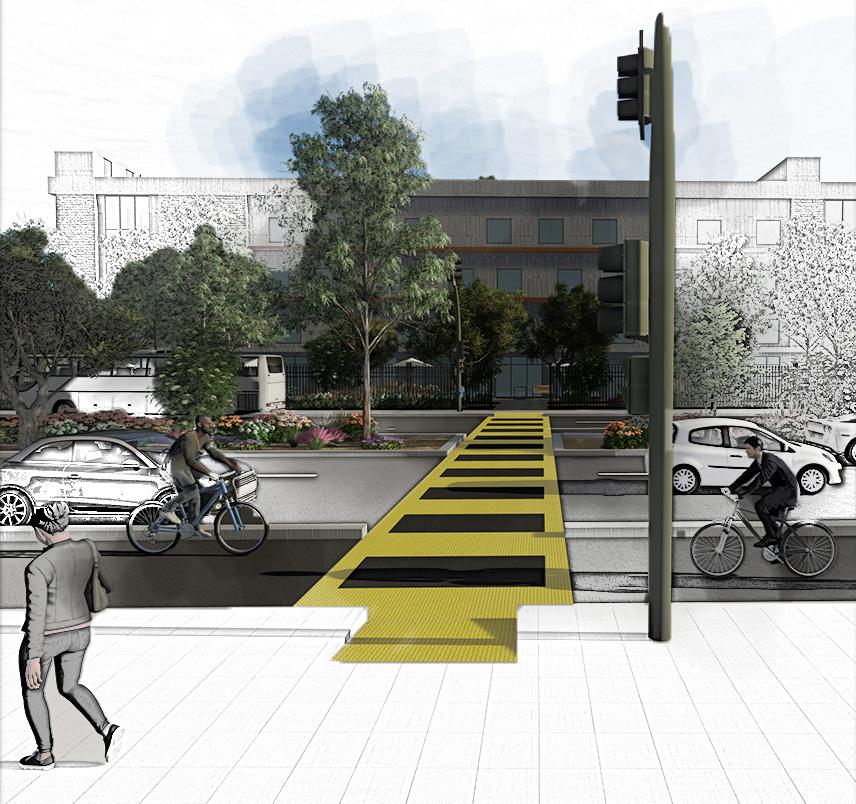
Senate Bill 330 (SB 330) already requires cities to permit whatever housing density is permitted by their General Plan. As a result, the City of Pomona has no power to prevent the construction of houses in this region. All three maps—the TIMS map, SB 535, and CalEnviroScreen—depict alarming indicators of heightened safety, environmental health, and social need. However, I use “Street” and “Form” which consit of coverage, lot size, amienity, building mass, building height, and stories to address these issues and figure out how to make accommodations for high-quality homes in this severely cumulatively impacted region on Reservoir St. In the images that follow, I’ll show how I apply quantifiable “Form” requirements and suggest new street conditions. Which considers the overall effects of pollution, truck traffic, noise, dust, debris, nuisance, and transportation injury, enabling the coexistence of higher dwelling densities and minor industrial facilities.


This map

Injury (Severe)
Injury (Other Visible)
Injury (Complaint of Pain)
2 -
3 -
4 -
SB 535 Disadvantaged
CalEnviroScreen 4.0 PM2.5 The indicator indicates the average concentration of
particulate matter (PM2.5)
the
> 90-100 Legend Legend Legend Site Service Street M-2 General Indstrial R-3 Medium Density Multiple M-1 Light Indstrial R-2 Low Density Multiple Family Outside of Pomona City Limts 4 URP 4850 | Spring 2022 | Software: Google Earth-> AutoCad -> Revit -> SketchUp -> Lumion-> Photoshop Transportation Injury Mapping System (TIMS) 2019-2021 Site Plan- Proposed Conditions S Reservior St E Olive St Mills Ave County Rd E Olive St S Reservior St Mills Ave Site Site Site Site Light Industrial Warehouse Mixed-Use Multifamily Docking Station Wrapped Parking Complex Site Plan- Existing Conditions N N
depicts the Cal EPA-designated disadvantaged communities for the purposes of SB 535. These are the 25 percent highest scoring census tracts in CalEnviroScreen 3.0, as well as other areas with high pollution and low population.
fine
in
air. This census tract has a PM2.5 percentile of 92, which means it is higher than 92 percent of the census tracts in California.

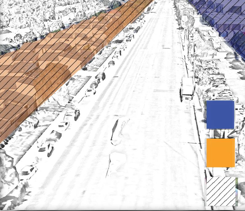

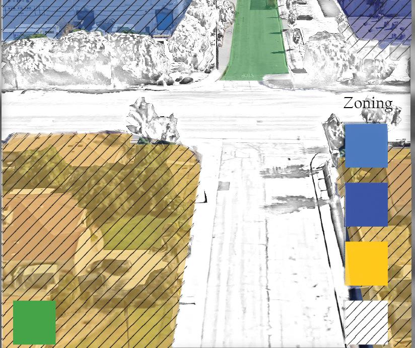


E Olive St S Reservior St 5 S Reservior St - Complete Street Corridor Mills Ave - Truck Oriented Throughfare E Olive St & S Reservior St - Intersection Enhancements Zoning Proposed Truck Oriented Throughfare M-2 General Indstrial Outside of Pomona City Limts SB330 Overlay Zone M-2 General Indstrial Proposed Truck Oriented Throughfare M-2 General Indstrial SB330 Overlay Zone SB330 Overlay Zone R-2 Low Density Multiple Family M-1 Light Indstrial R-3 Medium Density Multiple Zoning Site Light Industrial Warehouse Docking Station Mixed-Use Multifamily Wrapped Parking Complex
County Road
Building coverage (max) 61%
Building setbacks
Primary street (min) 30’ Side (min) 20’ Rear (min) 20’

Building coverage (maximum) and residential building sizes with the rest of the neighborhood. for future projects by providing pedestrian circulation. Enables friendly, sustainable, and aesthetically environments.
The minimum setback provides to capture runoff and buffer zones gas emissions, and heat island frontage zones which allows designers orientation and activation for can be activated by mixed-use storefronts. Allows more visual add facades to create a good design. prevent crowding between adjacent Pedestrian circulation.
Lot Size
Lot area: N/A Lot Width: N/A

Amenity
Residential amenity space (min) 15% (Roof Garden and ground level open space)

Residential and Warehouse shared amenity space (min) 6.5% (Outdoor Track)
Warehouse amenity space (min) 3.5% (Outdoor Break Space)
Because each parcel is unique, point in establishing requirements areas and lot widths

The following lot amenity space component from the community, and warehouse to experience their unique social environment. While residents and industrial employees within a shared space. The amenity outdoor recreational and social
Lot amenity community Space (min) 1% (Storefronts Outdoor Patio Space)

Removes the problem of having long building breaks that encourages enough allow good design and realthship between

Coverage Reservoir St Mills Ave
Amenity & Coverage: Building Setbacks Building Coverage Lot size Side Setback 52’ Primary Street Setback 41’ Building Break 50’ Side Setback 21’ 150, 153.53 sqft 43,524.55 sqft 86’-2 ” 64’ Property Information Assessor's ID No: 8330-012-023 Parcel Size 7.3 Acres Property Line Building Break 50’ -13/16” Mixed Use Building Width 208’-3 1/2” Stories & Height 12ft per story Base height in stories (max) 5 Having a max 5 story 12 feet per story leaves room for potential opportunities for developers to build higher density at the expense of community benefit services. Enables future development that considers the character of Historical-cultural aspects and the scale of their surroundings. Building Mass Building width (max) 480’ Building Break (min) 50’ The buidling width confronts the problem of having long buildings that don’t leave enough circulation and keeps future development to consider more human scale projects. the miminium building break allows enough space to allow good design and relatinship between buildings. That can be used with programing to create activation and to allow accesible pathways. Lot amenity community Space (min) 1% (Storefronts Outdoor Patio Space) Residential Amenity Space (min) 15% (Roof Garden and Ground Level Open Space) Warehouse amenity space (min) 3.5% (Outdoor Break Space) Residential and Warehouse Shared Amenity Space (min) 6.5% ( Outdoor Track) Amenity 12’ 24’ 36’ 48’ 52’ 58’ Story 4 Story 3 Story 2 Story 1 Story 4 Story 3 Story 2 Story 1 48’ 36’ 24’ 12’ Stories & Height 6 Objective Design Standards - Form URP 4850 | Spring 2022 | Software: Google Earth-> AutoCad -> Revit -> SketchUp -> Lumion-> Photoshop N
is 61 percent to prevent warehouse from becoming out of proportion neighborhood. It also ensures consistency providing enough space for vehicular and Enables the creation of environmentally aesthetically pleasing healthy
provides enough space for landscaping zones to reduce noise, greenhouse effects. Allows enough space for designers to take advantage of community engagement. Which mixed-use developments providing visual entrances and enough space to design. The side and rear setbacks adjacent parcels and enough
there is no requirements for lot
space allows each community, residential, their own While allowing employees to congregate amenity space provides social benefits
long buildings and enough space to between buildings.
Mills Ave County Rd Site Service Street 7 S Reservior St Mixed-Use Multifamily Wrapped Parking Complex Light Industrial Warehouse Docking Station Site Plan- Proposed Conditions N


8 Part of 15% Residential Amenity Space 1 % Lot Amenity Community Space 3.5% Lot Amenity Warehouse Space Storefront Patio Space Outdoor Lounge Area Part of 15% Residential Amenity Space Part of 15% Residential Amenity Space 6.5% Lot Shared Amenity Space 21’ URP 4850 | Spring 2022 | Software: AutoCad -> Revit -> SketchUp -> Lumion-> Photoshop Open Space - Roof Garden Open Space - Roof Garden Open Space - Outdoor Track Open Space - Green Lawn


9 Parking Elements Wrapped Parking Complex Entrance Site Service Street Site Service Street 50’ Lounge Area Complete Street Corridor Unit Types Light Industrial Docking Station Building Break S Reservior St - Complete Street
Placemaking
Project Information
Assessor’s ID No: 7421-022-036
Address: 111 W PACIFIC COAST HWY LOS ANGELES CA 90744
Property Type: Commercial/ Industrial Parcel Size: .4 Acres
Project Type: Academic
Undergraduate: URP 4040 Placemaking: Theories, Methods, and Practices Date: Fall 2021


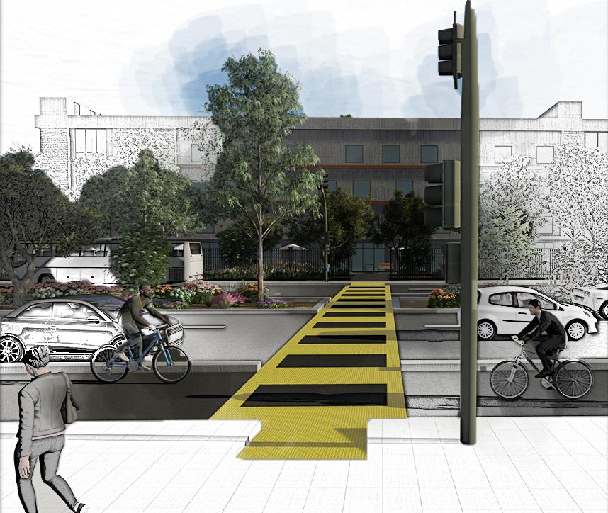
The site is situated at critical crossroads between E Pacific Coast Highway and N Avalon Boulevard. It is unique because of its diversified zoning which includes single-family and multi-family dwellings, commercial space, open space, and public uses like Banning High School neighbors across N. Avalon Blvd. The location will be a community center with a variety of activities, including a fresh vegetable market, a computer lab, free tutoring, a leisure space, and a cooking demonstration program for healthy meals on the first floor. The second floor will serve as a meeting area, daycare facility, and community garden. The initiative also seeks to decrease the negative effects on the environment of traffic, exposure to PM 2.5, diesel particulates, and toxic facilities. More individuals will be motivated to walk or bike instead of drive if the air quality is better. This can be accomplished by increasing landscaping to decrease the heat island effect, increase precipitation absorption, and lower GHG emissions. Bus stops that are attractive to the eye, road diets, gorgeously landscaped street medians, protected bike lanes, the installation of a crosswalk light guard system, and fewer street parking are all examples of human-scale enhancement. This will all contribute to converting the dangerous pedestrian E Pacific Coast Highway into a complete street with fewer pedestrian motor conflicts, reducing adverse environmental effects while boosting Wilmington’s pedestrian footprint.
Building Mass

10
URP 4040 | Fall 2021 | Software: CalEnviroScreen -> Excel -> Cadmapper-> Google Earth-> AutoCad -> Revit -> SketchUp -> Lumion-> Photoshop CalEnviroScreen 4.0
Space Public Site
Zoning Single Family Residential Multi-Family Residential Commercial Open


Site 11 Photoshop
Coast Hwy & N Avalon Blvd - Pedestrian Injuries
Coast Hwy & N
Blvd - Commuity Center & Complete Street
Pacific Coast Hwy & N Avalon Blvd - Existing Conditions Site Community Center Site
E Pacific
E Pacific
Avalon
E
-
12 URP 4040 | Fall 2021 | Software: AutoCad -> Revit -> Lumion Siteplan
UP-
----DN---
N
1st Floor 2nd Floor Community Center N Avalon Blvd E Pacific Coast Hwy Banning High School N N


Fresh Produce Market Day Care Community Garden 13 Siteplan Render 1st Floor Render 2nd Floor Render Healthy Food Cooking Demonstration Program Computer Lab Leisure Space Community Center N


A A B B C C 14 N Avalon Blvd & E Pacific Coast Hwy - Enhancements N Avalon Blvd & E Pacific Coast Hwy - Existing Conditions Siteplan - Street Section Key URP 4040 | Fall 2021 | Software: Google Earth-> AutoCad -> Revit -> SketchUp -> Lumion-> Photoshop


15
N Avalon Blvd Section CC
E Pacific Coast Hwy Section BB
N Avalon Blvd Section AA
Neigborhood Building
Project Information
Assessor’s ID No: 211131031, 211131026, 211131032, 211131024, 211131023, 211131023, 211131022, 211131021, 211131020, 211131019, 211131018, 211131017, 211131012
Location: Park Ave & University Ave Riverside CA, 92507
Property Type: Commercial/ Residential Site Size: 3.69 Acres Project Type: Academic
Undergraduate: URP 2020A Tools and Graphic Communication for Planning Activity Date: Spring 2021
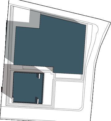
The site which consists of 13 lots totaling 3.69 acres and is located at a busy intersection of Park Avenue and University Avenue in Riverside, California. The location will transform into a public/commercial area with a range of uses. The main structure will have two stories, with the first floor serving as both public seating, a place for street sellers and small enterprises to set up shop between the columns and make use of the shade, public facilities, and regular client base. This concept aims to establish a location with facilities where street cart merchants may feel safe and at ease while also defending them against robbery, bigotry, and harassment. There will be 8 units totaling 20448.8392 square feet of commercial space on the second floor including outdoor dining areas for restaurants and shops. Other features include an open lawn in the middle of the property that can be used for community activities including art walks, farmers markets, recreational events, small concerts, outdoor movie evenings, and leisure space. There will also be an operations and maintenance facility, which will be responsible for site upkeep and helping street sellers obtain their business licenses, food handler licenses, and permits in order to avoid fines, jail time, and having their possessions seized. Finally, there will be a security structure providing on-site 24-hour surveillance.

16 URP 2020A | Spring 2021 | Software: AutoCad -> Sketchup-> Google Earth -> Photoshop

17

18 URP 2020A | Spring 2021 | Software: AutoCad -> Sketchup-> Google Earth-> Photoshop

19
Program Development
Property Information Assessor’s ID No: N/A
Location: 34°08’15.1”N 118°09’16.7”W
Property Type: Public, Semi-Public Site Size: 50.94 Acres Project Type: Academic Undergraduate: URP 4030 Physical Design Applications Date: Spring 2022
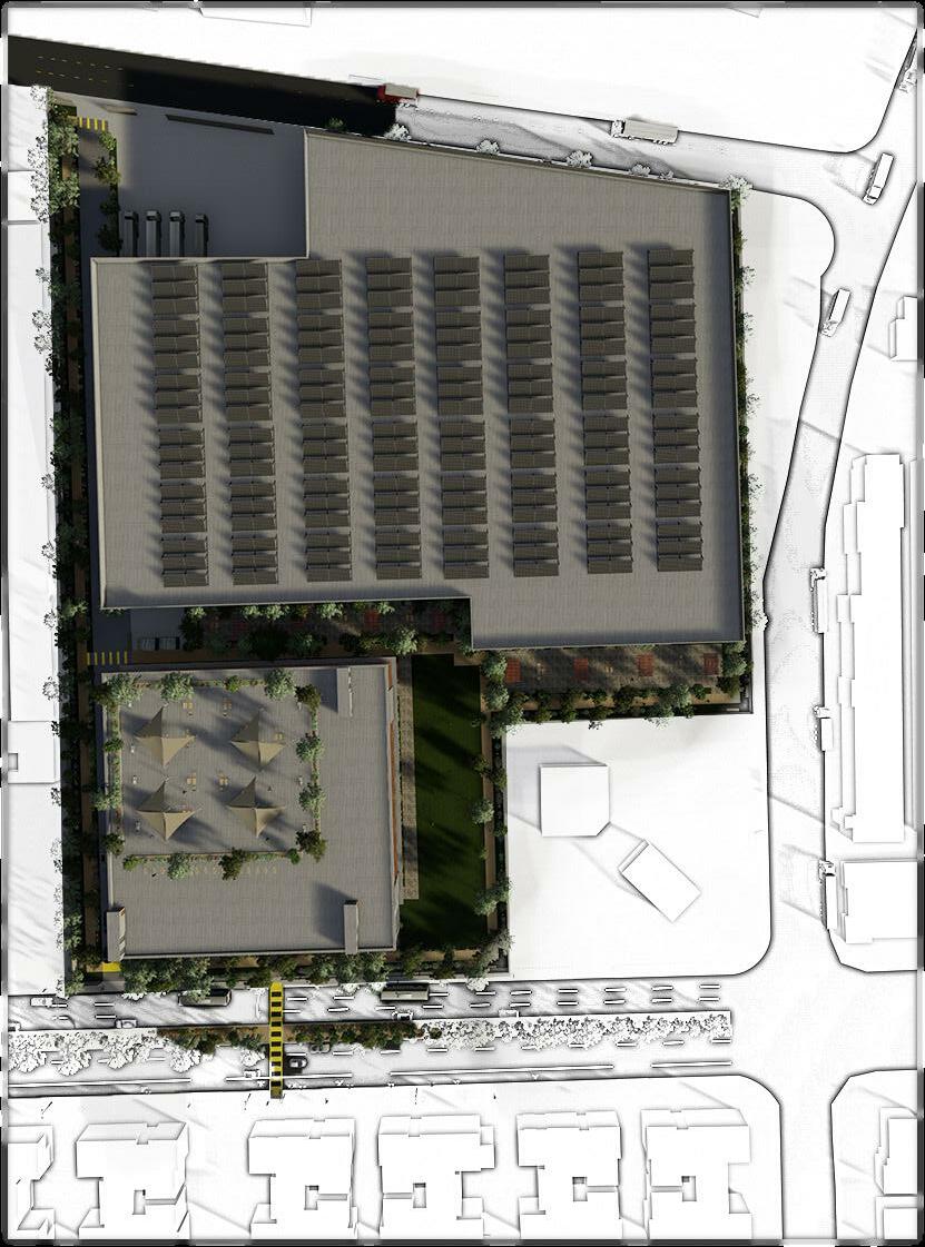
The location of the site is on a section of the excavation for the now-cancelled 710 Fwy extension between the Sequoia School on the south and roughly reaching up to the 210 Fwy on the north. The goal is to determine how to reconcile the gap that divides the site’s west and east ends. There are four sections to the project. First, there will be a community center that offers educational possibilities as well as athletic areas like three tennis courts, a soccer field, a baseball field, and a basketball court, from the Sequoia School to W Del Mar Blvd. Second, there will be mixed-use areas where you can live and shop from W Green St. to W Del Mar Blvd. Third, there will be a parking garage from W Green St to W Colorado Blvd that will let tenants and guests park within the building after departing from the 710 and 210. They can either depart the parking complex from the base floor which will take them to W del Mar Blvd, or from the level above W Green St. This parking building is also special because it has a playground, outdoor gym, community garden, and public restrooms on the roof. There will be open space, a pedestrian bridge that leads more west of the side, and a pedestrian/bike route that leads more east of the site from W Colorado Blvd to about the 210 Fwy. This design, in my opinion, contains a varied setting that can accommodate everyone and cover the points in what is most required to establish a 15 minute neighborhood. There will be a network of open spaces for pedestrians to travel through the four sections of the proposed site. The fact that you may live, work, play, learn, adventure, and shop all in one well-connected space is what distinguishes this idea from others.
Site Plan - Existing Conditions

Site 20 710 URP 4030 | Spring 2022 | Software: Google Earth-> Photoshop -> ArcGis
210
N
Transportation Modes Public

Amienities Insie & Oustide 1 Mile Buffer Radius
Schools

21

22 URP 4030 | Spring 2022 | Software: AutoCad -> Sketchup-> Google Earth-> Lumion-> Photoshop
-
Site Plan
Proposed
Proposed Conditions

23
N

24 Section URP 4030 Spring 2022
| Software: Google Earth-> AutoCad -> Sketchup-> Photoshop
Section Key

25
N
V.1 & V.2 Clean Slate Concept : Multi-Generational Unit
Project Information

Assessor’s ID No: N/A
Address: N/A
Property Type: Single Family Residential Parcel Size: .14 Acres


Project Type: Academic Undergraduate: URP 4510/A Land Use & Urban Design Policy Date: Fall 2022
Since 1971, the proportion of Americans living in multigenerational households has quadrupled. People are spanning across generations for a variety of reasons, including cultural, economic, and familial caregiving. Most city zoning laws do not address multi-generational housing and were written with a focus on single-family homes. For the City of Pomona, I created two brand-new concepts for a Multi-Generational Unit (MGU) referred to as V.1 and V.2. The location, which is a level vacant lot measuring 6,000 square feet, is also 100 feet deep and 60 feet wide. V.1 clean slate concept demonstrates how to allow more diversity of uses within single-family residential zones, that doesn’t only accommodate MGU’s needs but also the community. This can be achieved through Live Work Units that promote a conversation with the street, an ADU that allows for more monetizable aspects and space. Also, one main open space courtyard that allows all aspects of the home to gather. V.2 clean slate concept emphasizes on multi-generational communal engagement that allows social gatherings to take place all throughout the home. This layout allow for accessibility and adaptability aspects by providing opportunities for expansions, and conversions when it comes to storage or adding additional units. ADU
V.1 MGU Design
26 URP 4510/A | Fall 2022 | Software: AutoCad -> Revit -> Lumion
Live Work Unit Live Work Unit
Primary Unit Live Work Unit


--90 SF Room 1 96 SF Room 2 40 SF Bath 0 10 SF Closet 10 SF Closet 301 SF Kitchen 62 SF Studio Space 34 SF Bath 18 SF Closet 249 SF Kitchen 217 SF Primary Room 59 SF Closet 70 SF Bath 49 SF Bath 1 19 SF Closet 169 SF Room 1 92 SF Laundary 754 SF Great Room 179 SF Room 2 20 SF Closet 51 SF Bath 2 97 SF Office Kitchen Foyer Living Space Patio 269.06 SF Patio 168 SF Driveway 480 SF Green Space 524.13 SF Sidewalk Street Apron Walkway Walkway 275 SF Walkway Neighbor Walkway 1271.68 SF Walkway 42.88 SF Great Room 27 Floorplan Primary Unit ADU ADU Live Work Unit Primary Unit N

28 V.2 MGH Design Floor Plan Site Plan Building Coverage 3461.60SF / 58% Landscaping Coverage 1662.10SF / 28% Multi-Generational Layout Accessible To increase accessibility, Adaptability is made extra units as shown with the red arrows Backyard Section BB Section AA Back Patio Bedroom 5 Bedroom 4 Bedroom 3 Bedroom 2 Bedroom 1 Front Patio Carport Storage Bathroom 1 Bathroom 2 Bathroom 3 Living Room Kitchen Laundry Room N URP 4510/A | Fall 2022 | Software: AutoCad -> Revit -> Lumion
Accessible & Adaptable Layout

accessibility, all doors are 32” wide and comply with ADA regulations. made possible by the possibility of increasing storage or adding shown within the green borders. Vehicular circulations is indicated arrows and pedestrian circulation is shown with the yellow arrows.
West
South
East North
Frontage
29 A A B B
The house frontage brings a conversation to the street by having no fencing and a patio that allows property owners to utilize their front yard which is further activated by having a curtain wall double door that increases accessibility and circulation. The landscaping is minimal to allow space for social gatherings to take place. Potential for a separate unit Potential for a separate unit Potential to expand storage or add an extra


30 Design Process Still Life to Architectural Sketch Night Time Day Time Physical Model Multimeda: Watercolor, chalk, pencil Demensions: 8.5” X 11” Physical Model | Material: White foam board
