1 minute read
Chapter 2. Evidence and Analysis SITE AND CONTEXTUAL ANALYSIS


Advertisement
South Downs Way
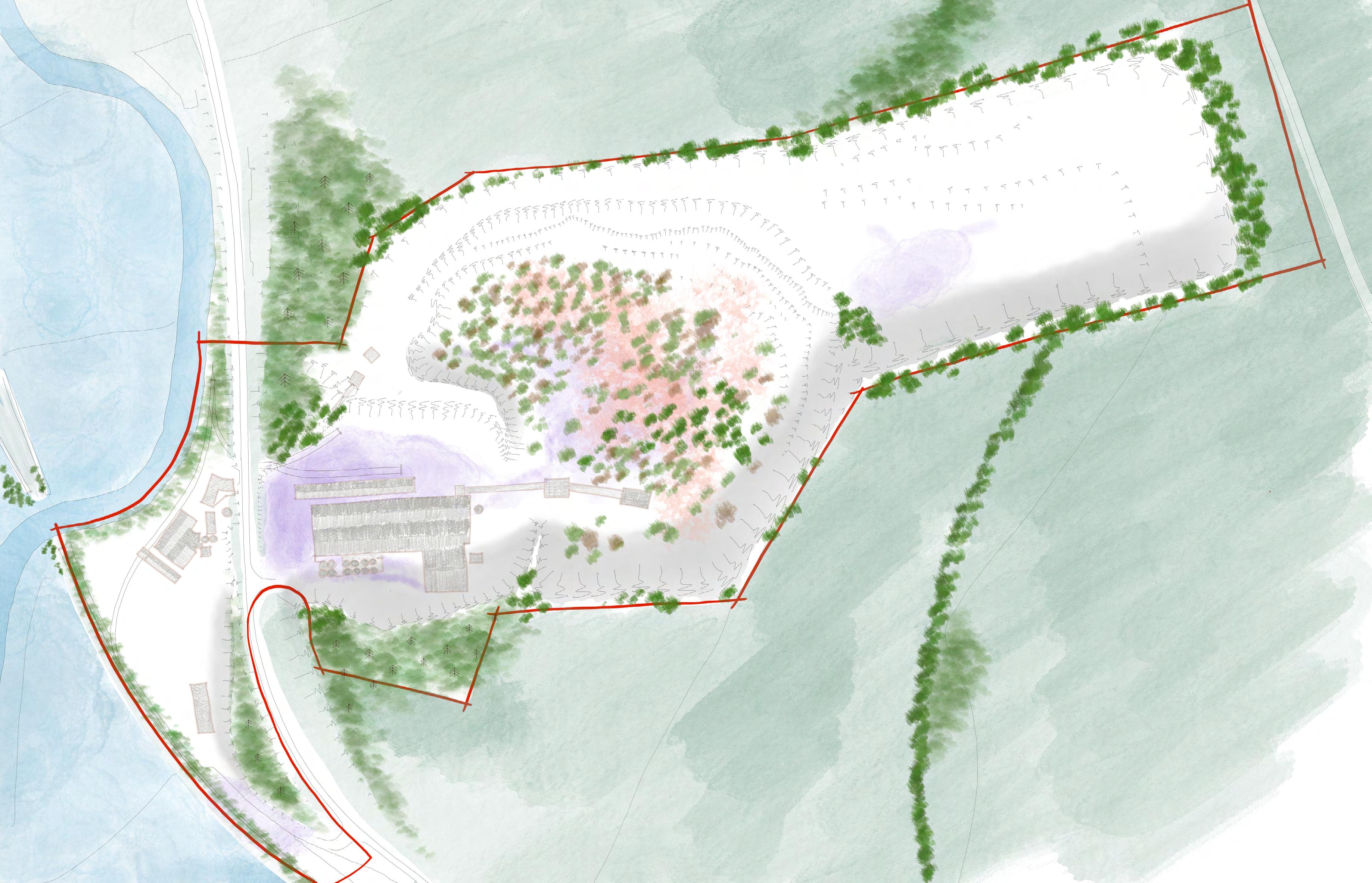
Existing structures


Most buildings contain asbestos. Buildings, conveyors, rail tracks, and surfaces contribute to the cultural industrial character of the site. Buildings have potential for birds/bats habitat.
Ground contamination


The central area is heavily constrained by substantial deposits of concrete kiln dust and is the site of a former lagoon. New buildings would require significant decontamination and complex foundations.
Tidal/river flood risk
The River Adur is tidal and when extreme events happen, the valley floods. Existing defences along the riverside prevent the site from flooding, but climate change could change this.
Surface water flooding
The A283 embankment prevent from most runoff water to flow down to the river. Chalk is permeable, but there are areas of standing water due to large extent of impervious surfaces (e.g. buildings, yards).
Shade
Due to the topography, areas along the southern boundary/cliffs are in the shade, except in Summer months. Contrarily, large areas are exposed to sunlight, glare and overheating.
Cliffs
Downs Link
Trees and woodland
Large wooded areas along the A283 and trees along the riverside boundaries.
Shrubs and hedgerows
Rich and varied vegetation has grown within the central area. Hedgerows form most field boundaries.
Chalk grassland


Native chalk grass and wildflowers are a priority habitat in the South Downs.
Scarp cliffs evidence the quarrying industries and are of geological and ecological value. There is a risk of erosion/ collapse but cliffs offer opportunities for long distance views. Birds nest in some cliffs.