
RAMROD Course Preview, 8/29/24
Introduction
On 8/29/24 Bill Pence and Pam Austin drove this years RR course to check for hazards, test the cue sheet, and photograph the various stops. Along the way we were able to make some useful observations. We had a timed entry reservation for 1-3PM, and left the Expo center at around 1130.
Course Notes
Mile 0-12 Rumble strips on shoulder, some debris and loose gravel.
Mile 13.1 Bridge barriers narrow the road and eliminate the shoulder; this is not easily visible in low visibility conditions. Easy to run right into it.
Mile 13 -Greenwater Rumble strips on and off, very hard to see. When the shoulder is wide enough to be usable they laid a rumble strip right down the middle, making the shoulder mostly unusable.
Greenwater to Silver Springs - Shoulder is mostly too narrow to be usable.
Silver Springs:Stop One - Road to the clearing is very potholed and lumpy; as usual. The clearing has been nicely compacted with small gravel, smoothing out a lot of the potholes. Best condition I have seen it in in years. There is an abandoned camper near the entrance.
Silver Springs to Cayuse Pass- (MP 31.8-39.9) No shoulder. Pavement is in excellent condition.
Cayuse Pass Descent down 123 - Pavement is in excellent condition. Descent is not particularly technical, but there are a number of tight curves and one hairpin bend. Caution is advised. The descents in the reverse direction are significantly more challenging that on the traditional course.
Mile 43- Tunnel, lights required. Pavement in the tunnel is good.
Mile 48 - Rough, undulating road. Pavement surface is good, but there are numerous areas of settlement which have a washboard like effect with a car.
Might be easier on a bike, but slowing down is advised here so that you do not develop a speed wobble. Extends to the Park entrance.
Mile 51- Stevens Canyon Entrance One lane ticket booth. Looks like another lane could be available for bicycles. See photographs Appendix.
Backbone Ridge Climb - Pavement excellent.
Backbone Descent and Climb to Upper Box - Pavement excellent.
Upper Box Canyon:Stop Two - Sightlines make it too dangerous to use the SE (first entrance). Enter and exit through the NW, or uphill entrance. Use caution when entering or exiting to insure there is no oncoming traffic. There will be course marshals.
Stevens Canyon Climb - Pavement is in excellent condition. It looks like some grates have been replaced with a newer style that should be safer for bikes.
Inspiration Point (water stop and checkpoint) -Mile 69.4. Riders must cross the road, so course marshals will direct riders into first, southern, entrance. The RFID will be stationed near that entrance. Riders may leave by the northern entrance, which has good sight lines.
Descent down the Paradise Corridor - The entry to the Paradise Corridor is at an intersection with a Stop sign for our traffic. Stop at the Stop sign, and be aware of high speed traffic descending from Paradise. Pavement is uniformly good to excellent. The descent is challenging but not too technical. There are a few hairpin bends. Speed limit is 35 mph on the upper half, above Longmire. Very skilled riders can move faster than the cars, but more conservative riders will be going slower, possibly slowing down some traffic. There is not much traffic, which is good. On the lower portions of the road above Longmire it is quite shady in spots, and good blinking lights will be essential. The Park will be enforcing speed limits.
Longmire (MP 78.9) - The speed limit is reduced to 20 MPH, and riders need to be aware of that.
Descent from Longmire to Nisqually Entrance - The speed limit is reduced to 25 MPH for some of this descent. At Kautz Creek the limit is reduced to 20 MPH, then increased to 25 MPH for the rest of the descent. This is new. Expect the Park to have their radar trailer out to remind cars and cyclists of the speed limit.
Pavement is excellent. This section is alternating sun and shade, and bright flashing taillights are essential. Course is twisty, but not difficult.
Nisqually Entrance to Ashford County Park (MP85.4-91.6) Stop Three -
Pavement is good, course is downhill, no problems. Ashford County Park sign is not easy to see, but on a bike, they will find it on the right.
MP 91.6-103.9 - The descent continues. Some rollers, road is good quality, wide, wide shoulders. All of the RR track warnings are needed.
Alder Cutoff to Eatonville (MP103.9-110.6) - A bracing climb with a false flat, followed by a spirited descent. Pavement is in good condition. Corners are big sweepers. No shoulder. Low traffic, but some logging trucks were out in the other direction.
Eatonville Eagles Checkpoint (MP110.6) - This is a checkpoint and snack spot. We went right past it the first time. It comes just as you crest a small rise coming into town off the descent, so riders will be moving fast through here. I advise signing this well before the turn. The lot is gravel, and large. There is no natural way to flow traffic through here. People will have to turn off the highway onto the side street, then into the gravel lot, through the checkpoint, and then come back out again. Sightlines are OK for the right turn, not great. Vehicles are coming up a rise, and then appear. Fortunately, there is not much traffic.
Eatonville School District Detour - The school district has asked us to detour from the original route, which just had a right turn onto the road out of town. Easy peasy. The detour basically is just the route we take into town on the traditional route. There are, however, problems with trying to do that in this direction. The detour involves continuing on Center Road, right on Mashell, then right on Lynch road near the High School. You now make a left turn onto the road out of town, Washington Avenue. The problem here is that to the left is a blind corner, and you cannot see the cars.


View to the left of the left hand turn from Lynch Road onto Washington Road.
Below is the view from the intersection. This is a very hazardous situation, I think. The sightlines to the right are better. This is a wide intersection, because of the turn lane. Traffic could be heavy from the school run, and riders are going to have to scoot to get clipped in and get across the intersection to avoid getting creamed by a logging truck.
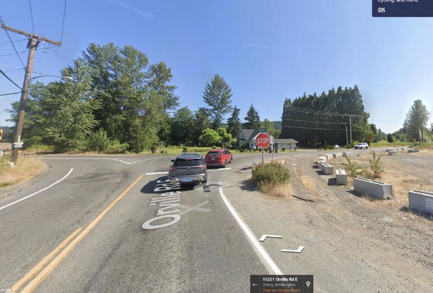
Orville Road - Pavement is good, road is undulating. Shaded. Lights helpful. No shoulder.
Kapowsin Turnoff - No issues here. Road from here to Orting is good, limited to no shoulder.
HWY162/Baxter Mfg (MP130.6) - This intersection takes us off the low traffic roads. We arrived around 4 PM, probably when the bulk of the riders will pass through. Traffic westbound on 162 was very heavy. A continuous stream of cars. Eastbound, very few cars. We are going Eastbound, against the rush hour traffic. Making a right turn at this intersection was very difficult, as the traffic was so heavy people couldn’t make a left hand turn. Traffic was very backed up at the stop sign. Bicycles can and should take to the gravel to go around the line of cars. In addition to the low traffic eastbound, the inability to make a left turn here blocked all of the cars who want to go right, onto the course. So good, for once.
Pavement is chipseal, in good condition, no shoulders. You are only on this road for about two miles. Ride fast.
South Prairie Road (MP133) - This turn is hard to see. I almost missed it. You are going to need a sign to alert the riders, I think. Once on it, the South Prairie road was in good condition, no shoulder, no traffic. Shady. Very hilly and undulating.
The Foothills trail entrance is also there, and I suspect a lot of people will choose that, as they intersect again when the South Prairie road ends.

SR 162 to Buckley (MP137.3-139.7) - leaving South Prairie the route rejoins 162 and climbs up to Buckley. Traffic in our direction was very light, only one car came up behind me. It is a climb, for about two miles, and a bit shady. Riders will want to have taillights. Just before Wilkeson Corner you cross a Bailey Bridge. Surface is good. At the Corner you turn left onto SR165. No shoulder, good pavement. Riders will be on this for about a mile and a half and then turn off onto the back streets of Buckley. You rejoin SR162 for a mile and then turn off onto the Mud Mountain road.
Mud Mountain Road (MP 143-146) - Road is quiet, beautiful, and shady in spots. Pavement is in good condition, no shoulders. Very nice finish to the route.
Traffic on the Course
We started from Enumclaw about 1130. Traffic was very light on 410. It was also very light on Cayuse and the descent off the pass. Arriving at the Stevens Canyon entrance, there was a line of three cars to get in. They processed us in about 90 seconds. Traffic was very light all the way to Reflection Lake, where the parking lot was packed. Clearly, this and Paradise were the termination points of the Park visitors.
Inspiration point had just a few cars, and we watched tourists arrive, one person leaving the car to take a selfie while the other remained in the car with the engine running.
The descent down the Paradise Corridor had a little more traffic, but not that much. If I slowed to the speed limit I generated a tailback of a few cars. I imagine cars backing up a bit with cyclists on the road, as the speed differential is not as great and it takes longer to safely pass.
Narada Falls parking lot was full, but spaces opened immediately. At Longmire, the parking lot was only half full, and I can’t remember seeing that very often on RR. I saw no one at Christine Falls, which usually has cars and people everywhere.
We will have to see how the descending riders work with the cars in the Paradise corridor. I will watch for that when I drive the course on RR Day.
Traffic Post Park
Traffic was very light. Any we saw was going against the flow of bicycles. This was particularly evident around Orting, where rush hour traffic was very heavy on 162 west bound, and traffic eastbound very light. We were transiting the latter half of the course in the same timeframe as the riders, so we had a pretty good check.
Temperatures
Through the Park, from 1330 on, we saw temperatures of low 70s. Once we exited the Park and reached lower elevations, temperatures climbed to the high 70s later in the day. The long climb of Cayuse will take place when outside temperatures will most likely be in the 50s.