
Selected Works 01
ARCHITECTURE
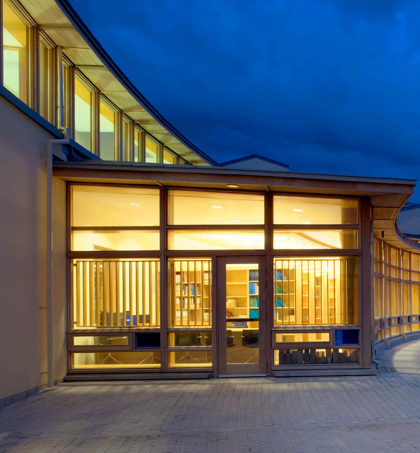
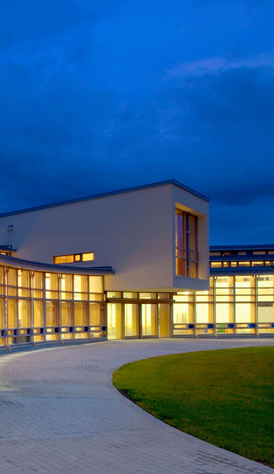
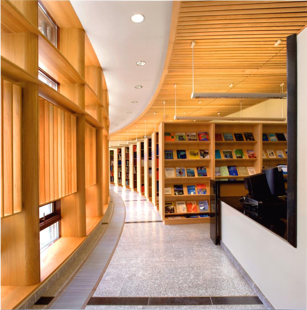
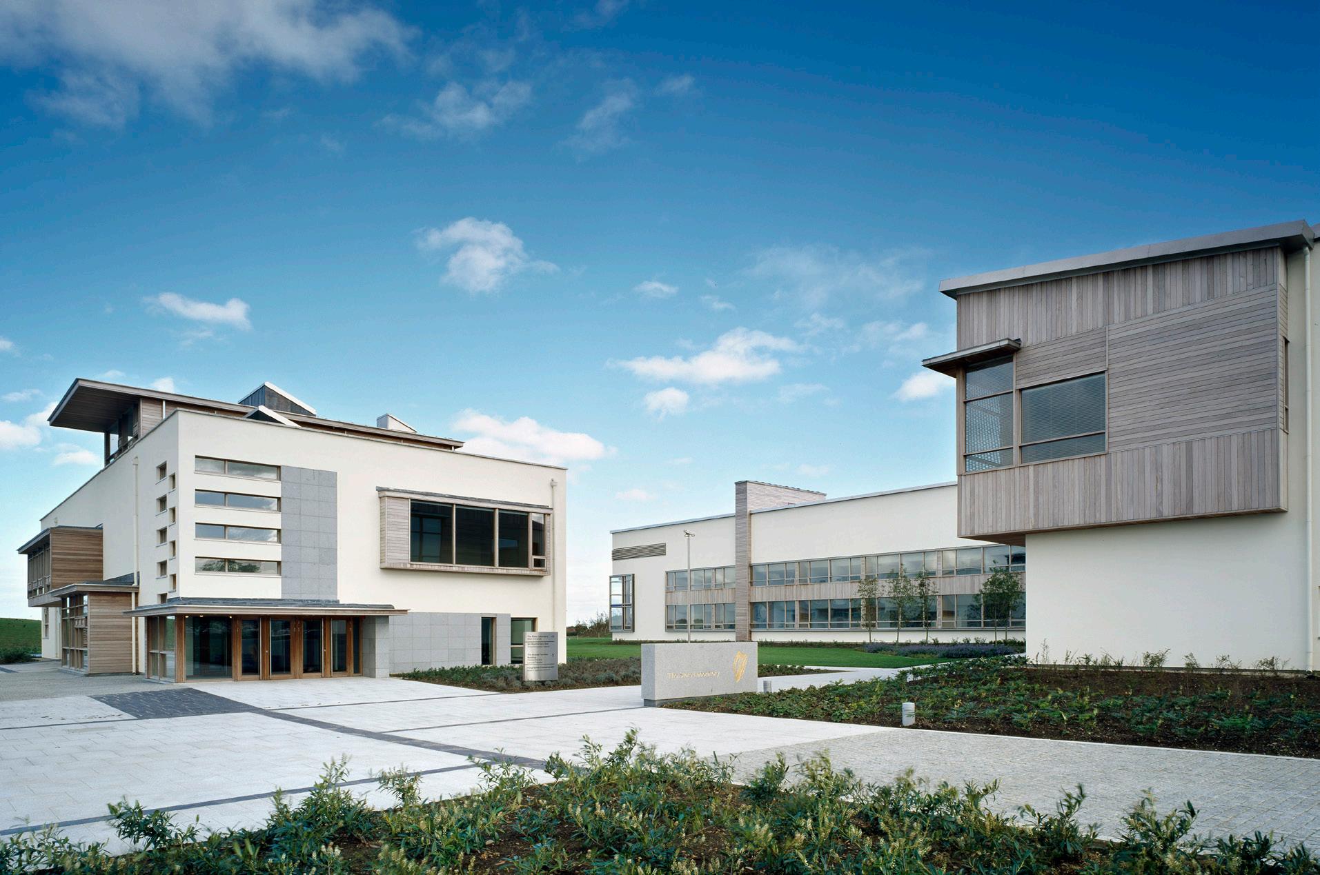
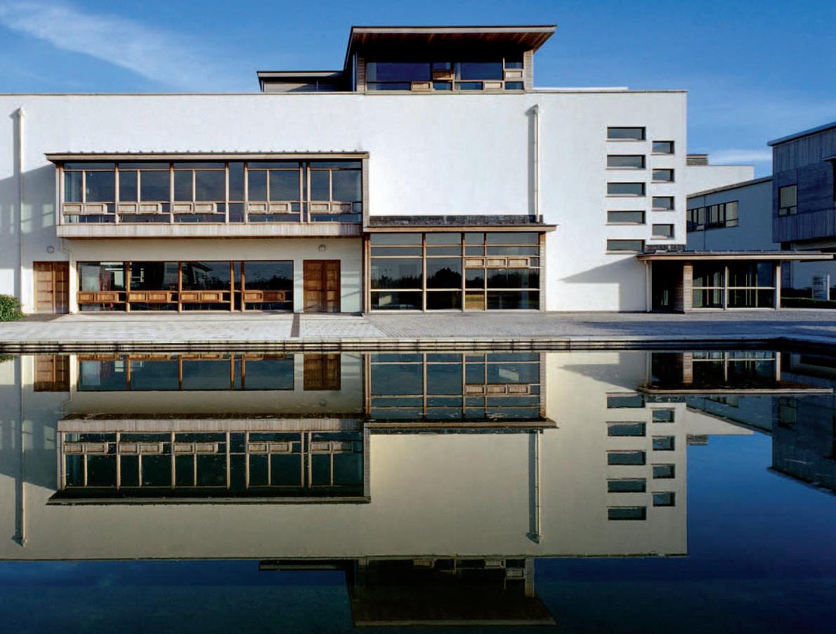
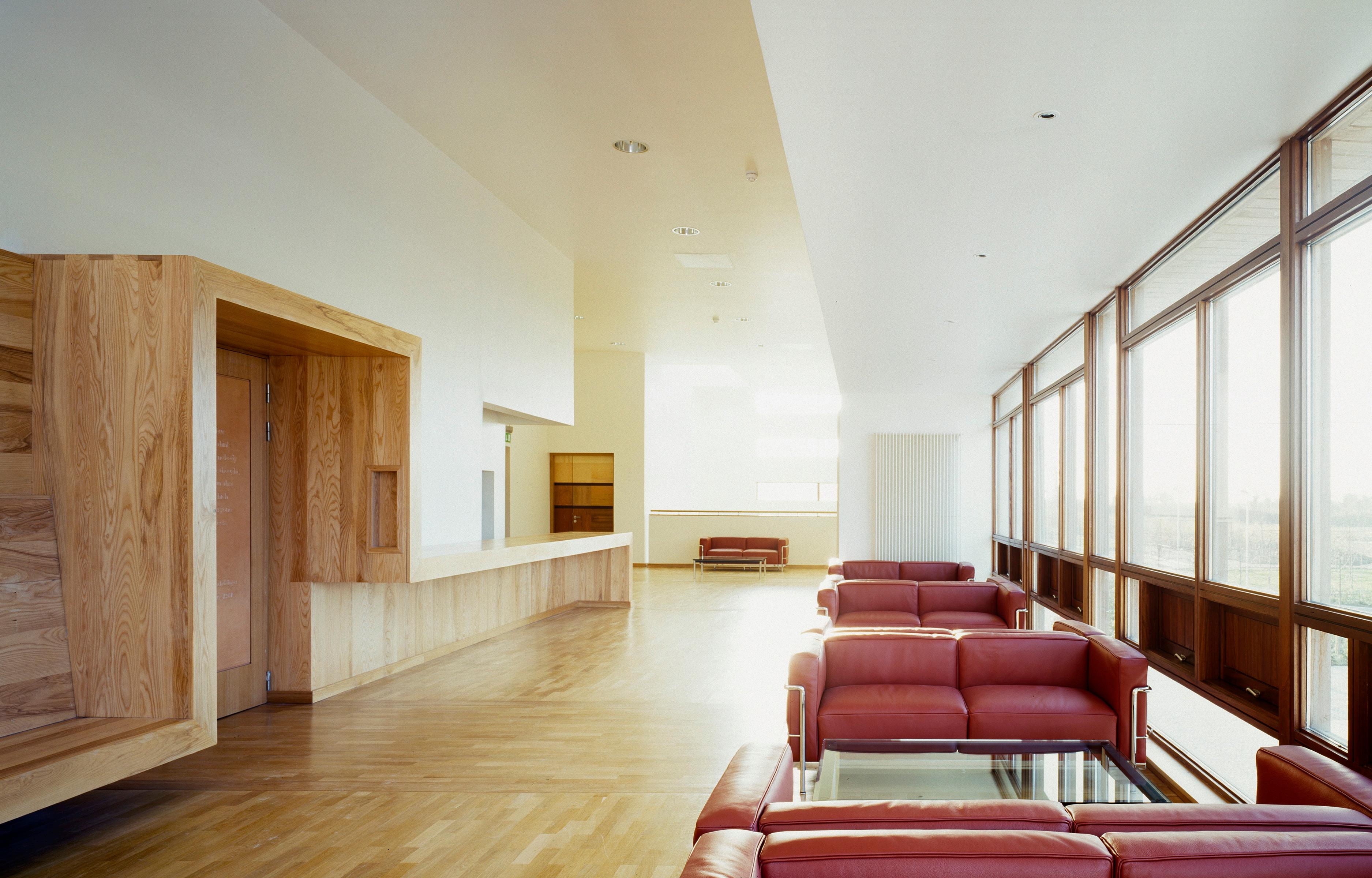
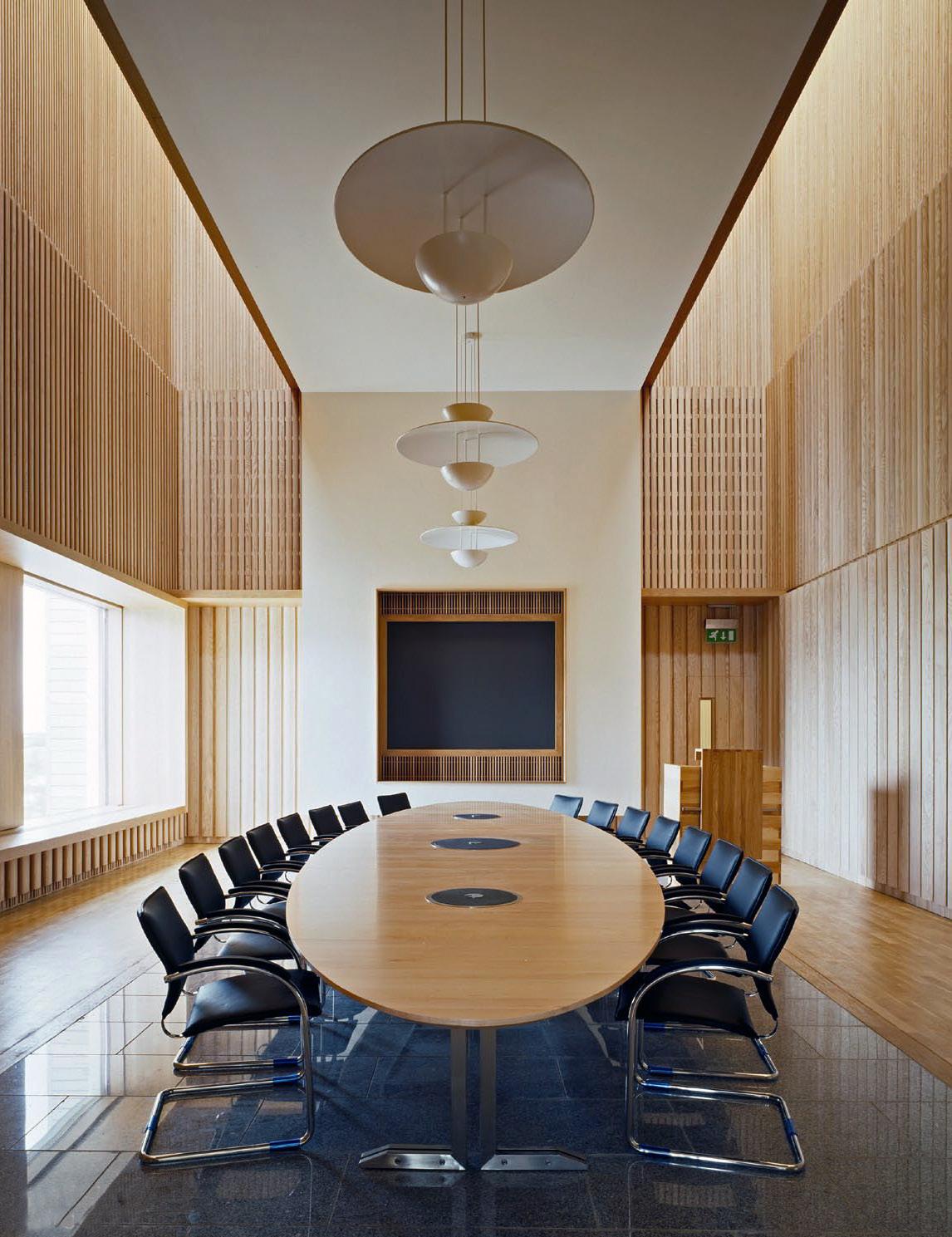
National Marine Research Institute
A state-of-the-art research center was developed with cutting edge facilities that enhanced vital national marine research and development services.
Summary
A large office complex to house the state agency responsible for marine research, technology development and innovation in Ireland. It is an extensive scheme to house marine scientists and their associated functions including offices, auditoriums, libraries and research laboratories. The latest concepts and innovations in office and laboratory design were incorporated in order to meet specialist international accreditation requirements.
The Marine Institute
CLIENT: LOCATION Oranmore Country Galway, Ireland
SIZE
51,200 sq.m
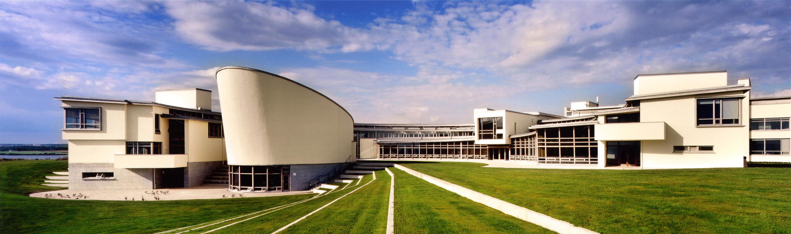
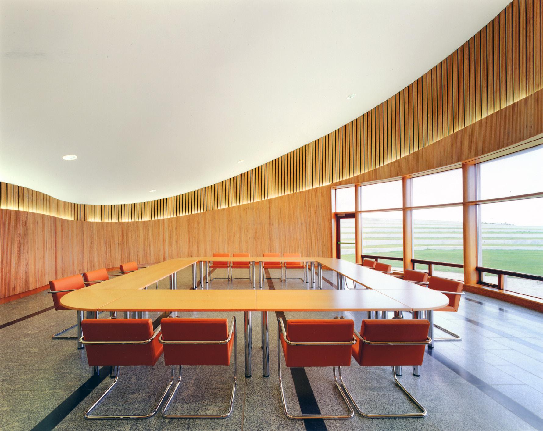
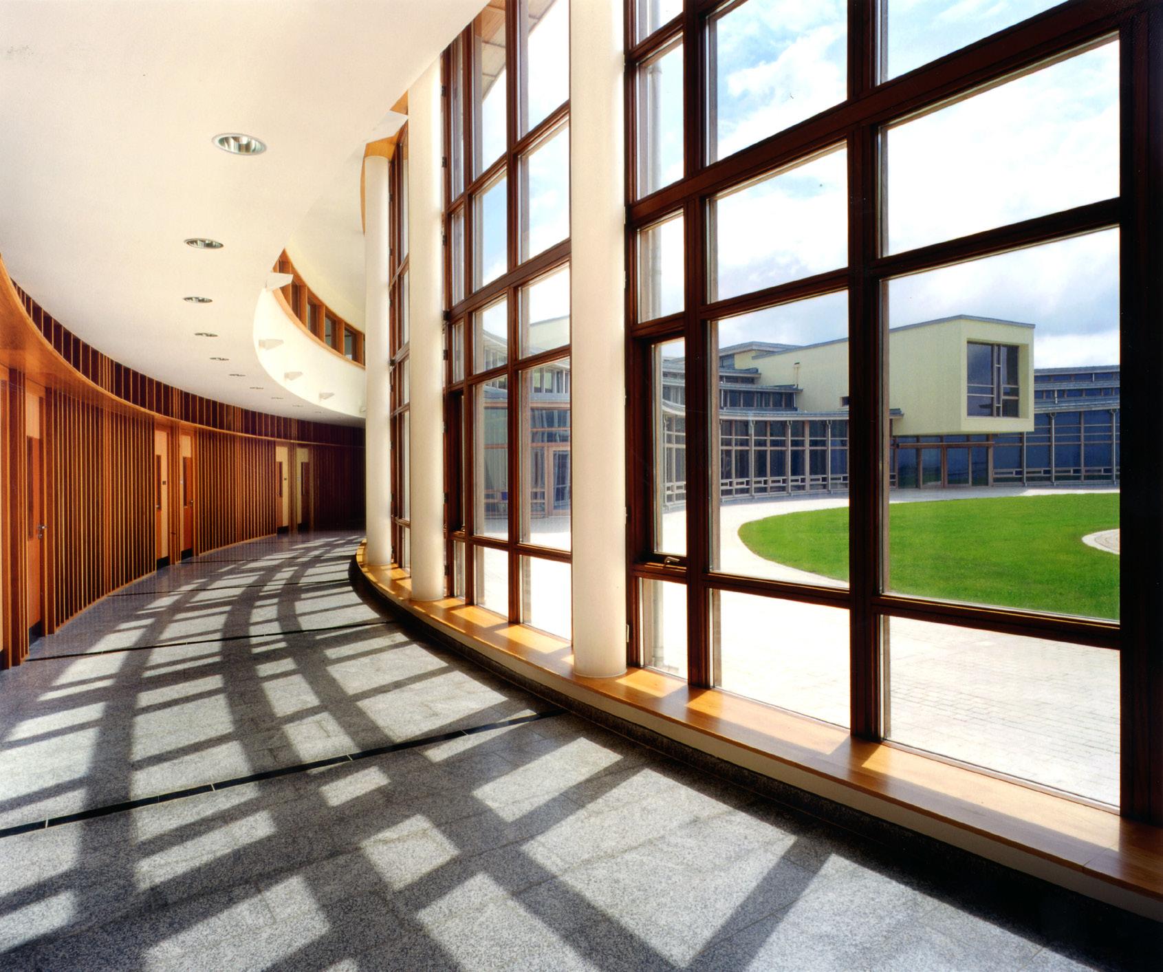
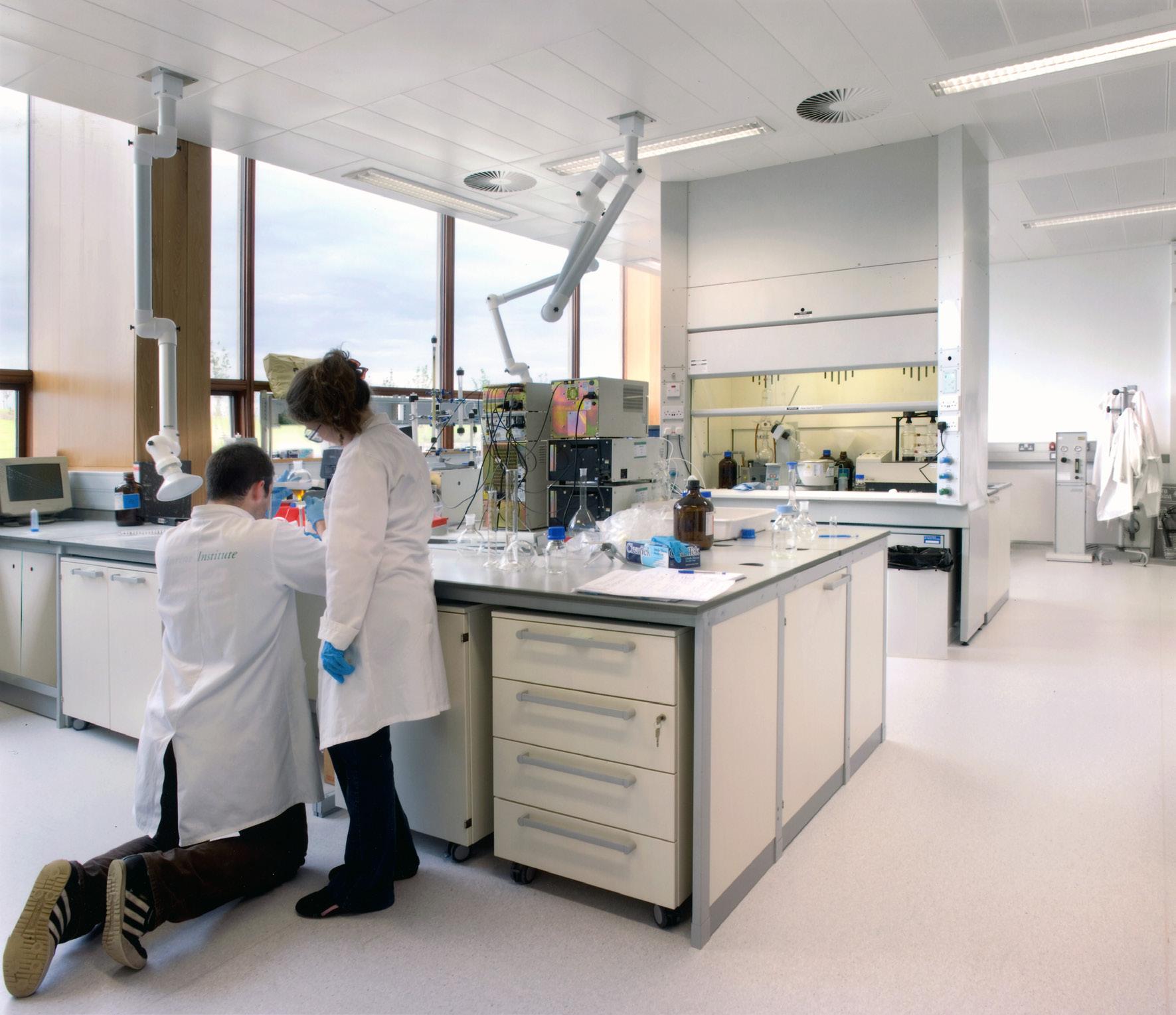
The institute carries out environmental, fisheries, and aquaculture surveys and monitoring programmes to meet Ireland’s national and international legal requirements. They provide scientific and technical advice to Government to help inform policy and to support the sustainable development of Ireland’s marine resource. Portfolio
State Laboratories
Project Goal
This is the Irish Government’s principal chemistry laboratory and provides a comprehensive analytical and advisory service to clients across a range of different disciplines

Summary
The complex brought together a number of different laboratories having a variety of functions into the one building. Ray played a key role in the production of tender drawings and detailed technical designs. As part of this project he initiated the implementation and use of Building Information Modeling (Revit) to assist in streamlining the design and production process.
CLIENT
Department of Agriculture, Food + Marine
LOCATION
County Kildare
Ireland
SIZE
9,550 sq. m
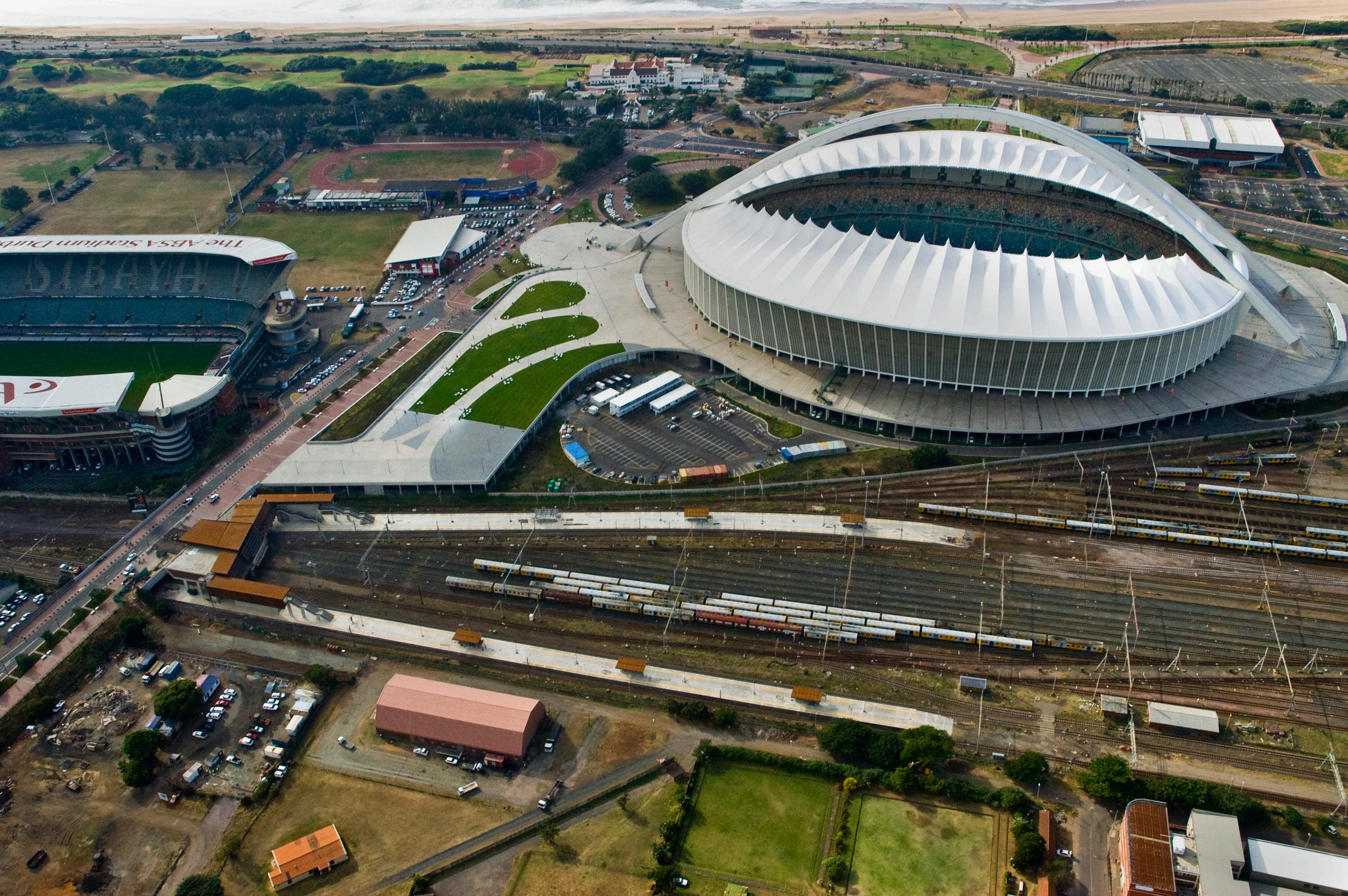
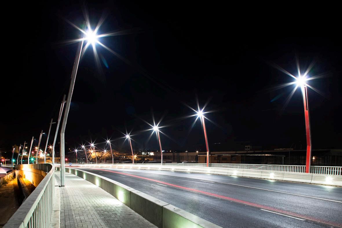
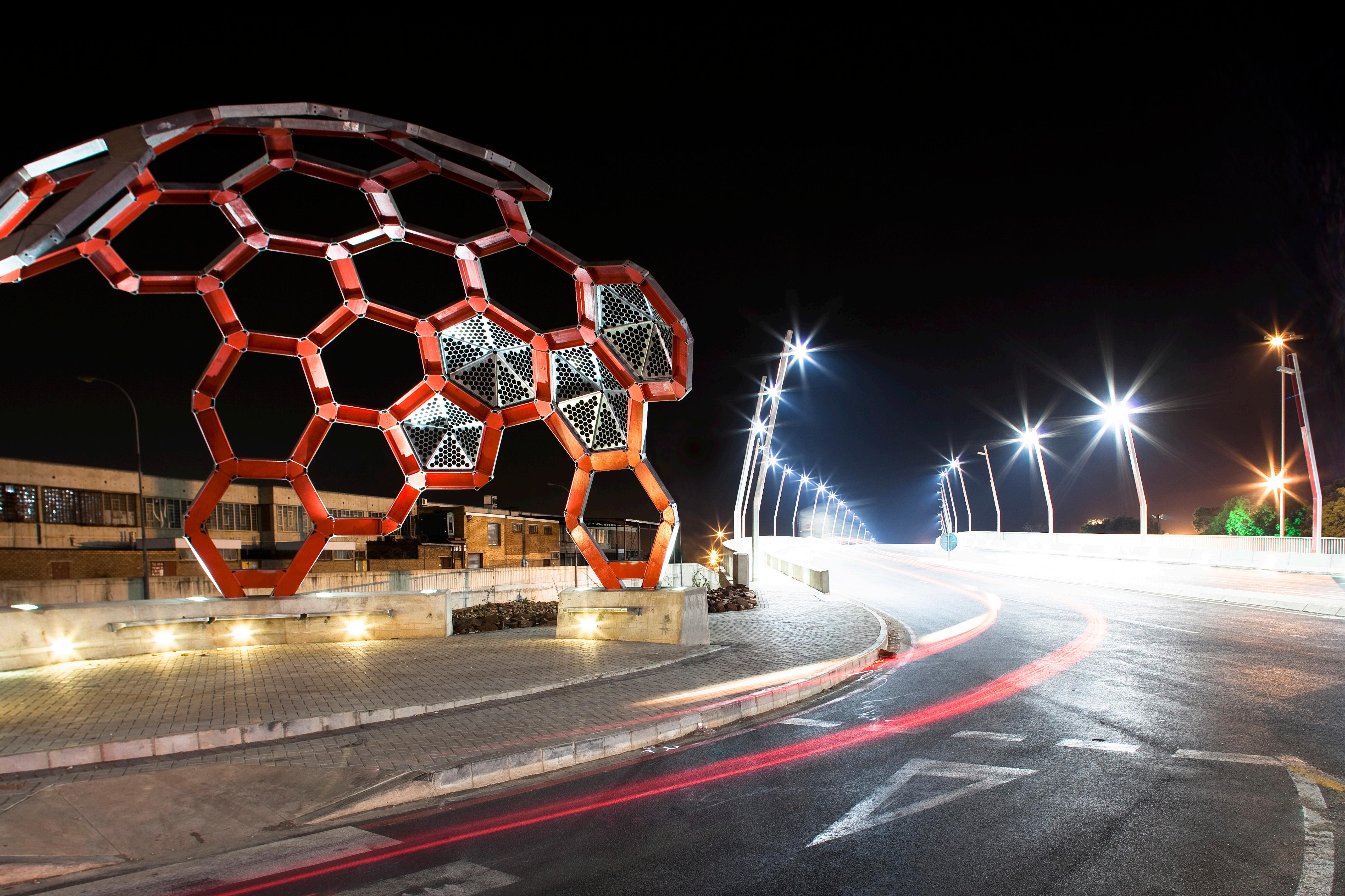
Moses Mabhida Station
Project Goal
An ambition for the station was to integrate architectural vision, civic identity and urban context within the rigorous requirements of passenger flows and operational demands.
Summary
Ray played a key role as lead architect on the successful delivery of the new award winning train station which was central to the 2010 World Cup events held at the adjacent football stadium. The station combines the highest international standards of comfort, ease of movement, visibility and security.
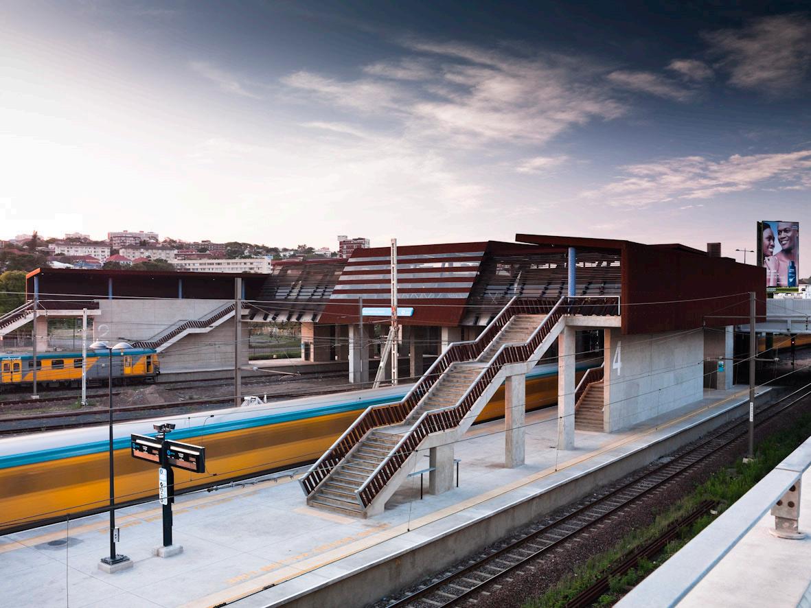
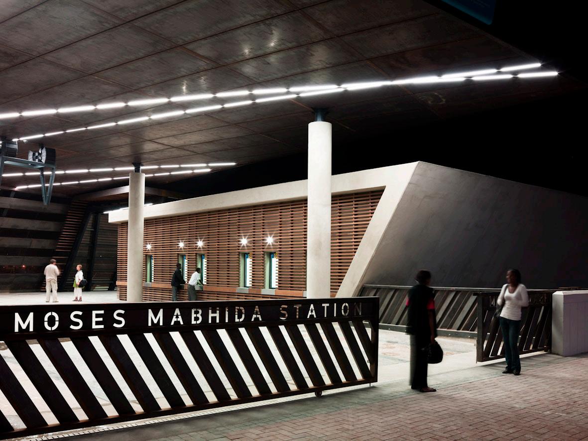
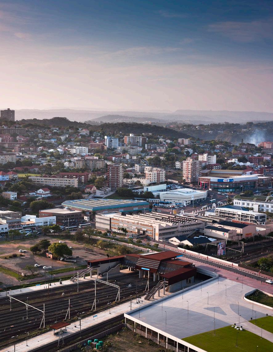
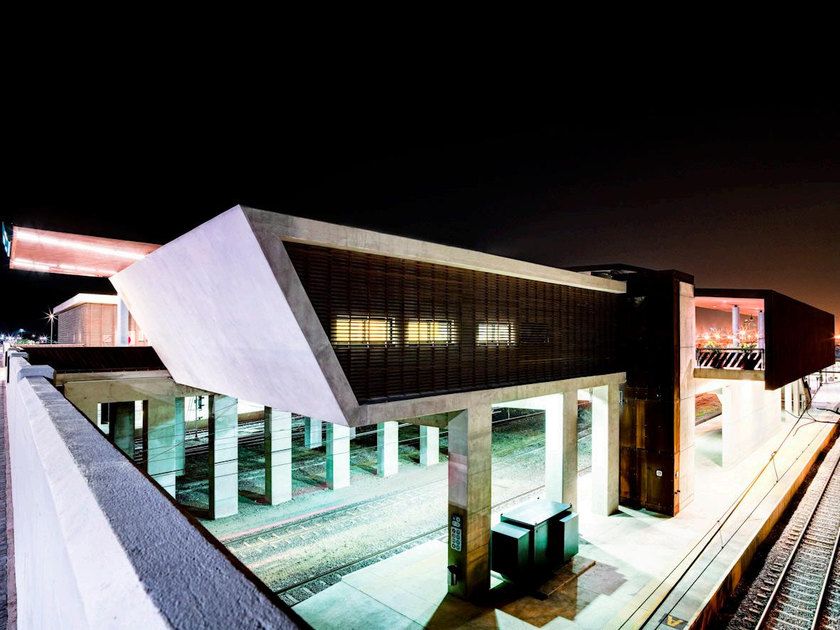
25,000 sq. m SIZE CLIENT Passenger Rail Agency of South Africa LOCATION Durban, South Africa
Portfolio|
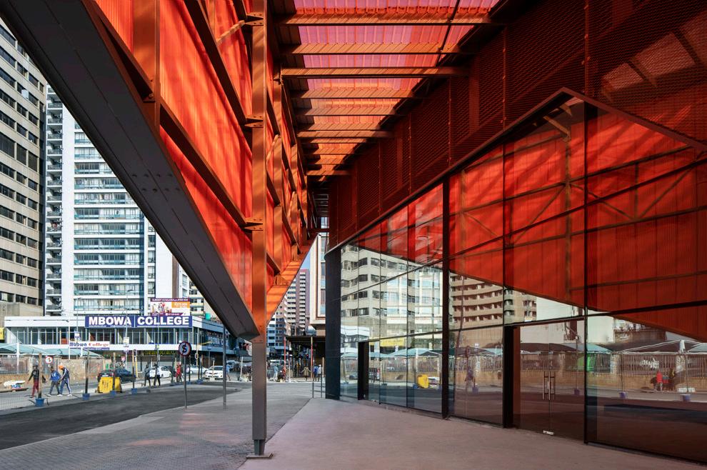
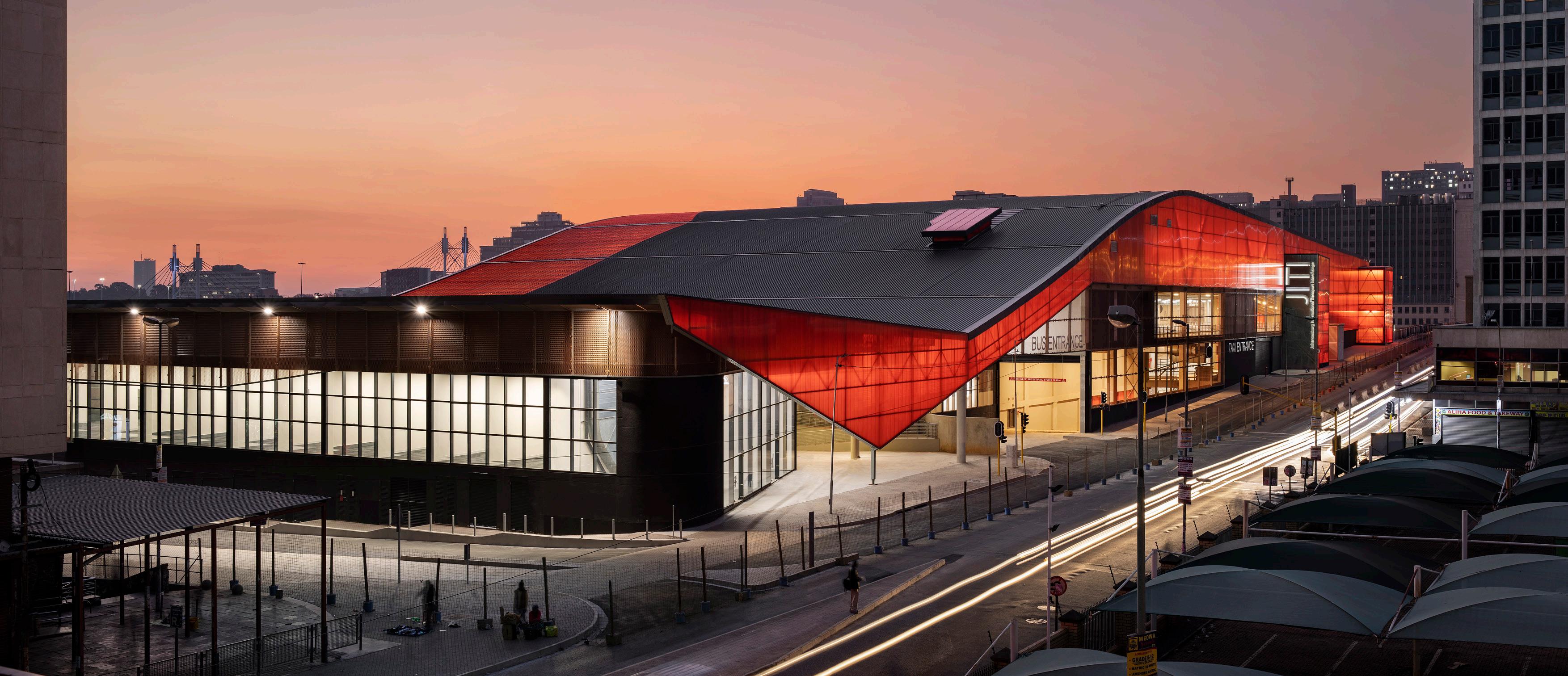
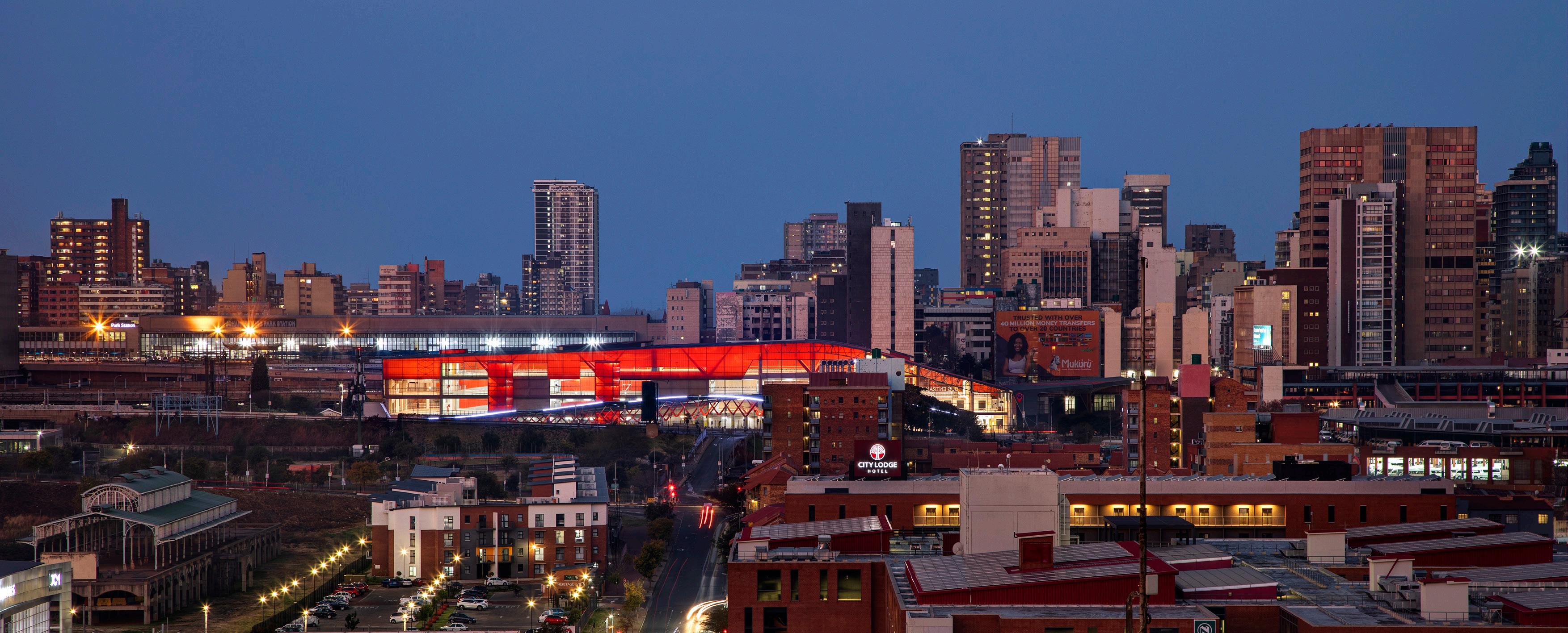
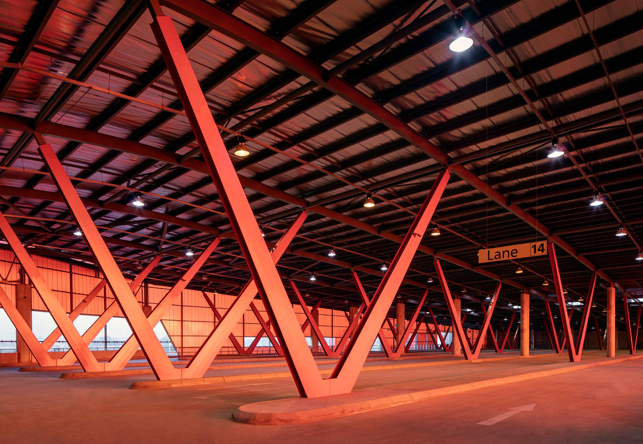
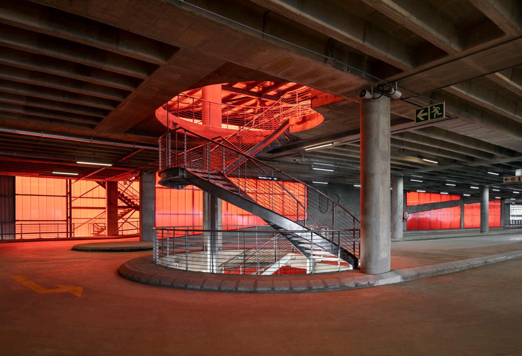
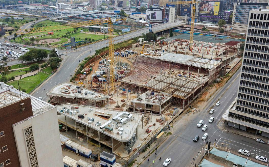
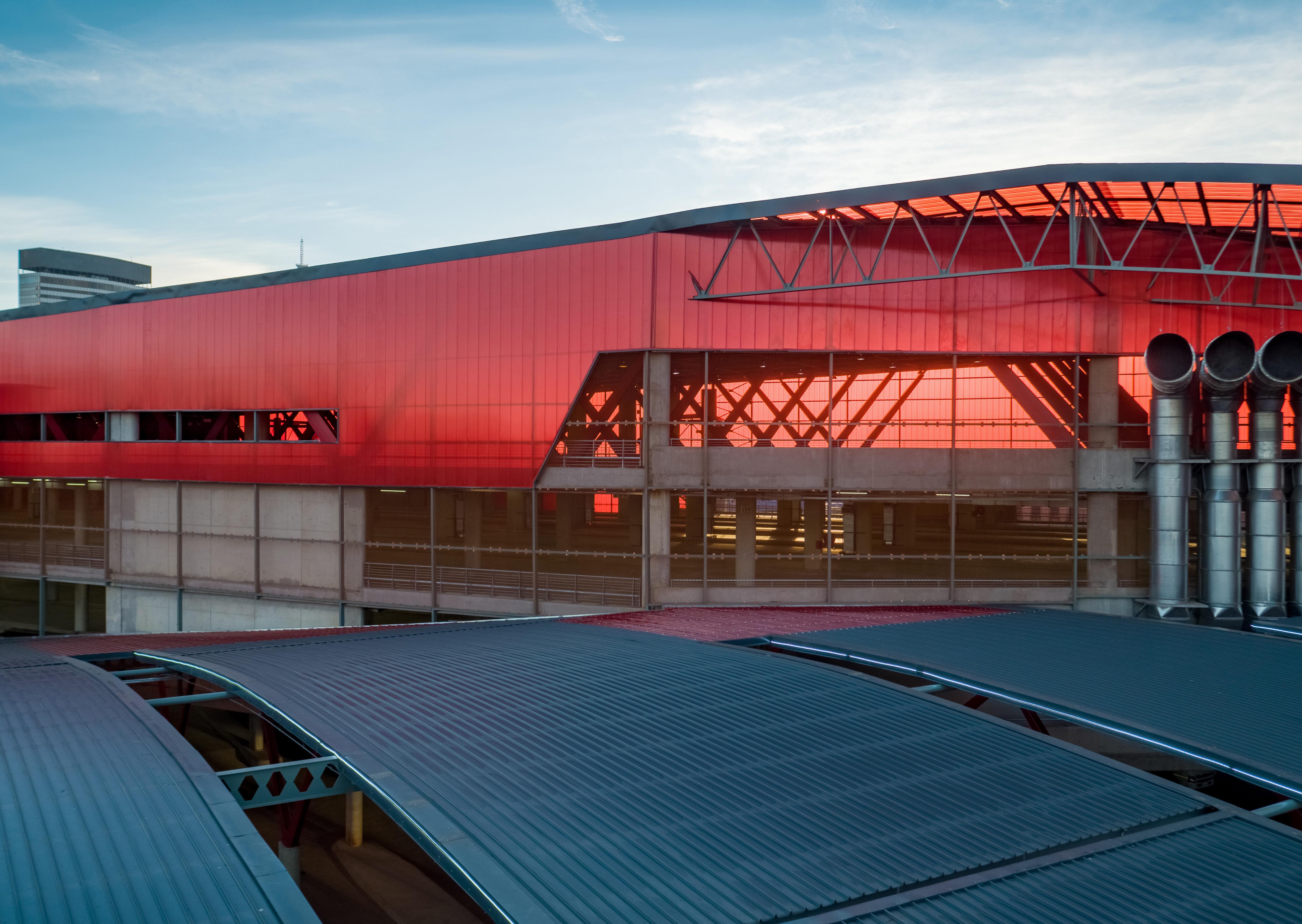
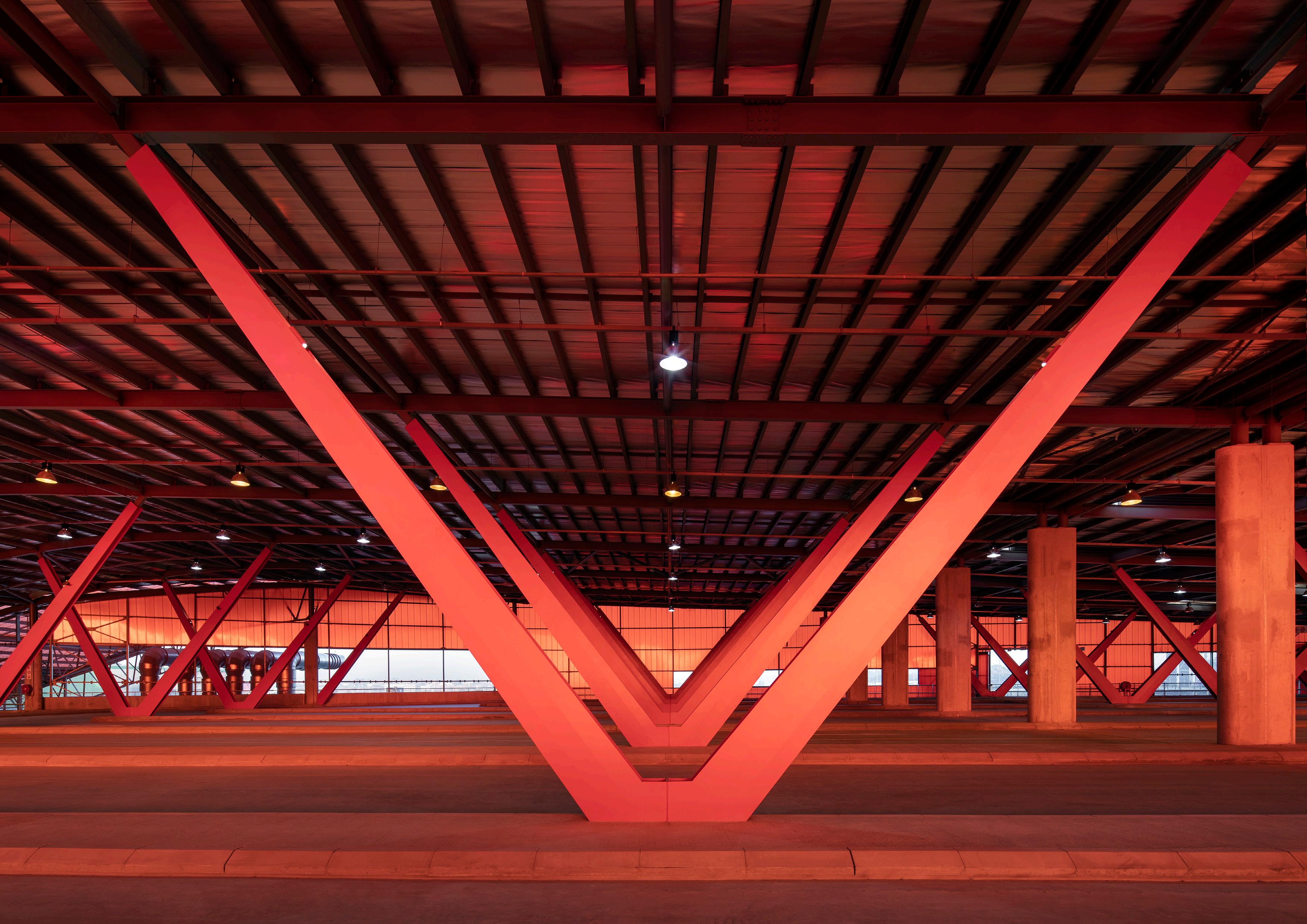
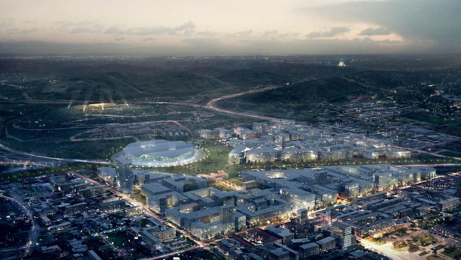
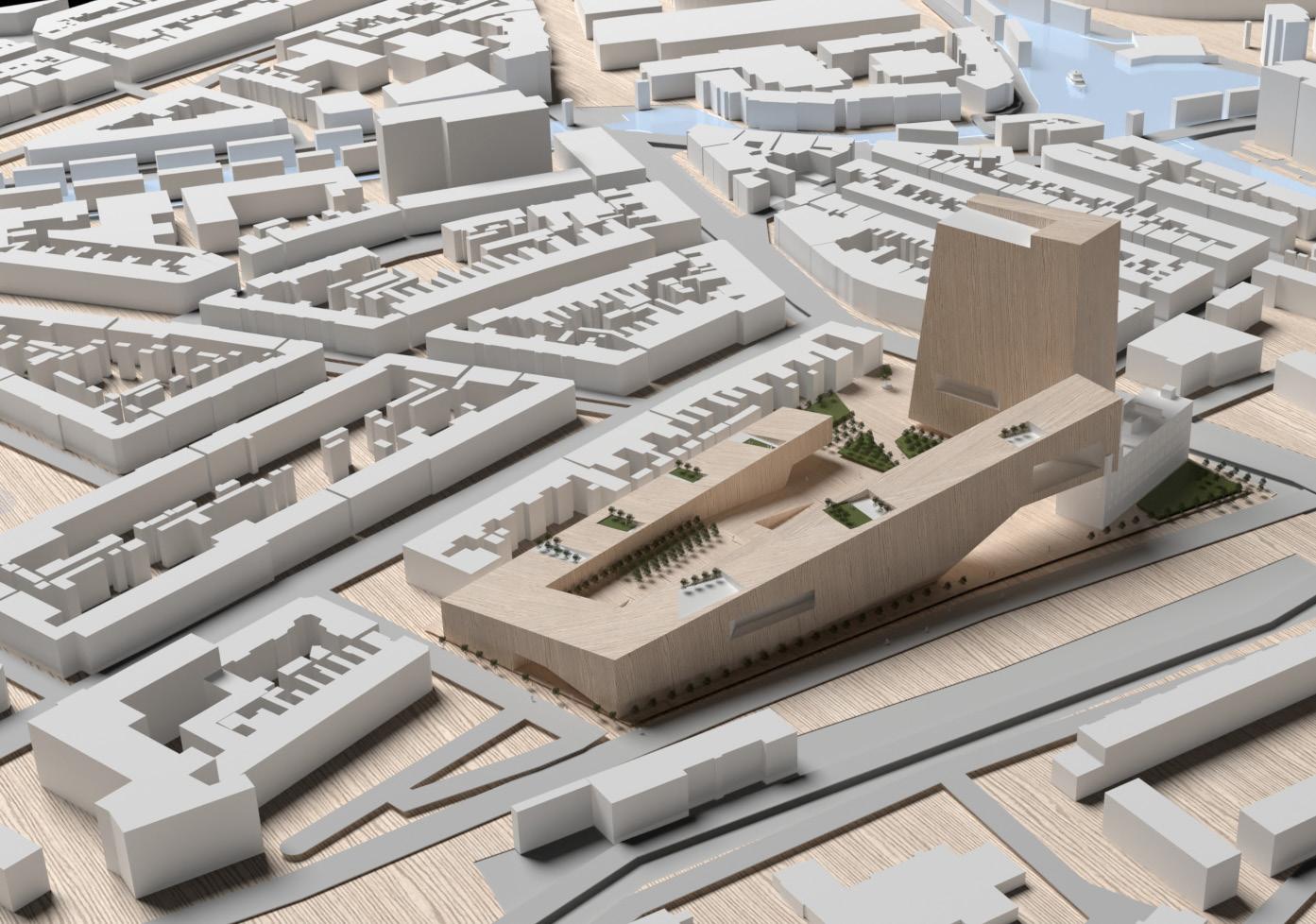
Johannesburg International Transport Interchange
Project Goal
The success of any transportation hub rests in its ability to connect multiple modes of transport within a compact area.
Summary
A new state-of-the-art, multi-modal mixed-use transport hub, encompassing retail, office, recreational, and storage facilities. Centrally located in Johannesburg’s inner-city, this project integrates comprehensive long-distance bus and rail facilities. My role as lead development manager involved innovative design solutions and strategic planning, contributing significantly to the cities public transport network enhancement. The project stands as a testament to modern urban infrastructure development, offering a seamless, efficient transit experience.
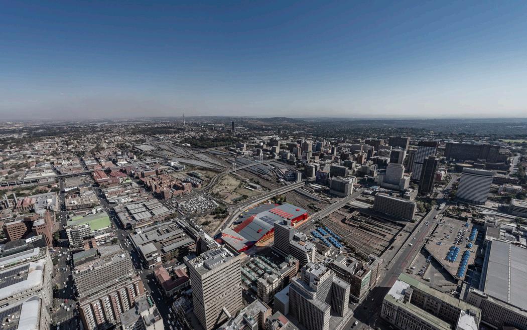
CLIENT
Department of Transport
LOCATION
Johannesburg, South Africa
SIZE
52,000 sq. m
Prior to developing the concept scheme the design team invested a significant amount of time to research the local dynamics and inner workings of the site’s immediate setting. It was of paramount importance to ensure that the scheme would seamlessly integrate into the urban context and work in unison with the complex surrounds.
Portfolio | 16
One of the most significant designs challenges was to safely harmonize the movement of taxis, buses, and pedestrians all under one roof. In order to assist with this process a series of high tech vehicular and pedestrian traffic models were developed. This allowed us to simulate flows and address bottlenecks up front. Entrances and exists needed to be carefully considered.
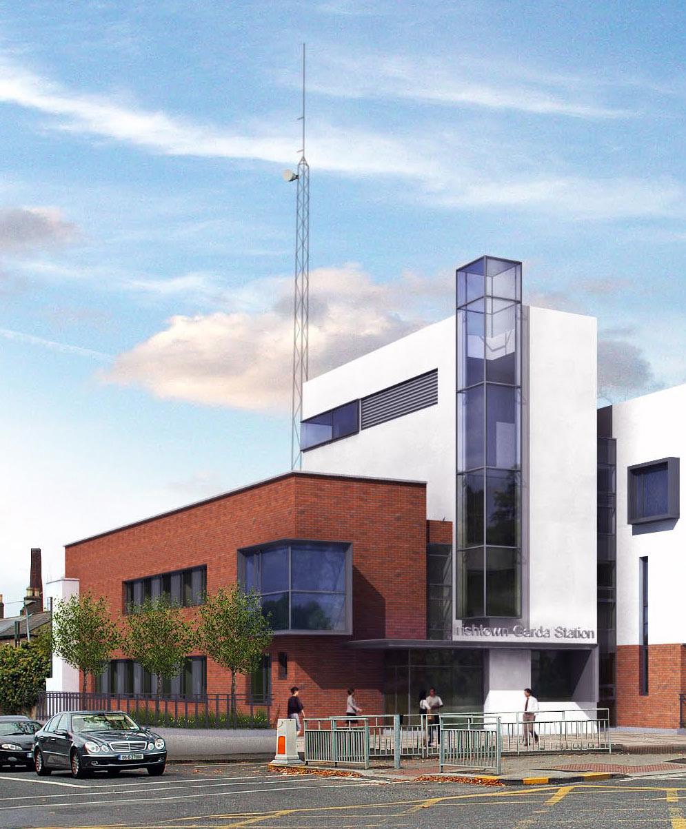
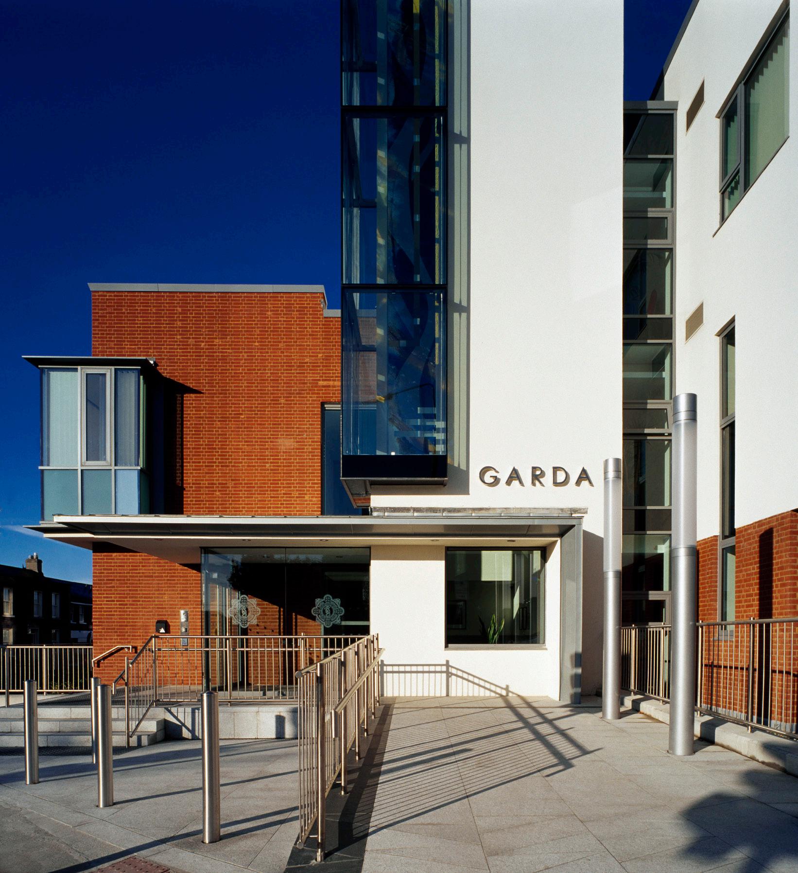
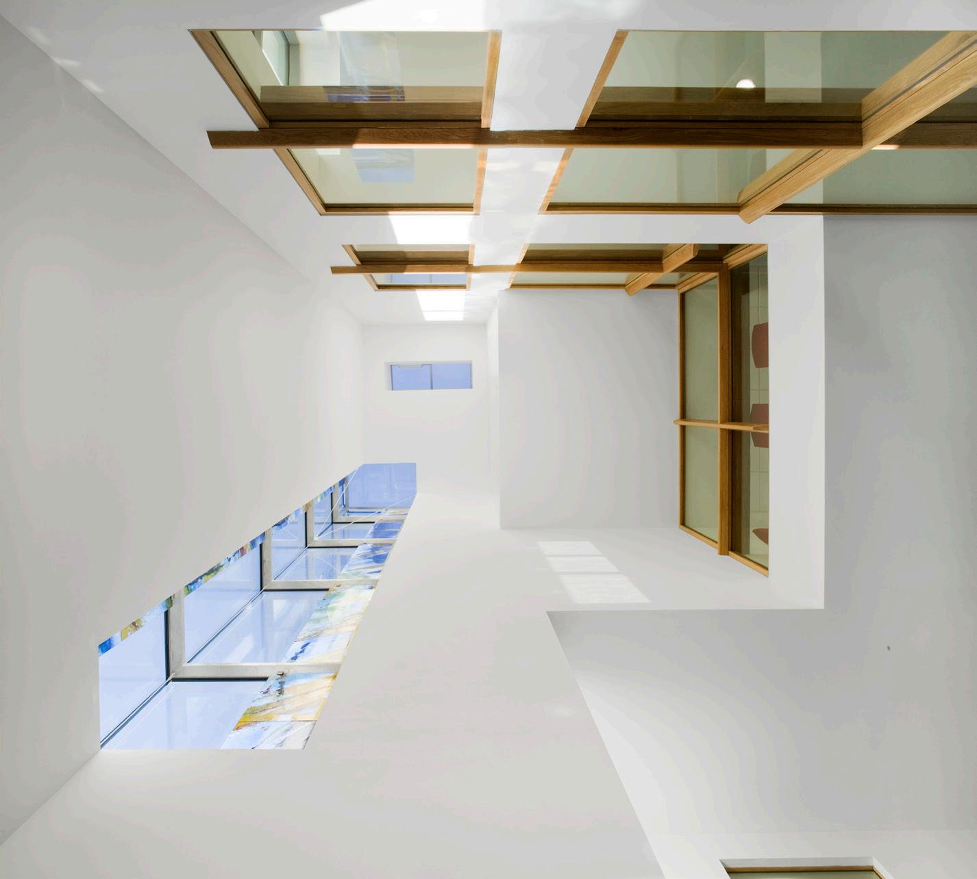
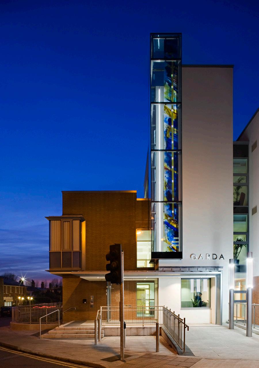
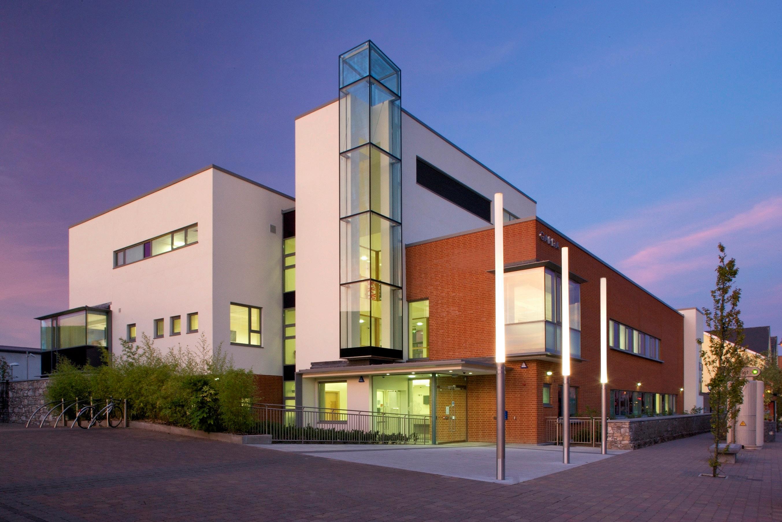
Police Stations
Project Goal
Ray made a noteworthy contribution to the development and realisation of the Police Building Programme in Ireland.
Summary
He was project architect from inception through to completion on several large stations involving of a number of specialised office, security and administrative related functions. Some of the sites were of great historical importance and as such an extensive amount of research and conservational work was carried out in order to ensure that the designs seamlessly responded to the sensitive urban fabric.
CLIENT
An Garda Síochána,
National Security Service of Ireland
LOCATION
Dublin, Ireland
SIZE
4350 - 23,200 sq.m
Portfolio | 18
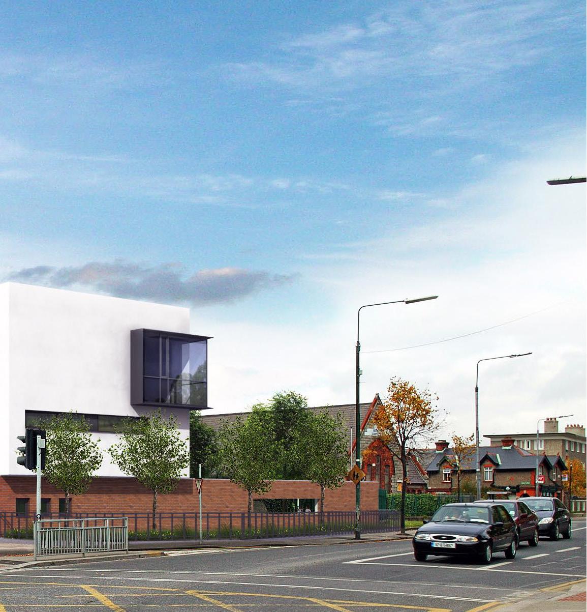
Another crucial aspect is the emphasis on sustainability and adaptability. The stations incorporated environmentally friendly design elements such as energy-efficient lighting, heating, and cooling systems, and the use of sustainable building materials.
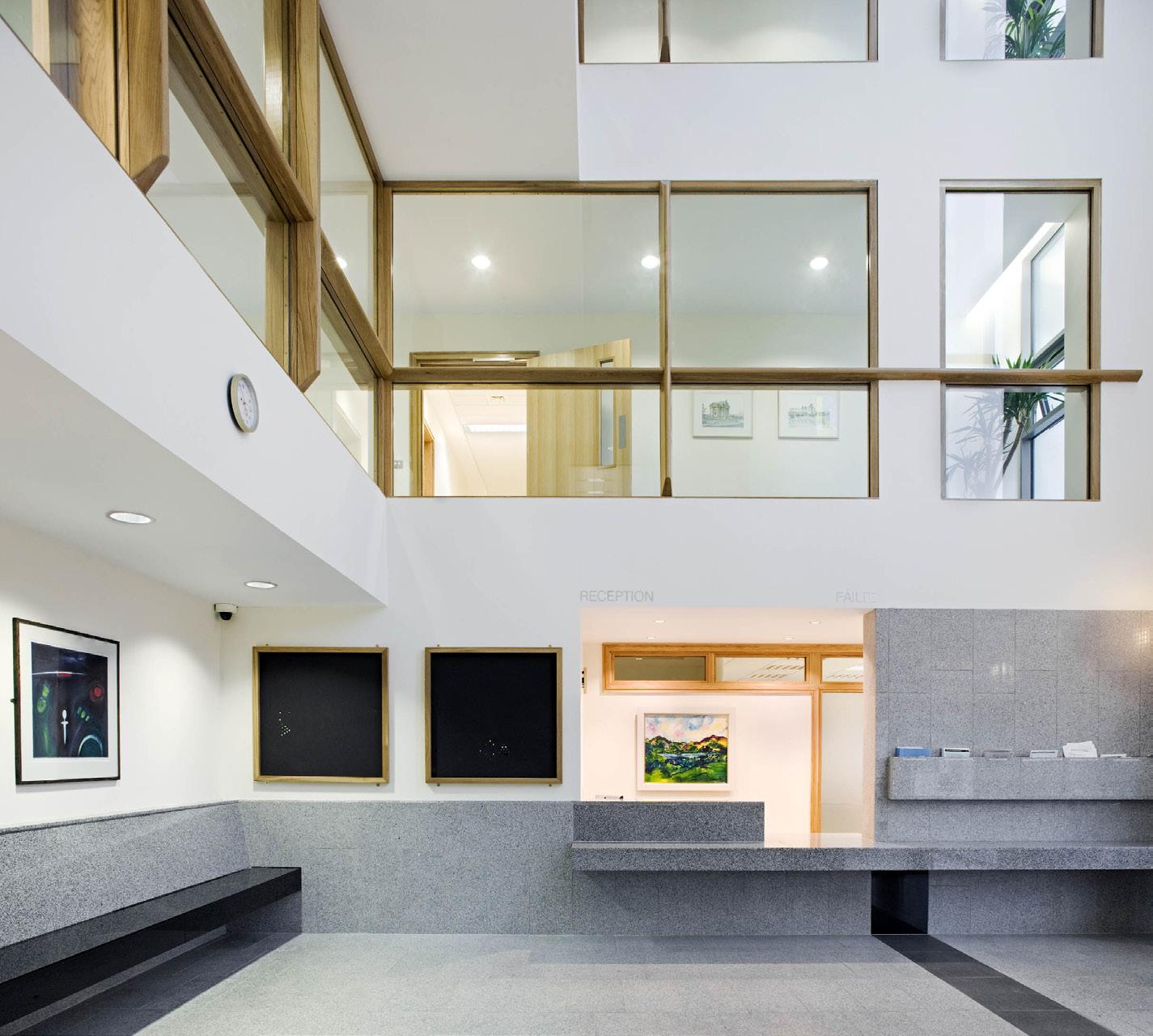
One fundamental principle was the creation of a welcoming yet secure environment. This was achieved through the use of transparent materials and open layouts in public areas, fostering a sense of accessibility and trust between the police and the community.
Selected Works 02
URBAN DESIGN
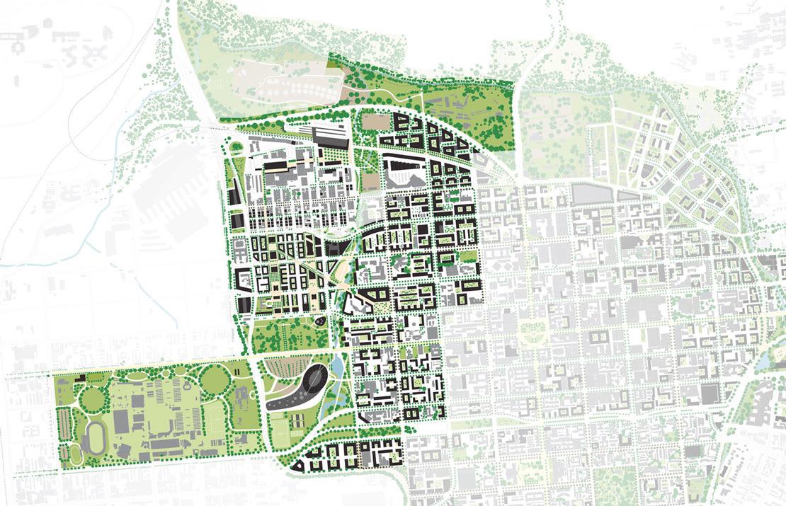
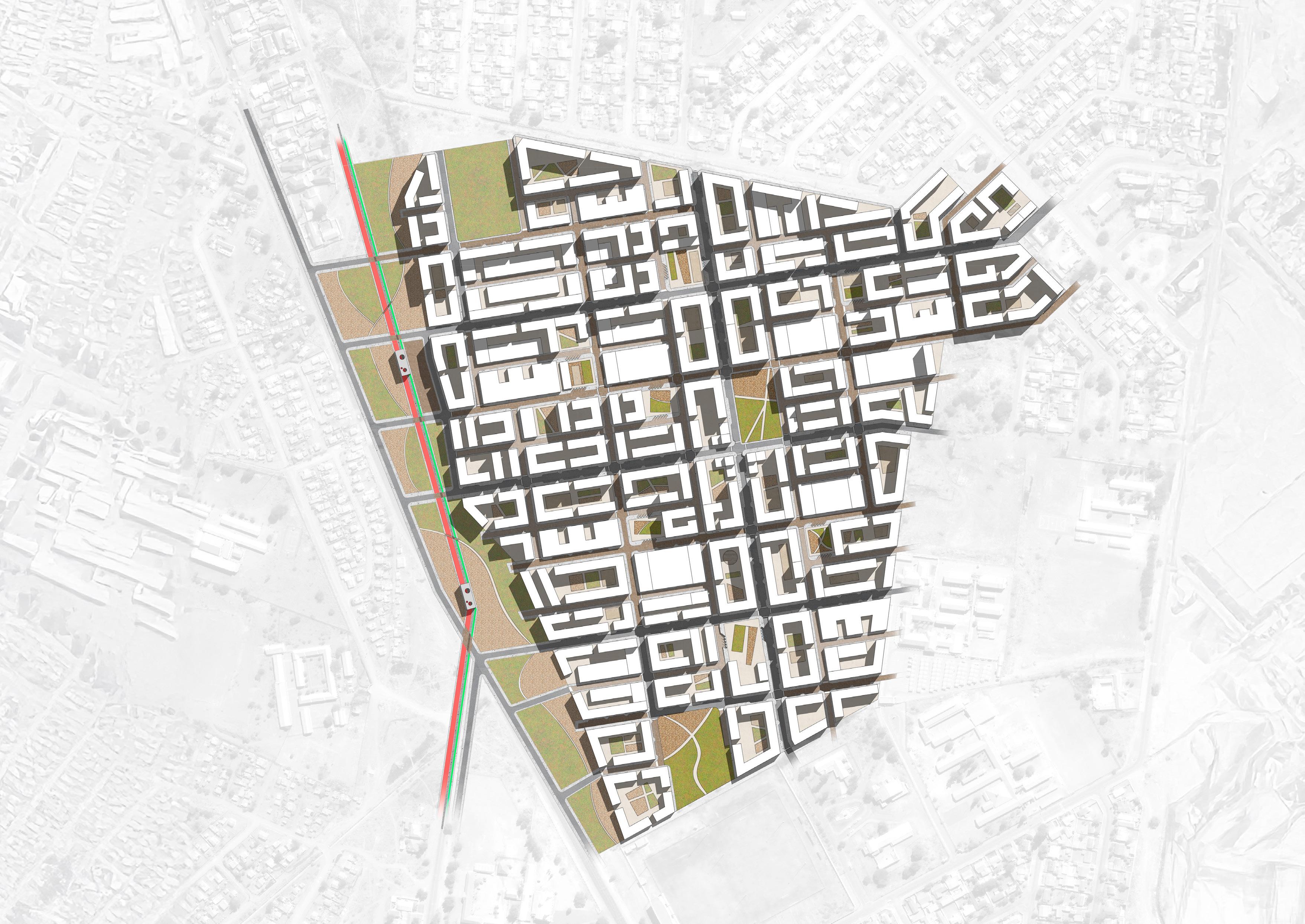
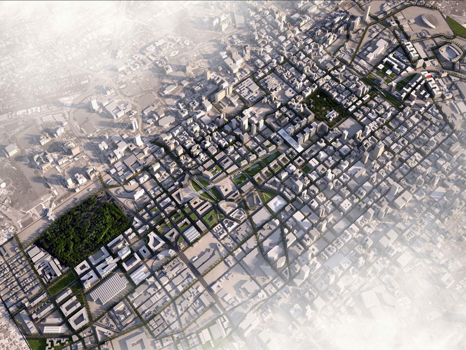
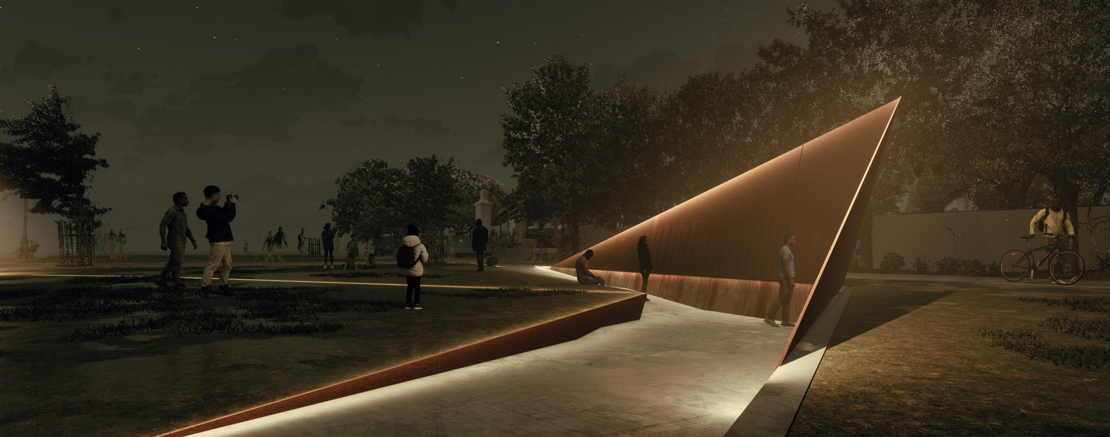
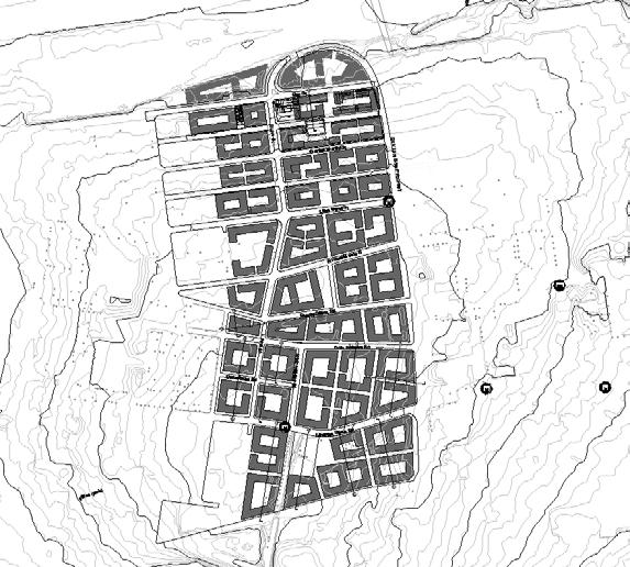
Tshwane Masterplan
Project Goal
The strategic masterplan and implementation framework offered to guide the regeneration of South Africa’s capital city.
Summary
Ray formed part of the architectural team on this project which provided a detailed masterplan and urban framework for several large government office precincts within the inner city and the immediate surrounding areas of the City of Tshwane. The masterplan was commissioned as an ambitious, overarching framework document to guide the evolution of the entire city.
CLIENT
City of Tshwane
South Africa
38.8 Hectares


Selected Projects 03
Computational Innovation
Model Integrity Dash
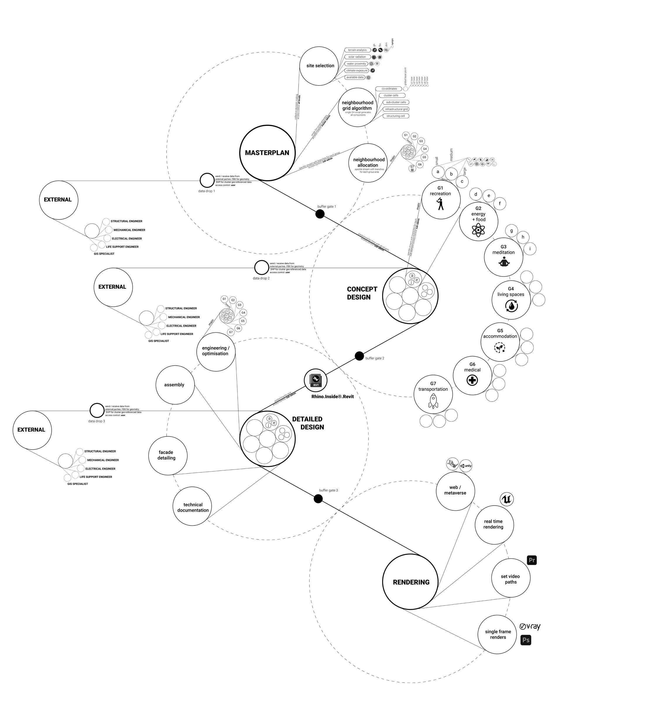
Using Machine Learning and AI in urban and architectural processes
Firefly
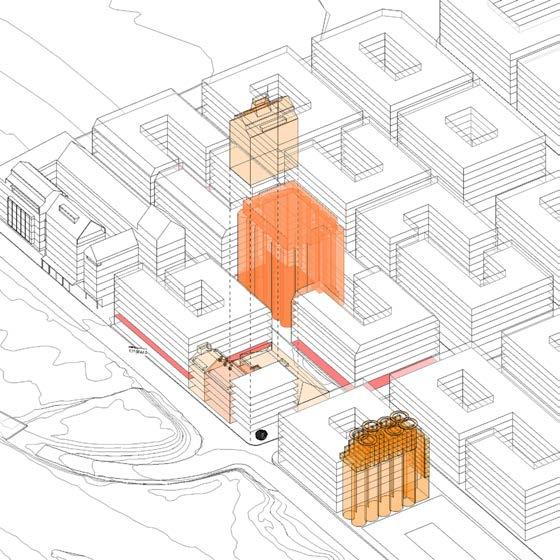
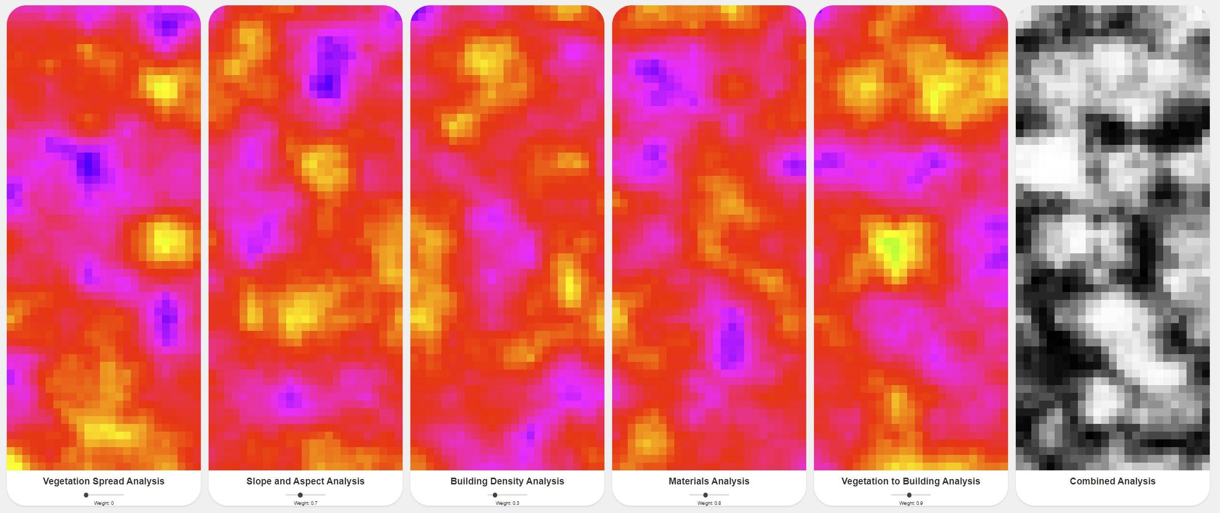
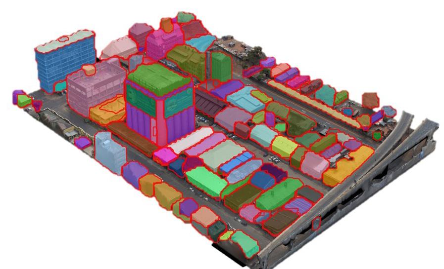
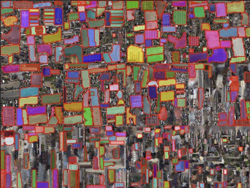
This research seeks to harness the power of dronebased photogrammetry and artificial intelligence to create a low-cost urban wildfire diagnostic tool. By interpreting this data with AI, the aim was to identify, categorize, and diagnose urban structural and environmental issues effectively, ultimately promoting sustainable urban development.
web-link
Adappt
The Addappt project, developed at the Institute for Advanced Architecture of Catalonia (IAAC), is a computational tool designed to help architects assess the adaptability of building designs in the early stages. Using geometrical data and machine learning, it analyses factors like building depth, shape, and structural grid to determine how adaptable a design is. The tool provides real-time feedback, highlighting adaptable designs in green and non-adaptable ones in red, facilitating more sustainable, flexible architectural solutions.
web-link
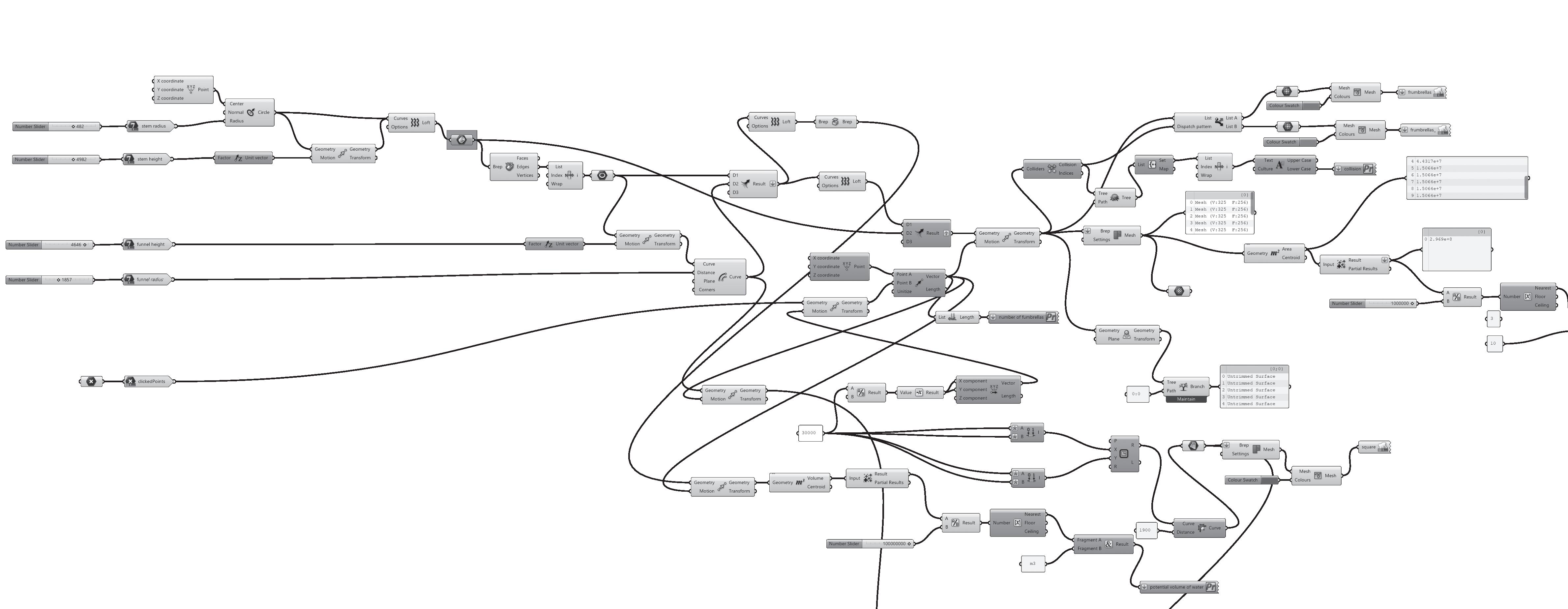
Fumbrella
The Fumbrella project is an urban installation concept designed to tackle water and energy crises. It merges a funnel and umbrella structure to collect water and sunlight. Users can customise Fumbrella designs through a web app, adjusting variables like height and funnel size. The app outputs details such as water collection potential, material costs, and covered area. This innovative approach integrates urban design with sustainability, offering a practical tool for resource harvesting in city environments. web-link
Routable
This research makes use of Graph Machine Learning to provide accessible route planning for people with disabilities. It offers information on accessible routes, transportation options, and points of interest for individuals in unfamiliar environments. web-link
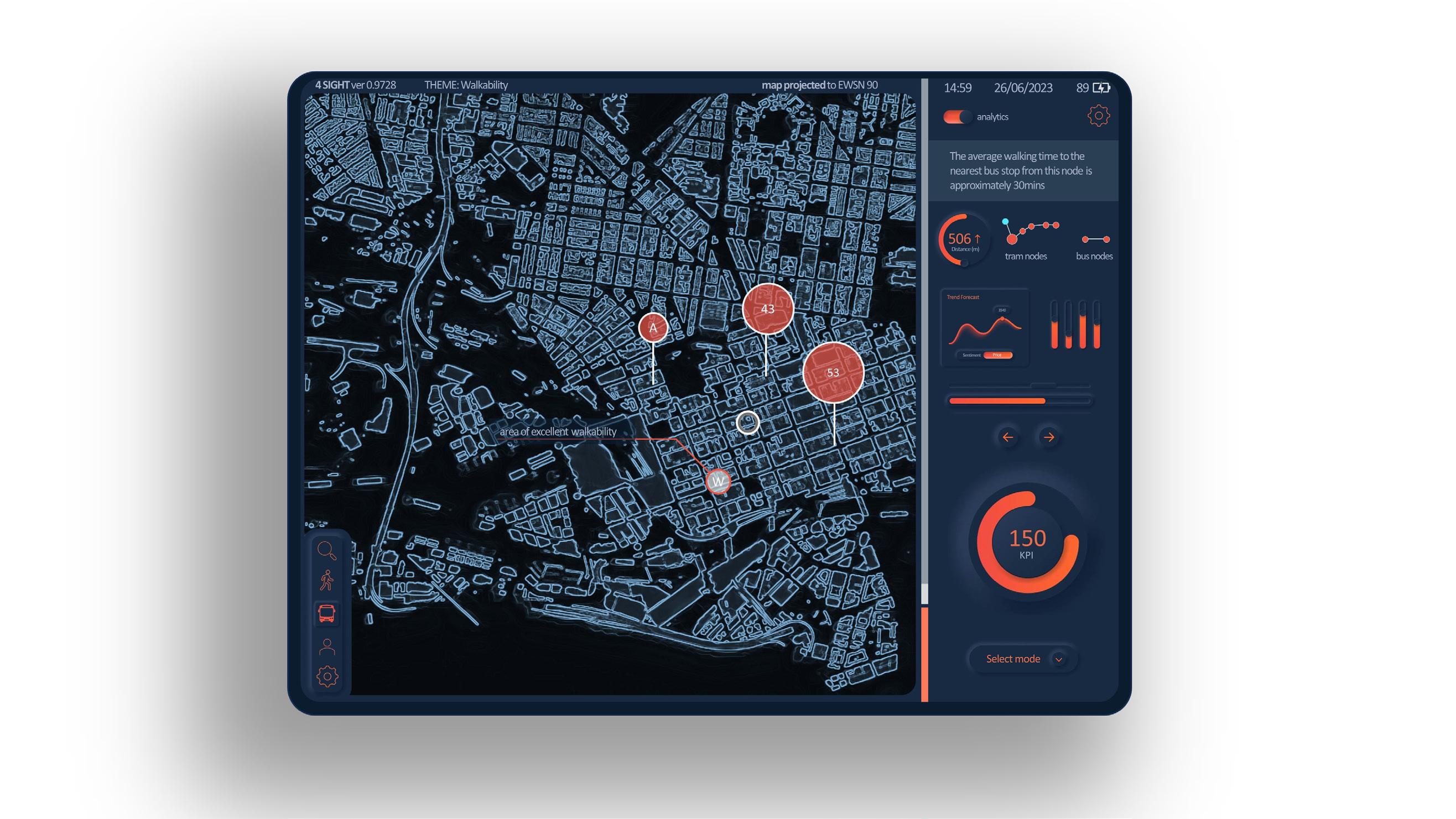
4Sight
Bio-Inspired Structures
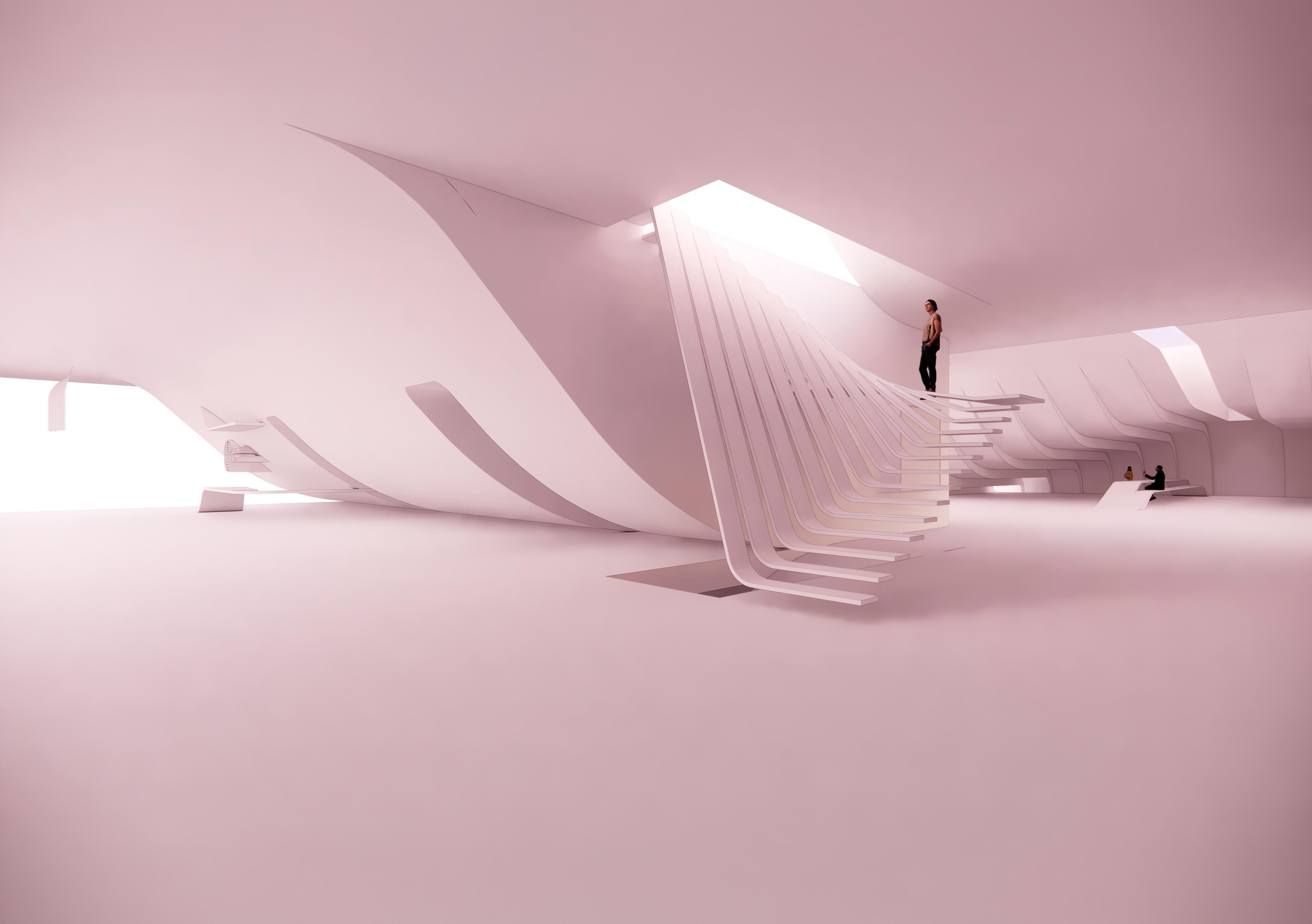
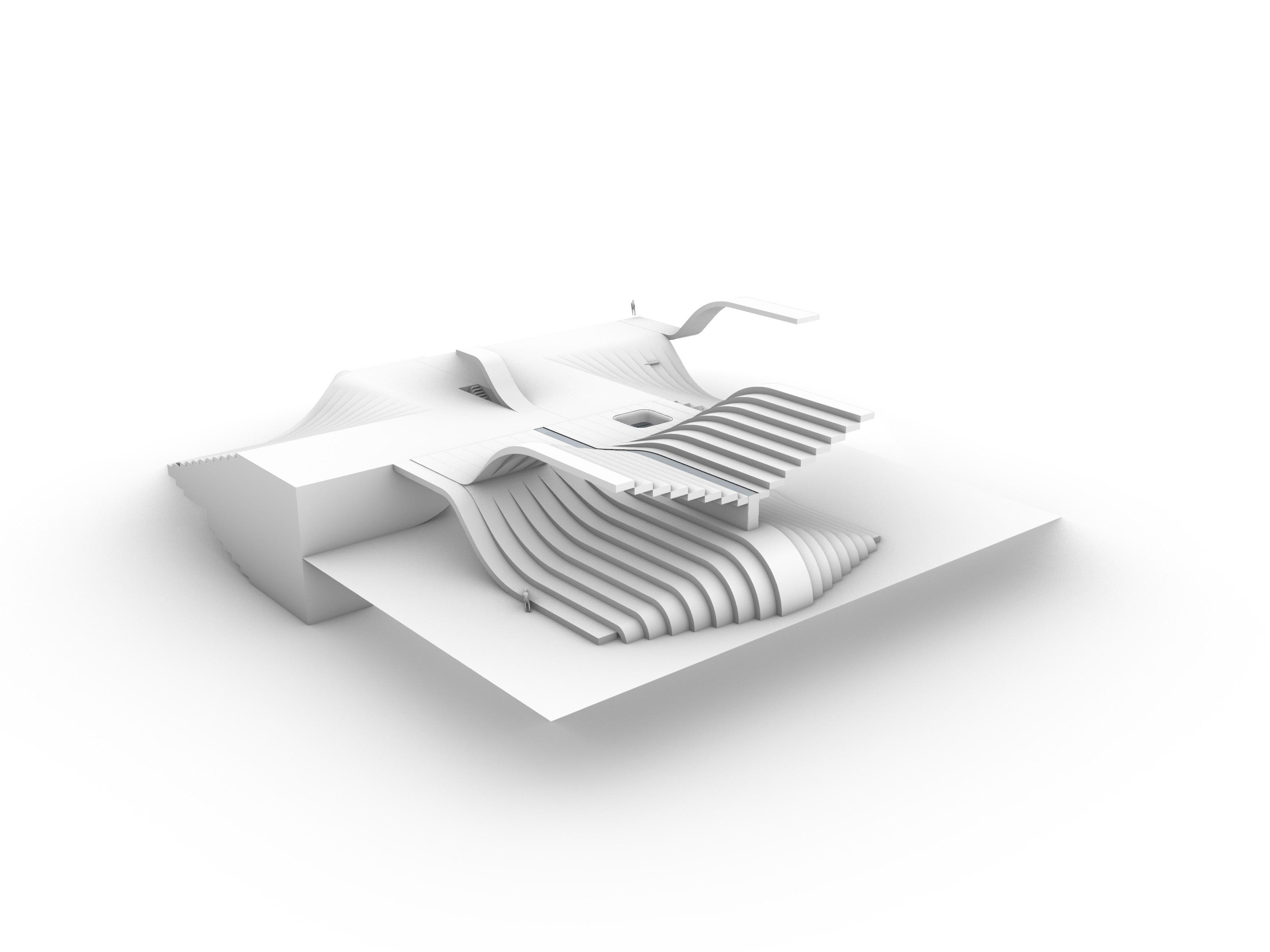
The Performative Bio-Inspired Structures project, developed at IAAC, explores using biological principles like cellular autonomy for architectural form generation. It leverages computational design and tools such as Karamba to create structures that evolve and adapt in response to environmental and functional demands. The project focuses on how buildings can embody evolutionary processes, resulting in innovative, complex forms that enhance structural performance and sustainability. web-link
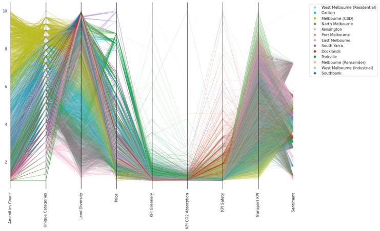
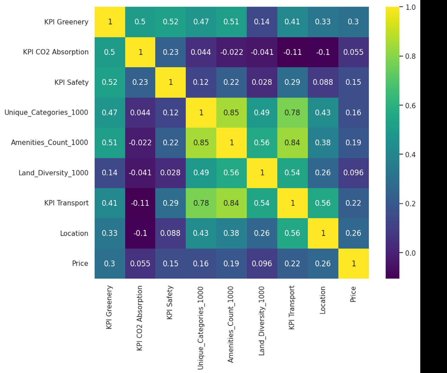
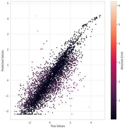
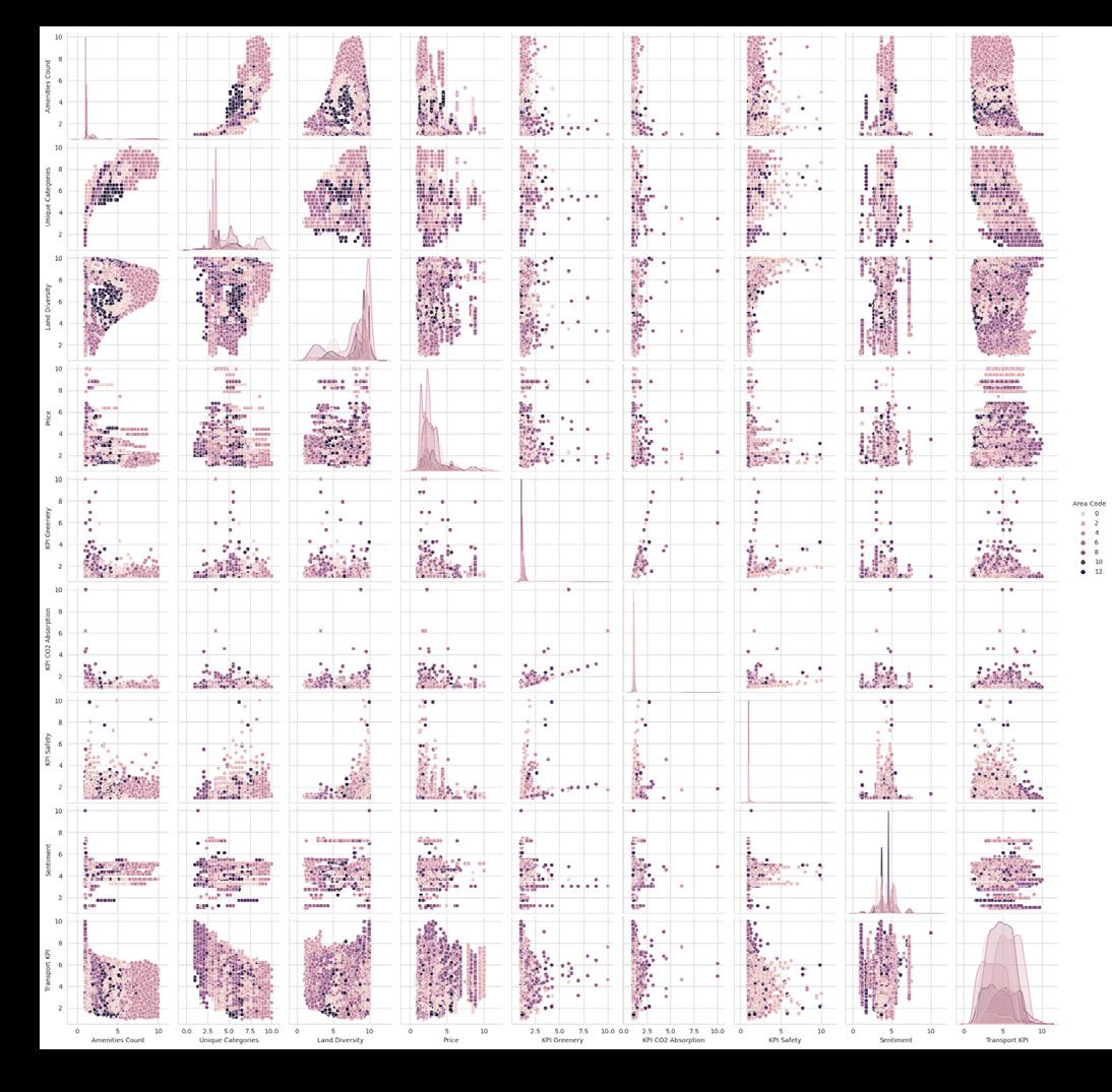
The 4sight project, developed at IAAC, uses machine learning to predict the impact of new urban infrastructure on city areas and property values. It processes vast amounts of urban data and presents insights through a user-friendly interface, helping stakeholders like citizens, planners, and investors understand how changes might affect urban environments. By evaluating factors like land use, transport, and amenities, the tool facilitates more balanced city development. web-link
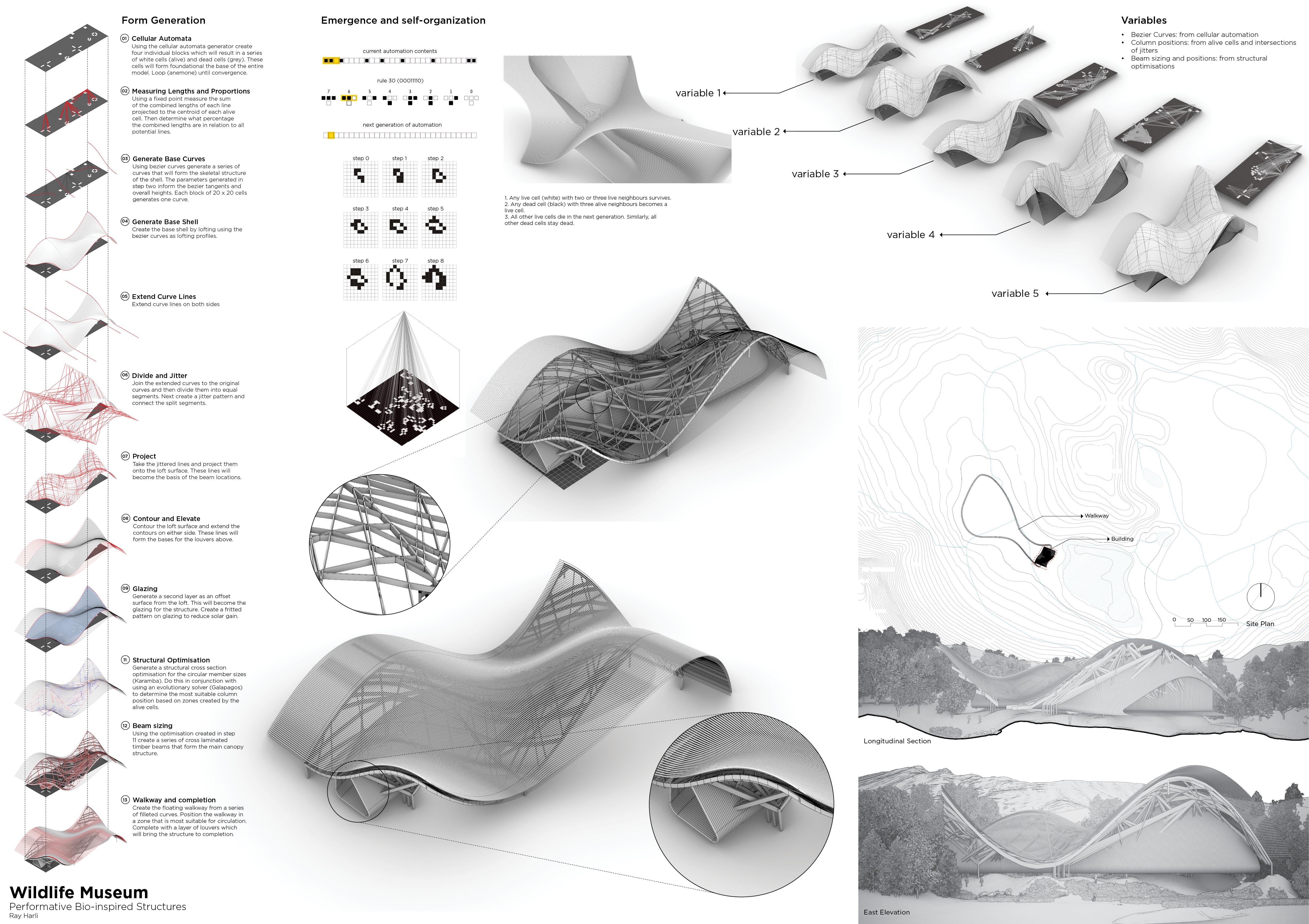
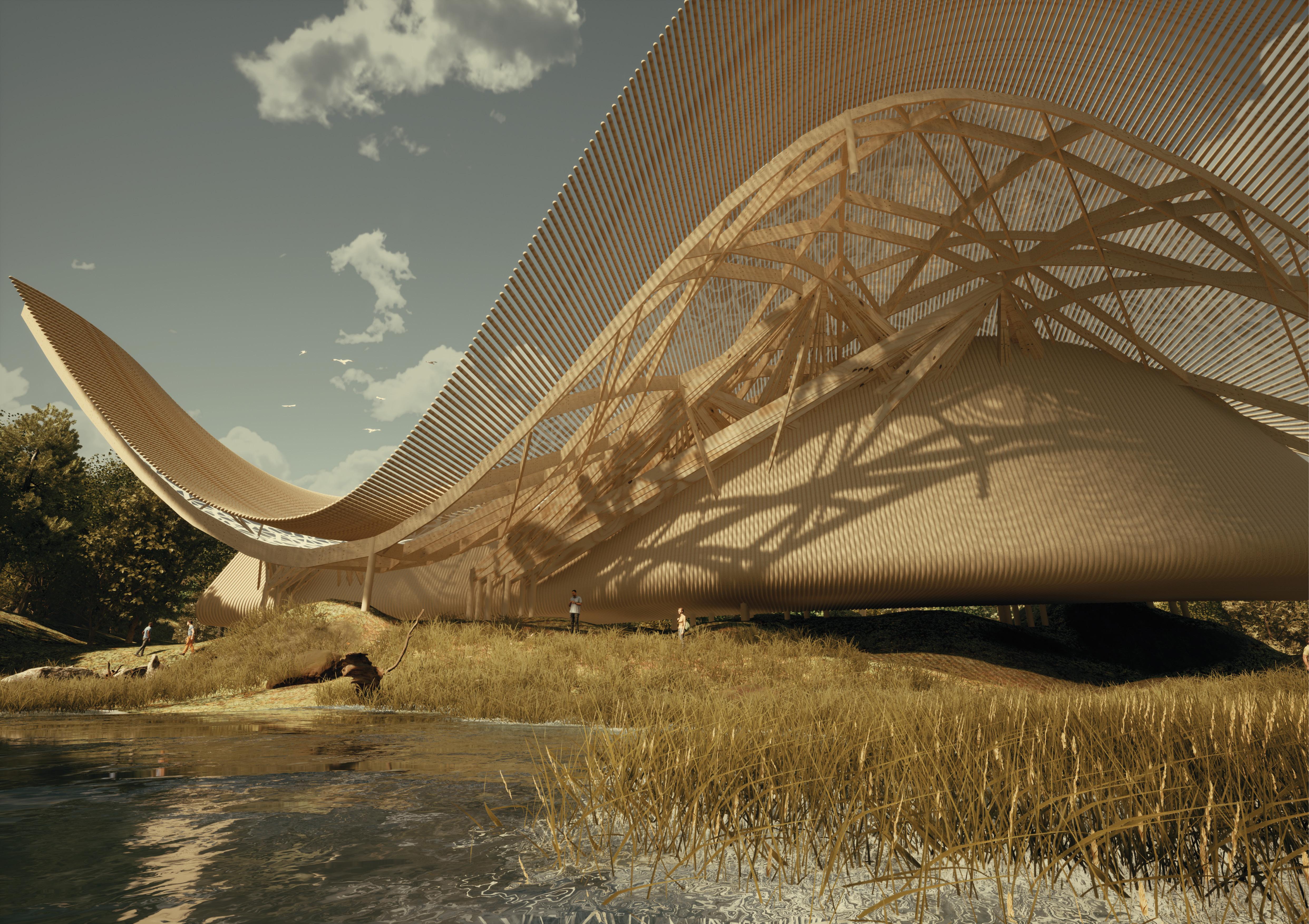
Cellular autonomy for form generation Bio-Inspired Structures
The Performative Bio-Inspired Structures project, developed at IAAC, explores using biological principles like cellular autonomy for architectural form generation. It leverages computational design and tools such as Karamba to create structures that evolve and adapt in response to environmental and functional demands. The project focuses on how buildings can embody evolutionary processes, resulting in innovative, complex forms that enhance structural performance and sustainability.
Click here to link to more info
App Description
Using Machine Learning to Analyse Urban Data
The 4sight project, developed at IAAC, uses machine learning to predict the impact of new urban infrastructure on city areas and property values. It processes vast amounts of urban data and presents insights through a user-friendly interface, helping stakeholders like citizens, planners, and investors understand how changes might affect urban environments. By evaluating factors like land use, transport, and amenities, the tool facilitates more balanced city development.
Click here to link to more info
Column1 and Column3


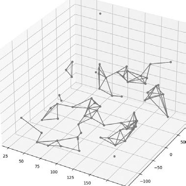
Fire Spread Analysis vegetation
convert point cloud to d a t
create a data structure that can be processed
perform clustering using DBSCAN algorithm (SKlearn)
Calculate cluster c e
group by cluster and calculate mean coordinates
create s p a t i a l i n d e x of centroids using KDTree
efficiently query distances between clusters
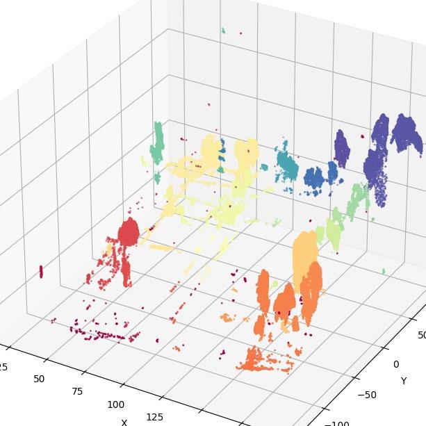
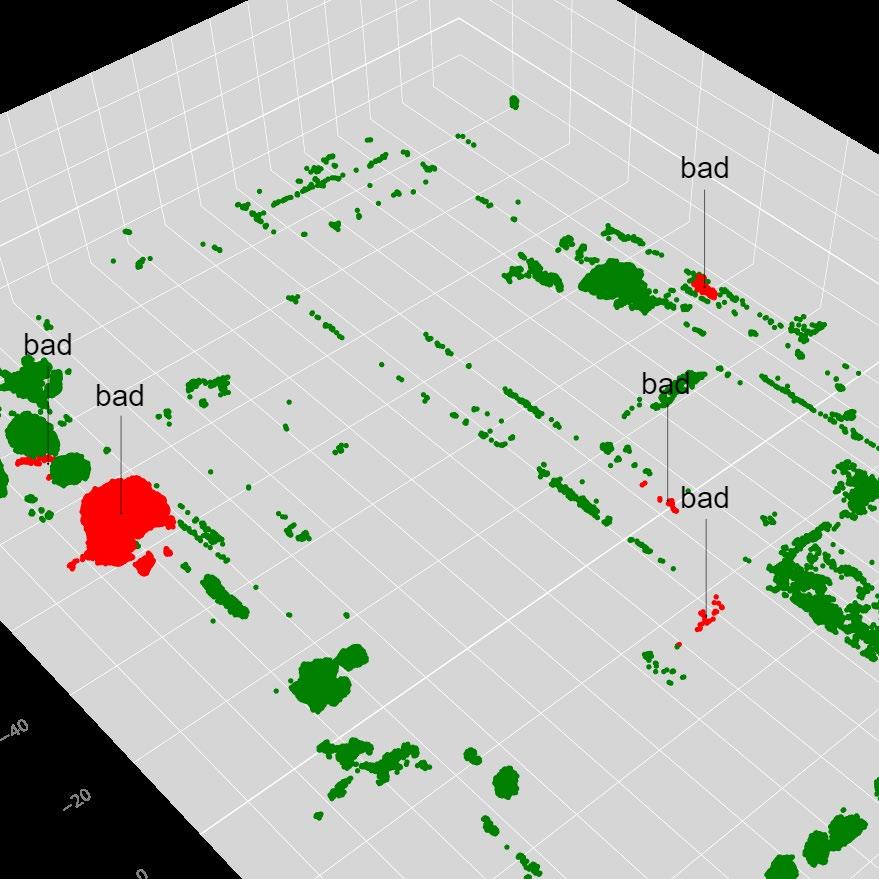

construct a graph
each node represents a vegetation cluster, and each edge represents a possible path for fire spread
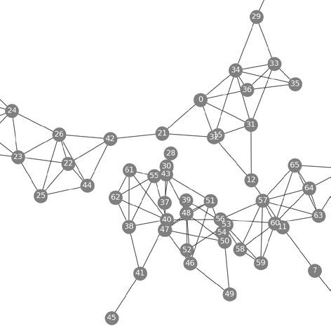
i s u a l i s e back to original point cloud
label problematic clusters (red) and overlay to original point cloud visual
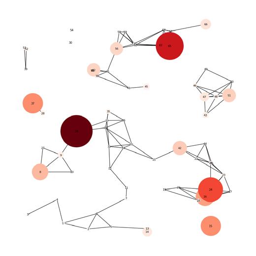
clusters that have many connections marked as "hotspots" for fire spread, the darker the red the more connections or 'degrees' that it has


D
U


Hello, I'm Ray
Ray Harli is an architect focused on the intersection of technology, design, and development economics with computational, architectural and property development degrees. He is a licensed architect in the UK, Ireland and South Africa and has successfully completed several award-winning mega projects. He has extensive experience in a broad range of sectors including: residential, retail, commercial, industrial, healthcare, educational, transitorientated-developments, masterplanning, renovation and sustainability, showcasing his versatility and depth across both local and global landscapes.
Ray is a recognised industry leader having pioneered the integration of AI and machine learning within the architectural field, setting new benchmarks for innovation and efficiency and has assisted in the creation of commercially successful VR apps now used by the industry and academia.