

04 08 12 18 48 62 65
ACKNOWLEDGEMENTS
EXECUTIVE SUMMARY
PROJECT BACKGROUND
PLANNING PROCESS
PARK MASTER PLAN
IMPLEMENTATION + FUNDING

04 08 12 18 48 62 65
ACKNOWLEDGEMENTS
EXECUTIVE SUMMARY
PROJECT BACKGROUND
PLANNING PROCESS
PARK MASTER PLAN
IMPLEMENTATION + FUNDING
PREPARED FOR
THE CITY OF RALEIGH PARKS, RECREATION AND CULTURAL RESOURCES DEPARTMENT
Attention: Emma Liles, Capital Project Manager
Mary-Ann Baldwin, Mayor
Jonathan Melton, At-Large, Mayor Pro Tem
Stormie D. Forte, At-Large
Mary Black, District A
Megan Patton, District B
Corey Branch, District C
Jane Harrison, District D
Christina Jones, District E
CONSULTANT TEAM
WITHERSRAVENEL
Jon Blasco, PLA/ASLA, Senior Project Manager
Rifat Sharmin, Landscape Designer II
Brian Starkey, PLA/ASLA, Director of Parks and Recreation
Emma Liles, Capital Project Manager
Lauryn Kabrich, Park Planner
Jai Butts, Park Planner
Zach Jewell, Park Planning Specialist
Sean Gough, Land Stewardship Program Manager
Gil Young, District Six Crew Supervisor
Mike Gagliano, Natural Resources and Parks Manager
Tori Spaugh, Recreation Program Director
Kira Stewart, Recreation Program Director
Dale Tiska, Senior Construction Project Manager
Kelly Ham, Parks Construction Projects Administrator
Neal Wisenbaker, City Horticulturist
Becky Burmester
Melissa Forde
Bekah Torcasso Sanchez
Sherry Stephen
Debora Thomas
Mysti Stewart
Adam Schreiner
Peter Giambattista
Crystal Scarborough
Alexis Arterberry
Hezekiah Goodson Jr.
Jeannette Arrowood
Mikaela Rojas
CITY OF RALEIGH PARKS, RECREATION AND CULTURAL RESOURCES STAFF
Stephen Bentley, Director
Adam Forman, Assistant Director
Ken Hisler, Assistant Director
Charles Craig, Assistant Director
Helene McCollough, Administrative Superintendent
Shawsheen Baker, Capital Projects Superintendent
TJ McCourt, Planning Supervisor
CITY OF RALEIGH PARKS, RECREATION AND GREENWAY ADVISORY BOARD
Carol Ashcraft
Rashawn King
April Love
Jeff Havener
Col. Robert Edgerton
Shangwen Liu
Hugh Fuller
Beverley Clark
Gregory Etheridge
Douglas A Johnston
Iain Burnett
Kate Dixon
Kara Strang
Chris Pereira
A SPECIAL THANK YOU TO ALL OF THE PARTICIPANTS WHO TOOK THEIR PERSONAL TIME TO PROVIDE FEEDBACK AND INPUT DURING THE PLANNING PROCESS.

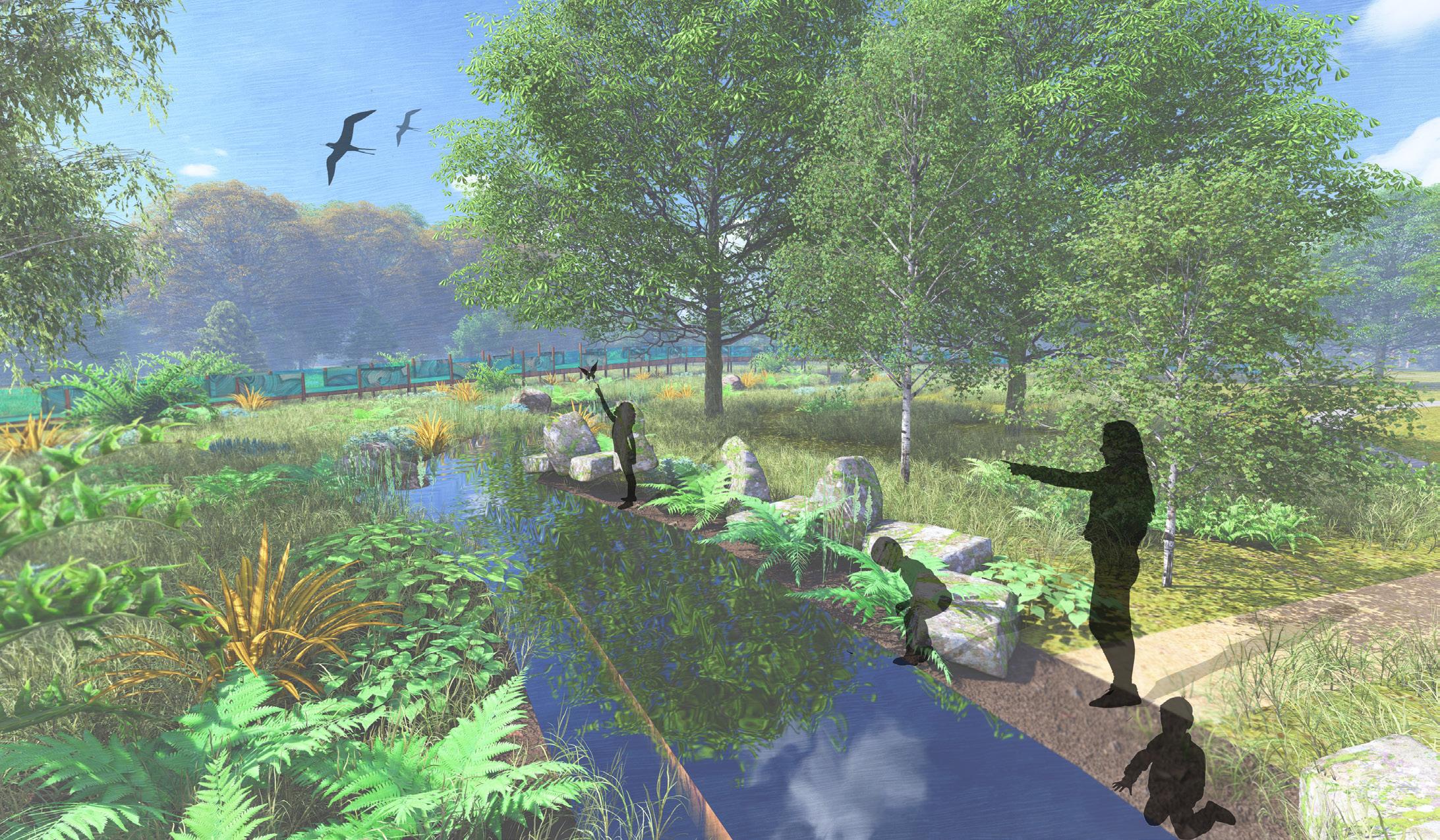
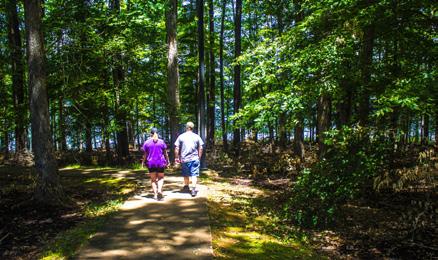
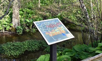
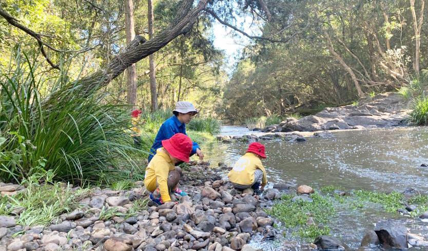
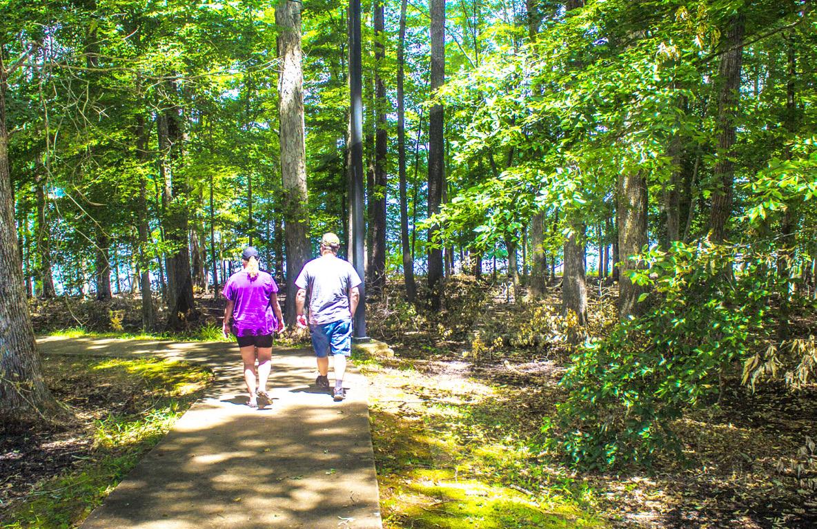
Inspired by the Beaverdam Creek Wetland, Kyle Drive Property Park will connect visitors to nature and serve as an inclusive community hub, providing nature-based recreation, multi-generational activities, and enhancement of the natural environment.
The final master plan for the park, along with associated recommendations, is a direct result of deliberate, inclusive and equitable community engagement process and reflects staff input and requirements for a neighborhood park.
WithersRavenel is pleased to present the Kyle Drive Property Park Master Plan Report to the City of Raleigh for consideration and adoption. Recommendations for park development, illustrated by the master plan and report, reflect a thorough understanding of the property’s attributes and capacity for development, a community-based collaborative planning approach and a creative pursuit of design solutions. Given the presence of an extensive wetland complex on site and two streams traversing the site, the master plan prioritizes a nature-based experience.
Over the course of ten months, a collaborative and inclusive consensus-seeking process was conducted. The project team from WithersRavenel worked closely with City of Raleigh Parks, Recreation and Cultural Resources staff, a Community Advisory Group (CAG) composed of community residents appointed by the city, and the community at large. This collaboration was critical to identifying recreational needs and aspirations, generating ideas for park development, and guiding plans as they evolved from concept to final master plan.
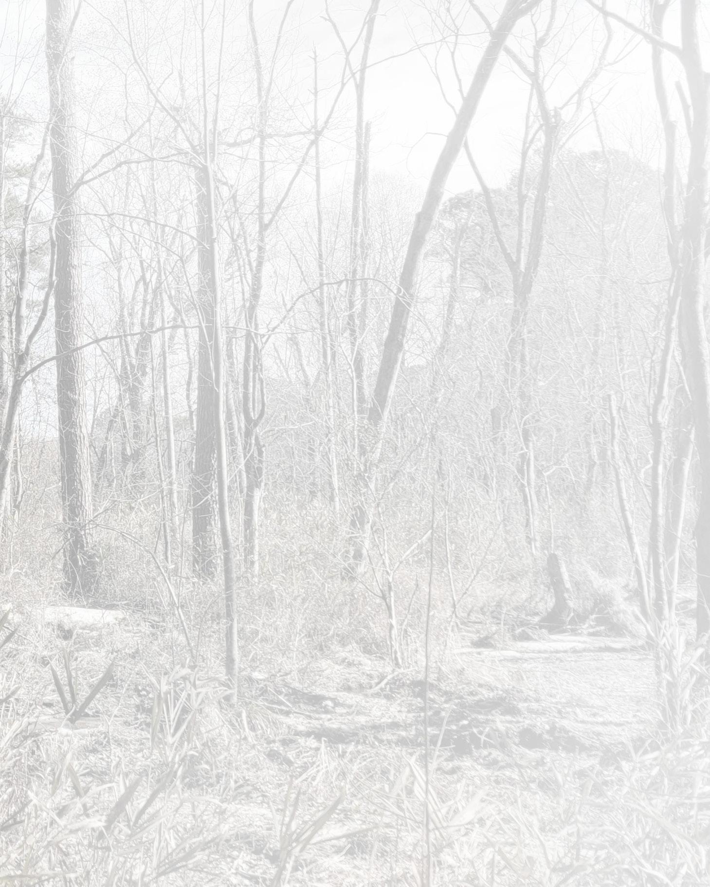
The Kyle Drive Park property is a 27.25-acre site located at 4700 Kyle Drive, near the intersection of Louisburg Road (U.S. Highway 401) and Valley Stream Drive. This park site is also located immediately adjacent to the Beaverdam Greenway Corridor, as designated in the Capital Area Greenway Master Plan.
Natural site features that have significantly influenced the master plan include the wetlands, streams, and topography. Other influential features are surrounding land use and opportunities for access. Adjacent residential land uses and existing street network offer opportunities to connect nearby neighborhoods to the park and provide access for visitors and emergency vehicles.
Throughout the process periodically scheduled meetings were held with city staff and the CAG. In addition, two community open house meetings were facilitated at strategic points in the process. Coordination meetings with city staff were held on a biweekly basis. In addition, there were other meetings specific to various subjects. The CAG met seven times, typically prior to community meetings. The two community meetings held were attended by 20-25 partcipants. In addition to meetings, community engagement was supplemented by virtual surveys that generated additional public input.
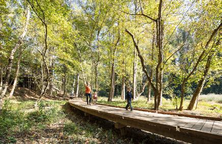
The park design provides multiple opportunities to connect with nature, by providing access to woodlands and wetlands. Primary park design features include; trails (both paved and natural), pedestrian connections to adjacent neighborhoods, an iconic boardwalk structure, play experiences, and a small sport court. The central focus of landscape interventions will be native vegetation and edible plants creating a food forest. The park and its features are intended to be universally accessible. Public art is also integral to the park development and should compliment the park’s nature theme, educate visitors and be interactive, when possible. Support facilities include public restrooms and parking, which are located at the park entry. This area between the road and the stream is the most conducive to development. It is immediately accessible, exhibits gentle topography, and is free of wetlands or other significant natural features. Ample opportunities for directed and imaginative play, as well as a variety of gathering spaces accommodating a diverse range of park visitors.
It is important to note that the master plan report includes a projected Opinion of Probable Construction Cost that is within the project budget identified by the City of Raleigh. Equally important, master plan recommendations are considered permittable by the authorities having jurisdiction.
In keeping with the City of Raleigh’s mission towards sustainable solutions, it is critical to protect the sensitive natural features of the site. Inclusion of low impact design strategies, such as sustainable stormwater mitigation and appropriate trail surface selection are integral to the plan’s recommendations. The use of these types of solutions present an opportunity to educate visitors on the importance of protecting resources. The Master Plan demonstrates that mission, simultaneously protecting those natural features that influence and informe the design while making them accessible to the community.
CAG ( Community Advisory Group )
PRGAB (City of Raleigh Parks, Recreation and Greenway Advisory Board)
City Council
7/1/2024
(YES)
(YES)
8/20/2024
Two significant documents were prepared prior to the master plan and report that provide justification for the park, a great deal of information about the park site, and recreation needs in the area. These documents are the System Integration Plan, prepared in 2010, and the Situation Assessment, prepared in 2023.
The System Integration Plan is the result of work by a variety of contributors with varying and complementary areas of expertise. This plan includes a detailed natural resource inventory, identifies deed restrictions, and makes recommendations on interim management of the land prior to the property becoming a park. The recommendations note in the System Integration Plan are organized into: Safety, Environment, and Property Issues.
The Situation Assessment document provides insight into the project’s local context, including its place within the overall parks and greenway system and other City of Raleigh projects, documentation of the community’s demographics, and identification of stakeholders and communication methods. The purpose of the assessment is to determine how best to engage the community in a collaborative process. It also helps identify any issues or opportunities that are important to the community that will be affected by the planning process. The Situation Assessment documents the historical and cultural context of the project and community and proactively identifies and addresses any issues that may be contentious during the planning process.
The Situation Assessment also identifies the Community Advisory Group (CAG), which is a membership-specific committee that provides oversight of the project planning process and ensures that decisions include a broad representation of the community and stakeholders impacted by the project. CAG members help facilitate information sharing between the community and planning staff.
The Kyle Drive Park property, approximately 27 acres, is located at 4700 Kyle Drive near the intersection of Louisburg Road (U.S. Highway 401) and Valley Stream Drive. This future park site is located immediately adjacent to the Beaverdam Greenway Corridor, as designated in the Capital Area Greenway Master Plan. Documentation of the park property’s attributes, constraints, opportunities, context, access, and overall character was instrumental to the process. Responding to these characteristics influences park design and visitor experience.
Along the southern edge of the property is a residential single-family neighborhood. The orientation of neighborhood streets to the property present numerous opportunities to make pedestrian connections and accommodate future greenway connections as well as access for emergency vehicles. Adjacent or nearby neighborhoods include : Brookstone HOA (West of the park site), Windward Downs (South of park site), and Valley Stream of Raleigh HOA (West of Valley Stream Drive).
Primary vehicular access into the site is from Kyle Drive. Entry from this edge of the site does not require any stream crossings, and the area immediately adjacent to Kyle Drive is the most conducive to development. This area exhibits gentle topography, is free from any naturally significant features, and is not subject to any environmental regulations. Access from Valley Stream Drive is also possible but would require an easement from an adjacent property owner and agreement from Duke Energy to cross the 100’ wide overhead power easement which runs the length of the west property line. Half of this easement overlaps park property.
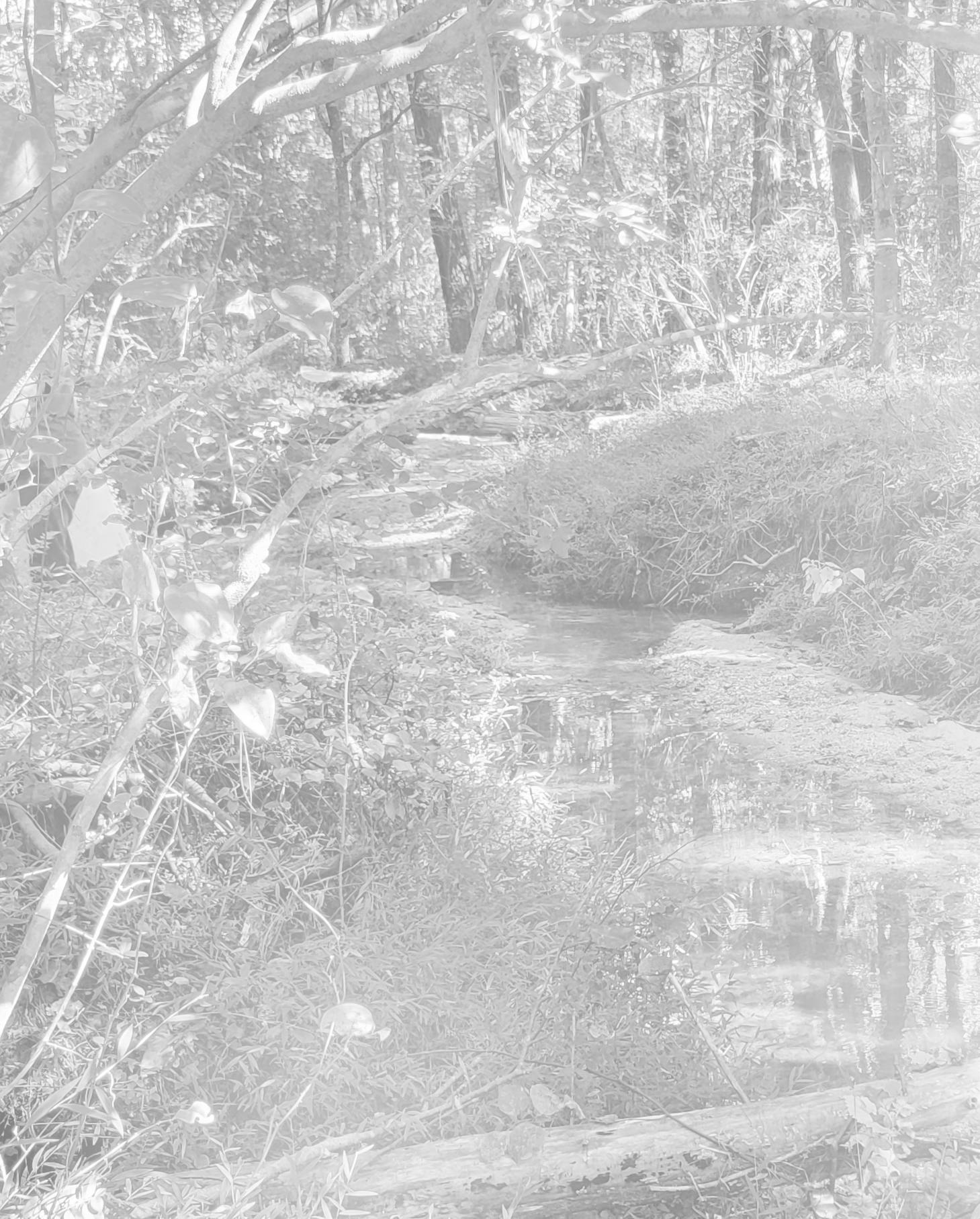
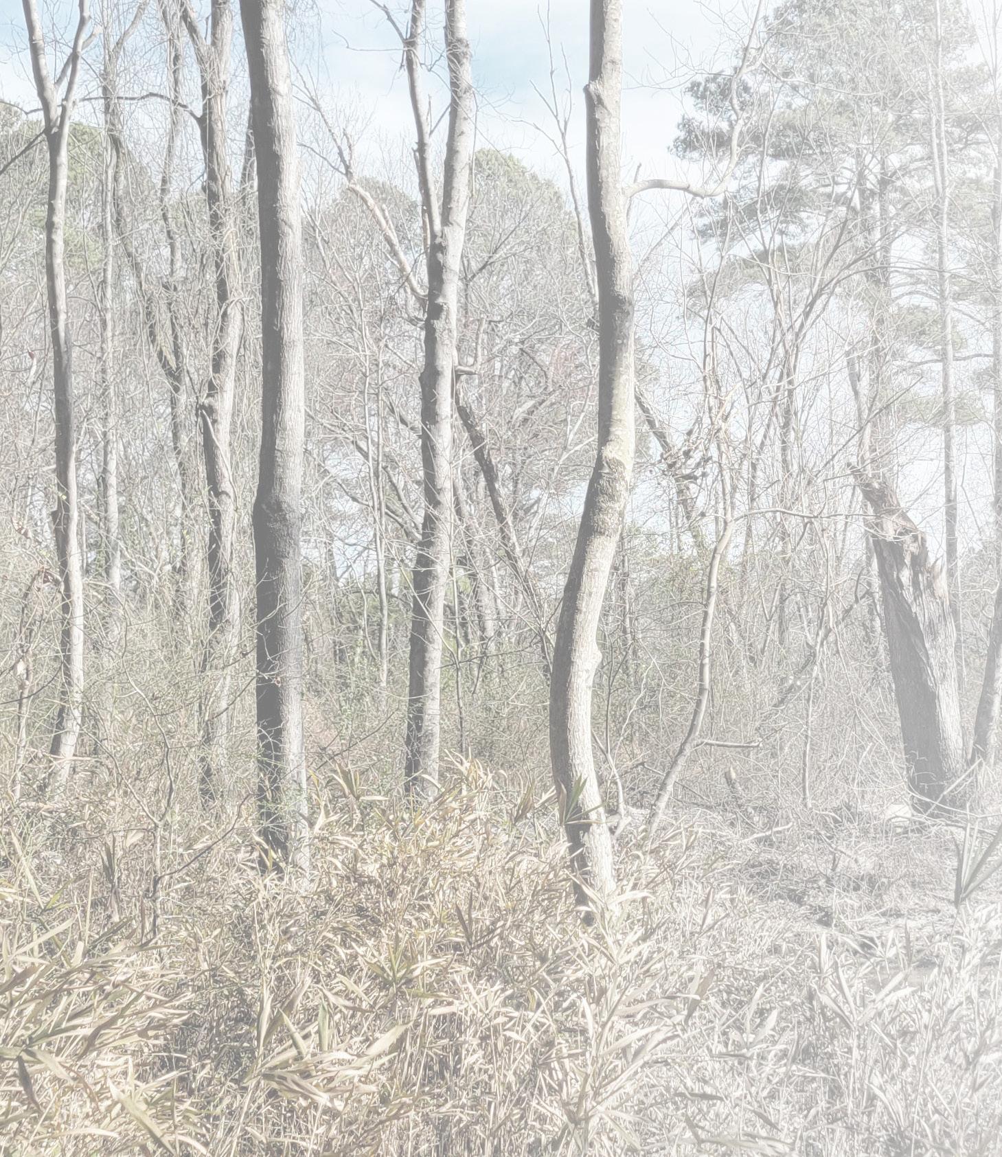
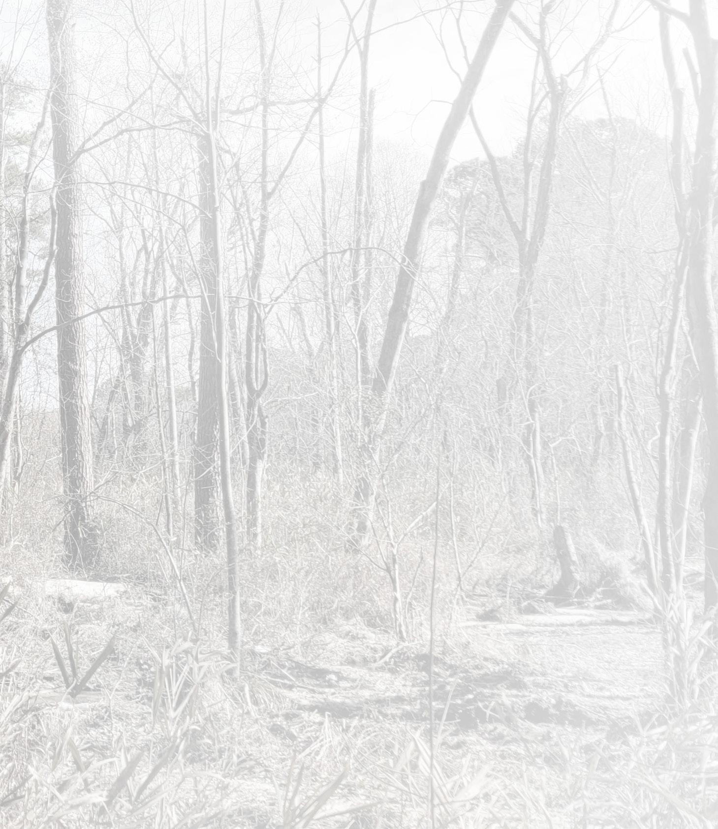
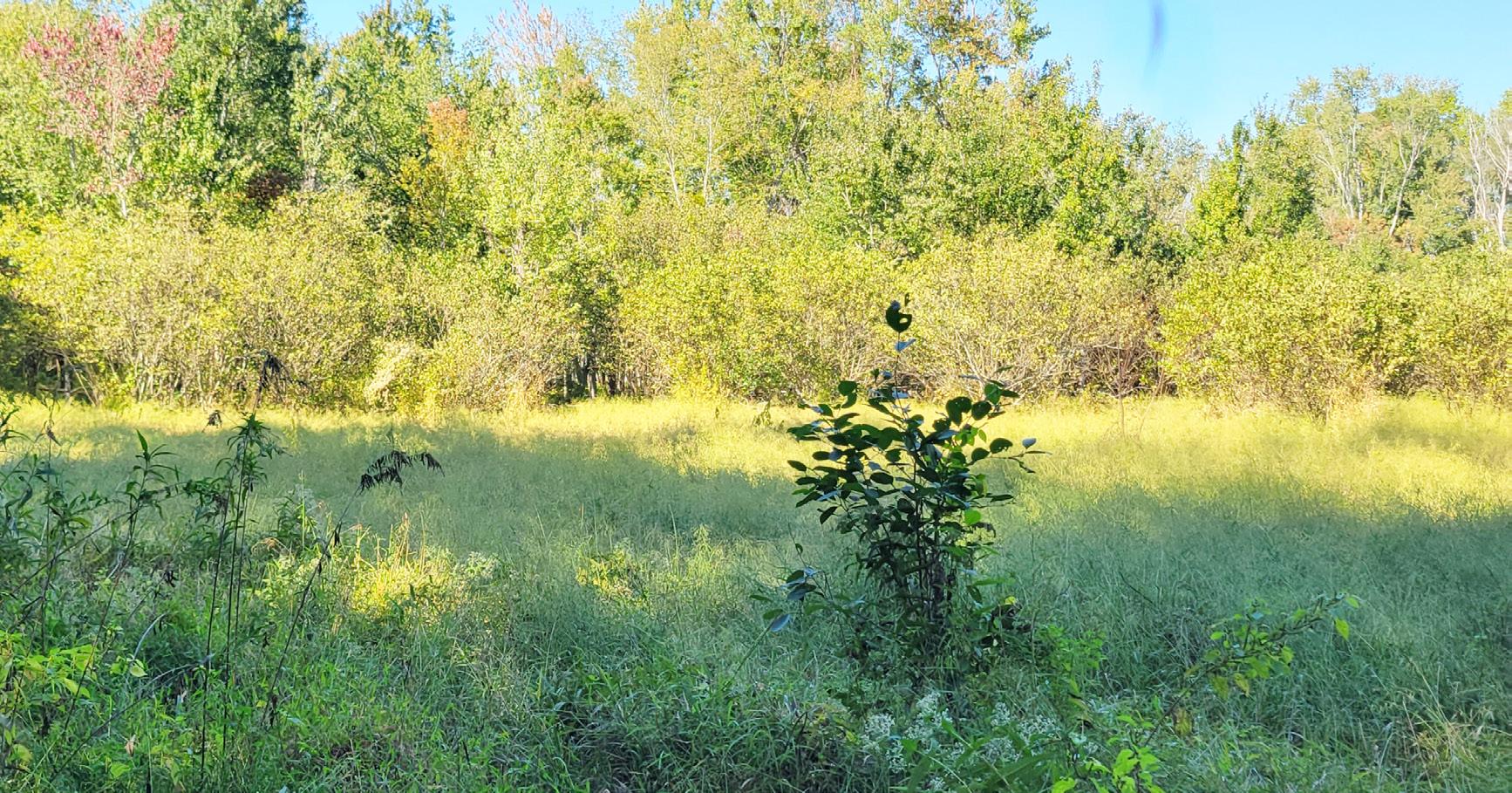
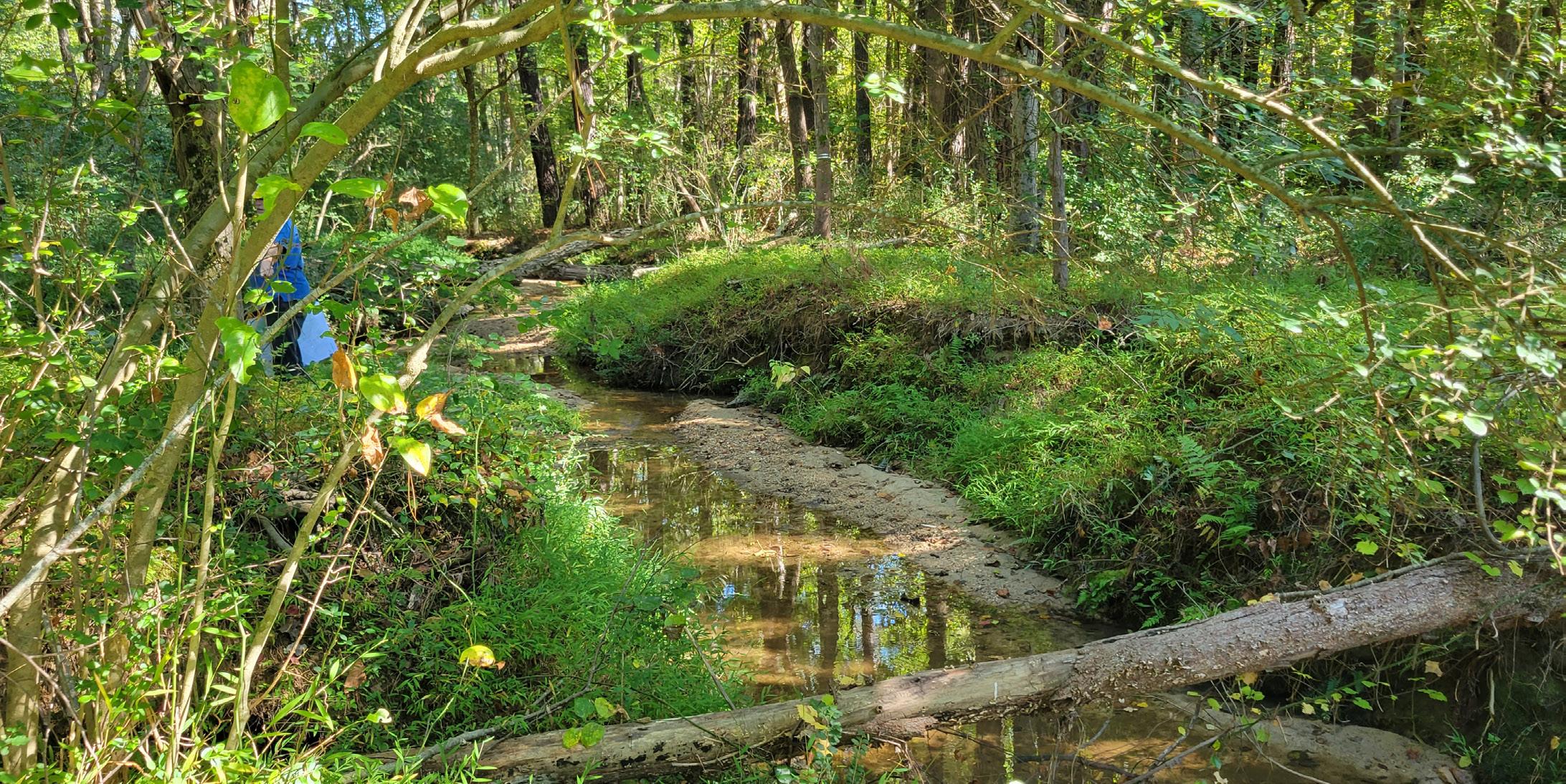
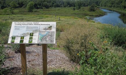
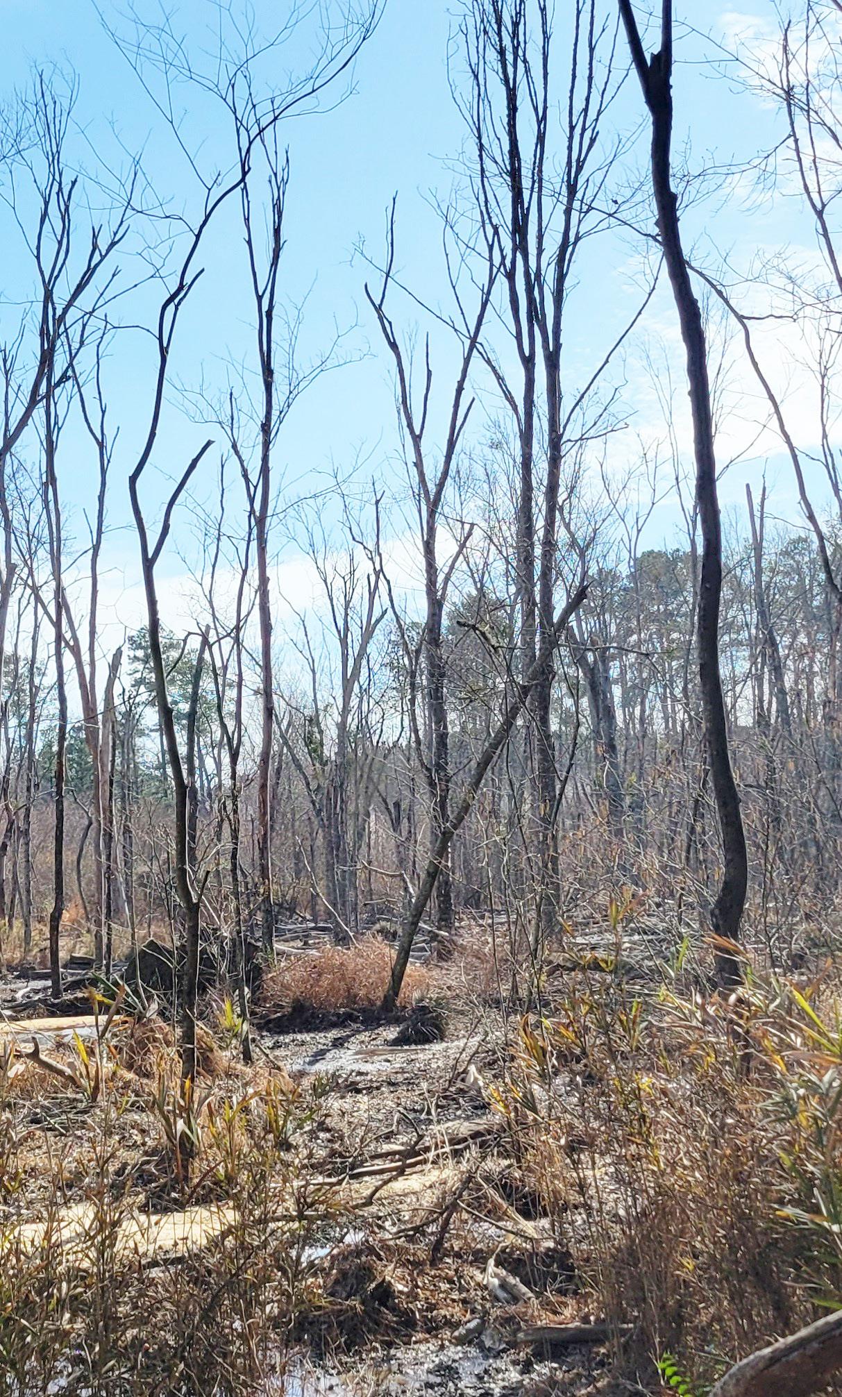
The most influential site features present on the park property are a portion of a 100+ acre wetland and the two streams that traverse the site. The wetland complex extends beyond the limits of the property and riparian buffers protect the stream corridors. Protection of these sensitive features is of the utmost importance.
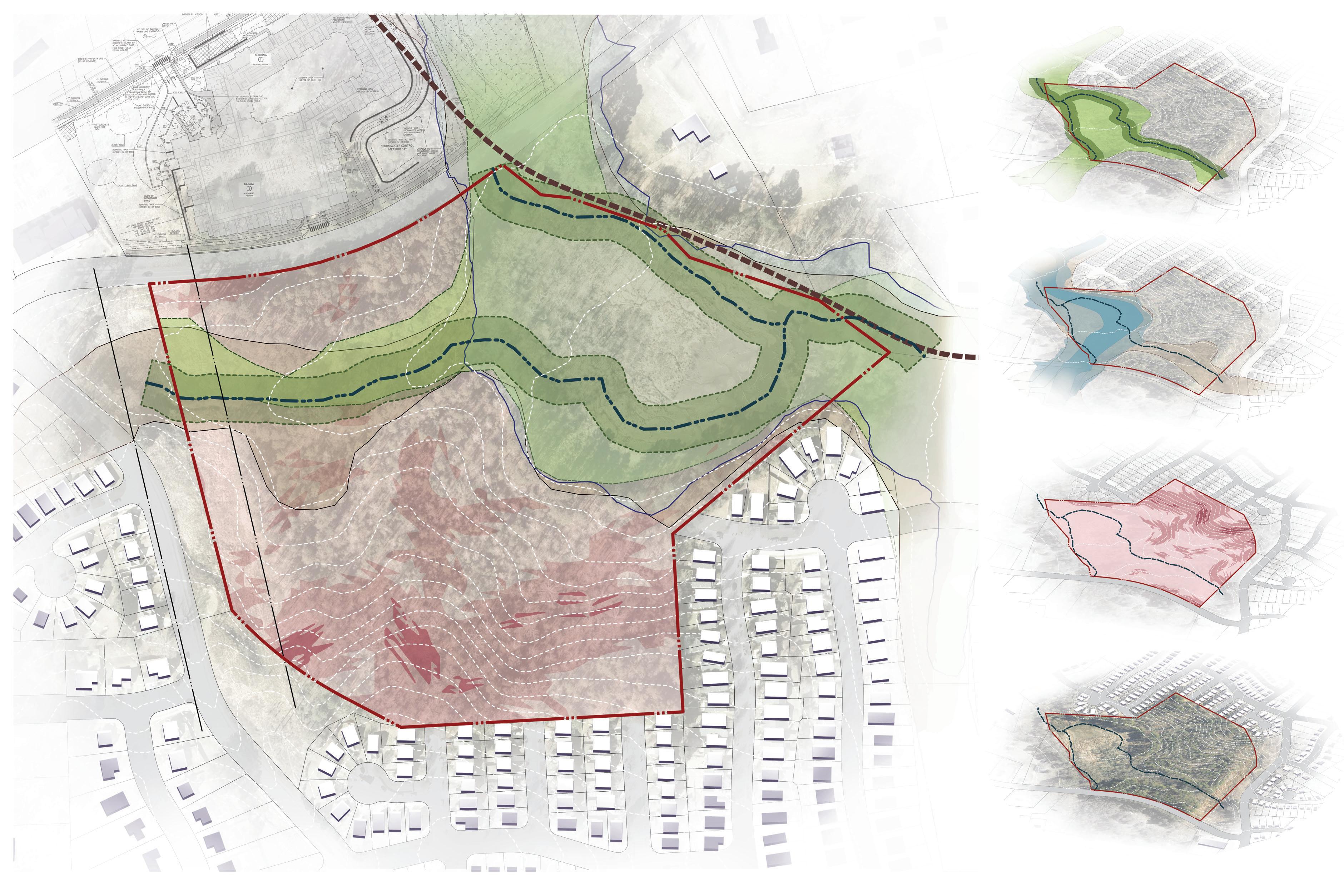

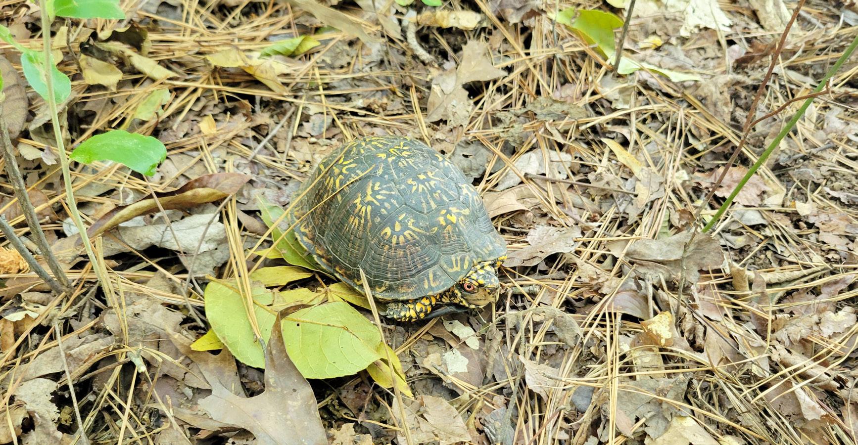
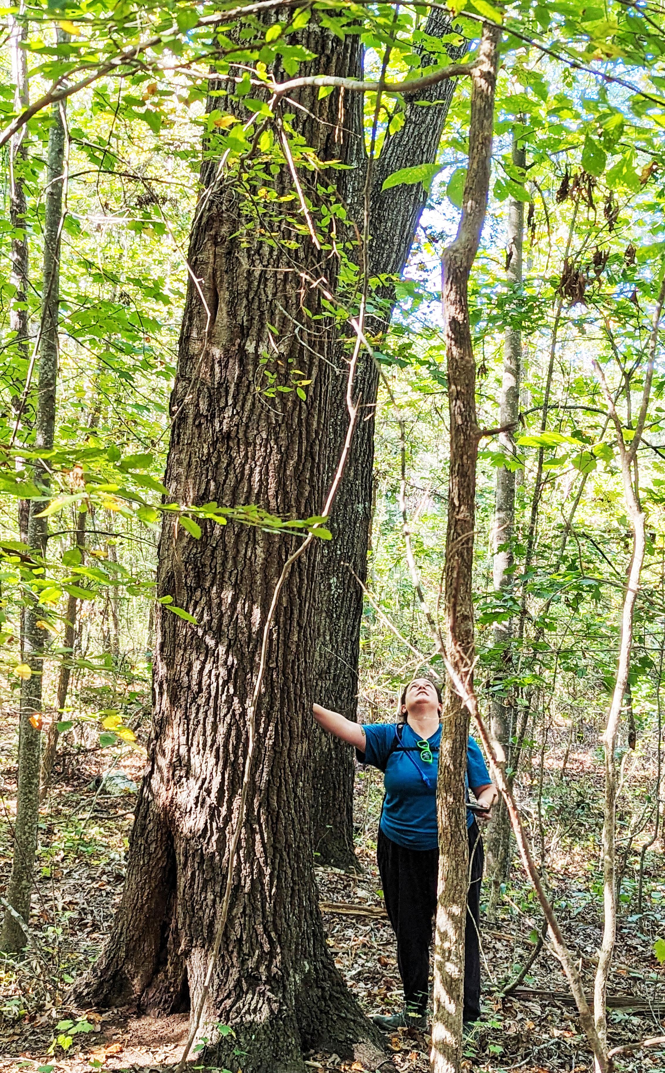
Topographical change in the southern portion of the property present challenges for development. Additionally, rock is visible on the surface in the higher elevations, which indicates the potential for more subsurface rock, creating more development challenges. Vegetation is typical for the Piedmont region. The site appears to have been logged in the past and the tree stand consists of mostly younger hardwoods.. Invasive species are present throughout the property, including Lizard’s Tail (Saururus cernuus) , which is dominant where the water is deepest . Tag Alder (Alnus serrulata), Climbing Boneset (Mikania scandens), and Smartweeds (Persicaria spp.) are dominant where the water is shallower. There is a large stand of Giant Cane (Arundinacea gigantea) in the eastern portion of the wetland. Invasive wetland plants include Japanese Stilt Grass (Microstegium vimineum), Marsh Dayflower (Murdannia keisak), and Chinese Privet (Ligustrum sinense).
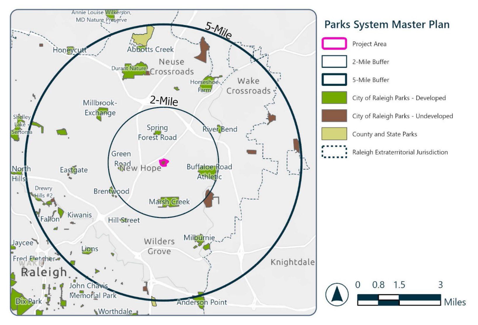
There are four operating parks within a 2-mile radius of the Kyle Drive Park property, including 22-acre Spring Forest Road Park, 29-acre Green Road Park, 110-acre Marsh Creek Park, and 166-acre Buffaloe Road Athletic Park. There are also several Raleigh parks and Wake County parks within the 5-mile radius of Kyle Drive Property Park.
Experiences missing from other parks should be considered for Kyle Drive Property Park to provide diversity of recreational opportunities as well as to avoid duplication where possible. Program elements such as nature-based play, walking trails, and food-focused landscape should be considered for inclusion with this project.
The City of Raleigh has identified a greenway corridor along the eastern boundary of the site as part of a larger network to connect neighborhoods with parks. It is important to recognize the desired connections and a greenway section should be implemented with this project. Coordination with the developer of the property immediately to the north should be ongoing to ensure a continuous connection and avoid gaps in the future greenway.
Access to water, sewer and power is available, however Duke Energy and Raleigh Water must be consulted to locate existing utility connections. There are utility easements located on both the west and east sides of the Kyle Drive property, and the park site is most easily accessed from these easements. A City of Raleigh sanitary sewer easement is located along the eastern boundary of the site. Water service will require extension along Kyle Drive to the park site; however, at the writing of this report it is unclear whether the park project or the adjacent development will be responsible for the extension. Whichever project goes into construction first will be responsible for the extension.
Due diligence associated with site analysis also noted that the City of Raleigh’s Comprehensive Plan identifies an extension of Jelynn Street through the park property as a collector street, connecting to Valley Stream Drive. The implementation of this street would negate the opportunity for park development. Park staff have filed an application for an amendment to the Comprehensive Plan to remove this street from plans for future development.
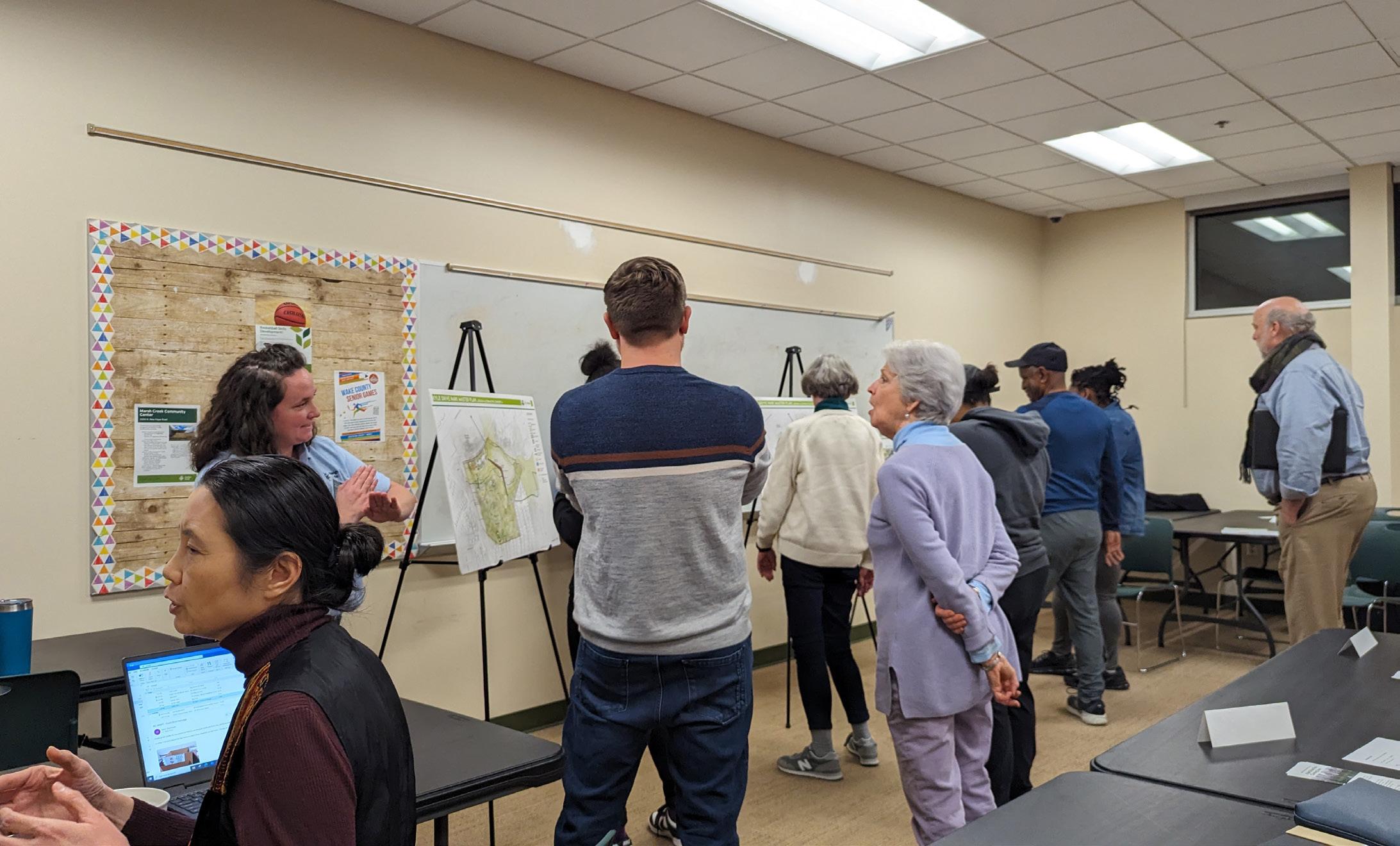
The planning and design process conducted for Kyle Drive Property Park was community based and collaborative. City of Raleigh staff provided the structure for the process orchestrating community meetings, facilitating meetings with the Community Advisory Group (CAG), leading site visits, and providing the platform for community outreach. They also provided information in the form of a System Integration Plan and Situation Assessment document that chronicled valuable information about the park site. Project team members from WithersRavenel attended and participated in those meetings as well as others, providing information on the park site’s ability to support development and creating design concepts and plans based on community needs and aspirations expressed throughout the process. Engagement of the community was accomplished through two in-person, open house format public meetings at pivotal points in the process. Community perspectives were also gathered through on-line surveys at those same points. The input of the CAG was instrumental in establishing a comprehensive vision for the park and guiding the design team on programming and the provision of specific park facilities and features. CAG members also served as ambassadors for the park project during the planning process.
Plans for the park acknowledge existing environmental features as both constraints and opportunities. These features also provided inspiration during the planning and design process. The overarching goal is to achieve a balance between park development and stewardship of these natural features and habitats. As plans evolved from conceptual ideas to the final master plan, a balance emerged that protected environmental assets while providing opportunities for visitors to connect with nature.

THIS PAGE INTENTIONALLY LEFT BLANK

10/13/2023 Site Walk
10/24/2023 CAG #1
10/30/2023 Public Mee ng #1
11/27/2023 Project Team Chare e
11/06/2023 CAG #2
10/20/2023 - 11/20/2023 Online Survey #1
12/12/2023 CAG #3
02/29/2024 Dra Concept Chare e

02/08/2024 CAG #4
01/10/2024 Design Alterna ve Review

01/29/2024 - 02/12/2024 Online Survey #2

03/18/2024 CAG #5
04/22/2024 Public Mee ng #2
04/22/2024 - 05/05/2024 Online Survey #3
04/01/2024 Sketch Plan Review
APRIL
MAY
05/10/2024 CAG #6


08/20/2024 City Council Presenta on 07/18/2024 PRGAB Presenta on
07/01/2024 CAG #7
JULY
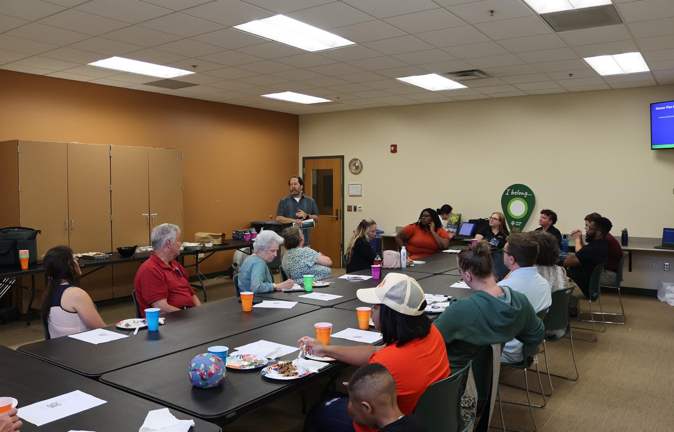
A consensus-building approach focused on community engagement is the foundation of this planning process overall. This involves including the general public, identified stakeholders and a Community Advisory Group (CAG), a membership-specific committee that provided oversight of the project planning process and ensured that decisions were made based on a broad representation of the community and stakeholders impacted by the project. The planning process was conducted over 10 months and involved in-person workshops, meetings, and site visits, as well as online surveys.
Throughout the planning and design process, the community participated in-person meetings to review project progress and provide input. A series of community surveys at critical points in the process were also conducted. Two public meetings were held at the completion of the site analysis and draft master plan phases of the project. Survey results and input received at in-person meetings were extremely similar and led to consensus regarding the approach to park development, park elements included, and experiences created.
A community advisory group was selected by the City of Raleigh to help guide the planning process and be a conduit between the community, city staff and the design team. And maybe most importantly, the CAG is expected to be an advocate of the project and work with their neighbors to ensure voices are heard throughout the process. Community members interested in serving on the committee were selected from a pool of applicants collected by the City. The applicants were evaluated based on demographics, proximity to the project site, interest in park planning and a host of other factors with the goal of creating a diverse stakeholder group that represents the surrounding communities.
COMMUNITY ADVISORY GROUP
BECKY BURMESTER
MELISSA FORDE
BEKAH TORCASSO SANCHEZ
SHERRY STEPHEN
DEBORA THOMAS
MYSTI STEWART
ADAM SCHREINER
PETER GIAMBATTISTA
CRYSTAL SCARBOROUGH
ALEXIS ARTERBERRY
HEZEKIAH GOODSON JR.
JEANNETTE ARROWOOD
MIKAELA ROJAS
The CAG followed a consensus-seeking process, including the adoption of a charter that governed how the group would operate. The CAG met with the design team five times throughout the master plan process and the group was encouraged to provide additional input by attending public meetings and communicating with the design team outside of the meetings. They also were asked to promote the park planning process within their neighborhoods and to publish informational posts on social media, which included the distribution of concept plans and meeting minutes. The CAG was able to reach a wide group of people easily and efficiently.
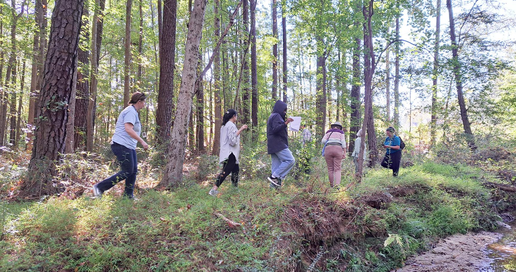
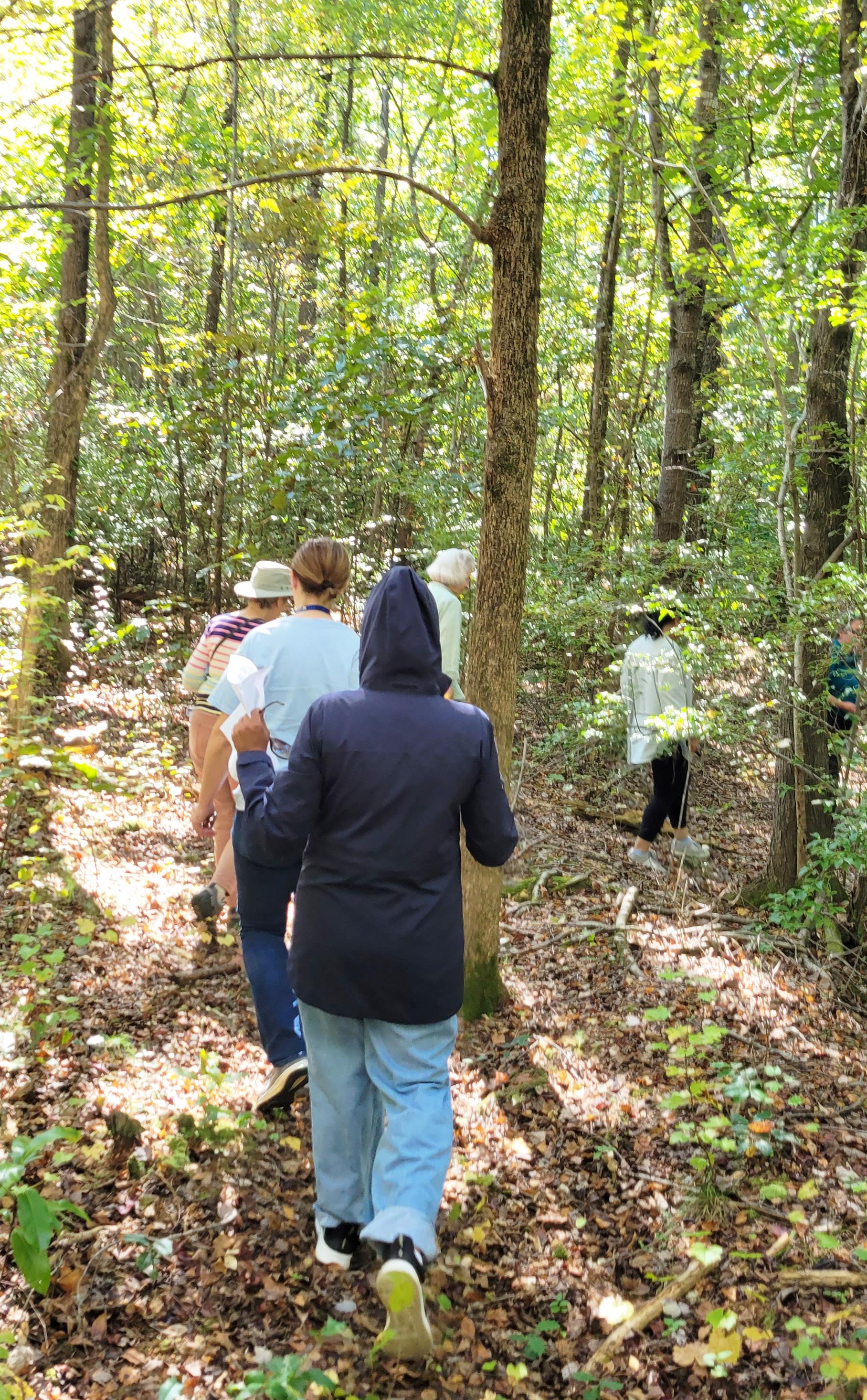
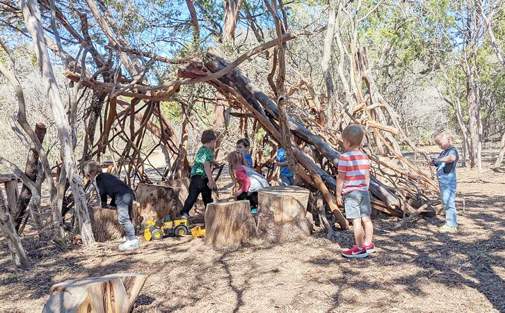
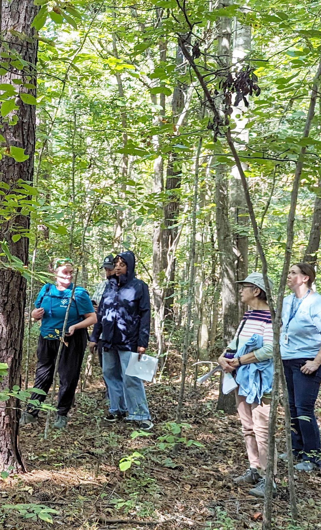
Meeting on site and walking the property was an important part of working with the CAG and members of the community. The City of Raleigh conducted several site walks, which were held during the week, on weekends, and at various times of day. The design team was able to join two of the walks, not only allowing the team to see the site first hand, but also to listen to the community and see how they experienced the site. The site walks were also an opportunity to educate the public about the natural resources as well as the opportunities and constraints of the site.
PROJECT TEAM SITE WALK

CAG MEETING #1
The first CAG meeting was held virtually on October 24, 2023, and was a chance to make introductions and explain the planning process. The CAG members were introduced to the project charter and their expected roles for the project. Additionally they had the opportunity to provide initial ideas and concerns about the future park.
PUBLIC MEETING #1
The first public open house workshop followed the first CAG meeting. Information provided to the community included site analysis documentation and a community needs survey
The meeting was an open-house style event with no pre-planned presentation. Members of the community were encouraged to drop in at their convenience over the course of 3 hours. Site inventory and analysis boards were available for review and a slide show of site photos was continuously running. In addition, the community was asked to provide input on a variety of program elements by placing dots on their preferred options. The design team and City staff were available throughout to explain the boards, answer questions and listen to feedback from the community.
At the second CAG meeting, the Park Planning team and consultants were introduced with CAG members. The Park Planning session provided an overview of the parks system, identified projects for investment, explained the current planning stage and master plan, and clarified roles for CAG, City of Raleigh and design consultant staff. Days and times for the first site visit with the CAG also were discussed.
In addition to the administrative agenda items, a preliminary site inventory map was presented to CAG members. CAG members discussed potential program elements with a visual preference board exercise and compared their results to the comments received at the public meeting and through the online survey.. Finally, key attributes for Kyle Drive Property Park were identified to help develop a draft vision statement, emphasizing inclusivity, peacefulness, natural beauty, creativity, innovation, safety, nature preservation, education, exploration and community interests.
The first online survey , conducted over the course of 2 weeks, received a total of 147 respondents. The majority of respondents indicated that they are most likely to use amenities such as paved walking trails, playgrounds, greenway access/connection, and picnic areas/ shelters at the park. Other amenities that received significant interest include community garden programming, unpaved walking/hiking trails, flexible open space, fitness stations, and unstaffed neighborhood gathering space. There were also requests for a pickleball court, nature play, interactive water features/splash pad, and additional amenities such as basketball courts, tennis courts, and a dog park.
In terms of accessing the park, the majority of respondents indicated that they would use a vehicle, followed by walking, biking, and public transportation. The preferred entrances to the park for those who selected walking or biking were from the west (Valley Stream Drive) and the north (Kyle Drive). There was also support for greenway trail construction to other parks in the future.
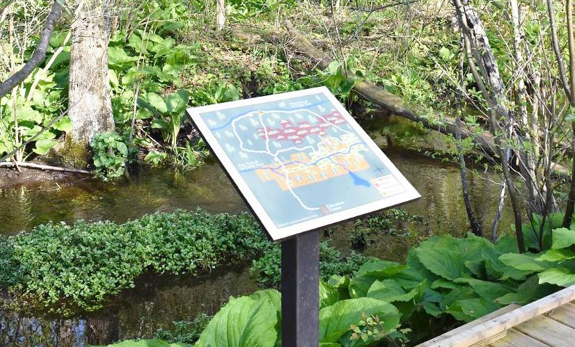
In terms of the wetland area, respondents expressed interest in amenities such as boardwalks, trails, viewing platforms, educational signage, and shaded trails with benches. Overall, the survey results provide valuable insights into the preferences and suggestions of the community for the development of Kyle Drive Park.
Which types of amenities would you and your household members be most likely to use at the Kyle Drive Park?
How would you and your family get to Kyle Drive Park?
If you selected Bike or Walk, would you enter the park from the north, south, east or west?
As part of this project scope, should greenway trail construction to other parks be a priority?
The third CAG meeting was held at Marsh Creek Community Center on 12/12/2023. The draft vision statement, emphasizing nature-based recreation, educational opportunities, and inter-generational play elements was discussed with the group and refined. Additionally, options for renaming the park as well as the process for renaming the park were discussed.
Site analysis information was presented and online survey results were reviewed to identify most desirable program elements for the park development. The group’s consensus was that that the program elements for park should be nature focused aiming to foster environmental respect and visitor awareness through educational signage promoting principles like “Leave no trace” and wildlife respect. The park should feature looped trails with distance markers, access to wetlands via boardwalks with interpretative signage, and generally maintain a quiet atmosphere. Potential sports courts would be located near the main frontage with noise mitigation solutions. The park should include a variety of play options, integrating both traditional and natureinspired equipment suitable for different age groups, including man-made hills for nature-play and adult fitness equipment. The idea of food forest emerged during this discussion.
PARK PROGRAMS
NATURE FOCUSED
WETLAND ACCESS
TRAILS - NATURAL/PAVED
INTERGENERATIONAL PLAY
NATURE PLAY AREA
VARIETY OF PLAY OPTIONS
ADULT FITNESS EQUIPMENTS
ADULT PLAY/SWING
COMMUNITY GARDEN
HAMMOCKS
FOOD FOREST
FLEXIBLE SPACES
GATHERING SPACES
SHELTERS
SPORTS COURTS
UNIQUE FEATURES : TREE HOUSES
LIGHTING
Additional amenities could include community gardens, hammocks, flexible flat areas for classes and events, gathering spaces, shelters, tree houses, and the reuse of cut-down trees for furnishings and play elements. Integration of stairs into the trail network and light into play areas shoud be considered, keeping in mind the park’s dawn-to-dusk operation.
Connectivity was a major topic at this meeting. The park should be equally accessible from the surrounding communities and the proposed apartment complex on the opposite side of Kyle Drive and connectivity should focus on the pedestrian experience. Future greenway connections were identified as being crucial to ensure future regional connectivity. Addressing concerns about speeding on Kyle Drive was also important, as it affects the safety of park entrances, and may necessitate the implementation of traffic calming measures on both Kyle Drive and Valley Stream Drive. Enhancing accessibility from Valley Stream Drive will further improve the park’s usability for all visitors. The potential to accommodate parking spaces under power lines should be explored.
Alternative concepts for park development were prepared based on site analysis and community survey results regarding recreational needs, aspirations, and perspectives on the appropriate level of development. While the alternative concepts have numerous similarities, there are both dramatic and subtle differences. Similarities include the general locations of program elements, network of trails, protection of wetlands and streams and connections to adjacent neighborhoods.
It was determined that parking is best located and accessed from Kyle Drive and that disturbance on the south side of the creek should be minimized. Vehicle access from Valley Stream Drive and parking on north side would require a drive crossing of the creek. The area just south of creek is a good location for trails, elements of play, education, food forest and art. These features can be connected to parking with the pedestrian network. The plan also needs to respect natural drainage patterns. In the future, parking may also serve as a trailhead for the greenway in addition to serving the park.
The following three alternative concepts were presented to the Park Planning team ahead of the CAG to ensure the design team was comfortable with the proposed design and program elements.
Similarities shared by all 3 options:
• Protection of wetlands and stream corridors
• Boardwalk access to wetlands
• Pedestrian access to stream
• Vehicle access from Kyle Drive and parking on north side of the creek
• Pedestrian connection to future greenway
• Hierarchy of trails (paved, natural and boardwalk)
• All paved trails are ADA accessible
• Activity areas on south side of creek
• Boardwalk access to wetlands
• Pedestrian access to Valley Stream Drive and associated neighborhood
• Other pedestrian connections to adjacent neighborhoods
• Incorporation of play environments
• Incorporation of educational opportunities
• Incorporation of public art
• Maintain 40-50’ wide natural buffer along Kyle Drive
• Implement traffic calming measures on Kyle Drive
• Program to remove invasive plants
• Single basketball court provided
• Green Stormwater Infrastructure
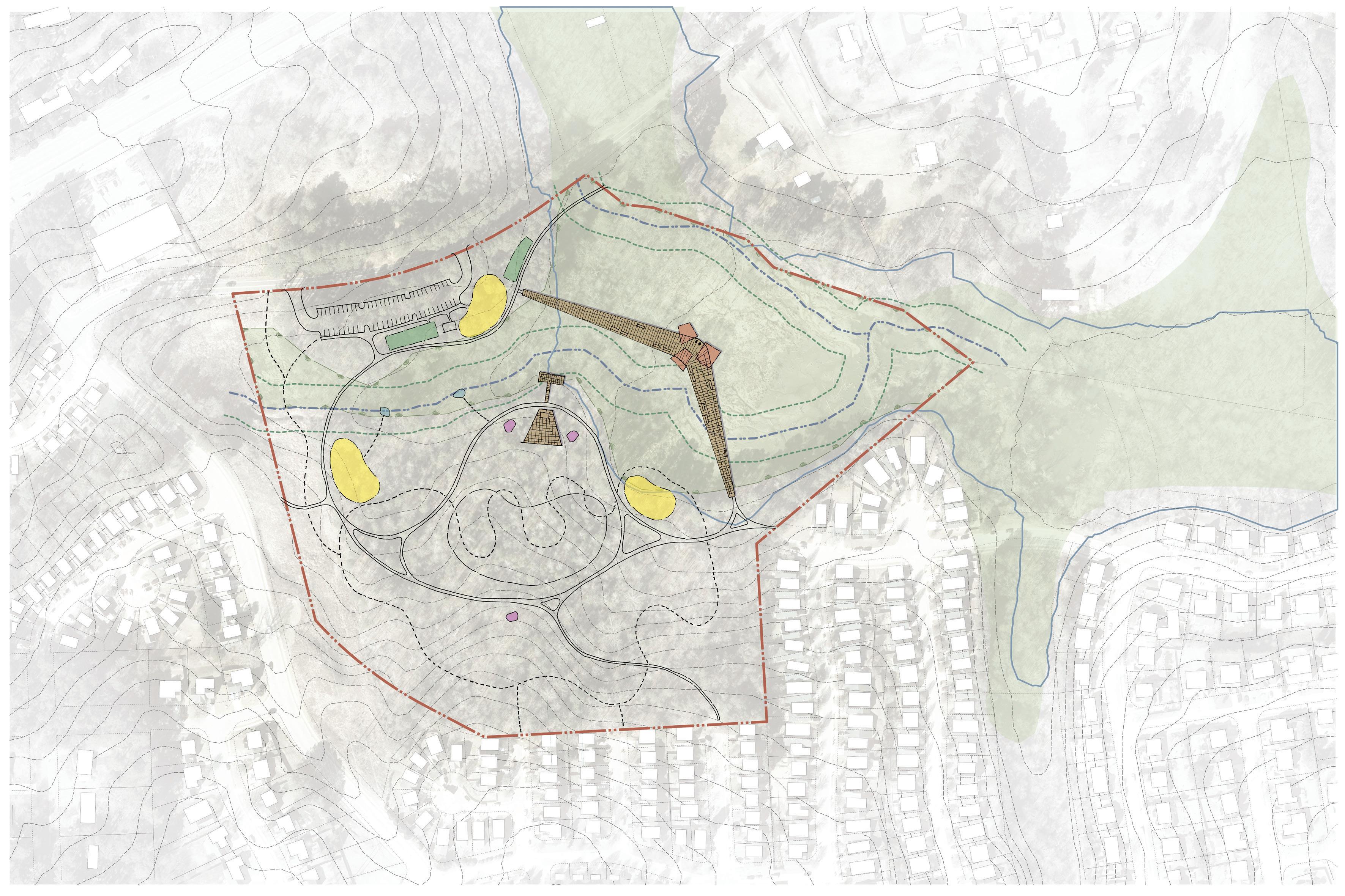
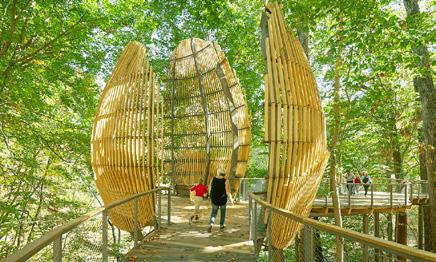
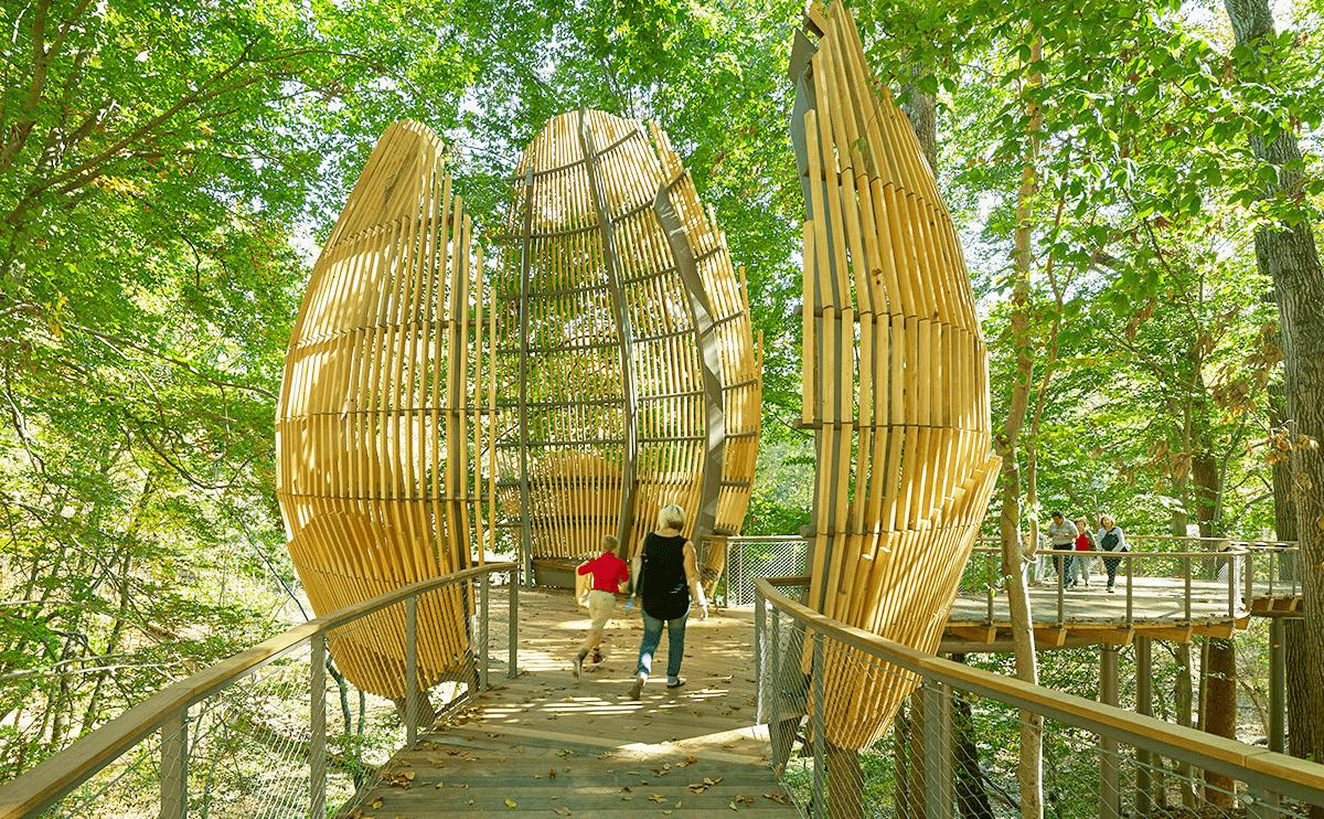
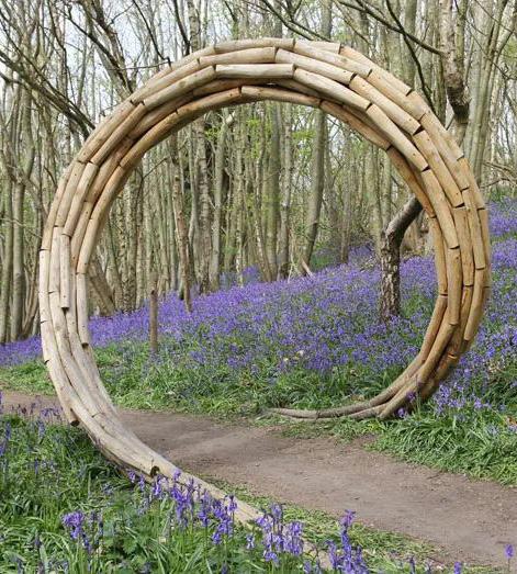
• The primary feature of this option is the “boomerang” boardwalk structure which provides access to wetlands in a dramatic fashion with a substantial structure that provides space for educational features, seating, viewing and creates a shaded space at the apex of the boomerang shape.
• Access to greenway is provided by separate spur trail connection paralleling Kyle Drive
• Hierarchy of trails
• Play opportunities are illustrated on both sides of the creek
• Food forest occupies center space on south side and is associated with outdoor classroom
• Public art pieces are strategically placed reinforcing an implied formal relationship between them and the outdoor classroom
• 60 parking spaces
• Community garden

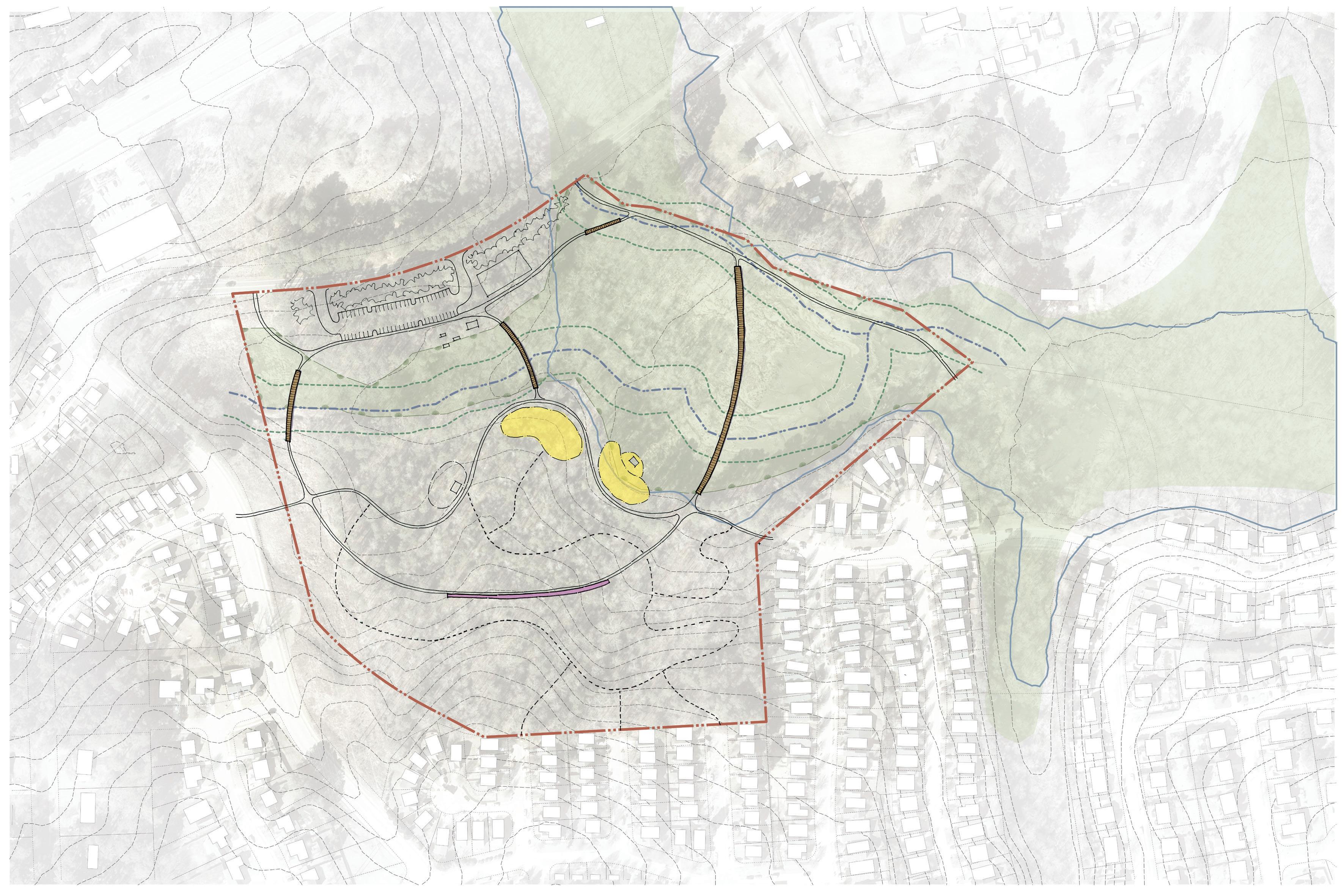
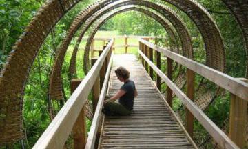
• The primary feature of this option are the 3 boardwalk structures. The forms of these reflect each other and are 3 different lengths. The longest at 500 LF, is the connection to the future greenway and could include built in seating areas along its length. The other connection from parking to greenway could be eliminated if it is advantageous to reduce impression of parking area as a trailhead parking facility
• Two connections to the future greenway
• Play opportunities on south side of creek only
• Center space south of creek includes adventure / nature play, outdoor classroom on the edge of the wetlands and remote picnicking
• Food forest south side of stream
• Public art is envisioned as an art wall that could take several forms including an installation that reflects the natural soil profile “life under the forest floor”
• 55 parking spaces
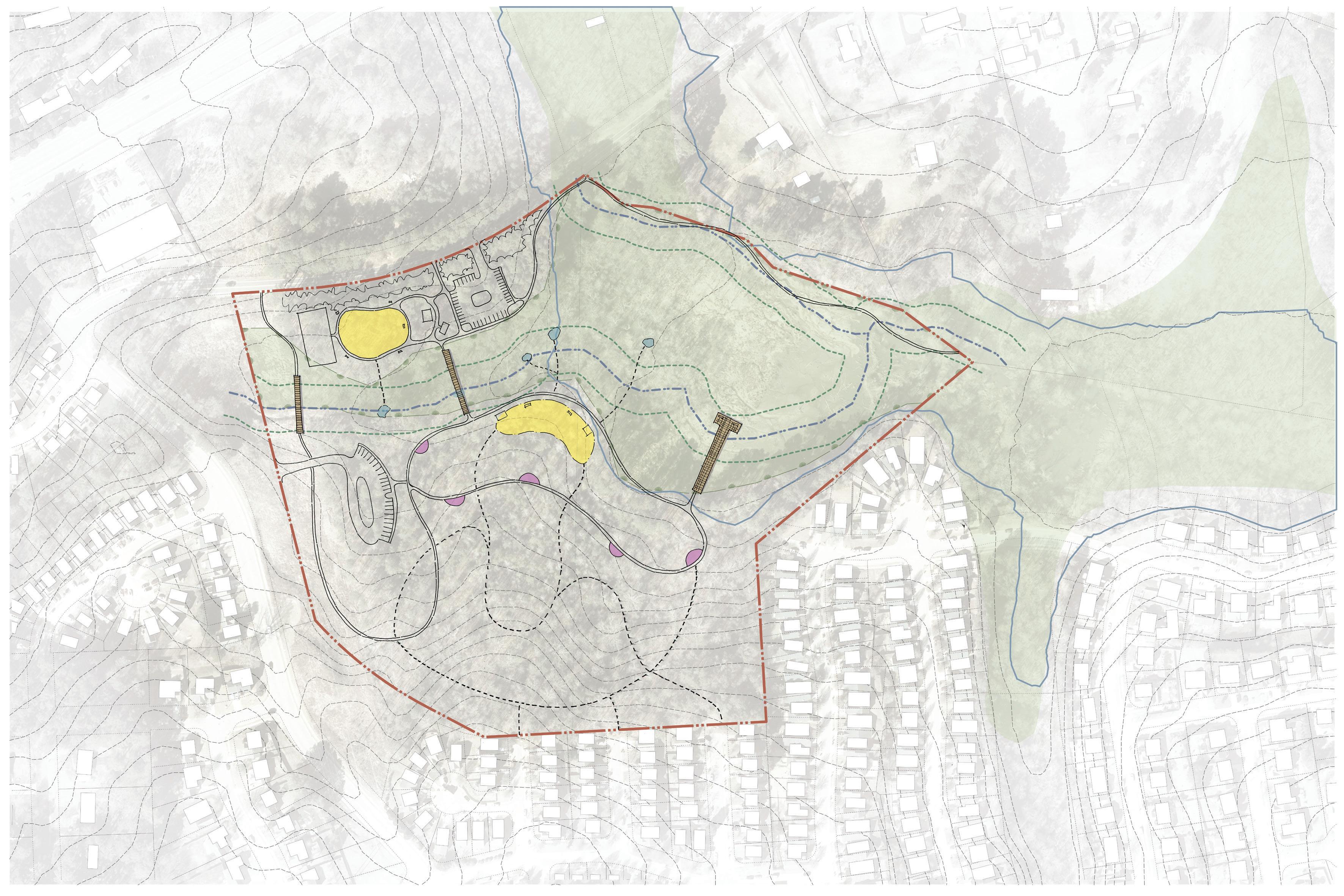
• The configuration of boardwalks in this option create a loop trail crossing the stream twice and the third extends into the wetland
• Trail connection to future greenway
• Primary trail includes spaces along the trail that can be public art, picnicking or simply a seating area
• Vehicle entry from Kyle Drive and Valley Stream Drive
• Parking north and south of streams total 50 spaces
• Play opportunities on north and south sides of stream
• Trail system does extend as far into southern portion of the site as other options
• Plan illustrates a small flexible open space adjacent to Kyle Drive
• Plan illustrates direct access to the creek.
Three conceptual design alternative option were presented to City of Raleigh Parks team. Suggestions were made to simplify the concepts into two distinct themes: one focused on community agriculture and the other on traditional park amenities. The alternate designs should include a greenway route through both the neighborhood and the wetland, ensuring connectivity and avoiding dead-ends.
Specific elements to include are the boomerang boardwalk, a pier, limited play areas with a mix of traditional and nature/adventure play, and picnic areas. Both concepts must support maintenance access, include green stormwater infrastructure (GSI) seating, and clarify stream access and art placement. Neighborhood connections should be natural surfaces, with paved connections only to Jelynn Street. The feasibility of a vehicular connection to Valley Stream Drive should be evaluated. Parking should be reduced to 30 spaces. Placing benches along the trails also were discussed. Concerns about tree clearing should be addressed with information on current trees, habitat, and planned plantings. The food forest should feature native fruiting plants, and the outdoor classroom area should be scaled down. Community gardens should be consolidated or differentiated by garden styles, considering sunlight availability. Precedent images should be included in future presentations.
The second online survey received a total 166 respondents. The survey results indicate a strong preference for certain elements in both Concept A and Concept B of the park design ; however, a majority of the respondents indicated that Concept A is the most preferred design.
Overall, which Concept Plan do you prefer?
Which unique elements, from either concept, do you want to see in the final plan?
The community garden and food forest elements of Concept A were highly favored and were mentioned frequently as desired features, as they provide opportunities for growing healthy food options and promoting community engagement. The boomerang boardwalk and adventure play were also mentioned as appealing elements, as it provides an interactive and engaging experience for children and adults. Additionally, the focus on nature and education in Concept A resonated with many respondents who expressed a desire for a park that promotes interaction with nature and provides opportunities for outdoor learning. Additionally, there was a desire for art along the trail, which will further enhance the aesthetic and recreational aspects of the park. The preference for Concept A over Concept B may be attributed to the unique and nature-focused elements it offers, as well as the desire to have a park that stands out from the traditional playgrounds and basketball courts found in other parks in the area.
At the fourth CAG meeting alternative concepts for the park were presented along with online survey results.
The CAG’s discussion touched on various aspects of the park’s development, emphasizing the need for practical and creative solutions. Suggestions were made about using permeable pavers for parking, noting their maintenance and cost. Suggestions were made to combine elements from both concepts. Elements that were preferred from both concepts are providing creative play structures, in both traditional and natural play area, including a community garden and combining food forest with adventure play along trails. While adventure play will still be promoted using natural materials, dedicated built structures may not be included to allocate resources effectively.
Suggestions were also made to accomodate a basketball court. Greenway access must accommodate emergency vehicles and fire trucks and school buses to accomodate outdoor learning opportunities. The boomerang boardwalk should offer flexible space. There was a consensus on the need for practical features like trash bins, drinking fountains, and restrooms, and ensuring the park’s elements are accessible and safe. Both traditional and nature play elements are desired, with durable materials. Integrating art into adventure play, and “preserving wildlife habitat” and “leave no trace signage” signage were also discussed. In conjunction with CAG meeting #4 alternative concepts were made available to the community online.

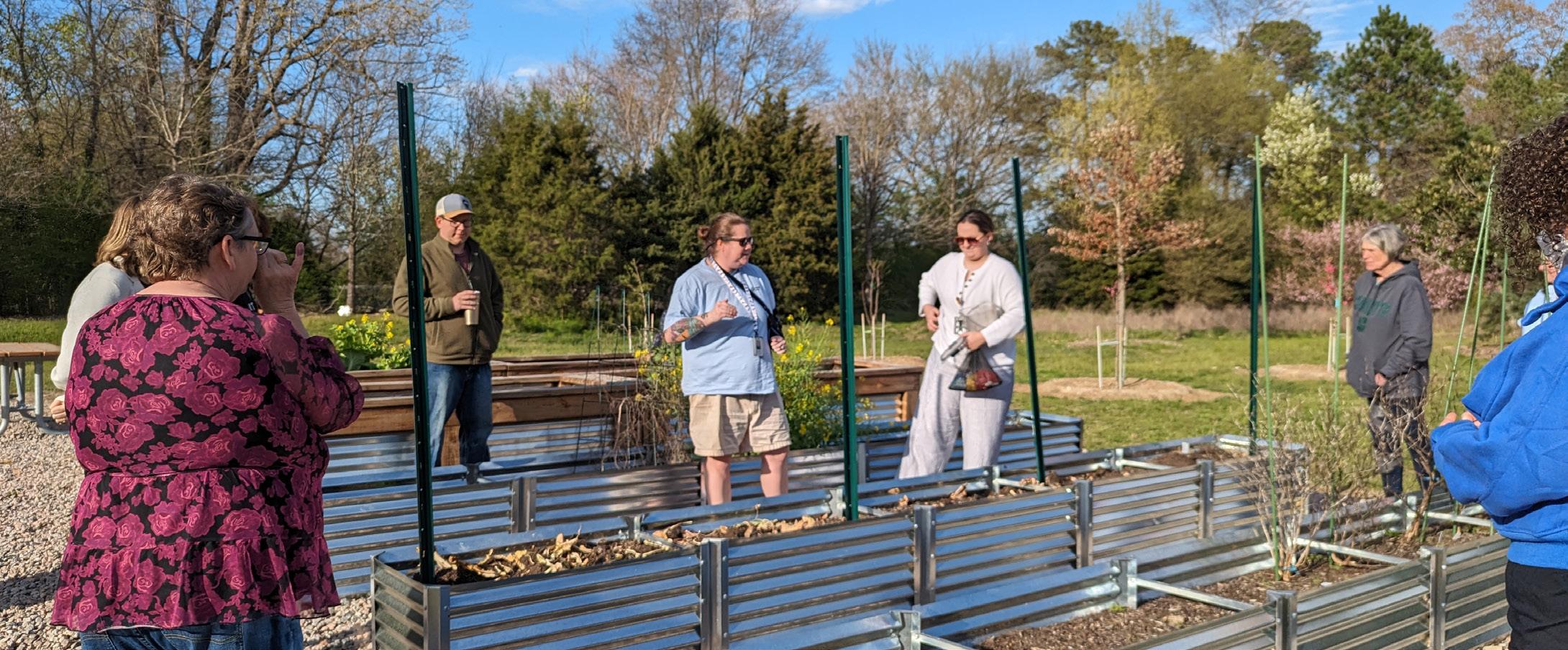
The Community Advisory Group meeting at Marsh Creek Community Center commenced with a tour of the community garden, followed by discussions on garden bed sizes and educational activities for children. During this meeting there was consensus for the proposed Food Forest, with suggestions to introduce edible landscapes in the northern part of the park, to replace the community garden on the master plan, as Marsh Creek Community Garden serve the area need. Additionally, Kyle Drive Park will not be staffed, and maintenance was a concern.
CAG members provided positive feedback on traditional and nature play elements, while expressing concerns about the proximity of the basketball court to the playground and the maintenance of the community garden. Other suggestions included adding benches along the greenway, removing adventure play along the natural trail, and combining shelter and restroom facilities. Programming revolving around the natural landscape and additional allocation of funds for public art were key take aways from this meeting. Additionally, there was a broader discussion on how to best incorporate a sport court, despite the park’s overall natural identity. Online survey results and input from CAG, inspired City Staff, and design team to explore half or short court design solutions.
City staff discussed implementing a door-to-door campaign in Windward Downs to ensure that the community was being engaged and heard, especially in regards to proposed pedestrian connections to the neighborhood.
During the CAG meeting, the group also continued discussions of possible names for the park with the following names emerging as top contenders:
• River Cane Wetland Park
• Kyle Drive Wetland Park
• Valley Stream Wetland Park
Additional suggestions will be invited from the community through a City-managed park naming process.
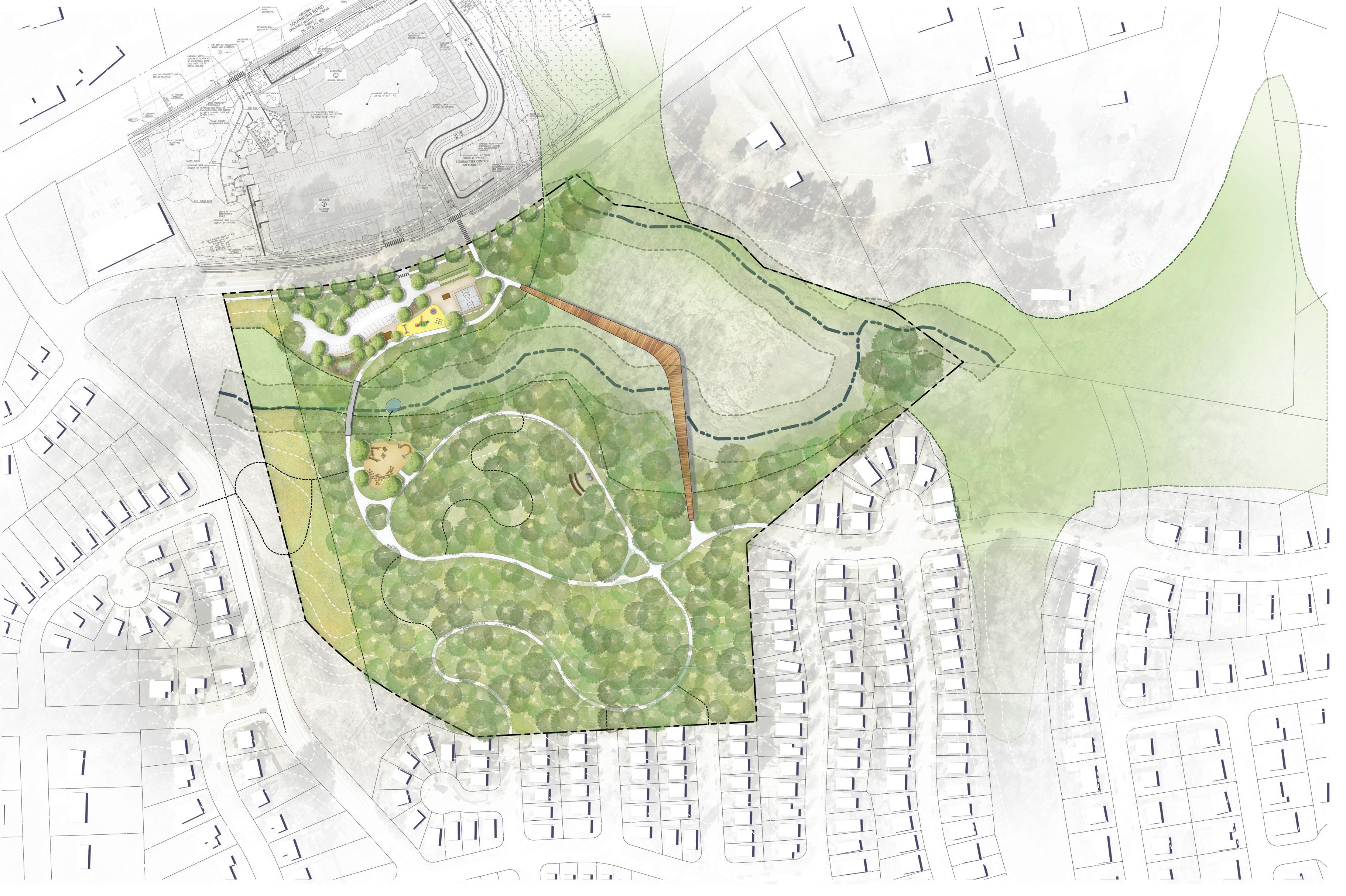
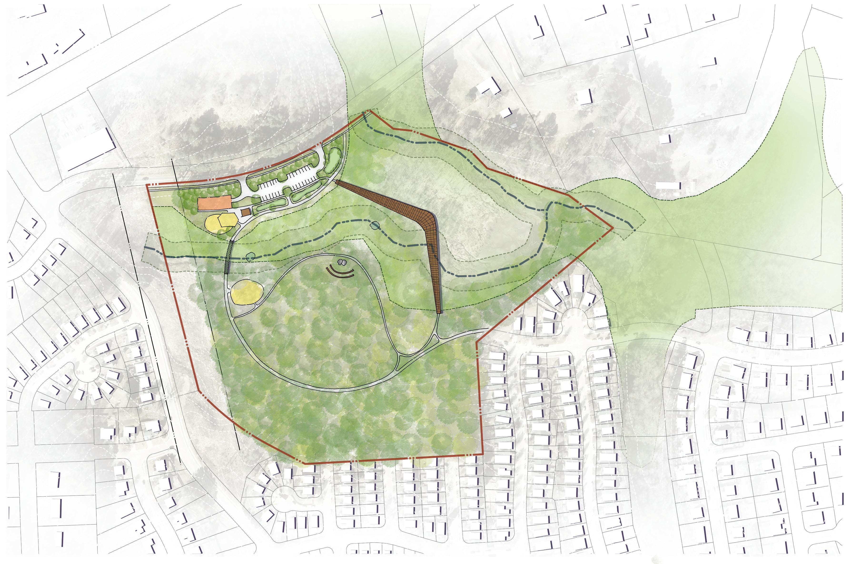
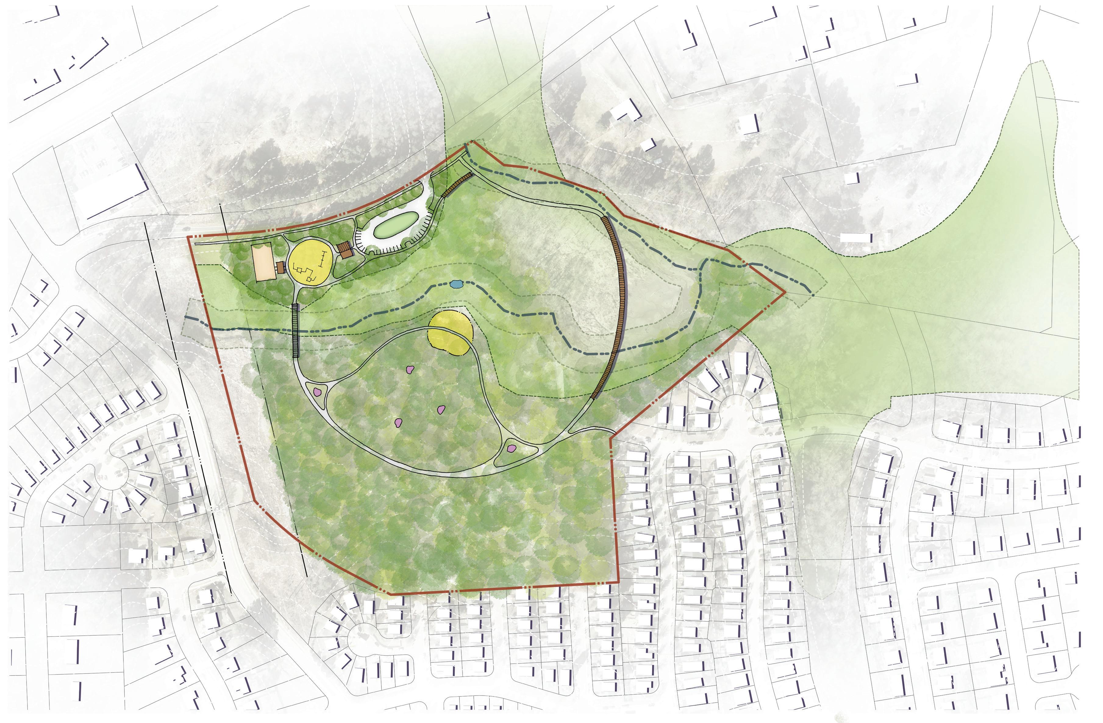
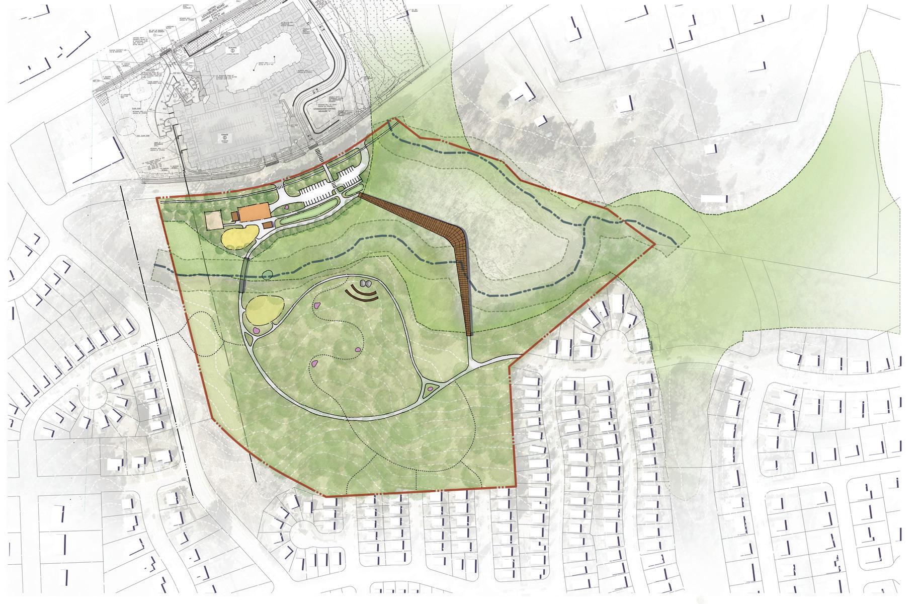
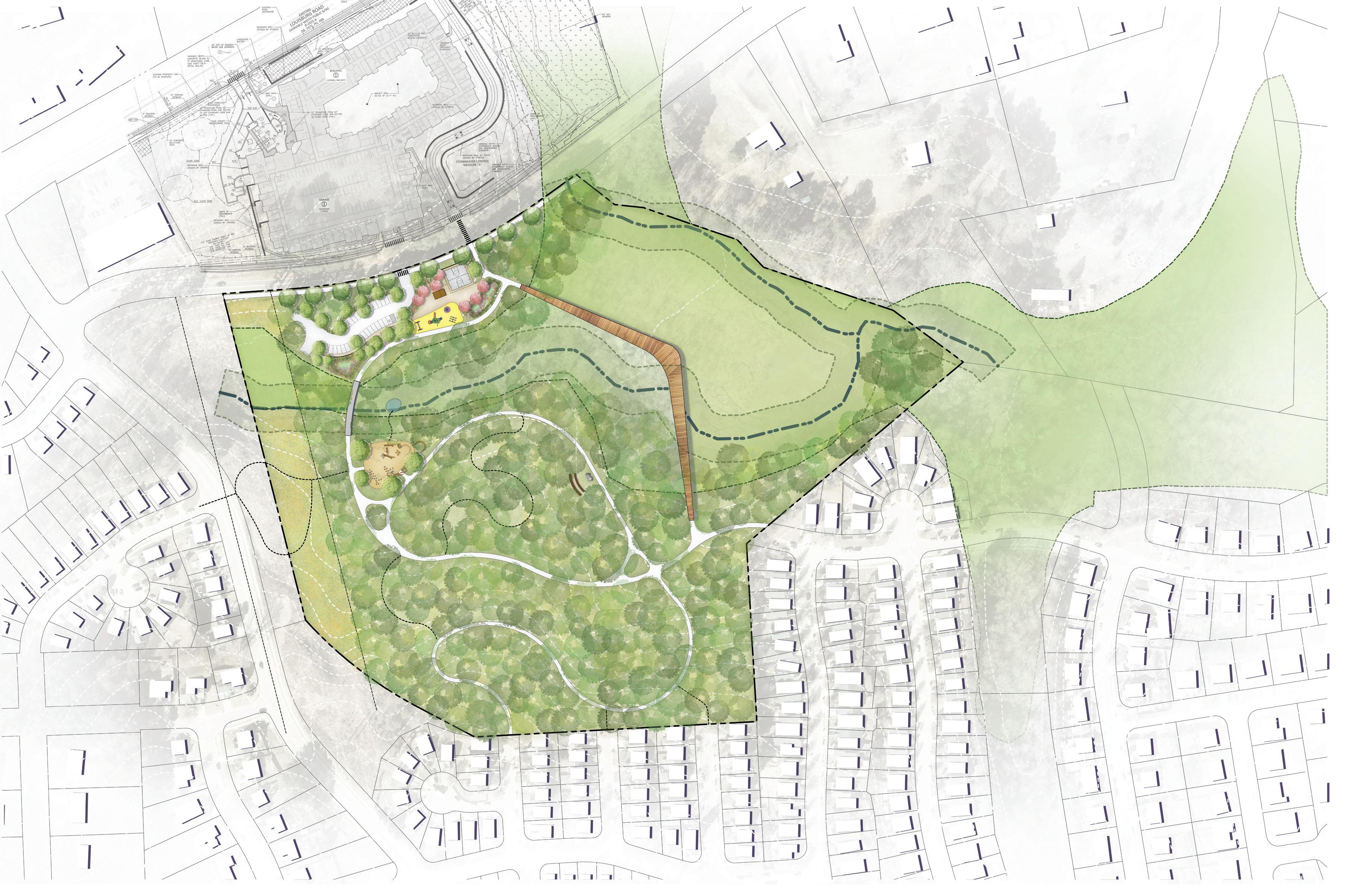
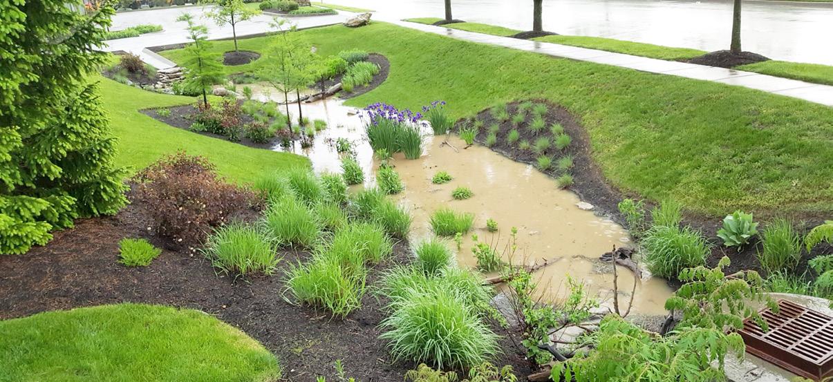
The draft master plan for Kyle Drive Property Park reflects community and staff input throughout the process as well as guidance from the project CAG. Recommendations support the overall direction for the park as a nature-based recreational experience fostering opportunities to connect to nature through education, play and healthy activities, such as biking and walking. Minimizing disturbance to existing landforms, drainage systems and vegetation is a central focus of the design. Park elements and connecting trails are positioned to limit disturbance. Also important to the implementation of the park, is the incorporation of sustainable practices relative to storm water management. This could include rain gardens, permeable pavement, and other best practices to prevent sediment from infiltrating streams.
Park features illustrated by the Draft Master Plan include the following:
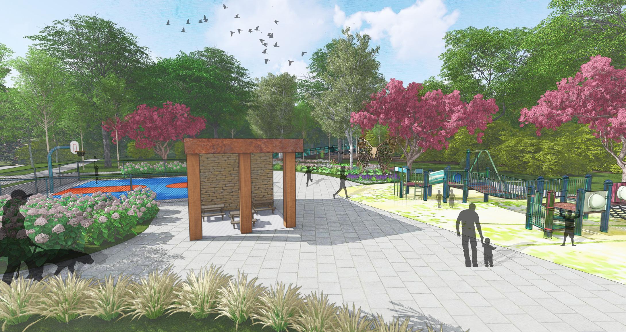
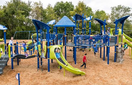
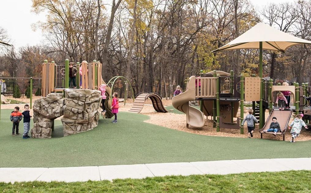
Traditional playground
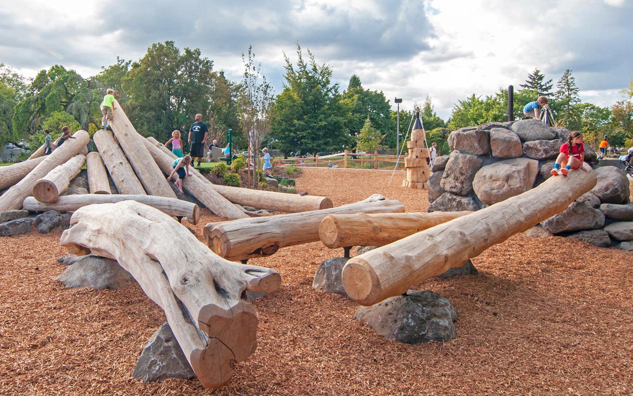
Natural playground south of the creek
Outdoor classroom south of the creek accommodating a 25-30 students
Natural trail connections provide access to the stream
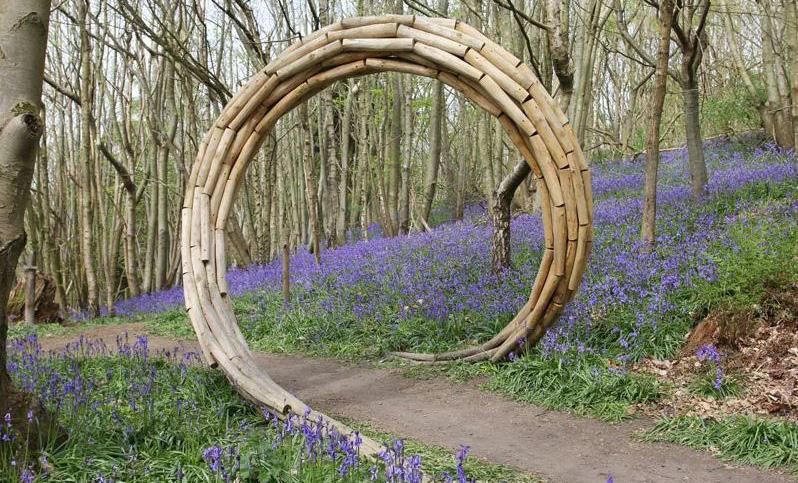
Public art incorporated into natural trail system
Public art incorporated into boardwalk trails
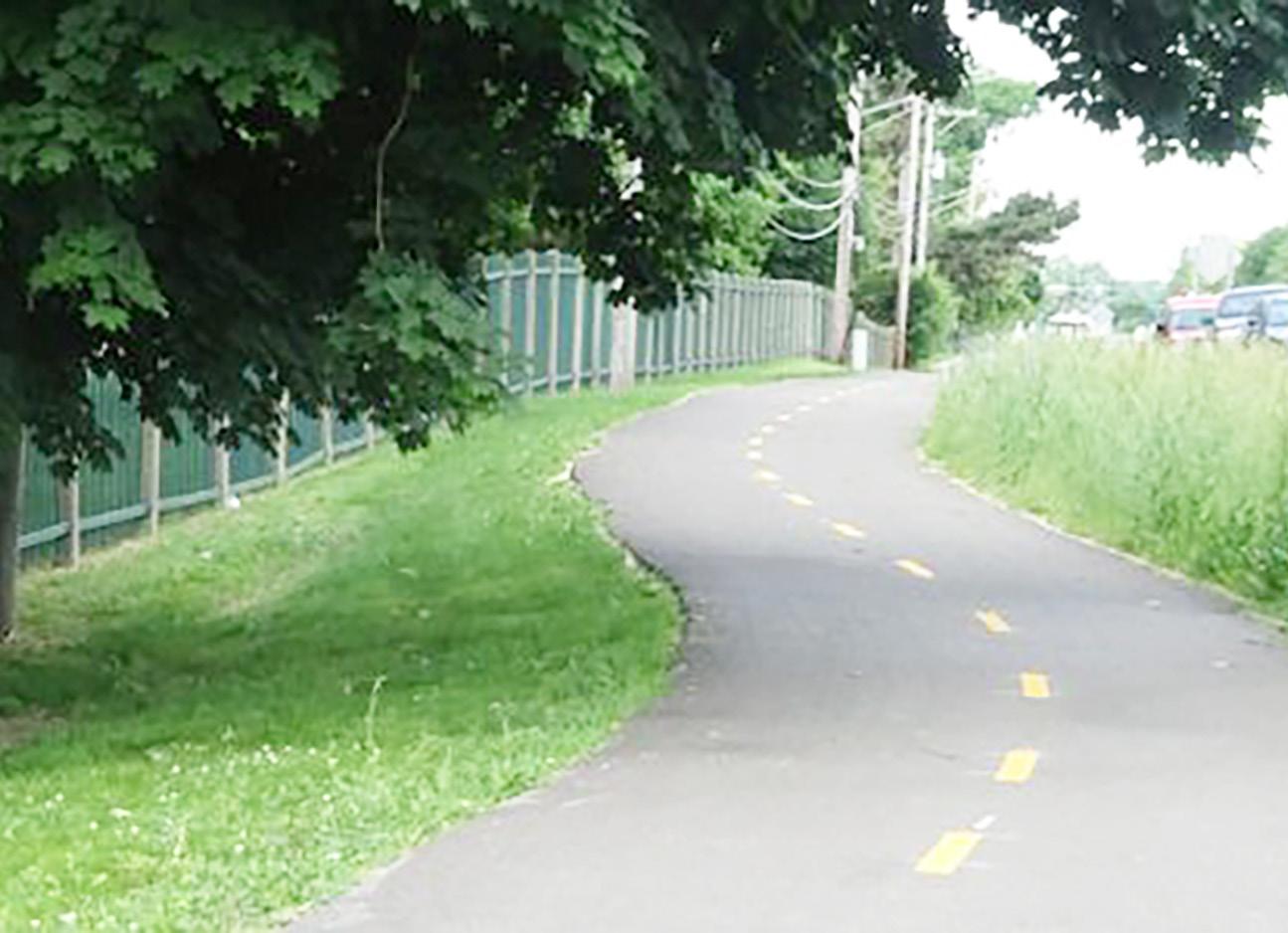
Paved greenway extension through the park from across Kyle Drive through the park to Jelynn Street to be continued into greater greenway network
A “boomerang” boardwalk which completes loop trail & provides access to wetlands
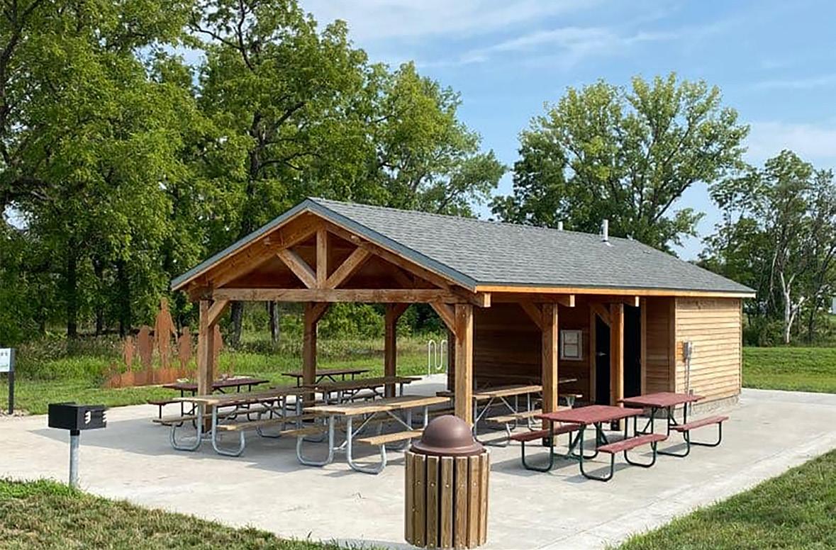
Public restroom & picnic shelter
Green Stormwater Infrastructure
30 parking spaces with adequate turn around space for emergency vehicles and permeable pavers
Educational signage for wetlands and other natural features
• Sidewalk along Kyle Drive frontage
• Walking trails, both paved and natural surface. Paved trails will be accessible meeting ADA requirements
• Bridge crossing over stream with minimized impact
• Pedestrian connections to adjacent neighborhoods
• Food forest to be implemented throughout the park along trails allowing easy access for visitors
• Meadow plantings in the overhead power easement along the west side of the park property
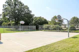
• Short basketball court
The third online survey received a total of 68 respondents. The proposed design for the Kyle Drive Park received overall support from the survey participants, with 60% expressing their support for the draft concept plan.
Several suggestions provided by the participants for the design team to consider. Suggestions included the desire for more paved pathways and boardwalks to enhance safety and accessibility, the inclusion of amenities such as a dog parks, and shade covers for the playground area. Participants also emphasized the importance of incorporating native trees and plants, creating wildlife habitats, and promoting green stormwater infrastructure.
Additionally, there were suggestions for adding creative play installations, sensory play equipment, and music stations to cater to different needs and interests. Some participants expressed concerns about the size of the traditional playground and the potential congestion around the nature playground. The majority of respondents preferred sliding, climbing, and swinging as the types of traditional playground equipment. There were also comments regarding the need for adequate parking, the inclusion of bus stops for easier access, and the importance of preserving existing wildlife.
Majority of the respondents chose the name Kyle Drive Wetland Park.
The design team carefully considered these comments and suggestions to ensure that the final design of the park meets the needs and preferences of the community while creating a harmonious blend of nature and artistic infrastructure.
This project will include two new playgrounds, including a traditional playground and a nature playground. What type of traditional playground equipment do you like most?
This project will include two new playgrounds, including a traditional playground and a nature playground. What type of nature playground equipment do you like most?
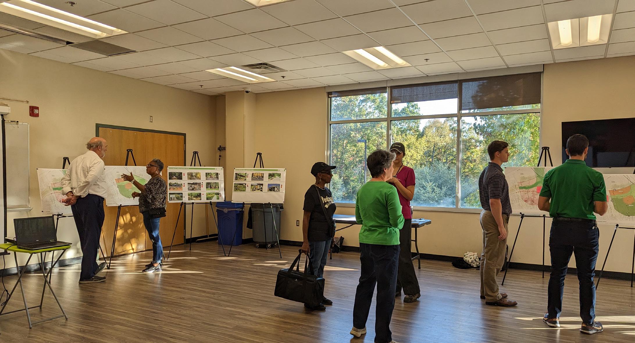
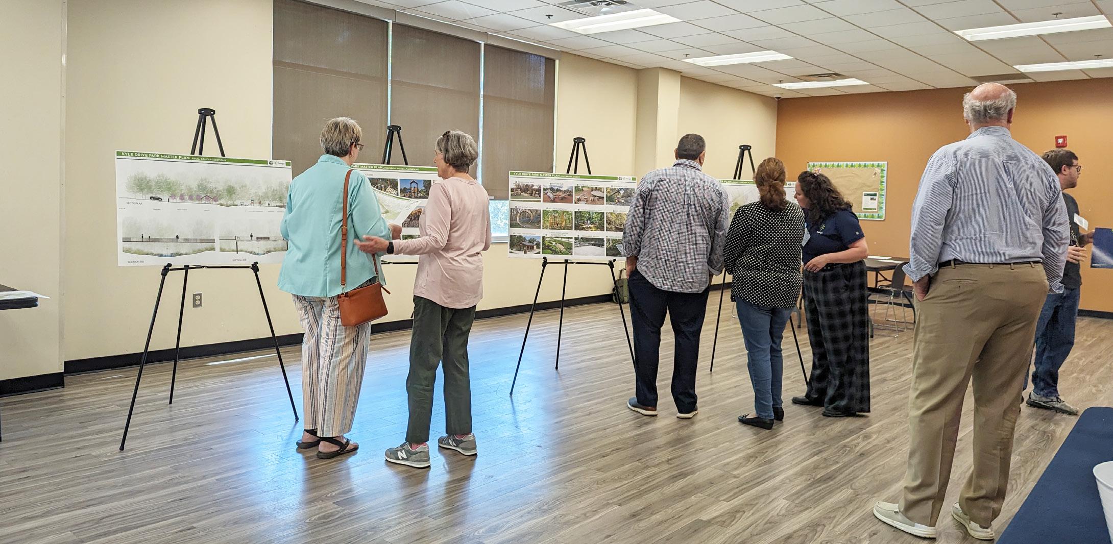
The second public open house workshop followed the fifth CAG meeting. Information provided to the community included draft master plan for the park along with precedent images that communicated the character of individual parks features. A community survey was available to attendees.
The community meeting was sparsely attended. Several CAG members were present ; however, very few community members attended. Those who were in attendance provided, positive feedback on the draft master plan and precedent images. Council member Patton was in attendance at this meeting and engaged with the CAG and planning team.
At the sixth CAG meeting a draft master plan for the park was presented along with further survey results. There were concerns about parking, with the possibility of adding additional spaces near the greenway trailhead and at the Jelynn Street dead-end. At this meeting the CAG took a consensus vote to adopt the draft master plan.
Through public survey responses, Kyle Drive Wetland Park, was determined as the preferred name.
At the seventh and final CAG meeting, the design team presented the final Master Plan and report to the group for review and discussion. The report was provided to the CAG a week before the meeting to allow them time to review the report in detail. At the conclusion of the meeting, the CAG voted 10-0 in favor of adopting the master plan and recommending it for approval by the City of Raleigh Parks, Recreation, and Greenway Advisory Board.
At the CAG’s final meeting of the master plan process on July 1, 2024, they voted 10-0 to move the master plan to the Parks, Recreation, Greenway Advisory Board (PRGAB) for review and recommendation for approval.
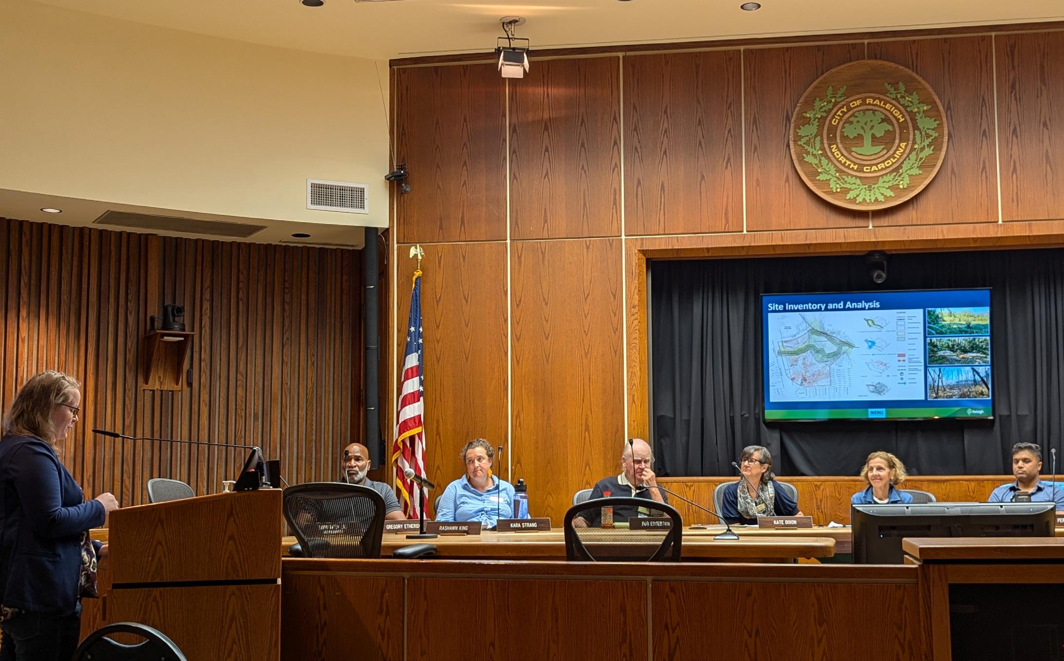
At the July 18, 2024, PRGAB meeting, the board voted XX-XX to recommend the master plan for approval and adoption by City Council.
City Council reviewed the master plan at their August 20, 2024, meeting and voted XX-XX to adopt the plan as well as to approve the construction document and implementation contract with WithersRavenel.
The final master plan for Kyle Drive Property Park is very similar to the draft plan. The differences include the elimination of the community garden, the locations of restroom/shelter, and basketball court, and the inclusion of a food forest, as a park feature. As the park design moves into the implementation phase and construction documents are prepared, it is inevitable that changes will be needed. Over the course of the project, the team will continue to receive more detail with the site survey and geotechnical investigations in addition to more accurate construction pricing. It is imperative that the team remain flexible while maintaining the vision of the project and the community.
Park features illustrated by the Final Master Plan include the following:
Traditional playground
Natural playground south of the creek
Outdoor classroom south of the creek accommodating a 20-30 students
Natural trail connections provide access to the stream
Public art incorporated into natural trail system
Public art incorporated into boardwalk trails
Paved greenway extension through the park from across Kyle Drive through the park to Jelynn Street to be continued into greater greenway network
A “boomerang” boardwalk which completes loop trail & provides access to wetlands
Public restroom & picnic shelter
Green Stormwater Infrastructure
30 parking spaces with adequate turn around space for emergence vehicles and permeable pavers
Educational signage for wetlands and other natural features
• Sidewalk along Kyle Drive frontage
• Walking trails, both paved and natural surface. Paved trails will be accessible meeting ADA requirements
• Bridge crossing over stream with minimized impact
• Pedestrian connections to adjacent neighborhoods
• Food forest to be implemented throughout the park along trails allowing easy access for visitors
• Meadow plantings in the overhead power easement along the west side of the park property
• Short basketball court
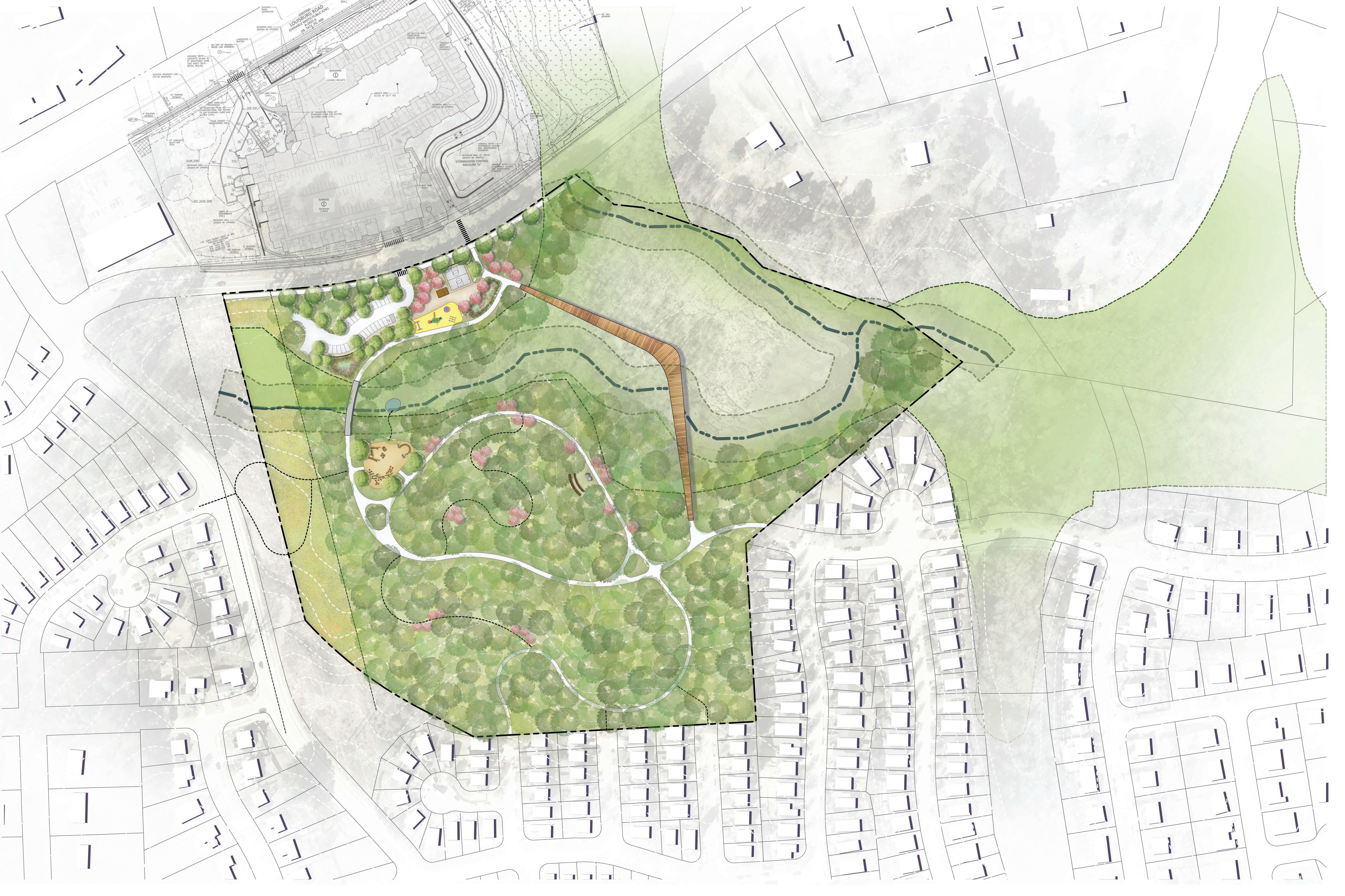
The Master Plan for Kyle Drive Property Park, along with associated recommendations, is a direct result of deliberate, inclusive and equitable community engagement process and reflects staff input and requirements for a neighborhood park. It illustrates a vision that balances nature-based and traditional recreation experiences for visitors, in addition to promoting urban agriculture practices. This approach to park development inspired by the extensive wetland and natural features of the site, is reflective of community aspirations and consensus for park development. This master plan accommodates the operational needs of the City or Raleigh and responds to the guidance provide by city staff as well as the Community Advisory Group.
Preserving natural resources and minimizing impacts is vital to this master plan. This includes the placement of features requiring intensive construction activities away from sensitive and naturally significant areas, as well as identifying specific materials, construction methods, and the incorporation of sustainable approaches into the design. As a nature based park experience the plan provides multiple opportunities to connect with the natural environment and healthy activities as well as organized or self-guided educational activities. Also integral to the plan, this park will be part of a larger greenway network connecting several parks and the North Raleigh greenway. Establishing connections to surrounding neighborhoods and accessible routes for pedestrians are incorporated throughout the plan as well as access for bicyclists.
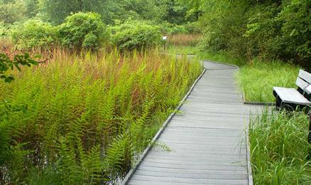
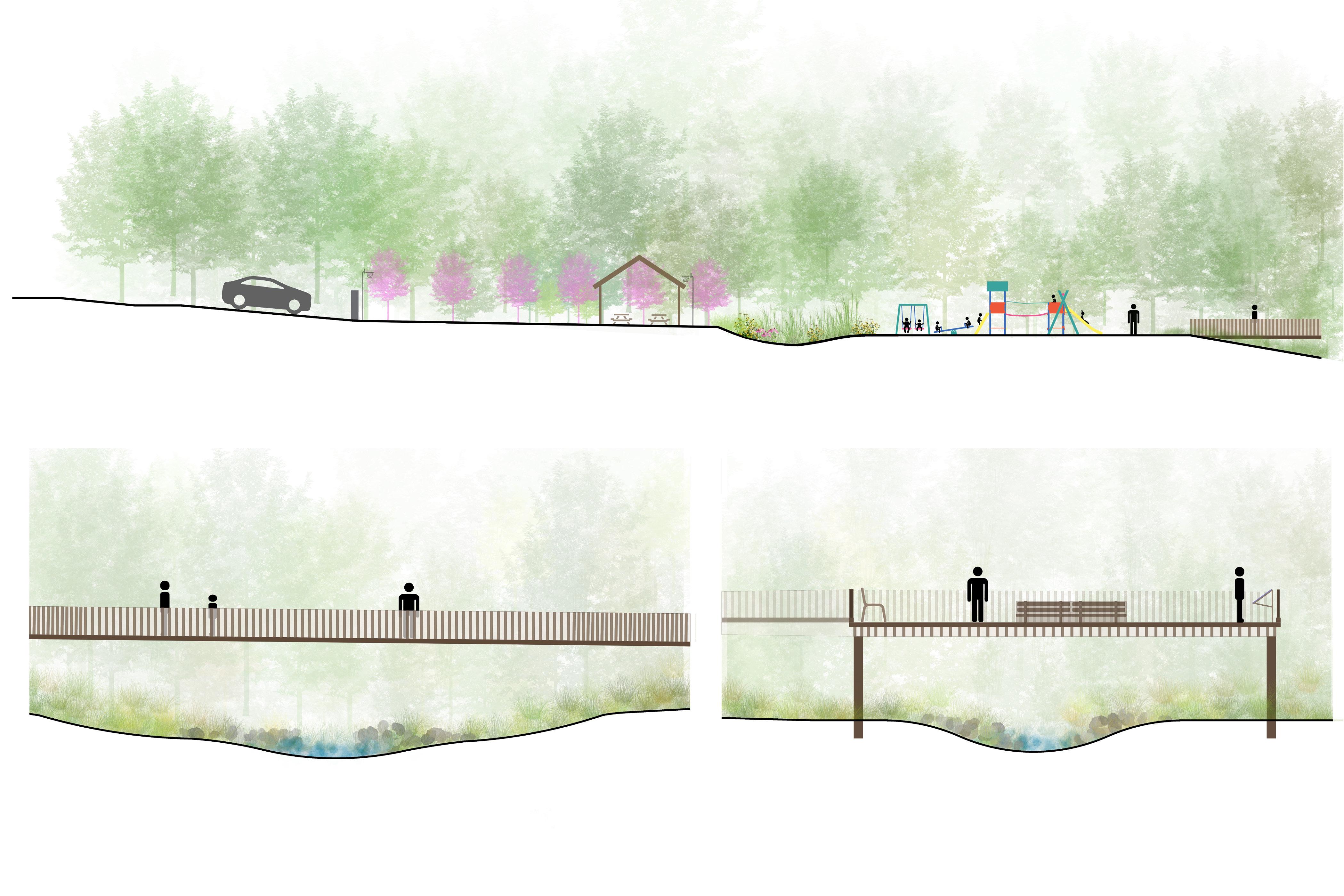
The “boomerang boardwalk” is the central feature of the park. The boardwalk is intended to be a space for gathering, education, nature observation, and movement. It allows visual access to the wetlands while contributing to a loop walk within the park. The boardwalk encourages park visitors to stop and observe wildlife and the unique ecology of the large wetland. Educational signage and viewing areas should be included to teach park visitors about the importance and functionality of the wetlands. As the design evolves, thought should be given to how various users can share the space, whether that be a staff-led school group learning about the wetlands, someone who has stopped to watch the birds, a parent and their child meandering through the space.
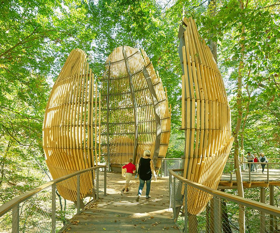
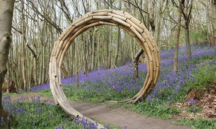
As public art is introduced to the park, consideration should be given to how art can be integrated into the boardwalk. This master plan does not intend to prescribe what that art might be, but rather stress the importance of public art in contributing to the space-making strategy of the boardwalk.
Construction of the boardwalk needs to respect the wetlands and disturbance should be minimal. Top-down construction methods are recommended to limit the overall disturbance. Helical piers or diamond piers along with a FRP (Fiber Reinforced Plastics) or metal substructure are likely construction methods. Long-lasting, durable and sustainable materials need to be considered for exposed surfaces, such as the decking and railings. Material considerations include FRP decking, composite decking, concrete decking, or thermally modified woods among others. Exotic hardwoods, while durable, should be avoided due to their cost and overall environmental impact.
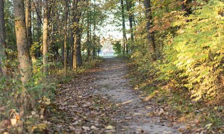
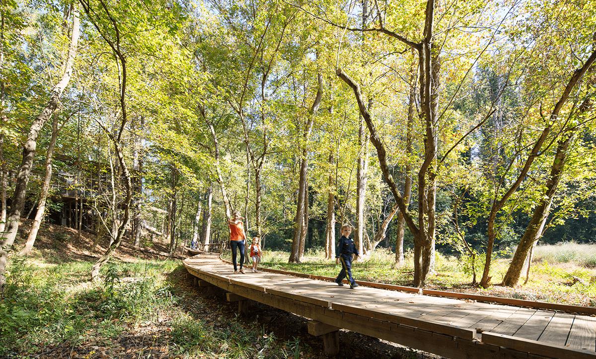
The 1/4 mile network of trails illustrated by the Master Plan reflect the community’s desire for a passive park with easy access to nature. A variety of trails are proposed throughout the park, including paved and natural surface trails. A 10’-12’ wide asphalt greenway is proposed to move users through the site. The trail extends towards the planned greenway trail north of Kyle Drive through the park and to the existing neighborhoods to the south and east. As the regional greenway develops over time, this park will be connected to other parks and neighborhoods via the greenway network.
Narrower secondary asphalt trails wind through the park providing access to various park features and the neighborhood to the south. Natural surface trails supplement the paved trails giving users a variety of trail experiences in the park. They also provide secondary connections to neighborhoods to the south and west. The boardwalk is integral to the trail network creating a loop for walking within the park.
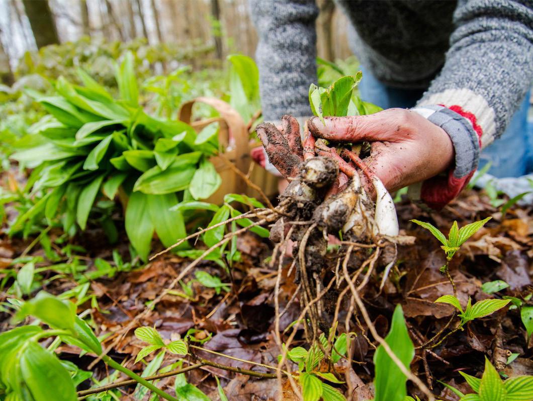
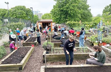
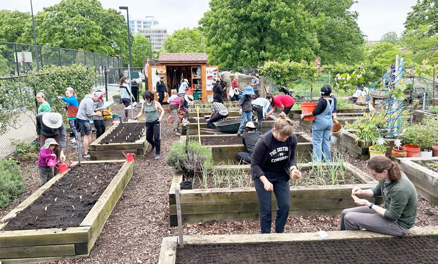
The community strongly supports providing food forests throughout the site, to function as educational opportunities and supplement existing habitat resilience. A food forest is an intentionally planted wooded landscape with edible plant species. Typically native, wild varieties are most successful and require little to no maintenance, once established. The edges of the trails provide great opportunities for the inclusion of edible plants and should be the first consideration for the food forest. Providing fruiting trees and shrubs and herbaceous plants will benefit the park users and wildlife.
As the park’s landscape plan is developed, consideration also should be given to integrating a food forest near the main entrance of the park and the most active area. A community garden was originally considered for this space; however, it was decided to introduce edible landscapes as part of the food forest in the northern part of the park. The discussion revolved around whether community gardens were more appropriate at staffed parks and whether a community garden at Kyle Drive would be duplicative of the one at Marsh Creek.
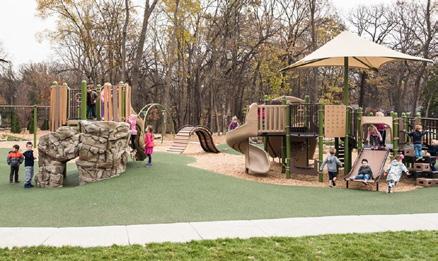
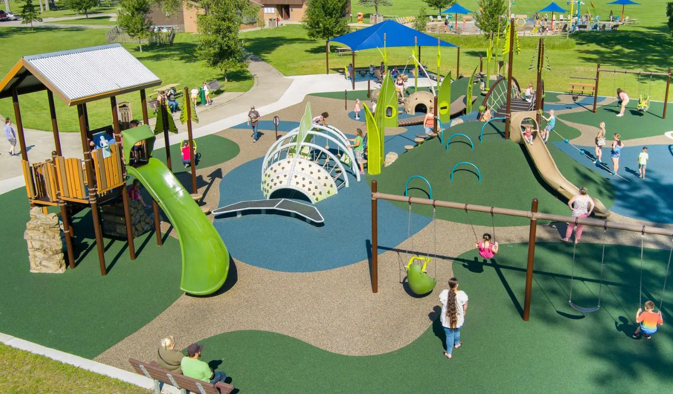
Two playgrounds are proposed for the park - a traditional post and platform playground and a nature-based play space. The traditional playground is proposed near the Kyle Drive entry in the more active zone. Survey results indicated that the community identified the following types of preferred equipment:
• Swings for parent and child
• Climbing structures
• Learning Element
• Balancing
• Shade structure
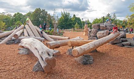
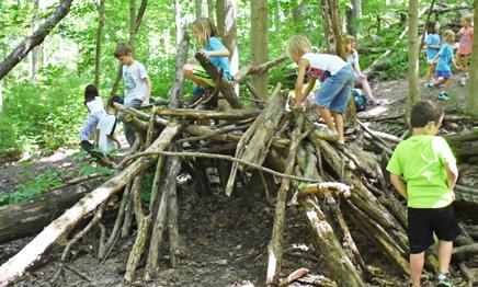
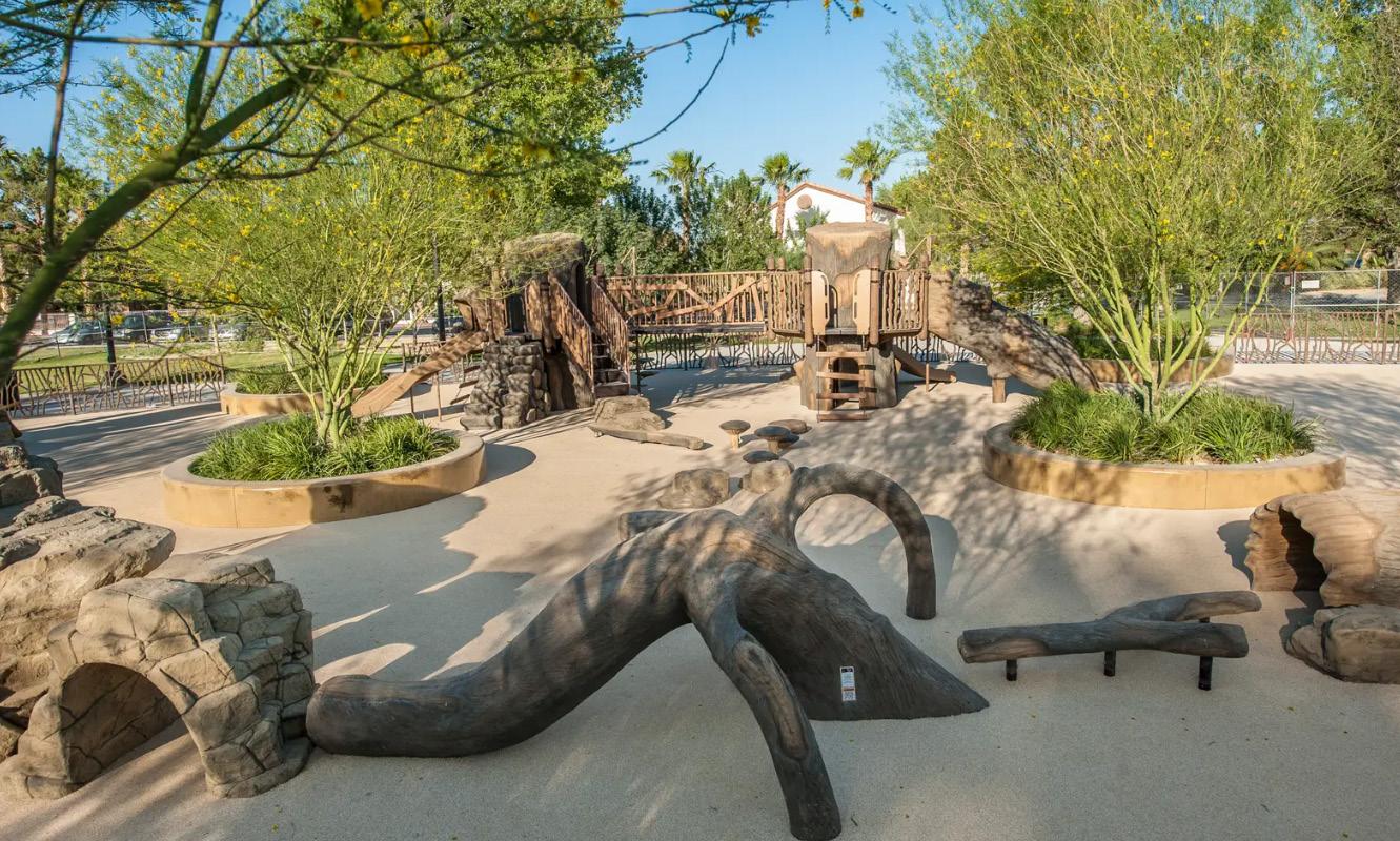
In addition to the traditional playground, the community supports a nature-based playground south of the creek. This playground is intended to provide naturethemed components from typical playground manufacturers. The components are intended to encourage free and imaginative play. This type of playground is intentionally sited south of the creek so that is more integrated into the quieter and nature-focused part of the park.
Nature play surfacing should reinforce the nature-based character of this portion of the park. Both play areas will emphasize inclusivity and accessibility, providing an inviting space for children of all ages and abilities. Poured in place rubber surfacing is recommended for accessibility at the traditional playground; whereas much surfacing is recommended for the nature play space to reduce stormwater runoff and blend in with the natural environment., durability and reduced maintenance. For the traditional playground, decorative metal or wood fencing around the play spaces provide parents with a sense of security. Equipment colors should be muted and earth tone.
NATURE BASED PLAYGROUND
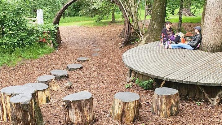
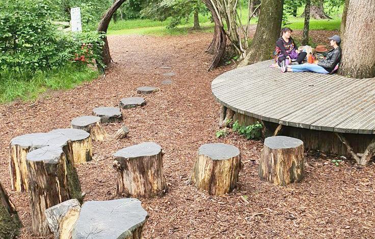
The outdoor classroom is positioned on the south side of the creek, with access from a paved trail and within an area designated for food forest. The classroom is envisioned to include a small stage and informal seating constructed from natural materials, including stone and wood. Tree stumps and natural rocks could also be used as seating elements. The classroom is a small amphitheater working with existing topography. The classroom is intended to accommodate 2030 children seated.
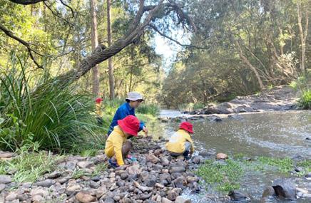
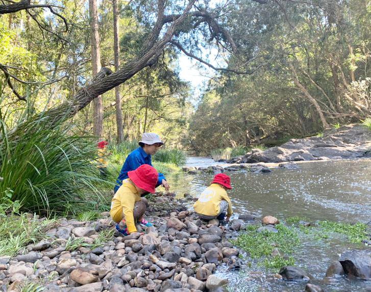
A small, but important, part of the plan is providing informal access to the creek that bisects the site. Positioned near the natural playground a short trail provides access to the creek. This connection provides an opportunity for children to play in the water and learn about the unique habitat for waterbased wildlife. Access points are intended to be informal and could consist of narrow, compacted dirt paths cleared of vegetation. Boulders can be used to provide seating spaces. Care should be taken to avoid creating erosion issues, damage to sensitive plant life, or unsafe conditions. It is likely that these access points will need to be field located during construction to ensure their feasibility and potential impacts.
While not unanimous, the community did support the inclusion of a basketball court at the park. The community expressed concern about potential noise as well as the appropriateness of a basketball court at a nature-based park. The compromise was to provide a smaller or shorter court that is well suited to children and does not encourage adult games. Hoops with variable heights are recommended to appeal to smaller children and older kids, alike. The court surface should be painted with vibrant colors and include surface games (four square, hopscotch, etc.) to provide alternative uses.
During the planning process, the CAG identified the incorporation of public art into the park project as a priority. While the project is not be subject to the City’s public art policy, staff agreed that art was an important component and dedicated a portion of the project budget to funding public art. The artist selection process, coordinated by City staff, and design of the art will be separate from the master planning process; however, it will imperative that members of the CAG remained engaged throughout to ensure that the values of the group are considered in the artist selection process and that the vision of the park is communicated to the selected artist and visible in their work. The public art components should be intentional and woven into the fabric of the park design. Collaboration between the park designers and the artists during the conceptualization of the proposed art and during the construction document phase will be important to ensure that the art is integrated into the park rather than placed
An outdoor restroom is located near the parking lot, basketball court and traditional playground. The plan suggests that a standalone shelter accommodating several picnic tables is appropriate. A custom-design restroom structure is recommended, however, a pre-engineered structure can be considered if budget is a concern. Independent of the construction methods, the design of the restroom structure should compliment the nature focus of the park and the building materials used in the boomerang boardwalk. This will help provide a continuity of design throughout the park.
When the park is developed, Kyle Drive will need to be widened to its ultimate section of a 2-lane road with 30” curb and gutter, an 18” grassed strip, 10’ wide multi-use path and street trees. The park project will be responsible for improvements south of the road’s existing center line, matching the required improvements of the new development to the north. Kyle Drive is a NCDOT maintained road and the final design will need to be approved by NCDOT. Street trees likely will be required behind the multi-use path. The road improvements will be required across the property frontage and should be extended westward to the intersection of Kyle Drive and Valley Stream Drive. Coordination with Duke Energy and the adjacent property owner will be necessary.
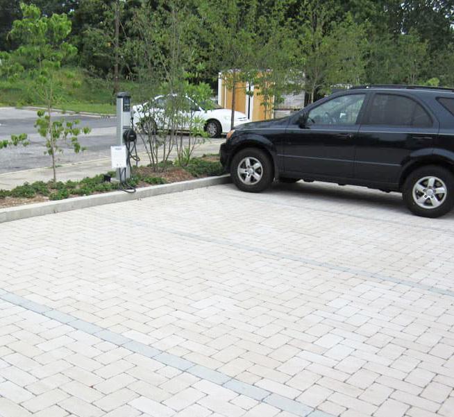
It is believed that most park visitors will be residents of the adjacent communities and that many will arrive at the park on foot or bike. That said, arrivals by vehicle need to be accommodated and a 30-space parking lot is proposed. The number of spaces can flex as dictated by budget and site constraints. Fire access that meets the current fire code is integrated into the parking lot design, allowing for access and maneuvering of a fire truck, garbage truck or school bus. ADA accessible parking spaces, EV chargers, and bike racks are to be included in the final design. Consideration should be given to using permeable pavers for the parking lot, whether for just the stalls or for the entirety of the lot. Permeable pavers will help manage stormwater and provide a more upscale feel, however, PRCR staff should be engaged to ensure proper maintenance can be performed.
City water currently is stubbed near the intersection of Kyle Drive and Valley Stream Drive and the public 12” main line will need to be extended to the park property. The development to the north is currently in design and permitting and will need the water line extension as well. Whoever is first to develop property will be responsible for extending the main water line to their respective property lines. As of this writing, it appears that park will be the first developer and, therefore, will be responsible for extending the line. Extending the line will be costly and a possible cost share with the adjacent development should be considered by both parties. If the apartments are able to extend the water main, only a 2” domestic service line and 6” fire line will need to be tapped and routed to the park.
A gravity sewer main line is in Kyle Drive and flows west to east. Based on drawings provided by the City, it appears that a gravity service connection from the proposed restroom to the main line with a connection at the easternmost manhole is feasible. However, further design is needed to make a final determination. If a gravity service line is not feasible, a small packaged grinder unit and forcemain will be necessary to accommodate wastewater.
Duke Energy will need to be engaged to provide power to the park. The proposed restroom and EV chargers will require a new connection to the power grid. Additionally, some parking lot lights are recommended for security purposes. Otherwise, the park is not intended to be illuminated or used after dark. Solar lighting and grants will be explored.
STORMWATER
Stormwater control and treatment is an important part of the park and should be integrated in a sustainable fashion. Green stormwater infrastructure following the City’s standard practices will be the main form of treatment and control. Permeable pavers can be used in the parking lot and pedestrian areas to help with the control of stormwater. Grassed dry ponds should be avoided at this park.
The landscape plan should compliment the native vegetation at the park and support a diverse ecology. Native plant material should dominate the plant palette with locally available native and non-native adapted species only used on a limited basis and for specific purposes. The landscape is intended to be low maintenance and drought tolerant. Plants requiring irrigation beyond establishment are discouraged. Native grasses and perennials will encourage a diverse ecology and strong visual interest. Lawn areas are to be kept to a minimum. Additionally, it is recommended that invasive species currently present on site be removed to the greatest extent possible.
Implementation of the park has not been subdivided into phases for construction. Given the city’s budget for the park and the recommendations / program for the park identified by the master plan, it is reasonable to recommend that the entire park program can be implemented in a single phase. However, it should be understood that as more data is received, coordination with outside resources occurs, and detailed design is completed, changes to the park plan may be needed to keep the project within budget. It will be critical to maintain the vision of the master plan and the major program elements through any future changes.
The following opinion of probable construction costs covers the full palette of recommendations for the park. Costs are estimated based on recent construction costs and a substantial contingency is identified for design and construction.
However, until a survey and environmental investigation are completed, construction costs cannot be estimated with a high degree of confidence.
SCHEDULE & IMPLEMENTATION
Project Initiation / Due Diligence: 3 months (End of 2024 completion)
Construction Documents: 12 months
Permitting: 6 months (Spring 2026 completion)
Bidding: 3 months
Construction: 12-14 months (Spring 2028 completion)
SITE WORK
GENERAL SITE WORK (Staking, layout, clearing, grubbing, grading, retaining wall, erosion control etc.
UTILITIES (Water services, backflow, meter, fire hydrant, fire line, sewer, manhole etc)
$300,000
$300,000
STORMWATER (INCLUDES GSI DEVICES) $300,000
PARKING (Asphalt paving, curb &gutter, wheel stop, stripping, signage etc ) $200,000
KYLE DRIVE IMPROVEMENTS (Clearing, erosion control, grading, curb ramps, storm drain, catch basins, street trees, traffic control, signal etc) $500,000
PARK IMPROVEMENTS
BOARDWALK
$1,750,000
PLAYGROUNDS (Play equipments, surfacing, fencing etc) $650,000
PRE‐FABRICTED RESTROOM AND SHELTER STRUCTURES $325,000
PUBLIC ART $75,000
ADDITIONAL PARK AMENITIES (INCLUDES GREENWAY TRAILS, BASKETBALL COURT, ETC.) $600,000
CONSTRUCTION SUBTOTAL $5,000,000
CONSTRUCTION SOFT COSTS (OVERHEAD & PROFIT, BONDS, INSURANCE, PERMIT FEES, ETC.) $1,500,000
CONSTRUCTION TOTAL $6,500,000
SOFT COSTS
DESIGN & PERMITTING $1,300,000
CONTINGENCY $1,000,000
TOTAL COST $8,800,000
TOTAL BUDGET $8,900,000
CITY COUNCIL APPROVED THE NEW PARK NAME RIVER CANE WETLAND PARK DURING THEIR OCT. 1, 2024 SESSION