

NEUSE RIVER PARK MASTER PLAN


NEUSE RIVER PARK MASTER PLAN
Prepared in November 2024 for The City of Raleigh Parks, Recreation and Cultural Resources Department
by
DESIGN WORKSHOP, INC
TRANSYSTEMS Civil Engineering
SWCA Environmental Engineering
PALACIO COLLABORATIVE Cost Estimation
RED BIRD PRECONSTRUCTION SERVICES Cost Estimation
CALIBRE ENGINEERING, INC. River Feature Engineering
CONTRIBUTORS
City of Raleigh Mayor and City Council
Mary-Ann Baldwin, Mayor
Jonathan Melton, At-Large, Mayor Pro Tem
Stormie D. Forte, At-Large
Mary Black, District A
Megan Patton, District B
Corey Branch, District C
Jane Harrison, District D
Christina Jones, District E
City of Raleigh Parks, Recreation and Greenway
Advisory Board
Carol Ashcraft
Rashawn King
April Love
Jeff Havener
Col. Robert Edgerton
Shangwen Liu
Hugh Fuller
Beverley Clark
Gregory Etheridge
Douglas A. Johnston
Iain Burnett
Kate Dixon
Kara Strang
Chris Pereira
City of Raleigh Parks, Recreation and Cultural Resources Staff
Stephen Bentley, Director
Adam Forman, Assistant Director
Ken Hisler, Assistant Director
Charles Craig, Assistant Director
Helene McCollough, Administrative Superintendent
Shawsheen Baker, Capital Projects Superintendent
TJ McCourt, Planning Supervisor
Emma Liles, Capital Project Manager
Lauryn Kabrich, Park Planner
Jai Butts, Park Planner
Zach Jewell, Park Planning Specialist
Seth Yearout, Outdoor Recreation Program Director
Joel Bateman, Forest Ridge Park Manager
Neal Wisenbaker, City Horticulturist
Sean Gough, Land Stewardship Program Manager
Gil Young, District Six Crew Supervisor
Mike Gagliano, Natural Resources and Parks Manager
Lisa Schiffbauer, Greenway Capital Projects Senior Supervisor
David Hamilton, Greenway Manager
Eric Dauterman, Greenway Maintenance Supervisor
Kelly McChesney, Public Art Director
Julia Whitfield, Public Art Community Engagement Coordinator
Mark Lyons, Construction Project Manager
Dale Tiska, Senior Construction Project Manager
Kelly Ham, Parks Construction Projects Administrator
Community Advisory Group
Alicia Hall
Bob Zarzecki
Craig Foster
Heidi Cowley
Kendra Williams
Kuanyu Chen
Leigh Ann Hammerbacher
Matty Lazo-Chadderton
Michelle Tomlinson
Norma Martí
Robert Parker
Scott Greenman
Shaneka Thurman Griffin
Thomas Walencik
Design Team
Emily McCoy, Design Workshop
Benjamin Boyd, Design Workshop
Corey Dodd, Design Workshop
Ethan Davidson, Design Workshop
Evie Dentinger, Design Workshop
Urey Zhang, Design Workshop
Zhiliang Wang, Design Workshop
Dan Miller, Transystems
Jaclyn Adriatico, Transystems
Charlie Benton, SWCA
Josh Allen, SWCA
Scott Shipley, Calibre Engineering
Sarah Mosier, Calibre Engineering
Grace Miller, Red Bird Preconstruction Services


CONTENTS
1 2 3 4 5 6 7
EXECUTIVE SUMMARY
PROJECT INTRODUCTION
Project Background
Planning Process
Public Input
Vision Statement + Goals
Previous Studies
SITE ANALYSIS
Site Conditions
Site Ownership
Site History
Site Context
Natural Resource Inventory
The Falls
Visitor Analysis
INITIAL PUBLIC ENGAGEMENT
Community Outreach Approach
Initial Public Feedback
CONCEPT ALTERNATES
Concept Alternate Site Plans
Comparing Concept Alternates
Public Feedback
Neuse Perspectives
FINAL MASTER PLAN
Final Site Plan
Parcel Approaches
Social Gathering and Play
River Activities
Circulation
Stormwater Management
Habitat and Species
Public Feedback
PLAN IMPLEMENTATION
Design, Permitting, and Construction Process
Opinion of Probable Cost
Prioritization Consensus Vote Results
APPENDICES


Neuse River Park: Embracing Community, Nature, and Outdoor Recreation along Raleigh’s Riverfront
Neuse River Park connects the community to the river and promotes physical and mental wellness by supporting a range of recreational activities in natural settings. Our vision is that Neuse River Park will create stronger ties to the natural world by enabling self-directed outdoor recreation, by strengthening linkages to the existing greenway and blueway trail systems, and by maximizing views, access, and enjoyment of the Neuse River. The park development process will implement best practices in sustainable design and construction, habitat preservation, and ecological restoration to ensure Neuse River Park will be a highlight of Raleigh’s park system, anchored by its connectivity to trail systems, our diverse community, and our shared commitment to use natural settings to improve the lives of all who visit this park and all the species who inhabit it.


CHAPTER 1
EXECUTIVE SUMMARY

PROJECT BACKGROUND
The Neuse River Park Master Plan lays out a strategic vision for developing approximately 100 acres of land along the Neuse River in northeast Raleigh. This park is uniquely positioned to become a key recreational destination, serving as the northern trailhead for the Neuse River Greenway and Blueway systems. With its combination of open spaces, forests, and direct river access, the park will cater to a wide range of recreational activities including hiking, kayaking, fishing, and birdwatching.
The development of a master plan has been driven by a commitment
to balancing recreational use with environmental sustainability. The park will serve as a gateway to the river, while edeavoring to preserve the unique natural ecosystems found on the site. Raleigh’s park system has long been a leader in sustainable development, and this plan aims to continue that tradition by designing a park that enhances outdoor recreation while minimizing impacts on the environment.
This master plan has been shaped by extensive input from the public and stakeholders, reflecting a shared vision for creating a destination that supports both active and passive recreation. From river enthusiasts
to local families, the park will offer something for everyone while seeking to improve the ecological health of the Neuse River corridor.
SITE ANALYSIS
The Neuse River Park site features a diverse landscape that includes riparian forests, wetlands, and areas prone to seasonal flooding. Understanding the site’s natural features was a critical first step in the planning process. A comprehensive biological survey (bio-blitz) of the site was conducted with the WakeNature Preserve Partnership to catalog observed plant and animal species. This inventory helped assess the site’s ecological significance
and identified opportunities to minimize impact on important natural communities. As the design moves forward beyond master plan, additional environmental assessments and field surveys will be conducted throughout the site, including wetland delineations, wildlife studies, and tree mapping. These surveys will inform the design, ensuring that the development respects the ecological integrity of the land while providing safe, accessible spaces for the public.
The park’s location along the Neuse River presents both opportunities and challenges. The riverfront provides a natural setting for waterbased activities such as kayaking and fishing, but it also faces issues related to erosion and flooding. The master plan seeks to address these concerns by proposing a design that stabilizes some riverbanks,

integrates green infrastructure, and preserves floodplains as natural buffers. These design elements aim to mitigate future environmental damage to the park’s landscape while enhancing public safety.

The master plan also highlights the importance of creating strong connections between different areas of the park. Trails will link the riverfront to forested areas, open spaces, and recreational facilities, creating a network that encourages exploration and enjoyment of the park’s natural beauty. These trails will be designed to accommodate a variety of userswith options for walkers, cyclists, and families alike.
PUBLIC ENGAGEMENT
Public input was a cornerstone of the Neuse River Park Master Plan. Throughout the planning process, Raleigh residents were invited to participate in a series of community workshops, surveys, and focus groups to ensure that their voices were heard. The feedback collected from these sessions helped shape the park’s design, helping the City and the design team prioritize program elements and locations of features or access points.
Figure 2: Site Overview Plan
Figure 1: Design Team, City of Raleigh staff, and CAG site visit
I: COMMUNITY NEEDS ASSESSMENT INVENTORY,
Community members expressed a strong desire for a park that preserves its natural character while offering opportunities for outdoor activities. River access, hiking trails, and areas for family-friendly recreation were identified as top priorities. Additionally, the public placed a high value on sustainability and environmental protection, leading to the inclusion of green infrastructure and habitat restoration in the final design.
The City of Raleigh also worked closely with key stakeholders such as local environmental organizations, homeowner associations, and recreational user groups to ensure that the park’s design aligned with
broader community goals. The result is a master plan that reflects the needs and desires of the local community while promoting longterm sustainability and resilience.
Concept alternate plans were developed that presented various options to the public and Community Advosory Group (CAG) to prioritize and provide feedback on.
FINAL MASTER PLAN
The Final Master Plan for Neuse River Park outlines a thoughtful and balanced approach to park development. The plan prioritizes improving access to the Neuse River, enhancing existing trails, and creating new recreational

opportunities for residents and visitors. Key features of the plan include new or enhanced river access points, river overlook points, expanded parking and restrooms, a nature based playground, and trails for hiking. These amenities are designed to support a wide range of outdoor activities while maintaining the park’s natural beauty.
The park is expected to be developed over multiple phases, with an estimated $11.5 million allocated from Raleigh’s 2022 Parks Bond to fund design and construction. The entire master plan is expected to be developed over multiple phases. The current master plan in its entirety is estimated to cost $14.9

Figure 3: Master Plan Overall Process
Figure 4: Concept Alternative Plans

million, including all soft costs (such as permitting, design, escalation, contingencies, surveys, etc.). The 2022 Raleigh Parks Bond allocation for this project is $11.5 million, representing 77% of the master plan cost estimate. Currently, the City of Raleigh is conducting a prioritization

process for the phasing of the plan. This phased approach allows for careful planning and implementation, ensuring that each aspect of the park is developed in alignment with the overall vision. As Neuse River Park moves from concept to reality, the goal is to create a one of
a kind public space that stands as a testament to Raleigh’s commitment to providing high-quality, sustainable green spaces for its residents.

Figure 5: Final Master Plan - Site Plan


CHAPTER 2

PROJECT BACKGROUND
The Neuse River Park Master Plan provides a conceptual framework and vision for the future development and management of nearly one hundred acres of park land and its interface with the Neuse River.
Neuse River Park is positioned to serve a large area of northeast Raleigh. As the northernmost trailhead of both the Neuse River Greenway Trail and Neuse River Blueway Paddling Trail and its status as a segment of the Mountains to Sea Trail system, the park has the potential to become a signature destination within Raleigh’s Park system. In addition, the unique features nearby in the river such as the Falls Dam tailwind area, and the southern channel, which are already popular with canoers and kayakers,
the park is also a draw to visitors from farther afield.
The design team, with the assistance of City staff, stakeholders, community members, and experts, and leaning on the extensive work already done by the City and others, has created this Master Plan that responds to current and future recreation, ecological, and logistical needs are anticipated to occur during the life of the park.
This master plan primarily focuses on 80 acres of undeveloped Cityowned land just downstream of Falls Lake Dam, with approximately 3,000 feet of shoreline along the Neuse River. Falls of Neuse Road bisects this site into northern and southern sections, with the only
current connection between the two sections being the Neuse River Greenway Trail underneath the Falls of Neuse Road Bridge.
The City of Raleigh also manages an adjacent 9 acres of land that is leased from the United States Army Corps of Engineers (USACE). With 1850 feet of shoreline along the southern channel of the Neuse River, this property is currently a popular destination for paddling, angling, river wading, hiking, birding, and greenway users. The site is currently developed with a parking lot, non-motorized water craft launch point, and one of the most heavily trafficked trailheads of the Neuse River Greenway Trail. The City’s use and management of this property is subject to a Development
Figure 6: The Neuse River adjacent to the park site
Agreement approved by the USACE.
That sight has also been the subject of previous studies aimed to bring a whitewater course to the southern channel. Part of the effort of this master plan is to assess some of the proposed site improvements in that study and review against both more up-to-date solutions, the public’s desire current for those features, and their prioritization versus other park elements.
PROJECT FUNDING
The Neuse River Park property (previously referred to as “Leonard Tract Park”) is specifically referenced in the 2014 City of Raleigh Parks, Recreation and Cultural Resources System Plan (Natural Environments Action Item 4.A.1) as a priority for development. On November 8, 2022, Raleigh voters approved a $275 million bond referendum. The 2022 Parks Bond includes projects that provide the Raleigh community with healthy park and recreation options for everyone to enjoy. These projects focus on heightened community priorities that have emerged as a result of the City’s focus on social equity and the impacts of the pandemic. The vision was to provide improved equitable, resilient park and greenway access across the City of Raleigh.
As part of that bond, $11.5 million was allocated for community engagement, master plan development, design, and construction at Neuse River Park.


Figure 7: Existing parking lot and Neuse Greenway Trail on USACE property
Figure 8: Existing boat launch
PLANNING PROCESS
The Neuse River Park Master Plan outlines a long-term vision for transforming the site into a City of Raleigh park and a valuable public amenity. The planning process was structured to ground the design in the realities of the site and ensure it aligns with the needs and desires future park users. The master planning process was divided into three phases:
PHASE 1: COMMUNITY NEEDS ASSESSMENT
In this initial phase, the design team conducted an inventory and analysis of the site while engaging with community members to understand their needs. This phase included gathering input through surveys, discussions, and meetings to ensure that the park design reflected the community’s desires.
PHASE 2: DEVELOPING CONCEPT ALTERNATES
Based on the information gathered, the design team and Community Advisory Group (CAG) established a vision and developed various program and design options, called concept alternates. A public workshop and focus groups were held to present these options, allowing the community to provide feedback on the proposed design options and prioritize program elements. The feedback collected during this phase helped shape the park’s features and layout.
PHASE 3: FINAL MASTER PLAN CONCEPT
In the final phase, the design team refined the master plan based on the public’s feedback and expert review. The preliminary and final plans were presented for additional review and refinement before being submitted to the Parks Board for approval. This phase also included confirming the costs, funding options, and scheduling for future development phases and construction.

Figure 9: Design Team, City of Raleigh staff, and CAG site visit
SITUATION ASSESSMENT
PUBLIC WORKSHOP #1 PUBLIC WORKSHOP #2
DESIGN DEVELOPMENT, CONSTRUCTION DOCUMENTATION, & PERMITTING
PHASE 2: DEVELOPING CONCEPT ALTERNATES
PHASE I: COMMUNITY NEEDS ASSESSMENT INVENTORY, ANALYSIS, DISCUSSION, GATHERING ESTABLISHING VISION, DEVELOPING PROGRAM AND DESIGN, REVIEW
WORKSHOP #3
CITY COUNCIL PARKS BOARD PRESENTATIONS NOV DEC
PHASE 3: FINAL MASTER PLAN CONCEPT
COST ESTIMATING, PHASING PRIORITIZATION, PRELIMINARY AND FINAL PLAN, REVIEW AND FEEDBACK, PARKS BOARD APPROVAL
Figure 10: Overall Project Schedule
Figure 11: Master Plan Phase Schedule
PUBLIC INPUT
CITY OF RALEIGH PARTICIPATION PLAYBOOK
The IAP2 Spectrum of Participation, created by the International Association for Public Participation, is designed to help determine the level of public involvement and set the participation goals that will guide the engagement process. The Collaboration option, being utilized for this master plan process, focuses on working directly with the public throughout the decision-making process to ensure their concerns and aspirations are understood and considered. This means that community members, stakeholders, and city representatives engage in a continuous dialogue, sharing input and feedback at key stages of the project.
The City of Raleigh emphasizes public involvement in the planning process for parks to ensure that community
voices are heard and reflected in the final design. Through public workshops, surveys, and focus groups, residents are encouraged to share their ideas and concerns about the park’s features, amenities, and environmental impacts. This collaborative approach, which includes feedback from the Community Advisory Group (CAG), helps shape the park to meet the diverse needs of the community while promoting transparency and inclusivity. The goal is to create a space that reflects the desires and values of Raleigh’s residents, ensuring that everyone has a stake in the park’s development.

For more: Community Advisory Group (CAG) Charter Appendices
For more: Community Advisory Group (CAG) Biographies Appendices
For more: Survey Reports Appendices
Figure 12: IAP2 Spectrum of Participation
Figure 13: Public Workshop #1 - November 3rd, 2023
ESTABLISHING THE COMMUNITY ADVISORY GROUP (CAG)
The Community Advisory Group (CAG), is a membershipspecific committee that provides oversight of the project planning process and ensures that decisions include a broad representation of the community and stakeholders impacted by the project. CAG members help facilitate information sharing between the community and planning staff.
CAG members were selected through a rigorous application process, with over 100 community members applying for the opportunity to be part of the Neuse River Park project. The Parks, Recreation, and Greenway Advisory Board (PRGAB) was responsible for the final selection of members. In order to ensure that the park’s design reflected the needs and values of the entire community, the selection process intentionally focused on creating a diverse group of individuals. Members were chosen to represent a wide range of interests and perspectives, from environmental advocates to recreational users and local residents. This diverse group of voices has been crucial in shaping a master plan that balances ecological preservation with the community’s desires for recreation and public access.
The CAG operates by consensus, promoting collaborative problem-solving where decisions reflect general agreement and shared information. While not all members may fully agree, the focus is on making the best possible decisions that are supported by the group. Consensus fosters mutual education and understanding, encouraging creative solutions through open discussion. A five-point scale is used to gauge the level of agreement on proposals, allowing members to express their views without delaying the decision-making process.
The five point scale is as follows:
• Endorsement – Member fully supports it.
• Endorsement with minor point of contention
• Agreement with minor reservations
• Stand aside with major reservations
• Block
VISION STATEMENT + GOALS
The Community Advisory Group (CAG) played a key role in establishing the vision statement and goals for the Neuse River Park project. Through discussion and thoughtful debate, CAG members shared their hopes, desires, and feedback on proposed ideas. Together, they refined the language and direction of the project, ensuring that the final vision reflects the collective values and aspirations of the community. This collaborative process helped create clear goals that will guide the park’s development in a way that balances environmental preservation, recreation, and community needs.
The Vision Statement and Goals are the result of the CAG’s first consensus vote and feedback received during extensive discussion. In accordance with the CAG Charter, the Vision Statement is consistent with the site’s Pre-Development Assessment Plan and the Raleigh Parks System Plan. The Vision Statement includes reference to the ecological significance and functions of the site, the site’s relationship to the larger park system surrounding context, and is informed by feedback received from the general public during the initial input phase of the master plan process.
NEUSE RIVER PARK: EMBRACING COMMUNITY, NATURE, AND OUTDOOR RECREATION ALONG RALEIGH’S RIVERFRONT
Neuse River Park connects the community to the river and promotes physical and mental wellness by supporting a range of recreational activities in natural settings. Our vision is that Neuse River Park will create stronger ties to the natural world by enabling self-directed outdoor recreation, by strengthening linkages to the existing greenway and blueway trail systems, and by maximizing views, access, and enjoyment of the Neuse River. The park development process will implement best practices in sustainable design and construction, habitat preservation, and ecological restoration to ensure Neuse River Park will be a highlight of Raleigh’s park system, anchored by its connectivity to trail systems, our diverse community, and our shared commitment to use natural settings to improve the lives of all who visit this park and all the species who inhabit it.
Figure 15: Vision Statement established by the CAG on February 2nd, 2024
PROMOTE ACTIVE USE OF NATURAL SETTINGS
Promote primarily self-directed use of the park through various forms of outdoor recreation. Design and build a park that immerses patrons in natural spaces, with the inclusion of river access points and activities, for an interactive experience. The focus on natural settings will support community health and wellness.
ENSURE ACCESSIBILITY AND INCLUSIVITY
Make the park accessible and inviting to all community members, regardless of physical or mental ability or background. This includes creating pathways and amenities that are wheelchair accessible and fostering diverse cultural experiences to reflect the community’s varied demographics. The park is committed to promoting access for everyone, including minority and marginalized communities.
LIMIT FACILITY DEVELOPMENT TO FOCUS ON NATURAL FEATURES OF THE PARK
The park planning process does not currently include developing staffed facilities (i.e., visitor center, park office, entrance booth), and will focus on park amenities (i.e., nature overlook, picnic shelter, restrooms) that connect, support, and promote health, limiting impacts to the park. Park development will utilize best practices for sustainable design and construction, habitat preservation, and ecological restoration, with a goal of mitigating previous environmental impacts to the site.
FOSTER COMMUNITY CONNECTION AND ENGAGEMENT
Utilize the park as a warm, welcoming space that fosters community, togetherness, and celebration. This includes creating flexible spaces that bring people together to appreciate nature and one another.
INTEGRATE THE PARK INTO THE LARGER COMMUNITY NETWORK
Connect Neuse River Park with existing trail systems and surrounding neighborhoods, making it a seamless part of the broader community infrastructure. The Master Plan will acknowledge the unique opportunities presented by the park’s location on the Neuse River adjacent to Falls Dam and its position as an anchor along regional trail networks. This approach includes considering the impact of parking, traffic, and access points to ensure the park is a convenient and integrated part of the local landscape, acknowledging the need to account for broad public interest in the park while limiting negative impacts to surrounding neighborhoods.
Figure 16: Goals established by the CAG on February 2nd, 2024
PREVIOUS
STUDIES
Early and long-range planning documents, such as the Neuse River Park Situation Assessment and the Neuse River Blueway Plan, were crucial for setting a solid foundation for future park development. These assessments and plans ensured that the ultimate design and functionality of the park aligned with assessed needs in the park system and the goals of other intersecting projects. By evaluating local conditions and community input early on, planners can craft strategies that effectively address specific challenges and opportunities. This sequential building of plans allowed for a cohesive

1976, 1986, 1989, 2022
The Raleigh Capital Area Greenway Master Plan was created and updated over the years to guide the development and expansion of a network of public open spaces and trails that connect various parts of the city, enhancing recreational opportunities and transportation for the community
development strategy that enhances the usability and sustainability of the park, ultimately leading to a space that is well-integrated with its natural surroundings and serves the community effectively. The following planning documents directly influenced the master plan of Neuse River Park.


1996
Guiding the future development of regional parks along the Neuse River, this master plan focuses on boosting recreational opportunities, promoting environmental stewardship, and fostering community ties through detailed planning and active public engagement.


2014

The Raleigh Parks System Master Plan aims to guide the development and enhancement of Raleigh Parks, recreation programs, and related policies over the next decade, focusing on creating a more equitable, interconnected, and inclusive park system. This comprehensive plan outlines steps for community engagement and the establishment of specific initiatives to achieve a shared vision for the future
City of Raleigh Parks, Recreation
Capital Area Greenway Master Plan
Neuse River Regional Park Master Plan
Park System Master Plan

Pre-Development Assessment Plan
2021
The Leonard Tract Pre-development Assessment, completed in 2021, was a strategic evaluation by Raleigh Parks, Recreation, and Cultural Resources Department to ensure any future park development at what is now Neuse River Park aligns with community goals and sustainable practices. It also acted as an early inventory and analysis of the site.

2021
The Neuse River Blueway Plan is designed to enhance public access, awareness, and appreciation of the Neuse River as a key natural and recreational asset, aiming to integrate the river more cohesively into Raleigh’s park and greenway system. The future Neuse River Park will be the starting point of the blueway trail.
For more: Situation Assessment Report Appendices

2023
The Neuse River Park Situation Assessment was conducted to analyze the local context surrounding the project, enabling effective community engagement and collaboration. This assessment also established the foundation for the Community Advisory Group, which plays a critical role in overseeing the project planning process and ensuring that decisions reflect the community’s broad interests
Neuse River Blueway Plan
Situation Assessment


CHAPTER 3
SITE CONDITIONS
Starting at the Old Falls of Neuse Bridge, the park site is bordered by the Neuse River to the north and east and features a blend of natural and developed areas. The northern portion of the park includes the well-known river access/launch, a highly trafficked site used by paddlers, anglers, and hikers. This area includes a parking lot, canoe launch, and major trailhead to the Neuse River Greenway Trail, making it a popular starting point for outdoor activities. The northern parcel is largely forested, though it bears the marks of historical development, with remnants of a homestead, aged infrastructure, and evidence of dumping.
Moving east, the landscape transitions from developed more facilities to more natural areas. The river itself forms the most significant hydrological feature of the site, with portions of the park located within the 100-year floodplain, making the area prone to occasional flooding due to heavy rainfall and dam releases. The greenway and surrounding natural areas offer opportunities for lowimpact recreation, such as hiking and biking, as well as wildlife viewing.
As you travel south of Falls of Neuse Road, the park becomes increasingly defined by its natural features. This portion of the park is more ecologically intact, with a mature
tree canopy and diverse biological habitats. Wetland areas and blue line streams create rich ecosystems that contribute to the park’s environmental value.
The terrain throughout the park varies, with some areas characterized by steep slopes, particularly in the southern section. These natural gradients could provide opportunities for trails that take advantage of the site’s topography. The park’s potential for further recreational development has been carefully weighed against the need to preserve these highintegrity natural resources.


Figure 17: Existing conditions plan


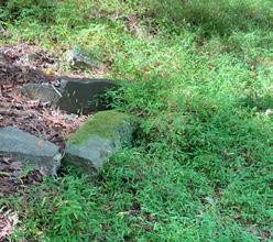


Figure 18: Existing site condition photos
SOUTHERN PARCEL CREEK
SOUTHERN PARCEL CREEK
ROAD
SOUTH PARCEL AND NEUSE RIVER
PARCEL
AND RIVER LAUNCH
SITE OWNERSHIP
Neuse River Park will primarily consist of the 83.6-acre City-owned site (Wake County Parcel ID Number: 1729559875), formerly known as the Leonard Tract. The site is located at 12098 Old Falls of Neuse Road, northeast of the I-540 Loop and east of Capital Boulevard (U.S. Highway 1). This parcel is bisected by Falls of Neuse Road, creating two separate contiguous areas (Northern and Southern), each approximately 40 acres. This parcel is further divided by Old Falls of Neuse Road / Wide River Drive, which separates two additional remnant parcels to the west of the main park site.
The northern parcel of the Cityowned property is bounded by USACE-owned property to the north, Falls of Neuse Road to the south, Old Falls of Neuse Road to the west, and the Neuse River to the east. Planning, design, and development of this Northern section of the property will respond directly to the interface with these boundary conditions. There is significant cleanup needed on this portion of the site due to dumping
and remnant infrastructure left by the prior owners.
The southern section of the Cityowned property is bounded by Falls of Neuse Road to the north, residential subdivisions to the south (including River Run and Bedford at Falls River), Wide River Drive to the west, and the Neuse River to the east. Planning, design, and development of this southern section of the property responds directly to the interface with these boundary conditions. It should also be noted that the natural resources inventory included in the Pre-Development Assessment Plan indicates that the Southern section of the City-owned property features more high-integrity natural resources as compared with the Northern section, including a greater biological diversity and a more mature tree canopy. There is an existing creek that exhibits extensive erosion and may be a candidate for stream restoration design. Closer to the Neuse River, there are low lying wetlands in the floodplain that will need to be protected.


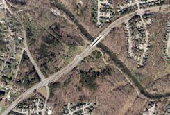


Figure 20: Site context map
Figure 19: Aerial photography of the park site over time

Site Boundary
Wetland Power Easements
USACE Leased Land
Greenway Trail
100-Year Floodplain Parking Sewer Line

INDIGENOUS PEOPLE OF THE NEUSE BASIN
The history of the Neuse River Park site is deeply intertwined with the region’s natural and cultural history, dating back thousands of years. The Neuse River, one of the longest in North Carolina, has been a critical resource for indigenous people, settlers, and modern communities throughout history. Prior to the construction of Falls Lake Dam, the river served as a vital source of sustenance, transportation, and trade for various Native American tribes, particularly the Tuscarora and other Siouan-speaking peoples. These tribes utilized the river’s fertile floodplains for agriculture, hunting, and gathering, which supported a thriving ecosystem rich with diverse flora and fauna.
Archaeological studies conducted in the region, including those referenced in the Falls of the Neuse
Reservoir archaeological evaluation, suggest that Native Americans inhabited this area for thousands of years, leaving behind artifacts such as pottery, projectile points, and remnants of settlements. The presence of these materials indicates a strong cultural reliance on the Neuse River and its surrounding landscape. Sites like Adshusheer, a significant village further up river visited by John Lawson in the early 1700s, illustrate the long-standing importance of this region as a center of indigenous people’s life.
The Neuse River’s importance continued into the colonial period, as European settlers began to establish communities along its banks. The river facilitated early trade routes and agriculture, contributing to the development of the surrounding area.
The indigenous peoples who
inhabited the Neuse River area, such as the Tuscarora and other Native American tribes, relied heavily on the river and its surrounding environment for sustenance and resources. The fertile floodplains along the Neuse River were ideal for cultivating staple crops like corn, beans, and squash, which were commonly known as the “Three Sisters.” These crops were often planted together in a method that allowed them to thrive symbiotically. The Neuse River’s consistent water flow and rich soils made it a potentially prime location for these agricultural practices.
In addition to these crops, the local plants and wildlife provided a crucial food source. Wild rice, millet, persimmons, and various berries were foraged seasonally, while acorns, hickory nuts, and animal fats were harvested during the fall to winter months, coinciding with the
Figure 21: Native dancer at Raleigh Parks’ Inter-Tribal Pow Wow at Dix Park
availability of deer, turkey, and bear. Fish, particularly catfish, also played an essential role in the diet of interior populations, offering a reliable source of protein.
In addition to agricultural use, indigenous peoples also made use of native plants along the Neuse River for medicinal and utilitarian purposes. Trees like the sycamore, hickory, and oak were vital for constructing tools, housing materials, and canoes. Ash trees were commonly used for bows and river cane for arrow shafts and a musical instrument called a “flageolet.”
The indigenous peoples along the Neuse River utilized a variety of native plants for both medicinal and dietary purposes as well. For example, spice bush was used as a tea and medicinal tonic, while red cedar and willow oak bark were used for healing and ceremonial purposes, such as treating aches, pains, and diseases. Other plants, like goldenrod and grapevine, were used for their fragrance or medicinal
properties. Slippery elm bark was known to help ease childbirth. These plant-based treatments were not just medicinal but also integrated into cultural practices and rituals, reflecting a holistic approach to health and spirituality.
FALLS DAM, INDUSTRIALIZATION, AND HOUSING DEVELOPMENT
Before the construction of Falls Dam, the Neuse River powered a mill across the river from the park site for the Falls of the Neuse Manufacturing Company, built in 1854. Originally a paper mill and later a textile mill, the River Mill utilized the river’s natural falls for industrial purposes. Now listed on the National Register of Historic Places, the mill stands as a reminder of the region’s industrial heritage, even as the area has transformed into a recreational and residential region following the creation of Falls Lake.
It wasn’t until the 20th century, with the construction of Falls Lake Dam in the late 1970s, that the river underwent significant alterations.
The dam, managed by the U.S. Army Corps of Engineers (USACE), was built for flood control, water supply, and recreational purposes, creating Falls Lake. While the dam improved water management and reduced flood risks downstream, it also significantly changed the natural flow of the river, impacting habitats and reducing the ability of migratory fish species to access upstream areas.
Residential development around Falls Lake and the Neuse River Park site has steadily increased since the completion of Falls Lake Dam. As the lake became a popular recreational destination, nearby areas, including communities like Wakefield Plantation and Bedford, saw significant residential growth. These planned communities offer a mix of suburban living with close access to outdoor activities along the Neuse River and Falls Lake, such as hiking, biking, and water sports.
Development in the area also prioritized environmental conservation due to the importance of Falls Lake as a water source

Figure 22: Indigenous tribes of North Carolina. Courtesy of the Charlotte Mecklenburg Library
for Raleigh and surrounding communities. As such, much of the residential growth has been carefully managed to balance the need for housing with the preservation of the lake’s ecosystem. Surrounding neighborhoods have benefitted from their proximity to the lake while ensuring that stormwater management and other environmental protections are in place to safeguard the region’s water quality and natural resources. Despite that effort, there are still signs of erosion in the current park site.
PARK SITE
The Neuse River Park site holds a varied history of land use. In the northern section of the property, remnants of a former homestead are still visible, marked by dilapidated fences. The presence of these features, along with specific plant species often associated with human habitation, reveals its past as a residential site. Additionally, this portion of the land shows signs of agricultural use, with fields that were likely used for pasturing livestock or small-scale farming. Although the residences and other structures were demolished after the City of Raleigh acquired the property in 2010, these historical uses have left a lasting mark on the landscape.
In addition to the homestead, there are also areas on the site where illegal dumping has occurred. Various debris, including a significant pile of discarded construction materials, have been found in these areas. This dumping has impacted the landscape, and measures will need to be taken to clean up and restore these sections to ensure the site’s ecological health and safety.

Figure 23: Existing erosion and debris in the southern portion of the site
Figure 24: Existing structure on the park site. The home has since been removed.
SITE CONTEXT
IMPACT OF THE WAKEFIELD AREA PLAN
The Wakefield Area Plan serves as a strategic guide for the future development and infrastructure improvements in northeast Raleigh, particularly focusing on the Wakefield community. This area, located around 12 miles from downtown Raleigh and near the Neuse River Park and Falls Dam, has grown rapidly over the last two decades. The plan addresses a range of issues, including transportation, environmental preservation, and land use, with the goal of ensuring the area continues to develop sustainably while meeting the needs of its residents.
Transportation and mobility are key components of the plan, with proposals aimed at creating a safer, more connected community. The plan recommends improving multimodal infrastructure, including new greenways and safer crossings, especially on major thoroughfares like Falls of Neuse Road, which connects the area to the Neuse River Park and beyond. Traffic-calming measures and expanded pedestrian and bicycle pathways are designed to improve safety and provide better access to nearby recreational areas like Falls Dam. These developments would make the park more accessible to both pedestrians and cyclists, encouraging greater use of the park’s recreational facilities. The integration of these transportation improvements also aligns with the park’s goals to offer a cohesive outdoor experience, linking natural and recreational spaces through safe, connected routes
In addition to transportation
improvements, the plan places a heavy emphasis on environmental conservation, particularly around the Neuse River Watershed. It highlights the importance of stormwater management, calling for retrofitting existing facilities and enhancing stream buffers to protect water quality. The proximity of the Neuse River Park and Falls Dam makes these conservation efforts critical, as they help maintain the health of the river and the surrounding ecosystem, which are key recreational and natural resources for both Wakefield and the broader Raleigh community.
Additionally, the plan’s recommendations for land use and urban design offer opportunities to further integrate Neuse River Park into the community. As auto-centric
areas are transformed into more walkable, mixed-use spaces, there will be potential for creating new park connections and enhancing public spaces near the park. These improvements could foster greater community engagement with Neuse River Park, making it a central feature of the area’s outdoor recreational offerings. The focus on developing more pedestrian-friendly environments also supports the park’s goals of sustainability and environmental preservation, ensuring that any future development complements the natural surroundings rather than detracting from them.

Figure 25: Proposed greenway connections in the Wakefield Area Plan


NATURAL RESOURCE INVENTORY
BIO-BLITZ
Before design efforts for Neuse River Park began, the community came together for the Wake Nature BioBlitz on August 28th, 2023, aimed at conducting a more in-depth natural resource inventory of the site. A bioblitz is a focused, collaborative event where participants work to identify as many species of plants, animals, and other wildlife as possible within a designated area. In this case, local volunteers, park enthusiasts, and naturalists explored various ecosystems across Neuse River Park to catalog its rich biodiversity.
During the bio-blitz, participants used Geographics Information
Systems (GIS) software to input their observations in real-time, enabling the collection of valuable data on the park’s flora and fauna. This data was essential for identifying the unique ecological features of the park, from the mature tree canopy in the southern portion to the diverse wetland areas. The inventory provided insights into the park’s biological diversity, which helped inform sensitive design choices aimed at preserving highvalue natural resources while accommodating future recreational development.
The bio-blitz not only contributed to the park’s environmental assessment but also fostered community
engagement and stewardship. Participants gained hands-on experience in ecological data collection, and their contributions played a key role in shaping the park’s future. This event exemplified how community-led initiatives can intersect with urban planning.
For more: Bio-Blitz Data Appendices
Figure 26: Habitat Map developed by the City of Raleigh in December 2023
HABITAT MAPPING
The following habitat types and features were identified on the site during the bio-blitz and offer different opportunities for development and preservation:
Piedmont Alluvial Forest
This low-lying forested area within Neuse River Park is characterized by nutrient-rich soils and periodic flooding, providing a critical habitat for diverse plant and animal species.
Previously Disturbed (Mixed Pine/ Hardwood)
This section of the park was previously altered, but now supports a mixed canopy of pine and hardwood trees, offering a space for ecological recovery and regrowth.
Previously Disturbed (Grass/ Shrub)
An area that was once disrupted and now dominated by grasses and shrubs, providing important habitat for early-successional species and contributing to the park’s ecological diversity.
Mature Oak-Hickory Forest
This established forest of oak and hickory trees represents one of the more mature ecosystems in the park, supporting a variety of wildlife and maintaining ecological stability.
Native Wildflower Area (Bear’s Foot)
A designated area of the park that fosters native wildflower species, including Bear’s Foot, which helps sustain local pollinators and enhances biodiversity.
River Cane Area
A region along the Neuse River that supports dense growths of river cane, a native species that provides habitat for wildlife and plays a role in soil stabilization along the riverbanks.
Granite Outcrop Area
This unique geological feature is exposed granite that creates specialized microhabitats, supporting unique plant species adapted to thin soils and harsh conditions.
Utility ROW (Diverse EarlySuccessional)
The utility right-of-way (ROW) in the park has become an earlysuccessional habitat, promoting a range of plant species that thrive in open, disturbed environments.
Salamander Habitat (Wetland/ Pool)
These wetlands and seasonal pools create ideal conditions for salamanders and other amphibians, providing vital breeding and sheltering grounds.
Upland Seep
A moist, seepage area in higher elevation zones of the park, which supports specialized plant species and contributes to groundwater recharge.
USGS Perennial Blue-Line Stream
A continuously flowing stream, as mapped by the US Geological Survey, this watercourse provides essential aquatic habitat and connects various ecosystems within the park.
Intermittent Stream Channel
A stream that flows seasonally or during periods of heavy rainfall, contributing to the dynamic hydrology of the park and supporting temporary aquatic habitats.

Figure 27: Bio-Blitz data points gathered in GIS software
THE FALLS - EXISTING CONDITIONS
“The Falls” at Neuse River Park are a series of naturally occurring shallow rapids or riffles (sections where the river’s gradient increases), causing the water to flow swiftly over rocks within the river. Typically found in the upper or middle reaches of a river system, the falls at Neuse River Park are found in the southern channel where the Neuse River splits along the northern portion of the site, and within the USACE leased land. Falls such as these play a crucial role in the river’s ecosystem by providing oxygenated water, habitat diversity, and help prevent dirt and debris from settling in the river. They also add to the aesthetic value of the river and are popular spots for activities like fishing for heron and people alike.
The narrow channel conditions are subject to erosion due to dam releases which threatens the integrity of the existing greenway and future improvements in the park.
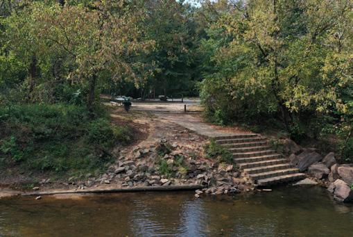
Beyond the southern channel of the Neuse and after it has joined together with the northern channel, the existing boat launch offers an opportunity for river users to either get out of the water to loop back to the start of the southern channel to go over the rapids over and over, but also for other users that want to proceed downriver to another takeout. This launch is also the starting point of the Neuse River Blueway, making it an important access point for people looking to enjoy the river. The launch features a concrete landing with pre-cast block steps, but it’s not fully accessible for all users since it lacks a handrail and doesn’t meet ADA standards. The area nearby includes parking for 29 cars (with one accessible space) and 9 trailers, but parking often fills up quickly because it’s a popular spot for paddlers, anglers, and greenway users.
* Source: Falls of Neuse Whitewater Park Feasibility Study, 2011

WHY IS THE FLOW RATE IMPORTANT?
CFS, or cubic feet per second, measures the volume of water that moves through the river each second. The Neuse River’s flow rate in the area of the park is directly correlated to the release volume of the nearby Falls Dam. The dam’s release volume is affected by rainfall and drinking water demands in Falls Lake.
Lower flow rates are great for water based recreation such as wading, fishing, swimming, etc.
There are various CFS flow rates recommended for usable boating activity (tubes, canoes, rafts, etc) such as:
For more: Whitewater Permitting Memo Appendices
• Tubes: Optimum range is 200–400 CFS.
• Canoes, Kayaks, Rowing, or Stand Up Paddleboards: Optimum range is 400–1,500 CFS
• Rafts: Optimum range is 800–3,000 CFS
It is estimated that the south channel exceeds 200 CFS about 35 days a year.*
Figure 28: Existing boat launch
Figure 29: Existing shallow rapid in the southern channel


Figure 30: Southern channel of the Neuse River just downstream of Old Falls of Neuse Road and adjacent to Neuse River Park
Figure 31: View of Falls Lake Dam tailrace, Old Falls of Neuse Road bridge, and Neuse River Park beyond
Figure 32: Historical flow rates below Falls Dam on the Neuse River.
RIVER SAFETY AND STORMWATER
Recent flooding and extreme weather events are having a significant impact on river ecosystems like the Neuse River. As global temperatures rise, storms are becoming more intense, leading to heavy rainfall and flash flooding. In recent years, areas around the Neuse River have experienced increased flood risks, causing erosion along riverbanks and threatening infrastructure like the Neuse River Greenway. Flooding can wash debris into rivers, further disrupting ecosystems and endangering wildlife that rely on stable habitats. These events highlight the importance of planning and maintaining the park in a way that balances recreational use with natural preservation.
Even at moderate flow rates, sudden changes in weather can drastically increase river levels, making popular spots like the Falls and boat launch more hazardous. It’s important for visitors to be aware of current conditions, as stronger currents can appear unexpectedly, increasing the risk of accidents and drownings,
especially for less experienced swimmers and paddlers. The master plan addresses public safety and access for emergency response and should continue to be addressed through the implementation phase.
These tragedies have raised serious concerns about safety, especially during times of fluctuating water levels and fast-moving currents. Local authorities responded by placing warning signs and temporarily closing access points to help prevent further incidents. As part of the Blueway Plan, bilingual safety signage was added to all existing launches. Safety considerations have been integrated into the design process, with comprehensive signage, public education, and clear safety protocols being essential components of future park development.
Data on past rain events show that without additional stormwater control measures, flooding will progressively intensify at the site over time. In addition to the issues
noted in the river, the expanding impervious surfaces in the neighborhoods uphill from the park are worsening erosion and posing a growing threat to water quality, as runoff from these areas flows into the creeks and river.
Flooding at the park site is caused by more than just heavy rainfall. The scheduled and essential dam releases from Falls Lake help discharge volumes of water built up over time, which then swell and overflow the Neuse River, its tributaries, and their banks into the park.
For more: Situation Assessment Report Appendices

Figure 33: Significant release of water from Falls Lake Dam after a large rainfall event in 2023 just upriver of Neuse River Park.


Figure 34: Flooding on the Neuse River Greenway after a dam release in 2023
Figure 35: Erosion of the southern tributary due to stormwater flow from uphill streets and neighborhoods.
Figure 36: Erosion of the southern tributary and riverbank due to stormwater flow from uphill streets and neighborhoods.
VISITOR ANALYSIS
Anonymized cell phone data was used to study visitor movements and patterns at the Neuse River Park site and along the adjacent greenway. This data-driven approach allowed the design team to gain valuable insights into how people move through the area, how they use the limited existing developments, and which parts of the park attract the most activity. By understanding these patterns, planners are better equipped to make decisions about future growth, amenities, and
important details such as where visitors are coming from, which routes they take within the park, and how they move around once on-site. This data can be used to determine the optimal locations for key features like park entrances, parking areas, recreational spaces, and other amenities. By aligning these features with current user behavior, the park can be designed to better accommodate both local residents and regional visitors.
LIMITATIONS OF VISITOR MOVEMENT DATA
While mobility data provides critical information, it is important to acknowledge its limitations. Not every visitor carries a phone capable of transmitting location data, and not all mobile devices have location services enabled while on-site. Additionally, external factors such as signal strength, weather conditions, or user privacy settings can affect the accuracy of the data. Despite these challenges, the cell phone mobility data undergoes a rigorous analysis process, applying statistical methods to verify accuracy and

extrapolate broader demographic trends. This thorough analysis builds a strong confidence in the results, even with the limitations acknowledged.
Ultimately, mobility data offers a clearer, more reliable picture than traditional observation techniques, as it captures real-time visitor behavior. The data becomes a powerful tool for identifying large-scale trends, understanding user patterns, and recognizing opportunities for improving the park’s design and services.
KEY TRENDS AND VISITOR INSIGHTS
The data analysis reveals several trends about how visitors are currently using the park. Visitors currently tend to gather in specific areas, particularly along the greenway and at the water access points. These are currently the only developed parts of the park, which explains their popularity. The Visitor Hot Spot Analysis demonstrates these areas as the busiest sections of the park, drawing consistent foot traffic throughout the day.
The data also highlights some clusters of visitors in areas that aren’t officially developed or marked as
points of interest. These unusual clusters can often be explained by slight inaccuracies in GPS data, which is within the margin of error for this type of analysis. However, these patterns could also point to informal paths or areas where visitors are naturally gathering, which allowed the design team to ground truth these areas further.
TIMING OF VISITS AND VISITOR BEHAVIOR
In terms of when people visit the park, the data shows that a surprising number of visitors come during business hours, with the highest concentration of visits occurring

39:
(2019-2023). *Differences in GPS accuracy can result in visual aberrations or anomalies.

Figure 38: Visitors proportion by day of week (2019-2023).
Figure
On-Site Visitor Hot Spots
around 2 PM. While weekends see a slight increase in visitors, usage remains steady throughout the week. This trend aligns with national postCOVID-19 patterns, where people are increasingly choosing to spend time outdoors during the day, particularly in parks and natural spaces.
The Visitor Proportion Over Time chart (Figure 40) illustrates how the number of park visitors has steadily increased since early 2020. This upward trend reflects the growing demand for outdoor recreational spaces, as more people seek fresh air, exercise, and social interaction in safe, open environments. As the park continues to attract more visitors, the need for well-planned facilities and services becomes even more critical.
VISITOR ORIGINATION
The cell phone data also sheds light on where visitors are traveling from, providing insights into the park’s reach beyond the immediate

community. This can be explored in two key ways: understanding where visitors live and examining how they arrive at the park.
The Visitors’ Home ZIP Codes map (Figure 41) reveals that people from a wide range of ZIP Codes across North Carolina have visited the park site between 2019 and 2023. When zooming in on the areas surrounding the park, we find that about 50% of visitors come from neighborhoods located to the north and west of the site (Figure 42). This shows that while the park is primarily serving local residents, it also has a broad appeal, drawing in visitors from other parts of the state. Approximately 40% of visitors are traveling from outside their immediate neighborhoods, demonstrating the park’s potential as a regional attraction.
HOW ARE VISITORS REACHING THE PARK?
Another important insight from the

data is how visitors are getting to the park. Pathing data, which tracks where visitors were 30 minutes before and after their visit, helps to identify common travel routes. This data not only highlights the roads and paths visitors frequently use but also points to other businesses, shops, or destinations they may visit along the way.
For example, the pathing data confirms that many visitors come from nearby areas such as Wake Forest and other neighborhoods surrounding the park. It also reveals the preferred routes taken by visitors coming from farther away, including popular routes like the Neuse River Greenway, Falls of Neuse Road, I-540, and Durham Road. Understanding these travel patterns is crucial for making informed decisions about where to place entrances, parking lots, and signage to improve accessibility and flow.

Figure 40: Visitor proportion by time of day (2019-2023).
Figure 41: Visitor proportion over time (2019-2023).


Figure 42: Visitors’ home ZIP Codes in blue in North Carolina (2019-2024).
Figure 43: ZIP codes near the park site and percent of total visitors from each area (2019-2024).
PRACTICAL APPLICATIONS OF THIS DATA
The insights gained from this data have been instrumental in identifying the busiest times, most frequently traveled routes, and the areas of the park that attract the most visitors. This allows the park’s design team to create spaces that better meet visitors’ needs.
By using this data-driven approach, the design team can ensure that resources are allocated efficiently.
The data helps prevent overcrowding in popular areas and ensures that visitors have a comfortable, enjoyable experience. Additionally, this method gives the park’s management team a forward-looking view, helping to plan for long-term growth and changing visitor needs. Unlike traditional surveys or anecdotal observations, the analysis of anonymized cell phone data provides a fuller, more dynamic picture of visitor behavior. It allows
for a deeper understanding of how people interact with the space, when they are most likely to visit, and what amenities they value the most. Armed with this knowledge, the design team can create a space that is both functional and welcoming, meeting the diverse needs of the community while also appealing to visitors from across the region.

Figure 44: Locations of visitors 30 minutes before and 30 minutes after visiting the site (2019-2023).
Blue Jay Point Park Forest Ridge Park

Locations
visitors 30 minutes before and 30 minutes after visiting the site, regionally (2019-2023).
Figure 45:
of
DURHAM RD


COMMUNITY OUTREACH APPROACH
Community outreach for Neuse River Park prioritized collaboration with the public and project stakeholders throughout the planning process. By raising awareness and fostering collaboration, the project achieved widespread participation and input. The process began with clear communication goals, methods, and role definitions to ensure transparency.
Recognizing the park’s future significance for Raleigh residents and visitors, equity was made a cornerstone of the engagement process from the onset.
The comprehensive strategy included digital engagement, traditional media, in-person events, mobile outreach, multilingual communications, partnerships with community organizations, and accessibility measures.
By employing this multi-tool approach, the design team was able to cast a wide net, engaging with a diverse cross-section of the community. The use of multiple engagement tools also allowed for cross-referencing and validation of input, providing a more comprehensive and nuanced understanding of community preferences.
The following lists demonstrate outreach tools implemented during each phase of the planning process.
INITIAL INPUT PHASE
• Public Workshop
• CAG Working Meetings
• CAG Site Visit
• Online Open House & Survey
• Focus Group - Homeowners
• Mailer notifications for nearby residents (Bi-lingual)
• Flyers distributed city-wide (Bilingual) at all community centers
• Yard Signs (Bi-lingual) at nearby parks and nearby greenway & blueway access points
• Posters & Rack Cards (Bi-lingual) at nearby parks
• Stakeholder & Subscriber Emails
• Digital Newsletters: Raleigh Parks (weekly), Greenways (quarterly)
• Social Media Post
• Project Website Updates
For more: Initial Public Feedback Chapter 4
CONCEPT ALTERNATIVE PHASE
• Public Workshop
• Public Site Visits
• CAG Working Meetings
• CAG Site Visit
• Online Open House & Survey
• Focus Groups: Homeowners, Outdoor Recreation, Environmental, River-Based Activities
• Event Tabling – Love your Lake event @ Falls Lake Dam & Kayak Pool Session @ Optimist Pool
• Mailer notifications for nearby residents (Bi-lingual)
• Flyers distributed city-wide (Bilingual) at all community centers, Wake Public Libraries, city-wide laundromats, city-wide Outdoor Recreation, Running, & Biking retail stores
• Yard Signs (Bi-lingual) at nearby parks, nearby greenway & blueway access points
• Posters & Rack Cards (Bi-lingual) at nearby parks
• Stakeholder & Subscriber Emails
• Digital Newsletters: Raleigh Parks (weekly), Greenways (quarterly)
• Social Media Posts & Ads
• Project Website Updates
For more: Concept Alternate Public Feedback Chapter 5
FINAL MASTER PLAN PHASE
• Public Workshop
• Public Site Visits
• CAG Working Meetings
• Online Open House & Survey
• Flyers distributed city-wide (Bilingual) at all community centers , city-wide laundromats
• Yard Signs (Bi-lingual) at nearby parks, nearby greenway & blueway access points, nearby Wake County Public School System facilities
• Posters & Rack Cards (Bi-lingual) at nearby parks
• Stakeholder & Subscriber Emails
• Digital Newsletters: Raleigh Parks (weekly), Greenways (quarterly), WCPSS, Que Pasa, & The Carolinian
• Go Raleigh Bus Ads
• Social Media Posts & Ads
• Project Website Updates
• Neuse Perspectives Campaign

RALEIGH PARKS MARKETING AMBASSADOR EVENTS
The Raleigh Parks Marketing Ambassadors are responsible for promoting Raleigh Parks programs and events, engaging with community members, and distributing information to patrons at local events. For Neuse River Park, they supported outreach efforts, raised public awareness, and encouraged participation in surveys and public meetings at the following events. For more: Final Master Plan Public Feedback Chapter 6
LOCATION
Harvest Fest 10/14/2023 Pullen Park
Poe Fest 10/21/2023 Alice Aycock Poe Center
CM Harrison Town Hall 10/21/2023 Lake Johnson
Walnut Creek Greenway Tour 11/11/2023 Lake Johnson
Skip the Straw Day 02/10/2024 Walnut Creek Wetland Center
Spring Sports Signup Outreach 02/10/2024 Glenwood Avenue
Public-Requested Presentations
• 10/23/2023 Midtown CAC
• 12/18/2023 North CAC
• 1/29/2024 Woodspring HOA
• 5/20/2024 Midtown CAC
• 6/25/2024 Woodbridge HOA
Spring Sports Signup Outreach 02/11/2024 Triangle Town Center
Spring 2024 Baseball Sign-Up 02/11/2024 Biltmore Hills
Riding Around Raleigh Teen Day 02/19/2024 Tarboro Road Community Center
PBS Rootle Roadster Tour 03/09/2024 Moore Square
Earth Day 04/19/2024 Dix Park
Figure 46: Public Workshop 1
INITIAL PUBLIC FEEDBACK
In Fall and Winter 2023, engagement efforts focused on familiarizing the community with the site and gathering initial feedback on its potential and limitations. Community Advisory Group (CAG) site tours during the initial feedback period provided a tangible connection to the project, allowing members to visualize future changes and understand site constraints firsthand.
A focus group with local homeowner associations served a dual purpose: they provided valuable insights into existing challenges faced by nearby residents, and they helped build relationships with key stakeholders. Discussions covered topics such as traffic, privacy concerns, and the impact of increased visitation on surrounding neighborhoods.
The Community Advisory Group (CAG) meetings resulted in the formal adoption of the project’s vision and goals, marking a significant milestone and providing
CAG Site Tours
Served to inform the plan by illuminating the CAG’s understanding of site opportunities and constraints.
2
a clear direction for the rest of the planning process.
The first workshop and online survey revealed community preferences for infrastructure, amenities, and activities related to water, trails, and outdoor adventure. The survey also highlighted sustainability topics and public art themes desired for the park.
A StoryMap, launched alongside the first workshop and survey, offered an interactive overview of the project. It helped educate the public about the park’s context and significance and provided a platform for project updated at each milestone in the planning process.
CAG SITE TOURS
CAG site tours provided an opportunity for the Community Advisory Group to gain critical insights into the current state of site flora and fauna, existing river access points and launch sites, and areas
Homeowner Focus Group
Served to inform the plan by providing insight into in-depth local knowledge on current use patterns and maintenance expectations.
of riverbank erosion. By grasping the complexities of the site and the potential improvements that could be addressed through the Master Plan, CAG participants were better equipped to contribute meaningful input to the planning process.
HOMEOWNER FOCUS GROUP
The design team continued public engagement in Fall 2023 by hosting a focused discussion with local homeowner associations. This gathering allowed nearby residents to voice their concerns about how park development might affect their neighborhoods. During the session, the design team outlined the project’s status, explaining that it was in the early stages of the Master Planning process, and emphasized the current priority of gathering community input to shape the park’s design and features.
Workshop & Online Survey
Served to inform the plan by identifying programming and amenity preferences and key sustainability and art themes.
12 970
Participants
Figure 47: Summary of engagement strategies implemented during analysis phase
CAG Site Tours
HOAs represented


Ayude a planificar el futuro parque Neuse River UN TALLER PÚBLICO
Raleigh Parks organiza un taller público para el plan general del Parque Neuse River. Este es un evento familiar e incluirá refrigerios y una estación de arte para personas de todas las edades. Habrá intérpretes de español en esta reunión.
Public Meeting Series
Raleigh Parks is hosting a series of public workshops for the Neuse River Park Master Plan. All Public Workshops will be family-friendly and will include light refreshments and an artmaking station for people of all ages. Accommodations and Translation Services are available upon request. Please contact NeuseRiverPark@PublicInput.com NeuseRiverPark@PublicInput.com NeuseRiverPark@PublicInput.com
Visit the Engagement Portal to learn more about the Community Advisory Group, upcoming public site visit series, and Online surveys: Engage.RaleighNC.gov/NeuseRiverPark Engage.RaleighNC.gov/NeuseRiverPark
DETAILS
Monday, March 4, 5-7 p.m. Campbell Lodge, Durant Nature Preserve 3237 Spottswood Street
raleighnc.gov/parks Help Plan the Future Neuse River Park!
48: Flyers distributed by the City of Raleigh to announce public meetings
Realice la encuesta: Realice la Realice engage.raleighnc.gov/NeuseRiverPark engage.raleighnc.gov/NeuseRiverPark
Neuse River Park es un espacio de 84 acres situado en 12028 Falls of Neuse Road junto al Neuse River Greenway y al Falls Dam Blueway Access. RaleighParks se complace en crear un plan maestro que refleje las necesidades y deseosúnicos de la comunidad.
Viernes 3 de noviembre 4-7 p.m.
Abbotts Creek Centro comunitario 9950 Durant Road Raleigh, NC 27614
raleighnc.gov/parks
49: Flyers were also distributed in spanish to announce public meetings.

Figure 50: The ArcGIS StoryMap developed for the project master plan.
Figure
Figure
PUBLIC WORKSHOP 1
The first public workshop was hosted at Abbots Creek Community Center on November 3, 2023, attracting nearly 60 participants. While this workshop and others that followed provided insights into community sentiment during master planning, the online surveys ultimately served as more definitive tools for understanding public priorities due to their broader and more comprehensive respondent base.
The main goals of the first workshop were to:
• Introduce attendees to the site planning process
• Clarify the scope of the planning process
• Conduct live polling to measure preferences and priorities for potential activities and amenities
• Explore desired sustainability practices
• Explore themes for public art
• Identify opportunities and constraints from the public’s perspectives
To meet these goals, the workshop was organized in the following 7 “stations”:
1. Project introduction
2. Activities and amenities
3. Water-based activities
4. Greenways and trails
5. Sustainabilty
6. Art and storytelling
7. Opportunities and challenges
The following tables include results from sticker dot voting for potential activities, amenities, and improvements during the first workshop.
POTENTIAL ACTIVITIES
POTENTIAL AMENITIES
Participants’ ideas for sustainability best practices at the park were focused on the importance of protecting and enhancing native wildlife and habitats while promoting environmental education and sustainable development practices.
Chimney Swift tower POTENTIAL IMPROVEMENTS
Erosion reduction/control on banks of river/ stream
Wildlife observation points with benches, birding trail, informative kiosk
Protecting existing native wildlife and plants/reduce invasive/ non-native plants
Participants’ ideas for stories, topics, and ways to incorporate them at the park were based in celebrating local history and indigenous culture, highlighting nature and wildlife, incorporating interactive elements, and enhancing existing structures while harmoniously blending with the natural environment.
History of first nation people
Pre-dam history Transfer images on trees and rocks
Native species scavenger hunt
Participants identified being most excited about expanded recreational opportunities, particularly water-based activities and trail improvements.
accessibility from nearby neighborhoods Restore old canoe launch
Participants identified being concerned about potential impacts the environment, infrastructure, and local quality of life, highlighting the need for a balanced approach to park development.
HOMEOWNER FOCUS GROUPS (FIRST MEETING)
The key themes highlighted by the Homeowners Focus Group during the November 30, 2023 meeting included:
Amenities and Features
» Interest in unique, nature-based play areas (e.g., elevated trails, tree forts).
» Discussion about the need (or lack thereof) for additional playgrounds.
» Focus on river-centric activities and maintaining natural resources.
Process and Decision Making
» Clarification that the CAG makes recommendations, not binding decisions.
» Some attendees expressed hope that local stakeholders’ opinions would be prioritized.
River Infrastructure
» Mixed opinions, with some opposition to including a whitewater feature.
» Questions about the necessity and appropriateness of such a feature.
Traffic and Safety
» Major concerns about traffic safety, especially at park entrances and nearby intersections.
» Worries about increased traffic due to park development.
» Suggestions for improved pedestrian access, including sidewalks and possibly pedestrian bridges.
Infrastructure and Maintenance
» Questions about road ownership and maintenance responsibilities.
» Concerns about existing infrastructure issues (e.g., road conditions, signage).
Community Impact
» Concerns about overflow parking affecting nearby communities.
» Worries about foot traffic and erosion impacting residential areas.
» Questions about how the park might affect property values and quality of life.
Environmental Concerns
» Strong emphasis on maintaining the natural character of the area.
» Interest in natural/environmental play areas rather than traditional playgrounds.
Collaboration
» Suggestions to work with other entities (USACE, Tar River Land Conservancy).
» Discussion about coordinating with schools for joint-use agreements.
Future Development
» Worries about phased approach and future funding for completing the project.
» Questions about cost estimates and potential reallocation of funds.
910
PARTICIPANTS
7,280 819
RESPONSES
PUBLIC SURVEY 1
In tandem with Public Workshop 1, an initial input survey was conducted to ask specific questions about the public’s future goals for the park.
KEY TAKEAWAYS
» Respondents ranked types of recreation in the following order (#1) river-based recreation, (2) outdoor adventure recreation, and (3) greenways and trails
» Respondents were most concerned about overdevelopment, maintaining natural appeal, and neighborhood proximity and safety
» Respondents identified canoing/kayaking, whitewater features, tubing, swimming/wading, and fishing as most desired water-based activities.
» The most popular trail-based activities and supporting infrastructure identified by respondents were: supporting amenities such as restrooms, hiking trails, separated trails by use, mountain biking trails, accessible trails and features, and connections to other parks and trails
COMMENTS
2,212
VIEWS
OCT. 19 - DEC. 15, 2023
» The most popular nature-based activities identified by respondents were: hiking, walking, and biking trails, educational and research areas, and low impact development
» The most popular outdoor/adventure activities identified by respondents were: hiking, walking, and biking trails, bouldering and rock climbing, and camping
» The most popular typical amenities identified by respondents were: restrooms, picnic opportunities, social spaces, trails and access highlighting nature, pet facilities, and outdoor sports facilities
» To promote sustainability, respondents identified desires for: native planting and invasive plant removal, solar power and alternative energy sources, recycling and composting stations, preservation of trees and natural habitat, low impact development, and green stormwater infrastructure
» The most popular art themes or topics to represent in community art installations identified by respondents were: local history and indigenous stories, creation stories of the lake and river, and natural environment and preservation.
Overall, the community prioritized river-based recreation, dedicated trails, and park infrastructure, while expressing concerns about overdevelopment and maintaining the area’s natural appeal.
For more: Survey Report Appendices
COMMUNITY ADVISORY GROUP (CAG) MEETING 1 (VIRTUAL)
OCTOBER 25, 2023
The initial CAG meeting began with introductions from CAG members who shared their connections to and interest in Neuse River Park. City staff provided an overview of the park site, located in Northeast Raleigh’s council district B, and shared the project budget, funded through the 2022 parks bond, includes community engagement, master plan development, design, and construction.
Staff presented the recently completed Situation Assessment, which had been adopted by the Parks Board on October 19, 2023. The assessment outlined the pre-planning phase that identified engagement strategies and project context. The site was described as 112 acres, featuring an existing boat launch, Neuse River frontage, and 80 acres of city-owned forested land, with connections to both the Neuse River Greenway and Blueway.
The engagement plan was presented in three main phases: Initial Input, Design Alternatives, and Final Draft Master Plan. Various engagement tools were outlined, including CAG working meetings, public workshops, pop-up events, surveys, and focus groups. A timeline for implementation was shared with the group.
The CAG’s structure was defined as a diverse committee of 15-20 members representing the surrounding community and interest groups. Their role included facilitating information sharing and voting on key decisions in a consensus-based process. The CAG charter, containing eleven sections detailing the group’s purpose, authority, and responsibilities, was distributed for review and signing before the first in-person meeting.
After upcoming engagement activities were announced, CAG members were assigned several tasks including: providing biographical information for public posting, responding to site visit scheduling poll, and sharing project information with their communities. During the question-and-answer session, members discussed project information sharing and requested a list of CAG members and their represented neighborhoods. City staff explained their policy regarding QR codes on promotional materials an proposed creating an e-mail listerv for coordination among members.
COMMUNITY ADVISORY GROUP (CAG) MEETING 2 (IN-PERSON)
NOVEMBER 7, 2023
The meeting began with introductions of CAG members and Design Workshop, setting the foundation for collaborative planning. Discussions centered on fundamental park planning principles and the unique opportunity the site presents within Raleigh’s Park system.
The group explored the site’s indigenous history, particularly near the dam area, and emphasized the importance of incorporating universal accessibility features throughout the park.
Public engagement efforts were reviewed, including the November 3, 2023 public meeting and an online survey that garnered nearly 600 responses at the time of this CAG meeting. The CAG expressed strong support for implementing focus groups with geographic representation to ensure comprehensive community input.
Members participated in a vision development exercise, contributing keywords and discussed both opportunities and potential challenges to the site.
Future engagement strategies were outlined, including plans to attend HOA meetings and leverage social media for broader community outreach.
The meeting concluded with scheduling a follow-up virtual session for early December, where Design Workshop would present draft vision statements for review.
COMMUNITY ADVISORY GROUP (CAG) MEETING 3 (VIRTUAL)
DECEMBER 6, 2023
During the public comment period, a resident expressed concerns about lack of connectivity to the park, advocated for minimal development, and emphasized the importance of preserving the river’s natural state. Raleigh’s Land Stewardship Program Manager discussed the ongoing process of designating protected natural areas within the property through the PDAP process in master planning efforts. Draft vision and goals for the park were presented, which included active use of natural settings, accessibility, protection of natural features with limited facility development, fostering community connections, and integration into the broader community network. CAG members requested clarification between facilities and amenities, suggested adjustments to the statement’s rigidity, and questioned whether the river should feature more prominently in the vision statement. It was decided that CAG members would review and vote on the vision and goals through a poll.
The engagement plan was reviewed, along with the emphasis on new elements designed to increase outreach to BIPOC populations. CAG members suggested adding intercept surveys on the greenway and connecting to city council members through town hall meetings. Survey data analysis revealed that most respondents were from the Raleigh area, particularly near the park property. The team committed to creating a public summary report of the survey data.
During open comments from the CAG, members confirmed that the idea board would remain open for submissions and suggested collecting data on CAG members’ park priorities. Regarding environmental studies, Phase 1 was completed, with additional phases and city habitat assessment expected to be completed by March, prior to design completion and construction. Questions were raised about expediting connectivity from Wakefield to the park through non-city owned land, with Raleigh Parks committing to follow up on the matter.
WHAT WAS THE COMMUNITY ADVISORY GROUP
TASKED WITH DURING THIS PHASE OF DESIGN?
Over the course of the project, the Design Team worked with the CAG to develop this master plan report containing five components: (1) a Vision Statement, (2) Design Alternatives, (3) a Draft Concept Plan, (4) Priorities for phased development, and (5) a Proposed Master Plan.
During this initial feedback phase the CAG was tasked with:
The CAG will develop a Vision Statement describing the overall vision for the park, including uses, sensitivity to natural elements, identity, history, and other characteristics as appropriate. The Vision Statement will be consistent with the site’s Pre-Development Assessment Plan and the Raleigh Parks System Plan. The Vision Statement will include reference to the ecological significance and functions of the site, the site’s relationship to the larger park system surrounding context, and will be informed by feedback received from the general public during the Initial Input phase of the Master Plan process.
SEE PAGE 14 TO REVISIT THE VISION STATEMENT


CHAPTER 5
CONCEPT ALTERNATES
CONCEPT ALTERNATES SITE PLANS
The next step in the planning process was the development of design alternatives. The purpose of the following alternative plans was to explore different possibilities for facility development, recreational amenities and programming, river accessibility, approaches to stormwater control, and pedestrian and vehicular park entrances and circulation.
CONCEPT ALTERNATE 1: RIDGELINE
Ridgeline focused on a balance of mountain biking, hiking, river access, and social spaces. Each shows a mix of priority elements and optional elements.


Concept 1 Concept 2
Figure 53: Concept 1: Ridgeline, illustrative plan
Figure 51: Concept 1: Ridgeline, program diagram
Figure 52: Concept 1: Ridgeline, program comparison

PLAYGROUND - LARGER AREA


UNIQUE TO


HIKING TRAILS


BEGINNER MOUNTAIN BIKE SKILLS COURSE


UNIQUE TO
ENHANCED CONNECTIVITY


UNIQUE TO THIS CONCEPT
UNIQUE TO THIS CONCEPT
CONCEPT ALTERNATE 2: CASCADE
The Cascade concept focused on a balance of river activities, including instream improvements, along with hiking trails and social spaces. Each shows a mix of priority elements and optional elements.
HIKING


Figure 54: Concept 2: Cascade, program diagram
Figure 55: Concept 2: Cascade, program comparison
Concept 1
Concept 2
Figure 56: Concept 2: Cascade, illustrative plan

NATURE PLAY - SMALLER AREA


SOCIAL LAWN + PAVILION


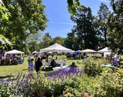

HIKING TRAILS


ENHANCED CONNECTIVITY


BOARDWALKS
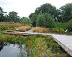


COMPARING CONCEPTS ALTERNATES
ENTRANCE LOCATION
In Concept 1, the design team is exploring the possibility of adding a traffic light at this location with the Department of Transportation. Concept 2 aligns with the existing home site road, but may conflict with the Falls of Neuse intersection.


TRAIL TYPOLOGIES
Each concept includes the greenway, accessible trails and sidewalks, and new hiking trails. Concept 1 includes mountain biking trails and Concept 2 includes boardwalk trails.

Both concepts include these trail types

Concept 1: Ridgeline includes


Concept 2: Cascade includes


Both concepts include areas for play.
Concept 1: Ridgeline shows more play structures
Concept 2: Cascade shows more natural play elements
The final concept will likely be a mix of play structures and natural play elements. The size of the playground is also flexible to fit the budget.


Concept 2: Cascade includes a dog park area.
The dog park is located close to parking so users can access it quickly. There is no permanent dog park provided by the city in this area, but there is a pop-up dog park at Abbott’s Creek Park.


DOG
BEGINNER MOUNTAIN BIKING
Concept #1: Ridgeline includes a beginner mountain biking skills area, ramp structures and dedicated trails.
Because of the size of the park, the mountain biking trails are limited to 1-2 miles maximum, which is why the layout is focused on beginner riders with activities that would be unique to the area like ramps and a mountain biking skills area.

MOUNTAIN BIKING SKILLS AREA
BASELINE PARK IMPROVEMENTS

WOOD RAMP STRUCTURES
Some of the elements that are in both concepts include:
• Benches
• Bike racks
• Bike repair station
• EV charging station
PARKING
• Improved wildlife habitat
• Picnic tables
• Public art
• Restroom facility

MOUNTAIN BIKING TRAILS
• Signage and wayfinding
• Sustainability practices
• Trash and recycling receptacles
• Water fountains
Both concepts include larger parking areas to accommodate both park visitors and greenway users. The goal is to greatly reduce any visitors desire to park in surrounding neighborhoods by providing them a much more convenient option. Another design goal is to make as much of the parking area pervious as possible or utilize green stormwater infrastructure to capture runoff.
SITE UTILITIES


Both concepts will require the following:
• Connection to existing sewer main on site for restroom facility and water fountains
• Connection to electrical power for restroom facility, site lighting, and other elements
• Connection to water main for restroom facility, water fountains, hose bibs (for cleaning and watering), fire hydrants, etc.
• Stormwater pipes and facilities for parking areas and roadways
RIVER AMENITIES + RIVER EDGE ENHANCEMENTS
BANK REINFORCEMENT
Both concepts stress the importance of protecting both the park and the leased USACE property from the effects of the dam. The dam will continue to cause erosion along the river bank and the design team proposes to reinforce key areas of the park.

INCORPORATE PLANTS INTO BANK REINFORCEMENT
RIVER ACCESS

PROVIDE ACCESS TO RIVER EDGES WHILE KEEPING NATURAL ELEMENTS

BUILD IN FLEXIBLE LOCATIONS FOR DIFFERENT RECREATIONAL USERS
Both concepts envision various improvements to encourage organized river access and enjoyment.


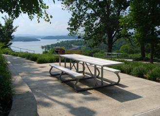
RIVER WILDLIFE
Since the 2011 study, a significant amount of research and testing has gone into implementing fish passage into whitewater parks. The drop structures proposed in Concept 2: Cascade would provide fish passage for native species and the northern channel will still be fully accessible. However, fish habitat will remain cut off by the Falls Dams just upstream from this project.
NEARBY PARKS
Different types of whitewater parks are located around the southeast including:
Existing in-stream parks:
• Nantahala Outdoor Center on the Nantahala River in Bryson City, NC
• Ocoee Whitewater Center on the Ocoee River in Ducktown, TN
• Great Falls Whitewater Park on the Catawba River in Great Falls, SC
In-Progress In-stream parks (at the time of this report):
• Woodfin Wave on the French Broad just outside of Ashville, NC
• Danville Whitewater Park on the Dan River in Danville, VA
Existing Pumped Parks:
• US National Whitewater Center, in Charlotte, NC
• Montgomery Whitewater Park in Montgomery, AL
ADA ACCESSIBLE RIVER PATHWAYS
OVERLOOK STRUCTURES
GATHERING AREAS ALONG THE BANK
PUBLIC FEEDBACK - CONCEPT ALTERNATES PHASE
Launching in Spring 2024, the second phase of engagement included a second online survey and public workshop to compare opportunities among two concept alternatives, and an initial call for participation in the Neuse Perspectives campaign. Information gathered through each of these efforts contributed to the amenities, programming, and distribution of dedicated gathering spaces and trails in the combined site plan.
PUBLIC WORKSHOP 2
On March 4, the second public workshop hosted at Campbell Lodge at Durant Nature Preserve focused on:
» Sharing results of the initial engagement about recreational preferences
» Sharing the two proposed concept alternatives for the park based on initial engagement feedback
» Discussing potential improvements to the Neuse River
» Presenting baseline park amenities
» Gathering input on the preferred allocation of funds for unique park elements in each concept alternative, beyond standard “baseline” amenities
General input from this workshop indicated many want the park to focus on nature, habitat protection, and low-impact activities rather than whitewater features. However, nearly half of the comments received mentioned whitewater, highlighting
COMMUNITY ADVISORY GROUP (CAG) MEETING 4 (IN-PERSON)
FEBRUARY 5, 2024
This CAG meeting focused on key project updates and milestones. The project timeline was adjusted, with two months removed from the schedule to target the September parks board meeting. Focus groups were moved earlier in the timeline to better inform the final draft concept plan, with virtual sessions planned to be open to CAG members but not the public to maintain focused discussions. The group achieved consensus on both the vision statement and project goals, with the vision statement receiving 11 endorsements, 1 endorsement with minor contention, and 1 agreement with minor reservation. The goals received 8 endorsements, 3 minor endorsements with minor contention, and 2 agreements with minor reservations. A key
modification was made to change the final goal statement from “accommodate” to “account for broad public interest.”
Initial survey results were presented, highlighting strong public interest in river-based recreation and separated bike and pedestrian trails. Primary concerns centered around overdevelopment and excessive pavement. The highest-ranked recreational activities included canoeing, kayaking, whitewater features, and tubing, while desired amenities focused on drinking water, benches, and various trail types. Sustainability elements such as native plantings, invasive removal, and low-impact development where emphasized as priorities.
its significance to the public conversation which also correlated to a strong interest in whitewater in the Public Survey 2.
Workshop participants were asked to select and rank park features they would like to see included in the final plan of the Neuse River Park in addition to predetermined core features. The following figure depicts how the features were ranked by participants based on the number of votes cast for each.
During the design alternatives discussion, participants raised questions about the existing canoe launch entrance, permitting requirements, and potential stream restoration costs. Suggestions included adding a bridge over floodprone greenway areas, maintaining Neuse River buffer zones, and improving pedestrian connectivity. The group also discussed upcoming engagement opportunities, including site visits scheduled for both CAG members (February 16-17) and the public (March 7 and 9), an online survey period from February 26th to March 11th (actual survey window: March 4th to March 18th), and two public meetings at Campbell Lodge schedule for March 4th and June 27th, 2024.
PUBLIC SURVEY 2
Summary: This question asked participants to select priority park elements within a limited budget. Each element was assigned proportional to their actual construction costs. There was a list of “baseline” park amenities that were subtracted from the budget that were by default included in the park, such as parking, roadways, plaza, utilities, ADA multi-use path, bank reinforcement, invasive species removal, site furnishings, lighting, security/safety equipment, and restroom facilities Participants select more elements than the budget allowed ($40).The following is a summary of the values of the park elements:
• Whitewater elements ($35),
• Dedicated Quick Access Route for Bike from Parking to Greenway ($2),
• Lawn and Pavilion ($5),
• Small Play Area ($3),
• Stream Restoration ($10),
• Dog Park ($3),
• Fitness Equipment Area ($2),
• Large Play Area ($6), and
• Beginner Mountain Biking Skills Course + Trails ($8)
• Improvements to Existing Launch received 576 votes (70%) from participants
o Restructure and reconstruct zone.
results from question 1 are listed below:
• Gathering Spaces received 571 votes (69%) from participants
• Whitewater elements were chosen by 1388 (69%) participants
A two-week public survey was conducted in March to gauge residents’ preferences on various park features and riverbank infrastructure improvements presented in two alternative concept plans. The goal was to identify the most favored elements from each proposal and integrate them into a final combined draft conceptual site plan. Using preliminary cost estimate data, the survey identified “baseline” or standard park amenities that will be included in the Master Plan. With these “baseline” amenities in mind, the survey allowed participants to provide feedback and rank additional unique park components that exceeded the standard amenities.
o Areas to gather around the river, amenities.
2,100
PARTICIPANTS
• Dedicated Quick Access Route for Bike from Parking to Greenway was chosen by 953 (48%) participants.
• New Launch Upstream of Southern Channel received 547 votes (66%) from participants
• Lawn and Pavilion was chosen by 861 (43%) participants
o Launch for the southern channel potential amenities.
• Small Play Area was chosen by 628 (31%) participants.
2,100 people participated in the survey from March 4-18, 2024.
• Stream Restoration was chosen by 556 (28%) of participants
• Dog Park was chosen by 552 (28%) of participants
KEY TAKEAWAYS
• Fitness Equipment Area was chosen by 511 (25%) participants
• Large Play Area was chosen by 409 (20%) participants
20,864
RESPONSES
275
• Beginner Mountain Biking Skills Course + Trails was chosen by 387 (19%) participants
» Respondents prioritized park elements in the context of a limited budget in the following manner:
3. Entrance Location/ Which proposed entrance location do you prefer? (1,510 Participants)
• Improvements to Existing Launch received 576 votes (70%) from participants
Sentiment: 72% for Concept 2 Entrance, 28% for Concept 1 Entrance
o Restructure and reconstruct zone.
• Gathering Spaces received 571 votes (69%) from participants

o Areas to gather around the river, amenities.
• New Launch Upstream of Southern Channel received 547 votes (66%) from participants
Prioritize River Improvements/ The core feature of this project will include enhancements along the bank of the Neuse River. Prioritize your preferred elements. (828 Participants)
o Launch for the southern channel potential amenities.
» Respondents prioritized river improvements in the context of a limited budget in the following manner:
Summary: Whitewater riverbank infrastructure and improvements.
6,315
COMMENTS VIEWS
Summary: Concept 1 proposes the main vehicular entrance of the park be aligned with Holmes Hollow Road. Concept 2 proposes the main vehicular entrance be aligned with the existing roadbed on site. 72% of participants believe that the entrance should be where the existing roadbed is, however, comments have noted that the proposed Homes Hollow entrance promotes safety and more space for trails withing the park. Only 28% of participants believe that the entrance should be aligned with Homes Hollow Road.

MAR. 4 - MAR. 18, 2024
• Bank Reinforcements/Erosion Mitigation %) from participants . Includes boulder placement and river
• River Access for Non-Boaters received 617 votes (75%) from participants
o River touch points.
• River Overlooks received 616 votes (74%) from participants
Entrance Location/ Which proposed entrance location do you prefer? (1,510 Participants)
o River Overlooks with amenities
» Respondents preferred the entrance to be closer to Falls of Neuse Road rather than aligned with Holmes Hollow Road on Old Falls of Neuse Road.
Sentiment: 72% for Concept 2 Entrance, 28% for Concept 1 Entrance
Survey Comments Keywords
Summary: Concept 1 proposes the main vehicular entrance of the park be aligned with Holmes Hollow Road. Concept 2 proposes the main vehicular entrance be aligned with the existing roadbed on site. 72% of participants believe that the entrance should be where the existing roadbed is, however, comments have noted that the proposed Homes Hollow entrance promotes safety and more space for trails withing the park. Only 28% of participants believe that the entrance should be aligned with Homes Hollow Road.
4. Open-Ended Feedback/ Do you have any further comments on the proposed design concepts? (275 comments)
» Respondents we asked to leave any general comments on the proposed design concepts. An analysis of those 275 responses derived the following general balance of sentiment and keywords:

For more: Survey Reports Appendices
STAKEHOLDER FOCUS GROUPS
In April 2024, environmental, homeowner association, outdoor recreation, and river-based recreation stakeholders participated in four (4) virtual focus groups to provide input on the two proposed concept alternative plans. These sessions also served as an opportunity to share project updates and the second survey’s findings. Each focus group begin with a brief overview of the project timeline, goals, and vision, and the CAG’s role.
Participants then reviewed program focuses and proposed amenities for each concept alternative, followed by targeted discussion questions for each stakeholder group. The feedback gained during each focus group played a crucial role in refining the draft conceptual site plan, helping to ensure it accurately reflects community needs and preferences.
Participants in each focus group included the following stakeholders:
ENVIRONMENTAL
• American Rivers
• Eno River Association
• Neuse Riverkeeper - Sound Rivers
• Partners for Environmental Justice
• Wake Audubon
HOMEOWNER ASSOCIATIONS
• Bedford at Falls River
• Daltons Ridge
• Falls of Neuse
• River Oaks
• Woodbridge
OUTDOOR RECREATION
• Bike/Walk NC
• Black Girls Do Bike
• BLK Hiking Club RDU
• NC Adapted Sports
• Runologie
RIVER-BASED RECREATION
• American Canoe Association
• Carolina Canoe Club
• Falls Whitewater Park Committee
• Neuse River Outfitters

Figure 57: Digital whiteboard used during virtual stakeholder focus groups
ENVIRONMENTAL FOCUS GROUP TAKEAWAYS
Environmental stakeholders emphasized several themes during the discussions, which included:
Green Stormwater Infrastructure (GSI) + Nature-Based Solutions
» Incorporate diversified GSI elements into the park design
» Create demonstration areas showcasing native plants and pollinators

Erosion Control and Plant Preservation
» Address erosion issues and consider taking inventory of, rescuing, and potentially relocating plants growing on the banks
» Develop a thoughtful construction process for features and erosion control
Educational Elements
» Install interpretive signage to highlight and educate visitors about the park’s natural features, including native plants and animals
» Ensure accessibility by providing braille and wheelchair-height signs
» Engage visitors by sharing the site’s natural and cultural history through informational stations, trail naming, and narratives
Biodiversity Support
» Incorporate native plants, such as the host plant for the Broad-winged Skipper butterfly, to support local biodiversity
» Work with local neighborhood associations to monitor upstream runoff and protect fragile seep environments or damp hideaways crucial for salamanders
Invasive
Species Management
» Address issues of invasive species in the park
Climate Change Adaptation
» Plan for climate impacts in the park design
Collaborative Efforts
» Leverage volunteer groups, youth organizations, and corporate volunteer programs for support
» Collaborate with local environmental associations and municipal entities
HOMEOWNER ASSOCIATION FOCUS GROUP TAKEAWAYS
The primary themes homeowner associations stakeholders raised in the discussion were:
Desired Amenities
» Prioritize park features that provide river views and access, develop hiking trails, preserve natural habitats, and include recreational facilities like play areas, picnic spots, fishing accommodations, and restrooms
Access
» Prioritize ensuring safe access to the park by car, walking, and biking. Construct a multi-use path to enhance the park experience for all visitors
Community Priorities
» Prioritize safety, accessibility, and infrastructure improvements that benefit the community, ensuring that all visitors can safely access the park by car, walking, and biking
OUTDOOR RECREATION FOCUS GROUP TAKEAWAYS
Park Character
» Prioritize creating a family-friendly park that focuses on improved water access, fishing accommodations, and preserving natural areas, while de-emphasizing the development of whitewater elements
User Conflict Prevention
» Prioritize creating separate spaces for different park uses to minimize conflicts and prevent environmental damage. Focus on mitigating bike and pedestrian conflicts on trails, ensuring emergency access, and using proper design, infrastructure, signage, and enforcement as key solutions to maintain safety and accessibility for all park users
Discussions with outdoor recreation stakeholders shed light on crucial themes like:
Most Likely Used Park Features
» Encourage more frequent visits with amenities such as restroom facilities, bicycle workstations, dedicated parking, water fountains, and access to food
Unique
Features or Events
» Increase the park’s appeal to a wide range of users and activities by offering features not found in nearby parks
» Host small-scale events to attract visitors
Catering to Different Age Groups and Skill Levels
» Provide dedicated spaces for children
» Offer a variety of walking trails with varying surfaces and difficulty levels
» Create accessible entry points for beginners to connect to trails of different skill levels
RIVER-BASED RECREATION FOCUS GROUP TAKEAWAYS
The following key themes were identified during discussions with river-based recreation stakeholders:
Current Challenges in River Access
» Broken steps
» Inadequate ramps for kayakers and those with disabilities
» Limited secondary access points
» Unsafe conditions for bank fishing
Suggested Improvements to River Access Points
» Ramps
» Additional access points on USACE leased land
» Simple boat slides
» Repairing existing sirens
» Creating areas for park users to watch the river
» Installing kayak cleaning stations to prevent the transfer of non-native organisms
Impacts on the River Recreation Community
» Improved access, amenities, and recreational opportunities
» Making the river more accessible and enjoyable for all users
» Helping to protect the river’s ecosystem Enjoyment for a variety of user groups
Benefits of Proposed River Enhancements
» Opportunities for non-boaters
» Wildlife observation opportunities
» Improved fish spawning
» Enjoyment for a variety of user groups

PUBLIC SITE VISITS
During the Design Alternatives phase of the Neuse River Park Master Plan, public site visits were organized to engage directly with the community at the project site. Two site visits were held on March 7, 2024 and March 9, 2024, both from 10am to 12pm. Staff, Community Connectors, and members of the CAG were stationed near the greenway trailhead and boat launch site along the Neuse River Blueway, equipped with materials from the March 4, 2024 public meeting.
The project team’s positions near the greenway and boat launch maximized outreach by enabling us to interact not only with greenway walkers, joggers, and cyclists but also with river users, such as anglers and paddlers who accessed the Neuse River from the popular entry point. The setup allowed for a casual, open dialogue with community members who may not have been aware of the ongoing master planning efforts. These conversations provided an opportunity to introduce the project, answer questions, and discuss the goals and vision for Neuse River Park. Many of these interactions were with people who had not attended formal meetings, thus expanding the diversity of perspectives contributing to the planning process.
A key objective during the site visits was to encourage participation in the online survey, which allowed individuals to share input at their convenience. This approach proved effective, as many participants appreciated the opportunity to provide feedback without needing to attend an official meeting. The public site visits enabled the project team to reach a broader crosssection of the community, gathering valuable insights from both frequent visitors and those who use the area occasionally for recreation.
Through this informal engagement at key entry points to the park, the project team was able to tap into a wider range of community feedback. This outreach effort deepened understanding of the diverse needs and desires of greenway and river users, ensuring that the project team received valuable feedback on the design alternatives to guide us toward developing a well-rounded concept plan.
NEUSE PERSPECTIVES
The campaign for Neuse Perspectives: Your Park, Your View launched in May 2024, inviting community members and park users to contribute photographs and personal stories highlighting their cherished experiences, views, and activities within the future park site. The campaign served to showcase the diverse range of users who currently enjoy the park’s amenities and to ensure the Master Plan will continue to support and enhance existing uses.


Figure 58: Photos submitted to Neuse River Perspectives campaign


CHAPTER 6
FINAL MASTER PLAN

Figure 59: Final Master Plan - Site Plan

FINAL SITE PLAN
The design for the Final Concept Plan is focused on a balance of river access and overlooks, multi-use trails, hiking trails, social spaces including a social lawn and pavilion, and play areas.
By combining these elements, the Final Site Plan creates a comprehensive outdoor destination that appeals to a wide range of users and interests. It encourages people to engage with nature, promote physical activity, and foster a sense of community, all while showcasing beauty and the potential of the river and its surroundings.
During the Concept Alternates phase, a number of design solutions were explored, especially within the southern channel of the Neuse River. The final design represents a compromise on some of those elements based on feedback received from the public, budgeting exercises, and a desire to balance enhanced water-based recreation features with minimizing environmental impacts and maintenance.


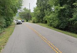


Figure


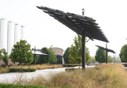


USACE PARCEL
The lease USACE parcel currently has City of Raleigh park elements and infrastructure on it, including the Neuse River Greenway. The focus of site improvements on the leased land will be along the southern channel to enhance river access and mitigate further erosion.

OLD FALLS OF NEUSE PARCEL
This remnant parcel doesn’t lend well to any program elements due to its slope and separation from the larger park parcels. Invasive plants should be removed and the large buffer planting maintained to protect the surrounding neighborhood from road noise and visibility.
WIDE RIVER DRIVE PARCEL
This remnant parcel doesn’t lend well to any program elements due to its isolation from the larger park parcels. Invasive plants should be removed. The site is a great opportunity to add green stormwater features to help mitigate runoff into the southern parcel creek.
Figure 61: Site improvement approach to individual park parcels.
NORTHERN PARK PARCEL
This parcel will be the main location of park development due to it’s proximity to existing infrastructure and the popular southern channel of the Neuse just down river of Falls Dam. Existing homesite that need clearing offer opportunities for easier grading for program elements. This parcel is also the only one with an entrance possibilities that are not in a residential neighborhood.

INDIVIDUAL PARCEL APPROACHES
Because the park site is bisected by both Old Falls of Neuse Road and Falls of Neuse road, different approached to each site have been developed to capitalize on the unique character of each. Proposals in the concept alternate stage to create stronger connections between parcels such as tunnels or bridges were ultimately deems undesirable or too cost prohibitive.
Major point of connection under bridge
SOUTHERN PARK PARCEL
The proposed program for the southern parcel is much more passive than the northern parcel due to the proximity of nearby neighborhoods as well as difficulties in getting access into the site. The plan includes short loop of hiking trails that go from the greenway, through the existing natural and topographic features with one access point at Falls of Neuse Road.
SOCIAL GATHERING AND PLAY

PARKING LOT
ARRIVAL PLAZA
RESTROOM
ACCESS TO RIVER
CHANGING STATION
BIKING
HIKING
YOUTH FOCUS NATURE PLAY ZONE
SOCIAL LAWN
IN-RIVER RECREATION ELEMENTS
POLLINATOR MEADOWS
ARRIVAL, SOCIAL LAWN, AND PAVILION


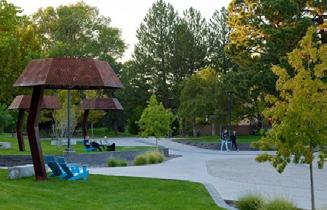

The sequence of arrival spaces provide versatile areas for socializing, picnics, and casual gatherings, surrounded by lush greenery and shaded spots. The main arrival plaza will serve as a starting destination for both the Neuse River Greenway and Blueway, celebrated with prominent signage and designed as a welcoming hub for park visitors. It will feature modern bathroom and changing facilities for convenience. A nearby pavilion will offer seating and shelter for small events, making this space a focal point for community engagement, recreation, and river access.
Parking lot with over 100 spaces
Pavilion and open lawn River access focused trails and features
Figure 62: Final Master Plan, program areas and points of interest
HIKING TRAILS


NATURE PLAYGROUND AND TRADITIONAL PLAY ELEMENTS
The nature play playground features a variety of natural elements designed to inspire imaginative and physical play for children of all ages. Key features include climbing logs and boulder scrambles nestled within a woodland setting. Young explorers can navigate through elements, balance on tree stumps, and engage with simple water play features like a water table or dry creek bed. This playground encourages interaction with the natural environment, fostering creativity, motor skills, and a sense of adventure.
Traditional play elements and surfacing may also be added to the plan to ensure accessibility for children of all abilities and to vary the experiences provided.


The proposed hiking trails would be designed to integrate seamlessly with the park’s natural and recreational elements, connecting visitors to key features like the Neuse River Greenway, Blueway access points, and picnic areas. Following best practices for multi-use trails, they will focus on accommodating hikers and casual walkers with clear signage.


While geared toward beginners and youth riders, a pump track offers an exciting circuit for cyclists of all skill levels, with smooth, rolling terrain and banked turns designed for continuous riding. Riders can navigate a series of berms, rollers, and small jumps, all set within a natural landscape that encourages outdoor activity. The track is suitable for kids learning to ride, as well as experienced bikers looking for a fun challenge. This feature promotes physical fitness, balance, and coordination while providing a thrilling experience for park visitors.


PUMP TRACK

Figure 63: Final Master Plan - play areas and pump track

RIVER ACTIVITIES
RIVER BANK


The design of area along and in the river focuses on the importance of protecting both the park and the leased USACE property from the effects of the dam releases and resultant erosion while area creating more access to the river and encouraging many different types of users to experience the water. The design team proposes to reinforce key areas of the river bank to enhance recreation and create habitat for affected species. Terraced boulders will be used as appropriate within the south channel to serve multiple functions as bank stabilization, river access, and a seating/ gathering space. The multiple levels of boulders offer access to the river at a variety of water levels.
NATURAL DROP AT ROCK FORMATION AND POTENTIAL WATER CRAFT LAUNCH AND RIVER ACCESS POINT
IN-RIVER STRUCTURES
PATH CONNECTION FROM RIVER ACCESS POINTS TO GREENWAY
ACCESSIBLE PATHWAY ON BANK REINFORCEMENT
OVERLOOK
PEDESTRIAN CONNECTION FROM NEW PARKING LOT
EXISTING PARKING LOT
IMPROVED WATER CRAFT LAUNCH POINT AND RIVER ACCESS POINT
CHANGING ROOM STRUCTURE
USACE TAIL RACE PARK AND RIVER ACCESS POINT (NOT IN PARK)
POTENTIAL WATER CRAFT LAUNCH (NOT IN PARK) A B C D E

Figure 64: Enlarged plan showing the southern channel site improvements
RIVER OVERLOOKS AND GATHERING SPACES


The series of river overlooks and gathering spaces along the Neuse River provide vantage points for visitors to enjoy scenic views and connect with nature. These overlooks feature seating areas, informational displays, and shaded spots, inviting both quiet reflection and social interaction. Designed to enhance public access, the spaces include gentle pathways and riverbank terraces, allowing for closer interaction with the water. The design encourages community engagement with the Neuse and its history, educational opportunities, and a deeper appreciation of the river’s natural beauty.

ACCESS TO ISLAND TO REMAIN UNAUTHORIZED
IN-RIVER STRUCTURES


In-river elements will consist of two structures and an existing natural drop. In-stream structures are constructed from natural local boulders that are grouted into place. These mimic natural river features and channelize flow to create play waves. The structures are tiered to accommodate low, medium, high and overflow flows.
At lower flows the structures will be designed to be navigable, but the water will lack power.
RIVER BANK


At medium flows the water will grow in power, but many of the same craft will be seen on the water. Beginner and intermediate kayakers will practice their skills on these features and the river will see a variety of floaters including rafters, tubers, funyaks, and stand-uppaddleboarders.
At higher flows the in-stream features will create surfable wave features that will be used by kayakers and stand-up-paddleboarders. Floaters, typically paddlers, will
still navigate the water but at these flows (above 300-500 CFS) it is not recommend to be used by tubers and swimmers unless they have life jackets and helmets.
In-stream structures help to stabilize channel geometry by configuring the bed slope to a step- pool pattern, which helps to prevent further erosion. The structures naturally form scour pools downstream, which create variation in flow and depth patterns that provide a variety of habitat to support invertebrate and fish life. These scour pools are also frequently utilized as swimming holes and become popular fishing locations which is an equally important goal of the final concept plan.
Ultimately, the flow of the Neuse River is controlled by the US Army Corps of Engineers (USACE) through dam releases, which are influenced by rainfall levels and weather conditions. The proposed features aim to enhance the natural environment while mitigating riverbank erosion caused by changing water levels and intermittent dam releases, creating a more stable and sustainable ecosystem.
The design focuses on the importance of protecting both the park and the leased USACE property from the effects of the dam releases and resultant erosion. The design team proposes to reinforce key areas of the river bank to enhance recreation and create habitat for affected species. Terraced boulders will be used as appropriate within the south channel to serve multiple functions as bank stabilization, river access, and a seating/gathering space. The multiple levels of boulders offer access to the river at a variety of water levels.
WHO WILL LIKELY USE THESE RIVER FEATURES?
Paddlers are likely to be “park-and-play” users who come to the park to paddle or tube and who tend to put in just above the top drop, and take out just below the last drop structure. Some will float down to the ramp near the existing parking lot. These users tend to run the park, walk back up, and run the park again. Some users who desire to see more of the river will choose to float from this site downstream to later take-outs as a half or full-day trip.


Since the 2011 Falls of Neuse Whitewater Park Feasibility Study, research has advanced in understanding how in-river elements can support fish passage for native species while maintaining recreational use. The Neuse River is home to several important species, including striped bass, catfish, and sunfish, as well as the rare Carolina madtom and Neuse River waterdog, an aquatic salamander. While the proposed features aim to facilitate fish movement in the river, the Falls Dam upstream continues to block access to certain habitats for migratory species like shad and herring.
Birdlife along the Neuse River is also abundant, with species such as herons and osprey frequently seen around the water. These birds depend on the river’s fish populations, highlighting the importance of balancing recreational use with habitat protection. By integrating fish passage elements into the park’s design, the project seeks to enhance wildlife habitats while supporting both aquatic and bird species that thrive in this ecosystem.
Despite these efforts, the habitat upstream of Falls Dam will remain inaccessible to many species due to the dam’s presence. This makes it even more critical to enhance the natural environment downstream by improving water quality and mitigating erosion, ensuring the river continues to support its diverse wildlife.
IMPROVED WATER CRAFT LAUNCH
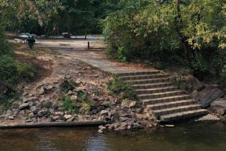


The existing canoe launch at Neuse River Park, built decades ago, is heavily used by paddlers, anglers, and hikers. However, it is not fully accessible, lacks a handrail, and in need of structural repair. To improve it, the master plan proposes to rebuild the launch to accommodate more types of watercraft and users, including adding an accessible ramp for people with disabilities. These upgrades will ensure the launch is more functional, safer, and easier for everyone to use while preserving its popularity as a key access point to the Neuse River.
RIVER WILDLIFE


CIRCULATION

ENTRANCE LOCATION
During the Concept Alternates phase, community feedback indicated a preference for placing the entrance closer to the Old Falls of Neuse and Falls of Neuse intersection. However, after further discussions with the North Carolina Department of Transportation (NCDOT), it was agreed that the preferred location would need to be adjusted, and the entrance is now planned to align with Holmes Hollow Road.
ARRIVE
EXPLORE ON BIKE
EXPLORE THE RIVER
EXPLORE ON FOOT
ENTRANCE
GREENWAY CONGESTION
Since park improvements are encouraging river users to transit along the existing greenway, a “sliplane” has been added from the parking lot to the greenway further south to help prevent user conflicts.
ARRIVE
Arrive at one of the two parking areas by car or use the multi-use pathway to arrive by bike. Buses can arrive at the main plaza and use the drop-off lane and then exit out the existing roadway.
Head to the arrival plaza and social lawn to then go to the playground or down to the river. Use the bike slip lane to avoid foot traffic and head to the greenway.
EXPLORE THE RIVER
After parking, take a shorter route directly to the river from the main parking lot.
Enter the river at one of 4 key connection points.
Continue down the river on the Neuse River Blueway Trail or loop back after disembarking at the existing canoe launch.
EXPLORE ON BIKE
Use the greenway trail to explore the Neuse River area.
Connect with sidewalks and bike lanes along Falls of Neuse Road.
Head up to Falls Dam to connect to trails around Falls Lake.

EXPLORE ON FOOT
Connect to the grenway via the arrival plaza or existing sidewalk connections.
Take a short hike on the southern trail by entering at the intersection or on the greenway.
Let the kids play in the nature playground or take short walks along the kids trail.
NEUSE RIVER GREENWAY


ACCESSIBLE TRAILS
The addition of accessible trails will seamlessly connect key program elements in the park, ensuring inclusivity and ease of movement for all visitors. ADA-compliant walkways and boardwalks will enhance accessibility, providing smooth, navigable paths to playgrounds, picnic areas, and river overlooks.
These improvements will also offer better access to the river’s edge, allowing everyone to enjoy the park’s natural beauty. This thoughtful integration ensures that the park is welcoming and usable for visitors of all abilities.

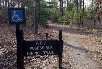
The Neuse River Greenway, already a beloved trail for cyclists, walkers, and nature enthusiasts, will see enhanced connectivity and accessibility through this plan. Smallscale improvements aim to reduce user conflicts, ensuring a safer and more enjoyable experience for all.
New access points and nearby parking facilities will make it easier for more visitors to enjoy this popular greenway. These upgrades will support the greenway’s role as a vital recreational and community asset.


TRAIL TYPOLOGIES

The 0.75-mile hiking trail on the southern portion of the site offers a scenic route with loop options and a connection to Falls of Neuse Road. This addition enhances trail connectivity, providing more opportunities for exercise and exploration within the park.
Designed to avoid sensitive ecological areas, the trail promotes environmental stewardship while allowing visitors to enjoy the park’s natural landscapes. Improved trail networks in parks encourage healthy lifestyles and greater appreciation for nature.


STORMWATER MANAGEMENT
GREEN STORMWATER INFRASTRUCTURE (GSI)
The design of the park limits most proposed impervious surface improvements like parking lot, roads, or plazas to the norther City of Raleigh parcel. Those site elements would create additional stormwater runoff that would need to be captured or slowed down and treated on site as close to the source as possible. Most GSI solution would be near the parking lot and plaza in order to maximize treatment and prevent additional runoff into the wetlands or the Neuse River.
In addition to treating for introduced impervious surfaces, the design team has identified other opportunities for future improvements to mitigate runoff from existing features such as on Falls of Neuse Road or the neighborhoods to the south which currently drain through the park and into the river. A stream restoration project could be separately funded to improve the condition of the southern parcel stream and a bioretention basin could be added to the southwest remnant parcel to further slow roadway runoff that eventually makes it into that same stream.
WHAT IS GREEN STORMWATER INFRASTRUCTURE OR “GSI”?
As defined in the City of Raleigh Unified Development Ordinance (UDO), green stormwater infrastructure is any of a number of practices that, used individually or collectively, contribute to managing, treating, and reducing stormwater runoff from a development or redevelopment site, as close as possible to the runoff’s source, by preserving natural landscape features (such as vegetation, soils, hydrology, and natural processes) and/or by mimicking natural processes through installation and maintenance of structurally engineered devices (such as bioretention cells, bioswales, permeable paving/pavers, green roofs, stormwater street trees, and cisterns). In addition to contributing to stormwater management, GSI practices can enhance site aesthetics, improve air quality, reduce urban heat island impacts, provide shading, create wildlife habitat, reduce energy consumption, reduce infrastructure costs, and increase property values.
1
2
3
4
5
BIORETENTION SYSTEM FOR ROADWAY AND PARKING LOT RUNOFF
BIORETENTION SYSTEM FOR ROADWAY AND PLAZA RUNOFF
BIORETENTION SYSTEM FOR PLAZA RUNOFF
BIORETENTION SYSTEM FOR PLAYGROUND RUNOFF
POTENTIAL FUTURE STREAM RESTORATION FOR ROADWAY AND NEIGHBORHOOD RUNOFF
POTENTIAL FUTURE
6
BIORETENTION SYSTEM FOR ROADWAY RUNOFF (NOT INCLUDED IN PROJECT BUDGET)

HABITAT AND SPECIES
Building on the work initiated during the community-led Bio-Blitz, the final master plan calls for further refined habitat protection through detailed surveys of species and ecosystems in the next design phase. These surveys will help identify and safeguard sensitive habitats, especially for potentially endangered species such as the Northern Long-Eared Bat, which is known to inhabit forested areas in this region. Additionally, the plan recognizes the significance of the Neuse River Watershed, ensuring that the park’s development supports the health and water quality of the broader ecosystem, which is critical for both wildlife and human communities.
Beyond identifying critical habitats, physical efforts will be made to enhance and restore these areas. This includes reforestation with native species, wetland protection, the creation of safe wildlife passageways, and management of invasive plants to improve the overall health of the ecosystem. These targeted actions aim to create a stable and thriving environment for species at risk and the broader wildlife community. While it may not be possible to address every area of the park in the initial phase, the refined design plans will set the stage for a long-term maintenance and remediation strategy to be conducted by the City, ensuring the park’s ecological integrity for years to come.
For more: Bio-Blitz Report Appendices

Figure 65: The Neuse River Basin in North Carolina. Map courtesy of the Lower Neuse River Basin Association
HABITAT RESTORATION


INVASIVE SPECIES REMOVAL
A focused effort to removing invasive species to restore and protect the park’s natural ecosystems will be needed throughout the park. Led by city staff and supported by volunteer efforts, this future initiative would enhance native biodiversity, allowing local flora and fauna to thrive. By eradicating invasive plants, we can improve the health and resilience of the park’s landscapes, ensuring a more vibrant and sustainable environment. This collaborative ecological stewardship is essential for maintaining the park’s natural beauty and balance.


The plan incorporates habitat restoration efforts to rejuvenate the park’s natural ecosystems and support local wildlife. Led by city staff and bolstered by volunteer efforts, these initiatives will focus on reestablishing native plant species and creating diverse habitats. Restoration activities will improve ecosystem health, enhance biodiversity, and provide critical habitat for local fauna. This collaborative approach ensures a vibrant, sustainable environment, preserving the park’s natural beauty and ecological integrity for future generations.


PETROCHELIDON PYRRHONOTA, CLIFF SWALLOW
NECTURUS LEWISI, NEUSE RIVER WATERDOG
ELAEAGNUS UMBELLATA, AUTUMN OLIVE
LONICERA JAPONICA, JAPANESE HONEYSUCKLE
ROSA MULTIFLORA, MULTIFLORA ROSA
LIGUSTRUM SINENSE, CHINESE PRIVET
LASIURUS BOREALIS, EASTERN RED BAT
POANES VIATOR, BROAD-WINGED SKIPPER
SITE VEGETATION SYSTEMS
SOUTHERN PIEDMONT MESIC FOREST AND PIEDMONT PRAIRIE
SITE OBSERVATIONS
PREVIOUSLY DISTURBED MIXED GRASS/SHRUB
PREVIOUSLY DISTURBED MIXED PINE/HARDWOOD


RIVER CANE
SOUTHERN PIEDMONT SMALL FLOODPLAIN
PIEDMONT ALLUVIAL
American Goldfinch
Cardinal Flower
Belted Kingfisher
Brown Bat
Eastern Tiger Swallow Tail
Eastern Whitetailed Deer
Gray Fox
Northern Red


The final master plan design focuses on restoring and preserving a range of habitats critical for both wildlife and plant species. Efforts will target the protection of key habitat types such as Piedmont alluvial forests, riparian zones, and upland seep areas, which support species like the Eastern Box Turtle, Northern Red Salamander, and Gray Fox. Habitat restoration may include stabilizing riverbanks to prevent erosion, planting or protecting existin stands of native vegetation like Cardinal Flower and Bear’s Foot, and protecting sensitive areas like salamander pools and river cane patches. These efforts aim to establish a balanced ecosystem that not only enhances biodiversity but also provides ideal conditions other species to thrive. By prioritizing both natural habitat integrity and public access, the project ensures that these ecosystems can be preserved for future generations while fostering environmental education and stewardship.


For more: Bio-Blitz Report Appendices
MATURE OAK HICKORY
SOUTHERN PIEDMONT DRY OAK-PINE FOREST
Bear’s Foot
Eastern Box Turtle
Spring Peeper
Ring-necked Snake
Swamp Chestnut Oak
Ebony Jewelwing
Red Salamander
PUBLIC FEEDBACK - FINAL MASTER PLAN PHASE
PUBLIC WORKSHOP 3
The third and final public meeting covered several key areas. The presentation of the Draft Concept Plan highlighted various river features, including bank reinforcement, river access, and wildlife considerations. It also addressed the existing canoe launch, program elements, environmental stewardship focusing on habitat and plants, sustainability, and plans for southern tributary restoration. Results from Survey 2 were shared, revealing the most desired park elements and riverbank infrastructure improvements among respondents.
A summary of Public Meeting 2 was provided, outlining focus areas and preferred park components identified by prior attendees. The meeting also included summaries from focus groups, presenting main ideas and themes from discussions with environmental advocacy groups, homeowners’ associations, and outdoor and river-based recreation enthusiasts. Current park conditions were described, including existing rock features, the canoe launch, and the southern channel. Attendees were given opportunities for further engagement through a QR code linking to the final survey and a chance to view photos submitted for the Neuse Perspectives campaign.
Additionally, participants could interact with the selected artist, Gabriel Eng-Goetz, and learn about initial ideas for artwork at the park.


Figure 66: Member of the design team discussing the final master plan at Public Workshop 3
COMMUNITY ADVISORY GROUP (CAG) MEETING 5 (IN-PERSON)
APRIL 30, 2024
This CAG meeting focused on review of the preliminary draft concept plan and engagement to date. Members expressed general satisfaction with how public comments had been incorporated into the designs, though some raised concerns about potential survey bias regarding whitewater features.
A significant portion of the discussion focused on path configurations and user conflicts, particularly regarding bicycle traffic through playground areas. The group recommended widening paths to accommodate higher volumes and multiple user types, suggesting the relocation of paths away from playground centers to create buffers. There was substantial discussion about the lack of youth-oriented activities in the current plan, with members noting that while hiking trails were wellrepresented, there was insufficient active play space for pre-teens and teenagers. Suggestions included adding a pump track, natural play elements such as climbing structures and tree houses, and adventure play areas.
The group also discussed trail design considerations, noting mountain bikers would likely use both hiking and biking trails regardless of designation, and recommended incorporating technical features like roller elements for water management on trails.
Questions were raised about water levels for recreational activities and bank reinforcement necessity. The meeting concluded with discussions about improving connectivity between parking areas and park features, with members suggesting clearer wayfinding signage for both river and bike-related activities. Members requested more clarity in future surveys regarding seasonal water levels and feature usability.
Artist:
Gabriel Eng-Goetz
Gabriel is an award-winning, multidisciplinary artist born and raised in Durham, North Carolina USA. His work explores our human connection to the natural world and the cultural history of identity, including his own as a Chinese American born and raised in the South. Outside of creating artwork for clients and collectors, Gabriel works with his community to showcase and uplift North Carolina’s vibrant and diverse art scene by producing/curating events and working as a youth mentor.
COMMUNITY ADVISORY GROUP (CAG) MEETING 6 (IN-PERSON)
JUNE 3, 2024
During this CAG meeting, it was noted that while the transportation department planned to repair the Falls of Neuse Bridge, the community expressed interest in adding bike and pedestrian connections, though this was not part of the current plan. The group discussed various engagement strategies, including both print and digital communications. Print materials were to include flyers and yard signs with QR codes, as well as Raleigh bus advertisements for the upcoming public workshop and survey. Digital outreach was planned through various channels, including potential communication with local schools and subscriber newsletters through Que Pasa and the Carolinian.
The group was introduced to Gabe, a public artist with 15 years of experience in North Carolina, who emphasized his focus on connecting natural elements with local culture. Gabe planned to attend the June 27 workshop and discussed his commitment to community engagement, including offering apprentice opportunities and gathering public input. The CAG expressed support for incorporating indigenous history and providing opportunities for children to contribute to the project.
Regarding the site plan, the project team recommended maintaining the current entrance while adding pedestrian safety improvements such as raised crosswalks and clearly marked routes. The group discussed trail locations, which were influenced by wetland positions, and noted that trail drawings would become more precise in later design phases. The CAG also addressed concerns about the 1.4-acre open area, suggesting possibilities for a rain garden to prevent unauthorized parking. Questions were raised about whitewater improvements and their impact on usable days, with the group requesting additional clarification from experts. The meeting concluded with discussions about including meditation rocks in the pollinator meadow and the importance of documenting historical erosion patterns to demonstrate the benefits of proposed riverbank reinforcement.
COMMUNITY ADVISORY GROUP (CAG) MEETING 7 (VIRTUAL)
JULY 19, 2024
This virtual CAG meeting focused on discussion of recent public engagement activities and project progress. The meeting addressed the recent public engagement events, including the public meeting held on June 27th and subsequent site visits on June 28th and 29th. While public meeting attendance was modest, the site visits attracted both newcomers to the project and supporters.
The group reviewed survey results which demonstrated strong community support for the project. Of 880 survey participants, 92% expressed supportive or strongly supportive positions, with 80% support from residents within a five-minute drive of the site. The survey also revealed positive feedback regarding art integration, including interest in incorporating art on the greenway trail bridge.
Discussion of next steps centered on concerns raised about the potential impact of in-river elements and the environmental review process on the project budget. City staff addressed these concerns by confirming their intention to focus the majority of bond funding on improvements to the City of Raleigh property and park amenities, while acknowledging that final decisions would depend on environmental assessment results. Stream restoration was identified as a potential backup opportunity for fund allocation if environmental assessment results delayed other park improvements. The need for a more comprehensive inventory of existing vegetation along eroded stream and river banks was discussed, with the possibility of a follow-up bioblitz to focus specifically on the banks and southern channel.
Regarding the master planning process, city staff distributed a voting link to CAG members, maintaining the established five-point voting system to gauge agreement on the draft concept plan. Members were given one week to respond. It was established that the draft of the master plan report would be distributed to CAG members one week before the August 27th CAG meeting. CAG members were encouraged to share the survey results showing overwhelming support for the plan with their networks and to direct interested parties to the StoryMap link for a complete overview of the master planning process.
COMMUNITY ADVISORY GROUP (CAG) MEETING 8 (VIRTUAL)
AUGUST 27, 2024
This virtual CAG meeting meeting primarily addressed project costs, phasing scenarios, and prioritization of park elements.
The group discussed three proposed phasing scenarios (A, B, and C) for the project. Cost estimation discussions emphasized that escalation would be carried through to the end of construction. The CAG members expressed strong interest in prioritizing riverbank reinforcement and river access, noting these elements as crucial to the park’s mission. Members raised concerns about unknown factors related to U.S. Army Corps of Engineers (USACE) land and emphasized the importance of staying aligned with the project’s river-oriented goals. There was consensus that parking, restrooms, plaza and pavilion, and river overlook should be included in Phase 1 across all scenarios, with a particular emphasis on ensuring accessibility for river access.
The group requested additional information for future decision-making, including detailed timelines for permitting processes, cost estimates for both full scope and phased scenarios, and rankings of how each scenario aligns with the CAG’s vision and goals. Several members noted that while Scenario A offered expanded city property amenities, it would effectively close the door on USACE property options due to permitting timelines. There was notable interest in a modified version of Scenario B that would emphasize river connectivity. The meeting concluded with requests for specific data on river flow rates, usable days, and comprehensive information about each element’s permitting timeline, costs, projected usage, and alignment with park’s vision.
COMMUNITY ADVISORY GROUP (CAG) MEETING 9 (HYRBID: IN-PERSON & VIRTUAL)
SEPTEMBER 30, 2024
The final CAG meeting for the master plan phase of work was a hybrid session held at Forest Ridge Park and via Microsoft Teams. The meeting was attended by representatives from Raleigh Parks, Raleigh Engineering Services, Design Workshop, and CAG members.
The meeting began with a presentation on river use considerations, during which attendees discussed the variety of potential users. When questioned about Hurricane Helene’s impacts on Western NC, staff noted that such events were unprecedented and difficult to plan for in park design.
Cost estimates and exhibits were thoroughly reviewed, with staff reminding attendees of the $11.4 million available project budget. Three scenarios (A, B, and C) were presented, with newer cost estimates for Scenarios B and C exceeding the budget due to a recent change in cost estimation consultants. The plaza pavilion area’s $1.5 million cost was discussed in detail, encompassing restrooms, arrival areas, wayfinding signage, social lawn, and various connections. Cost escalation factors were explained at 6% per year, with City of Raleigh property calculated at 24% (4 years) and Army Corps property at 30% (5 years).
Parking considerations were examined with Scenario A’s higher costs attributed to an additional 18,500 square feet accommodating 58 parking spots, estimated at approximately $130,000. The group discussed playground options, including natural play elements, though it was noted that fully volunteer-constructed play areas will be unlikely due to safety and liability concerns.
The meeting included a discussion of vision and goal alignment. Permitting timelines were reviewed, highlighting differences between City property and USACE program requirements. Potential funding sources were explored, with staff distinguishing between items they had direct experience with and those they did not.
The session concluded with a two-part consensus vote regarding preferred phasing scenarios and element prioritization. During the final discussion, several CAG members expressed concern about the reduction of youth activities in the plans, advocating for features such as a pump track, which would be unique to the region. There was also discussion of the merits of natural river play versus constructed play elements. The meeting concluded with a note that if Scenario C (including all water features) were selected, at least one member would consider blocking the vote.
PUBLIC SITE VISITS
Building on the success of the March 2024 public site visits, two additional public site visits were conducted during the draft concept plan phase of the Neuse River Park Master Plan. The site visits were held on June 28, 2024 and June 29, 2024, both from 10am to 12pm. Similar to the earlier outreach sessions, staff, community connectors, and CAG members were stationed along the greenway trailhead and boat launch. During these sessions, the project team had the opportunity to engage more extensively with river users, as the summer weather brought out a larger number of anglers, paddlers, and other recreational visitors along the Neuse River.
This phase of engagement included the artist who had been commissioned to develop public art for the park. Their presence added an interactive element, allowing participants to learn more about the artistic vision for the park and see how public art could be integrated into the landscape. The artist’s involvement sparked interest among community members and generated additional feedback on the cultural and aesthetic aspects of the park.
As with the March site visits, the June sessions enabled the project team to reach a mix of greenway users and river visitors who might not typically engage in formal planning meetings. Conversations with anglers, paddlers, and other river enthusiasts provided unique insights into the needs and interests of those who utilize the Neuse River as a recreational resource. There were also a large number of greenway users, including cyclists, families, and runners, moving along the trail. The river-focused engagement allowed us to better understand how the park could serve as a gateway for both land and waterbased recreation, enhancing the vision for a park that supports diverse activities.
The project team continued to promote the online survey during these site visits, allowing individuals to share feedback at their convenience. Overall, the June site visits helped validate the draft concept plan by incorporating feedback from a diverse group of users and ensuring the design reflected community desires. Engaging river users, in particular, underscored the importance of considering water-based recreation alongside traditional park amenities, providing a comprehensive approach to shaping Neuse River Park that balances environmental, recreational, and cultural elements.
Survey 3
PUBLIC SURVEY 3
PARTICIPANTS
RESPONSES
880 7,099 799 5,084
COMMENTS
VIEWS
JUN. 27 - JUL. 11, 2024
The finalization of the master plan was informed by valuable community input gathered by the third survey that opened in summer 2024. The survey was designed to gauge public opinion on the draft concept plan, solicit additional design suggestions, and gather detailed insights on public art preferences for Neuse River Park. Respondents were asked about their level of support for the proposed plan, priority themes for artwork, preferred locations for art installations, and desired representation of local flora and fauna. The survey also sought input on color preferences for the artwork and invited personal stories and experiences related to the park.
880 people participated in the survey from June 27, 2024 through July 11, 2024.
Responses revealed that most were strongly supportive of the draft concept plan.
» 76% Strongly Supportive
» 16% Supportive
» 6% Strongly Unsupportive
» 2% Unsupportive
Responses ranked the highest priorities for artwork themes ranked in the following order:
» 79% - Education about the river, geological formations, and the dam
» 70% - A focus on native and endangered species
» 63% - Education on the history and indigenous groups of the area
» 67% - A focus on native plants
» 65% - A multi-sensory art installation that is interactive
Locations for artwork at the park were ranked in the following order according to responses:
» 72% - Bridge over the greenway trail
» 50% - Park entry areas
» 48% - Trailheads
» 38% - Parking areas
» 34% - Boat launch
For more: Survey Reports Appendices
Animals and plants that participants would like to see featured in the public artwork can be categorized as the following:
Aquatic Species:
» Neuse River Waterdog (also called mudpuppy or hellbender)
» Fish: Bass, catfish, bluegill, American shade, hickory shad, gar
» Turtles, especially box turtles
» Salamanders and other amphibians
» River otters
Birds:
» Great Blue Heron
» Cardinal (state bird of North Carolina)
» Hawks, especially red-tailed hawks
» Owls, particularly barred owls
» Osprey
» Kingfisher
» Eagles
Mammals:
» Deer
» Rabbits
» Black bears
» Red wolves
» Foxes (both gray and red)
» Beavers
» Raccoons
» Opossums
» Chipmunks
» Mink
Reptiles:
» Snakes (including copperheads, water moccasins, and ring-necked snakes)
» Five-lined skink
Plants and Trees:
» Dogwood (state flower of North Carolina)
» Oak trees (especially white oak)
» Pine trees (particularly longleaf pine)
» Red maple
» Magnolia
» Redbud
» Wildflowers: Purple coneflower, black-eyed Susan, trillium
» Native grasses and sedges
» Ferns, especially Christmas fern
» Milkweed
Other notable mentions:
» Dragonflies
» Luna moth
» Crayfish
» Native fungi
Regarding colors or tones participants would like to see in the artwork, the responses overwhelmingly favored natural and earth tones for the artwork, with a strong emphasis on colors that complement and blend with the surrounding environment. Greens, browns, and blues were frequently mentioned, reflecting the landscape and river. While most prefer realistic colors, especially for depicting local flora and fauna, there was also a subset of respondents who advocated for bright, vibrant colors - either as accents or for specific features. The overall sentiment leans towards harmonizing with nature rather than standing out boldly, though some expressed interest in more contrasting or abstract approaches. Ultimately, the prevailing desire is for artwork that enhances (rather than overshadows) the park’s natural beauty.
For personal stories or experiences that participants shared, responses reveal a community with diverse opinions regarding Neuse River Park. Many people cherish the area for its recreational opportunities, particularly water activities like kayaking, canoeing, and tubing, as well as hiking and biking along the Greenway. Respondents shared fond memories of family outings, wildlife observation, and learning new skills. While there’s excitement about future improvements, including river elements, some expressed concerns about overdevelopment, water quality, and environmental impact. The overall sentiment reflects a deep appreciations for the natural beauty and recreational value of the Neuse River, with varying views on how to balance preservation with enhanced accessibility and amenities.


CHAPTER 7
DESIGN, PERMITTING, AND CONSTRUCTION
PROCESS
After the completion of the Master Plan phase, the City and the design team will embark on the remaining phases of design, culminating the construction of the park. Below is a brief explanation of each phase of the design process remaining.
SCHEMATIC DESIGN DESIGN DEVELOPMENT
In the typical park development process, Schematic Design is an early phase that builds on the broader master plan, focusing on refining the layout and preparing more specific, detailed plans for park features. This phase includes important steps like conducting wildlife and tree surveys, wetland delineations, and other field surveys required for U.S. Army Corps of Engineers (USACE) permits, ensuring the design aligns with environmental regulations and protects critical habitats. This phase will also include additional public outreach and consultation with the Community Advisory Group (CAG).
The Design Development phase builds on the schematic design by refining the plans and providing more detailed specifications for materials, dimensions, and construction methods. During this phase, elements such as infrastructure, park amenities, and landscaping are further developed to ensure functionality and integration with the overall park design. Additionally, any adjustments based on environmental surveys and regulatory feedback are incorporated.
CONSTRUCTION DOCUMENTATION BIDDING AND CONSTRUCTION
The Construction Documentation phase involves finalizing detailed drawings and specifications that will be used for construction. These documents include precise instructions on materials, dimensions, and building techniques and are critical for guiding contractors during the actual construction. This phase also integrates all necessary permitting requirements, ensuring that the plans meet local, state, and federal regulations. The construction documents are submitted for review to obtain permits from agencies like the U.S. Army Corps of Engineers (USACE) and other relevant authorities, making this phase crucial for both compliance and the smooth execution of the park’s development.
The Bidding and Construction phase begins with the preparation of bid documents based on the finalized construction plans. Contractors submit bids to compete for the project, and the city reviews these bids to select the most qualified and costeffective option. Once a contractor is selected, the construction phase begins, with the contractor following the detailed construction documents to build the park.
Throughout this process, the city monitors construction to ensure it adheres to the plans, specifications, and permitting requirements. Regular inspections are conducted to ensure that the project meets safety, environmental, and quality standards. This phase is critical for transforming the design into a functional park, ensuring that all elements are built correctly and in compliance with local regulations and permits.
PERMITTING
The permitting process is a crucial part of developing Neuse River Park that happens concurrently with the design documentation, ensuring that all proposed improvements to the park are safe, environmentally sound, and meet legal requirements. Before any construction can begin, several permits must be obtained to comply with federal, state, and local regulations. These permits help protect the river, wildlife, and surrounding ecosystems while allowing the park to enhance access and recreational opportunities for visitors.
Key permits include approvals from the U.S. Army Corps of Engineers (USACE), which oversees river-based activities, and certifications for water quality and floodplain management. These permits ensure that any work done in or near the river, like improving the canoe launch or adding in-river elements, does not harm the environment or increase flood risks. Additionally, environmental assessments (EAs) will be conducted to evaluate the potential impact on local wildlife and habitats.
This process ensures that the park’s development aligns with conservation goals while providing enhanced access and recreational amenities. By following the permitting guidelines, the City of Raleigh aims to create a sustainable, enjoyable park that balances human use with the protection of natural resources. Engaging in the permitting process early helps avoid delays and keeps the project on track for timely completion.
OPINION OF PROBABLE CONSTRUCTION COST
OVERALL BUDGET SUMMARY
The following opinion of probable construction cost includes all elements proposed on the City of Raleigh park site as well as the USACE leased site. Costs are estimated based on the most recent construction cost research at the time of completion of the Master Plan in October 2024 and includes various conditions and contingencies for the anticipated construction schedule. Cost estimates will gain a much higher degree of accuracy as the design team moves through the design process after the completion of the Master Plan phase.
DESCRIPTION COST
CITY OF RALEIGH PROPERTY
Entry Road + Parking Lot
Plaza + Pavilion Area
Youth Focuses Nature Play Areas
Hiking Trails
Meadows
Pump Track
River Overlooks
Utilities + Stormwater
USACE PROPERTY
River and In-Stream Enhancements
River Overlooks + Pathways
$0.97 million
$1.52 million
$0.08 million
$0.08 million
$0.13 million
$0.18 million
$0.16 million
$1.01 million
SUBTOTAL $4.81 million
$0.94 million
$0.32 million
SUBTOTAL $1.26 million
SOFT COSTS
Contractor General Conditions, fees, etc
Design, Permitting, Engagement, Fees
Contingencies and Escalation Costs
$0.82 million
$2.65 million
$5.42 million
SUBTOTAL $8.79 million
TOTAL $14.96 million*
* With a budget of 11.4 million, the final master plan cost estimate was over budget. In order to continue to develop the design in the next design phase, a series of prioritization exercises were performed with the Community Advisory Group to determine design elements that could become alternates or included in future phases of the park.
COMMUNITY ADVISORY GROUP (CAG) PRIORITIZATION EXERCISES
On August 27, 2024 an additional CAG meeting was held that began with an emphasis on the draft nature of the presented scenarios, noting their potential for change and need for additional CAG consultation during the schematic design phase. Some members advocated for prioritizing expanded river access improvements, agreeing on the inclusion of parking, restrooms, a plaza, and one river overlook in the baseline scenario. Questions were raised about the implementation of USACE land improvements in various scenarios, and suggestions were made to include river overlooks in all proposed options. The group requested timelines for each scenario and proposed adding an overlook to the USACE property. The need for context and the requirement of an Environmental Assessment were highlighted. Requests were made for timelines and cost estimates for each scenario, as well as comparisons
Baseline Park Improvements:
• New Entry Road off Falls of Neuse
• Restrooms
• Parking
• Arrival Plaza
• Social Lawn & Pavilion
• Bicycle Slip Lane
• Pedestrian Roadway Crossings
Prioritized Elements:
• USACE - Existing Boat Launch Improvements, Rank: 5.60
against the established vision and goals statement. It was noted that river access days would likely increase significantly, even with a higher CFS threshold. Clarification was provided that the master plan was already finalized, and the current discussion focused on phasing rather than altering the plan itself. The meeting concluded with a list of deliverables, including construction and permitting timelines, diagrams for each scenario, and an assessment of alignment with the vision statement.
On September 30, 2024, the Community Advisory Group (CAG) for the park was asked to complete a prioritization exercise to better help the design team and the city finalize the budget and included elements for the Master Plan. Results of the prioritization exercise are listed below.
• USACE - Southside riverbank reinforcement/ access, Rank: 5.90
• COR - River Overlook/ Access - South Parcel by Duke Energy Easement, Rank: 7.00
• COR - River Overlook/ Access - North Parcel, Rank: 7.20
• COR - River Overlook/ Access - South Parcel by Falls of Neuse Rd., Rank: 7.40
• COR - Youth Focused Nature Play Area, Rank: 7.50
• COR - Pump Track, Rank: 8.60
• COR - Hiking Trails - South Parcel, Rank: 8.70
• COR - Hiking Trails - North Parcel, Rank: 8.90
• USACE - Northside riverbank reinforcement/ access, Rank: 9.50
• COR - Pollinator Meadow - North Parcel, Rank: 9.50
• USACE - Drop Features/ Play Waves, Rank: 9.70
• USACE - Southern Channel River Access - Midpoint, Rank: 9.80
• USACE - River Overlook, Rank: 9.90
• USACE - Southern Channel River Access - Old Falls of Neuse Bridge, Rank: 10.10
• COR - Pollinator Meadow - South Parcel, Rank: 10.70
USACE = U.S. Army Corp of Engineers Leased property
COR = City of Raleigh owned property
PRIORITIZATION CONSENSUS VOTE RESULTS
CAG PRIORITIZATION
The Community Advisory Group (CAG) met on September 30th, 2024 meeting and discussed the master plan and the prioritization of park elements beyond the base level improvements. The group was not able to reach a consensus and some members expressed concern with the inclusion or potential exclusion of park elements including trails near housing or in-river elements. Additional notes provided by CAG members on this consensus vote can be found in the Appendices.
PARKS COMMITTEE PRIORITIZATION
The City of Raleigh Parks Committee is responsible for the study of issues related to park facilities, features, developments, and modifications. The committee prepared recommendations and proposals for the Parks, Recreation and Greenway Advisory Board based on in-depth review and study of park-related issues and concerns.
On November 7th, 2024 the City of Raleigh Parks Committee established a prioritization model for elements beyond the base level park improvements and discussed next steps for the park. The resulting ranking of elements from their prioritization exercise is below.
1. USACE - Southside riverbank reinforcement / access
2. USACE - Drop features / play waves
3. USACE - River Overlook / access
4. USACE - Existing Boat Launch Improvements
5. COR - River Overlook / Access (@Tributary Creek)
6. COR - Youth Focused Nature Play Area
7. COR - Pump Track
8. COR - River Overlook / Access (@Power Easement)
9. COR - River Overlook / Access (@North Parcel)
10. COR - Hiking Trails
11. COR - Pollinator Meadows
For more: Community Advisory Group (CAG) Consensus Votes Appendices


APPENDICES
Survey Reports (2024)
Whitewater Permitting Memo (2024)
Community Advisory Group (CAG) Charter
Community Advisory Group (CAG) Biographies
Community Advisory Group (CAG) Consensus Votes
Situation Assessment (2024)
Bio-Blitz Data (2023)
SURVEY REPORTS
Landscape Architecture Planning Urban Design Strategic Services
621 Hillsborough Street Suite 202
Raleigh, North Carolina 27603
919-973-6254
designworkshop.com
Overview
MEMORANDUM
To: Emma Liles
From: Design Workshop (Raleigh)
Date: 1/19/23
Project Name: Neuse River Park
Subject: Initial Input Survey Summary
An initial input survey was made available to the public starting October 19 and remained open through December 15, 2023. During the 8-week period it was open, the survey received 2,1 34 views and 970 people participated in providing feedback resulting in a total of 7,280 responses and 819 written comments.
The purpose of the initial input survey was to gather feedback on:
- Potential park user preferences
- Potential park user priorities
- The current use of the future park space
The survey was organized by the following 13 questions and concluded with a demographic module.
Executive Summary
The initial input survey revealed that the strongest desires for recreation and supporting infrastructure at Neuse River Park focus on river-based recreation opportunities, followed by providing a variety of dedicated trail types, and then typical park amenities. For river-based recreation, canoeing and kayaking rose to the top as preferred water activities. Regarding trails and naturebased or outdoor/adventure options across the park, hiking, biking, and running trails were most desired. Participant responses also demonstrated a variety of dedicated trail types as the amenity enjoyed most among other recently visited local parks. Support amenities like water stations, restrooms, lighting, and security measures are most valued along trails. Visitors would look forward to using Neuse River Park regularly if such support amenities are provided. Participants prioritized the promotion of sustainability in the park through native plantings and removal of invasive species. Representing local histor y and indigenous stories resonated heavily as themes to be pursued though community art installations.
Survey participants determined digital communications, especially email, as preferred for receiving project updates throughou t the planning process. 328 (or 98%) of 332 participants who provided feedback on where they live were from North Carolina. Nearly 40% (122 of 328) identified as living in Raleigh. The largest number of completed surveys were submitted by individuals aged 36-45 who identified as White males. Most participants shared earning an approximate household income of $118,000 or greater. Out of 64 unique ZIP codes submitted, the greatest number of participants identified 27614 as their ZIP code (70 (25%) of 278 ZIP code responses).
Initial Input Survey Response Summary
The following is a summary of the most frequent recurring themes among comments and the number of upvotes each comment received. These were used to determine the most desired suggested activities and amenities
1. The Neuse River Park will be able to support many types of recreation, and we want to hear from you how you envision the site should balance them all. Please rank the followin g:
Summary:
Among recreation types, River -based Recreation was ranked 1st most often.
• Ranked 1st by 294 participants Among recreation types, Outdoor Adventure Recreation was ranked 2nd most often.
• Ranked 2nd by 214 participants Among recreation types, Greenways & Trails was ranked 3rd most often.
• Ranked 3rd by 168 participants Among recreation types, Nature/Conservation Education was ranked 4th most often.
• Ranked 4th by 172 participants Among recreation types, Traditional Recreation was ranked 5th most often.
• Ranked 5th by 267 participants
a. River-based Recreation
• 1st (294)
• 2nd (147)
• 3rd (107)
• 4th (72)
• 5th (52)
b. Greenways & Trails
• 1st (234)
• 2nd (164)
• 3rd (168)
• 4th (72)
• 5th (22)
c. Outdoor Adventure Recreation
• 1st (178)
• 2nd (214)
• 3rd (118)
• 4th (90)
• 5th (41)
d. Nature Conservation/Education
• 1st (65)
• 2nd (84)
• 3rd (118)
• 4th (172)
• 5th (160)
e. Traditional Recreation
• 1st (20)
• 2nd (36)
• 3rd (93)
• 4th (150)
• 5th (267)
2. The park is at the north end of the Neuse River. What kind of water -based activities do you envision at Neuse River Park? (205 comments)
Sentiment: 44% positive, 48% neutral, 8% negative
Summary: Comments and upvotes identified canoeing and kayaking as the water -based activities most often envisioned at Neuse River Park (3 7% of upvotes), followed by whitewater features (19% of upvotes) , tubing (12% of upvotes), swimming/wading (9% of upvotes), and fishing (9% of upvotes). Apart from water-based activities, the remaining 14% of upvotes highlighted participant comments with an emphasis conservation vs. development at the park.
a. Canoeing/Kayaking (1430 upvotes – 37%)
i. General non-whitewater paddling access and rentals were also commonly suggested. Some wanted recreational access while others emphasized easier accessibility for people with disabilities.
b. Whitewater features (756 upvotes – 19%)
i. Whitewater features like rapids or a whitewater park
c. Tubing (450 upvotes – 12%)
i. Inflatable tubing down the river .
d. Swimming/Wading (360 upvotes – 9%)
i. Areas for swimming or wading in shallower parts of the river.
e. Fishing (357 upvotes – 9%)
i. Access or facilities to allow fishing in the river. Both wade fishing and fishing docs/piers were suggested.
3. The park will be along the Neuse River Greenway Trail and part of the Mountains -to-Sea Trail system. What kind of trail-based activities and supporting infrastructure do you envision at Neuse River Park? Some ideas are suggested, but feel free to add your own ideas in the comment box below. (93 comments)
Sentiment: 39% positive, 56% neutral, 5% negative
Summary: A robust system of diverse trails tailored to different users and abilities paired with thoughtful amenities and a focus on nature, emerges as a common vision. Comments and upvotes identified supporting amenities such as water stations, restrooms, lighting, and security measures as the top trail -based supporting infrastructure needs envisioned at Neuse River Park (37% of upvotes), followed by hiking as a top trail-based activity (21% of upvotes), separate trails (18% of upvotes), mountain biking trails (12% of upvotes), accessible trails and features (6% of upvotes), connections to existing trail and greenway systems (4% of upvotes), and lastly, trail spurs for river views and overlooks or adjacent businesses or neighborhoods (2 % of upvotes).
a. Supporting amenities (794 upvotes – 37%)
i. Such as water stations, restrooms, lighting, and security measures, especially around parking areas. However, some note d infrastructure like restrooms may be prohibitively expensive.
b. Hiking trails (440 upvotes – 21%)
i. Natural surface trails for hiking in addition to paved trails for walking. Having both smooth hardsurface trails as well as more natural dirt paths is advocated.
c. Separate trails (381 upvotes – 18%)
i. Separate trails for bikers and walkers/runners to reduce conflicts between different users. There were requests for dedicated pedestrian -only trails distinct from bike trails.
d. Mountain biking trails (246 upvotes – 12%)
i. More mountain biking trails and features, especially directional downhill trails that take advantage of slopes and elevation changes
e. Accessible trails and features (135 upvotes – 6%)
i. For those with disabilities or using non -traditional equipment like tricycles, making trails ADA compliant is strongly desired.
f. Connections to existing trail and greenway systems (96 upvotes – 4%)
i. Connections to existing trail systems and greenways in the area to expand the trail network and create links to other parks.
g. Trail spurs for views/overlooks (43 upvotes – 2%)
i. Trail spurs providing river views and overlooks, and spurs connecting to local businesses and neighborhoods to promote economic development. Greeneville, SC’s Swamp Rabbit Trail was cited as an example.
4. The park is around 84 acres of forest, wetlands, and riverbanks. What kind of nature -based activities and supporting infrastructure do you envision at Neuse River Park? Some ideas are suggested but feel free to add your own ideas in the comment box below. (64 comments)
Sentiment: 39% positive, 55% neutral, 6% negative
Summary: There are interests in recreational infrastructure to support access and enjoyment of the outdoors, and education and research opportunities. Comments and upvotes identified trails for hiking, mountain biking and running as the top nature-based supporting infrastructure envisioned at Neuse River Park (42% of upvotes) , followed by educational and research focused activities and supporting infrastructure (31% of upvotes), succeeded by low impact development to preserve natural areas and limit artificial struc tures (15% of upvotes), typical park infrastructure (7% of upvotes), and recreation spaces with river access (5% of upvotes).
a. Trails (882 upvotes – 42%)
i. Hiking, mountain biking, and running trails for different users
b. Educational/Research ( 622 upvotes – 31%)
i. Plant labels, signs, play spaces, birding areas, herpetology areas and habitat restoration to support nature exploration and education.
c. Low Impact Development (316 upvotes – 15%)
i. Preserving natural/wild areas and limiting artificial structures.
d. Typical Park Infrastructure (154 upvotes – 7%)
i. Parking, handicap access, restrooms/bathrooms, benches, picnic tables, and pet stations with water
e. Recreation (99 upvotes – 5%)
i. Camping (primitive camping areas) , picnic areas, disc golf course, pickleball, dog friendly areas/areas for dogs off leash/frisbee , whitewater activities (kayaking, canoeing) with river access points
5. The Raleigh Parks System Plan recommends this park provides access to outdoor recreation and adventure opportunities. What kind of outdoor/adventure recreation activities do you envision at Neuse River Park? Some ideas are suggested, but feel free to add your own ideas in the comment box below. (61 comments)
Sentiment: 41% positive, 48% neutral, 11% negative
Summary: Comments and upvotes identified hiking, walking, and biking trails as the top outdoor/adventure recreation activities envisioned at Neuse River Park (65% of upvotes), followed by ziplining and rock climbing (13% of upvotes), camping (9% of upvotes), and river recr eation (4% of upvotes). Apart from outdoor/adventure recreation activities, the remaining 8% of upvotes supported comments centered on accessibility improvements (6% of upvotes) and connections to other parks and trails (2% of upvotes).
a. Hiking/walking/biking trails (675 upvotes – 65%)
b. Zipline, rock climbing (137 upvotes – 13%)
c. Camping (96 upvotes – 9%)
d. Accessibility/improvements (parking, restrooms, handicap access, picnic areas, etc.) (61 upvotes – 6%)
e. River recreation (38 upvotes – 4%)
f. Connections to other parks/trails (25 upvotes – 2%)
6. There are plenty of opportunities at this park to provide specialized activities, but we’d love to hear what kind of more typical park amenities you would like to see. Some ideas are suggested, but feel free to add your own ideas in the comment box below. (65 comments)
Sentiment: 37% positive, 55% neutral, 8% negative
Summary: Participant comments and upvotes identified comfort amenities as the most desired typical park amenities (48% of upvotes), followed by social spaces (22% of upvotes), trails and access highlighting nature (16% of upvotes), pet facilities (12% of upvotes), and outdoor sports facilities 2% of upvotes).
a. Comfort Amenities (764 upvotes – 48%)
i. Restrooms, drinking water, picnic areas, and hammocks.
b. Social Spaces (355 upvotes – 22%)
i. Picnic tables and grills, outdoor conference venue, and food trucks
c. Trails and Access Highlighting Nature (264 upvotes – 16%)
i. Directional trails (some paved, some dirt) , access to the river for fishing, paddling, etc. , preserving ecological features, and designating areas to natural preservation.
d. Pet Facilities (189 upvotes – 12%)
i. Dog park
e. Outdoor Sports Facilities (29 upvotes – 2%)
i. Pickleball courts, sand volleyball courts, basketball courts, open grass areas for frisbee, yoga, etc. , and disc golf courses
7. This will be a flagship park for sustainability, and options may include electric vehicle (EV) charging, native plantings, and green stormwater infrastructure. What would you like to see to promote sustainability? (79 comments)
Sentiment: 30% positive, 51% neutral, 19% negative
Summary: Overall, there is a strong environmental ethos among responses focused on protecting local ecosystems, promoting sustainability education, providing alternative transit options, and avoiding over -development. Comments and upvotes identified native plantings and removal of invasive species as the top desire in promoting sustainability at Neuse River Park (42% of upvotes), followed by solar power and alternative energy sources (20% of upvotes), recycling and composting stations (17% of upvotes), preserving natural areas/trees/ha bitat (9% of upvotes), avoiding over-development (7% of upvotes ), connections to public transit and bike infrastructure as a means of reducing vehicular impacts (3% of upvotes ), and environmental education (2% of upvotes).
a. Native Plantings/Removal of Invasive Species (448 upvotes – 42%)
i. To support local ecosystems and wildlife.
b. Solar Power/Alternative Energy (224 upvotes – 20%)
i. Incorporation of solar power or other sustainable energy sources to power park lighting/amenities.
c. Recycling/Composting Stations (178 upvotes – 17%)
i. To provide convenient ways for visitors to properly dispose of waste.
d. Preserving Natural Areas/Trees/Habitat (92 upvotes – 9%)
i. There are desires to keep much of the park natural and undisturbed, with minimal hardscaping to protect existing ecosystems.
e. Avoid Over-Development/Large Parking Lots and Sustainable Materials Selection (71 upvotes – 7%)
i. Desire to avoid too much pavement and preserve the natural character of the park with use of pervious materials.
f. Connections to Public Transit/Bike Infrastructure (35 upvotes – 3%)
i. To promote non-vehicular access to the park to reduce environmental impact.
g. Environmental Education (22 upvotes – 2%)
i. Signs, gardens, infrastructure to demonstrate and teach about sustainable practices like rain gardens, watersheds, and green infrastructure.
8. What themes or topics would you like to see represented in the community art installations at the park and/or is there an unsung story you wish to be communicated through art? (51 comments)
Sentiment: 35% positive, 57% neutral, 8% negative
Summary: Comments and upvotes identified local history and indigenous stories as the most desired topics to see represented in community art installations at Neuse River Park (57% of upvotes), followed by the creation stories and ecological histories of the Neuse River and Falls Lake (32% of upvotes), and art demonstrating preservation of the natural environment (11% of upvotes). There are differing opinions between those wanting educational art installations and those wanting a preserved art-free natural space.
a. Local history and indigenous story (109 upvotes – 57%)
i. Including exploring the history behind the Neuse River area, its previous inhabitants, and how indigenous groups utilized the land.
b. Creation stories and ecological histories of the Neuse River and Falls Lake (62 upvotes – 32%)
i. Desires for educational components explaining the history/role of Falls Lake, the Neuse River.
c. Natural environment and preservation (22 upvotes – 11%)
i. An emphasis on preserving and celebrating the natural environment. Requests included focusing on flora and fauna native to the area and avoiding developing/adding too many structures.
9. What would make the park more attractive and useful to you? (93 comments)
Sentiment: 46% positive, 43% neutral, 11% negative
Summary: Comments and upvotes identified trails and safety measures a s what would make Neuse River Park more attractive and useful (34% of upvotes), followed by typical park amenities (30% of upvotes), recreational activities (18% of upvotes), and areas that encourage natural preservation (18% of upvotes).
a. Trails and Safety Measures (125 upvotes – 34%)
i. Safety and security measures, separate pedestrian bike lanes
b. Typical Amenities (107 upvotes – 30%)
i. Food and beverage options through vendors or a sandwich shop, b enches, picnic tables, sitting areas, restrooms, and parking
c. Recreational Activities (66 upvotes – 18%)
i. Whitewater features for kayaking, canoeing and tubing, hiking, biking and running trails, fishing access points, tennis courts, and disc golf course
d. Natural Preservation (66 upvotes – 18%)
i. Protect wildlife and natural habitat , native plants, access to water for nature viewing , and guided nature tours (birding, plant ID, stargazing)
10. What other local parks have you visited recently and what did you enjoy about them, including features and amenities? (65 comments)
Sentiment: 55% positive, 42% neutral, 3% negative
Summary: Comments and upvotes identified hiking /biking trails and paths as what they enjoyed most about other recently visited local parks (54% of upvotes), followed by water access and features (31% of upvotes), preserved natural spaces (11% of upvotes), and playgrounds and dedicated facilities for chi ldren’s education and play (3% of upvotes).
a. Hiking Trails and Paths / Biking Trails and Paths (153 upvotes – 54%)
i. Many users mentioned enjoying hiking trails, both paved and unpaved, at parks like Umstead, East Clayton, Crabtree Lake, Eno River, and more.
ii. Mountain biking trails were called out as being enjoyed at parks such as Lake Crabtree County Park, Little River Regional Park, Carolina North Forest, and others.
b. Water Access and Features (88 upvotes – 31%)
iii. Access to lakes, rivers, etc. for fishing, boating, kayaking, and recreation was mentioned for parks like Kings Highway Park, Falls Lake, and Sandhills Beach Recreation Area.
c. Preserved natural spaces that still felt quiet and disconnected from the urban environment (32 upvotes –11%)
iv. Durant Nature Preserve was cited as an example.
d. Playgrounds and dedicated facilities for children’s education and play (8 upvotes – 3%)
v. Cited examples include the Dr. Norman and Betty Camp Education Center (Walnut Creek Wetland Park) and Chavis Park
Other parks visited in NC:
a. Brumley Nature Preserve (Chapel Hill, NC)
b. Burmill Park (Greensboro, NC)
c. Carolina North Forest (Chapel Hill, NC)
d. Downtown Cary Park (Cary, NC)
e. Dr. Norman and Betty Camp Education Center ((Walnut Creek Wetland Center) Raleigh, NC)
f. Durant Nature Preserve (Raleigh, NC)
g. East Clayton Community Park (Clayton, NC)
h. Eno River State Park (Durham, NC)
i. Forest Ridge Park (Wake Forest, NC)
j. Great Smoky Mountains National Park (NC to TN)
k. Hillsborough Riverwalk (Hillsborough, NC)
l. Horseshoe Farm Nature Preserve Park (Raleigh, NC)
m. Joyner Park (Wake Forest, NC)
n. Kings Highway Park (Hillsborough, NC)
o. Lake Crabtree County Park (Morrisville, NC)
p. Lake Johnson Park (Raleigh, NC)
q. Little River Regional Park (Rougemont, NC)
r. Umstead State Park (Raleigh, NC)
s. U.S. National Whitewater Center (Charlotte, NC)
t. Valle Crucis Community Park (Banner Elk, NC)
Other parks visited outside of NC:
w. Belle Island (Richmond, VA)
x. James River Park System (Richmond, VA)
y. Table State Park (Pickens, SC)
z. Valles Caldera National Preserve (Jemez Springs, NM)
aa. Whitewater parks of Salida, CO/Montrose, CO/and Durango, CO
11. Please suggest events we should attend or organizations we should reach out to during the Master Plan community engagement process. (43 comments)
Sentiment: 42% positive, 49% neutral, 9% negative
Summary: The main trends are suggestions to engage with groups focused on outdoor recreation (particularly those focused on water activities, cycling, fishing, paddling, etc. ), the environment, community service and residences, education, planning and design, and recreation retail. Engaging with these types of groups w ill help inform stakeholders and increase community buy-in.
a. Outdoor Recreation Groups (38% of comments):
i. American Canoe Association (ACA)
ii. Capital Area Disc League (CADL)
iii. Carolina Canoe Club
iv. Carolina Kayak Club
v. Carolina Tarwheels
vi. Friends of the Mountain -to-Sea Trail
vii. North Carolina Adapted Sports (has an adaptive off -road cycling program and created accessible trails).
viii. Oaks and Spokes
ix. Triangle Fly Fishers
x. Triangle Off-Road Cyclists (TORC)
xi. Whitewater Center (Charlotte, NC)
b. Environmental Groups (24% of comments):
i. American Whitewater
ii. Eno River Association
iii. Nature Conservancy
iv. Partners for Environmental Justice
v. Sierra Club
vi. Sound Rivers
vii. Triangle Land Conservancy
c. Service Oriented Groups and Residences (14% of comments):
i. Boy Scouts and Girl Scouts
ii. Farmers markets
iii. Local search and rescue/water rescue teams
iv. Residential communities that border the park land
d. Education/Learning Groups (10% of comments):
i. Museum of Life and Science
ii. NCSU Osher Lifelong Learning Institute
iii. Traffic Garden
e. Planning and Design (7% of comments):
i. Nature Trails
ii. Roanoke River Basin Association
f. Sports and Recreation Retail (7% of comments):
i. Great Outdoor Provision Company ii. Orvis
12. How do you prefer to receive new information about the park and the planning process? (327 responses)
Summary: Email communication is overwhelmingly the most popular choice for receiving updates, with digital options like the website and social media also preferred over traditional physical mailers. Survey participants indicated a preference to receive new information mostly via email. The second most preferred method is the project website, followed by social media announcements. Very few preferred mailers, and almost none selected the ‘other’ option.
o Email (email blast, listserv, digital newsletters, etc.) (72%)
o Project website (34%)
o Social media announcements (31%)
o Mailers (7%)
o Other (1%)
13. Where do you live? (Map activity) (332 responses)

Summary: Of 332 participants who placed a pin on the map, 328 placed pins in North Carolina. Of participants who placed pins in North Carolina, 171 provided their address. 122 participant addresses identified participants living in Raleigh. Additional North Carolina addresses identified participants living in Wake Forest (17), Durham (7), Cary (5), Clayton (4), Chapel Hill (3), Greensboro (2), Pittsboro (2), Apex (1), Burlington (1), Carrboro (1), Charlotte (1), Four Oaks (1), Fuquay-Varina (1), Garner (1), Hillsborough (1), Robbins (1), and Wendell (1).
Demographic Module (518 responses)
1. What is your age?
2. Which of the following best describes your gender?
3. Which of the following best describes your race?
4. Are you of Hispanic, Spanish, or Latino/a/e ethnicity?
5. What is your approximate household income?
6. What is your ZIP code? (278 responses total)


Memo
To: Emma Liles, City of Raleigh
TJ McCourt, City of Raleigh
From: Sarah Mosier, S2O-Calibre Engineering
Scott Shipley, S2O-Calibre Engineering
CC: Benjamin Boyd, Design Workshop
Date: 3/29/2024
Re: Neuse River Park- Permitting Whitewater and River Improvements
Purpose
This memo has been prepared to address the permitting process associated with the development of whitewater features and other in-stream improvements currently proposed as part of the Neuse River Park. Prior to moving ahead with the inclusion of in-stream features into the Final Master Plan, the City has been consulting regulatory agencies, reviewing previous work, and soliciting the opinion of the design team to confirm that the expected permitting process will fit within the project budget and timeline.
The opinion presented is based on the design team’s engineering experience, review of previous prepermitting efforts, and discussions with regulators regarding the NRP. The design is currently at a conceptual level, and as such, this analysis represents a conservative estimate of requirements.
Permits
Required
The primary permits associated with the development of the river-based features 1 as proposed for the Neuse River Park are:
1. USACE Recreation Development Outgrant Request
2. USACE 404 Permit/NCDWR 401 Certification
3. Floodplain Development Permit
1 River based features are defined as the placement of fill (or removement of fill) below the ordinary high-water mark. The ordinary high-water mark is a line on shore established by fluctuations of water, typically indicated by physical characteristics such as change in vegetation.

Additional permits will be required for the park, as outlined in the preliminary work completed by Design Workshop and Transystems. The primary permits for river-based improvements, and which proposed elements require them are shown in the table below:
Note: timelines are the targeted review timelines, not total timelines for supporting studies or application development. These permits can, and should, be developed concurrently.
USACE Recreation Development Outgrant Request
Initial Request (30 days)
Detailed Request (60 days, 180 days with EA, 1 year with EIS)
1. Market Study (Work completed may suffice)
2. Feasibility Study
3. EA (w/ wetland delineation)
4. Development Plan (Site plan, schedule, cost, O&M)
5. List of Required Permits
6. List of Utility Services
7. Cut and Fill Volumes
USACE 404 Permit / NCDEQ DWR 401 Certification (Joint Application)
NWP or RGP (45 days) or Individual 404 Permit (120 days)
• Endangered Species and Designated Critical Habitat USFWS & NCWRC Biological Assessment / Section 7 consultation, NOAA Essential Fish Habitat
• Historic or Prehistoric Cultural Resources (NCDCR and SHPO/THPO)
• Flood Zone Designation
DWR 401 Water Quality Certification (120 days)
• Wetland Delineation
• DWQ Riparian Buffer Protection Rules/ Diffuse Flow Plan - Authorization Certificate
• Stormwater Management Plan
Environmental Documentation/ Violations/ Cumulative Impacts/ Sewage Disposal
Floodplain/FEMA Permits
Floodplain Development Permit (30 days) (If required) – CLOMR/LOMR
2 Applies to Landside Improvements on USACE Land
3 As submitted for the 401, the Stormwater Management Plan and environmental requirements apply to all park improvements; Riparian buffer rules apply to land with 50’ of the top of bank.
4 A floodplain development permit is required for development on land within the 100-year floodplain.
1. USACE Recreation Development Outgrant Request
The USACE Recreation Development Outgrant Request will be required for improvements made to the USACE-owned land leased by the City of Raleigh. In the current NRP concepts, this includes bank stabilization, improved river access, improved canoe launch(es), a riverside trail, whitewater features, and any landside improvements including modification of the existing parking lot.
The detailed outgrant request will require either a categorical exclusion (CATEX), environmental assessment (EA) and subsequent Finding of No Significant Impact (FONSI), or an Environmental Impact Statement (EIS). One type of categorical exclusion is “Activities at completed Corps projects which carry out the authorized project purposes”, which can include some erosion control or redevelopment of previously developed land. Due to the existing uncertainty around the presence of sensitive species and impact to anadromous fish, it is unlikely that the USACE would be able to grant a categorical exclusion for any river work extending below the Ordinary High-Water Mark (OHWM), including bank stabilization, canoe launches, or in-stream structures.
Any of the proposed NRP improvements are likely to fall within an EA & FONSI requirement. This EA will be the most significant need for the detailed outgrant request:
1 Market Study Work completed may suffice
2 Feasibility Study
3 Environmental Assessment EA will be needed
4 Development Plan (Site plan, schedule, cost, O&M)
5 List of Required Permits
6 List of Utility Services to be added
7 Cut and Fill Volumes
Typical Design Tasks
The EA, in accordance with the National Environmental Policy Act (NEPA), will be required to consider the possible impacts of the proposed project action. It is anticipated that the EA, at the direction of the US Fish and Wildlife Service (USFWS), the North Carolina Wildlife Resources Commission (NCWRC), and NOAA Fisheries, will likely require survey for federal and state-listed species, both terrestrial and aquatic. It is unlikely that selecting only certain improvements will allow the City to avoid these environmental considerations. For example, if all river access, canoe launches, and whitewater features were removed from the park design and only the bank stabilization improvements were being considered, this could still trigger the need for an aquatic survey based on disturbances below the OHWM in an area that may contain endangered aquatic species. Any bank or in-stream construction that requires full or partial dewatering may also be given construction timeline recommendations or requirements, based on input from USFWS and NCWRC.
An initial recreation development outgrant request was submitted in 2016 based on the 2011 Feasibility Study for the Falls Whitewater Park. Comments were received from the USACE that
indicated positive reception of the project and requested an EA and other project details as part of the detailed outgrant request.
All details requested by the USACE for the in-river and bank improvements are developed as part of the typical design process for in-river projects. This includes details such as the construction plan for instream work (dewatering, diversion, etc), bank stabilization design, vegetation plans (invasive removal & native riparian vegetation plan), sediment transport considerations, hydraulic modeling certifying no-rise conditions, and stability & scour analysis.
2. USACE 404 Permit/NCDWR 401 Certification
A USACE 404 Permit and 401 Certification will be required for any work that extends below the OHWM, including bank stabilization, canoe launches, whitewater features, or improved river access. The Neuse River Park is within the jurisdiction of the USACE Raleigh Regulatory Field Office. Upon application, the USACE is responsible for coordinating with state and federal agencies to ensure compliance with:
North Carolina Department of Environmental Quality (NCDEQ) Division of Water Resources (DWR)/ 401 Water Quality Certification
o May require stream identification
o The Stormwater Management Plan (SWP) and Diffuse Flow Plan, as required by the NC Riparian Buffer Protection Rules, will also need to be submitted for 401 Certification.
U.S. Fish and Wildlife Service (USFWS), the North Carolina Wildlife Resources Commission (NCWRC), and NOAA Fisheries will need to be consulted per Section 7 Endangered Species Act (ESA).
o At the time of this memo, none of these agencies have been consulted yet as part of the current NRP Master Planning effort.
Per the USFWS Critical Habitat Map, there is no critical habitat at or near the project site. Further downstream on the Neuse, there is Proposed Critical Habitat for the Green floater.
Per NOAA’s Endangered Species Act (ESA) Critical Habitat Mapper by the National Marine Fisheries Service (NMFS), there is no critical habitat at or near the project site. Further downstream on the Neuse, there is Critical Habitat for the Atlantic Sturgeon.
2010 communication with the NCWRC indicated that aquatic species of interest include the federally listed dwarf wedgemussel (Alasmidonta heterodon), and the statelisted Eastern lampmussel (Lampsilis radiate), Carolina fatmucket (Lampsilis radiata conspicua), Roanoke slabshell (Elliptio roanokensis), notched rainbow (Villosa constricta), Carolina madtom (Noturus furiosus), and Neuse River waterdog (Necturus lewisi)
o Due to the possibility of upstream migration following the removal of the Milburne Dam, an aquatic survey may be required. It is possible that this will not be required
upon consultation with regulatory agencies, but it is reasonable to conservatively assume that this will be required for any river-based improvements and build it into the project budget and timeline.
o In the design team’s experience, typical comments received from these agencies regarding in-river improvements include:
Recommendations for construction windows that avoid any in-channel disturbances during sensitive times, such as spawning, egg incubation, emerging juveniles, migration, etc.
Recommendations regarding fish passage that include considerations of low flow water depth, velocity, and structure height.
Recommendations on geomorphic considerations (slope, riffle & pool spacing) and the use of grade control features to mimic reference streams and create ideal natural habitat for local aquatic species.
General BMPs for in-river work, including the selection of adequately sized boulders and structure reinforcement to ensure stability and avoid scour, minimizing fine sediment deposition, construction BMPs including dewatering recommendations, E&S BMPs, and equipment disinfection BMPs.
o Since the 2011 study, a significant amount of research and testing has gone into implementing fish passage into whitewater parks. Fish passage is a consideration in every whitewater feature, channel stabilization, or restoration project that the design team has been a part of, which generally involves iterative design based on input from regulatory agencies and fish passage experts.
North Carolina State Historic Preservation Office (SHPO) under Section 106 of the National Historic Preservation Act (NHPA)
o There are not anticipated to be any special considerations made for in-river improvements on the NRP, but land development on the NRP may be impacted by the presence of historical structures.
For the NRP, many of these consultations will already be completed through the EA process as required by the Outgrant request. The City may be able to request agency coordination through the USACE so that review efforts do not need to be duplicated.
There are 3 primary types of 404 permits, including Regional General Permits (RGPs), Nationwide Permits (NWPs), and Standard/Individual Permits (IPs). For the NRP, some NWPs, which are issued by the Corps to streamline the authorization of specific activities expected to have minimal impacts, may be applicable. Many NWPs require a Pre-Construction Notification (PCN) to allow for verification of permit conditions for the work. For North Carolina, the USACE and the North Carolina Division of Environmental Quality (NCDEQ) have an electronic Pre-Construction Notification (ePCN) form for NWPs and RGPs.
The Nationwide Permits that are possibly applicable to proposed improvements at the NRP include:
NWP 13 – Bank Stabilization (can possibly be used for bank stabilization, if fill limits below OHWM are waived by district engineer, but site conditions make fitting within the fill limit unlikely)
NWP 27 - Aquatic Habitat Restoration, Enhancement, and Establishment (can possibly be used for river modifications that can be shown to enhance aquatic function by resembling an ecological reference. For the NRP, this may include channel stabilization measures that deflect current, re-establish a riffle and pool structure, or structures that create habitat)
NWP 36 – Non-Motorized Boat Launches (can likely be used for canoe launch improvements)
NWP 42 – Recreational Facilities (can possibly be used for whitewater features or recreational access improvements)
For the case of the Neuse River Park, because an EA will already be required for improvements on USACE owned land, the difference between a set of NWPs or an individual permit for the project would primarily be public comment & review time. As design progresses, the USACE will be able to recommend the appropriate 404 permit type that is in the best interest of the City.
3. Floodplain Development Permit
All improvements within the 100-year floodplain, including in-river, bank, and land construction, will need to be hydraulicly modeled to evaluate a potential rise in 100-year base flood elevations. If a norise condition cannot be met or at the direction of the Floodplain Administrator, a Conditional Letter of Map Revision (CLOMR) may be required. A CLOMR, followed by a Letter of Map Revision (LOMR) requires concurrence from FEMA and can involve a lengthy review process. In most cases, whitewater & riverside parks are generally able to achieve no-rise conditions.

Proposed improvements within the 100-year floodplain currently include whitewater features, river access improvements, bank stabilization, improved canoe launches, parking, trails, gathering areas, and river outlooks.
Timeline
The critical path for the permitting of any proposed river-based improvements at the Neuse River Park will likely begin with the Environmental Assessment. Our recommendation is to first establish if additional survey (such as an aquatic survey to support final critical habitat considerations) will be required, and phase it within the next year with all the other pre-deign survey that will be required for the park design (topography, bathymetry, wetland delineation, etc). This approach saves time and allows for the efficient scheduling of tasks that are seasonal in nature, that could therefore delay the project by a season. From there, the typical stages of design development will occur. By engaging regulatory agencies early and often in the design process (as has already been done for the NRP), design guidelines can be proactively addressed, and the final permit approval process can be completed without delay.
Concept Alternatives
The river-based improvements that were included in each of the concept alternatives is as follows:
South Bank of South Channel Bank Stabilization
North Bank of South Channel Bank Stabilization
Improved Canoe Launch Improved River Access
Whitewater Structures and Diversion Structure
The permits required for the river-based improvements in Concept 1 and Concept 2 are the same. While additional fish passage considerations may need to be made to influence the design of in-river structures, there are no permits exclusively associated with whitewater features.
Precedent Permitting Projects Reviewed
1) Forest Ridge - Recreation Development Outgrant Request completed by the City of Raleigh
EA required for the Outgrant Request, completed in 2011
This EA did not involve any river-based improvements
The improvements at Forest Ridge on USACE-owned land were larger than the improvements proposed for the NRP
2) Woodfin Wave Park– 404/401 and Floodplain Development Permit completed by the Town of Woodfin, NC
In 2023, the Town of Woodfin went through the 404/401 permitting process for a whitewater and riverside park. This is very beneficial to the permitting of the NRP, because it is a recent precedent project in the state of North Carolina, that involves all the same state agencies (NCDEQ, DWR, NCWRC, etc), and many of the same proposed river-based and riverside improvements.
The Woodfin Wave Park features a single whitewater feature and bypass, and riverside improvements including restrooms, a spectator area to view the wave, greenway
improvements, and a new boat ramp. The project applied for an individual 404 permit. The specific improvements regulated under the 404 included in the permit are: greenway stream crossing, river access, non-motorized boat ramp, boulder toe, wave & bypass fill, and temporary construction access.
The French Broad River is a significantly larger river, is located within a designated trout watershed, and had critical habitat near the site. From an environmental and habitat impact perspective, the NRP has fewer complexities to be addressed during design by being smaller, divided, below a major dam, and in an area that had natural whitewater prior to human impact.
Summary and Recommendations
Rivers are highly regulated environments, including the channel, banks, riparian buffer, and floodplains. A robust regulatory framework at the federal, state, and local level has been established for improvements within these areas to allow multiple agencies to provide design recommendations and requirements regarding channel function, stability, water quality, aquatic and bank habitat, flood impacts, and more.
The design goals of the Neuse River Park include ecological restoration, habitat preservation, and connecting the community to the river by improving access and providing unique opportunities for inriver recreation and enjoyment. Given the existing conditions on-site, it is the opinion of the design team that the goals of the Neuse River Park cannot be adequately met without engaging in this regulatory process as described above.
A review of required permits and associated tasks indicates that the design, permitting, and construction of the proposed river-based improvements, including whitewater features, are possible within 5 years. The design team recommends that the City begin the design and survey required for the environmental assessment process as soon as possible, and to continue to proactively engage regulatory agencies throughout the design development such that many of the regulatory tasks, some of which are seasonal in nature, can be completed in parallel with the design effort.
Neuse R iver Park Community Adv isory Group Charter
1. BACKGROUND AND PROJECT DESCRIPTION
The Neuse River Park master plan will provide a conceptual framework and vision for the future development and management of nearly one-hundred acres of park land and its interface with the Neuse River.
The Neuse River Park master plan will focus primarily on 80 acres of undeveloped City-owned land just downstream of Falls Dam, with approximately 3,000 feet of shoreline along the Neuse River. Falls of Neuse Road bisects this site into northern and southern sections, with the only current connection between the two sections being the Neuse River Greenway underneath the Falls of Neuse Road Bridge.
The City of Raleigh also manages an adjacent 9 acres of land that is leased from the United States Army Corps of Engineers (USACE). With 1850 feet of shoreline along the southern channel of the Neuse River, this property is currently a popular destination for paddling, angling, river wading, hiking, and greenway users. The site is currently developed with a parking lot, canoe launch, and one of the most heavily trafficked trailheads of the Neuse River Greenway Trail. The City’s use and management of this property is subject to a Development Agreement approved by the USACE.
Neuse River Park is positioned to serve a large area of northeast Raleigh, and due to its unique natural features, location on the Neuse River near Falls Dam and Falls Lake State Recreation Area, its position as the northernmost trailhead of the Neuse River Greenway Trail and Neuse River Blueway Paddling Trail, and as a destination along the Mountains to Sea Trail system, it has the potential to become a signature regional destination within the City of Raleigh Park System.
Funding in the amount of $11.5 million has been allocated for community engagement, master plan development, design, and construction at Neuse River Park through the 2022 Parks Bond Referendum.
2. PURPOSE
The purpose of the Community Advisory Group (CAG) is to provide recommendations to the Raleigh Parks, Recreation and Greenways Advisory Board (PRGAB) for a park design that will best meet the needs of the community that the park is intended to serve.
There are four major goals of the consensus process:
1) to provide CAG members with a process of discovery, information sharing, and education;
2) to provide CAG members with a direct role in developing, reviewing, and discussing the overall vision and specific elements of the Proposed Master Plan for Neuse River Park;
3) to provide CAG members with a direct role in resolving issues and balancing interests relative to the development of Neuse River Park, and
4) to inform the public and those ultimately responsible for approving the Final Plan about the topics being addressed in the process.
3. FINAL PRODUCTS
The Design Team will work with the CAG to develop a Master Plan report containing five components: (1) a Vision Statement, (2) Design Alternatives, (3) a Draft Concept Plan, (4) Priorities for phased development, and (5) a Proposed Master Plan.
1. The CAG will develop a Vision Statement describing the overall vision for the park, including uses, sensitivity to natural elements, identity, history, and other characteristics as appropriate. The Vision Statement will be consistent with the site’s Pre-Development Assessment Plan and the Raleigh Parks System Plan. The Vision Statement will include reference to the ecological significance and functions of the site, the site’s relationship to the larger park system surrounding context, and will be informed by feedback received from the general public during the Initial Input phase of the Master Plan process
2. Based on the Vision Statement, the Design Team will collaborate with the CAG to develop alternative site-related diagrams representing a range of Design Alternatives Design Alternatives will be presented to the general public, the Staff Resource Team, and other relevant stakeholders for review, evaluation, and comment The CAG will then select a preferred concept, taking into consideration feedback received during the Design Alternatives phase. The CAG’s preferred concept may consist of elements from one or more of the Design Alternatives.
3. Based on the CAG’s preferred concept, the Design Team will develop a Draft Concept Plan, which shall include a conceptual plan rendering, the Vision Statement, other background information as appropriate, a written description of the intent of the Plan concept proposed, , as well as recommendations for environmental stewardship of the park site and development of the park project.
4. If necessary, the CAG shall identify Priorities for phased development of the project, with consideration given to information on existing and anticipated funding.
5. The Vision Statement, Draft Concept Plan, and Phasing Priorities will be made available for public review and comment. The Design Team will work with the CAG to address comments received, and will process this feedback to develop a Proposed Master Plan The Proposed Master Plan will include the final conceptual plan rendering, Vision Statement, other background information as appropriate, written description of the intent of the Plan concept proposed, and recommendations for phased development of the park project (if necessary), as well as recommendations for environmental stewardship of the site and development of the park project. The Proposed Master Plan will be presented to the PRGAB for their consideration.
4. AUTHORITY OF THE CAG
The Community Advisory Group will report its recommendations to the PRGAB along with the Proposed Master Plan. Comments and recommendations generated by the CAG may be accepted in whole or in part at the discretion of the PRGAB. In either case, the Proposed Master Plan will be forwarded to City Council along with specific recommendations from the PRGAB as well as a record of comments and recommendations generated by the CAG
A. Representation
The CAG will be representative of persons with interests in the park and appropriate uses. Demographics of the area including age, race, ethnicity, gender identity, educational background, professional/personal experience, and other relevant qualifications related to the characteristics of the park involved will help determine representation of the committee.
Certain stakeholder groups are represented by a CAG Member, but the community engagement process will strive to include all interested parties.
CAG Members will be expected to represent the interests of:
1. Themselves,
2. Organizations that have authorized the CAG Member to represent them, and
3. Groups of constituents from a similar interest group or community (such as nearby HOAs or other organizations with a similar mission).
B. Responsibilities
Deliberating in Good Faith
• CAG Members will share information with constituents and share their interests with other CAG Members
• The primary responsibility of a CAG Member is to balance all interests and participate collaboratively in the development of the Draft Master Plan
• CAG Members will endeavor in good faith to develop a consensus Draft Master Plan that is satisfactory to all CAG Members
• CAG Members will ensure an integrated approach is taken in drafting the Draft Master Plan by meeting together as needed to assure strong communication and collaboration between all the CAG Members
Representing Constituents
• In developing a Draft Master Plan, CAG Members will consider the interests of all community members as well as their own particular interest group when reviewing issues and recommendations
• CAG Members will invite proposals from their constituents to present to the CAG and will provide proposals from the CAG to their constituents for feedback and input
• CAG Members will agree early in the process how non-members will present information, and when and for how long non-members may address the CAG.
Attending Meetings
• Each CAG Member is expected to attend and fully participate in each CAG meeting. CAG Members shall read appropriate materials and arrive prepared to work.
• Meeting materials and agendas will be provided in advance of meetings
• In the event that a CAG Member is unable to attend a meeting, then the CAG member must either submit their comments beforehand or designate a proxy to deliver their vote. A quorum is not required for decision-making.
• A reasonable amount of time will be devoted to old business at meetings. E-mail may be used to expedite this process.
C. Appointment, Withdrawal and Replacement
Voluntary Withdrawal and Replacement Appointments:
• If a CAG Member can no longer fully participate in the process, they may withdraw from the CAG. The CAG will determine if the withdrawn member’s interests can be represented by the remaining members.
• If not, then the CAG and the Parks Committee may suggest & appoint a replacement from a similar organization, interest group or neighborhood.
New Member Appointments:
• A strong effort was made during the forming of the CAG to encourage participation by representatives from all the various interests in the study area. While it is certainly the CAG’s desire to be inclusive and sensitive to the many various interests, the CAG recognizes the need to remain focused and moving ahead if the CAG’s goal (i.e. a set of consensus recommendations) is to be achieved.
• When evaluating potential new members, the CAG will first ensure that the interests that the potential new member would represent cannot reasonably be covered by an existing CAG Member.
• If the CAG decides there is in fact a need to have additional interests represented, then the CAG will identify potential candidates and recommend them to Parks Committee.
• The Parks Committee will make final decisions about adding additional members to the CAG
6. PUBLIC INPUT
The CAG is intended to be representative of the public through the CAG members' own organizations or affiliations, as well as through their work with other groups. All CAG meetings are open to observation by the public. A public comment period(s) of set duration (near the beginning, at the end or both) will be provided at each meeting.
Members of the public who attend meetings will be asked to abide by the following ground rules:
1. Only one person will speak at a time and no one will interrupt when another person is speaking.
2. No personal attacks or issue statements blaming others for specific actions or outcomes.
3. Avoid grandstanding (extended comments and questions) in order to allow everyone a fair chance to speak and to contribute. If necessary, the facilitator will designate & enforce a time limit for individual public comment.
If the above rules of decorum are violated, the facilitator has the right to remove the offending party.
7. RESPONSIBILITIES OF THE FACILITATOR
The roles and responsibilities of the Facilitators include:
• Facilitating meetings in a manner consistent with interest-based negotiations and this charter;
• Handling meeting logistics;
• Keeping meeting attendance records of all CAG Members;
• Helping the CAG stay on task and on process;
• Protecting participants (CAG Members and the public) and their ideas from attack, while ensuring that provocative issues are not avoided, but are discussed in a candid and respectful manner;
• Helping CAG Members to concisely describe their interests;
• Helping CAG Members find innovative and workable solutions;
• Helping CAG Members reach agreement;
• Providing for equitable participation by all CAG Members;
• Working, both at and between meetings, with CAG Members to assist in the free exchange of ideas between the Members and to resolve any impasses that may arise;
• Periodically surveying a sampling of CAG Members to assess fairness, meaningfulness, and efficiency of the process;
• Maintaining a list of significant topics on which the CAG have reached consensus or have failed to reach consensus;
• Acting as contact point and spokesperson for the stakeholder process and its progress (except when otherwise agreed to by the CAG) for the public and the media. In conjunction with departmental staff’s outreach and media efforts, the facilitator will help keep the public informed about the progress of project.
8 MEETING SUMMARIES AND AGENDAS
A. Meeting Summaries
The Facilitator will develop meeting summaries within 14 days following the CAG meetings and will notify CAG Members of their availability. E-mail will be the primary form of information dispersal and correspondence within the CAG with the option of having material mailed or delivered to those who do not have email or web access. Summaries shall include an attendance record, a summary of actions taken at the meeting, and other information pertaining to the deliberations. In general, discussion of new substantive issues will not commence until the summary of the preceding meeting is approved.
B. Agendas
At the end of each meeting, the CAG will specify a tentative agenda for the following meeting. The Facilitator will develop draft meeting agendas prior to each meeting. Final agendas including any added topics will be approved by the CAG at the start of each meeting and will include opportunities for public comment.
9. CONSENSUS-BASED
DECISION PROCESS
The CAG will operate by consensus of all members represented at the meeting. Consensus is the decision rule that allows collaborative problem solving to work. It is a way for more than two people to reach agreement. Consensus prevents domination by the majority, allows building of trust, and the sharing of information, especially under conditions of conflict. Consensus does not mean that everyone will be equally happy with the decision, but rather there is general agreement and support that the best decisions or recommendations that can be made at the time, have been made, with the people involved.
Consensus requires sharing information, which leads to mutual education, which provides the basis for crafting workable and acceptable alternatives. Consensus promotes joint thinking of a diverse group and leads to creative solutions. Moreover, because parties participate openly in the deliberation, they understand the reasoning behind the recommendations and are willing to support them. The focus for each stakeholder should be on making good decisions for his or her constituency, not simply to reach agreement.
In making decisions, each CAG Member will indicate their concurrence on a specific proposal using a five‐point scale. The scale allows CAG Members to clearly communicate their intentions, assess the degree of agreement that exists for a particular proposal, and register their dissatisfaction without holding up the rest of the CAG.
The five-point scale is as follows:
I. Endorsement – Member full supports it.
II. Endorsement with minor point of contention – Basically, member likes it.
III. Agreement with minor reservations – Member can live with it.
IV. Stand aside with major reservations – Formal disagreement, but will not block or hold up the proposal/provision
a. abstain
b. require more information
V. Block – Member will not support the Draft Master Plan.
If all efforts have been made to arrive at full consensus, but it appears that the CAG will not be able to achieve it, the group may choose to proceed with less than consensus in order to achieve progress. In the event of lack of consensus, the CAG will:
• Allow time for the dissenting parties to express their concerns and rationale, and alternative points of view
• Note the range of views presented on the decision or proposal at hand and record those views in the meeting summaries
If after further deliberation the group cannot reach a decision on how to proceed, then the Facilitator will make a final determination on how to move forward.
Facilitators measure the CAG’s consensus on a given proposal by open polling of the members present. The levels of consensus are:
• Consensus - All CAG Members present rate the proposal as a 1, 2 or 3.
• Consensus with Major Reservations – All CAG Members present rate the proposal as a 1, 2 or 3, except at least one CAG Member rates it as a 4.
• No Consensus - Any CAG Member present rates the proposal as a 5.
At the conclusion of a process, a final report will document the level at which individuals or groups supported the final product. All recommendations, major reservations, and the full lack of support to implement recommendations or decisions will be documented. This information will be documented in meeting summaries and the final report provided to the PRGAB and City Council.
10 GROUND RULES FOR INTERACTION
In order to have the most efficient and effective process possible, CAG Members will be fully present in the conversation, be respectful and be responsible. Specific Ground Rules are outlined below and can be modified as the process moves forward by a consensus of the CAG
Discussion Ground Rules During the Meetings
• Prepare to work collaboratively to move the project forward in a timely manner.
• Raise hand to be recognized by the Facilitator.
• Speak one at a time in meetings as recognized by the Facilitator. Everyone will participate, but none will dominate.
• Be concise and stick to the topics on the meeting agenda (Facilitator may incorporate time limits as needed). Speak only on one topic per entry (no laundry lists).
• Speak to the whole group when talking.
• Avoid side conversations.
• Avoid off-topic questions.
• Treat each other, Raleigh Parks staff, the Facilitator, the organizations represented in the CAG, and the CAG itself with respect at all times.
• Refrain from interrupting.
• Monitor your own participation – everyone should participate, but none should dominate.
• Adhere to the agenda and time schedule with diligence.
• Put cell phones on “vibrate” and leave the room when a call is received.
• Be prepared to start on time.
• Recognize that everyone’s interests are important.
• Avoid repetitiveness (i.e., one-track-mind behavior).
• Agree that it is okay to disagree, and disagree without being disagreeable.
• Avoid “cheap shots” and/or sarcasm.
• Refrain from hostility and antagonism.
• Leave personal agendas and “baggage” at the door; put personal differences aside in the interest of a successful CAG.
• Focus on the problem, not the person.
• Speak for yourself.
Process Ground Rules Throughout the Planning Process
• Adhere to the charter
• Review information and stay informed.
• Work as team players and share all relevant information. Ask if they do not understand.
• Encourage free thinking. Offer mutually beneficial solutions.
• Encourage candid, frank discussions. Be honest and tactful. Avoid surprises.
• Openly express any disagreement or concern with all other CAG Members.
• Actively strive to see the other points of view.
• Follow through on commitments.
• Share information discussed in the meeting with the organizations and constituents represented and bring back to the CAG the opinions and actions of their constituencies as appropriate.
• Communicate the requirements of this charter with the organizations they represent to minimize the possibility of actions contrary to the charter.
• Commit to issues in which they have an interest.
• Support and actively engage in the CAG decision process.
If the above rules of decorum are violated, the Facilitator has the right to remove the offending party from the meeting. If multiple or severe violations occur, then the Facilitator may recommend removal of the CAG member to the Parks Committee.
11. SCHEDULE AND DURATION
The draft schedule is as follows:
Public Engagement Period
Initial Input
Design Alternatives
Engagement Tool
Survey
Pop-Up Outreach
Public Workshop
Tentative Dates
October-November 2023
October 2023
November 2023
Community Advisory Group Meeting November 2023
Focus Groups November 2023
Community Advisory Group Meeting March 2024
Online Survey March 2024
Pop-Up Outreach March 2024
Community Advisory Group Meeting May 2024
Focus Groups May 2024
Community Advisory Group Meeting August 2024
Public Workshop March 2024 Draft Concept Plan
Survey August-September 2024
Pop-Up Outreach September 2024
Community Advisory Group Meeting
Parks, Recreation and Greenway Advisory Board
October 2024
Mti November 2024
Parks, Recreation and Greenway Advisory Board
Mti
City Council Meeting
December 2024
Public Workshop September 2024 Final Draft Master Plan
January 2025
By signing below, I hereby acknowledge that I have completely read, fully understand, and agree to the policies & procedures as outlined within the Community Advisory Group Charter.
Name Signature Date
Community Advisory Group: Community Advisory Groups (CAGs) are membership-specific committees that provide oversight of the project planning process and ensure that decisions include a broad representation of the community and stakeholders impacted by the project. CAG members serve to facilitate an effective information channel between the planning agency and community. The specific purpose, roles, responsibilities, and expectations of a CAG may be defined in a project Engagement Plan or separate Charter adopted by the CAG.
Design Team: A professional firm or team consisting of multiple firms with specialized expertise in planning, design, engineering, landscape architecture, architecture and/or other related disciplines relevant to the project, operating under a professional services contract with the City of Raleigh for the purpose of developing a Master Plan in collaboration with the CAG and the Staff Resource Team.
Master Plan: A planning document that generally describes and guides the future management and development of a park property. Master Plans should typically include:
• Conceptual graphic depiction of the Master Plan,
• Statement of vision,
• Description of proposed elements,
• Documentation of public participation process,
• Phasing plan identifying prioritized elements (if applicable), and
• Estimated budget for implementation.
Parks, Recreation and Greenway Advisory Board: The Parks, Recreation, and Greenway Advisory Board (PRGAB) serves as the official citizen advisory board to the City Council on issues related to parks, greenway, and recreation policy matters. The PRGAB advises on matters related to parks and recreation program policies, facility planning, and other responsibilities assigned by City Council. Additional information is available at raleighnc.gov/parksrecreation-and -cultural-resources/parks-recreation-and-greenway-advisory-board
Staff Resource Team: A team of City of Raleigh staff and City partners with knowledge and expertise on varying disciplines related to the project. Each discipline is represented by at least one staff member who is responsible for communicating information back to their Department, Division, etc. The group meets at regular intervals with the Design Consultant and periodically with stakeholders and subject matter experts during the project to guide and ensure sound planning, design and construction methods are used.
This page is intentionally left blank
COMMUNITY ADVISORY GROUP (CAG) BIOGRAPHIES
Alicia Hall
Community Represented: Bedford at Falls River
Biography: I have lived in Raleigh since moving here for college in 2001 and lived in North Raleigh since 2007. My husband and I are both NC State graduates and chose to stay here and start a family. A big reason for choosing our current location is the greenways and outdoor options nearby. I have two elementaryage kiddos. My family enjoys mountain biking, hiking, outdoor adventures, and environmental education.
Beverly Clark
PRGAB Rep
Biography: Not provided.
Bob Zarzecki
Community Represented: Environmentalism (Environmental Consultant); Cycling (Mountain Bike Team Coach); Paddling (Whitewater Park Committee)
Biography: Bob Zarzecki grew up near Falls Lake and less than 2 miles from the Neuse River Park property and has lived in the area his entire adult life. He’s an environmental consultant and previously worked for the NC Division of Water Quality and NC State University. He’s a coach on a local middle & high school mountain biking team. He’s also an avid paddler and trail runner. His vision for the Neuse River Park is to inspire and educate.
Craig Foster
Community Represented: Fishing (Orvis Fly Fishing)
Biography: Hi, I am Craig Foster. I moved to North Carolina over 16 years ago and fell in love with the diverse outdoor opportunities living in Raleigh affords us. I am an area manager for the Orvis Fly Fishing company and one of the many joys of my job is introducing people to the great resources that we have right here in our own backyard. I look forward to helping develop an area that all people can enjoy and spend time outdoors.
Heidi Cowley
Community Represented: Bedford at Falls River
Biography: Not provided.
Hugh Fuller
PRGAB Rep
Biography: Not provided.
Kendra Williams
Community Represented: River Run Biography: Not provided.
Kuanyu Chen
Community Represented: Cycling (Oaks and Spokes Board Chair)
Biography: Kuanyu is a long-time (18+ years) Greater Raleigh resident, a bike commuter, Neuse River Trail enthusiast, and
currently the Chair of the Board with Oaks and Spokes, a local 503(c)3 organization that is advocating for greater accessibility of active transportation of all kinds.
Leigh Ann Hammerbacher
Community Represented: Environmentalism (Triangle Land Conservancy)
Biography: Leigh Ann serves as the Eastern Director of Land Protection and Stewardship for the Triangle Land Conservancy. She has been working in the conservation field for over 16 years in the Wake County. Although she lives upstream now in north Wake County she spent 10 years of her life in the Falls Community living in both the River Mill and off Fonville Rd. She has a great love of the Neuse River Basin, especially Falls Lake and the Neuse River.
Matty Lazo-Chadderton
Community Represented: Disability Advocacy Organizations & Hispanic Affairs
Biography: A bilingual-bicultural (Spanish/Puerto Rican) professional with over 25 years addressing Latinx/Hispanic health equity. Focus on changing this historically marginalized population with resources in health care. Conducting hundreds of grassroots presentations as well as attending national, state, and local conferences to be the voice for those whose voices are not often heard or included. Staffed hundreds of benefits/ health fairs across the state’s minority/grassroots communities before retiring from NC DHHS Division of Public Health.
Michelle Tomlinson
Community Represented: Highland Park; Wakefield Schools Foundation
Biography: I have been an area resident of Highland Park since 2006. My family and I have enjoyed the greenway system for many years but more importantly, we love our community as a whole. I helped found the Wakefield Schools Foundation who, through the NC Adopt-A-Highway program, adopted a large section of Falls Of Neuse, including the Neuse River Park area. I currently serve as vice chair of WCPSS District 3 Board Advisory Committee and am actively involved in the Wakefield schools. In my professional life, I am a Realtor and for fun, you can find us on the lake!
Norma Marti
Community Represented: Alianza Latina Pro-Educacion, en Salud (ALPES) & Unity of the Triangle Spanish Ministry
Biography: A bilingual-bicultural (Spanish/Puerto Rican) professional with over 25 years addressing Latinx/Hispanic health equity. Focus on changing this historically marginalized population with resources in health care. Conducting hundreds of grassroots presentations as well as attending national, state, and local conferences to be the voice for those whose voices are not often heard or included. Staffed hundreds of benefits/health fairs across the state’s minority/
grassroots communities before retiring from NC DHHS Division of Public Health.
Robert Parker
Community Represented: Oakcroft
Biography: My family and I moved to the Raleigh area in 2017 and the Oakcroft neighborhood in 2018. One of our many reasons for relocating to Raleigh was the great parks and greenways. Being able to get outdoors to run, walk, and bike the trails or out on the Neuse River to kayak or simply float have become great ways for my family to enjoy our life here. The Neuse River park offers a unique potential to expand our ability to experience the outdoors. My hope is that this process creates a welcoming and accessible park that can be enjoyed by the entire community.
Scott Greenman
Community Represented: Wakefield/Berkshire; Raleigh Environmental Advisory Board Member
Biography: Scott is a registered architect in the State of North Carolina and LEED Accredited Professional. He currently serves as the Vice-Chair on the City of Raleigh’s Environmental Advisory Board. He lives with his family in the neighboring Wakefield community and frequents the Neuse River with his family.
Shaneka Thurman Griffin
Community Represented: Wakefield/Carrington; Alpha Kappa Alpha Sorority
Biography: Shaneka is a North Carolina native who recently moved back after living in the Washington DC metro area for the last decade. Professionally, she works with public health, nutrition, and wellness, globally, but with a focus on SubSaharan Africa. In her spare time, she enjoys traveling, hanging out with friends and family, and spending time on the lake with her husband and kids.
Thomas Walencik
Community Represented: Wood Spring
Biography: First name Tom. WoodSpring resident since November 1995. Retired in 2012 from Genworth Mortgage Insurance. Member of Triangle Greenways Council and Neuse River Foundation. Walker and birdwatcher on Raleigh Greenways, particularly Abbotts Creek, Falls Lake, and the Neuse River Audubon. Chess player.
COMMUNITY ADVISORY GROUP (CAG) CONSENSUS VOTES
February 5th, 2024 Consensus Votes
Question: Do you support the Vision Statement?
Endorse:
Rob Parker
Alicia Hall
Tom Walencik
Kuanyu Chen
Beverly Clark
Michelle Tomlinson
Shaneka Thurman Griffin
Matty Lazo-Chadderton
Scott Greenman
Heidi Cowley
Criag Foster
Endorse with minor point of contention:
Bob Zarzecki
Endorse with minor reservation:
Kendra Williams
Question: Do you support the Goals?
Endorse:
Rob Parker
Alicia Hall
Kuanyu Chen
Beverly Clark
Michelle Tomlinson
Scott Greenman
Kendra Williams
Heidi Cowley
Criag Foster
Endorsement with minor point of contention:
Tom Walencik
Shaneka Thurman Griffin
Matty Lazo-Chadderton
Endorse with minor reservation:
Kendra Williams
Bob Zarzecki
September 30th, 2024 Consensus Vote
Question: Do you support the Prioritized Park Elements?
Heidi Cowley
Endorsement: Member fully supports it.
Michelle Tomlinson
Endorsement: Member fully supports it.
Comment: I feel like this improves the river usage, access, and views while providing other types of recreation as well.
Kuanyu Chen
Endorsement with minor point of contention: Basically, member likes it.
Comment: “It should be noted that I was and am in full support of Scenario A, but as I read through the prioritization list, I was able to convince myself on each individual item where they fall in the list and these items. Separately, now that I see the ‘USACE - Existing Boat Launch Improvement,’ I am curious, does this item fall under ‘River Bank Enhancements, USACE’ or ‘River Overlooks + Pathways, USACE’? If not included in either, can we get a figure in front of the CAG at the earliest convenience? I’m not saying we are materialistic, but I think we should be economical and practical, and we should know how much our ‘No. 1 want’ costs.”
Beverley Clark
Endorsement with minor point of contention: Basically, member likes it.
Scott Greenman
Agreement with minor reservations: Member can live with it.
Comment: “My only concern with the prioritization is that it is not fully understood what only reinforcement to one side of the riverbank will do. The riverbank reinforcement should be treated holistically to not cause further man-made damage. It is my hope that as we move into the next phase of the project, we will better understand the environmental impacts and can think about this feature more thoroughly and do what is best.”
Robert Parker
Agreement with minor reservations: Member can live with it.
Comment: “Creating access to the river allows a wide crosssection of the community to engage with and enjoy a natural resource that is unique to this park. The top five items within the prioritization list:
USACE Existing Boat Launch Improvements, USACE Southside riverbank reinforcement/access, COR River Overlook Access - South Parcel by Duke Energy Easement, COR River Overlook Access North Parcel, COR River Overlook Access South Parcel by Falls of Neuse Rd reflect this goal and align to the vision statement for the park,
‘Neuse River Park connects our community to the river and promotes physical and mental wellness by supporting a range of recreational activities in natural settings. Our vision is that Neuse River Park will create stronger ties to the natural world by enabling self-directed outdoor recreation, by strengthening linkages to the existing greenway and blueway trail systems, and by maximizing views, access, and enjoyment of the Neuse River.’ The prioritization of a pump track and to a lesser extent the youth-focused nature play area (depending on the definition of youth) caters to a small segment of the population that strays from the vision of the park. My reservation is that the prioritization of these features may have negative consequences on the overall efficiency of the project and divert funds that may be more effectively spent on other elements due to the permitting and construction processes/workflows that are necessary to complete the river-focused elements.”
Bob Zarzecki
Block: Member will not support.
Comment: “I did not want to block this vote, but I feel compelled to do so as the CAG prioritization does not include the key river/water-based elements desired by the community, and I’m concerned that the proposed prioritization and phasing will make it extremely difficult if not effectively prevent these elements from being added in future phases. The City of Raleigh spent a lot of time and effort collecting public comment, and the public comment overwhelmingly wants the river/waterbased elements primarily being the Drop Features/Play Waves and Southern Channel River Access at the Midpoint & Old Falls of Neuse Road Bridge. The polling numbers prove this. The CAG is ignoring the polling and weighting the wishes of some individuals in the local area over those of the broader community. This is the City of Raleigh’s Neuse River Park and should provide a safe connection to the river for all the citizens of Raleigh and include the elements that the polling from these citizens asked for. High on the CAG prioritization list is USACE-Southside riverbank reinforcement/access. This is great and highly needed. However, it makes no sense to do this work before doing the other water-based elements. Working around the new reinforcement/access structures will make it increasingly difficult to construct the in-stream drop features/ play waves in the future. It would also increase the limits of disturbance within the river and buffers by having to work around these features. It’s just not efficient and will cost the City significantly more time and money in the future. The access and drop features/play waves create a safe and clear channel for people to enjoy the river. Building the parking lot, restrooms, plaza, and southbank river access and neglecting in-stream river safety elements is not being responsible. Simply put, if the City builds the amenities and access, then they also need to ensure that the river is as safe as possible.”
Kendra Williams
Block: Member will not support.
Comment: “I represent River Run, the only residential
community directly impacted by the Park. Because of this, it is my responsibility to have the community and its safety in mind at all times. We continue to oppose having any hiking trails in close proximity to and behind the homes. River Run is happy to support hiking trails on the north parcel only, as that is not near any homes and doesn’t pose any safety concerns. Thank you.”
Tom Walencik Stand Aside with Major Reservations.
This page is intentionally left blank
Introduction
A Situation Assessment is an analysis of the local context around a project, to help Raleigh Parks staff determine the best way to effectively engage the community in a collaborative process. Situation Assessments are used as an opportunity to identify key stakeholders and any issues or opportunities that are important to the community that will be affected by the planning process. Situation Assessments can be an opportunity to study the historical and cultural context of a particular project or community and to proactively identify and address any issues that may be contentious during the planning process.
The Situation Assessment also identifies the Community Advisory Group (CAG), which is a membership-specific committee that provides oversight of the project planning process and ensures that decisions include a broad representation of the community and stakeholders impacted by the project. CAG members help facilitate information sharing between the community and planning staff.
Project Overview
The Neuse River Park master plan will provide a conceptual framework and vision for the future development and management of nearly one-hundred acres of park land and its interface with the Neuse River.
The Neuse River Park master plan will focus primarily on 80 acres of undeveloped City-owned land just downstream of Falls Dam, with approximately 3,000 feet of shoreline along the Neuse River. Falls of Neuse Road bisects this site into northern and southern sections, with the only current connection between the two sections being the Neuse River Greenway underneath the Falls of Neuse Road Bridge.
The City of Raleigh also manages an adjacent 9 acres of land that is leased from the United States Army Corps of Engineers (USACE). With 1850 feet of shoreline along the southern channel of the Neuse River, this property is currently a popular destination for paddling, angling, river wading, hiking, and greenway users. The site is currently developed with a parking lot, canoe launch, and one of the most heavily trafficked trailheads of the Neuse River Greenway Trail. The City’s use and management of this property is subject to a Development Agreement approved by the USACE.
Neuse River Park is positioned to serve a large area of northeast Raleigh, and due to its unique natural features, location on the Neuse River near Falls Dam and Falls Lake State Recreation Area, its position as the northernmost trailhead of the Neuse River Greenway Trail and Neuse River Blueway Paddling Trail, and as a destination along the Mountains to Sea Trail system, it has the potential to become a signature regional destination within the City of Raleigh Park System.
Funding in the amount of $11.5 million has been allocated for community engagement, master plan development, design, and construction at Neuse River Park through the 2022 Parks Bond Referendum.

Master Plan Project Area

In order to fully account for the natural and recreational resources in the vicinity, the Neuse River Park master plan project area will extend slightly beyond the property lines of the City-owned “Neuse River Park” parcel to include adjacent land managed by the City and leased from the United States Army Corps of Engineers (USACE) as well as adjacent portions of the Neuse River itself.
Neuse River Park will primarily consist of the 83.6-acre City-owned site (Wake County Parcel ID Number: 1729559875) formerly known as the Leonard Tract. The site is located at 12028 Falls of Neuse Road, northeast of the I-540 Loop and east of Capital Boulevard (U.S. Highway 1). This parcel is bisected by Falls of Neuse Road, creating two separate contiguous areas (Northern and Southern), each approximately 40 acres. This parcel is further divided by Old Falls of Neuse Road / Wide River Drive, which separates two additional remnant areas to the west of the main park site.
A key focus of this master planning effort will be determining how these various pieces of land should be developed or otherwise managed to create a cohesive park design that responds to the needs of diverse stakeholders within the context of broader City priorities.
F IGURE 2: M ASTER P LAN P ROJECT A REA M AP
The Northern section of the City-owned property is bounded by USACE-owned property to the north, Falls of Neuse Rd to the south, Old Falls of Neuse Rd to the west, and the Neuse River to the east. Planning, design, and development of this Northern section of the property should respond directly to the interface with these boundary conditions. Specifically, the master plan should consider appropriate opportunities for vehicular and bicycle/pedestrian entrances along the site’s frontage with Old Falls of Neuse Rd and Falls of Neuse Rd; opportunities to provide for synergistic natural resource management, river access, and recreational use with the USACE-owned property; and the relationship between the park, greenway trail, and water along the Neuse River itself.
The Southern section of the City-owned property is bounded by Falls of Neuse Rd to the north, residential subdivisions to the south (including River Run and Bedford at Falls River), Wide River Dr to the west, and the Neuse River to the East. Planning, design, and development of this Southern section of the property should respond directly to the interface with these boundary conditions. Specifically, the master plan should include design considerations that are sensitive and responsive to the single-family properties and neighborhoods to the south of the park, while considering an appropriate level of connectivity with the Northern section and the site’s relationship to the Neuse River. It should also be noted that the natural resources inventory included in the Pre-Development Assessment Plan (see Appendix C page 50) indicates that the Southern section of the City-owned property features more high-integrity natural resources as compared with the Northern section, including a greater biological diversity and a more mature tree canopy.
These issues should be further explored during the master plan process, and may indicate that it would be appropriate to locate more intensive park features within the Northern section of the site while embracing a more low-impact design strategy for the Southern section of the park.
Additionally, two small remnant areas of City-owned land (approximately 3.5 acres and 2 acres, respectively) are separated from the main bulk of the City-owned parcel by Old Falls of Neuse Road / Wide River Drive. These remnant areas should be evaluated for potential alternative uses if they are not incorporated into the park.
In addition to the City-owned property, the master plan project area will also include an adjacent 9-acre property, presently referred to as the Canoe Launch at Falls Dam. The Canoe Launch at Falls Dam is owned by the U.S. Army Corps of Engineers (USACE) and is currently leased to the City of Raleigh through the year 2039. It is anticipated that the Neuse River Park master plan will approach designing these properties as a cohesive unit; however, all proposed design, management, and development recommendations on the Canoe Launch at Falls Dam property will be subject to the terms of the existing lease and subject to review and approval by the USACE. The master plan for Neuse River Park will prioritize a design for the City-owned site that remains viable (e.g. public access to Neuse River Park facilities should not be solely reliant on ingress and egress through USACE-owned parcel) in the contingency that the lease with the USACE is terminated or not renewed in 2039.
Furthermore, any proposed development or change of use on Federally owned property will be subject to additional permitting, regulatory review, and approval requirements including but not limited to (1) amendment of the current Development Agreement included in the lease between the City of Raleigh and USACE, and (2) National Environmental Policy Act (NEPA) requirements. These issues and associated impacts to project cost and timeline should be acknowledged and thoroughly considered in coordination with the USACE and relevant State agencies throughout the master plan process.
Finally, the master plan project area will include the adjacent segment of the Neuse River itself, as the planning process will include special consideration for river access, river-based natural resources, and river-oriented design features. The inclusion of the Neuse River section will increase the master plan project area by 19 acres; thus, the total project area for the master planning process is approximately 112 acres.
Park System Context
There are four developed parks within a 5-minute drive (2-mile radius) of the Neuse River Park property, Forest Ridge Park, Annie Louise Wilkerson MD Nature Preserve Park, Green Hills County Park, and the Falls Lake Dam / Falls Lake State Recreation Area. Abbott’s Creek Park also serves the surrounding community, located just beyond the 2-mile radius.
The 2003 Parks Bond included approximately $6.25M to fund the Environmental Assessment, Master Plan, and initial phase of development of Forest Ridge Park, a 587-acre site on Falls Lake. The master plan for Forest Ridge Park was developed through a consensus-based community planning process and was adopted by City Council in 2006. Today, the park features include a welcome center, playground, picnic shelters, restrooms, multipurpose field, and trails. In the years following initial development funded by the 2003 Parks Bond, staff have continued to implement additional master plan features through the construction of several miles of hiking trails, mountain bike trials, wildlife gardens, and a seasonal disc golf course.
In February 2006, the City of Raleigh received the gift of 157 acres of land along Falls Lake to create its first designated nature preserve. Dr. Annie Louise Wilkerson, a renowned Raleigh doctor with many pioneering achievements in her 53year career in medicine, stipulated in her will that the park be maintained as a "nature preserve park" used for the primary purpose of nature and wildlife education. The park offers a number of features to help you get the most of out nature including: electric car charging stations, exhibits and displays, free loaner equipment (binoculars, kites, etc.), nature play areas, hiking and wildlife watching, native plant gardens and comfort station (restrooms, water fountain, etc.). The Annie Louise Wilkerson Education Center is open to the public with exhibits, fun activities, live animals, and a new Nature Library. Three loop trails have been created on the 157-acre property. In addition, the Mountains-to-Sea Connector links the preserve’s trails with the Mountain-to-Sea Trail that follows the south shore of Falls Lake.
Green Hills County Park (formerly known as North Wake Landfill Park) is under the jurisdiction of Wake County and sits within the footprint of a previously closed municipal solid waste landfill. The park opened in July 2010, and offers 5 miles of paved and unpaved trails, beginner & intermediate mountain biking trails and skills area, a playground, picnic shelter and two hilltop observation points from one of the highest elevation points in Wake County.
Just outside of the 2-mile radius, Abbott’s Creek Park and Abbott’s Creek Elementary School are immediately adjacent to Green Hills County Park. The park features one of Raleigh’s flagship community centers, a shaded playground area, connections to the Capital Area Greenway trail system, and multipurpose fields.
Just across Old Falls of Neuse Rd from the Neuse River Park Site, the Falls Lake Dam Recreation Area offers a variety of activities including scenic overlooks, hiking and biking trails, fishing, boat ramps, picnic shelters, and access to the entire Falls Lake State Recreation Area.
Neuse River Park is positioned to contribute toward a destination outdoor adventure recreation hub within Northeast Raleigh, in synergy with the offerings of these existing parks.

Raleigh Parks System Plan
The Neuse River Park property (previously referred to as “Leonard Tract Park”) is specifically referenced in Action Item 4.A.1 in the 2014 City of Raleigh Parks, Recreation and Cultural Resources System Plan. This action item can be found on Page 179, under Goal 4 – Objective A – Action Item #1, as shown below:
Goal 4
The City of Raleigh will provide access to outdoor recreation and adventure opportunities throughout the city.
Objective A Develop regional outdoor adventure hubs
Action Item #1 Partner and develop Forest Ridge Park Outdoor Recreation Center, Falls Whitewater Park, ‘Leonard Tract’ Park and Neuse River Greenway Connectivity.
This park site is positioned to serve a large area of northeast Raleigh, and due to its location on the Neuse River near Falls Dam, its position as the northernmost trailhead of the Neuse River Greenway Trail and Neuse River Blueway Paddling Trail, and as a destination along the Mountains to Sea Trail system, it has the potential to become a regional destination within the City of Raleigh Park System.
During the master planning process, Neuse River Park will be designed to provide regional access to outdoor recreation and adventure opportunities, as called for in the Raleigh Parks System Plan.
The Neuse River Blueway Plan is a comprehensive effort to improve public access to and awareness of the Neuse River as a valuable natural resource and recreational asset. The plan provides a long-term vision for the creation of a cohesive paddling trail that will connect over 2,000 acres of parks, greenway land, and open space along the 25 miles of the Neuse River that flow through the City of Raleigh and Wake County.
This plan was developed in partnership with the National Parks Service, through the Rivers, Trails, and Conservation Assistance Program. A diverse group of project partners, representing multiple jurisdictions, public and nonprofit landowners, advocacy organizations, and various other stakeholder groups, provided essential guidance and expertise throughout the planning process. Community engagement, through online surveys, special events, and other outreach efforts, generated detailed feedback from over 600 people throughout the Triangle area. This engagement was essential to better understanding the needs and priorities of the community and directly informed the recommended improvements in this plan.
The Neuse River Blueway Plan proposes improvements to existing City of Raleigh river access points, as well as the addition of six new launches to the system. Proposed river access points are distributed to maximize flexibility and accessibility, creating more options for short 1–2-hour paddling trips that are ideal for casual users and recreation programs.
Proposed locations are designated as either Primary or Secondary access points. Primary access points, established at key nodes along the river, will be developed to accommodate heavy use and will include features such as restroom access, expanded parking, and ADA-accessible launch designs, where feasible. Primary access points should be capable of accommodating vehicles and trailers for the launching of power boats used by the Wildlife Resources Commission and emergency services. Secondary access points, primarily located at greenway trailhead parking lots along the river, provide alternative access opportunities but are not designed for intensive use.

F IGURE 4: N EUSE R IVER B LUEWAY P LAN
The Canoe Launch at Falls Dam property, which is included in the scope of the Neuse River Park master plan, is the northernmost launch access on the Neuse River. The City of Raleigh leases this property from the Army Corps of Engineers and has developed a boat launch through an outgrant agreement. The City used funds from the Land and Water Conservation Fund (LWCF) to secure the lease. In accordance with the legal requirements for LWCF funding, the land may not be used for any other purpose other than outdoor recreation.
The Canoe Launch at Falls Dam property is one of the City of Raleigh’s oldest and most popular access points on the Neuse River. The launch consists of a concrete landing and pre-cast block steps. There is no handrail, and the launch is not ADA-accessible. There are 29 car parking spaces (including one accessible space) and 9 trailer parking spaces in the parking lot. The Neuse River Greenway trail begins at this site, and there is a high demand for parking, as a result of multiple user types.
The Canoe Launch at Falls Dam property is located at the beginning of the Neuse River Blueway. It should be recognized as a primary launch location and should be able to accommodate more patrons than it currently serves.
Primary access points are planned to accommodate the majority of paddling activity and will generally have larger parking lots, more formal boat launch designs, and other amenities to improve user experience. Additional facilities beyond boat launch improvements themselves such as public restrooms, expanded parking, and ADA-friendly infrastructure are proposed at designated primary access points. These facilities will make paddling the Neuse River a more accessible experience for a broader cross-section of the population, ultimately expanding this recreational opportunity to a greater number of people. However, locating these amenities is a difficult challenge at many sites along the Neuse River corridor. Restroom facilities must be constructed outside of the river’s sizable floodplain, which may extend hundreds of feet inland, far away from potential boat launch locations; site topography and bank conditions may make it impossible or financially infeasible to develop fully ADA-accessible launch designs at some locations; and there is a delicate balance between dedicating enough space for adequate parking while limiting tree removal and impervious surface area in ecologically sensitive locations.
Where feasible, providing these enhanced facilities at primary access points is necessary to make the paddling experience accessible to as many people as possible. When co-located with trailheads along the Neuse River Greenway Trail and other park site improvements, these facilities will meet the demand of general park and greenway users in addition to blueway paddlers. In most cases, development of these enhanced facilities should be considered in coordination with future master planning and large-scale development of each individual site.

The master plan process will include an investigation into the current feasibility, desirability, anticipated cost estimates, permitting and regulatory requirements, and potential tradeoffs involved with any proposed in-stream construction.
It is anticipated that the Neuse River Park Master Plan will include strategies and interventions to provide greater public access to the Neuse River itself, which may or may not include the construction of features proposed in the 2011 Falls Whitewater Park Feasibility Study.
The concept for constructing whitewater features in the Neuse River below the Falls Dam has been in consideration at various times since the dam was constructed in 1978. The 2011 Falls Whitewater Park Feasibility Study (see Appendix D page 527) included a conceptual plan for a proposed whitewater park, to be developed within approximately 600 feet of the Neuse River, beginning in the southern channel of the river, immediately east of the Falls of Neuse Road bridge.
The whitewater course was proposed to take advantage of the bedrock river bottom that dominates the geology of the site. The proposed structures would be built of faux rock, to simulate the appearance of the river’s natural rock, and would span the river, creating hydraulic formations. The project would be located just downstream of Falls Lake Dam, where the river bifurcates at a large island into two distinct channels. The South Channel was the desired location for whitewater features; however, it receives the minority of the river flow. Based upon 2D analysis, approximately 1,500 cfs total river flow would be needed for the South Channel to receive 200 cfs (the lower acceptable range for boating, according to the criteria). Three different options for diversion weirs were presented in the feasibility study, including a fixed crest diversion, movable crest (mechanical weir) diversion, and smaller fixed crest diversion. The preferred method would be the smaller fixed crest diversion, which would leave more flow in the river and attempt to match the performance of the movable crest diversion.
Access improvements proposed in the Falls Whitewater Park Feasibility Study conceptual plan included a new put-in (just upstream of the Falls of Neuse Road Bridge) and a take-out at the downstream-most pool at the end of the whitewater improvements. Additional river access at various points along the whitewater course, together with a hardened area at the water’s edge along the southern bank, would allow for broader access by the general public, in addition to whitewater paddlers. The conceptual plan also proposed additional restroom facilities, parking, and improvements to accessibility and circulation.
Following completion of a feasibility study and concept plan in 2011, PRCR staff began the process of environmental and regulatory permitting prerequisite to final design and construction of the proposed Falls Whitewater Park. Due to insufficient funding necessary to complete the full scope of required regulatory permitting, as well as additional uncertainty raised by the 2017 designation of the Neuse River as critical habitat for endangered species and removal of Milburnie Dam downstream, work on the Falls Whitewater Park project was suspended.
Additional information on the Falls Whitewater Park Feasibility Study is available in the Pre-Development Assessment Plan (see Appendix D page 527). A full copy of the Falls Whitewater Park Feasibility Study is also included in the appendix to this document (see Appendix D page 527).
Neuse River Regional Plan
The Neuse River Regional Plan was completed in 1996 with the initial objectives to develop a comprehensive recreation master plan for an eighteen mile stretch of the Neuse River from Falls Lake Dam to Poole Road. The planning process quickly reveled an essential and exciting relationship between recreational opportunities and the river’s environmental context. Thus, the primary objective for the whole project is the conservation of the river while incorporating recreational opportunity within the framework of the river’s environmental systems.
The Neuse River Regional Plan introduces the concept of ‘Arrival Parks’ on page 65, and describes them as “destination facilities in themselves, as well as access points to the [Neuse River] Corridor, with a range and scope of recreational facilities typical of a Community or Metro Park within the Raleigh Parks System.” Neuse River Park, as considered for this project, is designated as an Arrival Park on page 86 of the Neuse River Regional Plan and is referred to as ‘Falls Park’.
Mountains to Sea Trail
The Mountains to Sea Trail (MST), a remarkable 1175-mile trail spanning from the Great Smoky Mountains to the Outer Banks, serves as a vital connector between numerous trail systems and notable natural areas. The Neuse River Greenway Trail comprises 32 scenic miles of this extensive trail network, forming a significant backbone that contributes to the overarching goal of linking diverse trail systems and showcasing the stunning landscapes of North Carolina, from the mountains to the sea.


F IGURE 7: M OUNTAIN TO S EA T RAIL
The Neuse River Greenway Trail is part of the Mountain to Sea Trail Segment 11: Neuse River Greenway & the Let’Lones. The beginning of this trail segment is at the Neuse River Park site.
IGURE 8: M OUNTAIN TO S EA T RAIL S EGMENT 11: N EUSE R IVER G REENWAY & THE L ET ’L ONES

F
Greenway Master Plan
The Neuse River Greenway Trail crosses the Neuse River Park property and connects it to nearby park properties, including Abbotts Creek Park, the Thornton Road Property, and Horseshoe Farm Nature Preserve There are proposed, future greenway trail connections in the vicinity of the Neuse River Park property, including the Richland Creek Corridor and an extension of the Honeycutt Creek Greenway Trail to the current northern terminus of the Neuse River Greenway Trail. The existing Wakefield Greenway Trail is also nearby; pedestrian connectivity to this trail is explored in the Wakefield Small Area Study. A map showing Greenway Connections from the Wakefield Small Area Study, shown on page 16, demonstrates the plans to connect this trail to the larger greenway network through side-paths and multi-use paths within the right-of-way of Falls of Neuse Road.
The Neuse River Greenway Trail begins at the Neuse River Park and is already a considerably popular destination in the City of Raleigh. Utilizing trail counters along the Neuse River Greenway Trail (close to Royal Forest Drive), yearly trail usage of this section is summarized in Table 1, below.
T ABLE 1: T RAIL C OUNTER D ATA FOR THE N EUSE R IVER G REENWAY
Fiscal Year Trail Utilization - Neuse River Trail at Royal Forest Dr Period Total Users Counted Notes:
- 06/30/2019
7/1/2021 - 6/30/2022
7/1/2022 - 6/30/2023
Out of service from Jan to April of 2022
Out of service from mid December 22 to mid Jan of 23
Integration of the Neuse River Greenway Trail will be a key focus of the master planning process for the Neuse River Park

Wakefield Small Area Study
The Wakefield Small Area Study focuses on an area in North Raleigh, between Falls Lake and the Town of Wake Forest. The study area includes Falls of Neuse Road from the Neuse River to Capital Boulevard/US-1. It also includes Wakefield Pines Drive, Forest Pines Drive, and surrounding areas.
The study identified projects and policies that support community goals to improve traffic, safety, walkability, and connections to greenways. With this primary aim of increasing transportation safety, the study also discussed the need for improvements to walkability and creation of a sense of destination in the Wakefield area.
The study recommends for projects in the Wakefield area to:
Add multi-modal connections
Encourage slower car speeds through street design
Increase access to natural resources

F IGURE 10 : G REENWAY C ONNECTIONS M AP FROM W AKEFIELD S MALL A REA S TUDY
The Falls North Area Plan provides policy guidance for land use, transportation, and urban design decisions for some of Raleigh’s northernmost neighborhoods. It also sets out a list of actions aimed at improving transportation and park facilities, as well as creating a stronger identify for the area. The plan study area extends along the Falls of Neuse Road corridor, north from Durant Road to the Neuse River. The bounds of the study area were drawn to include civic and institutional uses, undeveloped lots that have frontage on major streets with the potential to be developed, and natural areas along the Neuse River. Along the corridor, extensive vegetation and natural amenities give the area a distinctive sense of place.
The Falls North Area Plan recommendations primarily fit within three main themes, which align with the area’s growing identity as a hub of outdoor activity and natural beauty. The themes, and corresponding policies and actions, build on the foundation of the earlier Falls of Neuse Corridor Plan and respond to issues and opportunities raised during this planning process:
Park-like Character refers to recommendations for maintaining the wooded feel of the corridor and ensuring that the design of new development enhances the appearance of the area
Active Living involves a suite of improvements to the bicycle and pedestrian network, including enhanced greenway access and connectivity and improved pedestrian comfort and safety at intersections
Recreation Hub is a collection of actions designed to add to the area’s already extensive collection of public park facilities and to build on its identity as a hub of natural spaces
There are several action items outlined in the Falls North Area Plan that should be taken into consideration during the master planning process for Neuse River Park.
Current Zoning
The zoning designations around Neuse River Park are a mix of Raleigh zoning and Wake County zoning. The current zoning is primarily residential, including R-4, R-6, R-10, R-30, R-40W, and R-80W zoning designations. The W suffix is a Wake County zoning code, designating the area as a watershed, similar to the zoning overlay district that Raleigh has in the area for Urban Watershed Protection. There are small pockets of Office Mixed Use (OX) zoning along the Falls of Neuse Road corridor. To the west of the Canoe Launch at Falls Dam, there are two small parcels zoned RaleighNeighborhood Mixed Use (NX) and Wake County – General Business (GB). To the southeast of the Neuse River Park property is an area zoned as Planned Development (PD), which means it was developed as a large residential neighborhood, and offers more public benefits as outlined in the Comprehensive Plan than would a development produced under the typical standards. For more information about the Future Land Use of this area, consult the PreDevelopment Assessment Plan found in Appendix D page 527.

F IGURE 9: C URRENT Z ONING
Park Experiences
The following tables provide information regarding which park experiences are currently provided by other parks in this area of the city, as well as which park experiences are not currently available to residents in this vicinity. This information can be used to guide the future master planning of the Neuse River Park. Experiences included in the Neuse River Master Plan should be consistent with the vision and goals established for Neuse River Park and should serve the needs of the immediate community, while also complementing the facilities and amenities provided by other units of the park system in this area.
This data does not represent an exhaustive list of all potential park experiences. Raleigh Parks currently tracks 100 individual park experiences across Raleigh Parks’ system-wide asset inventory. Many potential park experiences (for example, futsal, ropes course, etc.) are not necessarily tracked in the park experiences inventory at this time.
This analysis can be used as a starting point for considering which park experiences this particular area of the city may have a deficit of, but should not be considered prescriptive. Additional types of park experiences beyond those included on this list can and should be considered during the master plan process.
The table below provides a list of park experiences that are not currently provided by any City of Raleigh parks within a 5-minute drive radius of Neuse River Park. This list represents some of the potential experiences that are currently “missing” from the park and recreation opportunities provided in this area. The experiences in this list should be considered for inclusion in the master plan, as they would provide new, unique opportunities for residents in this vicinity.
T ABLE 2: P ARK E XPERIENCES NOT WITHIN A 5- MINUTE D RIVE R ADIUS OF N EUSE R IVER P ARK
Aquatic Center
Arts Center
Neighborhood Center
Teen Center
Concessions
Computer Lab
Indoor Stage
Bocce
Handball
Horseshoe
Outdoor Game Tables
Table Tennis - Indoor
Table Tennis - Outdoor
Throwing Pit - Discus/ Shotput
Community Garden
Cistern
Constructed Wetland
Green Roof
Historic Signage
Historic Site
Boat Rentals
Basketball - Indoor (Half Court)
Basketball - Outdoor (Half Court)
Batting Cage
Multipurpose Court
Pickleball Court - Outdoor
Volleyball - Grass
Amusement Train
Carousel
Fitness Station/Equipment - Outdoor
Kiddie Boat Ride
Pedal Boats
Track - Non-Competitive/Lined
Track - Competitive/Lined
Walking Path
BMX Track
Inline Skating
Skate Park
Table 3, on the following page, provides information on park experiences that are already provided within a 5-minute drive radius of this property. When planning for development of Neuse River Park, it may not be necessary to duplicate some of the facilities and amenities already provided within a 5-minute drive radius of this site.
Table 4, found in Appendix A on Page 42, lists all park experiences currently provided within a larger 5-mile radius of this site. This information can be used to further inform the future master plan of Neuse River Park.
Experience Park Providing the Experience
Bike Repair Station
Car Charging Station
Comfort Station
Canoe Launch at Falls Dam, Forest Ridge
Annie Louise Wilkerson, MD Nature Preserve
Annie Louise Wilkerson, MD Nature Preserve, Forest Ridge, Green Hills County Park
Grill Forest Ridge
Educational Signage
Outdoor Water Fountain - People
Environmental Education Center
Library Room
Disc Golf
Pollinator/ Native Garden
Bio-Retention Pond/Rain Garden
Permeable Pavement
Historic Exhibit
Historic Structure
Museum
Visitor Center
Annie Louise Wilkerson, MD Nature Preserve, Forest Ridge
Annie Louise Wilkerson, MD Nature Preserve, Forest Ridge, Green Hills County Park
Annie Louise Wilkerson, MD Nature Preserve
Annie Louise Wilkerson, MD Nature Preserve
Forest Ridge
Annie Louise Wilkerson, MD Nature Preserve, Forest Ridge
Annie Louise Wilkerson, MD Nature Preserve
Annie Louise Wilkerson, MD Nature Preserve
Annie Louise Wilkerson, MD Nature Preserve
Annie Louise Wilkerson, MD Nature Preserve
Annie Louise Wilkerson, MD Nature Preserve
Annie Louise Wilkerson, MD Nature Preserve, Forest Ridge
Canoe & Kayak Launch Canoe Launch at Falls Dam
Fishing Access
Wildlife Viewing
Nature Education
Nature-Oriented Exhibit
Nature-Oriented Educational
Signage
Forest Ridge
Annie Louise Wilkerson, MD Nature Preserve, Forest Ridge, Green Hills County Park
Annie Louise Wilkerson, MD Nature Preserve, Forest Ridge
Annie Louise Wilkerson, MD Nature Preserve, Forest Ridge
Annie Louise Wilkerson, MD Nature Preserve, Canoe Launch at Falls Dam
River Canoe Launch at Falls Dam
Lake Forest Ridge
Pond
Annie Louise Wilkerson, MD Nature Preserve
Wetland Green Hills County Park
Creek
Other Natural Water
Open Play Field
Rock Climbing/Bouldering
Park Bench
Picnic Table
Picnic Shelter
Playgrounds: 2-5
Playgrounds: 5-12
Playgrounds: Nature-Oriented
Trails - Paved
Trails - Natural Surface/Unpaved
Trails - Loop
Mountain Bike Trails
Annie Louise Wilkerson, MD Nature Preserve, Green Hills County Park
Annie Louise Wilkerson, MD Nature Preserve
Annie Louise Wilkerson, MD Nature Preserve, Forest Ridge
Annie Louise Wilkerson, MD Nature Preserve, Green Hills County Park
Annie Louise Wilkerson, MD Nature Preserve, Forest Ridge, Green Hills County Park
Annie Louise Wilkerson, MD Nature Preserve, Canoe Launch at Falls Dam, Forest Ridge, Green Hills County Park
Annie Louise Wilkerson, MD Nature Preserve, Forest Ridge, Green Hills County Park
Annie Louise Wilkerson, MD Nature Preserve, Forest Ridge, Green Hills County Park
Forest Ridge, Green Hills County Park
Annie Louise Wilkerson, MD Nature Preserve
Canoe Launch at Falls Dam, Forest Ridge, Green Hills County Park
Annie Louise Wilkerson, MD Nature Preserve, Forest Ridge, Green Hills County Park
Annie Louise Wilkerson, MD Nature Preserve, Forest Ridge, Green Hills County Park
Forest Ridge, Green Hills County Park
Site A nalysis
There are entrances to the Neuse River Park from the north, off Old Falls of Neuse Road, and from Falls of Neuse Road. There is no current parking onsite; however, there is existing parking at the Canoe Launch at Falls Dam.
The landscape of the Neuse River Park property is mostly forested, with a few fields in the north and a creek & wetland area on the southern portion of the site. The northern portion of the property includes a former homestead site, which is evidenced not only by plant species but also by some remaining infrastructure (such as dilapidated fences and fence posts). The southern section of the site appears to have experienced less development and offers natural resource habitats with more integrity than those found in the northern half of the site.

F IGURE 11 : A ERIAL M AP V IEW
The Neuse River flows adjacent to the eastern boundary of the Neuse River Park property, representing the most significant hydrological feature of the site.
Approximately 21 acres of the tract is located within the 100-year floodplain, with roughly 5.8 acres of floodway, which is subject to frequent flooding. All of the additional hydrological features of the property, including a blue line stream and multiple stormwater channels, drain from the west/southwest to the east/northeast and discharge into the Neuse River.
The site has some gently sloping areas (0-8.75%), especially in the northern parcel; however, significant portions of the site are characterized by steep slopes (38%-60%) and very steep slopes (>60%), especially in the southern parcel. The natural topography of the site will heavily influence the developable area and may dictate site programming. Hiking and biking trails, as well as other forms of low-impact recreation that can take advantage of this topography, should be considered.

Further site analysis, including detailed natural resource inventorying & a preliminary site-suitability analysis, can be found in the Pre-Development Assessment Plan in Appendix D page 527.
F IGURE 12 : N ATURAL R ESOURCES E XHIBIT
Community Framework
Equity Prioritization can be determined by analyzing five key indicators of community health and well-being, as defined by Wake County Human Services’ Community Vulnerability Index:
Unemployment: Population age 16 and over who are unemployed in the civilian labor force
Low Educational Attainment: Population over age 25 who have less than a high school diploma
Age Dependency: Population under the age of 18 and over the age of 64 combined
Housing Vacancy: The total number of vacant or unoccupied housing units in a block group
Poverty Rate: The population living below the federal poverty threshold in Wake County
Communities exhibiting a high concentration of these five demographic and socioeconomic indicators are more likely to experience negative health outcomes such as heart disease, obesity, chronic stress, and depression−−outcomes which can be mitigated with better access to high-quality open spaces, outdoor recreation, and safe places to play and exercise.
Prioritizing investments in these communities helps ensure that Raleigh Parks sites, facilities, and programs are more accessible to the communities that will benefit most from these public resources.

Demographic Analysis
A demographic analysis determines the best methods for engaging residents within the project outreach area and additional resources that may be required. By determining the diversity of a community, engagement staff can create participation methods that can engage different stakeholders productively and create a more inclusive engagement environment.


There are 2,022 people living within a ten-minute walk of the Neuse River Park property. This population has a much higher median household income and has a larger white population than the average of the City of Raleigh. This area has significantly more 0-15 year-olds and 40-75 year-olds than the average in the City of Raleigh and has significantly less 2035 year-olds than the average. Within this population, 85% of people own their home (as opposed to renting), 13% of households have at least one person with a disability, 5% of households are below the poverty level, and 2% speak limited to no English.


F IGURE 14: T EN -M INUTE W ALK D EMOGRAPHIC A NALYSIS
There are 15,014 people living within a five-minute drive of the Neuse River Park property This population has a much higher median household income and has a larger white population than the average of the City of Raleigh. This area has significantly more 0-15 year-olds than the average in the City of Raleigh and significantly less 20-35 year-olds than the average. Within this population, 72% of people own their home (as opposed to renting), 20% of households have at least one person with a disability, 12% of households are below the poverty level, and 2% speak limited to no English.


F IGURE 15: F IVE -M INUTE D RIVE D EMOGRAPHIC A NALYSIS
Community Summary
As part of the Community Advisory Group Interest Form, applicants were asked to describe their community. This section of the Situation Assessment summarizes these answers, covering a wide range of communities that will utilize the park. All applications are available in Appendix C on page 50.
• “I would anticipate my neighbors are not going to be thrilled by any project that invites additional non-residents into the area.”
• “Many of the residents are active in the outdoors. Several are runners and make use of the existing pedestrian entrance off Falls of the Neuse into the greenway.”
• “There are several families with young children who intend to remain in the neighborhood for the long term.”
• “I'm an avid cyclist who utilizes the greenway for most bike rides with my kids.”
• “Concerned, involved and engaged in this planning process.”
• “There is a mix of families of all ages. Yet the population of families continue to movie in with small children. There is a draw here to raise a family. “
• “I believe residents in this part of town feel neglected.”
• “Mostly retired or new families”
• “Our neighborhood is a close knit community.”
• “We are a friendly neighborhood that engages with one another. “
• “Younger, active families are moving in at a faster rate than other groups.”
• “I see the senior population as the biggest change to come as they down size and young families move in.”
• “People of this community enjoy biking, tennis, walking, birdwatching and I frequently see people kayaking and floating the river “
• “There are a lot of people who fish in this area, I don’t think they are likely represented by a larger organization, but there is even a fair amount of subsistence fishing that goes on in the river and at the dam. It would be great to have a representative from this user group as part of this committee. “
Public engagement fulfills the City’s commitment to Raleigh residents by defining goals, identifying the needs of communities, and determining key audiences. It creates an opportunity for City staff to ensure that the decisions made reflect the needs of residents and provides a platform for residents to guide those decisions.
Public participation can lead to well-informed decisions by allowing decision-makers have complete information – in the form of community knowledge, values, and perspectives, obtained from the public – that can be applied to the decisionmaking process. Decisions that incorporate the perspectives and expertise of all stakeholders are more achievable and sustainable because they consider the needs and interests of all participants, including vulnerable, marginalized, and/or underserved populations. In addition, public participation helps participants better understand project impacts to their community and creates opportunities for participants to become invested in the project outcomes.
Level of Participation
Planning for the public participation process is a crucial step in ensuring that engagement efforts are effective. Defining the goals and objectives for the public participation process provides clarity about the engagement process. It is necessary to identify the role of the public and the level of its participation in the decision-making process, to determine what type of public engagement is needed to reach decisions
The International Association for Public Participation (IAP2) Spectrum was designed to assist with the selection of the level of participation that defines the public’s role and the public participation goal that will drive the engagement process. Each level of public participation and the accompanying goal on the spectrum suggests that a commitment is being made to the public and that the agency promises to take the identified action that will achieve the goal of the level selected.
This project will be using the Collaborate level of participation. This emphasizes the partnership between community members and the City of Raleigh, wherein a level of decision-making control is delegated to the community involved.
F IGURE 16: IAP2 S PECTRUM
City staff will partner with community members in each aspect of the decision, including the development of alternatives and the identification of the preferred solution. The promise to the public is, “We will look to the community for advice and innovation in formulating solutions and will incorporate the advice and recommendations into the decisions, to the maximum extent possible”. The Collaborate level of participation recommends utilization of a Community Advisory Group (CAG), a group that works in partnership with city staff and professional consultants to ensure that the park design and elements meet the specific needs and preferences of the community.
Community Stakeholders
Community engagement planning for this project will acknowledge and reflect the existing public uses of the site.
The Neuse River is a unique resource that draws visitation from a multitude of diverse user groups that live well outside of the 5-minute drive service area.
Site visits and initial stakeholder conversations conducted by staff revealed a number of specific groups that should be considered and engaged with directly during the planning process, to understand how they currently enjoy the site and how the master plan process should reflect their preferences and aspirations. These groups include hikers and others that use unofficial social trails throughout the property, kayakers and others that use the tailrace area and southern channel of the river during periods of peak flow for whitewater rafting, and a substantial population of anglers who commonly fish from the bridges and banks along the river many of whom are Spanish-speaking.
Additional community stakeholders identified for this project encompass a range of groups, including Homeowner's Associations (HOAs), apartment communities, nearby churches, Citizen Advisory Councils (CACs), Wake County Public Libraries, and Wake County Public Schools. These stakeholders were initially identified through GIS analysis, as seen in Figure 17, provided below Furthermore, a significant amount of additional stakeholders/stakeholder groups were identified via the Community Advisory Group Questionnaire. In this questionnaire, participants were invited to suggest other key individuals or organizations to be included in the engagement process, further expanding the breadth of identified stakeholders.

The identification of potential stakeholders is an important step in ensuring outreach and engagement efforts are effective, representative, and equitable. Stakeholders are typically individuals, groups, or communities who have a vested interest in, or affected by, the outcome of a project or decision.
The following groups were identified as potential community stakeholders and were explicitly invited to participate in the Community Advisory Group. Engagement with these groups will continue throughout the master planning process, regardless of membership on the Community Advisory Group.
T ABLE 5: C OMMUNITY S TAKEHOLDERS
Outdoor Recreation Special Interest Groups
HOAs & Neighborhoods
Sound Rivers Bedford
Carolina Canoe Club Dalton’s Ridge
Carolina Kayak Club Falls Pointe
Falls Whitewater Park Committee
Oaks & Spokes
Apartments
The Residences at Wakefield
Latine & Immigrant Groups Other Community Groups
El Centro para Familias Hispana
Gardens at Wakefield El Pueblo
Maystone At Wakefield Apartments
Glenstone at Wakefield Legacy At Wakefield
Oakcroft
Wake Audubon River Run
Columns At Wakefield
WCPSS: Wakefield Elementary, Middle & High Schools
CACs: North, Midtown, & Atlantic
Consulado de Mexico Wake County Social and Economic Vitality
La Ley Urban Land Institute
Council on Immigrant Relations Kerr YMCA
Wakefield Hills ALPES Lineberger's Tree Service Great Outdoors Provision Village of Wakefield Wake County Human Services Triangle Land Conservancy
Neuse River Outfitters
Big Wakefield
Raleigh Fly Fishing Little Wakefield
American Canoe Association NC Wood Spring
The Bike Guy Wood Bridge
Fonville / Holmes Hollow Falls River
Falls of Neuse
In-Stepp NC State Parks, Recreation, and Tourism Management Program
La Semilla Brentwood Boys & Girls Club
El Centro Hispano Wake County Public Library
This project will include three series of public engagement periods:
• Initial Input: We will work with the community to establish a shared understanding of the site & context, explore needs & priorities, and develop a Vision & Goals that will guide future phases of master plan development.
• Draft Alternatives: Based on community feedback during the Initial Input phase, we will develop several alternative concepts for how the park could be developed. Community engagement will focus on exploring the pros & cons of each alternative, helping us to move toward a final concept.
• Draft Concept Plan: Building on the insights gained from the previous phases, we will synthesize community feedback to craft a preliminary vision of the park's future. This Draft Concept Plan will reflect the priorities, preferences, and aspirations voiced by the community, weaving together the strengths of the Alternative Concepts. Following this phase, we will carefully refine and integrate the community's input to create a final, well-rounded concept plan that balances and aligns with the needs and desires expressed by the community.
Public engagement periods will include:
• Community Advisory Group Meeting - present draft plans for feedback + support before upcoming community engagement, and report back on results from previous community engagement activities
• Survey – generally open for two to four weeks, available online and hard copies available at nearby community centers, as well as other distribution methods to be determined by the Community Advisory Group
• Pop-Up Outreach – used as a direct way to engage people where they already are, using a table at an existing community event to provide information on the project
• Public Workshops - used to allow participants to work on an interactive exercise or activity to develop ideas and input
• Focus Groups – facilitated group interviews with a small group of individuals selected to represent either a stakeholder perspective or the diversity within a given community used to gather information and discuss a particular issue (e.g. in-stream construction)
The
Initial Input
Design Alternatives
Draft Concept Plan
Final Draft Master Plan
Survey October-November 2023
Pop-Up Outreach October 2023
Public Workshop November 2023
Community Advisory Group Meeting November 2023
Focus Groups November 2023
Community Advisory Group Meeting March 2024
Online Survey March 2024
Pop-Up Outreach March 2024
Public Workshop March 2024
Community Advisory Group Meeting May 2024
Focus Groups May 2024
Community Advisory Group Meeting August 2024
Survey August-September 2024
Pop-Up Outreach September 2024
Public Workshop September 2024
Community Advisory Group Meeting October 2024
Parks, Recreation and Greenway Advisory Board Meeting November 2024
Parks, Recreation and Greenway Advisory Board Meeting December 2024
City Council Meeting January 2025
Communication Strategies
Community engagement requires a variety of strategies to effectively reach stakeholders, engage key individuals, and encourage participation. Successful communication strategies consider the diversity of the audiences involved. To ensure that messages are received by and resonate with all community members, it is important to use multiple communication tools and channels.
Current communication strategies to promote the Master Planning process and CAG membership include:
Digital:
• Project websites at raleighnc.gov and publicinput.com
• Social Media announcements
• Raleigh Parks weekly digital newsletter
• Mass email outreach to residents of 27614 and 27615 zip codes (based on previous participation on publicinput.com)
• Email outreach to identified community stakeholders
& In-Person:
• Signs at the park site and adjacent street intersections (in English and Spanish)
• Posters at nearby parks, including Forest Ridge Park, Annie Louise Wilkerson MD Nature Preserve Park, and Abbotts Creek Park (in English and Spanish)
• Posters at Northeast Regional Library, a Wake County Public Library (in English and Spanish)
• Presentation at the North Citizen Advisory Council (NCAC)
• Meeting with NCAC and area residents hosted by Council Member Patton
Communication strategies planned for future engagement include:
• CAG working meetings
• Public Workshops and Open Houses (offered virtually and in-person)
• Pop-Up information table at community events
• Online surveys
• Mailer notifications for nearby residents
• Community Connectors program
• Intercept surveys and conversations with site visitors and greenway/blueway users
Below is a summary of concerns and suggestions that staff have received about the Neuse River Park. Quotes below are pulled from email correspondence, meetings, and CAG applications. Full CAG applications can be found in Appendix C on page 50.
Concerns
• Traffic
o Vehicular safety
“Traffic is also a major concern for our community as speeding along Wide River is a problem.”
“Concerned about high speed traffic coming through the neighborhood on Wide River”
“Access to the park should NOT have extra cars drinking through my neighborhood which already has a speeding problem.”
o Traffic noise
“I walk the area on a daily basis and there is an almost constant din of traffic noise from Falls of Neuse Rd. The areas of the property closest to Falls of Neuse are really not conducive to a serene park-like experience. “
• Park Use & Greenway Use Conflicts
o “Apart from the crossing under Falls of the Neuse Road, it's a tranquil stretch for a bike ride. So I hope that the tranquility will remain after the park is completed”
o “And there should be some sort of barrier to prevent little children running across the trail to get to another part of the park. This would also be a safety issue for the children”
• Safety
o “I have great neighbors but I am concerned about new people walking through my back yard.”
o “Very concerned about traffic, crime and the impact of public access near our Community Center and HOA pool.”
o “Maintaining safety and security of our property is of equal concern”
• Anti-Development Sentiment
o “I do have some concerns about the direction of development in this city and would like to see the city grow with a more conservation and preservation-focused mindset.”
“How do we get involved to hopefully stop this park from coming to our neighborhood?”
Suggestions
• Planning Process & Community Engagement
o “I have been involved in enough like this I know that sometimes not everyone is happy with the projects. It's key to really ask questions and understand their concern so that can be thoroughly reassured and/or advocate of possible changes.”
o “The hardest part of community engagement is attempting to engage underrepresented populations while balancing the impact of those that are highly engaged and may or may not have the ability to compromise or appreciate different perspectives.“
• Pedestrian Connectivity
o “The residents are looking for access to the Neuse River Trail, we need safe access to the greenway.”
o “There is currently no sidewalk on Old Falls of Neuse Rd along the park property and it makes walking there very dangerous.”
• Natural Resource Preservation
o “Being so close to the trail it would be great to preserve its natural beauty and compliment it with gardens, picnics areas, frisbee golf, playground, pavilions for parties.”
o “I would like to see as little wildlife habitat as possible disturbed.”
o “As a member of the Neuse River Greenway community, I feel that I have a civic duty to understand land development projects and advocate for the preservation of the local wildlife.”
• Co-locating the park with food vendors/ restaurants
o “One of the things paddlers love to do after a paddle is meet somewhere afterward for a bite to eat consider how the park and its location fits into the surrounding area and what visitors to the park may want to do nearby in addition to their use of the park.”
o “A local ice cream stand connected to the trail.”
• Riverfront Access & Views
o “It is important to create a unique, and useful park that fully utilizes the riverfront for recreational activities.”
o “I'm excited about a plan to create an outdoor water experience for the area.”
o “White water kayaking center with kayak/tube rentals and pick up shuttle”
o “I’m excited to see what the park plans are and how we can introduce the river to a larger audience”
o “Another thing that would be lovely is something with a view overlooking the whole park… with a large deck with a view of the river and various activities.”
• Sustainability
o “I think it's very important that this project lead on issues of sustainability, rehabilitating the river and keeping it cleaner and healthier, and reducing/reusing/recycling. I think a park like this, which will likely become a flagship city park, is a wonderful opportunity to engage visitors in those critical matters.”
“There are a variety of users groups who currently use and will hopefully use the site. I have experienced this site and the transformation of the area since before the greenway and new bridge have been in place. The access and improvements have opened the area to a whole new set of users and it is well loved by the community. This of course has come with some impacts including many new social trails, vegetation impacts, trash, and water quality impacts. That said I think the site is really an ambassador and gateway site to the greater community to access and recreate on and near the river. This is the start of the greenway, the start of a possibly blue way, and overall a wonderful respite from urban environments not far away. It also is really well loved by the youth. In fact this has been a well loved recreation and cultural site since the time of the Neusiok and Tuscarora.
Raleigh has a unique opportunity to develop and engage all citizens with both the cultural and natural amenities of the site as well as the non-human flora and fauna who inhabit this critical corridor. For many citizens this spot may be their first introduction to the outdoors. I’d like to help make it a safe and welcoming place that appeals to all user groups and helps support connections with nature across the region.”
Community A dvisory Group
One of the initial tasks of the Master Planning process is the identification and recommendation of interested community members for the Community Advisory Group (CAG). Using the data collected from CAG interest forms, recommendations from other stakeholders, and research and demographic analysis, a list was compiled of potential members.
Criteria for selection to the CAG included residency in the service area of the park, a willingness to commit the time to attend meetings, an interest in the park and its uses, and embodiment of diverse demographics and lived experiences.
Selection Process
The Community Advisory Group Interest Form was open from May 26 through July 31st. Individuals who were considered for membership were also asked to complete a short follow-up questionnaire. The interest form can be found on page 44, and the follow-up questionnaire can be found on page 49, both in in Appendix B.
Final selection of the Community Advisory Group will be made by the Parks, Recreation and Greenway Advisory Board.
Recommended Membership
The following individuals are recommended for the Neuse River Park Master Plan Community Advisory Group.
Demographic Breakdown
This page contains the demographic composition of the Community Advisory Group as recommend to the Parks, Recreation and Greenway Advisory Board
The CAG selection process will prioritize the formation of a CAG that demographically reflects the population of Raleigh.
Raleigh Parks will be presenting the draft Situation Assessment to the Parks, Recreation and Greenway Advisory Board (PRGAB) in July 2023. Raleigh Parks will present the final Situation Assessment to PRGAB in October 2023. Also at the October 2023 meeting, PRGAB will make the final selection for the Community Advisory Group.

The Master Planning process will officially commence in October 2023. This process will involve gathering the community’s feedback during public meetings, online surveys, and a variety of other forums, in order to produce a Master Plan for Neuse River Park that both the community and the City of Raleigh can embrace.
Following the master planning process, the project will move into schematic design, which will show phase one implementation at 30% design completion. This schematic design will be reviewed and (tentatively) recommended by the Parks, Recreation and Greenway Advisory Board to City Council for their approval. The project is then planned to move into construction document design, permitting, bidding, and construction.

F IGURE 18: S ITUATION A SSESSMENT T IMELINE
F IGURE 19: M ASTER P LAN T IMELINE
F IGURE 20 : O VERALL P ROJECT T IMELINE
This page is intentionally left blank
BioBlitz Results for Neuse River Park (NRP) - August
28, 2023
Order Family
Accipitriformes Pandionidae Pandion haliaetus Osprey
Accipitriformes Accipitridae Accipiter cooperii Cooper's Hawk
Accipitriformes Accipitridae Buteo jamaicensis Red-tailed Hawk
Apodiformes Trochilidae Archilochus colubris Ruby-throated Hummingbird
Ciconiiformes Ardeidae Ardea herodias Great Blue Heron
Columbiformes Columbidae Zenaida macroura Mourning Dove
Coraciiformes Alcedinidae Megaceryle alcyon Belted Kingfisher
Falconiformes Cathartidae Cathartes aura Turkey Vulture
Passeriformes Vireonidae Vireo griseus White-eyed Vireo
Passeriformes Vireonidae Vireo olivaceus Red-eyed Vireo
Passeriformes Corvidae Cyanocitta cristata Blue Jay
Passeriformes Corvidae Corvus brachyrhynchos American Crow
Passeriformes Paridae Poecile carolinensis Carolina Chickadee
Passeriformes Paridae Baeolophus bicolor Tufted Titmouse
Passeriformes Sittidae Sitta carolinensis White-breasted Nuthatch
Passeriformes Troglodytidae Thryothorus ludovicianus Carolina Wren
Passeriformes Turdidae Turdus migratorius American Robin
Passeriformes Fringillidae Spinus tristis American Goldfinch
Passeriformes Paridae Setophaga americana Northern Parula
Passeriformes Paridae Setophaga pinus Pine Warbler
Passeriformes Thraupidae Piranga rubra Summer Tanager
Passeriformes Cardinalidae Cardinalis cardinalis Northern Cardinal
Piciformes Picidae Melanerpes carolinus Red-bellied Woodpecker
Piciformes Picidae Dryocopus pileatus Pileated Woodpecker
Suliformes Phalacrocoracidae Nannopterum auritum Double-crested Cormorant
Insects
Diptera Agromyzidae Calycomyza eupatoriphaga
Diptera Agromyzidae Liriomyza carphephori
Diptera Agromyzidae Agromyza
Diptera Agromyzidae Liriomyza
Diptera Agromyzidae Nemorimyza maculosa
Diptera Agromyzidae
Diptera Agromyzidae Liriomyza schmidti
Diptera Agromyzidae Nemorimyza posticata
Diptera Agromyzidae Cerodontha dorsalis
Diptera Agromyzidae Cerodontha angularis
Diptera Agromyzidae Agromyza
Diptera Agromyzidae Liriomyza cracentis
Diptera Agromyzidae Phytomyza aesculi
Diptera Agromyzidae Phytomyza opacae
Diptera Agromyzidae Phytomyza ditmanii
Diptera Agromyzidae Phytoliriomyza felti
Diptera Agromyzidae Calycomyza smallanthi
Diptera Agromyzidae Cerodontha
Diptera Agromyzidae Agromyza echinalis
Lepidoptera Elachistidae Elachista undescribed species
Lepidoptera Gracillariidae Phyllonorycter celtisella
Lepidoptera Gracillariidae Cremastobombycia
Lepidoptera Gracillariidae Phyllocnistis insignis
probably A. aristata, but could be another species probably L. arctii, based on previous rearing
Either Cerodontha or Agromyza, unknown species
might be A. pudica, based on mine characteristics and previous rearings
unknown so far maybe
probably C. ignota, based on previous rearing
Lepidoptera Gracillariidae Cameraria caryaefoliella
Lepidoptera Gracillariidae Phyllocnistis vitifoliella
Lepidoptera Gracillariidae Phyllocnistis vitegenella
Lepidoptera Gracillariidae Cameraria
Lepidoptera Gracillariidae Phyllonorycter
Lepidoptera Nepticulidae Glaucolepis saccharella
Lepidoptera Gracillariidae Caloptilia
Lepidoptera Heliozelidae Coptodisca undescribed species
Lepidoptera Nepticulidae Stigmella
Lepidoptera Bucculatricidae Bucculatrix ivella
Lepidoptera Gracillariidae Phyllocnistis liquidambarisella
Lepidoptera Heliozelidae Coptodisca diospyriella
Lepidoptera Nepticulidae Stigmella
Lepidoptera Tischeriidae Coptotriche
Lepidoptera Gracillariidae Neurobathra strigifinitella
Lepidoptera Nepticulidae Ectoedemia platanella
Lepidoptera Nepticulidae Ectoedemia clemensella
Lepidoptera Gracillariidae Cameraria ulmella
Lepidoptera Gracillariidae Phyllonorycter
Lepidoptera Nepticulidae Stigmella apicialbella
Lepidoptera Gracillariidae Marmara
Lepidoptera Gracillariidae Caloptilia coroniella
Lepidoptera Gelechiidae Keiferia inconspicuella
Lepidoptera Gracillariidae Caloptilia violacella
Lepidoptera Gracillariidae Cremastobombycia solidaginis
Lepidoptera inserta cedis Cycloplasis panicifoliella
Lepidoptera Cosmopterigidae Cosmopterix
Lepidoptera Bucculatricidae Bucculatrix polymniae
Lepidoptera Bucculatricidae Bucculatrix new species
Lepidoptera Gracillariidae Marmara
Lepidoptera Gracillariidae Cameraria guttifinitella
Lepidoptera Gracillariidae Marmara fraxinicola
Lepidoptera Gracillariidae Marmara
Lepidoptera Gracillariidae Caloptilia negundella
Lepidoptera Papilio glaucus Eastern Tiger Swallowtail
Lepidoptera Papilio troilus Spicebush Swallowtail
Lepidoptera Eurema nicippe Sleepy Orange
Lepidoptera Cupido comyntas Eastern-tailed Blue
Lepidoptera Phyciodes tharos Pearl Crescent
Lepidoptera Epargyreus clarus Silver-spotted Skipper
Lepidoptera Poanes zabulon Zabulon Skipper
Lepidoptera Cosmopterigidae Cosmopterix
Lepidoptera Cyllopsis gemma Gemmed satyr
Lepidoptera Hermeuptychia sosybius Carolina satyr
Lepidoptera Lethe appalachia Appalachian brown
Lepidoptera Lethe anthedon Northern pearly eye
Lepidoptera Ancyloxypha numitor Least skipper
Lepidoptera Catocala ilia Ilia underwing moth
Lepidoptera Actias luna Luna moth
Lepidoptera Euptoieta claudia Variegated fritillary
Mantodea Mantidae Tenodera sinensis Chinese mantis
maybe C. saccharella probably P. trinotella, based on mine size and previous rearing probably C. umbratella or C. packardella
corylifoliella or myricafoliella
could be several species--S. procrastinella might be one possibility probably C. badiiella, based on mine characteristics and previous rearings either occitanica or argentinotella
unknown so far
possibly a known species, not sure which one
Araneae Araneus marmoreus Marbled orbweaver
Araneae Argiope aurantia Yellow garden spider
Araneae Dolomedes triton Six spotted fishing spider
Araneae Gasteracanctha cancriformis Spineybacked orbweaver
Araneae Leucauge venusta Orchard orbweaver
Araneae Micrathena gracilis Spined Micrathena
Araneae Micrathena sagittata Arrow orbweaver
Araneae Neoscona crucifera Spotted orbweaver
Araneae Oxyopidae Peucetia viridans Green lynx spider
Araneae Verrucosa arenata Triangulate orbweaver
Order Family
Anura Hylidae Acris crepitans Cricket frog
Anura Ranidae Lithobates sphenocephalus Leopard frog
AnuraRanidae Lithobates palustris Pickerel frog
Anura Hylidae Hyla cinerea Green tree frog
Anura Bufonidae Anaxyrus fowleri Fowlers toad
CaudataPlethodontidae Eurycea cirrigera Southern two-lined salamander
CaudataPlethodontidae Eurycea guttolineata Three-lined salamander
CaudataPlethodontidae Pseudotriton ruber Northern red salamander
CaudataPlethodontidae Desmognathus bairdi Dusky salamander
Chelonia Emydidae Pseudemys concinna River cooter
CheloniaEmydidae Terrapene carolina carolina Eastern box turtle
SauriaDactyloidae Anolis carolinensis Carolina anole
SerpentesColubridae Diadophis punctatus Ringneck snake
Squamata Colubridae Coluber constictor Black racer
Squamata Colubridae Nerodia sipedon Northern water snake
Testudines Kinosternidae Sternotherus odoratus Common musk turtle
Testudines Emydidae Chrysemys picta Painted turtle
Order Family
Gambusia holbrooki Mosquito fish Lepomis macrochirus Bluegill
Micropterus salmoides Large mouth bass
Semotilus atromaculatus Creek chub
Clinostomus funduloides Rosyside dace Etheostoma Darter
Scalopus aquaticus Eastern mole
Sylvilagus floridanus Eastern cottontail rabbit
Sciurus carolinensis Eastern gray squirrel
Odocoileus virginianus White-tailed deer
sp. C
Reptiles and Amphibians Mammals
Crustacean Fish
Fagus grandifolia American beech
Platanus occidentalis American sycamore
Juglans nigra Black walnut
Pyrus calleryana Callery pear
Carpinus caroliniana Ironwood
Fraxinus pennsylvanica Green ash
Carya glabra Pignut hickory
Acer rubrum Red maple
Betula nigra River birch
Celtis laevigata Hackberry
Quercus falcata Southern red oak
Liquidambar styraciflua Sweetgum
Quercus nigra Water oak
Quercus alba White oak
Acer negundo Box elder
Acer floridanum Southern sugar maple
Carya cordiformis Bitternut hickory
Gleditsia triacanthos Honey locust
Asimina triloba Paw paw
Ulmus americana American elm
Aesculus sylvatica Painted buckeye
Juniperus virginiana Eastern red cedar
Quercus rubra Northern red oak
Carya ovata Shagbark hickory
Prunus serotina Black cherry
Diospyros virginiana Persimmon
Taxodium distichum Bald cypress
Quercus michauxii Swamp chestnut oak
Ailanthus altissima Tree of Heaven
Salix nigra Black willow
Albizia julibrissin Mimosa
Smilax sp. Green briar
Baccharus halimifolia Groundsel tree
Lonicera japonica Japanese honeysuckle
Rosa multiflora Multiflora rose
Ligustrum spp. Privet spp.
Myrica cerifera Southern wax myrtle
Vitis spp. Muscadine grape
Elaeagnus spp. Olive spp.
Microstegium viminium Japanese stiltgrass
Ligustrum sinense Chinese privet
Ilex decidua Possumhaw

