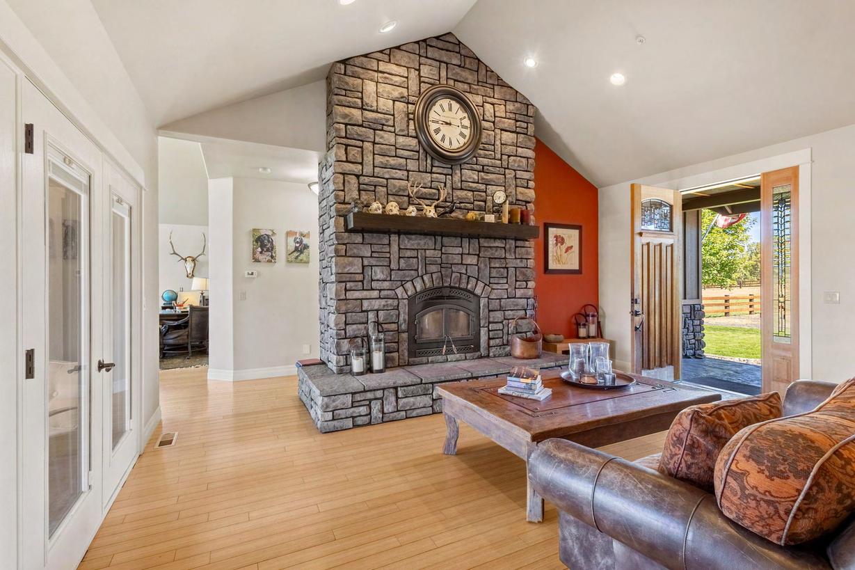
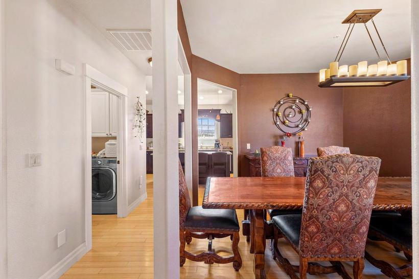
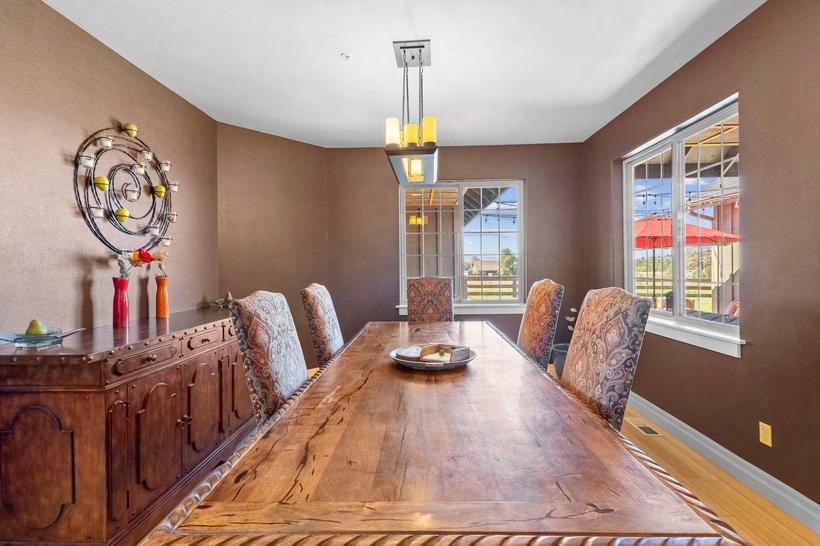
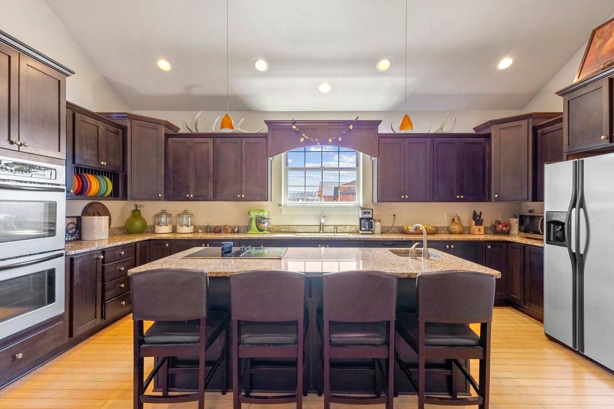
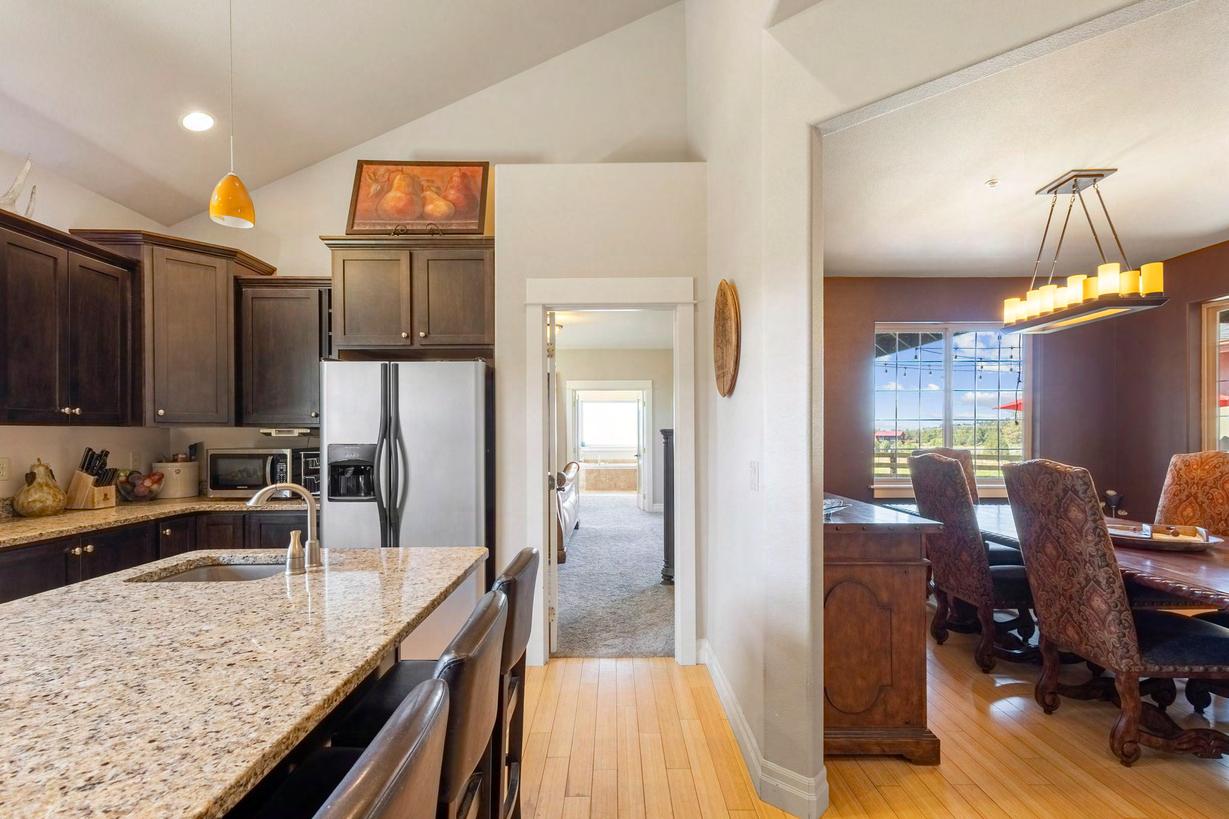
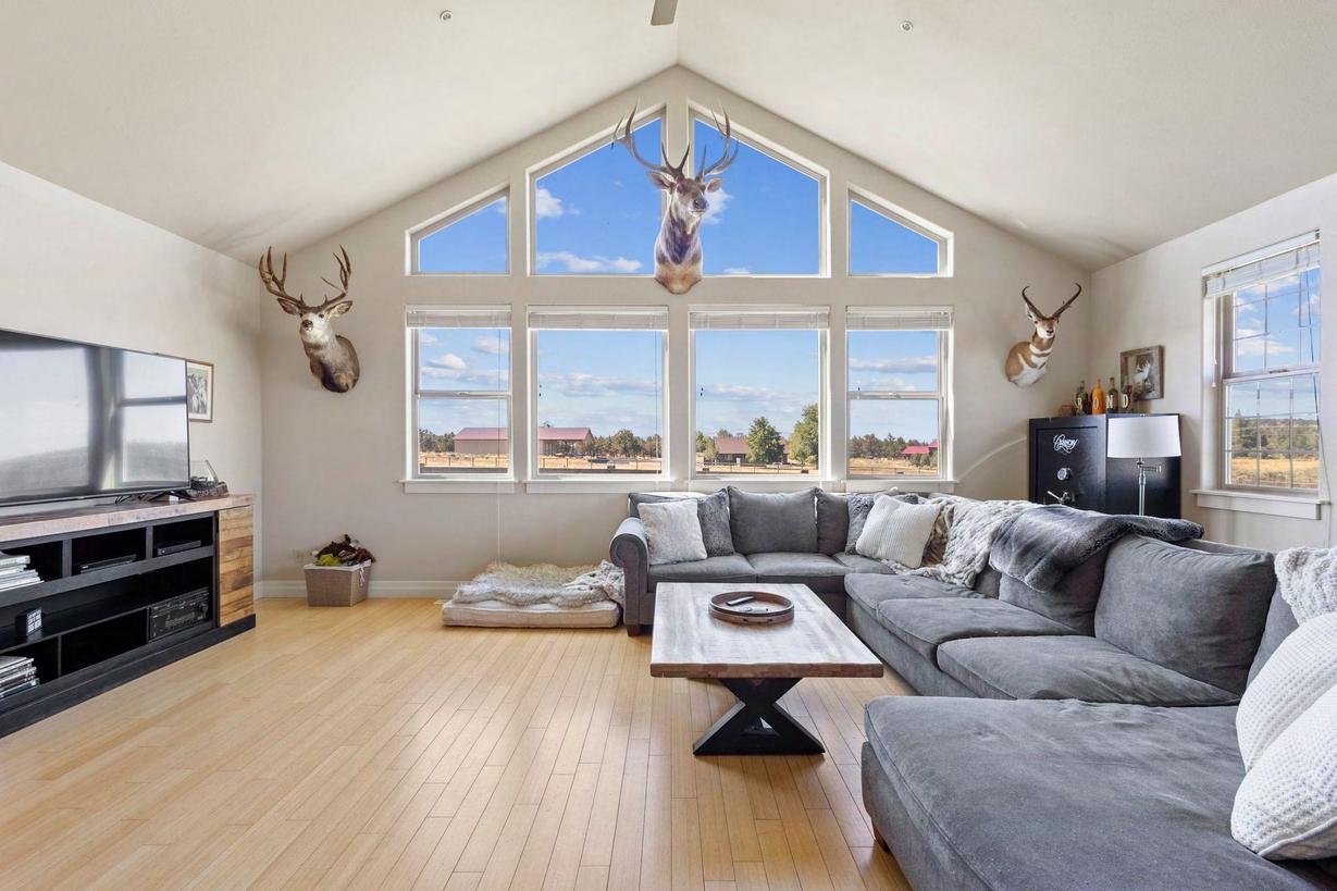
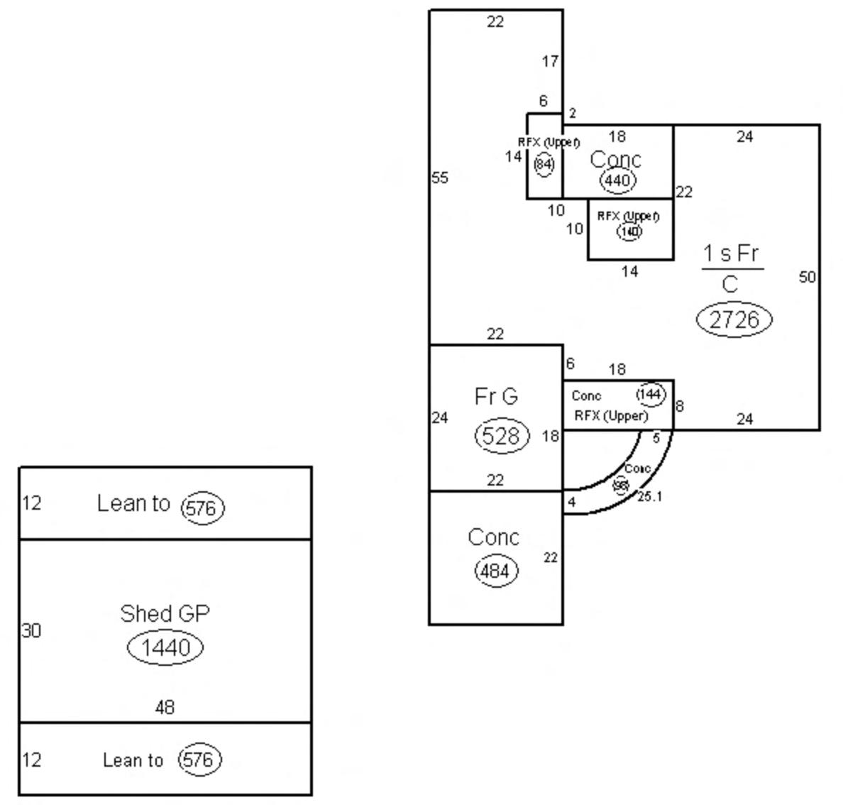
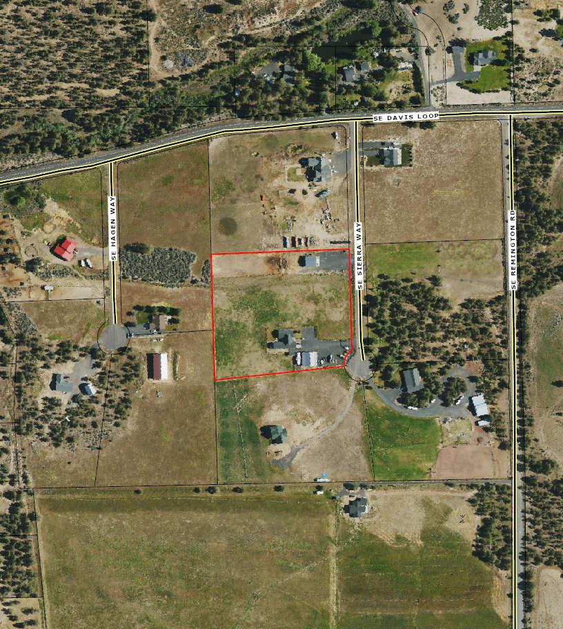
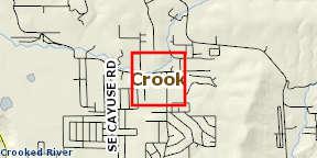
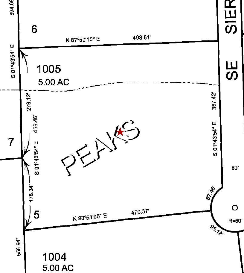
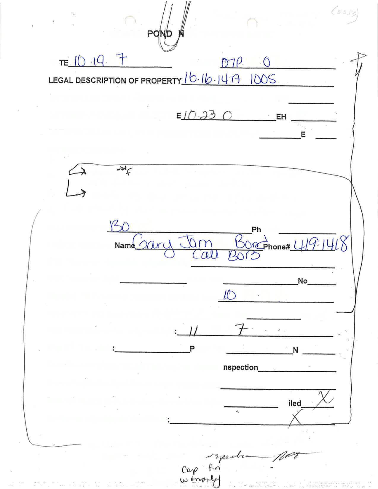
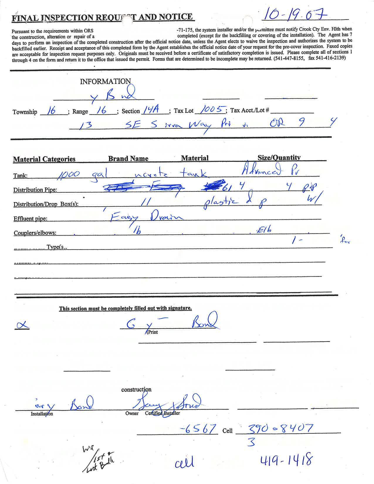
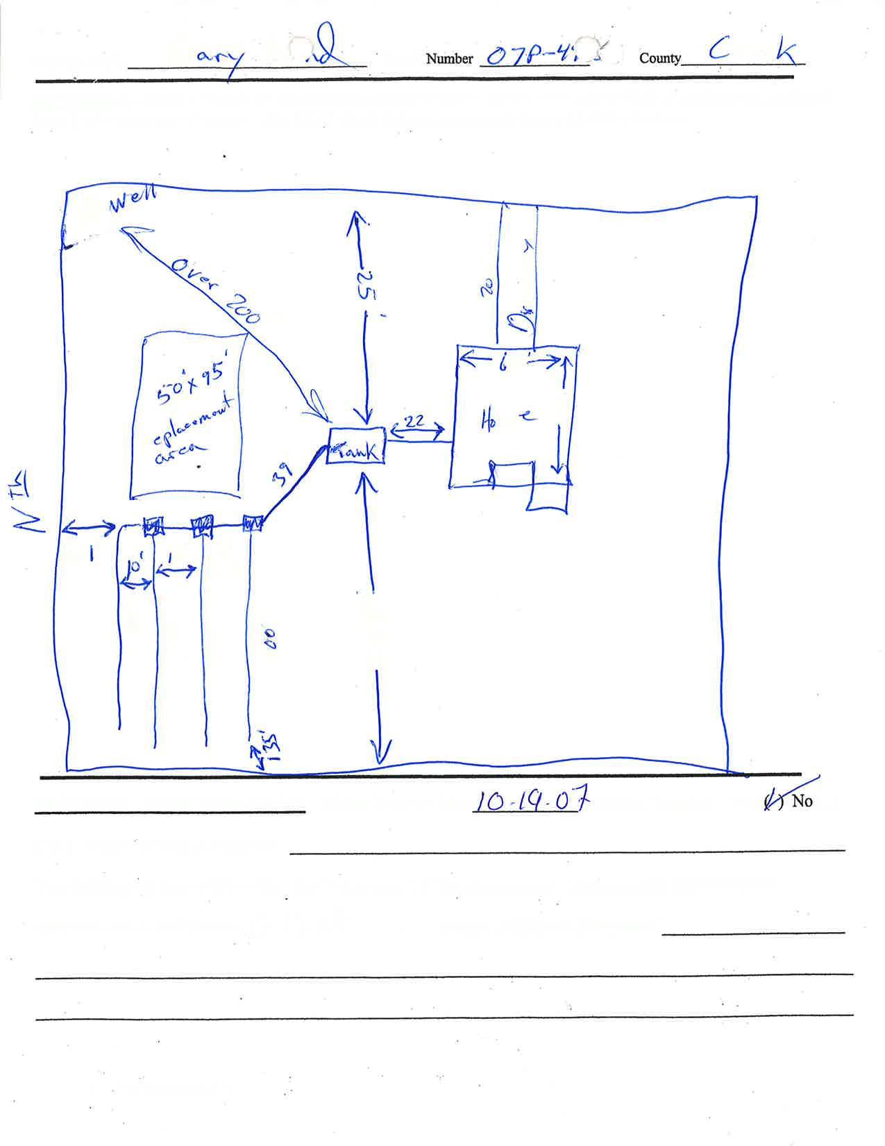
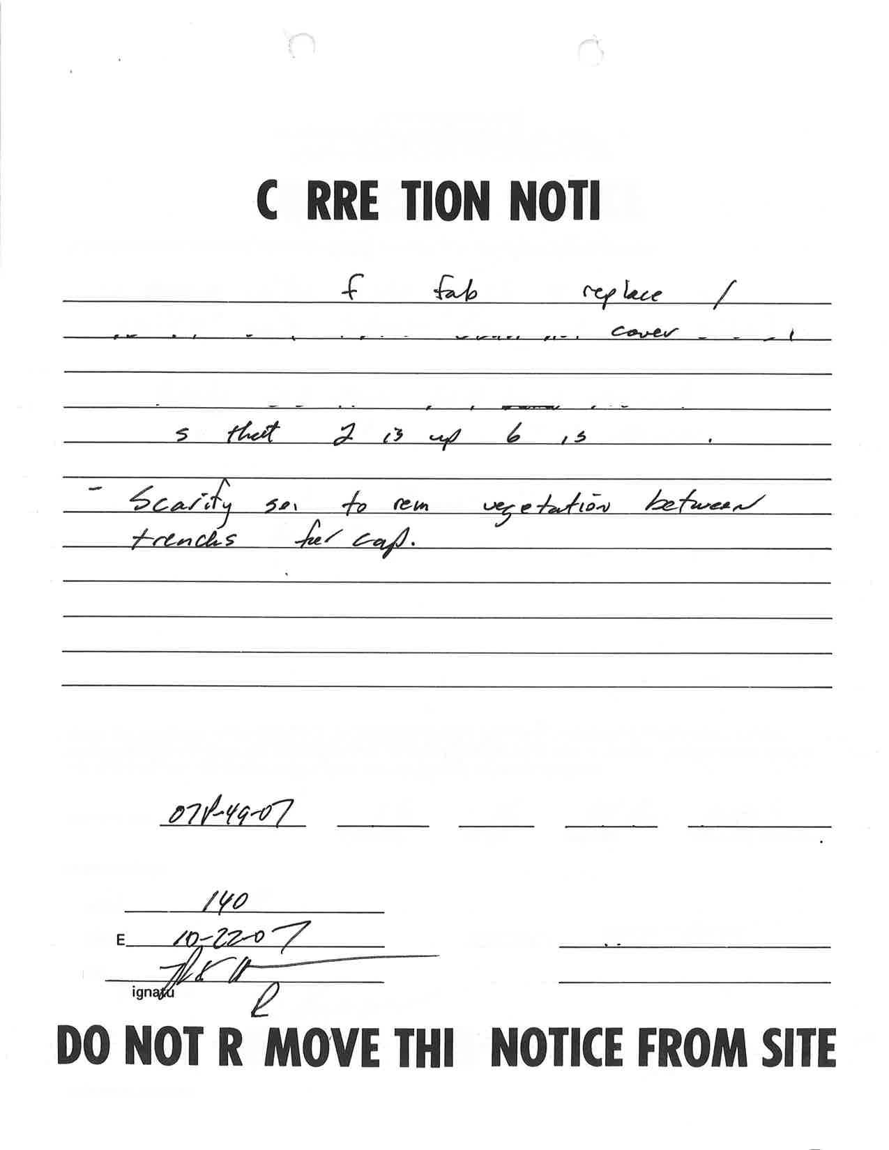
Ta Statement Property

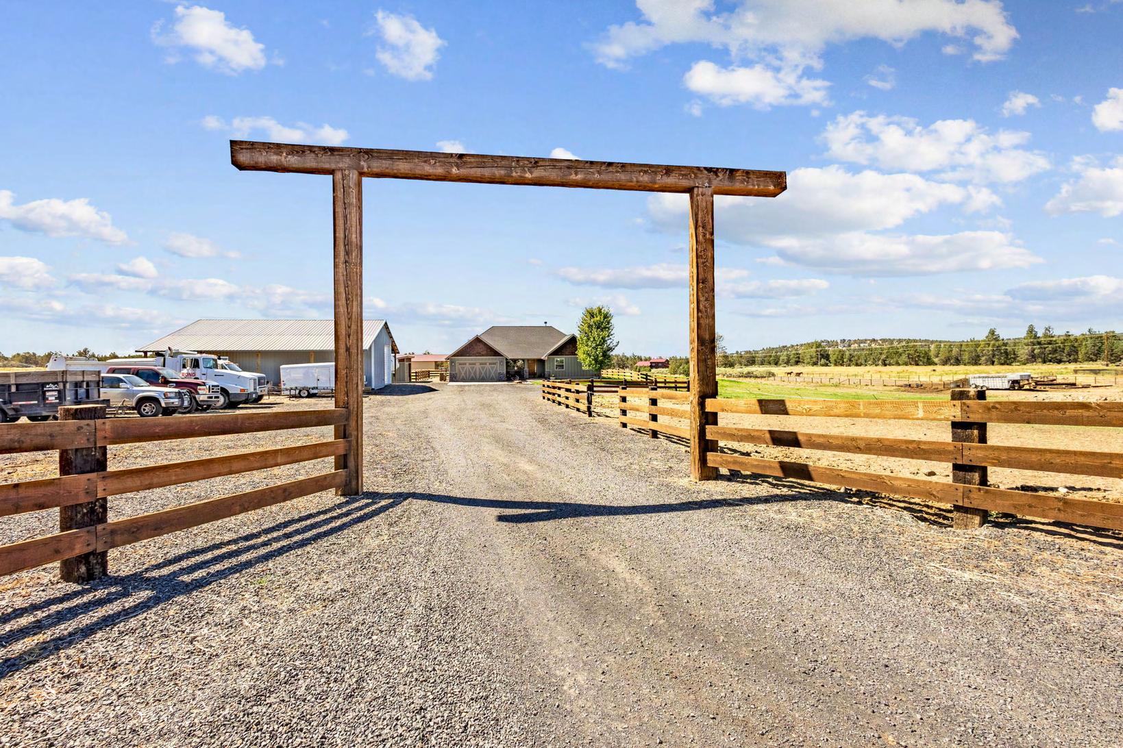
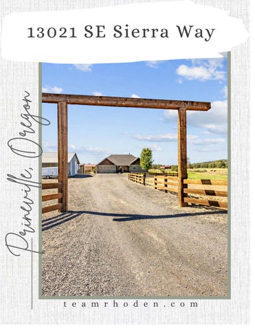
MAP: JULY 1, 2022 TO JUNE 30, 2023 CROOK COUNTY TAX COLLECTOR 200 NE 2nd St Prineville, OR 97754 16242 ACCOUNT NO: BOND GARY J & JENNIFER M 13021 SE SIERRA WAY PRINEVILLE OR 97754 13021 SE SIERRA WAY PRINEVILLE SITUS: 161614-A0-01005 CODE: 0021 VALUES: REAL MARKET (RMV) LAND STRUCTURES TOTAL RMV TOTAL ASSESSED VALUE NET TAXABLE: TOTAL PROPERTY TAX: LAST YEAR THIS YEAR 100,680 572,470 673,150 147,920 767,100 915,020 353,670 353,670 4,414.89 364,280 364,280 4,415.16 THIS IS NOT A TAX BILL IF... Your mortgage company is reponsible for 4,282.71 TOTAL DUE (After Discount ) 4,415.16 - 2022 2023 TAX ( Before Discount ) PROPERTY DESCRIPTION 2023 - 2022 CURRENT TAX BY DISTRICT paying for taxes. Keep this statement for your records. PHH MORTGAGE CORP / ROCHESTER Crook County Website - www.co.crook.or.us 1/3 PAYMENT 58.87 Nov 15, 2022 Date Due Amount Discount Allowed (See back of statement for instructions) 2,884.57 PAYMENT OPTIONS 1,471.72 132.45 Nov 15, 2022 Nov 15, 2022 2/3 PAYMENT 4,282.71 FULL PAYMENT No Discount .... 3% Discount .... 2% Discount .... TAX PAYMENT OPTIONS Tax Collector (541) 447-6554 or Assessor (541) 447-4133 ACRES: 5.00 REAL PROPERTY TAX STATEMENT Tear Here Tear Here *COURTESY STATEMENT IF LENDER IS SCHEDULED TO PAY. CALL LENDER TO VERIFY IF NECESSARY* ACCOUNT NO. 16242 PAYMENT OPTIONS Discount Date Due Amount Full Payment Enclosed or 2/3 Payment Enclosed or 1/3 Payment Enclosed 3% 2% 0% 11/15/22 11/15/22 11/15/22 1,471.72 2,884.57 4,282.71 MAILING ADDRESS CHANGES ON BACK Enter Payment Amount $ BOND GARY J & JENNIFER M 13021 SE SIERRA WAY PRINEVILLE OR 97754 MAKE PAYMENT TO: CROOK COUNTY 200 NE 2nd St Prineville, OR 97754 07100000162420000147172000028845700004282718 CROOK COUNTY TAX COLLECTOR 2022 - 2023 PROPERTY TAXES DISCOUNT IS LOST & INTEREST APPLIES AFTER DUE DATE TAX COLLECTOR HIGH DESERT ESD 35.12 CROOK COUNTY SCHOOL DIST 1,743.30 CENTRAL OR COMM COLLEGE 226.00 EDUCATION TOTAL: 2,004.42 CROOK COUNTY GENERAL FUND 1,409.84 AG EXTENSION SERVICE 43.97 CROOK CO HISTORICAL FUND 21.86 CROOK CO FIRE & RESCUE 579.21 CEMETERY DISTRICT 36.21 GENERAL GOVT TOTAL: 2,091.09 CC JAIL BOND 72.56 CC SCHOOL BOND 219.15 COCC BOND & INTEREST 27.94 BONDS - OTHER TOTAL: 319.65 Property Information Report, page 7 (For Report Disclaimer see page 1)

L g We
Temperature °F Lab analysis
Water quality concerns? Yes From Yes (describe below) To Description
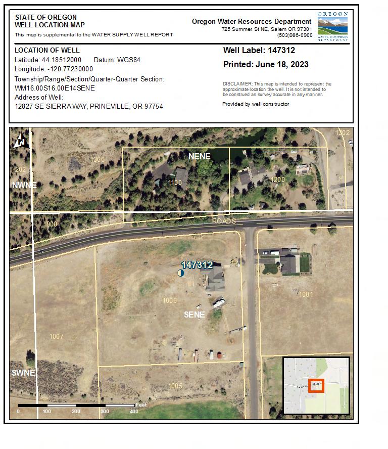
(9) LOCATION OF WELL (legal description)
(10) STATIC WATER LEVEL
Existing Well / Pre-Alteration Completed Well
Depth water was first found
Hard
Med Hard Red Basalt w/ Tan Clay Stone
Hard Grey Basalt
Conglomerate
Hard Grey Basalt
(11) WELL LOG Ground Elevation Material To Completed
Date Started
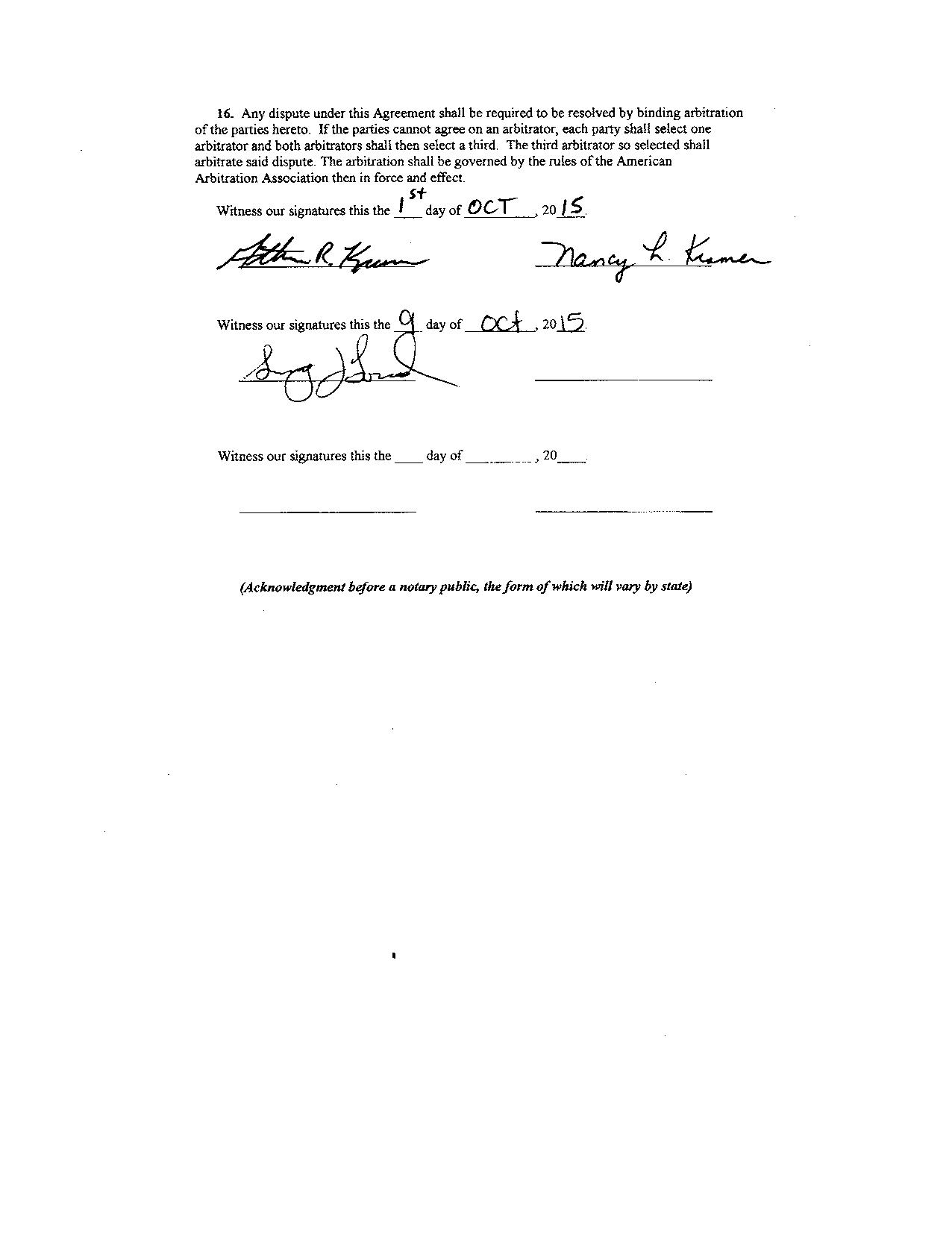
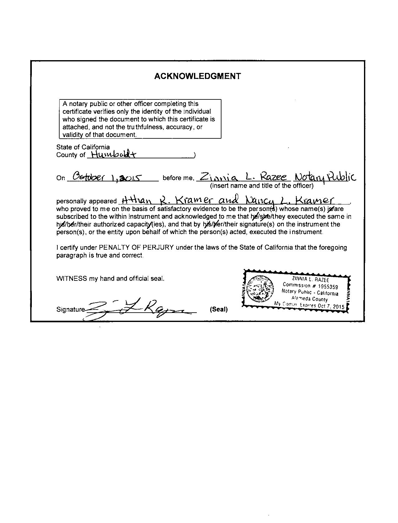
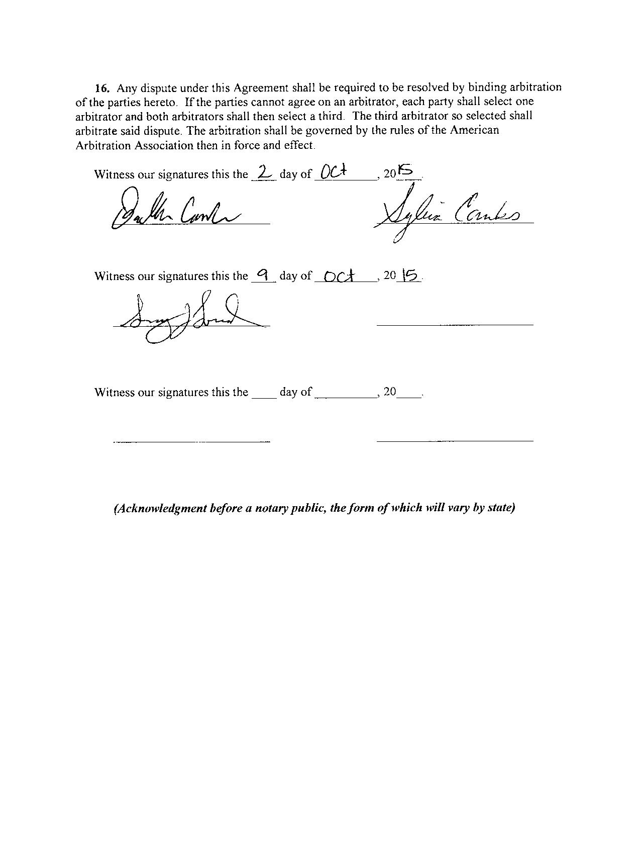
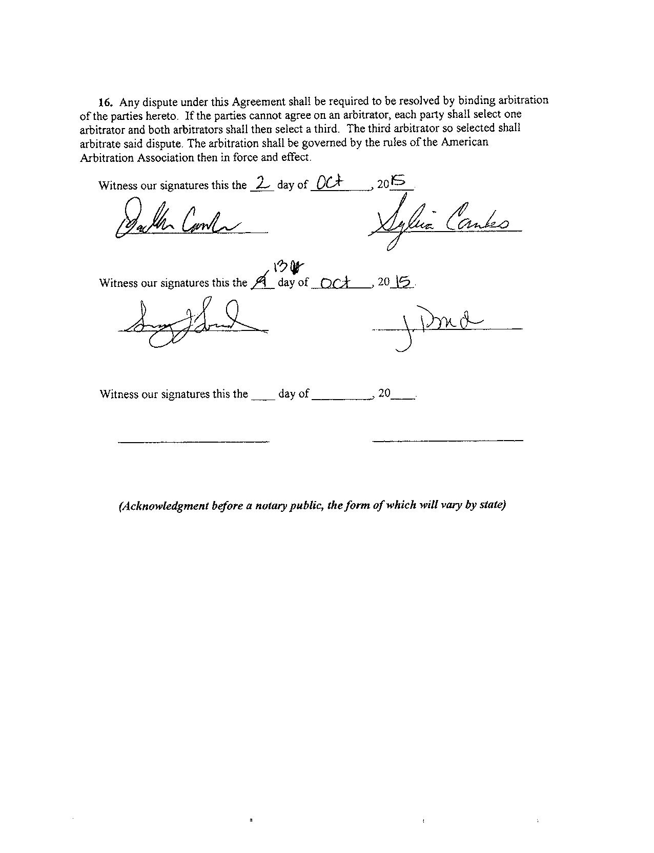
(unbonded) Water Well Constructor Certification
I certify that the work I performed on the construction, deepening, alteration, or abandonment of this well is in compliance with Oregon water supply well construction standards. Materials used and information reported above are true to the best of my knowledge and belief.
License Number Date
Signed (bonded) Water Well Constructor Certification
I accept responsibility for the construction, deepening, alteration, or abandonment work performed on this well during the construction dates reported above. All work performed during this time is in compliance with Oregon water supply well construction standards. This report is true to the best of my knowledge and belief.
License
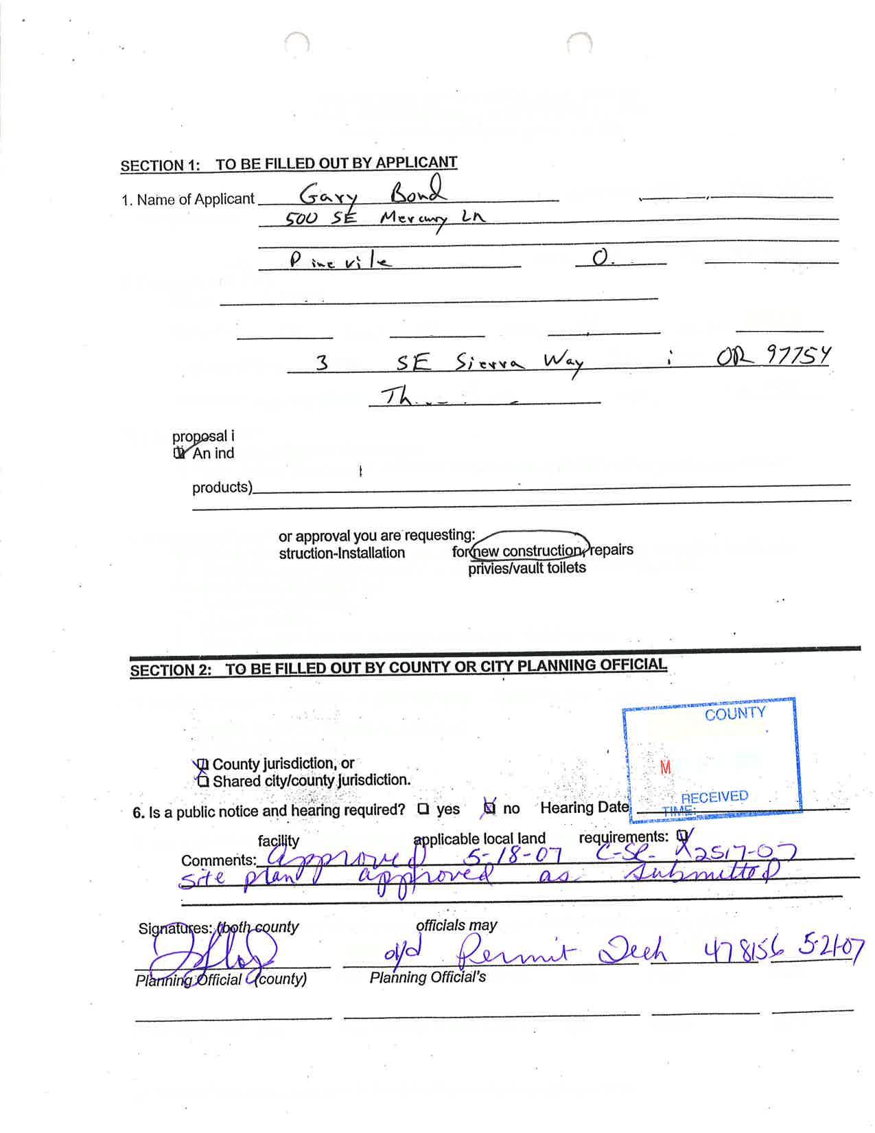
WELL I.D. LABEL# L START CARD # Owner Well I.D. First Name Address Zip (1) LAND OWNER New Well Deepening Abandonment(complete 5a) Conversion (3) DRILL METHOD Rotary Air Rotary Mud Cable Auger Cable Mud Other Reverse Rotary (4) PROPOSED USE Domestic Community Industrial/ Commericial Irrigation Livestock Dewatering State City STATE OF OREGON WATER SUPPLY WELL REPORT
537.545
OAR
Thermal Injection Other (5) BORE
Well ft. Explosives used: Yes Type Amount SEAL Material From To Amt Other Backfill placed from ft. to ft. Material Filter pack
ft.
ft. Material BORE HOLE (Attach copy) Dia From To Special Standard (6) CASING/LINER Dia Shoe Inside Outside Location of shoe(s) From To Gauge Stl Plstc Wld Thrd Casing Liner (7) PERFORATIONS/SCREENS Method Type Material Scrn/slot width To From # of slots Tele/ pipe size Casing/ Liner Dia (8) WELL TESTS: Minimum testing time is 1 hour Yield gal/min Drawdown
(as required by ORS
& 537.765 and
690-205-0210)
HOLE CONSTRUCTION Depth of Completed
from
to
Drill stem/Pump depth Duration (hr)
Tax Lot Lot Twp Range E/W WM
1/4 1/4
DMS or DD
° ' "
DMS or DD
N/S
the
Sec
Lat ° ' " or
Long
or
County
of
WATER BEARING ZONES From To Est Flow SWL(psi) SWL Date
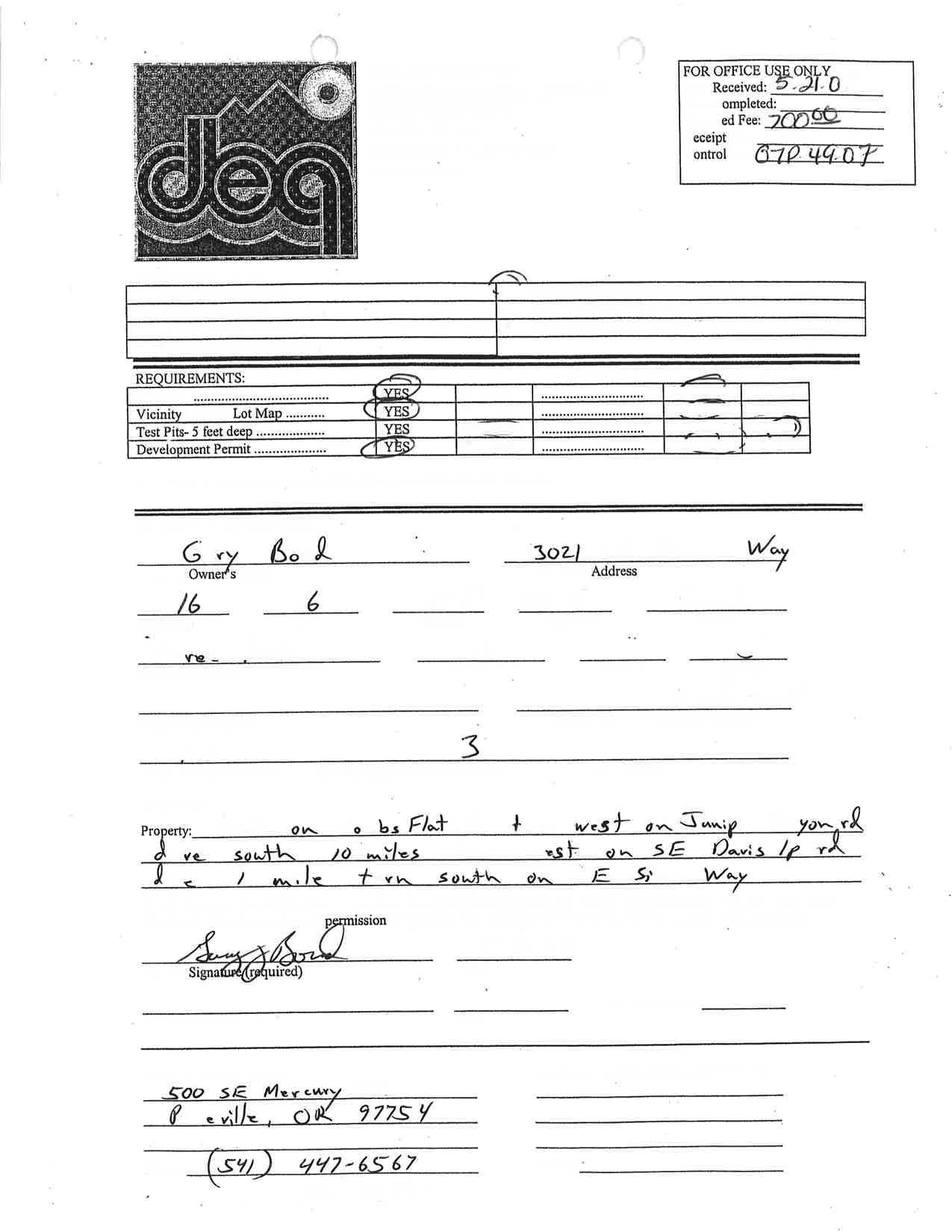
ORIGINAL - WATER RESOURCES DEPARTMENT THIS REPORT MUST BE SUBMITTED TO THE WATER RESOURCES DEPARTMENT WITHIN 30 DAYS OF COMPLETION OF WORK New exempt use wells must be submitted with a map and recording fee.
Temp casing From To Screen Dia Other
Tax Map Number
Number
Signed
Date
From Company Last Name E D C B A Method How was seal placed: Perf/ Screen + Date SWL(psi) By Amount Units sacks/ lbs Slot length Perforations Screens SWL(ft) + SWL(ft) + Size Contact Info (optional) Flowing Artesian? (2a) PRE-ALTERATION Alteration (complete 2a & 10) (2) TYPE OF WORK To sacks/lbs Amt From Material (5a) ABANDONMENT USING UNHYDRATED BENTONITE Proposed Amount From + Dia TDS amount Casing: Seal: ORIGINAL LOG # Actual Amount + Yes Street address of well Nearest address Pump Bailer Air Flowing Artesian Dry Hole? Form Version: Thrd Wld Plstc Stl Gauge To Calculated Calculated Page 1 of 2 147312 1061264 ATHAN KRAMER 12827 SE SIERRA WAY PRINEVILLE OR 97754 330.00 61 298.00 126 5/23/2023 5/22/2023 5/23/2023 1583 6/18/2023
DAVID SCHLICHTING (E-filed) 121 ppm 8 2 18 .250 6 10 330 .188 12 1 14 Perf Liner 6 290 330 .13 3 480 Factory 8 10 32 50 95 172 298 315 330 10 32 50 95 172 298 315 0 8 Sandstone & Rock Hard Tan Clay Stone Hard Grey Basalt
Hard Red Basalt
55399 CROO 6/18/2023
Med
Grey
Basalt
POURED IN DRY CROOK 16.00 S 16.00 E 14 SE NE 1006 44.18512000 -120.77230000 12827 SE SIERRA WAY, PRINEVILLE, OR 97754 25 330 2 5/23/2023 298 315 25 126 12 0 18.5 8 18.5 330 Bentonite Chips 0 18.5 28 S 10.78
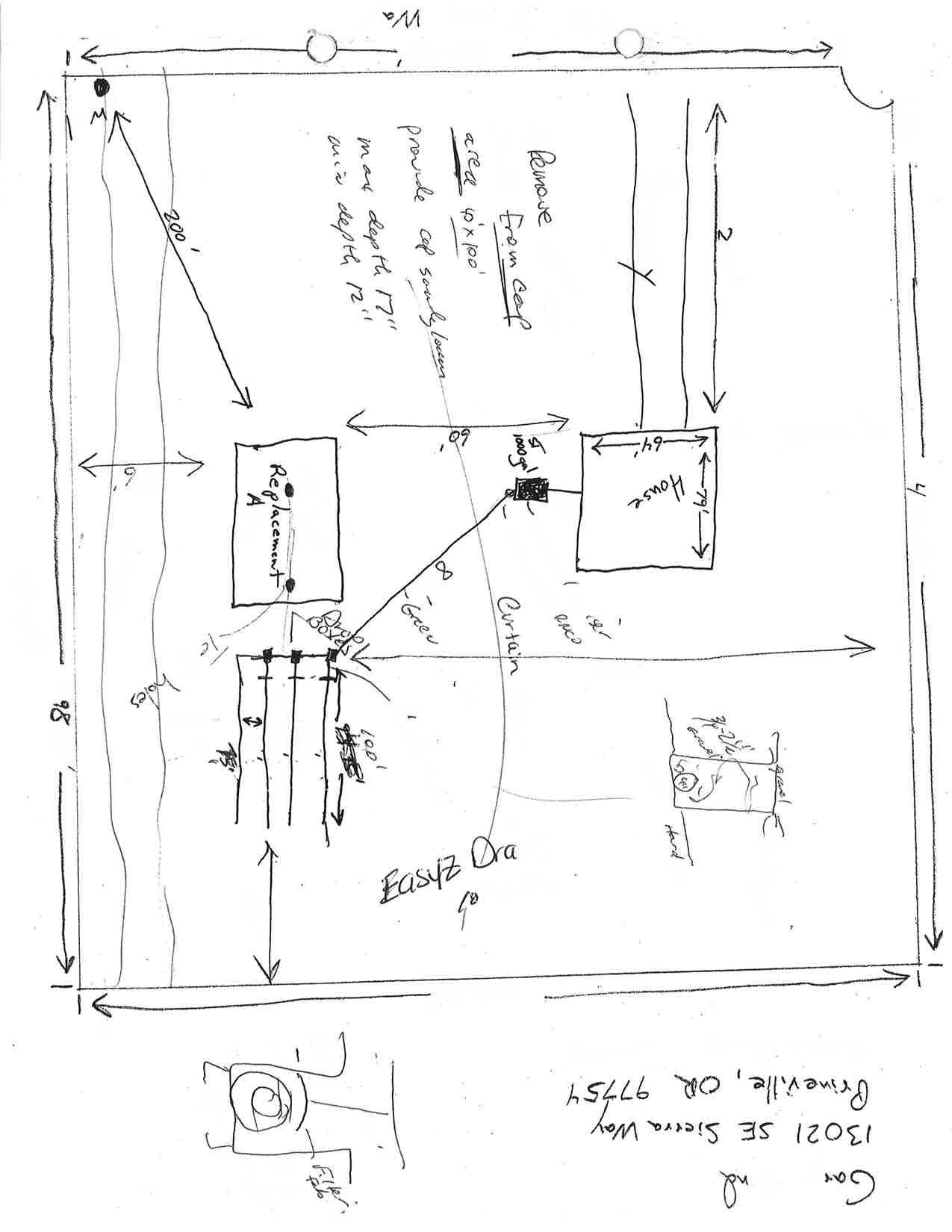
WATER SUPPLY WELL REPORT - Map with location identified must be attached and shall include an approximate scale and north arrow
Map of Hole
55399
CROO 6/18/2023
Page 2 of 2