California Route 66 National Scenic Byway
Discover the hidden gems of the Mojave Desert!
 Published by

This tour guide of the California Route 66 National Scenic Byway was made possible by the following people and entities:
Newberry Springs Chamber of Commerce
Rose Beardshear, President www.Newberry SpringsChamber.com newberryspringscoc@gmail.com
San Bernardino
County Travel & Tourism
Chamber Tourism Incentive Program funding https://selectsbcounty.com/major-initiatives/tourism
BackRoadsWest.com
Provided much of the travel guides and related content
Cliff & Ilene Bandringa, Owners & Founders Go on more road trips at www.BackRoadsWest.com
John Wease
Author of several articles - jnwease@gmail.com
Jorge Leandro Rodrigues Graphic Designer - leandro.works@gmail.com
Publishing Information
Dedicated
CONKLE – MAYOR
By the NEWBERRY SPRINGS CHAMBER OF COMMERCE 2
to JIM
OF ROUTE 66
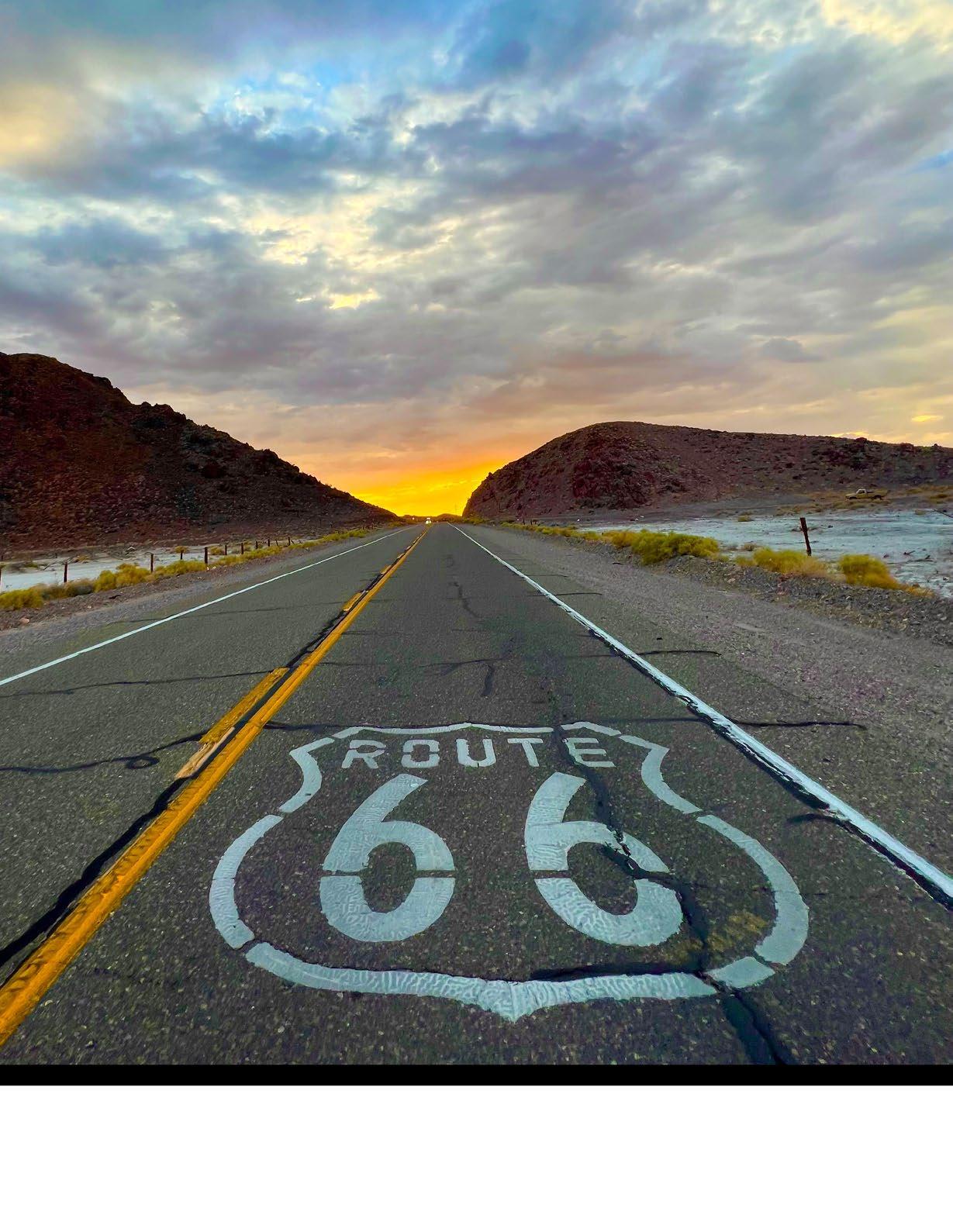
Cover photo by Rosco Thompson

Table of Contents The
now Deel’s, on Route 66 in Newberry Springs, as remembered by
and longtime resident Bill Smith 3 Publishing Information 2 Table of Contents 3 Route 66: From Highway to Byway 4 Tour Route for Route 66 from Barstow to Ludlow 6 Newberry Springs, a Desert Oasis 14 Mojave Trails National Monument 16 Newberry Springs Driving Tour Guide 20 Mojave National Preserve 26 Tour Route for Route 66 from Ludlow to Needles 29 Jim Conkle: The Mayor of Route 66 34
Cliff House,
painter
Route 66 From Highway to Byway
By John Wease
4
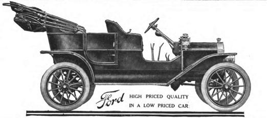
In the early twentieth century, the automobile was nothing more than an impractical toy for the wealthy class. In 1908, Henry Ford introduced the Model T. With an initial price of around $800, it was still a significant cost, but much more affordable than the average cost of the competition that ranged between $2,000 and $3,000. In 1909, 10,000 of the “Tin Lizzy” cars were produced. Every year, Ford streamlined the assembly line process which cut production costs. Somewhat surprisingly, instead of pocketing the profits, he cut the price of the car. By 1924, the cost was under $300, and two million were produced. Henry Ford had reached his goal of producing automobiles for the masses.
The masses needed roads. In 1925, Congress passed a highway act to create a system of numbered U.S. highways to connect urban and rural communities all across the nation. The most famous of these numbered highways was U.S. Highway 66. It ran from Chicago to Los Angeles and was soon extended to the base of the pier at Santa Monica. The highway was 2,448 miles long, and passed through eight states. It followed the main streets of the towns along the route, and soon became known as the “Main Street of America.” From the Midwest, U.S. Highway 66 became the all-weather route west to the Pacific.

Although the main purpose was to promote commerce in these cities, new businesses, catering to the automotive travelers, soon appeared. The first drive-throughs, fast food restaurants, auto camps, and motor inns were born. So were fuel and repair services, and don’t forget roadside advertising. The highway was popularly known as Route 66. Aside from vacationing travelers, it was the route west for the multitudes fleeing the Dust Bowl states of the 1930s. This migration was depicted in John Steinbeck’s novel, The Grapes of Wrath. He was the first to call Route 66, the Mother Road.

Route 66, running as it did from town to town, was anything but direct. It was not entirely paved until 1938. During World War II, troops, equipment, and materials had to be shipped primarily by rail. In 1956, President Eisenhower signed an interstate highway act to create a more efficient system of interstate travel. The popularity of Route 66 peaked during the post war years. The 1946 hit song, “Get Your Kicks on Route 66,” and the television series “Route 66,” added to its fame and popularity. There was a huge increase in automotive travelers after the war as well. Popular or not, Interstate 40, completed in 1979, marked the end of an era for Route 66. The iconic U.S. Highway 66 was officially decommissioned in June, 1985. Now, it is referred to as the Historic Route 66. The appeal and romance of the Mother Road lives on.
 “Tin Lizzy”: a 1908 Ford Model T
5
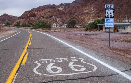
Concept Scenic Byway sign in Newberry Springs
On February 24, 2021, the Federal Highway Administration’s National Scenic Byways Program designated the 178 mile portion of the Historic Route 66 between Barstow and Needles a National Scenic Byway. This designation was the result of eight years of efforts led by the California Historic Route 66 Association and the Bureau of Land Management’s Barstow and Needles Field Offices. Of the 178 miles of the Scenic Byway, there are 150 miles of virtually undeveloped desert land that appears much as it did in 1926.
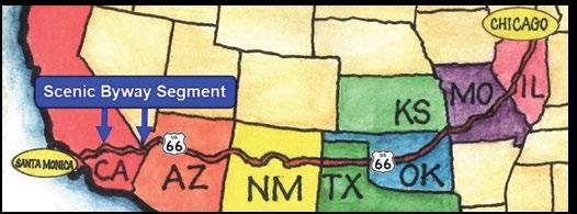

The Scenic Byway passes through Barstow, Daggett, Newberry Springs, Ludlow, Amboy, Goffs, and Needles. Gas stations, restaurants, and other Route 66 historic sites are easy to spot and harken back to the days of traveling at a less hectic pace. The Byway also bisects the Mojave Trails National Monument and passes through three World War II Desert Training Center camp areas. Whether your interest is historic sites, or enjoying unspoiled desert, come along with us on our tour of the Historic Route 66 Scenic Byway between Barstow and Needles. I think you will enjoy it.
Tour Route for Route 66 from Barstow to Ludlow
Passing through Daggett, Newberry Springs and Pisgah Crater
The most remote and barren stretch of Route 66 passes through California’s Mojave Desert between Barstow and the Colorado River, and the touring route described here covers the eastern half of it, between the towns of Barstow and Ludlow. Driving this very remote part of the Mother Road back in the 1930’s made people
nervous, and rightfully so. There was little traffic and, if their vehicle broke down, which they often did in those days, it was a long way to get help.
Although this tour goes from Barstow to Ludlow, it can be taken in either direction. If you start in Ludlow, simply follow the tour itinerary in reverse.
Length: About 50 miles (80 km) one-way
 Map showing the 178-mile scenic byway’s location within the entire 2,448 mile-long Route 66
6

Starting in Barstow
Begin your tour by driving to the east-end of Main Street in Barstow, where it passes underneath Interstate 40. You can also take the I-40 freeway and take exit #1. RESET YOUR TRIP METER here.
There isn’t much to see along the 1.5 mile (2.4 km) stretch of Route 66 from exit #1 to the Marine Corps base. There used to be an old hotel and bar, but it was razed around 2010.
Marine Corps Logistics Base Barstow
If you took Route 66 from exit #1, you’ll pass underneath I-40 again and in a short distance be stopped by the base’s main entrance. Just before the entrance stands an old gas station and hotel that was originally a Motel 6.

The alignment of Route 66 used to go right through the middle of this military installation. Until I-40 was built, Route 66 travelers drove right through the base as if it were another town along the road. Unfortunately, after the events of September 11, 2001, for security concerns, the public can no longer drive on this portion of Route 66 through the base.
The base is used as a supply depot and maintenance facility for the Marine Corps. It was originally established in 1942 to support the Pacific theater in World War 2. During this time, unneeded material, mainly wood for crates, were thrown away but picked up by locals to build many of the old buildings (picture at left) along Route 66. The base itself has since grown to support the on-going needs of the Marines.
7
A satellite facility of the base was built later and called the Marine Corps Logistics Base Yermo Annex. It can be seen along this tour just north of our visit through Daggett.
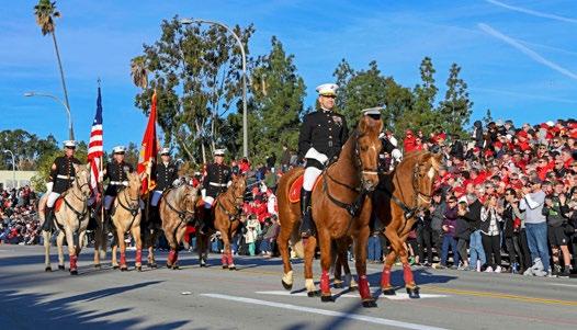
An interesting side note about this facility, it is the home of a mounted color guard. Traditionally, this elite team of equestrians lead and kick off the beginning of the Tournament of Roses Parade on Pasadena’s Colorado Blvd, which ironically is also Route 66.
To continue the tour, jump on I-40 eastbound at exit #2, drive two miles, then exit at Nebo Street (exit #5).
Whoop-de-doos & Elephant Mountain

After exiting Nebo Street, you’ll be connected back to the original alignment of Route 66 as it exits out of the east side of the Marine Base. Just like our tours of Route 66 from Victorville to Barstow, the old alignment is right next to the Santa Fe railroad trips, which are now owned by the Burlington Northern and Santa Fe Railway. These are the same railroad tracks that Route 66 roughly follows between Chicago and Los Angeles. There are many many “at grade” crossings of these same tracks and Route 66 along its entire length.
Between here and Daggett, you’ll experience the whoop-de-doos of driving through many dips in the road. These dips are caused by many drainage channels that run across the desert floor. These same types of channels are found all over the desert and cross Route 66 all the way into Arizona. When the roadbed was first built in the 1920s here (between Barstow and Daggett), it was simply built through these channels, causing the dips we’re experiencing now.
As we travel further east on Route 66, past Daggett, we’ll see that the road still crosses the many channels or ditches but now uses bridges instead. These were built in the 1920s and 30s, after it was determined that the road
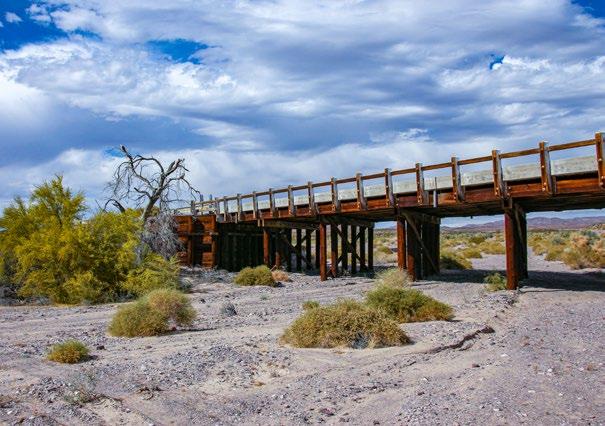
had too many dips for vehicles to drive through. By the ‘20s and ‘30s, vehicles by then were traveling faster than the normal 20-30 mph (32-48 kph) in previous years, causing newer vehicles needing to slow down for the dips.
In fact, and this might be hard to believe, Route 66 crosses more bridges between Daggett and the Arizona border than all the other bridges on the entire historic alignment of Route 66, from Chicago to Santa Monica. We’ll cover more on this topic on our next tour that continues east from Ludlow and into Needles.
Along this stretch of road, you’ll see a mountain come into view on the left. This is Elephant Mountain. It’s just across the sandy bed of the Mojave River from Route 66. Elephant Mountain saw several mining ventures that began the development of this area, mainly the town of Daggett, in the 1880s.
Elephant Mountain is also a significant archaeological site where debris, such as mill stones, pestles and mortars that were used by Native Americans, have been found here. There are also a few petroglyphs in a rock outcropping on the southern edge, as well as on an outcropping not far from Daggett-Yermo Road on the mountain’s east side.
Daggett
At about 7 miles (11 km) from I-40’s exit #1 (where we reset our trip meter), we reach Daggett. Although this looks like a forgotten and sleepy desert town, it actually has a lot of interesting history behind it and some of it is still standing around for you to go see.
Daggett had a lot going for itself back in the late 1800s. A lot of desert and Route 66 history occurred in Daggett; probably more than in any other town along Route 66’s path through the Mojave Desert.
Pictured next is an old AAA road sign from before Route 66 days was established in 1926.
8
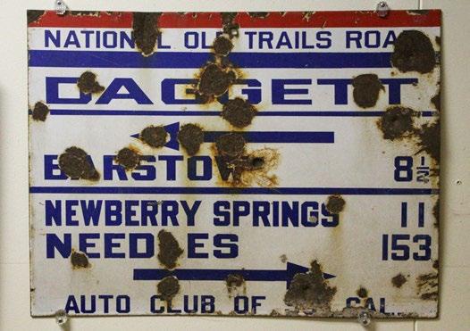
The townsite was first established because of small mines in Elephant Mountain mentioned earlier. The mining boom of both silver and borax in the nearby Calico Mountains, just 6 miles to the north, brought a lot more people into the area. In 1882, the railroad arrived, and Daggett was the closest point to the silver town of Calico. Ore was hauled by wagon to Calico and, from there, hauled by train for smelting.
In the 1890s, the Calico Mountains also had a large borax mining operation. Ore was hauled down by the famous 20 mule teams to a facility in Daggett, where it was processed and shipped away via rail.
Daggett was also an outfitting and jumping off point for many mining outposts hundreds of miles to the north, such as Death Valley. Many prospectors and miners took the train to Daggett, then ventured on by horse to various points throughout the Mojave Desert.
When the National Old Trails Road was being established in 1912, that would later become the path of Route 66 through California (the road alignment we’re touring on), an enterprising blacksmith owner got a contract to create the road grade from Barstow to the Arizona border.

Just before reaching the stop sign, you’ll see this curious looking “Ski lodge” on the right. This was built in the early 1920s and was a standard design in those days used for California Welcome Centers. It was also standard to have an inspection station built nearby and there was one directly across the street from the Ski Lodge. Now it is a vacant lot.
This inspection station is a big piece of Route 66 history, because it is the inspection station that actually appeared in the classic movie, the Grapes of Wrath, the movie that gave Route 66 that classic name, the Mother Road. In the movie, here’s where Tom Joad, played by Henry Fonda, was almost turned back. The real history is that this inspection station actually did turn back migrant workers in the Great Depression who were trying to escape the Dust Bowl of Oklahoma and the Great Plains.
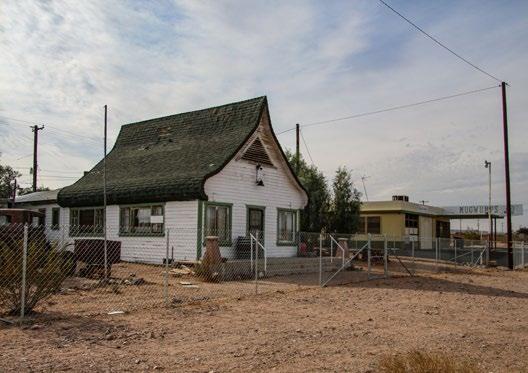
When you arrive at the stop sign in Daggett, consider taking a detour to explore a little bit of this nicely preserved town with so much history. Do this, by turning left at the stop sign, crossing the railroad tracks, then turning right onto Santa Fe Street (the street directly across the tracks).
Our first set of buildings to look at are the Desert Market and the Stone Hotel. The Desert Market is still serving customers today, just in case you want to go in and grab a snack. If you do, you’ll see a lot of historic pictures of Daggett. It’s almost like a museum.
The remains of the Stone Hotel date back to the 1890s. Here, people like Death Valley Scotty, grubstaked his many treks into the remote regions of his namesake (Death Valley) to look for that elusive ore (gold). Prospectors from all over got to Daggett by train, stayed one or more nights in town to gather their provisions, then ventured off for months into the vast Mojave Desert to the north.
9
Pre-Route 66 Automobile Club sign Mining equipment at museum in Daggett

Turn north onto the road next to the Desert Market, named Mill Street, to find the Daggett Historical Museum. If you find this little gem open, go inside and enjoy all the old photographs and artifacts that are wellpreserved here.
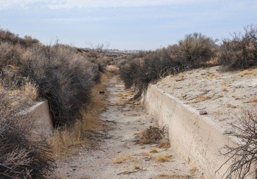
Behind the museum is the Daggett Ditch. This was an aqueduct built around 1893 to supply water to the farms just east of town. It ended up not working because the water in the Mojave River simply went under the dam built to divert water into the aqueduct.
Continue the tour down Route 66 by returning to the railroad crossing you crossed earlier, then turn left. RESET YOUR TRIP METER when you turn left. On the way out of town, you’ll see more old buildings.
Between Daggett & Newberry Springs
From Daggett, continue east on Route 66. You could have also continued east on Santa Fe Avenue, which connects back with 66 in 5 miles.
On the other side of the tracks from 66, or along Santa Fe Avenue, are several old ranches, along with the remains of several experimental power plants, one of which is still generating electricity today.
The Cool Water Ranch existed for over a hundred years and was still boarding horses a few years ago.

Just under 2 miles from Daggett, the Cool Water Coal Gasification plant is seen on the left. This plant was built in 1979 to convert coal into clean burning gas, which would be used in the neighboring electric power plant (closest to the road). The experiment concluded
Stone Hotel as it looked in 2022
10
Daggett Ditch
in 1987, but the power plant kept generating electricity using natural gas until it was decommissioned in 2015 and will likely be removed entirely at some point.
Next on the left are a series of solar power plants, which is about 3 miles from Daggett. The first one was called Solar One. It was the first large-scale solar electric power plant built in the USA. Built in 1981, it used 1,800 mirrors, to reflect the sun’s rays onto a central tower that would turn water, to steam and turn a generator.
Solar one operated until 1986 and was scrapped in 2009. Nothing exists at the site today and it currently is situated behind the newer solar power plants. Those newer power plants are currently operating. One of the plants is significant because it was the first one to utilize a system of parabolic mirrors that heated a special liquid that turns a turbine to spin a generator. This type of system is now widely used at many plants, including several around the Mojave Desert.

At 5 miles from Daggett, an optional left turn onto Hidden Springs Road leads to the Barstow-Daggett Airport. It has some history as it was built in 1933 and used for various projects during World War 2. A very large old hanger, that is interesting to look at, is still in use for sheltering aircraft. The County owned airport is still used by the Army in conjunction with nearby Fort Irwin.
Back on Route 66, and not too far from the airport, is another inspection station, this one was exclusively used for agricultural inspections. It was built in the 1950s and replaced the one in Daggett.
Vehicles coming from the east were thoroughly inspected. Travelers were asked to open their suitcases so that inspectors were satisfied that nobody was
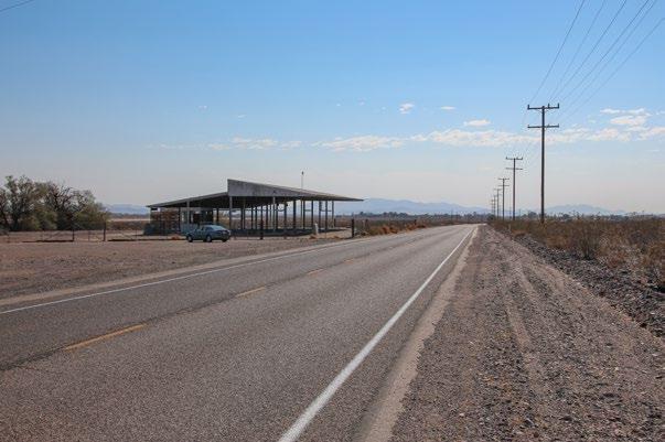
accidently bringing in contaminated fruits or vegetables that could easily devastate California’s huge agricultural business. After I-40 was completed in the early 1970s, a new inspection station was built on the Arizona border, and this one has been in a state of disrepair ever since.
Newberry Springs
Continuing east another 6 miles brings us to the town of Newberry Springs. As we approach, notice this taller mountain on the right. This is Newberry Mountain.
RESET YOUR TRIP METER after passing under I-40.
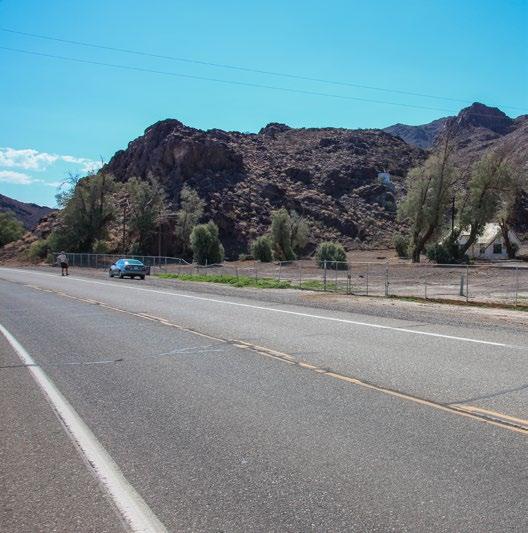
The first thing to see on the right is the original highway maintenance yard built in the 1920s when the roadbed for Route 66 was being built. There are a few buildings left where the maintenance workers lived. As of 2022, the property is privately owned.
 Solar One, circa mid-1980s
11
Inspection Station
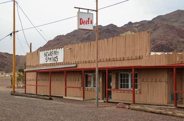
Next on the right after the maintenance yard is the Deel Plumbing Hardware Store, which was originally the Cliff House that was established in 1929. It was a full service desert oasis that included a garage, store, café, cabins, post office and general store. In the 1950s, both Greyhound and Continental Trailways bus companies stopped here. It also had the only telephone in town, which made it quite the popular place. An old pool and cabins can be seen in the back. The site is on private property.
Inching a little further down Route 66 brings us to a popular watering hole named, The Barn, on the left. On the weekends, you can expect the barn to be enjoyed by bikers and Route 66 travelers alike.
When you walk into The Barn, you’ll get to see plenty of old-time memorabilia from Route 66’s heyday, plus you’ll get a good idea of what a typical roadhouse looked like back then.

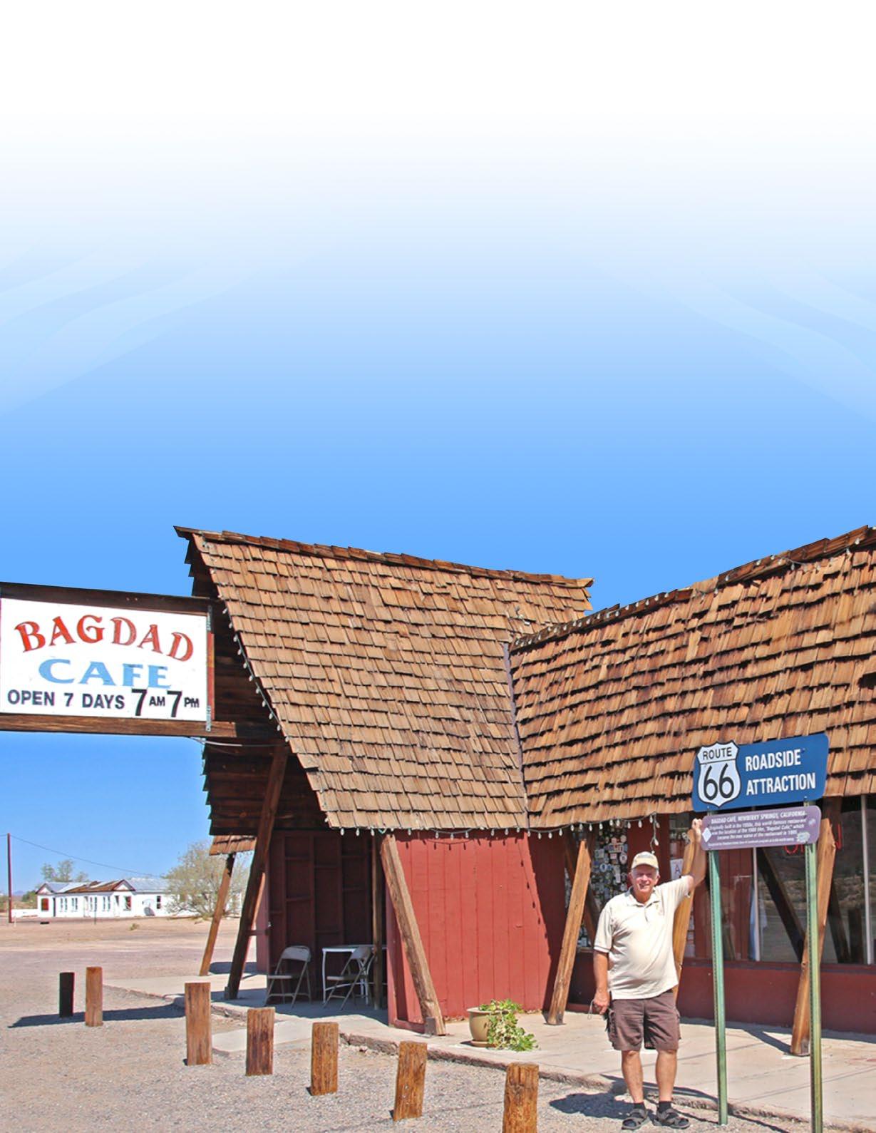
About 3 miles (4.8 km) from I-40, one of the biggest attractions that everyone wants to see on this section of Route 66 is reached, the Bagdad Café. Originally named the Sidewinder Café, this place was made famous by a 1987 movie named Bagdad Café. The movie has a cult following. Thanks to the movie and some other factors, it is now one of the most popular stops that tourists want to make along the entire stretch of Route 66. Like The Barn, there is also a lot of Americana memorabilia to see here.
The movie and the café were actually named after another Route 66 town called Bagdad, which is 50 miles to the east from Newberry Springs. Bagdad is truly a ghost town now, as there is nothing left but desert and a few foundations.
There used to be this adjoining hotel to the cafe, which was used in the movie, but sadly it was razed around 2016. However, the old motel sign still survives. As of 2022, efforts are underway to preserve this classic sign.

RESET
YOUR TRIP METER at Bagdad Café, then continue east. Soon, we’ll see two classic old gas stations that existed during Route 66’s heyday, the first one being this Whiting Brothers gas station.
Whiting Brothers was a chain of gas stations that started in 1926, when Route 66 was commissioned. This one sits on private property now and is rather photogenic. The next gas station, just down the road a short distance, is in much better shape. This gas station was not part of a chain like the previous one.
Pisgah Crater & Lava Flows
At 2 miles, the intersection with Fort Cady Road is reached. Many people jump on I-40 here to continue their Route 66 journey eastward. The pavement on the roadbed starting at this intersection becomes more deteriorated. However, serious and diehard Route 66 fans will want to continue past this point, regardless of the bad pavement, so that they don’t miss anything, including Pisgah Crater.
About 7.5 miles from Bagdad Café, the scenery changes as Route 66 begins passing through basalt flows, which marks where molten lava once flowed out of Pisgah Crater, which comes into view on the distant right.
12
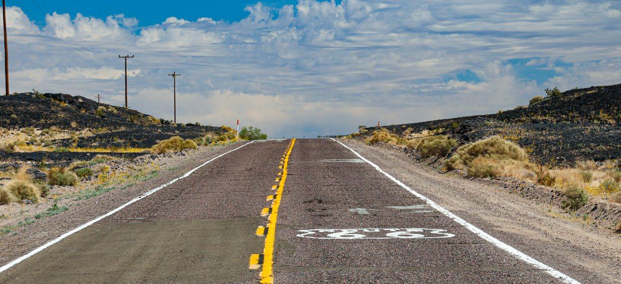
Located in this basalt flow is the Hector Mine. Unique minerals found nowhere else are mined here in the basalt flows. This area was the site of the magnitude 7.1 Hector Mine earthquake in 1999.
From Route 66, about 15.5 miles (24.8 km) from Bagdad Café, a badly paved road will lead towards the crater and is labeled Pisgah Crater Road on most maps. If you drive up the roughly paved road to the crater from Route 66, you’ll get to experience a very unique landscape. Cinder was mined from the crater on and off for the past several decades, which doesn’t make it very recognizable as a cone shape anymore.
The eruption created several lava tubes. These are essentially caves and are open for exploration. The basalt or lava rock surrounding Pisgah Crater has the largest concentration of caves in southern California.
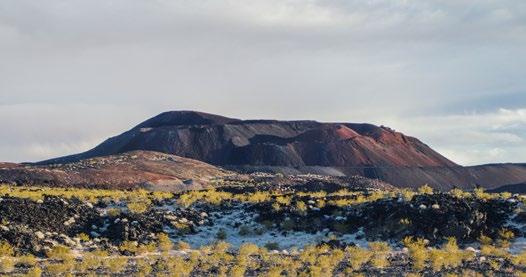
Just past Pisgah Crater is the border to the Mojave Trails National Monument. This relatively new national monument preserves the heritage of several historic roads through the Mojave Desert, including Route 66.
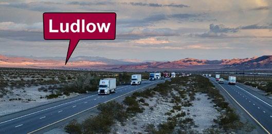
Continuing east on 66, you’ll cross over to the other side of I-40 with good views of the desert in both directions. The desert outpost town of Ludlow will be reached in 29 miles (46 km), from Bagdad Café. Ludlow marks the beginning of the next Route 66 tour. Look for that tour sheet that covers even more remote stretches of the Mother Road, to US Hwy 95, near Needles.
Continuing East
If you decide to continue east on Route 66 past Ludlow, be sure to check out the Ludlow to Needles tour guide found later in this publication
Watch a virtual video tour of Route 66 from Barstow to Ludlow and download detailed driving directions to print or upload to your phone.
See Places to Visit on the Newberry Springs Chamber website or search for “Route 66 from Barstow to Ludlow” on YouTube. www.NewberrySpringsChamber.com

13
Newberry Springs, a Desert Oasis
By John Wease
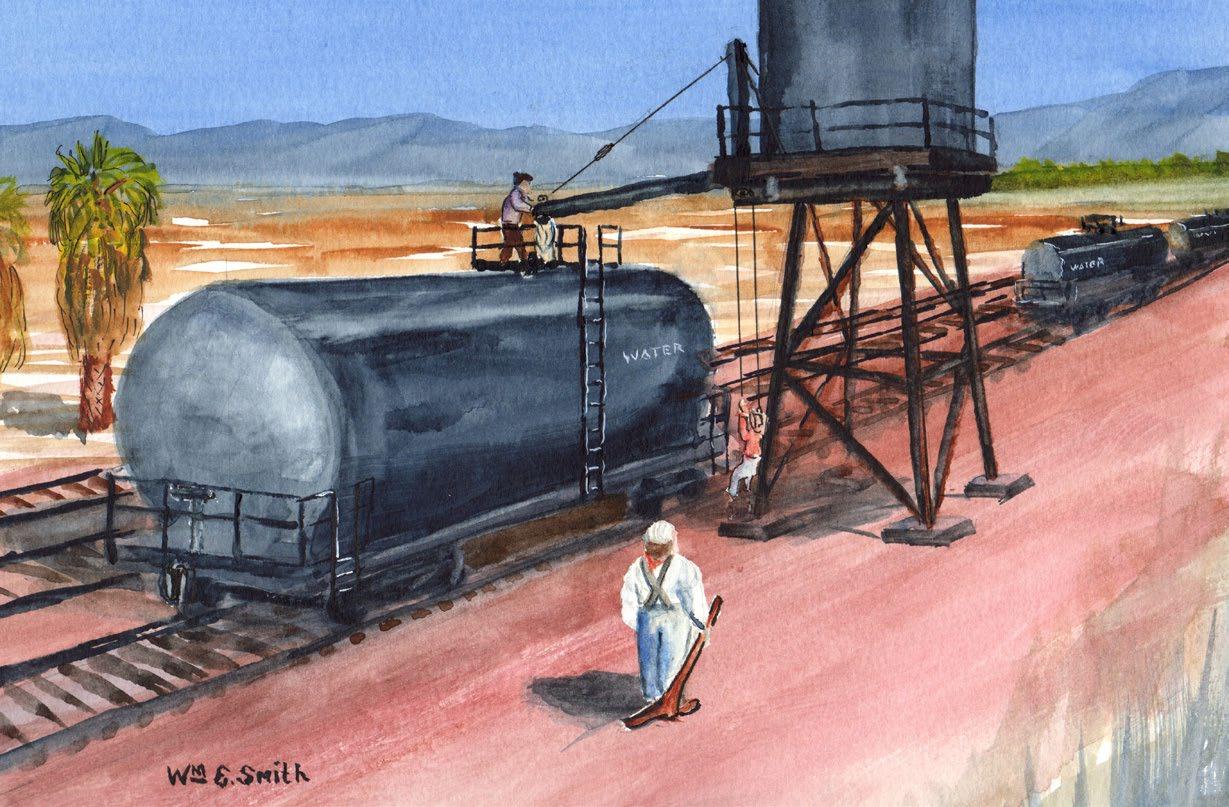
Newberry Springs is an unincorporated, High Desert community in San Bernardino County. It is located 20 miles east of Barstow and approximately 40 miles west of the Mojave Trails National Monument. The population of around 3,000 people are spread over a large area of 117 square miles. The relatively flat terrain was part of the lakebed of the ancient Lake Mannix that covered a great deal of the present-day Mojave Desert. The abundance of water made the Newberry Springs area a welcome oasis for desert travelers going back thousands of years.
The Mojave aquifer supplied enough water to support the agricultural economy of Newberry Springs. A good deal of land along Route 66, and Interstate 40, were wetlands at one time. In 1883, when the Southern Pacific built their tracks through the area, they called it Newberry. Purportedly, two brothers, named Newberry, lived at the spring, located about midway between the present-day locations of the Barn Route 66 and Newberry Road, where the railroad filled their water tanks. In 1919, Newberry was renamed “Water” by the Santa Fe Railroad. It was an appropriate name
14
Water tank cars being loaded with water from Newberry Springs to be shipped to places east like Ludlow as seen by painter and long-time resident, Bill Smith.
to them. It is estimated that they pumped between 300,000 and 600,000 gallons of water from the spring each day to supply their facilities in the more arid east. Around 1930, the name was changed back to Newberry, and Springs was added to the name in 1967
In 1910, the Mojave Desert was included in the Homestead Act. Up to 160 acres could be claimed, and ownership granted after three years of working the land. This period coincided with an unusually wet climate cycle. Settlers came from all over the country to farm their free land. They were pretty successful, until the climate returned to the more normal arid condition. Many settlers abandoned their homesteads, and returned to the less harsh environments they were used to. We must marvel at how tough the ones that stayed here were. They were able to survive, and in many cases prosper, without any of the modern conveniences we tend to take for granted today. They had to be tough, but also independent, and self-reliant. And, they had to be able to not only tolerate the loneliness of the remote desert, they had to love it. You actually see many of these same traits in the citizens of present-day Newberry Springs.
The soil, being an ancient lakebed, is alternating layers of clay and sand. The early settlers used this clay to make adobe bricks and mortar, and to line their livestock water reservoirs. Later residents expanded on this by digging ponds and in many cases, fair sized lakes. There were many commercial catfish farms as well as private residential lakes. Some of the larger lakes are community lakes where residents own a home on a parcel around the lake, like the twenty-seven acres Lake Jodie. Some of these lakes were designed for water sports. Wet Set Village
is the most famous water ski lake here. National water ski competitions are held there. For those that prefer less wet recreation, in and around Newberry Springs is an off-roader’s paradise.
Newberry Springs has always been primarily an agricultural-based community. Turkey and chicken farms were plentiful. Walter Knott bought all of the chickens for Mrs. Knott’s Chicken Dinner Restaurant at Knott’s Berry Farm for many years from producers here. As a side note, Walter Knott was one of the unsuccessful, early day homestead farmers here. He supported himself by working as a carpenter at the mines at Calico. He later purchased and restored Calico Ghost Town before donating it to San Bernardino County. With the success of Knott’s Berry Farm, I guess we can say he did alright.
Apricots were a major crop for many years. Alfalfa was first flood irrigated, then overhead watered, and finally expanded greatly with the pivot irrigation systems. With the declining water table, largely due to the overdraft of the Mojave aquifer by the larger cities upstream, these crops are no more. The less thirsty Pistachio became the number one commercial crop. Every year, Newberry Springs hosts a Pistachio Festival the first Saturday in November. In 2023, the twentyfifth annual festival was held. The festival has grown to a major regional event, attended by thousands.
Newberry Springs has several cozy Air B&B’s, and an RV park, that can be used as a convenient home base while visiting the interesting sites listed in this guide. Or, stay a little longer and visit the other fascinating locations in the surrounding area. Be forewarned though, many who visit Newberry Springs end up moving here to our little oasis in the desert.
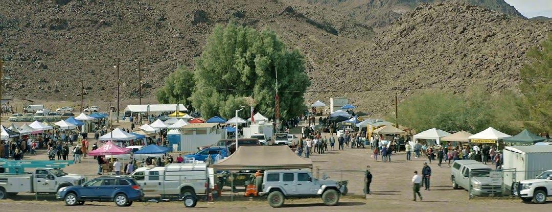
The
Annual
15
Newberry Springs
Pistachio Festival
Mojave Trails National Monument
Mojave Trails is a fairly new national monument, as it was designated in 2016, along with two other nearby national monuments, Sand to Snow and Castle Mountains. It is managed by the Bureau of Land Management Needles Field Office and is located in the vast Mojave Desert within San Bernardino County, California.
As its name implies, this national monument is dedicated to the preservation and protection of the historic trails etched into the desert landscape. These trails include old wagon roads and others would become the world-famous Route 66. Another invaluable aspect preserved by this national monument is the expansive desert ‘view-scapes’ that early travelers reluctantly negotiated while navigating these ancient paths. Today, visitors can still experience vast stretches of desert
untouched by human development.
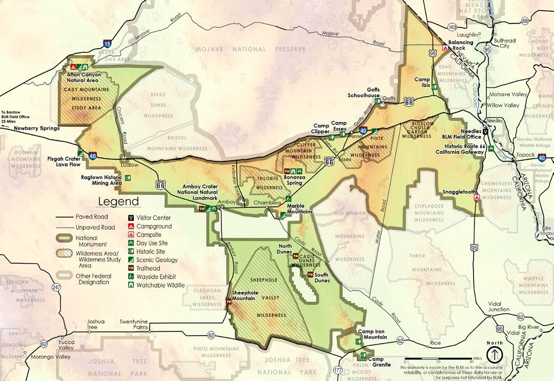
Below is a map of the national monument. You’ll see it looks like a big letter “Y”, with its upper-left side touching Interstate 15, its upper-right side touching the Nevada border, most of its northern border touching the Mojave National Preserve, and its bottom touching the boundary of Joshua Tree National Park. Its size is 1.6 million acres.
Unlike other national monuments, the area here is almost totally undeveloped, which was one of the reasons for creating it. With the talk of large scale solar power plants and wind farms, desert activists and preservationists wanted to take action before this swath of land was used for something that would alter the scenery here forever. Currently, the only man made things existing in the monument are roads of various types, a few abandoned ghost towns, and a handful of residents. Other than that, there’s nothing but virgin desert.
16
The monument also encompasses and joins several existing wilderness areas, such as Clipper Mountain, Cadiz Dunes and the Trilobite wildernesses. Other lands are those that have been acquired over a period of more than 20 years by the Wildlands Conservancy, and were then donated to help create a larger swath of protected land.
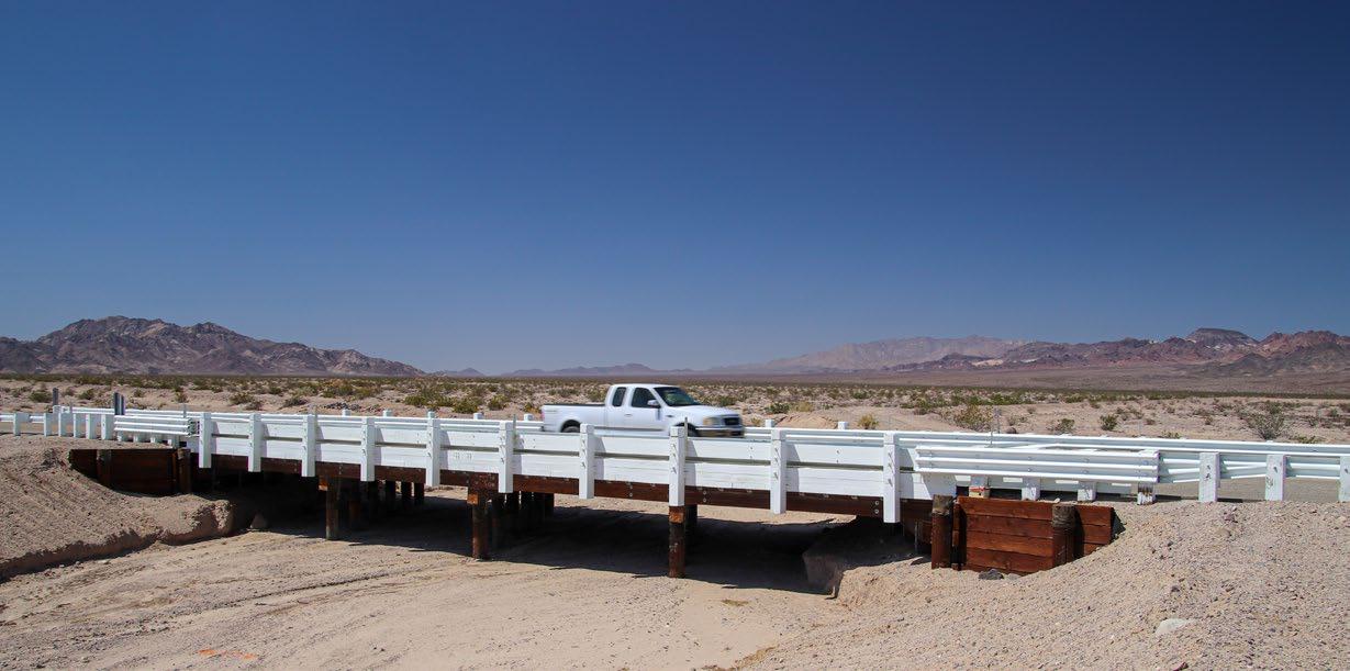
One key objective in establishing the monument was to secure funding and ensure the preservation of various historic roads and trails, hence the monument’s namesake, Mojave Trails. One of the primary roads is Route 66. One of the longest uninterrupted stretches of historic Route 66 passes through Mojave Trails. Unfortunately, many of the bridges for the roadbed that were built in the 1920s are slowly decaying thanks to the desert sun and numerous flash flood events they have endured since they were built. Thanks to the new national monument and the County of San Bernardino, efforts are now underway to repair the hundreds of old wooden bridges along this stretch of the historic Mother Road.
Along with Route 66, other historic roads passing through the monument include the Old Spanish Trail,
the Old Government Road (known in modern times as the Mojave Road), the Atchison, and Topeka and Santa Fe Railroad that Route 66 mainly followed all the way from Chicago. There are also countless roads and “tracks” that were created during the first years of World War 2 made by nearly a million soldiers training for desert combat under the command of everybody’s favorite general, old “blood and guts” himself, General George S. Patton.
Many people think that the words, national monument, means that it is land closed to motorized exploration. It isn’t. Wilderness areas are, but they were established decades ago. Much of Mojave Trails National Monument is open to mixed recreation, including hunting and off-road exploring.
The next time you visit this area, plan on checking out one of the places to visit in this new addition to the Bureau of Land Management National Conservation Lands. Places include Afton Canyon, Pisgah Crater, Amboy Crater, Cadiz Dunes, and the many swaths of wide-open desert. Learn more about the monument by searching for “Mojave Trails National Monument” on YouTube or scan the QR code below to watch a video tour.
Watch a virtual overview tour of Mojave Trails National Monument. See Places to Visit on the Newberry Springs Chamber website or search for “Mojave Trails National Monument” on YouTube.
 Newly restored bridge around 2022
17
18

19
Newberry Springs Driving Tour Guide
This tour guide will take you on a driving route through a unique community in the heart of the Mojave Desert, known as Newberry Springs. What makes this community special are the many sights and attractions to see along this tour that are found nowhere else.
Newberry Springs is located along historic Route 66 and the travel corridor of Interstate 40, about 20 miles east of the desert crossroads town of Barstow, and about 8 miles south of Interstate 15.
Tour length: About 80 miles (128 km)
See the map on the next page that points out all the stops highlighted in this tour.
Be sure to watch the video tour that visually shows the stops detailed here, plus a whole lot more information. See the Newberry Springs Chamber of Commerce website to find the video or search YouTube for “Newberry Springs”.
Stop #1: Start of Tour & Newberry Mountain
Start your driving tour by taking the Newberry Springs exit from Interstate 40, which is 18 miles east of Barstow. At the end of the offramp, turn towards the big purple mountain, which is Newberry Mountain.
The unique purplish color in this mountain was formed from repeated volcanic activity here about 5 to 20 million years ago. Newberry Mountain is full of twisting canyons and, in the spring, big wildflower displays.

Route 66
The road we’re on now is Route 66. This historic road parallels its successor, I-40, all the way through Newberry Springs. We’ll follow Route 66 for the first several miles of our tour.
Many of Newberry Springs historical buildings, as well as its history are tied to the Mother Road. For the next few miles, you’ll see buildings and businesses that were built along this once major highway starting in the 1920s. Some of these buildings are still clinging on to life, whereas others are in a state of decay.

Stop #2: Deel’s and The Barn
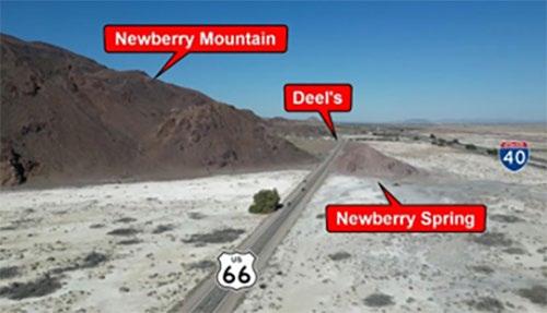
The first place of interest will be on the right, which is Deel’s. This used to be the Cliff House that was established in 1929.
It was a full-service desert oasis that included a garage, store, café, cabins, post office, general store, and even a swimming pool. In the 1950s, both Greyhound and Continental Trailways bus companies stopped here. It also had the only telephone in town, which made it quite the popular place.
If you look in the back, you can see remains of the old pool and a few of the cabins. As you can see, it abuts the volcanic rocks of Newberry Mountain.
20
Map showing tour stops
Return to this page to see the location of all the stop numbers in the tour guide

21
Just down and across the street is The Barn. It was built on the foundation of what was the Newberry Market and Café that burned to the ground in the 1960s. On the weekends, you might see motorcycles and classic cars parked here taking a break from enjoying a cruise along the Mother Road. Walking into the Barn reveals a classic roadhouse, the kind that once dotted Route 66 in its heyday. In the back is a stage where you might be lucky to catch a live music performance.
Stop #3: Newberry Spring
Continuing east, the road passes between two hills. Behind the shorter hill on the left, is the site of the actual Newberry Spring. During the early period of the road, before it was designated Route 66 in 1926, this was the only source of water for drivers to rely on coming from Needles, a stretch of about 160 miles.
During the 1940s, traveling merchants, known to everyone as Gypsies, came here to Newberry Spring in horse drawn wagons. They lit a big campfire to attract people from all around to sell and trade their goods.
Stop #4: Newberry Springs Community Center & Park
Turning right on Newberry Road off Route 66 will bring you to the Newberry Springs’ Community Center. This is home of the annual Pistachio Festival that occurs on the first Saturday of every November. It started in 1997.
Next to the community center is a small park with picnic benches. The side of the building has a mural depicting a quaint desert scene.

Stop #5: Poniente Drive – Troy Road
From stop #4, return to Route 66 and turn right. In one mile, a road to the right called Poniente Drive, turns into Troy Road in a short distance. It leads to a wonderland of off-highway exploring.
This dirt road passes around the Newberry and Rodman Mountains Wildernesses. One can spend a day exploring this area and make a loop trip on Camp Rock Road that leads back to I-40 near Daggett. Along the way, you’ll find a series of lava flows and a cinder cone, a canyon full of Native American rock art, and you’ll see a whole lot of Mojave Desert scenery.

Stop #6: Bagdad Café & Gas Stations
Just past the turnoff to Troy Road, you’ll go by one of the more popular attractions along the Mother Road – the Bagdad Café. People from all over the world stop here to visit this unique desert eatery.
Originally named the Sidewinder Café, this place was made famous by a 1987 movie named Bagdad Café. The movie and the café were actually named after another Route 66 town called Bagdad, which is 50 miles to the east from Newberry Springs.
Just past Bagdad Café are the remains of a Whiting Brothers gas station. Originally, this building housed Tony’s Spaghetti House, which was converted to the gas station we see today in the 1960s.
Next door to Tony’s, are the remains of Reed’s Texaco Station. The owners were known to run a spic and span operation. Today, the neatly kept remains of this gas station still reflects the original owner’s attitude.
Stop #7: World’s Longest Driveway
Continuing east on 66 for 1.5 miles, the intersection with Fort Cady Road will be reached. Turn left here to cross I-40, then turn right just past the truck stop. This road was part of a rather odd bit of motor racing history, known as the world’s longest driveway.
22
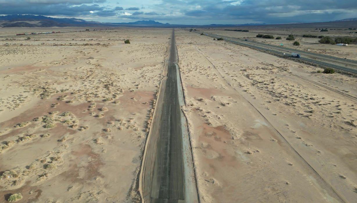
This “driveway” was built for Mrs. Orcutt after I-40 cut off access to her residence. Since this very straight and long road has no law jurisdiction, Mrs. Orcutt allowed car enthusiasts to speed-test vehicles on it. This road soon became famous for testing cars up to 200 mph.
Stop #8: Newberry Springs Family & Senior Center
Cross back over I-40, turn right on 66, then continue 3 miles to Newberry Road and turn right to cross I-40. The Newberry Springs post office will be seen on the right.
Two miles from the railroad tracks, on the right, we’ll pass the Newberry Springs Family & Senior Center and Drifting Sands Café. This is a community hub offering year-round activities as well as fresh cooked breakfast and lunch, Wed. through Sun., each week.

Stop #9: Water Skiing Lakes
A short distance past stop #8, turn left onto Silver Valley Road, heading west now. We’re now going to focus on one of the area’s bigger assets, its abundance of water.
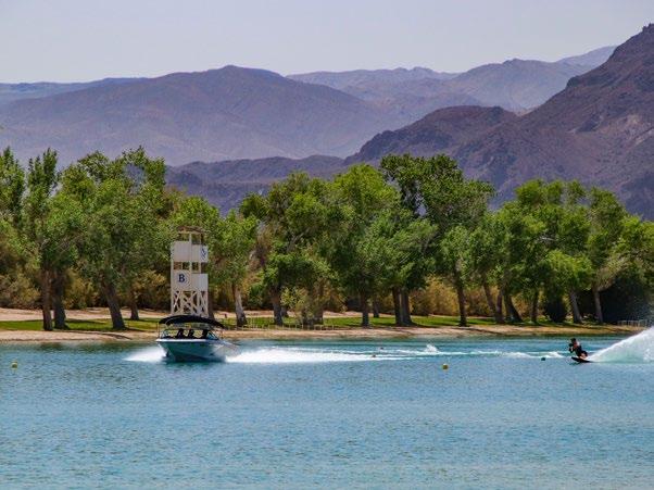
Because of ample ground water, the residents here have created many small lakes. Please be aware that all lakes are privately owned either by a single owner or a lake community. There are over a dozen lakes scattered across Newberry Springs, some of them competition water skiing lakes, others recreational. World-class competitions occur at these lakes regularly. Each lake is between 10 to 50 acres in size, with a total of about 300 homes around them.
23
Stop #10: Barstow Koi Farm
Continuing west on Silver Valley Road 4.5 miles from Newberry Road will reach the Barstow Koi Farm. It has been here for decades and is open to visitors only on the weekends. Check with someone at the front office before wandering around the farm and its buildings.
There are a series of ponds, mainly inside a greenhouse, where koi are raised from eggs, all the way to adult fish that are then sold to customers and wholesalers all over the USA. The facility uses custom equipment that was developed by its owners. Some of the fish raised here became prize-winning koi.
Stop #11: Pistachio Farm
Head east on Silver Valley Road to return to Newberry Road and turn left (north). Along with many lakes, Newberry Springs is known for pistachios, and you’ll find orchards scattered all over the community. In 2.2 miles after turning, you’ll see Big Al’s Pistachio Farms, which consists of about seven thousand trees total.

Stop #12: Lake Jodie
Keep heading north on Newberry Road and, in about half a mile, Lake Jodie is reached, which is another one of those private lake communities.
Lake Jodie is the largest recreational lake in Newberry Springs. It covers 55 acres and has the largest number of homes surrounding its shores. Its residents enjoy water sports of all kinds, or simply chilling out on the deck to enjoy the views.
Stop #13: Homes Buried in the Sand
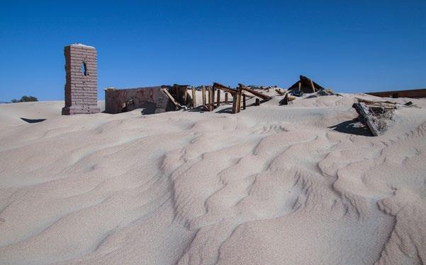
From Lake Jodie, continue on Newberry Road until the pavement becomes buried by drifting sands from the Mojave River. Don’t drive any further as it is easy to get a vehicle stuck in the sand.
After people built their homes here, they didn’t realize how strong Mother Nature was with her blowing sand. Several houses built here have since been buried and are now abandoned. The house pictured at right only has its roof and chimney sticking out of the sand.
Stop #14: Camp Cady wildlife area
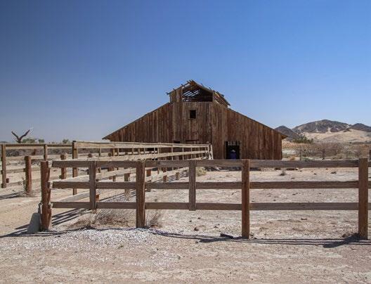
From the sands, head south back towards Lake Jodie, then turn left (east) onto Riverside Road. In one mile, turn left once more onto Harvard Road. In 0.8 mile, turn right onto the dirt Mojave Road to visit Camp Cady. The parking area is reached in 2 miles, on the left.
Originally called Fort Cady, it was established in 1860 as a military camp to suppress Piute attacks on wagon trains traveling the Mojave Road. Now, Camp Cady is a wildlife area. You are welcome to hike into Camp Cady and explore its old buildings, which is a ranch that was established long after Fort Cady was in operation.
24
Stop #15: Mojave River
Get back to the pavement of Harvard Road and turn right. Soon, you’ll be passing through the Mojave River, which is the primary source of underground water to Newberry Springs and all its lakes.
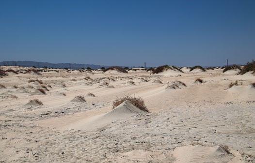
This river drains a big portion of the San Bernardino Mountains, some 80 miles away. This river is rare, as it flows away from the ocean and deposits its water into the desert. There is rarely water at the surface.
Stop #16: Ironwood Camp
Continuing one mile north past the river, turning right onto Cherokee Road will lead to Ironwood Camp. The road dead-ends at its gates in three and a half miles. Ironwood is a unique Christian-based facility that provides overnight stays for meetings and retreats. Access to the camp is by reservation only.
Stop #17: Saint Antony Monastery
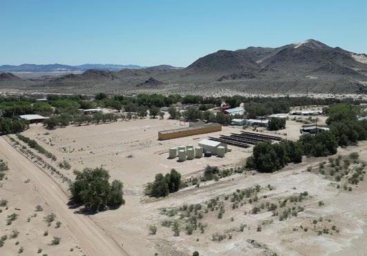
I-15 is reached just a short distance north on Harvard Road. To visit our next stop, cross over I-15, then turn left onto the frontage road. Follow the signs to Saint Antony Monastery, which is 9 miles from this point.
Stop #18: Volcano House
Our last stop is the unique architecture of the Volcano House. Retrace the tour back to the junction of Newberry Road and Silver Valley Road. From here, turn left (head east) on Silver Valley Road for 6 miles. As you head east, about when the road turns to dirt, look to the southeast and you’ll see it in the distance.

Resembling a flying saucer that has landed on top of a small cinder cone, the Volcano House was built in 1968 by Bard Wallace, the person that patented the skateboard. It was later purchased in 2003 by beloved PBS personality, Huell Howser, host of the popular TV show, California’s Gold. When Huell passed away in 2013, the house and surrounding property was sold to a private party that doesn’t allow access.
From the Volcano House, return to Newberry Road via Silver Valley Road, then turn left (south) to return to Route 66, which will bring you back to where this tour began.
Watch a virtual video tour of Newberry Springs and download detailed driving directions to print or upload to your phone. See Places to Visit on the Newberry Springs Chamber website or search for “Newberry Springs Tour” on YouTube. www.NewberrySpringsChamber.com

25
Mojave National Preserve
An Introduction
As Route 66 meanders through the Mojave Desert, it passes within an hour’s detour of two national parks – Joshua Tree and Death Valley. Another “almost” national park, the Mojave National Preserve, butts right up against Route 66 and is another region where more exploring can be enjoyed.
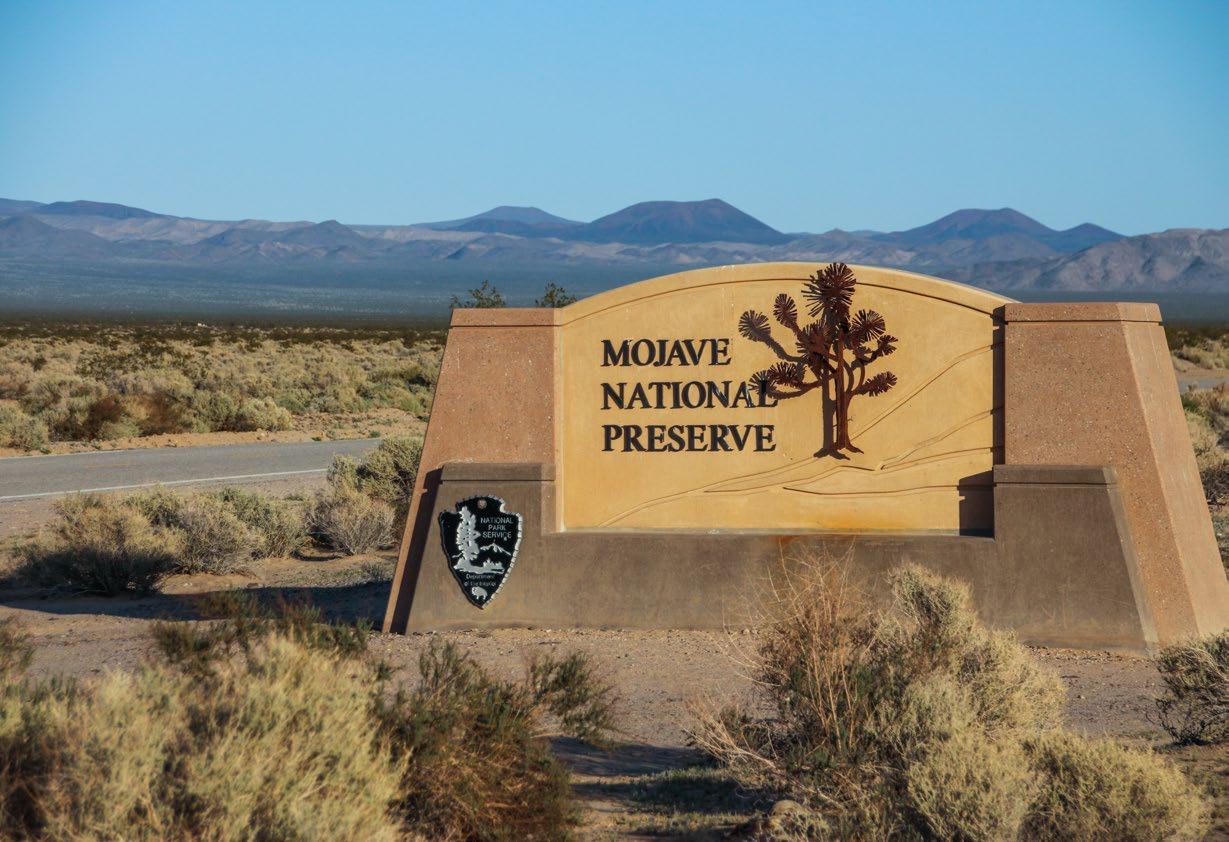
The Mojave National Preserve (MNP) was formed in 1994 by what is known as the Desert Protection Act. At approximately 1.6 million acres, it is one of the largest units of the National Park Service within the contiguous United States (right behind Death Valley and Yellowstone). It is roughly located between I-15 and I-40. Its western edge is situated roughly near Baker (north) and Ludlow (south), and extends almost to the Nevada/Arizona border.
There is a lot to explore in this large area and we hope that this article will spark your interest to learn more about it and take a trip (or several trips) out there to experience it for yourself. In addition to the vast amount of open, unspoiled desert landscapes, the Preserve has many unique things to see. It is a very special place.
Why was the Preserve created?
The whole purpose of creating the Preserve was to protect and save a region of the unique Mojave Desert environment. The Mojave Desert covers a huge area of land and much of the western part of it has been permanently altered by commercial and military development. The almost untouched “East Mojave” (which the Preserve is located in) still had most of the diverse flora and fauna specific to the Mojave Desert, so
26
it seemed logical to preserve this piece.
Good thing that decision was made because, in 2013, National Geographic Magazine rated the Mojave Desert as one of the top 100 places to visit in the world. Now, San Bernardino County has a world-renowned natural area that can be enjoyed for generations to come.
What is a National Preserve?
It is a bit confusing as to why the MNP is a National “Preserve” instead of a National “Park” but there is a clear distinction between the two. All land inside of a National Park must belong to the National Park system. It cannot be privately owned nor is any hunting or mining allowed.
When the Preserve was created, there were still many privately owned parcels of land within its boundaries. There were also active mining claims and hunting was allowed. Over time, these parcels are being purchased by the Park Service (as they become available and the Park Service can afford them) but the status of the Preserve cannot change until there is no more privately owned land, nor any mining or hunting interests. This will take some time.
What is there to see in the Preserve?
There is a lot of wide-open space and classic Mojave Desert scenery to see throughout the MNP. There

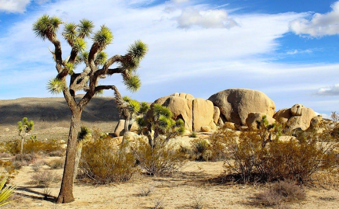
are lots of dirt roads and places to hike. There are also plenty of unique things to see like cinder cones, abandoned mines, petroglyphs, diverse flora and much more. Although you might think you see a lot of the MNP while traveling on I-15 or I-40, there are so many hidden gems that you can only get to by getting off the freeways and onto the back roads.
Many of the highlights of the MNP can be accessed with an ordinary vehicle via a paved or easy dirt road. One of these places is the beautifully restored Kelso Depot which is also the MNP’s main Visitor Center. There is also a small Visitor Center at the MNP headquarters in Barstow. It’s always a good idea to stop in at a Visitor Center before exploring an area. Other
27
places that you can get to with an ordinary vehicle are the Kelso Dunes, Hole-in-the-Wall, Mitchell Caverns, Rock Spring, Teutonia Peak hiking trail and Zzyzx.
How do I get to the Preserve?
From Newberry Springs or Barstow, travel east on I-40 for a little less than 60 miles. Take the Kelbaker Road exit and turn left. This portion of I-40 is the Preserve’s southern boundary, so as soon as you cross under I-40, you’re in the Preserve.
Kelbaker Road heads north all the way to I-15. But you don’t need to go that far. In about 22 miles, you’ll encounter Kelso Depot. Be sure to stop here to learn more about the Preserve.
From the depot, you can head in two different directions. Either continue north up Kelbaker Road to see the cinder cone field and its variety of lava flows and fields, or head northeast up Kelso Cima Road following the railroad tracks. This road leads to places of interest on the east side of the Preserve.
What kind of vehicle do I need?
Several paved roads crisscross the MNP. Paved roads mostly go north-south. Well-maintained dirt roads go east-west. Either way, its best to have a reliable vehicle that you don’t mind getting a little dirty and have plenty of fuel.
More of the MNP can be seen using an SUV or truck. You don’t necessarily need 4WD but having it will expand your trip options. Having that high-clearance will give you access to the many dirt roads across the MNP that lead to places like the cinder cone field, Cow Cove petroglyphs, Caruthers Canyon, historic mines of the Ivanpah Mountains, the Mojave Road and many other places.
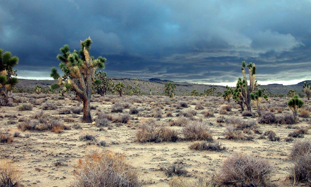
One easy introductory road trip through the MNP is via Kelbaker Road, mentioned earlier. Another easy road trip is via Cima Road off the I-15. It passes through the largest Joshua tree forest in the world and goes past the Mojave Cross (which has been in the news the past few years).
Watch Mojave National Preserve: Introduction & Tour on YouTube. Learn more about how to visit the Preserve at BackRoadsWest.com and select blog, or scan the QR code on the right.

28
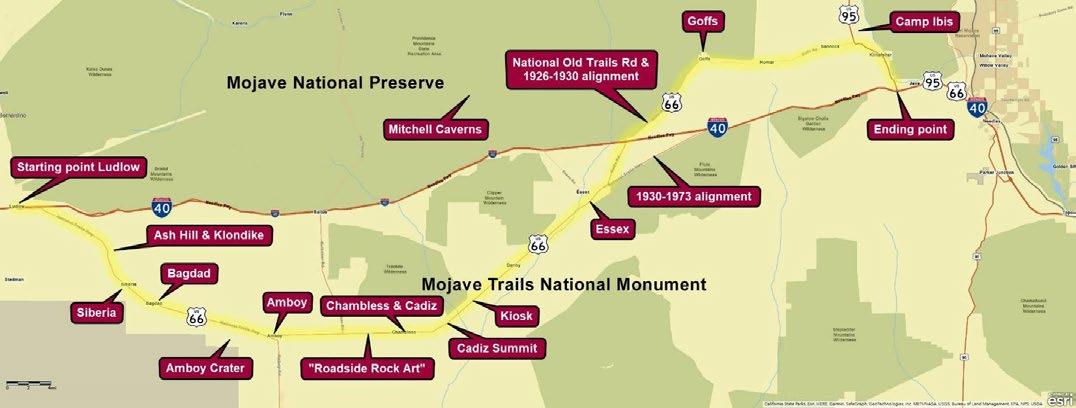
Tour Route for Route 66 from Ludlow to Needles
Passing through Bagdad, Amboy Crater, Amboy, Essex and Goffs
The most remote and barren stretch of Route 66 passes through California’s Mojave Desert between Barstow and the Colorado River, and the touring route described here covers a large portion of it, between the towns of Ludlow and Needles. Even more remote than our other tour of Route 66 between Barstow and Ludlow, this very section was even more remote for early travelers. Today, since this road sees very little traffic, it feels even more
remote. Unlike the Barstow to Ludlow section, which is close to its successor I-40 most of the way, this segment is far away from I-40 for its entire length.
Although this tour goes from Ludlow to just west of Needles, it can be taken in either direction. If you start from Needles, simply follow the tour itinerary in reverse.
Length: About 108 miles (173 km) one-way
Ludlow
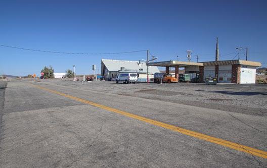
Begin your tour by getting to the town of Ludlow, which is an exit off of I-40. Ludlow is loaded with history. It was the beginning and headquarters of the Tonopah & Tidewater Railroad that operated from 1907 to 1940. Nearby mines pumped a lot of money into this remote desert town.
Behind (to the south of) the current-day café and hotel is where the old downtown existed. Remains of some of the old buildings still exist, including a mercantile store from 1908.
Return to the stop signs on Route 66 and begin heading east away from Ludlow. RESET YOUR TRIP METER here. In a quarter mile, more abandoned
buildings will be seen along Route 66. This will be the last signs of civilization until Amboy in 28 miles.
29
Bridges – Ash Hill – Klondike
About 9.5 miles from Ludlow, Route 66 crosses one of many old wooden bridges, this one longer than most. Many of these bridges are around 100 years old and are withering away in the desert sun and are slowly being replaced or upgraded as funding becomes available.
Near here are the old railroad outposts of Ash Hill and Klondike. Helper steam engines were turned around here to help trains up the long grade from Amboy.
Siberia
At 13.3 miles from Ludlow, a dirt road to the left leads to the remains of Siberia. This was an important water stop for steam engines climbing the long grade between Amboy and Ash Hill. All that remains of Siberia is the foundation and a few walls of a gas station.
Bagdad
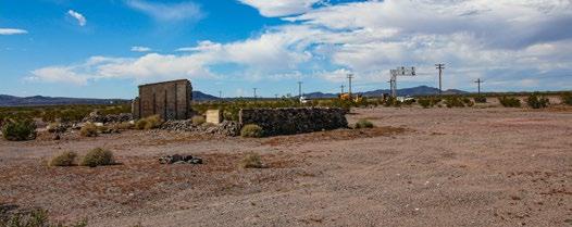
At 20.4 miles from Ludlow, a dirt road leads to the site of Bagdad. In its heyday, Bagdad had more going on due to the railroad, such as the station house and rail yard seen in the picture at right, plus there were several nearby mines. Unlike Siberia, where there is one foundation left, there’s nothing left of Bagdad.
Bagdad Café
Located at Bagdad was the “original” Bagdad Café, not the one that has been popularized in Newberry Springs that didn’t come into existence until the 1980s. This was one of many cafes / gas stations / garages / lodging that existed in many of the extinct towns along this tour segment of Route 66.
Bagdad Auxiliary Airfield
Amboy Crater
Seen in the distance from Bagdad, Amboy Crater is a cinder cone, which is like a mini volcano that only erupts a few times. More well-known volcanoes, like Mt. St. Helens erupts many times and becomes large mountains. According to geologists, Amboy Crater erupted around 10,000 years ago.
The entrance to the parking area, picnic tables and restrooms is 26.4 miles from Ludlow.
Hike into the Crater
At the end of the parking lot, near the restrooms, is the trailhead to begin a 3 mile round trip hike into the crater. The hike passes by the extensive fields of lava rock, known as basalt. The trail goes around the backside of the crater and climbs up and over a low spot of the crater’s rim. The views of the surrounding volcanic landscape and into the crater to see the explosion pits makes for a very rewarding hike.

Amboy
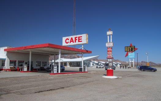
At 28 miles from Ludlow, the interesting little town of Amboy is reached. Amboy was founded as a mining town in 1858 and is one of California’s oldest towns. Amboy once boasted a hefty population of about 700.

Across the road from Bagdad (south side) is a memorial for five aviators that were killed while attempting to land at the Bagdad Auxiliary Airfield. They were on a training mission, preparing for the looming air war of World War 2. The accident occurred a few months after the attack on Pearl Harbor on April 9, 1942.
30
Amboy has the distinction of once being sold on the on-line auction website, eBay. It is currently owned by the founder of a popular Southern California fast food chain, Juan Pollo. The owner, Albert Okura, made many improvements to the town. Sadly, Okura died in 2023. His family vows to keep the town alive.
“Roadside Rock Art”
Between Amboy and Chambless, unique roadside rock art, or graffiti if you prefer, will be seen on the north or left side of the road. The art will go on for several miles. This tradition was supposedly started in the 1940s by a couple of children that were bored while the vehicle they were riding in broke down. They created the first rock art while their parents fixed their vehicle.
Roadrunner’s Retreat
At 37.5 miles from Ludlow, the ruins of an old truck stop / gas station / restaurant can be seen on the right (south) side of the road. This was Roadrunner’s Retreat that opened in 1962. It is now a Route 66 attraction as it has a well-preserved sign. A group of people are working on restoring the property, as well as lighting up the sign.

Chambless & Cadiz
Just after Roadrunner’s Retreat, Chambless is reached. The railroad first established Cadiz, which is 3 miles to the south. When National Old Trails Road was built around 1910, James and Fannie Chambless opened a service station and store here around 1912. When Route 66 was established in 1926, they moved their store onto the new alignment, which is the road we’re driving on today. Their establishment survived until the early 1980s. The remains of other roadside businesses can be seen nearby.
Cadiz Summit
After heading east from Chambless, the road climbs up and over Cadiz Summit. At the summit you’ll find the burnt remains of the café and gas station of the same name, Cadiz Summit.
Since the ascent to Cadiz Summit is a little steeper than other gradients along desert segments of Route 66, older vehicles of the day had difficulties conquering it in the desert heat. Countless vehicles were repaired here or had to recover from an overheated radiator.

Viewpoint - Kiosk
Just over 2 miles from Cadiz Summit, a pullout with a kiosk will be seen on the right overlooking the vast desert viewscapes, where the only signs of human development might be a passing train. The signs explain various aspects of historic Route 66.
Stretching from Cadiz Summit to Goffs, a distance of about 40 miles, Route 66 will be passing through a vast section of Mojave Desert called Fenner Valley. Very little human development or disturbed land exists in this valley.

31

Essex
60 miles from Ludlow, the town of Essex is reached. More ruins of old buildings from a vanished time can be seen here. Near the junction of Route 66 and Essex Road is a post office and the remains of the Wayside Garage, Café, Store and Camp.
In 1977, all the residents of Essex, about 50 at the time, appeared on the Tonight Show starring Johnny Carson. Essex had no TV reception back then and Johnny thought it would be interesting to interview a bunch of people that are out of touch with the outside world.
Route 66 Alignment Changes
1.5 miles from Essex, there’s a fork in Route 66. A bridge takes the 1930-1973 alignment of Route 66 over the railroad tracks and straight to I-40. Our tour bears left, following the National Old Trails Road and 19261930 alignment of Route 66 through Goffs.
Goffs
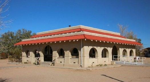
The next town encountered is Goffs. This town saw a lot of railroad activity starting in the late 1800s. When National Old Trails Road was established and, later, Route 66, Goffs prospered. When the aforementioned 1930 realignment was completed, most of the traffic took this path, and Goff’s prosperity was dimmed.
Today, people visit Goffs to see its old schoolhouse which now serves as a museum lovingly operated by the Mojave Desert Heritage and Cultural Association. Over the years, this organization has done an outstanding job of preserving many artifacts of the surrounding Mojave Desert.
Intersection With U.S. 95
At 14 miles from Goffs, Route 66 T’s into Route 95. Turning right continues our tour of 66 as it shared the same alignment as 95. However, if you wish to take a quick side trip, turn left and, in 2 miles, you’ll see the historical marker that explains Camp Ibis.
Camp Ibis
Along our tour of Route 66, we passed by three historic World War 2 military training camps: Camp Essex, Camp Clipper and Camp Ibis. Camp Ibis was by far the largest.

32
During the first half of the war, thousands of troops were trained at these camps under the command of General George S. Patton. The picture at right shows the extensive tent city of Camp Ibis and its roads. These roads can still be seen behind the historical marker, but no other trace of this large encampment remains.
Klinefelter
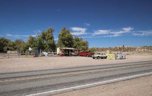
Continuing on Route 66 & 95 towards I-40, remains of the small town of Klinefelter is reached. Unlike other towns we’ve seen, close by springs provide life to palms and other trees. Honey has been sold here for decades.
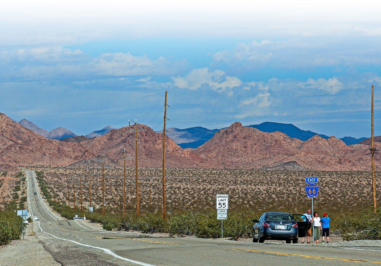
From Klinefelter, Route 66 funnels onto I-40, where you can simply follow it for 8 miles into Needles using the modern highway.
Needles
Use exit 141 to follow Route 66’s original alignment through downtown Needles.
Watch a virtual video tour of Route 66 from Ludlow to Needles and download detailed driving directions to print or upload to your phone. See Places to Visit on the Newberry Springs Chamber website or search for “Route 66 Road Trip from Ludlow to Needles” on YouTube. www.NewberrySpringsChamber.com

33
Jim Conkle The Mayor of Route 66
By Cliff Bandringa
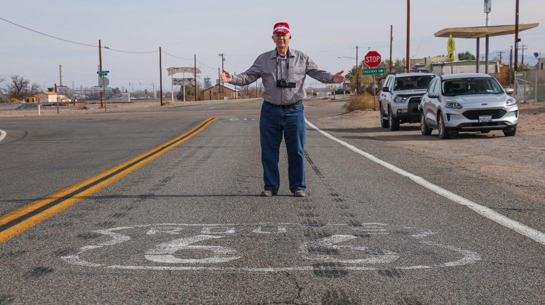
Route 66 was decommissioned in 1985. It only took a few years for the public to realize that the Road’s classic and historic forms of Americana, ranging from old road signs to roadside buildings, were clinging on to life. By the late 1980s, efforts were underway to preserve Route 66 as we know it today.
There were many people involved in preserving and promoting the Road. Much of that began in the town of Seligman, Arizona. In California however, there was one man that has promoted and spoken the words “Route 66” for so many reasons and so many, many times. His name is Jim Conkle.
Some people refer to Jim as the Mayor of Route 66. I’ve heard other people refer to him as Mr. Serendipity of Route 66. Jim has been involved with Route 66 in one way or another since about 1950. Back then, he interacted with Route 66 just like everyone else – by using it for east-west travel through the western half of the United
States. However, from 1990 on, Jim developed another relationship with the Mother Road.
Jim was at the forefront of promoting Route 66 in so many ways. Over the years, he has published books and magazines that tell the history of the Road along with all the interesting places to see along its route. Jim has been a tour guide, taking groups of all kinds along the Road’s length – from Chicago to Santa Monia – stopping at all those places of interest, all while telling stories and explaining the history that once was. Along the Road’s route, Jim has touched so many lives and been involved with so many projects, all with the goal of educating people about historic Route 66.
34
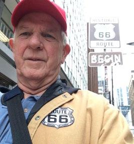
Jim Conkle on Route 66 in Daggett

He claims to have traveled Route 66 about 200 times. You might find that hard to believe. But if you end up talking to him for a while and hear all his stories, you’ll wonder if it might be even more than 200 times.
I met Jim about 2010, not on the Road, but on the information highway – social media. As always, Jim was on the lookout for other people also involved in
promoting or educating people about the virtues of Route 66. My personal interest was creating virtual travel experiences that one goes on by watching a video. He wanted to know more about how I created a virtual road trip through California’s Cajon Pass. We met at a nearby Starbucks, and we’ve been collaborating on various projects related to the Road ever since.
From 2010 to 2020, Jim has been instrumental in drumming up support for a way to preserve and promote Route 66 and its sites. At first, he visualized a “Mother Road National Monument” that would encapsulate just the road. But politics being what it is, it turned into today’s Mojave Trails National Monument, and more recently, its Scenic National Byway designation.
Today, Jim continues talking up Route 66 in many ways. This includes using his own publications such as The High Desert Pulse, or Route 66 Pulse Magazine, speaking and presenting at area functions, meeting with political members and other influential people, conducting tours of the Road, as well as simply wearing a Route 66 cap wherever he goes.
The producers of this publication wish to thank Jim Conkle for all his hard work on making all our Route 66 efforts come to fruition. Much of it wouldn’t have happened if it wasn’t for Jim.
35


 Published by
 Published by


 “Tin Lizzy”: a 1908 Ford Model T


 Map showing the 178-mile scenic byway’s location within the entire 2,448 mile-long Route 66


 Solar One, circa mid-1980s


 Newly restored bridge around 2022


