The idea of replacing part of Interstate 280 with a surface boulevard continues to capture the attention of local urban planners. Last month San Francisco Planning and Urban Research Association (SPUR) hosted a panel to discuss issues surrounding a proposal to end I-280 in the area of Mariposa and 17th Streets, as way to create a new gateway into the City and reconnect the Potrero Hill, Showplace Square, Mission Bay and South-ofMarket neighborhoods.
“We don’t want to replicate Octavia,” said Greg Riessen, transportation planner, San Francisco Planning Department, referring to the boulevard that was created after part of Highway 101 was torn-down. That project has been criticized for creating a difficult to access intersection.
SPUR is a member-supported organization that focuses on urban and regional issues. Most of the meeting’s 150 attendees consisted of the nonprofit’s members; the room was so packed that people had to sit on the floor. Sarah Karlinsky, deputy director, SPUR, moderated the panel, which included Riessen,; Gillian Gillett, director of transportation policy, City and County of San Francisco; and Jacinta McCann, executive vice president, AECOM, a transportation consulting firm.
According to SPUR, by making three “big moves” the City would create green spaces that reconnect Southside neighborhoods. The first big move would be to underground the new high speed rail and Caltrain. With I-280 in place, plans call for Caltrain and high speed rail to run along existing Caltrain tracks, which are at ground level from Mariposa

Street to the Fourth and King streets rail yard. Such an approach would force planners to put Mission Bay Boulevard and the intersection of 16th and Seventh streets underground, walling off the adjacent neighborhoods and undermining “…plans to upgrade 16th Street into a viable transit, pedestrian, bicycle and traffic route,” according to a SPUR article published last month. “We need a different solution,” said Gillett. “Well, what do we want? What can we do?”
Riessen believes that the best answer may be to underground the rail. Under this approach, the underground tracks would begin north of Cesar Chavez Street, go under Mission Bay — featuring a Mission Bay station — and travel to the new TransBay Transit Center. This strategy would also enable the City to redevelop the Fourth and King streets rail yard.
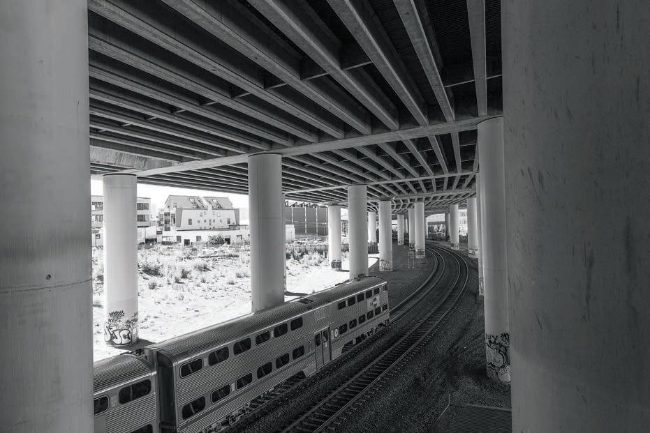
The second big move, and the project’s essence, would be to replace I-280 with a surface boulevard. According to McCann, that would open up access to Mission Creek and the Bay, creating opportunities for public spaces, such as plazas at Mission Creek and Channel Street. The City could also develop its own version of New York City’s High Line— a public park that was once an elevated railroad — if it leaves a fragment of I-280 standing, offering visitors a view of the surrounding area. The goal, in part, is to prompt travelers to say, “This is where I arrived in San Francisco,” McCann said.
Currently, I-280 runs above the Caltrain tracks until Seventh Street. If the interstate stopped near Mariposa, SPUR envisions crossings at 16th, Irwin, Hooper, and Berry streets. Neighborhoods north and west of Mis-
It’s the year 2000. A San Francisco Giants fan cycles from the new Pac Bell Stadium, heading south across the Third Street bridge toward Potrero Hill. She attempts to hug the waterfront by taking a sharp left, but is confronted by asphalt pavers and construction tape, so instead snakes her way through rows of parked cars toward Pier 48. Hanging a right, she coasts alongside the Bay; a yawning expanse of landfill and industrial buildings stretches in front of her, with no stop signs or traffic lights to slacken her pace. Her view of the Hill is unobstructed, save for whirlwinds of dust kicked up by passing trucks. The only person she spots is a lone fisherman, who hoists his equipment into the back of his hatchback against a backdrop of barges.
Flash forward to today. Where the old Southern Pacific railyard once stood, residential and commercial development has mushroomed. In less than a decade, the strip of land just north of the China Basin inlet has gone from marshy detritus to wallto-wall four story condominiums. The University of California, San Francisco-Mission Bay campus is nearing completion, sprawling over 43
acres, with more to come. The Veterans Administration wants to join the medical mini-city, along with a steady stream of biotechnology companies. As even medium-term Hill residents are acutely aware, in a dozen years Mission
In a dozen years
Mission Bay has transformed from yesteryear’s industrial terminus to a regional job nucleus
Bay has transformed from yesteryear’s industrial terminus to a regional job nucleus.
San Francisco has four major sites slated for development over the next 20 years, all of which will influence Bayview, Dogpatch, Potrero Hill, and South-of-Market. A snapshot in numbers: Seawall Lot 337 — the parking lot south of AT&T stadium — is set to host 3.5 million square feet of mixed-use development, the equivalent of seven Transamerica Pyramids. Next door, Mission Bay developers are expecting to fill 4.4 million square feet of office


s sleeping a form of public communication? I wouldn’t think so, but lately I’ve noticed a lot of snoozing going on at public policy meetings, which makes me wonder whether, by keeping my eyes wide open, I’ve missed out on some sort of trend.A couple of months ago I was sitting toward the front of modest-sized auditorium at a state public utilities commission workshop. The topic was tedious, no doubt: a presentation of California’s possible energy futures, which focused not on an array of colorful Future Shock-style possibilities, but on the statistical methods underlying the predictions being presented.
PublIShEr’S VIEw
I was actually interested; to me the discussion was like a paint-bynumbers game, with my job to make sure all of the right digits and colors were represented. During a pause in the presentation, I glanced to my left; a row behind me a fellow’s head was in his bent arm; his eyes closed. I looked to my right; a guy was slumped in his chair, chin to his chest, his eyelids fluttering like he was enjoying some REM sleep. I glanced toward the podium, where the speaker was now talking about Monte Carlo simulations. He didn’t seem to notice that he’d lost a chunk of his audience to dreamland.
Maybe the sleepers were practicing a New Age uber-absorption technique, the speaker’s words seeping into their cerebral cortex in an extra penetrative way. Or perhaps they weren’t sleeping at all, but engaged in Supreme Court-
illustration By amy curKendal
style extra vigilance, their eyes ready to snap open to make a pithy point or challenge an errant assertion. I heard a noise to my left; the guy with his head in his hands had started softly snoring.
Sleeping in public always seemed to me to be the ultimate transgression, not quite as bad as relieving oneself on the carpet, but close. The kids at school who folded their arms and laid down their head on their desk were always in trouble, or got bad grades. Occasionally an elderly relative might fall asleep mid-sentence, which was forgivable, given their age, but still a bit scary, like they were practicing an end of life ritual. And anyways, weren’t the people at the workshop being paid to be there, in which case they were sleep-stealing?
Then it dawned on me. They weren’t so much asleep as practicing a sophisticated performance art cum advocacy position. Dozing represented a protest against the sluggish process by which societal change occurs, mimicking the greater public, who themselves slept as a myriad of environmental and energy-related threats bore down on them, their eyes closed to eco-system destruction and climate change.
I shifted in my seat to get more comfortable, and let my eyelids drift gently downward. Next time I’ll bring a pillow.
A version of this piece previously aired on KQED Radio’s Perspective series.

Editor, In reference to “Kaiser Permanente Floats Revised Plans for Proposed Development” and associated letters to the editor (June): all of the people who are opposed to the Kaiser complex do not live here? Bayview residents are “bums and freeloaders”? Wow. With supporters like these, Kaiser-Walden opponents hardly need to stand up and be counted.
Ruth Miller, Mariposa StreetEditor,
Let me first say that I used to enjoy nothing more than picking up a copy of your publication when I visited my neighborhood haunts. Upon picking up your June issue, I was startled to see a picture of two gents wearing the antiKaiser t-shirts, but being used to bias against developers in San Francisco papers, I shrugged that off (“Kaiser Permanente Floats Revised Plans for Proposed Development”).
I was enthusiastic about having been featured in the article. I’d never been quoted in a news article before, and started consuming the entirety of it. Word by word, your article went into my brain! Your writer told the funny story that I had mentioned to him about crime and a car in “ill-repair.” My heart raced, and I was thinking “wow that guy is writing what I said!” Sadly though, it wasn’t meant to be. My enthusiasm quickly turned to anger as the last sentence of your writer’s summary of my comments indicated that 999 16th street residents equate the new Kaiser development with a nuclear power plant. Nothing could be more inaccurate.
What I had said to your reporter was “the crime is so bad, that we would welcome a nuclear power plant in lieu of the status quo. Anything would be a welcome improvement!”
After I said that, your reporter thanked me, and handed me his card. Before we parted ways I looked him right in the eyes and said “thanks for the card, now I know how to get a hold of you in case you misquote me!” Your writer totally misquoted me to the point of being obviously disingenuous. I’ve totally lost faith in The Potrero View. It depresses me to think that people can actually do such a thing.
I work so hard to employ people and make other’s lives better, and the one time I’m quoted in something it ends up being completely inaccurate. It makes me ask myself, “why keep doing things for good reasons when people do such horrible things.” Your reporter did in fact do a horrible thing.
Joey D’Angelo, 16th Street Editor, I am writing to express my concern regarding an article published in the June issue of The Potrero View entitled “Thieves Repeatedly steal ‘Safe and Clean Zone’ Fence at McKinley Square.” This article is a profoundly biased document with unsupported accusations. It would be a stretch at best to call it journalism. I am not at all sure why it was published in the View, but my conclusion is that it was designed to divide our community. One hopes this
was inadvertent; nonetheless, I’m having a very difficult time understanding why a community-based newspaper would publish such a divisive piece.
Besides being improperly researched, this article draws biased conclusions based on nonexistent facts. In the first paragraph accusations of theft are leveled on “potentially disgruntled dog owners.” Where does this information come from, a police report? What facts substantiate these accusations against an entire group of neighbors? This article offers no evidence, not even hearsay, to support the suspicions of a few who would castigate their neighbors based upon the fact that they have dogs and use the park.
A common tactic used to create division among a community is fear, and this article exploits this tactic. This article suggests through inference that there is a problem with Toxocara at the park. Did the paper research the incidence of Toxocara at McKinley Square Park, or at any other park in the City for that matter? Did the reporter contact the board of health or any other governmental agency whose job it is to monitor communicable diseases? The article offers no concrete evidence of any danger to children and/or other park denizens caused by Toxocara, yet unwittingly or otherwise plants the seed of fear. That, it seems to me, is unethical journalism.
According to the article, apparently a child would have to eat dirt contaminated with Toxocara. I’m going to go out on a limb here, but I would suggest that a child “swallowing dirt,” whether or not the dirt is “contaminated with dog or cat feces that contain Toxcera eggs…” is not being appropriately supervised. Furthermore, is there anyone who thinks the sand inside the fenced children’s playground is absent of animal feces, and if so what evidence supports that?
The “Safe and Clean Zone” fence that the article claims to be under the purview of RPD was erected by a single individual with no notice given to the community. There was no public discussion of this project prior to its placement. The fence itself, besides being an eye sore, is a danger to the public. It was erected at calf level, and at least two people had been tripped by it, including a child. It does not keep animals out, so to say that it is an area devoid of animal excrement is wishful thinking at best.
The article also states that “the zone is managed by RPD.” I don’t believe this is the case as I have contacted RPD and the person who erected the fence, seeking from them from whence the authorization to place this fence in a public park came. I have never been given an answer. I’m sure during the research for this article the reporter contacted RPD and would know who authorized this, I would appreciate their name and position. I would also like to know if RPD filed a complaint for the theft of the fence.
Again, I among others see this as a profoundly biased document with un-
The shooting occurred near 25th and Wisconsin streets. Three suspects had boarded the inbound 19-Polk Muni, then got off the bus and fired multiple times into the vehicle, according to police spokesman Sargent Dennis Toomer. A female passenger was grazed, and taken to San Francisco General Hospital by 14-year bus driver Felicia Anderson…On May 17 a thief broke into a car in the 400 block of Connecticut Street after spotting a garage door opener inside . The robber used the opener to gain access to the garage, and steal belongings inside. When police were called, the burglar hid in the stolen car and sat on the remote opener, causing the garage door to open and shut repeatedly. The police noticed the activity, and located the thief inside the car, along with stolen items from multiple properties… According to calculations by Hill resident Reynolds Cameron , the 144 automobile break-ins in the area between March and May cost Dogpatch and Hill residents almost $400,000 in repair costs and lost wages.
In May, the San Francisco Entertainment Commission granted a place of entertainment permit to Slovenian Hall. The permit had been held up for several months while the Planning Department determined whether it was legal for the hall to operate as a non-conforming — the use existed prior to adoption of the relevant planning code — entertainment venue. The permit comes with conditions, which include having a sound technician, two security guards and a manager on duty when the hall is being used for an event, with the manager required to carry a phone accessible to neighbors in case of a disturbance. The hall is also supposed to follow a “good neighbor policy” — the area around the hall has to be monitored, and the premises maintained as quiet, safe and clean — and police conditions, including installing an outside security camera. Commissioners Lee, Joseph, Perez and Akers voted in favor of the permit, with Hyde opposed.
Awards
Also in May, The New Spot and Gilberth’s Rotisserie & Grill — owned by one of the hardest-working couples you’ll ever meet, Gilberth Cab and Julia Rivera — received a Certificate of Honor from the San Francisco Board of Supervisors as part of the 2013 Small Business Week Celebration, and was also honored with a State of California Senate — Certificate of Recognition for District 10 — Malia Cohen, Supervisor. The pair recently closed their third outlet, Oralia’s , and expanded Gliberth’s to include lunch…The American Industrial Center (AIC), on Third Street, home of Gilberth’s, continues to add neighborhood amenities, with a pizza by the slice outlet opening in the building, as well as a grocery store…Last month the San Francisco Museum of Modern Art promoted Potrero Hill resident Jennifer Dunlop Fletcher from assistant curator of architecture and design to department head and Helen Hilton Raiser associate curator of architecture and design. Dunlop Fletcher joined SF MOMA as assistant curator in 2007, and has been serving as acting department head since 2011. In her new role, Dunlop Fletcher will continue to organize major exhibitions, undertake scholarship, steward the collection, and engage with artists, designers, collectors, and curatorial colleagues around the world….Missouri Street resident Leo Page-Blau, a junior at the San Francisco School of the Arts, traveled to Finland in June after being awarded a Finland-US Senate Youth Exchange Scholarship, funded by the Government of Finland. Page-Blau is living with a host family in Finland, after receiving an orientation in Washington, D.C. Congratulations, Jennifer and Leo!
Eggs
Last year, Good Eggs, an online farm and food marketplace, hatched on Tennessee Street. The company offers products from local farms and food makers, including fresh produce from Capay Valley Farm Shop and Bloomfield Farms, rib-eye steaks from Left Coast Grassfed, and
shOrT CuTs page 6


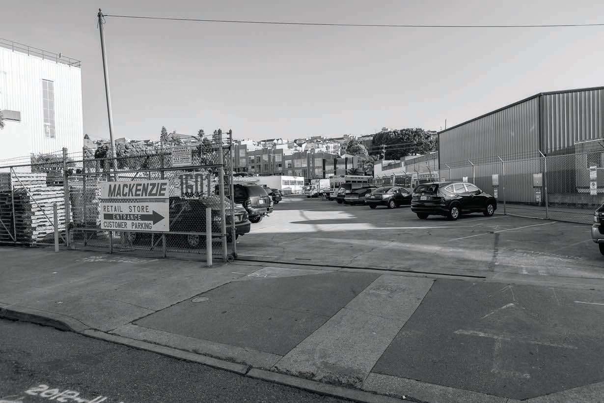
A number of Hill residents are concerned about yet another large-scale development, this one proposed across the street from Jackson Playground. At an almost four hour meeting held last spring at the Potrero Hill Neighborhood House, audience members — who mostly consisted of 18th Street residents — pelted developer Related California with questions about its plans for the expansive lot located on 18th and Arkansas streets. Dissatisfaction centered on size: a proposed 400,000-plus square foot, 40 foot high, 320-unit, three and a half acre rental complex on the site of a former automobile parts warehouse, bus repair shop, and parking lot.
“That is massive,” said philanthropist and Hill resident Ron Fiore, after the meeting. According to Fiore, the project should be substantially reduced, neighbors need to be better informed about the developer’s plans, and there should be a more realistic parking plan.
Residents questioned whether the whole site has to be built-out, with nearly an entire city block redeveloped under the proposal. But Lydia Tan, Related California’s executive vice president and director of Northern California operations, insisted that the location isn’t being maxed out. According to Rick Westberg, also of Related, after the complex is constructed several independent buildings will remain on the block, including Live Oak School’s campus on Mariposa and Arkansas streets — which also houses Yogasita and other businesses — and
corner of 18th and Carolina streets.
Live Oak School, an independent kindergarten through eighth grade facility, is concerned about its students’ safety during and after construction. The school believes that the additional traffic caused by the complex will increase risks to its, as well as International Studies Academy’s, students, and nearby park users. Air quality during construction is also a concern, since students and neighborhood children play outside during part of the day. And noise from such a large construction project would interfere will the students’ learning, complained Virginia Paik, head of the school.
The school is also worried about a reduction in light to its classrooms and the playground; the proposed project is four stories and set back only 16 feet from the school. “This impact on the learning environment for children is one of our greatest concerns,” Paik said. “The developer is asking for a rear yard exemption and planning to build in such a way that minimizes the light into our classrooms. We don’t believe the developer is taking our concerns seriously.”
Other neighborhood concerns focus on whether the project is consistent with the Hill’s character. “I am really disappointed this is all rental,” said Yolanda Garcia, a fifteen-year Hill resident. According to Garcia, developers consistently assert that their projects will add value to the community, but never ask residents what they want. “It’s

added that a sense of stability fosters community, and rentals encourage transient behavior. “They’re [the developer] seeing this as a business opportunity,” she said. With its high density, potential to increase traffic congestion and related hazards, and mobile population, Garcia didn’t believe that the new development would enhance the community.
According to 18th Street resident Greg Roensch, the project is too massive. “The scope of the project does [not fit] with the feel of the neighborhood,” Roensch said, with too many units crammed into the available space. Nine-year 18th Street resident Rosalie Lack agreed. Lack said the development would change the neighborhood’s character. “There is a right way to do things,” she said, implying that the project didn’t fall into that category. With 320 units proposed, Lack estimated that roughly 500 people would live in the development, many more than a typical Hill block. A View survey of two nearby streets suggests that between 100 and 250 people live on a Hill block.
year from rental income, without providing a single benefit for the residents of Potrero Hill,” Friedman said. “This proposed development will destroy the unique character of Potrero Hill. Instead of the monstrosity presented during the May 21st public meeting, I propose that the site be turned into green space, so that Potrero Hill can be a healthy place for kids to grow up, as population continues to increase.”
As with other developments in the neighborhood, obstructed views had residents’ blood pressure up. “I’m furious, really,” said Phil Soto, who lives at 18th and Arkansas. In response, Tan said, “We can look at some potential options.” Related is proposing four stories above street level at that corner, a height that will continue even as the lot slopes downward. According to one attendee, City ordinance requires Related to measure four stories from the floor of the Mackenzie warehouse, which sits below street level at 18th and Arkansas. But Julian Banales, planner, San Francisco Planning Department, said in an email to the View that generally height is measured from the curb to the maximum height for downward sloping lots. Banales referred residents to Planning Code Sections 102.12 and 260, which define and discuss height measurement, with Section 261 including a diagram to aid in understanding the requirements.
According to Tan, the project’s design remains influx. She suggested that Related and 18th Street loft residents form a working group to address the community’s issues. Tan stressed that Related wants the apartment community to be family-friendly.
A bit less than two-thirds of the apartments — 192 units — would be one bedrooms or studios. Somewhat more than a third of the units — 128 — would be two- or three-bedrooms. Each unit would have their own, inside, washer and dryer, and most of the two and three bedroom apartments would have two baths. Some two-bedroom apartments would have an option for a den. Space would be available for outdoor dining and barbequing. Related would meet affordable
“The proposed size of the complex...is way too dense for the site, and for the neighborhood,” said Hill resident Holly Friedman. “The proposal represents nothing more than a big New York developer attempting to extract millions of dollars per MaCKENZIE page 24
 photograph By don nolte
supported accusations against a group of neighbors, and as such an embarrassment to any legitimate newspaper.
Jay Schumann,Rhode Island
Editor, A comment on “SF Shines Brings Façade Improvements to Bayview,” in last month’s View. Under this City program facade improvements were funded at five Bayview locations in 2012: Kennedy’s Market, $58,584, La Laguna, $30,002, Market on Third, $59,066, Radio Africa $45,723, and Yvonne’s Southern Sweets, $35,824. A total of $229,399 was spent last year, an average of $45,840 per location.
Since 2005 SF Shines has spent $720,175. This includes Wing Stop, $25,000, Limon Rotissiere, $75,000, and Corner Café, $75,000, all of which are outside the Third Street commercial corridor, in brand new buildings. Radio Africa is also located in a brand new government building. Two are chain restaurants. Was this a successful use of tax revenues? I don’t think so.
LETTErs from page 3 I-280
Here’s a different idea. Paint 20 storefronts on the Third Street commercial corridor. The average cost for painting a storefront is about $5,000. Hire painters who are local Bayview residents, and require them to hire local Bayview students to help. In addition, reposition the grates and iron bars inside the windows on 20 storefronts on Third Street. The average cost for this sort of work is about $5,000. Likewise, hire local Bayview residents who are qualified and have
the same requirement to hire local Bayview students to help.
The total cost — (20 x $5,000) + (20 x $5,000) = $200,000 — is still almost $30,000 less than the cost of the five locations done in 2012, and would have the added benefit of improving four times as many storefronts. In addition, it would almost completely repaint an entire commercial corridor, and more completely matches SF Shine’s goals, which, among other things, are to increase economic vitality of businesses in commercial corridors, enhance the neighborhood streetscape, and increase neighborhood safety.
Robert Davis, QuesadaAvenue
Editor, I noticed that Keith Burbank’s article on CleanPowerSF (“CleanPowerSF
Unpopular with Both Sides of the Political Spectrum,” May) indicates that Marin Energy Authority’s (MEA) rates are about $3.30 more expensive than Pacific Gas and Electric Company’s (PG&E). This is quite out of date, and
LETTErs page 9
sion Creek Channel would have access to the waterway, likely prompting increased visits to Mission Creek Park.
The last big move — and big challenge — is redeveloping the Fourth and King streets rail yard. Caltrain stores railcars in the yard, and uses it as a staging ground for removing garbage

that have to be sited somewhere. The Planning Department has evaluated different scenarios for rail yard redevelopment. One possibility involves building office space above the yard, allowing it to remain in use. Alternatively, the yard could be moved, offering a blank slate for redevelopment. Or the rail yard could be moved, and part of I-280 could be replaced with a surface boulevard.
It’s this scenario that provides the most benefits, according to SPUR, including better urban design, greater capacity for development, and higher land values. A report by Economic & Planning Systems indicates that the value of adjacent land increases when a City removes an urban freeway.
According to the panel, one downside to the project would be the loss of the recent investment made to retrofit
I-280, work that was completed after the Loma Prieta earthquake.
The next step, according to SPUR, is to complete a study of the different scenarios, which City staff estimate will cost $2 million. According to panelists, the study should include a cost-benefit analysis, as well as an evaluation of the impacts the changes would have on California’s high speed rail system and the electrification of Caltrain, two projects already underway. “We hope that the City of San Francisco, with participation from regional partners and the Metropolitan Transportation Commission, will take the first step and study the big moves…” SPUR wrote in its June article.
With the new quarter’s statistics coming out it is becoming clear that it’s currently a great time to be a seller and a more challenging time to be a buyer.
Over the past year the average days on the market for single family homes, condos, and 2-4 unit buildings has been just over one month. Most properties are selling FAST!
Sellers want to prepare themselves for a quick sales cycle. And Buyers should have their purchasing power ready to pounce on the right property before it’s scooped up by someone else.
For all of your real estate questions and needs, contact me any time!










pastured eggs and whole chickens and stock from Early Bird Ranch. Or skip cooking and order a rotisserie chicken from Roli Roti, a weekly loaf from Josey Baker Bread or a pie from Three Babes Bakeshop. Other producers include Bread SRSLY, Four Barrel Coffee, Sow Fresh Juice, Straus Family Creamery and Big Dipper Baby Food. Deliveries are available four days a week, with a $3.99 fee. Or customers can pick up their orders for free at the Tennessee Street warehouse. Orders require a two-day lead time because everything is picked and prepared as requested… If they can raise the funds, Just For You Cafe and GreenTrustSF will build a New Orleans-inspired public parklet in front of the 22nd Street restuarant.
Another Mission Bay Hospital
The Veterans Administration Medical Center has formed a publicprivate partnership to fund a halfbillion dollar hospital and research facility in Mission Bay. The facility, which could be built on land Salesforce or the University of California, San Francisco (UCSF) owns, would replace the VA Medical Center’s bucolic but cramped and outdated home near the Golden Gate Bridge. The need to fund the new complex through a public-private partnership is driven by the VA’s modest capital improvement budget; just $1 billion for projects at 153 medical centers across the country. With $83 million in expenditures last year, the City’s Medical Center houses the VA’s largest research program. Last year, 37,000 patients passed through its doors, out of the 179,000 veterans the center serves in Northern California.
Hidden Bargains
A store crammed with bargainpriced art and craft supplies is hidden in the shadow of the 101 freeway. The 50 Thirteenth Street Outlet , between Folsom and Harrison streets, across the street from Rainbow Grocery’s

“I look forward to going to work,” said 91-year-old San Francisco Giants'’ usher and 20th Street resident, Mary Maglio. “I hope I can stay a couple more years.” Maglio has been ushering for the Giants since 1990. “Every day is a plus,” she said.
“She’s very active, said Carmen Castro, a Mississippi Street resident who, with her husband, Pascual, attends St. Teresa of Avila Catholic Church, where Maglio has been a member for more than 44 years. “And that’s what I think keeps her going.” According to Castro, Maglio has a regular routine. She gets up; has her oatmeal. “She'’s a real worker,” Castro said.
Maglio was born and raised in North Beach. She married her husband, Ernest Maglio, in 1947. For roughly six months they lived on a ranch in Fresno, her husband’s native city, before permanently moving to San Francisco. Ernest died in 2002.
Five years after she returned to the City, Maglio got a job at the Emporium, a department store located near the Powell Street cable car turnaround. She started in the children’s department, and later sold candy. “They used to call me Ms. Candy Lady,” Maglio said. She retired from the Emporium after 32 years. The store itself closed in 1996, ultimately replaced by the Westfield San Francisco Centre.
Maglio’s parents and sister had homes on Wisconsin Street before
Maglio built her 20th Street house in 1955. At that time the Hill was in slow decline, as industrial jobs disappeared from the nearby shipyards and canneries. Some of her friends questioned why she chose the location. “I like Potrero Hill. I have my own house,” she said.
Maglio’s two children, Marilyn and Bob, attended elementary school at St. Teresa'’s. Bob went on to Sacred Heart Cathedral Preparatory; Marilyn to Notre Dame, at 16th and Guerrero. Her son now lives in Placerville, her daughter in Rocklin. She has three grandchildren Michael, Denise, and Renee — and five great grandchildren; Alyssa, Adrian, Nicholas, Lucas, and Gabriela. Nicholas and Lucas enjoy baseball; Adrian plays soccer. “She has a wonderful family,” Pascual said.
Maglio works in sections 107 and 108 of AT&T Park, on the promenade on the first base side. The families of the visiting team sit in Section 107. “They’re all nice to me, Maglio said of game-goers. She’s worked two World Series, 2010 and 2012, participating in both resulting parades. “It was a big honor to me,” Maglio said of being in the parades. “The Giants accommodate you.” Since she has trouble walking sometimes she sat in one of the parade cars.
When her husband was alive, Maglio volunteered at Seton Medical Center, in Daly City. During World War II, she and her husband-to-be brought goodie bags to Italian prisoners on Angel Island. “Her husband was quite
mary dressed for an evening of ushering at at&t park where the giants played against the marlins, losing 3-6 on June 21. photographs By don nolte
a person too,” Carmen said. Both worked for the Giants. When her husband passed away, the Giants displayed a photograph of him on the scoreboard. Today, Maglio is on St. Teresa’s social committee, and helps with grief counseling at the church.
Maglio likes to meet people. “There’s no one she doesn’t know,” said Pascual. “I have been as far as Reno” with her, and encountered people she knows. De Haro Street resident and neighbor Loretta Lechich said the same is true at AT&T Park. “Everybody knows her, from the players to the broadcasters.” Lechich works in guest services for the Giants, which gave her the opportunity to befriend Maglio. “She’s a delight,” Lechich said.
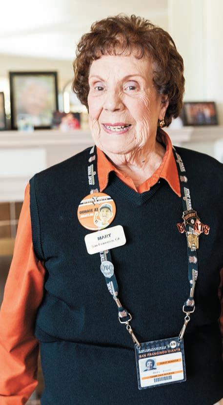
According to Carmen, Maglio’s short-term memory is sharp; her recall of the past is vivid. If Maglio meets someone she knows, she remembers their name and details about them
“It motivates me with my age,” Maglio said of working for the Giants. “I’m active. And I like to meet people.”
Before working for the Giants she had little interest in sports. “Now I love it though,” she said. She’ll turn 92 years old this September, just before playoff season starts. Asked what has kept her going for almost a century, Maglio said, “I just want to be active. I like to be active. The key is to keep active and eat right.”

Val Cunningham — a passionate Irish woman — opened The Dance Loft, located in Suite 311 of the American Industrial Center, in 2009. Over its four years of operation, hundreds of lives have been enhanced through Cunningham’s programs, which have ranged from yoga to partners’ dance instruction for that special first dance at wedding receptions.
Cunningham’s passion for her craft and its positive effects on her clients is evidenced by the excitement she expresses for her vocation, a level of enthusiasm that only comes from those rare people who have truly found what makes them happiest.
Cunningham’s discovery of dance wasn’t a manifestation of a childhood dream, however. Instead she dutifully followed her parent’s desire that she study business, earning a degree in travel and tourism, with a minor in French, from the University of Wales. She ended up in San Francisco working for Rosenbluth Travel, handling the needs of Chevron Corporation. But the City’s dance scene drew her away from her less creative day job. She became increasingly involved in dance, and was drawn away by Diane Jarnelow’s Metronome Dance Studio at age 26. With the influence of Jarnelowe, she realized that she’d found her bliss.
A natural teacher, Cunningham has a strong desire to share what she’s learned—and continues to learn—moti vated not so much by the steps that she demonstrates, but the uplifting discov ery and transformation she witnesses in her students. She’s most fulfilled when she “de-nerds” someone, using dance to transform a 32 year old Silicon Valley executive from being shy and socially awkward to becoming a self-confident, energetic, happy person who can dip a woman with aplomb on the dance floor.
Some of Cunningham’s tenants are basic: be kind, don’t assign blame, be open to being vulnerable, and be okay with spreading joy and passion. Her in fluence and instruction has resulted in successful marriages. When she shows an engaged couple how to perform at their reception, she teaches more than just foot placement, emphasizing communication, trust and commitment. Even her one hour training sessions leave her clients feeling better about themselves and their social graces.
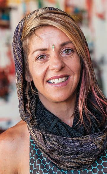
Cunningham teaches nightly from 5 to 10 p.m. Her favorite dance styles include Swing, Salsa and Tango; she sponsors monthly dance parties for both Salsa and Swing, complete with beverages and a DJ.
For additional information: www. valcunningham.com.
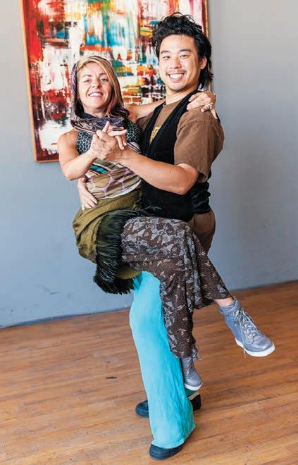
Val c unningham has been instructing, performing and choreographing since 1997, with a mission to unite and uplift the community through dance. s he loves the process of “de-nerding” a person, as well as bringing couples closer together with dance lessons. photographs By don nolte

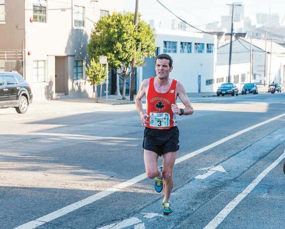
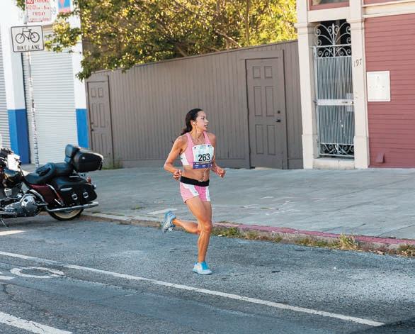
The early bird gets the worm as they say, and Don was able to catch the winners of the marathon on their path to the finish line. Top, Francois Lhuissier, 35, a French native who lives in New York City, finished in two hours 25 minutes and 14 seconds. Bottom Bay Area resident Anna Bretan, 28, finished in two hours 42 minutes and 25 seconds.
hasn’t been correct since 2012. From January to April of this year, MEA rates were cheaper than PG&E’s pretty much across the board. Currently, our commercial rates are much less than PG&E’s, while our residential rates are about the same. The average customer pays about 90 cents more per month under our services.
Even those numbers are skewed in PG&E’s favor. PG&E has added costs onto its generation rate due to Assembly Bill 32, which it’s currently deferring from including within its rates. Marin’s program included these costs in an April rate increase. PG&E’s most recent proposals to the California Public Utilities Commission suggest that the utility’s rates will be substantially higher in 2014.
Justin Kudo, Account Manager II Marin Energy Authority
Editor,
I was reading your June article, “San Francisco Board of Supervisors Hosts Hearing on MTA Parking Plans,’ in which the reporter, Keith Burbank, writes, “In response to a question from Farrell, Reiskin reported that the SFMTA receives $50 million in annual revenue from parking meters, half of which is from citations, which have been steadily declining during the last several years.”
Does this mean that SFMTA receives annual revenues of $25 million from parking citations? It is not clear from the wording of the article. The SFMTA website fact sheet for 20112012 shows parking ticket revenues are $83,290,024. Either Burbank or Reiskin has their numbers wrong.
Daniel Tomasevich, San Francisco
In fact, Reiskin said about $200 million in revenues is generated by parking, one half of which is from citations, which have been steadily declining over the last several years. We regret the error. — Editor.
 By sy DNEE BrOOKE r
Using matrices of LED light as his canvas and digital video as his media, Potrero Hill resident Jim Campbell has emerged as an internationallyrenowned digital media artist. From his backyard studio on De Haro Street, Campbell combines his passion for art with his engineering expertise to create original, abstract work.
Campbell’s artistic career sprouted in the late-1980s, when he began playing with videos, photography and the interactivity between the two. At the time he worked in Silicon Valley as an electrical engineer who went by the name of “Jack.” At the turn of the century, Campbell began working with low resolution lighting and lightemitting diodes, mediums he continues to rely on today. As “Jack, the engineer” explored art, he evolved into “Jim, the artist.” Now Campbell dedicates all of his time to art, though he frequently taps into his skills in electrical engi-


neering. “Traces of Jack are still seen in Jim’s work,” Campbell said.
One of Campbell’s most notable works, Exploded Views, was displayed in the San Francisco Museum of Modern Art’s atrium in 2011 and 2012. The work consisted of a three-dimensional grid of 32,000 suspended LED lights that abstractly portrayed images of moving people. “The inspiration for that work really stemmed from the work that I did in Madison Square Park and it was tailored and redesigned with regard to the atrium,” Campbell said. The artist’s New York-inspired work, displayed in 2010, was titled Scattered Light.
Campbell is currently working on the biggest project of his life: a 600-foot long six-foot wide sculpture made up 36,000 individual lights suspended from above. Although he hasn’t yet settled on the imagery, Campbell is entertaining the idea of using swimmers and birds. He recently conducted a video shoot at Stanford University, where he captured footage of swimmers from below. “I’m still working on the imagery,” Campbell said. “That ends up being the last thing that I do often because I really need to see the sculpture installed before I can see what works.” The piece will be displayed at Terminal 2 in the San Diego International Airport next month.


While Campbell’s work is exhibited throughout the world, it was in San Francisco where his art first gained momentum. “I have been particularly fortunate because the first show I was ever in in the late-80s/early-90s was at the museum [SFMOMA] at a time when none of the galleries in the City would show my work,” Campbell said.
Last fall Campbell was honored with the 2012 Bay Area Treasure Award for his work in new media and use of technology as expression. “It was kind of surprising,” Campbell said. “I think there are a lot of artists in the Bay Area that are at least equally deserving of that, if not more so. On the other hand, it was certainly an honor to receive. I think it’s kind of interesting that they chose to give it to a new media artist.”
Campbell has managed to bring something completely different to the art world. “I have always had this dialog between the electronic engineering that I did and the artwork and they would feed each other,” Campbell said. “Even though I’m an artist, I’m a nerd so I really enjoy mixing the two different ways of thinking.”






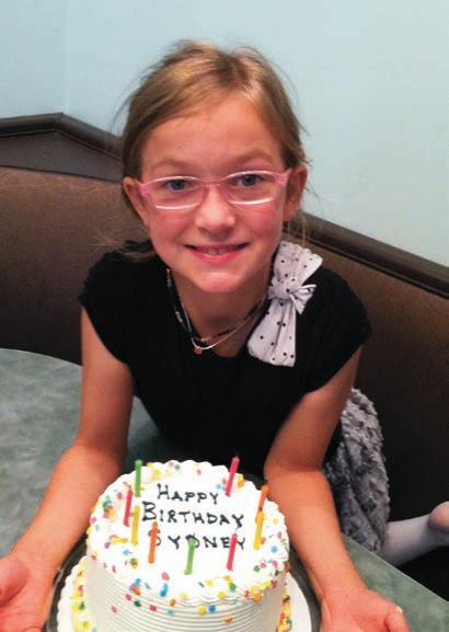
Love, Mom,


Happy SEVENTH Birthday to our special girl, Tesla. You are the best big sister, and we love you! Congrats on loosing your first tooth!

Happy SECOND Birthday Lars!
Love Mom, Dad AND Mormor


A MONTHLY UPDATE SPONSORED BY BRIDGE HOUSING
VOLUME 34 • JULY 2013


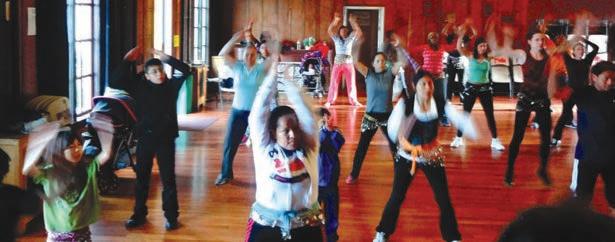

In 2011, Rebuild Potrero launched the Potrero Healthy Living Program to promote healthy habits and to build a deeper sense of community and support around living a healthier lifestyle. This program includes daily exercise activities, healthy eating and cooking workshops, a garden program, meditation classes, a sober living discussion group and other fun classes and events.
Tho gh all of the acti ities are pop lar, none draws a crowd li e the m a classes. eld twice a week on ondays and ednesdays from - pm at the otrero eighborhood ouse, the umba classes bring together participants from all over otrero all ages, all races and
dancing abilities he classes have become so popular the stage is often shared by the instructor and a crowd of kids, leading the room in fast paced dancing routines haring in the crowd s enthusiasm is rtea linton, the anointed umba class cheerleader, who is there every class to inspire participants to push on through and keep exercising he music, the energy in the room, rtea s support and the umba soul train gets everyone up and motivated, dancing for their health
o find out more about umba and the other otrero ealthy iving activities, e-mail mily einstein at eweinstein bridgehousing com or call uri easereene at 1 -look forward to coming to umba because it makes me feel good in my mind and body and en oy it - orgiana arks love coming to umba at the because it s fun not like being in a sterile gym on a treadmill staring at a wall here are people of all ages from toddlers to grandmas - eela oy come to umba because it makes me feel better and helps me with my health - ngela hurape
For more information, visit our website at rebuildpotrero.com or e-mail us at potrero@bridgehousing.com
shOrT CuTs page 6
parking lot, is easy to miss; its banner signs blend into the bright murals on its building’s façade. Inside, you’ll find narrow aisles stocked with standard supplies, like paint, brushes, colored markers, glitter, ribbons, jewelry findings and decoupage materials. The store specializes in things you’ve never imagined: 1950s French brass pins, 1940s plastic cabochons, tiny cow bells from India, giant pipe-cleaners, 1930s mink lipstick brushes, bags of minute watch gears, acrylic jewels, a wide variety of feathers and much more, more than 5,000 items. It’s best to visit with an open mind. The owner did well during the 1970s macramé craze, but when that fad died he concentrated on finding discontinued, forgotten, and unusual materials in warehouses around the world. There’s still macramé cord and beads, along with the other stuff, all at up to 90 percent off.
Shipyard
Last spring, the deal between Lennar and a hybrid of Chinese government agencies that would have provided more than $1.7 billion in financing for the Hunters Point Shipyard and Treasure Island developments fell through. But even without the big bucks, if everything goes as planned and it never does at the Shipyard; Aboriginal Blackman United are calling for more local hires —more than 250 units will be well underway by the end of this year. Hunters Point businesses, like Scott Madison of Eclectic Cookery, have
been meeting with Lennar’s design team to start envisioning their new spaces. The building that houses his commercial kitchen business, as well as artist studios, is slated to be demolished.
San Francisco prosecutors have opened a new front in the battle against copper theft, filing a $10 million lawsuit against a scrapmetal recycler that allegedly shut down and trashed its files rather than comply with a City subpoena seeking sales records. The unusual suit against J&S Recycling, which until March operated out of a 20,000-square-foot warehouse in Bayview, accuses the company of directing employees to empty file cabinets and toss computers after learning of the subpoena. The suit marks the latest effort to reduce copper theft — which plagues businesses, transit agencies, utility companies and cemeteries across the Bay Area — by targeting buyers of the stolen metal. Last year, Contra Costa County authorities raided seven junk dealers, two of which have since closed. Though not part of the suit, San Francisco prosecutors said they are also investigating whether J&S Recycling workers were involved in “mosquito fleets;” trucks that sweep through the City, sometimes in the dead of night, illegally paying people on the spot a cut rate for bottles and cans pilfered from blue recycling bins. The fleets then sell the containers at the full rate set by the state.
By ry DEr W. MILLE rTachyon Publication — an award winning publisher of science fiction, fantasy, and horror is located on a quiet corner of Connecticut and 20th streets. Jacob Astrov Weisman, 48, founded the company in Potrero Hill in 1995, and still serves as its editor and publisher. He’s lived in the neighborhood since he was three years old. Weisman’s parents were drawn to the community’s artistic vibe; his father worked as an actor and director with The San Francisco Mime Troupe.
Growing up Weisman remembered the Hill as a sleepy blue collar neighborhood “before the East Coasters arrived.” The community changed during the dotcom boom, and after the “freeways went down…It was a depository for East Coast settlers” who formed an “old artistic community,” said Weisman. “Most people in the City didn’t know where Potrero Hill was, and it still has a small town feel to it.”

A successful journalist and fan of genre fiction, Weisman launched Tachyon with Ganglion and Other Stories by Wayne Wightman. In 1997 the company found success in The Rhinoceros Who Quoted Nietzsche, by
fantasy legend Peter Beagle. Since then it’s won many of the major science fiction and fantasy awards — including The World Fantasy Award and the Nebula this year— steadily getting bigger. Along the way the field has changed, with many of the City’s book stores moving or folding, felled by the Internet. “Everything is really consolidated,” said Weisman, over bottled water. “Amazon is now a major player.”
•



Tachyon’s small size enables it to adapt, said Weisman. “Most people don’t pay attention to which publisher they read,” he admitted. Tachyon titles are sold at many outlets, including Christopher Books. The company sponsors a monthly science fiction author reading — SF in SF — organized by Weisman’s wife, Rina, and moderated by Terry Bisson, which serves as a fundraiser for The Variety Children’s Charity. Tachyon also hosts a monthly movie night, recently presenting Doctor Who. “We are more interested in being interactive than most science fiction publishers tend to be,” said Weisman. “Sci fi has
hILL PuBLIshEr page 24



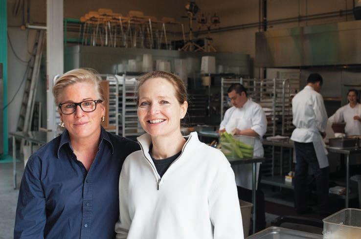
The morning that domestic partners Kristin Jenkins and Barclay Nicholson were to move to a quiet home in Mill Valley, their almost landlord called with bad news: the house had burned down. It was yet another twist of fate in a series of what turned out to be happy accidents along their way to creating a successful catering business. “We were scrambling. We had two dogs and
two cats. Where do you find a place that allows that in the City?” asked Nicholson.
They pair ended up renting a live/work loft in Bayview, where they’ve resided for the past two years, and from which they operate their two growing businesses, SF Private Chef — a daily food delivery service — and Nosh SF, a high-end boutique catering service.
Jenkins started SF Private Chef more than a decade ago. At first, it
was a side project, a flexible way to earn money to fund her other passion, golf. Although she never made it to the professional tour, Jenkins, a scratch handicapper, worked on her game while cooking for clients.
A few years ago, Jenkins and Nicholson examined their lives and decided they wanted a change. Nicholson, an administrative partner at a venture capital firm, was getting weary of sitting behind a desk. They contemplated moving out of the Bay Area, and sold their Bernal Heights home. “We wanted to move to the desert,” said Nicholson. “But a funny thing happened. We started to let our clients know, and they said you can’t leave, you can’t leave!” Deciding to double-down on their food business, they sent emails advertising their services to their friends. The enterprises quickly doubled in size.
Late last year, demand for their services started to outstrip the shared commercial kitchen space they were renting. In another feat of serendipity, a couple doors down from their live/work loft there was a vacant shell that their neighbor, Muratore Construction, used as a parking lot. Jenkins and Nicholson quickly negotiated a lease agreement with Muratore. In less than two months the pair built-out their very own commercial kitchen facility.
Toni Moore heads the kitchen at
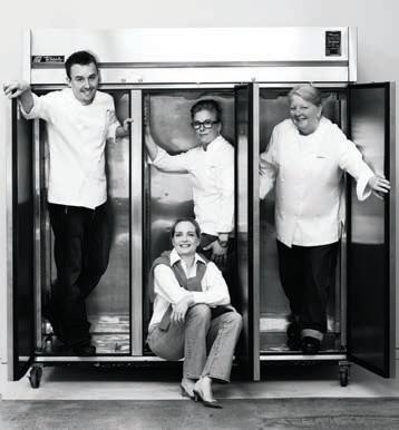
SF Private Chef. Moore, a pioneer in the slow food movement, designs healthy meals to be delivered daily to families who are too busy to cook. Chef Rob Dort, who previously was at French Laundry, heads up the catering business. While Nosh SF tends to cater smaller events to ensure quality, its guests can be quite outsized. Last year, it catered a fundraiser for President Barak Obama. “It was interesting to deal with the logistics of the Secret Service and trying to cook
CATER Southside page 14

 By ya EL ChaNOFF
Two years ago, a Fresh & Easy grocery store opened in Bayview. Mayor Ed Lee and District 10 Supervisor Malia Cohen heralded the retailer’s arrival in the neighborhood. “They are making an investment in health by providing access to fresh, high-quality food to a neighborhood that has historically lacked access to better options for generations,” Cohen said at the time.
Now, Fresh & Easy has announced that it is shutting its doors, after rapid expansion of the chain tanked the profits of its owner, British grocery giant Tesco. The grocery store’s late-2007 American launch was ill-timed, occurring just before the recession took hold. Fresh & Easy’s 200 stores — three of which are in San Francisco, on Third Street, Silver Avenue, and 32nd Avenue — have been consistently unprofitable. Tesco invested $1.6 billion in Fresh & Easy before deciding to make their exit; the company’s profits dropped 96 percent last year.
Tesco announced that they’d be selling Fresh and Easy last spring. In a hopeful press release, the company stated that “even though our parent company plans to leave the U.S., we’re pleased to confirm there are no plans to close any portion of Fresh & Easy.”
Instead, the goal is to sell the brand to another grocery retailer, who will keep them open as similar businesses.
Although a buyer has yet to be found for the chain, according to Tesco “it has already received interest from a number of parties including groups looking to purchase Fresh & Easy as an operating business.” According to Bloomberg News, billionaire Ron Burkle is in talks to buy the brand, and would use the chain’s infrastructure to re-launch the Wild Oats grocery store brand. Jim Keyes, former chief executive officer of 7-11 and Blockbuster, would serve as the revived Wild Oats’ CEO.
“We’re still fighting the good fight!” wrote Fresh & Easy, in their April 17 statement, a reference to the chain’s history of locating stores in neighborhoods with limited access to fresh produce, also known as “food deserts”. According to the U.S. Department of Agriculture, much of Bayview is a food desert. Specifically, the area bordered by Yosemite Avenue, Jamestown Avenue, Third Street and the Bay consists of “low-income census tracts where a substantial number or share of people are far from supermarkets,” USDA’s definition of a food desert. A 2010 PolicyLink study found that African-
Americans are nearly four times as likely as European-Americans to live in a food desert.
Bayview features a number of large markets, including Foods Co, at 345 Williams Avenue, Super Save Market, at 4517 Third Street, and Aguila de Oro at 5201 Third Street. But some residents say that Fresh & Easy was a welcome addition, and one of the few places to buy fresh and organic produce. “I think it’s going to be a huge inconvenience,” said Danielle Jackson, who lives near Fresh & Easy. Jackson said that without Fresh & Easy she’d most likely leave the neighborhood to shop for groceries.
“I would probably go to Costco or Safeway,” Jackson said. “But I have a car. I know a lot of people in this neighborhood might not have access to a car. They’re taking public transportation.”
Bayview resident TaLea Monet said Foods Co isn’t a good option for her. “I’ve been there, and they carry hardly nothing organic. Just a bunch of crap food,” Monet said. Monet’s husband, Debray Carpenter, said Fresh & Easy wasn’t immediately welcomed by the community. “We protested it when it opened,” he said, mostly because the store was co-located with market-rate housing; when Fresh & Easy opened, so did condominiums upstairs. The building resembles the Potrero Hill Whole Foods and other upscale grocery
stores that are built on the ground floor of high-end housing. The 5800 Third Street complex also includes Limón Rotisserie and the Corner Café. When Fresh & Easy opened in 2011 the San Francisco Chronicle reported that “more than a dozen” protesters were outside “denouncing what they said was a lack of real affordable housing in the surrounding development.”
Bayview resident Jameel Patterson said he doesn’t shop at Fresh & Easy, but he can understand why others might like the store. “It makes you feel good about your neighborhood,” Patterson said. “You can park in the downstairs parking lot and go right in.” However, according to Patterson, Fresh & Easy was never a real solution to improve health in Bayview. “They’re just in it for the money,” he said.
Patterson has more faith in groups like United Playaz, an anti-violence youth organization with chapters in San Francisco and the Bronx.
According to the group’s executive director, Rudy Corpuz, access to healthy food is a part of anti-violence work. “There are a lot of young people dying, and it’s not just violence. It’s cancer, it’s diabetes.” Corpuz said. “We’re not used to having a lot of healthy food in our neighborhood.”
That reality is slow to change. Fresh & Easy was the only new grocery store to open in Bayview in the past two decades, though alternative approaches to improving food access have been underway for much
of that period. Community garden projects, like the Quesada Gardens Initiative, bring opportunities to grow fresh food to the neighborhood. And earlier this year Lee’s Food Market, at 1397 Revere, had a “grand re-opening,” launching a new selection of products, including fresh fruits and vegetables. Ford’s Grocery has made similar changes at its 1496 Oakdale location. These efforts were supported by Southeast Food Access (SEFA), which describes itself as “a collaborative of residents, community based organizations, City agencies, and others working on food access and food systems.”
Besides their corner store initiative, SEFA has continued with long-term efforts to change food offerings at Super Save and Foods Co. — originally launched by nonprofits Literacy for Environmental Justice and San Francisco Community Power — and played a part in bringing Fresh & Easy to the neighborhood. “The people of this neighborhood deserve a natural food grocery store,” said Jackson.
kitchen: its large backyard. While their lease only encompasses a small amount of the space, there’s a vacant lot adjacent to their kitchen that Jenkins has figured out is a railroad right-of-way that’s leased to the San Francisco Sheriff’s Department. She hopes to negotiate with the department to develop the area into a community space.
In one corner they’ve already created the beginnings of a community garden. Barrels are planted with tomatoes and herbs. There are fig, apple, and plum trees, and a huge rosemary bush. According to Nicholson, ten more barrels have been ordered, and will be used to host additional herbs and micro greens. Ultimately, they want the space to become filled with edibles, in which classes would teach community children about growing vegetables. And in the kitchen, they’d learn how to cook what they’ve harvested.
around it, but more than anything it was an incredible honor to cook for the President,” said Nicholson. With their kitchen fully operational, the couple have their eyes on what they call the best part of the
Over the past three years the couple has gone from leading two separate careers to growing a business together, with their office in their house and the kitchen only a few paces away. “It is not all roses,” Nicholson admitted. “But it has actually made our relationship stronger.” Nicholson now can reminisce about her simple days in venture capital; she was making good money as a partner. Jenkins is quick to remind her that she’s still a partner, only now in their business. “Yeah, a partner who washes dishes,” said Jenkins, and they both laughed.
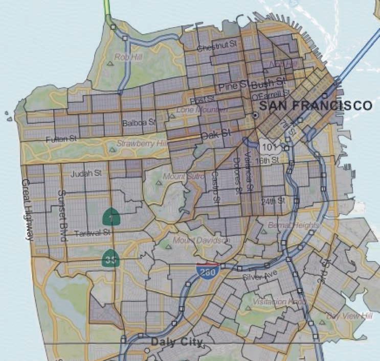
and bio-tech space. The Hunters Point Shipyard and Candlestick Park may become home to more than 12,000 residential units, and the new Transbay Center is slated for 3,400 housing units that will link up to an extended Caltrain. In addition, dozens more projects, including redevelopment at Pier 70, and significant new construction throughout the Southside neighborhoods, are on their way, as indicated in the accompanying maps.
Development of this scope, particularly when much of the land was either undeveloped, or hosted environmentally problematic industrial uses, requires an extensive amount of capital infrastructure. Sewer systems and electricity pipelines, roads and streetscape, lighting and green space all need to be paid for and maintained. Often a new street grid—such as where Mission Bay Boulevard North, China Basin Street, and Bridgeview Way criss-cross — needs to be created from scratch. Capital investment requires long-term planning and complex arrays of public and private financing that pay large upfront costs with longer-term paybacks.
Recently, the Mayor and Board of Supervisors approved the Capital Plan for fiscal years 2014 to 2023, which documents where the City is planning to invest and leverage roughly $25 billion of capital investments. The document, which has been updated on a biannual basis since 2005, amalgamates each department’s and agency’s strategic plans for spending their anticipated revenue. “In a way, the first step for getting funding from general funds is through the Capital Plan,” said Kaitlyn Connors, capital planning program assistant director. “The Capital Plan tries to prioritize areas that are going to be seeing new growth that’s in the planning pipeline report. We also try to be equitable in terms of geography
of infrastructure improvements, realizing that some areas are more deficient relatively.”
The City’s accompanying five-year financial plan projects a funding gap of $487 million in 2017, and the San Francisco Municipal Transportation Agency (SFMTA) projects an $8 billion capital shortfall over the next ten years. In an era of local government austerity, the Capital Plan is one of the few municipal reports that outlines what needs will be met with projected revenues, put-off to the future, or are emerging. Roughly two-thirds of the General Fund’s capital enhancement expenditures provide for earthquake and safety improvements on current building stock, while proposed transportation investments make up one-third of total expenditures.
As outlined in the Capital Plan, City departments must strike the difficult balance between the need
to address the backlog of properties requiring maintenance and new capital projects. This year, the Capital Plan introduced a comprehensive set of improvements called the Transportation and Street Infrastructure Package (TSIP). “TSIP is a first step toward dealing with the need to balance current capital needs with future growth,” said Connors. If approved by the Board of Supervisors this month, TSIP would support needed upgrades — like pedestrian and bike safety interventions, street paving and fleet replacement—as well as transit planning that aims to accommodate new development. Over the next decade, TSIP recommends the General Fund allocate an additional $790 million to the SFMTA, which would be funded through a vehicle license fee and a transportation bond, both of which would require voter approval during the November 2014 election.
While the Capital Plan is a highlevel, citywide review of capital needs, there are glimpses into capital needs that pertain to Southside neighborhoods. The Mission Bay developer — originally Catellus Development Corporation, now FOCIL-MB, LLC — has built more than two-thirds of Mission Bay’s needed infrastructure. According to the Capital Plan, over the next three years an additional $114 million in investment will be required. Yet FOCIL-MB is out-of-pocket; they’ve spent roughly $100 million that hasn’t yet been reimbursed by the City due to the hobbled economy. Since these infrastructure investments are financed through property taxes and bonding against special assessments, the developer’s repayment depends on growth.
The Capital Plan highlights several large transportation and transit projects that have been deferred Southside. The City has postponed $41 million in transportation improvements for Bayview, much of which is needed to create a direct truck route between Highway 101 and Candlestick as a way to reduce traffic on Third Street. According to the Capital Plan, funding hasn’t yet been secured for the 22-Fillmore extension to Third Street, which was identified as an emerging need in the Eastern Neighborhoods Transportation Implementation Planning Study, called EN TRIPS.
With thousands of families or soon-to-be families moving into new condominiums, schools are another emerging need. According to the Capital Plan, Hunters Point, Mission Bay and Hill school facilities will need to be reorganized and expanded as demographics shift, the funding for which may require a new general obligation (GO) bond approved by voters. Potrero

















4,500 child care spaces, 4,700 affordable housing units, and 14.5 acres of open space that will cost $89,000 a year to maintain. It also forecasts the need for 708,000 square feet of recreational facilities, which would cost $79,000 a year in maintenance.
(TIF), impact fees, or developer commitments, all of which are inextricably linked to growth.
the state to redirect property taxes into neighborhoods identified by city planners as blighted. These areas were subject to TIF, a creative financing mechanism that captured increases in assessed property value from the designated area and used it to pay-off capital investments within those same geographic boundaries.
last three recreation centers in need of seismic upgrades, with funding yet to be identified.
A 2008 Planning Department report, San Francisco Eastern Neighborhoods Nexus Study, though dated, is instructive. It forecasts that by 2025, eastern neighborhoods will need up to one additional middle school, roughly
Paying for these public services is partially dependent on the brick-andmortar process of new development. The General Fund is mostly sourced from three local tax revenues — property, business, and real property transfer taxes as well as an assortment of other tax revenues, state and federal transfers, licenses and public service fees. These funds can only support a fraction of the City’s needed capital investments. New capital projects often rely on other means of financing, including tax increment financing
Developer impact fees are one important mechanism for funding public services that are needed to meet increased demand. The Planning Department levies fees on a square foot basis from developers to pay for transit, sewer systems, parks, affordable housing, libraries, schools and child care facilities. A “reasonable relationship” must be established between the impacts caused by the development and the fees collected to offset them. According to the Capital Plan, eastern neighborhoods fee proceeds will address less than a quarter of the area’s capital needs. However, in good news for the City’s coffers, the fee deferral program created when the economy bottomed out expires this month. In fiscal year 2011-2012, almost $7 million of Eastern Neighborhoods Infrastructure Impact fees were deferred. With a spate of new development moving through the pipeline, impact fee revenues will soon be flowing.
Until late-2011, there was one dominant mechanism to return property tax revenue — a holy grail of sorts — to its geographic source: redevelopment areas, a device that was developed after Proposition 13 capped property taxes in 1978. For more than thirty years redevelopment was used throughout
In San Francisco, huge swaths of Mission Bay and Bayview-Hunters Point were under the purview of the now-defunct San Francisco Redevelopment Agency. “Redevelopment was good at taking parcel of lands where there was an impediment in the private market, where things weren’t going to get developed,” said University of California, Berkeley City and Regional Planning Ph.D. candidate Pedro Peterson, who previously worked for Seifel Consulting, an urban economic consulting firm that worked on San Francisco redevelopment projects. “These kinds of places like BayviewHunters Point, the only way they’ll get developed is if there’s an infusion of public money that cleans up contamination and brings it up to the level where private sector will come in.”
In addition to making blighted areas more attractive to private capital, redevelopment zones enabled comprehensive planning. According to Vanessa Dandridge, former Redevelopment Agency project area manager, who now serves as senior community development specialist for the Mayor’s Office of Housing and Community Development, “the beauty of redevelopment was that the allocation of funds — assuming
DEVELOPMENT next page






TIF was positive provided a funding source for long-term strategic investment. The City budget is annual, so you can’t do 30 or 40 year investment planning based on appropriations.”
Although a powerful tool for renewal, there was heated debate over whether some California redevelopment agencies strayed from their intended purpose. During the height of the recent state budget crisis, Governor Jerry Brown dissolved all redevelopment agencies. “Investment is going to take longer now and the focus is less clear,” said Dandridge. Some revitalization projects, like the Third Street Corridor project, have merged into other economic development programs. Redevelopment areas with master developers under contract, like Mission Bay and Hunters Point Shipyard, are now managed by redevelopment’s successor agency, the Office of Community Investment and Infrastructure, which will honor existing agreements, including bonds supported by TIF and lease obligations.
While it’s unclear if a viable surrogate for redevelopment areas will emerge, other financing options are being explored. In 2011, the City adopted criteria for Infrastructure Finance Districts (IFDs), which take on a similar function to redevelopment areas by allocating property taxes to public improvements. However, IFDs are more restricted; they’re limited to certain types of rezoned areas, there’s a cap on increment revenue, and property owners must vote to approve them. State cap-and-trade revenues,
generated by companies purchasing the right to emit greenhouse gases in California’s new carbon marketplace, could also conceivably fund capital projects in San Francisco one day.
In recent years, the City has also refined its public outreach strategies to raise its chances of winning a GO bond at the ballot box, in turn increasing the pot of money that can go toward capital investment. Whereas twelve years ago the City had a difficult time passing a GO bond, more recently there’s been a steady infusion of cash via voter-approved bonds: in 2011, a $531 GO bond for the modernization of school facilities passed; that same year, the $248 million Road Resurfacing and Street Safety GO bond gained voter approval; and in 2012, the $195 million Clean and Safe Neighborhoods Parks Bond passed.
Regardless of where the money comes from for infrastructure investment, it’s going to be needed. “For most places it’s not a matter of if we are going to grow, it’s how we are going to grow. Growth is inevitable. It’s about getting smart about how this growth happens,” said Robert Matthews, chief executive officer at Berkeley-based Synthicity, an urban development software start-up.
In San Francisco, growth is shaped by the availability of developable land, housing prices, and public policies that push for transit-oriented jobs, affordable housing, and tax revenue. “There are policies allowing development to happen in South San Francisco, like re-zoning,” said Synthicity’s manager of real estate applications Ian Carlton. The Eastern Area Neighborhoods Area Plan changed zoning requirements in 2009, creating the potential for up
to 10,000 residential units and more than 13,000 new jobs to be located in Dogpatch, the Mission, and Potrero Hill. “Those policies are not in play in other areas of San Francisco. People in Pacific Heights aren’t allowing growth to happen in Pacific Heights.”
Politics may play an even greater role in determining where public amenities are located in a post-Redevelopment Agency world. “Redevelopment Agency funds were funds you could count on that weren’t dependent on political influence or sway,” said Dandridge. “That’s not the universe anymore. Depressed communities don’t have the political capital to advocate for deep targeted investment in their neighborhood. They are focusing on how to make ends meet and combat violence and other pressing issues.”
Though projections of population and housing growth at the neighborhood level are hard to come by and assumptions are subject to debate— those that do exist can provide policymakers and stakeholders with a starting point for discussing infrastructure needs deficits. A recent growth forecast was published as part of the Draft Bay Area Plan, a comprehensive regional report that addresses carbon emissions linked to land use. “The plan is really designed to preserve the essential character of every community. San Francisco gets bigger, Oakland gets bigger and small towns in the region remain small towns,” said John Goodwin, public information officer for the Metropolitan Transportation Commission.
According to the plan, between 2010 and 2040 San Francisco will gain 190,740 jobs and 92,410 housing units. Much of this growth is expected to
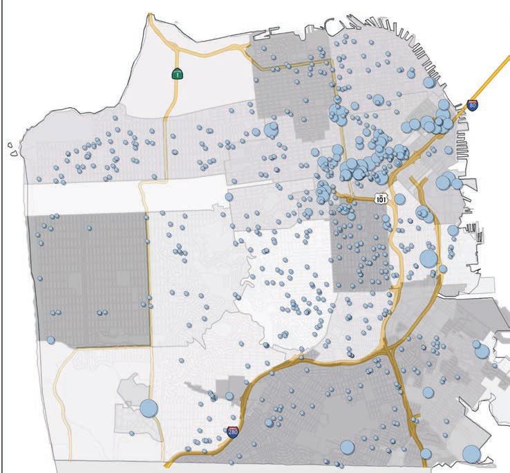
take place in Southside neighborhoods. Maps generated by Synthicity that show San Francisco’s current density and forecasted household growth by 2020. (note: while Synthicity produced forecasts for the Plan Bay Area Environmental Impact Report (EIR), these maps aren’t based on actual EIR results. They were generated using the next advanced stage of the same technology).
As shown in the first map, current density is highest in Northern neighborhoods, like Chinatown and North Beach, which have roughly twenty times greater residential household density than Mission Bay, Dogpatch and Potrero Hill. The household forecast, represented by the second map, shows that Mission Bay and sections of Bayview are likely to absorb the greatest household growth, given current zoning restrictions. These areas could end up being comparable to all but the densest Northern neighborhoods, which would significantly increase demand for public services.
While the Capital Plan raises some questions around how and when future capital needs will be met in Southside neighborhoods, it captures some positive highlights in and around Potrero Hill. The City re-opened Heron’s Head Park after $2.5 million of park investments in November 2012; San Francisco General Hospital’s new Acute Care Facility is on-schedule to open in 2015; and the Port is considering rehabilitating Crane Cove Park near Pier 70 with 2008 and 2010 GO bonds.
The next installment in this twopart series will discuss different perspectives on growth and capital needs around Potrero Hill.






The 33rd San Francisco Jewish Film Festival — the first and largest of its kind — returns to the Bay Area July 25 through August 12. Screenings take place at the Castro Theatre and the Jewish Community Center in San Francisco. Other venues include the Cinearts Theatre in Palo Alto, the Christopher B. Smith Rafael Film Center in San Rafael, The California Theatre in Berkeley, and the Grand Lake and New Parkway theaters in Oakland. The SFJFF prides itself on presenting the best in independent Jewish cinema, including films, festivities, special discussion programs and international guests highlighting 5772 years—in the Jewish calendar —of culture.
The Zigzag Kid opens the festival at the Castro Theater on July 25, with director Vincent Ball scheduled to be in attendance. Based on a novel by renowned Israeli writer David Grossman, the film “tells the tale of a young Dutch boy on the brink of his Bar Mitzvah with a rich imagination and quite the knack for getting into trouble.” The international cast includes Isabella Rossellini as Lola Ciperola, the famous chanteuse to whose songs he sings along.
The Festival’s “Centerpiece” film is Ziad Doueiri’s The Attack, a gripping adaptation of Yasmina Khadra’s international bestseller, in which an Israeli-Palestinian surgeon, shocked to discover that his wife was involved in a suicide-bomb attack, ventures into Palestinian territory to confront the

people who recruited her.
This year’s Freedom of Expression award goes to Alan Berliner, whose work the New York Times has described as: “powerful, compelling and bittersweet...full of juicy conflict and contradiction, innovative in their cinematic technique, unpredictable in their structures... Alan Berliner illustrates the power of fine art to transform life.”
Among the many festival highlights are several films about music, a focus on New York, and a spotlight on Israeli television. An evening with the irreverent Kenny Hotz, former South Park writer, and star of the hit television series Kenny vs. Spenny, will include three episodes from Hotz’s newest creation, Kenny Hotz’s Triumph of the Will. A day of social action films features award-winning documentaries from Sundance: Stories of Change,

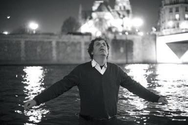
a new partnership with the Sundance Institute Documentary Program. These films offer examples of repairing the world through action; the Jewish practice of Tikkun Olam.
The U.S. premier of Rue Mandar, starring Sandrine Kiberlain, Emmanuelle Devos, and Richard Berry, close the Festival. The film is a “family dramedy about three French-Jewish siblings coping with their mother’s death.”
Several films have local connections. American Jerusalem: Jews and the Building of San Francisco, a documentary directed by Marc Shaffer and produced by Jackie Krentzman, both from the East Bay, charts the “evolution of the distinct brand of Jewish life that emerged in the West through portraits of influential pioneers like Levi Strauss and Adolph Sutro.” American Commune, directed by former Mission District residents and sisters Nadine
Mundo and Rena Mundo Croshere, was awarded a San Francisco Arts Commission Grant, and chronicles the Farm, an influential hippie community founded by Stepthen Gaskin in the early-1970s at the corner of Army — now Cesar Chavez — and Potrero Avenue.
Noe Valley resident Steven Pressman directed 50 Children: The Rescue Mission of Mr. & Mrs. Kraus, a documentary about a Jewish couple from Philadelphia who in 1939 travel to Nazi Germany to rescue fifty Jewish children and bring them to the United States.
For ticket information, contact the box office at 621.0523 or www.sfjff.org.

In April the Museum of Craft and Design (MCD) relocated to the same block as organic ice cream shop Mr. and Mrs. Miscellaneous. Since its reopening, the museum continues to push the boundaries of what it means to be art or craft. “With design, we most often only notice it when it is bad. But everything in the world has some element of design to it, from the chairs we sit in, to the buses we ride, to the machines we interact with,” said Kelsey Rudd, MCD’s registrar and administrative assistant. “Design is simply art that is responding to a need or a problem, art that has a purpose to it.”
According to Rudd, designs of everyday objects have become so intertwined in our lives that they become “invisible.” MCD focuses viewers’ attention on the aesthetics of design. The museum exhibits the creations of local, national, and international artists. MCD doesn’t have a permanent collection. Its exhibits are constantly changing; there’s often something new to see and do. “We are all passionate about what we do as artisans, designers. Everyone is a maker,” said Rudd.
In its first season in Dogpatch, MCD has exhibited pieces from Michael Cooper, Arline Fisch, and Rebecca Hutchinson. In A Sculptural Odyssey wood-maker Cooper combined art and technology through “fantastical,” functional hot rods, mixed media sculpture, commonplace objects, such as a lawn chair retrofitted as a go cart, and political installations with electrical motors. In “Creatures of the Deep” Fisch weaved, knit, crocheted, and braided thin metal called magnet wire — colored neon yellow, pink, green, orange, blues — into the shape of jellyfishes. Her work influenced magnet wire manufacturers to expand their selection of colored wire.
Current exhibitions showcase works by Herman Miller and Holly
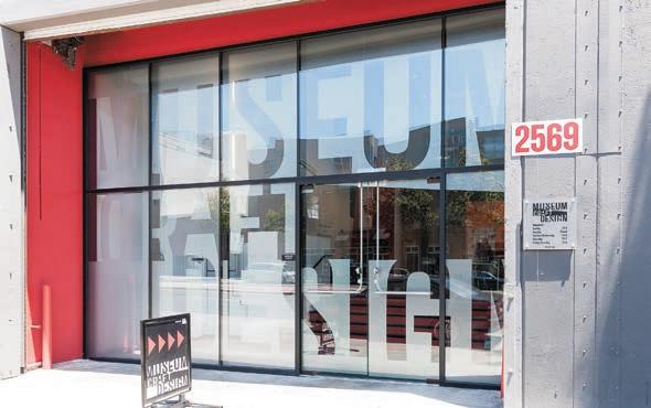
Lane. The exhibits tell the stories behind the inventions of this past century’s most revolutionary furniture, including Miller’s ergonomically designed office chair. In addition, it covers the principles of good design, pitfalls commonly faced by designers, as well as solutions. Lane is a trained painter who frames her paintings by hand, attracted by the power borders play in adding context and depth to her works.
MCD built its new museum’s interior from the ground up. The 24-foot high ceilings allow for flying and hanging installations. Movable walls facilitate adjustments to accommodate each new exhibit’s size and style. Exhibition space is twice as large as the museum’s previous location, enabling MCD to offer areas dedicated to handson education. Children can create their own masterpieces, designing their own chair or posters. The Etsy Meet and Make Craft Lab invites adults the first Thursday of the month to make art alongside professional artists, producing such works as carved rubber stamps, screen-printing, and bath scrubs, with drinks provided by local breweries.
Executive director JoAnn Edwards and her brother, Seb Hamamjian, founded MCD, which opened in Union Square in 2004. Building renovations at the original location destroyed some exhibits in 2010, which


prompted Edwards to leave the space. While it was displaced, MCD initiated a series of “pop-ups,” showcasing local artists in different venues and businesses throughout San Francisco.
“Dogpatch is teeming with creativity and camaraderie and we’re thrilled to be part of the continued transformation of the district into a thriving enclave for arts, culture, dining and entertainment,” said Edwards. MCD is located in the expansive American Industrial Center, which houses more than 200 enterprises, including graphic designers, wood makers, furniture makers, caterers, photographers, a butcher and artisan cheese maker.
“We are thrilled to have more creative people in the building,” said Emily Dreblow, owner of Soulflower Design Studio. “I love having MCD as a neighbor, and it definitely brought some charm to our building; their space is beautiful,” echoed award-winning chocolatier, Cristina Arantes, of Kika’s Treats. Lori Roby, one of 35 printmakers at Graphic Arts Workshop, and a MCD volunteer, said that the museum increases awareness of the arts movement in Dogpatch. MCD “brings more artists to the area, to have a museum upgrades everything,” Roby said. “I think it is great. I think the design of the place and the art of the museum is incredible.”
According to another printmaker, Gail Morrison, “When the Graphic Arts Workshop first moved here over 20 years ago, hardly anyone had ever heard of Dogpatch. Now it’s a real upand-coming area, a lot of that driven by the energy of the neighborhood’s
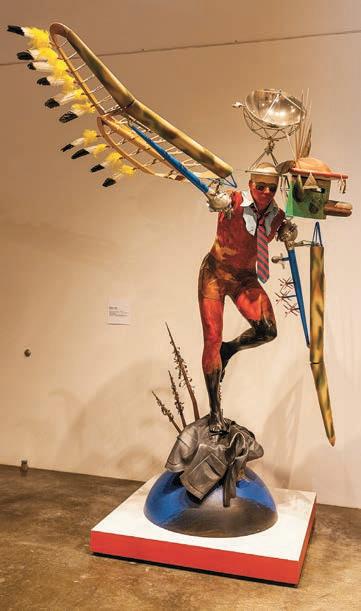
artists. We think the Museum of Craft and Design is a great addition to the mix, and we’re happy to welcome them!”
“Lovely staff and tour. I love the commitment to local, brand new, handmade art,” exclaimed San Francisco resident Charlotte, on a recent visit.
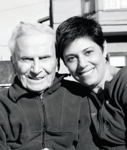
The View asked Hill resident and career expert Mauri Schwartz to answer questions from job seekers.
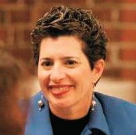
Q: Can you offer any advice for artists? I need to find work to pay the bills while pursuing a career as an actor. I’ve tried the typical jobs for “starving” artists — waiting tables, tending bar, and even some house painting for small residential remodeling projects — but I’d like something more creative and meaningful. However, working a normal job with a regular work week makes it nearly impossible to devote enough time to acting.
A: Believe it or not, there are jobs that provide the flexibility for theater workers to support their passions and provide them with the money and time to develop their craft. Many non-arts employers seek employees with the skills that you can bring to a job, such as creativity, organization, and passion. You can increase your chances of getting one of these jobs by effectively translating your theater experience into business language so employers can easily see the transferrable skills.
Relevant transferrable experiences include project management, working with limited budgets and short deadlines, doing whatever needs to be done and whatever it takes to complete the job, delivering presentations, dealing with diverse people, and making difficult decisions. Flexjobs.com is a terrific web site that provides listings for telecommuting jobs, part-time professional jobs, temporary jobs, freelance jobs, and jobs with flexible hours in many career categories, including art and creative fields. It was founded by Sara Sutton Fell after the birth of her first child when she couldn’t find a flexible, professional job that would allow her to grow in her career and be available to her child. Flexjobs is well worth the $15 per month subscription price.
An example of a virtual job that will allow you to work the hours that are best for you is web search evaluator. Internet search engine companies hire web search evaluators to help them improve Internet search relevance results. The basic requirement is a reasonable level of Internet savvy. You’ll be even more attractive if you’re fluent in a foreign language. If you’re willing to invest some time to become certified, you can also put your language skills to use as a medical or legal interpreter.
There’s another food industry position that you may not have considered, and it’s way more fun than waiting tables. With the recent startup boom, an increasing number of companies are hiring catering companies to bring healthy, tasty meals into the office for employees. The skill requirements for roles such as catering operations coordinator almost exactly match the above list of transferrable experiences. But the coolest jobs for an actor that I’ve found are in companies that provide innovative team building games for client companies of all sizes and industries. At The Go Game, you can work on a gig-by-gig basis as a plant, or actor, and earn experience worthy of your artist resume. Other team-building firms that are located right here in our own neighborhood are Syncopate Team Building and Parties That Cook. More information about team building and a list of companies can be found on Teampedia.net.




Liberty ship Experience: July Fourth Fireworks on the ss Jeremiah O’Brien Experience San Francisco’s Spectacular Fourth of July Fireworks Show from the decks of the Liberty Ship, SS Jeremiah O’Brien. “Liberty Ship Experience” Fourth of July guests will also enjoy light refreshments, music synchronized to the fireworks show, and full museum access. Tickets: $10 to $55. 6:30 p.m. to 9 p.m. Information: ssjeremiahobrien.org.
July 4 Through July 20
Theater: Betrayal by harold Pinter
Betrayal is enjoying a revival on the East Coast, and Off Broadway West Theatre Company is delighted to present this great classic on the West Coast, the company’s first full production after a year’s hiatus of

successful staged readings. The play begins with a meeting between adulterous lovers, Emma and Jerry, two years after their affair has ended. It ends, as we move back in time through the play’s nine scenes, in the house of Emma and her husband Robert, who is also Jerry’s best friend. Brilliantly simple in form, Betrayal is a haunting vision of man as a creature trapped in an orbit of betrayal that sends him circling around the ideal without ever reaching it. Tickets: $30 to $40. Doors 8 p.m. The Phoenix Theatre, 414 Mason. Information: info@ offbroadwaywest.org or 510.835.4205
July 4 through July 29
Tour: The Candlestick Park stadium

Home to the five time Super Bowl champions, the San Francisco 49ers, and the San Francisco Giants’ original home, Candlestick Park brims with memories and legacies! Take a tour and get the scoop behind the scenes like never before on the National Football League’s secondoldest and only concrete stadium. On this sixty-minute guided tour you’ll experience the 49ers’ locker room, and walk through the tunnel onto the field. You can run the gridiron, get
inside the old Giants dugout, see the views from the football press box way up high, peek inside a luxury suite, and more. Tickets $12 to $18.00. See website for times and dates: brownpapertickets.com/event/364249. Information: email Amanda.tugwell@sfgov.org, or call 819.6498
Comedy: The BitchSlap!
Bay Area comics Kimberly Rose Wendt and Eloisa Bravo are the minds behind BitchSlap!, a stand-up comedy show starring an exclusively all-female lineup. They’ll appear with more of the region’s edgiest women comics at this monthly showcase, which aims to spotlight the best local up-andcoming talent from San Francisco and beyond. Tickets: $10. 8:30 p.m. The Exit Theatre, 156 Eddy Street. Information: bitchslapcomedy.com.
Food: Basic Knife skills
Join 18 Reasons instructor John Lee for a class in the basics of using a chef’s knife at home, including the ins and outs of knife use, care and safety. You’ll walk away knowing how to maintain a sharp edge, and the best way to cut vegetables and herbs. Great class for beginners. Bring an apron, knife, and peeler; if you don’t yet own a knife, contact 18 Reasons at info@18reasons. org, and they’ll find one for you. $35. 6 p.m. 18 Reasons, 3674 18th Street. Information: e386462@staticfiles.com
Create: Bath scrubs at Museum of Craft and Design
Join San Francisco artist Katy Atchison to create a bath scrub set for yourself or as a gift that’s beautifully wrapped and 100% handmade. There’ll be an opportunity to make two types of scrubs (a sugar and a salt) and learn the natural benefits of each. Everything needed to decorate your gift in unique packaging will be on hand. All materials included. Born to a potter and textile artist, Atchison has a natural curiosity to explore everything DIY. She’s taught various workshops in the Bay Area, including Feather Hair Clips and How to Make Your Own Mini-Pie. $5 to members, $10 for non-members. 7 to 9:30 p.m. Museum of Craft and Design, 2569 Third Street. Information: sfmcd.org/programs/adults

Celebrate Bastille Day with your favorite furry friend in tow while raising funds for lost and abandonned Pugs around the Bay. Food and wine will be served. Prizes for the best Les Miserable-inspired dog costume and human/dog look-alike contest and much more. Tickets: $50-60. 3 to 6 p.m. Dogpatch Wineworks, 2455 Third Street. Information: vivelepug. eventbrite.com/
July 19 + 20
Film: Pictoclik Film Festival Pictoclik is a film community dedicated to bridging the gap between the Bay Area’s emerging talent and established professionals. Whether you’re a filmmaker, moviegoer, Bay Area resident, small business, film buff, pretty much anyone; this is for you. $30 to $200. 7 to 9 p.m. for pre-party at 518 Valencia. 9 to 11 p.m. Film Festival, Roxie Theater, 3117 16th Street. Information: e387940@staticfiles.com
Music: Midsummer
Mozart Festival
Come hear Bay Area 16 year-old prodigy Audrey Vardanaga playing one of Mozart’s most popular concertos. In addition, Rebecca Davis, who was one of the superstars with Maestro Cleve in the Opera San Jose’s series of Idomeneo performances in 2011, sings a gorgeous concert aria. Maestro Cleve has also included what’s possibly Mozart’s most popular single work, the Eine Kleine Nachtmusik. $20 to $52. Legion of Honor, Florence Gould Theater, 100 34th Avenue. Information: midsummermozart.org/
Food: unsung, summer Unsung illuminates the idea that some of the most delicious, enjoyable and memorable things to cook and eat are the foods most neglected in the modern kitchen: pea shoots, garnishing a tart of spring onion and bacon; fennel fronds, pounded into a piquant salsa verde; cardoons, braised and tossed with pasta and pecorino; kohlrabi, simmered with apple and pear and pureed into the most phenomenal soup. This is a two part series, with the second class offered July 29. $67. 6:30 to 9 p.m. 18 Reasons, 3674 18th Street. Information: 18reasons.org
July 25 through aug 12
Film: 33rd annual Jewish Film Festival
The San Francisco Jewish Film Festival is the oldest and largest such festival in the world, presenting dramatic, documentary, experimental, and animated features and shorts about Jewish history, culture, and identity. This year’s festival will feature, among many films, Theo Rigby’s Immigrant Nation, an exploration of multi-platform storytelling; Monica Haim’s Awake Zion, an uncovering of the connections between davening and the dance hall, payos and dreadlocks, Jews and Rastafarians; and Steven Pressman’s 50 Children: The Rescue Mission of Mr. and Mrs. Kraus, in which a Jewish couple from Philadelphia travel to Nazi Germany in the spring of 1939 with one mission: rescue 50 Jewish children. Ticket prices to be announced. Information: sfjff.org.
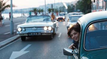
The San Francisco International Arts presents the mainland U.S. debut of Atamira Dance Company from New Zealand, a contemporary Maori Ensemble. The performance is part of the ensemble’s first national American tour that also includes dates in Hawaii and the Jacobs Pillow Dance Festival in Massachusetts. Tickets: $18 to $20. Joe Goode Annex, 401 Alabama Street. Information: brownpapertickets.com/event/399478
Kids Makeart: Poster art
Tour Good Design: Stories from Herman Miller, which is focused on graphic communication. Then take what you’ve learned to the MakeArt lab, and design poster art inspired by Steve Frykholm’s picnic posters. Snacks provided. For children ages six to 12. Free to members, $10 for non-members. 1 to 3 p.m. Museum of Craft and Design, 2569 Third Street. Information: sfmcd.org/programs/families-kids.
July through august
health: Cancer Prevention study
The American Cancer Society is doing a cancer-prevention study in San Francisco, and is looking for anyone 30 to 65 years old, who have never been diagnosed with cancer, and would be willing to make a long-term commitment to the study, which involves completing periodic follow-up surveys at home. Information: CPS3BayArea.org
Cellars 33 — a Dogpatchbased winery that sources its grapes from the nearby wine region — has its roots in Baltimore, owners John and Katie Fones’ former home and inspiration for their business’ moniker. Named for 33rd Street, where the old Memorial Stadium was located — in which John and his family watched many Baltimore Orioles and Colts games — Cellars 33 is wedged into a particularly industrial portion of Minnesota Street. The Fones moved into the space almost a year ago, after working from a smaller space in Bayview. The couple moved to the Bay Area in 2010.
The Minnesota Street winery took roughly six months to build, and plenty of planning and coordination with the two other winemakers that share the facility. Much of the equipment came from a smaller winery in Bayview, where John worked as an assistant for the labels August West Wine and Roar Wines, which had set up shop in that community in 2007.
The three winemakers, who all moved from Bayview to join newly formed Cellars 33, produce 200 tons of wine annually under seven different labels. The Fones are members of SFMade, an organization that supports businesses that manufacture products within City limits. During SFMade Week earlier this year, tours of the winery were offered, something the Fones enjoyed. “People are blown away that there is a winery here,” John said. “They are always looking for the grapes.”
John was a criminal lawyer and amateur home brewer in Baltimore. But when the couple started vacationing in California, and made it to wine country, he caught the wine bug. He signed on as a volunteer intern at Freeman Vineyard and Winery in Sebastopol, and then was offered a paying gig, which prompted the couple to move westward. They landed in the Sunset District with their dog, Max, a Jack Russell terrier. During the fall, the
Fones frequently travel to Sonoma County to check on the harvest, and work with farmers. During the rest of the year, John makes the two-hour drive about every two weeks to check on his grapes.
The Fones buy fruit from Monterey and Sonoma counties, which is then stored in half-ton bins near the front of the facility. Further into the building there’s the hopper, which de-stems the fruit. Deeper still into the 20,000-square-foot-space are 12 five-ton stainless steel tanks, alongside two three-ton tanks. “Last year things got so busy, all the tanks and bins were full,” John said. With 2012 such a high yield harvest, Cellars 33 bought more grapes and made more wine. According to the owner, running a winery in a City warehouse is a substantial operation, requiring careful monitoring of filtering systems and efficient electricity and water use.
The grapes hail from vineyards where John knows the growers. John admitted to not being a farmer by trade, and willingly accepts the expertise and skills of longtime Northern California growers. “The key for us is getting super good vineyards that I know and trust,” he said. Katie, a Downtown-based divorce attorney, joked that it’s important to visit the growing grapes to talk to them and make sure they’re happy.
According to John, the business is looking to add grapes from the more southern Paso Robles region, but would like to source fruit from as close to the greater Bay Area as possible. This is where his lawyer skills come into play, working with growers to nail down deals to buy grapes and use them for his locally made varietals. One small vineyard that supplies Cellars 33 is Bacigalupi Vineyards, located in the Russian River Valley; another is Keefer Ranch in the same area.
Once the wine finishes fermenting in the tanks, the “free run” is put into barrels. The more solid material, known as pumice, goes into a presser, where a so-called second-run is collected into barrels. A 5,000-square-
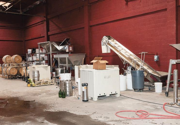
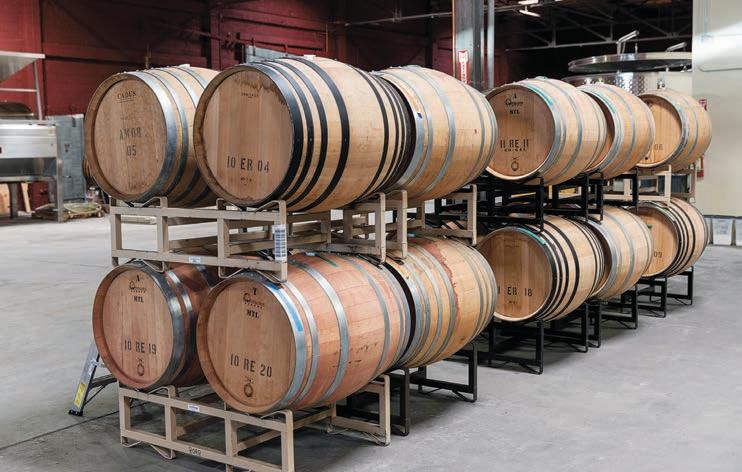
Left bottom cellar 33’s 20,000-square-foot space. Above a 5,000-square-foot chilled room stores the barrels, sometimes stacked three high, flled with various varietals. photographs By don nolte.
foot chilled room stores barrels, some stacked three high, filled with various varietals. John blends the wine, and decides what tastes best before bottling it with a mobile bottler that’s brought into the space at the end of the process. In 2012, 500 cases were made, and then they had to be sold. “Winemaking is the easy part,” he quipped.
The wine is sold to customers via a mailing list twice a year. The Fones sell any remaining bottles to local restaurants and wine retailers. Cellars 33 wines, including a petite Syrah, Chardonnay and Pinot Noir, can be found at Jamber Wine Pub
at 858 Folsom Street, Eno Wine Bar on Union Square, and at Oakland’s Wood Tavern Restaurant, among other places.
Roughly six interns join the operation for the fall harvest, when loads of grapes come into the winery. As sales grow the couple is considering adding more employees to the small operation. At this time of year, the buds are just breaking and the fruit flowering. John and Katie are harnessing their East Coast work ethic managing the production, sales, marketing and all other aspects of the wine label on their own, at what they said is a comfortable pace. According to the couple, a tasting room will eventually open in a separate location.
More information: www.cellars33.com

POTRERO BRANCH 1 1 20th STREET 355 2 22
Tuesday 10 am pm ednesday 12 noon pm
When
Enjoy small-lot, hand-crafted, artisanal wines in our collective tasting room.
That’s right. Make your own barrel of wine in your neighborhood at Dogpatch WineWorks.
We make hosting an event in a winery easy, from small groups to 300 people.
Tasting Room features wines made at Dogpatch WineWorks:


Tasting Room Open: Thursday- Friday 4 -8 pm • Saturday 12 pm - 7 pm • Sunday 12 pm - 5pm
In the Dogpatch: 2455 3rd Street @ 22nd | 415.525.4440
www.dogpatchwineworks.com


PARISH OFFICE
390 Missouri St San Francisco, CA 94107
Phone: 415.285.5272
E-mail: info@stteresasf.org
www.StTeresaSF.org
PLEASE JOIN US AS WE CELEBRATE THE EUCHARIST IN OBSERVANCE OF THE FEAST OF OUR LADY OF MOUNT CARMEL ON JULY 16 AT 8:30AM
SUNDAY MASSES
Saturday Vigil 4:15 pm
Sunday 8:30 am 10:00 am
WEEKDAY MASSES
Tuesday 8:30 am
Friday 8:30 am
Thursday 10 am pm Friday 1 pm pm
Saturday and Sunday 1 pm pm
Monday CLOSED
By LyNNE BarNEs, POT rErO BraNCh LIBrar IaNThe library will be closed on Thursday, July 4, in observance of Independence Day. Summer Reading for All Ages! Events & Prizes! June 1- August 1
Programs for Adults
The 55th Annual Potrero Hill Artists’ Exhibition will display through July 26. Drop by and enjoy the creative work of your neighborhood artists.
De-Tox with Holistic Foods. Learn to de-tox using holistic methods with Holistic Nutritionist Amy Woodbury. Wednesday, July 24, 5 to 6:30 p.m.
Rare Film Clips of the Rolling Stones. Rock historian Richie Unterberger presents two hours of rare Rolling Stones film clips from the 1960s and early 1970s, which marked the band’s truly golden decade. Saturday, July 27, 3 to 5 p.m.
Programs for Teens
Game On! Come play PS3 games on our big screen! We have a selection, but you can bring your own T or E rated games to share. Snacks. Ages 10 to 18 welcome. For more info, contact Lisa at lfagundes@sfpl.org or 355.3822. Tuesdays, July 2, 9, 16, 23, and 30, 4:30 to 6:30 p.m.
Breakdancing for Teens. Breakdancing combines flexibility, acrobatics and a culture of positive challenge that encourages each dancer to develop their own style. Students will learn the fundamentals of breaking and hip hop dance and participate in a freestyle circle. Ages 12 to 19. For more information, contact Lisa Fagundes at lfagundes@sfpl.org or 415 355 2822. Saturday, July 20, 3:30 to 4:30 p.m.
Teen Jewelry Making. Jeweler Extraordinaire Chelsee Robinson will guide you as you work with real stones, crystals, beads, and more, to create a beautiful necklace, bracelet or earrings!!! All materials provided. Ages 12-18. Space limited to 20, please sign up with a librarian, starting 2 weeks before the event. For more info contact Lisa Fagundes at lfagundes@sfpl.org or 355.2822. Friday, July 26, 3:30 to 5:30 p.m.
Baby Rhyme and PlayTime. For infants up to eighteen months old and their caregiver. Tuesdays, July 2, 9, 16, 23 and 30, 1:15 to 1:45 p.m.
Family Storytime. Featuring stories, songs and rhymes. For children from birth to five years old and their caregiver. Thursdays, July 11, 18, 25, 10:30 to 11 a.m. and 11:15 to 11:45 a.m.
Fun Flicks. This film program is offered every 2nd Wednesday of the month and includes short films based on children’s books and stories. July’s films will be Black Cat, The Box, Boy and a Boa, The Bicycle. For children ages 3 to 8. Wednesday, July 10, 6:30 to 7:15 p.m.
San Francisco Edible Mosaics. Craft your own delicious San Francisco treat in the form of a mosaic. Space is limited to 25 children. Please call for a reservation at 355.2822. Saturday, July 6, 4 to 5 p.m.
Shinta Arifin Origami. Join us in this hands-on workshop and learn how to fold paper into just about anything. Origami artist, Shinta Arifin will show you how. All materials provided. For children of all ages. Saturday, July 13, 4 to 5:30 p.m.
Movie: Paranorman Rated PG; 92 minutes; 2012. When a small town comes under siege by zombies, who can it call? Only misunderstood local boy Norman, who is able to speak with the dead. And… he’ll have to take on ghosts, witches and, worst, of all, grown-ups, to save his town from a centuries-old curse. But this young ghoul whisperer may find his paranormal activities pushed to their otherworldly limits. Friday, July 19, 1:15 to 3:15 p.m.
Movie Day: In partnership with Potrero Hill Family Support Center, we will screen a contemporary Children’s feature film...the title is to be decided Please check online for future updates. For all ages. Snack will be served. Friday, July 19, 3:15 to 5:45 p.m.
Unique Derique. Join us for the dynamic, syncopated rhythm of Derique’s body percussion and juggling comedy. For children of all ages. Friday, July 26, 1:15 to 2:15 p.m.
Fintastic! Shark Discovery. Explore the world of sharks, skates and rays, with Aquarium of the Bay! Through Naturalist-led, hands-on activities, find out how sharks are a special kind of fish with unique adaptations. Participants will also discover the importance of sharks in marine environments, the threats they face, and what Aquarium of the Bay is doing to help protect them. For children of all ages. Tuesday, July 30, 1:15 to 2:15 p.m.
 sPON sOr ED By MaINLINE sECurITy
In two separate incidences last month, used needles were found at Jackson Park’s playground sand box, located at Mariposa and Arkansas streets. And in the second occurrence a little boy poked himself after discovering an uncapped device in the sand.
In the first incident, Missouri street resident Meghan Sheedy was shocked to learn that three used needles had been left in the park. Another parent brought the needles which had traces of a brownish liquid — to Sheedy’s attention. Two of the needles had caps on; the third one was fully exposed.
Dismayed by the potentially dangerous litter, Sheedy put the needles in an empty water bottle, and called the San Francisco Park and Recreation Department (RPD), through 311. She then flagged down a park custodian, who took the needles for proper disposal. According to Sheedy, the custodian was raking the sandbox when she left the park that morning. “Hopefully this was a random, onetime event. Still, it’s a good reminder to be careful and aware at our parks. It’s also probably good to encourage shoe wearing. All of the kids on the playground were barefoot when the needles were discovered.”
However, at least one needle remained in the sandbox after the
custodian’s efforts, or was discarded there after the clean-up attempt. In the second incident, which occurred within ten days of the first, a toddler pricked himself after finding the needle in the sand. He was taken to an emergency room to be examined. Another parent threw the needle away.
After discussing the incidence with an RPD employee, Sheedy pointed to several improvements to the park that could discourage future drug activity, such as repairing the lighting and filling the sandbox with more sand so the box doesn’t provide an out of sight hiding spot. “While I disposed of three dirty needles this morning, I was concerned of the possibility there could be more…After all, dirty needles can transmit HIV, Hep C and other diseases.”
“I appreciate how disheartening it can be when people abuse our parks with unhealthy activities,” said Steven Cismowski, RPD manager. “We encourage the public to immediately contact 311 when they find any medical waste or issues with our parks. In addition, should anyone find any medical waste, such as needles or drug paraphernalia, in our parks, they can also contact Department of Public Health’s Medical Waste Program at 252.3800. And we will respond as soon as we can once we receive your request through 311.”

housing requirements within the complex.
Despite the assurances, Friedman said that the community needs “to look at this in terms of the cumulative effect of all of the developments currently planned in the neighborhood. There is a proposed development at the corner of Mariposa and Potrero, another one by Kaiser at 16th Street, plus yet another one across the street from the Corovan building, and even more on the drawing board. All together, these housing developments will overflow the already limited parks and green space, destroy the unique character of our neighborhood, and cause increases in traffic gridlock, crime, and pollution.”
“The neighborhood’s input is critical in shaping my perspective on proposed development projects,” said District 10 Supervisor Malia Cohen. “It is imperative that neighbors organize to shape projects so we can work together to improve them and ensure they are positive additions to Potrero Hill.”
Tachyon, named after a hypothetical particle that can travel faster than the speed of light, suggests the embrace of a science fiction dream of interplanetary travel, time travel and intergalactic communication that hasn’t yet materialized. For some sci fi fans the fact that this vision hasn’t come true is one of the biggest disappointments of the new millennium. “We didn’t get contacted by extraterrestrials. We didn’t blow up the planet. Not all the tropes are good,” said Weisman.
always been an open dialogue. It is more than just commercial.” Among Weisman’s current favorite authors are Michael Swanwick, Frederick Brown, and Philip K. Dick.
Weisman noted that science fiction is not as popular as it once was. “Traditional science fiction is not as vibrant as it’s been,” said Weisman. “It is not going away, but obscured or hidden under the surface.” Genre publishing has increasingly switched to fantasy and dark fantasy. And Tachyon has had to adapt to the rising popularity of Steampunk, Swords & Sorcery, Epic Fantasy, and Urban Fantasy. Tachyon’s staff likes to bring publications out of obscurity, as well as meet current sub-genre demands. “Preserve old stuff and push the envelope on what is being done now,” explained Weisman, who studied journalism and creative writing at Evergreen State College, and interned at Asimov’s and Locus Magazine. READ



Ro mis
Jour 23: Electronic Copy Editing 3.0 units
W 6:30 - 9:20 p.m. Mission/Rm. 21 Ro mis
Jour 24: Newspaper Laboratory 3.0 units
MW 12:10 - 1:00 p.m. L 61 on a s
Jour 26: Fundamentals of Public Relations 3.0 units
W 6:30-9:20 p.m. Mission/Rm. 217 a am
Jour 29: Magazine Editing & Production 3.0 units
M 6:30 - :20 p.m. Mission/Rm. 217 a am
Jour 30C: Selected Topics in Journalism 3.0 units
R RR 0 /1 -12/19 on a s
Jour 31: Internship Experience 2.0 units
R RR L 61 on a s
Jour 37: Intro to Photojournalism 3.0 units
W 6:30 - 9:20 p.m. Mission/Rm. 211 Lifand
Jour 38: Intermediate Photojournalism 3.0 units
R 6:30 - 9:20 p.m. Mission/Rm. 217 Lifand
In the early-1980s, six friends in their young 20s decided to move to San Francisco and find a place to live together. Bob, Marian, Crystal, Breakfast, Claire and Cookie were part of the anti-nuclear movement that gained momentum after the 1979 partial meltdown at Three Mile Island. The group came together after demonstrating against the Diablo Canyon Power Plant, where they were arrested as part of a nonviolent resistance campaign. All six were tired of moving from city to city, sleeping on couches while they worked for nuclear disarmament and a renewable energy future. They wanted a stable home, a place from which to pursue the political work that was central in their lives.
They called themselves anarchists, from the ancient Greek meaning “without rulers.” Anarchism has been examined by a host of political philosophers, from Lao-Tzu to Jean Jacques Rousseau — “...you are undone if you once forget that the fruits of the earth belong to us all, and the earth itself to nobody” — and advocated by Emma Goldman. The ideology has a complicated history, but in general
opposes authority and hierarchy in human relations.
Bob and Marian, Breakfast and Claire were part of the Narcoleptic affinity group, falling asleep in strategic locations as a direct action tactic in various political campaigns. Bob, Breakfast and Crystal had originally met at Stanford University in the 1970s, when they became involved in the national university divestment campaign to end apartheid in South Africa. The friends met other anarchists at Bound Together Books, in the Haight, and Bernal Heights’ Mission Blue Cafe collective. Anarchist collectives were known by their colorful names: Suburban Palace, Purple Rose, New Moon, Paradox House, Black Rose House, Chanticleer, Columbae and Anarchy Oaks. The Pickle Family Circus was a collective on Potrero Hill.
The six friends searched for a Bay Area home during Claire’s pregnancy, when Breakfast was soon to be released from four months in federal prison, his sentence for civil disobedience at the Rocky Flats Plant. The six became seven with the addition of Cookie’s Horse-dog, a huge “formerly-feral” Great Dane. It took a long-time, but the group finally found a run-down

house at 25th and Wisconsin streets, a former Pentecostal church with a large basement meeting room complete with bathtub-size baptismal font. The punk band Pearl Harbor and the Explosions had just moved out. The house was painted a brilliant pink, which had prompted punk bands to call it Pink Palace Studios. Breakfast came up with the perfect name for the collective: Urban Stonehenge, inspired by the upended slabs of concrete in the vacant lot across the street, all that was left of the foundations of World War II shipyard worker housing, which once included the site of Starr King Elementary School.
Living together meant making adjustments. Cookie was surprised that some of the men initially expected the women to do most of the cooking and cleaning while the guys talked politics. “Consider me one of the guys!” she said. Cookie proposed that house rules be established to organize housecleaning, and was told “We’re not going to have any rules.” Instead, guidelines evolved to which everyone could agree based on a “consensus process” that the anti-nuclear movement used to make decisions. The chores, shopping, and cooking were shared, according to what people enjoyed and felt strongly about doing. Assignments were recorded on artistic homemade monthly calendars, the records of which were used to assess how well things were going.
The place was great for parties, open to anyone in the neighborhood.
Horse-dog looked so scary that partygoers were usually well-behaved. And he helped dissuade visiting Federal Bureau of Investigation agents who came looking for draft-registration resisters. The neighborhood seemed divided, with housing projects across the street and gentrification starting just a few blocks north and west. A Molotov cocktail was once thrown through the front door; luckily, it didn’t ignite. There was open crack-dealing nearby; a stabbing and the occasional mugging at the bus stop on the corner. Cabs and pizza delivery wouldn’t come to that part of the Hill. The friends nicknamed 25th Street “The Class War Zone”.
The political organizing that had brought everyone together continued. Urban Stonehenge became a center for fundraising, planning non-violent direct actions and socializing around a wide variety of issues. The collective
sTONEhENGE page 27



supported protests at Vandenberg Air Force Base against the MX missile and “Star Wars” defense, and helped with draft resistance organizing, the Big Mountain struggle of Native Americans for land rights, The Abalone Alliance for Safe Energy, The Committee in Solidarity with the People of El Salvador, La Casa de las Madres’ fight against domestic violence, sex positive sex workers rights, the needle exchange program to help end the HIV epidemic and more. The house became a place where anarchist, pacifist and direct action activists from all over the world stayed. Sometimes there were 20 people housed in the basement; a challenging situation with only one bathroom.
Marian, a dancer, and Bob, a poet and artist, felt some of the political actions taken by the group weren’t effective or sufficiently compelling.

The collective started hosting San Francisco’s first anarchist coffee houses. These monthly gatherings brought artists and activists together for cultural performances, discussions and political fundraising. The former church space in the basement was perfect; the baptismal font made an excellent sound mixing zone, accompanied by a big coffee maker and sound system borrowed from Mission Blue Café. Later, that coffee maker and the Mission Blue crew would helped start the Martin de Porres soup kitchen on Potrero Avenue.
Upwards of 150 people came nightly. Urban Stonehenge became one of the best known of the coffee house venues, an ideal place to spread the word about emerging issues while having a good time. Soon events were rotated among different collectives, fertilizing many movements.
Earth First environmentalists Judi Bari and Darryl Cherney sang folk songs at Urban Stonehenge’s coffee house as part of Redwood Summer in 1990, protesting the logging companies’ deforestation of redwoods in Northern California. Just a month later, both would be seriously injured in a car bombing and arrested by the Oakland police and FBI for allegedly carrying a bomb to be used in a terrorist act. Bari and Cherney insisted that they’d been the victims of right-wing terrorism. The bombing and subsequent trial made national headlines. After Bari died in 1997, a posthumous trial in 2002 ruled that her and Cherney’s civil rights had been violated; they or their families were awarded $4.4 million.
Urban Stonehenge’s founders and members from the early years have all moved on. Crystal — Chris Hables Gray — published a novel while living at Urban Stonehenge, It Could Be Magic , and now teaches college courses focusing on cyborgs. Marian lived at Urban Stonehenge until the late-1980s; Bob until the early-1990s. Today they live together in Bernal Heights with their teenager, and recently helped found Occupy Bernal, which focuses on grassroots foreclosure prevention and eviction defense. Professionally, Bob does public health research and harm reduction work. He helped found Points-of-Distribution, a collective homeless outreach agency serving, among others, homeless encampments scattered around the base of Potrero Hill. Marian consults with nonprofits on economic justice issues.
David Solnit, who joined the collective in 1984, is a carpenter and organizer, famous for the big puppets he makes for political protests. Josh Sarintitis lived at the pink house in the late-1980s and early-1990s. He’s painted murals throughout the City — including “Carnival” on Harrison Street — and continues to make large scale mural/projects across the United States.
The owner of the property, Will Turner, has hardly raised rents over the past 30 years. Turner’s policy about house repairs has been “do what you need to do and pay yourself a laborer’s wage.” He thinks it’s just good that a house in San Francisco can be rented for under $1,000.
The current residents don’t call themselves anarchists, but continue
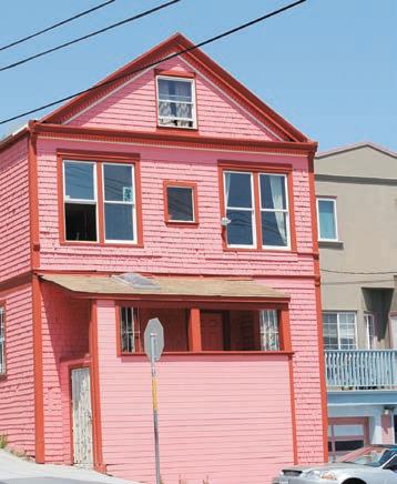
to think of the house as a cooperative. The core values statement in their house agreement describes Urban Stonehenge as “...an incubator space for creativity and community activism; a safe, nurturing and inspiring home base where environmental stewardship is practiced in all aspects of our living” As one Stonehenge founder put it, “People work full-time now just to pay the landlord; we could work parttime and spend the bulk of our time doing social and cultural change.”
Bari’s and Cherney’s 1990 performance at Urban Stonehenge can be seen at: www.youtube. com/watch?v=m5oX2o1sh6c; It Could Be Magic is available online at: www.indybay.org/newsitems/2011/12/21/18703178.php. Many thanks to Marian Doub, Bob Thawley, David Solnit, Chris Hables Gray, Charlotte Allen, and Betsy Davis for their help with this article. Potrero Hill Archives Project interviews are available on DVD at our library.