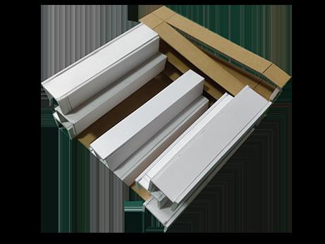
Selected works 2017 - 2022
PARTH SOLANKI
EDUCATION
SEA- School of Environment and Architecture five year bachlors of architecture degree 2017-22
Thakur College of Science and Commerce high school
Thakur Public School primary and secondary school
EXPOSURES
Worked at MOAD- Madras office for architects and designers
Chennai, 2021 internship as part of B.arch academia
Songs of Turbulance, 2020 grpahic design and photography of 5yr college event
PARTH SOLANKI
Mumbai, India
14-08-1999
+91 9821725126
77.solankiparth@gmail.com
WORKSHOPS
as part of electives conducted by the college
2020, Astrobiology coursera online course
2020, Bamboo weaving workshop with Ar. Prateek Dhanmer
2019, Arts after Image with art historian Sabih Ahemed
2019, Project Management workshop at Perkins Eastman
2019, Cynotype Printing technique with Vrinda Seksaria
2018, Virtual reality with Kabir Punde
2017, Photography Workshop with Dinesh Mehta
ACHIVEMENTS
Award for brevity in articulating complex systems and building details 2020-21
Award for exploratory and dedicated performace
2019-20
Best design in First Year
English Hindi
Gujrati
Connected Collaborative Studio, 2019 exchange programe with AVANI institue of design , Calicut
Decoding Urban Form, 2018 volunteering with Ar. Sameep Padora, Sp+a
DESIGN TOOLS
Hand drafting
Sketching
Model making
THOUGHT MEASURE
Autocad
Rhino
Sketchup
Revit
VISUALISE
Illustrator
Photoshop
Indesign
Procreate
Enscape
Lightroom
ARCHIVE
Photography
LANGUAGES
1
1.
2.
3.
4.
1 2-9 10-13 14-17 18-22 23-26 Publicness of Research Space Curriculum Vitae Project 1:12
Perma(Culture)
5.
The Hovering Clinic
CONTENTS 1
The Looped Network

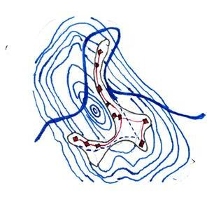
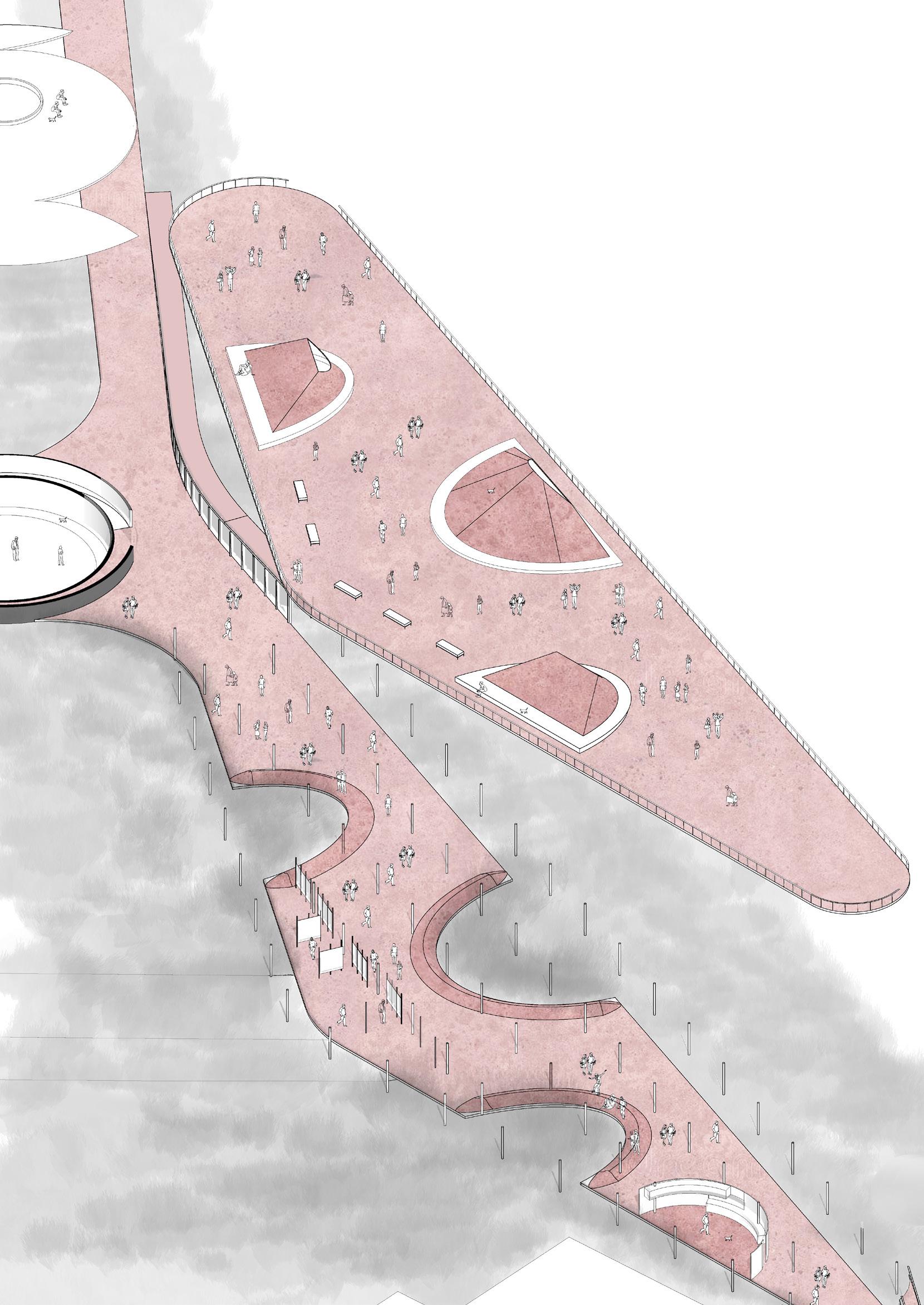
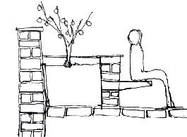
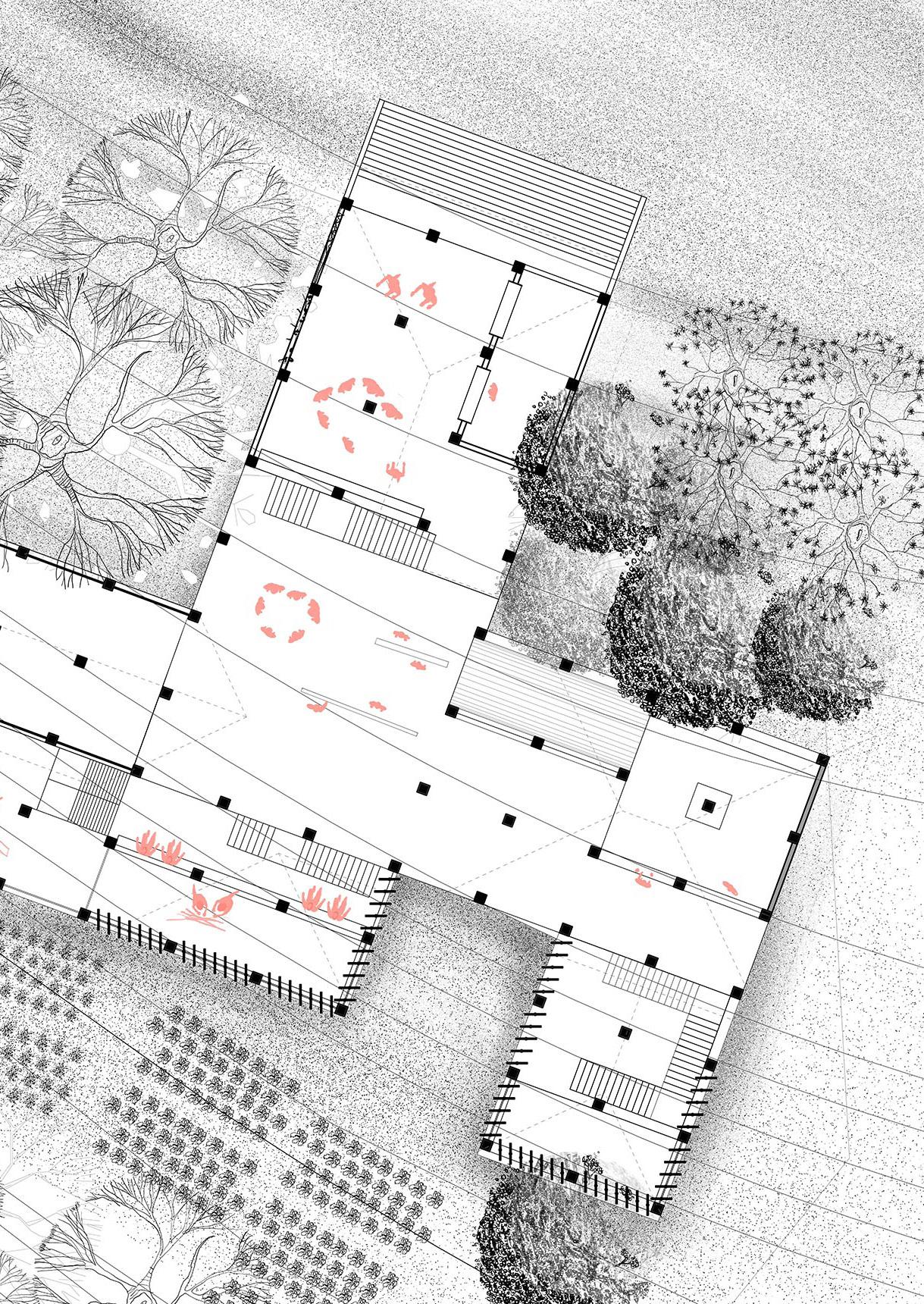
of research‘space’ Nursery Bus stop Nursey market Toilet block 5th year | Semester 9 & 10 | Institution revamp Individual acedemic dessertation project May 2021 Kalina Campus, Mumbai Supervisors: Ar. Dushyant Asher | dushyant@sea.edu.in Ar. Shreyank Khemalapure | shreyank.khemalapure@gmail.com +botany labs 2
Publicness
Isometric Drawing Toilet block
Botany lab
2
Assistant prof. cabin
Today, scientific research spaces do not directly share the knowledge they generate with the public. Instead, the knowledge obtained is filtered and censored. This research examines what led to this disconnect as well as how it affects the spatiality of the research spaces. What is the relationship between a research space and the public?
As science and technology advanced, the world realized that knowledge is infinite and always growing and can be commodified to generate income. The research identifies how various factors led to the spatial shift in the publicness of the research spaces. That shift has led to the emergence of new kinds of programmatic spaces like planetariums and science centers. I then respond to this research by doing a design intervention at an institution to reduce this gap between science and the public.
706 AD Renaissance Invention of telescope
Einstein Mcmath-Pierce Tiede Observatory Scientific Revolution Industrial Revolution Digital Revolution 1734 AD 1921 AD 1964 AD 1970 AD
Case study Timeline 3
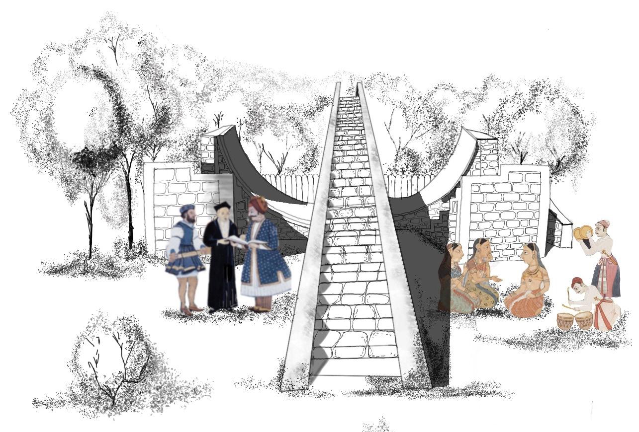
Jantar
Research
Jantar Mantar
Publicness of the Jantar Mantar
Solidness of the Objects
Difficulty to access due to location on mountain
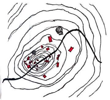
Research Spaces Being fragmented and minor tours allow public flow
on an island adds to the disconnect
No public allowed in the research spaces.
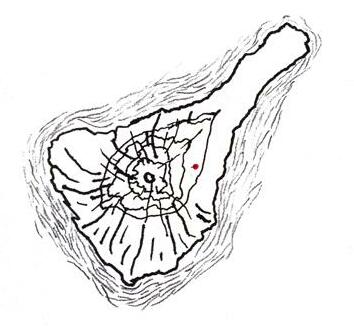
El caracol
Chichen Itza context Publicness of El Caracol
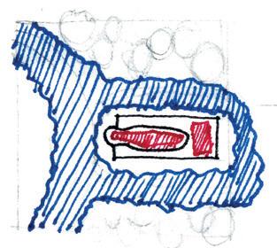
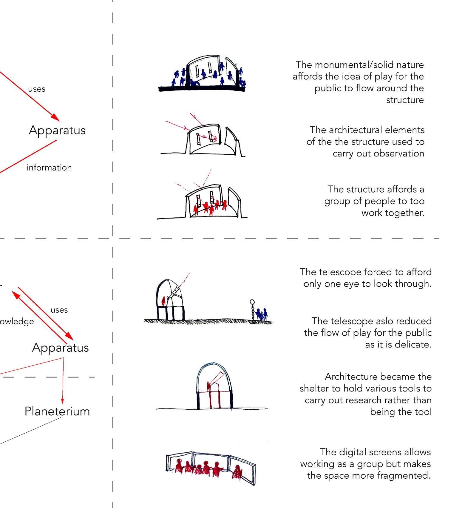
Einstein Tower Telescope Observatory
Location of the public park
Publicness of Einstein Tower is only around the structure
Being
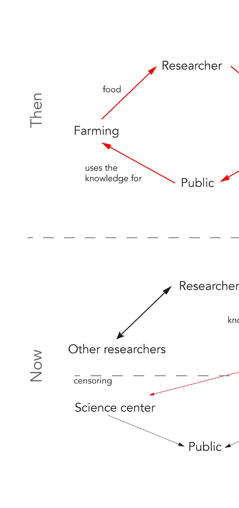
Apparatus Researcher Public Apparatus Researcher Public Apparatus Researcher Public
Researcher Public
Researcher 3
Apparatus
Apparatus
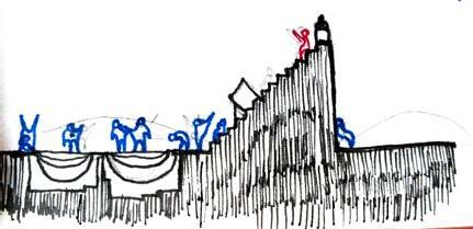
Jantar mantar
Case Study
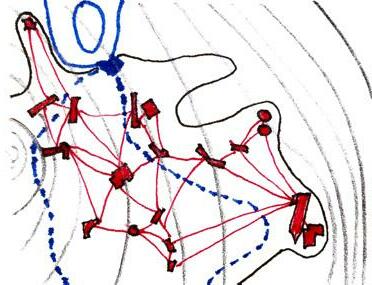
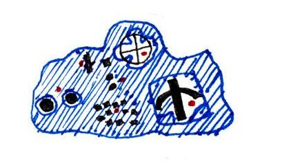
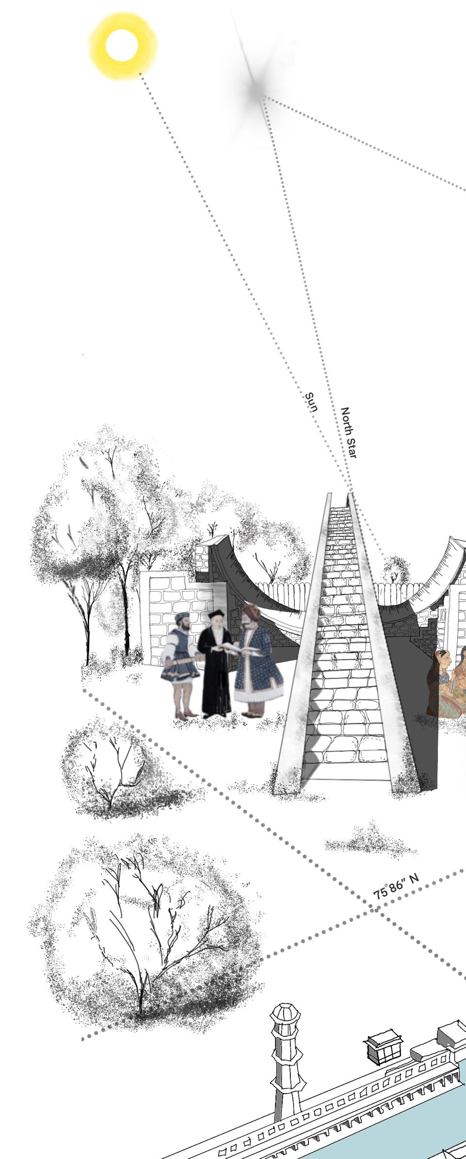
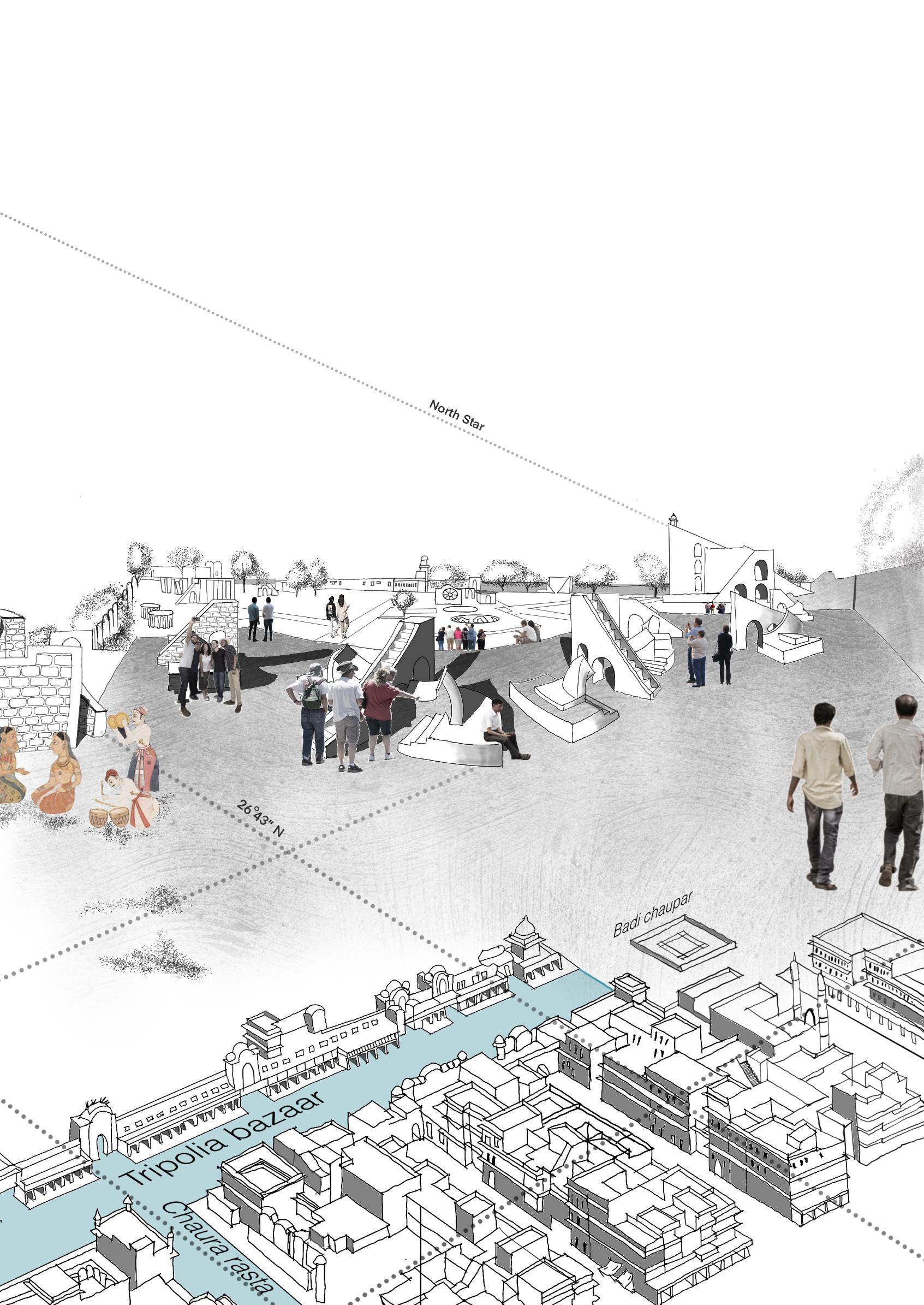
One of the five case studies I did was of a place called Jantar Mantar. The Jantar Mantar is a collection of 19 astronomical instruments built by the Rajput king Sawai Jai Singh II, the founder of Jaipur, Rajasthan. It was completed in 1934. The instruments allow the observation of astronomical positions with the naked eye. Jai Singh noticed that the Zij, which was used for determining the position of celestial objects, did not match the positions calculated on the table. He constructed five new observatories in different cities in order to create a more accurate Zij.
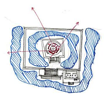
The relationship between the public and the researcher is more blurred here. The drawing on the right shows the relationship between the apparatus and the celestial bodies and how the materiality shifts over time. The location and context directly affect how much engagement the site allows from the public. In Jantar Mantar, we see that that knowledge is transparent irrespective of who uses it. The spatiality of Jantar Mantar allows group involvement to either study or perform social activities.
Jantar mantar | Case Study Drawing
4
4
The study indicates that there have been two types of shifts over time. One is a programmatic shift and the other is a spatial shift.. In the programmatic shift, the research space was earlier a collapsed ecosystem between the public, the researcher, and the apparatus. The public used to feed onto the information given by researchers. But they are now fragmented. This shift enabled new programs for the public like the visitors center, planetarium, and science centers to emerge.
The thesis opens up questions to rethink research spaces in a way to engage more public. How can science be accessible to the public?
Spaces like the planetariums or science centers that are emerging can be rethought to be more integrated with research facilities. The architecture itself can be the mechanism for engaging the public and conducting research.
5
Research conclusion Programatic Shift
Shift
Shift 5
Spatial
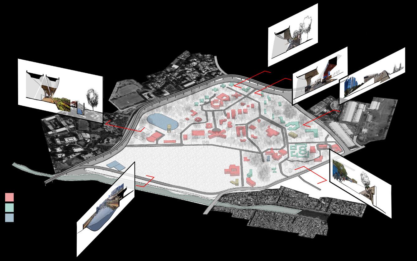
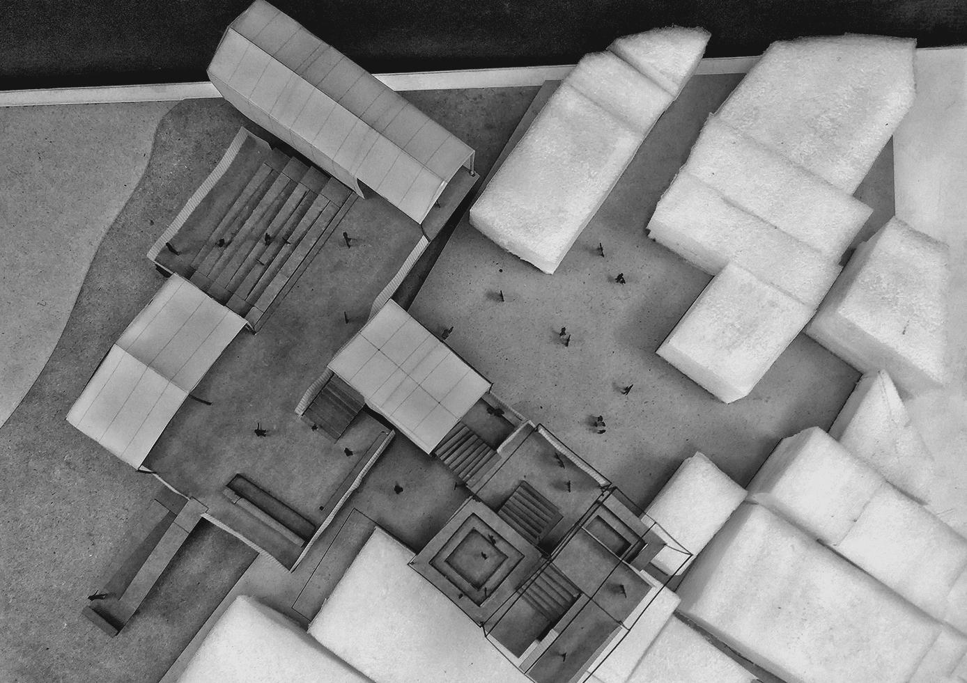
Context and Site analysis
6
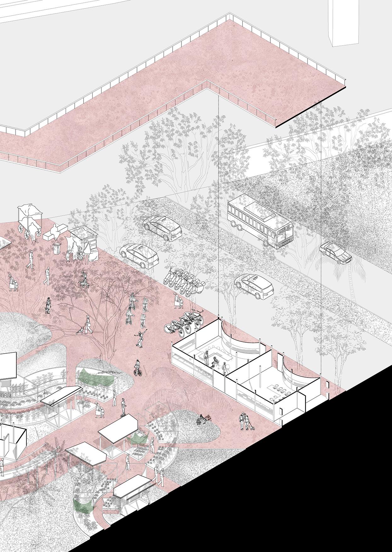
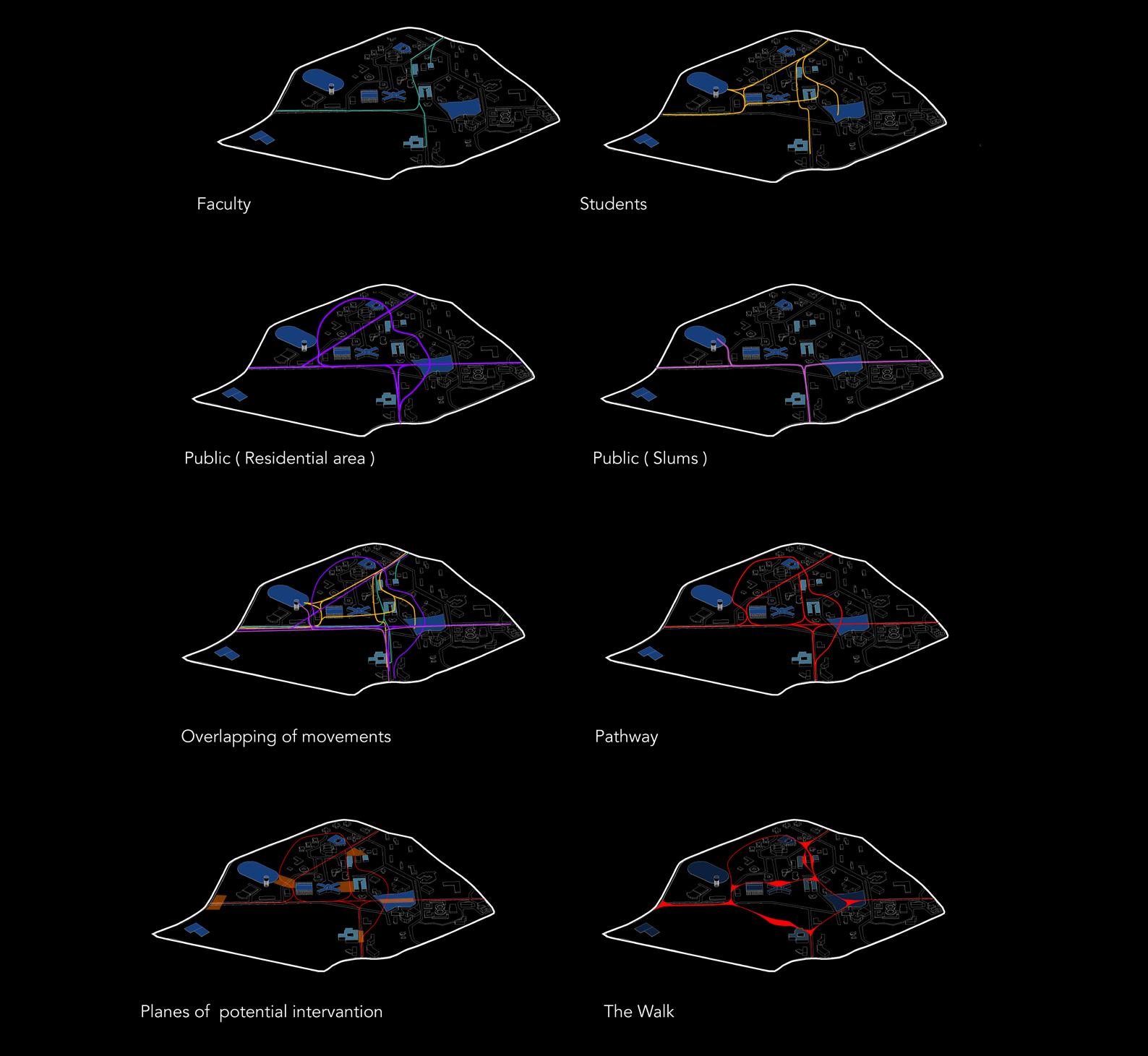
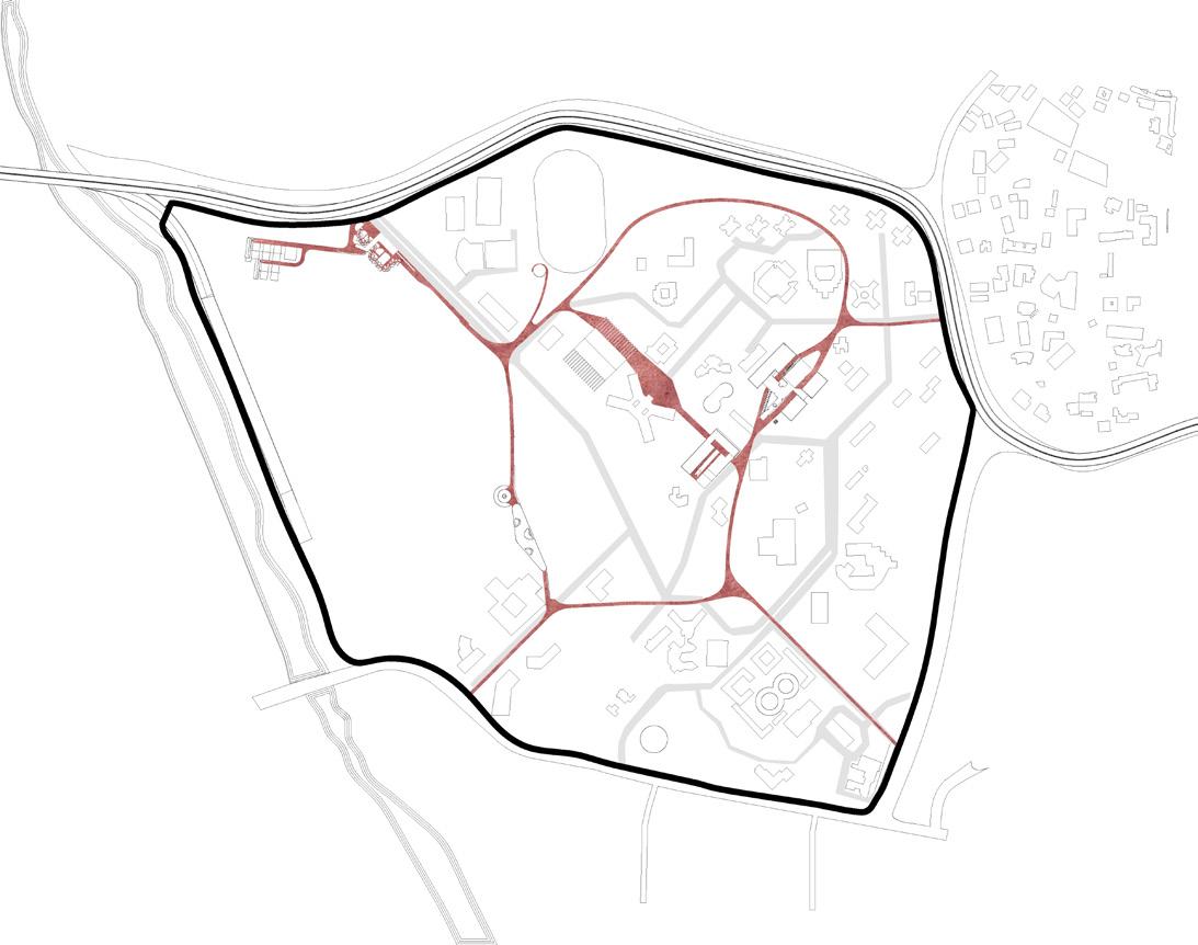
As my intervention site, I chose Kalina University. I realised that the campus functions as a closed ecosystem after observing the movement patterns of the three key actors on-site, the public, faculty, and students. The fact that it is a university makes it impossible for the general public to enter or cross. But the campus and its huge scale can afford to absorb the public as well as Smudge itself within the city.
As a result, my design strategy was to use landscape and interventions to create play, which served as a reason for the public to come. Magnets such as the playground, nurseries, and landscape areas that are shaded or have dense trees that will draw the public were identified on the site. Then, with relation to the setting and the magnets, I filtered the existing flows and identified prospective movement patterns of the various actors. By overlapping these paths, a trail is created in which all of these characters can intrude at various points.
 Intervention
6
Intervention Sites and the trail
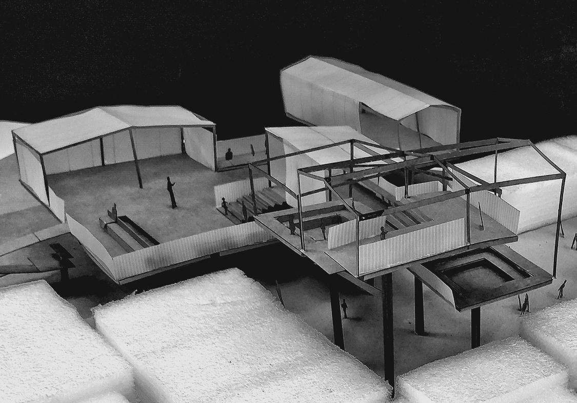
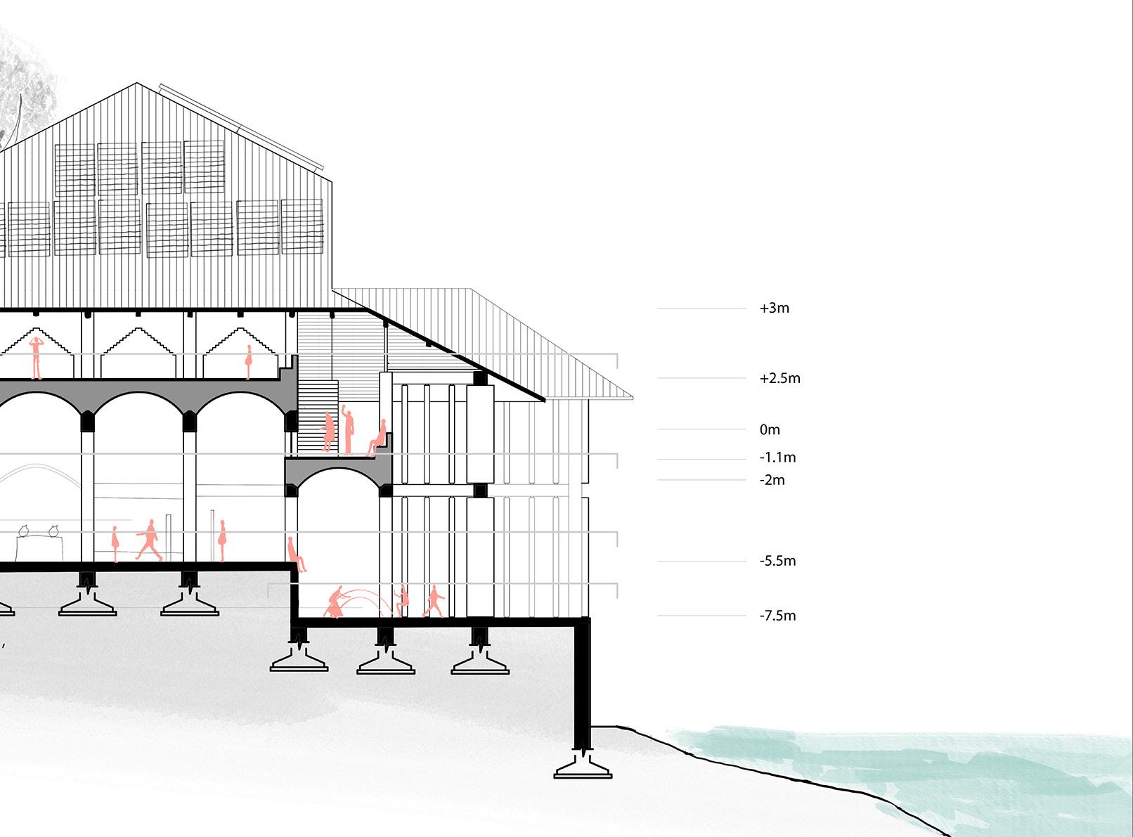
Exibition
+observatory
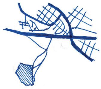
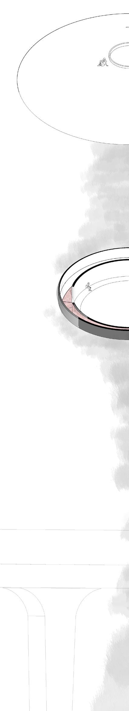
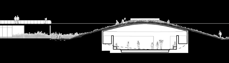
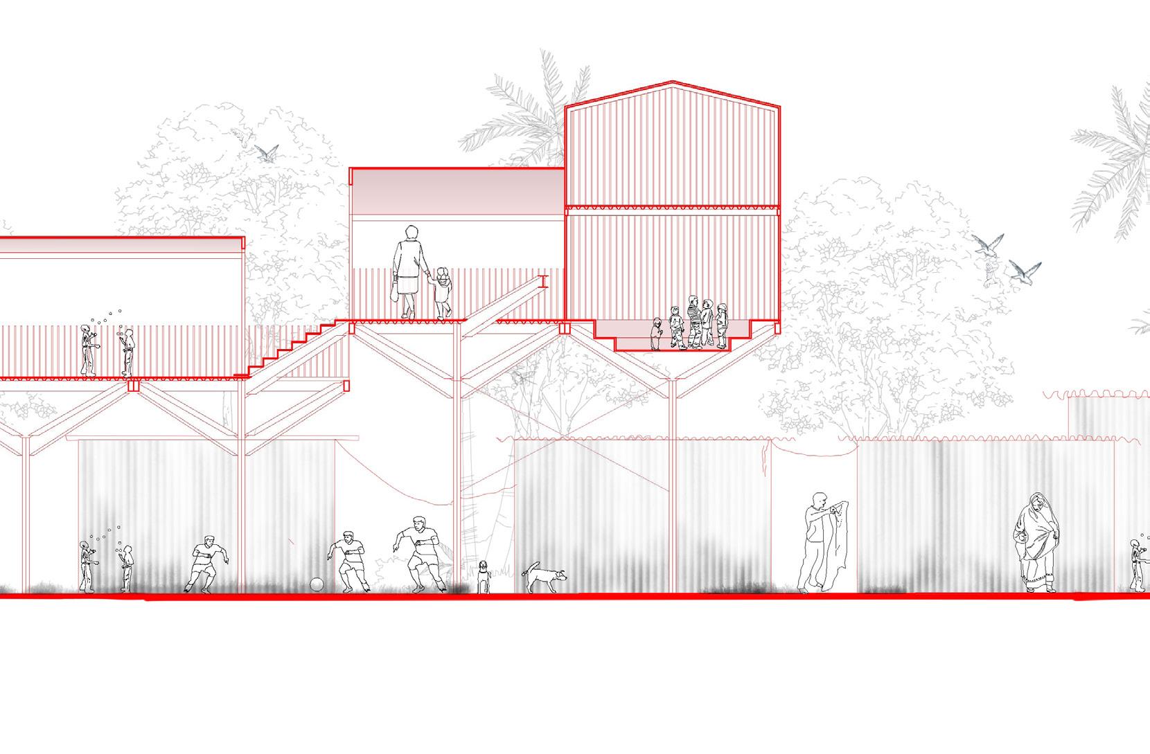
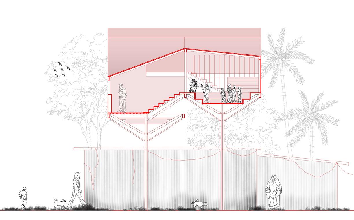
This part of the campus is overgrown with dry, tall grass and it is in between two overlapping movement paths of the people using the trail to cross the campus vertically.
The form of the roof is dependent upon the patch of grass that comes into the exhibition space. The roof bends and becomes a skylight, allowing the grass in that region to grow taller. The floor also bumps up, around the grass patches, allowing a person to stand and feel taller than the grass.
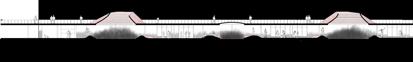
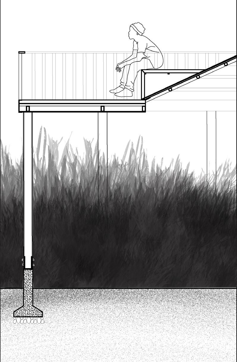
100mm
100x200mm steel beams
C channel on the periphery
150mm dia circular columns
Section and Detail
Sky observatory acts as the magnet to attract students and public.
Cut outs in the roof that brings light for the grass The landscape becomes the partition for the exibition
Movable panels further segregated the space for thr exibition
The floors moulds to become mounds around the grass for people to sit and climb
decking roof with red pigmented concrete
fiber cement board
0.0m +0.5m +3m +3.8m
2m to 2.8m tall dry grass
Isometric Drawing
Open labs +greenhouse +science cafe
The trail passes by the physics, chemistry, life science, and biotechnology departments. There is a dilapidated small greenhouse that the life science department used to use.
I wanted to redesign the greenhouse which thus serves as a magnet that generates the spark of play for the public to enter. The open lab is a space where artists can collaborate with researchers and students to help them visualize their research data. The science cafe acts as a public space where peer reviews and presentations can take place.
Programe synthesis diagram
Student Existing relationship New relationship Student Public Faculty Faculty Laboratory Laboratory Open Labs Science cafe Greenhouse 8
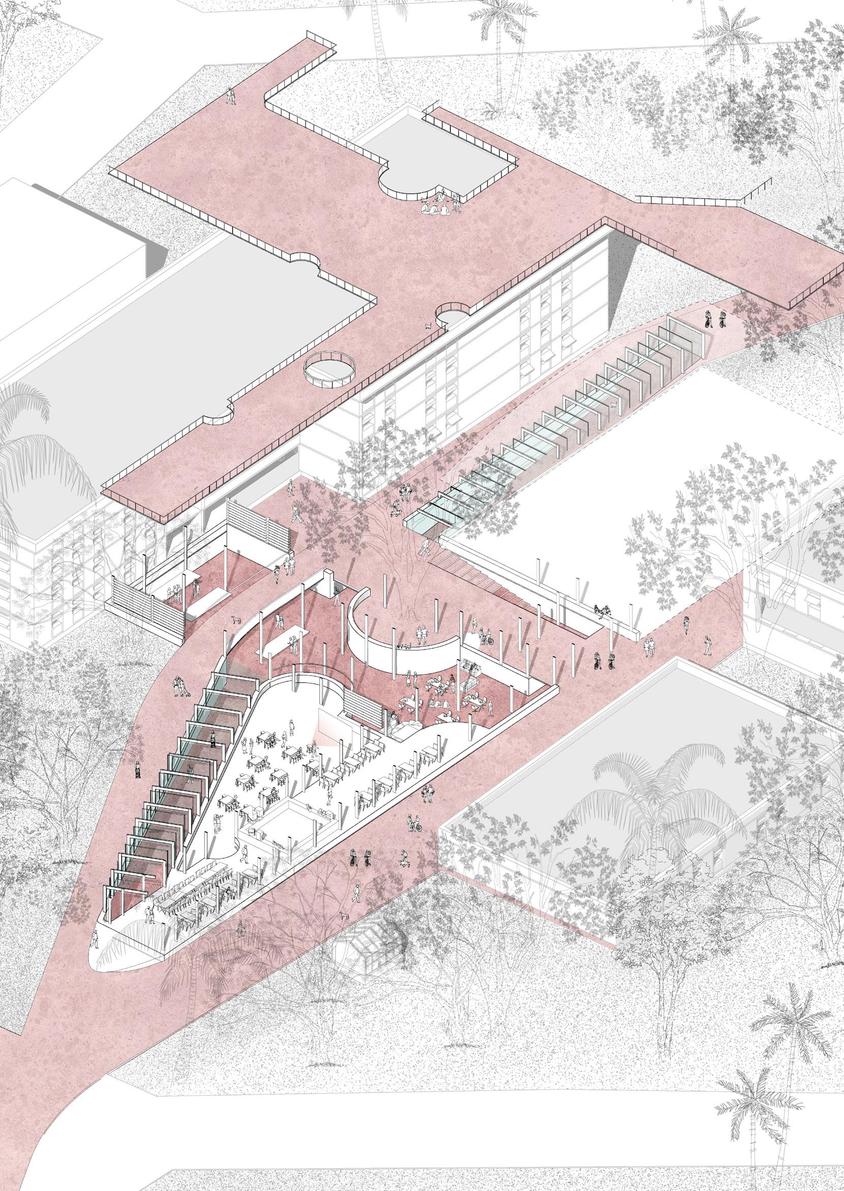
Greenhouse Science cafe Open labs New Chemistry lab Bio-tech Department Isometric Drawing 8
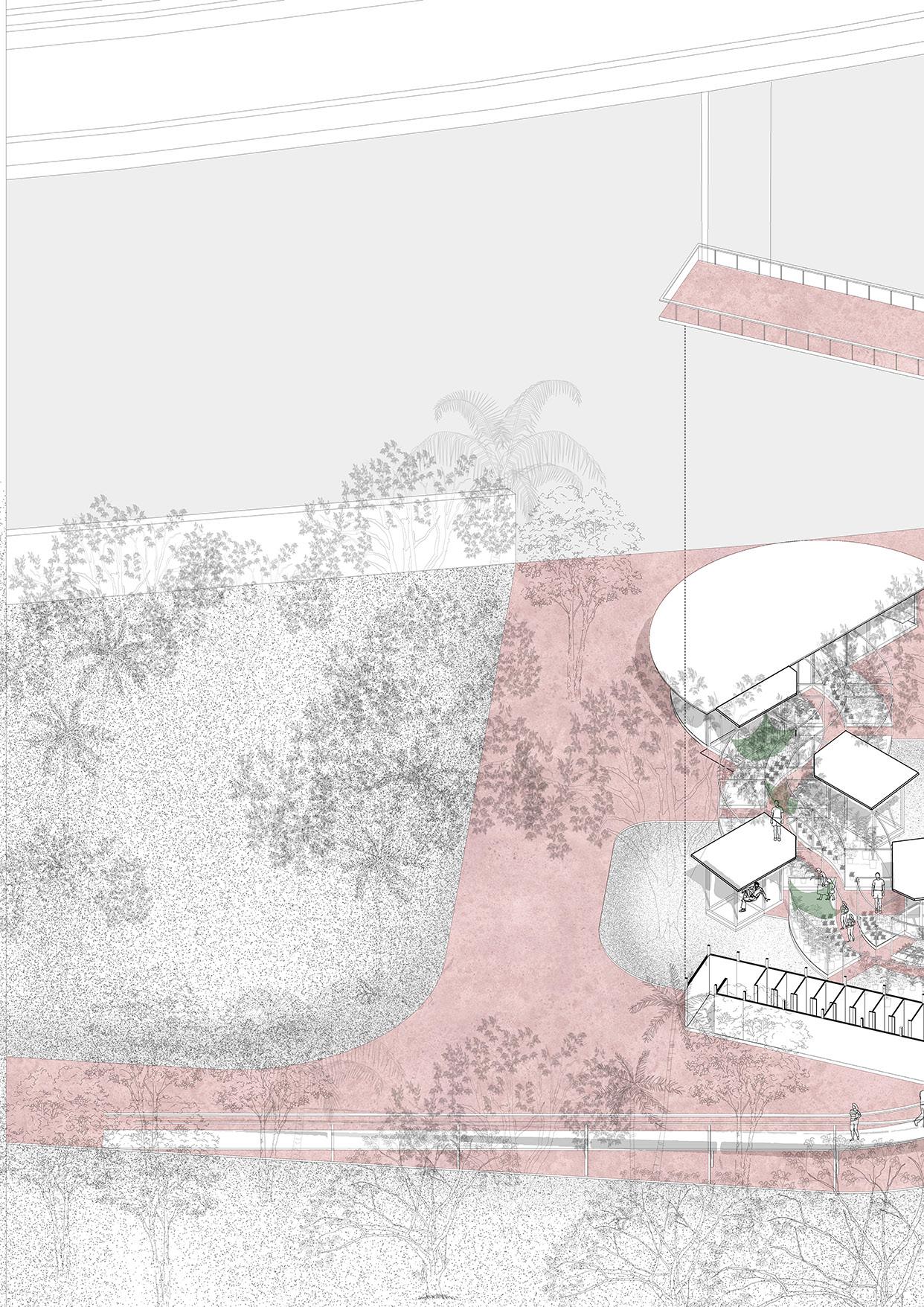
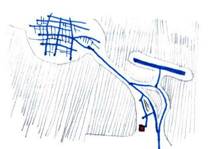
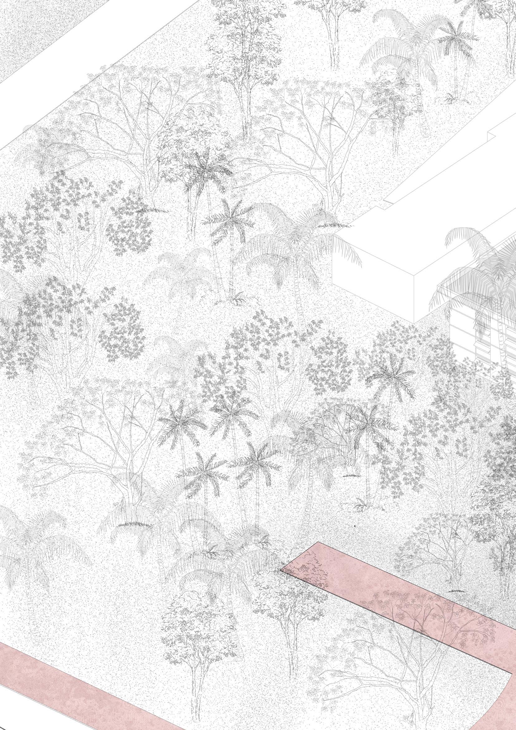
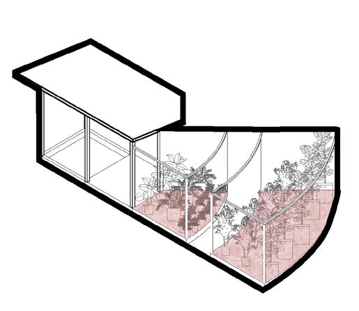
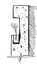
Nursery
+botany labs
This is the northern boundary of campus, where there is a lengthy stretch of existing nurseries. There is already a relationship between the city and the nurseries. The plan was to build a new botanical research facility and repurpose the nursery as a market to attract visitors.
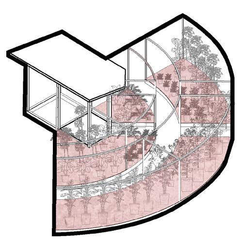
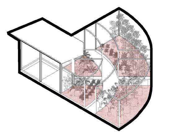
Instead of being constrained by a compound wall, I rethought the nursery’s existing typology to make it an independent shop. I developed three sets of such shops with radially expanding plinths. These modules are then connected to create a market for the general public to wander through. The public’s tour through the market is transformed into an experience. This market has a botany lab that runs parallel to it. As a result, researchers will be able to communicate with nursery store owners, and students will be able to learn from them. The architecture allows passers-by to see inside the laboratories.
Nursery shop units
I worked on this project for almost twelve months from articulating a spatial concernt to executing it onto a design intervention. This project explosed me to explore my thinking at various scales at the same time. It ranged from an urban scale to furniture scale. Most importantly I undestood how to think sensitively at all the scales.
 Rest
Plinth for plants
Frame to fabrichangfor shading or planters
Soil Pit
Rest
Plinth for plants
Frame to fabrichangfor shading or planters
Soil Pit
9
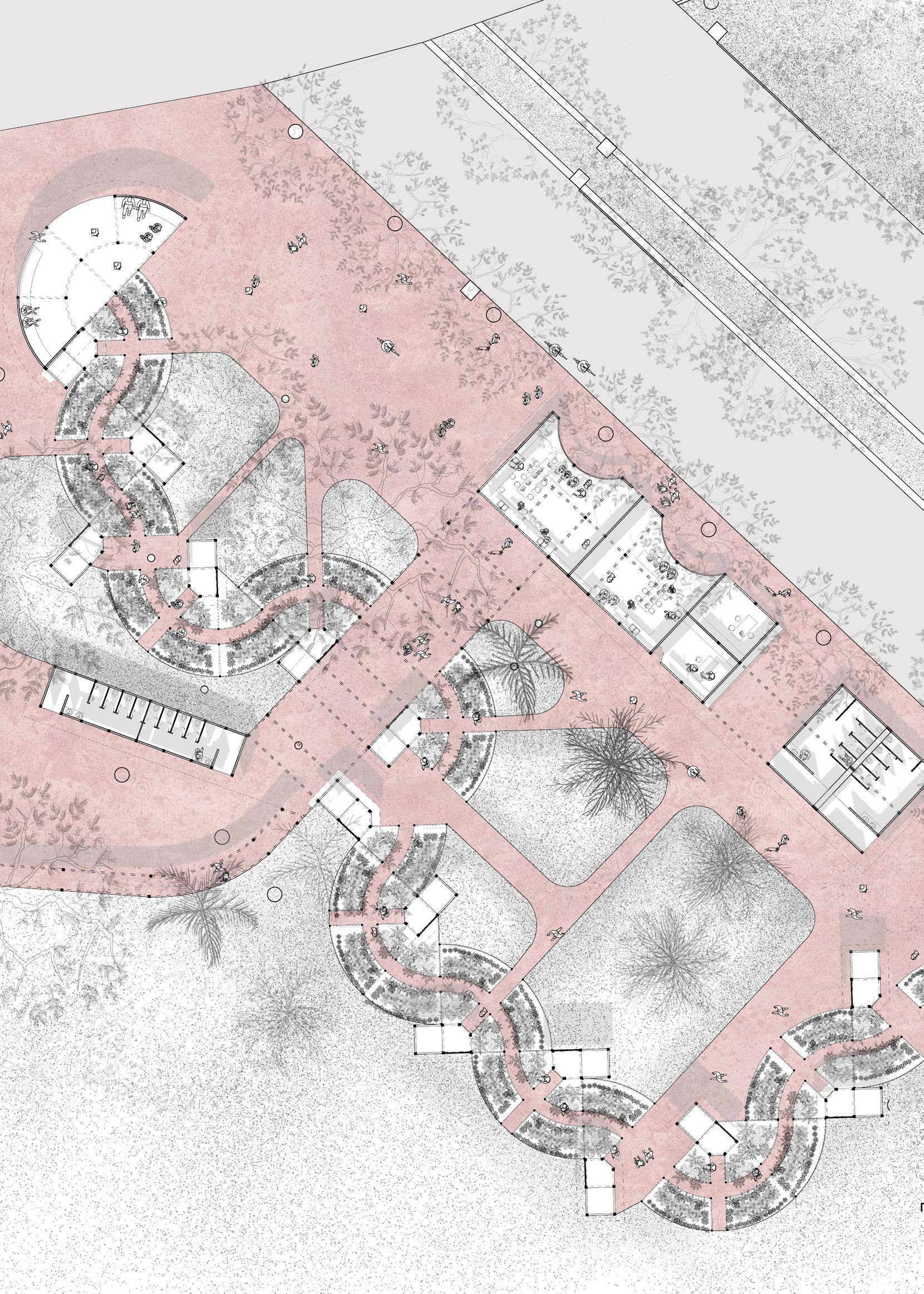
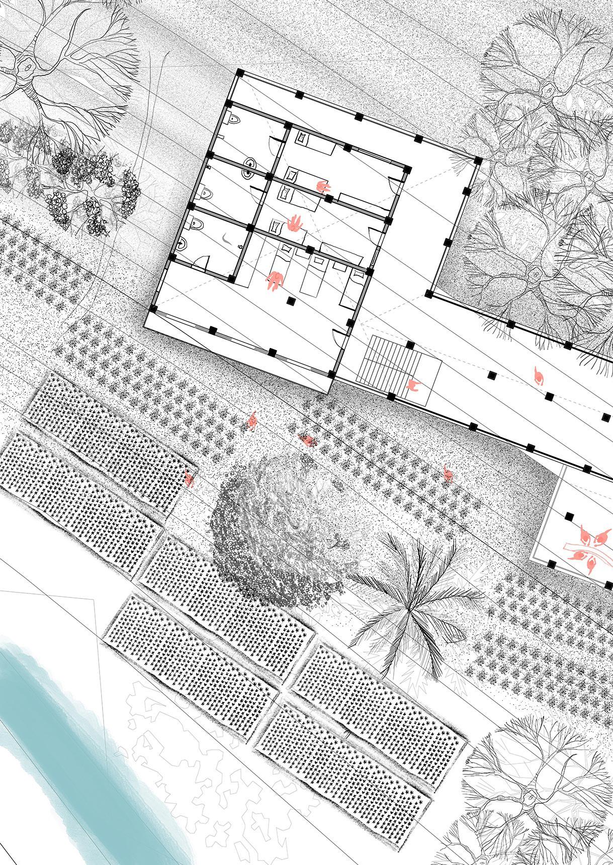
PLAN Bus stop
Nursey market
9
Toilet
block Botany lab Assistant prof. cabin
Project 1:12
3rd year | Semester 5 | Co-Living Space
Individual studio project
October 2019
Churchgate, Mumbai
Supervisor: Ar. Areen Attari | areen@pyht.org
10
10
Understanding the idea of resource was the studio’s objective. Where does it originate? Why is it crucial? and effective uses for it.
I believe that resources like air and water can be looped to be used more effectively. Convection currents and pressure, for instance, can be utilised to cool or heat a place, while the water cycle provides rain, which enables agriculture and contributes to the production of food. I therefore wanted to investigate the utilisation of land and electricity in conjunction to create a loop and use it for a co-living space on our site.
Therefore, I designed a system where the building would be naturally lit by solar fibre optic lighting and the facade would function as a vertical farm that would supply the canteen with food.

Resource
11
Resource loop diagram
ramp on a single face of the site
Iterations
ramp on a center of the site
models to fit ramps on the site
ramp on a around site
11
Window detail 12
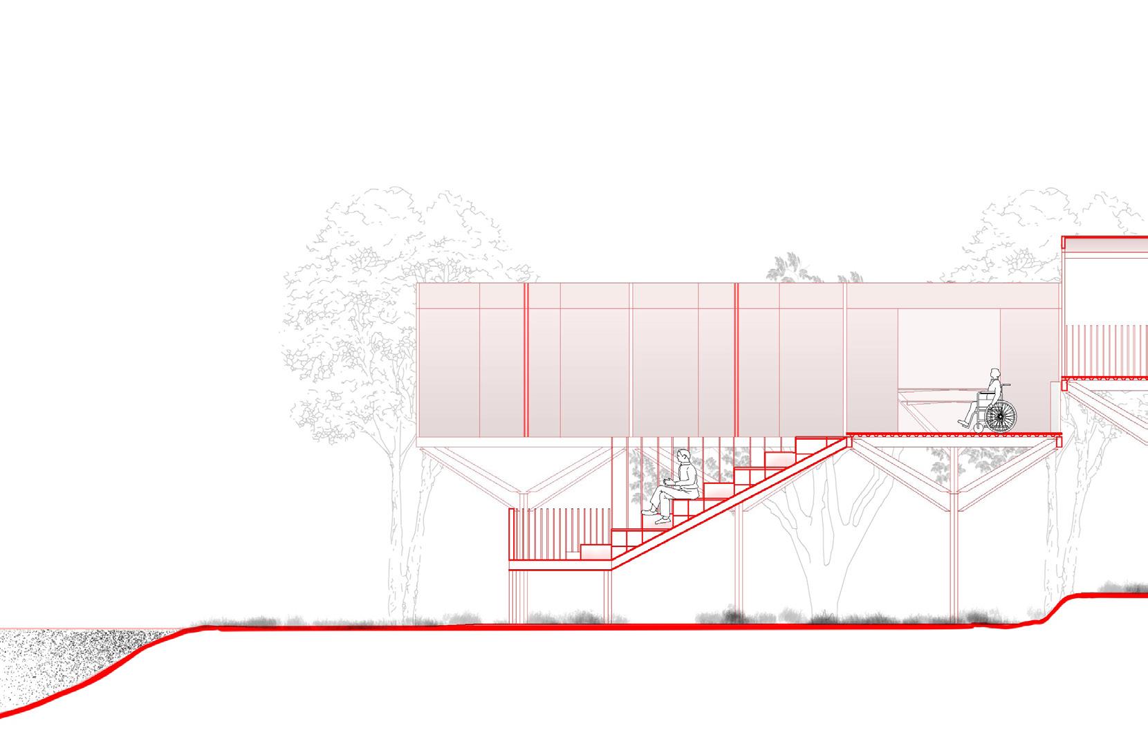
Ramps were thought of as a way for me to communicate the idea of the loop into language or a form. For a human to walk comfortably, a ramp ratio of 1:12 is required. The current challenge is to fit this ratio inside the restricted site constraints while still adhering to the local building codes.
As a result, these ramps alone established the quality of the spaces for the students in the Coliving space. The ramps took on a vital role in the construction, serving as meeting areas and mid-landings on all four corners. The ramps and rooms were evenly spaced out in a grid and supported by steel columns.
1:12 Ratio
12
Exploded drawing and block diagram of the rooms
Section 13
13
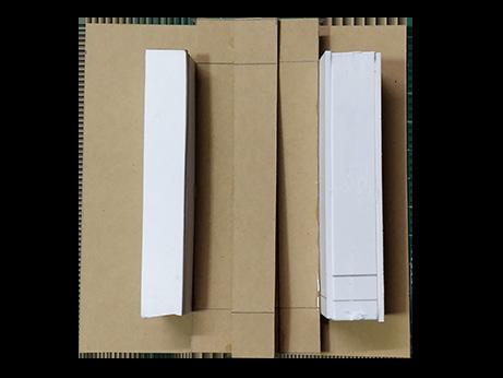
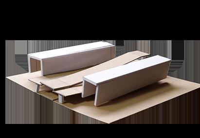
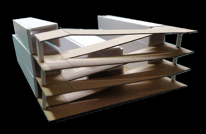
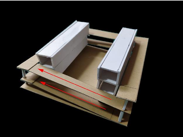
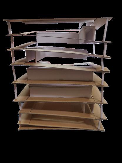
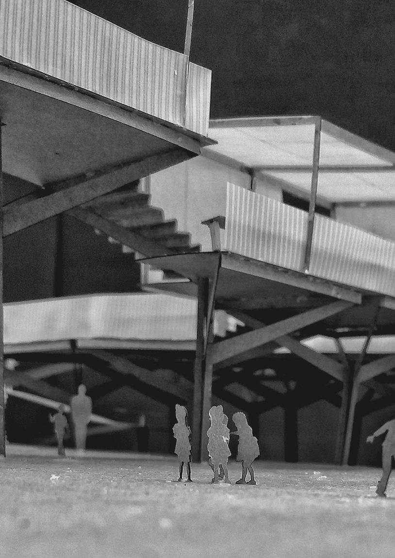
Model Photo
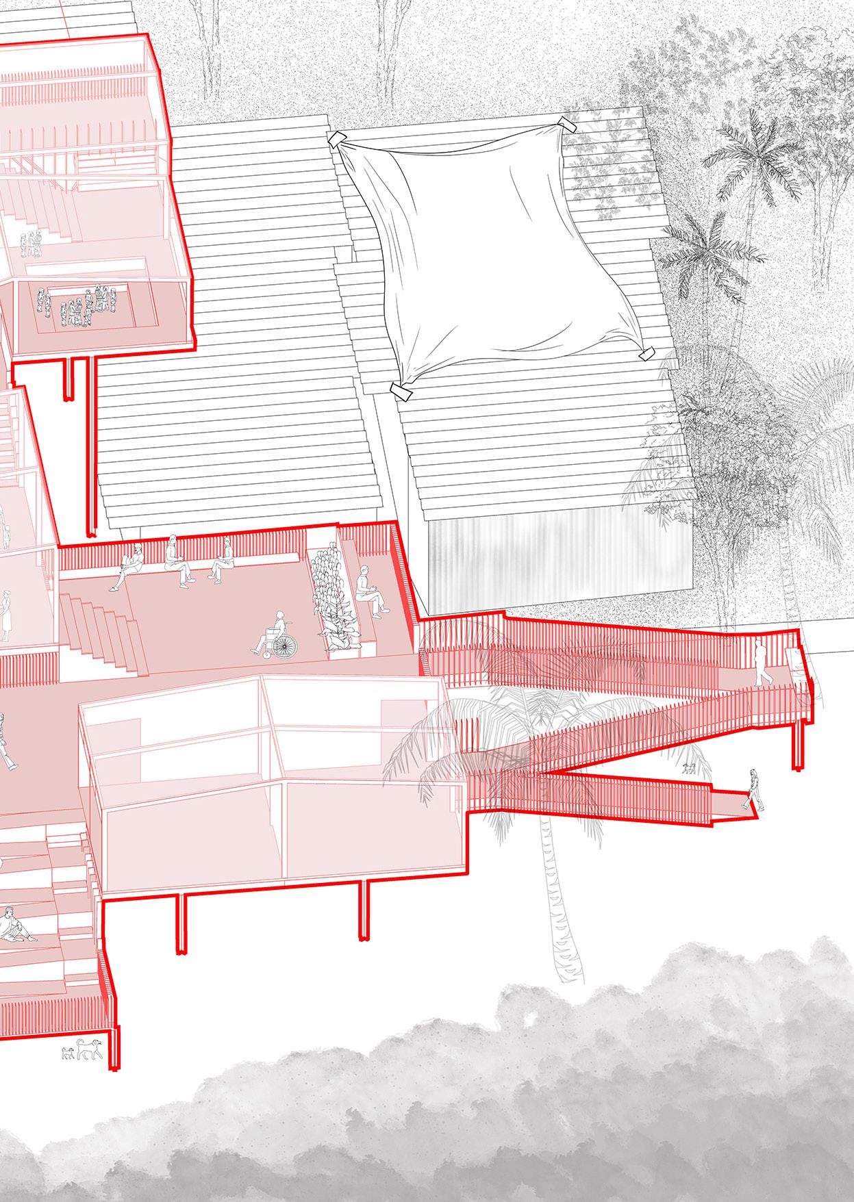
The Hovering Clinic
2rd year | Semester 4 | Community Clinic
Individual studio project
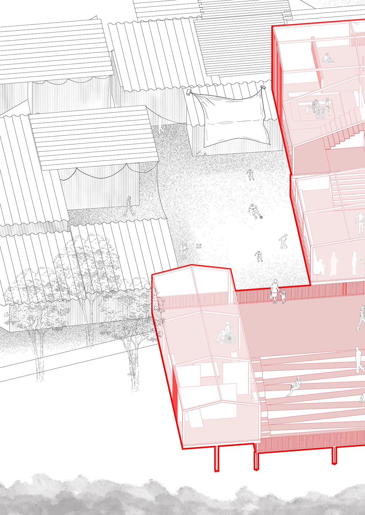
March 2019
Baba nagar, Mumbai
Supervisor: Ar. Areen Attari | areen@pyht.org
Clinic Amphitheather
14
Playground
Public Toilets
Balwadi
Isometric Drawing 14
Neighbourhood Studies
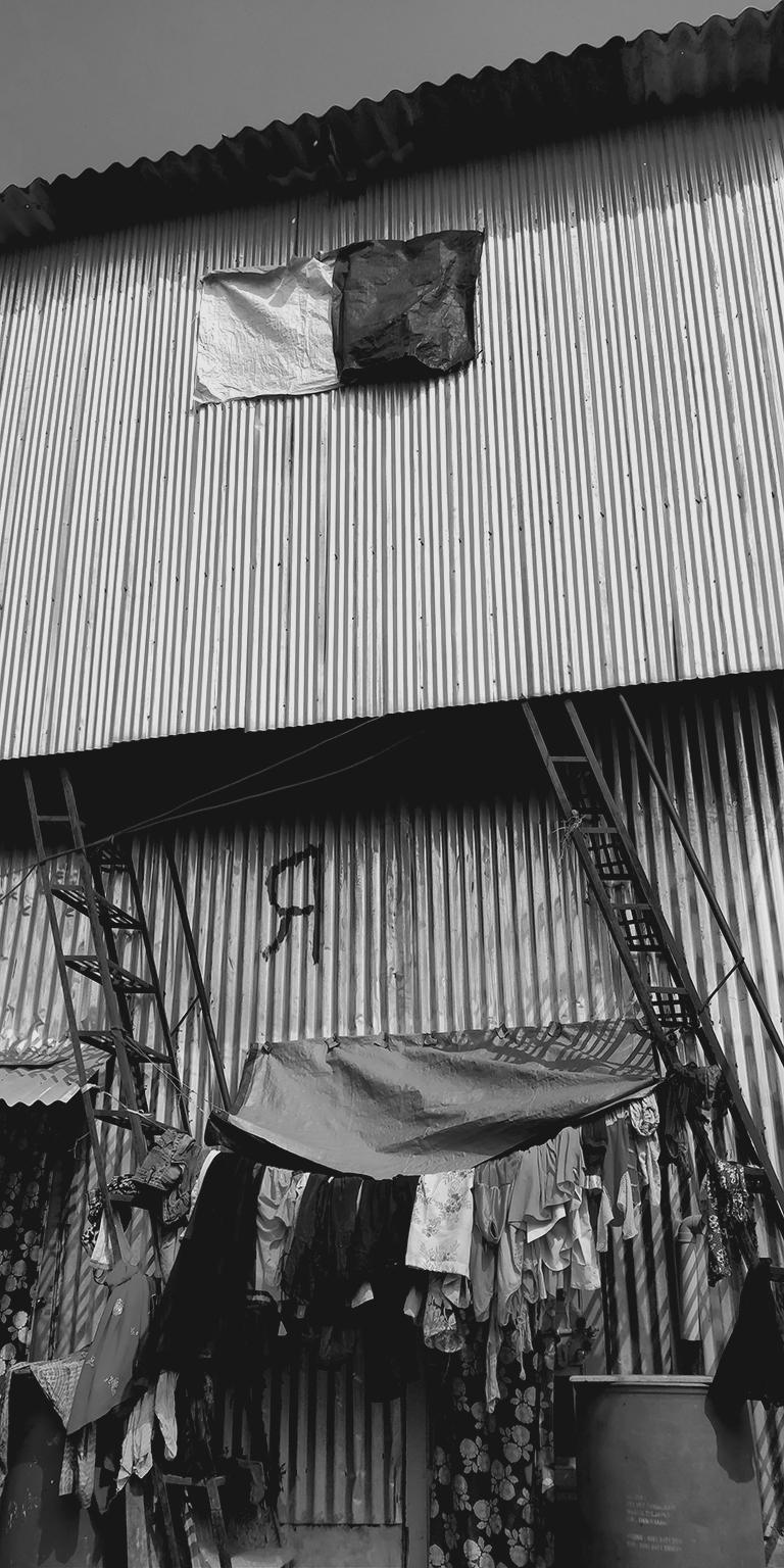
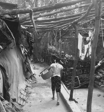
Baba Nagar is a small organic settlement in the Govandi Village of the M-East ward. It is located opposite Shivaji Nagar and adjacent to Rafique Nagar and the Deonar Dumping Ground, which happens to be the largest and oldest dumping ground in India.
Baba Nagar started developing as a residential settlement in the 1980s when people started coming to the city for jobs. One consistent job opportunity that lured people in was the dumping ground itself. As a Rag pickers paradise, this dumping ground can be held partially accountable for the upcoming Baba Nagar. But that didn’t mean that the settlements were recognized by the law. The residents recall times from the 1980s till almost 2006 when they won a case in the High court, they were constantly exploited in the form of evictions, threats, demolitions, and even physical violence by the police and local goons and sometimes even the mafia.
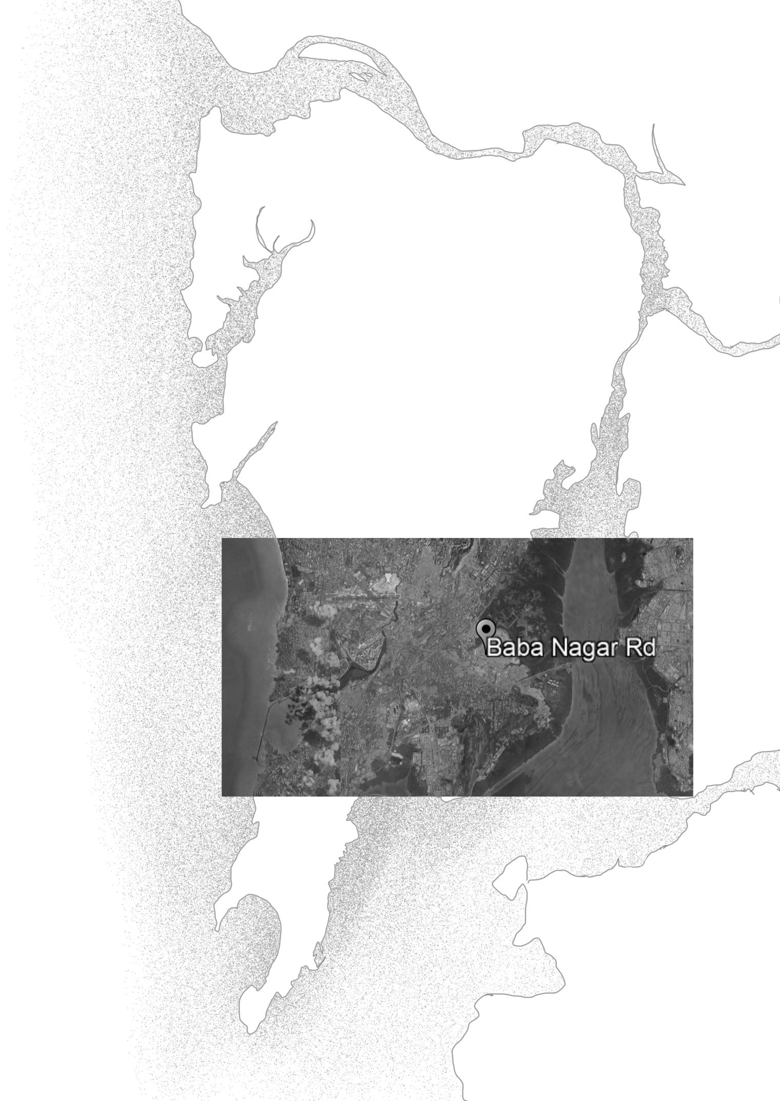
Mumbai 15
Neighbourhood Play Soaces
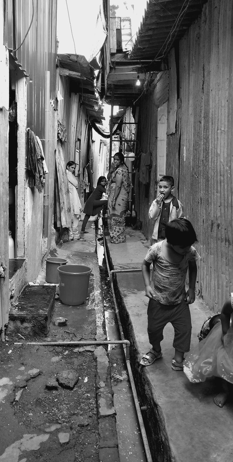
Context Incrimental
Housing
15
What is Care?
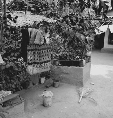
The studio’s objective was to understand what is the idea of a clinic in this context where people are extremely vulnerable to various factors. The children cannot afford to go to school hence I wanted the bring the idea of care in terms of learning and spreading knowledge which becomes a mental health clinic for children. Balwadi is a space where NGOs or any educated local can come in to teach these children. This also can become a community space for the locals to come together and start a conversation with the government authorities.
The settlement is prone to many evictions by the government for no major reason, due to while there is a constant fear among the locals. I wanted to design this clinic at an elevation height so people look up to it. I wanted the solidity of this structure to give hope that there will not be any further evictions.
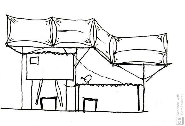
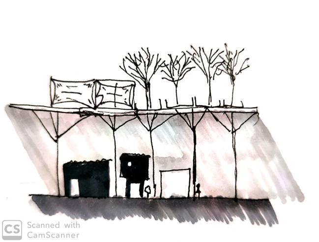
Section | Initial Sketches Amphitheather Clinic 16
Cross section through balwadi Playground Balwadi
16
Balwadi
Model Photos
17
17
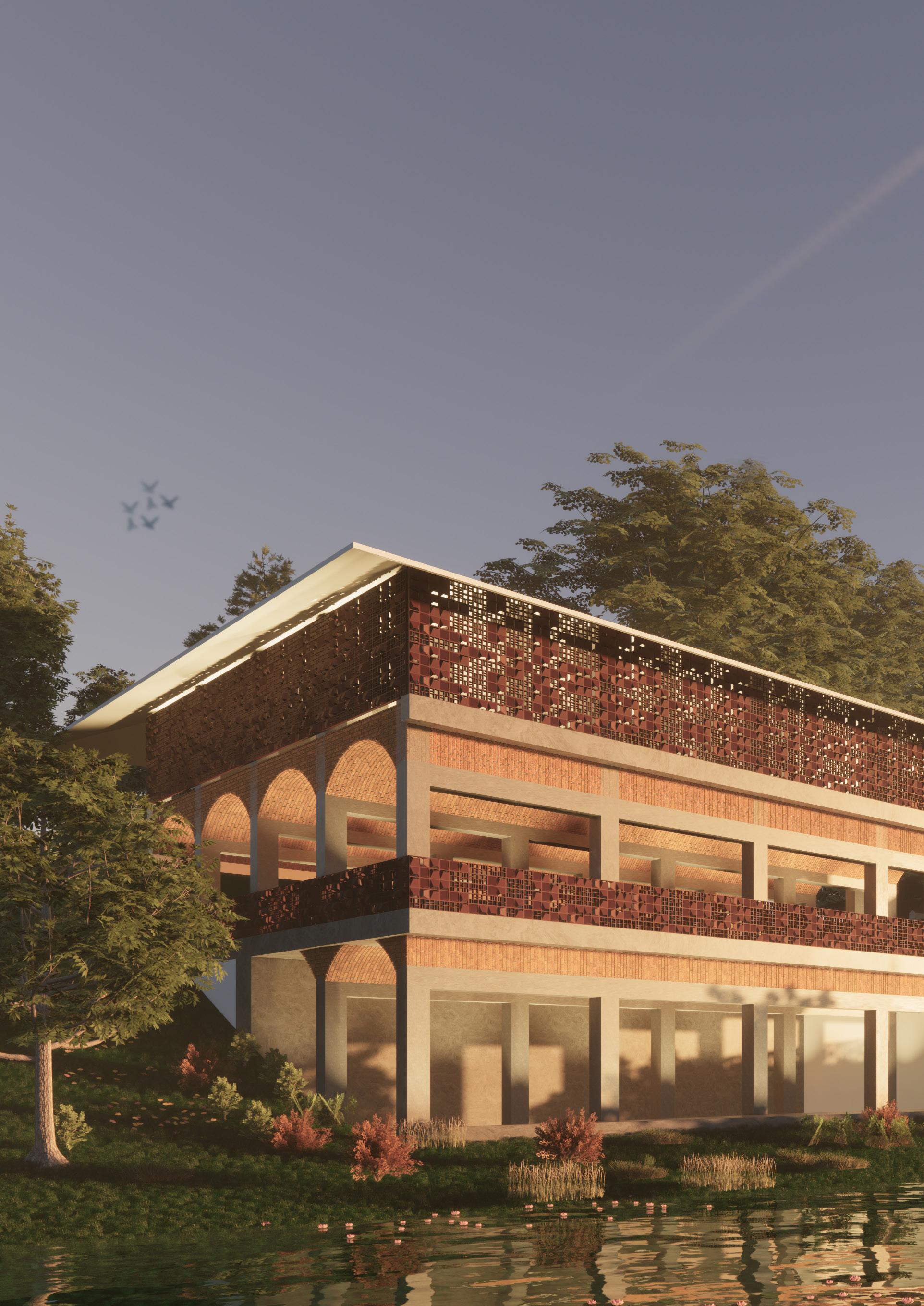
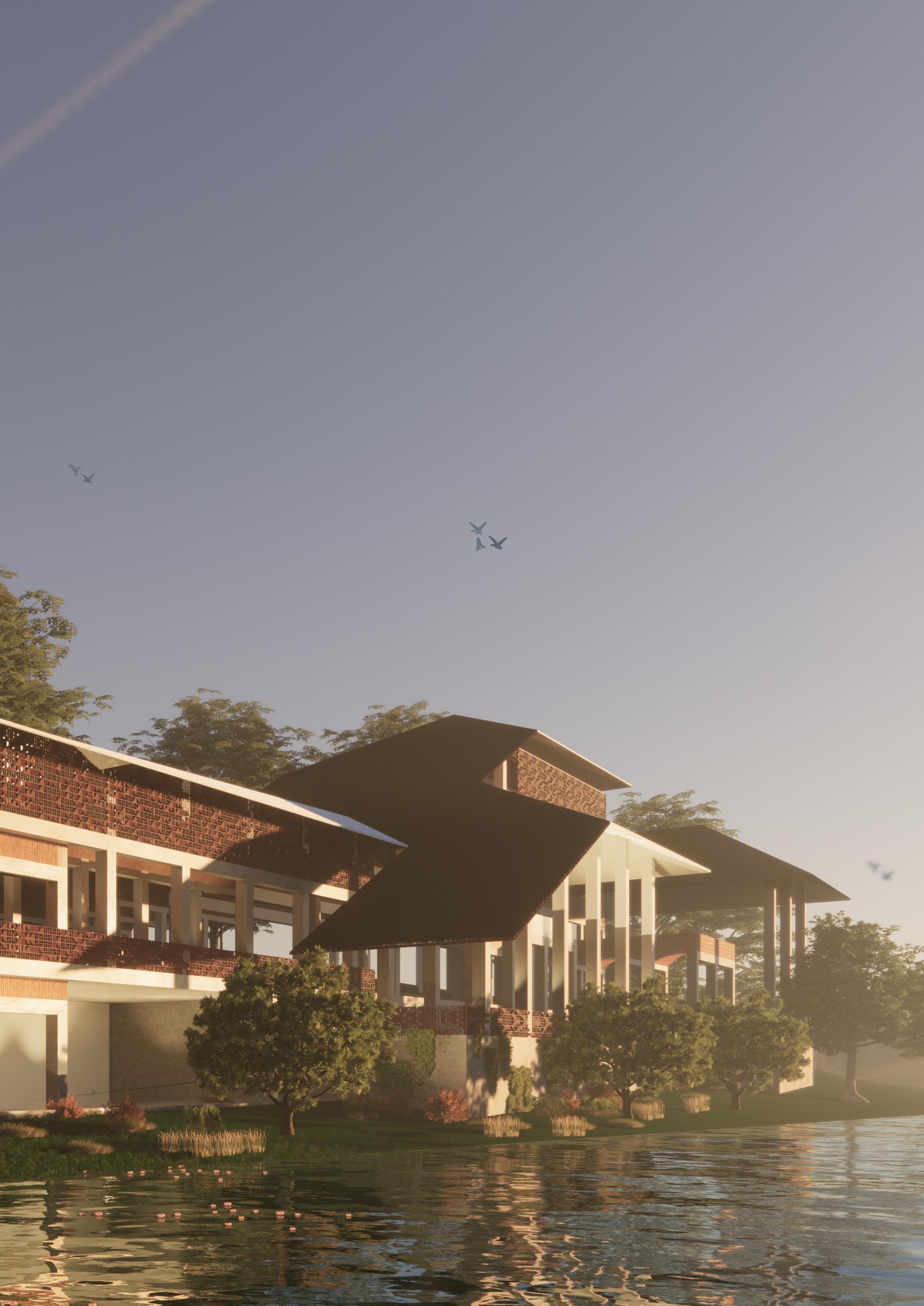
Perma(culture)
3rd year | Semester 6 | Permacultutre community center
Individual studio project
March 2020
Vihar lake, Mumbai
Supervisor: Ar. Malak Singh Gill | malaksingh@sea.edu.in
18
18
Generating Programs
The project began with visits to two communities, Sahi Banguda and Ultanpada. These are all distinct from one another in terms of how they approach the local architecture. One uses mud as its main material and the other uses wood as th
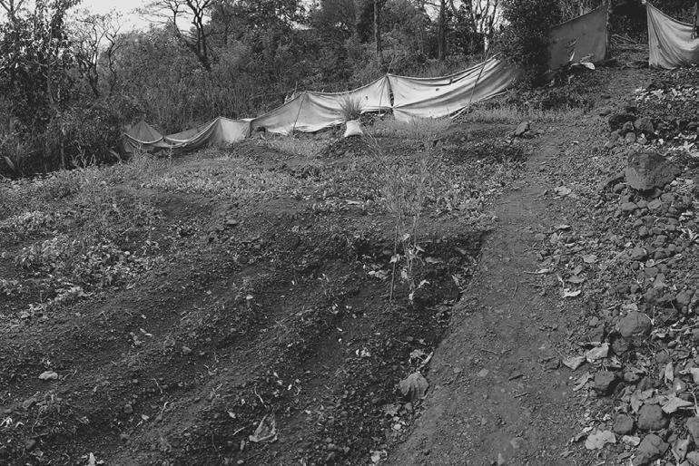
The task was to understand their complexity and the site’s vicinity to a body of water in order to devise a strategy that would take into account all the flux between these towns.
 MUD
Landscape
Sahi Banguda village
Ultanpada village
Farming
Wood Sheds
MUD
Landscape
Sahi Banguda village
Ultanpada village
Farming
Wood Sheds
19
People from Urban Mumbai Living ecology (NGO)
The city of mumbai is starting to explore rural activites as an opportunity to learn new things as well as a way of escaping their everyday.
The NGO were alredy working on these villages to help the people with jobs and opportunities in the city. But I belive they disreguard all the rural activities that already happen there.
Skill Exchange center
Indegenious building construction workshops
The center helps people from the city to teach the people from the villages or learn from various indegenious skils they have. which can become an income for the villages.
Permaculture
It is a set of design principles centered around on whole systems of thinking, simulating, or directly utilizing the patterns and resilient features observed in natural ecosystems
Programe diagram 19
Soap block model Library Wind Sunlight Learning center Cafe Skill Exchange Center Residence 20
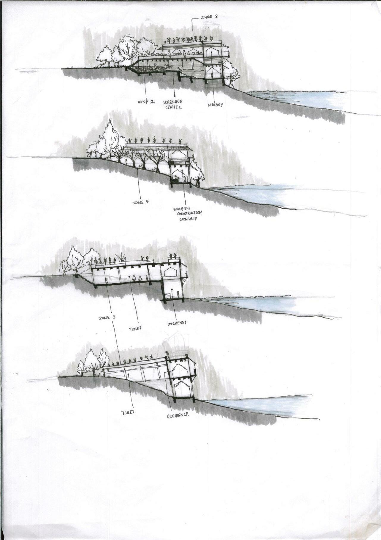
Sectional sketches to understant scale and materiality 20
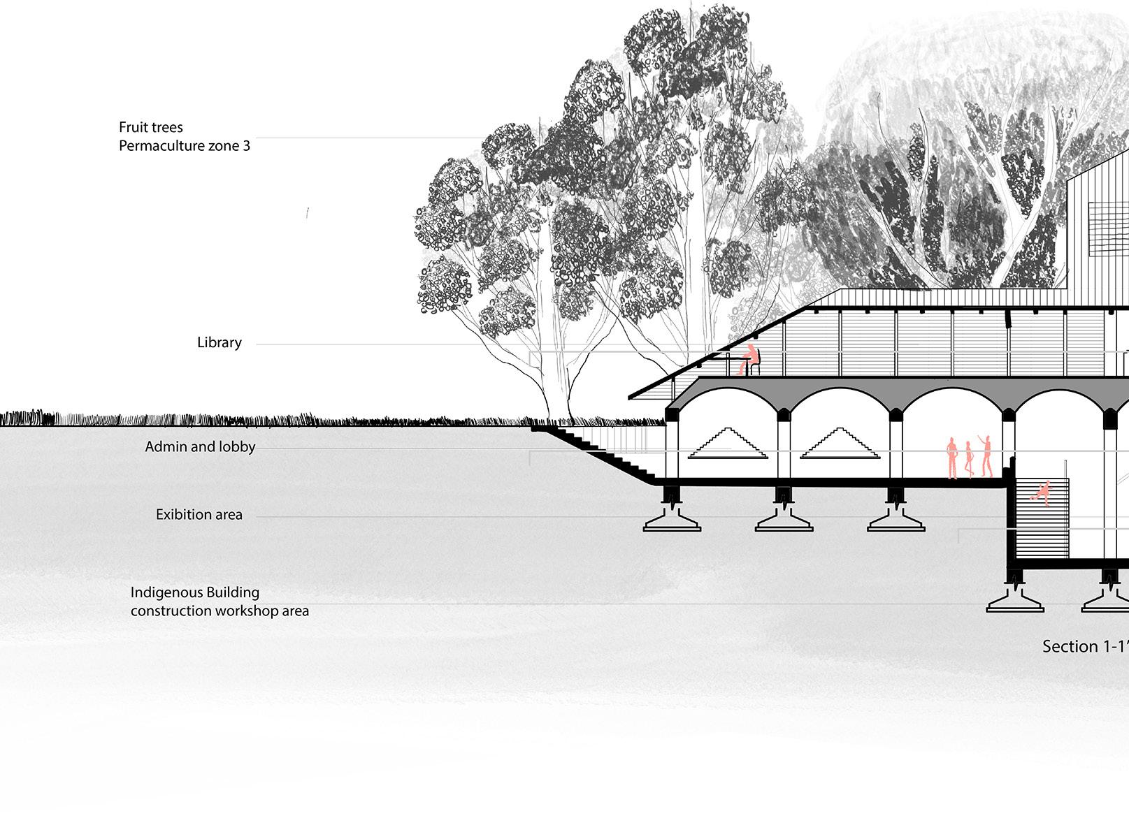
Section and details
Brick vault filler slab
Admin 21
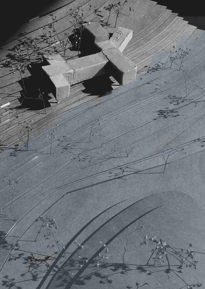
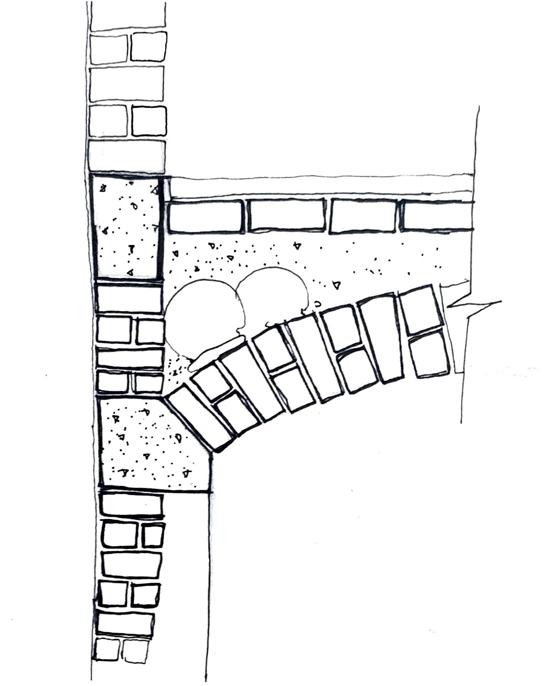
Bench and planter detail
Materiality and form
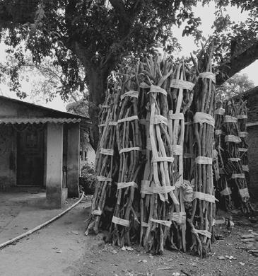
It was intended to employ materials with very low embodied energy and for the building to be self-sustaining. Bricks and wood, which were readily available nearby, were primarily used. Only the foundation, retaining walls, and beams were made of reinforced concrete.
Used or broken pots are placed on the floor, which is referred to as a filler vault slab, between the brick flooring and the vault to make it lighter. Cement serves as the binding agent. It is a widely used approach to lower the overall cost of materials and make it more sustainable in different parts of India.
The project taught me how to create my own programmes based on the situation and what is actually required.
retaining wall detail Workshop Exibition Library 21
Plan Summer - Winter
Zone 5-1.1m 3’ 3 4 4’ 5 Permaculture expert residence ( scholars residence) Estate managers residence 80sq m 90sq m Balcon y Balcon y Balcony Bedroom Bedroom
22
Zone 3 - Staple food
Workshop
Zone 1 - The building
 Zone 2 - Kitchen Garden
Zone 4 - Fruit trees
Zone 2 - Kitchen Garden
Zone 4 - Fruit trees
0m -2m -2m -5.5m -5.5m -1.1 m -1.1m -5.5m 1’ 2 2’ 5’ Smaller
Wood trees
group disscussion area
Lobby Exibition area Kitchen 180sq m 70 sq m 120sq m 40sq m Workshop 22
Smaller group disscussion area
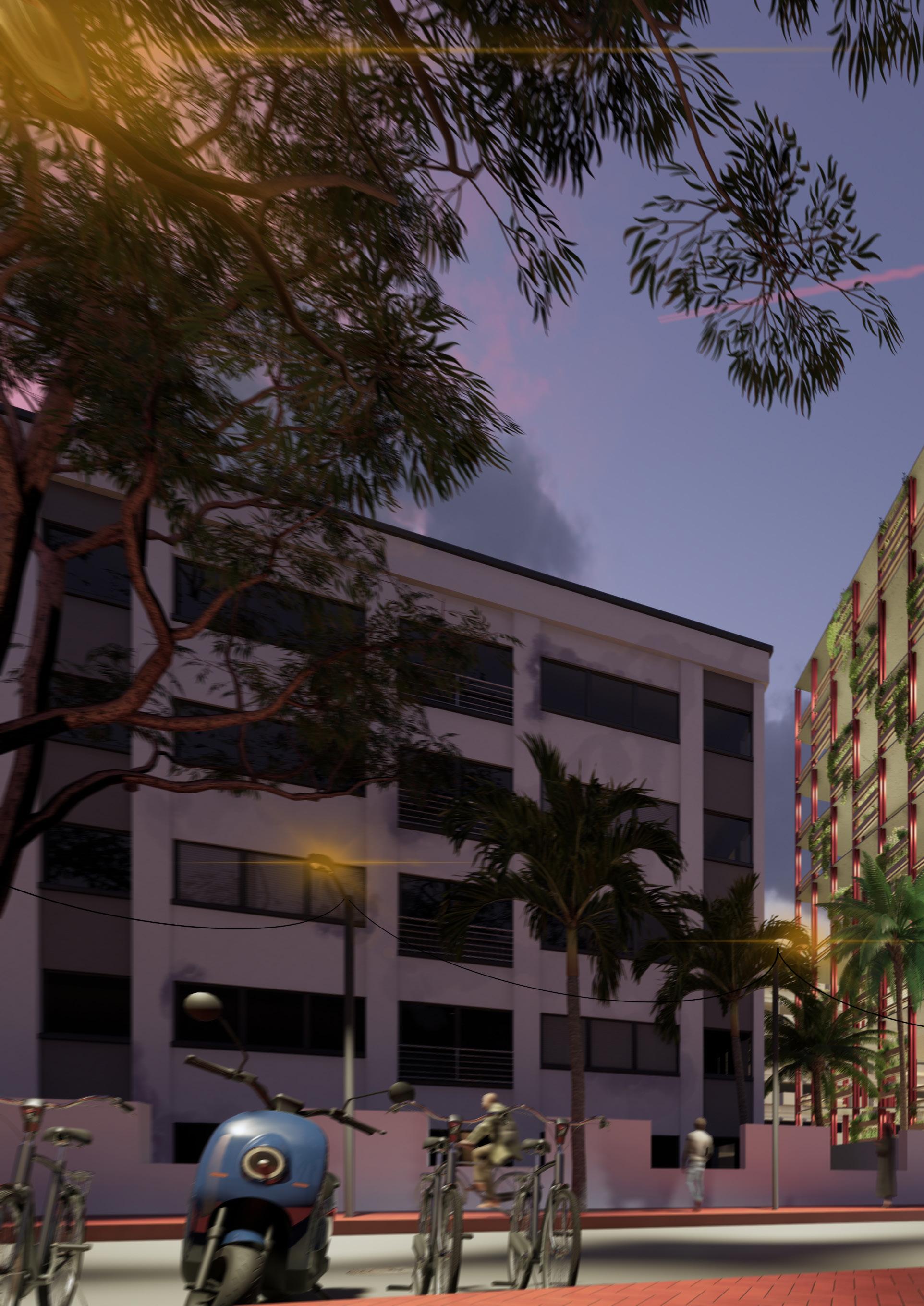
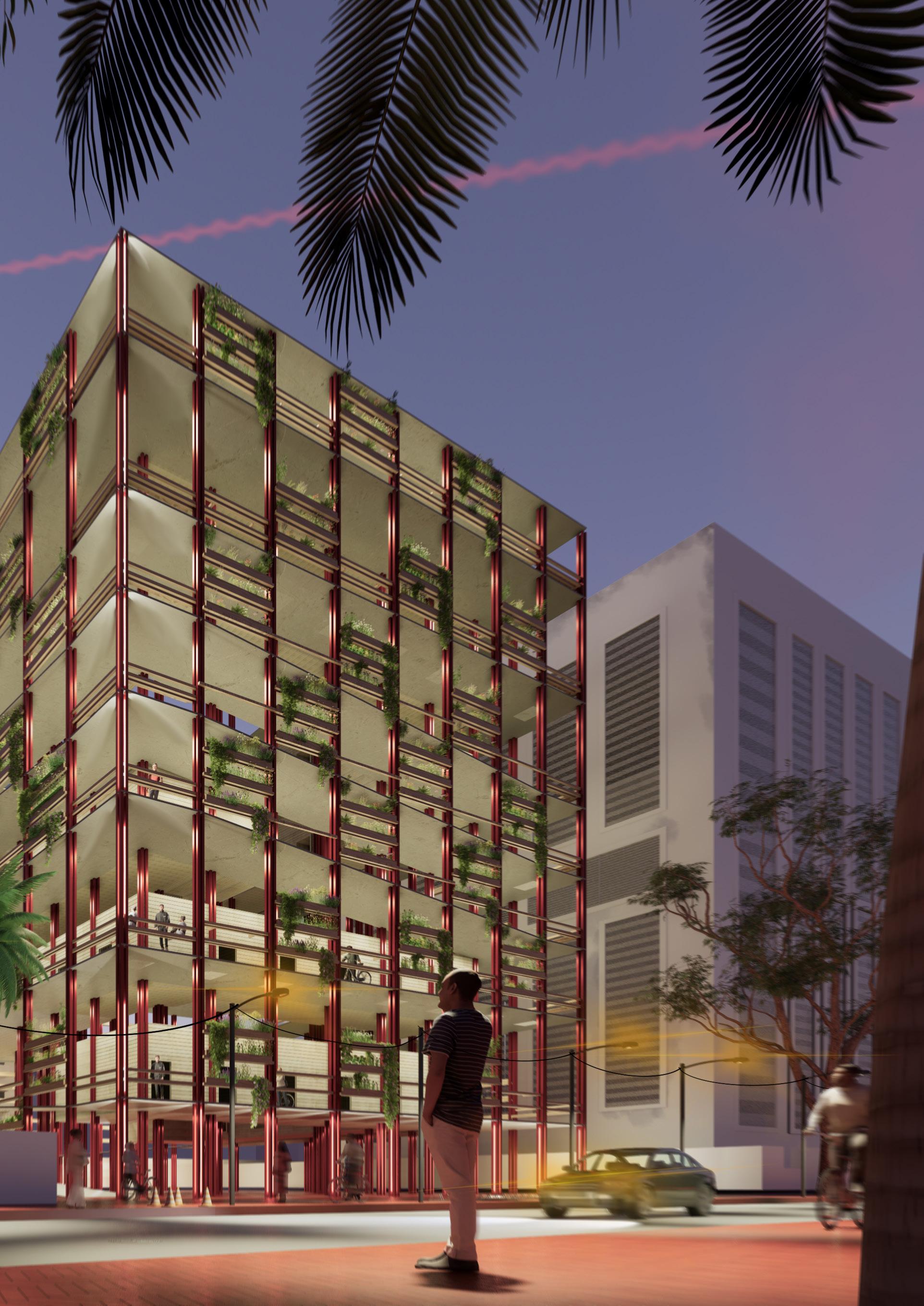
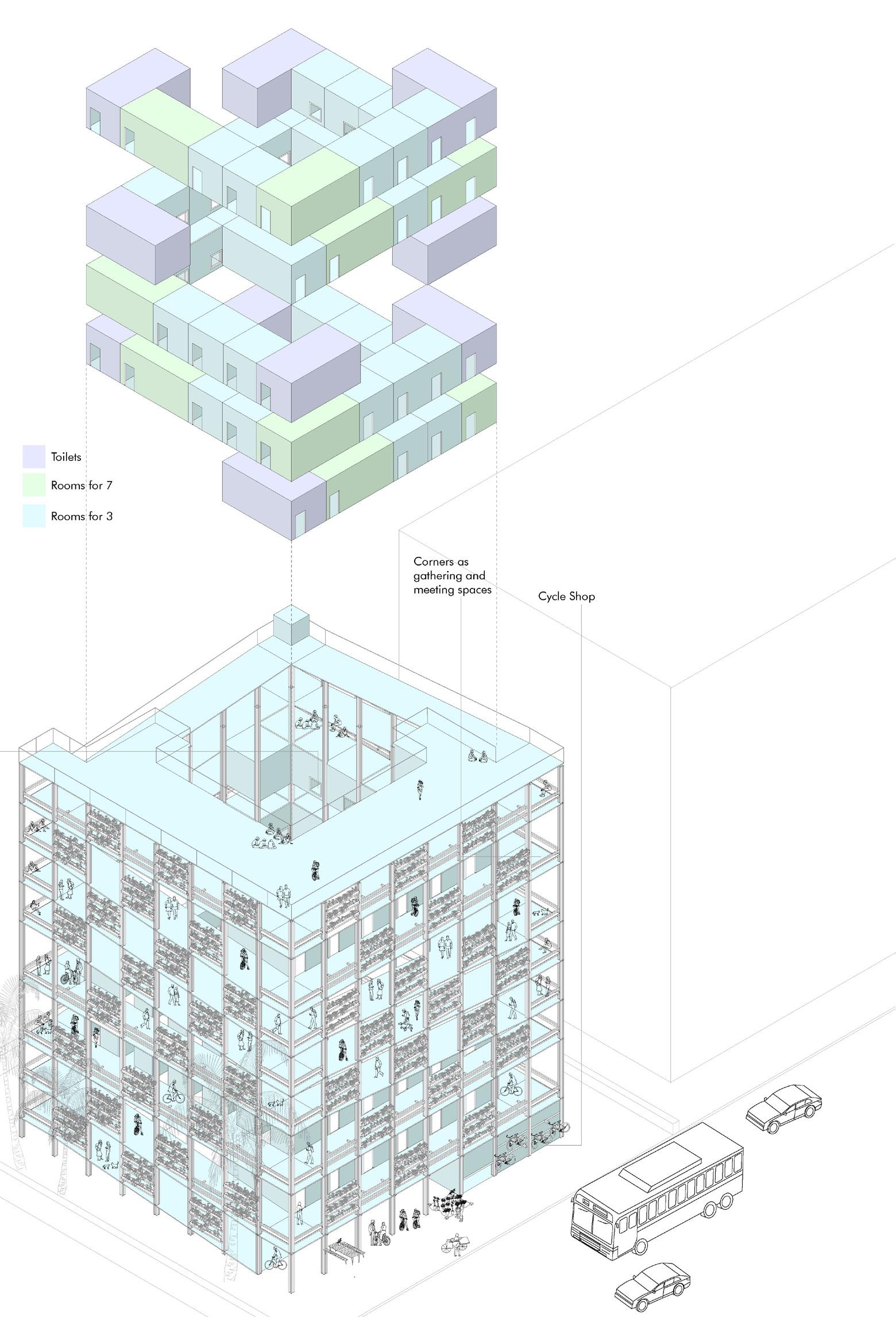
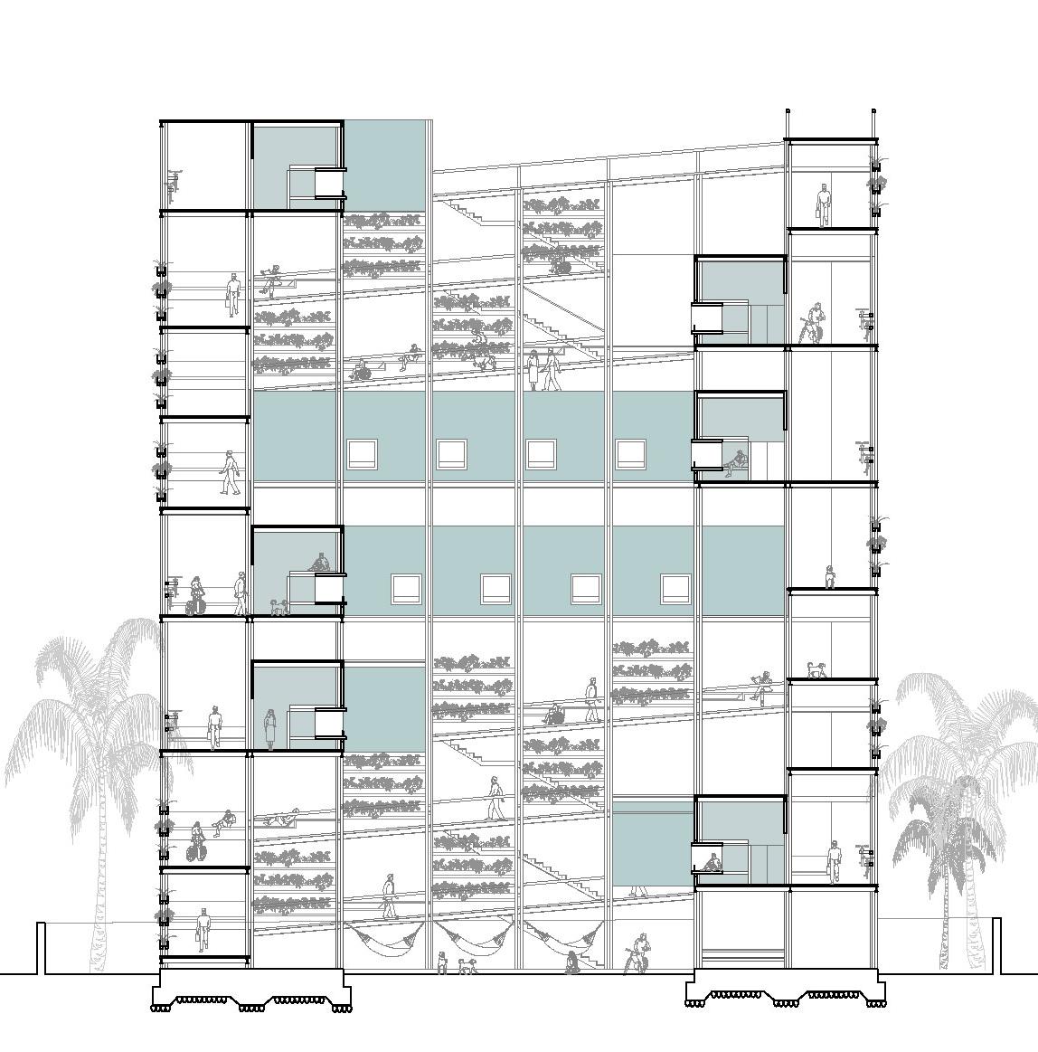
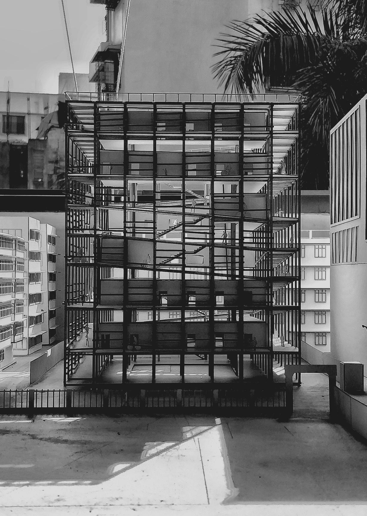
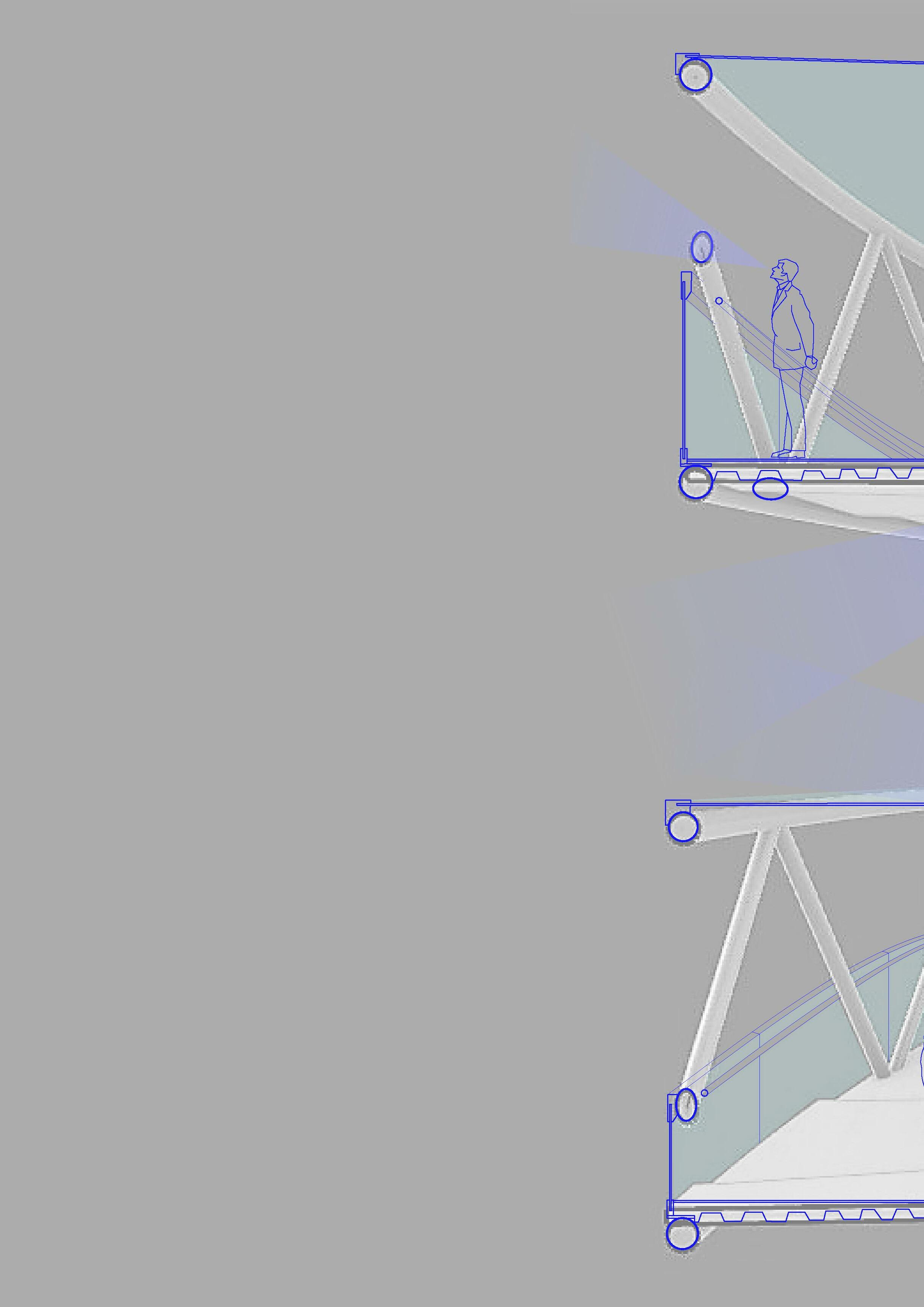
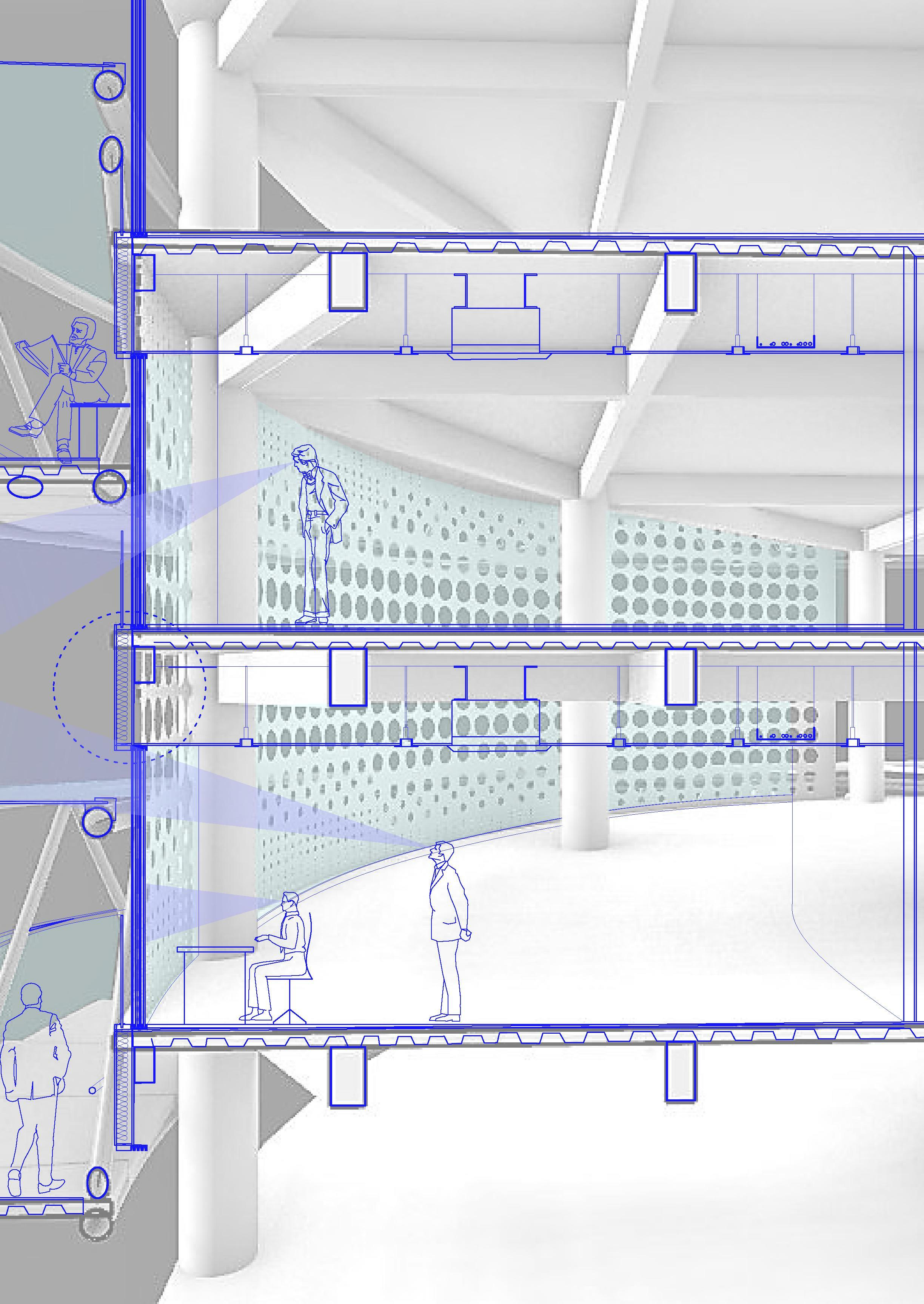
The looped Network
4rd year | Semester 7 | Mix-use highrise Group studio project
Team - Sanjana Habde & Parth Solanki
June 2020
Borivali, Mumbai
Supervisor: Ar. Shreyank Khemalapure | shreyank.khemalapure@gmail.com
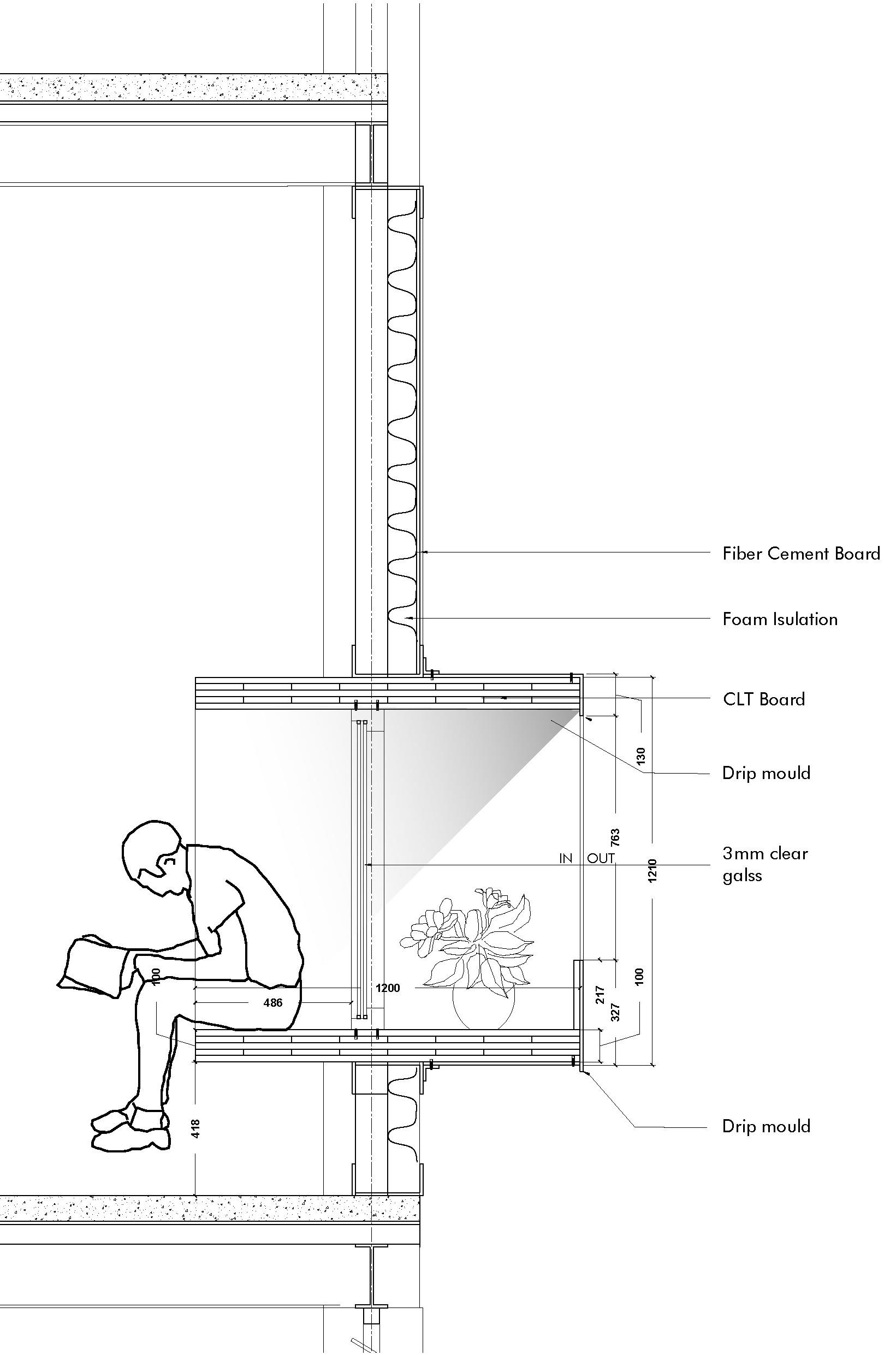
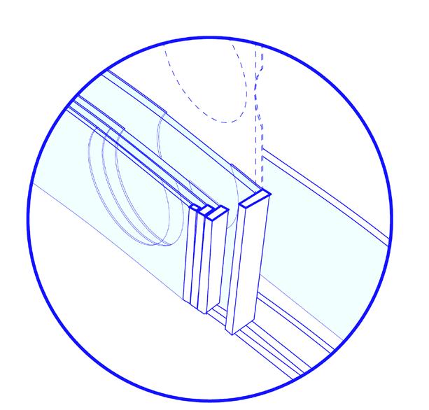
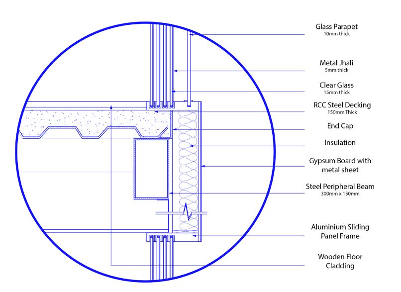
External wall section 23
23
Codes vs Form
Mumbai’s building regulations are strictly enforced. This results in extremely dull designs that constrict the potential for form exploration. Twenty million people live in the metropolis of Mumbai alone. As a result, having such a strict building codes is needed.
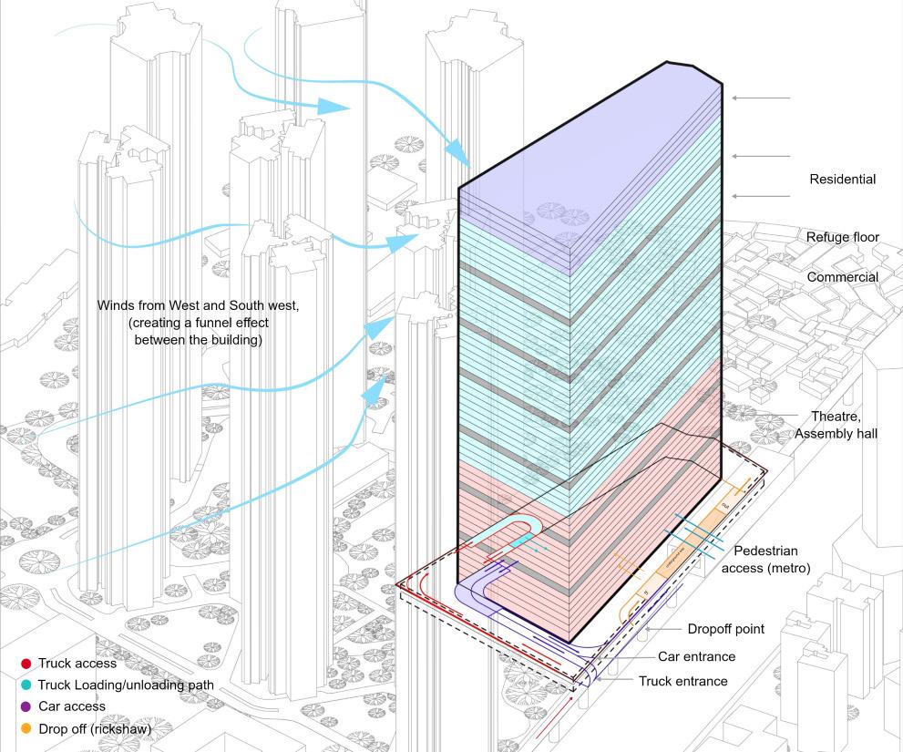
My ability to understand how to take advantage of this was tested by this project. How can one think about form first before considering function within a set of restrictions and limitations.
Understanding the maximum that can be built on the given site and context was the first step in the project. Using that information, it was then determined how to make the form both useful and interesting.
24
exploration diagrams 24
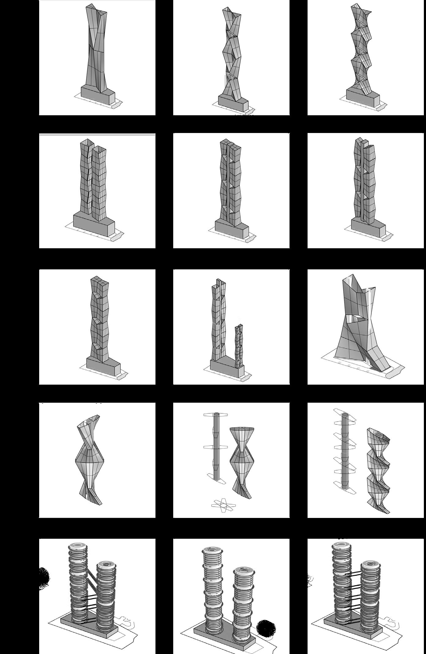
Form
25
Structure
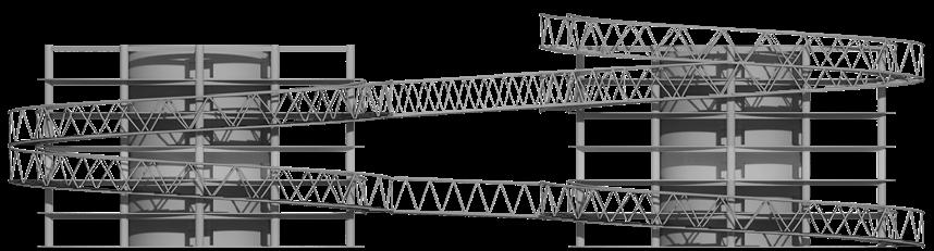
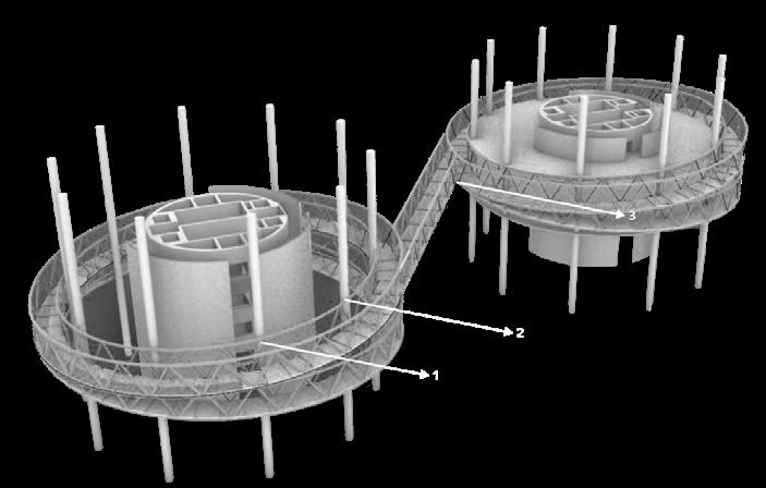
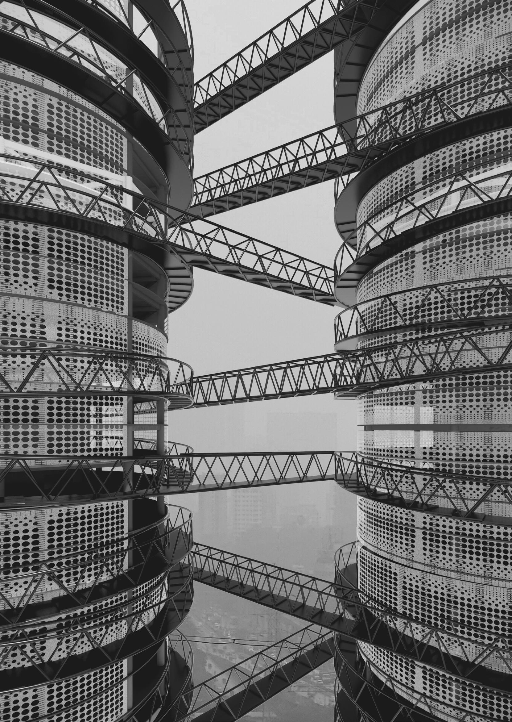
We began by reading François Blanciak’s book “siteless” for initial inspiration. This book contains diagrams for various objects that exists without any context. An infinite loop was introduced in one of the diagrams. which we wanted to investigate in terms of both the structure’s circulation and form.
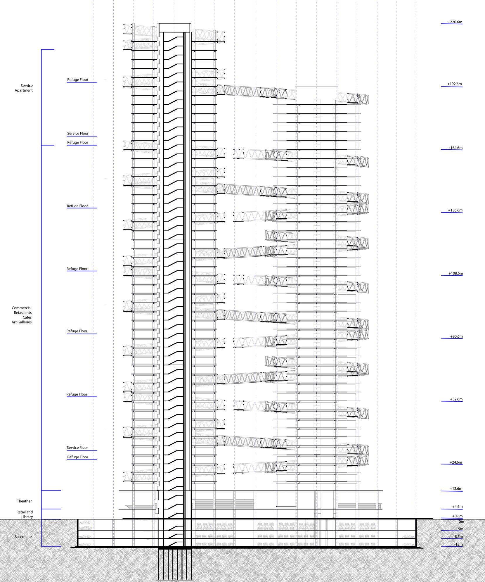
The bylaws were in charge of setting specific criteria, such as the quantity of podium space, the distribution of green space, the number of lifts, and whether or not loops should be regarded as balconies and, if so, how wide they should be. The loops connected all the refuge floors which is nessesary to have as per the codes. Part of the refuge floors and the looped bridges will be used as public spaces like cafes and liabraries for the offices as well as the public visiting the building.
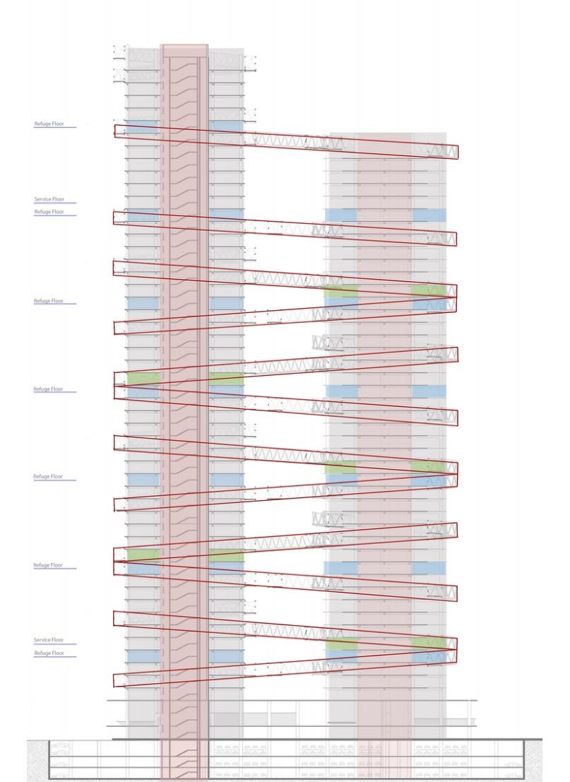
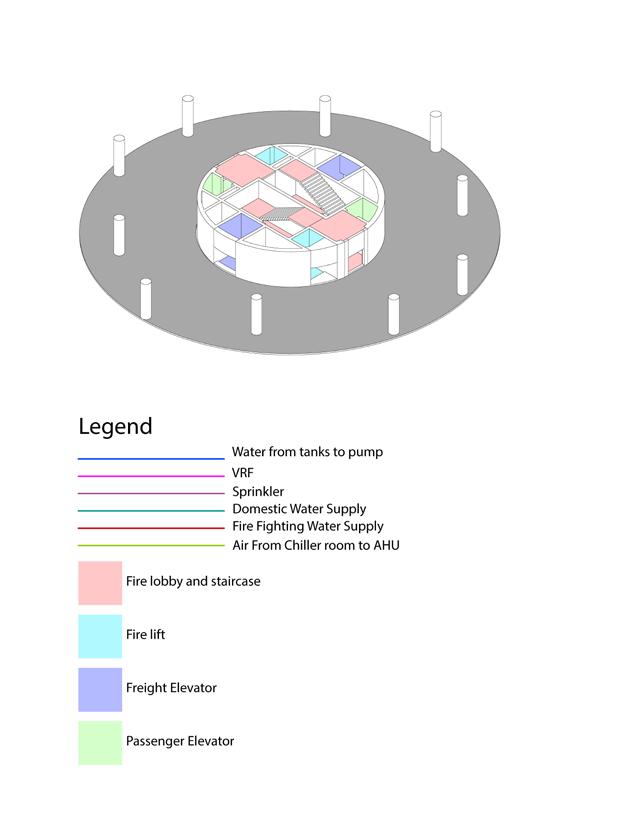
The structure is a simple frames cylindrical building supported by a single core in the center that also contains lifts and shafts for services. The main design element which is the circulation of the people is seen on the facade as the loops that goes around the buildings and across.
25
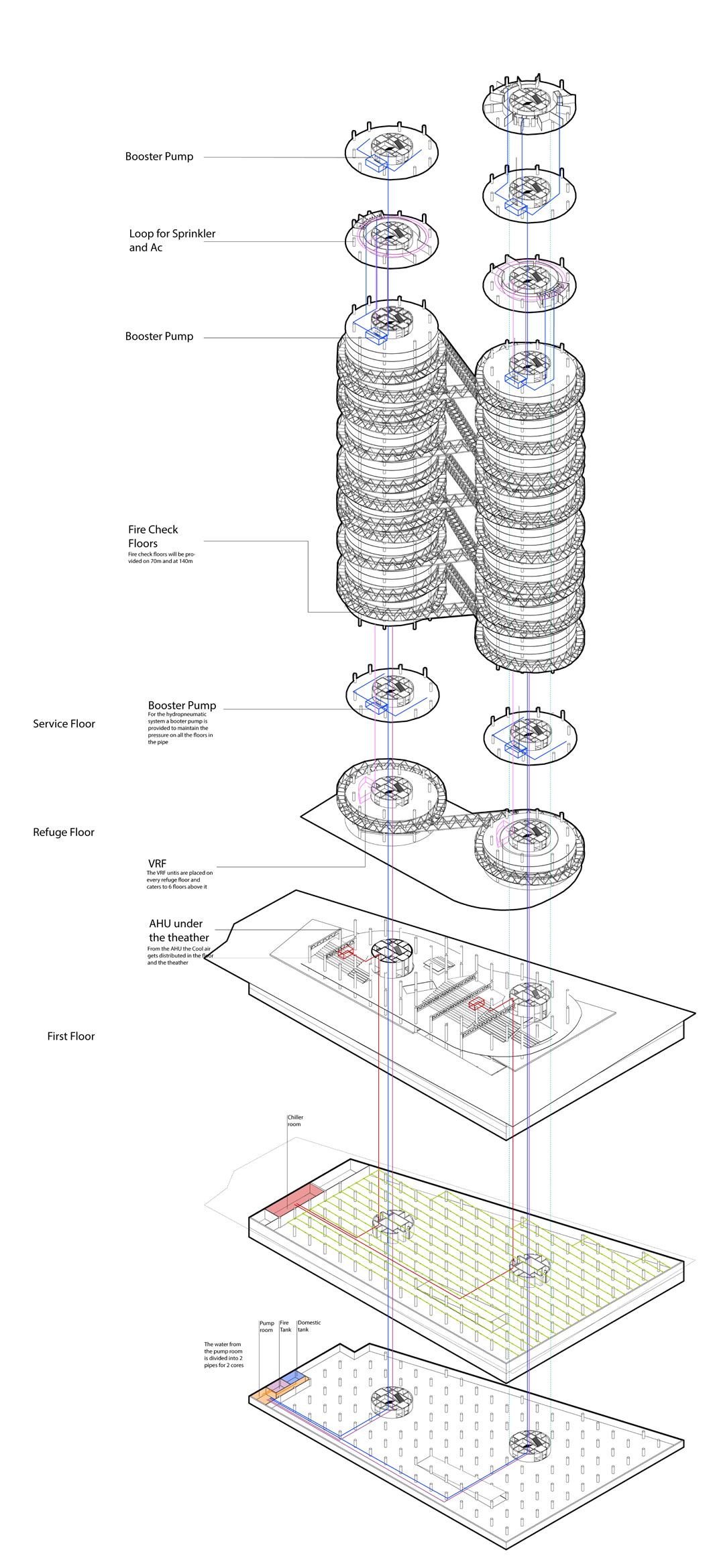
Services
One of the most crucial components of the design is the details and services. While Services improves the comfort of those occupying the building, Details enhances the aesthetics of the structure. The services had to be incorporated into the construction in accordance with the bylaws and fundamental occupancy rules.
This project taught me the details of all the services needed to sustain a high rise sensitively. What systems are available to lessen environmental impact and provide comfort for individuals. How to use the HVAC system and the facade to balance active and passive cooling.
2
6
Thank You :)
PARTH SOLANKI 77.solankiparth@gmail.com +91 9821725126
