DOWNTOWND C PARKS MA S TER PLA N
A C OMMUNI T Y -LED V ISIO N F OR P AR K S & O P EN S P A CES I N D O W N T O W ND C March 2023


Parks have long been considered the “lungs of the city” for their proven ecological benefits and the physical breathing space they offer urban dwellers. To breathe new life into the core of our nation’s capital and solidify its longterm economic vitality, we must enhance and improve the network of park spaces in DowntownDC. More and better parks will make this part of the city more attractive, welcoming, and vibrant, which will make downtown a highly prized destination for people to visit and to live, work, and play in for years to come. The recent revitalization of Franklin Park, an unprecedented public-private partnership between the federal and District governments and the DowntownDC Business Improvement District (BID), is a shining example of the power of reimagined park spaces. We are determined that it is just the beginning.
To build on the success of Franklin Park, the BID embarked on a year-long planning process to reimagine parks and open spaces in DowntownDC. Led by LandDesign, the project engaged with leadership and staff of the U.S. National Park Service and the DC Department of Parks and Recreation, as well as a diverse community of stakeholders, to identify challenges and opportunities to improve parks, open spaces, and streetscapes to make the public realm more engaging, adaptable, authentic, connected, and iconic. It is an inclusive, communityled plan that is meant to test boundaries and rethink spaces. The plan highlights several opportunities for park and public space enhancements, emphasizes where partnerships are needed to move forward, and creates the foundational framework necessary to create a parks system within DowntownDC.
The ultimate purpose of this plan is to help propel forward movement that will improve downtown. The DowntownDC Parks Master Plan
and a second BID project, the Gallery Place –Chinatown Corridor Study, were conceptualized prior to the COVID-19 pandemic and completed during a time when fundamental shifts in the way people engage with cities were taking place. Nonetheless, the times we live in have made these documents and their recommendations even more relevant and urgent. In the coming months, the DowntownDC BID will partner with the Golden Triangle BID and key stakeholders to develop an Action Agenda that will examine downtown's current economic and environmental conditions, analyze the recommendations in Mayor Muriel Bowser’s Comeback DC Plan, and offer concrete recommendations for public and private investments that will make downtown a more vibrant community and ensure that it remains the city's economic engine. We know for certain that investing in an enhanced network of parks will be a central element of the proposed actions to come.
I offer my sincerest gratitude to all the stakeholders who participated in the creation of this plan especially the members of the Steering Committee, including our key agency partners, for their thoughtful engagement and willingness to ideate and dream with us. And, of course, this plan would mean nothing without the public’s input. Thank you to everyone who completed a survey, participated in one of our outdoor listening sessions, or joined a focus group. The DowntownDC Parks Master Plan is strong because it reflects the voices of a diverse community. Finally, I want to thank LandDesign for their hard work in developing this plan and ensuring that the voice of the community remained at the forefront of the effort.
I look forward to continued partnerships to make this plan’s recommendations a reality.
Sincerely,
GERREN PRICE President and CEO DowntownDC Business Improvement District
In 2021, the Trust for Public Lands ranked Washington, D.C., as having the best park system in the United States. The ranking placed D.C.’s parks #1 for investment, equity, and access. Out of the city's 9,294 acres, the DowntownDC Business Improvement District (BID) has 27 acres. Despite the redevelopment of some park spaces in D.C., downtown’s parks, green spaces, and public realms remain relatively underdeveloped and underutilized. Many of the open spaces in DowntownDC are historically significant, which means they require another layer of planning and approvals. Many of these park spaces are surrounded by busy streets, lack modern park amenities, and are misaligned to surrounding community needs. The BID initiated this park planning effort in fall of 2021 to build a framework for an intentional, vibrant, creative, and meaningful park system in DowntownDC.


The DowntownDC Parks Master Plan is divided into eight sections:
Provides an overview of the purpose, goals, and process behind the plan's development.
Summarizes the demographics of park users and DowntownDC's market trends.
Highlights the process and findings from community engagement, including stakeholder interviews, community meetings, and public surveys.
Identifies existing open space assets, challenges, and opportunities. Creative solutions are required to increase the quality and quantity of parks in DowntownDC.
Identifies goals to meet the needs of park users, including leveraging available funding, expanding partnerships, and enforcing park policies. This section includes both system-wide and space-by-space recommendations.
Identifies strategies organized into three sections: facilities, partnerships, and policies. This is the first step in implementing the plan, in coordination with the upcoming Downtown Action Agenda, which will define investment needs.
Defines key terms and acronyms used throughout the document.
Contains more technical information that guided the development of the plan. The various parts of the appendix are referenced throughout sections 1-6.
The DowntownDC Parks Master Plan reimagines the parks and open spaces within the BID and examines how they look, feel, and contribute to the community that uses them daily. This effort relied heavily on an existing conditions analysis, community engagement, and partnership with the U.S. National Park Service and city officials to discern open space opportunities and community needs within the BID. This planning effort resulted in a strategic vision for new and enhanced parks and open spaces that meet the current needs but will also be the impetus for future re-envisioning of park spaces of DowntownDC for generations to come.
The recommendations explored in this document acknowledge the administrative limitations of the BID over open space in the DowntownDC. Therefore, it’s imperative to highlight that the BID recommends a thoughtful collaborative approach to implement comprehensive changes.
The project kicked off in the fall of 2021, beginning with data collection and site observations. This work established the existing conditions of downtown open spaces. New opportunities to expand and improve parks and open spaces emerged as the team began community engagement and data assessment in winter of 2021-2022.
The team engaged in extensive public outreach to gather information on the community’s needs, behaviors, and preferences. A Steering Committee of members representing key agencies and stakeholders was formed to identify the process and goals of the project. The Steering Committee, community meetings, and public surveys guided the evolution of the final recommendations. The final recommendations were also formed by accessibility analysis, market research, case studies, and best practices. The need for increased quantity, quality, and highly connected open spaces emerged.
The planning process also included thoughtful review and coordination with five parallel planning efforts. Like the DowntownDC Parks Master Plan, these studies address the public realm through placemaking and design:
» Gallery Place-Chinatown Corridor Study, led by the DowntownDC BID and consultant AECOM
» Pennsylvania Avenue Initiative, led by the National Capital Planning Commission (NCPC)
» K Street Transitway, led by D.C. Department of Transportation (DDOT)
» 11th Street Bus Priority Project, led by DDOT
» New York Avenue Sculpture Project, led by the DowntownDC BID in partnership with the Commission of Fine Arts (CFA) and NCPC
There are 27 acres of open space in DowntownDC, including 10 spaces over an acre in size. These spaces can be grouped into three categories based on size and use: parks, triangle parks and bowties, and view parks.


A park is a green space reserved for recreation, while plazas are intended to provide transitional spaces between public right-of way and building entrances. With the exception of Thomas Circle, parks and plazas are defined as open spaces over half an acre in size. DowntownDC currently has five parks and four plazas, which are the largest open space assets. These larger spaces have the greatest capacity to serve community recreational needs.
Triangle parks and bowties are triangle- or bowtie-shaped open spaces located at the nexus of diagonal and horizontal streets. These spaces are typically a half-acre or smaller and present an opportunity for creative programming and activation. DowntownDC currently has 15 triangles and bowties. The smallest open spaces in DowntownDC are view parks, which are less than 0.1 acres. These spaces are generally too small to program for typical park activities and are primarily used for memorials, decorative plantings, seating, or pedestrian refuge islands.
27 32
acres, about 4.5% of the BID area total spaces
10 spaces greater than 0.5 acres
15 spaces between 0.1-0.5 acres
7 spaces less than 0.1 acres
The BID shares maintenance responsibilities with NPS and the District for almost all open spaces within the BID boundary through partnership agreements. These agreements establish the roles of each partner, including number of hours and funding to be dedicated to each space annually. NPS is the operator of all but three parks within the DowntownDC boundary: the Park at CityCenter, Mount Vernon Square, and Mellon Fountain.
In contrast, the BID is the sole operator of the recently renovated Franklin Park. As part of a historic Cooperative Management Agreement (CMA) between the District of Columbia and NPS, the BID operates, maintains, and manages the park. Funding for this effort is provided by the BID’s DowntownDC Foundation. This form of private-public partnership has been very successful in reactivating Franklin Park and should serve as a blueprint for future investment and management of open spaces in DowntownDC.


The community engagement process discerned several key priorities. The community desires parks and open spaces filled with placemaking elements that evoke a sense of belonging, connectivity, and safety. Participants repeatedly noted the lack of maintenance and perceived safety concerns as the most significant barriers to using open spaces. Flexible amenities, such as benches, seating, shade, landscaping, public restrooms, and free events were suggested to build interest and encourage park use. Community members expressed a strong need for outdoor respite in the downtown, citing that open spaces do not currently provide a relaxing environment.
In addition to feedback related to the quality and quantity of open spaces, the community cited the need for increased connectivity between open spaces and their surrounding uses, such as transportation, dining, and tourism. Therefore, the recommendations in this plan considered the relationship of park edges to the rest of the public realm.

 McPherson Square: the highest priority for park improvements, according to community surveys
Community engagement
McPherson Square: the highest priority for park improvements, according to community surveys
Community engagement
The DowntownDC Parks Master Plan sets an ambitious vision for parks and open spaces in DowntownDC. Through community engagement and coordination with concurrent planning efforts, five priority parks were identified as the focus of this master plan: McPherson Square, Mount Vernon Square, Freedom Plaza, Chinatown Park, and John Marshall Park. Concept plans for these key parks are included in the space-by-space recommendations and incorporate communityrequested elements and amenities.
Investing in parks and open spaces within DowntownDC will help deliver a range of benefits to improve the experience of residents, workers, and visitors to the area.
A long-term funding strategy is needed to adequately address capital needs and operating needs of parks and open spaces within DowntownDC.
Under the fiscal pressure of supporting parks and recreation, public-private partnerships are critical for funding upfront costs and ongoing operations. The partnerships used to make Franklin Park renovation possible should be tools adapted to parks and open spaces throughout the BID.
Effective implementation of recommendations in this plan requires leaders to dedicate sustained funding, expand partnerships, and carefully coordinate across planning efforts. To realize this vision, the BID, D.C. agencies, and other key partners must share goals, implement regular financial investment, and coordinate efforts to support the needs of DowntownDC parks and open spaces. System-wide recommendations include:
The recommendations carefully incorporate the outcomes of parallel studies and plans in DowntownDC, especially related to increased connectivity and open space opportunities along main corridors.
While more open space will be difficult to acquire in the densely developed downtown, higherquality parks and open spaces can be achieved through amenity enhancements and consistent maintenance.
Effective enforcement of park policy can make parks welcoming, clean, safe, and activated.
Recommendations to improve the connectivity of downtown open spaces include expanding green corridors, prioritizing pedestrians, and expanding wayfinding.
Establishing clear capital improvement priorities and identifying bold investment strategies is the next step in the successful implementation of the DowntownDC Parks Master Plan. D.C. Mayor Bowser’s Comeback Plan, released January 2023, is a catalyst for future investment in downtown. The Comeback Plan is the City’s five-year economic development strategy and acknowledges Downtown’s historic economic contributions to the District.
The Comeback Plan lists several goals and initiatives for the District’s downtown, and specifically calls for a Downtown Action Agenda to make recommendations on how to reach the Comeback Plan’s goals and implement its initiatives.
The Comeback Plan’s major goals impacting Downtown include:

1. To grow downtown’s population by 15,000 (from its current 25,000).
2. To grow the city's employment by 35,000 over five years, much of which will occur in downtown.
The Downtown Action Agenda will be completed through a three-way partnership of the DowntownDC and Golden Triangle BIDs and the Federal City Council.
Excellent DowntownDC parks is a vitally important part of achieving Mayor Bowser’s goals for the District’s downtown. Therefore, the goals and recommendations of the DowntownDC Parks Master Plan will heavily inform the recommendations of the Downtown Action Agenda and guide catalytic capital investments throughout downtown open spaces. The Downtown Action Agenda will identify a longterm funding strategy for maintaining the parks at a world-class standard for the enjoyment of all District workers, employees, residents, and visitors.

DOWNTOWN HAS BEEN THE ECONOMIC ENGINE OF OUR CITY. IT'S THE REASON WHY WE HAVE BEEN ABLE TO MAKE HUGE INVESTMENTS IN SCHOOLS, IN TRANSPORTATION, IN SOCIAL SERVICES, IN PUBLIC SAFETY.
‒ D.C. MAYOR BOWSERChess board at Freedom Plaza. Community fitness class at Black Lives Matter Plaza


DEVELOPING A PARKS MASTER PLAN


For centuries, public parks and open spaces have been regarded as a public benefit. They serve as recreational spaces, sources of respite from the bustle of the city, and examples of natural resource management. They have recently been recognized for their critical role in fighting climate change, strengthening social networks, and supporting physical and mental health.

Parks became a vital part of public health strategy throughout the COVID-19 pandemic as open spaces were transformed into outdoor offices, workstations, school classrooms, and lounge areas where communities could escape the confines of quarantine and engage others while practicing safe social distancing. However, park spaces in the dense urban environment of downtown are ill-equipped to meet the demands of modern life, let alone the additional stresses of the pandemic. More than ever, park policy must evolve to create a robust public space network that meets the needs of the vibrant community they support.
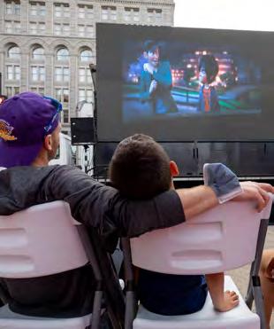
 Outdoor movie night on the Building Museum Lawn
Yoga classes in Freedom Plaza
DowntownDC streetscapes are an opportunity to expand walkability and bikability between the parks
Parks are a vital component of the social landscape (John Marshall Park)
DowntownDC BID Area
Outdoor movie night on the Building Museum Lawn
Yoga classes in Freedom Plaza
DowntownDC streetscapes are an opportunity to expand walkability and bikability between the parks
Parks are a vital component of the social landscape (John Marshall Park)
DowntownDC BID Area
As the nation’s capital, Washington, D.C., is filled with a rich urban design history and an uncommonly civic-focused public realm. It is reinforced by street designs emphasizing view corridors and grand ceremonial spaces creating formal focal points for public gatherings within the historic grid. DowntownDC is located just north of the National Mall and Smithsonian Museums making it uniquely positioned at the intersection of significant cultural resources, drawing a regional employment powerhouse of federal and private entities, a growing residential population, and strong tourism. This plan reimagines a healthy and meaningful open space system that caters to these diverse users.
DowntownDC’s mixed-use urban setting has an underdeveloped park network. Park spaces are rich in historic significance. However, most are small, surrounded by roadways, and lacking in modern park amenities. Nearly all were created by the L’Enfant Plan of 1791 and the 1902 Senate Park Commission Plan, which developed the current urban landscape and gridded form. Due to this design legacy and the histories of the individual parks, these spaces are recognized locally and nationally as historical resources. Additionally, monuments and statuary within the parks provide visual displays of history, and the formal layout, plantings, and materials further underscore the legacies of these open spaces. More information about the history of each open space is available in Appendix A: Open Space Inventory.
The DowntownDC Business Improvement District (BID) helps maintain almost all parks and open spaces within the boundary but is the sole operator of the recently renovated Franklin Park. As part of a Cooperative Management Agreement (CMA) between the District of Columbia and the National Park Service (NPS), the BID operates, maintains and manages the park. Funding support for this effort is provided by the BID’s DowntownDC Foundation. The BID also shares responsibilities of NPS and District-owned parks within the BID boundary by providing maintenance support and beautification investments through partnership agreements. These agreements establish the roles of each partner, including number of hours and funding to be dedicated to each space annually. NPS is the operator of all but three parks within the DowntownDC boundary: the Park at CityCenter, Mount Vernon Square, and Mellon Fountain. One of NPS’s primary mission components is to recognize and preserve national history as cultural landscapes within parks. This commitment to the past is very important, but sometimes it can hinder adapting to modern park users’ needs and the community’s expectations.
To create a vision for new and enhanced parks and open spaces that meet the needs of the DowntownDC community now and for generations to come.
Federal:
• National Park Service (NPS)
• National Capital Planning Commission (NCPC)
• U.S. Commission of Fine Arts (CFA)
District
• State Historic Preservation Office (HPO)
• Office of Planning (OP)
• Department of Parks and Recreation (DPR)
• Department of Transportation (DDOT)
In 2021, the DowntownDC BID embarked on a master plan exploration to reimagine the parks and open spaces within the BID and examine how they could look, feel, and contribute to the community that uses them daily. This effort relied heavily on community engagement to discern the needs and aspirations of open spaces within the BID. This examination would result in a strategic vision that enhanced DowntownDC open spaces with better connectivity and park amenities that fulfill the needs of the DowntownDC community. The key findings interpreted community needs into a framework of recommendations that would successfully develop vibrant open spaces.
The project kicked off in the fall of 2021, beginning with data collection and site observations. Throughout this process, the team worked to understand the challenges and opportunities unique to DowntownDC. The process identified new opportunities to expand and improve parks and open spaces in DowntownDC by growing the open space network, better-linking parks and open spaces, and enhancing spaces with new amenities, activities, and flexibility to meet local community needs better.
The team engaged in extensive public outreach to gather information on the community’s needs, behaviors, and preferences. Additionally, they studied the history and existing conditions of each park, conducted market research, and studied case studies. Public meetings and surveys were analyzed to document community preferences and priorities and further inform the recommendations’ evolution. A Steering Committee of members representing key agencies and stakeholders was formed to help guide the approach and outcomes of the project.
The planning process included thoughtful review and coordination with five parallel planning efforts:
These ideas and proposed designs are intended to provoke thought and push boundaries to create fresh ideas with new perspectives. Additional study and collaboration will be needed to develop further and finalize any plans, and the final conditions may look quite different. However, through thoughtful innovation, this document can further guide open space development. This document can assist open spaces in becoming vibrant sources for varied social experiences and entertainment within DowntownDC while acknowledging their national historical and cultural significance.
» Gallery Place-Chinatown Corridor Study, led by the DowntownDC BID and consultant AECOM
» Pennsylvania Avenue Initiative, led by the National Capital Planning Commission (NCPC)
» K Street Transitway, led by D.C. Department of Transportation (DDOT)
» 11th Street Bus Priority Project, led by DDOT
» New York Avenue Median Sculpture Project, led by the DowntownDC BID in partnership with the Commission of Fine Arts (CFA) and NCPC
Like the DowntownDC Parks Master Plan, these studies address the public realm through placemaking and design. Elements from each planning effort informed the recommendations identified in this plan. The bulk of the recommendations are organized into systemwide and park-specific recommendations. Additional information about the community engagement process can be found in Appendix A, Volume II, Community Assessment.
• Anna Chamberlin, District Department of Transportation (DDOT)
• Ella Faulkner, D.C. Department of Parks and Recreation (DPR)

• Galin Brooks, DowntownDC BID
• Gerren Price, DowntownDC BID
• Leslye Howerton, D.C. Office of Planning
• Jinhee Kim, EventsDC
• Jonathan Rogers, District Department of Transportation
• Maria Espinoza, DowntownDC BID
• Michael McCarthy, Quadrangle Development Company
• Michael Shankle, Advisory Neighborhood Commission (ANC) 2C
• Paul Tetrault, Ford’s Theatre
• Tammy Stidham, National Park Service
CommunityEngagement
DevelopRecommendations
FinalParksMasterPlan
“NPS preserves unimpaired the natural and cultural resources and values of the National Park System for the enjoyment, education, and inspiration of this and future generations. The Park Service cooperates with partners to extend the benefits of natural and cultural resource conservation and outdoor recreation throughout this country and the world.”
NPS defines cultural landscapes as “places … that have significance in American history and authenticity to a historic time period.”
Three DowntownDC parks are not administered by NPS: The Park at CityCenter is Districtowned and maintained privately by CityCenterDC. Mount Vernon Square is administered by the District, and Mellon Fountain is administered by the National Gallery of Art (NGA).
The NPS administers nearly all the parks within DowntownDC, most of which are listed in the National Register of Historic Places. As such, NPS manages and maintains these spaces in a way that considers their historical and cultural values. Under Section 106 of the National Historic Preservation Act, NPS considers the effects of their projects on historic resources and seeks public input on ways to mitigate potential adverse effects. Within Section 106 consultation, NPS confers with the D.C. Historic Preservation Office (HPO), the National Capital Planning Commission (NCPC), the U.S. Commission of Fine Arts (CFA), and special interest groups to preserve the city’s parks and open spaces. As responsible stewards of these cultural landscapes, NPS provides all infrastructure upkeep, some general maintenance, and safety patrol. Through CMAs, NPS partners with other entities, such as the DowntownDC BID to share maintenance responsibilities. The DowntownDC BID’s partnership with NPS supports ongoing maintenance such as regular trash pickup, snow removal, and event programming.
The NPS outlines 13 types of landscape characteristics that contribute to the heritage and culture of open spaces. Historical elements shown here have been identified from that list as the specific contributing features that enhance the historic and cultural importance of the parks and open spaces in DowntownDC.
As early as 2008, Franklin Park, the largest park in DowntownDC, was identified as a key opportunity for focused investment and renovation. Multiple studies by NCPC and the D.C. Office of Planning noted the need for improved open space within DowntownDC. In 2010, a concept plan for Franklin Park renovation was prepared and became a catalyst for the actions needed to make it a reality. In 2019, the federal government passed the federal lands package, a bill that enabled the District and the DowntownDC BID to enter a new CMA for the operation, management, and maintenance of Franklin Park in DowntownDC. This bill also unlocked the ability of the District to
fund the renovation and construction of Franklin Park. In the fall of 2021, a fully renovated Franklin Park was opened to the public, providing a muchneeded public open space during the COVID-19 pandemic with open lawns, walkways, plazas, a children’s garden, a restaurant, and public restrooms. The 2018 legislation opened the door for other parks to follow in Franklin Park’s footsteps and created a roadmap for additional open space resources. A new vision for DowntownDC calls for Franklin Park-like transformations of other parks downtown to help fill the gap in available space resources identified by previous studies.
 Families enjoying a sunny day in the revitalized Franklin Park

AVERAGE DAYTIME POPULATION
96,857 (2021)
269,000 (2019)
EMPLOYEES
175,945 (2019)
164,840 (2018)
RESIDENTS
10,470 (2021)
10,994 (2019)
HOUSEHOLD INCOME
61% over $100,000
71% over $75,000 (2021)
COMMUTERS 99% of DowntownDC employees live outside the BID (2018)
BID RESIDENTS COMMUTE MODE
50% walk
25% transit
13% drive (2018)
DowntownDC is home to D.C.'s historic Chinatown, which relocated here in the 1930's and is bounded by Massachusetts Ave. NW, and by 5th Street NW, G and K Streets NW. Though significantly smaller than it once was, a strong cultural connection remains.
In 2021, the project team prepared a detailed analysis of the study area’s demographics to better understand the users that visit DowntownDC parks. Users fit into three categories: office workers, residents, and tourists. The sections below summarize user demographics. For more information, please refer to Appendix C: Market Analysis.
The DowntownDC BID residential population is highly educated and earns a high income: 71% of households have annual incomes above $75,000, while 61% have incomes greater than $100,000. In all, 10,470 people call the DowntownDC BID home (2021), and before the pandemic, the number of daytime office workers and tourist visitors swelled to 269,000 people (2019). In 2021, the daytime average dropped to just 96,857 people as remote work affected office occupancy. While 95% of DowntownDC households do not have children, in 2019, there were 14 childcare providers located within the DowntownDC BID. This suggests families working in the BID may depend on childcare services in the area. Many of the childcare facilities and schools within the BID depend on public parks and sidewalks right of way for outdoor play activities, as most do not have dedicated playgrounds.
There were 164,840 workers employed in the DowntownDC area pre-pandemic (2018), and 99% of them commuted to the area.
Tourism is a significant driver of the D.C. economy, and many tourists come to DowntownDC to patronize local retail and restaurants. Multiple stakeholder interviews spoke of the importance of tourism engagement and noted the difficulty of traversing the core of DowntownDC. Engaging the tourist demographic is essential to activate the open space network further and draw more tourists to local restaurants, retail, and museums.
As a major part of the central business district for Washington, D.C., the DowntownDC BID is predominately office building stock (78%), with the remaining 22% consisting of retail, residential, museum, and hotel space. During the COVID-19 pandemic, office and retail vacancies hit historic highs. Office occupancy plummeted with a monthly average of 25% in 2020 and 21% in 2021. The residential population remained steady. The BID’s daytime occupancy fell from 269,000 in 2019 to 96,857 in 2021. In 2022, the average daytime occupancy rose to 122,398. The public realm experience has suffered due to lower pedestrian activity and vacancy rates, with many restaurants and retailers forced to close. With the rising demand for outdoor space from the pandemic, central business districts like DowntownDC need to adjust to remain vibrant, with a broader mix of uses. Investments in parks will be necessary to attract office new tenants, tourists, and residents.
Like many office districts across the country, the BID’s worker occupancy rates dipped dramatically, falling to a monthly average of 25% in 2020. DowntownDC has continued to feel the effects, with an average monthly occupancy of 35% in 2022. Office building vacancy rates in the BID climbed to about 40% at the end of 2022 as workers returned to the office.
Retail vacancies remain high as DowntownDC continues to recover from the COVID-19 Pandemic. Pre-pandemic, retail vacancy was at 10.3% but rose to 22.6% in 2020. By May of 2022, vacancies began to recover, lowering to 19.5%.
During the pandemic, the BID lost an estimated 180,000 daily customers. Although 19 restaurants were permanently closed, 15 new restaurants have opened. The increased number of vacant storefronts due to the pandemic has visibly affected DowntownDC.
In 2022, 1,700 new apartment units were constructed or planned, totaling about 7,000 units in the BID. Of the BID’s market-rate units, 60% are renter-occupied and 40% owner-occupied. There are an additional 992 units across 12 non-market buildings, which include affordable housing, senior living, student housing, and shelters. Vacancy rates increased from 4.9% in 2019 to 11.1% during COVID-19. However, occupancy is recovering and reached 3.7% by the end of 2021.
At the time of this report, two office-to-residential conversions were proposed near Thomas Circle, and two multifamily projects were underway in Chinatown (one redevelopment, one new construction). Additionally, two office buildings are being renovated, and four proposed mixeduse office buildings are slated for Chinatown. All these projects will bring 787 new residential units to DowntownDC, representing 13.1% of existing stock. This substantial increase in DowntownDC's population will encourage a more robust 24/7 environment. With the ongoing pandemic poised to reshape how and where people work permanently, DowntownDC will continue to face high office vacancies. Identifying opportunities to convert office to residential is a prime opportunity to build DowntownDC as a vibrant neighborhood.
GATHERING COMMUNITY INPUT
• Weekly BID touchpoints
• 5 Steering Committee meetings
• 4 virtual public meetings
• 3 in-person outdoor open house events
3 community surveys
• Project website
Community engagement was integral to understanding the challenges and opportunities for DowntownDC and guiding the development of the plan’s recommendations. The project team implemented various touchpoints, presentations, and input-gathering techniques to reach a diverse population of residents, workers, and tourists. This included virtual meetings, design charettes, online surveys, a dedicated website, news announcements, and the distribution of flyers at events such as the Downtown Holiday Market. A detailed description of the community engagement process and the input received can be found in the appendix. A detailed description of the community engagement process and outcomes can be found in Appendix D: Community Engagement and Presentations. Summaries and results of each survey can be found in Appendix E: Survey Summaries and Results.
The project team engaged a variety of stakeholder groups to discuss parks and space priorities within the BID. Stakeholders discussed ways to better integrate parks into the community by addressing needs for increased access, play spaces, and social events. Stakeholders addressed the need for bold, visionary thinking to activate and leverage existing open spaces fully. Interviews also included the evaluation of existing and future partnerships that can support new amenities and activations. Stakeholders highlighted challenges to open park spaces during interviews, such as lack of maintenance, and encampments.
Over six days, the consultant team performed 24 interviews with 35 stakeholders representing the following categories: commercial property owners, hotels and tourism, museums and culture, restaurants and retailers, community and advocacy groups, universities and schools, agencies, public safety officers, day care centers and churches, and DowntownDC BID staff.
Each interview was 45 minutes in length and conducted over Zoom. The following paragraphs summarize common themes that arose during these discussions.
All interviewees stated that maintenance and cleanliness are the most critical upgrades needed for all parks in the DowntownDC BID. Stakeholders commented that regular maintenance alone could achieve a more welcoming, usable environment for parks and open spaces. Stakeholders mentioned the significance of having public bathrooms in park spaces, especially for young children, bus drivers, tourists, and homeless individuals. For example, daycare centers that use the parks for their playgrounds said the lack of bathrooms became a practical limitation for young kids. WMATA bus drivers need access to public restrooms during bus layovers. Tourismrelated stakeholders and DowntownDC BID staff also mentioned the importance of public bathrooms. Advocates for people experiencing homelessness also talked about how crucial it is to provide restrooms for hygiene needs. It was cited how successful Franklin Park restrooms are and how they fulfill and highlight an overwhelming need downtown.
Stakeholders commented on the need for attractions and events to give people a reason to visit the parks in the BID. In addition, a few stakeholders mentioned the importance of creating lasting activation through infrastructure and park elements to create consistency in the usable areas within the BID. Stakeholders highlighted that some spaces are too small to activate with programming. Stakeholders said that the parks should provide a combination of temporary events, regularly scheduled programming, and permanent attractions.
Many stakeholders commented on the need for playgrounds in DowntownDC, citing that many families and children in the area are not seen because there is nowhere for them to go. Engaging environments for children need to be incorporated into park spaces safely. Many people commented on fencing as a way of logically dividing areas between user groups and keeping children safe from traffic. Regular programming schedules provide a functional activation for residents relying on parks for weekly social activity in their neighborhoods.
• 1882 Foundation
• ANC 2B & ANC 2F
• Bambini Play & Learn
• Boston Properties
Brookfield
• Camden Apartments
• Carr Properties
• Chinese Community Church
Clyde’s
• Cuba Libre
• Destination DC
• DowntownDC BID
• Epiphany Church
Georgetown University
• Hamilton Hotel
Johns Hopkins
• MPD
• Mount Vernon
United Methodist
• National Building Museum
• NCPC
• Oxford Properties
• Paradigm
• Pembroke
Pirate Ventures
• Quadrangle
Development
• Riggs Hotel
• Smithsonian Museum
Washington Area
Bicyclist Association
• WMATA
The area surrounding parks and open space is a critical right-of-way used by many users. WMATA needs the space to park buses and ensure equitable transit access. Bikes need clear zones to get to or around parks safely. Pedestrians need enough space to safely share the road with bikes and vehicles, and hotels and restaurants need visual access to the parks for their outdoor dining and sidewalk experiences.
Stakeholders expressed that bus riders should be embraced on the edges of parks with seating amenities that welcome bus riders to come into the park and linger rather than simply waiting at the perimeter. Parks should avoid turning their backs on the public realm but incorporate it into the design.


There was a wide range of opinions regarding individuals experiencing homelessness using park space as shelter. Some stakeholders felt strongly that parks, which are free spaces in the public realm, should be welcoming and better equipped to meet the needs of individuals experiencing homelessness by providing shelter, food, hygiene, and safety. Others believed that parks were not the appropriate place to offer such resources, and encampments in parks posed a barrier to other user types and should be removed. Advocates said removing encampments from current parks will not eliminate them but instead result in encampments moving to different parks.
Many interviewees said formal partnerships have enormous potential to activate and improve usability in the parks and open spaces, as seen in Franklin Park. Overwhelmingly, stakeholders wanted to replicate the success of Franklin Park through partnerships with businesses and cultural entities such as museums. Several groups represented in the stakeholder group were interested in partnering with NPS to activate and maintain park spaces. Stakeholders also recommended shifting some parks to District-control but keeping smaller spaces or parks with memorials under NPS jurisdiction, as that better suits their resources and expertise.
Community meetings were facilitated to communicate the goals of the DowntownDC Parks Master Plan, analyze existing conditions and the scope of current park needs, and capture community feedback. Participants in the meetings helped the project team better understand the needs, priorities, and expectations for DowntownDC parks. Although the planning effort occurred during the pandemic, the project team used virtual platforms, in-person presentations, and events to gather input effectively. Additionally, the consultant team used polling questions during each virtual meeting to collect feedback, increase overall participation, and further strengthen the quantitative data analysis of survey materials.
On November 11, 2021, the DowntownDC BID hosted an open house at Franklin Park to provide a safe, in-person component to the virtual engagement meetings offered. Members of the BID staff and the consulting team were present to explain the work done so far and to gather feedback from the public. Exhibits on display described the goals and schedule of the study, existing conditions, historical significance, and inventory of the park system.
A series of self-guided activities asked participants to reflect on their park needs, transportation preferences, and overall goals for the plan. The event coincided with the lunchtime jazz concert hosted in the park to increase foot traffic and add a festive atmosphere to the engagement. This event was used by the DowntownDC BID to gain more input from community members and share the planning process with the public.
In conjunction with the Franklin Park Open House, the project team provided three virtual meeting events to accommodate health concerns of the COVID-19 pandemic and to provide greater flexibility for participation. The three webinarbased meetings were held on November 16th and November 17.
The meetings presented the study’s goals, observed existing conditions, and gathered data for the parks and open spaces in DowntownDC. The consultant presented about the history of the park, markets, and the distinct needs of the various park user groups. Participants provided feedback through a series of 20 poll questions that mirrored the community survey. Participants were also encouraged to ask questions and provide additional thoughts not captured in the polls through the Q&A function of the meeting. Questions asked were addressed during the online seminar by the consultant team and recorded.
In the second community meeting, the project team partnered with the Gallery Place - Chinatown Corridor Study team to align the improvements discussion. During this meeting, a series of polls asked the community to describe their desired placemaking elements to create relaxing, social, and attractive spaces.
Community feedback indicated a need for improved maintenance, better lighting, and increased park activity to lower barriers to park use. For both studies, most people want more places to relax, eat and drink outside, and attend events. The survey identified Penn Quarter and Metro Center as the areas most in need of more park space. Community input and site observations allowed the project team to organize recommendations into main categories: improve quality and increase quantity of open space.
Over 1,600 people participated in the public surveys
77% do not have children at home 31% are dog owners
Weekend Afternoons Weekend Mornings Weekday Evenings
Weekday Afternoons
WHAT IS THE HIGHEST PRIORITY PARK FOR IMPROVEMENTS?
I do not visit parks
McPherson Square

The final community meeting presented three design concepts crafted from previous community input, site observations, and best practices. The focus of the conceptual design process was to create community spaces that could better serve daily park goers while preserving the rich history of the park system in DowntownDC. From previous public engagement efforts, community members had identified McPherson Square, Mount Vernon Square, and Freedom Plaza as redevelopment priorities. Engagement results showed a strong desire from the public to create park spaces that were more accommodating to residents and families, felt cleaner, safer, and more maintained. The project team presented these key community spaces alongside poll questions to gather design feedback. Polls asked attendees to vote on their favorite potential new park elements.
The project team administered three public surveys throughout the planning process. The first survey sought feedback on needs and asked respondents to pinpoint the most significant challenges and gaps in the system. Results indicated an ardent desire to have relaxing, sociable, and dynamic spaces that are clean and safe. The second survey asked the community to prioritize parks and streetscapes most in need of intervention. It also asked for more detail on how best to design those spaces. The final survey elicited feedback on the specific programming and design features for the top five parks previously identified by the community as priorities. Detailed summary and results of the community surveys can be found in Appendix E: Survey Summaries and Results.
IF YOU SELDOM USE OR DO NOT USE DOWNTOWNDC PARKS, WHAT ARE YOUR REASONS? (PICK 2)
Does not apply, I visit parks
WHAT WOULD YOU MOST LIKE TO HAVE IN DOWNTOWNDC PARKS? (PICK 2)

The community engagement process discerned several key takeaways. The community desires parks and open spaces filled with placemaking elements that evoke a sense of belonging, connectivity, and safety. Participants also noted the lack of maintenance and perceived safety concerns as the most significant barriers to using open spaces. Amenities, such as vending and restrooms, are needed to generate interest for park goers to stay longer, especially park goers with children.
There are overlapping needs for areas around parks related to transportation, dining, and tourism. A consistent theme highlighted by several stakeholders is the need to consider the relationship of park edges to the rest of the public realm. For example, the sidewalks can include better incorporation of bus stops, retail, and restaurants with park spaces. This would help reinforce their connection to the community.
Feedback expressed that parks and open spaces within the BID do not provide a relaxing environment and community members expressed a strong need for places of respite. Many felt existing spaces should be upgraded to be more flexible to meet various uses for community members. There was also consensus that the volume and frequency of programming should increase to activate the spaces and make them appealing to more park visitors.
 Tree-lined avenues create comfortable pedestrian experiences
Parks improve physical, mental, and social health for communities
Tree-lined avenues create comfortable pedestrian experiences
Parks improve physical, mental, and social health for communities
[I WANT TO] SAFELY WALK, BIKE, AND TAKE PUBLIC TRANSIT TO AND FROM THE PARKS. PRIORITIZE PEOPLE, NOT CARS.
‒ COMMUNITY MEMBER

27
32 acres, about 4.5% of the BID area total spaces
Parks and open spaces in DowntownDC are administered by NPS but maintained, programmed, and operated with support from the DowntownDC BID. Demand for existing DowntownDC parks is high, yet they are small, dispersed, and do not meet the level of service needed for a dense urban environment. The National Mall along the southern boundary of DowntownDC offers residents and visitors recreation and cultural opportunities. However, it lacks a variety of amenities for daily local use. Parks and open spaces should be high quality, easily accessed, evenly dispersed, and regularly activated to meet the needs of the area and support a vibrant social fabric.
10 spaces greater than 0.5 acres
There are 27 acres of open space in DowntownDC, including 10 spaces over an acre in size. Most of them were established by the L’Enfant Plan in 1791 and carry historical significance due to their design or statues. A complete park inventory including every space’s history, design, and observations can be found in Appendix A: Open Space Inventory.
15 spaces between 0.1-0.5 acres
The existing open spaces in DowntownDC can be grouped into three size-based categories: parks, triangle parks or bowties, and view parks. A park is a green space reserved for recreation. A plaza is a space that may be used by building occupants and visitors for café seating, transportation facilities, art displays, and similar uses. Plazas are intended to provide transitional spaces between public right-of way and building entrances. With the exception of Thomas Circle, parks and plazas are defined as open spaces over half an acre in size. DowntownDC currently has five parks and four plazas, which are the largest open space assets. These larger spaces have the greatest capacity to serve community recreational needs.
7 spaces less than 0.1 acres
56% OF THE BID IS PUBLIC REALM
Triangle parks and bowties are triangle or bowtieshaped open spaces located at the nexus of diagonal and horizontal streets. These spaces are typically a half-acre or smaller. They are smaller than parks but present a greater opportunity for creative programming and activation. DowntownDC currently has 15 triangles and bowties.
The smallest open spaces in DowntownDC are view parks, which are less than 0.1 acres. These spaces are generally too small to program for typical park activities and are primarily used for memorials, decorative plantings, seating, or pedestrian refuge islands.

DowntownDC is a compact urban environment that challenges the area’s quantity and quality of open space. Limited space and high demand make it difficult to expand, maintain, and access these spaces. This section identifies the specific challenges of DowntownDC in responding to the diversity of recreational demands.
88% OF THE BID IS IMPERVIOUS SURFACE
35% OF THE BID IS ROADWAY; 41% RIGHT OF WAY
4.5% OF THE BID IS PARK SPACE
3% OF THE BID IS GREEN PARK SPACE
Statistics show that crime has decreased across the DowntownDC BID over the past five years, yet the public’s perception of safety has been eroded, particularly for Chinatown and the 14th Street corridor. Throughout DowntownDC, poor lighting, insufficient pedestrian and cycling infrastructure, and open space closures contribute to safety concerns. Open space that is well cared for and frequently activated can improve public perceptions and boost occupancy. For example, recent updates to Franklin Park have already increased foot traffic and improved feelings of safety in the area.
Roadways and dense development typically bound open spaces in DowntownDC. As a result, most open spaces are less than half an acre, which can limit programming capacity and overall functionality. Level of Service (LOS) refers to the measurable standard for the quality and quantity of parks and recreation facilities a community needs. The Comprehensive Plan for the National Capital, approved in 2021, identifies benchmarks for park and recreation services under Chapter 8, Parks, Recreation, and Open Space Element, Section 1.2.1: Closing the Gap. D.C. aims to provide access to “quality green space within a 10-minute walk of residents,” “improved parks larger than 1/3 acre within one-half mile of residents,” and “2 acres per 1,000 residents in greater Downtown.” Every park user in DowntownDC can easily access open space within a 10-minute walking distance, but this benchmark does not address the quality and function of available spaces. Due to the limited capacity of each open space in the BID, this analysis uses a 400’ buffer to show a more realistic view of the system’s gaps. In this dense urban context, service gaps are much higher than they may appear when the quality and scale of assets are added to the LOS standard.
While measuring the amount and quality of open space is essential, understanding the area’s challenges requires an accessibility analysis. For this study, accessibility refers to the ease with which a person can travel from the point of origin (such as their home) to a destination (in this case, the parks and open spaces in DowntownDC). An accessibility analysis was performed for DowntownDC, indicating that increased footprints of non-residential office and retail buildings strongly correlate with park use. Increased metro ridership and bus stop proximity are also positively associated with park use. Appendix B: Accessibility Analysis maps the open space connections that are most accessible. The future open-space system in DowntownDC should expand on these priority streets to develop a genuine network of accessible open spaces. The full analysis can be found in Appendix B: Accessibility Analysis.

PARKS SHOULD BE OPEN TO ALL BUT CLEANLINESS AND SAFETY SHOULD BE THE CITY’S TOP PRIORITY TO ENSURE THAT ALL ARE COMFORTABLE USING THEM. THE CITY ALSO NEEDS MORE PUBLIC RESTROOMS.
ADDED
Gaps in service are highlighted in the map above, showing the areas of DowntownDC with insufficient park access. *The BID boundary was officially expanded in 2022, however the analysis and recommendations in this plan only include the 2021 boundary

Community engagement revealed that lack of maintenance of parks was the second highest concern for park users. Residents cited that trash and disrepair of walkways, lights, and benches contribute to the feeling that a space lacks care and safety.
Currently, NPS administers most parks in DowntownDC, with maintenance support from the DowntownDC BID. This requires continued dialogue with administering agencies such as DPR and NPS to coordinate responsibilities and identify service gaps. The BID has coordinates with these agencies in the form of partnership agreements. DowntownDC BID runs the Safety
and Maintenance Ambassador Program (SAM). The SAM Ambassadors work throughout the DowntownDC BID as concierges, law enforcement aides, maintenance, and goodwill ambassadors. SAM Ambassadors remove litter, leaves, graffiti, and snow from parks. They also maintain landscaping, hang banners and baskets, power wash, paint, and conduct minor infrastructure repairs. SAM Ambassadors work 362 days a year to create a safe and welcoming environment in the area. This dedicated team, when fully staffed, is made up of about 80 stewards. However, additional funding and staff are always needed to address the increased demand for and maintenance of open spaces.
In addition to the constraints of small spaces, many spaces are dominated by memorial statues or perimeters of iron fencing, limiting the space’s comfort and flexibility. During the engagement process, several community members commented that spaces dedicated to monuments are less engaging and feel unwelcoming, a perception that is deepened by steel perimeter fences. While memorial statues are essential in honoring the history and civic nature of our nation’s Capital, the dominance of statues in public parks combined with fence or curb barriers limits how the public interacts with the space. Dedication to our nation’s history should remain. However, changes to the form and function of the parks can bring monuments and recreational needs into balance.

Open spaces with insufficient and inadequate amenities limit activity and contribute significantly to the underutilization of the existing open spaces within the BID. Encampments can easily take over underutilized open spaces. An encampment is defined as the place of residence or accumulation of personal belongings on public property. Despite the combined efforts of the DowntownDC BID and partner agencies, the number of unhoused neighbors in D.C. has continued to grow since 2003, and underutilized open space downtown has become encampment sites. A thoughtful housingfirst approach must continue to be prioritized when upgrading and reopening these spaces to the public.

FOR THE MOST PART, THESE PARKS ARE SMALL AND SURROUNDED BY A BUSTLING CITY. HAVING GREEN AREAS WITH A PLACE TO SIT AND RELAX FOR A MOMENT MEANS A LOT TO CITY DWELLERS.
As D.C. recovers from the impacts of the COVID-19 pandemic, open spaces in DowntownDC are uniquely positioned to support the dense environment and anticipate future recreational needs. The dense concentration of culture, tourism, and business sets this area apart from the rest of the city. These characteristics make it central to high foot traffic and investment opportunities, which can be leveraged to create a robust park and open space network.
An open space amenity is a physical design element or component that enhances an open space’s comfort, functionality, or enjoyment. Throughout the community engagement process, members of the public were asked to share their recreational needs and expand on the types of amenities they would prefer in open spaces. This list represents the most frequently requested amenities:
• Vending: Food and beverage vending can activate park spaces socially and economically. Stakeholders commented that they would linger longer in parks if they had vending options.
• Dog parks: Dog-focused spaces would preserve other park space for users.
• Seating: The community indicated the need for shaded comfortable seating to support relaxation. During the pandemic, dilapidated benches were removed from parks, and the need for flexible seating has grown. The community wants shaded, comfortable seating to support relaxation.
• Landscaping: Plantings were requested to beautify, buffer noise, and improve air quality.
• Restrooms: Restrooms are a basic need that draws users into an open space. Schools that use the parks for play space need restrooms for practicality and safety.
• Event Space: Flexible hardscape, lighting, and utility connections are needed to support events.
• Public art: People want parks and sidewalks with engaging art pieces and sculptural elements.
• Playful elements: DowntownDC’s residential population needs spaces for families to play.
• Skateboarding: Freedom Plaza is currently popular for skateboarding, but the design does not attract other leisure activities. Diverse amenities should be supported while preserving skating where safe and appropriate.
• Games: Sports fields were cited as a needed amenity. However, the small scale of parks and proximity to the National Mall make this difficult to implement. Builtin games and small-scale recreation opportunities can be incorporated into redesigning existing spaces.
• Outdoor workstations Workstations provide hotspots and outlets for mobile office use.
• Shade structures: Shade is a significant need to improve the comfort and relaxing nature of the parks.
• Integrated transit and micro-mobility: Transit features such as bus stops, bike racks, and scooter access should be integrated with open space.
Through community input and site observations, two fundamental needs arose. First, a need to expand the amount of open space, and second, a need to improve the quality of existing parks. The community wants open spaces that are beautiful, accessible, and functional. To achieve this, the parks and open spaces in DowntownDC must be elevated to a higher service standard.
The biggest request of the community members and stakeholders was to improve the care and maintenance of all parks and open spaces in DowntownDC. Before parks and open spaces can be added or enhanced, an improved maintenance strategy for existing spaces must be established to reaffirm community trust and improve comfort in parks and open spaces. Community members specified that improving existing areas was of the highest importance, above increasing quantity.


REDUCE TRAFFIC LANES TO EXPAND THE PARKS. PARKS SHOULD FOCUS ON GREEN SPACE, NATURAL SHADE, WATER FEATURES, AND FOOD VENDING.
According to the National Recreation and Park Association (NRPA), the national benchmark for public park availability is 10 acres per 1,000 residents. Over the years, agencies in urban settings have struggled with this approach because it does not account for dense populations, especially in places where land costs and development pressures are high. The city aims to provide “2 acres per 1,000 residents in greater Downtown”.
DowntownDC currently offers 2.7 acres per 1,000 residents and only 0.3 acres per its daily population (2021 estimate of 96,857).
DowntownDC needs to meet this need by enhancing the function of underutilized open spaces, linking parks together through enhanced streetscapes, creatively activating smaller open spaces, and adding new parks to the public realm when possible.
Maintenance
Relaxation
Social Spaces
Vending in Parks
Event Spaces with Utility Connections


Public Restrooms Lush Landscaping
The most important features to the community to enhance the quality of public space in DowntownDC range from improved daily operations to increased diversity of amenities, including vending, seating, restrooms, infrastructure for events and programming, and relaxing elements that enhance the comfort and enjoyment of park spaces.
A FRAMEWORK TO GUIDE NEW DESIGN

The project team developed a set of recommendations to guide the ongoing improvement of parks and open spaces in DowntownDC. These recommendations are based on community engagement, existing conditions, and best practices. They include both systemwide interventions and site-specific recommendations. For detailed recommendations and implementation strategies by time frame, see Chapter 6: Action Plan.

The DowntownDC Parks Master Plan sets an ambitious vision for parks and open spaces in DowntownDC. Through community engagement and coordination with concurrent planning efforts, five priority parks were identified as the focus of this master plan: McPherson Square, Mount Vernon Square, Freedom Plaza, Chinatown Park, and John Marshall Park. Concept plans for these key parks explore potential physical forms for community-requested elements and amenities. Designing each space with high-quality, durable materials would help ensure each space functions at a high level for the duration of the park’s life cycle (30-40 years standard).
To effectively implement the recommendations in this master plan requires leaders to dedicate sustained funding, expand partnerships, and carefully coordinate across planning efforts. To realize this vision, the DowntownDC BID, D.C. agencies, and other key partners must share goals, implement regular financial investment, and coordinate efforts to support the needs of DowntownDC parks and open spaces.
DowntownDC hosted events on Black Lives Matter Plaza when it was closed to vehicle traffic
JOY
REAL ESTATE VALUE
EQUITY AND INCLUSION
GREEN INFRASTRUCTURE
ATTRACTION/ RETENTION OF RESIDENTS/JOBS
EARNED INCOME/ ENTREPRENEURSHIP
HEALTH TOURIST SPENDING
CAREER TRACKS
Well-managed parks and open space assets create value within cities and deliver benefits for residents, workers, and tourists. The value generated depends on the level of investment and intensity of programming. Although some benefits of open space are difficult to quantify, such as improved wellness and social connection, other open space investments have clear and measurable benefits. Quantifiable benefits of open space investment include increased real estate value, job creation, tourist spending, lowered incidents of crime, and positive environmental impacts. Investing in parks and open spaces within DowntownDC will help deliver a range of benefits to improve the experience of residents, workers, and visitors to the area.
• Place-based investments are more important to young workers than to older workers by as much as 50%.1
• 1 in 5 leaders of fast-growing companies named quality of life as a key factor for business location. 2
HEALTH, WELLNESS, AND LIVABILITY

• Outdoor recreation is associated with lower long-term individual and public health costs by improving physical fitness and social bonds. 3
• Urban parks foster social interactions and enhanced place attachment, as well as social resilience.4
SAFETY
PARK OPERATOR SPENDING
ECONOMIC AND REAL ESTATE DEVELOPMENT

• Urban trails generate the highest return on investment of all urban open space types because they generate a greater diversity of returns for lower capital and operating investment.
• Proximity to trails and parks can create a 20% premium for real estate value and average, with the greatest increases within a quarter-mile of the open space. 5

A long-term funding strategy is needed to adequately address capital needs (one-time, upfront costs like construction and land acquisition) and operating needs (ongoing costs like maintenance and events) of parks and open spaces within DowntownDC. This strategy should leverage a range of funding resources. There are four main sources of funding that can be used to support initial investment and ongoing operations:
• Public Funding: D.C. parks and open spaces are supported primarily by public funding, which city officials provide through the budget allocation process and public grant opportunities.
• Public-Private Partnerships: Under the fiscal pressure of supporting parks and recreation, public-private partnerships are critical for funding upfront costs and ongoing operations. In Chicago, for example, public funds covered 55% of the capital costs of Millennium Park and currently cover 60% of operating expenses. In New York, public contributions covered virtually all of Brooklyn Bridge Park’s capital costs, but almost no operating costs.
• Donations: Contributed income can take the form of capital campaigns, annual fund drives, membership fees, and naming rights. The DowntownDC Foundation supports philanthropy in the BID area by creating a way for the private sector, individuals, and nonprofit partners to support public space revitalization, such as the transformation of Franklin Park.
• Earned Income: Operating revenue can be earned through user fees such as third-party rentals. Much of what determines a park’s ability to earn income is its design and capacity to support programming. The DowntownDC BID aims to offer all programming produced by the organization to its residents and visitors for free. At Franklin Park, however, the BID receives a nominal fee for any third-party rentals of the park’s space.
• Value Capture: Economic benefits of parks and open spaces can be quantified, such as increased real estate value and retail purchases. The city captures these benefits through property and sales taxes, which benefit the BID through public funding.
Funding strategies for DowntownDC depend heavily on market trends, successful partnerships, and leadership commitment. The willingness and capacity of the private sector to generate park funds (directly or indirectly) will influence their level of involvement and the BID’s power to effect real change in parks and open spaces.
PUBLIC FUNDING
General fund revenue; new taxes
Private kickstart followed by sustained public funding
Donations and grants; membership programs; corporate sponsorships
Concession sales; rental fees; shortterm lease revenue
VALUE CAPTURE
Ground lease revenue; value increment on new and existing development
• National Park Service (NPS) National Capital Planning Commission (NCPC)
• U.S. Commission of Fine Arts (CFA)
• District Office of Planning (OP)
• State Historic Preservation Office (HPO)
• District Department of Transportation (DDOT)
• District Department of Parks and Recreation (DPR)
• D.C. Public Space Committee
• D.C. Department of Buildings (DOB)
The level of service demanded of parks and open space in DowntownDC requires large financial resources. Under the fiscal pressure of supporting parks and recreation, public-private partnerships are critical for funding upfront costs and ongoing operations. A public-private partnership is an arrangement between government and private sector institutions. Typically, it involves the private partner financing a portion of a public project up front, and then benefits from the public improvement over the course of the agreement. These arrangements allow entities like the BID to buffer costs while sharing the benefits. Implementation of the DowntownDC Parks Master Plan will require strong partnerships and other creative funding solutions.
Partnerships with the District and NPS are what made the renovation of Franklin Park possible. After nearly a decade of work with partners, Franklin Park is fully renovated, operated, and managed by the DowntownDC BID under a Cooperative Management Agreement (CMA). The partnerships and agreements leveraged to make Franklin Park possible should be tools adapted to parks and open spaces throughout the BID to achieve the goals of this plan.
Due to the historic nature of open spaces in DowntownDC, any renovation or redesign activities requires careful coordination and approval from multiple federal and district agencies, as required by Section 106 of the National Historic Preservation Act. Much of the BID area is in historic districts, which is one layer of regulation the organization must work within to achieve necessary park improvements. Historic districts within the BID are shown on the map to the right.
New CMAs — and, potentially, new legislation — may be needed to allow creative funding and management strategies for park improvements. Not all spaces will require the same level of coordination with agencies. However, open communication and collaboration between all parties can unlock the potential of these spaces to serve a broader range of needs and help shape DowntownDC for generations to come.
The majority of park spaces in DowntownDC carry some level of historic designation. Monuments, pathways, materials, and landscaping within the parks add to the history, but the formal layout, plantings, and material of the parks throughout the system also lend to the legacy of history in civic space in the District.

The recommendations carefully incorporate the outcomes of parallel studies and plans in DowntownDC, especially related to increased connectivity and open space opportunities along main corridors. In addition to the key corridors identified in the Connection Priorities map on page 40, the project team considered the recommendations of parallel planning efforts to develop a second Connection Priorities map, which includes the priority corridors of the planning efforts discussed in the following sections. These corridors are identified in orange on the second Connection Priorities map to the right.
This is a BID-led effort that includes an in-depth analysis of existing conditions and community needs along 7th Street NW. 5th Street has also been identified across planning efforts as a key corridor because it is anchored by the Chinese Community Church and Chinatown Park at the northern end, and Judiciary Square, Judiciary Park, and John Marshall Park at the southern end, with the National Building Museum and its lawn in the middle. As a result, both streets are positioned to fortify the character of Chinatown and enhance the open space network. Improved streetscapes, wayfinding, and outdoor exhibit opportunities are a few examples of corridor improvements that should be coordinated across planning efforts.

This is a DDOT-led project that will reconfigure one of the District’s major east-west corridors, K Street NW between 12th and 21st streets, with multimodal and landscaping improvements. Its main purpose is to make more efficient and effective use of right-ofway for bus riders, motorists, cyclists, and pedestrians. The need to buffer bike and pedestrian lanes and the addition of platform and median separations is an opportunity to improve the streetscape with shade and landscaping.
This is a DDOT-led project focused on improving bus operations and safety on 11th Street NW between Pennsylvania Avenue and Massachusetts Avenue. When improving the connection between these key thoroughfares, green infrastructure improvements should be considered.
 Pop-up vending making use of the public right-of-way (DowntownDC)
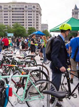
Bike event in Freedom Plaza
DowntownDC BID plant pop-up
Pop-up vending making use of the public right-of-way (DowntownDC)
Bike event in Freedom Plaza
DowntownDC BID plant pop-up
These connection priorities intersect with other planning efforts currently under way in the DowntownDC BID
Pennsylvania Avenue NW between the White House and the U.S. Capitol is an iconic location in the nation’s capital. This NCPC-led initiative reimagines the avenue transformed into a street that prioritizes people over cars with inviting and inclusive public spaces. This vision capitalizes on the avenue’s one-of-a-kind location, setting, scale, and character to make it a signature outdoor venue that could attract and support major national and international events. This initiative is an opportunity to improve connections between the existing 8.8 acres of open space along the corridor and incorporate more open space throughout.

This project is a BID-led initiative in partnership with the National Museum of Women in the Arts (NMWA). The project starts at 13th Street NW, ends at 9th Street NW and includes the addition of 12 sculptures, wayfinding signage, and updated landscaping. The project seeks to redefine New York Avenue as a pedestrian-friendly corridor and strengthen its sense of place as an arts and cultural district. It also connects major open space assets. Planned improvements for the rest of the corridor would strengthen connection and accessibility to Mount Vernon Square and the White House.
While open spaces within DowntownDC meet the standardized level of service, the needs assessment of this plan outlined the demand for a higher level of performance and improvement opportunities. Higher-quality parks and open spaces can be achieved through amenity enhancements and consistent maintenance.
When implementing park improvements, the BID should prioritize features that offer diverse and flexible uses, such as more playful elements, outdoor workstations, and outdoor dining. Each space has been evaluated for site-specific improvements, detailed in the following section, Open Space Recommendations.
Without a sustainable maintenance plan, new park amenities will have less impact on the quality of open spaces. Parks and open spaces need consistent trash collection, timely repairs, and landscape maintenance. An audit of current maintenance responsibilities and practices should be completed to identify gaps in service. Increased maintenance will require additional funding and agency collaboration, like the Franklin Park CMA between NPS, the District, and the BID to support the park’s management. This process could support ongoing maintenance for the broader
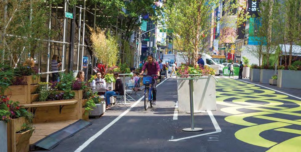
 Street painting and planters can be used as streetscape interventions to pedestrianize roadways (New York City)
park network. The BID should explore additional resources and support for park maintenance. For example, tapping local organizations or forming new ones, like a “friends of” group, could help implement and maintain the lush landscape that the community desires.
Creative methods of adding new open spaces and greenery are required since there is a limited park inventory downtown. These methods include using the surrounding sidewalk and public rightof-way to create an “outer park” to supplement the park’s size and meet a different set of pedestrian needs. Capitalizing on the improvements outlined in plans such as the Pennsylvania Avenue Initiative, K Street Transitway, and the New York Avenue Median Project can increase open space by incorporating green infrastructure during the design process. In the section Connecting Open Spaces, there are more recommendations for adding more open space by implementing road diets and minimizing car-dominated spaces.
Effective policy and enforcement should prevent parks and open spaces from becoming single use. When open spaces are no longer active or multipurpose, they can become unwelcoming to residents and visitors and fall into disrepair. Enforcement of park policy can make parks welcoming, clean, safe, and open to diverse people and uses.
In DowntownDC, some activities create friction between park user groups because of its expansive areas of hardscape and edges. For example, Freedom Plaza is beloved by the skateboarding community. However, NPS prohibits skateboarding due to the damage caused to the pavement, walls, and railings, and the high speeds of skateboarders discourage use by other groups. The skateboarding community
deserves a space in DowntownDC more appropriate for this use. Balancing the need for walkable spaces and areas for skateboarding could create a unique destination for all users.
Another user group that experiences friction in the community is those living in park encampments. In much of D.C., and in downtown specifically, the pandemic has increased the number of those experiencing homelessness, and many parks have become sites for encampments with unsafe and unsanitary conditions. Parks provide substandard living conditions and are ill-equipped to provide safe or healthy options for people struggling to find housing, but they can be used in the interim as forums to connect people with services.
The BID offers many resources to people living in these spaces, such as meal distribution and housing assistance. The BID partners with Pathways to Housing D.C. and actively works to help move people into permanent housing. The Safety/Hospitality and Maintenance (SAM) employees of the BID are trained to recognize and engage individuals experiencing homelessness, including those with mental and addiction challenges. The BID also operates the Downtown Day Services Center, which offers on-site support for individuals experiencing homelessness by providing a multitude of services at a single access point.
While the BID and its partnering agencies were able to house more than 100 individuals in the past year, these efforts should be fully funded and citywide. For example, when a park is about to be closed for renovation, additional mobile outreach should be performed to communicate the changes and offer support to those utilizing it.
As the homelessness crisis is addressed and the demand for encampment space decreases, park rules prohibiting encampments may be better enforced so that all user groups feel equally welcome in parks.
Keeping spaces open and accessible to the public is critical to supporting downtown needs. Some recommendations to improve the connectivity of downtown open spaces include expanding green corridors, prioritizing pedestrians, and expanding wayfinding.
Through the needs assessment, accessibility analysis, and coordination with parallel planning efforts, the plan identifies corridors ideal for open space improvements. As shown in the Connection Priorities map, Massachusetts Avenue NW is identified as a key corridor for enhancements due to its adjacency to residential neighborhoods and many small open spaces along its route. While analysis shows this corridor should remain a thoroughfare for vehicular traffic, creative stormwater solutions and pedestrian safety interventions could better connect the open spaces along its route. Based on a detailed analysis of existing vehicular and pedestrian patterns, the consultant team identified a few areas needing more open space. Both 13th and 11th streets are prime candidates for road diets that could reduce the space dedicated to cars and increase opportunities for street trees, green infrastructure, and pedestrians, turning these into “green corridors.” F Street was identified as an opportunity corridor that can better link existing retail and parks through the heart of DowntownDC as a “shopping corridor” since it is an essential east-west linkage within the open space network.
Implementing road diets is one way to deprioritize vehicular traffic. A road diet is a roadway reconfiguration that typically involves converting a main road lane and allocating it for other uses, such as bus lanes, pedestrian refuge islands, bike lanes, bump-outs, bus shelters, widened sidewalks, or landscaping. Allocating these areas to widened sidewalks or creative landscaping and stormwater solutions could increase usable open space downtown and improve pedestrian connectivity and safety.
A careful study of current vehicular use of streets and current pedestrian circulation patterns revealed potential opportunities for better prioritizing the pedestrian experience to connect existing park spaces. The Road Diet Toolkit illustrated on page 69 highlights the road diet benefits and implementation strategies. The locations of these corridors naturally lend themselves to support their surroundings through focused design efforts and coordination with adjacent neighborhoods and BIDs.
Pedestrian access, safety, and activity are critical to the success of parks and open spaces. Each park space is evaluated for opportunities to prioritize the pedestrian experience. Recommendations consider how pedestrians travel between spaces and within a space.
BIKING/WALKING DowntownDC Parks Master Plan
This plan organizes open space recommendations in four parts based on size, location, and use type:
» Parks and Plazas
» Bowties and Triangle Parks
» View Parks and Streetscapes
» Repurposed Spaces
Each category includes an open space inventory and recommendations based on the existing level of service, community needs, and future vision. The master plan highlights underutilized spaces such as streetscapes and alleyways as key means of creating a complete network of open spaces. The following sections explain each of these categories.
Key elements that contribute to high functioning, welcoming open spaces.
• Playful elements make spaces welcoming to children and provide opportunities for all ages to interact and enjoy parks creatively.
• Seating that is comfortable and flexible or movable is critical.
• Landscaping with highquality plantings adds visual amenity, seasonal variety, a connection to the natural world, and shade.
• Lighting improves safety and can provide additional aesthetic amenity.
• Clear entrances make public spaces more inviting, connected, and add landmarks.
• Wayfinding and signage is important for navigability and reinforces placemaking.
• Sidewalks are crucial for a quality parks system and should add to the experience of open space.
<
• Remove physical barriers to make places feel more inviting and increase visibility.
• Shade makes spaces more comfortable and enjoyable.
• Incorporate bus stops, bikes. and micromobility stations.
• Infrastructure improvements such as bulb-outs and mid-block crossings protect pedestrians.
• Special features, such as outdoor work stations, pavilions, public art, and restrooms activate and extend the use of a space.
9 SPACES
ACRES
A park is a green space reserved for recreation. For this study, parks and plazas are open spaces larger than a halfacre and are the largest open-space assets in DowntownDC. A plaza is a space that may be used by building occupants and visitors for the following: cafe seating, transportation facilities, art displays, and similar uses. Plazas are intended to provide transitional spaces between the public right-of-way and building entrances. These spaces have the potential for impactful upgrades that can serve a wider radius of residents, office workers, and tourists.
The sites shown in light green have recently been redeveloped and therefore are not included in the openspace recommendations of this study.
According to survey data, community meetings, and stakeholder interviews, the parks identified as the most important to redesign include McPherson Square, Mount Vernon Square, and Freedom Plaza. John Marshall Park was also examined due to its proximity to NCPC’s Pennsylvania Avenue Initiative and interest from the BID. Recommendations for these four parks are outlined in the following pages in order of size.

Each redesigned park should include park components such as playful elements, landscaping, lighting, seating, and shade. For immediate impact, creative temporary installations should be considered.
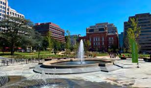


Mount Vernon Square is home to one of D.C.’s four Carnegie Library buildings; currently, it houses the D.C. History Center and an Apple Store. It is elevated at the convergence of New York Avenue, Massachusetts Avenue, and K Street, offering long vista views in each direction. Four triangle parks surround it on each corner of the square: Reservations 70, 71, 175, and 176 (only three are in the BID’s boundary). While the central location of the square keeps the space moderately activated, there is minimal recreational amenities. During the pandemic, the square was programmed with various outside activities, such as fitness classes and pop-up events. Public space deficiencies, such as unsafe pedestrian connections and inward-focused building design, contribute to the underutilized and uncoordinated space.
While the four reservations surrounding the square are NPS-owned and -operated, the administrative jurisdiction of Mount Vernon Square was transferred from NPS to the District in 2006. In 2010, OP and DDOT published the Mount Vernon Square District Design Project, which outlines 10 priority projects focused on the Carnegie Library, surrounding open space, connection to the Walter E. Washington Convention Center, and pedestrian and transportation improvements. The recommendations in this section align with those in the design project while recognizing the limitations of the BID’s jurisdiction at Mount Vernon Square.
Future improvements to the square must maintain and respect the landmark nature of the Carnegie Library and the lush landscape surrounding it. The redesigned space highlighted to the right shows immersive gardens with native and adaptive plantings, which envelop plaza seating areas and anchor rotating sculptures. Expanded partnerships with local museums, events organizations, and private businesses surrounding the square could support activations such as art and vending in the space. Plaza seating areas could be expanded by the permanent café addition visioned in the Mount Vernon Square District Design Project on the west side of the Carnegie Library. Minor enhancements to the adjacent reservations and maintenance of the open lawn space increase visual connectivity and flexible recreational opportunities.
 An immersive, destination garden inspired by Lurie Gardens (Chicago)
Comfortable outdoor workstation (Los Angeles)
An immersive, destination garden inspired by Lurie Gardens (Chicago)
Comfortable outdoor workstation (Los Angeles)
The plan visions movable seating on the east side of the square, offering flexible uses such as outdoor co-working or performance space, capitalizing on the foot traffic of the Apple Store and the convention center. A midblock crossing at K Street was a high-priority item expressed by community members and may provide increased connection to convention center pedestrian
safety. The effectiveness of this strategy should be analyzed in future studies. The Mount Vernon Square District Design Project also highlights many transportation interventions, such as midblock crossings at 8th Street NW with K Street NW and Mount Vernon Place NW and bulb-outs at the intersection of 8th and I streets NW.


Unlike parks that are original to the L’Enfant Plan, Freedom Plaza’s Postmodern design is a Pennsylvania Avenue Design Commission (PADC) project, the work of Venturi, Rausch and Scott Brown Associates with landscape architect George Patton. Freedom Plaza was originally designed as a ceremonial space for large events of national significance and continues to fill this role today. However, it is sorely lacking in amenities to serve the local population and daily visitors, despite being one of the larger parks in the downtown area. Its large size, elevated nature, and vast area of empty hardscape make it feel uncomfortable and unapproachable to users. As part of the Pennsylvania Avenue Initiative, NCPC developed three concepts for transforming the corridors parks, plazas, and gathering spaces. The recommendations identified in this section align the vision for the corridor to accommodate both the large national events and daily local users.
Introducing the design elements of green landscape, shade, and seating, as well as lowering the plaza to street level, will soften the plaza and make it feel more human scale. A woonerf — Dutch for “living street” — could be established on the northern side to expand the plaza’s footprint and better connect to the adjacent uses. A woonerf employs traffic calming strategies and low speed limits to force drivers to slow down and safely share street space with pedestrians and cyclists. Utilizing road diet measures may help capture additional park space and expand amenities.
Reworking the plaza’s existing features, such as the fountain and the vast hardscaped area, into a flexible plaza space with an integrated pop-jet fountain and relaxing seating could make the space more interactive and inviting. Seasonal adaptations of the flexible hardscape could bring “beach front” summers, an ice-skating rink in the winter, and roller-skating opportunities in the spring and fall. The plaza areas would continue to function as an important speaking and performance space with the flexibility to host events and provide market space. A passionate skateboarding community currently uses the park despite the activity being prohibited by NPS. Creating a skate-friendly area separate from the rest of the park area would allow other user groups to feel more comfortable sharing the park space.
Winter ice rink at Reston Town Center Summer “beach front” in San Diego’s Waterfront Park Roller skating in Dilworth Park, Philadelphia


John Marshall Park was a Pennsylvania Avenue Design Commission (PADC) project and the work of Carol R. Johnson, a pioneer in landscape architecture. The park is the fifth largest park downtown, but it is vastly underutilized due to its inactivation along two sides and a lack of park elements. The park’s southern half is within the Pennsylvania Avenue Initiative study area, and NCPC is currently studying its potential as a supportive event space.
In keeping with NCPC’s vision, the park must maintain a flexible area for events to support Pennsylvania Avenue as a civic stage. The park’s north side should feature an in-ground pop-jet fountain and flexible seating options such as a stramp and flexible lawn area. Improved pedestrian crossings across C Street NW should be installed to connect the north to the park’s southern end. For day-to-day activation, the memorial space south of C Street NW should be transformed into a plaza with room for flexible seating and a lighted beer garden or restaurant kiosk. By locating this near the roadway, the space is highly visible and could be expanded into the street for special events. The hardscaped space blends into an elevated performance space, which overlooks the plaza and lawns to the south. The open lawn area is designed to host a large-scale seasonal exhibition inspired by the Tower of London’s Superbloom event, activating the secluded space and drawing in crowds to see bold, planted floral installations that transform the park. Comfortable, intimate, and shaded seating spaces will entice the community into the space and invite them to linger. The park will also require increased utility capacity and flexible storage options to support this level of programming. The future revitalization of this park must honor the park’s history.
DC Blooms event inspired by the annual London Tower Superbloom A “stramp” functions as both stairs and a ramp to provide accessibility, and can add stadium-like seating (The Boro Tysons) Sculptural canopy
Due to its central location and proximity to mass transit options, McPherson Square is heavily used by both local commuters and tourists. A concentration of services for people experiencing homelessness is also provided in the park in collaboration with District. The square is recognized as a cultural landscape and important First Amendment space that continues to serve a crucial civic role for the District and the nation, such as the Occupy D.C. protest in 2011-2012 and the George Floyd protests in the summer of 2020. This civic stage is an opportunity to honor history through the existing statuary and make space for free speech and flexible amenities.
This concept shifts historic elements within the park to create a balance between interactive features to better draw people in. The statue should be relocated out of the center of the space, and a historic view corridor spanning across the plaza should be established. The diagonal hardscape through the park’s center preserves the historic Vermont Avenue view corridor while using movable planter boxes to break up the space with moments of greenery and comfortable seating. The park can become a more social space with flexible lawn areas, lush plantings, comfortable seating, and less emphasis on the existing statue. Movable shade sails and planters will create shade that can cluster around the central interactive water feature. Finally, a kiosk on the southern side, including utility connections, allows for vending or event space.


Changes to the park layout should carefully consider its sister park to the west, Farragut Square, and coordination should include the Golden Triangle BID, which provides services there. These layers of coordination and maintaining key historic elements will be critical to navigating the approval processes.

 Flexible open lawn area
Hardscape plaza with movable plant boxes and seating (Poland)
Modernize the experience of history to better meet parkgoers’ needs and increase engagement (First Amendment Memorial, Annapolis, MD)
Flexible open lawn area
Hardscape plaza with movable plant boxes and seating (Poland)
Modernize the experience of history to better meet parkgoers’ needs and increase engagement (First Amendment Memorial, Annapolis, MD)

For the purposes of this plan, triangle and bowtie parks are defined as open spaces a half-acre or smaller. They are typically triangle or bowtie-shaped open spaces at the nexus of diagonal and horizontal streets. These open spaces are smaller than them but present excellent opportunities for creative programming and activation.

The community engagement process focused on identifying the larger parks prioritized by the community. However, many of the amenities and activities identified by the public to enhance public space would be ideal for the small scale of triangle and bowtie parks, especially public art installations, moveable seating, street-side vending opportunities, and improved landscaping.
LANDSCAPED AND SHADY SPACES


Chinatown Park collects many user groups, such as people from the local Chinese Community Church, the 6th and I Synagogue, and residents from the surrounding neighborhoods. It is an important space for daily use and community connections. In 2017, a Technical Assistance Panel (TAP) report sponsored by the D.C. Mayor’s Office on Asian and Pacific Islander Affairs (MOAPIA) and the Metropolitan Washington Council of Governments (MWCOG) concluded that with the support of MOAPIA and partner organizations, new design and physical improvements, and a more active programming effort, Chinatown Park could be transformed into a space that would serve as an important neighborhood asset to enhance the District’s public realm. The report, Realizing a New Vision for Chinatown Park, documents the findings and identifies strategies that can be used to promote equity and protect the cultural identity of Chinatown.

The park’s small size and lack of maintenance are primary reasons it is underutilized. There are opportunities to grow the park by instituting a road diet or closure on certain blocks of I Street NW. One solution is to close the slip lane in the 400 block of I Street, eliminating vehicle traffic and making the existing view park more pedestrian friendly. Along the 500 block, shifting lanes of traffic to widen sidewalks and landscape areas would significantly grow the main park space, calm traffic, and create a more direct relationship to the land uses to the south. This additional space can support movable furniture, game tables, and more shade without detracting from the existing open lawn area, thus maintaining flexibility for different events and programming.
An integrated, play-friendly fountain for children and families can function as a flexible plaza when not in use. Lush plantings buffer surrounding traffic noise and foster the feeling of an urban oasis. A light shade structure anchors the park’s east end and provides an opportunity for a gateway feature to help draw people into the community from busy Massachusetts Avenue. A newly created park space on the park’s east section is produced by closing the slip lane. This new park space can be designated for dog use or added to the flexible lawn area. Coordination with Milian Park, Chinatown Park’s bowtie complement, and surrounding cultural organizations is key to meeting recreational needs and prioritizing the space’s cultural significance.
 Shade sails
Permanent game tables
Chinatown’s existing entry gateway
Shade sails
Permanent game tables
Chinatown’s existing entry gateway

These triangle parks are part of bowtie pairs that should be enhanced for pedestrian safety improvements. Activating surrounding sidewalks to serve an “outer park” function can improve overall usability. Given the smaller scale and location near residential buildings, these reservations will function best as neighborhood parks that can cater to families and apartment dwellers needing “backyard” space. Play elements, planted buffers, designated dog areas, and comfortable seating can help achieve an inviting space for regular residential visitors. Community members strongly desire to create more intimate park spaces that feel secluded and naturalistic. Stakeholders identified that small open spaces downtown are an opportunity for community-oriented spaces. Small park spaces should provide comfortable and beautiful settings for community activity while incorporating more play features and dog areas. The existing triangle parks are large enough to accommodate the residential community’s needs.

» Play elements
» Interpretive history features
» Dog areas
» “Outer” park and pedestrian enhancements
» Comfortable seating
» Improved lighting
» Lush plantings to buffer noise and add privacy

 Dedicated dog parks are needed in the DowntownDC to improve functionality for all users
Play elements will help the parks better meet the needs of residents (Union Park, Little Elm, Texas)
Dedicated dog parks are needed in the DowntownDC to improve functionality for all users
Play elements will help the parks better meet the needs of residents (Union Park, Little Elm, Texas)
These minor reservations surrounding Mount Vernon Square (Reservations 70, 175, and 71) should enhance the pedestrian connections to the larger park while expanding the total usable footprint of space. They should complement Mount Vernon Square with lush plantings and offer amenities better suited to smaller spaces. Spill-out dining from adjacent restaurants, relaxing seating areas, and small open lawn areas will add definition and purpose to the spaces to keep them activated and improve their appearance within the corridor. Any long-term renovation of these spaces should include Mount Vernon Square as a whole and consider the recommendations of the Mount Vernon Square District Design Project in coordination with agency partners.

When this plan was developed, the two reservations on the west side of Mount Vernon Square (Reservation 70 and 175) were closed by NPS for repair. While these closures are undesirable, they are an opportunity for the BID to implement short-term interventions for space improvements while closed off to the public. Some of these interventions include:
» Spill-out cafe seating
» Hardscape plaza
» Open lawn area
» Comfortable, intimate seating
» Enhanced pedestrian crossing
» Landscaping


8 SPACES
< 0.1 AC
The smallest open spaces in DowntownDC are view parks, which are less than 0.1 acres. These parks are generally too small to program for typical park activities and are mostly used for memorials, decorative plantings, seating, or pedestrian refuge islands. The BID has eight view parks, making up approximately 0.6 acres, in its boundary. These spaces could increase in impact and size when the right-of-way and adjacent streetscapes are improved with landscaping and creative stormwater management solutions.
While the community engagement process focused on identifying the most important park spaces, many amenities and activities recognized by the community are best served in view parks and streetscapes. Some of these enhancements include public art installations, historic interpretive elements, landscaping, pedestrian safety enhancements, and slip-lane conversions. Where possible, consider converting vehicular slip lanes to pedestrian and park spaces to connect these view parks to their adjacent blocks and increase the usable park space. Creative activations and uses such as moveable street furniture or tactical urbanism interventions such as painting the open space can make these spaces more purposeful.

The three reservations clustered at the intersection of New York Avenue and H Street NW, Reservations 172, 172A, and 172B, are categorized as View Parks. They are small, underused, and limited in their function as public spaces, primarily serving as pedestrian refuges for this busy intersection. Introducing a plaza to connect the two spaces across H Street would increase the usable area and improve the pedestrian experience. This would also provide an opportunity to activate, connect, and energize the alleyway off Reservation 172B. This proposed plaza presents a unique opportunity to partner with nearby property owners and retailers to activate the space. The New York Avenue Median Project begins at this intersection and offers a connection between these view parks and public art.


» Painted street plaza or “outer park” area

» Decorative lighting
» Public art
» Comfortable seating with shade cover
» Landscaping
With limited park space in DowntownDC, the streetscape is an excellent and accessible way to introduce more park-like features and activities to the BID. An enhanced streetscape experience can extend the sensation of parks to the street and improve pedestrian connections between existing park spaces. The community engagement processed revealed a strong desire for pedestrianfocused streets, and many stakeholders noted the dominance of cars in DowntownDC. Imposing road diets is a solution that can shrink down or remove traffic lanes to claim more space for pedestrians and improve pedestrian safety. The road diet tool kit on page 69 highlights lane-elimination strategies and benefits. If sidewalks and pedestrian areas are expanded, these spaces can be utilized for programming, green infrastructure, seating, public art, vending, and outdoor dining. Wider pedestrian areas make walking downtown more enjoyable and safer. Community member’s preferences align with these changes and express a desire for walkable streets that promote spill-out dining, commercial experiences, and public art.
“Grow” the park spaces by painting the sidewalk areas around them Blagden Alley, in Logan Circle, D.C.The 11th Street recommendations incorporate DDOT’s corridor study findings, such as dedicated transit lanes, bike lanes, and expanded sidewalk areas. The corridor can be reimagined without employing expensive infrastructure by using road restriping to expand the pedestrian-accessible area for streateries and drop-off areas. Lush landscaping and intimate seating areas along the sidewalk will expand the park experience to the streetscape. With collaborative support from existing business owners and stakeholders, dining opportunities and commercial kiosks could be infused along the corridor, as in New York City’s Herald Square. This stretch of 11th Street has the potential to become a destination for pedestrians to linger, shop, and stroll in between the park spaces of DowntownDC.


F Street is a prime candidate for pedestrianization, given its numerous storefronts and dining opportunities already situated along the corridor. The corridor is anchored by busy metro stations and gets significant daily visitors. The street creates a monumental feeling for pedestrians, as the road connects the White House, the Smithsonian museum, Capital One Arena, and Judiciary Square. The wide section of the roadway that runs along the south side of the Smithsonian already serves as a pivotal public space for seasonal events such as the BID’s Downtown Holiday Market, a farmers market, and other events. A road diet and special street paving adjacent to the Portrait Gallery would further foster a dynamic public gathering space. The road diet could extend west to allow for more generous sidewalk segments, expanding public areas further along the corridor. Recommendations put forward by the Gallery Place - Chinatown Corridor Study for the plaza should be supported to create a vibrant public space.
 Downtown Holiday Market
Roadway restriping to create more space for cyclists, pedestrians, and transit
Downtown Holiday Market
Roadway restriping to create more space for cyclists, pedestrians, and transit


The stretch of 13th Street NW through DowntownDC provides a connection to key public spaces. On the north, tt borders the eastern side of Franklin Park. It links to view parks at the New York Avenue and H Street intersection, the upcoming median sculpture project on New York Avenue, and the existing open space of Freedom Plaza. Imposing a road diet along the street will allow the sidewalk area to grow, provide dedicated bus travel lanes, and implement separated bike lanes.

Massachusetts Avenue carries significant traffic and has a wide rightof-way, often leading to speeding cars. Buildings are set back from the roadway, creating a large sense of scale for pedestrians. Several key parks line the roadway, including Mount Vernon Square and Chinatown Park, and a large residential population resides to the north of the corridor. Introducing the elements of a green street or stormwater management infrastructure can effectively improve the pedestrian experience. Transforming Massachusetts Avenue into a green street has the potential to introduce more linear park elements while also enhancing the city’s climate change adaptation by improving stormwater absorption. Street trees are another aspect of green streets that is key to expanding the feeling of parks to the roadway and having climate change adaptation benefits. Massachusetts Avenue has the potential to hold significant public art and become an enjoyable route for pedestrians that are traversing downtown.

The blocks north of McPherson Square that connects the avenue up to Thomas Circle has a wide, car-focused right-of-way but light car traffic. Reducing the roadway to two-lane travel with parking and a bike lane on one side would return space to pedestrians and improve the accessibility between McPherson Square and the residential neighborhoods north of Massachusetts Avenue. A wider sidewalk would provide space for greening, sidewalk retail, and seating opportunities. Expanding the planting strip to create a parallel track of green space running alongside the roadway would make Vermont Avenue a green corridor functioning as a linear park.
Pedestrian priority Sidewalk furniture Massechusetts Avenue and I Street NWThe Judiciary Square west lawn’s proximity to the Gallery Place/Chinatown residential buildings, Judiciary Square Metro station, restaurants, and cultural destinations give the park high potential for successful activation. Future activations could include the National Building Museum to program the west lawn with rotating and engaging exhibits. This will generate interest in the area and reinforce the corridor as a cultural destination within DowntownDC.

Adjacent to the 12th and G Metro Center station entrance is a plaza. This space provides a generous right-of-way width that can be activated with plantings, seating, vibrant signage, and vending. Due to its proximity to the most highly trafficked transit station in the DowntownDC area, pedestrian traffic near the plaza is already high.

The open space around the Federal Triangle Metro station has ample room for activation and already has frequent foot traffic. A lush landscape of plantings within the plaza could buffer noise and create a respite space for pedestrians, while the existing lawn area could remain flexible for activations. The interior space created by the covered arcade provides a sense of enclosure that would be complemented by additional landscaping.
The library’s overhang could host rotating outdoor installations curated in partnership with the library, such as outdoor workstations, movable seating, and outdoor games for the public. The uncovered portion of the sidewalk can feature immersive landscaping layered with a colorful planting section and swaths of greenery to create a park feel.
To grow the parks system, more public spaces need to be adapted to function as parks. Areas already within the public realm are key, as they do not carry associated acquisition costs, and many already serve some community role. Enhancing the communityfacing elements through design interventions can transform these spaces into destinations.
Short-term interventions can spark use in underperforming public spaces and provide an opportunity to observe how long-term implementation might perform in a real setting. They are intended to generate excitement for the public about future public space possibilities, quickly address the expressed needs of a space, be implemented at a low cost, and inform future interventions.
The parks and open spaces below were identified as potential intervention sites for their location, impact potential, and ability to address a specific need. The selection criteria considered the following:
» Need: the space exists in an area where there is a need for new park-like space as evidenced by geographic analysis and community input.
Demand Need Potential
Site Conditions
Adjacency Office, Mixed use Retail, Residential Federal Office, Hotels Library, Residential, Office Office, Retail, Metro
Notes
Most popular choice for prioritized improvement per community survey
ROW at Res. 73 is already striped and closed with bollards and bikeshare; 4th choice for improvement per survey
Third most important for community priority, national significance and key role in large scale events
Potential for activation partners; expanding into streetscape would broaden opportunity but no additional approval
Potential for activation partners. Expanding into streetscape would broaden opportunity but no additional approval
» Potential: The space has a high potential for immediate intervention based on availability and ease of approval process (type of intervention may still be restricted by numerous factors).
» Site Conditions: The space is either large enough to accommodate a significant intervention, or the intervention can be replicated in close enough proximity to make a significant statement.
» Demand: The space is located along highly frequented pedestrian routes, as highlighted by an analysis of Placer AI data.
» Adjacency: Surrounding uses contribute to pedestrian activity and are prime for publicprivate partnership opportunities
» Areas currently lacking park assets, such as the areas around Metro Center and Penn Quarter, can be bolstered by temporary installations that reimagine space in existing sidewalk or roadway as parks, and existing parks that do not currently meet their potential can be reimagined to better serve parkgoers. Test fitting through design interventions can prioritize investment locations based on performance and can determine what design elements are most successful for increasing park visitation.
Areas currently lacking park assets can be bolstered by temporary installations that reimagine space to serve park users better. Test fitting through temporary design interventions can prioritize investment locations based on performance.


The cluster of view parks at New York Avenue and H Street, the 13th Street corridor, and the 11th Street corridor were considered potential intervention sites. These spaces didn’t fit the criteria to warrant intervention, although they are highly visible and have great potential. The parks and sidewalk areas in the table score much better across the criteria categories and have a higher potential for community impact.
 Seasonal activation and pop-up events spur interest in public space
Freedom Plaza used as event space
Seasonal activation and pop-up events spur interest in public space
Freedom Plaza used as event space


A road diet will reduce the number of vehicular lanes to give more space to cyclists and transit through lane restriping
A temporary platform to allow pedestrians to safely board transit without disrupting the travel lane for cyclists
bike lane
Pedestrianized plaza to enhance street crossings and give more space to parks and the public realm
Outdoor dining opportunities
Expanded landscaping
Curbs moved to provide more sidewalk space for a lively pedestrian environment
Dedicated bike lane

1 INCREASE OPEN SPACE AMENITIES THROUGHOUT DOWNTOWNDC BID.
1.A. Renovate or redesign all parks to better meet the community needs and plan goals.
1.B. Seek funding avenues to support enhanced park and open space plans.
1.B.1. Prepare detailed budget for improvements to prioritize recommendations for open space projects.
1.B.2. Identify phasing opportunities as part of open space improvement projects.
1.B.1. Identify capital improvement funds.
1.B.2. Identify ongoing revenue streams to increase ongoing maintenance budget.
1.C. Partner with adjacent entities to support programming and maintenance.
1.D. Advance the planning and design of specific priority parks.
1.D.1. McPherson Square
1.D.2. Mount Vernon Square
1.D.3. Freedom Plaza
1.D.4. Chinatown Park
1.D.5. John Marshall Park
1.E. Identify locations for new public open space amenities to be included in underutilized publicly and privately owned land.
1.E.1. Partner with D.C. Public Library to identify opportunties for activating the entrance area at the Martin Luther King Jr. Memorial Library.
1.E.2. Partner with the National Building Museum to identify opportunties for activating the west lawn.
1.E.3. Partner with the GSA and WMATA to identify opportunties to activate the Federal Triangle Metro Station lawn.
1.E.4. Partner with the Ronald Reagan Building and the National Children’s Museum to identify opportunties for activating Wilson Plaza.
1.F. Encourage access to all green spaces.
1.F.1. Partner with public and private landowners to facilitate public use of private open spaces.
1.F.1.a. U.S. Tax Court parklet on 2nd Street NW.
1.F.1.b. U.S. Department of Labor and Metropolitan Police Department on D Street NW.
1.F.1.c. Georgetown University Law School F Street lawn.
1.F.2. Provide signage to invite public use.
1.F.3. Design the entrances to spaces to be welcoming from the public street frontage.
1.F.4. Partner with property managers to activate the spaces with events.
Immediate Short-term (0-2 years) Mid-term (3-8 years)
Long-term (9+ years)
1.G. Use temporary interventions to generate buzz, test design ideas, or implement an amenity identified by the community as a need.
2 PROVIDE PARK-LIKE CONNECTIONS BETWEEN THE PARKS.
2.A. Partner with DDOT to enhance streets, sidewalks, alleys, ROWs that could contribute a park-like atmosphere between each park.
2.B. Advance the planning and design of specific key corridors.
2.B.1. 11th Street
2.B.1.a. Restripe to add bike lanes, bus priority lanes, and lane buffers.
2.B.2. 13th Street
2.B.2.a. Alter curb alignment to increase pedestrian priority space and restripe to add bike lane.
2.B.3. I Street between 5th and 6th Street
2.B.3.a. Close slip lane from I street onto Massachusettes Avenue and make the 500 block one lane one-way traffic west-bound and one lane of parking.
2.B.3.b. Implement woonerf on the 500 block.
2.B.4. Mount Vernon Square
2.B.4.a. Implement mid-block crossings on Mount Vernon Place NW and K Street NW.
2.B.5. F Street from 9th to 13th Street
2.B.5.a. Implement road diet to remove northernmost lane and extend curb to expand the sidewalk and landscape panel.
2.B.6. Vermont Avenue: North of McPherson Square
2.B.6.a. Implement a road diet to remove two lanes of traffic and expand the sidewalk and landscape panel.
2.B.7. Vermont Avenue: South of McPherson Square
2.B.7.a. Convert parking on the west side to parallel instead of angled and expand the sidewalk and landscape panel.
2.B.8. Pennsylvania Avenue between 12th and 13th Streets
2.B.8.a. Implement road diets where possible to expand park space.
2.B.9. F Street between 7th and 9th Streets
2.B.9.a. Implement recommendations of the Gallery Place-Chinatown Corridor Study.
2.B.10. 7th, 8th, and 9th Streets
2.B.10.a. Implement recommendations of the Gallery Place-Chinatown Corridor Study.
Immediate Short-term (0-2 years) Mid-term (3-8 years) Long-term (9+ years)
2.C. Test long-term ideas with temporary test interventions.
2.D. Support green infrastructure plans that foster bike and pedestrian uses as well as sustainability goals.
2.E. Find opportunities in streetscapes and adjacent properties to enhance the “park-like” feeling of the BID.
3 EXPAND THE FOOTPRINT OF THE EXISTING PARKS.
3.A. Adopt the idea of an inner and outer park, with some park amenities located outside of park boundaries, which may be closed at night.
3.B. Improve park edges by incorporating park-like elements within the streetscapes surrounding parks.
3.C. Incorporate public transit and micromobility facilities into park designs so they feel more like part of the park space.
4 RECOGNIZE THE NEED FOR PARKS TO SUPPORT DAILY LIFE FOR RESIDENTS AND DAYTIME USERS.
4.A. Create a better balance in all public parks to meet the needs of daily users as well as special events.
4.A.1 Designs should be multifunctional to allow for special events without the exclusion of park amenities geared to daily life.
4.A.2 Seek to enhance daily use of parks with special events.
5 LIMIT THE SUBTRACTION OF PARK SPACE TO DAILY USE.
5.A. Closely evaluate the message and length of park closings when required.
5.A.1 When parks are closed for construction and/or rehabilitation the closing should convey information about its reopening and incorporate interactive fencing and displays.
5.B. Close parks nightly to activity other than connectivity and enforce closure.
5.B.1 Use positive signage to convey the message.
5.B.2 Develop strategies for closing that are positive and conducive to safety and comfort for the diverse population.
6 CREATE A DIGITAL WAYFINDING APP (SELF-GUIDED TOUR) TO TELL VARIOUS STORIES: CITY PLANNING, URBAN HISTORY OF DOWNTOWNDC, STATUES, ETC.
6.A. Partner with local business incubator, start-up, or university to generate test applications.
6.B. Partner with museums and cultural entities for content and events.
6.C. Utilize physical signage in parks and at local businesses to promote the app.
7 LOOK FOR OPPORTUNITIES TO INCREASE NATURAL AND ENVIRONMENTAL ASSETS.
7.A. Add additional landscape and plant materials to create a more lush environment.
7.A.1. Increase the tree canopy, with the goal of increasing shade, reduce heat, and mitigating noise and air pollution.
7.A.2 Add planting areas with shrubs and perennials for a layered approach with seasonal interest.
7.A.3 Lushly plant areas not suitable for people to sit or gather, i.e. view parks.
7.B. Find opportunities for natural and native plantings to double as a stormwater mitigation effort.
7.C. Seek opportunities to add green infrastructure in parks.
FACILITIES
8 INCORPORATE OPPORTUNITIES FOR PLAY.
8.A. Diversify ideas of play, creating opportunities for all ages and abilities to play.
8.B. Include a minimum of one playful element in each new or redeveloped park space.
8.C Add one new dedicated play area for children within DowntownDC.
9 PROVIDE A WELCOMING ENVIRONMENT FOR ALL PARKS.
9.A. Based on best practices, develop a strategy to enforce no sleeping overnight rules.
9.B. Add wayfnding signage in and between parks.
9.C Continue the success of BID ambassadors as service ambassadors within the parks.
9.D. Replace negative signage with positive signage.
9.E. Incorporate welcoming elements to signal to the public where areas are available for public use, including private areas that agree to public use.
10 UPGRADES / REDESIGNS SHOULD BALANCE THE NEEDS FOR LOW-MAINTENACE, IMPACT, AND BUDGET.
10.A. Use high-quality materials that are durable.
10.B. Use sustainable materials.
10.C. Use low-maintenance materials and plants.
10.D. Avoid use of annual plants in landscape.
10.E. Use drought-tolerant plants.
10.F. Consider maintenance budgets when designing new park spaces.
10.G. Prioritize high-budget features for high-impact and high-visibility locations.
10.H. Prioritize new park design budgets according to park elements most requested by the community.
11 MINIMIZE VEHICULAR / PEDESTRIAN CONFLICTS AND SUPPORT VISION ZERO PRINCIPLES.
11.A. Close slip lanes at diagonal streets to reduce conflicts and pedestrianize more space.
11.B. Implement road diets to allocate more streetscape to pedestrians.
11.C. Improve pedestrian crossings.
11.D. Install bulb-outs at intersections to shorten pedestrian crossings.
11.E. Use specialty pavement and unique pavement painting at key intersections to call out pedestrian priority zones.
11.F. Prioritize products and technologies that reduce conflicts for pedestrians or cyclists.
Immediate Short-term (0-2 years) Mid-term (3-8 years)
Long-term (9+ years)
12 DESIGN ALLEYWAYS TO CONTRIBUTE TO THE OPEN SPACE NETWORK.
12.A. Promote alleyway design that supports pedestrian safety and creates an inviting atmosphere to claim more people-centric open space.
12.B. Use wider alleyways with fewer loading areas as test sites for small events or temporary seating areas.
12.C. Provide lighting to promote activation and safety.
13 PROMOTE ACCESSIBILITY AND ACCESS TO PARK ELEMENTS AND SPACES.
13.A. Remove physical barriers such as large hedges, fences, curbs, etc.
13.B. Where curbs cannot be eliminated, implement lawn ramps to promote accessibility.
13.C. Survey parks and open spaces for elements of defensive architecture and develop a plan for removal.
14 PRIORITIZE FLEXIBILITY OF USES AND SPACES.
14.A. Include movable furniture to facilitate park activation and extended use.
14.B. Install basic event infrastructure such as integrated lighting elements and electrical receptacles for “plug and play” events without the need for a permanent stage.
14.C. Integrate features within spaces where possible, such as flush splash pads within plazas.
14.D. Consider event scale when designing new park spaces to accommodate a range of sizes and work to maintain a human scale.
15 PROVIDE BASIC PARK COMPONENTS IN ALL PARKS.
15.A. Repair or replace where existing park elements are deteriorated.
15.B. Add new park components where lacking to raise baseline standard of all park spaces.
15.B.1. Include standard site furniture typical of modern parks.
15.B.2. Prioritize components that facilitate extended park use for all park users.
15.B.3. Utilize universal design features and products.
15.B.4. Consider diverse abilities, cultures and user groups when selecting specific furnishings and components to appeal to a broad range of user groups.
16 PERFORM A COMPREHENSIVE REVIEW OF CURRENT MAINTENANCE AGREEMENTS, RESPONSIBILITIES AND PRACTICES.
16.A. Review infrastructure repairs as well as regular upkeep like trash and snow removal.
16.B. Establish a plan to address any service gaps.
1 SUPPORT DISTRICT AND FEDERAL AGENCY EVENTS AND INITIATIVES.
1.A. DDOT Open Streets
1.B. OP Streets for People
1.C. OP Public Life Studies
1.D. NCPC Pennsylvania Avenue Initiative
1.E. Vision Zero
1.F. Sustainable DC
2 BRING MUSEUMS AND CULTURAL ENTITIES INTO THE PARKS WITH EVENTS.
2.A. Capitalize on programming and event capacity already in place at museums and, in turn, increase their usable area to expand the reach and type of museum events.
2.B. Create seasonal, recurring event partnerships to activate parks and open spaces year-round and to instill reliability in offerings.
2.C. Take advantage of all partnership opportunities.
2.D. Strengthen the Cultural Corridor identified in Connection Priorities to support Chinatown history and culture.
3 CREATE A PROGRAM OF EDUCATIONAL AND HISTORICALLY OR CULTURALLY RELEVANT ACTIVITIES.
3.A. Partner with local groups to support and strengthen cultural events or activity within public open spaces.
3.B. Use public art to connect to history in an engaging and interactive way that supports current user needs.
3.C. Use branding throughout DowntownDC to reinforce history and identity related to modern park spaces.
3.D. Prioritize monuments and memorials that foster use rather than passive viewing in public spaces.
3.E. Include recent history and modern civics in interpretive features to acknowledge significant current events.
3.F. Create a managing entity to facilitate programming such as outdoor library, art studio, history classes, etc.
4 CREATE PARTNERSHIPS AND PROGRAMS WITH ORGANIZATIONS TO PROMOTE SAFE AND ACCESSIBLE BICYCLE AND PEDESTRIAN ACTIVITY THROUGHOUT DOWNTOWNDC.
4.A. Test street closures or expanded sidewalks.
4.B. Support on-road bicycle facilities.
4.C. Host events that spill out of parks onto surrounding sidewalks and streetscapes to reclaim space.
5 INCREASE THE LEVEL OF MAINTENANCE FOR THE PARKS IN GENERAL THROUGH NEW PARTNERSHIPS.
5.A. Partner with other stakeholder groups invested in parks as quality amenities for DowntownDC to increase maintenance and care capacity.
6 PARTNER WITH ADJACENT BIDS TO ADDRESS EDGE OPEN SPACES IN A HOLISTIC MANNER.
6.A. Renovate paired bowtie parks at the same time to ensure connectivity.
6.B. Distribute park amenities across BID boundaries.
6.C. Coordinate event programming to support user groups from both sides of a BID border.
7 PARTNER WITH PRIVATE PROPERTY OWNERS TO SUPPORT GROWTH OF PARKS AND PARK-LIKE SPACES.
7.A. Utilize building zones of sidewalks outside public ROW to enhance pedestrian experience and create parklets.
7.B. Encourage sidewalk cafes near parks and on priority pedestrian routes to parks.
7.C. Create sidewalk activations in key corridors identified in the Framework Plan.
1 UPDATE THE MASTER PLAN REGULARLY.
1.A. Update the DowntownDC Parks Master Plan every 10 years, minimum.
1.B. Survey the community bi-annually to measure satisfaction and community needs.
2 INCREASE RESOURCES FOR PARKS AND OPEN SPACES.
2.A. Develop partnerships with stakeholders to contribute resources.
2.B. Lobby district government for park resources.
2.C. Seek ongoing income streams like vending.
2.D. Evaluate DowntownDC BID budget with an eye to increase park-related budget.
2.E. Leverage documented economic impact of parks to allocate a larger portion of funding to parks.
2.F. Research and pursue grants to support specific park renovations and green infrastructure.
3 CREATE A MARKETING STRATEGY TO PROMOTE AND EDUCATE THE COMMUNITY ABOUT PARK AND OPEN SPACE OPPORTUNITIES WITH A THOROUGH SYSTEM MAP, A UNIFIED WAYFINDING SYSTEM,AND BRANDING.
3.A. Expand the branding system for the DowntownDC BID to include open spaces.
3.B. Establish a standardized wayfinding system for parks, green corridors, and recreational facilities.
3.C. Coordinate with NPS, NCPC, and DPR in this effort.
3.D. Involve employers and tenants for sponsorship opportunities and collateral development.
4 SUPPORT NEEDS OF THOSE EXPERIENCING HOMELESSNESS.
4.A. Continue to work with partners and agencies to create a strategy to support no overnight sleeping in parks.
4.B. Continue to work with agency and nonprofit partners to meet the needs of people experiencing homelessness including rehousing.
4.C. Support a coalition effort between governmental agencies, non-profits, and aid groups already working independently to house people so that efforts may be consolidated and strengthened.
4.D. Create an “inner” and “outer” park that may serve different functions to meet all park users’ needs.
4.E. Enforce closure of parks at night except for circulation.
4.F. Improve lighting and public safety to ensure all park users feel safe.
4.G. Increase park activation to welcome all users and balance user groups.
4.I. Prior to closing a park for renovation, implement mobile outreach to the community to facilitate connection to assistance resources and housing opportunities.
POLICY
5 SEEK FUNDING AND SPONSORSHIP OPPORTUNITIES TO FOSTER PUBLIC/PRIVATE PARTNERSHIPS FOR LAND ACTIVATION, PARK AND OPEN SPACE DEVELOPMENT.
5.A. Facilitate public/private partnerships throughout the community to increase public access to parks, open space and programs.
5.B. Support zoning incentives for development of park space that is accessible to the public.
5.C. Leverage private interest in providing high-quality park spaces by developing publicprivate partnerships to create new parks or re-design existing spaces.
5.D. Partner with landowners to provide temporary interventions and activation of spaces prior to redevelopment.
6 ESTABLISH A PLAN FOR MULTIPLE ENTITIES TO PROVIDE RESOURCES FOR PARK IMPROVEMENTS.
6.A. Utilize Cooperative Management Agreements (CMA) with agencies to include the broader definition of open spaces identified in this plan.
6.B. Transfer administration of priority spaces to the District and the DowntownDC BID.
7 WORK TO ENSURE FAIR ACCESS TO PROGRAMMING AND FACILITIES BY AIDING IN OVERCOMING ECONOMIC, RACIAL, GENDER, AND AGE DISPARITIES.
7.A. Offer free entry to events when possible or reduced entry fees.
7.B. Use messaging and marketing that welcomes a diversity of users.
7.C. Design events to welcome people of all ages and abilities to participate.
7.D. Use 8 to 80 design principals for public spaces to support a range of programmed activities.
7.E. Partner with schools, residential buildings, and local groups to create events and share resources.
9 PROVIDE VENDING OPPORTUNITIES IN AND AROUND PARKS.
9.A. Transfer administration of priority spaces to the District and DowntownDC BID so vending can be provided in those spaces.
9.B. Partner with DDOT and OP to support vending and market space on the sidewalks surrounding park spaces.
9.C. Consider other partnerships that could support vending uses in and around parks.
9.D. Involve adjacent retailers and restaurateurs in partnering to provide vending and markets in and around parks.

» Advisory Neighborhood Commission (ANC): A locally elected body that gives D.C. residents greater say in matters affecting their particular neighborhood. There are 46 ANCs in the District, covering all eight wards.
» D.C. Department of Parks and Recreation (DPR): The city agency that maintains and programs parks under District ownership.
» D.C. Office of Planning (OP): The city agency that manages the District's long-term growth and development.
» District Department of Transportation (DDOT): The city agency that manages publicly owned transportation-related infrastructure in D.C.
» DowntownDC Business Improvement District (BID): The business improvement district for 138 blocks of the City's central business district, from Constitution Avenue to Massachusetts Avenue NW, and North Capitol Street to 16th Street NW.
» Metropolitan Washington Council of Governments (MWCOG): An independent, nonprofit association through which D.C.-area leaders address regional issues affecting the District, Maryland, and Virginia.
» National Capital Planning Commission (NCPC): The federal government's planning agency for the National Capital Region, acting to protect and further federal interests in development.
» National Recreation and Park Association (NRPA): A leading not-for-profit organization dedicated to building strong, vibrant, and resilient communities through parks and recreation.
» State Historic Preservation Office (HPO): A District entity that carries out federal duties including historic preservation planning, survey and identification of historic properties, public education, and preservation review of government projects.
» U.S. Commission of Fine Arts (CFA): The federal agency that has review authority over design aspects of planning and construction in select areas of the District, per the Shipstead-Luce Act.
» U.S. Department of Housing and Development (HUD): The federal entitiy tasked with creating strong, sustainable, and inlcusive communities and quality affordable homes for all.
» U.S. General Services Administration (GSA): The federal entity that builds, provides, and manages office space for federal employeess and assists with basic function of federal agencies.
» U.S. National Park Service (NPS): The federal agency that manages all national parks and other natural, historic, and recreational properties in local jurisdictions.
» Washington Metropolitan Area Transit Authority (WMATA): A tri-jurisdictional government agency that operates transit service in and around D.C.
» 11th Street Bus Priority Project: A DDOT-led effort focused on improving bus operations and safety on 11th Street NW between Pennsylvania Avenue and Massachusetts Avenue.
» 1902 Senate Park Commission Plan: The plan that eliminated the National Mall's broad, Victorian landscaping and replaced it with a narrowed, uncomplicated expanse of grass (the Mall) and permitted the construction of low Neoclassical museums and cultural centers along the Mall's east-west axis.
» 8-80 Design Principles: A method of designing public spaces so that they work equally well for people of all ages, no matter if they're 8 or 80 years old.
» Accessibility: The ease with which a person can travel from a point of origin to a destination.
» Accessibility Analysis: A measure of pedestrian preference for existing and proposed connections based on the physical
environment, land use, road geometry, and location of destinations.
» Amenity: A physical design element or component that enhances the comfort, functionality, or enjoyment of an open space.
» Business Improvement District (BID): An area within which property owners agree to an additional, self-imposed tax in order to fund projects and programming within the BID's boundaries. In the District, these areas are typically administered by private, nonprofit 501(c)(6) organizations.
» Connectivity: How accessible various destinations are and how easily people can move between them. Here, it primarily refers to the ease of connections made for pedestrians, cyclists, and people using transit.
» Cooperative Management Agreement (CMA): A written legal instrument reflecting a relationshop between the NPS and a state or local government, or other nonfederal recipient in which the
principal purpose is to transfer money, property, services, or anything of value to the state or local government or other recipient.
» Cultural Landscape: Places that have significance in American history and authenticity to a historic time period.
» Cultural Landscape Inventory: The NPS database used to identify cultural landscapes in the National Park system and for the documents that provide information on their history, National Register significance, characteristics and features, condition, and management.
» Encampment: The place of residence or accumulation of personal belongings on public property.
» Gallery Place - Chinatown Corridor Study: The DowntownDC BID-led effort that is an in-depth analysis of existing conditions and community needs between 5th Street and 9th Street NW and Pennsylvania Avenue and K Street.
» Geospatial Data: Information that describes objects, events, or other features with a location on or near the surface of the earth. It typically combines location information, attribute information, and temporal information.
» Green Corridor: Linear natural infrastructure, such as trees and plants, that connect with other green and open spaces to form a green urban network.
» Green Infrastructure: The range of measures that use plant or soil systems, permeable pavement or other surfaces, stormwater harvest and reuse, or landscaping to store, infiltrate, or evapotranspirate stormwater and reduce flows to sewer systems.
» Green Street: Stormwater management approach that incorporates vegetation, soil, and engineered systems to slow, filter, and cleanse stormwater runoff from impervious surfaces.
» Hardscape: Sidewalks, roadways, or pavers that cover the ground with a flat, usually impermeable surface.
» Historical District: A property type used by the National Register to define a geographic area with architectural or historical significance.
» Inner Park: A term assigned to the traditional park footprint. In DowntownDC, the inner park is surrounded by sidewalks or roadways, often fenced in, and constrained in size. The inner park may close as night and have rules associated with its use that differ from the sidewalk surrounding it.
» K Street Transitway: The DDOT-led project that will reconfigure one of the District's major eastwest corridors, K Street NW, with multimodal and landscaping improvements.
» Land Use: The primary designated use of a land parcel, such as a building consisting of predominately office space or a site dedicated to surface parking.
» L'Enfant Plan: The original 1790 plan for the City of Washington. The plan generally features broad diagonal roadways superimposed over a traditional north-south, east-west street grid.
» Level of Service (LOS): A measurable standard for the quality and quantity of parks and recreation facilities a community desires to meet their needs. Standards are often based on national averages for other communities of comparable population size and density.
» Linear Park: A park that is longer than they are wide and often serve as a link between traditional parks.
» Microclimate: The atmospheric or weather conditions of a very small geographic area, especially if the conditions are significantly different than those in adjacent areas.
» Micromobility: Lightweight vehicles, such as scooters and bicycles, including electric-assistance vehicles and bikeshare programs.
» Mixed-use Development: A development characterized as pedestrianfriendly and blending two or more of the following uses: residential, commercial, cultural, institutional, and industrial.
» Mount Vernon Square District Design Project: An OP effort, completed 2010, that sought to generate implementation-driven solutions for specific transportation, public realm, and real estate challenges and opportunities in the blocks, streets, and reservations surrounding D.C.'s Mount Vernon Square.
» National Historic Site (NHS): The federal designation for an officially recognized area of national historic significance. Most sites are automatically entered in the National Register and are managed by the NPS.
» National Register (NR): The federal government's list of U.S. historic landmarks and districts. Properties listed in the register may be significant at the local, state, or national level.
» New York Avenue Median Sculpture Project: A DowntownDC BID-led initiative, in partnership with the National Museum of Women in the Arts. The project starts at 13th Street NW, ends at 9th Street NW, and includes the addition of 12 sculptures, wayfinding signage, and updated landscaping.
» NYC's Community Parks Initiative: A program that redesigns and rebuilds community parks neglected by previous city administrations, focusing on high-density, lowincome areas and parks that have seen less than $250,000 in investment over the past 20 years.
» Open Streets Initiative: A DDOT program that offers communities an opportunity to experience city streets in a new way. Open Streets events temporarily close roadways to vehicles to provide safe spaces for walking, biking, skating, programming, and other social activities.
» Outer Park: The area directly surrounding a park footprint that may function as part of the park. Within the public right of way, it may be programmed to support park activity, is a way to expand usable park space, and is always open to the public.
» Park: An open space greater than 0.5 acres in size.
» Parklet: A small seating area or green space created as a public amenity on or alongside a sidewalk, especially in a former curbside parking space.
» Park Amenity: Physical design elements or components that increase the use and enjoyment of a park space, such as play equipment, benches, trails, fountains, or shade.
» Park System or Network: Parks publicly availalbe to a local community. Open spaces making up a park system are ideally well cared for and offer a diversity of sizes, designs, and facilities to meet a range of needs for residents and visitors..
» Pedestrian Island: A space between roadways where pedestrians can await a break in traffic.
» Pedestrian-only Street: An area of a city that is designated to be carfree and can be limited to just pedestrian traffic, or also cyclists.
» Pennsylvania Avenue Development Corporation (PDAC): The Pennsylvania Avenue Development Corporation created a plan for the Pennsylvania Avenue corridor in 1974 to guide design and development.
» Pennsylvania Avenue Initiative: NCPC-led initiative that reimagines the avenue transformed into a street that prioritizes people over cars with inviting and inclusive public spaces.
» Placer AI: System that uses aggregate cell phone location information to visualize movement patterns and map where people travel and linger.
» "Plug and Play" Event Infrastructure: Concept that parks can have all of the infrastructure in place that any size or type of event would need to utilize that space.
» Public Life Studies: OP's methodology for studying public life that applies techniques developed by the Gehl Institute and adapted by the city agency.
» Public Realm: Any publicly owned land, including streets, sidewalks, parks, open spaces, and so on.
» Public-Private Partnerships: A long-term contract between a private party and a government agency for providing a public asset or service, in which the private party bears significant risk and management responsibility.
» Public Right of Way (ROW): Any publicly owned thoroughfare, such as streets, sidewalks, alleyways, or utilities. It includes medians and some space beyond the corridor.
» Rentable Building Area (RBA): Typically refers to offices spaces and includes the usable square footage of the office plus a percentage of the floor space of all shared areas in the building.
» Road Diet: A method utilized in transportation planning that reduces the travel lanes in a roadway
to dedicate to other uses or to widen sidewalks.
» Safety and Maintenance Ambassador (SAM): SAMS are DowntownDC BID employees that perform a multitude of roles. They execute maintenance tasks such as litter and trash collection, minor infrastructure repairs, and park maintenance.
» Section 106: A section of the National Historic Preservation Act which requires that each federal agency identify and assess the effects its actions may have on historic buildings or spaces, including consideration of public views and concerns about preservation issues.
» Slip Lane: A road at a junction that allows motorists to change roads withough actually entering an intersection.
» Streateries: Café seating, typically taking over a parallel car parking space.
» Streetscape: The full environment of the street, including the quality and visual effect of pedestrian space, aesthetic elements, overall design, and plantings.
» Streets for People Grant: The District grant program, managed by OP, that seeks to expand the utilization of sidewalks, alleys, curbside space, parking, and travel lanes to create vibrant public spaces that will support economic recovery; re-envision public space activation; promote equity; leverage the work of local artists, cultural organizations and business; celebrate D.C.'s vibrant culture; and attract residents, workers, and visitors.
» Stormwater Management: The effort to reduce runoff of rainwater or melted snow into streets, lawns and other sites, and improve water quality.
» Sustainable DC: The city's plan to make D.C. the healthies, greenest, most livable city for all residents.
» Tactical Urbanism: Shortterm, low-cost, scalable design interventions.
» Technical Assistance Panel: Typically one-and-ahalf day sessions in which multidisciplinary teams of five to eight real estate development professionals
tour the site under review, interview local stakeholders, and meet to develop recommendations that are presented publicly at the end of the session and in a follow-up report.
» The 15-Minute City: An ideal geography where most human needs and desires are located within a travel distance of 15 minutes.
» Triangle Park and Bowtie Park: Open space between 0.1 and 0.5 acres in size. They are typically triangle or bowtie-shaped open spaces located at the nexus of diagonal and horizontal streets.
» Urban Ecology: The scientific study of the relation of living organisms with each other and their surroundings in an urban environment. An urban environment refers to areas dominated by highdensity residential and commercial buildings, paved surfaces, and other urban-related factors that create a unique landscape.
» View Park: Small open spaces less than 0.1 acres in size.
» Vision Zero: Collaborative, nonprofit campaign helping communities set and reach the goal of eliminating traffic fatalities and severe injuries among all road users while increasing safe, healthy, equitable mobility.
» Walkability: A term for planning concepts best understood by the mixeduse of amenities in highdensity neighborhoods where people can access said amenities by foot.
» Wayfinding: Encompasses all of the ways in which people orient themselves in physical space and navigate from place to place.
» Woonerf: With roots in the Netherlands, a woonerf describes a living street that uses traffic calming measures, shade, special paving, and plantings to prioritize pedestrians over cars and create a comfortable environment. A woonerf can close to cars during some hours to increase capacity for events or widen pedestrian space.