Campus remaking
REMAKING OF THE MEDICAL CAMPUS
BY: ZAINAB ABDULLA
OLA IBRAHIM
HIBA ALRAHMAN
Content:
Part 1 : campus in context
Part 2 : strategy formulating
Part 3 : the remaking campus master plan
BY: ZAINAB ABDULLA
Content:
Part 1 : campus in context
Part 2 : strategy formulating
Part 3 : the remaking campus master plan
This stage aims to summarize the problems of the current situation of the campus. and focus on studying the opportunities and challenges in the host city. Also discuss the reasons of Needed to integration campus . Problems and solution strategiesarediscussedat3levels:
1. macro level (external setting of the campus (ownership , boundaries, edges, neighborhood, landmark ,linkages andfocalpoint).
2. micro level (internal layout of thecampus)
3. buildingcomponent. Finally, similar examples were briefly reviewed to summarize the strategies.
The spatial analysis method was used with emphasis on Kevin Lynch's theory. The primary data was collected through questionnaires and personal interviews, with officials and students, the report of the development strategy of the medical complex was reviewed. Finally, compare the current situation with similar examples.
Alsaidabdurhman
The college is designed to benefit from it to develop health work in Khartoum Hospital. The relationship between the hospital and the facilities around it is integrative. The campus extends into the cityandthecityextendsintothecampus. Students are trained in health facilities in the city, and professors work in nearby hospitals.


Thecampus


Thetotalareaofland=42330,msq
Theoccupiedareaof=16920m,sq.
Limitation

(governor general of Sudan from 1898 to 1899) on his last visit to the country in the summer of 1914, but the plans were temporarily suspended during the First World War. Following Kitchener’s death at sea in 1916, the decision was made to name the proposed medical school in his honour. A site in Khartoum was donated by the government, and construction began in 1922. The new school was opened bythe governor general Sir Lee Stack on 29 February 1924, with Khartoum Hospital (established in 1908) becoming the main teaching hospital.
The first faculty members at the new Sudanese school were doctors from the government’s Sudan Medical Service and staff from the Wellcome Research Laboratories, which was establishedinKhartoumin1903.


Built and un built area : In the twenties, Khartoum was a city with a low density andrepresentedtheareaofgovernment institutions and housing for state employees with privileges. We note that the percentage of built-up areas is low. Mostoftheplotsoflandarenotbuilt.


Plot shape :The shape of the square plots resulting from the grid layout. The plots of land were divided into large areas, even residential ones, ranging from6000to9000squaremeters Pattern : Buildings are organized into groups according to their scale: large course grain (in red), medium grain (in grey) and fine grain (in black). The course grain


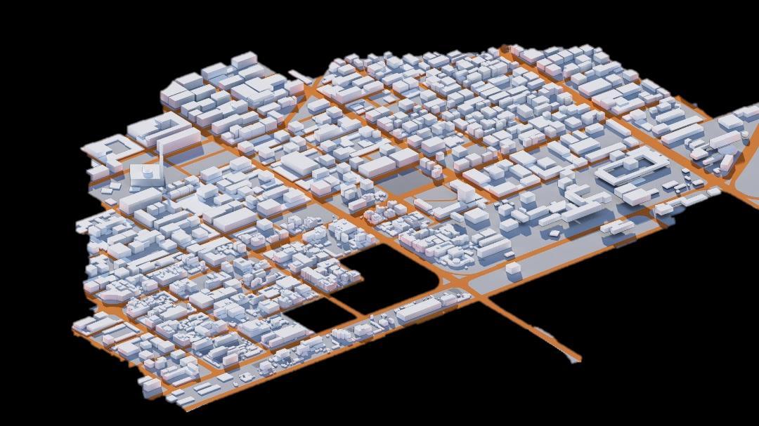
Thechangeoflanduse,comparedtothe past, from residential areas to commercial areas and institutions, and the reason for this change is that the social and economic situation of the country led to like this needs , also the urban growth that happened and expansion was a reason for this. The faculty of medicine, university of KhartoumandKhartoumhospitalwere A center from all over the country for treatment , the region had visitors and guests in large numbers, that refer to the changethatoccurred.. The population density increased as a result and with the emergence of horizontal and vertical urban expansion. in this figure the orange color represents high buildings and the violet color representslowbuildings. the red zone represent the high-density areawhichthecampusareincludeinit. . 03.3

03.2
Built and un built area:


The change of land use , compared to the past, from residential areas to commercial areas and institutions, and the reason for this change is that the social and economic situation of the country led to like this needs , also the urban growth that happened and expansion was a reason for this. The faculty of medicine, university of Khartoum and Khartoum hospital were A center from all over the country for treatment , the region had visitors and guests in large numbers, that refer to the change that occurred.


Medical CollegeStudents
Dental collegestudents

College of Pharmacystudents 4.8 DENSITY DISTRIBUTION 4.9

4.1 THE COMPUS GATES


4.2 MORPHOLOGY
4.3. GREEN COVERAGE


FACULTY OF PHARMACY
Total number of students = 700
Total number of Teachers = 60
FACULTY OF Dentistry
Total number of students = 811
Total number of Teachers = 61


• established as the College of Philadelphia in 1740, is one of the nine colonial colleges chartered before the U.S. Declaration of Independence.
• n the 1750s, roughly forty percent of Penn students needed lodging as they came from areas too far to commute including other colonies in the South or the West Indies
• In 1765, the campus was expanded by the opening of the newly completed dormitory run
• With respect to the desire to compete with peer institutions to attract students from across the nation. The campus was expands


• Half a century ago, when the university was threatening to relocate out-of-town to Chester County, the municipality offered generous use of
• urban renewal powers to raze adjacent AfroAmerican neighborhoods,
• As Penn’s campus grew more splendid it became an island of privilege in a sea of poverty.
• Problems of trespass and muggings,
• culminating in two highly publicized
• murders

• prompted a policy shift set out to realign the university with the needs of its immediate neighbors.
• Street re-openings, reorientation of building fronts and backs, retail developments large and small serving both campus and neighborhood
• bridges of connectivity
• Welcoming edge
• expand the university estate and enlarge the public realm of the city with parks and open spaces
• town-gown compacts
• community partnerships
• street corridors along campus edges
• general public encouragement to make the university a destination place16

• shift from a defensive, securitydriven enclave into an extrovert partner, regenerating its urban setting through spatial connectivity and practical collaboration
• Founded in 1943

• 1945 it became apparent that a university campus was necessary. For that reason, a master plan was commissioned to Enrique de la Mora and on February 3, 1947.
• on February 1, 1989, the first university ever connected to the Internet in both Latin America.
• Cities who compete for investment and jobs in a global marketplace have come to appreciate how a locally embedded university can enhance their productivity and competitiveness
• A desire to reintegrate hitherto discrete land use cells with the urban matrix has many parallels in the retail sector, transport planning and housing estates, but the theme of connectivity has particular resonance for higher education
• strong links with a host city facilitate
• knowledge transfer
• fluidity of the information creative symbiosis between region and campus depends on everyday encounter and shared lifestyle
• effect of the knowledgeeconomy is to break down conventional boundaries between campus and city. In the newest developments the two may be as
• intermixed


• expand the university estate and enlarge the public realm of the city with parks and open spaces
• town-gown compacts
• community partnerships
• street corridors along campus edges
• general public encouragement to make the university a destination place


DESIGN (Buildings Quality)
ifthenumberof(low):
• Over 7 DEMOLISH
• From3-7 MODIFIED OR PRESERVE
• 0-2 PRESERVE IT


FACED INWARD
SEPARATING HIGH CAPACITY
BOUNDARIES DESIGNED FOR IMPENETRABILITY
SEPARATING UNSAFETY
SUSTAINABILITY
SUSTAINABILITY
CONNECTIVITY MARKETING
KNOWLEDGE TRANSFER INFORMATION FLUIDITY
Plan for growth and On the other designing for communication networks Integrate present build into the existing Promote a pedestrian
QUALITYOF PLACE
SHARED LIFESTYLE internationali zation
SHARE IDENTITY
WALKABILITY
DESIGN FOR PEOPLE growth of community and unpredictable change hand, their interest in flexibility and growth, networks present and future needs and existing fabric sensitively pedestrian-friendly campus
Maintain the green character of the campus
Maintain the identity of campus neighborhoods and promote a sense of community
Build in an environmentally responsiblemanner EQUITABLE

Urban functions consist of the entirety of activities exercised within an urban area and across the space over which it extends. The study of urban functions makes it possible to characterize urban space and study its dynamics. Itincludes : (Communication – securityclimatic - comfort - relaxationpassive engagement - active engagement-discovery – variety).

Urbandensityisaterm
urban planning and design to refer to the of people inhabiting urbanizedarea.Assuch be distinguished from measures of population density. Urban density consideredanimportant in understanding campusesfunction.
3 . PERMEABILITY


Permeability or connectivity describes the extent to which urbanformspermit(orrestrict)the movementof people orvehiclesin differentdirections.

It means that the space accept functions and differentactivities;
usedin urban number a given suchitisto from other population density is importantfactor how space can to place


place identity mainly concerns the physical image and people’s perception with little emphasis on the degree of people-place association and the depth of meanings. Research in the realm of environmental psychology mostly connects place attachment to self and community identity and distinction.
For instance, Gasparini's (2004) research on place identity was conducted in Bilbao where the urban landscape is formed by a combination of modern and historical architecture. The findings of the research showed that both innovative design and built heritage contribute to the image and identity of the city equally, as perceived by the citizens and tourists.
Integrated urban planning is a modern planning approach close connected with the complex nature of the cities and the necessity of creating sustainable and resilient settlements. Research has shown that the implementation of integrated urban planning is directly connected to the socio-economic conditions, legal frameworks, technology, and professional and educational potentials of societies, which differ for each country. Research has shown, through concrete examples, that the practice of integrated planning is more prevalent in cities in EU countries than in postsocialist countries.

It means subjective incredibility and the significance of urban places; Sense of place is determined by personal experiences, social interactions, and identities.

legibility is the degree to which the designed features of the environment aid people in creating an effective mental image, or "cognitive map" of the spatial relationships withinabuilding,andthesubsequenteaseof wayfindingwithintheenvironment. These fiveelementswhenproperlydesigned and organized in space represent an assurance that the design is legible: Path, Edge,Landmark,District,andNodeasdefined byLynch. Paths:Streets,sidewalks,trails,and otherchannelsinwhichpeopletravel. 9. FLEXIBILITY


is the characterization of urban liveability as a human behavioural function that denotes the interaction between individuals and the environment.Inthissense,urbanliveabilityisauniquecaseofliveability atlargeandhasstrongtiestothenotionofurbanity.
The concept of flexibility in urbanism includes the following. Firstly, it reflects the conceptof dynamics, whichcanmake urban planning adapt to various changes in uncertain contexts. Secondly, it reflects the concept of coordination. One of the important features of urban planning is diversityandcomplexity.
Itmeansthatresidentsand citizens should be able to somehow “put their mark on the city", and own and personalize it to them in a way

It means the appropriateness of the visual character of the environment to the function of the meaning mentioned;

Itmeanstheeaseofphysicalinfluenceonvariouspartsoftheurbantexture.


Thediscussionandbrainstormingphaseis over with A set of strategies focus on the urban setting, the relationship with the campus, the built surraoundig, corridors of movement, and public spaces. The strategy takes integrating with the environment very seriously. The general idea focuses on making the most of urban opportunities around the campus and developing them for the benefit of the student community and citizens. Buildings: The strategy focuses on protecting the cultural heritage of the (old) building and reusing it as a cultural building open to the public. Creating a visual identity for the buildings that act as an urban pattern for the campus.``
The interventions included the urban perimeter of the university, Al-Qasir Street, ARMY Street and Al-Jamie Street. It was developed by reusing the street as a public space. In order to revive the streets and solve the problemofsafety. Paths and realm The corridors are designed in the direction of improving accessibility, eligibility, physical and human permeability in different layers.

Interventions at the level of public and open spaces on different layers with mixed, flexible and varied uses. It changesbasedonstudents'needs.


7.Inhancepermeability
6.Public space in deferentlayersof campus
5. Develop visual permeabilitybetween Campuscluster.
Orientation enhance for some blokes by lofted upfromtheground
1.clusterformation
Setout the needs of campus

2. Addnewblocks
Creating enclosure between campus part
3. Identify cluster orientation ,shape and linkage


4. Create interaction betweencluster. Develop linkage with the campus part by creating a pocketthroughtheclusters


Path 1. is on the ground level connecting the campus with multi aspect, one is as paths in the campusandsecondasconnecting paths the surrounding with the campus integrating the city around the campus with the rest of the campus , making a place more comfortable to the users frominandoutthecampus.
Path 2. is on higher level (lifted path ) connecting the campus with each other parts and to make an public spaces on lifted level to have a good distribution ofexperiencesinthecampus.
The public spaces consist of a network of corridors that form nodes The network has been developed to provide connectivity The node contains a range of
and


Al Qasr street redesigning >> the strategy was to divide it into 3 part : the pedestrian area at edges ( making walking path and seating area ) , parking lane and the activities on puffer space Linking the street node with pedestrian movement
Reviving the commercial and service activity alongthe street


The public space area which defined by the network of paths and nodes . Each nodes with green area & having interventions various activities . The paths through the green area are designed to establish continuity with campus paths network to provide the permeability through the public space and the paths in the campus .


building is more interaction the rest of the campus and public space area

Equity experience


More safety in the street for each pedestrian and the car movement .
Liking the two part of the campus with lifted path to cross the street
The public space area I the other part of the campus is into multi layers and having interaction with building and the facilities around it


Accessibility
Alternative circulation patterns in many layers the ground levels paths and the lifted paths showing as orange paths , connecting the over all campus together With Ground floor usage and transparency the lifted path users are allocated for only the academicals users

Permeability
the paths more defined . Context of the public space enclosure of the open spaces.
Focal point >> the intersection between paths create different nodes, that have multiactivity. and creating magnet point leading to more identity of the campus .


Multi-functionality >>
The public plaza in the west of the campus , the main public space nodes are acting as multifunctional activities experiences .
Propose Activity programming that adaptive, flexible and can respond to user need >>
Academically
Cultural
Social


Thank you