URBAN PLANNING / URBAN DESIGN SELECTED PROJECTS

OKSANA
VESELKOVA
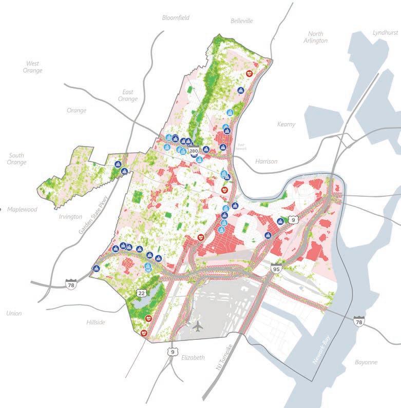
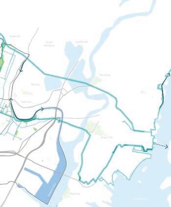
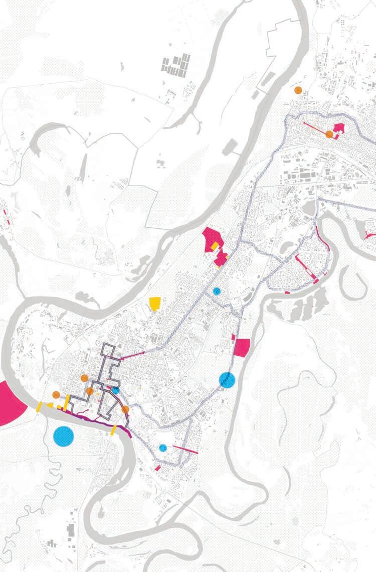
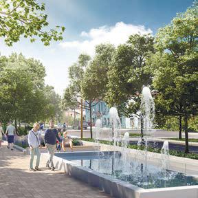
The new city Masterplan reflects the community values and goals to be followed the upcoming decade. Our objective was to incorporate state-of-art knowledge, social equity principles, and climate resilience approach to provide a clear set of planning policies. Those include flood and urban heat island risk mitigation with green infrastructure, dedicated areas for reforestation, tree buffers, coastal perimeter solutions, water retention facilities, and other resilience solutions. We also developed a network of green connectors feeding into the regional bike and walkability framework. This solution meets dual goals of enhancing social welfare and improving the air quality by reducing traffic and increasing city green areas.
Resiliency Strategies
Green Infrastructure Corridors
Proposed Greenways
Complete Green Infrastructure Projects
Future Green Infrastructure Projects
Wetland Restoration/Living Shoreline
Coastal Alignments
Underground Conveyance
Overland Conveyance
Retention Storage Sites
Potential Resiliency Hub
Portfolio. Oksana Veselkova
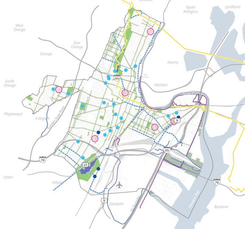
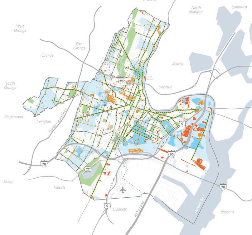
Green Infrastructure and Permeability
Primary Green Infrastructure Corridor
Secondary Green Infrastructure Corridor
Tertiary Green Infrastructure Corridor
Socially Vulnerable Areas of High Heat and Lack of Access to Green Areas
Areas of No Access to Green Space
Publicly Owned Impervious Surfaces
Impervious Surface on Vacant Lots
Expanding regional connectivity and recreation networks
FIGUrE 81 Areas of Priority for Permeability
Source. City of New Jersey, Resilient New Jersey
Impermeable surfaces in Newark strongly correlate with areas of social vulnerability and lack of access to green areas. De-paving the city's parking lots, wide corridors, and other impervious surfaces should target underserved and under-greened neighborhoods first.
Critical infrastructure and Vulnerability Areas
Childcare Centers Schools
Hospital-Medical Centers
Polluting Infrastructure
Socially Vulnerable Areas of High Heat and Lack of Access to Green Areas
Areas of No Access to Green Space
Air Quality Buffer for Highways Tree Canopy
Development - 2022
Team - One Architecture & Urbanism
Scope of works - policy and GIS analysis, vulnerability assessment, case-study, mapping, writing report
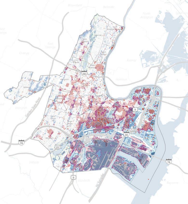
Climate vulnerabilty assessment and climate resilience chapter of the final masterplan for Newark, NJ will guide the city adaptation and mitigation actions. The Newarkers face considerable social, environmental, and economic challenges in the aftermath of hurricane Sandy with over 1/3 of the area exposed to rainfall areal, rainfall flash, tidal, and storm surge flood risks. On the other hand, proliferation of impervious surfaces and major regional transportation infrastructure cause the urban heat island effect adversely affectin socially vulnerable communities. We provided spatially explicit analysis to facilitate decisionmaking and prioritize communities` and assets` adaptation policies.
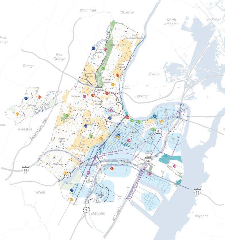
Vulnerability of critical assets75
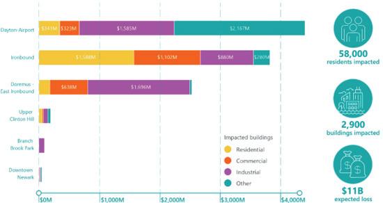
Priority assets
Infrastructure
Emergency response
Public health
Quality of life
Parks
Flood protection
Critical assets
Infrastructure
Emergency response
Public health
Quality of life
Parks
Priority parks (per RNJ ranking)
Flood protection
Light commuter rail
Repeated flooded rail lines
Repeated flooded streets
Natural gas pipelines
Transmission lines
Vulnerable areas
Socially vulnerable (SVI over 95%)
Economically vulnerable (>500M$/sqm projected losses-2070)
High vulnerability areas
Urban heat island effect
Extreme heat areas over
Extreme heat areas over Heat impacted areas without access to green space
Modeled flood impacts
Tidal flood extent (MHHW levels-projected 2070)
Coastal flood extent (Superstorm Sandymodeled 2070)
Flash flood extent (2%, 2hr rainfall eventmodeled current)
Areal flood extent (1%, 24hr rainfall eventmodeled current)
Known contaminated sites
Moderate
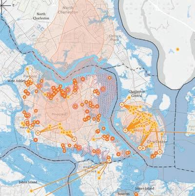
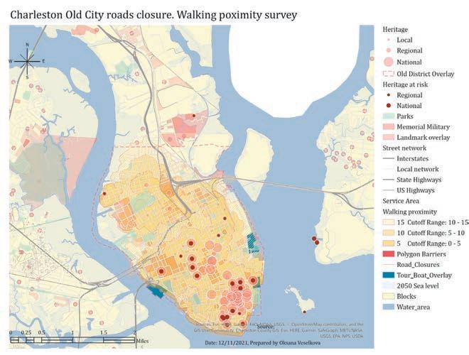
The GIS research project uses open data to explore Charleston county through the framework of the United Nations Sustainable development goals, particularly SDG 11 Sustainable cities and communities. The areas at risk are chosen according to SLR data projections for 2050. The first step determines whether the African American community is exposed to more risks from the sea level rise. Using Cluster-outlier analysis shows relatively equal risks, at the same time building Kernel density model for exploring poor communities showed several areas of the most urgent resettlement. The last step tested the idea of transportation restriction in the historical sites to reduce the subsidense keeping the heritage attraction points in walking proximity.
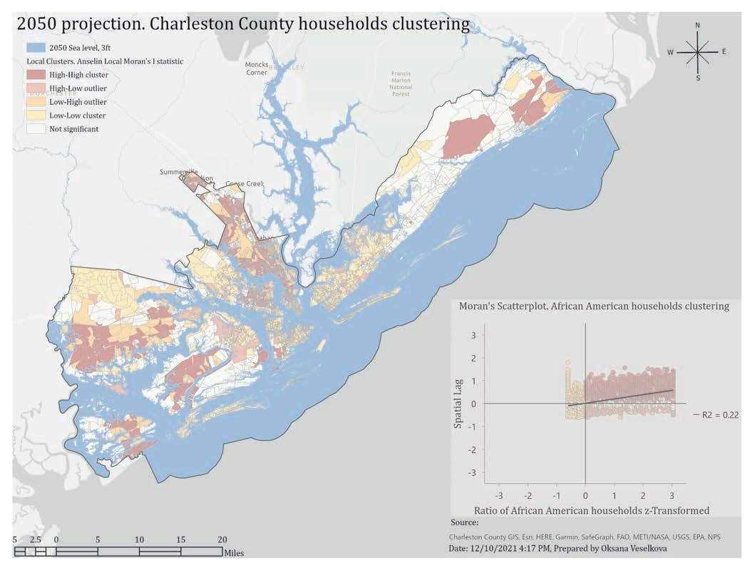
Environmental equity: higher poverty areas at the areas of sea level rise projections - 2050
Location-allocation model for the resettlement of communities at risk
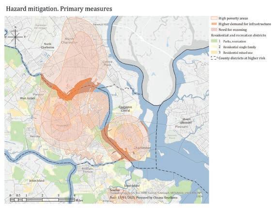
Survey area analysis for the traffic closure of the old city streets and pedestrian proximity of the historical points of attraction
Coursework - 2021
Institution - Clemson University
Scope of works - research hypothesis, data collection and analysis, quantitative analysis, analytical report
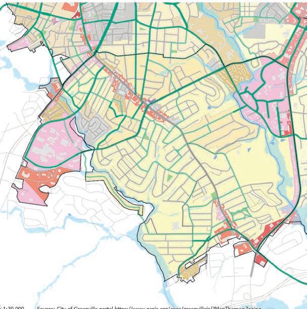
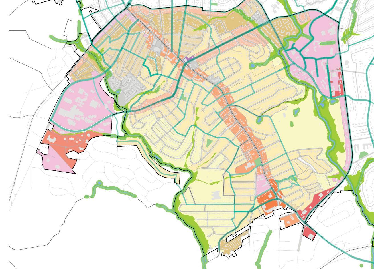
The Augusta Road area zoning pursues a set of goals following the Greenville city comprehensive plan: enterprising, resourceful, inclusive, and courageous city expressed in the objectives of vacant land preservation, affordable housing integration, safe and diverse mobility corridors (GLV 2040, p. 26). The environmentally focused Zoning ordnance aims to achieve a comprehensive model of sustainable development for the historical district of a rapidly growing city. The new land-use categories are created to implement a broader range of sustainable development policies providing safety, environmental quality, and the general welfare in accordance with the Greenville Comprehensive Plan. They include mixed-use and recreational districts comprising TOD and preservation tools.
Coursework - 2021
Institution - Clemson University
Scope of works - environmental planning policies analysis, field study, vision, zoning ordinance amendment, explanation, GIS analysis.
Parks, recreation, and open spaces
single-family residential multifamily residential office district planned development commertial light mixed use corridor mixed use gateway mixed use
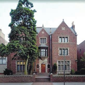
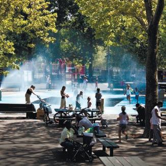
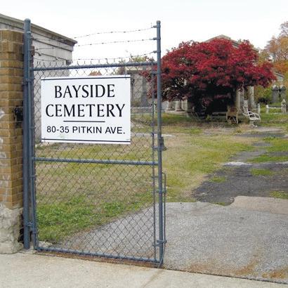
The Lubavitch community in Queens attracts thousands of pilgrims yearly. The main attraction points for the followers of Menachem Mendel Schneerson are two locations in New York City: the Rebbe’s burial site at Montefiore Cemetery and his home at 770 Eastern Parkway. These two points should be connected by a pedestrian and tranport route comprising intermediate points of interest. It includes the section of East-New York and Liberty Avenues, Rockaway, Fok and Merrick Boulevards, 120 and 121 Avenues. The track is based on walking activity index, noise level and safety data.
Portfolio. Oksana Veselkova
Responsibilities - project management, team leadership, social survey and GIS analysis supervision, vision, community participation, presentations to client.
Design principles include mixed-use development to create a multifunctional space for diversified communities; comfortable accommodation and service conditions for pilgrimage and cultural tourism; open knowledge, sharing Jewish culture with various categories of visitors; The memory center becomes a platform for interaction between residents and members of the Chabad-Lubavich community. The Cambria Heights area is dominated by single-family houses, lacking public facilities. One of the main objectives of the multifunctional center is to create a cultural space where the visitor could know the Rebbe better and immerse himself in Jewish culture in general. The center combines traditions of the Chabad culture and the Rebbe’s approach - openness, transparency, acceptance.
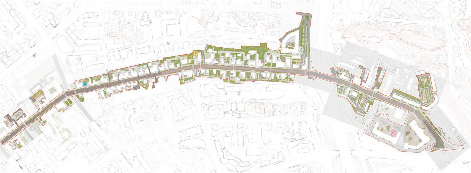
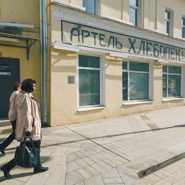
The medium- and short-term development program for the city of Ufa’s new comprehensive plan implementation comprises six priority sub-programs. One of the priorities is the sustainable development of the Belaya River embankment. The area will become the central water promenade while restoring the natural values and ecosystems. The public cultural facilities will be connected with pedestrian and bicycle lanes. A modern approach to urban development includes adapting heritage sites to new uses based on the social and market survey. The economic tools for this transition include federal co-funding and investment passports for the historical objects. New educational and community centers will serve as a driver for the social activity of citizens and involvement in positive citywide changes.
Belaya embankment (3,3 km)
Leisure facilities

Social centers and facilities
Heritage buildings adaptive reuse
Public spaces network
На территории Старой Уфы больше всего сохранившейся деревянной
застройки и древнейших зданий Уфы. Здесь появятся места отдыха, характерные для исторической среды палисадники и цветники. Дворы
будут развивать музейные функции. В частности, в Доме Демидова появится культурный центр, выставочные пространства и кафе.
Central routes (10 km of connected walking friendly streets, 75 km of bike lanes)
Responsibilities - project management, team leadership, social survey and GIS analysis supervision, vision, community participation, presentations to client, public presentation to the community, contract drafting. Features - The project vision connects all cultural attractions of the historical center and benefits all city communities

Октябрьской Революции развивается в соответствии с запросом на активизацию общественных пространств,
Зона «торгового променада» включает в себя территорию от ул.
Цюрупы до ул. Новомостовой. Это пространство задействует уличный
фронт прилегающей застройки и наполняется новыми зонами отдыха и активности. Так, на площади у Спасского храма появится кафе-трапезная и площадь для отдыха с сигнацией утраченного крыла храма.
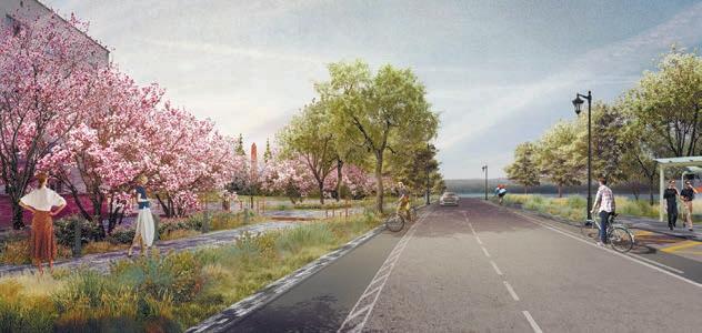
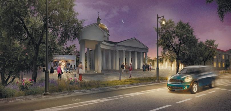
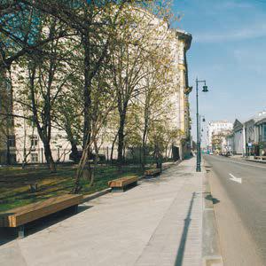
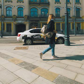
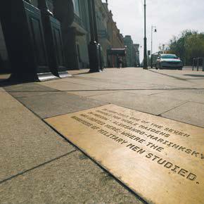
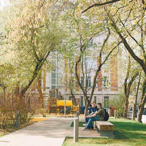
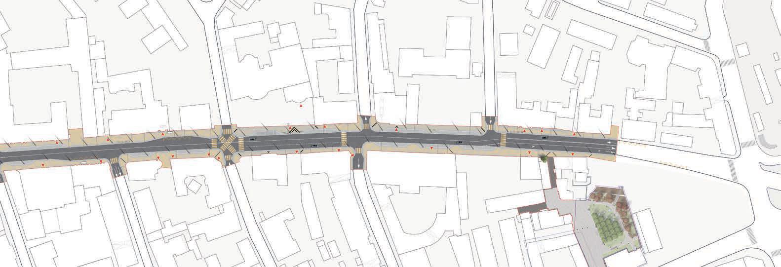
Ufa citizens’ vision of this historical street future is the main walking promenade in the city center, the central touristic district of Ufa, and an open-air museum. The project includes comfortable pedestrian spaces, information navigation, and new centers of attraction in the adjacent historical buildings to achieve this goal. Courtyard spaces are also reconsidered for public and commercial scenarios. Transport solutions include the reduction of car lanes, comfortable bus stop pavilions, bike paths, and elevated pedestrian crossings for increased safety on the street.
На месте исторического Уфимского кремля появится просторная пешеходная зона. Места исторического расположения стен Кремля будут выделены другим мощением, а также появятся цветущие яблоневые аллеи. Этот участок ведет к амфитеатру на набережной р. Белой и Монументу Дружбы, поэтому здесь появятся более широкие тротуары и туристский информационный центр на пересечении пешеходных потоков.

Многофункциональный квартал (владение 78) учитывает комфорт, пользовательский опыт и поведенческие сценарии будущих комфорт благодаря повышению общественных площадей на каждого жителя и качественного благоустройства участка. Соблюдение позволяет гармонично интегрировать комплекс в исторический контекст. Участок, расположенный на улице Октябрьской Революции, с обновленной набережной реки Белой. Туристические сервисы в первых этажах дополнят и оживят улицу, а надземный
Development - 2020 - 2021
Construction - 2022 - 2024
Team - Moscow Urban Center
Responsibilities - project management, team leadership, social survey and GIS analysis supervision, vision, community participation, presentations to client, public presentation to the community, contract drafting, schematic design, design development, cost estimations.
Features - Reconstruction and revitalization of the oldest street in the city, heritage adaptive reuse
2 km of dedicated bicycle lanes
32 new facilities in the renovated historical buildings,
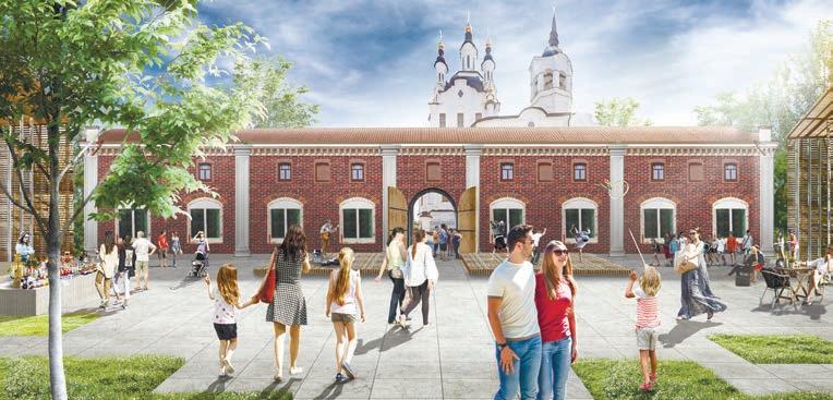
ВИЗУАЛИЗАЦИИ.
УФИМСКИЙ КРЕМЛЬ, АЛЛЕЯ К НАБЕРЕЖНОЙ
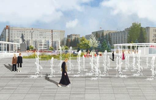
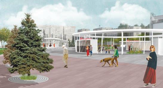
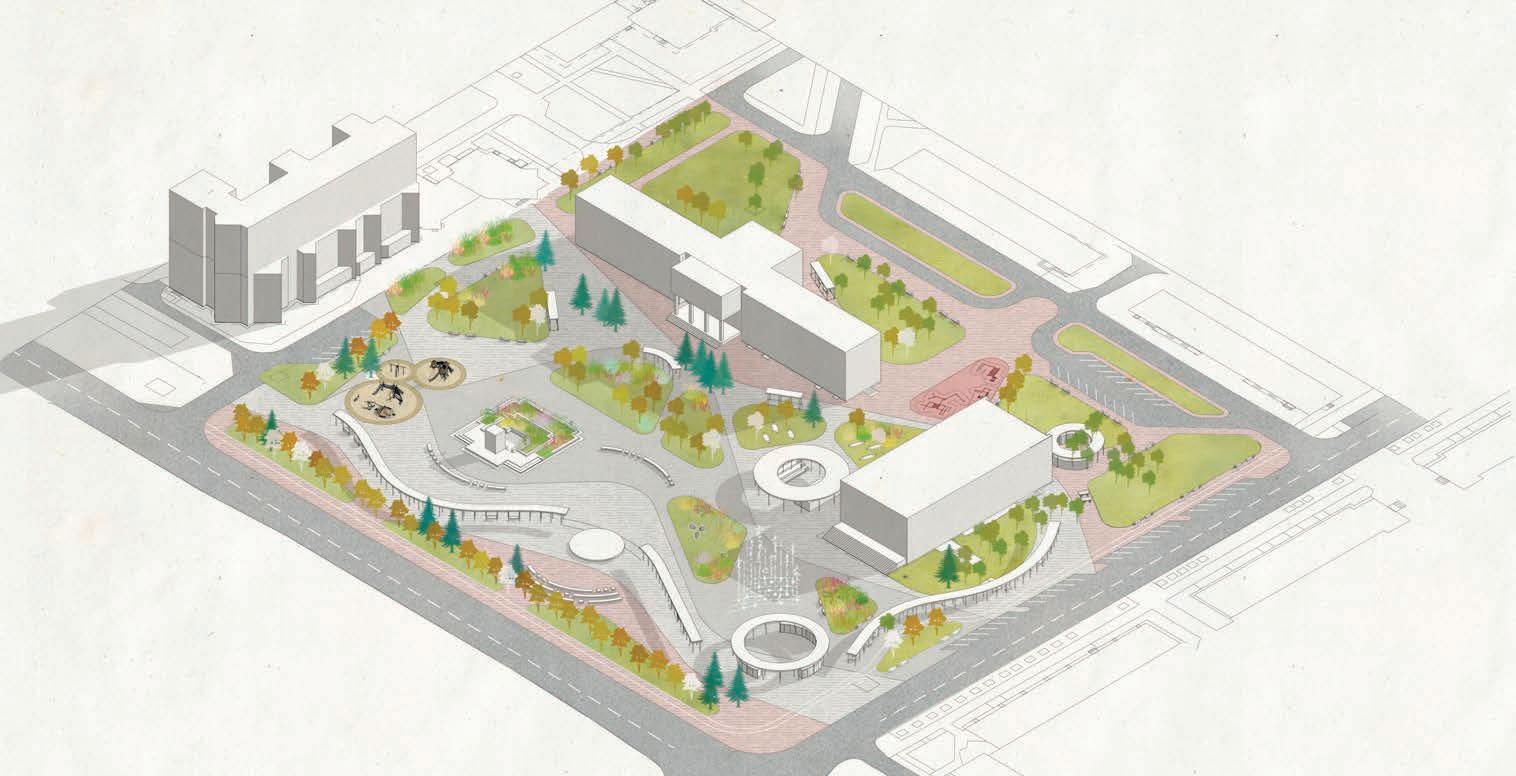
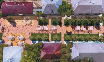
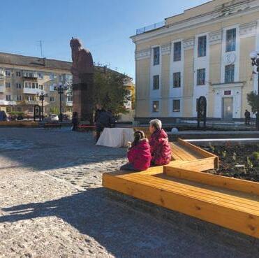
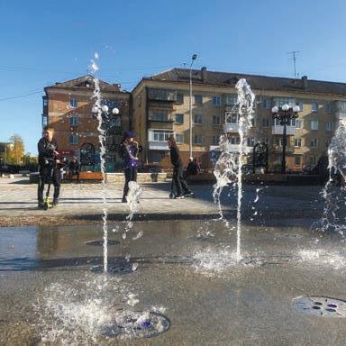
Lenin Square is a central public space in the small town of Kstovo. Despite its soviet rigid structure, citizens love the place and visit it in different everyday scenarios. The project aims at unleashing its potential for cultural events, recreational activities, and public participation. An important task here is rethinking the city symbolsstrawberry (the origin of the town’s name), the waves of the Volga river, and cinematographic episodes shot in the square. The project balances the controversial community requests for quiet recreation spaces and cultural and leisure activities. The square’s main program elements are diverse landscaping of concrete impermeable surfaces, creative and education areas, summer cinema, marketplace, recreation, and activity sites. The tree linings and wave-traced paths organize all these uses within one community space.
Development - 2021
Construction - 2022
Team - Moscow Urban Center
Responsibilities - project management, team leadership, social survey and GIS analysis supervision, vision, community participation, presentations to client, contract drafting, cost estimations. Features - won the federal grant for the realization
Development - 2019
Construction - 2020
Team - Moscow Urban Center
Responsibilities - project management, team leadership, social survey and GIS analysis supervision, vision, schematic design, presentations to client, contract drafting, cost estimations.
Features - 1st place among all russian regions in the category of the towns 50 000-100 000 population.
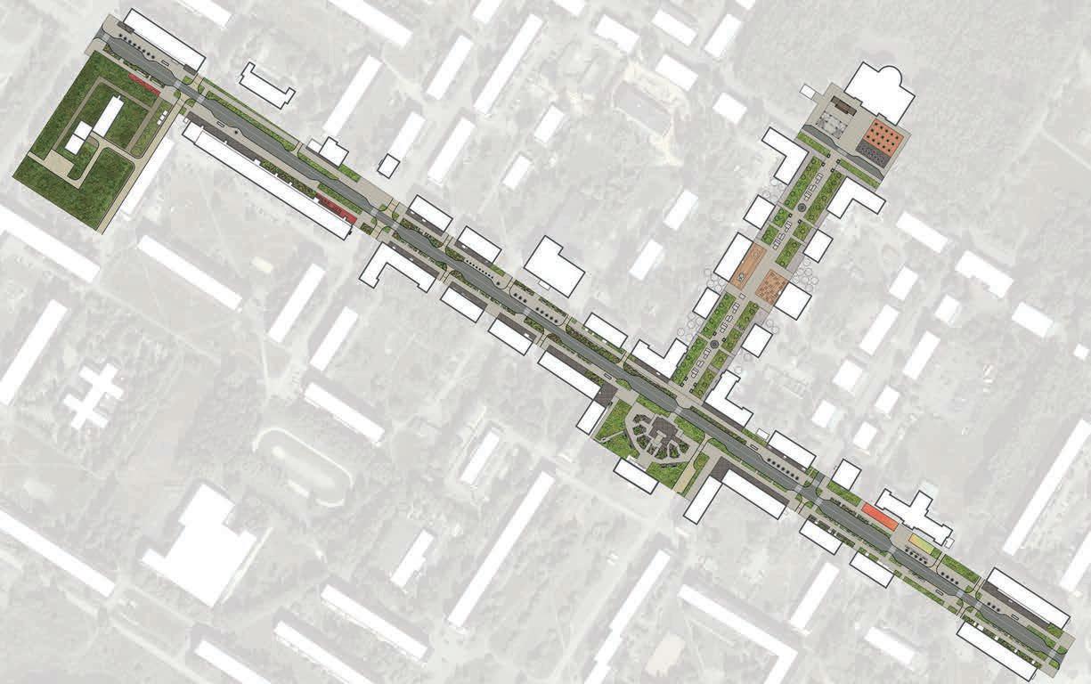
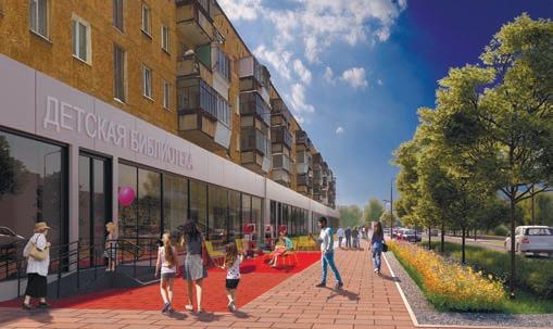
Polevskoy is one of the critical centers of the metal industry of Sverdlovsk in the Ural region. It is also the motherland of a children’s writer Bazhov, and numerous cultural facilities for childcare and education. The city community had chosen the territory of st. Karl Marx, pl. Bazhova, and st. Trojan for the priority revitalization. The space becomes the Alley of the Ural craftsmen, with street expositions and platforms for local entrepreneurship. New pocket parks and tree linings are being created to introduce a greener and more sustainable area environment. The spatial accents of the site are a unique event platform in front of the Cultural Center and the pedestrian promenade with a vernissage and shopping pavilions along the adjacent Trojan street.
Street retail and public facilities

Summer terraces and outdoor sites
Retail pavillions
Main promenade
Cultural activity
Festive cultural activity
Childcare center and primary school
следующие категории:
Студенты (педагогический институт, мед.колледж, колледжа культуры)
―Спортивные, женские объединения
Представители учреждений культуры, учителя, творческая молодежь
―Предприниматели Представители объединения людей с ограниченными возможностями ―Сотрудники крупных компаний
Проблемы территории по мнению жителей
Исторический и туристический потенциал территории раскрыт Неблагоустроенное место: нет освещения, плохие покрытия, мало озеленения; нет уличной мебели объектов общественного питания, которые бы позволили задержаться в этом месте общественного туалета, поэтому общественный туалет – сама площадь Достоинства территории по мнению жителей Расположение в исторической части города: близость с Кремлем ―История места Может стать важной точкой туристического маршрута городу ―Уникальный ландшафт
Развивающая площадка для подростков:
― Восстановить исторические постройки, наполнить
их современным функционалом:
•Пивоварня
•Прокат коньков в зимнее время, туристический центр
•Фермерские ряды
•Мастерские
•Трапезная и общепит
―Восстановить историческое покрытие площади
―Залить каток
―В заброшенном саду обустроить зону отдыха
―Инсталляция: раскопки старого города под стеклом
Визуализация. Вид на ул. Мира Вдоль ул. Мира организуются пешеходные тротуары, а также предусматривается буферная зона между пешеходной и автомобильной частью в виде плотной высадки кустарников.
Eco-parking lots (permeable pavement, trees)
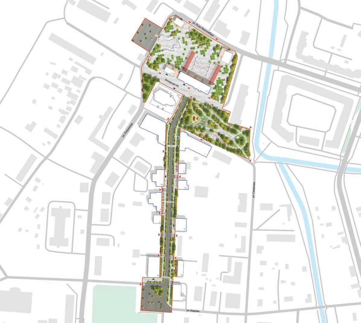
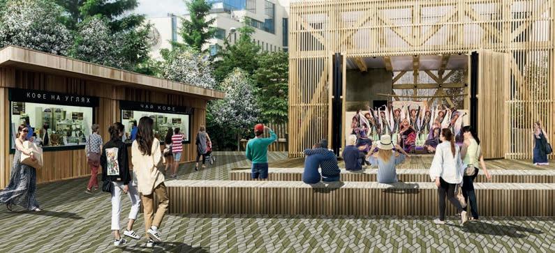
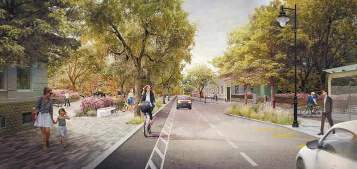
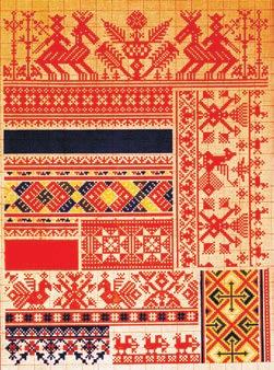
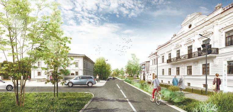
Tobolsk historically was a significant outpost in Russian Siberia. The old city market (Bazarnaya) square, Mira street, and the adjacent park were chosen by citizens as a priority revitalization site. The site connects lower districts with the Tobolsk Kremlin. The revitalization vision aims to bring the initial meaning of public meeting places to these areas. The connected city route includes the new general program of the historic buildings along the street leading to the city fair. There will be traditional and modern cultural and retail facilities, outdoor workshops, and temporary summer terraces. The parks and museums of the lower part of the city will connect to the points of attraction of the upland region. The new commercial activity on the street will encourage the development of the surrounding areas and allow investment in the heritage restoration, gradually bringing the historical character to the place.
Использование тематики западно-сибирского орнамента в оформлении и мощении площади позволит создать уникальный образ и придать территории идентичность в восприятии пользователями.
33
и активного отдыха, предусматривается размещение интегрированной песочницы, а также детских игровых элементов. Дорожки выполнены бетонной плиткой и гравийным отсевом. Проектом предлагается организация кольцевого маршрута
Development - 2019
Construction - 2021
Team - Moscow Urban Center
Responsibilities - team leadership, social survey and GIS analysis supervision, community participation, vision, schematic design, presentations to client, cost estimations.
Features - won the federal grant for the realisation in the category of the towns 50 000-100 000 population.
Комбинирование регулярной исторической планировки в структуре основных аллей и свободной дорожнотропиночной сети второстепенных маршрутов позволяет сделать сад проницаемым и грамотно разместить спокойного и активного отдыха. Организация площадок для воркшопов и сигнация исторического пруда зоны
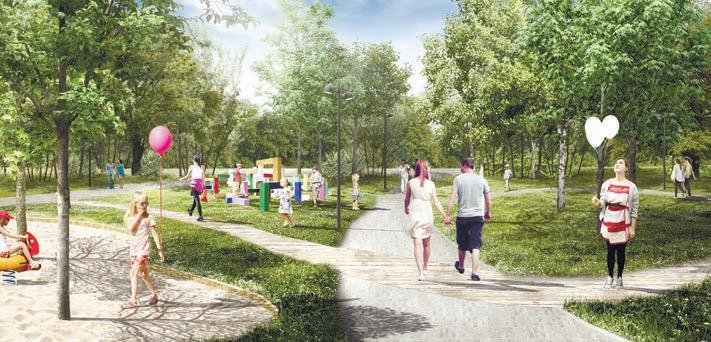
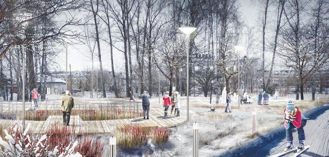
Aptekarsky Garden is located in the upper city district, walking distance from Tobolsk Kremlin. The place was used for growing medicinal plants next to the hospital. In 2018, My Territory creative center was opened for community cultural events in the garden. Besides the historical significance of the territory, the project aims at the community activities support. The info boards show the history of the place, ecological material of pavement and street furniture, indigenous plants, and rainfall gardens - all these elements allow the sustainable development of the park. Commercial and public facilities are incorporated within the park structure as recreational pavilions and new functions of surrounding buildings.
Playgrounds
Workout, sports grounds
Team - Moscow Urban Center
Responsibilities - team leadership, social survey and GIS analysis supervision, community participation, vision, schematic design, presentations to client, cost estimations. Features - won the federal grant for the realisation in the category of the towns 50 000-100 000 population.
Eco-parking lots
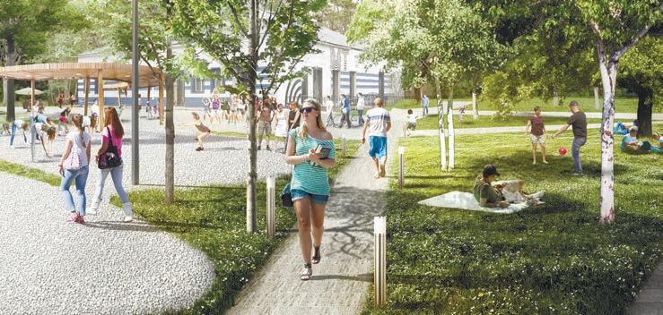
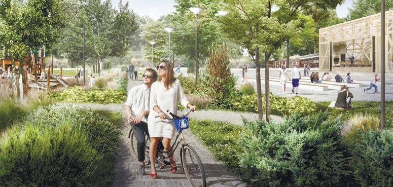
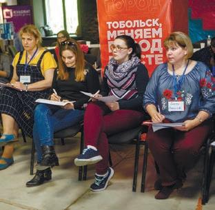
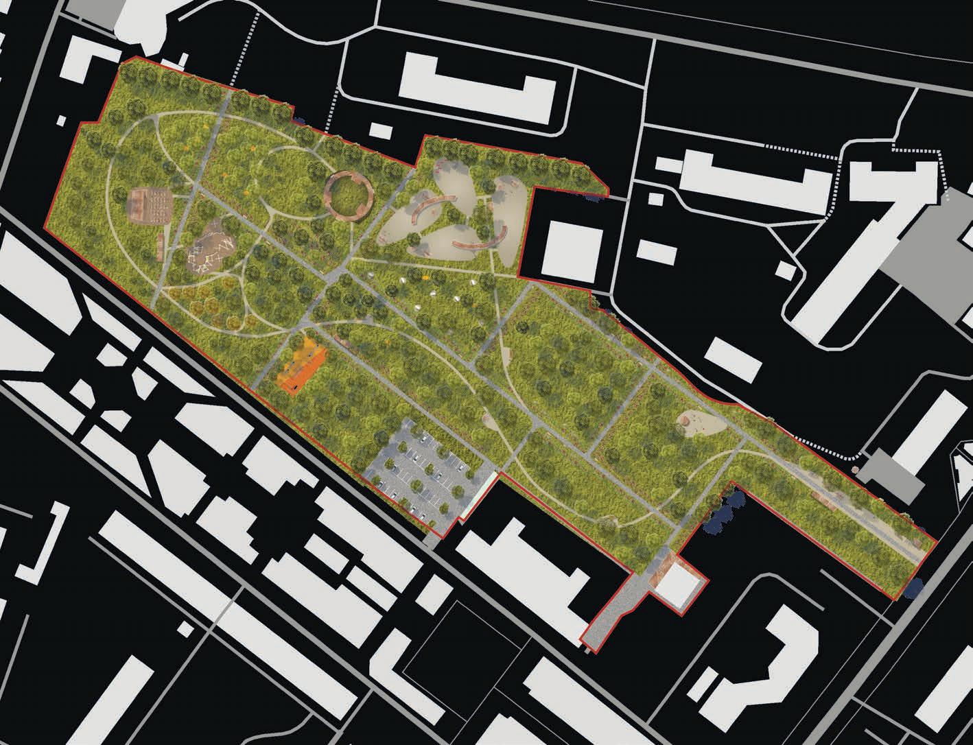
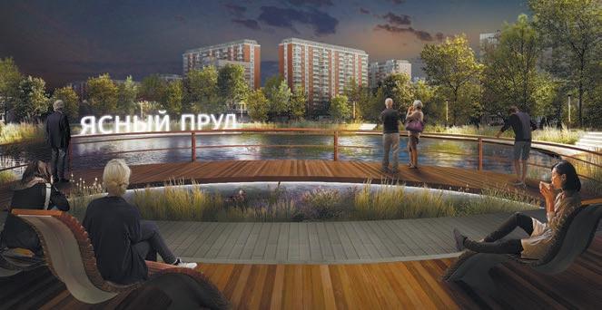
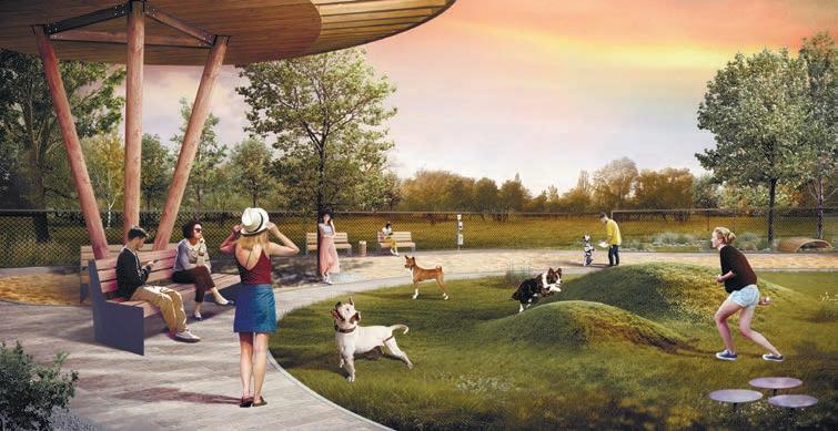
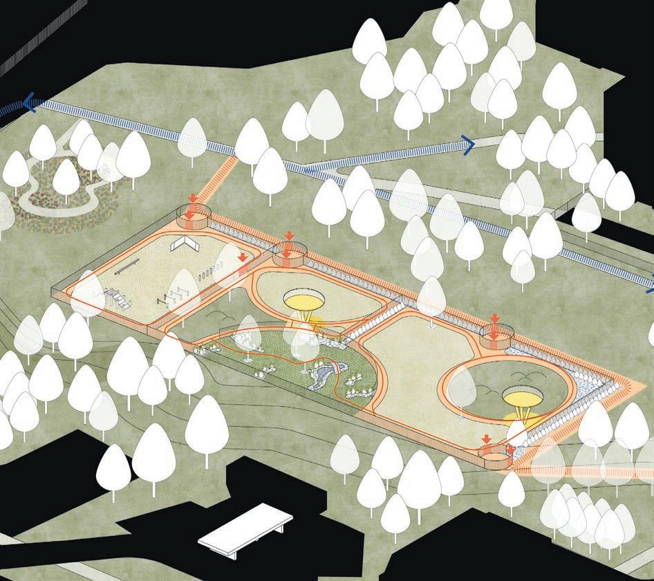
The research and design project commissioned by The Agency of the communities development aims to create quality public spaces for local communities in each of 146 Moscow districts. The constant growth of city center magnitude caused social disbalance, street congestion, and other issues exacerbated with the COVID-19 pandemic. The research methods used to prioritize districts to address the issue include community surveys, transportation, pedestrian analysis, field study, and GIS analysis of facilities. The work embraced the priority sites’ research, targeting, and conceptual design development.
Предусмотрены разнообразные знаковые точки вдоль набережной: смотровые площадки с видом на артобъекты, мостики с озеленением, амфитеатры на склонах с видовыми точками. Все они формируют новые форматы взаимодействия с водным объектом.
Скверы у воды будут оборудованы детскими и спортивными площадками, которые можно использовать круглый год.
ИДЕНТИЧНОСТЬ
Природные особенности и современные проектные решения: навигационные элементы, дизайн покрытий и малых архитектурных форм создадут уникальный образ места.
ДОСТУП К ВОДЕ ДЛЯ ВСЕХ
Проектом предусмотрено
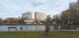
Responsibilities - project management, team leadership, social survey and GIS analysis supervision, vision, presentations to client, contract drafting, cost estimations. Features - covered all 146 districts of Moscow, inventroduced the typology of dog walking parks
Development - 2020
Construction - 2021
Team - Moscow Urban Center
Responsibilities - project management, GIS-analysis, social survey, vision, presentations to client.


Features - the whole design process including cost estimation and the assistance in fund-raising was made on the voluntary basis as a contribution to national memory and cultural progress.
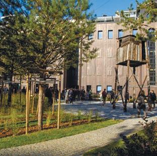
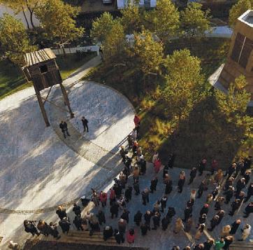
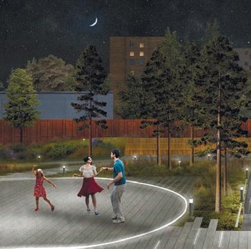

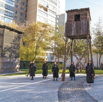
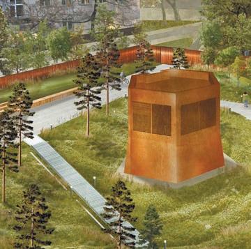
GULAG museum is a network of 36 memorial centers and institutions connecting and supporting the countless families affected by Stalin’s totalitarian regime and repressions. The museum keeps archive materials from the prison camps spread around the Russian North. The central point - the Moscow museum of GULAG - initiated the organization of the outdoor site for the museum collection and cultural events. The site, situated in Moscow interim zone (districts between downtown and periphery), was designed to consider surrounding communities. The social survey, mobility, and activities analysis helped shape the site program compatible with the museum plans and community needs. The idea of a memorial garden also provided fertile ground for pines, birches, and other trees from the camps, environmentally expanding the memory.
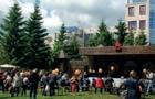
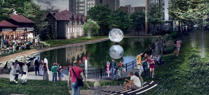
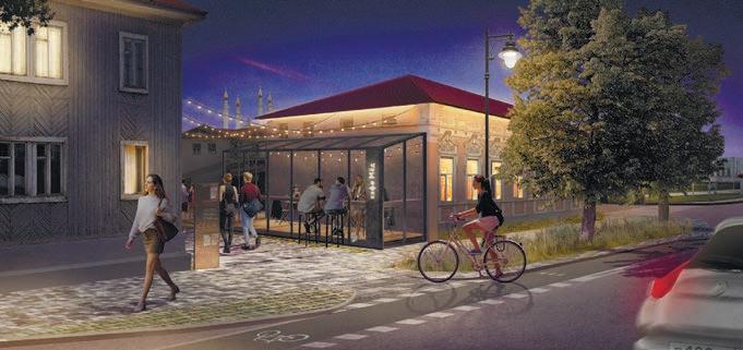
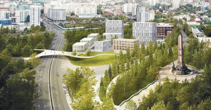
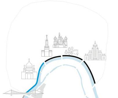
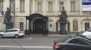
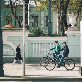
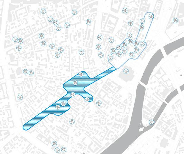
The project’s main idea is to connect 47 museums in the district with the connected pedestrian route. The route connects the area with the adjacent «museum quarter» of Pushkin state museum (the construction is in progress). One of the project goals was the activation of predominantly business real estate district «Golden Mile» area and the creation of a new spatial typology within the courtyards, aiming to increase the permeability of the territory.
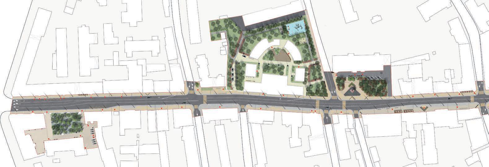
The diversification of scenarios was achieved through the research-based balancing of the automobile vs. pedestrian space of the street. The conceptual
design of the road, especially of its landmark spaces, was elaborated with thecommunities involvement. The historical. «museum» character of space was emphasized with the expanded sidewalks in front of the leading architectural dominants and cultural facilities. Underfoot, one peculiar detail is the «cheat sheets» for the tourist guides and curious passers-by. The content of short stories on the tiles was selected from the literature about the history of Prechistenka street or old Moscow.
Places for summer terraces and tourist groups
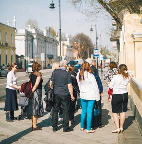
Responsibilities - team leader from the research to the construction supervision stages, field study, community participation, vision, conceptual design, design development, supervision, problem solving, presentation to the client. Features - organization and conducting participatory planning with communities, businesses and authorities before the officially required participation method was introduced .
New central business square with a rainwater scenic pond and public decks
Smaller local squares for summer terraces
Responsibilities - team leader, field study, community involvement, research supervision, vision, conceptual design, presentation to the client. Features - successful experience of international collaboration on the sustainable design of public spaces

Red oak alleys and herbal planting in flowerbeds
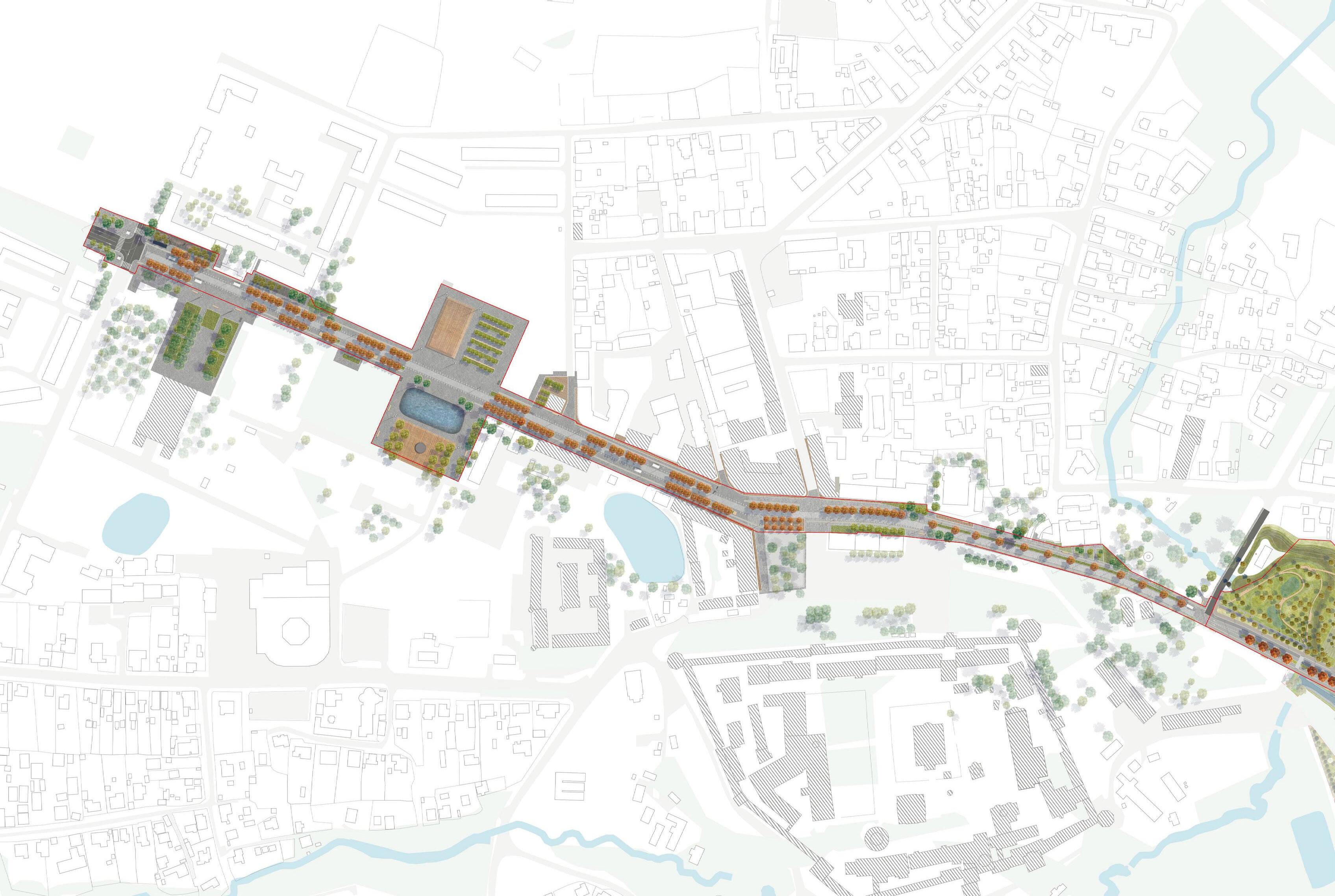
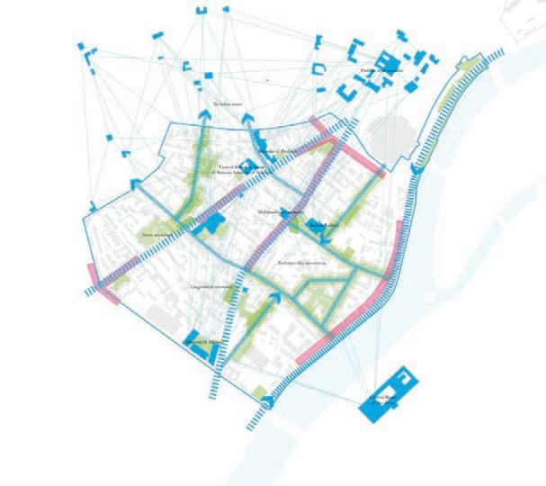
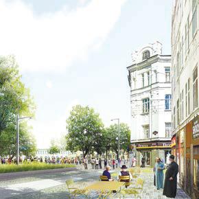
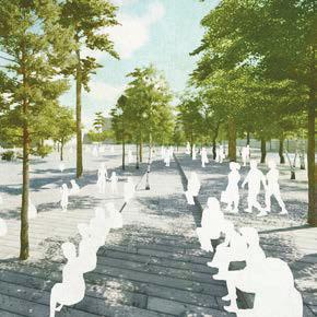
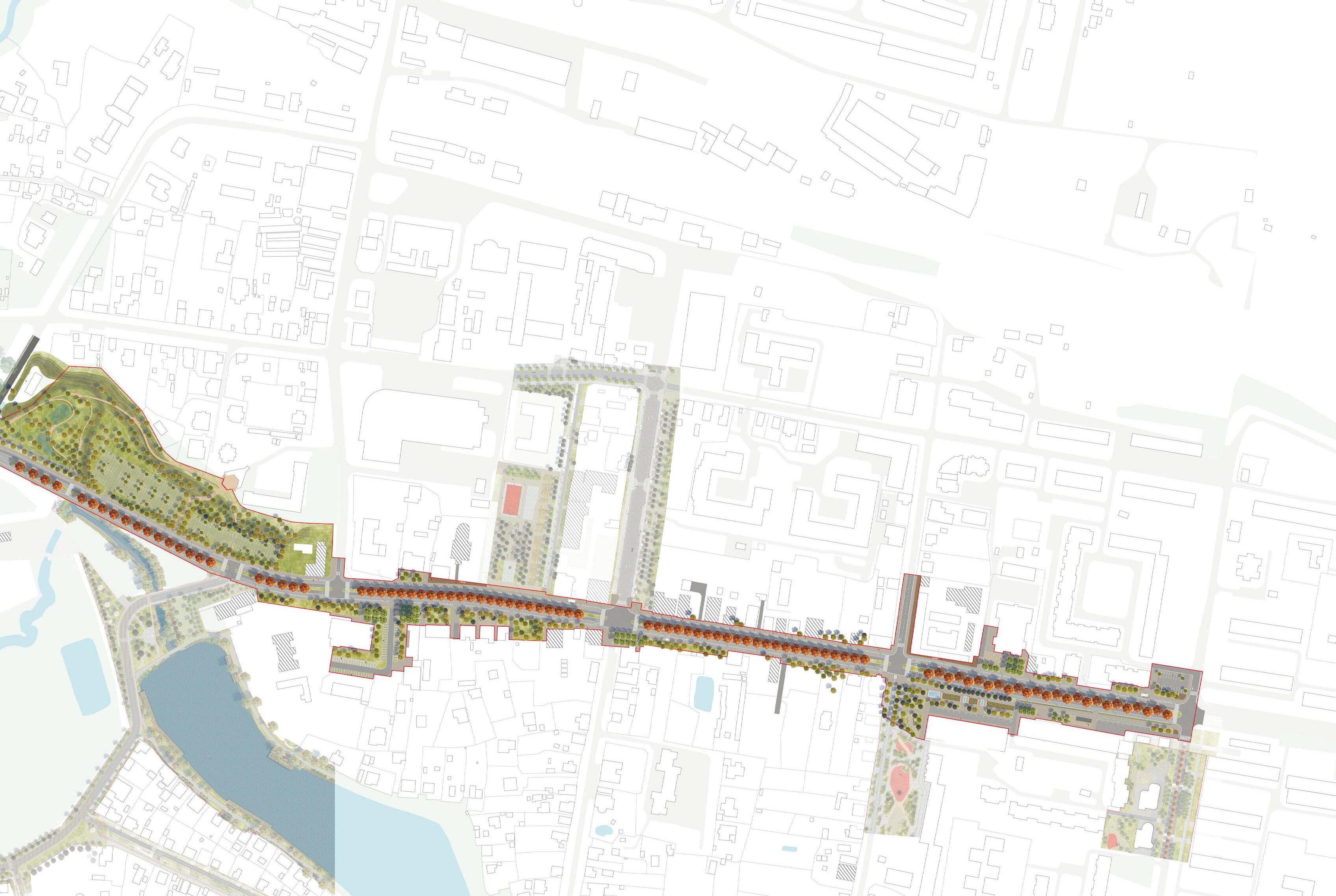
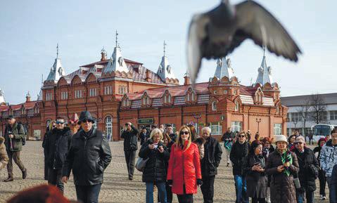
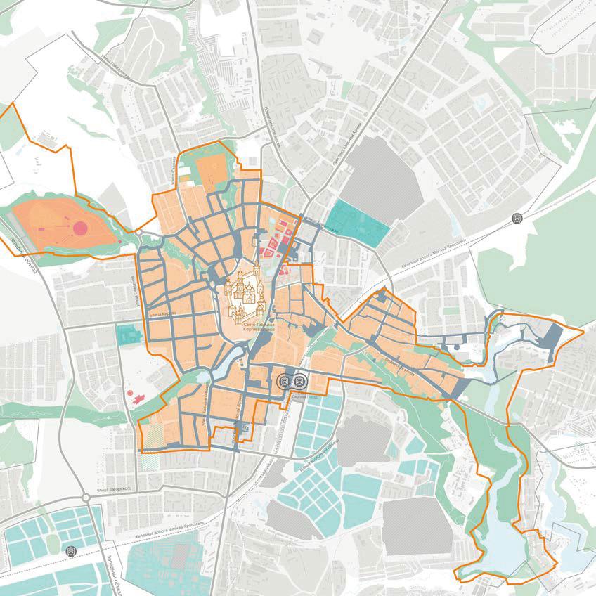
The strategy of spatial city development - 2025 is a comprehensive project comprising masterplan, form-based code, and public spaces design development. A vision and conceptual design for the historical part of the city public spaces was based on ethnographical research and social survey. The historical, thematic settlements of manufacturers or the other primary ideological and practical meanings of places have formed the local brand identity. In particular, a concept developed for the Krasnaya Armiya Avenue as the main city boulevard utilizes a red oak as the main symbol of pilgrims’ way to the shrine.
The project in general - proposing Sergiev Posad to become an international center of Orthodox Christianity is considered unsuccessful due to its unrealistic extent and the conflict of interests. Implementing an exclusionary strategy would take 140 billion rubles from the regional budget (considering an allocation of the whole Moscow Region of 670 billion rubles) and cause massive traffic congestion.

Organizer team - ISOCARP YPPN
Responsibilities - complex research, field study, heritage status and risk assessment, land use analysis, SWOT, targeting the priority vision, schematic masterplan, pavilions reuse and program
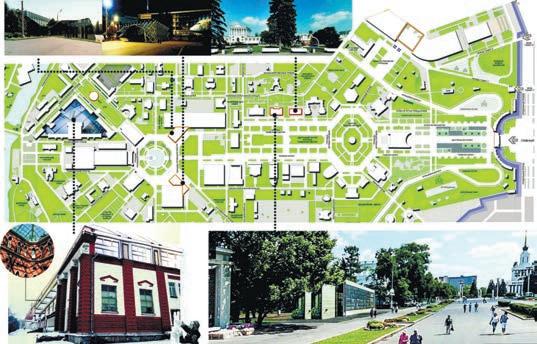

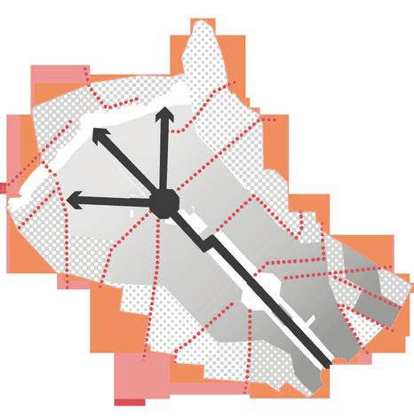
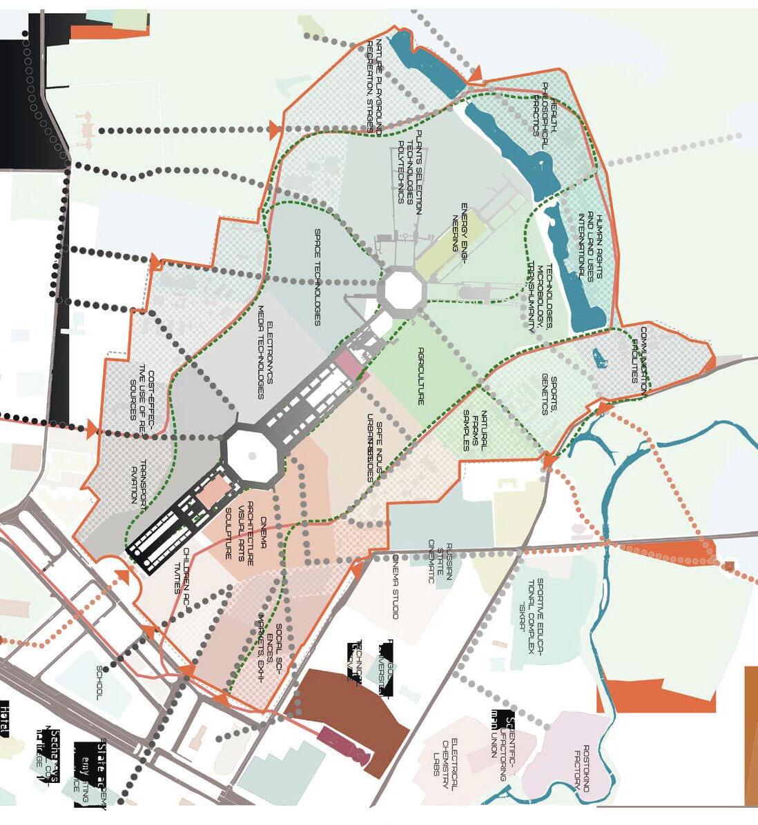
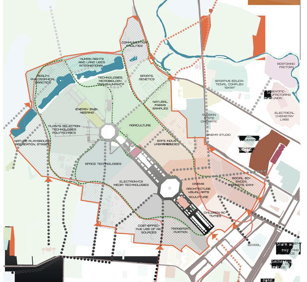
The issue of heritage protection - what to keep, who must keep, and how to determine the heritage - is observed at the multifaceted site of the VDNKh (communities stewardship and production exhibition) particularly acute. The vast territory of the former agricultural collection was developing in its current form for decades: changed ideals, varied power, varied functions of the pavilions. Thus, the strategy of a key heritage site is to adapt to constant change. The primary spatial method prioritizes older pavillions for conservation, reuses the interim pavillions, and partly reconstructs non-heritage ones. In this proposal, the central park alley becomes a line from past to future, along which the action develops. An essential point is the square of mechanization, as the timeline splits at this point into three ways - as the options for the future. Link to the expanded report on the workshop results