Southern Farm Collection
South Island, New Zealand
INFORMATION MEMORANDUMS


CABERFEIDH STATION THE WANDLE BAREWOOD STATION


CABERFEIDH STATION THE WANDLE BAREWOOD STATION
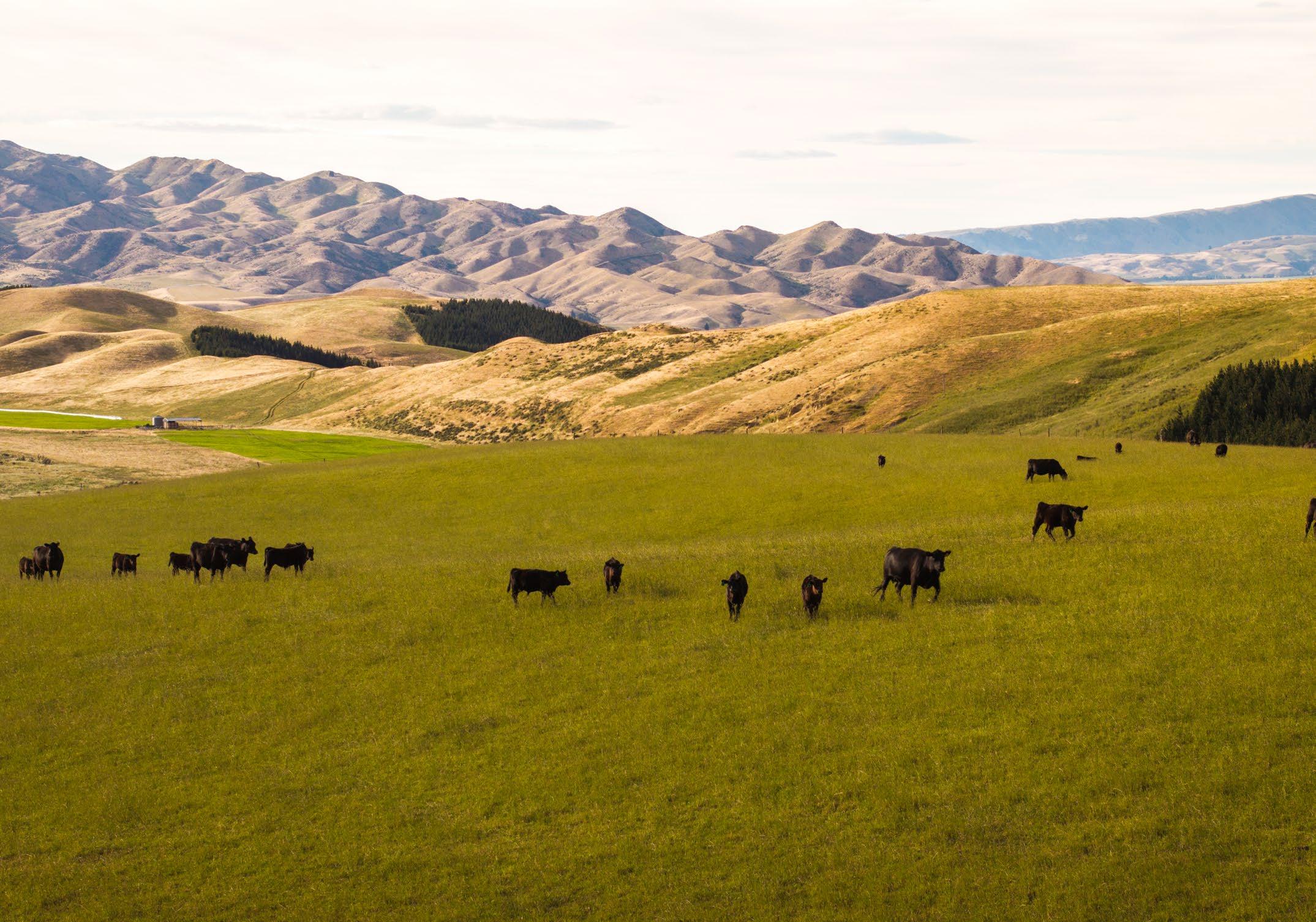
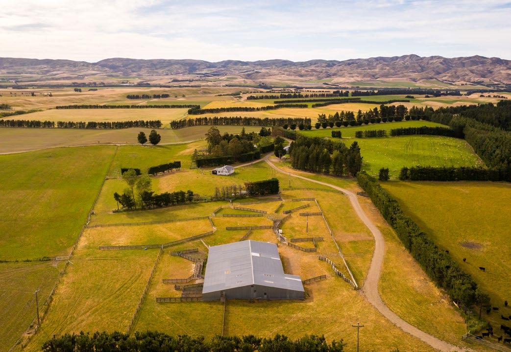
Caberfeidh Station is an amalgamation of nine original farms purchased in the early-mid 2000s. This is a large-scale breeding and finishing operation with a high level of production. Angus cattle are run along with a Headwaters ewe flock. Caberfeidh has mainly flat and rolling country with the backdrop of the Kirkliston Ranges with 1,300 ha of hill country between 700 to 900 metres ASL. The balance of the land ranges from easy downs to flat land with large areas of very productive soil types which have grown cereal and small seeds crops in the past.
LOCATION: Hakataramea Valley, Waimate District
AREA: 5,777.1179 hectares (14,275 acres)
TENURE: Freehold in 27 Records of Title
STOCK: (3 YEAR AVERAGE) Wintered Sheep: 20,318 Wintered Cattle: 1,989
SHEEP: Headwaters Ewes
LAMBING: 150-155%
CATTLE: Angus herd, with Angus and other beef breeds (trading)
IRRIGATABLE AREA: Pivot 370 ha K-Line 133 ha* (water allocation primarily used for pivots)
WOOLSHED/SHEEP YARDS: 4
CATTLE YARDS: 2
STAFF: 13 Fulltime staff
STAFF HOUSES/QUARTERS: 12
CABERFEIDH


Substantial investments have been made in Caberfeidh over the years, including:
• 4 centre pivot irrigators added covering an area of 370 ha.
• 7 new storage dams built with another currently under construction to make a combined storage of 460 m3 including existing dams.
• Development fencing to suit the pivots and general extensive subdivision elsewhere.
• Upgraded reticulated stock water schemes added.
• Improving soil fertility through lime and fertilizer applications.
• Pasture renovation and renewal through a winter cropping programme.
• 400 ha of downland country was developed out of native vegetation into permanent pasture.
• Since 2010, approximately 2,500 ha have been planted with lucerne and lucerne-based pastures. This plant is highly efficient in water usage and has contributed to increasing the property’s carrying capacity.
• A large area of Chicory and Red clover, across dryland and irrigated land has been introduced over the last five years to enable lambs to be finished for the Lumina Lamb programme.


Irrigated Flats – Pivots (improved pastures)
Irrigated Flats – K-Line (improved pastures)
Flats
pastures)
Foothill


24,564
Lambs Processed
1,034 4,914
Cattle Processed
Lambs Sold Cattle Sold
264 29,478 1,298
TOTAL Lambs Traded
TOTAL Cattle Traded
*3 Year Averages
From development, there are approximately 450 paddocks on Caberfeidh Station ranging in size from 5 ha to 400 ha in the five hill blocks. 500 ha are irrigatable using four centre-pivot irrigators and k-lines. Irrigation consents use water from three sources.
Between 300 ha to 350 ha of winter Brassica is grown annually along with 1,200 -1,600 t DM of silage and hay.
Caberfeidh has 14,500 Headwaters ewes, which lamb 150%-155%. Extra lambs are purchased, and the majority are finished through the Lumina programme (80% in 2023).
550 breeding cows are all DNA tested and selected for dollar profit index and meat quality traits. Sire bulls are sourced again on their $ profit index and their IMF estimated breeding value, as well as having to be structurally sound and be of a type that can handle our hill country. Caberfeidh also purchases approximately 800-1000 trade cattle for finishing. Our own bred and some trade cattle are farmed to qualify for Alliance’s Handpicked programme.
The contour of Caberfeidh ranges from flats to easy rolling downs on the lower country through to medium foot hill land and steeper high country land along the Kirkliston Range.

Altitude ranges from around 250 metres above sea level adjoining the Hakataramea River to 900 metres along the Kirkliston Range.
A search of the Manaaki Whenua/Landcare Research S-Maps online shows that the soils on Caberfeidh include a number of various soil types across the flats. These soil types include shallow, moderately well drained Darnley soils, shallow well drained Eyre soils, shallow imperfectly drained Okuku soils, moderately deep imperfectly drained Waipara soils and deep poorly drained Tai Tapu soils.
The lower easy country is intensively subdivided into manageable sized paddocks. There has been significant investment in fencing on the medium hill contoured land. There are several higher altitude blocks which are partially fenced and also rely on natural stock boundaries. The fencing on the property is of a good standard overall with significant new fencing having occurred including all of the pivot irrigated areas, tree lines and replacement of older fences.
A network of public roads provides easy access to most parts of the lower country on Caberfeidh. A 4WD track along the base of the Kirkliston Range provides access to the higher altitude land.

Stock and domestic water is sourced from a community scheme known as the Hakataramea water scheme. There is a reticulated trough water system resulting in a trough supply to most paddocks except higher grazing blocks which will still rely on natural stock water supply via creeks and dams.
Irrigation water is sourced from a number of surface water diversions and surface water takes into nine reservoirs with total capacity of 315,000 m³ of water storage plus an additional 148,000 m³ under construction (2025).
There is around 506 ha of flat land that is irrigated. There are four centre pivots which cover a total area of 373 ha. A further 133 ha is irrigable via k-line irrigation.
CABERFEIDH
FARM
Woolshed Woolshed
Covered Covered Yards
Fertiliser Bin Fertiliser Barn
Woolshed Woolshed Covered
Covered Covered Yards
Implement shed Implement Shed (North)
Hayshed
Implement shed Implement Shed/Garage (South) Killing Shed


FARM BUILDINGS DETAILS
Implement shed 3 Bay Implement Shed
Hay Hayshed
WINDSOR
FARM BUILDINGS DETAILS
Implement shed 3 Bay Implement Shed
Implement shed 3 Bay Implement Shed
Hay Hangar/Hayshed
Woolshed Woolshed
Hay 5 Bay Hayshed
FAIRVIEW
FARM BUILDINGS DETAILS
Woolshed 2 stand Woolshed
Covered Covered Yards
Hay Hayshed
Implement shed Implement Shed/Store Shed
MONETA DOWNS
FARM BUILDINGS DETAILS
Implement shed Implement shed
Implement shed 4 Bay Implement Shed
TARAMEA
FARM BUILDINGS DETAILS
Woolshed Woolshed and Covered Yards
Implement shed Implement Shed
Implement shed 3 Bay Haybarn
Implement shed Chemical Shed
Staff 1277 Hakatarmea House
Staff 1489 Hakatarmea House
Staff 199 Milne Road House
Manager 330 Milne Road House (Windsor Downs)
Staff 517 Corrigalls Road House
Staff 519 Corrigalls Road House
Staff 723 Corrigalls Road House
Staff 698 Corrigalls Road House
Staff 230 Farm Road House
Staff 366 Farm Road - Moneta Downs Cottage
Staff 382 Farm Road - Moneta Downs Homestead
Staff 477 Farm Road - Taramea


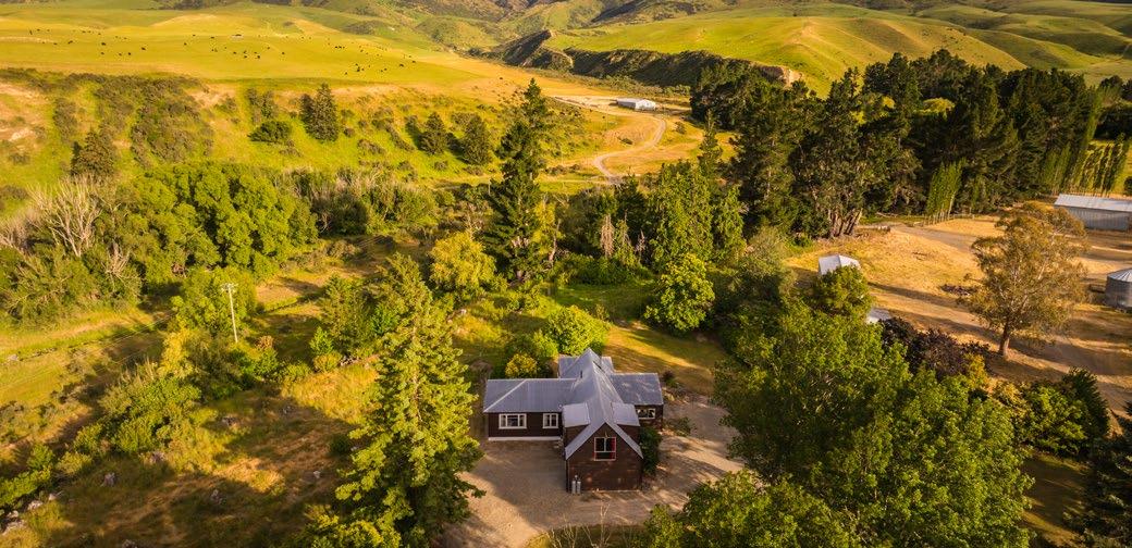


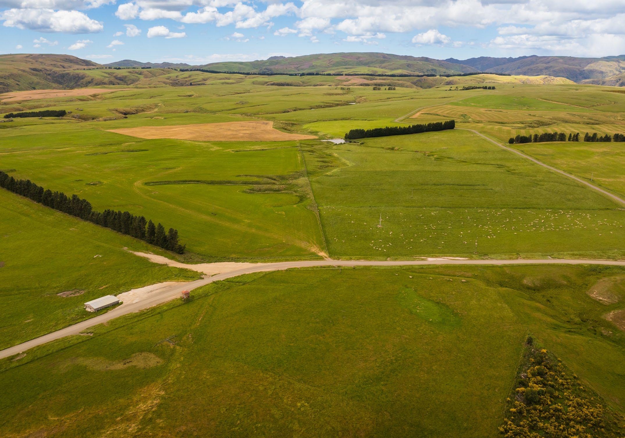
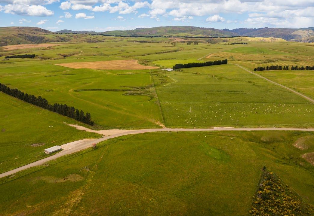
The Wandle is a large-scale breeding & intensive finishing operation with excess finishing capacity to what it breeds. It is well-balanced with diverse pasture types, and it has multiple land use opportunities including cropping and possible perennial crops. It is a high-producing farm which is predominantly terraced with some hill country along the Rock & Pillar Range.
LOCATION: Middlemarch, Otago
AREA: 2,501.6687 hectares (6,181 acres)
TENURE: Freehold in 26 Records of Title
STOCK: (3 YEAR AVERAGE) Wintered Sheep: 5,401 Wintered Cattle: 1,487
SHEEP: Headwaters Ewes
LAMBING: 140-150%
CATTLE: Angus herd, with Angus and other beef breeds (trading)
IRRIGATABLE AREA: Pivot 294 ha
K-Line 322 ha Gun 124 ha* (water allocation primarily used for pivots)
WOOLSHED/SHEEP YARDS: 3
CATTLE YARDS: 3
STAFF: 7 Fulltime staff
STAFF HOUSES/QUARTERS: 5 + 1 rented


The Wandle has undergone a very similar development programme to Caberfeidh and is also a breeding and finishing property. Development over the years has included:
• The Wandle was largely irrigated by K-Line with a small area on the bottom terrace next to the Taieri River under a gun system. There are now two centre pivots irrigating 180 ha with a mix of gravity and pumping. The pivot areas have been fenced appropriately. The additional purchase of the Nethertown block included a towable centre pivot which covers 80 ha. Two irrigation guns are still in use and used more strategically. K-Line still plays an important part in the irrigation system at The Wandle.
• Stock water systems have been upgraded to handle the increased carrying capacity and the increased number of paddocks. Stock water is sourced from streams running from the Rock & Pillar Range and is reliable.
• Pasture improvement and species selection have been made to complement the varying soil types across the property from light stony soils to good silts to heavy clays. The brown top dominant pastures have been developed to grow Chicory red clover finishing pastures, winter crops (Kale and Fodder Beet) and high performing grass-based pastures.
• New cattle yards.
• Stock/Vehicle Underpass built.
• New house built.


Irrigated Flats – Pivots (improved pastures) 294
Irrigated Flats – K-Line & Hard Hose (improved pastures) 446
Dryland Flats (improved permanent pastures) 658
Undulating to easy hill (improved permanent pastures) 720


20,863
Lambs Processed
1,191 5,996
Cattle Processed
Lambs Sold Cattle Sold
129 26,859 1,320
TOTAL Lambs Traded
TOTAL Cattle Traded
*3 Year Averages
The Wandle has 320 paddocks and is well serviced by good laneways and a stock underpass was built in 2018. An area of 740 ha is capable of being irrigated by three centre pivot, k-line, and gun irrigators. It has irrigation consents from the Taieri and various tributaries. A 500 ha hill block ranges from 400 to 900 m ASL.
Between 100 - 150 ha of winter Brassica is grown annually along with 1,200 -1,600 t DM of silage and hay.
The Wandle runs Headwaters 3,000 ewes of its own lambing 140% - 150%, as well as 1,000 Stud terminal ewes producing Rams for the other suppliers of the Headwaters programme. The Wandle finishes 10-12,000 Lumina lambs annually, plus another 8,000 commodity lambs.
The Angus cow herd is genomically tested and selected on the $ profit index, with their own bred cattle entering the Alliance Hand Picked programme. In addition 900-1200 trading cattle are purchased for finishing.
There is 55 ha of forestry in the ETS with a further 33 ha planned to be planted in 2025.

The Wandle is split into two non-adjacent blocks - The Wandle and Nethertown blocks. Both bound the Taieri River and the western side of The Wandle forms part of the Rock and Pillar Range. The Central Otago Rail Trail also passes through the flats portion of the property.
The Wandle sits at an altitude range of approximately 240 metres above sea level alongside the Taieri River, up to a high point of 1,150 metres above sea level on the western boundary of the Rock and Pillar Range. Overall, the property is considered to have a sunny eastern aspect.
A search of the Manaaki Whenua/Landcare Research S-Maps online shows that the soils on The Wandle include a number of various soil types across the flats. These soil types include shallow well drained Pigburn, moderately deep poorly drained Claremont, deep poorly drained Matapihi, moderately deep well drained Selwyn, moderately deep imperfectly drained Templeton, shallow moderately well drained Lindis and deep poorly drained Flaxton soils.
The Wandle is intensively subdivided into approximately 240 paddocks plus five larger hill blocks. The fencing on the property is in good condition with the land under the centre pivots re-fenced with new conventional fences along with new five wire subdivision within some of the deer fenced blocks. Approximately 1,350 ha is perimeter deer fenced with a combination of post and netting construction along with some top up internal deer fencing.
A network of central lanes and gravel tracks are fenced throughout the property which enables efficient stock movement. A stock underpass has been installed under the Middlemarch-Hyde Road to aid stock movements between the two sides of this road. Crossings are also in place over the Department of Conservation administered rail trail land that dissects part of the property for which an annual rental is payable.

Stock water is largely a gravity fed reticulated system with water sourced from creeks on the property with a dam providing storage. Approximately 200 troughs on the property have been replaced with 500 litre concrete troughs and provide reliable stock water.
There are two centre pivots along with a moveable pivot, which cover an area of 294 ha along with k-line infrastructure and hard hose guns. The calculated consented area for irrigation is 620 ha, with infrastructure for 740 ha. Six surface water takes service the irrigation area.
By the end of 2025, The Wandle will have over 90 ha with 55 ha of forestry already in the New Zealand Emission Trading Scheme.
Hay 3 Bay Hayshed Moynihans
Hay 3 Bay Hayshed 779 Ngapuna
Hay 4 Bay Hayshed 717 Ngapuna
Woolshed Ngapuna Wool shed
Covered Ngapuna Covered Yards
Implement shed Ngapuna 5 bay Implement Shed
Woolshed Wandle Woolshed
Covered Wandle Covered Yards
Implement shed Wandle 3 Bay Implement Shed
Workshop Wandle Workshop
Hay 4 Bay Hayshed - Cottage
Coolroom Cool Room
Office Staff Room
Woolshed Nethertown Woolshed
Implement shed Nethertown Implement Shed 1
Implement shed Nethertown Implement Shed 2
Hay Nethertown Hayshed Yards
Hay Nethertown Hayshed McKinnon Road
Manager 7439 St Hwy 87 - Manager house
Staff 7445 St Hwy 87 - Cottage
Staff 779 Ngapuna Road (sep garage)
Staff 717 Ngapuna Road (sep garage)
Manager 307 Ngapuna Road


Barewood Station is an amalgamation of four original farms and is the large breeding farm in the group, focusing on providing lambs for the other properties to finish. Barewood is largely flat to undulating country, with some gorges that lead down to the Taieri River and Deep Stream. The farm forms part of a historic early Otago run established around 1850.
LOCATION: Pukerangi, Otago
AREA: 6,413.6810 hectares (15,848 acres)
TENURE: Freehold in 5 Records of Title
STOCK: (3 YEAR AVERAGE) Wintered Sheep: 23,089 Wintered Cattle: 313
SHEEP: Headwaters Ewes
LAMBING: 135-145%
CATTLE: Angus herd, with Angus and other beef breeds (trading)
IRRIGATABLE AREA: NIL
WOOLSHED/SHEEP YARDS: 2
CATTLE YARDS: 2
STAFF: 8 Fulltime staff
STAFF HOUSES/QUARTERS: 6


1,438
Lambs Processed
49 18,035
Cattle Processed
Lambs Sold Cattle Sold
128 19,473
TOTAL Lambs Traded
177
TOTAL Cattle Traded
*3 Year Averages
Barewood has an established Headwaters breeding flock of 16,000 ewes lambing at 135-145%, with lambs mainly sold as forward stores to other Lone Star Farms properties. They also lamb 2,500 ewe hoggets.
The cattle system is based on purchasing 18-month-old cattle and finishing them prime or providing stores to other farms for finishing.
The farm now has excellent infrastructure and is split into 270 paddocks with approximately 3,300 ha in Lucerne and Lucerne mixed pastures.
Between 300-350 ha of winter Brassica and 150-200 ha of Short rotation Ryegrass grown annually along with 1,400-1,800 t DM of silage and hay.
Barewood has 600 ha in forestry for carbon and harvest, mostly under forestry rights.
2005 - 2010 Subdivision, pasture, stock water and fertility development.
2013 Staff quarters built.
2014 New house Reefs Road built.
2017 New cattle yards built.

The contour of Barewood is predominantly easy undulating with rock outcrops and steeper gorge faces along river boundaries. The effective grazing area is estimated at 4,700 ha. Altitude of the property ranges from around 300 - 400 metres above sea level.
A search of the Manaaki Whenua/Landcare Research S-Maps online shows that the soils on Barewood include a number of various soil types across the flats. The soil types include shallow well drained Matarae soils, moderately deep moderately well drained Pukerangi soils, shallow well drained Kiteroa soils, shallow poorly drained Ardlui soils and moderately deep poorly drained Ardlui soils.
Barewood Station is intensively subdivided into approximately 250 paddocks plus 9 steeper river gorge blocks.
The fencing on the property is in good condition and significant investment has been made building new fences in recent years. Fencing is predominantly conventional seven wire post and waratah construction.
A network of central lanes and gravel tracks are fenced throughout the property which enables efficient stock movement.

A reticulated water scheme is in place on Barewood with troughs to each paddock. Significant investment has recently been made in upgrading the stock water along with acquiring additional supply with 150 units in the Rocklands Rural Water Scheme.
BAREWOOD STATION
FARM BUILDINGS DETAILS
Woolshed 5 stand Woolshed Strathmore
Covered Covered yards Strathmore
Implement shed 6 Bay Imp Shed (Reef)
Woolshed 5 stand Woolshed Barewood
Covered Covered Yards Barewood
Fert Bin Fertiliser Bin ARV
Quarters Shearers Quarters - 730 Barewood Road
Office Office/Boardroom - 730 Barewood Road
Workshop Stables and Workshop
Implement shed 5 Bay Implement Shed - 730 Barewood Road
Implement shed 2 Bay Implement Shed HOUSES
Quarters
730 Barewood Road, RD2 Outram (staff quarters)
Manager 370 Barewood Road - Managers House
Staff 730 Barewood Road
Staff 810 Flat Stream Road
Staff 257 Flat Stream Road
Staff 433 Reefs Road


Barewood Station has approximately 600 ha in forestry for carbon and harvest, mostly under forestry rights.

AVERAGE TEMPERATURES
Summer average maximum 20 - 22 degrees Celsius
Winter average minimum -2 to 1 degrees Celsius
MEDIAN SUNSHINE HOURS
Moderate to high 2,000 to 2,050 hours annually.
Summer average maximum 19 - 20 degrees Celsius
Winter average minimum -4 to 0 degrees Celsius
Summer average maximum 19 - 20 degrees Celsius
Winter average minimum 0 to -2 degrees Celsius
Moderate 1,700 to 1,750 hours annually.
Moderate 1,650 to 1,700 hours annually.
SOIL MOISTURE DEFICIT
Soil water becomes insufficient to maintain evapotranspiration and irrigation becomes necessary to maintain plant growth for between 100 - 110 days per year.
Soil water becomes insufficient to maintain evapotranspiration and irrigation becomes necessary to maintain plant growth for between 80 - 90 days per year.
Soil water becomes insufficient to maintain evapotranspiration and irrigation becomes necessary to maintain plant growth for between 70 - 80 days per year.
SNOWFALL
Common during the colder months of May through to September, however, can also occur any time from March through to November.
Common during the colder months of May through to September, however, can also occur any time from March through to November.
Common during the colder months of May through to September, however, can also occur any time from March through to November.
On average around 3 snowfalls can be expected to settle on the flats with up to 150 mm possible.
Source: Colliers Desktop Update/ 10 July 2024/Ref 4534.
Snowfalls occur frequently in Otago relative to other parts of New Zealand, with high altitudes accumulating snow from late autumn, which settles through the winter.
Snowfalls occur frequently in Otago relative to other parts of New Zealand, with high altitudes accumulating snow from late autumn, which settles through the winter.
This Memorandum has been prepared solely to assist interested parties in deciding whether to express their interest in the assets and then making their own evaluation of the property and its assets. The Memorandum does not purport to contain all information that a prospective Purchaser may require. In all cases, interested parties should conduct their own investigation, analysis and verification of the data contained in this Memorandum and the property. Neither the delivery of this Memorandum nor any contractual agreement concluded thereafter shall under any circumstances create any implication that there has been no change in the affairs or prospects of the property since the date of this Memorandum or since the date as at which any information contained in this Memorandum is expressed to be applicable.
The Advisors have not independently verified any of the information contained in this Memorandum. None of the Advisors or Owner make any representation or warranty as to the accuracy or completeness of the information contained in this Memorandum and none of the Advisors or Owner shall have any liability for any statements, opinions, information or matters (express or implied) arising out of, contained in or derived from, or for any omissions from, or failure to correct any information in this Memorandum, or any other written or oral communications transmitted to any recipient of this Memorandum in relation to the property.
Retention of this Memorandum will constitute acceptance by the recipient and readers of these terms and conditions and any recipients who do not accept any of the terms and conditions should return the Memorandum to the Advisors immediately.
Matt works in partnership with Russell Reddell in the Queenstown office; a collaboration which has seen them negotiate some of the largest private property transactions in the market.
Their focus is predominantly on High Country Stations and Lifestyle properties throughout the South Island, rather than traditional residential real estate.
This formidable team have a strong reputation and considerable track record of success. The combination of Matt’s background in property valuation and commercial leasing, with Russell’s business acumen and negotiation skills, make for a strong and well-balanced partnership. With considerable experience in high-end real estate, difficult transactions and hard-to-sell properties, vendors often turn to this team to get results.
Both Matt and Russell have lived in Queenstown for over 30 years each, resulting in incredible local knowledge of the residential market. They are consequently regular sellers of the resort’s residential and lifestyle properties.
Offering a discreet and savvy approach to all property transactions, market-leading knowledge and results at the top end of the iconic property sector, contribute to the ongoing success of this unique team.
Matt and Russell have considerable experience in dealing with high-networth individuals and offer exceptional exposure to a large local and international database.
MATT FINNIGAN
+64 21 199 7669
matt.finnigan@nzsir.com
RUSSELL REDDELL
+64 21 355 291
russell.reddell@nzsir.com


