
2020 21 2021 22
BI-ANNUAL
NATIONAL UNIVERSITY OF SINGAPORE DEPARTMENT OF ARCHITECTURE
MASTER OF LANDSCAPE ARCHITECTURE BACHELOR OF LANDSCAPE ARCHITECTURE
YEARBOOK
NUS LANDSCAPE
ARCHITECTURE
Department of Architecture
School of Design and Environment
National University of Singapore
4 Architecture Drive
Singapore 117566
Editor Jessica Ann Diehl (Dr)
Layout Assistant
Abdul Latiff Bin Hamzah
Copy Edit Assistant
Marcus Chua Yao Hua
© INDIVIDUAL CONTRIBUTORS, 2022
ISBN: 987-981-18-7186-3
E-Book ISBN: 987-981-18-7185-6
Title: NUS Landscape Architecture Yearbook 2020-2022
Printed By:
All rights reserved; no part of this publication may be reproduced, stored in a retrieval system, or transmitted in any form or by any means, electronic, mechanical, photocopying, recording, or otherwise without prior written permission of the publisher.
The publisher does not warrant or assume any legal responsibility for the publication’s contents. All opinions expressed in the book are of the authors and do not necessarily reflect those of the National University of Singapore.
NUS LANDSCAPE ARCHITECTURE BIENNIAL YEARBOOK
2020-2021 2021-2022
CONTENTS Introduction Note from Program Directors LA4701 LA4702 LA5701 LA5702 LA5301 AR5954B LA5302 LA4202 LA4203* LA4212 LA4201 LA5222 AR5954A LA5303 LA5742 Academic Year 2020/2021 Master of Landscape Architecture Programme MLA Studio: Quarter MLA Studio: City MLA Studio: Country MLA Studio: Region Geodesign Topics in Landscape Arch: Principles of Ecology Detail Design Planting Design History and Theory of Landscape Architecture Topics in Tropical Ecology: Tropical Forest Ecology Policy of Landscape Urban Ecology and Design Topics in Landscape Arch: Digital Landscape Techniques Urban Greening: Technologies and Techniques Dissertation LAD1001 LAD1002 LAD2001 LAD2002 AR3101A AR3101B LAD1003 LAD1004* LAD2004 Bachelor of Landscape Architecture Programme Design 1 Design 2 Design 3 Design 4 Design 5: LA Emphasis Design 6: LA Emphasis Introduction to Landscape Architecture History and Theory of Landscape Architecture Introductory GIS for Landscape Architecture 8 12 16 24 32 40 48 52 54 56 58 60 62 64 66 70 72 76 82 88 94 100 102 104 58* 106
LA4701 LA4702 LA5701 LA5702 LA5301 AR5954A LA5302 LA4203* LA4212** LA5201 LA5222** LA4007 LA5303 LA5742 LAD1001 LAD1002 LAD2006 LAD2007 LAD3001 LAD3002 LAD1003 LAD1004* LAD2003 LAD2005 LAD2004 Academic Year 2021/2022 Dissemination Staff List *Common Core Curriculum **See Academic Year 2020/2021 Bachelor of Landscape Architecture Programme Master of Landscape Architecture Programme MLA Studio: Quarter MLA Studio: City MLA Studio: Country MLA Studio: Region Geodesign Topics in Landscape Arch: Digital Landscape Techniques Landscape Construction II History and Theory of Landscape Architecture Topics in Tropical Ecology: Tropical Forest Ecology Policy of Landscape Urban Ecology and Design Political Ecology Urban Greening: Technologies and Techniques Dissertation Design 1 Design 2 Design 3 Design 4 Design 5 Design 6 Introduction to Landscape Architecture History and Theory of Landscape Architecture Planting Design Introductory GIS for Landscape Architecture Landscape Construction I 110 116 126 130 138 142 146 148 60** 152 62** 154 158 160 164 170 176 182 188 194 200 148* 56** 202 204 208 218
INTRODUCTION
10

11
DIRECTORS
“The MLA programme celebrated its 10th year in 2019, and despite the COVID-19 pandemic, we have continued to grow and expand the disciplinary boundaries of landscape architecture. Between 2020-2022, MLA studios explored the limits of urban development in Singapore, landscape strategies for carbon sinking, community and productive landscapes, and regional-scale infrastructures and ecologies, all the while paying attention to questions of social equity and environmental justice. The design and research work of MLA students in 2020-22 reflect urgent concerns of our time, whether it is climate change, the pandemic, or social change, through reflexive design practices that are grounded in the particularities of site, communities, and rigorous research. These remarkable accomplishments are a testament to the hard work and resilience of our students during extraordinary times.”
Dorothy TANG, Programme Director Master of Landscape Architecture
PROGRAMME
“The Bachelor of Landscape Architecutre (BLA) Programme was started in 2020 and, at the time of writing, is only 3 years old. As such, it is with great pleasure and pride that we present work created by our inaugural students over the past two years. We hope that these same students, who will be graduating from NUS this summer, will leave inspired and motivated to contribute actively in building the landscape architectural profession in Singapore and beyond.”
13
Ervine LIN, Programme Director Bachelor of Landscape Architecture
AY 2020/2021
MASTER OF LANDSCAPE ARCHITECTURE
MLA STUDIO: QUARTER
Tutors Students
Jessica Ann DIEHL Ervine LIN
Feng Kangtai, Lam Ching Hang Adam, Wang Yu, Ou Yeyao, Wang Xiaomeng, Yin Yi, Hao Jun, Tan Shuyue, Zhu Wen, Xiang Wenqin, Zheng Qiaoyu, Rui Xue, Xie Wanying, Huang Xi, Li Xi, Long Di Liu Kaiyan, Ge Wenxi, Zhang Liping, Li Wanying, Zhang Kairui, Hong Mengyi, Li Jiaying, Zhang
Liao, He Xiaowei & Fang Ting
GROWN IN SINGAPORE
Description
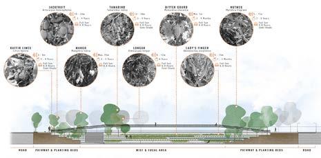
This studio re-imagined how to design green and grey spaces in Singapore as productive landscapes. We envisioned productivity to encompass edible and non-food related natural resources such as timber, traditional medicine, and other products. Students were challenged to critique the manicured lawns and trees of Singapore, to look past the veil of green walls and roofs, and to uncover the true potential of landscape architecture in bringing together multifunctional landscapes that are not only aesthetic and culturally significant, but also productive; to design productive landscapes that are ‘Grown in Singapore.’ We asked: Can multi-functional urban land uses that integrate—rather than separate— agriculture from other land uses be a critical adaptation for the sustainability of future cities? What novel design strategies should we develop, what changes in mindset do we need to inculcate, and what stakeholders do we need to engage in order to integrate diverse typologies of productive landscapes into built, ecological, and social urban systems? With an aim of envisioning better designed work, live and play environments that simultaneously tackle the need for outdoor space and productive landscapes, this studio attempted to alleviate two otherwise conflicting issues of food insecurity and land scarcity which plague rapidly urbanising cities of today.
MLA LA 4701
MLA STUDIO: QUARTER
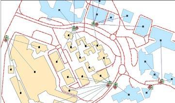
1 The Evolution of Singapore’s Agricultural Land and Planning / LAM Ching Hang, Adam
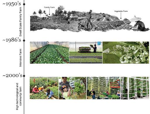
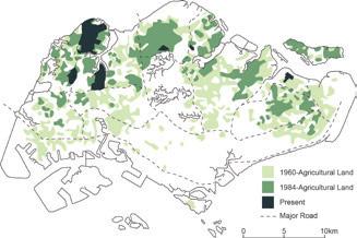
2 Change in agricultural land use in Singapore, 1960-present
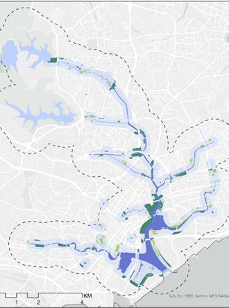
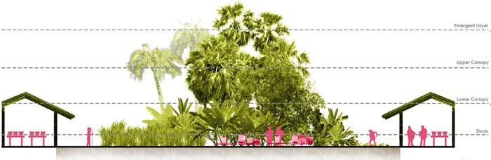
3 Studio site with water and drainage system. Ten landscape typologies were explored: Degraded forest; Urban Parks & Open Green space; Streetscapes; Underutilized built structures; Water & drainage network; Commercial areas; Institutional zones; Common space in high density residential ; Unused & underutilized spaces; Special populations
1 2 3 17
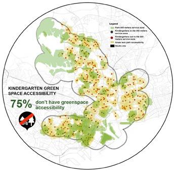
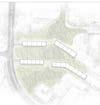
INSTITUTIONAL ZONES SCHOOL: Learning through Landscapes / GE Wenxi
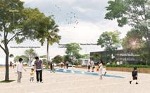
The concept of this project is to break the physical, social, and psychological boundaries of kindergartens with nature and surrounding neighborhoods. By providing a shared healthy-living campus, ecology education and food security awareness can be established. The campus will encourage children to discover nature, while helping them prepare for future transition stress and build a healthier personality.
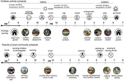
1 2 18
LA4701
MLA STUDIO: QUARTER
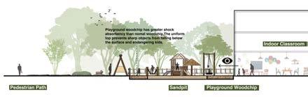
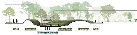
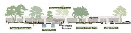
3 4 5 6 19
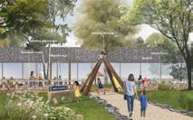
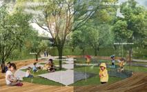
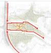
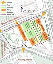
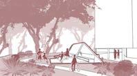
A. Drop-off
B. Outdoor Classroom
C. Composting
D. Cafe/Community Workshop/ Delivery Pickup
E. Farm
F. Waterscape Plaza
G. Ecological Parking Lot
GuillemardRd MountbattenRd A A A B C D E F G G H
H. Exercising Area
1 Site analysis
2 Perspectives
3 Master plan proposal for Mountbatten Centre
4 Section-elevation: ‘Begin in Garden’ drop-off point & entrance plaza
5 ‘Learn Outdoor’ outdoor classroom
6 ‘Play in Nature’ playground
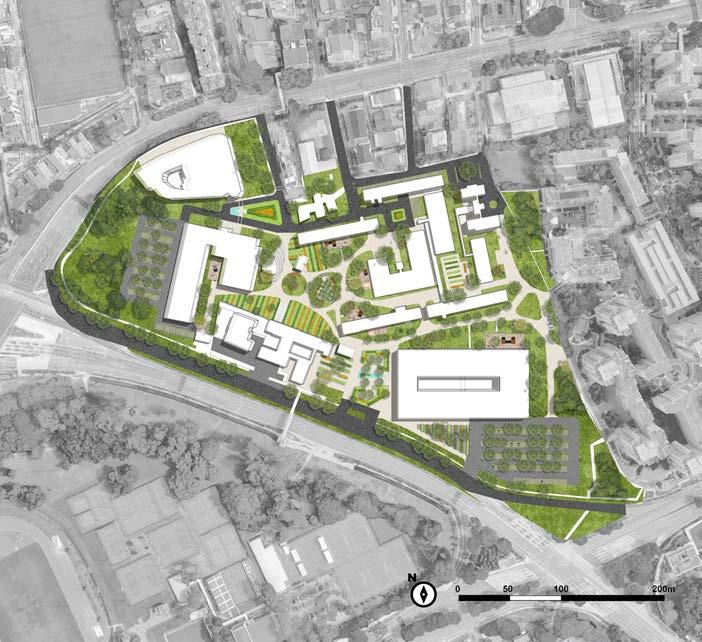
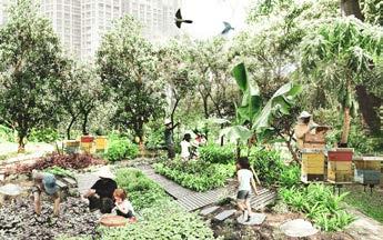
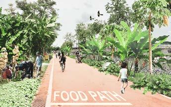
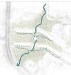
DEGRADED FOREST: The Productive Corridor / LAM Ching Hang, Adam
This project focuses on the concepts of urban agroforestry and the stepping-stone system. A network of productive forests is proposed along the Kallang River to improve the monofunctional landscape for people and landscape connectivity for Flora and Fauna. Agroforestry is used as a medium to reactivate the landscape and enhance agricultural productivity. The typology of urban agroforest in the masterplan creates a productive loop to reimage the urban landscape in Singapore.
1 Masterplan of Productive Corridor
2 Urban Agro-forest Typologies


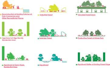
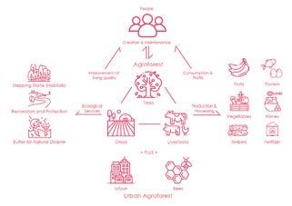
3 Operation Diagram of Productive Corridor
4 Agroforest in Residential Area
5 Food Path
6 Industrial Forest
7 Aquaforest
Primary Forest
Young Secondary Forest
Old Secondary Forest
Freshwater Swamp Forest
Green Open Space
Water Network
Intervention Area
Building/ Infrastructure
Productive Corridor
Agro-Forest
Eco-Link
Park Connector

20
LA 4701
1 2 3
21 Workshop Workshop
Residential Residential Canal Park Connector Food Way Agroforest in Residential Area Park
4 5 6 7 5 4 6 7
Agroforest MLA STUDIO: QUARTER
Connector Fish Pond Fish Pond Mangrove Shore Agroforest at waterfront
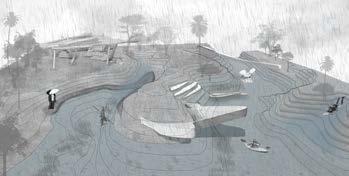
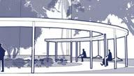
COMMON SPACE IN HIGH DENSITY RESIDENTIAL AREA: Break the Barrier / LI Wanying
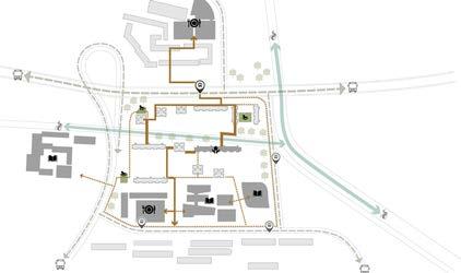
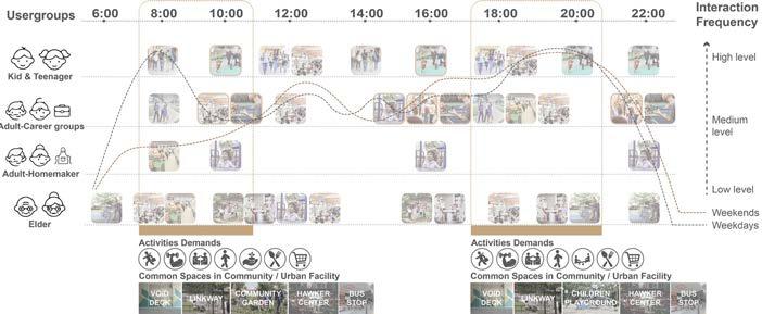
This site is located in Lorong 8 Toa Payoh, a subzone that has one of the highest rates of aging and most diverse race clusters in Singapore. Built in the 1970s, common spaces lack attraction and connection. These reasons bring the neighborhood a bigger challenge of social cohesion. The project aims to redesign common spaces, creating attractive multi-function spaces to increase neighborhood connection both spatially and interpersonally in order to enhance social cohesion.
22 LA4701 Void deck Empty Court Water Drainage Parking Lots With Facility Children Playground Occupied Residents Committee Senior Fellowship Home Community Garden Activity space Interstitial green patch Linear spaces Linkways Pathways Pedestrian Hotspots Outside Hotspots Inside Traffic Flow Bus Stop Hawker Center Children Playground Bus Flow Human Flow Senior Citizen Fellowship Home Education Institution Middle School Primary School Kindergarten
1
2
daily routine analysis 3 Hotspots and human flow analysis 1 2 3
Existing common space analysis
Users groups’
4


5


23 MLA STUDIO: QUARTER + + + + 1 14 14 14 14 14 14 14 2 3 4 5 6 6 12 6 7 8 9 10 15 11 13 11 11 1 Core Plaza 2 Paddy Field 3 Cleansing River 4 Cleansing Wetland 5 Compost Garden 6 Community Garden 7 Common Kitchen 8 Senior Fellowship Home 9 Neighborhood Meetingroom 10 Leisure Area 11 Existing Playground 12 Existing Community Garden 13 Existing Court 14 New pathways 15 Residents Committee + + + + + Community Food System Recovery Producing P r gnisseo noitubirtsiD musnoC p t o n The outline color of each scenario represents the different process of the community food system.
Masterplan & Key Scenarios - Integrating common spaces with community food system
4 5
Perspectives including more frequent daily interaction and special events in the core plaza, ‘Farm to table’ experience in common kitchen and community garden, and increased daily interaction in linkways and pathways
MLA STUDIO: CITY
Tutors Students
HWANG Yun Hye Evi SYARIFFUDIN
Hao Jun Jeff, Tan Shuyue, Yin Yi Anna, Zhang Kairui, Li Wanying, Zhu Wen, Hong Mengyi
Dreamy, Zheng Qiaoyu, Zhang Liao Judy, Xiang Wenqin, Liu Kaiyan, He Xiaowei Ceama, Rui Xue, Wang Xiaomeng, Fang Ting, Li Jiaying, Lam
Ching Hang Adam, Ge Wenxi, Long Di, Ou Yeyao Olivia, Li Xi Emily, Huang Xi, Feng Kangtai, Zhang
Liping & Xie Wanying
LOW-LYING SINGAPORE
Description
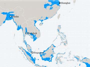
Singapore, as a coastal city-state, is susceptible to the effects of climate change, particularly rising sea levels. At the same time, Singapore’s 2030 Master Plan has gazetted coastal areas to become more intensively utilized as dense mixed-use developments. It is also expected to have more hard-engineered infrastructures that might increase coastal erosion and environmental hazards. In parallel with rapid urbanization, Singapore’s coastal ecosystem has been drastically altered over the past few decades with a significant loss of natural coastal habitats. This trend towards a mono-functional, static, and disconnected sea-land interface must be reversed. We asked: What existing coastal landscape typologies and developments are vulnerable to sealevel rise? How can they be retrofitted to not only ensure sufficient coastal protection but also uncover creative and unexpected land development methods that would otherwise be eclipsed by conventional planning processes? How can these new design approaches facilitate multi-functional land-use and cohabitation of man and ecology? How does all of this fit into the context of climate change? This studio aimed to answer these questions by projecting 25 coastal landscape scenarios responsive to low-lying Singapore.
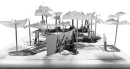
MLA LA 4702
1 The introductory studio poster shows the overlapping of climatologist Ed Hawkin’s stripes portrating the longterm increase in global temperature, and locations of asian cities at risk from sealevel rise.

2 Studio design process for the first four weeks focused on helping students understand their sites in-depth while exploring various design strategies. Process models show water-flow analysis, crucial for appropriate innovation.
25
MLA STUDIO: CITY
1 2
REDEFINING COASTAL BARRIER / LAM Ching Hang, Adam
Yishun Dam is transformed into living infrastructure. Coastal sediments and green waste from the reservoir are utilized to form multi-functional spaces. A tunnel beneath the new land facilitates the flow of heavy-vehicular traffic and doubles as a tidal barrier.
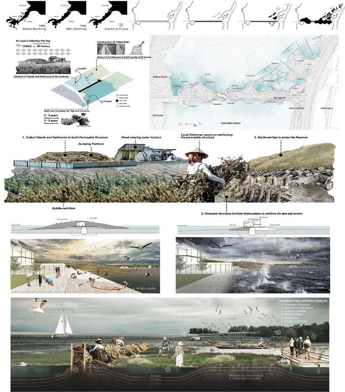
26 LA4702
1
1 Diagrams and Perspectives
MLA STUDIO: CITY
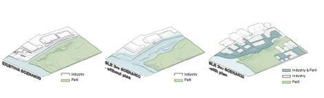
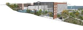
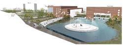
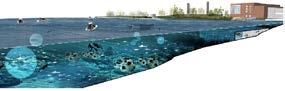
Located in an urban estuary, the project site presents a dynamic hydrological condition and complex land-use needs. This project aims to redefine water-management infrastructure while negotiating a new spatial typology in between an industrial zone and a park. At the same time it will maximize the opportunity to better adapt to sea level rise.
27
IN-BETWEEN LANDSCAPE / LI Wanying
REVIVAL: COASTAL NATURE, COASTAL CULTURE / HONG Mengyi Dreamy
In this project, a post-industrial site is given a new lease of life as a cultural arts facility. Factory buildings are retrofitted as workshop spaces for theatre, museum and educational / performance facilities. The sea is semi-enclosed to form a spectacular two-tiered stage: part underwater and part above. Open spaces are terraced to form gardens that are meaningfully directed to capture views of the expansive ocean while forming stepped coastal defense that also allow different coastal habitats to form.
28 LA4702
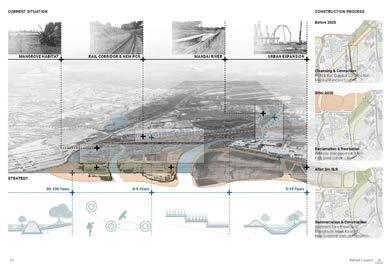
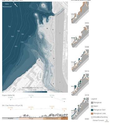
This project aims to expand mangrove habitats seaward in anticipation of rising sea-level. This entails phased land-use and sedimentation processes that also includes the development of a freshwater swamp, rerceational spaces, and high-density future developments.
ALTERNATIVE INDUSTRIAL LANDSCAPE DRIVEN BY OCEAN RESOURCE / TAN Shuyue
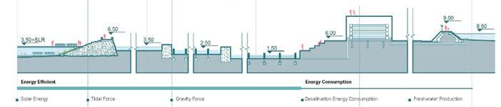
As the demand for oil decreases, existing oil plants have to give way to other postindustrial land-use. This project proposes turning one such site into a solar-powered water desalination plant that allows for coexistence of recreational spaces and waterdependant light industries.
29
STUDIO: CITY
MLA
RETREAT FORWARD / LONG Di
RIPARIAN URBANISM / GE Wenxi
The newly reclaimed Punggol Timor island faces several long-term environmental challenges including sea-level rise, storm surge risk, low biodiversity, and pollution. This project proposes a repeatable mixed development mode and triple-tiered defenses that can keep pace with sea-level rise for the business park. By reshaping the water system and ecosystem, reconnecting habitats, and injecting regional vitality, the project integrates nature into the business area and creates a new sustainable coastal lifestyle.
2 Site Sections
30 LA4702
1 Exploded Axonometric
1 2
GUARDIAN OF THE CITY / ZHANG
Liao Judy
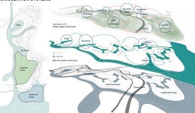
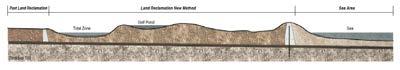
The current URA masterplan gazetted this site for future land-reclamation. Taking this opportunity, this project proposes an ecological golf course with a sensitively-shaped terrain that contributes to coastal defense, and also improves biodiversity, water-management, and provides new recreational spaces for the public.
ADAPTATIVE COASTAL INDUSTRIAL HUB / YIN Yi
In this project, an old, polluted, monofunctional industrial zone (a shipyard) is converted into a multifunctional futuristic technology hub specialized in clean-energy and coastal defence industries. Construction is sensitively phased to facilitate a smooth transition.
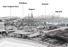
31
CITY
MLA STUDIO:
1 Photo montage
2 Site Landmarks
1 3 2
3 Site Sections
PANDEMIC DISRUPTIONS
Tutors
Students
Dorothy TANG
Melissa YIP
Bargotra Poornima, Cheng Jing, Ekta Balubhai Rakholiya, Feng Zihan, Han Cong, Lyu Jiawei, Mamiko Tanaka, Ruiee Vithal Dhuri, Shao Zhongran, Wang Haobo, Xiao Xinyan, Zhang Bingqian, Zhang Bingyi, Zhang Yifei, Zhong Yixin, Zhou Xianfeng, Zhou Zuyuan, Carissa Chin Qiwei & Lim Wenfa
Description
The unprecedented scale of disruption from the COVID-19 pandemic has renewed conversations about the role of the built environment in mediating the relationship between public health and economic resiliency. It has laid bare the stark disparities between communities and nations, and foregrounded the dependency on international mobility in economic growth. Widespread interruptions in the modern supply chain in Asia have caused global shortages in medical equipment, consumer goods, food, and even labor.
This studio expands the traditional notions of productive landscapes by tracing the lifecycles of critical products in the wake of the COVID-19 pandemic. By mapping the spaces of material extraction to final consumption, we gain a greater picture of the resources, infrastructure, and labor that shape the landscapes supporting our essential needs. These inquiries are centered around the relationship between economic policy and their spatial expression on the ground, and inform a critical position on the agency of landscape interventions. Furthermore, it challenges conventional notions of landscape practice and speculates on the future of our profession.
MLA LA 5701
MLA STUDIO: COUNTRY
conduct mode,


MLA STUDIO: COUNTRY


Surin Elephant Round-up

Phang Nga Elephant Park Phuket Elephant Sanctuary
2 1
Elephant
33
Elephant Conservation Center Thai Elephant Home Feeding elephantsElephant bathing Accommodation Observing elephants in the forest Water rafting Vet care
Thai
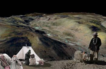
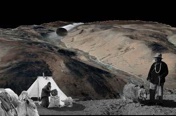
Elephant nature park Chang Thai Heritage Care for elephant2 Forest Elephant Sanctuary Adventure Residential areas Residential areas Forest Elephant nature park Feeding and nursing Service center Accommodation Bathing space Water rafting 300 kg per day per elephant cost 1600 USD per month Mahouts & Volunteers Tourists Jungle walk forage elephant family groups naturally and roam freely Villages Jobs Jobs Feed $ Help & work Land lease Disturbance Elephants Mahouts Tourists Sanctuaries Volunteers SANCTUARIES_STRUCTURE example, we will
Elephant Green land - Elephant nature park EXAMPLE_ELEPHANT NATURE PARK SURROUNDING AREAS RELATIONSHIP ACTIVITIES SANCTUARY OPERATION 300m Scale=1:1000 AREAS RAILWAY NATURE PARK LINE TOURISM Photos for Everything,
Valley Anantara Golden Triangle Camp Anantara Golden Triangle Camp FAE’s Elephant Hospital
Chiang Dao Elephant camp
Refuge BEE - Burm And Emily’s Elephant Sanctuary Elephant Hills
surrounding forest sanctuaries, which sanctuaries. Mahouts, stakeholders. The main bathing elephants, feeding in the forest, etc. and the surrounding farmland, so surrounding villagers. At larger space for from surrounding jobs for surrounding
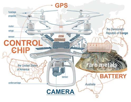
1 L Components and Supply Chains for Unmanned Aerial Vehicles / Illustration by Zhang Bingyi, Zhang Binqian, Wang Haobo, Lyu Jiawei
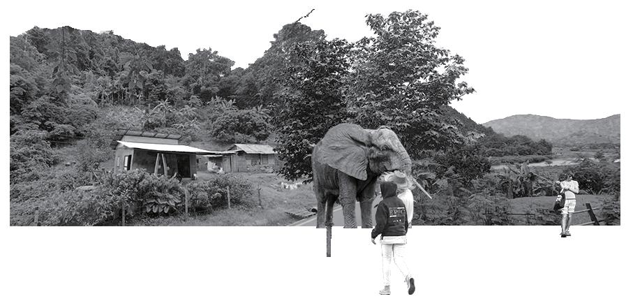
2 Analysis of Elephant Sanctuaries and tourism in Thailand / Illustration by Zhou Zuyuan, Zhou Xiangeng, and Feng Zihan
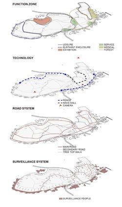
MONITORING LANDSCAPE: Community-based Ecotourism / ZHOU Zuyuan
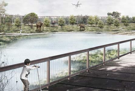
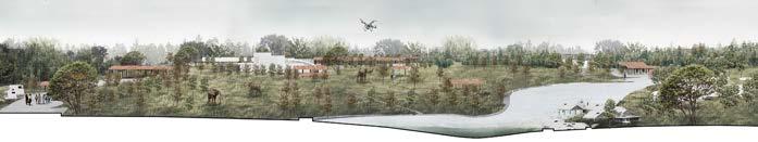
This project aims to address the increase of elephant poaching exasperated by the decline of the Thai Tourism Industry during the COVID-19 Pandemic. An elephant rehabilitation center leverages community-based ecotourism, novel monitoring technologies, and policy changes to reduce elephant poaching in Thailand.
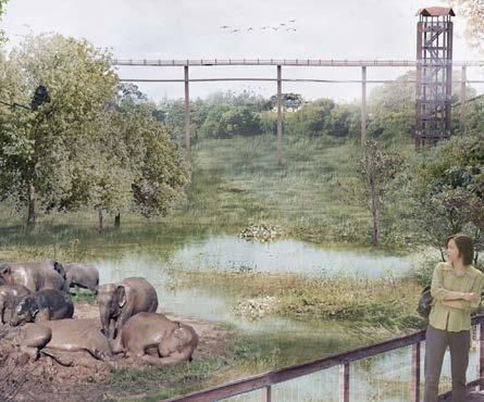
1 Perspectives
2 Topography & Diagrams
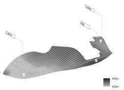
3 Master Plan
34
LA5701
1 2
35 Thermal Camera Tracker Drone Haha and Moats
3
MLA STUDIO: COUNTRY
LA5701
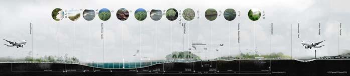
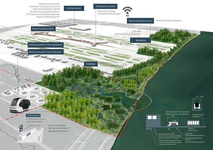
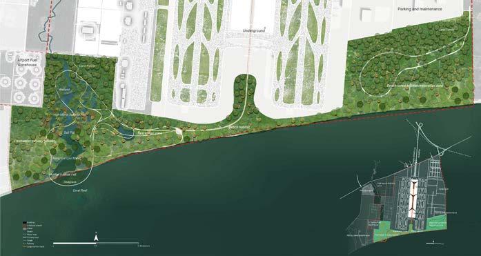
AUTONOMOUS MOBILITY & AIRPORT DEVELOPMENT / Cheng Jing
This project applies artificial intelligence and robotics to reimagine the landscape of an airport. Autonomous vehicles and technology flow along a physical loop system connecting the interior and exterior of the U-Tapao Airport located on the Gulf of Thailand. This creates a seamless visitor experience and opportunities to utilize under-developed airport land and restore coastline mangrove habitat. In conjunction with the planned Eastern Economic Corridor, the airport development becomes an important ecological beacon for Thailand.
36
1 Ecosysem connectivity and impacts
2 Master Plan
3 Site Section
1
4 Autonomous Vehicle Technology
37
2 3 4
MLA STUDIO: COUNTRY
INDICATOR ECOLOGIES: Lithium Mining in Western China / ZHANG Bingqian
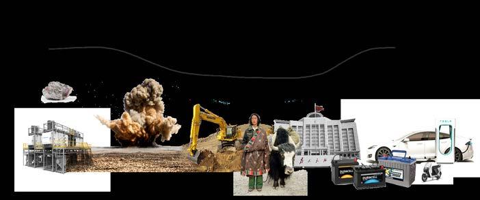
Competition for rechargeable batteries has increased in the midst of the ongoing USChina Trade War and exasperated by the COVID-19 Pandemic. A lithium mine in the Tibetan Plateau was closed because of community protests of downstream pollution in 2013, and has recently been reopened to supply lithium for China’s electronics industries, suffering from a shortage due to the trade war. This project explores the use of different landscape technologies for remediation, and as an indicator landscape to ensure ecological security and public health of the surrounding communities. A series of check dams are constructed downstream of the newly reopened mines to retain water, check for contamination, and remediate if necessary, before releasing downstream. This creates new habitat areas and production landscape that benefit local villagers.
1 Global Lithium Flows
2 Lithium Battery Production
3 Masterplan
38 LA5701 250 35% 200 30% 150 25% 100 20% 50 15% 10% GWh Local people Company Environment Government policy policy landscape change landscape change landscape change landscape change Downstream Li, Co IMPORT MAP the Republic of Congo Zambia Zimbabwe Portugal Australia Chile 47% 4.13% 17% 0.38% 0.14% China
1 2
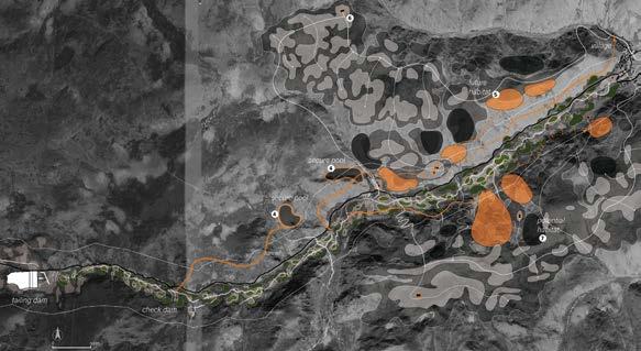


39 Raising yok and sheep Grazing in deep mountains Collect woods in mountains water resource pollution upstream habitat ---find flat area in the river buffer ---build dam at the edge of flat area ---plant vegetation in and around the flat space 1 2 3 MLA STUDIO: COUNTRY BEFORE: AFTER: PART1 Polluted area Forbidden to enter PART2 Remediation area Partially to enter PART3 Activities area Healthy to enter Master plan of natural dam check dam1 check dam1 checkdam1 Sensitive Plants and Biofuel Conservation area remediation plants 3
PANDEMIC DISRUPTIONS
Tutors Students
Ryan SHUBIN
Huei Lyn LIU
Mamiko Tanaka, Xianfeng Zhou, Jing Cheng
JoJo, Ruiee Vithal Dhuri, Yifei Zhang, Bingyi Zhang, Zhongran Shao, Yixin Zhong Crystal, Xiao Xinyan Will, Bingqian Zhang Cynthia, Jiawei Lyu, Poornima Bargotra, Carissa Chin Qiwei, Haobo Wang, Wenfa Lim, Ekta Baludhai Rakholiya, Astrid Han Cong, Brynn Zhou Zuyuan & Zihan
Feng
Description
The challenge for post-pandemic Singapore is to march in greater lockstep with the tropical ecosystems in order to subvert the greater consequence of a warming planet. Throughout the semester, we will explore how to create opportunities for the community to engage, and even escape, into the robust potential of Singapore’s natural environment as a proactive response to climate change.
What are the opportunities in Singapore to capitalize on the disrupted economy due to COVIC-19 by using natural systems to reimagine local tourism, retail, hospitality, entertainment, dining, construction and marine industries?
In the Built Environment, nature-based climate change mitigation strategies have the potential to reduce global greenhouse gas emissions. Each student will select a project approach from the Project Drawdown’s solutions to create a proposal to help reach Drawdown; Reduce Sources-bringing emissions to zero, Support Sinks-uplifting nature’s carbon cycle, Improve Society-fostering equality for all. As landscape architects, we will investigate how we can use these strategies to lead the CO2 Drawdown eff orts within Singapore and across all tropical environments
MLA LA 5702
MLA STUDIO: REGION
41
MLA STUDIO: REGION
1 Strategy: Closed-loop food waste disposal system / Illustration by Zhong Yixin Crystal
2 1
2 Evolution of Singapore’s mobility journey / Illustration by Poornima Bargotra


42
80 17 9 % % % + + + + + Timeline : Before 1950s 1960 1970s 1980s 1990s 2015- Present + Common ground as social spaces + Open Spaces - Limited designated green spaces - Underutilised car parking facilities and common ground area + Common ground as social spaces + Open Spaces + Vertical community to contain more families in an area - Limited designated green spaces + Common ground as social spaces + Open Spaces + Villages located within a natural environment - Limited land space for singled storey housing - Overcluttered spaces (hygienic Yio Chu Kang Village 1 storey 10 storeys Transformation of building typology Queenstown Public Hous ing 1st Satellite Town in Singapore Provision for open car parking facilities elevating car parking facilities Multifunctional podium space Elevated “eco-park” communal space more emphasis on sustainble residential development Consist of Shops, community spaces and car parking facilities + Common ground as social spaces + Reduction of land area for car parking facilities > Multi Storey Parking - Limited designated green spaces - Underutilised roof of multi story parking facilities and common + Common ground as social spaces + Reduction of land area for car parking facilities > Multi Storey Parking - Limited designated green spaces - Underutilised roof of multi story parking facilities and common + Common ground as social spaces + Reduction of land area for car parking facilities > Multi Storey Parking - Limited designated green spaces - Underutilised roof of multi story parking facilities and common Transformation of Public Residential Building Typologies in Singapore Site Context : Identifying site issues and improvements CP CP CP CP CP LEGEND Green Spaces HDB Blocks Private Housing Open Car Parking 150m HEAT MAP PATCHES To quantify patch sizes and analyse fragmentation of patches within a seclected boundary To represents the geographic density and surface heat temperature of a particular site To differentiate vegetation from other types of land cover and determine its overall state. EXISTING SITE PLAN NORMALISED DIFFERENCE INDEX VEGETATION (NDVI) OVERLAYING OF SITE ANALYSIS OPEN CAR PARKING INFRASTRUCTURE FREQUENT TREE PRUNING PEDESTRIAN WALKWAY PEDESTRIAN WALKWAY GREEN SPACE 2M GRASS BUFFER STRIP COMMON GROUND SPACES
Open Car Parking Infrastructure tucked between residential blocks poses restrictions in terms of walkability, connectivity and safety factors safety concerns due to the disconnection between pedestrian walkways Most of these common ground spaces were demarcated as sitting/ empty spaces but were underutilised Lawns were highly prefabricated as a landscape design element, short term solution annd cost effective to covering “left over spaces” between budilings LA5702 Patch Size: 16.4 Ha PUBLIC RESIDENTIAL HOUSING PRECINCT Patch Size: 1.6 Ha Patch Size: 0.62 Ha Patch Size: 0.67 Ha Patch Size: 36.7 Ha NEIGHBOURHOOD PARK YIO CHU KANG GARDENS LINEAR GRASS PATCH TARGORE FOREST of Singpore’s Population lived in a Public Residential Development of land use designated for public residential developments Land Use Projection by 2030 of land use designated for parks and nature reserves
Chu Kang West Subzone
Central Catchment Nature Reserve 800m Project Site CENTRAL CATCHMENT NATURE RESERVE
FOREST LIVING: Redevelopment of neighbourhood green spaces that maximise land area for biodiversity / CHIN Qiwei Carissa
SITEINTERVENTION
Yio
(Neighbourhood)
BLUE GREEN CONNECTIVITY WITHIN RESIDENTIAL DEVELOPMENT RECONFIGURATION OF RESIDENTIAL DEVELOPMENT BLOCK TYPOLOGY
INJECTING ELEVATED SPACES BETWEEN RESIDENTIAL BLOCKS HYBRID RESIDENTIAL DDEVELOPMENT TYPOLOGY


Project Stages


Projection for the greater residential development context
43
REGION GREEN + BLUE LEGEND DESIGN INSPIRATION : Connecting Element Roots system GREY GREEN COMMUNITY WSUD Enhance Ecological ConnectionRoad Infrastructure Demarcating Forest Core Pathway Connectivity Piling Foundation of Residential Building Water Sensitive Urban Design (WSUD) GREEN + GREY Forestcorridor Connect Patches 1 Direct Pedestrian Path 2 Minor Road 3 Fire Engine Access (Grass Pavers) 4 Forest Core 5 Transition Zone 6 Shurbland 7 Leisure Plaza Loop 8 Informal Lawn 9 Communal Garden 10 Gathering Pods 11 Logs Seatings 12 Elevated Play Space 13 Forest Trail 14 Nature Play Elements 15 Planting Mounds 16 Vegetated Swale 17 Retention Pond 18 Rain Garden Major Road Direct Route Building Outline Leisure Route Elevated Leisure Route Forest Route Fire Engine Access Road Car parking Driveway Forest Core Patch Main Water Flow Building Run-off WSUD Features Rain Garden Rain Garden Vegetated Swale Retention pond Expand Patches 40m 18 17 16 15 9 8 7 6 5 4 3 2 1 14 13 12 11 10 PROPOSED MASTERPLAN Overall site plan and spatial planning diagrams FOREST CORE URBAN LANDSCAPE Edge Management Strategies Forest Core Forest Core Shrubland Shrubland External Internal Nature Urban Boulders/ trails as demarcation Concave boundaries experience more colonization than compared to straight boundaries. Forest Living is led through a series of concave and convex boundaries, accelerating succession, enhance wildlife habitat and increase landscape diversity Pedestrian pathways Pedestrian pathway serves as administrative boundary between urban and nature landscapes Large rock boulders acts as the demarcation in the administrative boundary to the forest core zone Administrative Boundary Administrative Boundary Generated edge overlays the administrative boundary Generated edge lies inside the administrative boundary Concave- convex reversal 1 1 2 2 Reconfigure Elevate Proposed Concept Connect
MLA STUDIO:
+ + =
EXISTING SITE STAGE 1: STUDY SITE STAGE 2: FULL RESIDENTIAL PRECINCT STAGE 3: BEYOND RESIDENTIAL PRECINCT Fragmentation of green spaces (Small Patches) Integration of main ecological corridor connection Maximising residential land use space for the expansion of ecological patches within the residential precinct Strengthening road interfaces to other public residential precincts with proposed grass pavers at designated road infrastructures
CURATED MOBILITY: Exploring urban heritage through active transportation / Poornima BARGOTRA
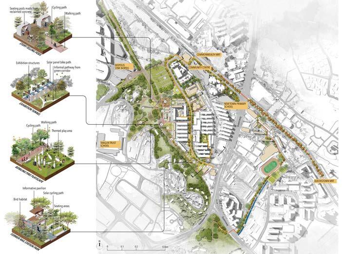
1 Site context & identified historical nodes
2 Site plan

2 Social & cultural fabric: Heritage trail experience
4 Ecological fabric: Planting typologies
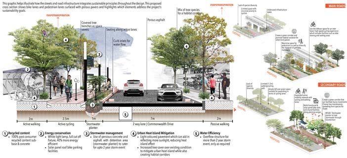
5 Road infrastructure to facilitate climate adaptation. Improved road configurations
44 LA5702
1 2
MLA STUDIO: REGION
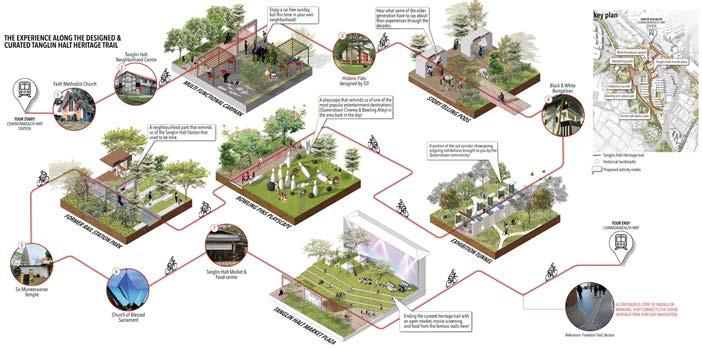
45
3 4 5
MASTER PLAN
1 Large carbon footprint behind food waste
2 Toh Guan neighborhood context
3 Master plan
4 System 1: Anaerobic digestion
5 System 2: Composting
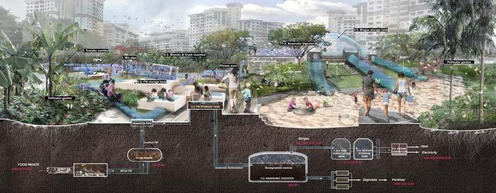
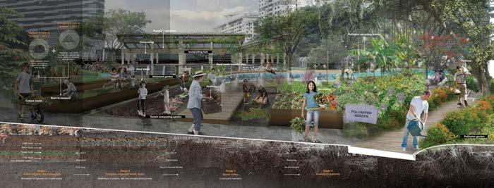
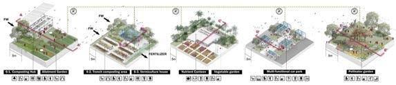
46 LA5702 1.Collection center 2.Composting hub 3.Tench composting 4.Vermiculture house 5.AD Blender 6.Food waste storage tank 7.Anaerobic digestion tank 8.Gas purification tank 9.Biogas storage tank 10.Engine generator 11.Edible forest 12.Fragment garden 13.Amphitheater 14.Forest 15.Allotment garden 16.Vegetable garden 17.Orchard 18.Flower garden 19.Pollinator garden 20.Multi-functional car park/ market 21.Fitness square 22.Civic plaza 23.Sand & pit 24.Nutrient canteen 25.Natural Swimming pool 26.Wetland
Skywalk Fitness Vegetation garden Children recreation Flower garden Communication Wetland Sports loop Exihibition Edible forest Farm/Agriculture Grassland Leisure Orchard Waste By-product Final product Commute route Educational trail Leisure trail Food Waste Disposal location Toh Guan Neighborhood(Site) HDB Buildings Neighbourhood boundary Neighbourhood food waste collection center Waterbody LEGEND 1 THE EXISTING LINEAR FOOD WASTE SYSTEM IN SINGAPORE Toh Guan neighborhood: densely populated community, close to the future second city center (Jurong east) of Singapore. BREATHING NEW
Food waste is a waste stream with which everyone is familiar. However, what may be less well known is its low recycling rate in Singapore is only 16%. The current disposal system for Singapore’s home food waste is a linear process. Household trash is first collected and transfer to the neighborhood collection point, then transported to the regional central collection center, and then finally shipped to Singapore’s only landfill, Semakau island. The current practice is to incinerate most of the food waste at the landfill. This disposal method has brought about a large carbon footprint and exerts high pressure on the urban environment in Singapore.
LIFE TO FOOD WASTE / ZHONG Yixin Crystal
1 2 3
47
STUDIO: REGION HDB Heat Electricity Fertilizer Brown ingredients Vegetables and fruit Food Money Biodiversity Flora 5-1.Blender 6-1. Composting Hub 5-2. FW storage tank 6-2. Trench composting Garden 5-3. Anaerobic 6-3. Vermiculture 5-4. Gas purification 5-5. Biogas storage 5-6. Engine 4.Collection center HDB 2000 kg Food Waste/ day 1600 kg Digestate Nutrient Planting Community Pollinator 3. Mix pipe 2. Transfer 4 5
MLA
GEODESIGN DESIGNING PRODUCTIVE LANDSCAPES
Description Jessica Ann DIEHL
Tutor
This module introduces and guides students through the geodesign process. Geodesign is a design and planning method which tightly couples the creation of design proposals with impact simulations informed by the geographic context. Geographic information system (GIS) software is used as the platform for the development of advanced techniques in analyzing, evaluating, managing, and modelling. Developed by Carl Steinitz, the geodesign process is an interdisciplinary and collaborative approach to design where each member of the team ‘knows a little about a lot, and a lot about a little’ (Steinitz 2012). The geodesign project complements LA4701 MLA Studio: Quarter: Grown in Singapore: Designing Spaces that Re-Imagine Singapore as a Productive ‘City in Nature.’
MLA LA5301
1

49
Distribution of Green Open Space and Forest
Distribution of Urban Landuse
Configuration of Infrastructure & Hardscape
Deforestation (2001-2019)
1 Site analysis of conditions along Kallang River / Lam Ching Hang, Adam
2 Site context and waterflow of MacRitchie Reservoir / Li Jiaying
3 Building elevation and sun hours analysis / Xiang Wenqin
2 3 4 GEODESIGN
4 Workshop on miroboard
Traditional farm area: 10,979 ft2
Vertical farm area: 3,746 ft2
Yield / ft2 / day farm(traditional):
0.4 heads of lettuce
Total: 154,225 heads of lettuce / day
50
1 2 3
LA5301
5 IGC 2021 Poster Submission

51 GEODESIGN
1 Butterfly Movement (Change Model / Zhang Kairui, Karry
2 Productive rooftop intervention for reducing UHI (2020-2050) / Li Xi, Emily
3 Converting lawns to temporary high yield public farms / Wang Yu
4 Stakeholder Map for Closing the Food Loop at Hawker Centres / Huang Xi
4 5
TOPICS IN LANDSCAPE ARCH
Tutor Description Mark MCDONNELL
Over the last 30 years, there has been a growing interest in ecological landscape design that conserves natural resources, preserves biodiversity, and protects the environment. This module introduces students to basic ecological principles and concepts which underlie the practice of ecological landscape design. It provides students a fundamental understanding of the composition, structure and dynamics of ecological systems such as forests, lakes, streams, wetlands and cities. Also, it provides students with a working knowledge of commonly used ecological concepts including stability, complexity, diversity, equilibrium, conservation, restoration, sustainability and resilience. Utilising a mix of lectures, reading materials, field trips, and class discussions this module assists students in understanding the questions that ecologists study and the methods they use, while also providing insights on how we can fill the knowledge gaps between the science of ecology and the practice of landscape architecture.
PRINCIPLES OF ECOLOGY


MLA AR5954B
Toco Toucan population
Jaguar population
Woolly Spidermonkey population
1
Harpy Eagle population
1 Tropical rainforest ecosystem
2 Examples of urban ecosystems


3 Map of different biomes
BASICS OF ECOLOGY 53
Tropical Rainforest
Alpine Tundra
Arctic Tundra
Taiga (Boreal Forest)
Temperate Forest Grassland Savanna
Desert
Shanghai
Singapore
Singapore
Beijing
2 3
Tutor
Description
Kenya ENDO
The field of landscape architecture requires a series of detailed steps to achieve successful design projects. This module’s prime emphasis is in the integration of details in terms of 1) tangible aspects: various materials, their attributes, and implementation; and 2) intangible aspects: sustainable principles, socio-cultural values, and limits, to ensure longterm performance and coherence of design works. Therefore, the interrelationship and interdependence of parts and whole, between near and far, and between small and large scales are explored through a variety of cases and exercises related to real design practices.
This module covered basic topics in lecture format, including water, vegetation and soil, materials and resources, human health and flow, building and landscape, and pre- and post-construction phases. In addition, guest speakers on landscape lighting design and professional practices were invited to provide first-hand experience in the industry. The module was carried out online due to the Covid-19 pandemic, through various online tools including Zoom, Miro and Loom, as well as Gopro for virtual filed visits.
MLA LA 5302
DESIGN
DETAIL
DETAIL DESIGN
1 Detail analysis of a courtyard of a hostel at 26 Evans Road, Singapore / Adam Lam Ching Hang
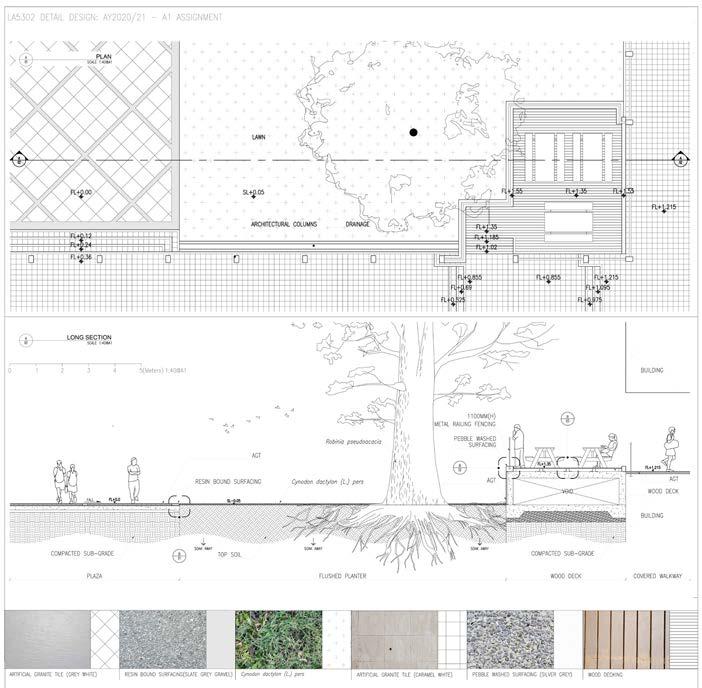
2 Vegetation and soil study of a residential landscape in Zhuhai, Guangdong, China / Wanying Li
55
1 2
PLANTING DESIGN
Tutor
Description TAN Yit Chuan
The urban landscape in general presents different environment conditions from the way plants have naturally evolved and lived in their original environment. For plantings in urban areas, specific conditions need to be fulfilled – creation of favourable growing conditions, use of appropriate landscape design for plants to thrive, as well as the selection of suitable species. This module focused on the understanding of unique urban conditions, covering aspects such as urban microclimate, temperature, water, light, soil and nutrients. In addition, the design of planting areas to ensure the growth needs are met and understanding the range of plant diversity suitable for different urban conditions are critical. The module’s key focus is on the fundamental knowledge and challenges to ensure that plants can thrive well in urban areas, and provide landscape architects with a solid and practical grounding in plant knowledge and application.
MLA LA 4202
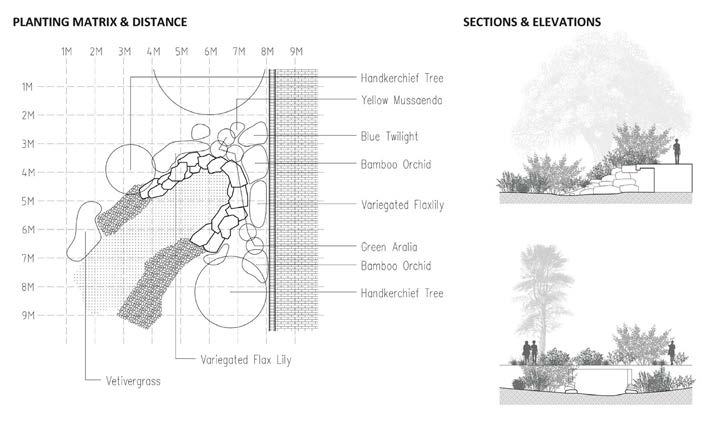
1 Serial vision and landscape observation / Ge Wenxi
2 Landscape observation, planting matrix and palette / Yin Yi Anna
DESIGN 57
PLANTING
1 2
Tutor
Description
HISTORY AND THEORY OF LANDSCAPE ARCHITECTURE
Ervine LIN
There is nothing new except what has been forgotten. Design is not spawned from a void; instead it is intricately linked to a myriad of influences across time, cultures, and even personal experiences. Such influences are often compiled into theories by scholars and practitioners alike as a means to better understand, explain or educate about the rationale or technique of the shaping landscapes.
As such this module explored the underpinnings of landscape architecture, exposing students to ideas that have molded our understanding between the dichotomies of nature versus naturalistic, aesthetics versus economics, mimicry versus authenticity, and how unravelling these discourses can enrich their reading of the landscape. The goal was not to produce historians capable of identifying the nuances between landscape styles, but rather designers who are critical of landscapes that they see and experience, but more importantly design and build.
MLA LA4203
59
AND
HISTORY
THEORY
1 Debating the need to expand beyond literal greening in urban contexts / Julia Tong
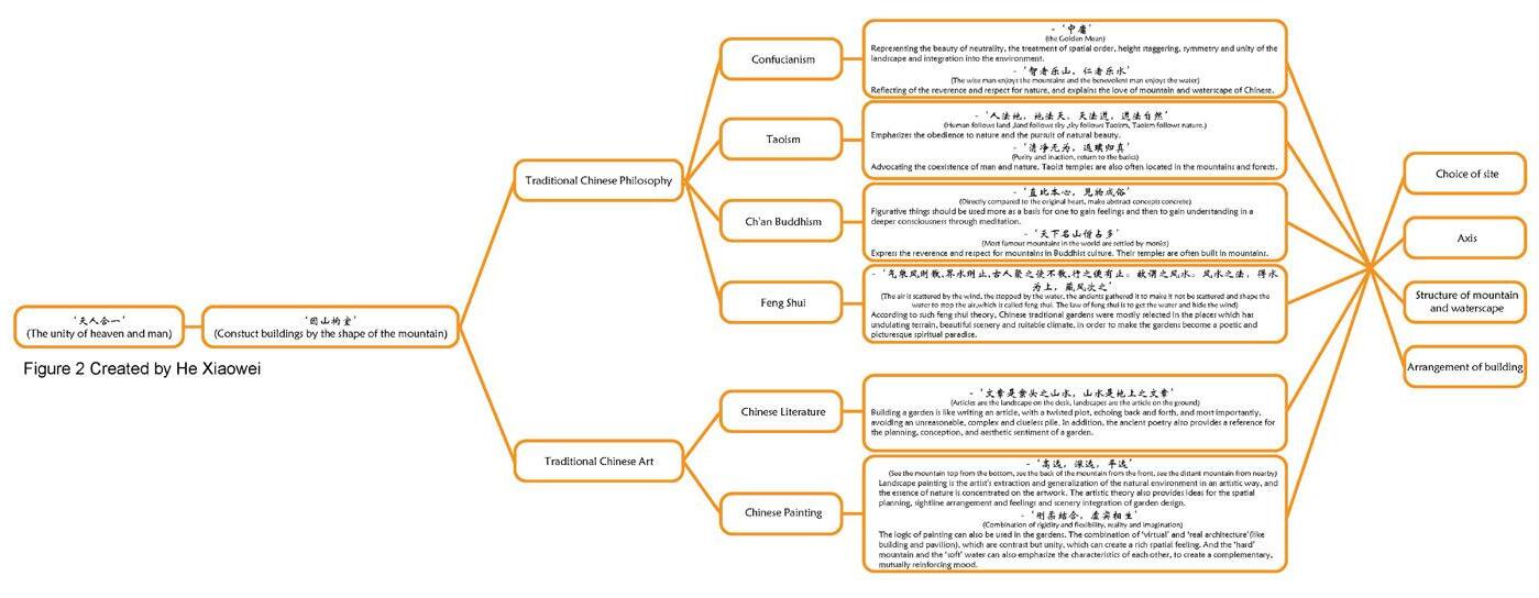
2 Diagram dissecting traditional Chinese art and philosophy / He Xiaowei
1 2 3
3 Deeper reading of Bishan Ang Mo Kio Park / Nicole Foo
TROPICAL FOREST ECOLOGY TOPICS IN TROPICAL ECOLOGY
Description Shawn LUM
Tutor
The practice of landscape architecture requires a working knowledge of ecology. The distribution of plants and animals is dependent on environmental conditions of a site, land use history, local and regional habitat and species distribution, and a number of other factors. As building and design can transform landscapes and the habitats and wildlife that live on them, holistic practice involves understanding ecological characteristics of a site prior to development. In addition, the ability to make realistic assessments of potential outcomes on site ecology after development and designing toward desired ecological outcomes are indispensable skills for the successful landscape architect. The ecological understanding of practitioners is particularly challenging in the tropics, which feature some of the world’s most diverse and complex ecosystems. This module aims to equip students with the foundational knowledge (ecological principles; vegetation types; habitats) and basic skills (plant identification, literature reviews) to recognise habitat types, interpret ecological properties of a site, and to be able to design and critique landscapes from an ecological perspective.
MLA LA4212
Central Catchment Nature Reserve, Singapore
TROPICAL FOREST ECOLOGY 61
POLICY OF LANDSCAPE
Tutors Description Wolfgang WENDE
Following the Convention on the Protection of Biodiversity (CBD), the New Urban Agenda (UN Habitat) and the Sustainable Development Goals (SDGs) of the United Nations, landscape architects will increasingly be called upon to work on a more strategic, a more ecological, and a broader scale level. This module exposed students to a critical review of contemporary landscape practice locally, regionally and globally to provide guidance for landscape strategies (e.g., legislative, spatial). By conceptualizing theories such as Green Infrastructure, Nature Based Solutions, and Ecosystem Services, students take new emerging instuments and tools into account like landscape planning, environmental impact assessment, biodiversity offsets. With this the module integrates design capabilities as well as ecological baseline knowledge to be applied in a landscape policy and decision-making context. Students applied learning to a case study project to re-design a more ‘environmentally friendly‘ holiday village using environmental impact assessment tools.
MLA LA4201
1 Ecological analysis / Chin Carissa, Rakholiya Ekta, Bargotra Poornima, Dhuri Ruiee
2 Stakeholders of the case study: Environmental Impact Assessment Holiday Resort‘ / Cheng Jing, Shao Zhongran, Zhang Bingqian, Zhang Yifei
3 Alternative design of the holiday village taking environmental and ecological information into account / Wang Haobo, Zhang Bingyi, Zhou Xianfeng
POLICY OF LANDSCAPE 63
1 2 3
URBAN ECOLOGY AND DESIGN
Tutor Description Mark MCDONNELL
The modern practice of landscape architecture and design has moved beyond aesthetics and is now focused on creating livable, healthy and resilient cities, which requires a greater understanding of ecological principles and concepts. Urban ecology is the study of ecosystems that include humans living in cities and urbanizing landscapes. It is an emerging, interdisciplinary field that aims to understand how human and ecological processes can coexist in human-dominated systems and help societies with their efforts to become more sustainable and resilient. It has deep roots in many disciplines including sociology, geography, urban planning, landscape architecture, engineering, economics, anthropology, climatology, public health, and ecology. This course was designed to provide students with an advanced understanding of urban ecological principles and concepts.
MLA LA5222
1
New York City, USA
Singapore
1 Class Project & Field Trip
2 Examples of green infrastructure
3 Examples of urban ecosystems
 Streets of Shanghai, China
Multi-Layered Planting, Singapore
Green Facade in Fukuoka, Japan
Streets of Shanghai, China
Multi-Layered Planting, Singapore
Green Facade in Fukuoka, Japan
ECOLOGY 65
URBAN
2 3
TOPICS IN LANDSCAPE ARCH
Tutor
Ervine LIN
DIGITAL LANDSCAPE TECHNIQUES
Description From the invention of the axe to surveying tools like the graphometre, technological advancements have always influenced how we document, understand, design and modify our landscapes. The future is digital—smart cities, digital twins, BIM, AI and so on--are rapidly changing how city planning and architecture operates. Landscape architecture has not been void of technological tools, perhaps the most influential being utilised is Geographic Information System (GIS) technology. However, unlike the two dimensional nature of GIS, landscapes are inherently three dimensional. The course thus explored the various advances that allow landscape architects to operate within a 3D environment using data collected from reality, studied and modified through computational thinking, and enriched through information modelling. The goal was for the module to serve as a spring board for future landscape architects to begin their journey of adopting new digital tools previously built for other disciplines and adapting them to landscape architecture.
MLA AR5954A

TECHNIQUES 67
DIGITAL LANDSCAPE
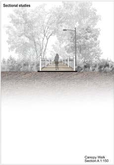
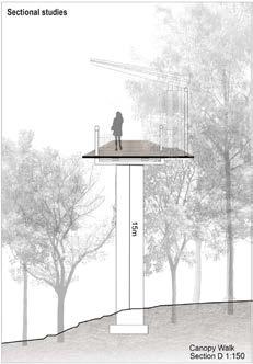
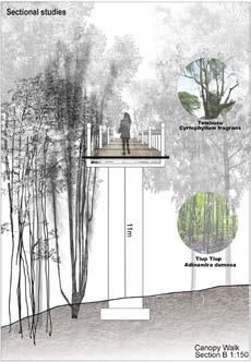
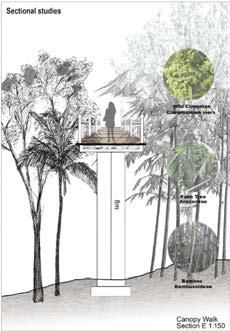
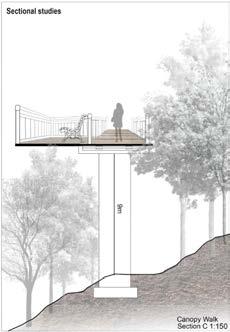
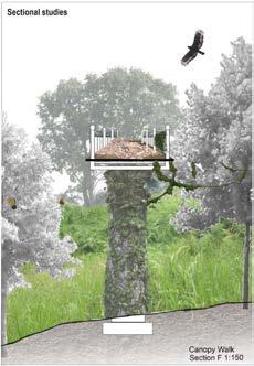
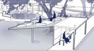
1 Parametric Modelling of a Tree Top Walk / Carissa Chin, Poornima Bargotra, Ruiee Dhuri, Wenfa Lim
1 2
2 A universally designed path generated to ensure wheelchair accessibility / Ekta Balubhai Rakholiya, Xiao Xinyan, Zhou Zuyuan
AR5954A 68 1 2 3
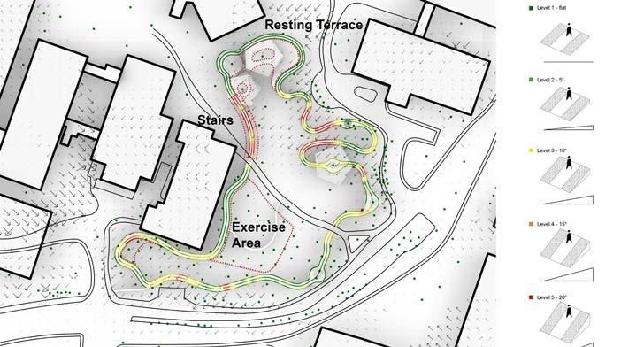
Rest Area Raised Platform Exercise Area
LANDSCAPE TECHNIQUES 69
DIGITAL
1 Crop suitability analysis combining sunlight, slope and accessibility / Cheng Jing, Shao Zhongran, Zhang Yifei
2 Students were introduced to Grasshopper Scripting / Cheng Jing, Shao Zhongran, Zhang Yifei
3 Plant suitability analysis based on water flow analysis / Feng Zihan, Han Cong, Tanaka Mamiko, Zhang Bingqian
4 Running track difficulty based on slope angle / Lyu Jiawei, Wang Haobo, Zhang Bingyi, Zhou Xianfeng
5 Water flow analysis / Feng Zihan, Han Cong, Tanaka Mamiko, Zhang Bingqian
4 5 6
6 Viewshed analysis / Lyu Jiawei, Wang Haobo, Zhang Bingyi, Zhou Xianfenga
URBAN GREENING TECHNOLOGIES AND TECHNIQUES
Tutor Terrence TAN
Description This module introduced students to contemporary and emerging technologies and techniques that have become essential components of urban greening design and practices. It traced the origins of such technologies and techniques as responses to challenges and opportunities in creating a green and ecologically-balanced urban environment, explained their scientific underpinnings, and illustrated with examples of real-life applications. It emphasised the role of R&D as a continual process to improve the performance of greenery to contribute to sustainability, ecological health, and liveability of the built environment. Topics covered include metrics and software used to measure greenery with the grey, brown, and blue elements of the built environment, and the role of plants as the basic building blocks of functional landscapes.
MLA LA5303
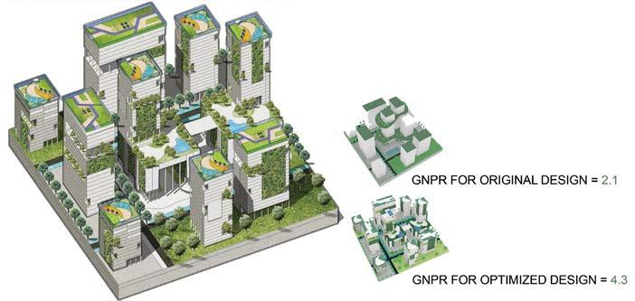
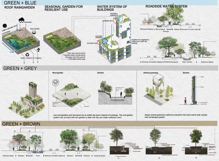
Green and greener precincts: Students were tasked to redevelop a precinct by increasing the Green Plot Ratio (GNPR) and to propose suitable technologies for implementation.
URBAN GREENING 71
DISSERTATION
Tutor TAN Puay Yok
Advisors Description
Jessica Ann DIEHL, HWANG Yun Hye, Ervine LIN, Terrence TAN, Dorothy TANG
The Dissertation module engages the student in a research project aligned to the academic interests of the student and is conducted under the guidance of a supervisor. It presents an opportunity for the student to investigate in-depth, a subject area of intellectual curiosity or practical relevance to the professional practice of landscape architecture. The emphasis of the module is on adopting a scientific process of developing a central question or proposition, collection of evidence, and producing a structured presentation of arguments in relation to the questions being investigated. This process of self-directed inquiry and learning culminates in a substantial piece of written work that demonstrates a critical analysis of the pertinent issues, and the use of scholarly methods in the presentation of arguments and perspectives. Dissertation has grown to be a key feature of NUS MLA programme and complements the research-oriented focus of the school towards the teaching of tropical landscape architecture.
The topics covered by students in AY2021-22 were broad, as we have seen in the last 3-4 years, in parallel with the increase in advisors. Students covered topics from social aspects such as place branding, gentrification and spatial equity, to ecological topics of ecosystem services assessment, microclimatic student, and to the application of artificial intelligence in designing streetscapes.
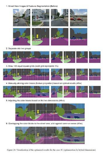
1 Evolutionary multi-objective optimization for designing urban streetscape from the perspective of human perception / Illustration by Hao Jun
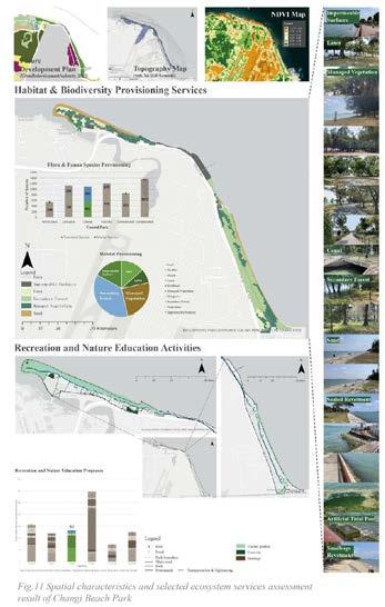
2 Characterizing spatial configuration and ecosystem services of coastal parks in Singapore / Illustration by Huang Xi
MLA LA5742
DISSERTATION TITLES
» FANG TING: Spatial–temporal dynamics of urban green space in response to rapid urbanization and greening policies: A comparative study of six first-tier Chinese cities in the Yangtze River Delta
» FENG KANGTAI: A Revision of GnPR from the perspective of microclimate
» GE WENXI: Urban residential heritage district development and place attachment: A case study of Suzhou
» HAO JUN: Evolutionary multi-objective optimization for designing urban streetscape from the perspective of human perception
» HE XIAOWEI: Ecosystem services provided by vegetation converted from cropland due to Grain for Green Project
» HONG MENGYI: Solutions for the multifunctional unused / underutilized space under the elevated infrasctructure in Singapore
» HUANG XI: Characterizing spatial configuration and ecosystem services of coastal parks in Singapore
» LI JIAYING: Co-relation between perceived greenness visibility and urban green space distribution for recreational cycling experience in Singapore
» LI WANYING: A morphological study of Singapore’s post-war industrial landscape
» LI XI: Solar Exposure of roof garden and ground-level garden
» LIU KAIYAN: Comprehensive suitability model of sponge city development in Futian, Shenzhen
» LONG DI: Exploring human-wildlife conflict in Singapore and its relationship to landscape design
» OU YEYAO: Performance evaluation of green walls: a case study of Ventus Building in Singapore
» RUI XUE: Co-relation between perceived greenness visibility and urban green space distribution for recreational cycling experience in Singapore
» TAN SHUYUE: Life Cycle Assessment of vertical greenery systems in Singapore: Focusing on carbon emission
» XIANG WENQIN: Place branding and rural tourism: The case of Tea Horse Ancient Trail in Pu’er, Yunnan
» XIE WANYING: From common to iconic: Singapore landscapes and gentrification
» YIN YI: The greener, the better? Varying acceptance levels of greening efforts across different urban green spaces in Singapore
» ZHANG KAIRUI: Assessment of spatial inequality of cooling services provided by urban green spaces in Singapore
» ZHANG LIPING: Understanding management practices of commercial rooftop farming in Singapore
» ZHENG QIAOYU: Evaluation of microclimate condition of thematic zones within Gardens by the Bay
» ZHU WEN: Impact of urban parameters on air temperature for a campus located in the tropics
DISSERTATION 1 2
73
AY 2020/2021
BACHELOR OF LANDSCAPE ARCHITECTURE
Tutor Students
BLA STUDIO: DESIGN 1
Description
Yun Hye HWANG
Cheng Hwee Cherise Chng, Qi Fang Chow, Rui Yi Rhueyviianne Chua, Xue Ying Judith Tay, Lovey Joash Kashanna, Jun Yi Kirsten Khoo, Min Rui Nicole Ler, Jia Yin Lin, Nur Nadzirah Binte Mohamed Nizam, Kangqi Peng, Yock Li Sandy Foo, Xue Xia & Yijie Zhang
This foundation level studio aimed to familiarize landscapes – referring to a relationship between human and nature. The studio focused on reading, conceptualizing and manipulating landscapes with diverse modes of ‘Sensing.’ Emphasis was placed on developing spatial literacy and proficiency in design thinking via drawing, analysing and making.
SENSING LANDSCAPE
The first of three integral projects, themed ‘Attention to Landscape’ asked students to thoroughly observe and represent physical and spatial characteristics of chosen natural landscape elements through multiple ways of seeing with a great sensibility, at various scales and perspectives. Beyond these immediate dimensions of the elements, the second project ‘Articulating Landscape’ deployed generative (annotative) and analytical methods to understand what constitutes a ‘scene’ and how the chosen landscape elements operate as a basic kit of parts in a whole. Students were asked to identify spatial and functional novelty and authenticity of the elements. Finally, with ‘Manupulating Landscape’, students worked iteratively to propose an imaginative space where a combination of natural and manmade landscape elements amplify visual and functional values towards cohesion and robustness of landscapes.
BLA LAD1001
Sketches and handdrawings to encourage students to experience new levels of creative tension through reassembles and reorganization of possibilities. The goal was not to collect more ideas, but to project meaningful and impactful visual exploration of alternative urban landscapes.
1 77
DESIGN

LAD1001 78 1
THE SHADED PLAZA / Kirsten KHOO
The project depicts how there are a plethora of different plants with different leaves, yet they all manage to have their own unique features. The plaza was designed with the intention of creating a comfortable space that allowed visitors to admire and appreciate the beauty of leaves through the shade they provide. The strong contrasts between the open area of the plaza consisting of smaller trees with less dense canopies in comparison to the denser, more shaded area with larger trees highlights the differences in trees. Sectional perspectives depicted how plants and their leaves interact with the environment around them, which in turn impacts the way humans experience this environment. The varying shade and cooling effect provided by leaves adds on their awe and magnificence
DESIGN 1
79
2
1-2 A collection of physical models. Physical model making worked as an important design process for this studio. The models helped students to undertstand scales, experience various materials, and tested design ideas in a 3 dimesional way.
FIXED FORM OF FLEXIBILITY / Cheng Hwee Cherise CHNG
The designed space allows users to be fully exposed to the water, especially during raining events. While many shy away from rain, this human intervention encourages visitors to stand on the platform to observe how water flows towards them. There are two layers with the lower platform floodable.
1 Site plan
2 Section drawing
3 Topographic perspective
LAD1001
80
2 1 3
THE MIDDLE GROUND / XUE Xia
As the underground anchor of plants, roots may be thin and fine individually, but grow and extend to form an extremely strong and stable support system. Motivated by roots as bulky and inflexible, but adapting overtime to their surroundings to maximise functions, this project intervens in the placement of paths and structures in the root spaces. the key design principle is to find balance between minimising the destruction to natural root spaces and underground ecology while maximising user experience in the area.
SKY PLAYGROUND / Xue Ying Judith TAY
This project was inspired by forest layers that create differences in density, shade, overlapping of branches, space and boundaries.
DESIGN 1
81
Tutor Students
BLA STUDIO: DESIGN 2
Description
Kenya ENDO
Cheng Hwee Cherise Chng, Qi Fang Chow, Rui Yi Rhueyviianne Chua, Xue Ying Judith Tay, Lovey Joash Kashanna, Jun Yi Kirsten Khoo, Min Rui Nicole Ler, Jia Yin Lin, Nur Nadzirah Binte Mohamed Nizam, Kangqi Peng, Yock Li Sandy Foo, Xue Xia & Yijie Zhang
This second foundational studio offered basic skillsets to interpret spatial compositions, scales, and patterns from our surrounding environments. The studio addressed a number of landscape methodologies on articulating spatial characteristics that make places unique from one another, including field observations, precedent studies, and iterative drawings.
COLLECTIVE SPACES
Introductory exercises centered on analyzing various sectional profiles of a given linear site(s), with the emphasis on understanding different scenarios and functionality. Both urban and natural settings were targeted for investigation, to unfold their spatial organization that defines people’s perception. We sought to answer: What proximity and juxtaposition of landscape elements (e.g., vegetation, waterways, circulation) influence the way people experience the space? Subsequent assignments carried forward key learnings from the previous one, and focused on re-interpreting them into strategies for spatial interventions. As a response, students were tasked to reimagine a small urban site to enhance/redefine/ update the site’s identity via manipulating its spatial configuration.
BLA LAD1002
DESIGN 2 83
1 Series of sections of tree top canopy walk at Kent Ridge Park, illustrating vegetation types, proximity, and experiential aspects / Chng Cheng Hwee, Cherise, Zhang Yijie
1 2
2 Printing on a transparent film; a representation method to understand changes in spatial quality
1 Various models to test and represent design ideas / Cheng Cheng Hwee, Cherise, Chow Qi Fang, Chua Rui Yi Rhueyviianne, Judith Tay Xue
Ying, Khoo Jun Yi, Kirsten, Lin
Jia Yin & Zhang Yijie
2 Design strategies
3 Layout plan 1
LAD1002 84
2
DESIGN
85 2 3
THE TRANSIENT GREEN / Judith TAY Xue Ying
NOW YOU SEE ME / Xia Xue

LAD1002
86
2
DESIGN
87
H(OURS) / CHNG Cheng Hwee, Cherise
Tutors Students
BLA STUDIO: DESIGN 3
Description
Kenya ENDO Lehana GUO
Alyssa Tee, Amber Yong, Brina Choo, Tammy Chen, Shoa Yin Cheong, Chester Lee, Qing Yun Chye, Allaine Galapon, Jing Jing Ho, Benjamin Ling, Magan Lam, Nicole Foo, Qiyanah Azmi, Jie Min Tan, Sok Vin Tan, Sit Kee Yap, E Ming Yeoh, Yulin Teo, Wen Zhang, Siew Yi Hia & Julia Tong
RETROFITTING SITES
Campus landscape of NUS comprises a mix of habitats ranging from secondary forest to managed parklands and manicured gardens. Since the 1980’s, the sprawling 150-hectare Kent Ridge site has become home to academic and thriving campus activities for students, staff, and researchers. The setting of campus landscape serves as a suitable specimen to analyze how key landscape layers such as accessibility, water movement, fauna and flora, micro-climate, and human experiences intertwine with unique topographical features. Through viewing the campus with the lens of landscape architectural design, this studio gave students the opportunity to unfold spatial patterns (how landscape is formed, programmed, and used) and at the same time, examine how spatial design can suggest ideas to retrofit towards an environmental and responsive campus.
BLA LAD2001
DESIGN 3 89
1 Site analysis and rapid design response for NUS UTown, Campus lawn / Alyssa Tee, Amber Yong, Tammy Chen, Qing Yun Chye, Tan, Sok Vin Tan.
1 2
2 Design exploration with concept and site models / Chester Lee, Jie Min Tan, Brina Choo, Siew Yi Hia, Sit Kee Yap, Julia Tong, Qiyanah Azmi, Jing Jing.
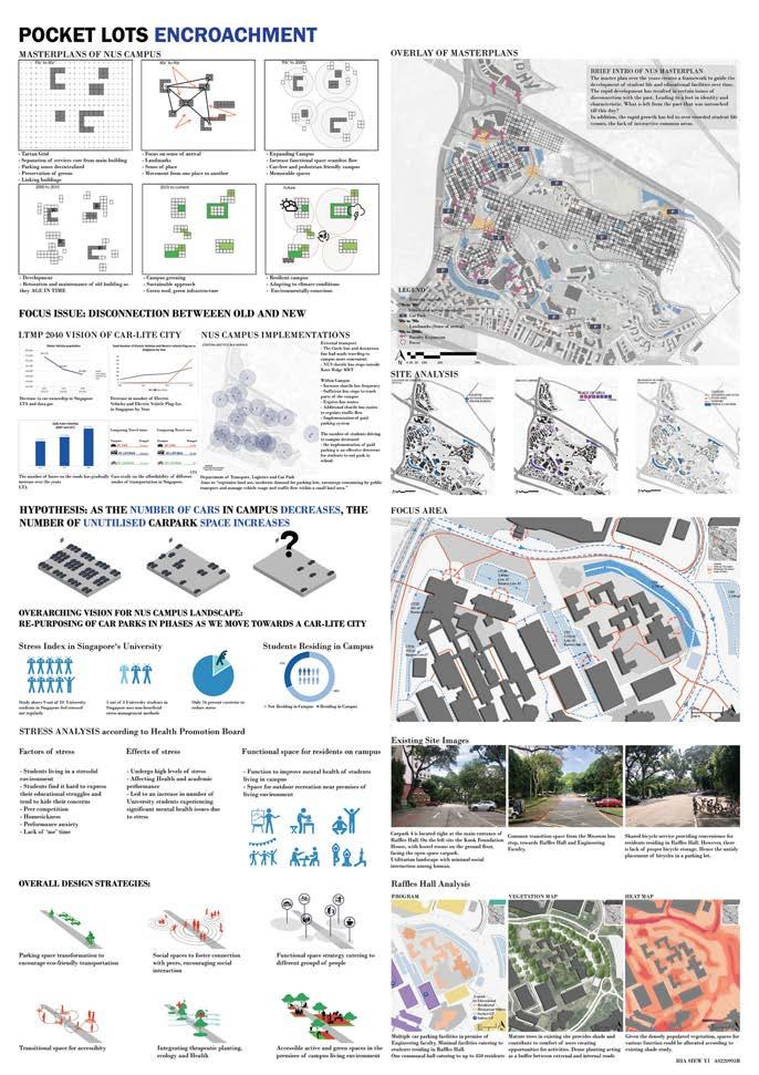

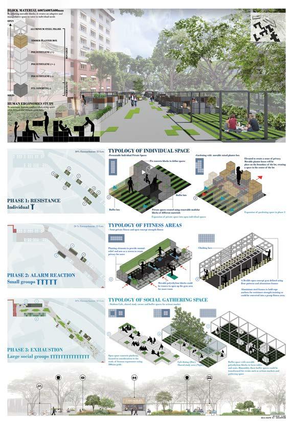
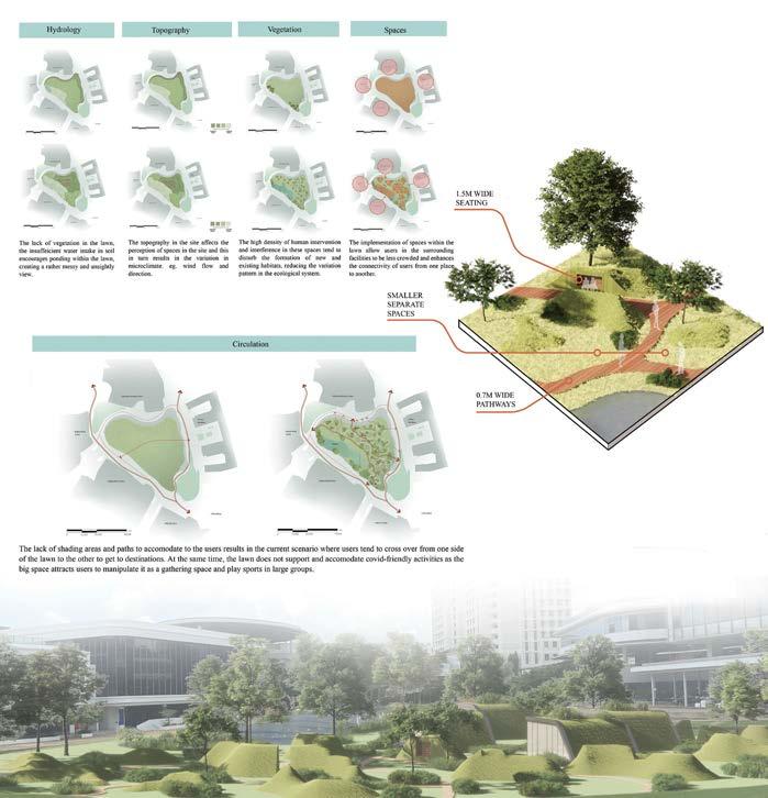
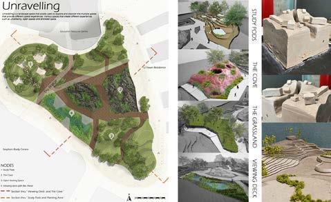
POCKET LOT ENCROACHMENT / SIEW Yi Hia 90
LAD2001
DESIGN 3 CAMPUS IN NATURE / Jing Jing HO 91
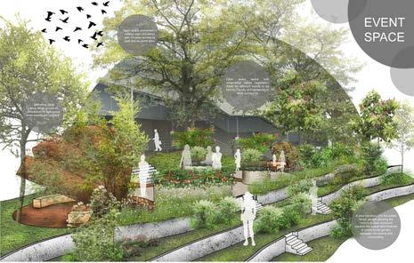
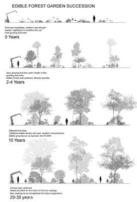
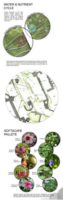
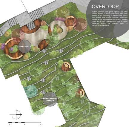
OVERLOOP / E MING YEOH 92
LAD2001
DESIGN 3
93
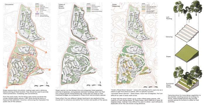
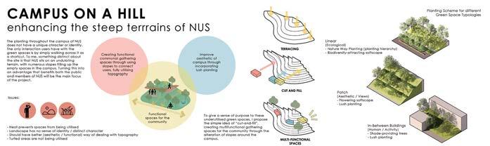
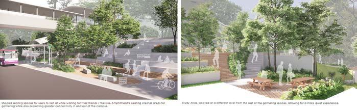
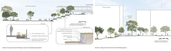
CAMPUS ON A HILL / Alyssa TEE
BLA STUDIO: DESIGN 4
Tutor Students Description
THE LANDSCAPE OF INFRASTRUCTURE
Henry STEED
Alyssa Tee, Amber Yong, Brina Choo, Tammy Chen, Shoa Yin Cheong, Chester Lee, Qing Yun Chye, Allaine Galapon, Jing Jing Ho, Benjamin Ling, Magan Lam, Nicole Foo, Qiyanah Azmi, Jie Min Tan, Sok Vin Tan, Sit Kee Yap, E Ming Yeoh, Yulin Teo, Wen Zhang, Siew Yi Hia & Julia Tong
Future Landscape Architects will design fewer pretty places and focus more on rescuing the man-made and natural environment. Parks and urban landscapes will be important, but mitigating the impact of our vast ‘infrastructure’ on the environment will be our most pressing role. Infrastructure is almost everything that provides essential services to communities. These are some of humanity’s largest interventions into the natural world, altering ecosystems or removing nature altogether. Rarely are they harmonious with nature.
This module addressed the above and assessed the impact of each infrastructure type, reviewing their presence. It covered the probabilities of future change: improvement of existing systems, ways to work with engineers and agencies involved, ways to remove old systems, and the how to contribute usefully. Students learned about infrastructure policies and economics, and how they shape planning decisions. Environmental and resilience policies are increasingly influential, helping to reduce the scale. These important topics were covered in talks and discussions during the course. The design site was an urban infrastructure intersection. It was chosen to test students’ abilities to alter such an environment for the better.
BLA LAD2002
DESIGN 4 95
1 Proposed masterplan / Studio
1
2 Green connections masterplan / Ho Jing Jing, Tammy Chen, Tan Sok Vin. 2
1 Detail Plan / Julia Tong
2 Perspective / Julia Tong
3 Detail plan / Yulin Teo

4 Section of elevated walkway / Yulin Teo
5 Perspective of Level 3 rooftop / Yulin Teo
96
LAD2002
2 1

DESIGN 4 97 3 4 5
98 2 1 3
LAD2002 RIVERINE PARK / Brina CHOO
DESIGN 4
99
RAILWAY VISTA PARK / Magan LAM
1 Layout Plan / Brina Choo
2 Design Principle / Brina Choo
3 Ecology Zone / Brina Choo
4 Detail Plan / Magan Lam
4 5
5 Perspective of Feature Shelter / Magan Lam
REMAKE WHAMPOA
Tutors
Students Description
LEE Tat Haur
Kenya ENDO
Chloe Lau Jia Yee, Guan Qin, Jessica Ann Lee Yu, Puar Yue Hong, Tan Ee Joo & Kelly Tan Yu Jia
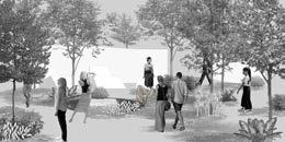
The design works from this landscape-focused studio embedded in Architecture design studio (AR3101) exemplify design for health and well-being in response to the current pandemic situation, and address longterm effects on architecture and urbanism. The Covid-19 pandemic has immensely impacted how we, as individuals and as a community, live, work, play and behave. During the lockdown period in Singapore, restriction to essential necessities and activities led the studio to re-evaluate the spatial quality of architecture, landscape, and urban realms. Under such circumstances, good quality public spaces with seamless pedestrian connection, lush softscape design, spatially safe and aesthetically pleasing designs appear to be an antidote.
The site-at-large encompassed the existing Whampoa HDB (public housing) precincts, St. Michael Bus Terminal, Whampoa Makan Place with Market, and Whampoa Community Centre, where they are located in close proximity to the historically rich Balestier Road. Within this district, work began with macro-scale contextual analysis with a longterm urban framework that had greater emphasis on enhancing sense of community and cultural identity. Subsequently, students carried out further research on various architectural typologies and massing studies with targeted programming, in order to inform the architectural shape for the site, and how it interplayed with the outdoor environment.
BARCH AR3101A
5
LANDSCAPE EMPHASIS: DESIGN
DESIGN 5
1 Remaking Whampoa Community Centre with the focus on food and connection: farm to-table food cycle from production to composting / Chloe Lau Jia Yee
101 1 2
2 Urban planning masterplan envisioning improved connectivity and decentralized community facilities / Chloe Lau Jia Yee, Ryan Neo, Zhi Hao Koh
LANDSCAPE EMPHASIS: DESIGN
Tutors
Students Description
INCLUSIVE FIGURES
CHU Lik Ren Terrence TAN
Tan Yu Jia, Janina Kwan Yin Man & Nur Sabrina Binte Shafari
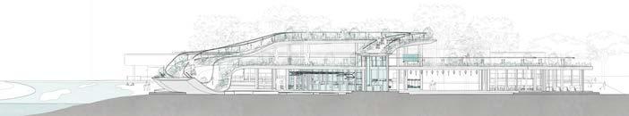
This landscape-focused studio embedded in Architecture design studio (AR3101) explored the architect’s challenge of inclusion: the art of designing for people and things to function alongside each other, differently but well. The architecture studio investigated various methods of embracing a diverse collection of human bodies, and the ways in which they interact with a building—from its legibility within the neighbourhood fabric, to issues at the architectural scale: approach, procession, organisation, spatial quality and access. This module challenged students to develop robust and tolerant design frameworks, as well as figures with room for an array of subsystems—such as structure and tectonics, services, programs, aesthetics, human relations, and experiences—within Singapore’s natural conditions. Students were tasked to design an inclusive library that caters to users who ‘read’ and experience architecture in radically different ways. Specifically, four use-cases comprising wheelchairbound, hearing or visually impaired, and hyper- and hypo-sensitive demographics were considered.
BARCH AR3101B
6
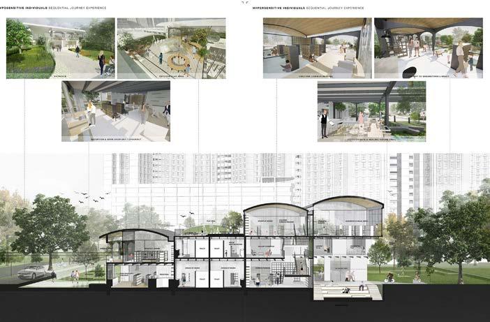
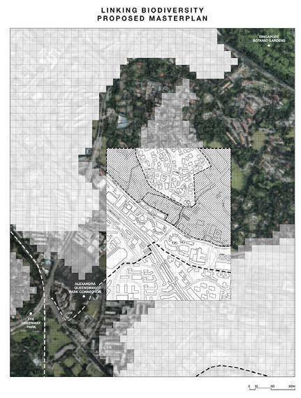
DESIGN 6 103
1 Proposed masterplan for biodiversity preservation by linking sites through design / Nur Sabrina Binte Shafari
1 2
2 Sectional perspective of proposed architecture design / Nur Sabrina Binte Shafari
INTRODUCTION TO LANDSCAPE ARCHITECTURE
Tutors Students Description
Lehana GUO Dorothy TANG
Alyssa Julianne Tee Xin Yun, Amber Yong Ling, Brina Choo Si Min, Chen Hui Lin Tammy, Cheong Shao Yin, Chester Lee Yong Lin, Chng Cheng Hwee, Cherise, Chow Qi Fang, Chua Rui
Yi Rhueyviianne, Chye Qing Yun, Galapon Ma Allaine Corpuz, Hia Siew Yi, Ho Jing Jing, Julia Tong Wai Shan, Judith Tay Xue Ying, Kashanna
Lovey Joash, Khoo Jun Yi, Kirsten, Ler Min Rui Nicole, Lin Jia Yin, Ling Wei Shuen, Benjamin, Magan Lam Wan Kay, Nicole Foo Jiaxuan, Nur Nadzirah Binte Mohamed Nizam, Nur Qiyanah Binte Azmi, Peng Kangqi, Sandy Foo Yock Li, Tan Jie Min, Tan Sok Vin, Xia Xue, Yap Sit Kee, Yeoh E Ming, Yulin Teo, Zhang Wen & Zhang Yijie
This module introduces the concepts of landscape and how its conception relates to the profession of landscape architecture. Through understanding landscape as an epistemological category, it presents a survey of the development of the profession and how the profession responds to urgent societal and environmental issues.
The course was organized around two major debates in conceptualizing landscapes. First, is landscape natural or is it culturally constructed? Second, is landscape a public amenity or a resource and utility? Over the course of the semester, students were introduced to ideas of landscape as nature, environment, art, culture, leisure, public spaces, infrastructure, and productive landscapes, culminating in a panel discussion about landscape futures.
BLA LAD1003

INTRO TO L.A. 105
INTRODUCTORY GIS FOR LANDSCAPE ARCHITECTURE
Tutor
Description
Terrence TAN
This module provided an understanding of the basic concepts and uses of Geographic Information Systems (GIS) technology and spatial analysis. By linking data to maps, GIS reveals relationships not apparent with traditional item-referenced information systems and database management products, and by displaying information in a graphic form, it unpacked complex spatial patterns. The course emphasized concepts needed to use GIS correctly and effectively for manipulating, querying, analyzing, and visualizing spatial data. Students participated in hands-on exercises as well as GIS assignments linked to their design studio. In this semester, classes were conducted via zoom due to the Covid-19 pandemic.
BLA LAD2004
1 Noise and nearest distance analysis for individual assignment
/Tammy Chen
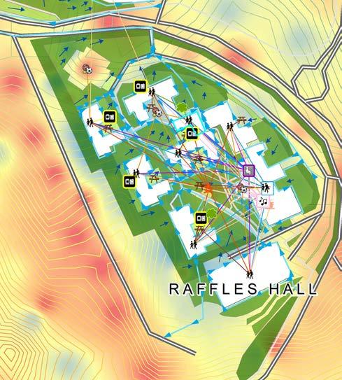
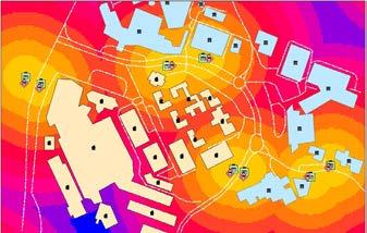
2 Analysis of shortest route to amenties within NUS Raffles Hall with overlay of ambient temperature, surface runoff, and topography / Brina Choo
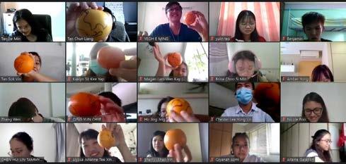
3 Lesson 1: Understanding Geographic and Projected Coordinate Systems with Oranges. conducted via Zoom / Screenshot by Terrence Tan
INTRO GIS 107
1 2 3
AY 2021/2022
MASTER OF LANDSCAPE ARCHITECTURE
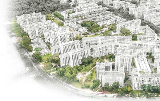
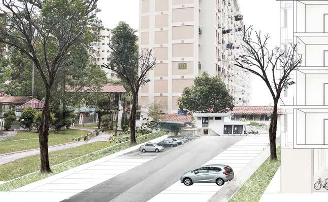
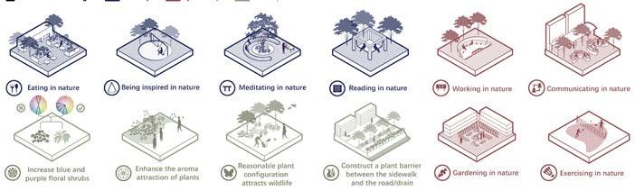
MLA STUDIO: QUARTER FROM LIVEABLE TO LOVEABLE: PLACEMAKING IN SINGAPORE’S HDB ESTATES
Tutors Students
Jessica Ann DIEHL
Melissa YIP
Anchita Mirwankar, Cao Naichun, Chai Xin Yi, Chang Wanruo, Cheng Siqi, Cynthia Wee Su Yi, Dong Liwei, Hu Die, Janina Kwan, Jensen Por Pheng Ju, Jiang Ruomin, Jin Zhuoyin, Jiang Yul, Lin Lan, Liu Kangsheng, Liu Ziyue, Ren Junyao, Sabrina Shafari, Shen Yunnan, Shi Yilan, Virginia, Wang Liangyu, Xing Zhiyan, Xu Ruozhu, Ye Han, Zhou Sicong, Zhang Yuer, Zhang Yuxi, Zhang Wenting & Zhao Mingyu
Description
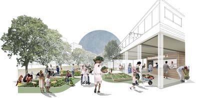
What defines a space, place or home? In dense and fast-paced Singapore where things don’t keep still, there is a migration of people across the islandwhether to newer, greener HDB estates to start new lives or around older estates to be close to the city, family or work. Demographics within estates change, and with that comes shifting urban economics instigating changes in the neighbourhood, schools, and so forth. Older neighbourhoods have to reinvent themselves, while new neighbourhoods have the task of forging fresh identities and social pacts between neighbours. Placemaking is a valid strategy for urban branding and rejuvenation, but it will not be realized without valid consideration of the people we design for. This studio generated fresh visions for HDB residential estates to co-create places where people feel at home. We went beyond the concept of liveability to embrace placemaking that instils loveability. Through the course of the studio, we paired landscape architecture with on-the-ground studies, social economics and policy, environmental and ecological fundamentals - combining top down and bottom up approaches to community design. We endeavored to shape a greater sense of identity, attachment, and cohesion in Singapore’s society.
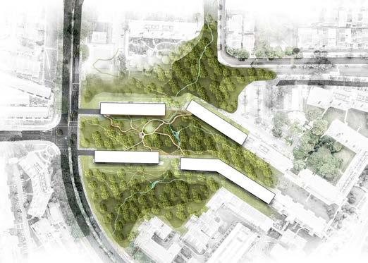
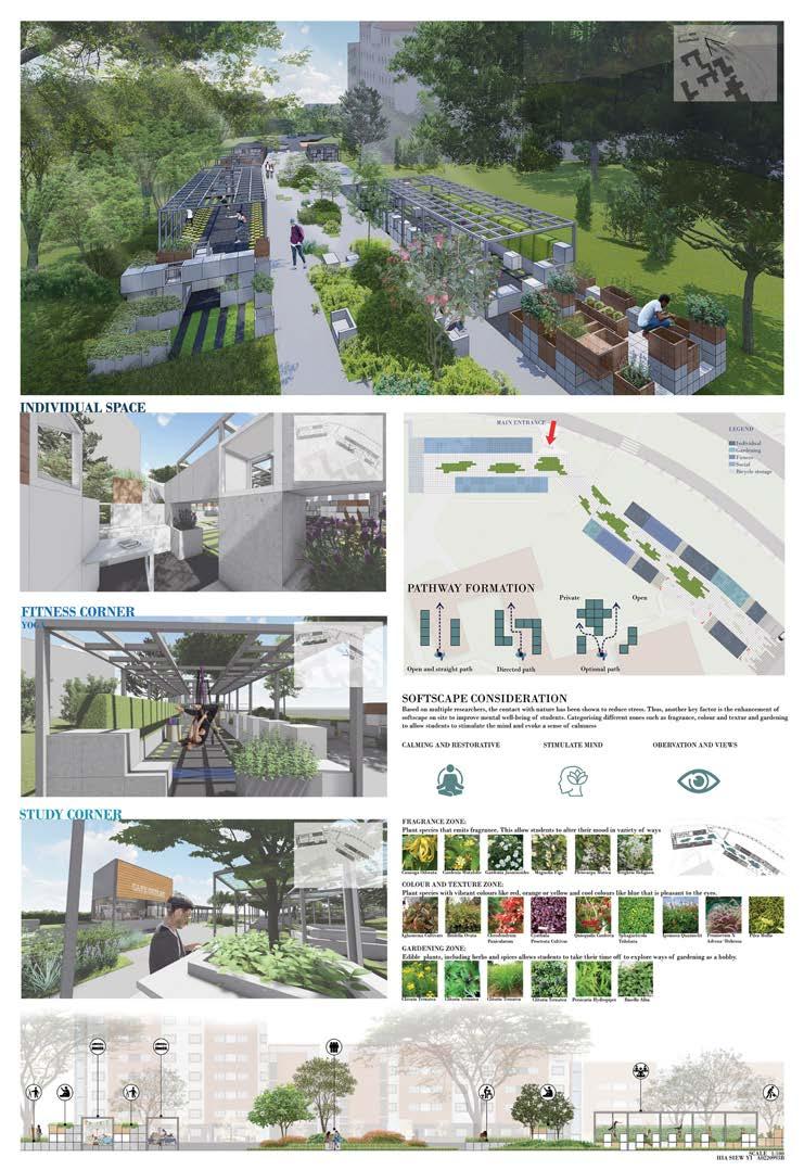
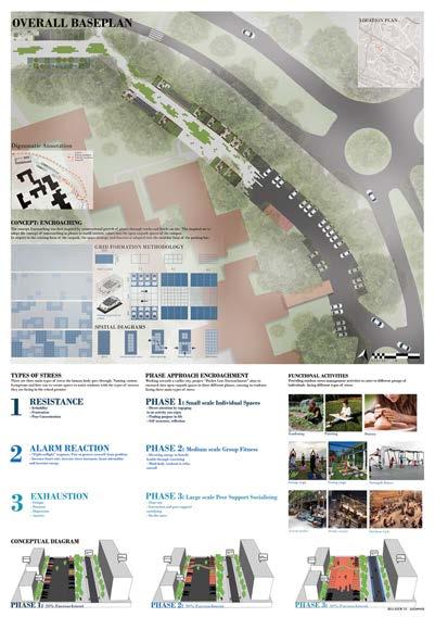
MLA LA4701
1 Green Space Distribution / Cao Naichun, Jiang Yuli, Ren Junyao, Virginia, Wang Liangyu
2 Online community survey / Anchita Mirwankar, Jiang Ruomin, Sabrina Shafari, Shen Yunnan, Zhao Mingyu, Zhou Sicong

3 Quality Matrix of Public Green Space / Dong Liwei, Janina Kwan, Jin
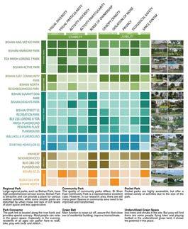
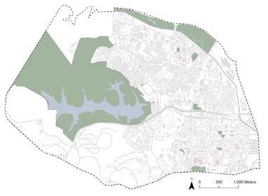
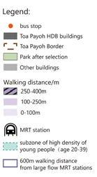
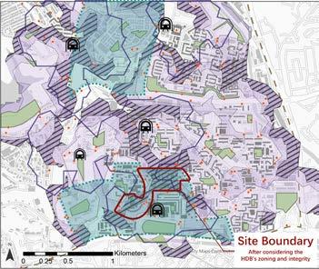
24 ACTIVITY G(RE)ENERATOR Community Outreach UNEVEN DECENT GREEN SPACES DISTRIBUTION 2 x 1 2 3 4 4 3 1 2 2 3 4 4 3 x 1 1 Narrow & unsheltered sidewalk Separated & sheltered sidewalk Well-organized community park Functional park Positive example Negative example Parks Bishan-Toa Payoh border Most problematic area Hydrology HDBs Other buildings Linked canopies Under-utilized community park Non-functional lawn Lack of connection between green spaces MLA STUDIO: QUARTER 111
1 2 3
LA4701
THE GREEN MILE / YE Han
Concept Statement
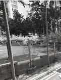
A restorative landscape is proposed between HDB, metro station, and bus station to allow young people more contact opportunities with the natural environment during the busy commute to improve mental health.
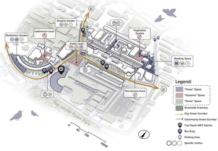
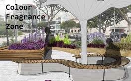
Strategies: Pause Space: Private, quiet, natural environment to restore attention and relax.
Dynamic Space: An interesting communication space in nature to engage in outdoors activities and socializing. Sense Space: Cool-toned shrubs, fragrant plants, and plants to attract fauna for distraction of passersby.
Master Plan
Tactics
112
MLA STUDIO: QUARTER
Pause space
8:00 in the working day morning
Commuters refresh their minds on the “roof”
18:00 in the working day nightfall
People relax their minds in the meditation space downstairs after get off work
8:00 in the working day morning
Commuters stay for a short time and make arrangements for the day
10:00 in the morning on weekend
Share planting experience and have intergenerational communication
20:00 in the working day evening
Workers can swing in the community to have more inspiration for the work problems.
Part of Plant species for Sense space
17:00 in the working day afternoon
Colleagues enter the green space to chat and socialize after get off work
Rendering1: “Roof” of Bus Stop
Rendering2: Lawn in Front of MRT Station
Pause space1 Before Before After After After After After After Before Before Before Before Pause space2 Pause space3 Dynamic space
113
MEMORYSCAPES in TOA PAYOH / Sabrina SHAFARI

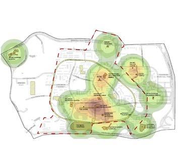
The concenpt is to preserve, revitalise and reconnect the past, present, and future heritage and cultural sites in the heartland of Toa Payoh. By reinventing underutilised spaces and thresholds between each heritage typology landmarks to reflect the old, current and new trends of town identity. The aim is to improve and transform Toa Payoh from a liveable to a loveable neighbourhood, where it continues to instill a sense of ‘kampung spirit’ within the community.
LA4701
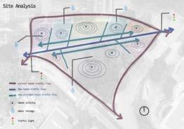
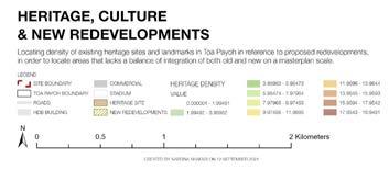
DENSITY MAP ANALYSIS
Cluster of existing heritage sites in the Central Heartland of Toa Payoh.
PRESERVE REVITALISE RECONNECT
HERITAGE TYPOLOGY MATRIX
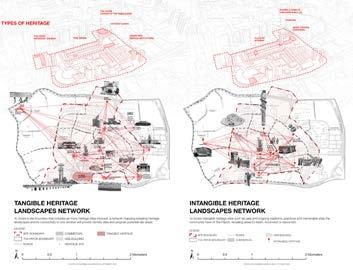
TYPES OF HERITAGE
RESIDENT - HERITAGE ATTACHMENT
Identifying the types of tangible and intangible heritage sites, residents are drawn towards.
114
MLA STUDIO: QUARTER
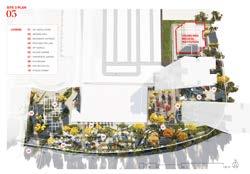


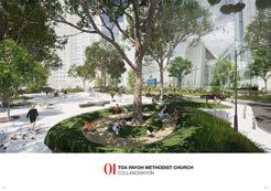
TOA PAYOH METHODIST CHURCH COLLABORATION

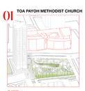
The first site is opposite Toa Payoh Methodist Church that aims to connect the public and residents with external and internal [eg. BTPTC] organisations to encourage community driven collaborations that can assist with improving the loveability aspect of the neighborhood.
A communal space between Toa Payoh Library, 600 Lorong 4 Toa Payoh & HDB Residential Blk 179, is designed to promote cross-generational interactions through a common appreciation of Toa Payoh’s intangible heritage.
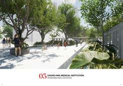
CHUNG HWA MEDICAL INSTITUTION REMEMBERING HERITAGE
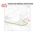
To design an experiential journey towards Chung Hwa Medical Institution which reflects Traditional Chinese Medicine elements. The heritage corridor is both a commercial & heritage park that aims to grow with the community, transforming the urban landscape into a flexible, everchanging space.
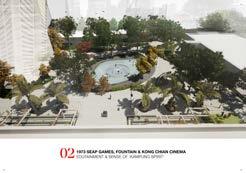
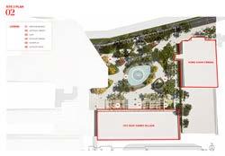
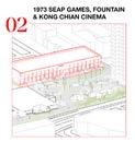
 1973 SEAP GAMES VILLAGE, FOUNTAIN, KONG CHIAN CINEMA EDUTAINMENT & SENSE OF ‘KAMPUNG SPIRIT’
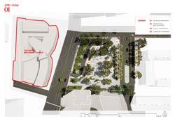
MASTERPLAN VISION 115
MLA STUDIO: CITY
BIRDS ON A BULLDOZER: RE-SHAPING THE ECOLOGICAL
Tutors Students
STRUCTURE OF PLAB
HWANG Yun Hye
Lehana GUO
Ye Han, Xing Zhiyan, Janina Kwan Yin Man, Nur Sabrina Binte Shafari, Lin Lan Hu Die, Jiang Yuli Liu Kangsheng, Zhang Yuer, Shen Yunnan, Dong Liwei, Jin Zhuoyin, Liu Ziyue, Zhang Wenting & Wang Yu (Studio 1)
Cynthia Wee Su Yi, Chang Wanruo, Shi Yilan, Chai Xin Yi, Mirwankar Anchita Nitin, Wang Liangyu, Zhang Yuxi, Xu Ruozhu, Ren Junyao, Cao Naichun, Zhou Sicong, Zhao Mingyu, Jiang Ruomin & Cheng Siqi (Studio 2)
Description
This studio tackle questions that included: Where are the green and blue spaces that are imperative to future ecological desired function? What opportunities for ecological restoration exist? How can we leverage a city’s natural capital to strengthen our ecological, climate and socio-economic resilience? What are the development alternatives that can mitigate loss of nature and limit carbon footprint?
Adopting urban ecological principles from several studies, the studio envisioned PLAB district to possess a self-sustaining and healthy habitat, a physical environment interwoven with histories of infrastructure, buildings, and open spaces to enhance biodiversity conservation and maximize resource usage efficiency, and a district connected to the larger ecosystem. In doing so, it injected flexibility into the PLAB district, allowing it to anticipate and respond to rapid changes in environmental and socio-economic conditions.
MLA LA4702
1 The introductory studio poster shows the loss of biodiversity overlapping of a photo of deforestration Site Near Pasir Ris Park, 2015 / Photo Credit: Hu Zhijie, NUS MLA
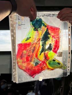
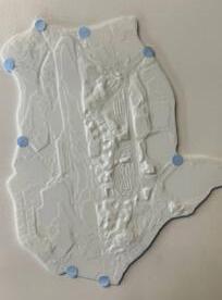
2 Studio design process for the 14 weeks focused on background and topic research, concept master plan workshop, model making, revisiting studio direction, firming up parameters, topic design, concept and design stretegies.
117
MLA STUDIO: CITY
14’
1 2
RE+: Recycled Construction Material / JIANG Yuli, LIU Ziyue, YE Han


This project provides new ideas for the long-term development of a resilient city: a recycling and material rental system that extends the life cycle of materials. It uses landscape as an agent to bring attention of the global resource crisis down to a humanly perceptible scale. The strategies work in tandem using recycled demolition waste as the catalyst for urban regeneration.
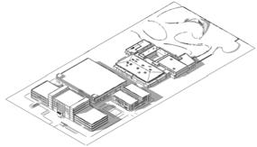
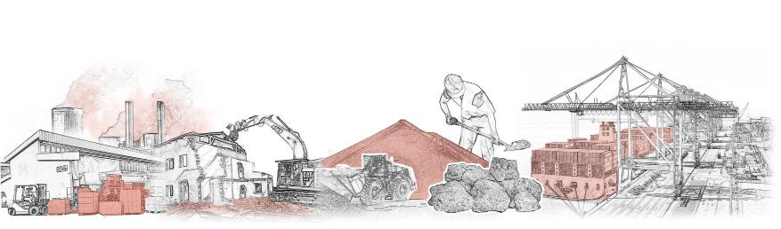
In order to build the vegetable and fruit garden area, I rented a total of... How people interact with the material? Visitors Rental House Assemble and Decorate Fruit and Vegetable garden Harvest fruits and vegetables Procedures for leasing Take care of fruits and vegetables Eat by themselves Handle rental cancellation procedures When the lease expires Help customers transport materials to the corresponding garden Choosing the material of the planter box Have a dinner party Sell to market Disassemble and clean the planter box Picking the seeds you want to grow Participate in festivals Teaching how to splice planter boxes CONCRETE 220 T METAL 36 T STONE 7 T PLASTIC 7 T Detachable Planter Box Structural Analysis Replaceable Recycled Metals Sheets Small Planter Box Lettuce Carrots 100mm 400mm Mint Rose mary Potato 100mm 400mm 200mm Bay leaf Tomato Parsley 100mm 500mm 200mm Basil Lemon Thyme 100mm 600mm 300mm Medium Planter Box Large Planter Box Alphabet Plastic Modules Compound Flower Stand Replaceable Free to Draw Replaceable Steel Available for climbing plants Recycled plastic clapboard Other Small Structure MATERIAL SIZE 4.75 mm (fine) Metal PAVEMENT WALL BUILDING FURNITURE Detachable concrete board Wrinkled concrete Structured beam & joints 3D Printing Road edge Undulating concrete 3D Printing 100 200 mm 650 mm Stone wall Planting box Stone building Cylindrical stool Modular plastic Regular stone Gabion building Hex podium Steppingstone Building materials emit a large amount of carbon dioxide during their life cycle! If we don’t recycle the materials, the raw materials will be depleted very quickly! Singapore’s building materials mainly rely on imports. Due to factors such as the epidemic, material prices continue to rise! DEMOLITIONAREA
Dumped and Sorting Building Processing Building Material Bank Sta Building Education Center Public Green Space 2 3 4 LA4702
COMPREHENSIVERECYCLINGCENTER
118
MORE THAN BLUE INFRASTRUCTURE / HU Die, Lin Lan, JIN Zhuoyin.
This project proposes a new framework for water management in future PLAB by pushing the limits of blue infrastructure to connect it to ecological restoration, historical memory, and community life.
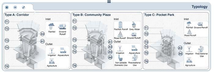
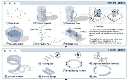
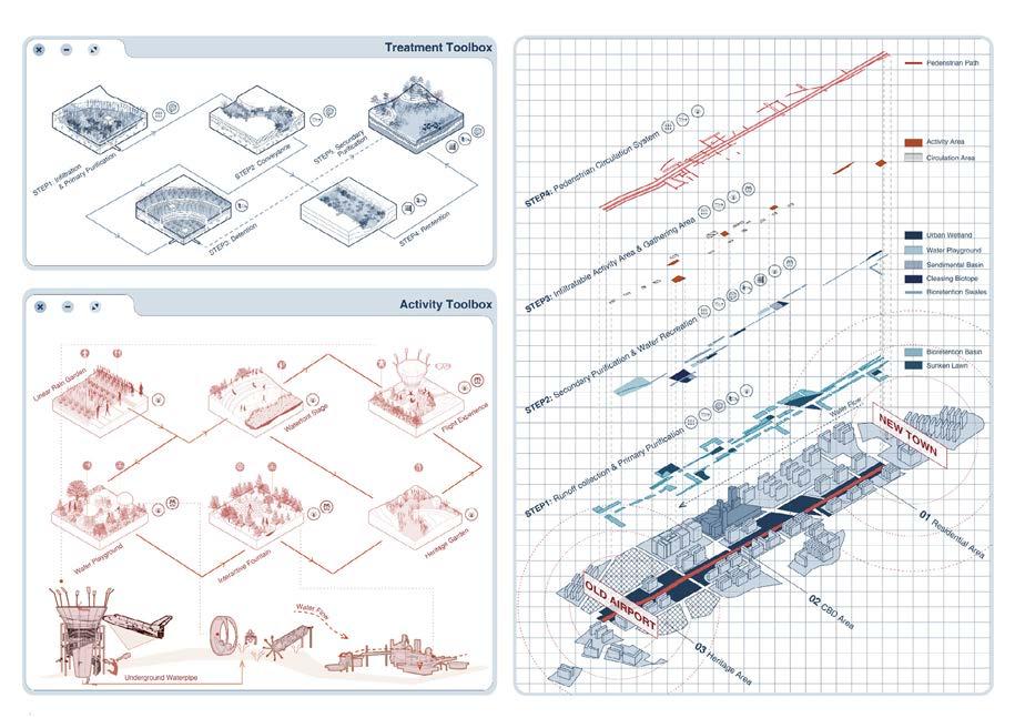
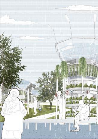
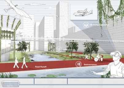
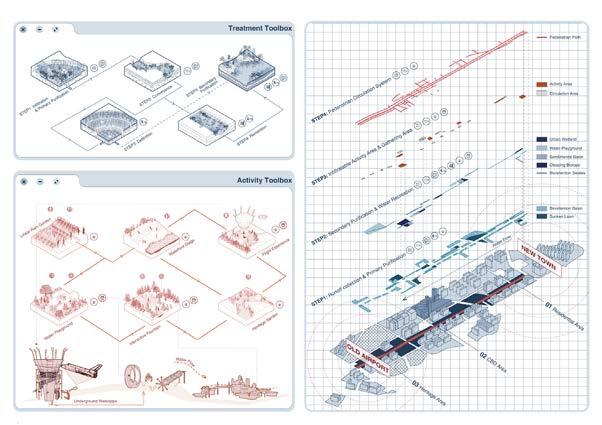
MLA STUDIO: CITY
119
LIVE WITH BIRDS / DONG Liwei, SHEN Yunnan, ZHANG Yuer
This project is designed to transform PLAB from a birdforbidden site to a bird-friendly forest network. It conceptualises strategies that bridge the people and nature gap.
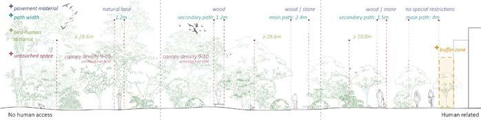
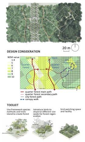
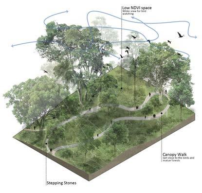
LA4702
120
Through the reclassification of the urban soil type of PLAB, this project proposed argriculture urbanism strategy to target the issue of food scarcity. An agricultural infrastructural network is proposed to connect the soil regeneration strategy to urban agricultural solutions.
The approach of this project integrated a scenario-based framework, where a series of ecological strategies respond to predicted trends in PLAB. The approaches considered current, ongoing and future scenerios based on the overall masterplan and the corresponding proposals of the other teams.
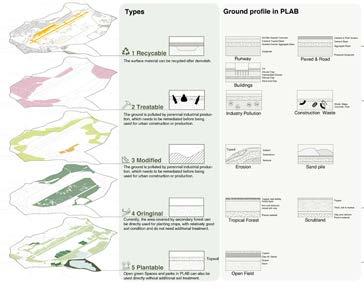
MLA STUDIO: CITY
LAND & SOIL MANAGEMENT / LIU Kangsheng, WANG Yu, ZHANG Wenting
WATERSHED PROTECTION/ Janina KWAN, Nur Sabrina, XING Zhiyan
121
PLAB CONCEPT PLAN / Studio Group 2
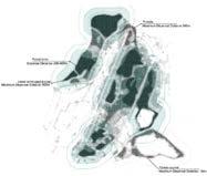
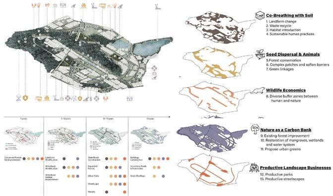
The concept plan overlays the rating maps of four nature-focused student groups to understand the different degrees from nature to the human area and negotiation to achieve overarching studio vision ‘REGENERATIVE PLAB.’ The plan includes five topics with four phases: Co-Breathing with Soil, Seed Dispersal and Animals, Wildlife Economics, Nature as a Carbon Bank, and Productive Landscape Business.
TRAVEL GUIDE OF SEEDS / Ruozhu XU, Wanruo CHANG, Yilan SHI
This project proposes to create nature-driven urban planning through application of the primary dispersal method, which prioritizes wildlife movements to promote a selfsustainable food system and opportunities for spontaneous landscapes in the long run.
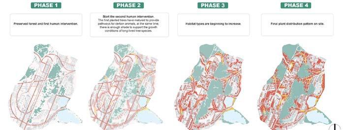
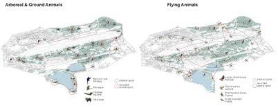
LA4702
122
MLA STUDIO: CITY
CO-BREATHING WITH SOIL / Anchita Nitin MIRWANKAR, CAO Naichun, ZHOU Sicong
This project proposes a strategy to revitalize soil quality by allowing the soil to breathe and humans to breathe with soil. The strategy consists of four sequential actions: soil movement, habitat improvement, soil treatment, and human interplay.
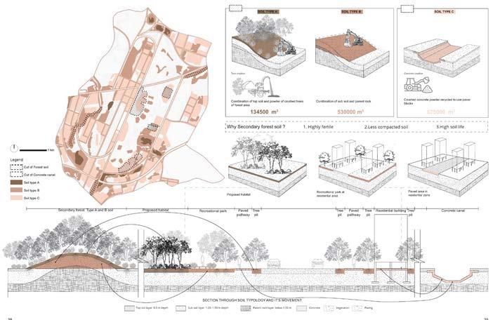
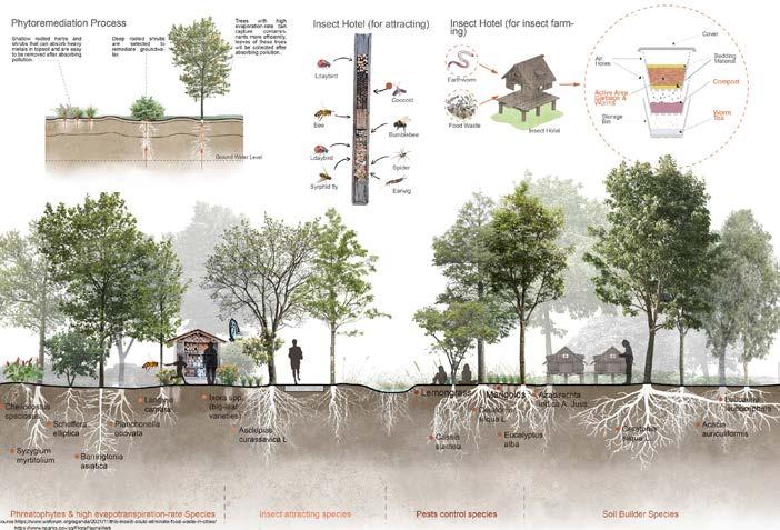
123
PRODUCTIVE LANDSCAPE BUSINESSES / Cynthia WEE, CHAI Xin Yi
This project to design productive parks that incorporate tree nurseries aims to meet PLAB as well as national demands for the development of urban green spaces. By assembling a sustainable network of resource management through soil banks, water catchments, and cleansing biotopes, it helps improve regenerative qualities of the business.
STAND BY WILDLIFE / REN Junyao, WANG
Liangyu, ZHANG Yuxi
With three design approaches ‘Diffuse, Appreciate, and Negotiate,’ this project prototypes multiple edges hamonizing human and wildlife with a consideration of topography change and surrounding land use.
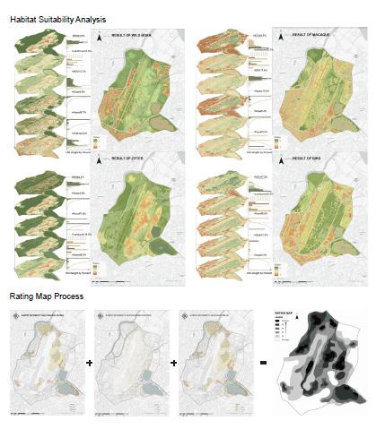
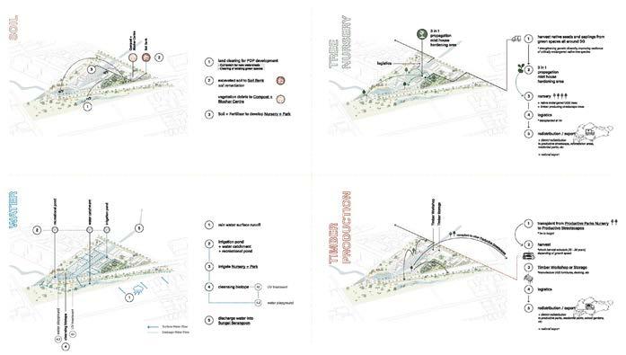
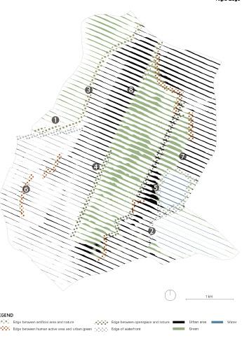
LA4702
124
NATURE AS A CARBON BANK / CHENG Siqi, ZHAO Mingyu, JIANG Ruomin
Based on the calculation of CO2 release from the projected population of PLAB over 30 years, this project aims to form a carbon bank to mitigate the high per capita carbon emissions through the recycling of water, soil, vegetation, and other natural resources.
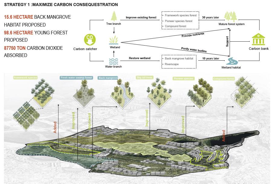
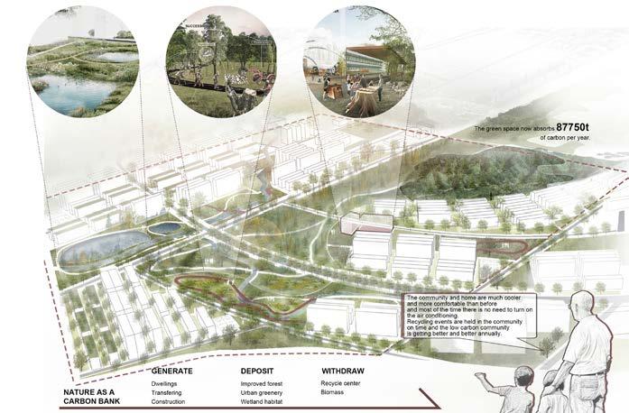
STUDIO: CITY
MLA
125
Tutors Students
Ryan SHUBIN Evi SYARIFFUDIN
Fang Ting, Feng Kangti , Ge Wenxi, Hao Jun, He Xiaowei, Hong Mengyi, Huang Xi, Lam Ching
Hang, Li Jiaying, Li Wanying, Li Xi, Liu Kaiyan, Long Di, Ou Yeyao, Rui Xue, Tan Shuyue, Xiang Wenqin, Xie Wanying, Yin Yi, Zhang Kairui, Zhang Liao, Zhang Liping, Zheng Qiaoyu & Zhu Wen
Description
Around the world, urbanites have been making the shift out of city centres to reclaim more space. As working from home increasingly becomes a norm, various live-play-work spatial models are also continually being explored. What if people could move into properties that generate self-sustaining energy, food, and water while reusing materials, creating less waste, and connecting to the greater community? In land-scarce Singapore, can we create this homesteading space upwards instead? What unique typologies of homesteading space can be proposed by landscape architects, who uniquely have both an intimate working knowledge of ecology and spatial thinking? This studio aimed to combat climate change as a combined effort. First by empowering individual citizens to understand their choices on a personal scale, creating communal spaces that reflect those choices while maintaining flexibility for change and progressive activism. Second, by providing a homesteadable high-rise hinterland for residents of our fully urbanized city-state.
MLA LA5701
COUNTRY
MLA STUDIO:
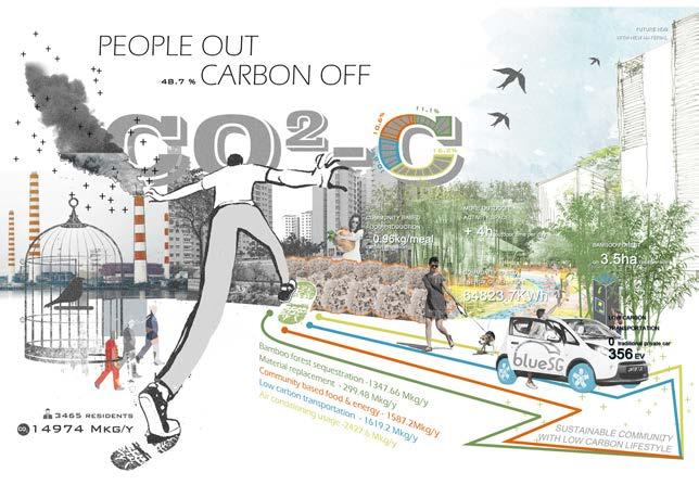
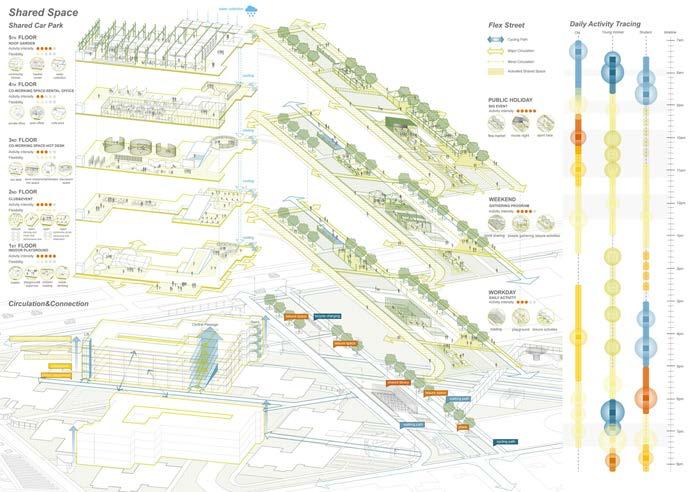
127
MLA STUDIO: COUNTRY PUNGGOL / XIANG Wenqin & LIU Kaiyan Lydia
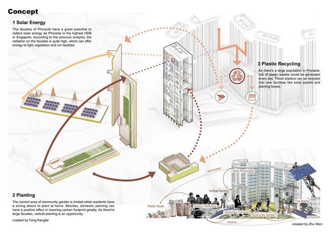
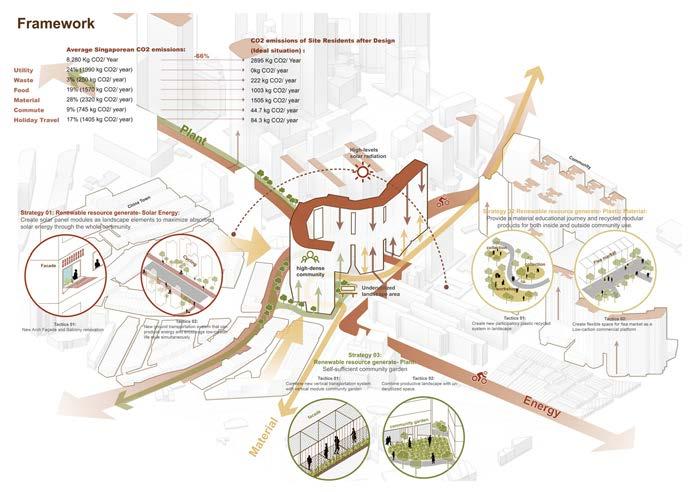
LA5701
128
DUXTON / ZHU Wen & FENG Kangtai
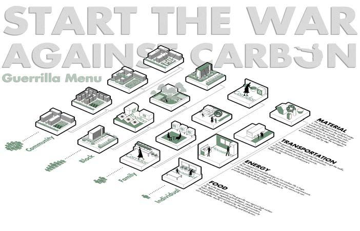
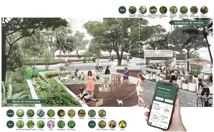
MLA STUDIO: COUNTRY SERANGOON / YIN Yi Anna & HUANG Xi 129
MEKONG FUTURES
Tutors Students
Dorothy TANG
Huei-Lyn LIU
Fang Ting, Feng Kangtai,Ge Wenxi,Hao Jun, He Xiaowei,Hong Mengyi, Huang Xi, Li Jiaying, LiWanying, Li Xi, Liu Kaiyan, Long Di, Ou Yeyao, Rui Xue,Tan Shuyue, Xiang Wenqin, Xie Wanying,Yin Yi, Zhang Kairui, Zhang Liping, Zheng Qiaoyu & Zhu Wen
Description
This studio interrogated speculative infrastructural landscapes in the Tonlé Sap watershed. The Mekong as a region is defined by its infrastructure. The economy and ecologies of Tonlé Sap Lake, the largest freshwater lake in Southeast Asia, face the dual threat of reduced water levels due to damming along the Mekong and the uncertainties brought about by climate change. This final semester MLA studio explored the hydropolitics of the Mekong Region and proposed speculative futures for the Tonlé Sap Watershed in Cambodia. The studio used infrastructure as an armature for new forms of agrarian economies, urbanism, and institutions to shape a new rationale for landscape interventions in the region.
MLA LA5702
MLA STUDIO: REGION
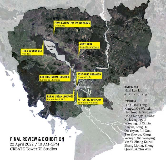
131
MLA STUDIO: REGION
AGROTOPIA Blockchain and Building Mutual Trust in Rural Cambodia / HAO Jun, HONG Mengyi & TAN Shunyue
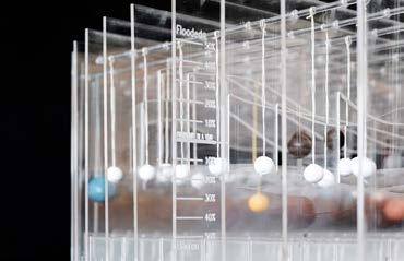
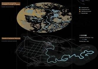
Krong Stueng Saen is endowed with rich farming and water resources and highly productive local farmers. However, like many other agricultural regions, the profits of the agricultural products are exploited by large corporations and logistical companies. The region is currently undergoing complex changes as it transitions from rural to desakota regions, and eventually towards an urban economy. Similarly, indigenous agricultural species are being replaced by modern hybridize crop varieties and mechanized farming methods. In order to preserve the potential of this nascent agricultural region, we propose a blockchain system powered by micro hydropower that will empower local farmers by protecting their autonomy while improving access to markets, and in turn lead to mutual trust and the reorganization of ecological and landscape systems.
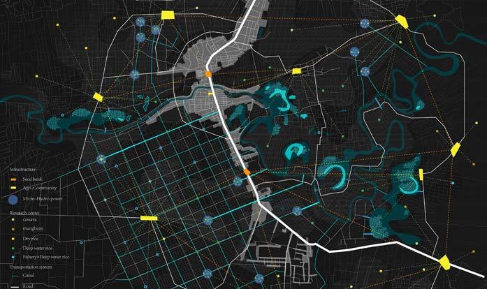
LA5702
132
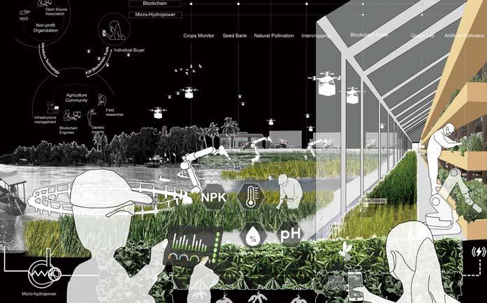
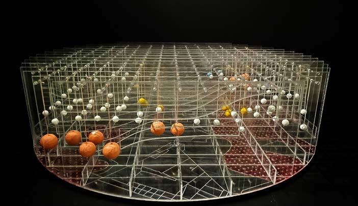
STUDIO: REGION 133
MLA
THICK BOUNDARIES A Vision for Co-conservation in Prek Toal / FANG Ting, HE Xiaowei & XIANG Wenqin
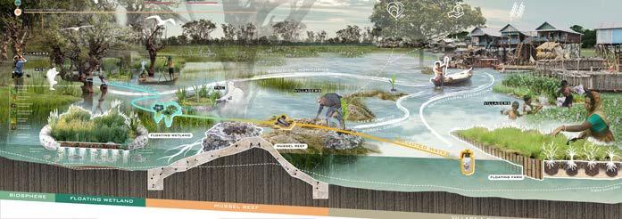
The imminent impact of new upstream dams on the Tonlé Sap Lake ecosystem will threaten local livelihoods and the ecological systems of the region. Our project addresses the history of deep-rooted environmental injustices due to restrictive boundary regulations along the Tonlé Sap Lake by recognizing the knowledge and practices of the indigenous local communities. Our project reimagines the relationship between local communities and the UNESCO funded Prek Toal Bird Sanctuary and Ramsar Site. We propose the thickening of conservation boundaries to empower local communities and transform the geographically bounded nature reserves to a co-conservation biosphere based on a collaborative governance structure and ecological infrastructure.
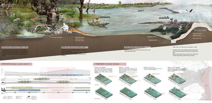
LA5702
134
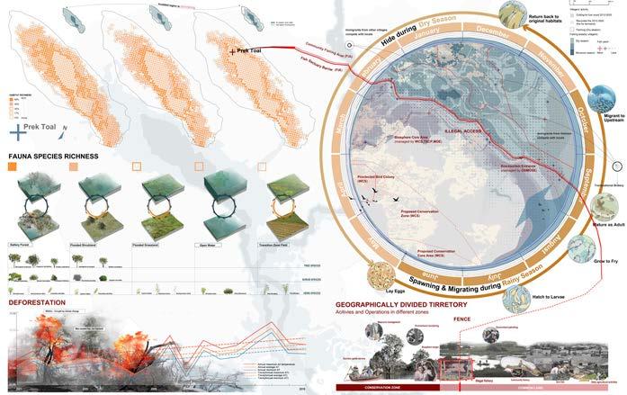
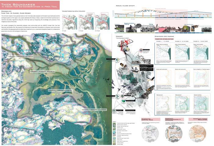
MLA STUDIO: REGION 135
MITIGATING TOMPOUN A Critique of Wetland Compensation and Urban Development / LI Jiaying, OU Yeyao & ZHANG Liping
Tompoun Wetland is located in the southern periphery of Phnom Penh and is one of the most important ecological landscapes of the city. Not only has it been an important site to prevent urban flooding, the wetland was also responsible treating approximately seventy percent of the wastewater from Phnom Penh. However, beginning in 2008, the wetland was slated for development. The proposed ING city project consists of a new CBD, residential development, and other urban amenities. While some efforts have been made to address the loss of infrastructural functions such as flood control and sanitation, it remains insufficient.
Our project critiques conventional wetland compensation and mitigation policies by redesigning ING City while retaining the wetland’s water storage capacity and sewage treatment functions. By examining the policies and economics of wetland mitigation, we question the desire for urban development and the environmental future of Phnom Penh.
LA5702
136
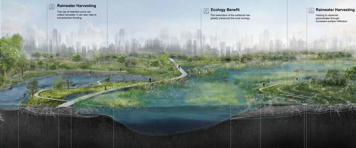
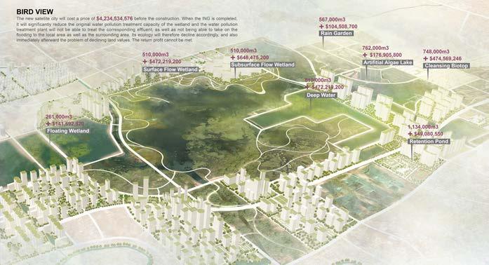
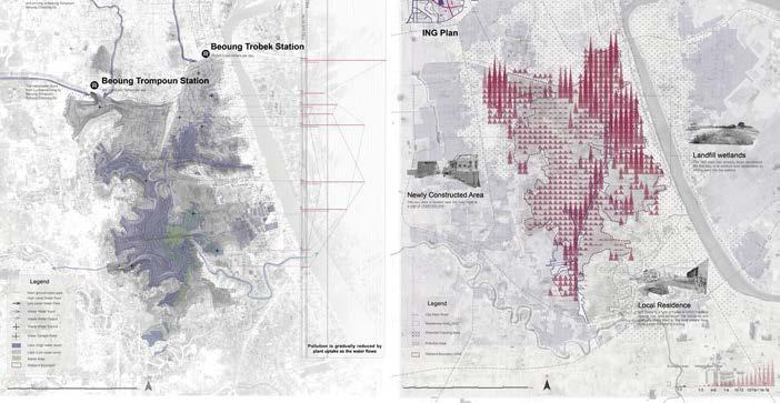
STUDIO: REGION 137
MLA
GEODESIGN DESIGNING PRODUCTIVE LANDSCAPES
Description Jessica Ann DIEHL
Tutor
This module introduces and guides students through the geodesign process. Geodesign is a design and planning method which tightly couples the creation of design proposals with impact simulations informed by the geographic context. Geographic information system (GIS) software is used as the platform for the development of advanced techniques in analyzing, evaluating, managing, and modelling. Developed by Carl Steinitz, the geodesign process is an interdisciplinary and collaborative approach to design where each member of the team ‘knows a little about a lot, and a lot about a little’ (Steinitz 2012). The project complements LA4701 MLA Studio: Quarter: From Liveable to Loveable – Visions for 2021: A bottom-up approach to placemaking in Singapore’s HDB residential estates.
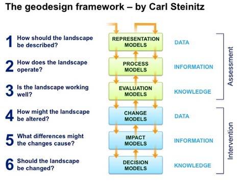
MLA LA5301
1 Amenities in Bishan-Toa Payoh GRC / Zhang Yuxi, Zhou Sicong, Zhao Mingyu
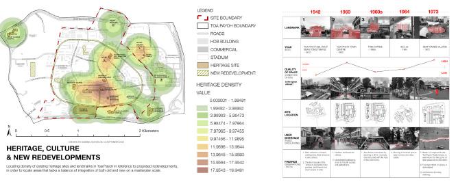
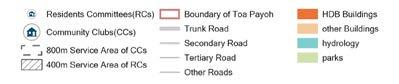
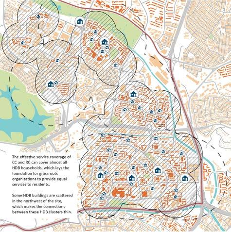


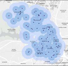
2 Accessbiity of Community Clubs / Dong Liwei, Jiang Yuli, Cao Naichun, Lin Lan, Liu Kangsheng

3 Access to Heritage Points
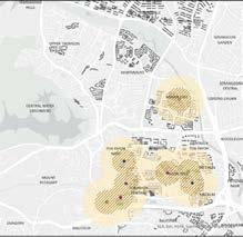
GEODESIGN Map of Child Amenities
Map of Senior Amenities 139
History, Culture & Community Service Area of Community Clubs and Resident Committees
1 2 3
1 Process model: Land surface temperature / Anchita Mirwankar
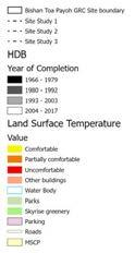
2 Green space distribution / Anchita Mirwankar, Cheng Siqi, Guo Mengyang, Jensen Por Pheng Ju, Jin Zhuoyin
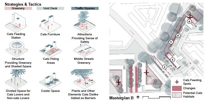
3 Impact model: Commute change and psychological impact / Ye Han
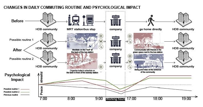
4 Change model: Strategies, Tactics, Master plan / Shi Yilan
5 Stakeholder Map for Nature Link / Chang Wanruo
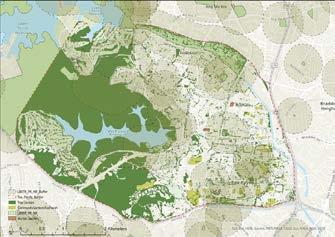
6 IGC 2022 Poster Submission
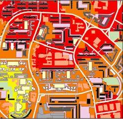
LA5301 140
1
2 3 4
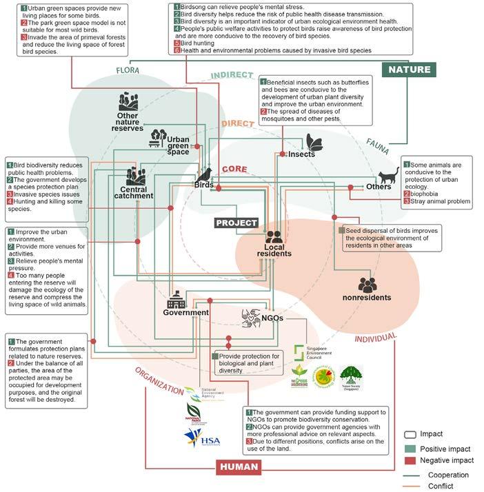
GEODESIGN 141 5 6
TOPICS IN LANDSCAPE ARCH
Tutor Description Ervine LIN
DIGITAL LANDSCAPE TECHNIQUES
From the axe to the graphometre, the invention of new tools and techniques have always influenced how we document, understand, design and modify our landscapes. Unlike the physical examples that came before, the new generation of tools and techniques is digital—smart cities, digital twins, BIM, AI, and so on are rapidly changing how city planning and architecture operates. Landscape architecture has not been void of technological tools but this course caters specifically to the exploration of advances that allow landscape architects to operate within a 3D environment with data collected from reality, studied and modified through computational and parametric thinking, enriched through information modelling and tested through simulations.
The goal is for the module to serve as a spring board for future landscape architects to begin their journey of adopting new digital tools (previously built for other disciplines) and adapting them to landscape architecture. This was done through a series of predefined programs which students were tasked to work in groups in order to demonstrate the use of these new tools to generate and analyse their designs.
MLA AR5954A
DIGITAL LANDSCAPE TECHNIQUES
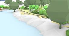
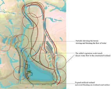
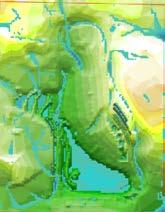
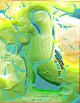
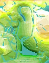
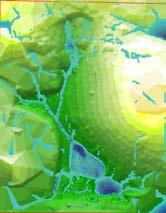
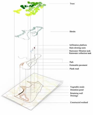
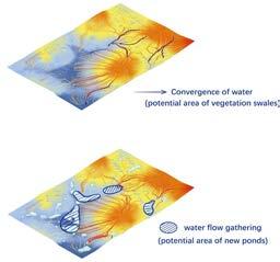
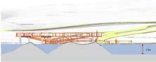
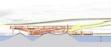
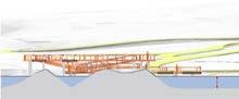
2.5m 2.4m
Flow Analysis - Original Site Plank Road and Water Level Analysis Extreme Weather Rainy Season Dry Season 4 2 Original Terrain 1 First Modified Version (Terrain) First Modified Version (Terrain and Facilities) Second Modified Version (Terrain and Facilities) 3 5 143
1 Rain flow modelling: Heavy rain
2 Design Improvement - Second Version
3 Three Road Modes along the Lake
4 Exploded View
5 Water Sesitive Design / Chang Wanruo, Jiang Ruomin, Liu Kangsheng, Liu Ziyue, Pei Wanyu, Shi Yilan & Ye Han
AR5954A
Intermediate Track Slope
Children Playground
Slope >10 ° be Red
Slope >20 ° be RedSlope >40 ° be Red
Intermediate Cycling Track
Wind Rose
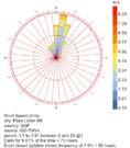
Species Location
Advanced Cycling Track
Playground - Skywalk-Slide
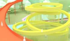
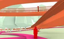
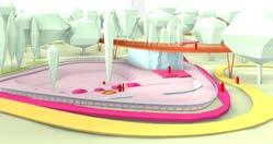
Sunken Canopy Trail
Entrance Plaza and Pond
Skate Park Topography
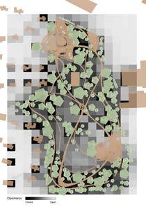
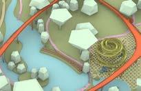
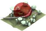
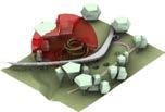
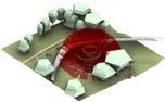
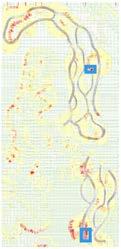
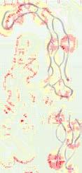
Openness Analysis
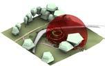
Playground - Sight Viewing Analysis
1 Outdoor Cycling Park / Cao Naichun, Lin Lan, Ren Junyao, Zhou Sicong, Zhang Wenting, Zhang Yuer & Zhao Mingyu
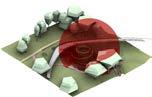
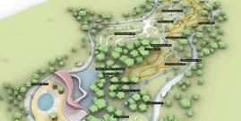
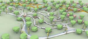
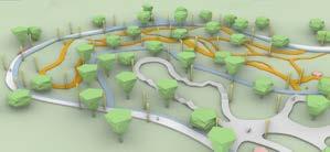
2 Outdoor Exercise Area / Hu Die, Lu Yichun, Dong Liwei, Shen Yunan, Wang Liangyu & Xu Ruozhu
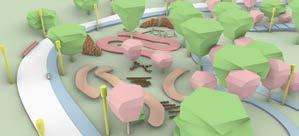
2 1 144
DIGITAL LANDSCAPE TECHNIQUES
3 Large-scale productive landscape / Chai Xin Yi, Cynthia W, Jiang Yuli, Virginia, Xing Zhiyan & Zhang Yuxi
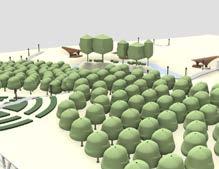
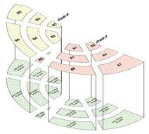

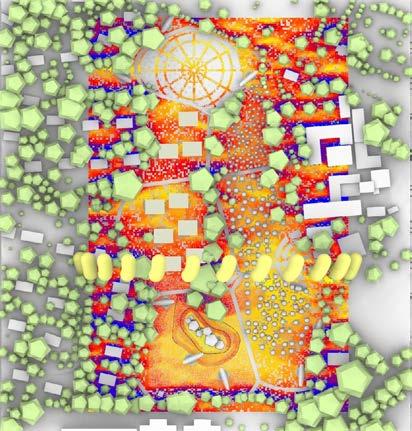
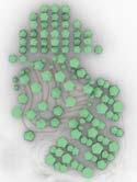
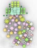
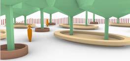
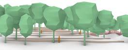
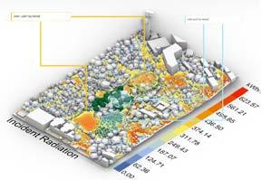
4 Reforestation and rejuvenation / Cheng Siqi, Janina Kwan Yin Man, Jin ZhuoYin, Mirwankar Anchita Nitin, Nur Sabrina Binte Shafari & Por Pheng Ju Jensen
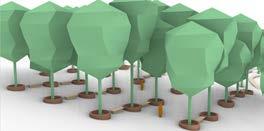
Direct Sun Hour Analysis
PAR & DLI Solar Radiation Analysis
Tree Plantation in Plazas
Tree Species - Before Tree Species - After
DensityDistance Between Plants 1.5m 4 3 145
Bird’s Eye View of Orchard
Planting
Tutors
Alfred LEE
KOH
Jiann Bin
Description
WSUD has emerged as a mainstream area of expertise expected of landscape architects. In addition, as recent landscape design projects become more complicated with technical fluency and the involvement of other disciplines, professional landscape architects must understand the complexity involved in a development project and the current and evolving roles of landscape architects to shape projects that achieve the goals of promoting sustainability, liveability and resilience of the urban environment. This module provides the fundamental knowledge and reinforces knowledge in professional practice and roles of landscape architects.
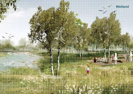
3 Design calculation / Studio 1
4 Study Section / Studio 1
LANDSCAPE CONSTRUCTION II MLA LA5302
1 Final project masterplan / Studio 2: Cao Naichun, Chai Xin Yi, Chang Wanruo, Cheng Siqi, Cynthia Wee Su Yi, Jiang Ruomin, Mirwankar Anchita Nitin, Ren Junyao, Shi Yilan, Wang Liangyu, Xu Ruozh, Zhang Yuxi, Zhao Mingyu, Zhou Sicong
2 Final project masterplan / Studio 1: Liu Ziyue, Liu Kangsheng, Ye Han, Dong Liwei, Jiang Yuli, Hu Die, Lin Lan, Jin Zhuoyin, Zhang Wenting, Janina Kwan, Sabrina Shafari, Shen Yunnan, Xing Zhiyan, Zhang Yuer
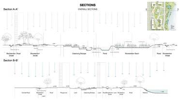
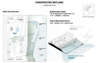
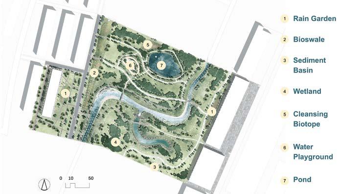
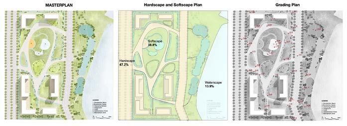
LANDSCAPE CONSTRUCTION II 147 1 2 3 4
HISTORY AND THEORY OF LANDSCAPE ARCHITECTURE
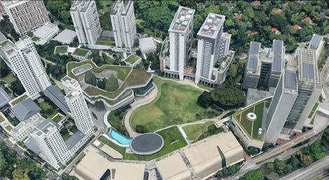
Tutor Description Ervine LIN
One common conundrum students have surfaced when being taught a history and theory class is that despite all the readings, they find it difficult to see how applicable the knowledge presented in class is to their designed projects. As such, in this run of the module, a reading assignment was replaced with a design specific one to allow students the opportunity to directly translate theory into design. Students were asked to pick a theoretical framework from Susan Herrington’s book ‘Landscape Theory in Design’ to redesign the lawn area in the NUS University Town (below). The goal was to alleviate the ‘baggage’ that often comes from design projects by specifying not only the site but also the theoretical framework to work within. Suffice to say, even given the same site and in some cases the same theoretical basis, there was not a single design that was remotely similar to another and students were challenged to put aside any established norms or paradigms in order to align their designs with the selected theory.
MLA LA4203/LAD1004
1 Function: Creating landscapes using functional objects / Chang Wanruo
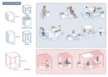
2 Infrastructure: Landscapes with multifunctional uses / Jin Zhuoyin
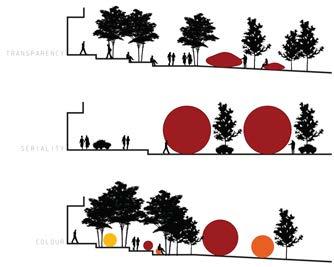
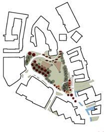
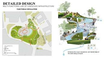
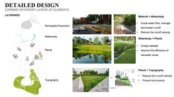
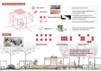
3 Forming: The use of a sphere as a landscape element to alter space / Abdul Latiff
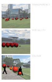
4 Structuralism: Oversized statues seek to provoke a response from observers / Wayne Tan
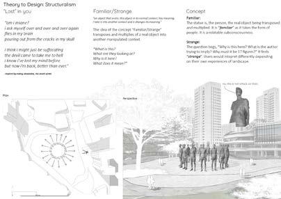
149 HISTORY AND THEORY OF L.A.
1 2 3 4
1 Structuralism: Retracing the expanded field / Cai Xin Yi
2 Aleatory systems: Juxtaposing unrelated elements / Azzah Atifah
3 Materiality: Literature expressed as landscape through materials / Hu Die
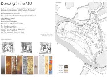
4 Structuralism: Rigidity vs fluidity in the landscape / Nadia Kuan
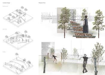
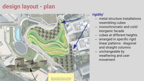
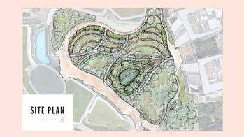
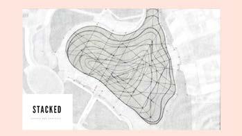
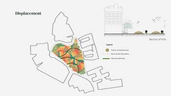
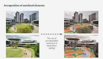
150 LA4203/LAD1004
1 2 3 4
5 Infrastructure: Prioritising ecological over pedestrian movement / Dexter Lim
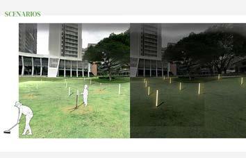
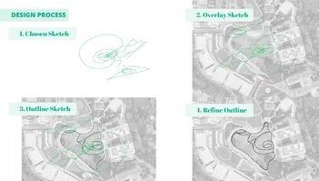
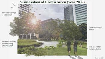
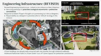
6 Systems theory & Cybernetics: Interactive lightpost to encourage interactions / Zhuo Sicong
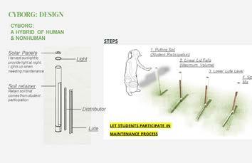
7 Aleatory systems: Park design from a child’s sketch / Sofeah
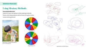
Insyirah
8 Memory & Space: Subtle use of topography to invoke historical presence of a pond / Cynthia Wee
151
OF
HISTORY AND THEORY
L.A.
5 6 7 8
POLICY OF LANDSCAPE
Tutor
Description Dorothy TANG
This module takes an infrastructural approach to landscape policies to understand the resulting spatial practices and how they intersect with national and international governance structures. Infrastructure— understood as both object and method—is the substrate of ‘life’ and inter-relation of ‘things’. It is governed by specific codes, standards, norms, and operations designed to enable modern societies to function properly, and contestation emerges when infrastructures fail or produce uneven geographies.
By studying the mundane, ordinary, and ‘boring’ aspects of the Landscape Architectural profession, the module reveals the norms, politics, and economics that shape our everyday built environment and society. More importantly, it engages with how landscape policies are affected by the epistemologies of allied disciplines such as urban design, planning, economics, ecology, and engineering—and advocates for an integrated and collaborative landscape future.
“...[S]tandards have become the definers, delineators, and promoters of places, regardless of variations in landform, natural systems, and human culture. Like genetic code in biology, standards are the functional and physical unit of planning legacy, passed from one generation to the next.”
—Eran Ben-Joseph, 2005, The Code of the City, p. xii
MLA LA5201
1 Students used infrastructure proposals in the Greater Mekong Subregion as the basis for policy analysis during the course / Dorothy Tang
“...[This is] a call to study boring things. Many aspects of infrastructure are singularly unexciting. They appear as lists of numbers and technical specifications, or as hidden mechanisms... It takes some digging to unearth the dramas inherent in system design creating, to restore narrative to what appears to be dead lists.”
Susan Leigh Star, 1999, The Ethnography of Infrastructure, p. 377
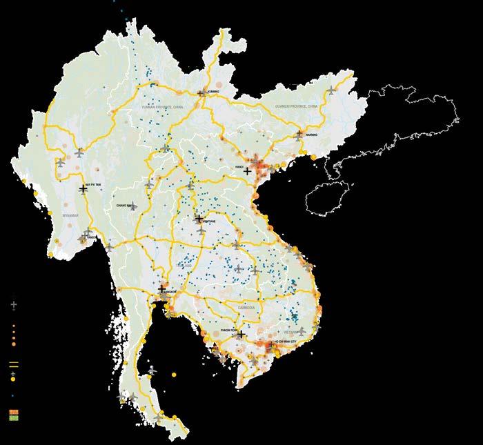
POLICY OF LANDSCAPE
153 1
POLITICAL ECOLOGY OF LANDSCAPES
Tutor
Description
Jessica Ann DIEHL
Political Ecology is a field of study and research that focuses largely on socio-environmental conflicts and their origins. Political ecology analyses are historically grounded, attendant to socioenvironmental relations and constructions, and concerned with the ways that constantly changing, multi-scalar political economies and cultural politics affect access to and control of resources. This module is a critical exploration of theories and themes related to: global water politics; energy and natural resource management; urbanization and city environments; marine policy and fisheries politics; the production and consumption of food; nature conservation; disaster governance; animal ecologies; and climate change.
Through local landscape case studies, we examined differing theoretical frames employed by political ecologists, including approaches to environmental knowledge and discourse, political economy, and environmental justice among others. Students took positions on key environmental debates touching across local to global scales, generating empirical evidence and theoretical perspectives through inclass discussions, reflection papers, photovoice techniques, videography, and other documentation approaches. Throughout the module, students focused on understanding and analyzing the origins and trajectories of environmental conflicts and problems with the aim of strengthening foundational knowledge for developing landscape-based interventions.
MLA LA4007
What is Landscape? Is it a place modified by humans? What about natural places such as wilderness? In reality, there are few places that have not been modified or influenced in some way by human activity—through settlement, agriculture, deforestation, or water, air, soil pollution and climate change.
Even preserved landscapes exist because of the influence of policy, planning, rules and regulations that intervene to protect them from human activity. Direct and indirect impact on the landscape reflects our value of nature and our perception of our relationship with the environment that insofar has been able to supports us.
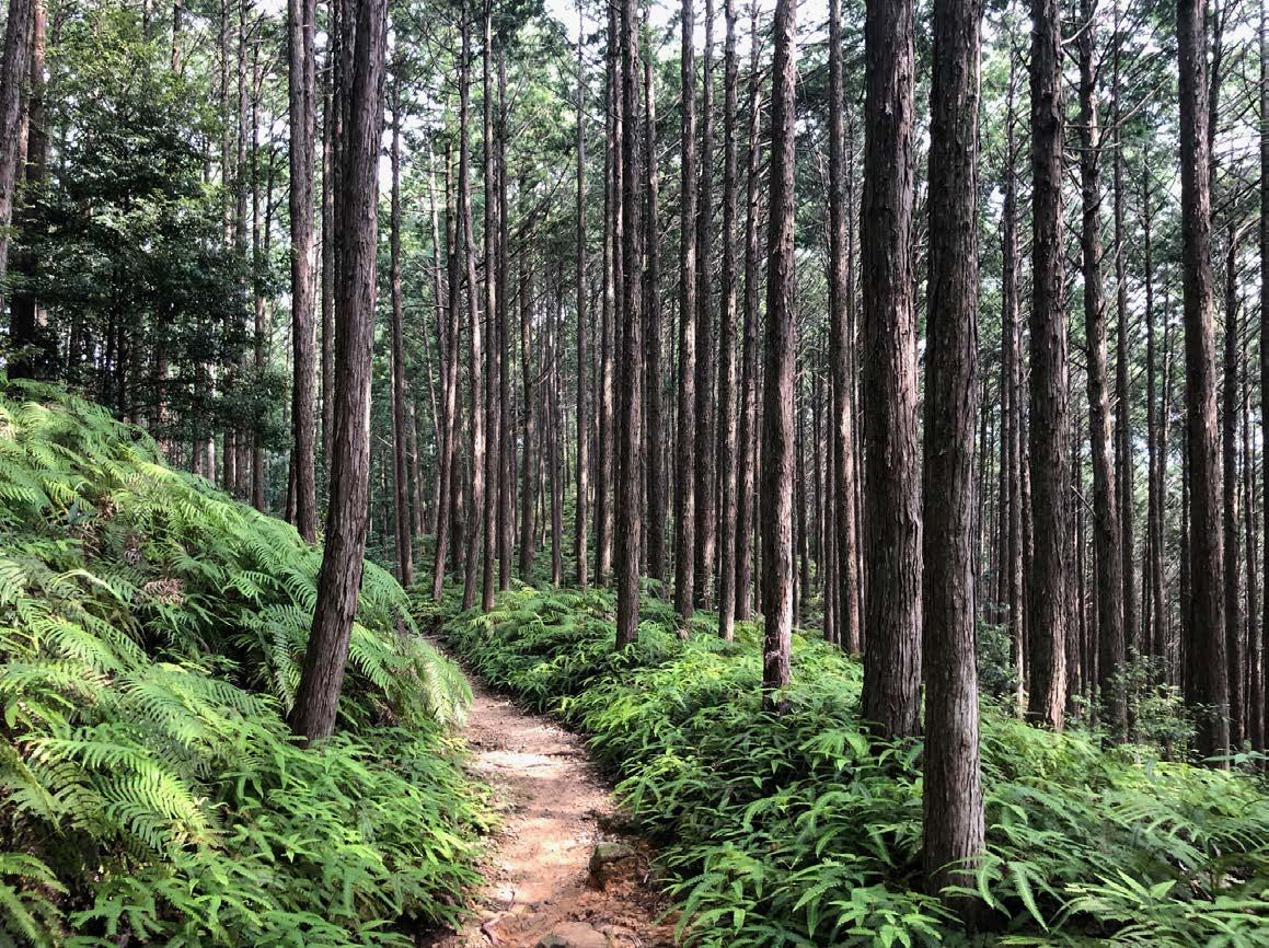
POLITICAL ECOLOGY
155
1 Territorialization, colonization, sovereighty & independence documentation activity: Students visited Tengah Forest and investigated the landscape at five points of time from the original landscape to present day.
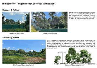
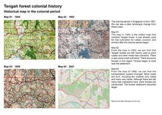
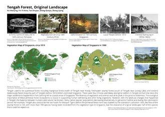
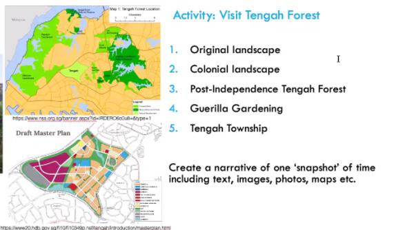
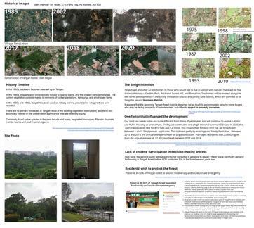


https://www.facebook.com/wilfredtravel/photos/pcb.815119089056233/815116622389813/ :https://remembersingapore. org/2020/10/01/jurong-road-closure/ “Guerrilla gardening is the act of gardening – raising food plants or flowers – on land that the gardeners do not have the legal rights to cultivate, such as abandoned sites areas that are not being cared for, or private property. It encompasses a diverse range of people and motivations, ranging from gardeners who spill over their legal boundaries to gardeners with a political purpose, who seek to provoke change by using guerrilla gardening as a form of protest or direct action.” —— from Wikipedia 1.Kampong Area There were large amout of buildings in Tengah Foresta and most of it used to be Kampong. Even though there will be not original residents living in this area, we can see the vestige of guerrilla gardens in Tengah forest. Besides, we found a photo shows a resident who lived there maintained his garden. 2.Building Worker It's the most interesting finding when we walked into the site. We all know this area is developed into a new high-density residents and we will not be able to see how people lived and planted here. However, we found some new guerrilla gardes nears the constructive site. They're developed and maintained by the worker. Most of the Guerilla Gardens in Tengah Forest were located next to Old Jurong Road. Both sides of old Jurong Road were the home to many kampongs in Singapore, such as Ong Kah Village, Kampong Ulu Jurong, etc. The residents in these Kampong villages used the nearby vacant for small-scale farming to supplement their daily needs. The crops were mainly fruit trees, herbs, and leafy vegetables. Many of these Guerilla Gardens were abandoned due to the relocation of Kampong's residents. Nowadays, these gardens are replanted by nearby residents and migrant workers who work in the construction sites. The images above show the Guerrilla Gardens next to Old Jurong Road. These gardens contain informal structures, such as storage, shading, and planting boxes. In recent years, people still do recycling and hobby farming in the gardens. However, these gardens and activities are disappearing due to the new developments. Text & Graphic: FENG Kangtai; LAM Ching Hang, Adam Site Visit: LIU Kaiyan; ZHU Wen The images above show the newer version of Guerrilla Gardens in Tengah Forest. These planting spaces are much smaller in scale, and they are likely the leftover of former Guerrilla Gardens in Kampong. In addition, they are probably managed by migrant workers for leisure purposes. Definition of Guerrilla Gardening Guerrilla Gardens inherited from Kampong Guerrilla Gardens in Construction Areas Two types of Guerrilla Gardening in Tengah Forest Distribution of Guerrilla Gardens in Tengah Forest Change of Participants and Purposes Guerrilla Gardening In Tengah Forest In the Past Participants • Residents in Kampong • Migrate Workers • Nearby Residents • Hobby Farming • Tourism Self Sustained Argriculture Purposes In Recent Years LA4007
156 1
Cleanliness / Neighborliness Tolerance / Cooperation Deviance / GAZE
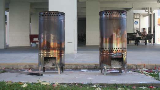
2 Hostile landscapes photovoice activity: Students visited their studio site and photo documented examples of: a. Design features that promote cleanliness; b. Hostile design; c. Social practices such as traces or appropriated spaces.
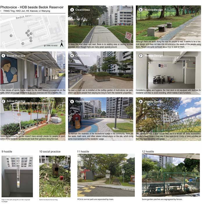
POLITICAL ECOLOGY
157 2
URBAN GREENING: TECHNOLOGIES AND TECHNIQUES
Tutor
Description
Terrence TAN
This module introduces students to contemporary and emerging technologies and techniques that have become essential components of urban greening design and practices. It traces the origins of such technologies and techniques as responses to challenges and opportunities in creating a green and ecologically-balanced urban environment, explains their scientific underpinnings, and illustrates with examples of real-life applications. It emphasizes the role of R&D in a continual process to improve the performance of greenery to contribute to sustainability, ecological health, and liveability of the built environment. Topics covered include metrics and software used to measure greenery, technologies used to integrate greenery with the grey, brown and blue elements of the built environment, and the role of plants as the basic building blocks of functional landscapes. The module is conducted through lectures, class discussions, and site visits demonstrating real-life applications and students’ self-learning through structured individual and group projects.
MLA LA5303
Building-scale greenery critique: Measurements before decisions. Students conducted lighting intensity measurements around UTown and developed strategies for planting to ensure adequate light provision for plants.
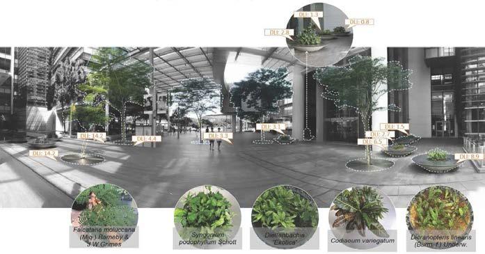
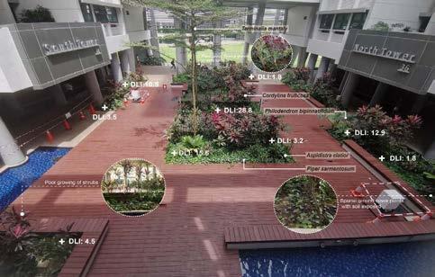
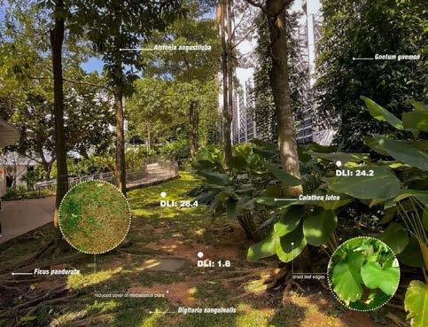
URBAN GREENING
159
DISSERTATION
Tutor TAN Puay Yok
Advisors
Jessica Ann DIEHL
HWANG Yun Hye
LIN Shengwei, Ervine
Terrence TAN Chun Liang
Description
This module required MLA students to complete a dissertation through independent research under the guidance of an advisor. A dissertation is a substantial piece of written work that emphasizes the critical analysis of a central question or proposition on a subject area selected by the student, based on the use of scholarly methods in the research process, and presentation of arguments. It is typically based on a systematic process of developing a central question or proposition, collection of evidence through qualitative or quantitative methods, and producing a structured presentation of arguments in relation to the central question. The key emphasis is self-directed, culminating in the demonstration of a student’s ability to deliver a scholarly analysis of a subject area of interest and relevance.
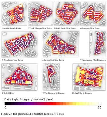
MLA LA5742
1
1 Daily Light Integral in 10 study sites, in Assessing the Potential of HDB Estates for PlantBased Farming in Singapore / Illustration by Zhou Xianfeng
2 Machine learning to generate landscape patterns, with training data (top), results of the same area (middle) and results of additional site (bottom), in Automatic Generation of Naturalistic Planting Plan by Piet Oudolf with the Help of Machine Learning / Illustration by Zhang Bingqian
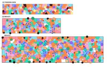
3 Target species for different landscape typologies, in Urban Landscapes as Habitats to Promote Pollination and Seed Dispersal / Illustration by Lim Wenfa
DISSERTATION TITLES
» BARGOTRA POORNIMA: Uncovering Sustainable Management Potential of Neighbourhood Landscapes in Singapore: Quantifying Maintenance Activities of Two HDB Precincts in Choa Chu Kang
» CARISSA CHIN QIWEI: Assessing the Performance of Landscape Design in Neighbourhood Spaces to Support Biodiversity
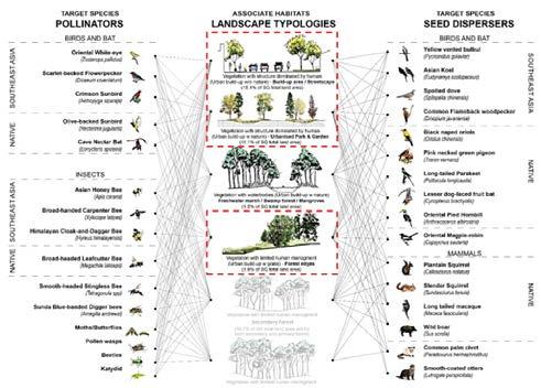
» CHENG JING: Life Cycle Assessment of Rooftops Production Systems in Singapore: A Case Study of ComCrop
» EKTA BALUBHAI RAKHOLIYA: GIS-Based Landscape Planning Decision Support Methodology: Multi-criteria Decision Support Approach for Urban River Naturalization
» FENG ZIHAN: Analysing the Effects of Riparian Landscape Design on Channel Sedimentation through Computer Simulation
» HAN CONG: Investigating Social Capital and Active Public Spaces in Singapore HDB Estates
» LIM WENFA: Urban Landscapes as Habitats to Promote Pollination and Seed Dispersal
» LYU JIAWEI: Urban Pluvial Flood Simulation and Assessment of Nature-Based Solutions
» MAMIKO TANAKA: Why Urban Farmland Still Remains in Tokyo? A Study of Takamatsu District in Nerima Ward
» RUIEE VITHAL DHURI: Analysis of Biodiversity Conservation Values of Nature Parks in Singapore
» SHAO ZHONGRAN: A study of Singapore Hawker Centres in a Socio-spatial Dimension
» WANG HAOBO: Characterizing Lakeside Landscape Typologies along Dianchi Lake, Kunming
» XIAO XINYAN: After the Outbreak: A Post-Covid Study of the Social and Spatial Patterns of Public Space Usage in Singapore’s Multicultural HDB Communities
» ZHANG BINGQIAN: Automatic Generation of Naturalistic Planting Plan by Piet Oudolf with the Help of Machine Learning
» ZHANG BINGYI: Study on the Perception of Biodiversity and Aesthetics of Urban Landscapes in Singapore
Residential Communities
» ZHANG YIFEI: Comparison of Albedo Values of Plants Under in-situ and Simulated Conditions
» ZHONG YIXIN: On the significance of psychological security for urban
» park design
» ZHOU XIANFENG: Assessing the Potential of HDB Estates for Plant-Based Farming in Singapore
» ZHOU ZUYUAN: A Comparison of Photogrammetry Generated Point Clouds and 360 Degree Panoramic Photos for Semi-immersive Online Teaching of Landscape Architecture
DISSERTATION 2
3 161
AY 2021/2022
BACHELOR OF LANDSCAPE ARCHITECTURE
BLA STUDIO: DESIGN 1
Tutor Students
Yun Hye HWANG
Mariam Yusuf Rajkotwala, Tay Jing Ying, Cleon Lai Yi Hui, Kuan Shiqi Nadia, Clarissa Ke Li Wen, Kaena Sutanu, Nur Nadzirah Binte Mohamed Nizam, Toh Cheng Choon Vince, Tang Yijia, Krystle Lim Si Ying, Wayne Tan Pei Wee & Altoaimi Lina Walid S
SENSING LANDSCAPES
Description
The first core studio emphasizes the unique role of landscape architecture to shape, modify, and manage ecosystems through sequential exercises. This studio facilitated an in-depth understanding of patterns and characteristics in Nature by having students observe, analyse, describe, and interpret urban landscapes with creative conceptualizations and sophisticated representations.
Three interrelated projects were given to students. The first project, ‘ARTICULATING LANDSCAPES’, asked students to characterise chosen natural elements through multiple ways of seeing at various scales and perspectives. The project also deployed annotative and analytical methods to understand elements’ functionality as systems. The second project, ‘MANIPULATING LANDSCAPES’, asked students to reshape landscape elements by amplifying their spatial and functional values. Students worked iteratively to propose an imaginative space where a combination of natural and artificial landscape elements worked together synergistically in a robust system. The third project, ‘CONTEXTUALIZING LANDSCAPES’, expanded students’ perspectives of landscapes to situate them in time and place. Students were asked to consider relationships between landscape and larger environmental, socioecological, and geographical systems. In response to the demands of a tropical urban context, they were asked to consider the values and approaches embodied in designed spaces.
BLA LAD1001
Students created hybridized spaces composed of natural and artificial landscape elements. Various modes of drawings and makings were introduced to develop systemic observation of spaces and spatial sensitivity in design as well as logic in spatial design thinking, and its process.
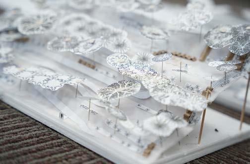
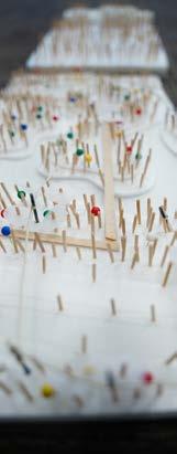


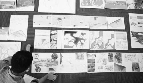
1
DESIGN
165
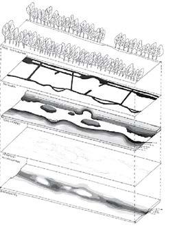
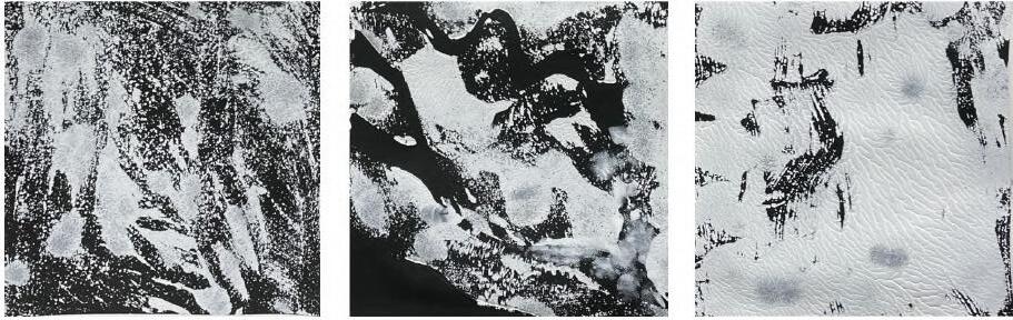
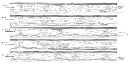
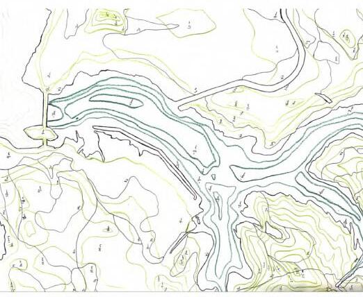
LAD1001 166
A LIVING, CHANGING WATER EDGE / Altoaimi Lina Walid S.


Inspired by erosion and sedimentation as the result of powerful movement of water, this project translated such movement into space observable on foot–by designing a canal with flowing water and different edge conditions, through designed space, and over time. A canal was designed with two sides: one side being a natural, living water edge allowing people to interact with sediment, the other more urbanized, allowing people to view the opposite side from different perspectives. At the centre of the canal are floating islands, further exemplifying erosion, with varying edge-conditions. Pathways can be introduced to the natural side by collecting sediment deposits after 5-10 years and constructing the path with these on-site materials.
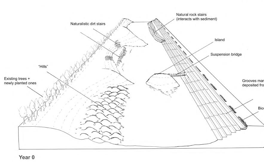
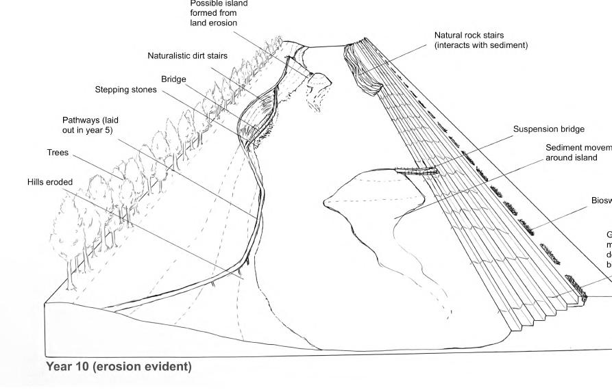
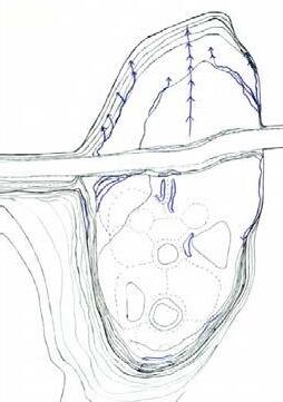
DESIGN 1
167
LAD1001


SOIL GARDEN / Kaena Sutanu
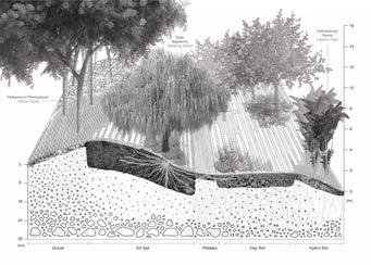
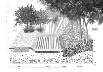
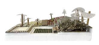
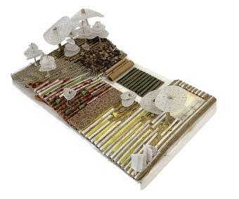
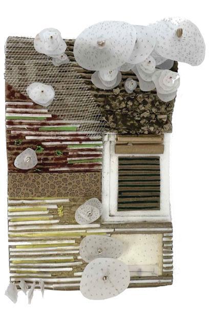

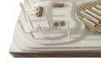


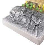
Inspired by the nutrient-dense leaf litter topsoil used in Singapore’s Botanic Gardens, the forested area within the garden is filled with Catappa Trees which generate large amounts of leaf litter to act as topsoil and is used for composting. The compost site also consists of organic matter from leguminous species, generating up to 5 tonnes of compost annuallyproviding nutrient-rich soil for the vegetable patch. Different soil types are used across the garden, growing plants that are best suited for its soil conditions while providing a variety of barefoot walking experiences by stepping on various pavements including pebbles, sand, and mud.
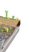
168
WATER IN FLUX / Kuan Shiqi Nadia
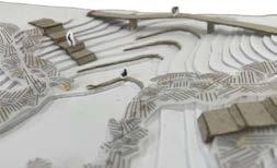
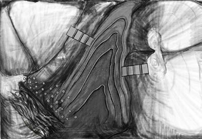
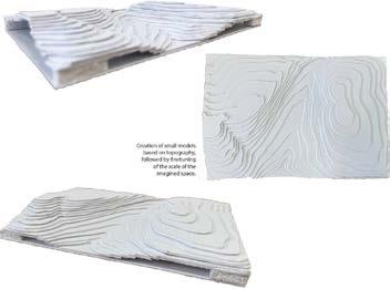
A one-hectare gentle grass mound was designed to slow down and reduce the volume of stormwater runoff, while serving a recreational purpose of open-air theatre and water play area, drawing attention to the interdependent relationship between topography and hydrology. In response, the land has a variety of high and low topographical points which demonstrate a contrast in water flows.
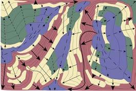
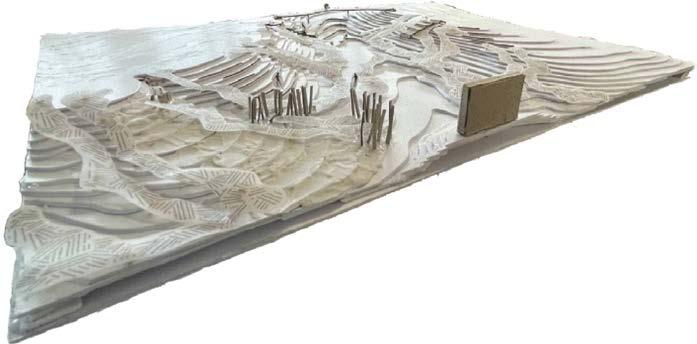
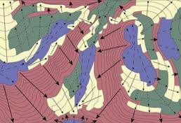
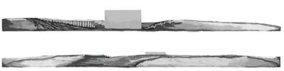
1
DESIGN
169
BLA STUDIO: DESIGN 2
Tutor Students Description
WHOLE BRAIN SPATIAL DESIGN
Ryan SHUBIN
Altoaimi Lina Walid, Clarissa Ke Li Wen, Cleon Lai Yi Hui, Kaena Sutanu, Krystle Lim Si Ying, Kuan Shiqi Nadia, Mariam Yusuf Rajkotwala, Nur Nadzirah Binte Mohamed Nizam, Tang Yijia, Tay Jing Ying, Toh Cheng Choon Vince & Wayne Tan Pei Wee
The ‘Whole Brain Spatial Design’ studio explored the fundamentals of how our mind can be trained to fully utilise our ability to create landscape spaces. Throughout design history, ideas of the more left brain or right brain thinking have developed into whole movements. For example, in the early-1900s logical left-brain design led the way with ‘form follows function’. Then in the mid-1900s, a more right-brain experiential approach dominated design with ‘less is more’. These architectural aphorisms in times past are moments when it was more fashionable to approach design with a greater left (logic) brain or right (experience) brain thinking. In this studio, we sought to understand how to tap into BOTH our rational thinking with site observations and imaginative sensorial abilities to craft landscapes. The objective of the class was to grow as landscape architects by approaching design as an integration between spatial experience and performative outcomes.
BLA LAD1002
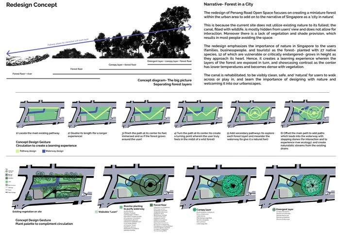
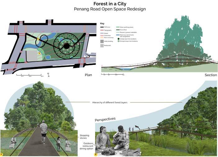
DESIGN 2 1 Design Concept / Altoaimi Lina Walid 2 Perspectives / Altoaimi Lina Walid 171 1 2
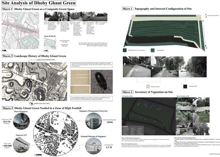
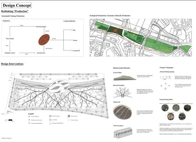
LAD1002 RETHINKING PRODUCTION / Cleon LAI Yi Hui 172
This project revives Orchard Road’s history as a nutmeg plantation by redesigning a site to support nutmeg production and the commercialisation of its products. The concept is grounded in the fundamental understanding of biological processes of nutmeg and its coupling to ecology to safeguard production. To further capture footfall within the commercial area and convert it to revenue, a cafe is integrated into the plantation to allow commercialisation of nutmeg spices and essential oils produced on-site. Lastly, to be ecologically sensitive to the current context the site is located in, shrubs that serve as host and nectar plants to butterflies are planted to serve as a secondary site of butterfly production, which allows the designed site to be integrated as part of the Dhoby Ghaut Green butterfly trail.
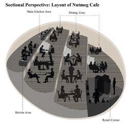
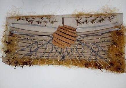
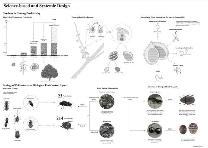
DESIGN 2
173
1 Design concept & Perspectives
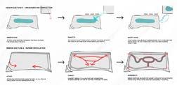
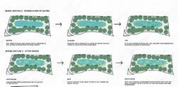
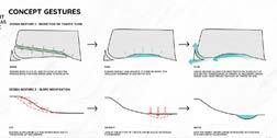
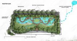
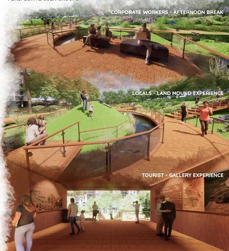
2 Performance diagram
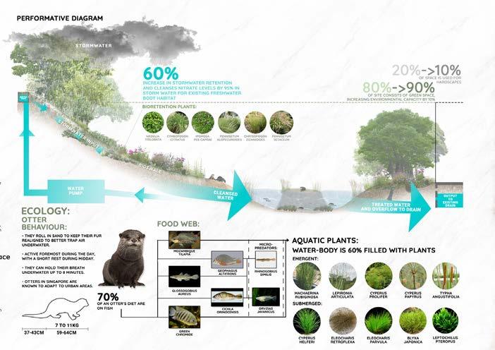
LAD1002
174 1 2
QUAR-OTTERS / Wayne TAN Pei We
PIXELATED MEMORIES: A Covid-19 Memorial - Fighting the Pandemic / Mariam Yusuf Rajkotwala
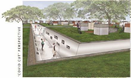
3 Site Analysis, Concept & Perspective
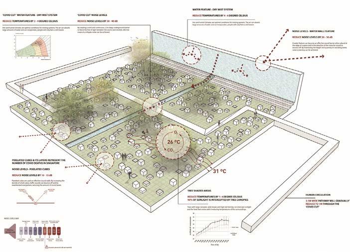
4 Performance diagram
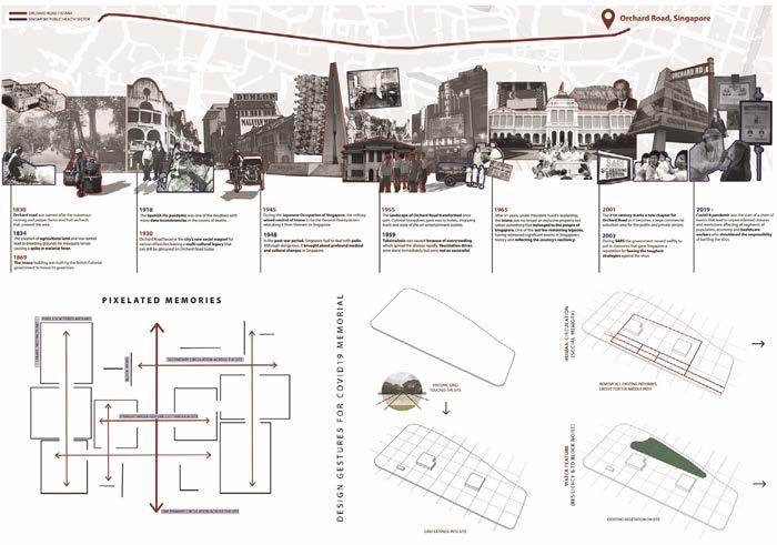
DESIGN 2
175 3 4
BLA STUDIO: DESIGN 3
Tutors Students Description
RETROFITTING SITES
Kenya ENDO Lehana GUO
Abdul Latiff Bin Hamzah, Anderson Wong Kui Lok, Azzah Atifah Binte Mohd Ramezan, Cai Jiajin, Ching Wai Lum, Chng Cheng Hwee, Cherise, Chow Qi Fang, Chua Rui Yi Rhueyviianne, Jeffery Lok Yong Quan, Judith Tay Xue Ying, Kashanna Lovey Joash, Kevin Ang Tian Sheng, Khoo Jun Yi, Kirsten, Kwan Shu Jun Josephine, Lai Woei Qing, Ler Min Rui Nicole, Lim Yau Dexter, Lin Jia Yin, Mohammad Amirul Bin Abdul Rahman, Nuramirah Binte Mohd Nor, Peng Kangqi, Sandy Foo Yock Li, Sofeah Insyirah Binte Ahmad Jamal, Tee Shu Zie, Wang Huajun, Xia Xue, Yap Xi Yi, Yeo Zhen Hao & Zhang Yijie
Situated within a hilly terrain, National University of Singapore’s (NUS) campus circulation planning has always been a challenge for its wayfinding, comfortable walking experience, and placemaking Viewing the existing campus circulation pattern through the lens of landscape architectural perspective, this studio provided an opportunity to critically analyze and reconfigure its spatial pattern— how the journey in campus can be better enhanced through incorporating natural systems, sustainable practices, and technical innovation. Students examined how landscape design can suggest ideas to retrofit campus circulation by carefully unfolding each landscape layers, namely, water flow, fauna and flora network, indoor amenities in-relation to topography, and human perception.
BLA LAD2006
1 Topography team’s site analysis focusing on detail levels, slope, and stabilization methods around YIH / Kevin, Shu Zie, Qi Fang, Cherise, Nuramirah, Latiff & Kashanna
2 Synthsis process by overlaying various layers including circulation, hydrology, vegetation and topography for identifying issues, patterns and principals / Anderson, Shu Zie, Azzah & Rui Yi
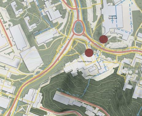
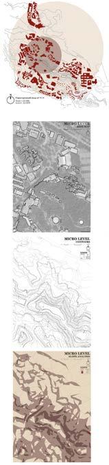
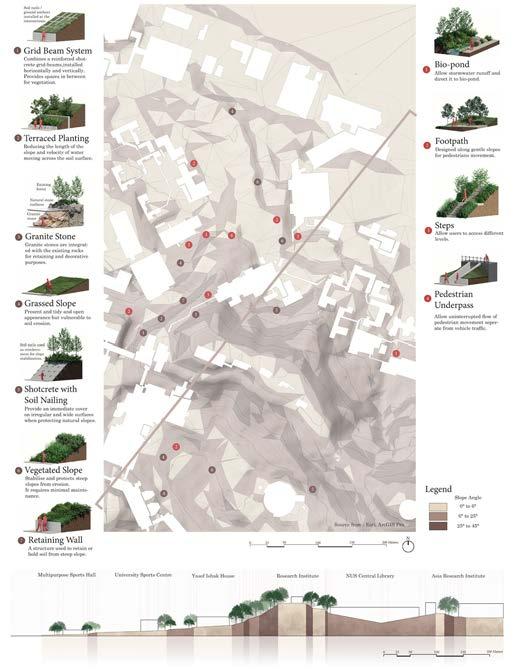
DESIGN 3
177 1 2
LAD2006
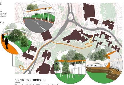

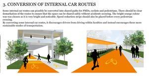
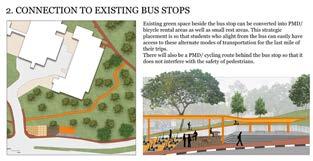
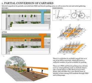
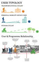
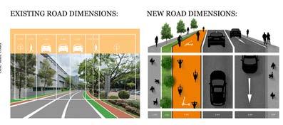
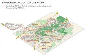
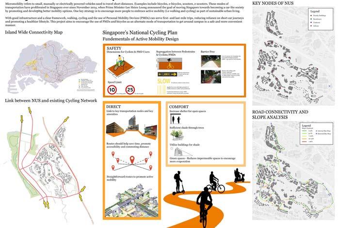
178
CAMPUS OF MICROMOBILITY / KHOO Jun Yi, Kirsten
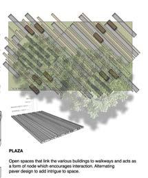
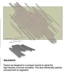
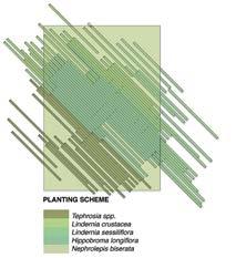
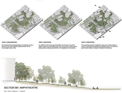
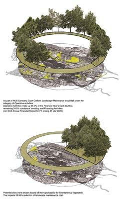
DESIGN 3 DELIBERATE SPONTENEITY / LIM
179
Yau Dexter
LAD2006
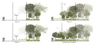
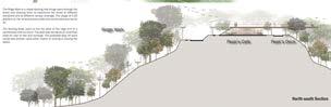
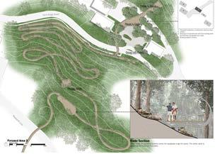
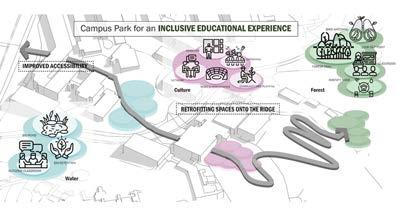
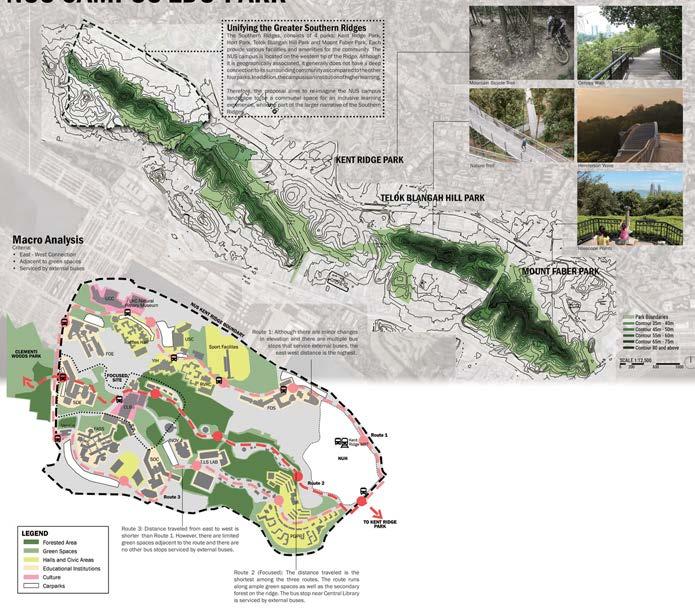
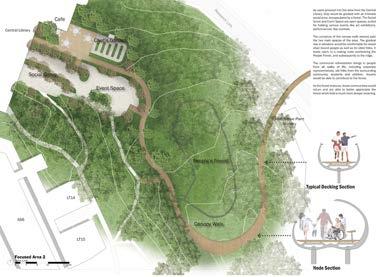
180
NUS CAMPUS EDU-PARK / Mohammad Amirul Bin Abdul Rahman
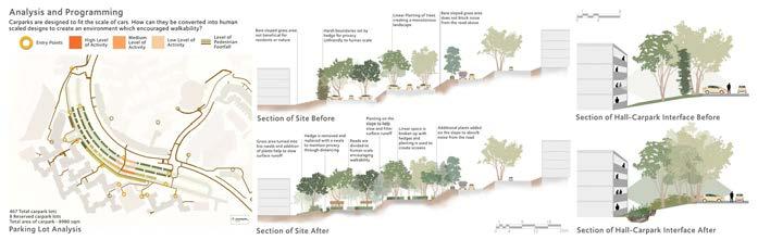
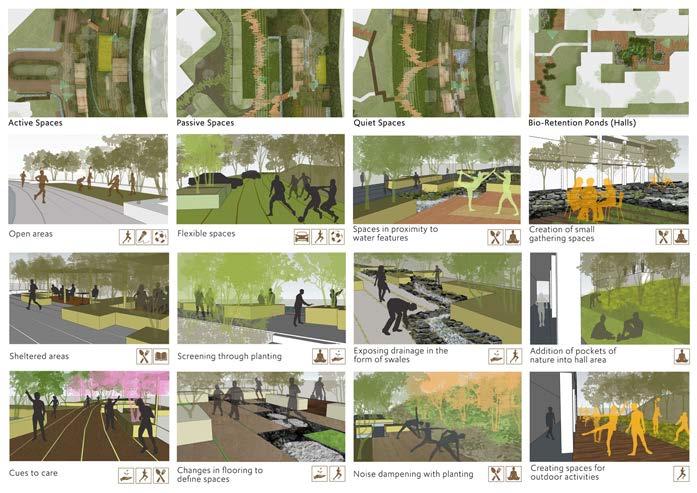
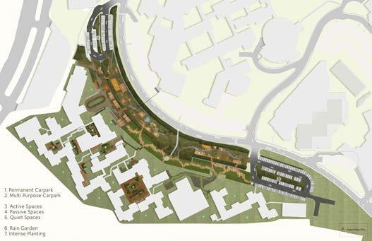

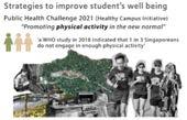
DESIGN 3 PAUSE IN TRANSIT / CHING Wai Lum 181
BLA STUDIO: DESIGN 4
Tutor Students
DENSIFICATION AND GREEN INFRASTRUCTURE
Henry STEED
Abdul Latiff Bin Hamzah, Anderson Wong Kui Lok, Azzah Atifah Binte Mohd Ramezan, Cai Jiajin, Ching Wai Lum, Chng Cheng Hwee, Cherise, Chow Qi Fang, Chua Rui Yi Rhueyviianne, Jeffery Lok Yong Quan, Judith Tay Xue Ying, Kashanna Lovey Joash, Kevin Ang Tian Sheng, Khoo Jun Yi, Kirsten, Kwan Shu Jun Josephine, Lai Woei Qing, Ler Min Rui Nicole, Lim Yau Dexter, Lin Jia Yin, Mohammad Amirul Bin Abdul Rahman, Nuramirah Binte Mohd Nor, Peng Kangqi, Sandy Foo Yock Li, Sofeah Insyirah Binte Ahmad Jamal, Tee Shu Zie, Wang Huajun, Xia Xue, Yap Xi Yi, Yeo Zhen Hao & Zhang Yijie
Description
The Canberra-Yishun District in this study lies between two eponymous MRT stations flanked by Yishun Avenue 2 and Avenue 8, with coastal forest and the sea to the north. This is a mixed land-use zone with new and older housing, schools, industries, arterial and local roads, MRT and Bus Stations, bus routes, two rivers, a hilltop park, connections to a Nature Park, vacant (but reserved) land, car parks, bus parks, mixed streetscape, schools, and temples. It is a mix of ages, spanning 50 years of history. The land is part open ground, but is mostly densely developed, reflective of 1980’s planning.
The students, divided into 9 teams, studied and analysed this very large and difficult district, and produced a full set of detailed documents sufficient to derive a full Master Plan of Blue and Green Infrastructure. From this, each team produced a Master Plan of the whole area. After that, each individual embarked on a design exercise for one of the selected sites. Each one had to be physically linked to the next project to ensure that the Master Plan’s connectivity worked.
BLA LAD2007
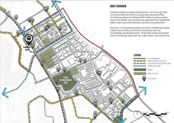
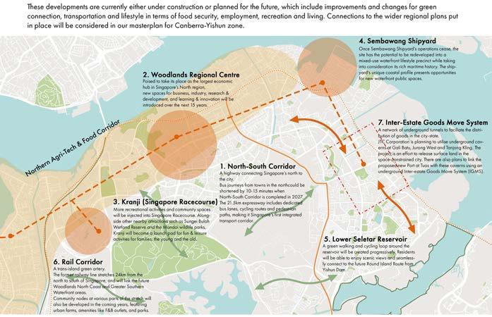
DESIGN 4
1 North Region Development Analysis / Mohd Amirul Abdul Rahman, Kashanna Lovey Joash, Chua Rui Yi & Lin Jia Yin
183 1 2
2 General Site Analysis / Cai Jiajin, Nuramirah Mohd Nor & Chow Qi Fang
LAD2007
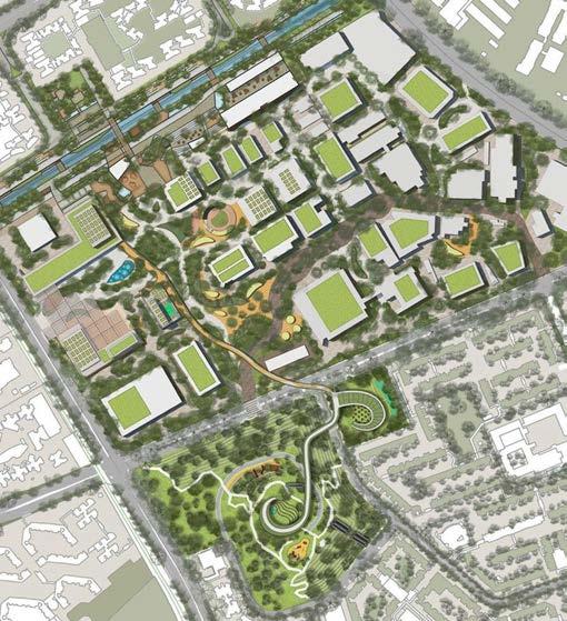
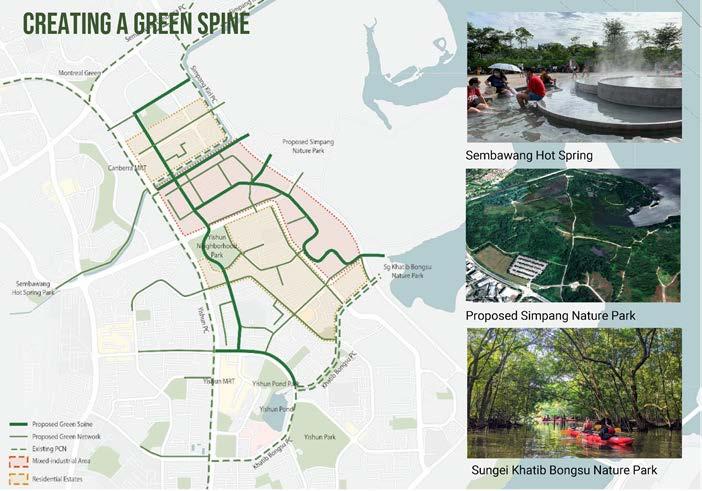 1 Strategy plan to create a green spine / Anderson Wong, Ching Wai Lum & Nicole Ler
2 Masterplan / Dexter Lim, Kirsten Khoo & Tee Shu Zie
3 Lifestyle park / Chua Rui Yi
1 Strategy plan to create a green spine / Anderson Wong, Ching Wai Lum & Nicole Ler
2 Masterplan / Dexter Lim, Kirsten Khoo & Tee Shu Zie
3 Lifestyle park / Chua Rui Yi
184 1 2
4 Wellness district / Ching Wai Lum
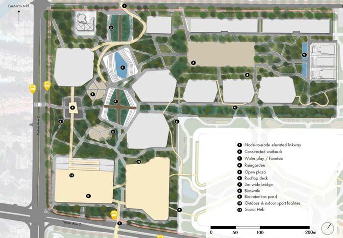
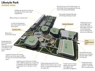
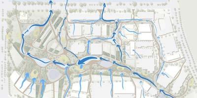
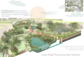
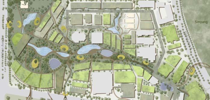
DESIGN 4 185 3 4
LAD2007
1 Wellness district / Anderson Wong
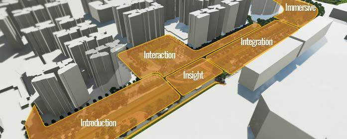
2 Canal grounds / Yap Xi Yi
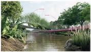
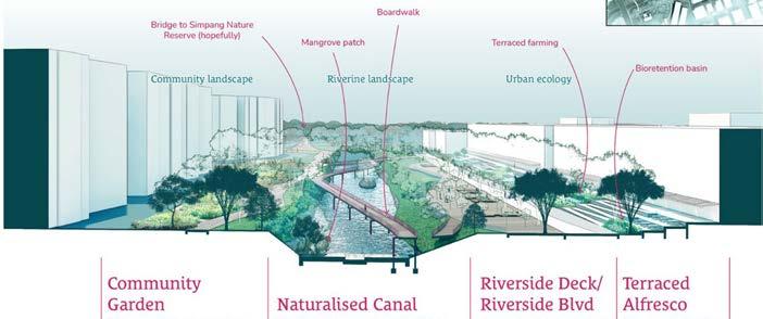
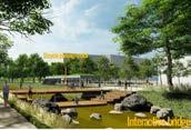
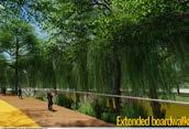
3 Yishun neighborhood park / Wang Huajun
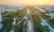
4 Yishun neighborhood park / Yeo Zhenhao
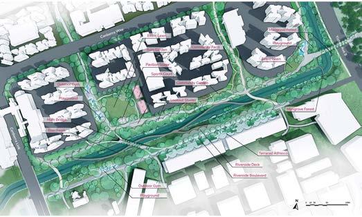
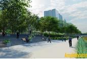
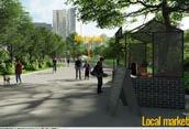
1 186 2
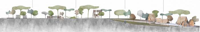


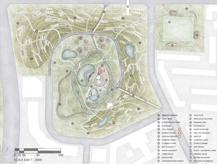
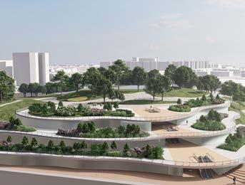
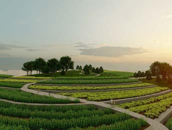
DESIGN 4 187 3 4
Tutors Students
BLA STUDIO: DESIGN 5 DIGITAL PLAYSCAPES
Ervine LIN
Terrence TAN
Alyssa Julianne Tee Xin Yun, Amber Yong Ling, Brina Choo Si Min, Chen Hui Lin Tammy, Cheong Shao Yin, Chester Lee Yong Lin, Chye Qing Yun, Galapon Ma Allaine Corpuz, Hia Siew Yi, Ho Jing Jing, Julia Tong Wai Shan, Ling Wei Shuen Benjamin, Magan Lam Wan Kay, Nicole Foo
Jiaxuan, Nur Qiyanah Binte Azmi, Tan Jie Min, Tan Sok Vin, Yap Sit Kee, Yeoh E Ming, Yulin Teo & Zhang Wen
Description
Architects have historically used physical models to study the complex three-dimensionality of their designs. Landscape architects, in contrast, have traditionally used maps and plans to represent their proposals instead. As important as maps are, there is a need to shift from a traditional 2D mode of inquiry into one that is 3D in nature – considering how the real world exists in three dimensions. This studio leveraged the qualities provided by three dimensional models through the exposure to stateof-the-art technologies and techniques. Starting with reality capture techniques to capture the site in full 3D, followed by parametric as well as Building Information Modelling (BIM) tools introduced to lend relevance to contemporary landscape design practices in the industry.
The end goal was to leverage digital techniques to design landscapes suitable for outdoor play, or simply playscapes. The ability to extract microtopography, locate a single tree branch in 3D space, populate and manipulate the landscape parametrically, and to do so in a geographically accurate and information rich environment is seen to enable the next generation of landscape architects to generate innovative landscape forms and deploy 3D
BLA LAD3001
DESIGN
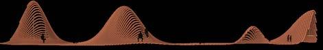
1 Site view
2 Proposed design and construction details of platforms / Brina Choo Si Min
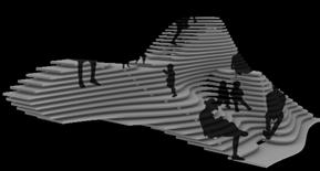
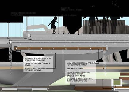
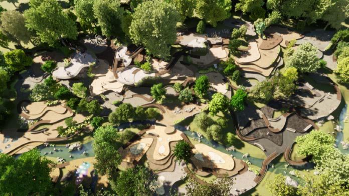
2. Overall Sectional Perspective and Furniture Design / Zhang Wen
4 Pavilion, bench and play perspectives
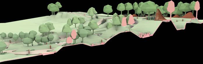
5
1 2 3 4 189
2
1 Landscape layers, types of activities and connections of proposed design / Alyssa Julianne Tee Xin Yun
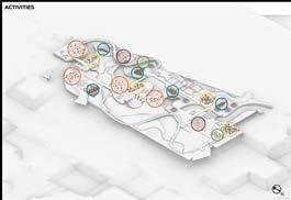
2 Abstract, familiar, inspirational, and unfamilar stream scenes / Chen Hui Lin Tammy
3 Artificial hill playform / Yeoh E. Ming
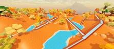
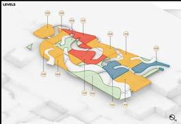
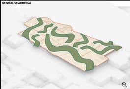
4 Perspectives of skate bowl and playing mounds
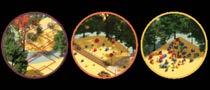
5 Sectional perspective.
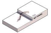

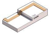
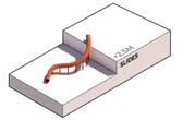
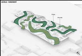
6 Process and design / Ling Wei Shuen Benjamin
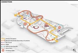
LAD3001
1
190
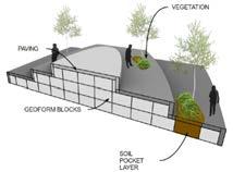
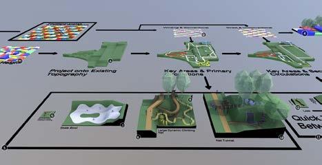
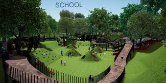
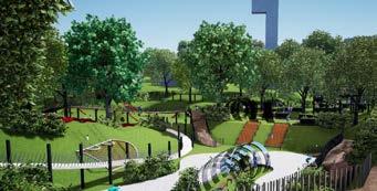
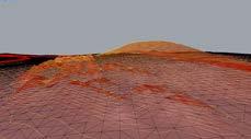
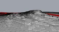
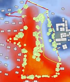
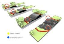
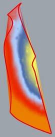
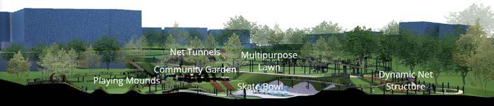 Existing
DESIGN 5 3 4 5 6 191
Proposed
1 Landscape analysis, strategy, and proposed design / Hia Siew Yi
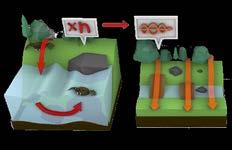
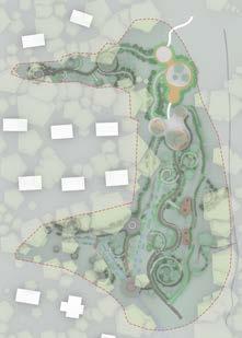
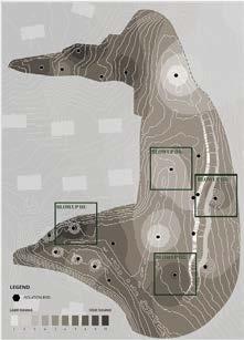
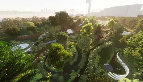
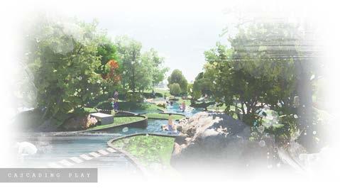
2 Site analysis, concept, and proposed design / Tan Sok Vin
3 Wetland trails / Chester Lee Yong Lin
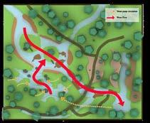
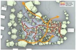


4 Dragonfly islands / Magan Lam Wan Kay
5 Kinesis / Julia Tong Wai Shan

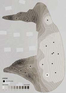
0.3-0.6m 0.6-1.2m 2m 1.2-1.6m
LAD3001
1 2 192
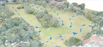
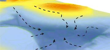
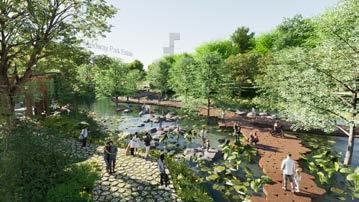
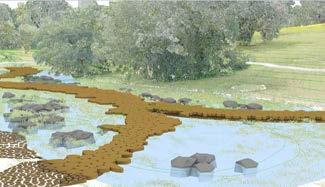
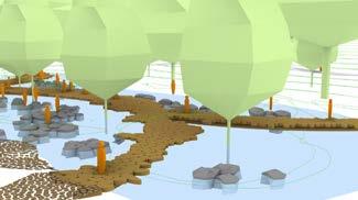
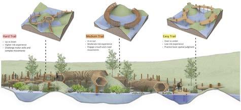
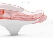

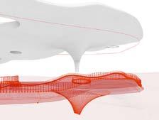
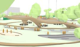
DESIGN 5 3 4 5 193
BLA STUDIO: DESIGN 6
Tutors Students Description
Kenya ENDO Evi SYARIFFUDIN
Alyssa Tee, Amber Yong, Brina Choo, Tammy Chen, Shoa Yin Cheong, Chester Lee, Qing Yun Chye, Allaine Galapon, Jing Jing Ho, Benjamin Ling, Magan Lam, Nicole Foo, Qiyanah Azmi, Jie Min Tan, Sok Vin Tan, Sit Kee Yap, E Ming Yeoh, Yulin Teo, Wen Zhang, Siew Yi Hia & Julia Tong
This studio assumed a bold stance that landscape architecture, standing at the intersection of ecology, infrastructure, and social space, is strategically poised to augment the health of the environment and the people symbiotically. How can outdoor and semioutdoor spaces in and around our residential estates be designed differently if designers have a deeper understanding of the needs and circumstances of the vulnerable in our society? This studio emphasized detailed contextual understanding from vulnerable persona’s perspective through interviews and active engagement with them, in order to understand the conditions of physical and social spaces around their daily lives. Queenstown’s residential neighbourhood was the target site for investigation where demographics closely mirror Singapore’s projected national demographics by year 2030. Design outcomes included strategic masterplans, human-scale design interventions that reimagine our living spaces holistically to facilitate multigenerational interaction and multi-functionality of outdoor spaces.
BLA LAD3002
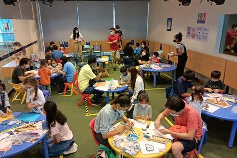

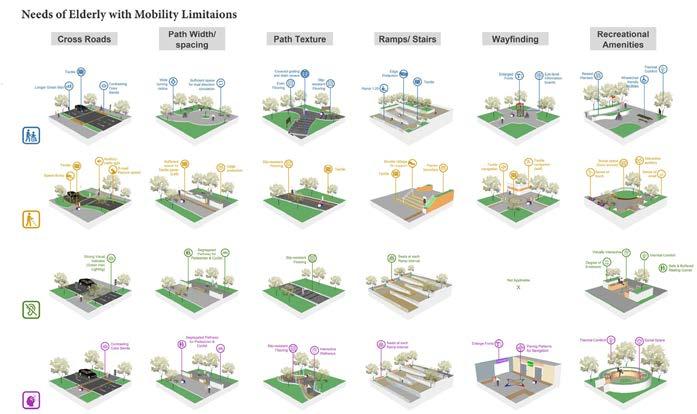
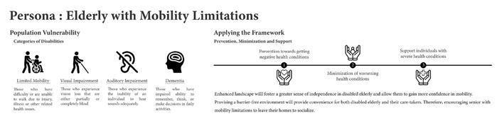
DESIGN 6
1 Persona analysis: Studies on spatial requirements for elderly with mobility limitations in relation to Queenstown neighborhood / Magan Lam, Kaelyn Yap, Siew Yi Hia, Tammy Chen & Sok Vin Tan
1 2 195
2 Collaboration with Queenstown Library to conduct community engagement workshops to directly understand the needs and voices of the target users
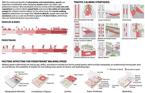
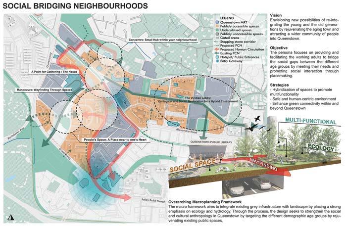
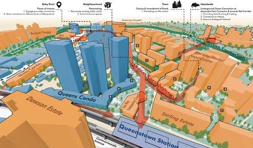
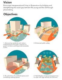
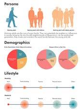
LAD3002
1 Strategic masterplan of Queenstown neighborhood targeting young adults / Sok Vin Tan, Julia Tong, Chester Lee, Jie Min Tan & Yulin Teo.
1 2 196
2 Students developed topical focus studies individually to further analyze the site through typologies and design language. This case focus on speed / Qing Yun Chye
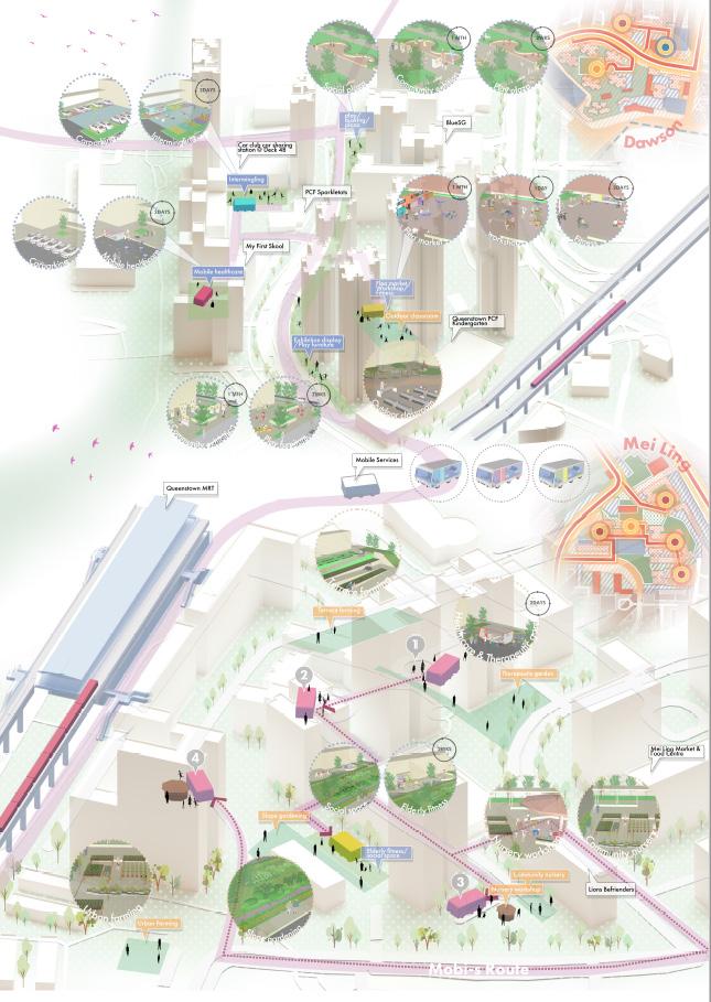
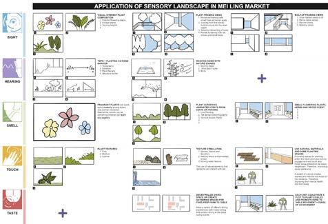
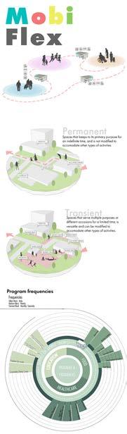
DESIGN 6
3 Strategic masterplan titled Mobi-flex, inspired by Molly, the mobile library service that brings books and communal activities to residents’ doorsteps / Zhang Wen, Siew Yi Hia, Amber Yong & Jing Jing Ho
3 4 197
4 Topical focus studies on senses / Allaine Galapon
LAD3002
TANGLIN V / HO Jing Jing
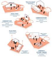
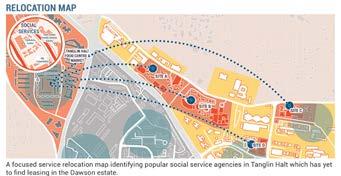
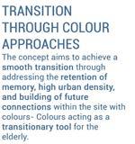
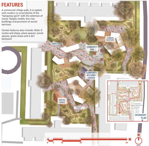
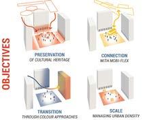
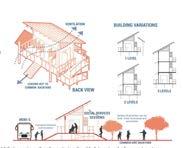
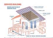
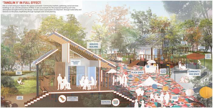
198
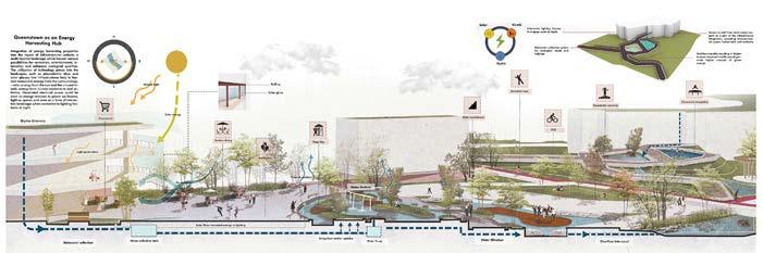
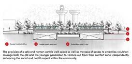
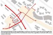
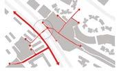
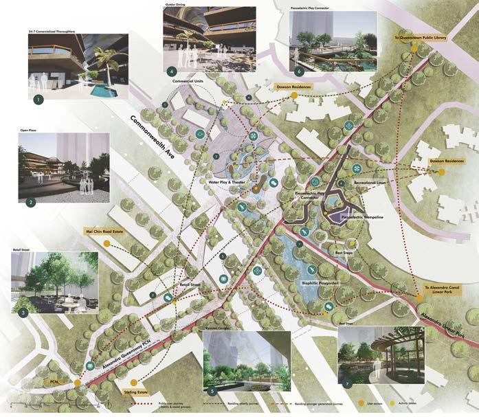
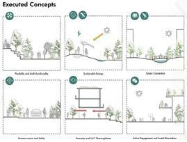
DESIGN 6 NEXUS - RE:IDENTIFY RE:CHARGE RE:JUVENATE / TAN Sok Vin 199
INTRODUCTION TO LANDSCAPE ARCHITECTURE
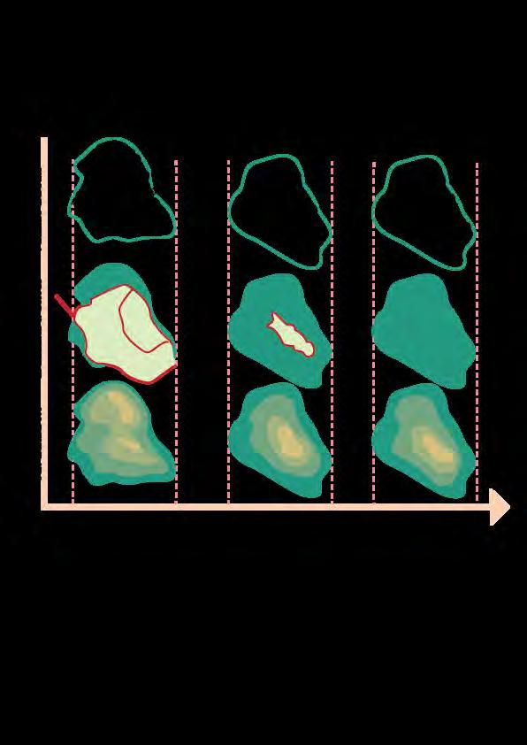
Tutors Description
Lehana GUO Dorothy TANG
Introduction
This module introduced concepts of landscape and how its conception relates to the profession of landscape architecture. Through understanding landscape as an epistemological category, it presents a survey of the development of the profession and how the profession responds to societal needs. Emphasis was placed on understanding the significance of environmental, socio/cultural, physical/visual, and aesthetic factors in developing intervention strategies and designs. Contemporary landscape architectural issues, practitioners and work were presented. In addition to lectures and in-class discussions, students engaged in active learning through documentation of their personal encounters in the landscape. Students developed critical essays of 21 contemporary landscapes in Singapore to sharpen their ability to read and write about landscapes.
In the heart of the Civic and Cultural District of Singapore sits Fort Canning Hill, a landmark archaeological heritage site whose history encompasses 700 years. Over the centuries, the hill has gone through numerous transformations from being the residence of ancient Malay nobility in the 14th Century, British government and finally recreation, known as Fort Canning Park. Once a tropical cleared to create a palace before growing into a lowland industrially sculpted by the British for an unobstructed view of the harbour. Today, the land is being repopulated by trees and smaller vegetation
Spanning 18-hectares and reaching 156 feet at its peak, the land set aside for Fort Canning Park seem like a luxury, especially in the Downtown Core Planning Area, the economic and cultural heart of Singapore industrial purposes to meet the demands of housing and provision of jobs (Lim 2011, 1). However,
Beyond its
BLA LAD1003
LAD1003: Critique of Fort Canning ParkIffah Rusyda Binte Azmi A0204308R
in the eyes of the Singaporean government, this scale is justified.
Rail Corridor
Rail Corridor
750m Radius = 10mins walk
750m Radius = 10mins walk

On the surface, it seems that the Jewel Shiseido Forest Valley bridges the connection between human and nature but what kind of connection are we fostering when the nature that we are educating users about has been altered to better suit the comfort of the people?
A great piece titled “50 ways to the Singapore Rail corridor” by Andre Sevtsuk sheds a clear light into the shortcoming of the project so far with studies that backs the implementation of 50 newly proposed pedestrian and bike connections to the rail corridor that would yield access to approximately 430,000 residents who living within the 1km buffer zone along the actual street network (Andres Sevtsuk, 2021) and arguing that with improved accessibility, the Singapore green corridor can be utilized by not only close to a half a million residents and the employees of around 4,000 firms in the immediate surroundings, but also become a sought-out hiking, biking and recreational trail for all residents of Singapore (Andres Sevtsuk, 2021). This could be argued to the opportunities that has been missed in the implementation of the project which causes the site to not embody the connectivity and recreation aspect that was originally laid out. So, was six years in the making and four more to go not truly filling the void left by the railway?
A great piece titled “50 ways to the Singapore Rail corridor” by Andre Sevtsuk sheds a clear light into the shortcoming of the project so far with studies that backs the implementation of 50 newly proposed pedestrian and bike connections to the rail corridor that would yield access to approximately 430,000 residents who living within the 1km buffer zone along the actual street network (Andres Sevtsuk, 2021) and arguing that with improved accessibility, the Singapore green corridor can be utilized by not only close to a half a million residents and the employees of around 4,000 firms in the immediate surroundings, but also become a sought-out hiking, biking and recreational trail for all residents of Singapore (Andres Sevtsuk, 2021). This could be argued to the opportunities that has been missed in the implementation of the project which causes the
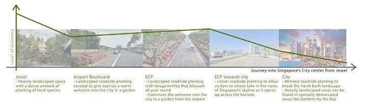
Firstly, Jewel as a stand-alone landscapegives usersthe illusion of being able to add and remove themselves from nature as and when they want. In this case, housing nature in a bubble when nature is intensified and all-encompassing. When entering and exiting the site, the feeling of being surrounded by the intense amount of greens is strikingly contrasted. This further highlights the gap between human and nature as two different entities.
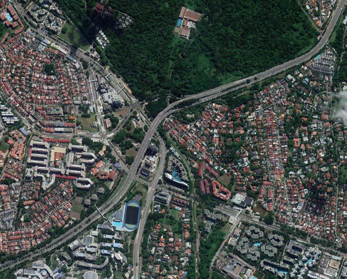
Heavily choreographed experiences
INTRO TO L.A.
1 Analysis of landuses and access points to the Rail Corridor / Abdul Latiff Bin Hamzah
2 Diagram of “greening” efforts between the Jewel and Downtown / Wai Lum Ching
1 2 3 4 5 6 7 8
King
Bukit
Ngee
Beauty World MRT
1 2 3 4 5 6 7 8
Albert MRT Station
Timah Plaza
Ann Polytechnic Temasek Club
Station
Blossomvale Condominiums
King Albert Park Estate Pei Hwa Presbyterian Primary School Bukit Timah Market
Choeng Chin Nam Rd
Beauty World Centre, Beauty Wolrd Plaza, Bukit Timah Shopping Centre
Jardin & Garden Vista Condominiums
Mayfair Garden & Binjai Park Estates
Figure 8: An analysis of the level of greens one is surrounded by on their way out of the airport to the town area
1 2 3 4 5 6 7 8
King Albert MRT Station
Bukit Timah Plaza
Temasek Club Beauty World MRT Station 1 2 3 4 5 6 7 8
Ngee Ann Polytechnic
Blossomvale Condominiums
King Albert Park Estate Pei Hwa Presbyterian Primary School Bukit Timah Market
Mayfair Garden & Binjai Park Estates 1 2 201
Choeng Chin Nam Rd Beauty World Centre, Beauty Wolrd Plaza, Bukit Timah Shopping Centre
Jardin
& Garden Vista Condominiums
INTRODUCTORY GIS FOR LANDSCAPE ARCHITECTURE
Tutors
Description
Terrence TAN
This module provided an understanding of the basic concepts and uses of Geographic Information Systems (GIS) technology and spatial analysis. By linking data to maps, GIS reveals relationships not apparent with traditional item-referenced information systems and database management products, and by displaying information in a graphic form, it unpacks complex spatial patterns. The course emphasized concepts needed to use GIS correctly and effectively for manipulating, querying, analyzing, and visualizing spatial data. Students participated in hands-on exercises as well as GIS assignments linked to their design studio.
BLA LAD2005
1 Topography analysis of Kent Ridge / Xia Xue
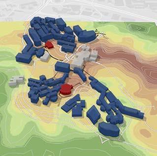
2 Figure ground and analysis of buildings fragmenting the forest / Anderson Wong
3 Mapping of forested areas in Kent Ridge / Anderson Wong
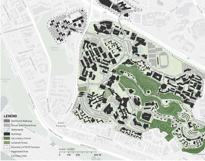
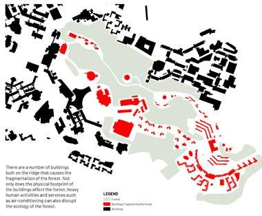
INTRO GIS
1 2 3 203
Tutor Description
Kenya ENDO
The field of landscape architecture requires a series of detailed steps to achieve successful design projects. This module developed students’ technical ability to effectively analyze and design a space with practical site engineering knowledge, legitimate, safety standards, and ideas on natural resource management. Landscape architects hold stewardship of the land as a key responsibility of the profession. Understanding design implementation process can enhance spatial sensitivity in students’ design responses along with a greater literacy in detailing.
The module’s objective was two-fold: 1. To understand basic knowledge on construction terms, procedures, site measurement process, and key principals required for landscape architects within a multidisciplinary team; and, 2. To acquire design thinking skills through design exploration along with technical detailing, and understanding its consequence on human experience, sustainability, and feasibility.
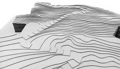
BLA LAD2004 LANDSCAPE CONSTRUCTION I
1 Design exercise reimagining a plaza in NUS by manipulating hardscape material, size, color, and pattern / Siew Yi Hia, Julia Tong & Kangqi Peng.

2 Detail deep section of highrise greenery soil layer, drainage ,and outdoor furniture. Kampung Admiralty, as a case study / Judith Tay, Mia Chow, Kangqi Peng & Yijie
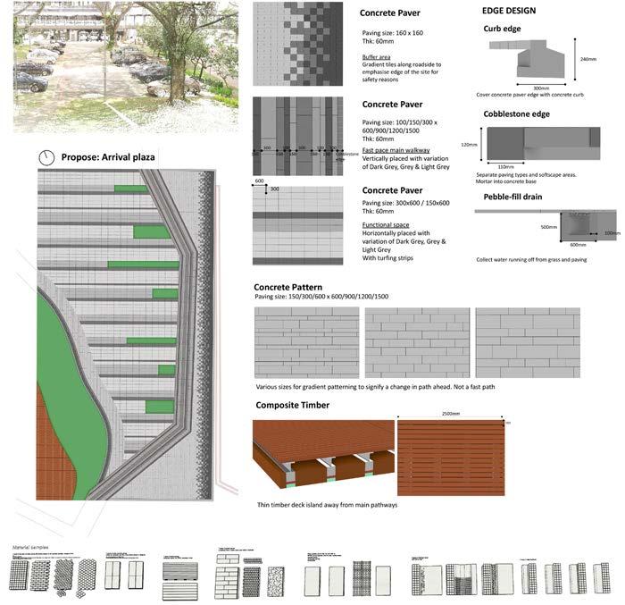
LANDSCAPE CONSTRUCTION
1 2 205
Zhang
DISSEMINATION
DISSEMINATION
Event Description
2021 Enlighted Asia Student Workshop
NUS landscape students collaborated with Lighting Planners Associates (LPA) for the Enlighted Asia 2021 Student Workshop (organized by International Association on Lighting Design).
As part of 6 Universities in Asia (among Tokyo, Seoul, Beijing, Bangkok, Karnataka), we analyzed Singapore’s lighting environment / night culture to understand “Now”, and to propose “Future” nightscapes from landscape point of views.
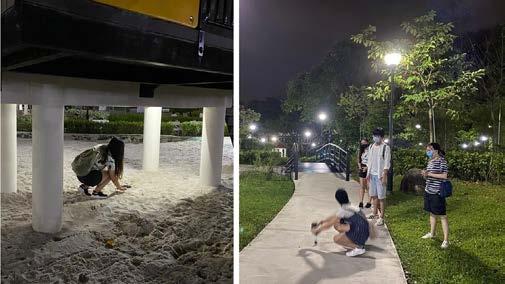
1 Site analysis of social spaces, e.g., market and hawker centre / Adam Lam, Chua Rui Yi & Rui Xue
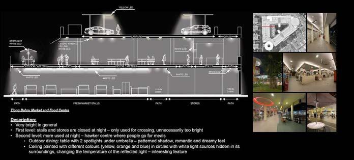
2-3 Site photos
4 Site analysis of Orchard Road / Mia, Anna, Fang Ting, Olivia & Nicole
5 Site analysis of lighting provision in the Tiong Bahru neighborhood / Karry, Shuyue & Jia Yin
1 2
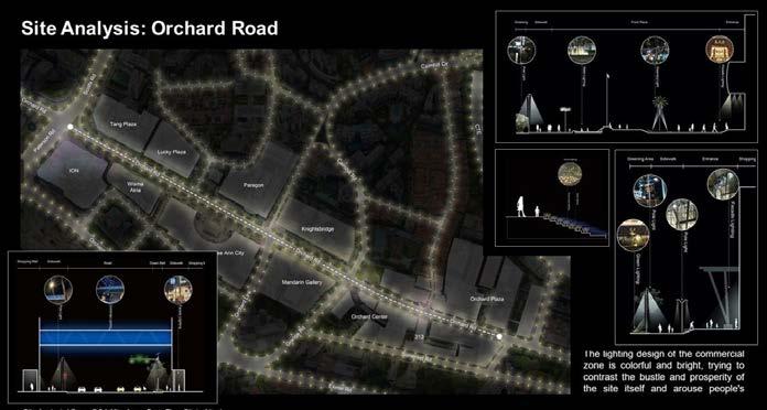
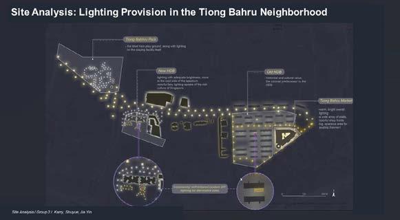
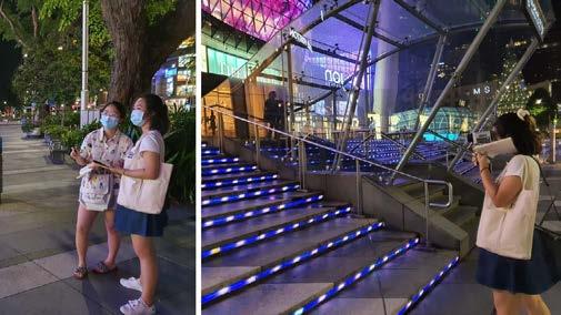
3 4 5 209
DISSEMINATION
Event Description
IGC 2021: Where will we plant a Trillion Trees?
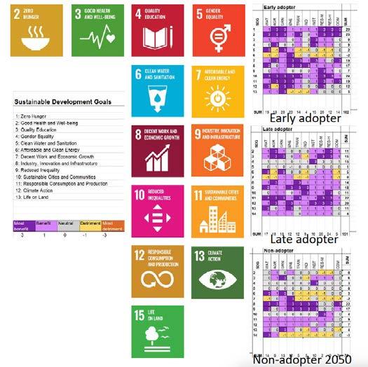
MLA Year 1 cohort participated in the 3rd annual International Geodesign Collaboration conference
IGC 2021
With decreasing of agriculture land in Singapore over past decades, nowadays, the area of agriculture land in Singapore is only 0.78%. Additionally, Singapore’s food production at this stage only accounts for less than 10% of consumption, which indicates a severe food security issue. COVID-19 situation also affects food abundancy and food insecurity within the country. Moreover, the land use in Singapore urban area is extremely limited. Land scarcity makes the food security more challengeable, so the problem is how to develop design strategies contributed to multi-functional urban land uses that integrated, rather than separate agriculture from other land uses for the sustainability of Singapore future, and how to redesign both green and grey spaces into productive landscape.
1
1 Goals for a sustainable development
2 The study area covered a 1km buffer area of the canal network between Marina Bay and Central Catchment
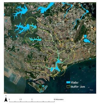
3 As green spaces will decline, green infrastructure should become more common, thus, intergrated green spaces will increase.
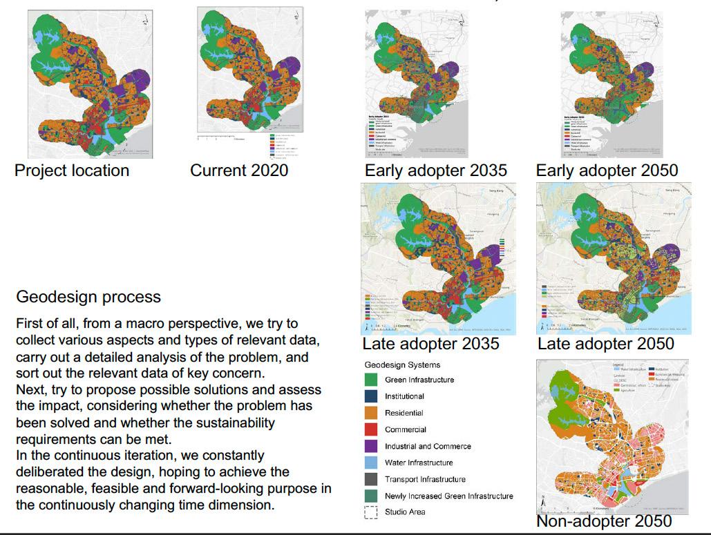
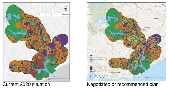
2 3 211
Event Description
2021 Changi Point Competition
Urban Redevelopment Authority and Singapore Land Authority launched a competition in April to get the public to share ideas on how to sensitively enhance the heritage and recreational elements of Changi Point while preserving rustic charm. The aim was to incorporate suitable ideas into future plans for the area.
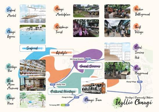
Congratulations to NUS MLA team (2022); Hong Mengyi, Huang Xi, Li Xi and Li Wanying for their Concept Master Plan for Changi Point entitled “Hide and Seek”, supervised by A/P Yun Hye Hwang and part-time tutor Evi Syariffudin.
“Hide and Seek” proposes for Changi Point to be a place of escape from the city; for people to experience a more laid back lifestyle while exploring the “heritage treasure of Singapore”.
1 Possible points of interest
2 Master plan for Changi Point
3 Vision - A rich heritage treasure of future Singapore
4 Diverse exploration experience
DISSEMINATION
1
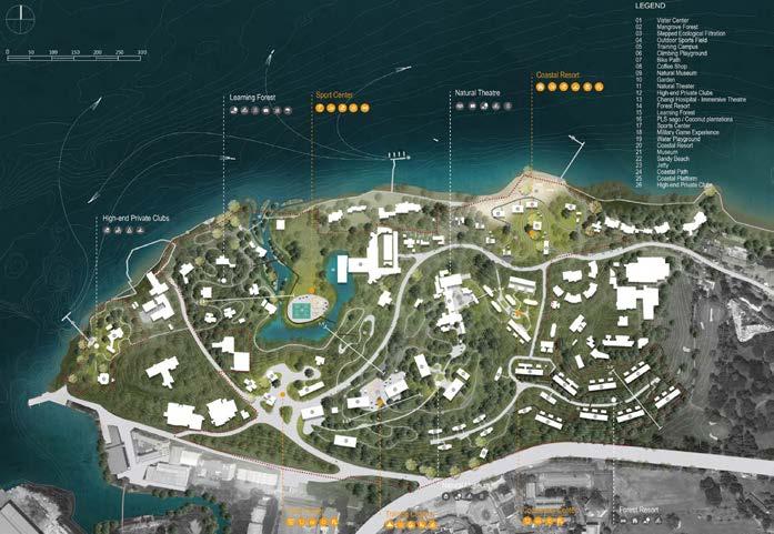
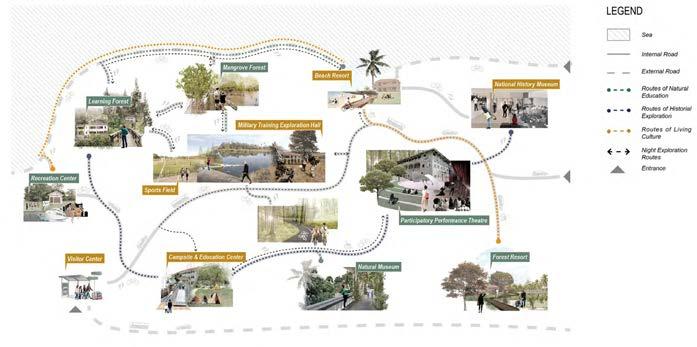
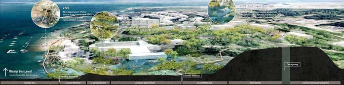
2 3 4 213
DISSEMINATION
Event Description
2022 Student WLA Award
Congratulations to NUS MLA Ekta Rakholiya (class 2021) for winning the 2022 Student World Landscape Architecture Award! Graduate Award, Award of Excellence; “Rewilding Coasts A Project Drawdown”, supervised by Ryan Shubin and Huei Lyn Liu.
This project is about Rewilding Coasts. Coastal habitats cover less than 2% of the total ocean area but account for approximately half of the total carbon sequestered in ocean sediments. It sequests carbon 40 times faster than any other terrestrial habitat and lock it in the ground for around 1000 of years. If implemented appropriately, can help tremendously in countering climate change issues. The design proposal counters the act of land reclamation and instead intervenes strategically at certain areas to create a thriving habitat that can act as a buffer and protection from inundation.
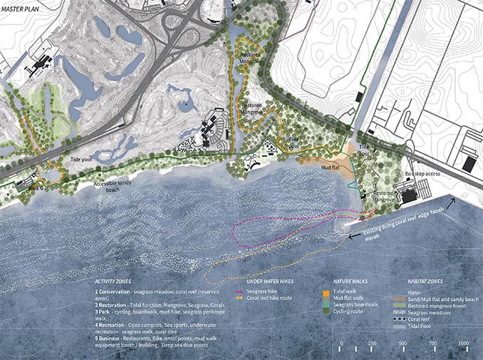
1
Event
Description
Lighting Design Workshop
Do you know the lighting concept of the Gardens by the bay?, and how landscape and lighting designers coordinated during the design phase?
As a junior landscape architect, what were the lessons learned in the course of designing Learning Forest@ SBG, Round Island Route?
Thank you @Yusuke Hattori from LPA, @Anna Yap from Stephen Caffyn Landscape Design, for sharing your precious experiences.
Detail Design module for MLA year1 went 100% online, utilizing ZOOM, LOOM, MIRO, GOPRO for immersive learning!
2 3 1
2
3
215
Master plan
Collaborating on MIRO
Zoom sessions with guest speaker
STAFF
STAFF LIST


 Dorothy Tang Assistant Professor
Kenya Endo Lecturer
Puay Yok Tan Associate Professor
Ervine Lin Senior Lecturer
Terrence Tan Senior Lecturer
Hwang Yun Hye Associate Professor
Jessica Diehl Assistant Professor
Mark McDonnell Visiting Associate Professor
Wolfgang Wende Visiting Associate Professor
Dorothy Tang Assistant Professor
Kenya Endo Lecturer
Puay Yok Tan Associate Professor
Ervine Lin Senior Lecturer
Terrence Tan Senior Lecturer
Hwang Yun Hye Associate Professor
Jessica Diehl Assistant Professor
Mark McDonnell Visiting Associate Professor
Wolfgang Wende Visiting Associate Professor


 Lehana Guo Part-Time Tutor
Melissa Yip Part-Time Tutor
Tan Yit Chuan Part-Time Lecturer
Jiann Bin Koh Part-Time Lecturer
Huei Lyn Liu Part-Time Tutor
Evi Syarriffudin Part-Time Tutor
Alfred Lee Part-Time Lecturer
Shawn Lum Visiting Consultant
Lehana Guo Part-Time Tutor
Melissa Yip Part-Time Tutor
Tan Yit Chuan Part-Time Lecturer
Jiann Bin Koh Part-Time Lecturer
Huei Lyn Liu Part-Time Tutor
Evi Syarriffudin Part-Time Tutor
Alfred Lee Part-Time Lecturer
Shawn Lum Visiting Consultant
219
Ryan Shubin Part-Time Tutor