1 minute read
EARLY BAMPTON

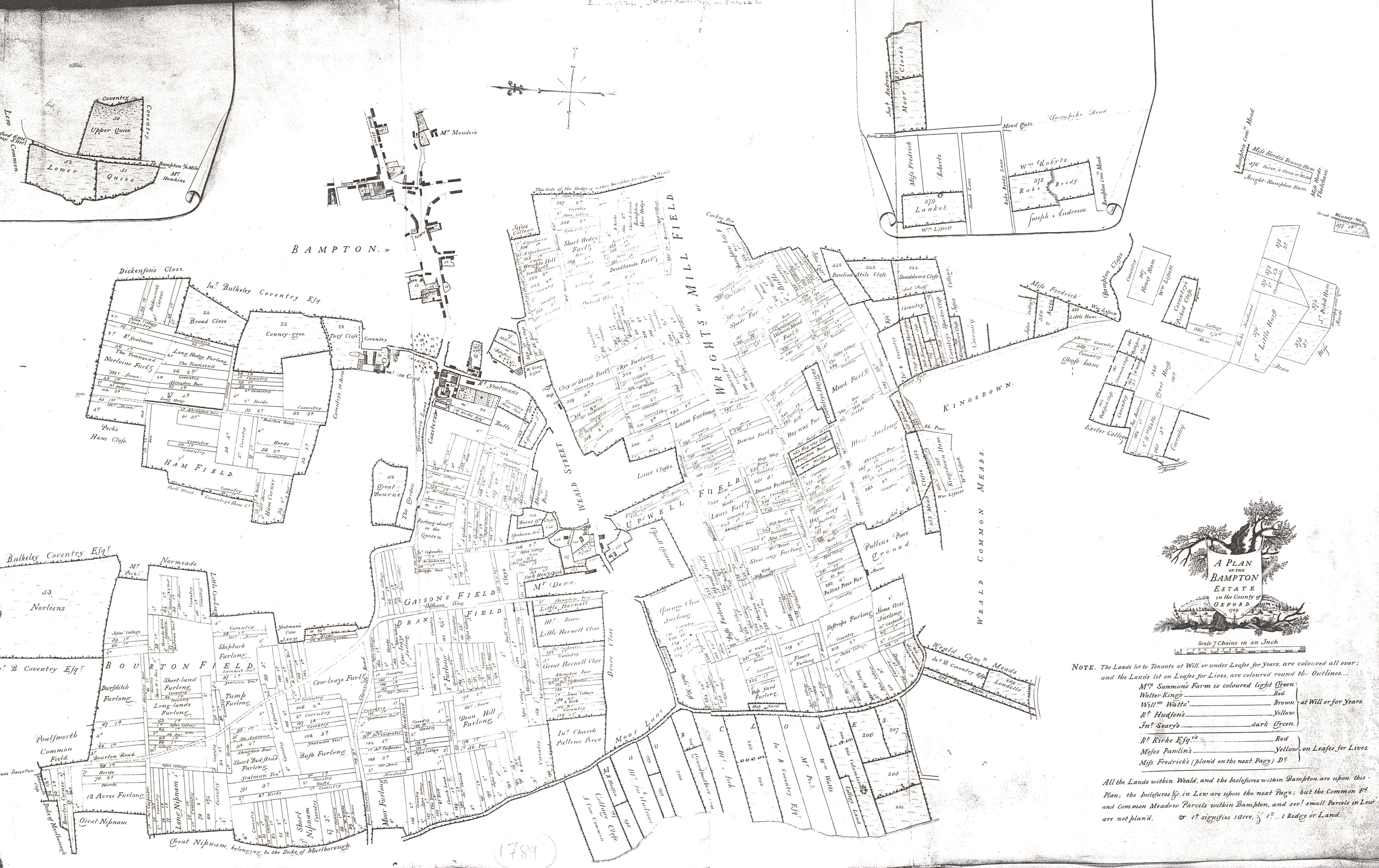
Bampton is depicted on various county maps of Oxfordshire dating to the 17th and 18th centuries, but detailed early mapping of the settlement eludes the historian.
Where Bampton does appear on an early map, the older the map the less detail with which the settlement is depicted.
Advertisement
The earliest depiction of Bampton is that of Thomas Saxton’s 1574 Map of Oxfordshire.

18th century maps of Bampton all characterise Bampton in very similar ways. What features they chose to include when constrained by small scales are very interesting. All maps show the convergence of the three routes into Bampton on the market place. All make a point of describing the road today known as Landells as it makes a distinctive curved track around the perimeter of the churchyard.
There are also usually concerted efforts to show the tracks of Broad Street and Church View as distinct and running parallel to each other, with the latter terminating at the church.
Interestingly, most early small scale maps make an attempt to depict the track or path heading east from the settlement core to Beam Cottage.
The 1767 ‘New Map’ actually depicts Beam Cottage, standing in isolation at the end of this track. Weald is depicted variously as a semi-separate settlement, perhaps centred on its own green. All of these features, taken together can be used to infer much earlier landscape features.