1 minute read
ENCLOSURE

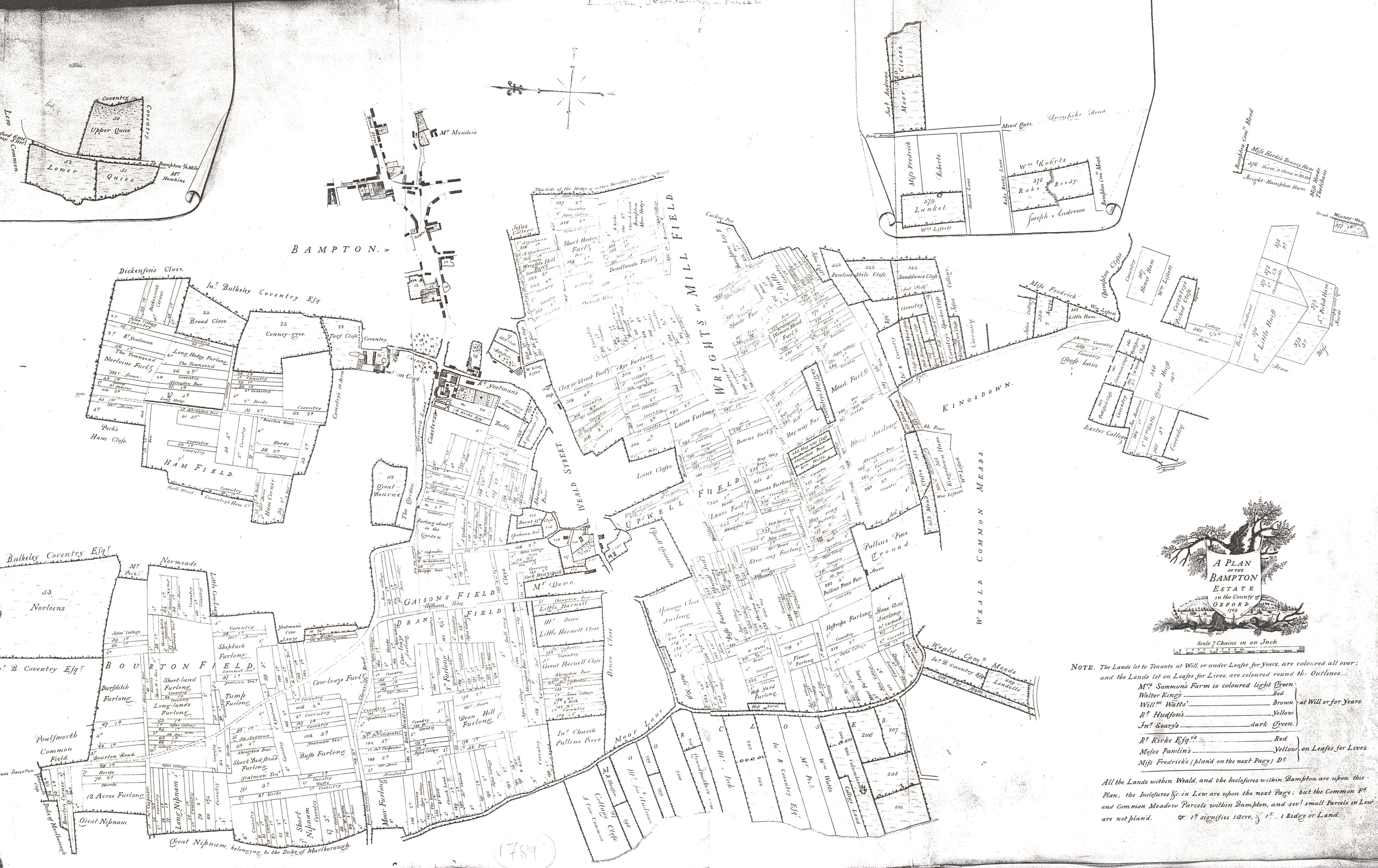
Throughout the early modern period Bampton’s status as a centre of trade (traditionally of tanning and leather glove making) was declining. In 1789 the Earl of Shrewsbury’s surveyor described Bampton quite decisively as a “former market town”. The importance of its agricultural hinterland would become a proportionately more important part of its economy.
By the end of the eighteenth century the enclosures of Bampton were situated in the areas considered to be the richest for agricultural purposes. This broadly defined by the area along the Buckland turnpike road to the south of the settlement in an area named Brookfast Closes - the name being descriptive as the closes are equally spaced perpendicular either side of the route of the Shillbrook. This area of closes appears to have been bounded to the south by Meadow Brook, beyond which to the south was open meadow.
Advertisement
Other early closes are to the south west of Weald, accessed by droveways and known by the 18th century as either the “moor” or “marsh” closes in various sources. The two names appear contradictory, but considering there is also record of the “Maw ditch” in this area, it seems much more likely to be the former, derived as it is from the Saxon word Mōr, used to denote grassland.
To the north of Bampton there were larger enclosures forming the demesnes of the Bampton Manors of the Deanery and Ham Court.
Other important early enclosures include land set aside to fund relief of the poor (“the poor closes”). In 1768, when a poor house was first constructed in Rosemary Lane, this close was used as a source of construction timber.
Beyond the early-enclosed closes of Bampton were large areas of agricultural land. Early county maps illustrate the vastness of the common land around Bampton and Aston. That closest to the settlements of Bampton and Aston were settled into fields that would allow four-field cultivation.

The others, principally towards the south were set aside as meadows. There were also a small number of areas enclosed for coppicing.
1828 Enclosure map showing fish ponds & streams