1 minute read
BAMPTON IN THE 19th CENTURY

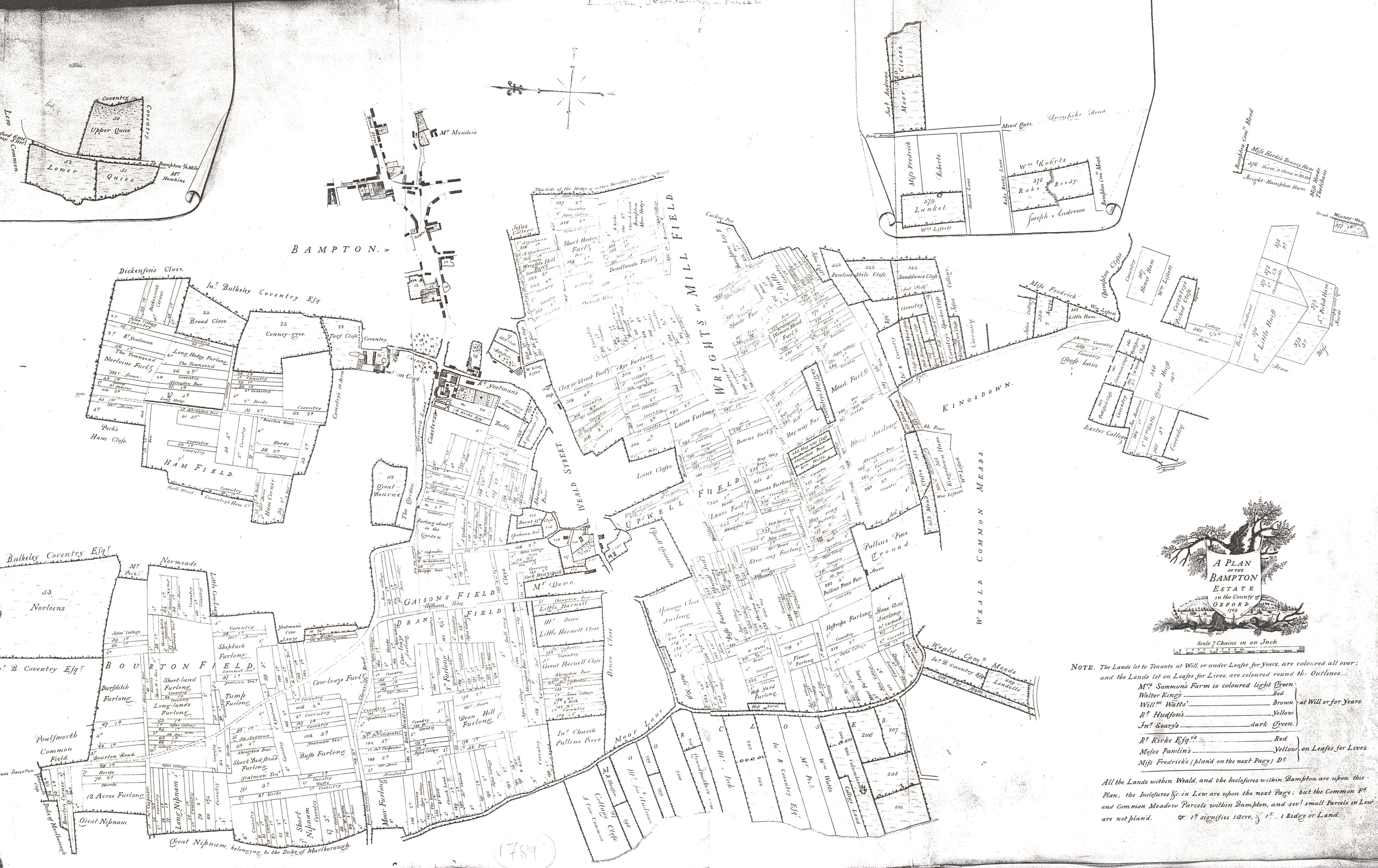
From the 1820s the impact of parliamentary enclosure was felt keenly. Many former commoners relinquished their land and either continued as rural labourers, or abandoned the agricultural economy altogether. This resulted in concentrations of rural labourers in Bampton at dense concentrations in Rosemary Lane and Kerwood’s Yard.
The former was a longstanding area associated with the poor, being mentioned as a site chosen by the parish for a “workhouse capable of employing and housing 60 persons or more” in 1768 before the construction of the later poorhouses on Weald Street.
Advertisement
Both became known as notorious slums during the 19th Century. Pressures on these areas may have fallen in the late 19th Century following a long recession and a national crisis in agricultural productivity that saw the population of Bampton fall from its 1860s peak of 1,713 (accommodated in 393 houses, with another 15 unoccupied). When the 3rd edition map was published in 1921 Bampton’s population was only 1,104.
This latter fall can be identified on the mapping in the abandonment and clearance of areas where very high density labourers’ cottages were provided. Kerwood’s Yard is no longer annotated in 1921 and its site had been cleared. Similarly, the high density labourers’ accommodation in the area around the former workhouse in Rosemary Lane and latterly in Weald Street was consolidated and substantially cleared by the 1920s.