MUSTAFA HANNAN KAGDI CONTENT
6016 4th St NW
Calgary, AB, Canada
T2K 1B5
mkagdi100@gmail.com
+1 - 587 969 3758
Mustafa is a passionate urban designer excelling in creatively solving problems within the built environment. Proficient in shaping artistic expressions through space, scale, and materials, He explores the profound impact of design on individuals and communities. His holistic approach integrates technology, theory, anthropology, and creativity, envisioning a future for architecture, planning, and urban design. Dedicated to transforming how we live, his forward-thinking mindset addresses current challenges while anticipating future needs. Committed to a multi-disciplinary approach, Mustafa reflects this in his endeavors to sculpt not just spaces but transformative experiences for communities, merging artistry and functionality.
+ COMMUNITY DESIGN CONCEPTS | CALGARY, ALBERTA
Redefine Banff Trail Community for future, Advanced Professional Studio
+ CALGARY METROPOLITAN REGION GROWTH PLAN | ALBERTA
Updating Growth Plan to be future ready!, Regional Planning Studio
+ OLYMPIC CONNECTION | CALGARY, ALBERTA
Reimagening Shaganappi Point Golf Course, Community Planning
+ INSIDE OUT | CALGARY, ALBERTA
Revitalization of Downtown West End, Urban Design
+ KAKATOOSOYIISTS or STAR LODGES | SIKSIKA NATION, ALBERTA
3D Concrete Printed Housing, Research
This portfolio holds a collection of some of my academic and non-academic work in urban design and architecture. Each project had its own means of presentation, but for convenience, they are attempted to be presented in a similar layout in this portfolio while keeping the original presentation spirit.
COMMUNITY DESIGN CONCEPTS
Re-define Banff Trail Community for future
TYPE - ADVANCED PROFESSIONAL PLANNING STUDIO
STUDIO - M.PLAN | GROUP WORK
SITE - CALGARY, ALBERTA, CA
INTRODUCTION
Location - Calgary | AB
Site Location - Banff Trail Community
Team - 3 Members (Maneet. Anshuman, Mustafa)
Tools - Adobe Creative Suite, AutoCAD, ArcGIS, Sketchup, Enscape 3D, Rhino
COMMUNITY DESIGN
CONCEPTS
ABOUT THE PROJECT -
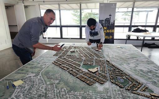
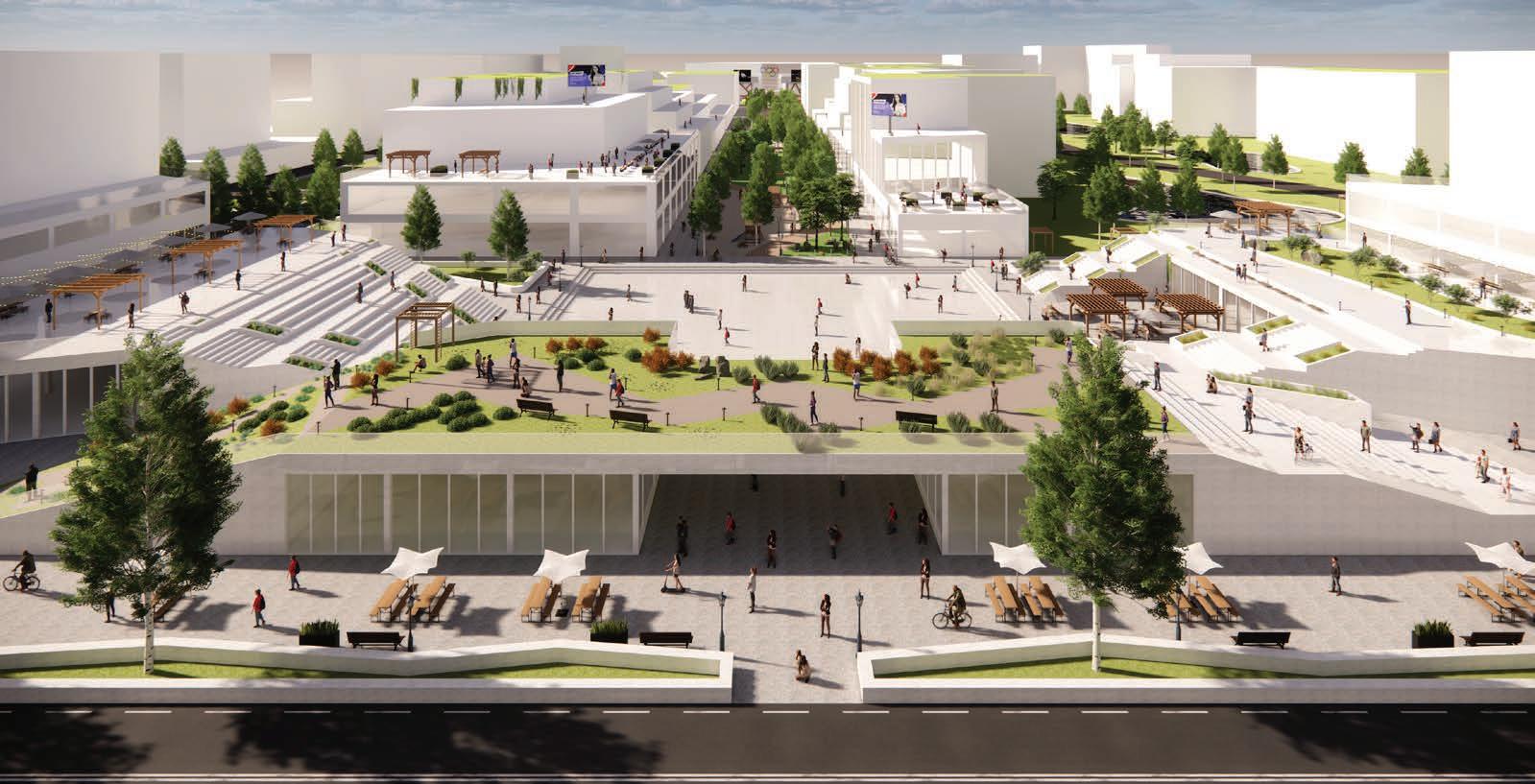
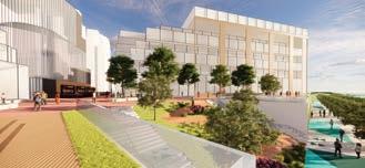
The City Design Catalyst (CDC) project, in collaboration with the Banff Trail Community Association, aims to enhance the Banff Trail community through strategic urban planning and design. This initiative, part of the Winter 2024 PLAN 630 Advanced Planning Studio at the University of Calgary, involved extensive analysis and public engagement to address key issues such as main street improvements, traffic safety, and the utilization of open spaces. The project developed comprehensive recommendations focusing on transforming the urban fabric, enhancing connectivity, creating interactive open spaces, and re imagining Motel Village. Through these efforts, the CDC project aspires to make Banff Trail a vibrant, sustainable, and inclusive community.

PROJECT VISION
Re-define Banff Trail community as a vibrant and diverse neighborhood that thrives year-round, offering a safe and engaging environment for residents and visitors of all ages.
PROJECT GOALS
PROJECT STRATEGIES
TRANSFORMING URBAN FABRIC
BRANDING OF THE COMMUNITY
INTERACTIVE OPEN SPACE
PROGRAMMING AND ACTIVATION


ENHANCED CONNECTIVITY
LAND USE CHANGE
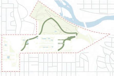
RE IMAGINING MOTEL VILLAGE
URBAN DESIGN PRINCIPLES
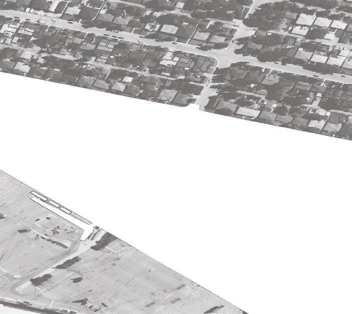
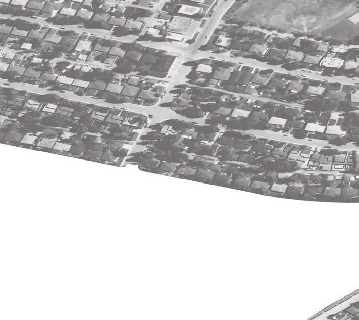
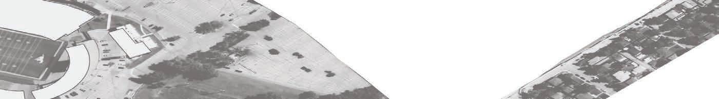
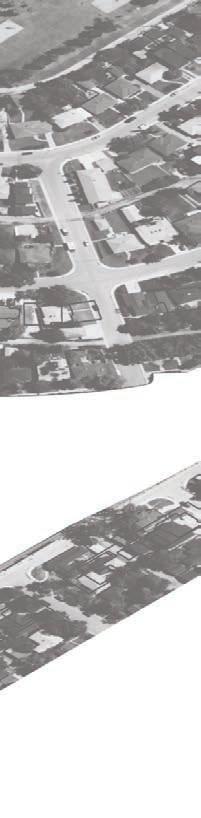
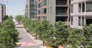
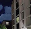
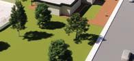
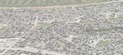
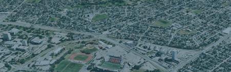
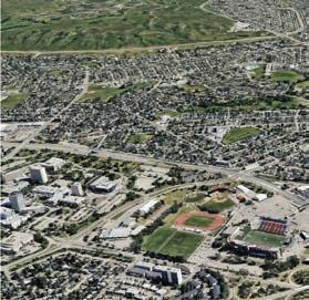
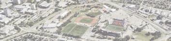
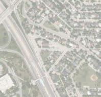
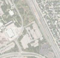
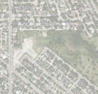
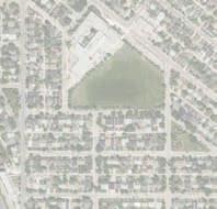
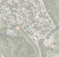
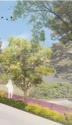
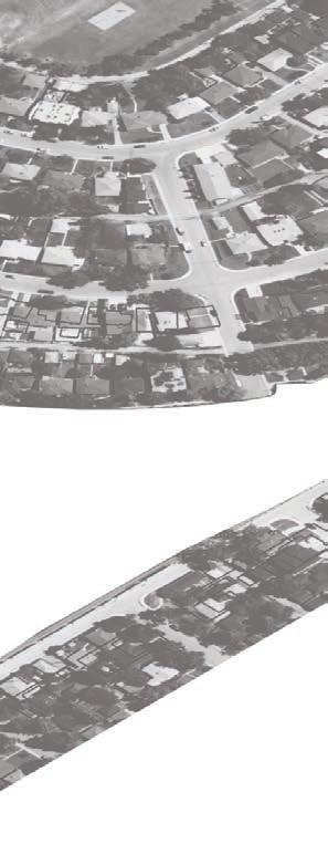
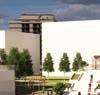
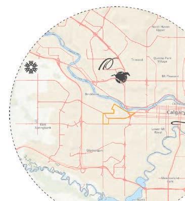
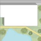
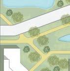
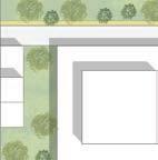
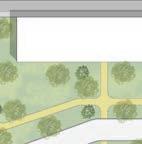
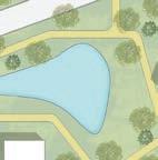
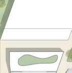
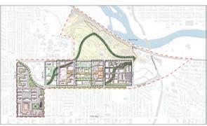
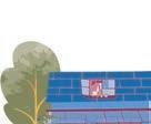
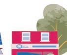
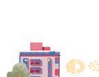
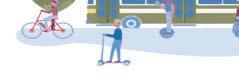
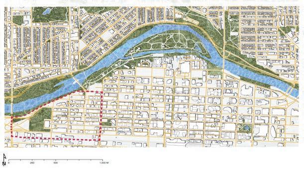
Situated in the heart of North-West Calgary, the vibrant community of Banff Trail is an inviting place to live with its unique charm and dynamic character. The neighbourhood was established in 1951 and spanned an area of 1.5 square kilometers. Banff Trail is home to a diverse population of 3,805 residents and was named after the historic 19th Street, which was once a trail to Banff. The community is proud of its lush green spaces and parks, which provide a stunning backdrop for residents to enjoy.


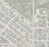
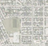
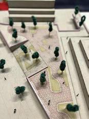
PROJECT BRIEF PROJECT TIMELINE CONTEXT FOR BANFF TRAIL COMMUNITY SITE ANALYSIS SUMMARY OPPORTUNITIES AND CONSTRAINTS PUBLIC ENGAGEMENT OPEN HOUSE Research Analysis Site Visit Presentation to Steering Committee Report Submission Presentation to Steering Committee Physical Model Community Engagement Open House Final Presentation Detail Design Draft Concept 1. Main Streets & Street scape Improvements 2. Traffic and cycling issues 3. Motel Village Safety 4. Lack of uses of Open Spaces 5. Only commercial Node 6. Limited Type of Density and Housing typology 7. Unsafe Intersections 8. Speeding Issues 9. Disconnect between Motel Village and the Community 4 7 medium density motel village weeds cafe legal suites o leash dog park icy sidewalks cross country ski crosswalks mix use secondary suites 24th ave unsafe intersection transit tra ic student housing walkable schools back lane maintenance undesirable winter activities confederation park a ordability rentals community association garbage diverse people unsafe overpass bridge diverse housing benches parking laneway house illegal activites tra ic conjestion block size grocerry stores identity aging in place 16thAve Briar Hill McMohan Stadium Nose Hill Park Confederation Park University of Calgary CrowchildTr Capitol Hill Banff Trail LRT ST Banff Trail Community University LRT ST Charleswood 14th St Great Re-design of Cathedral Park I love the Density Great concept and idea of Dog Park Great approach to incorporate diverse housing Cool Design Motel Village helpful to reduce crime 22nd Street Greenway is a great concept
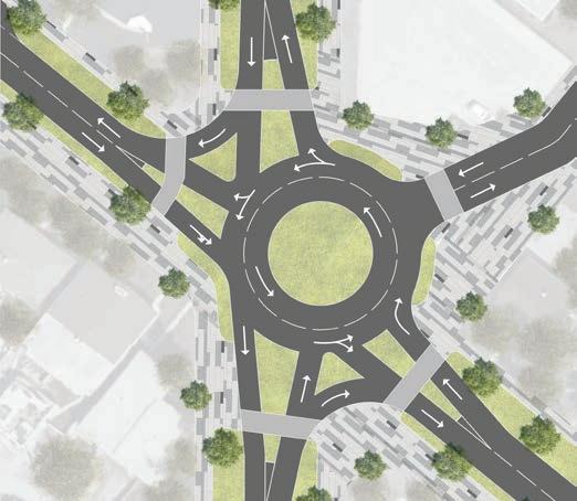
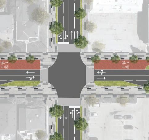
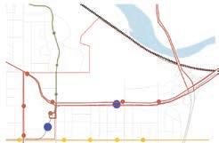
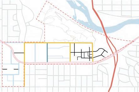
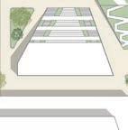
GOAL - 3 ENHANCE CONNECTIVITY


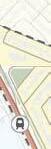
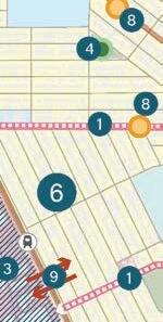
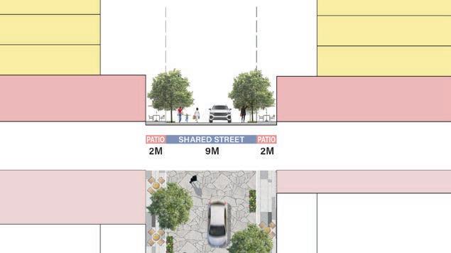
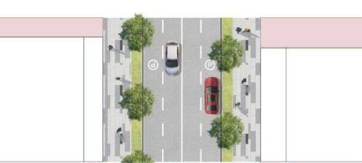
Banff Trail Shared Street Back Alley Connection Bike Path LEGEND Proposed Overpass Intersection Re-design Multi Use Pathway LRT Station LRT Station Bus Stop Ban Trail LRT Line
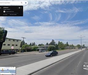
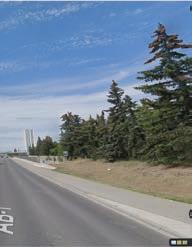
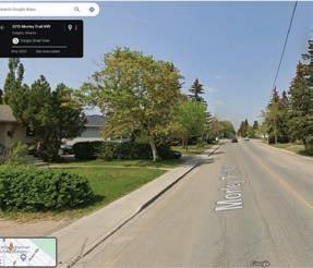
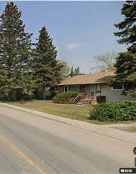
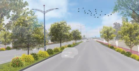
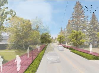
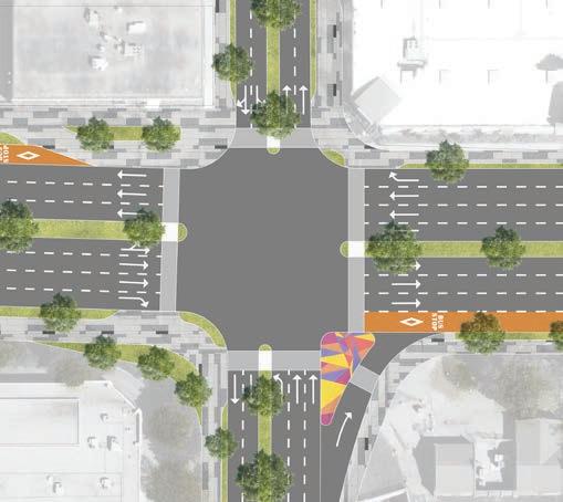
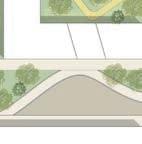
goal is to improve public transportation and enhance connectivity within the community by expanding critical pathways, pedestrian bridges, intersection, sidewalks, and bike lanes. OPPORTUNITIES 16TH AVE RE-DESIGN MORLEY TRAIL RE-DESIGN AFTER AFTER BEFORE BEFORE
Our
19th ST RE-DESIGN

20th AVE RE-DESIGN
RECOMMENDATION AND CONSIDERATIONS
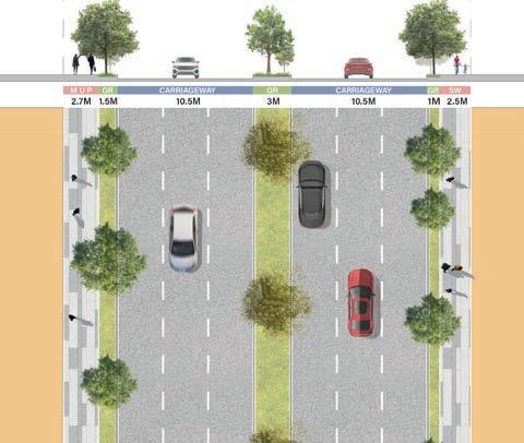
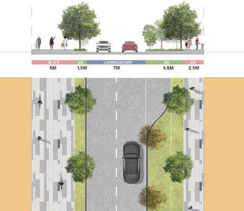
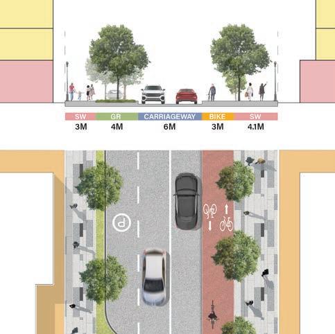
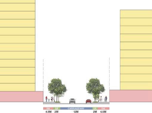
Green Strip - A minimum 1 m green strip along the sidewalks for each road development.
Side Walk - A minimum 2 m sidewalk along all roads.
Multi-Use Path(MUP) - MUP for safe access to parks and trailheads for pedestrians, cyclists and equestrians.
Bike Path - Provision of designated bike path to provide a safe, convenient, and sustainable way to travel within the community.
OUTCOMES
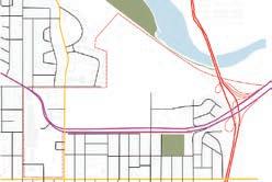
MORLEY TRAIL & 24th ST INTERSECTION 20th AVE & 19th ST INTERSECTION
16th AVE & 19th ST INTERSECTION 20th Ave 19 th St 19 th St 20th Ave CochraneRd MorleyTrail MorleyTrail 24 th ST 24 th ST 16th Ave 16th Ave 19 th St 19 th St
Safety Transit Ridership Walkability Bike Paths CITY km
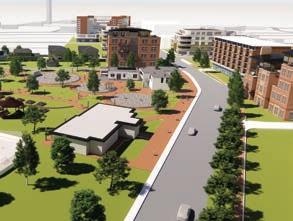
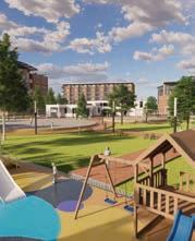
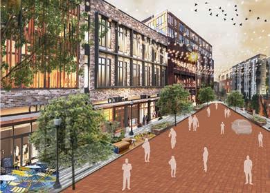
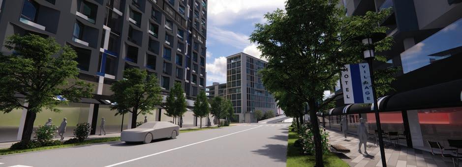
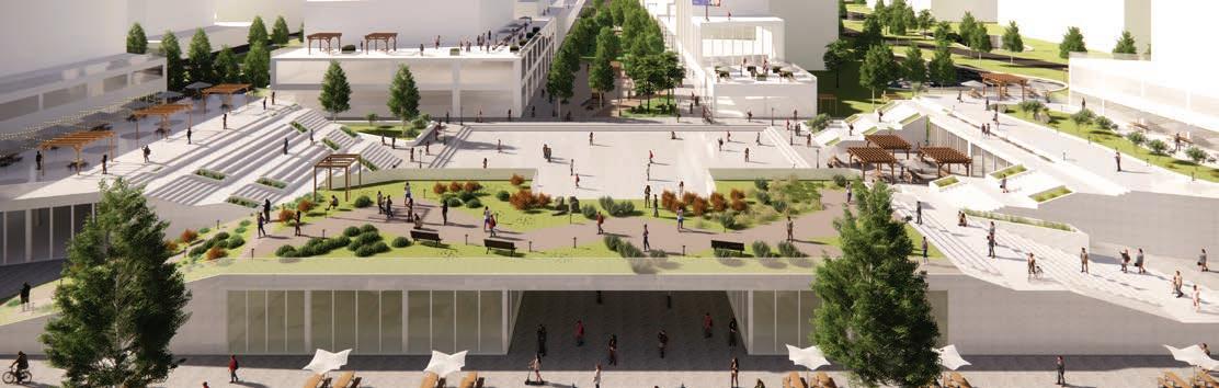
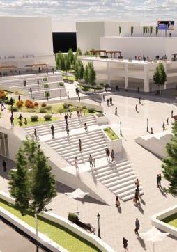
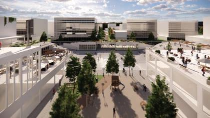
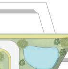
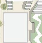
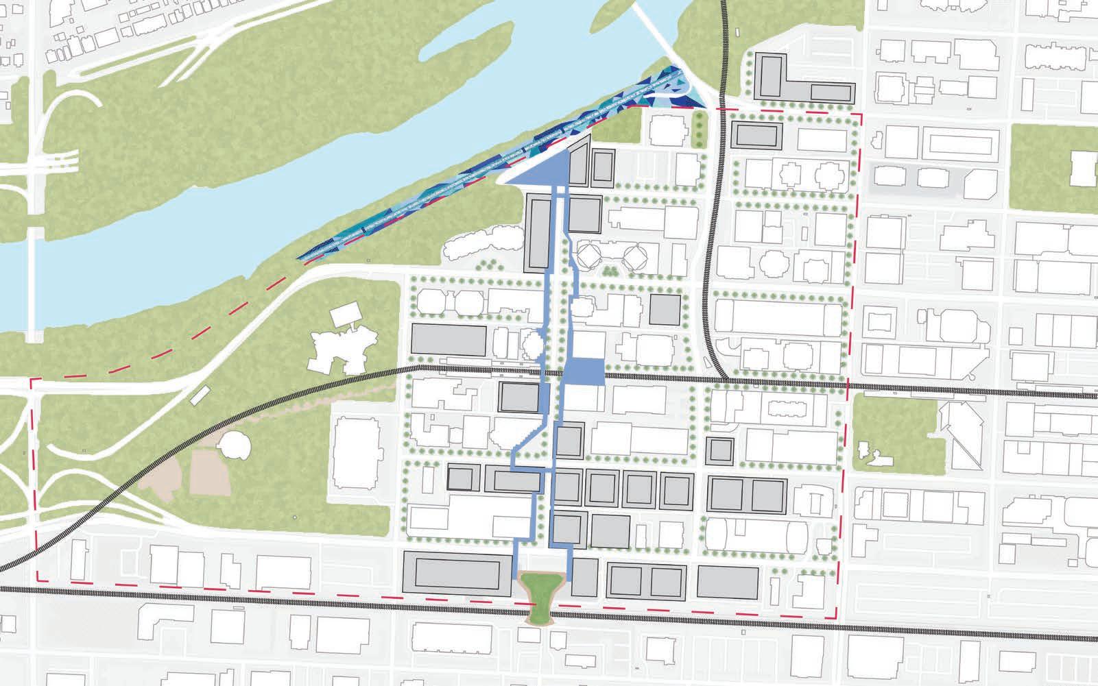
GOAL - 4 RE IMAGINING MOTEL VILLAGE
Our goal is to make Motel Village an attractive and lively destination that reflects the spirit and values of the Banff Trail community.
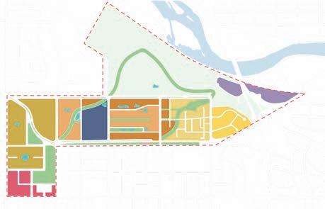
LAND USE
DESIGN PROCESS
ITERATION - 1
Our initial approach utilized the maximum building footprint, and maximum heights what City of Calgary envisioned within their South Shaganappi Local Area Plan which is maximum upto 28 storeys and subdividing uneven parcels leading to challenges such as excessive shadowing and an imbalance in community density.
ITERATION - 2
With the iteration two, we went back to original parcels as it might delay the process of developing, and also increasing more of in between public space, with all the facades facing street and pushing all the parking for visitor at back or underground.
FINAL ITERATION
With all of the iterations, there has been background study for sun shadows, which also helped in grading down the heights for our final Iteration. After reassessment, we were more focused for the public spaces and pocket parks, thus fostering a more balanced urban environment
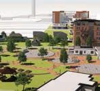
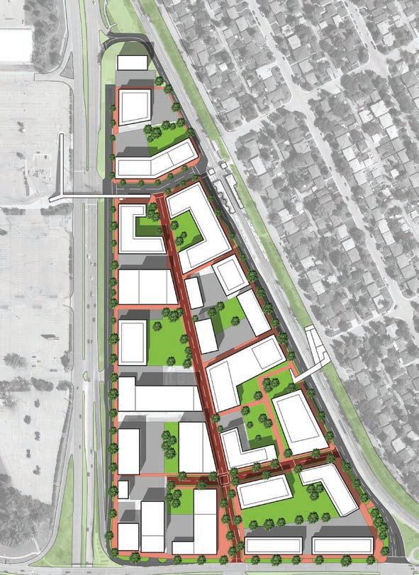
MASTER PLAN
USE ZONING BUILDING HEIGHTS Legend Green Space Parking Shared Street Multiuse Pathways PROPOSED NAC PROPOSED COMMERCIAL 20 storey 15 storey 8 storeys 6 storeys 10 storey 3 storeys Active Frontage Mix Use MU - Mixed Used Residential M-U2 Mixed Use Active Frontage R-CG Grade Oriented Infill Retail Green Area
LAND

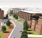
OVERALL VIEW New Overpass Bridge Student Housing Central Plaza Motel Green Roof Shared Street Pocket Parks Small Retail Parking Housing Legend Student Housing Seniors Housing Hospitality Retail Offices 16THAVE CROWCHILDTRAIL NUMBERS BREAKDOWN To create the vibrancy and also cater the sports arena adjacent to the site few of the motels are proposed. area in m2 51,000 HOSPITALITY JOBS people Approx. 13 to 23 sq. meters of retail space creates one job. The jobs estimate was provided by dividing retail space by the average of 18 sq.m per job. 2390 Underground Parking will be available for residents, however certain parking stalls are provided at grade for visitors comfort. number of stalls 850 PARKING The avg apartment size in Calgary is considered from 65 to 80 sq. m. To calculate the total number of market housing units, 70 sq. m. per unit is considered. number of units 1650 MARKET HOUSING The avg student apartment varies from 50 to 70 sq. m. To calculate the total number of student housing, 60 sq. m. per unit is considered. number of units 460 STUDENT HOUSING The avg senior apartment varies from 50 to 70 sq. m. To calculate the total number of student housing, 60 sq. m. per unit is considered. number of units 264 SENIOR HOUSING
RECOMMENDATION AND CONSIDERATIONS
Setback - Minimum of 2 m should be set back from the plot line and podium
Podium Setback - Each building be set back at least 3 meters from the podium.
Branding Motel Village - Re-branding the motel village by providing an awning for each building.
Community Connect - Building a pedestrian overpass bridge to enhance pedestrian connectivity with the Banff Trail community.
Pocket Plaza - Providing pocket parks to prevent over development in high-density areas.
OUTCOMES
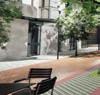
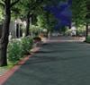
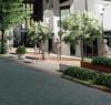
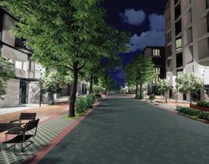
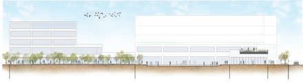
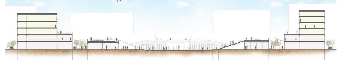
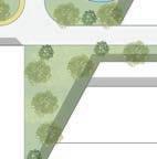
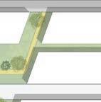
SHARED STREET BEFORE SHARED STREET AFTER SHARED STREET SECTION ACTIVE STREET FRONTAGE SECTION ACTIVE FRONTAGE STREET CONCEPTUAL RENDER
Safety Social Life Housing affordability Identity Diverse Housing
CALGARY METROPOLITAN REGION GROWTH PLAN
Updating Growth Plan to be future ready!
INTRODUCTION
Type - Regional Planning Studio
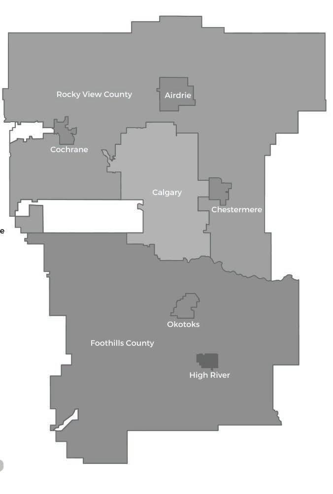
Location - CMRB (8 Municipalities)
Team - Bhavana, Himanshu, Jiyayi and Mustafa
Tools - ArcGIS, Microsoft Office, Miro, Adobe Creative Suite
OBJECTIVE
The objective of the Regional Planning Studio project was to develop a comprehensive and strategic Growth Plan update for the Calgary Metropolitan Region Board (CMRB) that enhances quality of life, reduces vulnerabilities, and promotes sustainable development.
The project aims to:
Understand the Current State and Future Vision of the CMR:
1. Conduct thorough research and mapping to understand the demographics, land use patterns, and servicing needs of the Calgary Metropolitan Region.
2. Identify key areas for improvement to align with the Board’s vision of becoming a “worldclass region.”
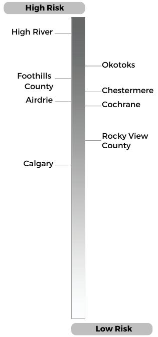
Identify Risks and Vulnerabilities:
1. Assess and prioritize specific risks that threaten the achievement of quality of life goals. Conduct high-level vulnerability assessments and spatially identify areas most at risk.
Develop Strategic Recommendations:
1. Propose specific strategies to mitigate identified risks and reduce vulnerabilities, ensuring the Growth Plan’s goals are met.
2. Illustrate the benefits and trade-offs of different strategies through scenario development and spatial analysis.
Formulate Policy Recommendations:
1. Create clear, actionable policy statements to implement the proposed strategies.
2. Utilize a variety of policy instruments to address the region’s needs, focusing on effectiveness, cost, and political feasibility.
Synthesize and Present Findings:
1. Compile a synthesis scenario that integrates strategies and policies for regional growth.
2. Present the final recommendations in a clear and concise manner to inform and guide the CMRB’s decision-making process.
SCENARIO AS USUAL KEY RESPONSIBILITY
1. Policy writing through collaborative and critical thinking.
2. Extensive research to understand the context in association with the updates to growth plan.
3. Extensive analysis of implementation challenges for the CMRB Growth and Servicing Plan.
4. Spatial Mapping and Visual representation throughout the process.
1. Limited Housing Affordability 2. Limited Diverse Housing 3. Growing Income Inequality 4. Burdened Infrastructure 5. Declining Regional Attraction 6. Limited Mobility 7. Limited Investment Opportunities 8. Inefficient Land Consumption 9. Limited Job Opportunities 10. Impact on Tourism
“Provide housing diversity to cater the varied needs of residents across different demographics, lifestyles, and life stages within the community.”
Member Municipalities in CMR shall identify hubs along the transit system focusing on newly developed seniors and multigenerational housing within 1km of transit with the targets to achieve as follows: City of Calgary: 75%; Other Urban Municipalities and Joint Planning Areas outside the City of Calgary: 50%; and Hamlet Growth Areas: 30%.
Member Municipalities in CMR shall increase the development of Missing Middle Housing types within next ten years as follow –City of Calgary: 55%; other Urban Municipalities and Joint Planning Areas outside the City of Calgary: 35%; and Hamlet Growth Areas: 15%.
The Missing Middle housing development should increased through –Permit subdivision of larger lots to facilitate the development of smaller, more diverse houses.
Implement zoning policies requiring 30% of units in the new development are from the missing middle housing spectrum
Member Municipalities in CMR shall collaborate with financial institutions to develop innovative financing options for developers to increase the overall diverse housing stock within the next five year, evaluated for effectiveness.
Members Municipalities in CMR shall achieve 30% increase in diverse housing projects to meet the housing stock through implementation of incentive programs with potential fee waiver, density bonuses, or fasttrack approvals for developers within next ten years
Member Municipalities in CMR shall expand housing choice by amending existing lowdensity residential zones to allow diverse housing form and increase gentle density within next 15 years.
SENIORS
INCREASE IN HOUSING CHOICE FOR ALL INCREASED INTEREST
DEVELOPERS IN DIVERSE
PROJECT INCREASED DENSITY
CHANGING
SCALE
AND MULTIGENERALTIONAL HOUSING
FOR
HOUSING
WITHOUT
NEIGHNOURHOOD FORM AND
DWELLING TYPES INCREASE IN SENIORS POPULATION POPULATION INCREASE INDICATORS $$$ $ $ $$ $$$ $ COST OUTCOMES Medium term 5-30 years Medium term 5-15
Medium term 05-15 years Long term 15-30 years TIME FRAME 2.1 1.2.1 1.2.2 1.3 1.4
STRATEGY POLICIES
years
“Implement measures to improve housing affordability throughout the region, involving both home ownership and rental sectors, to provide support for lowerincome and vulnerable population”
Members Municipalities in CMR shall complete a context study involving demographic, income level and physical nature of communities to evaluate local demand for affordable housing and mixed-income groups within the next 5 years.
Member Municipalities in CMR shall integrate affordable housing based on context study by allocating targeted percentages to Placetypes within 15 years span: City of Calgary: 25%; Other Urban Municipalities and Joint Planning Areas outside the City of Calgary: 10%; and Hamlet Growth Areas: 5%.
Members Municipalities in CMR shall align ownership and rental affordable housing with Public Transit by allocating 25% of the affordable housing to Transit Oriented Development (TOD) Placetypes. It will be implemented within 10 years time span through:
Zoning designation for affordable housing assigned to infill lands along the existing transit corridors
Incentives and bonus density programs for developers to provide affordable units within the new transit-oriented developments
Member Municipalities in CMR, in partnership with the federal and provincial government, shall create long-term dedicated funding to preserve existing affordable housing while supporting private and non-profit developments to increase affordable homes with:
Urban municipalities supporting through incentive program, bonus density and fast track application process and; Rural municipalities implementing through grants, subsidies, and application waivers.
Members Municipalities in CMR shall facilitate affordable options for low-medium income groups, through additional landuse bylaw regulations to allow flexible design models within 10 years time span. These housing models include but are not limited to tiny homes, container homes, modular homes and accessory dwelling units (ADUs).
REGIONAL HOUSING AFFORDABILITY INTEGRATION WITH COMMUNITIES AND PUBLIC TRANSIT.


HOUSING CHOICES FOR DIVERSE INCOME GROUPS.
PUBLIC-PRIVATE COLLABORATION TO PRESERVE EXISTING AND FUTURE AFFORDABLE HOUSING SUPPLY.
DESIGN BASED INITIATIVES TO ADD MORE AFFORDABLE HOUSING OPTIONS.
2.1.1 2.1.2 2.2 2.3 2.4 DWELLING TYPES
POPULATION INCREASE INDICATORS $ $ $$ $$$ $$$ COST
STRATEGY POLICIES
MEDIAN FAMILY INCOME
OUTCOMES Short
term 5-30
Medium term 5-15 years Long term 15-30 years Medium term 05-15 years Medium term 05-15 years TIME FRAME
- Long
years
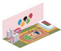
OLYMPIC CONNECTION
Redefining Shaganappi Golf Point Community
TYPE - COMMUNITY PLANNING STUDIO
STUDIO - M.PLAN | GROUP WORK
SITE - CALGARY, ALBERTA, CA
Olympic Connection
ABOUT THE PROJECT -
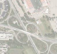
Shaganappi Point Community had the one of the oldest 26 holes golf course in the community which has not been used to its full potential lately. The Studio is focused on how this golf course can be rethinked and serve a better purpose to the community. BBC-YYC a team of four from the community planning studio at SAPL looked it as a catalyst and ideal space to accommodate the olympic facilities and based on that Calgary can bid to host winter Olympics in 2036 and this facility can also serve as a training and leisure space to the community and Calgary.

INTRODUCTION
Location - Shaganappi Golf Point
Site Area - 126 Acres
Team - 4 Members (Maneet, Leigh, Anshuman, Mustafa)
Tools - Adobe Suite, AutoCAD, Sketchup, Enscape 3D, Rhino
FOUNDING PRINCIPLES
Heart
Ignite the Olympic Spirit in Calgary by offering new competitive and recreational sports facilities & create a main athlete village.
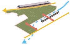


Provide meaningful connection to the surrounding area, sink the LRT and redesign Bow Trail, and capitalize on the growing momentum of the Calgary Airport to Banff Rail project that passes through the site. Summit Connection
Offer meaningful place making, by prioritizing pedestrian and cycling through the site with a dedicated green way
Our vision is to create a centre for sports and recreation as a catalyst in economic growth, community enhancement, and sustainable development.
To bring the Olympics spirit back to Calgary and encourage all calgarians to be more involved in sports and fitness. To revive the overall economical growth of the declining downtown as well.
VISION AIM SITE ANALYSIS

N N Transit Routes Cliff Bungalow Route Bow Trail Route 17th Ave Bus Route CP Rail LRT Blue Line Slopes Beyond 15% Unbuildable slope N Existing Road Typology Skeletal Road Arterial Road Neighbourhood BLVD Local Streets Figure Ground and Existing Road Network Existing Neighbourhood Blocks N Olympic
Meadow
Walk
MARKET STUDY
Understanding the sports market in Alberta and Calgary is an essential component. While there is quite a healthy market in the province, there are some unique obstacles to overcome. The most evident would be the 2026 Olympic bid failure. The aim is to solve some of the complications that arose. We also have a good amount of facilities to host Olympics but we lack in certain aspects and that is the focus of this design to fulfill the remaining.
Canada’s Sports Market

EXISTING INFRASTRUCTURE
GREEN AREAS AND OPEN SPACE
Alberta’s Sports Market


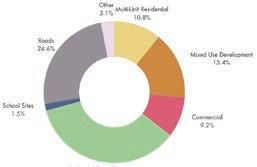
LAND USE


ROAD NETWORK AND HIERARCHY
The Failed 2026 Bid 01 02 03 04 WrongEventWrongTime FinancialUnderstanding Leadership BenefitsofOlympics
Market Total $1.3 Billion Calgary $500 mil Creates 14000 jobs in Alberta
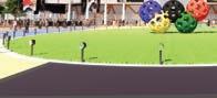
The market is growing 6.5% year on year Informal Sports $279 mil Formal Sports $1978 mil Education Sports $1432 mil Government Funding $897 mil ICE HOCKEY (5,000 capacity) MULTI-SPORT FIELD HOUSE (10,000 capacity) OLYMPIC VILLAGE (760 units)
High Density Residential Mid Density Residential Low Density Residential High Density Mixed Use Mixed Use Sports Arena Retail Industrial Parks/Recreation Water Body N Meadow Walk Park/Open Space
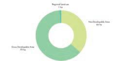
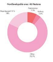
N % BREAK DOWN OF LAND USE Unbuildable: 46 ha Buildable: 89 ha Total Area: 135 ha
N Crowchild Trail Bow Trail Fieldhouse Street Celebration Street Skeletal Road Arterial Road Primary Collector Rd. Activity Centre St. Collector St. Residential St. Back Alley St.
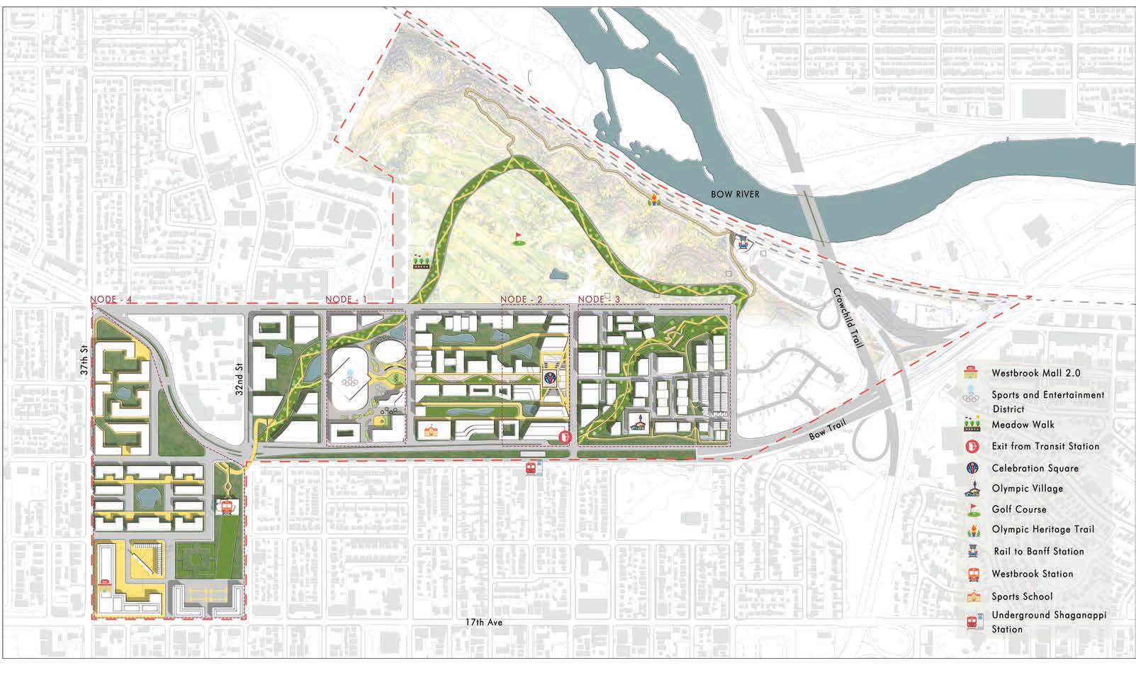
MASTER PLAN
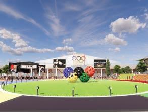
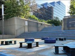
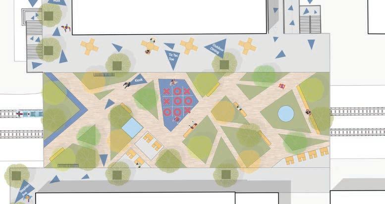
CELEBRATION SQUARE
CONNECTIVITY


View towards plaza from the Multisport Fieldhouse
PLAN SECTION B-B’ SECTION A-A’ ConnectiontoMultisport Fieldhouse Multiple Entry/Exit Point View towards Stepped Plaza View of plaza from the high street
of Overall Celebration Plaza from the Olympic Village side with Arena in background KEY MAP LEGEND 1. Sunken Plaza 2. Stepped Plaza 3. Mix-Use Buildings 4. Back-Alley Street 5. StormWater Ponds 6. Primary Collector Street 7. Bow Trail 8. Children Play Area View towards plaza from the Multisport Fieldhouse Mix-Use Building Active Street Stepped Plaza Sunken Plaza Stepped Plaza Active Streets Mix-Use Building B B’ A’
View
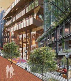
INSIDE OUT
of Downtown West End TYPE
SPRING URBAN DESIGN STUDIO STUDIO
SITE
Revitalization
-
- M.PLAN | GROUP WORK
- CALGARY, ALBERTA, CA
INTRODUCTION
Location - Downtown West End
Team - 8 Members (Maneet. Yasmin, Himanshu, Nathan, Kaitlyn, Christine, Marvit, Mustafa)
Tools - Adobe Suite, AutoCAD, Sketchup, Enscape 3D, Rhino
INSIDE OUT
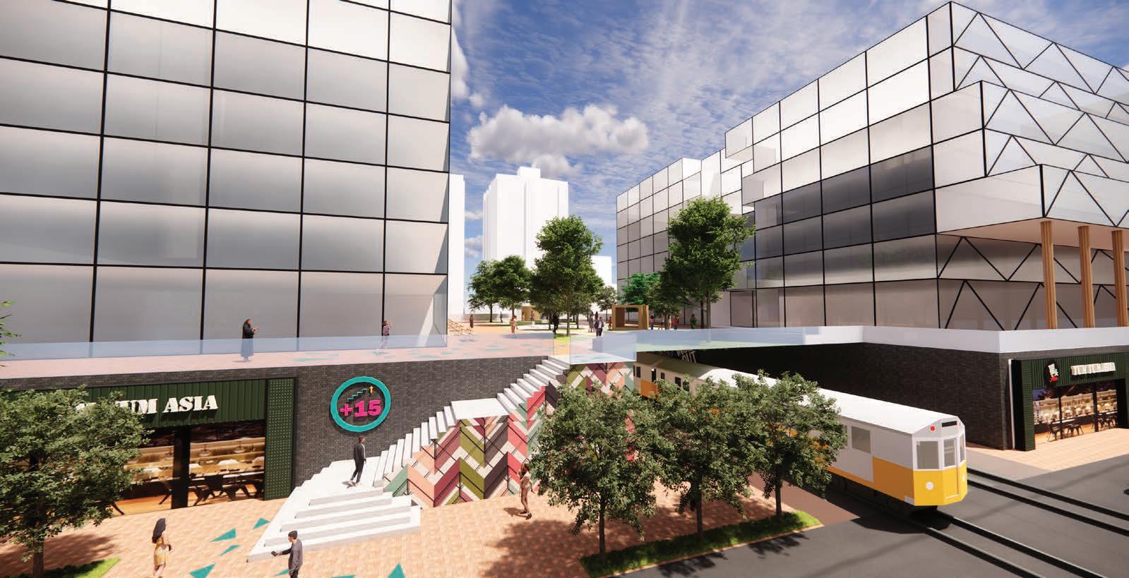
ABOUT THE PROJECT -
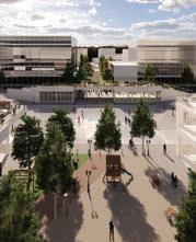
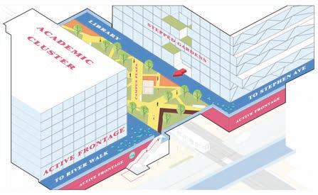
The inception of the Inside Out project revolved around a meticulous examination of Calgary’s downtown +15 system, aiming to assess its current state and envision its future growth. The comprehensive understanding through research guided our proposal for a unique +15 system that connects west downtown, seamlessly integrating residential, institutional, and public realm components. The Inside Out project epitomizes our commitment to crafting urban environments that respond dynamically to the community’s evolving needs, offering a vision for a more integrated and vibrant Calgary.

PROJECT GOALS
OVERALL STRATEGY
A multilevel community that stacks living, working, and playing from street to sky in the Downtown West End. At its core, this concept is about creating a vertical connection from the street to the outdoor +15 system and the spaces that surround it. It’s about enhancing the relationship and the experience of using the +15 and the journey towards it.
POLICY DEVELOPMENT


Building A -
Buildings along plus 15 corridor wishing to integrate may construct with 2nd storey column allowing for 5m walkway.
Vibrant Community


Building B -
Buildings may integrate with cantilevered/externally supported approach where plus 15 wraps around 2nd storey.


Building C -
Buildings may integrate with cantilevered/externally supported approach where plus 15 wraps around 2nd storey.
Provision of lighting under system is encouraged. (public lighting = property tax incentives)
Building B -
Uses on first and second story must be street/systemoriented and may include cafes, restaurants, patios, shops, vendors, markets, daycares, and other commercial ventures.
Space under system remains open for active uses and programming.
Innovative +15 System Multimodal Transportation Long-Term Sustainability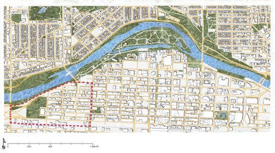
3 4 1 2
SUSTAINABLE MATERIAL PALETTE
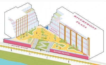
RIVERFRONT PARKWAY
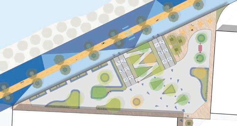


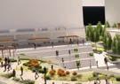
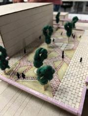
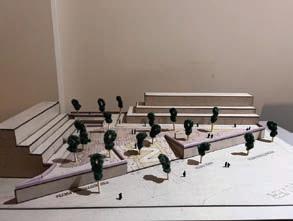
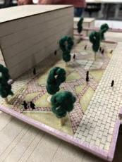
PHYSICAL MODEL
PLANTING PALETTE


PHYSICAL MODEL


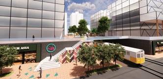
SKY CAMPUS
Jan Apr Jul May Aug Jun Sept Oct Nov Dec Feb Mar (Achillea Millefolium) Yarrow Wild Bergamot (Monarda Fistulosa) Dropmore Linden (Tilia Flavescens) Blue Hill Sage (Salvia Nemorosa)
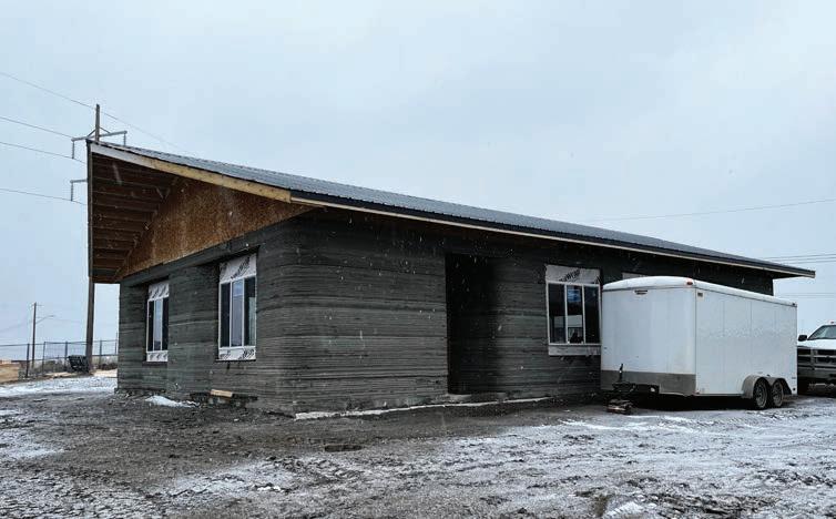
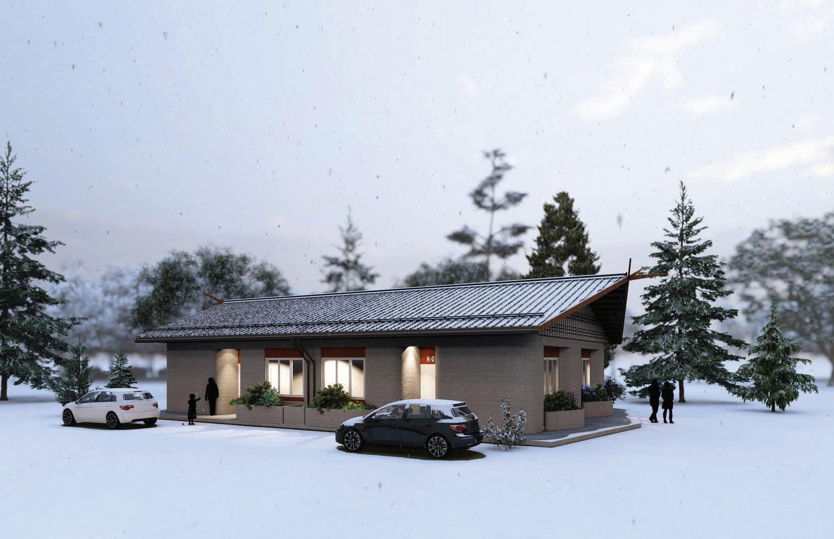
KAKATOOSOYIISTS or STAR LODGES
3D Concrete printed housing for Siksika Nation
TYPE - ADVANCED TECHNOLOGY HOUSING (ARCHITECTURE)
BUILDING CONSTRUCTION AND INNOVATION GROUP RESEARCH LAB
SITE - SIKSIKA NATION, ALBERTA, CA
KAKATOOSOYIISTS
ABOUT THE PROJECT -
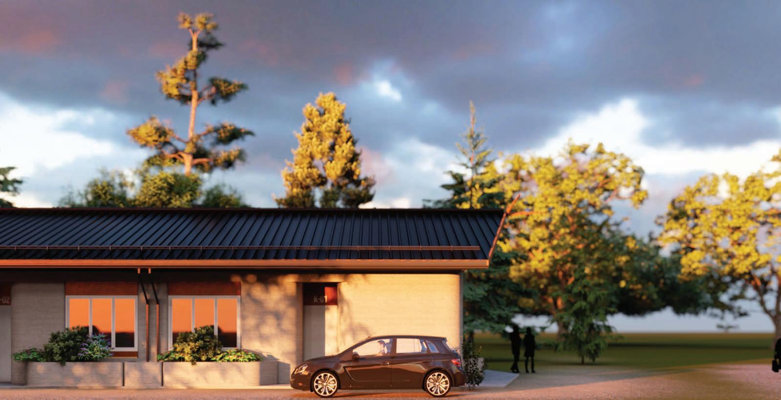
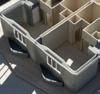
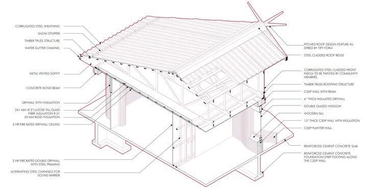
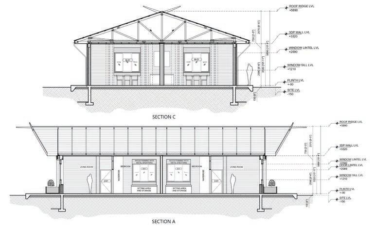
The Star Lodges are comprised of 16 transitional homes aimed at providing temporary housing options to community members during emergency situations. These homes were designed by researchers under the guidance of Blackfoot Elders and Knowledge Keepers Eldon Weasel Child and Bren Little Light and built in partnership with Siksika Housing and Nidus 3d, a company specializing in Concrete 3D printing technology.
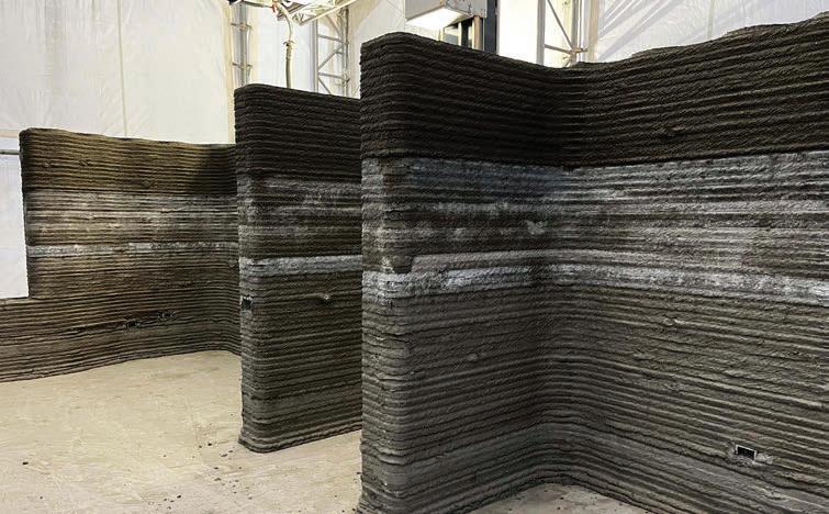
The project strategically leverages the potential of C3DP to streamline the construction process, enhance durability, reduce maintenance costs, and improve the energy performance of housing. Ultimately, the overarching goal of the project is to assess the potential of this technology in meeting the escalating housing demands within Indigenous nations and the rest of Canada. Additionally, the project aims to offer design flexibility, democratize the design and construction process, and address the longstanding housing crisis that has persistently affected Indigenous communities for generations.


INTRODUCTION
Location - Siksika Nation
Team - 4 Members (Prof Mauricio Soto Rubio, Fauzan Mirza, Ahmed Bisati, Mustafa Kagdi)
Tools - Adobe Creative Suite, AutoCAD, Sketchup, Enscape 3D, Rhino
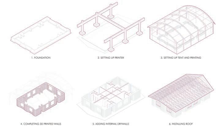
PROCESS
PROJECT VISION
Kakatoosoyiists: Star Lodges aims to address the housing crisis in Siksika Nation through culturally relevant and sustainable homes using Concrete 3D Printing (C3DP). By empowering Indigenous communities in the design and construction process, we promote self-determination and preserve cultural heritage. This innovative approach reduces construction time, costs, and material waste while enhancing durability and energy efficiency. Adaptable to extreme climates, the project integrates modern technology with traditional knowledge, setting a precedent for future Indigenous housing initiatives and ensuring safe, dignified, and culturally significant homes.
DETAILS
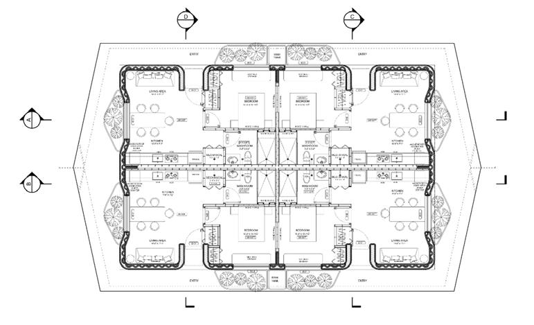
TYPICAL SECTIONS
TYPICAL PLAN SITE IMAGES
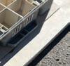
3D Concrete Printing completed till lintel level
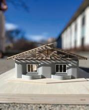
Exterior view of one of the 4 lodge completed till roof setup
THANK YOU!