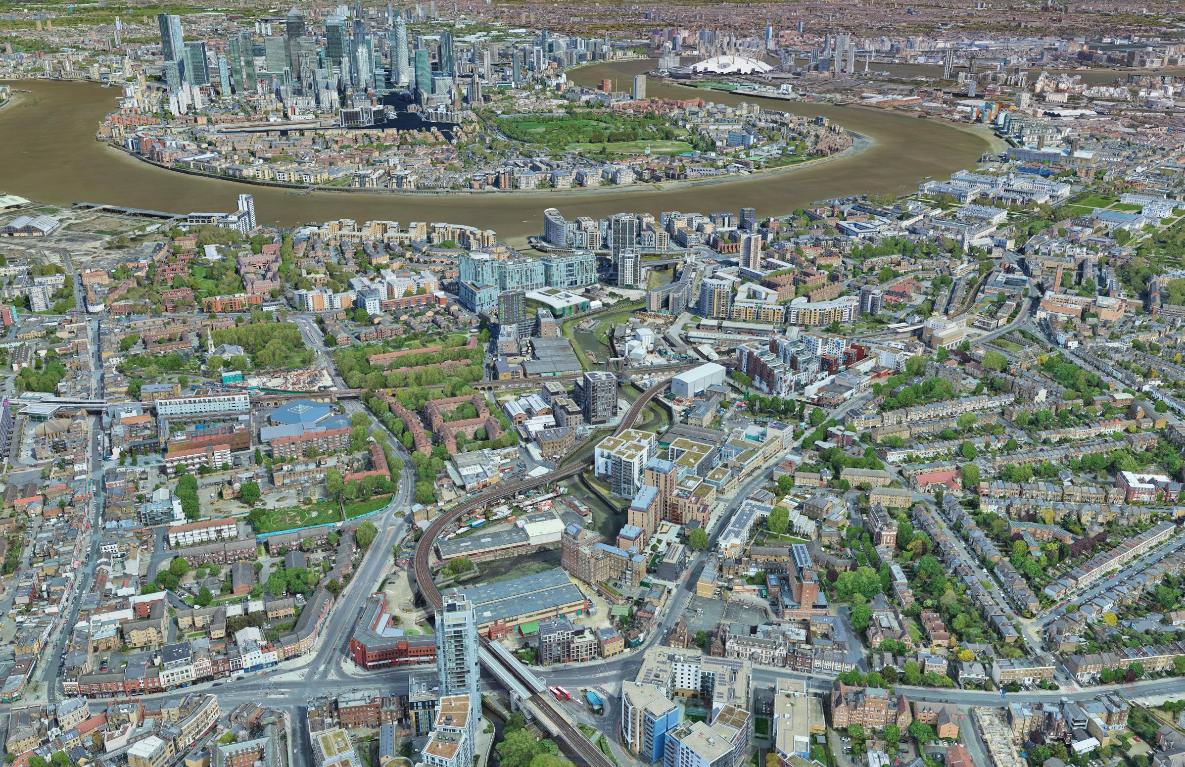
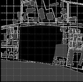
NORMANROAD
03
studio critics collaborators software used
RIVER THAMES
CANARY WHARF
GREENWICH
STADIUM
DEPTFORD HIGH STREET
GREENWICH O2
GREENWICH STATION
DEPTFORD BRIDGE STATION
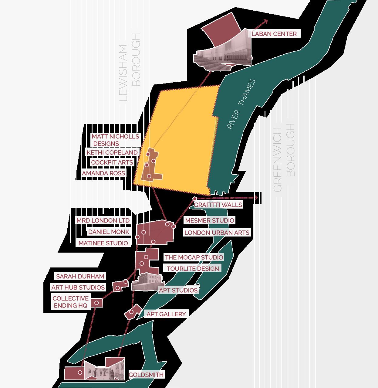
LABAN CENTER
DEPTFORD STATION
ART IN PERPETUITY
GOLDSMITHS MFA
CREEK ROAD
TRAINS TO CENTRAL LONDON
LIGHT RAIL TO CANARY WARF
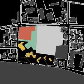
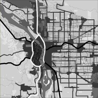
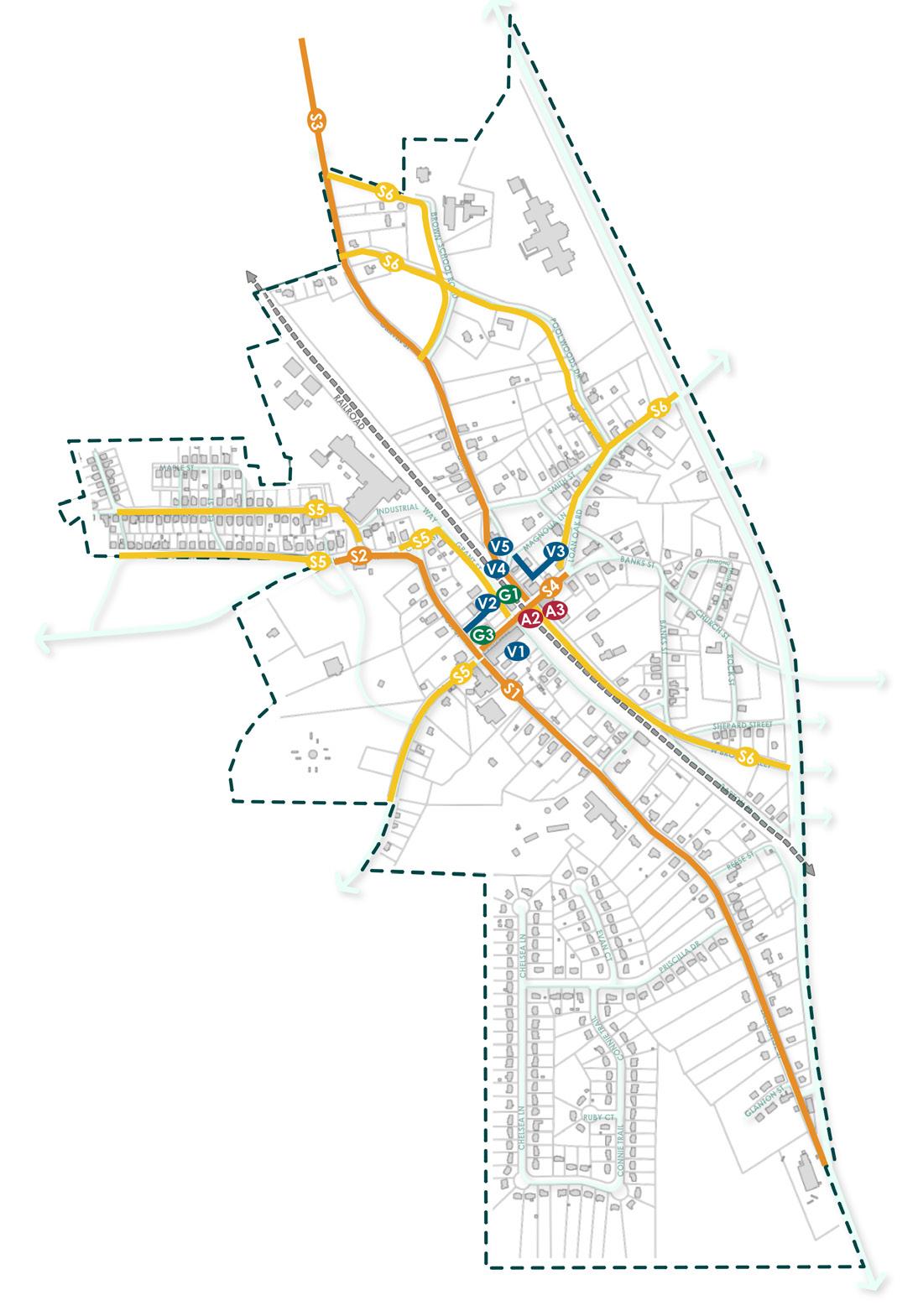
SYSTEMS MAP
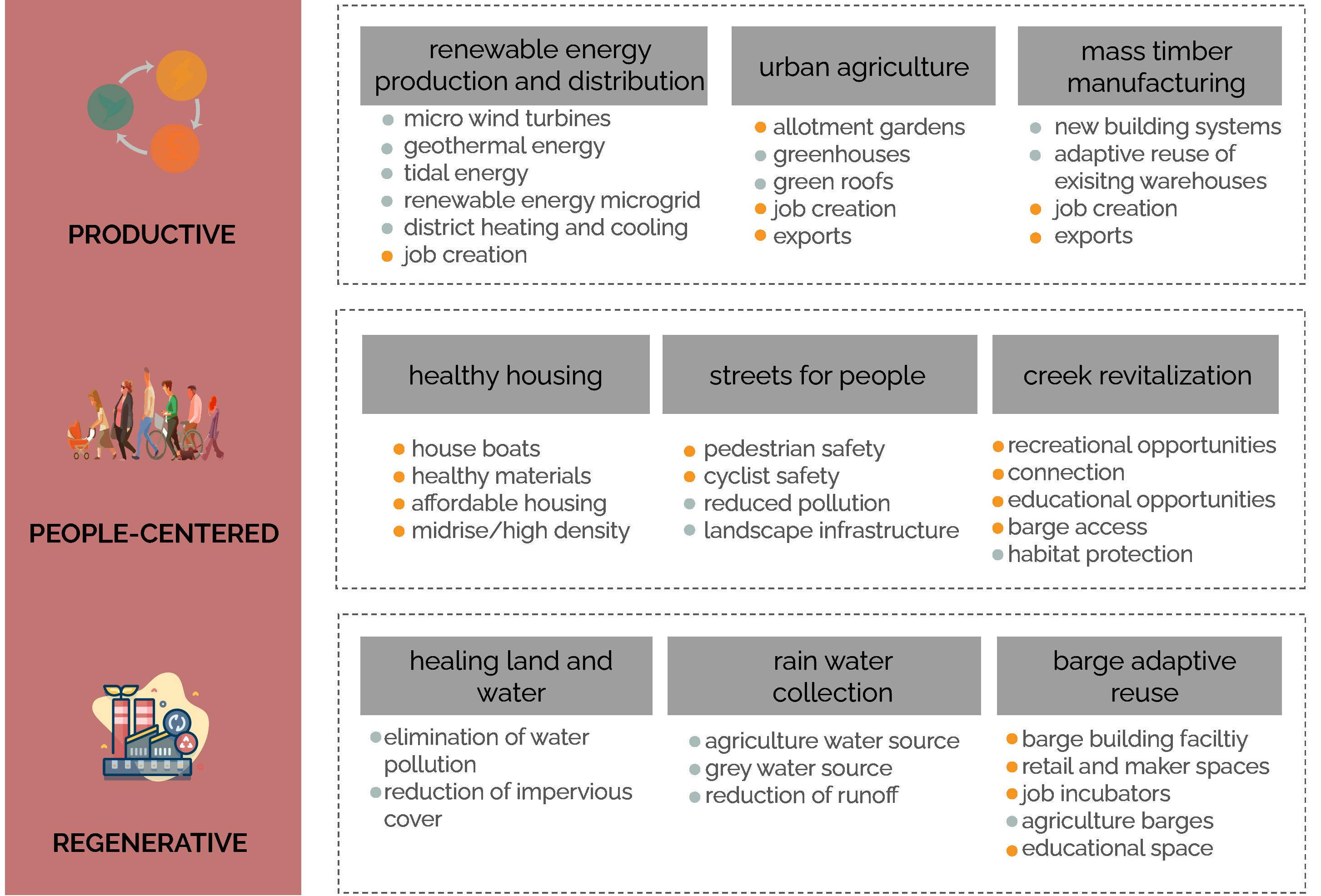
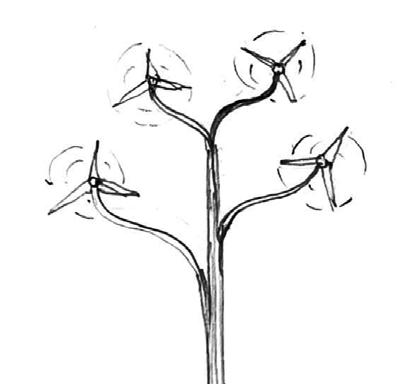
Renewable energy systems
Barge systems Housing and Creek systems
Creek habitat systems
Creek systems
Urban Agriculture systems
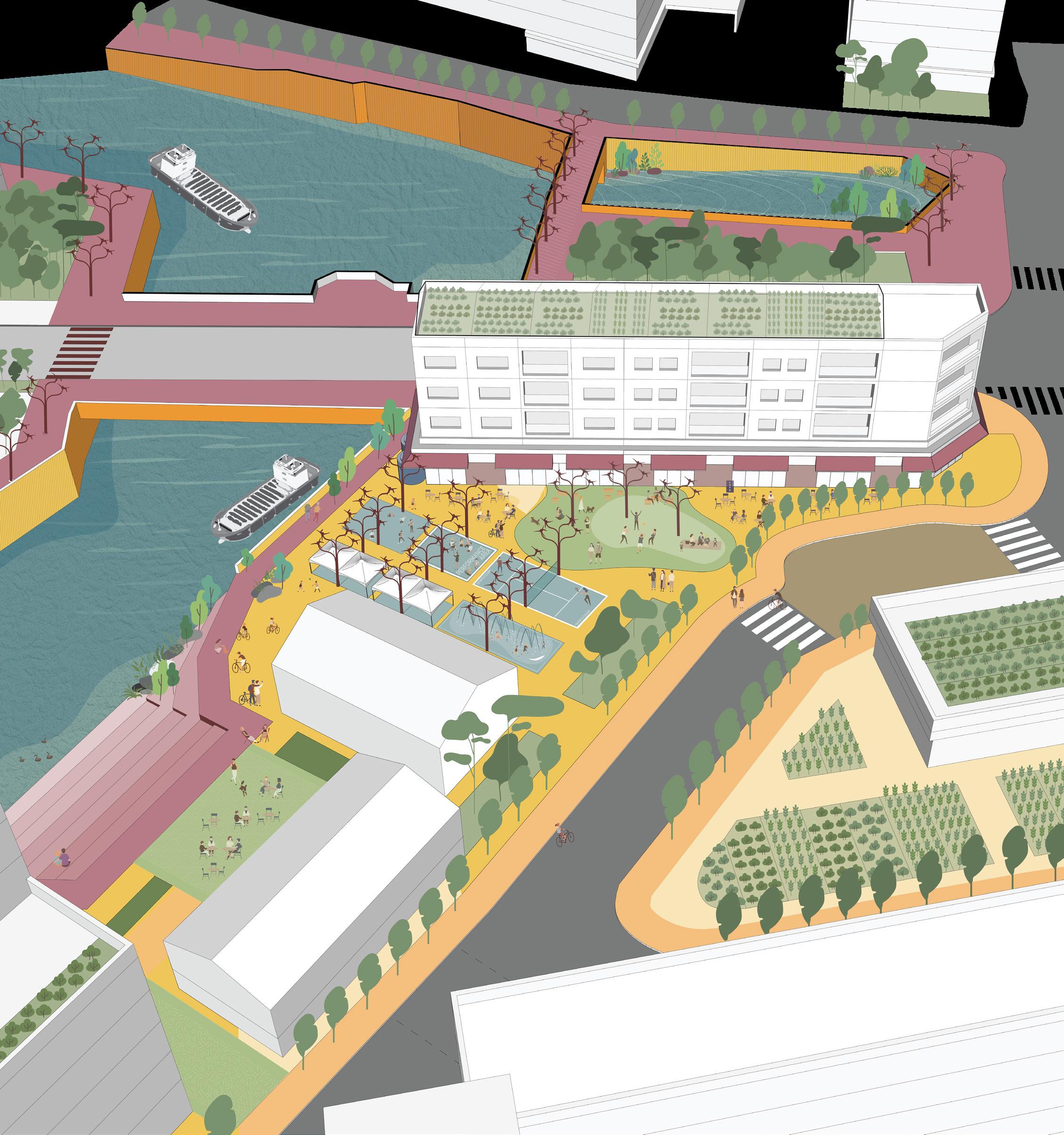
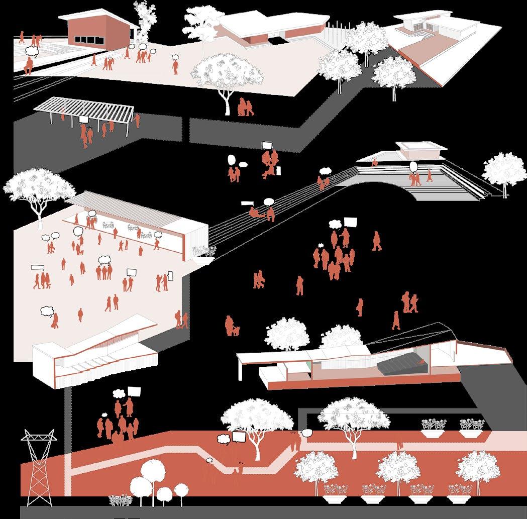
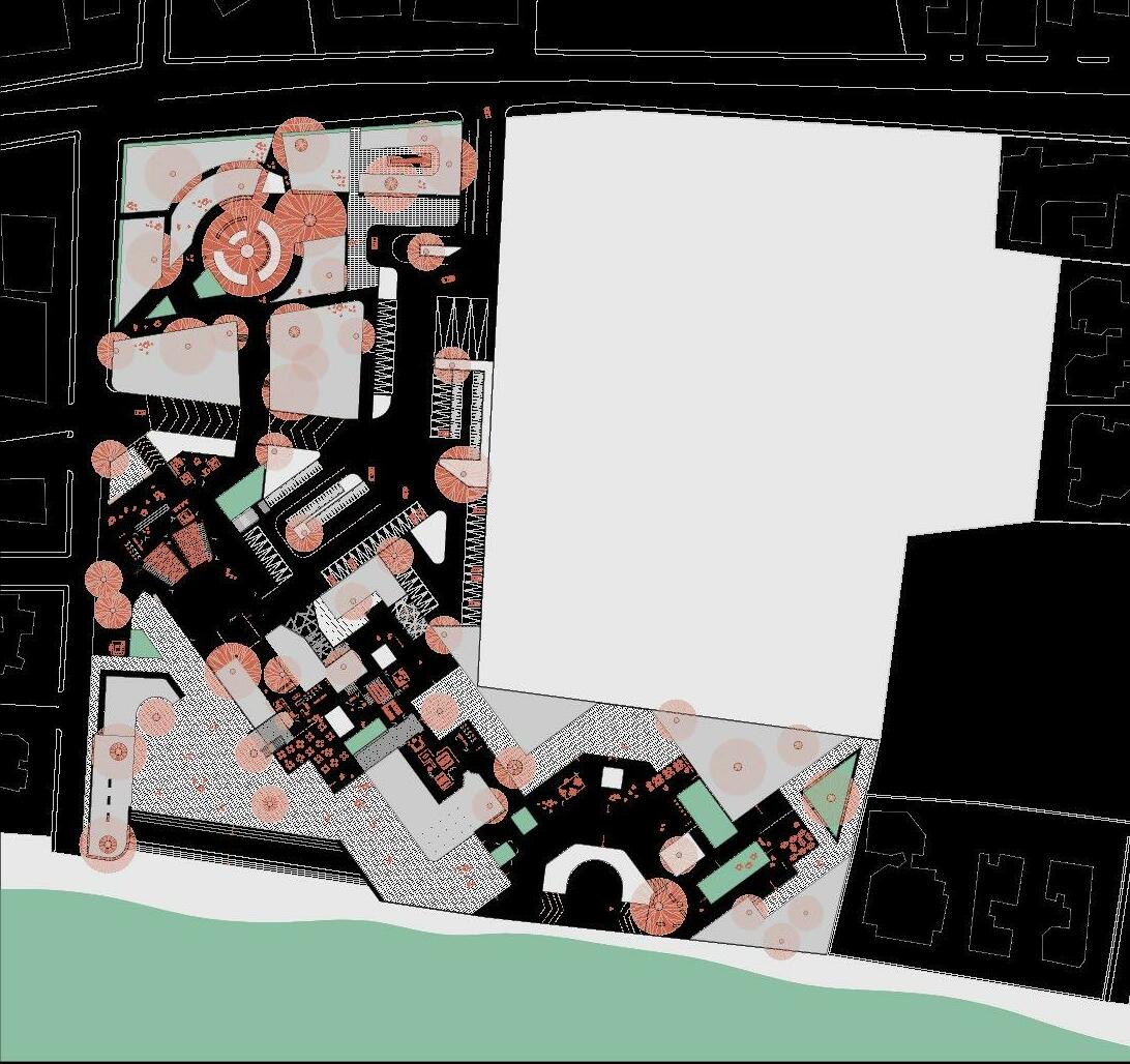
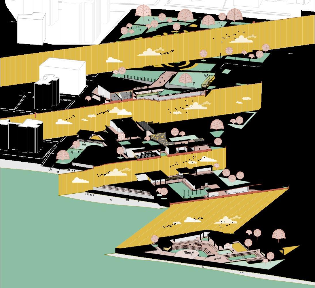
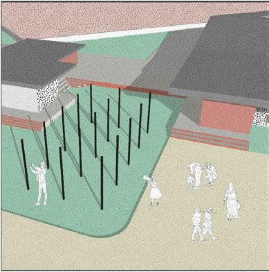
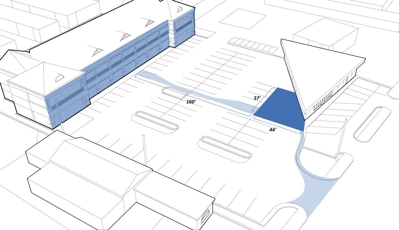
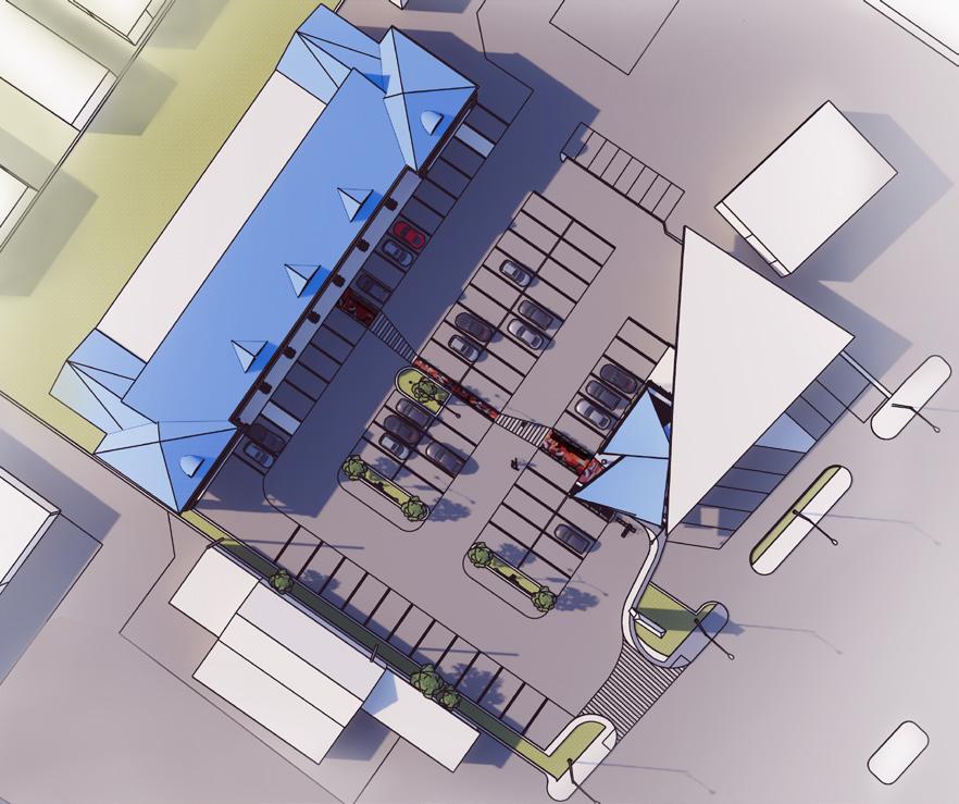
key intervention sites creek walk renewable energy urban agriculture housing greenspace green street manufacturing creek habitat area barge / houseboat

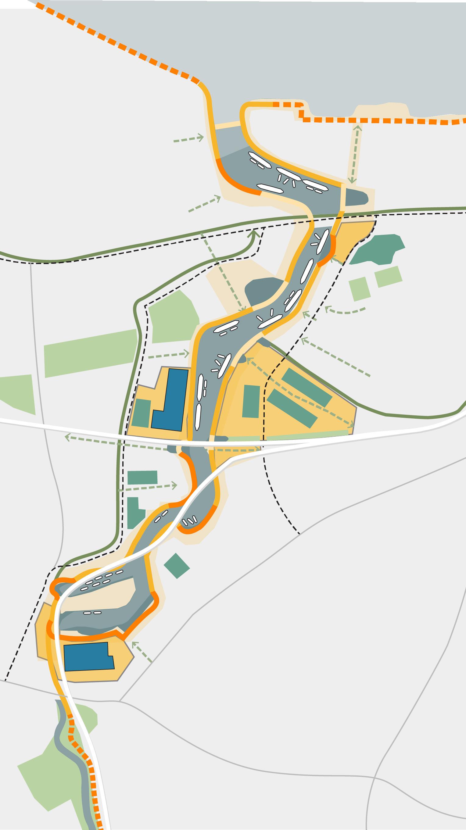
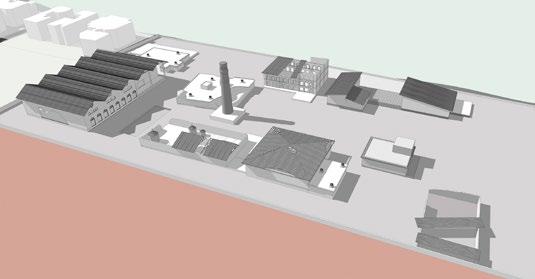
Old Cement factory site
Laban Center Council housing New mixed-use developement site
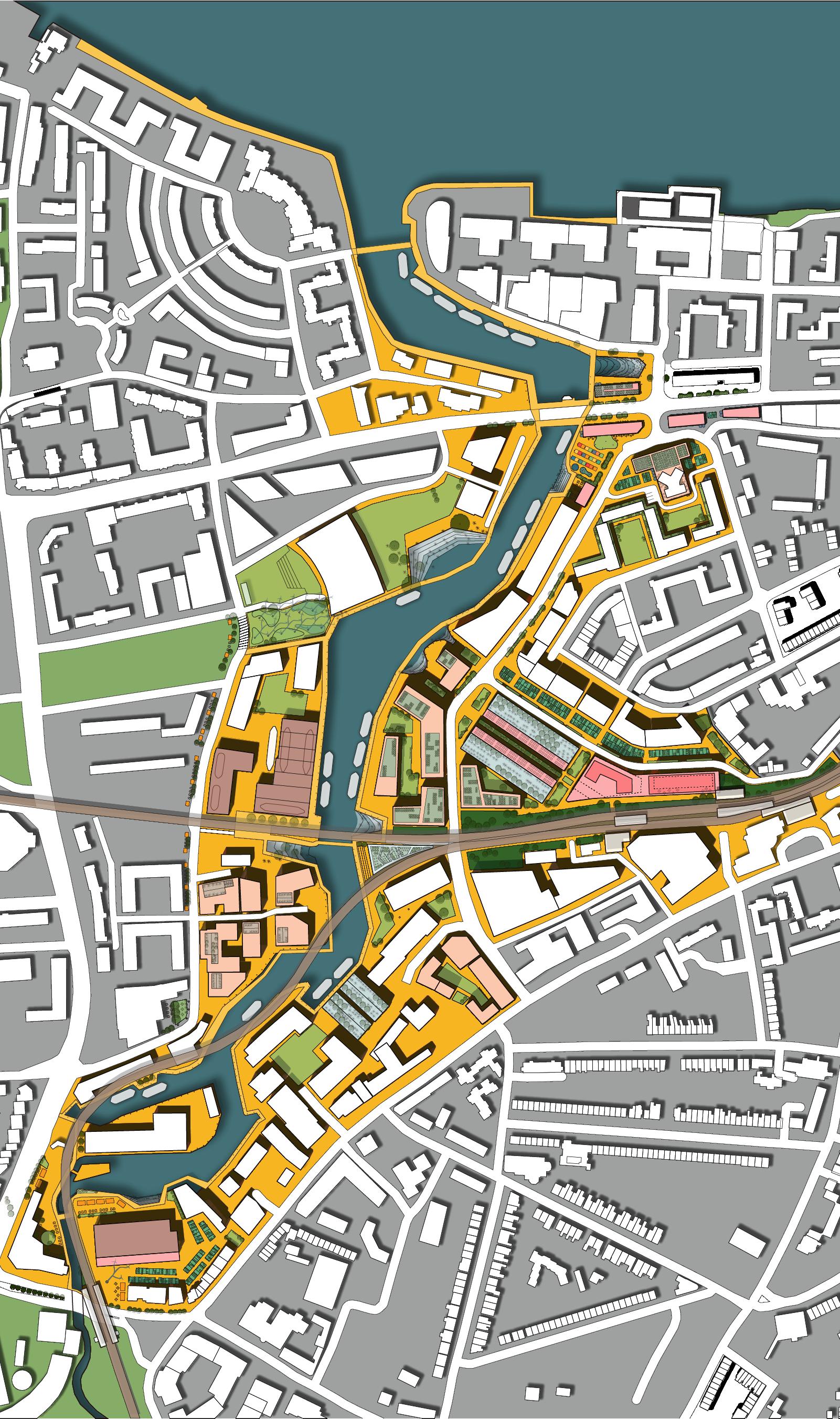
Mass Timber Hotel
Greenwich Station Culinary Arts institute and Barge building facility
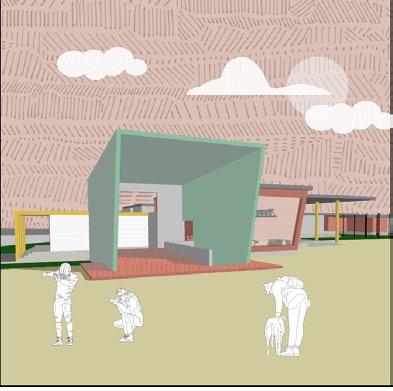
Creek Discovery Center
Microgrid Power station
Goldsmith Arts facility CLT manufactory Deptford station
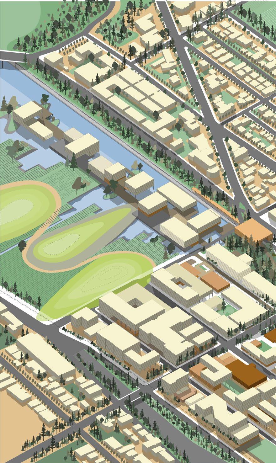
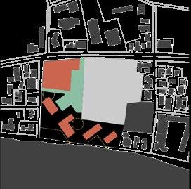
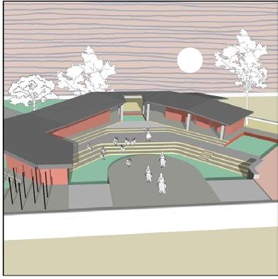
MASTER PLAN
1 2 3 4 5 6 7 8 9 10 11 12 1 2 3 4 6 9 10 11 12 8 7 5
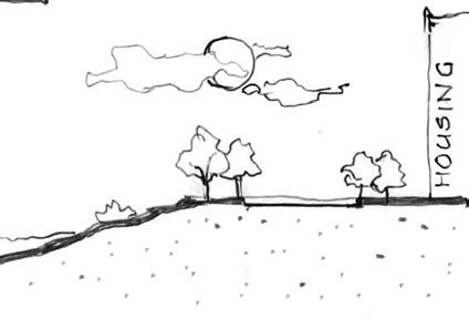
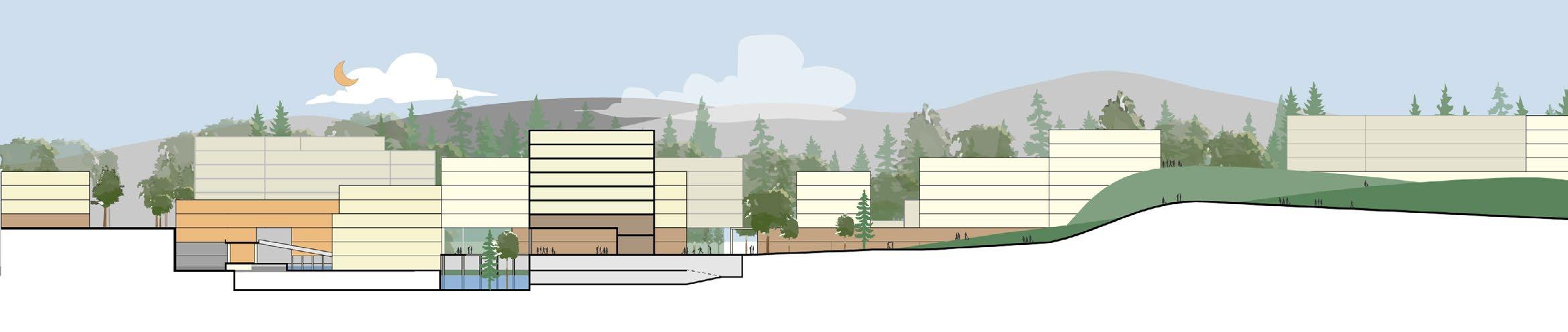
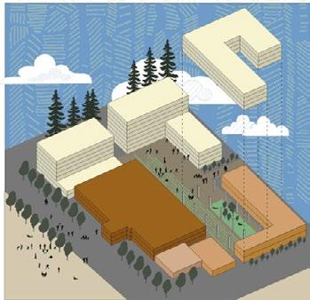
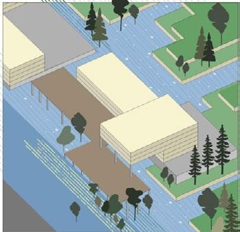
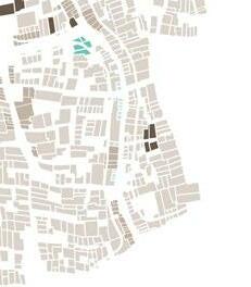
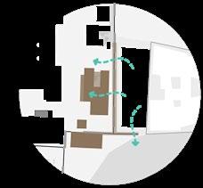
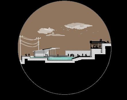
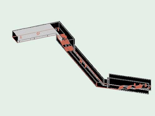
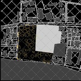
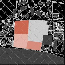
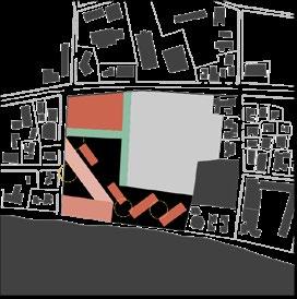
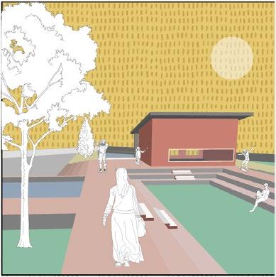
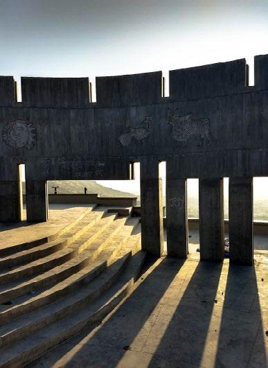
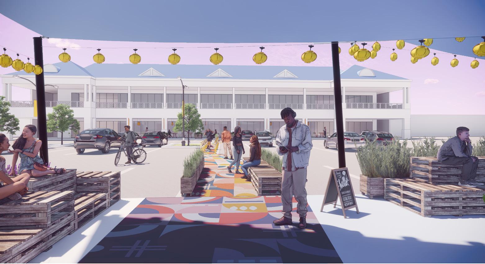
There are several important arts institutions along the left bank of the creek. The Barge manufactory connects many such institutions and old warehouses, becoming almost like a missing tooth in what could potentially become a small arts district.
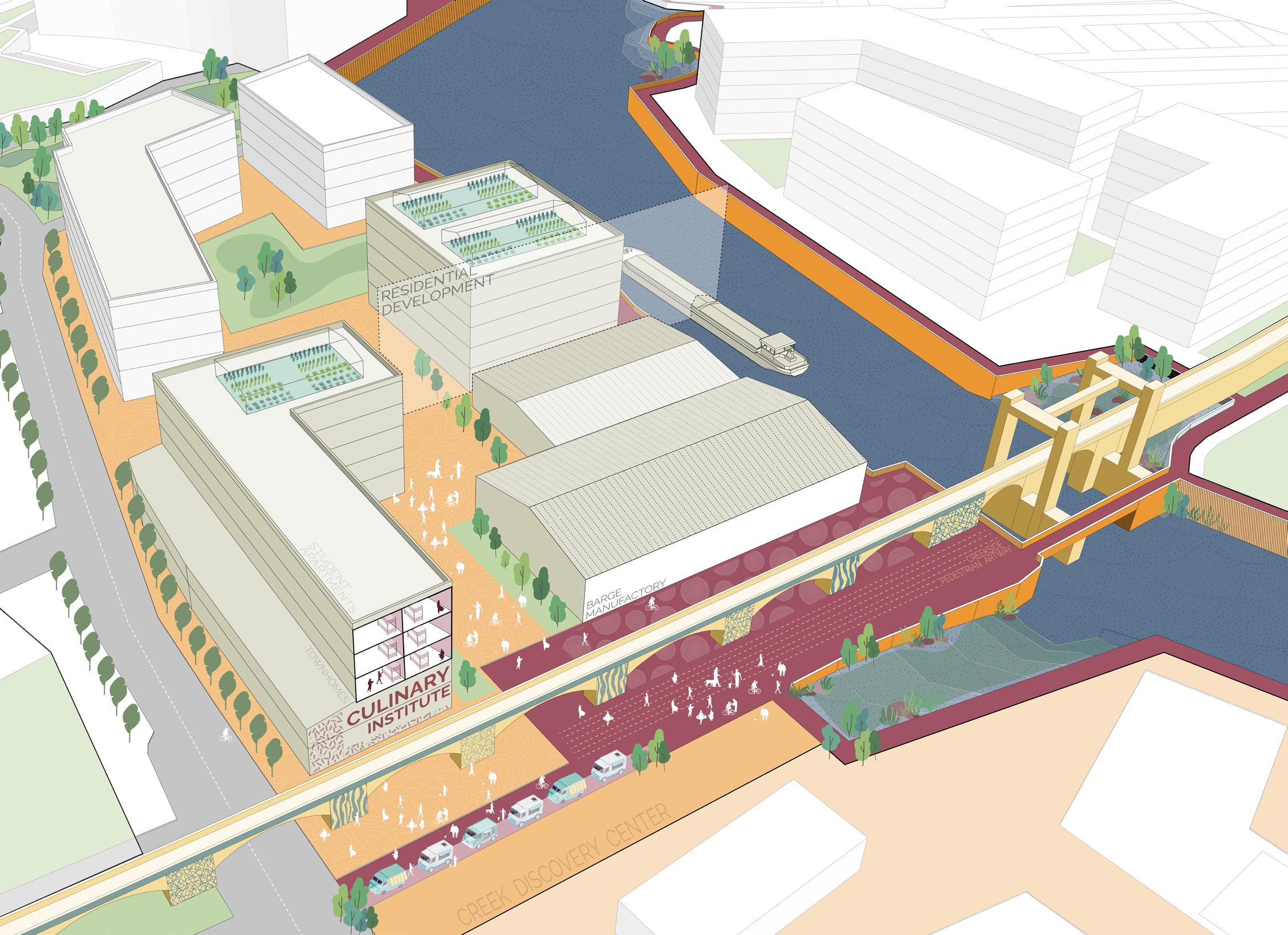
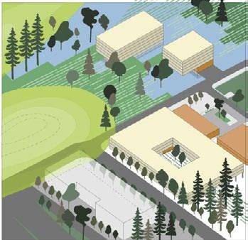
This area houses some large warehouses in relatively good condition, which were repurposed to accomodate barge building facilities. These, when they reach their end , can be redeveloped, with the street-side of the property to become a culinary arts institution which partners with the urban greenhouse operations. Students at the culinary school could also find housing here.
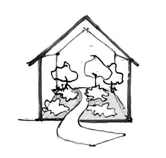
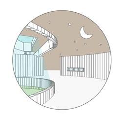
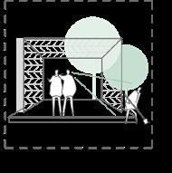
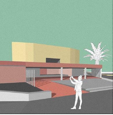
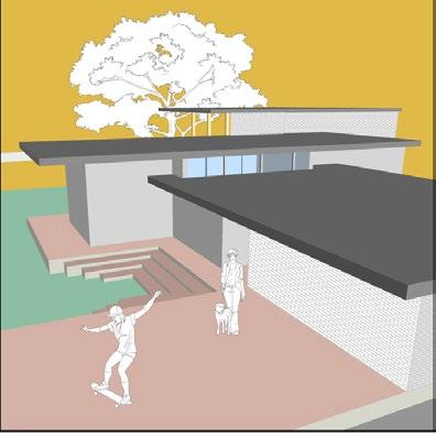
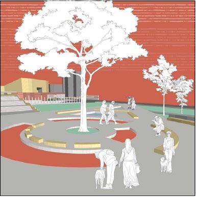
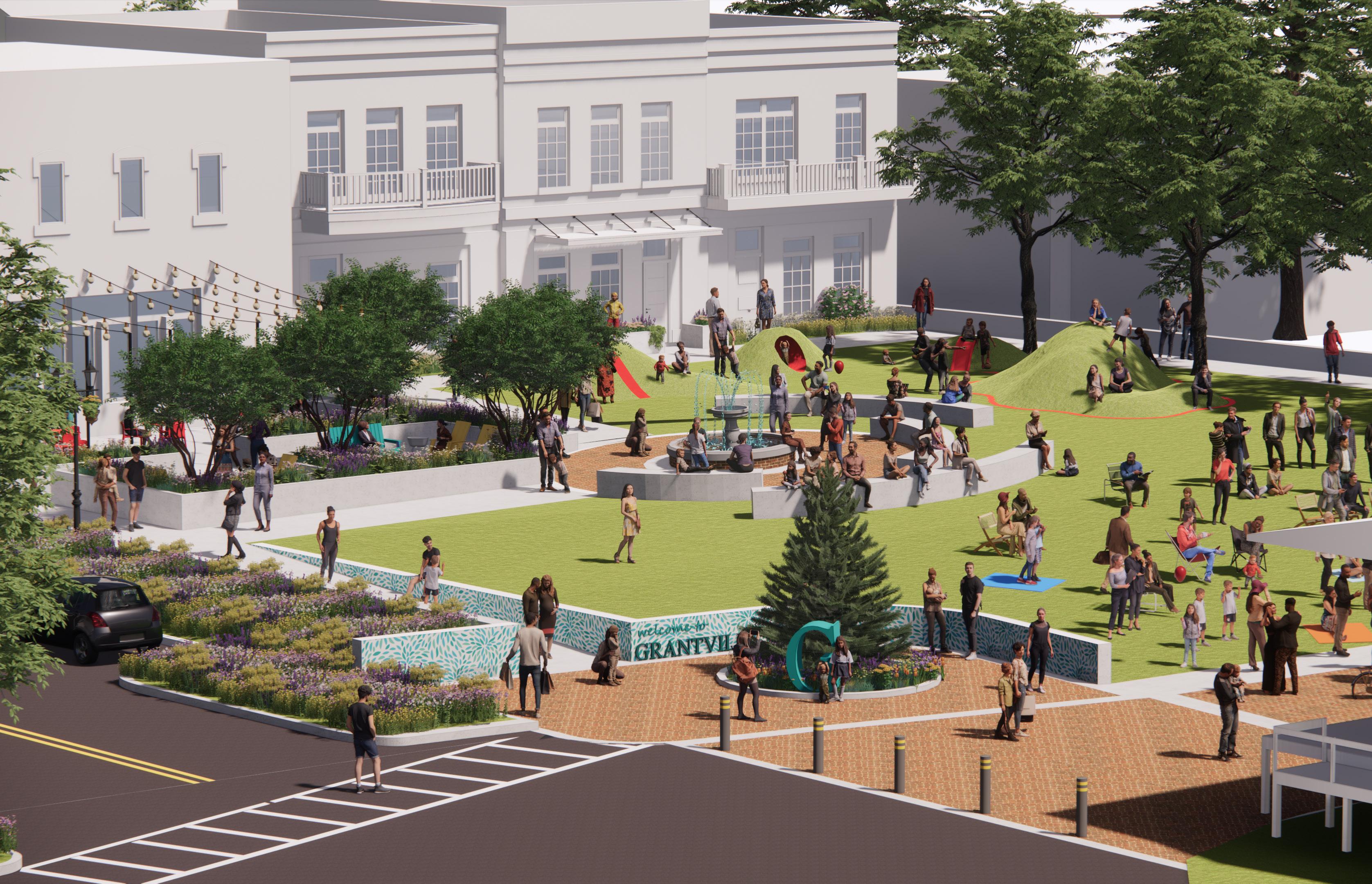
 View
View
of the Arts District
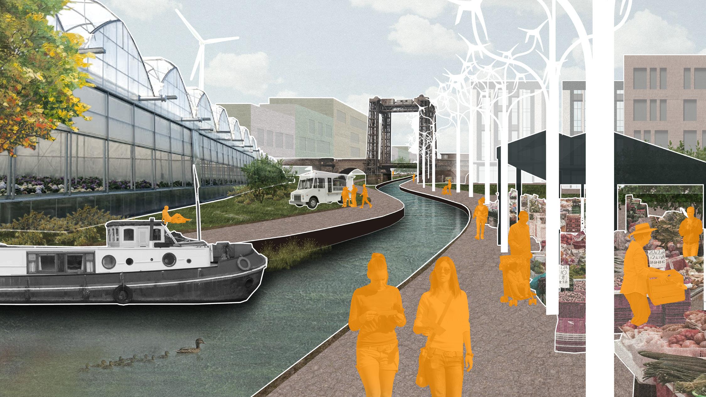
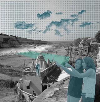
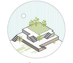
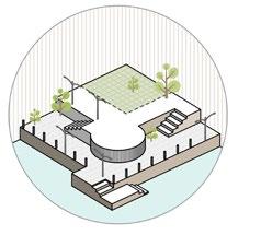
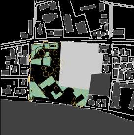
Deptford creek may be under threat now – from things like pollution, from cars, and from thoughtless development. But it has a brighter, greener future ahead of it, a future that will recapture that vibrant, innovative, and undeniably east-London spirit.
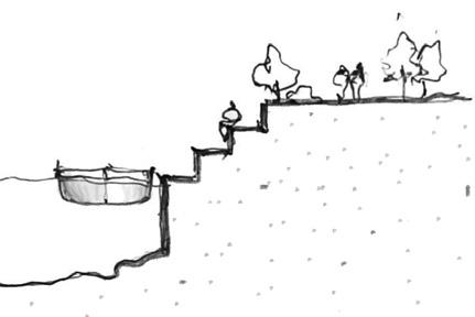
urban agriculture repurposing warehouses community-centric programming more housing opportunities creek habitats reimagined streets reimagined creek edge revisiting creek activity
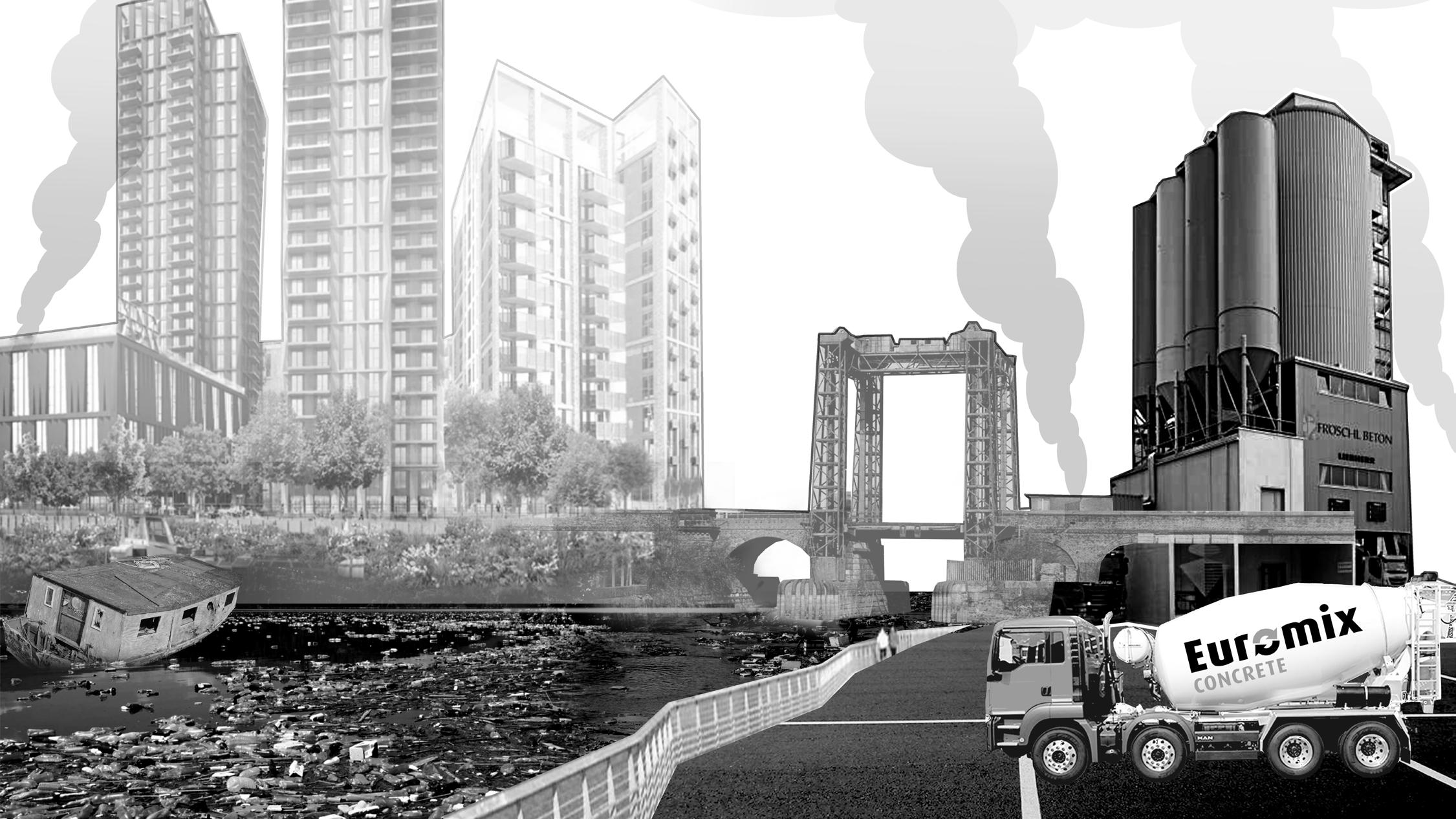
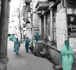
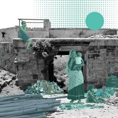
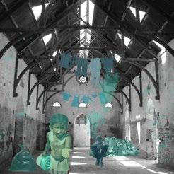
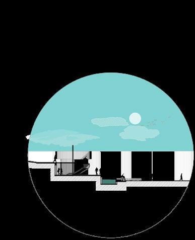
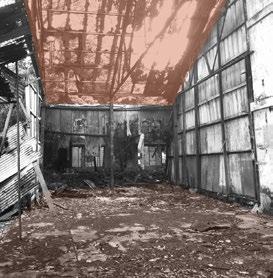
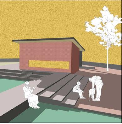
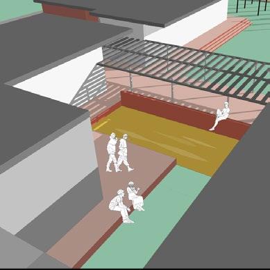
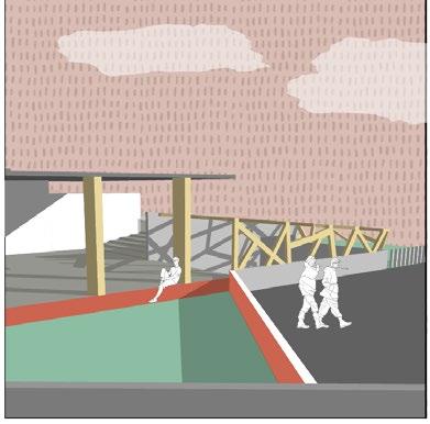
 View of the Deptford Creek today
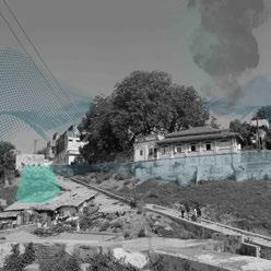
View of what Deptford Creek could be
View of the Deptford Creek today
View of what Deptford Creek could be
studio critics collaborators software used
THE STITCH fall 2021
The University of Texas at Austin
Brittany Falkner, Carolina English
the stitch
ArchiCAD, Photoshop, Illustrator, Indesign, QGIS, Affinity
01
01
the stitch
.academic 2021 .group project .graduate .landscape urbanism
.academic 2021 .group project .graduate .landscape urbanism
Instructors : Dean J. Almy, Maggie Hansen Studio : Studio Cascadia, Fall 2021
Instructors : Dean J. Almy, Maggie Hansen Studio : Studio Cascadia, Fall 2021
Design development : Mudita Bilay, Carolina English, Brittany Faulkner Framework + Graphics (Portfolio) : Mudita Bilay
Design development : Mudita Bilay, Carolina English, Brittany Faulkner Framework + Graphics (Portfolio) : Mudita Bilay
Design development : Mudita Bilay, Carolina English, Brittany Faulkner Framework + Graphics (Portfolio) : Mudita Bilay
Software used : ArchiCAD, Photoshop, Illustrator, QGIS, Indesign, AutoCAD, Affinity.
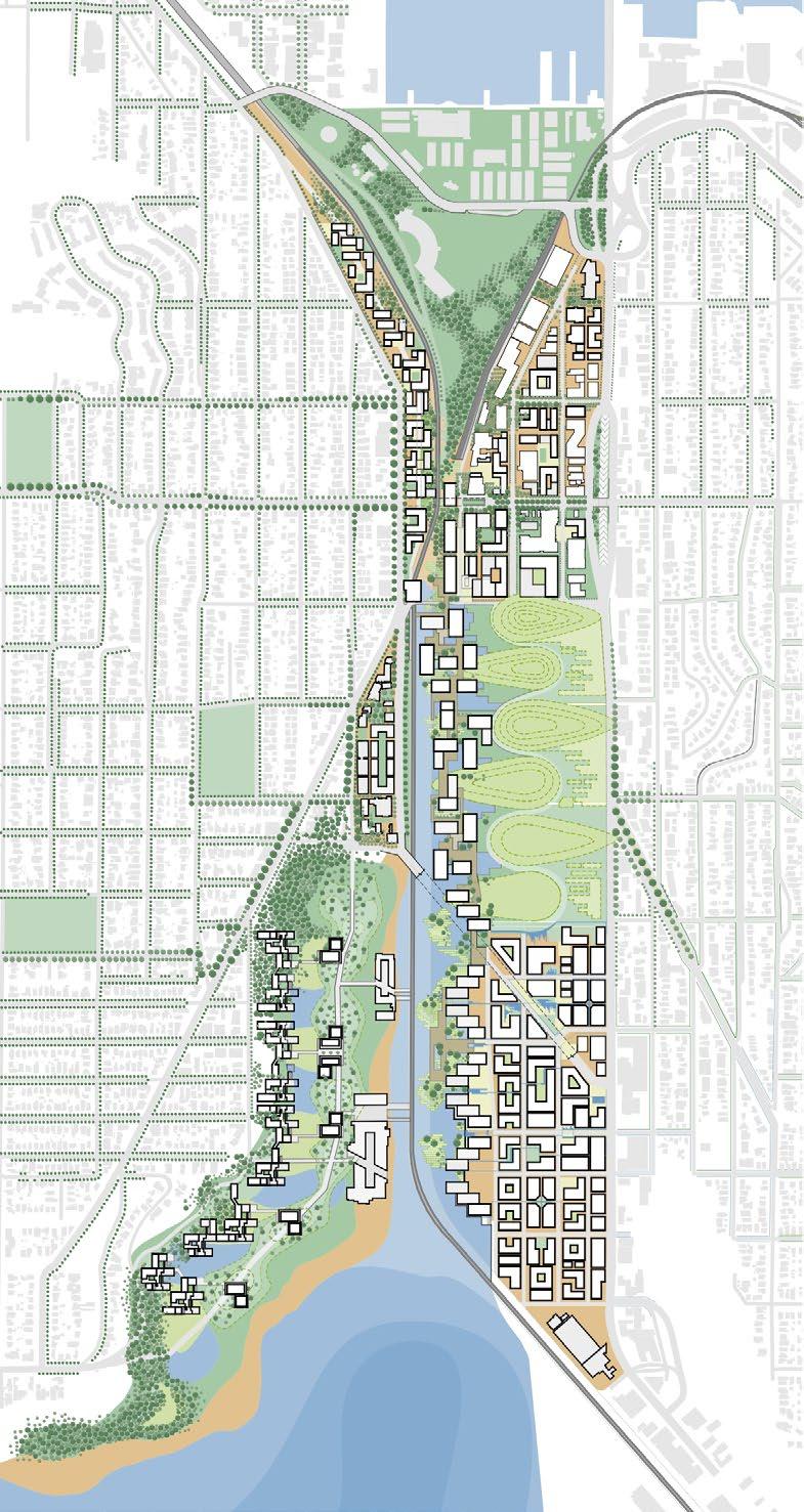
The studio focused on the industrial land of Interbay area in Seattle. The current use separates the two adjoining neighborhoods of Queen Anne and Magnolia and is heavily occupied by large surface parking areas and defunct industrial spaces. The area also falls under mandatory housing affordability zone, but is majorly laced with single family houses.
The studio focused on the industrial land of Interbay area in Seattle. The current use separates the two adjoining neighborhoods of Queen Anne and Magnolia and is heavily occupied by large surface parking areas and defunct industrial spaces. The area also falls under mandatory housing affordability zone, but is majorly laced with single family houses.
The project explored environmental, infrastructural, and economic linkages through tailoring metaphors to bring together areas of Queen Anne and Magnolia. The project also tries to address liquefaction and anticipated sea level rise.
The project explored environmental, infrastructural, and economic linkages through tailoring metaphors to bring together areas of Queen Anne and Magnolia. The project also tries to address liquefaction and anticipated sea level rise.
The project explored environmental, infrastructural, and economic linkages through tailoring metaphors to bring together areas of Queen Anne and Magnolia. The project also tries to address liquefaction and anticipated sea level rise.
Liquefaction and sea level rise susceptible zones
utilises
Liquefaction and sea level rise susceptible zones
Liquefaction and sea level rise susceptible zones
The Landscape stitch The Infrastructure stitch
bus routes, light rail, passenger
brings the existing fabric and
The Mobility stitch The Landscape stitch
The
The Mobility stitch The Landscape stitch The Infrastructure stitch
Interbay through corridors and
.academic 2021 .group project .graduate .landscape urbanism 01
nearby urban villages together
Software used : ArchiCAD, Photoshop, Illustrator, QGIS, Indesign, AutoCAD, Affinity. The Mobility stitch
existing and proposed
connects all the green spaces around
the stitch
The studio focused on the industrial land of Interbay area in Seattle. The current use separates the two adjoining neighborhoods of Queen Anne and Magnolia and is heavily occupied by large surface parking areas and defunct industrial spaces. The area also falls under mandatory housing affordability zone, but is majorly laced with single family houses.
Instructors : Dean J. Almy, Maggie Hansen Studio : Studio Cascadia, Fall 2021
04
Software used : ArchiCAD, Photoshop, Illustrator, QGIS, Indesign, AutoCAD, Affinity.
Infrastructure stitch
Dean Almy, Maggie Hansen
TOWARDS BALLARD INDUSTRIAL AREA
TERRACED LIVING IN THE CANOPY GROUNDS
TERRACED LIVING IN THE CANOPY GROUNDS
BOARD WALK COMMERCIAL AND
BOARD WALK COMMERCIAL AND
DRUMLINS‘THE HEART’
DRUMLINS‘THE HEART’
TOWARDS BALLARD INDUSTRIAL AREA SALT MARSH LIVING
MASTER
0 100 300 800ft
CONSTRUCTED WETLANDS
PLAN
CONSTRUCTED WETLANDS
SALT MARSH LIVING
The four systems come together in each of the four different neighborhoods to represent a multicoloured fabric across Interbay.
housing commercial-
residential 22nd Ave W
market amenity
intercity amtrak station affordable housing
amtrak rail line
live-work housing (in elevation) live-work housing (in elevation) mix-use commercial slow roads
modal change parking underground freight line
board walks commercial - food + retail
market housing underground parking
elevation)
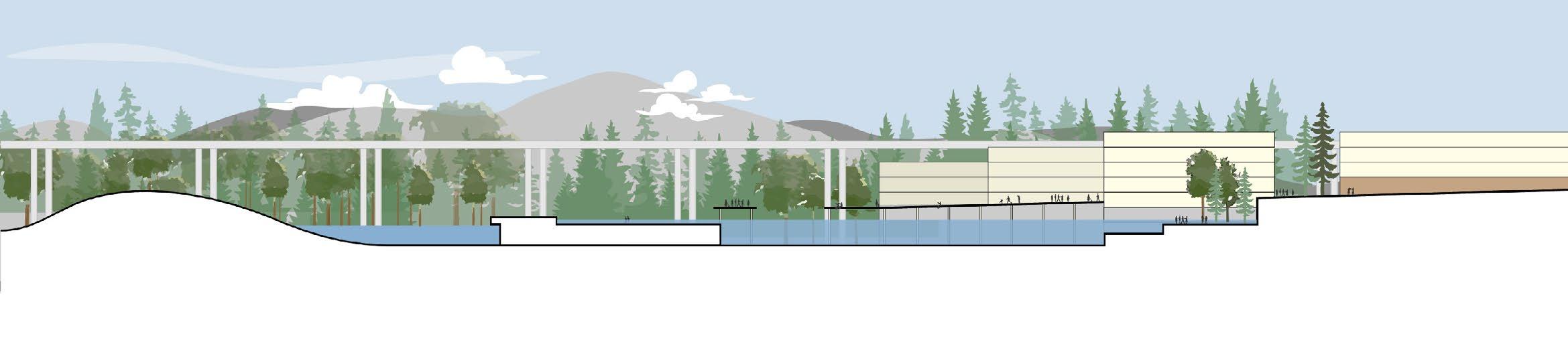
Canopy grounds enclose various terraces tucked into skyscrapping evergreen tree. These terraces hold mixed used functions embroidered amongst the existing fabric with interesting details of ramps and mobility networks.
The Marsh living is a submersed experience meant to be flooded. The existing industrial seams stretch out from the tiered train tracks, which after sea level impact reminisces past like the ‘Seattle Underground’.
Constructed Wetlands lace these older industrial lands with lively residential communities to curate a different immersive experiences around the boardwalks.
The Boardwalks create a unique slow moving commercial and retail mix-use experience beside aggressive landscape systems.
Section through the canopy grounds
market housing beside 15th street
live-work + market housing
commercial - food + retail
paved trail drumlin grounds
Section through the constructed wetlands
market housing
immersive water experience + board walks
affordable + market housing with mixed commmercial beside 15th street
Imagined as a rhinestone sewn onto the fabric, the drumlins can be seen as the focus of the Original Olmsted Park ring.
These drumlins bring together the four neighbourhoods together through the vast green lung.
The drumlins are built on a landfill that currently suffers from high levels of toxicity. The landscape from the drumlins aggresively anchors and mitigates toxicity. This also allows the city to reclaim a landmass which otherwise is not employable,
Terraced neighborhoods provide anchorage in the liquefaction zones
the landscape aggressively flows in and out of neighbourhoods
DRUMLINS - ‘ THE HEART’
Mix use vicinities ensure footfall around drumlin throughout the day
Layered multi-modal connectivity further assists easy accessibility
phases. The following project was included as a part of the 6-site proposal.
LOST IDENTITIES spring 2019 University of Mumbai
Urban insert | community programming tourist interface | conservation | adaptive reuse
Studio Guide professional guidess software used
(1850)
BEGUM WADI (1850)
ORTHODOX CHURCH
SARDAR MANZIL (1850)
CIVIL HOSPITAL (1850)
Software used : ArchiCAD + Cinerender, Photoshop, Illustrator, Indesign, AutoCAD
Krishnan V. Debashish Nayak, Saswat Bandhopadhyay
ArchiCAD, Cinerender, Photoshop, Indesign, Illustrator
Budgeting and tender approvals ongoing for other phases. The following project was included as a tourist interface | conservation | adaptive reuse
OLD PARSI AGIARI
R. D. LIBRARY & BHARUCHA HALL (1850)
FIRE TEMPLE
POL HOUSES OF BHARUCH
OLD POL HOUSES
02| THE BRIDGE : SITE AND THE RIVER
Budgeting and tender approvals ongoing for other phases. The following project was included as a tourist interface | conservation | adaptive reuse
The city of Bharuch has experienced about 2000 years of cultural and infrastructural transition, recorded through the old town and existing literal archives to discover several undocumented paths in history. Despite a strong cultural presence, the city has no identity of its own.
The city evolved along the River Narmada, and laced public spaces network along the river edge, which experience disuse today. The public spaces and the heritage district are on a verge of turning into a necropolis within the acropolis. The research addresses the depleting urban fabric by repurposing and inculcating a thought towards an identity of the city.
| THE BRIDGE : SITE AND THE RIVER
The city of Bharuch has experienced about 2000 years of cultural and infrastructural transition, recorded through
OLD COURT (1850)
JAIL PREMISES (1890)
02
OLD POL HOUSES
KATOPORE BAZAAR (1850) FORT WALL & PORT
JAMA MASJID
05
There is a need to introduce a program that revives the site barring the set schedules of the community. The area experiences little or no footfall even during the day. Additionally, illegal activity one site renders the site inaccessible.


STRENGTH OF THE SITE ▪ architectural value of the context ▪ library and school

WEAKNESS PRESENT ▪ inaccessible buildings and illegal activities
STRENGTH OF THE SITE ▪ existing landscape for green pockets
WEAKNESS PRESENT ▪ inaccessible space for the specially abled ▪ illegal activities ▪ informal settlements, unhygienic conditions


GSPublisherVersion 0.1.100.100
ACTIVITY
INFORMAL SETTLEMENTS DUTT MANDIR FURZA PORT BEGUM WADI SARDAR MANZIL R. S. DALAL SCHOOL ORTHODOX CHURCH R. D. LIBRARY | HERITAGE AWARENESS | SITE ACTIVATION | REMINISCENCE OF THE STRUGGLE | COMMUNITY PROGRAMMING NDU 40 USLIMS 38 RSI 10 CHRISTIANS 10 OTHERS 2 100 ldren 15 oung adults 10 outh 25 d lives 30 ired 20 100 rpose School 20 Passer by 65 isiting 10 ing 5 100 Chart Title 1 2 3 4 5 Chart Title Chart Title HINDU 40
38
10
10
2 100 children 15 young adults 10 youth 25 mid lives 30 retired 20 100 purpose School 20 Passer by 65 Visiting 10 Living 5 100 Chart Title 1 2 3 4 5 Chart Title 1 2 3 4 5 Chart Title 1 2 3 4 HINDU 40 MUSLIMS 38 PARSI 10 CHRISTIANS 10 OTHERS 2 100 children 15 young adults 10 youth 25 mid lives 30 retired 20 100 purpose School 20 Passer by 65 Visiting 10 Living 5 100 Chart Title 1 2 3 4 5 Chart Title 1 2 3 4 5 Chart Title 1 2 3 4 FOOTFALL AROUND THE CLOCK ACTIVITY ACTIVITY ACTIVITY ACTIVITY ACTIVITY FOOTFALL AROUND THE CLOCK FOOTFALL AROUND THE CLOCK FOOTFALL AROUND THE CLOCK FOOTFALL AROUND THE CLOCK COMMUNITY BUILD UP USER AGE GROUPS PURPOSE OF VISIT HINDU RETIRED CHILDREN YOUNG ADULTS ADULTS MID LIFE ADULTS PASSING BY WORK / SCHOOL LIVING VISITING OTHERS CHRISTIAN PARSI MUSLIM FOOTFALL AROUND THE CLOCK 1M CONTOUR INTERVAL 12AM 12AM 12AM 12AM 12AM 12AM 12PM 12PM 12PM 12PM 12PM 12PM
CIVIL HOSPITAL TOMB WARD TANK INFORMAL SETTLEMENTS
MUSLIMS
PARSI
CHRISTIANS
OTHERS
Rooms for Repose
1 Provides a resting area for the visitors from the ‘heritage walk’.
2 Experiencing the re-adapted built mass from a fresh perspective.
3 Curating different cultural activities for complete tourist experience of the place.
Clusters of Contemplation
1 A Visual informative conclusion comparing a before and after phase of the built mass covered in the ‘heritage’ walk.
2 Establishing a narrative between visitors and locals.
Interpreting new identities
1 Rekindling the human - river connection.
2 Create seamless circulations around the landform and the retained built mass..
3 Spaces simulate thoughts through reminiscing and encourage to form new perspectives for the place.
MASTER PLANNING DIAGRAMS
plazas and quandrangles buffers along the set routes of community
valley as a green breathing lung of the area
decongesting katopore bazaar remniscing memories and imagining new identities
demolishing defunct structures and open the beautiful facade of the library for circulation
footfall during the late hours: ensuring security on site future urban development : riverfronts
GSPublisherVersion 0.1.100.100
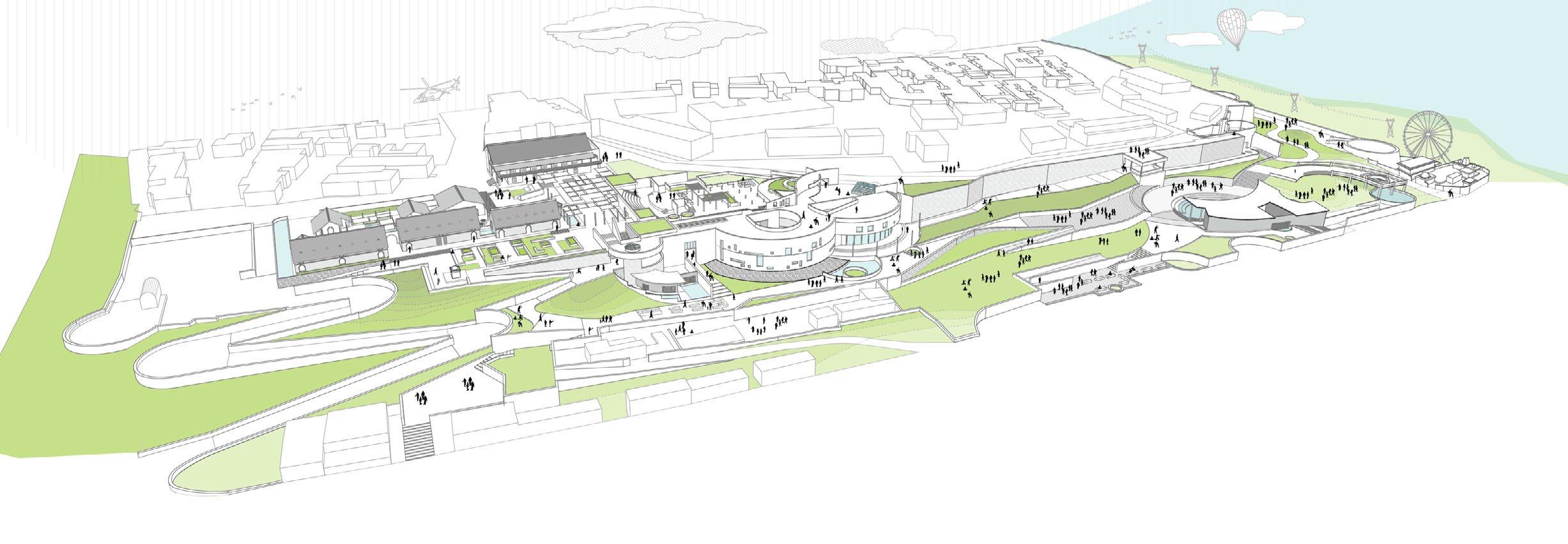
1 Entrance (from existing temple shrine) 2 Parking 3 Administration Block 4 Guest quarters 5 Temporary exhibition spaces (interior and exterior) 6 Cafeteria 7 Entrance 2 8 Library (and quadrangle) 9 Entrance 3 10 Amphitheatre (Green room at G-1 lvl) 11 Ward tank - Plaza 12 Museum and Gallery (at G-1 and G-2 lvl) 13 Raatri Bazaar (at G-1 and G-2 lvl) 14 Monument of Resistance
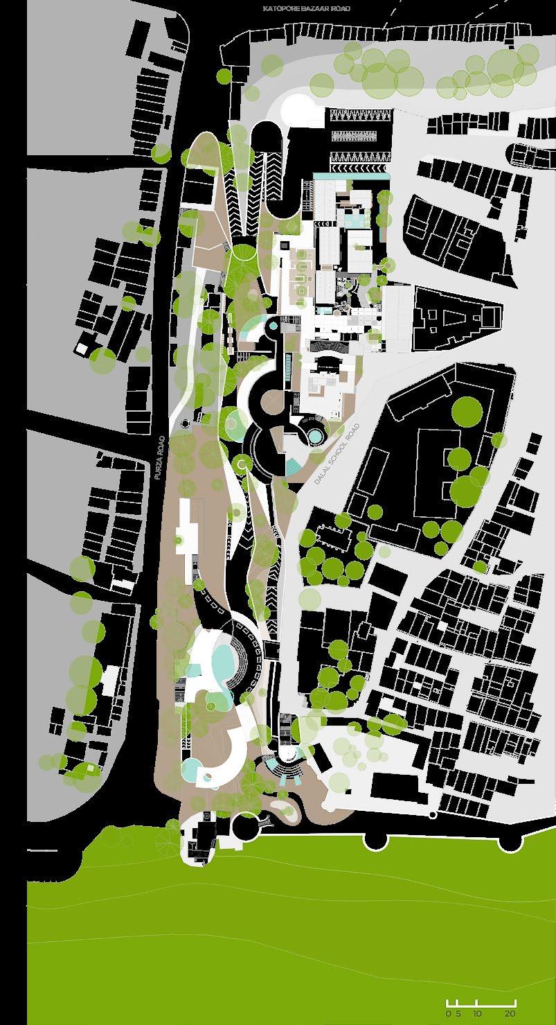
LEGEND
SITE PLAN 9 10 12 13 14 11 8 7 1 2 3 4 5 6
The design utilises the existing Library and the Civil Hospital to open into a quadrangle which houses small conversational pockets.
The amphitheatre celebrates the performing culture of the city and desembles to create another extension of the Water tank Plaza. The Exhausts of the ward tank create interesting patterns for circulation.
The galleries beside the ward tank provide an extension to the ward tank plaza creating a seamless places of activity around the space. Meanwhile, the greenscape directs the user along the fort wall while gradually descending the site.
The galleries culminate the cultural experience through a literal recital of the timeline of the city.The interior space animates throughout the day due to three different skylights. ACTIVITY MAPPING DESIGN FLEXIBILITY day 6AM noon evening loading unloading
raatri bazaar
ART TOURISTS THE DRAWING DOES NOT SHOW EXISTING OR PROPOSED LANDSCAPE ON SITE FOR BETTER DESIGN UNDERSTANDING
for cafeteria school children + company health enthusiasts + office goers practice raatri bazaar
midnight dawn 3AM LOCAL PUBLIC COMMERCIAL COMMUNITY
Clusters of Comtemplation through the Amphitheatre
Interpreting new identities through the Monument of Resilience
Rooms of repose as observed through the Raatri Bazaar
weekday weekend holiday emergency (during social unrest)
 raatri bazaar
PARADOX ON THE FREEDOM OF EXPRESSION
fall 2017 University of Mumbai Studio Guide software used
paradox on the freedom of expression .academic .individual project
| the commemorative setting
Krishnan V. ArchiCAD, Photoshop, Indesign, Illustrator
Guide: Krishnan V. Site: India united mills, Mumbai Architecture design studio 6 commemorative program | urban insert | art and performance platform
Software used : ArchiCAD, Photoshop, Illustrator, Indesign, AutoCAD
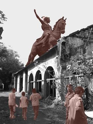
Initially, the mills in the newly independent India represented a platform to express. beyond obvious economic self-sufficiency. The 8-acre land is today imagined as a statue of Shivaji and a musuem.
The design interpretation analyzes the exclusivity of new proposed program and uses commemoration to imagine a space that truly represents the site context and the people
EXISTING SITE
WHAT ITS GOING TO BE
-- memorial that commemorates the life and work of Shivaji Maharaj
-- supportive functions such as visitor centre buildings, a memorial garden, a library, food court, and convention centre.
The existing site houses several dilapidated structures of the old mill. Due to weak foundation and structural system, any possible reuse can possess a risk to life.
The site is to be cleared to incorporate new functions
| the commemoration through spaces (circulation)
The program reminisces the freedom struggle and the conditions thereafter. Naturally, the commemoration is done in two parts. Experiences repeat throughout the structure and renders a feeling of deja-vu to inculcate a thought process.
3 2 1
The first memorial directs the user through a palpable sense of supression and liberation
1. Suppression through the long flight of stairs 2. Hope through the flashes of light near midlanding 3. Liberation through the escape route

4. Repeating and reliving the experience one continues to experience in day to day life depicted emotions of confusion and anxiety.
The second memorial directs the user through a intangible confused period.
03
3
4 4 3
07 06


STUDIO BUFFER
2 2 2 2 1 3 3 3 3 3 1 4 4 4 LOOK
1
GALLERIES
SPACES CAFETERIA
EXPERIENCE PROPORTIONS INTERACT
Dance Drama Art Literature Elocution Singing Debate
LEGEND
Vehicular entry-exits
Park
Parking
Auditorium + supplementary offices (at ground and first lvl)
Transitional memorial space 1 (at underground lvl)
Cafeteria
Guest accomodation
Transitional memorial space 2 (at underground lvl)
Staff leisure space
Library
Open amphitheatre
Display Gallery
Dance and music studios
Vocational workshop studio
N
2
3
4
5
6
7
8
9
10
11
12
13
14
15
1 2 3 4 6 7 8 8 9 10 12 13 11 14 15 5 5 1 0 2 5 10
1
Art studio Pedestrian entry denoted by
original 12 acre site without
leaving aside 4 acres for future opens a transition area from the
original 12 acre site without defunct structures.
leaving aside 4 acres for future expansions. The rest 8 acres opens a transition area from the built context to the sea.
dividing the site into three different zones : a green zone towards the road for the community; loud and silent zones framing views of the sea
dividing the site into three different zones : a green zone towards the road for the community; loud and silent zones framing views of the sea
daylight usage and framing the
Tilting the grid for optimal daylight usage and framing the views of the sea
identifying vegetation pockets and using the void between those to create programs.
identifying vegetation pockets and using the void between those to create programs.
according to the zones.
placing program blocks according to the zones.
reducing footprint and accomodating parking needs, adding memorial spaces along the main program.
reducing footprint and accomodating parking needs, adding memorial spaces along the main program.
devising different circulation paths and piercing through the blocks to reduce the volume of humongous blocks.
devising different circulation paths and piercing through the blocks to reduce the volume of humongous blocks.
SITE
PLAN
supplementary space 1 space 2 studio
SITE PLAN
GSPublisherVersion 0.7.100.100
DEVELOPMENT CONCEPTS
04-W Worksheet )1( 5000:1
FORM
KEY PLAN Transition spaces Scale Undulating plinths Visual Connection Animated spaces Relevancy
GSPublisherVersion 0.7.100.100
DEVELOPMENT CONCEPTS
SECTIONAL ISOMETRIC 04-W Worksheet )1( 5000:1
FORM
KEY PLAN Transition spaces Scale Undulating plinths Visual Connection Animated spaces Relevancy
SECTIONAL ISOMETRIC
FOCUS : addressing a larger mass of people PLAY : interacting with a space, light and shadow
UNHEARD NARRATIVES : discursion of ideas
UNHEARD NARRATIVES : incubator of thoughts
BACKYARDS: leisure spaces for the staff AMPHITHEATRE : incubators of conversation for artists
BACKYARDS: seen unseen leisure spaces
PROPORTIONS: changing scales and perceptions
THE SEGUE : the breathing lung
FALSE BACKYARDS: a repose
MEMORIAL: reminiscing the struggle
LIBRARY: food for thought
1 paintings for the tribal museum bhopal
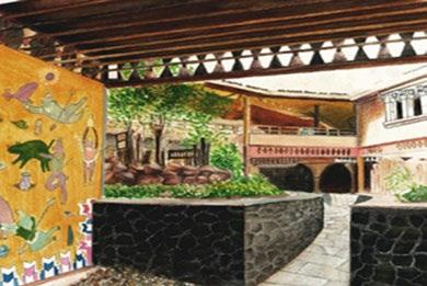
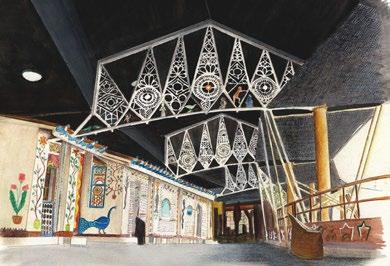
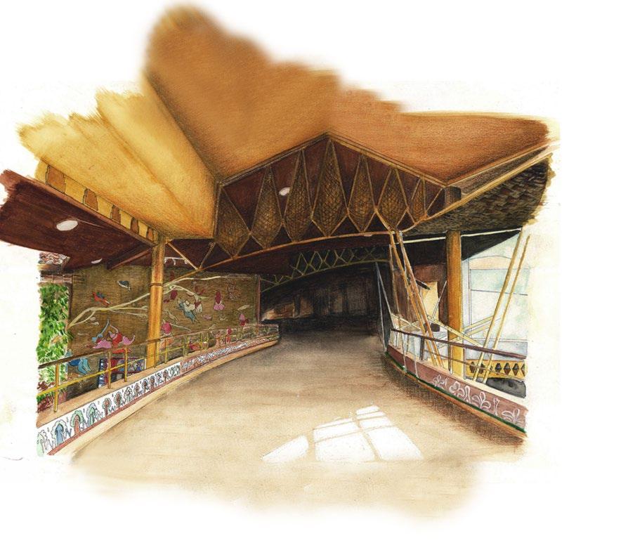
Individual work done for the Nari Gandhi Analysis trophy competition 2014 medium : handsketched, water colour and aquarelle pencil detailing
2 Structuring Urban space
2 Structuring Urban space
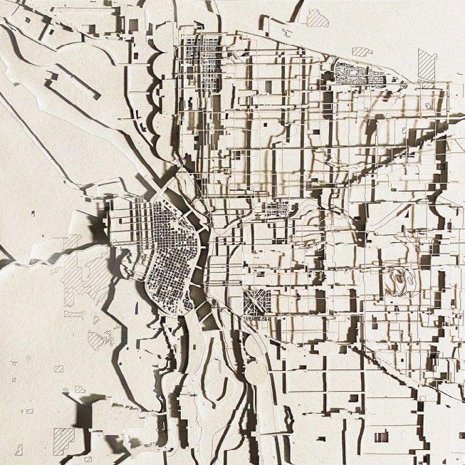
Individual graduate school work material + software flow : QGIS, Illustrator
Individual graduate school work material + software flow : QGIS, Illustrator
07

3 photography medium : phone Architecture || Nature and Sceneries || Colour themes and Lifestyle @mosby.explores
MUDITA SUSHIL BILAY +1 512. 718. 9040 mudita.bilay@utexas.edu mdtbilay@gmail.com


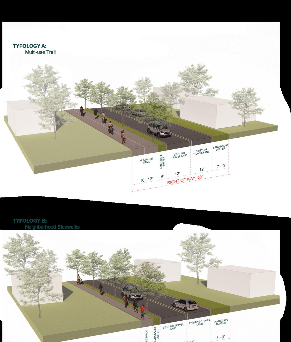
 Neighborhood Sidewalks