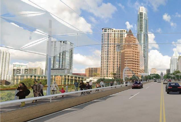
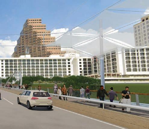
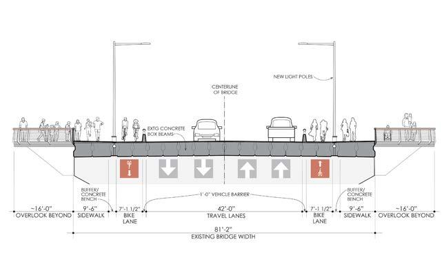
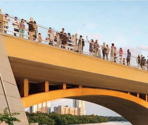
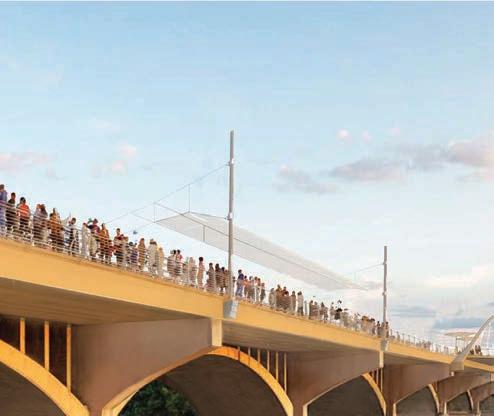
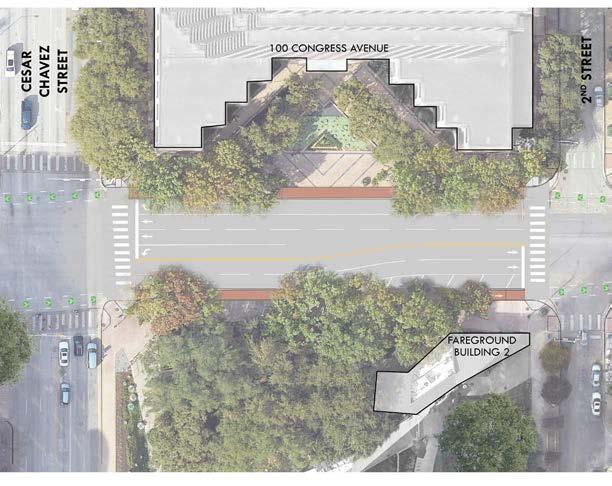
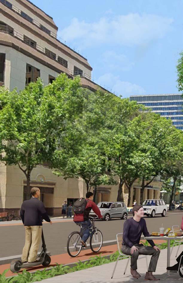
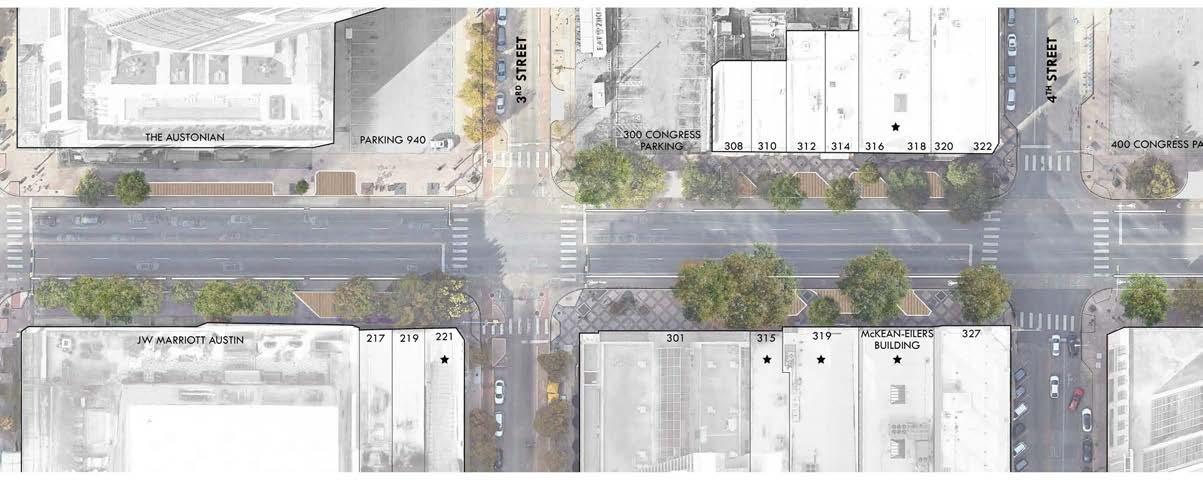
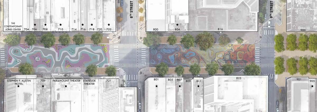
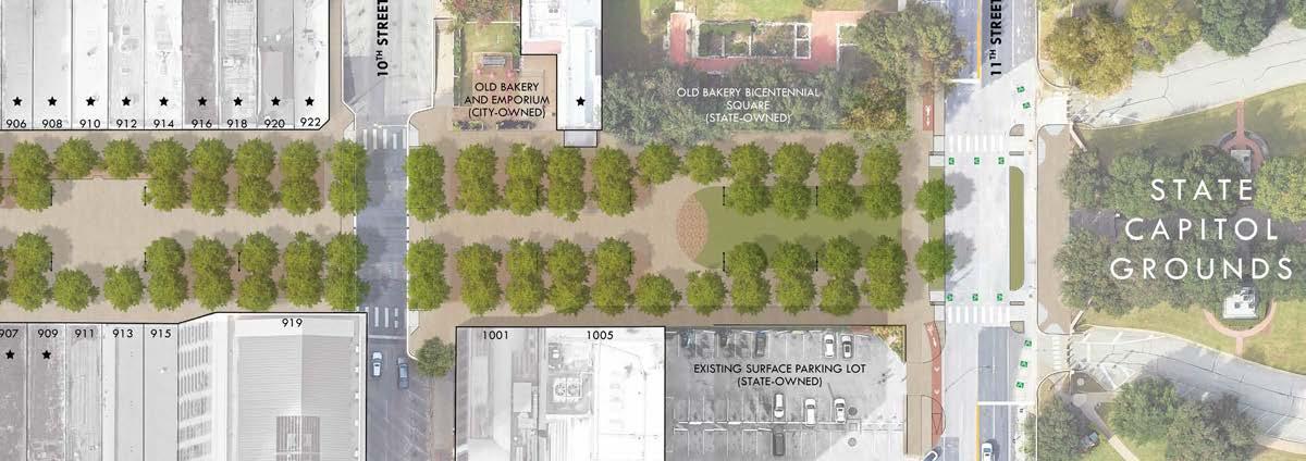
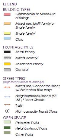
PROPOSED FUNDED IMPROVEMENTS
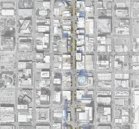
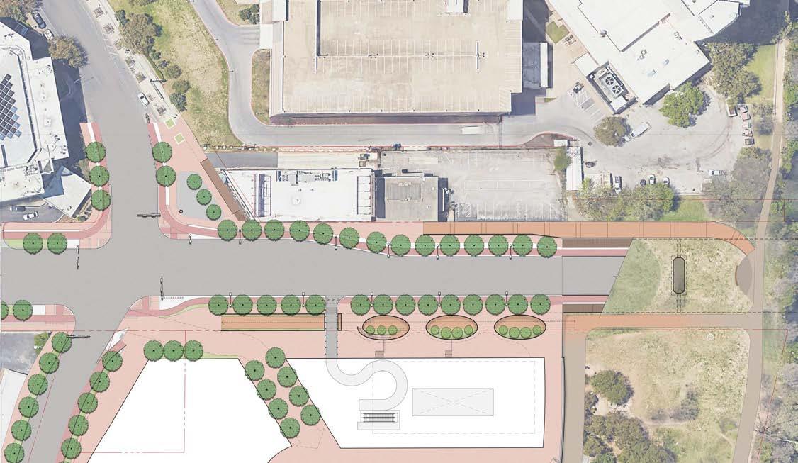
The Congress Avenue Urban Design Initiative (CAUDI) was made possible with funding from the City’s 2012 bond program as well as the 2020 bond program. In partnership with the Downtown Austin Alliance (DAA) and community stakeholders, the City contracted to help refine and realize the vision for the Congress Avenue from the Capitol to Riverside Drive. From there, the City contracted with a consultant team to develop detailed design and a funded first phase of construction.
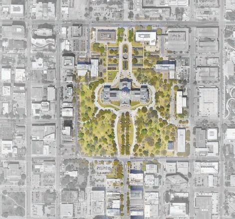
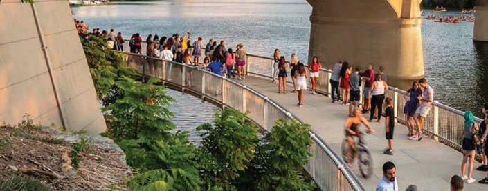
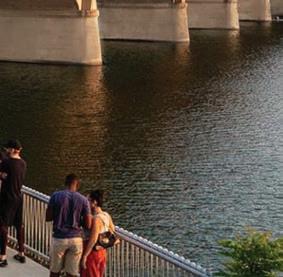
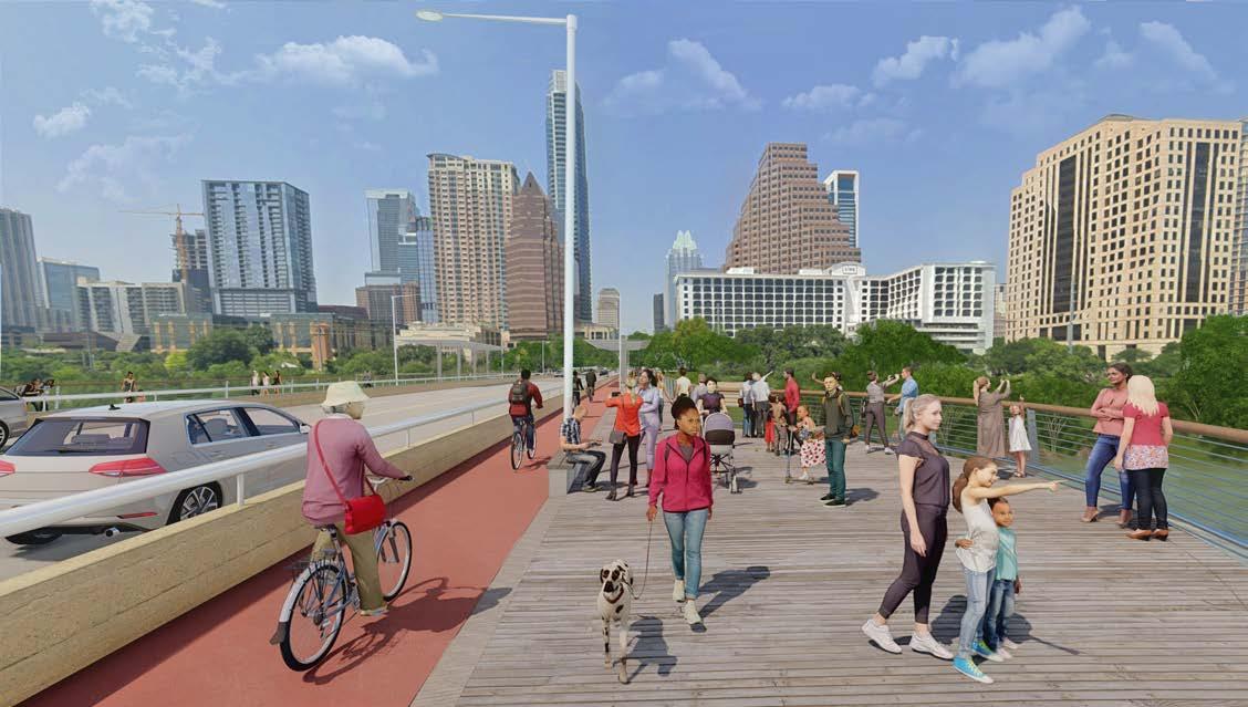
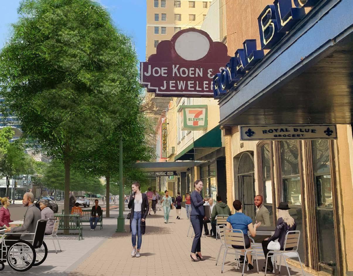
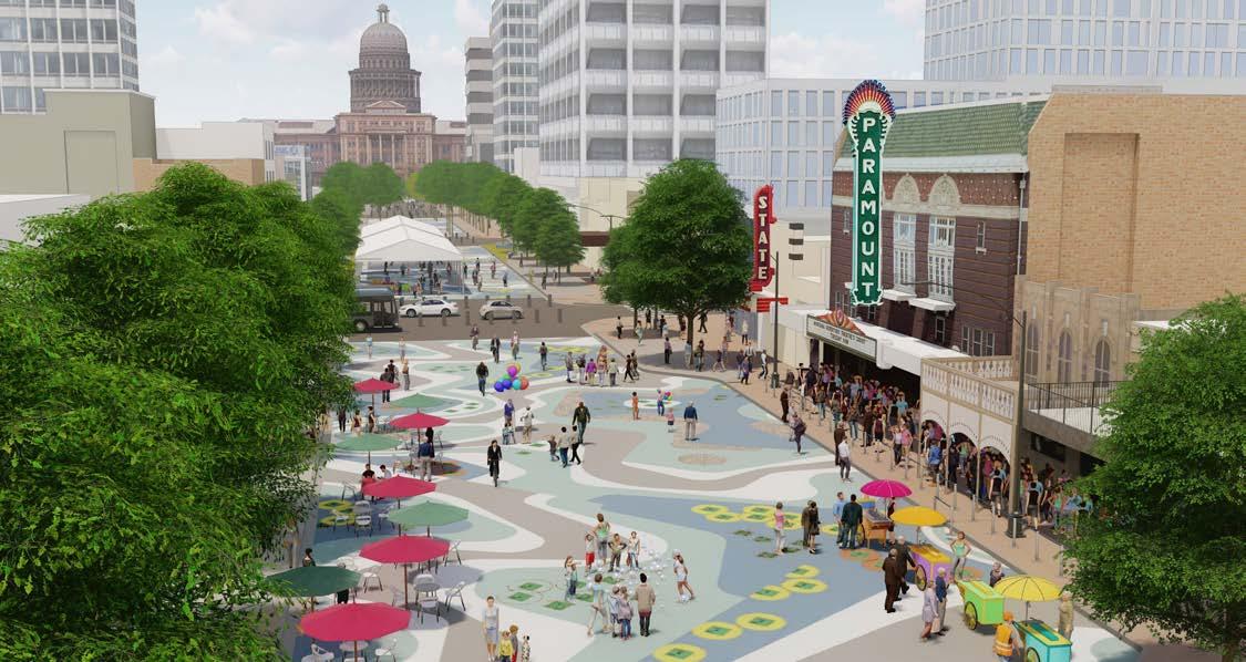
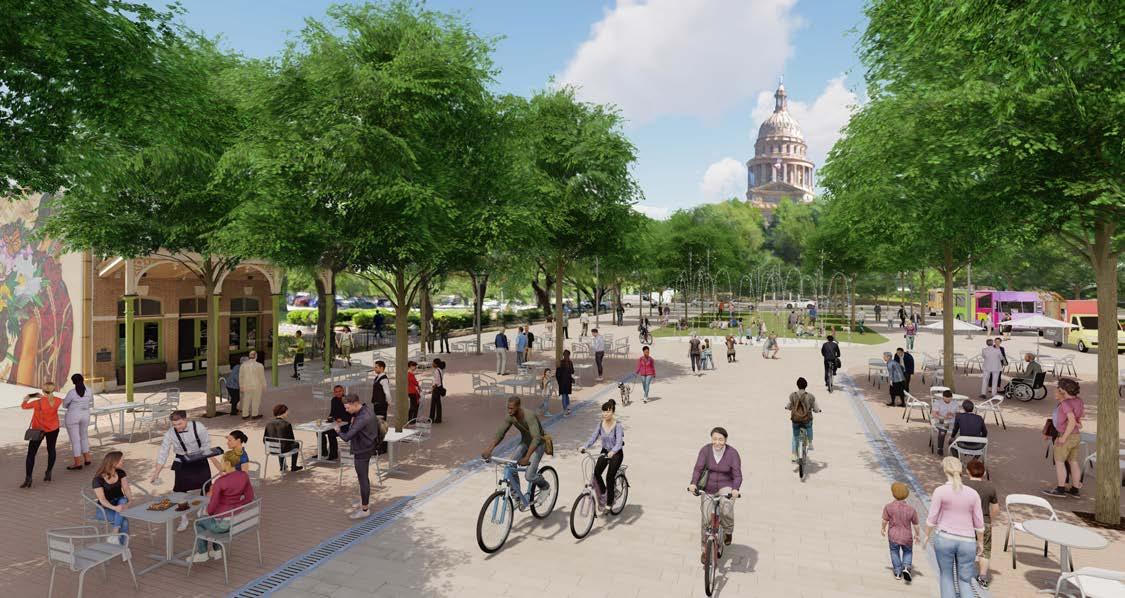
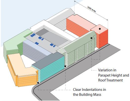
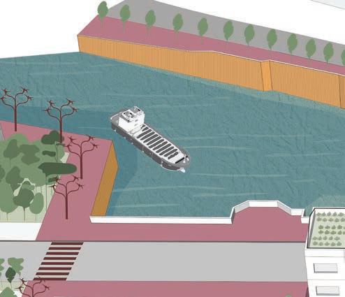
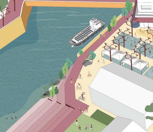
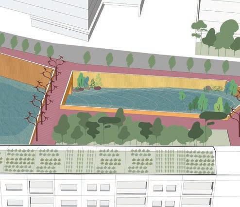
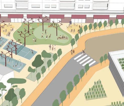
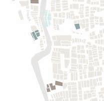
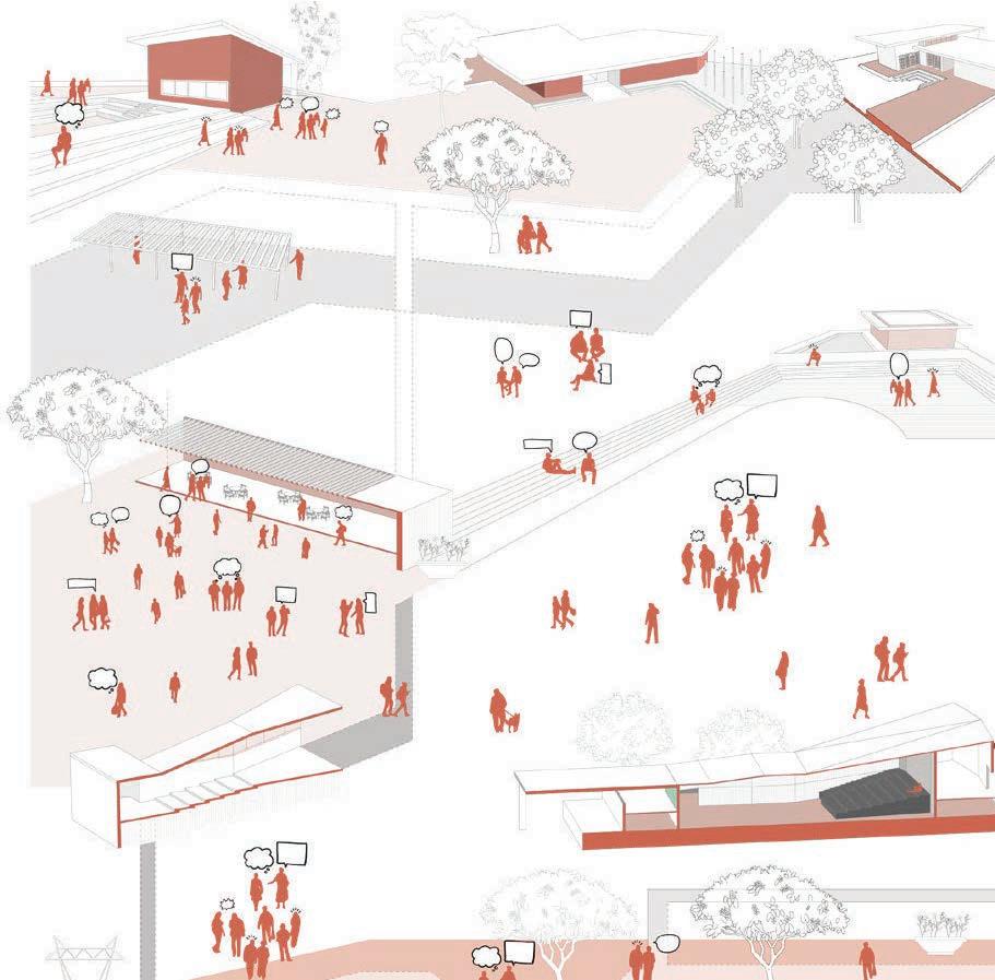
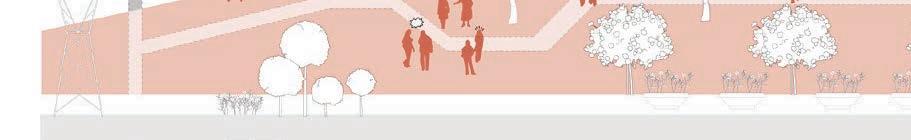
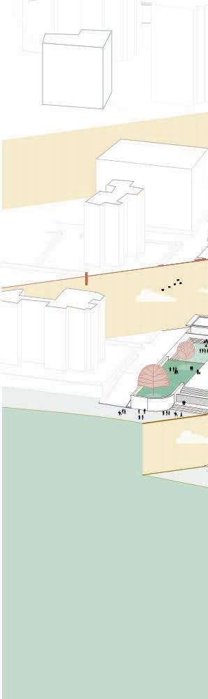
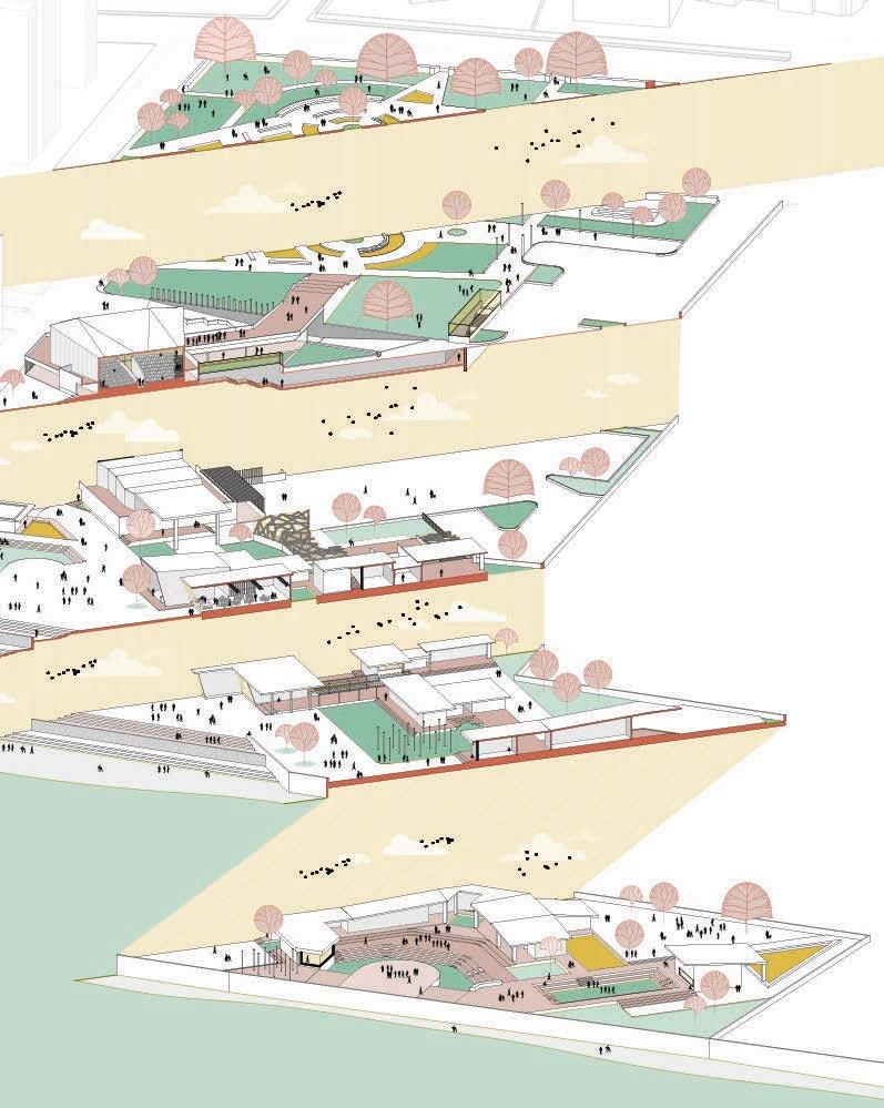
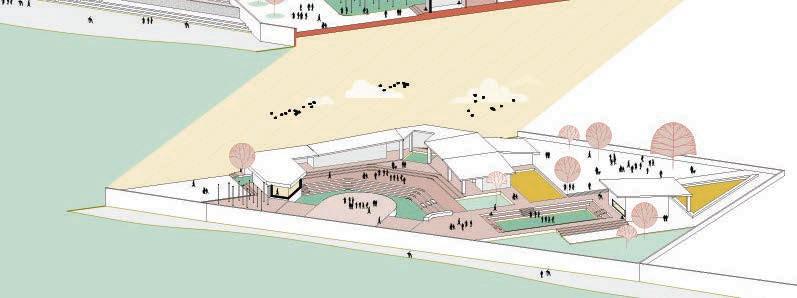
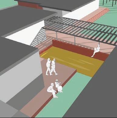
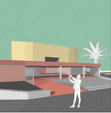
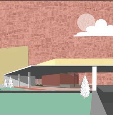
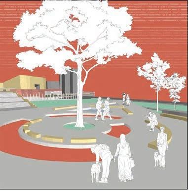
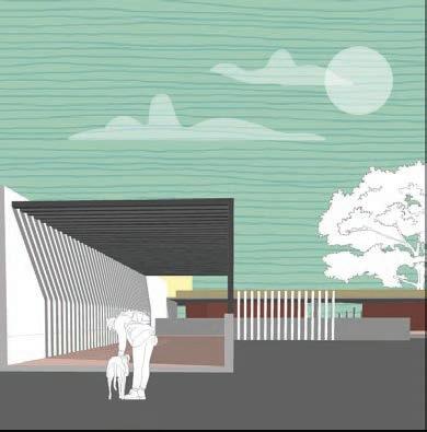
The City of Austin’s decision to develop a public plaza on the northern portion of Congress Avenue was spurred by a vision to revitalize this historic street and enhance its role as Austin’s “Main Street.”
Drawing inspiration from the successful transformation of the Texas Capitol Mall in the four blocks north of the Capitol building, this proposal seeks to reimagine Congress Avenue as a vibrant, pedestrian-friendly space that reflects Austin’s unique character.
Extensive stakeholder engagement in the development of the Vision Plan and the subsequent presentations to City of Austin Boards, Commissions and key stakeholders, such as the Downtown Austin Alliance, highlighted the demand for a more accessible, connected, and active urban environment. The public plaza concept offersto help achieve these goals while also stimulating economic growth and cultural vitality in the heart of Downtown Austin.
COLONY PARK SUSTAINABLE COMMUNITY
MCCANN ADAMS STUDIO
Project Team
Client Contribution
Software used
Jim Adams, Victor Butcher, Mudita Bilay
Catellus and City of Austin
Master Plan, Research and Graphic support for Design Guidelines, Graphic support for Planned-Unit Development, Graphic support for Master Development Agreement
AutoCad, Illustrator, Indesign, Sketchup, Photoshop, ArcMap, Lumion
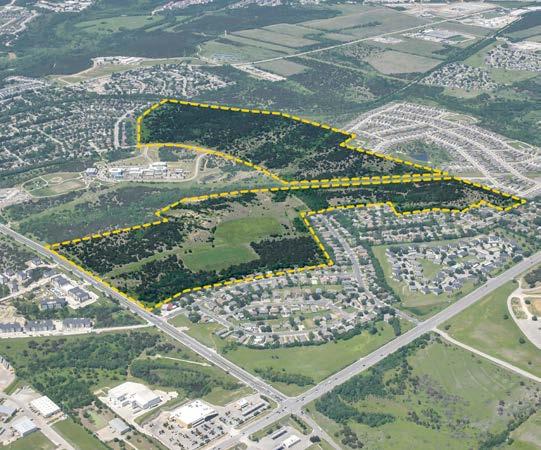
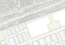
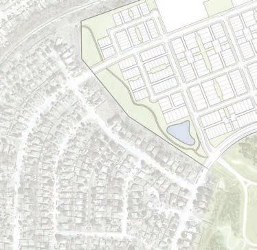
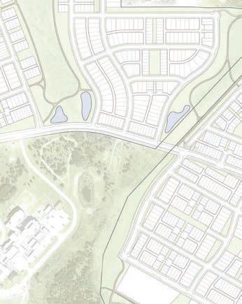
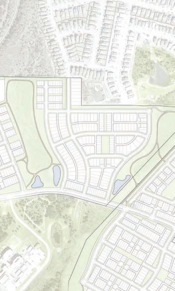
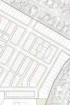
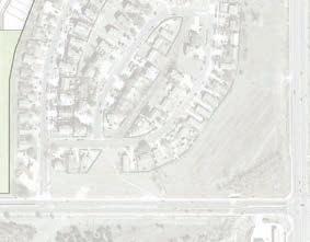
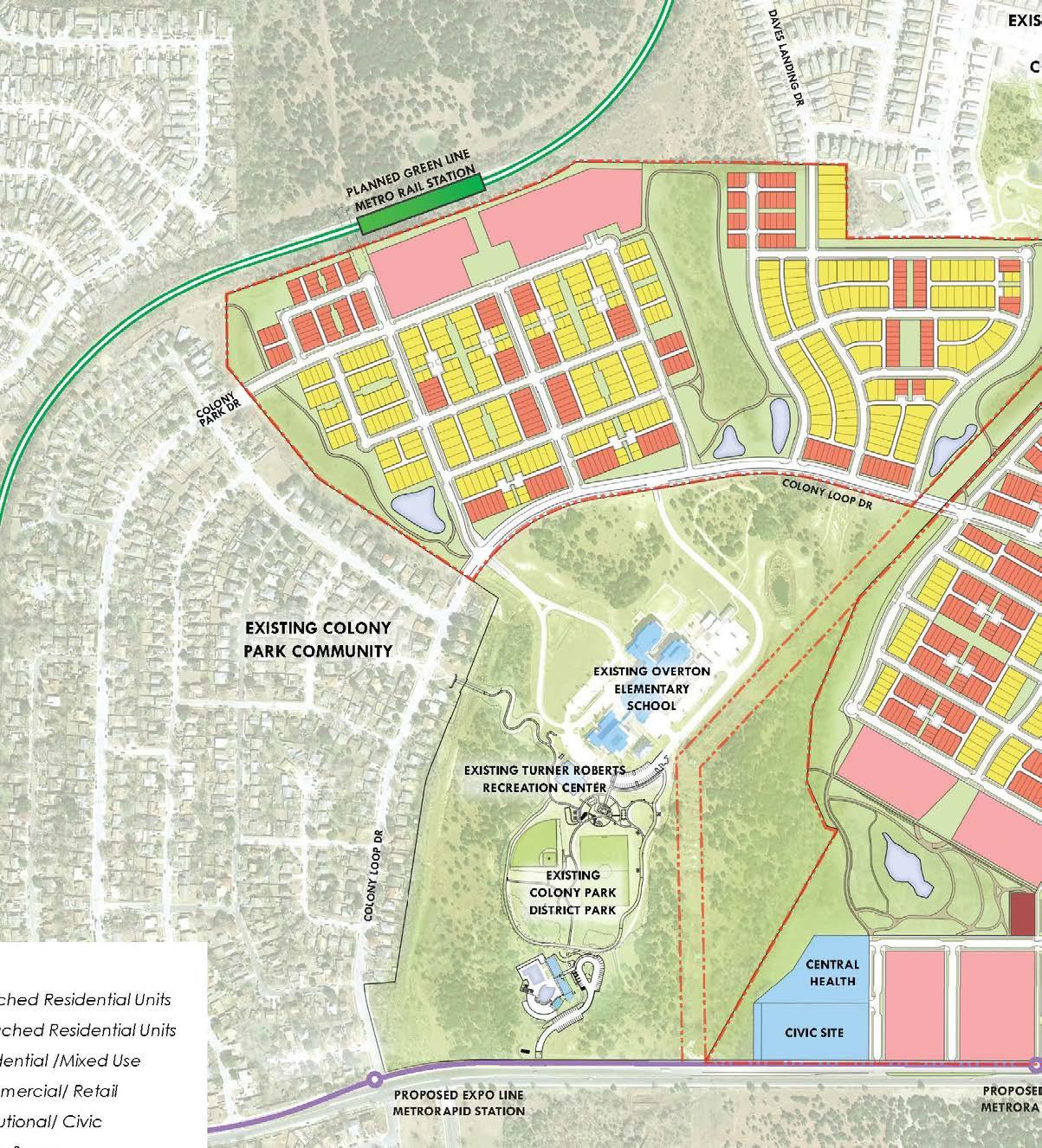
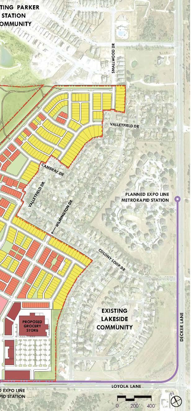
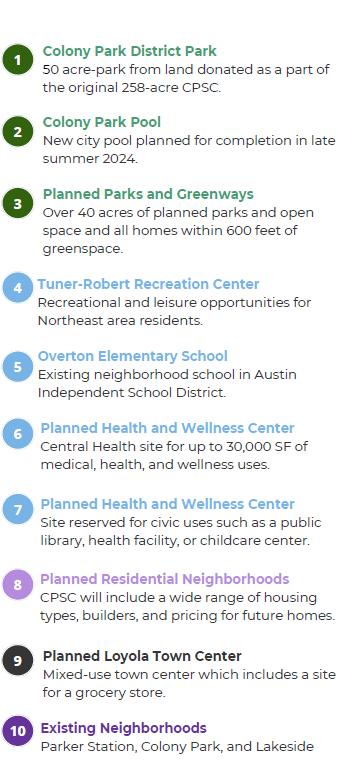
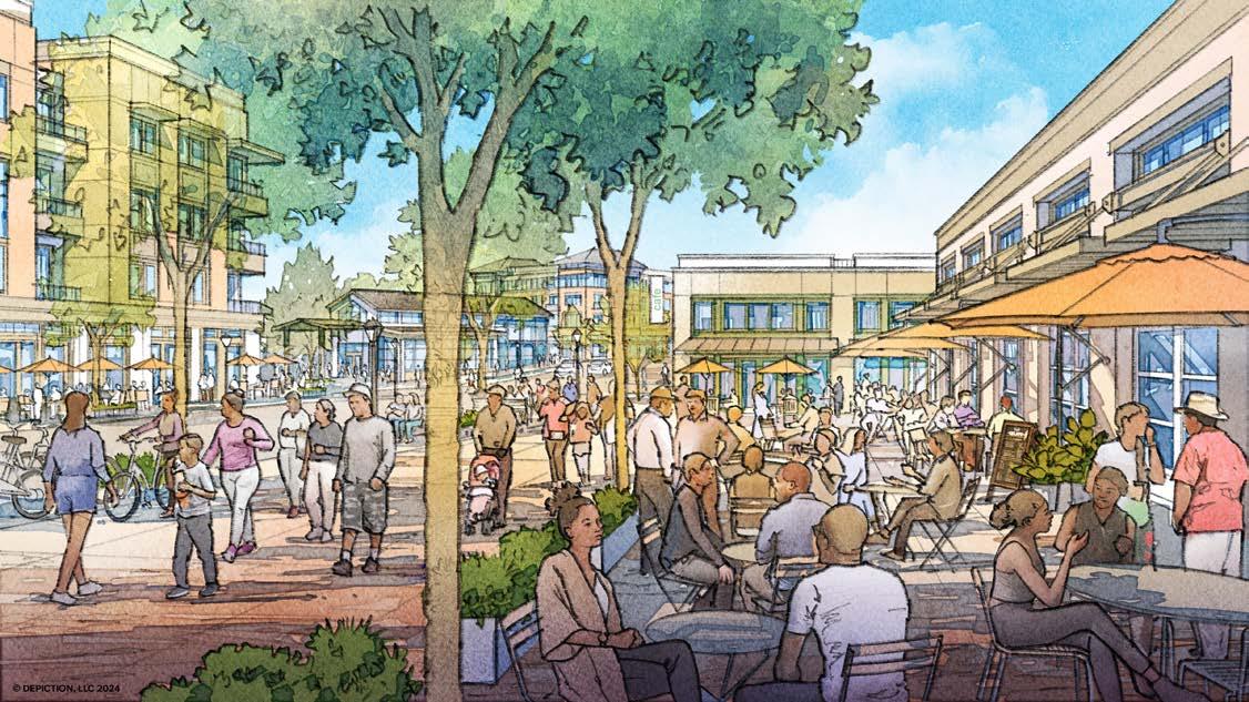
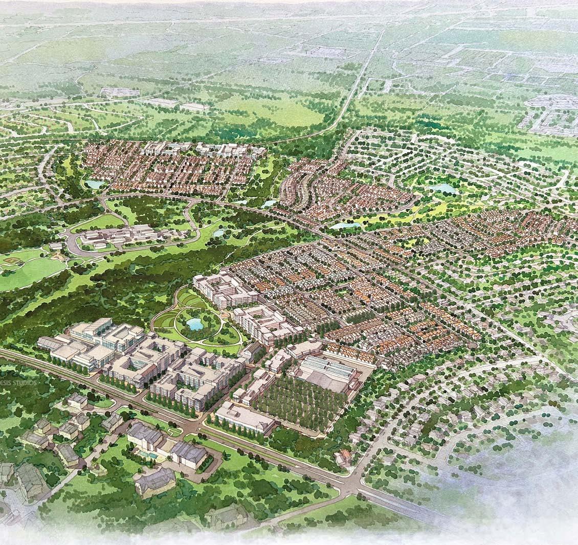
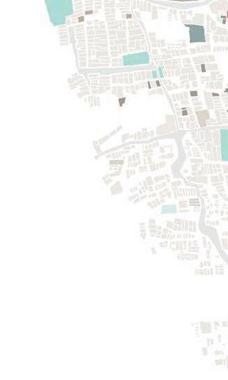
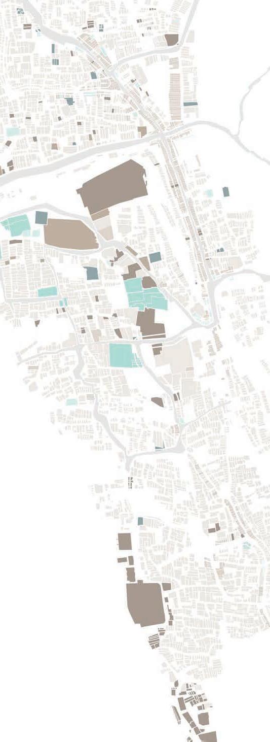
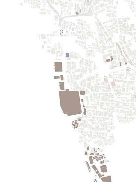
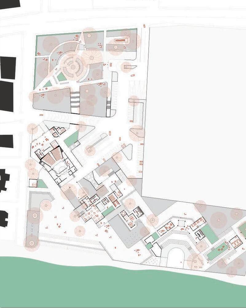
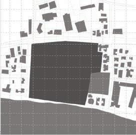
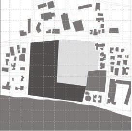
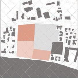
The Colony Park Sustainable Community (CPSC) is a City and community led effort to develop 208 acres of City-owned property in northeast Austin. This vision is captured in the Colony Park Master Plan and Design Guidelines, which includes priorities that will guide the development of the 208 acre City-owned site.
When complete, the Master Planned Community is projected to deliver approximately 1,072 singlefamily homes, 831 multi-family apartments, 230,000 square feet of mixed-use office and institutional space, 130,000 square feet of mixed-use retail space, 53 acres of parks, trails, and open space.
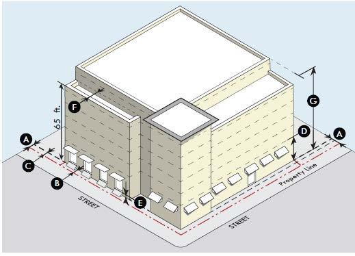
Development within the CPSC is governed by the PUD zoning adopted by the Austin City Council on November 30th, 2023, which describes the allowable land uses within each of the five neighborhoods and districts of the community and the corresponding site development standards including building height, setbacks and impervious cover.
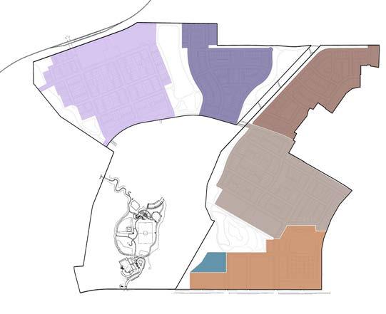
VALLEYFIELD
SMALLWOOD
LOYOLA
DECKER
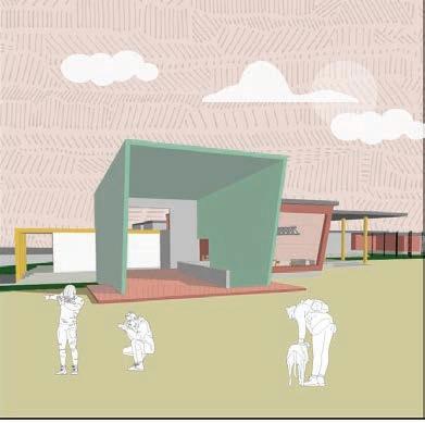
Turner-Roberts Recreation Center
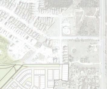
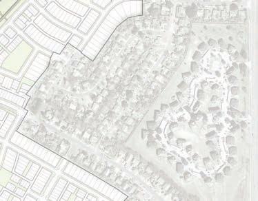
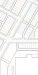
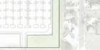
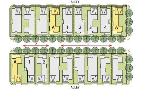
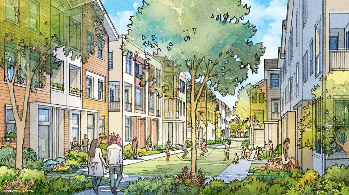
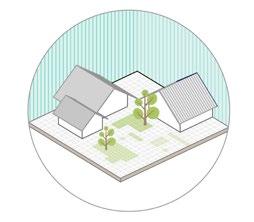
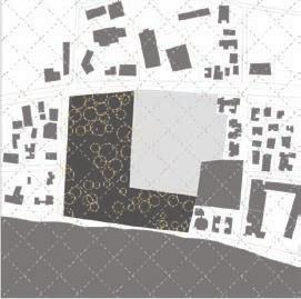
The CPSC Framework Plan and the Design guidelines describe the form, design and treatment ofbuildings and their relationship to the streets and public spaces of the new community. The goal of these guidelines is to promote well-scaled and articulated buildings that contribute to the urban “town scale”, interest and vitality of the Colony Park Sustainable Community.
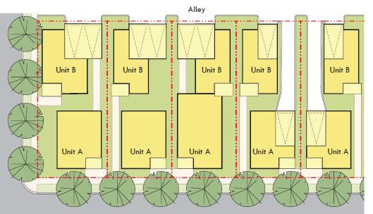
A rich variety of single-family housing types is permitted within the four neighborhoods north of Loyola Town Center. These include detached yard houses that are both front and rear-loaded, zero lot line homes, row houses, rowhouse courts, cottage courts, and two-unit residential homes. Accessory dwelling units (ADUs) are permitted on both yard house and row house lots.
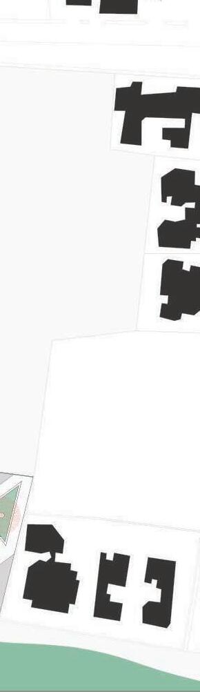
Diagrams depicting guidelines for mixed-use, multifamily developments
Diagrams depicting guidelines for single-family developments
source: McCann Adams Studio & Depiction LLC
source: McCann Adams Studio & Depiction LLC
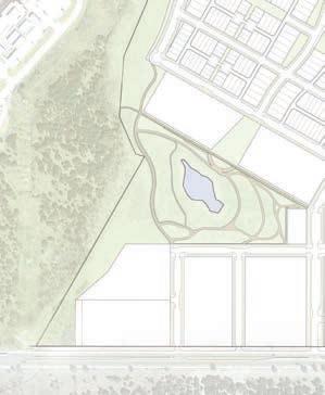
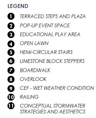
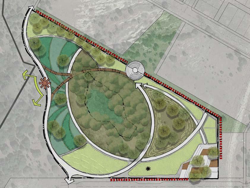
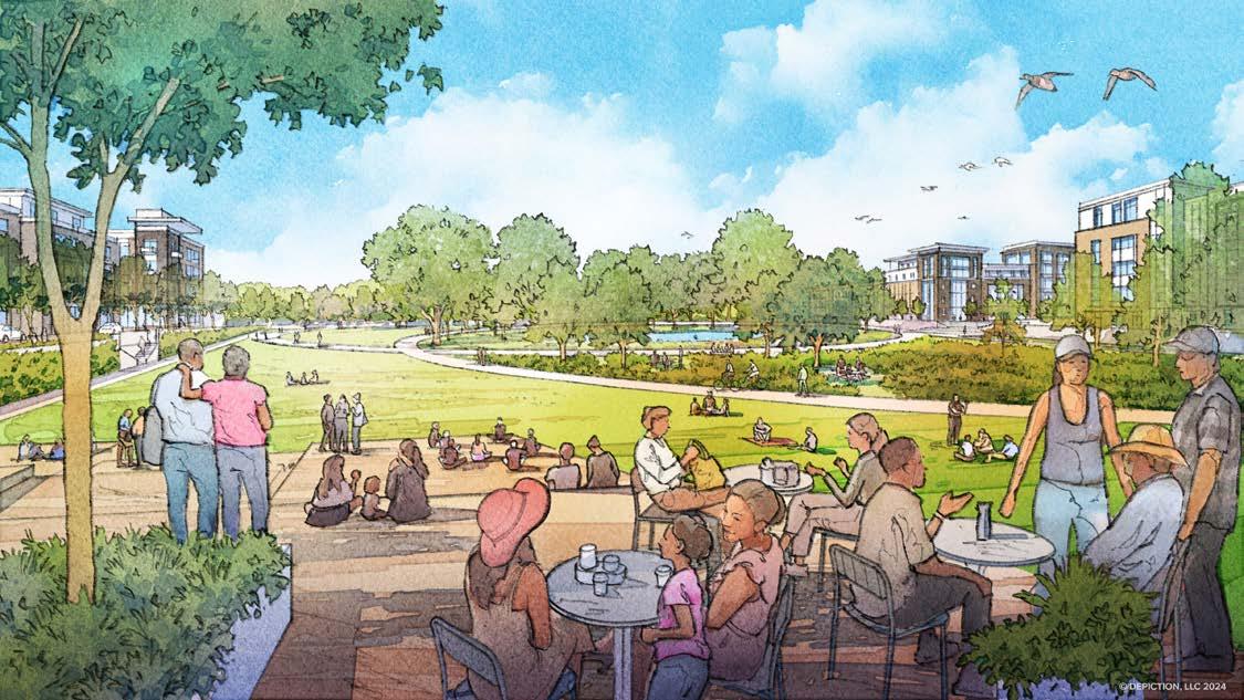
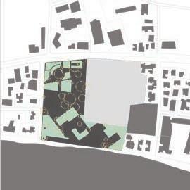
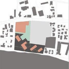
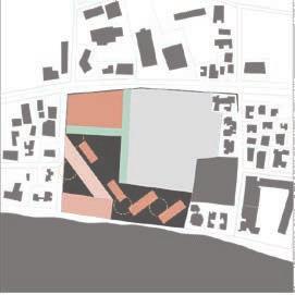
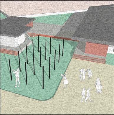
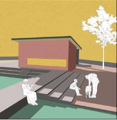
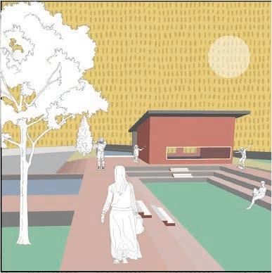
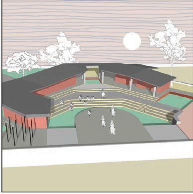
The Colony Park Sustainable Community presents a unique opportunity to develop a system of diverse parks and open spaces that will play an important role in creating the community’s identity. They will act as a critical complementary piece to the buildings and streetscapes that is needed for a compelling, liveable, and sustainable urban development.
source: McCann Adams Studio, Rvi Planning & Depiction LLC
Plan for Loyola Town Center Park
source: RVi Planning
source: McCann Adams Studio, Rvi Planning & Depiction LLC
Project Team
Client Contribution
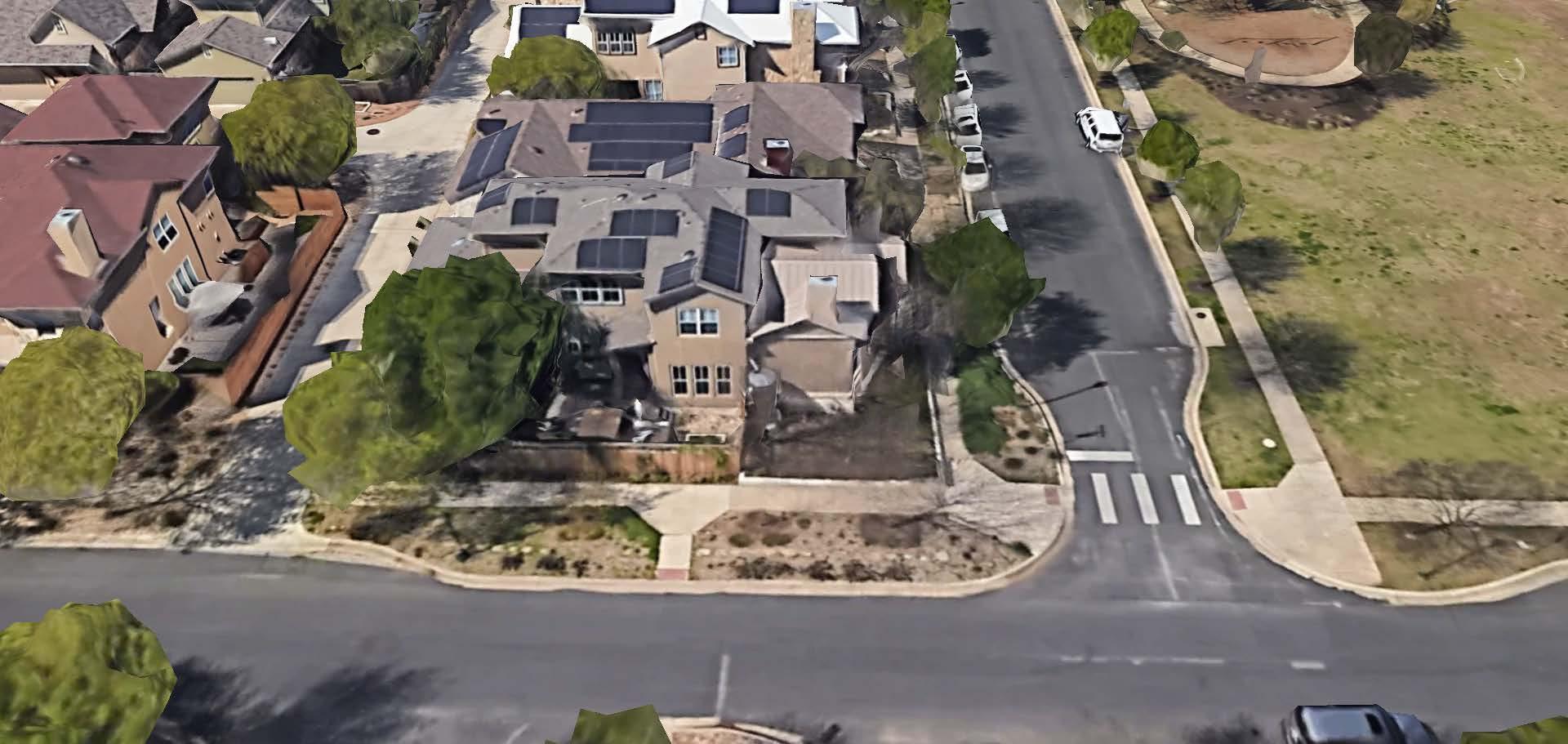
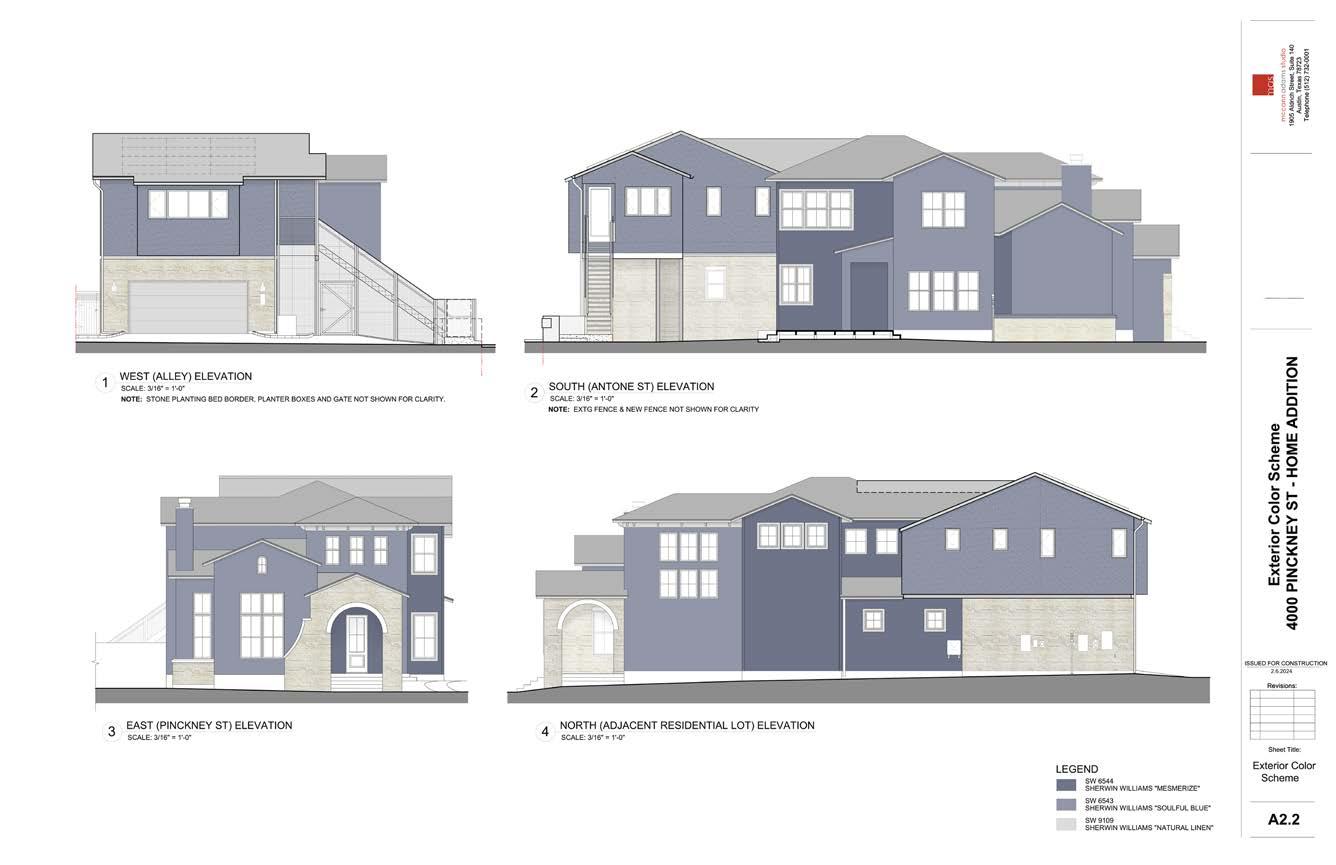
4000 PINCKNEY ST - UNIT B
MCCANN ADAMS STUDIO
Jana McCann, Mudita Bilay
Jim Adams & Jana McCann
Architectural Construction Drawings for City of Austin Permit and Site Coordination
AutoCad
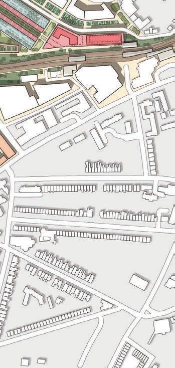
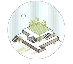
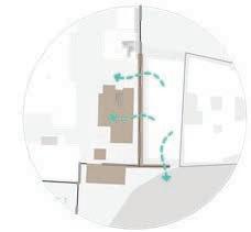
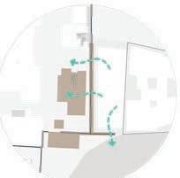
The Project is the addition of a 597 sq. ft. second dwelling unit located above the existing 2-car garage of the existing single-family unit; and a 42 sq. ft. closet addition for the existing main unit. The additional dwelling Unit contains a studio/home office, kitchen, bath and closet. An exterior stair and landing provide access to this addition from the rear of the lot along Antone Street. The stair has a vertical vine trellis/fence enclosure along the rear, alley-side, replacing the existing fence.
ANTONE STREET
PINCKNEY STREET
Second Floor Electrical Plan
Studio mentors Collaborators
Software used
GREENING GREENWICH
THE UNIVERSITY OF TEXAS AT AUSTIN
Simon Atkinson, Robin Abrams
Aubry Klingler, Sabbir Ahmed, Yuhe Xiao
AutoCad, Illustrator, Indesign, Sketchup, Photoshop
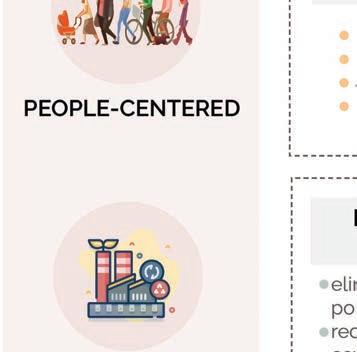
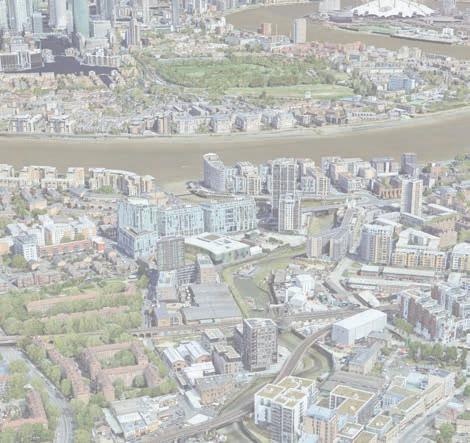
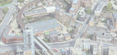
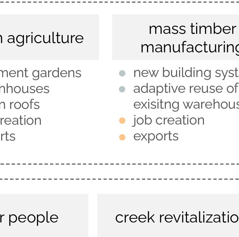
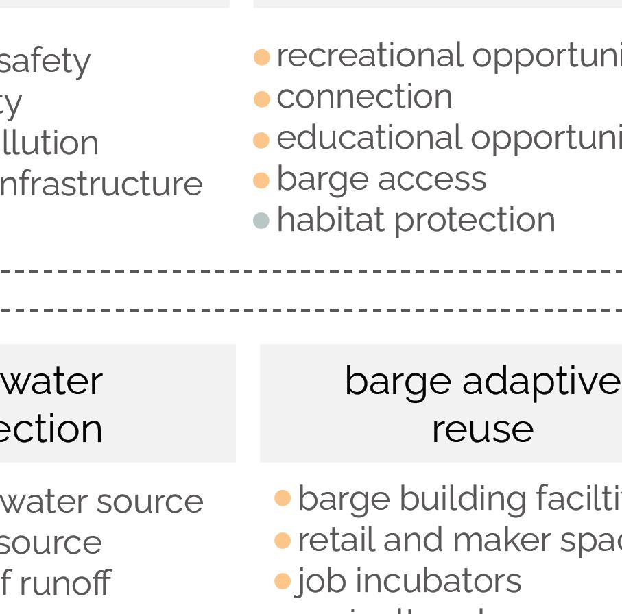
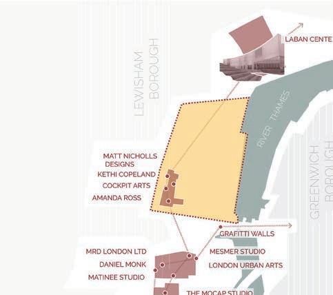
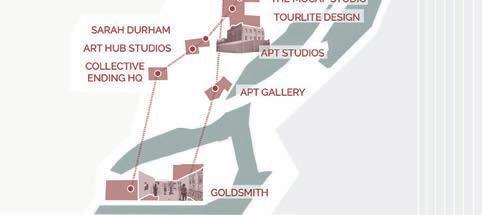
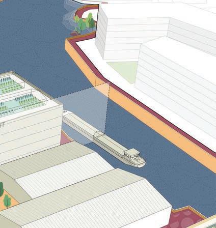
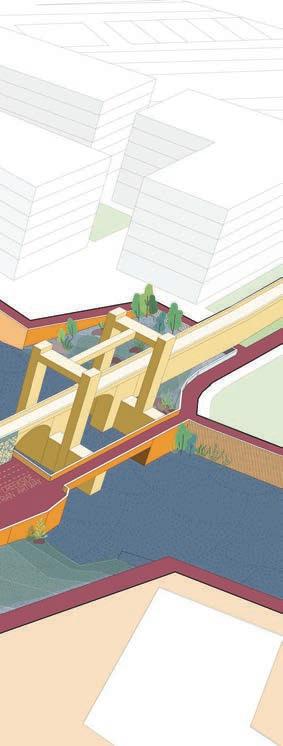
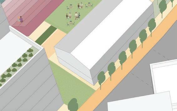
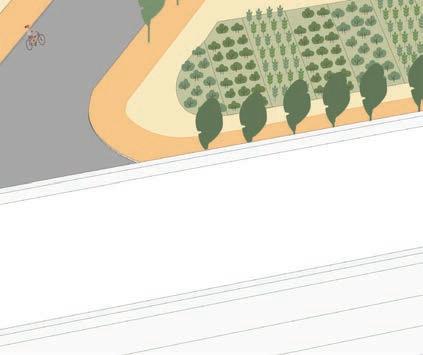
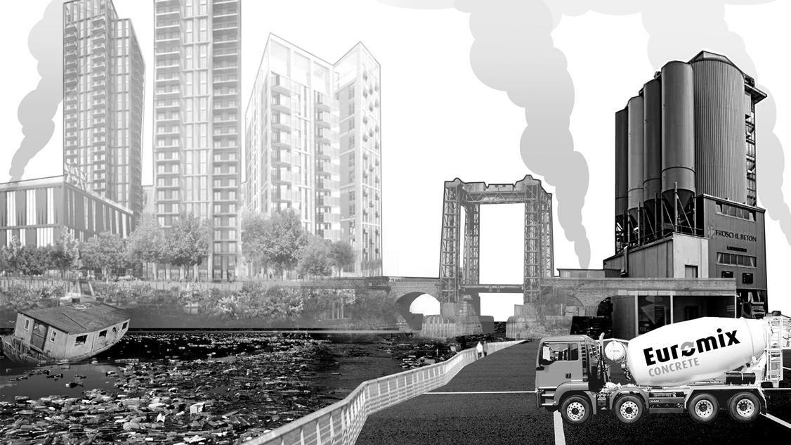
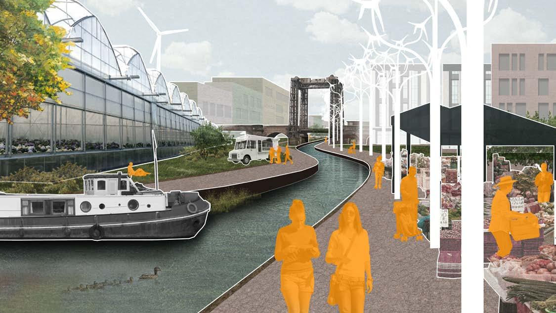
Deptford Creek, in the southeast London, between the boroughs of Greenwich and Lewisham, represents an important but often overlooked part of London’s character – the industrial side of citya grungy, creative, working-class side that is just as integral to the city. This Industrial character and its history along the river was revisited for this former hub of innovation and production resulting in a number of people, production and sustainabilityoriented strategies to truly recapture that vibrant, innovative, and undeniably east-London spirit.
LIGHTRAILTOLEWISHAM
CREEKSIDE
NORMANROAD
RIVER THAMES
CANARY WHARF
DEPTFORD HIGH STREET
DEPTFORD BRIDGE
DEPTFORD
GOLDSMITHS
CREEK ROAD
LIGHT RAIL TO CANARY WARF
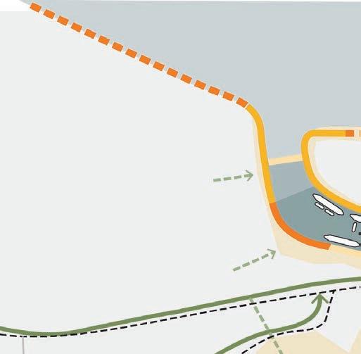
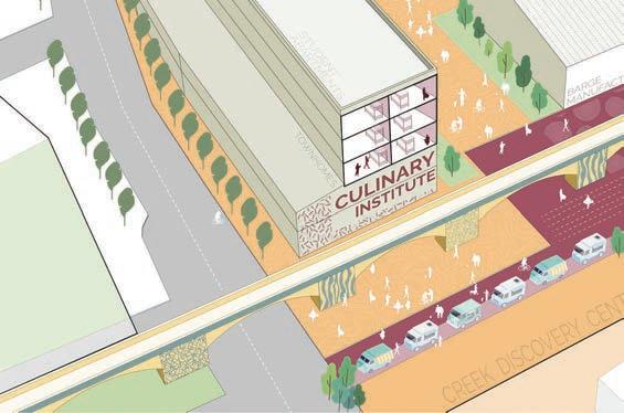
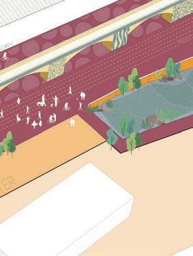
There are several important arts institutions along the left bank of the creek. The Barge manufactory connects many such institutions and old warehouses, becoming almost like a missing tooth in what could potentially become a small arts district.
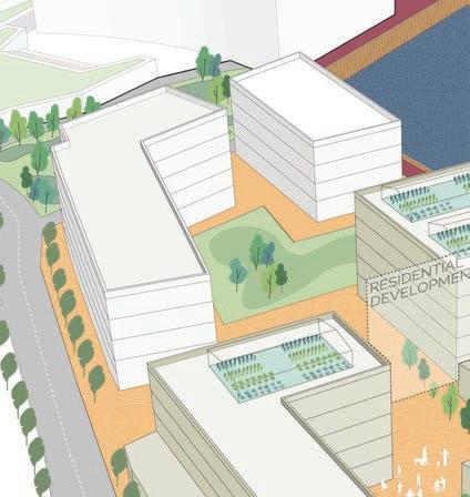
This area houses some large warehouses in relatively good condition, which were repurposed to accomodate barge building facilities. These, when they reach their end, can be redeveloped, with the street-side of the property to become a culinary arts institution which partners with the urban greenhouse operations. Students at the culinary school could also find housing here.
View of the Arts District
Deptford creek may be under threat now – from things like pollution, from cars, and from thoughtless development. But it has a brighter, greener future ahead of it, a future that will recapture that vibrant, innovative, and undeniably east-London spirit. “ “
repurposing warehouses
Studio Mentor
Professional Mentors
LOST IDENTITIES
UNIVERSITY OF MUMBAI
lost identities .undergraduate thesis .professional .individual
Academic Guide : Krishnan V. Professional Guides : Debashish Nayak, Saswat Bandhopadhyaya
Site: Bharuch, Gujarat, India
Krishnan V. Debashish Nayak, Saswat Bandhopadhyay
Softwares used
ArchiCAD,
Status : Phase 1 completed. Budgeting and tender approvals ongoing for other phases. The following project was included as a part of the 6-site proposal.
Cinerender, Photoshop, Indesign, Illustrator
Urban insert | community programming tourist interface | conservation | adaptive reuse
Software used : ArchiCAD + Cinerender, Photoshop, Illustrator, Indesign, AutoCAD
lost identities .undergraduate thesis .professional .individual
Academic Guide : Krishnan V. Professional Guides : Debashish Nayak, Saswat Bandhopadhyaya
Site: Bharuch, Gujarat, India
Status : Phase 1 completed. Budgeting and tender approvals ongoing for other phases. The following project was included as a part of the 6-site proposal.
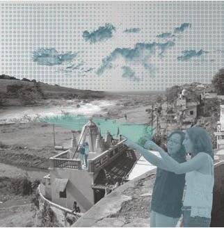
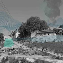
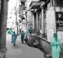
River Narmada and the holy city of Bharuch have experienced centuries of cultural and infrastructural transition. Despite being thoroughly documented in religious archives, and local folks passing down the stories of past over the generations, little has been done to preserve and celebrate the reminders of the past.
Urban insert | community programming tourist interface | conservation | adaptive reuse
Software used : ArchiCAD + Cinerender, Photoshop, Illustrator, Indesign, AutoCAD
The City life of the acropolis once flanked the river. Today, it lies neglected, misused and forgotten, and is almost on the verge of turning into a necropolis. The Design Dissertation studies the depleting urban fabric of the historic Bharuch and tries to repurpose the remains to reflect the 20th Century Identity of the City.
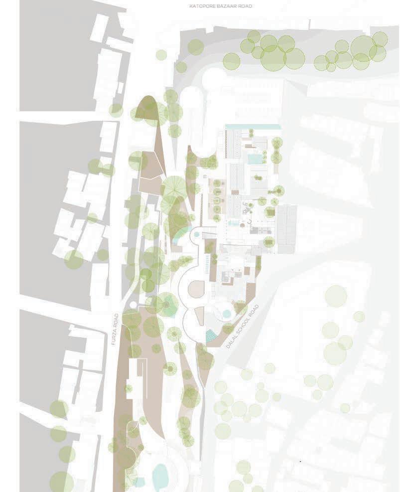
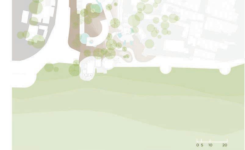
| THE BRIDGE : SITE AND THE RIVER
The city of Bharuch has experienced about 2000 years of cultural and infrastructural transition, recorded through the old town and existing literal archives to discover several undocumented paths in history. Despite a strong cultural presence, the city has no identity of its own.
The city evolved along the River Narmada, and laced public spaces network along the river edge, which experience disuse today. The public spaces and the heritage district are on a verge of turning into a necropolis within the acropolis. The research addresses the depleting urban fabric by repurposing and inculcating a thought towards an identity of the city.
The city of Bharuch has experienced about 2000 years of cultural and infrastructural transition, recorded through | THE BRIDGE : SITE AND THE RIVER
OLD COURT (1850)
JAMA MASJID
KATOPORE BAZAAR (1850)
FORT WALL & PORT (1850)
CIVIL HOSPITAL (1850)
BEGUM WADI (1850)
SARDAR MANZIL (1850)
ORTHODOX CHURCH
FIRE TEMPLE
POL HOUSES OF BHARUCH
R. D. LIBRARY & BHARUCHA HALL (1850)
OLD POL HOUSES
JAIL PREMISES (1890)
OLD PARSI AGIARI
There is a need to introduce a program that revives the site barring the set schedules of the community. The area experiences little or no footfall even during the day. Additionally, illegal activity one site renders the site inaccessible.
STRENGTH OF THE SITE
▪ architectural value of the context
▪ library and school
WEAKNESS PRESENT
▪ inaccessible buildings and illegal activities
STRENGTH OF THE SITE
▪ existing landscape for green pockets
WEAKNESS PRESENT
▪ inaccessible space for the specially abled
▪ illegal activities
▪ informal settlements, unhygienic conditions
Rooms for Repose
1 Provides a resting area for the visitors from the ‘heritage walk’.
2 Experiencing the re-adapted built mass from a fresh perspective.
3 Curating different cultural activities for complete tourist experience of the place.
Clusters of Contemplation
1 A Visual informative conclusion comparing a before and after phase of the built mass covered in the ‘heritage’ walk.
2 Establishing a narrative between visitors and locals.
Interpreting new identities
1 Rekindling the human - river connection.
2 Create seamless circulations around the landform and the retained built mass..
3 Spaces simulate thoughts through reminiscing and encourage to form new perspectives for the place.
MASTER PLANNING DIAGRAMS
plazas and quandrangles buffers along the set routes of community
valley as a green breathing lung of the area
decongesting katopore bazaar remniscing memories and imagining new identities
demolishing defunct structures and open the beautiful facade of the library for circulation
footfall during the late hours: ensuring security on site
future urban development : riverfronts
The design utilises the existing Library and the Civil Hospital to open into a quadrangle which houses small conversational pockets.
The amphitheatre celebrates the performing culture of the city and desembles to create another extension of the Water tank Plaza. The Exhausts of the ward tank create interesting patterns for circulation.
The galleries beside the ward tank provide an extension to the ward tank plaza creating a seamless places of activity around the space. Meanwhile, the greenscape directs the user along the fort wall while gradually descending the site.
The galleries culminate the cultural experience through a literal recital of the timeline of the city.The interior space animates throughout the day due to three different skylights.
Clusters of Comtemplation through the Amphitheatre
Interpreting new identities through the Monument of Resilience
Rooms of repose as observed through the Raatri Bazaar
weekday weekend holiday emergency (during social unrest)
weekday weekend holiday emergency (during social unrest)
raatri
raatri bazaar
Studio Guide Softwares used
PARADOX ON THE FREEDOM OF EXPRESSION UNIVERSITY OF MUMBAI
Guide: Krishnan V.
Site: India united mills, Mumbai Architecture design studio 6
paradox on the freedom of expression .academic .individual project
Krishnan V. ArchiCAD, Photoshop, Indesign, Illustrator
commemorative program | urban insert | art and performance platform Software used : ArchiCAD, Photoshop, Illustrator, Indesign, AutoCAD
Guide: Krishnan V.
Site: India united mills, Mumbai Architecture design studio 6
commemorative program | urban insert | art and performance platform
Software used : ArchiCAD, Photoshop, Illustrator, Indesign, AutoCAD | the commemorative setting
EXISTING SITE
The design interpretation analyzes the exclusivity of new proposed program and uses commemoration to imagine a space that truly represents the site context and the people paradox on the freedom of expression .academic .individual project
EXISTING SITE
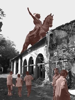
WHAT ITS GOING TO BE -- memorial that commemorates the life and work of Shivaji Maharaj -- supportive functions such as visitor centre buildings, a memorial garden, a library, food court, and convention centre.
WHAT ITS GOING TO BE -- memorial that commemorates the life and work of Shivaji Maharaj -- supportive functions such as visitor centre buildings, a memorial garden, a library, food court, and convention centre.
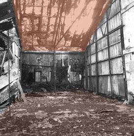
The existing site houses several dilapidated structures of the old mill. Due to weak foundation and structural system, any possible reuse can possess a risk to life.
The existing site houses several dilapidated structures of the old mill. Due to weak foundation and structural system, any possible reuse can possess a risk to life.
The site is to be cleared to incorporate new functions
The site is to be cleared to incorporate new functions
Initially, the mills in the newly independent India represented a platform to express. beyond obvious economic self-sufficiency. The 8-acre land is today imagined as a statue of Shivaji and a musuem.
Initially, the mills in the newly independent India represented a platform to express. beyond obvious economic self-sufficiency. The 8-acre land is today imagined as a statue of Shivaji and a musuem.
The design interpretation analyzes the exclusivity of new proposed program and uses commemoration to imagine a space that truly represents the site context and the people
the commemoration through spaces (circulation)
The program reminisces the freedom struggle and the conditions thereafter. Naturally, the commemoration is done in two parts. Experiences repeat throughout the structure and renders a feeling of deja-vu to inculcate a thought process.
The program reminisces the freedom struggle and the conditions thereafter. Naturally, the commemoration is done in two parts. Experiences repeat throughout the structure and renders a feeling of deja-vu to inculcate a thought process.
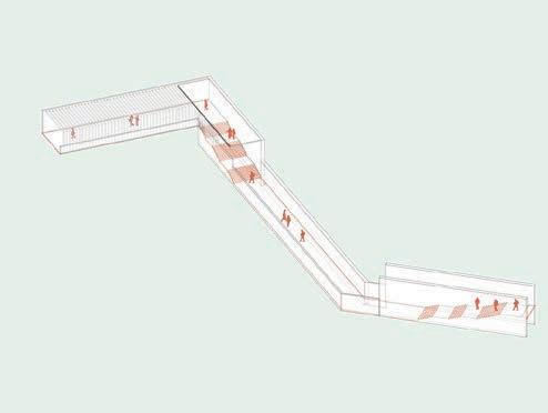
The first memorial directs the user through a palpable sense of supression and liberation
The first memorial directs the user through a palpable sense of supression and liberation
1. Suppression through the long flight of stairs
2. Hope through the flashes of light near midlanding
3. Liberation through the escape route
1. Suppression through the long flight of stairs
2. Hope through the flashes of light near midlanding
4. Repeating and reliving the experience one continues to experience in day to day life depicted emotions of confusion and anxiety.
3. Liberation through the escape route
4. Repeating and reliving the experience one continues to experience in day to day life depicted emotions of confusion and anxiety.
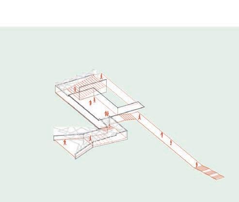
The second memorial directs the user through a intangible confused period.
Each circulation on site culiminates at the plaza. the plaza allows a free area to allow a person
Each circulation on site culiminates at the plaza. the plaza allows a free area to allow a person to think and reflect and form his own opinion.
original 12 acre site without defunct structures.
original 12 acre site without leaving aside 4 acres for future expansions. The rest 8 acres opens a transition area from the
leaving aside 4 acres for future expansions. The rest 8 acres opens a transition area from the built context to the sea.
dividing the site into three different zones : a green zone towards the road for the community; loud and silent zones framing views of the sea
dividing the site into three different zones : a green zone towards the road for the community; loud and silent zones framing views of the sea
identifying vegetation pockets and using the void between those to create programs.
identifying vegetation pockets and using the void between those to create programs.
reducing footprint and accomodating parking needs, adding memorial spaces along the main program.
reducing footprint and accomodating parking needs, adding memorial spaces along the main program.
daylight usage and framing the
Tilting the grid for optimal daylight usage and framing the views of the sea
placing program blocks according to the zones.
devising different circulation paths and piercing through the blocks to reduce the volume of humongous blocks.
devising different circulation paths and piercing through the blocks to reduce the volume of humongous blocks.
Worksheet (1)
04W- Worksheet (1)
BACKYARDS: leisure spaces for the staff
AMPHITHEATRE : incubators of conversation for artists
FOCUS : addressing a larger mass of people PLAY : interacting with a space, light and shadow UNHEARD NARRATIVES : discursion of ideas UNHEARD NARRATIVES : incubator of thoughts
BACKYARDS: seen unseen leisure spaces
THE SEGUE : the breathing lung
MEMORIAL: reminiscing the struggle
PROPORTIONS: changing scales and perceptions
FALSE BACKYARDS: a repose
LIBRARY: food for thought