1 PORTFOLIO 2017-2022
Architecture and Design Mónica S. Piñones Besnier
2
3 CONTENT 4 Curriculum Vitae 6 Senior Living + Additional Programme 20 Sut[egia]: Cultural Center Fundidora Ave. Revitalization Community Center for Musical Arts 34 En Vías a la Biofília Low-income Housing + Neighborhood Regeneration 48 Vasconcelos Complex Mixed Use Complex 58 Celso Piña Cultural Center Community Center for Fine Arts 64 Museum for the Mexican Arts and Culture Museum + Additional Programme 68 Small-Scale Projects Primary School + Single-family Housing 72 Other works
Mónica Sofía Piñones Besnier
19/11/1998
Monterrey, N.L., México
Contact
mspinones@gmail.com +52 8182017094
Languages English French German Spanish (Native)
Software
Autocad 2022 Revit 2022
Photoshop CC 2022 Illustrator CC 2022 Indesign CC 2022 Sketchup 2022 Lumion 2022 V-Ray 2022
Linkedin www.linkedin.com/in/monicapinones
Portfolio
issuu.com/mspinonesarq/docs/portfolioen
Recent Architecture graduate, with special interest on social, sustainable and inclusive design.
Passion for design that not only speaks to emotions and comfort, but also connection, social collaboration and education.
Experience on social service projects, children’s education and play, architectural heritage and urban projects research.
Personal interest in mixed media painting, model making, photography, music, volunteering, travelling and basketball.
curriculum vitae
4
Education
2017-2022
Bachelor of Arts- Architecture Instituto Tecnológico y de Estudios Superiores de Monterrey (ITESM) 2014-2017 International Baccalaureate Prepa Tec Campus Cumbres (ITESM)
Academic Experiences
2021
Catedra Orange Investments Real Estate Development Intensive Course School of Architecture, Arts and Design (ITESM)
Catedra INFONAVIT Social and subsidized Housing Intensive Course School of Architecture, Arts and Design (ITESM)
2022
International Exchange
Exhibitions + Contests
2019 Proyecta: Finalist in Single-Family Housing Design Finalist in Collective Housing Design School of Architecture, Arts and Design (ITESM) 2020 Proyecta: Finalist in Culture and Education Buildings Design School of Architecture, Arts and Design (ITESM) 2021
Catedra INFONAVIT National Contest: 1st Place Institute of the National Housing Fund for Workers (INFONAVIT)
Proyecta: Project “En Vías a la Biofília” C. INFONAVIT Best Overall Project, Best Graphic Representation, Best of Category (Integrative Projects I) School of Architecture, Arts and Design (ITESM)
State Student Biennale: Project “En Vías a la Biofília” Best of Category (Urban Image) College of Architects of Nuevo León
Escuela Técnica Superior de Arquitectura de San Sebastián (Universidad del País Vasco, España)
Catedra Blanca CEMEX: Bachelor Thesis Project
Architectural and Urban Design Intensive Course + Field Trip to Phoenix, Arizona, US.A. School of Architecture, Arts and Design (ITESM)
Work Experience
11/2019-01/2020
Design and rendering Waves Acoustics (Mty, México) 04/2021-06/2022
Research, On-site registry of Architectural Heritage Patrimonio Nuevo León INAH + CONARTE (Mty, México) 03/2022-06/2022
Research and Graphic Content Designer C+Lab Norte (Mty, México)
10/2022-Presente
Urban Design Inspection (Construction y Land Use) General Directorate of Regulatory Control and Surveillance Town Hall Secretary - Government of Monterrey (Mty, México)
12/2022-Presente
Architectural and Interior Design Independent Work (Mty, México)
5
6
Fundidora Ave.
Revitalization
7
Senior Living + Additional Programme
Feb-May 2022 Catedra Blanca 38 With Arch. Roberto Romero & Agustín Landa
VIA OBRERA
Catedra Blanca CEMEX
Project in collaboration with students from Catedra Blanca 38, with a focus on international case studies and field research.
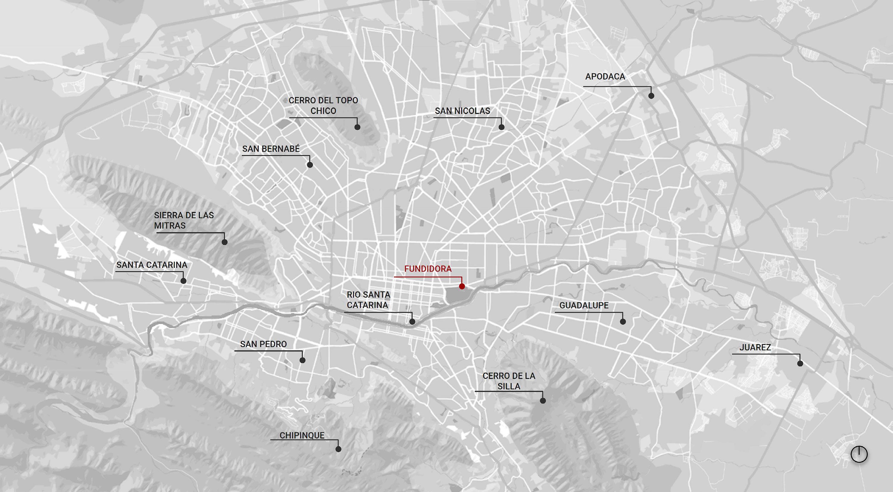
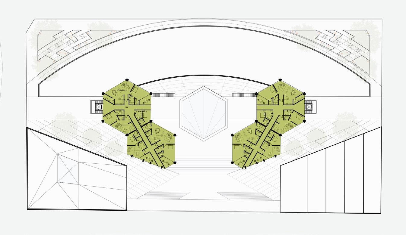
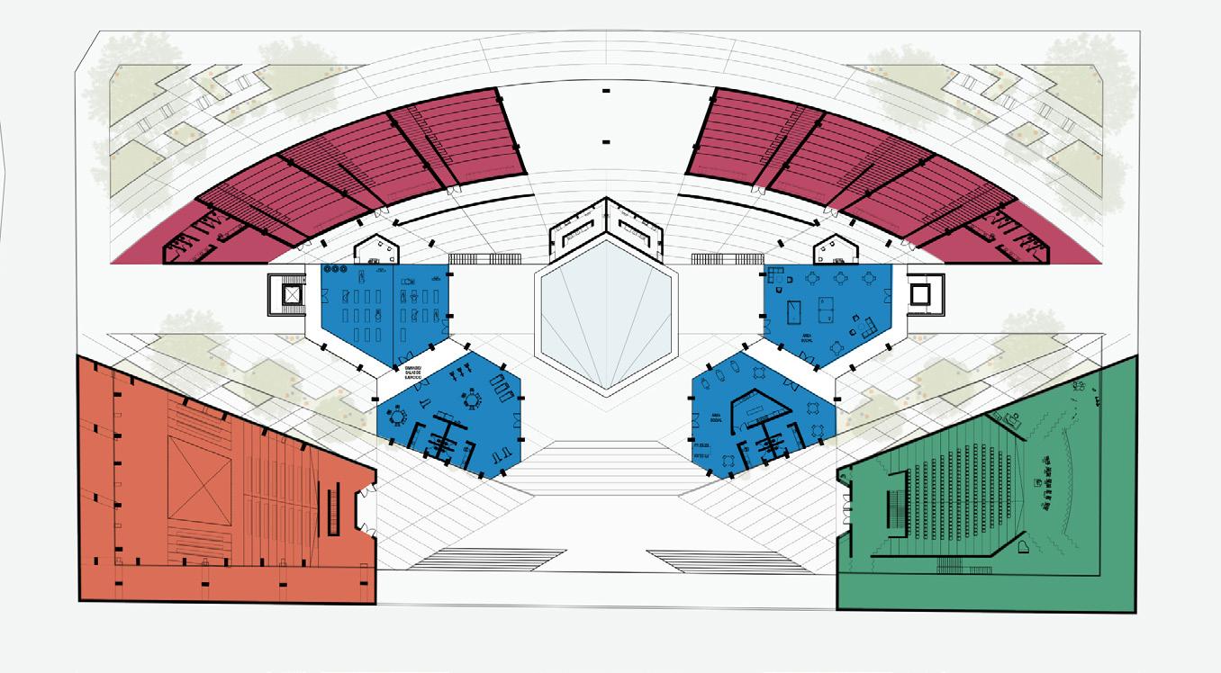
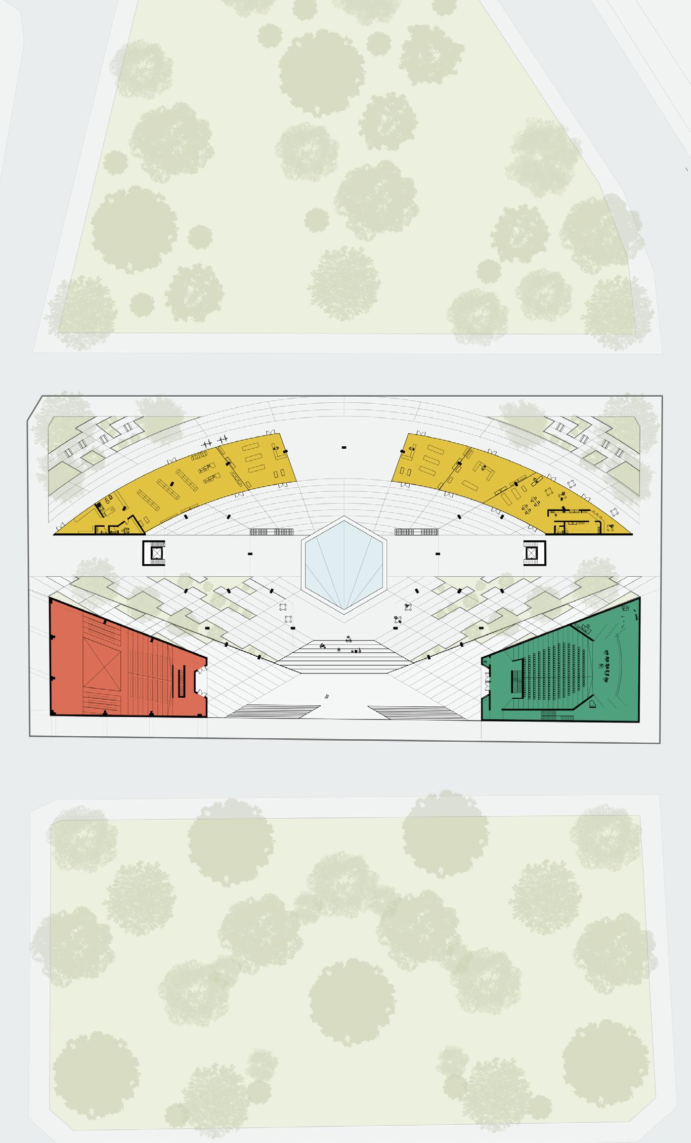
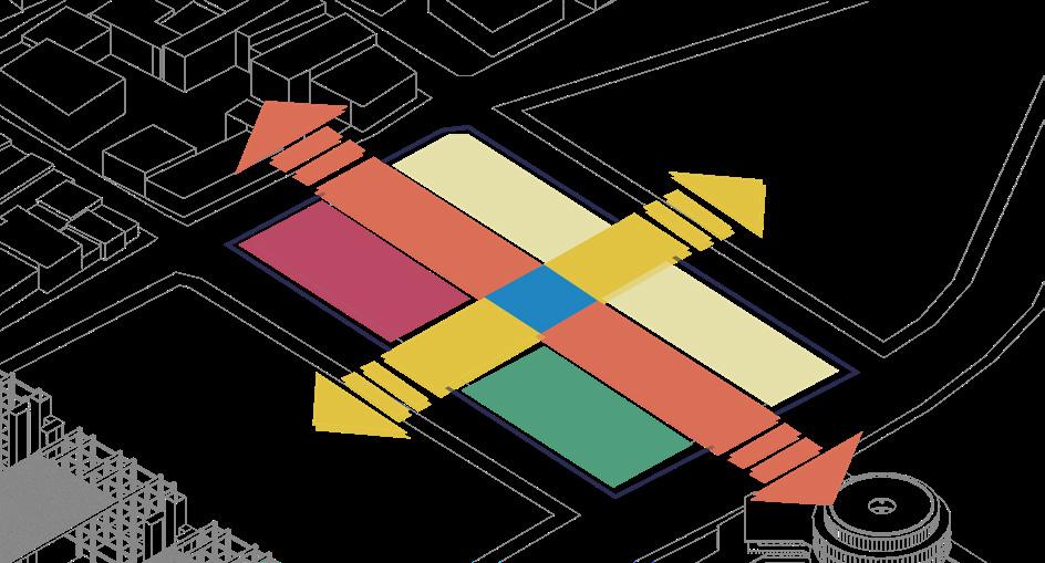
Urban and architectural design proposal based on the discovery of a lack of non-industrial facilities in the Fundidora area, in the City of Monterrey. The mix of new typologies seeks to create a complex full of life that serves as a connector from Parque Fundidora to the rest of the city, in such a way that the activity and existing green footprint permeates to the surrounding neighborhoods. All this with the aim of advancing the city towards becoming a metropolitan city of the future and with more logical and interconnected growth.
8
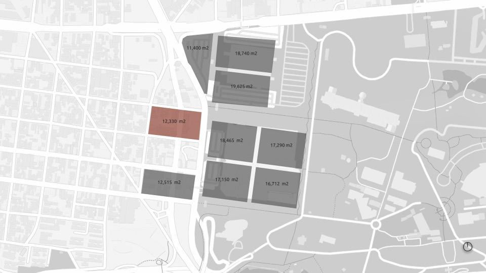
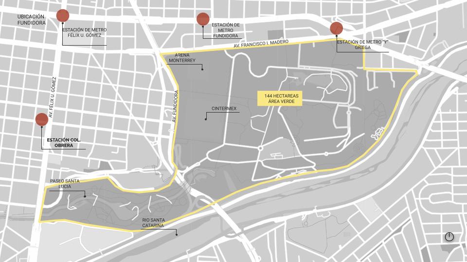
The assigned site is currently located in the limits of one of the city’s oldest neighborhoods called Colonia Obrera, where in the past hundreds of working class families became established as they worked in the nearby factories. Today this space is lined up with industrial retail, carshops and fastfood restaurants that do little to connect with the neighborhood, local commerce, and the Fundidora Park (the largest concentrated hub for culture, sports, green open spaces and entertainment).

9
First Floor
Second
Ground Floor

10
Floor Model Floor
Project Development
The goal is to transform the assigned site into a space with a greater diversity of activities, where the minimum programmatic requirement is the design of housing for the elderly, a temple, an auditorium and a cinema complex.s.
Commercial Space Programme
Supermarket 3 Retail spaces Restaurant/Café
Temple
Auditorium
Cinema Complex
Ammenities
Fitness Center Fitness/Yoga/Pilates Rooms Social spaces Creation and art workshops Medical Clinic Physical Rehabilitation Space
Senior Housing Units 5 unit typologies per level
Modulation
The order of the project is given by the structural design, which is based on a triangular steel frame that is repeated in almost the entire structure of the project with its different variations.
11

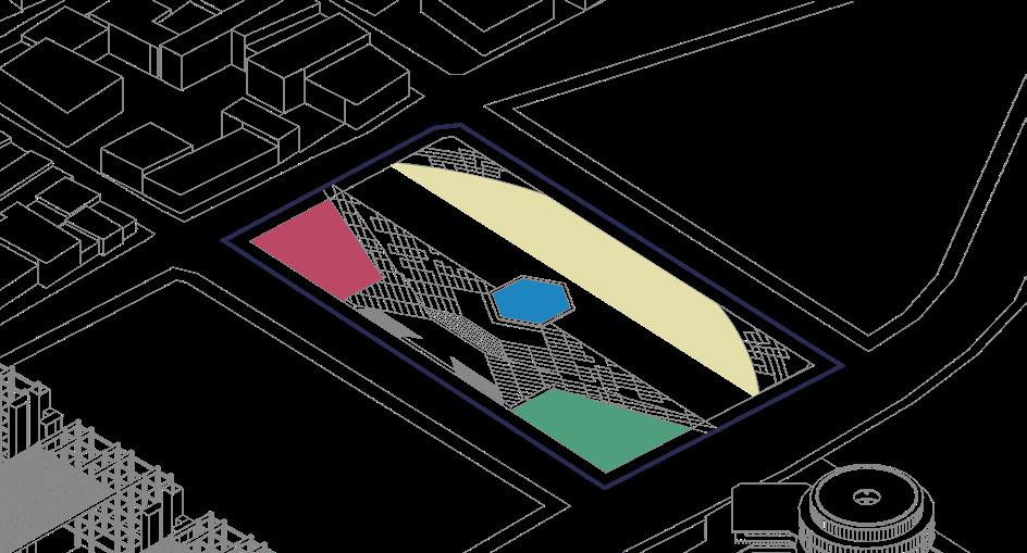

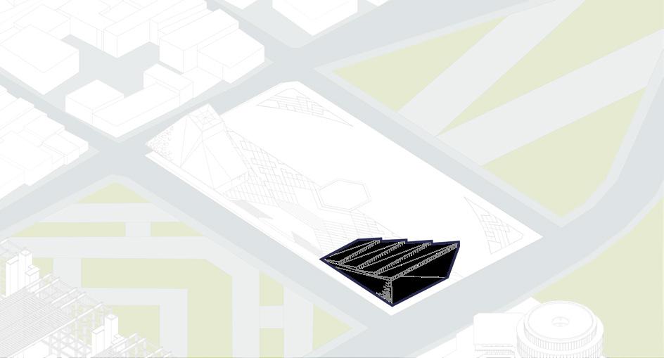

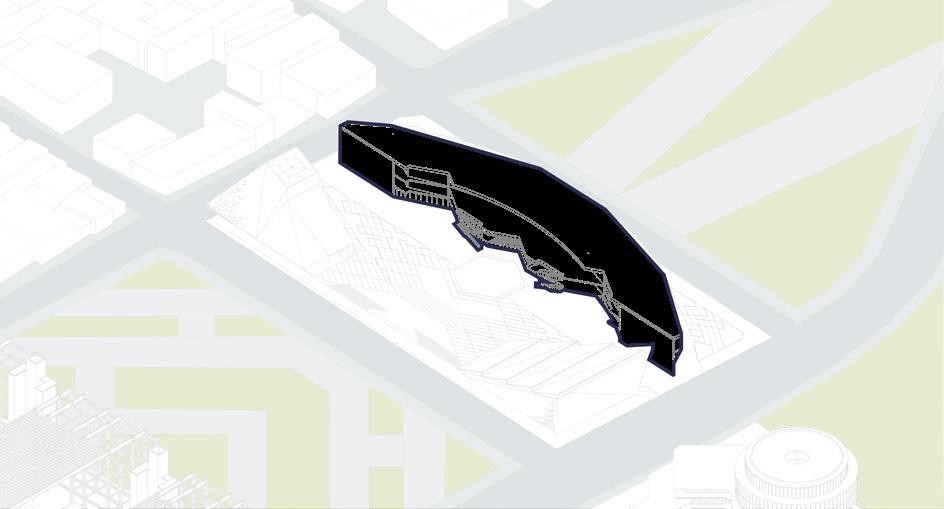
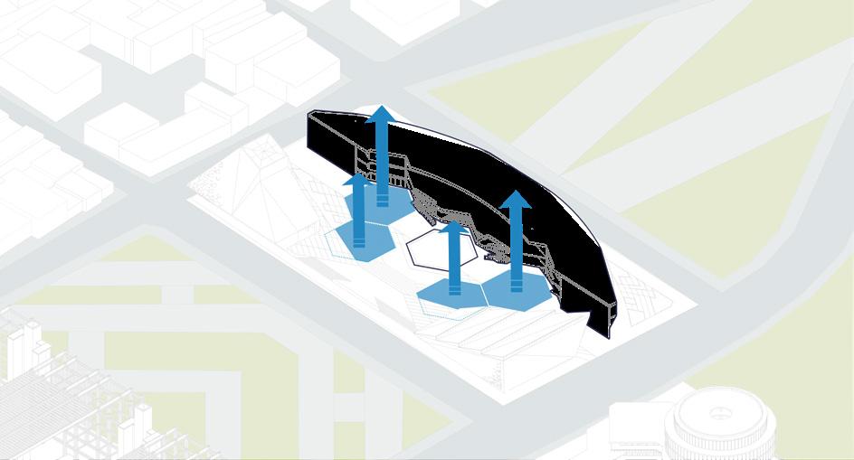
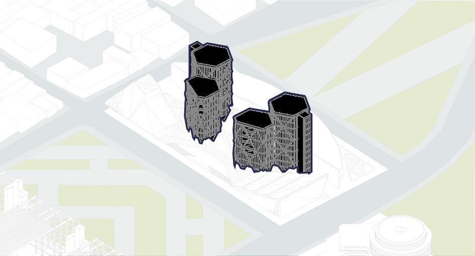
12 1. Site 2.
3.
4.
5.
6.
7. Cinemas and commercial space 8. Architectural survey of senior
towers 9. Housing
amenities Design Process
Definition of guiding axes
Definition of floor and sidewalks from the project’s heart
Temple’s volume
Auditorium’s volume
Definition of commercial building
housing
towers and

13 Complex Isometry
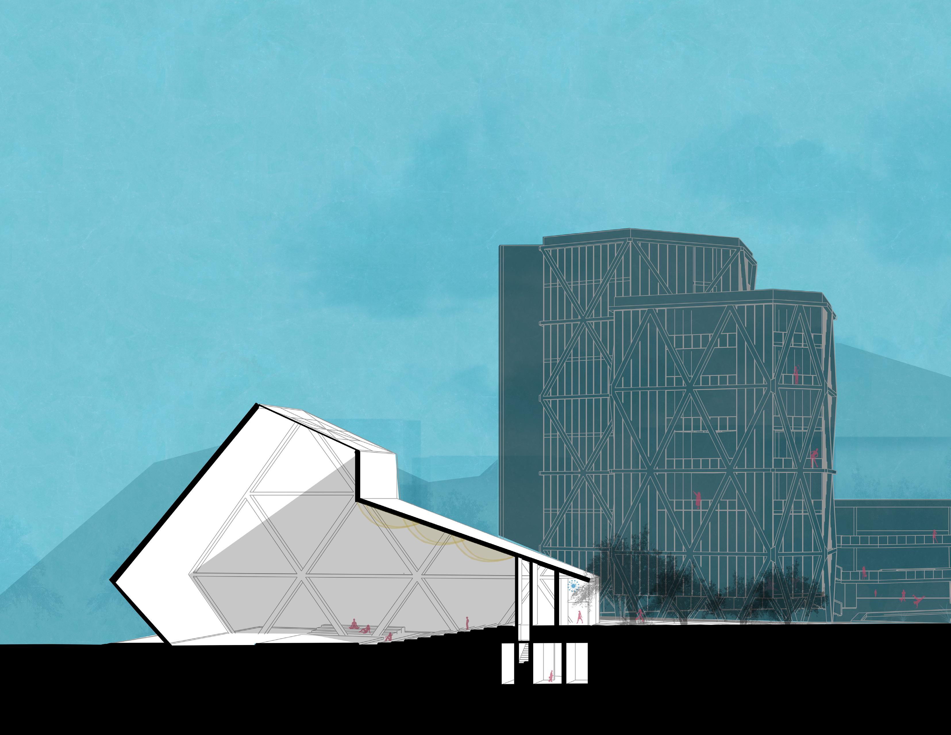 Temple
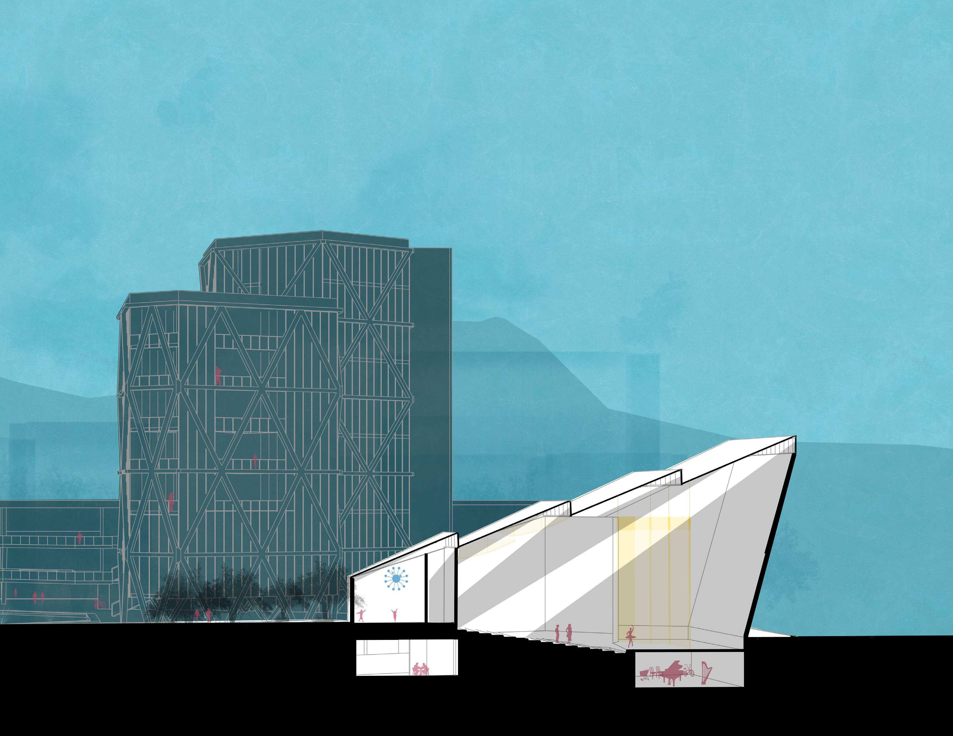 Auditorium
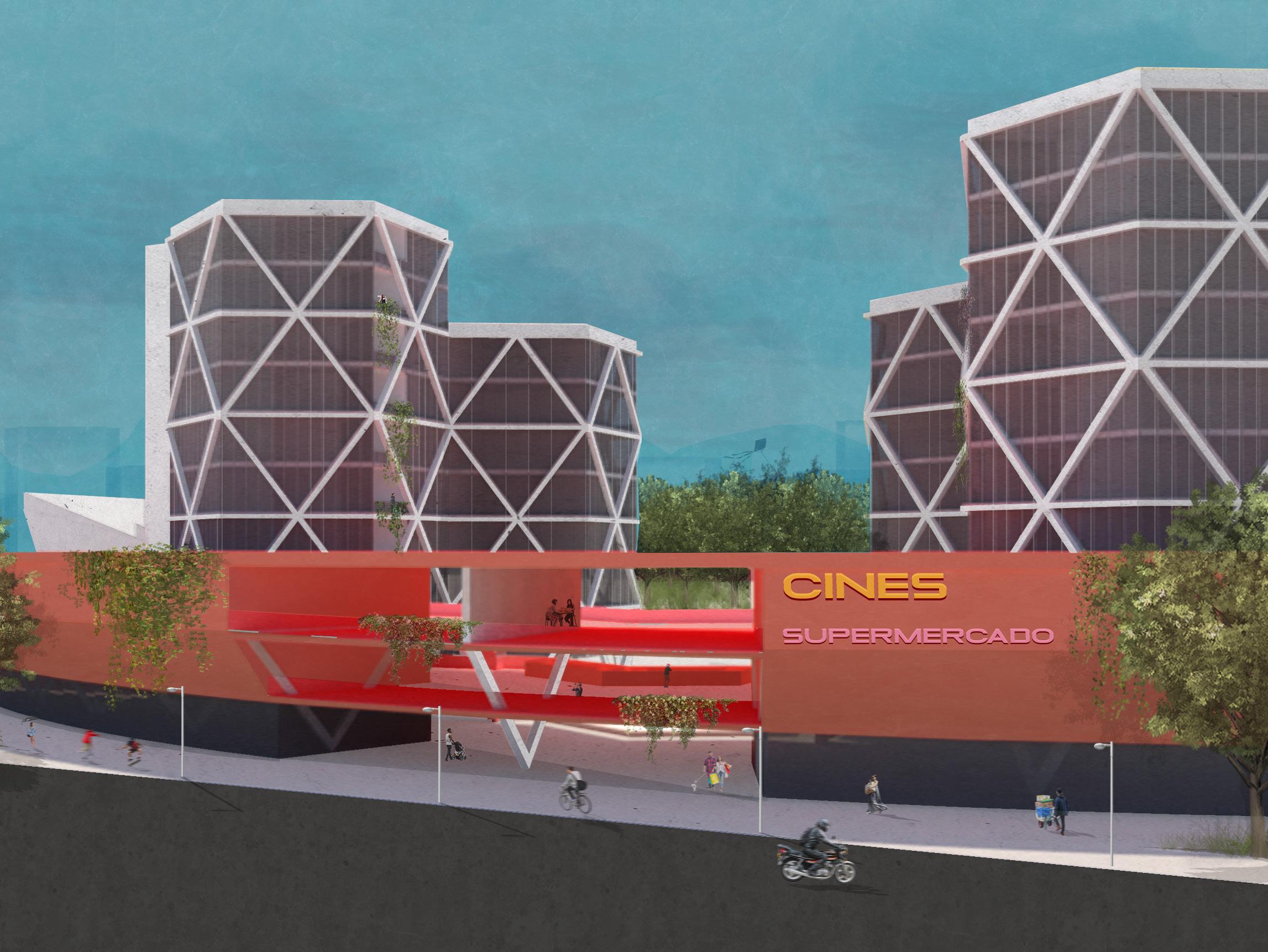
16
Carlos Salazar Ave. Facade
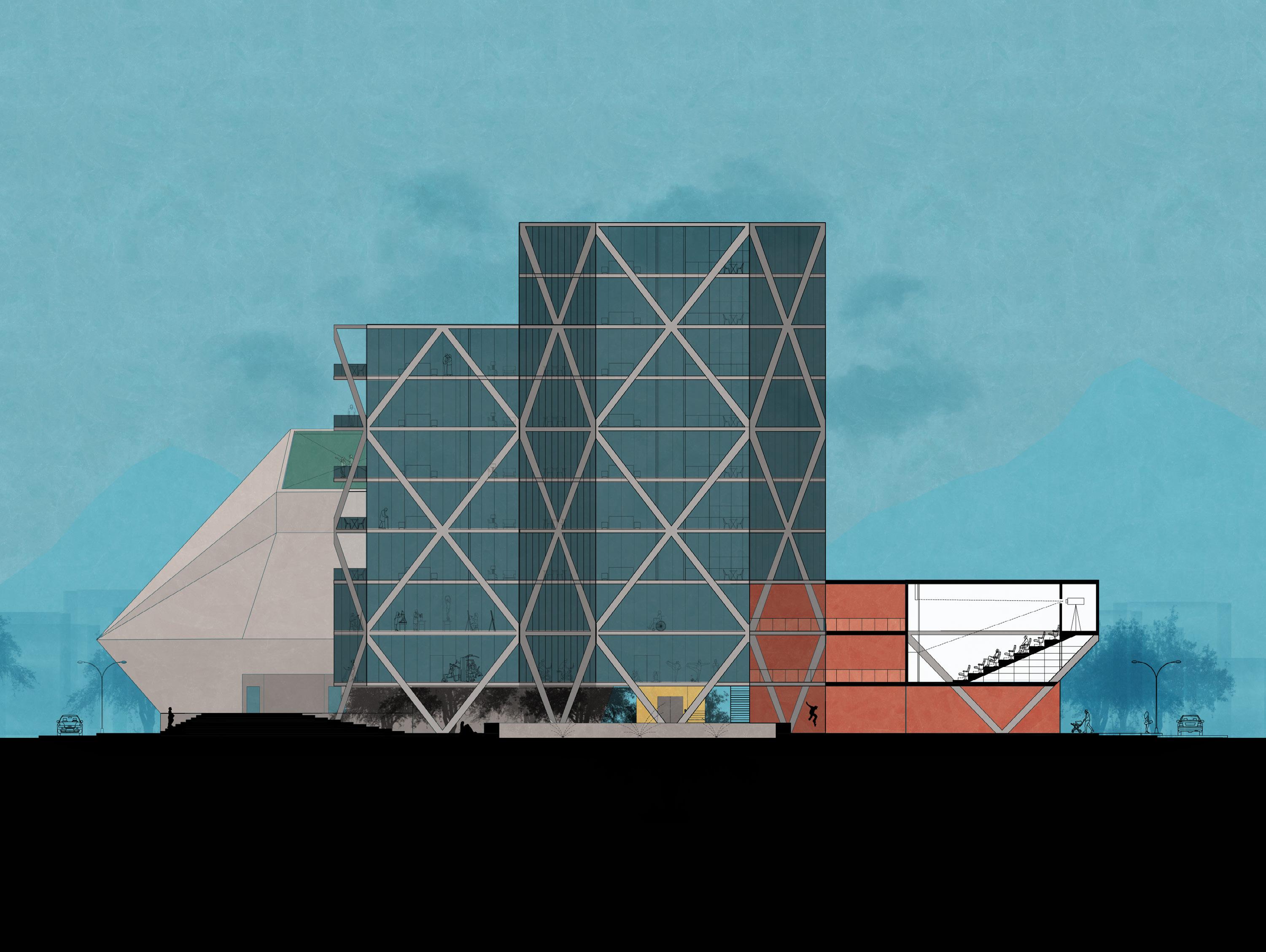
17
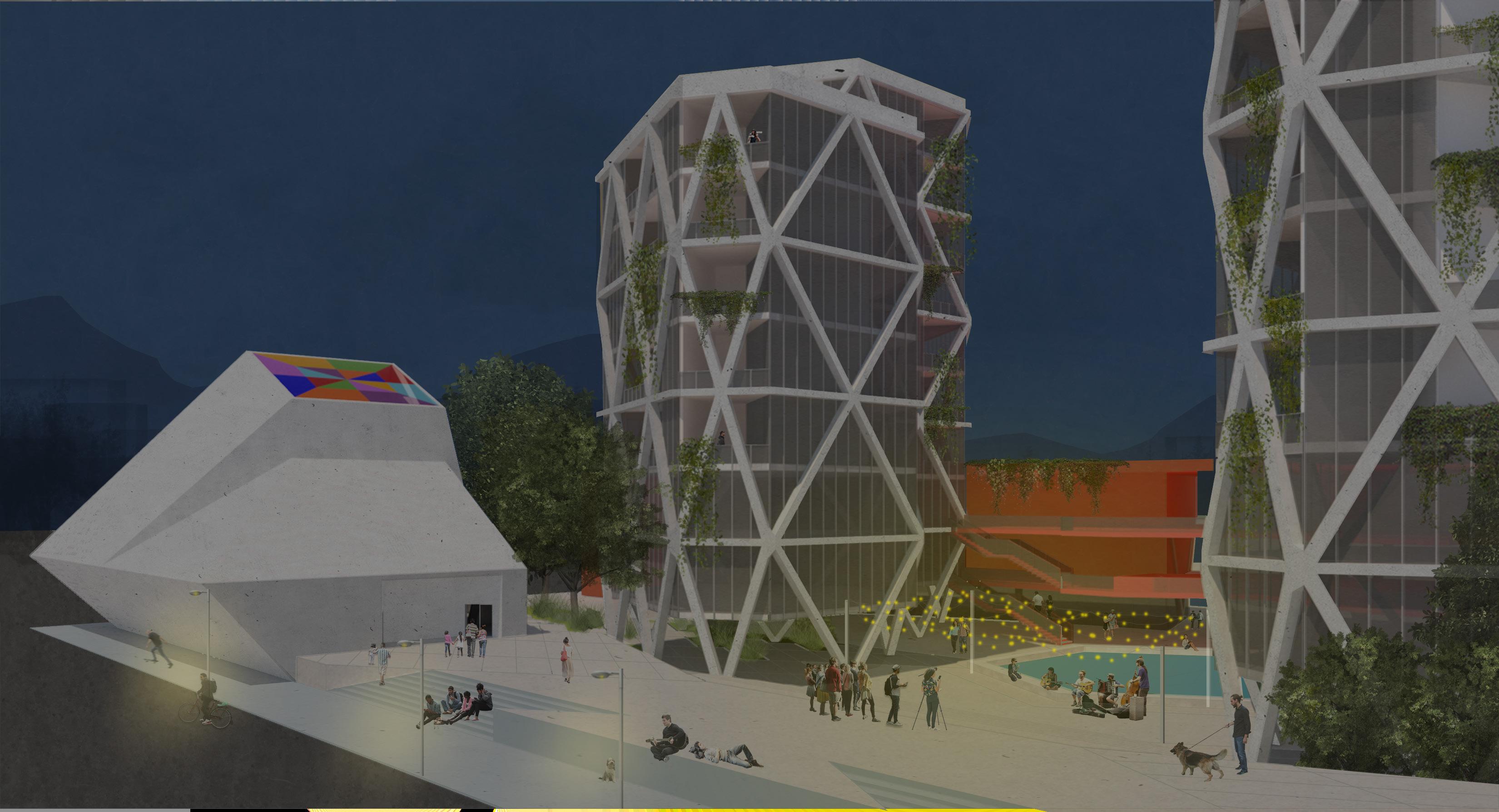
Cinema Complex
Central Plaza
Temple
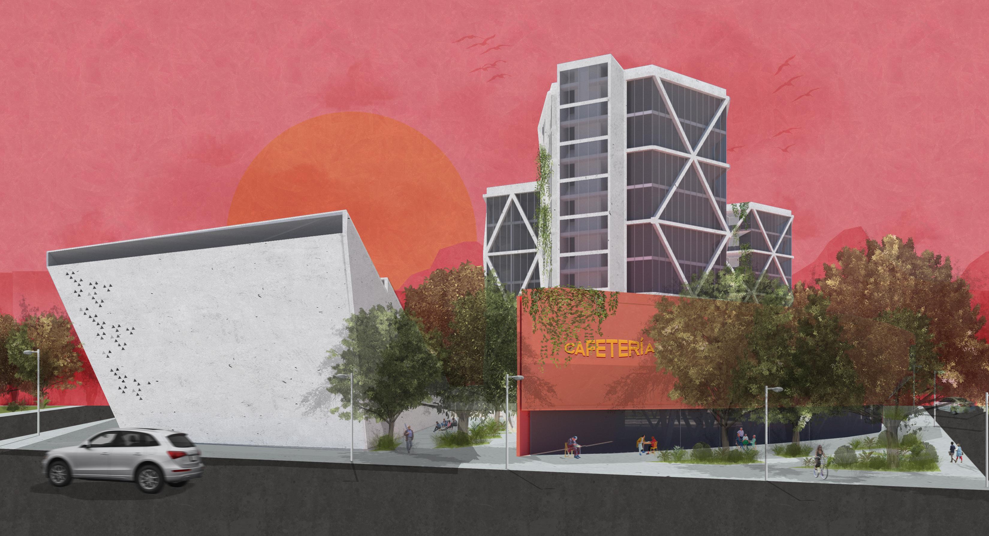
18
Fundidora Ave. Facade
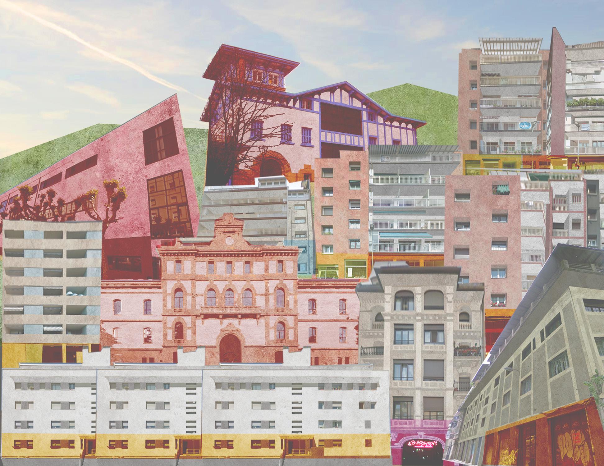
19
Jerónimo Treviño Ave. Facade
Sut[egia]: Cultural Center
Community Center for the Musical Arts
Sept-Dec 2021
21
Projects 9: Universidad del País Vasco With Arch. Mario Sangalli

22
Sutegia, Cultural Center
Proyectos IX: Universidad del País Vasco
Sometimes known as the “Soho Donostiarra”, the Egia neighborhood, in San Sebastían (Spain) has developed for about 15 years as a neighborhood full of art and youth culture. The project is located on a plot with a particular location. Tabakalera surrounds it to the north, Cristina Enea Park to the east and the train tracks to the west.
After research in the field, we discovered that the passion for art, music, dance and design exist and dedicated sites as well, however there is not a single center that focuses on creating a community of young local artists where they can develop ally and make themselves known.
As part of the site recognition process, a physical and sociocultural analysis of the neighborhood was made, and based on this an abstract mapping of the sites related to arts and culture. In this way, being able to see graphically what programmatic needs the project may have.
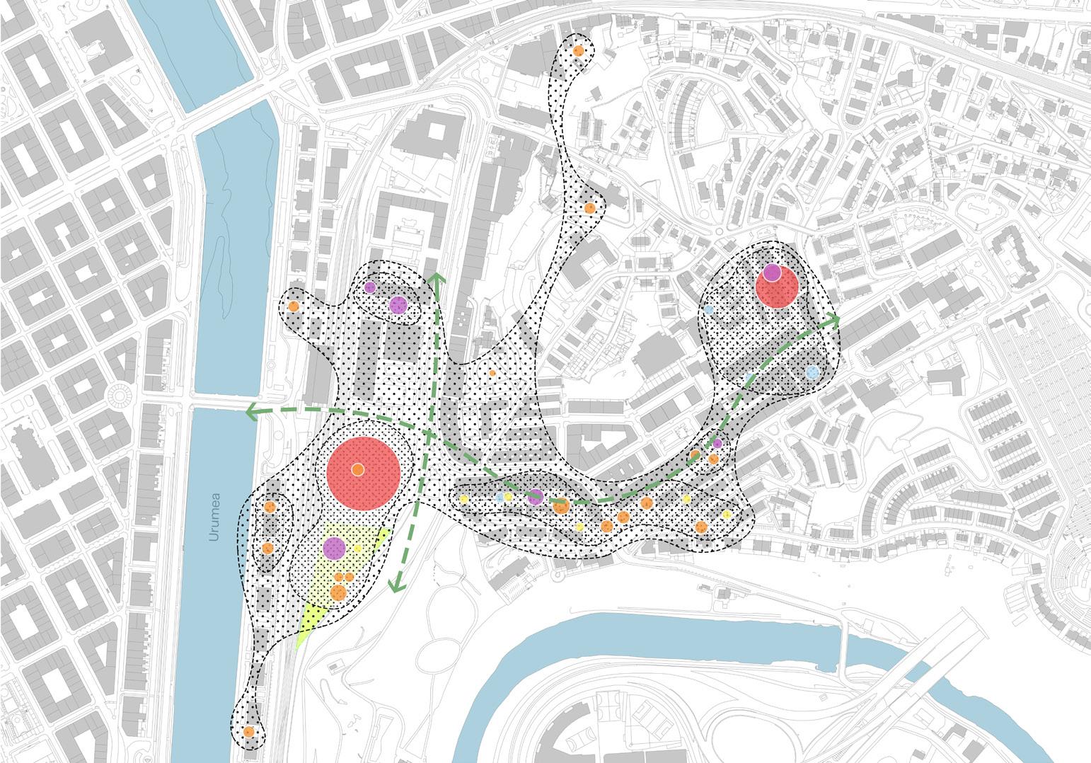
Music-related businesses
Shows and concerts
Important cultural centers
Art, creation and design centers
Businesses related to art and design
Project Site
Junction axes between cells
23
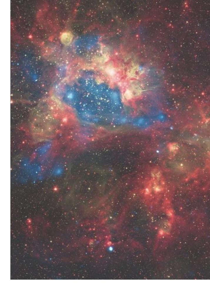
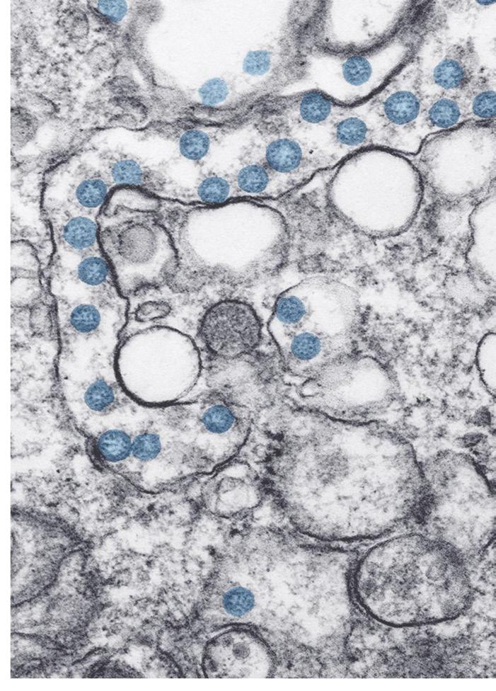
Set of cells in a human body Space nebula
Sutegia from Basque “hotbed” or “seedbed” + [Egia] from Neighborhood in San Sebastián, Basque Country
= Sut[Egia] a seedbed for the development of future artists in the neighborhood

Concept Development
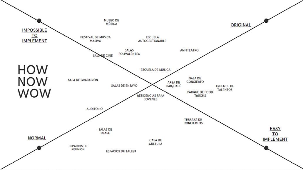
Faced with the challenge of designing a youth space without a specific program, the physical and sociocultural analysis of the plot was used, in addition to different creative thinking exercises to decide on the vocation of the site.
From what was generated, a project manifesto was established.
MANIFESTO FLEXIBILITY of modular spaces OPENNESS of shared and social spaces
DIAPHANOUS
SPACES transparency + natural lighting
VISUAL CONNECTIONS taking advantage of views + linking to the site
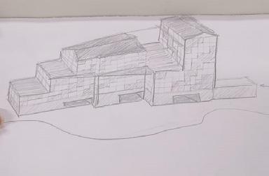
DECOMPOSITION of the solid volume
24
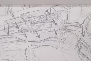
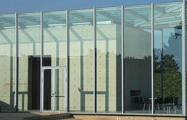
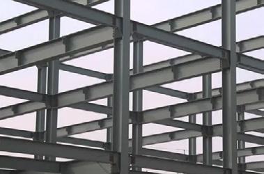
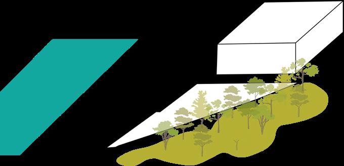
Conceptual volumetry











25
Graphic
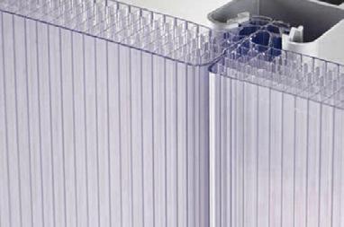
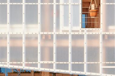
site model+sketches Basic materiality translucent flexible warm diaphanous
image Brainstorm
Project development



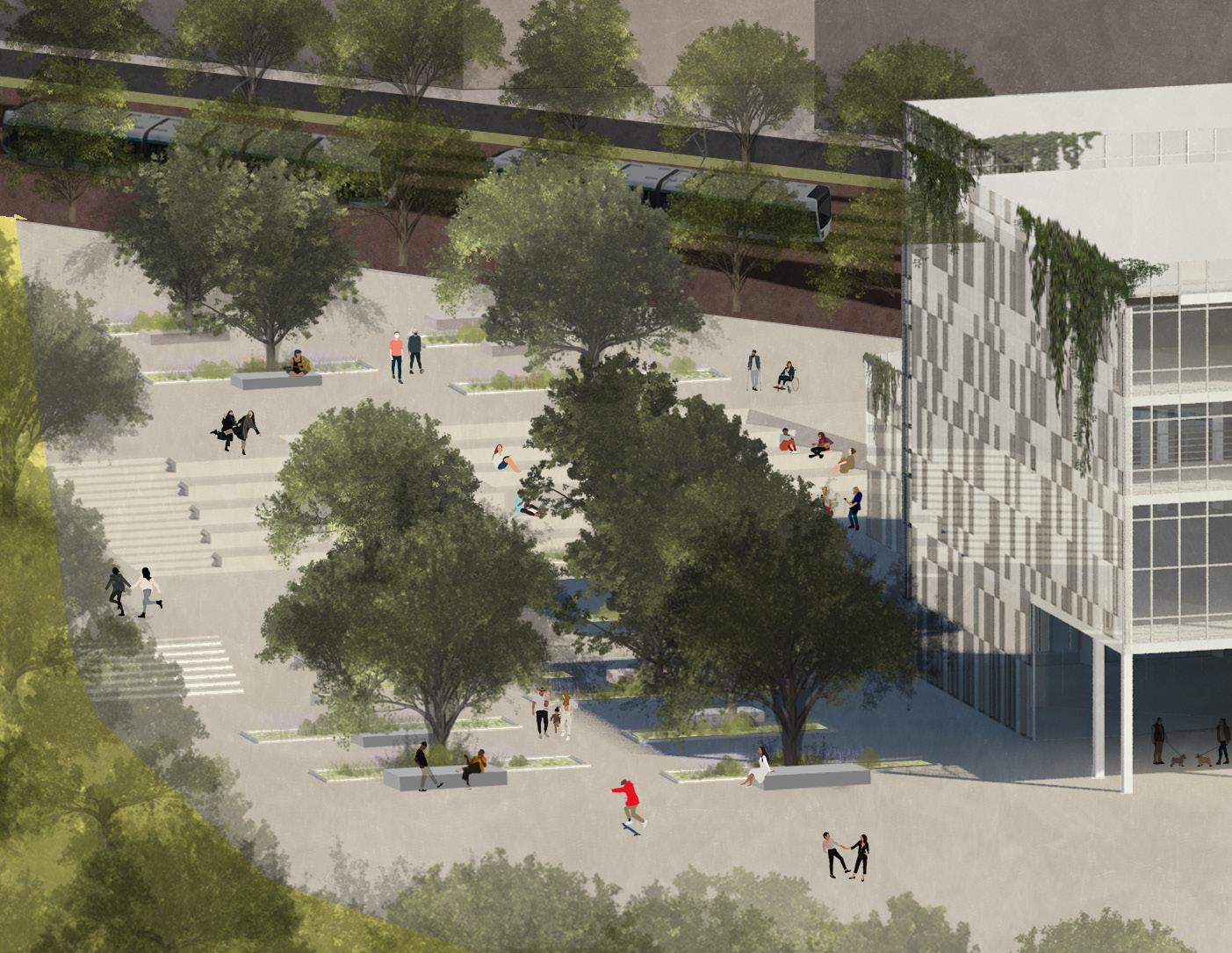
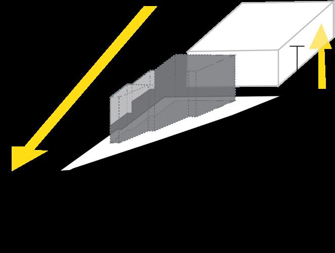
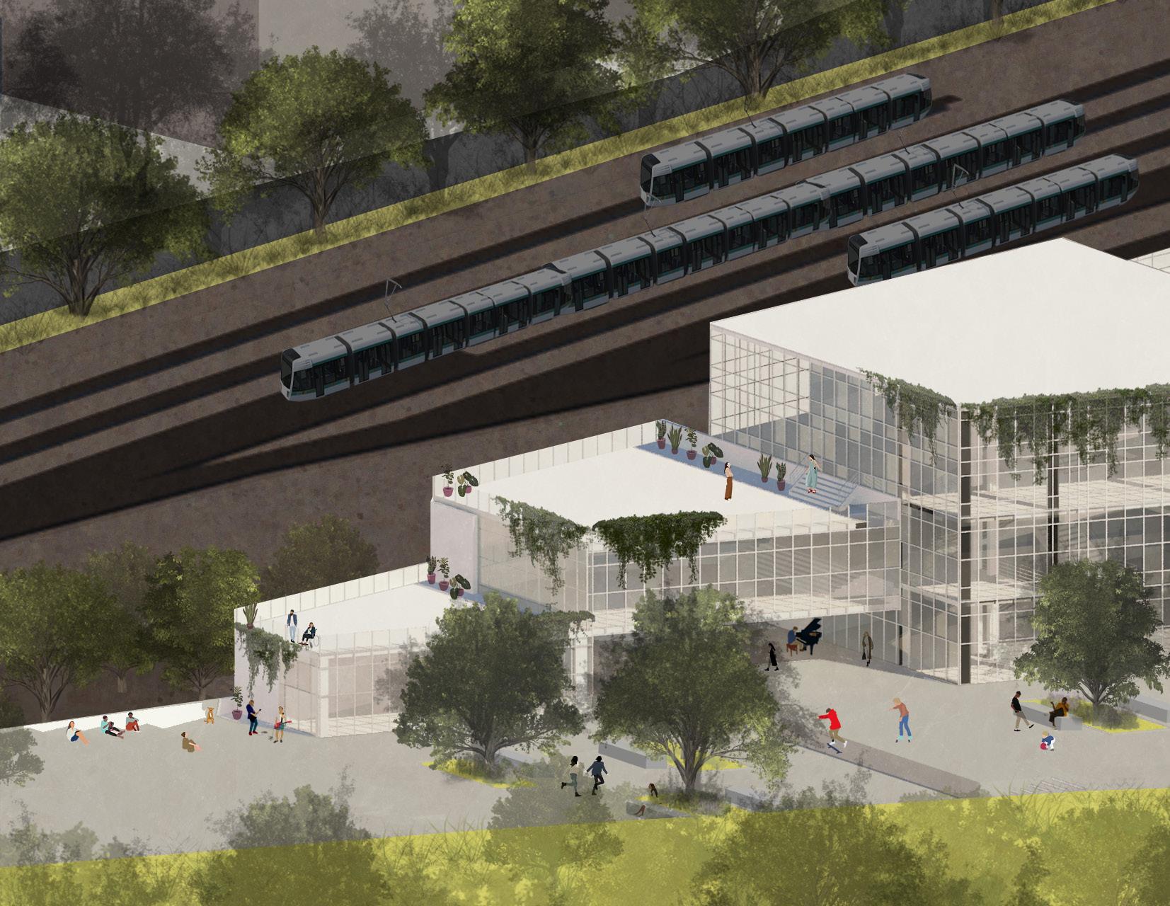
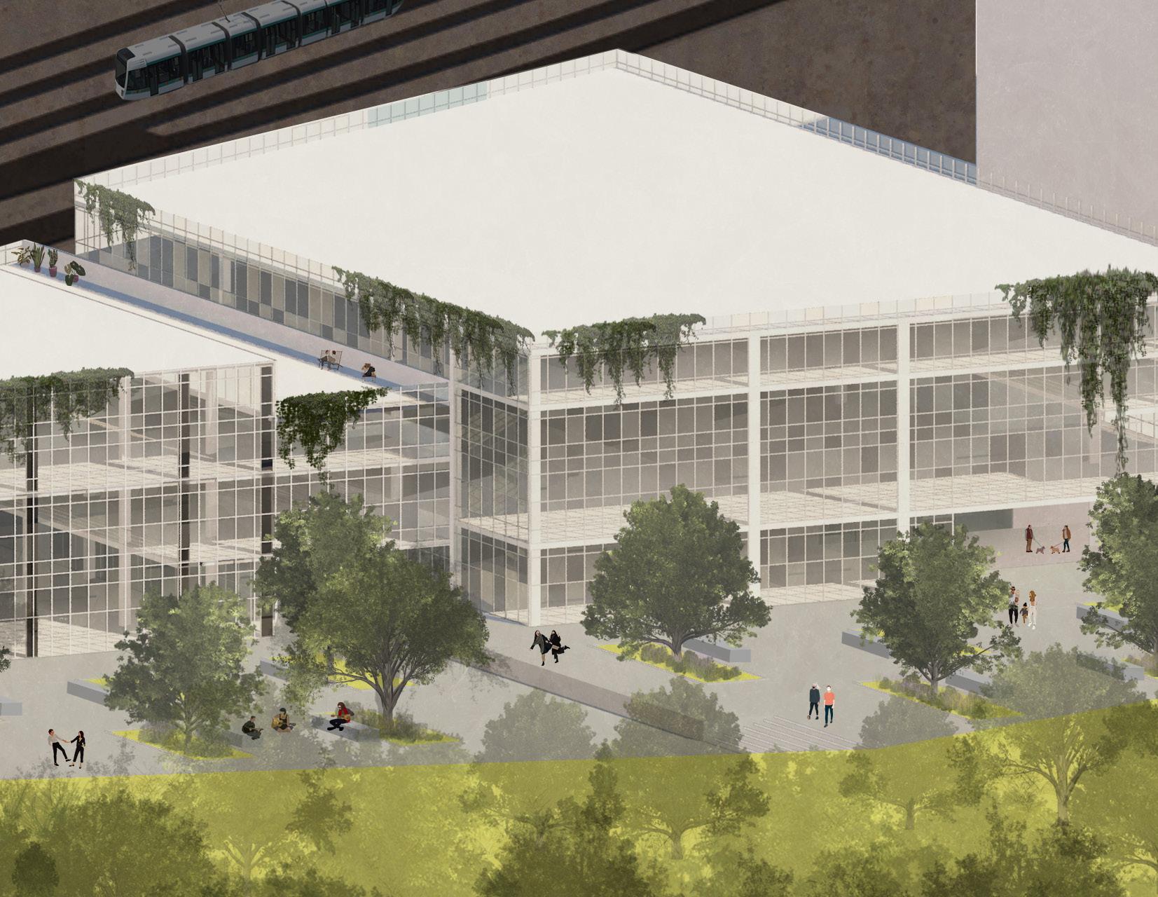
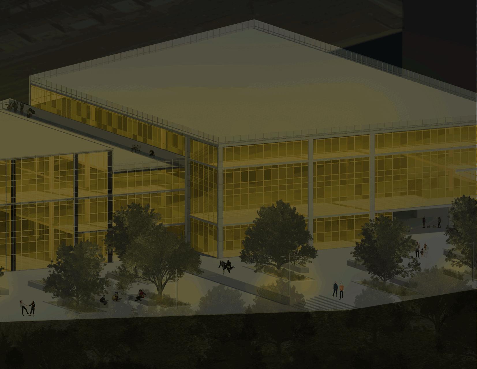
The cultural center seeks to relate to the neighboring park in a physical and visual way through a public plaza and views, with the district for its program in a way that it complements instead of being a redundant space for the neighborhood and finally with the train tracks trying to open up on all its facades and become a type of lamp that illuminates the connection between the center of Donostia and the neighbourhood.
Presentation/Exhibition Spaces Outdoor Spaces/Public plaza

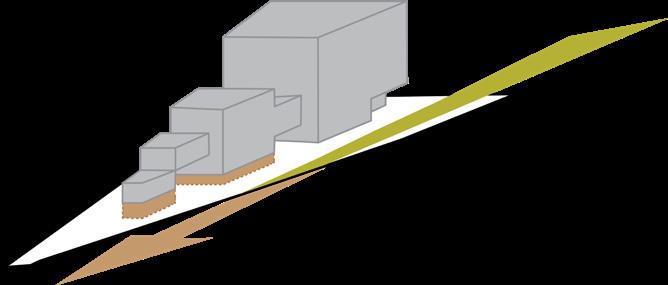

Office Spaces Service Spaces

27
floor
entry
Volumetry
Site Ordination of
plan Urban height-scale relationship Visual connections and
poins Relationship with ground Conceptual
Ground floor
Public spaces / Exchange / Meeting Programme


Floor
Floor
Floor
First
Second
Third
Programme
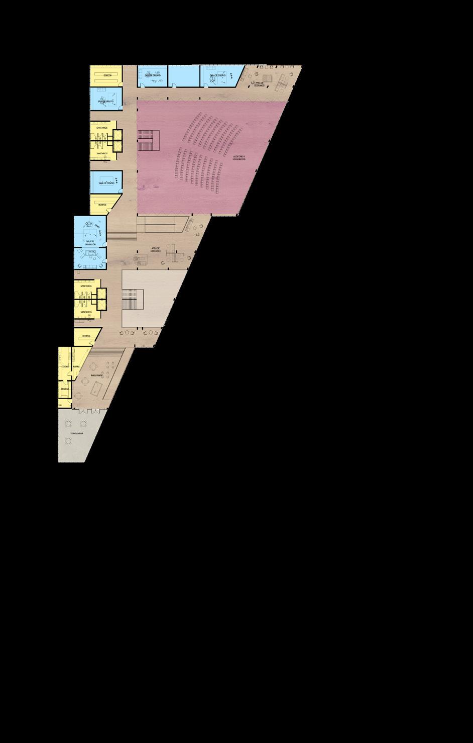
The project includes 2 exhibition galleries, a main and a secondary lobby, administration offices, ticketing, storage for machinery and musical equipment, an auditorium, group and individual rehearsal rooms, a recording studio, residences for students or employees of the community center, bar, a cafeteria, a media library and 3 terraces.
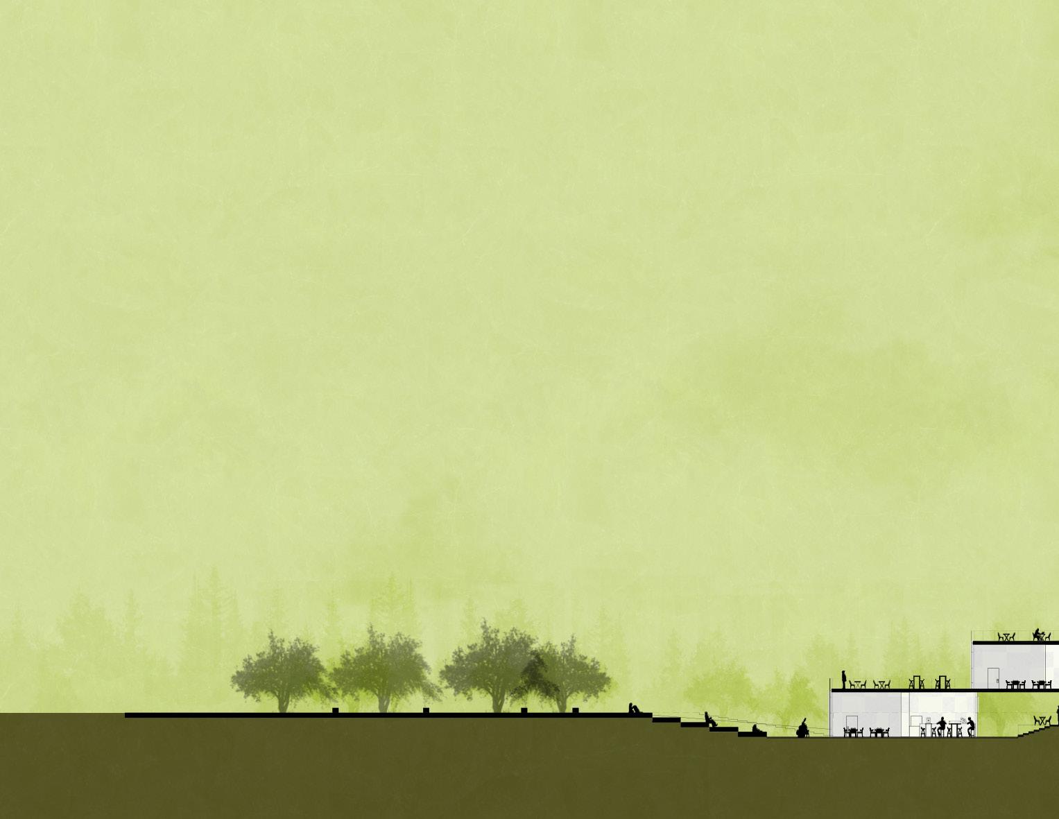
Longitudinal section
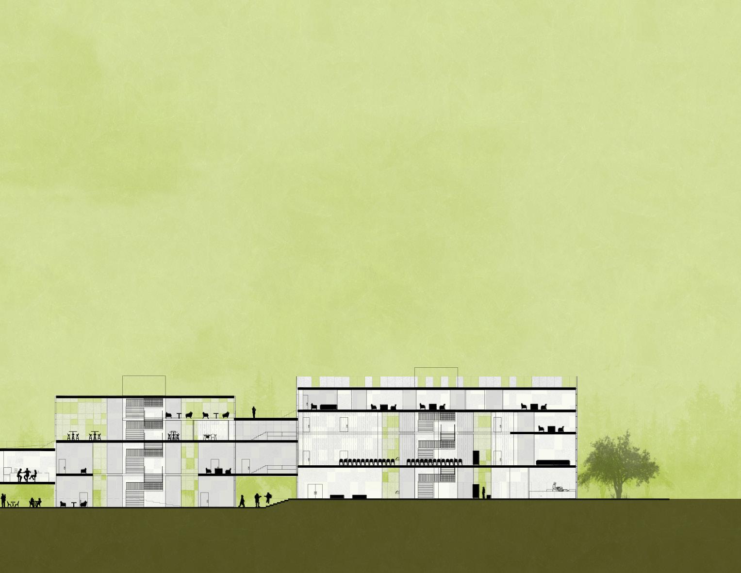 Service Spaces Multipurpose Concert Hall Student + Collaborator Housing
Work/Rehearsal/Practice Spaces


Pathways to Biophilia/
Vías a la Biofília
Low-income Housing + Neighborhood Regeneration
35
Feb-Jun 2021 Catedra INFONAVIT With Arch. Juan Carlos López & Roberto García Collaboration with Grecia Arizpe & L. Gilberto Rodríguez
BIOPHILIA
of GR. BIOS “LIFE” FILIA “LOVE” s, f. /baI.oU’fil.i.a/
1.f. Love for living things and nature, some scientists such as Edward O. Wilson, Erich Fromm, Stephen Kellert and Lynn Margulis believe that humans are born with it.
36
Pathways to Biophilia/ Vías a la Biofília Integrative Projects 1: Catedra Infonavit.
Team: Luis Gilberto Rodríguez, Grecia Arizpe, Mónica Piñones
Workshop teachers: Juan Carlos López & Roberto García
Regeneration project of the popular neighborhood “Praderas de San Juan” in the municipality of Juárez, Nuevo León, Mexico, with a focus on solutions related to COVID problematics, urban connectivity and integral wellness.
Biophilic proposal: approach to the problems identified at the territorial, neighborhood and housing levels, through techniques to improve the connection with nature that exists at these three levels. The potential of the neighborhood or housing unit to be an urban forest was identified, where the community can develop in a healthier, safer, more equitable and efficient way.
37
Site Analysis

To occupy a place means to take possession of it. For the human being to inhabit space, he has to transform it and through change, history begins.
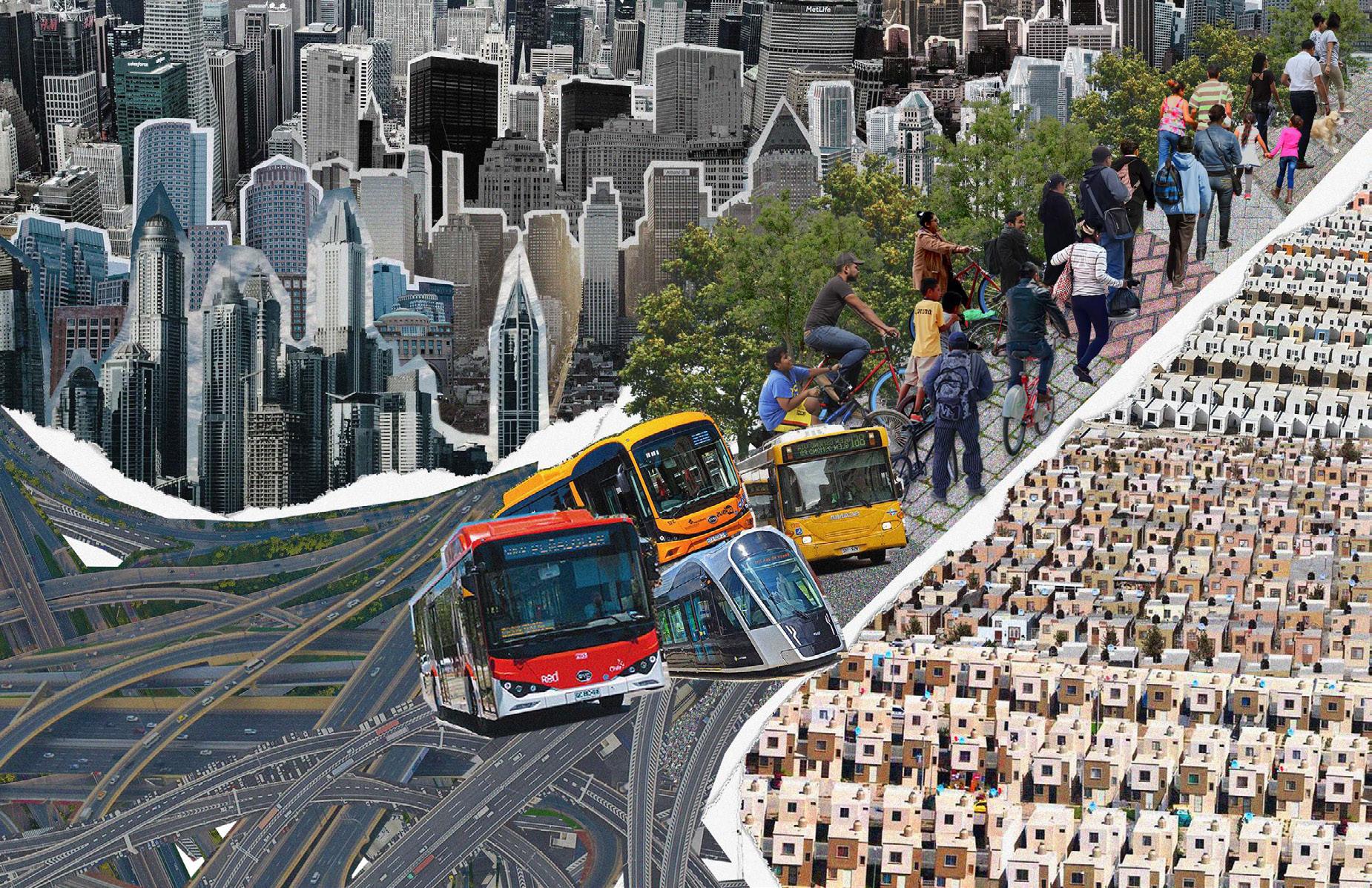
The gray area on the map is the uncontrolled growth of mass housing. This brings problems of mobility, pollution and marginalization. During our visit to the site, we noticed the proximity of the UH to the train tracks and after studying its route, we discovered its potential for connectivity to the city and with other mass transportation systems such as the metro and the ecovía. This condition is replicable in other cities of the country.
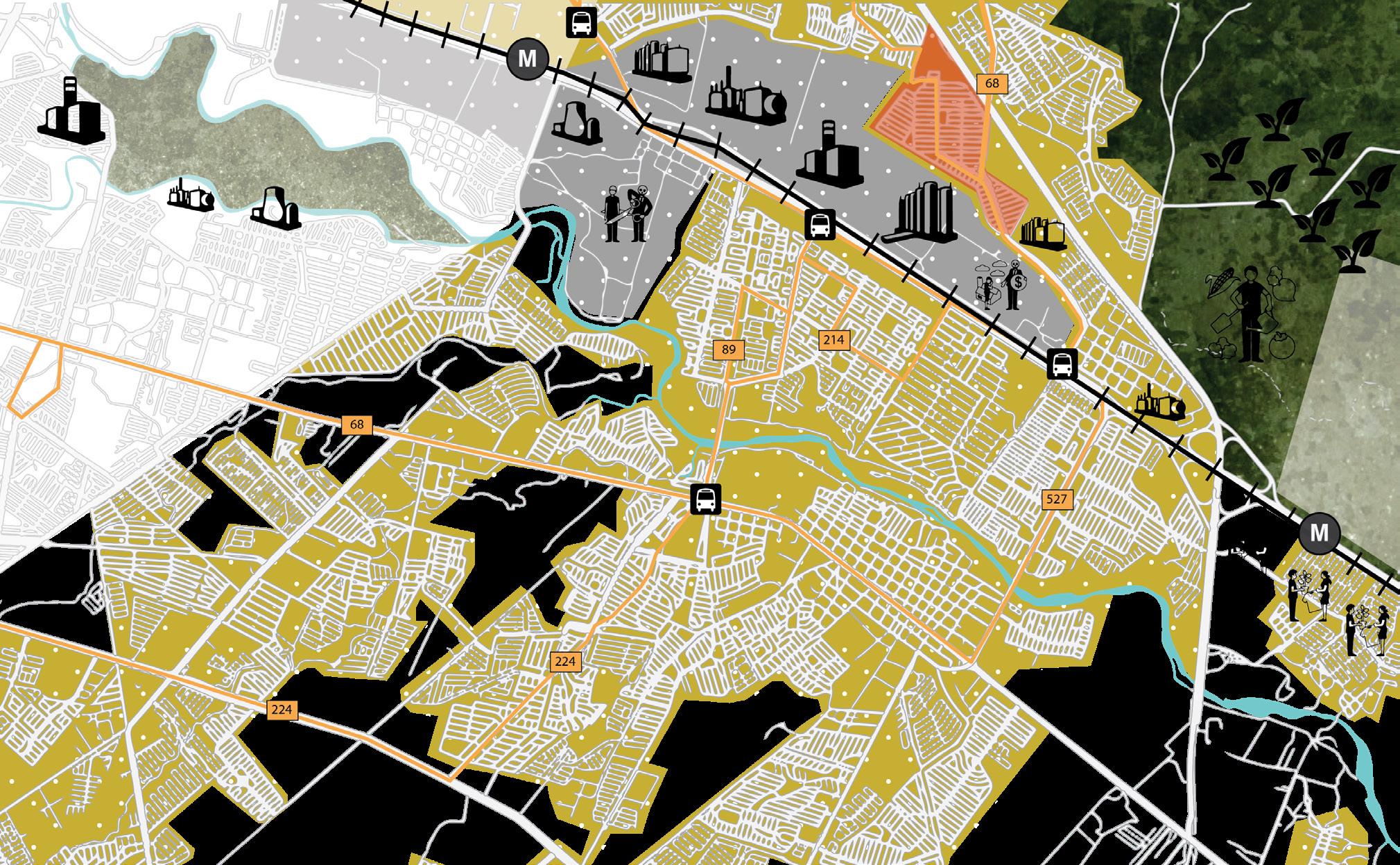

Praderas de San Juan, located in the municipality of Juarez, is 25 kilometers from the center and is part of the outskirts. It is surrounded by 4 situations: ejido housing, agricultural land, serial housing and industry. The latter brings with it an environmental contingency in the municipality; and the seriousness is such that the official recommendation is to maintain windows closed.
Salary Expenses
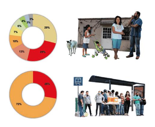
29% of the salary is spent in nourishment and 25% in transport. Said percentage is excessive due to the remoteness of the municipality.
Users with a car
Only 28% of the residents of the neighborhood have a car, because they don’t have the possibility to get another credit and buy a car.
Prosperous cities index
Juárez has a PCI of 50.07, with improvement areas in governance, health, internet access, environment and urban mobility.
Crime in Juárez
Main crimes commited are domestic violence 34.6% and minor theft 9%. For children and woman it becomes a dangerous environment.
Green Area per Person
There is 8.15 sqm of green areas per person in the neighborhood, the recommendation by WHO is that each person has access to at least 15sqm.
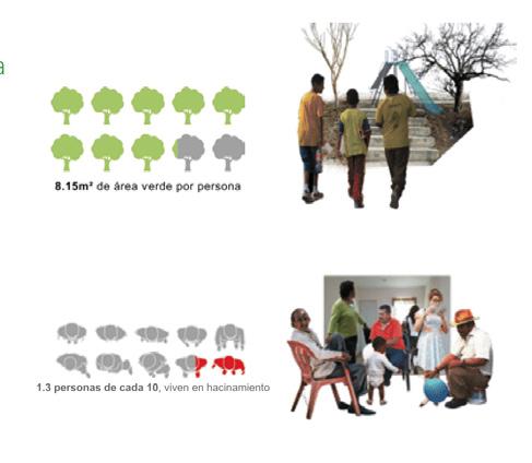
Overcrowding
In the neighborhood 1.3 out of 10 people live in overcrowded spaces, meaning there is a breach of the minimum habitability standards.
38
Moving on to the housing unit, and after investigation by INEGI, we found that:

● 1 of 4 houses is abandoned
● There are two main axes where public transport routes pass


● Urban equipment is poor quality
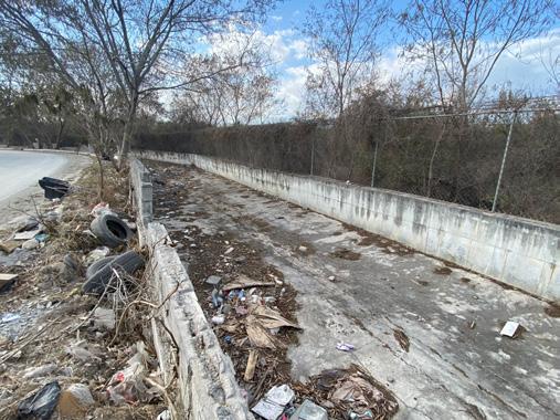
● The car dominates the road despite the fact that only 28% of the inhabitants have one
● Green areas are insufficient

● The parks are in disuse
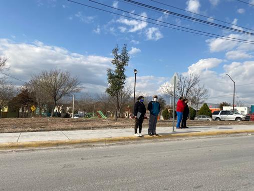
The experience of living in Praderas de San Juan is getting up at dawn to spend hours in the bus, not being able to share housework due to the small space, connecting spiritually under a tin roof and playing in desolate parks.


39
CURRENT SITUATION VEHICULAR MOBILITY URBAN TRANSPORT GREEN AREAS/ VEGETATION URBAN FACILITIES HOUSE ABANDONMENT Percentage per square
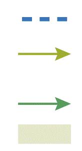
11-20% 21-30% 31-40% 41-50% VEHICULAR CIRCULATION Primary Streets Secondary Streets Tertiary streets Main street direction Bus routes Relevant crossings Bus stops CIRCULACIÓN AUTOBUS Parks or lots for public use Vegetation GREEN SPACES Lots for public use Educational FACILITIES Sports Religious Health Commercial
0-10%
More
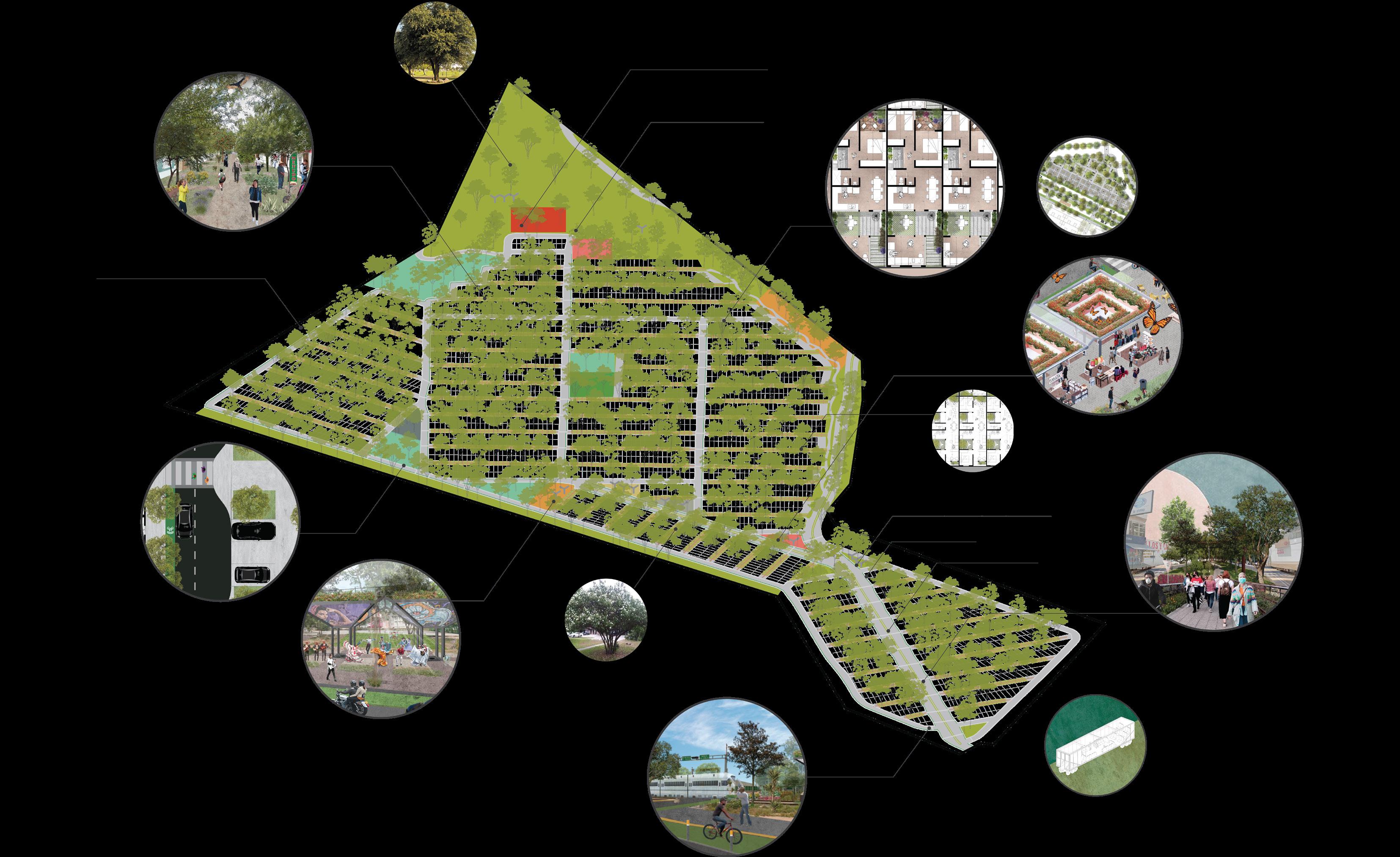
attention to vegetation and care for green areas Pedestrian-only streets New health urban facilities New modular and safe bus stops Biophilic housing Implementation of pavilions for different activities Safe and continuous sidewalks Bikeways
General Proposal
40
Linear
Parking
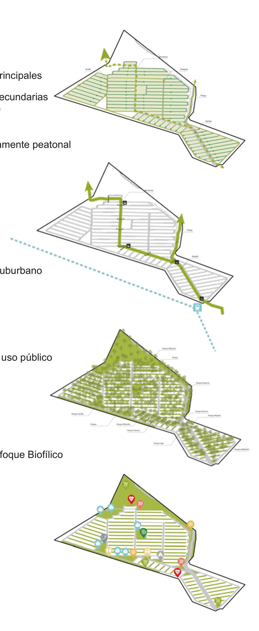
The intervention seeks to satisfy biophilia in 4 main aspects: body and health (as a strategy to combat covid), relationships (providing areas of healthy coexistence), emotions (improving mental health) and built environment, seeking to generate a more resilient neighborhood, in which the focus is recovery and disease prevention. Making the whole project a healing forest. The evolution that we propose begins with the reforestation of the unit and is positioned on three pillars: housing, public space and mobility. suburban
Park New programme for existing parks
for public use Multi-use stations for communication with
transport media
200 MONILLA trees 3310.06 kg CO2/ yr 5
200 ANACAHUITE trees 3310.06 kg CO2/ yr 5.5 meters of separation
200 FLAME CORAL trees 2942.30 kg CO2/ yr 4.5 meters of separation
200 WICKER trees 4413.45 kg CO2/ yr 6 meters of separation
360 OAK trees 177950 kg CO2/ yr 10 meters of separation
360 EVERGREEN OAK trees 48261.05 kg CO2/ YR 12 meters of separation

360 WHITE OAK trees 39721.03 kg CO2/ yr 10 meters of separation
200 SUGARBERRY trees 6951.18 kg CO2/ yr 9 meters of separation
350 ELM trees 18922.66 kg CO2/ yr 8 meters of separation
200 HUIZACHE trees 8826.89 kg CO2/ yr 6 meters of separation
350 MEZQUITE trees 23460.23 kg CO2/ yr 7 meters of separation

TREE QUANTITY 2,980 pc AREA OCCUPANCY 169,663 m2 CO2 RETENTION PER YR 338,069.15 kg



41
VEHICULAR MOBILITY URBAN TRANSPORT GREEN AREAS/ VEGETATION URBAN FACILITIES VEHICULAR CIRCULATION Primary Streets Secondary Streets Tertiary streets Main street direction Bus routes Relevant crossings Bus stops CIRCULACIÓN AUTOBUS Parks or lots for public use Vegetation GREEN SPACES Lots for public use Educational FACILITIES Sports Religious Health Commercial High-speed train stop Cultural Children Oriented Work Oriented Project Intervention
for tree planting in public space
Proposal
meters of separation
1 1 3
Street Regeneration Proposal

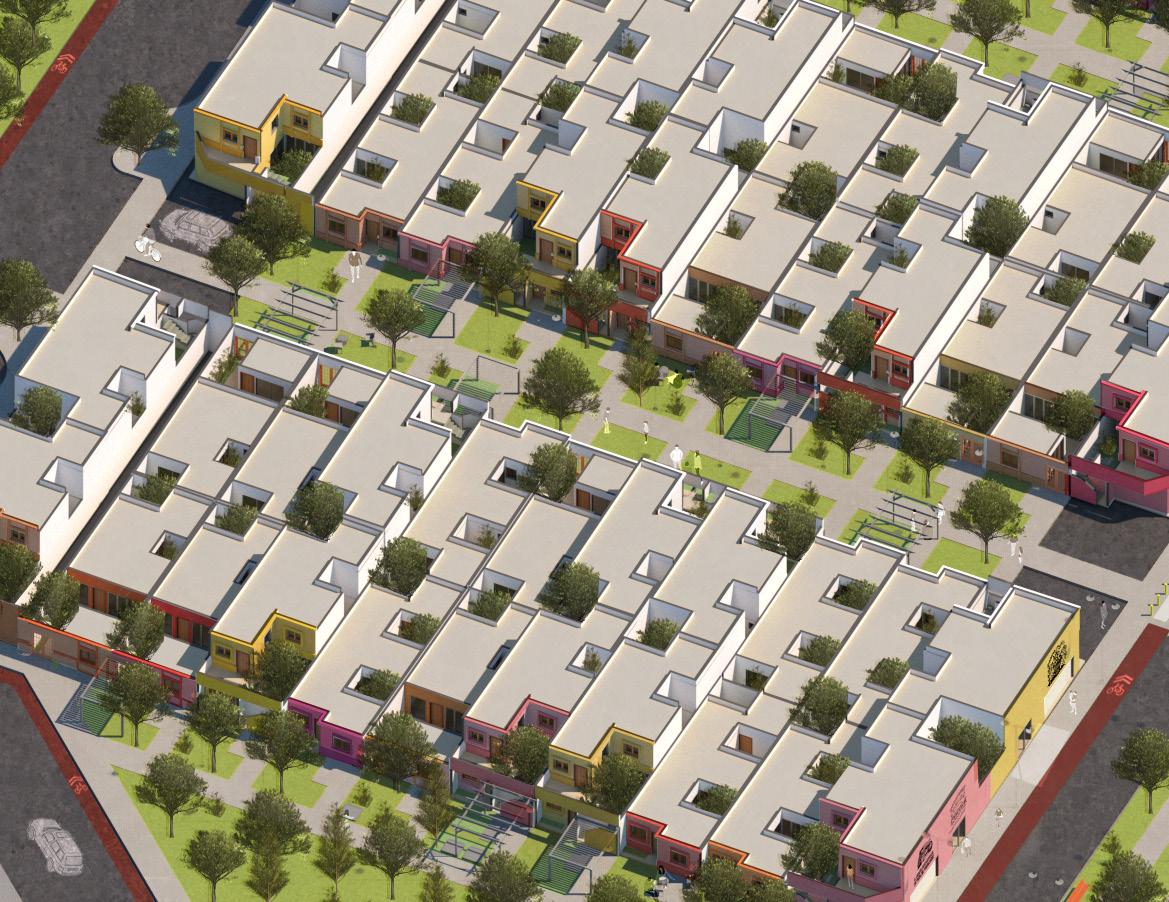
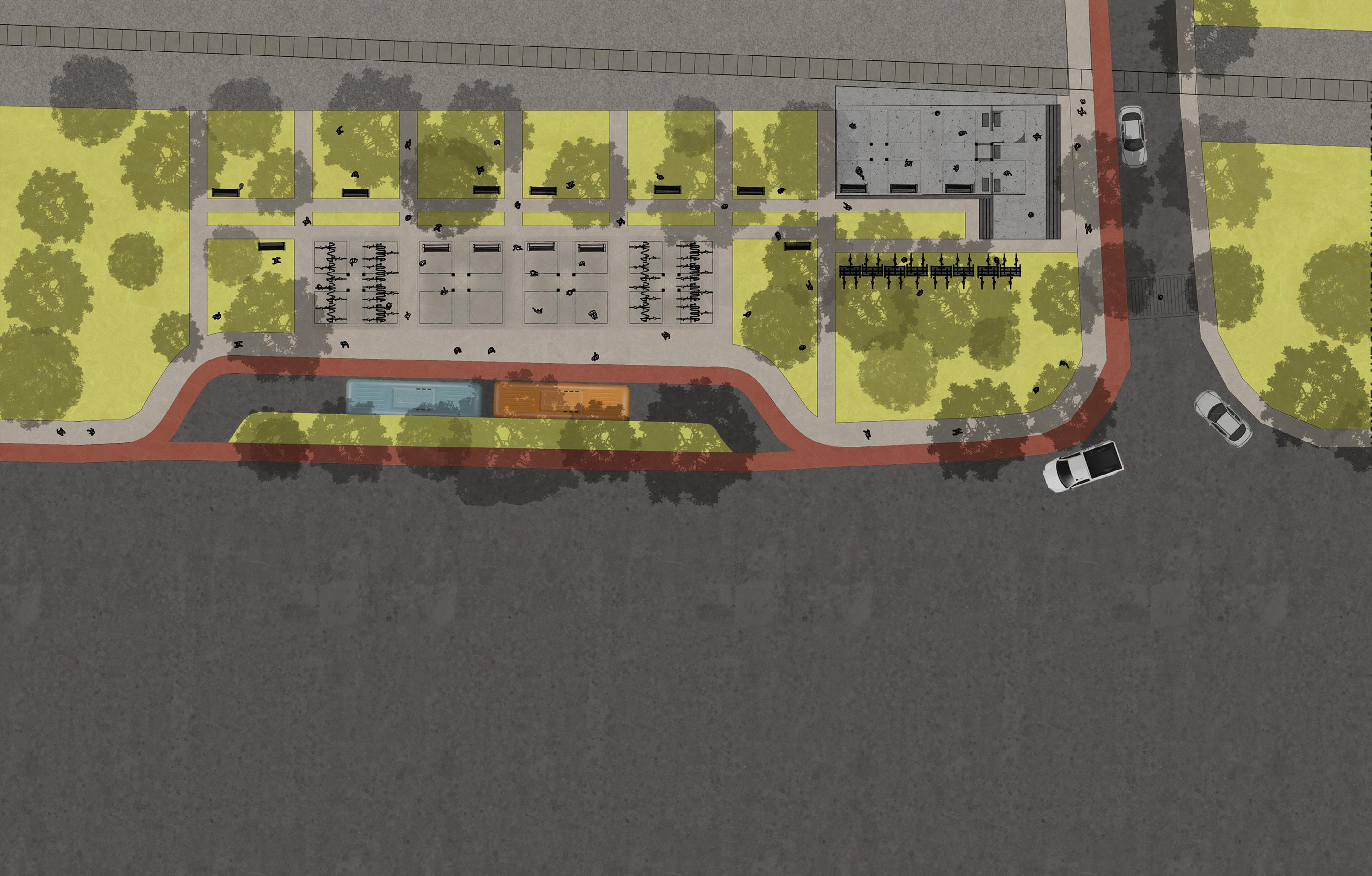
Given that only a third of the population has private vehicles, it is proposed to close the tertiary streets that join the houses and transform the secondary streets into corridors with community parking lots, where pedestrians are encouraged but there is enough space for those who do have a car, either for reasons of personal transportation or for their jobs.

As for the larger and more important streets within the unit, which cross the entire site, the creation of a linear park is proposed to reduce speed on the avenue, and also provide a lung of trees to the unit that, in addition to being attractive visually, provides thermal comfort on the sidewalks by giving shade and filtering the air from the dust and pollution generated by the surrounding factories. The street is also divided into a single traffic lane per side and a bike lane in order to propose a new nonmotorized mobility such as the bicycle.
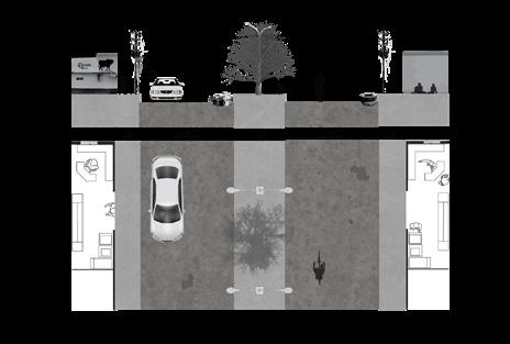

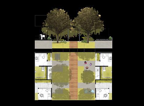
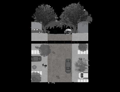
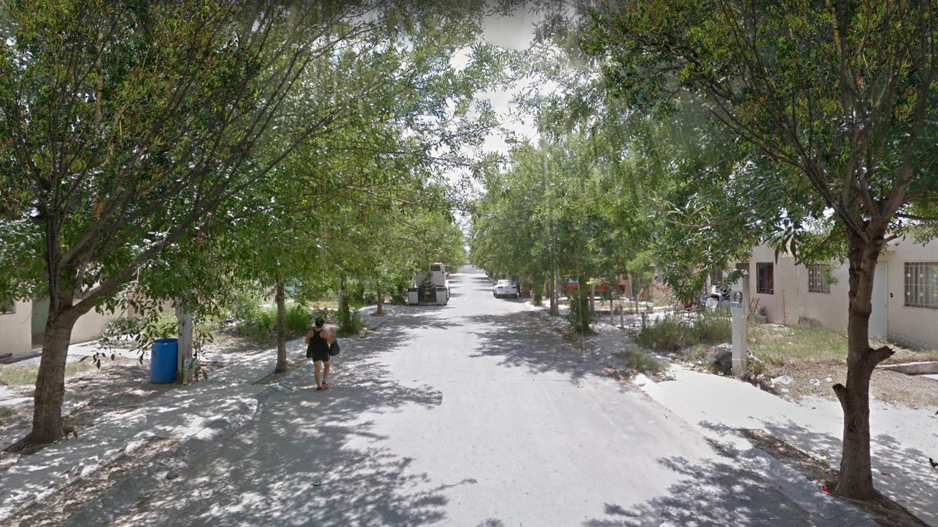
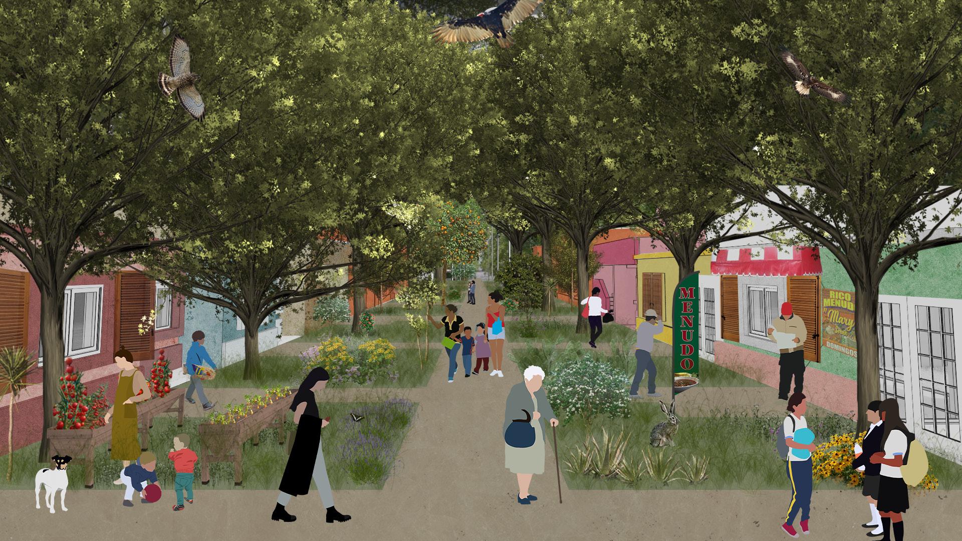
By removing vehicular circulation within the tertiary or internal streets of the unit, we allow the creation of urban “forests” making the facades of the houses extend outwards and have a little more of a shared garden. These gardens encourage neighborhood coexistence and allow the development of new activities such as the creation of orchards or “terraces” where people can keep their eyes on the street, children can play safely and residents can feel more protected from outsiders.

43
Biophilia Proposal Street with public parking Commercial Street + Linear park Pedestrian street 2 1 2 3
Street currently
Improvement Proposal for Urban Mobility
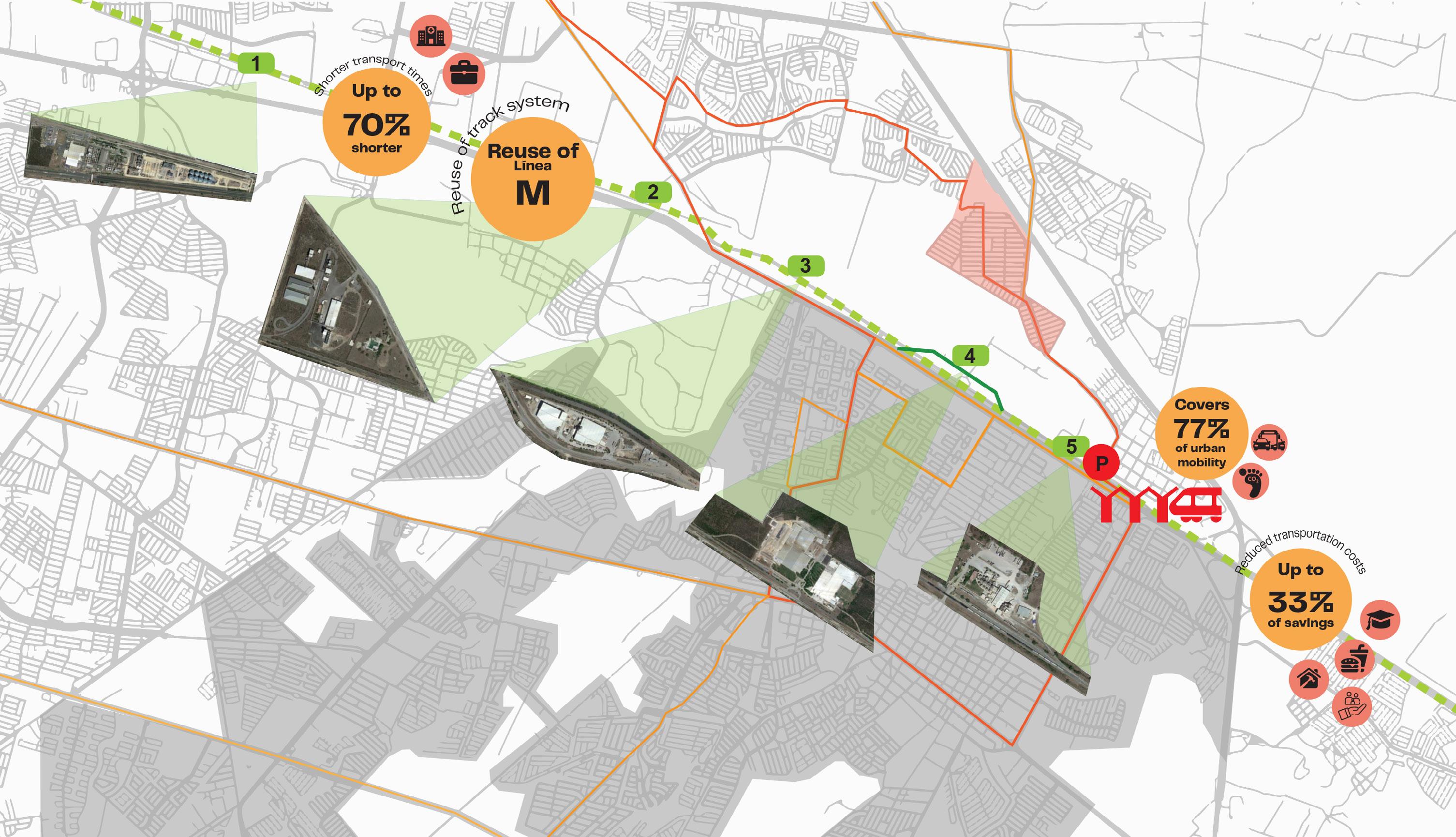
The M line of the railway that runs parallel to the housing unit opens the possibility of a new means of transport such as a suburban train, and currently has various industrial stops that could be used in a new way to serve communities that require faster and cheaper transportation.
The use of a suburban train would benefit people since, due to its speed as transport, it can achieve shorter journeys of up to 70% less time, it would take advantage of schedules where industries do not use the tracks, it could serve 77% of the population that does not have a private car and currently uses public transport. And additionally, it would generate a significant saving of 33% in transportation costs for residents who are part of the economically active population.
A project of this type provides better communication between different means of transport, among which could be the ecovia, the metro, traditional route buses, etc.
44
Reducing travel times and transportation costs means that people will have more time to pursue activities of personal interest such as developing a hobby, pool savings, spend this on better food, to provide better assets for their families, or possibly to renovate their home. And in more extreme cases, if they need medical help, they require less waiting time, which could make the difference in an emergency.
To generate a connection with the train track for suburban use, different stops or train stations are proposed, among which, one stands out just at the exit of Praderas de San Juan to the South and the others on the main road that surrounds the Highway. Both are adequate to open up the number of opportunities and possibilities for residents, since the entire metropolitan area could be within their reach and not just within their unit.
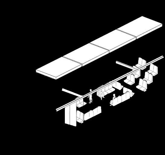
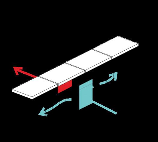
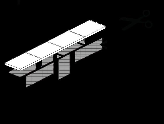

45
Housing and public space

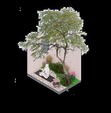
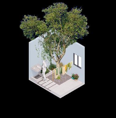
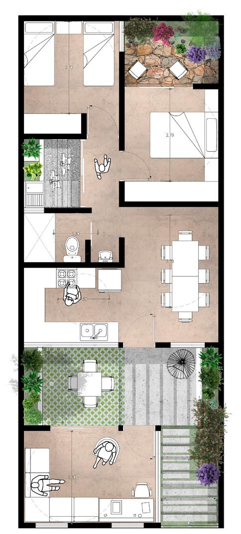

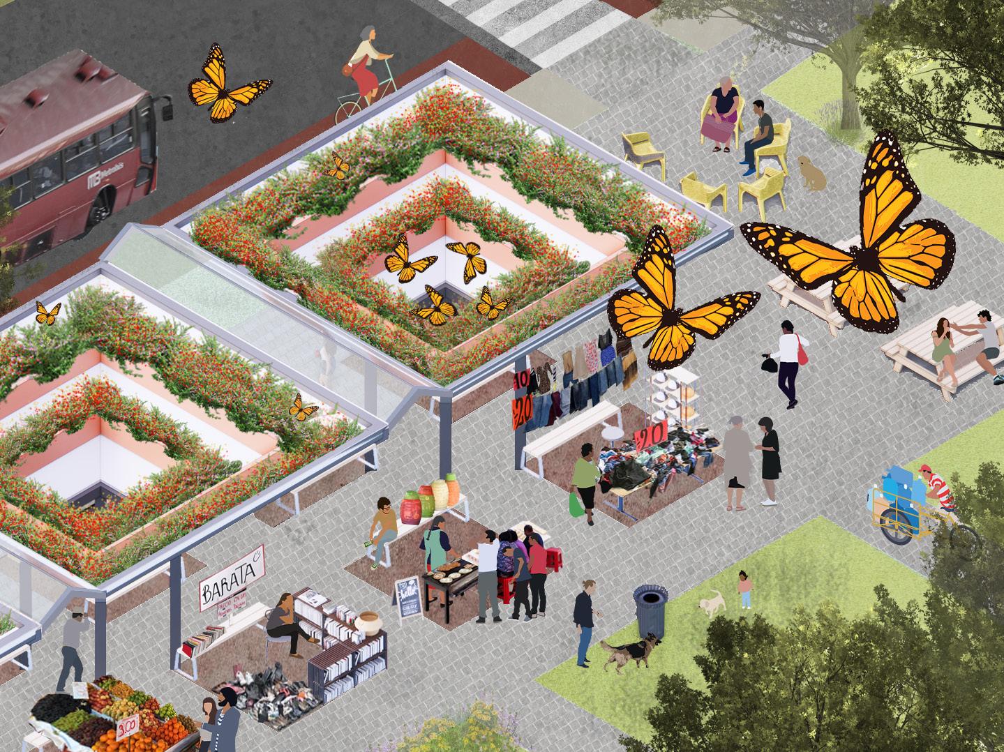
The daily life of the residents will have a radical turn. The situation changes, everyone has a deep connection with their natural space. There is a cooperation and neighborly relationship. They meet under the shade to hold markets, neighborhood meetings, social events and use the public space according to their needs. The impact will be such that there is no doubt that biophilia is the locomotive of our project. By regenerating our environment, we regenerate ourselves as a society.

1 2 3 4
46
1 2 3 4
47
48
Vasconcelos Complex
49
Mixed Use Complex Aug-Dec 2020 Projects 5 With Arch. Teresa de la Garza
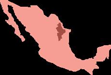
Ubicación
México



50
Housing Public Facilities Commerce
Nuevo León
San Pedro Garza García
Site Main avenue Avenues with access to site
Zona Valle Poniente
Tampiquito
Vasconcelos Complex
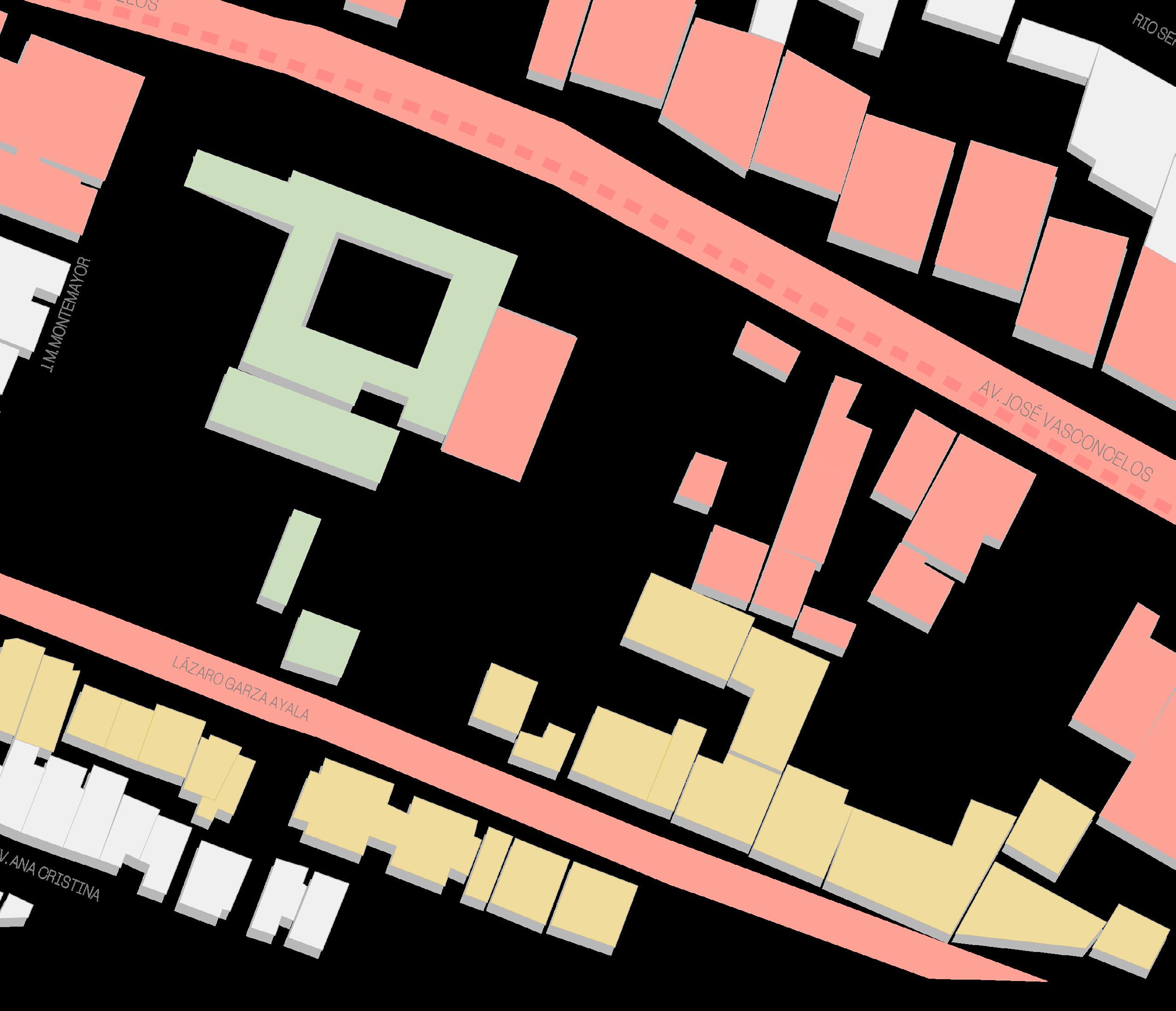
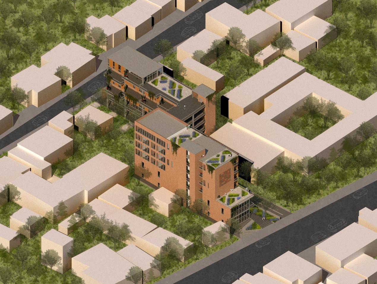
Projects V: Project Tampiquito Project located in the Tampiquito area, a neighborhood with a great identity and a need for public spaces that communicate with what already exists.
Proposal of spaces for public and private use to unite with the context and connect two land uses.

Design Intentions
Integration to the urban context Permeability from 1 street to another Views and scenarios
Integration to the natural context Use of local vegetation
Minimum Excavation Required
Understanding user patterns Separation of public and private Path with views
Estrategies
Circulations and flows

Communication from 1 street to another Effective use of both views
OPENNESS
COMMUNITY FLUENCY REGENERATION
PEDESTRIAN PRIORITY
Uses and vegetation
Commerce on ground floor
Communication with street and public Typologies of different types and sizes Vegetation to fill gaps
Visual appeal
Covering of CAAV requirements
51
A B 2 A B A B
A B Entry points
1
1 Circulations and flows Horizontal circulations Vertical circulations 2 Uses and vegetation Diverse typologies Circulations/ public spaces
52
Mixed Use Proposal


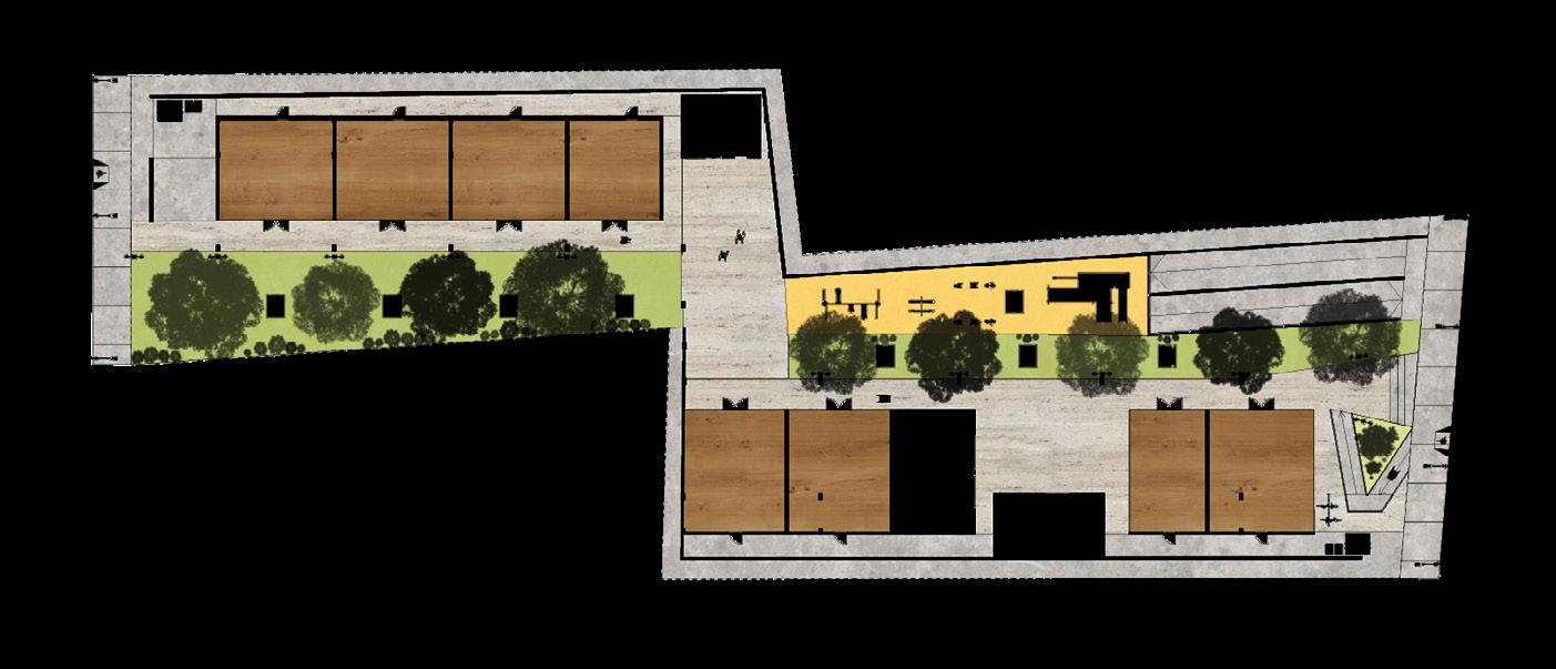
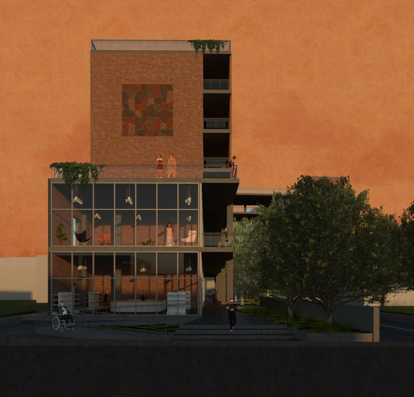
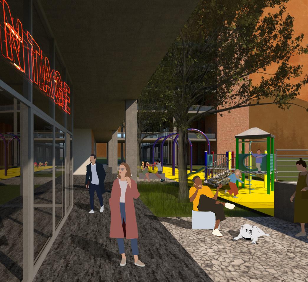
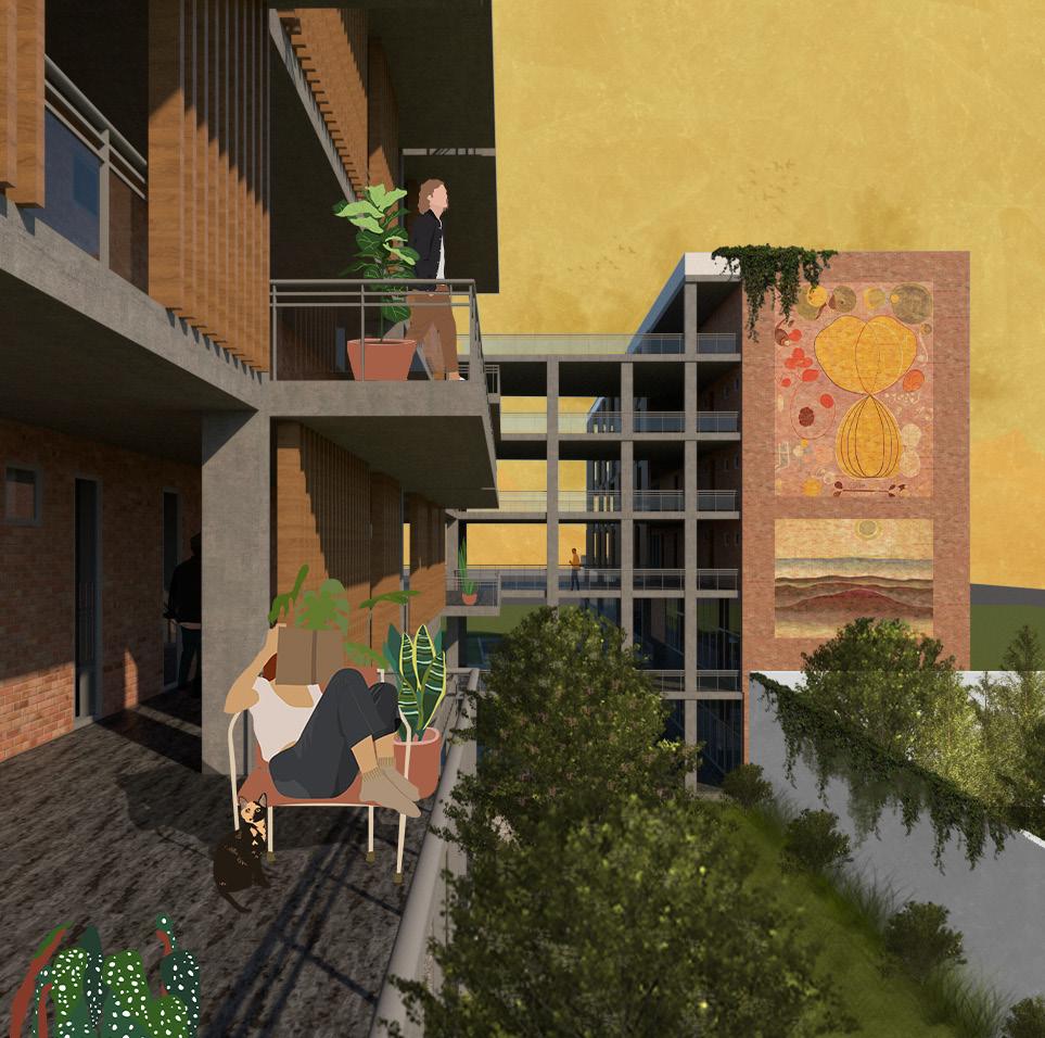
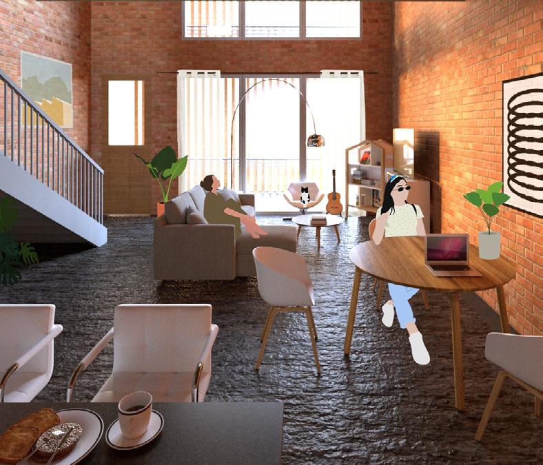
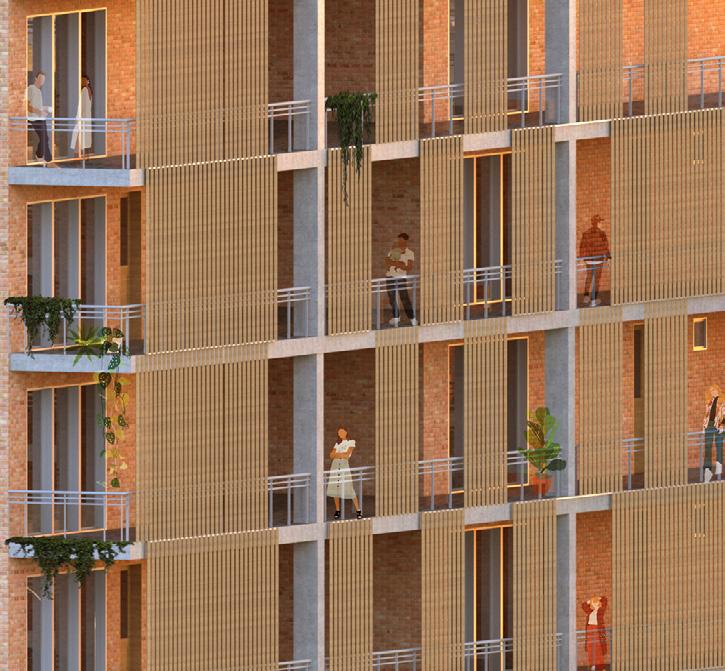
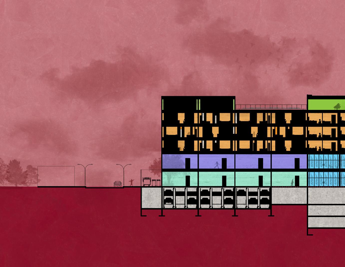
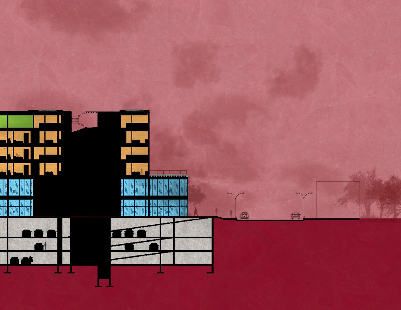
Among the objectives of the complex, is the possibility of making a mixture of uses appropriate to the urban context, which gives life to the building throughout the day and is accessible to all.
● Commerce
8 Spaces for commercial use with visibility to the plaza and public areas

● Offices/Workshops
8 Office or workshop premises with privacy and rest areas
● Housing
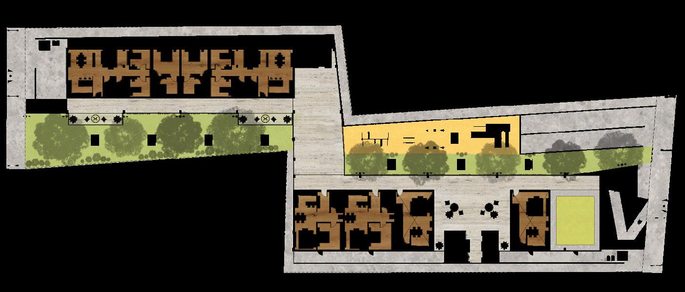
16 apartment units of various sizes for diverse families with amenities and recreation spaces
● Amenities
Indoor and outdoor spaces for shared use by residents and visitors of the complex, such as children’s play area, exercise rooms, green terraces, social areas
● Services
Parking lots, public restrooms, machine rooms, facility bins
53 Ground Floor
Floor Amenities Floor
Model
East Elevation West Elevation
54


55
Longitudinal Section
58
Celso Piña Cultural Center
Community
Jan-May
59
Center for Fine Arts
2020 Projects 4 With Arch. Pedro Pacheco
“Celso Piña” Centro Cultural Projects VI: Campana-Altamira Project
Proposal for a community project in the Campana-Altamira district, an area in a state of economic, social, cultural and educational vulnerability.
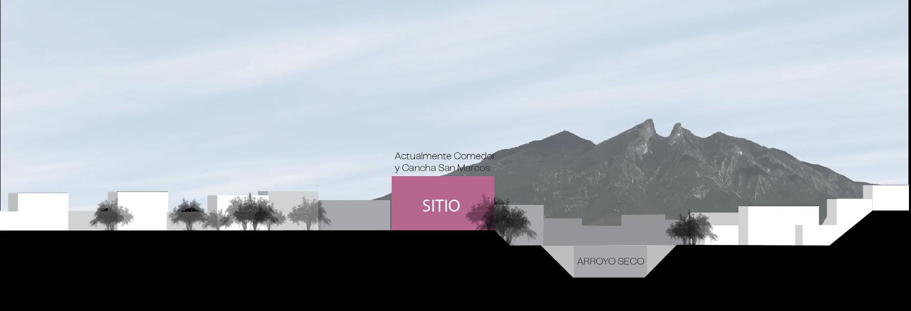


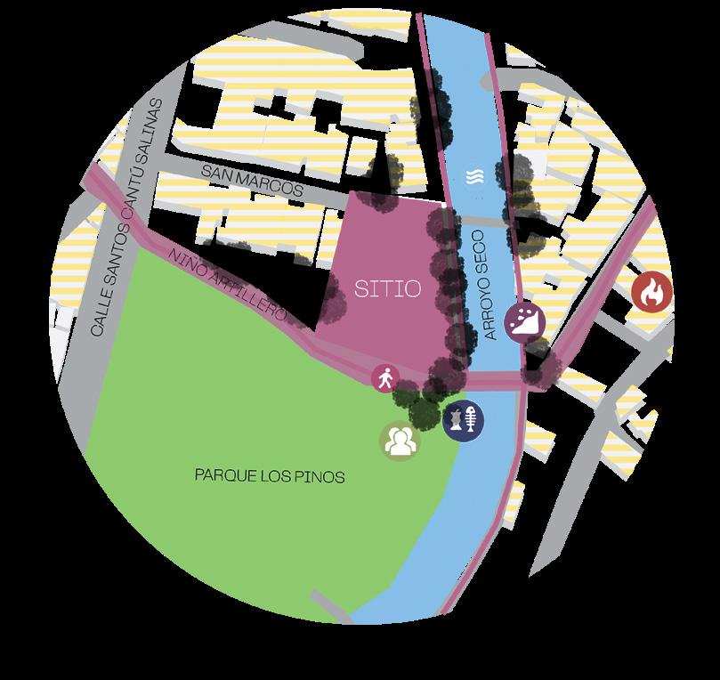
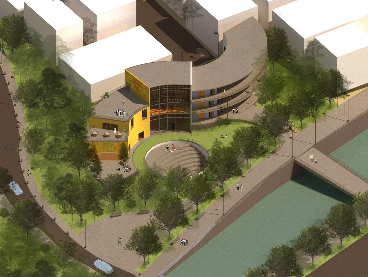
An extensive site analysis was carried out on these different vulnerabilities and the vocation of the land was decided based on the direct connection with Los Pinos Park, the Arroyo Seco, the need for a space dedicated to culture and the arts since there is a deficit of cultural spaces and access to activities of this type where only 1.8% of the local population can develop them.
60
SITE
Commerce
Vehicular circulation Housing Pedestrian Circulation Education Immediate site analysis, risks and opportunities Analysis of connections and interventions SITE
SITE
Ground Floor
First floor
Intervention Proposal
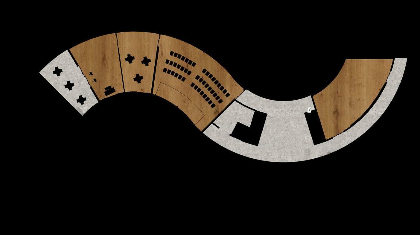
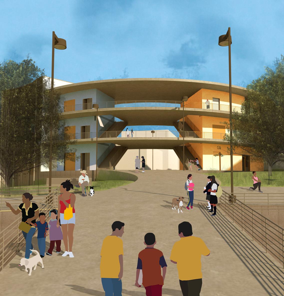
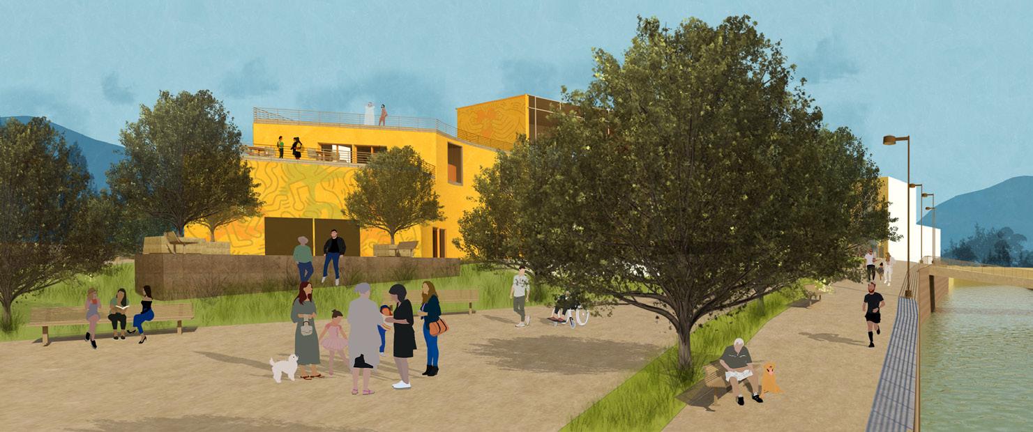
The proposal includes the design of the architectural project, the connection at street level with the access streets, and the development of a walkway along the Arroyo Seco that delimits it.
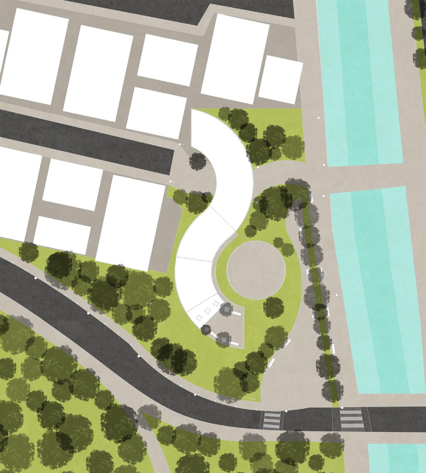
The architectural program includes the amphitheater, an auditorium, three rehearsal rooms for music classes, a mixed dance room, a plastic arts room, a visual arts room, a multipurpose or exhibition room, three terraces, administrative offices, public restrooms and warehouses for storage.


61
Second floor
62
The final objective of the proposal is based on using art in 3 axes:
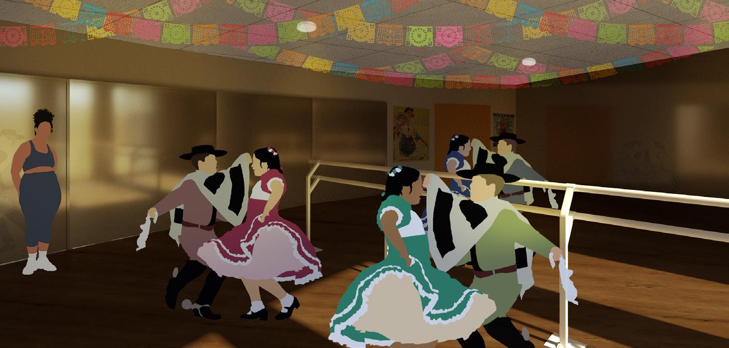

● Art as Therapy
Art as a mechanism that influences change in a community through relationships based on security, acceptance and opportunity.
● Art as an Economic Model Art as a means of revitalizing spaces that were abandoned, reactivating public spaces and reactivating the economy thanks to the development of activities for local entertainment and manual skills that can generate income.
● Art as an Engine of Inclusion Art as a tool for social inclusion and social capital, where the more actors are involved, the more unity is generated within the community.
63
64
Museum for the Mexican Arts and Culture
65
Museum + Additional Programme
Aug-Dec 2019 Projectos 3 With Arch. Rodrigo Lobeira
Museum for the Mexican Arts and Culture
Project III: Culture and Education Buildings
Design proposal for a museum focused on the exhibition of Mexican artists and artisans from all eras. It is proposed to create a cultural attraction to a space that has economic and recreational activities, which could be complemented in the educational field.

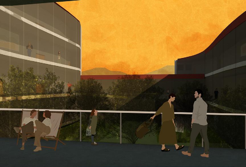
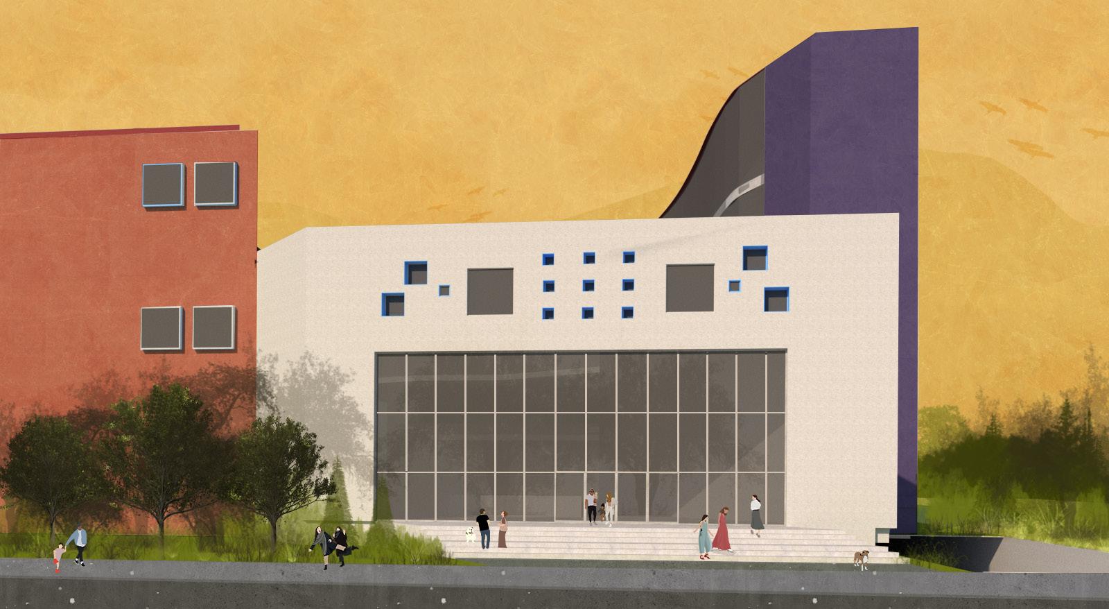
66
Programme
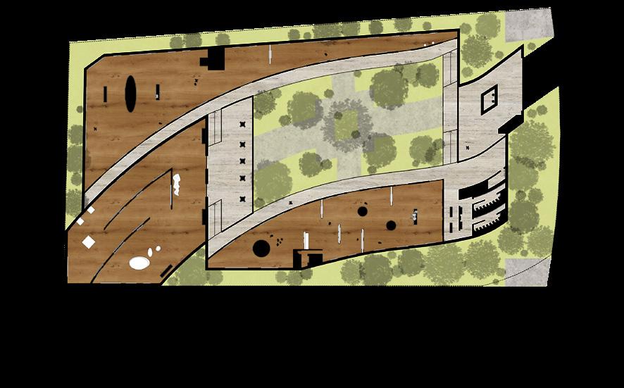
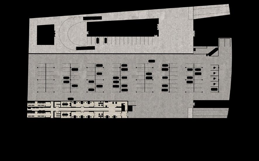
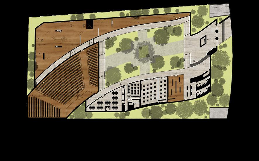
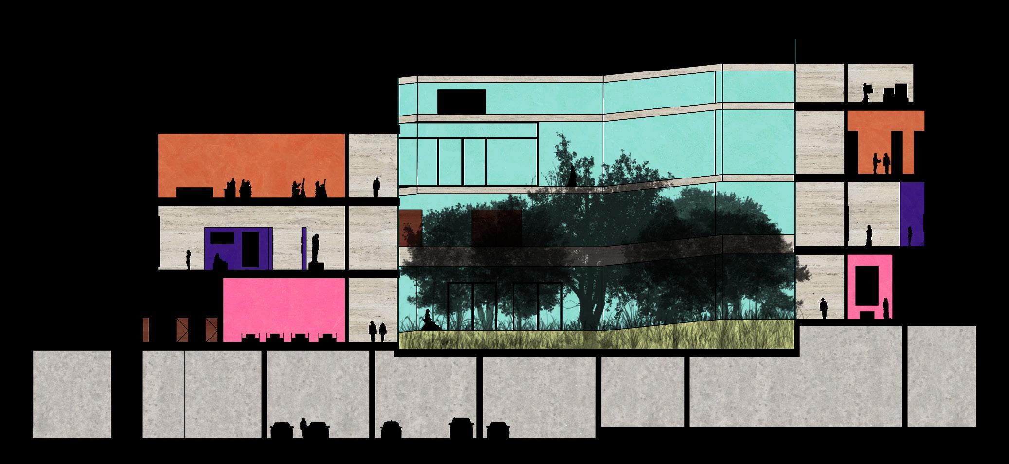
The museum’s services and amenities include 4 exhibition halls, plastic arts workshops, an auditorium, a cafeteria, a merchandise store, museum administrative offices, and rest spaces.
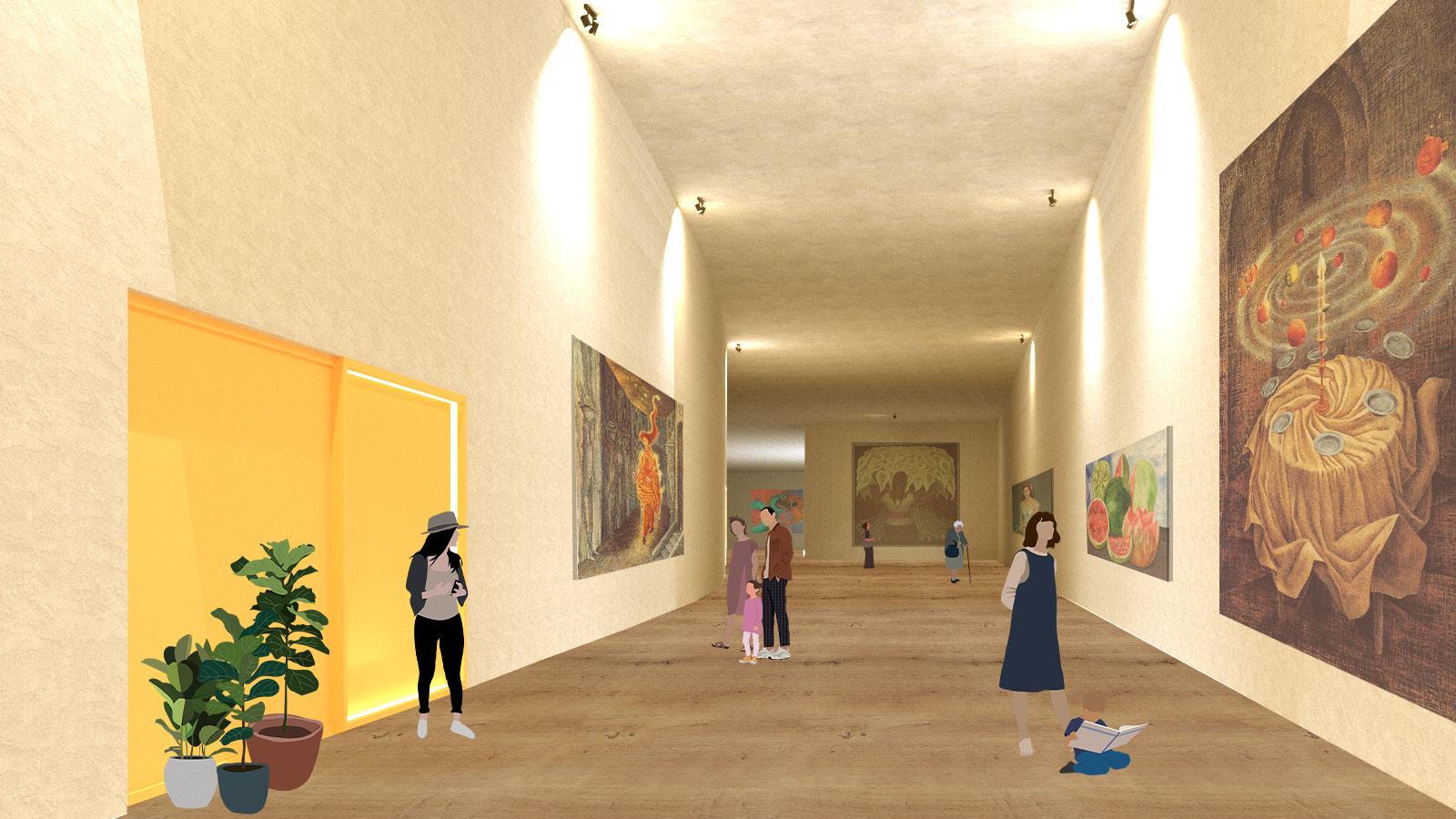
The entire museum was designed with bioclimatic design strategies in mind, and in accordance with accessibility guidelines, so that all spaces are accessible to people who use a wheelchair, walker, cane or some other support tool.
67
Ground Floor
Basement Floor
First Floor
68
Small Scale Projects
69
Primary School + Single-Family Housing
Aug-Dec 2019 Aug-Dec 2018 Projects 3: With Arch. Rodrigo Lobeira Projects 1: With Arch. Claudia Carreño & Juan Talamás
Rediseño para Escuela Primaria Guadalupe Villarreal
Projects 3: Education and Culture Buildings
Collaboration with Mariana Saucedo, Lisha Cruz & Maria Paula Montemayor
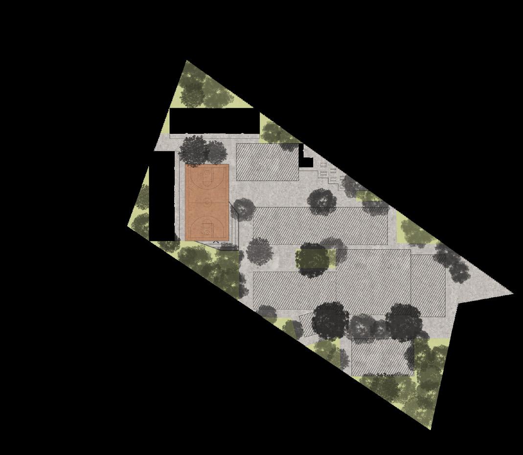
Based on the axes of order, economy, flexibility and a better quality of space, an extension to the existing spaces based on the architecture of the school was designed.
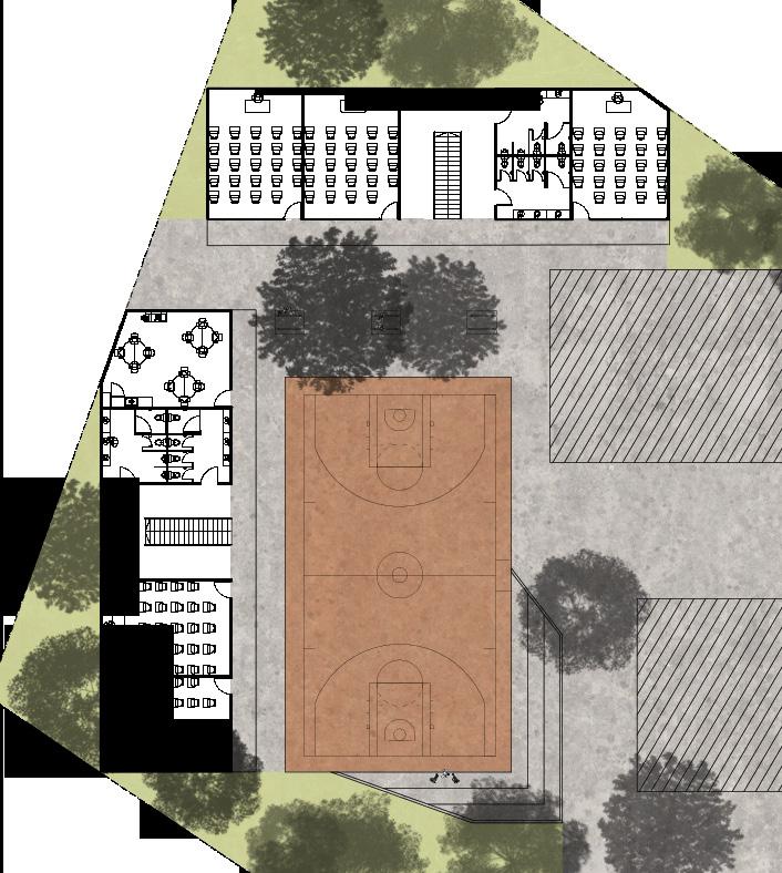
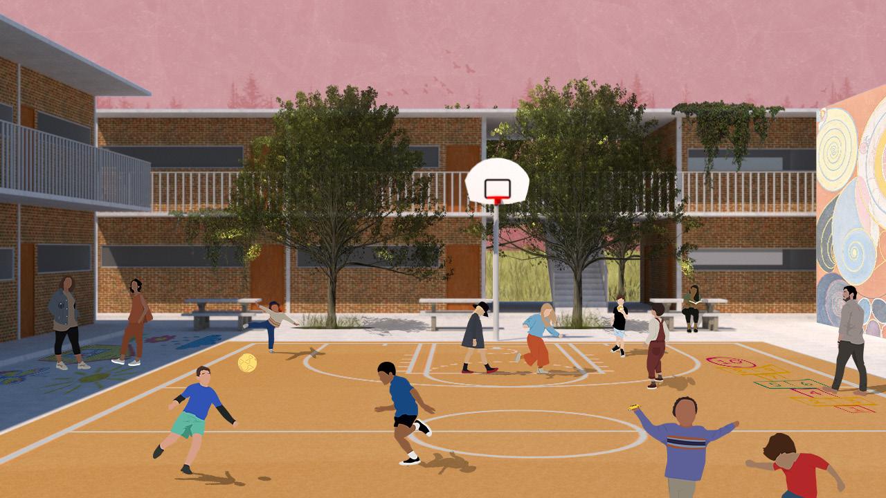
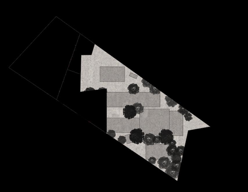
Original Site
70
Expansion Proposal
Valle Alto House
Projects 1: Sigle-Family Housing
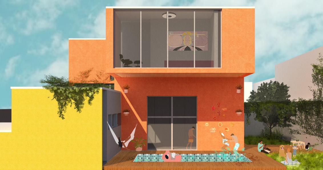
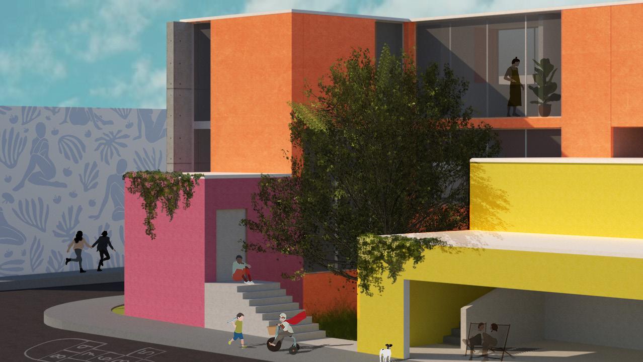
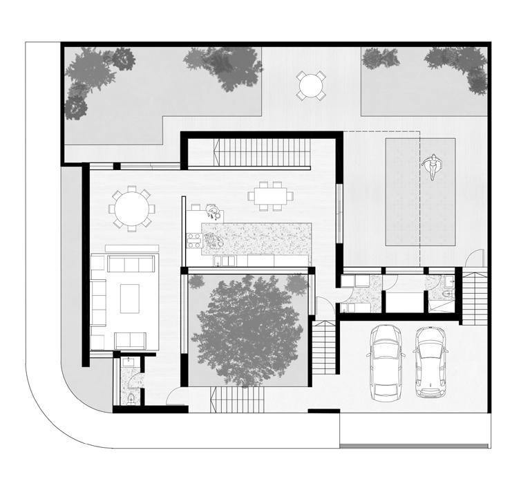
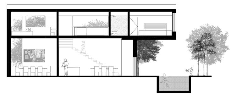
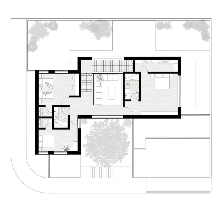
Neoplasticist projects such as Gerrit Rietveld’s Schröder House or Theo Van Doesburg’s Study House were used as case studies. It was an experiment with volumes by “exploding” the box, and playing with the ceiling and slab levels.
71
Section A
Ground Floor First Floor
Other Works
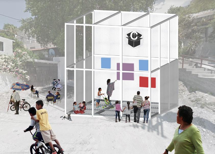
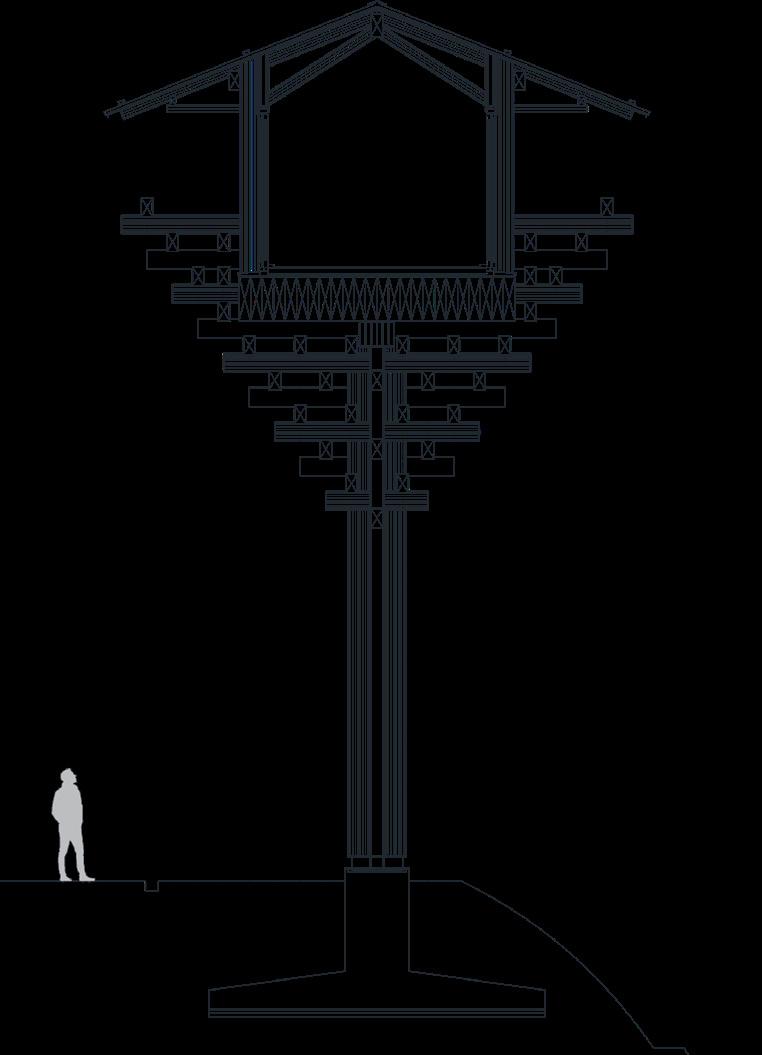
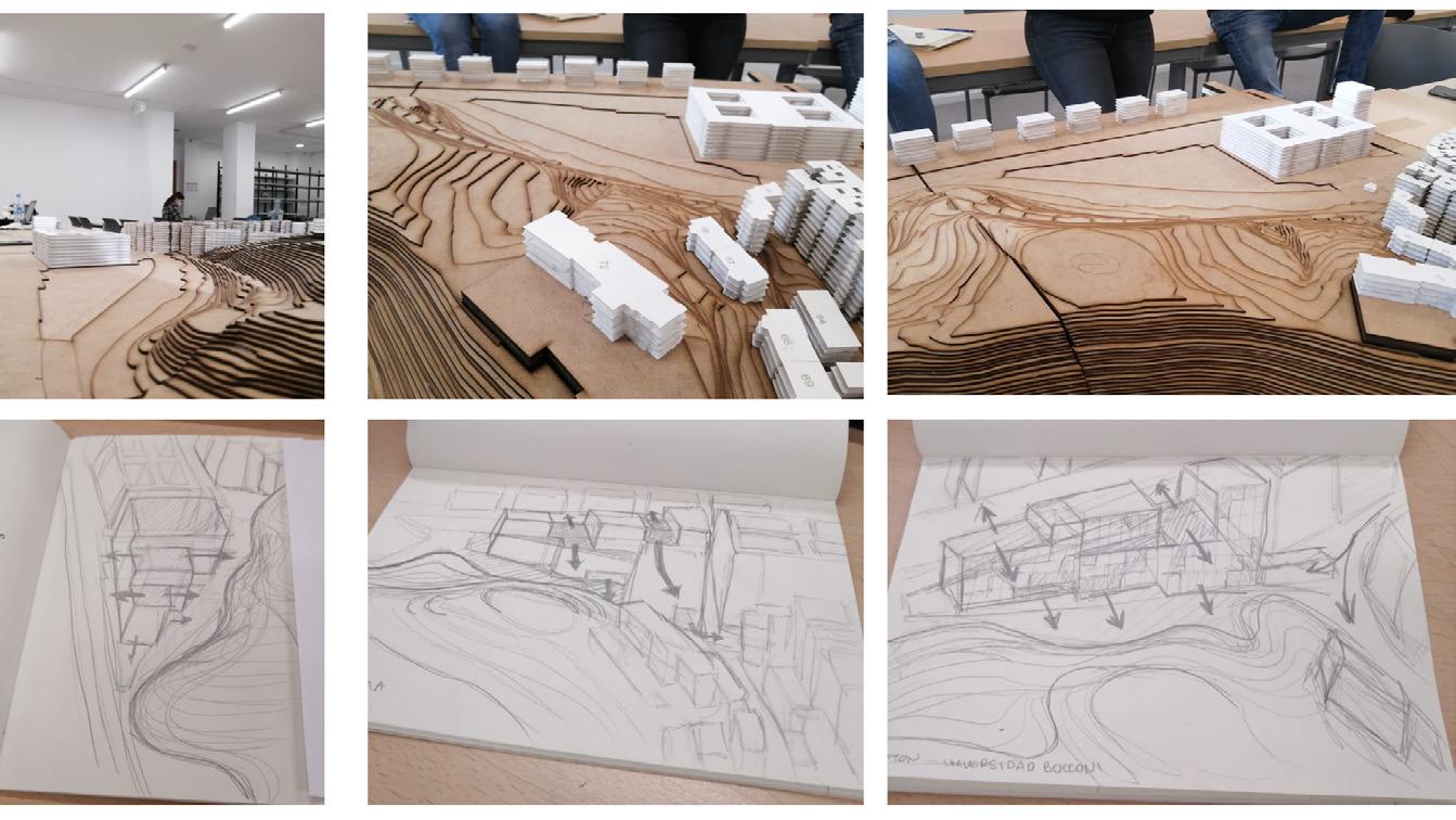
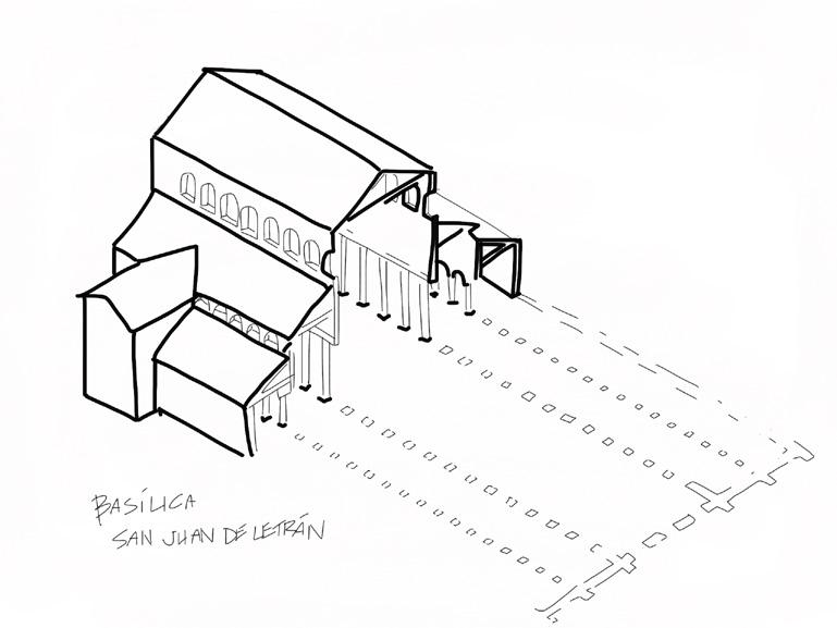


72
Para identificar áreas de oportunidad intervención que contribuyan a una mejor ordenación del paisaje de Urnieta, se debe analizar distintos aspectos del paisaje que pueden servir para unir o coser los distintos usos de suelo del municipio (industria, ambiente natural, urbanización).

Se escogió como área de estudio el área entre la urbanización de Urnieta al Norte y el límite del municipio con Andoain al Sur.
Uno de los aspectos que se analizaron es la calidad de los viales y la accesibilidad peatonal que estos tienen, ya que afectan la forma en que los ciudadanos se mueven dentro del municipio.
Al ser un área que comunica la ciudad con la industria, generalmente se pueden notar ejes principales de mala o nula accesibilidad peatonal, ya que son autopistas o vias de mayor velocidad. Viales al interior de la industria con calidad media pero que podrían tener una mejor conexión su entorno a la campiña.
Y vías peatonales o ciclistas que ya han sido pensadas para el disfrute del paisaje y tienen una mejor calidad en terminos de seguridad, pavimentos, delimitación, dimensiones, iluminación vistas.
Como muestras de la trama urbana de Urnieta se tomaron 4 tipos de vías o calles sobre las cuales se puede intervenir de forma que se mejore la experiencia peatonal general se pueda hacer un municipio más comunicado entre sus partes. Además se identificaron posibles nuevas conexiones entre viales para crear una ruta o un circuito
ANÁLISIS
Tras analizar accesibilidad peatonal, hitos, valor paisajístico y la relación via-paisaje, podemos comprender que Urnieta se encuentra segmentado en 3 partes: Industria, Campiña Urbanización. Esta segmentación que aunque existe desde hace más de 30 años, se exponenció por la creación de autopistas, carreteras y rotondas que priorizan al automóvil utilizan el paisaje solamente como áreas de paso.


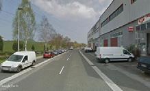
Con el proyecto se busca unir o coser el territorio de Urnieta, de modo que estas 3 áreas puedan comunicarse, revitalizarse y que los habitantes del municipio puedan disfrutar del paisaje de campiña en su totalidad, sin ser orillados a verlo solo desde la ventana del auto.


Se piensa como elemento unificador la accesibilidad peatonal de las vías existentes, por medio de una ruta o circuito cerrado que haga un recorrido por el área y que hace parada en 3 puntos específicos de intervención (1,2,3), que sirven para conectar paisaje-industria-ciudad.
Para intervenir estos puntos mencionados, se hizo un análisis de corte de terreno y calle para revelar qué tanto espacio se le dedica a cada actividad y usuario de la conexión Lezo- Pasai.
Y después basado en reglamentos de accesibili dad y acondicionamento urbano de Pais Vasco, y la Guía de diseño urbano de NACTO, se proponen mejoras a lo largo de la carretera donde además habrá puntos de atracción o actividad.
En el punto de Conexión desde Lezo (1), actual mente la carretera es casi completamente para el auto y se hizo una plaza/parque que no tiene mucho uso.
Se propone ampliar el espacio dedicado a la acera, hacer una acera del otro lado de la carretera, hacer un carril bici claramente delimitado y protegido y hacer una plaza-mirador más agradable con juegos para niños y bancas.
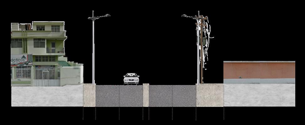
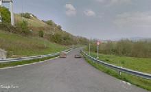
En el punto medio de la carretera (2), se nota el mínimo espacio dedicado al peatón y ciclista, que solo están protegidos por postes y no tienen espacio para disfrutar el paisaje o descansar.
Se propone ampliar la acera, hacer una acera al lado opuesto de la carretera, delimitar y proteger el carril bici y crear puntos terraza-mirador con bancas e iluminación para descansar, admirar el paisaje y hundirse en la vegetación actual.
73 1 2 3 4 1 2 3 4 ACCESIBILIDAD PEATONAL BUENO ACCESIBILIDAD DE CALIDAD BUENA MEDIO ACCESIBILIDAD DE CALIDAD MEDIA MALO ACCESIBILIDAD DE CALIDAD BAJA MUY MALO NO HAY ACCESIBILIDAD VIALES EXISTENTES POSIBLES CONEXIONES ENTRE VIALES LÍMITES DE ANÁLISIS LOCAL DIAGNÓSTICO Y PLAN DE MEJORA PAISAJÍSTICA DE LA SALIDA PEATONAL NATURAL DE URNIETA ORDENACIÓN DEL MEDIO, PAISAJE Y ACCIÓN TERRITORIAL ALEJANDRO, JIANG, MÓNICA
2 2 3 ESPACIOS DE OPORTUNIDAD PUNTOS DE OPORTUNIDAD PUNTOS DE UNIÓN O CONEXIÓN (NODOS) CAMPIÑA PAISAJE CONECTAR CON LA CIUDAD INDUSTRIA IMPACTO VISUAL PAISAJISTICO DIVISIÓN DE USOS MAYOR EDUCACIÓN/CULTURA SUELO URBANO USOS AISLADOS POR DIVISIÓN DE ZONAS DIAGNÓSTICO Y PLAN DE MEJORA PAISAJÍSTICA DE LA SALIDA PEATONAL NATURAL DE URNIETA ORDENACIÓN DEL MEDIO, PAISAJE Y ACCIÓN TERRITORIAL ALEJANDRO, JIANG, MÓNICA
ANÁLISIS
Solar junto al Colegio Salesiano, salida peatonal natural de Urnieta
Vista aérea
Conexión industria-restaurantes por medio de campiña
Vista aérea
Plancha aparcamiento junto a área industrial
Vista aérea
PROPUESTA DE INTERVENCIÓN URBANA
07/01/2021
Conexión Lezo-Pasai Donibane
Plano 3
14.7m 2.4m 8.0m Área verde libre Acera Carretera 7.35m 2.4m 8.0m Área verde libre Acera Carretera 7.35m Mirador 2.4m Ciclovía 2.4m Acera 3.5m Mirador Puerto ESTADO ACTUAL PROPUESTA Expansión de vía peatonal y ciclista, creación de miradores, a lo largo del puerto de ambos lados de la carretera. Puerto industrial de grandes dimensiones, con impacto visual, auditivo y ambiental. Víalidad peatonal y ciclista con poca 7.4m 2.4m 8.0m Área verde libre Acera Carretera Acera/ Ciclovía Puerto 7.4m 6.8m 8.0m Área verde libre Parquemirador Carretera Puerto 2.4m 2.4m Acera 2.4m 1 2 Conexión desde Lezo Punto medio de carretera
Mónica Piñones Urbanismo VII
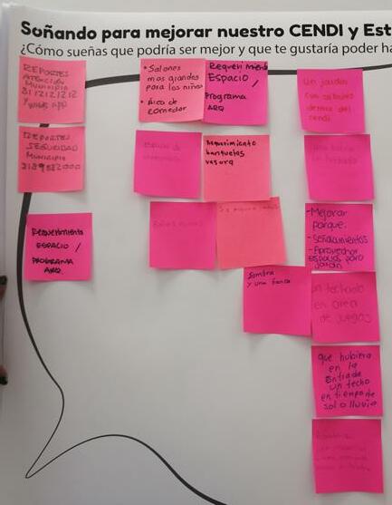
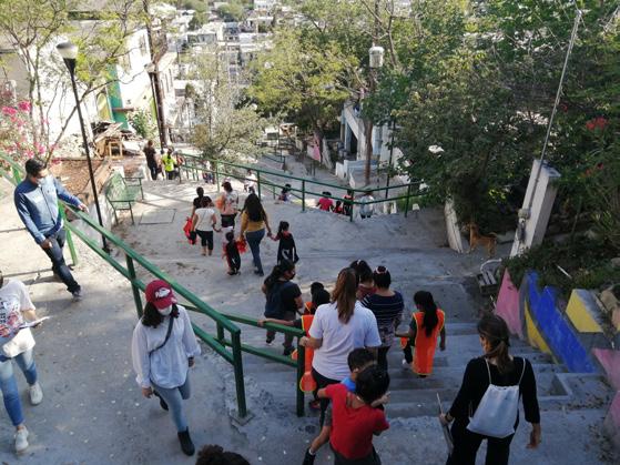
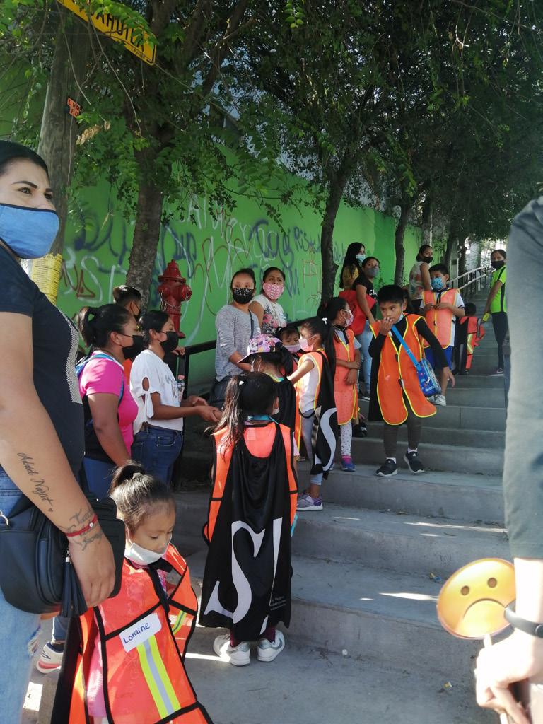
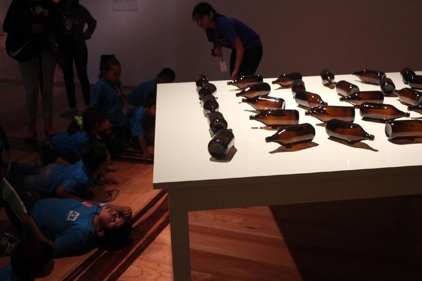
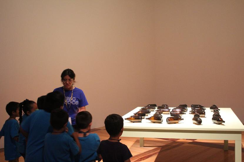
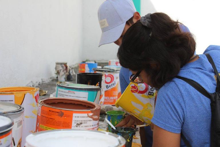
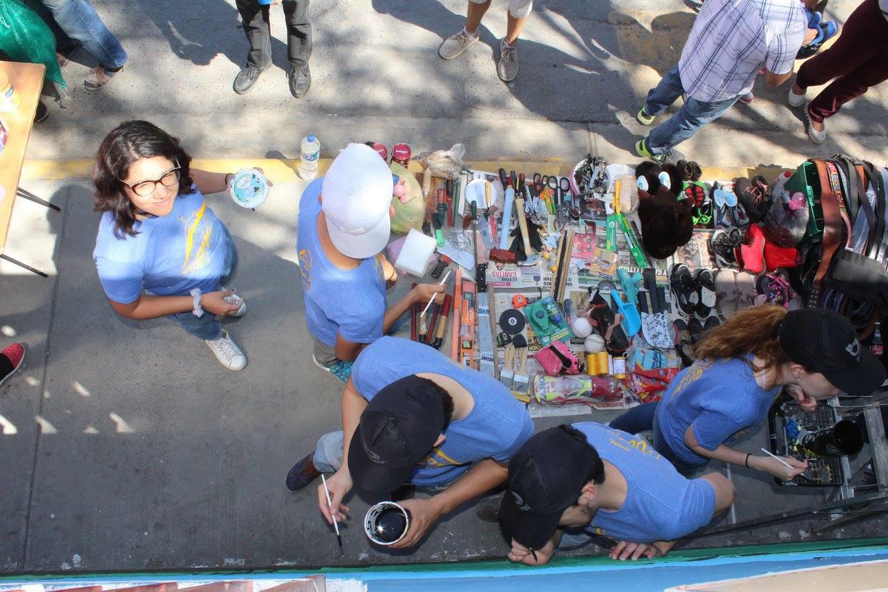
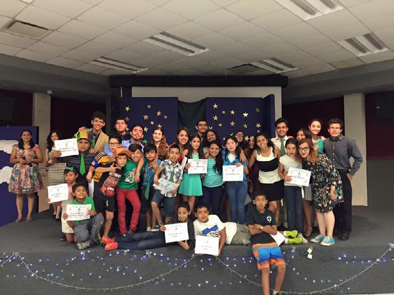
On-site Experiences




74
75
76


 Temple
 Auditorium


 Service Spaces Multipurpose Concert Hall Student + Collaborator Housing
Work/Rehearsal/Practice Spaces


