
MAY 17, 2016
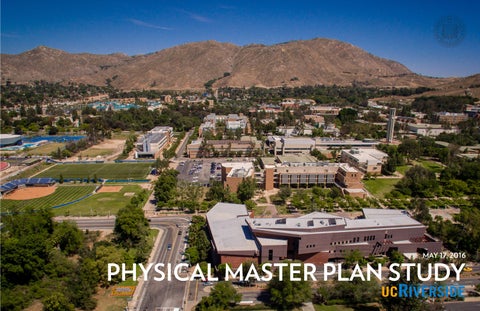
MAY 17, 2016
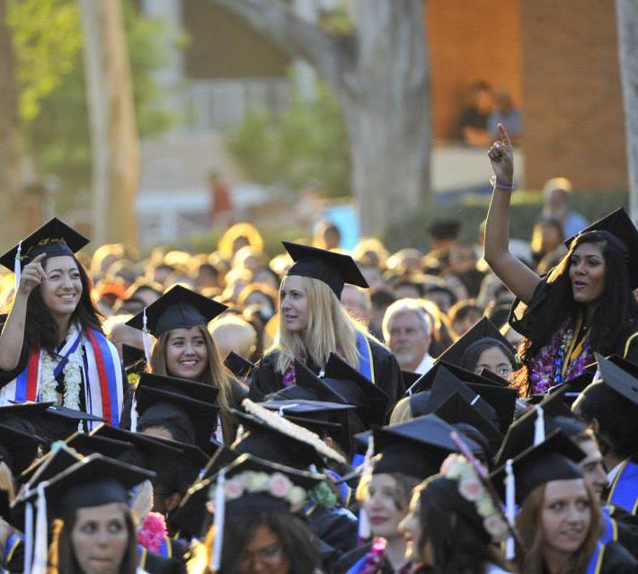
This is an exciting time at UC Riverside. Guided by the vision and goals set forth in our strategic plan, “UCR 2020: The Path to Preeminence,” we stand as an institution defined by academic excellence, student access, campus diversity and engagement with our community and the world. We have experienced phenomenal growth over the last decade and continue on that trajectory with plans to enroll over 25,000 students and grow our faculty by 300 by 2020. Sustaining this growth requires a thorough alignment of campus resources, with a particular emphasis on our physical environment.
This Physical Master Plan Study represents a comprehensive vision for UC Riverside’s physical campus. Envisioning a campus environment that is functional, attractive and committed to environmental stewardship, this study defines a methodology and physical structure consistent with our needs, values and aspirations as a world-class university. In so doing, this plan holds the potential of transformative change at UC Riverside.
I deeply appreciate the creativity, commitment and collaboration that has characterized this planning process. As students, faculty, staff, community members and civic leaders, you have all made valuable contributions. I look forward to working with you as we build a legacy for future generations.
Kim A. Wilcox
Paul D’Anieri, Co-chair: Provost and Executive Vice Chancellor
Maria R. Anguiano, Co-chair: Vice Chancellor, Planning & Budget
Ron T. Coley: Vice Chancellor, Business and Administration
Jay Eastman, AICP: Principal Planner, City of Riverside
Rob Gayle: Associate Vice Chancellor , Campus Architect
Ashley Harano: President, Associated Students of UCR
Jeff Kaplan: Associate Vice Chancellor, Capital Assets Strategies
Cindy Larive: Interim Dean, College of Natural and Agricultural Sciences
Nafi Karim: President, Associated Students of UCR
Jeff Kraus: Director, Office of Government & Community Relations
Janna M. Le Blanc: Asst. Director Human Resources – CPSU Engineering Dean’s Office
Richard A. Luben: Faculty Senate, Professor of Biomedical Sciences and Biochemistry, Emeritus
Kenneth J. Mueller: Director, Physical Plant
Nosang Myung: Professor and Department Chair Chemical/Environmental Engineering
Jocelyn L. Nakashige: Chief Financial and Administrative Officer, School of Medicine,
Charles J. Rowley: Associate Vice Chancellor, Chief Information Officer
Robert Slater: Interim Director, Physical Plant
Preston Williams: President, Graduate Students Association
Todd Wingate: Assistant Dean of Students, Student Affairs
Marylynn V. Yates: Dean, College of Natural and Agricultural Sciences
Rob Gayle: Associate Vice Chancellor, Campus Architect
Jeff Kaplan: Associate Vice Chancellor, Capital Assets Strategies
John O. White: Assistant Vice Chancellor, Capital Planning
R. Umashankar, Project Manager: Physical Planner
Barbara Lloyd: Project Communication Liaison
John J. Cook: Director, Office of Sustainability
Jon Harvey, AICP: Principal Educational Facilities Planner, Capital Planning
Sherman L. Kyles: Planning Intern
George MacMullin: Interim Director, Architects & Engineers
Tricia D. Thrasher, ASLA, LEED AP: Principal Environmental Planner, Capital Planning
Todd Wingate: Assistant Dean of Students, Student Affairs
Leslie Rose: PMT Support
Matthew McIvor: PMT Support
Susan Marshburn, Chair: Executive Director of Housing Services, Housing, Dining & Residential Services
Edmund Buenrostro: Admin Asst / Resident Assistent, University Extension
Ann Frenkel: Associate University Librarian for Research and Inst. Services, Rivera Library
Jon Harvey: AICP, Principal Educational Facilities Planner, Capital Planning
Nafi Karim: President, Associated Students of UCR
Janet Lucas: Executive Associate Director of Athletics/SWA, Athletics
Laura Riley: Director, Student Special Services
Alaina Sudeith: Resident Director for Glen Mor Student Apartments, Residence Halls
Arvin Varma: Associate Director of Programs, Student Recreation Center
Ellen R. Whitehead: Director, Student Life
Preston Williams: President, Graduate Students Association
Todd Wingate: Assistant Dean of Students, Student Affairs
Irma Henderson, Chair: Director, Transportation & Parking Services
JC Allen Sr.: Director, Service Enterprises
Dolores Cordova: Physical Plant Office of Purchasing
Cheryl Garner: Executive Director of Dining, Catering & Conference Services Dining
Rob Gayle: Associate Vice Chancellor, Campus Architect
Lisa Martin: Emergency Manager
Peggy A. Mauk: Director of Agricultural Operations, Agricultural Operations
Mike Lane: Chief of Police, UC Police Department
Andrew Stewart: Superintendent, Parking Operations
Russell Vernon: Director, Environmental Health & Safety
R. Umashankar: Physical Planner
Kenneth J. Mueller, Co-Chair: Director, Physical Plant
John J. Cook, Co-Chair: Director, Office of Sustainability
Matthew J. Barth: Director, CE-CERT
Nils Burkland: Steam Plant Supervisor, Steam Plant
Robert Corey: Head Electrician
Chris Flanders: EMS Controls Superintendent, Steam Plant
Amanda E. Grey: Environmental Program Manager, Storm Water
Ruby A. Gonzalez: LEED Analyst, Office of Sustainability
Jerry Wayne Higgins: Maintenance Plumber Supervisor, Water/Sanitary Sewer
Karen Jordan: GIS Specialist, Capital Asset Strategies
George MacMullin: Senior Engineer, Architects & Engineers
Dan S. Martin: Communications Campus Planner, Computing & Communications
Charles Wyman: Faculty, Chemical & Environmental Engineering
Jon Harvey, AICP: Principal Educational Facilities Planner, Capital Planning
Toshio G. Ishida, Chair: Assistant Director of Landscape & Refuse Service Physical Plant, Physical Plant Grounds
Michael A. Anderson: Faculty, College of Natural and Agricultural Sciences
James H. Baird: Faculty, College of Natural and Agricultural Sciences
Delphine Faugeroux: Science Specialist, Office of Sustainability
Patricia Garcia: Housing
Hassan Ghamlouch: Director of Facilities Management, Housing, Dining, & Residential Services, Fortino Morales: Botanical Garden/ Arboretum Manager, R-Garden
Kenneth J. Mueller: Director, Physical Plant
Gustavo Plascencia: General Manager, Special Projects, Housing, Dining, & Residential Services, Dining Services
R. Umashankar: Physical Planner, Capital Planning
Technology
Dan S. Martin, Chair: Communications Campus Planner, Computing & Communications
Gregory J. O. Beran: Faculty, Chemistry Department
Israel Fletes: Director of Educational Technology and Computing Services, Computing and Communications
Karen Jordan: GIS Specialist, Capital Asset Strategies
Patrick Hartney: Assistant Dean, Finance & Administration, Bourns College of Engineering
Jon Harvey: AICP Principal Educational Facilities Planner, Capital Planning
Charles J. Rowley: Associate Vice Chancellor, Chief Information Officer
James S. Tobias: Faculty, English Department
City & Community
Gurumantra Khalsa, Chair: University Neighborhood Association and Friends of Riverside’s Hills
Richard Block: Member of Friends of Riverside’s Hills
Kevin Dawson: Member of the University Neighborhood Association
Christina Duran: Riverside Resident
Jeff Kraus: Director, Office of Government & Community Relations
Robin Lang: East Hills Division of the Riverside Chamber
Andy Melendrez: Riverside City Council Member – Ward 2
David Murray: Senior Planner, Riverside Planning Dept.
Diana Ruiz: Chair of the University Knolls Homeowners Group
Stan Stossel: Riverside Planning Commission
Susan Straight: Faculty, Creative Writing
Master Planning
Buzz Yudell: Partner-in-Charge, Moore Ruble Yudell Architects & Planners
Mario Violich: Principal-in-Charge, Moore Yudell Architects & Planners
Simone Barth - Auster: Senior Associate, Moore Ruble Yudell Architects & Planners
Mike Zilis: Principal, Walker Macy
Ken Pirie: Senior Associate, Walker Macy
David Herd: Partner, BuroHappold Engineering
Julian Parsley: Associate Principal, BuroHappold Engineering
Gideon Susman: Senior Engineer, BuroHappold Engineering
Chris Forney: Principal, Brightworks Sustainability
Joshua Hatch: Principal, Brightworks Sustainability
Civil
Alysen Weiland: Project Manager, PSOMAS
Cost
Chris Sterparn: Principal, The Capital Projects Group
Sarah Brandenberg: Principal, Fehr and Peers Transportation Consultants
Chris Gray: Senior Associate, Fehr and Peers Transportation Consultants
3-D Renderings
Shimahara Illustration
Drone Photography
John Goolsby, Godfather Films
Air Changes per Hour (ACH) - the number of times the air in a space is completely replaced by infiltrated or ventilated air, per hour
Air Handling Unit (AHU) - a device that regulates and circulates air as part of a heating, cooling and air conditioning system
Alignment - the proper positioning of priorities and criteria for decisions with agreement among responsible parties
ASHRAE - the American Society of Heating, Refrigerating and Air-Conditioning Engineers
Arroyo - a drainage gully, often steep-sided, carved by ephemeral running water
Average Vehicle Ridership (AVR) - the average number of occupants in a vehicle
Basic Gross Area - building area measured from outside faces of exterior walls, disregarding projections (cornices, pilasters, buttresses) which extend beyond the wall faces. Overhangs for sunshades and similar features are not included
Belltower - a landmark element at the center of Carillon Mall
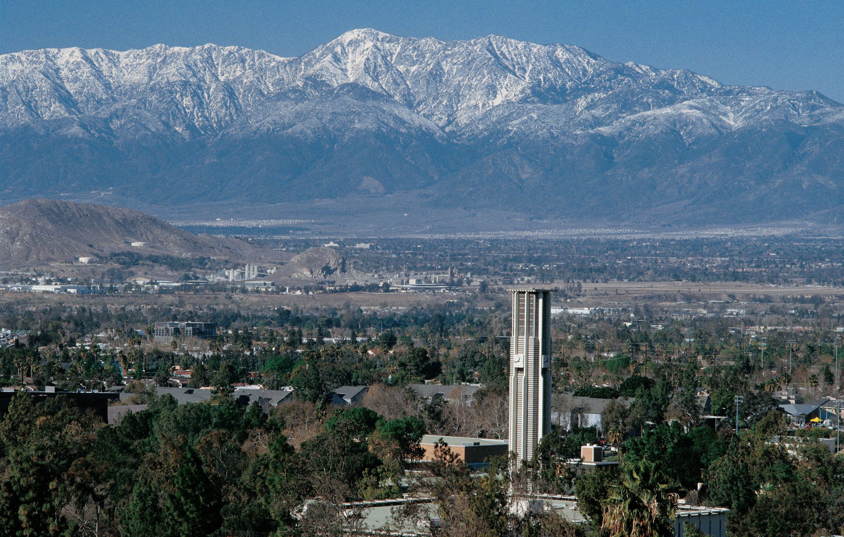
Box Springs Mountains - the dominant range of mountains to the east and south of the UC Riverside campus
Capital Finance Plan (CFP) - UC Riverside’s multi-year program of proposed capital construction and renovation, submitted annually for acceptance by the Board of Regents
Carbon Neutrality 2025 - the University of California’s initiative for all its campuses to become carbon neutral by 2025
Carillon Mall - the primary open space in the heart of the campus
Constant Air Volume (CAV) - a mechanical system that provides forced air to building spaces for heating, cooling and ventilation, at a constant rate
Core Campus - the region within the East Campus that contains nearly all of the academic buildings, as well as most of the University’s older buildings
Cost Drivers - those characteristics of the physical context of the institution or facility type that disproportionately influence cost
Covered Unenclosed Area - includes covered or roofed areas of a building located outside of the enclosed structure for all stories which have floor surfaces
Critical Alignments - guiding alignments from one building to another, to frame open spaces and views
Degree-Day (Heating / Cooling) - a measurement of heating or cooling load relative to a base temperature. It is the product of the number of days during the year and the degrees above (cooling) or below (heating) the base temperature each day
Demand Control Ventilation (DCV) - A control method that modulates the volume of fresh air supplied to a space based on the current air quality
Direct Digital Control (DDC) - a centralized computer-based control system, as opposed to separate control and actuation points operating on the same system
East Campus - the portion of campus east of the Interstate 215 /SR-60 freeway
Energy Efficiency Measure (EEM) - A modification made to a building’s systems or operation that is intended to reduce annual energy consumption
Emissions Factor - a value expressing the relationship between a pollutant released into the atmosphere and the activity associated with that release
Endogenous - conditions that are tied directly to the campus, such as geology, topography and site development
Energy Use Intensity (EUI) - A building’s annual energy use, as consumed on-site, measured in kBtu/ft2/year
Essential Elements - the four fundamental guiding principles of the Physical Master Plan Study that are derived from UC Riverside’s Values, Beliefs and Principles—“Identity, Community, Stewardship, and Density”
Exogenous - conditions that are beyond the campus such as evolving pedagogy, codes/regulations, and energy costs
Flexibility - the ability of a capital asset to adapt to its uses – presently and over time – to accommodate a variety of anticipated needs. Also referred to as “Long Life/ Loose Fit”
Floor Area Ratio (FAR) - the total built space on a given site, divided by the area of the site itself. It is an absolute measure of the built density of an area of land
Full Storage Operation - a mode of operation for a cooling system with thermal energy storage in which thermal stores are fully charged during the off-peak tariff period (night time) and fully discharged, with chillers off, during the peak tariff period (daytime)
Gateways - points of arrival on campus that identify the institution
Greenhouse Gas (GHG) - any of the gases whose absorption of solar radiation is responsible for the greenhouse effect, including carbon dioxide, methane, ozone, and fluorocarbons
Interstitial Space - an area at the intersection of different types of spaces; e.g., the area between the inside and outside of a building
kBtu/sf/yr - one thousand British Thermal Units per square foot, per year
Leadership in Energy & Environmental Design (LEED) - a third-party certification program and nationally accepted organization for the design, operation and construction of high-performance green buildings and districts
Legacy Buildings and Landscapes - prominent cultural elements / buildings and open spaces on campus
Leverage - the deployment of relatively small additional investments in existing capital assets to achieve significant returns for purposes of advancing a new project
Living Building Challenge - a building certification program and advocacy tool that defines the most advanced measure of sustainability in the built environment possible today
Load-levelling (Otherwise known as peak-lopping) - A mode of operation for a cooling system with thermal storage in which chillers are run constantly with the thermal stores being charged during low load periods and discharged in peak load periods
Long Range Development Plan (LRDP) - UC Riverside’s plan and the accompanying Environmental Impact Report, the two guiding documents for the physical growth of the campus, approved and certified in 2005
Low Impact Development Best Management Practices (LID BMP) - Design Handbook of methodologies developed by the Riverside County Flood Control and Water Conservation District
Mobility Hub - the multi-modal transportation center proposed as part of the future gateway on University Avenue.
MtCO 2 e - metric tonnes of carbon dioxide equivalents
North District - northern portion of campus projected for new student residential, retail and recreation and the Campus Events Center.
Open Space Framework - the network of open spaces, malls and walks on campus, including pedestrian / bicycle paths
Opportunity Site - a discrete area found to be underserving the campus relative to its potential
Perimeter Loop Road - The loop encircling the Core Campus consisting of University Avenue, North Campus Drive, East Campus Drive, South Campus Drive and West Campus Drive
Permeable Building - a building that facilitates pedestrian movement through its ground floor
Phase Change Materials (PCM) - lightweight material with a high capacity to absorb or release heat when melting or freezing over a narrow temperature range. Commonly used a replacement to thermal mass.
Photovoltaic (PV) - generation of electric current at the junction of two substances exposed to light. A process typically supported by commonly known electricity generating solar panels
Physical Master Plan Study (or Master Plan Study) - the overall subject of this document resulting from the planning process, including the Planning Framework
Planning Framework - guidance regarding the future growth of the campus, intended to be adaptable and flexible over time.
Plant Palette - a combination of plants selected for a landscape area
Public Realm - pathways, open spaces, courtyards, and other public and pedestrian-oriented areas
Public Realm Opportunity Site - includes broader improvements to campus circulation, open space systems and associated infrastructure, not just buildings
Riverside Transit Agency (RTA) - the main bus and public transit agency for western Riverside County, providing both local and regional services, including to the UC Riverside campus
Solar Fraction - the ratio of solar energy input to total energy input (normally including natural gas) in a solar powered system
Site Development Area - area outside of the building footprint within the construction limit of work, including all areas that will be redeveloped.
Solar Heat Gain Coefficient (SHGC) - the fraction of incident solar radiation admitted through a window, both directly transmitted and absorbed and subsequently released inward
Solar Reflectance Index (SRI) - the fraction of the incident solar energy which is reflected by a surface
Stormwater - precipitation that infiltrates into the soil, evaporates, or drains to nearby water bodies
Strategic Initiatives - high-level recommendations which support achievement of the study’s Essential Elements
Structural Landscape - landscape areas that define circulation and interstitial spaces around buildings
Swale - a low, planted basin that receives and filters runoff from its surrounding area
Synergy - the ability of a combination of capital asset investments to generate greater benefits as a group than the sum of the benefits accrued to each project individually
Thermal Mass - high thermal capacity building constructions, such as brick or concrete, that can reduce internal temperature fluctuations by usefully absorbing and releasing heat over time
Transportation Demand Management (TDM) - the application of strategies and policies to reduce travel demand (specifically that of single-occupancy private vehicles), or to redistribute this demand in space or in time.
Transportation & Parking Services (TAPS) - the University department that manages parking, enforcement, shuttles and alternative transportation
U-Pass Program - public transportation program which provides free rides on local buses to any member of the UC Riverside community
Variable Air Volume (VAV) - a mechanical system that provides forced air to building spaces for heating, cooling and ventilation, at a variable rate. These systems have lower annual fan energy than CAV systems
Variable Frequency Drive (VFD) - a type of motor controller that controls motor speed by varying frequency and voltage. This allows motor driven systems, such as fans and pumps, to operate at variable rates for potential energy savings
Variable Refrigerant Flow (VRF) - a type of heating and cooling system that uses refrigerant, as opposed to water or air, to deliver heating or cooling to a space
Vehicle Miles of Travel (VMT) - a metric calculated to measure the amount of daily vehicular traffic for a selected area. The vehicular traffic amounts are either estimates (current or past data) or they are projections (future data)
West Campus - the portion of campus west of the I-215/SR-60 freeway, currently utilized primarily for agricultural research
A Message from the Chancellor Planning Team Glossary of Terms Table of Contents
ES.1 Building on the Path to Preeminence
ES.2 Planning Strategies to Strengthen the Campus
ES.3 Enhancing the Public Realm
ES.4 Opportunities for Future Growth
ES.5 Integrated Planning
1.1
CHAPTER 3: NEW PLANNING FRAMEWORK
3.1 Flexible Framework for Growth
3.2 Foster a Sense of Campus Community
3.3 Reinforce Institutional Identity
3.4 Exercise Stewardship
3.5 Define Appropriate Density
3.6 Begin the Transformation Process
4.1 Integrate Natural Surroundings
4.2 Create a Vibrant Campus Open Space Network
4.3 Landscape Character
4.4 Beautify and Activate Campus Edges
4.5 Create Complete and Pedestrian-Friendly Campus Streets
CHAPTER 5: CIRCULATION AND TRANSPORTATION
5.1 Improving Mobility Options
5.2 Manage Parking Supply and Demand
5.3 Improve Service Routes and Loading Areas
CHAPTER 6: INFRASTRUCTURE AND UTILITIES
6.1 Vision
6.2 Methodology: Carbon Model Review
6.3 Buildings
6.4 Campus Cooling
6.5 Campus Heating
6.6 Campus Power
6.7 Stormwater Quality and Management
6.8 Sanitary Sewer
6.9 Water Distribution
6.10 Irrigation Water System
CHAPTER 2 AND 3
Plant Growth Environments Study
Mobility Hub Concept Study
CHAPTER 4
Plant Palette Suggestions
CHAPTER 5
TDM Report
CHAPTER 6
Building Audit Report
Calculated Chilled Water Network Leg Capacities
Calculated Steam Network Leg Capacities
Hydrology Report
Stormwater Quality Report
Sanitary Sewer Calculations
Water System Calculations
Irrigation Water Calculations
CHAPTER 7
2025 UCR Carbon Neutral Campus Building Inventory Analysis
CHAPTER 8
Cost Model
The University of California, Riverside is a highly regarded public university with a strong reputation for research, opportunity, and achievement. As the University enters the next decade, our vision is to build upon our strengths and strategically grow in both size and significance, epitomizing excellence in all that we do: advancing and communicating knowledge through cutting edge research and creative activity; developing and inspiring the leaders for tomorrow’s world; transforming communities, both locally and globally; and demonstrating that diversity is both a measure of excellence and a means of achieving it.
• Continue to build on the current planning theme of “simple buildings in a dramatic landscape” to celebrate the campus’ unique setting at the base of the Box Springs Mountains.
• Articulate campus gateways to strengthen campus identity.
• Frame views towards the heart of campus and the Belltower, and outwards to the Box Springs Mountains through the careful configuration of future buildings in the Core Campus.
• Infill strategically located “opportunity sites” on East Campus to increase density and accommodate future growth.
• Manage university land and research resources on West Campus as strategic assets to sustain UC Riverside’s excellence long into the future.
• Shape buildings, campus open spaces and interstitial environments to promote collaboration and interaction.
• Address common interests of campus and community by creating a safe environment for pedestrians and bicycle riders at the campus perimeter with managed service and vehicular access.
• Foster a sense of campus community by enhancing campus zones and linking them through pedestrian promenades.
The University has identified achieving the profile of an Association of American Universities (AAU) institution as one benchmark for measuring its success. The ability to achieve the profile of an AAU member requires the campus to accelerate development of its infrastructure in support of research and creative activity and achieve higher levels of success. Modern, attractive, functional, and sustainable facilities play a critical role in recruiting and retaining strong faculty, students, and staff; enhancing research productivity; and improving campus setting. Aesthetics, accessibility, and functionality of the physical setting are the foundation, both literally and symbolically, for campus life. Thus, plans for new and renovated facilities must be consistent with the University’s Strategic Plan.
UC Riverside’s enrollment is projected to surpass 25,000 students by 2020, with the further possibility of 30,000 students by 2025.
As the University population grows, its physical needs will be accommodated through a mix of new construction and strategic renovation across all facility types. These include academic and research, student life, student-oriented housing improvements as well as enhancements to the campus’s public realm. Future growth will enhance and support UC Riverside’s teaching, research, and service endeavors, with an unwavering focus on green facilities and sustainable practices.
The Physical Master Plan Study (“Master Plan Study”) demonstrates how up to 1.5 million square feet of new academic and support space and at least 3,700 additional student beds can be added within the existing fabric of East Campus. The environmental impact of this level of potential growth will be evaluated in an environmental impact report in support of the next Long Range Development Plan (LRDP) update. Simply growing, however, is not enough. The development opportunities in this study show ways of accommodating this growth while advancing the planning goals and leveraging its land resources in a thoughtful manner.
UC Riverside’s Master Plan Study is a tool to guide future decisionmaking regarding campus development, in support of the Strategic Plan’s academic vision and Long Range Development Plan. It defines building development opportunities and their capacity to accommodate anticipated growth, as well as opportunities to improve and better integrate the surrounding framework of circulation and open space.
The LRDP projects future enrollment and square footage growth, and articulates where that growth is to occur by designating land uses. LRDPs are adopted by the Regents. The environmental impacts of LRDPs are evaluated in Environmental Impact Reports.
This Physical Master Plan Study articulates development concepts that will be incorporated into the next update of the LRDP. It is neither a detailed land use plan, nor a commitment to a set of projects. As needs are defined and supporting funding becomes available, specific projects will be developed following the defined framework. It is flexible, not prescriptive. While some of the ideas represent completely fresh thinking about campus growth, many others are logical extensions of previously articulated goals and strategies. The intent is that the University continues on a rational course, adjusting where necessary to carry investments forward in an organized and reasonable fashion.
The Master Plan Study is a campus-level planning study with a very broad set of recommendations. For the physical planning concepts presented herein to take effect, they must first be incorporated into the campus’s Long-Range Development Plan and Physical Design Framework. It guides more detailed studies yet to be undertaken for specific areas and systems, such as a Landscape Master Plan, Campus Design Guidelines, and a Bicycle Master Plan Study.
The master planning process was led by two primary teams. The first, the Steering Committee, directed the Planning Team through all phases of the visioning and planning process. The Steering Committee was co-chaired by the Provost and the Vice Chancellor for Planning and Budget. The second, the Project Management Team, managed the visioning and planning process and provided staff assistance; coordinated all communications between the University and the consultant team; vetted observations, findings and recommendations; and were hands-on in crafting the final report. The Project Management Team consisted of key campus stakeholders and subject matter experts.
The planning process was divided into four major phases:
• Assess campus site and infrastructure
• Review previous campus and city studies
• Confirm program needs
• Develop Physical Master Plan Study beliefs and principles
• Create planning framework scenarios
• Define growth and cost capacity range
• Develop environmental stewardship strategy and priorities
• Engage campus and community
• Confirm preferred planning framework
• Analyze campus infrastructure systems
• Summarize capital investment cost
• Review document (University)
• Publish Physical Master Plan Study Report
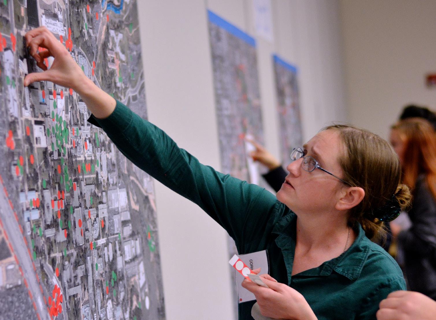
In the Understanding phase, the Planning Team gathered information from a variety of sources to develop an understanding of the campus and its needs. Workshops with stakeholders, data collected in previous studies and on-site observation of the campus all provided valuable insight.
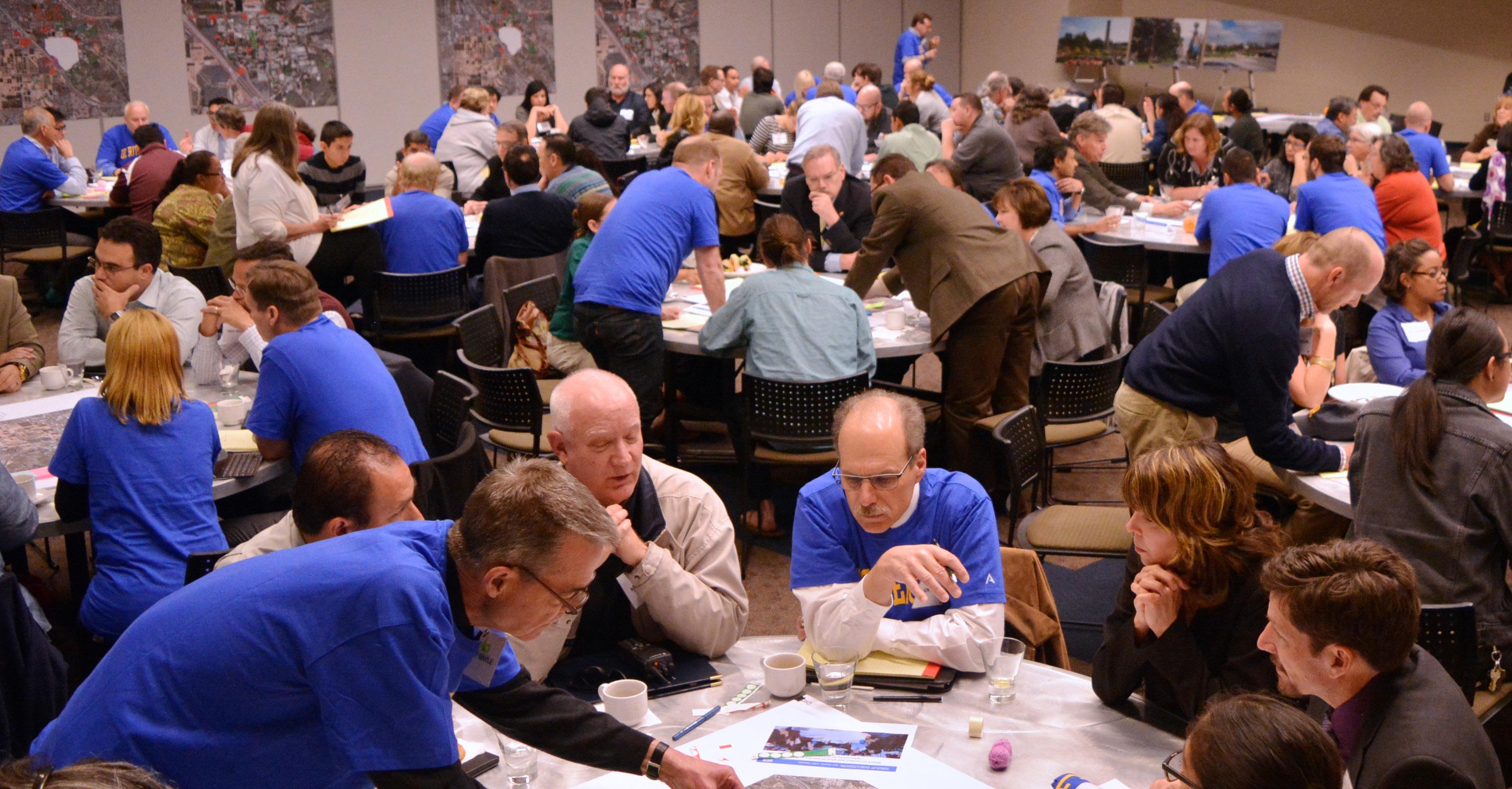
The University sought to involve a wide range of constituents in the planning process. Students, faculty, staff and community members participated in a series of on-campus workshops where they were asked to identify areas of the campus that worked well, and those that presented challenges. Five specialized “Working Groups” of subject matter experts gave targeted input on technical campus-based issues, namely Technology, Sustainable Practices, Sustainable Infrastructure, Student Life, and Campus Logistics and Safety. A sixth group, City and Community, provided general input on the University’s relationship to the surrounding neighborhoods.
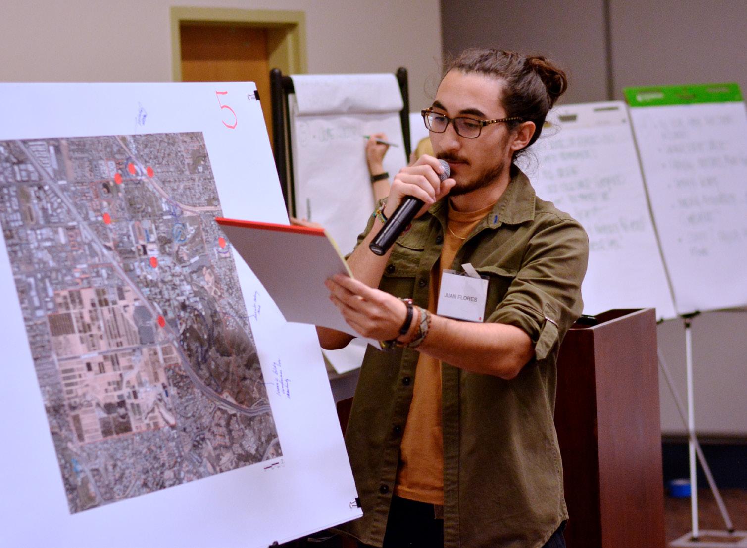
In the Integrating phase, the Planning Team tested development scenarios looking at a range of densities and program distribution. In subsequent workshops, attendees responded to these scenarios. Through several working sessions, the planning scenarios evolved and were eventually merged into a single planning framework that reflected consensus on key aspects of the future campus. The opportunities and recommendations in the Master Plan Study take the information gained through these sessions into consideration and address concerns to the greatest extent possible. The resulting plan thus represents not just the will of University leadership, but a shared vision of many who hold a stake in the institution’s continued success.
The Planning Team also examined previous planning documents and utilized quantitative data on enrollment, housing, and space utilization to formulate recommendations. Where specific information was not available or not current, the Planning Team conducted careful assessments. Qualitative evaluations were made of patterns of use throughout the campus. Observations of the existing character and condition of various campus zones were recorded. The Planning Team also performed quantitative analyses of existing building performance. Throughout the Integrating and Validating Vision phases, financial stewardship was central to the planning process. Financial stewardship focuses upon responsible investment to achieve the desired return to the campus. In the selection of proposed development sites, the Planning Team analyzed relative development costs for the various campus districts. The area within and immediately adjacent to Campus Drive (Core Campus) was found to offer the greatest discount given available infrastructure and minimal site development costs. The steeply sloping hillsides south and east of Core Campus carry the highest premium, followed closely by West Campus, due primarily to the significant up-front site utility investments required.
Essential Elements are the major objectives the University desires to achieve directly through the Master Plan. They are the distilled results of the Understanding phase, and have been profoundly influenced by the values, beliefs, and principles articulated through the planning process. These broad goals guided the development of the Master Plan Study’s strategic initiatives. Interventions into the physical campus were prioritized based on their ability to achieve one or more of the elements.
Enhance Sense of Place
• Strengthen a sense of connection to the campus’s natural surroundings.
• Create better-defined and more welcoming open spaces.
• Integrate existing buildings and open spaces with future development.
Facilitate Engagement
• Strengthen an environment for living and learning.
• Create vibrant spaces that can be used for more of the day and evening.
• Leverage campus open spaces to accommodate varied programs.
Exercise Environmental Stewardship
• Recognize that stewardship is both an environmental and fiscal imperative.
• Create value by leveraging existing campus buildings and infrastructure.
• Reduce demand for energy and pursue less carbon-intensive energy sources.
Demonstrate Leadership and Innovation
• Embrace compact development to achieve new capacity for growth.
• Increase connectivity and ease of movement throughout campus.
• Promote synergies among communities, departments, buildings, and open spaces.
EXTEND AND REFINE THE OPEN SPACE FRAMEWORK
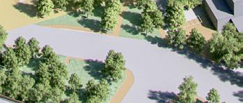
Open space is composed of paths and places. Paths move people from courtyards to plazas, to malls, and to other spaces. Places encourage people to stay and gather. These outdoor rooms serve many of the same programmatic functions as buildings—academic, social, and environmental. These places are memorable, and form lasting impressions on those who experience the University. Richness in a campus open space network comes from a mix of open space types –formal and informal. Buildings shape path and place, and vise-versa, thus a thoughtful configuration of buildings is critical to the development of a successful open space network.
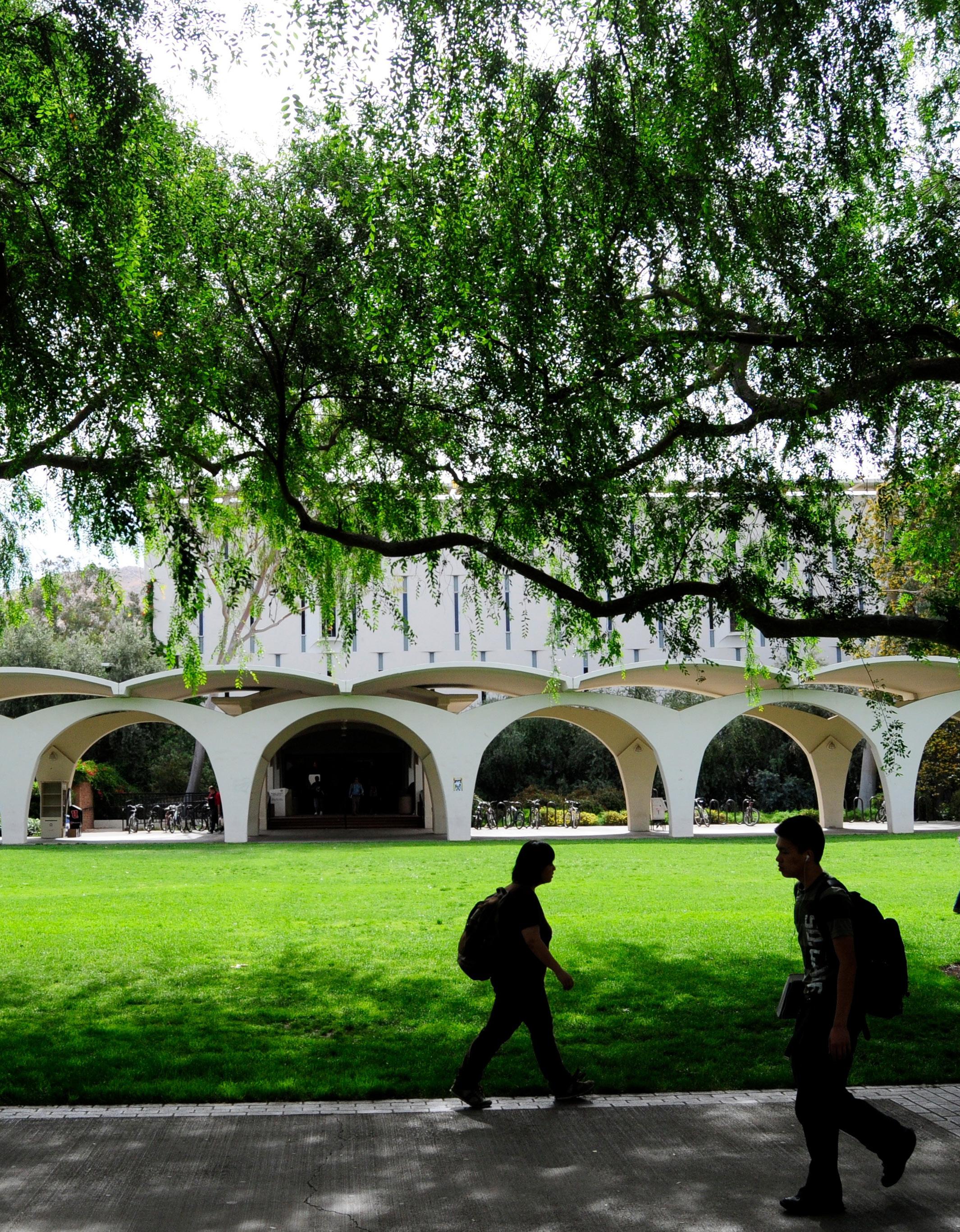
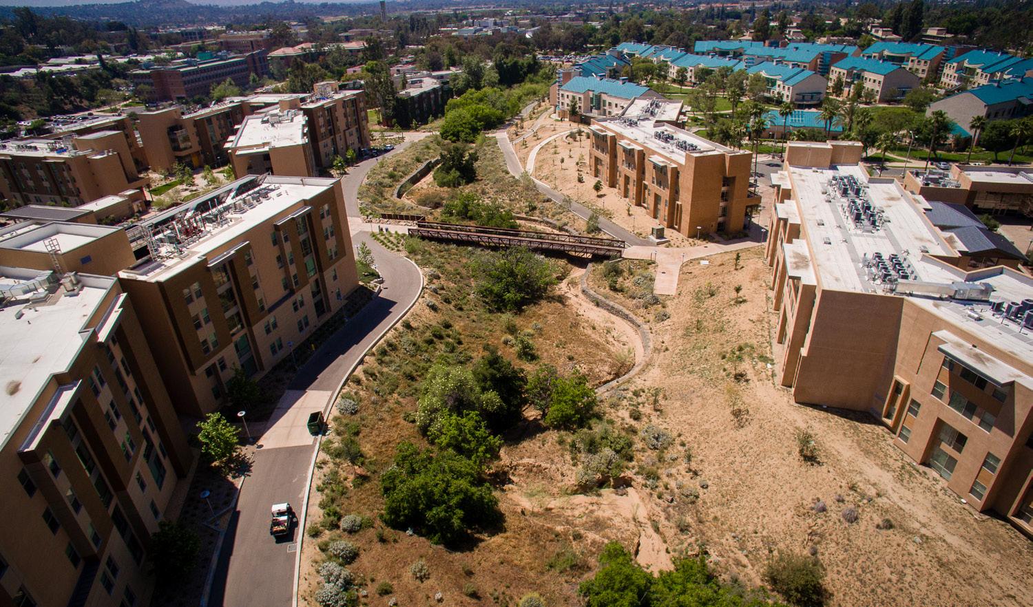
The Carillon Mall is the signature open space, and the anchor of the open space framework. Secondary and tertiary open spaces connect to it to form a network that extends to the outer edges of the campus. The Master Plan Study strives to strengthen campus open spaces by locating new buildings to form clear edges to open spaces that are special places to relax, work, and/or gather.
The campus landscape can be significantly improved, in some cases, by removing existing buildings that interrupt the open space framework. As an example, Spieth Hall interrupts the intersection of the Carillon Mall and Citrus Walk. Its removal will open a new viewshed to the hills to the south from Core Campus. Recreation Mall is an entirely new open space opportunity, providing pedestrian connectivity from Core Campus to future housing recreation, retail and the Campus Event Center to the north.
Key open space strategic initiatives include:
• Connect existing malls and walks.
• Create a network of shaded walkways.
• Increase priority for pedestrian use of open spaces and paths.
• Improve links to the center of campus.
• Orient new building entrances to address the pedestrian environment.
• Create a landscaped buffer zone against the freeway.
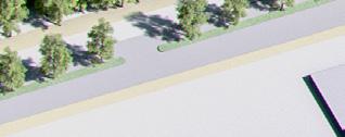
The perimeter of the campus is the public face to the world, and often the first impression for those who visit. Creating a strong identity at its interface with the surrounding community communicates institutional pride. Oftentimes, campus property is indistinguishable from nonUniversity land, and first-time visitors have difficulty navigating from perimeter parking lots to destinations in the heart of campus.
Clearly defining campus gateways strengthens campus identity and aids in navigation. Enhancing the primary gateway at the intersection of University Avenue and Canyon Crest Drive—the University Avenue Gateway—will provide a sense of arrival and introduces visitors to the unique visual identity of campus. Two additional secondary entrances will be defined on the northern and southern sides of East Campus—Blaine Street at Canyon Crest Drive to the north and Campus Drive at Canyon Crest Drive to the south.
“Campus nodes” are intersections of particular importance, primarily around the campus perimeter. By prioritizing these areas for investment in upgrades to paving, lighting, and landscaping, the University will achieve stronger return on investment, as the prominence of these intersections magnifies the value of such improvements. Other opportunities for improvement include better managing traffic and service activities, improving landscape and wayfinding at campus edges, and creating a safer environment for pedestrians and bicycle riders.
Experiences, history, and cultural identity are what make a place memorable.
Careful consideration thereof is necessary to ensure that UC Riverside’s history connects to its future as the campus evolves. Development of the University’s institutional identity begins with respecting its rich history through recognition of the role key buildings and open spaces play in defining a sense of place. Historical significance, a measure that is somewhat subjective and often defined in different ways, is evaluated in this study by the following criteria:
• Age
• Significance to the campus
• Architectural character
• Responsiveness to climate
• Contributions to adjacent open space
Visually strengthening the connection to the Box Springs Mountains to the east and the citrus groves on West Campus is a primary goal of the new planning framework. Proposed development sites are located to preserve and enhance views to these iconic natural features. The theme “simple buildings in a dramatic landscape” guides the new planning framework as it seeks to bring the natural and built environment into balance.
Where the current Master Plan Study departs most significantly from previous studies is in the decision to consolidate new growth on East Campus and retain existing uses on West Campus for the forseeable future. Higher-density development with a diverse range of academic and administrative programs in close physical proximity will encourage programmatic synergies and promote sustainable development. Higher population density will increase the effectiveness of public transportation and the likelihood of spontaneous social interaction. Utilizing existing utility infrastructure will save on site development costs.
Analysis of the existing campus resulted in identification of high-value development zones—referred to as “Opportunity Sites”—with the greatest potential to accomplish the University’s key planning goals.
An Opportunity Site is a discrete area found to be underserving the campus relative to its potential. Opportunity Sites fall into one or more of the following categories:
• Undeveloped or underdeveloped sites or those only requiring minor demolition
• Sites with high potential to advance the University’s vision for its open space framework
• Buildings which are inefficient or programatically inflexible
• Buildings not contributing to the campus’s desired character
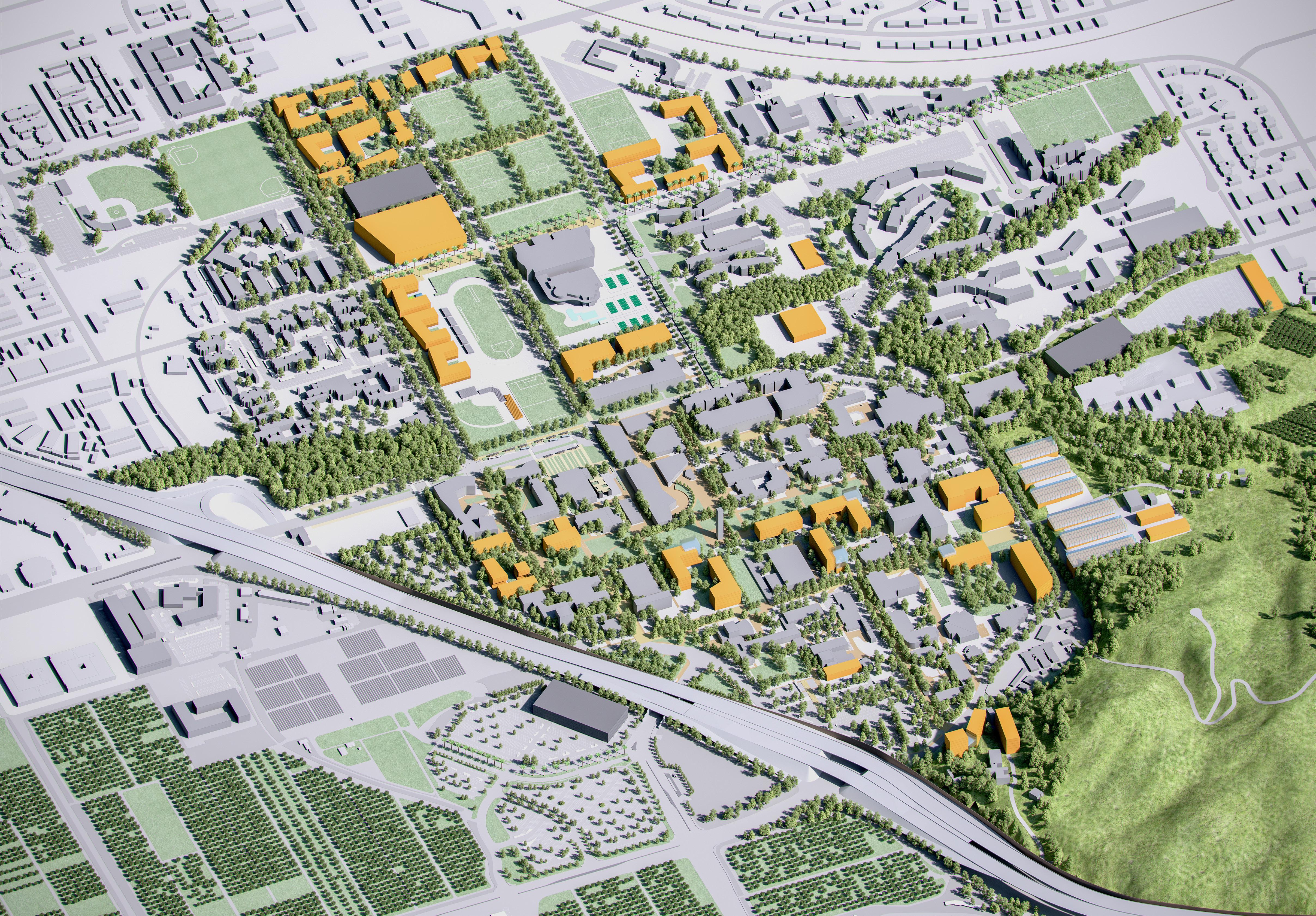
The Physical Master Plan Study illustrative (Fig ES.1) shows how the physical planning principles can be applied to the campus.


Public Realm Opportunity Sites include broad improvements to campus open space systems and associated infrastructure, focusing on circulation, landscape, stormwater management, identity, and wayfinding. Below are two examples of such sites.
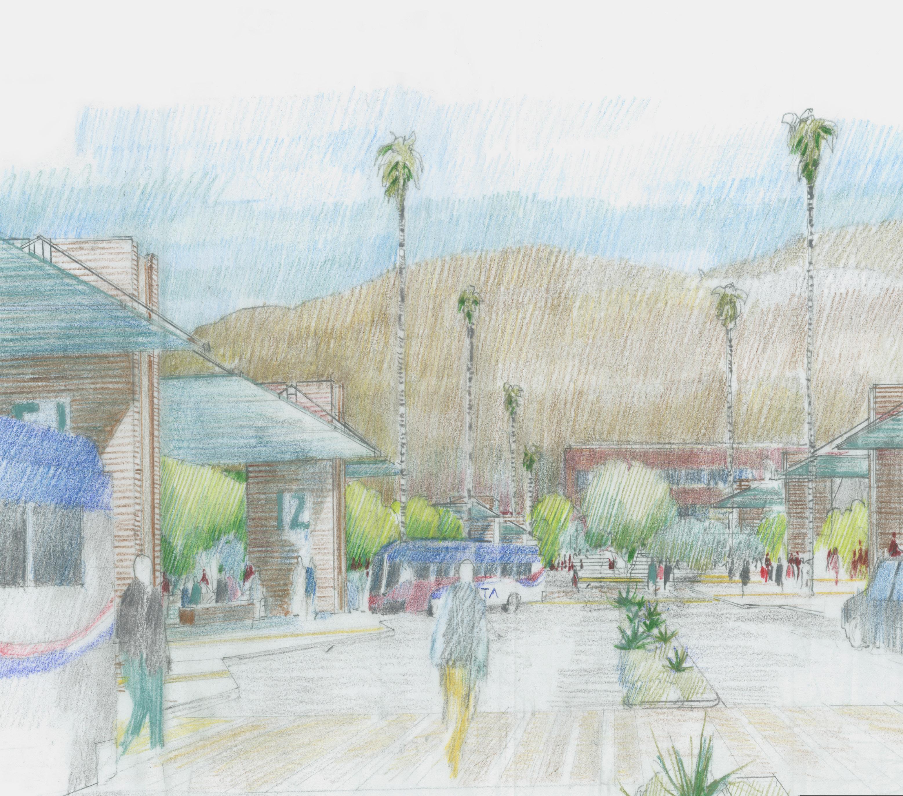
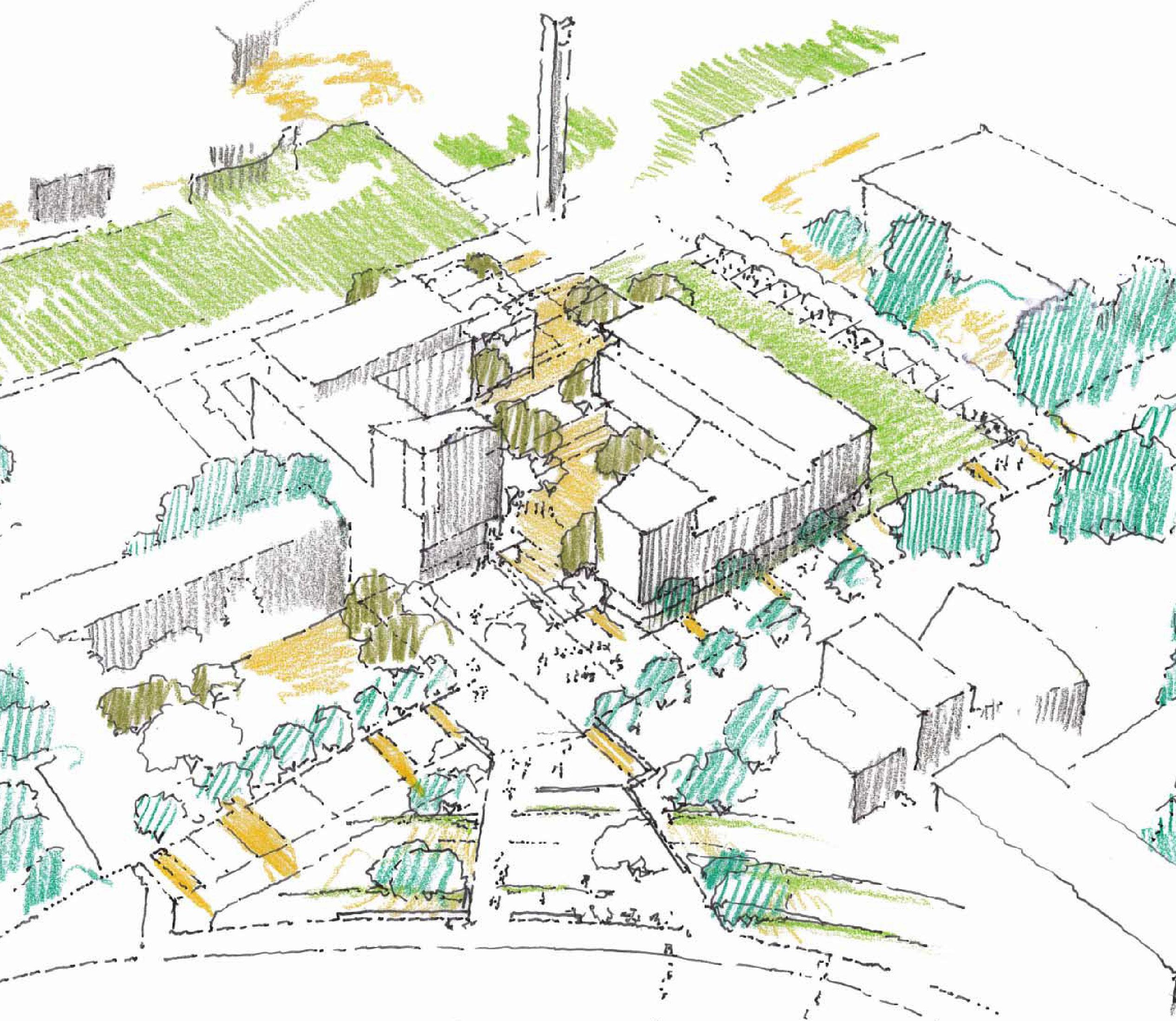
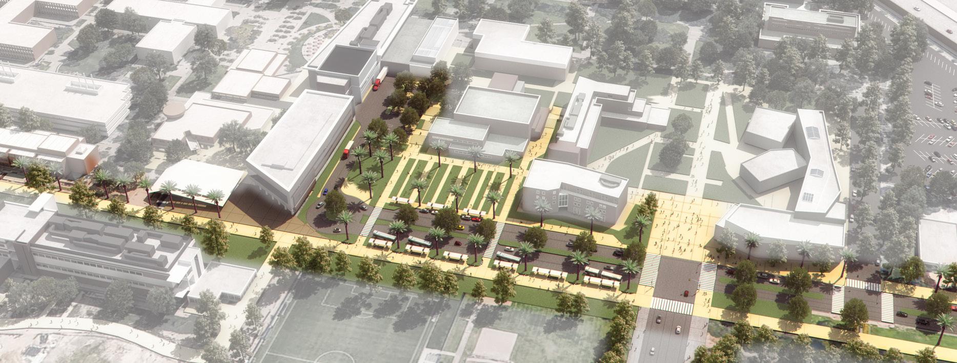
The proposed University Avenue Gateway holds tremendous potential to transform the campus. It creates a welcoming experience at the primary entry point to the campus—the intersection of University Avenue and Canyon Crest Drive. At the campus edge, better management of all forms of traffic means a safer environment for students, faculty, staff and visitors. The proposed Mobility Hub will improve access to public transportation, reducing reliance on personal vehicles. Close proximity to student life programs will further enhance safety and extend access to the campus into the late hours. Community is fostered through the inclusion of a flexible public gathering space with improved connectivity to the rest of campus. The site also enjoys potential synergies with the adjacent Multidisciplinary Research Building 1 (currently under development.)
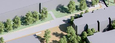
Significant new program areas north of Linden Street will require new connections to the Core Campus to ensure that the campus feels cohesive. Pedestrian and bike improvements to Canyon Crest Drive and Aberdeen Drive are important components of this connectivity, and a new open space – Recreation Mall – will run parallel to these streets, between Blaine Street and the west edge of the Materials Science & Engineering Building. The mall will be designed to be shared with bicycles, having a substantial central paved walkway. Pedestrian amenities such as benches and lighting will be placed along the outer edge. On either side of the central walkway, generous landscaped zones will provide transitions between the walkway and adjacent building entries and generous planting areas for shade trees that provide pedestrian comfort. Stormwater treatment will be provided through linear swales in these zones, treating building runoff as well as runoff from the central walkway.
Building Opportunity Sites define priority locations for future buildings, including those with the highest transformative potential. In the Core Campus they are mainly reserved for research and academic functions, while those in the North District are better suited to housing, retail, recreation, and culture.
On the sharply rising hillside just above the southern edge of Core Campus, this area has great potential to enhance institutional identity. The site is highly visible both from the freeway and from the rest of the campus, making it an ideal location for a “landmark” building. Any structure on this site will also have unobstructed views outwards over the campus and surrounding landscape. Development on this site has the added opportunity to shape a southern end to Citrus Walk.
UC Riverside is a national leader in the fields of crop and agricultural systems biology. Modern plant science facilities will be key to maintaining this status in the future. Currently, the University’s supply of greenhouses and support spaces are distributed between two main sites – one along East Campus Drive and the other, on West Campus south of Martin Luther King Blvd. Facilities in both locations are in immediate need of upgrade or replacement. Re-envisioned, the land area to the east of East Campus Drive has the capacity to hold the University’s entire greenhouse program, along with support facilities.
The present location of Watkins Hall, redeveloped, has the potential to dramatically impact the campus’s open space network, having frontage on the Carillon Mall, Library Mall, and Eucalyptus Walk. By leaving the site open on a northeast-southwest axis, the Belltower will become visible from the Canyon Crest-South Gateway, contributing to wayfinding and campus identity.

CORE CAMPUS
1. Carillon Mall West
Shape the intersection of Arts Mall and the Carillon Mall on the site of Hinderaker Hall.
2. Gateway Link
Modifications on the Athletics and Dance Building site to create a connection between the Mobility Hub and Carillon Mall.
3. Core Campus Nexus
Create new lines of sight into the heart of campus from the perimeter.
4. Eucalyptus Walk Science Area
Transform a “back door” into a “front door” at the perimeter of East Campus.
5. Picnic Hill Science Area
Reframe a popular outdoor gathering space.
6. Core Campus South Extension
Enhance institutional identity on the southern hillside.
7. Citrus Walk Portal
Create a portal to Citrus Walk from Carillon Mall to frame views to the south.
8. Science Area Greenhouses
Consolidating the greenhouse program on a contiguous site adjacent to plant based research.
Sites 9 to 15
Additional sites on East Campus for future buildings
NORTH DISTRICT
Sites A to G
Future student housing, recreation, retail and Campus Events Center
WEST CAMPUS
Sites H
Outpatient Pavillion
Site I
Areas on West Campus to prioritize future development
Integrated Planning is the linking of vision, priorities, people, and the physical institution in a flexible system of evaluation, decision-making, and action. It shapes and guides the entire organization as it evolves over time and within its community. Within the physical planning realm, the Planning Team examined not just the locations of buildings and open spaces, but also integrated considerations of transportation, utility infrastructure, environmental stewardship, and fiscal responsibility. The resulting study reflects a comprehensive vision for campus growth.
The University Avenue Gateway concept integrates a Mobility Hub, a proposed partnership between UC Riverside and the Riverside Transit Agency (RTA) to enable all of its service routes to the campus to converge at a single location. Clearly defined pedestrian and bicycle connectivity, safe and attractive drop-off facilities, and an inviting environment will all contribute to making the University Avenue Gateway the much needed front door the campus presently lacks.
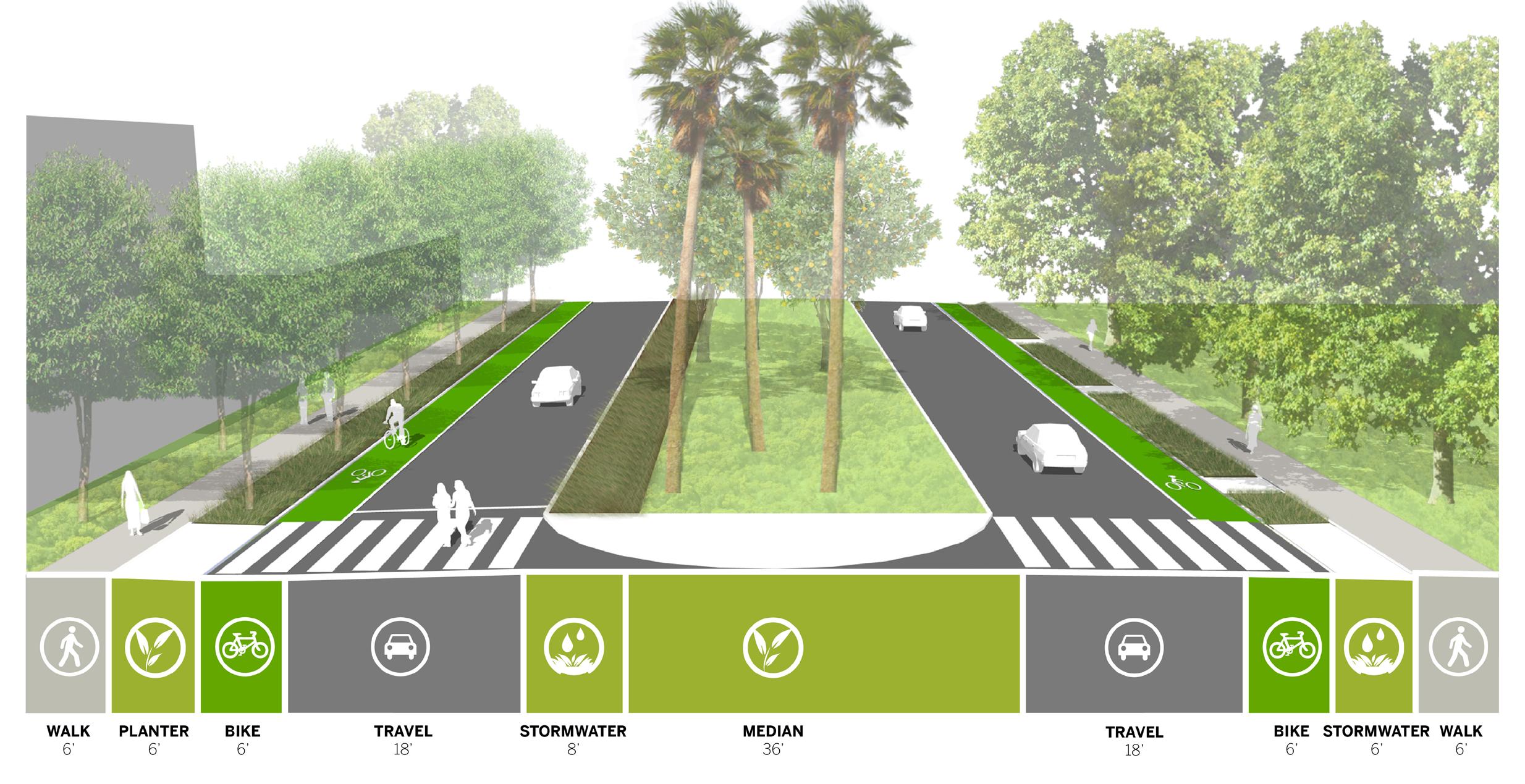
The campus and its immediate surrounding areas are generally conducive to walking, but can be improved upon. University Avenue, Canyon Crest Drive, and Aberdeen Drive can benefit from landscape buffers in between the sidewalk and the roadway. Obsolete service access points should be eliminated to reduce conflicts between service vehicles, pedestrians, and bicycle riders. The proposal to create a connection between the Mobility Hub and Carillon Mall accomplishes several of these objectives in a functional and attractive manner.
A greater emphasis on transit, walking and bicycle use will reduce the demand for parking. However, given campus growth projections, and that that existing parking capacity will be lost to future development, replacement parking and additional capacity need to be planned for. The Master Plan Study proposes structured parking at key locations at the campus perimeter. Additionally, it should be noted that students who live on campus or within a walkable distance are less likely to bring a car to campus. Investments in expanding on-campus student housing and programs to encourage students faculty and staff to live close to the campus will further reduce the need to add parking capacity.
Environmental stewardship is a key tenet of the Master Plan Study, the two critical areas of focus being carbon neutrality in operations and stormwater management.
UC Riverside’s buildings are the single greatest contributor to greenhouse gas emissions by way of energy use. Therefore, reducing demand for energy is the first step towards carbon neutrality in operations. To this end, a representative sample of fourteen campus buildings, selected to represent a range of ages, sizes and uses, were evaluated. The results were evaluated against Energy Use Intensity (EUI) benchmarks for specific building types, and divided into two categories – buildings with poor performance that require major renovation or replacement; and those with good performance requiring only minor retrofits and retro-commissioning.
The Master Plan Study sets target EUIs for new building performance well beyond what is required by the current California Energy Code. The University should strive to meet these targets through the application of appropriate energy efficiency measures that include high performance building envelopes, climate control systems and lighting, as well as passive strategies for shading, daylighting and ventilation.
To achieve carbon neutrality in operations, the University will need to meet its energy needs from alternative sources such as wind and solar. Electricity currently supplied by Riverside Public Utilities (RPU) is primarily coal based and therefore carbon-intensive, though this is in transition. The University envisions strategic partnerships with RPU to further reduce the carbon footprint of purchased electricity. On-site rooftop solar arrays can provide buildings with a portion of their energy demands and create capacity on the campus electrical grid. Rooftop solar hot water heaters are efficient and cost effective, especially on residential projects with large hot water demand. Even with reduced demand and on-site generation, off-site utility-scale wind and/or solar arrays will be required to achieve full carbon-neutrality in building energy use.
It should also be noted that a third of the campus’s carbon emissions are a result of burning natural gas. Because gas is a carbon fuel source, neutrality will only be achieved through conversion to sustainablygenerated electric power or the purchase of carbon offsets.
Stormwater management on new development sites will strive to mimic the natural, pre-development hydrology patterns to reduce erosion and stormwater pollution. On-site treatment of stormwater is envisioned through vegetated swales and like strategies that slow the flow and promote infiltration recharging ground water reserves. Reduced stormwater flows will prevent existing detention basins from being overwhelmed. New buildings will implement water conservation strategies such as stormwater and greywater reuse, high efficiency fixtures, and water-efficient landscaping. Similar measures will be also be considered when renovating existing buildings.
Rooting future development decisions in environmental stewardship will yield innovative solutions to present-day and future challenges. Design which responds directly to Riverside’s unique natural environment will truly connect the campus to its surroundings.
At the time of completion of the Master Plan Study in May 2016, numerous projects were in different stages of development. Each of these projects are in alignment with the planning principles and directions outlined in the Study.
The following ongoing renovation projects reinforce the campus’s commitment to continue to invest in those buildings and campus locations that best leverage existing campus assets:
• Batchelor Hall Interior Renovation
• Pierce Hall Renovation and Classroom Addition
• Boyce Vivarium Renovation
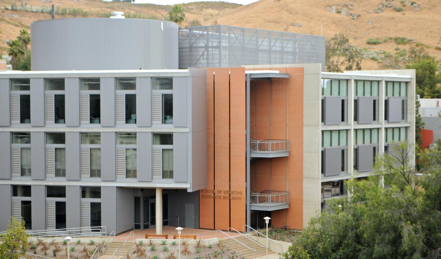
• School of Medicine Research Building – BSL-3 Laboratory
• School of Medicine Research Building – First Floor Fit out
Planning ahead, as the campus increases its faculty by almost 300, the majority of whom will be focused on research, it will be important to add research space to maintain an appropriate space-to-faculty ratio of 1,032 ASF, which is closer to the UC system wide average of 1,140 ASF. The proposed Multidisciplinary Research Building 1 will serve to meet this space need with the addition of approximately 150,000 GSF.
Future renovation projects and new building additions will continue to be guided by the Master Plan Study and based on the Capital Financial Plan.
The physical setting of UC Riverside is an integral part of the educational experience for all those who come to live, learn, and work on campus. This relationship is vital to its students, faculty and staff. The Physical Master Plan Study articulates a vision for the physical environment of the campus to respond to its goals for future growth — potentially up to 30,000 students by 2025.
The guidance provided by this Study enables the campus to retain and enhance the best aspects of its existing character, and accommodate significant new development while balancing vital programmatic, physical, capital, and environmental priorities.
The campus is a living laboratory for the exploration of issues critical to growing communities—air, water, energy, transportation, politics, the arts, history, culture, and healthcare. UC Riverside already is a highly regarded public research university particularly noted for its achievements in the measures of educational value and accessibility in:
• Serving a high percentage of first-generation college students
• Parity in student six year graduation rates across all ethnic and socioeconomic groups.
• Enabling a high-quality education at an affordable cost
• Providing social mobility ladders that will improve lives of generations of deserving students and their families from California and around the world
Today, UC Riverside stands at a defining moment — on the path to becoming recognized as one of the nation’s top-ranked research institutions — an aspiration that will be reinforced by planned growth in the scale of the campus faculty and student body.
ACADEMIC EXCELLENCE
Developing a Preeminent Research
University for the 21st Century
Enhancing Opportunity for Graduate, Professional, and Undergraduate Students
Serving as a National Exemplar for Diversity, Inclusiveness, and Community ACCESS
Shaping our World DIVERSITY
ENGAGEMENT
UCR’s key goal is developing the profile of An Association of American Universities (AAU) member
The driving force of the Physical Master Plan Study is the campus leadership’s continued support and implementation of the Strategic Plan, UCR 2020: The Path to Preeminence
Developed in 2010, the Strategic Plan continues to serve as the framework for planning and decision making for the next decade. UC Riverside’s plans to achieve its academic objectives as outlined in the 2020 Strategic Plan are guided by its primary academic priorities and strategies as shown in the Four Pillars in Figure 1.2.
In UCR 2020: The Path to Preeminence, the campus holds itself to achieving the profile of an Association of American Universities (AAU) profile as a valid measure of what it is to be an academically excellent research university. Attaining the profile of an AAU institution is a guidepost for academic excellence because the organization – today comprising 63 leading public and private research universities in the U.S. and Canada—focuses on metrics of importance to research-intensive universities, including funding for research and creative activity, research policy issues, and graduate and undergraduate education.
The Association of American Universities
• Current membership of 63 leading public and private research universities in the U.S. and Canada
• Focuses on metrics of importance to research-intensive universities, including:
• Funding for research and creative activity
• Research policy issues
• Graduate and undergraduate education
The Leiden Rankings, which measure scientific and research impact on a per capita basis, place UC Riverside 17th world-wide in the natural sciences and engineering and 44th in overall scientific impact. While the University is home to significant research excellence, it is not at a scale that allows it to fully realize its potential as a preeminent research university.
UC Riverside anticipates growing its faculty by 300 net new faculty (from the 2014 baseline of 678) and increasing enrollment to surpass 25,000 students by 2020 to be evalucated. UCR presently has one of the highest student-to-faculty ratios in the system, at 29 to 1, far higher than the system-wide average of 23 to 1. Growing faculty, a key objective of the 2020 Strategic Plan, will better serve students and enhance UC Riverside’s national and international research profile and stature. It also should be noted that more than half of UC Riverside students currently benefit from hands-on faculty-mentored research, and growing the faculty maintains this advantage even as enrollment grows.
Given that the size and quality of graduate and professional programs are an important measure of a top-tier research university, the majority of the faculty expansion and projected enrollment growth, up to 80 percent, will be in graduate students and post-doctoral scholars. This significant expansion, along with strategic investments in research infrastructure, will focus on interdisciplinary areas of research. This initiative will achieve critical mass in vital and emerging fields of scholarship, foster truly cross-disciplinary work, and further diversify the faculty at one of America’s most diverse research universities.
• UC Riverside’s top objective of academic excellence and related performance metrics create the Roof
• Key areas of strategic growth serve as Three Pillars supporting the roof of excellence
• The critical support of staffing, space, efficiencies, and diversification of activities serve as the investments we must make to provide a strong Foundation to sustain growth
- Faculty Ratio • Surpass 25,000 students by 2020 • Increase Federal Contracts & Grants by $200 million
Growth • Hire300 newfaculty membersby 2020
, Scholarship, and Creative Activity Growth
Optimal staffing
Enhance efficiencies
Refining and defining the use of space
Diversifyfinancing & development activities
For UC Riverside to achieve the profile of an AAU member, the campus must accelerate development of its infrastructure and facilities, in support of research and creative activity. This includes ensuring that the campus has new facilities and equipment, ranging from performance studios to laboratories, greenhouses to vivaria, and more. The costs of these critical investments will need to be met through a range of strategies – operational efficiencies, increased external funding for campus research, and expanded campus fund raising all will play a part. The Physical Master Plan Study better prepares the campus to meet these targeted future needs of infrastructure and facilities and make the right investments of its precious resources.
UC Riverside is transforming to become a national model for academic excellence, student access, and best-in-class operations. These goals require the foundation that is provided by strategic investments – in top-notch people, programs, facilities, and infrastructure – that enable success and emphasize results.
With these investments in increased efficiency, targeted renovations, construction of new facilities, and ultimately, implementation of the vision contained in this Master Plan Study, UC Riverside will have the physical infrastructure it needs to traverse the Path to Preeminence.
The Master Plan Study builds upon and articulates the following goals in response to planning objectives, regulatory requirements and environmental stewardship goals:
• Embody the strategic goals outlined in UCR 2020: The Path to Preeminence
• Focus academic, research, and student life program-based physical expansion on the East Campus within and immediately adjacent to the Core Campus
• Identify a long-term strategy for the West Campus area
• Reinforce campus identity along its primary entrances and community edges – including the potential to develop a primary campus gateway on University Avenue
• Showcase the University’s commitment to environmental stewardship to include new stormwater management regulations and University of California system wide carbon neutrality initiatives
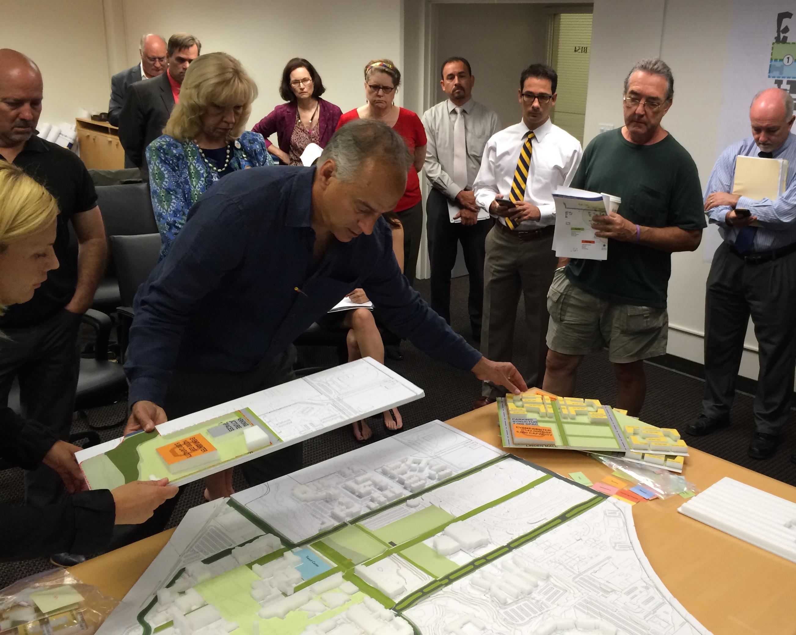
With the support of its multi-disciplinary consultant team, UC Riverside began the Master Plan Study “journey” with the intent of capturing the diverse range of perspectives among campus and community stakeholders about the future vision for the campus. UC Riverside’s efforts included creating an inclusive planning team; reaching out to diverse stakeholders (e.g., students, faculty, staff, administrators, community members, elected officials, and City of Riverside representatives); and hosting multiple visioning workshops and meetings on campus and in the community.
The following groups were created with the intent of directing, advising and supporting the Master Plan Study.
Steering Committee
This twenty-member committee was co-chaired by the Provost and the Vice Chancellor for Planning and Budget. The Steering Committee directed the planning team throughout all phases of the visioning and planning process. Over the course of more than a year, seven Steering Committee meetings were held, providing hundreds of hours of input, review, comment, and validation of the vision, analysis, observations, findings, and recommendations arising through the study process.
Project Management Team (PMT)
This multi-disciplinary team of key campus stakeholders and subjectmatter experts managed the visioning and planning process and provided staff assistance; coordinated all communications between the University and consultant team; vetted observations, findings, and recommendations; and played hands-on roles in the crafting of the final report and related materials.
A total of six specialized working groups supported the visioning and planning process with detailed input specific to their areas of focus. These six working groups were comprised of sixty-four subject matter experts and stakeholders across campus and in the community.
• Campus Logistics & Safety: Focused on efforts to improve campus safety and security and improvements to enable the campus to function in a cohesive, efficient, and safe manner
• City & Community: Provided a forum to engage with city and community constituents on campus planning issues, to facilitate a singular vision of the campus informed by neighborhood and City perspectives
• Student Life: Identified opportunities to enhance the quality of student experience within the built environment (interior and exterior space) and explore avenues to improve the campus environment
• Sustainable Infrastructure: Supported the master plan study with the development of an integrated stormwater management plan and to consider strategies to become carbon neutral in operations by 2025
• Sustainable Practices: Explored aspects of broader campus operations such as landscape planting, irrigation water use, edible landscapes and edible landscapes that influence the larger campus physical environs for opportunities to realize greater efficiencies of resource use and expression of commitment to environmental stewardship
• Technology: Helped identify how evolving technologies could potentially transform the physical makeup of campus and project how technology will influence the campus of the future
The ideas and opportunities documented in this report reflect the combined efforts of each of the above referenced groups working collaboratively with the consultant team. A full list of committee members, groups and individuals involved in the study can be found in the preface to this report.
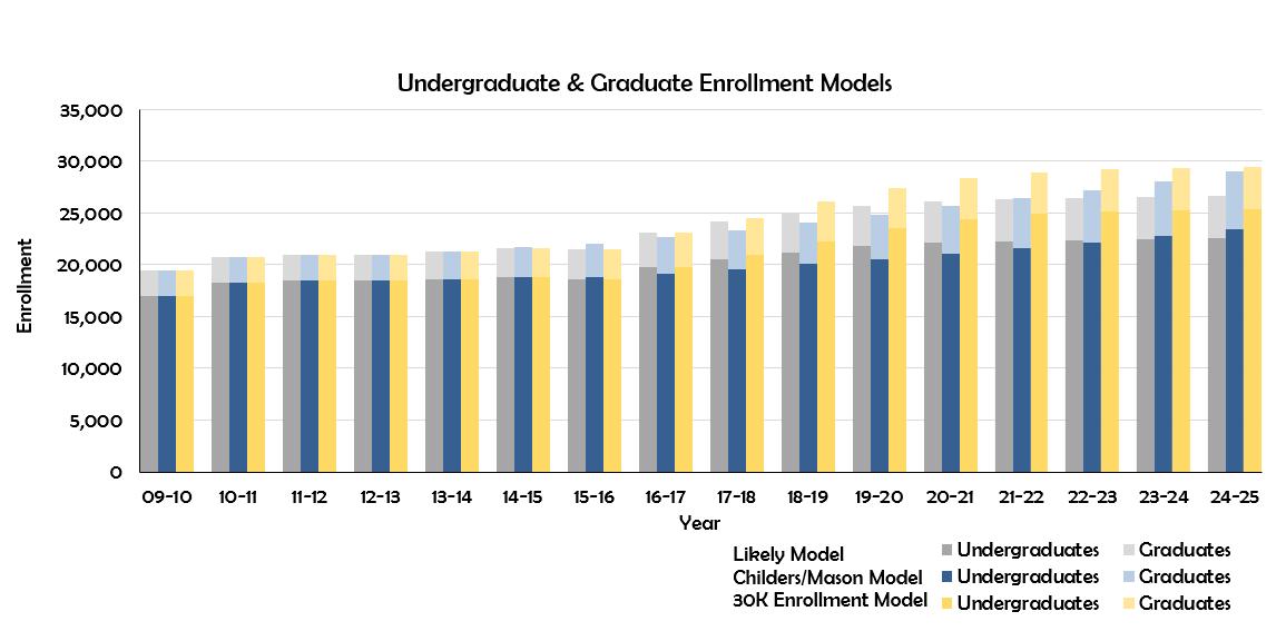
The Master Plan Study has been informed by the Strategic Plan and LRDP which calls for UC Riverside to grow to 25,000 by 2020. A potential option for UC Riverside is to continue this rate of growth and reach 30,000 by 2025. As such, the Planning Team worked collaboratively with institutional research to test a variety of enrollment projections using detailed program level enrollment models that ranged from 27,100 (likely model) to 29,900 (30k model) students.
Each of these models have a direct impact on student housing, dining, and Transportation Demand Management (TDM). Recognizing the inherent variability of the multitude of these models, student housing is modeled as a range of capacities given the potential for the private sector to moderate demand. The models projects parking capacity increases that correspond to the “30k model” to test an extreme scenario. Academic and support space demand are modeled per a straight-line projection as described in the following section.
In 2015, as part of UC’s budget agreement with the State of California, its ten campuses will be accepting 5,000 additional in-state undergraduates in 2016-17 and 2,500 additional in 2017-18 and 2018-19, as compared to 2014-15. The percentage of this growth absorbed by each campus was determined through discussions between the campuses and UC Office of the President regarding available or potential capacity in resource areas such as on-campus housing and classroom space. In 2016-17, UC Riverside will accept approximately 750 of these additional in-state undergraduates from the 2014-15 base. This share is based on a combination of UC Riverside’s potential capacity and the characteristics of its typical applicant pool. This growth is in alignment with UC Riverside’s Strategic Plan and is covered by the current LRDP and LRDP Environmental Impact Report. At the time of writing, future shares beyond 2016-16 had not been determined by the Office of the President, however, it is assumed future growth will continue to be in alignment with the University’s future growth plans.
In the year 2015, UC Riverside’s space inventory in support of its academic and research mission was approximately 7.5 million Gross Square Feet (GSF). Space on East Campus can be broadly classified as described in the following table:

Additionally, the campus owns or leases 350,000 GSF of space in different properties within the City of Riverside and Riverside County. The Master Plan Study did not analyze off-campus spaces. Nonetheless, the Master Plan Study acknowledges that some of those uses are located off-campus owing to the lack of available space on the main campus and recommends that future projects seek to find the means to integrate those uses back to campus as and when possible.
Space on campus has continued to grow in response to increases in the student population, research activity and the addition of newer academic programs, the newest being the School of Medicine and the School of Public Policy. Moving forward, in order to develop a broad understanding of future needs, the campus conducted a space study. The analysis was conducted using three different models for comparison:
• Council of Educational Facility Planners International (CEFPI)
• Texas Higher Education Coordinating Board
• Straight-Line Method (space increase based on enrollment growth ratio)
It was determined that the straight-line method was the preferred model to adopt as the basis of the program for the Master Plan Study. As part of the space study, the campus also evaluated available space. Key outcomes of this evaluation are:
• A vast majority of buildings on campus are greater than 40 years old and are, by default, inefficient in the use of available space within, and therefore lack the ability to be configured optimally. This is especially true of laboratory spaces.
• Historical space assignments to some campus units do not reflect present-day space needs.
• Available space is oftentimes used inefficiently.
Based on the findings of the space analysis it was evident that there was potential to “find” additional space within the current inventory. Supporting strategies include:
• Consolidating spaces, right-sizing offices, sharing more office and support spaces, and eliminating duplicate offices where practical.
• Increasing classroom utilization by changing operating parameters such as time of day, day of week, and better aligning actual enrollment to seating capacities, etc.
• Reassigning research space based on level of research activity and revenue generated.
Existing space is a valuable asset the campus must strive to use in an optimal manner. Even a modest 10% optimization in the use of current space translates into a yield of 470,000 GSF campus wide and a saving of valuable capital that could be targeted to investment in other critical and transformative priorities. For the purposes of a program for the Master Plan Study a 10% optimization strategy is assumed to be applied to existing space on campus as a baseline. Eventually new space will be needed even with improved utilization, and this future need is modeled.
A straight-line projection applied to the different types of space yields the following table. However, research space projections are based on maintaining an average of 1,200 Assignable Square Feet (ASF) of space per principal investigator (PI), for approximately 900 PIs.
Furthermore, the straight-line projection represents a space need based on present-day models of space utilization. Pedagogical models and space requirements for research continue to evolve, and the standards for space needs, actual space utilization and metrics can change in the years to come. As UC Riverside continues to grow its enrollment, faculty size and program offerings, future investments in space will be informed by detailed, project-specific data.
The program for the Master Plan Study should be used as a planning tool and not as an expression of need.
For Fall 2015, the campus was home to more than 6,700 on-campus resident students. These on-campus students are housed across ten residential complexes that are either residence halls, campus apartments or family housing units. UC Riverside does not require any class of students to live in campus-owned or controlled housing and therefore the campus resident student population can vary depending on demand.
Typically freshmen and sophomore students live in the residence halls and have meal plans that give them access to either of the dining halls or other dining facilities on campus. Juniors, seniors and graduate students are assigned apartment style housing. Because they are more independent in comparison and oftentimes opt not to have meal plans, they have not been a consideration for dining hall capacity to date.
Figure 1.7 PROJECTED STUDENT HOUSING BED CAPACITY DEFICIT
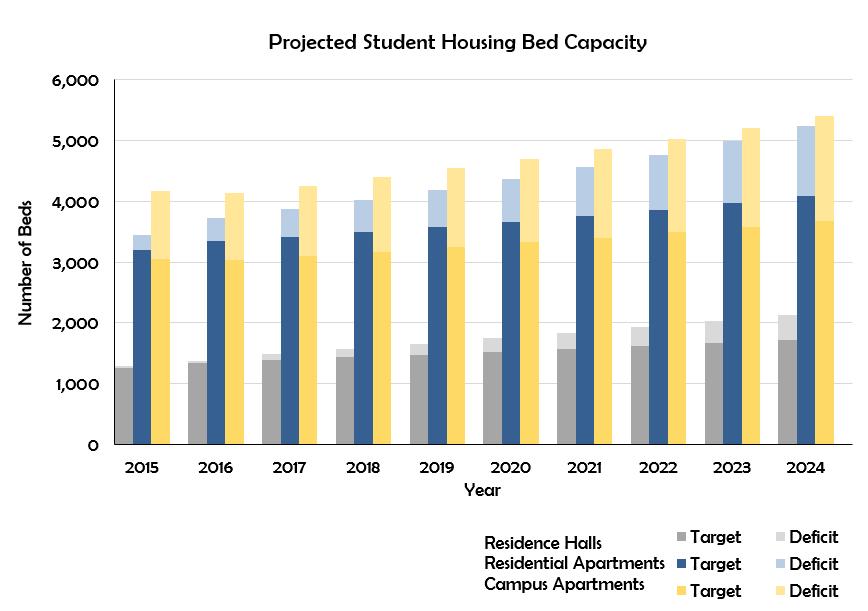
Specific to future expansion in housing capacity, the Master Plan Study uses past indicators of absorption to model future expansion that is responsive to enrollment growth. In the years preceding, an average of one out of every three enrolled students typically is estimated to live on campus. Another third of the enrolled students are estimated to live in
the surrounding community within a three mile radius of campus, and the remaining are assumed to commute. UC Riverside Housing Services projects needing to increase bed capacity by at least 3,700 to maintain current ratios of resident students to the overall campus population, as outlined in Fig 1.7.
A key change to the portfolio of current housing options is the planned redevelopment of the Crest Family Housing site to integrate additional Event Center project. Additionally, the Bannockburn Hall complex, owing to its age, is projected to be removed within the next decade. Between the two locations is also a potential redevelopment of the Lot 24 site and the police station building at the southeast corner of Linden Street and Canyon Crest Drive. These sites support a range of housing expansion options that can be pursued as the opportunities present themselves. These future developments are expected to absorb the majority of housing expansion within the current planning horizon.
Space is a finite yet global campus resource. Effective space management by the campus can leverage both campus-wide and off-campus opportunities to provide the right quantities and types of space to meet current and future needs.
The Master Plan Study has been informed by a set of Values, Beliefs and Principles developed by the University’s Campus and Study leadership, including the Chancellor, Steering Committee and Project Management Team. These high-level principles have profoundly informed the four ”Essential Elements” that serve as key themes in the study.
Honor, reinforce and enhance UC Riverside’s unique identity as a thriving place for academic excellence and civic engagement amid beautiful surroundings.
• Incorporate the existing natural setting and open spaces as key elements of the campus physical planning framework.
• Enhance a strong sense of place, provide welcoming points of arrival, and build physical connections to and across campus.
• Convey the rich human and agricultural history of UC Riverside and the region, including the citrus legacy and leadership.
• Strengthen connections to the surrounding natural environment, including the arroyos and the Box Spring Mountains.
• Follow the overall aspiration of “creating simple buildings in a dramatic landscape”.
• Increase the visibility of the campus by reinforcing a sense of cohesion among campus buildings and showcasing landscape and view sheds.
• Develop a cohesive landscape fabric that connects the campus with its naturalistic setting to maintain sense of place.
Create connections across campus and to the community with diverse gathering spaces in the public realm to foster a vibrant, healthy, and interactive living and learning community of the
• Support a 24/7 interactive campus that is a cultural resource for the community, the region, and beyond.
• Provide mobility options and circulation strategies that support safe passage for all – pedestrians, bicycle riders, and drivers.
• Reinforce and clarify the “heart” of the campus.
• Celebrate and leverage the unique characteristics of the campus districts.
• Enhance connectivity and optimize the use of the public realm across campus.
• Promote pedestrian orientation and use of alternative transportation modes by increasing student housing and reducing commuter traffic.
• Develop multi-modal strategies to optimize efficient transportation, parking, and service networks, including a transit and welcoming center at the “heart” of the campus.

Serve as a living laboratory for innovative solutions that accommodate growth while building a more environmentally conscious, healthy, and vibrant campus communit y.
• Develop flexible strategies to accommodate growth and innovation while embracing the natural environment of the campus.
• Pursue best practices for stormwater management, energy and water efficiency, and carbon neutrality.
• Recognize that stewardship is an environmental, physical, educational, and fiscal imperative.
• Enhance the value of UC Riverside’s capital investments by leveraging synergies in infrastructure systems, buildings, and other campus elements.
• Leverage the design of buildings and open spaces to serve multiple aspirations and functions.
• Serve as a living laboratory for solutions that build a more sustainable, healthy, inclusive, and vibrant campus community.
Embrace density to achieve synergies and capacity for critical campus growth. Create a new model for how a great public research university can refine and redefine the use of space to optimize the returns on the University’s capital investments.
• Leverage the need to expand while promoting beneficial synergies between communities, departments, open spaces, buildings, and program requirements.
• Consolidate academic development on East Campus to leverage existing assets and promote greater collaboration, interaction, and shared identity.
• Manage the valuable university land and research resources on West Campus as strategic assets to sustain the University’s excellence long into the future.
• Provide contiguous multi-disciplinary research and classroom spaces for enhanced engagement and efficiency.
• Design building density and height standards to also create a lively pedestrian-oriented space that increases connectivity and ease of movement throughout campus.
UC Riverside recognizes the importance of the physical campus in achieving the goals articulated in its strategic plan, UCR 2020: The Path to Preeminence. The development proposed in the Master Plan Study is the physical embodiment of the strategic plan. To be successful in developing the future campus to achieve its strategic goals, the University needs to understand clearly the foundation upon which these efforts will be built – the campus as it exists today. This chapter outlines the methods and results of the Planning Team’s investigation into the existing campus, its many components and their relationship to each other and to the surrounding natural and built environment.
Glossary of Terms
Belltower - a landmark element at the center of Carillon Mall
Box Springs Mountains - the dominant range of mountains to the east and south of the UC Riverside campus
Carillon Mall - the primary open space in the heart of the campus
Core Campus - the region within East Campus that contains nearly all of the academic buildings, as well as most of the University’s older buildings
East Campus - the portion of campus east of the Interstate 215 / SR-60 freeway
Legacy Buildings and Landscapes - prominent cultural elements/ buildings and open spaces on campus
West Campus - the portion of campus west of the I-215/SR-60 freeway, currently utilized primarily for agricultural research
The primary goal of the Master Plan Study is to accommodate development as enrollment grows, but simply growing is not enough. Growth must be thoughtful and organized for the result to be successful. In addition to “how much growth?” the University asks itself the following questions, which this chapter seeks to answer:
• What features of the campus make UC Riverside memorable?
• How is the campus accessed and what are the conditions at its edges?
• How can a large demand for new space be accommodated on East Campus, which many perceive as already being built-out?
• Which buildings and open spaces most contribute to the University’s desired setting, and how can they inform the aesthetics of future development on campus?
• What opportunities exist to reduce campus energy demand and resource consumption even as UC Riverside experiences significant growth?
• What impediments exist to connectivity within the campus and to the surrounding neighborhoods?
• What opportunities are there for the creation of new open spaces and other venues for interaction and engagement across campus?
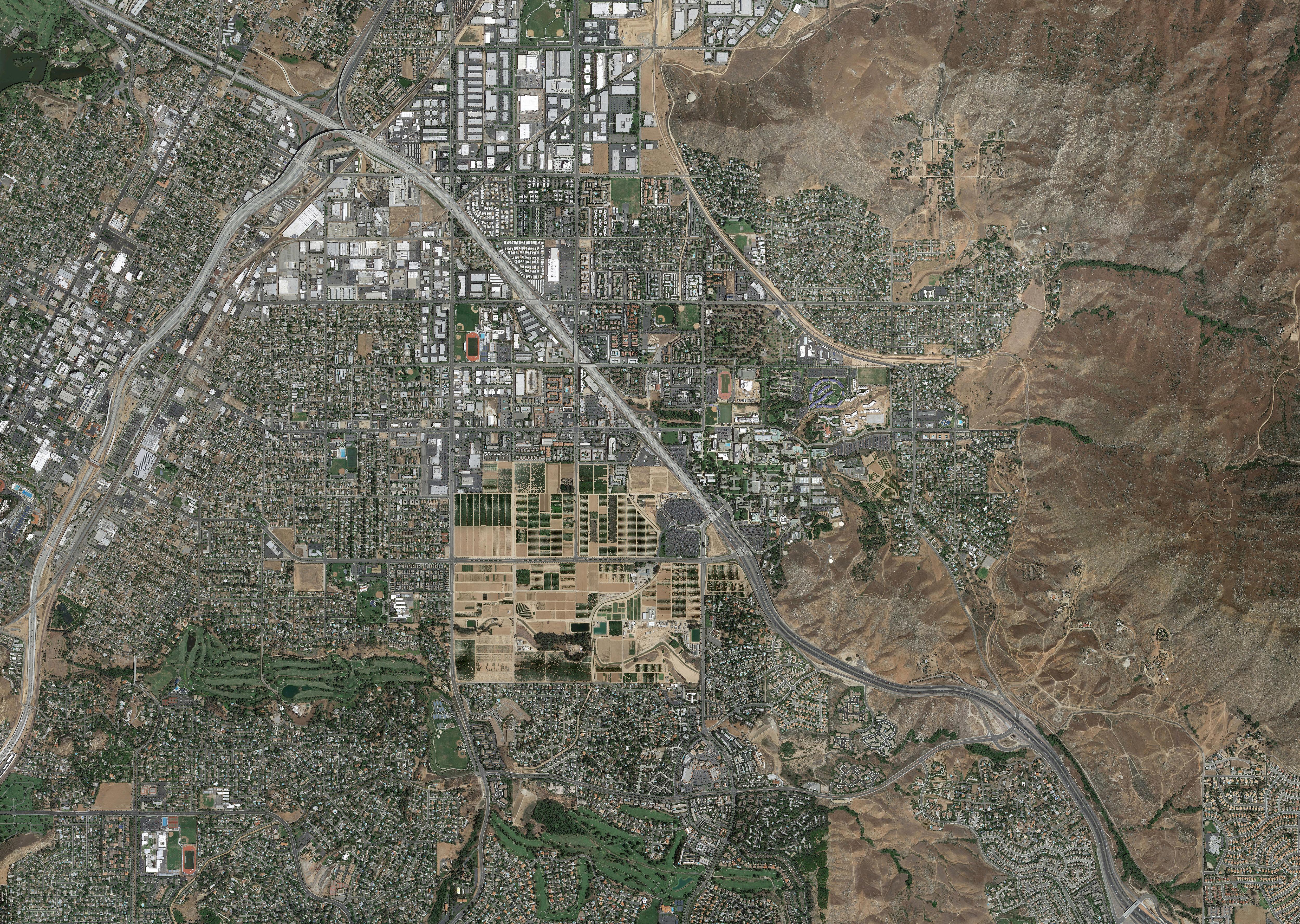
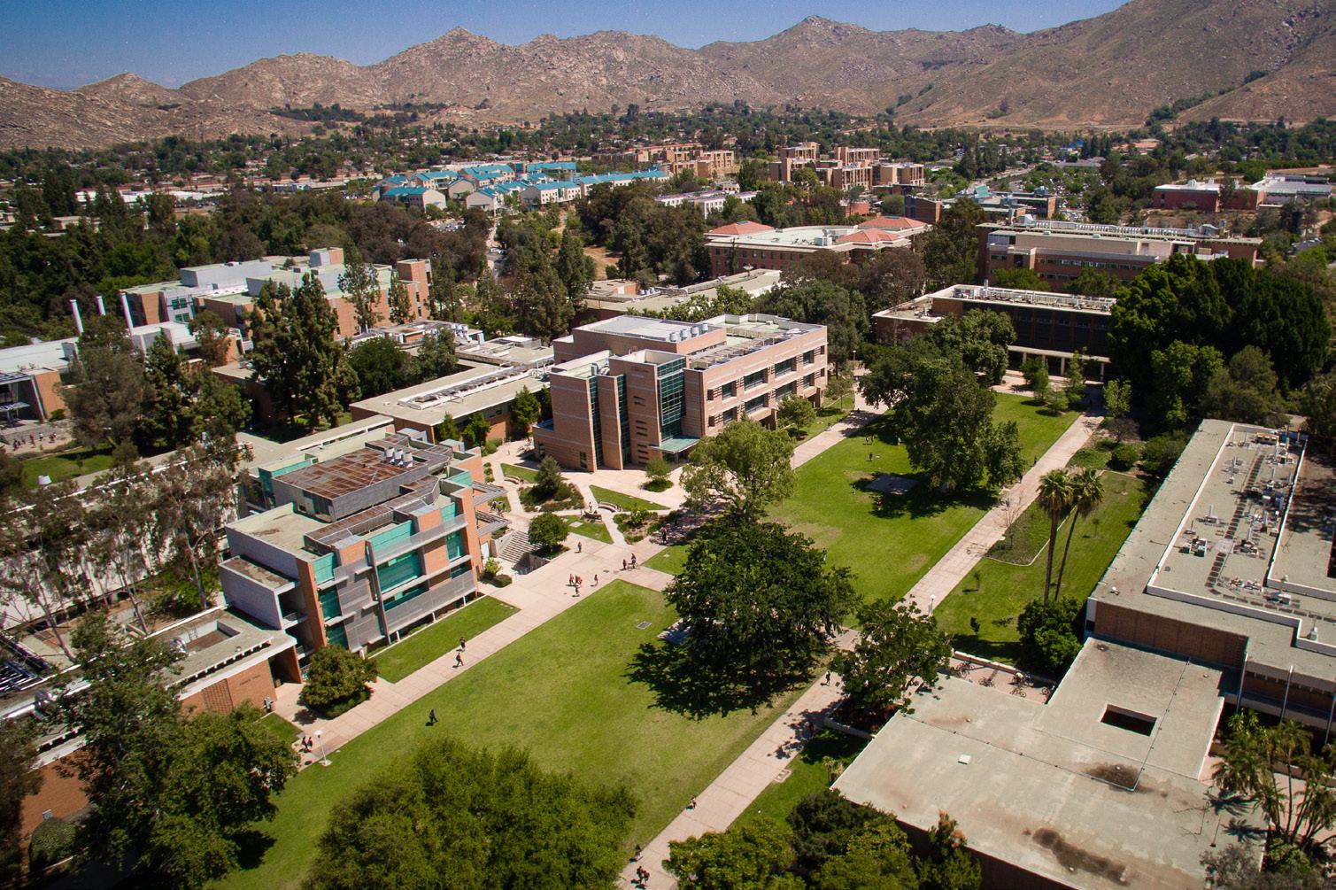
The UC Riverside campus is located three miles east of downtown Riverside at the base of the Box Springs Mountains, and within the County of Riverside. UC Riverside is the only public research university located within Inland Southern California. The 1,127-acre campus is bisected by the Interstate 215 / SR-60 freeway. The two resulting areas
East Campus comprises 604 acres and contains the vast majority of the University’s built space. Nearly all of the academic, research and support facilities are located within the zone outlined by Campus Drive, including most of the campus’s original buildings. The northern half of East Campus is devoted to student housing and recreation. The Belltower marks the heart of campus at the center of the Carillon Mall. The terrain steepens just to the south and east of campus and as a result,
The majority of the 523 acre West Campus land area is currently in use as agricultural teaching and research fields, mostly citrus groves managed by the College of Natural and Agricultural Sciences (CNAS)
Several facilities, besides the teaching and research fields, currently occupy the West Campus. These include Parking Lot 30, University Extension (UNEX), Highlander Hall (due to be demolished as seismically unstable), the two-story Human Resources Building (also due to be demolished owing to fire damage) and International Village, a housing complex intended for visiting international students.
A City of Riverside electrical substation occupies the northern edge of Parking Lot 30. A Caltrans service yard occupies a 4.1-acre triangular parcel directly west of the freeway at the eastern terminus of Everton Place. The Gage Canal traverses the site north to south.
The original University of California Citrus Experiment Station (CES) was founded just west of the downtown area of Riverside at the foot of Mt. Rubidoux in 1907. In 1917, the University of California acquired 370 acres from the City of Riverside and the CES moved to a location at the foot of the Box Springs Mountains, just east of the Gage Canal. Down the hill to the west, the Barn and other assorted small buildings associated with the maintenance and operation of the station were constructed, and are still in use today.
The University of California, Riverside, had its official beginning in 1948, when a committee of the State Legislature recommended that a small liberal arts college be established in proximity to the Citrus Experiment Station. A grouping of core buildings was completed by 1954: the Library, Webber Hall, the Physical Sciences Building, the Physical Education Building, and the Social Sciences Building (known now as Tomas Rivera Library, Webber Hall, Geology, Athletics and Dance, and Watkins Hall, respectively). The first five buildings were centered on a wide central open space – today’s Carillon Mall – that now is anchored by Hinderaker Hall on the west end and Webber Hall on the east. Classes began in February of 1954 with a faculty of 65 and a student body of 127, and a planned capacity of 1,500 students.
In 1959, Riverside was declared a general campus by the Regents. The University’s Graduate Division was established in 1960. Since then, the University’s growth has mirrored the growth of Southern California. Once a small university in a small town, it is now the premier research and educational institution in Inland Southern California.
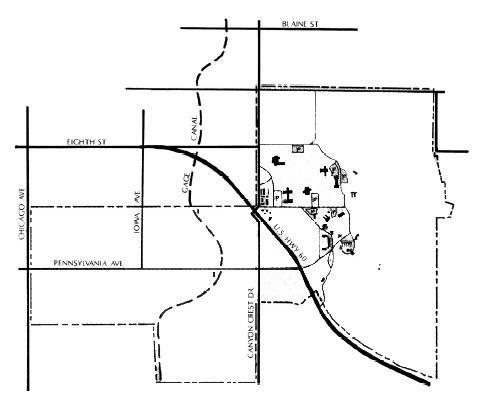
CITRUS STATION, 1934 UC RIVERSIDE, 1954
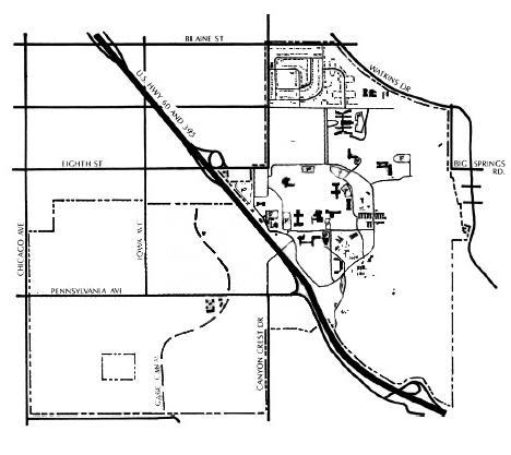
April 21, 1948
The Riverside Citrus Experiment Station, the forbearer of the University, opens for business.
Governor Earl Warren signs legislation authorizing the University of California to open campuses in Riverside and Davis, earmarking $2 million for initial planning and design costs.
RIVERSIDE, CITRUS STATION, 1934
1954
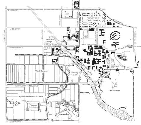
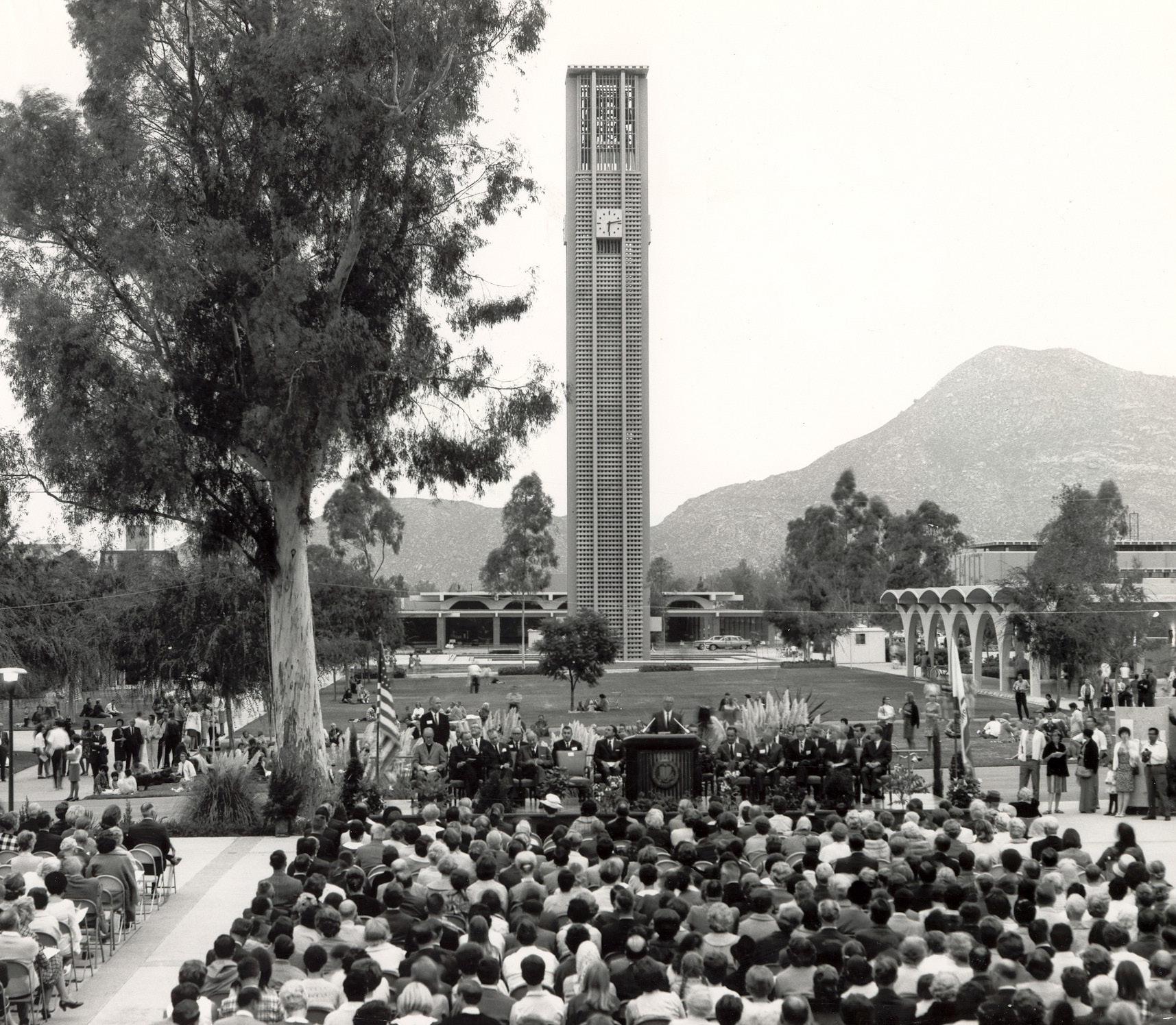
December 7, 1953
February 15, 1954
June 20, 1954
October 19, 1954
August 1955
The first library building is completed and opens on December 24 stocked with 33,000 volumes.
127 students and 65 faculty members arrive for their first day of classes. The next day, Charles Young is elected student body president. He later becomes chancellor of UCLA.
The first 20 students graduate from the University. UC Riverside is officially dedicated.
The big “C” on Box Springs Mountain is made with cement and equipment donated by the E.L. Yeager Construction Co. Surveying work is done by students. At 132 feet long, it is the largest concrete block letter on record.
1955
April 18, 1959
1960
“Highlanders” is adopted as the campus mascot following a vote of the student body. The Scottish theme is embraced for several campus groups and buildings.
UC Regents vote to make UC Riverside a “general” campus, complete with graduate instruction and professional schools.
The College of Agriculture is founded, successfully combining the work done at the Agricultural Experiment Station with undergraduate and graduate teaching.
October 2, 1966
The Belltower is dedicated.
The University offers a Bachelor of Science degree for the first time to students majoring in chemistry, geology or physics.
April 1998
April 15, 2005
November 2006
September 2012
August 2013
Students approve a plan for the University’s athletics teams to join NCAA Division I. In March 2000, UC Riverside is accepted into the Big West Conference.
The UC Riverside Palm Desert Center opens.
The University’s plans for a medical school are accepted.
The School of Public Policy is announced, with its first class of students expected in 2015.
The first inaugural class of 50 students is welcomed into UC Riverside’s School of Medicine.
The Planning Team assessed opportunities, challenges and constraints on campus utilizing a range of methodologies. These included workshops with key stakeholders, first-hand observation of the physical campus, and reviews of previous planning studies all provided valuable information.
The planning process, beginning in December 2014 and completed in May 2016, was organized into four major tasks (see Fig. 2.3.) In the Understanding phase, the Planning Team gathered information from a variety of sources to develop an understanding of the campus and its needs. The primary method of representing this information is through plan-based diagrams, which are found throughout this document. The analysis of the campus is divided into distinct systems or components, but because these systems are so interconnected, their analyses naturally overlap.
In the Integrating phase, the Planning Team tested development scenarios looking at a range of densities and program distributions. In later workshops, attendees responded to these scenarios. Through several working sessions, the planning scenarios evolved and were eventually merged into a single planning framework that reflected consensus on key aspects of the future campus. The opportunities and recommendations in the Master Plan Study take the information gained through these sessions into consideration and address concerns to the greatest extent possible. The resulting plan represents not just the will of University leadership, but a shared vision of many who hold a stake in the institution’s continued success.
The Physical Master Plan Study is a campus document. While it has been facilitated by the consultant team who have contributed their expertise in helping the campus articulate its vision, the University has been actively engaged in guiding the Study’s development. This engagement makes the Study a reflection of the University’s aspirations and needs.
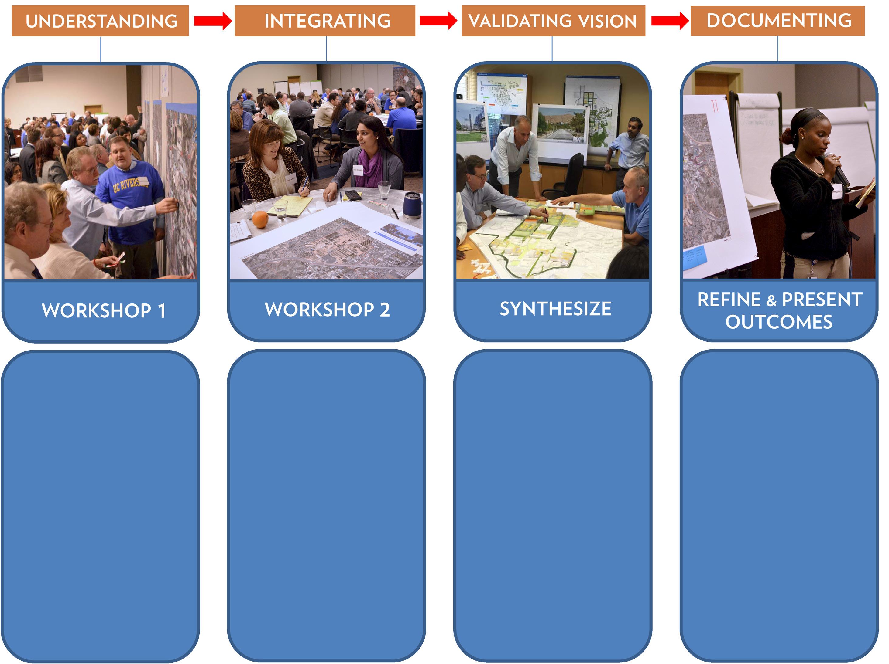
• Campus site and infrastructure assessment
• Review of previous campus and city studies
• Program needs confirmation
• Physical Master Plan Study beliefs and principles
• Planning framework scenarios
• Growth and cost capacity range
• Environmental stewardship strategy and priorities
• Campus and community engagement
• Confirm preferred planning framework
• Capital investment cost summary
• University document review
• Prepare technical narrative and supporting graphics
• Compile draft Physical Master Plan Study and supporting appendices
• Publish the final Physical Master Plan Study document
The planning process was deliberate in seeking the participation of students, faculty, staff, administrators, community members, elected officials, and City of Riverside representatives. This broad engagement started with the establishment of a diverse Steering Committee with representation from these many stakeholders. The Steering Committee met approximately every two months for a year, providing critical insights on the existing campus and future aspirations, developing consensus on foundational values, beliefs and principles to guide the Master Plan Study, and responding to observations and recommendations arising out of the work of the Planning Team.
The Design Review Board (DRB) advises the University on major planning initiatives, and facilities siting, design and landscaping for major projects. DRB involvement promotes consistency with the campus LRDP and UC Riverside’s planning principles as specified in the Campus Physical Design Framework, Campus Design Guidelines and Landscape Guidelines. The DRB is headed by the Campus Architect and is comprised of four outside architects and landscape architects who act as peer reviewers, and of faculty representatives from within the University. In a campus walk with the Planning Team, the DRB both added to and confirmed the findings of the campus analysis. At the next stage, the DRB affirmed key planning themes and principles, and finally, confirmed the specific planning directions and initiatives proposed in the Master Plan Study.
UC Riverside’s commitment to incorporating diverse perspectives was also reinforced by the formation of multi-disciplinary working groups bringing special focus to the following key areas:
• Campus Logistics and Safety
• City and Community
• Student Life
• Sustainable Infrastructure
• Sustainable Practices
• Technology
Further stakeholder input was solicited through a variety of workshops, meetings, and outreach activities over the course of the planning process. For example, the Planning Team engaged with approximately 450 individuals in workshop settings, including faculty, staff, students, alumni, and community members. Additional targeted outreach to
students included a series of emails, postcards, and on-campus tabling in spring of 2015, and presentations to representatives of over 150 student organizations in both spring of 2015 and winter of 2016. During the same time periods informational presentations and progress updates also were provided at public meetings of the Associated Students of UC Riverside and the Graduate Students Association.
This method of information-gathering by engaging directly with the campus community has several benefits. Primarily, those who use the campus every day are able to provide insights with a level of detail and nuance that otherwise might not be captured by the Planning Team in the relatively brief timespan of the study. Public inclusion also helps to engender a widespread sense of ownership over the final recommendations. Lastly, it ensures that the process remains open and inclusive. Below are some of the most significant workshops from the planning process.
February workshops were structured to offer participants a chance to voice their opinions on a wide variety of issues including design, open space, building functionality, circulation, way-finding, safety, and sustainability. At the on-campus workshop in the morning, roughly 150 faculty, staff, students, alumni and facilitators gathered to analyze and discuss what is working – and what can be improved – about the current physical campus. The participants identified these areas on a large map of the campus through the use of colored dots: green dots represented successes and red dots, challenges. A second workshop was held in the evening at which over 50 facilitators and members of the outside community discussed the same overall questions. Participants discussed numerous areas of concern and suggested future opportunities to enhance the campus experience.
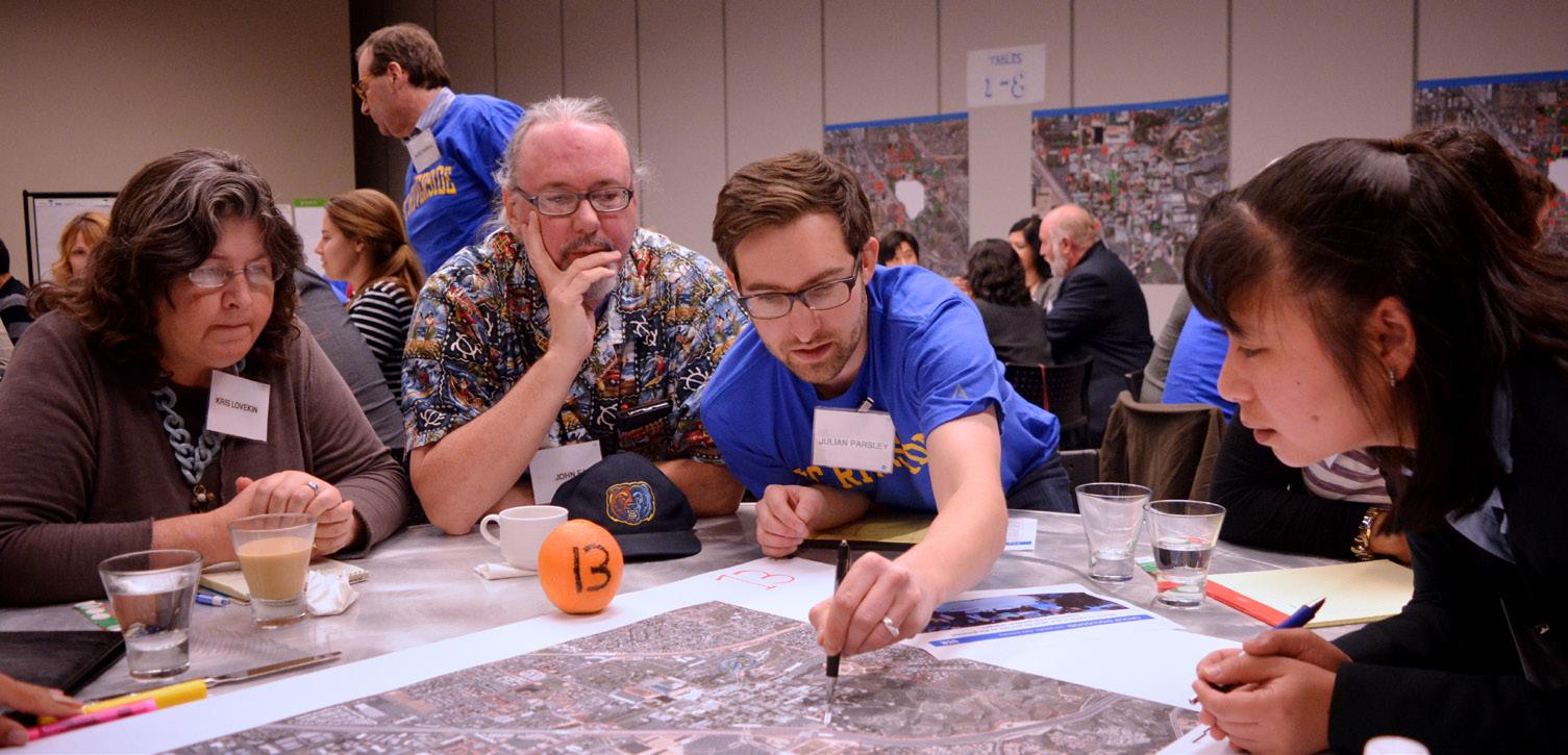
In the April workshops, participants were given the opportunity to develop preferred planning scenarios. The Planning Team provided a range of planning scenarios to which the workshop attendees, working in groups, responded. Each group was given a “tool kit” of various types and characteristics of open space, such as outdoor performance space, courtyards, drought tolerant landscapes, and pedestrian pathways. In addition to providing commentary on the proposed program distribution, they used the open space tool kit to annotate each land planning scenario with their vision of ideal locations for each open space type. The planning scenarios evolved and eventually were merged into a single planning framework that reflected a consensus on the preferred aspects of the future campus.
Among the most frequently-mentioned concerns were the following:
• Connectivity across campus and to the surrounding neighborhood is lacking.
• The campus lacks a sense of arrival. The threshold to campus needs to be more clearly identified.
• Campus is difficult to navigate, and often lacks a “sense of place.”
• Visibility between different campus landmarks can be improved.
• Destinations are separated by large distances.
• More interactive and multi-purpose spaces are needed to integrate isolated programs.
• More informal gathering spaces are needed, including food venues.
• Comfort and performance of outdoor space can be improved.
• The campus needs to be more pedestrian and bicycle-friendly.
• Pedestrian, vehicular, service, bicycle, and other forms of circulation overlap.
• Lighting can be improved.
• There is little activity on evenings or weekends.
As a means of encouraging greater input from senior academic and executive leadership across campus, the Chancellor hosted a meeting at which members of the Project Management Team briefed campus executives and facilitated a group exercise similar to the activities undertaken in Workshop 2, starting with a narrower range of scenarios that had been built with the benefit of responses from prior workshop participants.
Charrette: June 24, 2015
This session focused on confirming several key pieces of information: the University’s program needs, the selected opportunity sites and the drivers for program distribution. The Project Management Team gathered together with the chairpersons of the Working Groups and reviewed the results of the stakeholder engagement process and the Planning Team’s technical analysis (detailed in subsequent sections.) Together, they worked with the evolving planning scenarios, precedent images, and a rough scale model of the campus, to build a tangible image of the future campus. The Planning Team presented a range of potential development sites for both buildings and landscape, and discussed the potential each represented to accommodate growth and address campus shortcomings that the workshop participants had identified. These initial sites were chosen on the basis of building energy performance, historical significance, age, density and flexibility. The group reached consensus on which potential sites merited further evaluation.
While some of the ideas in the Master Plan Study represent completely fresh thinking about campus growth, many others are logical extensions of previously articulated goals and strategies. The intent is that the University continues on a rational course, correcting where necessary and carrying past investments forward in an organized fashion. To this end, the Planning Team consulted the work of their predecessors through a wide range of documents.
The most recent overall planning documents are the 2005 Long Range Development Plan, the 2008 Campus Aggregate Master Planning Study, the 2007 Campus Design Guidelines, and the 2009/2010 Physical Design Framework. In the decision to concentrate new growth on
East Campus, the Master Plan Study departs significantly from these previous studies. Many of the previous ideas remain valid nonetheless – particularly for the development of open space and landscape within the Core Campus – and have been incorporated into the new planning framework. Other specific planning efforts which are ongoing, like the site planning and design of new buildings, have also been carried forward into the current plan. The recommendations of the Master Plan Study will form the basis for updates to the LRDP so that it reflects updated planning.
Quantitative surveys were valuable tools in the analysis of the existing campus. These included, but were not limited to studies on building inventory, housing, parking utilization, and enrollment.
The Planning Team conducted “walk-throughs” of the campus to observe and experience open spaces and buildings first-hand. These visits occurred over a period of several months and included University planning staff, consultants, and DRB members. The goal of these observations was to assess utilization of space both interior and exterior, and to form hypotheses as to why some are better used than others.
Generally, the team observed a low utilization of campus open space, with pockets of high activity. These pockets were generally associated with comfortable microclimates and active adjacent programs, like dining and retail. In buildings, the team assessed the adaptability of various building floor plans; whether or not their footprints lend themselves to contemporary methods of working and teaching. Around the campus perimeter, the Planning Team mapped the experience of the campus edges through driving tours, recorded on video.
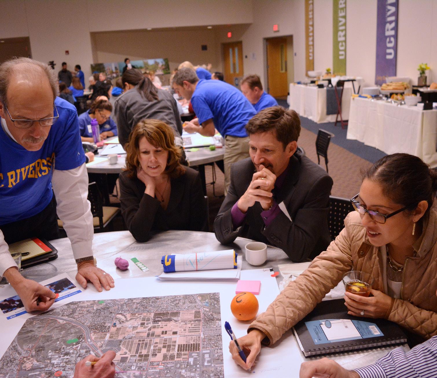
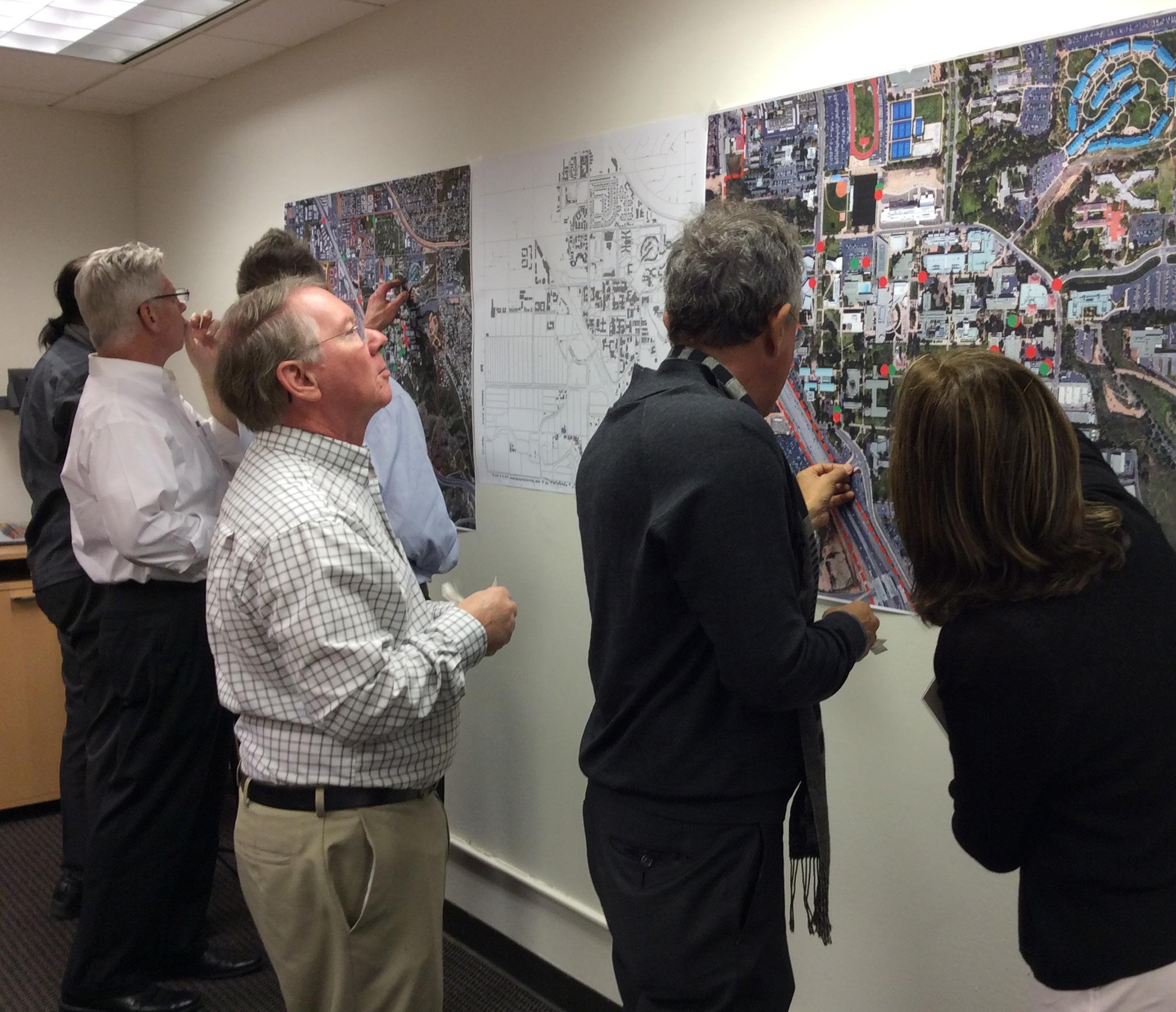
UC Riverside’s landscape and climate are key to its sense of place, being defining features of its location in Inland Southern California. Many of the buildings on campus, older ones in particular, demonstrate climate responsive design strategies. Large overhangs, loggia, shaded courtyards and deep brise-soleils all help provide protection against the sun. Long, freestanding outdoor arcades make walking more comfortable.
These architectural responses to the Riverside climate contribute significantly to the campus’s sense of place.
The Box Springs Mountains, east of and adjacent to the UC Riverside campus, are the dominant geographical feature of the immediate region. To the north and more distant, the San Gabriel and San Bernardino Mountains are visible on the horizon. The Box Springs Arroyo cuts through the southernmost portion along a meandering alignment generally extending from east to west south of Martin Luther King Boulevard.
Riverside’s climate is semi-arid. Temperatures vary widely, with lows occasionally below freezing, and highs in summer often well over 100 degrees Fahrenheit. Average temperatures in the summer months of July and August can be in the 90s. Pleasantly warm conditions typify the area in the spring and fall. Humidity is generally low. Winters are mild and relatively wet, with average daily highs near 70. Prevailing winds are from the northwest, becoming more westerly in the summer. “Santa Ana” winds blow from the northeast, bringing hot, dry conditions in the fall and winter.
The topography of the campus ranges from comparatively level areas to steep hills with massive rock outcroppings. West Campus is relatively flat. East Campus presents a greater variety of landforms. The developed central portions of East Campus appear to be level, though there is actually a 60-foot difference in elevation from east to west. The southeast portion of the campus, comprising approximately 120 acres, exhibits the greatest variety in topography, ranging from limited flat plateau areas to very steep hills with large rock outcroppings, loose boulders, and deep ravines.
While on a map the distances across campus appear manageable, the topography presents several challenges for connectivity.
Walking between buildings can become tiring, particularly on hot summer days. Many paths are also technically inaccessible (as defined by the Americans with Disabilties Act.) Steep grade transitions separate the Student Recreation Center and Student Housing in the northeast from the Core Campus.
Open space is composed of paths and places. Paths move people from place to place, and at edges connect to the surrounding landscape and neighborhood. Places encourage people to stay and gather. These outdoor rooms serve many of the same programmatic functions as buildings – academic, social and environmental. The best of these places are memorable, and form lasting impressions on those who experience the University. Richness in a campus open space network comes from a mix of open space types – formal and informal. Informal spaces, like Picnic Hill, tend to be related to nature, along hillsides and streams. Formal spaces like the Carillon Mall make clear connections between buildings and districts.
Buildings shape path and place, and vice-versa, thus a thoughtful configuration of buildings is critical to the development of a successful open space network. On the UC Riverside campus, buildings which frame open spaces tend to be opaque and inactive at the ground floor. In many cases, buildings block views to the surrounding landscape and to internal landmarks. Buildings which are only one or two stories high lack the physical presence to effectively define open space.
Chapter 4 focuses specifically on campus open space, studying climateadaptive landscaping, pedestrian connectivity, and relationships to buildings, among other specific topics.
Within a campus, defining distinct sub-regions provides a framework for organizing future development. Programs that benefit from each other can then be co-located in close physical proximity. On the UC Riverside campus, the Planning Team defined these regions roughly at first, based on existing programmatic concentrations, then refined those definitions based on physical boundaries. Within these boundaries, flexibility exists to plan each region in more detail.
West Campus is a single region defined primarily by its use for landbased agricultural research and support functions. East Campus comprises two regions. “Core Campus” contains nearly all of the academic buildings, as well as most of the University’s older buildings; the “North District” extends north to Blaine Street and Watkins Drive. This region contains student housing and recreational facilities, and has the greatest potential for interface with the surrounding neighborhoods. Land area in the North District is severely underutilized.
The Planning Team observed that while Core Campus is lively midday, in the evening, activity shifts to the residential areas. While initial planning scenarios examined the possibility of intermixing residential and academic uses, input from campus constituents pointed out the tradeoffs of this option. Though it may have increased activity in the Core Campus in the later hours, the resulting sparsity of academic buildings would have exacerbated existing issues of distance and topography.
Within Core Campus, academic programs often operate in isolation. This is especially the case with science and research, which lacks a connection to other academic functions.
UC Riverside lacks a clear identity at its edges. University Avenue is a primary connector between the city and the campus, but lacks any identity before passing under the freeway moving from west to east. The intersection of Canyon Crest Drive and West Campus Drive, a primary campus entrance from the south, announces its arrival at the campus edge with a 2,000-car parking lot. North Campus Drive is similarly lacking in identity, and East Campus Drive has the feel of a “back door” to the campus. The boundaries of the North District are unclear, as it bleeds into the surrounding neighborhood.
Another detriment to campus identity is the location of parking, the majority of which is on surface lots distributed around the campus perimeter. Although this approach minimizes conflicts with pedestrians and cyclists on the campus interior – it undermines institutional identity as parked cars become the face of the institution. The edge of campus therefore becomes indistinguishable from adjacent non-University property. Navigating from parking lots to the active spaces on campus is also difficult, partially owing to the fact that the campus is not intuitively laid out in many instances. The lack of visibility to key landmarks on the campus interior is a contributing factor.
The University aspires to be a resource and destination to its surrounding community but is limited in its success, given the constraints of its physical setting. This is a key finding from the workshop process: community members desire to take advantage of cultural events on campus, but are unsure how to access them. Specific observations and recommendations for improving the legibility of the campus network of roadways, service routes, bicycle paths and pedestrian ways are covered in Chapter 5.
The UC Riverside campus is relatively low in density. This is a function of two measurements: building height and site area coverage. Building heights range from one to five stories. Older buildings and those towards the campus periphery tend to be shorter, while those newer and nearer to the center of campus tend to be taller. This relatively low height range, combined with the buildings’ spacing yields a Core Campus floor-area-ratio of 0.65. In workshops, many participants expressed the assumption that East Campus is fully built-out, given that there are few remaining open building sites.
On closer investigation, it was determined that significant capacity for growth exists through the replacement of lowdensity, older and/or under-performing buildings.
While density – or lack thereof – in itself is neither good nor bad, it can affect quality of life on campus. The physical distance between related uses makes pedestrian travel less comfortable and cross-disciplinary interaction therefore difficult. Programmatic synergy – the sharing of spaces between buildings – is less viable. Larger networks of roads and utilities are required to serve these widely-spaced structures.
What is the appropriate height and density for UC Riverside? If buildings are too low, they underutilize precious land area, and lack the ability to shape recognizable open spaces. If too high, the campus may begin to feel out of scale with its surroundings. Taller buildings have also been found to hamper interaction and productivity. After modeling a range of density scenarios, the Planning Team recommends that new development occur in the typical height range of four to five stories.
Legacy buildings and landscapes are the campus’s most important cultural artifacts. They represent the values, care and craft of the University at particular moments in its history. They embody particularly successful expressions of the life and aspirations of the campus and its community at the time of their construction, connecting the past and present.
Memorable campuses value and preserve their most successful buildings and landscapes, as these places create an important sense of continuity, respecting the University’s past even as it moves into the future.
No campus should be frozen in amber. At its essence, the University is a place of creativity and innovation as well as a repository of history and culture. Prominent existing buildings should be respected but not static; they should continue to contribute to the vibrant and evolving life of the campus by being available to house new uses. Not all existing buildings can be, or should be, preserved. While some make important contributions the University’s cultural identity (particulary those in the mid-century modern style), the significance of others is overshadowed by their inefficiency and their dilution of strong open space.
Significance is a subjective measure and often defined in different ways. In this study, significance was evaluated by the following criteria:
• Age
• Significance to the campus
• Architectural character
• Responsiveness to climate
• Contributions to adjacent open space
The Planning Team identified Anderson Hall, the Belltower, the Rivera Library arcade, Olmsted Hall, Sproul Hall, and the Barn as worthy of incorporation into the new planning framework as prominent legacy buildings that contribute to the campus’s sense of place. Significant open spaces include those from the campus’s beginnings – the Carillon Mall, Library Mall, and Eucalyptus Walk – as well as those that have gained cultural value over time, specifically Picnic Hill. The selection of these buildings and spaces as significant is a recommendation of the Planning Team, and is neither final nor prescriptive. In the future, a detailed campuswide assessment of historic resources should be should be undertaken as part of the LRDP EIR cultural resources evaluation.
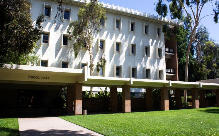
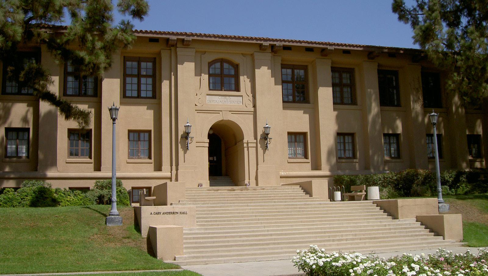
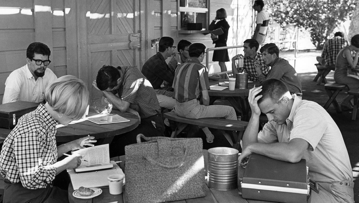
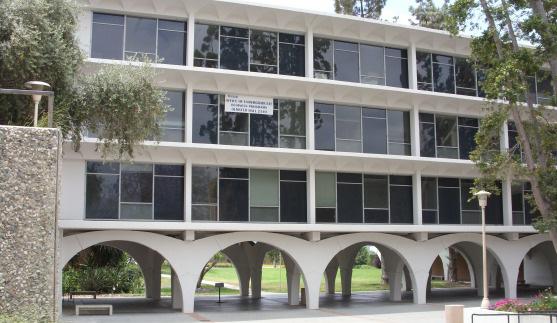
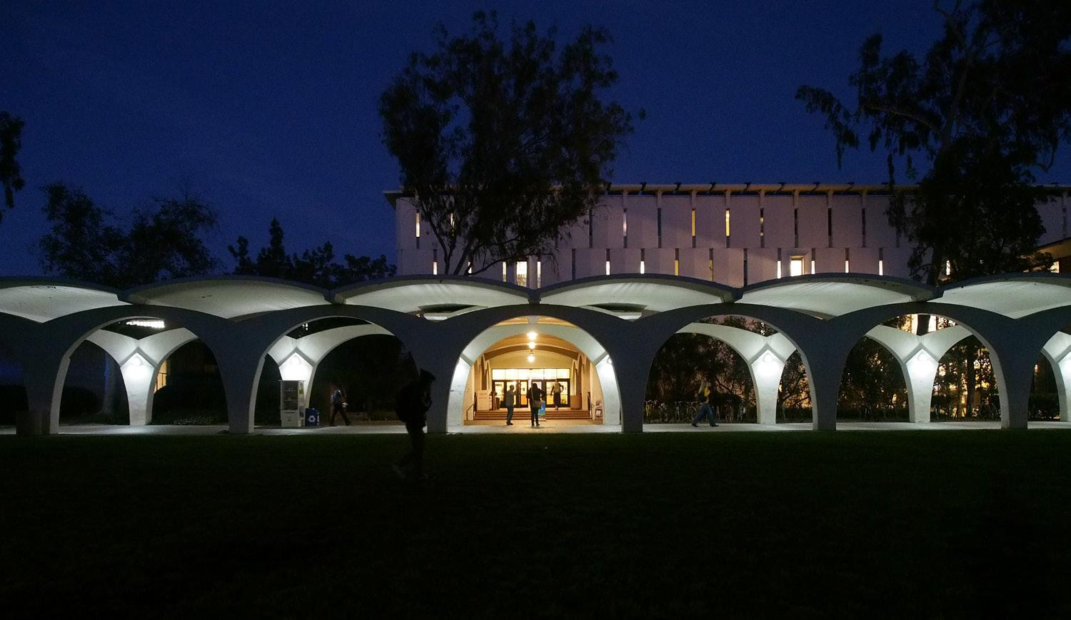
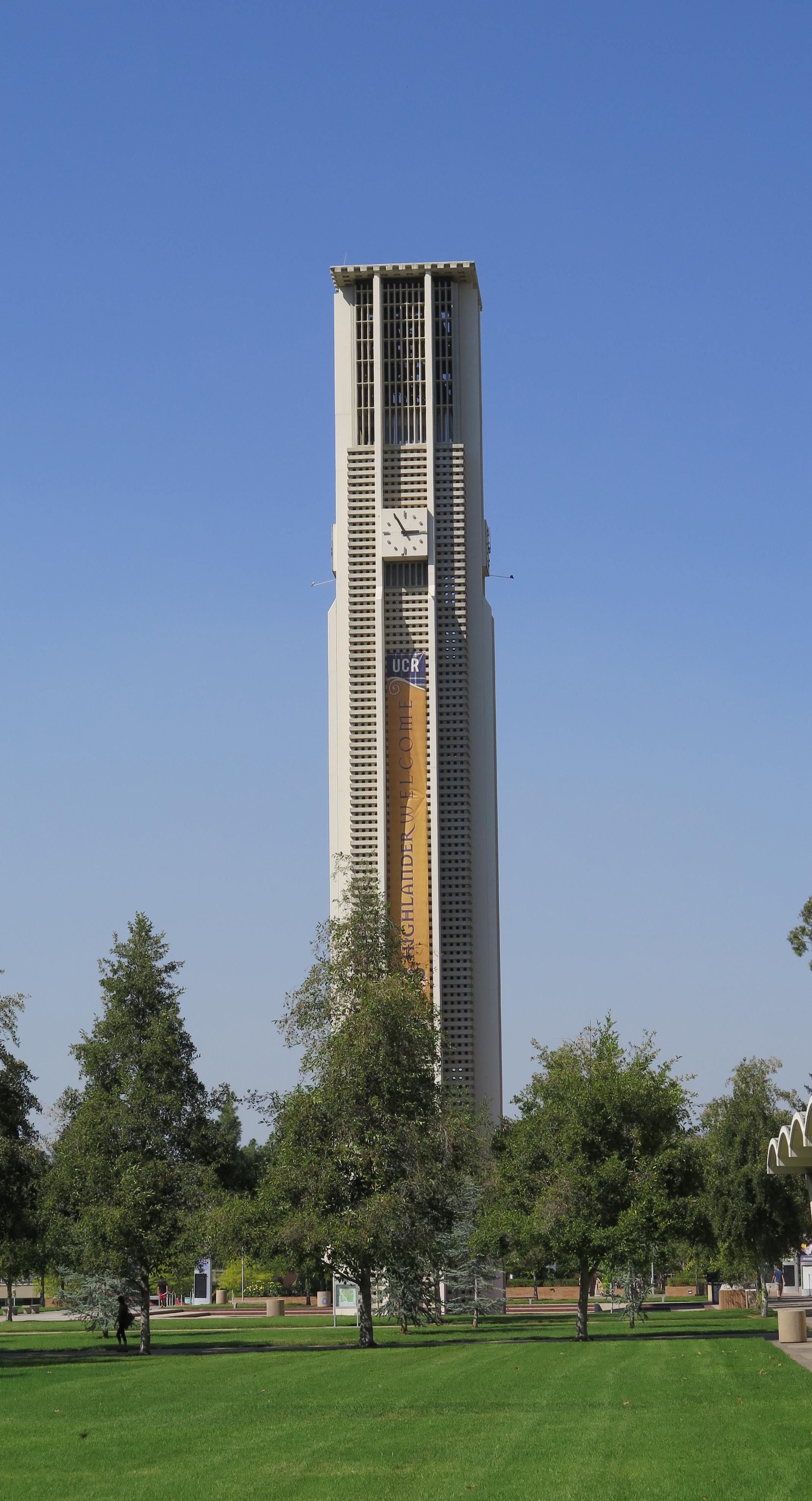
Measures of existing buildings’ energy efficiency heavily influenced the planning process. For the University to achieve its goal of carbon neutrality in operations, it is critical that inefficient buildings be improved or replaced. The Planning Team completed an ASHRAE Level 1 assessment of 14 existing buildings, representing a range of uses and ages. Given the Riverside climate, campus buildings may never achieve levels of efficiency as would be possible in milder regions, however, much room for improvement was found. The results of this basic energy analysis were evaluated against established baselines for comparable building types, and the results depicted graphically on a plan of the campus.
This “heat map” (see Fig 6.5) was a key tool which the Planning Team used to formulate initial recommendations for removal of certain buildings. It identifies the energy usage of each building using a tenstep scale from “excellent” to “very poor.” Existing buildings were then categorized more broadly into two basic groups: those that could achieve good performance with minor adjustments and upgrades, and those that required extensive renovation. Buildings in the latter category which are also inflexible and make poor use of their site, among other criteria, became prime redevelopment opportunities.
Chapter 6 provides more detail on this topic, including the “heat map.” It also includes a detailed look at existing utilities and infrastructure.
The ASHRAE Level 1 audit is the basic starting point for building energy optimization. It involves brief interviews with operating personnel, a review of the facility’s utility bills and other operating data, and an abbreviated walk-through of the building.
• The surrouding landscape provides a dramatic backdrop for the campus.
• The mid-century modern architectural legacy is a strong contributor to the campus’s sense of place.
• Views to the Box Springs Mountains are often partially or completely blocked.
• Topography, distance and lack of shading limit pedestrian movement.
• Research activities are separated from academic and support programs.
• There is little activity on campus on the weekends and evenings.
• Entry points to the campus lack a clear University identity.
• Wayfinding from the campus perimeter is not intuitive.
• A vast majority of the buildings in the Core Campus are over fifty years old.
• At a floor area ratio of only 0.65, the Core Campus is at a relatively low density.
• Demand for on-campus housing exceeds the University’s current ability to accomodate it.
• Many buildings, particularly the older ones, are energy-inefficient.
Future growth of the UC Riverside campus must support the University in creating and sustaining a vibrant, healthy community for living and learning. This new planning framework comprises a series of strategic initiatives to guide growth while embodying the intent of the Master Plan Study’s four essential elements. The broad goal of the initiatives is simple: to preserve and enhance the successful aspects of the physical campus – its connection to the natural setting, its legacy buildings and open spaces, and its rich supply of agricultural research land – while re-envisioning the campus components that will not meet future needs.
Glossary of Terms
Critical Alignments - guiding alignments from one building to another, to frame open spaces and views.
Floor Area Ratio (FAR) - the total built space on a given site, divided by the area of the site itself. It is an absolute measure of the built density of an area of land.
Gateways - points of arrival on campus that identify the institution.
Mobility Hub - the multi-modal transportation center proposed as part of the future gateway on University Avenue.
North District - northern portion of campus projected for new student residential, retail and recreation and the Campus Events Center.
Opportunity Site - a discrete area found to be underserving the campus relative to its potential.
Planning Framework - guidance regarding the future growth of the campus, intended to be adaptable and flexible over time.
Strategic Initiatives - high-level recommendations which support achievement of the study’s Essential Elements.
• Articulate campus gateways to strengthen campus identity.
• Address common interests of campus and community by creating a safe environment for pedestrians and bicycle riders at the campus perimeter with managed service and vehicular access.
• Shape buildings, open spaces, and interstitial environments to promote collaboration and interaction.
• Frame views towards the heart of campus and the Belltower, and outwards to the Box Springs Mountains through the careful configuration of future buildings in the Core Campus.
• Foster a sense of campus community by enhancing campus districts and linking them through pedestrian promenades.
• Infill strategically located “Opportunity Sites” on East Campus to increase density and accommodate future growth.
• Manage university land and research resources on West Campus as strategic assets to sustain UC Riverside’s excellence long into the future.
• Continue to build on the current planning theme of “simple buildings in a dramatic landscape” to celebrate the campus’s unique setting at the base of the Box Springs Mountains.


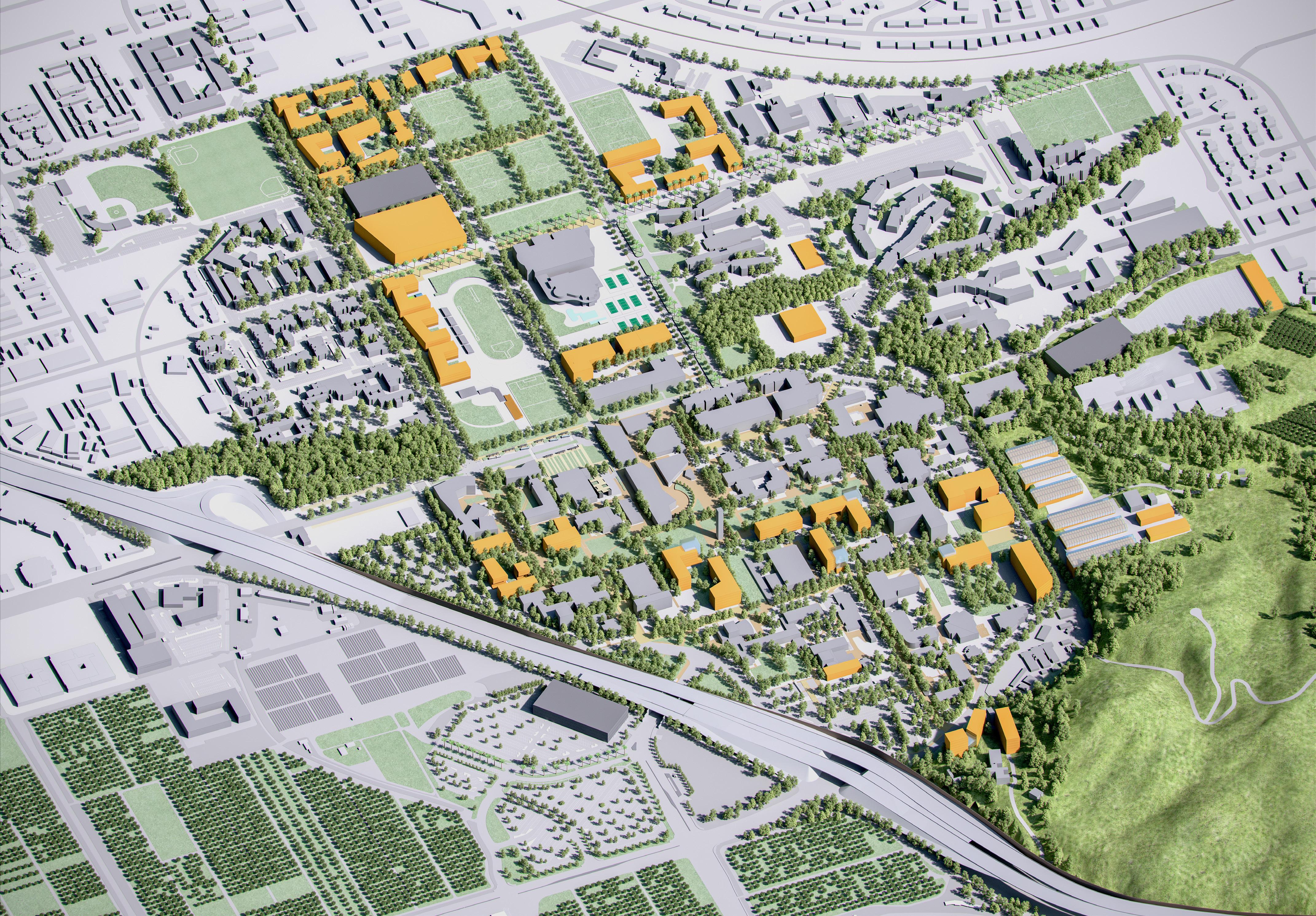


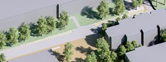


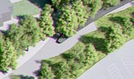


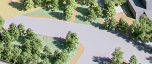


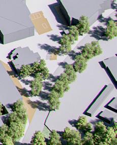
The new planning framework is intended inform and guide UC Riverside’s future decisions relative to campus growth, its interface with its immediate neighbors, and its relationship to the larger community it serves and functions within. Flexibility is key to leveraging existing assets and protecting future opportunities, as economic realities, environmental aspirations and programmatic requirements of the campus are everchanging. This framework is thus meant to be adaptable, rather than prescriptive. Fig. 3.2 shows the framework’s basic elements.
For the purposes of assessment and recommendations, the Master Plan Study focuses on individual campus components and systems and addresses them chapter-by-chapter. Because these systems are intertwined within both the physical and operational fabric of the campus, there is inherent overlap of their analysis and related recommendations. The Master Plan Study is deliberate in its integration of these considerations.
This chapter specifically focuses on the following aspects of campus organization and projected campus growth:
• Campus Gateways, Circulation and Community Interface
• Open Space Framework
• Program Adjacency
• Future Expansion Opportunities
Subsequent chapters focus on open space, transportation, utilities and infrastructure, environmental and fiscal stewardship.
The campus circulation and open space components highlighted in figure 3.2 form the organizing structure for future development. The primary features of this structure are roadways, major malls and walks, and the surrounding natural landscape. From the freeway, University Avenue is the main route into the campus. Campus Drive – also referred to as the “loop road” – is presently the primary circulation corridor that defines the Core Campus.
The first type of circulation improvements the Master Plan Study advocates for are campus gateways. A newly defined primary gateway at the intersection of University Avenue and Canyon Crest Drive – the “University Avenue Gateway” – will strengthen campus identity as one of two major entry points to campus. Two additional secondary entrances will be defined on the northern and southern sides of East Campus – Blaine Street at Canyon Crest Drive to the north and Campus Drive at Canyon Crest Drive to the south.
The second type of circulation improvements are pedestrian pathways. Canyon Crest Drive and Aberdeen Drive run northward from University Avenue and North Campus Drive, respectively, connecting the Core Campus to the North District. Between these two traditional roadways, a new parallel pedestrian pathway – Recreation Mall – will be created.
A separate segment of Canyon Crest Drive serves as the primary connector from the Core Campus to the West Campus and surrounding neighborhoods on the west side of the freeway. Though these roadways will remain in their existing configuration, their character, usability and pedestrian-accessibility will be enhanced with the addition of lighting, landscaping, wayfinding signage, and improved sidewalks.
Connecting the campus’s users to the region by providing views to the surrounding landscape is a primary goal of the new planning framework. Proposed development sites are located to preserve and enhance views to these iconic natural features. The theme “simple buildings in a dramatic landscape” guides the new planning framework as it seeks to bring the natural and built environment into balance.
The rugged profile of the Box Springs Mountains just east of campus is a reminder of UC Riverside’s place in Inland Southern California.
Open spaces, both formal and natural, are key to the campus’s memorability, and improvements to them are a vital component of the Master Plan Study. Within the Core Campus, the east-west Carillon Mall is the signature open space. Eucalyptus Walk, Citrus Walk, Science Walk, Barn Walk, Library Mall, Arts Mall, Commons Mall, and Picnic Hill are secondary and tertiary open spaces that complete the open space network, and will be enhanced in the future. Where open spaces can be extended, new development will increase opportunities for academic, social and recreational use.
The Master Plan Study often suggests “defining” or “strengthening” the edges of these spaces. This means aligning building facades to shape spaces that are more recognizable, so that open space is not simply the amorphous zone between buildings, but a distinct place for people to gather. “Activating” the edges of open spaces means surrounding them with ground-floor building programs that attract high volumes of diverse users throughout the day. These strategies improve their functionality as formal and informal gathering spaces, resulting in a more memorable institutional experience.
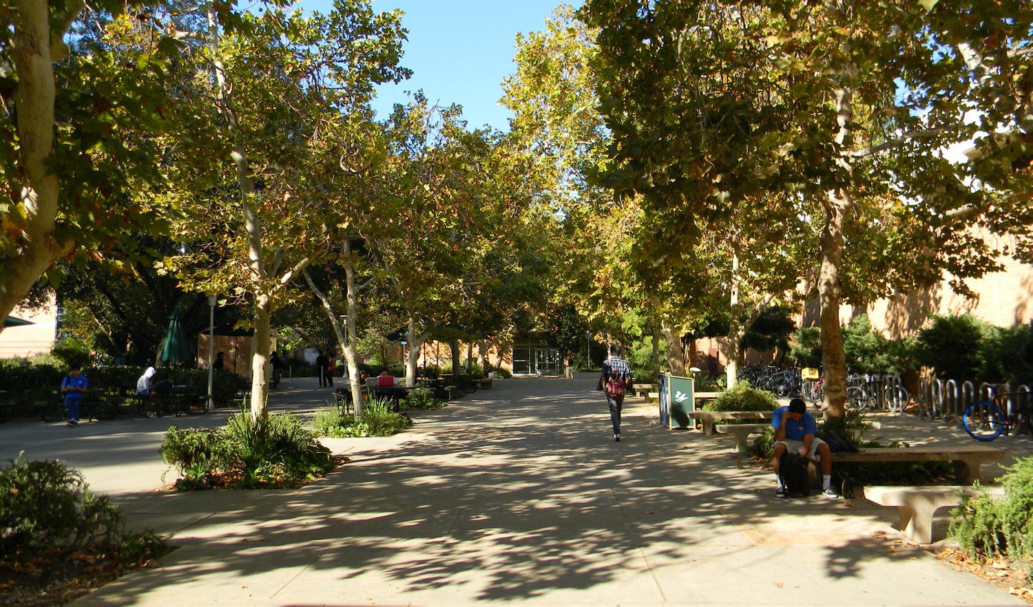
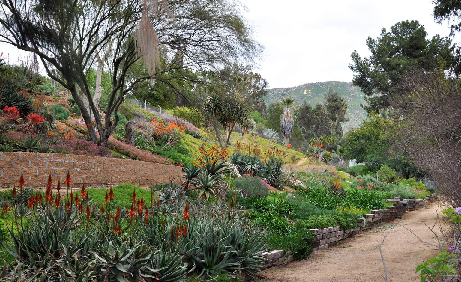
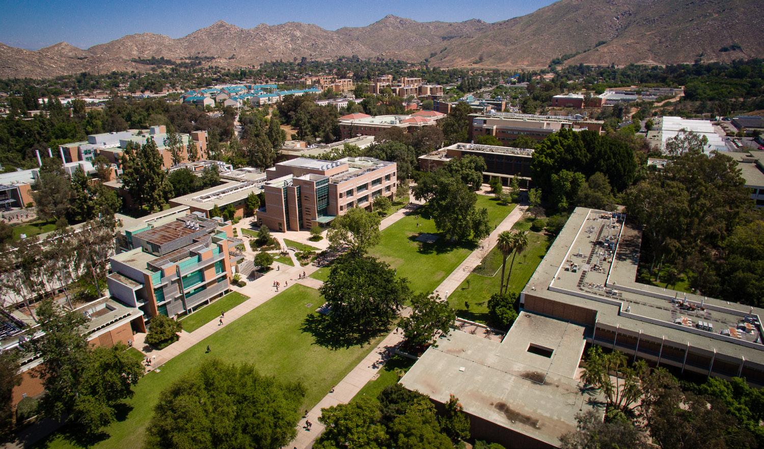
The Master Plan Study demonstrates how up to 1.5 million additional square feet of built space and at least 3,700 additional beds (approximately 2.8 million GSF aggregated and used for modeling purposed in the energy model referenced in Chapter 6 and 7) can be accommodated on campus. The overarching planning principle guiding this study is the consolidation of growth on East Campus, and the retention of West Campus for future uses.
The Master Plan Study maintains all of the lands south of Martin Luther King Boulevard for long-term land-based research (approximately 290 acres.) Most of the remainder of West Campus land will be retained for short-term land-based research.
Though previous planning initiatives identified West Campus as a significant future development zone, current assessments show that focusing new construction on West Campus would be prohibitively expensive, by several measures. First, it would diminish the value of an important university resource – its agricultural research land. Second, it would impose high infrastructure costs on new projects. Third, its isolation from Core Campus would weaken the intellectual synergies desired.
Conversely, East Campus development provides prime opportunities to preserve land, leverage existing infrastructure, and strengthen interaction across disciplines. Proposed development sites in the Core Campus are mainly reserved for research and academic functions, while those in the North District are better suited to housing, retail, recreation, and culture.
An Opportunity Site is a discrete area found to be underserving the campus relative to its potential, either because it is underutilized or impairs preferred alignments between buildings and open spaces. These high-value development areas enable campus expansion at greater densities while maintaining the desired balance between buildings and open spaces.
Opportunity Sites are divided into two major types: buildings and public realm. “Building Opportunity Sites” identify locations for traditional building development, while “Public Realm Opportunity Sites” include broader improvements to campus circulation, open space systems, and associated infrastructure, while specifically focusing on these components:
• Circulation – vehicular, pedestrian, bicycle riders, transit and service
• Landscape and stormwater management
• Identity and Wayfinding
Detailed descriptions of these Opportunity Sites (which follow in Section 3.5) illustrate how the values embedded in the Master Plan Study can be applied to site planning by suggesting approximate locations, capacities and critical alignments for future construction. These concepts take advantage of the varied topography of the sites and aim to increase the visibility of new buildings from both the campus heart and perimeter. The Master Plan Study does not define any particular style of architecture for these sites, beyond the current planning theme of “simple buildings in a dramatic landscape.”
The Opportunity Sites vary in their size, program, orientation, topography, and character, so each offers unique opportunities. Recommendations for development of the sites vary, including the construction of new buildings, the adaptive reuse of existing buildings, the specification of desirable building heights, and the development of well-defined site features like courtyards and pathways.
Opportunity Sites fall into one or more of the following categories:
• Undeveloped sites or those only requiring minor demolition
• Sites with high potential to advance the University’s vision for its open space framework
• Low-density buildings
• Low-performing buildings (based on energy use assessments detailed in Chapter 7)
• Buildings not contributing to the campus’s desired legacy
• Programmatically inflexible buildings
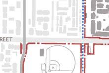

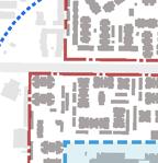

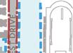


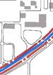
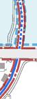
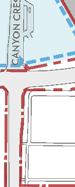


CORE CAMPUS
1. Carillon Mall West
Shape the intersection of Arts Mall and the Carillon Mall on the site of Hinderaker Hall.
2. Gateway Link
Modifications on the Athletics and Dance Building site to create a connection between the Mobility Hub and Carillon Mall.
3. Core Campus Nexus
Create new lines of sight into the heart of campus from the perimeter.
4. Eucalyptus Walk Science Area
Transform a “back door” into a “front door” at the perimeter of East Campus.
5. Picnic Hill Science Area
Reframe a popular outdoor gathering space.
6. Core Campus South Extension
Enhance institutional identity on the southern hillside.
7. Citrus Walk Portal
Create a portal to Citrus Walk from Carillon Mall to frame views to the south.
8. Science Area Greenhouses
Consolidate the greenhouse program on a contiguous site adjacent to plant based research.
Sites 9 to 15
Additional sites on East Campus for future buildings
NORTH DISTRICT
Sites A to G
Future student housing, recreation, retail, and Campus Events Center
WEST CAMPUS
Sites H
Outpatient Pavillion
Site I
Areas on West Campus to prioritize future development
P-1. University Avenue Gateway
Create a primary campus gateway experience at the intersection of University Avenue and Canyon Crest Drive. Integrate the proposed Mobility Hub and its associated program elements, as well as upgraded amenities for pedestrians and bicycle riders.
In Section 3.6, this initiative has been expanded to include a detailed development scenario.
P-2. Connection to Existing Student Housing
Reconcile vehicular, service, and pedestrian flow from the residence halls into the heart of campus.
P-3. Canyon Crest Drive Streetscape
Create a safe and pedestrian-friendly mixed-use street.
P-4. Recreation Mall
Link the Core Campus to the North District.
P-5. Aberdeen Axis
Visually extend the Aberdeen Drive axis into the North District as a pedestrian pathway with limited vehicular and service access.
P-6. Citrus Mall
Restore the Citrus Mall axis by reconfiguring the adjacent open spaces and the surface parking around Anderson Hall.
P-7. Canyon Crest—South Streetscape
Define arrival into campus through enhancements to the pedestrian experience, including upgraded landscape, lighting and paving.
* Chapter 4 describes these initiatives in more detail.
Some of the Opportunity Sites are defined by the University’s desire to achieve preferred alignments from one building to another, as well as to the immediate campus district and broader open space network, including the Carillon Mall, Library Mall, and Eucalyptus Walk. These alignments are illustrated for each Opportunity Site in Section 3.5 and more comprehensively in the attached appendix.
The following principles determine critical alignments
• Preservation and enhancement of views from the heart of the campus to the perimeter.
• Preservation and reinforcement of key open spaces and pathways to create connections across campus and to the community.
• Integration of transitional zones between buildings and open spaces, including arcades, terraces, and landscape elements.
The concentration of new development on East Campus will strengthen the campus community. Presently, buildings and open spaces are often separated from one another by both distance and topography, and lack clear connections to their surroundings. Proposed development on the Opportunity Sites will create a more active and connected community by bringing a diverse range of academic, research, and student life programs together in close physical proximity. Centrally located shared spaces will improve the physical and intellectual links between campus districts and colleges.
Initiatives which promote connectivity through pathways and open space are discussed more in Chapters 4 and 5. These include improving roads and paths for vehicles, pedestrians, and bicycle riders, as well as the expansion of pedestrian connections. Also discussed are improved access to transit and the strengthening of the ground-level interface between buildings and adjacent open spaces with permeable edges that encourage pedestrian activity.

UCR 2020: The Path to Preeminence ties the future growth of the campus student body to UC Riverside’s inclusive values and outstanding educational opportunities. It is a campus that provides a transformative experience in a living-learning environment that is engaged with, and responsive to, the needs of the larger community.
The aspiration for this living-learning community is one that extends beyond the boundaries of the campus. It encompasses the success of students, staff, and faculty in achieving their own goals and serving as leaders to amplify the University’s impact on the social, cultural, and economic growth and well-being of the region.
This vision goes even further to convey a global dimension in the definition of its community, with the objective that the University’s activities include perspectives from every aspect of its diverse community, and incorporate an international point of view.
The University has the opportunity to enhance campus communities and promote engagement with UC Riverside’s surrounding neighborhoods through several initiatives. In the North District, the quantity and concentration of student residences and recreational fields should be significantly increased. These new student life developments also must be better linked to the academic and research facilities in the Core Campus through an enhanced network of pathways for pedestrians and bicycle riders.
The ideals of an enhanced living-learning environment and engagement with the larger community are exemplified further by the desire to locate a future Campus Event Center in the North District as part of a mixeduse complex of student housing, dining, retail, entertainment, recreation, and student services. In the North District and across campus, there is particular benefit to expanding dining options and making them available for extended hours – increasing activity day and night and to promote social and academic interaction.
Development on the proposed opportunity sites in the Core Campus will support UC Riverside’s living-learning environment in many ways, including:
• Facilitating multidisciplinary engagement by bringing diverse program together in close proximity.
• Improving the learning environment as out-moded buildings are refurbished or replaced.
• Enabling the application of emerging innovations in energy efficiency, stormwater management, and other sustainable practices.
As they occur, these new developments will also support expanded living-learning opportunities in the campus public realm that could include:
• Better defining the Carillon Mall, traditionally known as the University’s landmark gathering spot.
• Create or improve other open spaces that can be used for outdoor learning and interaction.
• Enable flexible use of open spaces, pathways, building lobbies, and outdoor facilities with enhanced technology and other supportive features (such as shade structures.)
“UCR is a living laboratory for the exploration of issues critical to diverse, growing communities at home and abroad - air, water, energy, transportation, agriculture, arts, culture, health care, and more.”
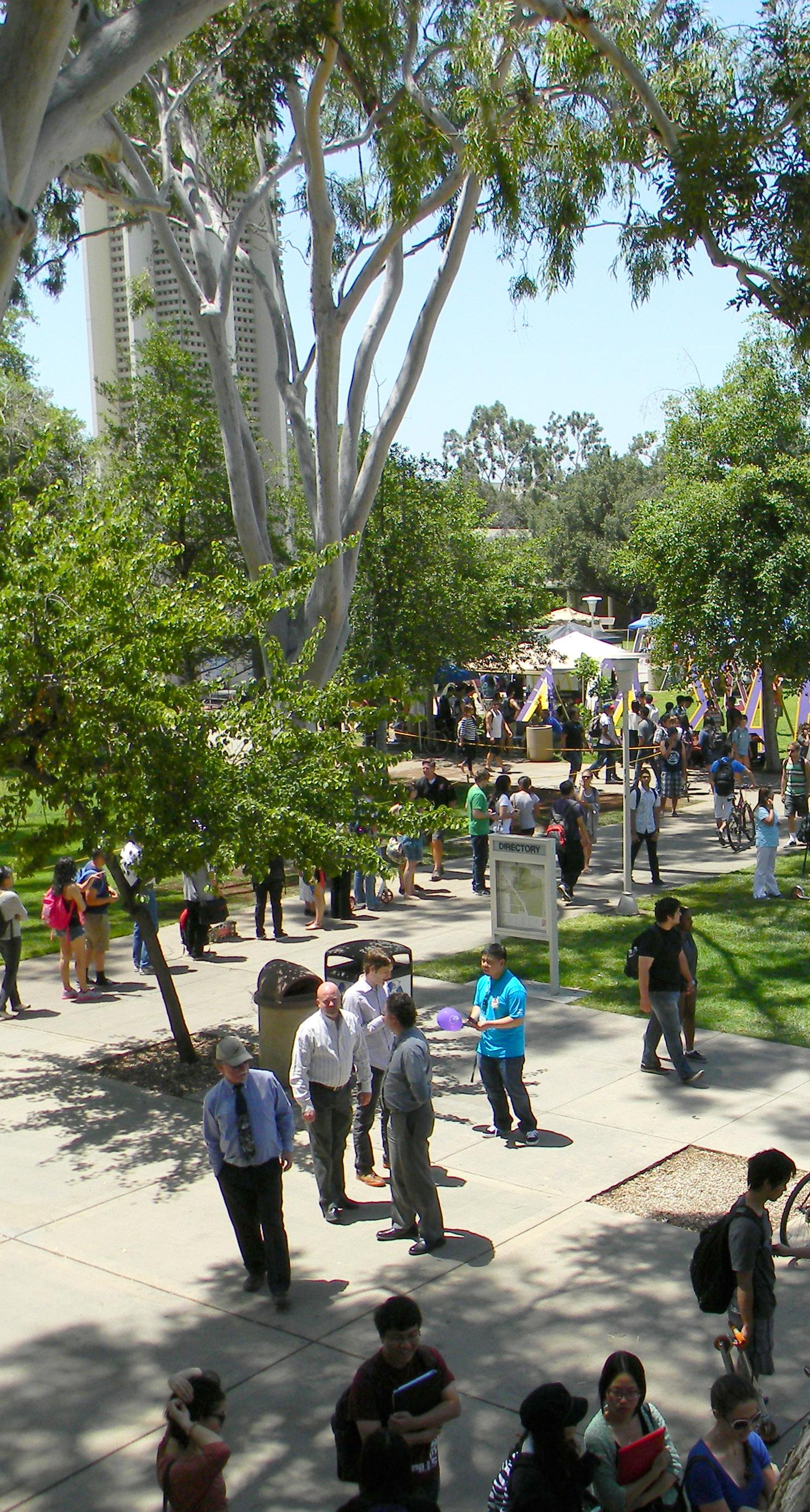
On-campus communities will be fostered by reinforcing – and sometimes expanding – existing campus programmatic regions through careful program placement and management of campus land. The Core Campus will be the focal point for expanded academic and research uses. The continued concentration of academic programs in the Core Campus will support interdisciplinary interaction and collaboration, aided by the inclusion of shared social amenities, such as dining and gathering spaces, where practical. Key student life functions (other than housing and recreation) will also retain their traditional places in the Core Campus to facilitate a sense of community and support student success. These functions, particularly the most public and active ones, will be integrated at ground-level to create buildings with “permeable” ground floors.
The North District of the campus is envisioned as a more lively student housing and mixed-use neighborhood organized around a variety of residential, recreational, dining and event uses. Much of the new development will need to occur on the site of the existing Canyon Crest Family Housing complex. Along the outer edges of this site a variety of new multi-story student housing buildings can be developed – from freshman residence halls to undergraduate apartments and graduate student studios. Families can be accommodated in existing one- and two-story apartments on the west side of Canyon Crest Drive. Across the street on the east side of Canyon Crest Drive, the University can create the opportunity for mixeduse retail spaces on the ground floor of new student housing projects. With proper planning, new recreation fields also can be provided along with the additional housing.
Specific projects, both current and future, can be found in the University’s 10-Year Capital Financing Plan.
It is important to note that the Master Plan Study does not attempt to define the intended use of potential future building sites by specific schools or colleges, or by specific housing type, for a number of reasons. First, the nature of campus activities is likely to evolve and its needs for space will change in response. Second, the use of future spaces may even transcend traditional boundaries between disciplines. Third, the timing of most future buildings remains unknown, due to limited resources and uncertain priorities. Therefore, the new planning framework exists to facilitate these detailed programmatic decisions in the future, rather than to make them now. The guidance offered remains at the district or neighborhood level.
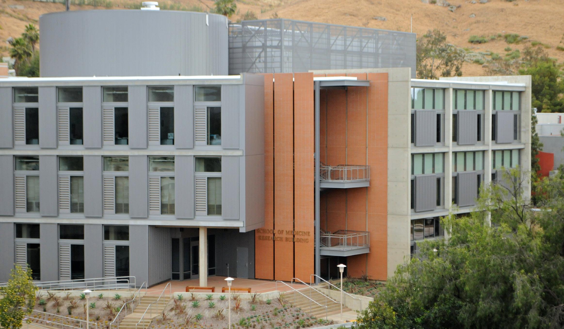
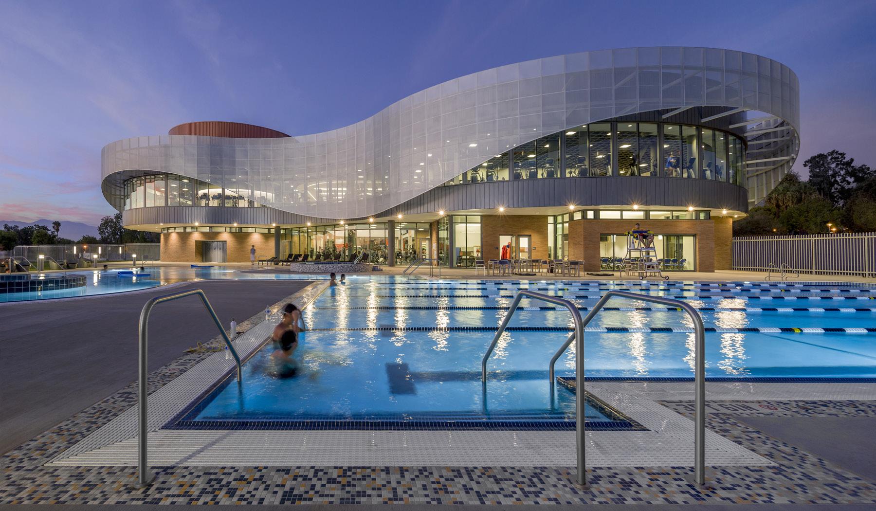
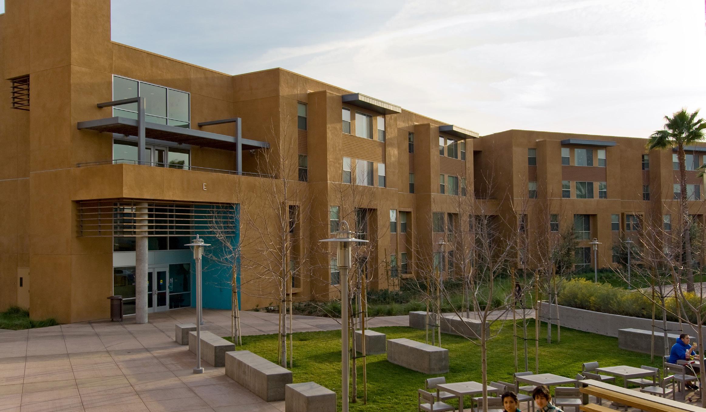
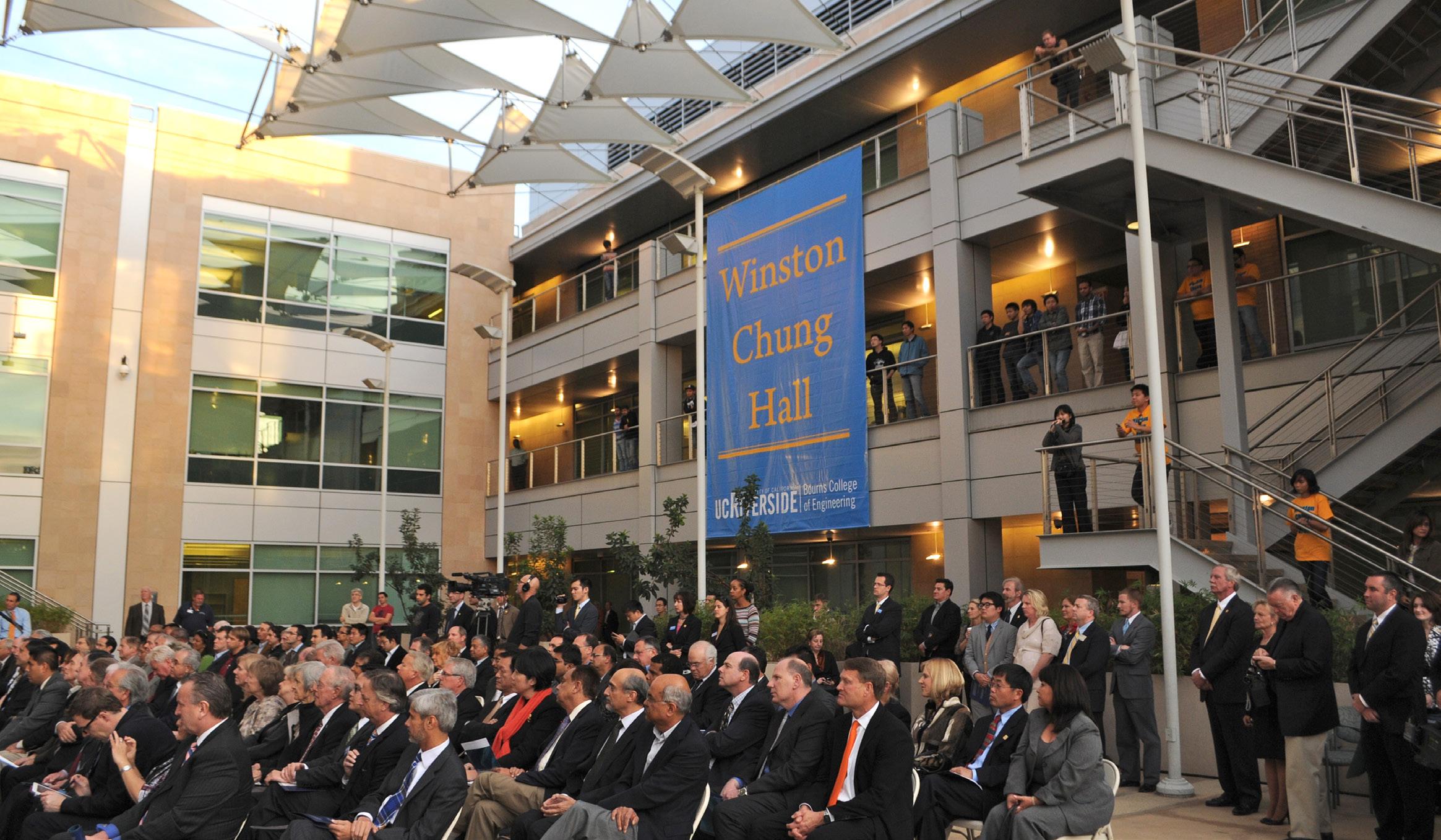
Developing the University’s institutional identity begins with respecting its rich history through the recognition of the role prominent buildings and open spaces play in defining a sense of place. Connecting these buildings and open spaces to the future of the campus has been embraced throughout the Master Plan Study by a wide variety of stakeholders, from students, staff, and faculty to alumni, neighbors, and others in the surrounding community.
In keeping with this consensus arising out of the planning process, key legacy buildings will be retained, and their importance reinforced, rather than diminished, by the new developments to come nearby. For instance, the placement and alignment of new buildings will define positive relationships to legacy buildings, including Sproul, Olmsted and Anderson Halls, the Barn Complex, as well as Rivera Library and its arcade.
New buildings sited within the opportunity sites will further reinforce primary campus open spaces, including Library Mall, Picnic Hill, and the Carillon Mall. As new buildings and open spaces are brought forward, they will be designed so that the resulting views will call attention to the campus’s agricultural features and naturalistic setting, including the Citrus Variety Collection, the arroyos, surrounding mountains, and Botanic Gardens.
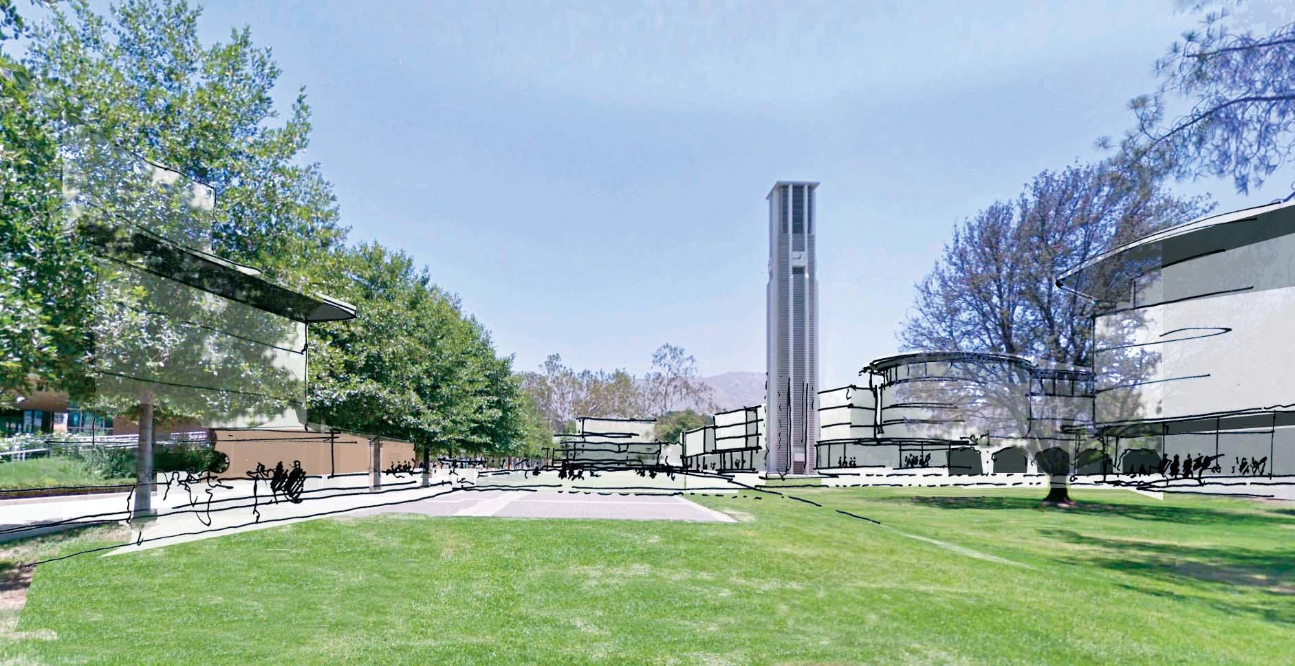
The campus lacks a strong identity with the surrounding community at its edges. Oftentimes, campus property is indistinguishable from non-University land. Many opportunities exist to improve campus-tocommunity connections, including better management of traffic and service, enhanced landscape and wayfinding at campus edges, and a safer environment for pedestrians and bicycle riders. These initiatives, discussed further in Chapters 4 and 5, are particularly important on and around Campus Drive.
Figure 3.9 highlights “campus nodes” – intersections of particular importance – primarily around the campus perimeter. By prioritizing these areas for investment in upgrades to paving, lighting and landscaping, the University will achieve stronger returns on investments, as their prominence magnifies the value of such improvements. The most critical of these nodes are the three “campus gateways,” described in more detail in the following section.
New view and landscape corridors will mark entry points to the campus wherever practical. These corridors will build upon and expand the existing open space network and provide links to the adjacent communities along Blaine Street, Linden Street, and Big Springs Road. Public gathering spaces will intersect these corridors at key points, facilitating their enjoyment and enhancing a sense of place.
To further enhance campus identity, the Planning Team proposes creating three clearly defined gateways at strategic intersections around the campus perimeter. These gateways will integrate landscape features, lighting, wayfinding, and the adjacent building forms.
A primary gateway at the intersection of University Avenue and Canyon Crest Drive will include a proposed Mobility Hub and will reinforce a new city-campus-mountains axis. University Avenue Gateway is also a part of Public Realm Opportunity Site #1, which Section 3.6 describes in more detail.
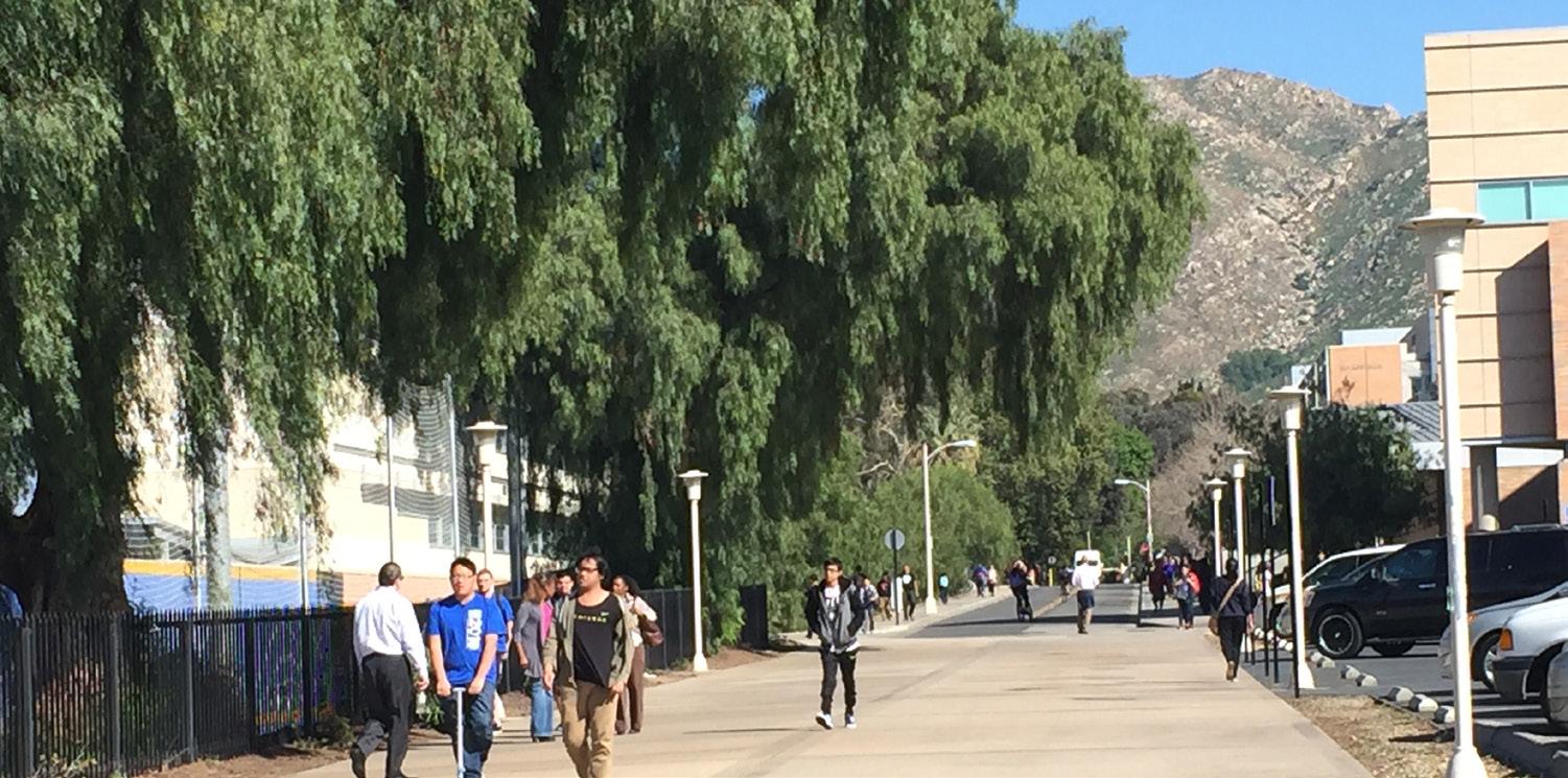
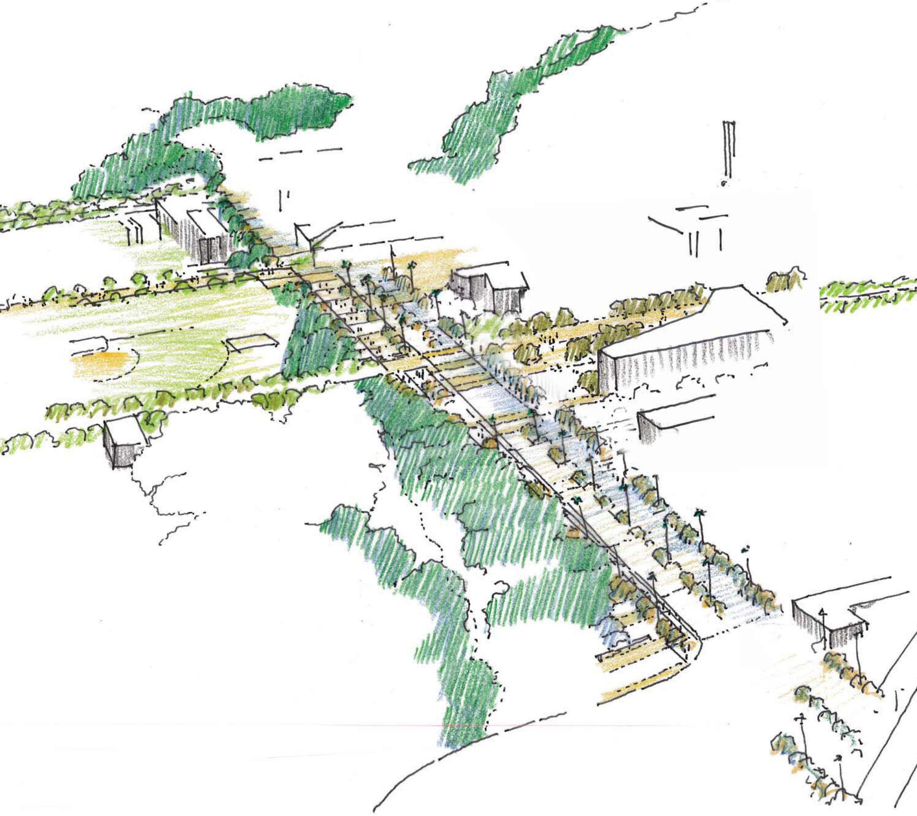
Event Center
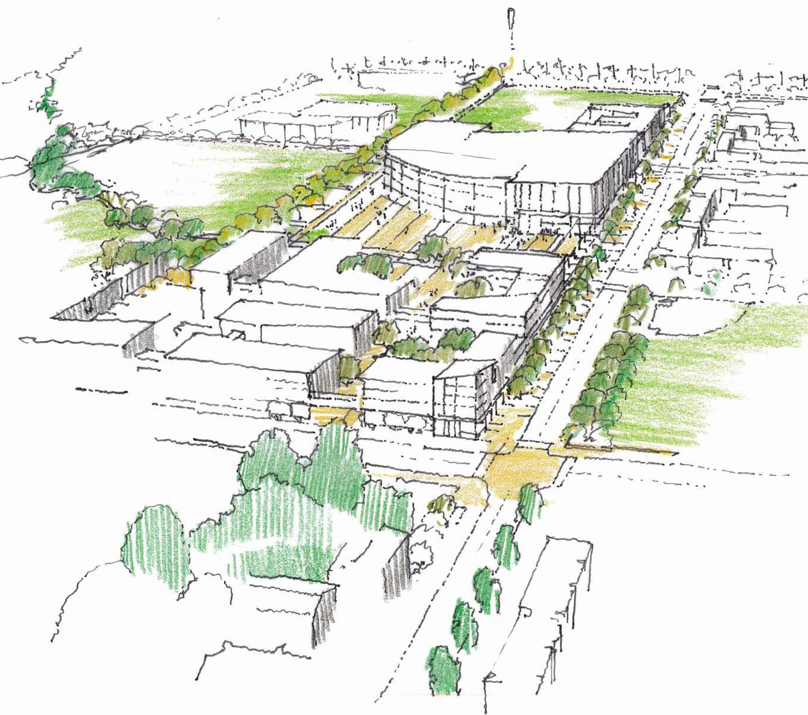
Belltower
Proposed Housing
Proposed Housing
Linden Street Canyon Crest Drive
The intersection of Canyon Crest and Blaine Street marks an important campus and community node. Residential, recreation, and other mixed uses, including a new Events Center, are envisioned at this junction and along Canyon Crest Drive running southward toward the Core Campus. Blaine Street, from its freeway exit to Canyon Crest Drive, is a primary vehicular access route to the campus, the importance of which will increase over time as population density increases in the North District. The development of this gateway should take into consideration the proposed streetscape improvements along Canyon Crest Drive and Linden Street.
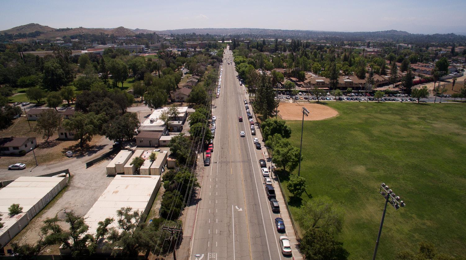
Stonehaven Apts.
From south of the Core Campus, Canyon Crest Drive turns northeast as it passes below the freeway, terminating at its intersection with West Campus Drive. A primary gateway at this intersection has significant potential to enhance institutional identity by improving visibility to the Belltower. The creation of this diagonal view axis is a key goal in the shaping of Building Opportunity Site #3. The Canyon Crest South Gateway also sits near the intersection of several primary pedestrian routes, including Library Mall and Eucalyptus Walk, and pathways from the adjacent transit stops and Parking Lot 30.
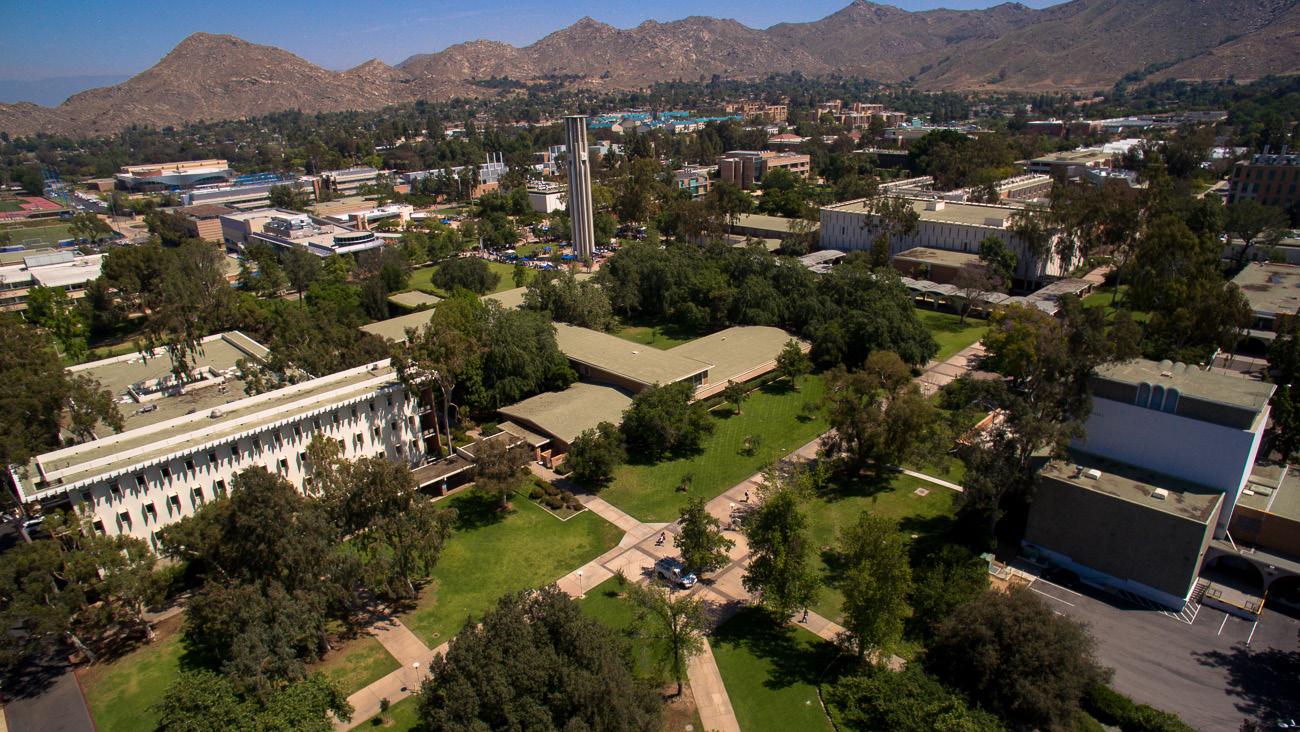
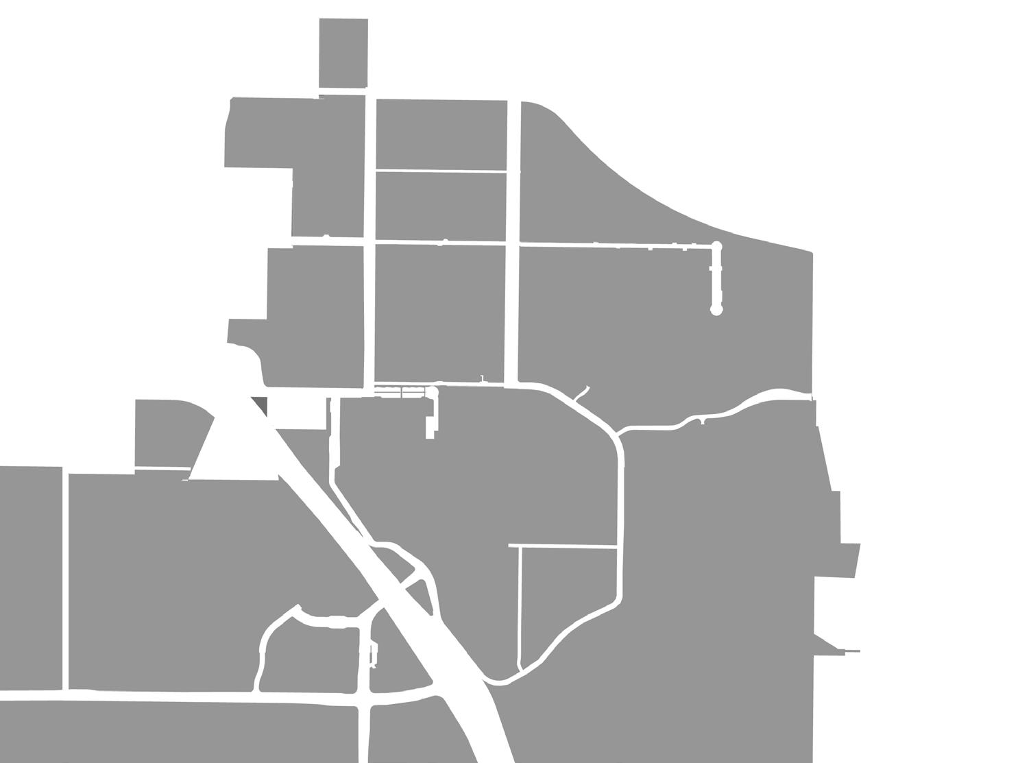
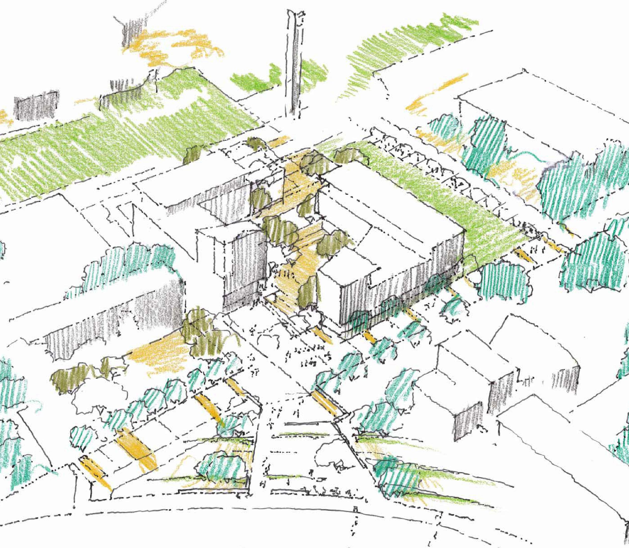
Stewardship is inherent to each of the recommendations and initiatives of the Master Plan Study. It means that all actions will be looked at comprehensively, and in this context refers specifically to environmental sustainability and fiscal responsibility. The two are often closely related.
Strategies which conserve energy and material resources often result in financial savings as well.
On University campuses, environmental stewardship is most commonly associated with energy and resource conservation at the building level. The Master Plan Study embraces a broader definition that includes conservation strategies at the site planning level, compact development, adaptive reuse of existing buildings, and passive resource conservation.
Compact development is the key to responsible growth, for several reasons. First, greater density in the built environment increases the viability of efficient central plants for energy distribution, and makes better use of existing distribution networks. Likewise, a smaller system of roadways is required to access and service a more compact campus, reducing the problems of stormwater runoff and the heat island effect which is the result of sprawling paved surfaces. When destinations are placed closer together, walking and biking between them become more convenient, and, as population density increases, so does the effectiveness of public transportation. The extension of campus infrastructure – utilities, roads, transit – to remote development sites would represent a significant investment, made unnecessary by the decision to focus growth near existing infrastructure within the Core Campus.
Where advantageous, the Planning Team recommends the renovation of existing structures. Upgrading and reusing older buildings can increase their energy efficiency and conserve the material and financial resources that would be required for new construction. This strategy is most viable in buildings that have flexible / adaptable floor plans which are
easily converted to new uses. This is the case with the existing Athletics and Dance Building, which can house new uses that benefit from its proximity to the proposed Mobility Hub. Where existing structures are simply too inefficient, in too poor a condition, or too poorly located to justify further investment in their upkeep, new high-efficiency buildings will be built in their place.
While Chapter 7 explores specific strategies to meet the campus’s energy demands – including large-scale wind and solar installations – the Opportunity Sites in this chapter should integrate passive strategies to reduce energy usage. Simple decisions in the design and placement of new buildings can make them more efficient. These include the use of courtyard forms to allow in ample air and daylight, reducing the need for electric lights and forced-air ventilation. Proper shading of windows can reduce the need for air conditioning by reducing heat gained from the sun. Landscaping with plants that naturally grow in the Riverside climate makes the campus more resilient – that is, better able to survive in times of drought without the consumption of precious water.

Density is a key factor in determining the character and usability of any built environment. Consider the differences between New York and Los Angeles. New York developed in a compact way, resulting in a higher intensity of uses and population density, while Los Angeles developed in a more sprawling pattern. Some feel the former is cramped and claustrophobic. Others may say the latter is spread out and unwalkable. There is no “correct” density, in an absolute sense. Rather the challenge is to determine what specific density is best, given the institution’s heritage, culture and needs, all of which evolve. This metric can then be used to guide future development.
Currently, many of the buildings in the Core Campus stand at 2-3 stories which, along with their sparse concentration, yield a relatively low Floor-Area-Ratio (F.A.R.) of 0.65. While low buildings and generous open space are a part of the campus’s character, long distances between buildings create practical problems for circulation and interaction.
The University’s capacity to accommodate future growth within the Core Campus can be significantly increased through additional height and site area coverage. Setting a target average building height of 4-5 stories – the height of several recent building projects on campus – and yielding a correspondingly higher F.A.R. of 1.5 will contribute to the achievement of the Essential Elements of the Master Plan Study, while maintaining the character that makes UC Riverside unique.
Floor-Area-Ratio, abbreviated as F.A.R., is the ratio of the total built space on a given site, divided by the area of the site itself. It is an absolute measure of the built density of an area of land. A low F.A.R. indicates that buildings are low and/or spread out, and may not be using available land area effectively.
CORE CAMPUS
1. Carillon Mall West
Shape the intersection of Arts Mall and the Carillon Mall on the site of Hinderaker Hall.
2. Gateway Link
Modifications on the Athletics and Dance Building site to create a connection between the Mobility Hub and Carillon Mall.
3. Core Campus Nexus
Create new lines of sight into the heart of campus from the perimeter.
4. Eucalyptus Walk Science Area
Transform a “back door” into a “front door” at the perimeter of East Campus.
5. Picnic Hill Science Area
Reframe a popular outdoor gathering space.
6. Core Campus South Extension
Enhance institutional identity on the southern hillside.
7. Citrus Walk Portal
Create a portal to Citrus Walk from Carillon Mall to frame views to the south.
8. Science Area Greenhouses
Consolidating the greenhouse program on a contiguous site adjacent to plant based research.
Sites 9 to 15
Additional sites on East Campus for future buildings
NORTH DISTRICT
Sites A to G
Future student housing, recreation, retail and Campus Events Center
WEST CAMPUS
Sites H
Outpatient Pavillion
Site I
Areas on West Campus to prioritize future development
Shape the intersection of Arts Mall and the Carillon Mall on the site of Hinderaker Hall. Improve the existing drop-off zone on West Campus Drive.
Hinderaker Hall is an underperforming building at the intersection of two key campus axes, the Carillon Mall and Arts Mall. A portion of this site is presently vacant, making it able to accommodate growth without immediate demolition. The site also enjoys frontage on Campus Drive, presenting an opportunity to improve campus identity.
Initiatives:
• Make the west end of the Carillon Mall more recognizable.
• Frame an east-west view axis through the site to the Carillon Mall and Belltower.

Direction of view
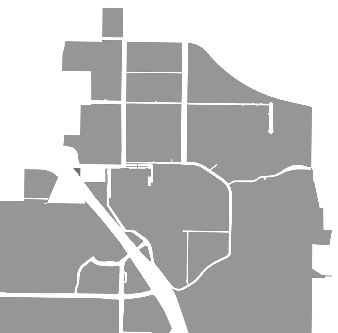
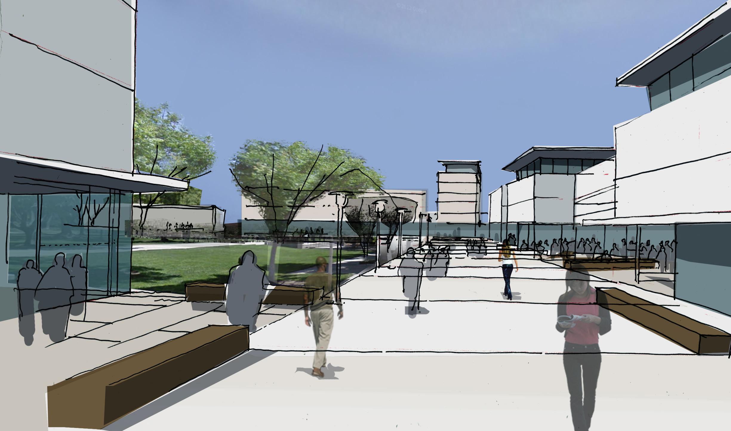

Bridge between transit, student life and the Carillon Mall. Adaptively reuse the Athletics and Dance Building.
Opportunity Site 2 spans between the Carillon Mall and Parking Lot 19, the site of a proposed Mobility Hub and a primary gateway to the University. The site thus has the opportunity to connect these two important campus components, increasing pedestrian traffic. Site 2 is also adjacent to existing and proposed student services, including the Highlander Union Building complex.
• Adaptively reuse the Athletics and Dance building (and expand where feasible) for alternate programs including expansion of student life program space, that benefit from its central campus location and adjacency to transit.
• Provide an accessible landscaped path between the new Mobility Hub and the Carillon Mall by removing a portion of the southeast wing of Athletics and Dance and the now defunct swimming pool. This path will replace the parking lots and service corridors students currently traverse.
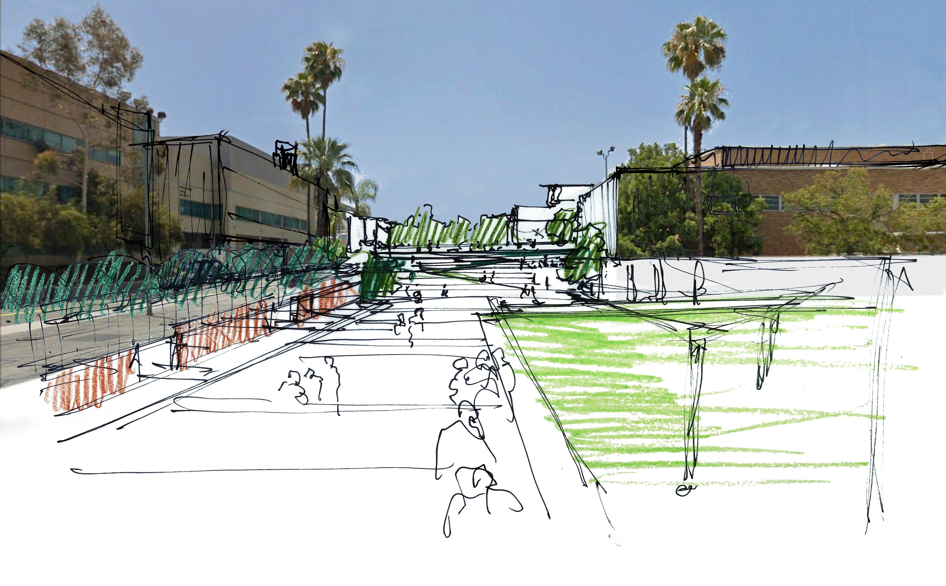
Creates new lines of sight into the heart of campus from the perimeter.
Watkins Hall is an underperforming building in a critical location. The building is low-density and energy-inefficient, as well as programmatically inflexible in its layout. The site fronts on three key pedestrian axes: Library Mall, Eucalyptus Walk, and the Carillon Mall. It is also directly between the Belltower and the Canyon Crest South Gateway. These attributes give Site 3 the opportunity to positively shape the heart of the Core Campus and to enhance institutional identity by increasing visibility from the perimeter to the Core.
Initiatives:
• Shape new buildings to create a diagonal view through the site from the Canyon Crest South Gateway to the Belltower.
• Further define the boundaries of Library Mall, Eucalyptus Walk and the Carillon Mall.
• Develop buildings with permeable edges and diverse programs at the ground level to support an active pedestrian environment.
Mall & Library Mall
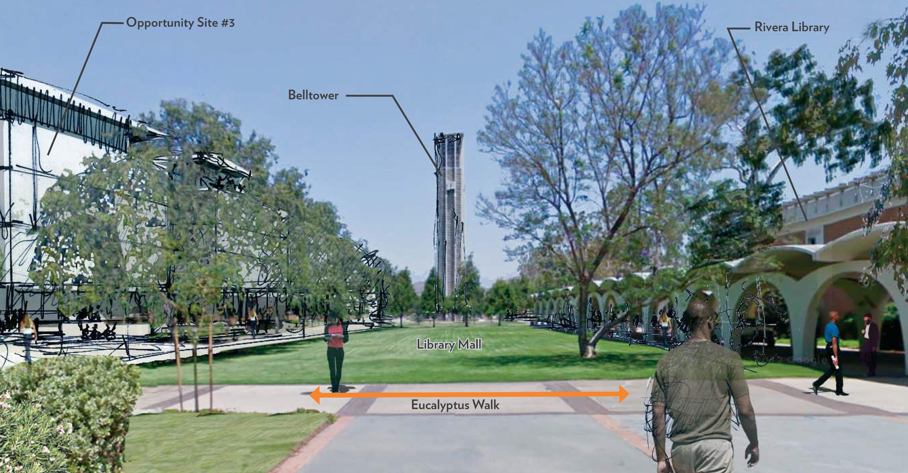

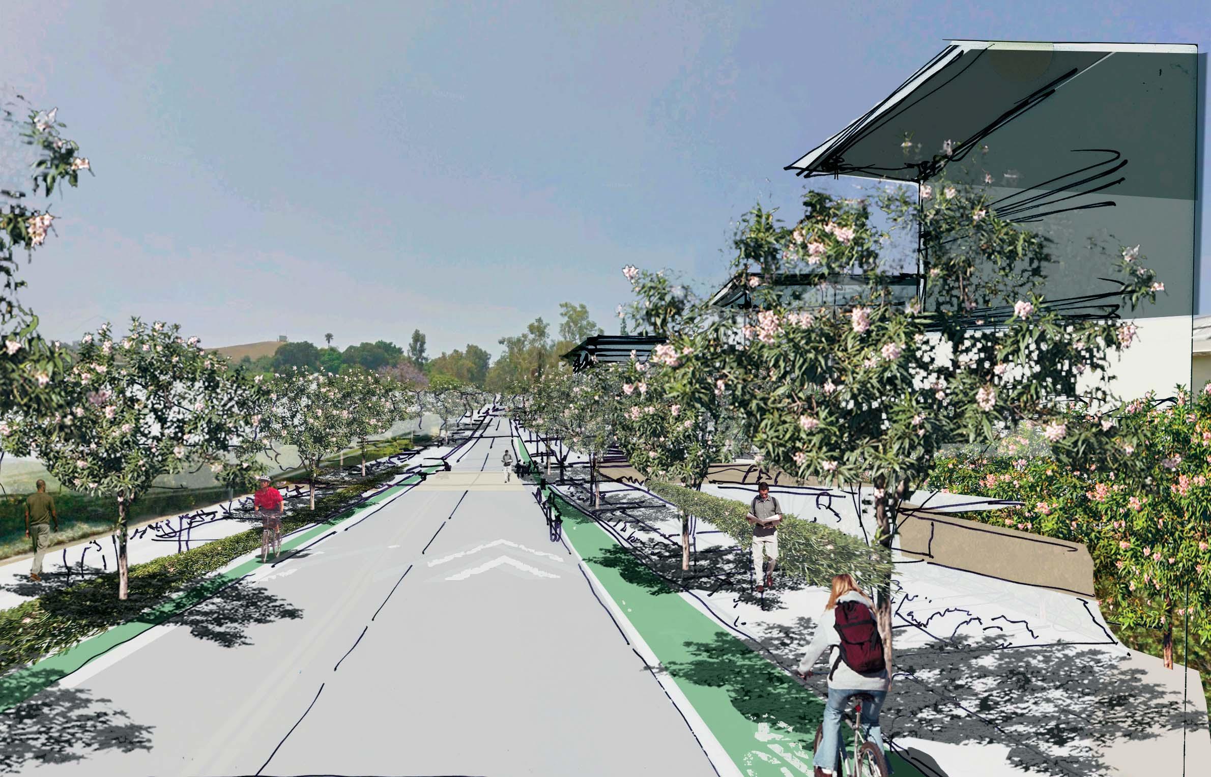
Transform a “back door” into a “front door” at the East Campus perimeter.
Greenhouses and surface parking make Opportunity Site 4 extremely low-density in its current state. The existing greenhouses on the site are also in poor condition. Frontage along East Campus Drive gives Site 4 the opportunity to enhance identity at the campus perimeter.
• Develop site with research building(s.) Site is a potential location for Multidisciplinary Research Building 2.
• Enhance the character and quality of East Campus Drive through streetscape improvements.
• Place “front doors” on Eucalyptus Drive and East Campus Drive, and service the site from existing access to the north.
Reframe a popular outdoor gathering space.
The existing buildings on Opportunity Site 5 are small and loosely composed, resulting in a low overall density. Fawcett and Boyden Laboratories are also underperforming. The site surrounds Picnic Hill and fronts on Eucalyptus Walk, offering the opportunity to positively shape these important open spaces.
Initiatives:
• Incorporate development into a “Science and Research District” along with Opportunity Sites 4 and 8.
• Positively frame Picnic Hill by creating portals between buildings and engaging it visually with the intersection of East Campus Drive and Citrus Drive..
• Site new buildings to take advantage of north-facing slope and views to the Box Springs Mountains.
• As with Site 4, create “front doors” from Eucalyptus Drive and East Campus Drive.
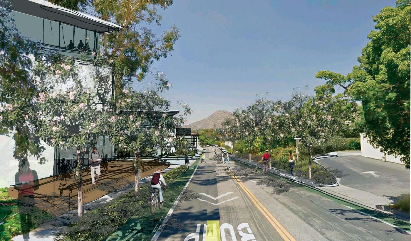
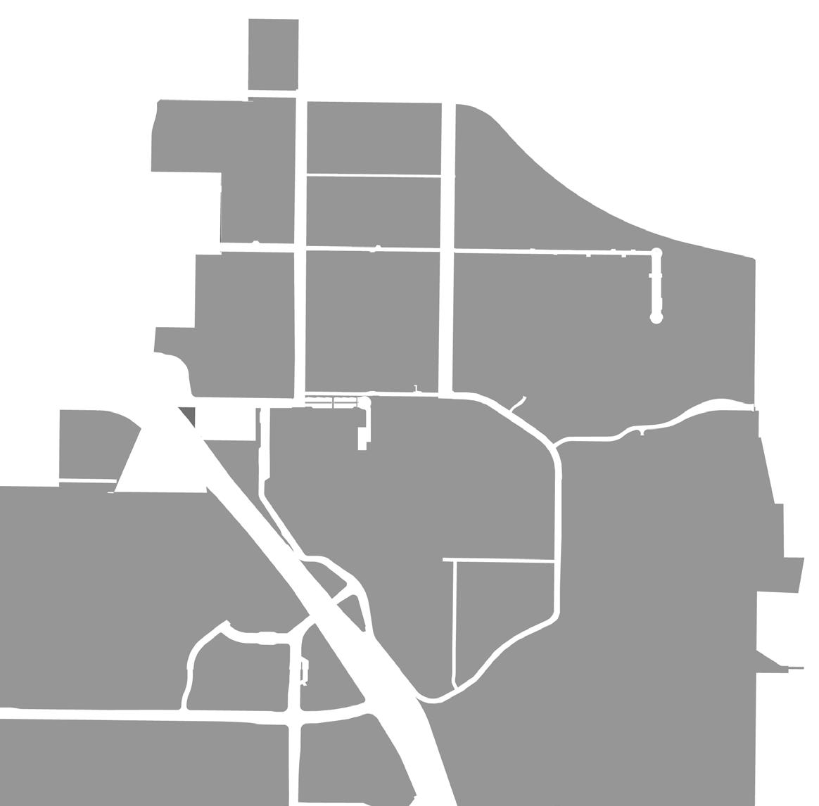
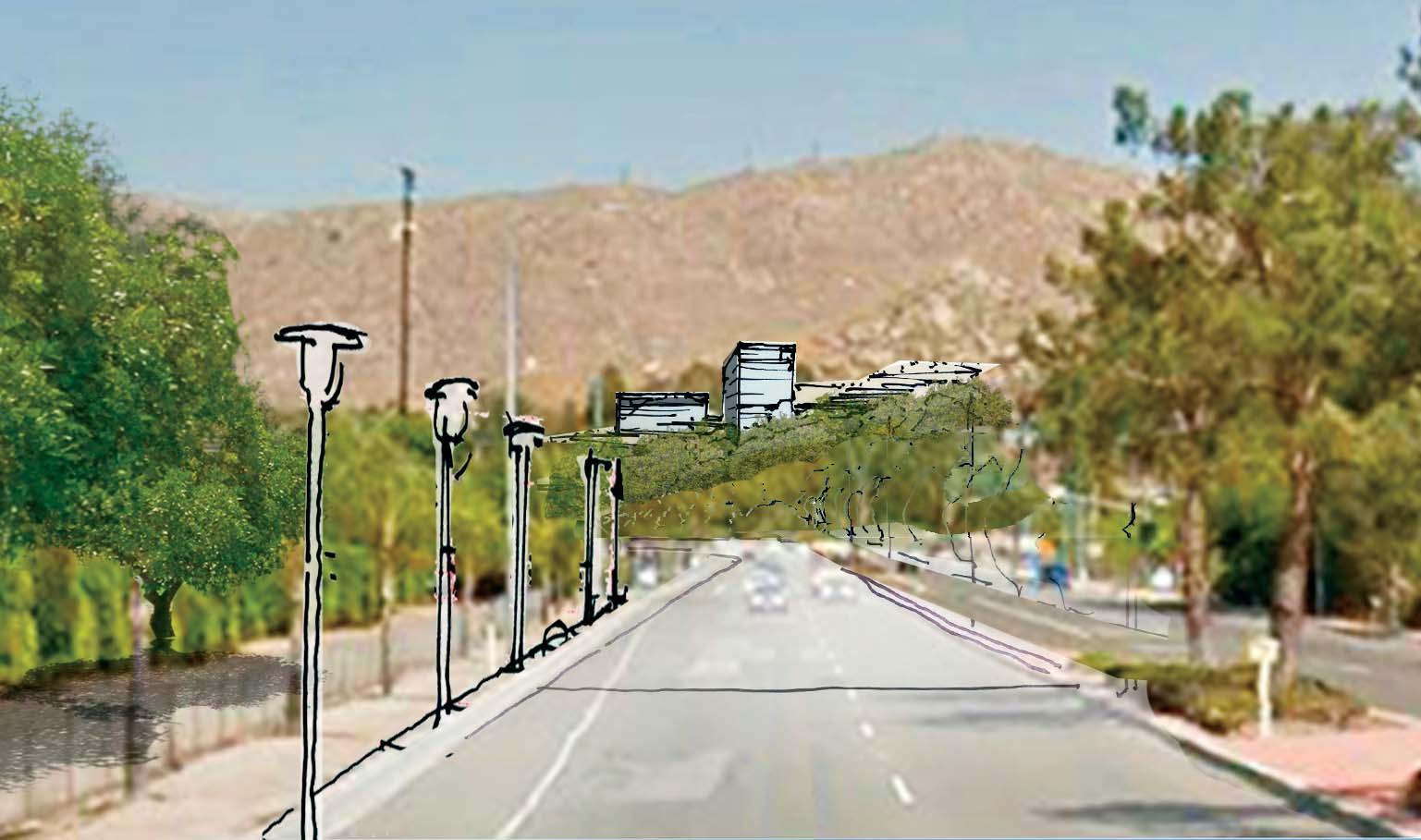
Enhance institutional identity on the southern hillside.
Opportunity Site 6’s hillside location makes it highly visible from the freeway and the Core Campus, presenting a significant opportunity to enhance campus identity. The site’s high elevation also gives it unobstructed views outward. Existing buildings on the site are low-density.
• Take advantage of the site’s visibility from the I-215 / SR-60 freeway and Core Campus.
• Take advantage of unobstructed views outward.
• Frame the south end of Citrus Walk.
• Incorporate landscape development that accommodates pedestrians and bicycle riders on the steeply sloping site.
Re-envision a science and research district.
Opportunity Site 8 sits just outside the Core Campus. Its frontage on East Campus Drive and adjacency to existing and proposed laboratories make it a prime location for programs complementary to science and research. Existing greenhouses and trailer facilities on the site are lowdensity and underperforming.
The site has the capacity to hold the University’s entire greenhouse program, along with support facilities, including those currently located on West Campus that can be relocated. Relocation of the existing Computing and Communications Center will provide land for a much-needed research requiring containment. The slope of the site is challenging, but offers opportunities to stack program for higher density.
Initiatives:
• Integrate new greenhouse development into a “Science and Research District.”
• Enhance the character and quality of East Campus Drive through streetscape improvements.
• Use new development to extend Eucalyptus Walk eastward, terminating with views to the Botanic Gardens and Box Springs Mountains.
• Accomodate sloping topography with terraced / multi-level buildings.

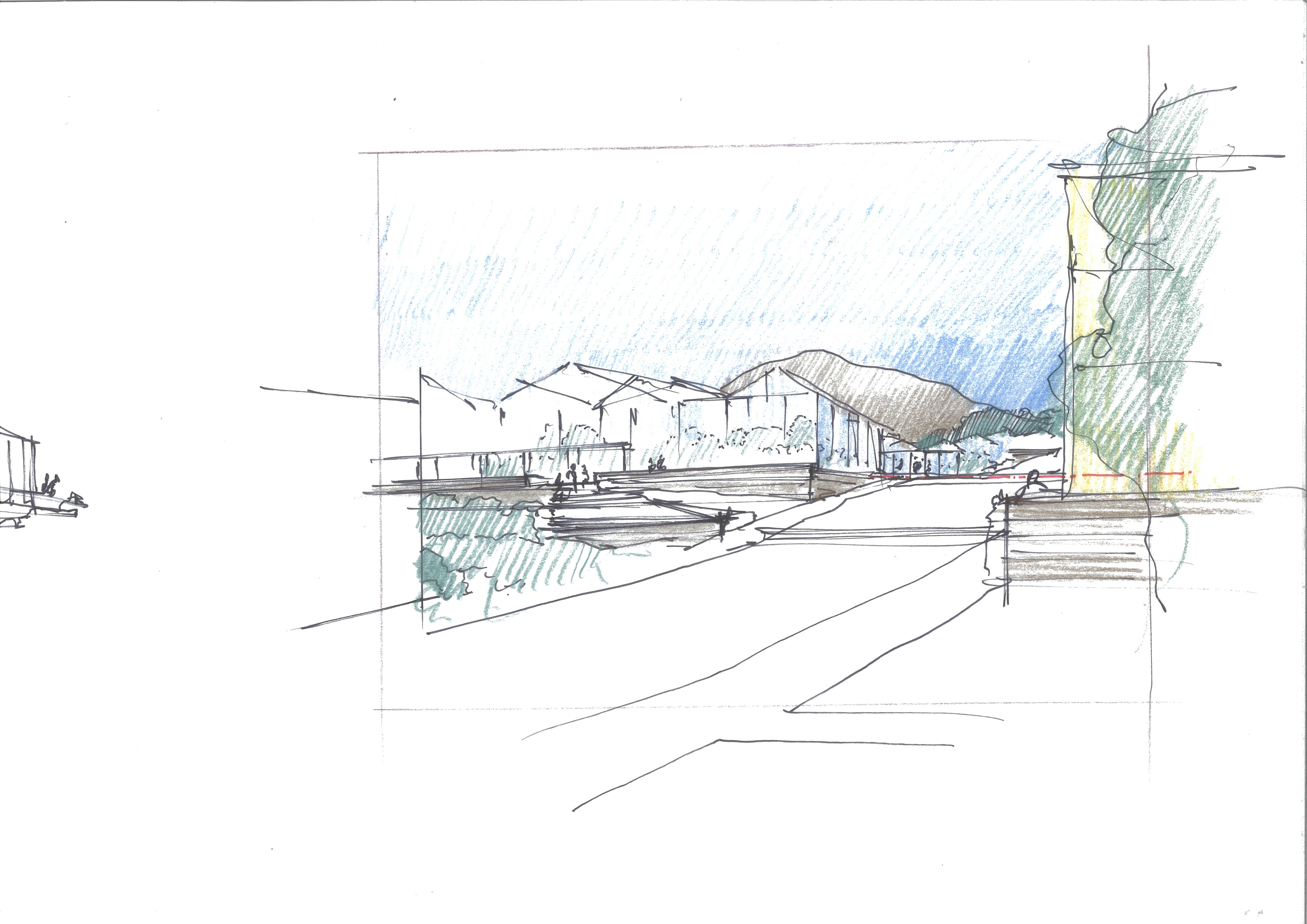
Reinforce the intersection of Citrus Walk and the Carillon Mall.
Site 9 sits at the intersection of the Carillon Mall and Citrus Walk. The connection between these key open spaces is cut off by Spieth Hall, which current users have identified as programmatically inflexible due to its floor plan.
Initiatives:
• Shape a recognizable south edge to the Carillon Mall with buildings that include diverse programs and active edges at the ground floor.
• Create a “front door” to science and research programs on the Carillon Mall.
• Shape development to extend Citrus Walk and connect it to the Carillon Mall.
Integrating & Expanding Residential Life, Recreation & Mixed Uses
In the campus’s North District, residential and retail uses and a potential 8,000 to 10,000 seat Campus Events Center will be organized around recreational fields. These Building Opportunity Sites are designated in Figure 3.31. This new development is envisioned to replace the existing the existing Canyon Crest Housing at a significantly greater density. The Master Plan Study models the potential for the North District to add at least 3,700 resident students in mid-rise apartment-style housing and residence halls, thus maintaining the current ratio of resident students to the overall campus student population. Ground-floor retail spaces along Canyon Crest Drive and Blaine Street will better define the street edge.
The North District will be integrated with the Core Campus by extending the Aberdeen Drive corridor north of Linden Street and through the creation Recreation Mall, connecting the North District to the proposed Mobility Hub. Together, the Campus Event Center, adjacent recreation fields and Recreation Mall will provide a flexible array of congregation spaces for campus and community events, supporting the University’s desire to activate this zone of campus.
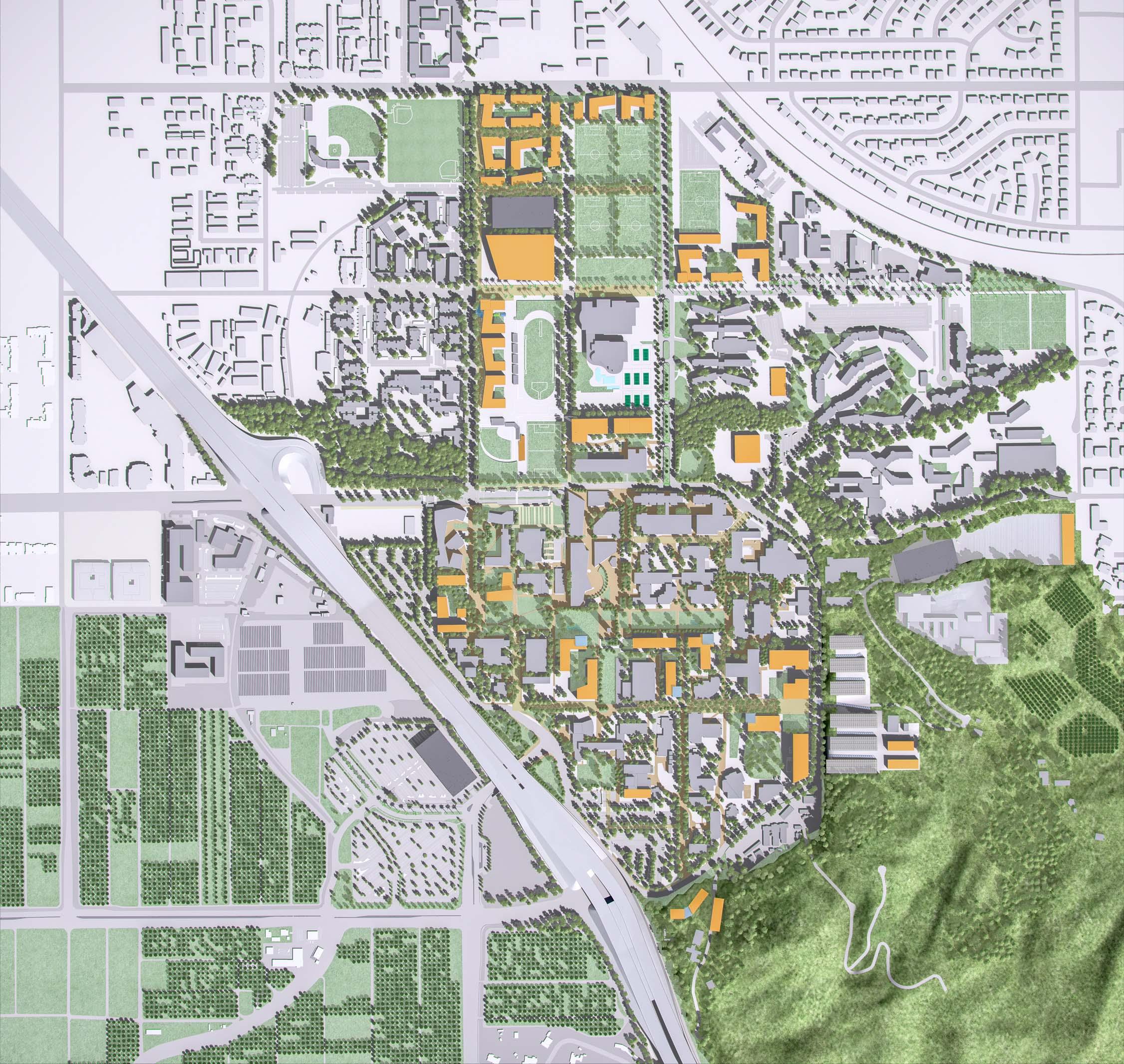

PUBLIC REALM OPPORTUNITY SITE #1: UNIVERSITY AVENUE
From the range of public realm development opportunities considered, the University selected the University Avenue Gateway as the first for further exploration. The conceptual design1 of this site has been developed concurrently with the Master Plan Study. It is an example of the potential each of these sites represents.
“Integrate a Mobility Hub and its associated program elements as a primary campus gateway experience.”
The Mobility Hub enhances campus identity through the formation of a welcoming primary gateway. At the campus edge, better management of all forms of traffic means a safer environment for pedestrians and bicycle riders that will, along with improved access to public transportation, will reduce reliance on personal vehicles. The landscape is integrated with the natural setting, and strengthens a new axis from the city to the campus, and to the Box Springs Mountains beyond. Community is fostered through the inclusion of a flexible public gathering space with improved connectivity to the rest of campus.
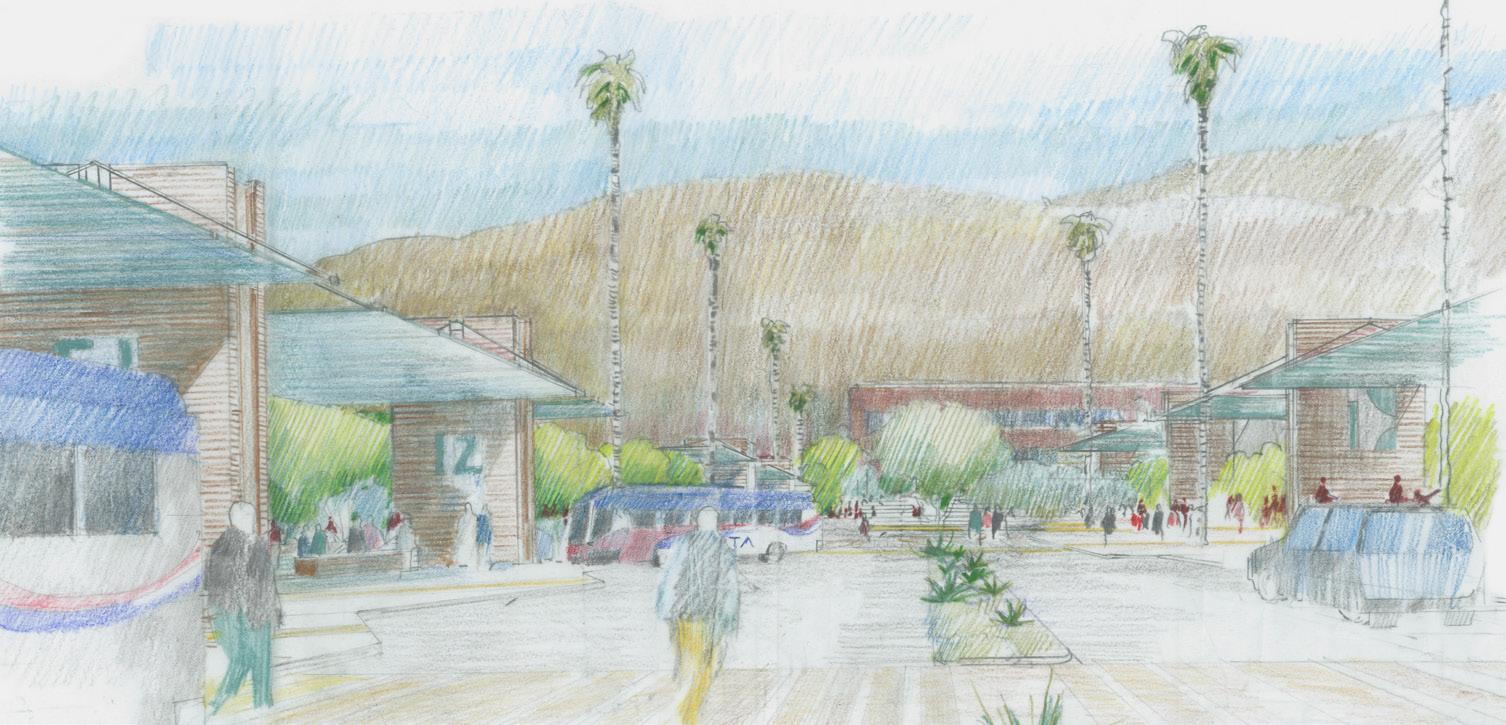
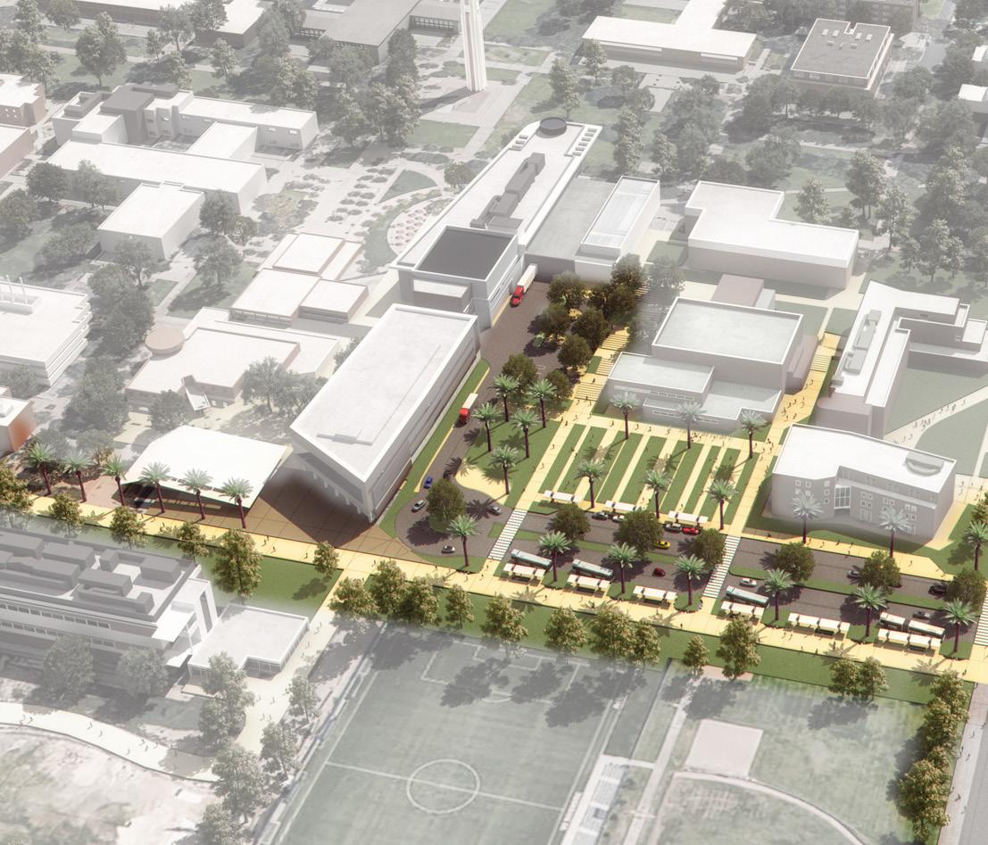
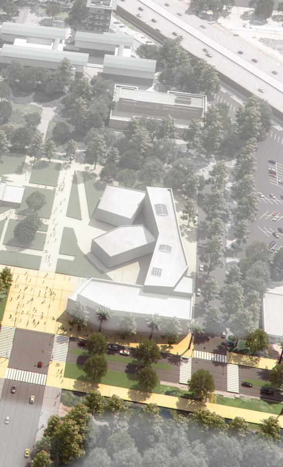
Specific benefits of the proposed gateway and Mobility Hub:
• A single location for all bus routes to converge will allow the RTA to provide better service, in alignment with University objectives.
• Improved access to buses will enhance connectivity to downtown Riverside, reducing personal vehicle trips and potentially mitigating increased parking demand from projected growth.
• Close proximity to student life programs will enhance safety and extend access to the campus into the late hours.
• An accessible landscaped path will provide a safe, direct pedestrian connection from the new Mobility Hub to the Carillon Mall, replacing the parking lots and service corridors students currently traverse.
• Dedicated pathways into campus for bicycle riders will be separated from vehicular traffic.
At the time of completion of the Master Plan Study in May 2016, numerous projects were in different stages of development. Each of these projects are in alignment with the planning principles and directions outlined in the Study.
The following ongoing renovation projects reinforce the campus’s commitment to continue to invest in those buildings and campus locations that best leverage existing campus assets:
• Batchelor Hall Interior Renovation
• Pierce Hall Renovation and Classroom Addition
• Boyce Vivarium Renovation
• School of Medicine Research Building – BSL-3 Laboratory
• School of Medicine Research Building – First Floor Fit out
Planning ahead, as the campus increases its faculty by almost 300, the majority of whom will be focused on research, it will be important to add research space to maintain an appropriate space-to-faculty ratio of 1,032 ASF, which is closer to the UC system wide average of 1,140 ASF. The proposed Multidisciplinary Research Building 1 will serve to meet this space need with the addition of approximately 150,000 GSF.
Future renovation projects and new building additions will continue to be guided by the Master Plan Study and based on the Capital Financial Plan.
The UC Riverside campus identity is strongly linked to its natural setting, including arroyos descending from the steep hillsides of the Box Spring Mountains above campus, and on-campus hillsides to the southeast. The campus was developed as a green oasis in a semi-arid setting. UC Riverside is also proud of its legacy of citrus research and cultivation. Campus growth and redevelopment should strive to respect and integrate the natural beauty and agricultural legacy of the region in an enduring way. The Master Plan Study supports strengthening and protecting the character of campus by enhancing connections to its environmental context while improving the public realm.
Glossary of Terms
Permeable Building - a building that facilitates pedestrian movement through its ground floor
Plant Palette - a combination of plants selected for a landscape area
Public Realm - pathways, open spaces, courtyards, and other public and pedestrianoriented areas
Structural Landscape - landscape areas that define circulation and interstitial spaces around buildings
Swale - a low, planted basin that receives and filters runoff from surrounding area
Stormwater - precipitation that infiltrates into the soil, evaporates, or drains to nearby water bodies
• Strengthen UC Riverside’s distinct sense of place by integrating the campus public realm and its natural setting (e.g., the arroyos and views to the mountains)
• Strengthen and expand the framework of open spaces to embrace new campus opportunity sites through a cohesive and vibrant network of outdoor malls, courtyards, gathering spaces, and pathways
• Creatively shape campus open spaces and the spaces between buildings to promote collaboration, interaction, and shared experiences
• Visually reinforce campus edges to strengthen the identity of the institution and to communicate campus character
• Increase appropriate plantings throughout campus to provide shade and enhance campus identity and the quality of a user’s experience
• Identify a campus plant palette that is responsive and adapted to the local climate, reinforces regional identity, and conserves water
• Integrate stormwater management into the open space framework to satisfy regulatory requirements through innovative, attractive, and cost-efficient solutions
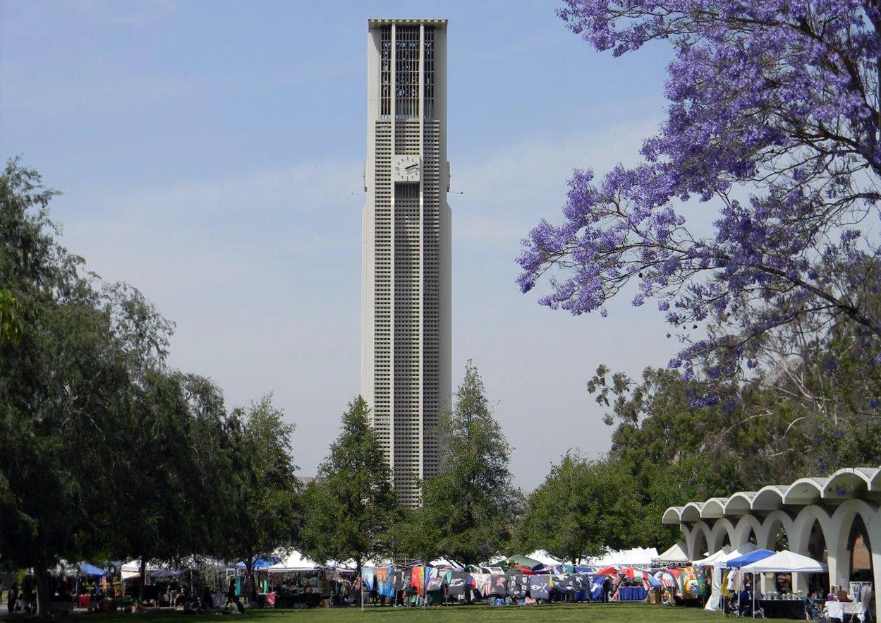
The Master Plan Study embraces the regional landscape and climate within the UC Riverside campus public realm in a variety of ways. The campus abuts the rugged Box Springs Mountains and is transected by arroyos draining the steep slopes of this mountainous area, which includes regionally-significant habitat, protected areas, and connections to other natural surroundings The contrast between UC Riverside’s semi-arid mountainous setting and the managed, park-like campus is striking. Where possible, the natural arroyos that flow westward and downhill from the Box Springs Mountains are protected and enhanced to ensure continuous flow across campus.
Native or non-invasive, climate-adapted landscape features, similar to the successful plantings at Glen Mor Housing, will be incorporated in targeted parts of campus green spaces, including transitional edges, to help attain sustainability goals and blend the campus with the surrounding natural landscape of open space reserves, while helping to prevent wildfires from spreading to the campus.
Respect for UC Riverside’s natural setting extends to the placement and scale of future buildings. The overall vision is to maintain the elegant, low-impact presence of the campus in its stunning natural setting, thus ensuring that new construction continues to build on the theme of “simple buildings in a dramatic landscape.” Dramatic views of sharplydefined rocky peaks provide stark visual reminders of the campus setting and a strong sense of place. These view corridors, many of which are maintained by virtue of their location at the terminus of campus streets and open spaces, will continue to be protected with new campus growth including siting future buildings to take advantage of their elevation and locations to provide views over the tree canopy to hillsides beyond.
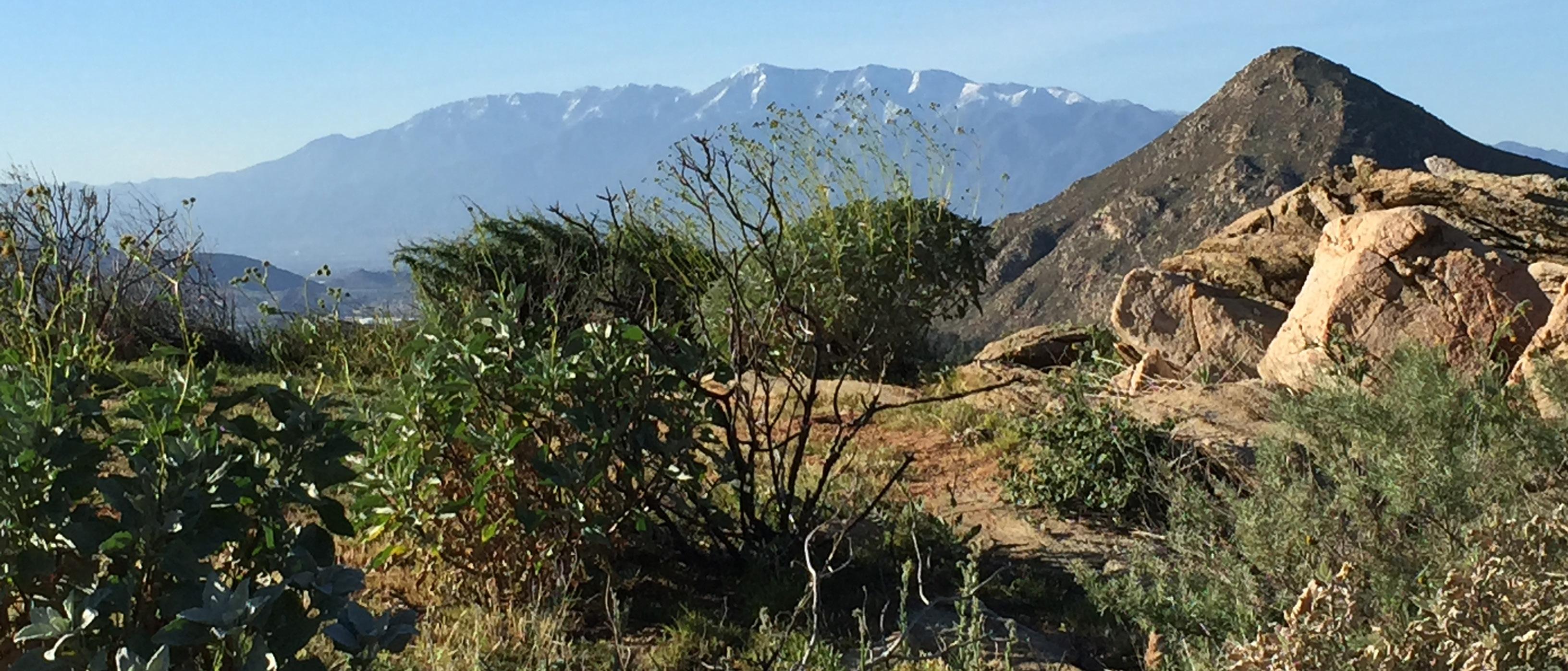
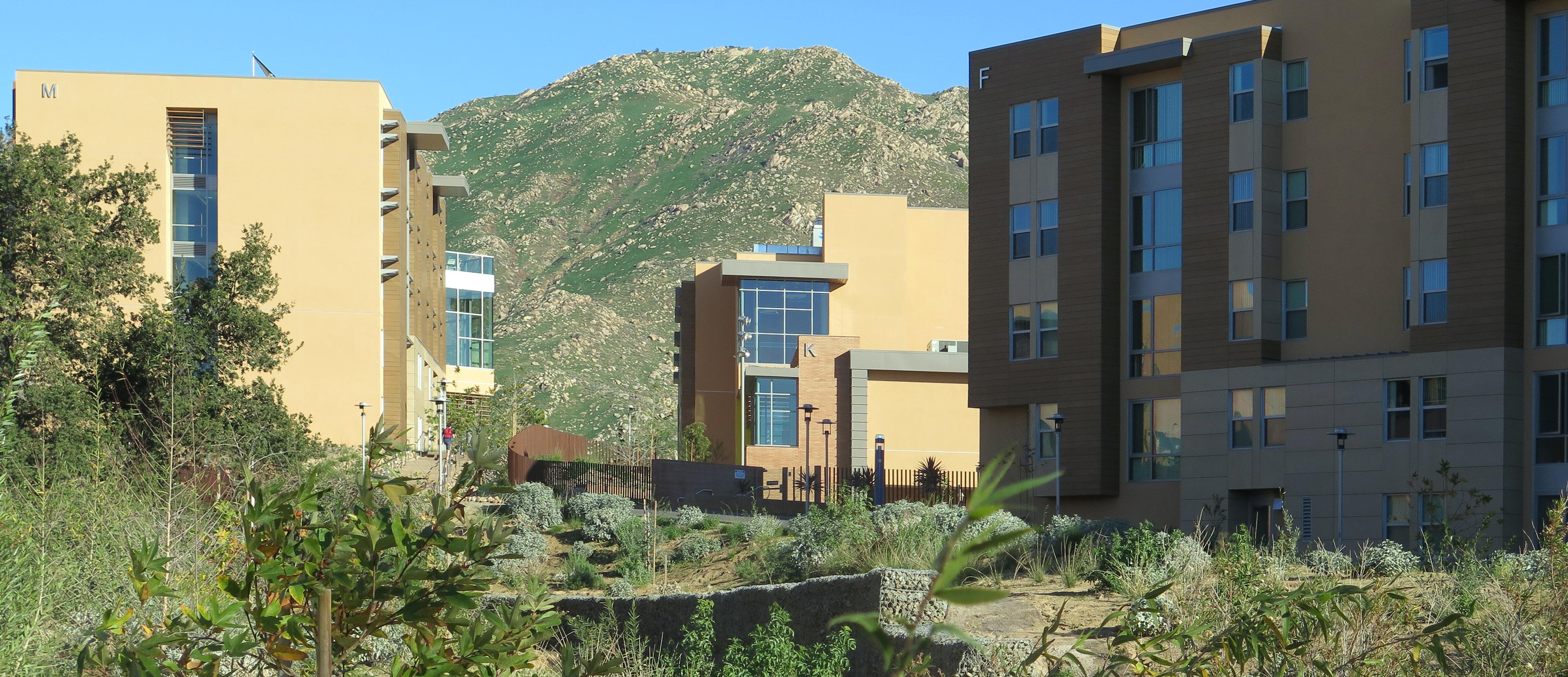

Open space on the campus plays a vital role in fostering a spirit of intellectual exchange, contemplation and community. The quality of open space is important in attracting faculty, staff, and students, providing memorable, evocative first impressions, and framing their daily lives on campus as they move between offices, labs, classrooms, and gathering spaces.
The heart of the UC Riverside campus is defined by a series of orthogonal, interconnected malls. Campus buildings feature primary entrances on these open spaces. Courtyards and plazas, often adjacent to building entrances, provide places for seating and interaction. Arcades reinforce the pedestrian walk system, especially along major malls, by providing vertical structure and shade.
The fabric of outdoor malls, courtyards, gathering spaces, and pathways weaves together the different areas of the campus. The hot and dry climate encourages some aspects of campus life to occur outdoors (except in summer months), lending a dynamic, active spirit to open spaces. Classrooms, corridors, and gathering spaces directly open up to and are integrated with the campus grounds.
There are also intangible but distinctive elements that derive from the lush nature of UC Riverside’s open space. The scent and color of plants, cascading birdsong, dappled shade, and the sound of carillon bells are all cited as memorable to UC Riverside’s identity and sense of place. This pattern of buildings, open space, and circulation will continue and be strengthened through future campus development. The Master Plan Study addresses several strategies to protect and enhance the campus open space network.
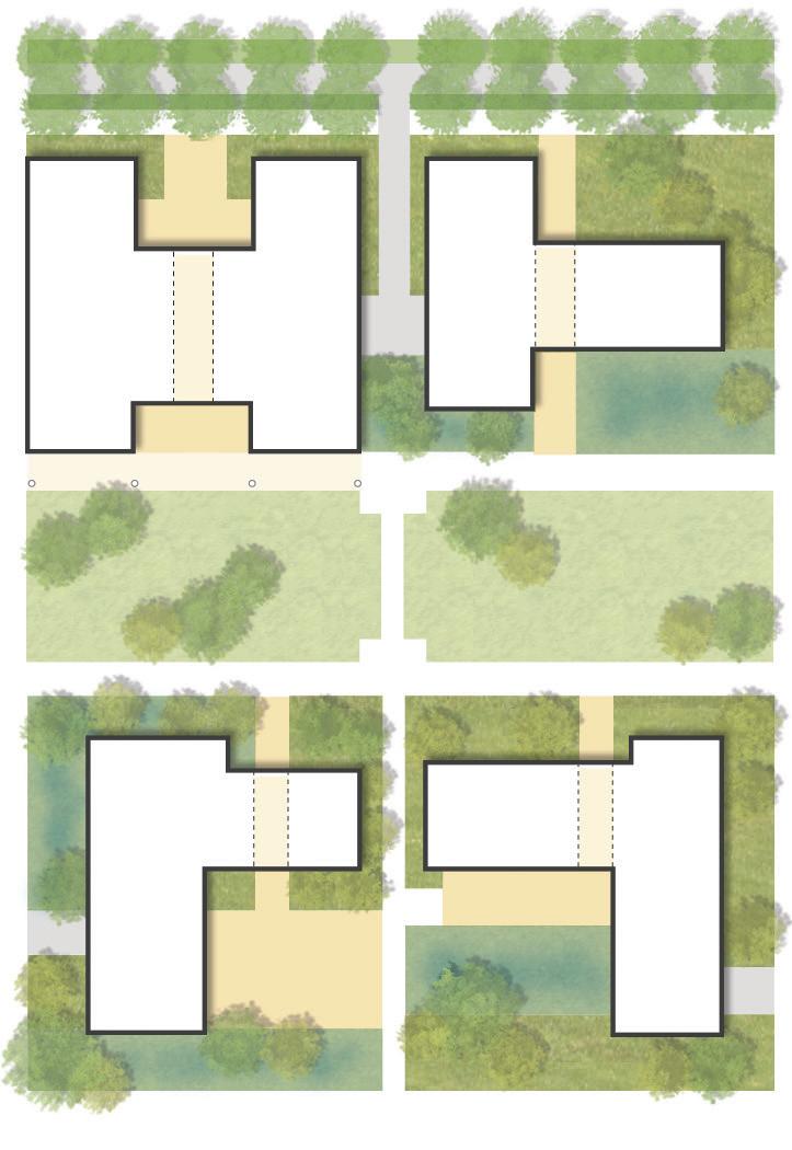
MEDIAN
STREET
STORMWATER SWALE
SERVICE ACCESS
SECONDARY BUILDING ENTRY
STRUCTURAL LANDSCAPE
STRUCTURAL STORMWATER GARDEN
POTENTIAL ARCADE
MALL
PEDESTRIAN WALK
PRIMARY BUILDING ENTRY
‘PERMEABLE’ BUILDING (see Figure 4.3)
OUTDOOR LEARNING
COURTYARD/PLAZA
SERVICE ACCESS
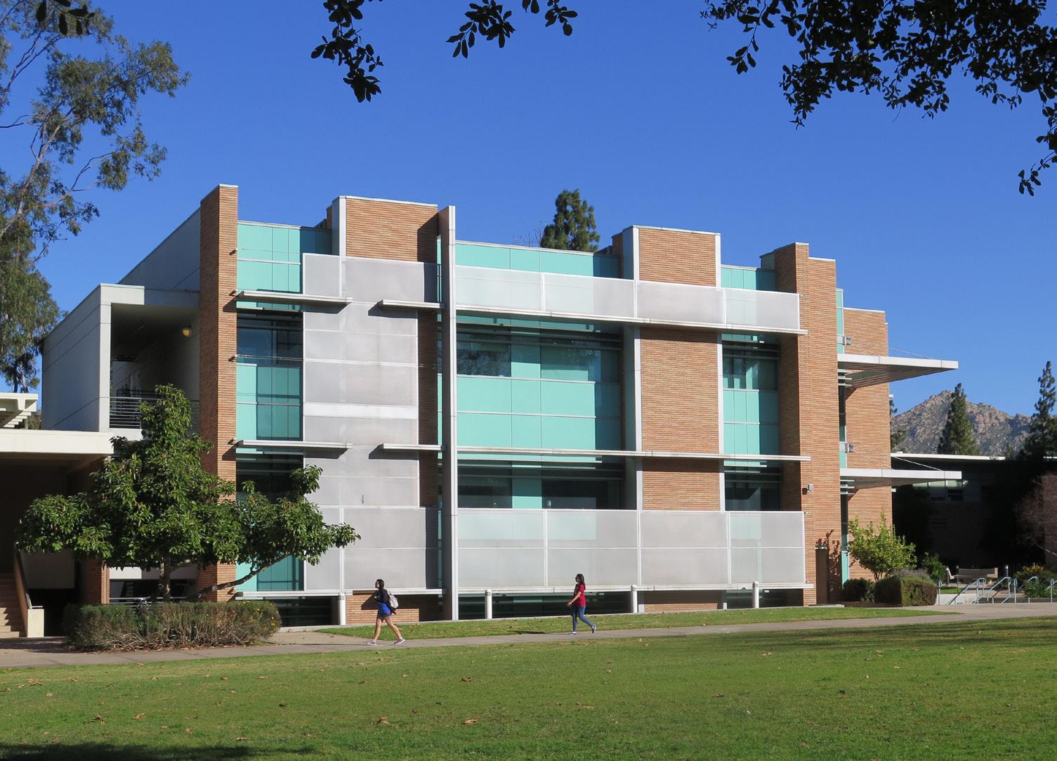
Malls and walks provide an interconnected system of linked open spaces throughout the developed areas of the campus. The campus’s malls, which consist primarily of park-like lawns and large shade trees framed by academic buildings, provide pleasant and inviting spaces and a welcome contrast to surrounding busy streets and adjacent arid natural areas. Existing malls, including the Carillon Mall and Library Mall, will be preserved and strengthened while new linear open spaces will incorporate their essential design principles. Large shade trees and defined landscape beds will reinforce malls, contributing to the existing recognizable sense of place. The malls are intended to be high-use flexible areas for informal recreational activities or formal events (such as graduation.)
In the future, as the campus grows, additional and improved pedestrian and bicycle connections will be required to allow convenient and efficient movement throughout campus, particularly from outlying residential areas to the inner Core Campus. These will be accommodated on converted service drives as well as along key corridors such as the Arts Mall and the proposed Science, Barn, and Eucalyptus Walks. Existing campus walks are undersized and will be widened to accommodate increased pedestrian circulation.
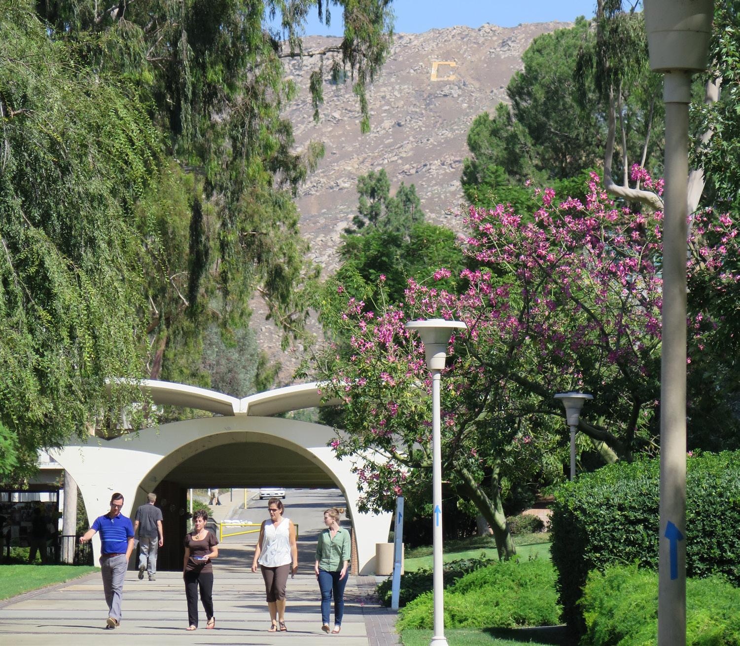
Some entries to campus buildings are shaded by arcades. These arcades create informal gathering spaces, identify the entries, and provide sheltered outdoor circulation. This strategy of marking entries reinforces a quality of informality on the campus. Exterior connections between buildings are an integral part of the campus circulation system and also create visual links. Where possible, the system of arcades will be expanded, prioritizing key pedestrian corridors, campus malls, and walks. These new arcades will actively engage buildings, provide shade and create spaces for interaction.
Existing walks will be widened where possible to safely accommodate increased pedestrian and bicycle traffic. Walks of a minimum 12 feet in width are suggested for busy campus routes. As adjacent building projects are funded, campus walkways will be upgraded. Shade trees will be added where possible to increase pedestrian comfort.
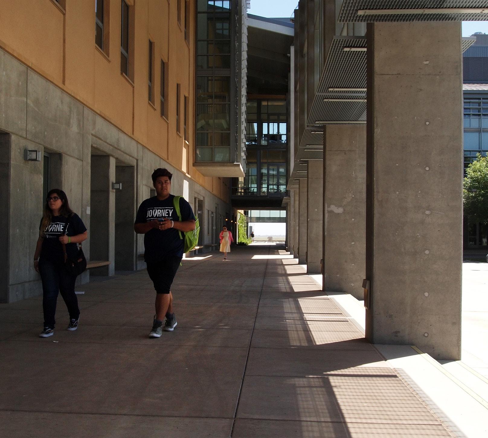
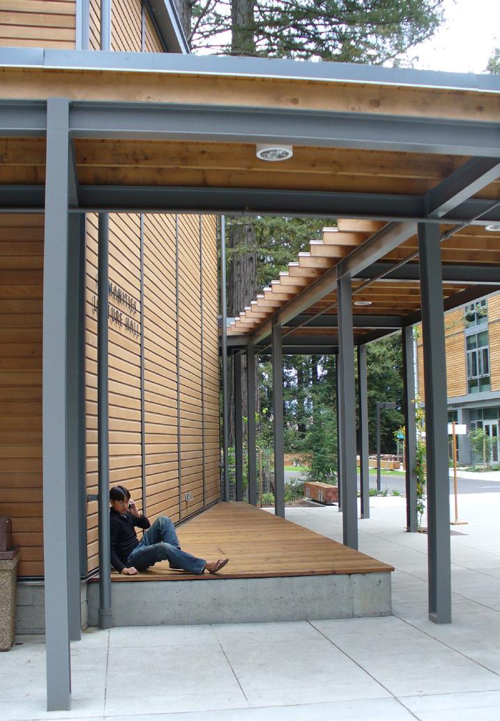
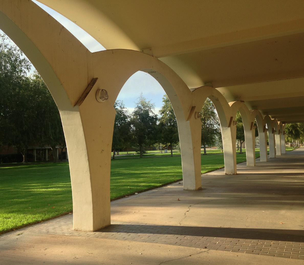
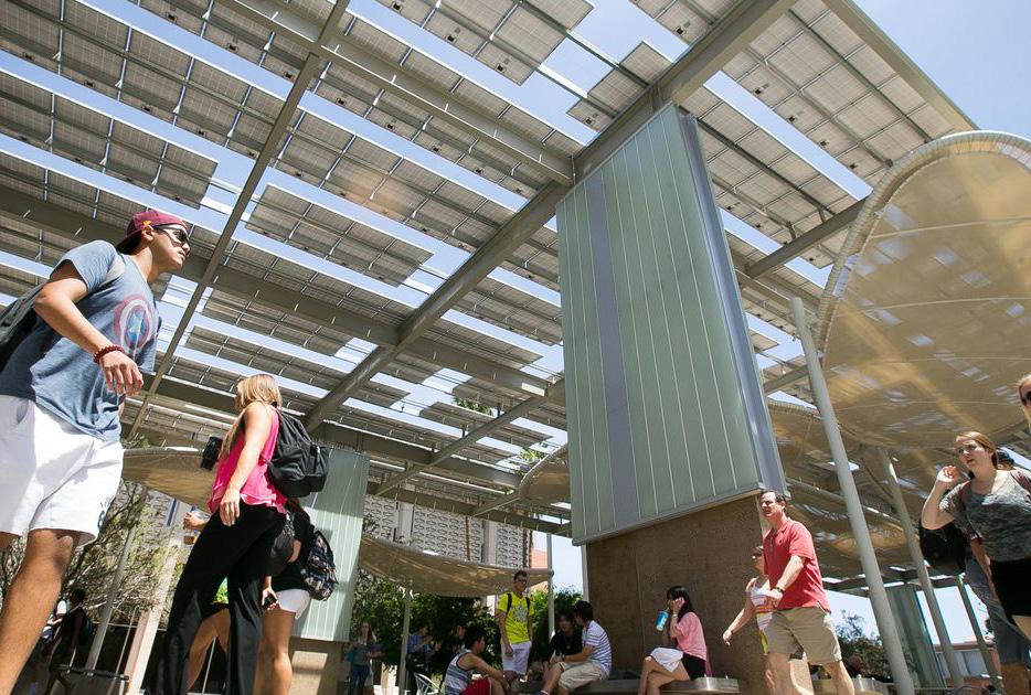
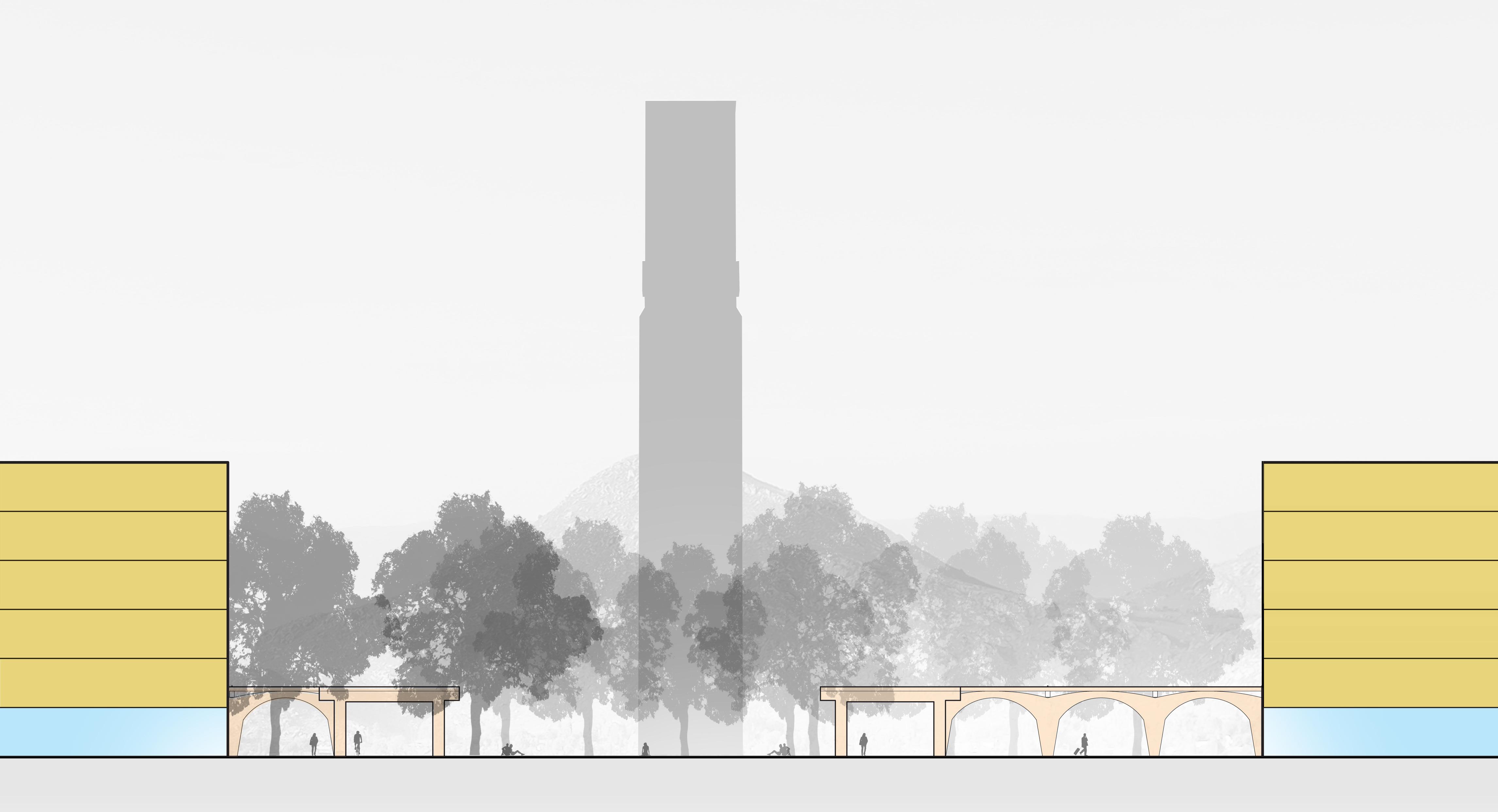


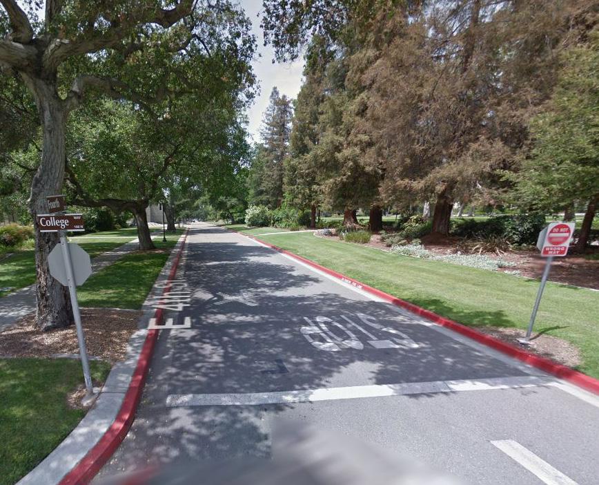
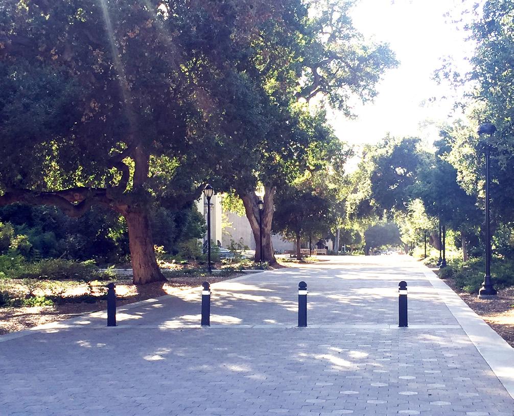
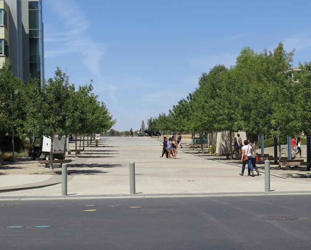
The campus open space framework reinforces the campus’s northsouth and east-west connections. Pathways framed by trees will be an important part of the campus structure and circulation, providing view corridors to the mountains, integrating stormwater management, wayfinding elements, and spaces for social gathering. The framework will connect a variety of spaces, including gardens, courtyards, sports fields and performance venues as well as major gathering places on campus.
The Carillon Mall and nearby proposed Opportunity Sites reinforce the campus “heart”, connected to other campus areas to the north and south via new pedestrian paths. Service access to the center of campus is essential but sometimes holds undue priority over pedestrian circulation, particularly on Eucalyptus Drive, Citrus Drive, and Science Walk, as well as on the section of North Campus Drive between the Materials Science & Engineering Building and University Lecture Hall.
Several service drives are currently gated and limited to service and other permitted vehicles only. These drives will be redesigned as integrated limited-access campus walkways. Gates will be replaced with automated bollards to encourage pedestrian use. These routes will be curbless pedestrian and bicycle-friendly walks. They will be designed as safe mixing zones, where service vehicles travel slowly on their infrequent trips into the heart of campus. Pomona College’s 4th Avenue redesign project is a good example of similar transformation. It is important to note that the design of these walkways needs to support the weight of large service vehicles.
Future studies should explore the possibility of limiting service access at one notable vehicle-pedestrian conflict point - the junction of the Commons Mall and the service drive that runs east-west between the Bookstore and the Highlander Union Building (HUB). Service access across the Commons Mall could potentially be limited to the Pierce Hall loading area. Service vehicles would then be able to access the HUB and Café from a redesigned access area at the future extension of University Avenue into campus.
The addition of significant new programs and activities north of Linden Street will require new connections with the Core Campus to ensure that the campus feels cohesive. Pedestrian and bike improvements to Canyon Crest Drive and Aberdeen Drive are important components of this connectivity. A new Recreation Mall is proposed to run parallel to these two streets, between Blaine Street and the west edge of the Materials Science & Engineering Building. This mall will connect to proposed new student residential areas. It will be designed to be shared with bicycles and will be approximately 68’-86’ feet wide, with a substantial central paved walkway. Pedestrian amenities such as benches and lighting will be placed along its edge. On either side of the central walkway, generous landscaped zones will facilitate transitions between the walkway and adjacent building entries and provide shade trees for pedestrian comfort. Trees along the walk will also provide linear wayfinding and campus identity for walkway users. Stormwater treatment will be provided by linear swales in these zones, treating building runoff as well as runoff from the central walkway.
The naturalistic hillsides on the southern and eastern edges of UC Riverside’s campus offer a strong sense of regional identity and a stunning natural backdrop to daily life on campus. The hillsides are important habitat connectors and popular hiking destinations that provide an expansive view of the campus. Some campus research occurs and might expand in test plots in these areas. The campus adjacent to these areas accommodates diverse uses, such as the Botanic Gardens, groves of avocado, citrus and almond trees, and greenhouses. There are also several building Opportunity Sites on the south and east sides of Campus Drive. Development of these sites must respect the character and environmental sensitivity of the hillsides, while recognizing the unique challenges of building on such steep topography.
The connection to existing student housing areas to the northeast of the Core Campus will be improved (P-2). Pedestrians and bicycles will be given priority where the existing steep Health Center access road meets Campus Drive. The existing curb-tight sidewalk will be replaced with a wider sidewalk and a bike lane and the actual roadway crossing will be enhanced, possibly with a raised crosswalk, subject to future study.
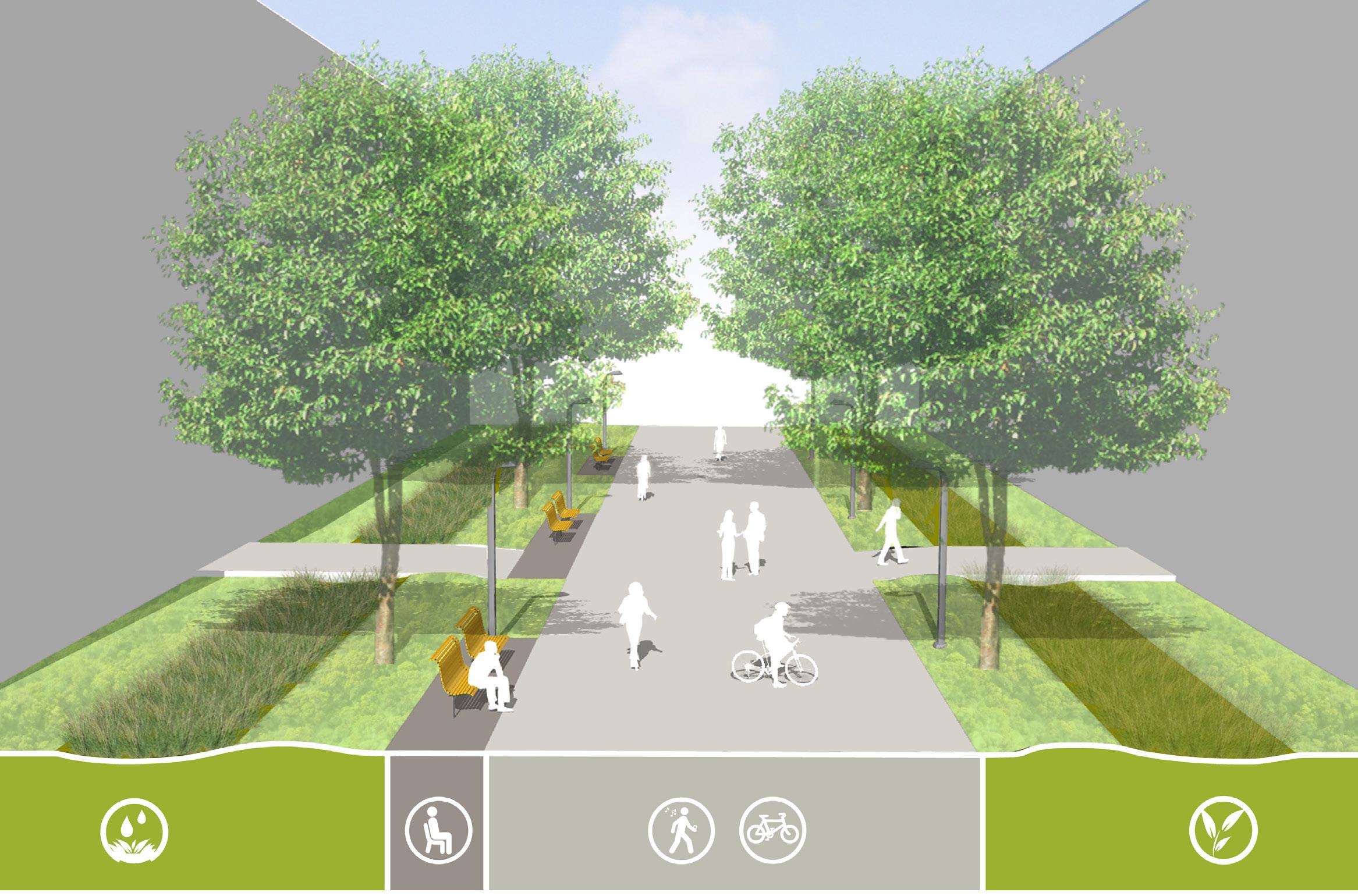
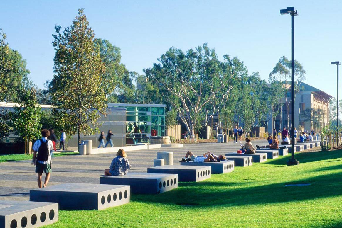
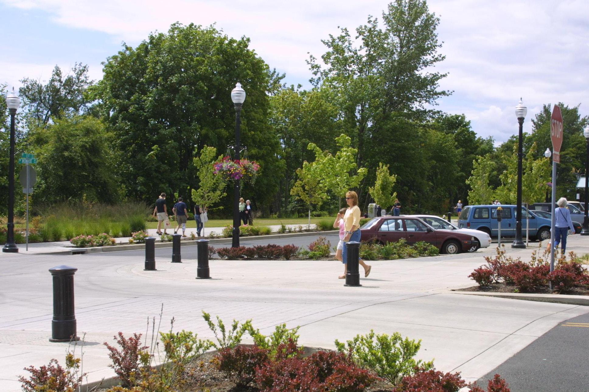
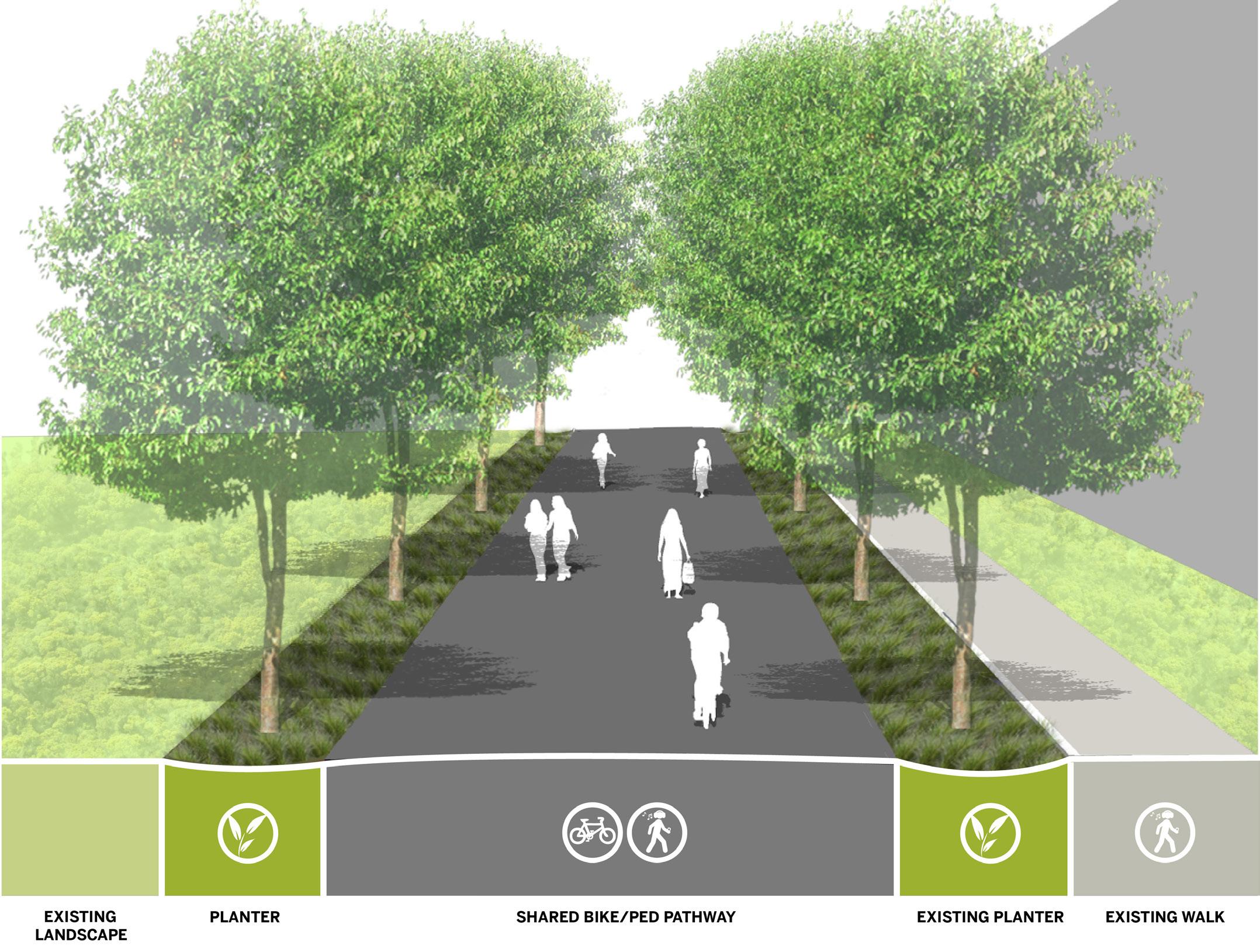
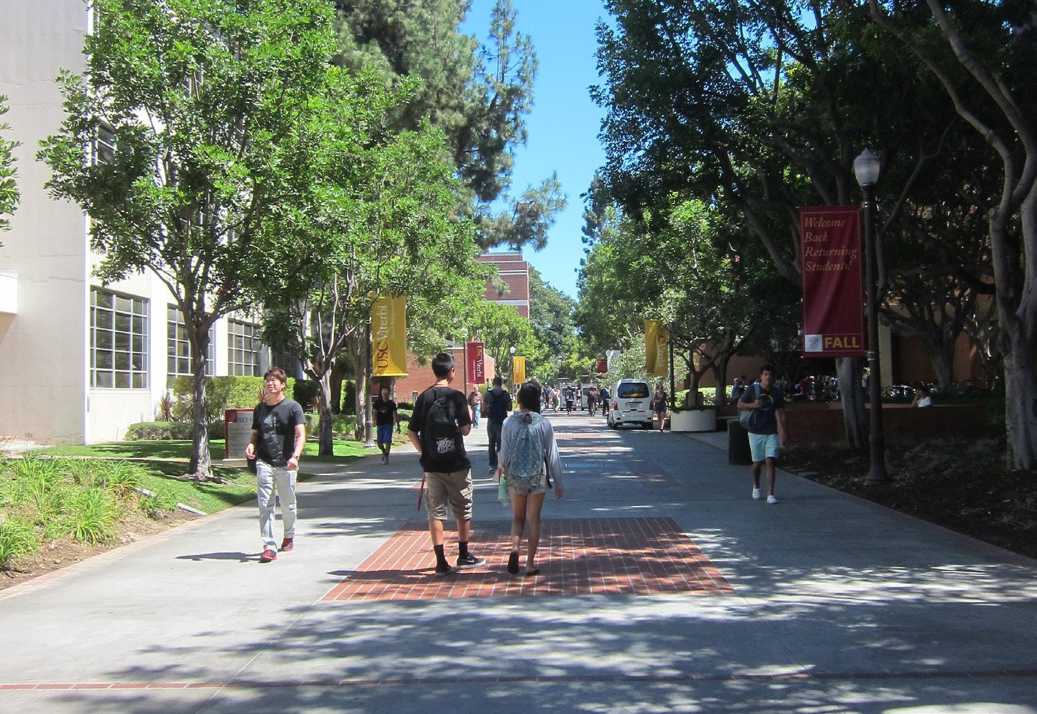
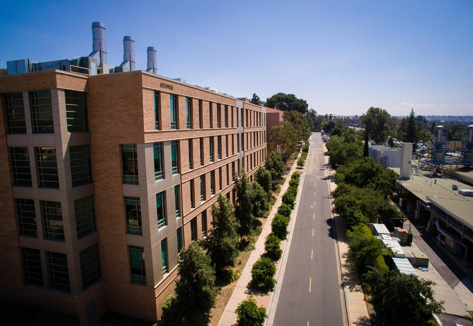
A key new connection will lead to Site 6: Core Campus South Extension, an Opportunity Site south of Anderson Hall at the visual terminus of Martin Luther King Boulevard with a prominent location overlooking the campus. The existing Citrus Drive will be transformed from a regular campus street, to a curbless pedestrian and bicycle pathway - Citrus Walk - connecting the Carillon Mall to the new Opportunity Sites on the south edge of campus.
From the west facade of Anderson Hall, a new Citrus Mall is proposed, extending west from this historic building, integrating with Citrus Walk and creating a new campus space through the existing Lot 6. This new Mall will be intercepted by the southward extension of Library Mall, after it passes underneath Olmsted Hall’s arches.
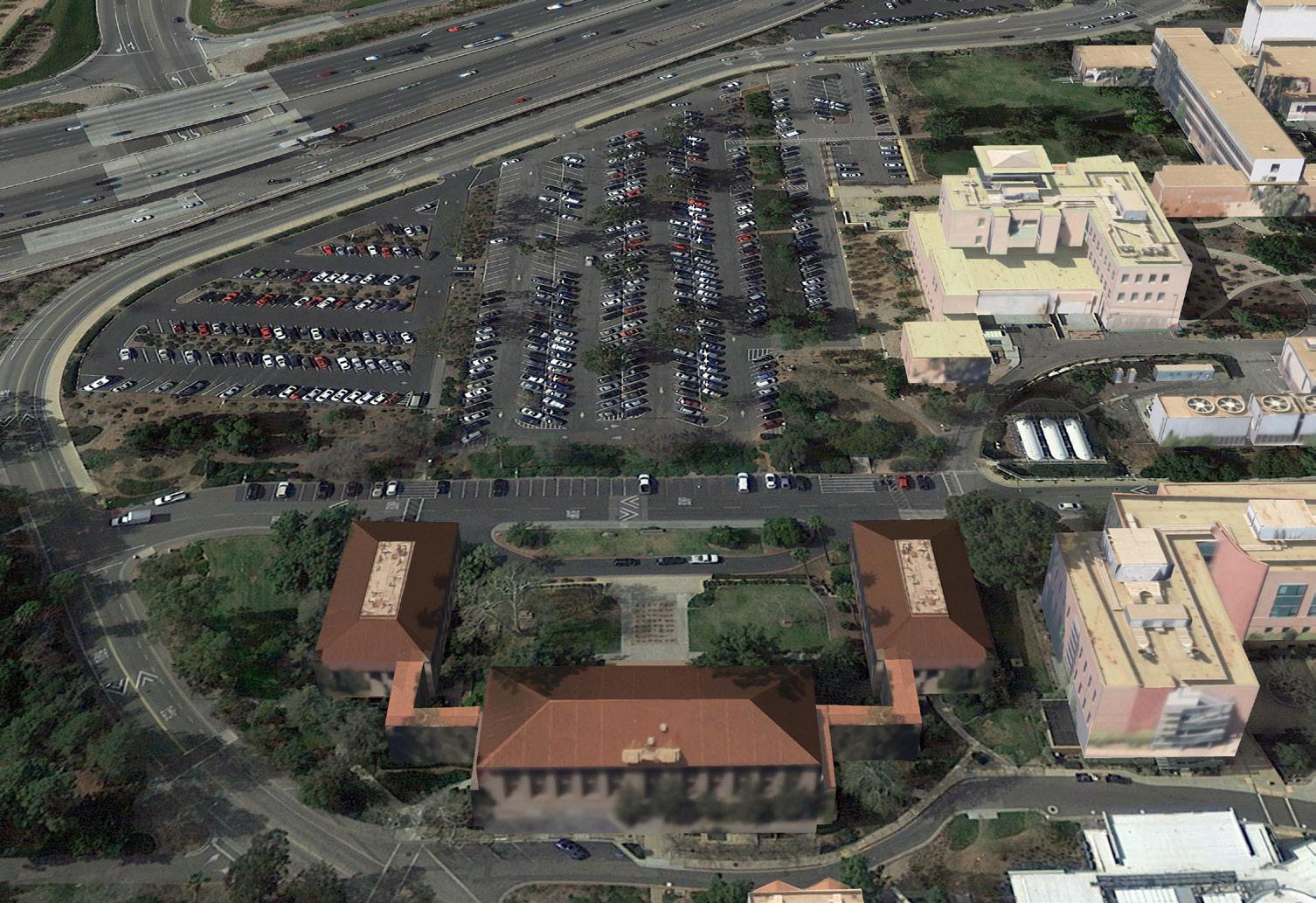
A successful campus relies on a positive relationship between its buildings and adjacent exterior spaces, creating opportunities for social engagement and impromptu communication. One of the key strengths of the UC Riverside campus is the way buildings are oriented to help define and differentiate adjacent open spaces. The integration of a building with outdoor space also establishes a hierarchy that is a critical part of the campus wayfinding system. The careful siting of new buildings will help further define open spaces, creating varied experiences across the campus, from naturalistic open spaces to formal malls to courtyards, allowing for chance meetings, informal group study and unstructured relaxation between classes.
Buildings should both define open spaces and actively engage them. It is important that ground floor levels of buildings maintain a permeable human scale and encourage activity in and around themselves. It is at the ground floor where people interact most directly with a building, so the scale of elements should be more attuned to human dimensions and perception. As Figure 4.7 demonstrates, in some locations buildings can also step down to meet important campus open spaces, softening the visual impact of greater density and increased heights.
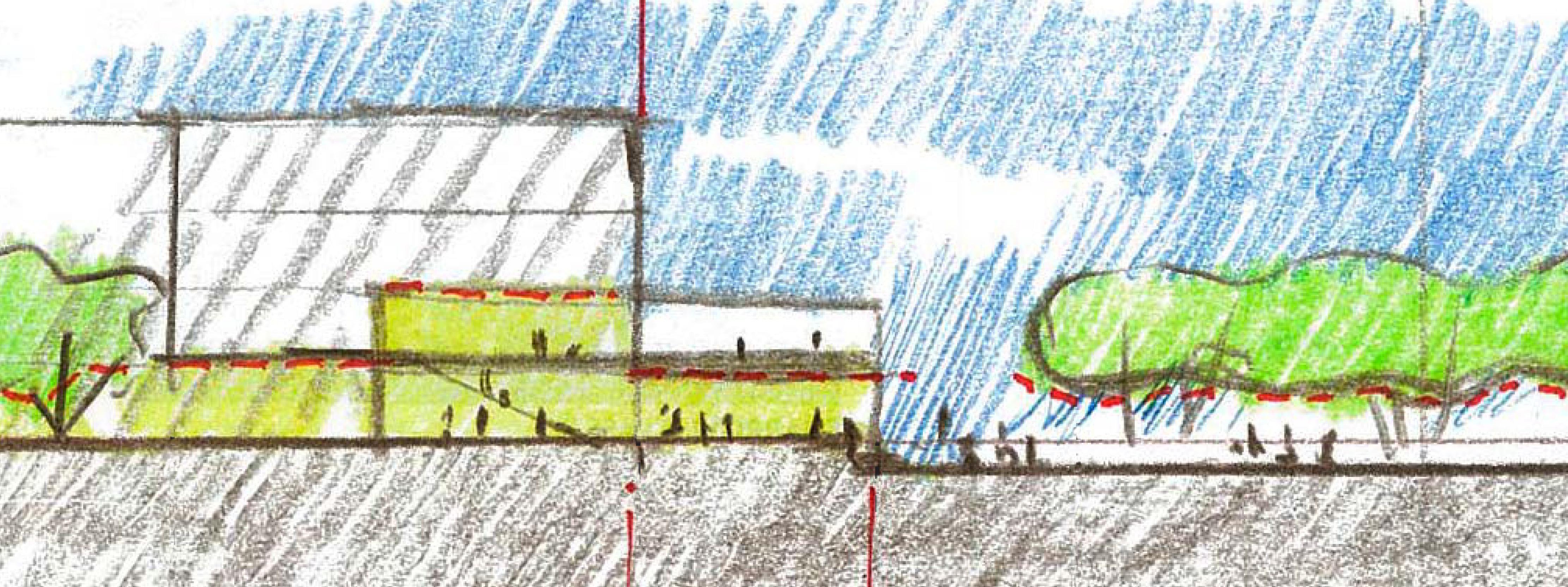
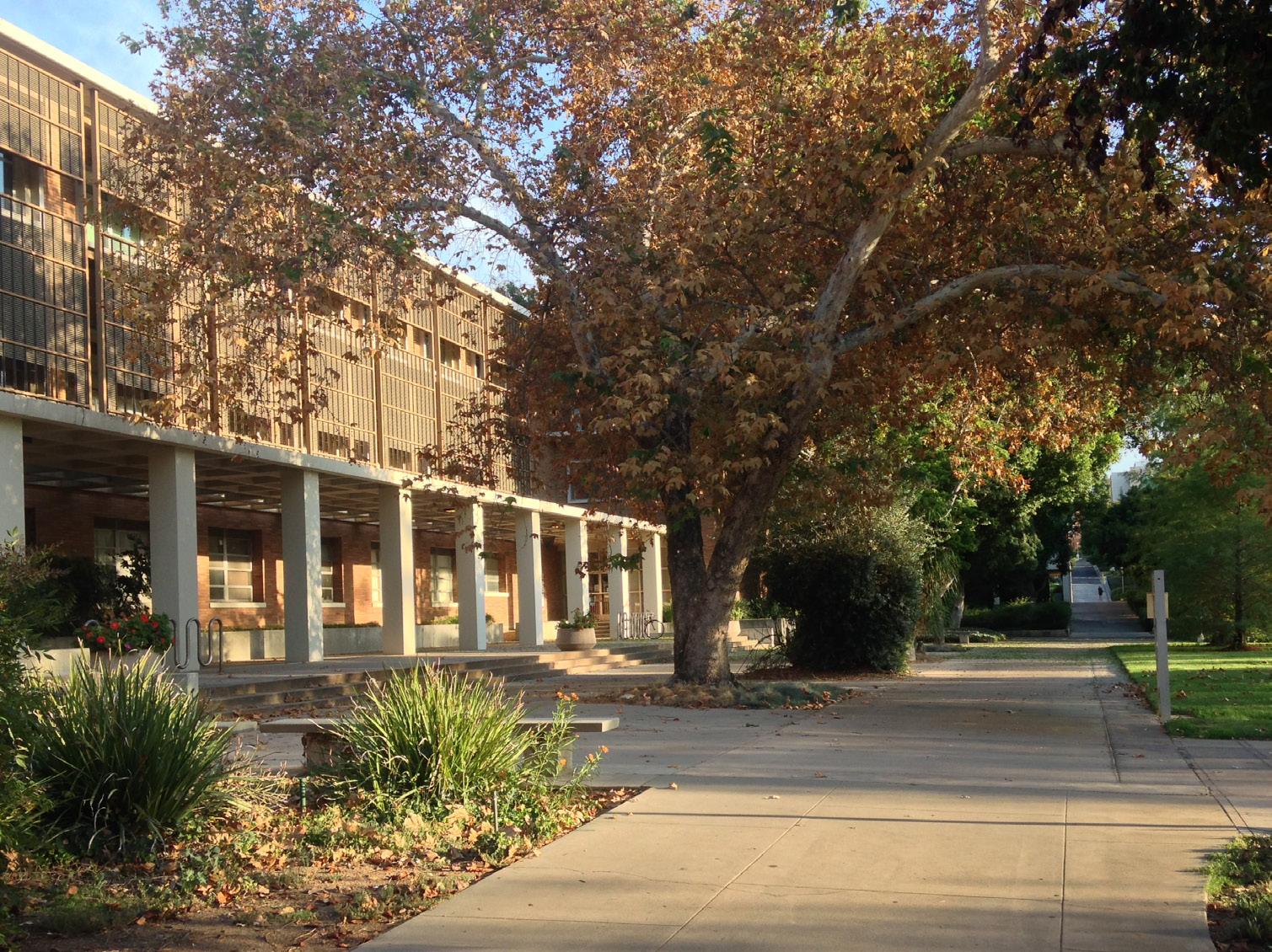
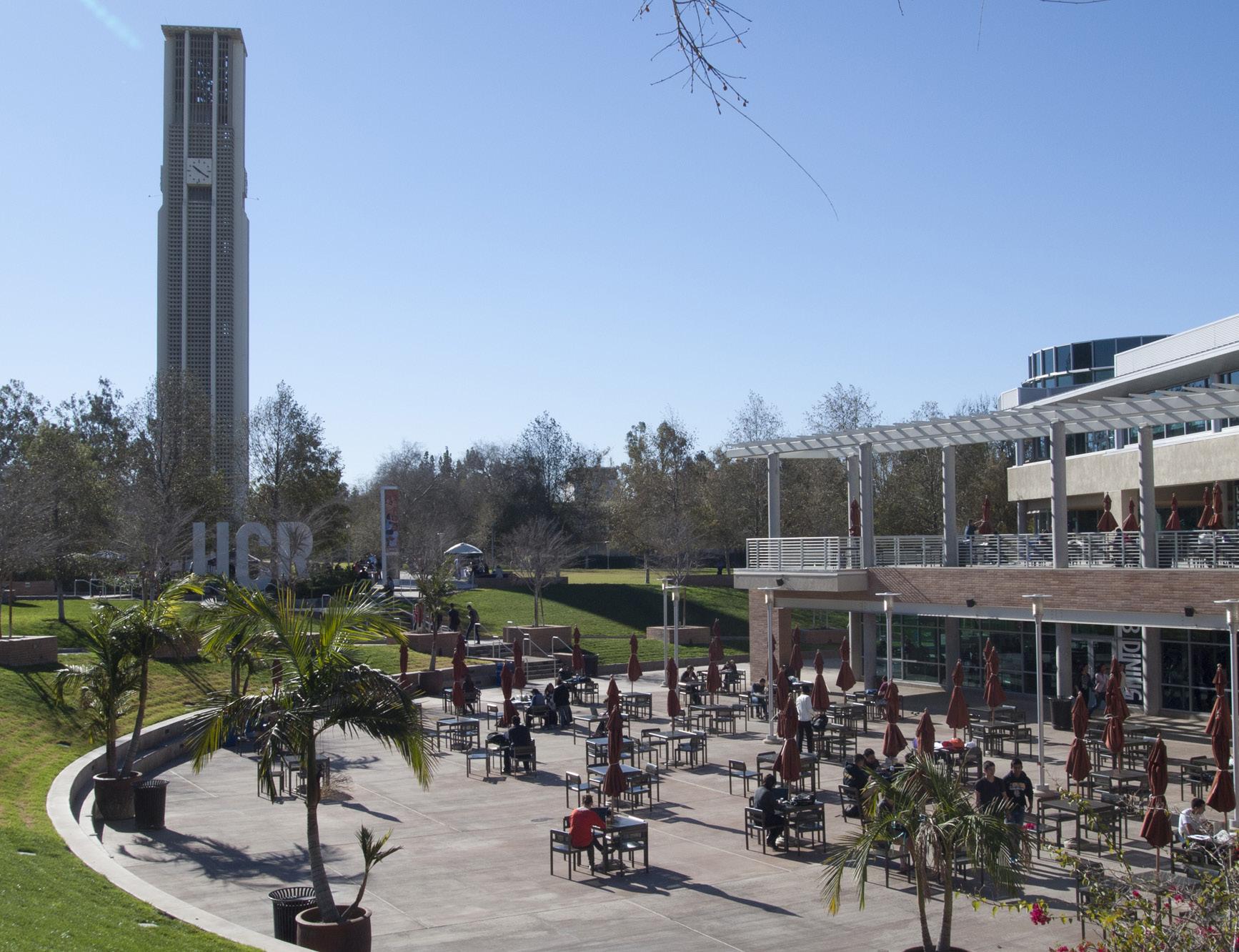
Identifiable building entrances are important campus elements that help orient users, so these entrances must be clearly marked and visible from a distance. Courtyards and plazas can create clear entry points to buildings and provide special places for both interaction and solitude. When effectively designed, courtyard spaces contribute directly to intellectual pursuit and dialogue within the community. The most successful courtyards are those that have a sense of enclosure, provide a variety of seating configurations, and provide shade and comfort to the users. Courtyards and gardens should be the most lushly planted areas on campus with plants especially chosen for their thematic, aesthetic, and aromatic qualities, as well as shade to provide a ‘garden oasis.’
At key building entrances and crossroads on campus, courtyards and plazas provide a broad mixing zone for pedestrians. The areas around the Highlander Union Building are a good example of a successful paved plaza on campus, integrated with seating areas and planting beds to add shade and visual interest. New building projects adjacent to campus malls and major walks should include generous plaza spaces to allow for unencumbered circulation, especially at times of heavy pedestrian traffic, such as class changes. Within plazas, outdoor spaces will be activated with the help of furnishings, provision of wi-fi, and shade, which are all low-cost investments to support outdoor learning, collaboration, and a sense of community.
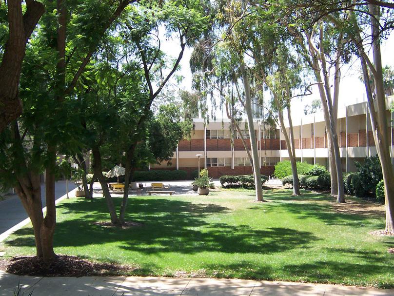
The campus will express its regional identity with climate-appropriate landscapes, including drought-tolerant planting that reduces the need for irrigation. Plants selected will be both native and climate-adaptive hardy species from other arid zones around the world. Recent campus projects such as Glen Mor have employed a mixed Mediterraneandesert plant palette that is highly effective for this region and climate. Broad-canopy shade trees are essential to the function and identity of campus malls, to increase shading and nearby building comfort. On campus streets and parking lots, shade trees provide needed evaporative cooling and reduce heat generated by asphalt and concrete paving.
Given UC Riverside’s strength in agricultural research and botany, campus open spaces could include future demonstrations of permaculture in a variety of ways, such as by integrating edible landscapes. The campus presently has several examples of permaculture, including the use of citrus near the Humanities Building, herb gardens at Glen Mor and Watkins Hall, the Avocado and Macadamia Tree Collection and the Medicinal Herb Garden. Such spaces strengthen the campus’s sense of place, remind the entire campus community of the University’s research origins and provide inspiration for sustainable landscapes. The campus has a goal of reducing the use of herbicides and fertilizer. These reductions should be balanced with consideration of the amount of physical labor required for maintenance.

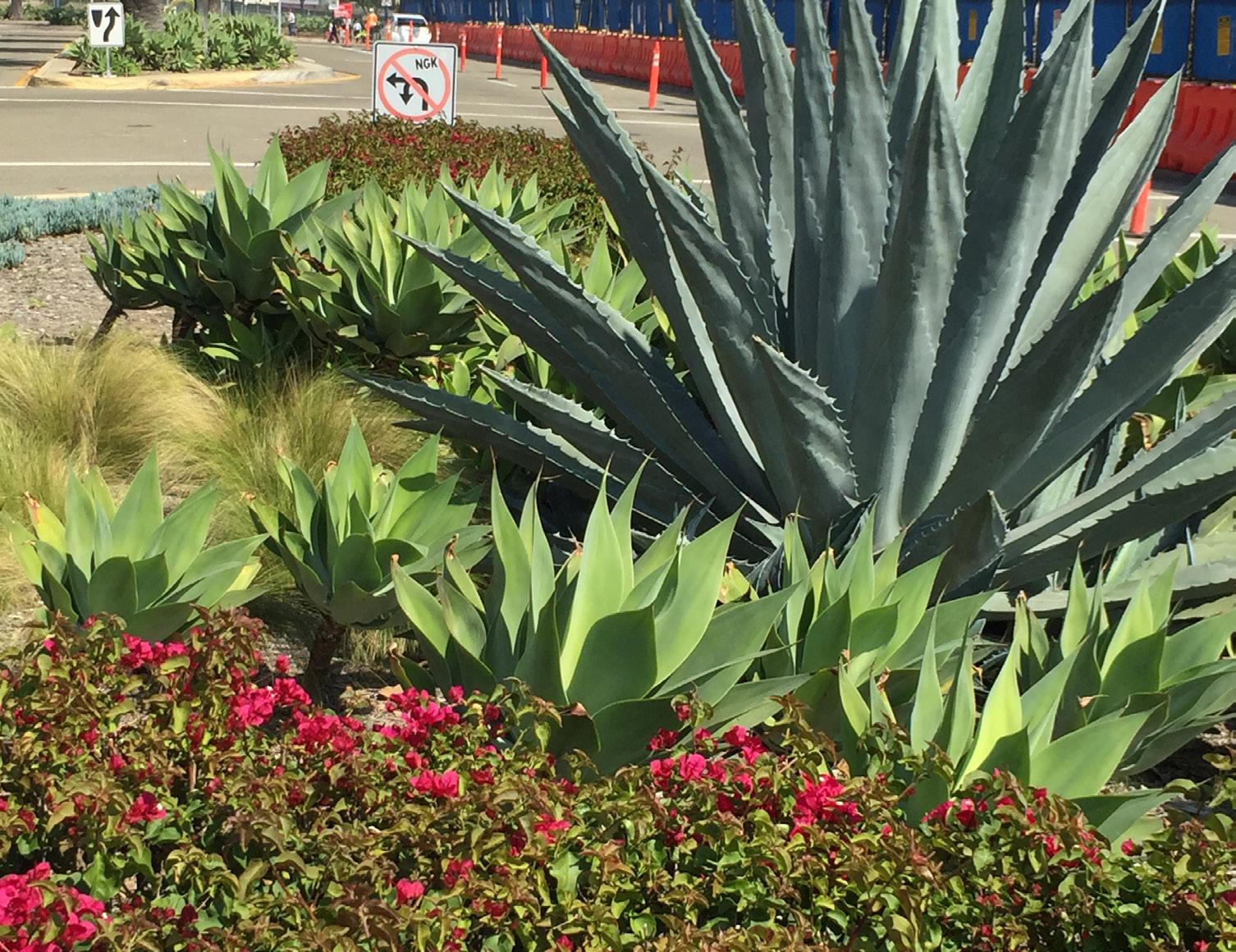
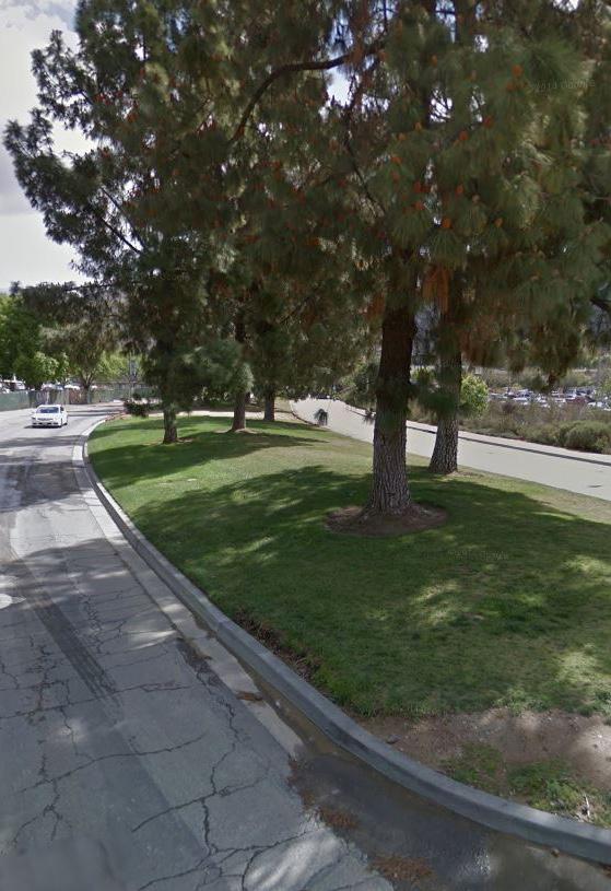
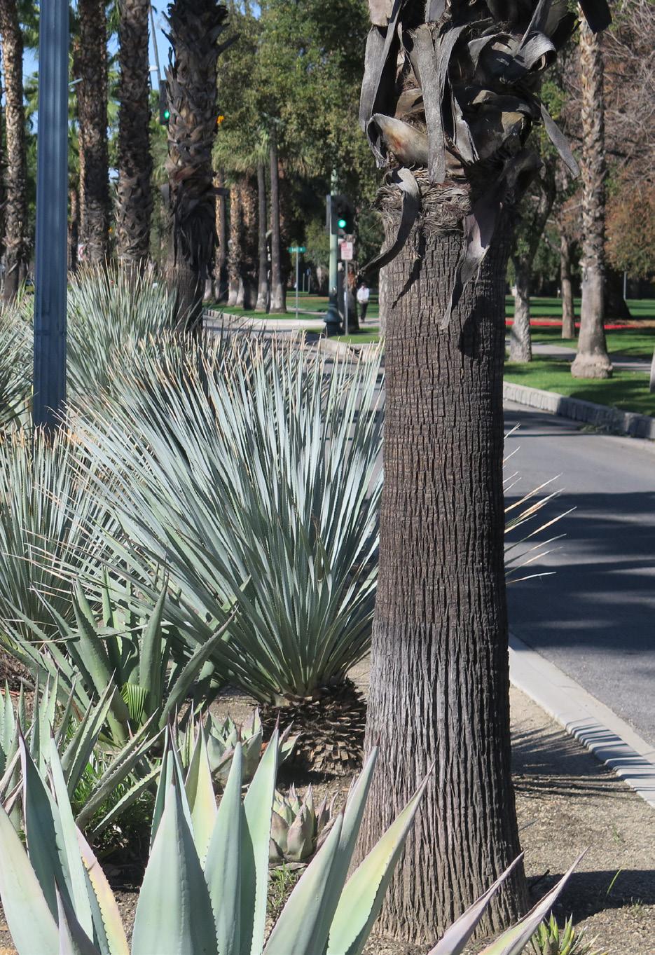
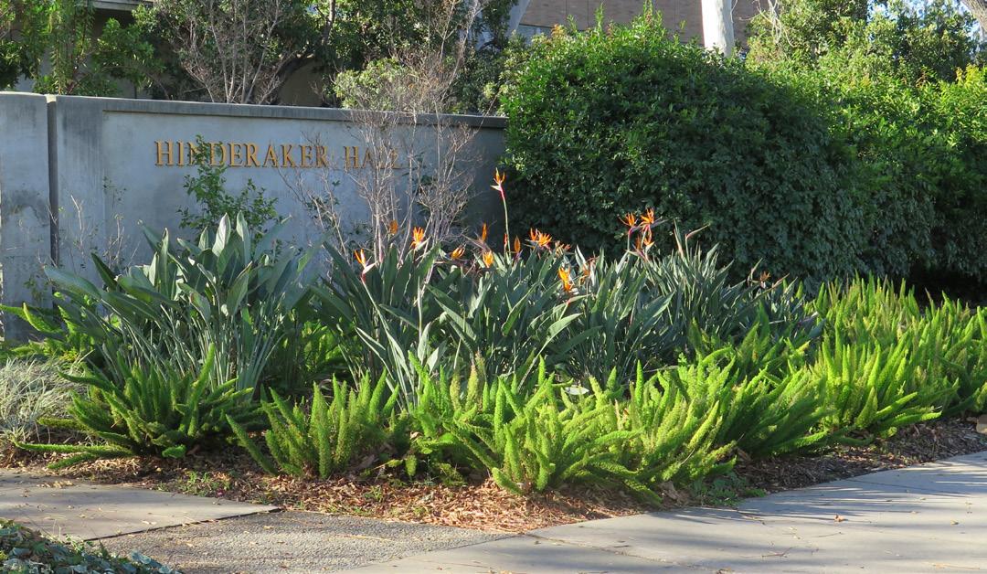
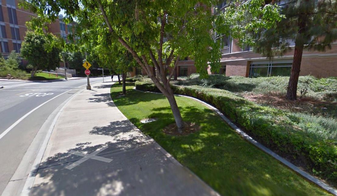
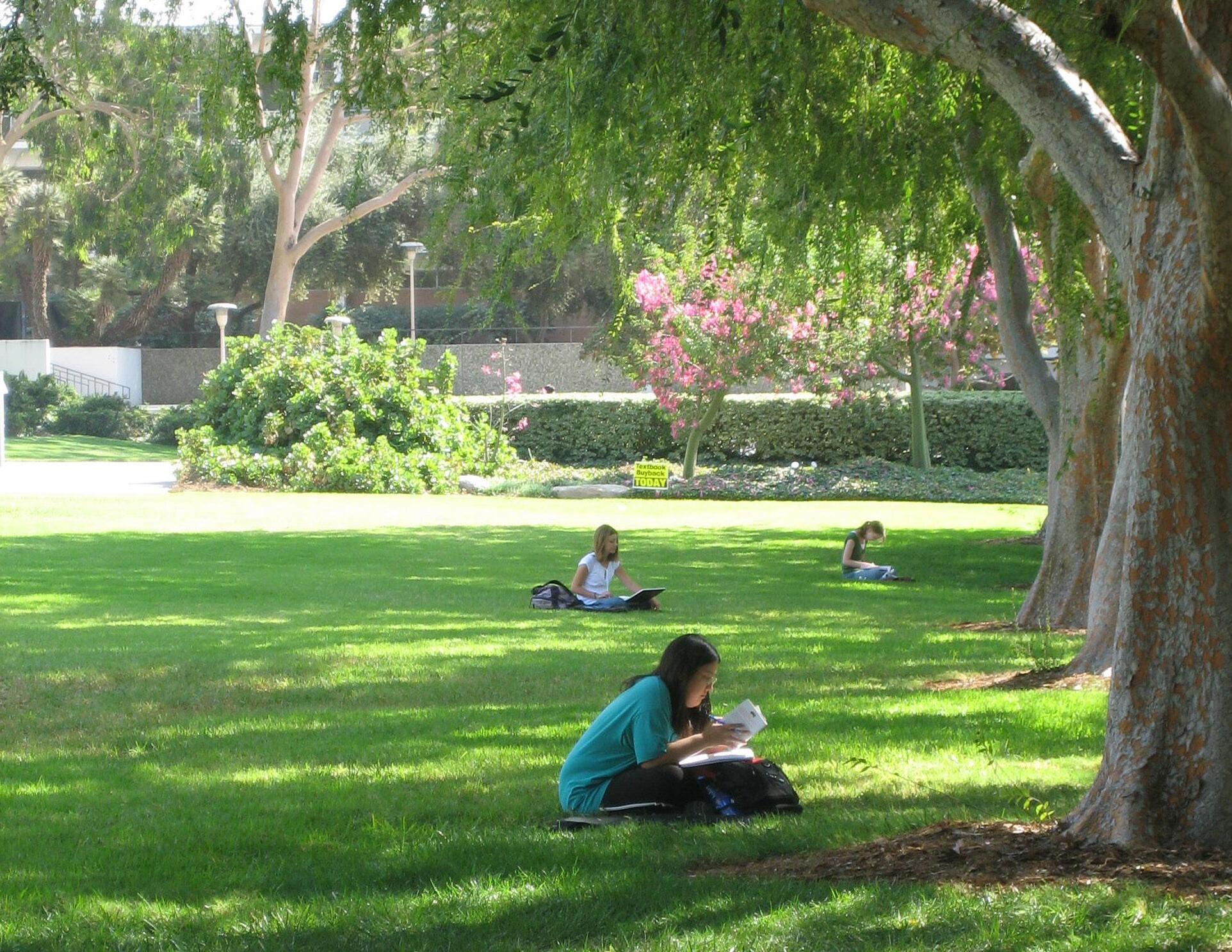
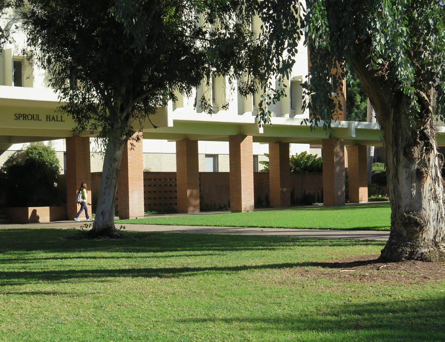
The UC Riverside campus character is defined by modern buildings framing a core of open grassy malls. The turf on these malls is resilient, allowing for a variety of activities, from informal studying and sports to graduation ceremonies.
New state conservation mandates require reductions in water use. Irrigated turf areas are obvious targets for these reductions. However, campus landscape staff have found that transforming turf areas with planting beds does not necessarily save water or meet conservation targets. The costs of removing turf and irrigation systems exceed the current financial benefits resulting from reducing the watering needs. At the time of publication of this Master Plan Study, campus domestic water is inexpensive due to water rights associated with the Gage Canal. As the cost of water increases over time, this benefit may not always apply.
Removing turf and associated irrigation without carefully considering how campus trees are dependent on the existing irrigation regime could also result in some shade trees dying due to lack of accustomed water. Irrigation is still generally needed when planting beds replace turf in order for the plants to get established. Through targeted turf removal, irrigation efficiency, computerized monitoring, and the use of graywater, UC Riverside will make advancements to meet the UC Policy on Sustainable Practices and state regulations.
Plant selection for future buildings will consider open space functions, including retention of turf in high-use areas such as courtyards and malls. A strategic approach to minimizing turf use on campus could include removal of turf in low-use areas as is successfully shown at Glen Mor. Future projects will be strategic about where to install new turf.
Steep, rocky, and undeveloped hillsides rise almost 2,000 feet east of campus. Natural drainages incise this terrain with arroyos which drain westwards into the Gage Basin and eventually into the Santa Ana River. The general flow of runoff on campus is in a northwesterly direction. To date, few low-impact stormwater treatment and control features have been built on campus but new state regulations require and encourage on-site absorption and treatment of campus stormwater drainage. As the campus grows and new hard surfaces are added, the additional runoff that is generated will need to be managed and treated to conform to these new state requirements.
These new regulations provide an opportunity to develop sustainable campus open spaces that outwardly and visibly express stormwater treatment functions in an integrated way. Such low-impact stormwater facilities are cost-effective and inherently sustainable. They replicate natural drainage patterns and allow plants to filter pollutants out of runoff before it flows into sensitive waterways.
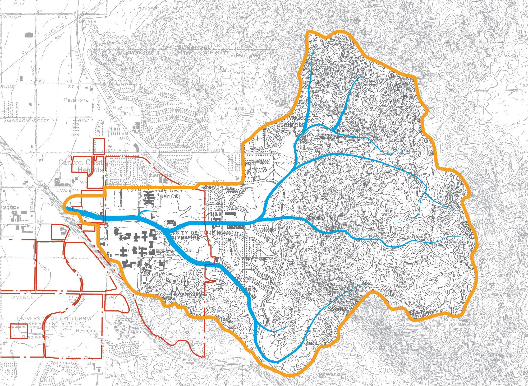
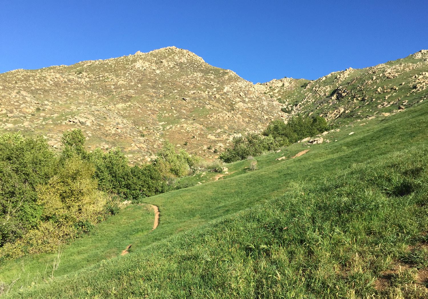
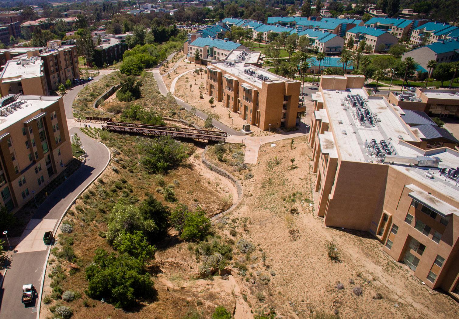
P1 RETAINS
Fig. 4.9 describes an overall strategy for integrating stormwater treatment with the campus landscape. This includes daylighting stormwater treatment in targeted places such as the Recreation Mall and Canyon Crest Drive, with the objective of generally directing treated water towards three primary treatment areas and ultimately the Gage Basin, while allowing some water to infiltrate, where soil types allow. This display of dynamic stormwater treatment complements the conveyance of runoff in large pipes underneath West Campus Drive and the arroyo on the northeast edge of the Core Campus, and south of the Materials Science & Engineering Building.
There are a number of low-impact methods to accomplish the strategy of integrated stormwater treatment. Infrastructure plans will emphasize natural infiltration and evaporation where possible to reduce water run-off during storm events. Campus paving will move towards using materials that allow rainwater infiltration where feasible, particularly for secondary paths and roads. Stormwater run-off from roofs and paving will be filtered by bio-swales, filter strips, and stormwater planters. Surface parking lots will be designed with stormwater drainage detention swales for runoff interception, filtration and storage. There are strategic locations on campus where new naturalistic stormwater treatment swales will add visually interesting spaces for contemplation that evoke the character of nearby natural areas. However, stormwater treatment within the central malls will be avoided, in recognition of the important role these spaces play in providing flexible, programmable space for a range of student activities.
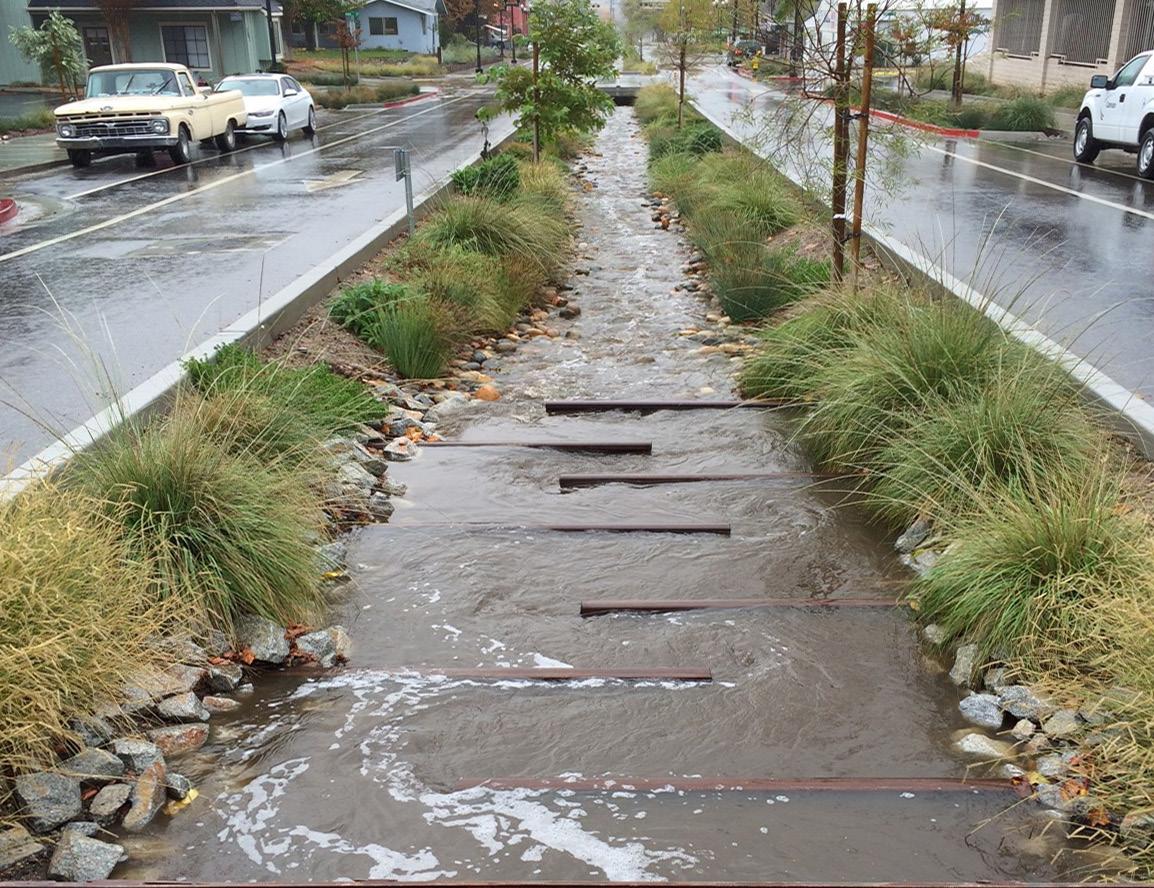
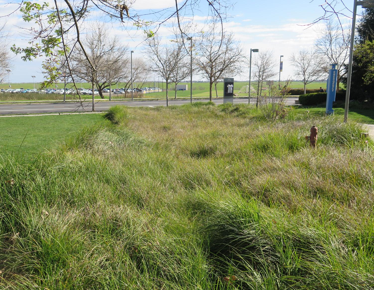
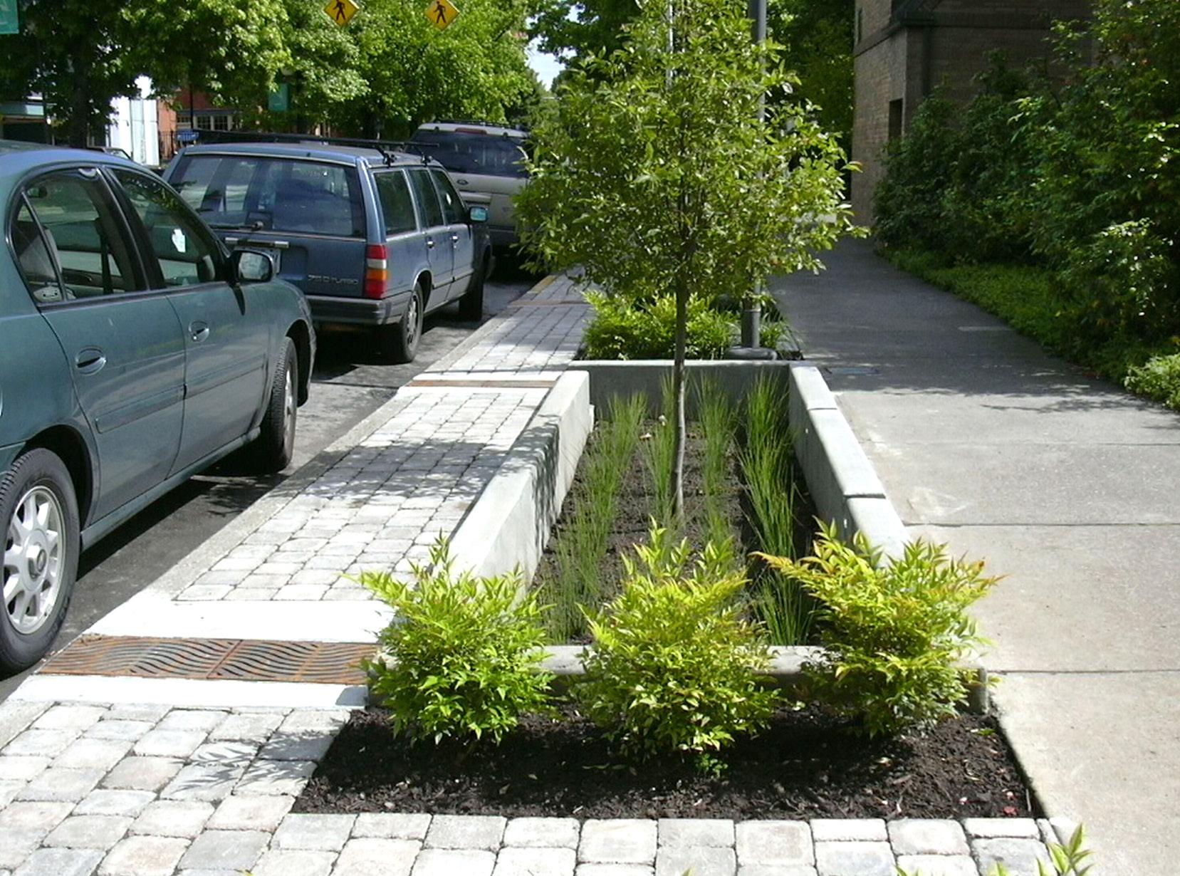
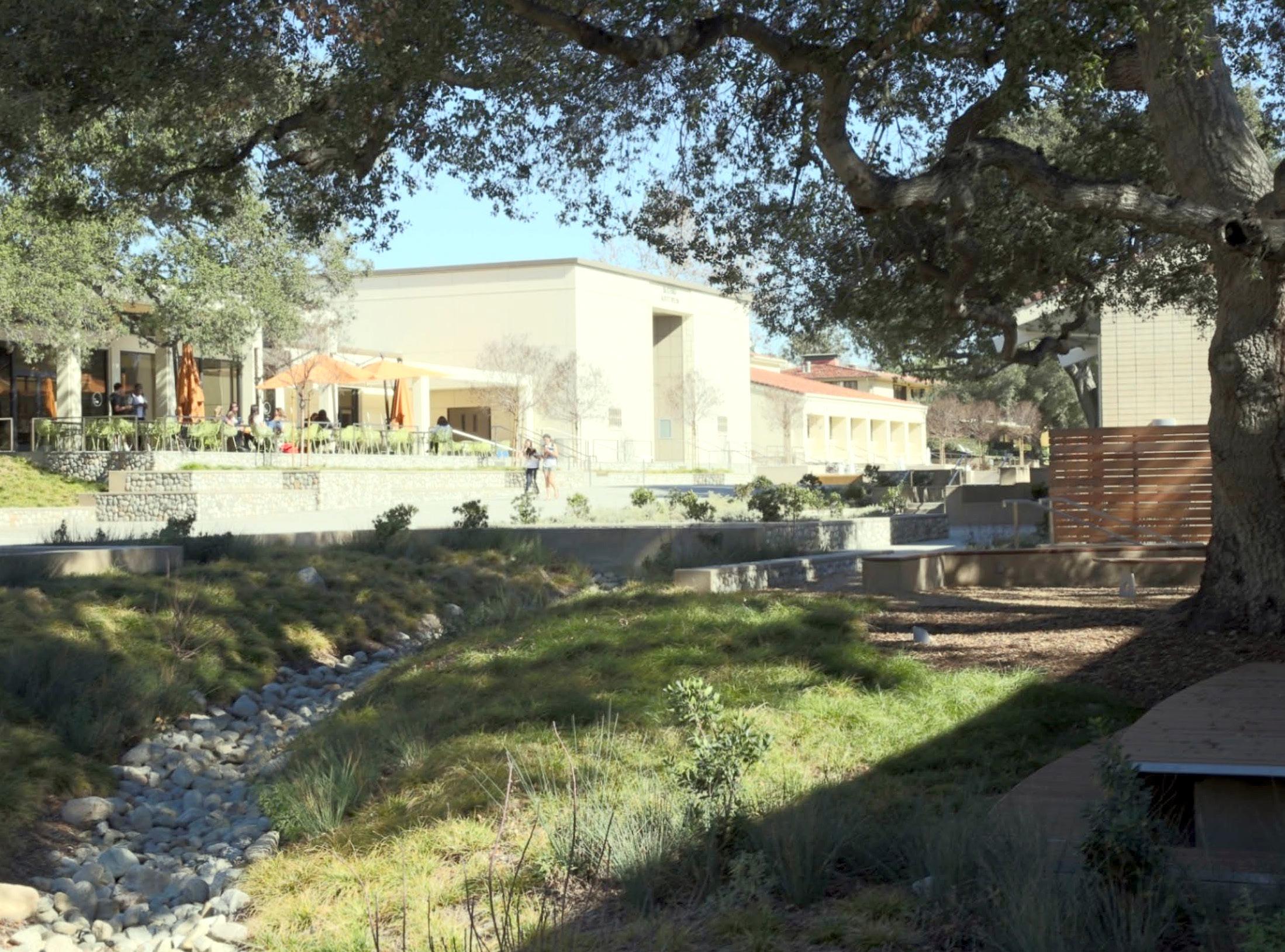
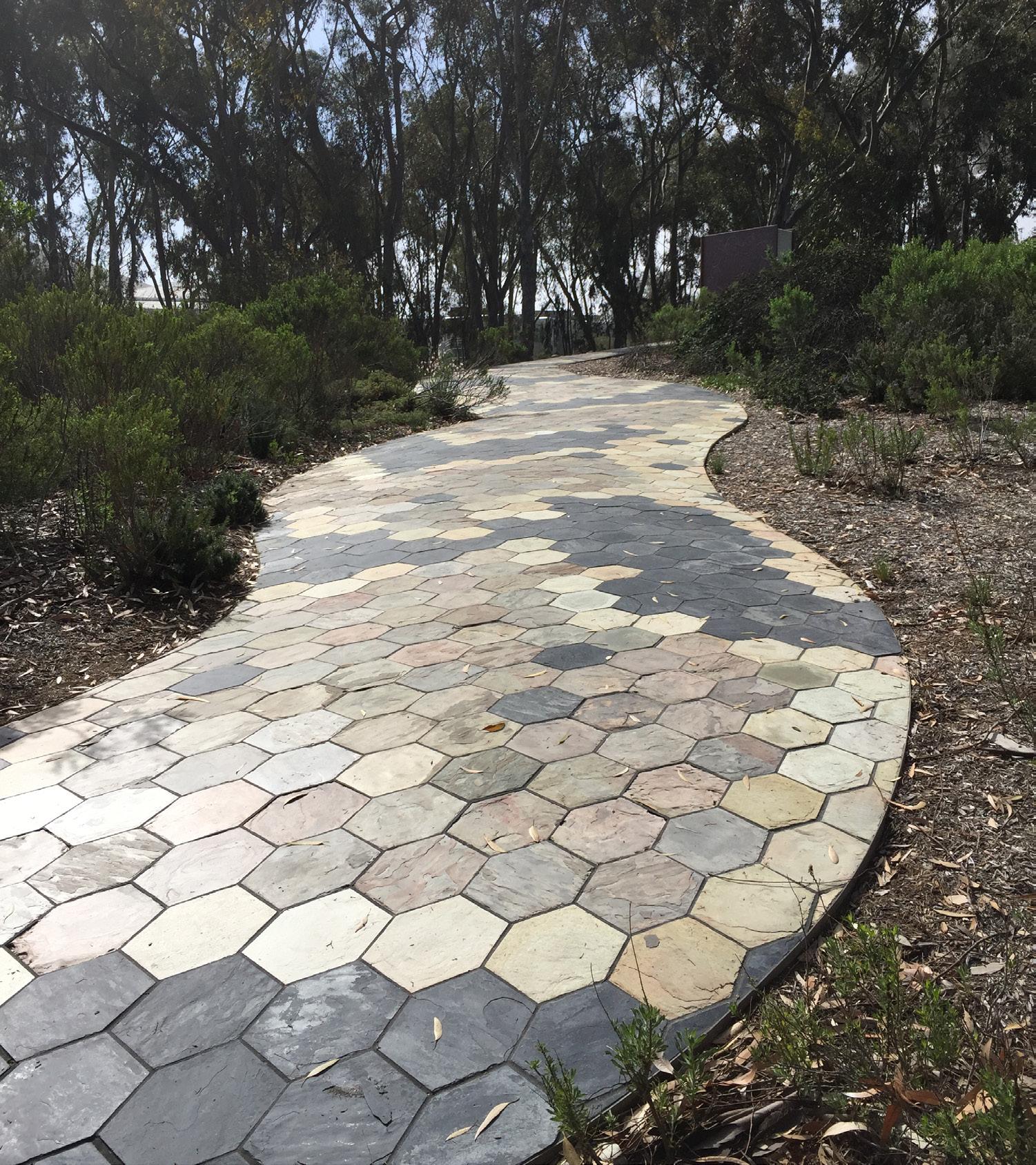
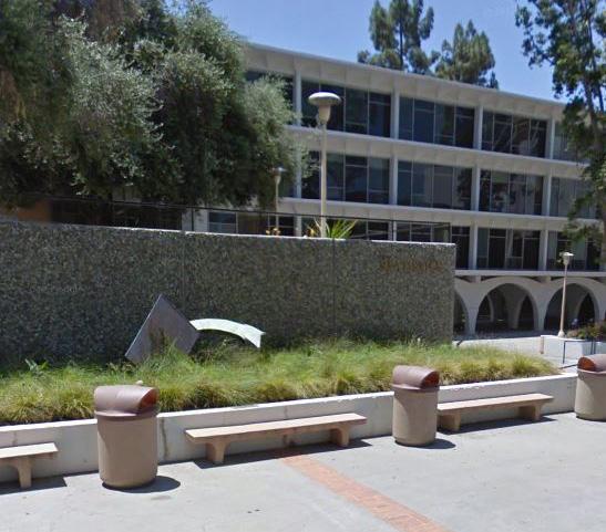
Campus art can express the intellectual inquiry, exploration, and creativity found at UC Riverside. New art and sculpture can relate to associated academic programs to enhance and highlight the learning experience. UC Riverside’s Advisory Committee on Campus Art (ACCA) is tasked with creating and updating a Three Year Public Art Plan that is approved by the Chancellor and defines a vision and priorities for Public Art. ACCA members consider and make recommendations on the placement of public art on campus, and with the approval of the Chancellor engage in the solicitation and acquisition of public art.
The Master Plan Study includes recommendations for the placement of an art piece, how it will relate to its immediate surroundings and integrate with the campus context. Priority locations include focal points and pedestrian gathering areas. Placement of each art piece will relate to its immediate surroundings and integrate with its campus context, with priority locations at focal points and pedestrian gathering areas. Art can also reflect the academic focus of adjacent buildings, particularly when located within courtyards. The campus nodes identified in Chapter 3 are good locations for art to act as gateway and wayfinding elements to welcome the campus community and enhance identity.
The UC Riverside campus edges are important elements in establishing the identity and character of the institution. They communicate the campus location and identity to the surrounding communities, visitors, and students, while reminding the campus community, as they arrive, of the memorable setting for their education and work. The edges of campus also serve to buffer the campus from adjacent noise and incompatible uses. The study proposes the following specific improvements to campus edges.
There are ways that the campus landscape will also become part of wayfinding, by ensuring that key malls and walks into the Core Campus are visible and identifiable from the campus perimeter. The Arts Mall and proposed Recreation Mall, Citrus Walk, Science Walk and Eucalyptus Walk are important campus open spaces that extend to the campus perimeter and will provide a legibility that helps users to understand the structure of campus. Wayfinding is also assisted through the use of distinctive plantings that signify important places utilizing larger trees, allées or specimen plantings that provide seasonal color.
The Campus Sign Program, originally developed in 2008, has only been partially implemented. The program’s recommendation to implement parking lot signs has been highly effective in directing vehicular movement. However, only a limited set of recommendations specific to pedestrian wayfinding have been implemented. The monument signs proposed at primary campus entrances have not been introduced. The recommendations of the Campus Sign Program should be reviewed for continued relevance and adjusted where needed, to fit the planning framework of the Master Plan Study.
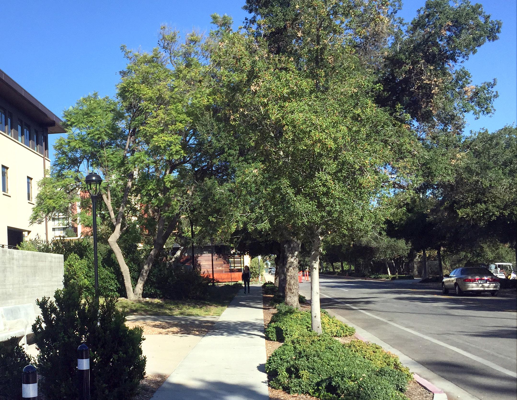
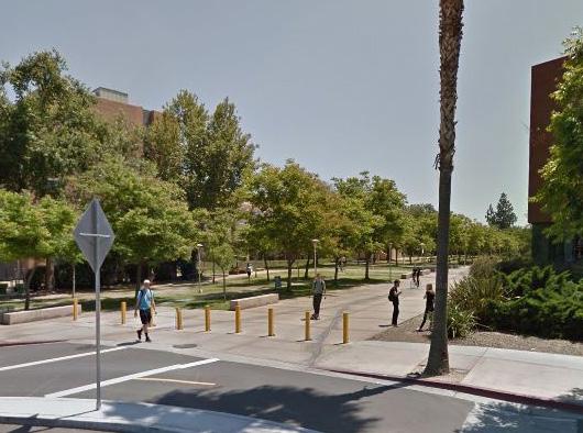
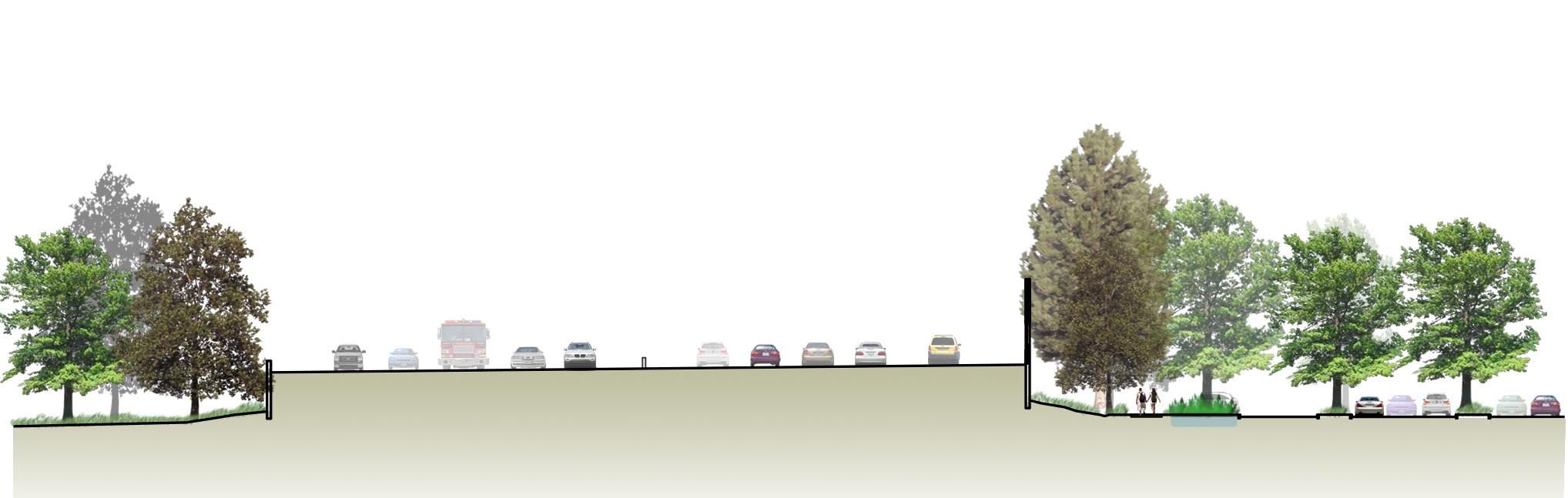

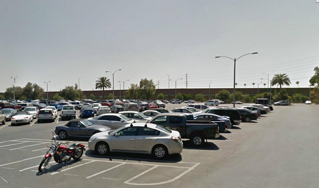
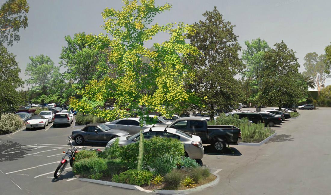
The Planning Team proposes mitigating noise and visual impacts from the I-215/ SR-60 freeway that bisects campus through a landscaped buffer that will serve a variety of functions. In addition to providing a verdant, shaded area to help mask the sound wall and filter freeway pollutants, this buffer will also aid in enhancing the campus identity to passersby who currently see only glimpses of the Belltower and the Humanities and Social Sciences Building tower. A new green, landscaped transition zone adjacent to the freeway will convey the sense of the campus as an oasis beyond the sound wall. This landscaped transition zone is intended to be extended along the entire freeway edge, resulting in a connected tree canopy to the hillside open space south of the Core Campus. On the west side of the freeway, a grove of trees will be planted, further improving campus identity.
The transition zone will be a broad swath of naturalistic landscape, including space for a linear stormwater detention facility and a multi-use path serving as an off-street link along the west edge of the campus. Portions of existing Parking Lot 1 will be planted with new trees and shrubs to mitigate heat-island effects and improve the appearance of this campus gateway. (See Figs. 4.10 and 4.11)
The new landscaped transition zone, stormwater facility, and parking lot plantings would require removal of up to 200 parking spaces from Lot 1 and associated parking to the south such as Lots 4 and 5. A wider perceived buffer will be accomplished by upgrading adjacent surface parking lots and by adding shade trees, which will capture rainwater, reduce the reflectivity of lot surfaces, and thus make the pedestrian experience within the lots more comfortable. Final dimensions will be determined though future detailed design studies.
Views of loading docks at several locations, including at the Lothian Residence Halls along Big Springs Road and at the Arts Building on West Campus Drive, negatively affect visual perceptions of campus. Future buildings on the campus perimeter will be designed to place service access away from highly visible campus gateways and pedestrian walks. Existing loading docks, such as the University Theater, will be screened with additional landscape or decorative walls. The campus should also study ways to screen outdoor equipment such as transformers and generators as well as trash and recycling dumpsters, and consider standards and guidelines for future building projects that encourage careful placement of this equipment. See Section 5.3 in Chapter 5 for more detail on loading and service.
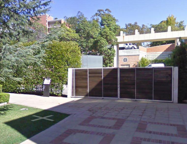
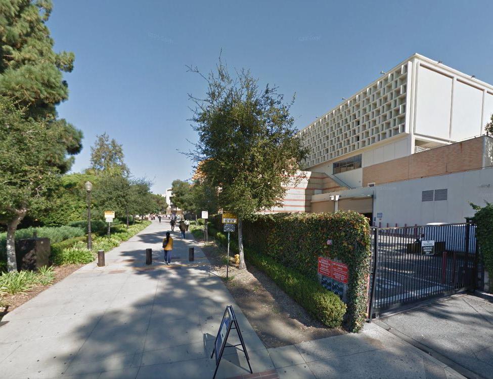
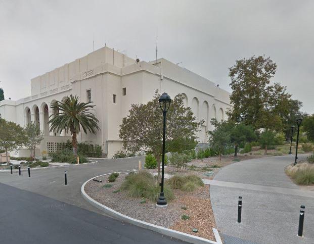
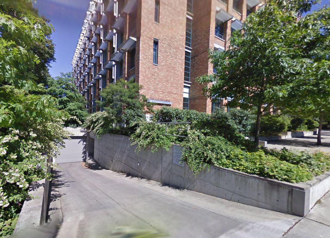
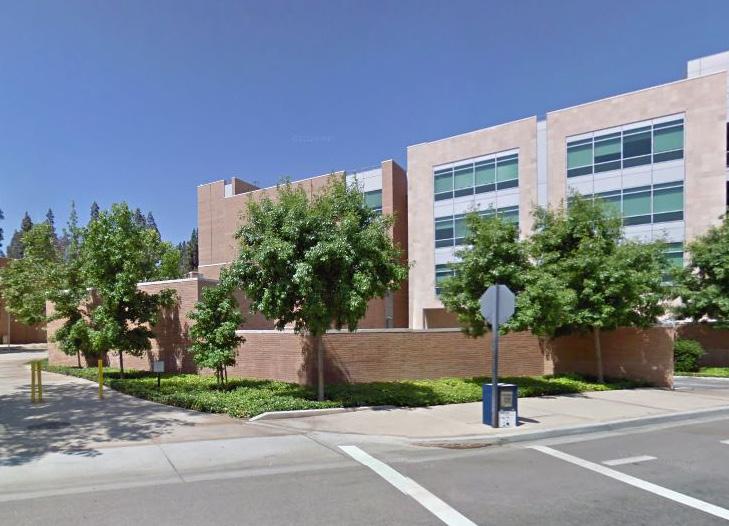
Equally important to creating an inviting and legible edge to campus is the need to improve streets leading to campus and along its perimeter, particularly University Avenue, Canyon Crest Drive, Blaine Street, Linden Street, and Campus Drive. The streets should be ‘complete’, meaning carefully designed for transit, pedestrians, and bicycles, instead of only private automobiles. These streets have been improved in recent years, with wider sidewalks and a protected bicycle lane on Canyon Crest Drive, but they can still be further reconfigured to provide a more welcoming identity. With UC Riverside occupying space in the University Village area and on the west side of Canyon Crest Drive, it is essential to provide pedestrian and bicycle-friendly streets that are safe to traverse. These improvements should occur through partnerships with CalTrans and the City of Riverside. These streets will also be integrated with the campus stormwater treatment system, with open vegetated planters serving as a linear conduit for stormwater in some places, such as along the east edge of Canyon Crest Drive.
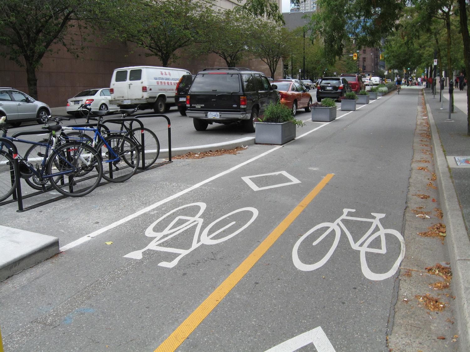
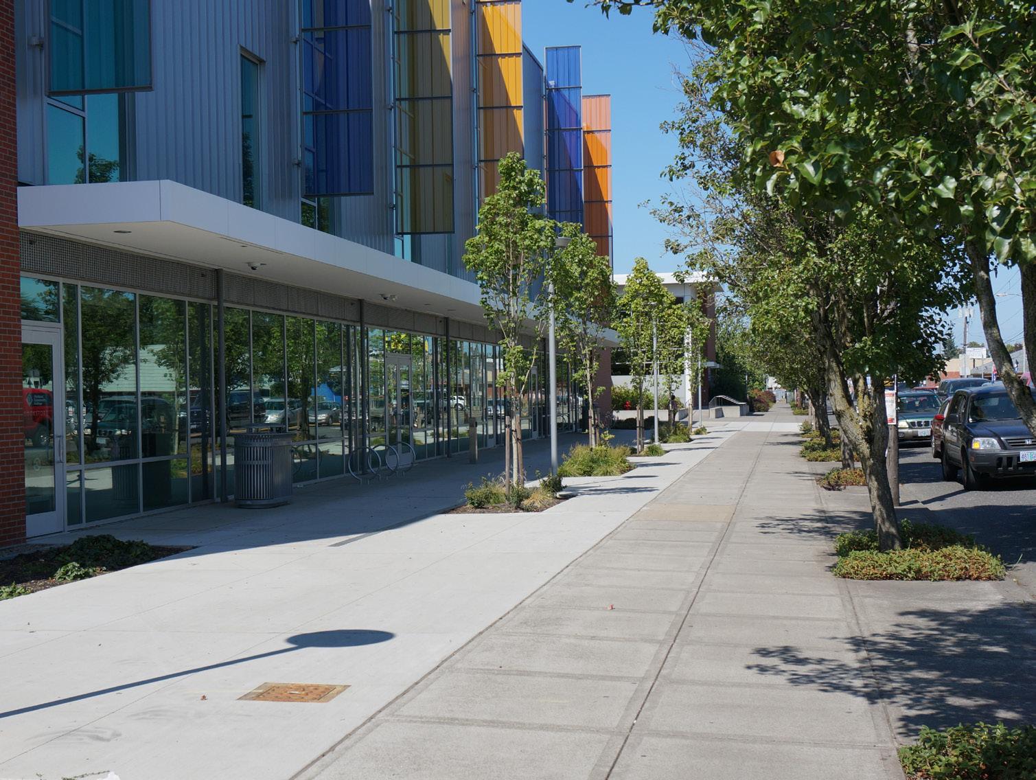
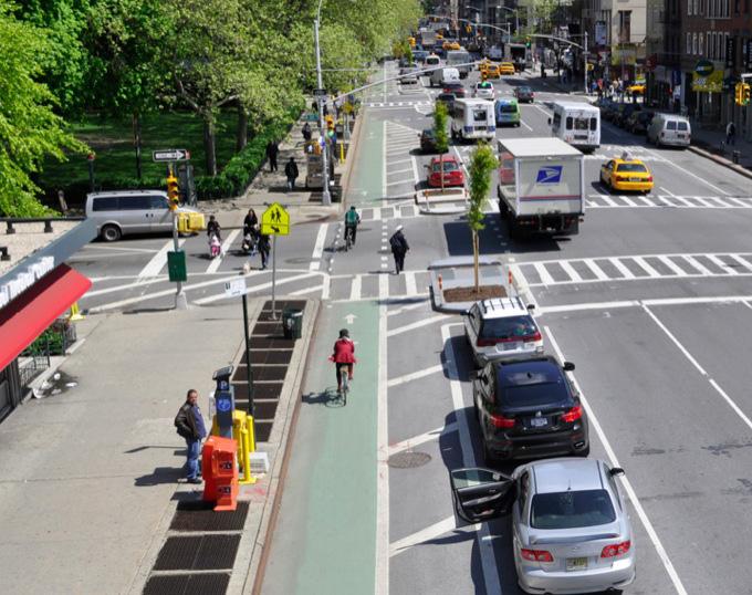
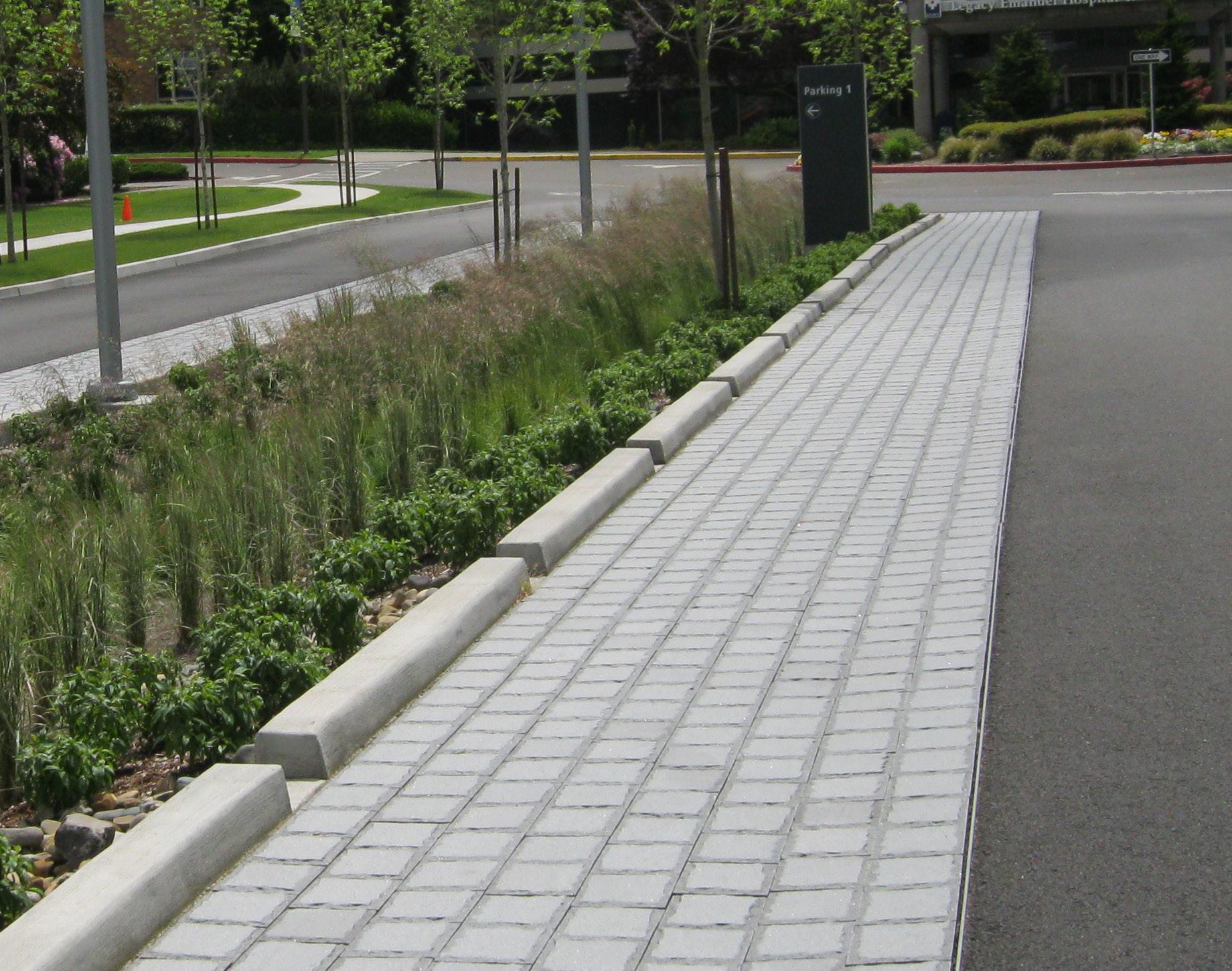
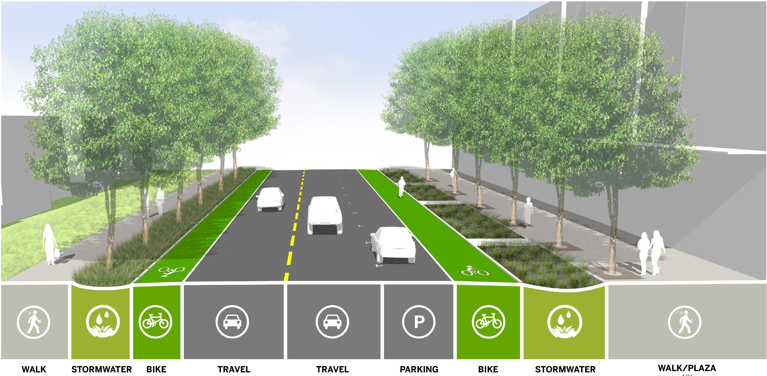
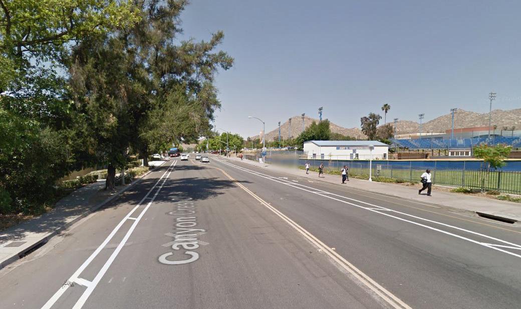
Canyon Crest Drive north of University Avenue is a public street and an important access route to campus from residential areas to the north and west. The street has been improved in recent years with wider sidewalks and a protected bicycle lane on the east edge. The Planning Team proposes a further transformation of Canyon Crest Drive to reflect growing pedestrian and bicycle use, as well as the anticipated increased intensity of adjacent land uses. UC Riverside should work with the City of Riverside to create improvements to this important entry to campus.
The existing right-of-way (ROW) is approximately 80-85’, so additional ROW may be needed to accommodate the design shown in Fig 4.13. Travel lanes should be narrowed to standard widths and the existing excess lane width re-allocated. Wider sidewalks will provide comfortable pedestrian access to campus. Bicycle lanes will be included on both sides of the street. On-street parking will be provided on the east side of the street, next to travel lanes to buffer bicycle traffic from moving vehicles. Stormwater swales will be added to both sides of the street to convey runoff to campus treatment areas and the Gage Basin. This configuration will be re-visited and confirmed, along with all other campus bike infrastructure, in a future detailed Bicycle Master Plan Study.
Canyon Crest Drive north of Linden Street will be a similar configuration to its cross-section to the south, but will reflect future adjacent land uses. (The existing 80’ ROW will require an additional 5’ on each side to accommodate the design shown in Fig 4.14) Should the Campus Events Center be built at the northeast corner of Linden Street and Canyon Crest Drive, the sidewalks adjacent to the future event center will be widened similar to the more urban condition closer to campus. Onstreet parking will be provided on both sides of the street, with the west side possibly providing some parking for student housing. Stormwater swales will be added to both sides of the street, conveying runoff south to campus treatment areas and the Gage Basin. Bicycle lanes will be provided on both sides of the street, adjacent to the curb and protected from travel lanes by on-street parking. This configuration will be revisited and confirmed, along with all other campus bike infrastructure, in a future detailed Bicycle Master Plan Study.
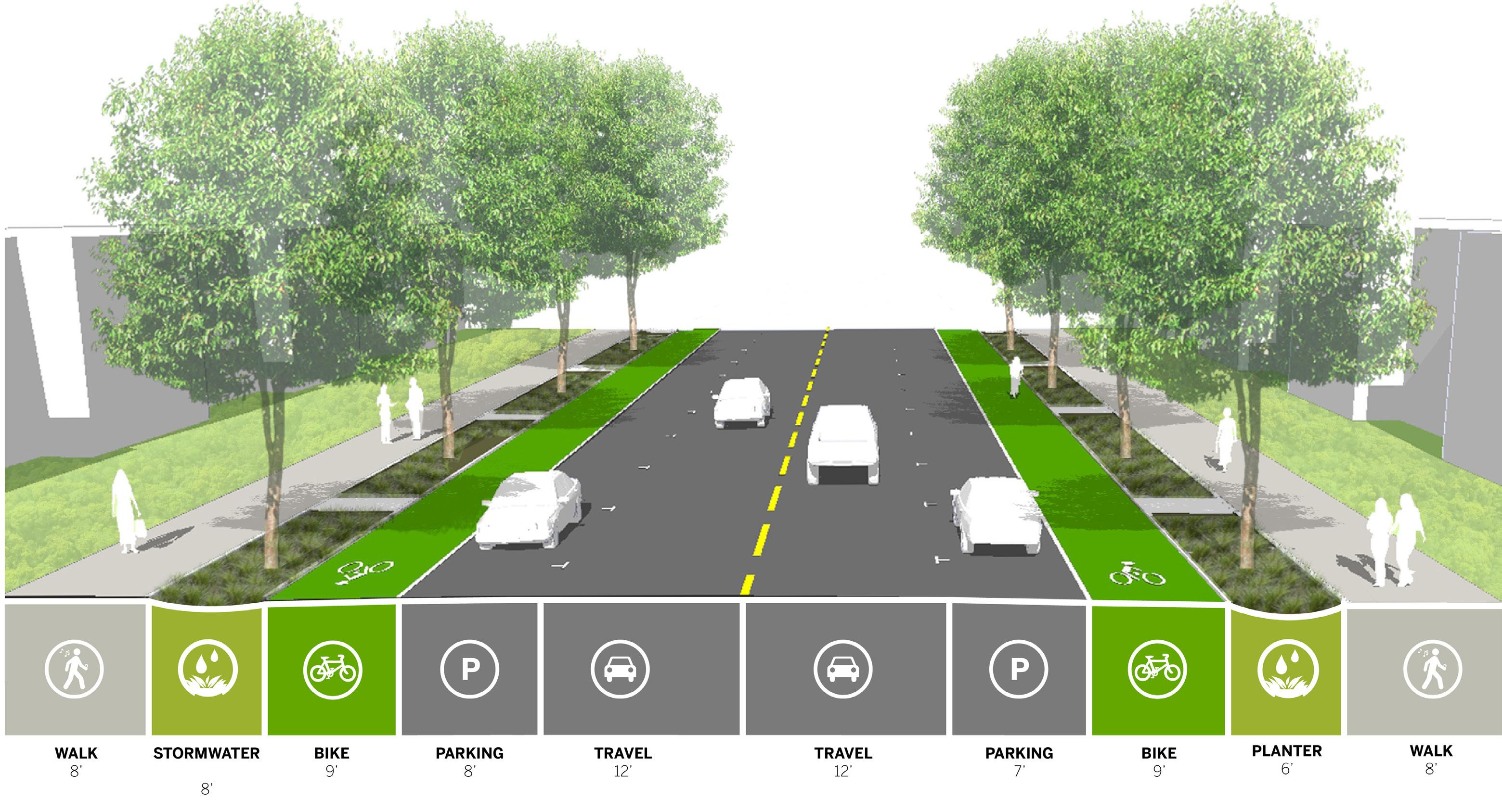
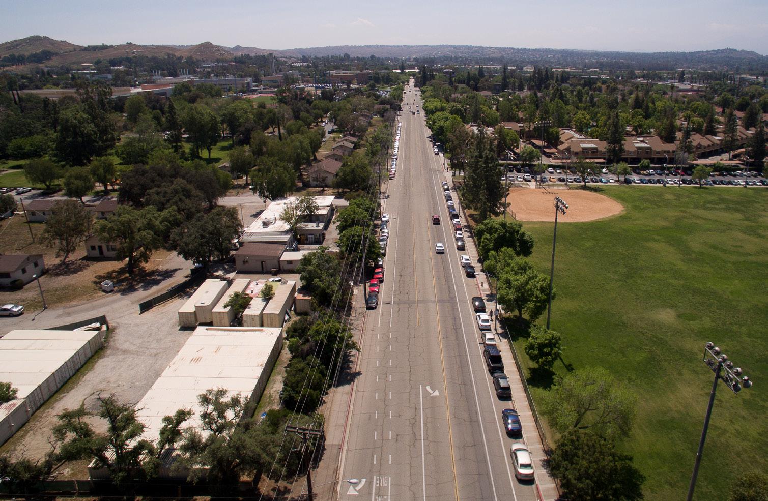
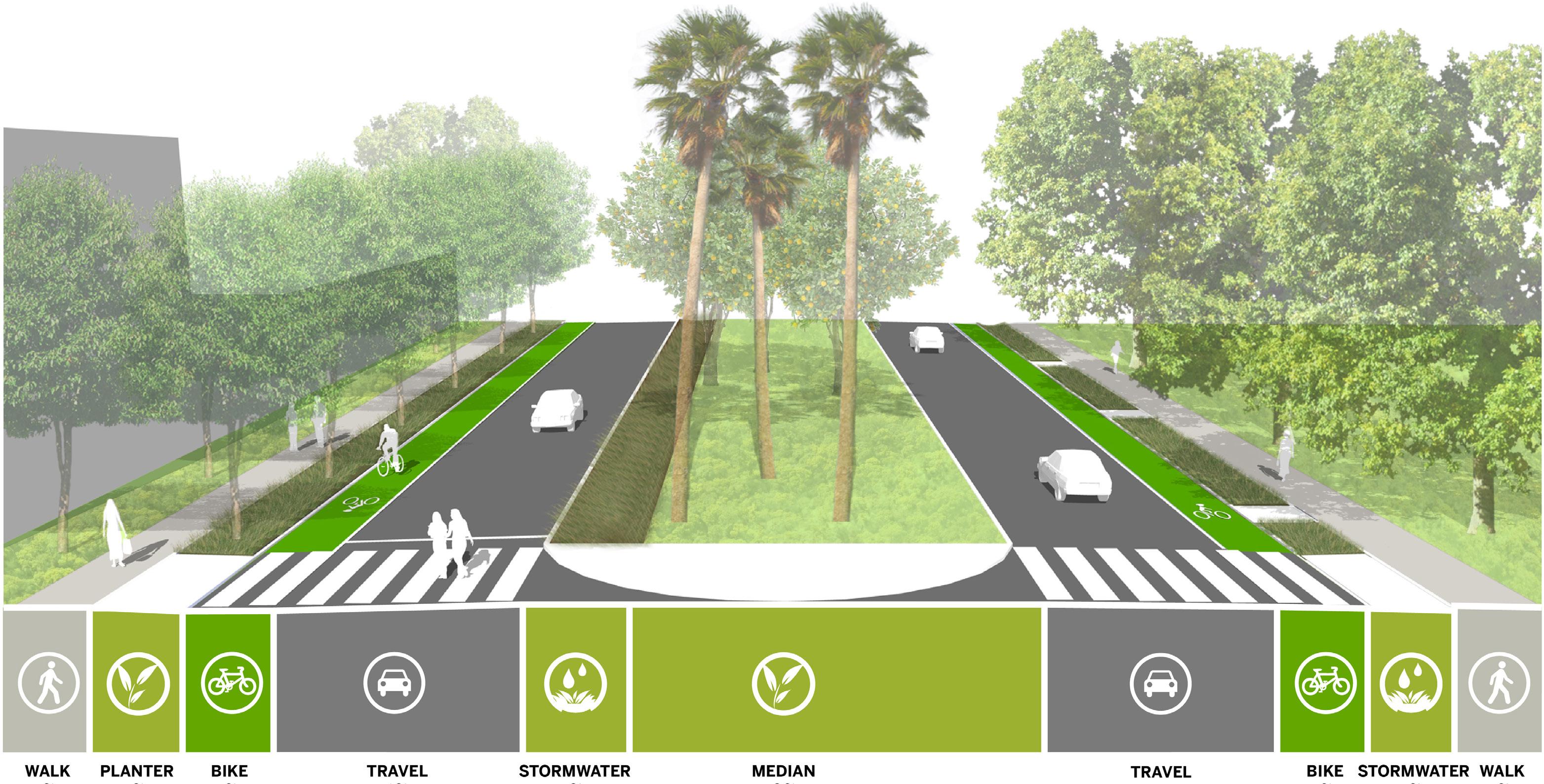
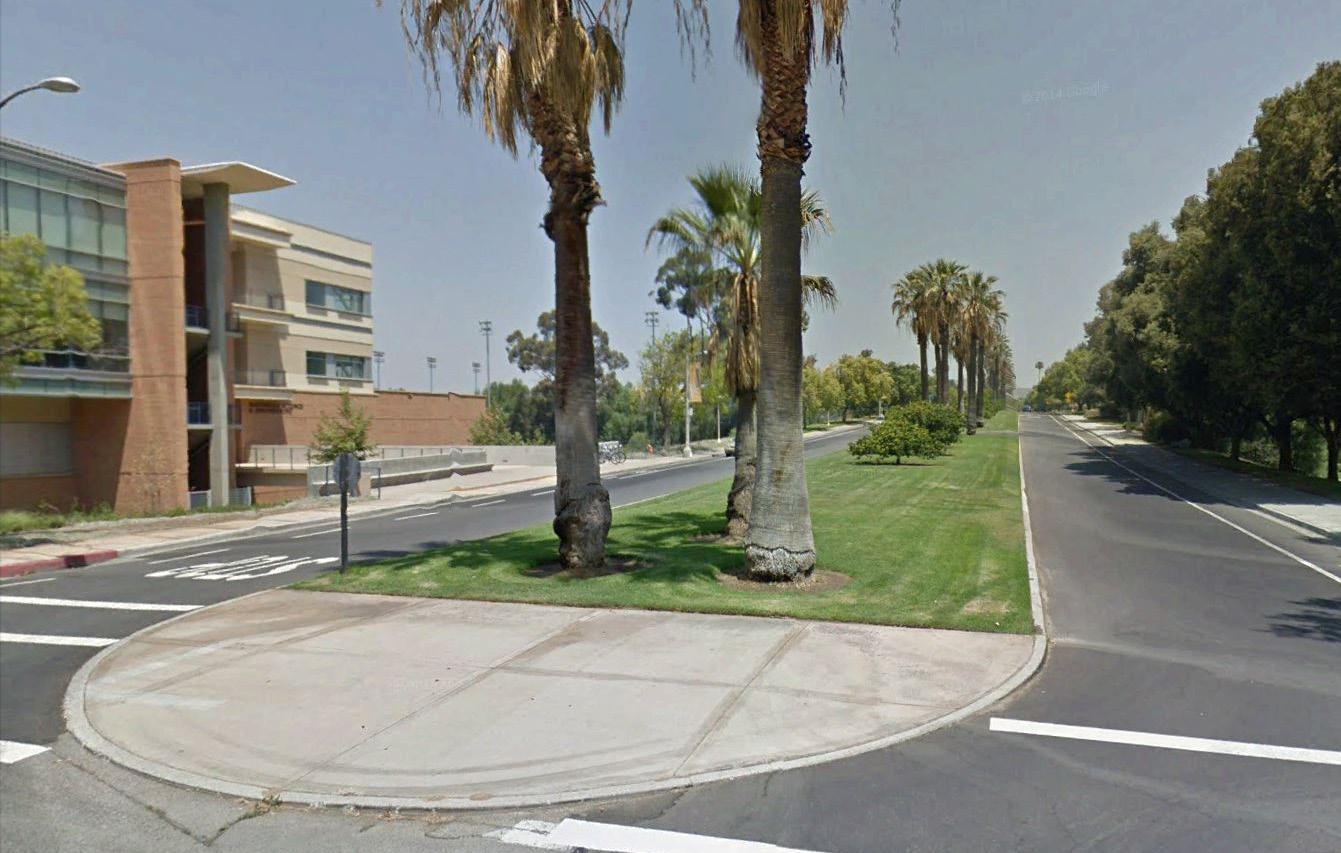
Aberdeen Drive is a campus street and has excess space, currently devoted to vehicles, that will be re-allocated. Wide travel lanes will be re-striped to add more generous bike lanes. Current curb-tight sidewalks will be replaced with wider walks separated from the roadway by planting strips with new shade trees. Within the central median, some of the legacy turf will be replaced with new drought-tolerant plantings, while retaining the signature palm and citrus trees that provide an evocative entrance to campus and honor UC Riverside’s research legacy. Within this median, linear stormwater swales will also be added to treat some of the stormwater that is conveyed in the pipe underneath Aberdeen Drive. As new housing is built adjacent to Aberdeen Drive, the campus should explore strategies to focus pedestrian crossings to specific locations to avoid cut-through paths on the median and ensure pedestrian safety.
Big Springs Road, another campus street, will also be redeveloped. It currently has bicycle lanes and a generous stormwater swale along much of its southern edge (redesigned as part of a campus flood control and arroyo restoration project.) Some of the current roadway will be reclaimed for wider walks on the north side to facilitate safer pedestrian travel from the east. Both streets have a landscaped central median that serves to enhance the identity of campus entries, but the Aberdeen median is continuous and is particularly important in expressing the character of the campus and its setting.
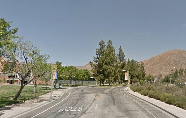
Aberdeen Drive terminates at Linden Street. As a primary corridor into the campus, it is logical to continue the alignment of Aberdeen Drive to the north as a walk for pedestrians and bicycles to access proposed student housing in the North District. This may accommodate as much pedestrian and bicycle traffic as the parallel Recreation Mall to the west. This future walk will be similar in character to Recreation Mall, with adequate width to accommodate shared circulation between bicycles and pedestrians. Benches, tables, and lighting will be located on the edges, with planting pockets interspersed. This corridor will also accommodate some open stormwater treatment swales. The future detailed design of this corridor should ensure that it provides access to adjacent recreation fields. At the transition point to the existing Aberdeen Drive, a gateway landscape feature will be designed, as well as a clear and safe crossing at Linden Street.
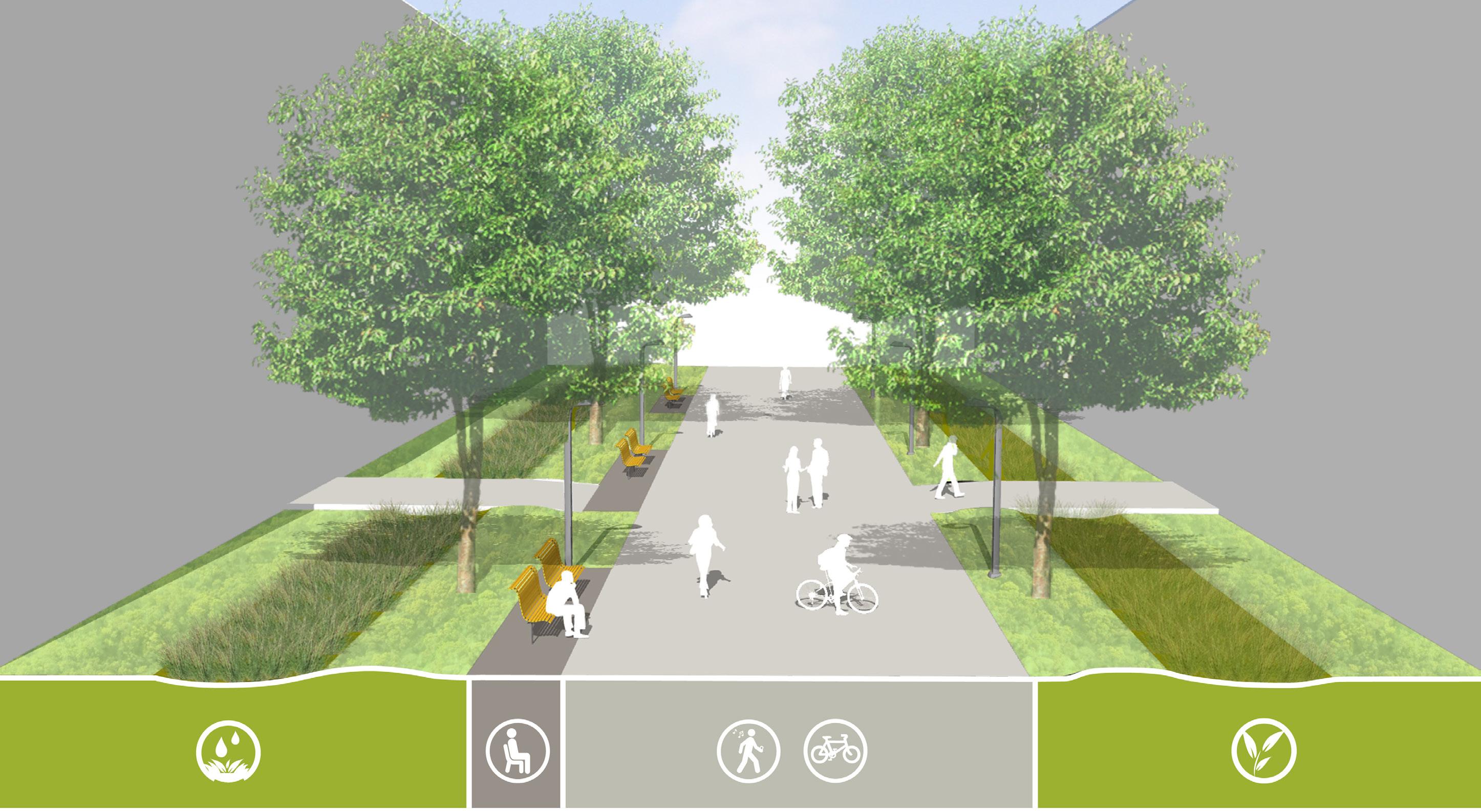
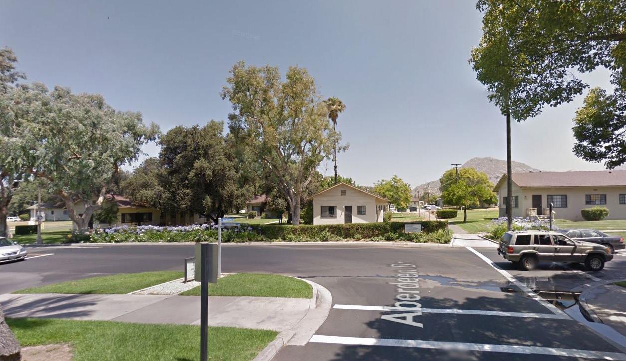

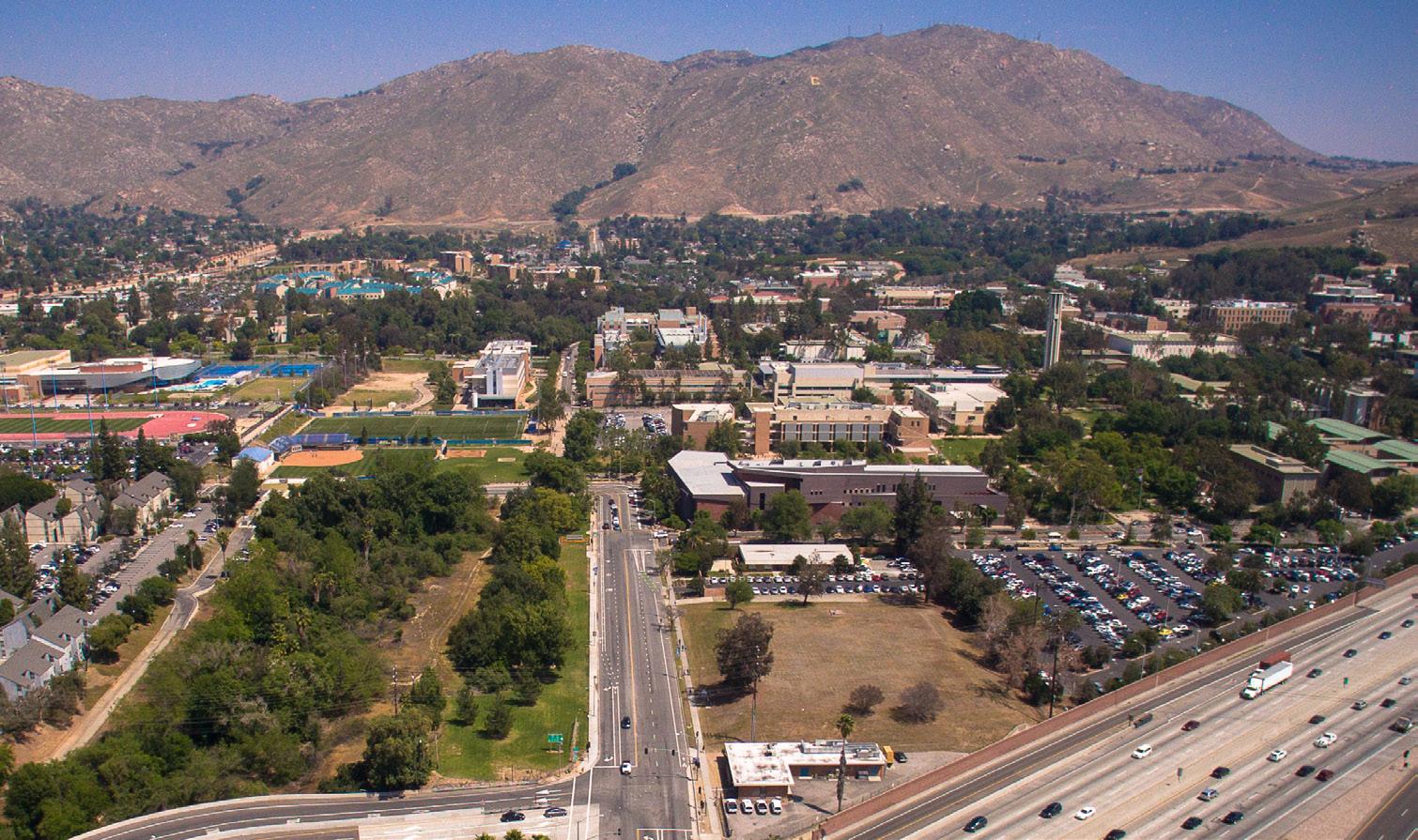
This city street, long viewed as the “front door” to UC Riverside, is the primary campus approach from downtown Riverside and from south and northbound I-215/SR-60. The roadway presently has irregular street tree plantings and excess roadway width within an approximately 80’ right of way. Pedestrian access along this route provides challenges, with narrow sidewalks and limited street crossings on a heavily-traveled corridor between the University Village area and the Core Campus. It has the potential to become an important gateway to campus with streetscape improvements. Figure 4.17 describes improvements such as a planted median, widened sidewalks (especially on the north side), new street trees and bike lanes that would not only clarify wayfinding, but also contribute to a sense of entry to the proposed Mobility Hub and the unique place that is the UC Riverside campus. The campus will work with the City of Riverside and CalTrans towards implementing improvements.
Within the campus itself, existing campus streets will be transformed into more attractive and safer multi-modal circulation elements. Campus Drive is currently a non-descript, auto-oriented street that feels like a service drive in places, particularly on the south edges of campus. Campus Drive serves as an important loop road for the campus, connecting east and west areas and linking major parking lots. With new development south of Campus Drive, this street will be more of a front door to new buildings on the southern Opportunity Sites and can help to integrate these sites with the Core Campus. The street will be improved incrementally along with adjacent building projects to provide a more pedestrian and bicycle-friendly environment. Current curb-tight sidewalks will be separated from cars with the addition of a planting strip. Space for shade trees will be added to shade the sidewalk and roadway. Existing bicycle lanes will be widened, while auto travel lanes will be narrowed to slow traffic.
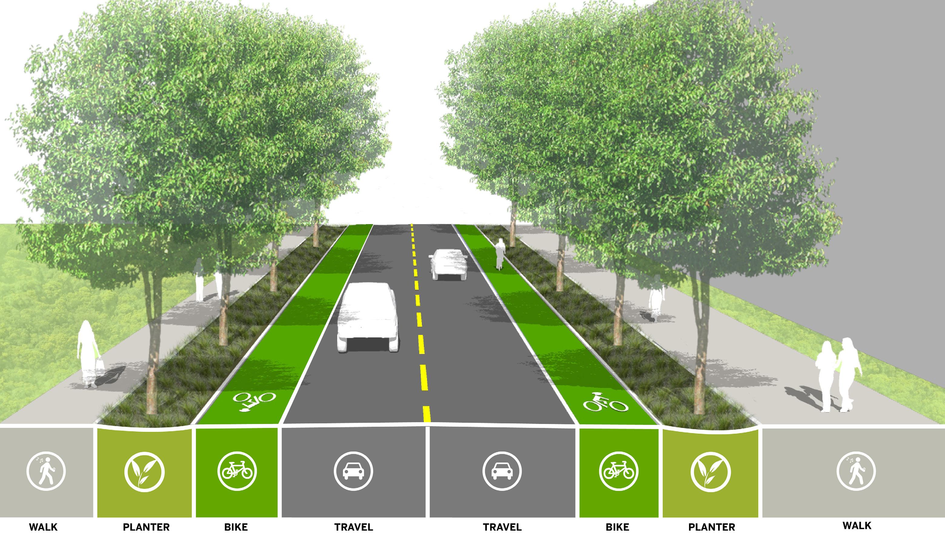
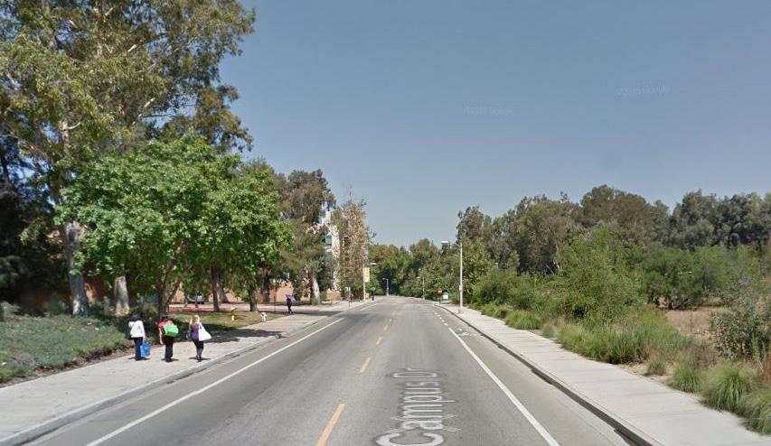
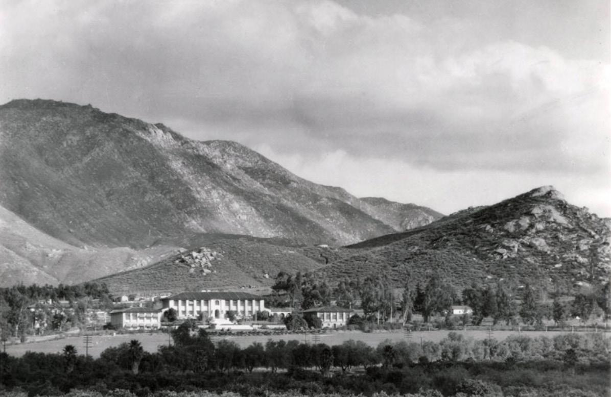
UC Riverside faculty, staff, students and visitors travel to and within campus using a variety of modes. Through the initiatives resulting from the Physical Master Plan Study, the University will improve the mobility of all people traveling to and around the campus. The proposed strategic initiatives will create a framework to guide the University’s future decisions regarding transportation policies and circulation infrastructure. These initiatives include creating a campus Mobility Hub and increasing emphasis on active transportation modes, parking management, and pedestrian access and design. The initiatives will promote environmental stewardship and travel options that are safe and accessible for pedestrians, bicycle riders, transit riders and auto users, alike.
Glossary of Terms
GHG - greenhouse gas emissions
VMT - vehicle miles of travel
RTA - Riverside Transit Agency
AVR - average vehicle ridership. The average number of occupants in a vehicle
TDM - transportation demand management
Mobility Hub - a multi-modal transportation center, including transit service and pick-up and drop-off areas
UPASS - system that allows faculty, staff and students to ride RTA busses for free
TAPS - Transportation & Parking Services
• Promote an integrated circulation framework that engenders safe passage for pedestrians and bicycle riders and accommodates automobiles efficiently.
• Recognize the increasing relevance of bicycles as a choice mode of travel and integrate desired routes with the city and campus’s circulation framework.
• Promote transit as a convenient and preferred mode of commuting to campus and connecting to community destinations by integrating it into the campus setting.
• Provide additional on-campus student housing as enrollment grows, to reduce parking demand and minimize the roadway infrastructure improvements that would be required for commuter trips.
Every day, thousands of faculty, staff, and students drive to campus in personal vehicles. These cars require parking in lots or structures, interspersed along the campus perimeter and among the campus buildings. For many persons traveling to UC Riverside, their first sight of the campus is of roadways and parking lots instead of key campus landmarks.1
The University’s projected growth provides an opportunity to create an integrated transportation and parking system that promotes the use of transit, walking, and biking. This effort extends long-standing UC Riverside policies and programs that have reduced dependence on personal automobiles since the early 2000s. With the implementation of the Master Plan Study, integrated transportation strategies will reduce greenhouse gas (GHG) emissions and vehicle miles of travel (VMT), and further UC Riverside’s goals related to environmental stewardship. Mobility strategies will also improve safety by reducing conflicts between vehicles, bicycle riders, and pedestrians.
Trends in travel modes
UC Riverside has made significant efforts to encourage the use of non-automotive travel. The University has partnered with the local transit provider, Riverside Transit Agency (RTA), to subsidize bus use for faculty, staff and students through the UPASS program. Transit ridership has increased five-fold since the UPASS program began in 2007, from 100,000 riders in the first year to approximately 500,000 riders during the 2013-2014 academic year. Due to the lack of transit infrastructure on campus, RTA has limited capacity to expand its transit service to campus. UC Riverside also provides incentives to employees to use shared ride strategies such as carpooling and vanpooling.
Due to the investments by UC Riverside to encourage nonautomobile travel, average vehicle ridership (AVR) has increased from approximately 1.36 to 1.57 occupants per vehicle over the last 15 years, as
illustrated in Fig. 5.1. Forty-five percent of UC Riverside affiliates travel to campus by modes other than single occupant vehicles, as illustrated in Fig. 5.2.
As shown in Fig. 5.3, a majority of UC Riverside affiliates reside in the areas surrounding the campus. This population cluster is an important component and beneficiary of UC Riverside’s efforts to promote alternative transportation. Trips that originate close to the campus are much more likely to be made by alternative modes of transportation than trips originating further away. Proximity to campus makes alternative transportation much more attractive, and helps to achieve the University’s overall goal to reduce single-occupant vehicle trips. In addition, students residing in on-campus housing or close by can travel exclusively by walking and biking, whether going to class, or to social and recreational activities on campus.
Currently, bicycle riders can reach campus from the surrounding areas using the on-street bike lanes along University Avenue, Big Springs Road, and Canyon Crest Drive. The City of Riverside is currently evaluating additional bicycle lanes along Watkins Drive and Martin Luther King Boulevard that will provide additional connectivity to the campus. However, once bicycle riders reach campus there are significant gaps in the bicycle network. In many instances, bicycle riders are forced to share the road with automobiles, buses, and service vehicles.
The pedestrian environment at UC Riverside, as described in Chapter 4, is generally conducive to walking to and within the campus. The pedestrian malls, building arcades, shade trees, and other elements contribute to an environment which promotes pedestrian travel in the Core Campus. However, the pedestrian network has not kept pace with changes in campus development patterns and gaps occur along some of the major campus roadways, such as Canyon Crest Drive.
Currently, UC Riverside has limited opportunities for the pick-up and drop-off of passengers in designated areas. One formal pick-up and drop-off location is near Parking Lot 1 at the west end of the Carillon Mall. Due to the lack of available options, parking lots are commonly used as pick-up and drop-off areas. There is also a significant amount of informal curb-side pick-ups and drop-offs occurring at locations such as Aberdeen Drive, near its intersection with North Campus Drive.


The goal of Alternative Transportation is to reduce the total number of single occupant vehicle trips made to campus by faculty, staff and students. This goal supports California clean-air mandates and reduces campus and community congestion.
Mobility Hub
Transit riders can arrive at campus on one of ten routes operated by RTA. Bus stops are located mostly along University Avenue, Iowa Avenue, Blaine Street, Watkins Drive, Canyon Crest Drive, and West Campus Drive. Some stops are located directly on the street, such as the stops on Canyon Crest Drive. UC Riverside currently lacks a dedicated transit station, where transit lines converge and infrastructure such as shelters, electronic signage, and maps are provided.
The proposed Mobility Hub will provide a centralized transit stop on campus, improving transit access. It will also provide the opportunity to enhance bicycle and pedestrian accessibility within the Core Campus by improving bicycle and pedestrian infrastructure in the surrounding areas. As the campus grows, the Mobility Hub will provide additional benefits as a key element of campus place-making. With the implementation of the Master Plan Study, it will be a key multi-modal transportation feature and activity center, enhancing the overall campus environment. Transit facilities and circulation within the proposed Mobility Hub are illustrated in Fig. 5.4.
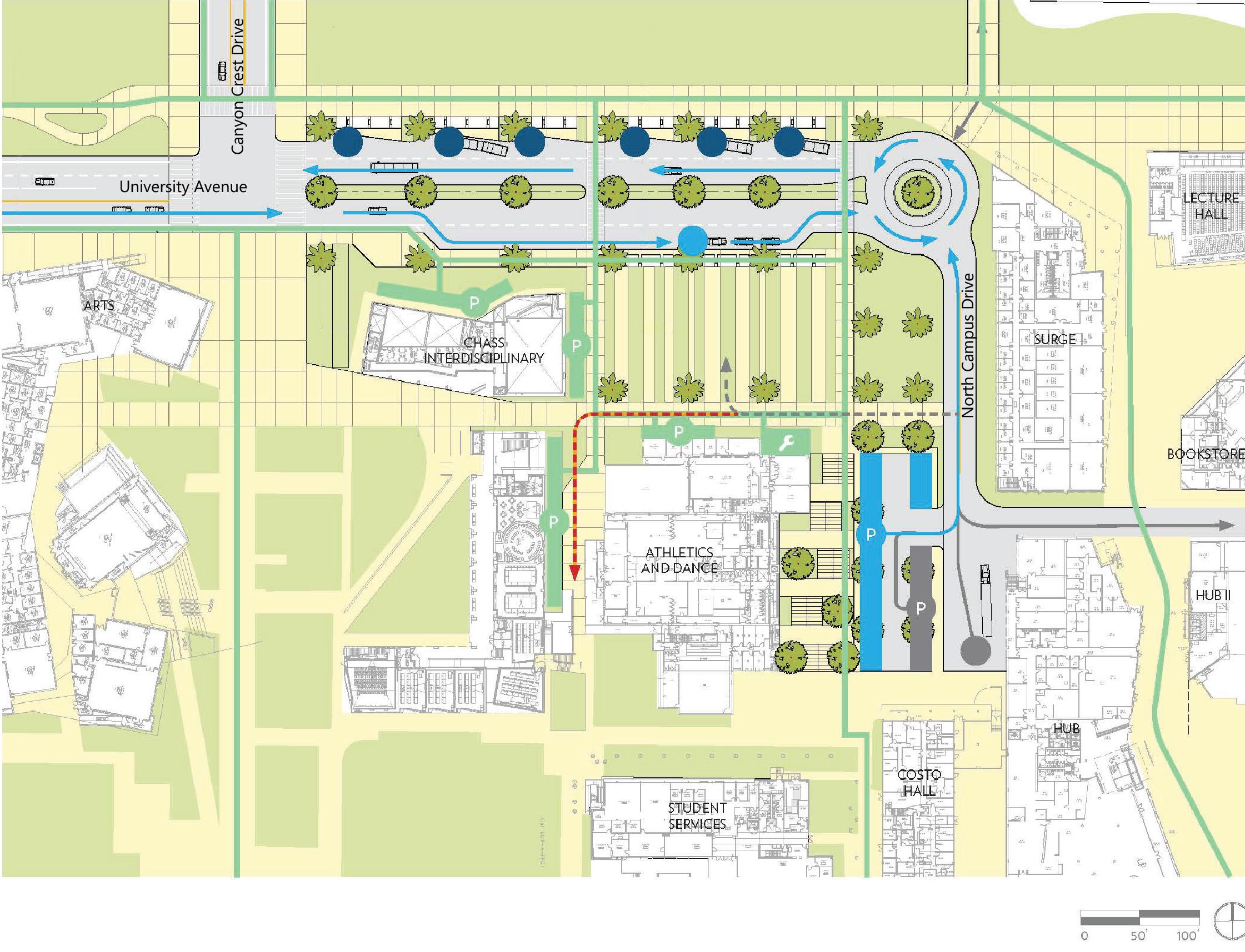
Bicycle circulation
Figure 5.5 illustrates the proposed UC Riverside bicycle network. Specific bicycle improvements identified in the Physical Master Plan Study are:
• Bicycle lanes on South Campus Drive
• Bicycle lanes on Aberdeen Drive
• Additional bicycle parking in central locations, including the Mobility Hub
• Bicycle path on the south side of Watkins Drive with current on-street bicycle lanes remaining in place
The Planning Team recommends that UC Riverside proceed with a Bicycle Master Plan Study. This study will provide a framework to make bicycle riding more convenient and appealing on campus. Through the expansion of bicycle and pedestrian networks on campus, travelers will have greater access to campus facilities, become better connected with the surrounding community, and feel safer riding their bicycles and/or walking. This study should integrate the existing and planned bicycle facilities in the City of Riverside with the campus network.
Class I Bike or Shared Use Paths provide a completely separate right-of-way and are designated for the exclusive use of bicycles and pedestrians.
Class II Bike Lanes provide a striped lane for oneway bike travel on a roadway adjacent to vehicle travel lanes and/or on-street parking.
Class III Bike Routes are designated by signs and/or shared lane pavement markings, known as sharrows, for shared use with vehicles.


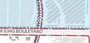
Several pedestrian enhancements are part of the Master Plan Study. Fig. 5.6 illustrates the proposed UC Riverside pedestrian network. Pedestrian improvements are as follows (see Chapter 4 for details):
• Identifying bicycle dismount zones, including one at the Mobility Hub, to reduce conflicts between bicycle riders and pedestrians
• Improving pathways such as Science Walk, Barn Walk, Arts Mall, and Eucalyptus Walk
• Providing an upgraded pedestrian environment on major streets such as University Avenue, Canyon Crest Drive, and Aberdeen Drive
UC Riverside will improve pick-up and drop-off zones through two efforts. First, the proposed Mobility Hub will contain a formal pick-up and drop-off area at the main entryway of the campus. Second, new pick-up and drop-off zones will be incorporated into the Master Plan Opportunity Sites. For example, the North Campus Opportunity Sites can provide a pick-up and drop-off zone for those entering through the Canyon Crest North Gateway. In addition, pick-up and drop-off zones will be evaluated in conjunction with the design of future parking structures on campus.


Parking supply
Over the past ten years, UC Riverside has accommodated significant growth in faculty, staff, and students with minimal increases to the number of parking spaces on campus.
Overall campus population doubled from 2005 to 2015 while the University added only 1,500 parking spaces.
As of 2016, UC Riverside has approximately 10,000 parking spaces to serve a campus population of 27,000 (faculty, staff, graduate students, undergraduate commuter students, on-campus residents), as well as service and delivery vehicles and campus visitors. The majority of these spaces are allocated for use by faculty, staff and graduate students (31 percent), followed by commuter students (29 percent), and on-campus residents (27 percent), leaving the remaining parking supply for visitors and department and service vehicles (13 percent.)
Most of the campus parking facilities are surface parking lots, with one parking structure reserved for use by on-campus residents. UC Riverside actively manages parking demand through a tiered parking permit system in which users purchase permits to access various parking facilities based on their affiliation with the campus. While this allows the campus to allocate parking based on campus affiliation, parking spaces cannot be easily redistributed as parking demand shifts throughout the day or academic year. Fig. 5.7 illustrates the existing parking lots and parking supply.
The University currently oversells parking permits (more permits than spaces) to maintain optimal usage levels of existing parking facilities.
Despite the overselling of parking permits, the campus still has available parking supply on a typical weekday. On average, 67 percent of parking spaces are occupied on campus.
Fig. 5.8 illustrates the utilization of parking on campus. Several lots have a high occupancy rate (over 85 percent), while other parking lots further from the Core Campus have less than a 60 percent occupancy rate during peak periods. These utilization rates indicate a higher demand for parking in the Core Campus area. While parking capacity is available on campus, it may not be provided in the areas most convenient for faculty, staff, students and visitors.
Campus residents have access to 2,670 parking spaces, which comprises 27 percent of the overall supply of parking on campus. One out of every four undergraduate residents (25 percent) purchases a parking permit in comparison to one out of every two and one-half undergraduate commuter students (40 percent).
Residential parking lots currently have an occupancy of approximately 56 percent, leaving nearly 1,200 parking spaces available each day.
Freshman are allowed to purchase parking permits when residing on campus, which sets UC Riverside apart from several other universities.
One of the key components of managing the demand for parking at UC Riverside is the TDM program. TDM strategies are aimed at reducing reliance on driving to campus through effectively providing alternative travel options. To reduce the demand for parking and vehicle trips on campus, UC Riverside operates several programs to encourage the use of transit, ridesharing, and active transportation modes, such as walking and bicycling.
Parking management plan
As the campus grows, both in terms of population and physical space, the existing parking system will change due to two factors:
• Parking demand, including parking needs by user type, will be affected by the growth in faculty, students, and staff, and by an increase in student housing.
• Some surface lots will be replaced by new buildings.
UC Riverside can respond to this change in supply and demand by strategically managing parking. Providing the optimal amount of parking will require the development of a Parking Management Plan, given that there are significant downsides to providing too much or too little parking on campus. Excess parking can result in the following:
• Parking areas consume land and funding that could otherwise be used for academic buildings and open space.
• Additional impervious surface creates greater challenges for stormwater management and treatment.
Parking supply
If the current parking demand rate was applied to Master Plan Study growth projections, parking utilization on campus would be 100 percent in comparison to today’s utilization of 67 percent. When planning for new parking facilities it is common to aim for a parking utilization of 90 percent. This allows for parking turnover to occur throughout the day with a buffer for peak periods. For use in the UC Riverside Master Plan Study, two parking demand factors were considered to capture a range of future parking needs (a low of 80 percent and high of 90 percent utilization).
If the current parking supply rates were to continue to be implemented to accommodate campus growth, the parking supply on campus would be underutilized and the campus would likely invest in more parking infrastructure than actually needed. Therefore, the Planning Team developed a more realistic parking forecast based on the number of vehicles actually parked on campus on a typical weekday in relation to the current population.
On the lower end of the range, minimal new parking will be needed to accommodate growth (fewer than 300), whereas at the higher end of the range, nearly 2,200 new parking spaces may be needed.
The parking opportunities in the Master Plan Study consider the following:
• Implement Strategic Initiatives to reduce the need for faculty, staff and students to drive to campus.
• Identify TDM strategies in support of the Strategic Initiatives to further reduce the need for new parking on campus.
• Identify opportunities for new parking on campus to accommodate future needs if demand management strategies are not as effective as desired or other demographic and economic trends result in changes to parking demand (e.g., gas prices continue to decline, the next generation of students likes driving more than millennials do, etc.)
• Consider the geographic distribution of parking on campus, need for convenient parking in the Core Campus, and new facilities that may have unique parking needs, such as the planned Campus Events Center.
Implementation of the Master Plan Study will result in the elimination of several surface parking lots in the Core Campus. To replace the eliminated parking spaces, new parking structures may be constructed. Fig. 5.9 illustrates the parking envisioned in the Master Plan Study. New parking structures may be constructed for the proposed additional student housing and Campus Event Center, along with additional parking on Lot 30. The Master Plan Study estimates the campus could create a net gain of up to 2,580 parking spaces on campus.
Some specific benefits of this parking approach are as follows:
• Providing less parking in the future than currently prescribed by the existing supply ratios will create further incentives towards the use of alternative travel modes.
• New parking structures will be easier to manage and operate than dispersed parking lots, particularly for faculty and staff parking. As Opportunity Sites are developed, UC Riverside will be able to better manage changing parking demands in the larger, centralized parking structures.
The construction of parking structures will create additional debt for parking operations and increase permit prices.
The parking recommendations are based on current travel behavior and the current parking programs at UC Riverside. Further changes in driving behavior could result in fewer persons driving to campus beyond the reductions seen in the past 10 years.
Underutilized resident parking can be reallocated to other uses, such as faculty, staff, commuter student and visitor parking. This reallocation in
parking supply can help to serve the growth envisioned in the Master Plan Study. In addition, UC Riverside could restrict freshman on-campus residents from bringing their cars to campus, similar to several other UC campuses, such as UC Davis and UC Santa Barbara. Since freshman on-campus residents consume most of the current residential parking supply, not allowing freshman on-campus residents to purchase campus parking permits will help to further increase parking supply for other campus users.
Additional TDM strategies will be utilized by UC Riverside to support the Strategic Initiatives of the Master Plan Study. Fig. 5.10 summarizes these strategies. The combination of TDM strategies and the Strategic Initiatives listed above will help to promote a multi-modal environment at UC Riverside, decrease personal automobile use, and improve safety on campus.
# Strategy Summary
1 On- and Near-Campus Housing and Amenities
2 Parking Management
3 Metrolink Service
4 Car Sharing
5 Emergency Ride Home Program
6 Active Transportation
7 Annual Monitoring and Evaluation
8 Resident Parking
9 Parking Pricing
Prioritize investments in on-campus housing and amenities to eliminate the need for students to drive to campus
Create a parking management program to monitor demand and reallocate supply as growth occurs
Create a rebate program for commuters using Metrolink and promote the extension of the 91/ Perris Valley Line
Expand and diversify on-campus car sharing, especially for campus residents
Expand current program to include graduate students
Provide amenities to encourage more trips by biking and walking to campus, such as bike share, bike centers, and bike repair stations
Implement annual monitoring and evaluation program to determine effectiveness of TDM strategies and need for new facilities
Restrict permits available for residents living on campus, including restrictions for freshman parking
Increase permit pricing to fund new parking structures serving the Core Campus
Service routes are currently provided throughout the campus. They typically coexist with pedestrian pathways and roadways shared with bicycle riders in the Core Campus.
There are two primary challenges with the current service vehicle routes at UC Riverside. First, there are several significant conflict areas where service vehicles, bicycle riders, and pedestrians commingle, such as by the HUB and the Bookstore. Secondly, many service and loading locations only serve a single building instead of servicing multiple buildings from a single location. Therefore, service locations proliferate through campus, meaning that service vehicles often have to make multiple trips.
There are also several examples on campus of buildings that have existing service facilities that are no longer necessary. Some examples of this are the Rivera Library, the Bookstore, and the Geology Building. All of these buildings currently have loading docks designed for large truck deliveries, which are no longer utilized due to changes in their delivery needs.
Reconfigure service routes and loading areas
Fig. 5.11 illustrates the service access proposed in the Master Plan Study. New service areas will be incorporated into the Opportunity Sites as redevelopment occurs.
Service route improvements around the Mobility Hub, specifically, will include:
• Providing direct access to campus facilities and avoiding circuitous routes for service vehicles.
• Restricting delivery vehicle access through the construction of a gate adjacent to the Bookstore at the end of the current service drive. This gate will allow emergency vehicle access but restrict vehicles from entering the Commons Mall.
The Planning Team recommends that UC Riverside study the potential for service to enter campus adjacent to the Pierce Hall loading area. This would allow vehicles on the Commons Mall to be completely eliminated. The grade of this area would need to be factored into the feasibility of providing service vehicle access.
A comprehensive solution is the provision of service courtyards for new buildings or redeveloped existing buildings. Service courtyards will be incorporated into the Master Plan Opportunity Sites. For example, the North District can provide a centralized courtyard to serve multiple buildings. Service vehicle and accessible parking can be provided as well. These service courtyards provide a significant amount of flexibility, allowing the space to be reconfigured as the service and loading needs of buildings change over time. This joint-service approach reduces potential conflicts between bicycles, pedestrians, and service vehicles.
• Centralized access: Transit access to the campus will be significantly improved with the Mobility Hub. Currently, most RTA buses load and unload on Canyon Crest Drive at locations remote from the Core Campus. The Mobility Hub is embedded into the fabric of campus, near key destinations such as the Highlander Union Building (HUB).
• Better bus operations: RTA buses stopping on Canyon Crest Drive have to extend their routes after dropping off passengers, as they are unable to turn around at the final stop. The Mobility Hub will provide a turn-around, allowing buses to reduce their travel time to and from campus. With a reduction in travel time, the same number of RTA buses can provide higher frequency service.
• Multi-modal access: The existing pick-up and drop-off locations provide access to sidewalks but limited connections to other modes. The Mobility Hub will consolidate modes such as bike riding and car sharing, allowing a person to exit the bus and directly connect to these other types of travel.
• Better connectivity to the Riverside community: As transit service improves, there will be more opportunities for students, particularly those that live on campus, to use transit to connect to other areas in Riverside. Local destinations such as Downtown Riverside will be more accessible to these on-campus students, providing additional cultural, dining, and recreational opportunities. In addition, bus service can provide access to the future Metrolink station at Hunter Park.
• VMT/GHG reductions: As persons traveling to and from UC Riverside use transit with greater frequency, there will be a proportionate reduction in vehicular trips. This reduction will
reduce VMT and GHG, consistent with State regulations and UC policy. Diverting personal automobile trips to carpooling, vanpooling, transit, bicycling, and walking will also reduce fossil fuel consumption.
• Synergy with emerging technologies: The transportation field is undergoing a transformative change as new technologies and strategies are being developed and deployed. Mobile phone applications that tie transit with car sharing and bicycles are widely available and will continue to be heavily used in the future. Providing a high level of multi-modal connectivity will increase mobility choices. Autonomous vehicles can also be integrated into the University’s transportation system as they become more commonplace.
• Parking management: Effectively managing existing and future parking resources will reduce the number of new parking spaces required, protecting available land resources for academic buildings and open spaces.
• Bicycle and pedestrian circulation: Dedicating facilities for bicycle riders and pedestrians will improve their overall safety by protecting them from vehicular traffic.
• On- and near-campus housing: Enabling more students to live on or near campus will help to minimize the amount of new parking required as the campus continues to grow and will allow more students to walk and bike to classes instead of driving.
Campus life is supported by a physical network of buildings and infrastructure systems that manage the energy and water flows on campus. It is critical that these systems reliably support existing campus operations and allow for future expansion. The UC system’s Sustainable Practices Policy places strict requirements on campus energy and water systems, including carbon neutrality from operations by 2025, a 20% per-capita water use reduction by 2020, followed by an additional 36% reduction of the same by 2025.
This Master Plan Study provides guidance for the planning of campus buildings and infrastructure systems such that future growth can be reliably supported and environmental goals met. This involves balancing the cost and resource savings advantages of combining existing systems with the efficiency gains that can be made by implementing new systems.
Glossary of Terms
Energy Efficiency Measure (EEM) - A modification made to a building’s systems or operation that is intended to reduce annual energy consumption
Energy Use Intensity (EUI) - A building’s annual energy use, as consumed on-site, measured in kBtu/ft2/year
Solar Heat Gain Coefficient (SHGC) - The fraction of incident solar radiation admitted through a window, both directly transmitted and absorbed and subsequently released inward
Solar fraction - The ratio of solar energy input to total energy input (normally including natural gas) in a solar powered system
Thermal Mass - High thermal capacity building constructions, such as brick or concrete, that can reduce internal temperature fluctuations by usefully absorbing and releasing heat over time
• Reduce building carbon emissions, increase energy efficiency in current building stock and design highly efficient new buildings, such that specified Energy Use Intensity (EUI) targets are met
• Increase redundancy in the campus power network, employ a combination of building energy efficiency upgrades, local photovoltaic (PV) generation, and demand side management, to reduce load on existing feeders and sub-stations
• Connect new Core Campus buildings to the existing chilled water network and consider replacement of existing chillers with high-efficiency magnetic bearing models
• Study the costs and benefits of decommissioning the steam network and transitioning to supplying the majority of campus heating needs through localized electric heat pumps for significant carbon savings
• Develop an integrated approach to stormwater management and quality by adopting a campus-wide approach and identifying opportunities for multiple benefits
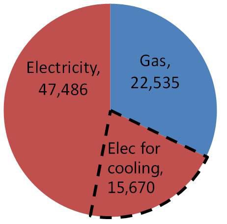
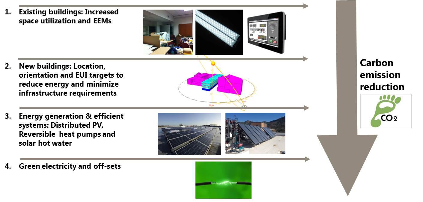
1“Electricity for cooling” is a calculated value based on campus building energy models only, as no annual campus cooling data was available. “Electricity” and “Gas” are numbers quoted from campus utility bills. “Electricity” includes all electricity, including that devoted to cooling. Campus fleet emissions are not included but these are small in comparison to built environment emissions, 1764 MtCO2e.
In the fiscal year 2014/2015, the university consumed 123,900 MWh of electricity. Of this, 3,900 MWh was generated by the West Campus PV farm; the rest was supplied by Riverside Public Utilities. During the same period the campus consumed 3,900,000 therms of natural gas. This energy use is responsible for the release of around 67,000 MtCO2e (assuming 824 lb CO2/MWh electricity and 117 lb CO2/MMBtu natural gas.) Fig. 6.1 shows the amount of carbon emissions produced by electricity used for cooling.
In order to reduce campus carbon emissions to zero by 2025 an integrated approach is needed to improve campus efficiency while supporting campus growth. This Master Plan Study outlines a menu of options that can bring the campus’s power, cooling, and heating carbon emissions to carbon neutrality, while increasing system redundancy where necessary. This begins with addressing energy efficiency in existing buildings and moves through proposed new buildings, campus level heating and cooling efficiency, on-site renewables and the purchasing of Renewable Energy Certificates (RECs) and offsets. Fig. 6.2 shows this process.
The other major component of campus infrastructure planning is water. A campus-wide approach to the water system and sanitary sewer system infrastructure analysis allows the University to comprehensively review the systems to determine areas for recommended improvements, upgrades and conservation opportunities.
University stormwater management analyses and recommendations are provided to ensure future development helps the University comply with its permit requirements and that best management practices are properly implemented.
The carbon modeling process consisted of creating energy models of each building typology for annual heating, cooling, and power demands (described in more detail in the Energy Modeling section below.) These demands were multiplied across existing and future campus program areas in order to predict campus demands in 2025. The Planning Team then constructed a campus carbon model by assuming the following:
• No major existing building renovations
• New buildings built to Title 24 California Energy Code minimum standards
• All existing and new core buildings to be connected to the chilled water network with no changes made to chilled water central plant
• All existing core buildings to remain connected to the steam network with no changes made to the steam plant
• All new buildings to be heated by local gas-fired condensing boilers
The model yielded a predicted, business-as-usual carbon emission figure. Those measures, when individually applied and compared to the baseline, are characterized by a total campus carbon emission reduction as a percentage of the baseline total. This provides a clear metric with which to compare reduction measures. The heating and cooling sections below analyze system options through their carbon reduction potential as well as their ability to reliably support campus expansion.
By combining building level measures with suggested campus heating and cooling strategies, a potential whole-campus carbon reduction strategy can be implemented. Fig. 6.4 outlines a series of step-wise reductions.
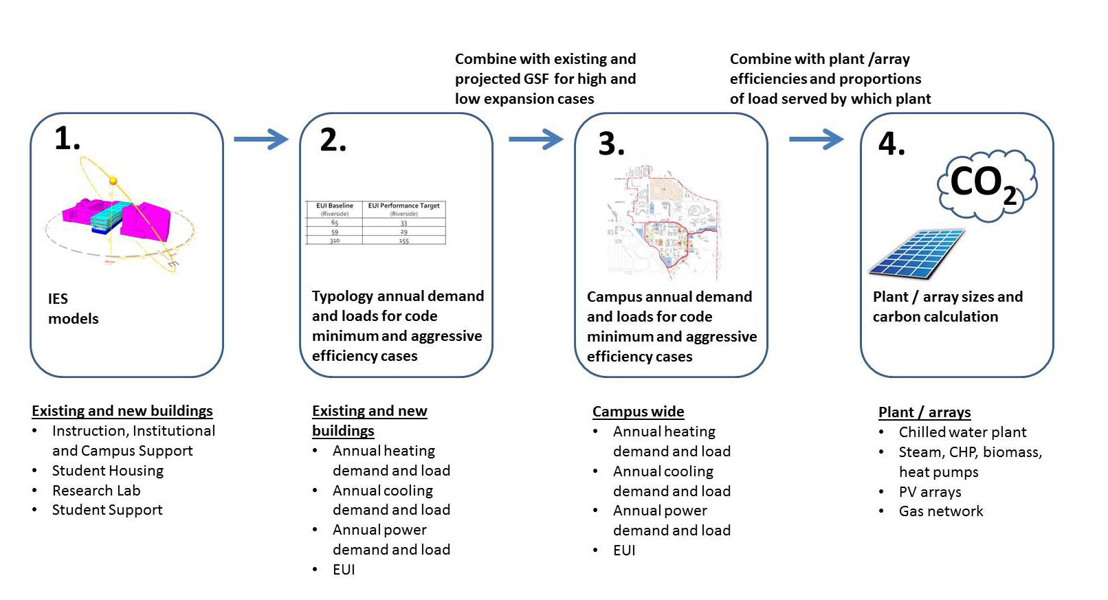
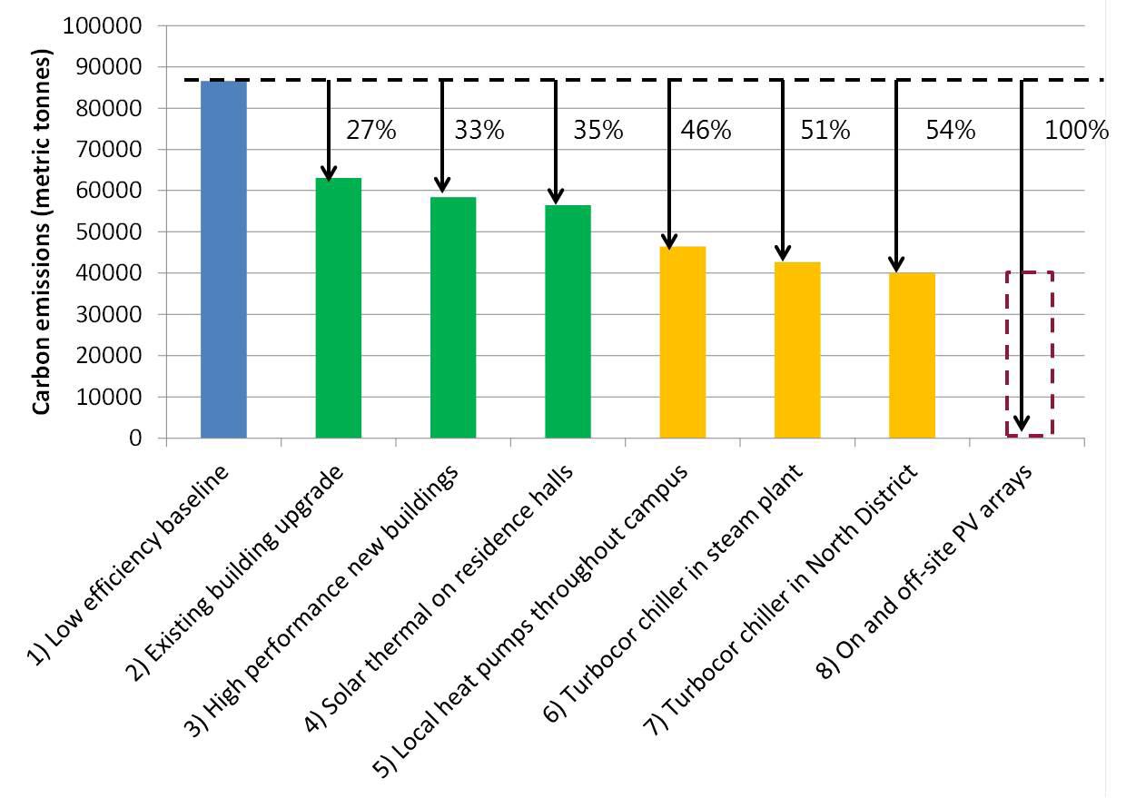
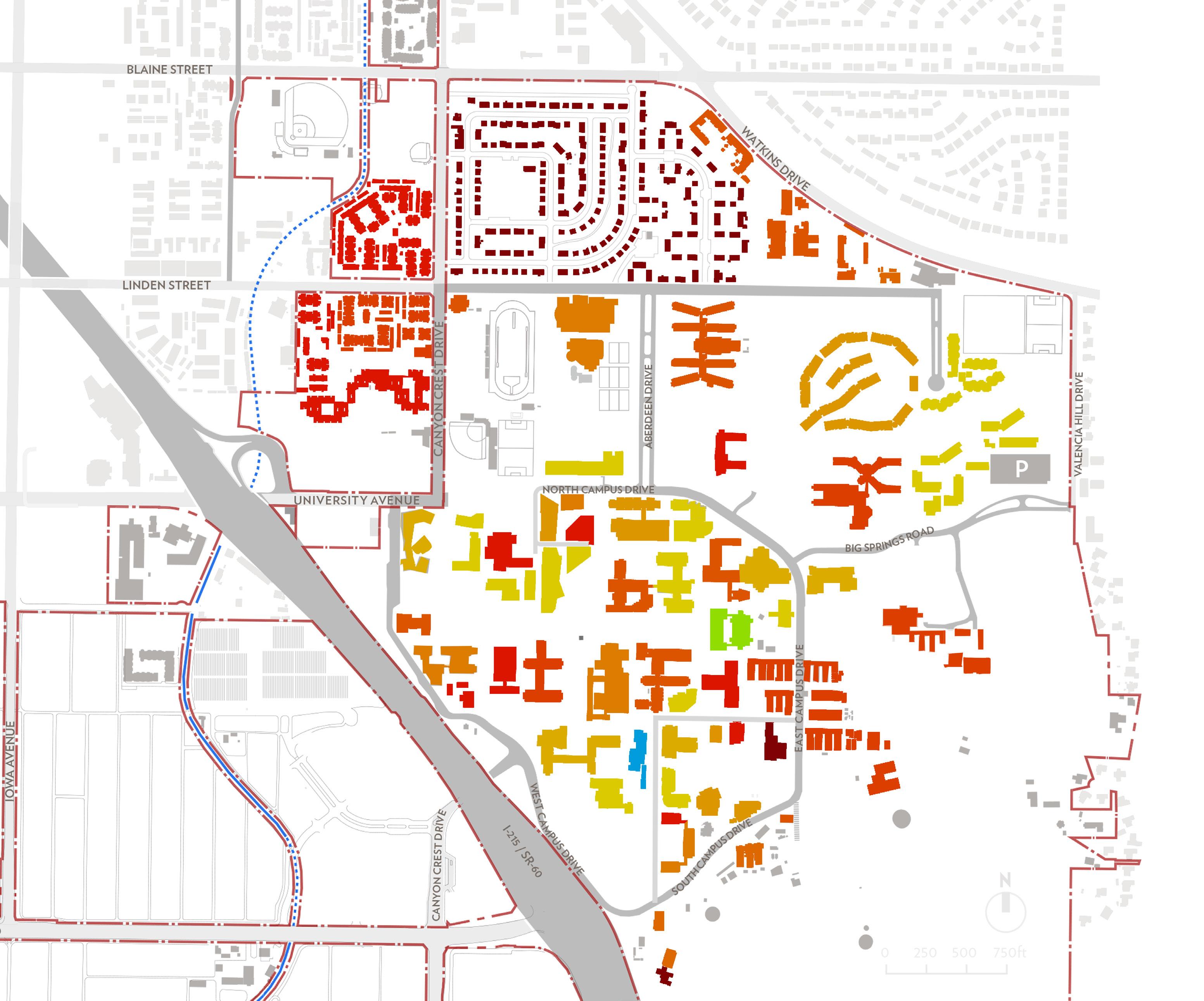


Buildings on campus generally range in construction time period from the 1950s to the present day and may be divided into 4 main typologies, listed below with their approximate proportions of total campus floor area indicated.
• Instruction, Institutional and Campus Support (this includes administrative and faculty buildings with offices, not laboratories)
• Research Lab
• Student Housing
• Student Support (this includes sports facilities and dining)
Some major renovations and minor upgrades have been made over the life of the campus resulting in a broad range of systems and envelope quality. An investigation into the state of current campus buildings was undertaken, which included auditing 14 campus buildings in accordance with ASHRAE (American Society of Heating, Refrigerating and AirConditioning Engineers) Level 1 requirements. The buildings varied in terms of age, scale, and typology so as to cover the range on campus. The Planning Team combined the audits with a building-by-building review conducted with the University facilities team. The quality of all building lighting, mechanical systems, and controls were scored from 0 to 5. Scores were then averaged for each building and mapped onto campus buildings, as displayed in Fig. 6.5.
This provides an overview of the state of building systems, highlighting those that are performing inefficiently, those that require some level of upgrade, and those that require little to no improvement.
The list of buildings audited is as follows:
• Psychology Building
• School of Medicine Research Building
• Olmsted Hall
• Hinderaker Hall
• Campus Greenhouses
• Chemical Sciences
• Geology Building
• Orbach Science Library
• Pierce Hall
• Campus Surge
• Highlander Union Building (HUB)
• Materials Science & Engineering Building
• Glen Mor
• Aberdeen-Inverness Residence Hall
The results of the audit and review reveal that there is an opportunity to renovate existing buildings to raise efficiency and reduce the campus carbon footprint, as well as reduce peak power loads, thus relieving pressure on stressed feeders and sub-stations (see Section 6.6 for more details.)
In order to determine the extent to which existing building renovations and efficient design of future buildings can lower annual energy use, the Planning Team used the energy modelling software IES VE to construct six building energy models:
• Existing Instruction, Institutional and Campus Support
• Existing Student Housing
• Existing Student Support
• New Instruction, Institutional and Campus Support
• New Student Housing
• New Student Support
All models were 37,000 st2 and had the same geometry. Existing models were constructed to represent the average building of that typology on campus in terms of envelope, mechanical systems, and lighting. New models were constructed to meet Title 24 California Energy Code prescriptive requirements for envelope, mechanical systems, and lighting. The Planning Team then used these models to simulate the dynamic energy performance of the buildings over an annual period, using the typical meteorological year weather file for Riverside.
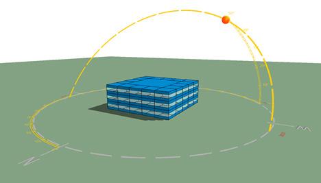
Because building-level consumption data was not available, the validity of the existing building models was assessed by aggregating across the whole campus. This was done by deriving peak and annual heating, cooling, and power loads from each model, then normalizing with respect to floor area allowed loads and energy to be multiplied across the entire floor area of each typology on campus, to determine annual campus loads, then compared to campus electricity and gas usage. This comparison can be seen in Fig. 6.7. The deviations were within the acceptable range for the method employed.
recorded data
After validation, the models’ peak and annual heating, cooling, and power were recorded. Energy Use Intensity (EUI) figures were also derived. These EUIs were compared to the UC system’s 1999 EUI benchmarks in Fig. 6.8.
The models were then adjusted to represent the application of a package of energy efficiency measures. This allowed prediction of ambitious but achievable EUI targets for each building typology. This was done for both existing building and new building models. The strategies described in the following sections indicate measures that could be applied to reach those target EUIs.
Existing buildings can achieve peak load and annual energy reductions through a range of Energy Efficiency Measures (EEMs). These EEMs can bring the building EUI down to more efficient levels. Fig. 6.8 shows UC system 1999 benchmark EUIs, modeled current building EUIs (taken to apply to the average building in each typology) and modeled target EUIs.
UC System 1999 EUI benchmarks (kBtu/ft2) Modeled average existing building EUI (kBtu/ft2) Modeled target EUI (kBtu/ft2)
measures from mechanical, lighting and envelope categories. Major envelope upgrades will tend to have a longer payback period and may not be practical. For major single building renovations, the building must be subject to an ASHRAE level 2 or 3 audit, in order to determine the specific EEM package to be applied.
The following order is suggested as a building upgrade program outline, that prioritizes the largest and most cost-effective EEMs so that EUI targets are reached most quickly:
1) Major renovation of the worst performing Research Lab buildings
2) Lighting system upgrades across campus
3) Major renovation of the worst performing Instruction, Institutional and Campus Support buildings
4) Major renovation of the worst performing Student Housing
This order is a general guide. Once buildings are assessed in more detail, a detailed upgrade program may be established. This could prioritize the upgrade of poorly performing student housing buildings if they are found to yield a particularly high savings potential.
The lists below describe building measures that could be applied to achieve target EUIs.
In order to make the largest and most cost-effective energy savings, the largest and most inefficient energy users should be targeted first. The largest energy users are the laboratories, because of their high ventilation requirements and, to a certain extent, their process loads. The most inefficient energy users are the older, under-renovated buildings on campus. Therefore, the older laboratories that have not received a major renovation within the last 15 years should be targeted for energy savings first. The EEMs may be divided into 3 categories:
• Lighting
• Mechanical systems
• Envelope
Generally, in older buildings that have not recently been renovated, it will be more cost-effective to implement selected mechanical and lighting upgrades, but any package of measures could include a range of
The following measures have been identified in response to the audits and building review conducted. EEMs are intended to improve currently under-performing systems/components, where they were found. See the Building Audit Report, in the Appendix, for more details on current conditions.
Mechanical systems for research labs:
• Convert any constant air volume (CAV) systems to variable air volume (VAV) systems for large fan power savings
• Create and enable economizer control on all VAV systems
• Install heat/energy recovery on exhaust. This is particularly important in laboratories, which have a high heat load due to high ventilation rates
• Re-zone mechanical systems, where appropriate, to reduce reheat requirements and improve thermal comfort
• Replace or seal leaky ductwork to reduce losses and fan power
• Insulate ductwork where practical
• Shade all unshaded rooftop ductwork where practical
• Insulate all chilled water and heating hot water pipework in buildings
• Insulate or replace all uninsulated chilled water and steam heat exchangers
• Install variable frequency drives (VFDs) on all air handling unit (AHU) fans, chilled water pumps and heating hot water pumps to allow systems to modulate output and save energy during low load periods
• Install a centralized building energy management system (for mechanical and lighting systems) with direct digital controls (DDC), where not currently found. Target the largest campus buildings first
• Remove all electric resistance heating
• Install occupancy sensors on all fume hoods
• Enable sash-interlocked, constant face velocity fume hood control
• Install VAV systems interlocked with fume hood exhaust for effective turndown of supply air
• Install low static pressure control valves
• Implement wind velocity based exhaust exit velocity control
• Optimize HVAC zoning between wet labs, dry labs and office spaces
Lighting for all building typologies:
• Implement lighting upgrades to achieve a 25 percent improvement over California Building Code requirements
• Implement enhanced daylighting measures, which could include refractive films or light shelves, heliostats, light-wells, solar tubes or fiber-optic collectors
• Replace all light fixtures with light emitting diodes (LEDs)
• Install vacancy sensing controls throughout
• Install daylight dimming controls in perimeter spaces that receive sufficient daylight for dimming to regularly occur
• Install centralized lighting management systems in all buildings over 50,000 ft2
• Implement a “lights off” policy at night (possibly with incentives)
Lighting for instruction, institutional and campus support buildings:
• Install low power lighting, utilizing low ambient light levels with task lighting, daylight dimming and vacancy sensing
Mechanical systems for instruction, institutional and campus support buildings:
• Several constant air volume systems remain on campus. Convert any CAV to VAV systems for large fan power savings
• Apply demand control ventilation (DCV) to greatly reduce fan power in laboratories and offices during unoccupied periods
• Create and enable economizer control on all VAV systems
• Install heat/energy recovery on exhaust
• Re-zone mechanical systems, where appropriate, to reduce reheat requirements and improve thermal comfort
• Replace or seal leaky ductwork to reduce losses and fan power
• Insulate ductwork where practical
• Shade all unshaded rooftop ductwork where practical
• Insulate all chilled water and heating hot water pipework in buildings
• Insulate or replace all uninsulated chilled water and steam heat exchangers
• Install VFDs on all AHU fans, chilled water pumps and heating hot water pumps to allow systems to modulate output and save energy during low load periods
• Install a centralized building energy management system (for mechanical and lighting systems) with DDC, where not currently found. Target the largest campus buildings first
• Remove all electric resistance heating
• Install local condensing boilers to replace steam network connection
Mechanical systems for student housing:
• Convert heating and cooling systems to variable refrigerant flow (VRF), radiant or hydronic fan coil systems
• Insulate all chilled water and heating hot water pipework
• Install VFDs on all chilled water and heating hot water pumps
• Install a centralized building energy management system unless living units are served by single-zone units
• Remove any electric resistance heating
• Replace any non-condensing boilers with condensing boilers
Envelope upgrades for all building typologies:
• Many older campus buildings have glazing that does not control solar gain through selective reflection of infra-red and ultraviolet light. This raises building cooling loads if not shaded effectively. Where practical, solar film should be applied (target 0.22 solar heat gain coefficient (SHGC)) or external shading installed (to effectively meet the equivalent SHGC target) on glazing units that admit a high level of solar radiation
• Heating load from overnight and morning warm up is found to be a particular problem at UC Riverside. Draughts from leaky building envelopes greatly increase unwanted building heat loss and gain. High infiltration doors and windows should be replaced to reduce infiltration to a perimeter space target of 0.25 to 0.1 air changes per hour (ACH), dependent on envelope.
• UC Riverside buildings receive an extremely high amount of solar gain through their roofs due to the high number of sunny days. This is a particular issue in the summer. Roof heat gain can be greatly
reduced by increasing reflectance, through painting or application of reflective coating/layer. An aged solar reflectance index (SRI) of 0.63 should be targeted.
• In addition to improving roof reflectance, roof insulation should be raised to a target U-factor of 0.031 Btu/hr-ft2-F, or that which is commensurate with construction.
• UC Riverside has a large number of heavyweight buildings due to concrete construction. This thermal mass should be utilized for its temperature-moderating effect through exposure of concrete walls, ceilings and floors, where possible. Phase change materials, preferably in steel-cased ceiling tiles, should be applied in spaces with low thermal mass and the potential to reach an air temperature, at night, below 63 °F for heat rejection.
• As part of a whole-building upgrade, the potential to improve wall insulation should be investigated. Where practical, cavity insulation or furred-out envelope constructions should be applied to decrease U-factor in high heat loss walls. Thermal bridging should be addressed as part of this process. A U-factor of 0.064 Btu/hr-ft2-F should be targeted.
• Where practical, enable natural ventilation in cellular offices, openplan offices, break rooms and dormitory rooms, through installation of operable windows. Operation to be coordinated with systems control through window actuation or contacts to disengage mechanical systems.
Additional measures:
• For instruction, institutional and campus support: reduce equipment gains through low power work stations and hot desking where possible.
• For Student Housing: Install solar hot water arrays and tanks to achieve 60 – 80 percent solar fraction
• Install comprehensive sub-metering throughout. This will give facilities staff a much clearer view of which buildings are performing well or poorly and why. It will also allow the visibility of building energy use be increased through use of energy data dashboards and displays. This will promote awareness among building occupants and allow self-regulation of building energy use.
• Behavior change programs should be invested in to bridge the gap between technological upgrades and desired EUI targets. This should include a campus awareness campaign and potentially incentives for building energy use reduction
• In addition to the major measures listed above, some minor renovations may be made to new or relatively recently renovated buildings.
• Retro-commissioning of mechanical controls
• Retro-commissioning of lighting controls
• Heat/energy recovery on exhausts if not present
• Replacement of all light fixtures with LEDs
• Installation of lighting, daylight dimming and vacancy sensing controls
New buildings must adhere to the California Building Code which sets stringent requirements on energy performance. However, in order for the University to achieve carbon neutrality in operations the following measures should be considered in order to achieve the EUI targets stated in Fig. 6.10.
Figure 6.10 EUI BENCHMARKS, EXISTING BUILDING
Passive design:
• Orient buildings east/west, where possible, with low window-to-wall ratios (WWRs) on east and west facades.
• Design improved facades to minimize annual heating demands and cooling demands and maximize daylighting. This must be determined with detailed energy modeling that seeks the lowest-energy solution through determining optimal values for façade and roof elements’ U-values, glazing window-to-wall ratio and solar heat gain coefficient, external shading and daylight enhancement through refractive films or light shelves.
• Natural ventilation in cellular offices, open-plan offices, break rooms and student housing units. Operation to be coordinated with systems control.
• Expose thermal mass or phase change material in wall/ceiling elements to reduce internal temperature fluctuation.
Interior lighting for all buildings:
• Lighting upgrades to achieve a 25% improvement over California Building Code requirements
• Enhanced daylighting measures, which could include refractive films or light shelves, heliostats, light-wells, solar tubes or fiber-optic collectors
• Replacement of all light fixtures with LEDs
• Install lighting, daylight dimming and vacancy sensing controls
• Install a centralized building energy management system
• Office spaces: Low power lighting, utilizing low ambient light levels with task lighting, daylight dimming and vacancy sensing
Mechanical systems for instruction, institutional and campus support buildings:
• Radiant heating and cooling, through radiant panels or exposed floor/ ceiling slabs, with dedicated outdoor air for ventilation.
Mechanical systems for student housing:
• Conversion to VRF, radiant or fan coil systems
• Insulation of all pipework
• Installation of VFDs on all chilled water and heating hot water pumps
• Installation of a centralized building energy management system unless housing units are isolated
• Installation of condensing boilers and high efficiency chillers
Mechanical systems for research labs:
• Chilled beams, where structure allows
• Transfer air from offices to labs for reduced total air requirement
• Fumehood occupancy sensors
• Sash-interlocked, constant face velocity fumehood control
• VAV interlocked with fumehood exhaust for effective turndown of supply air
• Low static pressure control valves
• Wind velocity based exhaust conditioning
• Improved heating, ventilation and air coniditoning (HVAC) zoning between wet labs, dry labs and office spaces
• Heat recovery on exhaust Additional measures:
• Offices: reduce equipment gains through low power work stations and hot desking where possible.
• For residential buildings: install solar hot water arrays and tanks to achieve 60 – 80 percent solar fraction
• Laboratories: specify low power equipment
• Install
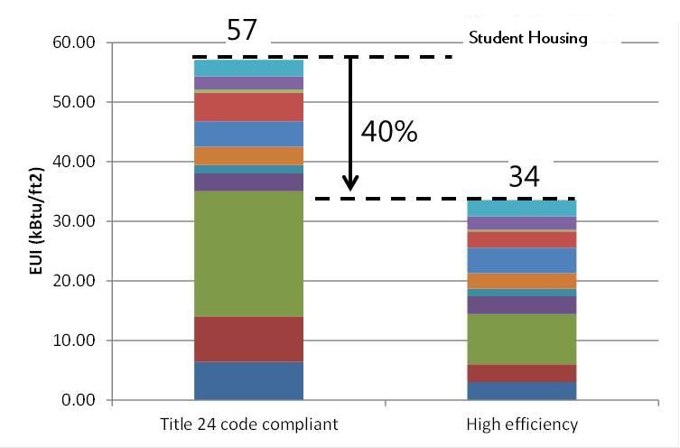
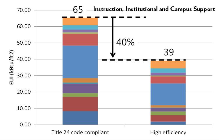
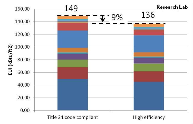
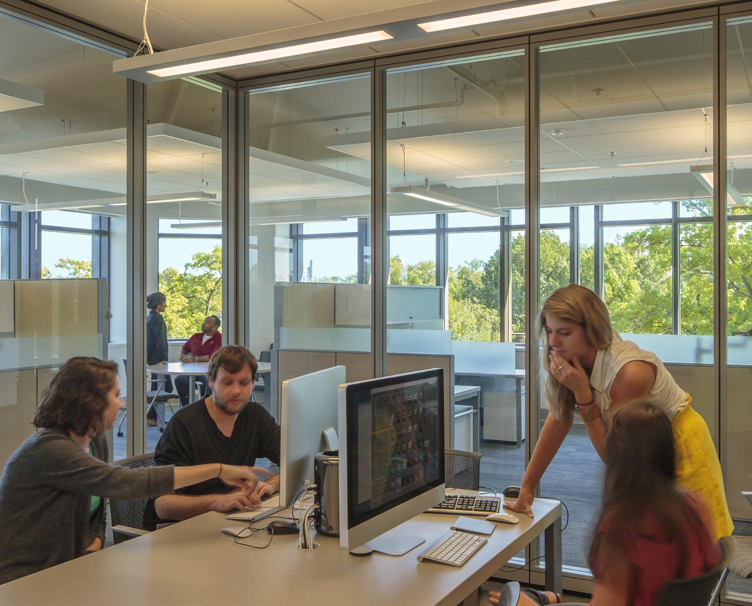
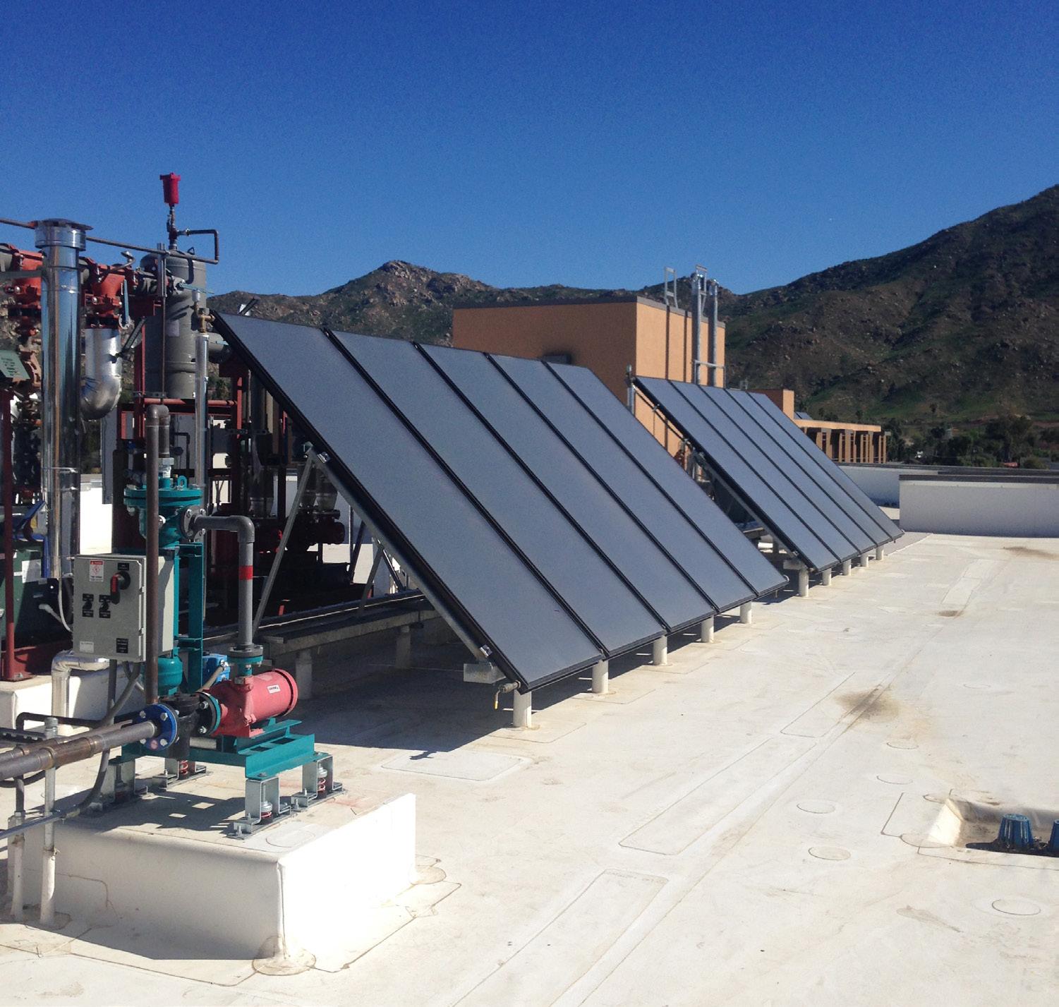
As well as the specific measures listed above, campus building design guidelines should be applied to support an integrated low carbon strategy.
Design guidelines:
• Include demand reduction strategies using any combination of controls or batteries to reduce demand under peak conditions by 20 percent based on a signal from the campus energy management system
• Commercial / administrative buildings: integrate photovoltaic panels
• Residential buildings: incorporate solar thermal technologies
• Incorporate site photovoltaic elements where identified in the Master Plan Study
• Achieve UC-mandated EUI targets in new buildings
Net zero energy building strategy:
The campus has the option to require all new buildings to achieve net zero energy. This can be achieved through the following measures:
• Minimize building EUI
• Maximize photovoltaic roof coverage (consider photovoltaic canopy)
• Create adjacent covered parking lot photovoltaic arrays where possible
• Create remote photovoltaic arrays for virtual connection where required
• Fund ground mount arrays as part of building projects

Covered Parking lot PV panels
PV Panels


A range of cooling techniques are used across the campus. Residence halls and most buildings outside Core Campus are locally cooled through a range of technologies, depending on the building’s age and renovation history. For instance, student housing units in Glen Mor are cooled by modern reversible heat pumps; whereas Aberdeen-Inverness Hall utilizes constant air volume (CAV) systems, served by local centrifugal chillers and a cooling tower.
Buildings in Core Campus are cooled by water supplied through the chilled water network. The network is served by three thermal energy stores (TES). The stores operate in “full storage mode”, being charged by chillers at night and then discharged to meet load during the day. A summary of the campus chilled water system is given below:
• Steam plant chiller capacity: 5 x 1250 ton chillers (6250 ton). Chillers 1 to 3 in parallel arrangement with flow through chillers 4 and 5 in series
• Satellite chiller plant capacity correction: 6000 ton capacity
• TES1: 2.2 Mgal storage and 9000 GPM discharge
• TES2: 2.7 Mgal storage and 9000 GPM discharge
• TES3: 2 Mgal storage and 6000 GPM discharge
• Flow and return temperatures 39°F and 60°F (although often 54°F)
In order to better understand the potential spare capacity in the campus chilled water network and central plant, a static load model was developed and compared to calculated capacities throughout the network.
Chilled water supply to campus buildings is generally not logged. However, indicative loads were recorded by the facilities team for a range of buildings in the early afternoon of April 30th and May 1st. These values are displayed in Fig. 6.13.
Figure 6.13 CHILLED
SELECTED BUILDINGS BETWEEN 2:30 AND 4:30 PM, 04/30/2014
The average per-square-foot value was obtained for each building typology and then multiplied across the gross floor areas of buildings on each leg of the chilled water network. Accepting that the recorded values represented a lower-than-absolute peak value, when the entire network load was summed, the resultant value was compared to the recorded peak output from the chilled water stores, 10,980 tons as discharged simultaneously from TES 1 and 2. The calculated network load was found to be significantly less than the peak chilled water store discharge load. A derived adjustment factor of 0.46 was therefore multiplied by each normalized typology load (ft2/ton) such that the total network load equaled the peak chilled water store discharge. This raised each typology load to an estimated peak value. See Fig. 6.14.
Figure 6.14 DERIVED AVERAGE PEAK ON CHILLED WATER NETWORK
This allowed for comparison to the calculated capacity on each leg of the network, calculated by assuming a flow and return differential of 21°F and referencing the following table for assumed maximum flow rate in each pipe diameter case.
Figure 6.15 ASSUMED MAXIMUM FLOW RATES IN CHILLED WATER NETWORK
Fig. 6.16 displays estimated chilled water network leg capacities.
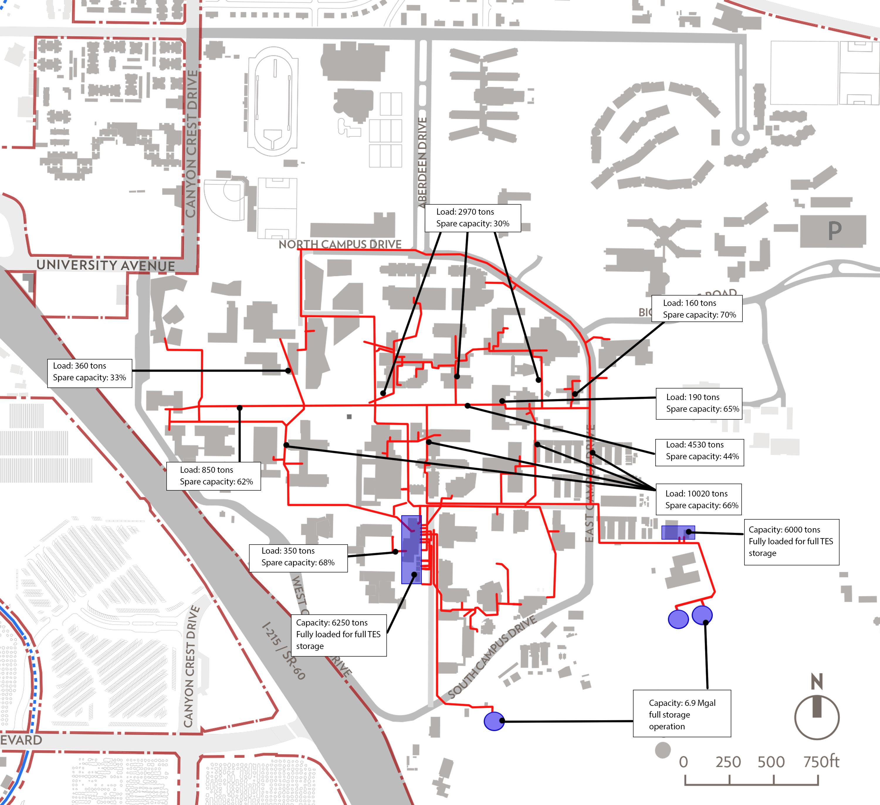
It is important to note that these figures are not derived from comprehensive recorded data or an accurate dynamic model. Rather they are derived from the assumptions and calculation method described previously. Values should be taken as indicative and with a wide error margin. General conclusions may be drawn but a detailed study of particular network legs should be undertaken before new buildings are considered for connection.
The chilled water system generally has capacity to support additional load, both in the network (over 50 percent spare capacity on most legs) and at the central plant.
The three thermal energy stores currently operate in full storage mode. Switching to a load-levelling operation would roughly double the system plant capacity by allowing chillers and thermal stores to meet the campus load in parallel.
This figure is a diagrammatic representation of an infrastructure network that is based available drawings and in person conversations with UCR personnel. They are representative and likely to have some inaccuracies.
Options for cooling are essentially based on the following considerations:
• Centralized campus service vs. local cooling
• Efficiency level of chiller
Options for campus cooling have been divided between Core Campus and the North District. The following cooling options were assessed:
• Local chillers: There is little advantage gained from using local chillers for core campus buildings, given the existing chilled water network.
• Centralized chillers: The existing chilled water network efficiently provides chilled water to Core Campus buildings and has sufficient capacity for more buildings to be added to most legs, depending on size. The large combined load provides the option to replace current chillers with more efficient models for large efficiency savings in the future.
• High efficiency chillers: Magnetic bearing chillers could replace Core Campus chillers for an efficiency gain that would yield a total campus carbon reduction of around 7 percent. Replacement could be timed for completion just prior to 2025, thus making the most cost-effective use of existing chillers.
• Local chillers: These are the most cost-effective solution for cooling the North District, given that a chilled water network does not currently exist there. Local cooling would give flexibility and spread capital investment over multiple buildings.
• Centralized chillers: An efficiency gain can be made combining buildings on a small local loop so that larger, more efficient chillers can serve those building from a central plant.
• High efficiency chillers: Centralization of cooling in the North District would allow for high efficiency chillers to be installed with a total campus carbon reduction of around 3 percent.
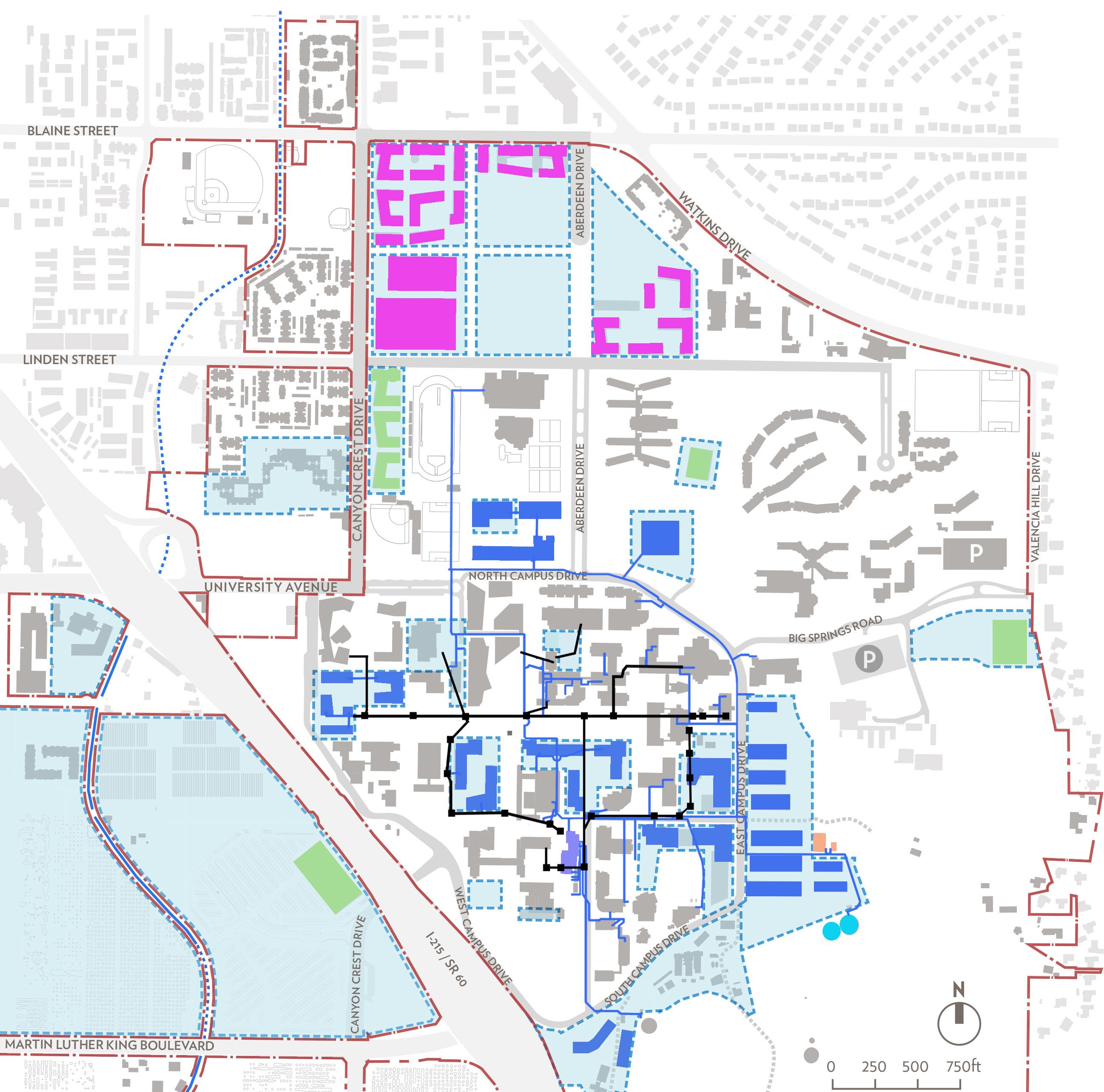
This figure is a diagrammatic representation of an infrastructure network that is based available drawings and in person conversations with UCR personnel. They are representative and likely to have some inaccuracies.
Core Campus: It is recommended that buildings on development pads within and adjacent to the Core Campus be connected to the existing chilled water network. Connection to the network has the following advantages:
• The chilled water network is extensive in the Core Campus, meaning that any opportunity sites located in and around the core can be added for relatively low cost.
• The proximity of Core Campus opportunity sites to existing network legs means that new branches will be short, which leads to higher efficiency distribution.
• Useable program space is maximized in buildings because a cooling plant is not required.
• A reduction in maintenance and efficient plant operation are achieved due to centralization. Local cooling would not bring a significant carbon saving and does not give the option of central chiller replacement with high efficiency magnetic bearing chillers. Replacement should be timed for completion at the end of 2024.
• North District: It is recommended that a chiller plant with chilled water storage be built to serve North District buildings. The primary benefit of this would be the ability to use high efficiency magnetic bearing chillers which require a high combined cooling load. Furthermore, reductions in maintenance and an increase in useable program space give additional advantage to this scheme.
Campus cooling options Total campus
Central plant chiller replacement 6,250 ton turbocor magnetic bearing chiller set 7%
North Precinct: 3,200 ton turbocor magnetic bearing chiller plant with 1.4 Mgal chilled water store 3%
As with cooling, a range of methods for heating are employed across campus. Buildings outside the Core Campus are typically heated by gas boilers, as in the case of Aberdeen-Inverness Hall which has constant air volume (CAV) supply. An example of an alternative is the heat pump system employed in Glen Mor.
Buildings in the Core Campus are generally served by the steam network which is supplied by boilers located in the central steam plant. Notable exceptions include the Campus Surge Building which has gas-fired packaged variable air volume (VAV) units for heating. The steam plant is summarized below:
• Boilers 2 & 3: 30,000 lb/hr each.
• Boiler 4: 40,000 lb/hr.
• Boiler 5: 50,000 lb/hr.
• Total: 150,000 lb/hr1
• Boilers typically operate at 80 percent efficiency
Gas is supplied to the campus by SoCal Gas. Supply lines run west to east along Blaine Street, Linden Street, University Avenue and Martin Luther King Boulevard. Local gas lines are extensively laid in the North District and Core Campus. Most supply lines are assumed to be at around 5 PSI standard pressure. Martin Luther King Boulevard has two trunk lines, one at 55 PSI for supply to steam plant boilers and the other at 5 PSI for Core Campus supply. Capacity in the supply lines is estimated to be sufficient to support any near and medium term expansion in the Core Campus, North District and West Campus.

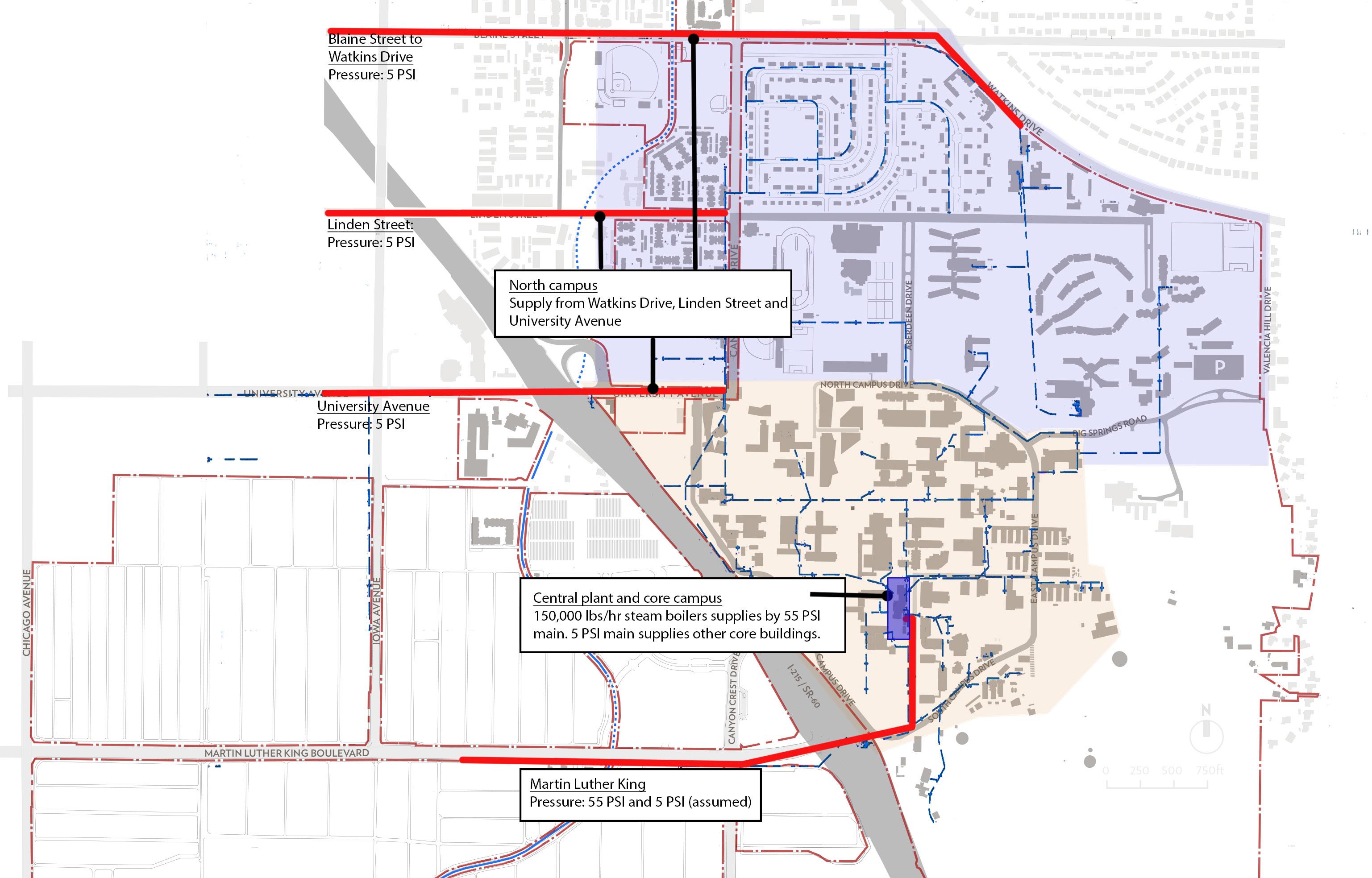
1 Boiler 1 is currently off line
This figure is a diagrammatic representation of an infrastructure network that is based available drawings and in person conversations with UCR personnel. They are representative and likely to have some inaccuracies.
Similar to the chilled water capacity assessment, the steam network was analyzed through development of a static load model and comparison to network capacities. Indicative steam loads were recorded by the facilities team for a range of buildings in the early afternoon of April 30th and May 1st. These values are displayed in Fig. 6.20.
Figure 6.20
AND 4:30
PM, 04/30/2014
The average per-square-foot value was obtained for each building typology and then multiplied across the gross floor areas of buildings on each leg of the steam network. When the entire network load was summed, the resultant value was compared to the recorded peak output from the steam boilers, 147,441 kBtu/hr as supplied by boilers 2, 3, 4, and 5 simultaneously. The calculated network load was found to be significantly less than the peak boiler output. A derived adjustment factor of 1.85 was therefore multiplied by each normalized typology load (Btu/h-ft2) such that the total network load equaled the peak boiler output. This raised each typology load to an approximately peak value. See Fig. 6.21.
Figure 6.21
The resulting network capacity is discussed in the following section. It is important to note that these figures are not derived from comprehensive recorded data or an accurate dynamic model. Rather they are derived from the assumptions and calculation method described in the previous section. Values should be taken as indicative and with a wide error margin. General conclusions may be drawn but a detailed study of particular network legs should be undertaken before new buildings are considered for connection.
This allowed for comparison to the calculated capacity on each leg of the network, calculated by assuming steam pressure of 95 PSI and maximum velocity of 6000 fpm and referencing the following table for calculated maximum capacity in each pipe diameter case.
Figure
The steam network and plant has a large excess of capacity due to a move towards gas and electric heating on campus. The steam plant has around 18 percent spare capacity. The network appears to have even more spare capacity. A potential pinch-point exists in the central trunk line between tunnels 6 and 26, since this central part of the network may have insufficient capacity to serve all loads downstream.
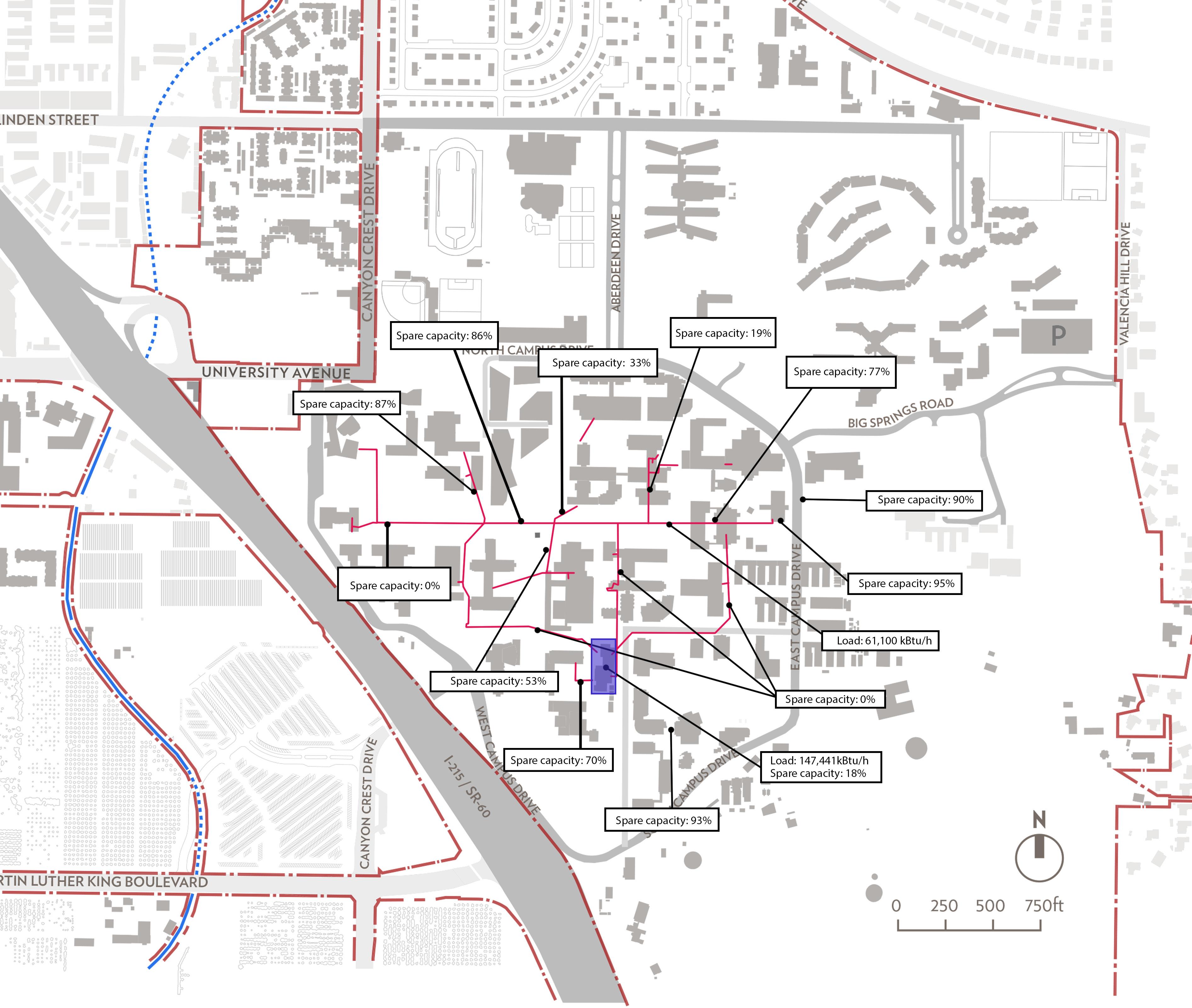
This figure is a diagrammatic representation of an infrastructure network that is based available drawings and in person conversations with UCR personnel. They are representative and likely to have some inaccuracies.
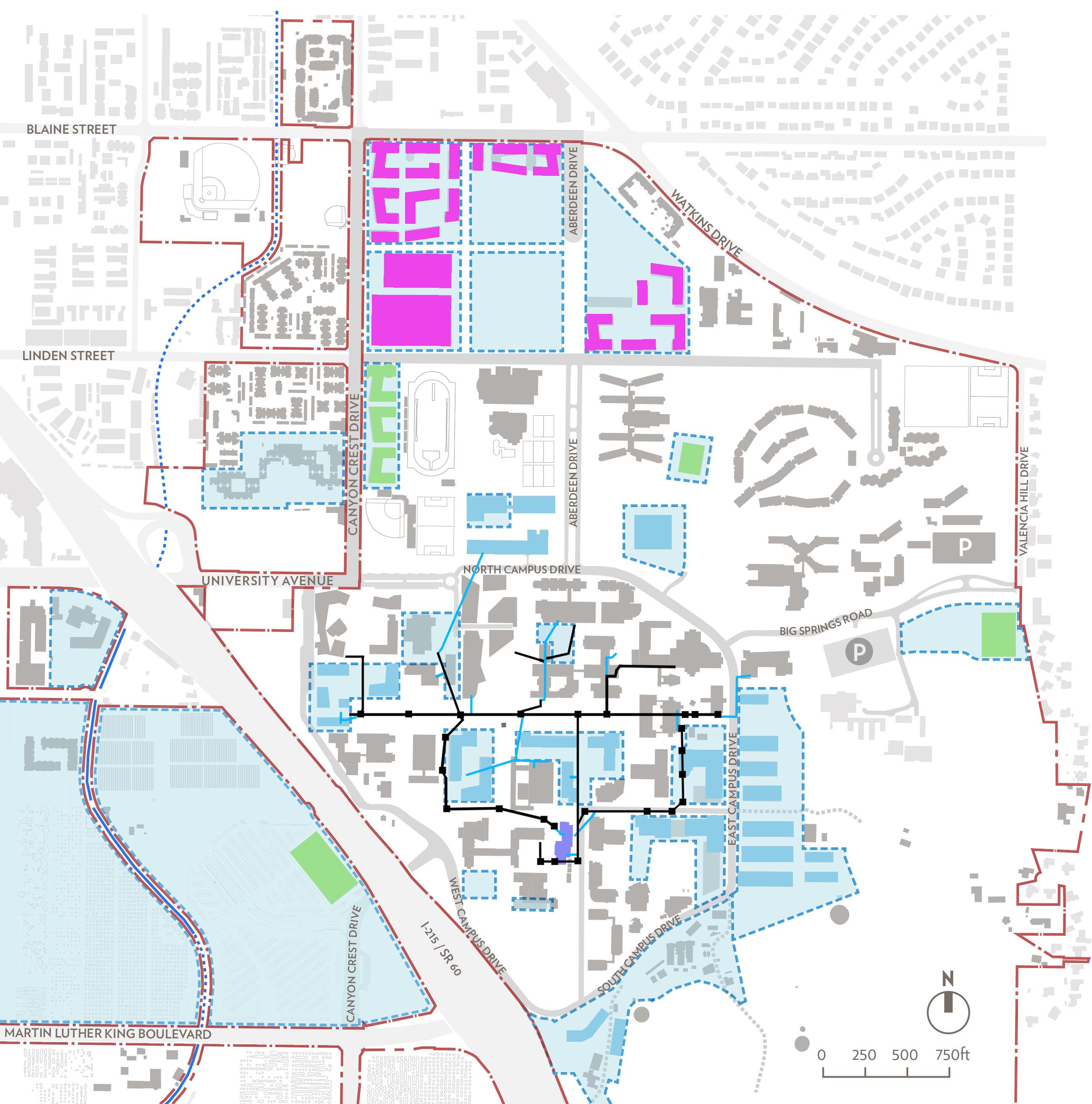
This figure is a diagrammatic representation of an infrastructure network that is based available drawings and in person conversations with UCR personnel. They are representative and likely to have some inaccuracies.
There are several options for heating the campus. These have been divided between the Core Campus and North District. The following heating options were assessed:
• Local gas boilers: Installation of local condensing boilers is the standard, low cost option to address new heating loads on campus. Gas mains have capacity to cover additional loads. However, this option does not help bring the campus to carbon neutrality due to the continued reliance on combustion.
• Retaining/extending existing steam network: The steam network reliably provides high grade heat to Core Campus buildings but is very inefficient, with a likely whole-system efficiency of 70 percent or lower. The continued use of this network impedes progress towards carbon reduction goals
• Hot water network: There is a large efficiency gain to be found by converting the Coer Campus steam network to hot water. A 3 percent total campus carbon savings is predicted but this likely requires replacement of all existing steam pipework (i.e. no direct conversion, which entails a high capital cost.
• Biomass and/or waste: Replacement of steam boilers with biomass/ waste boilers plus hot water store, to cover campus base heating load would yield a large carbon reduction benefit but requires steam to hot water conversion, to be efficient. With steam to hot water conversion this scheme could yield a maximum of 23 percent total campus carbon reduction.
• Biogas: There is a large carbon reduction potential from supplying most of the total campus gas demand with biogas. This would require steam to hot water conversion to be efficient, and would yield a total campus carbon reduction savings of up to 22 percent. However, there is currently very little biogas for purchase in California and this situation is unlikely to change in the near future. The UC Office of the President has approved investment in a bulk biogas purchase and the generation of its own biogas. Current indications are, however, that yields will be small in comparison to demand. Note: On-site biogas generation from anaerobic digestion of food waste and agricultural arisings will not yield a significant proportion of the campus demand.
• Combined Heat and Power (CHP): Replacement of steam boilers with a CHP plant plus hot water store to cover campus base heating load yields a small carbon reduction potential when the low electricity grid carbon factor is considered. This would require steam to hot water conversion to be efficient, with a total campus carbon reduction of 12 percent.
• Centralized heat pumps: Large heat pumps are now being integrated into advanced district heating networks for large carbon savings when combined with renewable power. This option combined with a hot water store to cover campus base heating load would bring a significant carbon reduction due to the progressively decarbonized power supplied by Riverside Public Utilities. Installation requires steam to hot water conversion to be efficient, but would yield an 11 percent total campus carbon reduction.
• Local heat pumps: Local heat pumps also bring a significant carbon reduction due to the favorable grid carbon factor and avoids campus heat network investment, as well as spreading capital investment between buildings. If installed on a local scale, heat pumps could be sized to cover the total heating load of a building, with the potential addition of gas top-up for higher temperature process requirements. An estimated 20 percent total campus carbon reduction could be achieved if all buildings were converted. Local heat pumps could also be integrated into a geothermal system, to be assessed on a building by building basis, for further increased efficiency.
North District:
Heating options for the North District are similar to those for Core Campus, without consideration of the steam network. A central heating plant would not bring significant benefit unless powered by biomass or biogas. Local heat pumps would bring a significant carbon reduction, as compared to combustion.
It is recommended that the steam network be progressively decommissioned and that campus heating be provided at the building level by electric heat pumps in both the North District and Core Campus. Geothermal heat pumps should be assessed for installation on a building by building basis.
By investing in a transfer from centralized steam to localized heat pumps the University will make large strides toward its carbon reduction goals, as well as create a pathway that spreads capital investment. Heat pumps are also expected to reduce their per unit heat carbon emissions over time in line with the increasing renewables mix from grid-supplied electricity.
UC Riverside accounts for 6 percent of total city demand supplied by Riverside Public Utilities. The University purchases electricity for 0.1 $/ kWh. The campus is mostly served by a 12.47 kV network, following the recent conversion of the previous 4.16 kV network to 12.47 kV. As the campus at UC Riverside has expanded in recent years, the power infrastructure has been reduced the to less than 100 percent redundancy. There is currently 80 percent redundancy in the existing sub-station, located on West Campus. This represents an operational choke point. Feeders run from the substation on West Campus to service electrical needs on East Campus. The feeders are grouped in pairs for redundancy but are likely to have reached a load at which both feeders in each pair are simultaneously needed at peak load. It has already been determined that feeders 2A and 2B have exceeded redundant capacity.
The campus has significant on-site power generation, with some distributed rooftop photovoltaic arrays and (2) 1.5 MW solar arrays, located adjacent to the main sub-station on West Campus. Maximum output of the large arrays is around 2.2 to 2.6 MW (DC) total. Expansion into agricultural land would be difficult or impossible.
The Physical Plant team proposes that power infrastructure solutions target 100 percent redundancy, through efficiency upgrades in buildings, local renewables generation, etc. Increasing electrical distribution capacity should be avoided if possible. There is therefore an opportunity to use peak load reduction measures and local power generation to reduce carbon emissions and increase network redundancy.
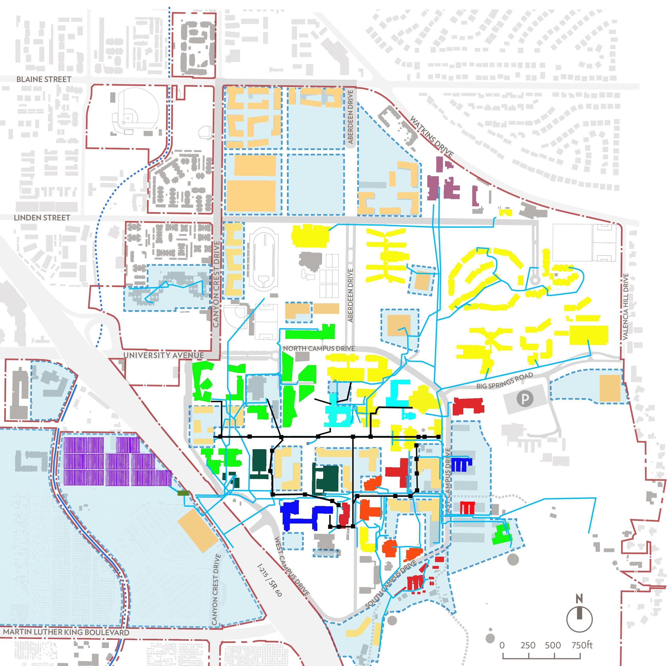
Buildings color coded according to serving feeder. Feeder positions can change over time. This image is what was observed at the time of this planning effort.
This figure is a diagrammatic representation of an infrastructure network that is based available drawings and in person conversations with UCR personnel. They are representative and likely to have some inaccuracies.
In order to reduce the load on the power infrastructure the Planning Team recommends that the University pursue an aggressive policy of energy efficiency measures on new and existing buildings, as well as localized PV generation and storage. Demand-side management should be combined with these initiatives to effectively reduce and shift load, such that redundancy is restored to the grid. This approach becomes particularly important when the recommended move toward local heat pumps is considered. Heat pumps will add power load to the existing network so peak reductions through other means must be initiated as soon as possible.
A new sub-station to serve the North District will likely be required irrespective of load reduction achieved in the Core Campus. This is due to location and anticipated load.
Note: In order to inform campus expansion the Planning Team recommends that the University undertake a feeder load study. This will allow stressed feeders to be identified so that upgrades can be made, or load reductions applied, where necessary.
The UC Riverside campus is divided into two watersheds separated by I-215/SR-60. The East Campus is located in the University Arroyo watershed to the northeast of I-215, whereas the West Campus is located in the Box Spring Arroyo watershed to the southwest of I-215. Onsite and offsite stormwater is collected and discharged through overland flow, underground storm drains, and natural arroyos.
The East Campus is bounded on the north and east by residential neighborhoods, separated by Blaine Street and Valencia Hill Drive/ Watkins Drive respectively. The majority of stormwater runoff coming from the east is collected as surface runoff near Valencia Hill Drive and Big Springs Road by an inlet structure and is discharged to the Gage Detention Basin north of University Avenue at Canyon Crest Drive through above-ground swales, a 72” pipe, and finally a 7’ box culvert.
The existing storm drain network serving the campus is made up from a mixture of local (UC Riverside), city, and county drainage facilities. The campus generally drains as a mixture of surface flows and underground storm drain conveyances that ultimately discharge to open channel arroyos and large diameter backbone county drainage infrastructure.
According to the Federal Flood Hazard Boundary / Flood Insurance Rate Map (FIRM), some areas in the vicinity of North Campus Drive, east of Aberdeen Drive are located within the 100-year flood plain. In order to comply with the Federal Emergency Management Agency requirements, future growth in this area will be located outside of the 100-year flood plain; and the improvements will not impede or redirect flood flows within a 100-year flood hazard area.
The future development projects and project limits are illustrated in the Fig 6.29: Future Site Development. Additional above-ground and below-ground storm drain improvements will be required in order to support the future growth, potentially including new academic buildings, parking lots, athletic fields, retail spaces, other support facilities, associated site work and landscape. Detailed hydraulic
analyses of existing storm drain facilities should be performed with each project. Development projects’ impact on existing facilities upstream and downstream should be studied. It may be necessary to construct additional storm drain improvements or upsize existing facilities outside of new project limits in order to ensure that adequate stormwater flood prevention is provided.
UC Riverside is governed by federal, state, and regional stormwater regulations, promulgated under the Clean Water Act. Several regulations are overarching in nature and do not require specific permitting measures as their requirements have been incorporated into other regulations. These include:
• Clean Water Act (Federal)
• Antidegradation Policy (Federal and State)
• Porter-Cologne Water Quality Control Act (State)
A summary of regulations is presented in Appendix 6.7-B, Stormwater Quality Report, performed as part of the Master Plan Study.
In order to perform a concept-level hydrology analysis, the Riverside County Flood Control District guidelines were used to calculate the 2, 10, 25, 50, and 100-year peak flow rates within the campus limits. The campus watershed was divided into several drainage sub-areas and runoff was calculated for both existing and future conditions. Reference Appendix 6.7-A for the Hydrology Report performed as part of the Master Plan Study.
Low Impact Development Best Management Practices (LID BMP)
Methodology is a design approach which minimizes the impacts of the proposed project on its surroundings by closely mimicking the predevelopment hydrology, thus reducing the downstream erosion and also significantly reducing the pollutants in runoff from the site.
The Riverside County LID BMP calculation methodology was used to calculate the required treatment flows and volumes, referred to herein as the Mitigated Flow Rate (QBMP) and Mitigated Volume (VBMP), respectively. The mitigated flow rate and volumes were calculated for each of the future development sites as shown in following Fig 6.30. For further information and analysis refer to Appendix 6.7-B for the Stormwater Quality Report performed as part of the Master Plan Study.
Site Area (acre) VBMP (cf)
Site-1
Note:
* Future Development Sites not included in the current analysis, referenced per Chapter 3 for information only.
The existing natural arroyos, streets, and detention basins within the campus were identified as opportunities for a campus-wide approach to stormwater treatment. The arroyos and detention basins currently serve as a way to convey and contain the 100-year flood storm generated by the campus and upstream properties, and therefore will be maintained
as such. Similarly, roadways are necessary to support campus circulation and must remain in place. However, they can also provide opportunities for centralized stormwater treatment.
Future development project sites need to incorporate pre-treatment systems before discharging into the treatment areas identified below, and ultimately the Gage Basin. Future and existing streets and malls included as part of future development plans, as well as future and existing storm drains, will be used to pre-treat and transport runoff to the identified treatment areas. Additional information and descriptions of various types of BMPs can be found in Appendix 6.7-B.
Conveyance systems and treatment areas will be designed to provide multiple benefits beyond their traditional purposes, including stormwater treatment, detention, and conveyance. It shall be the responsibility of project design team to confirm the stormwater quality requirements for each project based on the final project scope of work. Not all Best Management Practices (BMPs) are practical or suitable for all project sites due to poor soil permeability, steep slopes, and small project footprints.
The following summarizes recommended BMPs and water quality mitigation measures for the future development areas. Graphic locations of the future stormwater treatment systems are illustrated on Figure 6.32: Stormwater LID Treatment and Conveyances.
The Great Glen Basin currently receives flows from a natural arroyo which serves a portion of the campus as well as an offsite residential area to the northeast, approximately 100 acres in total. The 85th percentile treatment storm from development areas 4, 5 and 8 will be collected and conveyed by various drainage systems, including underground storm drains and surface conveyance through the Science Walk Extension pedestrian mall. Stormwater runoff which exceeds the treatment flow will overflow to future and existing storm drain conveyance systems which serve the existing sites and maintain existing drainage patterns. Only the Mitigated Volume (VBMP) from the treatment storm will be diverted to the existing Great Glen Basin, so that the existing basin will not be overburdened during larger storm events. Based on Federal Emergency Management Agency (FEMA) Flood Zone Map No. 06065C0727G, the Great Glen Basin is located within the 100-year flood plain. Adding
the Mitigated Volume (VBMP) from the upstream development sites will increase the stormwater volume held on the basin. During a 100year storm event, this could negatively affect the 100-year flood plain water level. Therefore, it is necessary to increase the volume of the basin to accommodate the additional stormwater. A detailed analysis is necessary to determine the impacts.
The capacity of the basin can be increased by increasing its depth, widening the edges, or combination of both. Subsurface storage such as a gravel storage area at the bottom of the basin would also aid in increasing capacity with minimal land disturbance. However, there may be State and Federal agency reviews or permits implicated by the modification of the basins in the ways noted above. It will be necessary to consult with these agencies to determine requirements as part of the design and implementation of the recommended stormwater improvements.
The existing Great Glen Basin currently functions as a stormwater basin only, with natural features and plantings which require little maintenance. Similarly, the basin is not programmed for other institutional uses. Noted adjustments to the capacity of the basin shall be respective of its existing function and provide considerations for reestablishment of a more natural state. However, since the basin is not programmed as a pedestrian space, it may be more acceptable to provide stormwater storage on the surface of the basin, rather than underneath in a gravel layer as noted above. Since the site is not mowed or used for recreation, any modifications to the inlet structure to attenuate drainage from varying storm events can take place at the surface level or above.
The Glade Basin currently accepts flows from a 40-acre portion of the campus to its north. The 85th percentile treatment storm from development areas 11, 12, 13, C and D will be collected in underground storm drains and conveyed by a vegetated swale along Aberdeen Drive to the existing detention basin. Stormwater runoff which exceeds the treatment flow will overflow to future and existing storm drain conveyance systems which serve the existing sites and maintain existing drainage patterns. Similar to TR1, only the Mitigated Volume (VBMP) from the treatment storm will be diverted to the existing Glade Basin, so that the existing basin will not be overburdened during larger storm events. Based on Federal Emergency Management Agency (FEMA) Flood Zone Map No. 06065C0727G, the Glade Basin is also located
within the 100-year flood plain. Adding the Mitigated Volume (VBMP) from the upstream development sites will increase the storm water volume held on the basin. During a 100-year storm event, this could negatively affect the 100-year flood plain water level. Therefore, it is necessary to increase the volume of the basin to accommodate the additional stormwater. A detailed analysis is necessary to determine the impacts.
The capacity of the basin can be increased by increasing its depth, widening the edges, or combination of both. Subsurface storage such as a gravel storage area at the bottom of the basin would also aid in increasing capacity with minimal land disturbance. However, there may be State and Federal agency reviews or permits implicated by the modification of the basins as noted above. It will be necessary to consult with these agencies to determine requirements as part of the design and implementation of the recommended storm water improvements.
Modifications to the Glade Basin area shall also be coordinated with the UC Riverside Facilities Management as it is used for many events, and needs to remain accessible as such. Similarly, any modifications to the basin must consider its function as a gathering and recreation space. Stormwater storage shall occur beneath the surface in a gravel layer or similar as noted above. Inlet structure modifications to attenuate drainage from varying storm events shall be designed so as not to inhibit mowing or programmatic uses.
The existing area of the Proposed Freeway Buffer consists of narrow parking separating the 215 Freeway and West Campus Drive. The Master Plan Study proposes replacement of the existing parking with a 40’ to 50’ wide buffer consisting of trees, a multi-use area and an area designated for stormwater treatment as illustrated in Fig 4.42 of Section 4.4 “Beautify and Activate Campus Edges.” The 85th percentile treatment storm from development areas 1, 2, 3, 6, 7, and 9 will be collected and conveyed through various landscape spaces, pedestrian malls and underground storm drains. The stormwater treatment buffer will be designed to treat stormwater in a similar fashion to a vegetated swale while conveying it from south to north, to a future detention basin located south of Parking Lot 1.
The Freeway Buffer and downstream basin will be designed to function as a vegetated swale and detention basin, respectively, as defined by the Riverside County LID BMP Design Handbook.
TR4 (Proposed Canyon Crest Drive Linear Treatment System)
The Proposed Canyon Crest Drive Linear Treatment System will modify the existing Canyon Crest Drive to include an area for stormwater treatment as part of its cross-section. The 85th percentile treatment storm from development areas A, B, D, E and F will be collected and conveyed through landscape spaces, pedestrian malls and underground storm drains. The stormwater treatment strip will be designed to treat stormwater, similar to a vegetated swale, while conveying it from north to south, to the existing Gage Basin.
The Linear Treatment System will need to be designed to function as a vegetated swale or similar bio-treatment facility as defined by the Riverside County LID BMP Design Handbook.
The following Fig 6.31 provides a summary of anticipated treatment totals at each treatment location resulting from the future development projects. The required treatment flows and volumes are referred to as the Mitigated Flow Rate (QBMP) and Mitigated Volume (VBMP), respectively:
ft3: cubic feet cfs: cubic feet per second
Note:
* Assumed 50% of Area D will drain to this Location
The campus’s sanitary sewer is served by three major arteries: a 15-inch main located in North Campus Drive, an 8-inch main located in Canyon Crest Drive serving the North District, and an 8-inch main branching out from the 15-inch main and serving the heart of the campus. There is an additional 8-inch sewer line that also branches out from the 15-inch main and serves some areas adjacent to West Campus Drive. Several lateral pipes branching out from the main lines serve various parts of the campus.
Although North Campus Drive is part of the campus, the underlying 15-inch sewer is owned by the City of Riverside. The 15-inch line serves as an interceptor for the whole campus and also receives sewage effluent from the residential neighborhood upstream of the campus. The 8-inch main along Canyon Crest Drive is also owned by the city. The remaining pipes serving the campus are owned and maintained by the University. The existing sewer mains are identified in Fig 6.35 Existing Sanitary Sewer Network.
The buildings on campus were classified into various categories based on use. Flow from all the non-academic buildings was determined using local planning factors. The remainder of the flow from the academic buildings was prorated based upon population density. The population density analysis is presented in Fig 6.33: Population Density. The total existing building area was estimated from campus aerial topography. A peaking factor of 3.5 was applied to determine the peak flow rates. The on-site sanitary sewer system was mapped per existing utility
Note:
Student headcount based on Fall 2014 enrollment data
2 Faculty and Staff FTE based on UC Riverside website
3 Estimated from campus aerial topography
documentation provided by UC Riverside. Multiple sources were used to identify the location of the existing sewer lines including survey data, electronic design files and the East Campus Infrastructure Project Report provided by the University. The material of the existing pipes was assumed to be Vitrified Clay Pipe (VCP) which corresponds to a Manning coefficient of 0.014. Manning’s equation was used to calculate the capacity of pipes based on full flow capacity. The existing sanitary sewer system is identified in Figure 6.35.
A sanitary sewer capacity analysis was performed for sewer mains and laterals which correspond to Areas “0” through “28”. Refer to Appendix 6.8-A for the sewer analysis performed as part of the Master Plan Study.
Appendix 6.8-A includes a summary of the existing campus buildings’ square footage, occupancy, occupancy type, average daily flow rate, and peak flow rate generated on campus. Based upon the population density analysis, the existing average daily flow rate generated from offsite and on-campus buildings is calculated at 1,701,211 gallons per day (gpd), which is equivalent to a peak flow rate of 2.632 cubic feet per second (cfs.) The North District includes the existing Canyon Crest Family Student Housing facility and for the Master Plan Study analysis, sewer flows were determined based on local planning factors for residential buildings. Considering the facility is comprised of older, World War II-era buildings, the average daily and peak flow rates for the facility may be much lower if the University were to perform an analysis based on their fixture unit count.
The sanitary sewer system was evaluated with the addition of future buildings. Appendix 6.8-A includes a summary of the future campus buildings’ square footage, occupancy type, average daily flow rate, and peak flow rate. Based upon the population density analysis performed, the future average daily flow rate generated from existing offsite and future on-campus buildings is calculated at 1,586,045 gallons per day (gpd), which is equivalent to a peak flow rate of 2.454 cubic feet per second (cfs.)
The sewage flow rates from the existing buildings are within the capacity of the campus’ sewer system, with the exception of the 8-inch main running along Canyon Crest Drive, which will be serving the North District.
The analysis of the future sewer demands based on planning factors reveal that the anticipated sewage flow rates decrease by nearly 10%. The main reason for the reduction in the sewage flow rate is the use of planning factors for modeling the existing residential development in the North District. A detailed analysis using fixture counts and meter readings may reveal a lower existing average daily flow rate. The following Fig 6.34: Sanitary Sewer Flow Summary provides a summary of the total sanitary sewer flow for both existing and future conditions.

City 15” Main line under discharge agreement between the City and UC Riverside based on East Campus Infrastructure Report, 2002 and LRDP 2005


The East Campus Infrastructure Project Report (Project No. 950403) provides recommendations for continued maintenance and inspection of the sewer system in order to ensure its service in the future, and should continue to be followed.
The following are recommendations for improvements to the existing sanitary sewer system in order to maintain service to the existing buildings:
• The existing 8-inch main sewer line running along the Canyon Crest Road has an average slope of 0.27% and according to analysis presented herein, at peak flow, the pipe section will exceed its current full flow capacity. Upsize the existing 8-inch pipe to 15-inch pipe (with an absolute minimum slope of 0.5%) to meet the minimum velocity requirements and adequately serve the existing buildings.
• The condition of the existing 8-inch sewer lateral pipes serving the Spieth Hall needs to be further investigated in order to provide any recommendations.
• The existing 8-inch sewer pipe serving Pierce Hall is reported to have blockage issues. The condition of the pipe needs to be evaluated in order to provide any recommendations.
• Several sanitary sewer laterals have continuous drainage and blockage problems. It is recommended that the University further investigates the existing pipe conditions in order to improve the drainage conditions. Pipe replacement is recommended when future developments are planned within the area.
In order to service the future development in the Core Campus, the following improvements need to be undertaken. Recommendations include relocation, demolition and replacement of various sewer pipes to accommodate expansion of the campus. See Figure 6.36 and 6.37 for conceptual illustrations of the recommendations. Pipe sections shown in blue denote new sanitary sewer pipes to be constructed, replaced, or relocated to accommodate future building needs.
• Opportunity Sites A, B, D, & E: In order to provide a clear site for future development in the North District, remove the existing sanitary mains and laterals currently serving the Canyon Crest Family Student Housing. The existing system can be cut at MH-1. An 8-inch lateral main connection along the new 15-inch sewer main on Canyon Crest Drive will be necessary, as shown in Figure 6.37. This 8-inch lateral will serve as a main sewer line to provide POC’s to various sites in the North District.
• Opportunity Site C: Replace the existing 6-inch sewer lateral with a new 6-inch sewer lateral, with a minimum slope of 0.5% and provide POC for future development.
• Opportunity Site F: Install an 8-inch stub-out from the 15-inch sewer main to serve the future development.
• Opportunity Site 1: Remove the existing 8-inch lateral currently serving Hinderaker Hall and provide an 8-inch stub out to serve the future development.
• Opportunity Site 3: Install a 6-inch stub out from 8-inch sewer main to serve the future development.
• Opportunity Site 4: Install a 6-inch stub-out to serve the future development.
• Opportunity Site 5: Remove the existing 4-inch sewer lateral currently serving Fawcett Laboratory and provide a 6-inch stub-out to serve the future development.
• Opportunity Site 6: Relocate the 6-inch sewer lateral to provide a clear site for future development, and install a 6-inch stub out.
• Opportunity Site 9: Relocate the 8-inch sewer lateral currently serving Spieth Hall and the Life Sciences building to provide a clear site for the future development.
• Opportunity Site 11: In order to serve future development, a 6-inch lateral will be installed. This 6-inch lateral will be connected to the existing 6-inch sewer lateral.
• Opportunity Site 12: Replace the existing 8-inch sewer lateral with a new 8-inch sewer lateral, with minimum slope of 0.5% and provide
POC for future development.
• Opportunity Site 13: Install a 6-inch lateral to serve future development in the Core Campus and provide a 6-inch stub out to serve the future development.
The recommendations presented herein include removal, replacement, and construction of new sanitary sewer pipes in order to adequately serve the existing buildings as well as future developments in the Core Campus. Further investigations may be needed for the existing sanitary sewer main lines which have a potential to exceed maximum capacity. The findings and recommendations are determined for master planning analysis with assumed peak flow rates. If the proposed building designs yield larger flow rates than presented herein, it is recommended that the University re-evaluate the data analysis and findings.
Sites 9 to 15
These sites’ primary contribution to the Master Plan Study is capacity for additional square footage.
Sites A to G
North District Opportunity Sites.
CORE CAMPUS
1. Carillon Mall West
Shape the intersection of Arts Mall and the Carillon Mall on the site of Hinderaker Hall.
2. Gateway Link
Bridge between transit, student life and the Carillon Mall.
3. Core Campus Nexus
Create new lines of sight into the heart of campus from the perimeter.
4. Eucalyptus Walk Science Area
Transform a “back door” into a “front door” at the perimeter of East Campus.
5. Picnic Hill Science Area
Reframe a popular outdoor gathering space.
6. Core Campus South Extension
Enhance institutional identity on the southern hillside.
7. Citrus Mall Portal
Reinforce the intersection of Citrus Mall and the Carillon Mall.
8. Science Area Greenhouses
Re-envision a science and research district.
Sites 9 to 15
These sites’ primary contribution to the Master Plan Study is capacity for additional square footage.
WEST CAMPUS
Sites H and I
West Campus Opportunity Sites.
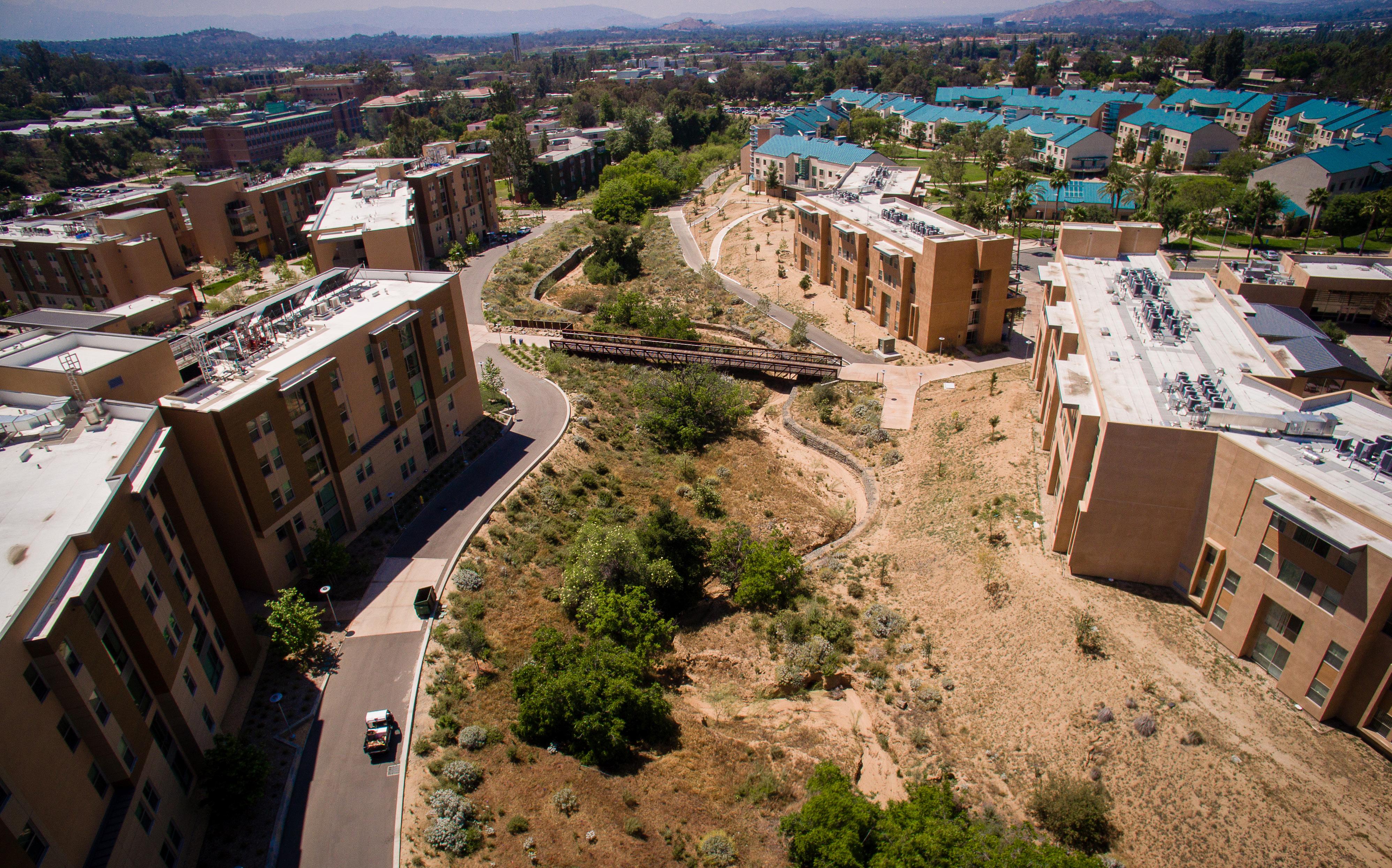
UC Riverside’s domestic, irrigation, and fire water needs are fulfilled by 5,000,000-gallon city reservoir, which is buried just south of University Avenue and East of I-215 / SR-60. The University also has rights to the ground water. The treated water from the reservoir is supplied to the campus domestic water pumping station through a 15-inch concrete pipe. The pumping station is located east of the intersection of University Avenue and Canyon Crest Drive. This pumping station consists of the main city 12-inch water meter, two reduced backflow preventers, and four 100 HP pumps per East Campus Infrastructure Project Report.
Buried City Reservoir 5MG capacity
The campus has two domestic water storage tanks, with capacities of 1,000,000 gallons and 50,000 gallons each. A 12-inch transite pipe (concrete with asbestos) serves as the main water line for water distribution to the main campus as well as feeds the two campus storage tanks located south east of the campus. When the storage tanks are full, the pumps shut off, and the storage tanks act as the main water source for the campus. When the water level drops below a pre-determined level, the pumps start once again to fill the tanks as well as supply water to the campus.
A separate 12-inch city water line also runs along Linden Street, which connects to the existing campus domestic water system at the corner of Florida Street and Linden Street through a city water meter and valve. This 12-inch water line serves as a backup supply to the campus main water network system. It also services the offsite residential neighborhood just east of the campus, which is beyond the scope of this study.
Several water laterals ranging from 4-inch to 8-inch branch out from the 12-inch transite line and serves the water demand of the Core Campus. The North District is mainly served by an 8-inch asbestos cement water line running along the Canyon Crest Drive, and provides the main point of connection to the 6-inch service line at the corner of Florida Street and Linden Street.
(East Campus Infrastructure Report, 2002)
Campus Pumps
(3 Simultaneously Operating Pumps)
12-inch Transite Line
Campus Infrastructure Development Study 2008)
(East Campus Infrastructure Report, 2002)
Campus Storage Tanks
(1 MG and 0.5MG capacity 1288 feet elevation)
Methods for estimating water flows and modeling water usage are based on common engineering principles. Domestic water flows by on-site buildings for the campus were estimated based on the existing building square footage. An average of 25 Gal/SF was used to determine the average daily flow produced by the buildings. A peaking factor of 3.0 was used to determine the maximum daily demand. Fig 6.39 summarizes the results of average water consumption based on Energy Star Data Trends.
Two computer models were created with EPANET 2.0 to illustrate the existing conditions on campus. Appendix 6.9-A includes a summary of the results of the computer model for Scenario “A” and Scenario “B.” Fig 6.9 (a) & (b):Existing Water Distribution – Pipe and Node Map (Core Campus), corresponds to the existing system model Scenario “A” provided in Appendix 6.9-A, whereas Fig 6.9 (c) & (d): Existing Water Distribution – Pipe and Node Map (North District), illustrates the existing system model Scenario “B” provided in Appendix 6.9-A.
The water system was evaluated with the addition of proposed buildings Based on the future development presented in the Master Plan Study, recommendations have been made to construct new water pipes, and to relocate and demolish various existing water lines. This is conceptually illustrated in Fig 6.40 Master Plan Study Future Domestic Water North District, and Fig 6.41 Master Plan Study Future Domestic Water Core Campus.
Based on the findings above, the existing water network system adequately supports the demand for the existing buildings on campus. However, if UC Riverside wishes to pursue the future developments as depicted in the Master Plan Study, the following recommendations need to be considered in order to provide service connections to the future buildings, re-routing water lines, and replacing old pipes as illustrated in Fig 6.40 Proposed Domestic Water Network North District, and Fig 6.41 Proposed Domestic Water Network Core Campus.
Computer models were created with EPANET 2.0 to determine the minimum pressure values at the nodes, which approximately serves the total water service area. The estimated maximum daily flow demands for the campus were applied to various nodes based on the maximum usage of the service area. The models tested the existing system’s ability to satisfy the domestic water and fire water needs for the existing campus and future developments.
The existing water distribution network is identified in Fig 6.38: Existing Water Distribution Network. Based on the operational procedures of the current water system, two scenarios were taken into consideration. In order to meet the water demand for Scenario “A”, the campus water system was supplied by pumps only with the exclusion of storage tanks. In Scenario “B”, two fire hydrants were added to the water system at strategic locations with a demand of 1500 gpm each. The storage tank was also assumed to be connected the main water system, which serves as a backup for the fire water demands.
Scenario “A” and Scenario “B” as discussed in the existing water analysis section were used to create computer models using EPANET 2.0 in order to illustrate the future conditions on campus. Appendix 6.9-A includes a summary of the results of the computer model for Scenario “A” and Scenario “B.” Fig 6.9 (e) & (f): Future Water Distribution – Pipe and Node Map (Core Campus), corresponds to the future system model Scenario “A” provided in Appendix 6.9-A, whereas Fig 6.9 (g) & (h): Future Water Distribution – Pipe and Node Map (North District) illustrates the future system model Scenario “B” provided in Appendix 6.9-A.
An evaluation of the water models revealed that the existing water system adequately supports the demand for existing buildings and the future developments as depicted in the Master Plan Study with no significant pipe losses due to size or elevation. In addition, the existing water pressures throughout the campus satisfy the Riverside County Fire Department minimum requirement of 20 psi as shown under the “Pressure” column of the data analysis table included in Appendix 6.9-A.
• Opportunity Site A, B, D, & E: In order to serve future developments in the North District, remove the existing network of 6-inch water lines currently serving Canyon Crest Family Student Housing, and install a 6-inch water main connected to the existing water system at the Linden Street and Florida Street intersection. Several service connections along the new 6-inch line will be provided to service future developments in the North district.
• Opportunity Site C: Install a 6-inch lateral and service connection to serve future developments in the North district just west of the Corporation Yard.
• Opportunity Site F: Provide a service connection to future developments from the existing 12-inch transite line west of the UC Riverside Track Facility.
• Opportunity Site 1: Install a new service connection to serve future developments from the existing 8-inch water main.
• Opportunity Site 3: To provide a clear site for future developments, remove the 4-inch water line and install a new service connection to serve the future building.
• Opportunity Site 4: To provide a clear site for future developments, remove the existing 6-inch lateral pipe serving the greenhouses and install a new 6-inch water service loop and a service connection for the future building.
• Opportunity Site 5: Provide a service connection to the future developments.
• Opportunity Site 6: To provide a clear site for future developments, relocate the 6-inch water line in conflict with the future building next to College Building North and provide a service connection for the future building.
• Opportunity Site 9: Install a new 6-inch lateral and service connection to serve the future developments.
• Opportunity Site 11: Provide a service connection to the future developments from the existing 8-inch loop north of North Campus Drive.
• Opportunity Site 12: To provide a clear site for future developments, remove the water line and provide a new service connection from the existing 6-inch water line.
• Opportunity Site 13: Provide a service connection to the future developments from the existing 8-inch water line.
The recommendations presented herein include removal, replacement, and construction of new water lines. The findings and recommendations are determined for master planning analysis with assumed water demands. If the proposed building designs yield larger flow rates than presented herein, it is recommended that the university re-evaluate the data analysis and findings.
Benefits of using stormwater, greywater and/or blackwater include:
• Conserving groundwater by replacing potable water with stormwater and/or greywater for irrigation
• Reducing water costs
• Reducing costs for complying with new stormwater management requirements LID/SUSMP for roadway improvements and public school parking lot upgrades
• Reducing runoff pollution to area waterways
• Creating educational opportunities
The following are strategies for reducing domestic water usage:
• Retrofit standard urinals with more efficient models.
• Upgrade sanitary fixtures with high efficiency models including highefficiency toilets, water saving sinks, waterless urinals etc.
• Reuse greywater and stormwater for non-potable applications such as landscaping irrigation, toilets and urinal flushing
• Implement a reuse system that collects rainwater from the roof, air handler condensate discharge, and water rejected from a reverse osmosis system used to generate pure water for laboratory experiments
• Reuse blackwater by implementing systems such as a Living Machine. Waste solids settle in a primary tank and non-potable water is pumped out though the treatment system for use in toilet flushing, disposal, or subsurface landscape irrigation. Typically, these systems require a certified operator and regularly-scheduled testing, sometimes up to three times per week. The operations and maintenance of such system will need to be further investigated.
All potable, fire water, and irrigation services are connected to the oncampus private system throughout the campus. During the summer months when school is not in session irrigation water is a greater percentage of the overall water used. During the fall, winter, and spring months when school is in session, less irrigation is necessary and the percentage of water used for irrigation is less. Therefore, based on the analysis of existing water meter readings for the year 2014 presented in Fig 6.42: Historic Campus Water Usage 2014, the Planning Team assumes that 50% of the water used for the entire campus is for irrigation purposes with the remaining 50% for potable and fire purposes.
6.42 HISTORIC CAMPUS WATER USAGE 2014
The existing combined water distribution network is identified in Fig 6.43: Existing Irrigation and Domestic Water Network. The combined water demands for the campus were estimated based on an analysis of meter readings over a recent 12-month period. Results of this analysis are summarized in Fig 6.44: Historical Campus Irrigation Water Usage 2014.
Irrigation Service Areas
The “annual average day” column is based on the average annual daily usage. The “peak month average day” considers only the higher meter readings for the dry months between June and November. The average peak month demands were assumed to be generated over eight hours a day to get the maximum daily water usage for irrigation. The 8-hour maximum daily water usage is calculated to be 1224 gallons per minute.
Refer to the Fig 6.45: Peak Flow Density, for the total campus landscaping area including turf and planters (estimated using Google Earth and aerial map.) The peak flow density per 1000 square feet was calculated based on the total landscaping area and 8-hour maximum daily usage, which was then used to estimate the irrigation usage for the future site development as depicted in the Master Plan Study.
the existing campus and future developments. Appendix 6.10-A, summarizes the irrigation water usage allocation based on the irrigation service areas. The results from the computer model for the existing combined water system are shown in the Appendix 6.10-A. Fig 6.10 (i) & (j): Existing Irrigation and Domestic Water Distribution – Pipe and Node Map corresponds to the existing system model provided in Table Appendix 6.10-A.
The combined water system as shown in Fig 6.46 and 6.47 was evaluated with the addition of proposed landscaping area. Appendix 6.10-A, summarizes the irrigation water usage allocation based on the irrigation service areas. Fig 6.10 (k) & (l): Future Irrigation and Domestic Water Distribution – Pipe and Node Map corresponds to the existing system model provided in Table Appendix 6.10-A. The results from the computer model for the combined future water system are also shown in Appendix 6.10-A.
The existing water system adequately supports the combined irrigation and domestic water demands for existing buildings and the future developments as depicted in the Master Plan Study. In addition, the existing water pressures throughout the campus satisfy the Riverside County Fire Department minimum requirement of 20 psi.
An evaluation of the existing water system revealed that the existing water services adequately support the demand of existing buildings and landscape areas with no significant pipes losses due to pipe size or elevation. The existing water system can also adequately support the demand for proposed buildings, landscape areas, and practice fields as depicted in the Master Plan Study. Since the potable and irrigation water is a combined water distribution network, recommendations provided under domestic water system are relevant for the irrigation system as well.
Irrigation usage on campus has been estimated based on the water usage data provided by the University; actual irrigation demand could vary substantially. The ratio of irrigation-to-potable usage is a general overall campus comparison and may not be applicable at every point of connection. Therefore, we recommend that each irrigation connection be sub-metered in order to ascertain more precisely how much water is currently being used for irrigation purposes campuswide. Furthermore, sub-metering allows for campus personnel to evaluate zones which are operating inefficiently or identify points of connection or mains which require maintenance. Utilizing these more accurate irrigation usage quantities, more precise water savings can be calculated.
The following are strategies for reducing irrigation water usage
• Incorporate xeriscaping - landscaping based on native, water-efficient plants to minimize the need for irrigation.
• Introduce drought-tolerant landscaping and plant materials according to the landscape strategic initiatives presented in Chapter 4.
A computer model of the combined domestic and irrigation water system was created with EPANET 2.0 to determine the minimum pressure values at the nodes, which approximately serves the demands of the service area. The estimated maximum daily flow demands for domestic water in Appendix 6.10-A, and irrigation demands as calculated in Table A-1 were applied to various nodes based on the maximum usage of the service area. The models tested the existing system’s ability to satisfy the domestic water and firewater needs for
The University of California boasts a robust sustainability program driven by a nationally-recognized comprehensive sustainability policy and leading-edge presidential initiatives. Its sustainability policy positions the system campuses as leaders in environmentally sound operations. As of 2007, all of the 10 chancellors are also signatories to the American College & University Presidents’ Climate Commitment.
Overwhelming scientific consensus points to climate change being driven by the release of carbon dioxide into the atmosphere, primarily from the burning of fossil fuels. UC is responding to this growing environmental crisis with direct action by committing to emit zero greenhouse gases on a net annual basis from its buildings and vehicle fleet by 2025.
Glossary of Terms
Degree-Day (Heating / Cooling) - a measurement of heating or cooling load relative to a base temperature. It is the product of the number of days during the year and the degrees above (cooling) or below (heating) the base temperature each day.
Emissions Factor - a value expressing the relationship between a pollutant released into the atmosphere and the activity associated with that release
Energy Use Intensity (EUI) - an expression of annual energy consumed per square foot, expressed as kBtu/sf/yr
kBtu/sf/yr - one thousand British Thermal Units per square foot, per year
MtCO 2 e - Metric tonnes of carbon dioxide equivalents
• Implement high-performance retrofits of existing buildings that meet recommended EUI targets.
• Design future new buildings to high-performance standards that meet recommended EUI targets.
• Install solar photovoltaic panels on all campus non-residential buildings.
• Install solar hot water heaters on all campus residential buildings and solar photovoltaic panels on all campus non-residential buildings to reduce carbon emissions from electricity use.
• Install solar photovoltaic panels above parking lots, walkways, and other available open spaces.
• Partner with Riverside Public Utilities or third-party renewable energy developers to install significant off-site solar photovoltaic or wind energy generation capacity.
Stewardship of the natural environment is a core value of UC Riverside that shapes policy decisions, inspires daily action and presents pertinent learning opportunities. In planning for campus growth to accommodate increases in enrollment, the Master Plan Study balances opportunities to protect, enhance, or restore natural systems; promote alternative transportation options; introduce greater efficiencies in campus infrastructure and resource use; and, most importantly, envision a roadmap to carbon neutrality.
Future growth of the campus will need to enhance this commitment to environmental stewardship to account for the impacts of development and expansion of campus infrastructure. The goal of carbon neutrality is a key commitment that the Planning Team studied. The results are detailed in this chapter. Environmental stewardship involves many other considerations, some of which are addressed in Chapter 4, Landscape & Open Space; Chapter 5, Circulation & Transportation; and Chapter 6, Infrastructure & Utilities.
UC Riverside has implemented a variety of stewardship programs on campus. In this Master Plan Study, the Planning Team focused on strategies for achieving the University of California’s Carbon Neutrality 2025 Initiative, announced in November 2013 by President Janet Napolitano. This initiative commits the University of California system to emitting zero net greenhouse gases from all of its campuses and vehicle fleets by 2025, something no other major university system has accomplished.
The University will need to take bold steps to achieve carbon neutrality by 2025. The Master Plan Study provides a foundational analysis and identifies strategies for meeting the Carbon Neutrality 2025 challenge.
Greenhouse gas (GHG) emissions come in multiple types and from multiple sources, making analysis complex. The Greenhouse Gas Protocol (GGP), developed by the World Resources Institute (WRI) and the World Business Council on Sustainable Development (WBCSD), standardizes a method for measuring, managing, and reporting greenhouse gas emissions. The Greenhouse Gas Protocol has been adopted by The Climate Registry (TCR), which runs voluntary compliance reporting in the State of California. In particular, the Greenhouse Gas Protocol divides the auditing and analysis of greenhouse gas emissions into three main “scopes,” as follows:
• Scope 1: Direct GHG Emissions comprises greenhouse gas emissions that occur from sources owned or controlled by the University. These emissions include on-site combustion or other types of release (such as chemical production) from owned assets such as boilers, company vehicles, and other process equipment. UC Riverside reports its complete Scope 1 emissions to The Climate Registry, the UC Office of the President, and the American University Presidents’ Climate Commitment.
• Scope 2: Indirect GHG Emissions accounts for emissions from the generation of electricity (or heat or steam) purchased from another party. UC Riverside reports its complete Scope 2 emissions to The Climate Registry, the UC Office of the President, and the American University Presidents’ Climate Commitment.
• Scope 3: Other Indirect GHG Emissions accounts for all other indirect emissions. These emissions result from the activities of a subject entity but occur from sources not owned or controlled by the University. Examples include emissions resulting from services or materials purchased by the University, employee commuting activities, and business air travel, among others. UC Riverside currently reports Scope 3 emissions to the UC Office of the President and the American University Presidents’ Climate Commitment, with the following exclusions: waste, water, and purchasing.
According to the UC Riverside Office of Sustainability, in 2014 (the year to which emissions data in the Master Plan Study are benchmarked), UC Riverside emitted 108,924 metric tons of carbon dioxide equivalents (MtCO2e) Buildings are the single greatest contributor to these emissions. in 2014, UC Riverside’s approximately 6,900,000 square feet of facilities produced 70,021 MtCO2e, or 64 percent of the total. Of this 64 percent of emissions from UC Riverside buildings, 68 percent resulted from electricity generated to supply campus demand, while 32 percent resulted from natural gas combustion. Remaining campus emissions resulted from fleet vehicles, refrigerant leakage and other minor sources.
The analyses performed for the Physical Master Plan Study revealed valuable information about factors contributing to UC Riversides’ GHG emissions and the interactions between these factors. UC Riverside’s current GHG footprint results from a complex interaction of the following factors:
• Regional climate
• Existing building stock
• Types and energy intensities of existing campus buildings
• Fuel source & carbon intensity
• Renewable energy
• Carbon offsets
(IN MtCO 2e)
Scope 1
Direct Emissions
Scope 2
Indirect Emissions (Electricity)
Scope 3
Indirect Emissions (Other)
Figure 7.3 Source: The Climate Registry and UC Riverside Office of Sustainability
UC Riverside’s future emissions will result from a complex interaction of the foregoing factors, along with building types and energy intensities of planned new buildings.
Riverside, California, is located in Climate Type 3B (Warm, Dry) with 2,430 Cooling Degree-Days and 1,779 Heating Degree-Days per year. (A technical measurement in climate analysis, the units Cooling Degree Days and Heating Degree Days are not intended to add up to 365). Annual precipitation totals 10.4 inches occurring mostly in the winter and early spring. Riverside experiences extreme heat and cold nights during the summer and moderate temperatures during the winter. Buildings in Riverside typically use more energy than buildings in more moderate climates. Buildings located in more temperate climates can achieve a lower energy intensity since they have lower heating and cooling requirements throughout the year.
The University projects that its enrollment will grow to 25,000 students by 2020 and 30,000 students by 2025. To accommodate this projected growth, the Planning Team has modeled the addition of up to 2.9 million gross square feet (GSF) to the campus’s existing inventory of 6.4 million GSF of space. Complete details of the program used for the Master Plan Study are included in Chapter 1, Building On The Path To Preeminence.
Many variables determine the annual energy use of a building, which in turn largely determines its carbon impact. These variables include the surrounding climate, the efficiency and operation of building systems, and building function. Because no two buildings are exactly alike in their use, design, and operation, building performance assessments normalize energy use by establishing a common metric. This metric is Energy Use Intensity, or EUI. EUI is an expression of annual energy consumed per square foot (kBtu/sf/yr). At the time of this writing, the average EUI for all UC Riverside buildings is 130 kBtu/sf/yr.
As detailed in Chapter 6, Infrastructure & Utilities, the Planning Team conducted an in-depth assessment of age, condition, and performance of existing campus buildings during the Master Plan Study to understand the EUIs of different groups of buildings on campus.
Source: http://www.usclimatedata.com/climate/riverside/california/united-states/usca1695
A study for the UC system by the University of California and the California Institute for Energy and Environment grouped UC buildings into three general building types and provided EUI baselines and targets for each (see Figure 7.4).
Using this work as a model, the Planning Team reviewed UC Riverside’s building inventory and grouped campus buildings into the following four types:
• Instruction, Institutional and Campus Support
• Research
• Housing and Dining
• Student Support
To establish benchmarks for comparing and evaluating the actual and potential energy performance of these building types, the Planning Team first referenced the U.S. Environmental Protection Agency’s (EPA) Target Finder tool. Column 1 in Figure 7.5 shows the median EUI for a selection of building types represented on the UC Riverside campus. The Planning Team also referenced three additional standards recognized in the building industry. Each standard – California Title 24, 30% better than Title 24, and Architecture 2030 – represents a increasingly higher level of energy performance than the median shown in column 1.
UC Riverside obtains most of its electric power from Riverside Public Utilities (RPU). It also operates a central utility plant. Chapter 6, Infrastructure & Utilities, provides more in-depth information on existing energy infrastructure.
The carbon content of energy is expressed in pounds of carbon dioxide (CO2) per megawatt hour, calculated using an emissions factor. In the context of UC Riverside’s carbon neutrality plan, the emissions associated with electricity generated for the campus is expressed in pounds of carbon dioxide (C02) per megawatt hour (MWH) of electricity.
The carbon intensity of electricity sourced from the grid varies widely. Today, Riverside Public Utilities generates 36 percent of its electricity from coal. RPU has been reducing the carbon content of its electricity
Academic/Administrative Non-Complex Space (Instruction,
Source: University of California and California Institute for Energy and Environment
1Except for lab buildings, which are not included in EPA’s TargetFinder 2Demonstration Only, Title 24 is prescriptive, not EUI-based 3 2030 Challenge Target for 2015 4Since EPA’s TargetFinder does not include lab buildings, this value was derived from the Labs21 database by climate zone and UC EUI targets. The resulting value reflects Average EUI for All Labs in Climate Zone 3B

over time. As shown in Figure 7.6, the carbon intensity of RPU electricity has been declining, from 1,333.45 pounds CO2 per MWH in 2006 to 823.72 in 2014, a reduction of approximately 40%. At the time of the Master Plan Study, RPU projected an additional 11% reduction by 2020, for a total reduction in carbon intensity of approximately 52% between 2006 and 2020. With various state and federal policies currently in place or likely to be enacted, the carbon content of RPU electricity likely will reduce further.
To conservatively estimate the carbon intensity of RPU electricity in the 2025, when UC Riverside must achieve the Carbon Neutrality 2025 Initiative, the planning team calculated a linear and logarithmic trend in the 2006-2020 data and added approximately 10% back, for a projected value of 620 pounds CO2 per MWH for RPU electricity in 2025.
Although limited in output, UC Riverside has begun on-campus production of renewable energy. As of the Master Plan Study, a 3.0 MW ground-mounted photovoltaic installation produces electricity for the campus. The campus also produces solar hot water on the rooftops of the Glen Mor student housing facility.
The California Air Resources Board (CARB) established a GHG capand-trade program starting in 2013 as required by Assembly Bill 32 (AB32), the California Global Warming Solutions Act. Emitters of greater than 25,000 MtCO2e must purchase an allowance for each ton of GHG they emit above this threshold. Many California universities including UC Riverside are near or above this cap and must participate in the purchase of carbon offsets. UC Riverside’s Scope 1 emissions currently fall below this threshold and are expected to remain as such. However, the purchase of carbon offsets may still be required to meet the UC Carbon Neutrality 2025 goal, even if CARB’s GHG cap-andtrade program does not require the University to do so.
In April 2014, CARB approved the allocation of free allowances to the University of California system for the 2013-2020 period. Starting in 2014, UC campuses received 98 percent of the allowances needed for their annual compliance. Every year after 2014, the allowance amount will decrease in line with the reduction in the cap-and-trade program’s overall emissions cap reduction, or about 2 percent per year. The
program also requires reporting of investments in energy efficiency and other projects consistent with the goals of AB 32, the total amount of which should equate to the total value of the free allowances. When the UC carbon neutrality commitment goes into effect in 2025, UC Riverside will need to purchase carbon offsets for any emissions not already eliminated through investments in energy efficiency and renewable energy.
UC Riverside is currently expected to purchase third-party carboncredits (valued at $12.70 per MtCO2e at the time of the Master Plan Study) to offset emissions that exceed each year’s emissions cap. At 2015 and estimated future emissions levels, these are real and significant costs that must be factored into planning for future physical improvements.
The Planning Team’s analysis demonstrates the annual cost of carbon offsets would be over $1 million per year starting in 2025 for business-asusual. Offset costs will be approximately $500,000 per year if all energy efficiency and renewable energy opportunities are implemented on campus. These costs would be less than $200,000 per year with offsite renewable energy to account for campus electricity use. Carbon offsets could theoretically be zero if all of these strategies were pursued in combination with switching all natural gas, hot water and domestic heating to heat pumps powered by electricity.
The Planning Team quantified the key factors in current building-related emissions using inputs from on-site building assessments and from research and calculations developed as part of the Master Plan Study. The Planning Team then developed scenarios that vary these key factors to achieve carbon neutrality. For reference, see Fig. 7.8.
High performance targets for existing and new buildings
To guide future retrofits of existing facilities and the design of new facilities, the Planning Team developed recommended EUI targets for existing and new facilities, shown in Fig. 7.7, representing ambitious but feasible performance targets for UC Riverside’s buildings. Figure 7.7 PROPOSED
Riverside climate
Building stock
Types and energy intensities of existing campus buildings
Types and energy intensities of planned new buildings
Fuel source and carbon intensity
Renewable energy
Carbon offsets
To estimate future energy consumption and associated carbon emissions, the Planning Team then applied the targeted EUIs to the different types of new buildings envisioned in the Master Plan Study. These EUI targets were also modeled using sophisticated energy analysis software. The results of this analysis are presented and discussed further in Chapter 6, Infrastructure & Utilities.
Fuel source and anticipated carbon intensity
Most energy serving UC Riverside buildings comes from Riverside Public Utilities. RPU’s portfolio is shifting from fossil fuels to renewable sources, such as solar and wind. After reviewing past and forecasted carbon content of RPU energy, the Planning Team assumed a fuel source carbon intensity of 620 pounds of greenhouse gas emissions per megawatt hour of production for 2025, a reduction of 4.7% beyond the forecast level shown in Figure 7.6 for 2020.
• N/A (Reflected in building energy use data and EUI targets)
• Total square footage of buildings (new and existing)
• List of demolished buildings (name, square footage, and type)
• Planned new buildings (type, square footage)
• Building type (Instruction, Institutional and Campus Support; Research; Housing and Dining; Student Support)
• Existing building energy use data
• Planned building EUI targets
• Carbon intensity of electricity and natural gas
• Existing solar photovoltaic and hot water generation
• Solar resource availability
• Area available for rooftop installation
• Solar hot water resource fraction
• Opportunity sites for buildings and ground-mount solar
• Carbon offset price per metric ton
The Planning Team evaluated on-campus and off-campus renewable energy options that can replace carbon-intensive and non-renewable fossil fuel-based energy sources. In particular, the following were evaluated:
• Solar photovoltaics for electricity production
• Solar hot water production for domestic uses
• Wind energy for electricity production
• Biogas for both electricity and heat production (cogeneration)
For any carbon offsets included in UC Riverside’s carbon neutrality strategy, the analysis assumed a price of $12.70 per MtCO2e.
After characterizing and quantifying existing conditions and planned campus growth, the Planning Team developed scenarios illustrating the effects of implementing the Master Plan Study, drawn from the key factors in the carbon neutrality analysis.
The scenarios update the campus building stock by removing the carbon impacts from buildings slated for demolition and replacement. For existing buildings that will remain in operation, the scenarios assume energy efficiency improvements from high-performance upgrades that target recommended EUIs. Scenarios assume that new buildings will incorporate high-performance energy efficiency strategies to achieve the recommended EUI targets for their respective types.
• Ground-mount solar
All scenarios envision on-campus solar generation from groundmount photovoltaic installations above parking lots, walkways, and other available open spaces.
• Rooftop solar photovoltaics
One scenario envisions an option for on-campus solar photovoltaic electricity generation from the rooftops of all non-residential campus buildings, including existing buildings to remain and new buildings to be built.
• Canopy solar photovoltaics
Two scenarios envision on-campus solar photovoltaic electricity generation from canopy solar above building rooftops, which offers increased area for production and thus generation capacity.
• Solar hot water for residential buildings
Three scenarios envision solar hot water production on the rooftops of all existing residential buildings and all planned new residential buildings.
• Electrified infrastructure
One scenario envisions replacement of natural gas with electric heat pumps for the campus’s steam plant.
After maximizing on-campus rooftop and ground-mount generation potential, the scenarios calculate the amount of off-campus renewable energy, in the form of solar and wind generation, required to achieve carbon neutrality from all facility operations except the campus steam plant.
The scenarios estimate the annual cost of any offsets needed to achieve carbon neutrality after the implementation of the strategies selected for each scenario.
The Planning Team’s scenarios illustrate pathways for UC Riverside to achieve carbon neutrality. The scenarios are not exhaustive—the University could implement a preferred scenario representing a combination of the measures shown. For example, some rooftops could have direct-mount solar while others could have canopies; off-campus solar and wind energy could be pursued along with carbon offsets.
In realizing any of the scenarios, UC Riverside will need to:
• Retrofit existing buildings and design new buildings to meet aggressive EUI targets
• Install solar generation directly on building rooftops or on canopies above rooftops
• Develop off-campus renewable energy capacity or purchase carbon offsets
• Choose wind or solar energy for off-campus renewable energy production
Fig 7.9 provides a comprehensive view of the five scenarios.
Scenario 0: Baseline
Reflected in the first column of Fig. 7.9, existing campus conditions (2014) provide a baseline benchmark for the five carbon neutrality scenarios. The campus’s 6.4 million square feet of buildings have an average EUI of 130 kBtu/sf/yr. On-campus solar generation is limited to 3 MW from the existing ground-mount photovoltaic array, and oncampus solar hot water is limited to the existing system on Glen Mor.
Scenario 1 demonstrates the effects of energy efficiency modernizations for existing buildings and aggressive EUI targets for new buildings, averaging 80 kBtu/sf/year across campus, at the full campus build-out of 8.9 million square feet. As this scenario reveals, energy efficiency alone cannot neutralize current and projected additional campus GHG emissions.
After high-performance strategies are implemented for all existing and new buildings in a fully built-out campus of 8.9 million square feet, renewable energy must replace fossil fuels. If renewable energy cannot entirely replace fossil fuels, carbon offsets must be purchased to achieve carbon neutrality. Scenarios 2-5 demonstrate the effects of four alternative renewable energy scenarios for UC Riverside:
Scenario 2 adds 8 MW of ground-mount solar generation to UC Riverside’s current on-campus renewable energy generation. This scenario envisions new ground-mount solar covering about 25 acres of walkways, parking lots, and other open spaces. All remaining scenarios include this new, 8-MW, ground-mount solar installation..
Scenario 3 adds 9.7 MW of new rooftop solar energy production to the increased on-campus renewable energy generation shown in Scenario 2. This scenario assumes 50% coverage (maximum practical) of all campus non-residential buildings with photovoltaic panels. In addition, this scenario reflects the addition of either 53 MW of off-campus solar energy production or 43 MW of off-campus wind energy production to UC Riverside’s energy supply.
Scenario 4 adds 41 MW of new canopy solar energy production to the increased on-campus renewable energy generation shown in scenario 2. Solar canopies offer more area for generation and thus more production capacity. By generating more energy on-campus from canopy solar arrays, this scenario reduces the capacity needed from off-site generation to 32 MW of solar energy or 23 MW of wind energy.
Scenario 5 also adds 41 MW of new canopy solar energy production to current on-campus renewable energy generation (in addition to Scenario 2’s new, 8-MW ground-mount production). In this scenario, campus infrastructure is also updated by decommissioning campus natural gas
steam generation and introducing electric heat pumps instead. To offset this increased electrical load, off-campus renewable energy generation must increase to either 63 MW of solar energy production or 45 MW of wind energy production.
Energy efficiency
UC Riverside’s carbon neutrality scenarios require campus building energy efficiency to improve from the current campus average EUI of 130 kBtu/sf/yr to 80 kBtu/sf/yr. This is a significant undertaking that translates to upgrades throughout existing campus buildings and high performance construction for all new facilities.
Energy efficiency is not an ultimate solution for neutralizing the campus’s carbon footprint. While energy efficiency reduces energy consumption and associated GHG emissions, it does not eliminate them. For example, UC Riverside’s central plant burns natural gas, a fossil fuel. While the efficiency of the plant may be increased, it will always produce some GHG emissions by virtue of its fuel source.
Energy efficiency recommendations
• Eliminate buildings that have exceeded their useful life and perform poorly.
• Develop a long-term strategy to inform short-term and project-byproject decisions about heating, cooling and energy distribution with carbon neutrality as a priority.
• Investments in infrastructure should give preference to renewable and low-carbon fuel sources to ensure systematic reductions in GHG emissions are achieved over time.
• Upgrade existing buildings that will remain in service, at least to current energy code minimums.
• Design and construct all new buildings for high performance and energy efficiency.
• Target net-zero capable EUIs for Instruction, Institutional and Campus Support and Housing and Dining building types. (This may not be possible for Research and Student Support.) See Chapter 6 recommendations for meeting EUI targets for existing and new buildings.
After implementing energy efficiency measures, UC Riverside will need to pursue on-campus and/or off-campus solar generation in order to achieve carbon neutrality. After increasing the energy efficiency of existing and new buildings to an average campus EUI of 80 kBtu/sf/yr and optimizing campus steam and cooling infrastructure, 129 million kWh of annual electrical demand and 269 million kBtu of annual thermal energy demand remain. This demand must be supplied with carbonfree energy to avoid the significant ongoing operational costs of carbon offsets.
Riverside has excellent solar resources available throughout the year. The average annual solar insolation is equal to 1,900 kilowatt-hours per square meter. (The US national range is 1,000-2,100 kilowatt-hours per square meter.)
Multiple factors affect the efficiency of solar generation. Current solar photovoltaic technology can only capture about 20 percent of incident solar radiation. Additional losses result from conversion to alternating current (AC) and other factors. Solar arrays must also consider solar panel tilt, spacing for access, and other factors.
After considering these variables, an area of 240 acres would be required to construct a large enough solar array to produce 100 percent of the current UC Riverside electricity usage.
(Land resources of the existing campus are too valuable to devote to a single use such as ground mounted solar.)
If there were technology that could capture 100 percent of this solar radiation, UC Riverside would require 16 acres of solar panels to supply its current demand of 123,900 Megawatt-hours.
UC Riverside currently operates a 3-MW ground-mount solar installation. The Master Plan Study demonstrates that the University can increase its on-campus solar generation from ground-mount installations by 8 MW, to 11 MW total, by installing ground-mount solar over parking lots and walkways and on suitable unused open space.
Two options exist for rooftop solar electricity production. Photovoltaic panels mounted on building rooftops can be maximized at 9.7 MW of installed capacity. This assumes a utilization of 50 percent of total rooftop area, the maximum practical. Alternatively, the University may install solar canopies above existing or new rooftops. This would allow for up to 41 MW of solar electricity production. Campus solar is a significant undertaking that would likely require partnering with a thirdparty solar provider in a power purchase agreement (PPA).
In addition to solar electricity, UC Riverside can implement solar hot water on campus, similar to that already in place on Glen Mor. Using the sun’s rays to heat water for domestic uses is a proven technology widely used in many parts of the world. When installed on appropriate buildings, solar hot water is more cost-effective than solar photovoltaic. Solar hot water is best suited to buildings with large hot water demand, such as residential buildings, rather than academic buildings.
On an annual basis, at least 50 percent of the daily hot water demand in UC Riverside’s residential buildings can be served by solar hot water.
Glen Mor residential housing includes the installation of a domestic solar hot water system that offsets 45 percent of the natural gas demand of the building.
Photovoltaic electricity production can be distributed, so it is broadly applicable to any building rooftop, or to ground installation. The Master Plan Study targets solar photovoltaics for all non-residential building rooftops, and for selective ground installations. On-campus generation should directly serve adjacent building loads, providing so-called “microgrid” benefits. These benefits include minimizing transmission losses and avoiding constraints in the campus’s utility distribution (“pinch points” in the campus grid) when managed on the campus side of utility sub-stations.
Although solar hot water is more cost-effective than solar photovoltaic, it requires large and consistent domestic hot water demand within a short distance to take advantage of hot water output. For this reason, the Planning Team targeted solar hot water installations for residential building rooftops only, since they have large and consistent domestic hot water demand throughout the year.
In 2015, electricity supply to UC Riverside came primarily from large, remote generation facilities. No dedicated off-campus renewable energy is serving the campus. After maximizing on-campus solar electricity and on-campus solar hot water, UC Riverside will still need large off-campus renewable energy installations to avoid expensive carbon offsets. As expressed in the scenarios, these installations would need to produce anywhere from 32 MW to 63 MW of solar electricity offsite to avoid carbon offsets. This assumes that all campus natural gas uses are converted to use electricity and that solar canopies (rather than rooftopmounted solar panels) are installed.
Alternatively, wind farms producing between 23 MW and 45 MW could be installed instead of solar fields. Wind and solar have different production characteristics, accounting for the differing capacities of wind and solar. Compared to off-campus wind energy, off-campus solar energy generation would require much less land area, would be quicker and easier to permit and install, and could be installed on any site with unobstructed solar access.
San Gorgonio Pass near Riverside is one of the windiest places in Southern California. For this reason, it has over 600MW of installed wind power generation in operation. Although wind energy is widely deployed in Riverside County, it is not well suited to the steep and urbanized landscape of the UC Riverside campus. When implemented at a utility scale in locations with strong, consistent wind, wind power can be highly cost-effective. Wind energy from one or more off-campus utility-scale wind farms would reduce the need to develop on-campus solar, which is inherently more expensive and complicated. This strategy is highly dependent on finding a viable site. At 2 MW per turbine, generation capacity of 25 to 50 MW of off-site wind energy would require 13 to 25 wind turbines. At 85 acres per MW, generation of 25 MW to 50 MW would require 2,100 to 4,500 acres. Such a site would need to offer strong winds and adjacent high voltage transmission lines. Identifying and permitting a viable site for wind energy will take at least 3-5 years.
Long term, as utility-scale electricity generation converts from fossil fuel sources to renewable sources, such as solar and wind, electricity has the potential to become completely carbon neutral. For this reason, renewable energy production is a critical component of any carbon neutrality strategy. Additionally, renewable energy is free after the initial investment, perpetually boosting returns with no additional carbonrelated costs.
SQUARE FOOTAGE (BUILDINGS)
AVERAGE BUILDING EUI CARBON NEUTRALITY STRATEGIES
High Performance Buildings
On-Campus Solar
Existing Ground-Mount Capacity
New Rooftop Capacity
New Ground-Mount Capacity
New Canopies Capacity
Solar Hot Water
Off-Campus Utility Generation
Specifications for Solar Option
Specifications for Wind Option
Campus Infrastructure Upgrades
Specifications
RESULTS
Solar as % of Total Electricity
Avoided Offset Costs from Solar
REMAINING EMISSION SOURCES
EMISSIONS / OFFSETS NEEDED
Potential Cost (Annual)
With Existing Ground-Mount Solar 2015 Baseline
High-Performance Buildings
Existing campus conditions provide a starting-point for evaluating the impacts of planning variables, including future campus building growth, the efficiency of those buildings and the kinds of fuel sources supplying energy to those buildings.
6,400,000 square feet
(from
(Glen
solar)
With energy efficiency modernizations for existing buildings and aggressive EUI targets for new, the campus will emit significantly less carbon-dioxide. The campus would still be far from achieving carbon-neutrality, however, so credit offsets will need to be purchased annually.
8,900,000 square feet (full build-out)
High-Performance Buildings
With Existing Ground-Mount Solar
New Renewable Energy
New Ground-Mount Solar
High-Performance Buildings
With Existing Ground-Mount Solar
New Renewable Energy
New Ground-Mount Solar
Rooftop Solar Electric & Hot Water
Off-Campus Utility-Scale Solar (Option A)
OR
Off-Campus Utility-Scale Wind (Option A)
High-Performance Buildings
With Existing Ground-Mount Solar
New Renewable Energy
New Ground-Mount Solar
Rooftop Solar Electric & Hot Water
Off-Campus Utility-Scale Solar (Option B)
OR
Off-Campus Utility-Scale Wind (Option B)
In addition to high-performance buildings, if renewable energy in the form of new ground-mount solar is pursued, the cost for carbon offsets can be reduced significantly.
8,900,000
Further expanding the production of renewable energy for the campus can reduce the costs for offsets even more. Aggressive rooftop solar or generating utility-scale solar electricity off-campus are alternative options described in this scenario.
It is possible to supply 100% of all electricity demand on campus with renewable carbon-free energy, but carbon offsets would still need to be purchased annually to offset the remaining consumption of fossil fuels (natural gas).
All-electric infrastructure eliminates natural gas on campus. Off-campus utility-scale renewable energy supplies 100% of campus electricity from carbonfree sources or generates enough surplus carbonfree electricity to offset emissions from natural gas.
Solar photovoltaic farms would provide the most straightforward and dependable carbon neutral energy production to help eliminate or offset campus GHG emissions. Power Purchase Agreements (PPAs) with Riverside Public Utilities as a third-party solar provider could potentially be negotiated to supply carbon neutral electricity instead of electricity generated with fossil fuels. Solar-generated electricity from remote facilities that have inexpensive land costs, ideal solar exposures and sufficient utility grid access can benefit the UC Riverside campus by preserving campus land for academic uses.
For the purpose of the Master Plan Study, biogas is defined as the process of collecting agricultural and food waste and converting it to electricity by reducing the feedstock through bio-digesters, creating methane as a result, and burning that methane to drive steam-powered electric generators. Biomass recovery systems are capable of reducing food and agricultural waste by converting it to energy. Waste heat is also collected and used. Biogas use offers the secondary benefit of waste reduction, diverting waste from a landfill where methane (a powerful greenhouse gas) might be released into the atmosphere uncontrolled.
UC Davis uses anaerobic digesters to produce biogas for combustion for cogeneration (heat and power) and for use in vehicles that run on natural gas. Fuel cells were also considered as a technology to produce renewable energy from biogas, however the success at UC Davis using combustion of biogas was deemed most appropriate. Since there were no other renewable energy feedstocks for fuel cells, they were not further considered (fuel cells can also run on natural gas, however that is a fossil fuel with greenhouse gas emissions and inherently not carbon neutral).
Based on production and feedstock numbers from the UC Davis biogas system, UC Riverside could likely produce approximately 2 million kWh per year (1.5 percent of total energy demand in 2025) from 10,000 tons of organic food and agricultural waste. This is about half of the waste input and energy production associated with the UC Davis system, which has 50 percent more students to generate waste and greater agriculture sources for feedstock.
A biogas system would have an upfront cost of $4.2 million. Relative to the energy production, a biogas system is not a cost efficient strategy. Biogas presents several other challenges. A great volume of reliable
feedstock must be collected and transported to the processing site, creating cost, imposing logistical coordination needs, and requiring energy input and associated greenhouse gas emissions. As a new technology, biogas may pose higher costs with uncertain reliability of meeting predicted energy production performance.
Energy expended to collect and deliver feedstock must be considered. Overall, the cost of a biogas system for the amount of energy it produces it not cost effective, however it may be worthwhile when waste elimination and treatment is considered, or as a research opportunity.
Biogas purchased from a third party source should be considered as a carbon offset, not an energy resource for the purpose of on-campus energy supply. (See “Off-Site Biogas Offset Purchase.”) The purchase of off-site biogas carbon offsets are one specific type of carbon offset. They represent purchasing the right to claim the carbon reductions from the biogas project elsewhere, but not the actual use and substitution of biogas for natural gas use on the UC Riverside campus. In 2014, UC Riverside purchased 20,000 MMBTU of biogas carbon offsets.
Renewable energy recommendations:
• Install solar thermal generation on all residential building rooftops.
• Install solar energy generation capacity on all other building rooftops.
• Partner with utilities to develop off-site utility-scale solar and/or wind power to fulfill campus energy needs
After energy efficiency and renewable energy strategies are implemented, any remaining carbon footprint will need to be accounted for by purchasing carbon offsets.
Carbon offsets have limitations. They do not always result in additional greenhouse gas reductions (the concept of “additionality” is a fundamental and contentious issue with carbon offsets). This should be seen as a last resort, as carbon offsets are annual payments with no payback and only include the benefit of carbon reduction, so grid generation is still required for power.
To achieve carbon neutrality per the space need projected in the Master Plan Study, UC Riverside must:
• Reduce existing building energy use by 49%.
• Achieve performance 36% better than California energy code for new buildings.
• Install 10 MW of solar photovoltaic capacity on all non-residential building rooftops.
• Install 16 Billion Btu/yr of solar hot water on all residential building rooftops.
• Install 8 MW of solar on 25 acres of campus open space and above parking lots and walkways.
• Install 53 MW of off-campus solar on 162 acres of land or 43 MW of off-campus wind on 3,690 acres of land.
• Purchase $175,000 per year of carbon offsets to account for natural gas combustion or convert all remaining natural gas infrastructure to electric and install additional 15 MW of solar or 12 MW of wind energy to account for this increased load.
• Purchase offsets for Scope 3 Emissions (resulting mostly from transportation).
The objective of developing a decision-making framework for capital asset investments is to ensure that the planning, prioritization, and decision-making for investments in capital projects at UC Riverside is comprehensive, rational, and fiscally responsible. This objective is consistent with UC Riverside’s commitment to strong financial stewardship of campus assets in order to support the ambitious research, academic, and cultural leadership objectives presented in UCR 2020: The Path to Preeminence.
Glossary of Terms
Alignment - the proper positioning of priorities and criteria for decisions with agreement among responsible parties
Cost Drivers - those characteristics of the physical context of the institution or facility type that disproportionately influence cost
Endogenous - conditions that are tied directly to the campus, such as geology, topography and site development
Exogenous - conditions that are beyond the campus such as evolving pedagogy, codes/regulations, and energy costs
Leverage - the deployment of relatively small additional “investments” in existing capital assets to achieve significant “returns” for purposes of advancing a new project
Synergy - the ability of a combination of capital asset investments to generate greater benefits as a group than the sum of the benefits accrued to each project individually
Flexibility - the ability of a capital asset to adapt to its uses – presently and over time – to accommodate a variety of anticipated needs. Also referred to as “Long Life/ Loose Fit”
Basic Gross Area - building area measured from outside faces of exterior walls, disregarding projections (cornices, pilasters, buttresses) which extend beyond the wall faces. Overhangs for sunshades and similar features are not included.
Covered Unenclosed Area - includes covered or roofed areas of a building located outside of the enclosed structure for all stories which have floor surfaces.
Site Development Area - area outside of the building footprint within the construction limit of work, including all areas that will be redeveloped.
8.1
• Identify potential capital asset investments to address campus needs and evaluate them based on both programmatic and financial measures of anticipated returns on investment.
• Seek low-investment, high-impact campus interventions to remediate legacy challenges that have hindered achieving UC Riverside’s strategic objectives.
• Consider relative costs and benefits of alternate strategies, not just absolute cost levels.
• Utilize best-in-class economic and financial modeling tools to objectively quantify the estimated costs and benefits of selected real asset investment strategies. Evaluate trade-offs among alternatives and monitor returns on investment over time.
Capital assets support UC Riverside’s research, academic, and community leadership mission. The following five Guiding Principles form the framework for the capital asset investment decision-making process developed as an integral part of the Master Plan Study.
• Leverage
• Synergy
• Flexibility
• Achieving Alignment
• Commitment to Best Management Practices
To “leverage” is to deploy relatively small additional “investments” in existing capital assets to achieve significant “returns” for purposes of advancing a new project. The returns include benefits accrued to new projects by the use, re-use, or more effective use of existing campus assets (e.g., heating and cooling capacity), and the avoidance of major capital costs associated with the creation of wholly new assets in order to provide the desired service or function (e.g. the construction of a new central plant while the existing central plant has unused capacity or expansion capability).
With this in mind, UC Riverside’s prior investments in its capital assets should be considered valuable existing resources that may be utilized both to limit the size of up-front investment needed for new facilities and to capture the full value of the prior investment. This is especially applicable if an existing real property or capital asset has surplus capacity that can be accessed or expanded upon at a relatively low incremental cost. Leveraging existing assets is a low-investment and high-impact strategy. Following are several examples.
The UC Riverside Core Campus has a central plant that produces chilled water and steam. The central plant has both spare capacity and the ability to expand. The central plant is connected to a distribution
network that can also be expanded to serve new, enlarged, and/or repurposed and renovated facilities.
UC Riverside’s Core Campus comprises building stock that can be repurposed, renovated, and/or expanded provided these facilities and their intended future uses meet pre-determined criteria for redevelopment. These criteria may include the following:
• Significance of the facility to campus
• Condition, whereby the costs to renovate, repurpose, or expand are not prohibitively high
• Whether the intended future use is relatively compatible with the original design and performance characteristics of the existing building
The Planning Team identified Opportunity Sites across campus that appear to be developable. While these are an asset that can and should be leveraged, careful consideration must be given to each site to understand its unique cost profile. Costs for preparing a site within a campus for development or redevelopment frequently include but are not limited to soil remediation, site utility relocation, hazardous material abatement, working within constrained conditions, adhering to the design and material palate of the existing campus context, and remediating legacy challenges with existing facilities.
The campus undertook a study to determine the best path forward for the relocation of its Plant Growth Environments and support facilities. Two locations were considered – Core Campus and West Campus. The preliminary study took into account the following cost considerations:
• Existing site conditions
• Access to utility infrastructure
• Access to central plant capacity
• Costs to relocate existing facilities
It was determined that relocating the Plant Growth Environments and support facilities to the West Campus would have carried with it a premium of between 5% - 15%.


“Synergy” is the ability of a set or combination of capital asset investments to generate greater benefits as a group than the sum of the benefits accrued to each project individually. This is possible through the advantageous relationships developed with surrounding new and existing facilities and site development. As logical as it would seem, synergy is an often undervalued benefit of new construction or renovation within an existing campus.
This principle specifies that any investment in a capital project opportunity should be judged not solely on the benefits accrued to its designed use, but also on the benefits that arise out of its relationship to other existing and future assets on the campus. The elements considered may include program mixes within buildings, facility mixes within neighborhoods, and the connections of neighborhoods across districts with the adjacent public realm. For example, relatively small investments in campus open spaces can result in significant programmatic and/or connectivity benefits to multiple facilities in close proximity. While such benefits may be difficult to quantify, it is very important that these investments are given priority. Criteria for this type of decision-making exercise may include the following, among others.
• Explore existing and potential programmatic adjacencies that may be further strengthened by the investment being considered.
• Identify current challenges in the area that may be addressed by the new capital investment with relatively small incremental costs.
• Determine whether the value of the benefits accruing to one or more facilities or programs exceeds the incremental costs of the improvements.
Example
Using the Plant Growth Environments and support facilities example, a synergistic benefit of redeveloping these facilities on the Core Campus is their proximity to existing research facilities within the campus and access to existing campus amenities and infrastructure.
“Flexibility” is the ability of a capital asset to adapt to alternate or additional uses – presently and over time – to accommodate a variety of anticipated needs and to mitigate uncertainty about future campus conditions and needs.
This principle specifies that any investment in a capital project opportunity should be judged not solely according to the benefits accrued to a single intended use at a given point in time, but also according to its multiple concurrent and sequential possible uses over its entire life. At the heart of this idea is the concept that our exposure to future uncertainty presents not only risks (which must be mitigated) but also opportunities (which should be seized).
Although near-term facility needs, funding cycles, and funding sources, among other factors, will frequently drive capital investment decisions, attention must be paid to opportunities for incremental investment that can accommodate future unknown conditions and facility needs more effectively and economically, and ultimately with higher returns on investment. Potential criteria for this type of decision-making exercise may include the following.
• Plan facilities to receive solar panels and convert the solar energy into usable electricity for the building or to be sent back into the electrical grid.
• Design facilities to accommodate different uses over time. Among other features, this may include higher floor-to-floor heights, stiffer structure, larger bay sizes, robust MEP systems, flexible interior construction such as modular walls, and building orientations that mitigate heat gain and glare while supporting daylighting and views.
• Carefully evaluate the suitability, benefits and challenges of available building sites.
• Place buildings on sites in a manner that is the highest and best use and, when feasible, allows for expansion over time.
• Extend site utilities to developable sites and expand distribution capacity in anticipation of future loads.
• Make the best use of available building sites by right-sizing buildings for their sites. Meet pre-determined budgets for projects by deferring full fit out until future users are identified and their needs and fiscal capacity are better understood.
The School of Medicine Research Building is an example of the power of flexibility. Although it is a relatively small facility, it was built to accommodate future uses of an uncertain nature. As such, the structural frame and building proportions can satisfy laboratory uses along with many others requiring less stringent performance and technical criteria. It was built with two-third of the facility shelled, with the knowledge that future users would be accommodated and the fit-out of those spaces tailored to their specific requirements. It was understood that building a larger building with extra shell space could be constructed more economically as one phase than to attempt to expand the building at a later time.
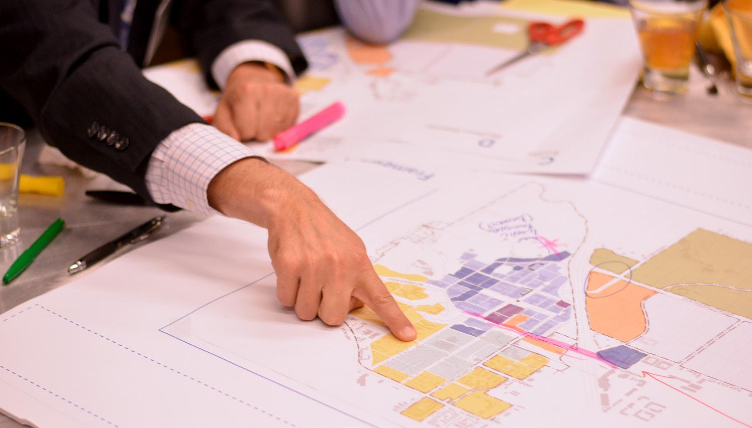
“Alignment” is the proper positioning of priorities and criteria for decisions, with agreement among responsible parties as to that positioning and its consistency with their organizational mission and strategic objectives. Alignment ensures that facilities and programs work together effectively, in pursuit of the University’s key objectives, and not redundantly or at cross-purposes.
This principle specifies that in all capital planning the right balance should be struck among oftentimes competing priorities, including those described below.
• Budget factors could take into account both capital and operating costs, as well as potential revenue opportunities.
• Scope factors could take into account programmatic functions, size, technology and other features of the asset.
• Expectations could include performance objectives, such as energy efficiency, design aesthetics, and prioritization of discretionary spending across facility systems.
• Likewise, the drivers for campus development – academic expansion; campus setting and identity; and environmental priorities – will all shape future decision-making.
• UC Riverside’s primary strategic objectives – namely academic and research excellence; access and opportunity; diversity and inclusion; and engagement and impact in shaping our world – all are equally important, even though they may not have equal focus in making each capital investment decision.
The upcoming Multidisciplinary Research Building #1 (MRB 1) is an example of the importance of alignment. This project became a high priority for near-term development because of its “mission critical” role in meeting the objectives of the UC Riverside Strategic Plan. Specifically, in order to achieve the growth in research faculty and graduate students targeted by campus leadership, it was vital to advance the development of this project and demonstrate the ability to deliver the needed research space quickly.
Expediting the project required an accelerated and collaborative review of alternative sites to identify relative advantages and trade-offs. For instance, key considerations included access to infrastructure and site availability. The selected site also enabled the University to defer relocating existing research greenhouse facilities. Future capacity for additional research facilities near MRB 1 was also a factor that weighed on campus decision-makers committed to a near-term decision that would also be prudent in the long-term.
The selection of a design-build delivery method also took into account the principle of alignment, as it reflected the need to meet complex technical specifications and to achieve greater certainty of on-time and on-budget completion.
The meaning of “best management practices” in the context of UC Riverside’s capital program is to build on campus-wide organizational excellence initiatives, with particular focus on providing decision makers at all levels of UC Riverside with accurate, concise, clear and wellstructured information in order to align capital project decision-making with the University’s goals and objectives.
This principle specifies that UC Riverside will establish best management practices (BMPs) for capital investment planning and execution. These BMPs will be consistent with current and future campus-wide organizational excellence initiatives. Current efforts are aimed at establishing internal standards and processes that engage and motivate campus employees to deliver products and services that fulfill UC Riverside’s mission. Key themes of the current organizational excellence initiatives are to:
• Streamline business processes
• Instill a culture of collaboration and innovation
• Support professional and leadership development
• Encourage process standardization
• Promote a culture of continuous improvement
• Drive organization simplification
• Empower bottom-up change
• Recognize specialization of services
Several BMPs that affect the area of capital investment planning and execution are already in practice or underway at UC Riverside. These include:
• Preparing long-range capital planning forecasts
• Evaluating multiple alternatives in project planning
• Matching project type and University objectives with appropriate delivery strategies
• Redesigning the UC Riverside budget process to provide a more transparent view of the institution’s resource use
• Establishing a new management reporting platform to offer the critical data needed for leadership decisions in a format tailored to the specific needs and interests of individual campus leaders
• Redefining the use of space to achieve increased efficiency and utilization in light of anticipated growth in the campus population
Strategic decisions about capital projects must be supported by rigorous analysis based on solid data. These efforts must be standardized through a replicable approach known to yield positive outcomes. Among the key factors discussed below are the need to understand the University’s capital investment cost drivers, the importance of analyzing probable costs under a range of scenarios, and applying robust tools to quantify trade-offs to support informed capital investment decisionmaking.
Cost drivers are those characteristics of the physical context of an institution that disproportionately influence cost. Each campus has a unique set of capital-cost and operation-cost drivers. Some of these cost drivers stem from the nature of the campus itself, while others arise out of extraneous circumstances either beyond the control of the institution or resulting from its pursuit of its specific strategic goals. Cost drivers can be endogenous – those tied directly to the campus; or exogenous – those arising from conditions beyond the campus, as listed below.
• Geology
• Topography
• Utility plant capacity, distribution network, utility relocation burden
• Site development
• Nature of the existing facility stock
• Requirement for enabling projects
• Phasing requirements and timing
• Construction access and staging
• Campus context, quality and performance expectations
Example of an endogenous cost driver are the energy efficiency performance of the existing building stock, and the campus topography, both shown in Fig. 8.3.
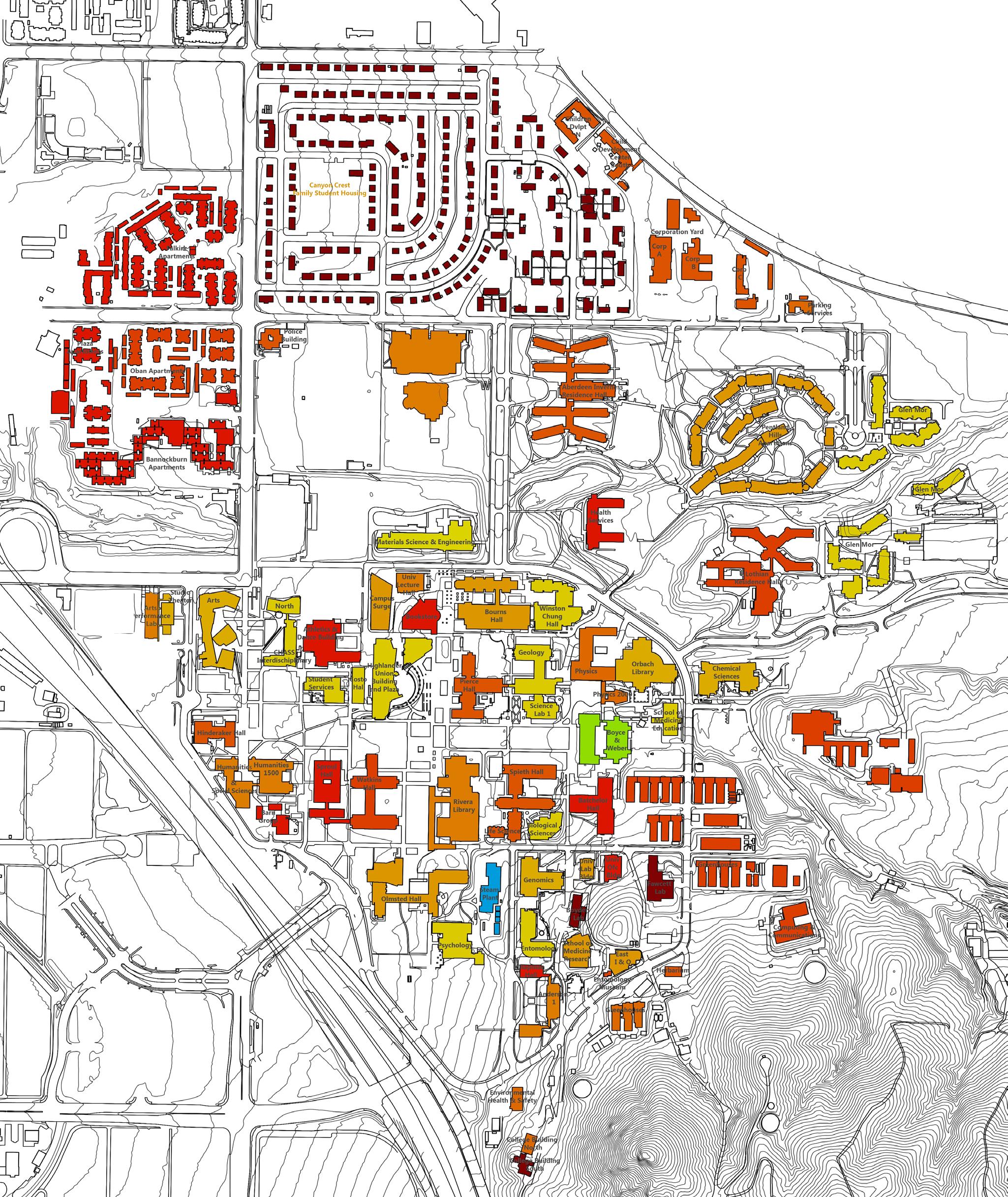


• Evolving pedagogy
• Building codes and regulations
• Local and regional construction market conditions
• Global commodity prices
• Energy prices
Effective means of taking into account these and other exogenous cost drivers are discussed below.
In order to develop models of probable costs of potential future capital investments that are valid across multiple scenarios, specific data relating to endogenous and exogenous conditions must be collected, analyzed, and evaluated. The different types of inputs that would form the basis for developing a complete understanding of a development cost profile of the UC Riverside campus include:
Existing campus conditions
• Built and natural environment
• Infrastructure
• Geology and topography
• Existing facilities condition
Construction market / economics indices
• California Construction Cost Index
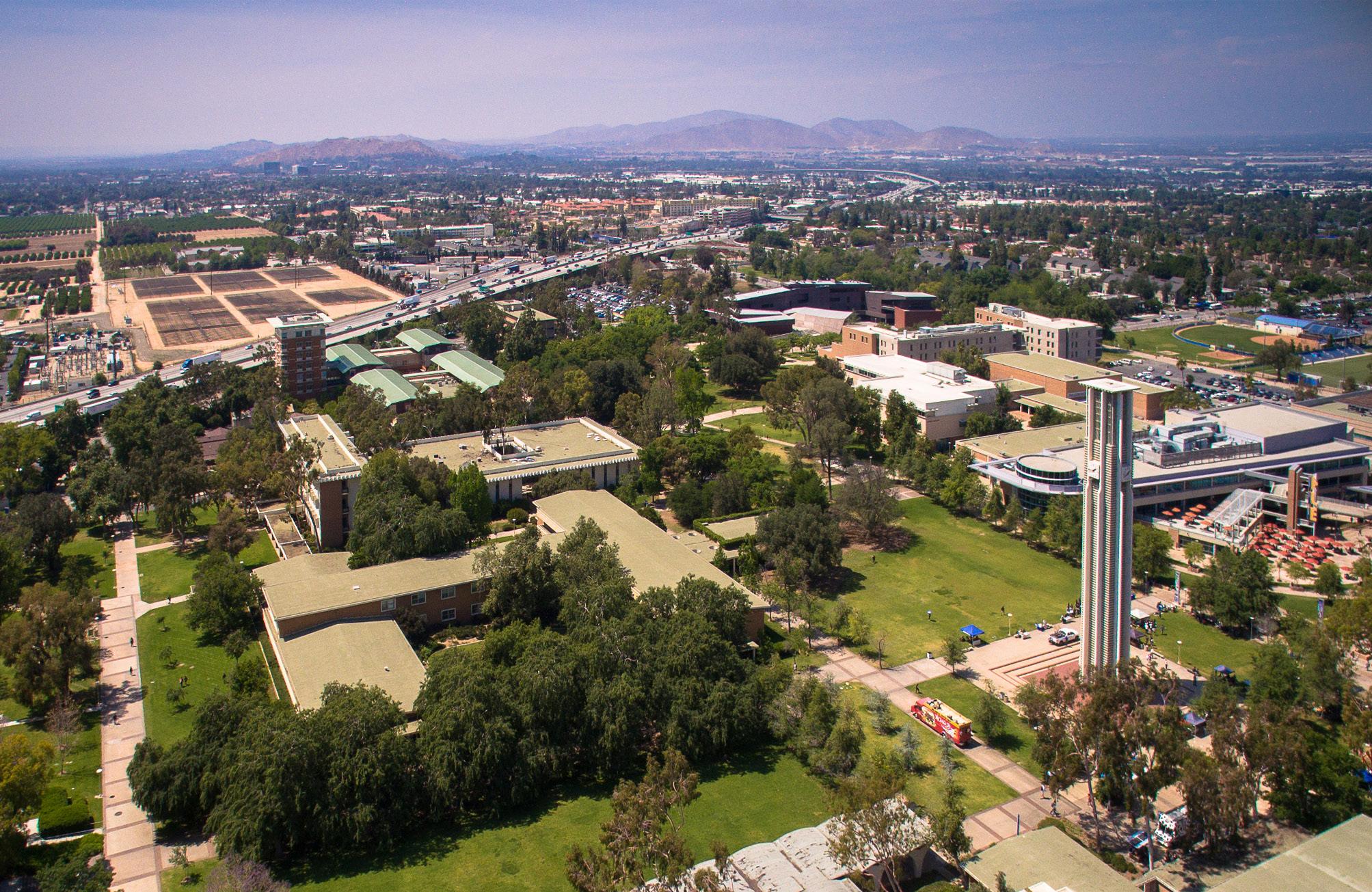
The preceding sections lay out a set of principles to be referenced and an approach to be followed when evaluating capital project investment alternatives and opportunities across all projects. This section provides insight into how these principles are applied in the Master Plan Study.
Investments in the open space fabric of the campus represent a costeffective means of enhancing the value of new and existing facilities within campus neighborhoods and, more broadly, knitting together the entire campus.
The role of building-specific site development, which is primarily intended to extend the use of the building beyond its enclosed area, may be expanded to promote connection among groups of buildings leading to improved alignment and unlocking the latent value of synergies between different areas of the campus.
Specific but relatively small investments in open space can serve to enhance the user experience across the entire campus, adding value both to that area of the campus and the adjacent facility. Examples of recent and proposed enhancements illustrate these multiple benefits.
• The proposed improvement of the Lower Plaza at the Bookstore Building is a nominal investment in a high traffic area of the campus to add a smaller and special place within the larger plaza. It will serve as a forecourt to the renovated lower floor of the Bookstore Building and provide additional seating options the area is presently lacking in.
• The proposed University Gateway, shown as P-1 in Fig. 8.4, would create a primary campus gateway experience and integrate the proposed Mobility Hub and its associated program elements, as well as upgraded amenities for pedestrians and bicycle riders.
• Future improvements to the streetscape at Canyon Crest Drive, shown as P-3, would create a safe and pedestrian-friendly mixeduse street adjacent to planned new student housing and a proposed Campus Event Center.
• A new Recreation Mall, shown as P-4, would create a vital link between Core Campus and the North District, with shaded walkways for pedestrians and bicycle riders, alongside scattered seating and structured garden landscapes that also will capture campus stormwater.
Details and additional examples can be found in chapters 3 and 4.
Infrastructure investment strategies should seek to address unique and evolving conditions across campus. In the near-term and medium-term, it will be advantageous to leverage the existing campus heating and cooling infrastructure and expand whenever it is cost-effective to do so. In the North District, this approach advocates for embarking on an incremental and decentralized approach to energy generation plants until a critical mass is achieved, at which point it may be financially feasible to build a central utility plant (Refer to Chapter 6 for additional detail). On West Campus, incremental and decentralized approaches to facility energy generation plants will be needed until a critical mass is achieved, which is significantly beyond the planning horizon of this study.
Existing facilities that may be re-purposed through rehabilitation, renovation, or retrofit should be evaluated on a case-by-case basis to determine whether they can be suitable for the University’s current and future needs. Through a rigorous and replicable approach to evaluating the viability of existing facilities to meet evolving needs, the campus can validate whether additional investment in an existing facility is the best course of action. Such an evaluation should consider the following:
• Facility condition assessment - to determine the condition of the existing building generally and its systems specifically
• Evaluate the role the repurposed building will play in the evolving campus fabric
• Determine fitness for intended new use
• Develop a space-program project cost estimate
• Compare cost of renovation to new construction
A key objective of the Master Plan Study is to guide the location of future development. As such, it is important to understand the costs and benefits of developing new facilities on various sites or in different sections of the campus. Applying the guiding principles, it was possible to determine the relative cost premiums and discounts. This particular cost-benefit analysis took into account several principles, including Leverage, Synergy, and Alignment. (Flexibility and Best Management Practices don’t weigh into this particular analysis because they are not specific to any one site.)
The results of the study yielded the following premiums and discounts relative to a Core Campus baseline of 0% [that assumes limited renovation of existing facilities].
North District (3% - 8% Cost Premium)
• High campus utility infrastructure first-costs
• Enabling / offsite projects
• Relatively large up-front investments
The North District is relatively undeveloped. It does not have viable infrastructure and would require large-scale site enabling and improvement projects. As such, it has limited resources (other than relatively open land) to leverage, and few synergies and alignment opportunities on which to capitalize for academic activities. Those opportunities do exist for student housing, recreation, retail and the Event Center. Site development areas as a proportion of building area are higher and the benefits of site development are relatively less farreaching.
Core Campus - 0% - 5% Cost Discount
• Low campus utility costs
• Opportunities to leverage existing facilities
• Expected synergies among facility uses
The Core Campus benefits from significant investments in utility infrastructure, which can be expanded to deliver services to new and renovated buildings at minimal costs. Site development areas as a

proportion of building areas are lower and the benefits are farther reaching. Moreover, UC Riverside can accommodate additional development within the Core Campus through both renovation and repurposing of existing facilities as a means of achieving even greater cost efficiencies.
Core Campus Southern Edge (Zone 1) 5%-10% Cost Premium
• Moderate grading, excavation, retention, rock costs
• Moderate campus utility costs
This area is the lightly-developed section at the toe of the hill that is proximate to existing utility infrastructure that can be expanded upon to deliver services to new and renovated buildings. However, the costs for these extensions will be significant. Given the more challenging topography and geology, it is anticipated that development will come with higher costs for foundations and basement construction. Site development areas as a proportion of building area are lower and the benefits of site development are farther reaching. Overall there is less opportunity to leverage existing facilities and infrastructure. Future opportunities exist to create synergies, and develop better alignment with University objectives such as campus identity and visibility.
Core Campus Southern Edge (Zone 2) 10%-20% Cost Premium)
• High grading, excavation, retention, rock costs
• High campus utility costs
The area is the lightly-developed section at the toe of the hill further south of Zone 1 and into the steeper slopes, farther from existing utility infrastructure. Extending existing infrastructure to deliver services to new buildings in this area would come at a significant cost premium. Topography and geology in this area will pose a challenge for construction. It is anticipated that development within this district would come with higher costs for foundations, basement construction, and overall constructability. While site development scope as a proportion of building areas might still be low, this area is at a distinct disadvantage given the reasons cited.
• Very high campus utility costs
• Enabling / offsite projects
The West Campus is the lightly-developed portion of campus west of and across the I-215 / SR-60 freeway from the Core Campus. It lacks the infrastructure to support significant development and would require site enabling, site improvements, and site development as an initial investment. Site development areas as a proportion of building areas would also be higher and the benefits of site development would be less far reaching.