monica cristaldo
monica cristaldo
jazcristaldo99@gmail.com +4917663364456
Potsdam, DE
I have 2 years experience in architecture & urbanism:
aug 2023 - oct 2023
URBAN INNOVATION AGENCY Asuncion, Paraguay
Collaborated in a community housing project for ≈ 1500 families. Streets and public spaces design, 3D visualizations.
jan 2023 - mar 2023
OMCM ARCHITECTURE STUDIO Asuncion, Paraguay
Participated in 2 architectural competition proposals. Metric calculations, budgeting, graphic design, 3D visualizations.
sep 2022 - dec 2022
CIVIL ORGANIZATION ASU+B Asuncion, Paraguay
Contributed to the Caballero Park Revitalization Project. User-friendly map design, GIS and spatial data visualization.
ago 2022 - nov 2022
UNIVERSIDAD NACIONAL DE ASUNCIÓN San Lorenzo, Paraguay
Teaching Assistant “Graphic Representations ll.”
jul 2020 - feb 2021
ETECCISA Asuncion, Paraguay
Designed housing projects. Surveying, plan digitization, interior design, 3D visualizations.
competing: 2023
“Proposal for the San Jose Events Hall”, 2nd Place. “Proposal for the Schoenstatt Sanctuary”, honorific mention.
working with:
Native Spanish
C1 English, IELTS 7.5
B1 German
B1 Italian
A2 Portuguese speak:
Adobe Suite qGIS
SketchUp 3D AutoCAD
Archicad
Lumion
Oil painting
Photography
Sketching
Collage

My strengths are captured in 3C’s: Creative, Curious, & Collaborative. Committed to fostering positive change, I strive to enhance spatial understanding and improve decision-making through innovative map design.
studied:
2018 - 2024
NATIONAL UNIVERSITY OF ASUNCION San Lorenzo, Paraguay
Architecture & Urbanism Bachelor. Avg: 4,67/5,00 (German grade: 1,3).
Research thesis: “ Designing Healthy Streets”, focusing on the influence of street design parameters on community well-being.
ITAIPU University Degree Scholarship.
2021 - 2022
SAPIENZA UNIVERSITÀ DI ROMA Rome, Italy
MArchi Urban Regeneration. Study abroad program.
BECAL International Exchange Scholarship.
researched:
LMU Munich, Germany
Methods in Digital Heritage Winter School.
LMU Full Scholarship.
2023 2025
SUPERWIEN URBANISM Asuncion, Paraguay
“Urban Design Laboratory for the historic center on Asuncion.”
2023
NATIONAL UNIVERSITY OF THE LITTORAL Santa Fe, Argentina
“Naturar Conectar Ecologizar,” construction workshop.
2019 - 2022
UNIVERSIDAD NACIONAL DE ASUNCIÓN Asuncion, Paraguay
“Urban Park Management.”
“XI Ibero-American Biennial of Architecture and Urbanism.”
“Technique, Tectonics, and Technology for Contemporary Housing.”
2022
FEDERAL UNIVERSITY OF RIO GRANDE DO SUL Porto Alegre, Brasil
“XXV Congress of Public Architecture Universities of South America.”
Regeneration of the public space Piazza del Verano.
course
Urban Planning Studio - Sapienza Università di Roma.
professor Marika Fior.
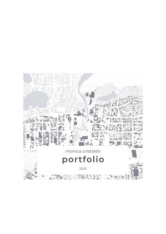
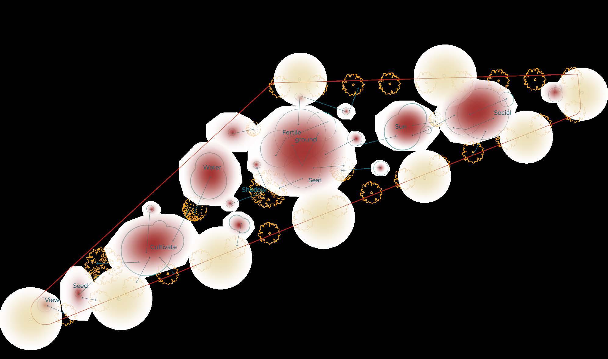
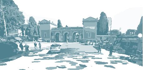
Piazza del Verano has a strategic location in San Lorenzo between universities, factories, the Basilica di San Lorenzo and the Verano Cemetery, being its vocation to serve as a link between these different entities.
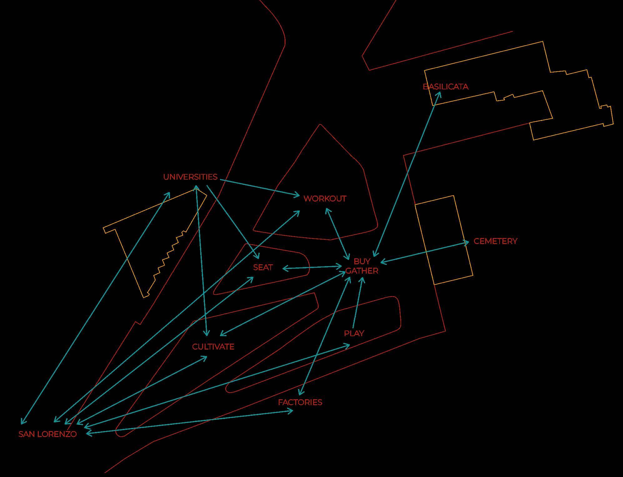
The square was reorganized to become a centrality in the neighborhood. In order to do this, five islands emerge around the theme of sharing: growing, playing, sitting, exercising and shopping. Each island is designed with furniture inspired by Aldo Van Eyck, based on simple geometric shapes.
Seeking to enhance the historical heritage of San Lorenzo three actions are carried out: the creation of axial pathways to offer varied perspectives and approaches to the buildings, the replacement of asphalt with natural stone pavement that complements the character of the existing architecture, and the aligned planting of vegetation to serve as visual guides, with heritage sites as focal points.
Flow scheme
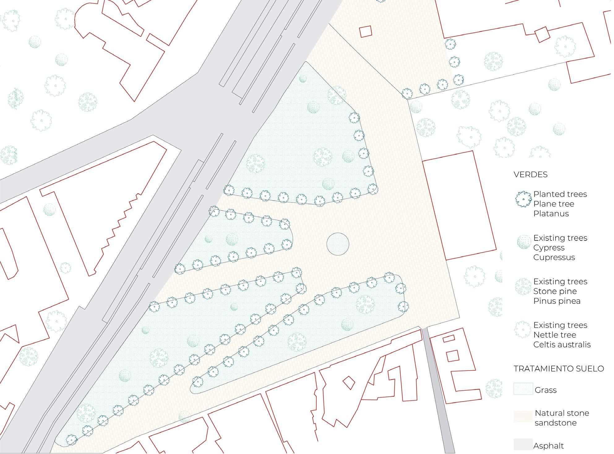
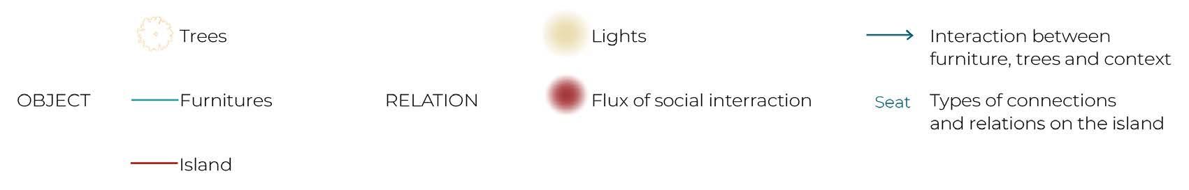
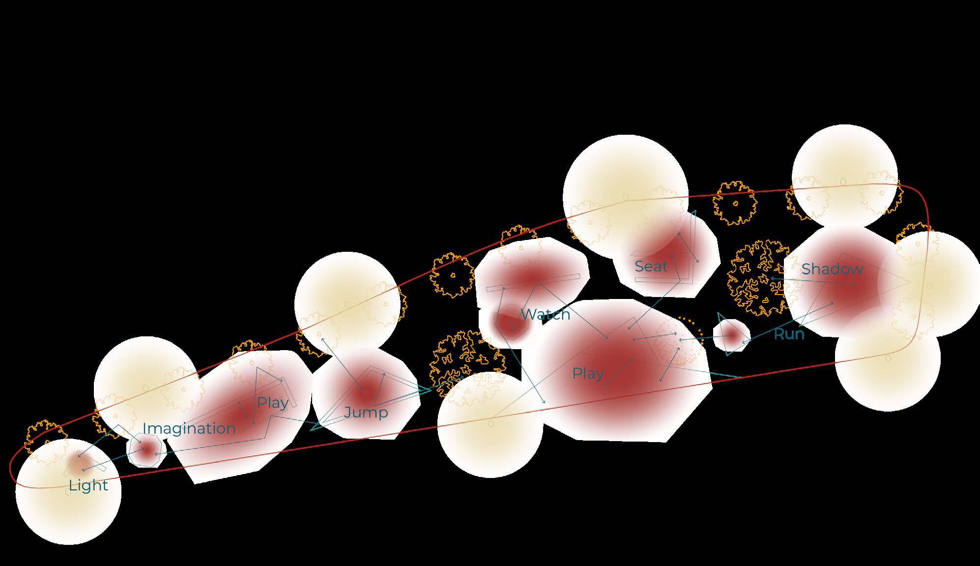
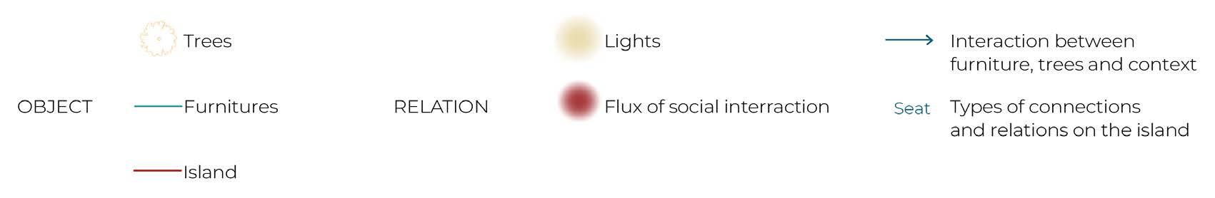
Seat flow scheme
Play flow scheme
Workout flow scheme
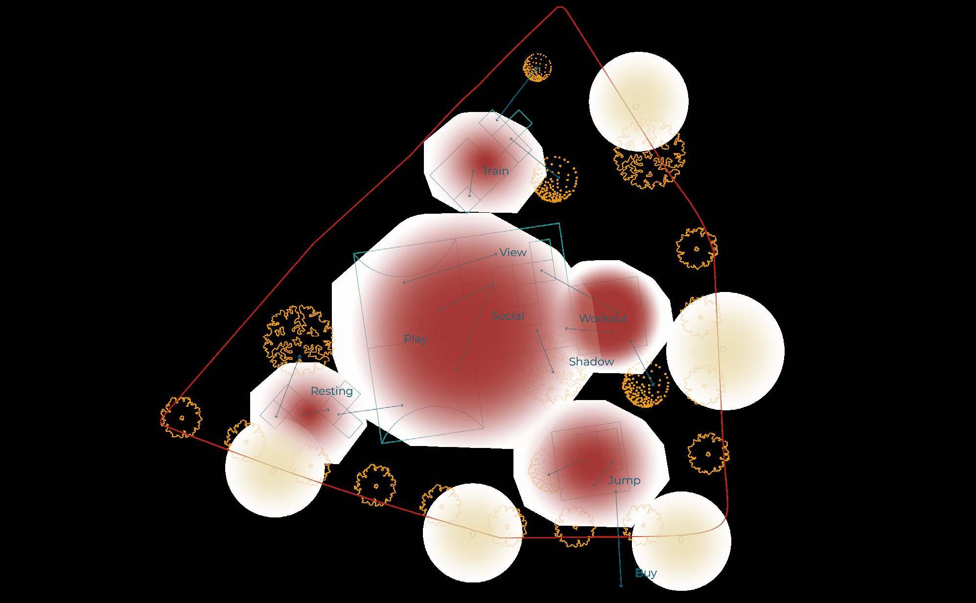
flow scheme
project
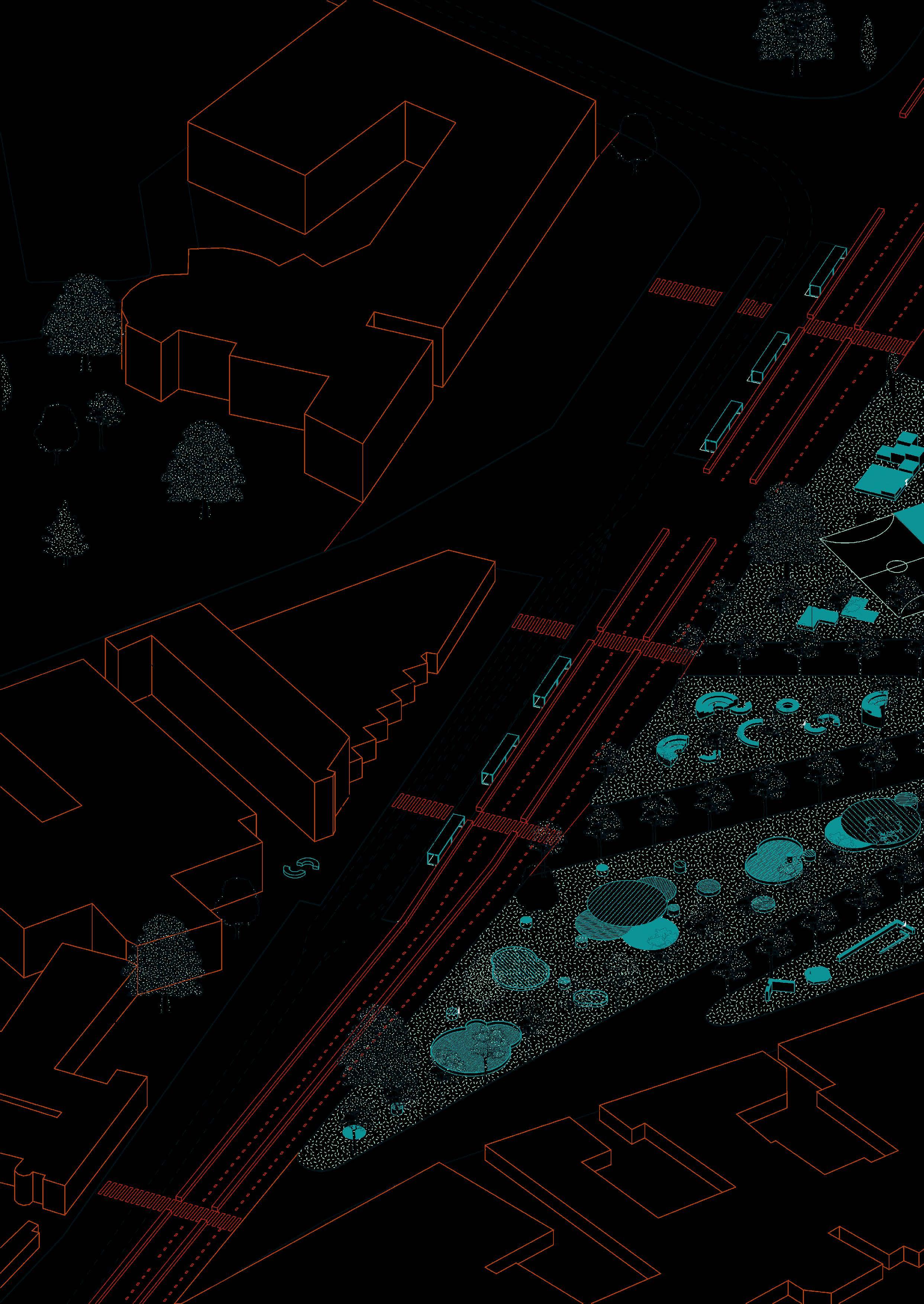
Masterplan for Quartiere San Lorenzo in Rome, Italy.
in collaboration w/ Bettina Bodin, Miriam Byberg, Tonje Thomassen.
course
Urban Planning Studio - Sapienza Università di Roma.
professor Marika Fior.
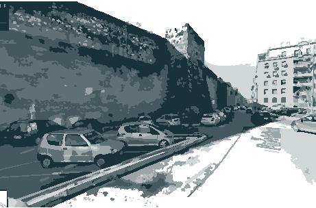
San Lorenzo is configured as an “urban island” surrounded by major urban facilities such as Città Universitaria, Policlínico Umberto I, Verano Cemetery, a railway depot, and Termini Station. This condition has led to the formation of informal settlements on the district's edges which take advantage of abandoned industrial sites. The Masterplan addresses this issue through two lines of analysis:
1. The permeability of San Lorenzo, measuring people’s perception of how easily they can move through and physically traverse the area.
2. A focus on the district’s margins, considering them as key spaces for interaction between Rome’s diverse communities, following Richard Sennett’s open city theory.
Walking access
Areas with high pedestrian accessibility (10min)
Social interact.
Social interact.
- by age
All users
Majority of users
Minority of users

Places of interaction
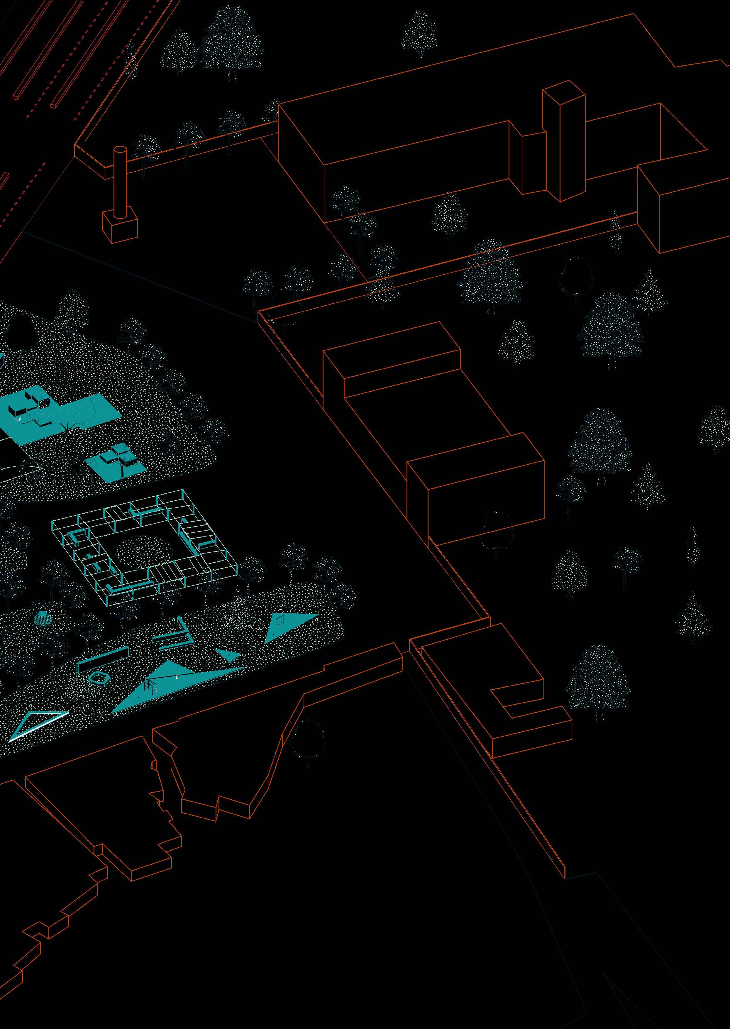
SOFT TRANSFORMATIONS
areas to maintain
AREAS
Consolidated squares
Cultural squares
ACTIONS
High concentration of public services on ground zero (min. 60%)
Medium concentration of public services on ground zero (min. 30%)
Increase permiability of barriers
MEDIUM TRANSFORMATIONS
- areas to requalify
GREEN/PUBLIC SPACE: functional and environmental transformations
Via Tiburtina & adjacent squares
Piazzale del Verano & Scalo San Lorenzo
Educational quarter
Re-qualification of ecological connections
INDUSTRIAL AREAS: maintain industrial use, with added fuctions
North industrial area
South industrial area
Areas to become predominantly green/public space
Buildings to be demolished to create green/public space
Biuldings with possible GFA increase to compensate
COMPLETE TRANSFORMATIONS
areas to regenerate
MOBILITY TRANSFORMATIONS
create a community less dependent on automobiles through the promotion of sustainable mobility
TRANSPORT
Bus
Tram
Cycleway
Pedestrian street with restricted parking
Slow traffic street (30 km/h)
Ring road
Temporary parking
URBAN CENTRALITIES
public space for social interaction
EXISTING - enhance qualities
Piazzale Tiburtino
Parco Caduti 19 Luglio 1943 Villa Mercede
Piazza dei Sanniti
Piazzale del Verano
Scalo San Lorenzo
Piazza dell'Immacolata
PROPOSED
Public space connecting the University and San Lorenzo
Industrial park
Public space along the Aurelian Wall
Vía dello Scalo / Ring road
Railway yard
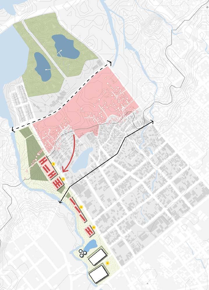
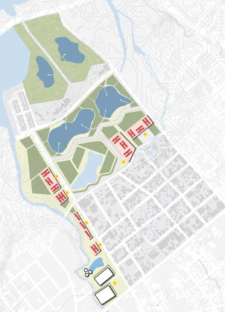
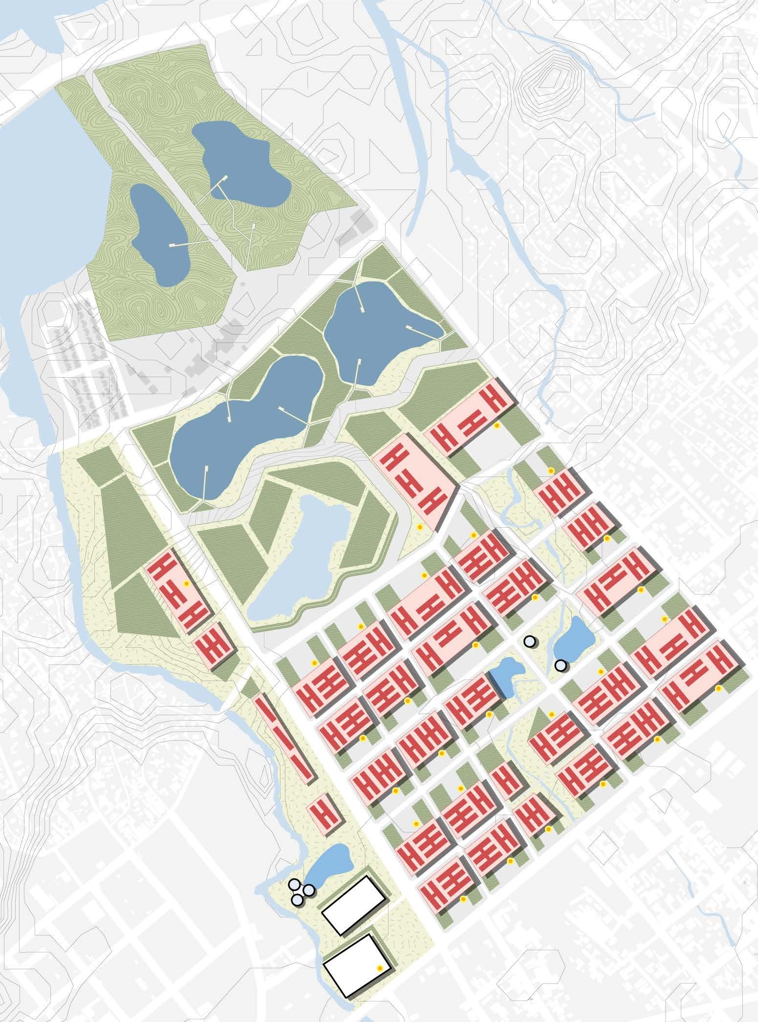
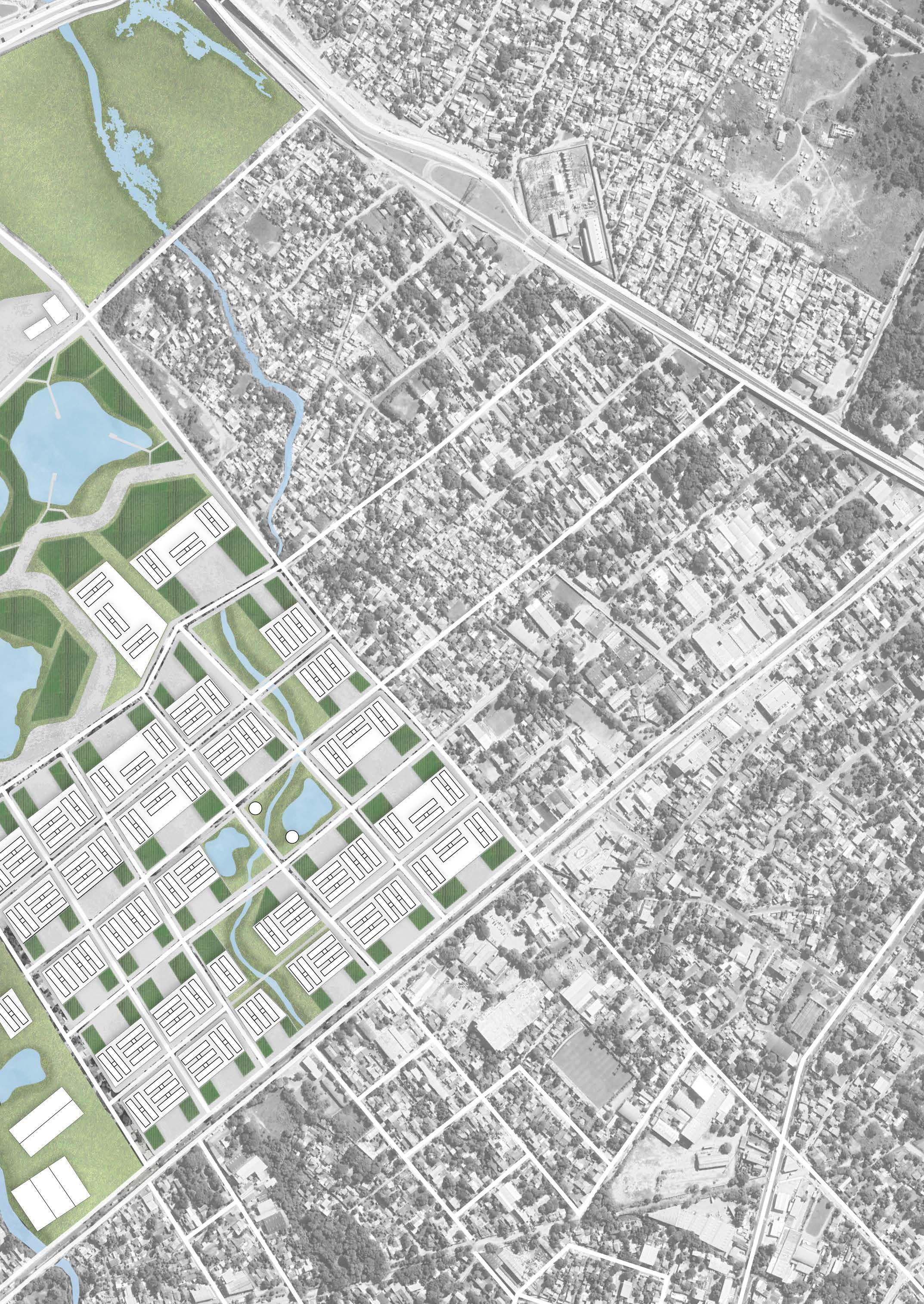
Urban regeneration of the Mburicao stream lower basin.
in collaboration w/ Andrea Ramirez, Gabriela Orrego, Arami Paredes, Ximena Zavala.
course
Urban Design II - Faculty of Architecture, Design, and Art
professor
Sebastian Blanco
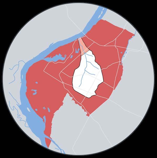
The project is located in the neighborhood Virgen de Fatima, which faces several urban challenges, including poor resource and waste management, high industrial pollution, frequent flooding, and low population density.
The proposal for a new urban model is centered around a main axis—habitat—supported by three complementary pillars: water, air, and food. The key strategies include developing road infrastructure to promote sustainable mobility, restoring the protection zones of the Mburicao and Ybyray streams, increasing residential density, repurposing industrial areas, expanding green spaces, and implementing sustainable urban drainage systems.
With "habitat" as the core principle, the project proposes a vertical housing model, increasing density to 350 inhabitants per hectare—an ideal value according to Salvador Rueda’s Urban Ecology.
Emission: 59.000 Co2/year
53% - industries
Absorption: < 1%
Proposal


Consumption: 280mill lts/year
Floodable area: 50%

Emission: 123.256 Co2/year
Absorption: 38,5%
2,5% - green areas
36% - organic waste
Consumption: 1.358bill lts/year
Retention area: 30%
urban gardens: 280.800.000 lts/year
Consumption: 552.456 kg/sem
Cultivation area: <15%
Consumption: 1.7mill kg/sem
Cultivation area: 50%
4% - facade
96% - horizontal
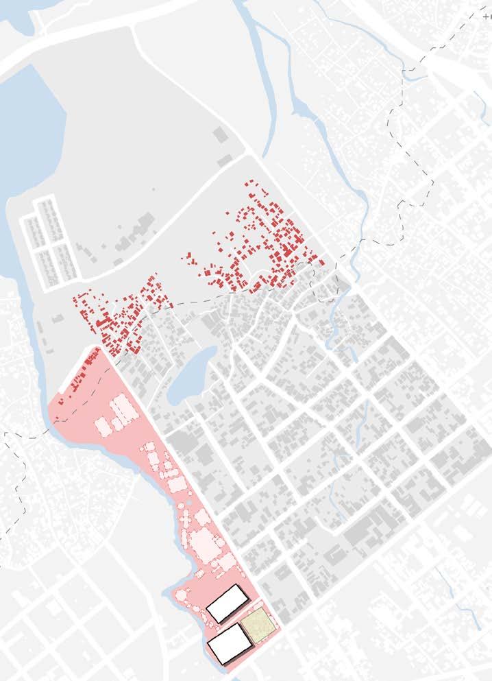
Industries to be Relocated
Industries illegally occupying the stream protected zone. 70% of the industries will be demolished.
30% of the industries will be repurposed.
Civic Information Center
Hosting talks, urban labs, and small interventions in the area.
7.301 sqm of civic center space.
Road Infrastructure
Connection between the streets Lombardo and Florencio Villamayor, along with intervention on Dublin St.
Water Tower and Retention Basins
Construction of water storage towers and storm water management pond.
Urban Gardens
Crop production in horizontal layouts, on the facades of former industries, and on water towers.
Housing Modules
Relocation of residents living in flood-prone areas, with mixeduse podiums designated for commerce and services.
Clean Points
Collection and waste sorting sites + composting.
Housing Modules
Continuation of Housing Complex Construction.
Biological Wetlands Park
Continuation of water management ponds construction, including infrastructure for trails and public spaces.
Urban Gardens
Crop production Around Cerrito Lagoon and Wetlands.
HABITAT: housing + commerce + services density
350 inhab/ha

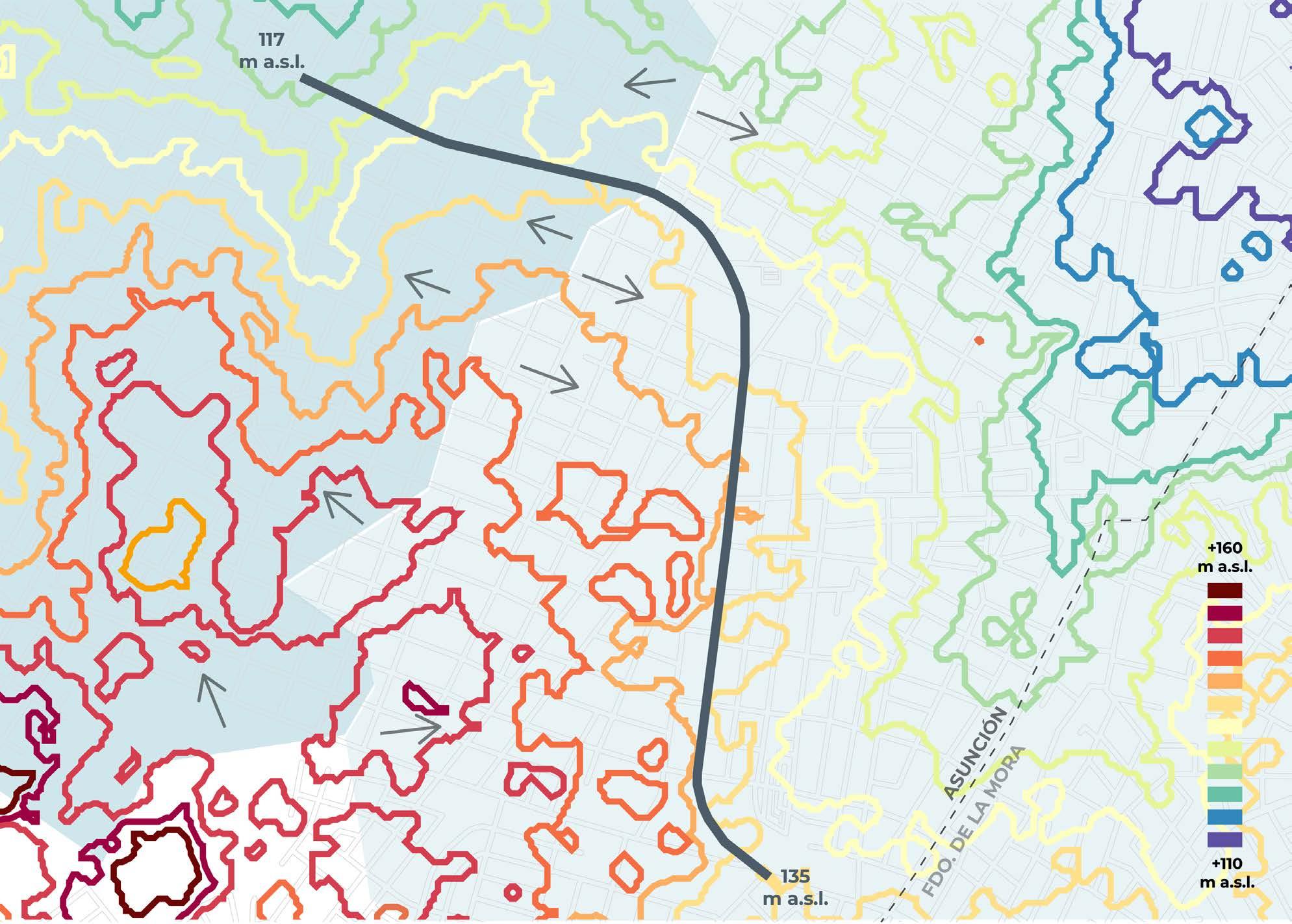
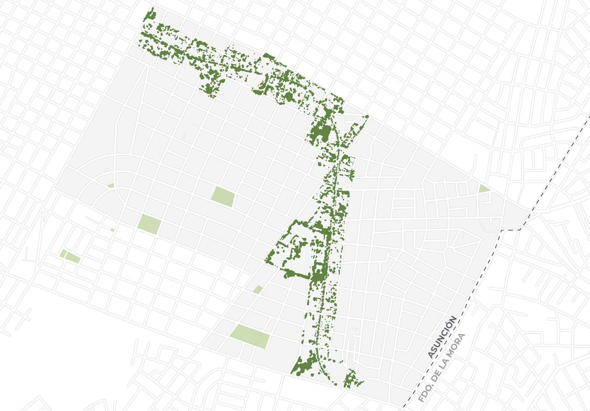
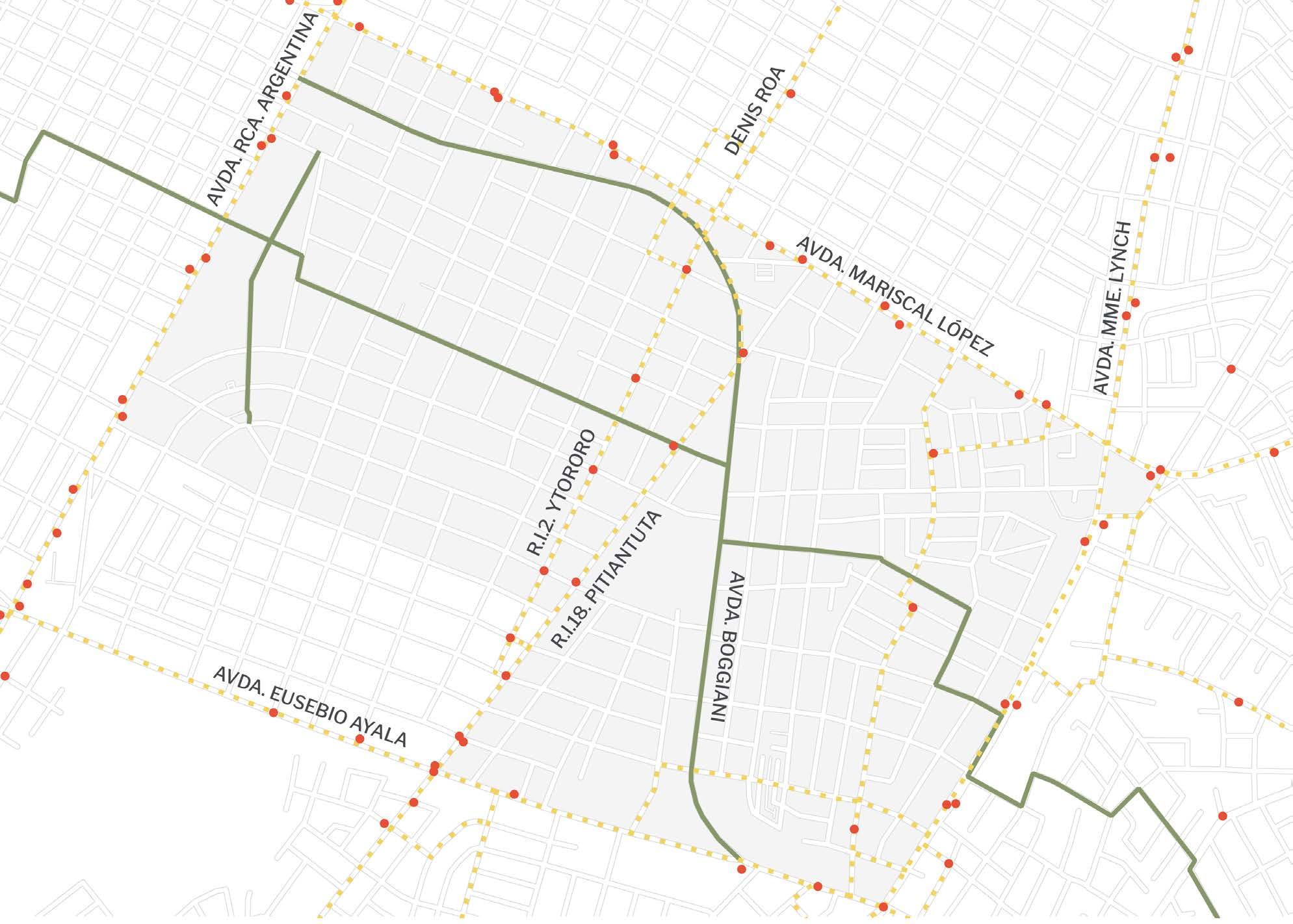
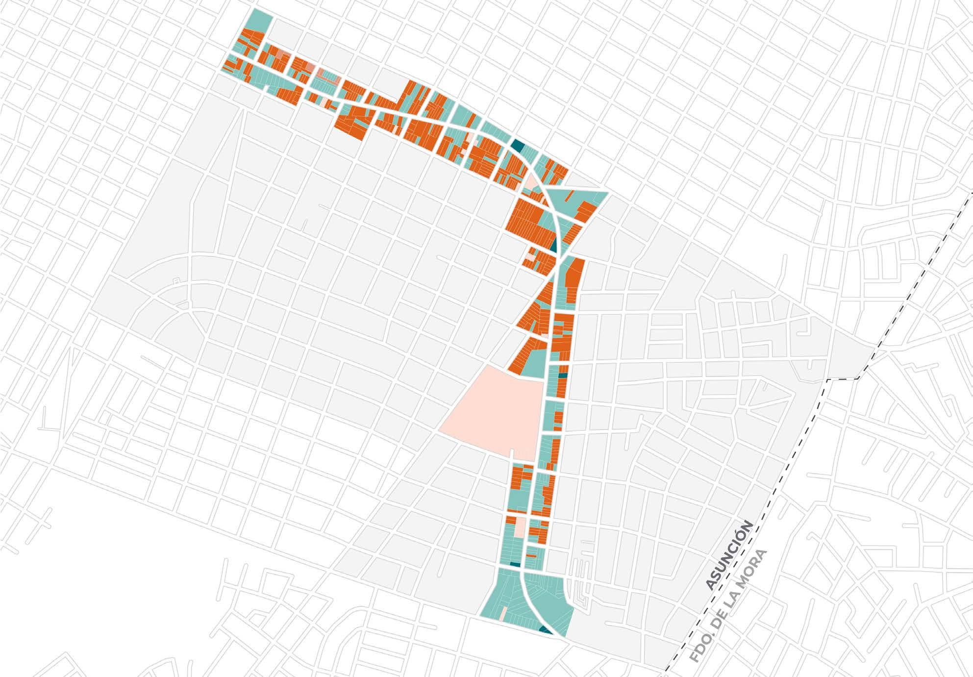
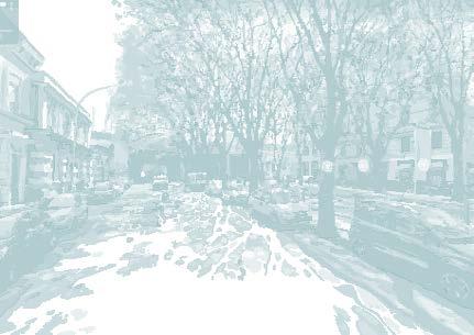
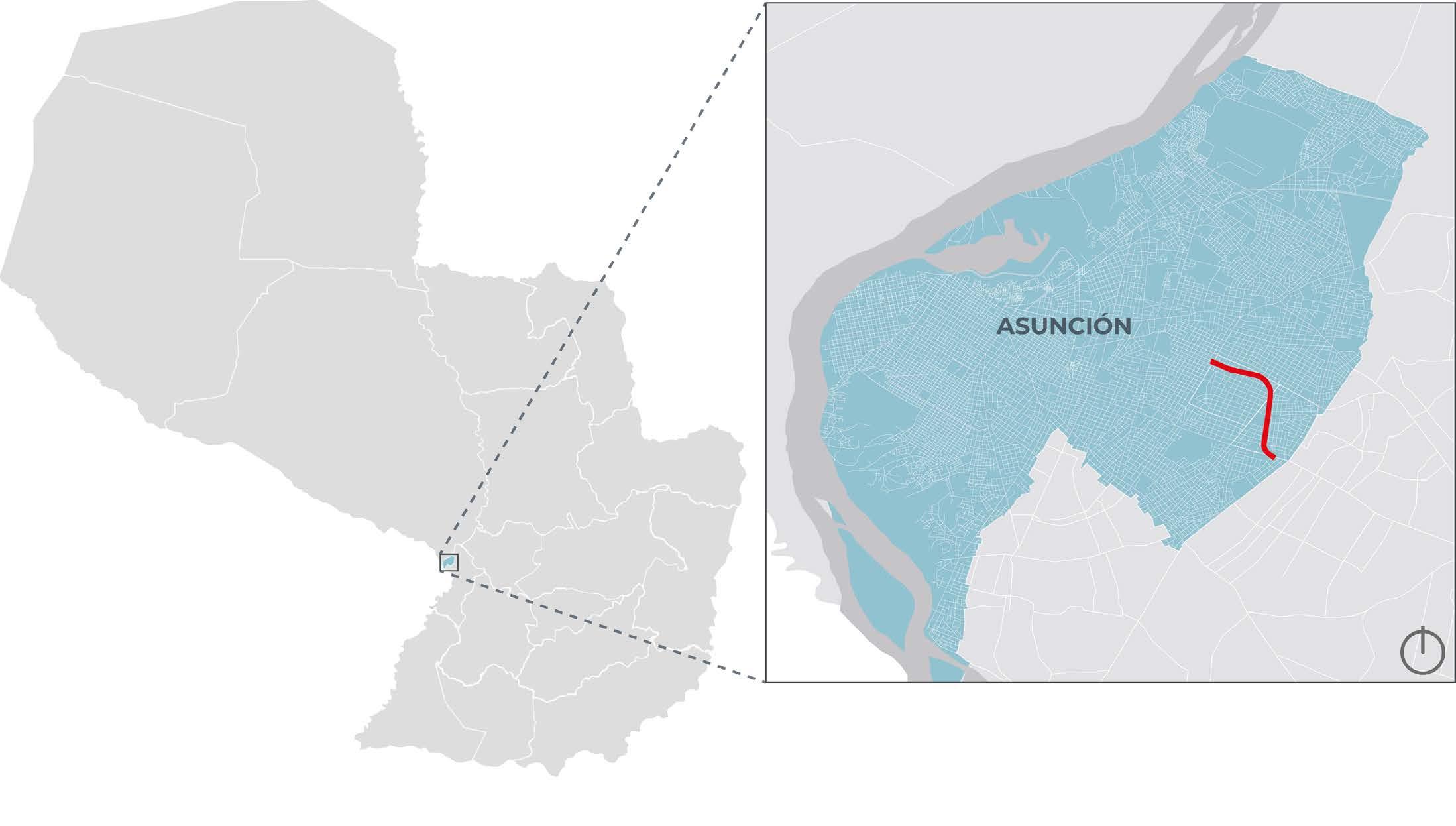
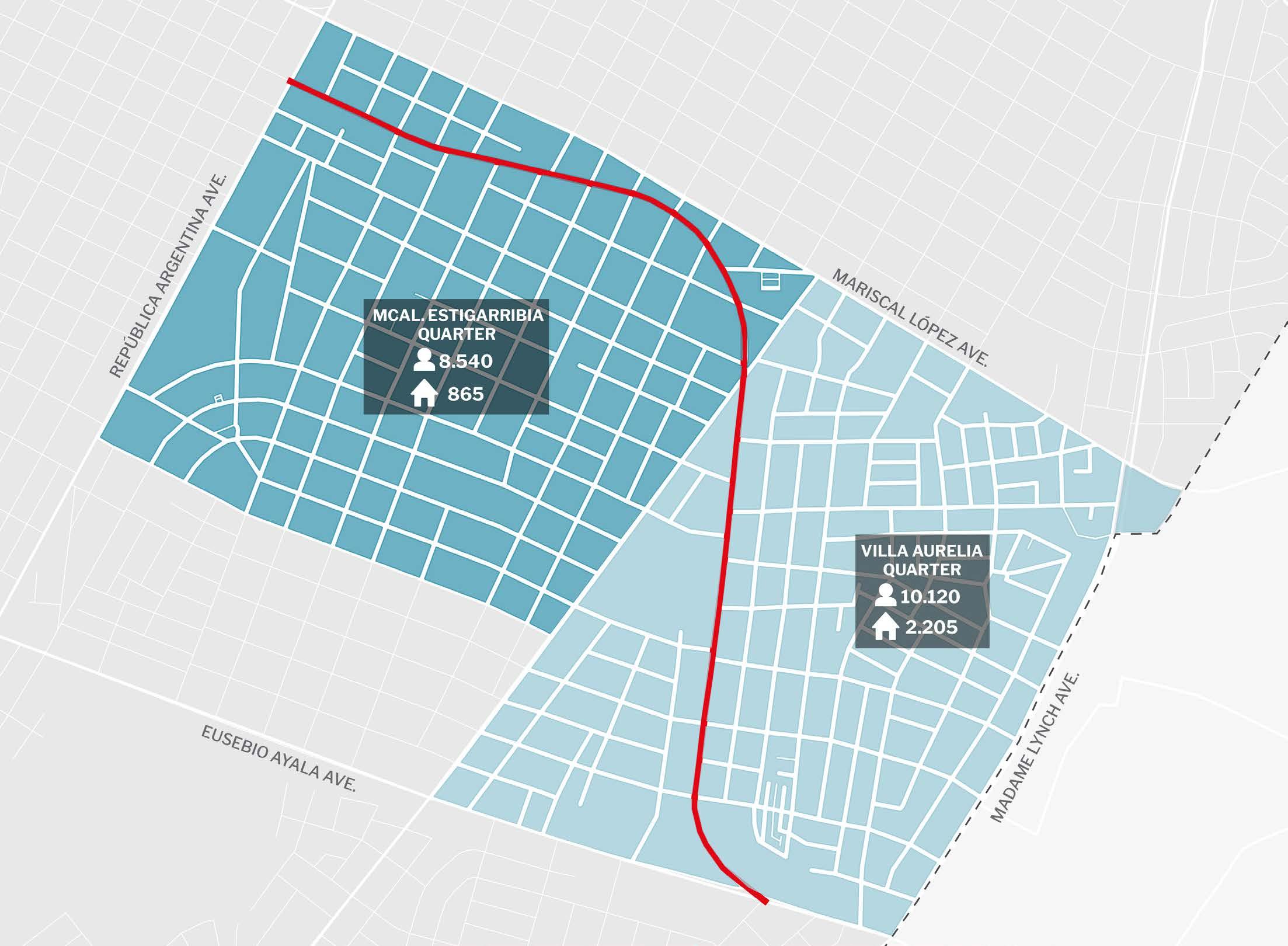
Application of Healthy Streets Indicators to Avenues in Asuncion.
in collaboration w/ Andrea Ramirez.
course
Bachelor's Thesis - Faculty of Architecture, Design, and Art
tutor
Annie Granada
The research thesis analyzes Boggiani Avenue in Asuncion, Paraguay, using the "Healthy Streets" indicators, a tool developed by urban planner Lucy Sanders to assess the health conditions of urban streets. The study begins with a preliminary analysis of the site’s characteristics, identifying the street’s strengths and weaknesses. Based on these findings, improvement strategies are proposed, including road safety measures, sustainable urban mobility, dynamic public spaces, and green infrastructure.
The project aims to transform Boggiani Avenue into a Healthy Street model and promote this concept in other parts of the city. Additionally, it proposes a replicable methodology for studying public spaces to enhance urban health and well-being.
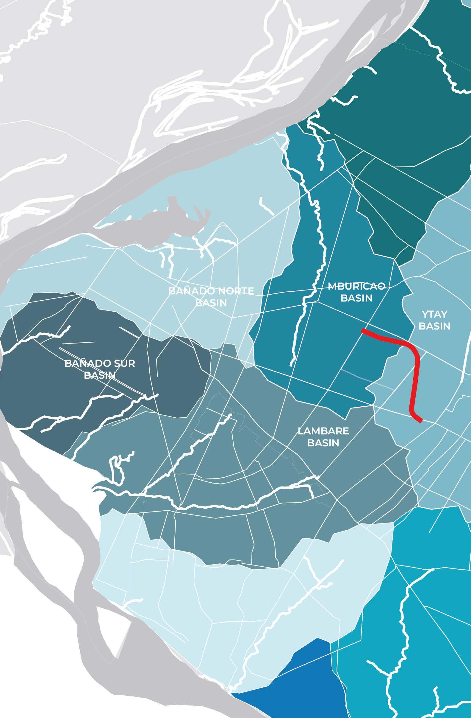
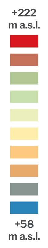
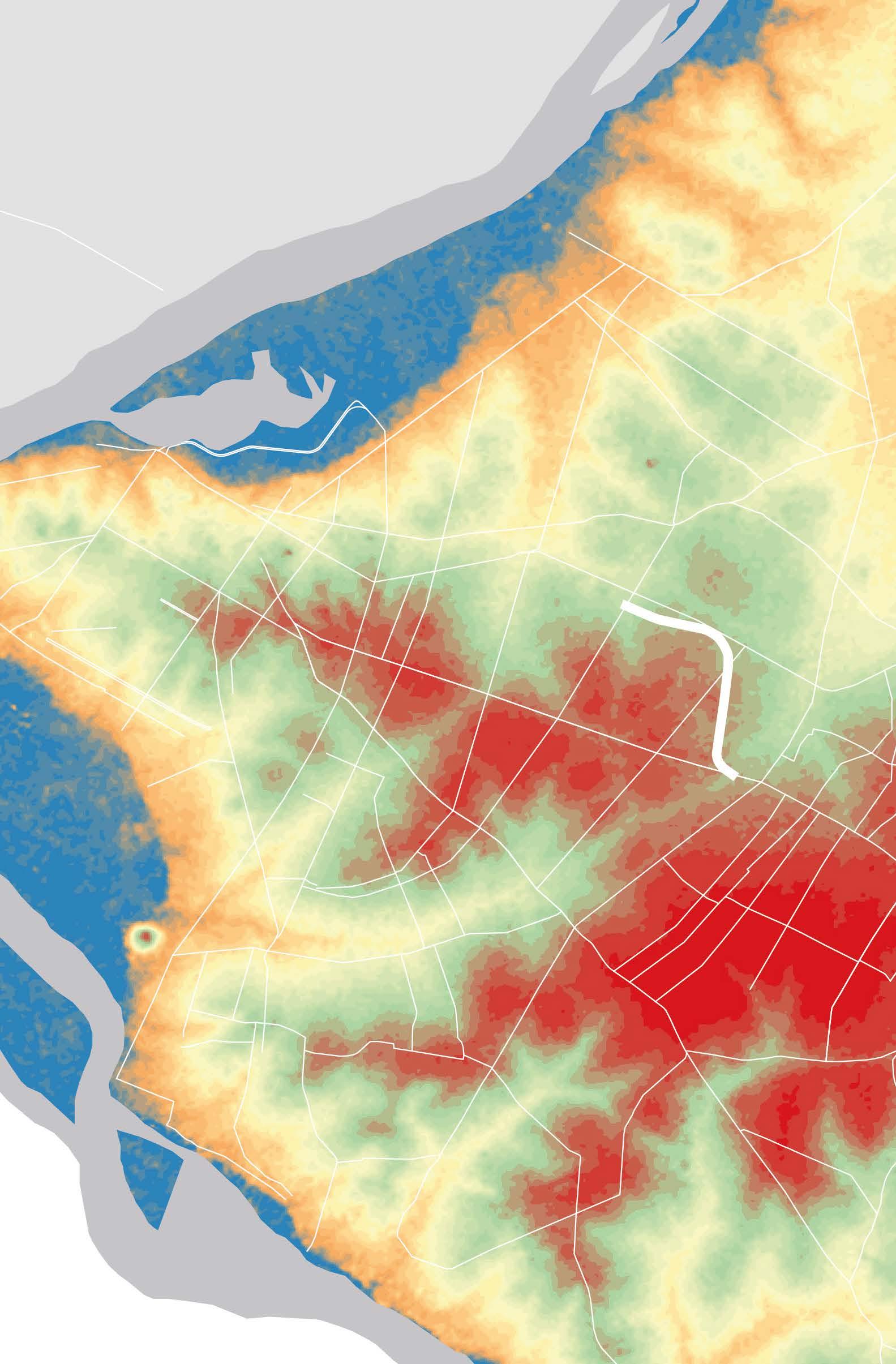
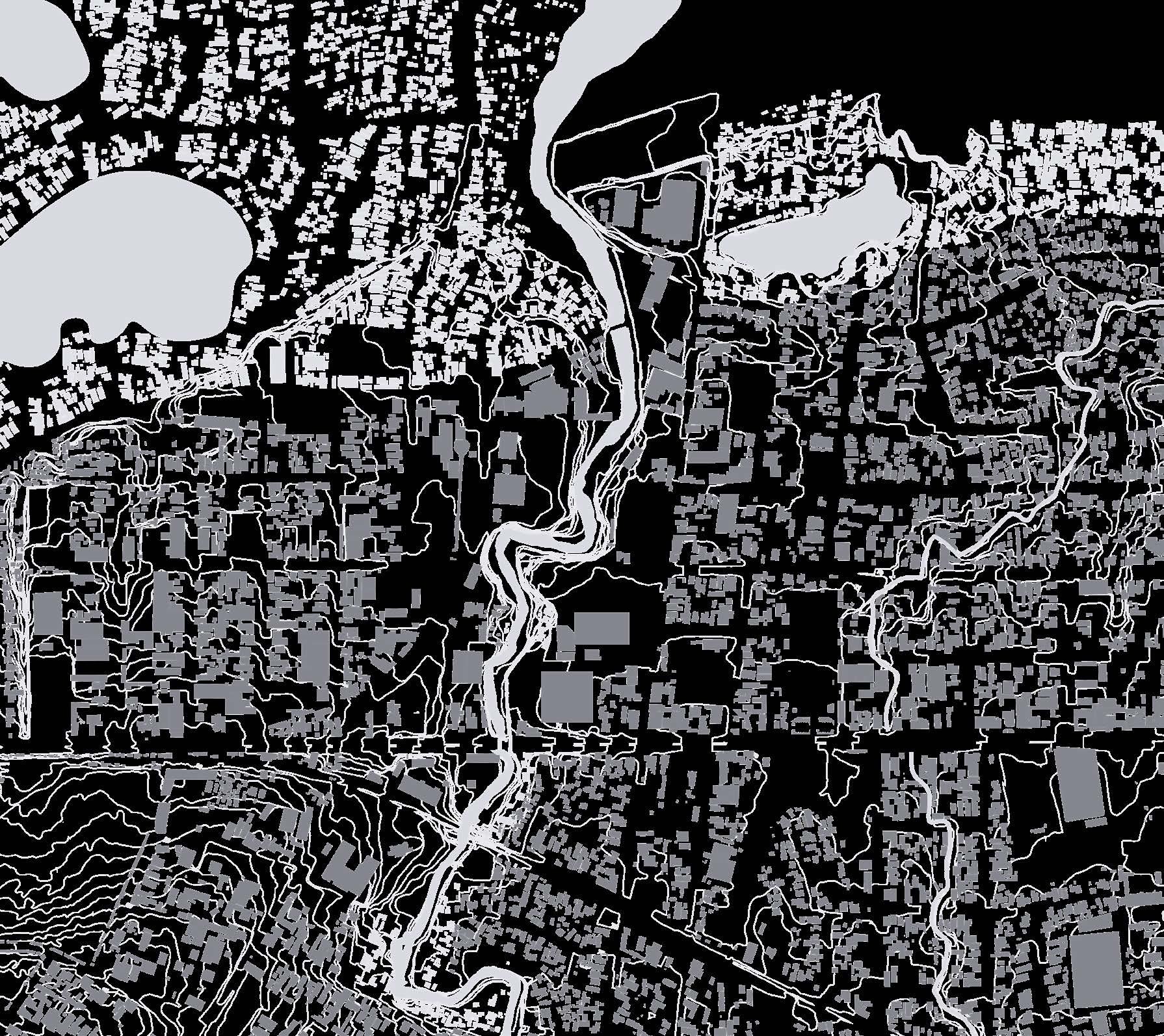
Asuncion topography