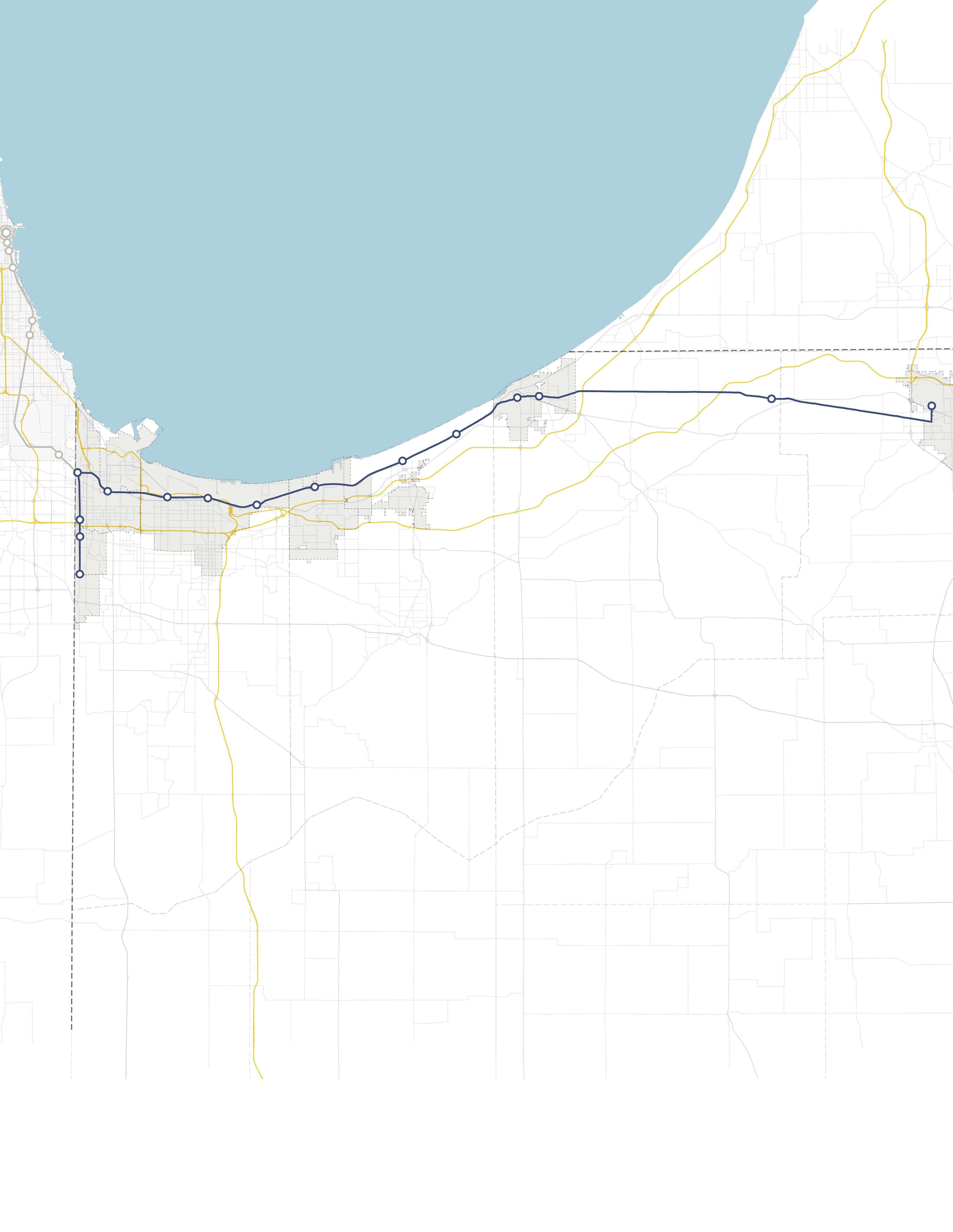

INDIANA INDIANA MICHIGAN ILLINOIS 94 94 80 65 Lake Michigan Hammond Gateway East Chicago Gary Metro Center Miller Portage/ Ogden Dunes 11th Street South Bend Dune Park Beverly Shores Ridge Road Main Street Portage & Ogden Dunes 2023 NORTHWEST INDIANA TDD TOD Strategic Implementation Plan
Acknowledgments
This project was completed with Federal Transit Administration TOD Pilot Planning Funds applied for and with a grant match from the Northwest Indiana Regional Development Authority and the Northern Indiana Commuter Transit District.
Throughout this process, the team worked closely with the City of Portage and the Town of Ogden Dunes to identify and collaboratively advance planning for the communities to be proactive about future TOD.
Project Leadership
Northwest Indiana Regional Development Authority


Sherri Ziller, President and CEO
Northern Indiana Commuter Transit District
Michael Noland, President
i
Portage & Ogden Dunes • Portage/Ogden Dunes Station
ii Table of Contents 01 02 03 Introduction TOD Strategy Appendix Introduction 1 Transit-Oriented Development 3 Northwest Indiana TOD Strategy 5 Overview 12 Land Use Planning 23 Development Planning 29 Infrastructure 41 Zoning 57 Implementation 61 Northwest Indiana TDD • TOD Strategic Implementation Plan

01
Introduction 01
Overview
The Northwest Indiana Regional Development Authority (Northwest Indiana RDA) and Northern Indiana Commuter Transit District (NICTD) collaborated in 2020 to pursue a Federal Transit Administration Pilot Grant to provide planning assistance to Northwest Indiana communities impacted by the modernization and double tracking of the NICTD South Shore Line and the construction of the NICTD West Lake Line. With support from the State of Indiana and Northwest Indiana cities and towns, the two organizations successfully obtained this grant and, through a competitive RFP process, selected MKSK as the lead planning consultant to prepare this Northwest Indiana Transit-Oriented Development Strategic Implementation Plan. MKSK brought a team of experts to supplement their planning expertise including: Shrewsberry Associates, focused on Civil, Utility, and Transportation Engineering; Metric Environmental, focused on Environmental Conditions and Brownfields; and Town Planning and Urban Design Collaborative (TPUDC), focused on Zoning.
Project Background
Prior to this planning process, the Northwest Indiana RDA was authorized by the Indiana State Legislature to create economic development boundaries, called Transit Development Districts (TDDs), which function similarly to a Tax-Increment Financing District, with the purpose of enabling Transit-Oriented Development (TOD) in Northwest Indiana. TOD in Northwest Indiana will leverage these rail capital investments to provide the opportunity for additional economic development as part of the TDDs established under HEA 1144-2017. As part of this legislation, the RDA is tasked with “incentivizing, guiding and promoting economic development around the stations along the South Shore commuter line and future West Lake Corridor line.” These boundaries are no more than 320 acres (1/2 square mile) in area; capture the incremental growth in local income and property tax revenue for

use in public investment related to the station area; and are calibrated specifically for each community based on analysis, areas of opportunity, and the goals and visions of the community. The first group of eight TDDs was established in September of 2022.
This planning process harnessed the momentum generated by the capital improvements to the NICTD commuter rail system and the creation of TDDs. The team, in close collaboration with the RDA and NICTD, then commenced a process focused on how each community impacted with the rail projects and TDDs can be proactive in attracting economic development in accordance with its own growth path. This planning process commenced in September 2021 and was finalized in March 2023.
The communities along the NICTD South Shore and West Lake Lines are diverse and unique. The history, people, natural environment, and built character of each community differentiates it from another; those qualities create an unmistakable identity. In each city and town, there is a deep pride and a sense of individual spirit. Because of this, it is of the highest importance that the growth of these communities be carefully considered against what makes them special today and what their aspirations may be for tomorrow.
The planning process is built upon a deep knowledge of work and a close collaborative relationship with local cities and towns and the RDA’s long-standing commitment to supporting capital investments and economic development in Northwest Indiana. This process also built upon work completed as part of the West Lake Transit-Oriented Development Plan for Hammond, Munster, and Dyer in 2017, completed by the Northwest Indiana Regional Plan Commission (NIRPC), and recent plans completed by local cities and towns.
2 Northwest Indiana TDD • TOD Strategic Implementation Plan
01 Introduction
Transit-Oriented Development
Transit-Oriented Development Primer
Transit-Oriented Development will look different in each Northwest Indiana community, tied to each community’s individual growth path.
The Federal Transit Administration defines Transit-Oriented Development (TOD) as a dense, walkable, mixed-use area centered around or located near a transit station. This concentration of development fosters a vibrant, connected community because of increased access to jobs, amenities, businesses, and housing. TOD also emphasizes non-motorized infrastructure with less reliance on automobiles, resulting in improved safety, congestion mitigation, environmental resiliency, and better quality of life for all.
Benefits of TOD:
• Provides transportation choices and reduces dependence on driving
• Reduces vehicular travel times, congestion, and emissions
• Encourages more walkable cities and towns
• Reduces land consumption for development
• Reduces parking and increases the opportunity for higher/better uses of land
• Provides residents with choices to live, work, and play in the same area
• Expands equitable access to jobs and housing
• Links urban and suburban areas to people and jobs
• Increases housing choices by including a variety of housing types (such as homes on smaller lots, condominiums, townhomes, apartments, etc.)
• Fosters lively community nodes with co-located mix of uses (including all housing types, retail/ shops, restaurants, office, institutional, and commercial)
• Stimulates the revitalization of economically challenged areas
• Increases the potential for community growth and economic activity, stimulates the local economy
• Results in higher state and local tax revenues from increased development opportunity and activity
• Increases a community’s resiliency through a more dynamic mix of uses that makes it less subject to economic volatility
Equitable Transit-Oriented Development
Furthermore, TOD brings equity to the conversation. Equitable Transit-Oriented Development (ETOD) is an important and emerging lens through which economic, environmental, and social sustainability is at the forefront. ETOD focuses on representing the community in decision-making to realize communityfocused benefits. ETOD has the potential to uplift historically disadvantaged communities by providing tailored planning support. Planning grounded in equity should produce policies and programs that improve transit access to economic and social opportunities such as workforce housing, jobs, education, healthy food, recreation, and healthcare, particularly in underserved areas.
Information through this process will help communities plan proactively for development; attract the private market to invest based on assets and opportunities; and apply for funding through local, state, federal, and philanthropic sources. Cities and towns can easily advance planning recommendations produced as part of this process into adopted plans and ordinances that support community building and economic development pursuant to their growth path.
Why is TOD Important for Northwest Indiana?
The historical investment in the NICTD South Shore and West Lake Lines, paired with the ability for TDDs to catalyze development in Northwest Indiana, will be transformative in the communities along the lines. This is a once-in-a-generation opportunity to build upon the public investments (including the $646 million in the Double Track and $852 million in the West Lake capital improvements) to attract economic development to the region through TOD tethered to the country’s third-largest city, Chicago.
Introduction 3
TOD will boost the economy of Northwest Indiana and offer new, healthier lifestyle choices for residents of the region’s cities and towns. The modernization of the NICTD commuter rail line will allow for enhanced rail competition with vehicular commuters into the Chicago Loop, bringing the rail commute time equal to, if not faster than, vehicular drive times, and much cheaper than driving and parking in Chicago.
The RDA’s Comprehensive Strategic Plan estimates $2.7 billion in projected TOD investments in Northwest Indiana due to these rail projects. Many communities are receiving upgraded stations as part of the rail capital improvements. New stations are being constructed in Hammond, Miller (Gary), Michigan City, and Munster; existing stations are being upgraded in Portage/Ogden Dunes and Dune Park. Due to these improvements, TOD projects are already occurring in Michigan City and Hammond, with others to follow. This type of investment has also been happening in the Chicagoland suburbs for decades.
Orland Park Metra Station - SWS Line (2007)
+17% 1.2M +37%
Square Feet of New Construction
Elmhurst Metra Station - UP-W Line (2006)
+11% 640k +40%
Square Feet of New Construction
Highland Park Metra Station - UP-N Line (2009)
0% 640k +43%
Square Feet of New Construction
Romeoville Metra Station - HC Line (2018) 0% 316k +3%
Square Feet of New Construction
Example metrics illustrating the levels and types of investment and impacts occurring in TOD areas in Chicagoland suburbs.
$2.7 Billion in Projected TOD Investments Due to Rail Projects
4 Northwest Indiana TDD • TOD Strategic Implementation Plan 2022 Billions $0.0 $1.0 $2.0 $3.0 2023 2024 2025 2026 2027 2028 2029 2030 2031 2032 2033 2034 2035 2036 2037 2038 2039 2040 2041 South Bend East Chicago Michigan City Munster Dyer Gary Miller Hammond South Gary Metro Hammond Gateway Portage Ogden Dunes Munster Ridge Road
Population Growth Population Growth Population Growth Population Growth Change in Real Estate Value Change in Real Estate Value Change in Real Estate Value Change in Real Estate Value
Northwest Indiana TOD Strategy
Planning Process
This process commenced by bringing the same level of planning assistance to each community impacted by the NICTD South Shore and West Lake Lines, focusing on communities with a TDD boundary in place or with significant economic development opportunities tied to the station area. To accomplish this, a three-step process planning process was employed. This process began with work sessions with each city or town to understand the level of interest and goals for TOD in each community in alignment with their individual growth path.
Through the previous TDD boundary process, the consultant team understood that various factors, such as local political and staff changes, potential catalytic private development, and ongoing planning or infrastructure projects, would impact project work and schedules on a community-by-community basis. To account for these variables, we employed a schedule that begins with a first step of identifying planning needs for each station area.
Based on planning needs and community readiness, we proposed to group station areas to accommodate varying situations and stagger planning activities.
Generally, each community process took approximately 12 months. All of this work was completed between October 2021 and March 2023. During this time, Northwest Indiana RDA and the consultant team met directly with local staff, stakeholders, elected and appointed officials, and the public to solicit feedback and direction for each TOD-focused plan. As a result, individualized community plans have been developed for each study area with supporting appendix materials from technical sub-consultants.
Step 1
Present Previous Findings, Confirm Direction & Establish Priorities
Timeframe: 6-8 weeks
Step 2
Conduct In-Depth Analysis, Advance Development/ Infrastructure Planning & Evaluate Regulating Resources
Timeframe: varies
Step 3
Conduct Individualized Planning Activities & Provide Recommendations and Documentation
Timeframe: varies
CONCURRENT: Public Engagement, Client, Local Officials & Team Meetings
Planning Process Introduction 5
West Lake Line & South Shore Double Track Projects
West Lake Line Project
9 MILES South Shore Line Double Track Project
25 MILES
16 MILES
Communities Studied
The project focused primarily on communities with an established TDD boundary or with a TOD study area. However, high-level assessments were also conducted for communities with stations along the South Shore Line who are eligible for future TDD boundaries. Several stations along the lines were not studied at the request of local leadership in consultation with the Northwest Indiana RDA and NICTD.
South Shore Line
• East Chicago (TDD Boundary)
• Metro Center, Gary (TOD Study Area)
• Miller, Gary (TDD Boundary)
• Portage/Ogden Dunes (Two-Community TDD Boundary)
• Dune Park (High-Level Study)
• Beverly Shores (High-Level Study)
• Michigan City (TDD Boundary)

• South Bend (High-Level Study)
West Lake Line
• Hammond Gateway/Downtown, Hammond (TDD Boundary)
• Ridge Road, Munster (TDD Boundary)
• Main Street, Munster & Dyer (Two-Community TDD Boundary)
NORTH INDIANA INDIANA MICHIGAN ILLINOIS 94 94 80 65 Lake Michigan Lake County Porter County LaPorte County St. Joseph County GARY PORTAGE BURNS HARBOR PORTER CHESTERTON MICHIGAN CITY EAST CHICAGO HAMMOND MUNSTER DYER SOUTH BEND Hammond Gateway East Chicago Gary Metro Center Miller Portage/ Ogden Dunes 11th Street South Bend Dune Park Beverly Shores Ridge Road Main Street 6 Northwest Indiana TDD • TOD Strategic Implementation Plan
Rail Extension
Project Area New Second Track
Scope of Work
To further develop an individualized approach for each community, work plans were created, incorporating specific information desired by the FTA to be included in the planning process and other planning processes at the request of the communities, if any. The Scope of Work Breakdown on the following pages detail the work plan and planning activities in this process.
The following task list organized the work plans:
• Individualized engagement approach
• TOD readiness evaluation
• Previous planning gaps and opportunities
• TOD types and community priorities
• Potential areas of impact (TOD areas and other areas of anticipated significant change)
• Future land use projections (5-, 10- , 20-year time horizons)
• Development feasibility testing and potential community impacts
• Development character renderings
• Thoroughfare typology assignments
• Conceptual corridor designs
• Brownfield assessments
• Infrastructure assessments
• Zoning code/ordinance analysis and recommendations
• Order of magnitude infrastructure and corridor cost estimates
• Additional tasks as requested by individual communities, which may consist of corridor/ connectivity planning, neighborhood/subarea planning, additional engagement activities, additional site concept designs and/or renderings, development pitch kits, open space and trail planning, case study research, additional conceptual street design, capacity building, action planning, and one-year follow-up summaries
Scope Items
Planning Needs and Gaps Analysis
Land Use & Zoning Review and Recommendations
Environmental Assessment and Recommendations
Transportation Assessment and Recommendations
Infrastructure Assessment and Recommendations
Development Testing
Capital Improvements Plan
On-Going Efforts
Coordination with NICTD
Stakeholder and Public Engagement
Introduction 7
Planning Needs and Gaps Analysis
• Confirm framework plan direction by correlating objectives from previously completed plans with the community’s current future vision
• Identify gaps and opportunities not addressed in local planning based on previously completed plans
• Determine and prioritize planning needs for future development and recommendations
Land Use & Zoning Review and Recommendations
• Record and analyze current land use and zoning ordinances
• Identify potential changes in land use and zoning ordinances to achieve desired future development
• Coordinate zoning with planning concepts and planned land uses

• Draft zoning code revisions and/or design guidelines to promote future TOD
• Draft regulating plan/zoning map

• RDA consultants will take zoning through process for adoption by local entities
Environmental Assessment and Recommendations
• Limited assessment of sites with potential or known environmental/brownfield concerns
Transportation Assessment and Recommendations
• Corridor and connectivity planning that improves access and walkability to the station area
Infrastructure Assessment and Recommendations
• Evaluating stormwater, utility, road, and pedestrian facilities at site and district scales

Scope of Work Breakdown
8 Northwest Indiana TDD • TOD Strategic Implementation Plan
Development Testing
• Identify up to eight priority development sites per station area (each “site” up to 10 acres)

• Test development scenarios for priority sites
• Assess potential site uses based on land use projections and market understanding
• Develop conceptual site plans and three dimensional massing illustrations showing potential infill and redevelopment
Capital Improvements Plan
• Order of magnitude cost estimates for infrastructure improvements and projects to effectuate development (with close collaboration with local units)

Scope of Work Breakdown
Introduction 9
TOD Readiness
At the onset of the process, the team acknowledged that each community differed in its potential for TOD as a result of existing policies and infrastructure in place that are necessary to enable TOD, referred to as TOD readiness. To diagnose each community’s TOD readiness, a matrix was developed to evaluate factors of TOD readiness and was completed in collaboration with local officials. In addition, NICTD completed TOD assessments, which were consulted as these evaluations were completed.
TOD Readiness Criteria
• NICTD Station currently operational or under construction
• TDD Boundary is adopted or the community is eligible for a TDD Boundary
• Adopted policy documents that address or plan for TOD (i.e. comprehensive plan, neighborhood plan)
• Adopted zoning ordinances (or overlays) that address or plan for TOD
• Existing walkable grid as part of a downtown or mixed-use neighborhood that connects or can connect to the station
• Currently operational/planned trail or multi-modal infrastructure
• Existing urban amenities that are walkable and/ or within 1/2 mile of the station (i.e. restaurants, grocery, drug stores, office, parks/plazas)
• Existing dense and quality housing stock (more than eight dwelling units/acre), including rowhouses/townhomes, apartments, condos, and ADUs
• Vacant developable sites within TDD Boundary
• Local unit has demonstrated additional initiatives to support TOD
• Current infrastructure has the capacity to support additional development or TOD
Anticipated Results
At the conclusion of this process, control of local land use and zoning remains with the cities and towns. This process aims to provide proactive guidance and recommendations that the local units can use to advance their planning processes, resulting in updated comprehensive plans, area plans, and zoning ordinances complete with locally-controlled public input. In addition, components of this study are designed in a highly-graphic format to inform development discussions, potential RFP’s, and grant applications. The following sections reflect recommendations particular to each TOD study area with key considerations, immediate next steps (next year), short-term recommendations (next five years), and long-term recommendations (beyond five years).
Each community-specific section will function as a standalone plan that is meant to be pulled out of the overall regional plan and referenced by officials of local cities and towns, public members, and the development community. This information is supplemented by more technical information in the respective appendices.
10 Northwest Indiana TDD • TOD Strategic Implementation Plan
02 TOD Strategy 02


Portage & Ogden Dunes
Portage/ Ogden Dunes
Overview
The Portage/Ogden Dunes TDD boundary area is unique to the Northern Indiana Commuter Transportation District (NICTD) South Shore Line because it is located within two municipalities, separated by US 12/Dunes Highway. Corporate limits of Portage extend north of US 12 and corporate limits of Ogden Dunes extend south of US 12. This area demonstrates considerable greenfield development opportunities within walking distance of the Portage/Ogden Dunes Station. Developable area in the TDD boundary, which is predominately owned by the City of Portage Redevelopment Commission, is linked by the planned Burns Parkway/Stagecoach Road and the future Marquette Greenway alignment through this area.
This effort provides an updated vision for the Portage/Ogden Dunes Station Area with a phased conservation-focused and trail-oriented approach. While the TDD boundary is in both Portage and Ogden Dunes, all phase one development is envisioned on properties within Portage. Phase two development may include additional properties along Burns Parkway/Stagecoach Road and long-term joint development and structured parking on the NICTD surface lot south of US 12/Dunes Highway.
The City of Portage previously completed master planning and subarea planning for this area, which was incorporated into this study. The City is actively working on trail and roadway extensions to increase walkability and connectivity within this area and to the broader region, and is seeking a developer for property within the TDD boundary envisioned as a commercial and employment center. There is a future opportunity to consider establishing US 12/Dunes Highway as a Scenic Byway in collaboration with state and national stakeholders.
This section provides materials and recommendations to prepare the City of Portage and the Town of Ogden Dunes to update their plans and ordinances in preparation for the modernization of the South Shore Line and the pursuit of TOD.
12 Northwest Indiana TDD • TOD Strategic Implementation Plan
02
TOD Readiness
Both communities understand the potential for TOD around the Portage/Ogden Dunes Station; they also understand the challenges presented from federal jurisdiction of US 12/Dunes Highway and the Indiana Dunes National Park, physical barriers to development (such as highways, railroad right-of-way, and utility easements), a lack of existing utility and roadway infrastructure on developable sites, and the need for sensitivity around existing residential areas.
The City of Portage envisions the development of this area to be phased, focusing on conserving certain portions of the property as natural forested, dunes, or prairie areas developing a range of housing, community and tourism amenities, and small-scale mixed-use nodes. The City also recognizes that road and utility upgrades will be required before this area develops.
Evaluation Criteria
NICTD Station currently operational or under construction
The planned alignment of Burns Parkway may be modified in the future if TOD joint development occurs on the NICTD parking lot site south of US 12. The City is motivated to develop intentionally following its Northside Master Plan and subsequent TOD planning included here. The City has been proactive in releasing an RFP for development on City-owned property within the TDD boundary. The City is considering propsals to develop the 180 acre site owned by the Redevelopment Commission (RDC).
This document serves as a roadmap for TOD implementation by providing recommendations for land use, development, zoning, and infrastructure investments.
TDD Boundary is adopted or the community is eligible for a TDD Boundary
Adopted zoning ordinances (or overlays) that address or plan for TOD
Adopted policy documents that address or plan for TOD (i.e. comprehensive plan, neighborhood plan)
Existing walkable grid as part of a downtown or mixed-use neighborhood that connects or can connect to the station
Currently operational/planned trail or multi-modal infrastructure
Existing urban amenities that are walkable/within 1/2 mile of the station (i.e. restaurants, grocery, drug stores, office, parks/plazas)
Existing dense and quality housing stock (more than 8 dwelling units/acre), including rowhouses/ townhomes, apartments, condos, and ADUs
Vacant developable sites within TDD Boundary
Local unit has demonstrated additional initiatives to support TOD
Current infrastructure has the capacity to support TOD/additional development
13 Portage & Ogden Dunes • Portage/Ogden Dunes Station
Community Priorities
Community priorities were developed by working closely City and Town officials to confirm economic development goals, identify key sites of interest, and understand recent and ongoing municipal and development projects. These priorities form a future vision for the TDD boundary area specific to Portage and Ogden Dunes, which include the following:
• Implement the “Northside Master Plan – Creating a Livable Lakefront”
• Better integrate Lake Michigan and the Indiana Dunes National Park into the fabric of the community
• Build a healthy, sustainable community –environmentally, economically and socially
• Create a walkable TOD defined by high quality and ADA accessible trail linkages, sidewalks, and compact development patterns connecting to the station, Marquette Greenway, and the Portage lakefront
• Confirm the routing for future Burns Parkway/ Stagecoach Road and the Marquette Greenway. The NICTD Portage/Ogden Dunes Station commuter lot creates issues with extending Burns Parkway to US 12/Dunes Highway as originally recommended.
• Advance efforts to develop property owned by the City of Portage Redevelopment Commission
Big Moves
“Big Moves” are defined as enabling steps to signal to the market that conditions are right for transit-oriented development to occur. Opportunities for medium-density mixed-use transit-oriented development exist in close proximity to the station area. Enhanced connections for pedestrians should link existing suburban neighborhoods and existing and future employment centers to the station area. This station presents unique development-ready sites of large City-owned greenfield properties. Streetscape and traffic enhancements of the US 12/ Dunes Highway corridor will increase safety and access to and from the station. Development of RDC property holdings will support future transit-oriented development in Portage.
14 Northwest Indiana TDD • TOD Strategic Implementation Plan
Burns Parkway Extension
An extension of Burns Parkway/Stagecoach Road will create a convenient multi-modal vehicular corridor through the TDD boundary from US 12/ Dunes Highway to IN 249. This alignment could support conservation-style development in the near term and mixed-use TOD in the long term. The planned alignment of Burns Parkway may be modified in the future if TOD joint development occurs on the NICTD parking lot site south of US 12. The intent of near-term and future phase Burns Parkway improvements are to create a walkable environment with trail linkages, buffering between roadways and residential uses.
Conservation-Style Subdivision


Development in Portage is facilitated by a large amount of available greenfields and City-owned property within the TDD boundary. This area can conservation-style development, including a mix of housing types, that would preserve and celebrate existing natural features. Portage Northside Business Park is an 150 acre master planned development with several built developments on site.
*Theareaindicatedintheboxwillrequirefurtherstudyasdevelopmentisproposedinthisareatoensuretheneedto protectresidentialadjacenciesisbalancedwithfuturetrafficandpedestrianinfrastructure.
15 Portage & Ogden Dunes • Portage/Ogden Dunes Station
South Shore Line Burns Pkwy 12 South Shore Line Burns Pkwy 12 NORTH Big Moves City of Portage Area of Concern* City of Portage Area of Concern
Mixed-Use Town Centers
South Shore Line

The future Burns Parkway/Stagecoach Road connection creates a new epicenter for a mixed-use development adjacent to the station area, incorporated tourist and lodging facilities associated with Indiana Dunes National Park. Long-term potential for TOD at the station exists as joint development may occur on the commuter parking lot south of US 12/Dunes Highway. Within this area there is tremendous opportunity for walkable, residential development that could offer a unique ability for residents to walk to the station, creating a true TOD in this area. As a first phase, several sites have been identified for townhome and single family development. In addition, several sites have been identified for longer term investment of mixed use and lodging.
*Theareaindicatedintheboxwillrequirefurtherstudyasdevelopmentisproposedinthisareatoensuretheneedto protectresidentialadjacenciesisbalancedwithfuturetrafficandpedestrianinfrastructure.
16 Northwest Indiana TDD • TOD Strategic Implementation Plan
Burns Pkwy 12 NORTH Big Moves City of Portage Area of Concern
TOD Opportunity
An overall TOD opportunity vision was developed with the City of Portage and Town of Ogden Dunes outlining the development and investment potential within the TDD boundary area. Opportunity sites were identified as Areas of Impact within each TDD boundary with the greatest development potential.
The City of Portage, as the primary owner of properties within the TDD boundary south of US 12/ Dunes Highway, is interested in conservation-style development with a focus on residential development in the first phase and long-term potential for tourism- and community-focused TOD. This area includes approximately 150 acres owned by the Redevelopment Commission. The strategy is to create a blended transit-oriented and trail-oriented development area designed to manage growth and stormwater in an environmentally sensitive manner that can complement the Indiana Dunes National Park. The investment in the Marquette Greenway, which is anticipated to extend through this area, is poised to be a transformative regional connector.
A phased approach allows the City of Portage to retain sites closer to the station and measure how TOD matures with the development of residential and hospitality areas. Existing residential areas can remain unconcerned about dense development in the foreseeable future. This will also allow the City to realize the goals of its 2016 Northside Master Plan in a way that is sensitive to how things have changed since the plan was completed and later updated. In the long term, there is an opportunity for joint development with NICTD to occur at the recently constructed NICTD parking lot south of US 12/Dunes Highway.
The Town of Ogden Dunes is not interested in development within the TDD boundary north of US 12/ Dunes Highway.
The City of Portage is interested in how the Marquette Greenway will access Indiana Dunes West Beach, Portage Lakefront and Riverwalk, and Portage South Properties. Portage is interested in linkages between the Portage Ogden Dunes Station, parks, and Lake Michigan.
Areas of Impact
Areas of Impact were established to distinguish between major (re)development areas, both TOD and non-TOD, and areas to be maintained, preserved, and enhanced. These designations begin to direct development activity and other targeted investments based on proximity and relationship to the station area. For purposes of this study, individual sites may have been grouped to demonstrate synergy among sites for development potential.
TOD Opportunity Sites
These areas are prime sites for transit-oriented development due to their proximity and connectivity to the station area. Development of these sites should be dense and urban in form, promote walkability (in general, a quarter mile is walkable and the entirety of the area is walkable if trail linkages are implemented) and multi-modal access, and emphasize a quality public realm and sense of place. Access to the station area is crucial in these areas. Development should be mixed-use, integrating a variety of active ground-floor commercial uses and upper-floor uses within a building and integrating a variety of uses in a collection of buildings on a site.
Site A
Site A is 6.2 acres, primarily owned by NICTD, that lies within both municipalities. The site is currently mostly undeveloped land, with the exception of properties within Ogden Dunes that include a substation and two active commercial properties. This site is intended to be NICTD commuter parking areas that will be accessible via Stagecoach Road. This site is across US 12/Dunes Highway from the station platform so ensuring a safe pedestrian crossing from parking to the station is very important. Long-term this could be a TOD development site.
Sites B and D
Sites B and D are a combined 6.5 acres of undeveloped land owned by the City of Portage Redevelopment Commission. These sites are expected to be positioned along the Burns Parkway/Stagecoach Road extension. As they are within walking distance to the station area, these sites hold long-term potential for TOD; however, they are anticipated to remain undeveloped while other areas of the TDD boundary are prioritized for development first.
17 Portage & Ogden Dunes • Portage/Ogden Dunes Station
Areas of Impact
Vacant land between the utility corridor and existing residential areas presents a “clean slate” for transit-oriented development, although not immediately adjacent to the station. The remaining portions of the boundary to the south present the same “clean slate” opportunity and could accommodate significant development in the future that may build upon the Portage-Burns Waterway, Ameriplex, and interstate access.

TOD Opportunity Site Area of Significant Change 18 Northwest Indiana TDD • TOD Strategic Implementation Plan 12 Burns Pkwy Dunes Hwy Portage and Ogden Dunes Station OGDEN DUNES PORTAGE Corporate Boundary 1/2Mile Portage-BurnsWaterway Doyne’s Marina Ameriplex at the Port 94 Southport Rd Ameriplex Dr Melton Rd 12 Ind ust r i a l S a f ert yOverpass Indiana Dunes National Park Tolleston Dunes Site B 2.5 Total Acres Site D 4.0 Total Acres Site A 6.2 Total Acres Site E 7.0 Total Acres Site F 41.3 Total Acres Site H 11.8 Total Acres Site M 45.4 Total Acres Site K 8.1 Total Acres Site L 10.3 Total Acres Site J 81.7 Total Acres Site I 10.4 Total Acres Site C 13.0 Total Acres A F E H C I J L M K B D Site N 9.2 Total Acres South Shore Line Hillcrest Rd Stagecoach Rd N O Site O 9.5 Total Acres 249
NORTH
Site C
Site C is approximately 13 acres of undeveloped land, owned by the City of Portage Redevelopment Commission. It is situated between the existing Stagecoach Road on the west and the future Burns Parkway/Stagecoach Road extension on the east. To north is a small cluster of single-family homes on Stagecoach Road. Access to this site is anticipated to be from Burns Parkway/Stagecoach Road. This is site is also adjacent to the Indiana Dunes National Park and the Tolleston Dunes Trail, which could be advantageous for future tourism-oriented uses on this site.
Sites E
Sites E is 7.0 acres of undeveloped land owned by the City of Portage Redevelopment Commission. A portion of Site E is likely to develop as future phases of the Marina Shores development with access controls in place. Future developments would be accessible via a new roadway network that connects to the Burns Parkway/Stagecoach Road extension.
Site H
Site H is an 11.8-acre undeveloped site owned by the City of Portage Redevelopment Commission. This site will be along the anticipated Burns Parkway/ Stagecoach Road extension.
Site N
Site N is 9.2 total acres and is currently a residential area. There are a number of property owners making up the parcels in Site N, but the area has potential for future TOD with the adjacency to Site A and proximity to the station.
Areas of Significant Change (Non-TOD)
These areas have been identified for their potential for redevelopment and a major change in use and/ or form. These areas are outside the walkable area surrounding the station – therefore not TOD – but high-quality development of these sites is possible and will significantly impact the community. These areas may be identified for several reasons: they have been included in development planning in this plan but are not proximate to the station; they may have development planning efforts ongoing outside of this plan; or there may be a high potential for future development in the long term that has not been studied yet. Development of these sites may require changes in land use, updates to zoning designation and/or regulations, infrastructure upgrades, or environmental review.
Site F
Site F are a total of 41.3 acres of undeveloped land owned by the City of Portage Redevelopment Commission immediately to the south of the Marina Shores at Dune Harbor residential development and marina but is anticipated to develop as a separate neighborhood, unlike Site E. Future developments would be accessible via a new roadway network that connects to the Burns Parkway/Stagecoach Road extension.
Site I
Site I is a 10.4-acre site owned by the City of Portage Redevelopment Commission. This site is currently undeveloped forest land, but is anticipated to have access from the Burns Parkway/Stagecoach Road extension. A NIPSCO easement exists directly to the south of the site.
Site J
Site J is a 81.7-acre site that is bounded by a NIPSCO easement to the north and the Portage-Burns Waterway to the south. This site is owned by the City of Portage Redevelopment Commission. This site is cleared, shovel-ready land. Although it is not currently accessible by an existing roadway, the Burns Parkway/Stagecoach Road extension is planned to run through this site.
Sites K, L, and M
Sites K, L, and M are 33.8 acres in total, located along the built portion of Burns Parkway and accessible via IN 249. These sites are part of an already platted development, so they are anticipated to develop in the near future. As Burns Parkway/Stagecoach Road is extended, these areas will have more direct vehicular and trail access to the Portage/Ogden Dunes Station.
Site O
Site O is 9.5 acres of undeveloped land owned by the City of Portage Redevelopment Commission immediately south of Burns Parkway.
19 Portage & Ogden Dunes • Portage/Ogden Dunes Station
Areas to Maintain and Invest
All other areas within the TDD boundary not identified for future development investment opportunities should be targeted for enhancement and preservation efforts that protect the existing character and build upon the strengths or existing assets. These areas may look like stable and established neighborhoods or active commercial nodes. Opportunities for small infill development or rehabilitation of structures may be present in these areas but should occur with a focus on compatibility with the surrounding context and land uses.
20 Northwest Indiana TDD • TOD Strategic Implementation Plan
TOD Types
Transit-Oriented Development (TOD) Types are not prescriptive of future land use or zoning but instead describe the vision for creating a vibrant ecosystem with walkability, transit access, and a diverse range of businesses, destinations, and housing. These descriptions have an overarching intent statement and describe typical uses and goals for how development or redevelopment could occur in each of these areas. Short statements are paired with character imagery from other similar places to help visualize these places.
Future TOD in Portage/Ogden Dunes is envisioned as a Transitional TOD. The following descriptions explain the key considerations of this TOD Type.
21 Portage & Ogden Dunes • Portage/Ogden Dunes Station
Transitional TOD
Walkable development that transitions between multiple densities and provides a range of commercial, housing types, and services integrated vertically or horizontally


TOD Types
Typical Land Uses
Multi-Family Housing; Attached Housing; Detached Housing; Cultural/Civic; Religious, Education, and Assembly Facilities; Retail/Offices/Services; Medical Offices/Services; Government/Public Facilities; Hospitality; Entertainment; Mixed-Use (vertically and horizontally integrated)
Secondary Land Uses
Supportive Housing; Pocket Parks/Plazas; Greenways/Trails; Recreation Facilities; Floodplain/ Floodway; Preservation/Conservation Area; Surface and Structured Parking; Artisan Manufacturing/Food Production; Office/Flex/Light Industrial

Parking
On-street parking; off-street parking with shared public or private parking lots; bike parking
Transportation
Typical Building Heights/ Density
Interconnected street grid with sidewalks, some bike facilities, and connections to bus/transit
Medium to low density expected to be less than 15 dwelling units per acre; anticipated average height of 2+ stories
Infill/ Redevelopment
Infill should continue the existing visual pattern, rhythm or orientation of surrounding context, when possible. Historically significant or contributing buildings should preserved or adaptively reused when possible. Infill should be of a scale that appropriately visually transitions between two areas.
Other Considerations
Any redevelopment should occur in a sustainable manner that minimizes impacts on natural areas, incorporates proper stormwater management, and mitigates any potential hazards to air or water quality
22 Northwest Indiana TDD • TOD Strategic Implementation Plan
Land Use Planning
Documentation and Analysis
Previous Planning
Relevant recommendations from the City of Portage’s 2005 Northside Master Plan (updated in 2016), the 2013 Lakefront South Properties Sub-Area Plan, and both phases of the Marquette Plan were integrated into this process.
Gaps and Opportunities
A review of previous land use planning from relevant completed plans for each community was conducted to understand where common themes lie across years of land planning and where ideas of land use have evolved over time or may conflict with each other. The review resulted in identifying opportunities that were consistent across many plans and in line with current community goals. Gaps were identified as areas within the TDD boundaries that have not been studied in great detail in the past but may have future development potential and should be considered to be studied.
All previous land use planning has promoted the development of a mixed-use center and walkable neighborhoods on the land near the South Shore Station. Development plans in Portage near the station have been centered around marina expansion and recreation.
Over time, plans have shifted toward residential, office, and commercial uses. Much of these development plans have hinged upon the construction of Burns Parkway, which would become the central spine of new development and connect to the station area.
A priority for the City is to create a quality connections to the study area and the station and to emphasize the need for safe crossing across US 12/Dunes Highway.

23 Portage & Ogden Dunes • Portage/Ogden Dunes Station
Sites Studied Areas with Similar Future Uses in 2+ Plans Areas with Varied Future Uses in 2+ Plans Potential Marina Planned Locations (Previous and Future) Gaps and Opportunities Analysis of previous plans affecting the TDD boundary NORTH
2005 Northside Master Plan (updated 2016)
Both versions of this plan called for an extension of Burns Parkway/Stagecoach Road to US 12/ Dunes Highway. Due to the location of the new NICTD commuter parking lot south, the most viable connection to US 12/Dunes Highway for the future Burns Parkway is where Stagecoach Road currently intersects with the highway. In the long term, there may be an opportunity to align the intersections of Burns Parkway/Stagecoach Road and Hillcrest Road at US 12/Dunes Highway if TOD occurs at the NICTD parking lot.

The principals that guided the original plan were sustainable design, neighborhoods focused on recreation, high-quality design, transportation options and partnerships. The 2005 master plan presents recommendations for future land use, including a range of residential development and an office complex, which was included in this TOD study. The 2005 plan is considered more relevant today because the 2017 update contemplated investment in a sports park that was never built. Thoroughfare and trail cross sections included in these plans remain relevant as options for the future Burns Parkway/ Stagecoach Road alignment. The City also supports the construction of a pedestrian bridge across US 12/Dunes Parkway as a safe connection from the Marquette Greenway into the TDD boundary in Portage.


24 Northwest Indiana TDD • TOD Strategic Implementation Plan
2005 Northside Master Plan
Potential for pedestrian bridge over US 12 recommended in the Northside Master Plan
Existing Land Use
Existing land uses within the TDD boundary in the City of Portage include primarily Mineral and Agriculture (undeveloped), Multi-Family Residential Single-Family Residential and Vacant Single-Family Residential (planned future development), and Vacant Industrial. Commercial uses exist around Marina Shores and along Stagecoach Road where it intersects with US 12/Dunes Highway. The TDD boundary is divided by a Utility corridor.
The Town of Ogden Dunes is primarily Residential in use with some Park District and Municipal uses closer to the South Shore Station.
25 Portage & Ogden Dunes • Portage/Ogden Dunes Station

Single-Family Residential Multi-Family Residential Commercial Public Utility and ROW Park District Agricultural Industrial Vacant Residential Vacant Commercial Vacant Industrial Marina NORTH 26 Northwest Indiana TDD • TOD Strategic Implementation Plan 12 Burns Pkwy South Shore Line Hillcrest Rd Stagecoach Rd Dunes Hwy Ind ust r i a l S a f ert yOverpass Portage and Ogden Dunes Station OGDEN DUNES PORTAGE Corporate Boundary 1/2Mile Portage-BurnsWaterway Indiana Dunes National Park Tolleston Dunes Doyne’s Marina Ameriplex at the Port 94 Southport Rd Ameriplex Dr Melton Rd 12 249 Existing Land Use
Future Land Use
The approach to future land use planning in this plan focuses on areas that are anticipated to change. Future land use is shown in general categories of land use to guide future land use and development decisions while allowing for flexibility in densities and building types. These land use descriptions also illustrate a general character and scale of the built environment recommended as most appropriate.
Other areas within the TDD boundaries that are not anticipated to change are not included in future land use planning. More detailed projections over 5-, 10-, and 20-year time horizons are mapped out for specific development sites included in this plan to represent a phased approach to development and land use.
Land adjacent to the Portage/Ogden Dunes Station is intended to be Station Area uses consisting of surface parking lots serving NICTD rail commuters, but there is potential for Mixed-Use Joint Development over time with structured parking that serves both the development and rail commuters. The remainder of the site is considered to be Conservation-Style Development and Employment/Office uses, with existing Utility Easements as designated.
Station Area
The Station Area use applies to the immediate land surrounding the NICTD Rail Station. This area includes the station platform, transit centers or amenities, parking lots or structures for transit riders, and maintenance yards. In the long term, some station areas may have the ability for Mixed-Use Joint Development to occur.
Conservation-Style Development
Conservation-Style Development areas are designed and developed in a way that prioritizes the protection of existing natural resources and trail connectivity. Buildings are clustered together in a centralized node that is surrounded by existing land to be preserved. Developed areas often include smaller lot sizes, but densities and housing types can vary. In addition, developed areas of Conservation-Style Development should include infrastructure that is designed for sustainability and mitigates the impacts of the development on the preserved natural area.
Employment/Office
Employment/Office uses are areas that are dedicated to commercial office spaces, light industrial, and flex spaces, typically as standalone campus-like or office park-like development or destination. This use exists for a specific purpose or serves a particular population and is a major trip generator for a single site (i.e. business parks, flex manufacturing, etc.) Concentrated employment areas may be supported by a variety of nearby businesses targeted toward serving the daytime population
Utility Easement
A Utility Easement is the legal right to use a specific portion of land for the purpose of constructing, operating, and maintaining utility company facilities. No encroachment of any obstruction or improvement of any kind, such as building structures, may be placed within the easement as it would interfere with access to facilities.
Mixed-Use Joint Development Potential
Some Station Areas in these communities have the potential to redevelop over time and transform from surface parking lots into mixed-use joint development. This type of development would add vibrancy to the Station Area with a mix of uses, added residential units, and active groundfloor commercial spaces, while also continuing to provide parking for commuters through structured parking. This joint development should be considered and executed through collaboration among local units, NICTD, and developers. If federalized NICTD property is included, development will need to adhere to the FTA’s Joint Development process.
27 Portage & Ogden Dunes • Portage/Ogden Dunes Station

Station Area Conservation-Style Development Employment/Office Mixed-Use Joint Development Potential Utility Easement NORTH 28 Northwest Indiana TDD • TOD Strategic Implementation Plan 12 Burns Pkwy South Shore Line Hillcrest Rd Stagecoach Rd Dunes Hwy Portage and Ogden Dunes Station OGDEN DUNES PORTAGE Corporate Boundary 1/2Mile Portage-BurnsWaterway Indiana Dunes National Park Tolleston Dunes Doyne’s Marina Ameriplex at the Port 94 Southport Rd Ameriplex Dr Melton Rd 12 Ind ust r i a l S a f ert yOverpass Existing Conservation Area Existing Conservation Area 249 Future Land Use
Development Planning
Development Concepts
Within this TOD study area, two distinct strategies informed development opportunities that were tested more thoroughly. The primary strategy employed was to focus on sites with catalytic development potential that could spur investment by the private market in the short term. A secondary strategy was employed for long-term opportunities for which development potential is anticipated to increase with continued public and private investments as well as enabling infrastructure improvements. Specific development concepts were envisioned and analyzed by a range of development impacts that define an arc of development that supports the City of Portage’s economic development path.
Six development opportunities were studied in this planning process and selected to illustrate the potential of TOD in more detail with scenario planning and renderings.
This section also includes a development concept for Site M along the built portion of Burns Parkway. Prior to this planning process, this team worked with the City of Portage to prepared a development framework for this site that the City has used to prepare an RFP for developer selection. Implementation is currently underway, and exhibits included in this plan depict the City’s preferred development scenario.

Site A
Site E
Site F
Site M
DunesHwy
Rd NORTH SouthShoreLine
Crisman
Site H Site C Site I
29 Portage & Ogden Dunes • Portage/Ogden Dunes Station
Site A
Phase 1: Surface Parking
Phase 2: TBD Mixed-Use Development
Development Character
• Opportunity long-term for joint development in a mixed-use project with structured parking

• Potential development would require a high-degree of collaboration with NICTD and additional property acquisition
• Development would need to be phased over time to maintain the minimum required parking by NICTD for commuters to the Portage/Ogden Dunes Station
• There is also potential to re-route Burns Parkway/ Stagecoach Road to align with Hillcrest Road at US 12/Dunes Highway if this development occurs
• Development of this site would need to follow the FTA Joint Development requirements due to federal interest in the property
Development Program 6.2 Acres
NORTH 30 Northwest Indiana TDD • TOD Strategic Implementation Plan
DunesHwy
Stagecoach Rd
Development Character
• Development of this site should take advantage of its proximity to Indiana Dunes National Park Tolleston Dunes

• Potential for transformative anchor development such as a “national park lodge” style hotel and conference center


• Opportunities to connect to the Marquette Greenway with a new trailhead and create access to the National Park

Site C NORTH
Development Program 13 Acres Lodge 150 Keys Conference Space 22,000 SF 31 Portage & Ogden Dunes • Portage/Ogden Dunes Station
Development Character
• This development is envisioned as a blend of townhome and single-family housing with trail connections to the station area


• The scale of this development is intentionally envisioned to match that of Marina Shores at Dune Harbor and to provide natural buffering areas between developments

Sites E & F
Development Program 48.3 Acres Single-Family Residential 44 Units (Site E) Single-Family Residential 102 Units (Site F) NORTH 32 Northwest Indiana TDD • TOD Strategic Implementation Plan
Single-Family (Detached)
Single-Family (Attached)
DunesHwy
Development Character
• Site could be designed as trail-oriented development with townhomes or small-scale market-rate or luxury multi-family buildings

• This area is attractive as a potential low-maintenance community within a walkable distance to the Portage/Ogden Dunes Station and bikeable to the lakefront
• Development of the site should be compact in order to preserve existing natural forested areas as much as possible
• Rear alley-loaded townhomes or buildings with frontages focusing on internal green spaces, natural areas, and views


Site H NORTH
Burns Parkway
Development Program 11.8Acres Townhome Residential 123 Units 33 Portage & Ogden Dunes • Portage/Ogden Dunes Station
Development Character
• Envisioned to be developed as a second phase of Site H with similar trail-oriented development with townhomes or small-scale market-rate or luxury multi-family buildings

• Development of the site should be compact in order to preserve existing natural forested areas as much as possible
• Designed as rear alley-loaded buildings that maximize private frontages that face natural areas or green spaces with road way frontage and walk up development.


Site I
Development Program 10.4Acres Townhome Residential 130 Units NORTH 34 Northwest Indiana TDD • TOD Strategic Implementation Plan
ProposedRoadway Proposed Alley UtilityEasementBuffer
Development Character
• This southern part of the TDD boundary is designated for office campus-style development, including office/light industrial flex, community commercial, and hotel uses


• The City of Portage is actively pursuing development of this site and is envisioned as a significant gateway into the area
• A trail network should be incorporated into the campus development as well as connecting to existing trails in Portage and the future Burns Parkway extension to the north that is proposed

NORTH
Site M
Development Program BlockA BlockB BlockC BlockD BlockE BlockF Total Commercial 41,000 SF 41,000 SF Office 47,000 SF 47,000 SF 8,000 SF 50,000 SF 152,000 SF Hotel 43,000 SF 43,000 SF Light Industrial/Flex 52,000 SF 55,000 SF 107,000 SF Totals 47,000 SF 88,000 SF 51,000 SF 52,000 SF 50,000 SF 55,000 SF 343,00 SF Parking 220 250 150 130 120 130
Portage-BurnsWaterway
BurnsPkwy Indiana 249 Block A Block D Block B Block C Block E
Block F
35 Portage & Ogden Dunes • Portage/Ogden Dunes Station Existing Trails Proposed Trails
To US 12/Dunes Highway
36 Northwest Indiana TDD • TOD Strategic Implementation Plan
This page is intentionally blank.

37 Portage & Ogden Dunes • Portage/Ogden Dunes Station

38 Northwest Indiana TDD • TOD Strategic Implementation Plan
Arc of Development
At this level of study, it is difficult to assign exact timeframes to development, but this plan demonstrates a range of development and illustrates a potential arc of development over time that could be possible with the right set of incentives and conditions supported by the market.
To understand the full range of potential of these sites, high-level capacity tests were conducted using various densities and types of development possible for each community. Estimations of several metrics of community impacts, including population changes, jobs created, and generated vehicle trips, were calculated based on future potential development. These impacts were informed by market analysis conducted by KPMG and Policy Analytics, ownership status, local guidance and interest, and quantitative and qualitative planning analysis.


The arc of development for each community was defined collectively for selected development opportunities within the TDD boundary that projects future development potential over 5-, 10-, and 20-year time horizons. Quantitative and qualitative factors such as local/public property control, developer engagement or interest, site conditions, current regulations or future regulatory changes, among others were considered in determining the arc of development over time. This study is confident, however, that investments outlined herein can change the outlook and perception of this area and thus induce the private development market over time.
Projected Land Use & Development: 5-Year Horizon
Projected Land Use & Development: 10-Year Horizon
Projected Land Use & Development: 20-Year Horizon
Dunes Hwy 12 South Shore Line BurnsPkwy Dunes Hwy 12 South Shore Line BurnsPkwy Dunes Hwy 12 South Shore Line BurnsPkwy
39
Station Area Conservation-Style Development Employment/Office
Portage & Ogden Dunes • Portage / Ogden Dunes Station
Mixed-Use Joint Development Potential Utility Easement
Impact Projections
* Vehicle trips generated include projected commuters in 2022 and in 2040 at full build out
** Source: NICTD
40 Northwest Indiana TDD • TOD Strategic Implementation Plan Land Use Total Development in Acres 24 - 74 Acres Total Development in Sq. Ft. 1,047,400 - 3,231,900 SF Retail Development 0 - 150,000 SF Hotel/Lodge Development 0 - 270 Keys Office 152,000 - 453,000 Light Industrial/Flex 107,000 - 190,000 SF Multi-Family Residential Development 0 - 1,252,900 SF Residential Housing Units Total Housing Units 399 - 1,732 Rental Units 0 - 1,139 Owner-Occupied Units 399 - 593 Projected Impacts Residential Population Increase 838 - 3,637 Households with School-Aged Children 153 - 665 Employees 553 - 2,731 Vehicle Trips Generated* 7,234 - 33,499 (2022)** 7,234 - 33,499 (2040)**
Infrastructure
Documentation and Analysis
Functional Classifications
Determined by INDOT, functional classifications were documented and used in analysis to understand the hierarchy of corridors in each community. These classifications also helped inform street design and public realm character typologies.
US 12/Dunes Highway is the Principal Arterial through the TDD boundary. While Burns Parkway/ Stagecoach Road has not yet been constructed, it is anticipated that road would be a Major Collector that connects to new local roads. The TDD boundary area is underdeveloped and limited or lacking in road and utility infrastructure, therefore it will need significant investment in infrastructure before development can occur.
41 Portage & Ogden Dunes • Portage/Ogden Dunes Station

Freeways (Interstates) Principal Arterial Minor Arterial Major Collector Minor Collector 94 NORTH Northwest Indiana TDD • TOD Strategic Implementation Plan 42 Burns Pkwy Portage and Ogden Dunes Station 1/2Mile Portage-BurnsWaterway Indiana Dunes National Park Tolleston Dunes Doyne’s Marina Ameriplex at the Port Southport Rd Ameriplex Dr Ind u s t r i a l SafetyOverpass South Shore Line Stagecoach Rd Dunes Hwy Indiana 249 12 H i l l cre s t R d OGDEN DUNES PORTAGE Corporate Boundary Interstate 94 20 Melton Rd 249 Functional Classifications
Thoroughfare Typologies
Thoroughfare Typologies were developed to analyze existing corridor conditions and create aspirational goals for future street design and streetscape. Typologies focused on important corridor segments within and connecting to the TDD boundary to guide the design and character of roadways, sidewalks, and amenities within the public right-of-way. These typologies depict typical elements of corridors, including the number of travel lanes, landscaping, lighting, bicycle infrastructure, and sidewalks and paths.


The TOD Priority Thoroughfares in Portage and Ogden Dunes consist of segments of existing and planned roadways: Burns Parkway/Stagecoach Road and its future extension north, and portions of Hillcrest Road and US 12/Dunes Highway that lie within the TDD boundary. The remainder of US 12/Dunes Highway and Hillcrest Road outside of the TDD boundary are TOD Connectors as they connect the surrounding areas to the station area.
There is potential that US 12/Dunes Highway from Lake/Porter County Line Road to Michigan City could be designated as a National Scenic Byway in the future. This designation would position these communities for enhanced tourism as the primary access point to Indiana Dunes National Park. This may also present an opportunity significantly reduce truck traffic by re-routing through trucks to US 20/Melton Road and other major highways.
Stagecoach Road, Route 249, Industrial Bridge Safety Overpass, and Melton Road are Key Vehicular Routes that solely serve vehicular travel and have little accommodations for other modes. The station area benefits from trail amenities in the Marquette Greenway and the Portage Lakefront and Riverwalk. Plans for additional trails in this area could connect these existing trail networks and provide more trail access to these communities. The Burns Parkway extension can enhance this pedestrian and trail connectivity with an accommodating street design.
*Theareaindicatedintheboxonthefollowing mapwillrequirefurtherstudyasdevelopmentis proposedinthisareatoensuretheneedtoprotect residentialadjacenciesisbalancedwithfuturetraffic andpedestrianinfrastructure.


43 Portage & Ogden Dunes • Portage/Ogden Dunes Station 43
Pedestrian Route TOD Priority Thoroughfare
Connector Trail/Greenway Key Vehicular Route
Key
TOD

TOD Priority Thoroughfare TOD Connector Key Vehicular Route Proposed TOD Priority Thoroughfare Existing Trail/Greenway Proposed Trail/Greenway Area of Concern* Indust ri a l S a f e r t y Overpass 12 20 Burn s Pkwy NORTH Northwest Indiana TDD • TOD Strategic Implementation Plan 44 Portage and Ogden Dunes Station 1/2Mile Portage-BurnsWaterway Indiana Dunes National Park Tolleston Dunes Doyne’s Marina Ameriplex at the Port 94 Southport Rd Ameriplex Dr South Shore Line Dunes Hwy Indiana 249 Stagecoach Rd Melton Rd Portage Lakefront & Riverwalk Proposed Marquette Greenway Marquette Greenway H i l l c r e st Rd Thoroughfare Typologies OGDEN DUNES PORTAGE Corporate Boundary City of Portage Area of Concern* 249
Trail Typologies
Marquette Greenway Sub-Area Plan Trail Typologies
trail point A primarily Dunes reflecting a composed regional Calumet and that of journeys adjacent or attractions. mainline/trunk, for Greenway Trail studies carefully efforts by that National the alternative preferred later in
In 2009, the Marquette Greenway Sub-Area Plan developed plan alternatives based on the following trail typologies:
• Main Line/Trunk – A single, predominantly point A to point B scenic thruway trail contained primarily in within the boundaries of the Indiana Dunes National Lakeshore
March 9, 2009
March 19, 2009
• Dendritic – An east-west movement reflecting a larger river and connecting tributaries composed of a main line/trunk trail with a series of regional trail feeders such as the Brickyard, Calumet and Prairie Duneland trails

March 19, 2009
May 4, 2009
May 21, 2009
June 10, 2009
Kick-Off Meeting with Town of Burns Harbor Design Workshop
Public Open House
Presentation to Burns Harbor Plan Commission
Presentation (Public Hearing) to Burns Harbor Plan Commissions
Presentation to Burns Harbor Town Council
• Braided/Loops – An east-west movement that mimics a braided stream with primary and secondary channels composed of a series of trail loops that provide long and short journeys that encompass special features and adjacent or nearby developments or community attractions


• Hybrid – A combination of the mainline/trunk, dendritic and braided/loops
These alternatives were evaluated with input from project stakeholders to develop trail connections and linkages in a Preferred Master Plan. The Guiding Principles for the plan were as follows:
• Emphasize the desired route of the Marquette Greenway Trail as a destination
• Ensure connectivity between existing trails and desired trail route
• Integrate and connect surrounding attractions destinations
• Integrate desired land uses along the trails catering to residents/recreational users
• Emphasize a development character that complements existing natural resources
• Establish links to alternative transportation modes (i.e. South Shore Rail, etc.)
• Emphasize a system that is a model of sustainable design and accessibility
• Separate incompatible modes for safety and user experience
• Prioritize experience based on “family” as a primary target user
• Base decisions on an implementation strategy that maximizes flexibility, cost effectiveness, and ease of phasing
Main Line
Main Line Dendritic
Hybrid existing Information project
Dendritic Braided Hybrid 45 Portage & Ogden Dunes • Portage/Ogden Dunes Station
Braided / Loops
day
Marquette Greenway Sub-Area Plan (2009) Trail Typologies


46 Northwest Indiana TDD • TOD Strategic Implementation Plan
Marquette Greenway over Salt Creek in Portage
Marquette Greenway approaching Salt Creek in Portage
Section of Marquette Greenway near Burns Harbor
Marquette Greenway in the Indiana Dunes National Park in Portage
TOD Priority
Thoroughfare
Designed as a Complete Street, accommodating all modes of transportation with high-quality facilities, amenities, and public realm


TOD Priority Thoroughfares support the highest intensity of activity, at local and regional scales. The function of these corridors is primarily to provide multi-modal access to the Station Area and to generate street-level activity for a mix of uses. These corridors will likely carry a high volume of traffic, but at lower vehicle speeds to also accommodate safe, highly-walkable conditions for pedestrians and bicyclists. An attractive, high-quality public realm provides abundant amenities for pedestrians and bicyclists, creating a safe and comfortable environment and establishing an identity/ sense of place. Buildings are typically oriented toward the sidewalk with active ground floor uses. Sidewalks should be wide enough to accommodate a clear walking path along with amenities such as street trees, planters, landscaping, outdoor dining, and gathering areas. Transit is also highly accessible along TOD Priority Thoroughfares, and transit stops should be enhanced and designed as part of the public realm. Parking is typically provided on-street, and access to development blocks or off-street parking should not occur directly from the corridor.

Portage/Ogden Dunes Station
Number of Lanes/ Target Speed
Non-motorized Facilities
Bus/transit Facilities
Parking
Access Management
Public Realm Design/Amenities
2-4 lanes / 25-35 mph
Dedicated facilities (dedicated/separated bike lanes, sharrows, multi-use paths) wide sidewalks; frequent crossings that are well-designed and enhanced for safety and access, including mid-block crossings where necessary

Well-served by bus/transit; enhanced transit stops including shelters and other amenities; Station Area as a hub for transit facilities; bus pull-off or drop-off zones encouraged
On-street parking; any off-street parking, either structured garages or surface lots, should be to the rear of buildings, interior to blocks, and/or properly screened and well-designed with landscaping
Very limited to no driveways in the TOD Station Area; shared parking among buildings and uses is highly encouraged to reduce the number of driveways; driveways, if present, should be adequately spaced and offset to prevent conflicts; consolidation of existing driveways should be studied
High quality and active public realm design with abundant amenities for pedestrians and bicyclists; design should be reflective of the community character and identity; sidewalks should provide adequate clear space for pedestrian circulation
48 Northwest Indiana TDD • TOD Strategic Implementation Plan
TOD Priority Thoroughfare
TOD Connector
Multi-modal street that balances modes of transportation to connect to other major facilities, with high-quality public realm and frequent amenities


TOD Connector Thoroughfares may vary more in density of development and intensity of uses, depending on the context. These corridors serve to provide access to TOD Priority Corridors, transit-oriented development and the Station Area for the broader community and connect to other key destinations. TOD Connectors are multi-modal in design with lower vehicular speeds, connected pedestrian and bicycle networks, and transit stops. Bicycle infrastructure may vary from dedicated facilities to shared streets, depending on available right-of-way. A high-quality public realm should continue along these corridors, but may be less intense or frequent in amenities depending on right-of-way and context. Buildings are typically oriented toward the sidewalk with active ground floor uses, but setbacks may increase with a decrease in density. Driveways, both residential and commercial, may be present along the corridor, but infrequent; access management should ensure safe entry/exit along the corridor. Parking is typically provided on-street, and access to development blocks or off-street parking should not occur directly from the corridor.

Portage/Ogden Dunes Station
Number of Lanes/ Target Speed
Non-motorized Facilities
Bus/transit Facilities
Parking
Access Management
Public Realm Design/Amenities
2-4 lanes / 25-35 mph
Connecting gaps of existing facilities (dedicated/separated bike lanes, sharrows, multi-use paths, sidewalks, well-designed and enhanced crossings); enhancing existing facilities to improve safety and accessibility

Well-served by bus/transit; enhanced transit stops including shelters and other amenities; bus pull-off or drop-off zones encouraged
On-street parking; any off-street parking, either structured garages or surface lots, should be to the rear of buildings, interior to blocks, and/or properly screened and well-designed with landscaping
Limited driveways along corridor; shared parking among buildings and uses is highly encouraged to reduce the number of driveways; driveways, if present, should be adequately spaced and offset to prevent conflicts; consolidation of existing driveways should be studied
High quality and active public realm design with many amenities for pedestrians and bicyclists; design should be reflective of the community character and identity; sidewalks should provide adequate clear space for pedestrian circulation
50 Northwest Indiana TDD • TOD Strategic Implementation Plan
TOD Connector
Key Vehicular Route
Primarily functions for vehicular travel but ensures adequate access and safety for all other modes along the corridor, connects to other facilities in the community


Key Vehicular Routes serve areas of moderate density and transition areas to more residential or neighborhood scale areas of the community. These corridors are more auto-oriented, linking residents to major community destinations, services, and amenities, but should still contribute to the network of safe and comfortable pedestrian and bicycle facilities. Transit service may be less frequent on these thoroughfares, but should still be accessible to important transit routes. Vehicular speeds are low along these thoroughfares, and the public realm may be less formal in design, especially in residential areas. However, quality design should still contribute to a sense of place along these corridors. On-street parking may exist in denser areas, and residential and commercial driveways are more frequent along Key Vehicular Routes, especially in more suburban-style development areas. New development should establish a high level of public realm and prevent or mitigate any vehicular conflicts through access management interventions. Parking is typically provided on-street, and access to development blocks or off-street parking should not occur directly from the thoroughfare.


Portage/Ogden Dunes Station
Number of Lanes/Target Speed 2 lanes / 20-25 mph
Non-motorized Facilities
Connecting gaps of existing facilities and access to enhanced facilities (sharrows, multi-use paths, sidewalks, well-designed and enhanced crossings); focus on balancing of modes

Bus/transit Facilities
Some bus/transit facilities, less frequent but enhanced transit stops; stops should be located at key destinations
Parking
On-street parking; any off-street parking, either structured garages or surface lots, should be to the rear of buildings, interior to blocks, and/or properly screened and well-designed with landscaping (if visible from corridor)

Access Management
Public realm design with basic amenities for pedestrians and bicyclists; design should be reflective of the community character and identity; sidewalks should provide adequate clear space for pedestrian circulation
Public Realm
Design/ Amenities
High quality and active public realm design with many amenities for pedestrians and bicyclists; design should be reflective of the community character and identity; sidewalks should provide adequate clear space for pedestrian circulation
52 Northwest Indiana TDD • TOD Strategic Implementation Plan
Key
Route
Vehicular
Key Pedestrian Route
Functions primarily for pedestrians, typically as a highly-designed pathway or as a trail or greenway, and may also accommodate bicyclists


Key Pedestrian Routes primarily serve pedestrians to connect to key destinations, transit access, and the Station Area. These routes may exist alongside vehicular corridors or they may exist in the form of a pedestrian pathway or trail. In the case of a trail, bicycles may also be accommodated. Amenities and landscaping should be designed at pedestrian-scale and either contribute to the surrounding character or to particular brand if part of a larger trail network. Wayfinding and signage is particularly important to highlight access points and destinations across the community. New Key Pedestrian Routes should be planned to avoid vehicular conflicts such as driveways, and these conflicts should be reduced to the extent possible along existing Key Pedestrian Routes.


Portage/Ogden Dunes Station
Number of Lanes/Target Speed N/A or Varies
Non-motorized Facilities
Completing gaps of existing facilities and access to enhanced facilities (sidewalks, multi-use paths, and well-design and enhanced crossings where intersecting with roadways); may exist along roadways or as a separated facilities like a path or trail

Bus/transit Facilities
Some bus/transit facilities, less frequent but enhanced transit stops; stops should be well-connected by a complete network of pedestrian facilities

Parking
Parking areas, on-street or off-street, should be located near trailheads. Pedestrian routes may connect parking areas to other destinations in the community.
Access Management
Limited driveways intersecting with pedestrian routes to reduce conflicts with vehicle entries/exits and maximize pedestrian safety. New pedestrian routes should be planned along corridors with minimal driveway conflicts, or access management interventions may be implemented.
Public Realm Design/ Amenities
Amenities along pedestrian routes should be tailored to pedestrians (or bicyclists if a multi-use path or trail); design should be reflective of the community character and identity; local or regional trails may be designed with individual branding
54 Northwest Indiana TDD • TOD Strategic Implementation Plan
Key
Route
Pedestrian
Brownfield Analysis
Completed NICTD brownfield analysis was supplemented by further research and analysis conducted in this planning process. The team identified that no known environmental issues exist in the study area that would impact the potential for future TOD.

Engineering & NICTD Coordination
Throughout this process, the team collaborated closely with NICTD and the City of Portage on several considerable efforts that will help enable TOD. These efforts included determining the location and orientation of the NICTD parking lot south of US 12/Dunes Highway. The parking lot was purposely designed to minimize the need for a stormwater pond with pervious pavement. Due to the sandy soil conditions, percolation rates are such that a pond was not needed. Without a stormwater pond, additional space is available to retain more of the berm on the east side of the property that serves as a buffer from nearby residential properties as well as to construct trail access between the berm and the parking lots. The parking lots were also designed in such a way that a parking structure could optimally be located on the western side of the site to replace the surface parking lot and allow for long-term mixed-use development to occur on site. This site could also allow for connectivity to Hillcrest Road from Burns Parkway/Stagecoach Road if additional property in Ogden Dunes not owned by NICTD could be acquired.
Throughout the study area, the team further analyzed utility capacity to support TOD and found all power, sewer, water, and gas utilities to be sufficient. In addition, recent improvements to corridors negate the need for repavement in the vicinity of development sites.
In addition, the team worked closely with the City of Portage to understand projections for traffic associated with several different development thresholds in the TDD boundary and arrive at a range recommendations that are aligned with the realities of short- and long-term infrastructure possibilities.
Burns Parkway/Stagecoach Road
This study also reviewed previous infrastructure plans to understand if the infrastructure proposed with the Burns Parkway extension would support the level of development desired by the City for this area. The team confirmed that those assumptions are still adequate to accommodate the development proposed in this plan. Traffic analysis showed that most of the development could be accommodated with a two-lane section at the pinch point at US 12/Dunes Highway and the future Burns Parkway intersection. Increased development density would require a four-lane section at the pinch point, but approximately 100 feet of right-of-way is available to accommodate this larger section. Maximizing buffers from existing residences to the east were also evaluated as part of this process and would require a larger retaining wall on the west side to accommodate a larger buffer.
55 Portage & Ogden Dunes • Portage/Ogden Dunes Station
StagecoachRd
Dunes Hwy
NORTH
Ogden Ave Hillcrest Rd
Trail Connectivity

The vision for thoroughfare improvements in Portage and Ogden Dunes includes enhanced streetscape and trail connectivity focused on establishing Hillcrest Road as a primary gateway into the Town of Ogden Dunes. Improvements may include gateway signage, pavement and rail crossing improvements, and multi-use paths to the town guard house and access road to the Portage Lakefront. There also is an opportunity to create an on-street sharrow to the Portage Lakefront following current road right-of-way and connecting to exiting trails to the lakefront.

The Marquette Greenway is planned to cross US 12/ Dunes Highway at Hillcrest Road (either at-grade with a pedestrian signal and raised crosswalk or with a pedestrian bridge). This trail planned to run alongside the south side of US 12/Dunes Highway to the western edge of the berm along the NICTD parking lot and continue south along the future alignment of Burns Parkway/Stagecoach Road. A consultant is currently studying routing options for the City of Portage in anticipation of implementation.
National Scenic Byways


The National Scenic Byways Program is a voluntary, community-based program administered through the Federal Highway Administration (FHWA) to recognize, protect, and promote America’s most outstanding roads. National Scenic Byway designations recognize those roads across the country that exhibit one or more of six core intrinsic qualities – scenic, natural, historical, recreational, archaeological, or cultural – contributing to a unique travel experience. Communities typically work closely with local and state agencies to preserve and promote these qualities and character of the road. Communities benefit from scenic byways through increased tourism and subsequent economic development.
US 12/Dunes Highway from Gary Miller to Michigan City extends through the width of Indiana Dunes National Park as well as along Indiana Dunes State Park. This includes the national park’s western gateway at Miller Woods and its eastern gateway at Mt. Baldy, with multiple scenic destinations in between. Throughout this planning process, various conversations have supported the local units collaborating regionally to have INDOT, Indiana Department of Natural Resources (Indiana DNR), and the National Park Service submit US 12/Dunes Highway for National Scenic Byway designation. This was also included as a recommendation in NIRPC’s regional Marquette Plan.
Source: National Scenic Byways Association - for more information visit: https://fhwaapps.fhwa.dot.gov/bywaysp
56 Northwest Indiana TDD • TOD Strategic Implementation Plan
Zoning
Coding Objectives
The team worked with the City of Portage and Town of Ogden Dunes to understand zoning needs to achieve desired future development if joint development occurs at the NICTD parking lot south of US 12/Dunes. Since this property lies within both Portage and Ogden Dunes, it is important for both communities to adopt the same zoning for this site. Further south in the City of Portage, the existing Planned Development district could be amended to achieve the potential transit-oriented and trail-oriented development proposed in this area. For Portage only, the team has prepared an evaluation of the current code and a new coding template. Due to the detail and length of the coding template, detailed zoning recommendations are in the Appendix
Existing Zoning Districts
The table below lists the existing Zoning Districts in the City of Portage within the TDD boundary along with their description.
District Description
HI Heavy Industrial For moderate to high impact industrial parks, manufacturing facilities, and utility usage
MW Marina Waterway For medium density single-family residential to medium density multi-family residential, entertainment office uses, local commercial, and normal commercial uses in association with waterway leisure activities
PD Planned Development Special district that can be pursued by an applicant; can only be created from R1, R2, R3, M1, M2, MW, OC, C1, C2, HC, BP, and LI zoning
PR Parks and Recreation For government-owned parks, open space, playgrounds and recreational areas
Planned Development (PDs)
There is a Northside PD south of Burns Waterway that is unmapped. It is intended to promote the development of an office park. The roadway from the development plan has been constructed and the parcel has been subdivided as shown in the plan.
The PD that is mapped within the TDD boundary is the Marina Shores at Dune Harbor PD. It includes single-family homes, cottage homes, condos and a yacht club.
57 Portage & Ogden Dunes • Portage/Ogden Dunes Station

PD MW C1 HC LI HI OC BP IS PR Burns Pkwy PR HI MW PD Existing Zoning Districts City of Portage NORTH PD PD 58 12 South Shore Line Hillcrest Rd Stagecoach Rd Dunes Hwy Ind ust r i a l S a f ert yOverpass Portage and Ogden Dunes Station OGDEN DUNES PORTAGE Corporate Boundary 1/2Mile Portage-BurnsWaterway Indiana Dunes National Park Tolleston Dunes Doyne’s Marina Ameriplex at the Port 94 Southport Rd Ameriplex Dr Melton Rd 12 Northwest Indiana TDD • TOD Strategic Implementation Plan 249
Existing Zoning Metrics: Portage
Some of the primary metrics that were taken into account in the analysis are provided in the table.
59 Portage & Ogden Dunes • Portage/Ogden Dunes Station
District Height (max) Lot Coverage (max) Lot Area (min) Lot Width (min) Frontage & Setbacks (min) PD Planned Development N/A N/A N/A N/A N/A MW Marina Waterway single-family (detached) 2 stories 60% 8,400 sq ft 70 ft lot frontage: 50 ft front yard setback: 20 ft non-residential 40 ft N/A 4,400 sq ft 35 ft lot frontage: 25 ft front yard setback: 20 ft from ROW when adjacent to arterial streets; 10 ft from ROW when adjacent to collector or local streets HI Heavy Industrial 70 ft 75% 2 acres 200 ft lot frontage: 90 ft on public street with access from said public street front yard setback: 75 ft from ROW when adjacent to an arterial street PR Parks and Recreation 35 ft 35% 9,500 sq ft 100 ft lot frontage: 30 ft front yard setback: 40 ft
Codes and Recommendations
The Marina Waterway zoning and Northside PD are a good starting place for implementing the TOD principles and Northside Plan. The zoning should be updated north of the Burns Waterway to ensure the Northside Plan is implemented as revised. An updated calibrated zoning template has been provided and could be adopted to replace portions of the existing Planned Unit Development (PUD) as updates are needed to support development. It is important that before joint development on the NICTD parking lot site occurs in the future that both communities adopt the same zoning for that site either by right or as a PUD.
TOD Principles Evaluation Recommendation
Employment Center The parking regulations require 1 space per 150 sqft floor area for retail stores, eating establishments, and personal service establishments.
Corridor The potential extension of Burns Parkway would create the corridor through the TDD. The current zoning is Marina Waterway which is intended for medium density single-family residential to medium density multi-family residential, entertainment office uses, local commercial, and normal commercial uses in association with waterway leisure activities. However, multifamily and commercial are special exception uses not permitted uses. The Northside Plan envisions a TOD area with a mix of uses north of the waterway.
Neighborhoods
The Marina Waterway zoning is intended for the mix of residential uses found within a neighborhood. However, multifamily is a special exception use.
Consider reducing commercial parking standards.
The zoning should be updated to implement the Northside Plan and allow the uses envisioned in the plan by-right. Character-based zoning may also include the ability to do a mix of housing types that would be appropriate to achieve a complete neighborhood.
The zoning should be updated to allow for a mix of housing.
60 Northwest Indiana TDD • TOD Strategic Implementation Plan
Implementation
Implementation Strategies
While planning efforts are inherently long-range in scope, there is a benefit to identifying early projects – catalyst projects – that are necessary to improve market conditions and spark changes. This is where a development plan becomes more tangible with near-term goals that can be brought into sharper focus for the community and achieved relatively quickly to create momentum into the future.
Critical components of an implementable development plan include site capacity, economic viability, and political support. The implementation strategy summarizes project recommendations contained within this plan and an explanation of associated infrastructure project costs that can be used to develop a capital projects plan that supports TOD. This process is aimed at providing implementable steps and technical resources for the community to advance and adopt in preparation for TOD in accordance with its growth path.
Implementation strategies are outlined in three timeframes and are defined below: Immediate Next Steps, Short-Term Strategies, and Long-Term Strategies.
Immediate Next Steps
Actions to take quickly to get recommendations set up for implementation
Short-Term Strategies
Tasks and projects that can be executed in a 1-5 year timeframe
Long-Term Strategies
Tasks and projects that require additional work to execute and can be completed in 5 or more years
Enabling Actions
• Host an educational session “road show” with the Northwest Indiana RDA in both Portage and Ogden Dunes that builds support among elected and appointed officials and residents. These meetings should share the purpose of this effort; the positive community impacts that can occur within the TDD boundary; and the potential to create walkable, vibrant TOD that will attract new investment, population, businesses, and employment opportunities.
• Meet with Portage staff to review TOD and zoning recommendations. Develop a responsibility matrix.
• Use recommendations and illustrations within this plan for funding requests/applications for NIRPC, READI, Next Level Trails, and other state, federal, and philanthropic grant opportunities that highlight the comprehensive thought and partnerships behind this effort
• Collaborate with the RDA to understand how projects could be funded through TDD increment dollars as revenue begins to flow into the TDD fund in 2024
Recommendations
Land Use & Zoning
Immediate Next Steps
• Review the Portage zoning recommendations included in this TOD strategy. Bring this draft information to a working group to further evaluate next steps for updates to the PUD ordinance for this area in advance of development
Short-Term Strategies
• Adopt this plan as an update to the Northside Master Plan for the City of Portage. Consider incorporating future land use recommendations into the City’s Comprehensive Plan.
61 Portage & Ogden Dunes • Portage/Ogden Dunes Station
Long-Term Strategies
• As TOD matures to a point where joint development at the NICTD parking lot south of US12/Dunes Highway is a possibility, Portage and Ogden Dunes should collaborate to adopt the same mixed-use zoning and design standards for that site to allow for seamless development
(Re)development
Immediate Next Steps
• Continue to utilize this TOD strategy to create an RFP to secure a developer for property owned by the Portage Redevelopment Commission. The City of Portage should lead efforts for redevelopment in the TOD area with technical support from the RDA.
• Negotiate with developers to include City-owned properties in future phases of Marina Shores development
• Convene a conversation with National Park Service, Indiana Dunes Tourism, Indiana Destination Development Corporation, and Indiana Department of Natural Resources (Indiana DNR) about the potential to attract a hotel/conference center at Site C
• Create an ongoing dialogue with developers that attended the RDA TDD Industry Day and share the TOD vision. Try to attract developers who are looking for a unique opportunity to partner with the City on its development vision.
Short-Term Strategies
• Convene a meeting with Portage staff, NICTD, and owners of properties adjacent to the new NICTD parking lot to discuss a phased development approach that allows for future joint development on this site
• Engage the Portage Redevelopment Commission and the development community to target opportunity sites for property acquisition and assemblage either by the City or private developers. The City of Portage currently has an LMCP grant for the purpose of implementing this strategy.
• Share this TOD and TDD vision with landowners; interested parties; developers; investors; and local, state, and regional economic and housing agencies. Build excitement and support to attract transit- and trail-oriented development to the TDD boundary area.
Long-Term Strategies
• Secure a developer to conduct joint development with NICTD at the Portage/Ogden Station parking lot south of US 12/Dunes Highway
• Develop sites in Portage in accordance with its zoning/PUD ordinances with an emphasis on walkability and mixed-use development concentrated within a ¼ mile of the station
Thoroughfare Improvements
Immediate Next Steps
• Convene a meeting with the City of Portage, Town of Ogden Dunes, INDOT, NICTD, National Park Service, Indiana DNR, NIRPC, RDA, Northwest Indiana Forum, Indiana Dunes Tourism, Indiana Destination Development Corporation, and other stakeholders to discuss the potential designation of US 12/Dunes Highway as a National Scenic Byway. Portage wants to open up the discussion on should US 12 become a scenic byway or be decomissioned as a federal highway to embody the goals of a corridor based Nationa Park.
Short-Term Strategies
• Engage NIRPC and INDOT to determine if grant funding is available to conduct a study of next steps for US 12’s Scenic Byway designation and how physical infrastructure and development could be guided by this process
• Coordinate with NICTD and INDOT to enhance the streetscape and safety around the station, which might include enhanced crosswalks or a pedestrian bridge, signage, and multi-use paths with bollards and landscaping to protect pedestrians crossing the highway
• Support improvements to Hillcrest Road in Ogden Dunes connecting to the station including gateway signage, landscaping, and sidewalks
• Design and engineer the Burns Parkway/ Stagecoach Road extension and Marquette Greenway improvements. Install storm sewer, sanitary sewer, and water infrastructure at the same time to enable development in this area.
62 Northwest Indiana TDD • TOD Strategic Implementation Plan
Long-Term Strategies
• Establish US 12/Dunes Highway as a National Scenic Byway
• Explore the potential to re-route truck traffic to US 20/Melton Road or other thoroughfares while permitting local truck traffic to remain on US 12
• Implement the Burns Parkway/Stagecoach Road extension including potential realignment of Stagecoach Road and Hillcrest Road intersections at US 12/Dunes Highway. Focus on advancing the discussion around priority areas identified in this plan towards the eventual goal of TOD on the NICTD parking lot south of US 12. Reinforce the importance of TOD and the realignment of Burns Parkway in accordance with the City’s Northside Master Plan.
Transportation & Mobility
Short-Term Strategies
• Support first- and last-mile connections to the station, such as upgraded sidewalks, ADA ramps, and bike/scooter share programs
Long-Term Strategies
• Consider long-term improvements for safe crossings of Marquette Greenway at US 12/ Dunes Highway, including signalization, raised crosswalks, pedestrian refuges, and/or a pedestrian bridge across the highway
Community Building & Identity
Immediate Next Steps
• Brand the Portage/Ogden Dunes TDD boundary area as the Gateway to the Indiana Dunes National Park
• Employ an Equitable Development Toolkit to model impactful and inclusive growth on catalytic sites. Prioritize support for projects which:
› Convene enhanced outreach to minority and non-English speaking populations within the community
› Support mixed-income and workforce focused development
› Establish a framework for preventing displacement
› Create pathways to community wealth-building
› Invest in the public realm and promote authentic identity tied to place
› Support the growth of a thriving minorityowned business community and startups
63 Portage & Ogden Dunes • Portage/Ogden Dunes Station
64 Northwest Indiana TDD • TOD Strategic Implementation Plan
This page is intentionally blank.


INDIANA INDIANA MICHIGAN ILLINOIS 94 94 80 65 Lake Michigan Hammond Gateway East Chicago Gary Metro Center Miller Portage/ Ogden Dunes 11th Street South Bend Dune Park Beverly Shores Ridge Road Main Street
