


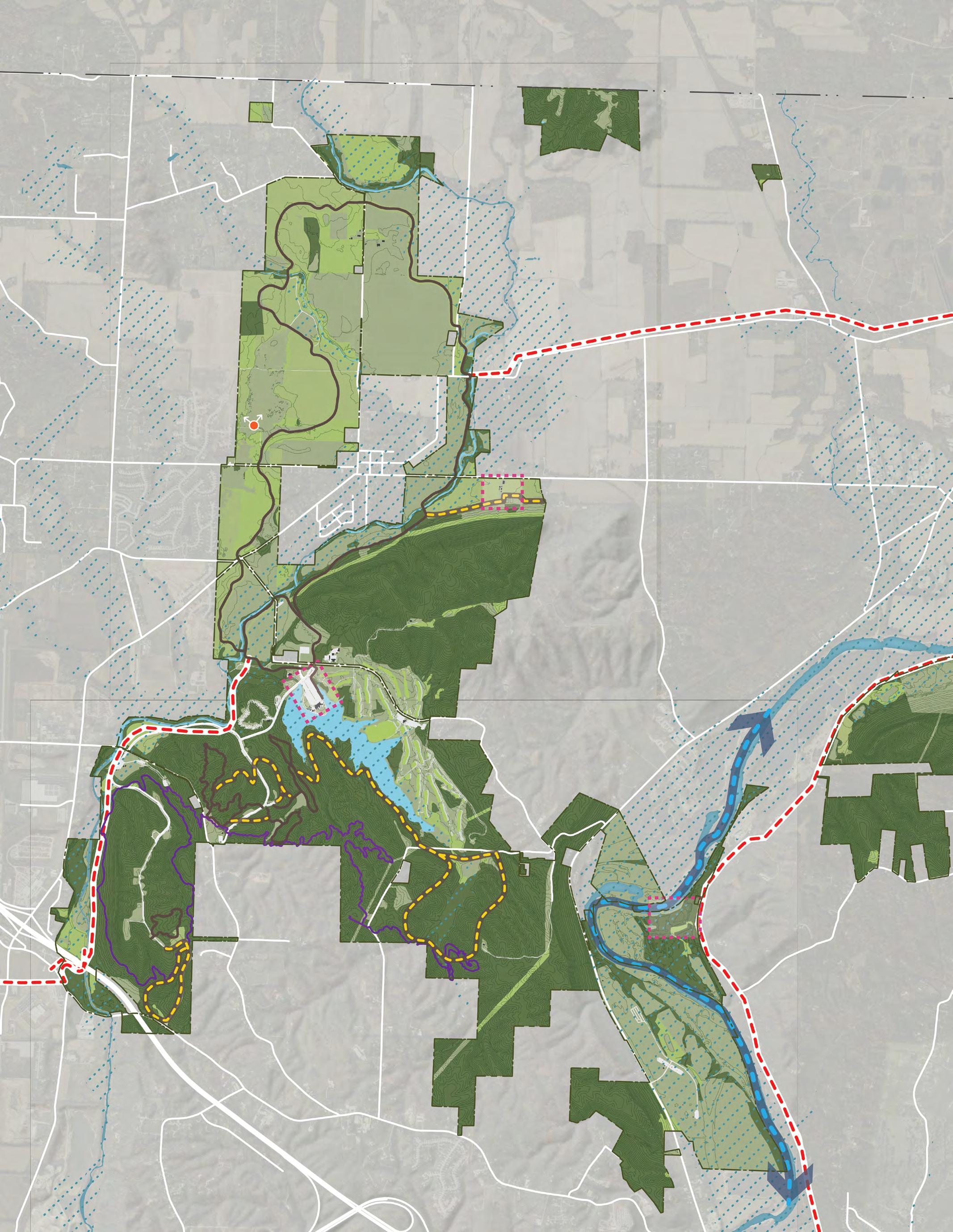
THE PARK AND FACILITY MASTER PLANS FOR GREAT PARKS OF HAMILTON COUNTY FOLLOWS THROUGH ON THE COMMITMENT TO PLAN FOR THE FUTURE OF EVERY PARK. THROUGH A COLLABORATIVE PROCESS, GREAT PARKS ENGAGED THE HAMILTON COUNTY COMMUNITY IN CREATING INDIVIDUAL MASTER PLANS FOR EACH PARK. THESE PLANS BUILD ON THE GOALS AND PRIORITIES OUTLINED IN THE 2019 COMPREHENSIVE MASTER PLAN AND OUTLINE SPECIFIC IMPROVEMENTS AND ACTION STEPS FOR ENHANCING EXPERIENCES IN EVERY PARK.
This work was led by an interdisciplinary planning and design team, guided by Great Parks leadership and staff, and informed by stakeholder and community input. Beginning in the spring of 2019 and working through the spring of 2021, Great Parks studied each region of Hamilton County individually to fully understand the needs and opportunities within each park. The planning and design team visited and did fieldwork in every single park in addition to engaging directly with staff and park users who are in the parks in a daily basis. Two parks that were not studied during this process were Oak Glen Nature Preserve, which is still in recovery from a 2014 oil spill, and the Werk Road property, which wasn’t acquired until late 2021 and will undergo its own master
planning process. The resulting plan sets a vision for each park that has achievable short and long-term implementation steps.
For each of the Park and Facility Master Plans, the planning and design team conducted existing conditions analysis to determine needed improvements. Once these needs were cataloged, community input and staff review helped to determine which improvements required more focused concept development. Collectively, the individual park plans include nearly 170 ideas for improvements. From this list, 63 Focus Area projects are highlighted in more detail. These ideas and Focus Area projects can be organized by four themes that emerged during public input: Add More Trails & Adventure, Refresh Harbors &
Experiences, Build New Nature, Education, & Event Centers, and Implement Conservation Projects.
The Park and Facility Master Plans will help to set priorities for the next 10 years of projects, programs, investments and improvements in each Great Park. While the direction from the community is clear, the next phase of work will require both alignment with future funding priorities and additional research, environmental review and community outreach as these planning concepts continue to the design and development stage. Doing so will enable Great Parks to advance its mission and continue to build the relationships and community partnerships that will improve the user experience in each of its parks.

The 2019 Comprehensive Master Plan set the stage for the Park and Facility Master Plans. The five goals and plan priorities served as a guide to the planning and design team’s work with staff, stakeholders and the community. As improvements were considered, the five goals (see list at right) were used a benchmark and helped to inform the plan’s four themes. Conservation, programming and experiences provided the foundation for many of the park improvement ideas, and fiscal health and standards of excellence were important considerations in both concept design and the establishment of priorities.
The priorities from the Comprehensive Master Plan shaped many of the ideas within this document. The Parks and Facility Master Plan set out to implement Priority #8: Plan for the future of every park. The planning and design team was able to accomplish each of these priorities in each region, if not every park, across Great Parks. From adding more trails to establishing blueways, to focusing on conservation and sustainability, to developing new and diverse programming and improving access for all, the Parks and Facility Master Plans fulfill the goals and priorities set forth by Great Parks and the Hamilton County community.
1
2
3
4
5
STANDARDS OF EXCELLENCE
MAY 2019
PROJECT INITIATION
SUMMER 2019
ANALYSIS AND PARK TOURS
1 BUILD MORE TRAILS
2 ADD PROGRAMMING AND EVENTS FOR DIVERSE AUDIENCES
3 PROVIDE ACCESS TO CONSERVATION AREAS
4 ESTABLISH A DEFINED BLUEWAY SYSTEM
5 FOCUS ON PARTNERSHIPS
6 BUILD ECOLOGICAL RESILIENCY AND SUSTAINABILITY
7 EXPAND ACCESS FOR ALL USERS
8 PLAN FOR THE FUTURE OF EVERY PARK
WINTER - SUMMER 2020
EAST REGION ENGAGEMENT AND PLANNING
FALL 2019 - WINTER 2020
WEST REGION ENGAGEMENT AND PLANNING
SPRING - SUMMER 2020
CENTRAL REGION ENGAGEMENT AND PLANNING
FALL 2020 - SPRING 2021
PARK AND FACILITY MASTER PLANS AND RECOMMENDATIONS
The Park and Facility Master Plans work was divided into three different regions. Beginning in the spring of 2019 each region, West, Central and East, were studied individually with dedicated staff, community and stakeholder outreach. These improvement ideas were gathered together in the fall of 2020 to understand how each park worked together in the context of the entirety of Great Parks. The planning and design team developed Focus Area projects for each region to study improvements that met the needs of each park and served key community priorities. The end result was a set of regionspecific plans that were shared with the community for their review and input.
This plan is divided into the following sections:
Engagement & Themes
This section reviews the engagement process, major findings, and the resulting improvement themes. Each theme is explained in detail, along with a map of how specific improvements relating to that theme are distributed across Great Parks.
West, Central and East Regions:
Each region has its own section that gives a general overview of planning improvements, before detailing the Master Plan for each park in that region.
Implementation:
Organized by region, the implementation section catalogs each Focus Area improvement and each general improvement for every park and lists potential prioritization.
Beginning in 2019, a team of planners, landscape architects, architects, ecologists, and civil engineers, started working with Great Parks staff and the Hamilton County community to shape the future of every park. Before community engagement began, the planning and design team conducted detailed analysis including:
• A Building Audit of 36 existing structures to develop an understanding of both deferred maintenance and needed improvements;
• A Natural Resources Management Plan to guide continued investment in conservation;
• A Programming Evaluation to examine both existing programs and needed investment in new programming and facilities to support them; and
• A Design Guidelines review to begin to create a common playbook for the implementation of needed improvements across all parks.
This initial analysis (summarized at right) was an important step in building an understanding of the issues and opportunities facing Great Parks. Taken together with the community, stakeholder and staff input, this work directly informed the decision making as the planning and design team developed Focus Area improvements and established priorities. Each of these documents are available as stand alone reports.
While site-specific natural resources management plans and restoration projects have been implemented over time, new land acquisitions and ecological threats call for an updated and holistic document for the whole of Great Parks that outlines resources, goals and approach. The development of a comprehensive Natural Resources Management Plan (NRMP) helps prioritize areas for conservation work.
The NRMP was used to determine conservation projects and identify areas where potential development related to the recreation and education aspects of Great Parks’ mission would be the least impactful to natural resources. Further environmental review for each development concept will be conducted before any construction is planned or approved.
A total of 36 buildings of a variety of ages, sizes, and functions were identified by Great Parks of Hamilton County to undergo a building audit process. Each building was visited to visually determine condition and functionality of the building. An executive summary of the findings was created for each facility to describe interior and exterior condition, and to provide recommendations for immediate, near-term and long-term actions for the park district to undertake.
Understanding the current conditions of buildings not only helped to inform capital budgeting, but also shaped the concepts for new or improved buildings included in the Park and Facility Master Plans.
The Programming Evaluation served to develop a program plan to address Great Parks strengths, challenges, and gaps. This plan also recommends program standards and performance measures. Additionally, programming opportunities are addressed across each region to improve Great Parks’ offerings.
The Programming Evaluation for the Parks and Facility Master Plan was done in two phases. Phase one was a regional programming plan that researched and analyzed existing programming data, area service providers, and staff feedback, and included a comprehensive system tour. Phase two synthesized all of this information into a preferred programming plan for the system. Additionally, phase two included financial implications associated with key new programming recommendations and their relationship to new/ improved facilities and spaces as conceptualized in Focus Area projects planning.

The Design Guidelines establish basic design requirements that are shared across all parks and facilities. These guidelines are intended to be grounded within the principles of sustainable design and construction and guide Great Parks’ efforts in development of capital improvement projects throughout the park system that deliver outstanding experiences for users while maintaining the highest standards of quality.
The guidelines reinforce and extend the goals of the Comprehensive Master Plan throughout planning and development projects across Great Parks, and help to establish a unified vocabulary of design philosophy, character and materials that clearly identifies each park as part of the Great Parks of Hamilton County system. They are meant to be a living document that is periodically updated as standard practices, issues and people change over time.
 The Master Plan team meeting with staff from Adventure Outpost at Winton Woods.


TO PLAN FOR THE FUTURE OF EVERY PARK, MORE THAN 2,800 COMMUNITY MEMBERS WERE ENGAGED IN THE PARK AND FACILITY MASTER PLANS PROCESS. THROUGH INPUT FROM THE COMMUNITY, STAKEHOLDERS, AND PARK STAFF FOUR DYNAMIC AND TRANSFORMATIVE THEMES WERE IDENTIFIED THAT WILL HELP GUIDE PARK IMPROVEMENTS OVER THE NEXT 10 YEARS.
To better serve the residents of Hamilton County, Great Parks operates in a regional model. The Park and Facility Master Plans process built on this approach by planning for each region of Great Parks individually. For each region, the planning team toured each park, met with staff and stakeholders, and conducted community outreach. Starting with the West Region in summer 2019 and working through the East Region and Central region through the fall of 2020, the planning team engaged with more than 2,800 community members throughout the process. This engagement resulted in nearly 170 ideas for improvements to Great Parks.
These ideas can be grouped into four major themes:
• Implement Conservation Projects
• Add More Trails & Adventure
• Refresh Harbors & Experiences
• Build New Nature, Education, & Event Centers
Input and guidance provided to the planning team by the community led to the development of the four themes that shaped the recommendations and strategies of each park’s individual master plan. These four themes focus on issues that are the most critical to park users and that will advance
the goals and priorities of Great Parks established during the Comprehensive Plan. This section details the engagement process of the Park and Facility Master Plans and the results of these community conversations.
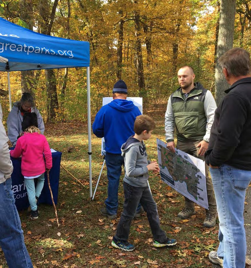

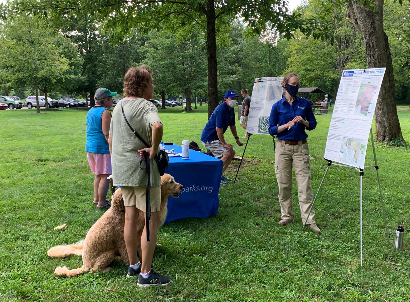

MORE THAN 2,800 COMMUNITY MEMBERS WERE ENGAGED IN THE PLANNING PROCESS

Over the past 18 months, Great Parks has engaged the community utilizing a variety of methods from inperson events to virtual community workshops to online surveys to staff tours and work sessions. This hands-on engagement was critical to shaping the recommendations for improvements to each park.
40+ IN-PERSON EVENTS
OVER 18 MONTHS
4 ONLINE SURVEYS
3 VIRTUAL PUBLIC MEETINGS
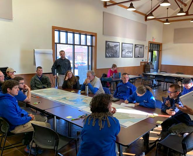
To inform the planning done for each region of Great Parks, the planning team started by holding work sessions with the staff that work in each park. Additionally, multiple day tours were conducted so that the planning team and staff could spend time in each park. This enabled the planning team to gain a strong understanding of the current conditions and opportunities for improvements in each park. As recommendations were drafted for each region, additional work sessions were held so that staff could review proposed improvements and provided input. In total six work sessions were held, two for each region of Great Parks.

Great Parks would like to recognize and thank the following organizations and individuals for their support, direction, and guidance throughout the planning process.
Anderson Township
Bayley Adult Day Program
Cardinal Land Conservancy
Cincinnati Museum Center
Cincinnati Off-Road Alliance (CORA)
Cincinnati Parks
Cincinnati Preservation Society
Cincinnati Public Schools
Cincinnati Recreation Commission
Cincinnati Wildflower Preservation Society
Fiver Rivers MetroParks
Friends of White Water Shaker
Village, Inc (FWWSV)
Girl Scouts of Western Ohio
Greater Cincinnati Disc Golf Association
Green Acres Canoe
Green Township
Groundwork Ohio River Valley
Hamilton County Soil & Water
Conservation District
Ohio Horseman’s Council
OKI Cachers / OKIC GEOCACHING CLUB
Orienteering Cincinnati
Orienteering Club
Oxbow, Inc
Sayler Park
Seven Hills School
Southwest Local School District
Special Olympics Ohio
The Nature Conservancy
15 STAKEHOLDER INPUT SESSIONS
6 STAFF INPUT SESSIONS
SITE TOURS OF EVERY PARK SIGNAGE AND ADVERTISEMENTS WITHIN AND OUTSIDE THE PARKS
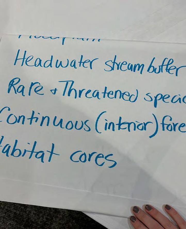
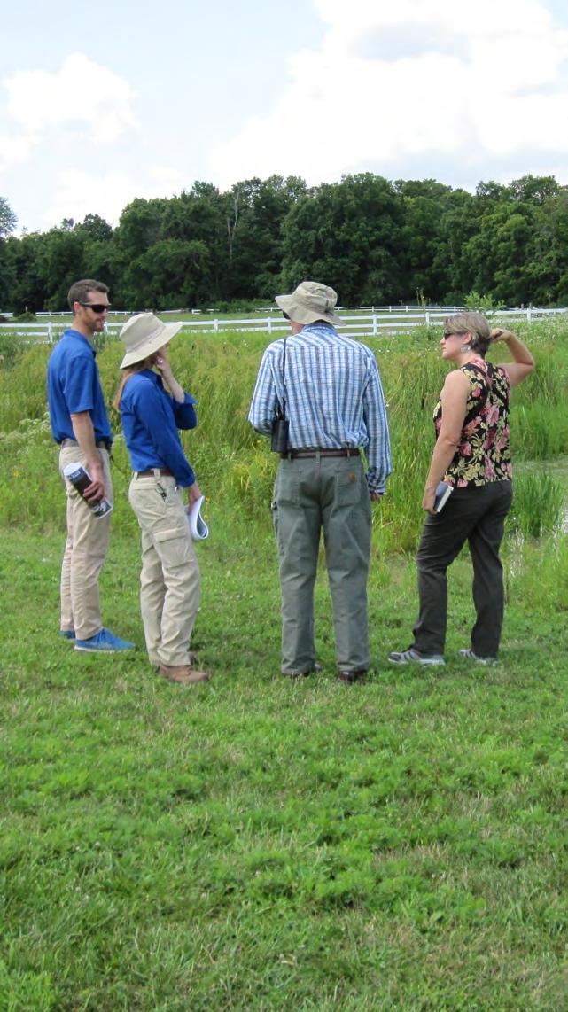
The planning team’s knowledge of Great Parks was augmented by dozens of stakeholder interviews with individuals and organizations that are involved with Great Park. A custom list of stakeholders was developed for each region of Great Parks to better address the issues and opportunities in each part of Hamilton County. These input sessions included user groups, public agencies, environmental and conservations groups, and more.

City of Harrison
City of Sharonville
Cleveland Metroparks
Colerain Township
Crosby Township
Delhi Riverview Kiwanis Club
Delhi Township
ELMNTL Fitness
Fernald Preserve

Imago Earth
MetroParks of Butler County Metzcor LLC
Miami Township
Miami University
Mill Creek Alliance
Oak Hills Local School District
Ohio Audubon Society
Ohio History Connection
Three Rivers Local School District
Three Valley Conservation Trust
TriState Trails
University of Cincinnati
Village of Cleves
Village of North Bend
Western Wildlife Corridor
Whitewater Township
Winton Woods City School District
Yoga Leela
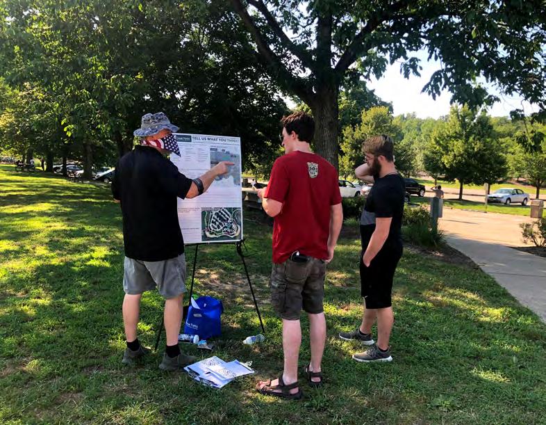
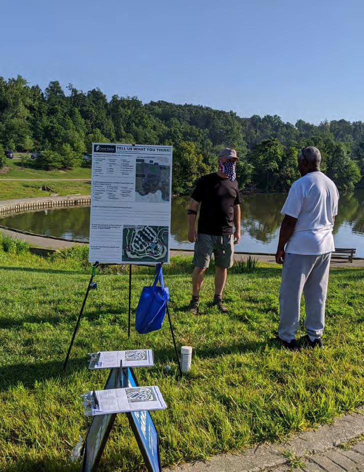
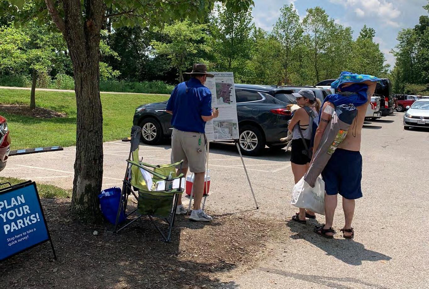
In order to interact with as many park users as possible, planning staff and Great Parks staff held more than 40 in-person engagement events in parks. Starting in the West Region in 2019, this included special festivals and events such as Harvest Home and Weekend in the 1800s, as well as attending regularly occurring activities such as the CORA Night Ride. With the on-set of the COVID-19 pandemic, engagement in the East and Central regions relied on pop-up intercept surveys and information booths in parks or at popular trailheads and park destinations to meet people in the parks.
To supplement in-park engagement and to reach a wider audience of county residents, a project website and online survey provided information and allowed input through the planning process. In total there were four online surveys conducted. Each region had a customized survey at the outset of the planning process that focused on learning from respondents how they currently use the parks and what improvements they would like to see. The fourth online survey administered allowed community members to review the draft recommendations and provide feedback. This online survey was launched concurrently to the three community workshops hosted online. In total more than 1,800 survey responses were received.
In order to safely share the draft master plans for each region, three virtual public meetings were held in May of 2021. One public meeting was held for each region and in addition to a Zoom meeting the presentation was also broadcast on Facebook Live. Feedback from these
workshops helped the planning team finalize Park and Facility Master Plans for each region prior to presenting them to the Board of Commissioners in July of 2021.
To reach both park visitors and non-visitors, Great Parks staff used a variety of communication methods to raise awareness about the Park and Facility Master Plan process. In light of the COVID-19 pandemic, signage and advertisements for the mygreatparks.com website, the online surveys, and virtual public meetings were placed both within the parks and in other community destinations in order to drive public participation in the plan. This included posters at libraries, Community Resource Centers and bus stops (places with free internet access) to promote engagement activities to a broad population. In all, more than 2,800 community members were engaged in this planning process.


The West Region kicked off the Park and Facility Master Plan process. In addition to staff and stakeholder meetings, the public was engaged in a variety of ways. Six in-person engagement events were conducted:
• Weekend in the 1800s event at Shawnee Lookout
• CORA Night Ride mountain biking event at Mitchell Memorial Forest
• A Bike and Hike Event at Miami Whitewater Forest
• Bonfire Bash in Fernbank Park
• Harvest Home Fair at Harvest Home Park in Cheviot
• Great Hunt Program at Miami Whitewater Forest
These in-person events were supplemented by an online survey that yielded 567 survey responses.
The key takeaways from the West Region engagement were:
• The West Region has the highest number of responses asking for future investment in camping, mountain biking, and water play
• Desire for water play to be added back to Miami Whitewater Forest
• Requests for more kayak put-in locations
• Requests for more interpretative spaces, signage, and programs to inform about the natural areas of the parks
• High responses from local organizations (mountain biking and disc golf) offering to help in both facility improvements and creation


The Central Region survey and engagement occurred during the spring and summer of 2020. Outdoor socially-distanced engagement events occurred at Winton Woods, Glenwood Gardens, Triple Creek and Farbach Werner to interact with park users and conduct surveys. Throughout these parks advertisements and signs distributed to promote the in-person events and the online survey. In total, the Central Region had the greatest number of responses with 951.
The key takeaways from Central Region engagement were:
• Strong desire for connections to and between parks and regional trail systems
• Changes and improvements to needed for the harbors at Winton Woods and Sharon Woods
• Highest desire for future investment in nature observation and educational programs
• Strong desire for adult education for outdoor activities and investment in nature observation and education
• Dog park desired in this part of the county


The East Region survey and engagement occurred during the spring and summer of 2020. Outdoor socially-distanced engagement events occurred at Withrow Nature Preserve, Sharon Woods, Otto Armleder, Lake Isabella, Little Miami Golf Center and Woodland Mound to interact with park users and conduct surveys. Throughout these parks advertisements and signs distributed to promote the in-person events and the online survey. In total, the East Region had 775 survey responses.
The key takeaways from the East Region’s engagement were:
• Request for upgraded play features with wider age appeal
• Improve the current disc golf course facilities
• Desire for future investment in canoe/kayak facilities
• Need for enhancing the birding and nature observation opportunities
• Request for more preservation/ conservation areas to interact with and learn from


The planning team distilled the community’s 170 ideas for improvements into four main themes that reflect the community’s vision for the future of Great Parks. These overarching themes are expressed in 63 specific Focus Area improvements that will enhance the current park user’s experience and will attract new visitors to the parks. These Focus Areas expand on the successful elements already present in the parks, enhancing and improving destinations and unique experiences, creating new spaces to educate and gather, and furthering Great Parks’ goal to be a leader in conservation and environmental stewardship.
In the following pages, the four themes and Focus Areas are outlined, with greater detail provided in the description of overall improvements to every park in Sections 2, 3, and 4.
IMPLEMENT CONSERVATION PROJECTS
Mature Forest Management, Stream and Wetland Restoration, Golf Course Restoration, Stormwater Management
ADD MORE TRAILS & ADVENTURE
Hiking/Walking Trails, Mountain Biking, Regional Trails, Blueway Trails
REFRESH HARBORS & EXPERIENCES
Harbors, Playgrounds, Camping, Disc Golf
BUILD NEW NATURE, EDUCATION, & EVENT CENTERS
Education and Event Centers in Each Region

IMPLEMENT CONSERVATION PROJECTS
ADD MORE TRAILS AND ADVENTURE
REFRESH HARBORS & EXPERIENCES
BUILD NEW NATURE & EVENT CENTERS
150 ACRE ECOLOGICAL RESTORATION AT SHAWNEE LOOKOUT
13.5 ACRES RESTORED FOREST AND RIPARIAN AREA AT LITTLE MIAMI RIVER CORRIDOR
10+ ACRE RESTORED WETLAND AND STREAM AT GLENWOOD GARDENS
7 GREEN STORMWATER PARKING LOT RETROFITS


The 2019 Comprehensive Plan established a primary goal of Great Parks as being a recognized leader in conservation. This plan helps accomplish this goal by identifying specific strategies, recommendations and improvement projects. In the Park and Facility Master Plans, five types of conservation projects were identified. These include managing mature forests; restoring streams, wetlands and riparian corridors; restoring a golf course; and adding stormwater infrastructure to parking lots. Each offers multiple opportunities to restore ecological
From an ecological perspective, the goals of these projects are to:
1. Increase habitat and diversity,
2. Support conditions required for mature forests to exist and thrive,
3. Improve stream and wetland function, and
4. Inspire nature education and exploration.
Community engagement continued to echo the desire for a focus on conservation and so these goals are integrated into the master plan for each park.



Great Parks is located in the Southwest corner of Ohio, with the vast majority of property in Hamilton County and a few acres in Clermont County to the east. The 17,733 acres of Great Parks’ managed property are comprised of 22 parks and preserves situated in suburban, rural and urban areas. More than 83% of lands are undeveloped and comprised of forests, wetlands, brushland, and prairie, as well as others including several high-quality rare communities. The remaining acreage, which includes lawns, buildings and pavement, is developed for educational and recreational purposes.
Great Parks mission is to preserve and protect natural resources and to provide outdoor recreation and education in order to enhance the quality of life for present and future generations. The Natural Resource Management Plan (NRMP) supports this mission through the employment of ecologically sound land management practices in compliance with relevant laws, regulations, and applicable state and federal guidance. The NRMP is based on an adaptive management approach, which allows for flexibility in the face of changing conditions.
The overall management vision is to protect and restore resilient native ecosystems, which provide abundant benefits and services. This vision is supported in the NRMP by goals and management objectives, as well as best practices to achieve these goals. The NRMP will serve as a guide for the implementation of Park and Facility Master Plan projects.
50+ MILES OF NEW TRAILS


10 MILES OF NEW REGIONAL TRAILS

25 MILES OF BLUEWAYS
Dating back to the 2019 Comprehensive Plan, public input has been clear that there is a desire for more trails of all kinds. The Park and Facility Master Plans will expand existing trails and create new trails within every park. It also connects parks and communities to one another through regional trails, and creates unique regional experiences with blueway trails on Hamilton County’s river and stream corridors.
• The trail improvements in this plan create more than 50 miles of new trails within Great Parks.
• New trails will include a mixture of natural surface and paved trails. These systems will be tied together at parks like Shawnee Lookout and Richardson Forest Preserve via trail hubs.
• This plan also outlines the regional trail connections that Great Parks will focus its efforts on implementing over the coming decade, totaling more than 10 miles of connections between parks, neighborhoods, and community destinations
• Additionally, this plan identifies improved access points and a formal strategy for establishing a 25-mile blueway trail system along the Great Miami River and Whitewater River corridors within western Hamilton County.
Great Parks of Hamilton County has long been a partner and champion of developing regional trail systems and connections between parks, communities, and destinations. These paved, off-road trails expand safe, accessible and enjoyable opportunities for people to reach their parks by walking and biking. Great Parks’ focus on regional trails extends throughout the entire tristate region, including trails along the Mill Creek, Great Miami, Little Miami, and Ohio Rivers. In this plan, four regional trail segments have been identified as priorities for Great Parks:
1
1. The Glenwood Gardens to Winton Woods Trail will span 3.6 miles and connect two Great Parks that are adjacent to one another.
2 3
2. The Beechmont Bridge Connection is currently under construction. This trail will link the Little Miami Scenic Trail to the Otto Armleder, Lunken Loop, and Ohio River Trails.
3. The 1.6-mile Columbia Connector Trail will ultimately tie the Little Miami Scenic Trail to other segments of the 34-
CENTRAL

4
mile CROWN regional trail loop, including the Murray Path and Wasson Way.
4. The Ohio River Trail – The Oasis Corridor is another regional trail that is currently in the planning stages. This trail connection from the Lunken Loop Trail to downtown Cincinnati is a critical segment of the Ohio River Trail, which will eventually stretch from one end of the county to the other.

While Great Parks continues to plan for and make improvements to access points on the Little Miami blueway trail and to study the potential for access on the Mill Creek blueway, the Park and Facility Master Plans focused on creating a new blueway trail network on the Great Miami and Whitewater Rivers. Access along these two river corridors on the west side of Hamilton County will be significantly improved, with four new put-ins and take-outs that offer a variety of different trip lengths and river experiences.
The future four access points are located at Miami Whitewater Forest, Mitchell Memorial Forest, Campbell Lakes Preserve, and Shawnee Lookout. With the four access points, comes opportunities for different blueway experiences, including mobile water school programming of educational and water safety classes and day trips along the corridor.
The four access points allow paddlers to define and create their own unique experience with paddle trip lengths ranging from a few hours to all day. Users can also combine this experience with hiking, bike rides, and visiting other amenities within and near the parks.



HERITAGE PARK (NON-GPHC)
SHAWNEE
DRAVO PARK (NON-GPHC) 4.0
MIAMI WHITEWATER FOREST 6.0 MILES

OTTO
OTTO ARMLEDER MEMORIAL PARK
BASS


3 REVITALIZED HARBORS

3 NEW CAMPING EXPERIENCES

4 IMPROVED DISC GOLF COURSES

5 IMPROVED PLAY EXPERIENCES
The Park and Facility Master Plans also address improvements to the signature experiences within Great Parks. These include the harbors, playgrounds, campgrounds, and disc golf courses. With these investments, Great Parks will improve its existing facilities and create new attractions. The harbors are popular destinations and the combination of activities present at each makes them an incredible asset to the community. There is one harbor in each region, each with its own distinct needs and opportunities. Many specific areas of these harbors are out-ofdate, could be better integrated into the surrounding park, or do not necessarily reflect the desires of the park users.
In addition to harbor improvements this plan focuses on:
• Defining the future of play experiences in five parks.
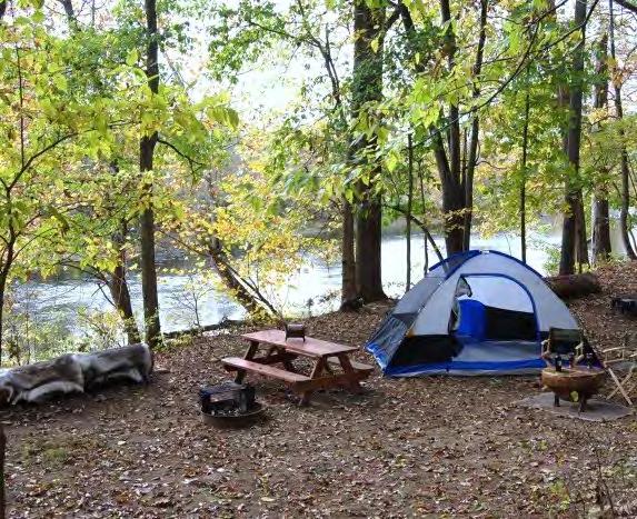
• Expanding camping opportunities with three new camping experiences.
• Improving four disc golf courses throughout Great Parks.


Throughout the Great Parks there are three harbors that serve as major centers for activity for users of all ages. However, these harbors need improvements to better serve the desires of park users. The three harbors this plan looks at are:
• Miami Whitewater Forest which is in need of an improved play area and better connections and interactions with the water.



• Winton Woods needs to be reconfigured to take better advantage of the space it has as well as views of Winton Lake.
• Sharon Woods also needs to take better advantage of the lake frontage and other nearby park features.
Most of the larger, destination playgrounds at Great Parks are outdated and nearing the end of their life cycle. The need to update and upgrade these play experiences was a common community sentiment. New play experiences will:
• Integrate water with other play experiences, eliminating the need for an additional fee.
• Focus on natural materials and experiences that reflect the unique character and landscape of each park’s setting and become regional destinations.
• Meet the needs of all ages and abilities by providing unique play features that enable a wide variety of types of play.
This plan proposes three new camping experiences:
• Miami Whitewater Forest’s existing campground will be converted to pop-up camper and tent-only. This is dependent on creating a new campground on the west side of the county that can better serve large RVs.
• Winton Woods Campground will add additional RV spots, including pull-through sites, to service the popular campground.
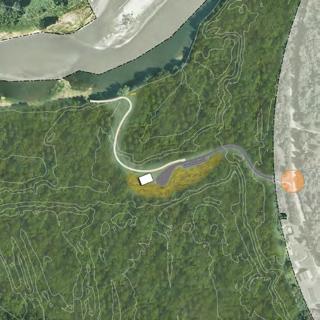
• Mitchell Memorial Forest will add backcountry camping sites that can be paired with new hiking trails, the blueway trail access, and mountain biking activities at the park.

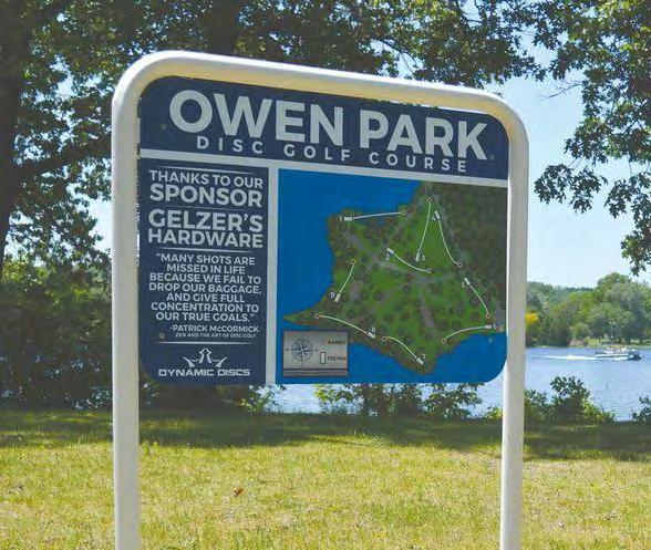
Great Parks is fortunate to have numerous disc golf courses and an incredibly engaged user group. Great Parks recognizes the significance of the growth of the sport and recommends updating four courses: Embshoff Woods, Miami Whitewater Forest, Winton Woods, and Woodland Mound. Improvements will include:
• New tee pads and baskets
• Improving signage




• Partnering with local organizations on course design and alignments

As part of the analysis stage of this plan, the planning team conducted a building audit examining 36 buildings throughout Great Parks. The findings from this building audit, in addition to input from the community stakeholders and staff, directed the planning team to examine three major building projects. These building projects focused on creating high quality, timeless facilities that can serve as hubs for education, interpretation, and gatherings. This plan identifies at least one major building project in each region:
• Shawnee Lookout Nature and Education Center in the West Region
• Glenwood Gardens Event and Education Center in the Central Region
• Woodland Mound Nature and Education Center in the East Region
Each building becomes an anchor attraction for the parks, serving individual park users and group visitors alike by providing a variety of services, flexible spaces, and strategic placement adjacent to popular park features.
While not highlighted in this Executive Summary, the Park and Facility Master Plans also proposes improving the Shaker Trace Nursery at Miami Whitewater Forest to improve production, volunteer and educational experiences by renovating the existing barn and adding new facilities.
1 NEW NATURE & EDUCATION CENTER AT SHAWNEE LOOKOUT

1 NEW NATURE & EDUCATION CENTER AT WOODLAND MOUND

1 NEW EVENT & EDUCATION CENTER AT GLENWOOD GARDENS

1 NEW ENVIRONMENTAL EDUCATION EXPERIENCE AT SHAKER TRACE NURSERY


Improvements to parks in the West Region meet the needs of the community by adding the most trail miles (27), investing in a 25-mile blueway trail along the Great Miami and Whitewater River corridors, and building a new beginner mountain biking course at Mitchell Memorial Forest.
In addition to protecting and restoring natural areas, projects at Shawnee Lookout and Shaker Trace Nursery will highlight the unique historic, cultural and ecological features of western Hamilton County.
Other park experiences will be improved, with investment made in new play experiences, camping, disc golf, and harbor facilities. The following pages will highlight the master plan of improvements for each park in the West Region.
Within each park master plan, general improvements are listed
and briefly described. Some parks also have Focus Area improvements that feature more advanced plan concepts and descriptions. In Section 5: Implementation, all of these improvements are cataloged and prioritized.
• Revitalized Harbor at Miami Whitewater Forest
• New Play Experience at Miami Whitewater Forest
• 2 Improved Disc Golf Experiences at Miami Whitewater Forest and Embshoff Woods
• 2 New Camping Experiences at Miami Whitewater Forest and Mitchell Memorial Forest
ADD MORE TRAILS AND ADVENTURE
• 27 Miles of New Trails (Hiking/ Walking) and Neighborhood Connections
• 1.4 Mile Beginner Mountain Biking Course at Mitchell Memorial Forest
• 25 Mile Blueway Trail Along the Great Miami and Whitewater River Corridors
• New Nature and Education Center at Shawnee Lookout
• New Environmental Education Experience at Shaker Trace Nursery
• 150 Acre Ecological Restoration of the Former Shawnee Lookout Golf Course
• Bowles Woods Preserved Mature Woodlands at Miami Whitewater Forest

THE MASTER PLAN FOR SHAWNEE LOOKOUT FOCUSES ON AN ECOLOGICAL RESTORATION OF THE FORMER GOLF COURSE, THE CONSTRUCTION OF A NEW NATURE & EDUCATION CENTER, AND THE CREATION OF A NEW INTERCONNECTED TRAIL NETWORK THAT ADDS EIGHT NEW MILES OF TRAILS.
EXISTING CONDITIONS
Shawnee Lookout sits at the far southwestern corner of Hamilton County near the confluence of the Great Miami and Ohio Rivers. With commanding views of both river corridors, this park has significant geologic, cultural, historic, and ecologic importance. Shawnee Lookout’s striking topography and juxtaposition of land and water have contributed to it being a site of human habitation for the past 14,000 years. Several archeological sites and earthwork studies have determined that Shawnee Lookout was a key location for many different groups of indigenous people.
The park is divided between the Great Miami Watershed and the Ohio River Watershed, with the watershed divide being along the top of the ridgeline located within the park. Most of the park property drains northwest to Great Miami River. Prominent streams within the park include Dark Hollow Run, which drains to the Ohio River, and an unnamed tributary to the Great Miami River. The unnamed tributary is located within the existing golf course and has been modified through historic land use practices. This park provides one
of the few opportunities in the system to manage the entirety of a watershed draining directly to a central waterway, and the headwater streams are the highest-quality in the entire Great Parks’ system.
Current amenities at this park include nature trails, picnic areas, a playground, access to Great Miami River, a recently decommissioned golf course, and the historic Springhouse School and Log Cabin.
Issues
1. Buried and unvegetated streams contributing to gully formation
2. Contamination and nutrient loading of waterways
3. Potentially impaired soil function on former golf course due to turfgrass management
4. Altered hydrology and drainage tiles in the floodplain
5. Invasive species, especially along utility right of way
6. Disturbance to historic sites and artifacts
Priorities
1. Improve water quality and stabilize streams by restoring natural hydrologic patterns
2. Develop a comprehensive cultural resources stewardship approach to guide maintenance activities and future development in order to protect cultural resources.
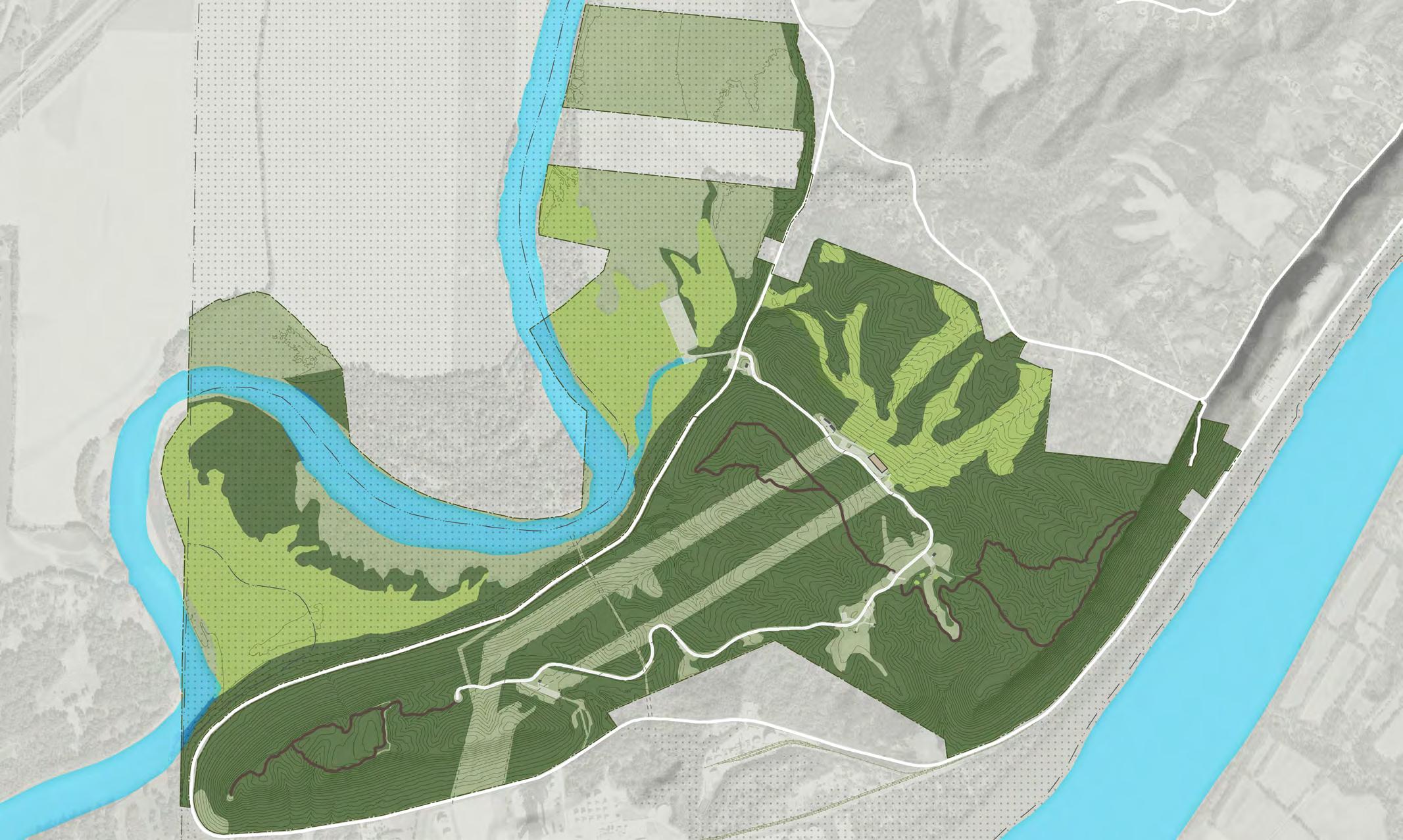


Former Golf Course
Uhlmansiek Wildlife Sanctuary
Ranger Station
Canoe / Kayak Launch Blue Jacket Trail
Restrooms / Archaeological Museum / Former Clubhouse
Sand Volleyball
Waterhole Meadow Shelter
Waterhole Playground
Cabin View Picnic Area
Restrooms
Little Turtle Trail
Springhouse School
Historic Log Cabin
Restrooms
Columbia Terrace Playground
Cedar Bend Shelter
Miami Fort Trail
LEGEND Meadow/Prairie Forest Existing Trail Proposed Trail Proposed Blueway Trail Proposed Regional Trail 6
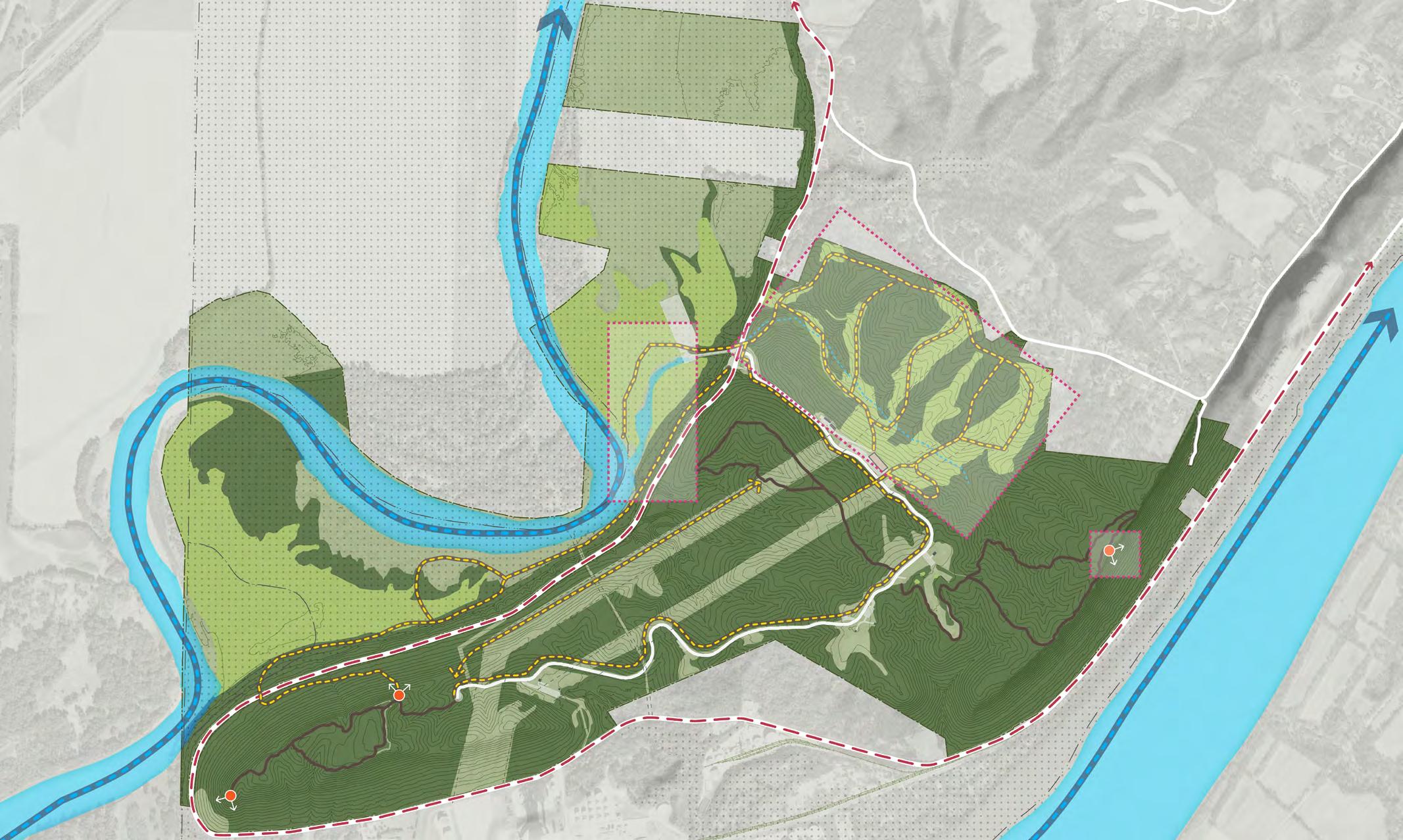
Major planned improvements include:
Ecological Restoration (3)
• Restoring the streams, forests, and prairies within the 150-acre footprint of the former golf course (3) will showcase the importance of conservation to Great Parks and provide new environmental and cultural education opportunities.
central hub for a new system of interconnected trail loops offering a multitude of hiking experiences.
New Trails
• This plan creates 8 miles of new trails within the park, including an accessible trail adjacent to the Nature and Education Center.
New Overlooks
• Enhancing the trail overlooks of the surrounding river valleys will not only attract visitors, but will also provide an educational opportunity.
Blueway Trail Access (1)
Nature & Education Center (2)
• This new facility will offer needed exhibit and classroom space, allowing Great Parks to properly highlight the unique natural and cultural features of Shawnee Lookout. It will also serve as a
New Nature and Education Center
Stream, Forest, & Prairie
Restoration Area
Great Miami River Blueway
Trail
2 3 4 5 Overlook LittleTurtleTrail BlueJacketTrail MiamiFortTrail Overlook Overlook Ohio River Trail Great Miami Riverway Trail Potential Access Point A B C D E 4 5 1 2 3 OHIO RIVER GREAT MIAMI RIVER UTILITYUTILITYCORRIDOR CORRIDOR Lawrenceburg
Ohio River Blueway Trail
Mature
Nature and Education
A B C D E
Center Loop Trail
New Trail
Connection from Blue Jacket to Miami Fort
Extension from Miami Fort Trail to Schoolhouse Area




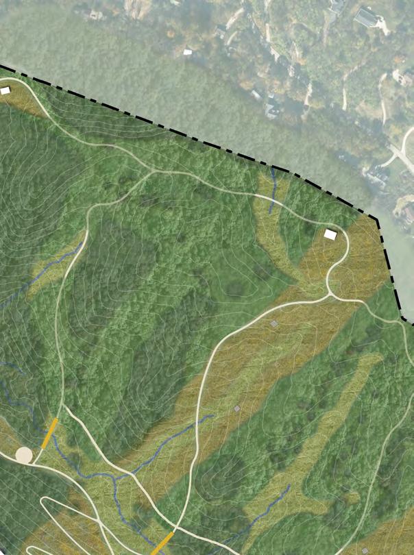


The re-use of the former golf course at Shawnee Lookout represents a 150-acre ecological restoration opportunity including daylighting the stream corridor, as well as reforestation and plant restoration strategies, to fill in the former fairways. Proposed improvements include:
• Utilizing some of the existing cart paths to create 2.9 miles of new trails in this part of the park.
• Constructing a new Nature and Education Center to serve as a center of activity and trail hub.
• Connecting to the canoe and kayak launch on the Great Miami River and existing natural surface trails in other portions of the park.
• Enabling new educational programs with an amphitheater and outdoor classroom

• Providing new trail experiences with multiple picnic shelters, a bird blind, a nature playground, and multiple stream crossing points.
• Ensuring accessibility through an accessible path system that allows for everyone to enjoy this new part of the park.

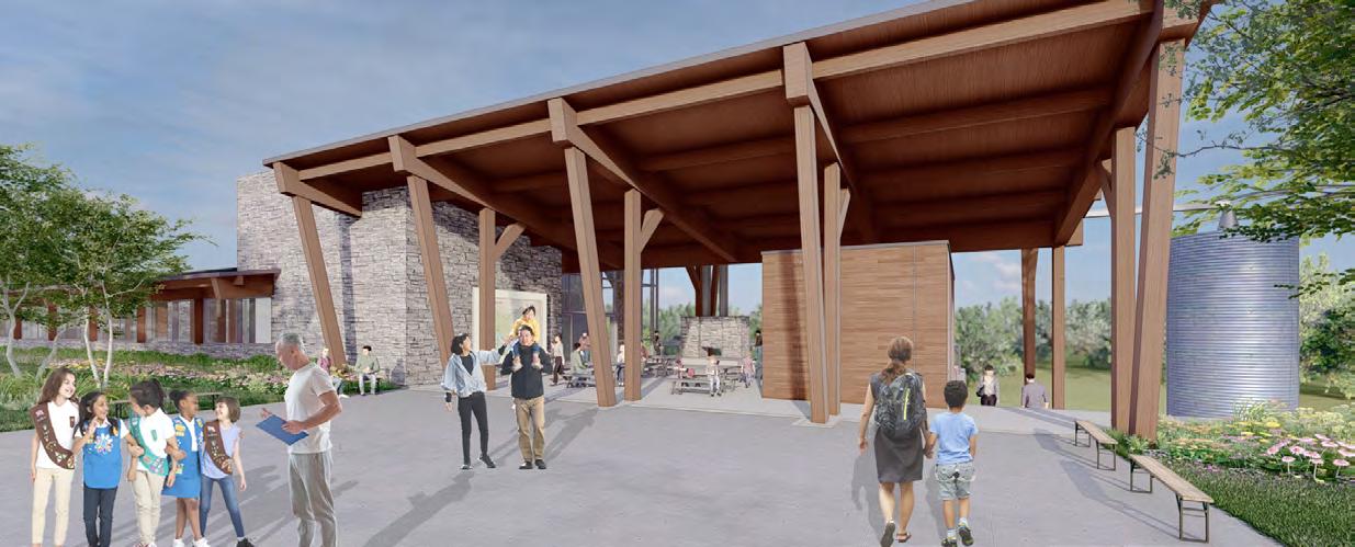
New Nature and Education Center 1
Parking Lot Bioswale 2 Entrance Plaza 3
4
Trail Hub
Solar Panels 5 Rainwater Harvesting 6
Overlooks 7 Trail Path 8 Amphitheater 9
Accessible Trail 10
Accessible Stream Trail 11
The decommissioning of the golf course allows for incorporating a new nature and education center with a larger plan related to a 150acre ecological restoration of the area. The location has existing parking and utility infrastructure and is near the park entrance. It is also set away from the culturally sensitive areas of the park where construction could be problematic. The building will support interpretive programming focused on the natural, cultural and environmental attributes of the park. Cultural exhibits and signage will be developed in coordination with appropriate tribal communities. Building features include:
• An upper floor that holds cultural exhibits highlighting the 14,000year cultural history of this corner of Hamilton County. This floor also includes classrooms for education, retail functions, and staff support/administration spaces.
• A lower level that includes space for nature exhibits as well as animal care support space.
• Exterior amenities supporting park programming such as covered gathering areas at both ends of the building that can be used for eating and education.
• A snack bar, and restrooms at both levels can be accessible to park patrons even when the building exhibit areas are closed.
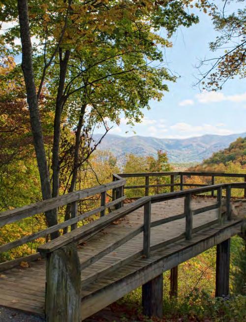
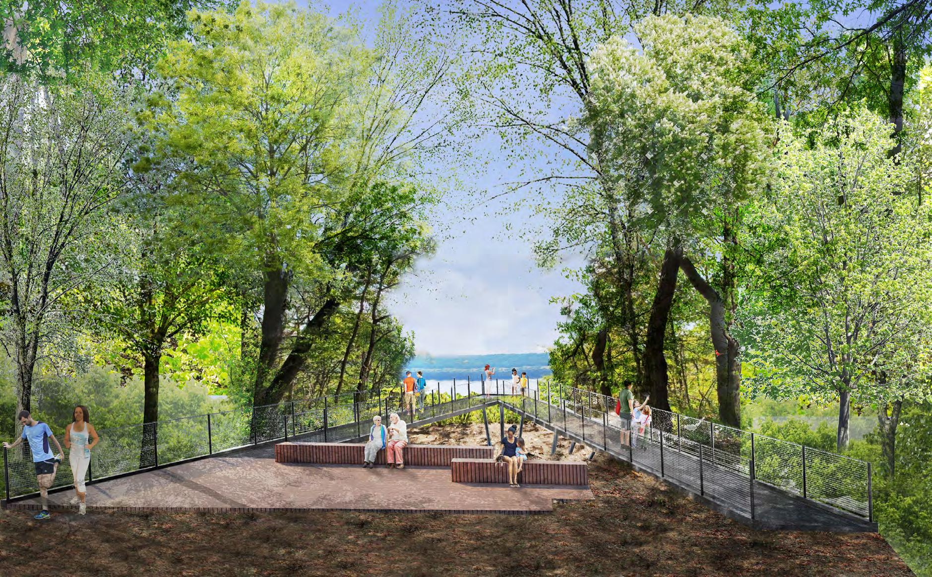
Enhanced and new overlooks will help to define Shawnee Lookout as a must-see destination in Great Parks. These overlook locations highlight the unique geography and cultural history of Shawnee Lookout, drawing visitors and enabling educational opportunities through both signage and interpretive programs. There are three existing overlooks at Shawnee Lookout, two on the Miami Fort Trail and one on the Little Turtle Trail.
The Little Turtle Trail overlook could offer a dramatic view of the Ohio River, with a platform that cantilevers off the main trail. At the juncture of the viewing platform and adjacent to the main trail, a shaded seating area can offer respite to hikers and small gathering space for programs. The overlooks on the Miami Fort Trail should be smaller scale to be sensitive to the cultural, historical and natural resources of those locations.




1 New Trailhead 2
Improved Pedestrian Crossing
3
Trail to New Nature and Education Center
New Trail 4
5
Reduced Size Parking Lot
6
Canoe / Kayak Hand-Carry Trailhead
Blueway Signage 7
8
Canoe / Kayak Access Point
9
Potential Additional Access Point if Dredging Resumes
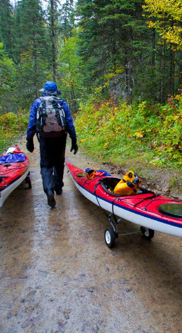
The existing Great Miami River access at Shawnee Lookout provides a walk-in canoe and kayak put in via a quarter mile trail. In addition to this access point, there is an existing concrete ramp at the lower parking lot. While this used to allow access for powered watercraft, it required dredging of the river channel to maintain access. Resuming modest dredging sufficient to allow for canoe and kayak access to the Ohio River would provide a much more convenient and usable put-in for blueway trail users.
Other proposed improvements include a system of river’s edge trails, as well as a trail that connects up the hill to amenities located in the main area of the park. Providing these trail linkages will connect multiple park experiences allowing visitors to both enjoy time on the river and other activities such as hiking and educational programming. To enable Great Parks to offer paddling education classes and other programming, seasonal storage of canoes and kayaks could be added in one of the parking areas.
EXISTING CONDITIONS - LITTLE TURTLE OVERLOOK PROPOSED IMPROVEMENTS - LITTLE TURTLE OVERLOOKTHE MASTER PLAN FOR MIAMI WHITEWATER FOREST FOCUSES ON IMPROVING THE HARBOR EXPERIENCE, EXPANDING THE CAPABILITIES OF SHAKER TRACE NURSERY, ADDING BLUEWAY TRAIL ACCESS, AND DEVELOPING A MANAGEMENT PLAN FOR ONE OF THE MOST NOTABLE MATURE FORESTS WITHIN GREAT PARKS.
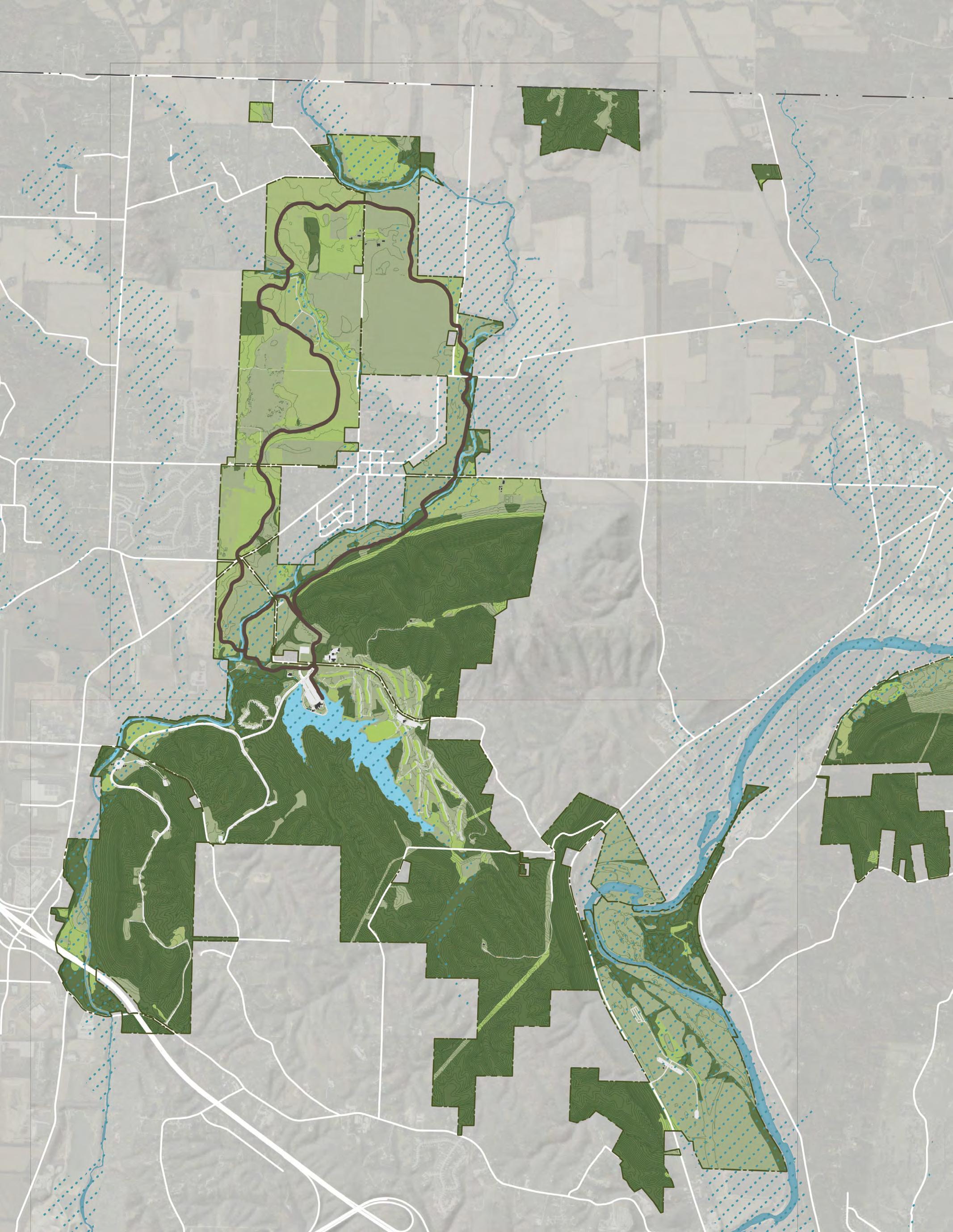
Located in the northwestern corner of Hamilton County, Miami Whitewater Forest is the largest park in the Great Parks’ system at 4,670 acres. Ninety percent of the park is natural area. Each major type of habitat from this region can be found there, with old growth forest, prairie, brushland, wetland, rivers, streams and even vernal pools. Much of Miami Whitewater Forest is hilly with steep ravines. There are two larger stream systems along its edges: Dry Fork Creek enters the park in the north and meanders in and out of the park along the western border until it exits in the southwestern part of the park. The Great Miami River runs along the southeastern edge of the park.
Due to the size of Miami Whitewater Forest, existing conditions and improvement opportunities will be divided into north and south. The northern portion of Miami Whitewater Forest draws the greatest number of visitors to the golf course, harbor, campground, and Shaker Trace Loop Trail. Amenities on the southern portion of Miami Whitewater Forest include Bowles Woods, hiking and horse trails, soccer fields and a dog park.
The Master Plan for Miami Whitewater Forest focuses on both improvements to the harbor and campground experience, but also recognizes the unique natural features of the park that need to be protected and restored. Stream corridor and stormwater issues need to be addressed, as does the longterm health of important habitat such as Bowles Woods. Improvements to Shaker Trace Nursery will enable Great Parks to continue to address prairie and forest management in every park. There is also an opportunity to enhance recreational options for hikers and paddlers, with five new miles of trails and a new access point to the Great Miami River.
Issues
1. Deer herbivory is changing forest composition and impeding recruitment of keystone oak and hickory saplings
2. Hydrological alteration has interrupted natural stream dynamics
3. Neighboring developments create stormwater issues, human-wildlife conflict and fire management challenges
Priorities
1. Protect old-growth in Bowles Woods and Oak Leaf Forests: manage canopy gaps by allowing trees to survive deer browse
2. Create stormwater master plans for golf courses and developed areas and reduce sediment loads in streams
POINTS OF INTEREST
Central Shaker Site
Trail Shelter
Shaker Trace Outer Loop Trail
South Shaker Site
Shaker Trace Wetlands
Wildlife Viewing Shelter
Shaker Trace Inner Loop Trail
Disc Golf
Sand Volleyball
Miami Whitewater Forest
Wastewater Treatment Plant
Accessible Canoe Launch
Harbor Playground
Boathouse
Visitor Center
Bank Fishing
Maintenance Facility
Shaker Trace Horse Trail
Shaker Trace Nursery
Miami Whitewater Forest Golf Course
Snack Bar / Restrooms
Driving Range
Timberlakes Trail
Miami Whitewater Forest
Campground
Hickory Knoll Picnic Area
Badlands Trail
Timberlakes Program Shelter
Oakleaf Trail
Wooded Horse Trail Loop B
High Plains Shelter
Sand Volleyball
Beech Bluff Shelter
Bluebird Glen Shelter
Big Sycamore Shelter
Wooded Horse Trail Loop A
Tallgrass Prairie Trail
Wooded Horse Trail Loop C
Hidden Hollow Youth Camp
Soccer Fields
Simmonds Family Dog Park
For this park, the Master Plan notes the following improvements including:
• Convert the current campground (11) to pop-up camper and tent only (dependent on creating a new campground on the west side of the county to better serve large RVs)
• New tee pads, baskets and improved signage for the disc golf course (7)
• A new trail to connect the Loop Trail to the Shaker Trace Nursery (A) and a new wetland viewing platform on the western side of the Outer Loop Trail (3)
• Update to the golf course driving range and clubhouse (8)
• Restoration of former farmland (6) as well as wetlands and prairie (5) with a new area for wetland plant propagation (4) located adjacent to Shaker Trace Nursery
Shaker Trace Nursery
In addition to these improvements, the master plan focuses specific attention to improvements planned for both the Harbor and Shaker Trace Nursery.
Harbor
In addition to vehicular and pedestrian circulation improvements, plans for the harbor area include a new play experience, event lawn, and covered pavilion. (see page 45)
Shaker Trace Nursery
The plan for Shaker Trace Nursery includes upgraded production facilities for both prairie and woody plants as well as new education and event space. (see page 47)
The southern part of Miami Whitewater Forest focuses on new trail connections between the Timberlakes and Badlands Trail (A), the extension of the Prairie Trail (C) and a new loop trail along the
southeastern edge of the lake (D). Additional improvements include upgrading the Equestrian Camp (5) and Timberlakes Shelter (10) to better serve park users. Over the long term, there are stream, forest and farmland restoration opportunities in this part of the park.
Focus Areas in the southern part of Miami Whitewater Forest include:
Bowles Woods
• A forest management plan will be developed for Bowles Woods that protects this unique oak-hickory and oak-sugar maple forest (see page 49).
Blueway Trail Access
• Blueway trail access will be formalized on the eastern side of the Great Miami River off E. Miami River Road, allowing for both putins and take-outs and a storage facility (see page 48).
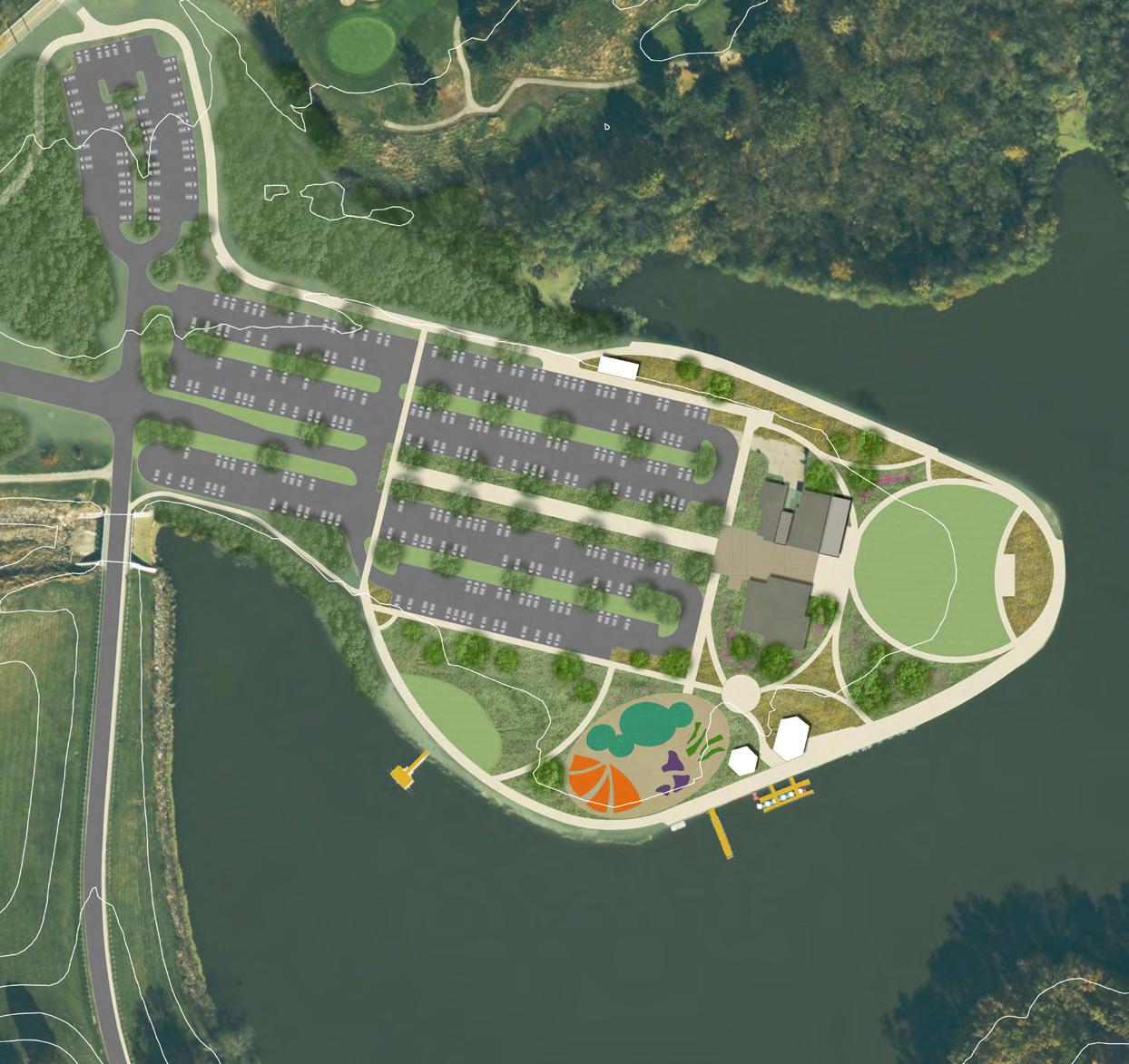
The plan for the harbor at Miami Whitewater Forest will make it a far more attractive, inviting, and interesting gathering place. Today, an overabundance of pavement and confusing circulation makes the parking lots difficult to navigate for both cars and pedestrians. Instead of welcoming users to the lake, the visitor center building is positioned in a way that blocks the best views. The low-slung roof the current pavilion space also hampers views to the lake and lawn area. While the playground equipment is newer, it is surrounded by older swings and the splash pad was recently closed and removed at the harbor area, resulting in a decline in visitors.




Bike Rental 1
Pedestrian Promenade 2 Improved Entry Plaza 3 Open “Breezeway” Retrofit 4 Covered Pavilion 5
Event Lawn 6 Stage/Plaza 7 Swings 8 Boat House 9 Nature and Wet Playgrounds 10 Vegetated Lake Edge Improvements 11
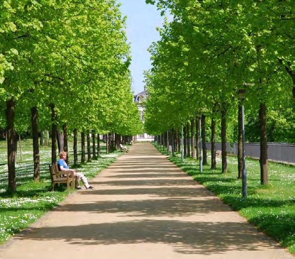
The improvements to Miami Whitewater Forest harbor focus on celebrating the best views of the lake. This begins with reconfiguring the parking lot to create two distinct loops that clearly direct users to the part of the harbor area they intend to visit. A new central pedestrian promenade will clearly connect the parking lot loops to the visitor center that has been renovated to relocate the bathrooms at the center of the building to open up a breezeway with clear sight lines to the lake. The covered pavilion will also be retrofitted to have a taller, more expansive roof allowing for views to the water and new event lawn. With a circular path, new swings and seating, the event lawn will become an attractive and welcoming space to spend time. A new stage and plaza area will support larger events and programming on the lawn.
A new destination playground with natural and wet play elements and a picnic lawn will be constructed on the west side of the harbor area. Designed for children of all ages and abilities, this playground will be a unique family attraction at Miami Whitewater Forest. To mitigate congestion issues, improvements also call for the separation of bike and boat rentals, with bike rentals located on the eastern side of the harbor closest to the bike trail, and boat rentals located in its current location on the western side of the harbor. A new multi-use trail will also connect the harbor area directly with the campground.
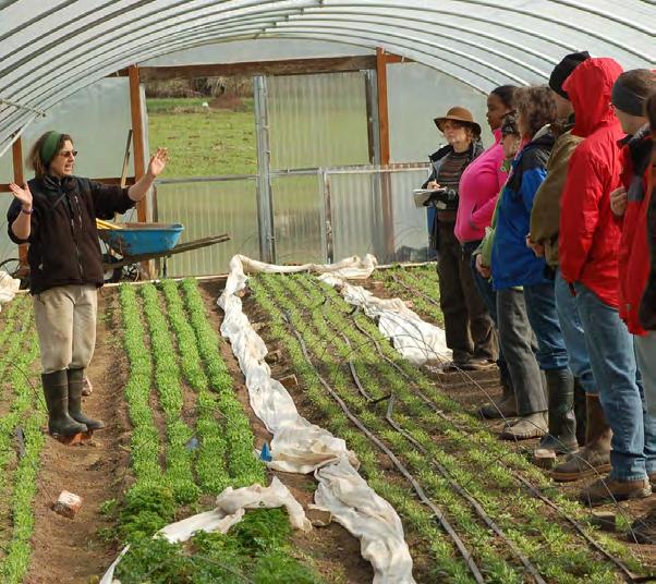
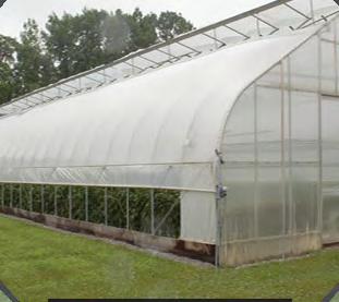
Shared Parking 1 Drying Barn 2 Storage Barn 3 Office 4 Hoop House 5
Located just east of the Shaker Trace Loop Trail, the Shaker Trace Nursery specializes in preserving the ecological and genetic integrity of the region through native plant propagation of local ecotypes.
Established in 1992, nursery staff and volunteers work with nearly 200 species of native plants, which include wetland, prairie and woodland flora. As of late 2019, well over 8,000 pounds of native seed have been processed and more than 300,000 seedlings have been transplanted. Seeds produced at the nursery are used to restore prairies and wetlands on several hundred acres within Great Parks and is a resource for other conservation agencies in the region.
This impressive facility is an important component to the conservation mission of Great Parks, but is largely hidden from public view. In addition to seed and woody plant improvements to enable greater productivity, there is an opportunity to expand the role that the nursery plays in educating the community about native plants and restoration. Nearly all of the facilities at Shaker Trace Nursery are in need of significant upgrades. The historic drying barn has a leaky roof, the nursery office and volunteer space is cramped, there are no bathrooms on site, and the greenhouse is inadequate.
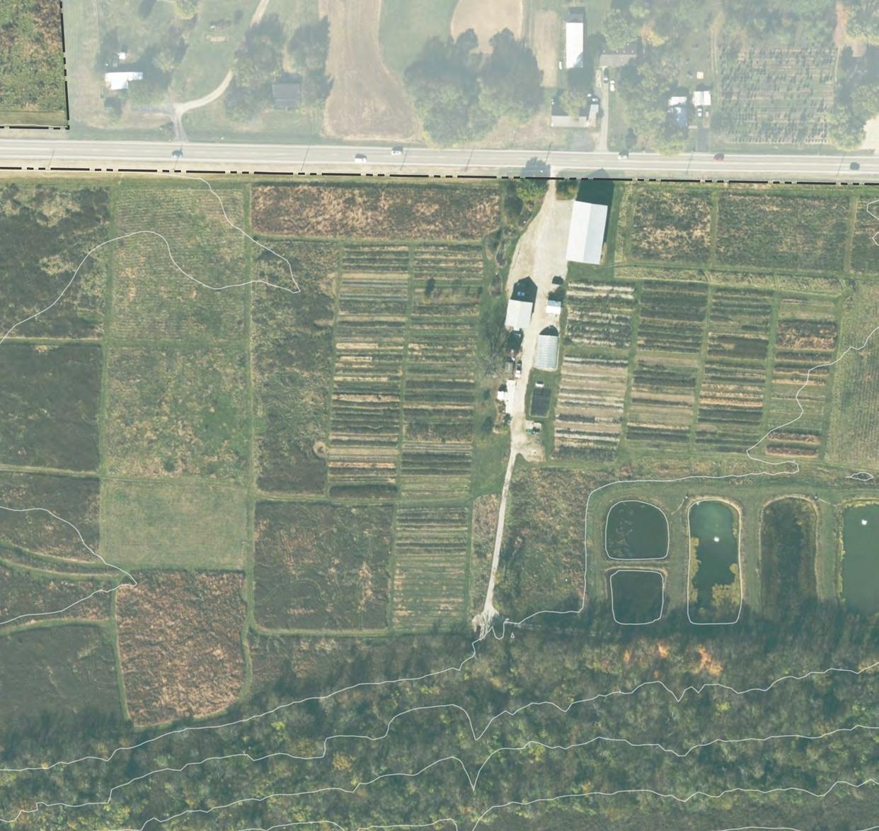


Demonstration Gardens 1
Visitor & Event Courtyard 2
Drying Barn Repurposed as Flexible Event Space and Education Center 3
4
New Entry & Signage
6
8
Visitor Parking
5 Office Building
New Greenhouse 7
New Drying Barn
Educational Trail Circuit 9 Connection to Loop Trails 10
To help expand production, the plan for Shaker Trace Nursery calls for a new drying barn and greenhouse. This enables the historic barn to be converted into a flexible building for volunteers and education programming. The repurposed barn would also have bathrooms and facilities so that it can host small events and gatherings. A new parking lot located east of the barn would allow for a new courtyard space framed by educational demonstration gardens. A system of educational trails will guide visitors through production fields, and a trail spur will connect Shaker Trace Nursery to the Shaker Trace Outer Loop Trail enabling access from the rest of the park.
1
Entry Signage
Small Parking Area 2 Meadow Planting 3 Storage Building 4 Hand-Carry Trail 5 Blueway Trail Signage 6
To improve blueway access to the Great Miami River and to allow for expanded paddling programs and education, a new access point, storage facility and program offices are planned for park property off E. Miami River Road. A small parking area and short hand-carry access trail will accommodate paddlers looking to paddle downstream to either Mitchell Memorial Forest or Shawnee Lookout. In addition to providing access for different length trips, the existing storage building on site will be repurposed to enable the expansion of paddling programming. The building will be used to store equipment for education and outdoor programming as well as provided needed office space.

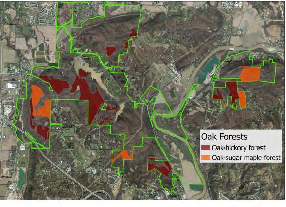
1. Miami Whitewater Forest –Bowles Woods
2. Winton Woods – Greenbelt State Nature Preserve
3. Kroger Hills – Upland Forest north of Wooster Pike
4. Withrow Nature Preserve – behind Lodge
5. Shawnee Lookout


Bowles Woods is an exceptional example of old-growth oak-hickory and oak-maple forest within Miami Whitewater Forest. However, the subcanopy is notably homogeneous and strongly dominated by sugar maple. Succession into stands of maple is a serious threat to these forest types. Where forested areas are too densely populated by woody vegetation (trees and shrubs), shading greatly reduces recruitment. The combined threats of browse pressure from deer and lack of disturbances (e.g., fire) pose a threat to oak and hickory forest regeneration in southwest Ohio. The species that comprise these forest types do not readily establish even in canopy gaps and open areas where sunlight is sufficient. Additional threats to oak-hickory and oak-maple forests include invasive trees, shrubs, and vines, as well as pests, disease and uprooting which may be associated with changes in precipitation patterns.
As one of the notable mature forests within Great Parks, this plan calls for a conservation project that will focus on prioritizing oak/hardwood recruitment and regeneration alongside structural diversity to preserve this natural asset. Management activities for Bowles Woods include:
• Prescribed burn management
• Deer control
• Invasive species control
• Enhancement seeding and planting
• Restoration monitoring via vegetation inventories and management plan summaries
THE MASTER PLAN FOR MITCHELL MEMORIAL FOREST FOCUSES ON EXPANDING MOUNTAIN BIKING AND HIKING TRAILS, PROVIDING BACKCOUNTRY CAMPING, AND ADDING BLUEWAY TRAIL ACCESS.
Mitchell Memorial Forest represents some of the most rugged terrain in Great Parks. Mostly undeveloped, the park offers camping opportunities with Pine Meadow Group Camp, eight miles of mountain bike trails, a nature trail, and River Hill Pond for fishing. The existing mountain bike trails are difficult and are for experienced riders only. In addition to adding more mountain bike trail mileage to make the park more of a destination for riders, there is an opportunity to build a beginner trail to safely introduce people to the sport. These trails could also be used for hiking, broadening the appeal of the park and providing some of the longest contiguous trails in Great Parks.
Land in the northern part of the park runs along the Great Miami River, providing an ideal access point to the blueway corridor. Adjacent to the park, a mix of forest and residential use can be found to the east and south. There are numerous potential access points to existing neighborhoods, allowing greater access to the park on foot. As new trails are built, particular emphasis will need to be placed on trail planning to avoid erosion and on management plans to control the spread of invasive species.
Issues
1. Japanese stilt grass is invading new areas, following biking trails.
2. Deer browse is exceptionally heavy.
Priorities
1. Maintain Silver Creek as prime shrubland bird habitat.
2. Consider designation as a dark sky site.
3. The steep topography creates high potential for soil erosion. Professional trail planning is required to prevent degradation.
4. Invasive species control plan will accompany proposed development of trails or other infrastructure.
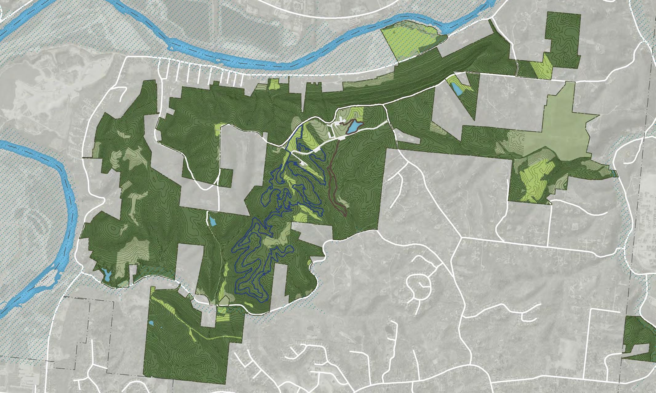


Pine

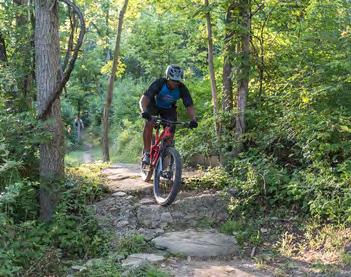
The master plan for Mitchell Memorial Forest calls for improvements to the existing eight miles of mountain bike trails (5) and the construction of a new 1.4 mile beginner mountain bike course (4). Located across from the Wood Duck Trail, this new trail will introduce new riders to the sport, providing a safe and fun experience for all abilities. Another 10.6 miles of hiking and walking trails are also possible for the west side of this park (A,B, and C), meeting the community need for longer hiking trails within Great Parks. Any new trails will require an environmental assessment to consider potential impacts on habitat and natural areas within the park.
With the trail expansion comes the opportunity to add backcountry camping sites (3) that will provide
a unique nature experience within Hamilton County and allow for new education programming opportunities to teach outdoor skills. Along the southern edge of the park, four new pedestrian access points could be added to connect Mitchell Memorial Forest to the surrounding neighborhoods.
The Silver Creek area is currently home to a vibrant community of brushland and grassland birds. In addition to a new loop trail, a management plan should be created for this unique habitat that includes soil amendments and the removal of invasive plants. To allow for needed maintenance and management, access and a small amount of parking will need to be provided to this part of the park.

ADD BEGINNER MOUNTAIN BIKING
New
7 Shrubland/Grassland Management Area
6 Stream and Vernal Pool Restoration ADD BACKCOUNTRY CAMPING
New
Pedestrian Park Access
Silver Creek Trail and Access


Entrance 1
Floodplain Woodland Restoration 2
Small Parking Area 3
Drop-off Loop 4
Hand-Carry Trail to River 5
Canoe/Kayak Access Point 6
Blueway Trail Signage 7
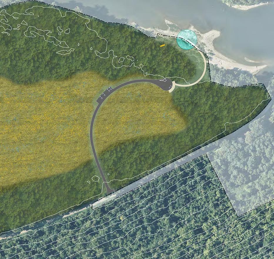
Blueway trail access will be added to Mitchell Memorial Forest along E. Miami River Road. A short entrance drive will lead to a canoe/kayak drop off loop with a hand-carry trail to the river. A small parking area will also be provided. This access point would be used by those looking to spend a longer day on the river as a trip downstream to Shawnee Lookout is approximately 10 miles. In addition to providing access for paddlers, there is an opportunity to restore the existing floodplain woodland habitat that exists at this site today.


THE MASTER PLAN FOR WHITEWATER RIVER CORRIDOR FOCUSES ON ESTABLISHING WATER SCHOOL EDUCATIONAL PROGRAMMING, CREATING A SWIMMING AREA, INCREASING NATURE OBSERVATION AND BIRDING OPPORTUNITIES, AND PROMOTING CONTINUED CONSERVATION.
Located on the west side of Hamilton County in Harrison Township and sitting along one of the five major water corridors in Hamilton County, Great Parks’ Whitewater River Corridor includes numerous tracts of land totaling more than 500 acres, with the best known being the Campbell Lakes Preserve. The other tracts of land making up the Whitewater River corridor park include lands both donated to and acquired by Great Parks, some of which have direct frontage along the Whitewater River. The corridor is surrounded by a mix of forest and agricultural lands to the west and south, and residential neighborhoods to the east and north. The park spaces are mostly undeveloped, though activities such as fishing and nature observation are the most popular things to do along this corridor. There is a primary access point at Campbell Lakes that includes a parking lot and a path network to access the various lakes. In the past, Great Parks stocked the lakes and charged a fee for fishing. However, stocking was discontinued when breaches between the lakes
Issues
1. Unmanaged hydrological evolution of floodplain and riparian connections
2. Land use history prevents development of buffer vegetation and shallow habitat
Priorities
1. Develop management framework/approach for floodplain and riparian connection or even channel migration, and explore capacity for floodwater storage.
2. Develop open land management targets for birds that can maximize the ecological performance of areas with industrial or compacted soil and serve as a model for other gravel pit sites.
3. Use the novel ecosystem created by soil conditions to experiment with vegetative community and species that are native but uncommon such as prickly pear.
HARRISON TWNSP HARRISON TWNSP WHITEWATER TWNSP CITYOF HARRISON Whitewater Valley Elementary School
KilbyRd Lawrenceburg
EXISTING WHITEWATERRIVER BondRd Brooks Rd


74 1 2 1 2
Lawrenceburg
POINTS CampbellRd
Campbell Kilby Rd railline
LEGEND Meadow/Prairie Forest
EXISTING MEADOW AND LAKE CAMPBELL LAKES

57 56

The Whitewater River Corridor offers a hub of education and programming around water-based recreation.
Improvements to facilities here would provide needed river access, as well as educational opportunities to teach paddling and safety skills.
Within the Campbell Lakes Preserve area of the Whitewater River Corridor, the master plan focuses on improving the entry to the park, increasing both visibility and wayfinding. With the park, an accessible fishing area will be reestablished and a meadow loop trail will be added. A canoe and kayak access point will also be formalized at the lake to the south of the entrance.
The Whitewater River Corridor is an ideal setting for creating a
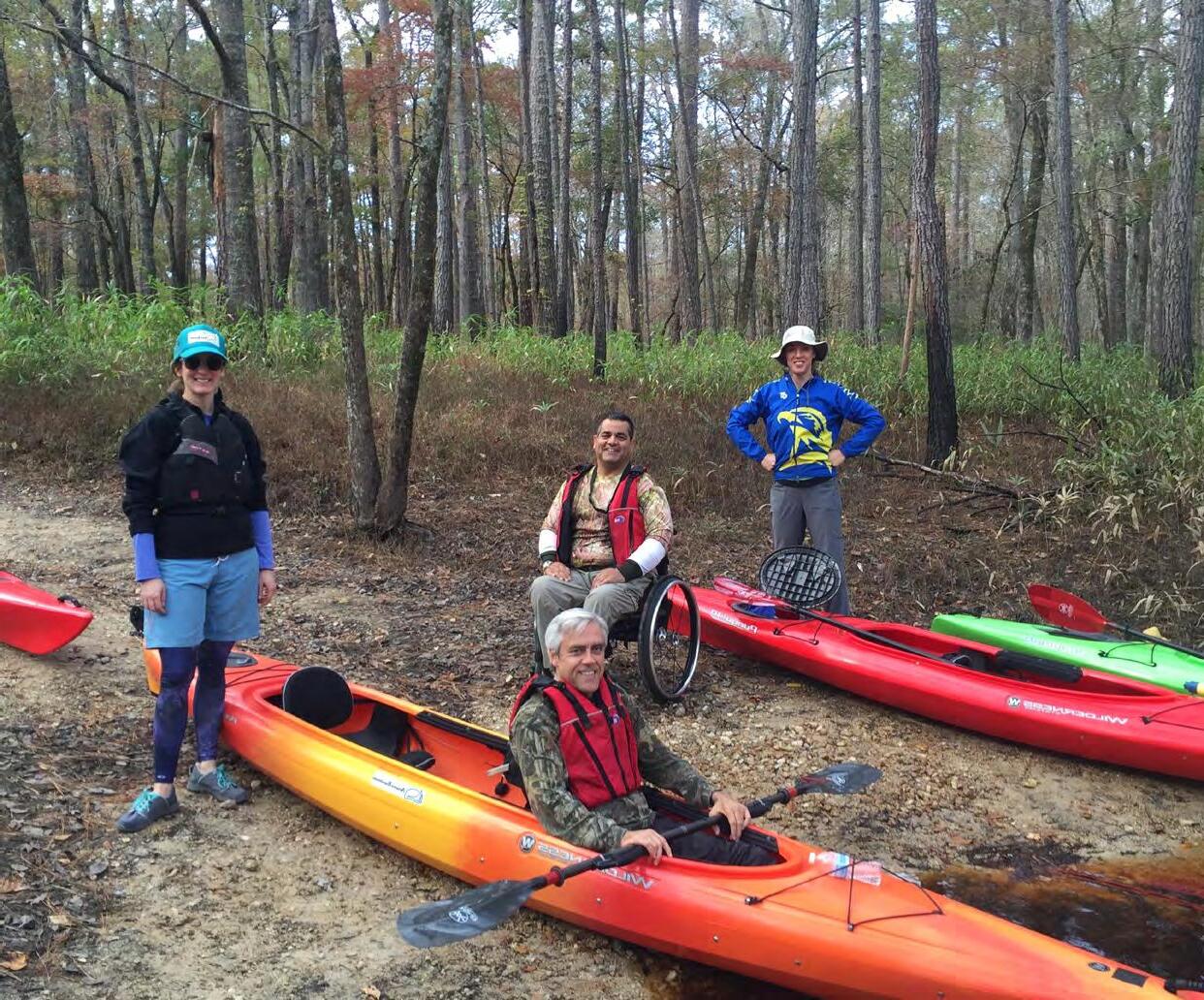
Water School to teach water-based recreation classes and skills. The flatwater of the quarry lakes is a great place to teach new paddlers how to use canoes, kayaks and stand-up paddleboards in a safe and protected environment. After completing an introductory course to learn about water safety and paddling, users could then “graduate” to going on a trip down river toward Shawnee Lookout.
There are two potential locations for a future Water School along the Whitewater River Corridor as part of increased programming for Great Parks (see pages 60 and 61).
Depending on the location, the Water School programming could be mobile, needing just a designated area to set up and run classes, or have a storage facility and outdoor classroom shelter. These waterbased recreation programs could
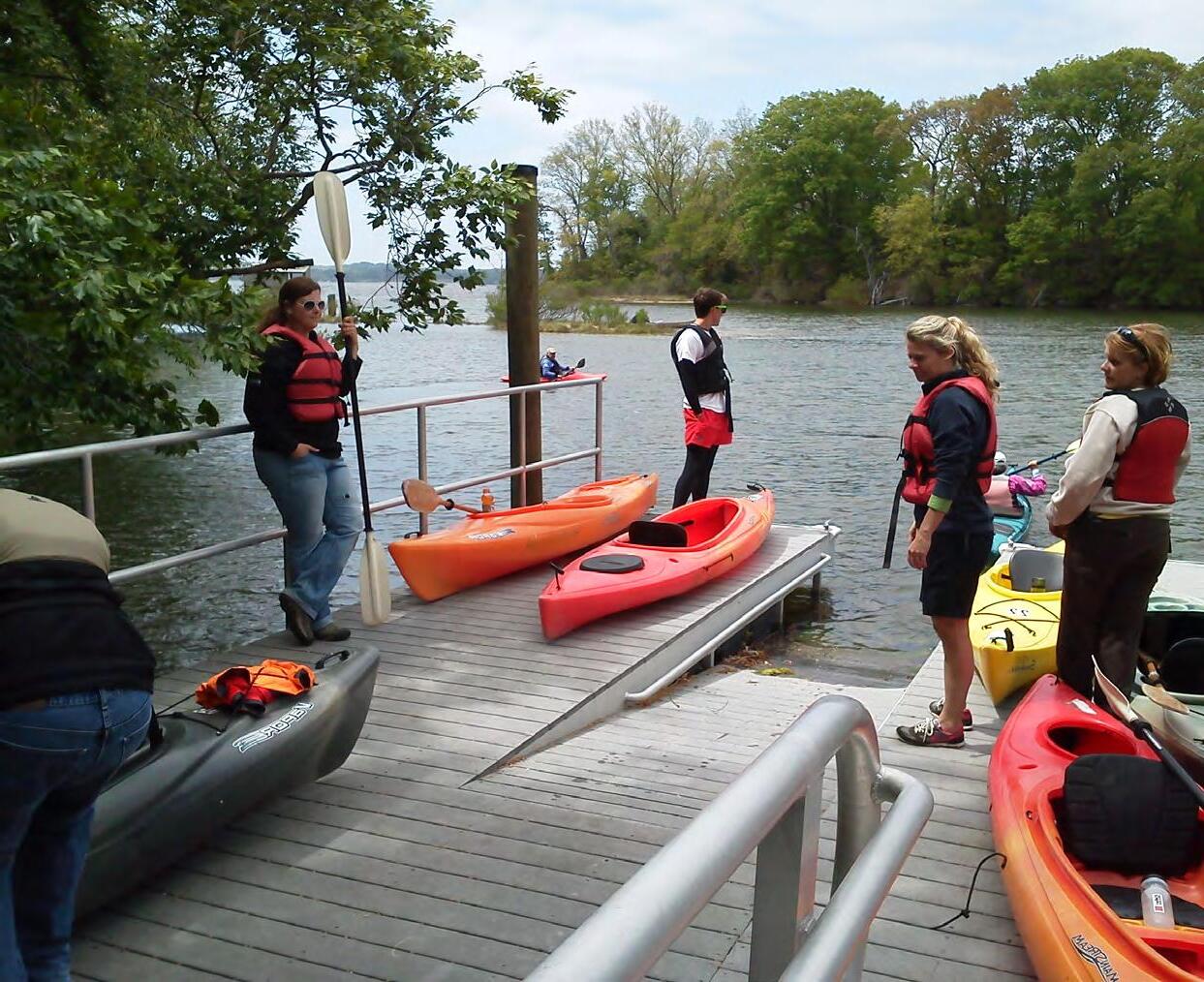

also be paired with regional bike rides or activities at other parks that will also have access points along the Whitewater and Great Miami River blueway trail system.
Possible
River
Great

Entry Signage & Railroad Crossing Improvements 1
Accessible Canoe Kayak Launch 2 Meadow Loop Trail 3 Blueway Trail Signage 4 River Access Point 5
One potential blueway trail access and a Water School site is at Campbell Lakes Preserve. An accessible canoe/kayak launch could provide easy access to the lake, and a paddler could then access the Whitewater River through a breach area at the southern end of the lake. Water-based recreation classes could be taught on this lake, and longer river trips could be launched from this location as well.
A major challenge to this location is that the property was purchased with Clean Ohio funds, which restrict development and construction of infrastructure needed to support the Water School.


Water School Training Lake 1
Accessible Canoe Kayak Launch 2 Shelter 3 Loop Trail 4
Access Drive and Drop-Off 5 Storage Building & Parking 6
Improved Crossing and Entrance 7 Improved Railroad Crossing 8
Access Drive and Drop-Off 9
Accessible Canoe Kayak Launch 10
Accessible Canoe Kayak Launch 11
The second potential blueway trail access point is located south of Campbell Lakes Preserve at another quarry lake east of Kilby Road. Since this lake is isolated from the Whitewater River, it could also offer lake swimming as well as Water School programming. The advantage of this site is that it could also accommodate an on-site storage facility for needed outdoor gear and equipment as well as an outdoor classroom shelter. While this site offers great access for flat water paddling and classes, it would require crossing the road to get access to the Whitewater River.


THE MASTER PLAN FOR FERNBANK PARK FOCUSES ON PROVIDING ACCESS TO THE OHIO RIVER BLUEWAY TRAIL, PREPARING FOR CONNECTION WITH THE FUTURE OHIO RIVER BIKE
TRAIL, EXPLORING HISTORIC INTERPRETATION AND EDUCATION OPPORTUNITIES AT THE LOCK CARETAKER’S BUILDING, AND IMPROVING STORMWATER MANAGEMENT.
EXISTING CONDITIONS
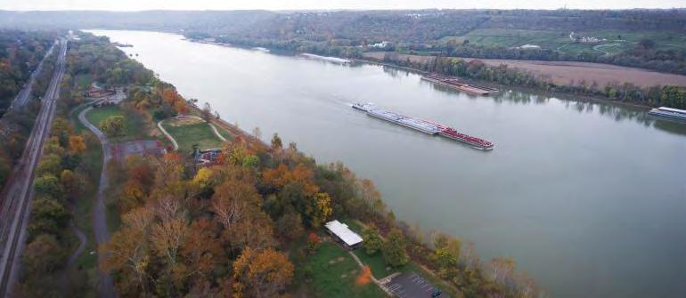
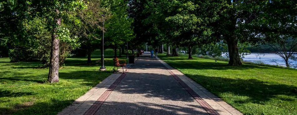
Fernbank Park is a 65-acre park leased and managed by Great Parks through a partnership with the Cincinnati Park Board. The park is bordered by US-50 and the Ohio River. Amenities within the park include reservable shelters and Fernbank Lodge, a playground, rental lodge, rest rooms and access to bank fishing in the Ohio River. The park also features a 1.2-mile shared use trail and the 1-mile Sycamore walking trail. The park is well-used, and serves its surrounding community.
The landscape of the park is mostly flat and has been heavily influenced by the Ohio River as it is located entirely within the floodplain of the river.
NATURAL RESOURCES
Issues
1. Soils are predominantly urban
Priorities
1. Replace turf with meadow habitat at focal locations
2. Improve stormwater management to help improve Ohio River water quality


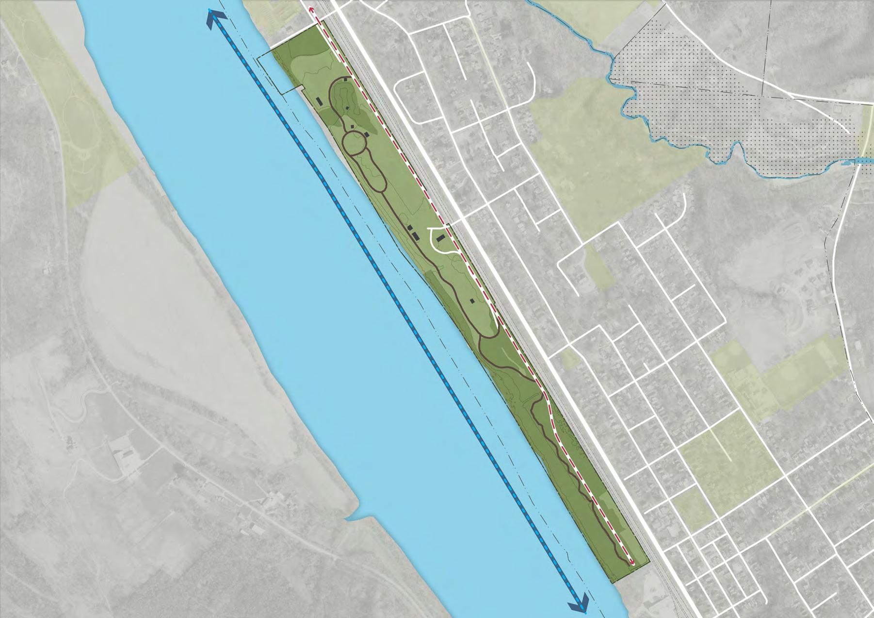
Fernbank Park currently offers amenities and programs that serve a diverse array of park users. Improvements to the park build off the popular activities of the park and improve connections to two regional trail systems.
Ohio River Blueway Trail
Fernbank Park is one of two Great Parks that has direct access to the Ohio River. Unfortunately, there is currently no place to launch or dock a canoe/kayak or boat. Providing an improved access point in Fernbank Park (2) would formalize access to the Ohio River blueway trail and provide a new reason for users to visit this park.
Ohio River Trail
The Ohio River Trail is one of the region’s most important regional bike
routes. Upon completion the trail will connect from the southwestern corner of Hamilton County and Ohio through Downtown Cincinnati and out to Clermont County east of Hamilton County. From west to east, this trail will directly connect with five Great Parks (Shawnee Lookout, Fernbank Park, Embshoff Woods, Withrow Nature Preserve, and Woodland Mound). As the trail is built out along US-50, it should run through Fernbank Park, allowing users to experience the park, learn about the unique history of the area, and potentially get a bite to eat at a café or snack bar (5).
Improve Entrance Experience 1
Allow Canoe/Kayak Launch and Improve Pathway 2
Historic Interpretation at Lock Caretaker’s Building near Lodge 3
Ohio River Recreational Trail Blueway 4
Study Potential Reuse of Concession Stand 5
Explore Stormwater Management / Naturalization Opportunities 6


THE MASTER PLAN FOR EMBSHOFF WOODS FOCUSES ON ADDING NEW TRAILS, CREATING A CANOPY WALK TRAIL, CONNECTING TO NEARBY NEIGHBORHOODS, IMPROVING THE DISC GOLF COURSE, AND ACCESSING THE FUTURE OHIO RIVER TRAIL.
EXISTING CONDITIONS
Embshoff Woods is approximately 325 acres bordered to south by US-50, and to the north by Delhi Avenue. The park includes significant topography that includes a change in elevation of 340 feet. The programmed park space occupies a small portion of the park at the top of the hill, with the only access point located off Paul Road. Despite their proximity, adjacent residential neighborhoods to the east have
limited access to the park due to the lack of sidewalks and pedestrian connections. All of this makes the park difficult to find and access.
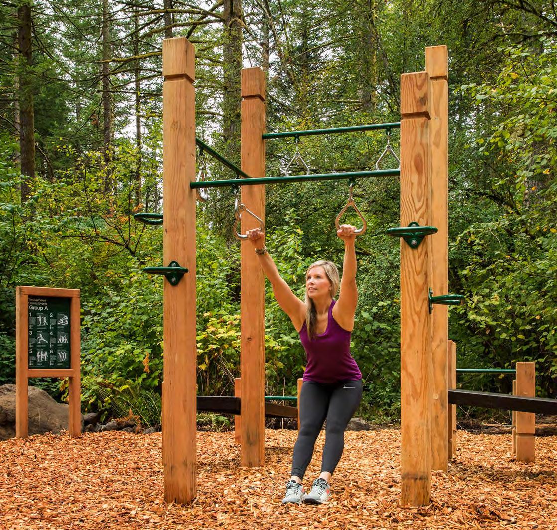
Amenities in the park include the disc golf course, 1-mile fitness trail, reservable shelters, and playground. This park also contains what is one of the largest bur oak tree in the region.

Issues
1. Exceptional invasive species
2. Hydrological alteration, runoff, and drainage pipes
3. Neighboring developments create stormwater management issues
Priorities
1. Clean up dumping sites
2. Active vegetation management in focal areas – examine local job and summer programs
3. Manage landslide risk and erosive potential of steep streams, though the topography will prevent many options of management.
4. Manage stormwater to daylight stormwater drainage to create an amenity


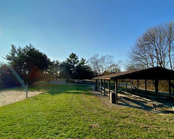

POINTS OF INTEREST
Evening Shadow Shelter
Morning View Shelter
Rolling Vista Shelter
Whistling Wind Shelter
River Mount Shelter
Restrooms
Playground
Disc Golf Course
River Bird Shelter
Mossycup Hill Shelter
Restrooms
Horseshoe Haven Shelter
Fitness Trail
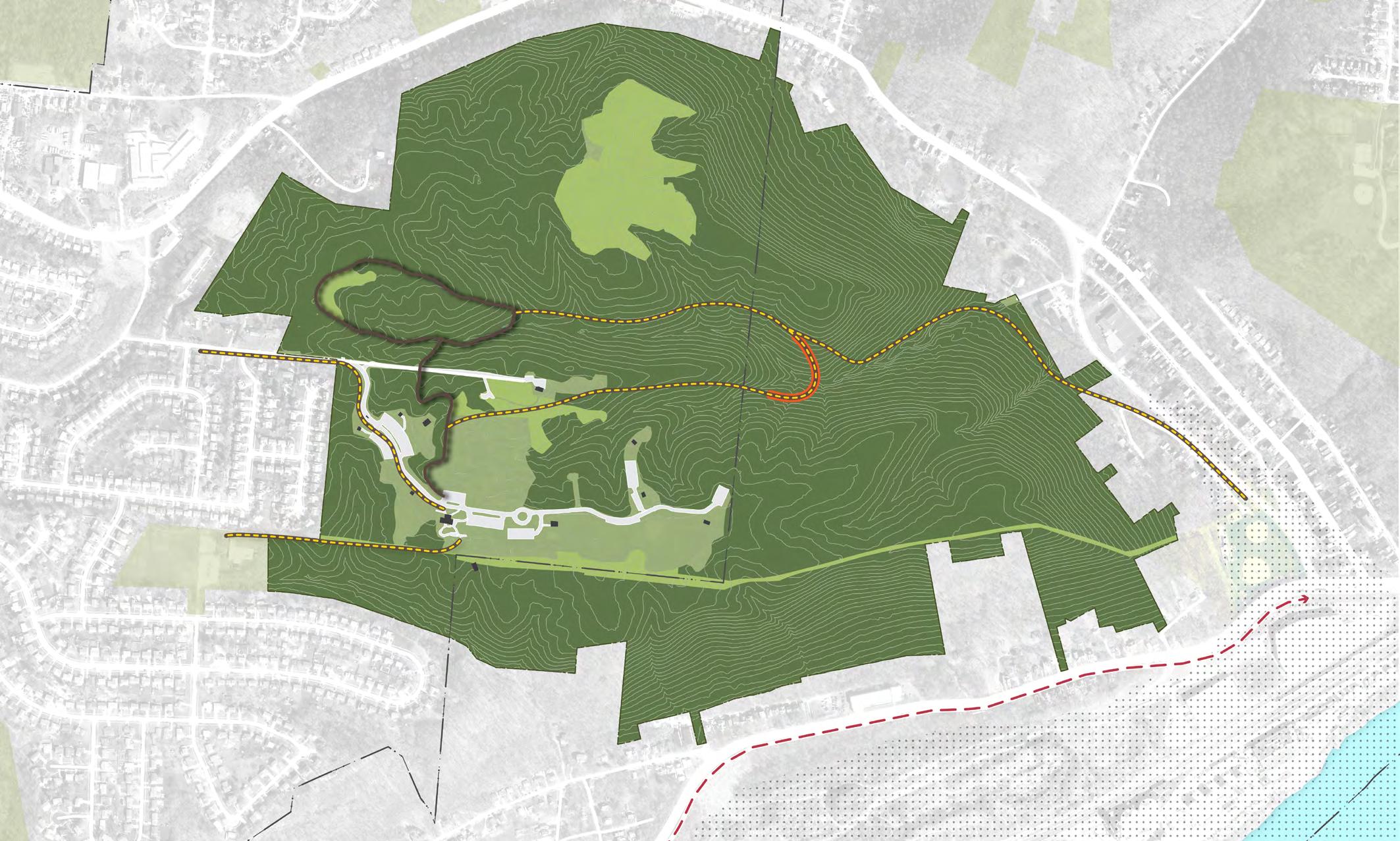
Embshoff Woods has the potential to be a park that better serves both adjacent residential neighborhoods and provides a unique natural destination close to the heart of the city. The master plan focuses on providing needed neighborhood access through both new sidewalks on Paul Road and the park access drive, and a connection to Delshire Park. There is also the potential to provide pedestrian access from the bottom of the hill at BoldFace Park. Doing so would create a more visible frontage along US-50.
Many of the park’s current features are in need of improvement and the master plan calls for a new pavilion, enhanced disc golf course, and improvements to the fitness trail. Given its location at the top of a hill, there is also an opportunity
to mitigate stormwater runoff by retrofitting the paved parking areas with green infrastructure, restoring former athletic fields and daylighting a piped stream. These improvements will enable stormwater to be held on site, easing the amount of runoff on the surrounding hillsides.
IMPROVEMENTS
Rehab / Replace Pavilion
Green Stormwater Parking Lot Retrofit
Improve Disc Golf Course
Canopy Walk Overlook
Improved Entry Experience
Daylight Stream
Restore Former Athletic Fields
Canopy Walk Trail
Fairbanks Ave Access Trail
Connection to Delshire Park
Complete Sidewalk Network into Park
Improve Fitness Trail



In addition to the new pedestrian access points from the surrounding neighborhoods, there is an opportunity to construct a canopy walk trail that highlights the unique topography and ravines within Embshoff Woods. Running along the ridges on both sides of the ravine to the east of the existing Fitness Trail, this loop would provide outstanding ravine views culminating in a suspended trail platform that is elevated in the tree canopy overlooking a stream and the forest below. The canopy walk trail would be unlike anything else in Great Parks and would offer a hiking and education experience in every season, from waterfalls during spring rains to the changing colors of leaves during the fall.


 NATURE TRAIL
RAISED CANOPY WALK
Existing Tree Canopy
Elevated Canopy Walk
On Grade Trail
For the Central Region the Park and Facility Master Plans focus on numerous community priorities including improved trail connectivity, access for a variety of outdoor activities, investment in nature observation and education, and upgrades to Winton Woods Harbor. Eighteen miles of trails will be added throughout the Central Region, with a focus on new hiking trails, regional trail connections between existing parks, and direct pedestrian linkages to neighborhoods surrounding the parks.
The Central Region is anchored by Winton Woods, which will see several improvements. The harbor will be updated with a new destination play experience, improved boat access, a skate park, and a relocated and expanded amphitheater. The campground will also get new RV spaces andnew rental facilities.
Nature education is also a strong focus for the Central Region, with a new Education & Event Center at Glenwood Gardens, a new raptor facility at Farbach-Werner Nature Preserve, and improved access at Richardson Forest Preserve and Newberry Wildlife Sanctuary. Conservation and restoration projects will also take place throughout the Central Region. The Trillium Trails area will be restored
at Glenwood Gardens, and old growth management protocols will be established for the two mature forests at Winton Woods.
The following pages will highlight the master plan of improvements for each park in the Central Region. Within each park master plan, general improvements are listed and briefly described. Some parks also have Focus Area improvements that feature more advanced plan concepts and descriptions. In Section 5: Implementation, all of these improvements are cataloged and prioritized.
ADD MORE TRAILS AND ADVENTURE
• 18 Miles of New Trails (Hiking/ Walking) and Neighborhood Connections
• Improved Access at Richardson Forest Preserve and Newberry Wildlife Sanctuary
• New Beginner Mountain Biking Trail at Winton Woods
• Improved Harbor at Winton Woods
• Campground Improvements at Winton Woods
• Disc Golf Course Improvements at Winton Woods
• New Event and Education Center at Glenwood Gardens
• New Raptor Facility at FarbachWerner Nature Preserve
• Trillium Trails Restoration at Glenwood Gardens
• 2 Preserved Mature Woodlands
• Wetland Restoration at Triple Creek

THE MASTER PLAN FOR WINTON WOODS FOCUSES ON IMPROVEMENTS THAT WILL ENHANCE THE USER EXPERIENCE IN THE MOST-VISITED GREAT PARK. WITH A REFRESHED HARBOR, EXPANDED CAMPGROUND, NEW TRAILS AND CONNECTIONS, A NEW DOG PARK, AND IMPROVEMENTS TO THE DISC GOLF COURSE, ADVENTURE OUTPOST AND PARKY’S FARM, WINTON WOODS WILL REMAIN THE HEART OF GREAT PARKS.
EXISTING CONDITIONS
Located in Springfield Township just south of I-275 and west of I-75, Winton Woods is the most visited of all the Great Parks. Seventy-five percent of this 2,500 acre park is comprised of natural areas, but it offers a wide range of amenities that draw more than 1.1 million visitors annually.
The most active part of the park is centered around Winton Lake. On the north side of the lake is the harbor, which features a playground, splash pad, fishing area, and bike and boat rentals. There is also Winton Woods Campground, which is the most popular campground in Great Parks. There are also two old growth forests that are designated as State of Ohio Nature Preserves. On the southern side of the lake, there are reservable shelters, Adventure Outpost, a disc golf course, and numerous paved and natural trails. The Parky’s Farm area on this side of the lake also offers an educational farm and play experience, as well as the Riding Center and equestrian trails. On the north side of the park along Sharon Road, there there are two golf courses - Meadow Links & Golf Academy and The Mill Courseas well as Possum Run Youth Camp
and an accessible bow-hunting area. The park is surrounded by residential neighborhoods, making this one of the most accessible parks to nearby residents. There are three nearby schools, with Winton Woods High School on the north side of the park, and the Winton Woods South Campus and Primary North Campus on the northeast side of the park. Metro bus service also provides access to Winton Woods with two bus stops along Winton Road at the northern and southern edge of the park.
Winton Woods is located within the Mill Creek watershed and the topography is varied, with steep uplands draining down to the surface of Winton Lake. The primary stream feeding the lake is the West Fork of Mill Creek. The lake was built between 1950 and 1952 and was the first operational lake in the Army Corp of Engineers Louisville District. The lake is very shallow, and where tributaries enter there is sediment deposition and the water quality is heavily impacted by the surrounding urban land use practices.
Meadow Links and Golf Academy
Driving Range
Snack Bar
Possum Run Youth Camp
The Mill Course / Mill Race Banquet Center
Orchard Area Shelter
Cherry Hill Shelter
Central Maintenance Complex
Great Blue Heron Shelter
Maple Knoll Shelter
NATURAL RESOURCES
Issues
1. Sedimentation in the lake from tributaries
2. Combined Sewer Overflows impact the park and Winton Lake
3. Water quality issues with ponds at Parky’s Farm
Priorities
1. Consider riparian edge plants along the lake
2. Improve water quality at Parky’s Farm

Woodpecker Woods Shelter
Raccoon Ridge Shelter
Kestrel Point Shelter
Daly Hill Shelter
Holstein Shelter
Clydesdale Shelter
Hayloft Barn
Parky’s Farm
Winton Woods Riding Center
Garnett
Elm Ridge Overlook Shelter
Campground Playground
Warren Wells Preserve West Fork Dam
Adventure Outpost
Disc Golf Course
Fox Knoll Shelter Sand Volleyball
Ladybug Landing Shelter
Butterfly Bluff Shelter Owl Overlook Sweetgum Slope Shelter
Accessible Canoe/Kayak Launch
Shetland Shelter
Great

1 2
Management
Beginner Mountain Biking Trail
Update Mill Race Banquet Center
Wetland/Habitat
Improvements to the northern portion of Winton Woods focuses on new trails and connections. Of the 9 miles of new trails in Winton Woods, 3.7 of them are part of the new North Loop Trail (B) that would connect the Harbor Loop Trail on the east side

of the park with the Kingfisher Trail on the west side of the park. Along with better pedestrian connections into existing neighborhoods (E), the North Loop Trail would significantly improve access to the park for nearby residents. The Winton Woods to Glenwood Connector Trail (C) would also connect to the North Loop Trail, providing access to Glenwood Gardens and expanding the regional multiuse trail network.
West of the planned North Loop Trail north of Sharon Road, a beginner mountain biking course is planned (2). This facility would offer access to entry-level mountain bike trails to introduce the sport to kids and adults alike. Given the lack of such facilities on the north side of Hamilton County and its proximity to neighborhoods, this new adventure recreation amenity has the potential to be a popular destination.
Other improvements in the Park and Facility Master Plan for the northern portion of Winton Woods include:
• Improvements to the Mill Race Banquet Center to enable it to continue to attract and serve events (3)
• Mature forest management for the areas north of Sharon Road (1)
• Wetland and habitat restoration in the area north of the Meadow Links and Golf Academy (4)
On the southern side of Winton Woods, the Park and Facility Master Plan focuses attention on an improved Harbor that upgrades the play experience, improves lake access, and adds neighborhood focused activities. Other improvements include:
Winton Woods Campground (6)
The campground is slated for
updates, adding 14 new RV spaces (four of which are pull-through sites) and new rental facilities.
Trail Connections
Trail connections are planned that would provide a trail all the way around Winton Lake, making Parky’s Farm, the Harper Meadows area, and the Disc Golf Course and Adventure Outpost more accessible.
Improved Adventure Outpost (7)
Improvements to the Adventure Outpost include trail connections to the rest of the park, updates to restroom, office, boat storage, and camping/cabin facilities.
Improved Disc Golf Course (8)
Improvements to the Disc Golf Course would include new tee pads, baskets, signage and potential design adjustments to certain holes.
New Dog Park (9)
The area south of Lakeridge Drive has been identified by this plan as a potential location for a new dog park.
Improved Farm Complex (10)
The Riding Center is in need of improvements to its riding and programming areas. In addition to studying improvements to the education areas and a plan for repurposing the indoor play area, Parky’s Farm also requires more work to enhance the quality of the pond.
Mature Forest Management (11, 12)
The two State Nature Preserves are notable mature forests within Great Parks and are part of the new management protocols identified as part of the Natural Resources Management Plan.
Winton Woods Harbor is one of the most visited parts of Great Parks. The Harbor Pavilion offers a snack bar, restrooms, and picnic table seating. The adjacent playground and wet play area are popular, but are dated and reaching the end of their useful life. The amphitheater is programmed throughout the summer months, but is limited in terms of the size of events it can serve. Along the lake’s edge wide pathways allow for access, but the overabundance of pavement and a lack of shade result in an uncomfortable experience.
At the boathouse, visitors can rent a variety of watercraft, but those bringing their own boats to the park often find themselves in conflict with those renting boats. The harbor area is well served by parking lots, but improvements are needed to enhance the pedestrian experience from these parking lots to the destinations and attractions at the harbor. Likewise, the parking area north of the Harbor is underutilized, except for during special events. Finally, the small parking area north of Lakeview Drive is underutilized, although the basketball courts are popular.


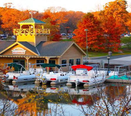
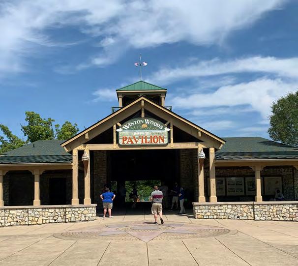

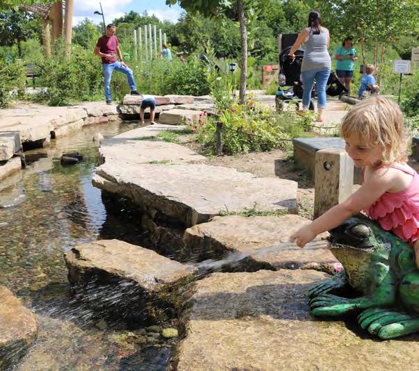

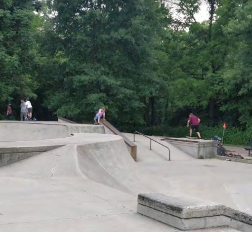

Improved Park Promenade 1
Improved Play Experience 2 Living Edge Enhancements 3 Fishing Piers 4 Amphitheater 5
Stormwater/Riparian Edge Plantings 6 Relocated WWHS Dock and Improved Canoe/Kayak Access 7 New Cafe Building 8 Skate Park 9 Shelter 10
Improved Basketball Court 11 Harbor improvements focus on enhancing existing spaces and organizing uses in a more thoughtful, efficient and accessible manner. First, the pedestrian experience from the parking lot will be improved by building a central pedestrian promenade that offers direct access to the Harbor Pavilion. The play experience will be upgraded to an entirely new destination playground that has integrated natural and water play elements that are open to all users without a fee. Along the lake, riparian “living edge” plantings will improve habitat and reduce the amount of hard pavement. Several piers will provide access for fishing. The boathouse and accessible canoe/kayak launch will remain in their current locations, but the dock for the Winton Woods High School rowing team may be relocated adjacent to the improved gravel canoe/kayak put-in location.
To enable larger events, a new amphitheater will be added just to the south of the north parking lot, providing easier access to this area and separating it from the play experience at the center of the harbor. At the end of this parking lot, there is an opportunity for a potential café building that could be run by an outside vendor or local restaurateur. Finally, to better serve neighborhood residents, the basketball courts will be improved, with a shelter for shade and a new skate park located adjacent to a right-sized parking area.
WITH A NEW PAVED TRAIL CONNECTION TO WINTON WOODS, NEW HIKING TRAILS, A NEW EVENT AND EDUCATION CENTER, THE RESTORATION OF THE TRILLIUM TRAILS AREA, AND NEIGHBORHOOD LINKAGES, GLENWOOD GARDENS WILL BECOME AN EVEN MORE IMPORTANT ASSET TO THE COMMUNITY.
EXISTING CONDITIONS
Glenwood Gardens is approximately 338 acres, of which 260 are diverse natural areas. Located adjacent to Winton Woods, it includes Trillium Trails, which is a State Nature Preserve. Amenities at the park include the Highfield Discovery Garden, the Cotswold Visitor Center, and 2.6 miles of trails. The gardens surrounding the visitor center offer dramatic views of the park and their formal style are unlike any other park in Great Parks. These gardens are a popular venue for wedding photography.
Access to this park is currently through a drive off Glendale Milford Road. It is possible to enter on foot off Springfield Pike where there is also a Metro bus stop. Informal pedestrian access is also possible from the adjacent apartment complex located east of the park. The neighborhoods south of the park adjacent to the Trillium Trails area has been an informal access point in the past, but needs improvement.
Glenwood Gardens is located downstream of Winton Woods park on the West Fork of Mill Creek. The creek meanders through the middle of the park and is the only constantly flowing stream in the park. Vegetation in the park is a mixture of forest, brushland, prairie, meadow and wetlands.
Issues
1. Invasive Species
2. Trail maintenance issues include excessive gravel and some drainage problems
Priorities
1. Regular invasive species control and management
2. Trail maintenance
3. Watershed management plan along with stream assessment of West Fork of Mill Creek


Ballyclare
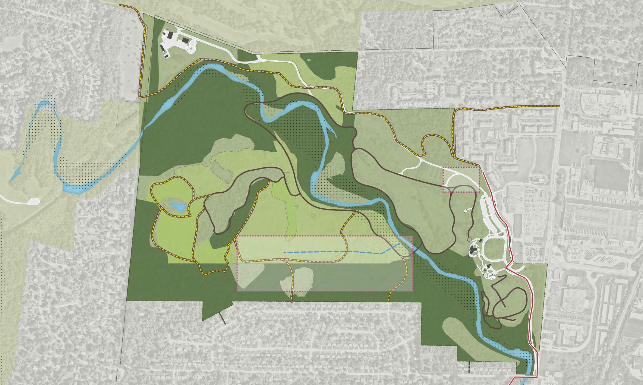
DeauvilleRd
The Park and Facility Master Plan for Glenwood Gardens focuses on two major improvements: a new event and education center and the restoration of the Trillium Trails area.
New Event & Education Center (1)
To better serve existing educational programs and provide space for larger events, a new Event & Education Center is proposed for Glenwood Gardens. Located at the northwest end of the existing parking area, this building would be integrated into the existing Garden Loop Trail and offer expansive views of the park (see page 84).
Trillium Trails Restoration (2)
The restoration of the Trillium Trails area would not only enhance habitat and stormwater management, it would also create formal trail
connections to the neighborhoods on the southern edge of the park (see page 85).
Other important improvements to Glenwood Gardens include:
Trails and Connections
• The Glenwood Gardens to Winton Woods Trail (A) is a 3-mile trail that will connect these two Great Parks together to form another linkage in the regional trail system and improve access to neighborhoods. This would also include a spur trail to Springfield Pike.
• Additional trail loops are also planned for Glenwood Gardens to highlight other natural feature and vernal ponds as well as provide connections to the southern part of the park. In total 3.4 new trail miles are planned. (C)
IMPROVEMENTS
New Event and Education Center
Trillium Trails Restoration Area
New Music Garden
Trillium Trails Old Growth Forest Management Area
• The entrance to Glenwood Gardens at Glendale Milford Road will be improved for pedestrians with an improved Metro bus stop and new sidewalk and crosswalk. (E)
Music Garden (3)
• At the Meadow Loop below the Highfield Discovery Garden, a Music Garden is planned to create a unique park experience and entice visitors to use this part of the park.
Glenwood Gardens to Winton Woods Trail
TRAILS Connection to Springfield Pike
New Hiking Trail
Neighborhood Connections
Improved Entrance and Pedestrian Experience



This Event and Education center provides a suitable space for ceremonies and receptions as well as for corporate events of a variety of sizes. The building is strategically located along a curving ridgeline between a service drive to the north and the Garden Loop Trail to the south. The grade change as the Garden Loop Trail descends into the park creates two opportunities. First, a lower floor allows for the creation of a coffee/snack bar, an activities room, and restrooms as amenities to trail users. Secondly, it elevates the event center spaces to add drama to the view and allow for separation of event guests from trail users. Other building features include:
• An event center that includes a dividable hall sized to accommodate 350 guests.
• A west end vestibule provides access from a dramatic covered, open air ceremony pavilion. The covered pavilion is also connected to the trails below allowing it to double as outdoor education space for tour groups.
Site improvements include an expansion of the existing parking area to accommodate a larger event, a covered vehicular drop off, and an overflow parking area with additional landscaping appropriate for its location deeper into the park setting.


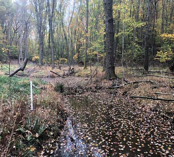


Restore Forested Riparian Buffer (9 Acres)
Daylight Existing Pipe Network and Restore as Headwater Seasonal Wetlands
Restore Remnant Channel as Overflow/ Seasonal Wetlands (1.8 Acres / 880 LF)
Neighborhood Pedestrian Connections
Stream restoration as needed to restore Hydraulic Floodplain Connectivity
Field Restoration
This portion of Glenwood Gardens is part of the larger Mill Creek Watershed and offers opportunity to restore headwaters, improve stormwater management, develop more trails, and create a better connection with nearby neighbors. This identified project would restore 880 linear feet of stream as part of a larger restoration area of more than 10 acres. Other features include:
• Removal of drainage pipes and tiles that aren’t part of the wetland restoration to restore water flow to the surface.
• Reconnecting the stream to the floodplain. The stream was straightened and altered in the past, and restoration will allow natural drainage patterns.
• At the upper end of the reach where more clay soils are present, minor topography grading can promote wetland creation and retain water on the floodplain.
• As the channel nears West Fork Mill Creek, a combination of boulders and bank grading will be necessary to given the steep topography.
• Establishing two trail connections from Joliet Avenue through the restored stream and wetland area and to the existing Wetland Loop trail. These new trail connections present an incredible educational opportunity for trail users to learn about these types of restoration projects.
FARBACH-WERNER IS A HIGHLY-PROGRAMMED PARK SURROUNDED BY NEIGHBORHOODS AND BUSINESSES. THE MASTER PLAN FOCUSES ON INCREASING ACCESS AND EDUCATIONAL OPPORTUNITIES WHILE MAINTAINING THE NATURAL OASIS FEEL OF THE PARK.
Farbach-Werner Nature Preserve is a mostly natural, 25 acre park that is home to some of the most unique experiences offered in the Great Parks system. Located in Colerain Township, just off of Colerain Avenue and within walking distance of residential neighborhoods, this park is home to forests, a secluded nature trail, and is a hub for programming and educational opportunities. The park includes forests, gardens, and vernal ponds.
The park includes a stream, wooded lawn used for programs, flower beds, a butterfly garden, wetlands, and a planted prairie. Amenities include a nature barn, outdoor amphitheater and fire pit for programs and a highly popular nature trail. The Nature’s Niche gift shopped closed in 2021, which provides an opportunity to repurpose the space. For its small size, Farbach-Werner experiences a high volume of visitors per year. Birding is an incredibly popular activity among visitors.
Three properties along Poole Road were recently acquired with Clean Ohio funds. This 2-acre addition the park features former residential houses, which have been re-purposed for staff offices and storage. Large yards offer an opportunity for habitat restoration, community gardens, or other lowimpact improvements that are in accordance with grant restrictions.
Issues
1. Algae blooms in ponds
Priorities
1. Create raingarden
2. Stormwater management

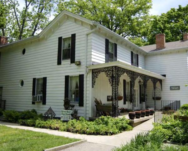


Former Nature’s Niche Gifts and Books
Ellenwood Nature Barn
Amphitheater
Pin Oak Trail
Raptor Center
Interpretive Meadow/Prairie
New Park Property

The master plan for FarbachWerner Nature Preserve focuses on increasing trail connections and making improvements to the unique destinations within the park.
Trails
While three new trail connections combine for just over a quarter mile of new trails, each serves an important role. The trail marked A establishes a connection from the park to the nearby Clippard Family YMCA. This connection will create easier access to the nature trails and unique educational opportunities for members of the YMCA. Proposed Trail B will create an additional access point from the Pin Oak Trail to the parking area and will serve as the primary connection to the new raptor center (1). Trail C will establish a paved path connection
from the park entrance along Poole Road to Colerain Avenue. This will help improve access to the park for pedestrians walking along the Colerain Avenue corridor.
The master plan also calls for establishing a new raptor center that will further expand educational programming opportunities and improve Great Parks’ ability to care for wildlife. This raptor center will be supported by a new trail connection that can serve as an educational walking path to view wildlife exhibits and will be designed so that it can be closed to the public when the birds need a break.
This parking lot will be one of several throughout the Great Parks system to be an initial candidate for improved
stormwater management techniques. During an expansion for the parking lot, bioswales will be added to improve the ability of the parking lot to handle stormwater runoff.
1 2 3
New Raptor Center
Green Stormwater Parking Lot
Retrofit
Repurpose Former Gift Shop
TRAILS
A
Trail Connection to YMCA B
Trail Extension
Sidewalk Connection to Colerain Ave C

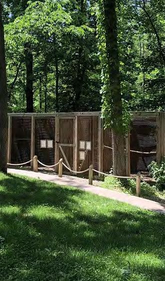

NEWBERRY WILDLIFE SANCTUARY IS ONE OF GREAT PARKS’ CONSERVATION AREAS THAT WOULD BENEFIT FROM MANAGED ACCESS. THE PLAN WILL FOCUS ON EDUCATIONAL PROGRAMMING AND LOW-IMPACT ACCESS TO THE PARK.
Newberry Wildlife Sanctuary is 110 acres, all of which are natural areas. Contained within the Sanctuary is a State Nature Preserve, which is maintained by Great Parks. Currently, there is no public access, parking, or restrooms on site.
Within the park is a stream and waterfall, as well as grasslands, brushlands, and mature forests. Community engagement throughout the planning process expressed a desire to have access to more natural areas that will create more nature observation and educational opportunities.
The master plan improvements for Newberry Wildlife Sanctuary focus on improving access opportunities to the park through low-impact strategies that will create new educational programming opportunities. Access will be limited and scheduled.
In total, the master plan proposes 2.4 miles of trails. The trails would improve some existing foot paths that have been created by staff and further used by a small number of current visitors.
In order to access the new trails, the plan identifies two potential areas for a low-impact parking area located next to a trailhead. These parking areas would offer only a few spaces for programmed hikes. Located at the parking areas and trailheads would be educational and interpretive signage that would support programmed hikes and events that will take place at the park.
The natural areas of this park provide for unique observation areas and educational programming. This park has also been identified as a key site to practice management strategies for the old growth forests (3).


Create a Trailhead Parking Lot
Potential Alternative Parking Site
Old Growth Forest Management Area
THE MASTER PLAN FOR TRIPLE CREEK CALLS FOR INCREASED ACCESS TO THE NATURAL AREAS OF THE PARK IN ADDITION TO IMPROVING THE EXISTING FEATURES OF THE PARK TO CREATE A MORE WELL-ROUNDED EXPERIENCE FOR PARK USERS.
EXISTING CONDITIONS
Triple Creek is a 179-acre park that includes a mix of natural areas, ball fields, trails and a fishing pond. Most of the park is natural area that contains a series of hiking trails. There is mix of passive and active park activities at Triple Creek that bring a diverse group of users to the park. The ball fields attract users of all ages with their families for tournaments and games held regularly at these fields. Supporting the fields is a snack bar and picnic area and a playground.
The natural areas, which cover most of the park, contain a fishing pond, wetland, and forested areas with a looped nature trail. Community input requested continued growth of the trail system, especially where there is access to natural areas.
The fishing pond is stocked by Great Parks and is in need of improvements, including dredging, to enhance the fishing experience. This could include water quality improvements and mitigation of stormwater runoff that makes embankments difficult to fish from.
Triple Creek is also located near several residential neighborhoods. Establishing pedestrian paths and connections to them could make this park more accessible to these residents.
NATURAL RESOURCES
Issues
1. Algal bloom problems with fishing pond
2. Wetland needs better protection from trails
3. Riparian buffer needed
Priorities
1. Resolve algal blooms and fish kills by exploring dredging
2. Improve trails through wetlands to limit disturbance


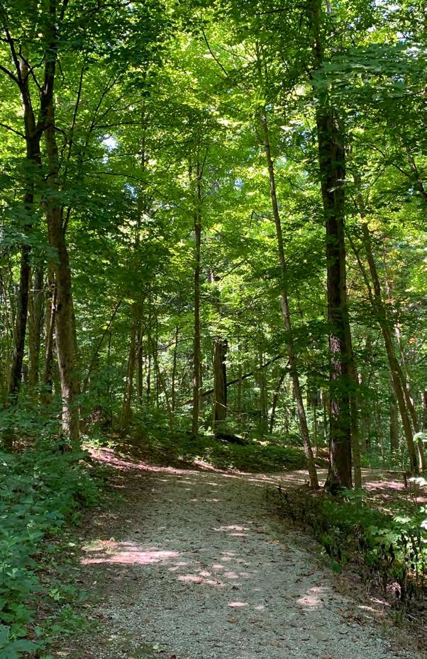
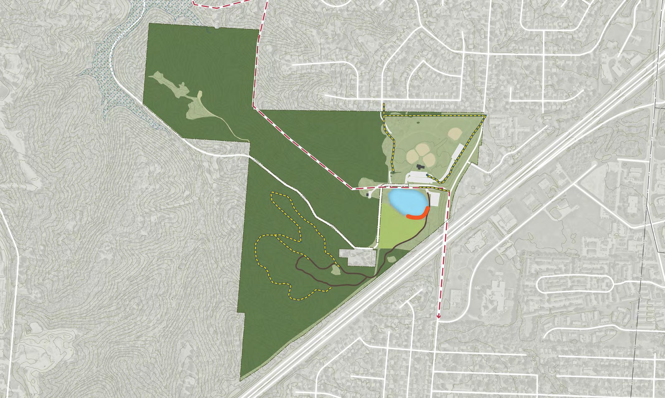
The Triple Creek master plan focuses on expanding trail opportunities and connections to the surrounding neighborhoods, improving the visitor experience for ball field users and anglers, and improving access to the park into the regional trail system.
Trails
The master plan proposes 4 miles of new trails and trail expansions. Trail A expands the loop trail within the forested portion of the park to create more observation and educational nature hikes. Trail B improved the existing trail by creating a boardwalk trail in a wetland area which will keep the trails accessible during inclement weather. Trail C provides a loop around the ball fields and connects with the neighborhood to the north at Templeton Drive. There is an opportunity to restore the wetland
5 6
conditions along this trail (6) routing south of Windon Drive that will provide an educational component to the trail. Trail D creates a sidewalk path that connects to Pippin Road allowing for better pedestrian access to the park.
Additional improvements to the park include improvements to the pond and fishing by creating a formalized fishing pier (1) and improving water quality of the pond (2) to create a better fish habitat and reduce the amount of restocking necessary.
Dugout and bleacher shade structures will be added near the ball fields (4), in addition to improving the concessions area (3) to provide a better guest experience. The playground will be expanded, and a

EXPANDED PLAYGROUND
sand volleyball court will be created (5) to offer more active experiences.
1 2 3
4 5
Improve Concession Amenities
Add Dugout Roofs and More
Shade
Expand Playground and Add Sand Volleyball
Wetland Restoration 6
Expand Trails
Loop Trail and Neighborhood Connection
Connect Sidewalk to Pippin Rd

BOARDWALK TRAIL
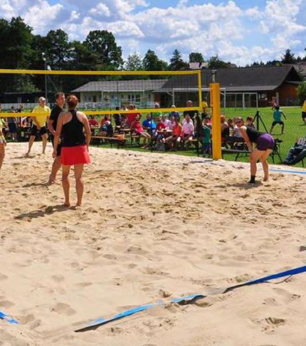
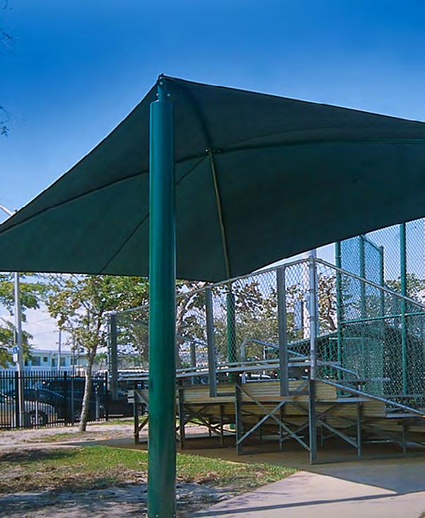
A B BENCHMARKS


RICHARDSON FOREST PRESERVE IS A CONSERVATION AREA THAT CURRENTLY HAS LIMITED ACCESS. THE MASTER PLAN WILL INCREASE ACCESS TO THIS PARK TO EXPAND GREAT PARKS’ NATURE OBSERVATION AND EDUCATIONAL OFFERINGS.
EXISTING CONDITIONS
Consisting of 413 acres, Richardson Forest Preserve is largely forested conservation area protected by Great Parks. Currently, the park is not regularly accessible to the public. Each year, guided hikes are conducted to observe some of the rare plant species that grow in the preserve including skunk cabbage, marsh marigold, and five-angles dodder.
Community and stakeholder engagement expressed a desire to maintain Great Parks’ role as a regional leader in conservation, but also desires to increase access to unique habitats and nature observation opportunities. The master plan for Richardson Forest Preserve focuses on low-impact improvements that will offer access and improve the visitor and educational experience of the park.
While some informal paths exist to support the guided hikes that occur on the preserve, the master plan proposes improving and formalizing three official trails that would total 2.8 miles of new trails. Paired with these new trails would be a low-
impact parking area for a few cars to make the access safe and more visible. Informational and educational signage would be incorporated into the trail head for this park to guide visitors on how to properly interact with the park and its sensitive habitats. These trail improvements will increase accessibility for all ages and skill levels and will expand the opportunity for Great Parks staff to lead programmed and educational experiences.
Other improvements for this park include future coordination of regional bike trails to connect from Richardson Forest Preserve to the Great Miami River Trail to the West and to Triple Creek and then on to Winton Woods and the West Fork Mill Creek Greenway Trail to the South. Additionally, there is former farmland encompassing approximately 31 acres of the site that should be restored as a brushland.
Issues
1. Deer overbrowse
2. Severe erosion
3. Beaver dams flooding and creating problems for the road
Priorities
1. Address beaver dams
2. Define appropriate use levels based on ecological sensitivity

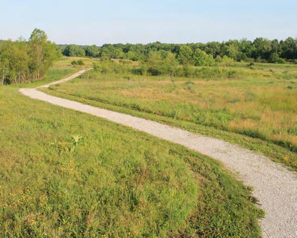


The Park and Facility Master Plans for the East Region address community priorities by focusing on 12 new miles of trails and pedestrian connections, investments in nature education facilities, river and lake access, harbor improvements, and the restoration and preservation of natural areas.
Throughout the East Region there are opportunities to extend hiking trails in nearly every park. These additional trail miles also open up opportunities to celebrate the unique overlooks, especially in the parks along the Ohio River. A new Nature & Education Center at Woodland Mound is oriented around these Ohio River views, providing another reason to visit this park in the far southeast corner of Hamilton County.
At the northeastern edge of the county, significant improvements are outlined for Sharon Woods to enhance the existing harbor, playgrounds, lake access, and hiking trails. Access to the Little Miami River is also a key focus, with improvements outlined at Lake Isabella, Kroger Hills, Bass Island and Otto Armleder to support this blueway corridor.
In addition to interconnecting park experiences along the Little Miami River corridor, plans call for
better neighborhood connections between parks and the communities nearby. This includes both physical paths and access points as well as programs and activities that will bring surrounding residents into the parks.
Conservation projects within the East Region address water quality, riparian restoration, and mature forest management. This includes a 13.5 acre restored forest and riparian area at the former Indian Valley Golf Course in the Little Miami River Corridor, and a green stormwater retrofit at Withrow Nature Preserve that will be a model for other such projects in Great Parks.
The following pages will highlight the master plan of improvements for each park in the East Region. Within each park master plan, general improvements are listed and briefly described. Some parks also have Focus Area improvements that feature more advanced plan concepts and descriptions. In Section 5: Implementation, all of these improvements are cataloged and prioritized.
ADD MORE TRAILS AND ADVENTURE
• 12 Miles of New Trails (Hiking/ Walking) and Neighborhood Connections
• 5 New Overlooks
• Improved Harbor, Fishing and Lake Access at Sharon Woods
• New Play Experiences at Woodland Mound and Sharon Woods
• Improved Disc Golf Course at Woodland Mound
• Improved River Access at Bass Island
BUILD NEW NATURE, EDUCATION & EVENT CENTERS
• New Nature and Education Center at Woodland Mound
• 13.5 Acres Restored Forest and Riparian Area in Little Miami River Corridor
• Green Stormwater Parking Lot Retrofit at Withrow Nature Preserve
• 4 Preserved Mature Woodlands
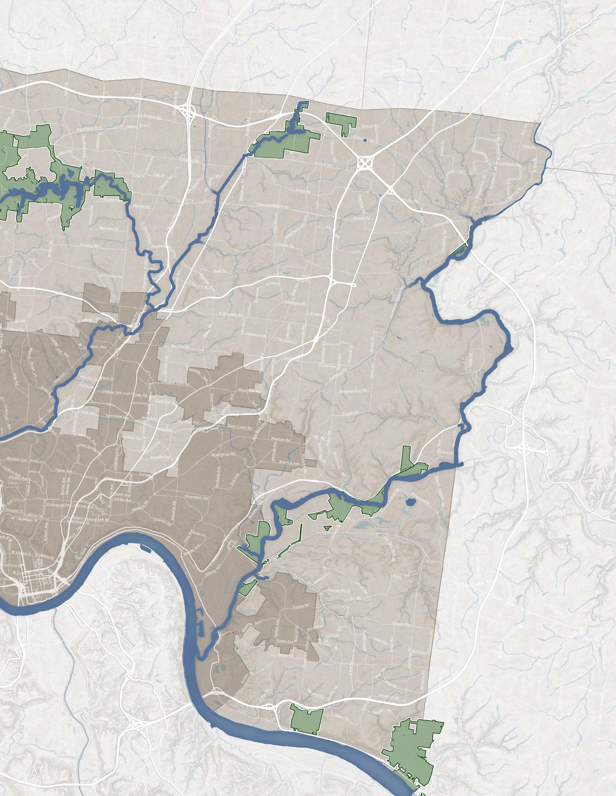
THE EASTERNMOST GREAT PARK, WOODLAND MOUND OFFERS COMMANDING VIEWS OF THE OHIO RIVER. THE MASTER PLAN FOR WOODLAND MOUND CREATES A VISION FOR A NEW NATURE & EDUCATION CENTER, ENHANCED PLAY EXPERIENCE, AND A COMMUNITY GATHERING SPACE THAT CONNECTS TO ALL OF THE PARK’S EXISTING TRAILS AND AMENITIES.
EXISTING CONDITIONS
Located in Anderson Township between Eight Mile Road and Nine Mile Road along the Ohio River, Woodland Mound is approximately 1,070 acres of diverse habitats including old growth forests, prairies, brushland/successional areas, wetlands, riparian land, and vernal pools. The park has three distinct areas. At the northern portion of the park is Vineyard Golf Course. In the central part of the park along Woodland Mound Drive are the greatest concentration of park amenities, including the Seasongood Nature Center, Parky’s Wetland Adventure Wet Playground, Breezy Point Playground, and the Weston Overlook special event lawn. This area is also a hub for nearly four miles of trails that explore the park, the disc golf course and a fitness trail. Disconnected from the main park along the Ohio River is the Steamboat Bend Area that used to offer a RV campground and reservable picnic shelter. This area of the park does have a boat ramp for canoes, kayaks and motorboats.
Almost 1,000 acres of the park are preserved as natural areas. Most of the property is forest, with a predominance of successional hardwoods. Since the park is located along a ridgeline, the stream network contained within is mostly steep headwater streams. On the south side these drain to the Ohio River, on the west side they drain to Eight Mile Creek, and the northeast side they drain to Nine Mile Creek. The park contains almost the complete watershed of the unnamed tributary to Nine Mile Creek along Nordyke Rd.
NATURAL RESOURCES
Issues
1. Invasive species
2. Deer overbrowse
3. Stormwater runoff from surrounding development and park infrastructure with few Best Management Practices
Priorities
1. Monitor and treat invasive species
2. Maintain firebreaks in prairie
3. Maintain vernal pools
4. Create a stream/watershed master plan
5. Implement Golf Course Best Management Practices to improve water quality of runoff
6. Install Stormwater Best Management Practices for existing park infrastructure


POINTS OF INTEREST
The Vineyard Golf Course
Sweetwine Banquet Center Maintenance Complex
Fox Ridge Shelter
Elderberry Shelter
Juneberry Shelter
Leatherleaf Shelter
Chipmunk Shelter
Monarch Meadow
Fitness/Obstacle Course
Disc Golf Course
Badger Bluff
Seasongood Nature Center
Parky’s Wetland Adventure
Wet Playground
Breezy Point Playground
Weston Overlook
Former Campground
Former Steamboat Bend Shelter
Steamboat Bend Boat Ramp
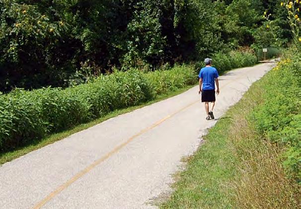

The Master Plan for Woodland Mound considers two Focus Area improvements in the main part of the park.
New Nature & Education Center (4)
A new Nature & Education Center will replace the current Seasongood Nature Center, which is limited in its ability to meeting programming and space needs. The new center will offer flexible classroom, exhibit and gathering space, and dramatic views of the Ohio River from a new walkway and overlook.
A new destination play experience will integrate wet play and adventure play components into one playground that no longer requires paid admission.
Other park improvements include:
• Upgrades and improvements to the Vineyard Golf Course Clubhouse (1) and the Sweetwine Banquet Center to add needed amenities and ensure that the facilities remain competitive for hosting events.
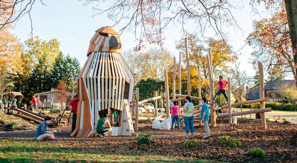

• Continue expansion of the existing Fitness/Obstacle Course (2) equipment to add more stations.
• Improvements to the disc golf course (3) (new tees, baskets, pads)
• Four miles of new and expanded trails with overlooks

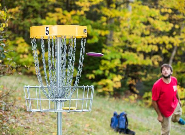

The central area of Woodland Mound is currently separated into three different experiences: The Seasongood Nature Center, the Parky’s Wetland Adventure Wet Playground, and the Breezy Point Playground. The Master Plan for this area of the park reconfigures these uses into one unified gathering place. The park experiences are interwoven, with a new Nature & Education center, a Great Lawn that afford stunning views of the Ohio River valley, and an integrated adventure play experience. From this new hub, other park amenities and trails are easily and clearly accessible.
The new Nature & Education center at Woodland Mound will replace the current nature center that is not able to be renovated to meet current programming and staffing needs. The location allows for the existing building to remain in operation during construction and is strategically located to utilize the existing parking.
Building features will include:
• Connections to nearby northern and southern trail loops allowing it to be trail hub for the park.
• A new pedestrian promenade and overlook deck created for viewing the dramatic vista of the Ohio River.
• A large, flexible exhibit space that can be opened up to an adjacent terrace.
• An outdoor portico sheltering seating areas, a fireplace and snack bar.
• A demonstration garden, amphitheater, and outdoor classroom to support programming.


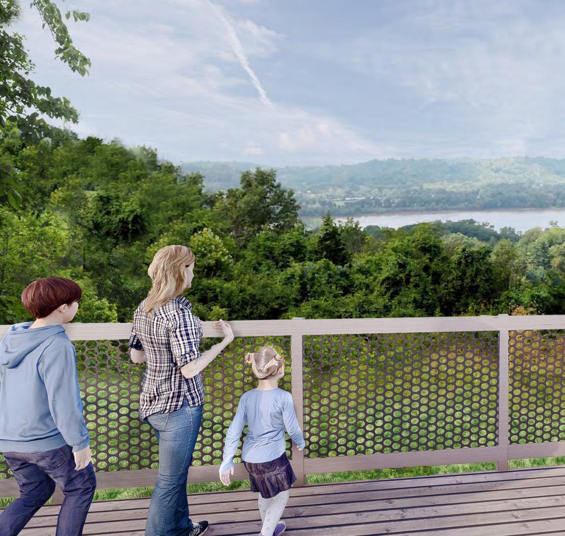
Ohio River
New Nature and Education Center
Loop 4
& Water Feature 6
Amphitheater / Outdoor Classroom 7
Promenade Walk 8
Overlook Deck 9
Great Lawn 10
Restrooms 11
Adventure Play Experience 12
• A Great Lawn in place of the current wet playground to offer flexible gathering space and view of the Ohio River.
• An entry portico to enhance visibility and serve as a welcoming element.
• A services section at the entrance of the building that includes retail, staff, and restroom functions.
The new Nature and Education Center and Great Lawn are linked to the Adventure Play experience by a set of walking paths. Shifted slightly south from their current location, this new playground will feature an experience that is unique to Woodland Mound, has integrated water play elements and offers adventure components that celebrate stunning views. Other improvements to this area include a restroom building that is convenient to the playground and safe walking paths along the parking lot edge to connect seamlessly to other park uses. The parking lot is also retrofitted to include green stormwater infrastructure and additional trees.
PROPOSED OVERLOOKTHE MASTER PLAN FOR WITHROW NATURE PRESERVE ENHANCES THE HIKING AND EVENT USES IN THE PARK, WHILE WORKING TO LESSEN THE IMPACT THAT THESE USES HAVE ON THE SURROUNDING ENVIRONMENT.
Withrow Nature Preserve is a 280acre park located in Anderson Township. The park covers a hillside and slope with impressive views overlooking the Ohio River and Northern Kentucky. The park is largely undeveloped except for the former homestead located within the park which is now primarily used for weddings and small gatherings. There is one trail, the Trout Lily Trail, which follows most of the ridge top of the park.
Between the popular trail and an outdoor wedding venue, this small park can get crowded on the weekends. There is a parking lot near the event venue which may not be big enough to provide needed parking for event guests and other park users at the same time. Another notable issue in the park has to do with the significant stormwater runoff that eroding the Trout Lily Trail and the hillside to the south of the parking area. Improving the
sustainability of the parking lot here will also increase the resiliency of the trails.
Withrow Nature Preserve is a good example of a park that can provide access to trails and views while having a minimal impact on the natural environment. Future improvements for this park aim to support current uses, but work to reduce impervious surface and increase green infrastructure to better protect the park and surrounding natural areas.
Issues
1. Invasive Species
2. Deer overbrowse
3. Canopy gaps from ash trees allowing rapid invasion of invasive plants
4. Parking lot sheeting water off and causing erosion
Priorities
1. Replant Canopy Gap and Manage Old Growth Forest
2. Trout Lily Trail Maintenance
3. Parking Lot Green
Stormwater Retrofit


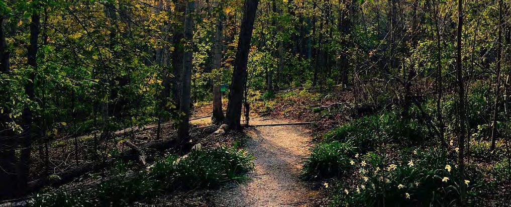

Natural Resources
The master plan focuses on protecting the natural environment that make this park attractive for events and trail users. This includes stormwater management strategies for the parking lot (see pages 110 and 111) and restoration planting strategies that help to fill in gaps in the tree canopy (4), restore brushlands, and maintain the mature forest in the park.
Trails
Stakeholder and public input expressed a strong desire for improving hiking and nature observation opportunities. While new trails are not being constructed in this park, the experience of the 1.7 miles of trails are improved in multiple ways. First, the master plan proposes establishing a destination
overlook (8) at the end of the Trout Lily Trail that provides views the Ohio River. Additionally, the plan proposes creating a small, low-impact trailhead parking lot (6) that will help address the conflict between event visitors and trail users.
Highwood Lodge (3)
The event venue at Withrow Nature Preserve will also be improved. In addition to improving the parking lot and access, the lawn area will be set up to better accommodate tents for outdoor events.

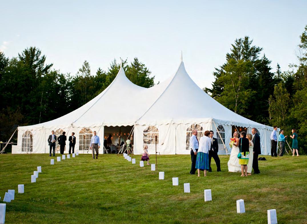


Withrow Nature Preserve currently has one parking lot for both event visitors and trail users. Located at the top of a ridge, the parking lot features overly wide drive aisles. The excessive pavement and a lack of appropriate stormwater infrastructure creates erosion problems along the Trout Lily Trail to the south of the parking lot.
The other issue related to parking occurs when events at Highwood Lodge create a conflict between visitors and trail users. It is common for trail users to have a hard time finding a place to park during events and causes people to park in places that are not parking spots.


6 7 Trailhead Parking (20 Spaces)
Trout Lily Trailhead
To address the conflict between event visitors and trail users, a new low-impact trailhead parking lot (6 and 7) is also proposed. Located to the south of the entrance drive, this would give trail users a dedicated parking area and access to the Trout Lily Trail.
The proposed Green Stormwater Retrofit of this parking lot reduces pavement of the current parking area and creates a bioswale to better manage and treat stormwater runoff. The stormwater management improvements here can become an example for many other parking lots in Great Parks that face similar runoff issues.
A new circle drive improves access to Highwood Lodge, protects the Dawn Redwood Tree, and creates a connection to the Trout Lily Trail to improve the user experience. If desired, other low-impact permeable surfaced parking areas can be located off the entrance drive to increase the number of parking spaces in the park.


THE MASTER PLAN FOR OTTO ARMLEDER FOCUSES ON IMPROVING THE EXISTING PARK FEATURES TO BECOME MORE RESILIENT AND ENHANCING ACCESS TO THE LITTLE MIAMI RIVER AND THE LITTLE MIAMI SCENIC TRAIL.
EXISTING CONDITIONS
Otto Armleder Memorial Park is a 240-acre park located in Columbia Township, flanking the Little Miami River. The park is a joint venture between the Cincinnati Park Board, Cincinnati Recreation Commission and Great Parks. Each partner plays a different role in maintaining and programming this park.
The park is moderately developed with park features that attract a variety of users. Some of the park’s existing features include canoe access to the Little Miami River, paved shared use trails, soccer fields, two dog parks, several picnic areas, and a playground.
Currently, the Little Miami Scenic Trail connects into the park via a trail connection crossing Beechmont Avenue to the south of the park. That same trail connection also connects Otto Armleder to Reeves Golf Course and Lunken Airport. In 2021, construction broke ground on the Beechmont Avenue Bridge Connector Trail that will create a
multi-use path and trail connection across the Little Miami Scenic River. Additionally, this connection will make the park more accessible to residents on the east side of the river in Anderson Township.
Located within the floodplain of the Little Miami River, Otto Armleder is also home to Duck Creek, which is often subject to flash flooding as it flows to the Little Miami River. The area catches runoff from park trails and parking lots, which causes frequent flooding in the park, especially the dog park.
NATURAL RESOURCES
Issues
1. Regular flooding
2. Altered hydrology of Duck creek and small tributaries
3. Burning presents issues with nearby airport
4. Invasive species
Priorities
1. Invasive species management
2. Examine hydrology and restoration potential of Duck Creek


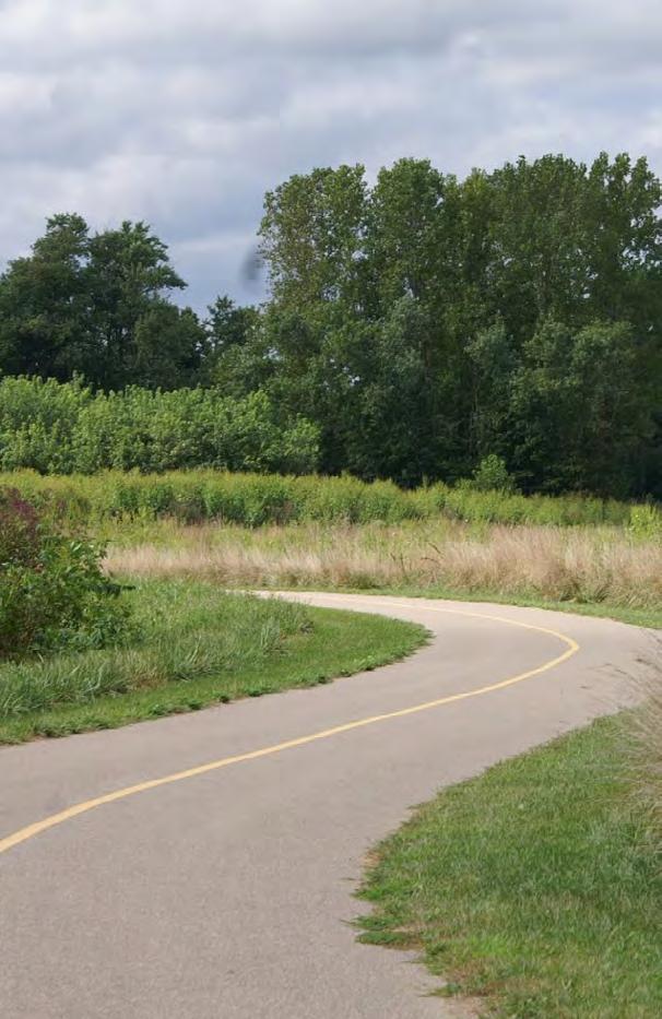
Canoe/Kayak Launch
Armleder Dog Park

Otto Armleder Park is comprised of developed and natural features that attract different types of park users each day. The master plan focuses primarily on improving those features and experiences that have come to define the activities in this park. The improvements to the park include trail extensions and connections, an observation deck, dog park improvements, improving parking areas, and watershed and floodplain restoration.
The master plan includes 2.5 miles of new trails, which focus on improving connections to the river and other trails. Trail A will formally establish a path connecting the Armleder Loop Trail to the Little Miami River. At the end of this trail will be a new river observation deck (1). Trail B improves the path from the Armleder Loop Trail to the canoe and kayak
4
access point for the Little Miami River. Improvements to the parking area for this canoe/kayak launch are also part of this master plan (3).
Trail C is the Beechmont Bridge connection, which will fill in a critical gap that connects the Little Miami Scenic Trail on both sides of the river at Beechmont Avenue. Trail D will connect from Beechmont Avenue, through the Elstun site, down to Kellogg Road via a natural surface shared hiking and mountain bike trail.
Stormwater Management
Improvements to the dog park (2) as part of this master plan will focus on improving conditions of Duck Creek and increasing the natural retention of the adjacent floodplain.
1 2 4
3
Little Miami River Observation
Deck
Dog Park Improvements
New Parking Area near Boat Launch
Duck Creek Watershed Improvements
TRAILS
A B
C D
Trail Expansion
Trail Expansion
Beechmont Bridge

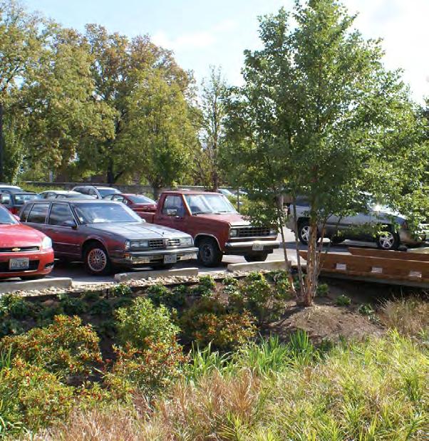


THE MASTER PLAN FOR THE LITTLE MIAMI CORRIDOR FOCUSES ON CREATING A COHESIVE VISION OF COMPLEMENTARY ACTIVITIES IN THESE THREE PARKS THAT ARE ANCHORED BY THEIR FRONTAGE ON THE LITTLE MIAMI RIVER AND SCENIC TRAIL.
Little Miami Golf Course
Clubhouse
Mini-Golf Course
Little Miami River Scenic Trail
Trailhead
River Access at Bass Island
Little Miami River Scenic Trail
Trailhead
Former Indian Valley Golf Course
EXISTING CONDITIONS
The Little Miami River Corridor is comprised of five separate areas over a stretch of nearly 3 miles along the Little Miami River: Little Miami Golf Center, Bass Island, Avoca Trailhead, and Kroger Hills as well as the former Indian Valley Golf Course property along Dry Fork Creek.
Similar to the Whitewater River and Great Miami River Corridors in the West Region, these areas along the Little Miami Scenic River Corridor offer Great Parks a great opportunity for a variety of activities and programming. Each of these five sites are different in how much they are developed and what opportunities are present for future improvements. Great Parks also maintains two other parks with frontage on the Little Miami River, Otto Armleder Memorial Park and Lake Isabella.
Little Miami Golf Center is a large park that is about half developed. The main use of the park is a golf course, which includes a clubhouse, driving range, and mini-golf course located on the northwest side of Newtown Road. The Little Miami Scenic Trail also currently runs through the park along Newtown Rd. Along the Little Miami River is a canoe and kayak
access point at Bass Island that is slated for improvements (see page 120). Pairing the biking and paddling activities together creates a strong dynamic for this park in connection with other Great Parks facilities along the river and the Little Miami Scenic Trail.
Avoca Trailhead is a smaller, less developed site located in very close proximity to the Little Miami Golf Center. This trailhead features a soccer field, a restroom, picnic shelter and an access point for the Little Miami Scenic Trail that runs through the park.
Kroger Hills is a state designated preserve leased by Great Parks from the Ohio Department of Natural Resources. It is comprised of more than 200 acres, which includes mature woodlands, a restored prairie and 80 acres of grassland. The Little Miami Scenic Trail also cuts through a portion of this park along Wooster Pike; however, this conservation area does not offer public access at this time.
NATURAL RESOURCES
Issues
1. Regular flooding
2. Dry Run Erosion Field
3. Golf Course Nutrient Loading to River and Dry Run
4. Invasive species
5. Deer Overbrowse
Priorities
1. Dry Run Erosion Field
2. Examine hydrology and restoration potential of Dry Run
3. Document old-growth forest
4. Invasive species management
5. Water Quality improvement strategies


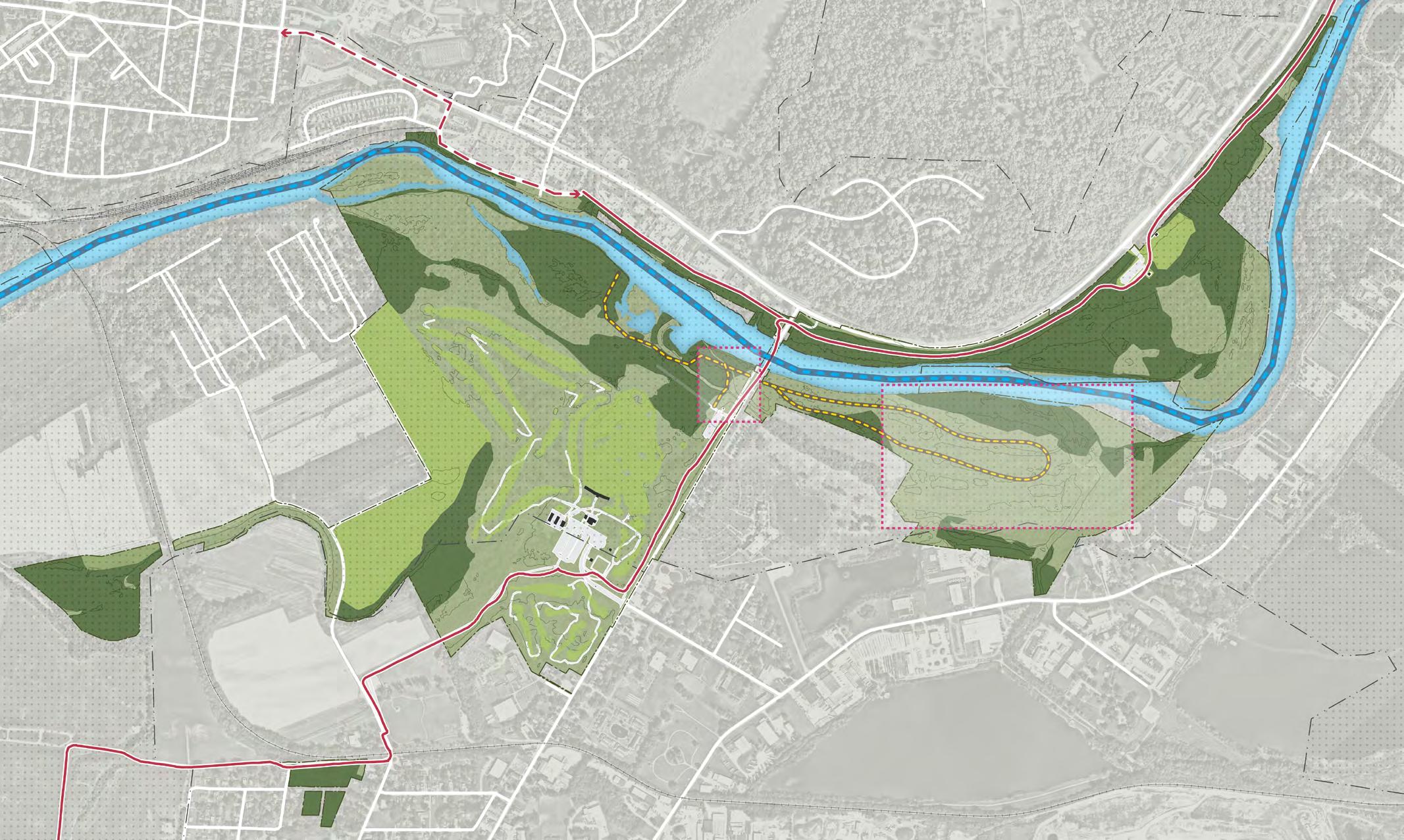
COLUMBIA TOWNSHIP
50
50 West Canoe & Kayak 50 West Brewing
CrystalSprings Riverside Park Short Park Flag Spring Cemetery FMCA Campground
Debolt St MooreRd
6 7
MARIEMONT LITTLEMIAMIRIVER LITTLEMIAMIRIVER LITTLE MIAMI RIVER Connection to CROWN 1
3 A B Meadow/Prairie Forest Existing Trail Existing Regional Trail Existing Blueway Trail Proposed Trail Proposed Regional Trail
Debolt St
Moore Rd ValleyAve RoundBottomRd
Miami Valley Christian Academy
Little Miami Golf Center
The master plan for Little Miami Golf Center includes two Focus Area projects: an improved Little Miami River Access at Bass Island (2) and a conservation project focused on the restoration of the former Indian Valley Golf Course (1) located on the east side of Newtown Road.
The master plan proposes two new trails totaling 3.5 miles. The two trails are both located close to the Little Miami River. One trail (B) aligns through the restoration site of the former Indian Valley Golf Course (1) and will provide users access to a natural area they previously did not have access to.
Additionally, plan recommendations include a new ranger station (4), a new clubhouse to better serve the
A B WoosterPike Mt. Vernon Ave Newtown Rd ChurchSt Center St
ANDERSON TOWNSHIP ANDERSON TOWNSHIP ANDERSON TOWNSHIP
4 5
COLUMBIA TOWNSHIP COLUMBIA TOWNSHIP INDIAN HILL NEWTOWN
Wags Park
golf course (6), improvements to the mini golf course (7), and establishing a regional bike hub adjacent to the Little Miami Scenic Trail (5).
Avoca Trailhead
Currently Avoca Trailhead contains a soccer field, picnic shelter, and restroom building. The master plan recommends creating a beginner mountain biking course (3). A mountain bike trail here would complement the existing mountain biking trail at Jim Terrell Park farther up the Little Miami Scenic Trail. A braided system of mountain bike trails and regional trails would create a unique attraction for the region.
Indian Valley Golf Course Restoration Area
Bass Island River Access
Mountain Biking Course in Avoca Park
New Ranger Station
Regional Bike Network Hub
New Clubhouse
Refresh Mini-Golf Course
Round BottomRd

7. MINI GOLF
Formalize Trail along Dry Run

6. NEW CLUBHOUSE


Expanded Parking Lot 1 Drop-Off Loop 2
Accessible Path 3
Canoe/Kayak Launch 4
The Bass Island blueway access point for the Little Miami River offers unique experiences for users as it is located adjacent to the Little Miami Scenic Trail and close to two proposed hiking trails.
While the Bass Island blueway access point exists today, this plan identifies improvements to the access point that will make the put-in and takeout process easier.
The plan includes an improved parking area (1) and a drop off loop (2).
Improvements will also be made to the path from the drop off loop to the kayak launch (3), including making it accessible.
The put-in/take-out site itself currently works well but will be improved with a durable and sustainable solution that will help to address issues with bank erosion and rogue trails that occur in the existing condition.


1 Vegetation Plan that Includes Invasive Species Removal
3
Reduce Slopes on High Vertical Banks and Add Habitat Structures
2 Restore Connection to Dry Run with Regenerative Stormwater Conveyance
4 Remove Golf Course Debris 5
Raise Channel & Widen Floodplain
6 Loop Trail
Diversify Remnant and Overflow Channel Habitat
The establishment of the former Indian Valley Golf Course diverted a drainage channel, referred to as Dry Run, to travel north into the Little Miami River, which has resulted in a series of erosion fields present today. One of the key conservation projects identified in this plan is to restore these erosion fields and the remnant drainage channels near it.


There is an Upper (red) and Lower (orange) reach that have different conditions and require a unique approach to restoration. There is also a series of tributaries and connections to Dry Run that must be considered in the restoration process. The restoration will focus on stabilizing the stream and establishing wetlands that will help to create consistent conditions to support native vegetation and reduce erosion.
Paired with this restoration project will be the creation of a new trail (7) that will provide users with another new area for nature observation, which was a common request from public input in this process.
PROPOSED ACCESS POINT PLAN 4. KAYAK LAUNCH 3. ACCESSIBLE PATH IMPROVEMENTS DRY RUN RESTORATION AREA PLAN 6. REMNANT/OVERFLOW CHANNEL
LEGEND Meadow/Prairie Forest Existing Trail Existing Regional Trail Proposed Trail Existing Blueway
INDIAN HILL INDIAN HILL
Indian R i dg e Counci l r o c k nL TERRACE PARK TERRACE PARK COLUMBIA TOWNSHIP COLUMBIA TOWNSHIP
50
ElmRd
Indian Hill Rd Willow Hills Ln Willow Hills Ln WillowRunLn Round Bottom Rd
Drackett Field 1 2
A B
Terrace Park Swim & Tennis Club Stumps Boat Club
ElmRd WoosterPike
WoosterPike Mt. Carmel Rd
Scenic River Canoe Excursions
ANDERSON TOWNSHIPTERRACE PARK ANDERSONTOWNSHIP
A consistent goal of this plan is to provide safe and responsible access to natural and conservation areas that previously had limited or no access. The Kroger Hills master plan focuses on providing increased access to the park by creating almost 1.5 miles of new natural surface hiking trails within the southern portion of the preserve that is closest to the Little Miami River. Paired with the new trails would be a meadow bird blind, which would provide
A B LittleMiamiScenicTrail LittleMiamiScenicTrail
nature observation and birding opportunities. The northern portion of the preserve is located on a steep hillside, making access challenging. The plan identifies this area as one that should receive a Mature Forest Management plan.
As Kroger Hills is leased to Great Parks through the Ohio Department of Natural Resources (ODNR), any proposed changes to the park must be submitted for approval.
1 2
Old Growth Forest Management across Wooster Pike
Meadow Bird Blind
TRAILS
Connect to Little Miami Scenic Trail

BIRD BLIND
PRAIRIE TRAIL
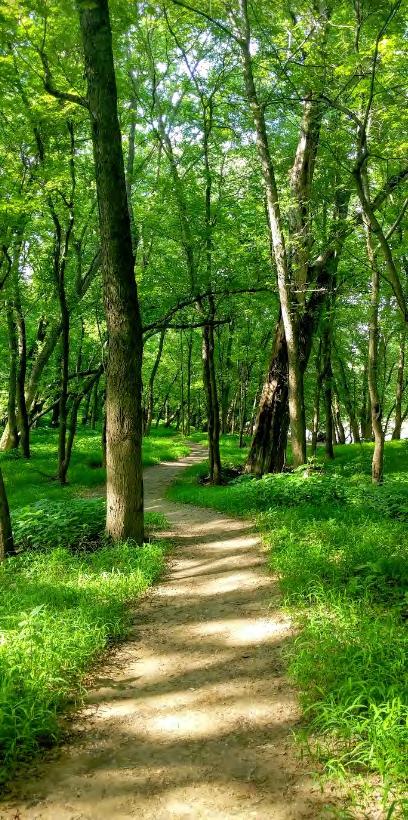
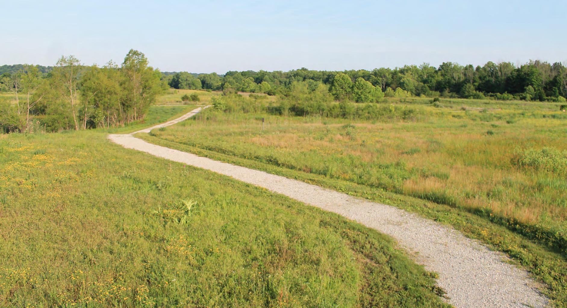
THE MASTER PLAN FOR LAKE ISABELLA PROPOSES BUILDING ON THE UNIQUE ACTIVITIES OFFERED HERE TO ESTABLISH THIS PARK AS A HUB FOR FISHING, CAMPING, CANOEING, KAYAKING, AND EVENTUALLY BIKING.
EXISTING CONDITIONS
Lake Isabella is 76-acre park that is primarily used for fishing and camping. The park fronts the Little Miami River, is adjacent to residential neighborhoods and is located partly underneath an I-275 bridge.
The park serves a variety of park users. It contains multiple play areas, located near the campgrounds and picnic shelters. The campground is a 24-site primitive tent campground located along the banks of the Little Miami River. Within walking distance of the campground is a canoe and kayak launch creating potential opportunities for pedal and paddle experiences with the Little Miami Scenic Trail located across the river from the park.
The lake itself comprises 28 acres, and is primarily used for fishing. Fishing is offered from the bank, dock, or boat rentals. The lake is stocked from March to October with a variety of fish including catfish, trout, bluegill and perch. Next to the lake is a boathouse that contains various fishing supplies, a snack bar, meeting room, and outdoor deck space.
NATURAL RESOURCES
Issues
1. Invasive Species Priorities
1. Invasive Species Management
2. Water Quality Improvement Strategies


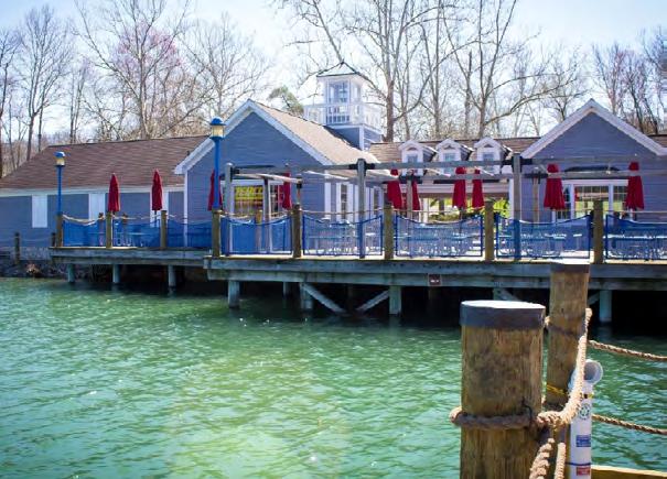

POINTS OF INTEREST
Restrooms
Bank Fishing
Shady Elm Shelter
Lake Isabella Primative
Campground
Canoe / Kayak Launch
Quarry Bluff Playground
Quarry Bluff Shelter
Wildlife Blind
Riverside Lodge Boathouse & Snack Bar
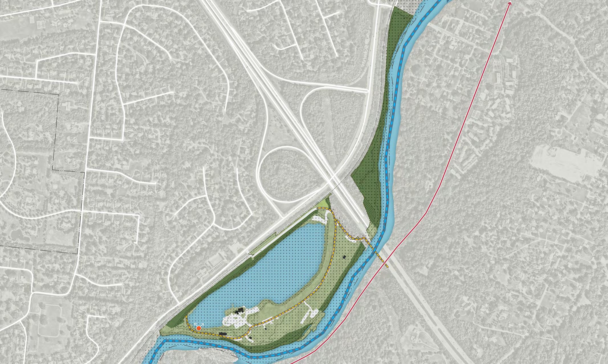
The master plan for Lake Isabella focuses on enhancing existing park assets and amenities and introducing new activities that will improve the park experience.
Trails
There are currently no walking trails at Lake Isabella. A new 0.7 mile loop trail (A) would run along the park road and around three sides of the lake. There is insufficient room on the northwest side of the lake to create a path without having a negative impact on lake edge habitats. This trail would be complemented by an overlook at the southwestern edge of the lake.
Lake Isabella is directly across the Little Miami River from the Little Miami Scenic Trail. Great Parks should study the possible
ELovelandMadeiraRd
connection to the bike trail (B) to enable users to directly access the park. This would create a unique bike camping opportunity for Ohio-toErie riders and regional trail riders, as well as enable paddle and pedal opportunities along the Little Miami River.
Boathouse and Storage (1)
A new storage building should be built to better serve park maintenance operations and allow for storage space that currently occupies a portion of the Boathouse. This would create more programable space within the Boathouse.
Adventure Outpost and River Access
Great Parks should establish an Adventure Outpost facility at Lake Isabella (2) to offer both access for river trips and instructional classes on
the lake. This should be paired with improvements to the current river access point (3), which requires users to navigate a steep, unmarked path to the river’s edge.
1 3 4 5
2
Improve Boathouse
Create an Adventure Outpost
Improve Canoe/Kayak Launch
Boat Racks at Campground
Overlook Platform
TRAILS
A B
New Hiking Trail
Potential Connection to Little Miami Scenic Trail


THE MASTER PLAN FOR FRANCIS RECREACRES ESTABLISHES NEW TRAILS, NATURE OBSERVATION, AND COMMUNITY FOCUSED RECREATIONAL USES TO COMPLEMENT EXISTING ACTIVITIES.
Francis RecreAcres is a 148-acre park that is bisected by Conrey Road and is about half developed. The park is primarily used for soccer, but is also home to a playground, snack bar and picnic area, and a walking loop path. All of the developed features currently exist on the east side of Conrey Road. On the west side of Conrey Road is a 100-plus acre natural area that was a former homestead. There is currently a mowed path going around the perimeter of this natural area and the buildings remaining on the property are primarily used for storage.
Identifying potential recommendations for the former homestead portion of this park was a key part of the public and stakeholder engagement process. The most common sentiment expressed a desire to protect greenspace and habitat while providing access for wildlife observation.
This park is activated by numerous partner groups and sports leagues. There are multiple residential neighborhoods within walking distance of the park. Stewart Elementary School is located to the south of the park across School Road. Located at the intersection of Conrey Road and School Road is the SPCA facility which utilizes the park for dog walking.
1. Tile drainage and buried stream system
2. Invasive species Priorities
1. Resolve dumping and reforestation site issues


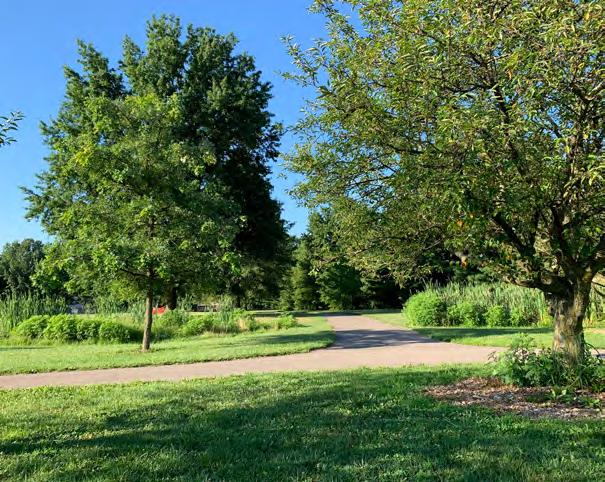

Eddington
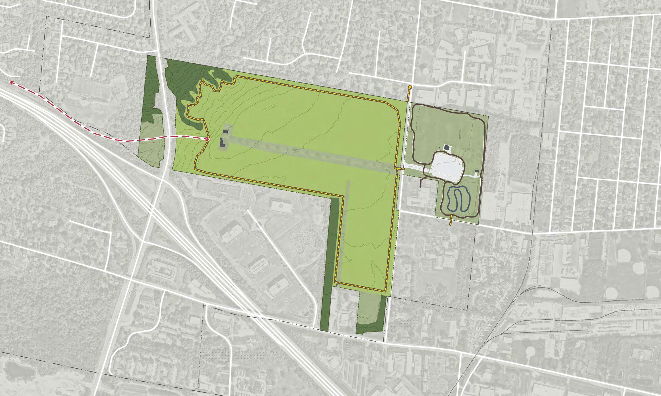
3
Reed
The master plan for Francis RecreAcres focuses on improving the types of activities currently happening in the park and creating a plan for the former homestead west of Conrey Road.
Trails
There are a series of three trails proposed in this master plan. A natural surface trail will increase access to the former homestead portion of the park that has become a popular destination for birding enthusiasts within Great Parks (A). Creating educational signage along the trail would improve the experience for users of all ages and birding experience levels. A small sidewalk connection between the park and the neighborhoods to the north of the park on the west side of Conrey Road will improve
access for nearby residents (B). An improved path and crossing to Stewart Elementary, whose students use the park for group hikes and the playground,will make accessing the park safer(C). Creating safe pedestrian crossings is key for this park, especially for park users wishing to cross to the other side of Conrey Road for the new trail path (3).
Other improvements to the park include community focused recreational activities to serve the surrounding neighborhoods. These activities require more study, but may include replacing the south soccer field with a skate park and pump track and the sand volleyball courts with an expanded playground and obstacle course.
1 2
Skate Park and Pump Track
Replace Volleyball Area with Expanded Playground and Obstacle Course
Pedestrian Crossing 3
A B C
Loop Trail
Connection to Neighborhoods
Connection to Stewart Elementary

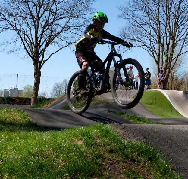

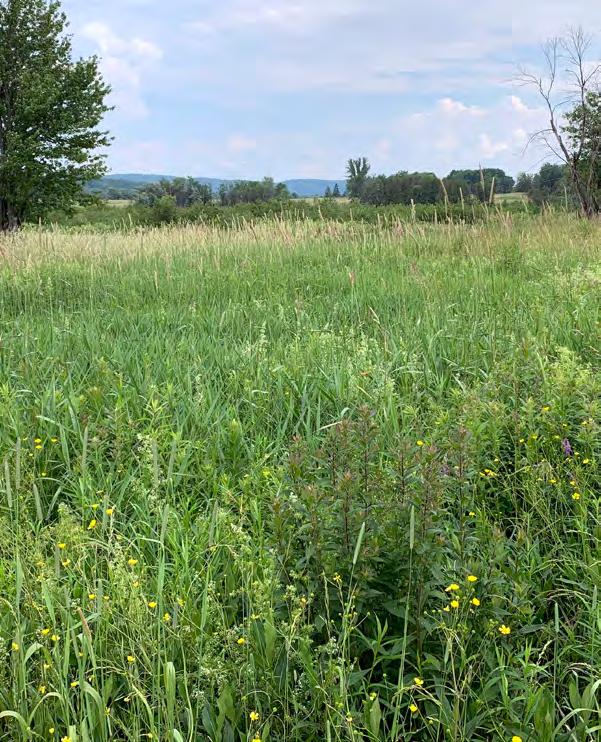

THE MASTER PLAN FOR SHARON WOODS FOCUSES ON IMPROVING THE HARBOR EXPERIENCE, INTEGRATING LAKESIDE LODGE, MAKING NEIGHBORHOOD CONNECTIONS, ADDING LAKE ACCESS, AND COMPLETING THE GORGE LOOP TRAIL.
EXISTING CONDITIONS
Sharon Woods is located in Sharonville just south of I-275 between US 42 and Reed Hartman Highway. This 730-acre park is the third most visited Great Park and is generally surrounded by residential neighborhoods. The topography of Sharon Woods is varied, with steep uplands draining down to Sharon Lake. The hydrology is similarly characterized across a range of waterways, from steep headwater streams that generally drain developed areas, plunging waterfalls, and the open water of the lake. The primary stream feeding the lake is Sharon Creek, whose greater watershed is likely the primary sediment source to Sharon Lake.
The park has four distinct areas. On the west of the side of the park (along US 42 and Cornell Road) is the Sharon Centre education and visitor center, playground, trails and numerous shelters. The Heritage Village Museum is owned and operated by Historic Southwest Ohio,
Inc. and is located adjacent to the Sharon Centre.
In the center of the park, the Gorge Trail—the most popular trail in Great Parks— follows Sharon Creek out of Sharon Lake and features dramatic cliffs and a waterfall. This area of the park is a State Nature Preserve. The area south of Sharon Creek to Cornell Road is a high-quality mature forest.
On the north end of the park, activity centers around the harbor area, which has a playground, wet playground, snack bar, and boathouse. Across the lake is the Lakeside Lodge and a trailhead for the multiuse trail that runs around the lake. Sharon Lake will be dredged in the near future to remove sediment, improve water quality and reduce the amount of aquatic vegetation. Sharon Woods Golf Course is located in the southeastern part of the park and is bisected by Swing Road.
Issues
1. Sedimentation and nutrient loads in Sharon Lake
2. Hydrological alteration has interrupted natural stream dynamics
3. Potential nutrient loading, flashy stream flows from stormwater inputs from surrounding development and park infrastructure with no Best Management Practices. Priorities
1. Create Watershed master plan
2. Diversify wetland habitat and shallow areas
3. Explore restoration opportunities for the old soccer fields
4. Develop a new management plan and goal for Lone Oak Meadow
5. Optimize the dredge operation for ecological uplift and restoration, adding a littoral shelf or additional pocket wetlands


Wet Playground
Snack Bar / Restrooms
Boathouse
Bank Fishing
Lakeside Lodge Canoe / Kayak Launch
Gorge
Sharon
Sharon

The Master Plan for Sharon Woods focuses on improvements to the Harbor and Lakeside Lodge areas (See pages 136-137). Linking these two areas together will extend the harbor and lake experience to both sides of the lake with new trails, amenities, and views of Sharon Lake.
Other improvements for the park include:
Trails
In addition to providing pedestrian connections to the neighborhoods to the south, the major trail improvement to Sharon Woods is the completion of the Gorge Trail Loop. This popular trail is currently an outand-back experience. The new loop will return back to the lake via a trail on the north side of the creek. A loop trail could also be added adjacent to Lakeside Lodge.
This facility needs improvements to update indoor education exhibits and experiences. Sustainability improvements, including solar panels, will be considered for the building as part of Great Parks’ commitment to 2030 District program goals. The outdoor playground adjacent to Sharon Centre needs to be replaced with a new, more accessible play experience.
As part of the dredging project there is an opportunity to build littoral shelves and/or create wetlands on the lake edge to enhance habitat and improve water quality. In addition to the habitat improvements, there are also new hand-carry watercraft
Improve Harbor
Lakeside Lodge Improvements and New Event Lawn
Create Wetland/Lake Boardwalk
Add New Picnic Shelters and Great Lawn
New Fishing Pier
New Kayak Launch
Improve Existing Canoe/ Kayak Launch
New Playground
Old Growth Forest Management Area
Sharon Centre Improvements

Lake Loop Trail
Complete Gorge Loop Trail
launches (6) that can be added around the lake, as well as providing a fishing pier (5) along the south end of the lake. At the north end of the lake, a new wetland and boardwalk (3) would connect across the lake and provide a unique educational opportunity.
Mature forest management strategies should be applied to the high quality old-growth forest located in the area east of Meadow Drive.
Neighborhood Connection
Neighborhood Connection
Neighborhood Connection


Sharon Woods Harbor is a popular visitor destination, with a number of attractions and activities. With a snack bar, boathouse, water play area and traditional playground, picnic area, and shelters located in a small area, this part of the park quickly can become over-crowded. Like other harbor areas, the building blocks the best views of Sharon Lake and the wayfinding down to the boathouse and water’s edge is circuitous and unclear. The lake in this location has mostly hard edges, which is important for boat rentals and storage, but could be removed outside of these high traffic areas.
The Lakeside Lodge area is technically connected to the harbor area via a paved trail, but there are no amenities to entice a guest from the harbor area to visit the other side of the lake. Lakeside Lodge itself is a functional event space with views to the water. The area in front of the lodge is primarily paved, with a collection of picnic tables. The entrance to the building is unclear. The back side of the lodge is directly on the water as this was previously a boat rental facility. However, with the dredging project, this inlet will be filled in with dredged material. The lawn area above Lakeside Lodge is underutilized and there are no amenities located in this part of the park.


Trail Connection to E. Kemper Rd 1 Lakeside Loop Trail 2 Picnic Shelter 3
4 Expanded Play Features
5 6 Education Shelter
7 Grand Stair
8 Lake View Deck / Boat House
9 Vegetated Edge Enhancements
Small Play Area
10 11
12
Prairie Planting Improved Lakeside Lodge Event Lawn
To address crowding and circulation issues at Sharon Woods Harbor, the Master Plan reorients the entrance arch to the harbor to direct visitors toward the lake. The current boat house will be removed to allow for a new Grand Stair (6) that will provide lake views, seating areas, and direct access to the lake. To relieve congestion in the picnic areas and shelters, a new lake view deck (7) will been added on top of the slope behind the snack bar/ restroom building. This new space will offer lake view seating at the harbor level and a new boat house below. Currently, along the lake is a hard edge that allows for lake access for boating and fishing, but south of the harbor area, this edge will be improved with new vegetation to improve habitat (8).
At the harbor level, picnic shelters will been clustered around an expanded play experience. This allows for the dedication of a shelter on the south side of this area to be used exclusively for education, providing nature interpreters more space to do programming and events in a quieter part of the harbor (5).
Connections and pathways around the harbor area will also improved. The multiuse path planned by Sharonville will be brought into the park running along the north end of the harbor before connecting back up to E. Kemper Road (1). Overflow parking will be expanded on the west edge of the entrance drive.
Across the lake at Lakeside Lodge, improvements to the lodge entrance and the addition of an event lawn leading down to the lake will better support events at this venue (11, 12). The event lawn will add needed outdoor space to support events. To better pull some of the guests over to this part of the park, a lakeside loop trail (2) will be added to connect with the existing trail system, and a new Great Lawn and trail will occupy the area above the lodge. New rentable shelters (3) and a nature playground (9) will be added around this new lawn. Linking these two sides of the lake together with new park experiences will help to spread out the traffic around the harbor area and enable more visitors to comfortably visit Sharon Woods.


 3. PICNIC SHELTER
4. NATURE PLAY
GREAT PARKS NATURE CENTER AT THE SUMMIT PROVIDES THE LOCAL COMMUNITY ACCESS TO THE EDUCATIONAL PROGRAMMING OPPORTUNITIES. THE MASTER PLAN FOR THIS LEASED AREA FOCUSES ON IMPROVING AND EXPANDING THE OFFERINGS AND EXPERIENCES THAT CAN SERVE THE SURROUNDING RESIDENTIAL NEIGHBORHOODS.
EXISTING CONDITIONS
Great Parks Nature Center at
The Summit, or Summit Center, is a nature center located in the Roselawn community. Summit Center provides a variety of activities and educational programming that better connects nearby children and families with the natural environment of Hamilton County.
The facility has both indoor and outdoor space. The indoor space, where most of the programming occurs, includes live animal exhibits and a classroom area. Recently, improvements have been made to the outdoor portion.
The outdoor portion of the nature center is located along the Mill Creek and currently includes an outdoor classroom with amphitheater seating, a storage building and an archery range, and a natural area adjacent to the Mill Creek.
MASTER PLAN
Future improvements to the nature center’s outdoor spaces will focus on improving existing features to make them more resilient for the long term, and able to better accommodate more visitors simultaneously. The plan recommends constructing an outdoor covered stage to enhance all-weather programming. Additional recommendations from the plan include improving and formalizing the trail that provides an overlook of the Mill Creek as it is a valuable resource to the programming capabilities of the nature center.
NATURAL RESOURCES
Issues
1. Introduced & Invasive Species
2. Deer Overbrowse


Add More Trails and Adventure New trails and connections
Add More Trails and Adventure Overlooks
Add More Trails and Adventure Blueway trail access
Implement Conservation Projects
Refresh Harbors & Experiences
THE IMPLEMENTATION OF THE IDEAS, RECOMMENDATIONS AND CONCEPTS IN THE PARK AND FACILITY MASTER PLANS WILL REQUIRE ADDITIONAL COMMUNITY CONVERSATIONS TO CONFIRM PRIORITIES, DETERMINE FUNDING, FORM PARTNERSHIPS, AND FINALIZE DESIGNS.
Implement Conservation Projects
Golf Course Restoration
- Stream, Forest and Prairie Restoration
- Trails and Bridges
- Outdoor Classroom
- Nature Play
- Amphitheater - Shelters
- Interpretive Signage
Parking lot green stormwater retrofit
Build New Nature, Education & Event Centers New Nature and Education Center
Add More Trails and Adventure Regional Trail Connections
General Improvements
To guide this ongoing work, the following implementation matrix has been created. The matrix is organized by park, with individual improvements noted and an initial priority listed. For each park, the Focus Areas are listed, as are the general park improvement recommendations. The Focus Area recommendations correspond to the detailed concept development, and have separate cost estimate ranges that are available as an appendix document. The general improvements are cataloged but have not been through any specific concept level development and no costs have been determined.
The matrix is meant to be a working document, allowing staff to set priorities, align funding with projects, and track implementation progress.
It is fully expected that these projects may be reprioritized and adjusted (or even combined), as work to advance plan concepts and determine funding sources continues.
While community priorities are clear, the next phase of work will require additional community outreach as these planning concepts go through more detailed design and development. Additionally, further environmental review for each development concept will be
conducted before any construction is planned or approved.
Great Parks is committed to continuing this design process with the community as it works to follow through on its promise to improve the user experience in each of its parks.
Refresh
&
Refresh Harbors & Experiences
Harbor Improvements
- Improved Entrance Experience
- Harbor Building Retrofit and Improvements
- Event Lawn - Stage Area
- Nature / Wet Play
- Vegetated Edge Improvements
- Relocated Bike Rental
Add More Trails and Adventure Canoe/Kayak launch and storage facility
Implement Conservation Projects Bowles Woods Old Growth Forest Management
General Improvements
Wetland Boardwalk
Trail additions
Improve Disc Golf Course
Golf Course/Driving Range/Clubhouse improvements
Update Timberlakes Shelter
Regional Trail Connections
Horseman’s Camp Improvements
Existing campground improvements (for tents and small campers)
New Campground and Shaker Interpretation
Additional Wetland/Prairie/Forest/Farmland/Stream/Floodplain Restoration Projects
Add More Trails and Adventure Monfort Heights canoe/kayak access and parking
General Improvements
Trail additions
Beginner mountain bike trails and skills course
Mountain bike trail improvements
Backcountry Camping
Access points for pedestrian access
Silver Creek access point and trail
Regional Trail Connections
Additional Restoration and Management Projects
Add More Trails and Adventure Water School (Either Location) and River Access Point
Add More Trails and Adventure Great Miami River Blueway Trail
General Improvements
Accessible Fishing
Meadow Loop Trail
Entry Improvements
Old Growth Management and Farmland Restoration
Improve Entrance Experience
Allow Canoe/Kayak Launch and Improve Pathway
Historic Interpretation at Lock Caretaker’s Building
Study Potential reuse of concession stand
Stormwater management / naturalization opportunities
Add More Trails and Adventure Create Canopy Walk Trail
Add More Trails and Adventure Canopy Walk Overlook
General Improvements
Improved Entrance Experience
Complete Sidewalk Network into Park
Daylight Stream and Restore Former Athletic Fields
Green Stormwater Retrofit in Parking Area
Rehab/Replace Pavilion
Improve Disc Golf Course
Improve Fitness Trail
Connection to Delshire Park
Fairbanks Avenue Access Trail
CENTRAL REGION
Refresh Harbors & Experiences
Improve Winton Woods Harbor - Improve Basketball Courts - Create Skatepark - Improve Campground by creating more Pull-Through Sites - Improved Entrance Experience - Amphitheater - Café Building - Improved Play Experience - Vegetated Living Edge
General Improvements
Improve Disc Golf Course
Improve Riding Areas at Parky's Farm
Update Mill Race Banquet Center
Mature Woods Management within Nature Preserve
Beginner Mountain Biking Trail
Connect Harbor Loop, WW-GG Trail, Fitness Trail, and Kingfisher Trail
Pedestrian Neighborhood Connections
Dog Park
Expand Harbor Loop Trail on West Side of Winton Lake
Improve Facilities at Adventure Outpost
Implement Conservation Projects Trillium Trails Restoration Area
Build New Nature, Education & Event Centers Create New Event + Education Center
Add More Trails and Adventure Glenwood Gardens - Winton Woods Trail
Add More Trails and Adventure New Hiking Trails
Add More Trails and Adventure Neighborhood Connections
General Improvements
Improve Entrance and Pedestrian Experience
New Music Garden
CENTRAL REGION
CENTRAL REGION
The following table outlines the focus area improvements for the Central Region. This list does not include every improvement from the master plans, a complete inventory of improvements and recommendations can be found in the full Master Plan document.
New
Trail
Green
Trail
to Colerain Avenue
Create
trail is impacted by Wetland
to Neighborhood to the North
Connect to
Create Fishing Pier Improve
at Concession Area: More Shade, Picnic Area, Beer Garden
Connect
Loop
Establish
Boardwalk Trail in Wetland
Creake
Fishing Pier
Improve
Add
Expand
at Farm Field
and More Shade
Establish
Parking at Farm Field Brushland
Add More Trails and Adventure Add River Overlooks to Trails
Build New Nature, Education & Event Centers
New Nature Center - Amphitheater / Outdoor Classroom - Overlook Deck - Demonstration Gardens - New Restroom Building
Implement Conservation Projects Mature Woods Management
Refresh Harbors & Experiences Improved Play Experience
General Improvements
Hedgeapple Loop Trail
Improve Disc Golf Course Loop Trail Expansion
Seasongood Trail Rerouting
Expand Fitness / Obstacle Course equipment
Connect to Ohio River Trail
Steamboat Loop Trail
Upgrade Vineyard Golf Course Clubhouse
Implement Conservation Projects Green Stormwater Parking Lot Retrofit
General Improvements
Old Growth Forest Management and Replant Canopy Gap
Trailhead Parking Lot
Trail Connection
Event Tent Area
Update Highwood Lodge
Restore Brushland
Establish a Destination Overlook
Little Miami River Observation Deck
Connection to Elstun Site
Dog Park Improvements
New Parking Area near Boat Launch
Wetland/Floodplain Restoration
Little Miami Golf Center
Add More Trails and Adventure Bass Island Trailhead - Improve Access to Water
Implement Conservation Projects Indian Valley Golf Course Restoration Area
Add More Trails and Adventure Loop Trail on East Side of Newtown Rd
General Improvements
Refresh Mini-Golf Course
Develop Mountain Biking Facility in Avoca Park
Develop a Regional Bike Network Hub
New Ranger Station
New Club House
Formalize Trail along Dry Run
Kroger Hills
Implement Conservation Projects Old Growth Forest Management across Wooster Pike
General Improvements
Connect to Little Miami Scenic Trail
Meadow/Bird Blind
Riverside Trail
New Hiking Trail
Improve Existing Canoe/Kayak Launch
Boat Racks at Campground
New Maintenance / Storage Building
Create an Adventure Outpost
Potential connection to Little Miami Scenic Trail
Improve Boathouse
Connection to Stewart Elementary
Connection to Neighborhoods
Replace Volleyball Area with expanded Playground and Obstacle Course
Skate Park and Pump Track
Loop Trail
Pedestrian Crossing at Conrey Road
Improve Sharon Woods Harbor - Trail Connection With Kemper Rd - Additional Picnic Shelter
Refresh Harbors & Experiences
- Improve and Expand Play Area
- Redirect Entrance Arch
- Grand Stair to Lake - Lake View Deck and Boathouse - Vegetated Edge Enhancements
Implement Conservation Projects Old Growth Forest Management
Refresh Harbors & Experiences
General Improvements
Lakeside Lodge Improvements and New Event Lawn
Complete Gorge Loop Trail
Lake Loop Trail
Neighborhood Connections
Create Wetland/Lake Boardwalk
New Play Area at Sharon Centre
New Fishing Pier
Enhance/Improve existing Canoe/Kayak Launch
Add New Picnic Shelters and Great Lawn
Sharon Centre Improvements
New Kayak Launch on East Side of Lake
Hiking Trail Loop
Amphitheater Improvements
Improved Storage and Restroom
Stage with Shade Canopy
Archery Range
Fire Pit
Interpretive Planting


GREAT PARKS OF HAMILTON COUNTY