Sabarmati Ashram Precinct
Master Plan Studio Monsoon 2024
Master’s in Urban Design I Sem 03
CEPT University
PUD23217
R. Desai
Mihir

Master Plan Studio Monsoon 2024
Master’s in Urban Design I Sem 03
CEPT University
PUD23217
R. Desai
Program Chair: Purvi Chhadva
Tutor: Umesh Shurpali
Teaching Assistant: Shivani Singh
This studio focuses on the design of large greenfield developments, with an emphasis on creating livable neighborhoods. It aligns with initiatives directed by the State Government to address the demands of expansion in rapidly growing urban centers.
To facilitate such growth, governments employ various development mechanisms. In greenfield developments with multiple land parcels owned by different stakeholders, the Town Planning Scheme (TPS) is typically utilized to consolidate and manage land ownership and development. Additionally, the Integrated Township Policy allows private developers to design and execute residential townships on the outskirts of cities. These projects often involve large tracts of greenfield land under single ownership, enabling streamlined and cohesive planning.
The studio project will be based on a large greenfield site with single ownership, driven by a private developer, providing a unique opportunity to explore innovative urban design and planning strategies.
I would like to express my heartfelt gratitude to my studio faculty members—Umesh Sir, Sahiba Ma’am, Praveen Sir, Shashank Sir, and Shobit Sir—for their unwavering support and invaluable guidance throughout this enriching learning journey. Their insightful critiques and consistent encouragement motivated me to push the boundaries of my understanding and refine my work week after week. Each session provided a deeper perspective on the complexities of designing largescale greenfield developments while highlighting the importance of balancing theoretical frameworks with practical implementation.
I am also deeply thankful to my friends and fellow batchmates for their invaluable inputs during group discussions and collaborative exercises. Their constructive feedback and shared knowledge fostered an environment of mutual growth and intellectual exchange, enabling me to refine my ideas and approach to the project. Our discussions often extended beyond technical aspects, delving into real-world challenges such as navigating the nuances of multiple-ownership brownfield developments, addressing policy frameworks, and fostering livable neighborhoods in rapidly urbanizing contexts.
This collective effort, guided by the studio’s vision to create sustainable and inclusive neighborhoods, has been instrumental in shaping my understanding of the complexities involved in urban design and planning. I am truly grateful for the camaraderie, mentorship, and opportunities to learn from such a dedicated and talented group of individuals.
1.1.1 What are Urban Voids?
Land is one of the most valuable assets for countries and cities worldwide. In the face of rapid urbanization, the scarcity of available land has become a pressing challenge for planners, policymakers, and developers. However, amidst the dense urban fabric, certain pockets of land often remain underutilized or neglected. These areas, commonly referred to as urban voids, represent a unique paradox within cities: they are neither fully integrated into the urban landscape nor part of the natural environment.
Current Scenario – Global
- Land considered to be the most valuable asset to countries and cities around the world.
- With the current load of urbanisation- scarcity of land
The phenomenon of urban voids has been exacerbated by socio-economic shifts. As economic activities migrate to city outskirts and suburban areas, central urban zones often experience stagnation. This shift leaves behind spaces that struggle with unemployment, inadequate public services, and decaying infrastructure, further marginalizing residents and excluding them from accessing opportunities for growth and prosperity.
- The shift of economic activities to city outskirts has left inner-city areas struggling with unemployment, poor services, and decaying infrastructure, excluding residents from better opportunities
Urban voids can be broadly defined as spaces that, for various reasons, remain in a state of limbo—unused, underdeveloped, or simply
forgotten. They may be leftover parcels of land, abandoned industrial zones, disused rail corridors, or spaces rendered obsolete by changing urban dynamics. Such voids are inherently temporary and transitional, existing on the periphery of active urban life and awaiting their turn to be reimagined.
These spaces present both challenges and opportunities. On one hand, they may become hotspots for urban blight or illegal activities if left unaddressed. On the other, they offer a blank slate for innovative urban design solutions, such as creating public parks, community hubs, or mixed-use developments. By strategically revitalizing urban voids, cities can reclaim lost spaces, improve connectivity, and address issues of social and spatial inequality.
Urban voids hold immense potential to transform cities by reconnecting fragmented urban systems and fostering inclusivity. A thoughtful approach to their integration can align these spaces with broader urban development goals, ensuring they contribute to a sustainable and vibrant urban future.
“Urban voids are areas that are neither city nor nature. Urban voids are areas that for whatever reason have been waiting for to be developed, or not. Urban voids are temporary areas tied to the periphery of the city.”
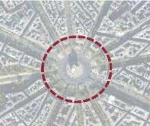
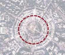
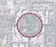
Many cities across the world have adopted innovative approaches to address the issue of urban voids within their urban fabric. Urban regeneration emerges as a key strategy, revitalizing underutilized spaces and redistributing opportunities to enhance urban prosperity and quality of life. This process involves a range of interventions, including
brownfield redevelopment, densification, economic diversification, heritage preservation, and the enhancement of public services. By transforming neglected areas into vibrant, functional spaces, urban regeneration not only addresses spatial inefficiencies but also fosters inclusive growth and sustainable development.
1.1.3 Global examples of Urban Regeneration
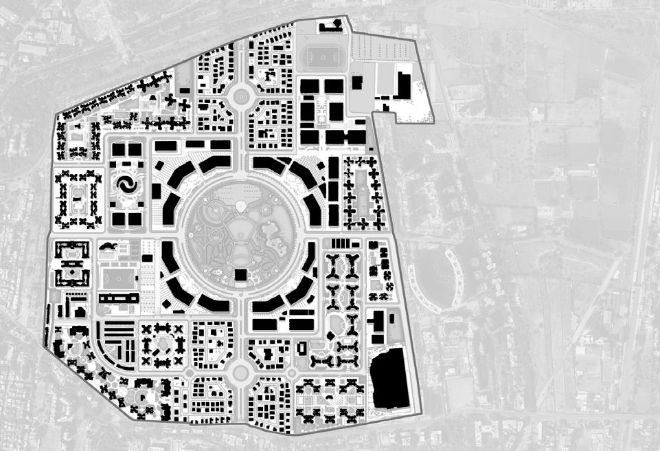
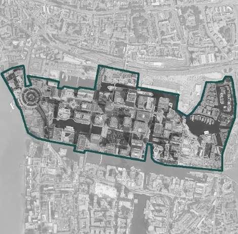
Total Area: 430 acres (Built up: 557420 sq. m.)
Client: MTDCCL + Magarpatta City Council
Designer: Associated Space Designers
Budget: Rs. 2000-2500 crore
Types of Use: Commercial, Housing, Social Amenities, Institutional, Mix
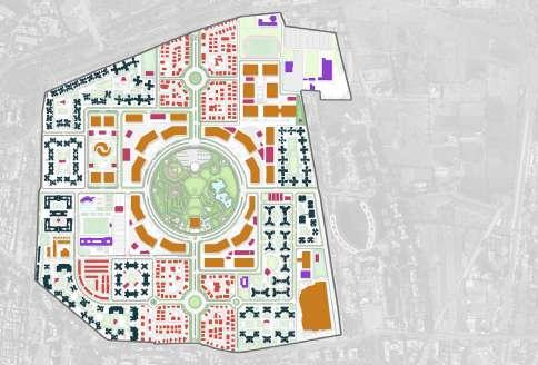
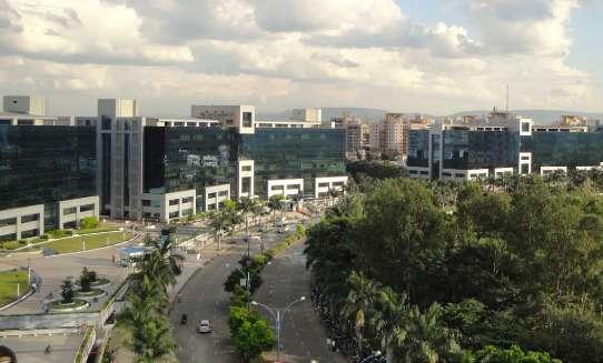
Magarpatta City is a pioneering project that transformed 430 acres of land, owned by 120 farmer families, into a thriving, community focused inclusive planning sustainable urban township. The vision centers on enhancing lifestyles by creating an integrated community that balances modern amenities with environmental responsibility. It is designed to offer high living standards, advanced educational facilities, state-of-the-art workspaces, and reliable security, all while preserving the identity of the landowners.

1.1.3 Global examples of Urban Regeneration
1.1.3.2 Canary Wharf, London
Total Area: 133 acres
Built up: 1,300,643 sq. m.
Client: Canary Wharf Group PLC
Designer: Skidmore, Owings & Merrill
Budget:
Types of Use: Commercial, Social Amenities, Mix, Housing
Canary Wharf in London is another urban regeneration project that transformed a neglected docklands area into a leading financial district. Started in the late 1980s, it brought new offices, infrastructure, and jobs, making it a key economic hub.
Wharf, London
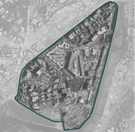
1.1.3.3 Bandra Kurla Complex, Mumbai (G- Block)
Total Area: 915 acres- 290 acres (G-Block)
Built up:
Client: MMRDA (Mumbai Metropolitan Region Development Authority)
Designer: VLK Architects and others
Budget: Rs. 10,000 crore
Types of Use: Commercial, Housing, Social Amenitie, Mix
BKC is one of such projects where a marshy low lying land parcel with informal settlements residing on it was reclaimed to develop into a CBD due to its proximity to international airport, Western Express Highway and Eastern Express Highway. It is also spatially centrally located within the city.
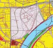
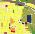
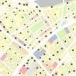
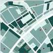
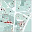
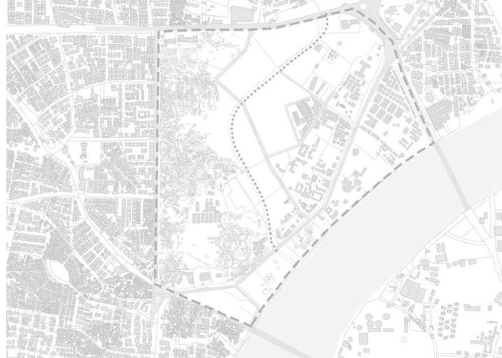
1.2.1 Urban Voids in Ahmedabad
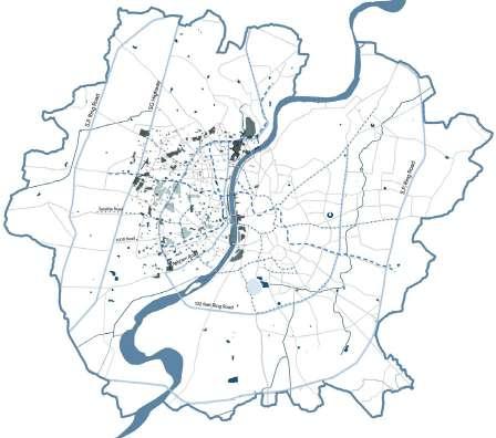

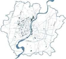
Ahmedabad faces significant challenges in optimizing its land utilization, with numerous urban voids scattered throughout the city. These underutilized spaces often remain neglected despite their potential to contribute meaningfully to urban development. With Ahmedabad experiencing rapid urbanization, these voids represent an opportunity to address pressing challenges such as land scarcity, urban sprawl, and the need for more inclusive public spaces. Through strategic master planning, these vacant parcels can be transformed into valuable assets that enhance connectivity, encourage mixed-use development, and promote sustainable urban growth.
Current Scenario – Ahmedabad City
Mumbai (G- Block)
Thiem New Urban Area, Vietnam 1623 acres Source:
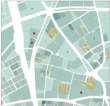
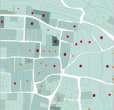
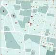
1.2.2 Types of Urban Voids in Ahmedabad
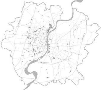
Urban Voids in Ahmedabad
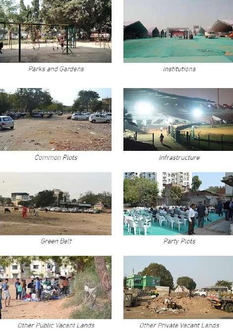
Urban voids in Ahmedabad include a diverse range of underutilized spaces such as parks, gardens, institutional lands, common plots, green belts, infrastructure zones (like areas around flyovers and underpasses), party plots, and vacant spaces within public and private plots. Many of these spaces remain neglected or poorly managed, limiting their contribution to urban life. By strategically redeveloping these areas, Ahmedabad can transform them into vibrant public spaces, green corridors, or multifunctional hubs, enhancing connectivity, inclusivity, and sustainability across the city.
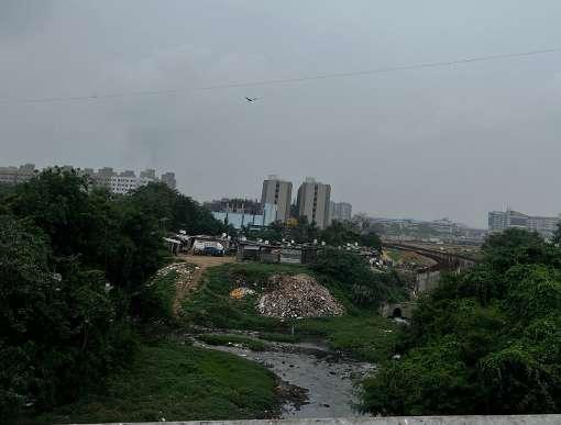
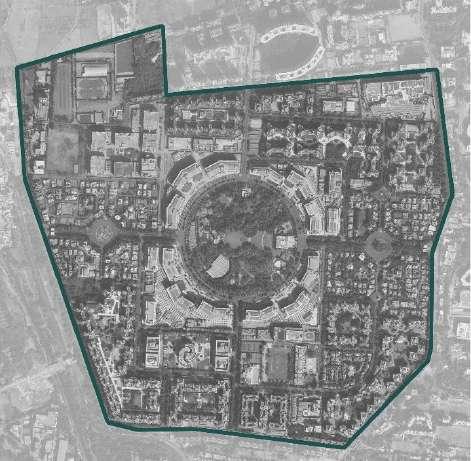
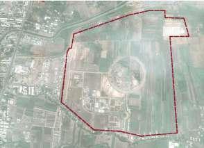
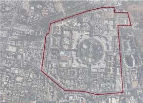
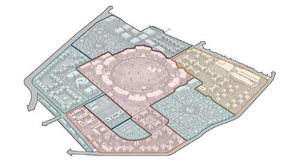
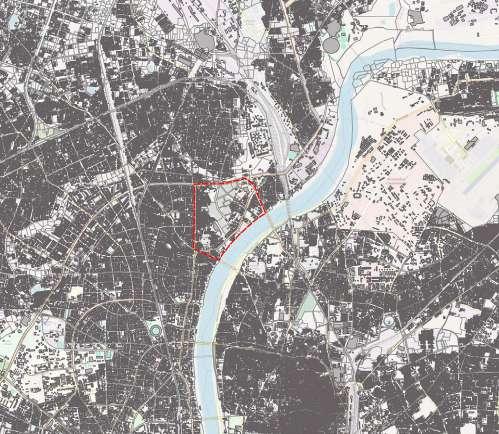
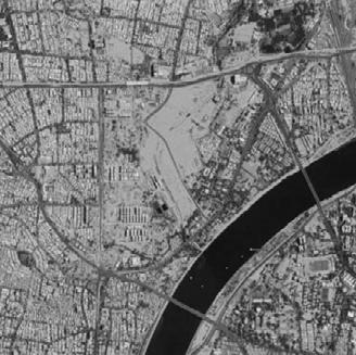
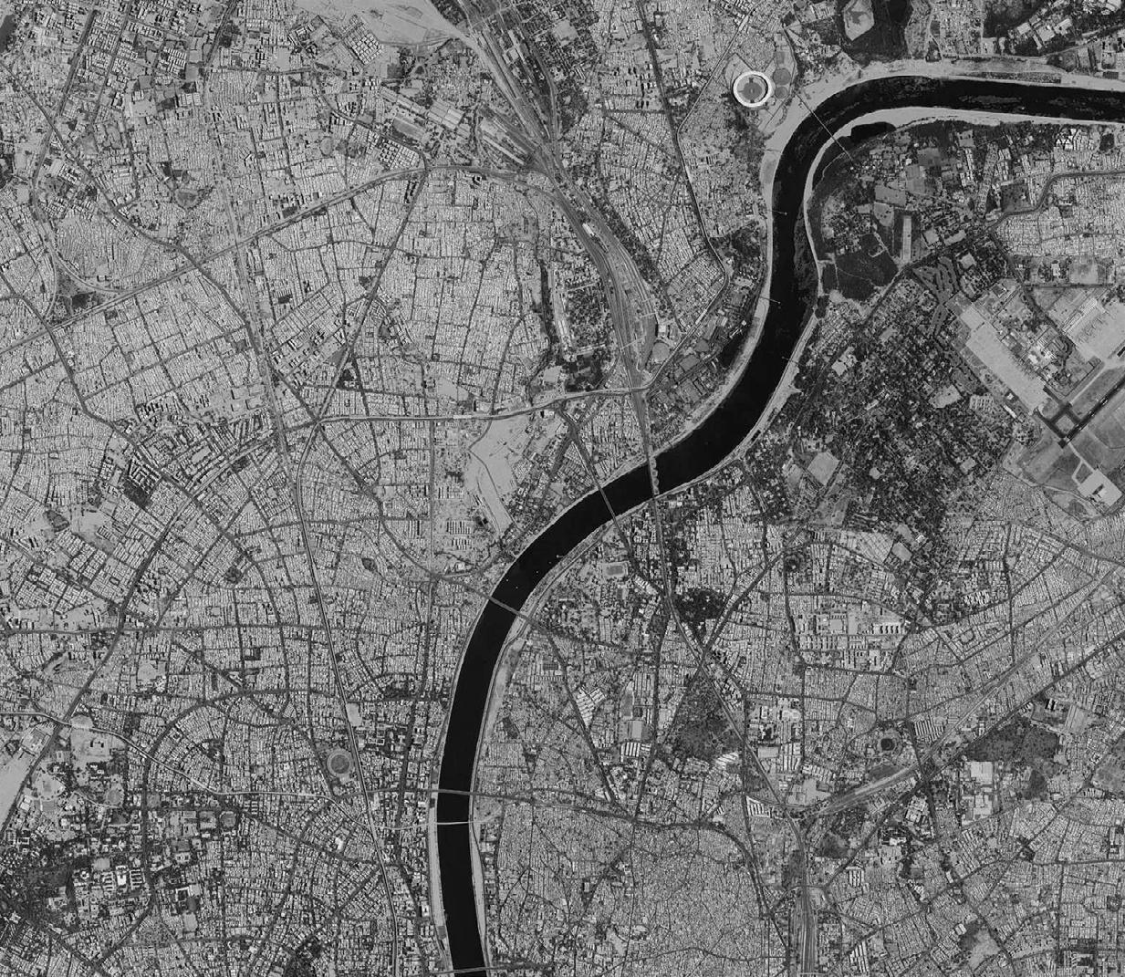
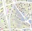
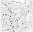
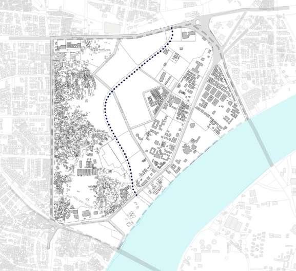
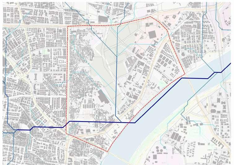
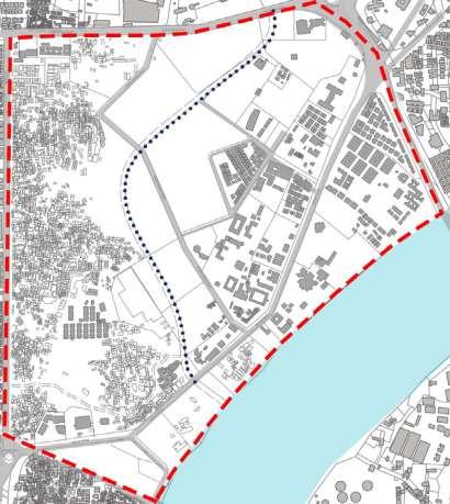
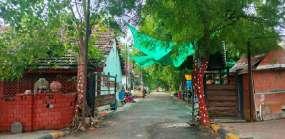
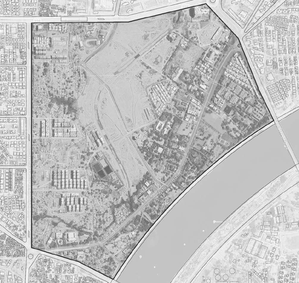
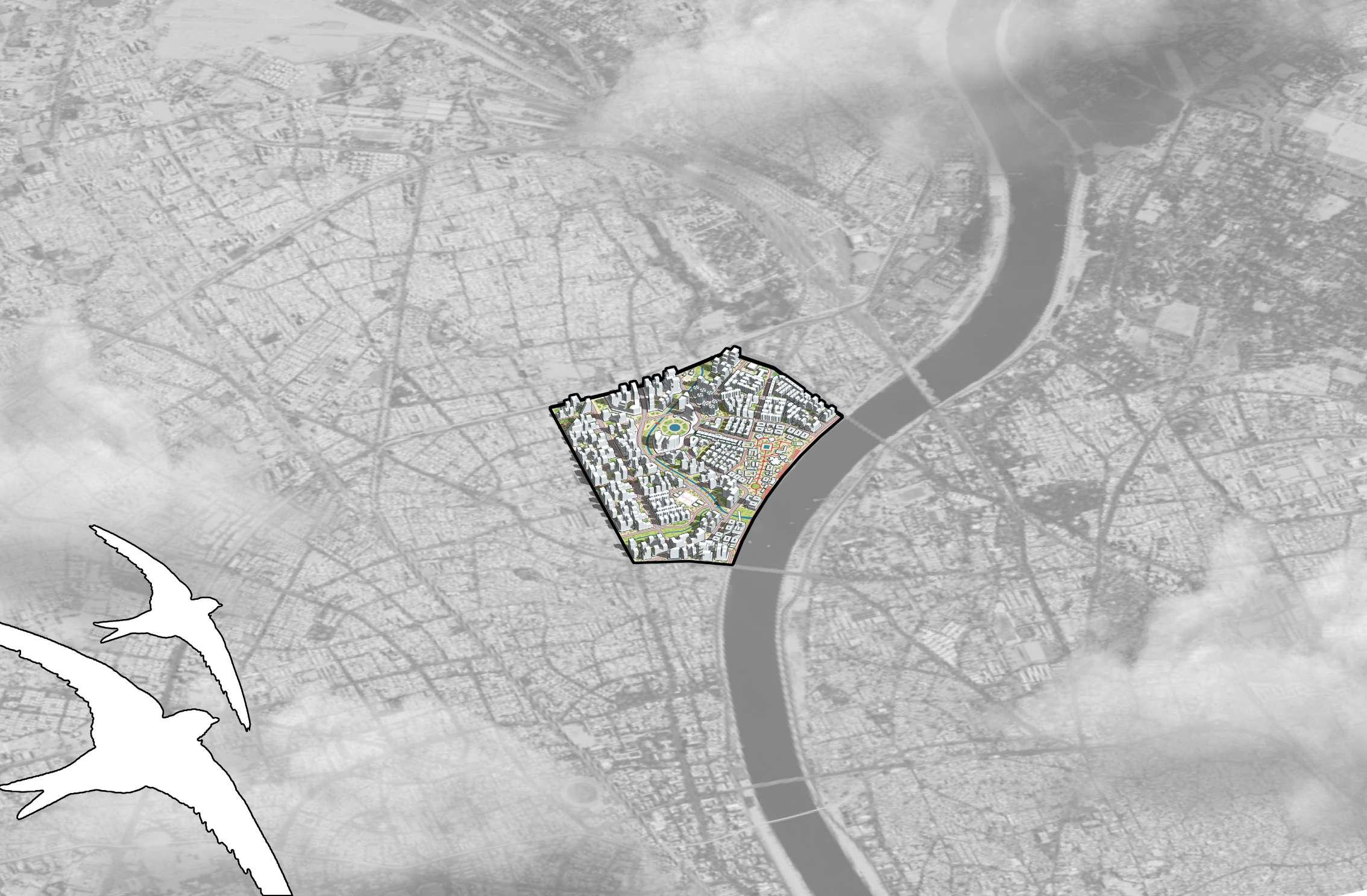
A prominent example of such an urban void is the Sabarmati Ashram precinct, located near the city core. This area, steeped in historical and cultural significance, is uniquely positioned to serve as a bridge between Ahmedabad’s heritage and its modern aspirations. Its prime location, excellent connectivity, and proximity to key city landmarks make it a site ripe for thoughtful redevelopment. Redeveloping this precinct offers a dual opportunity: preserving and celebrating its historical identity while reimagining it as a vibrant, inclusive urban space. By integrating the precinct into the larger urban framework, the city can enhance public access, promote tourism, and create a dynamic hub that caters to the diverse needs of its residents and visitors.

The site is surrounded by major future flagship projects which also highlight its potential.

are we not exploring its potential through the lens of Densification of land?
Source: https://www.vacantlandstudio.com/finding-vacancy
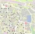
Master Plan Studio I Site Contextualization
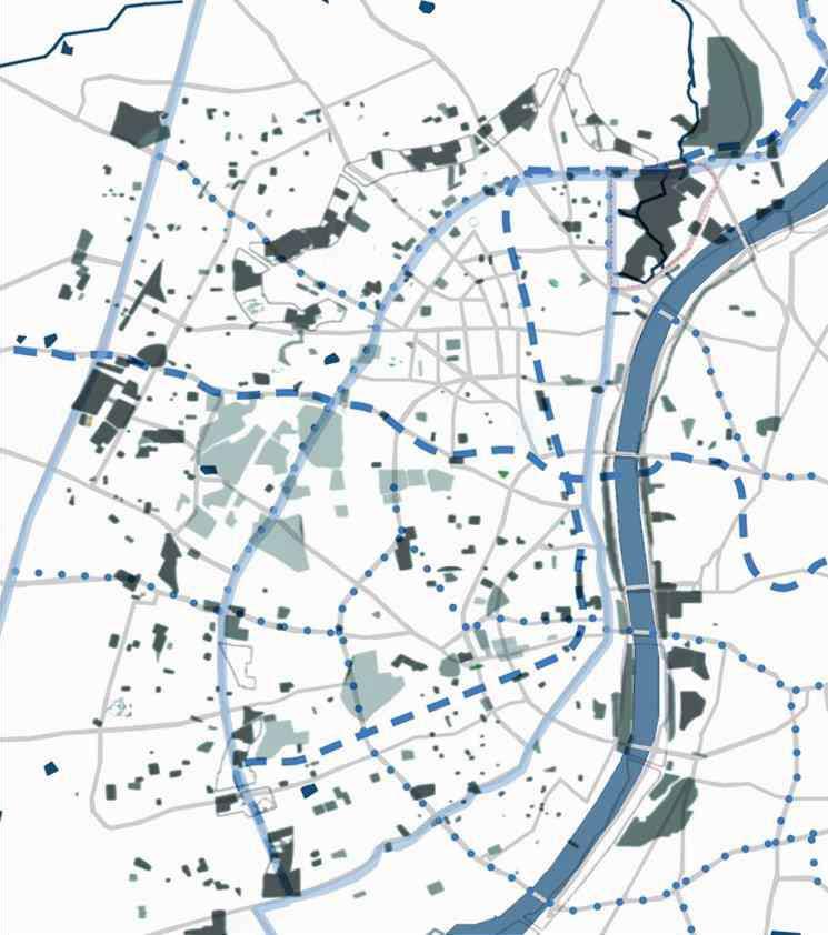
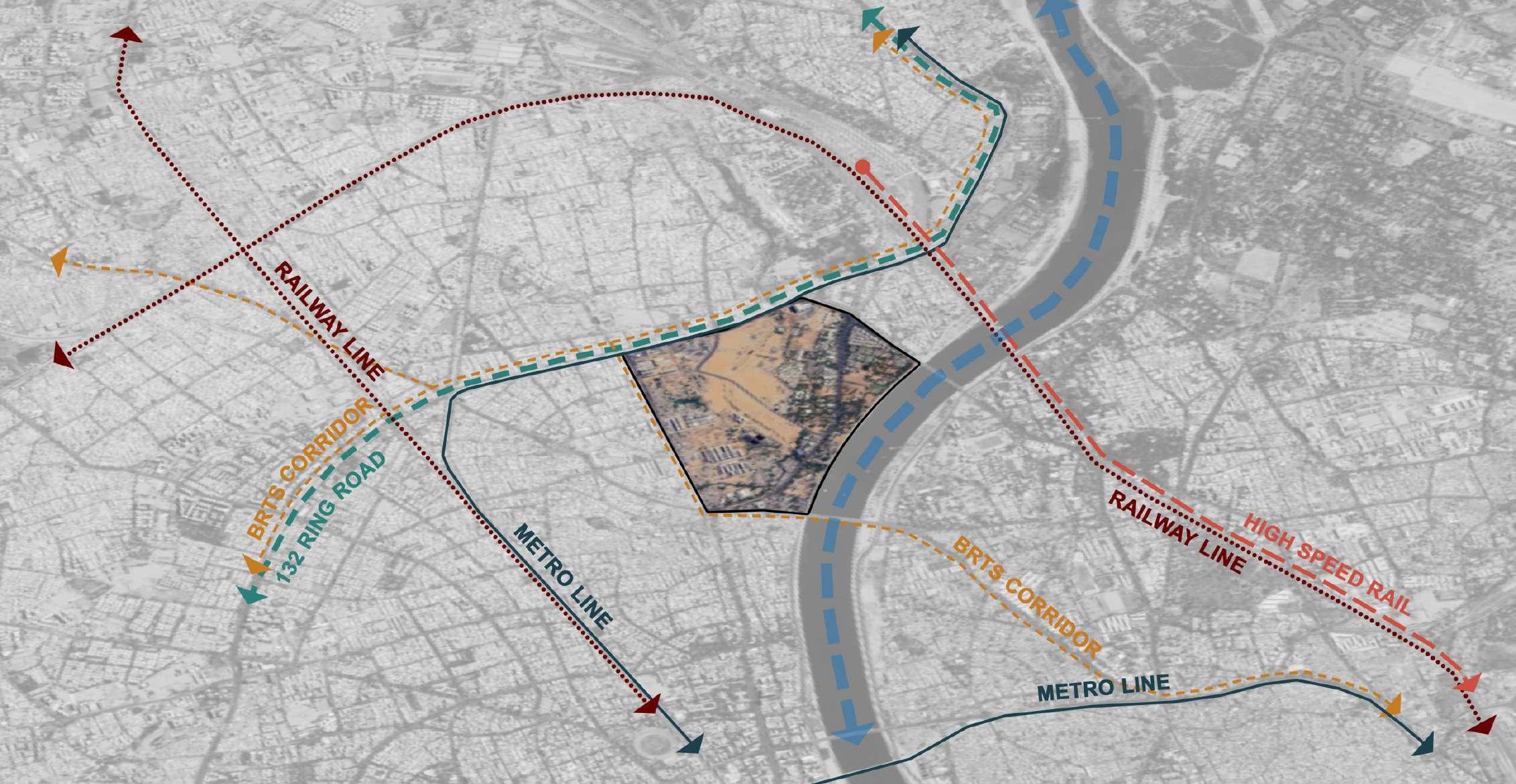
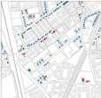
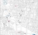
The Sabarmati Ashram precinct is a strategically located urban void in Ahmedabad, well-connected to key landmarks. Within 5 km, it is near the Riverfront Garden, Hutheesing Jain Temple, and Sardar Patel Stadium. Within 10 km, it links to Ahmedabad International Airport, Narendra Modi Stadium, Kankaria Lake, and Kalupur Railway Station, and within 15 km to SG Highway and APMC market. Its connectivity and proximity to major hubs highlight its potential for redevelopment and integration into the city’s urban framework.
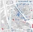
13: Future proposals and Flagship projects (Source: Author)
The Sabarmati Ashram precinct is surrounded by numerous city-level landmarks, making it a prime location with high potential for urban transformation. Its strategic position near major hubs and prominent infrastructure makes it particularly prone to urbanization pressures. Moreover, its proximity to several existing and upcoming flagship projects—such as the Gandhi Ashram Retrofitting, Central Business District, Sabarmati Station Redevelopment, Olympic Complex, and Riverfront Extension—serves as a catalyst for further development. These projects are expected to significantly enhance the area’s connectivity, functionality, and economic viability.
Given these factors, the precinct presents a compelling case for exploring its redevelopment potential through the lens of densification. Leveraging its strategic location and surrounding developments could unlock immense value, creating a vibrant, multi-functional urban hub. By integrating this historically significant site into the broader urban fabric, Ahmedabad has an opportunity to balance heritage preservation with modern urban needs, driving inclusive and sustainable growth.
Understanding the Sabarmati Ashram precinct requires exploring its historical evolution within Ahmedabad’s urban fabric. Established in 1949, the Ashram became a site of cultural significance, with Ashram Road constructed for the Dandi March and the Sangrahalaya later designed by Charles Correa. Connectivity improved further in 1973 with Subhash Bridge, linking the precinct to the old city and nearby areas, including Ramapir Tekra slums, shaping its role in Ahmedabad’s development.
In 2005, SRFDCL was established under AMC to lead the Sabarmati Riverfront Development, revitalizing the riverfront and elevating the Sabarmati Ashram precinct to national prominence. Designated as a Special Development District (SPD), the area was integrated into a broader vision of urban regeneration, balancing heritage preservation with modern development.
1949 1973
Source:
In 2018, GACAIS was formed by TRGA and AMC to preserve the Sabarmati Ashram’s essence, establishing an institutional zone in the Hridaya Kunj area. Improved connectivity through BRTS and Metro further enhanced its integration. By 2024, redevelopment under the Smart City Mission aims to uplift slums and introduce recreational and mixed-use developments within a TOD zone, fostering sustainable growth.

2005 2018 2024
Author)

3.3.1
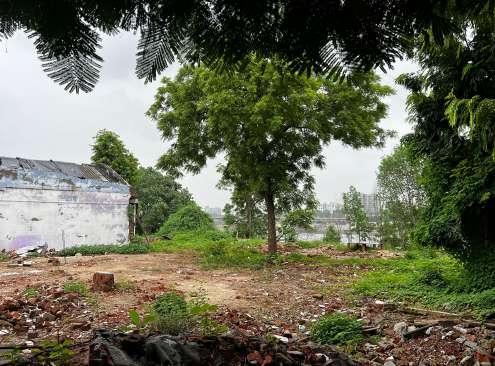
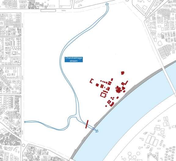
The site’s ecological significance is enhanced by the presence of the Chandrabhaga stream, introducing vital blue and green elements to the proposal. Additionally, the Sabarmati Riverfront serves as a major anchor, offering opportunities for sustainable and nature-integrated development.
The site holds immense heritage value, anchored by the iconic Sabarmati Ashram, a national landmark of historical and cultural significance. Its location along the Sabarmati Riverfront on the city’s western edge further enhances its prominence, creating opportunities for development that respects and integrates its rich legacy. This unique blend of heritage and connectivity positions the site as a focal point for culturally driven and sustainable urban transformation.


The site is well-connected through multiple transportation networks, including the High-Speed Rail (HSR), expanding Metro Rail (MRT) system, and the established BRTS. This multi-modal infrastructure enhances accessibility and supports sustainable, transit-oriented development, making the site ideal for efficient, mixed-use urban growth.


The site benefits from its proximity to the Central Business District (CBD) and existing residential density, with a growing number of residential blocks emerging around the area due to rising property prices. This makes it an attractive location for further development and integration into the city’s urban fabric.


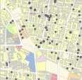


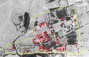
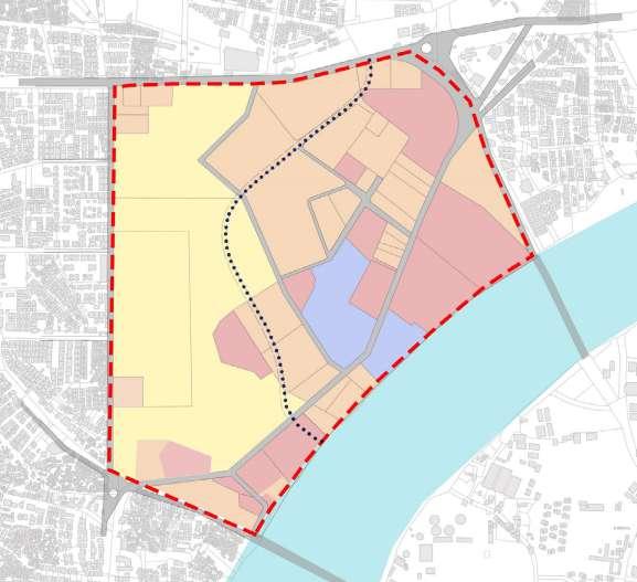
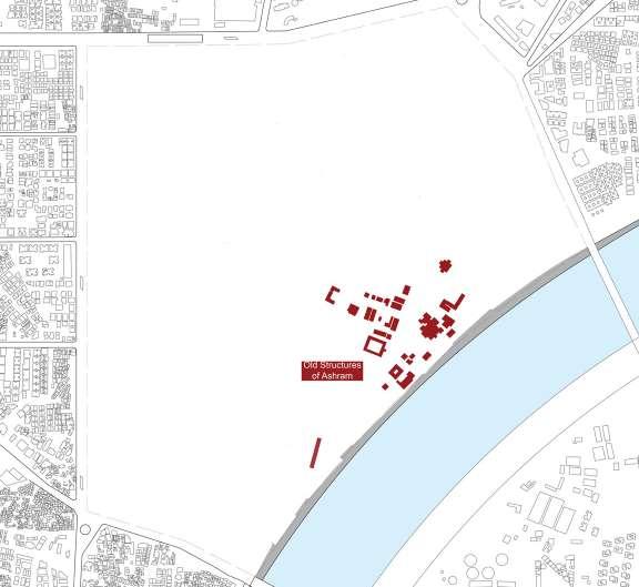
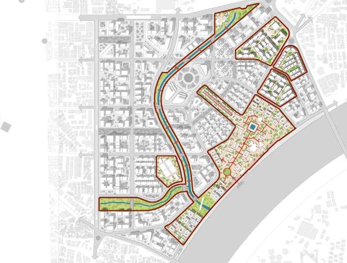
The Sabarmati Ashram precinct, located in the heart of Ahmedabad, has a diverse land-use distribution, with 40% of the area occupied by informal settlements, 10% by Sabarmati Trust land, 20% by state-owned land, and 30% by private ownership. This mix presents both challenges and opportunities, as informal areas require upgrading and integration, while private and state-owned lands offer potential for redevelopment, heritage preservation, and urban regeneration. With thoughtful planning, the precinct can be transformed into a vibrant and inclusive urban space.
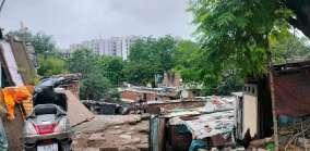
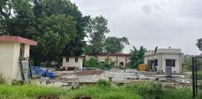
The site includes the informal settlement of Ramapir no Tekra, which occupies 40% of the area and houses approximately 8,000 households. This settlement faces challenges such as inadequate infrastructure and limited access to services. However, it presents an opportunity for inclusive urban regeneration, improving living conditions and integrating the community into the broader development, enhancing the overall socio-economic fabric of the area. 3.4.1 Existing
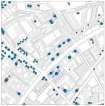
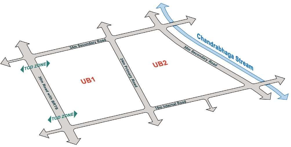
The site is well-connected through a comprehensive road network, with the primary roads being the 132 Ring Road, Ashram Road, and the metro and BRTS corridors that run along them, providing excellent connectivity to the wider city. Secondary roads include the newly built Radha Swami Road and the late Rajendra Mistry Marg, both of which feature BRTS corridors, enhancing public transport accessibility. Tertiary roads are internal streets that connect various parts of the site, ensuring smooth circulation and access within the precinct. This multi-tiered road network supports efficient movement and integration within the broader urban context.


• Although the site is connected with all the public transport, the Sabarmati Ashram is only connected with AMTS bus route only
• Considering the private ridership of 50% yet other half of the visitors are dependent on odd means of transport like auto rickshaw for last mile connectivity.
The site benefits from an integrated and efficient public transport system, with the primary modes being the metro and BRTS corridors running along the 132 Ring Road, Ashram Road, and the secondary roads. These corridors provide seamless connectivity to key areas of Ahmedabad, ensuring fast and reliable access to the site from various parts of the city. In addition, multiple AMTS bus stops are strategically located along the site, further enhancing public transport accessibility for local commuters. This combination of metro, BRTS, and AMTS services creates a robust network that promotes sustainable mobility and reduces dependency on private vehicles, making the precinct easily accessible to a diverse range of users.
Green and blue component has a humanitarian history in the city
Earlier informal settlements used to reside along such talavdies and streams for their livelihood in the city. Which were called as “Tekras”.
Settlements”
Excluded with public infrastructure & public life in the cities
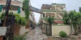
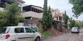
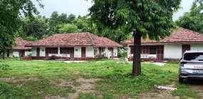
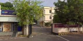
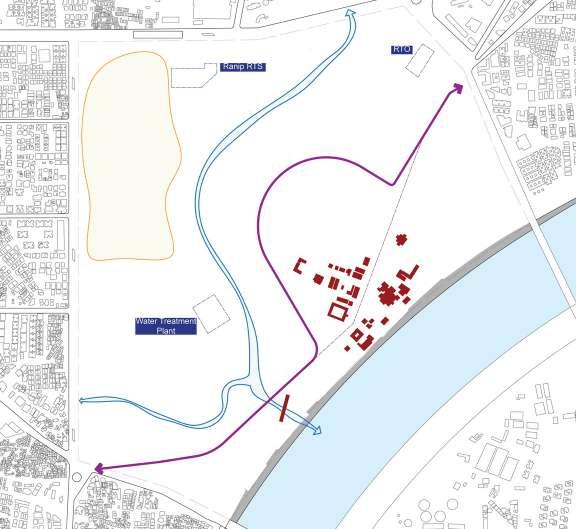
The building morphologies within the Sabarmati Ashram precinct showcase a diverse range of block sizes and architectural typologies, contributing to a varied urban landscape. The private bungalows and informal residential settlements, such as those in Ramapir no Tekra, feature irregular, smaller block sizes with dense, informal layouts. These areas reflect a mix of traditional housing forms and unplanned growth, which contrasts with more formal residential developments like the RBI Staff Quarters. The larger residential and heritage properties, such as Sabarmati Ashram, are characterized by more spacious, well-defined plots and orderly building arrangements, creating a distinct sense of place within the precinct.
Additionally, the precinct includes several public infrastructure buildings, such as the RTO and Magistrate offices, which occupy medium-sized, functional blocks. These structures serve the operational needs of the area, complementing the larger civic framework. The presence of critical utility infrastructure, such as the water distribution system and the RTS (Rapid Transit System), integrates seamlessly into the site, connecting the precinct to the broader city fabric. Together, these diverse building forms and block sizes create a complex and dynamic urban environment, offering opportunities for mixed-use development and urban regeneration while preserving the precinct’s historical and cultural identity.
The master plan is assumed to be prepared on behalf of the AMC. The extent of the sites have been defined largely by important roads. Site have a significant part under public ownership. Re-organisation of the private parcels is assumed to allow greater design flexibility in a contiguous extent of land.”
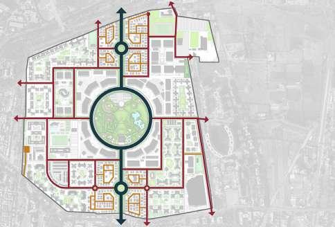
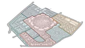
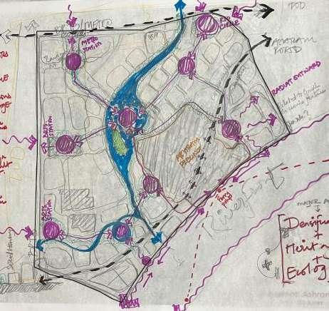
4.2 Vision for Master Plan

Figure 31: Vision for Master Plan (Source: Author)
"Reimagining the Sabarmati Ashram precinct as an inclusive, sustainable urban hub that balances heritage, ecology, densification, connectivity, and community integration into the city's daily life." =
Reimagining the Sabarmati Ashram precinct as an inclusive, sustainable urban hub that balances heritage, ecology, densification, connectivity, and community integration into the city’s daily life.” “
Morarji

5.2.1 Retaining Old Ashram Buildings
The retention and integration of the Ashram’s historical buildings, such as Hridaya Kunj and the Satyagrah Ashram, into the master plan is vital for preserving its cultural significance. These heritage structures will be adapted for contemporary uses, ensuring a seamless blend of history and modernity, while enhancing the precinct’s identity and offering spaces for community engagement.
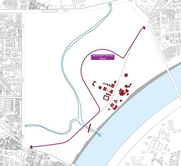
5.2.3 Redirecting Ashram Road
5.2.2 Reactivating Chandrabhaga Stream
Reactivating the Chandrabhaga Stream and transforming it into a vibrant streamfront will revitalize a currently polluted waterway, plagued by solid waste. By addressing environmental concerns and improving the water quality, the streamfront will become a new urban landmark, seamlessly connecting to the Sabarmati Riverfront. This transformation will enhance the city’s fabric, offering a sustainable, accessible public space that contributes to both ecological and social well-being.

Redirecting Ashram Road around the Sabarmati Ashram complex will reduce noise pollution and traffic congestion, preserving the area’s tranquility. This will protect the Ashram’s sanctity and enhance the experience for visitors and residents alike.
5.2.4 In-situ rehabilitation of informal settlements and infrastructure buildings
The revitalization of the 800 households in the Ramapir no Tekro slum involves upgrading living conditions, improving infrastructure, and, if necessary, relocating residents to more suitable spaces within the site. This includes the reconstruction of essential infrastructure such as water supply, drainage, and access roads, ensuring better connectivity and sanitation. The process will aim to integrate the community into the broader urban fabric while preserving social cohesion and providing improved housing conditions.

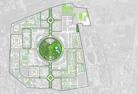
The existing ecological layer of the site is shaped by natural features such as the water flow and contours that define the terrain. The Chandrabhaga Stream flows through the site and eventually feeds into the Sabarmati River, creating a significant ecological connection within the city. The contours along the stream influence the water flow patterns, which need to be considered in the master planning to prevent flooding and promote sustainable water management.
In addition to the water flow, the site is also
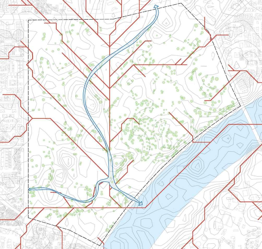
characterized by existing trees, particularly along the stream edge and within the Sabarmati Ashram complex. These mature trees play a critical role in maintaining the ecological balance of the area by providing shade, supporting biodiversity, and contributing to the aesthetic quality of the space. The preservation and integration of these natural elements will be crucial in maintaining the environmental health of the site while enhancing its overall urban design.
Nodes
Walkable
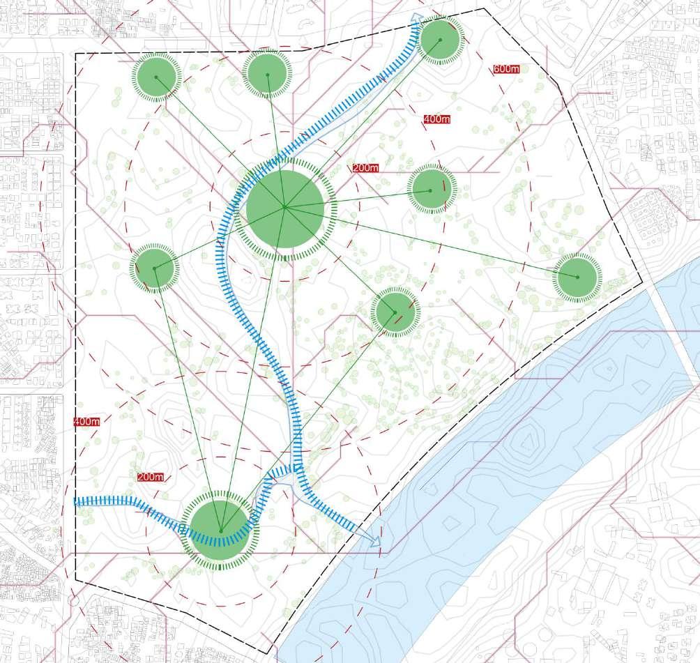
The landscape strategy builds on the site’s natural features, utilizing low points for stormwater retention, such as ponds or rain gardens, while preserving existing water flows and contours. This approach enhances sustainability and creates spaces for both ecological and recreational use.
Additionally, a 200-meter walkable radius is incorporated, ensuring easy access to key nodes within the site. Smaller markers guide movement, connecting important features like open spaces, the streamfront, and the Ashram complex. This
design fosters walkability, enhances accessibility, and strengthens the site’s ecological and social fabric.
5.5.1 Concept Diagram


5.5.2
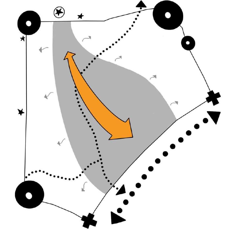
The concept diagram highlights a key pedestrian spine that stretches from the Transit-Oriented Development (TOD) area to the Sabarmati Riverfront, covering a 1.2 km stretch that currently lacks road access. This pedestrian corridor is designed to serve as the primary connective route, fostering a seamless and accessible linkage between the city’s key zones. The spine not only enhances mobility but also strengthens the integration of the riverfront into the urban fabric, ensuring a walkable, pedestrian-friendly environment that encourages sustainable urban living.
Building upon this foundational idea, the master plan evolves by incorporating the natural and cultural elements of the site, such as the Chandrabhaga Stream and the Sabarmati Ashram complex. The careful planning ensures that these features are preserved while creating new opportunities for urban development. The focus is on enhancing connectivity, ensuring heritage preservation, and maintaining ecological sensitivity, ultimately creating a balanced urban environment where both cultural and environmental layers coexist with modern development.
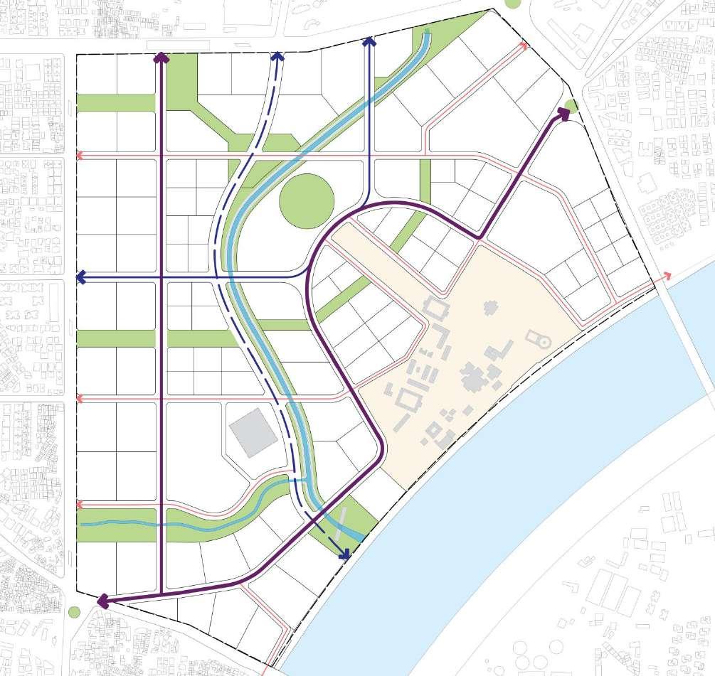
Road Network
Road Network
Primary Roads
Primary Roads
Secondary Roads and Pedestrian Dominant Road
Secondary Roads and Pedestrian Dominant Road
Tertiary Roads
Tertiary Roads
Primary Roads

Redirected Ashram Road (ROW- 24m)
Redirected Ashram Road (ROW- 24m)
Redirected Ashram Road (ROW- 24m)
Secondary Roads and Pedestrian Dominant Road
Tertiary Roads
Tertiary
Secondary Roads
to TOD (ROW- 30m)
to TOD (ROW- 30m)
Parallel to TOD (ROW- 30m)
Parallel to Streamfront (ROW- 32m)
Parallel to Streamfront (ROW- 32m)
Road Network
Primary Roads
Connecting TOD (ROW- 24m)
(ROW- 24m)
Secondary Roads and Pedestrian Dominant Road
Tertiary Roads
Tertiary Roads

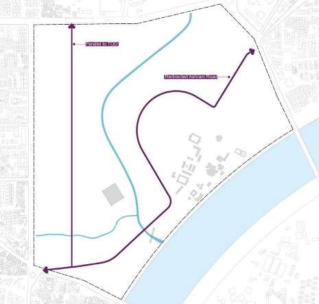

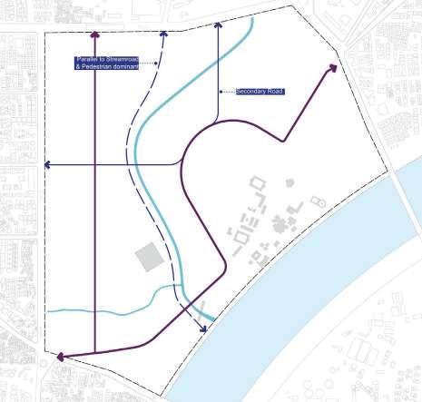
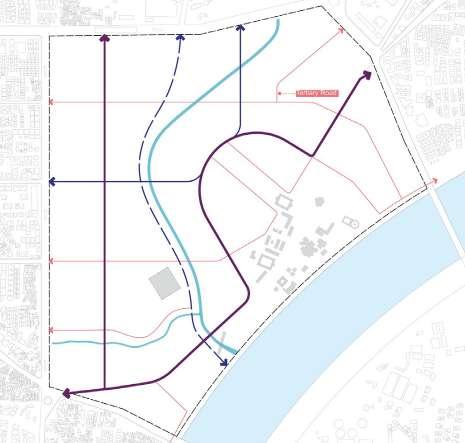
Figure 41: Hierarchy of Roads (Source: Author)
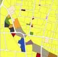
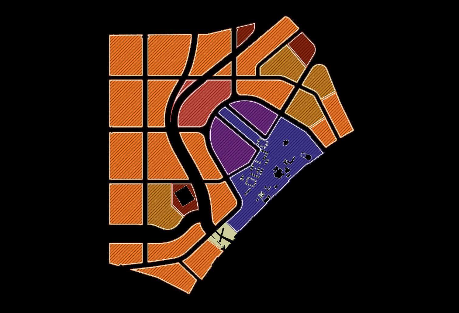
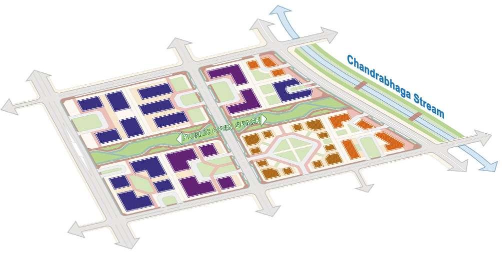
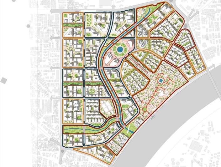
6.1.2 Dominant Land use
(Source: Author)
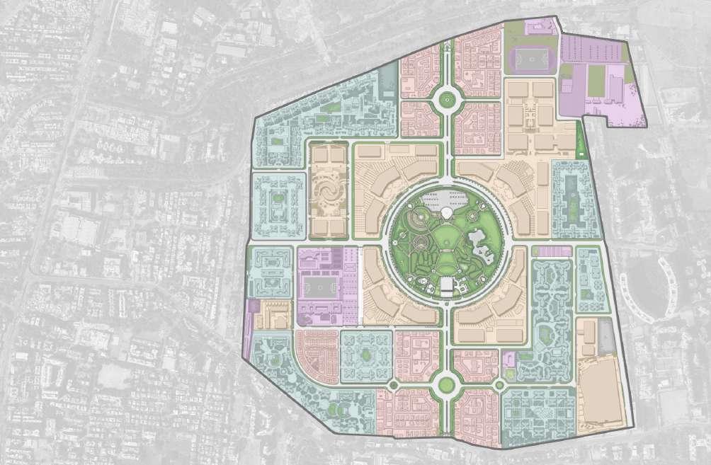
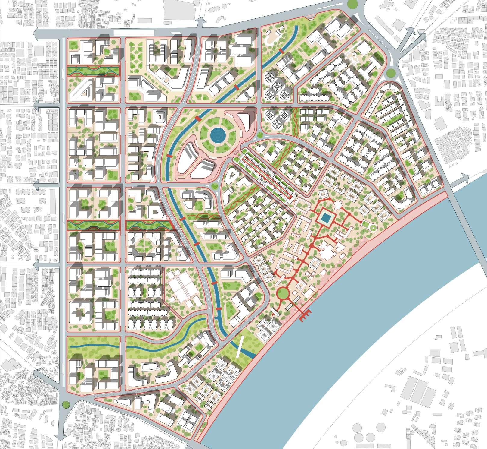
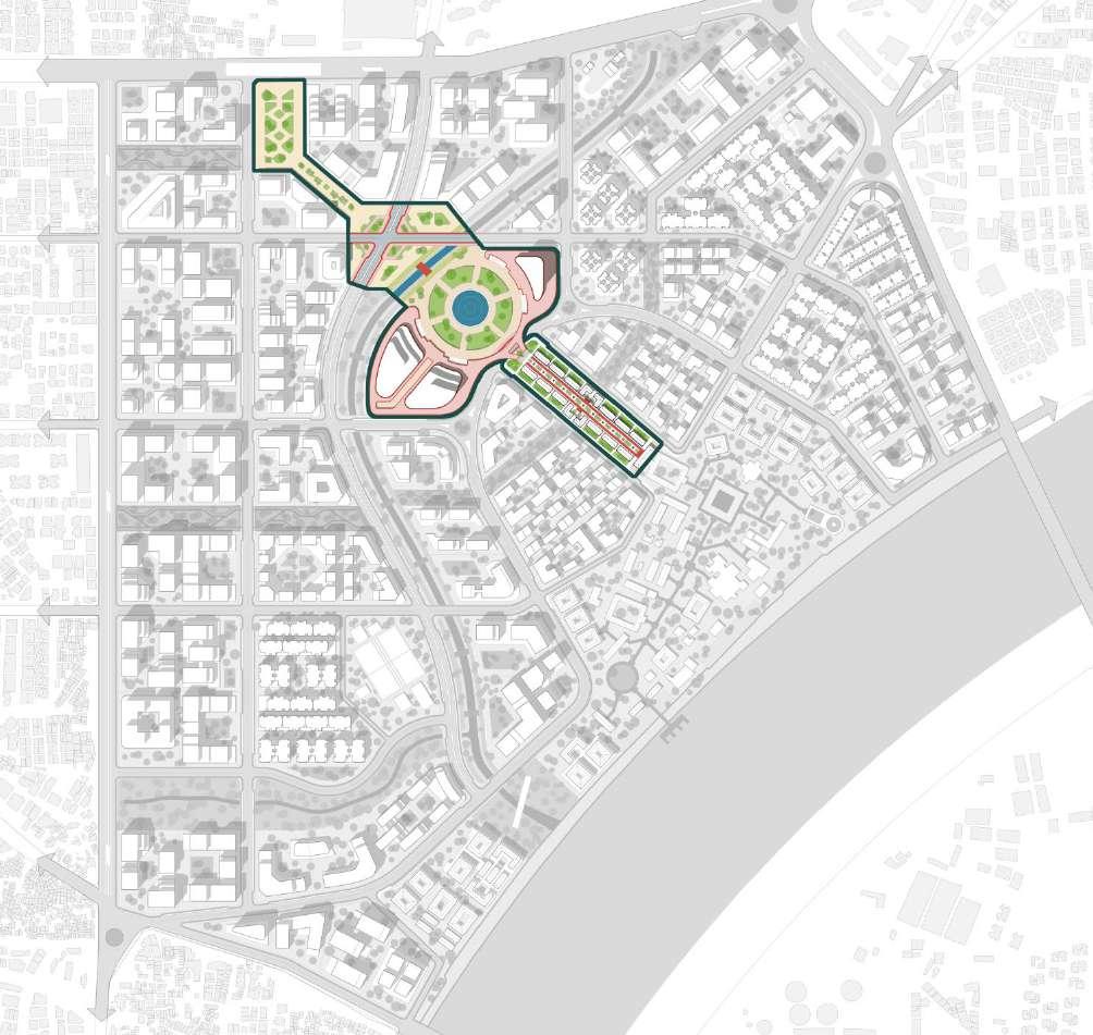
The land use distribution for the Sabarmati Ashram precinct emphasizes a balanced approach to urban growth and heritage preservation. With 43% of the site dedicated to mixed-use development, the plan allows flexibility for residential, commercial, and recreational spaces, fostering a vibrant, high-density environment around transit hubs. This approach supports the TOD strategy, ensuring that the precinct remains well-connected and adaptable to future urban needs.
Along with mixed-use areas, the plan
Mixed Use (43%)
Roads (18%)
Ashram (11%)
PMAY- Affordable housing (8.5%)
C. Streamfront- open space (7%)
Ashram Satellite campus (5%)
MICE- City convention center (4%)
Site Infrastructure (3.5%)
Primary Roads
Secondary Roads
Tertiary Roads
Ashram Access Corridor (27%)
Chandrabhaga Streamfront (57%)
Linear parks + S. Riverfront (16%)
includes significant allocations for roads (18%), the Ashram complex (11%), and affordable housing under PMAY (8.5%), ensuring both cultural preservation and social equity. Open spaces along the Chandrabhaga Streamfront (7%) and an Ashram Satellite campus for institutions (5%) maintain ecological and cultural integrity. The inclusion of a city-level convention center (4%) further strengthens the site’s role as a civic and cultural landmark within Ahmedabad.
6.1.3 Plots Division
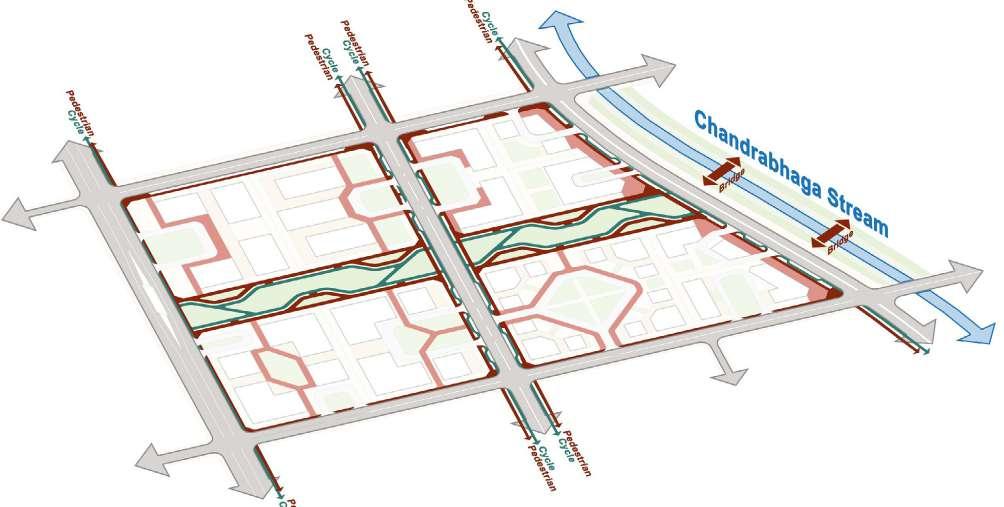
Pedestrian way
Cycle lane
AMTS Stops
BRTS stops Metro Station
Sabarmati
(Source: Author)
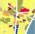
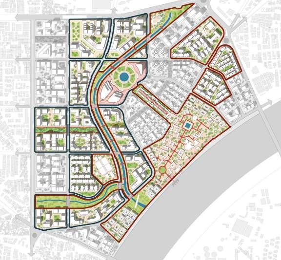
Overlaying the landscape strategy diagram onto the dominant land use distribution highlights the careful integration of open spaces and major spines within the master plan. The design focuses on ensuring that key green and public spaces, such as the Chandrabhaga Streamfront and Ashram Access Corridor, are seamlessly incorporated into the plot division. This approach ensures that the site’s ecological and cultural elements remain central to the overall layout, while also facilitating connectivity and accessibility across the precinct.
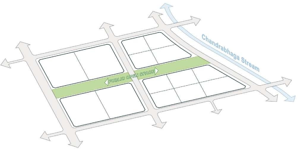
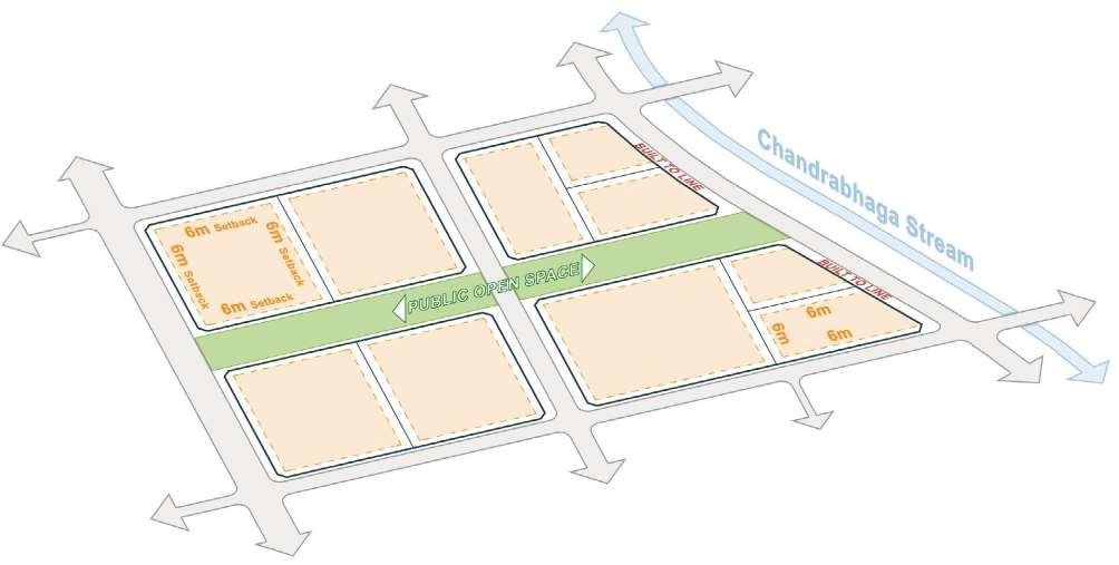
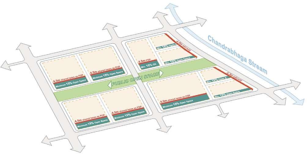
The plot division strategy reflects this integration by varying the sizes of plots based on their location within the master plan. Plots located along the TOD zones are larger, with an average size of 90x90 meters, enabling higher-density development and accommodating a mix of residential, commercial, and recreational uses. In contrast, internal plots are smaller, averaging 55x55 meters, which allows for a finer grain of development, promoting walkability and ensuring that the landscape and open spaces are easily accessible for all.
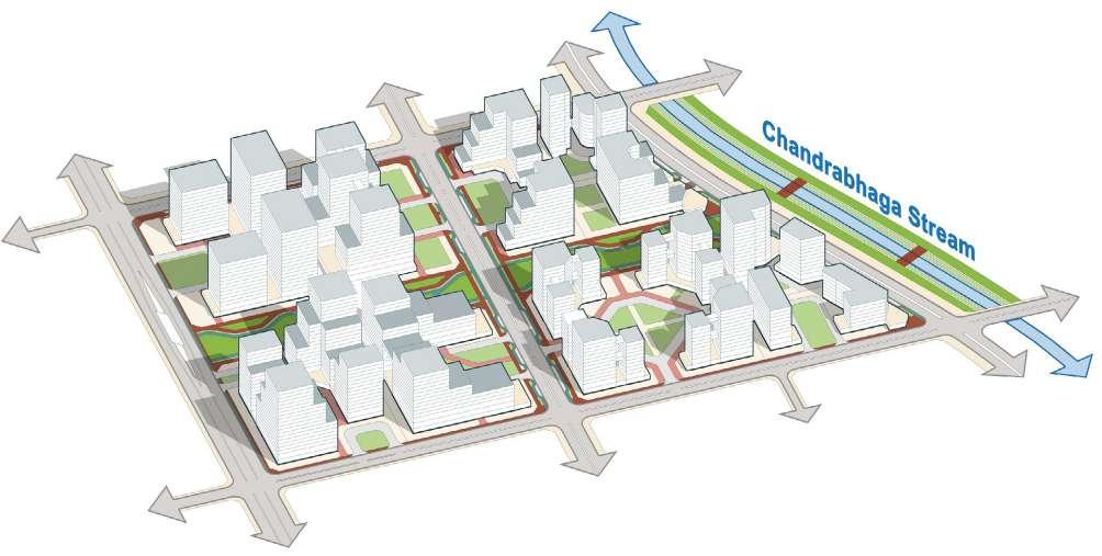
The built-unbuilt diagram shows that 23% of the site is developed, with larger, higher-density blocks concentrated in the TOD zones, designed to accommodate mixed-use developments. These areas support commercial, residential, and institutional spaces, boosting connectivity and urban vitality.
Points of Interest (POIs) are integrated into these built areas to enhance accessibility and engagement, promoting public interaction. The finer grain of development surrounding the Sabarmati Ashram ensures a balance between high-density
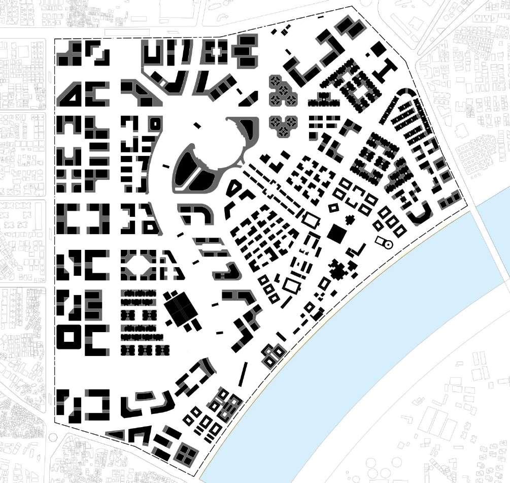
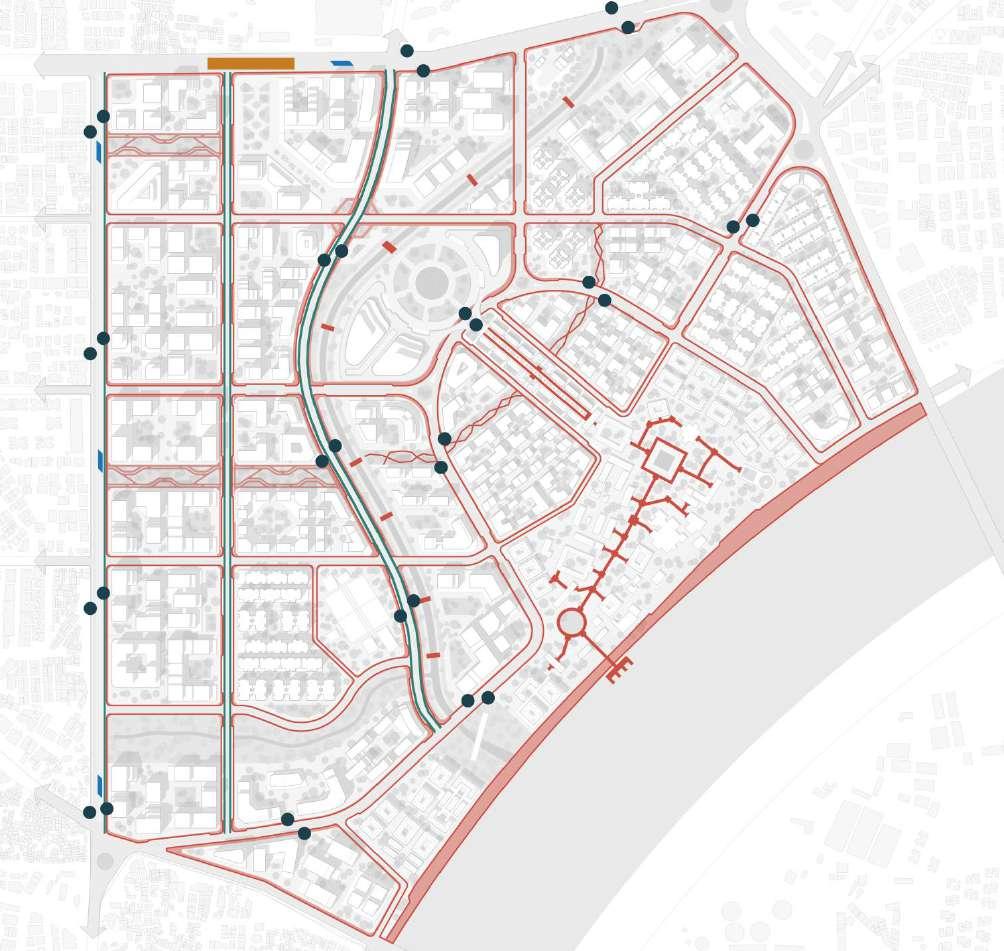
In addition to pedestrian infrastructure, the site is well-served by multiple public transport options. AMTS stops are strategically placed growth and heritage preservation, creating a dynamic yet respectful urban environment.
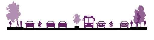
The master plan prioritizes sustainable transportation by incorporating dedicated pedestrian pathways and cycle lanes throughout the site, enhancing walkability and promoting eco-friendly mobility. These routes connect key areas, including the Sabarmati Ashram and Chandrabhaga Streamfront, encouraging seamless movement within the precinct.
placed across the site for easy access to local bus routes. BRTS stops further strengthen the public transport network, ensuring efficient connectivity with the city. The integration of a Metro Station provides a high-capacity transit option, linking the site to the broader urban fabric and reinforcing the precinct’s role as a transit-oriented development (TOD) hub.

Mixed Use (43%)
Roads (18%)
Ashram (11%)
PMAY- Affordable housing (8.5%)
C. Streamfront- open space (7%)
Ashram Satellite campus (5%)
Site Infrastructure (3.5%)
Primary Roads
Secondary Roads
Tertiary Roads
Ashram Access Corridor (27%)
Chandrabhaga Streamfront (57%)
Linear parks + S. Riverfront (16%)
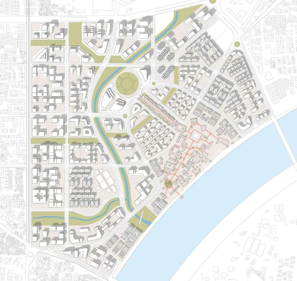
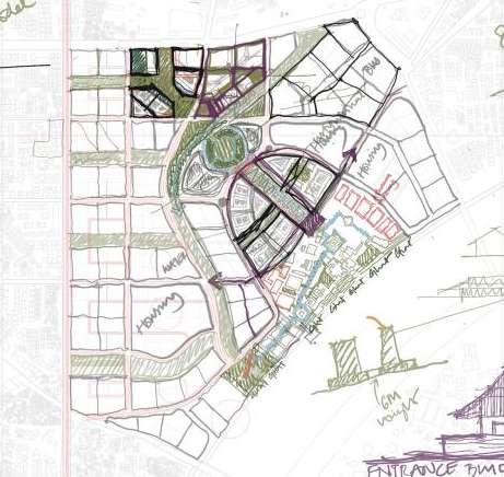
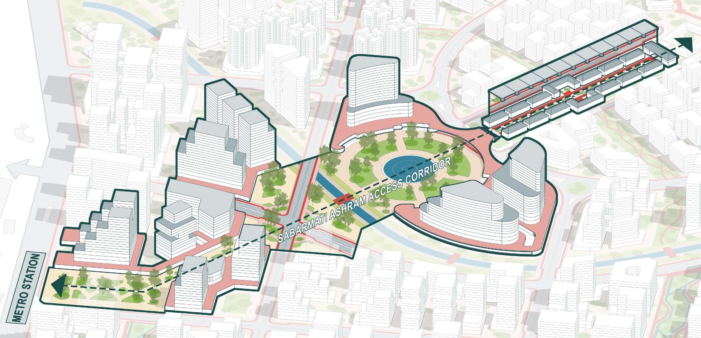
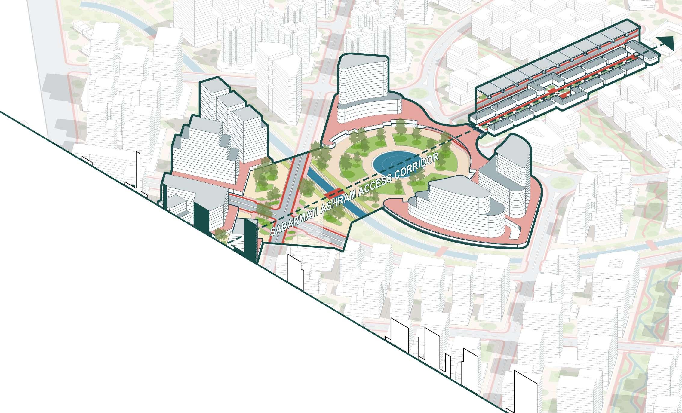
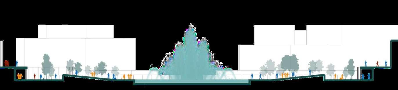
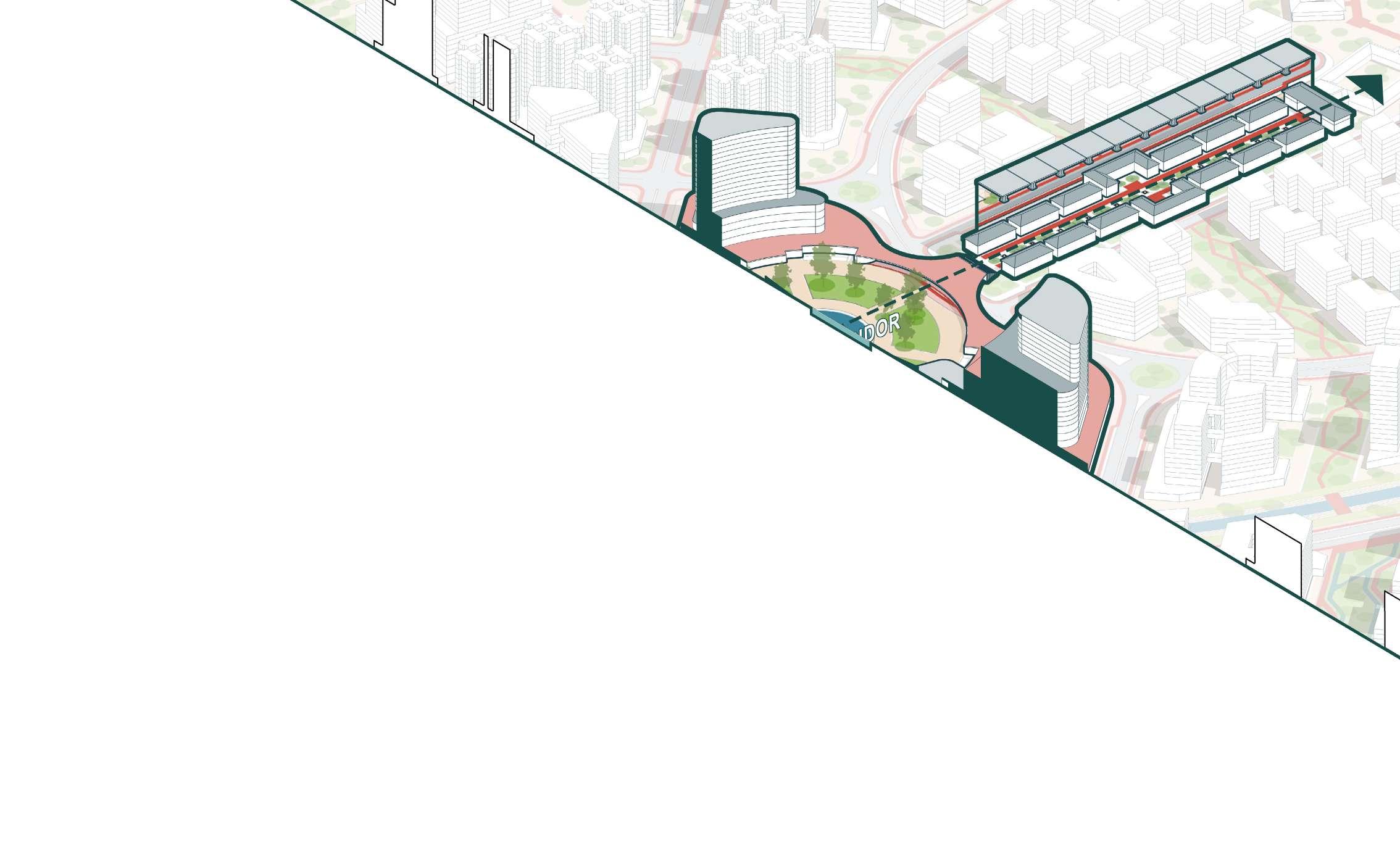
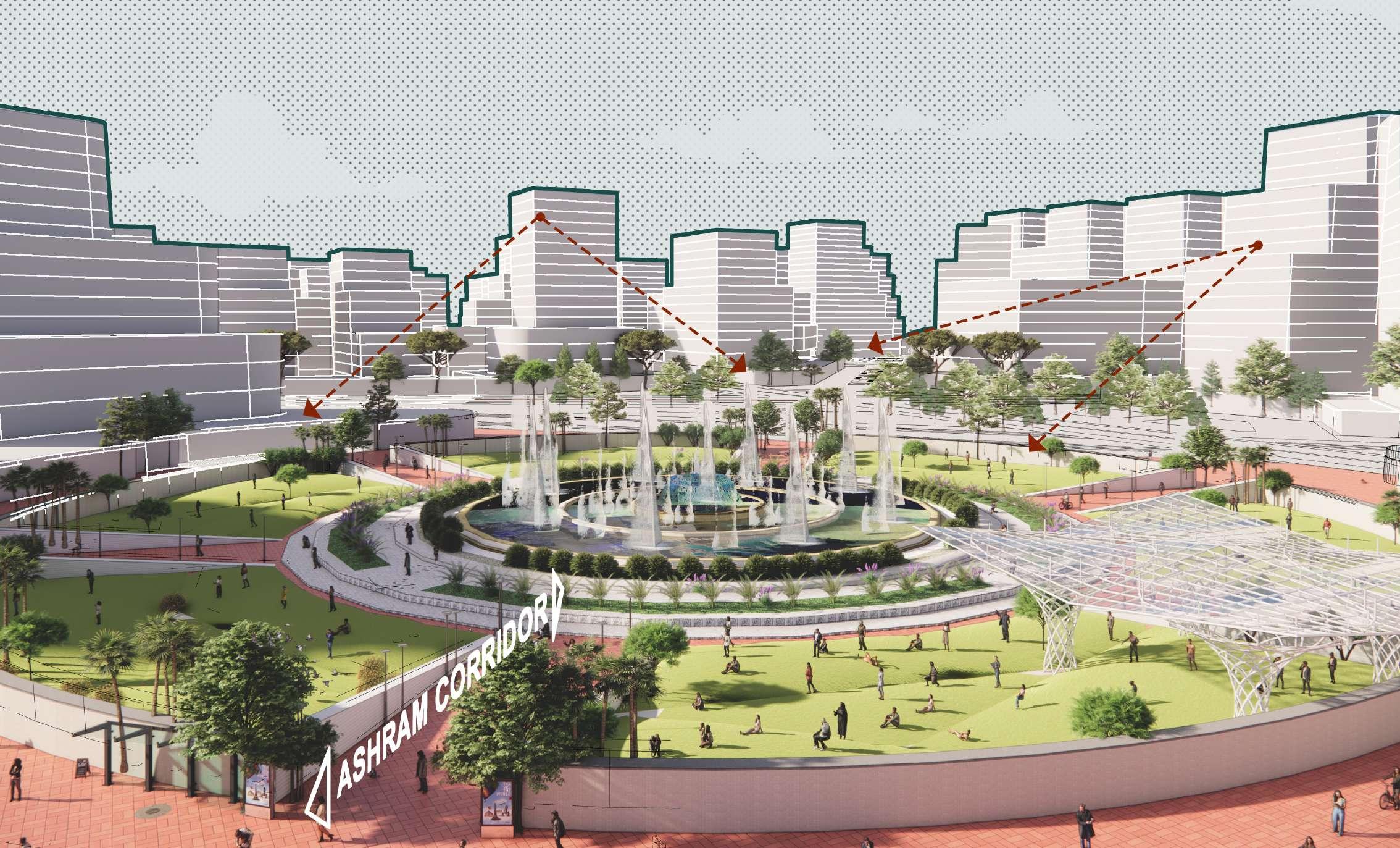
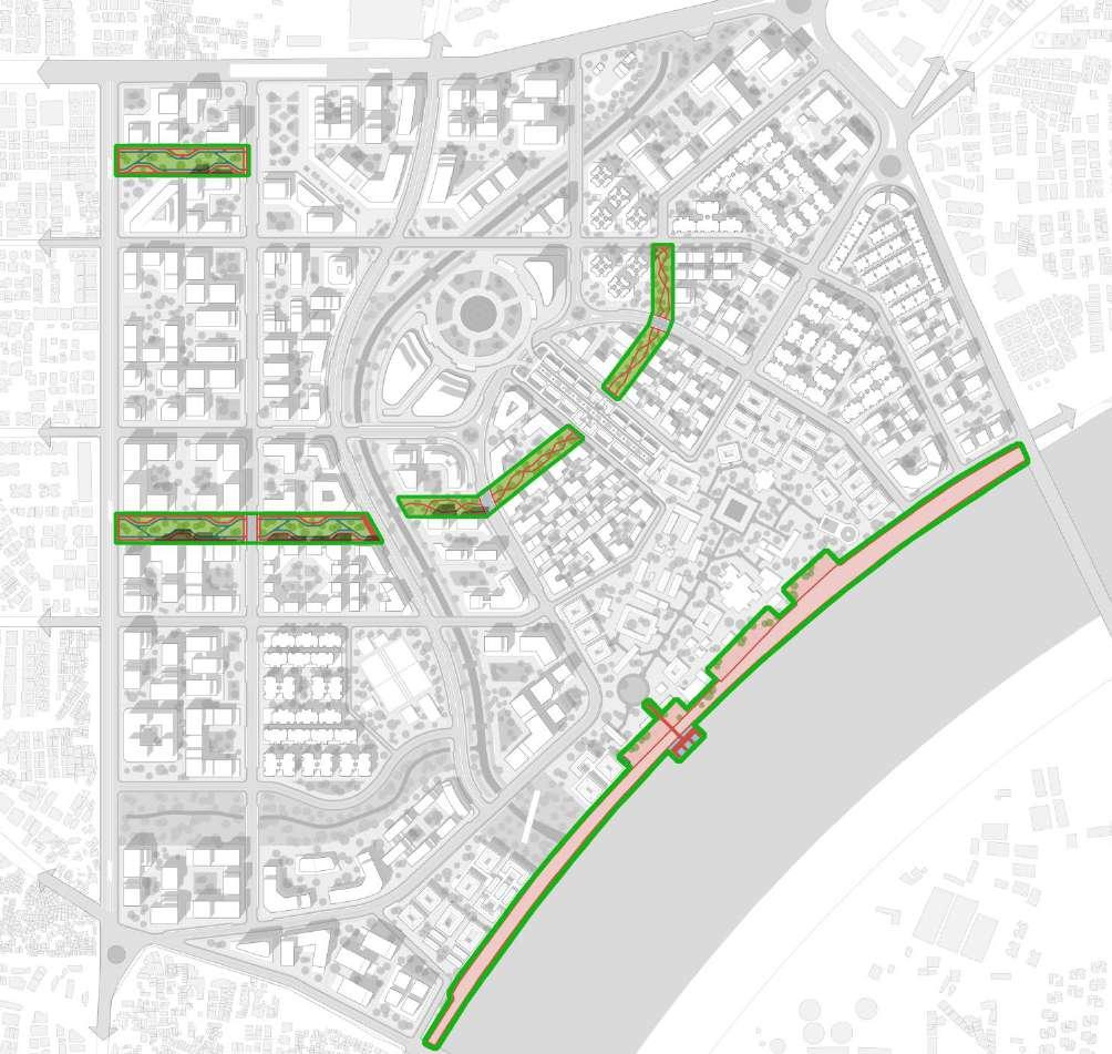
The master plan features a hierarchy of open spaces designed to enhance connectivity and create vibrant public areas. The Ashram Access Corridor (27%) serves as the primary route leading to Sabarmati Ashram, starting at Ranip Metro Station and passing through central open spaces, which include a city-level fountain and a convention center with an iconic building, becoming a new city landmark. The corridor culminates at the Ashram Bazaar, extending to the historical Sabarmati Ashram building.
The Chandrabhaga Streamfront (57%) is
MICE- City convention center (4%)
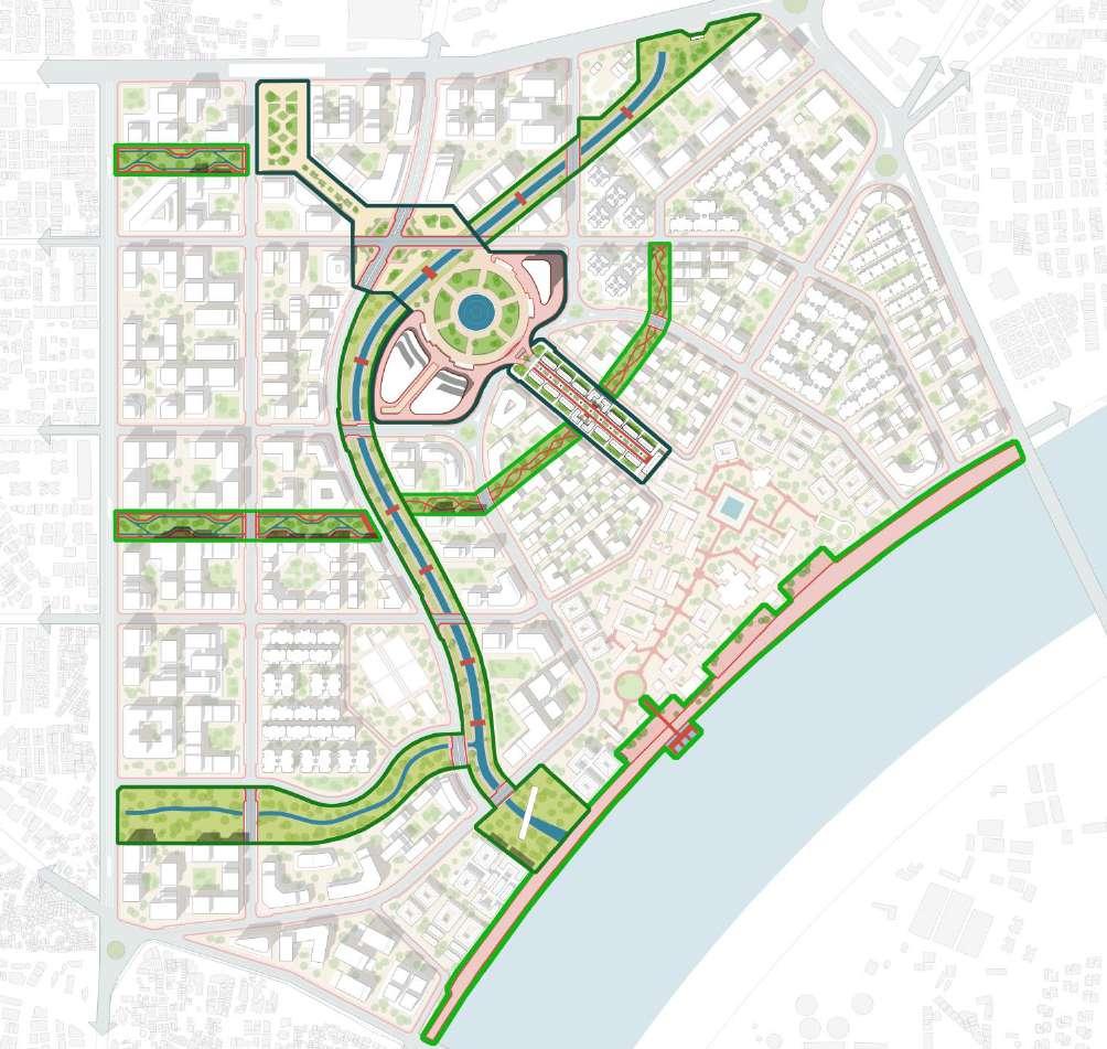
a key element of the plan, built along the existing stream, which, despite being polluted, provides a new landmark that connects to the Sabarmati Riverfront. The streamfront serves as the masterplan’s main spine, supporting diverse activities like bus stops, gardens, recreational spaces, and pedestrian bridges. Linear parks (16%) connect to both the streamfront and Sabarmati Ashram, integrating pedestrian and cycle trails, and providing access to the riverfront with enhanced ghats and a jetty for water-based connectivity, further strengthening the city’s public space network.
The Ashram Access Corridor (27%) is a key route connecting Sabarmati Ashram with the surrounding city, beginning at the Ranip Metro Station. It passes through various open spaces, including a central area with a city-level fountain and a convention center, which serves as a new landmark for the city. The corridor culminates at the Ashram Bazaar, leading directly to the historic Sabarmati Ashram, seamlessly linking the city with its cultural heritage.
This corridor not only functions as a transportation route but also as a vibrant public space,
offering recreational and civic amenities. Its integration of open spaces and landmarks ensures it plays a central role in the city’s connectivity and urban identity, bridging the past and future of Ahmedabad.
Author)
The Ashram Access Corridor is a pivotal element of the master plan, serving as the primary connection between Sabarmati Ashram and the surrounding city. Starting from Ranip Metro Station, it passes through a series of open spaces, including a central area with a city-level fountain and convention center, acting as a new landmark for
Ahmedabad. The corridor culminates at the Ashram Bazaar, linking the city’s vibrant commercial areas with the historic Ashram. Beyond its transport function, the corridor enhances public life by integrating cultural, civic, and recreational spaces, making it a dynamic route that bridges the past and future of the city.
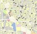
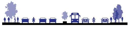
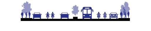
Types of actives in Public spaces defined by Jan Gehl.


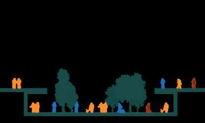


Types of actives in Public spaces defined by Jan Gehl. Social 20m
53:

(Source: Author)
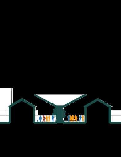
The Ashram Access Corridor culminates at the Ashram Bazaar, a vibrant marketplace lined with shopfronts that promote local crafts and handicrafts. This area serves as a platform for artisans, encouraging the preservation and growth of traditional skills while supporting the local economy. The bazaar fosters a lively cultural atmosphere, connecting seamlessly to the Sabarmati Ashram complex and supporting both commerce and community interaction.
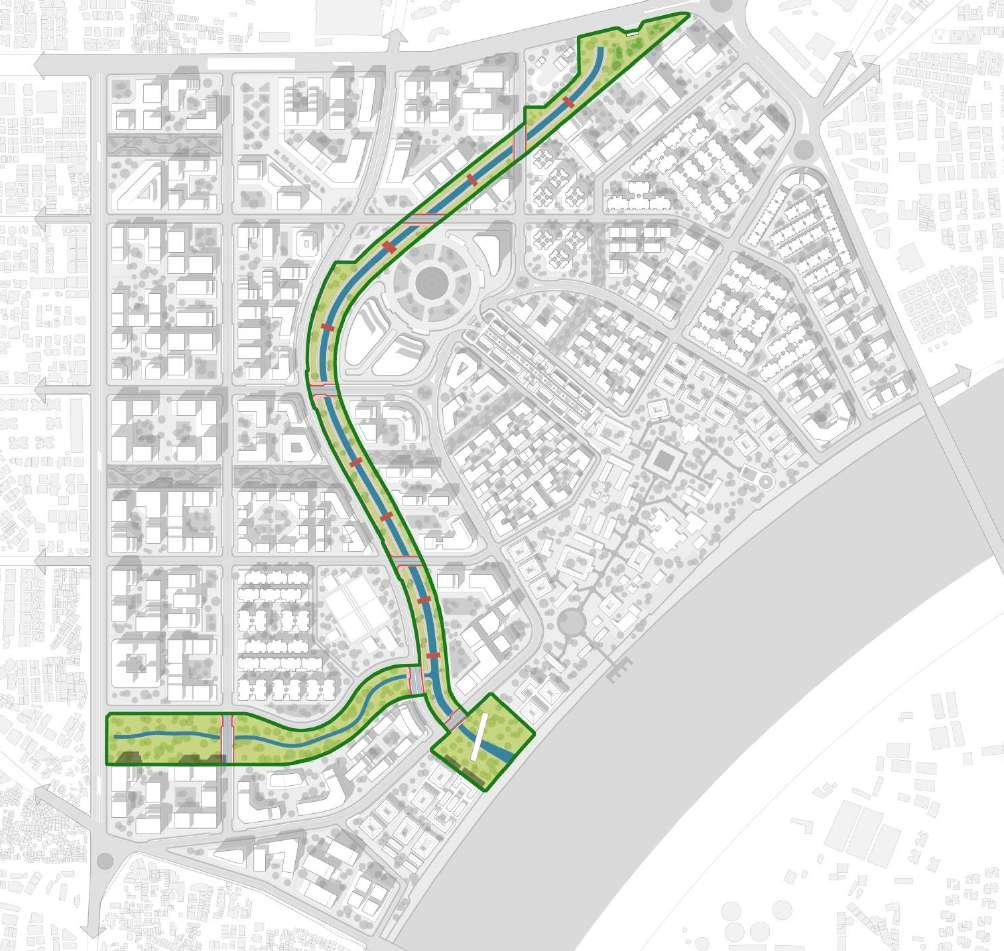
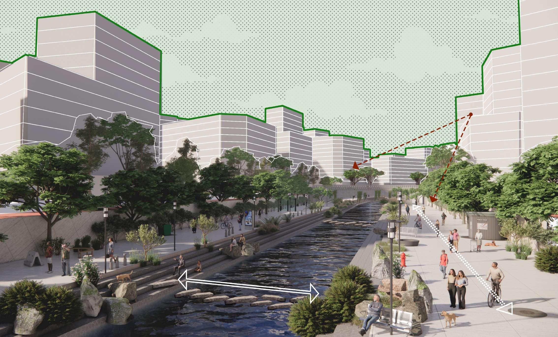
The Chandrabhaga Streamfront (57%) is a vital element of the master plan, built along the existing Chandrabhaga stream that flows through the site. Although the stream currently faces pollution challenges, it holds significant potential to become a key urban landmark, linking the site to the Sabarmati Riverfront. This streamfront will transform into a major spine of the master plan, offering a mix of activities and public spaces such as gardens, bus stops, recreational areas, and pedestrian bridges, making it a lively and functional urban space.
The streamfront not only strengthens the connection between the city and the Sabarmati Riverfront but also creates a dynamic environment for social interaction and environmental regeneration. It serves as a central axis for the master plan, promoting accessibility and enhancing the city’s public realm. By revitalizing the streamfront, the master plan aims to integrate ecological, recreational, and cultural functions, contributing to a more sustainable and vibrant urban landscape.
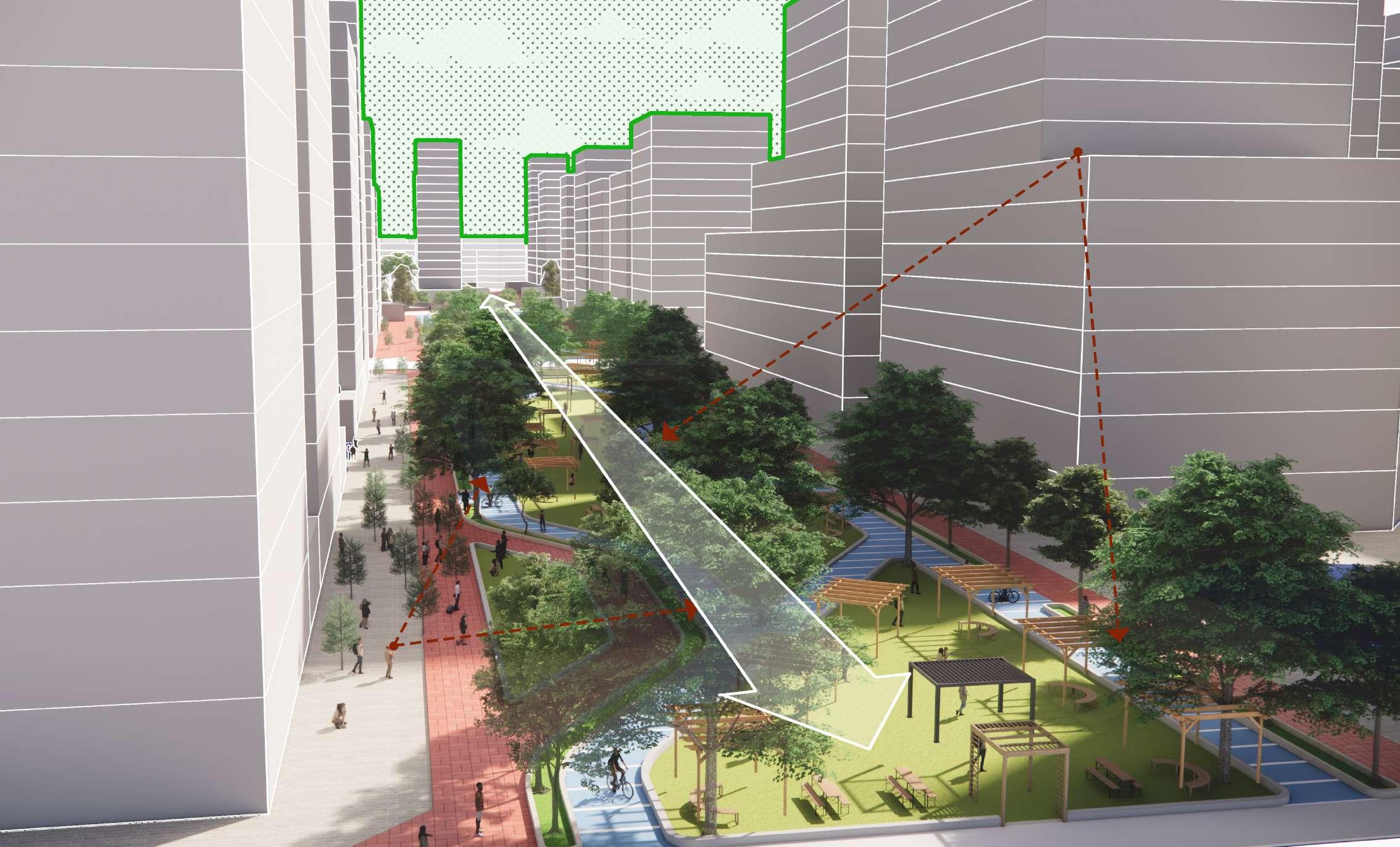
The Linear Parks (16%) form an essential part of the master plan, connecting the Chandrabhaga Streamfront with the Sabarmati Ashram and Riverfront. These parks act as feeders to the main urban spine, offering pedestrian and cycle trails that support daily life and mobility within the development. By incorporating green spaces with recreational areas, the linear parks provide much-needed public space for residents and visitors, creating a buffer between the built environment and the natural elements.
The integration of the Linear Parks with the Sabarmati Riverfront strengthens the connection to the existing public space and enhances the accessibility of the river. The addition of pedestrian ghats and a jetty for water-based transportation further enriches the user experience, encouraging more sustainable movement across the city. This design not only promotes physical connectivity but also aligns with the master plan’s vision of a sustainable, inclusive, and environmentally conscious urban development.
Author)
Author)
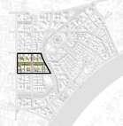
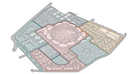
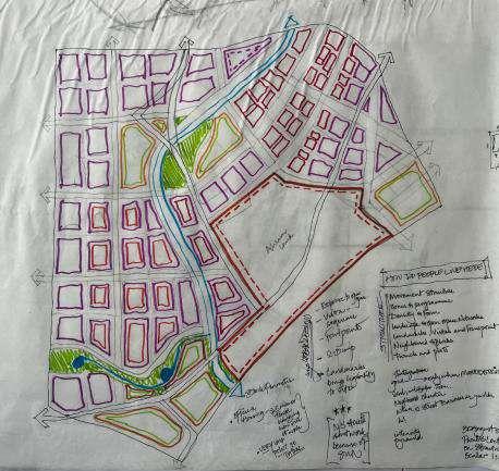
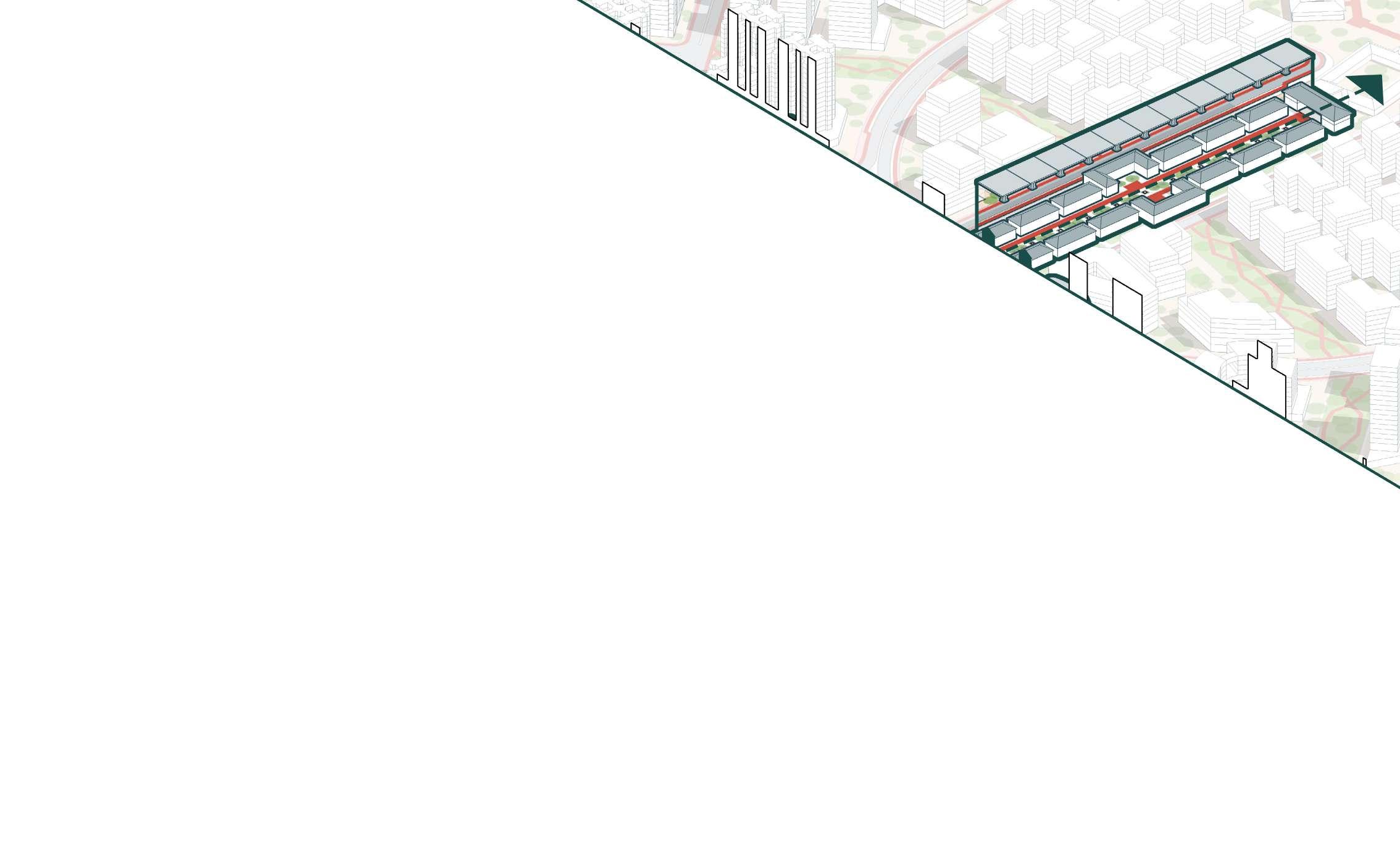
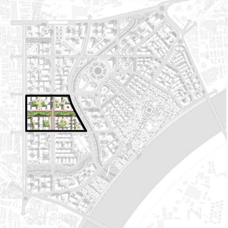
This urban block was selected due to its strategic location and connectivity. It lies within the TOD zone to the west, with the key Chandrabhaga Streamfront Road on the east, providing vital access within the master plan. Internal roads to the north and south further enhance connectivity. The block is also linked by linear parks leading to the Chandrabhaga Streamfront and Sabarmati Ashram, offering ecological and recreational value. Its mixed-use nature, combining residential, commercial, and cultural spaces, makes it an ideal area for a comprehensive urban development study.
(Source: Author)
Author)
2.3

The first phase focuses on building essential site infrastructure, including roads and service facilities, while enhancing the Sabarmati Ashram complex to preserve its heritage. It also involves revitalizing the Chandrabhaga Streamfront to create a sustainable blue-green corridor and developing the first phase of affordable housing to promote inclusive living. This phase lays the foundation for a balanced and sustainable transformation of the precinct.
6.6.2
Phase 2 focuses on enhancing connectivity with the Ashram Access Corridor and developing a city-level Convention Center as a cultural hub. It includes the second phase of affordable housing and activates key areas with buildings along the Chandrabhaga Streamfront and Ashram Corridor, integrating functionality with heritage and natural elements.

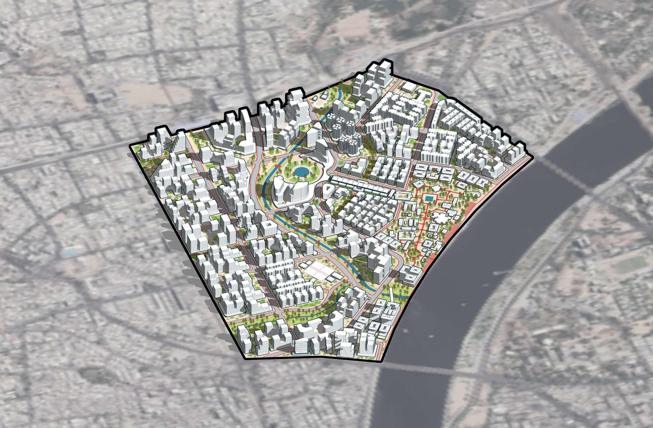
The master plan for the Sabarmati Ashram precinct envisions a sustainable, inclusive, and vibrant urban transformation, balancing ecology, heritage, and densification. By enhancing the Sabarmati Ashram complex, revitalizing the Chandrabhaga Streamfront, and integrating green infrastructure, the plan preserves the area’s historical and ecological significance. The inclusion of affordable housing, mixed-use developments, and a city-level Convention Center fosters community growth and economic vitality, while transit-oriented developments ensure connectivity and accessibility. Overall, the plan not only addresses the city’s urbanization challenges but also enriches its cultural and environmental fabric, creating a model for sustainable urban development. 6.6.1
The third phase focuses on leveraging transit-oriented development (TOD) with strategically located buildings to enhance connectivity and urban density. It includes the development of an Ashram Satellite Campus and associated institutes to extend the precinct’s cultural and educational footprint. Additionally, mixed-use and commercial developments are planned to create vibrant, self-sustaining spaces that balance economic activity with the precinct’s historical and cultural essence.
The studio’s masterplanning exercise offered invaluable insights into the principles of sustainable and inclusive urban design, fostering a comprehensive understanding of balancing growth with community and environmental priorities. The project emphasized integrating densification with heritage preservation, ensuring urban growth complemented rather than compromised cultural and historical identity. A strong focus was placed on leveraging transit-oriented development (TOD) to enhance accessibility and connectivity, while the incorporation of blue-green infrastructure showcased a forward-thinking approach to improving environmental resilience and addressing climate challenges.
Recognizing the complexities of urban regeneration, the exercise addressed the inclusion of informal settlements, highlighting the importance of equitable planning to promote social cohesion and integration. The process also honed critical skills in analyzing land-use transitions, understanding stakeholder dynamics, and interpreting economic trends.
Ultimately, these efforts unlocked the latent potential of underutilized urban spaces, exemplifying a holistic and multidisciplinary approach to reimagining urban environments for a sustainable and inclusive future.
Gehl, J. (2011). Life Between Buildings: Using Public Space. Washington, D.C.: Island Press.
Gordan, D. (2022). Canary Wharf’s transformation from planning disaster to London’s second business district. Queen’s University, 220-228. Retrieved from https://www.researchgate.net/publication/369425634
Abdel, H. (2022, May 26). Sanjaynagar Slum Redevelopment Project / Community Design Agency. ArchDaily. Retrieved from https://www.archdaily.com/982534/sanjaynagar-slum-rehabilitation-project
Urban Redevelopment Authority. (2023). Residential Handbook. Singapore. Retrieved from https://www.ura.gov.sg/Corporate/Guidelines/Development-Control
Sabarmati Riverfront Development Corporation Limited (SRFDCL). Sabarmati Riverfront: Reconnecting Ahmedabad to its River. Retrieved from https://sabarmatiriverfront.com/
Ghosh, S. (2017, March). Ramapir no Tekra - Looking Glass To Urban Poverty. Medium. Retrieved from https://medium.com/@sohinighosh/ramapir-no-tekra-looking-glass-to-urban-poverty-1d77ed439fe
Sharma, R. (2015, December). Smart city plan for Ahmedabad: Sabarmati Ashram area to get facelift, includes 8,000 slum dwellings. The Indian Express.

Thank you!