SKY BRIDGE In-flight Magazine has been published by Le magazine de bord SKY BRIDGE est publié par Media Publishing International N.V. P.O. Box 409, Philipsburg, Sint Maarten (Dutch Caribbean) Tel./Whatsapp: +1-721-527-5111
Avital engine of progress for any nation, air transport is even more so for the island states of the Caribbean. It’s not just about connecting dots on a map, it’s about bringing people closer, fueling economies, supporting tourism, facilitating trade and human exchange, and building a shared future. This belief has always guided our mission, captured in our motto: One Caribbean.
In today’s geopolitical climate, marked by global upheaval, the vulnerabilities of small island states have become more visible than ever. And yet, within these challenges lies a historic opportunity — the chance to forge true regional integration based on connectivity, cooperation, and solidarity. With 47 million people sharing common history, culture, natural resources, and challenges, the Caribbean can no longer afford fragmentation. It is time for a bold, coherent strategy to make intra-Caribbean mobility a right and a daily reality.
Sunrise Airways was born of this ambition. Over the past 13 years, we have carried millions of passengers, built a network spanning over 15 destinations, and brought together a team of more than 250 professionals representing 14 nationalities operating in 11 countries.
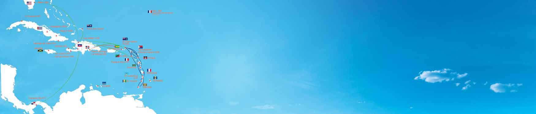
From Haiti to Miami and Panama, to the Eastern Caribbean including Saint Kitts, Antigua, Dominica, Saint Lucia, Guadeloupe, Saint Vincent, Grenada, Sint Maarten and Tortola, our network reflects a concrete, inclusive, and sustainable model of regional integration.
But our mission goes beyond transportation. Since the beginning, we’ve seen ourselves as a driver of social and cultural transformation. Through organizations like Société Audubon Haiti and Haiti National Trust, we support environmental initiatives that protect our region’s biodiversity. We also champion Caribbean culture, backing educational, artistic, and literary projects and celebrating music through Encuentro, a platform for a new regional musical expression.
To build this network is to offer the people of the Caribbean the freedom to move, to exchange, to innovate, and to dream together.
If you’re holding this magazine today, it means you’re traveling between two islands in our region and embodying, in your own way, a vibrant, connected Caribbean.
Thirteen years after our first flight, the vision of a borderless Caribbean sky is finally taking shape. And this is only the beginning.
Welcome aboard!
Gary Stone, Sunrise Airways CEO
Message du PDG
Moteur essentiel de croissance pour n’importe quel pays, le transport aérien est encore plus vital lorsqu’il s’agit d’une île des Caraïbes. Et il ne s’agit pas que de relier des points sur une carte, mais de rapprocher les gens, d’alimenter les économies, de soutenir le tourisme, de faciliter les échanges commerciaux et humains… de construire un futur commun. Ce constat est le phare qui guide la mission de Sunrise Airways depuis le tout premier jour et qui s’exprime à travers notre devise « One Caribbean ».
Dans le climat géopolitique actuel, marqué par de grands bouleversements mondiaux, la vulnérabilité de nos petites îles est plus visible que jamais. Et pourtant, à travers ces défis se présente une opportunité historique : la chance de forger une véritable intégration régionale, basée sur la connectivité, la coopération et la solidarité. Avec plus de 47 millions d’habitants qui partagent une histoire, une culture, des ressources naturelles et des challenges communs, les Caraïbes ne peuvent plus se permettre cette fragmentation. Il est temps d’adopter une stratégie cohérente pour faire de la mobilité intracaribéenne un droit et une réalité quotidienne.
Sunrise Airways est née de cette ambition. En 13 ans nous avons transporté des millions de passagers, développé un réseau vers plus de 15 destinations et composé une équipe de plus de 250 collaborateurs, de 14 nationalités différentes, dans 11 pays.
De Haïti à Miami et Panama, dans les Petites Antilles, dont St Kitt’s, Antigua, la Dominique et St Lucie, Guadeloupe, St Vincent, la Grenade, Sint
Maarten et Tortola, notre réseau reflète un modèle d’intégration régional concret, inclusif et durable.
Au-delà du transport aérien, nous avons depuis l’origine, considéré notre mission comme celle d’un acteur de transformation sociale et culturelle. A travers des organisations comme la Société Audubon Haïti et Haiti National Trust, nous soutenons les initiatives qui protègent l’environnement et la biodiversité de notre région. Nous valorisons également la culture caribéenne, en soutenant activement des projets éducatifs, artistiques et littéraires, et en célébrant la musique à travers « Encuentro », un creuset dédié à la création musicale caribéenne.
Créer et développer ce réseau, c’est offrir aux habitants de la Caraïbe la possibilité de bouger, d’échanger, d’innover et de rêver ensemble. Et si vous avez ce magazine entre les mains, c’est que vous voyagez entre deux îles de notre région et incarnez à votre manière une Caraïbe dynamique et connectée.
Treize ans plus tard, notre vision d’un ciel caribéen sans frontière est devenue une réalité. Et ce n’est que le début !
Bienvenue à bord !
Gary Stone CEO Sunrise Airways
History How it started
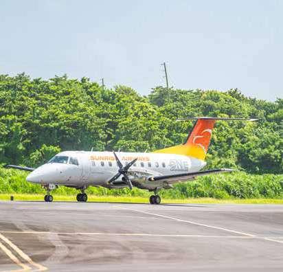
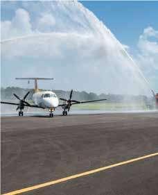
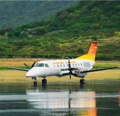
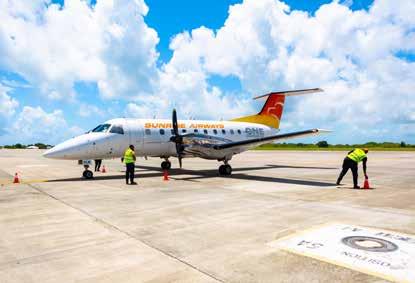
On December 21, 2012, the Sunrise Airways colors were proudly displayed for the first time on the aircraft’s fuselage, for the inaugural flight to Cap Haïtien.
In 2013, Sunrise Airways opened its first international route to Turks and Caicos, and a year later passed the 20,000-passenger mark, mainly thanks to the domestic market, with 3 19-seater aircraft. Then, in 2015, we exceeded 50,000 passengers with the opening of the PAP-Santo Domingo route.
Our fleet expanded in 2016, with the arrival of our first regional aircraft and the opening of our regular services to Cuba. From 80,000 passengers we have grown to 250,000 passengers a year in 2019, with an average of 24 weekly flights to Cuba. In 2018 with the acquisition of a Dominican airline we expanded our network and operated flights to Chile, Curacao and Orlando.
In 2020, the Covid 19 pandemic hit the entire sector hard. Cuba, our most important market, came to a halt overnight, and we suddenly lost over 150,000 passengers!
In 2021, by reinforcing our offer on the domestic market, we managed to carry 95,000 passengers, then to reach 180,000 passengers in 2022, despite the difficult political, economic and security context in Haiti.
This growth has been mainly driven by our flights to Jérémie and Les Cayes, now our top domestic destination, the Dominican Republic and the resumption of flights to Cuba.
In 2023, after opening Guadeloupe and Panama, two destinations that promote connections to Europe and South America, the need to consider a connection to Miami became increasingly apparent. In September 2023, Sunrise Airways began regular service to Miami.
In April 2024, Sunrise Airways entered the eastern part of the Caribbean region, developing a network between Antigua, Saint Kitts, Dominica and St Lucia. This network is currently being expanded.
Since October 2024, Cap Haïtien has become the busiest hub in our network, with almost 5000 passengers a week.
Histoire Comment tout a commence
Le 21 décembre 2012, les couleurs de Sunrise Airways se sont fièrement affichées pour la première fois sur le fuselage de l’avion, pour le vol inaugural vers le Cap Haïtien.
En 2013, Sunrise Airways ouvre sa première ligne internationale vers Turks and Caïcos, un an plus tard, le cap des 20.000 passagers est dépassé, principalement grâce au marché domestique, avec 3 avions de 19 places. Puis dès 2015 nous dépassions les 50.000 passagers après l’ouverture de la ligne PAP-Santo Domingo.
Notre flotte s’est étoffée en 2016, avec l’arrivée de nos premiers avions de transport régional et l’ouverture de nos dessertes régulières sur Cuba.
De 80.000 passagers nous sommes passés à 250.000 passagers par an en 2019, avec une moyenne de 24 vols hebdomadaires sur Cuba. En 2018 avec l’acquisition d’une ligne aérienne dominicaine nous avons étendu notre réseau et opéré des vols sur le Chili, Curaçao et Orlando.
En 2020, la pandémie du Covid 19 a frappé de plein fouet tout le secteur. Cuba, notre marché le plus important, s’est arrêté du jour au lendemain et nous avons brutalement perdu plus de 150.000 passagers !
En 2021, en renforçant notre offre sur le marché domestique, nous sommes parvenus à transporter 95.000 passagers puis à atteindre en 2022,180 000 passagers, malgré un contexte politique, économique et sécuritaire difficile en Haïti.
Cette croissance s’est majoritairement appuyée sur nos vols vers Jérémie ou Les Cayes, devenue
notre première destination nationale, la République Dominicaine et la reprise de vols sur Cuba.
En 2023 après avoir ouvert la Guadeloupe et Panama, deux destinations qui favorisent les connexions vers l’Europe et vers l’Amérique du Sud, le besoin de considérer la connexion avec Miami s’est fait sentir de façon de plus en plus forte. En septembre 2023, Sunrise Airways a commencé une liaison régulière avec Miami.
En avril 2024, Sunrise Airways s’est lancée sur la partie orientale de la région Caraïbes en développant un réseau entre Antigua, Saint Kitts, Dominica et St Lucia. Ce réseau est en cours d’expansion.
Depuis octobre 2024, Cap Haïtien est devenu le « hub » le plus actif de notre réseau, avec près de 5000 passagers par semaine.
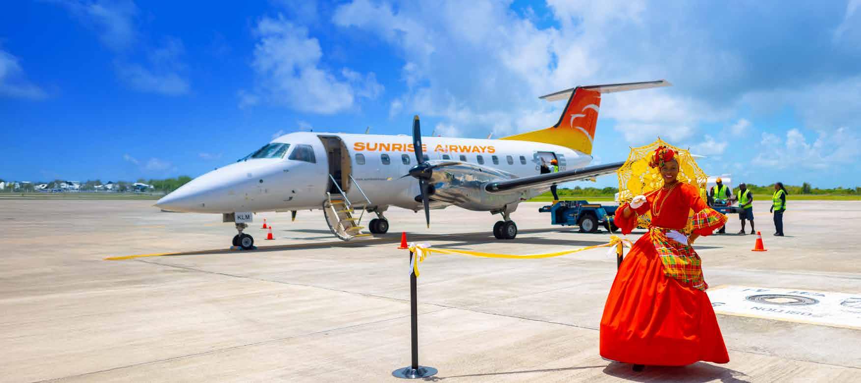
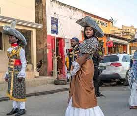
We fly to connect people
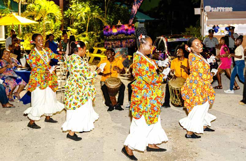
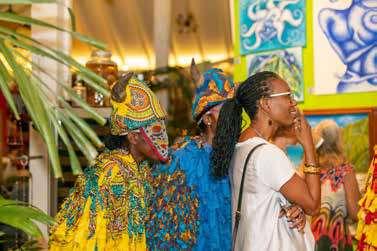
Photo by Watkins Multimedia for the Antigua and Barbuda Tourism Authority. Featuring RT Performers – Cultural Ambassadors of Antigua and Barbuda. Costume: Madame Fancy.
Antigua & Barbuda | Dominica | Grenada | Guadeloupe | Haiti | Miami | Panama
Santo Domingo | Saint Kitts | Saint Lucia | Saint Vincent & the Grenadines
Sint Maarten | Tortola | Turks and Caicos
Planning your next getaway?
Our Destinations Essentials Guide gives you the essentials you need to explore smarter, safer, and stress-free.
Essentials Guide Destinations
ANTIGUA & BARBUDA
CAPITAL
St. John’s SIZE
40 km² (170 sq mi)
POPULATION
102,658 (2018 estimate)
TIME ZONE
Atlantic Standard Time (UTC−4)
CURRENCY
Eastern Caribbean Dollar (XCD)
LOCATION
Antigua and Barbuda is located in the Caribbean Sea, specifically in the Lesser Antilles. It is situated to the east of Puerto Rico and the Virgin Islands, and to the west of Barbuda, which is part of the same nation. Antigua is the larger of the two main islands that make up the country of Antigua and Barbuda. Its
geographical coordinates are approximately 17.0608° N latitude and 61.8004° W longitude.
OFFICIAL LANGUAGE
English
CLIMATE
Antigua and Barbuda has a tropical maritime climate characterized by warm temperatures and moderate humidity throughout the year.
AIRPORT
V.C. Bird International Airport (ANU), Osbourn
TOURISM OFFICE
Antigua and Barbuda Tourism Authority
Redcliffe Quay, St. John’s, Antigua
+1 268-562-7600
www.visitantiguabarbuda.com
Vous planifiez votre prochaine escapade ?
Notre Destinations Guide
Essentiel incontournables vous fournit les informations essentielles dont vous avez besoin pour explorer de manière plus intelligente, plus sûre et sans stress.
Destinations
Guide Essentiel
CAPITALE
Saint John’s
SUPERFICIE
440 km² (170 mi²)
POPULATION
102 658 habitants (estimation 2018)
FUSEAU HORAIRE
Heure normale de l’Atlantique (UTC−4)
MONNAIE
Dollar des Caraïbes orientales (XCD)
EMPLACEMENT
Antigua-et-Barbuda est situé dans la mer des Caraïbes, plus précisément dans les Petites Antilles. Il se trouve à l’est de Porto Rico et des îles Vierges, et à l’ouest de Barbuda, qui fait partie de la même nation. Antigua est la plus grande des deux îles principales qui composent le pays d’Antigua-et-Barbuda. Ses
coordonnées géographiques sont d’environ 17.0608° N de latitude et 61.8004° W de longitude.
LANGUE OFFICIELLE
Anglais
CLIMAT
Antigua-et-Barbuda a un climat maritime tropical caractérisé par des températures chaudes et une humidité modérée tout au long de l’année.
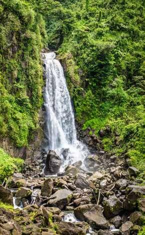
Dominica is an island nation located in the Caribbean Sea, specifically in the Lesser Antilles. It is situated to the north of Martinique and to the south of Guadeloupe. It’s geographical coordinates are approximately 15.4150° N latitude and 61.3710° W longitude.
OFFICIAL LANGUAGE
English
CLIMATE
Dominica has a tropical rainforest climate, characterized by warm temperatures, high humidity, and significant rainfall throughout the year. Dominica’s lush vegetation and diverse ecosystems are a result of its abundant rainfall and tropical climate, making it a popular destination for eco-tourism and nature enthusiasts.
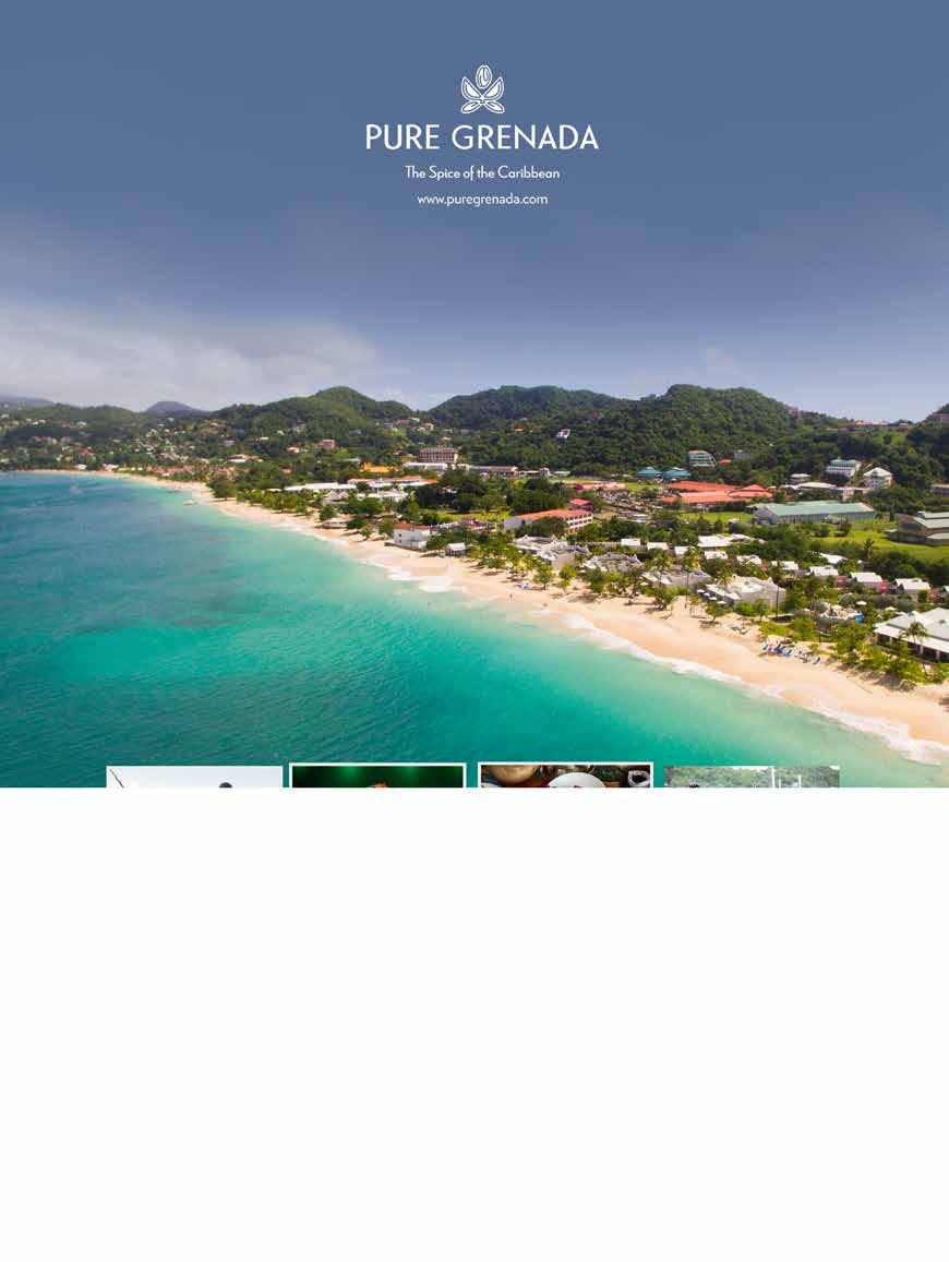
Grenada is located in the Caribbean Sea, specifically in the Lesser Antilles. It lies to the north of Venezuela and is situated approximately 100 miles (160 kilometers) north of the coast of South America. The country consists of the main island of Grenada and several smaller islands, including Carriacou and Petite Martinique.
OFFICIAL LANGUAGE
English
CLIMATE
Grenada has a tropical climate characterized by warm temperatures and high humidity throughout the year. The average temperature typically ranges from 24°C to 30°C (75°F to 86°F). The island experiences a wet season from June to December, with the potential for tropical storms and hurricanes, particularly from August to October. The dry season runs from January to May, offering more stable weather conditions.
AIRPORT
Maurice Bishop International Airport (GND), St. George’s
TOURISM OFFICE
Grenada Tourism Authority Burns Point, St. George’s, Grenada +1 473-440-2001 info@puregrenada.com
LA DOMINIQUE
CAPITALE
Roseau
SUPERFICIE
750 km² (290 mi²)
POPULATION
72 000 (estimation de 2023)
FUSEAU HORAIRE
Heure normale de l’Est (UTC−5)
MONNAIE
Dollar des Caraïbes orientales (XCD)
EMPLACEMENT
La Dominique est une nation insulaire située dans la mer des Caraïbes, plus précisément dans les Petites Antilles. Elle se trouve au nord de la Martinique et au sud de la Guadeloupe. Ses coordonnées géographiques sont d’environ 15.4150° N de latitude et 61.3710° W de longitude.
LANGUE OFFICIELLE
Anglais
CLIMAT
La Dominique a un climat de forêt tropicale, caractérisé par des températures chaudes, une humidité élevée et des précipitations significatives tout au long de l’année. La végétation luxuriante et les écosystèmes diversifiés de la Dominique sont le résultat de ses abondantes pluies et de son climat tropical, ce qui en fait une destination populaire pour l’écotourisme et les amateurs de nature.
La Grenade est située dans la mer des Caraïbes, plus précisément dans les Petites Antilles. Elle se trouve au nord du Venezuela et est située à environ 100 miles (160 kilomètres) au nord de la côte de l’Amérique du Sud. Le pays se compose de l’île principale de la Grenade et de plusieurs îles plus petites, y compris Carriacou et Petite Martinique.
LANGUE OFFICIELLE
Anglais
CLIMAT
La Grenade a un climat tropical caractérisé par des températures chaudes et une humidité élevée tout au long de l’année. La température moyenne varie généralement de 24 °C à 30 °C (75 °F à 86 °F). L’île connaît une saison humide de juin à décembre, avec un potentiel de tempêtes tropicales et d’ouragans, en particulier d’août à octobre. La saison sèche s’étend de janvier à mai, offrant des conditions météorologiques plus stables.
AÉROPORT
Aéroport international Maurice Bishop (GND), Saint-Georges
OFFICE DU TOURISME
Bureau du tourisme Autorité du tourisme de la Grenade Burns Point, Saint-Georges, Grenade +1 473-440-2001 info@puregrenada.com
GUADELOUPE
CAPITAL
Pointe-à-Pitre
SIZE
1,628 km² (629 sq mi)
POPULATION
378,561 (2024 estimate)
TIME ZONE
Atlantic Standard Time (UTC−4)
CURRENCY
Euro (EUR)
LOCATION
Guadeloupe is an archipelago located in the Caribbean Sea, part of the Lesser Antilles. It is situated to the southeast of Puerto Rico and to the northwest of Dominica. The main island of Guadeloupe is shaped like a butterfly and consists of two main islands, Grande-Terre and Basse-Terre, along with several smaller islands. Its geographical coordinates are approximately
CAPITAL
Port-au-Prince
SIZE
27,750 km² (10,714 sq mi)
POPULATION
11.4 million (2024 estimate)
TIME ZONE
Eastern Standard Time (UTC−5)
CURRENCY
Haitian Gourde (HTG)
LOCATION
Haiti is located in the Caribbean region of North America. It occupies the western part of the island of Hispaniola, which it shares with the Dominican Republic to the east. Its geographical coordinates are approximately 18.9712° N latitude and 72.2852° W longitude.
OFFICIAL LANGUAGE
French and Haitian Creole
CLIMATE
Haiti has a tropical climate with two main seasons: a wet season and a
16.2650° N latitude and 61.5510° W longitude. Guadeloupe is an overseas region of France.
OFFICIAL LANGUAGE
French and Guadeoupe Creole
CLIMATE
Guadeloupe has a tropical climate tempered by maritime influences and the Trade Winds. There are two seasons, the dry season called “Lent” from January to June, and the wet season called “winter”, from July to December.
AIRPORT
Pointe-à-Pitre International Airport (PTP), Les Abymes.
TOURISM OFFICE
Comité du Tourisme des Îles de Guadeloupe 5 Square de la Banque, Pointe-à-Pitre, Guadeloupe +590 590 82 09 30 www.guadeloupe-islands.com
dry season. The wet season typically runs from April to October, bringing heavy rainfall, particularly in the mountainous regions. The dry season occurs from November to March, with lower humidity and less precipitation. Due to its geographical location, Haiti is also susceptible to hurricanes and tropical storms, especially during the Atlantic hurricane season from June to November. The country’s climate can significantly impact agriculture, water resources, and overall economic stability.
AIRPORTS
Cap-Haïtien International Airport (CAP)
Les Cayes Airport (CYA)
Toussaint Louverture International Airport (PAP), Port-au-Prince
TOURISM OFFICE
Ministère du Tourisme, 8, Rue Legitime, Port-au-Prince, Haiti +509 2990 1111 info@haititourisme.gouv.ht
GUADELOUPE
CAPITALE
Pointe-à-Pitre
SUPERFICIE
1 628 km² (629 mi²)
POPULATION
378 561 (estimation 2024)
FUSEAU HORAIRE
Heure normale de l’Atlantique (UTC-4)
MONNAIE
Euro (EUR)
EMPLACEMENT
La Guadeloupe est un archipel situé dans la mer des Caraïbes, qui fait partie des Petites Antilles. Elle se trouve au sud-est de Porto Rico et au nord-ouest de la Dominique. L’île principale de la Guadeloupe a la forme d’un papillon et se compose de deux îles principales, Grande-Terre et Basse-Terre, ainsi que de plusieurs îles plus petites. Ses coordonnées géographiques sont
CAPITALE
Port-au-Prince
SUPERFICIE
27 750 km² (10 714 mi²)
POPULATION
11,4 millions (estimation 2024)
FUSEAU HORAIRE
Heure normale de l’Est (UTC-5)
MONNAIE
Gourde haïtienne (HTG)
EMPLACEMENT
Haïti est situé dans la région des Caraïbes, en Amérique du Nord. Il occupe la partie occidentale de l’île d’Hispaniola, qu’il partage avec la République dominicaine à l’est. Ses coordonnées géographiques sont approximativement 18,9712° de latitude nord et 72,2852° de longitude ouest.
LANGUE OFFICIELLE
Français et créole haïtien
CLIMAT
Haïti a un climat tropical avec deux saisons principales : une saison humide et une saison sèche. La
approximativement 16,2650° de latitude nord et 61,5510° de longitude ouest. La Guadeloupe est une région d’outre-mer française.
LANGUE OFFICIELLE
Français et créole guadeloupéen
CLIMAT
La Guadeloupe bénéficie d’un climat tropical tempéré par les influences maritimes et les alizés. Il y a deux saisons, la saison sèche appelée « Carême » de janvier à juin, et la saison humide appelée « hiver », de juillet à décembre.
AÉROPORT
Aéroport international de Pointe-à-Pitre (PTP), Les Abymes.
OFFICE DU TOURISME
Comité du Tourisme des Îles de Guadeloupe
5 Square de la Banque, Pointe-à-Pitre, Guadeloupe +590 590 82 09 30 www.guadeloupe-islands.com
saison humide s’étend généralement d’avril à octobre et apporte de fortes précipitations, en particulier dans les régions montagneuses. La saison sèche s’étend de novembre à mars, avec une humidité plus faible et moins de précipitations. En raison de sa situation géographique, Haïti est également exposé aux ouragans et aux tempêtes tropicales, en particulier pendant la saison des ouragans dans l’Atlantique, de juin à novembre. Le climat du pays peut avoir un impact significatif sur l’ l’agriculture, les ressources en eau et la stabilité économique générale.
AÉROPORTS
Aéroport international du Cap-Haïtien (CAP)
Aéroport des Cayes (CYA)
Aéroport international Toussaint Louverture (PAP), Port-au-Prince
OFFICE DU TOURISME
Ministère du Tourisme, 8, Rue Legitime, Port-au-Prince, Haïti +509 2990 1111 info@haititourisme.gouv.ht
PANAMA
SANTO DOMINGO
CAPITAL
Panama City
SIZE
75,417 km² (29,119 sq mi)
POPULATION
4.38 million (2025 estimate)
TIME ZONE
Eastern Standard Time (UTC−5)
CURRENCY
Balboa (PAB) and United States Dollar (USD)
LOCATION
Panama is located in Central America, bordered by the Caribbean Sea to the north and the Pacific Ocean to the south. It is situated between Costa Rica to the west and Colombia to the southeast. The country is known for the Panama Canal, which connects the Atlantic and Pacific Oceans. Its geographical coordinates are approximately 8.9824° N latitude
and 79.5199° W longitude.
OFFICIAL LANGUAGE
The official language of Panama is Spanish. It is the most widely spoken language in the country and is used in government, education, and daily communication. Additionally, there are various indigenous languages spoken by some communities.
CLIMATE
Panama has a tropical climate characterized by high temperatures and humidity throughout the year. The country experiences two main seasons: a wet season and a dry season.
AIRPORT
Tocumen International Airport (PTY), Panama City.
TOURISM OFFICE
Autoridad de Turismo de Panamá, Plaza Edison, El Cangrejo, Panama City +507 526-7000 www.tourismpanama.com
CAPITAL
Santo Domingo
SIZE
48,671 km² (18,792 sq mi)
POPULATION
10.8 million (2024 estimate)
TIME ZONE
Atlantic Standard Time (UTC−4)
CURRENCY
Dominican Peso (DOP)
LOCATION
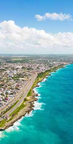
Santo Domingo is located in the southern part of the Dominican Republic, on the Caribbean coast. It is situated along the banks of the Ozama River and is the capital and largest city of the country. Santo Domingo is approximately 150 miles (240 kilometers) west of Puerto Rico and is known for its rich history and cultural significance, being the oldest continuously inhabited European settlement in the Americas. Its geographical
coordinates are approximately 18.4861° N latitude and 69.9312° W longitude.
OFFICIAL LANGUAGE
Spanish
CLIMATE
Santo Domingo has a tropical savanna climate, characterized by warm temperatures and distinct wet and dry seasons.
AIRPORTS
Las Américas International Airport (SDQ)
La Isabela International Airport (JBQ)
TOURISM OFFICE
Ministry of Tourism of the Dominican Republic Ave. Cayetano Germosén, Santo Domingo, Dominican Republic +1 809-221-4660 godominicanrepublic.com
PANAMA
SANTO DOMINGO RÉPUBLIQUE DOMINICAINE
CAPITALE
Panama City
SUPERFICIE
75 417 km² (29 119 mi²)
POPULATION
4,38 millions (estimation 2025)
FUSEAU HORAIRE
Heure normale de l’Est (UTC-5)
MONNAIE
Balboa (PAB) et dollar américain (USD)
EMPLACEMENT
Le Panama est situé en Amérique centrale, bordé par la mer des Caraïbes au nord et l’océan Pacifique au sud. Il est situé entre le Costa Rica à l’ouest et la Colombie au sud-est. Le pays est connu pour le canal de Panama, qui relie l’océan Atlantique et l’océan Pacifique. Ses coordonnées géographiques sont approximativement 8,9824° de latitude nord et 79,5199° de longitude ouest.
LANGUE OFFICIELLE
La langue officielle du Panama est l’espagnol. C’est la langue la plus parlée dans le pays et elle est utilisée dans l’administration, l’éducation et la communication quotidienne.
En outre, plusieurs langues indigènes sont parlées par certaines communautés.
CLIMAT
Le Panama bénéficie d’un climat tropical caractérisé par des températures élevées et une forte humidité tout au long de l’année.
Le pays connaît deux saisons principales : une saison humide et une saison sèche.
AÉROPORT
Aéroport international de Tocumen (PTY), Panama City.
OFFICE DU TOURISME
Autoridad de Turismo de Panamá, Plaza Edison, El Cangrejo, Panama City +507 526-7000 www.tourismpanama.com
CAPITALE
Santo Domingo
SUPERFICIE
48 671 km² (18 792 mi²)
POPULATION
10,8 millions (estimation 2024)
FUSEAU HORAIRE
Heure normale de l’Atlantique (UTC-4)
MONNAIE
Peso dominicain (DOP)
EMPLACEMENT
Santo Domingo est située dans le sud de la République dominicaine, sur la côte caraïbe. Elle se trouve sur les rives du fleuve Ozama et est la capitale et la plus grande ville du pays. Santo Domingo se trouve à environ 240 kilomètres à l’ouest de Porto Rico et est connue pour sa riche histoire et son importance culturelle, étant la plus ancienne colonie européenne continuellement habitée des Amériques. Ses
coordonnées géographiques sont d’environ 18,4861° de latitude nord et 69,9312° de longitude ouest.
LANGUE OFFICIELLE
Espagnol
CLIMAT
Santo Domingo bénéficie d’un climat tropical de savane, caractérisé par des températures chaudes et des saisons humides et sèches distinctes.
AÉROPORTS
Aéroport international Las Américas (SDQ)
Aéroport international La Isabela (JBQ)
OFFICE DU TOURISME
Ministère du Tourisme de la République dominicaine
Ave. Cayetano Germosén, Santo Domingo République dominicaine +1 809-221-4660 godominicanrepublic.com
SAINT KITTS & NEVIS
CAPITAL Basseterre
SIZE
261 km² (101 sq mi)
POPULATION
53,000 (2023 estimate)
TIME ZONE
Atlantic Standard Time (UTC−4)
CURRENCY
Eastern Caribbean Dollar (XCD)
LOCATION
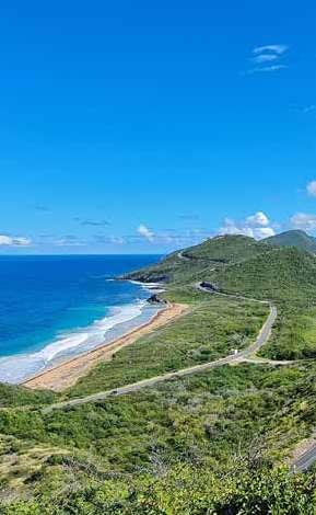
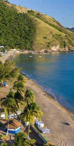
Saint Kitts, officially known as Saint Christopher Island, is located in the Caribbean Sea, specifically in the Lesser Antilles. It is situated to the west of Antigua and Barbuda and to the southeast of Saint Eustatius. Saint Kitts is part of the Federation of Saint Kitts and Nevis, which includes the nearby island of Nevis. Its geographical coordinates are
CAPITAL Castries
SIZE
617 km² (238 sq mi)
POPULATION
184,000 (2023 estimate)
TIME ZONE
Atlantic Standard Time (UTC−4)
CURRENCY
Eastern Caribbean Dollar (XCD)
LOCATION
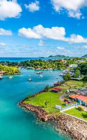
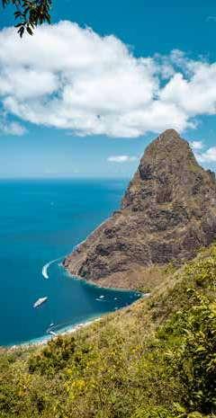
Saint Lucia is an island nation located in the eastern Caribbean Sea, part of the Lesser Antilles. It is situated to the north of Saint Vincent and the Grenadines and to the south of Martinique. The island is known for its stunning natural beauty, including the famous Pitons, which are two volcanic spires that rise dramatically from the sea. Its geographical coordinates are approximately 13.9094° N latitude and 60.9789° W longitude.
approximately 17.3578° N latitude and 62.7830° W longitude.
OFFICIAL LANGUAGE
English
CLIMATE
Saint Kitts has a tropical climate characterized by warm temperatures and moderate humidity throughout the year. Saint Kitts enjoys a warm and sunny climate, making it a popular destination for tourists seeking beach and outdoor experiences.
AIRPORT
Robert L. Bradshaw International Airport (SKB), Basseterre
TOURISM OFFICE
Saint Kitts Tourism Authority P.O. Box 132, Pelican Mall Basseterre, St. Kitts +1 869-465-4040 www.visitstkitts.com
OFFICIAL LANGUAGE
English
THINGS TO DO
Saint Lucia offers a variety of activities and attractions for visitors, showcasing its natural beauty, rich culture, and vibrant history. Here are some popular things to do in Saint Lucia: relax on the beaches, explore the Sulphur Springs, visit the Botanical Gardens, take a Catamaran cruise, snorkeling and diving, visit Pigeon Island National Park, experience local cuisine, etc.
CLIMATE
Saint Lucia has a tropical climate characterized by warm temperatures and high humidity throughout the year.
AIRPORT
Hewanorra International Airport (UVF), Vieux Fort
TOURISM OFFICE
1 Bella Rosa Rd., Gros Islet, P.O. Box 221, Castries, Saint Lucia +1 758-458-7101 tic@stlucia.org
SAINT KITTS ET NEVIS
CAPITALE
Basseterre
SUPERFICIE
261 km² (101 mi²)
POPULATION
53 000 habitants (estimation 2023)
FUSEAU HORAIRE
Heure normale de l’Atlantique (UTC−4)
MONNAIE
Dollar des Caraïbes orientales (XCD)
EMPLACEMENT
Saint Kitts et Nevis, officiellement connu sous le nom de Saint-Christophe-et-Niévès, est situé dans la mer des Caraïbes, plus précisément dans les Petites Antilles. Il se trouve à l’ouest d’Antigua-et-Barbuda et au sud-est de Saint-Eustache. Saint Kitts et Nevis fait partie de la Fédération de Saint Kitts et Nevis, qui comprend l’île voisine de Niévès. Ses coordonnées géographiques
CAPITALE
Castries
SUPERFICIE
617 km² (238 mi²)
POPULATION
184 000 habitants (estimation 2023)
FUSEAU HORAIRE
Heure normale de l’Atlantique (UTC-4)
MONNAIE
Dollar des Caraïbes orientales (XCD)
EMPLACEMENT
Sainte-Lucie est un État insulaire située dans l’est de la mer des Caraïbes, qui fait partie des Petites Antilles. Elle se trouve au nord de SaintVincent-et-les-Grenadines et au sud de la Martinique. L’île est connue pour sa beauté naturelle époustouflante, notamment les célèbres Pitons, deux pics volcaniques qui s’élèvent de manière spectaculaire au-dessus de la mer. Ses coordonnées géographiques sont environ 13,9094° de latitude nord et 60,9789° de longitude ouest.
sont environ 17,3578° de latitude nord et 62,7830° de longitude ouest.
LANGUE OFFICIELLE
Anglais
CLIMAT
Saint Kitts et Nevis bénéficie d’un climat tropical caractérisé par des températures chaudes et une humidité modérée tout au long de l’année. Saint Kitts et Nevis jouit d’un climat chaud et ensoleillé, ce qui en fait une destination prisée des touristes à la recherche d’expériences balnéaires et de plein air.
AÉROPORT
Aéroport international Robert L. Bradshaw (SKB), Basseterre
OFFICE DU TOURISME
Office du tourisme de Saint-Kitts P.O. Box 132, Pelican Mall Basseterre, St. Kitts +1 869-465-4040 www.visitstkitts.com
LANGUE OFFICIELLE
Anglais
THINGS TO DO
Sainte-Lucie offre une multitude d’ activités et d’attractions aux visiteurs, mettant en valeur sa beauté naturelle, sa riche culture et son histoire passionnante. Voici quelques activités populaires à Sainte-Lucie : se détendre sur les plages, explorer les sources sulfureuses, visiter les jardins botaniques, faire une croisière en catamaran, faire de la plongée avec tuba ou sous-marine, visiter le parc national de Pigeon Island, découvrir la cuisine locale, etc.
CLIMAT
Sainte-Lucie bénéficie d’un climat tropical caractérisé par des températures chaudes et une forte humidité tout au long de l’année.
AÉROPORT
Aéroport international Hewanorra (UVF), Vieux Fort
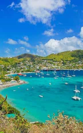
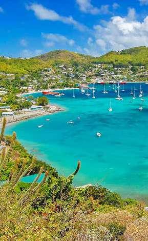
Saint Vincent and the Grenadines is located in the Caribbean Sea. The island is known for its lush landscapes, volcanic mountains, and vibrant culture. Saint Vincent and the Grenadines is located at approximately 13.2528° N latitude and 61.1971° W longitude
CAPITAL Philipsburg
SIZE
34 km² (13 sq mi)
POPULATION
58,477 (2023 estimate)
TIME ZONE
Atlantic Standard Time (UTC−4)
CURRENCY
Caribbean Guilder (XCG)
LOCATION
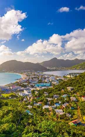
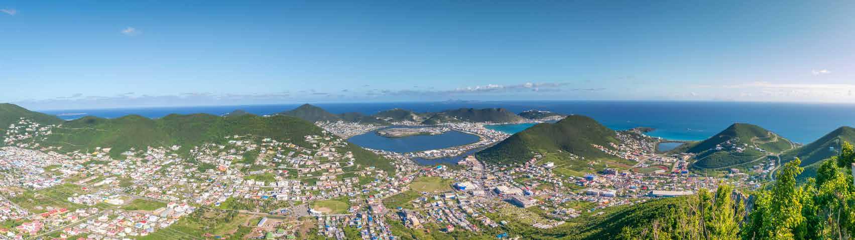
Sint Maarten is located in the Caribbean, specifically in the Lesser Antilles. It occupies the southern part of the island of Saint Martin, which it shares with the French overseas collectivity of Saint Martin to the north. Sint Maarten is situated east of Puerto Rico and northwest of Anguilla. Its geographical coordinates are approximately 18.0425° N latitude and 63.0581° W longitude.
OFFICIAL LANGUAGE
English
CLIMATE
Saint Vincent and the Grenadines has a tropical climate characterized by warm temperatures and high humidity year long. The average temperature typically ranges from 24°C to 30°C (75°F to 86°F).
AIRPORT
Argyle International Airport (SVD), Argyle
TOURISM OFFICE
SVG Tourism Authority 2nd Floor, NIS Building, Upper Bay Street, Kingstown, St. Vincent +1 784-457-1502 tourism@gov.vc
OFFICIAL LANGUAGE
Dutch and English
AIRPORT
Princess Juliana International Airport (SXM), located in Simpson Bay.
CLIMATE
Sint Maarten has a tropical maritime climate, characterized by warm temperatures and relatively high humidity throughout the year. The average temperature typically ranges from 24°C (75°F) to 31°C (88°F). The island experiences a wet season from May to November. The dry season runs from December to April, offering more stable weather conditions and lower humidity. Overall, Sint Maarten enjoys plenty of sunshine, making it a popular destination for tourists year-round.
TOURISM OFFICE
St. Maarten Tourism Board Juancho Yrausquin Blvd #6, Philipsburg, Sint Maarten +1 721-542-2337 www.vacationstmaarten.com
SAINT-VINCENTET-LES GRENADINES
CAPITALE
Kingstown
SUPERFICIE
389 km² (150 mi²)
POPULATION
110 000 habitants (estimation 2023)
FUSEAU HORAIRE
Heure normale de l’Atlantique (UTC-4)
MONNAIE
Dollar des Caraïbes orientales (XCD)
EMPLACEMENT
Saint-Vincent-et-les-Grenadines est situé dans la mer des Caraïbes. L’île est connue pour ses paysages luxuriants, ses montagnes volcaniques et sa culture dynamique. Saint-Vincent-etles-Grenadines est situé à environ 13,2528° de latitude nord et
CAPITALE
Philipsburg
SUPERFICIE
34 km² (13 mi²)
POPULATION
58 477 habitants (estimation 2023)
FUSEAU HORAIRE
Heure normale de l’Atlantique (UTC−4)
MONNAIE
Florin des Caraïbes (XCG)
EMPLACEMENT
Sint Maarten est située dans les Caraïbes, plus précisément dans les Petites Antilles. Elle occupe la partie sud de l’île de Saint-Martin, qu’elle partage avec la collectivité d’outre-mer française de Saint-Martin au nord. Sint Maarten est située à l’est de Porto Rico et au nordouest d’Anguilla. Ses coordonnées géographiques sont approximativement 18,0425° de latitude nord et 63,0581° de longitude ouest.
LANGUE OFFICIELLE
Néerlandais et anglais
61,1971° de longitude ouest.
LANGUE OFFICIELLE
Anglais
CLIMAT
Saint-Vincent-et-les-Grenadines bénéficie d’un climat tropical caractérisé par des températures chaudes et une forte humidité tout au long de l’année. La température moyenne varie généralement entre 24 °C et 30 °C (75 °F et 86 °F).
AÉROPORT
Aéroport international d’Argyle (SVD), Argyle
OFFICE DU TOURISME
SVG Tourism Authority
2e étage, NIS Building, Upper Bay Street, Kingstown, Saint-Vincent +1 784-457-1502 tourism@gov.vc
AÉROPORT
Aéroport international Princess Juliana (SXM), situé à Simpson Bay.
CLIMAT
Sint Maarten bénéficie d’un climat tropical maritime, caractérisé par des températures chaudes températures chaudes et une humidité relativement élevée tout au long de l’année. La température moyenne varie généralement entre 24 °C (75 °F) et 31 °C (88 °F). L’île connaît une saison humide de mai à novembre. La saison sèche s’étend de décembre à avril, offrant des conditions météorologiques plus stables et une humidité plus faible. Dans l’ensemble, Sint Maarten bénéficie d’un ensoleillement généreux, ce qui en fait une destination touristique prisée tout au long de l’année.
OFFICE DU TOURISME
Office du tourisme de Saint-Martin Juancho Yrausquin Blvd #6, Philipsburg, Saint-Martin +1 721-542-2337 www.vacationstmaarten.com
USA, MIAMI
CAPITAL
Tallahassee (State Capital)
SIZE
Area: 143.1 km² (55.3 sq mi)
POPULATION
442,241 (2020 census)
TIME ZONE
Eastern Standard Time (UTC−5)
CURRENCY
United States Dollar (USD)
LOCATION
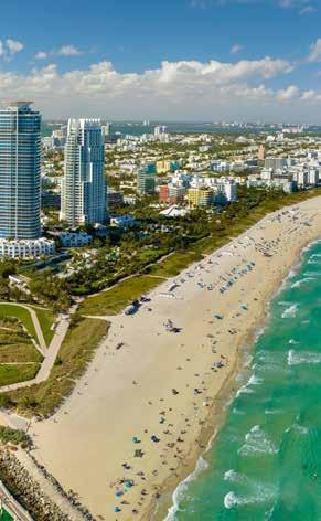
Miami is located in the southeastern part of the state of Florida, in the United States. It is situated on the Atlantic coast, approximately 20 miles (32 kilometers) south of Fort Lauderdale and about 110 miles (177 kilometers) north of Key West. Its geographical coordinates are approximately 25.7617° N latitude and 80.1918° W longitude.
OFFICIAL LANGUAGE
English
CLIMATE
Miami has a tropical monsoon climate, characterized by hot, humid summers and warm, dry winters. Miami enjoys a sunny climate year-round, making it a popular destination for tourists seeking warm weather.
AIRPORT
Miami International Airport (MIA), Miami
TOURISM OFFICE
Greater Miami Convention & Visitors Bureau 701 Brickell Avenue, Suite 2700, Miami, FL 33131 +1 305-539-3000 www.miamiandbeaches.com
TURKS & CAICOS ISLANDS
CAPITAL Cockburn Town (on Grand Turk Island)
SIZE
948 km² (366 sq mi)
POPULATION
45,000 (2024 estimate)
TIME ZONE
Eastern Standard Time (UTC -5)
CURRENCY
United States Dollar (USD)
LOCATION
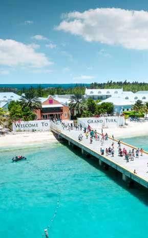
The Turks and Caicos Islands are located in the Caribbean, specifically to the southeast of the Bahamas and north of Hispaniola. They are situated approximately 575 miles (925 kilometers) east of Miami, Florida. The islands are known for their beautiful beaches and clear turquoise waters. The geographical coordinates of the Turks and Caicos Islands are approximately 21.75° N latitude and 71.58° W longitude.
OFFICIAL LANGUAGE
English
CLIMATE
The climate is classified as tropical, characterized by warm temperatures and a relatively dry environment. The islands experience two main seasons: a dry season from December to April and a wet season from May to November. Average temperatures typically range from 75°F (24°C) to 90°F (32°C) throughout the year.
Miami est située dans le sud-est de l’État de Floride, aux États-Unis. Elle se trouve sur la côte atlantique, à environ 32 kilomètres au sud de Fort Lauderdale et à environ 177 kilomètres au nord de Key West. Ses coordonnées géographiques sont environ 25,7617° de latitude nord et 80,1918° de longitude ouest.
CAPITAL
Cockburn Town (sur l’île de Grand Turk)
SUPERFICIE
948 km² (366 mi²)
POPULATION
45 000 habitants (estimation 2024)
FUSEAU HORAIRE
Heure normale de l’Est (UTC -5)
MONNAIE
Dollar américain (USD)
EMPLACEMENT
Les îles Turques-et-Caïques sont situées dans les Caraïbes, plus précisément au sud-est des Bahamas et au nord d’Hispaniola. Elles se trouvent à environ 925 kilomètres à l’est de Miami, en Floride. Les îles sont réputées pour leurs magnifiques plages et leurs eaux turquoise cristallines. Les coordonnées géographiques des îles Turques-et-Caïques sont approximativement 21,75° de latitude nord et 71,58° de longitude ouest.
LANGUE OFFICIELLE
Anglais
CLIMAT
Miami bénéficie d’un climat tropical de mousson, caractérisé par des étés chauds et humides et des hivers doux et secs. Miami bénéficie d’un climat ensoleillé tout au long de l’année, ce qui en fait une destination prisée des touristes en quête de chaleur.
AÉROPORT
Aéroport international de Miami (MIA), Miami
OFFICE DU TOURISME
Greater Miami Convention & Visitors Bureau 701 Brickell Avenue, Suite 2700, Miami, FL 33131 +1 305-539-3000 www.miamiandbeaches.com
LANGUE OFFICIELLE
Anglais
CLIMAT
Le climat est classé comme tropical, caractérisé par des températures chaudes et un environnement relativement sec. Les îles connaissent deux saisons principales : une saison sèche de décembre à avril et une saison humide de mai à novembre. Les températures moyennes varient généralement entre 24 °C (75 °F) et 32 °C (90 °F) tout au long de l’année.
AÉROPORT
Aéroport international de Providenciales (PLS)
OFFICE DU TOURISME
Office du tourisme des îles Turques-et-Caïques 1316 Customs Complex, Providenciales, Leeward Highway +1 649-946-4970
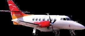
Our Jetstream 32 aircraft offer an intimate travel experience, accommodating up to 19 passengers. These twin-engine turboprops are ideal for short regional flights, ensuring agility and reliability.
Nos avions Jetstream 32 offrent une expérience de voyage intime, pouvant accueillir jusqu’à 19 passagers. Ces bimoteurs turbopropulseurs sont idéaux pour les vols régionaux de courte durée, car ils sont agiles et fiables.
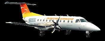
EMBRAER EMB-120ER BRASILIA
The Embraer EMB 120ER Brasilia is a versatile 30-seat turboprop, renowned for its speed and fuel efficiency. It provides a smooth and swift journey, making it a preferred choice for regional routes.
L’Embraer EMB 120ER Brasilia est un turbopropulseur polyvalent de 30 places, réputé pour sa vitesse et son efficacité énergétique. Il offre un voyage fluide et rapide, ce qui en fait un choix de prédilection pour les liaisons régionales.
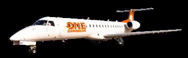
EMBRAER ERJ-145LR
Our Embraer ERJ-145 jets comfortably seat 50 passengers, offering a balance of performance and comfort. With a range suitable for longer regional flights, they connect you seamlessly to your destination.
Nos jets Embraer ERJ-145 accueillent confortablement 50 passagers, offrant un équilibre entre performance et confort. Avec un rayon d’action adapté aux vols régionaux plus longs, ils vous permettent d’atteindre votre destination en toute transparence.
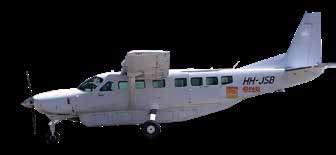
CESSNA GRAND CARAVAN EX
The Cessna Grand Caravan EX is a robust aircraft, seating up to 9 passengers. Its versatility and reliability make it perfect for accessing remote destinations, ensuring a unique travel experience.
Le Cessna Grand Caravan EX est un avion robuste pouvant accueillir jusqu’à 9 passagers. Sa polyvalence et sa fiabilité en font l’appareil idéal pour accéder à des destinations éloignées et garantir une expérience de voyage unique.prédilection pour les liaisons régionales.
The Airbus A320, flying in association with Sunrise Airways, is a wide-body jet designed for medium to long-haul flights. It offers spacious seating for up to 269 passengers, combining comfort, range, and efficiency. Its reliability and advanced design make it ideal for connecting major cities across continents.
Le Airbus A320, qui vole en association avec Sunrise Airways, est un gros porteur conçu pour les vols moyen et long-courriers. Il offre des sièges spacieux pour 269 passagers, alliant confort, autonomie et efficacité. Sa fiabilité et sa conception avancée en font l’avion idéal pour relier les grandes villes à travers les continents.
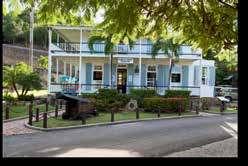
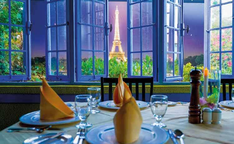
Le Bistro
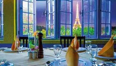
Antigua’s �irst authentic French restaurant was opened in 1981. Since then, their popularity, with both visitors and locals, has never waned. Dining here is close to luxurious perfection.
Open Tuesday - Sunday from 6:00pm with Last orders at 9:30pm. Closed on Mondays.
Le Bistro, Hodges Bay, St. John’s, Antigua T: (268) 462-3881
E: lebistroantigua@gmail.com
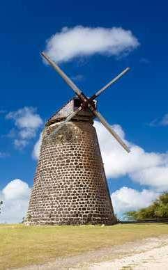
World Heritage in Antigua and Barbuda
ANTIGUA AND BARBUDA
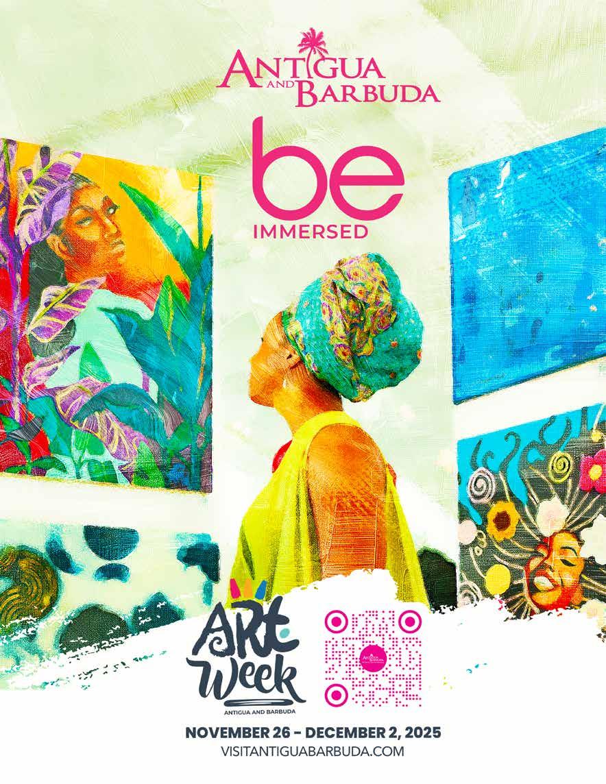
Be Here. Be Immersed.
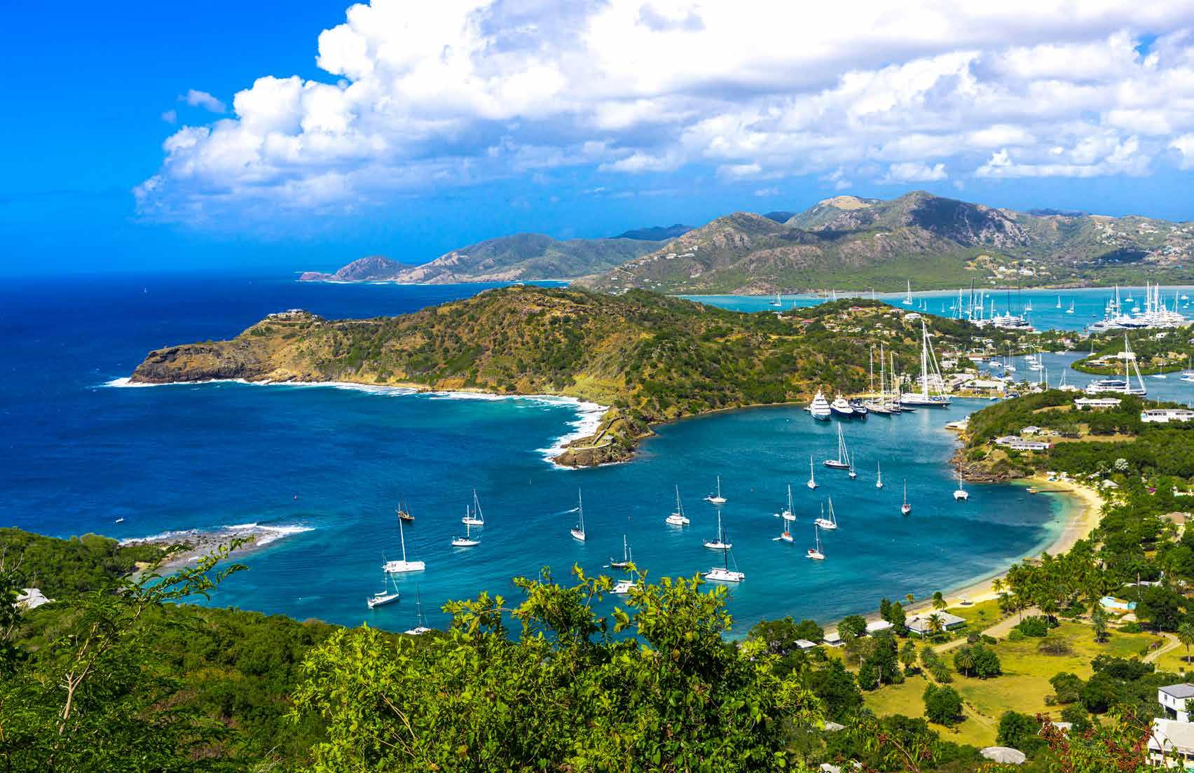
In Antigua and Barbuda, the beach is just the beginning.
With 365 beaches, vibrant culture, and a rhythm that speaks to your soul, these twin islands beckon Caribbean neighbours to cometo relax, reconnect, and rediscover the beauty of island life. From the world-famous Shirley Heights Sunday Sunset Party to the breathtaking experience of swimming in cool, turquoise waters, Antigua and Barbuda invites you to be here.
This November, discover a new side of the twin-islands during Antigua and Barbuda Art Week taking place from November 26 – December 2. From colourful galleries to immersive paint sessions, live performances to art & culture bus tours through the lush and scenic countryside, Antigua and Barbuda comes alive with creativity, inspired by our rich culture, landscapes, and people.
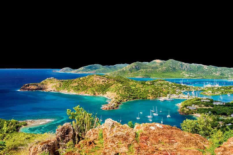
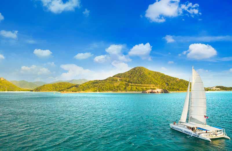
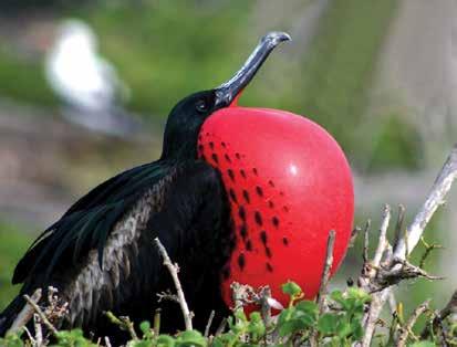
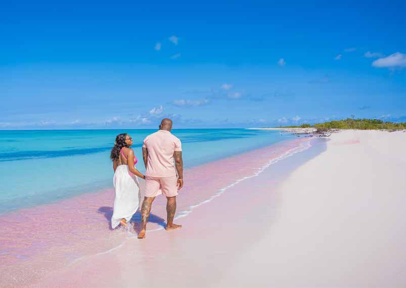
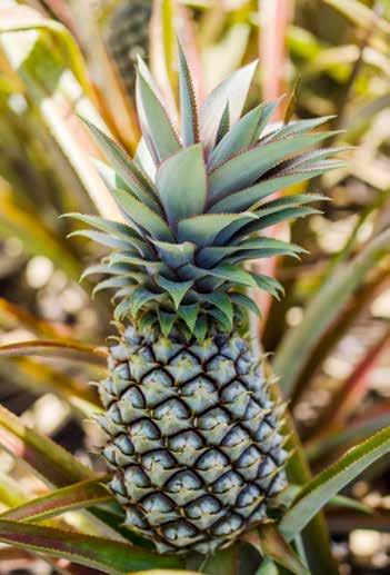
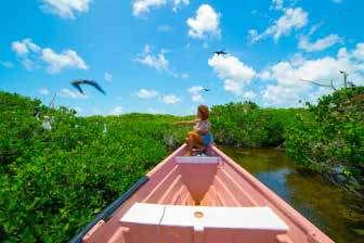
Get out on the water with a catamaran cruise, visit Barbuda’s Frigate Bird Sanctuary, and bask in the sun on a pink sand beach. Then, explore Antigua’s vibrant sailing and yachting community of English Harbour, and the UNESCO World Heritage Site of Nelson’s Dockyard, home to some of the world’s most prestigious regattas. During Culinary Month in May, be immersed in the flavours of Antigua and Barbuda from curated chef dinners to food festivals. ‘Eat Like a Local’ on a local food tour - sampling everything from wood oven bread to season rice, curry conch to stuffed shellfish, fresh lobster to black pineapple and our well-known Antigua Cavalier Rum.
Whether you’re dancing at Antigua Carnival, ‘The Caribbean’s Greatest Summer Festival’, enjoying a private dinner at a nearby offshore island, or exploring our colourful shopping districts, Antigua and Barbuda offers a truly authentic Caribbean experience, with friendly faces and enriching experiences. Be here for the beaches. Be immersed in the culture.
Website: www.VisitAntiguaBarbuda.com
ANTIGUA-ETBARBUDA
Soyez ici. Soyez immergé.
À Antigua-et-Barbuda, la plage n’est qu’un début...
Avec leurs 365 plages, leur culture dynamique et leur rythme qui touche l’âme, ces deux îles jumelles invitent leurs voisins des Caraïbes à venir se détendre, se reconnecter et redécouvrir la beauté de la vie insulaire. De la célèbre Shirley Heights Sunday Sunset Party à l’expérience époustouflante de nager dans des eaux turquoise et fraîches, Antigua-et-Barbuda vous invite à venir la découvrir.
En novembre, découvrez une nouvelle facette des îles jumelles lors de la semaine de l’art d’Antiguaet-Barbuda, qui se déroulera du 26 novembre au 2
décembre. Des galeries colorées aux séances de peinture immersives, en passant par les spectacles en direct et les circuits artistiques et culturels en bus à travers la campagne luxuriante et pittoresque, Antigua-et-Barbuda s’anime grâce à la créativité inspirée par notre riche culture, nos paysages et notre population.
Partez en mer à bord d’un catamaran, visitez la réserve naturelle de Frigate Bird Sanctuary à Barbuda et profitez du soleil sur une plage de sable rose. Explorez ensuite la communauté dynamique des plaisanciers et des yachtmen d’English Harbour à Antigua, ainsi que le site classé au patrimoine mondial de l’UNESCO de Nelson’s Dockyard, qui accueille certaines des régates les plus prestigieuses au monde. Pendant le mois culinaire en mai, plongez dans les saveurs d’Antigua-et-Barbuda grâce à des dîners préparés par des chefs et des festivals gastronomiques. « Mangez comme un habitant » lors d’une visite gastronomique locale, où vous pourrez déguster du pain cuit au four à bois, du riz de saison, du curry de conque, des coquillages farcis, du homard frais, de l’ananas noir et notre célèbre rhum Antigua Cavalier.
Que vous dansiez au carnaval d’Antigua, « le plus grand festival estival des Caraïbes », que vous profitiez d’un dîner privé sur une île voisine ou que vous exploriez nos quartiers commerçants colorés, Antigua-et-Barbuda vous offre une expérience caribéenne authentique, avec des visages amicaux et des expériences enrichissantes. Venez pour les plages. Plongez-vous dans la culture.
Site web : www.VisitAntiguaBarbuda.com
Antigua’s �irst authentic French restaurant was opened in 1981. Since then, their popularity, with both visitors and locals, has never waned. Dining here is close to luxurious perfection.
Open Tuesday - Sunday from 6:00pm - with Last orders at 9:30pm. Closed on Mondays.
SKYBRIDGE: SUNRISE AIRWAYS IN-FLIGHT MAGAZINE
WHERE AND ADVENTURE LÀ OÙ L’HISTOIRE ET OÙ
WHERE HISTORY BEGINS, ADVENTURE IS REBORN
L’HISTOIRE COMMENCE L’AVENTURE RENAÎT
Discover the Soul of Historic Haiti
Welcome to Historic Haiti The most wonderful, historic, and hospitable region of the country. From majestic mountains to sparkling beaches, this multifaceted destination welcomes you to explore a land steeped in stories, cultural richness, and vibrant traditions. Here, every site has a voice, and every path leads to discovery.
Embrace Authenticity Experience sustainable adventures and connect with the living heritage of the North and North-East of Haiti. Whether you’re hiking to ancient fortresses or tasting Creole delicacies by the sea, Historic Haiti offers memories to treasure.
Your Journey Begins Here –In the Land of Freedom
Découvrez l’âme de l’Haïti historique
Bienvenue dans la destination Historic Haïti, la plus merveilleuse, historique et hospitalière d’Haïti. Cette multi destination vous ouvre ses portes pour vous permettre de faire connaissance avec ses montagnes majestueuses, ses merveilleuses plages. Nous vous invitons à explorer ce territoire doté d’un riche patrimoine culturel matériel et immatériel et où chaque lieu raconte une histoire, une épopée.
Historic Haïti est aussi la destination où il est possible de vivre des expériences authentiques et de réaliser des activités écoresponsables.
Embarquez avec nous pour une aventure inoubliable sur les terres de la liberté.
KEY ANNUALEvents
FEBRUARY/ MARCH
MAY
JULY/AUGUST
DECEMBER
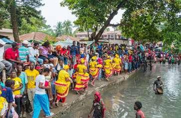
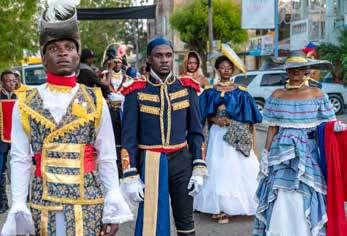
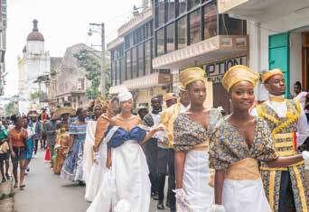
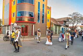
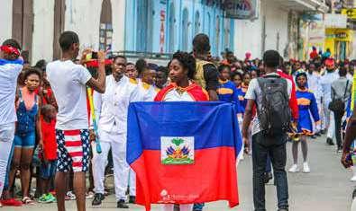
STREET CARNIVAL –
COLORS, RHYTHMS & REVELRY
FLAG DAY & GASTRONOMY FAIRS
CAP-HAÏTIEN CITY FESTIVAL –CONCERTS & CULTURAL EVENTS
HOLIDAY CRAFTS & CHRISTMAS TRADITIONS
ANNUELS CLÉS Événements
FÉVRIER/ MARS
MAI
JUILLET-AOÛT
DÉCEMBRE
CARNAVAL DE RUE, COULEURS ET TAMBOURS
FÊTE DU DRAPEAU & FOIRES GASTRONOMIQUES
FÊTE DE LA VILLE DU CAP-HAÏTIEN, CONCERTS & FESTIVALS
ARTISANAT & TRADITIONS DE NOËL
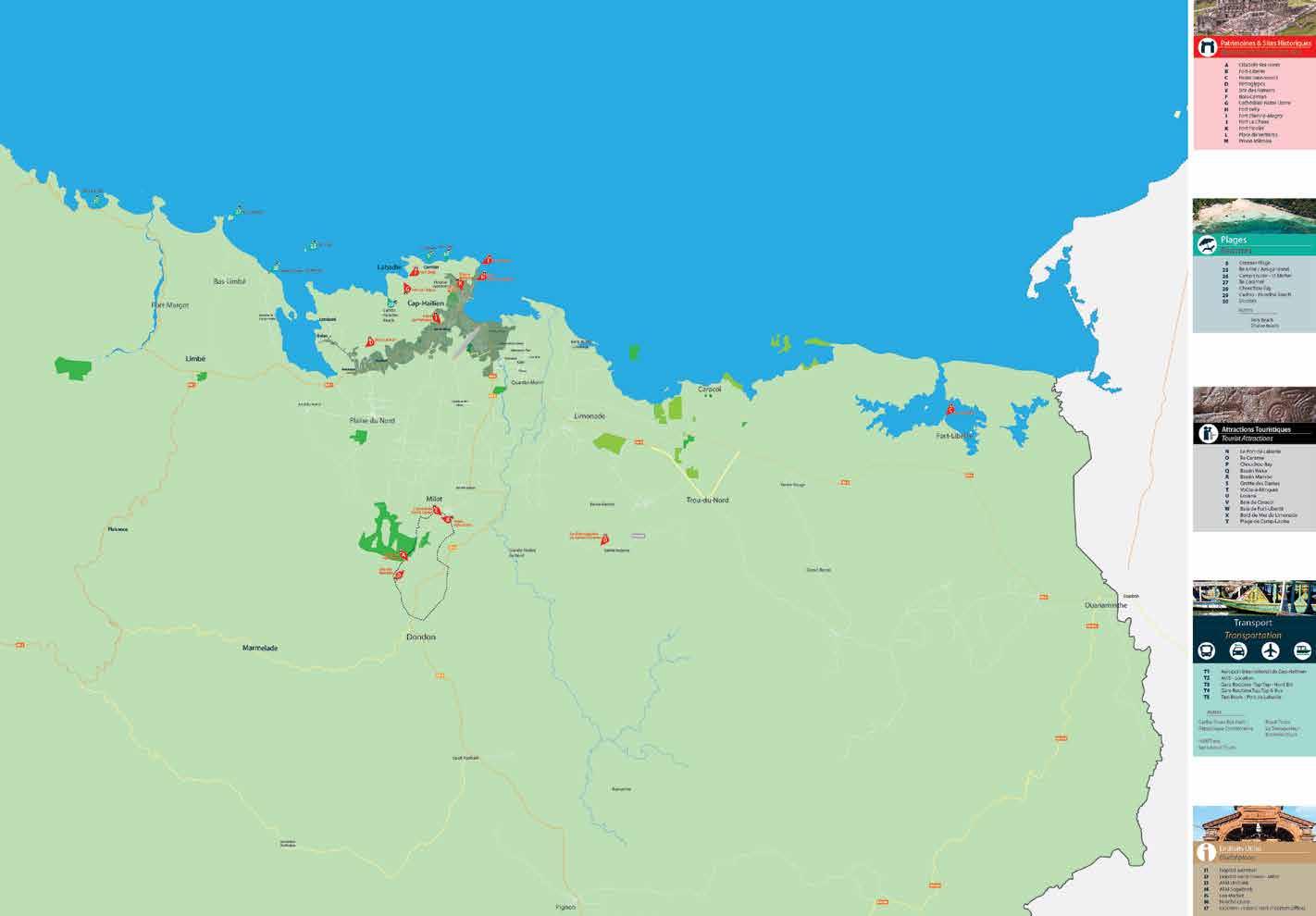
HISTORIC HAITI BY THE NUMBERS
1
2
Historic Departments: North & North-East
Direct access via Cap-Haïtien International Airport (CAP)
UNESCO World Heritage Sites
3 100+
Historical and Natural Attractions
30+
Cultural Events Each Year
200+
Lodging Options
300+
Days of Sunshine Annually
200+
Restaurants Serving Local Flavors
Promise: An Authentic, Unforgettable Experience
LA DESTINATION EN CHIFFRES
2
Départements
Historiques : Nord & Nord-Est riches en patrimoines
Accès Direct via L’aéroport International du Cap-Haïtien (CAP)
3 100+
Sites Inscrits au Patrimoine Mondial de l’UNESCO
Sites Historiques et Naturels Recensés
30+
200+
300+
200+
1
Événements
Culturels Chaque année
Hébergements
Pour Tous les Goûts et Budgets
Jours de Soleil par An
Restaurants Offrant une Gastronomie Riche
1 Seule Promesse : Une Expérience Authentique et Inoubliable
TOP 6 MUST-DO EXPERIENCES
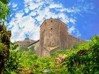
Climb the Citadelle — Military masterpiece atop freedom’s peak
Taste Haiti — From street food to rum, savor every bite
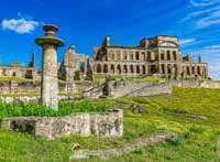
Visit Sans Souci Palace — Royal heritage in stone and spirit
Feel the Culture — Dance, music, artisanry & Vodou traditions
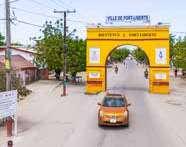
Explore Cap-Haïtien & Fort-Liberté —
Historic streets, colonial charm
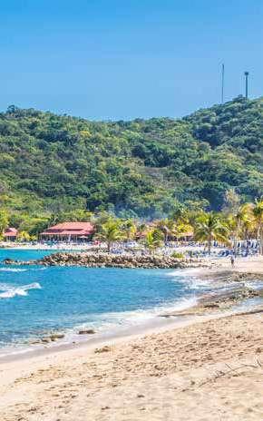
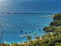
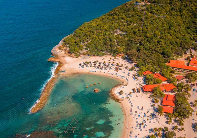
Escape to Labadie —
Pristine beaches and fishing village charm
Gravir la Citadelle — Chef-d’œuvre militaire au sommet de la liberté.
Goûter aux saveurs oc ales — Fruits tropicaux, plats créoles & rhum haïtien.
Explorer le Palais Sans Souci — Splendeur du royaume d’Henri Christophe
Plonger dans la culture vivante — Danse, artisanat, musique & traditions et rituel vodou
LES 6 EXPÉRIENCES INCONTOURNABLES
Découvrir le Patrimoine historique et architectural du Cap — Haitien et de Fort-liberté
Naviguer jusqu’à Labadie —
Plage paradisiaque & village côtier
EXPERIENCES
INCONTOURNABLES
START YOUR JOURNEY NOW!
Rediscovering the Pearl of the Antilles
We sometimes tend to judge a whole based on just one of its facets. A country, a culture, or a population can thus be reduced to a simplistic image, often negative, without considering the complexity of their reality. Haiti is one of the most striking examples of this.
Formerly nicknamed the “Pearl of the Antilles,” Haiti is today too often perceived through the lens of its socio-economic and political difficulties. In the collective international imagination, this Caribbean nation sometimes embodies instability, poverty, or chaos. However, reducing Haiti to its contemporary issues ignores a whole part of its identity.
Because Haiti is also, and above all, a unique heritage. It is the first independent Black republic in the world, born from a revolution that profoundly changed colonial history and power relations of the time. It is a resilient people, a mosaic of living traditions, a craftwork of remarkable finesse, a blended gastronomy, and a vibrant artistic richness.
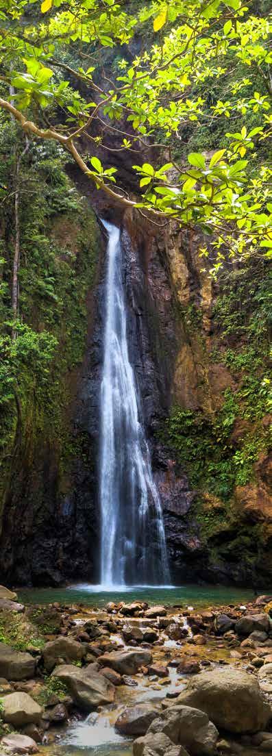
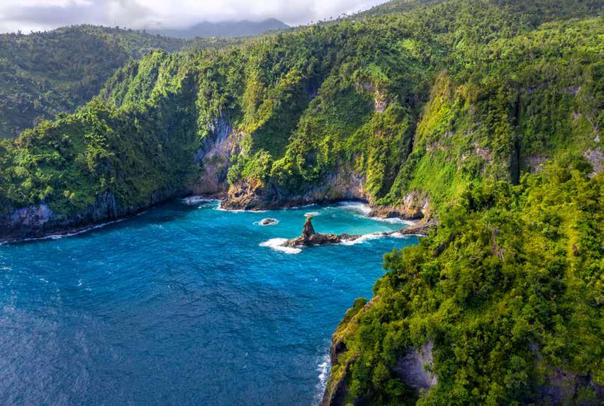
It is also a generous nature, still largely unknown: lush mountains, spectacular caves, tropical forests, hidden waterfalls… Not to mention its fine sandy beaches bordered by turquoise waters, which rival the most popular destinations in the Caribbean.
This partial view, which only sees one aspect of the country, conceals a diversity and beauty that are just waiting to be (re)discovered.
Through this series of articles, we will explore this other Haiti — one of heritage and history, culture, art and craftsmanship, outdoor adventure, beaches, and relaxation. An authentic, fascinating, often unexpected Haiti. A Haiti that is not always visible but certainly exists.
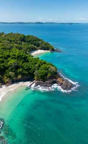
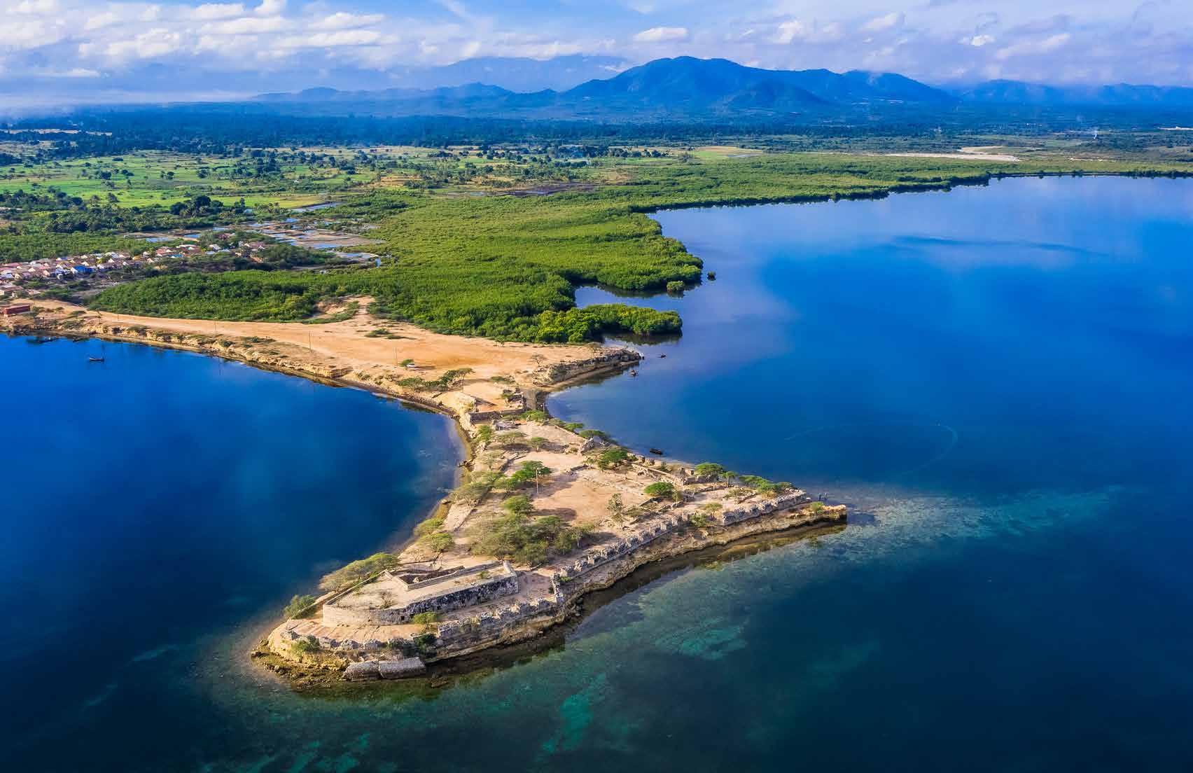
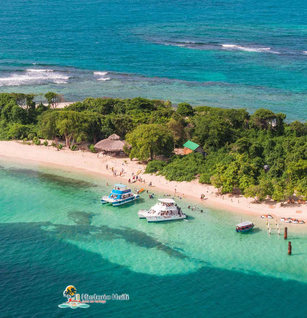
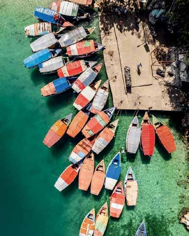
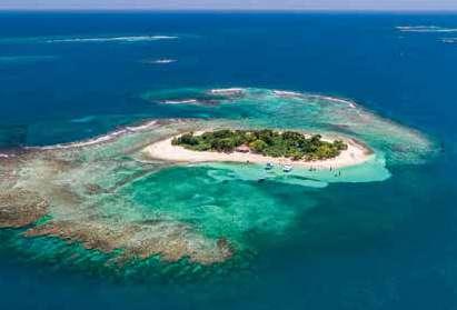
AMIGA ISLAND PHOTOGRAPHY BY JEAN OSCAR AUGUSTIN
Anciennement surnommée la « Perle des aujourd’hui trop souvent perçue à travers difficultés socio-économiques et politiques. collectif international, cette nation des Caraïbes l’instabilité, la pauvreté ou encore le chaos. à ses maux contemporains, c’est ignorer identité. Car Haïti, c’est aussi, et surtout un héritage première République noire indépendante révolution qui a bouleversé l’histoire coloniale pouvoir de l’époque. C’est un peuple résilient, traditions vivantes, un artisanat d’une finesse gastronomie métissée, une richesse artistique
À la redécouverte de la Perle des Antilles
Nous avons parfois tendance à juger un tout à partir d’une seule de ses facettes. Un pays, une culture ou une population peuvent ainsi être réduits à une image simpliste, souvent négative, sans considération pour la complexité de leur réalité. Haïti en est l’un des exemples les plus frappants.
Anciennement surnommée la « Perle des Antilles », Haïti est aujourd’hui trop souvent perçue à travers le prisme de ses difficultés socio-économiques et politiques. Dans l’imaginaire collectif international, cette nation des Caraïbes incarne parfois l’instabilité, la pauvreté ou encore le chaos. Pourtant, réduire Haïti à ses maux contemporains, c’est ignorer tout un pan de son identité.
Car Haïti, c’est aussi, et surtout un héritage unique. C’est la première République noire indépendante du monde, née d’une révolution qui a bouleversé l’histoire coloniale et les rapports de pouvoir de l’époque. C’est un peuple résilient, une mosaïque de traditions vivantes, un artisanat d’une finesse remarquable, une gastronomie métissée, une richesse artistique foisonnante.
C’est aussi une nature généreuse, encore méconnue : montagnes luxuriantes, grottes spectaculaires, forêts tropicales, cascades insoupçonnées… Sans parler de ses plages de sable fin, bordées d’eaux turquoise, qui n’ont rien à envier aux destinations les plus prisées de la Caraïbe.
Ce regard partiel, qui ne voit qu’un aspect du pays, occulte ainsi une diversité et une beauté qui ne demandent qu’à être (re)découvertes.
À travers cette série d’articles, nous partirons à la rencontre de cette autre Haïti ; celle du patrimoine et de l’histoire, de la culture, de l’art et de l’artisanat, de l’aventure en pleine nature, des plages et de la détente. Une Haïti authentique, fascinante, souvent inattendue. Une Haïti que l’on ne voit pas toujours, mais qui existe bel et bien.
amiga island Photography by Jean Oscar Augustin Anciennement surnommée
AMIGA ISLAND
PHOTOGRAPHY BY JEAN OSCAR AUGUSTIN
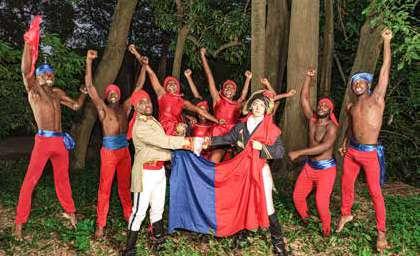
Haiti, Cradle of Freedom
A heritage forged in struggle and grandeur
As the first black republic in the world, Haiti did not only gain its independence; it overthrew one of the most powerful empires of its time and shook the global order. In 1804, after more than ten years of fierce fighting, the former slaves of Haiti defeated Napoleon’s troops, making this country the first post-slavery free and sovereign state.
This unprecedented victory would not have been possible without prominent figures such as Toussaint Louverture, a master strategist and initiator of the revolutionary process. Arrested and deported to France, he did not witness independence, but his legacy is immense. Jean-Jacques Dessalines, his successor, proclaimed independence on January 1, 1804. This marked the beginning of a new nation built on sacrifice, resistance, and the pursuit of dignity.
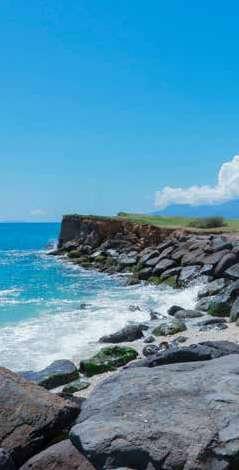
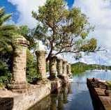
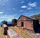
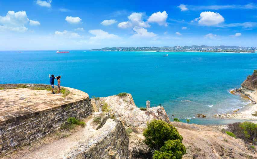
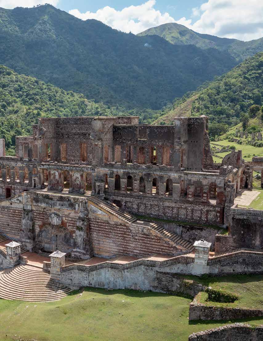
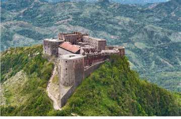
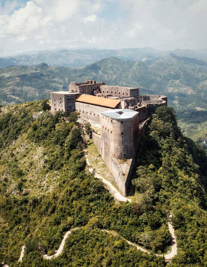
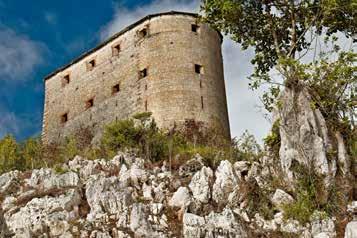
This glorious past has left tangible traces, still visible today in the country’s architectural heritage. Among the most eloquent symbols is the Citadelle Laferrière, perched on the heights of Milot, overlooking the northern plains as a silent witness to the power and vision of the builders of that era. Inscribed on the UNESCO World Heritage List, it is one of the largest forts in the Americas.
Alongside it stands the Sans-Souci Palace, former residence of King Henri Christophe, illustrating the early Haitian leaders’ desire to create a strong, cultured, and respected nation. These structures are not merely picturesque ruins; they tell a story of grandeur, identity, and resilience.
But Haitian heritage is not limited to monuments: it also lives in traditions, dances, oral stories, ancestral rites, and symbolic sites like Bois Caïman, where the call to revolt was launched. Every stone, every name, every relic carries a part of this unique memory.
Highlighting this heritage is a reminder to the world that Haiti’s history is not just about crises: it begins with an act of unparalleled freedom and continues through an incomparable cultural and historical richness.
Haïti, berceau de liberté
Un patrimoine forgé dans la lutte et la grandeur
Première République noire du monde, Haïti n’a pas seulement arraché son indépendance ; elle a renversé l’un des empires les plus puissants de son époque et ébranlé l’ordre mondial. En 1804, après plus de dix ans de lutte acharnée, les anciens esclaves d’Haïti ont vaincu les troupes napoléoniennes, faisant de ce pays le premier État post-esclavagiste libre et souverain.
Cette victoire sans précédent n’aurait pas été possible sans des figures marquantes comme Toussaint Louverture, stratège hors pair, initiateur du processus révolutionnaire. Arrêté et déporté en France, il n’assistera pas à l’indépendance, mais son héritage est immense. Jean-Jacques Dessalines, son successeur, proclamera l’indépendance le 1er janvier 1804. C’est le début d’une nouvelle nation, construite sur le sacrifice, la résistance et la quête de dignité.
Ce passé glorieux a laissé des traces concrètes, visibles encore aujourd’hui dans le patrimoine architectural du pays. Parmi les symboles les plus éloquents, la Citadelle Laferrière, perchée sur les hauteurs de Milot, domine les plaines du Nord comme un témoin silencieux de la puissance et de la vision des bâtisseurs de l’époque. Inscrite au patrimoine mondial de l’UNESCO, elle est l’un des plus grands forts des Amériques.
À ses côtés, le Palais Sans-Souci, ancienne résidence du roi Henri Christophe, illustre la volonté des premiers dirigeants haïtiens de créer une nation forte, cultivée et respectée. Ces édifices ne sont pas seulement des ruines pittoresques : ils racontent une histoire de grandeur, d’identité et de résilience.
Mais le patrimoine haïtien ne se limite pas aux monuments : il vit aussi dans les traditions, les danses, les récits oraux, les rites ancestraux et les lieux symboliques comme Bois Caïman, où l’appel à la révolte a été lancé. Chaque pierre, chaque nom, chaque vestige porte en lui une part de cette mémoire unique.
Mettre en lumière ce patrimoine, c’est rappeler au monde que l’histoire d’Haïti ne se résume pas à ses crises : elle commence par un acte de liberté sans égal, et se prolonge dans une richesse culturelle et historique incomparable.
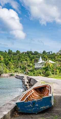
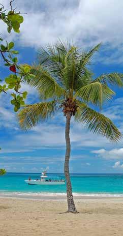
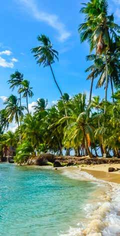
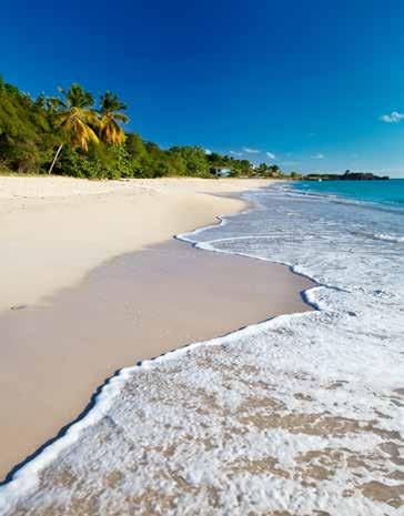
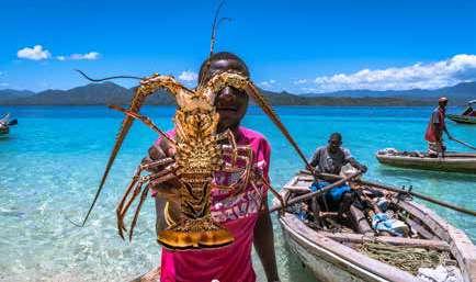
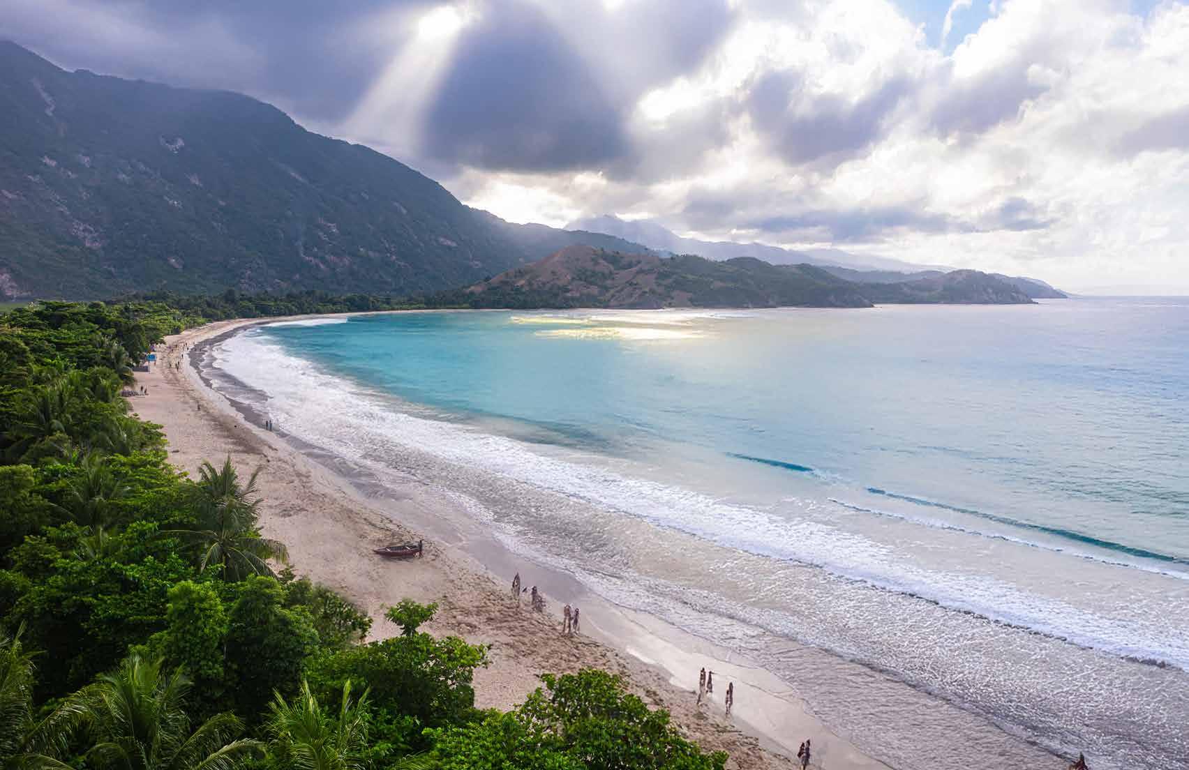
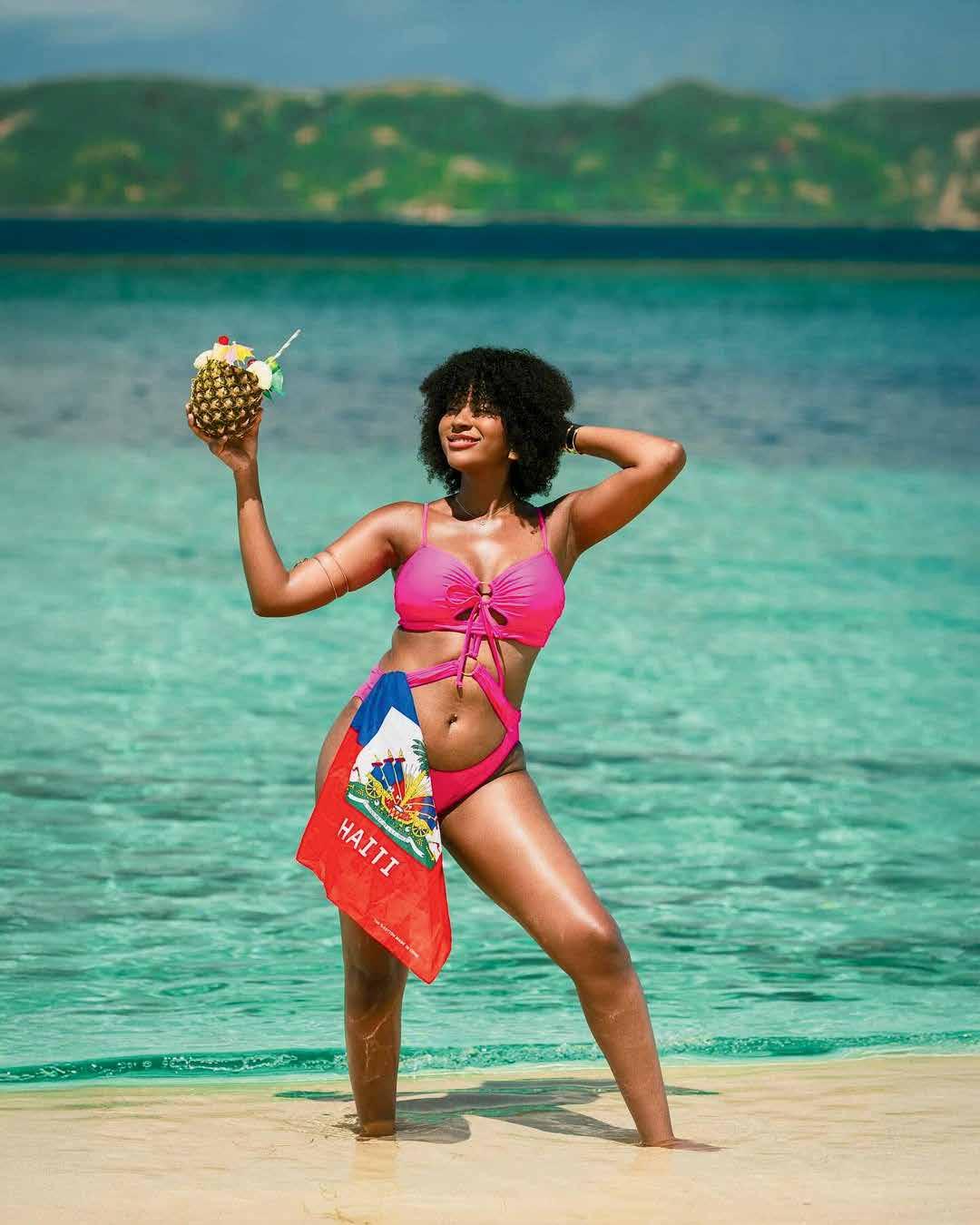
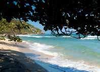
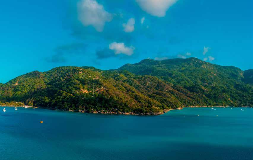
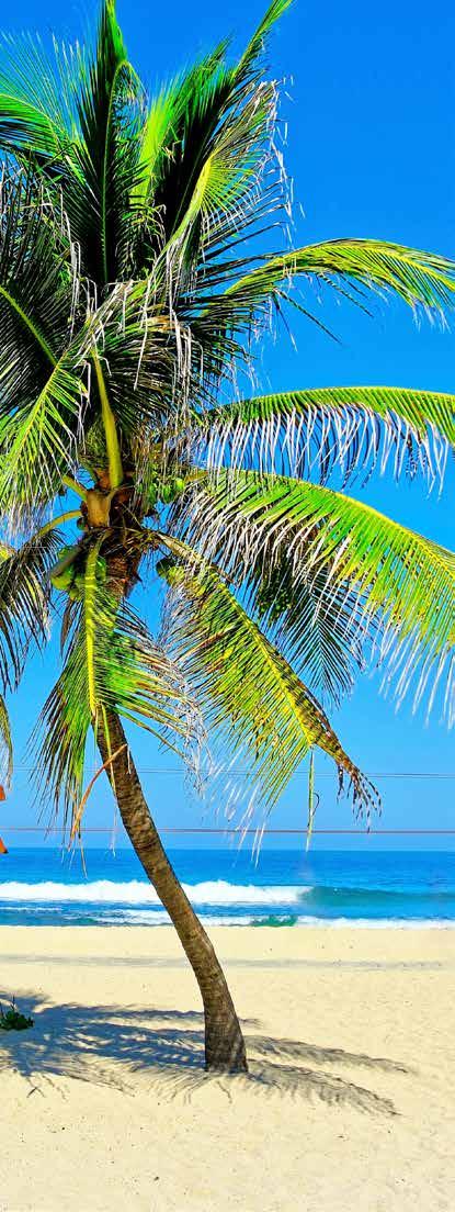
The Soul of Haitian Beaches
When thinking of Haiti, few people imagine its sunlit coasts, its translucent waters reflecting emerald hues, or its wild beaches rocked by the song of the wind in the coconut trees. Yet, with over 1,700 kilometers of coastline, Haiti possesses one of the most beautiful maritime faces in the Caribbean.
Here, the sea does more than surround: it soothes, heals, and invites contemplation. Far from the usual tourist circuits, Haiti offers authentic beaches, often preserved, where time seems to stand still. There, a rare form of luxury can be found: tranquility.
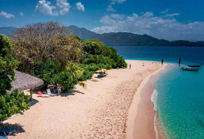
From Labadie, a jewel in the North nestled between the sea and mountains, to Port-Salut in the South with its pristine white sands and golden sunsets, and the crystal-clear waters of Jacmel, each Haitian beach has its own distinct personality. Abaka Bay, on the paradise island of Île-à-Vache, has even been ranked among the most beautiful beaches in the Caribbean. The water there is so calm that it feels like walking on a liquid mirror.
But relaxing in Haiti is not just about lying on a beach. It’s also about immersing oneself in the local atmosphere—tasting freshly grilled fish under a thatched hut, listening to a band playing traditional music in the distance, or simply chatting with fishermen at day’s end.
In its moments of leisure, Haiti offers a rare reconnection: with nature, with oneself, with what is essential. It is an invitation to slow down, breathe deeply, and relearn the sweetness of simple things.
Although the country may not yet shine brightly in travel agency brochures, perhaps that is precisely what makes it so precious. Here lies a discreet, authentic beauty that must be earned and savored all the more.
L’âme des plages haïtiennes
Quand on pense à Haïti, rares sont ceux qui imaginent ses côtes baignées de lumière, ses eaux translucides aux reflets émeraude, ou encore ses plages sauvages bercées par le chant du vent dans les cocotiers. Et pourtant, avec plus de 1 700 kilomètres de littoral, Haïti possède l’un des plus beaux visages maritimes de la Caraïbe.
Ici, la mer ne se contente pas d’entourer : elle apaise, elle soigne, elle invite à la contemplation. Loin des circuits touristiques classiques, Haïti offre des plages authentiques, souvent préservées, où le temps semble suspendu. On y trouve cette forme de luxe rare : la tranquillité.
De Labadie, joyau du Nord niché entre mer et montagnes, à Port-Salut dans le Sud, avec son sable blanc immaculé et ses couchers de soleil dorés, en passant par les eaux cristallines de Jacmel, les plages haïtiennes ont chacune une personnalité bien à elles. Abaka Bay, sur l’île paradisiaque de l’Île-à-Vache, a même été classée parmi les plus belles plages des Caraïbes. Là, l’eau est si calme qu’on croirait marcher sur un miroir liquide.
Mais se détendre en Haïti, ce n’est pas seulement s’allonger sur une plage. C’est aussi s’imprégner de l’ambiance locale, goûter un poisson fraîchement
grillé sous une paillote, écouter un groupe jouer de la musique racine au loin, ou simplement discuter avec les pêcheurs en fin de journée.
Haïti, dans ses instants de détente, offre une reconnexion rare : à la nature, à soi, à l’essentiel. C’est une invitation à ralentir, à respirer profondément, à réapprendre la douceur des choses simples.
Et si le pays ne brille pas encore dans les brochures des agences de voyage, c’est peut-être justement ce qui le rend si précieux. Il y a ici une beauté discrète, authentique, qui se mérite et qui se savoure d’autant plus.
Parfait, voici une version retravaillée, enrichie et plus développée de ton article. Elle conserve ton angle original — une opportunité historique — tout en lui donnant plus de profondeur, de souffle et d’aspiration stratégique.
VILLA RUSSO 1898
Located in the heart of Pétion-Ville, Villa Russo offers a curated selection of prestigious watches, fine jewelry, elegant tableware, and luxury accessories you won’t find anywhere else. Whether you’re shopping for yourself or choosing the perfect gift, our collection blends craftsmanship, elegance, and timeless style.
At Villa Russo, we bring together an exclusive collection of refined pieces: Prestigious Watches – Timepieces crafted with precision and heritage.
Fine Jewelry – Elegant creations designed to sparkle on every occasion.
Exquisite Tableware – Elevate your dining with artistry and elegance.
Luxury Accessories – Sophisticated details to complement every lifestyle.
Haiti in Osaka: A Historic Opportunity for Revival
On December 8, 1949, Haiti made a shining mark in modern history with the opening of the Port-auPrince International Exhibition. For several months, the country became the focus of global attention. This event marked a turning point. It provided Haiti with the opportunity to showcase its riches, project a strong, ambitious, and dynamic image. More importantly, it laid the foundations for a burgeoning tourism sector while creating a space for dialogue between cultures and worldviews. At that moment, Haiti expressed its desire to fully participate in modernity and major international exchanges.
Seventy-five years later, a new historic crossroads presents itself: Haiti’s participation in the 2025 Osa-
ka World Expo. An unexpected opportunity amid a profoundly changed global and national context. Today, Haiti faces major challenges: political, economic, security-related. But it is precisely in these moments of crisis that the most promising impulses are born. Participating in Osaka is not about fleeing reality; it is about responding to it with boldness, imagination, and courage.
The Osaka World Expo should not be merely a ceremonial event for Haiti but a strategic lever for repositioning. The country possesses invaluable intangible resources, still too little showcased on the international stage. Its culture, rich and original, deserves a central place. Its art, music, dance, litera-
ture, as well as its gastronomy, crafts, and spiritual traditions—all form a living heritage that touches, moves, and inspires.
Osaka can become the stage where Haiti tells its story differently—not as a country defined by its tragedies but as a land of creation, resilience, and innovation. It is an opportunity to build a positive, mobilizing national narrative focused on the future. The Haitian pavilion could become a manifesto of identity and hope—a place where visitors discover a country with a thousand faces, invited to see it differently.
This Haitian presence in Japan must be conceived as a genuine development project. It can attract investors interested in sustainable solutions, short supply chains, ecotourism, and creative industries. It can foster connections between the diaspora and young talents on the ground. It can strengthen regional cooperation and pave the way for new strategic alliances, especially with Asia and the Pacific Islands.
The Haitian pavilion should embody this ambition: it could be designed as an immersive, multisensory space that blends tradition and modernity, telling a story in motion. Far from being static, this space would be a laboratory for encounters, ideas, and performances. Every day, something new could happen—musical performances, culinary demonstrations, documentary screenings, artistic exchanges.
However, for this vision to come to life, one essential condition is collective mobilization. The state, artists, entrepreneurs, artisans, researchers, youth, and the diaspora—all must be involved in this project. It is not just about representing Haiti but about dreaming it together, symbolically rebuilding it through this pavilion.
History will remember that in 2025, despite the hardships, Haiti chose to believe in itself. That it dared once again to present itself to the world—not as a victim but as an active participant. The Osaka World Expo could thus mark a new chapter—not of erasure but of reconquest; not of nostalgia but of hope.
Haïti à Osaka : une opportunité historique de renaissance
Le 8 décembre 1949, Haïti entre dans l’histoire moderne des nations avec éclat : l’Exposition internationale de Port-au-Prince ouvre ses portes. Pendant plusieurs mois, le pays devient le centre d’attention du monde. Cette manifestation marque un tournant. Elle offre à Haïti l’occasion de présenter ses richesses, de projeter une image forte, ambitieuse, dynamique. Elle pose surtout les jalons d’un secteur touristique naissant, tout en créant un espace de dialogue entre cultures et visions du monde. À ce moment précis, Haïti affirme son désir de participer pleinement à la modernité et aux grands échanges internationaux.
Soixante-quinze ans plus tard, un nouveau carre-
four historique s’offre au pays : sa participation à l’Exposition universelle d’Osaka 2025. Une opportunité inespérée dans un contexte mondial et national profondément bouleversé. Haïti fait aujourd’hui face à des défis majeurs : politiques, économiques, sécuritaires. Mais c’est précisément dans ces moments de crise que naissent les impulsions les plus porteuses. Participer à Osaka, ce n’est pas fuir la réalité : c’est y répondre avec audace, imagination et courage.
L’Exposition universelle d’Osaka ne doit pas être pour Haïti un simple événement protocolaire, mais un levier stratégique de repositionnement. Le pays dispose de ressources immatérielles inestimables,
encore trop peu mises en valeur sur la scène internationale. Sa culture, d’une richesse et d’une originalité inouïes, mérite une place centrale. Son art, sa musique, sa danse, sa littérature, mais aussi sa gastronomie, son artisanat, ses traditions spirituelles : tout cela forme un patrimoine vivant qui touche, émeut, inspire.
Osaka peut devenir la scène sur laquelle Haïti se raconte autrement — non pas comme un pays défini par ses tragédies, mais comme une terre de création, de résilience et d’innovations. C’est l’occasion de construire un récit national positif, mobilisateur, tourné vers l’avenir. Ce pavillon haïtien pourrait devenir un manifeste d’identité et d’espoir. Un lieu où l’on découvre un pays aux mille visages, où le visiteur est invité à changer de regard.
Cette présence haïtienne au Japon doit être pensée comme un véritable projet de développement. Elle peut attirer des investisseurs sensibles aux solutions durables, aux circuits courts, à l’écotourisme, aux industries créatives. Elle peut permettre de créer des ponts entre la diaspora et les jeunes talents sur place. Elle peut renforcer la coopération régionale et ouvrir la voie à de nouvelles alliances stratégiques, notamment avec l’Asie et les îles du Pacifique.
Le pavillon haïtien doit incarner cette ambition : il pourrait être conçu comme un espace immersif, multisensoriel, qui marie tradition et modernité, qui raconte une histoire en mouvement. Loin d’être figé, ce lieu serait un laboratoire de rencontres, d’idées, de performances. Chaque jour, quelque chose de nouveau pourrait s’y passer : une performance musicale, une démonstration culinaire, une projection documentaire, un échange artistique.
Mais pour que cette ambition prenne vie, une condition est essentielle : la mobilisation collective. L’État, les artistes, les entrepreneurs, les artisans, les chercheurs, les jeunes, la diaspora — tous doivent être partie prenante de ce projet. Il ne s’agit pas seulement de représenter Haïti, mais de la rêver ensemble, de la reconstruire symboliquement à travers ce pavillon.
L’histoire retiendra qu’en 2025, malgré les épreuves, Haïti a choisi de croire en elle-même. Qu’elle a osé, une fois encore, se montrer au monde, non comme victime, mais comme actrice. L’Exposition universelle d’Osaka pourrait ainsi marquer un nouveau chapitre. Non pas celui de l’effacement, mais celui de la reconquête. Non pas celui de la nostalgie, mais celui de l’espérance.
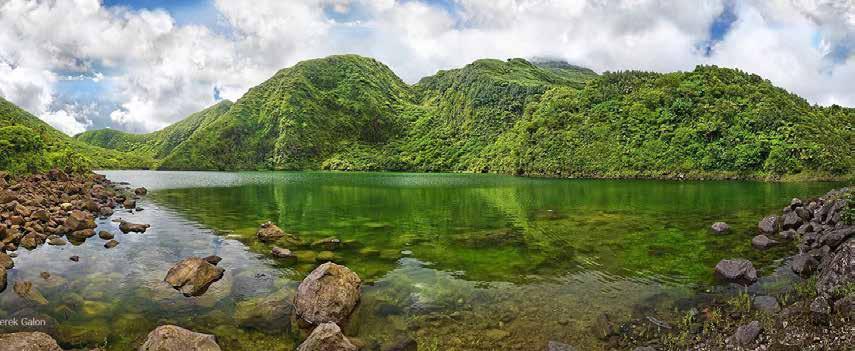
Dominica:
A Prime Destination in the Heart of the Caribbean with a bold vision for sustainable development.
Nestled between the French islands of Guadeloupe and Martinique, Dominica is fast emerging as one of the Caribbean’s most attractive and promising destination for sustainable investment. Dominica is not a commercialized destination-a rare advantage for first movers looking to establish business in tourism, agribusiness, healthcare, manufacturing, digital entrepreneurship, or renewable energy. Additionally, the government has prioritized climate resilience and eco-friendly policies, offering a clear path to investors aligned with global sustainability trends.
Dominica boasts zero restrictions on foreign ownership, streamlined business registration, access to CARICOM markets, and preferential trade agreements with the European Union and the United States. The island’s legal system is based on English common law, and Dominica is considered politically stable. The government offers a tailored package of incentives to include tax holidays, exemptions from payment of import duty, VAT, withholding tax and others. Its population is English-speaking, highly literate, and increasingly trained in the tourism, hospitality, agriculture, and tech related sectors— making it easy to build and scale teams locally.
La Dominique
Une
destination de choix au cœur des Caraïbes, avec une vision audacieuse du développement durable.
Nichée entre les îles françaises de la Guadeloupe et de la Martinique, la Dominique est en train de devenir l’une des destinations les plus attrayantes et les plus prometteuses des Caraïbes pour les investissements durables. La Dominique n’est pas une destination commercialisée, ce qui constitue un avantage rare pour les pionniers qui souhaitent créer une entreprise dans les domaines du tourisme, de l’agroalimentaire, de la santé, de l’industrie manufacturière, de l’entrepreneuriat numérique ou des énergies renouvelables. De plus, le gouvernement a donné la priorité à la résilience climatique et aux politiques respectueuses de l’environnement, offrant ainsi une voie claire aux investisseurs en phase avec les tendances mondiales en matière de durabilité.
La Dominique n’impose aucune restriction à la propriété étrangère, offre un enregistrement simplifié des entreprises, un accès aux marchés de la CARICOM et des accords commerciaux préférentiels avec l’Union européenne et les États-Unis. Le système juridique de l’île est basé sur la common law anglaise, et la Dominique est considérée comme politiquement stable. Le gouvernement offre un ensemble d’incitations sur mesure, comprenant des exonérations fiscales, des exemptions de droits d’importation, de TVA, de retenue à la source et autres. Sa population est anglophone, très instruite et de plus en plus formée dans les secteurs du tourisme, de l’hôtellerie, de l’agriculture et des technologies, ce qui facilite la constitution et le développement d’équipes au niveau local.
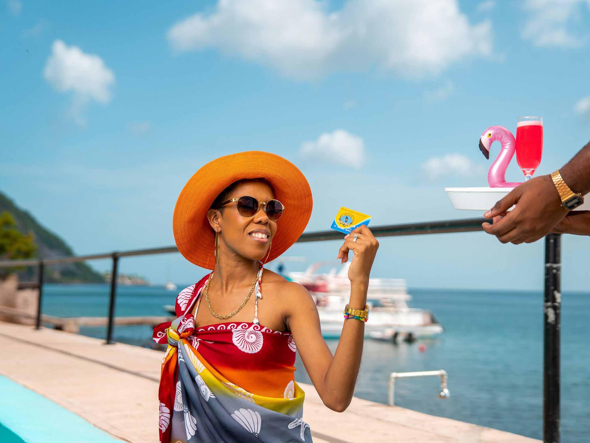
THERE'S NO NEED TO CARRY CASH OR CHEQUES WHEN SHOPPING OR TRAVELLING
USE YOUR CARD AT HOME AND AROUND THE WORLD AT THOUSANDS OF ATMS WHERE THE VISA LOGO IS DISPLAYED.
USE YOUR CARD TO SHOP AND MAKE PAYMENTS ONLINE.
SIGN UP FOR CU ONLINE OR CU CALL TO TRACK & MANAGE YOUR MONEY FROM ANY LOCATION.
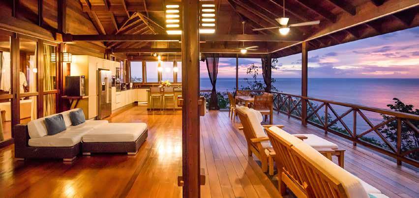
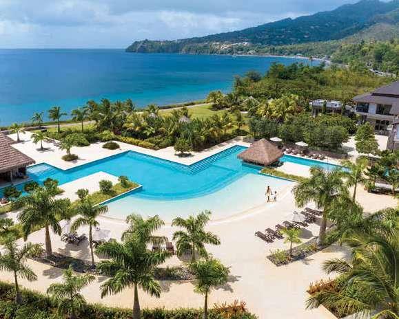
a Caribbean sanctuary where indulgence meets sustainability. Nestled within Cabrits National Park, our resort offers stunning ocean and mountain views, eco-friendly wellness experiences, and a world-class spa infused with the island’s healing essence.
INVEST DOMINICA AUTHORITY ACTIVELY PROMOTE INVESTMENTS ACROSS STRATEGIC SECTORS
1. TOURISM: NATURE MEETS LUXURY
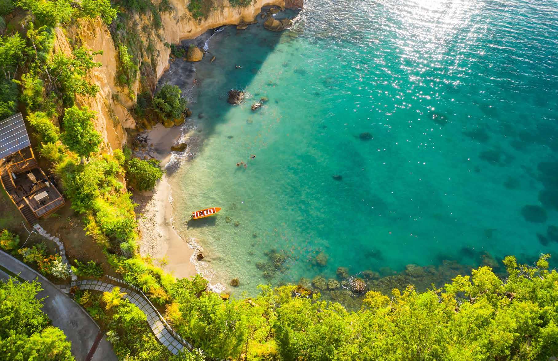
Tourism in Dominica is shifting away from massmarket travel and towards niche, eco-conscious tourism. Boutique hotels, guided nature tours, wellness Eco-resorts, natural hot springs spas, and climate resilient rainforest lodges are rapidly growing in demand. The island’s protected natural assets—such as Morne Trois Pitons National Park, a UNESCO World Heritage Site—offer investors the perfect backdrop for premium, low-impact development.
The real estate sector is also expanding with new developments tailored for digital nomads, and climate-conscious retirees. With government’s support, favorable tax regimes, and low crime rates, Dominica offers a safe and profitable real estate landscape.
2. GREEN INNOVATION & RENEWABLE ENERGY
Dominica’s natural topography—marked by volcanic peaks, rivers, and geothermal springs— makes it an ideal location for green technology and sustainable construction. As Dominica invests in an initial 10 MW geothermal infrastructure to achieve energy sustainability, new opportunities are emerging for downstream investments.
These include green-powered industrial zones, green hydrogen, cold storage facilities, electric vehicle infrastructure, data center operations, and sustainable tourism developments that leverage clean energy. Businesses looking to integrate renewable energy into their operations will find a uniquely supportive environment.
L’AUTORITÉ D’INVESTISSEMENT DE LA
DOMINIQUE
ENCOURAGE ACTIVEMENT
LES INVESTISSEMENTS DANS LES SECTEURS STRATÉGIQUES SUIVANTS
1. TOURISME : QUAND LA NATURE RENCONTRE LE LUXE
Le tourisme en Dominique s’éloigne du tourisme de masse pour se tourner vers un tourisme de niche et respectueux de l’environnement. Les hôtels-boutiques, les visites guidées dans la nature, les éco-resorts bien-être, les spas thermaux naturels et les lodges résistants au climat dans la forêt tropicale connaissent une demande en forte croissance. Les atouts naturels protégés de l’île, tels que le parc national de Morne Trois Pitons, classé au patrimoine mondial de l’UNESCO, offrent aux investisseurs un cadre idéal pour un développement haut de gamme et à faible impact.
Le secteur immobilier est également en pleine expansion, avec de nouveaux développements adaptés aux nomades numériques et aux retraités soucieux du climat. Grâce au soutien du gouvernement, à des régimes fiscaux favorables et à un faible taux de criminalité, la Dominique offre un paysage immobilier sûr et rentable.
2. INNOVATION VERTE ET ÉNERGIES RENOUVELABLES
La topographie naturelle de la Dominique, caractérisée par des pics volcaniques, des rivières et des sources géothermiques, en fait un endroit idéal pour les technologies vertes et la construction durable. Alors que la Dominique investit dans une infrastructure géothermique initiale de 10 MW pour atteindre la durabilité énergétique, de nouvelles opportunités apparaissent pour les investissements en aval.
Il s’agit notamment de zones industrielles alimentées par des énergies vertes, d’hydrogène vert, d’installations de stockage frigorifique, d’infrastructures pour véhicules électriques, d’exploitation de centres de données et de développements touristiques durables tirant parti des énergies propres. Les entreprises qui souhaitent intégrer les énergies renouvelables dans leurs activités trouveront ici un environnement particulièrement favorable.
Tel: 1-767-448-2045 •
3. AGRO-PROCESSING & MANUFACTURING
Dominica’s agricultural sector produces a wide range of high-demand crops such as plantains, turmeric, traditional medicinal and aromatic plants. These raw materials are ripe for value-added processing, creating opportunities in areas such as essential oil production, organic teas, natural seasoning packaging, health and wellness products, biodegradable packaging and other food processing. With the increasing global demand for organic, traceable, sustainably produced goods, Dominica is ideally placed to supply premium products to the North American, European, and CARICOM markets. The sector benefits from attractive fiscal incentives and technical guidance to ensure operational readiness and market competitiveness.
Whether you are investing in eco-lodging, launching a new agri-business, or the knowledge sector — there has never been a better time to invest. Dominica is positioning itself as a niche destination for remote work and digital entrepreneurship. The government supports ventures in software services, digital marketing, BPO operations, and creative industries, all of which can thrive in Dominica’s peaceful, connected, and climate-resilient setting.
If you are seeking a destination where return on investment aligns with purpose, environmental responsibility, and long-term stability—Dominica stands out.
www.investdominica.com
3. TRANSFORMATION AGRICOLE ET FABRICATION
Le secteur agricole de la Dominique produit une large gamme de cultures très demandées, telles que les bananes plantains, le curcuma, les plantes médicinales traditionnelles et les plantes aromatiques. Ces matières premières sont mûres pour une transformation à valeur ajoutée, créant des opportunités dans des domaines tels que la production d’huiles essentielles, les thés biologiques, les assaisonnements naturels en sachets, les produits de santé et de bien-être, les emballages biodégradables et d’autres transformations alimentaires. Avec la demande mondiale croissante de produits biologiques, traçables et issus d’une production durable, la Dominique est idéalement placée pour fournir des produits haut de gamme aux marchés nord-américain, européen et CARICOM. Le secteur bénéficie d’incitations fiscales attractives et de conseils techniques pour garantir sa capacité opérationnelle et sa compétitivité sur le marché.
Que vous investissiez dans l’écolodging, le lancement d’une nouvelle entreprise agricole ou le secteur du savoir, le moment n’a jamais été aussi propice pour investir. La Dominique se positionne comme une destination de niche pour le travail à distance et l’entrepreneuriat numérique. Le gouvernement soutient les entreprises dans les domaines des services logiciels, du marketing numérique, des opérations BPO et des industries créatives, qui peuvent toutes prospérer dans l’environnement paisible, connecté et résistant au climat de la Dominique.
Si vous recherchez une destination où le retour sur investissement correspond à vos objectifs, à votre responsabilité environnementale et à votre stabilité à long terme, la Dominique est la destination idéale.
The official name of the entire island is St. Martin. The island is divided into two distinct territories: the southern Dutch side, officially called St. Maarten, and the northern French side, known as Saint Martin. In this publication, when we refer to St. Martin, we are speaking of the island as a whole. References to St. Maarten specifically indicate the Dutch territory in the south, while Saint Martin refers to the French territory in the north.
CAPITAL: The capital of St. Maarten is known as Philipsburg, featuring cobblestone streets and colorful, colonial-style buildings lining its Front Street shopping area. The capital of Saint Martin is Marigot, known for its open-air markets, French cafés, and charming waterfront promenade.
SIZE: Dutch Side (St. Maarten): 16 square miles / 41 km²
French Side (Saint Martin): 21 square miles / 54 km²
Informations Générales
Le nom officiel de l’île entière est Saint-Martin. L’île est divisée en deux territoires distincts : la partie sud néerlandaise, officiellement appelée Saint-Maarten, et la partie nord française, connue sous le nom de Saint-Martin. Dans cette publication, lorsque nous faisons référence à Saint-Martin, nous parlons de l’île dans son ensemble. Les références à Saint-Maarten indiquent spécifiquement le territoire néerlandais au sud, tandis que Saint-Martin fait référence au territoire français au nord.
CAPITALE : La capitale de Saint-Martin est Philipsburg, avec ses rues pavées et ses bâtiments colorés de style colonial qui bordent la zone commerciale de Front Street. La capitale de SaintMartin est Marigot, connue pour ses marchés en plein air, ses cafés français et sa charmante promenade en bord de mer.
SUPERFICIE: Côté néerlandais (Saint-Martin) : 16 miles carrés / 41 km²
Côté français (Saint-Martin): 21 miles carrés / 54 km²
POPULATION: The island’s population is split between 42,749 residents on the Dutch side and 27,515 on the French side.
CURRENCY: The Caribbean Guilder (XCG) is the official currency of St. Maarten. Whereas the Euro (EUR) is the official currency of Saint Martin due to its connections to mainland France. The United States Dolar (USD) is also used and accepted island wide.
CLIMATE: St. Maarten has a tropical savanna climate with warm, humid conditions year-round, temperatures averaging around 27°C (80°F), with dry and rainy seasons. Seawater temperatures average 27.2°C, and skies are generally clear to partly cloudy.
ELECTRICITY:
Dutch side: 110 V, 60 Hz (same as the United States).
French side: 220 V, 50 Hz (same as Europe).
TIME ZONE: The entire island follows Atlantic Standard Time (GMT-4), the same as Puerto Rico and La Paz, Bolivia.
POPULATION: La population de l’île se répartit entre 42 749 habitants du côté néerlandais et 27 515 du côté français.
MONNAIE: Le florin des Caraïbes (XCG) est la monnaie officielle de Saint-Martin. L’euro (EUR) est quant à lui la monnaie officielle de SaintMartin en raison de ses liens avec la France métropolitaine. Le dollar américain (USD) est également utilisé et accepté dans toute l’île.
CLIMAT : Saint-Martin bénéficie d’un climat tropical de savane, chaud et humide toute l’année, avec des températures moyennes avoisinant les 27 °C (80 °F) et des saisons sèches et pluvieuses. La température moyenne de l’eau de mer est de 27,2 °C et le ciel est généralement clair à partiellement nuageux.
ÉLECTRICITÉ :
Côté néerlandais: 110 V, 60 Hz (identique aux États-Unis).
Côté français: 220 V, 50 Hz (comme en Europe).
FUSEAU HORAIRE: toute l’île suit l’heure normale de l’Atlantique (GMT-4), comme Porto Rico et La Paz, en Bolivie.
LANGUAGES: Dutch and English are the official languages of St. Maarten, while French is the official language on Saint Martin. Across the island, you’ll also hear Spanish, Creole, Hindi, Mandarin, and Papiamento, reflecting the island’s rich cultural diversity.
AIRPORTS:
Princess Juliana International Airport (PJIA): Main gateway on the Dutch side.
L’Esperance Airport: Regional airport on the French side.
PORTS:
Port St. Maarten (Dutch side): Major cruise and cargo port.
Galisbay Port (French side): Commercial and regional port.
TRANSPORTATION: Car rentals, taxis, public buses, water taxis, and ferries are readily available on both sides of the island.
TELECOMMUNICATION SERVICES:
Dutch side providers: Telem, Flow, and Coral.
French side providers: Orange, Dauphin, and Digicel.
Both prepaid and postpaid plans are available, with widespread Wi-Fi hotspots in tourist areas and businesses.
LANGUES: le néerlandais et l’anglais sont les langues officielles de Saint-Martin, tandis que le français est la langue officielle de Saint-Martin. Sur toute l’île, vous entendrez également parler espagnol, créole, hindi, mandarin et papiamento, reflétant la riche diversité culturelle de l’île.
AÉROPORTS:
Aéroport international Princess Juliana (PJIA): principale porte d’entrée du côté néerlandais. Aéroport de L’Espérance: aéroport régional du côté français.
PORTS :
Port de Saint-Martin (côté néerlandais): grand port de croisière et de fret.
Port de Galisbay (côté français): port commercial et régional.
TRANSPORTS: Des voitures de location, des taxis, des bus publics, des bateaux-taxis et des ferries sont facilement disponibles des deux côtés de l’île.
SERVICES DE TÉLÉCOMMUNICATION:
Fournisseurs du côté néerlandais: Telem, Flow et Coral.
Fournisseurs du côté français: Orange, Dauphin et Digicel.
Des forfaits prépayés et postpayés sont disponibles, avec des hotspots Wi-Fi largement répandus dans les zones touristiques et les entreprises.
Quick Facts About St. Maarten
ANNUAL VISITORS
• Approximately 1.300,000 cruise passengers glide into our vibrant ports each year, soaking up the sun and island energy.
• Over 470,000 stayover visitors visit St. Maarten Princess Juliana International Airport (PJIA), the gateway to paradise.
ACCOMMODATIONS
• St. Maarten’s 3,700 hotel rooms — spanning luxurious resorts, charming inns, private villas, and vacation rentals — offer a distinctive taste of island life.
• There are over 2,300 active short-term rental listings, from cozy beachfront bungalows to upscale urban retreats.
Quelques faits À propos de Saint-Martin
VISITEURS ANNUELS
• Environ 1 300 000 croisiéristes débarquent chaque année dans nos ports animés pour profiter du soleil et de l’énergie de l’île.
• Plus de 470 000 visiteurs séjournent à l’aéroport international Princess Juliana (PJIA) de Saint-Martin, la porte d’entrée vers le paradis.
HÉBERGEMENTS
• Les 3 700 chambres d’hôtel de Saint-Martin, comprenant des complexes hôteliers luxueux, des auberges de charme, des villas privées et des locations de vacances, offrent un aperçu unique de la vie insulaire.
• Il existe plus de 2 300 annonces de locations à court terme, allant de bungalows confortables en bord de mer à des retraites urbaines haut de gamme.
• As the Culinary Capital of the Caribbean, visitors enjoy a mouthwatering selection of 300+ restaurants showcasing global flavors alongside authentic island fare.
• Don’t miss local delights like fluffy Johnny Cakes, fresh conch dishes, and the sweet tang of Guavaberry treats.
ART & CULTURE
• Discover vibrant murals on the Philipsburg Art Walk initiated by Be The Change Foundation.
• Delve into island history at the St. Maarten Heritage Museum or the We Culture Carnival Museum in Maho.
VISITEURS ANNUELS
RESTAURANTS ET GASTRONOMIE
• Dans la capitale culinaire des Caraïbes, les visiteurs peuvent déguster une sélection alléchante de plus de 300 restaurants proposant des saveurs du monde entier ainsi que des plats authentiques de l’île.
• Ne manquez pas les délices locaux tels que les Johnny Cakes moelleux, les plats à base de conque fraîche et les friandises acidulées à la goyave.
ART ET CULTURE
• Découvrez les fresques murales colorées de la Philipsburg Art Walk, initiées par la fondation Be The Change.
• Plongez-vous dans l’histoire de l’île au St. Maarten Heritage Museum ou au We Culture Carnival Museum à Maho.
ACTIVITIES
• Explore 37 pristine beaches, dive into yachting, ziplining through lush green hills, vibrant diving spots, and immersive eco tours.
• Embark on unforgettable island-hopping adventures to Anguilla, Saba, St. Eustatius, and St. Barths.
SHOPPING & NIGHTLIFE
• Experience duty-free shopping treasures in Philipsburg and Marigot.
• Dance the night away at hotspots like Lotus Nightclub, District 721, and Nowhere Special.
ACTIVITÉS
• Explorez 37 plages immaculées, initiez-vous à la voile, faites de la tyrolienne à travers des collines verdoyantes, découvrez des sites de plongée animés et participez à des visites écologiques immersives.
• Embarquez pour des aventures inoubliables d’île en île à Anguilla, Saba, Saint-Eustache et Saint-Barthélemy.
SHOPPING ET VIE NOCTURNE
• Découvrez les trésors du shopping hors taxes à Philipsburg et Marigot.
• Dansez toute la nuit dans des lieux branchés tels que le Lotus Nightclub, le District 721 et le Nowhere Special.