Terraced vineyards trail

Page 1

parenthese.ch

Martigny in ancient times, seen from the Bâtiaz heights

around martigny

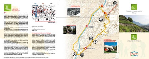
TERRACED VINEYARDS TRAIL

Trail The walk starts from the town square – the place Centrale (1) – entirely restored in 2012. The trail first follows the rue Marc Morand et runs along the Vaison-la-Romaine square that is bordered on the east by the Grand-Maison, an ancient inn built at the beginning of the 16th century (2) that boasted illustrious guests such as Goethe and Dumas. From the Manoir – a patrician house dating from 1730 that houses many contemporary art exhibitions (3), the trail joins the banks of the Dranse by the former main track. It briefly follows the river’s course before crossing it by the covered bridge (4), built after the Giétroz debacle that devastated the neighbourhood in 1818. The Our-Lady-of-Compassion chapel (1625-1630), in front of which was located the old bridge, was miraculously spared; it houses one of the most beautiful collections of ex-votos from the Valais (5). The path then goes back up the Dranse’s left bank, along the front of the Louis Moret foundation, known for its contemporary art exhibitions (6). A sign at the Rossettan bridge describes its main characteristics. A little beyond a bend in the river, the trail joins the territory of Martigny-Combe and goes through the Creusats quarter. It reaches the main road to cross the Dranse at Martigny-Croix, then takes a western direction and penetrates Martigny-Bourg, leaving the St-Michael chapel on its left (7). The walk continues along the village’s Grand Rue; further down, on the right, are located the former Ursuline convent (8), built in 1645 and, on the village square, the Trois Couronnes Hotel, built in 1609, at the time of the Martigny Vidomnes’ residence (9). Continuing along the rue de Surfrête, then the rue du Forum, the trail reaches the Gianadda Foundation (10), and the archaeological walk with its many Roman buildings: the Tepidarium (11), the Amphitheatre (12) – one of the most spectacular monuments of the Forum Claudii Vallensium Roman town (2nd and 4th century AD) – a section of flagstone road, the Mithraeum (13), the oldest cellar of the Valais adjoining the Caldarium (14), the Domus Minerva (15) and, finally, leaning against the parish church, a military milestone as well as the remnants of the early Christian cathedral dating from the 4th century (16). The town visit ends on the place Centrale after going round the Town Hall (17) and its huge, 55 m2 stained-glass window created by Edmond Bille.

Martigny Tourisme Av. de la Gare 6

Collotype Co., Médiathèque Valais – Image et Son

1920 Martigny 027 720 49 49 info@martigny.com www.martigny.com Superimposition of plans dating from 1850, 1910 and 1990, according to C. Coppey, 1991-1992

Path along the Dranse banks

Starting point: place Centrale Walking time: 1h20 Difference in altitude: +30 m -30 m Length: 6 km

The development of the town of Martigny Martigny’s history in rich in events. A first settlement was founded around the year 45 AD, close to the Celtic city of Octodure. Then the capital city of Roman Valais, Forum Claudii Vallensium became the first episcopal see. During the Middle Ages, Martigny was a group of hamlets forming a community dependent on the Bishop of Sion or the Count of Savoy – according to historical events. Located at the crossroads of the transalpine routes of the Simplon and the Great St. Bernard, the community’s commerce thrived. Goods and passengers passed in transit. During the 19th century, the town’s urbanisation took place in stages: overall, the place Centrale’s planning and the arrival of the railway constituted a turning point between the mediaeval Martigny, constituted of several villages, and the present-day city. The town grew along the avenue de la Gare, to the detriment of the former main road: the old north-south axis of Chemin Royal gave way to the new east-west development axis. During the 20th century, Martigny stretched out to form a single entity by joining the old mediaeval quarters.

Acknowledgements: Espace Mont-Blanc – Creation: Commune de Martigny, Commune de Martigny-Combe, Valrando, Martigny Tourist Office, Gérald Besse wine cellar. Authors: Sarah Besse (Gérald Besse wine cellar oenologist), Sandro Benedetti (geographer).

Photo: Benedetti

Gianadda Foundation: large private art exhibition site open to the public every day of the year

Photo: Arnaud Carpentier

around martigny


Terraced vineyards trail

Cross-sectional view of the soil in the Champortey area

Photo: P. Keusch

Photo: M. Darbellay

Mountain Pasque Flower

(Lacerta bilineata), settled in dry

(Pulsatilla montana) is a

habitats, its length can exceed 30

precocious flower typical of the

Martigny Tourisme

cm. It is the country’s most beautiful

Valais steppes. It is rather rare

Av. de la Gare 6

saurian, the male’s throat becoming

in the rest of Switzerland.

1920 Martigny

bright blue during the mating season.

Trail

Photo: M. Darbellay

027 720 49 49 info@martigny.com www.martigny.com

Grown in terraces, the vineyards overlap, each hanging on to the one above; the slope is steep and the climatic conditions favourable. In 1812, the production of the best wine from Valais was noted on the Martigny slopes. Grape growing expanded together with the arrival of the railway in the mid-19th century. Techniques and grape varieties change over the years. For the past few years, efforts have been concentrated on diversifying plantations so that a great many specialities are produced nowadays on the Martigny slopes. The focus is also placed on the conservation of the traditional heritage, in search of authenticity.

Dry stone walls A constitutive part of the Valais heritage, the dry stone wall bears witness to the herculean work needed to establish arable land surfaces. In the Valais vineyards, the cumulated length of these constructions is estimated at 1,500 km. Retaining walls border other stonework such as “murgères” (pile of stones) formed from the stones removed from the vineyards, arbours and other mazots. Since the years 2000, to counter the risk of dry stone walls disappearing and retain a know-how that is becoming rare, the attention of the Valais is newly focused on the maintenance and reconstruction of these walls. Photo: M. Darbellay

The Martigny vineyards The Martigny slopes vineyards extend over some 120 hectares across the Martigny and Martigny-Combe territories. With particularly steep slopes gen-

View of the valley from the terraced vineyards trail

erally facing the south-west, it is the largest vineyard on the Rhone’s left bank. It is characterised within the Valais vineyards by its soil constituted of mixed

Photo: M. Darbellay

scree: limestone, crystalline rocks and moraine. From the Bâtiaz heights to

the museum-mazot is a tribute to all wine-

Growing wild or domesticated as early as the 6th-7th century BC, the cultivation of vines on the Martigny slopes is attested in texts dating from the beginning of the 14th century, with the description of les Bans, Soleil, Champortey and En-Celluysier (Plan Cerisier) plots.

growers from Salvan, Vallorcine and

Rossettan

Sur les Scex

Les Marques

Tirbovet

Les Bellaines Le Brésil

Coquimpey

Champortey

Les Bans

Le Liappey

Le Sommet des vignes (village)

Opened in 1978 and renovated in 2008,

Terraced vineyards

Les Girardins

The Plan Cerisier museum

Soleil

Plan Cerisier, the soil’s limestone content steadily decreases. Plan-Cerisier

Starting point: Bâtiaz bridge Walking time: 1h45 Difference in altitude: +205 m -205 m Length: 6 km

The vineyards and the Bâtiaz tower

Le Perrey

From the famous covered bridge (1), the terraced vineyards trail goes through the Bâtiaz quarter. When it reaches the former school building (2), it turns to the left to climb the winding road towards the castle. On the way, it meets various varieties of rocks, of which marble that was mined since the Roman period (3). After visiting the castle built during the 8th century and abandoned in the early 16th century, and its siege engines (4), the walk continues towards the west to reach the very heart of the Martigny terraced vineyards. Following the former historic path leading to the Sommet des Vignes and to Ravoire, it crosses the international Forclaz road – the last pass road entirely built on a new alignment (1957) – then joins a hillside road to carry on towards the Forclaz valley. After about 150 m, the trail follows the old vineyard path down to Plan Cerisier, typical hamlets constituted of “mazots” (small traditional chalets). One of them houses the vineyard museum (5). On exiting Plan Cerisier, the path continues downwards towards the Martigny-Croix crossroads, leaving the village on the right, crosses the main road and joins the banks of the river Dranse through the Creusats quarter. It follows the foot of the vineyards and their many terraces supported by dry stone walls. It meets a first covered bridge, then the Rossettan bridge and, along a last pastoral stretch between the rock and the Dranse, ends at the Bâtiaz covered bridge.

Photo: J.-M. Pillet

The Western Green Lizard

Entremont who worked at Plan Cerisier. The smallest museum reported in Switzerland, it exhibits traditional objects that were used in the vines and for the transhumance, and occasionally works of local artists. Photo: M. Darbellay

Reprinted with permission from swisstopo (BA 130157)


Issuu converts static files into: digital portfolios, online yearbooks, online catalogs, digital photo albums and more. Sign up and create your flipbook.