George Davidson's Oregon
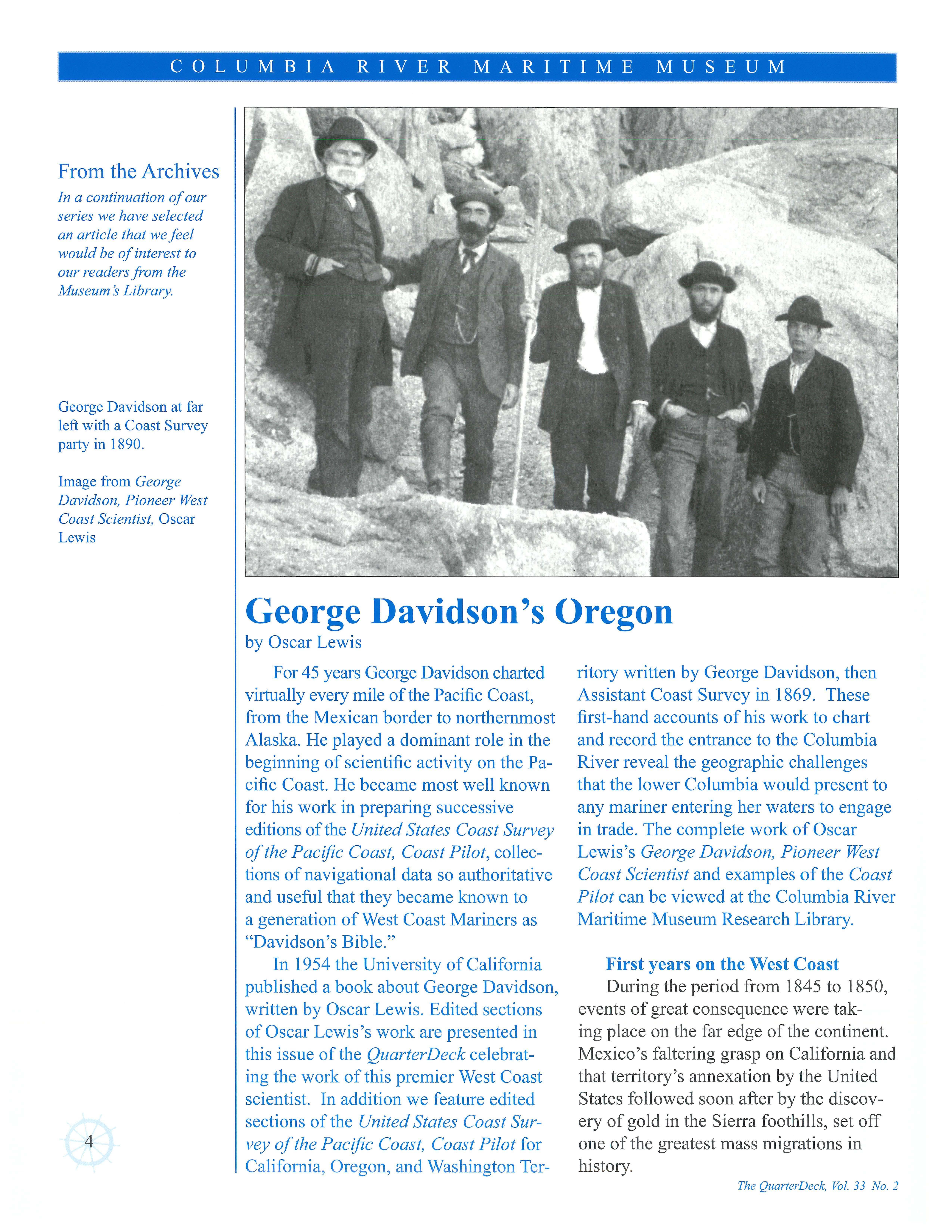 by Oscar Lewis
For 45 years George Davidson charted virtually every mile of the Pacific Coast, from the Mexican border to northernmost Alaska. He played a dominant role in the beginning of scientific activity on the Pacific Coast. He became most well known for his work in preparing successive editions of the United States Coast Survey of the Pacific Coast, Coast Pilot, collections of navigational data so authoritative and useful that they became known to a generation of West Coast Mariners as "Davidson's Bible."
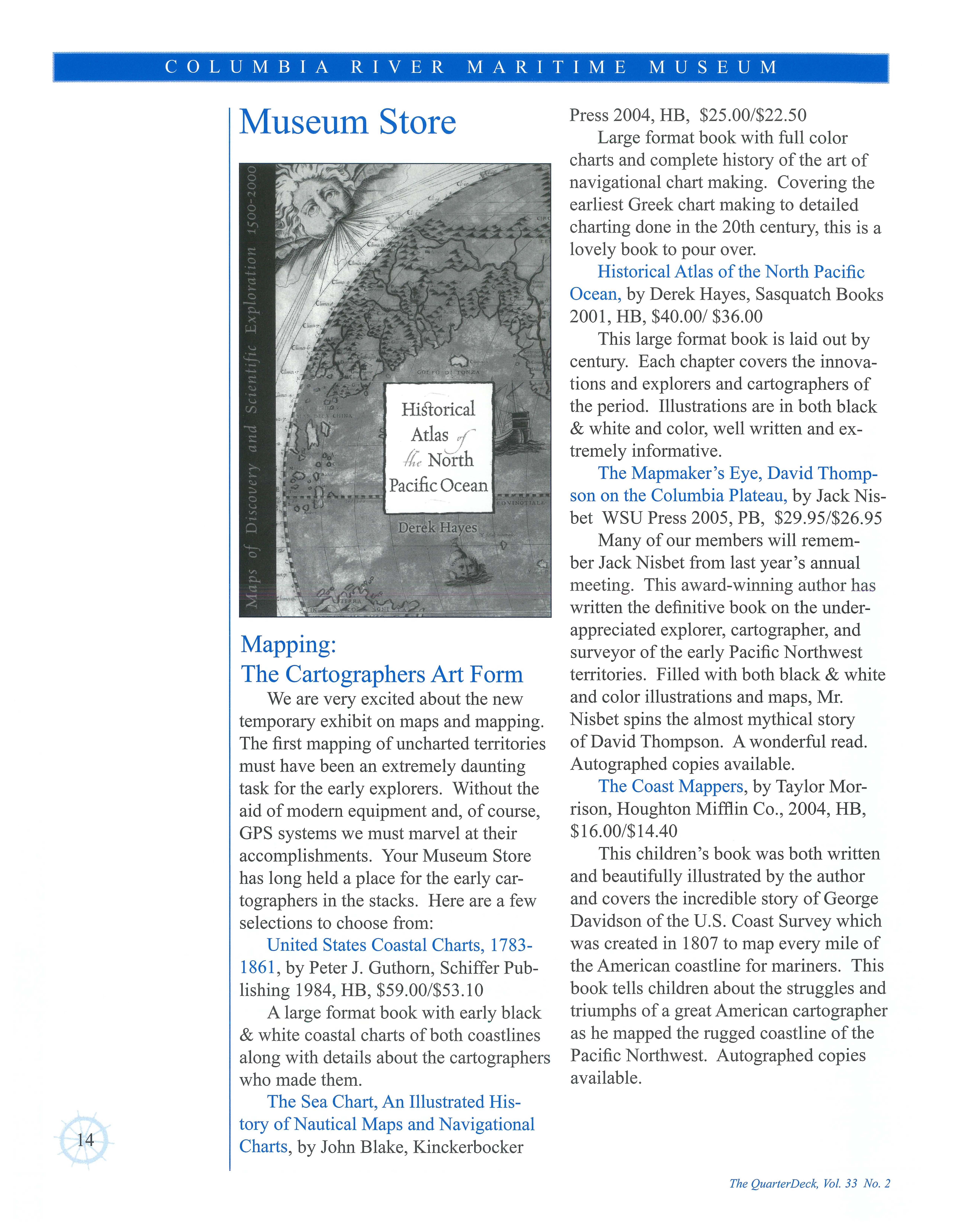
In 1954 the University of California published a book about George Davidson, written by Oscar Lewis. Edited sections of Oscar Lewis's work are presented in this issue of the QuarterDeck celebrating the work of this premier West Coast scientist. In addition we feature edited sections of the United States Coast Survey of the Pacific Coast, Coast Pilot for California, Oregon, and Washington Ter-
ritory written by George Davidson, then Assistant Coast Survey in 1869. These first-hand accounts of his work to chart and record the entrance to the Columbia River reveal the geographic challenges that the lower Columbia would present to any mariner entering her waters to engage in trade . The complete work of Oscar Lewis's George Davidson, Pioneer West Coast Scientist and examples of the Coast Pilot can be viewed at the Columbia River Maritime Museum Research Library.
First years on the West Coast
During the period from 1845 to 1850, events of great consequence were taking place on the far edge of the continent. Mexico's faltering grasp on California and that territory's annexation by the United States followed soon after by the discovery of gold in the Sierra foothills, set off one of the greatest mass migrations in history.
I_- _ C O L U M B I _ A __ R I V E R M _ A _ R I _ T I M _ E _ M U S E U M ______J
4
The QuarterDeck, Vol. 33 No. 2
These developments made imperative a prompt further extension of the work of the Coast survey. Superintendent Bache foresaw that the worldwide interest aroused by news of the gold discovery would result in a vast increase in waterborne commerce, and this would necessitate the accurate mapping of the Pacific shoreline and its installation of numerous aids to navigation. With hundreds of ships converging on San Francisco from every comer of the globe, the need for such safeguards was both clear and urgent. For at the time California passed to the control of the United States there were no lighthouses, buoys, or other markings anywhere along the long coastline from San Diego to Puget Sound, and such charts as existed were few and of almost no practical value.
The result was that the gold ships arrived with whatever charts could be found in the ports where the voyages had originated. Davidson himself later stated that many of the ships had nothing more to guide them than the maps taken from school atlases. Others, a bit more fortunate, used charts printed in England that were based on the exploratory surveys made by Captain George Vancouver on his visit to the coast more than half a century earlier. So far as it is known, the only
available chart of San Francisco Bay and its narrow entrance towards which virtu ally all the gold ships were headed-was that made in the mid- l 820s by another English exploring party, commanded by Captain William Beechy. However, a few ships from the East Coast of the United States may have carried charts prepared by members of the Wilkes expedition, which had visited the area more recentlythat is , in 1841.
Faced by this emergency, the seriousness of which was demonstrated by reports of frequent wrecks on the coast, Superintendent Bache lost no time in laying plans for beginning a survey of the area. Accordingly, as early as October 1848, he dispatched the coast survey schooner Ewing to California and assigned a U.S. Navy Lieutenant, William P. McArthur, to command her, with instructions to begin a hydrographic survey. However, by the time the Ewing was fitted out and then journeyed around the horn, the greater part of year had gone by, and the vessel did not arrive until mid-September 1849 .
By that time the gold rush was at its height, and Lt. McArthur discovered that, with the inflated values then prevailing throughout California, it was impossible to hire men to operate the craft at the modest wages he was authorized to pay.
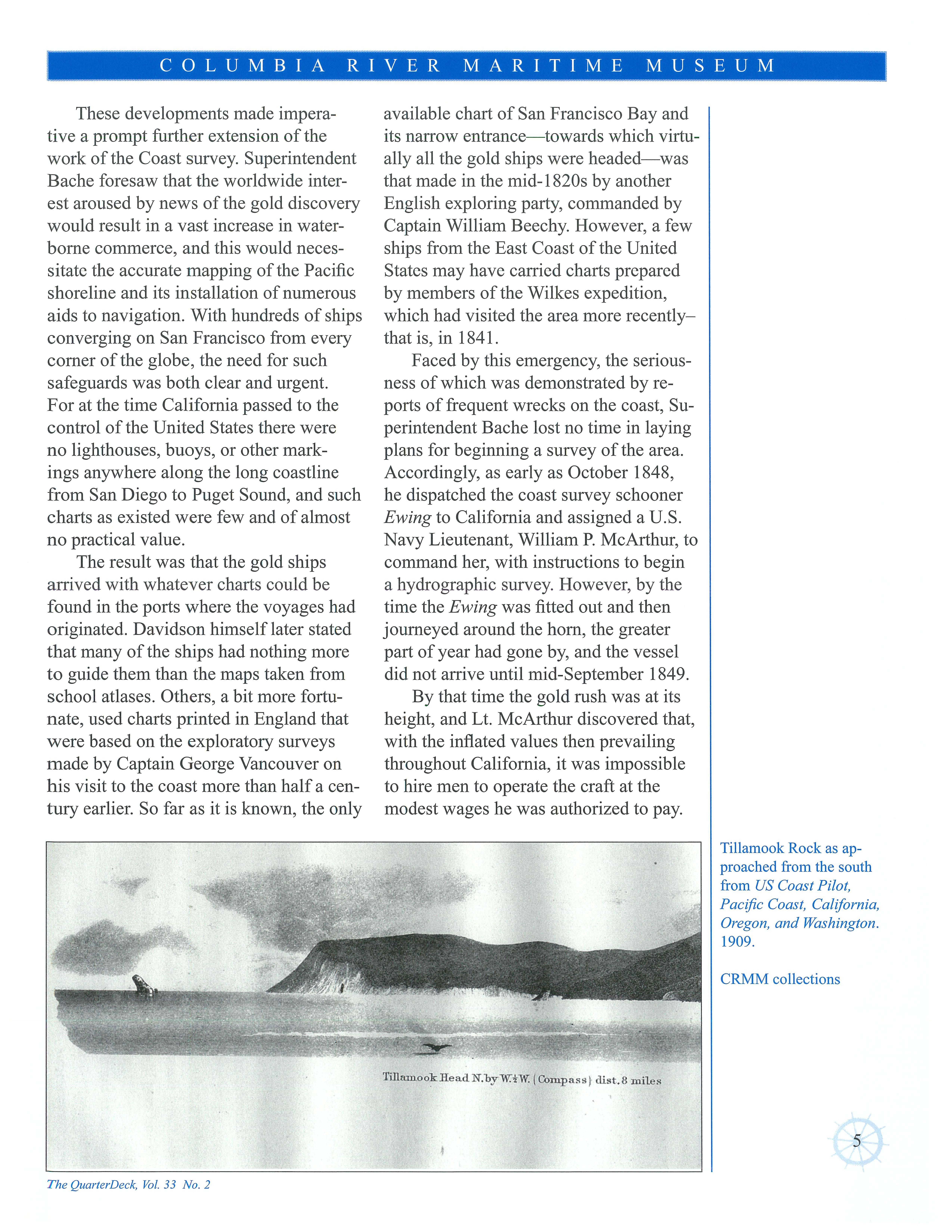
Tillamook Rock as approached from the south from US Coast Pilot, Pacific Coast, California, Oregon, and Washington . 1909
1· ····---·--- ·1 COLUMBIA RIVER
MUSEUM
MARITIME
The QuarterDeck, Vol. 33 No 2
TillamooklieadN.byW.tW. ( Compass ) clist 8 m ile s
5
CRMM collections
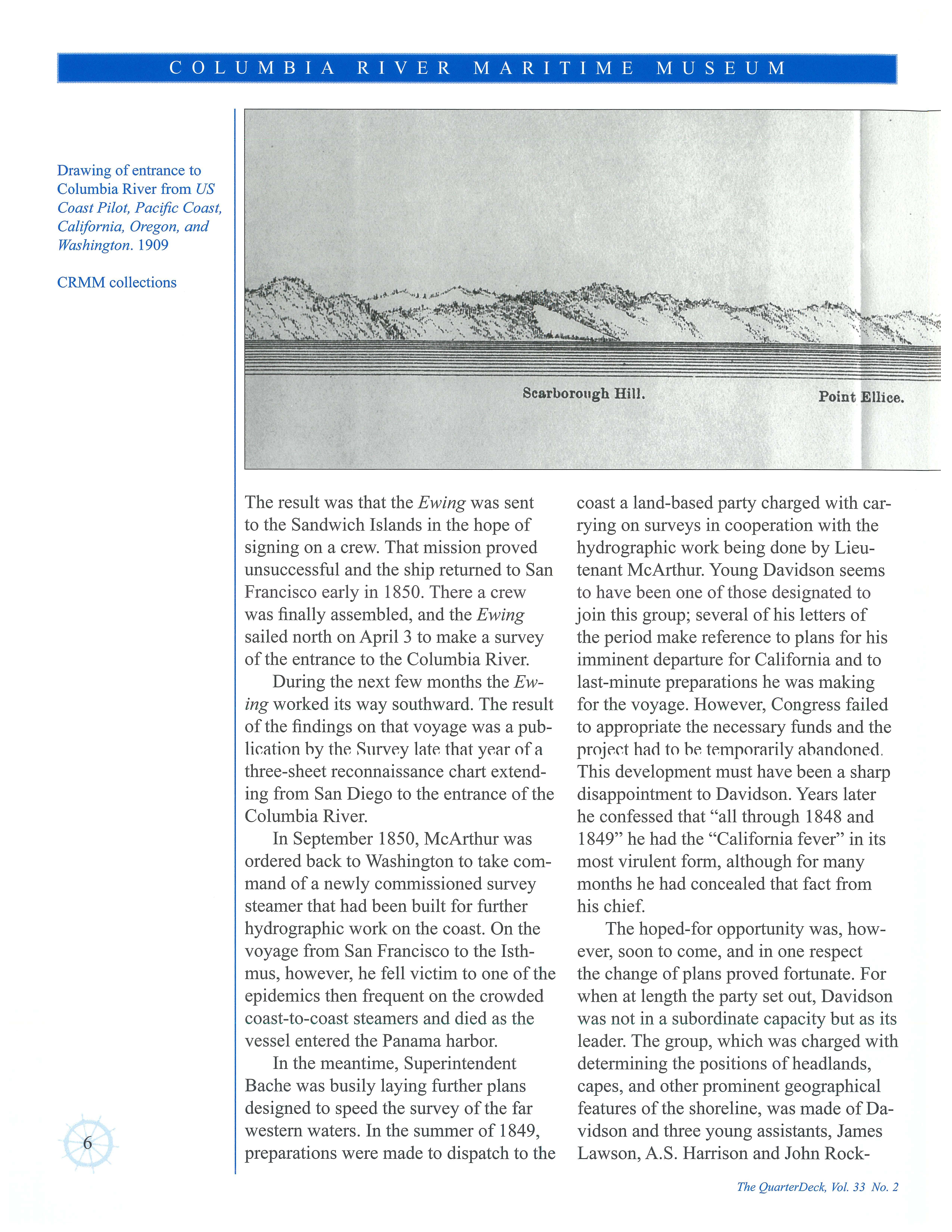
Drawing of entrance to Columbia River from US Coast Pilot, Pacific Coast, California, Oregon , and Washington . 1909
CRMM collections
The result was that the Ewing was sent to the Sandwich Islands in the hope of signing on a crew. That mission proved unsuccessful and the ship returned to San Francisco early in 1850. There a crew was finally assembled, and the Ewing sailed north on April 3 to make a survey of the entrance to the Columbia River.
During the next few months the Ew ing worked its way southward. The result of the findings on that voyage was a publir,ation hy thr- Snrvr-y latr- that yr-ar of a three-sheet reconnaissance chart extending from San Diego to the entrance of the Columbia River.
In September 1850, McArthur was ordered back to Washington to take command of a newly commissioned survey steamer that had been built for further hydrographic work on the coast. On the voyage from San Francisco to the Isthmus, however, he fell victim to one of the epidemics then frequent on the crowded coast-to-coast steamers and died as the vessel entered the Panama harbor.
In the meantime, Superintendent Bache was busily laying further plans designed to speed the survey of the far western waters. In the summer of 1849, preparations were made to dispatch to the
coast a land-based party charged with carrying on surveys in cooperation with the hydrographic work being done by Lieutenant McArthur. Young Davidson seems to have been one of those designated to join this group; several of his letters of the period make reference to plans for his imminent departure for California and to last-minute preparations he was making for the voyage. However, Congress failed to appropriate the necessary funds and the projr-r,t ha<l to hr- tr-mporarily abandoned. This development must have been a sharp disappointment to Davidson. Years later he confessed that "all through 1848 and 1849" he had the "California fever" in its most virulent form, although for many months he had concealed that fact from his chief.
The hoped-for opportunity was, however, soon to come, and in one respect the change of plans proved fortunate. For when at length the party set out, Davidson was not in a subordinate capacity but as its leader. The group, which was charged with determining the positions of headlands, capes, and other prominent geographical features of the shoreline, was made of Davidson and three young assistants, James Lawson, A.S. Harrison and John Rock-
. COLUMBIA RIVER MARITIME MUSEUM
6
. ..,'-' ,, .t P"'_,,,.~.,. rn~-•l ~:
Scarborough Hill. Point Elliee.
The QuarterDeck, Vol. 33 No 2
well, all members of the Coast survey staff, who had volunteered for the work. The party left the East Coast in late May 1850, on board the steamer Philadelphia, and crossed the Isthmus of Panama early in June. On the West Coast they embarked on the Tennessee and landed in San Francisco on June 19.
That the work he and his party were engaged in during those pioneer years entailed much hardship and the cons i<lerah le rlegree of rlanger-is clear from the nature of their duties. For they were engaged in making the first detailed surveys of a coastline that was rugged in the extreme, with few harbors or inlets where safe landings could be made, and where the little survey ship, exploring waters close inshore, faced an ever present danger from submerged reefs and other navigational hazards.

Davidson and his aides fully shared these perils, for although their duties consisted mainly in making land surveys and observations; they traveled from point to point on board the Survey's ship, going ashore from time to time in setting up stations on headlands or other elevated spots. This involved their landing, with all their equipment and supplies, in small boats,
frequently on rocky shores where unskillful handling of their little craft might well have brought disaster, for the piloting of such small vessels through the surf onto an unknown shore has long been looked upon as one of the most hazardous of all feats of seamanship.
In the early and middle 1850s, Davidson and his helpers performed that difficult maneuver not once or twice but scores of times; in fact, he once stated that in the first three years on the coast he made "more than 40" such landings. Although he and the others of his party escaped major mishaps while so engaged, every member of the group invariably was soaked to the skin in the process of making shore and carrying their instruments and provisions to the beach .
However, not all members of the survey staff on the coasts got off so lightly. In October 1852, a member of the staff, assistant Joseph S. Ruth, with whom Davidson had formed a close friendship when both were stationed at the Washington headquarters, was drowned off the mouth of the Columbia River by the capsizing of the small boat in which he was going ashore.
But landing through the surf was not
The QuarterDeck, Vol. 33 No. 2
Tongue Point.
7
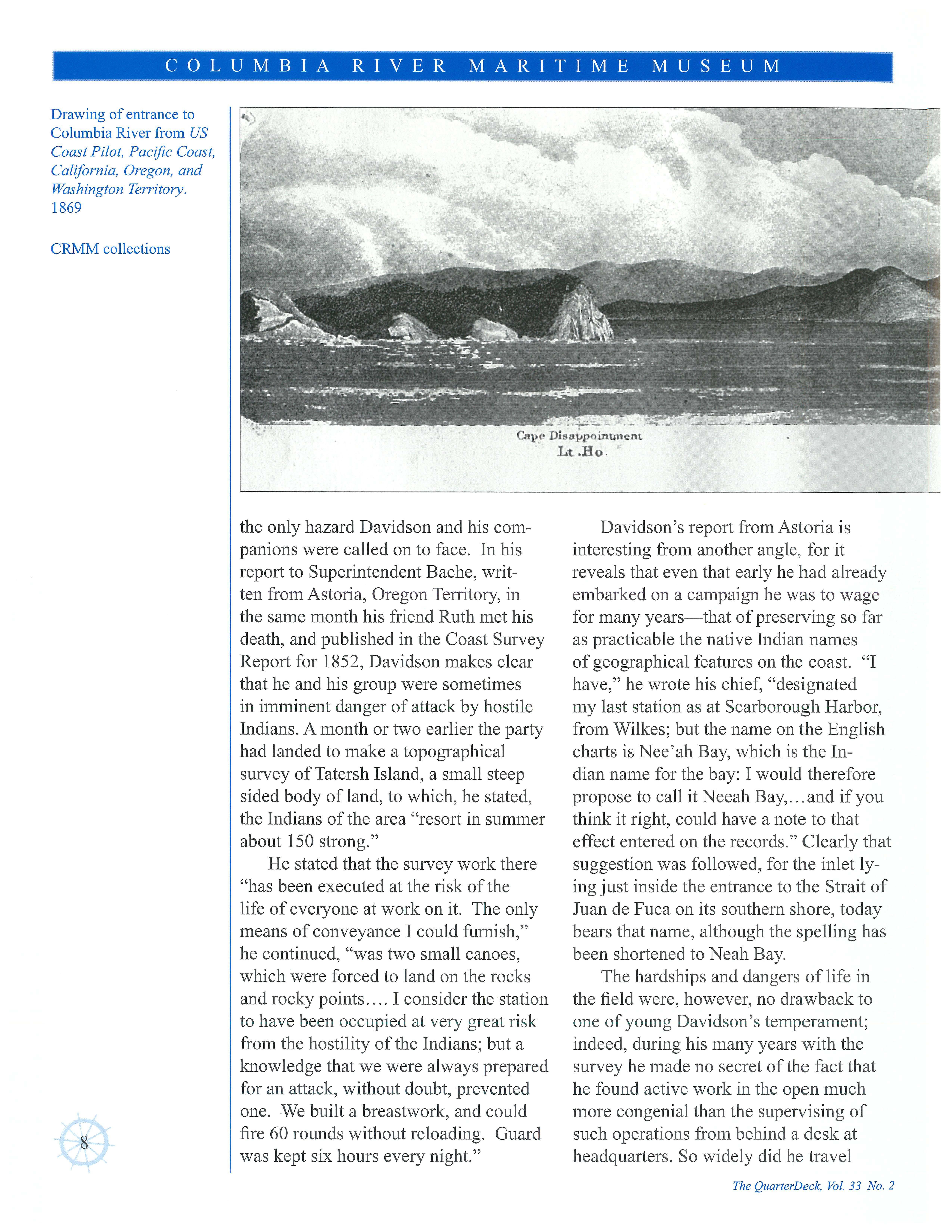
Drawing of entrance to Columbia River from US Coast Pilot, Pacific Coast, Calffornia, Oregon , and Washington Territory 1869 CRMM collections
Lt.Ho.
the only hazard Davidson and his compan ions were called on to face. In his report to Supe r intendent Bache, writ ten from Astoria, Oregon Territory, in the same month his friend Ruth met his death, and published in the Coast Survey Report for 1852, Davidson makes clear that he and his group were sometimes in imminent danger of attack by hostile Indians. A month or two earlier the party had landed to make a topographical survey of Tatersh Island, a small steep sided body of land, to which, he stated, the Indians of the area "resort in summer about 150 strong."
He stated that the survey work there "has been executed at the risk of the life of everyone at work on it. The only means of conveyance I could furnish," he continued, "was two small canoes, which were forced to land on the rocks and rocky points I consider the station to have been occupied at very great risk from the hostility of the Indians; but a knowledge that we were always prepared for an attack, without doubt, prevented one. We built a breastwork, and could fire 60 rounds without reloading. Guard was kept six hours every night."
Davidson's report from Astoria is interesting from another angle, for it reveals that even that early he had already embarked on a campaign he was to wage for many years that of preserving so far as practicable the native Indian names of geographical features on the coast. "I have," he wrote his chief, "designated my last station as at Scarborough Harbor, from Wilkes; but the name on the English charts is Nee'ah Bay, which is the Indian name for the bay: I would therefore propose to call it Neeah Bay, .. . and if you think it right, could have a note to that effect entered on the records." Clearly that suggestion was followed, for the inlet lying just inside the entrance to the Strait of Juan de Fuca on its southern shore, today bears that name, although the spelling has been shortened to Neah Bay.
The hardships and dangers of life in the field were, however, no drawback to one of young Davidson's temperament; indeed, during his many years with the survey he made no secret of the fact that he found active work in the open much more congenial than the supervising of such operations from behind a desk at headquarters. So widely did he travel
~ ~ i COLUMBIA RIVER MARITIME MUSEUM ' I_
8
-~:~=-Cape
Disappoinunent
The QuarterDeck, Vol, 33 No. 2
on such missions that in 1900 he wrote proudly that on such official tasks he had covered a total of 402,188 miles, a distance of more than 16 times round the world. In a letter to the editor of the National Geographic magazine, written that same year, referring to his more than half a century of active fieldwork he stated: "I made it a rule to volunteer for every dif ficult, disagreeable and faraway work that was projected, and usually managed to succeed in getting it."
Curiously, Davidson's first impressions of the West Coast which was to be his home for more than 60 years and to the development of which he was to contribute much-were far from favorable. Soon after he arrived in 1850 he wrote to a friend in the East: "combining all the worst features of New England, make every hill barren no roads, no timber, no houses-and you will get a country in which no man will work while he can live elsewhere." But it was not long before his new surroundings came to seem less strange and unfriendly. For he was an active youth, physically strong, and with the natural liking for challenges and rewards of frontier life. Indeed, after five years
on the coast , when he had begun to think of the likelihood of his being recalled permanently to the Survey's headquarters at Washington, his attitude changed so that, in January, 1855, he wrote his future mother-in-law, Jane Fauntleroy: "How stupid it would seem ever again to sit quietly and cogitate before a fire ... to grow gray headed and take a pew in church in order to appear respectable."
In 1852, while working in close cooperation with a hydrographic party led by Lieutenant Alden , Davidson would conduct extensive surveys of the Columbia River. The following was edited from his published 1869 Coast Pilot giving a glimpse of the work involved in such an undertaking as expressed through Davidson's own words .
Columbia River: Point Adams
Two miles northward of Tillamook Head commences a peculiar line of low sandy ridges, running parallel to the beach towards Point Adams, and appearing like huge sand waves covered with grass and fern. Between some of them run small creeks, while the country behind is low, swampy, and covered with wood and an almost impenetrable undergrowth. About
COLUMBIA RIVER MARITIME MUSEUM
l i t.S t. B'cll eue
T0Jig 11e:et
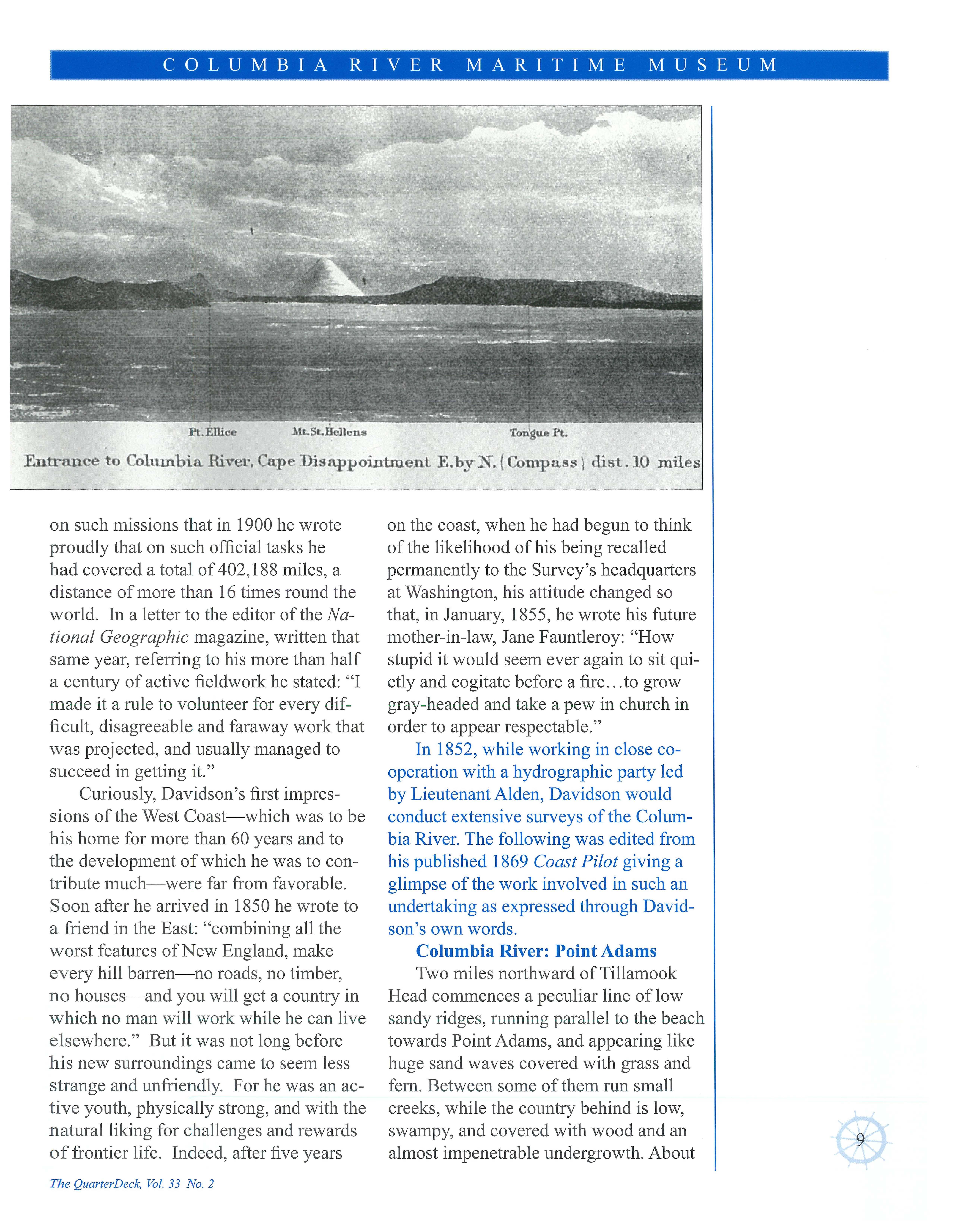
Entrance t o Columbi a River, Cape Di sappointment E .by N . (Compass\ di st . 10 mile s
The Qua r terDeck, Vol. 33 No 2
I 9
three miles north of the head, Clarke says, a beautiful stream empties, with a strong rapid current. It is eighty-five yards wide, and has three feet at its shallowest crossing.
Point Adams is low and sandy, covered with bushes and trees to the line of sand beach and low dunes; and although it is reported to have washed away over half a mile since 1841, we find comparatively small changes since the survey of Broughton in 1792.
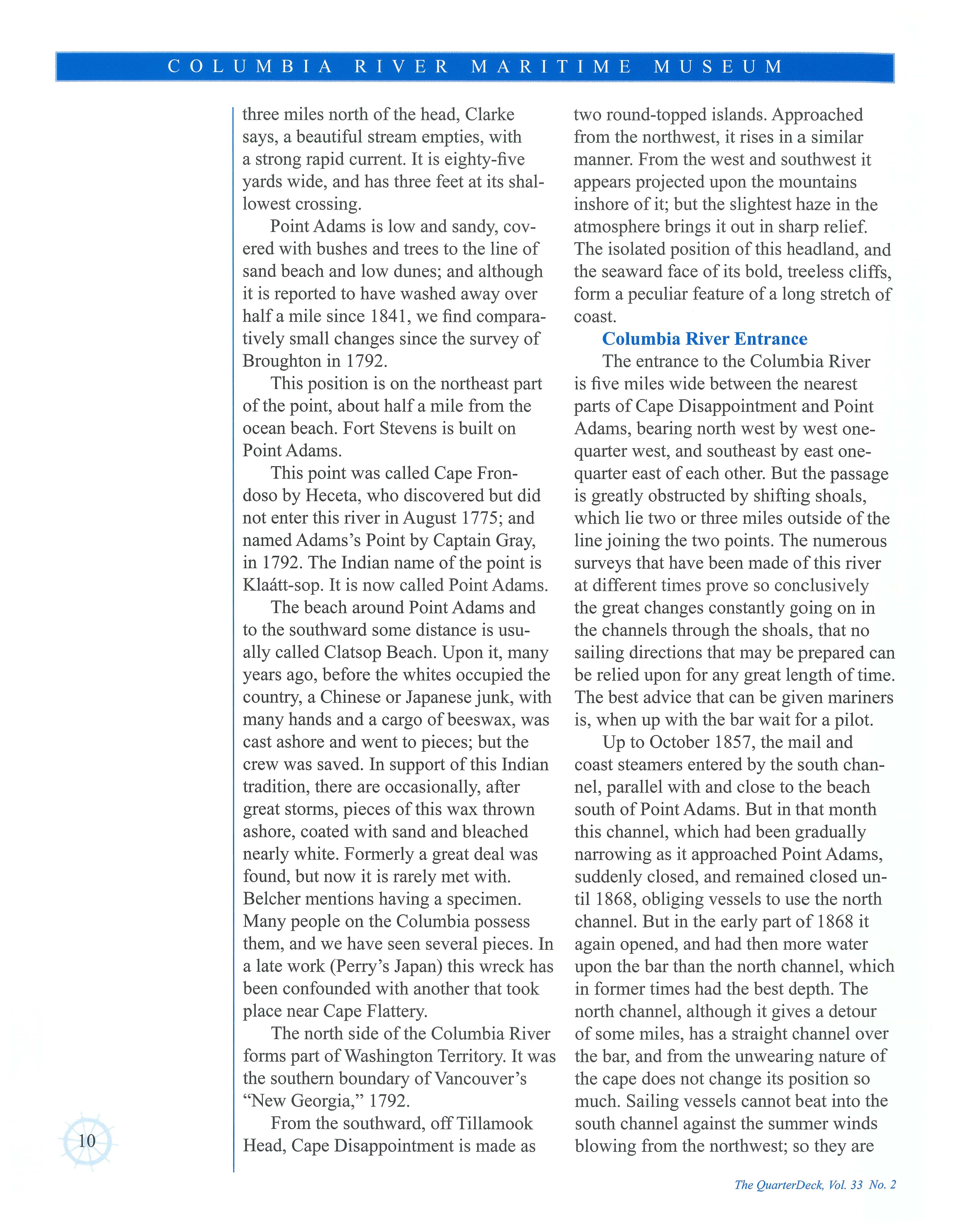
This position is on the northeast part of the point, about half a mile from the ocean beach. Fort Stevens is built on Point Adams.
This point was called Cape Frondoso by Heceta, who discovered but did not enter this river in August 1775; and namedAdams's Point by Captain Gray, in 1792. The Indian name of the point is Klaatt-sop. It is now called Point Adams.
The beach around Point Adams and to the southward some distance is usually called Clatsop Beach. Upon it, many years ago, before the whites occupied the country, a Chinese or Japanese junk, with many hands and a cargo of beeswax, was cast ashore and went to pieces; but the crew was saved. In support of this Indian tradition, there are occasionally, after great storms, pieces of this wax thrown ashore, coated with sand and bleached nearly white. Formerly a great deal was found, but now it is rarely met with. Belcher mentions having a specimen. Many people on the Columbia possess them, and we have seen several pieces. In a late work (Perry's Japan) this wreck has been confounded with another that took place near Cape Flattery.
The north side of the Columbia River forms part of Washington Territory. It was the southern boundary of Vancouver's "New Georgia," 1792.
From the southward, off Tillamook Head, Cape Disappointment is made as
two round-topped islands. Approached from the northwest, it rises in a similar manner. From the west and southwest it appears projected upon the mountains inshore of it; but the slightest haze in the atmosphere brings it out in sharp relief. The isolated position of this headland, and the seaward face of its bold, treeless cliffs, form a peculiar feature of a long stretch of coast.
Columbia River Entrance
The entrance to the Columbia River is five miles wide between the nearest parts of Cape Disappointment and Point Adams, bearing north west by west onequarter west, and southeast by east onequarter east of each other. But the passage is greatly obstructed by shifting shoals, which lie two or three miles outside of the line joining the two points. The numerous surveys that have been made of this river at different times prove so conclusively the great changes constantly going on in the channels through the shoals, that no sailing directions that may be prepared can be relied upon for any great length of time. The best advice that can be given mariners is, when up with the bar wait for a pilot.
Up to October 1857, the mail and coast steamers entered by the south channel, parallel with and close to the beach south of Point Adams. But in that month this channel, which had been gradually narrowing as it approached Point Adams, suddenly closed, and remained closed until 1868, obliging vessels to use the north channel. But in the early part of 1868 it again opened, and had then more water upon the bar than the north channel, which in former times had the best depth. The north channel, although it gives a detour of some miles, has a straight channel over the bar, and from the unwearing nature of the cape does not change its position so much. Sailing vessels cannot beat into the south channel against the summer winds blowing from the northwest; so they are
COLUMBIA RIVER
MUSEUM
MARITIME
The QuarterDeck, Vol. 33 No 2
The Columbia River Bar is a crossing never to be underestimated. Davidson's directions for sailing ships were considered the most accurate of the time. After reviewing these directions one would have to wonder what would be going through a captain's mind preparing his ship to enter the Columbia River.
To enter by the South Channel. Bring Cape Disappointment light-house to bear north by west one-quarter west, and steer for it. This course will bring you to the Outer Bar buoy, which is placed in twelve fathoms, one and oneeighth miles southeast by south from the southern point of the Middle Sands. When up with this buoy, which you may pass close to on either hand, steer north for three and a quarter miles to the red buoy on the west end of Clatsop Spit. Give this buoy a berth to starboard of one hundred and fifty yards, and when
abreast of it steer northeast by north until the Fort Stevens flag-staff on Point Adams bears east-southeast. Then steer east one-quarter north until the same flag-staff bears southeast by south three-quarters south, then steer southeast one-quarter east until the flag-staff bears southwest three-quarters west. Now steer east three-quarters south, two and three-eighths miles, until you bring Point Ellice to bear north, when you will see a black buoy three-quarters of a mile northeast three-quarters east ofyou. Now you must steer northeast by east three-quarters east to Astoria, where you may come to anchor offAstor Point in from seven to eight fathoms; or, by rounding the point to the front of the town, you may anchor in from four to six fathoms in the bight. But if bound up the river, the best direction that can be given is to take a pilot at Astoria.
Davidson's location of the flag pole at Fort Stevens in 1869
Latitiude: 46° 12' 24 .. Longitude 123° 56' 47.2"
1- - c o -·L U MB 1 A -Riv- E-R ·MA-R - 1 i I M E M u s ·E u M -· - : 1--~- ·---·-·- -·· -·· -----·· ·- ·- ·-. ·-·
The QuarterD eck, Vol 33 No. 2
11
Davidson's location of Astor Point station in 1869, which he states is at the front of the town
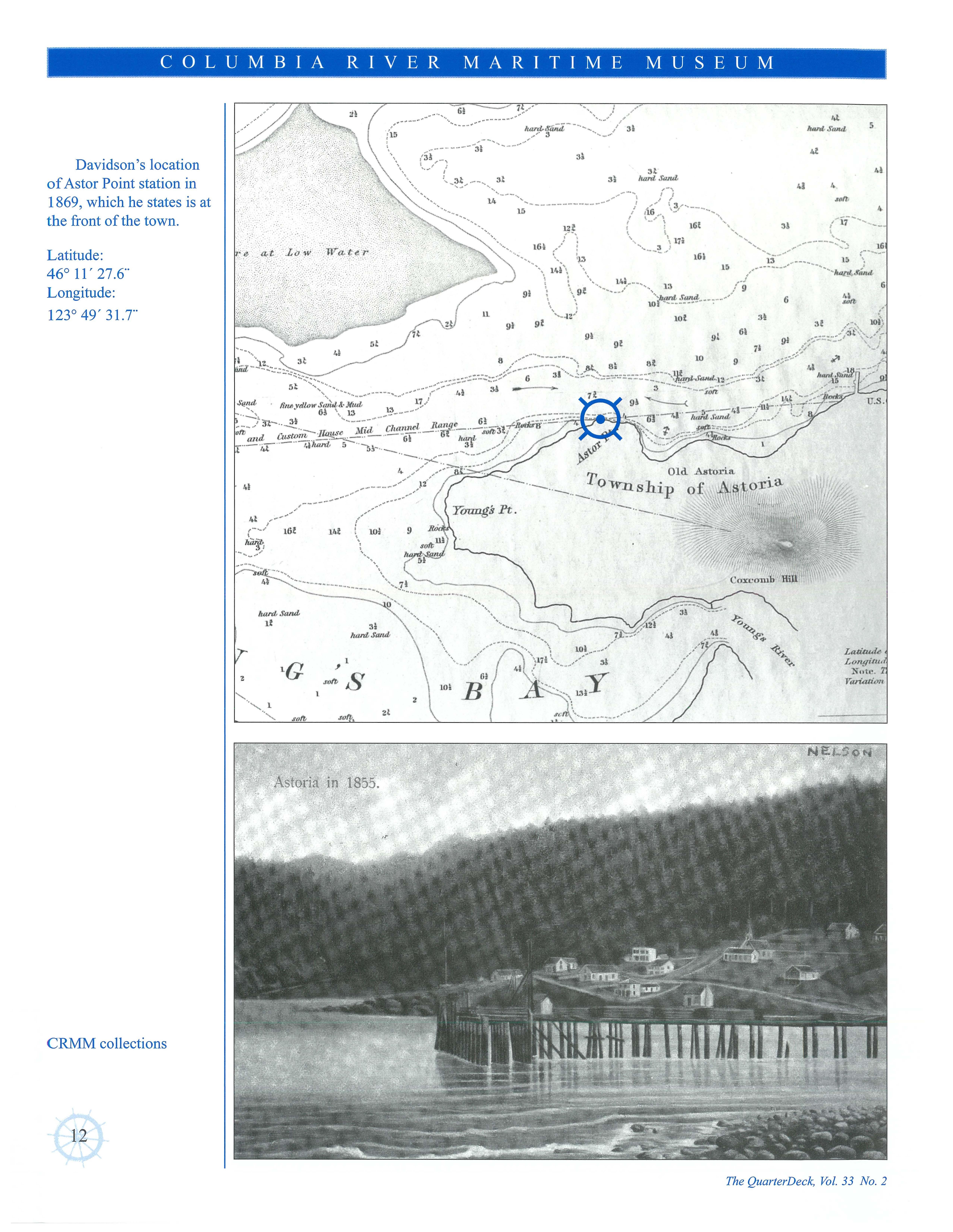
Latitude : 46° 11' 27.6" Longitude: 123° 49' 31.T
1l
harJ,Sa,ul
COLUMBIA RIVER MARITlME MUSEUM
CRMM collections 12
The QuarterDeck, Vol. 33 No 2
41 hard,Sand,
31
61 IOI B ~ ) ./·., hard,/Jiiii,i, "~ " //' 3l ______ 3 __ al 3l To---. h. ·-· ··- ".US Ip ·. ---·--··-4l 4 ,.n 4LttlUlUU Longi-1u, Noh• Variation
obliged to use the north channel. But they almost invariably come out through the former; as with the prevailing wind they can easily fetch out by the point of Clatsop Spit, and then have a fair wind over the bar.
During heavy weather, and especially in winter, the sea breaks with terrific fury from northwest of Cape Disappointment, well to the southward of Point Adams. The mail steamers have sometimes to wait days for the smallest show of an opening to get in; and sailing vessels have laid off the entrance six weeks, waiting for a fair opportunity to enter. Many lie inside for weeks unable to get out. The mail steamers, by exerting all their power, sometimes drive through the combers, but have their decks swept fore and aft by every sea. Few places present a scene of more wildness than this bar during a southeast gale, contrasting strongly with many times during the summer, when not a breaker is to be seen on the shoalest spots.
Young's Point
Young's Point, on the southern side of the river, is the first point made after passing eastward of Clatsop Beach Immediately behind it the land is high and densely wooded; and around its southern face opens Young's River.
It was called "Point George" by Broughton in 1792; "George Point" by Belcher in 1839; "Young's Point" by the United States exploring expedition in 1841; "Smith's Point" by the Coast Survey, in the triangulation of 1852; but it is, we believe, generally known as Young's Point.
Astor Point, on the southern side of the river, lies east three-quarters north, distant five and a third miles from Point Adams. It is low at the river bank, but has moderately high wooded land behind it. The southern channel passes close to it. The name is derived from a Coast Survey triangulation and secondary astronomical
station upon it, but it is in reality a part of Young's Point.
Just above Astor Point is situated the town of Astoria, now a thriving commercial place. The custom-house is located here, and it is connected with Salem, the capital of the State, by a military road. Vessels bound up the river here exchange the "bar pilot" for a "river pilot." About [half] the distance between Astor and Tongue Points lies the wreck of the ship Silver de Grace [Sylvia de Grasse] upon a dangerous rock, close in to which the channel goes, and around which the current runs with great velocity either way at half tide.
Smithsonian Poster Exhibit Celebrates 200th Anniversary of The Coast Survey
The Columbia River Maritime Muselllll, in a partnership with the Smithsonian and NOAA, is proud to host From Sea to Shining Sea: 200 Years Charting Americas Coasts . The exhibition tells the story of America's first federal science agency, the Coast Survey, and its direct descendent, the National Oceanic an<l Atmospheric Administration.
These organizations are known for a tradition of perseverance, scientific integrity, engraving and charting skills, and courage. In recognition of this landmark 200th anniversary, NOAA and the Smithsonian Institution Traveling Exhibition Service have created the exhibit, From Sea to Shining Sea: 200 Years of Charting Americas Coasts, which opens June 21 in 200 venues nationwide. This exhibit, celebrates the history, accomplishments and scientific contributions of the nation's first federally funded science agency.
The 20 colorful posters are illustrated with photos, charts and artwork from the Survey's archives, and will be on display in our meeting rooms this summer.
, COLUMBIA RIVER MARITIME MUSEUM
Th e QuarterDeck, Vol. 33 No. 2
13
0Smithsonian Institution Traveling Exhibition Service

 by Oscar Lewis


