POSITION STATEMENT
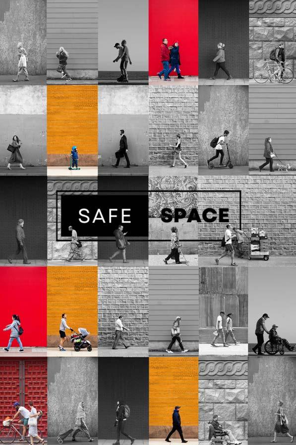
Public Space should be safe space. The most prominent of these spaces - the street, is often underutilised, under appreciated and often forgotten. When the local government does intend to improve upon the street, it is often driven by economic (and rarely social) gains. When stakeholder engagement is promoted in the decision making, it is often poised in a manner which is generally concerned with generating capital, increasing pedestrian traffic and providing social settings. Though all of these are well-intentioned means of change, they often fail to acknowledge less documented facets of the street. We aim to be agents of change, advocating for what is often unheard, unseen and undocumented within our streets. We aim to gather data that is not often found in council surveys or stakeholder engagement plans.
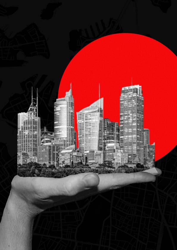
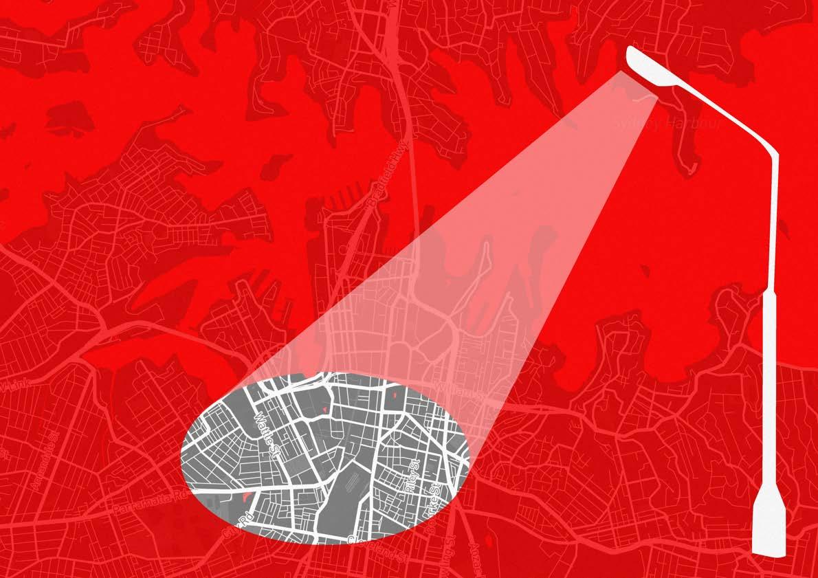
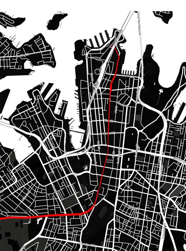
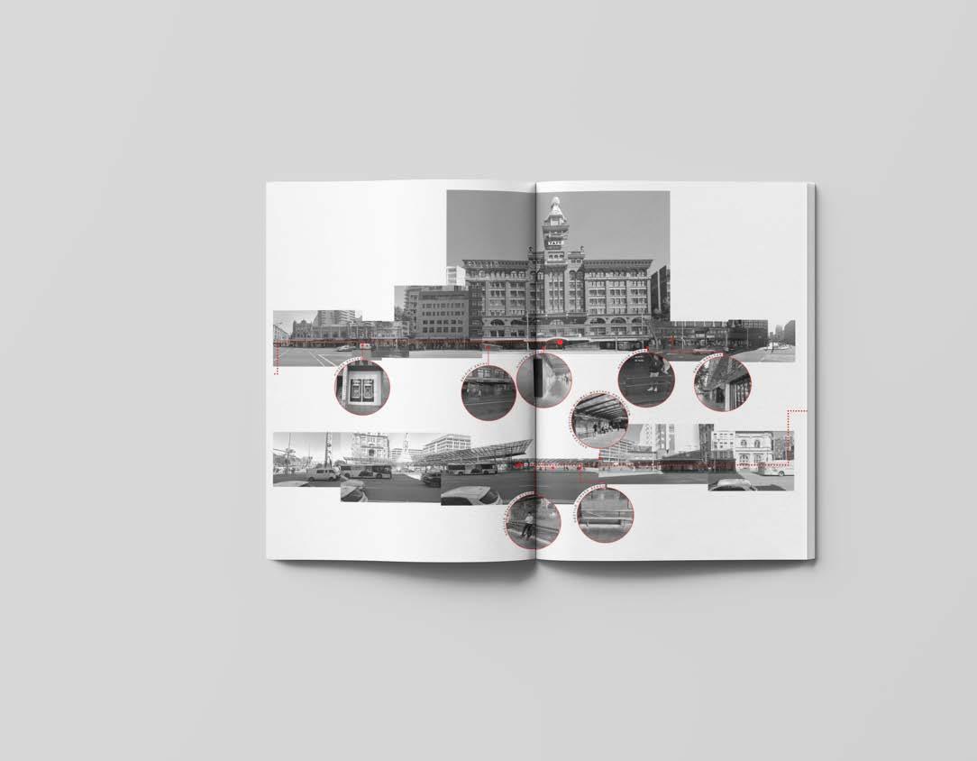
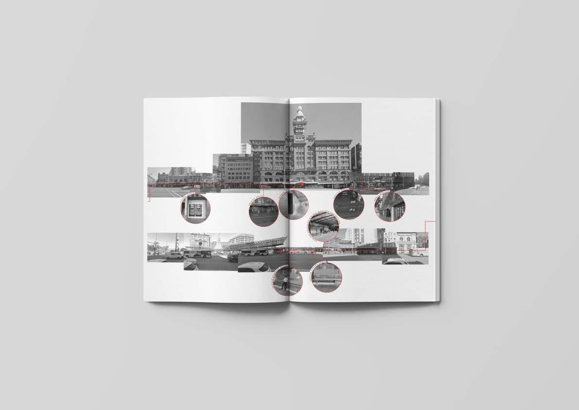
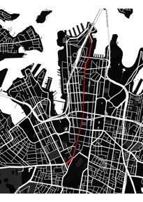
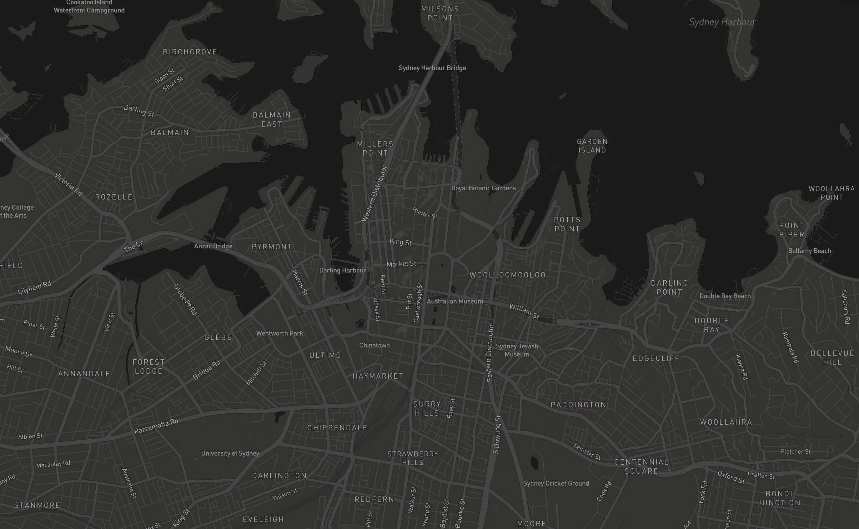
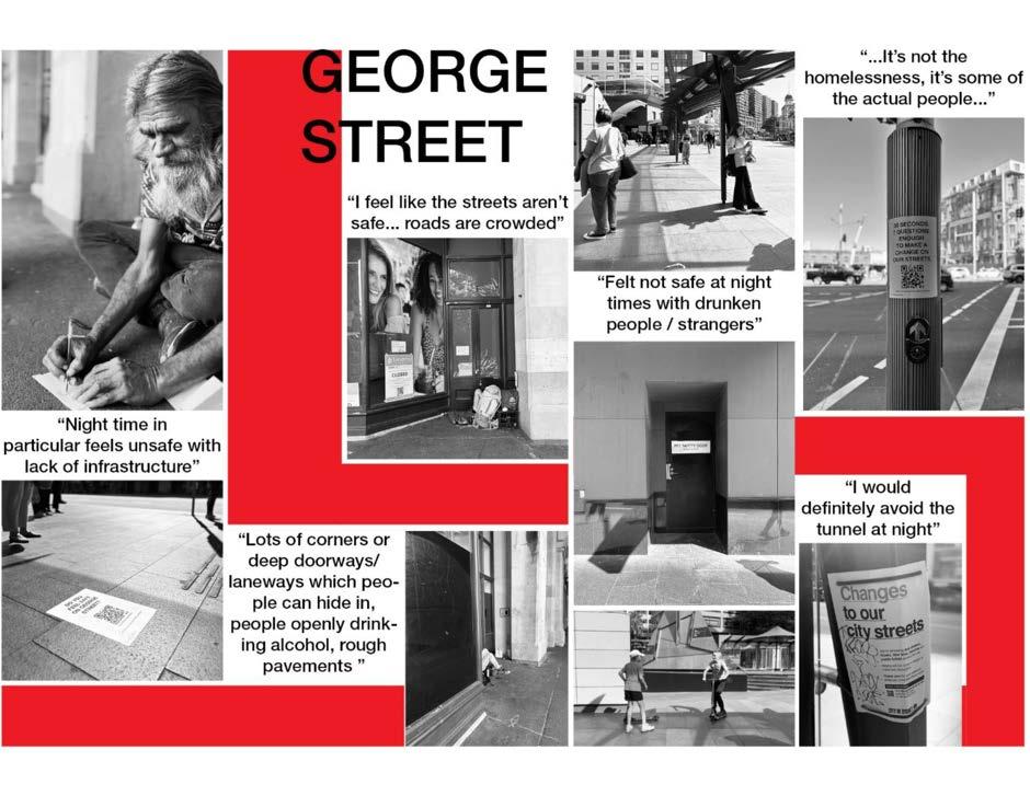
The three kilometre stretch of George Street in the City of Sydney amasses hundreds of thousands of pedestrians daily. Almost all of these people see George Street as merely a temporary passageway to more accessible parts of the city. The reasons are a lack of good urban planning, civil architecture and infrastructure on this street. The City of Sydney local government has plans to develop the Haymarket-Chinatown precinct, and have tried to engage with various stakeholders through surveys and forums. Patently, the council wants people to have a say in public projects - albeit, the suggestions people make are often confined to economic and social reasons. This is largely due to the questions that are asked of the people, questions which can only ever lead to answers in favour of the development.
On the City of Sydney website, the council clearly states its intentions for the projects - “The pedestrianisation of George Street all the way to Rawson Place” and “Upgrading local streets…” are the priorities for the local government. The Sydney Streets program aims to increase “... use of footpath and open space for outdoor dining, extended foyer space and live performance.” When stakeholders are involved, they are encouraged to share their thoughts on these specific notions through forums and online interaction. However, what these platforms do not provide is the information that is often unseen, unheard and forgotten - we aim to gather this information and provide it to council, followed by engaging in stakeholder meetings and presenting our findings. We hope our findings allow the council to recognise that they need to resolve the root of these social issues.
Our methodology is based on finding data which would otherwise be hidden from the local council. Through surveying and simply having conversations with different stakeholders, we question the hostility, safety and accessibility of our streets. Analysing George Street, we use a range of tools to gather data including photography, interviews, surveying and simply observing the behaviours of pedestrians. We then aim to formalise this data into a publication which is presented to the council as a supplementary tool to aid with the redesigning of our streets. Our short-term plan over the next five years is to analyse different parts of the City of Sydney and provide this alternate set of information to council. We will continue our engagement with the council by attending stakeholder meetings and assuring that our unorthodox data is not only considered but also implemented in the transformation of the streets.
We are advocates for acknowledging the hidden truths of our streets and providing public space that considers these hidden truths.
INTRODUCTION
Established in 2022, Safe Space Sydney (SS) is an Sydney based agency working for local councils. Our mission is to redefine the streets of sydney that have been caught in the battle of economic stakeholders and neglected the most important stakeholder - the user. We are a medium between council and the public, improving communication between the two, forming a relationship and ensuring understanding is clear both ways.
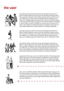
We believe that the process of creating public space should be transparents in order to get the best possible outcome from the user. The three main focuses will be hostility, safety and accessibility, as we believe these are key to the success of our streets and how we use them. These aspects have both an effect on the tangible and intangible feel of space and untimely influence the future of our cities.
The results derived from our research will formulate a series of reports. These will be the voices of the public, illustrated and unpacked by architects and presented to councils in order to provide them with the information to plan for our streets and guide them on how approved buildings and infrastructure will impact public space.
Our history in architecture, planning and design documentation have formed a foundation on which we plan to continue to develop as we act as detectives of our streets. We understand the importance of public space and aim to ensure councils are doing the best they can to better define the streets we use everyday.
1. HOSTILITY
2. SAFETY
3. ACCESSIBILITY
AGENDA
Brought about from the injustices faced by the key stakeholders of our streets, the user, Safe Space was established by a group of students from UTS Architecture in order to redefine the street for the people.
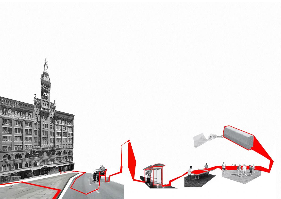
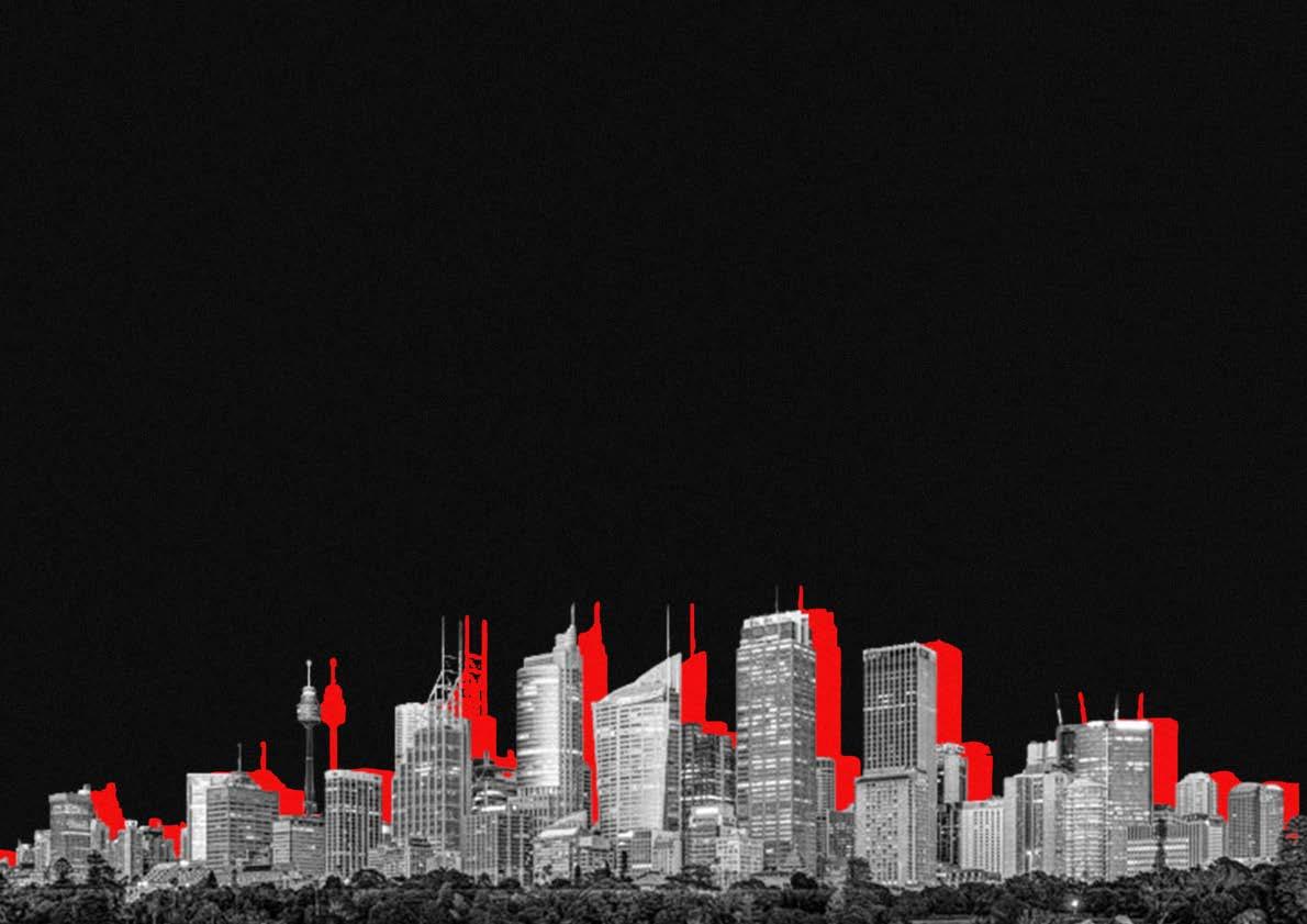
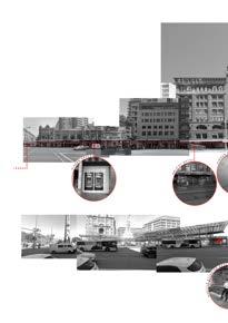
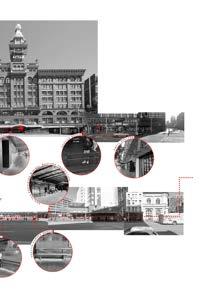
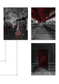
After studying at the University of Technology, Sydney for 5 years, we have been active users of George street at all times of the day. Our daily routines have been built around the route we take from Central station or where we park our cars to UTS, with George Street being a vital part of our journey. The morning coffee from 7/11, lunch from one of the many food outlets or an afternoon snack. Slowly we began to notice the weaknesses of the street. The lack of seating, the hostile architecture, the indents in infrastructure that have doors but are dark and hidden, the absence of green space and the lack of accessibility. Seeing the faults that have arisen because of the impacts that approved developments and infrastructure have had, as well as the negligence of the people’s needs by key players such as NSW transport, this was the motivation we needed to advocate for better public space on our streets and lead us to develop our first report.
At the heart of our work, we aim to collaborate with communities in a way that allows them to get their needs met. We seek to create a relationship with both the councils and the public setting that encourages discussion and ensures their voices are heard, where people can trust they are being considered in the planning process, as people may not always feel confident expressing their ideas at city run planning meetings or discussion panels.
TOOLS
All New South Wales local governments use one tool in obtaining feedback from the public - their website. Beyond this, their need to obtain public information is not accessible nor visible. Their public engagement is usually vague and broad.
We at Safe Space aim to bridge that gap of communication between Councils and the public. Our tools will allow data to be gathered from the public
These include:
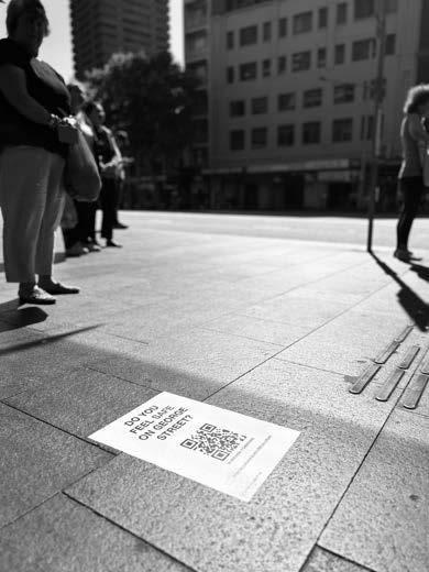
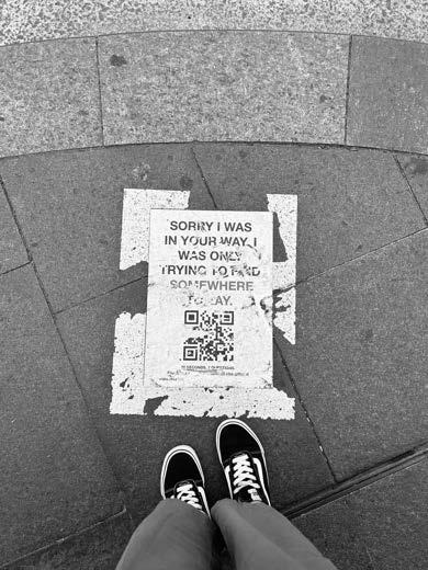
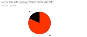
- Surveys
- Interviews
- Live Documenting
- Photographs
- Instagram tags
Once this data is gathered, analysis will be conducted to identify problems, patterns and uncover the finer details that are usually overlooked.
As we aim to work for Council or work with grants from organisations researching public space, we believe that we have an advantage as architecture students to analyse documentation, behaviours and patterns using the tools of our every day.
The data from surveys, interviews and recorded documentation, will allow us to demonstrate our findings through
- Visualisation
- Mapping
- Identifying details through drawings
- Video analysis / Re-enactments
- Audio Analysis
- Photogrammetry
We will use these tools to bring to light the hidden and untold stories of our streets


INTERFACE INTERFACE
INTERFACE INTERFACE
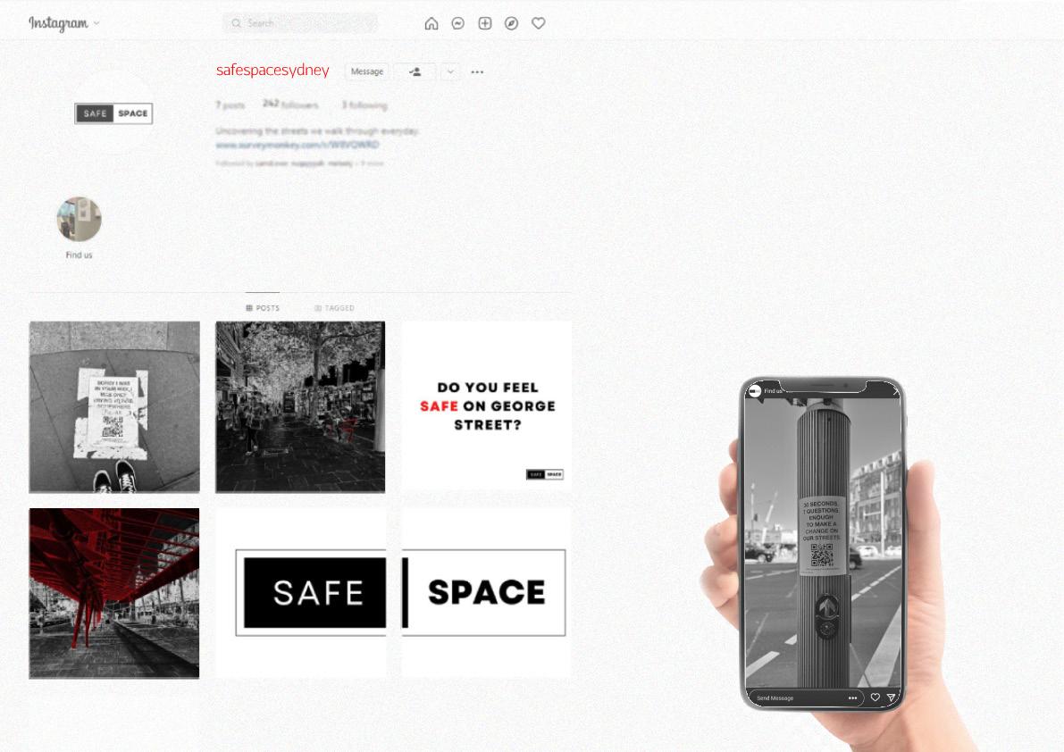
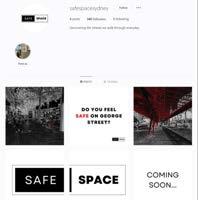
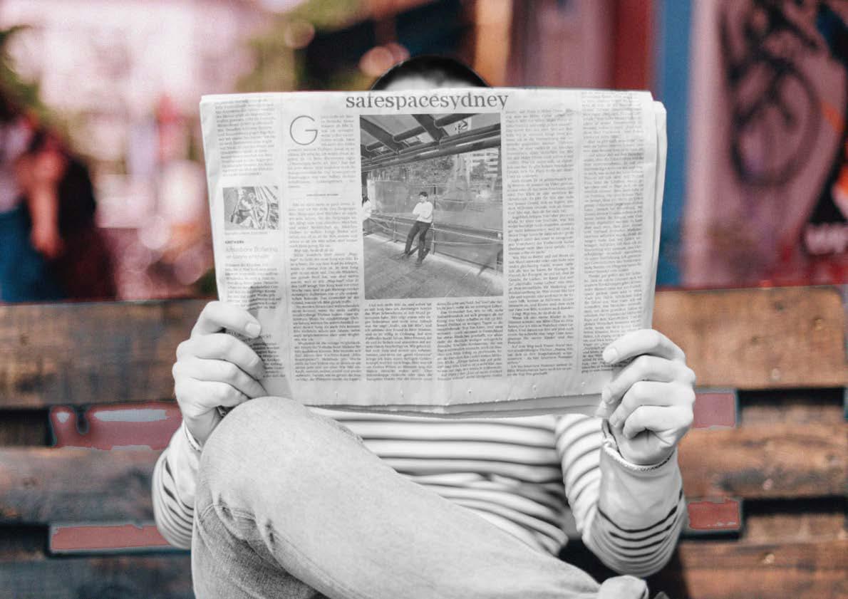
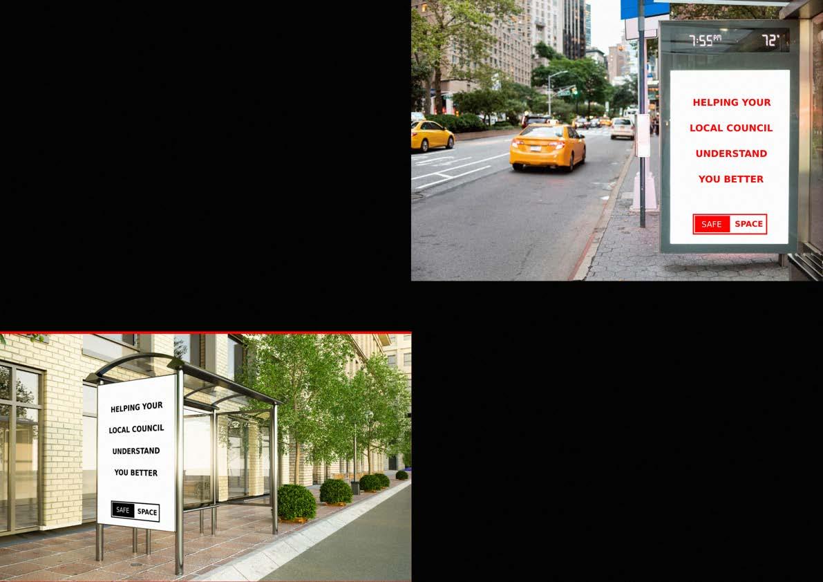
The interface can be divided into two specific audiences. The citizens and the government. Since we aim to be the bridge between these two entities, we have devised specific methods to target these stakeholders. Our instagram page @safespacesydney becomes an archive of our advocacy works, as fellow citizens can tag the page as a way to claim what they see is wrong (or right) in our public spaces. A survey is also linked to promote people to give their insights into our current project at the time. Through photographs, videos, sketches, and markups, we show our understanding of the public space through tools associated with tertiary architectural education. The outcome of these shared with the public on a digestible and accessible platform allows for acknowledgement, expansion and awareness of our cause. We aim to show what is hostile, unsafe and inaccessible through our page and can use this as evidence when presenting data to the council when they undertake a project in a specific public space.
Our relationship with the council is that of an ally. We are an agency aiming to work alongside the government during the research phase of an urban project in a public domain. Our data (past and present) will aim to provide information which is often unseen, unheard and undocumented.
ACTION PLAN
BUILD AGENCY & AGENDA
DEVELOP PORTFOLIO (STREETS)
BUILD PORTFOLIO
DEVELOP NETWORKS (PUBLIC SPACE)
PHASE 1 (2022 - 2023) PHASE 2 (2023)BUILD PORTFOLIO (PARKS)
BEGIN C.O.S COUNCIL COMMISSIONED PROJECTS
PHASE
COMMISSIONED BY OTHER LOCAL GOVERNMENTS
PHASE
3 (2024) 4 (2025)ALLIES OF THE COUNCIL

As accessible as social media is to the average citizen (especially younger ones) - reports, publications and A4 print media are equally as crucial for those in government positions making decisions. Presenting our research and findings in a medium familiar to what the council is used to will ultimately help better inform the stakeholders who decide how our public spaces are designed. Our information is gathered significantly through primary sources such as surveys and interviews, alongside secondary sources such as existing documents and conditions (which we analyse). Thus, our research can be categorised as alternative information - because it is not the typical data which is extrapolated from forums and online questionnaires on the council website. Patently, there are economic and social interests which the government prioritises - albeit, we believe there is more information which is ignored which could help better inform what is truly needed in our public spaces.
We are allies of the council. We work for the betterment of public spaces for all citizens. Thus, we are the median between the public and the government. Once we have an established relationship with the council, we hope to be commissioned for research and analysis on sites destined for urban planning. We want public space to be designed better - through finding out what the public wants in these spaces. Although there are mediums for the public to communicate with the government, these are often underutilised. Understandably, there are far too many concerns for council workers to be solely focusing on the design of public space, thus our niche can help both the council better understand the social fabric of the site and the citizens better communicate their tangible and intangible associations with the site.
COUNCIL
ACTION PLANSHORT TERM
BUILD AGENCY & AGENDA
DEVELOP PORTFOLIO (STREETS)
PHASE 1 (2022 - 2023)
RESEARCH
- ON STREETS AS PUBLIC SPACE
- OF GEORGE STREET & STAKEHOLDERS
GATHER DATA
- SURVEY MONKEY & STREET EXHIBITION
DELIVER
- DRAFT PUBLICATION /
IMPROVE
- ADVOCACY SKILLS & WRITING THROUGH COURSES
BUILD PORTFOLIO
DEVELOP NETWORKS (PUBLIC SPACE)
PHASE 2 (2023)
GATHER DATA ON REMAINING
GEORGE STREET
- SURVEY MONKEY & STREET EXHIBITION
DELIVER
- GEORGE STREET PUBLICATION
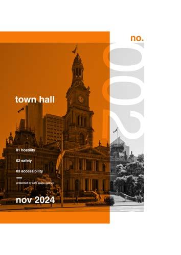
RESEARCH TOWN HALL
- CASE STUDIES
- LEGISLATIONS AND POLICY GOVERNING
PUBLIC SPACE
- CASE STUDIESDEVELOPMENT IN T.H.
INTERVIEW
- THOSE IN CITY OF SYDNEY COUNCIL
- DEVELOP NETWORKS
DELIVER - TOWN HALL
PUBLICATION


ACTION PLAN - LONG
RESEARCH AND INVESTIGATIONS
BUILD AGENCY & AGENDA
DEVELOP PORTFOLIO (STREETS)
RESEARCH
- ON STREETS AS PUBLIC SPACE
- OF GEORGE STREET & STAKEHOLDERS
GATHER DATA
- SURVEY MONKEY & STREET EXHIBITION
DELIVER
- DRAFT PUBLICATION
BUILD PORTFOLIO
DEVELOP NETWORKS (PUBLIC SPACE)
RESEARCH TOWN HALL
- CASE STUDIES
- LEGISLATIONS AND POLICY GOVERNING PUBLIC SPACE
- CASE STUDIESDEVELOPMENT IN T.H.
GATHER DATA ON REMAINING GEORGE STREET
- SURVEY MONKEY & STREET EXHIBITION
INTERVIEW
- THOSE IN CITY OF SYDNEY COUNCIL
- DEVELOP NETWORKS
DELIVER
- GEORGE STREET PUBLICATION
PHASE 1 (2022 - 2023) PHASE 2 (2023)“ULTIMATELY, WE WANT TO BE COMMISSIONED TAKING
LONG TERM
COMMISSIONED BY VARIOUS COUNCILS IN UNDERFOR THEIR PROPOSED DEVELOPMENTS”
BUILD PORTFOLIO (PARKS)
BEGIN C.O.S COUNCIL COMMISSIONED PROJECTS
PHASE 3 (2024)
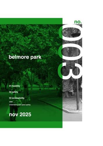
RESEARCH BELMORE PARK
- CASE STUDIES
- LEGISLATIONS AND POLICY GOVERNING PARKS
- CASE STUDIES
GATHER DATA ON BELMORE PARK AND IT’S STAKEHOLDERS
- SURVEY MONKEY & EXHIBITION
DELIVER
- BELMORE PARK PUBLICATION
PROPOSE TO COUNCIL
- CONTRACTED WORK FOR FUTURE DEVELOPMENTS
COMMISSIONED BY OTHER LOCAL GOVERNMENTS
PHASE 4 (2025)
- BUILD AGENCY
PORTFOLIO, WEBSITE AND COMMUNICATIONS
PUBLICITY
- BUILD AGENCY
PORTFOLIO, WEBSITE AND COMMUNICATIONS
COMMISSIONED
- BY OTHER LOCAL GOVERNMENTS IN I
NVESTIGATING PUBLIC SPACE AND DATA
FUTURE PUBLICATIONS

PUBLICATIONS
Why City of Sydney?
The City of Sydney is the local government authority for central Sydney and surrounds with a population density of 8,040 persons per square kilometre.
It’s historical, economical, social and its geographic location play a major role in it’s great attraction to locals, non-locals and tourists.
In such a large and diluted local government area, the shift and focus is usually driven to economic gains, and public engagement is usually shadowed. Especially in public spaces that attract the most visitors than any other LGA.
We believe the City of Sydney will be our first successful project, in working with councils and understanding public data. With it’s various projects in line, the information and analysis colllected, can allow the City Of Sydney to design better spaces and streets for the public.
LIVE ACTIVATION
ACTIVATION
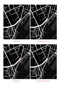
POLICY ANALYSIS
SURVEYS
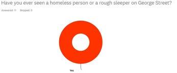
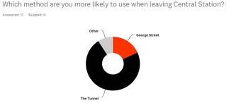
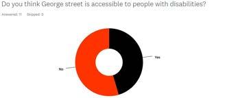
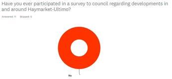
SURVEY RESULTS


JULIA BOUSTANI
MELEK JAMIL
MOHAMMAD ALI NATHANI