L uben R aytchev
EXPERIENCE
GeorGia ConservanCy
community deSiGn lead
2.2023-PreSent
• Manage community planning projects like neighborhood master plans, ARC-CDAP projects, and housing studies.
• Provide data analytics, data visualization, geospatial analysis, and mapping support for all projects between Atlanta and Coastal offices.
• Represent Georgia Conservancy at conferences, retreats, and continuing education offerings as a presenter.
• Create original graphic content for print and digital publication.
• Support research for new policy and advocacy initiatives at the local and state level
• Co-manage Georgia Conservancy planning and design interns.
• Support internal business development initiatives at Georgia Conservancy.
deSiGner/Planner
6.2021-2.2023
Planning and urban design role supporting all Sustainable Growth projects, lead production on secondary studies, projects, and initiatives, and fulfilling graphic design tasks.
SuStainable Growth intern
5.2018-5.2021
Planning and urban design role leading design tasks at Georgia Conservancy and fulfilling the project management duties for community planning projects. Contributed content creation, research and GIS analysis, technical assistance, and document design services among several projects.
enterprise Community partners
SolutionS intern 6.19-8.20
Evaluated the feasibility of incentivizing more affordable units through tax exemptions in the Atlanta Metro using tax and property revenue data analyzed under different affordability thresholds.
GeorGia teCh ColleGe of DesiGn Graduate reSearch aSSiStant
EPA Rainworks Challenge 2020 dr. richard daGenhart | School of architecture 8.20-5.21
Frederick K. Bell Fellowship Award
PORTFOLIO & FEATURED PROJECTS
https://issuu.com/lubenraytchev
dr. Perry yanG | School of city & reGional PlanninG 8.18-5.19
ULI Hines Student Competition 2021
Kansas City, MO
Architectural Visualization
Parametric Design
Reinhabit
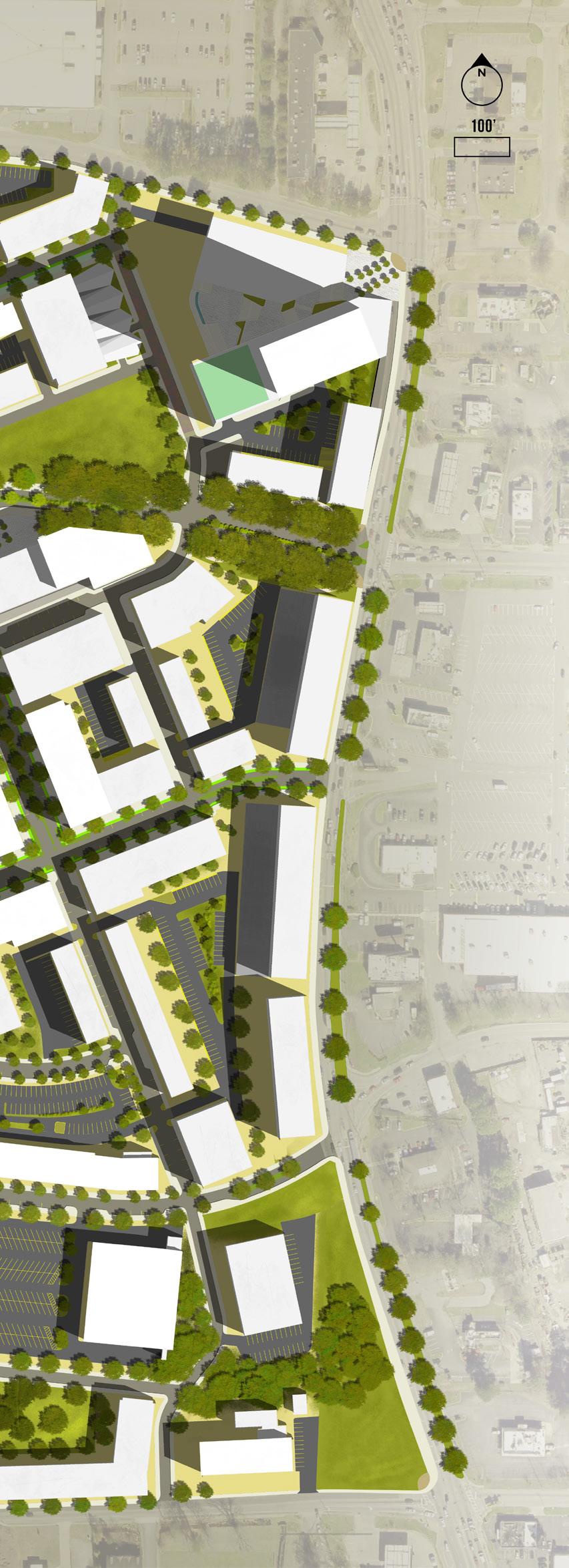
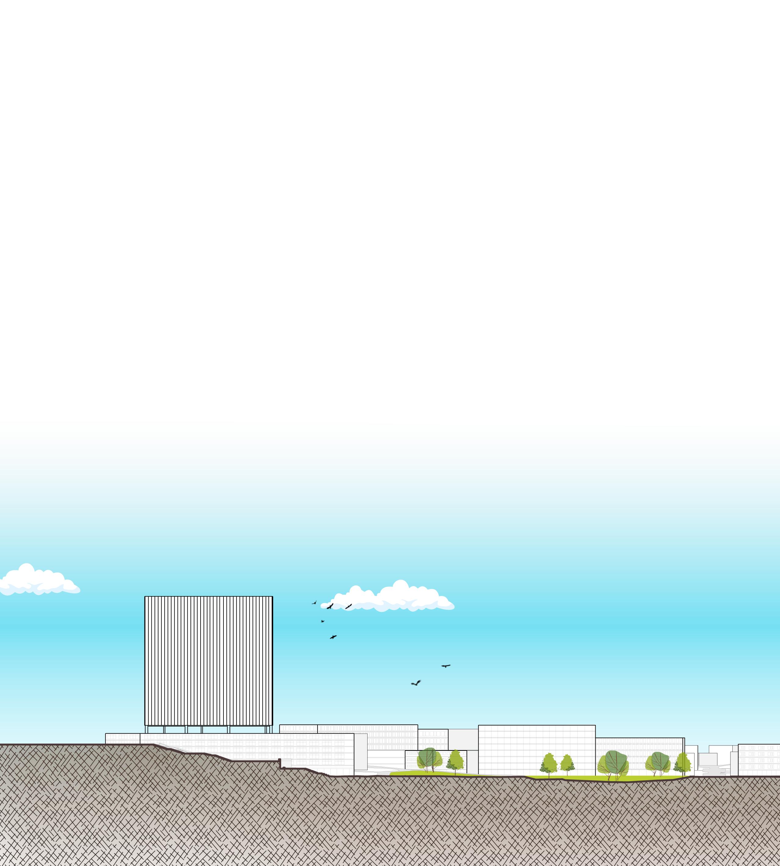
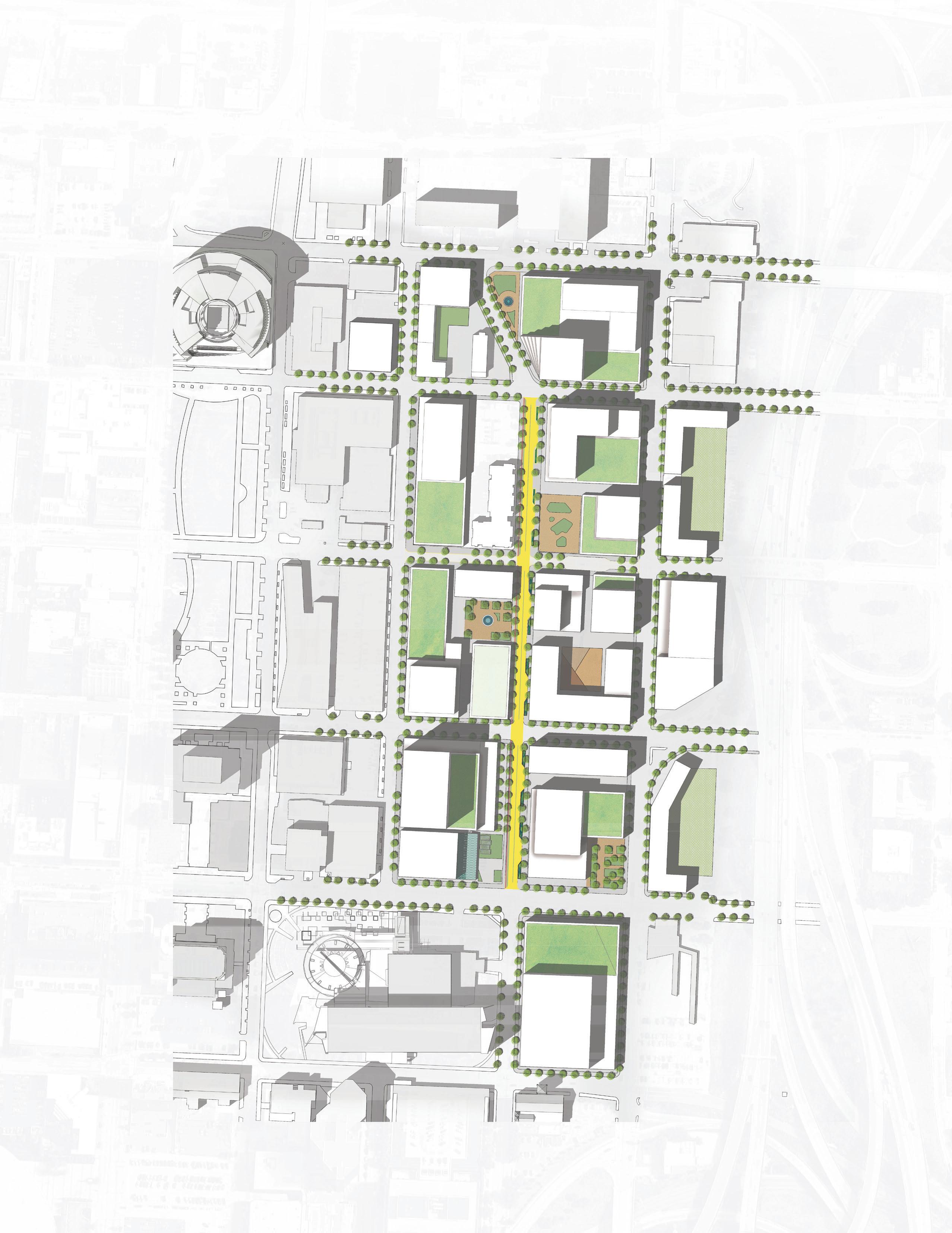
South Dekalb Mall Retrofit & Redevelopment
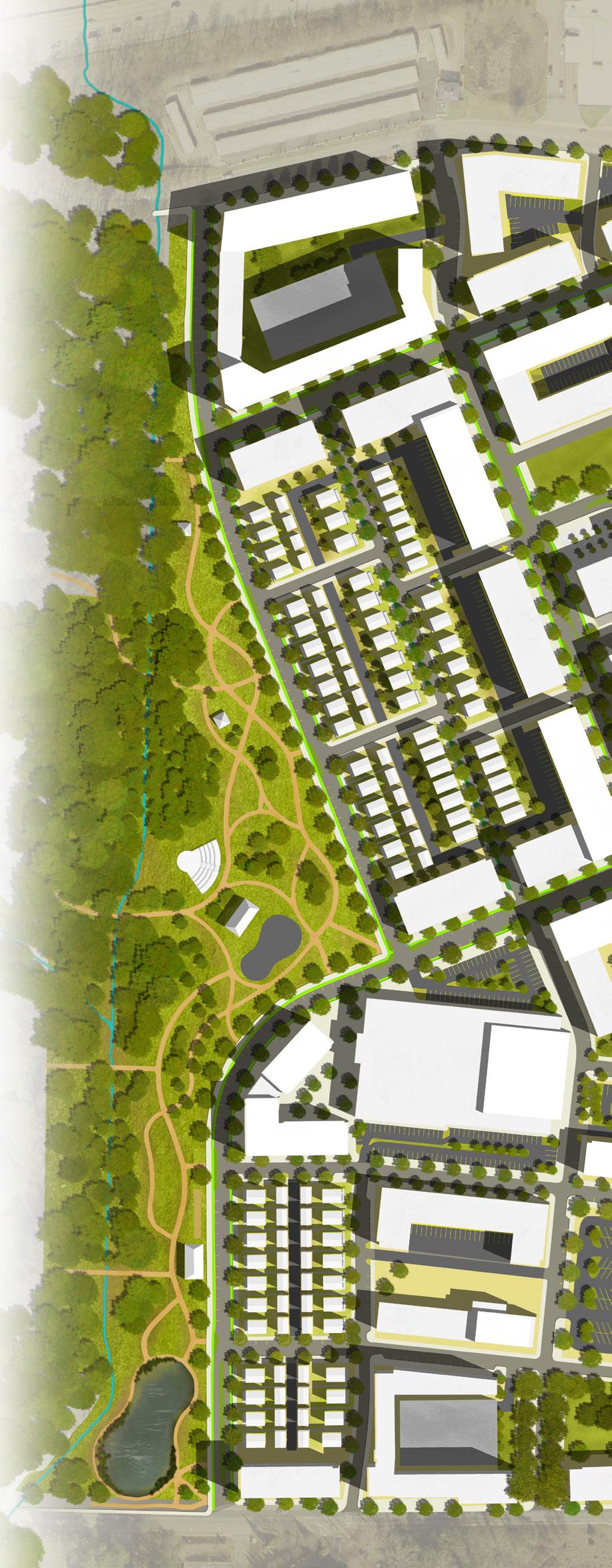
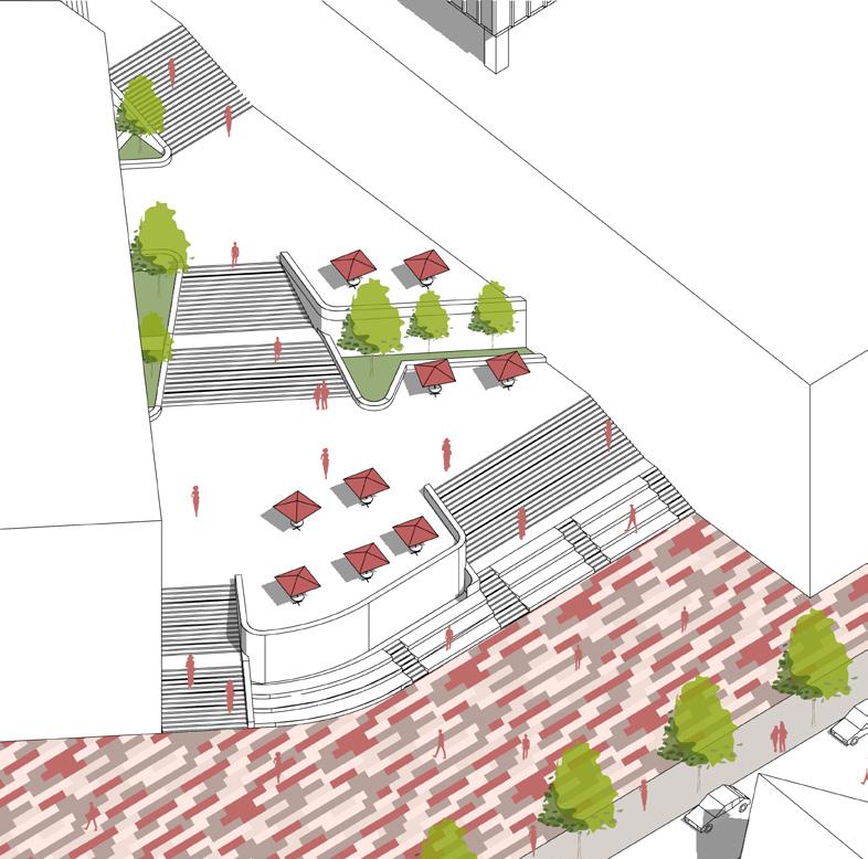
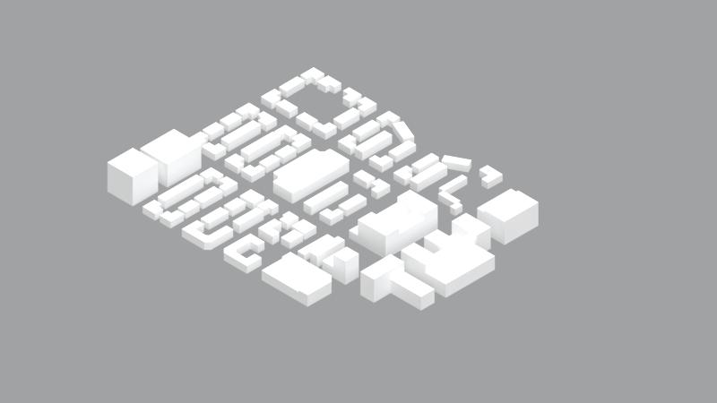
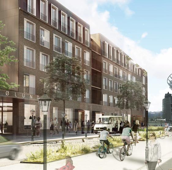
The Gallery at South Dekalb is a struggling shopping mall complex located off of Candler Rd. in South Dekalb County. Like many failing suburban shopping malls, the expansive property presents an opportunity for transformative redevelopmement.
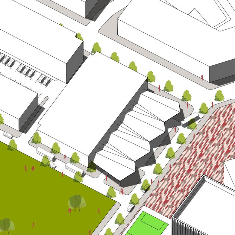
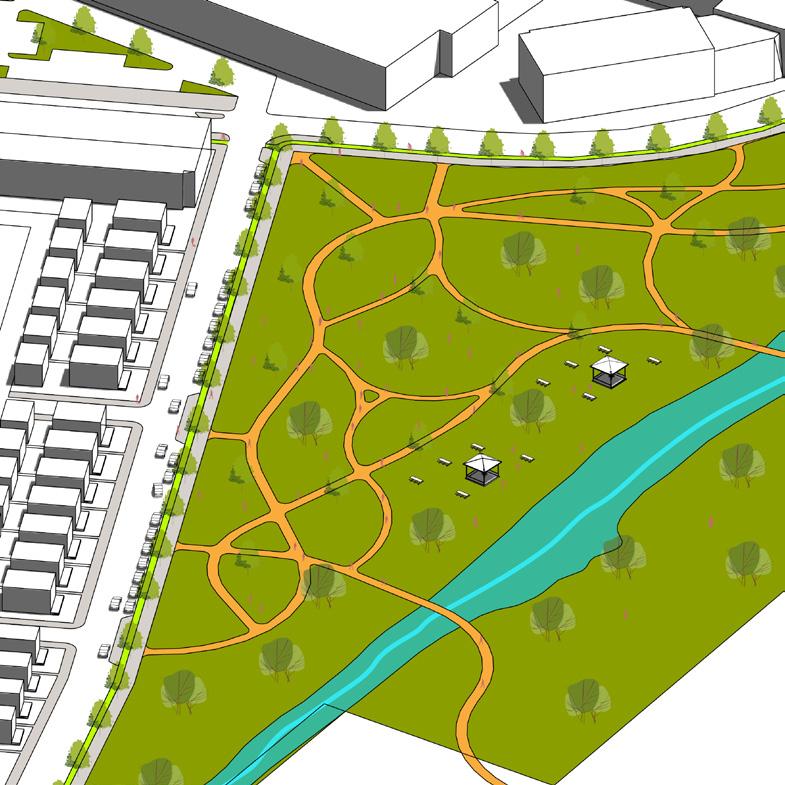
This project proposal envisions a mixed-use development that retains part of the mall, addresses the transition into the site on the Candler Rd. edge with an activated street front and a terraced plaza to negotiate the steep terrain, a reduction in impervious area, partly through re-greening and regrading the surface parking lot abutting the creek, and a bus terminal station to serve existing lines and new bus lines. Since the project was completed, MARTA announced plans to build a South Dekalb Transit Hub to serve high-ridership bus routes adjacent to the mall. The redevelopment proposal was guided by the principles of environmental justice, multimodal transit, and creating a mixeduse town center.
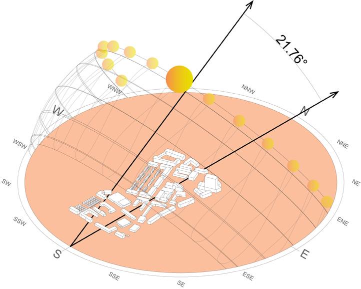
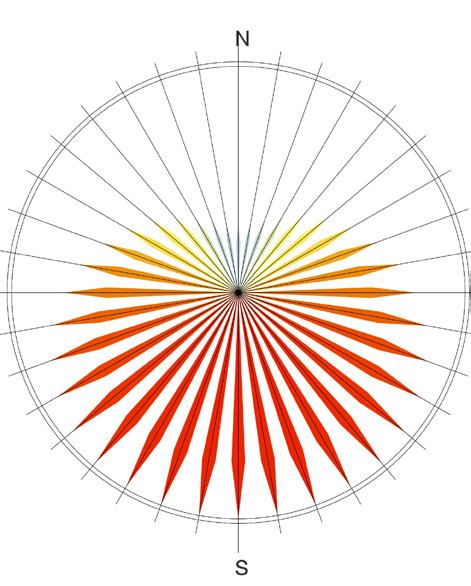
The project was concered with building energy efficiency. The new concept for the site introduces a grid that is tilted off-axis relative to North to reduce direct sun exposure during from the West and South during the hottest months of the year.
The site plan breaks up the mall but retains keeping the existing grocery store and low-density corner. New construction comes in the form active part of the site at the northeast. The site character moving westward towards the creek.
the Macy’s anchor building. It also suggests low-density office development in the southeast form of a mixed-use development with most site becomes more passive and residential in creek.
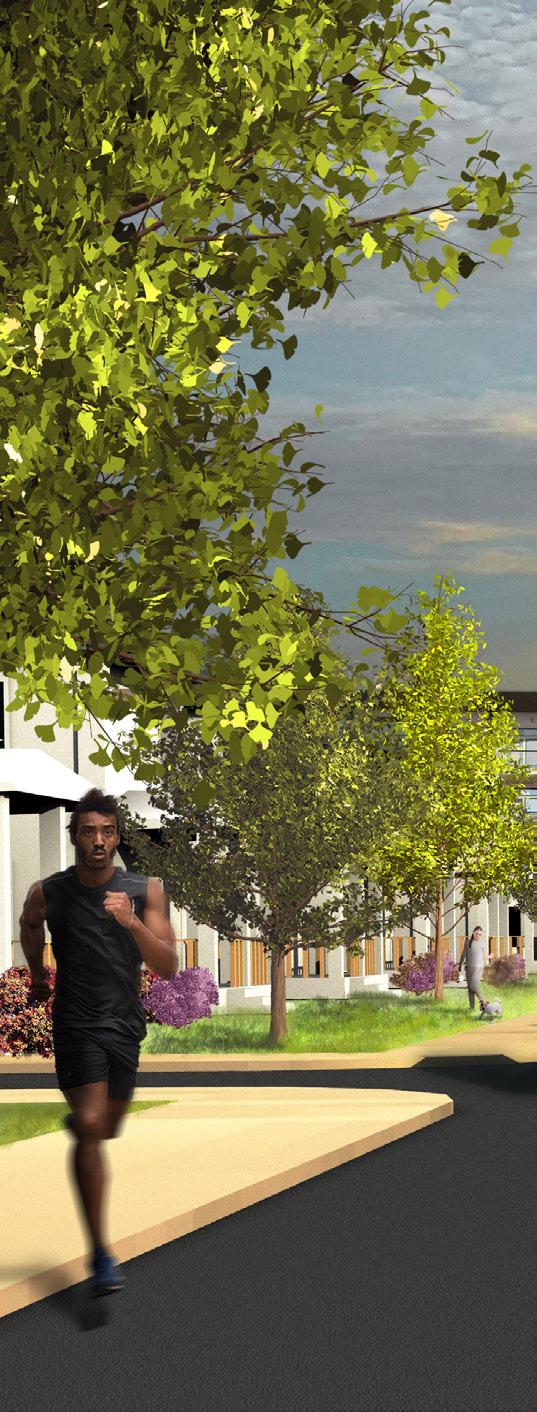
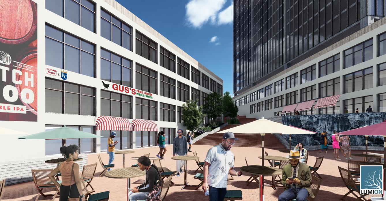
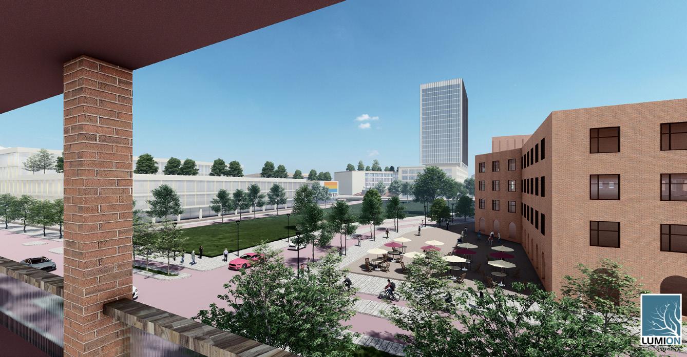
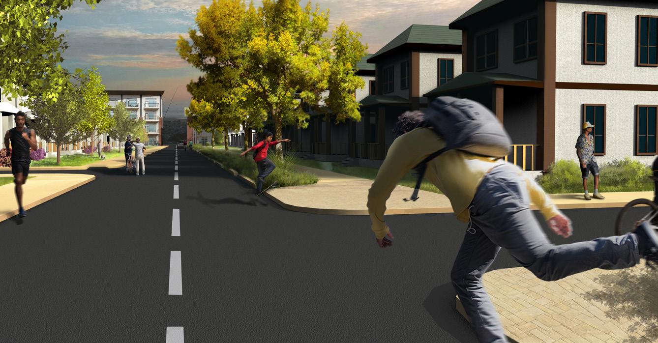
(Top) A terraced plaza as a ‘grand entrance’ into the site offers a semipublic space flanked with commercial establishments in mixeduse buildings. (Midde) A view of the central green, opposite the proposed MARTA bus transit hub. (Bottom) An urban, mid-density residential neighborhood that offers a different character than the more activated parts of the site.
Graphic by Zhao Huangzhe
Graphic by Zhao Huangzhe
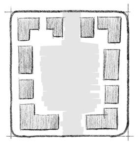
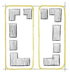
Land use intensity is mapped on a 3-tier system: T1 - low intensity, T2 - medium intensity, and T3 - high intensity. Intensity of development decreases moving westward, culminating in a large greenspace.
t 1 t 2 t 3
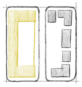
A terraced plaza is embeded into the steepest part of the site and acts as a grand entrance. The plaza aligns with the bus transit hub and central park.
A bus transit hub is introduced to accommodate high-use bus lines and additional capacity for new bus lines.
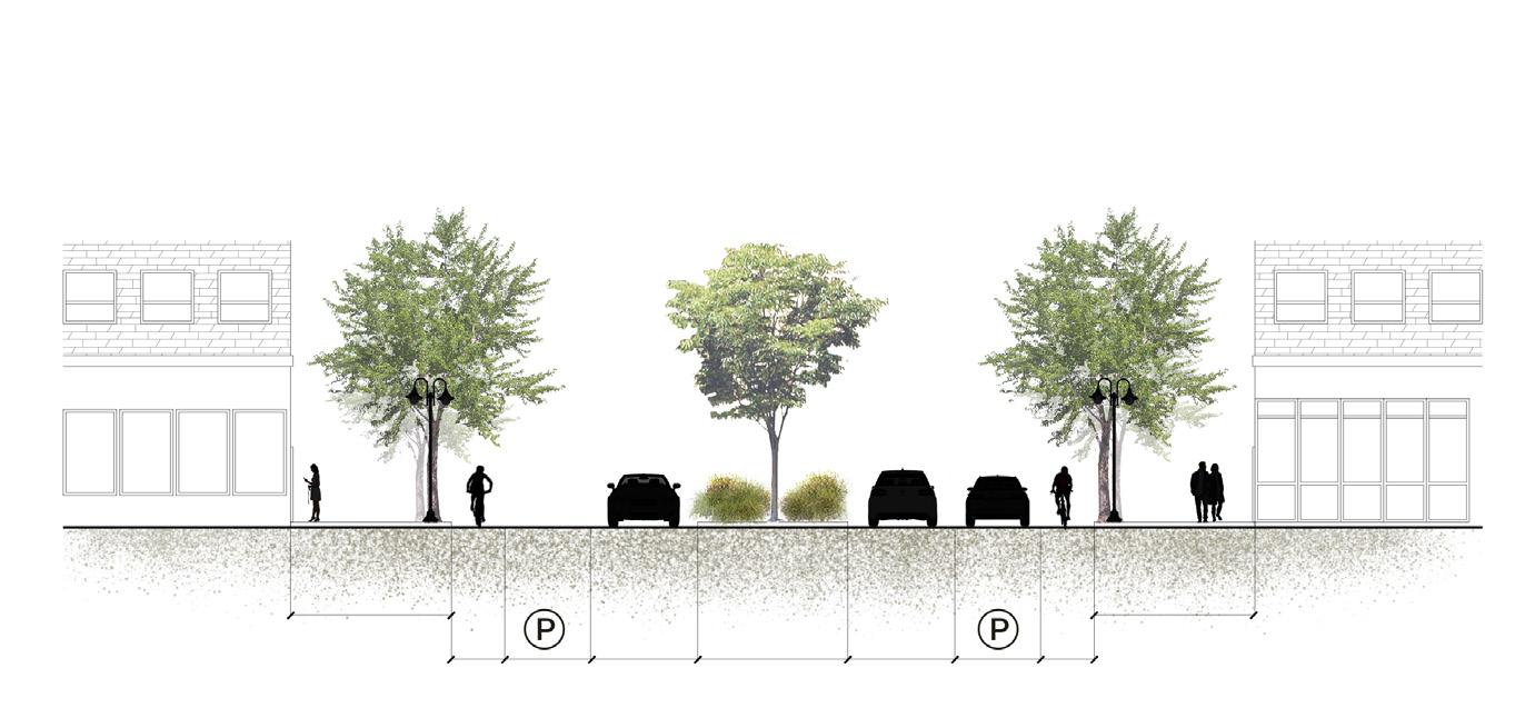
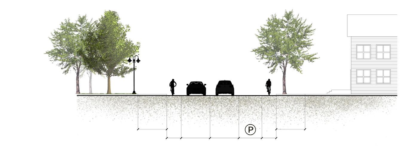
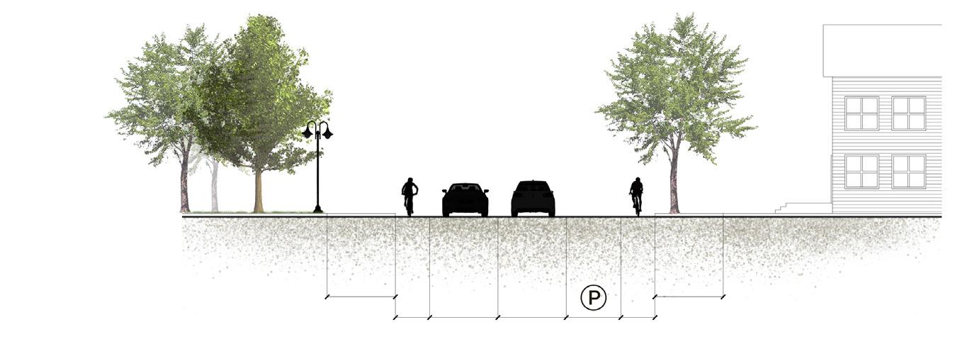
The street grid that will be introduced to the site incorporates several types of streets that facilitate on-street parking to reduce the need for surface lots and decks, bike lanes, and generous sidewalks.
A signature park covering the west side of the site will result in flood reduction and creek restoration, trading a large surface area of impervious material for greenspace. Bridges across the creek can connect to the neighboring residential developments and facilitate pedestrian access.
02
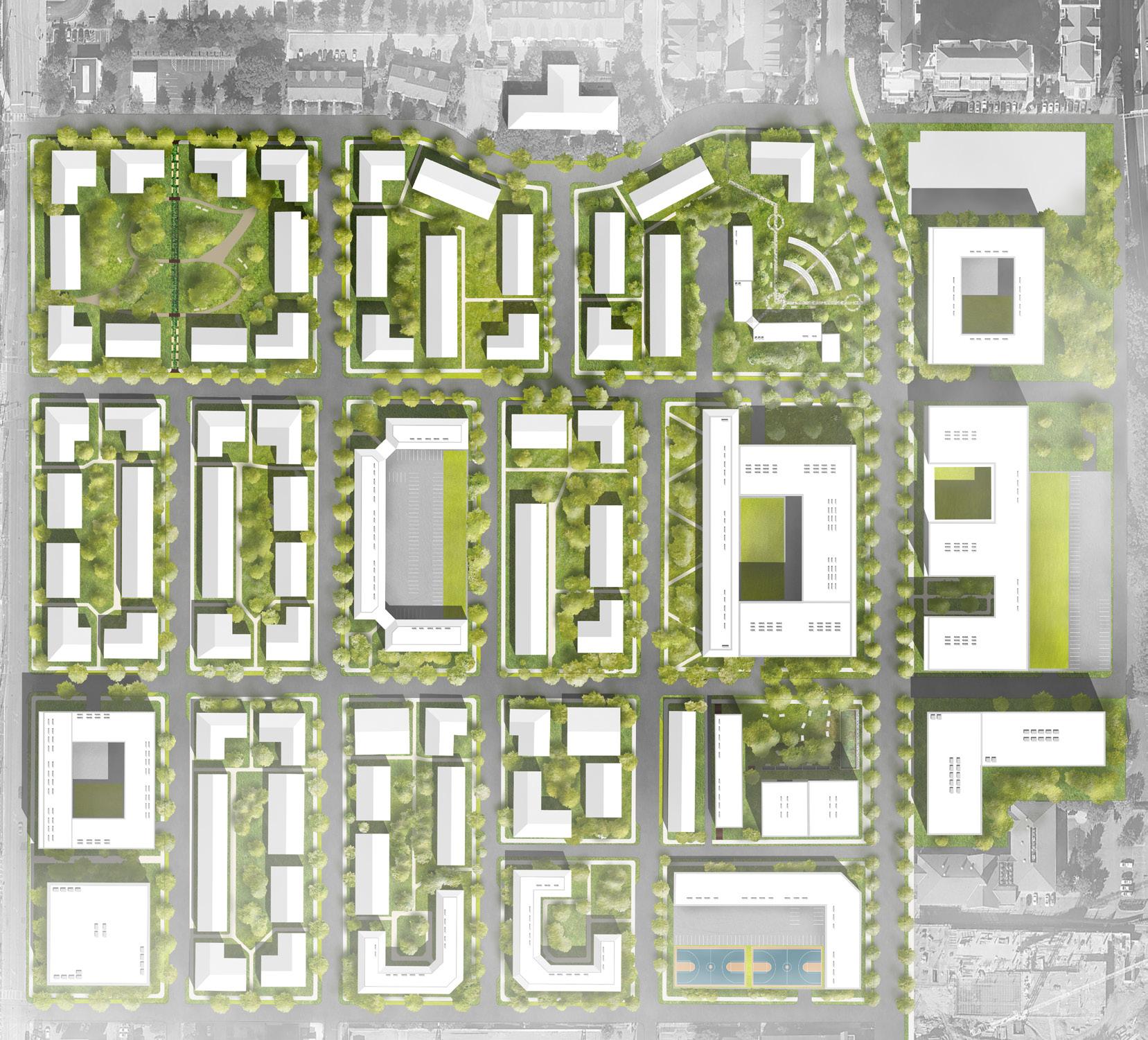
Centennial homes
Atlanta, GA
This urban design studio took on the task of planning design interventions that would reduce stormwater impacts in Downtown Atlanta. Groups focused on a downtown creek drainage basin: Tanyard, Intrenchment, and Clear Creek basins. Each basin also included at least one urban scale design site.
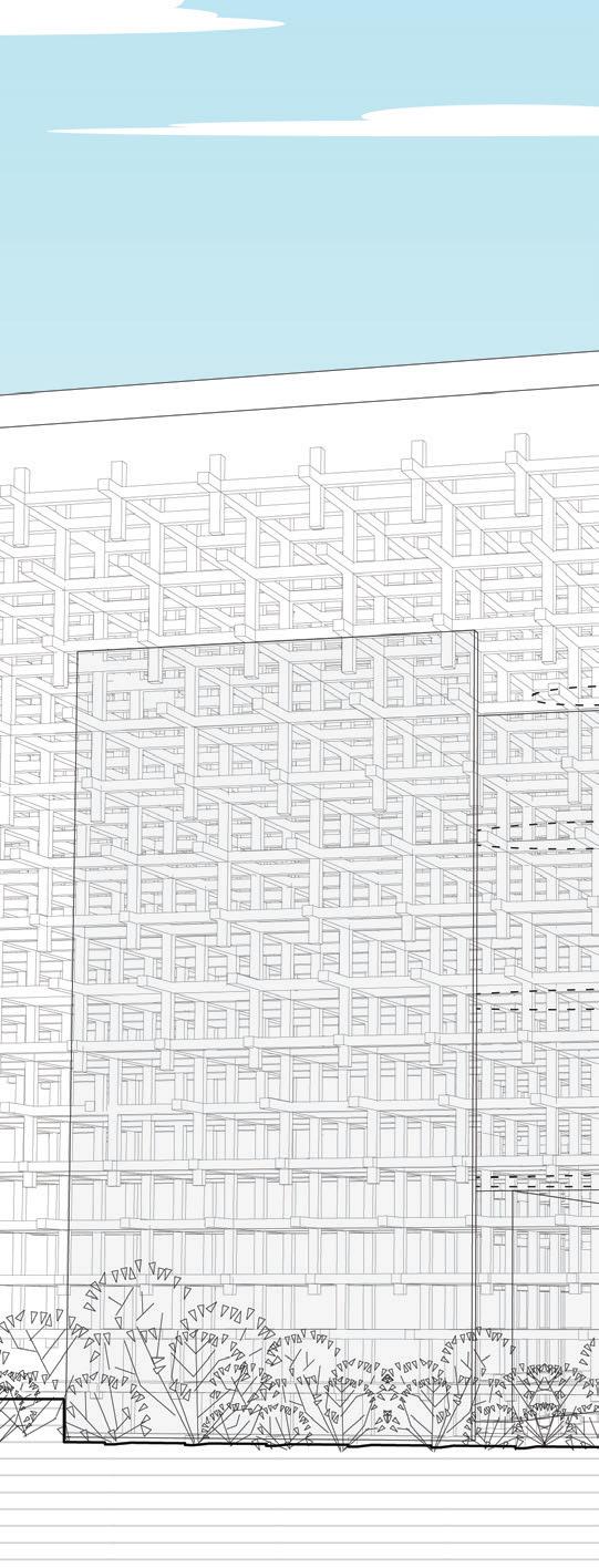
This site planning of the Centennial Homes neighborhood south of Georgia Tech was a subset of the work in the Tanyard Creek basin. The proposed redesign of the neighborhood emphasizes a mix of preservation and new development. While tapping into the potential to more intensely activate this site, which lies between Downtown Atlanta and the Georgia Tech campus, the proposed plan also envisions retaining older buildings to break the cycle of clean-slate redevelopment and displacement and preserve the site’s historic significance. The site plan also incorporates water management strategies in green infrastructure in right of ways and rain gardens and parks to absorb water in block interiors.
Top-down redevelopment of the site by centralized powers in the past have resulted in monotonous blocks and design patterns. To promote variety, this development scheme relies on unique developers to develop different areas of the site, which will be marketed separately.
The historical street grid than with the larger blocks plan breaks up the large eliminating
in this neighborhood was much denser blocks introduced in redevelopments. This blocks, returning additional streets and eliminating closed, interior block spaces.
Green Infrastructure (GI)
(Left) New construction in yellow, and preserved buildings in grey. (Middle) Activation areas, particularly on Centennial Olympic Park Dr. (Right) Green spaces and green roofs.
Elevation decreases moving northwards through the site. The lowlying area north of Centennial Homes is a major water accumulation point.
PREDESiGN
INFRASTRUCTURE
ROOFSGREEN DECKSPARKiNG
ROOFTOPS PARKiNGSURFACE
STREETS
BLOCKS
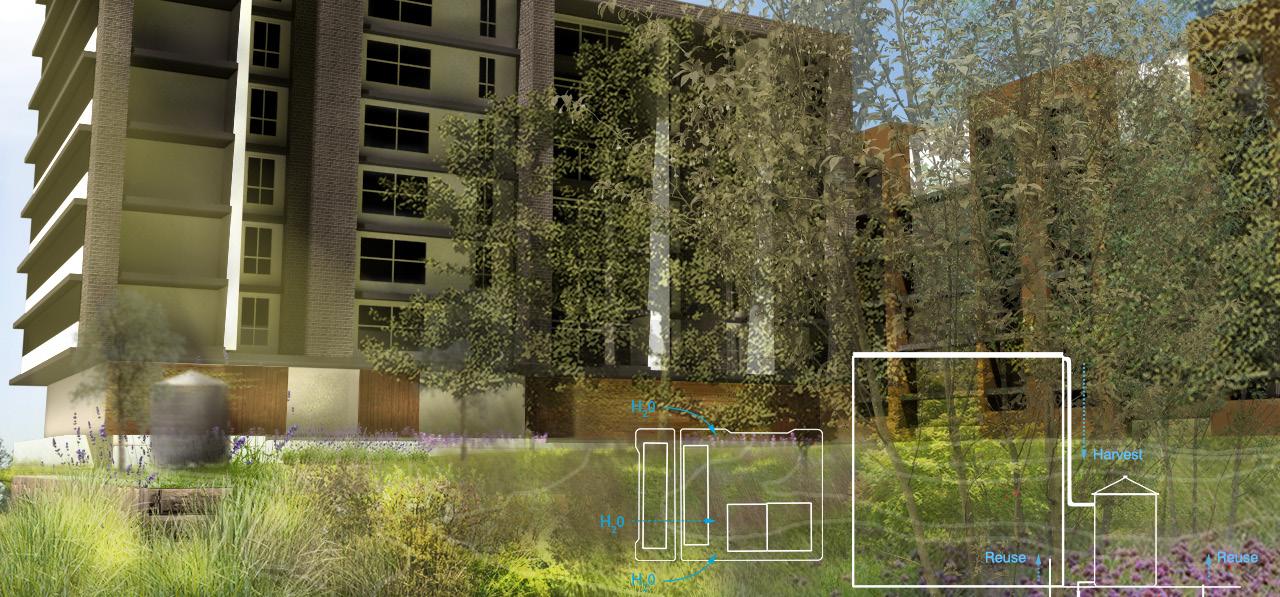
The site was analyzed by streetsheds, contained water drainage areas defined by streets, and water volume and peak flow rate reduction post-design was calculated for each street shed as a function of reduced impervious surface. The redeveloped Palmer House lot outfiteed with a rainwater harvesting system and rain garden. The property is owned by Atlanta Housing and used to feature a multifamily building.
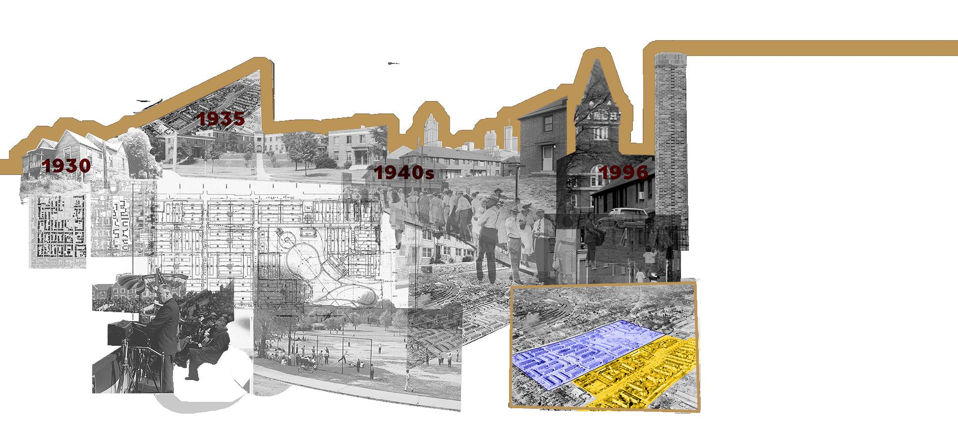
The area was originally known at Techwood Bottoms or Tanyard Flats. Similar to Buttermilk Bottom that existed on the site of the Atlanta Civic Center, Tanyard Flats was a floodprone area that was seen as a slum. The site was redeveloped as the nation’s first public housing project, Techwood Homes (the western half was developed later as Clark Howell Homes). Before the 1996 Olympics, the site was once again redeveloped into Centennial Homes.
The street density that was emerging organically in the 1930s was drastically reduced with the block structure of the public housing redevelopments in the area. The size of the blocks has increased over time.
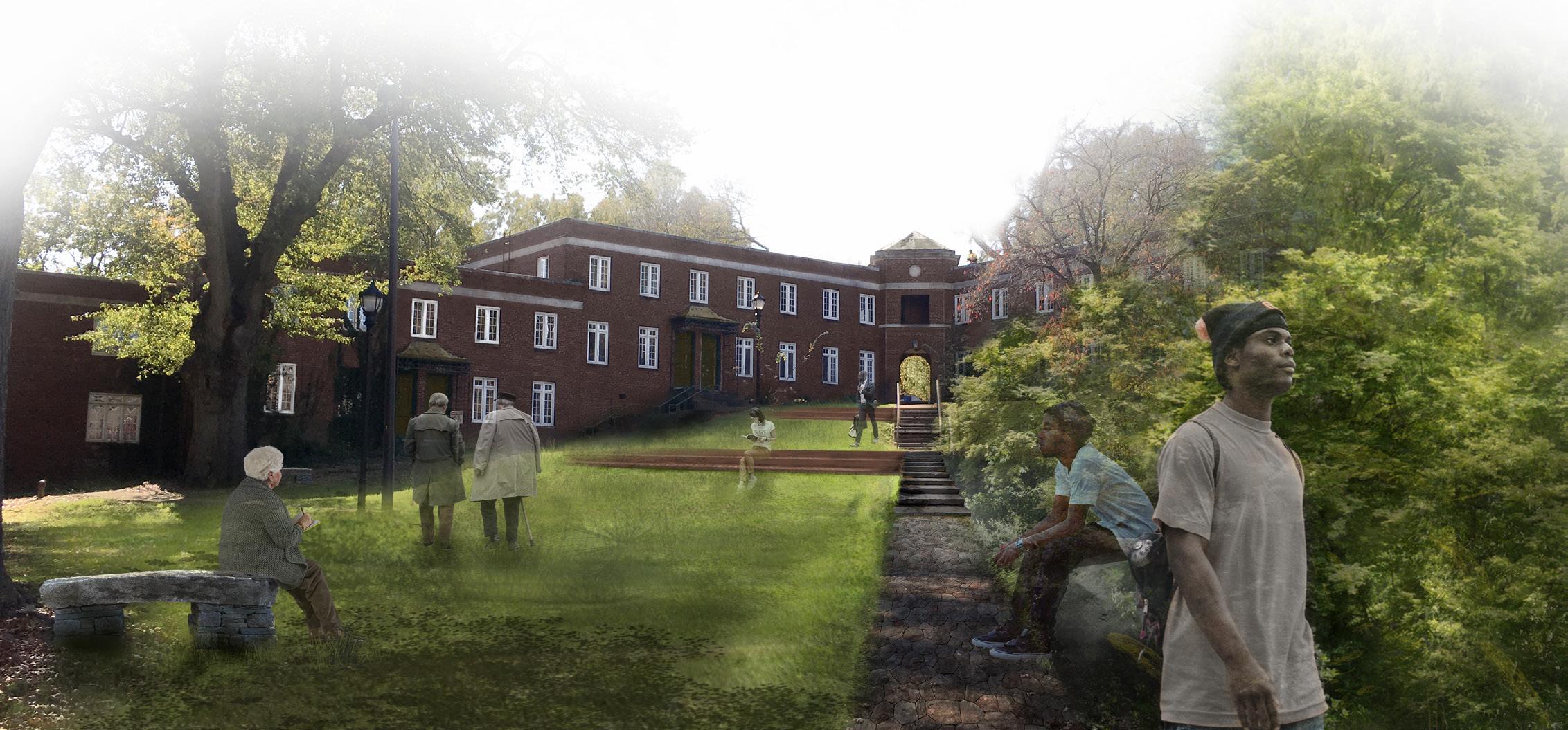
A revitalized Techwood Homes building and grounds as an active civic and memorial space.
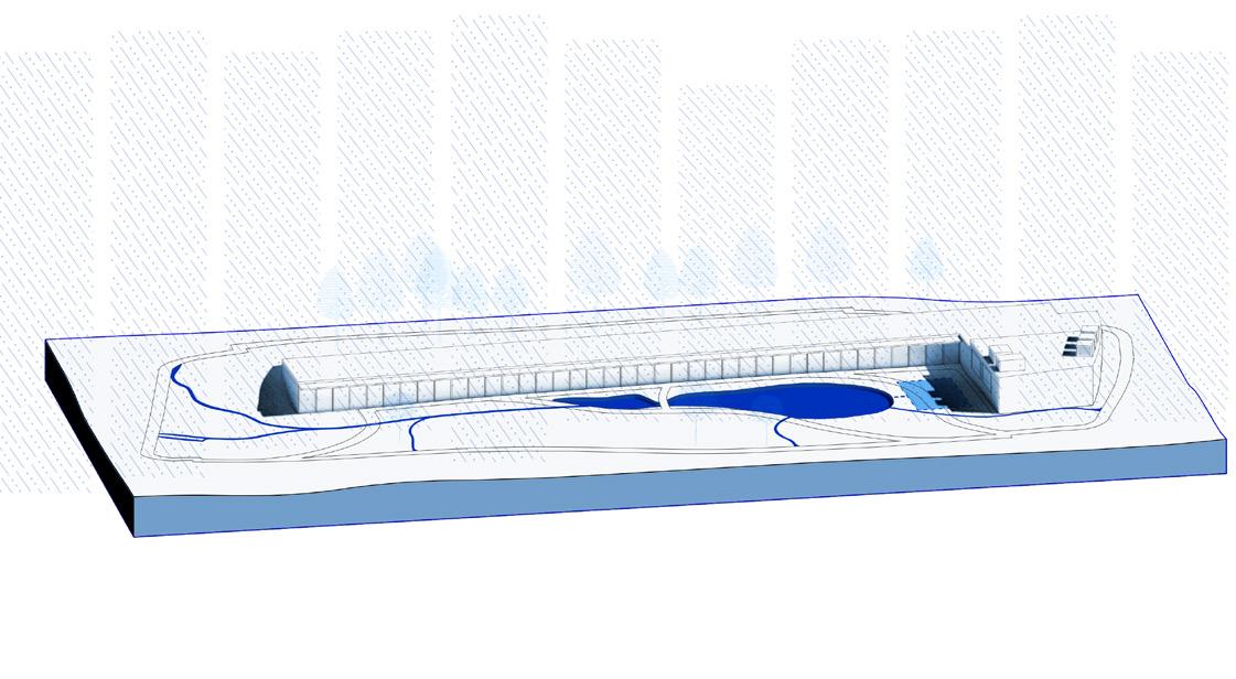
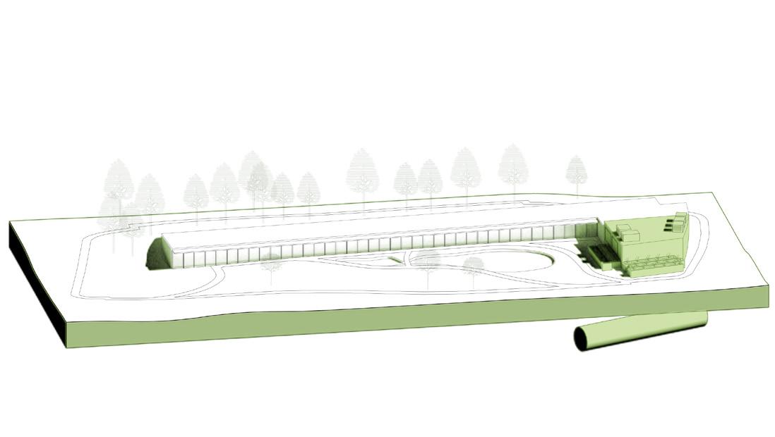
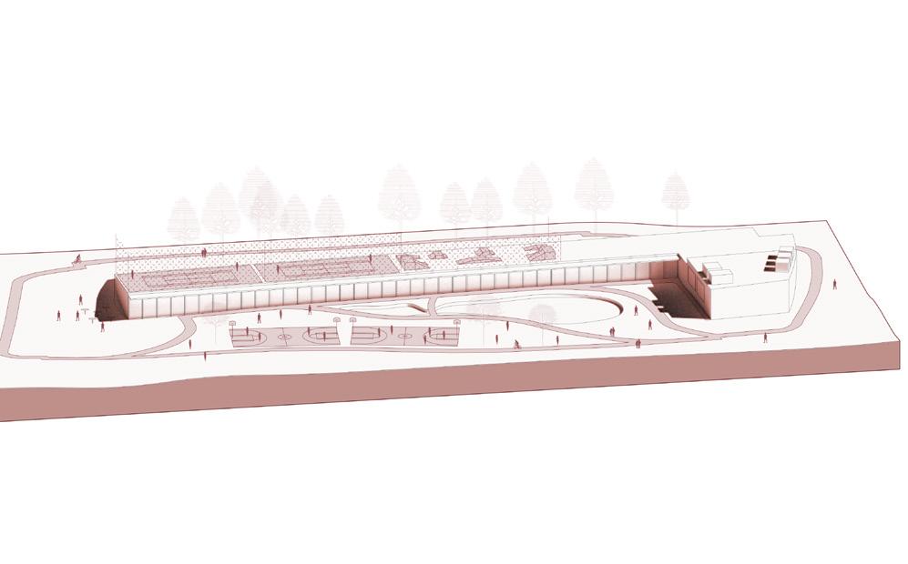
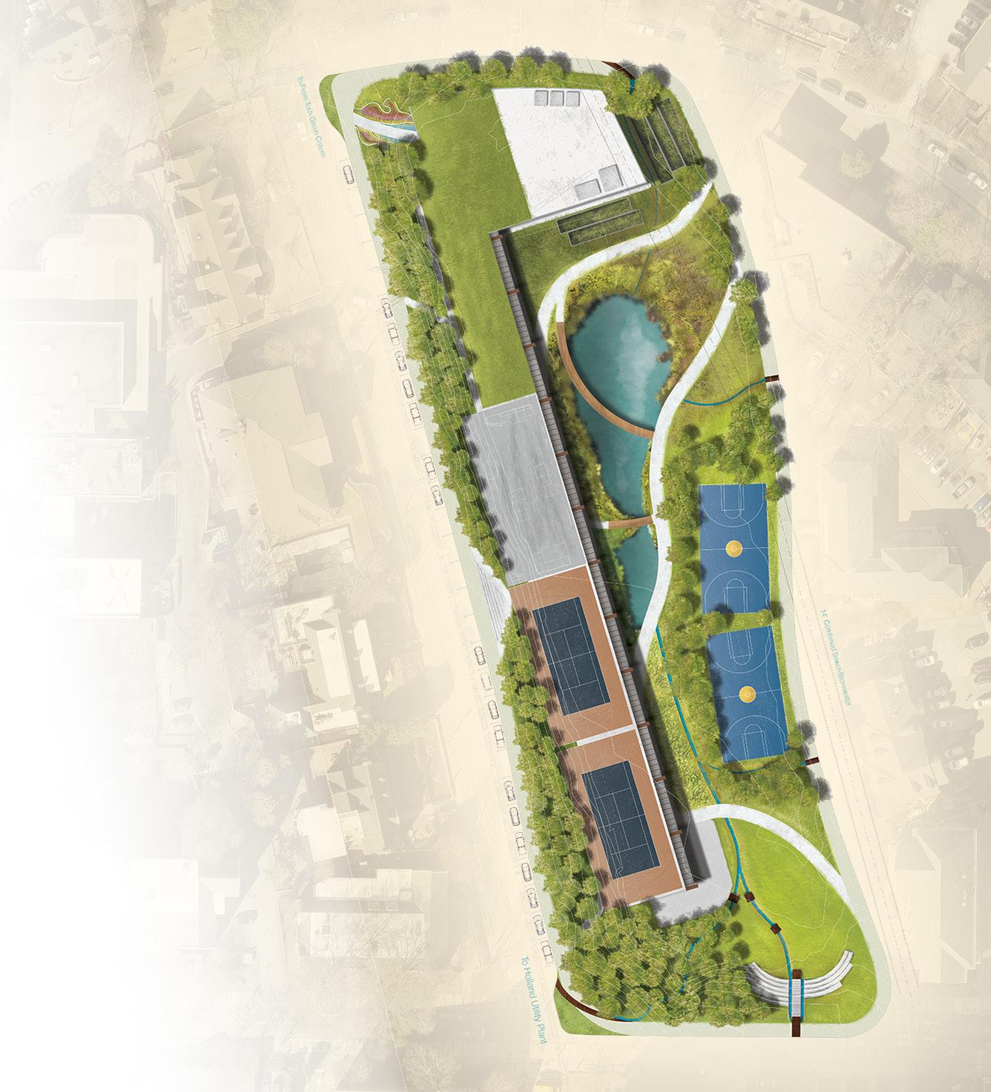
PeteRs PaRk
EPA Campus RainWorks Challenge
Georgia Tech Campus
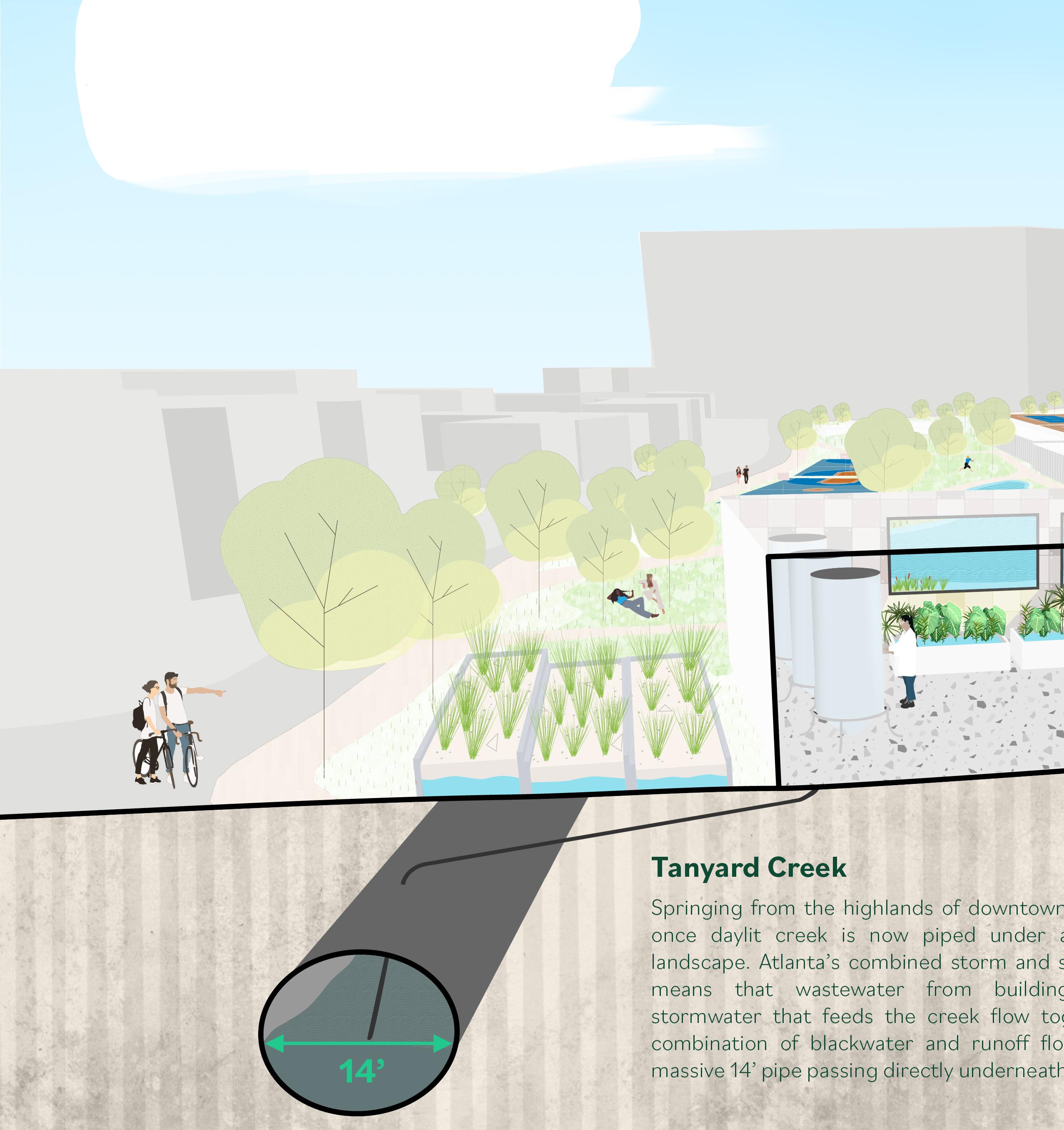
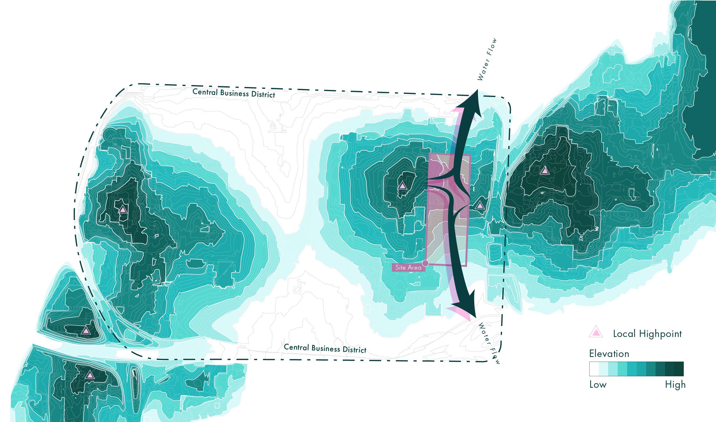
Peters parking deck is a Georgia Tech parking facility on the site of a former park, named after prominent Atlantan Richard Peters. Topographically, this location just north of Bobby Dodd Stadium is a low-point, acting as a sink for stormwater flows. Underneath the site, a 14’ diameter municipal trunk wastewater line carries combined water and sewage from the entire Tanyard Creek watershed and is the vessel for the buried creek.
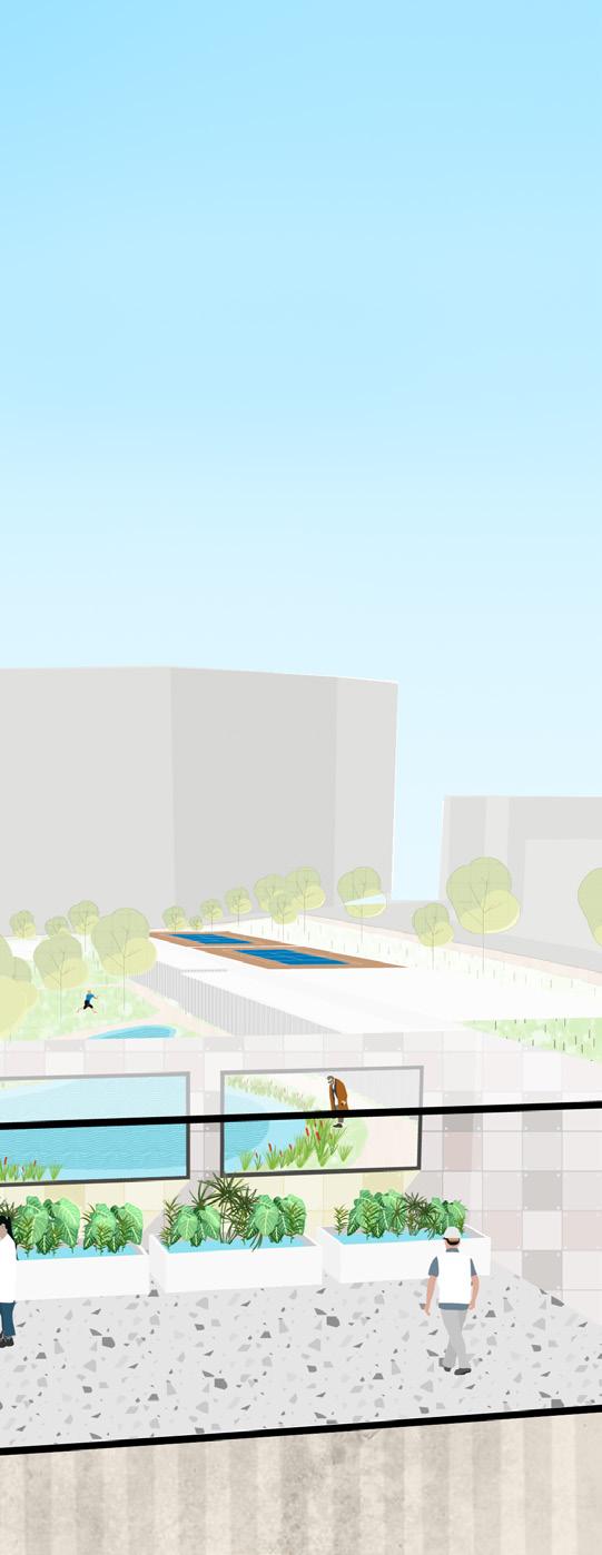
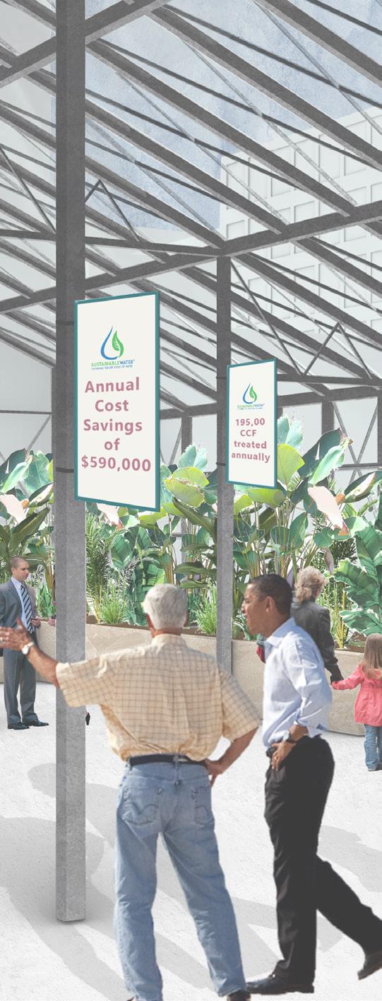
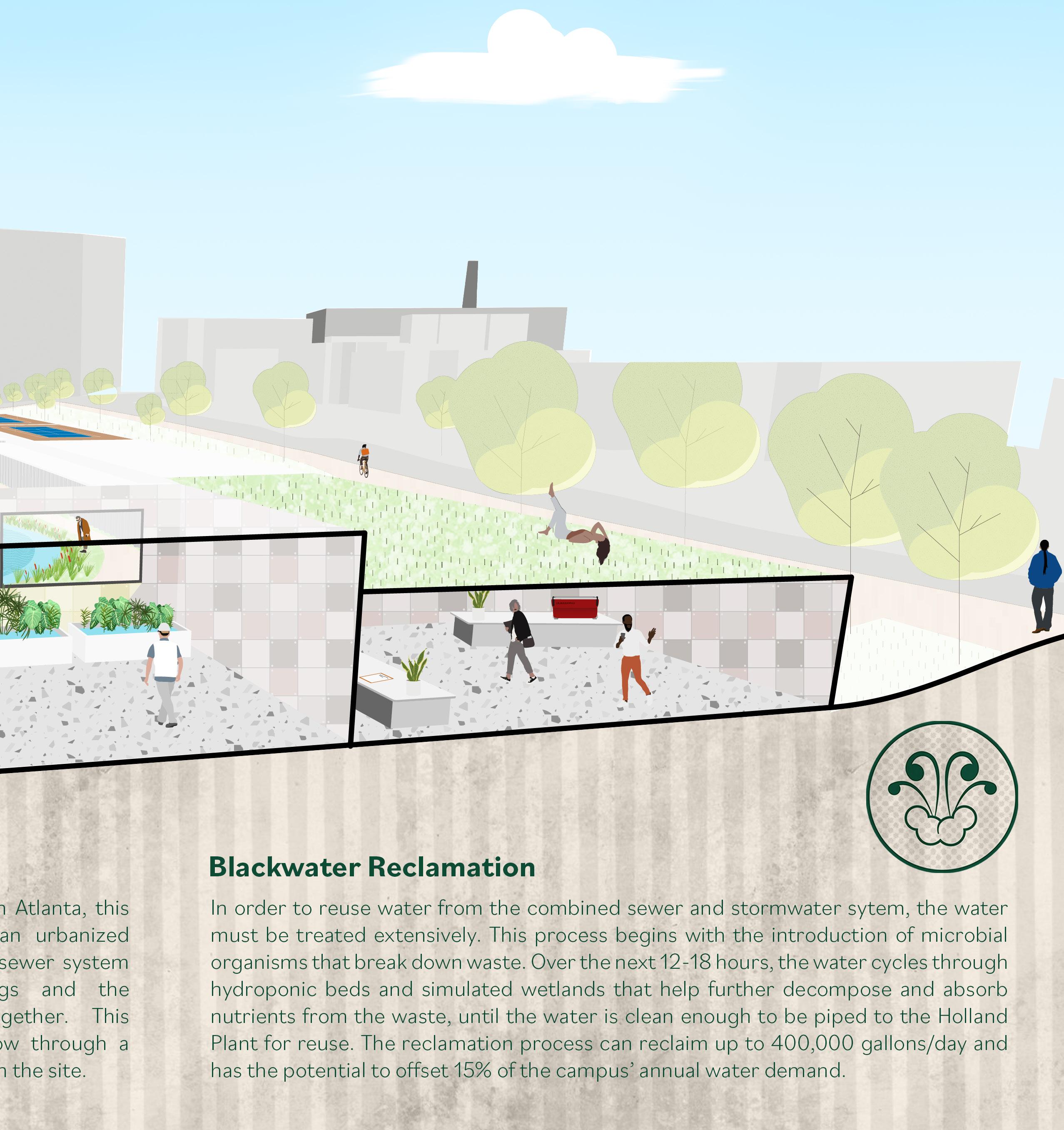
The design team proposed to demolish the existing park and to replace it with a blackwater extraction, treatment, and reuse facility, passive green space, a retention pond, and a building containing several campus-supportive uses. The water treatment center is open to the general public and serves educational, and water utility roles, similar to the Emory WaterHub that was the inspiration for the system. The recreational courts atop the existing parking structure are replaced and additional recreation amenities and programming are added to enhance the leisure potential of this central campus location. The rest of the site is used for the retention pond and as an open space. This project was submitted for the 2021 EPA RainWorks Challenge.
Stormwater Reuse/Storage
During and after a storm, runoff enters the site and travels via swales until it is deposited in the pond. Water can be exchanged between the pond and an underground cistern. In turn, this cistern can exchange between a campus-wide network of cisterns.
Blackwater
Cistern Storage/Exchange
An onsite cistern connects to the campus cistern network and the pond, facilitating two-way water exchange between storage and distribution areas.
= height delta from site/ vertical pump delta
= existing cisterns
Reclamation & Tourism
The wastewater treatment facility purifies blackwater through a gauntlet of microbial and hydroponic cycles. The facility is open to the public.
Recreation
The design potential leisure the landscape
UpstreamtoDowntown
Surface Collection
Curb cuts and swales create channels that collect and store runoff on site.
= starts of surface channels
Downstream toPeachtreeCreek
design does not compromise the recreation potential of the former site. It enhances the variety of leisure that visitors can engage in and greatly improves landscape of the active space.
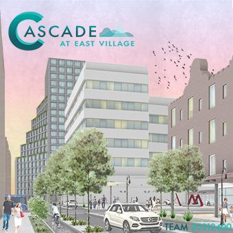
CasCade at east Village
ULI Hines Student Competition 2021 Kansas City, MO
The ULI Hines Student Competition challenges interdisciplinary graduate teams to come up with a development concept and financial plan for sites throughout the US and Canada. The site for the 2021 competition was in Kansas City’s East Village.
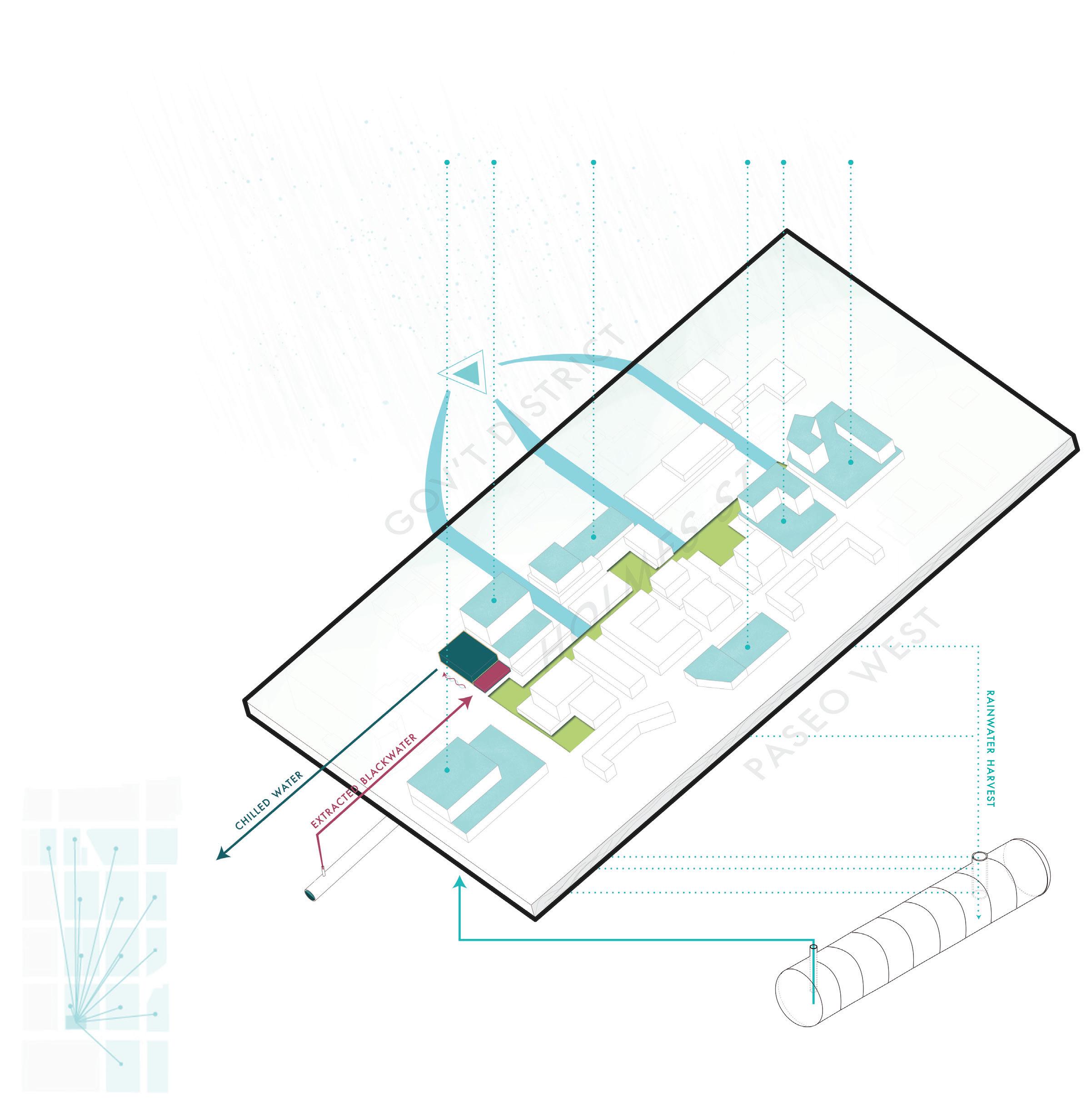
The themes of this design proposal were water reuse and recycling and equitable mobility and housing outcomes. The design sought to reduce water resource inefficiency by reclaiming and purifying blackwater and stormwater and reusing it throughout the development. A small-scale water hub treatment plant and a chiller plant for district cooling were proposed.
This section also references two other ULI competition submissions. The three submission boards from the 2019, ‘20, and ‘21 competitions can be found at https://issuu. com/lubenraytchev.
Proposed phasing for the design, which includes substantial rental housing, and projected revenue and other financial
The site is situated in the eastern Central There is a minor site. The site lies and receives water elevations to either it north and south. the relative flow direction.
substantial affordable for-sale and financial benefits.
Team Members: Christopher Barnum, Alison Evans, Varun Sethi, Manushi Sheth
Stormwater Cycle (light blue): 1) Stormwater flows into the site 2) green infrastructure intercepts runoff, 3) rooftop rainwater is harvested, 4) water is distributed from storage cisterns as needed.
Blackwater Reclamation Cycle (red): 1) Blackwater is extracted from the sewage main, 2) blackwater is treated at the Village Water Center, 3) treated water is sent to the chiller plant to buildings in the district for non-potable uses.
Dsitrict Cooling Cycle (blue): 1) The chiller plant receives water treated at the Village Water Center, 2) water is chilled and distributed through the district for cooling.
28-30M Gallon Annual Water Harvest Potential
situated on the side of a hill Central Business District. hill to the east of the in a relative depression water flows from higher either side before expelling south. The arrows represent direction.
The chiller plant and water treatment center are major elements of the design proposal. The two work together to reclaim wastewater and use it for building cooling throughout the district.
Graphic by Christopher Barnum
Team
1) Slotted curb to allow stormwater to flow into green infrastructure
2) Curb extensions with rain gardens (green infrastructure) to reduce impervious surface and allow stromwater infiltration
3) Pervious paving to allow additional stormwater inflitration
4) Infiltration basins and constructed wetlands
5) Filter strips for stormwater capture and separation of bike lanes
6) Ground floor retail to activate street edge
The Cascade at East Village design proposal highlighted water resource management through water reuse and reclamation while developing the site to provide maximum liveability and enhanced transportation options.
Intermedio proposed a lively development in an underutilized site between Miami’s Wynnwood and Edgewater districts. Adaptive reuse, entertainment, and pedestrian areas were highlights of the proposal.
Urban Front aimed to bring the city to the riverfront in Cincinnati in a redevelopment concept catalyzed by a proposed interstate cap that would bridge Downtown and the River District. The full submission boards can be viewed at https://issuu.com/lubenraytchev
Graphic by Varun Sethi
7) Corner street plaza with recreational activities
8) Retrofit of histroic Wiltshire Apartments Hotel
9) Bus Rapid Transit lane for Cascade MAX bus line
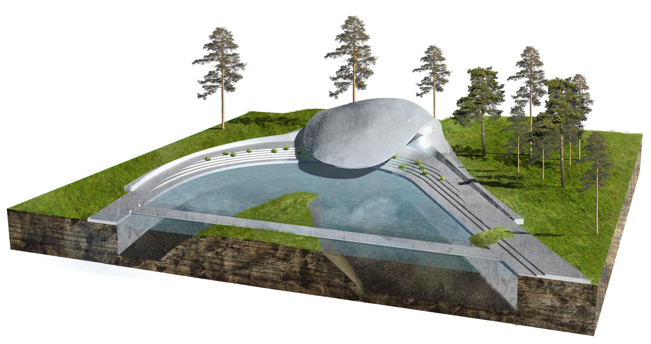
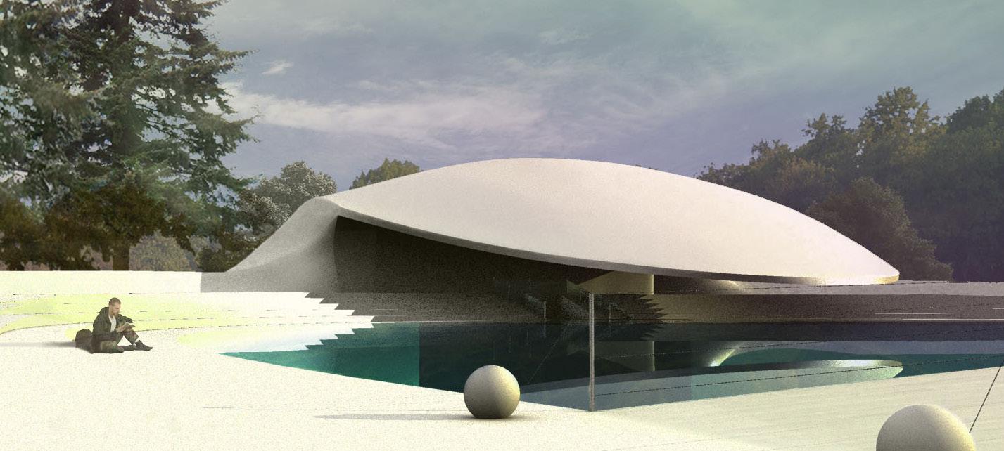
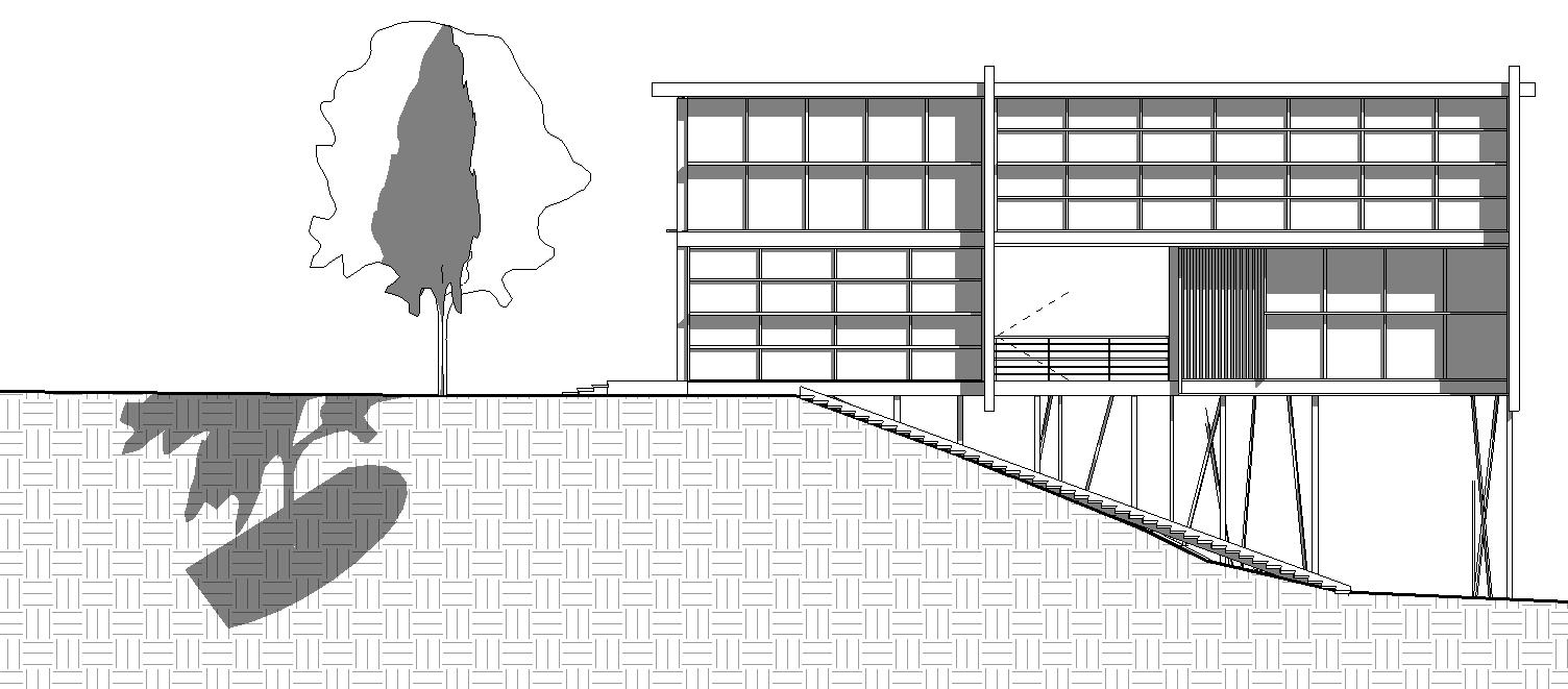
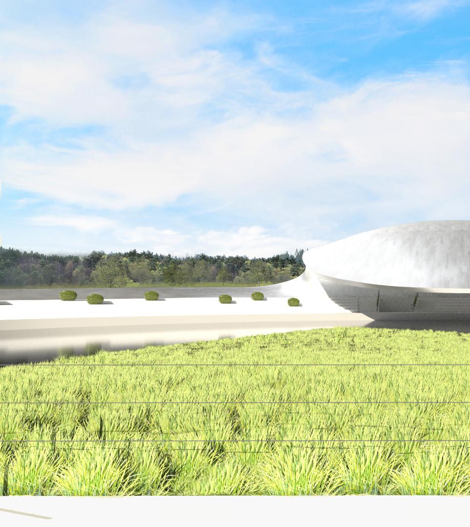
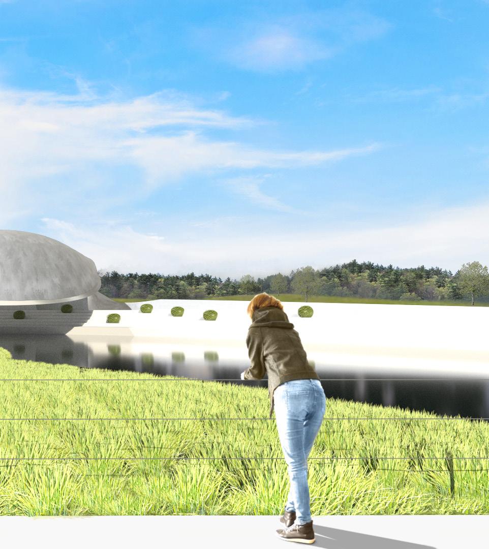
PoRsChe PaVilion
Architectural Visualization and Design Studies
The Porsche Pavilion is part of the Autostadt complex in Wolfsburg, Germany. Celebrating the Porsche brand, the building is known for its iconic curved canopy, which uses no external support system. The exterior forms part of a landscape design and encloses a reflection pool, while the interior houses a showroom with replicas of historic Porsche automobiles and space for displaying current models.
This building study was intended as an exercise in understanding a building design and as practice in 3D modeling and architectural visualization.
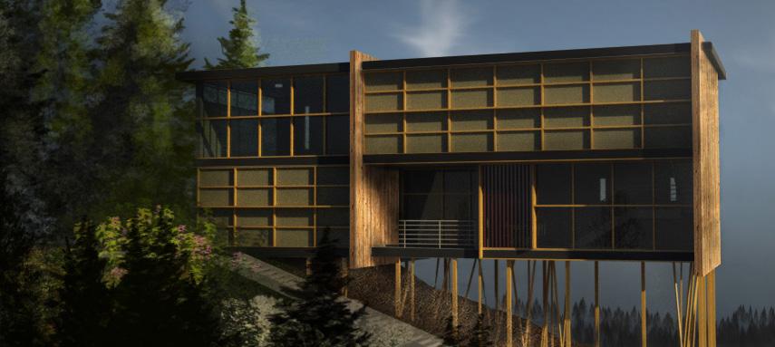
Also featured on this page is an exterior model and visualization of a home created using Revit. Together, the projects showcase visualization and modeling skills in Rhino, Revit, Adobe Illustrator, and Adobe Photoshop.
Perspective visualization of the Porsche Pavilion and landscaping features.
Elevation and plan sections.
(Above) Porsche Pavilion.
(Below) A concept for a house designed using Revit and visualized using Revit and Photoshop. The concept is based on examples of minka, traditional Japanese homes, with a modern massing and imagined in a mountainside setting.
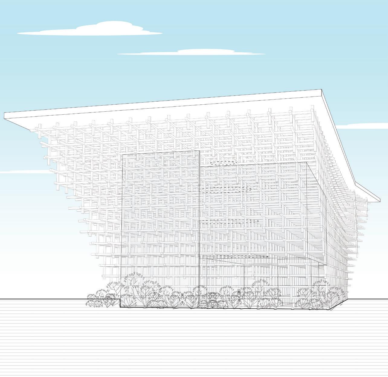
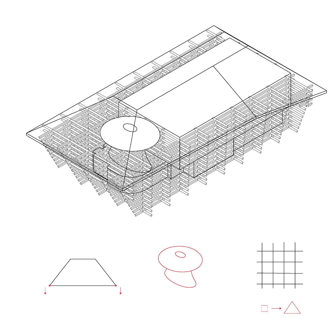
PRostho museum
Parametric Design
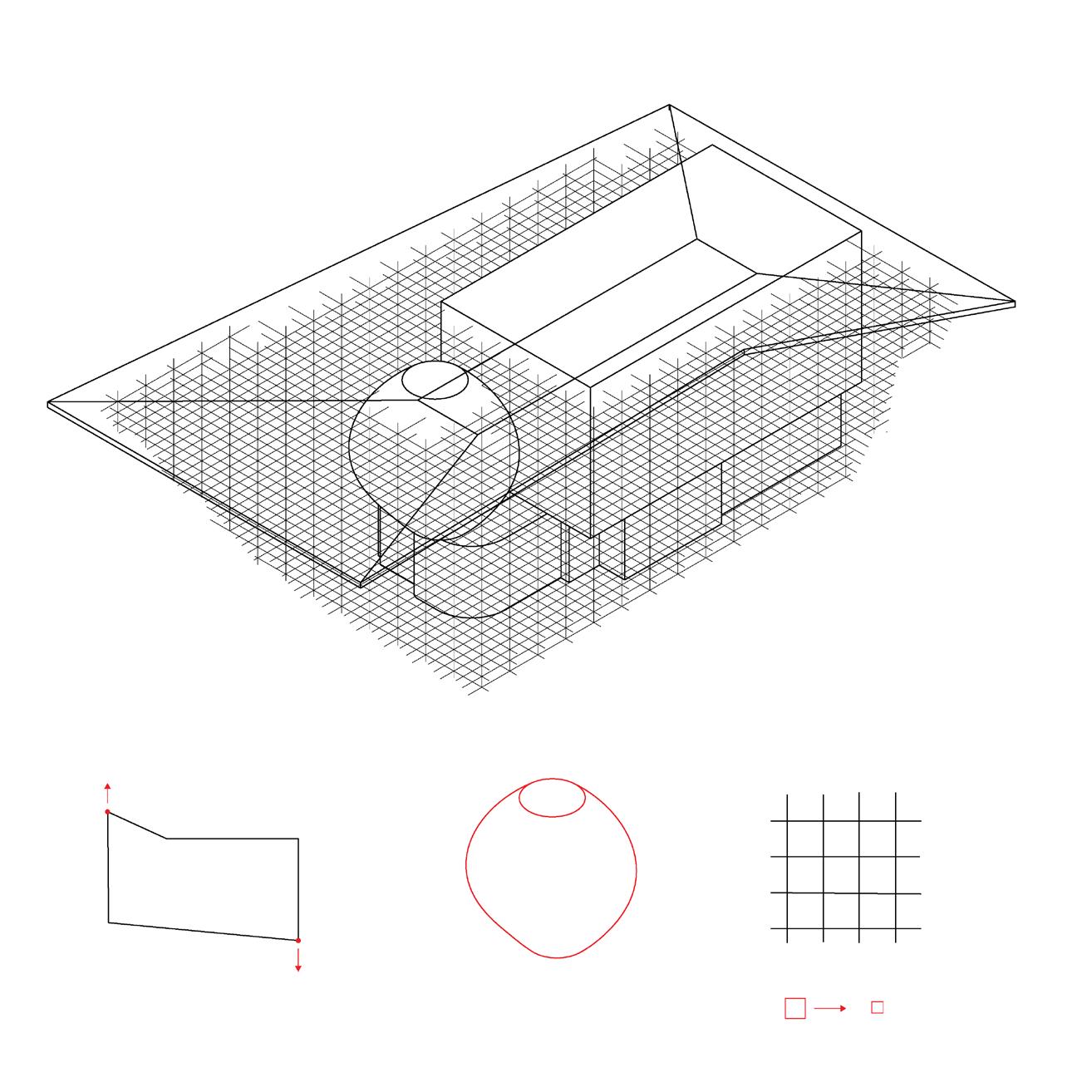
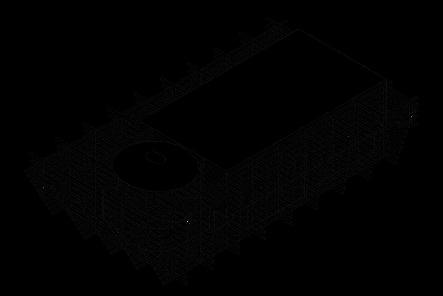
The Prostho Museum and Research Center was designed by architect Kengo Kuma, who was inspired by a traditional Japanese cidori toy. The wooden members of the building are joined in an interlocking system without using glue or nails.
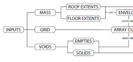
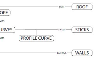
The goal of this project was to create a parametric system based on the museum’s structural elements that could be manipulated to yield different variations of the building. The parametric system was created using Grasshopper for Rhino and allows the user to manipulate the massing, spacing of the grid, voids (unenclosed areas without wooden members), and enclosed spaces.
The parametrized elements include the buildings the void spaces, and the shape and thickness of combinations of these structural aspects results
The Prostho Museum and Research Center in its original design.
The building parametrized
A grid superimposed
Empty (cavities) by lofting
The members length of
Massing
Grid
Voids
Members
building mass is constructed by lofting between two parametrized curves.
The grid can be cut to any shape.
of curves with programmable size and density is superimposed on the mass, then cut to the shape of the mass.
(cavities) and solid void (rooms) spaces are constructed lofting between parametrized curves.
members are created by extruding a profile curve along the of the grid curve. The profile shape is adjustable.
buildings massing, the grid of wooden members, of the wooden members. Unique results in different variations of the building.
Team Members: Katie Reilly, Rosanna Franco
Stretched roof, ovoid void space, reduced size of wooden members.
Heightened roof pitch, complex void, increased size and triangular shape for wooden members.