
Valley Regional Council
Local Floodplain Management Plan


ACKNOWLEDGMENT OF COUNTRY
Lockyer Valley Regional Council respectfully acknowledges the Traditional Owners, the Yuggera and Ugarapul people, as custodians of the region we share. We pay our respects to their elders past, present and emerging and the Aboriginal and Torres Strait Islander Elders of other communities who may live here as the keepers of the traditions, customs, cultures and stories of proud peoples. Lockyer Valley Regional Council is committed to cultivating inclusive environments for all staff, customers, residents and visitors.
OUR PARTNERS

ACRONYMS AND ABBREVIATIONS
AEP Annual Exceedance Probability
AHD Australian Height Datum
ARR Australian Rainfall and Runoff Guide
BoM Bureau of Meteorology
SFMP Brisbane River Strategic Floodplain Management Plan
DFL Defined Flood Level
EY Exceedances per year
FOUL Friends of Upper Laidley
H Hazard category
HR Hydraulic Risk
ICPA Integrated Catchment Planning Approach
LFMP Local Floodplain Management Plan
LGA Local Government Area
LUCI Lockyer Uplands Catchment Inc.
LVRC Lockyer Valley Regional Council
MCA Multi Criteria Analysis
MMM Minor, Moderate, Major (flood classification)
PMF Probable Maximum Flood
QERMF Queensland Emergency Risk Management Framework
QFCoI Queensland Floods Commission of Inquiry
QRA Queensland Reconstruction Authority
RCP Representative Concentration Pathways
RRSEQ Resilient Rivers South East Queensland
SEQ South East Queensland
TLPI Temporary Local Planning Instrument
UU Urban Utilities
VHBB Voluntary Home Buy-Back scheme

A MESSAGE FROM THE MAYOR
The Lockyer Valley proudly boasts one of the world’s most fertile soils and it’s no surprise that agricultural production drives the local economy and positions the region as a wonderful place to live, work, visit and raise a family.
The soil’s fertility is directly due to the region being a floodplain and while this helps us contribute more than $2.5B to the national economy each year, it also carries risks to businesses, infrastructure, lives and lifestyles if not properly managed.
Council is committed to ensuring the community’s preparedness for and resilience to disasters is improved through community education, training and strong partnerships that protect the community and economy of the Lockyer Valley.
The Local Floodplain Management Plan (LFMP) helps Council to understand the risk factors and implement plans that enhance community safety and preparedness. The LFMP builds on Council’s experience in flood response and mitigation and prioritises actions that protect our growing community, both now and into the future.
Floods are a natural part of life in this region, and we all have a responsibility to do our part in being ready and minimising the risks. From our land use planning policies, stormwater networks, transport routes, community hubs and emergency preparedness, we need to continue improving our planning for and resilience to floods.
I am proud of the work done by Council in preparing this Plan and can assure the community we are committed to applying it to give the community every opportunity of achieving a safe and vibrant future.

Councillor
Tanya Milligan Mayor, Lockyer Valley Regional Council

VISION
Through the Local Floodplain Management Plan, Lockyer Valley Regional Council seeks to reduce the community’s vulnerability to flood by implementing a range of sustainable and effective initiatives and regulation to avoid and mitigate flood impacts and support the community to be prepared to respond to flood.
COUNCIL’S ROLE
Council will fulfill a range of roles as we work towards our vision, recognising that it cannot be achieved by Council alone.
ROLE

DESCRIPTION
Provider Delivering services
Funder
Funding other parties to deliver services
Regulator
Partner
Facilitator
Advocate
Regulating activities through legislation, local laws and policies
Forming partnerships and strategic alliances with other parties in the interests of the community
Assisting others to be involved in activities by bringing groups and interested parties together
Promoting the interest of the community to other decision makers and influencers
CONTEXT
THE LOCKYER VALLEY AND FLOODING
Flooding is a formative characteristic of the Lockyer Valley. Periodic flooding supports the ecological function and economic productivity that underpins the prosperity of the region (Brook, 2022). As one of Australia’s most fertile agricultural plains, home to a growing population, the Lockyer Creek catchment rises on the eastern slopes of the Great Dividing Range and flows in an easterly direction before joining the Brisbane River just below Wivenhoe Dam.
HISTORY OF FLOOD
The Creek and its tributaries form a bowl-shaped catchment with an area of approximately 3000 km2. Elevations range from 1100 m AHD on the Great Dividing Range to 24 m AHD on the broad alluvial plains where the Lockyer Creek meets the Brisbane River (Resilient Rivers Initiative, 2016). The Lockyer Creek catchment’s main arteries are the Lockyer and Laidley Creeks, which are fed by systems originating from Flagstone, Tenthill, Ma Ma, Woolshed and Sandy Creeks.
Since European settlement and the advent of record keeping, the Valley has recorded more than 70 flood events of varying degree and significance. Predominately occurring during the ‘wet season’ between January and March, the most recent and devastating events have occurred in 2011, 2013, 2022 and 2024.


OTHER NOTABLE RAIN EVENTS THAT RESULTED IN SIGNIFICANT FLOODING INCLUDE:
September 1863 Some damage to bridges, culverts and roads
March 1905 Gatton and Laidley impacts
January 1933 Laidley, Plainland impacts
February 1950 Third flood in three months, LGA impacts 235mm
January 1974 Major flooding across SEQ +/- 650mm
February 2001 Lockyer and Laidley Creek catchments 600mm in upper Laidley Ck
January 2011 Major flooding across SEQ, devastation in parts of Lockyer Valley 600mm-1m during Dec/Jan period
January 2013 Laidley, Tenthill and Black Duck Creek catchments 750mm
February 2022 Whole of LGA
LOCKYER VALLEY FLOODPLAIN
The steep sided ‘bowl shaped’ catchment that is the Lockyer Valley results from its unique underlying geology. Stream types throughout the catchment are highly variable with the upper catchment being bedrock confined, with narrow valleys following fault lines. Soils in the Lower Lockyer are alluvial with the main Lockyer Creek considered a ‘macrochannel’.
This is a deeply entrenched channel bounded by steep and resistant terraced banks that accommodates infrequent high magnitude floods and shows considerable structural resilience. However, erosion of the bank can occur and structures within this zone are vulnerable. A rare extreme flood which overtops the banks can result in high velocity floodplain flow which may cause loss of farmland or the depositing of in-stream sediment in the catchment. Lower flow events mobilise sediment in the creek which is then deposited further downstream (Resilient Rivers Initiative, 2016).
WHY HAVE AN LOCAL FLOODPLAIN MANAGEMENT PLAN?

Following the devastating events of 2010/2011, the 2011 Queensland Floods Commission of Inquiry 2012 (QFCoI) was established. The QFCoI looked at detail into preparedness for flood, land use planning, emergency response, dam operation and structural mitigation.
From the QFCol, a recommendation was made for Councils in floodplain areas to develop comprehensive floodplain management plans. This resulted in a collaboration between the State Government, the four Local Governments of Brisbane, Ipswich, Lockyer Valley and Somerset, and other stakeholders in developing the Brisbane River Strategic Floodplain Management Plan (SFMP).
The next stage of this process is the creation of individualised Local Floodplain Management Plans that form part of the Queensland Flood Risk Management Framework. These are plans tailored at a local level by collecting the necessary data, defining the flood hazard, assessing the risk, considering options to manage the risk to acceptable levels, and developing an implementation plan to manage the risk.
Council works to protect the community and economy of the Valley, which includes improving resilience of public and private property, assets and infrastructure (Resilient Rivers Initiative, 2016). The LFMP helps Council understand the risk factors and put plans in motion to satisfy the overall objective of community safety and preparedness.
THE BUILDING BLOCKS
The development of floodplain management in the Brisbane River catchment was created over four phases:
• Phase 1 – Data Collection Report (Aurecon, 2013)
• Phase 2 – Brisbane River Catchment Flood Study
• Phase 3 – Brisbane River Strategic Floodplain Management Plan 2019 (SFMP)
• Phase 4 – Local Floodplain Management Plan (LFMP) – this plan
Other plans
- Brisbane FloodSmart Future Strategy
- Ipswich Integrated Catchment Plan
- [Somerset] Local Floodplain Management Plans
The objective of an LFMP is to develop a local approach to floodplain management by documenting a detailed view of the risks, land use planning options, mitigation strategies and emergency preparedness.
In preparing this plan, Lockyer Valley Regional Council undertook a range of comprehensive studies to understand and model local flood behaviour, establish the risk factors and impact of flood, develop a profile of the communities at risk of flood, and conceive a plan to improve resilience through regulation, awareness and preparation.
As a reference document, the LFMP sits within a suite a of strategic documents that are aligned in their response to natural hazard.
Background studies:
• Local Floodplain Management Study
• Community Precinct Risk Assessment
• Evacuation Route Planning
• Flood classifications
• Hydraulic assessment
Evacuation Plans
Community Profiles
Regional and local creek flood modelling
Land Use Planning for Flood Lockyer Valley Planning Scheme Environment Strategy Economic Development Strategy

PRECINCT APPROACH
For the purposes of the LFMP, a risk assessment has been undertaken to understand the current and future flood risk across the local government area at a community precinct level.
Communities of the LGA are relatively disparate, with unique characteristics in terms of demographics, vulnerabilities, flood risk and built form. To better understand the varying dynamics, ten precincts have been identified to describe the community, source and scale of flooding, development pressures, climate change susceptibility, and mitigation measures previously considered or implemented.

Precinct name
1. Murphys Creek – Withcott
2. Helidon – Grantham
3. Flagstone Creek
4. Tenthill
5. Gatton
6. North Lockyer
7. Forest Hill
8. Laidley – Plainland
9. East Lockyer
10. Mulgowie
• Murphys Creek
• Lockyer
• Carpendale
• Helidon
• Egypt
• Stockyard
• Lilydale
• Black Duck Creek
• Mount Sylvia
• East Haldon
• Ma Ma Creek
• Lower Tenthill
• Gatton
• Lawes
• Churchable
• Glenore Grove
• Lake Clarendon
• Blenheim
• College View
• Crowley Vale
• Laidley
• Plainland
• Brightview
• Summerholm
• Mulgowie
Localities
• Withcott
• Upper Lockyer
• Helidon Spa
• Iredale
• Rockmount
• Fordsdale
• Junction View
• Upper Tenthill
• Lefthand Branch
• West Haldon
• Mount Whitestone
• Adare
• Ringwood
• Lockyer Waters
• Kentville
• Ingoldsby
• Forest Hill
• Rockside
• Laidley North
• Laidley Heights
• Hatton Vale
• Lockrose
• Lynford
• Thornton
• Grantham
• Flagstone Creek
• Upper Flagstone
• Caffey
• Ropeley
• Veradilla
• Woodbine
• Winwill
• Placid Hills
• Woodlands
• Morton Vale
• Spring Creek
• Mount Berryman
• Glen Cairn
• Laidley South
• Laidley Creek West
• Regency Downs
• Kensington Grove
• Townson
SHARED RESPONSIBILITY
Flood awareness, risk, response, management, recovery and resilience are shared responsibilities of every individual and every level of government. At each level, information and support is shared horizontally and vertically and is utilised to build a better understanding and resilience to flood.
Floodplain management draws on the guiding principles of prevention, preparedness, response and recovery. The principles are applied across all elements of floodplain management and all sectors of society share responsibility including community, business and governments.
STRATEGIC DIRECTION
• Decision making
• Built environment
• Emergency plans
• Evacuation routes
• Readiness
• Activate emergency plans
• Land use planning
• Information
• Flood intelligence
• Mitigation
• Dissemination of information
• Education
• Readiness guides
• Flood intelligence
• Management plans
• Alerts
• Local Disaster Management Group
• Local Disaster Coordination Centre
• Evacuation
• Recovery planning
MANAGEMENT ACTION HIERARCHY
A holistic approach to catchment management is essential to maintain the long-term resilience of the catchment and community. There are complex interactions between catchment flows, water quality, channel morphology, land use, riparian vegetation and aquatic ecology. These interactions also impact on human health and wellbeing, assets, infrastructure, property, recreation, economy, tourism, amenity and natural resources.
• Building regulation
• Planning policy
• Education
• Intelligence data
• Alerts –early warning
• Alerts –Early warning (BoM)
• State Disaster Coordination Centre
• State Agencies
• Response support and resources
• Recovery Support
• Response support
• Recovery funding
Managing only one element of a catchment is unlikely to address all relevant aspects. It may be necessary to compromise between the priorities at a site to achieve a balanced outcome that maximises overall environmental, social and economic benefits. However, given catchment runoff, volumes and forces cause many social, economic and environmental impacts, managing these specific runoff characteristics is imperative (Resilient Rivers Initiative, 2016).
OBJECTIVES
The Brisbane River Strategic Floodplain Management Plan (SFMP) proposes a framework for addressing floodplain management at a local level through an Integrated Catchment Planning Approach (ICPA). An ICPA balances the social, environmental and economic considerations of flood hazard and has been incorporated into State planning instruments as an outcome of the Queensland Flood Commission of Inquiry (QFCoI).
The core components of ICPA are Flood Management, Land Use Planning, Landscape Management and Water Supply. The Planning Institute of Australia recognises this approach as best practice in supporting community resilience to natural hazards. Further, the SFMP acknowledges that local governments within the floodplain are continuously refining responses to flood risks as resources permit (QRA, 2019).
To contextualise the integrated catchment planning approach and satisfy its strategic vision, Council considers floodplain management through five principles:
INTEGRATED CATCHMENT PLANNING

The community’s preparedness for disasters is improved through community education, training and strong partnerships between Council and other agencies (LVRC Corporate Plan 2022-2027).
Land Use Planning Landscape Management
Flood Management Water Supply


PRINCIPLE 1 – KNOWING THE RISK
The impacts of natural hazards go beyond the physical damage caused by inundation of property. Property represents people’s lives, employment, education and social connectedness. The underlying stresses and adverse impact on wellbeing following a natural disaster exceed the loss of material possessions (Brook, 2022). We know the risk and vulnerability that flooding poses to our region, our communities and our businesses.
The extent and impact of flooding is highly variable, so floodplain management needs to be grounded in a methodology that considers risk and consequence as being highly variable rather than a ‘one size fits all’ approach. Embedded in policy and guidance, the risk-based approach to floodplain management also requires a level of judgment on what is considered an acceptable, tolerable or intolerable risk. Tolerability is largely driven by a community’s awareness of flooding and resilience to impact, and is likely to change overtime.
Lockyer Valley’s risk-based methodology supports a five stage approach:
Accept / Transfer the risk
By analysing the behaviour of historic flood events based on their duration, volume of rain and catchment condition, we can predict the likelihood and consequence of any given rain event. This analysis helps in the development of risk management strategies that aim to reduce exposure to and impact from flooding.
To determine the overall flood risk for the region, the probability of floods occurring in frequent, moderate and rare occurrences are examined. These events include:
(1 in 10)

ECONOMIC, AGRICULTURAL AND ENVIRONMENTAL IMPACTS
Economic Impacts
Flood has wide ranging impacts on the community and landscape. Economic assessment of flooding considers the costs associated with damage caused to communities because of flood events. This damage can be defined as tangible or intangible. Tangible damages are those costs for which a monetary value can be easily assigned; while intangible damages are those to which a monetary value cannot easily be attributed.
Agricultural Impacts
The region’s alluvial soils provide fertile land for agricultural production. They are prominent in floodplains and wide valleys and susceptible to flooding impacts. Soil erosion is a significant issue for the catchment and downstream areas.
Environmental Impacts
There are large tracts of environmentally significant areas within the LGA; typically the hill and mountain areas and upper parts of the various creek catchments. Due to the topography, these areas and areas along the waterways are more likely to experience more frequent and intense rainfall and subsequently suffer damage during flood events.
Damages are further categorised as being either direct or indirect. Direct damages are caused by direct interaction with the floodwaters, causing damage or disruption. Indirect damages are the aftereffects from flood events such as loss of wages, traffic disruption, and loss of community wellbeing.
The erosion and deposition of sediments because of flood events cause significant impacts on agricultural production in the LGA, but the impacts also extend downstream. The Lockyer catchment has been identified as the major contributor of sediments to the lower Brisbane River and Moreton Bay.
The hills within the south and the west of the LGA; have geological features that can produce large quantities of sediment during significant rainfall events, resulting in extensive erosion or sediment deposition and the loss or damage to vegetation.

12,156 buildings impacted in the PMF extent
PMF $6b total cost of damage
$29m total cost in 10% AEP event
$4101 /ha attributed to agricultural damages in a regional flood extent
21,500ha of agricultural land within regional flood extent
$47.5m Agricultural costs in 1% AEP event
$3663 /ha attributed to environmental damage

11,200ha within regional flood extent
2264 buildings with water over the floor during a 1% AEP flood event
7500 properties inundated above ground level during a 1% AEP flood event
UNDERSTANDING FLOOD RISK
The relative safety of people and property determines the level of hazard a flood poses; the deeper and faster the water, the more hazardous.
HAZARD
LEVEL
H6 Unsafe for vehicle and people. All building types considered vulnerable to failure
H5 Unsafe for vehicles and people. All buildings vulnerable to structural damage. Some less robust building types vulnerable to failure
H4 Unsafe for people and vehicles
H3 Unsafe for vehicles, children and the elderly
H2 Unsafe for small vehicles
H1 Generally safe for people, vehicles and buildings
Combining the level of hazard with the probability of a flood event informs the potential hydraulic risk. The Australian Disaster Resilience Guidelines identify hazard characteristics that provide a regionally consistent definition of Hydraulic Risk (HR).

0.2%AEP (1 in 500)
0.5%AEP (1 in 200)
1%AEP (1 in 100)
2%AEP
in 50)
5%AEP (1 in 20)
10%AEP (1 in 10)
Hydraulic risk combined with tolerability underpins the risk-based approach to floodplain management.

FLOOD RISK FACTORS
Four key hydraulic elements are considered when assessing the flood risk within the LGA.
These are as follows:
• Potential Hydraulic Risk – likelihood, level of hazard, hydraulic behaviour
• Flood Function – flood conveyance areas, flood storage areas and flood fringes
• Flood Islands – areas isolated during frequent and rare events
• Warning Time – those areas susceptible to flash flooding in a 1% AEP event or have less than 6 hours of warning
These risk factors are determined using a range of engineering flood maps, including maps of frequent to rare flood events.
Example: During rare rain events, localities like Withcott are susceptible to increased flood risk due to the topography and rapid rise in flood water. As water enters the many tributaries, creek systems and floodplain, it spreads. The flood timing for places like Withcott is normally very short from initial rainfall to flash flooding, whereas places like Glenore Grove generally have advanced warning of the rise in creek level and potential for conveyance through the flood storage and fringe areas.

CURRENT FLOOD EXPOSURE
For the purposes of describing and analysing the behaviour and impact of flood events, the Lockyer Valley floodplain is divided into ten precincts. The precinct approach is used to describe the source and scale of flooding, development pressure and climate change susceptibility and assists in identifying each community’s risk profile.
Detailed flood studies provide an indication of the number of buildings that are exposed to the impacts of flood water in a 1% AEP from local flooding or flood conveyance and whether the impacts are on the property or progress to over the floor of the building.

ABOVE GROUND OVER FLOOR

CRITICAL
INFRASTRUCTURE IN THE PRECINCT
Within the region there are many critical assets, including emergency services, telecommunication towers, water reservoirs and priority evacuation and shelter buildings such as halls and schools. The locations of critical assets, and the risk associated with their exposure to hydraulic risk or isolation, is captured for each precinct.
Big industry in the floodplain: Agricultural production, processing and industry has an important role in the local economy and supply chain. Processing facilities are commonly located where the produce is sourced, on the nutrient rich alluvial floodplain. The risk of isolation during flood events is an essential consideration for large employers when developing their emergency management plans. These locations are generally ill-equipped to host large numbers of people in refuge and there is a real risk in navigating the floodplain as the road network becomes impacted.
WARNING TIME – TIME TO INUNDATION
Flash flooding occurs suddenly and with little warning. It is often caused by sudden local or nearby heavy rainfall. It is generally not possible to issue detailed flood warnings for flash flooding; however, generalised warnings may be possible. Development within these areas needs to be resilient and safe, and not reliant on evacuation or temporary flood protection devices.
In the Lockyer Valley context, any area subject to potential inundation in the 1% AEP event and with less than 6 hours warning of that location being inundated, is considered to be at risk. The determination of limited warning time is based on observations from historical flood events and is classified as:
• Less than 6 hours of warning in a regional flood event including locations such as Forest Hill and communities upstream of Grantham railway bridge;
• In all precincts, local (flash) flooding is classified as having effectively nil or less than 6 hours of warning.
FLOOD ISLANDS
Flood islands are areas within the floodplain that remain above the flood level but are surrounded by floodwaters during a flood event. As rainfall and flood intensity increases, these islands can become impacted by flood water causing water over the property or inundation of buildings. The LFMP considers three types of flood islands:
• Low flood island category A areas which are dry but surrounded by floodwaters in a 5% (1 in 20) AEP event but become inundated in a 1% AEP event.
• Low flood island category B areas which are dry but surrounded by floodwaters in a 1% AEP event but become inundated once the event reaches a PMF level.
• High flood islands areas which are dry but surrounded by floodwaters at the PMF level. These areas do not become inundated at any point.
Due to the potential for extended isolation and inability to evacuate once water encroaches the property, the low flood islands are considered to be at higher risk.

Many areas of the Lockyer Valley can become isolated as access routes are impacted by flood water and the roads are closed for a prolonged period.

DETERMINATION OF RISK
Risk classification for each precinct is determined by establishing community vulnerability markers, knowing the overall likelihood of impactive flooding and the consequences of both these factors on people, property, access and critical assets. Risk classification is used to inform Council’s planning, business and operations, as well as third party interests, e.g. State and Federal government entities ensuring there is a shared understanding of risk at a precinct level and that they are managed to reduce the impact of disaster on the community. Our awareness of what constitutes risk and the information and tools needed to effectively manage these changing risks are also improving.
VULNERABILITY
Social characteristics of the region guide the risk assessment process. Using census data and metrics consistent with the SFMP, the overall vulnerability of the region at a precinct level is established. When integrated with an overall risk and consequence matrix, each precinct is determined to have an overall risk classification. The risk classification drives outcomes of the LFMP, from warning systems and education, to physical mitigation and land use planning policy.
To determine vulnerability, census data for each locality is benchmarked against the LVRC and State average to determine a level of vulnerability either lower than, unchanged or higher than the comparison. The combined vulnerability of the localities within a precinct determines whether the precinct has a vulnerability score of either high, slightly high, slightly low or low.
VULNERABILITY ASSESSMENT

to area in last 5 years > 65

RISK CLASSIFICATION
The Queensland Emergency Risk Management Framework (QERMF) has been developed to inform risk-based planning across the emergency management sector in Queensland. It promotes opportunities for collaboration, communication and identification of residual risk with all stakeholders at all levels. The QERMF methodology expects the outputs to be applied to Council’s planning, business and operations.
Likelihood + Vulnerability + Consequence = Level of Risk


CLIMATE CHANGE
Consideration of the impacts of climate change is now accepted best practice and embedded in policy and strategy documents across the planning, disaster and resilience spectrum.
Climate change analysis has been undertaken under the Australian Rainfall and Runoff 2019 RCP8.5 scenario; essentially a 20% increase in rainfall applied to a 1% AEP event and applied to the local and regional models. The resultant effect of climate change on each precinct varies considerably with some change evident within the banks of creeks while other increases are noticed in urban areas, away from the ‘normal’ flood conveyance and storage areas.


PRINCIPLE 2 – TAKING A RISK-BASED APPROACH
Each local government within the floodplain is continually refining responses to flood risks as resources permit, through the integration of best practice floodplain management principles in their community engagement, disaster management, land use planning and other floodplain management activities (QRA, 2019).
MANAGEMENT OPTIONS
• Land Use planning – Local government manages risk through appropriate zoning and regulation.
• Flood resilient built form and retrofitting – Homeowners can modify their home to be more resilient to frequent and substantial inundation. These options include house raising and use of resilient materials to reduce damage and replacement costs and allow easy washdown.
• House buy back schemes – Where the risk is too great and built form options are not suitable, mitigating loss of life and property is better managed through a long term solution provided by a buy back scheme.
• Structural management options – Local and regional scale management options reduce impacts on the whole of community from frequent and substantial flooding. These management options can include dams, levees, basins, bypass flood-ways, channel improvements and flood gates.
• Natural flood plain management – The damaging effects of floods can be minimised through catchment and riparian vegetation, land management and water sensitive urban design.
• Evacuation Routes – The identification of evacuation routes at a local and regional scale is an important consideration in land use planning and personal safety.
LAND USE PLANNING
Land use planning is an effective mechanism available to local government to reduce future exposure and vulnerability of people and property to flood hazard by establishing appropriate strategic land use policy and development requirements. A key outcome of the Queensland Flood Commission of Inquiry is the implementation of risk-based land use planning that is informed by robust flood hazard and risk assessments.
Through the State Planning Policy, the Queensland land use planning system requires local governments to adopt a risk-based approach for managing flood risk through their local planning instruments and policies. This process involves understanding flood behaviour across the full spectrum of flood hazard conditions and likelihoods to determine its acceptability or tolerability to current and future flood risk.
Land use planning has a key role in supporting resilience of the Lockyer Valley’s current and future settlement pattern. Risk-based planning ensures that land use is response to risk and development is appropriately located according to land use sensitivity and level of risk.
TOLERABILITY
The acceptability of risk often varies for different activities, land uses and disaster response capability. For example, the risk may be tolerable for land in a rural zone where access to safe refuges exists, but intolerable in an urban zone with a greater population density, or for specific vulnerable uses (Brook, 2022).
Land Use Activity Group
Potential Hydraulic Risk Category
Non-urban and recreation uses
Commercial and industrial
Residential and accommodation
Filling Acceptable Tolerable* Tolerable* Intolerable Intolerable
Vulnerable uses
Acceptable Tolerable* Intolerable Intolerable Intolerable
Community infrastructure and critical services Acceptable Tolerable* Intolerable Intolerable Intolerable
* Subject to requirements to treat and manage risk to an acceptable level informed by local floodplain management plans and risk assessment process).
RISK BASED PLANNING
The Defined Flood Level (DFL) is the height which it is reasonably expected flood waters may rise. Dwellings, structures and other assets need to have a finished floor constructed so it is at least the DFL level plus freeboard.
Freeboard is a height above the DFL. Freeboard compensates for the many unknown factors that could contribute to flood heights greater than the height calculated for a selected flood event and floodway conditions, such as wave action, bridge openings, unforeseen blockages, other localised hydraulic effects and the hydrological effect of urbanisation of the watershed. Councils are required to ensure that the risks associated with flooding, including the projected impacts of climate change, are avoided or mitigated to protect people and property and enhance the community’s resilience to natural hazards.
EVACUATION ROUTES FLOOD EMERGENCY ACCESS STRATEGY (FEAS)
Providing for safe emergency access is a key consideration of floodplain management initiatives including land use planning. An assessment of the capacity and capability and the region’s FEAS is a recommendation of the SFMP. The outcomes of the analysis will provide important insights that will inform local flood risk and risk-based land use planning in the floodplain (QRA, 2019).
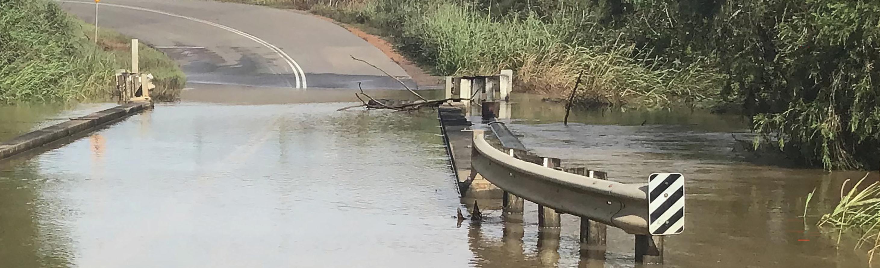
The LFMP background study identifies that most of the LGA road systems have a low flood immunity and suffer the effects of inundation and result in isolation. Specifically, local roads experience a shorter duration of inundation, while the inundation of regional road networks results in broader scale impacts.
The primary objective of Council’s FEAS is to understand the current constraints within the local area and which routes need to be prioritised to enable safe emergency access. Using detailed analysis and setting priority routes, Council will work with stakeholders and authorities to establish strategies to improve flood immunity while addressing the overwhelming risk posed by linear infrastructure projects across the LGA.


PRINCIPLE 3 – MITIGATION STRATEGIES
Reducing the physical damage to possessions, whilst enabling people to return to their homes and workplaces sooner, improves the resilience of a community to floods. Flood resilient construction principles extending beyond structural integrity have the ability to reduce the intangible and tangible damages from floods (QRA, 2019).
Previous flood studies have examined structural measures to mitigate the adverse effects of flooding across the LGA. The LFMP considers the previously identified options from these studies, including property-level initiatives and with the use of integrated catchment planning, employs risk-based methodology to place emphasis on actions that reduce impacts to life and property.
FLOOD RESILIENT BUILT FORM
Eliminating or reducing the physical damage to property and possessions, whilst enabling people to return to their homes and workplaces sooner, improves the resilience of a community to flood. To enable this, the Queensland Development Code requires minimum flood immunity of habitable areas and structural integrity of buildings. When building work is carried out in a local government area with a defined flood level, the Queensland Development Code MP 3.5 applies. By prescribing the flood level, structural integrity and materials, people are safeguarded from illness and injury caused by flood water affecting buildings.
RESILIENT HOMES FUND
The Resilient Home Fund is an initiative jointly funded by the Commonwealth and State Government that provides financial assistance to owners of eligible homes to complete works including repair or retrofit, raising, relocating and demolishing. Embracing the risk-based methodology, the scheme provides immediate mitigating actions that manage, avoid and arrest continual or future flood impacts. The Resilient Homes Assistance Scheme is administered by the Queensland Rural and Industry Development Authority (QRIDA) on behalf of the Department of Housing, Local Government, Planning and Public Works.
Voluntary Home Buy-Back (VHBB) Scheme: Homes that were the most severely impacted by the eligible flood events, and at the greatest risk from future flooding, are purchased for the purpose of removal or demolition. With VHBB funding, Council has purchased 24 properties that were seriously impacted by the 2021-22 flood event, removed or demolished the dwellings, and rezoned the land to Limited Development Zone. The program has removed people and property from harm’s way and prevents future devastation.
Retrofitting and House-raising: The retrofitting and house-raising program provides financial assistance to owners of eligible homes to complete works to improve flood resilience. Eligible works include repairing damaged homes with more resilient materials or retrofitting to make the home more resilient to flooding, raising the home to improve immunity, and relocating homes out of the flood hazard area.

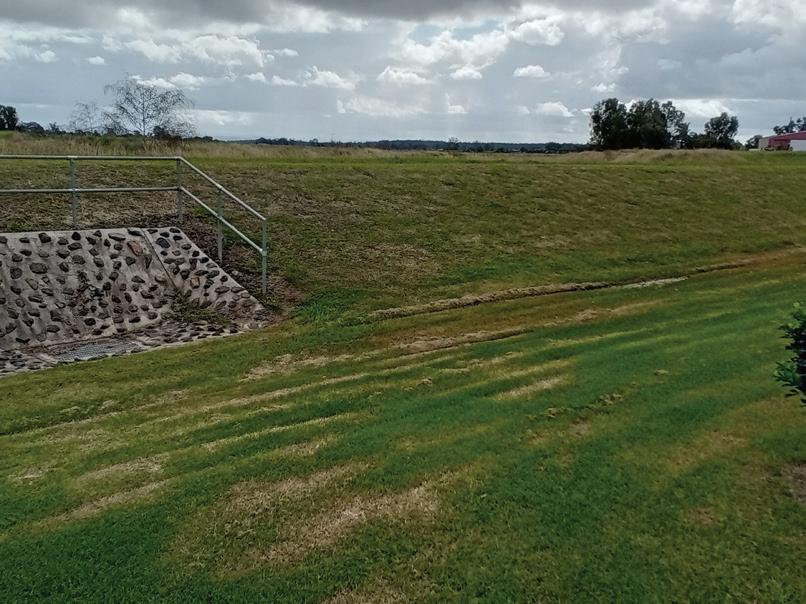
STRUCTURAL MANAGEMENT OPTIONS
The traditional approach to floodplain management has focused on hard engineering solutions such as dams, levees, flood gates, channels and drains. While these options provide an immediate and realised solution, some structural systems have the potential to change the function of a floodplain increasing flooding in downstream areas.
Lockyer Valley has implemented a series of successful structural projects including drainage systems, flood gates, reinforcement, basins and culverts.
The SFMP determined a multi criteria analysis (MCA) approach to prioritising actions with numerous structural flood modification projects progressing to investigation and implementation stage. Most notably, the Laidley Flood Mitigation Scheme and the Withcott Flood Mitigation Scheme produce the highest benefit across all categories of analysis.
Acknowledging a contemporary approach to structural modification options, both projects will be realised through a naturalisation approach with the end result providing broad scale community and environmental benefit.
NATURAL FLOODPLAIN MANAGEMENT
Landscape management actions, such as targeted catchment and riparian revegetation, rural landscape management practices and water sensitive urban design, can be effective tools that contribute to enhanced floodplain management particularly in terms of improving resilience to the damaging effects of floods (QRA, 2019).
Landscape management typically refers to vegetation and agricultural practices in upper parts of the catchment that provide benefits in smaller flood events and reduce erosion and, improve ecosystem health and downstream water quality.
Previous studies have guided the prioritisation of catchment projects by identifying areas of potential instability or changes in the creek systems. Each project is analysed using a range of possible approaches and for its cost / benefit to the greater risk profile, enabling efficient use of limited resources.
Landscape management focuses on naturalised repair and restoration through:
• Catchment and riparian re-vegetation;
• Rural land best management practices;
• Restoration of waterways; and
• Water sensitive urban design.
Management practices and projects that reduce sediment load and keep soil on the ground are particularly important in the Lockyer Valley context. Reducing sediment movement from the LGA will also contribute significant benefits to the downstream communities of the Brisbane River and the ecosystem health of Moreton Bay.


Resilient Rivers South East Queensland (RRSEQ) is a successful partnership between Council of Mayors (SEQ), the Queensland Government, water utilities, key regional waterways and catchment organisations and the community. For almost 10 years it has delivered coordinated catchment management to improve the health and resilience of South East Queensland’s catchments, waterways and the internationally significant Moreton Bay. Resilient Rivers was established as a response to the devastation of the 2011 and 2013 floods in South East Queensland, through recognition that coordinated catchment management is vital to ensure future economic, social and environmental health of the region. Among its aims, RRSEQ seeks to help protect our regions water and food security to support current and future populations of SEQ and improve the climate resilience of the region. At its core, Resilient Rivers recognises that we can deliver more through collaboration, cooperation and coordination than working alone.

PRINCIPLE 4 – BE PREPARED
FLOOD RISK MANAGEMENT ROLES AND RESPONSIBILITIES
Flood Risk Management (FRM) is a shared responsibility of Federal, State and Local Governments and their agencies. FRM initiatives are delivered at State, District and Local levels. The Queensland Disaster Management Arrangements (QDMA) are a tiered framework of plans, strategies, guidelines and legislation that facilities disaster management in Queensland.
SHARED RESPONSIBILITY
In executing its responsibility in disaster management, Council’s Local Disaster Management Plan (LDMP) provides a comprehensive, consistent and coordinated approach to disaster management and is an important tool for managing disasters. The LDMP demonstrates Council’s and the Local Disaster Management Group’s (LDMG) commitment to improving safety, capacity and resilience in the Lockyer Valley.
When the Lockyer Valley is impacted by flood, whether it’s at a local or regional scale, responsibility to respond and power to act is shared across resources at Local, State and, in rare cases, Federal level.
Awareness and resilience strategies aim to ensure that the community has the knowledge, tools and resilience to return to business as usual after an event.
Through its Disaster Management function, Council has developed sophisticated intelligence and response capability and relays that information to support community awareness through:
• Location specific flood level information, i.e. totems;
• Information and education material, i.e. Get Ready Guide and Get Ready Lockyer Valley;
• Flood Information Portal property specific flood height and risk data;
• Disaster Dashboard - web based platform provides a central location for all preparedness, awareness and response information.
RESOURCES FOR AWARENESS AND RESPONSE
Resource
Flood Information Portal
Awareness campaign
Early Warning Network
Get Ready Guide
Rain and water gauges
Purpose
Tool enabling locality specific flood information to support decision making
Collateral, events, networks, education and engagement that maintains a disaster aware profile of the community
Phone or text notification system alerting individuals to impending risk and to activation emergency plan
Reference document supporting individuals to have a plan and prepare to activate it.
22 rainfall and river height gauges and 10 reference points across region. Data publicly available to support awareness and decision making - MMM
Evacuation Identified locations for mass evacuation, i.e. Gatton and Laidley evacuation centres and local places of shelter
Risk Management Measures
Land use regulation and infrastructure projects that minimise exposure to risk and support resilience
The capacity of a community to respond, restore and adapt to a disaster is key to its resilience.
The Local Disaster Management Group (LDMG) works to build the LGA’s capacity through public information and education programs that increase natural hazard awareness and risk management for residents, visitors and businesses.
Gauge and camera
Gauge – all (multi agency LVRC, BOM, SEQ Water)
Camera
Regional Individual
Regional Individual
Regional Individual
Regional Individual, community and Council
Local Individual and Council
Precinct Individual, community and Council
Local Council

EVIDENCE BASED DECISION-MAKING
The importance of awareness and early warning is paramount in reducing impact and risk to life. Flood intelligence has improved drastically because of significant investment in a range of products from data capture (gauges), modelling software and real time awareness (cameras). The awareness tools coupled with local knowledge and forward planning support accurate decision making for Council, the LDMG and the individual.
The LDMG relies on the community to act on information provided before, during and after events as vital to creating disaster resilient communities.
All river height gauges have an agreed set of Minor, Moderate and Major (MMM) flood classifications (level) to inform flood warning and planning (QRA, 2024).
Minor
Flood classification
Causes inconvenience. Lowlying areas next to watercourses are inundated. Minor roads may be closed and low-level bridges submerged. In urban areas inundation may affect some backyards and buildings below the floor level as well as bicycle and pedestrian paths. In rural areas removal of stock and equipment may be required.
Flood forecasting
Moderate
In addition to the Minor flood effects, the area of inundation is more substantial. Main traffic routes may be affected. Some buildings may experience water above the floor level. Evacuation of flood affected areas may be required. In rural areas removal of stock is required.
Major
In addition to the Moderate flood effects, extensive rural areas and/or urban areas are inundated. Many buildings may be affected above the floor level. Properties and towns are likely to be isolated and major rail and traffic routes closed. Evacuation of flood affected areas may be required. Utility services may be impacted.
Council has a flood intelligence system which is based on the existing URBS model sets and TUFLOW output mapping using the waterRIDE console. To forecast flood, the BoM’s rainfall forecast is run within the console to arrive at a perceived flood surface (extent) and with some interpretation, to determine the time to inundation, potential number of properties to be impacted and appropriate evacuation strategy.
Using flood forecasting to determine likely impact areas and priority evacuation needs. The need to evacuate may happen at short notice – preparation is the key to a safe evacuation. Everyone has a responsibility for their own personal safety. Council’s message is to be prepared and planned for evacuation – use the tools available to plan the route.
Emergency alerts
During extreme rain events, flood forecasts and potential for inundation is used to request the release of regional or locality-based emergency alerts. These alerts are text message or landline-based information that are distributed by State Emergency Management.
Evacuation


PRINCIPLE 5CONTINUAL LEARNING
The common understanding of flood is that no two floods are the same and, depending on the nature of the flood, communities are affected to different degrees and at different times. To ensure all sectors responsible for prevention, preparedness, response and recovery have a shared understanding and access to relevant, up to date and contemporary practice, Council is committed to continual learning through an action plan and recommendations from the LFMP.
Data collection: Following each significant rainfall and flood event, Council collects rainfall data, survey height data and impact extent to monitor its predictive capabilities and inform decision-making.
Modelling: Collected data from significant events is input in the URBS to calibrate the event against existing and design events to determine the relevant AEP and continually improve calibration and accuracy of the model.
Revising MMM: Collected data and impacts are continually reviewed with stakeholders to determine the flood classification.
Best practice land use planning: Risk hazard identification, state planning policy and tolerability criteria are continually reviewed and adjusted to inform best practice land use planning.
Training: A rolling suite of disaster management training is provided to Council officers and stakeholders to ensure capacity during activation of the Local Disaster Coordination Centre, Evacuation centres and in the field.
Education: Continued education of the community to inform of risk and resilience measures that can be implemented is essential to achieve community resilience.
Resources: Regular reviews of resources available will be undertaken to inform and support Council and the region’s prevention, preparedness, response and recovery capability.


ACTION PLAN
for development of built environment resilience RR09/PM10
Grazing
Laidley Flood Management Strategy
FM01/FM02
Withcott Flood Management Strategy
William Street, Gatton drain – design and construct FM12
MILESTONE ACHIEVEMENTS
STRUCTURAL MITIGATION PROJECTS
Various structural projects have been implemented to improve drainage, protect assets and maintain connectivity including: Storr Street drain, North Laidley levee, Wandin Road Withcott drainage
FLOOD MONITORING CAMERAS

To further enhance preparedness and response for disaster events, Council has installed a network of cameras around the region.
FLOOD INFORMATION PORTAL

The Flood Information Portal (FIP) forms a critical part of Council’s planning and assessment process. The FIP enables users to obtain specific flood data at points of interest on a selected property.

DISASTER DASHBOARD
The Disaster Dashboard was implemented as a single point of truth to provide community and other users the information and resources required to prepare for and respond to severe weather and disaster events that impact the region.

The Grantham siren has been installed to alert residents of a flood emergency that is likely to impact the community’s safety.
BUY-BACK
AND LAND SWAP

Council has advocated for and delivered programs that assist with moving communities out of direct risk of flood:
2011 land swap – 44 properties
2022 VHBB – 24 properties
GRANTHAM SIREN
REVEGETATION

Through CoMSEQ’s Resilient Rivers South East Queensland Initiative, Council has delivered or planned significant revegetation of the Lockyer Creek catchment.
REFERENCES
Brook, J. (2022) Planning Responses for Flood RiskLockyer Valley Regional Council. Meridian Urban.
Council of Mayors (SEQ) (2024) Resilient Rivers. Retrieved from About Resilient Rivers: https:// resilientrivers.com.au/about
Queensland Reconstruction Authority (2019) Brisbane River Strategic Floodplain Management Plan. Retrieved from Queensland Reconstruction Authority: https://www.qra.qld.gov.au/sites/ default/files/2019-04/Plan%20-%20Brisbane%20River%20 Strategic%20Floodplain%20Management%20Plan%20%28April%20 2019%29_2.pdf
Queensland Reconstruction Authority (2021) Queensland Flood Risk Management Framework, Queensland Government.
PLANNING SCHEME

The Lockyer Valley Planning Scheme supports sustainable development, providing for growth of the Lockyer Valley and disaster resilience.
TEMPORARY LOCAL PLANNING INSTRUMENT (FLOOD REGULATION)

Council has utilised a TLPI to regulate development in the flood overlay since 2012. Council will continue to use a TLPI until such time as a new Flood hazard overlay and code is incorporated into the Lockyer Valley Planning Scheme.

Queensland Reconstruction Authority (2021-2023) Queensland Flood Risk Management Framework. Retrieved from Queensland Reconstruction Authority: https://www.qra.qld.gov.au/QFRMF
Queensland Reconstruction Authority (2024) Flood Classifications in Queensland - a best practice guide for local governments, Retrieved from qra.qld.gov.au: https://www.qra.qld.gov.au/ flood-classifications
Queensland Reconstruction Authority (2021) Queensland Flood Risk Management Framework. Retrieved from qra. qld.gov.au: https://www.qra.qld.gov.au/sites/default/ files/2021-06/queensland_flood_risk_management_ framework_2021_qfrmf_0.pdf
Resilient Rivers Initiative (2016) Lockyer Catchment Action Plan 2015 - 2018, Brisbane: Council of Mayors.
For more information phone 1300 005 872, email mailbox@lvrc.qld.gov.au or visit www.lockyervalley.qld.gov.au
Lockyer Valley Regional Council, PO Box 82, Gatton Qld 4343 © Lockyer Valley Regional Council
