LAR 507 | COASTAL DYNAMIC STUDIO
Professors Andrew Fox & David Hill
Coastal Dynamics Studio, focused on the Town of Manteo on Roanoke Island, North Carolina. In interdisciplinary teams of six, students developed Master Plans that respond to sea level rise, community input, and ecological resilience.
Team members Arjun Deva, Melissa Dominguez, Hussam Farghal, Dalton Langon, Lizandro Marcial-Armas, and Shannon Smith envisioned Manteo’s future under a projected four-foot sea level rise scenario. Our proposal shifts the town’s tourism-based economy toward sustainable eco-tourism, preserving natural systems while supporting local livelihoods. With much of the island already under conservation, Manteo is well-positioned to lead with ecological and cultural resilience.
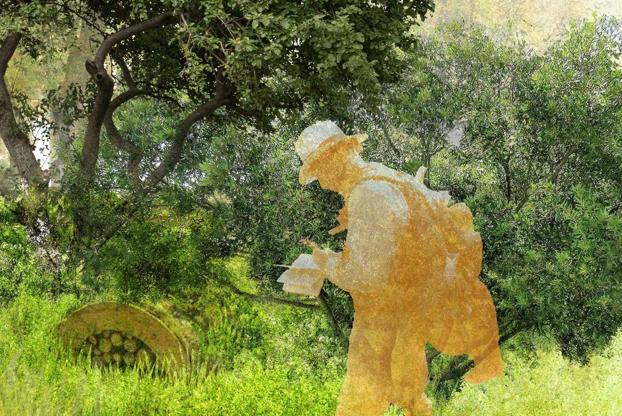
My individual focus transforms Bowsertown, a former capped landfill and historically significant site, into a public recreational amenity that restores ecological function while providing meaningful community space.
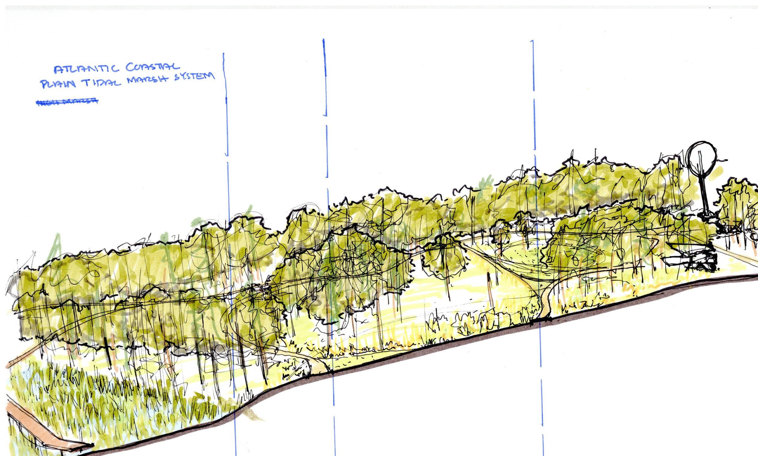
ALBEMARTE SOUND

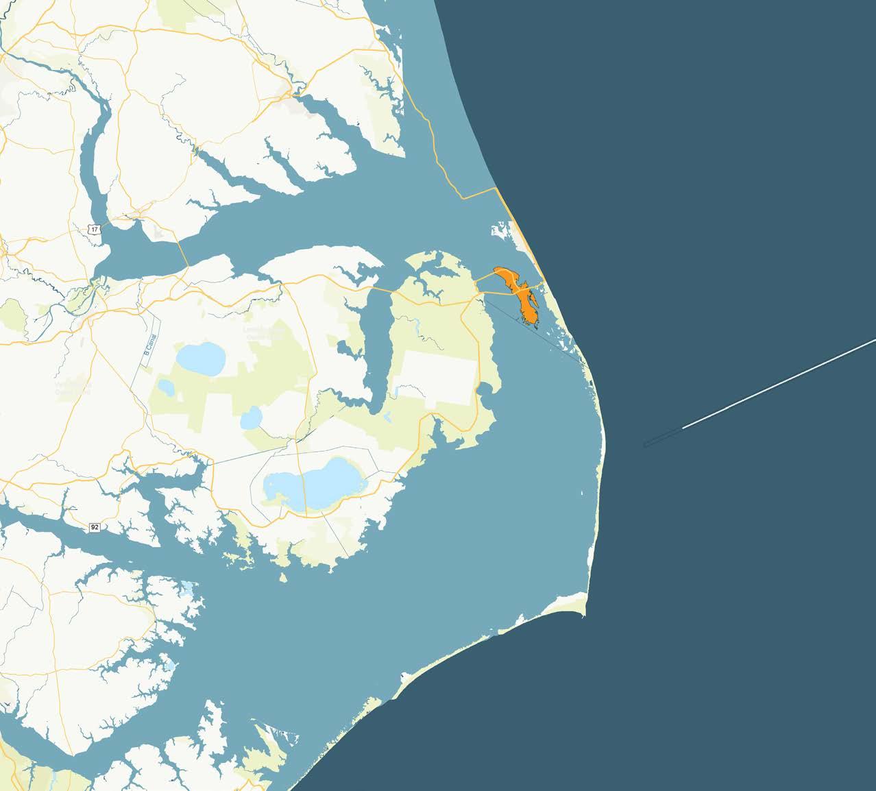
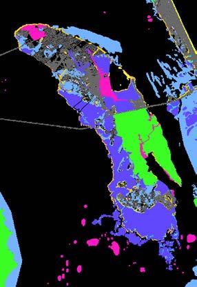
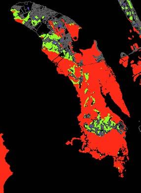
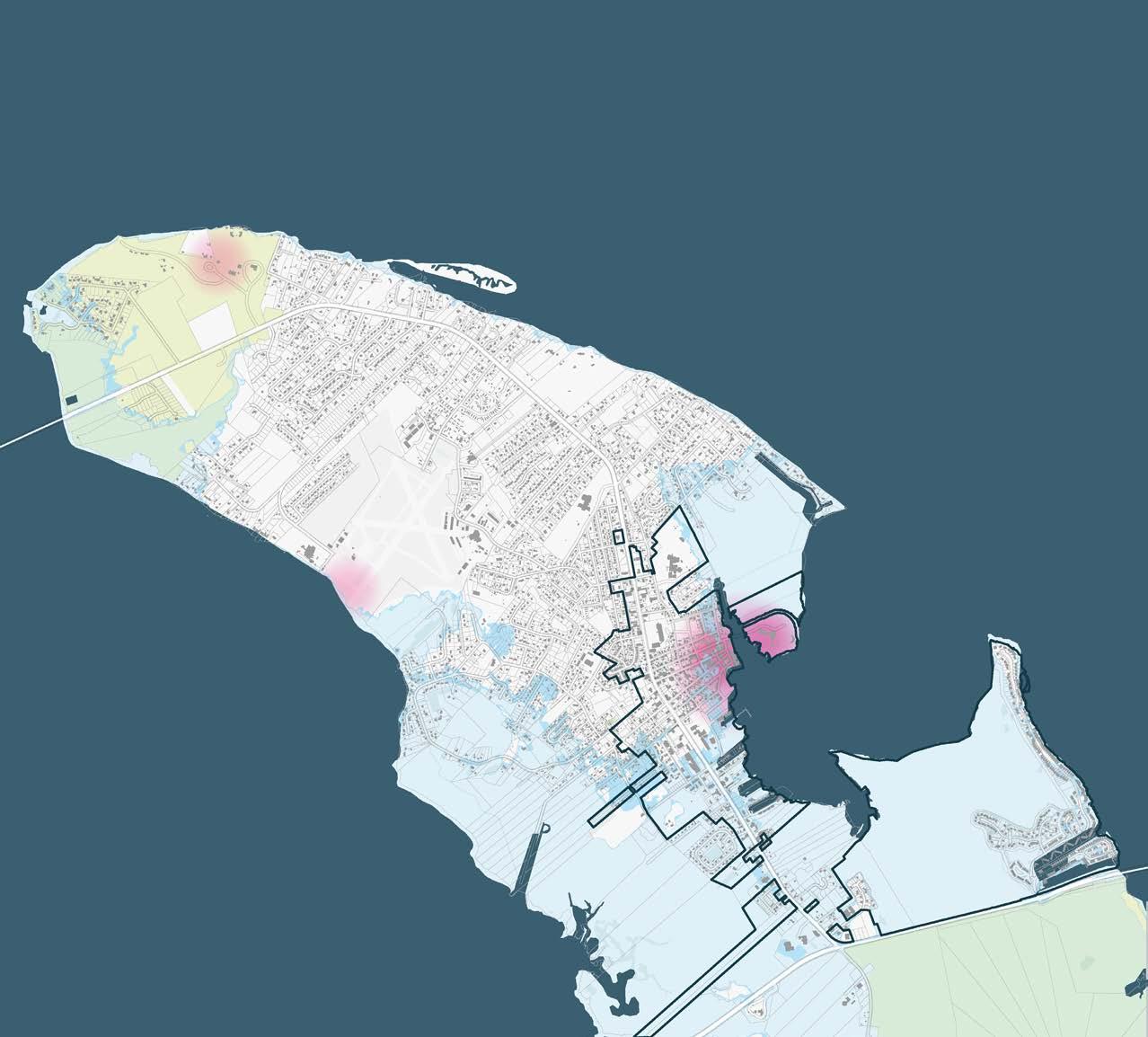
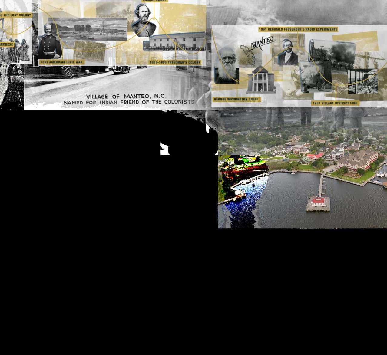
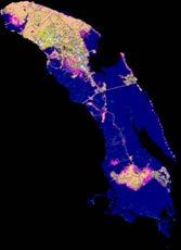
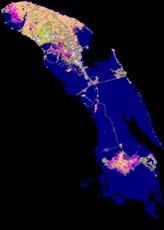
Manteo, a historic town on Roanoke Island along North Carolina’s Outer Banks, holds a coastal identity shaped by shared spaces, deep roots, and a strong bond with the local ecology. As sea levels rise and marshlands vanish, the loss of these natural buffers threatens both ecological integrity and the cultural resilience that defines the community.
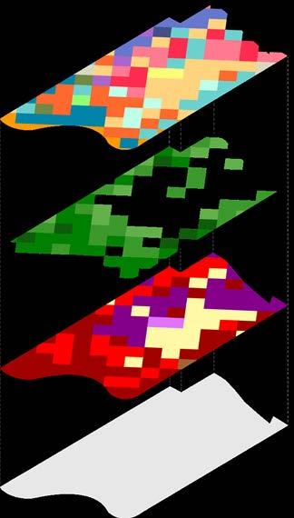
BIODIVERSITY AND WILDLIFE ASSESSMENT
MANTEO MIDDLE SCHOOL FIELDS
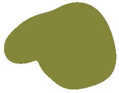
DARE COUNTY REGIONAL AIRPORT (MQI)
DARE COUNTY PARKS AND RECREATION RIMD
ECOLOGICAL PARK

TEAM | Arjun Deva, Melissa Dominguez, Hussam Farghal, Dalton Langon, Lizandro Marcial-Armas, & Shannon Smith
Our team explored a vision for the future of the Town of Manteo under a projected four-foot sea level rise scenario. Recognizing Manteo’s coastal charm and tourism-based economy, we proposed a shift toward sustainable eco-tourism—one that preserves the natural landscape while continuing to support local businesses. With much of Roanoke Island already designated as conservation land, the town is well-positioned to build on this foundation of ecological value and public access.
Our project aims to guide Manteo toward a more resilient future by embracing environmental adaptation, enhancing community connectivity, and reinforcing its strong local identity.
My individual focus centers on the transformation of Bowsertown, a historically significant site and former capped landfill, into a new recreational amenity. This design reclaims a once-degraded landscape, restoring its ecological function while providing meaningful public space for the surrounding community.

COLLEGE OF ALBERMALE FIELDS DOCKS
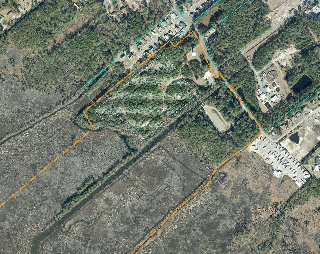
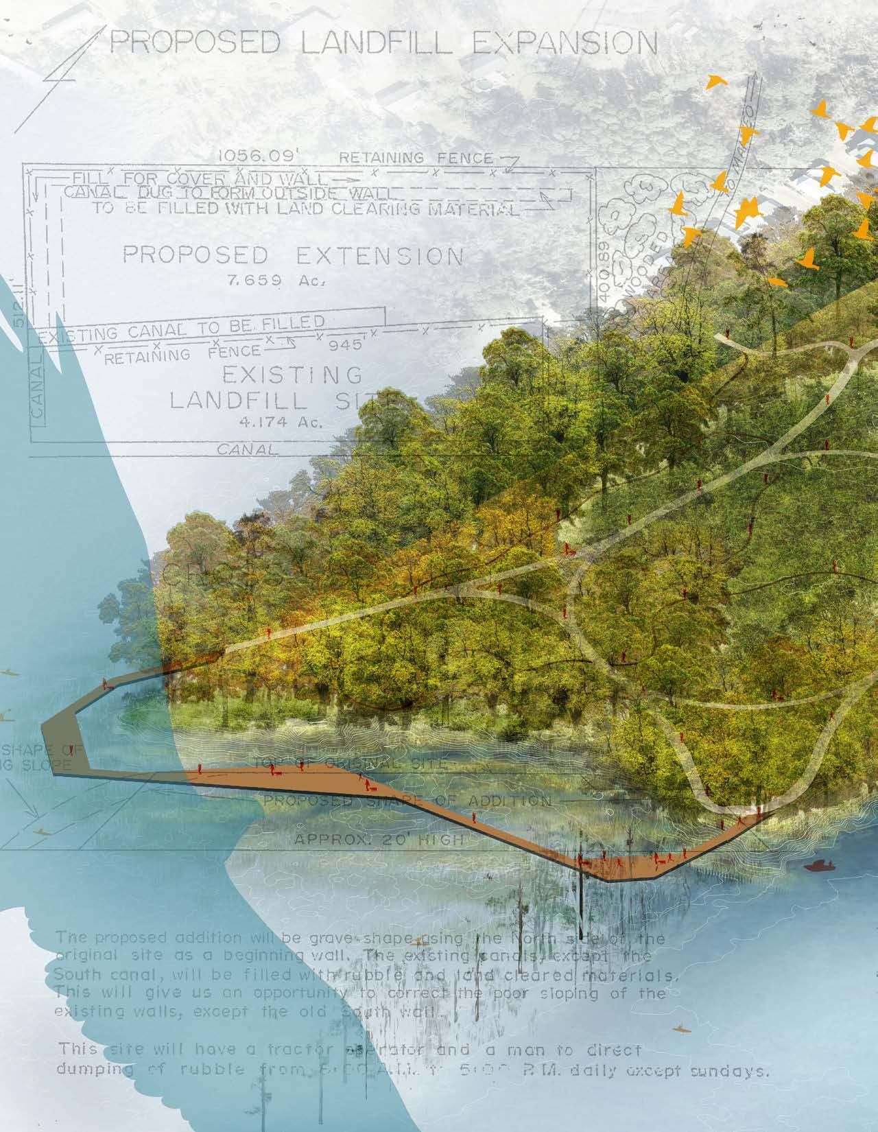
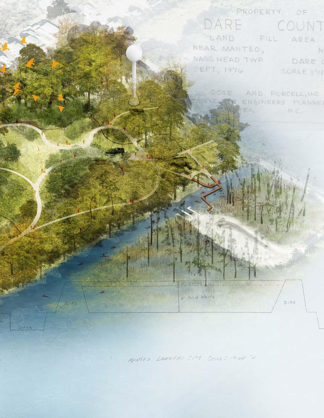
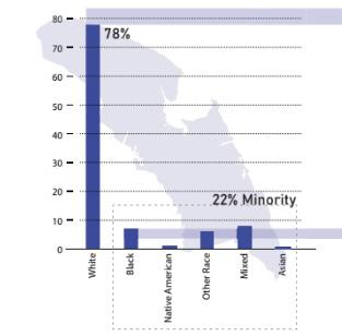
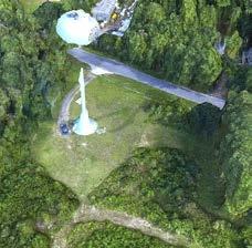
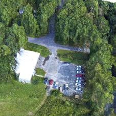
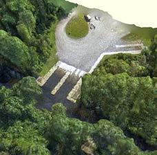
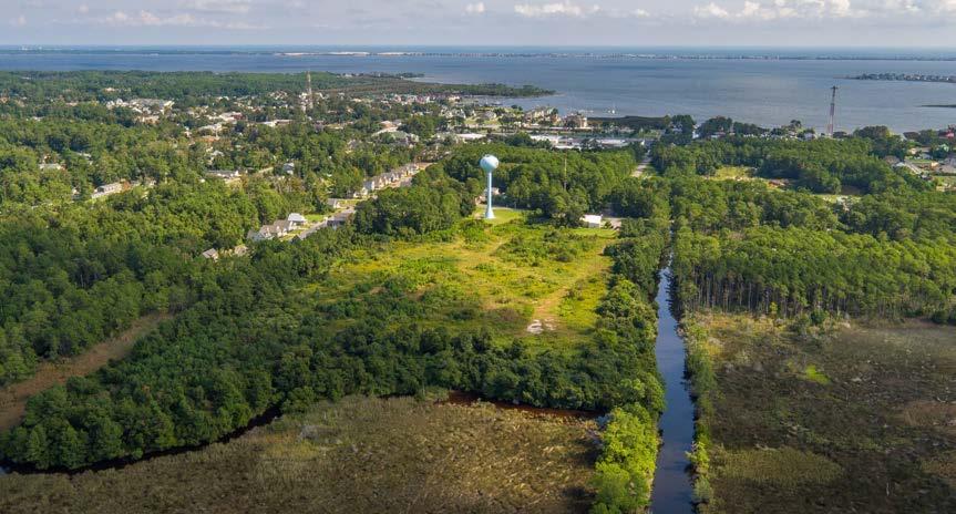
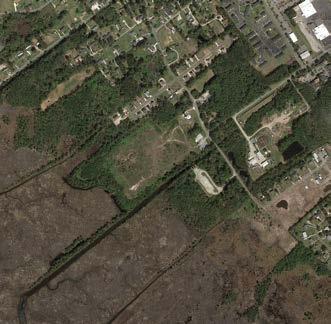
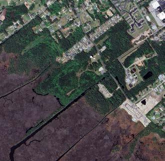
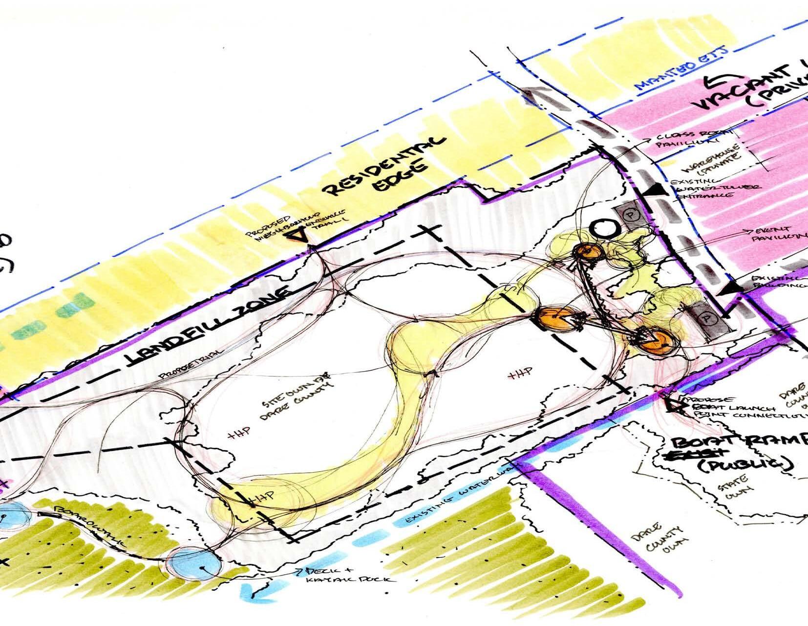
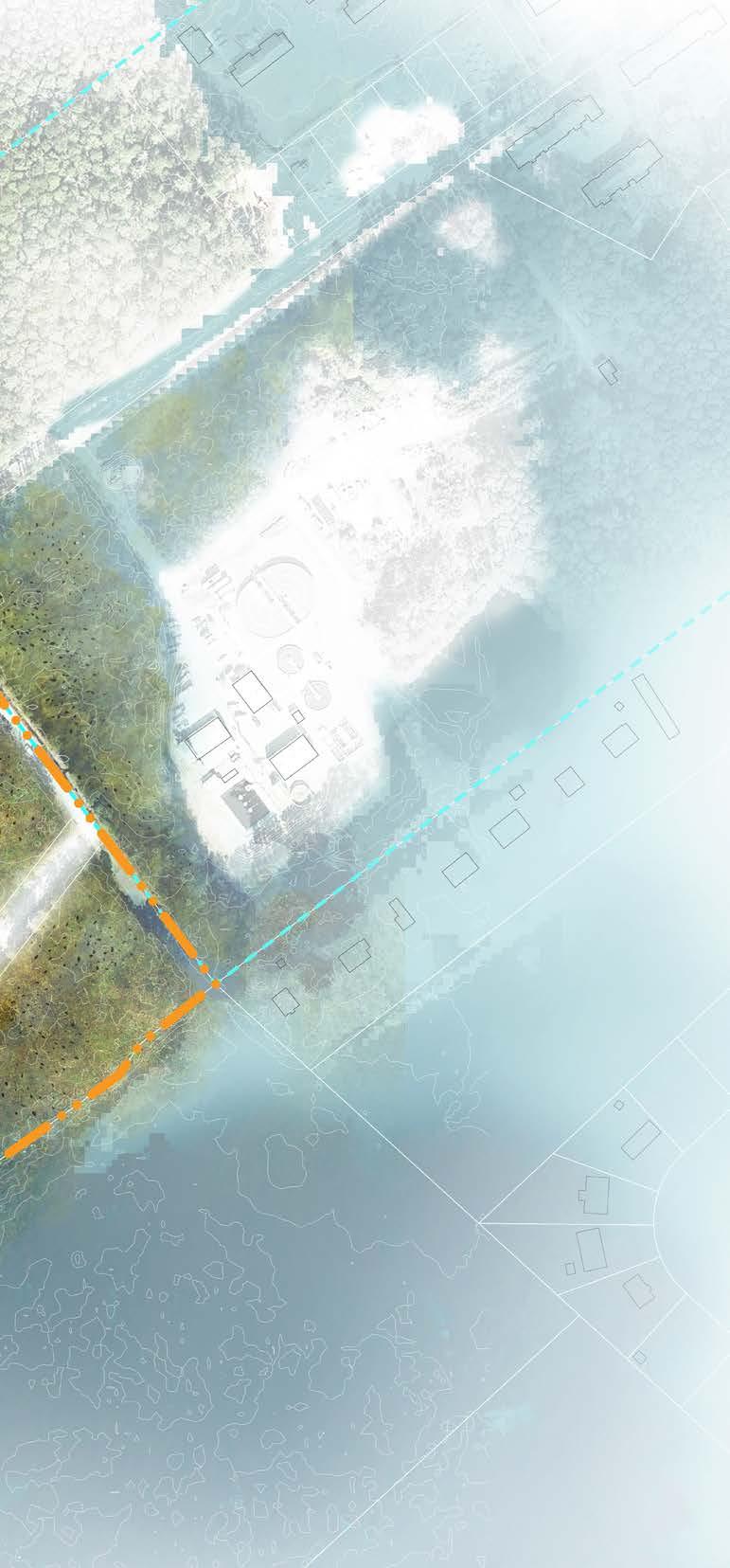
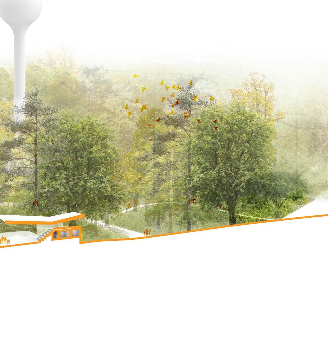
Located on the western edge of Roanoke Island in Manteo, North Carolina, the Bowsertown Landfill—also known as the Dare County Dump—was a pre-regulatory landfill used from the 1970s through the early 1990s for disposing of household waste and demolition debris. The 10-acre landfill sits within a 20-acre site that lies in a historically African American neighborhood and continues to border a predominantly minority, low-income community today.

Environmental reports, especially a 2010 contaminant delineation, identified elevated levels of iron, arsenic, zinc, and other heavy metals in the soil and groundwater. SVOCs and formaldehyde were also detected.
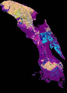
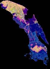
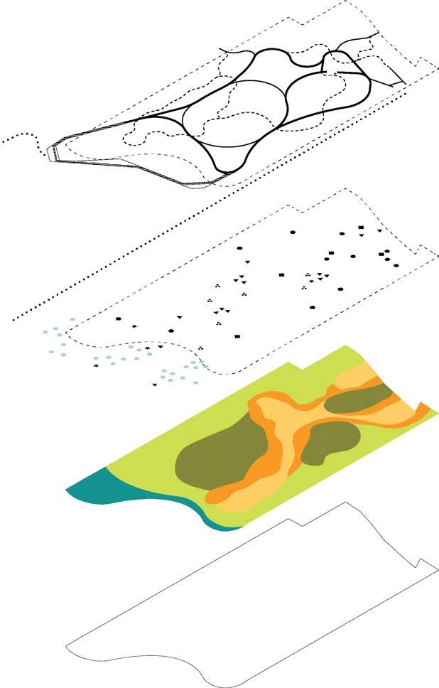
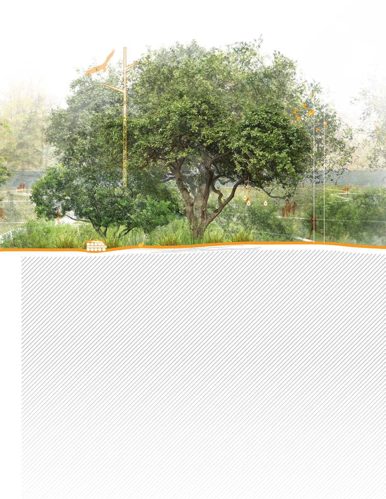
The community has long expressed interest in transforming the site into a public amenity. Using GIS and government data, the broader ecological context was assessed. The landfill sits at one of the highest elevations in Manteo, making it less vulnerable to sea level rise. However, remediation remains essential to protect surrounding wetlands and their high biodiversity.

TOPOLOGY + HYDROLOGY VEGETATION TYPE
SOILS
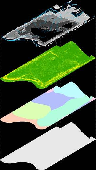

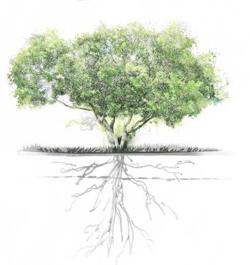
PLANT SUCCESSION


PHYTOSTABILIZATION
Plants to immobilize contaminants in the soil, reducing their mobility and preventing leaching or dispersion. This is achieved through root absorption, binding contaminants to soil particles, or causing them to precipitate within the root zone.
RHIZOFILTRATION
Water remediation technique that uses plant roots to absorb, adsorb, and filter out pollutants—such as heavy metals and other contaminants—from contaminated water.
PHYTOSTIMULATION
Process by which plants enhance microbial activity in the rhizosphere. By releasing natural compounds from their roots, plants stimulate beneficial microbes that break down organic soil contaminants such as pesticides, aromatic hydrocarbons, and PAHs.
PHYTOEXTRACTION
Use of plants to absorb heavy metals and other contaminants from soil or water. The pollutants are taken up through the roots and stored in plant tissues, which are then removed from the site through harvesting.
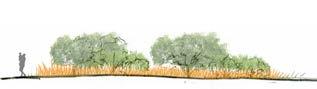
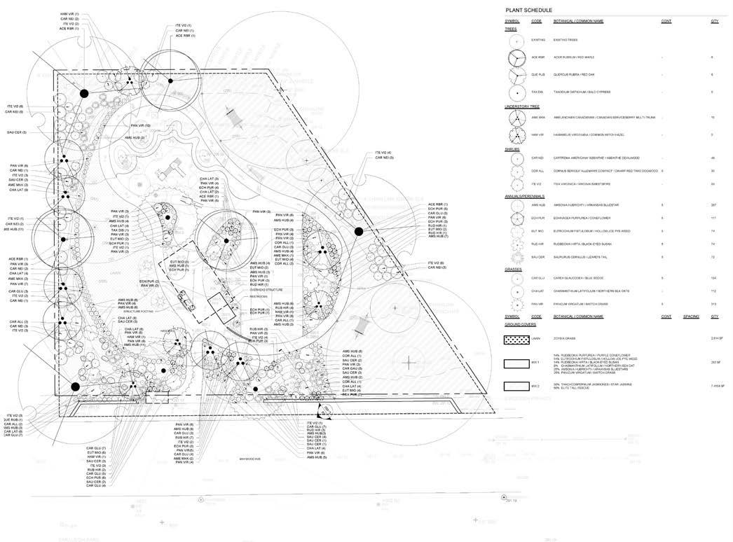
PERENNIALS
BLACK-EYED SUSAN RUDBECKIA HIRTA
PURPLE CONEFLOWER ECHINACEA PURPUREA
GRASS
SWITCHGRASS PANICUM VIRGATUM
LITTLE BLUESTEM SCHIZACHYRIUM
VIRGINIA WILDRYE ELYMUS VIRGINICUS
BLACK NEEDLERUSH JUNCUS ROEMERIANUS
TUSSOCK SEDGE CAREX STICATA
SMOOTH CORDGRASS SPARTINA LTERNIFLORA
SHRUB
YAUPON HOLLY ILEX VOMITORIA
GALLBERRY ILEX GLABRA
WAX MYRTLE MORELLA CERIFERA
FETTERBUSH LYONIA LUCIDA
SWAMP TITI CYRILLA RACEMIFLORA
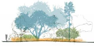
TREES
LIVE OAK QUERCUS VIRGINIANA (SHALLOW ROOTS)
POND PINE PINUS SEROTINA
SWAMP TUPELO NYSSA BIFLORA
The design was developed with input from community stakeholders, environmental documentation, and precedent research. Remote sensing and analytical tools enabled a rigorous understanding of the site’s ecological function and potential.
Ultimately, the project reframes waste as an opportunity: to heal the land, elevate resilience, and provide equitable access to nature.
ENCOURAGE RESEARCH OPPORTUNITIES AND COLLABORATION
~ 35 DIFFERENT EDUCATION SIGNAGE
HABITAT RECREATION + PROTECTION
~25 NEW HABITAT CREATION
RESIDENTIAL NEIGHBORHOOD
REMEDIATION WILD
WILD MARSH WILD
IMPROVEMENT + PROTECTION OF WATER QUALITY
~2 Arce OF FLOATING WETLAND
CREATION OF PASSIVE RECREATIONAL AMENITY SPACE
~1.7 Mi OF MULTI MODEL PATHWAY
~1 Mi OF EDUCATIONAL TRAILS
SITE ZONES
WILD
REMEDIATION WILD
Sense of Place
Lack of MultiGenerational Amenities
Water Quality
Landfill Leachate
Local Ecology
Landfill Contaminates
Rising Groundwater
Lack of Waterfront Interaction
Habitat Degradation
Adaptive Planting
Cultivate relationships between Community & Ecology
Conserve and rehabilitate natural habitats
Foster ecological understanding through place-based engagement
Landfill Remediation
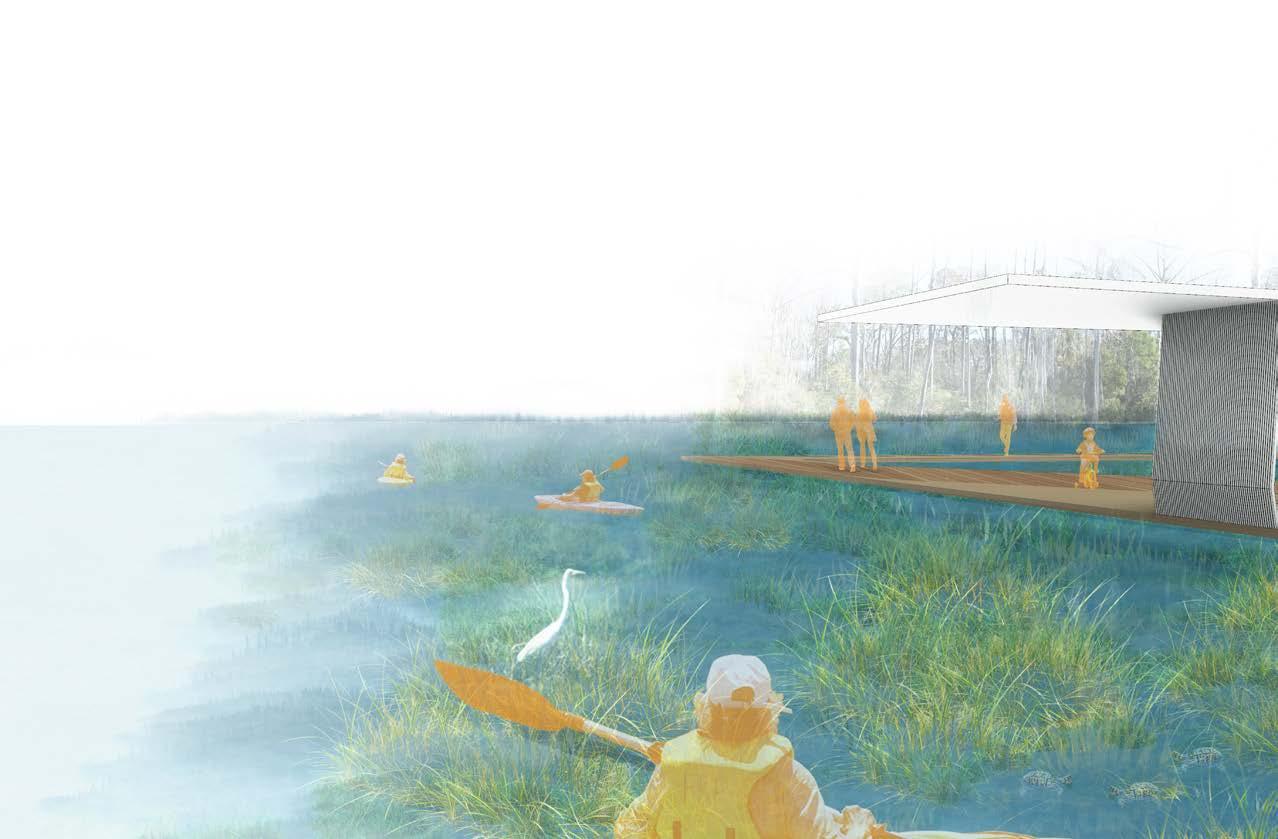
Blue-Way Trails
Floating Wetlands
Erosion Control
Living Shorelines
Multi-Model Pathways
Natural Trails
Boardwalk
Passive Recreation
Main Path Trails Kayak Trails
Existing Vehicular Entrance
Raptor Roost
Hibernacula Snags
Pollinator Grassland
Maritime Buffer
Maritime Forest
Upper Maritime Forest
Pocosin Wetland
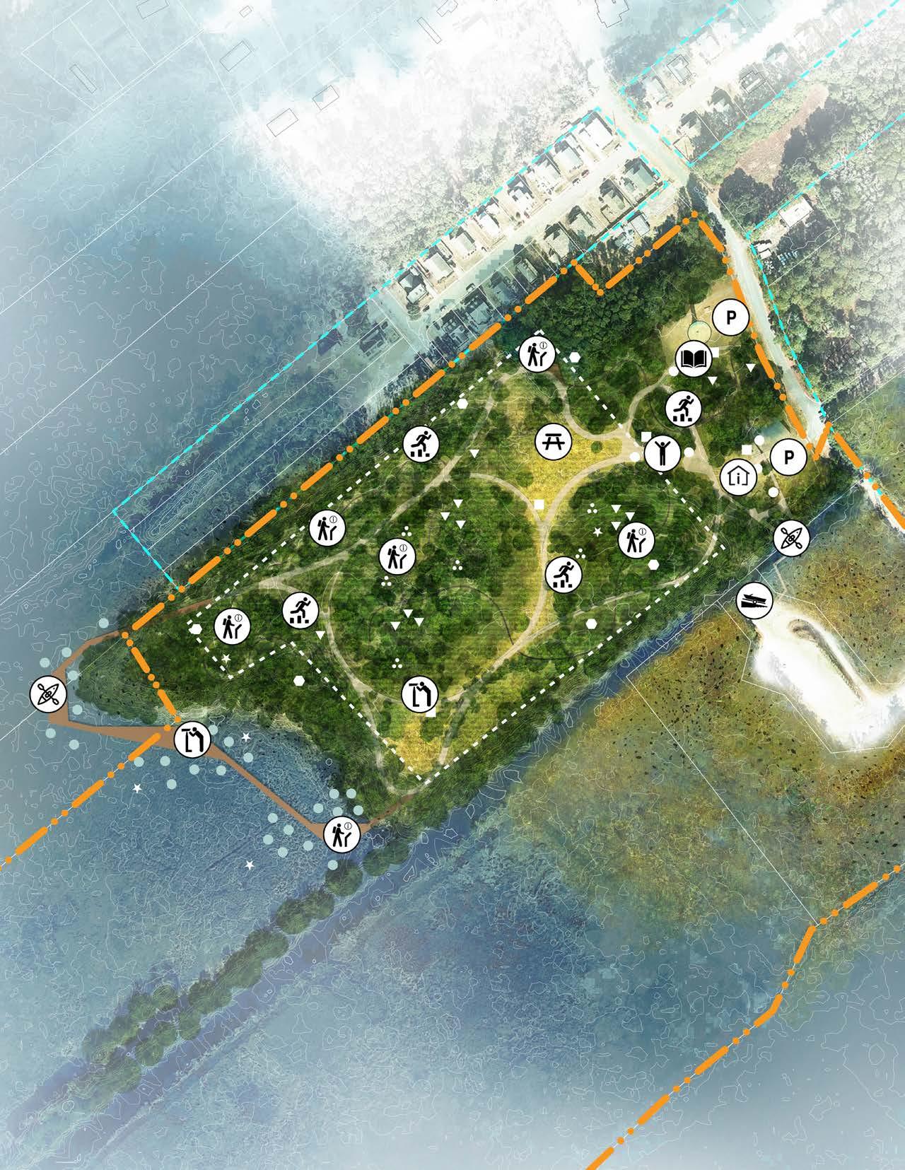
PROGRAM
Cultural Pavilion
Information
Proposed Pedestrian Entrance Kayak Dock Structures
Nesting Area Bee Hotel Pollinator Area Floating Wetland
Leisure Lawn
Classroom Pavilion Kayak Dock
Parking
Information
Observation
Intergenerational
HABITAT
Pollinator Grasslands
Upland Maritime Forest
Maritime Forest + Buffer
Zone
RESTORATION
Bee Hotels
Pollinator Area
Nesting Area
PROGRAM
Classroom pavilion
Cultural Pavilion
Information pavilion
Boat Ramp
Kayak Dock
Intergenerational Play
Parking
CULTURE PAVILION
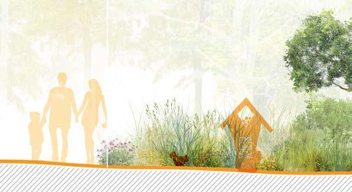
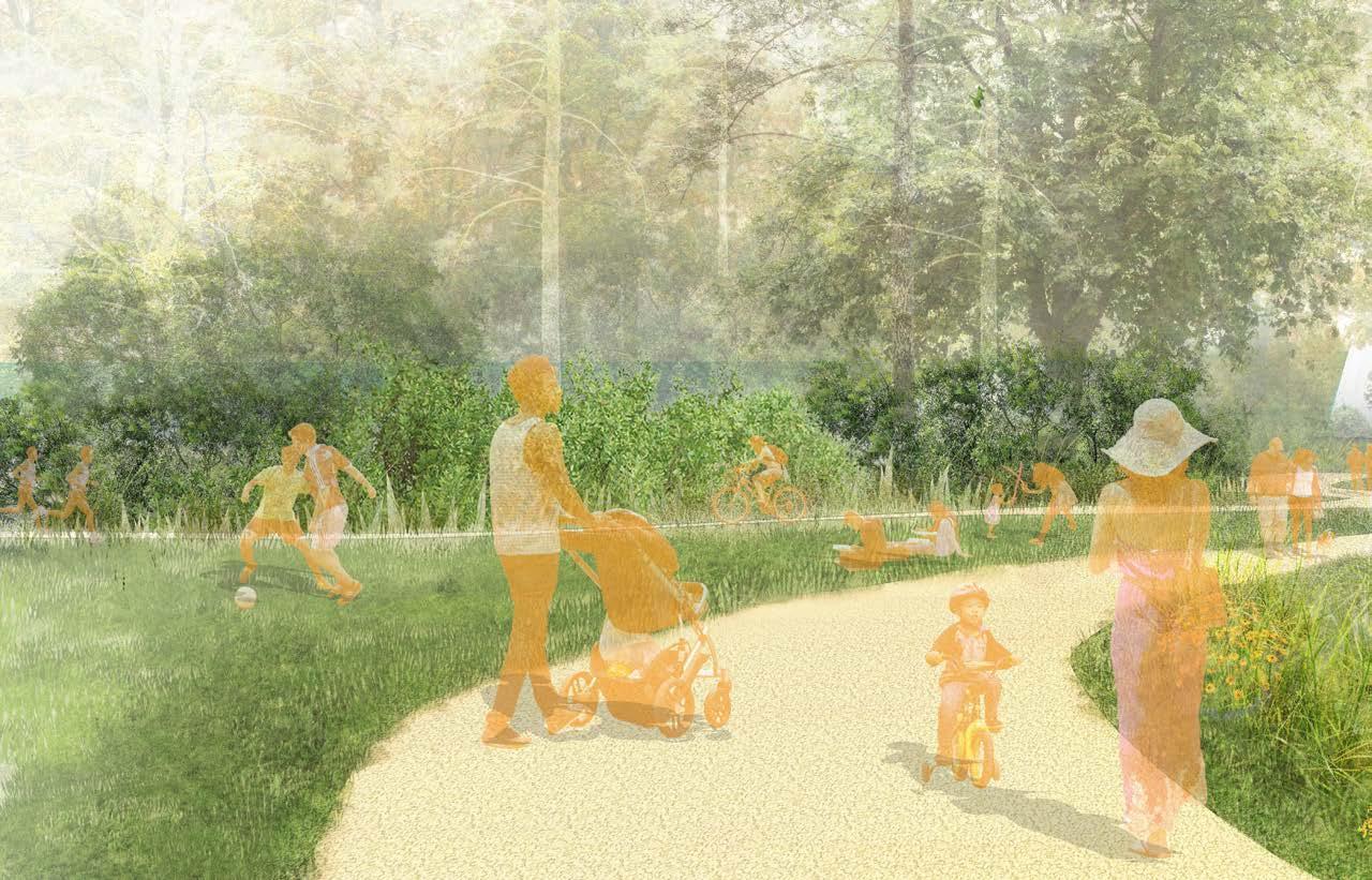
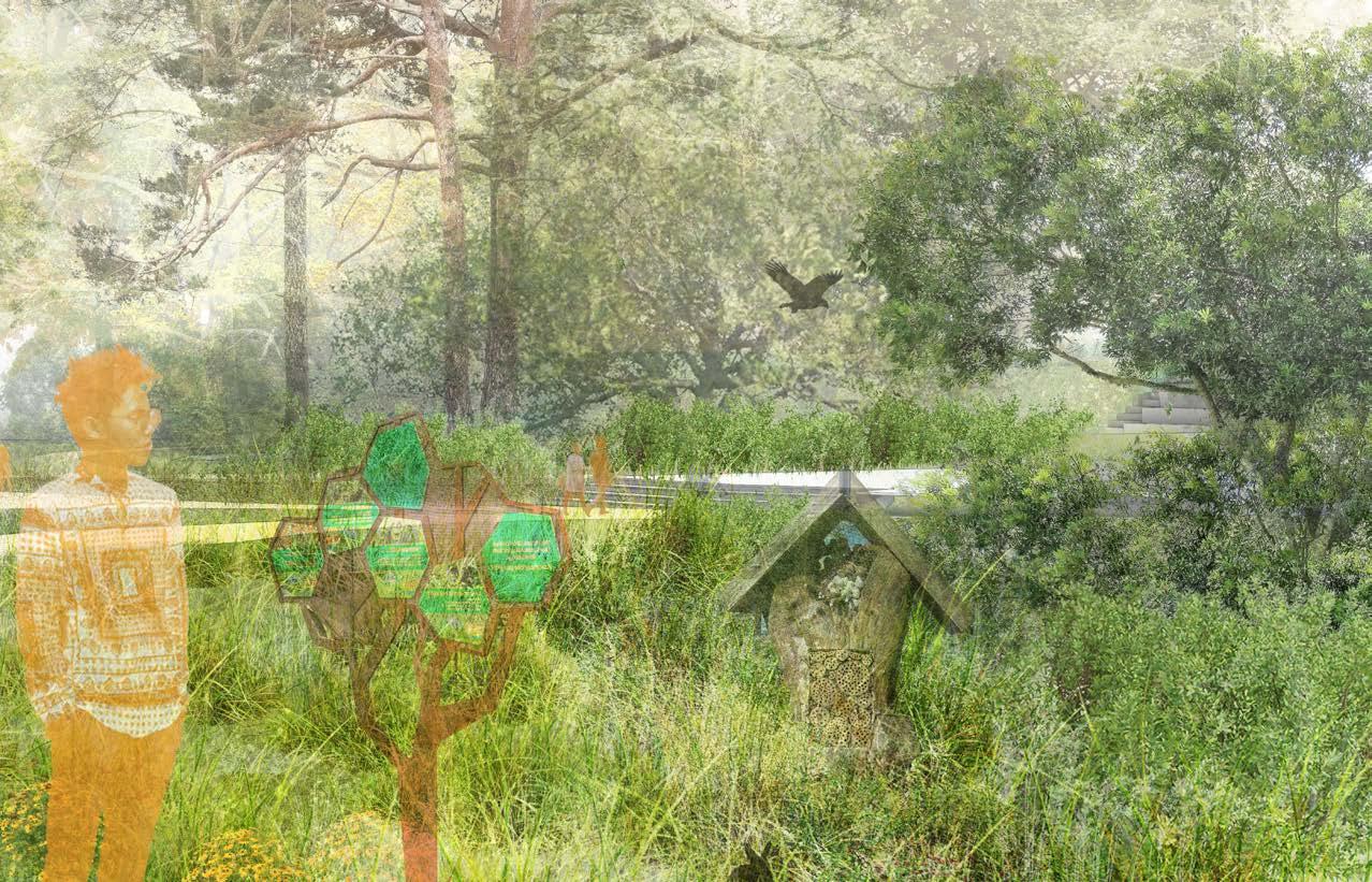
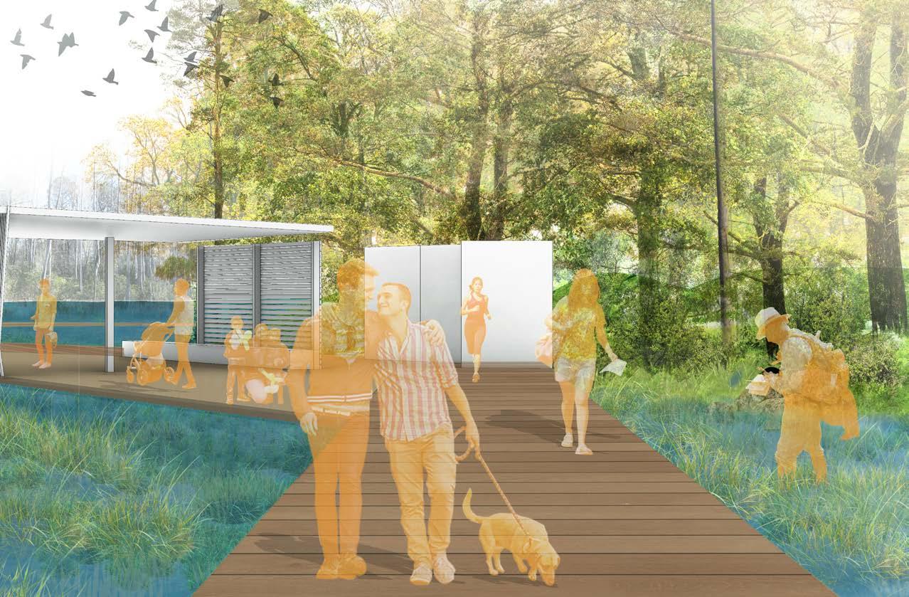
The community wild serves as the primary community interface. It includes pollinator meadows, a classroom pavilion, public restrooms, and kayak rental facilities. This zone encourages environmental education and outdoor activity while showcasing native planting that supports biodiversity.
INTERPRETATIVE SIGNAGE BEE HOTELS
POLLINATOR MEADOW
CULTURE PAVILION
HABITAT
Meadow + Pollinator Grasslands
Upland Maritime Forest
Maritime Forest + Buffer Zone
RESTORATION
Raptor Roost Bee Hotels
Pollinator Area
Nesting Area
Hibernacula
PROGRAM
Intergenerational Play
Observation Point
Information Station
Leisure Lawn
YAUPON HOLLY ILEX VOMITORIA PHYTOSTABILIZATION
GALLBERRY ILEX GLABRA PHYTOSTABILIZATION
INTERPRETATIVE SIGNAGE
HIBERNACULA
RAPTOR POST Ospreys
UPPER MARITIME FOREST
HIBERNACULA
Green Anole
Eastern Racer
Eastern Ratsnake
UPPER MARITIME FOREST
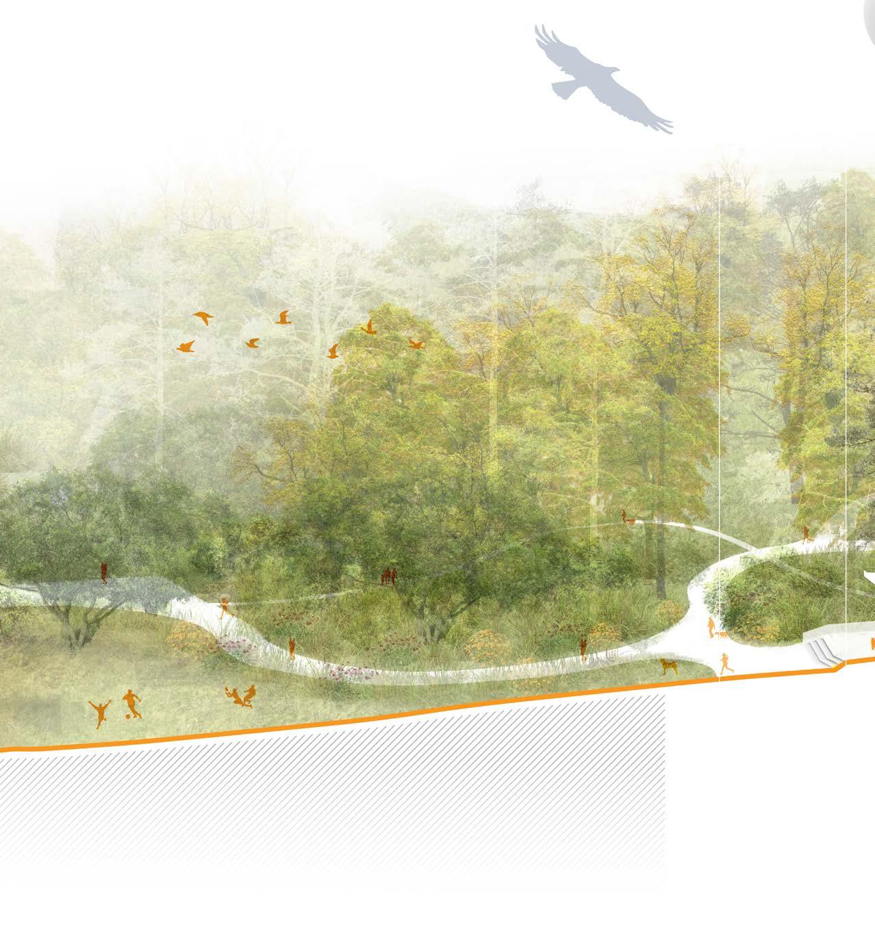
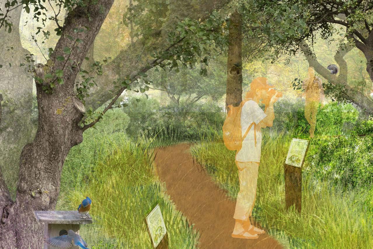
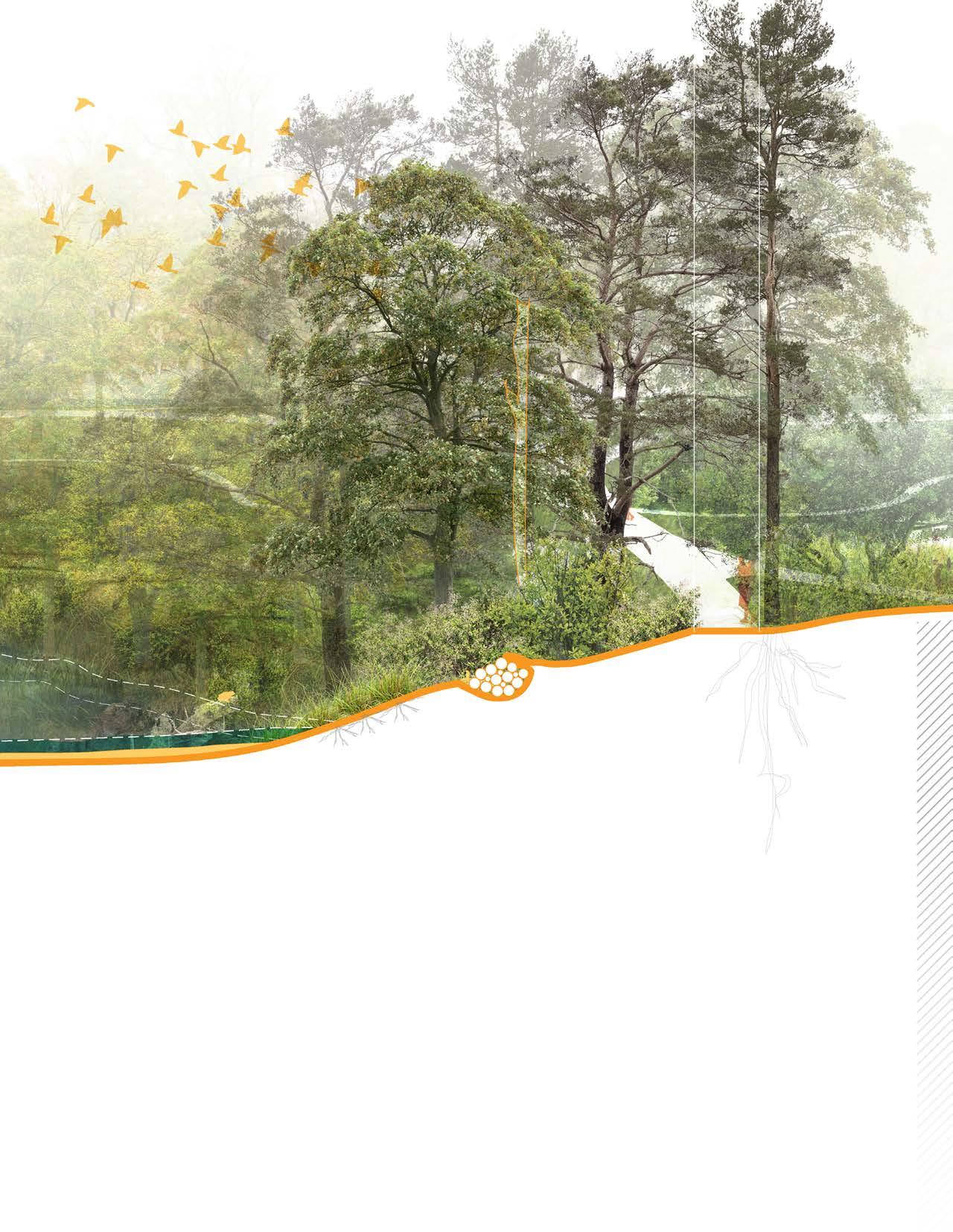
The remediation wild focuses on phytoremediation and ecological restoration. Carefully selected plant species work to stabilize soil and remove pollutants. Interpretive trails provide access and foster public awareness of environmental repair.
LIVE OAK QUERCUS VIRGINIANA PHYTOSTABILIZATION
WAX MYRTLE MORELLA CERIFERA
RHIZODEGRADATION + NITROGEN FIXATION
NESTING AREA
Eastern Bluebird
Northern Mockingbird
Northern Cardinal
VIRGINIA WILDRYE ELYMUS VIRGINICUS PHYTOSTABILIZATION
O P P
4 FT WIDE DIRT PATHWAY
ORIGINAL SHORELINE
EXISTING CONDITION NO INTERVENTION
HABITAT
Pocosin Wetland
Tidal Marsh
RESTORATION
Raptor Roost Nesting Area
Hibernacula Snags
Floating Wetland
Great Blue Heron Double-Crested Cormorant
4ft SLR OriginalShoreline

POCOSIN WETLAND
Black Needlerush Juncus roemerianus Phytostabilization
Swamp Tupelo Nyssa biflora Rhizodegradation + Phytostabilization
Swamp titi cyrilla racemiflora Phytostabilization
Fetterbush Lyonia lucida Rhizodegradation
Tussock Sedge Carex Sticata Rhizofiltration
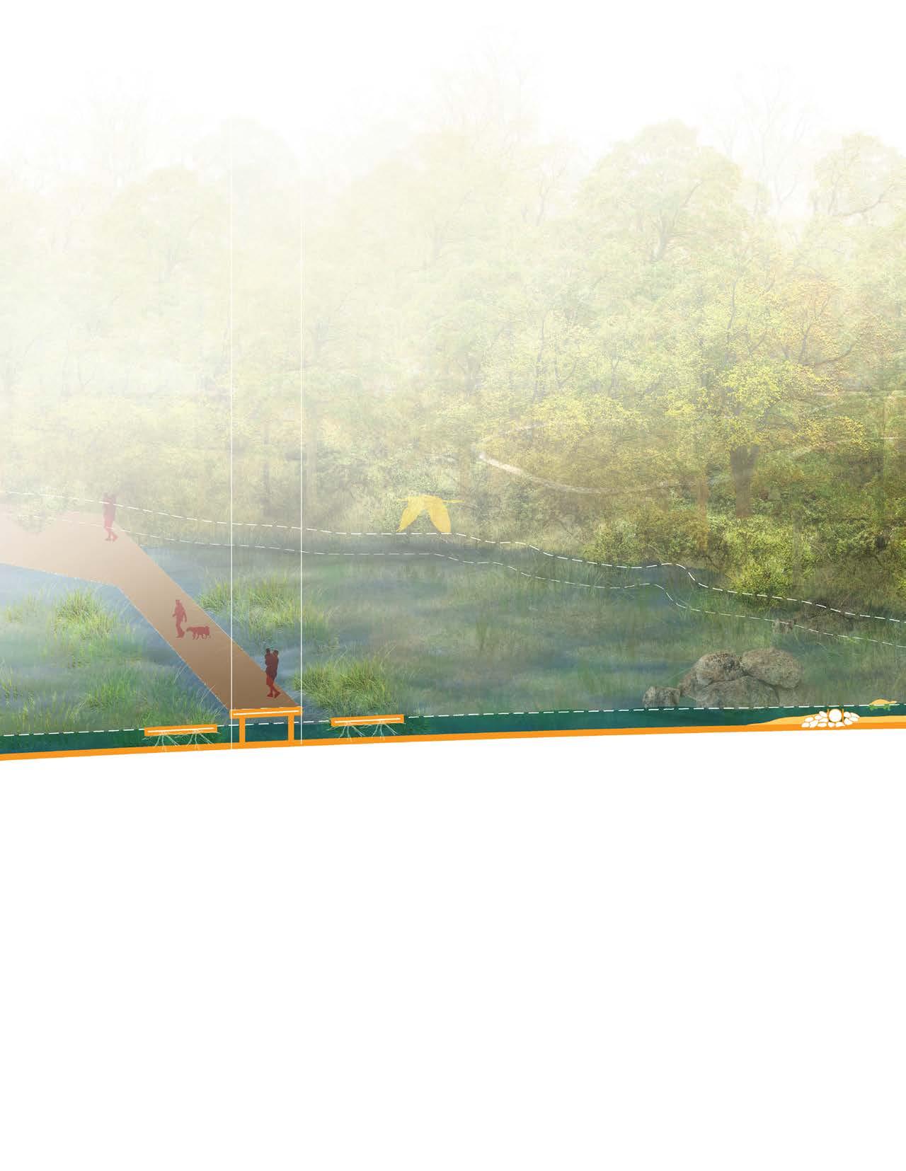
LIVING SHORELINE
OBSERVATION POST
COMPOST RESTROOMS
Pond Pine Pinus serotina Rhizodegradation + Phytostabilization
SNAG Eastern Gray Squirrel Yellow-Bellied Sapsucker
Green Tree Frog Broad-headed Skink Fowler’s toad
12 FT WIDE PEA GRAVEL PATHWAY
THERMALLY
POCOSIN WETLAND LIVING
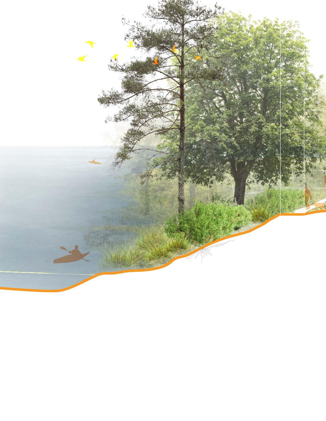
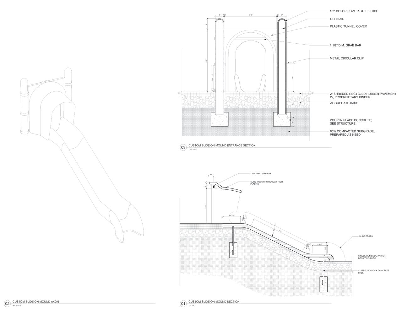
The Marsh Wild restores tidal marshes, creating a buffer between the landfill and surrounding wetlands Living shorelines prevent erosion, and new boardwalks with bird-watching areas and kayak docks encourage passive recreation connected to nature.

LAR 503 | DESIGN DEVELOPMENT STUDIO
Professors Stephen Faber, Jeff Israel, & Benjamin Monette
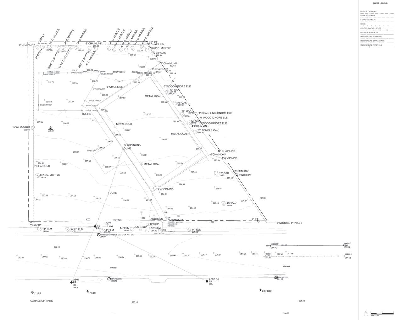
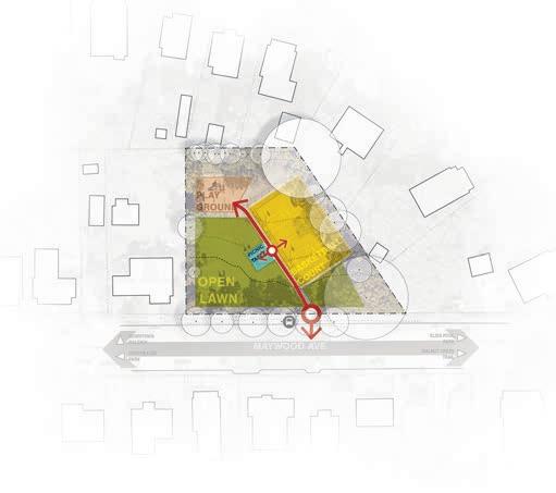
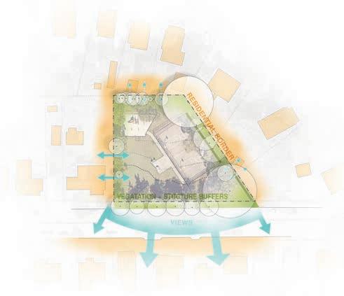
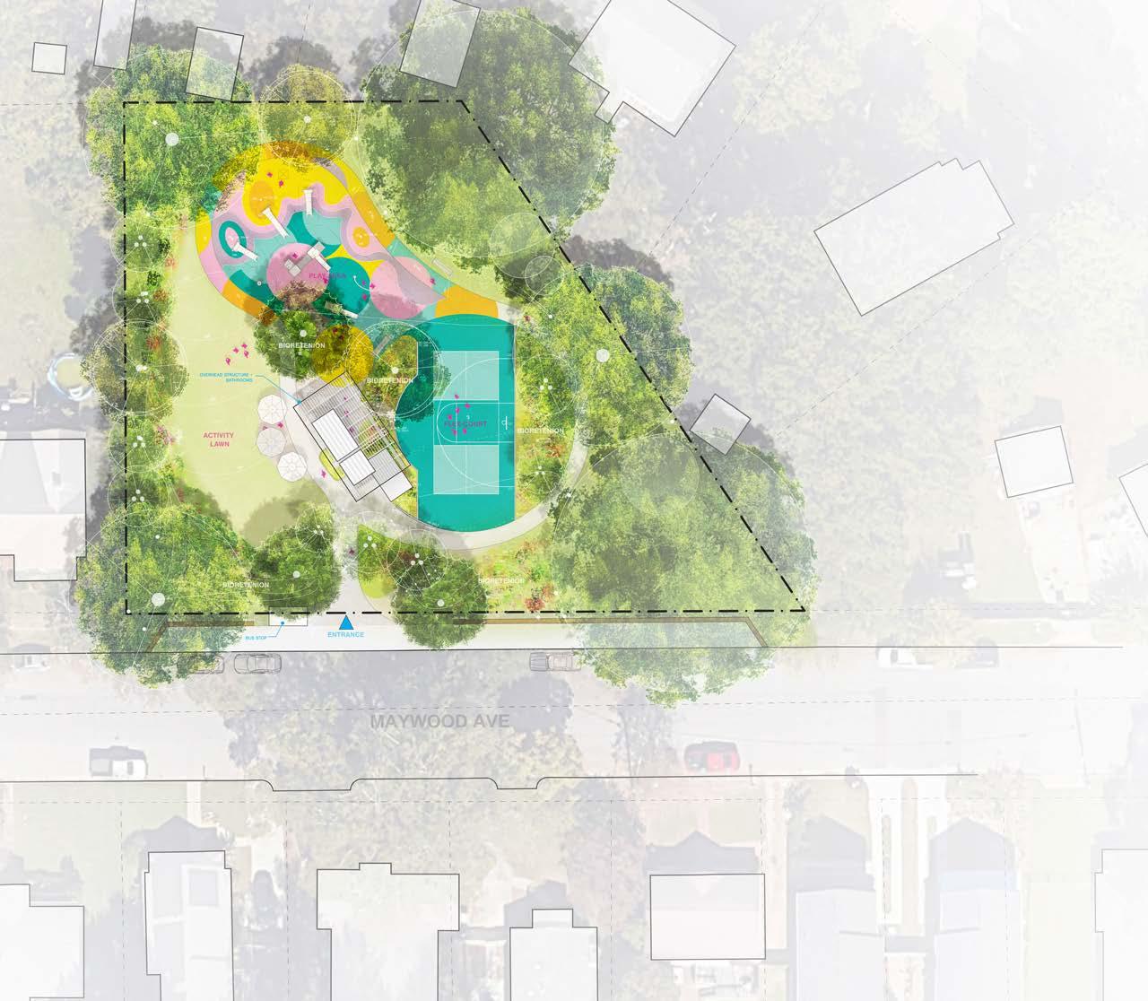
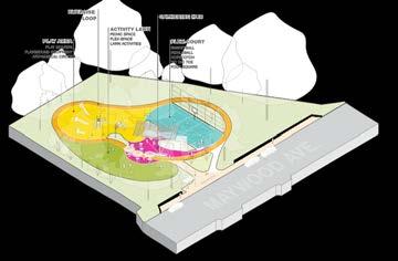
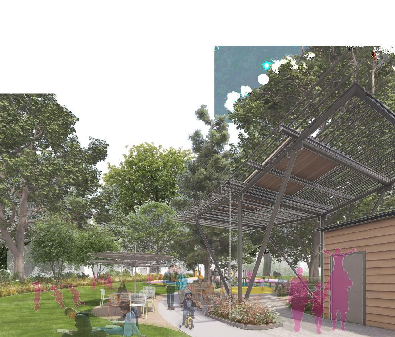
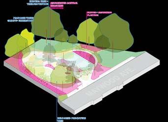
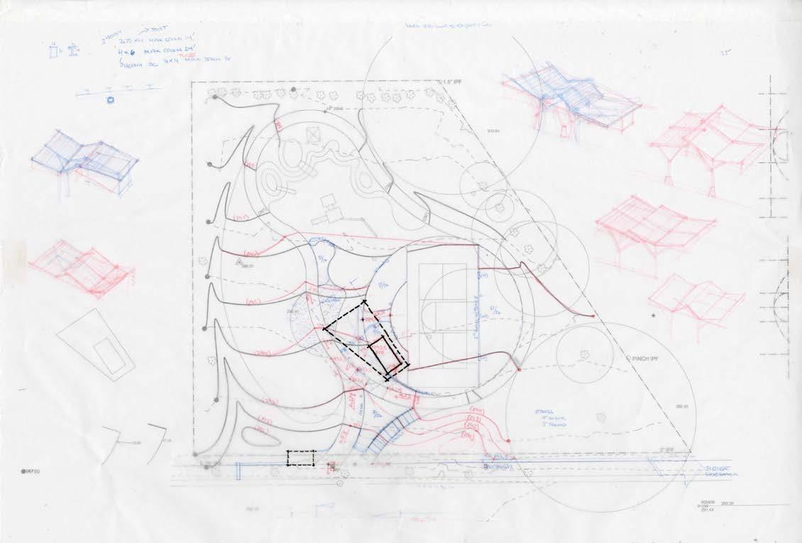
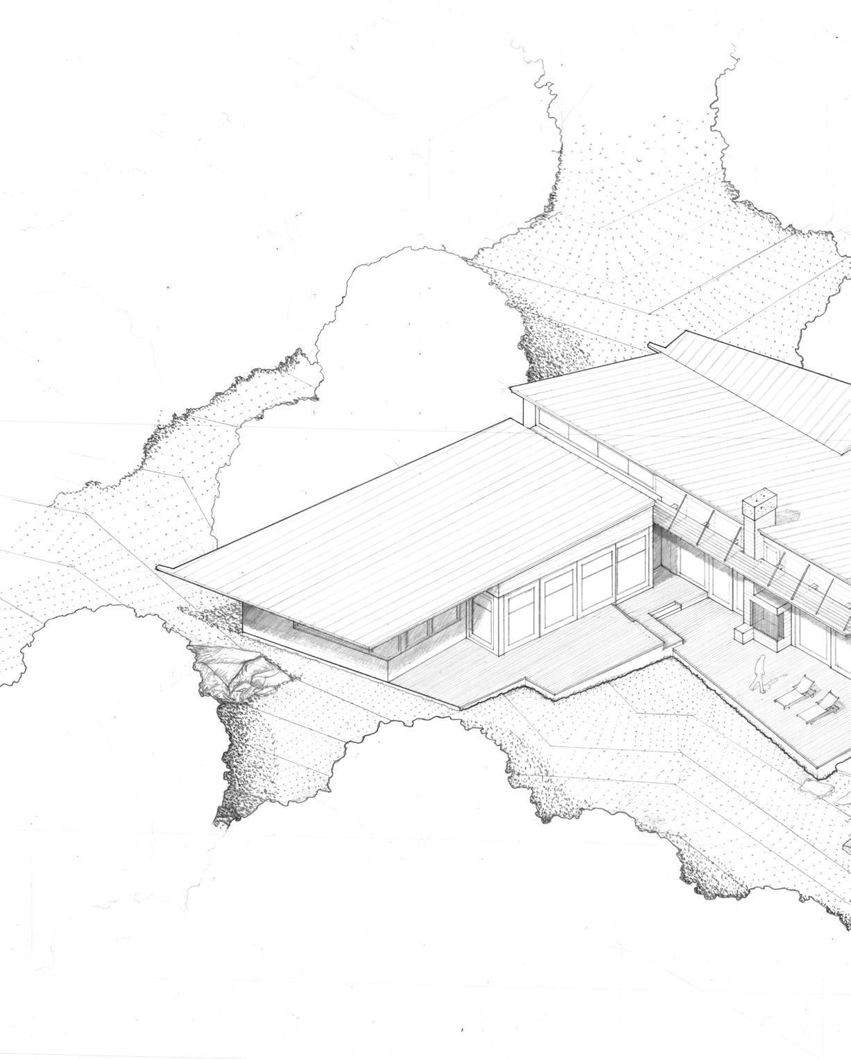
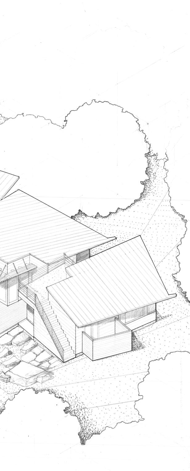
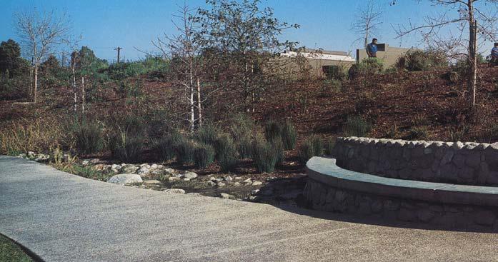
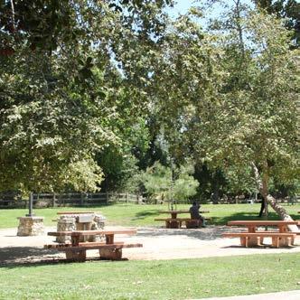
Located in Raleigh’s historic Caraleigh neighborhood, Caraleigh Community Park is a small but essential green space positioned between Dorothea Dix and Eliza Pool parks. As the neighborhood grows more diverse and remains an affordable housing area, the park has the potential to serve as an inclusive and vibrant community hub.
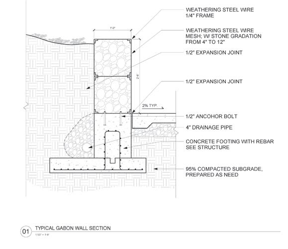
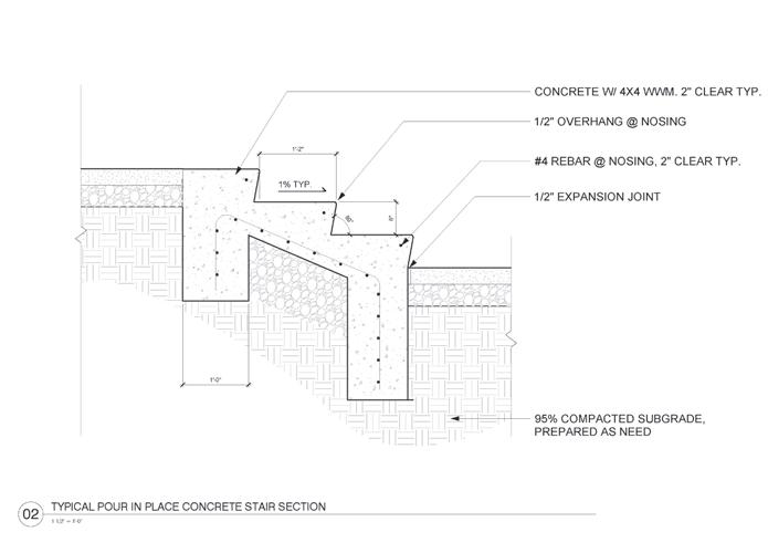
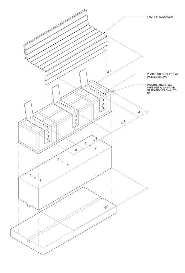
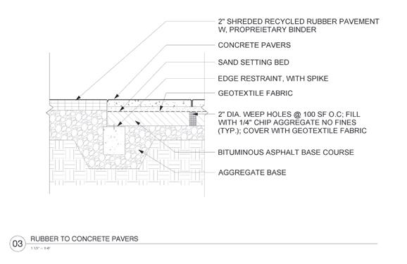
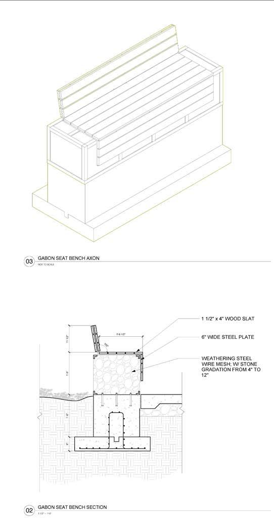
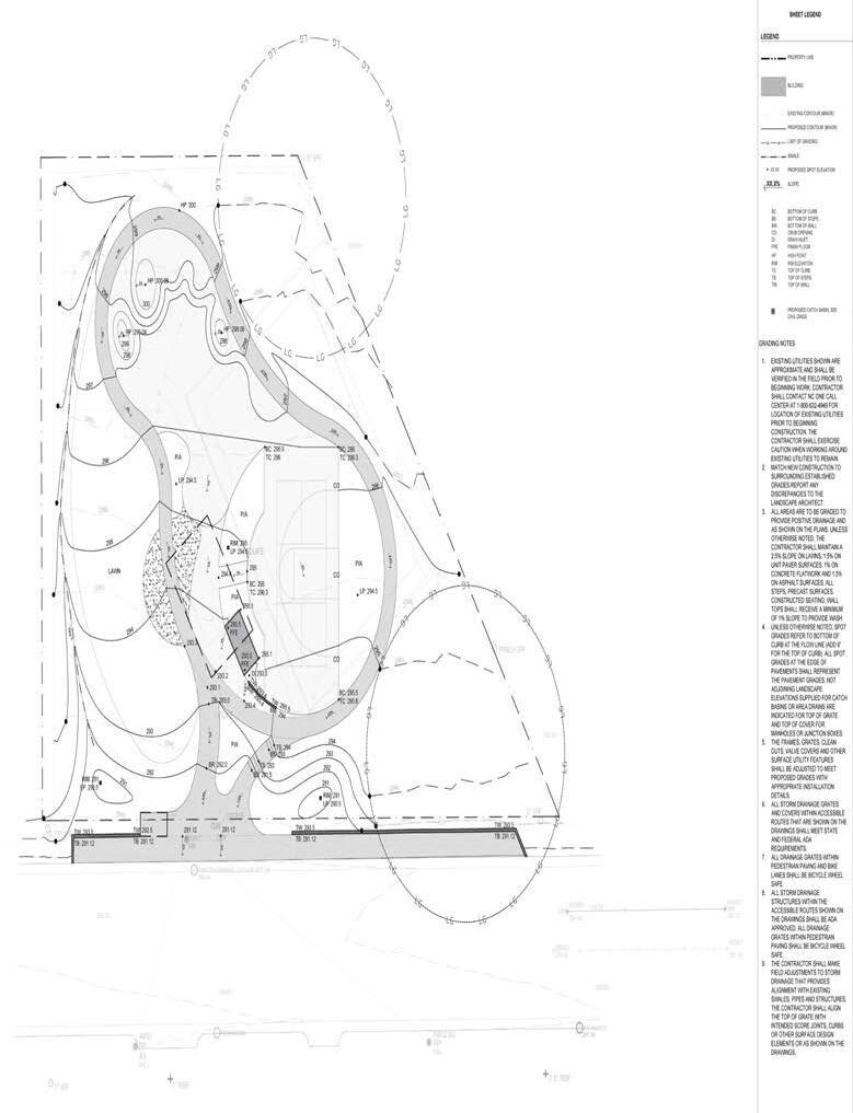
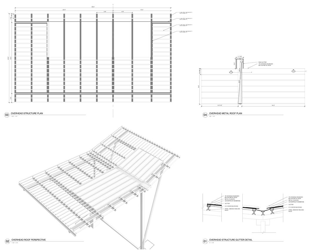
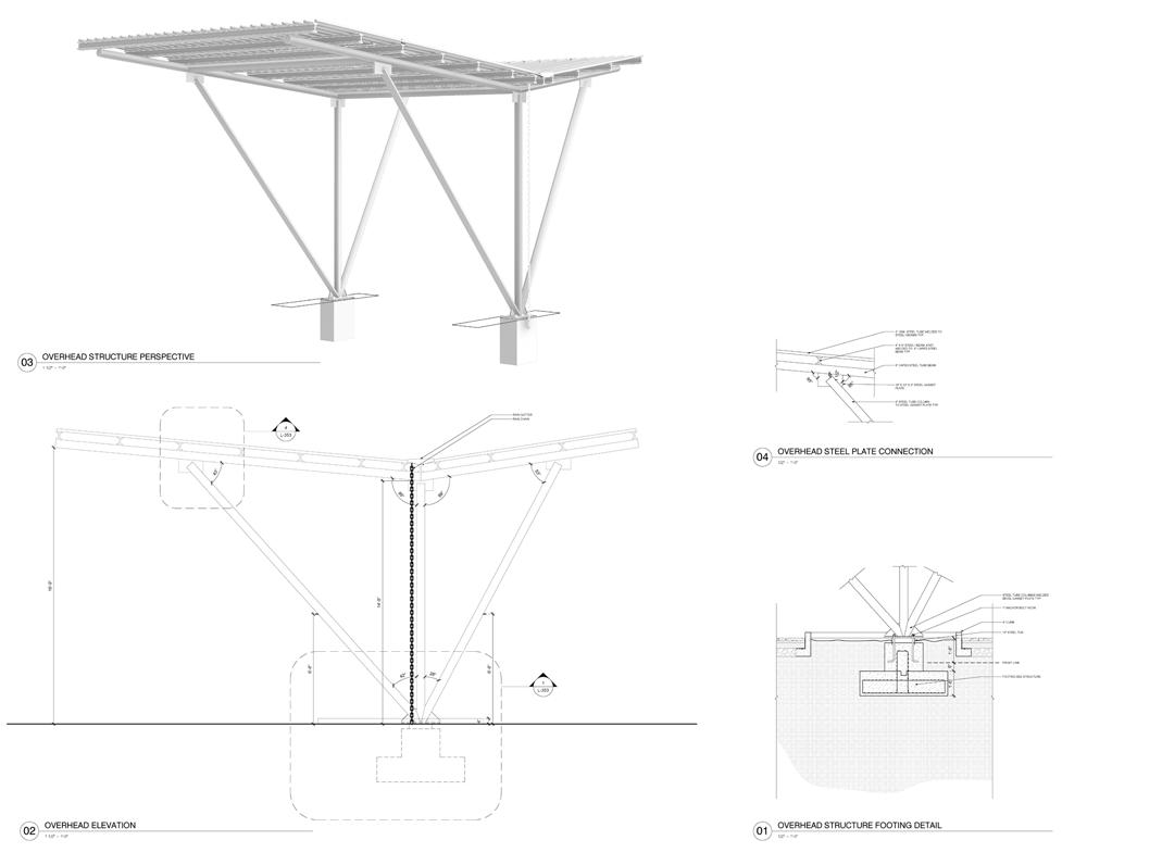
This project was part of an academic studio focused on learning how to create construction documents. While the design prioritizes accessibility, recreation, and ecological resilience, the core objective was to develop technical skills for translating conceptual ideas into buildable plans.
The City of Raleigh provided the existing site analysis and shared its goals to improve park access, update amenities, and, if funding allows, enhance the adjacent bus stop.
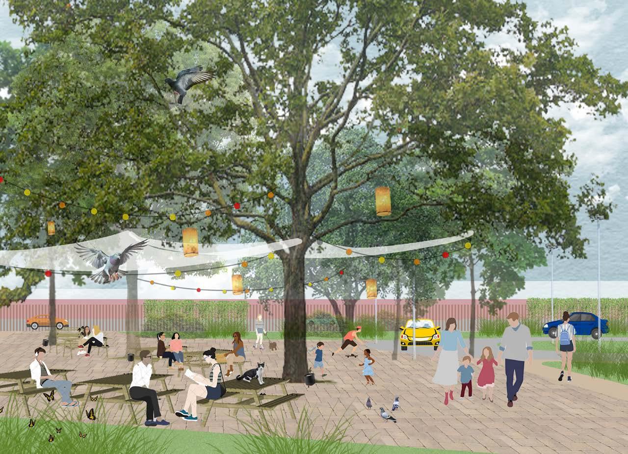
The resulting design envisions a welcoming and sustainable park that supports play, connection, and habitat creation.
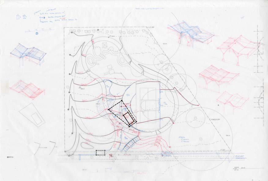
SKETCHES
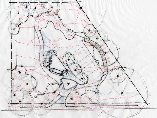
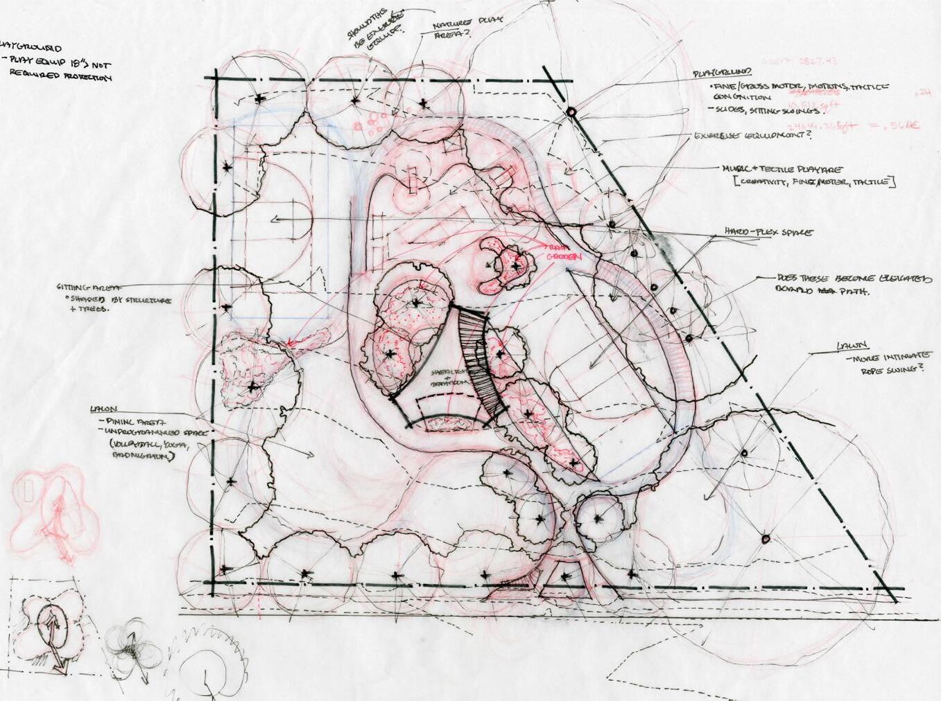
PARTI
PROGRAMMING DIAGRAM
SITE PLAN
SUMMER 2024 + SPRING 2025
Design Workshop CFI Intern + Landscape Designer
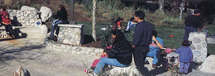
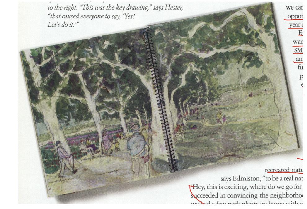
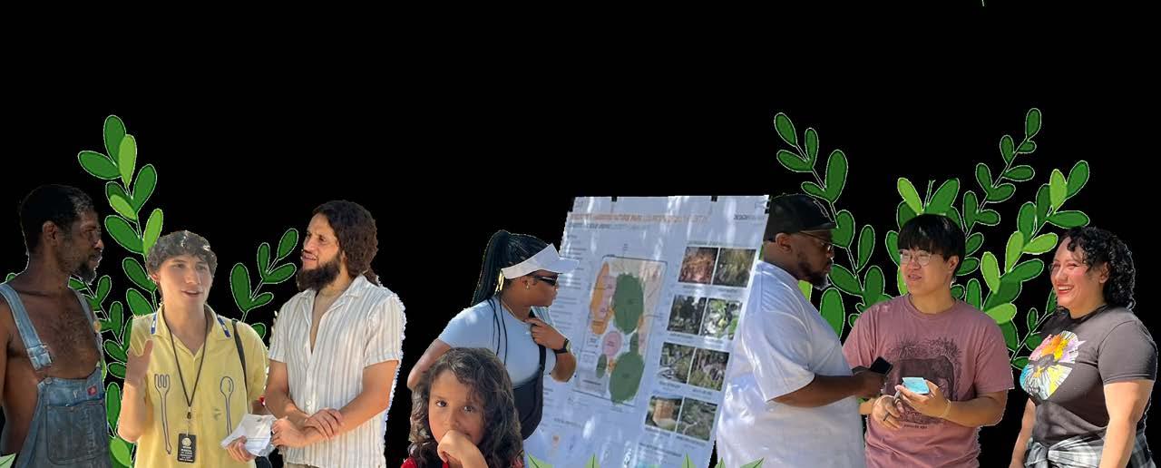
As a 2024 Charles Fountain Intern, I contributed to the redesign of Augustus F. Hawkins Park, an 8.5-acre historic green space in South Los Angeles, alongside a team of seven other interns. It was an extremely collaborative effort. As a Landscape Designer, I assisted with the project booklet for clients, project award submissions, redlines, and research.
SUMMER 2022 - SPRING 2024
Hanbury Summer Scholar + Architecture Designer
Developed high-impact graphics and info graphics for client presentations in collaboration with the Planning Team and data analysts. Participated in action meetings, site visits, and concept development charrettes to support campus planning initiatives. Conducted research as a Summer Scholar, re imagining a shopping mall impacted by environmental challenges and evolving retail trends. Engaged with city officials and industry professionals to gather insights, culminating in the publication of a comprehensive book documenting findings and design solutions.
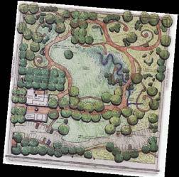
IMAGES FROM 19XX
“I LIKE THE GREEN AREAS TO PLAY WITH MY LITTLE BROTHER.”
“I LIKE THE POND, DUCKS, AND TURTLES!”
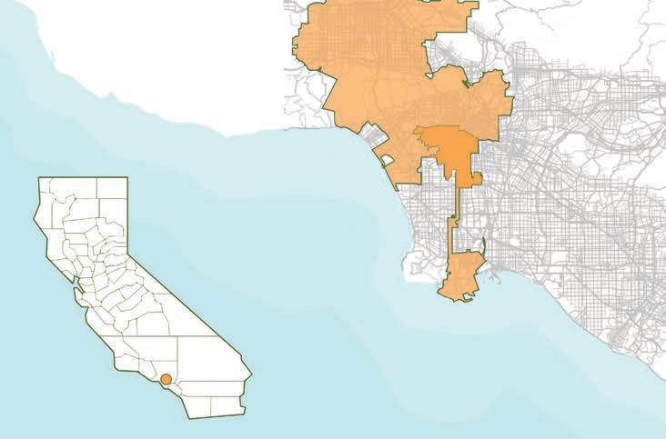
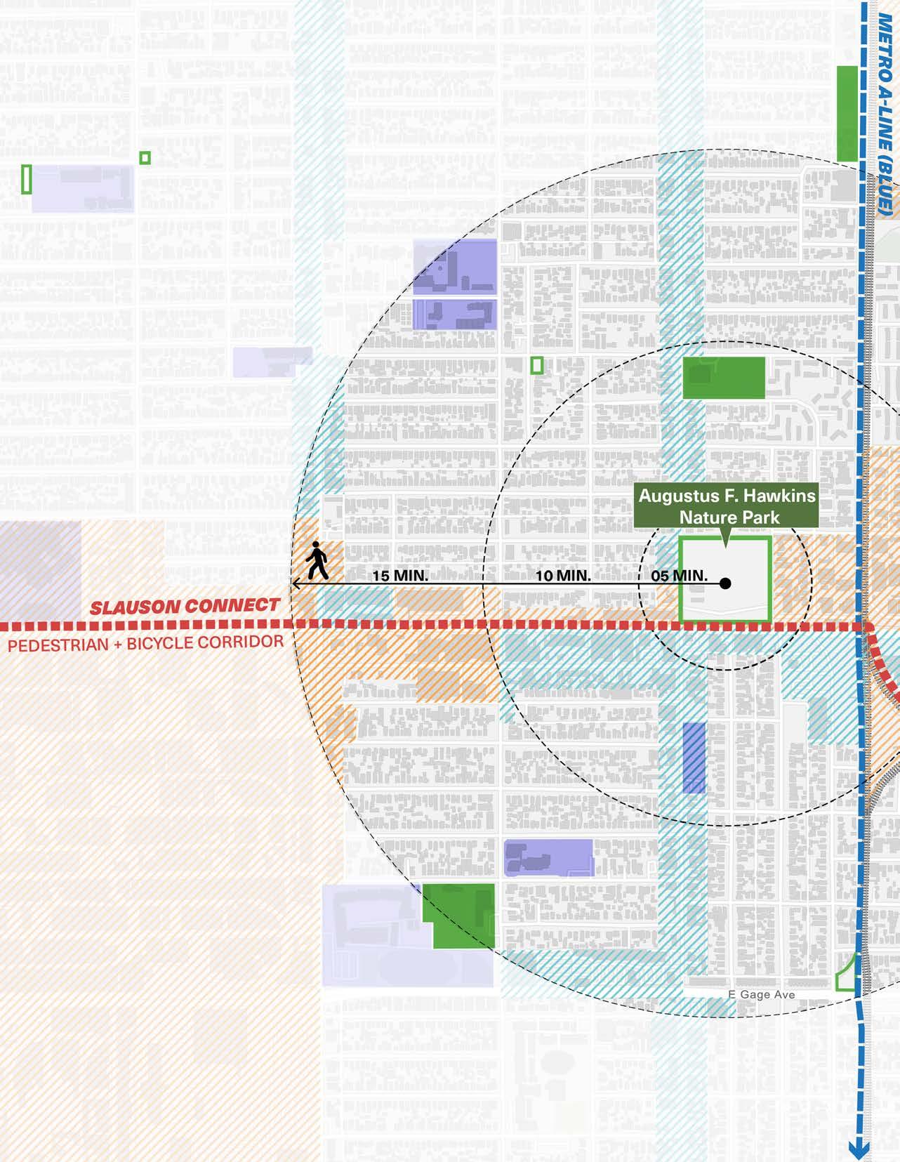
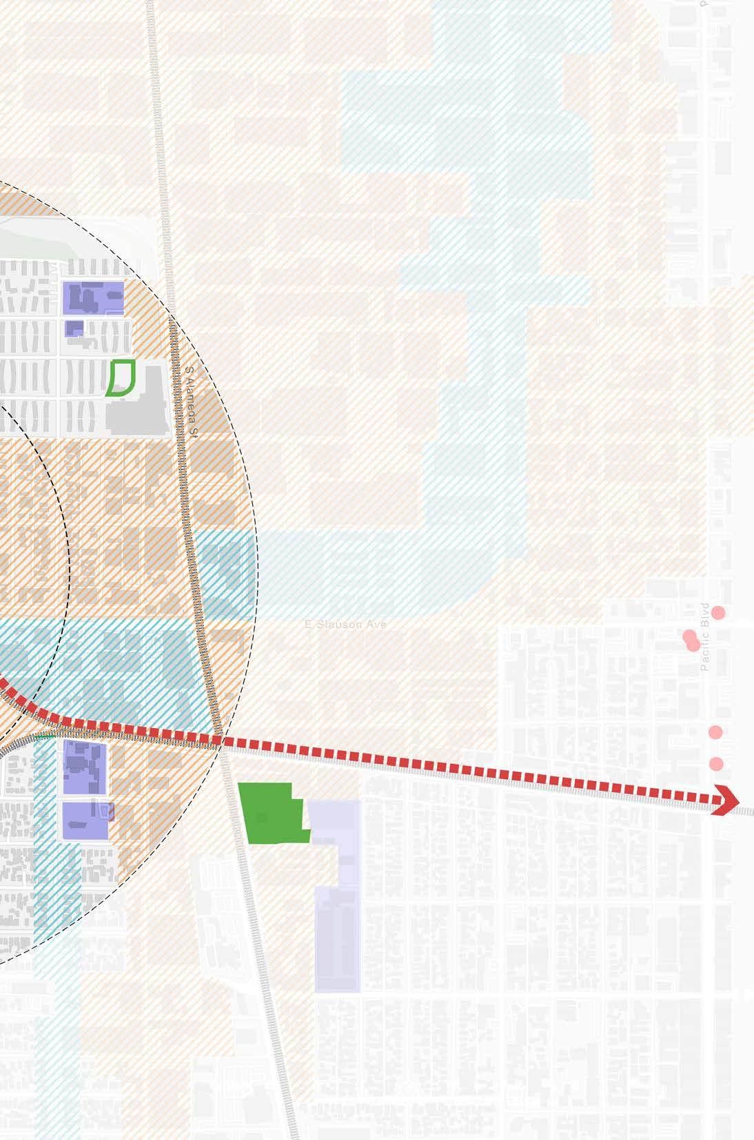
CONTEXT MAP
Los Angeles City Boundary
“I LIKE THE TREES AND THERE AREN’T A LOT OF PEOPLE SMOKING AND DRINKING.”
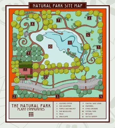
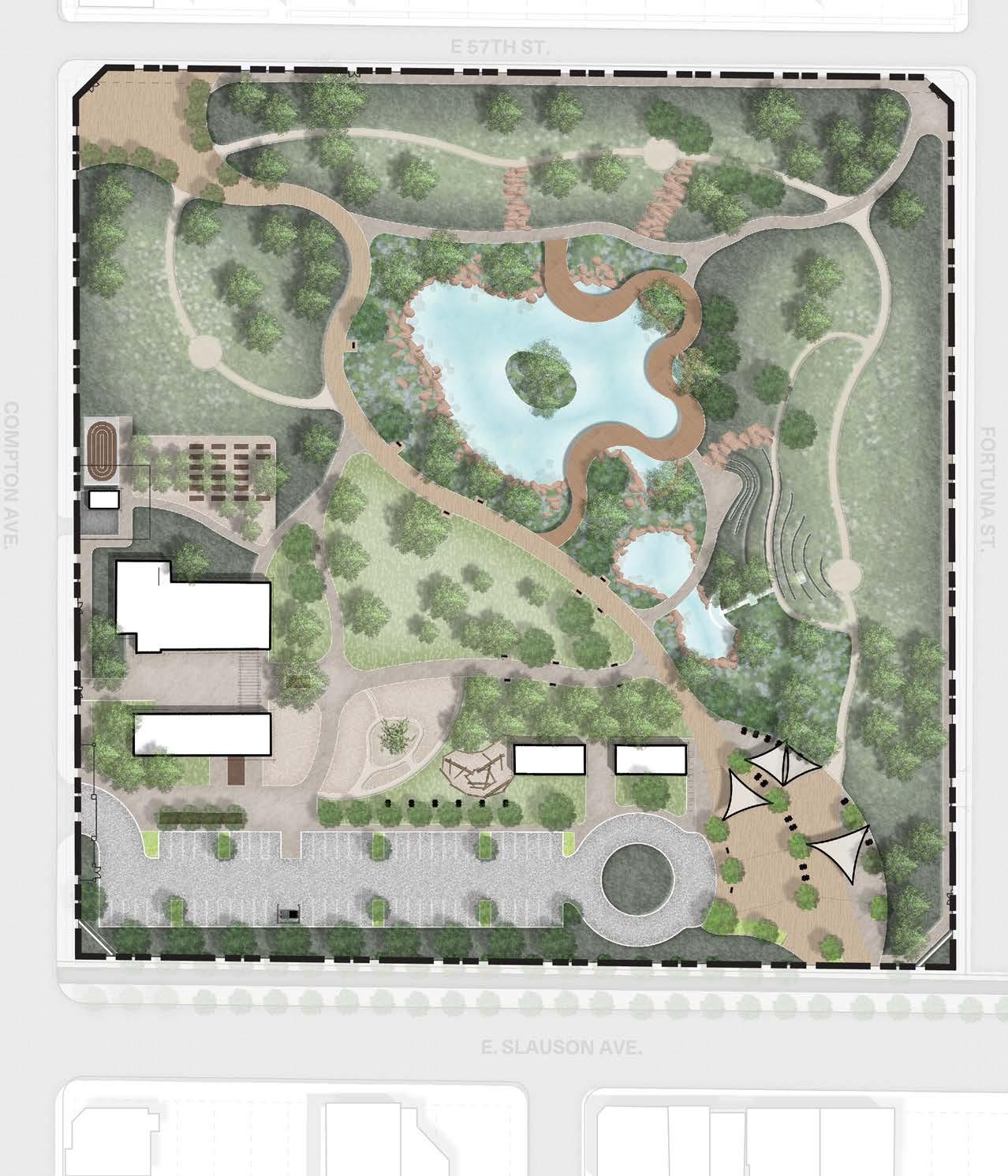
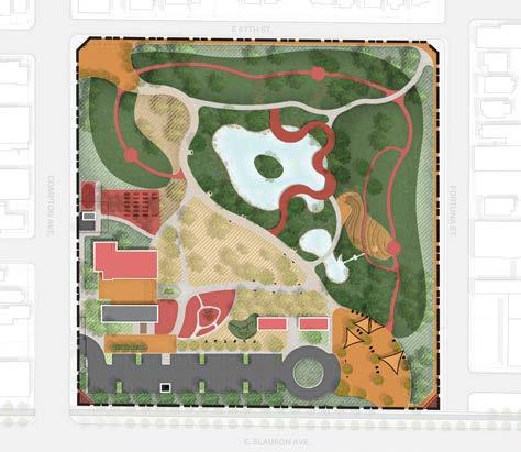
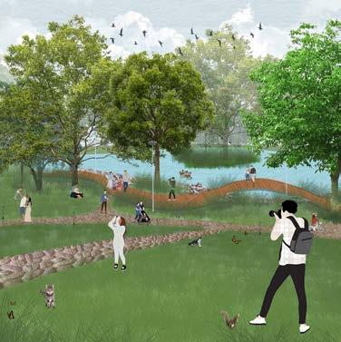
As part of the Charles Fountain Interns of 2024, we’ve had the honor of redesigning Augustus F. Hawkins Park, a groundbreaking and cherished green space in South Los Angeles. Our goal were to propose a design that ensures this 8.5 acre historic park continues to serve the community for the next 25 years and beyond—not as a tourist destination, but as a preserved and enhanced oasis for the local residents who have enjoyed it for the past quarter-century. We used data to support our design decicions and strageties.
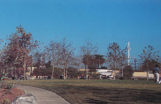
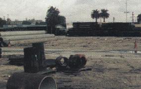
Once a brownfield pipe yard this park was originally designed through collaborations between key landscape architects, local leaders, and the community, the park was created in response to the community’s desire for a safer space and wa connection to nature. Today, it remains a vital social and environmental asset, rooted in collaboration and reflecting the needs and values of the local community
QUIETER THAN THE BUSY STREETS OUTSIDE
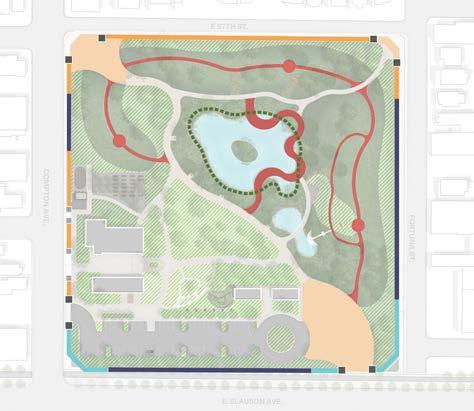
58%
TREE CANOPY COVER
COMPARED TO 1-2% IN SURROUNDING NEIGHBORHOOD
THE ONLY DEDIC ATED WILD LIFE SANCTUARY IN SOUTH L.A

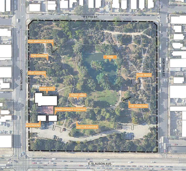
EXISTING CONDITIONS
“I’M HOMELESS FROM THIS HOOD; I LIKE THE SHADE, WATER FOUNTAINS, AND PEACE. THERE ARE NO GANGS HERE: ITS QUIET.”
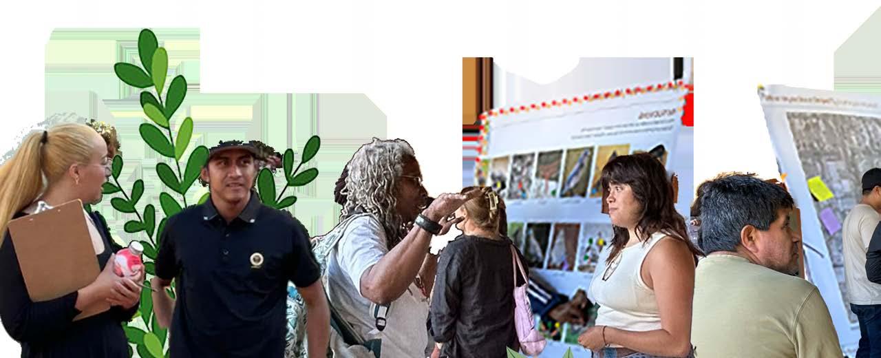
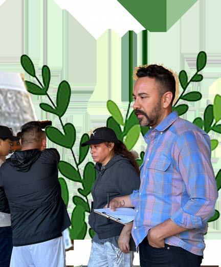
During our community engagement, key themes emerged: enhanced safety, preserved natural features, improved accessibility, and expanded family-friendly, educational, and inclusive spaces. These conversations were instrumental in shaping our design strategies to align with the community’s needs and aspirations.
Our research further revealed significant challenges beyond the park’s boundaries. South LA suffers from a stark lack of habitat for diverse species, putting local wildlife at risk. Limited green spaces contribute to high temperatures, exacerbating health and comfort issues for residents. Many community members also face barriers to accessing fresh, healthy food, while the scarcity of environmental education programs limits opportunities to inspire care for the local environment. Additionally, the area has long struggled with crime, gang activity, and a significant unhoused population. By addressing these issues, the park plays a vital role in creating a safer, more supportive space for the community.
From the Community Engagements and site analysis we developed three strategies and six goals to make sure the design proposal meets the need of the community.
ECOLOGICAL & ENVIRONMENTAL RESILIENCE
COMMUNITY SAFETY & ENGAGEMENT
FORTIFY ECOLOGICAL RESILIENCE
IMPROVE PARK SAFETY
REDUCE THE IMPACT OF UHI
CREATE VIBRANT AND INCLUSIVE
“LOVE
“LOVE THE WATER FEATURES AND WANT TO SEE THEM BROUGHT BACK.”
LEARN & PROSPER
DRIVE ECONOMIC GROWTH
CULTIVATE EDUCATIONAL
THE IDEA OF MAKING SIDEWALKS COLORFUL OUTSIDE OF THE PARK TO
CATCH ATTENTION.”
RENDERING + ILLUSTRATIVE PLAN WERE DONE BY A TEAMMATE
Having thoroughly analyzed the site’s existing conditions—including its ecological features, community usage patterns, and infrastructural elements—we gained further valuable insights into the park’s strengths and areas for improvement.
In our initial design concept phase, we explored various approaches to reimagine these spaces. We experimented with ‘pushing and pulling’ different areas, considering how modifications could address our goals—such fortifying ecological resilience, creating vibrant and inclusive community spaces and cultivating educational opportunities—each with varying emphases. This iterative process allowed us to develop focused strategies tailored to the park’s unique context and the community’s aspirations.
Documentation of the entire project can be provide on request
HANBURY SUMMER SCHOLAR THEORETICAL PROJECT
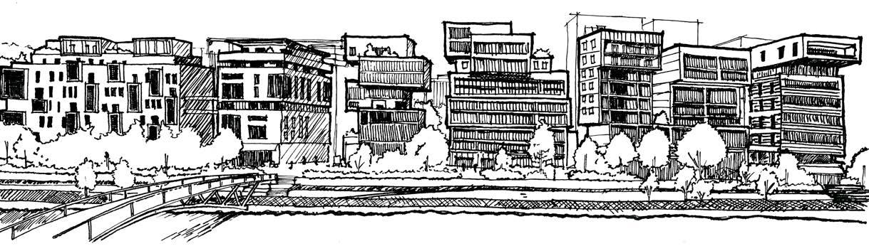
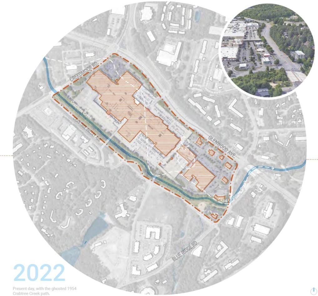
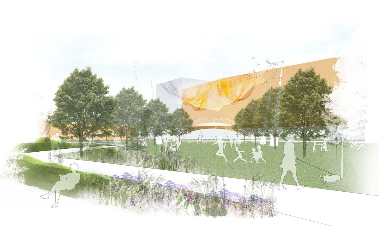
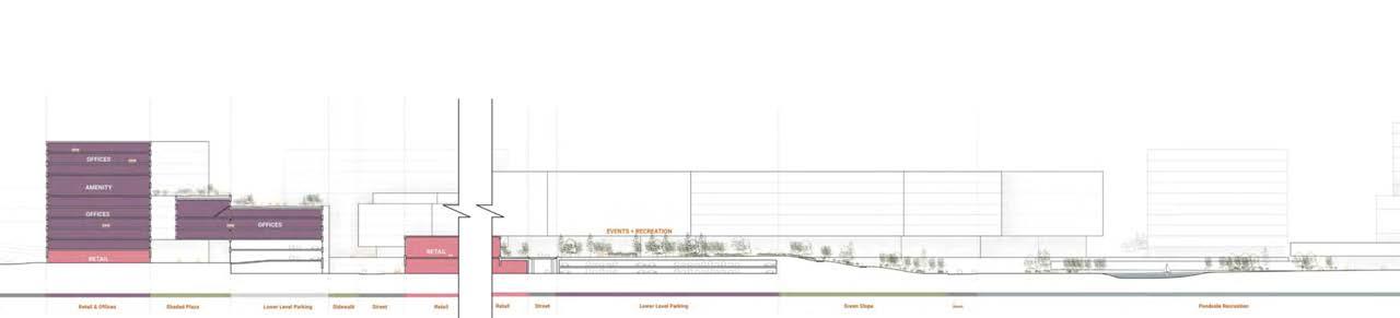
A New Spectacle, a research book by the 2022 Hanbury Summer Scholars (Abhishek Ambekar, Kelly Clark, Shuqi Liu, and Lizandro Marcial-Armas), explores the future of Raleigh’s iconic Crabtree Valley Mall, recently listed for sale after 50 years. Acknowledging the mall’s ecological vulnerability near flood-prone Crabtree Creek, the Scholars envision a sustainable mixed-use development. Their proposal integrates green infrastructure, repurposes existing assets, and emphasizes pedestrian-friendly design. The plan includes residential, commercial, and recreational spaces to serve Raleigh’s diverse community while harmonizing with the natural environment.
DIGTAL BOOK

SUMMER 2023 - SPRING 2024
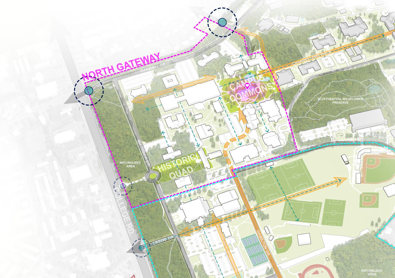
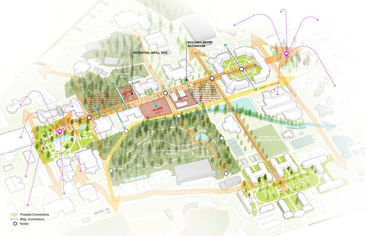
Spearheaded the development of illustrative graphics for the University of North Carolina Wilmington Master Plan, collaborating with the planning team to ensure alignment with project objectives. Designed a comprehensive 3D campus model, serving as the foundation for 2D illustrations, to effectively visualize and communicate master plan goals and initiatives.
Documentation of the entire project can be provide on request