 Image by Karl Jilg
center

Image by Karl Jilg
center
by liubov kniazeva, julia
&
mohadeseh alidoost gralkaAfter planning most European cities to be car-friendly, more than half of the public space is now devoted to cars. But is this how we imagine our future city? Do we really want cars to dominate public space? In this project, we use the example of Ratzingerplatz to consider what our future city should look like.
middle ring inner 15min
ring
5,78km
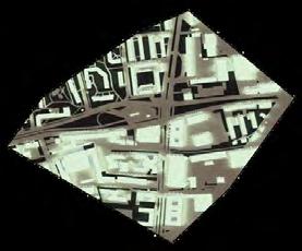
The reason for choosing Ratzingerplatz is that it is located outside the city center and is one of the ugliest plazas in Munich. Due to its industrial importance, it was connected to the city center by railways since 1903. After the construction of Aidenbachstraße subway station, the railways sevice was dicontinued and Ratzingerplatz lost its identity as a result.
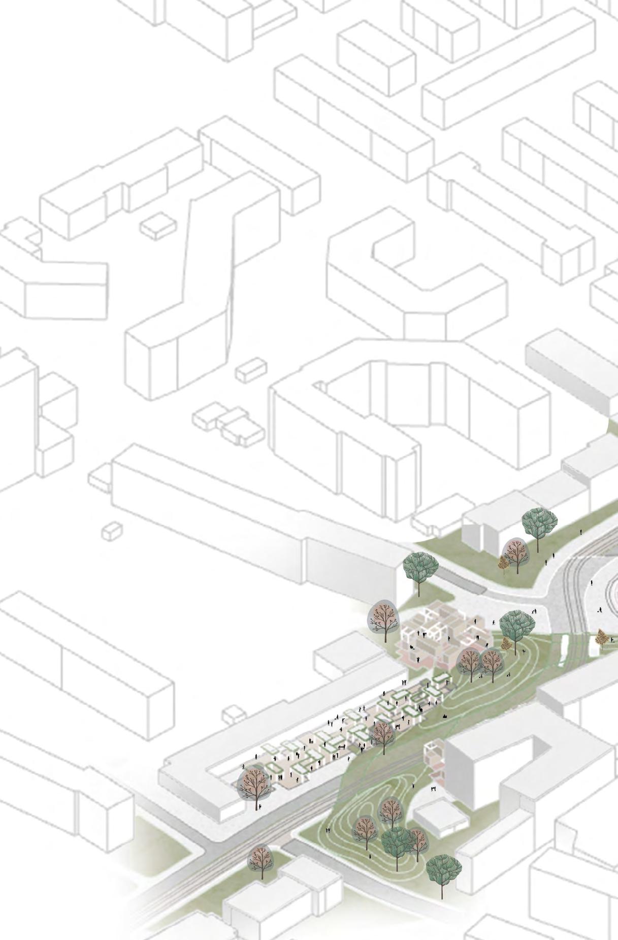
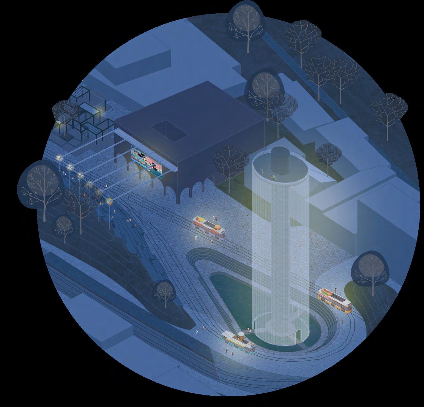
Axonometry from South-West of the intervation of the Ratzingerplatz.

*3https://clima.cbe.berkeley.edu/(11.01.2022)
of
for each of 4 challanges in present and future.
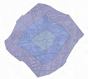
FIGURE 4
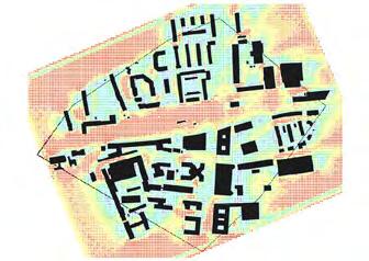
State plan with highlighted space owened by cars.
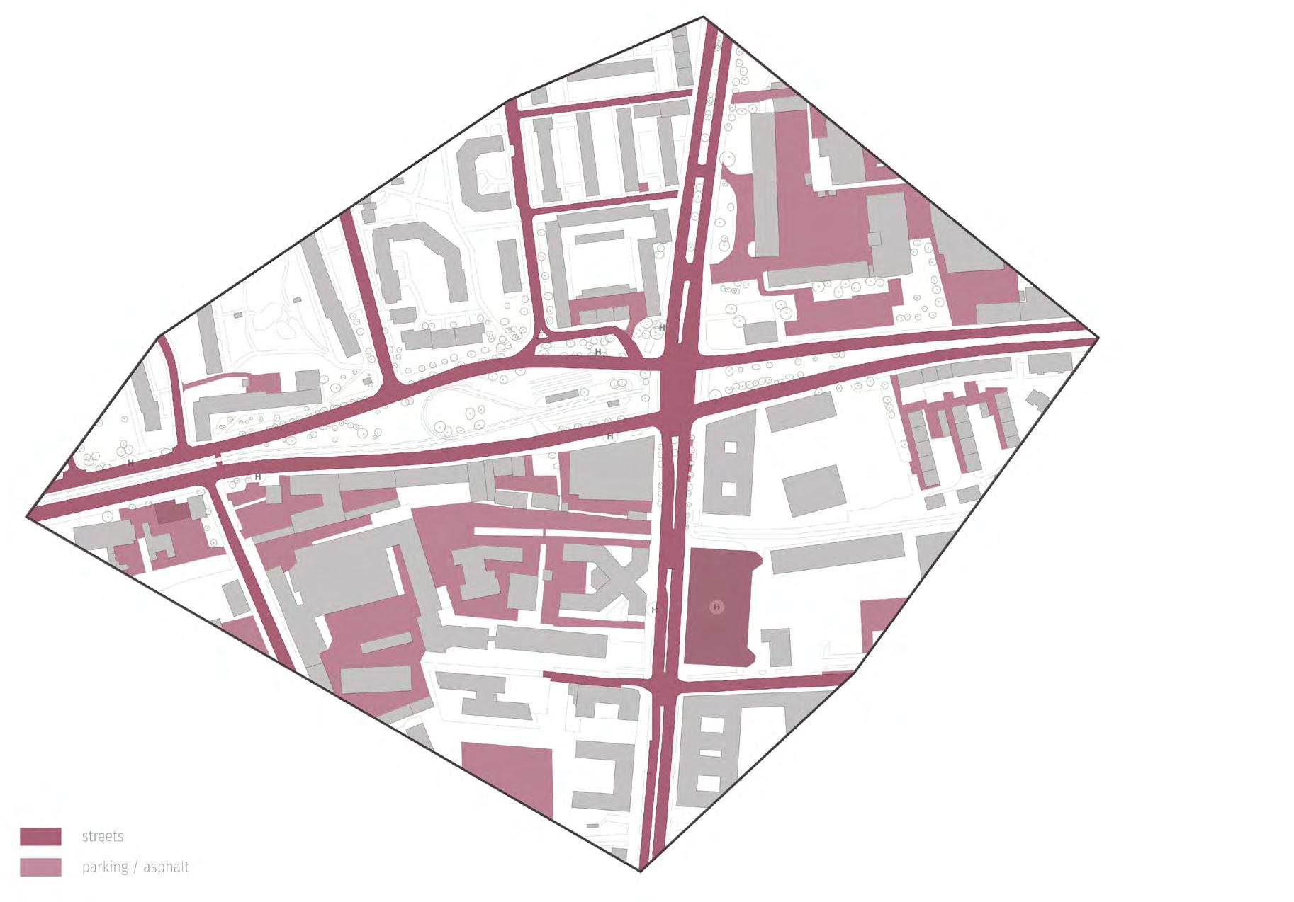
FIGURE 5
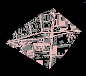
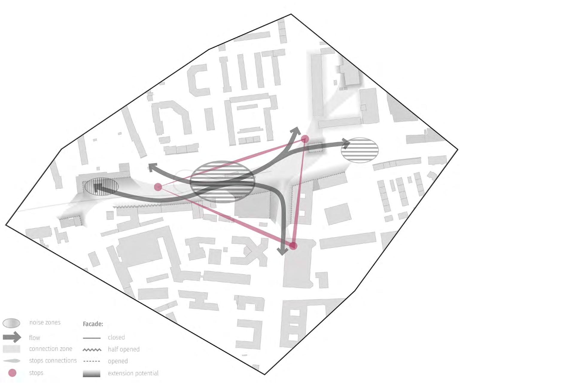
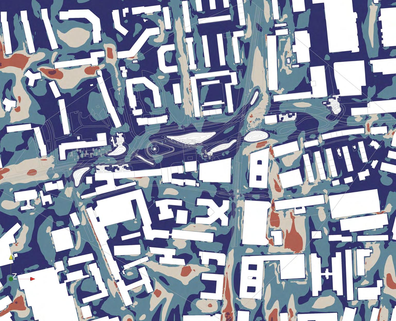
Concept base for masterplan design. Distributed stops to create communication flow on the plaza.


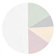
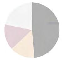
When analysing future development and what the city of the future should look like, four major challenges have emerged. The first is climate, which forms the basis for the other challenges, and the other three are mobility, population and lifestyle. All of these four challenges will be looked at over time. First, we analyzed a 15-minute area of Ratzinger Square for each of the challenges for the present and the future. (Figure 2)
For the present, the following conclusions can be seen: Considering climate, there is a strong wind, as the plaza is open to the prevailing wind from southwest. Regarding mobility more than a half of space in street sections belongs to cars. Most of the residents are elderly and families, and in terms of lifestyle, the availability of various functions is low.
In the future, there will be extreme weather conditions and there will be no more private cars. The population will grow and lifestyles will become more flexible, for example, people will want to work from anywhere.
To solve the future challenges a strategy has been developed for each. As the strategy to face the extreme weather conditions, comfort islands will be created and climate energy will be used. For mobility there will be only shared transport, which will minimize the streets. A new center will be created for this 15 min area and the plaza will be given back to people.
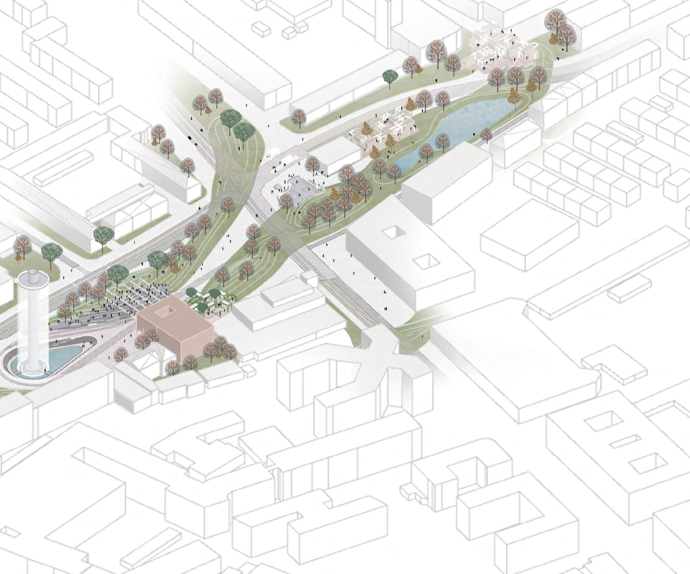
Masterplan concept has been developed with these strategies. Starting to design for 5 min area of Ratzingerplatz, one can see a big plaza, with a lot of green area, that is not accessible. The main reason is that the plaza is surrounded by car lanes As it can be seen, a really big space is devoted to cars and car lanes divide the whole area in small pedestrian pieces (Figure 4). Through that a barrier is created in plaza. There is a quite big potential in the existing functions. They need more space and it can be taken from cars and given back to people. The existing public functions will be connected and new ones will be added to create enough density for this new city center. In order to create a circulation of people on the plaza the public transport stops will be divided. In this way a flow between our connection zones and
increase accidental encounter will be created. Through this flow a center will be made, where everything meets and runs out to the secondary attractions on the east and west. (Figure 5)
Depending on functions, there are two noise zones: silent with recreational character and loud zone, where an Agora as the new city center will be created.character and loud zone where we want to create an Agora as the new city center.
Now coming back to the concept base, a response has been defined for the designs regarding each future challenge (Figure 3). In order to create comfort islands, a topography on the plaza is created Regarding the mobility challenge, the car lanes will no longer take space away from nature and pedestarians, but only borrow it. Finally for the new city center, an orientation point is needed and to strengthen pedestrian traffic, the design will create a flow that connects the entire area. Topography as a climate base contributes to all the others challenges (Figure
6): It helps to slow down the transport, it creates a diverse space for different age groups and functions and a human scale can be achieved through it on this big plaza.
Vehicle lanes borrowing space (Figure 7) means that where the lanes meet nature or pedestrian zone, there will be unsealed surface. Pedestrian will have priority in these areas. The space for vehicles lanes is eliminated and given back to people.
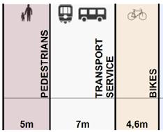
To minimise the space of vehicle lanes, the minimum width needed for each mode of transportation has been analysed and different lane’s types eleborated (Figure 8). In the main street, public transport has one lane in each direction and next to it there is the bike path with two lanes in each direction which can be used by emergency. In the secondary streets, bikes have priority and these streets can also be used by car sharing drivers. To create safe school ways, there is a low speed bike lanes next to school. In the shared zone where pedestrian have priority there is speed limit for bikes and vehicles


The master plan (Figure 9) is designed regarding these tools and base directions (Figure 5).
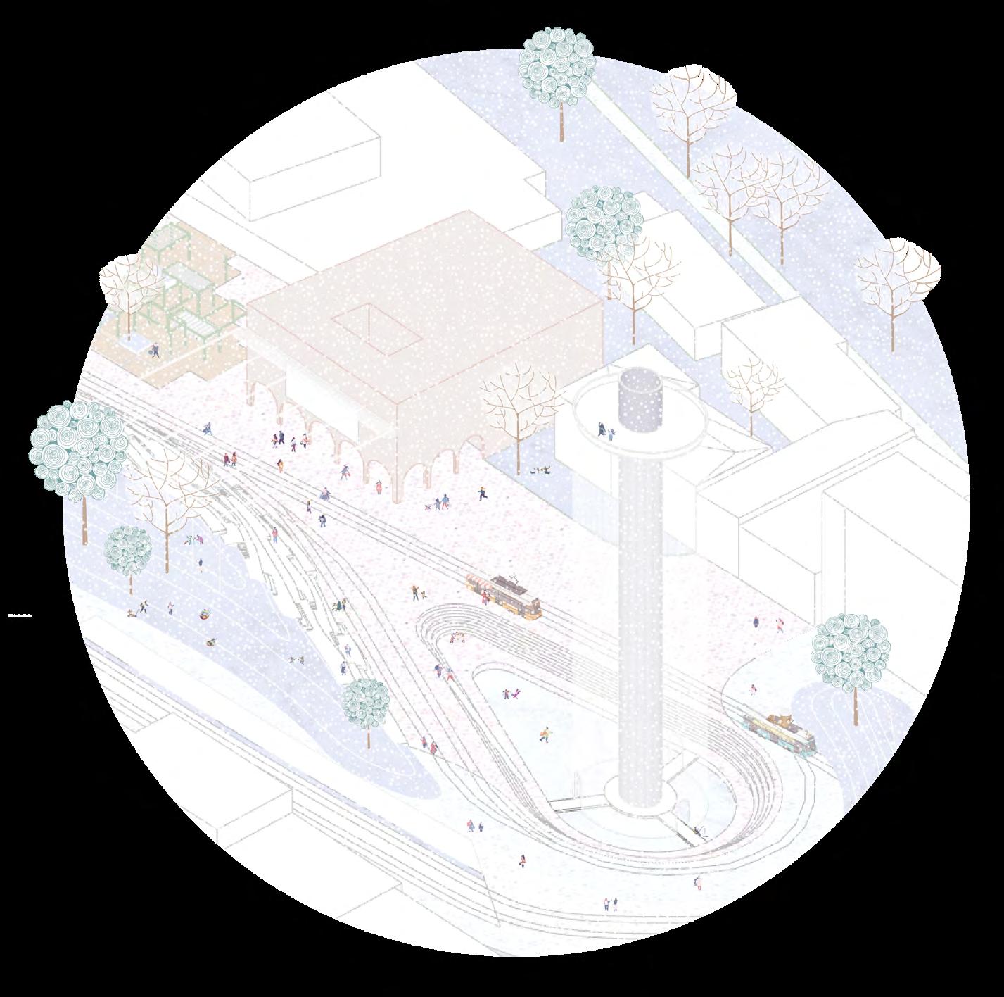
The hills are arranged in such a way that they create the flow. They guarantee a human scale experience on this huge plaza and make the circulation meet in the center. Topography is used for different kind of activities like skatepark, stairs for sitting together, or even for sleighing in winter
Topography is also used for water bodies. They can be used in summer for swimming as in the recreation area or in winter for ice skating
As mentioned in the concept, the transport stations are placed in these three points, one on the subway Aidenbachstraße and the other two on the left and right. The old tram lines, that enter the ratzingerplatz from west and redirect them to the north are used to create the big plaza that is connected to the existing functions. The tram is extended to the north and south and will connect the east through buses. To create Safe school ways, an additional bike lane is added near the school. To emphasis the flow the shared zones are placed on the light red areas.
Now going into details, the intersections work without traffic lights Wherever the vehicle lanes meet nature or pedestrian zone, the pedestrians have priority. Otherwise public transport and bikes can pass the intersection. For Emergency the bike lanes can be used.
As the main attraction point for this new city center, the Ratzingerplatz has been given an agora that is located at the meeting point of our flow and where the old tramline has its end. It consists of a cultural Center, a pop up market and an multifunctional tower. The cultural Center consist of an portico on the groundfloor and is located in front of the sitting stairs. It can be extended with an flexible covering and used for different activities like festivals. The old tram lines give this place its historical identity. The Ratzingertower, located next to the agora has a multifunctional usage. It consists of a structure that dissipates the wind to create comfort on the plaza and of a core that catches the wind to create energy and summer cooling.
The structure can be used for nests of birds or as a viewing point for people to see the alps or Munich. In Winter the tower can be used for sun reflection. To respond the flexible lifestyle of people a flexible structure is created that can be used for different functions. For example as a pop up market next to the cultural Center or the shared space that works like car-sharing but only for space.
The interaction between all these functions gives the plaza a gathering place for all ages. In this overview of Ratzingerplatz one can see that every time a vehicle enters to the plaza it drives over a hill to slow down. Through this the driver can always recognise easily that he is on the Ratzingerplatz.
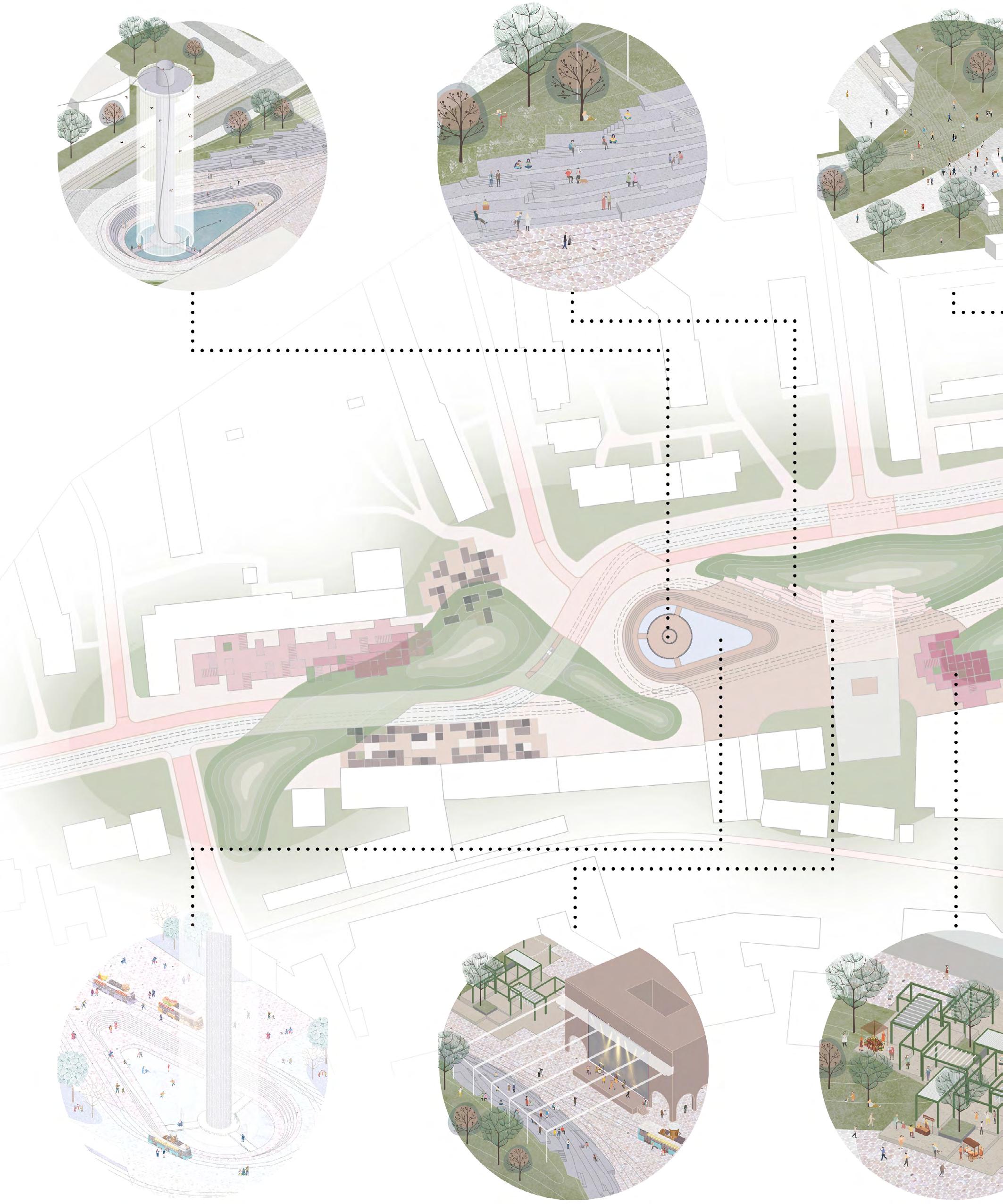
Masterplan with function’s zoom-ins
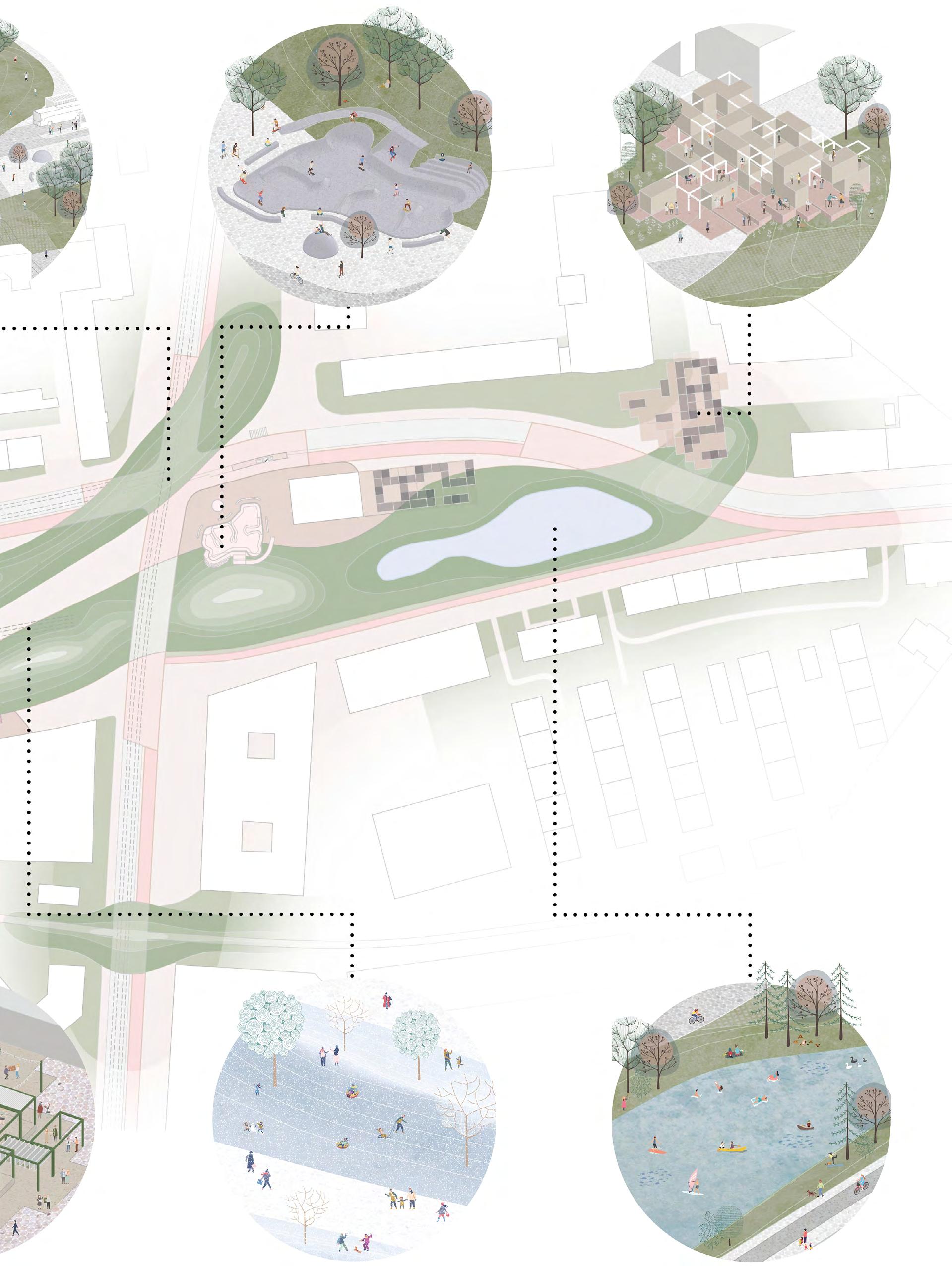
FIGURE 10
Summer scenario of Agora and Ratzitower. Sunbathing, picnics
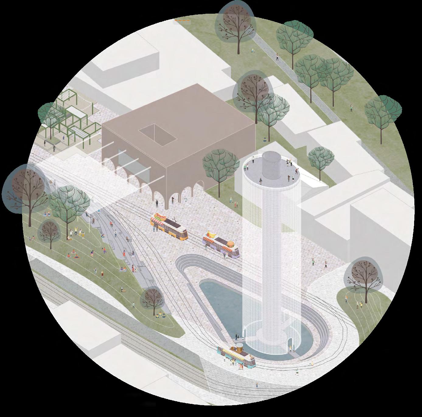
FIGURE 11
Autumn scenario of Agora and Ratzitower. Festival
Responsive Design, Winter 2021-22
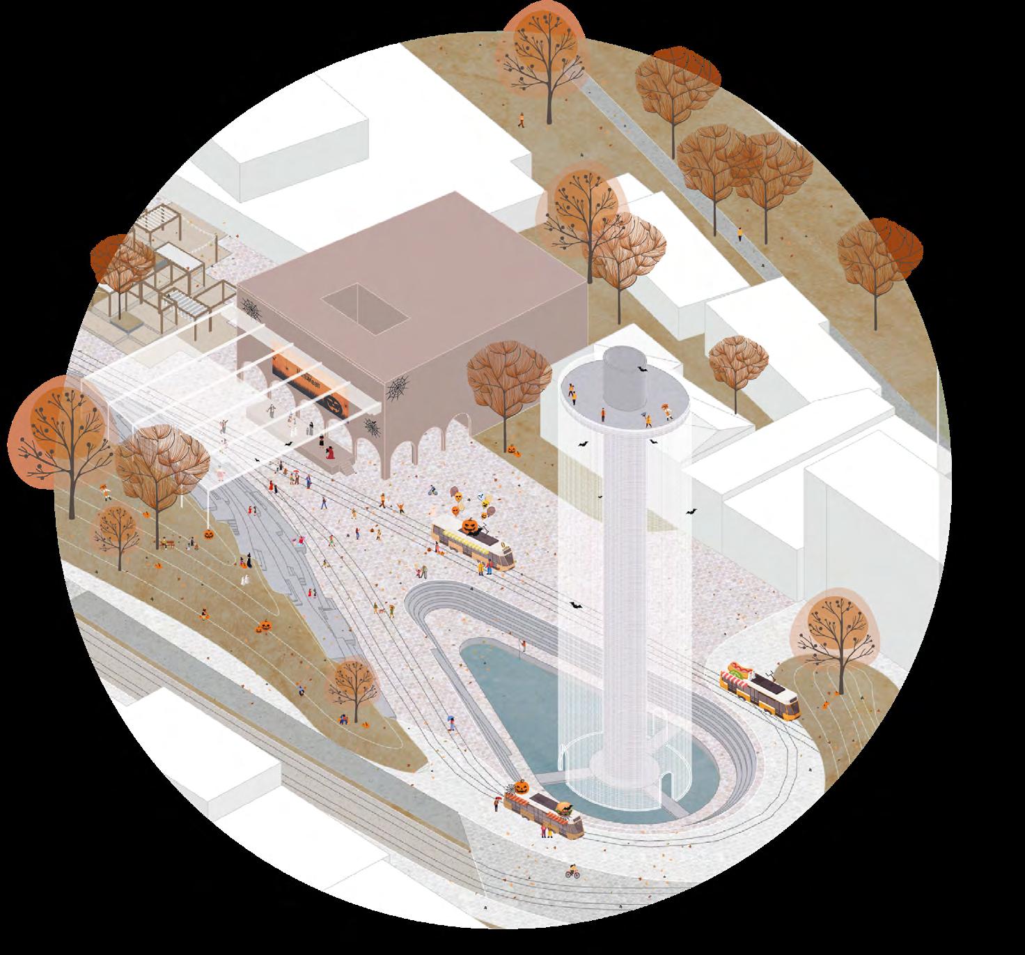
FIGURE 12
Night scenario of Agora and Ratzitower. Open-air cinema
FIGURE 13
Winter scenario of Agora and Ratzitower. Ice-skating, sleighing
wind rose winter
uncomfortabe
walking fast
walking leisurley
sitting short
sitting long
U
FIGURE 14
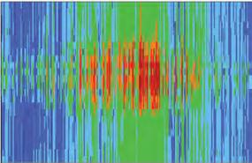
Wind simulation for prevailing wind in winter before design
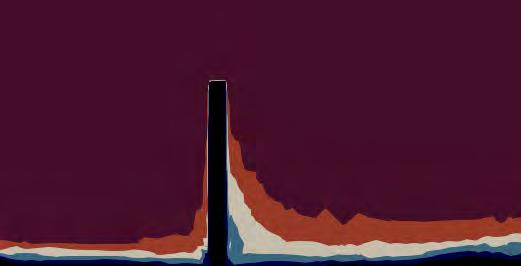
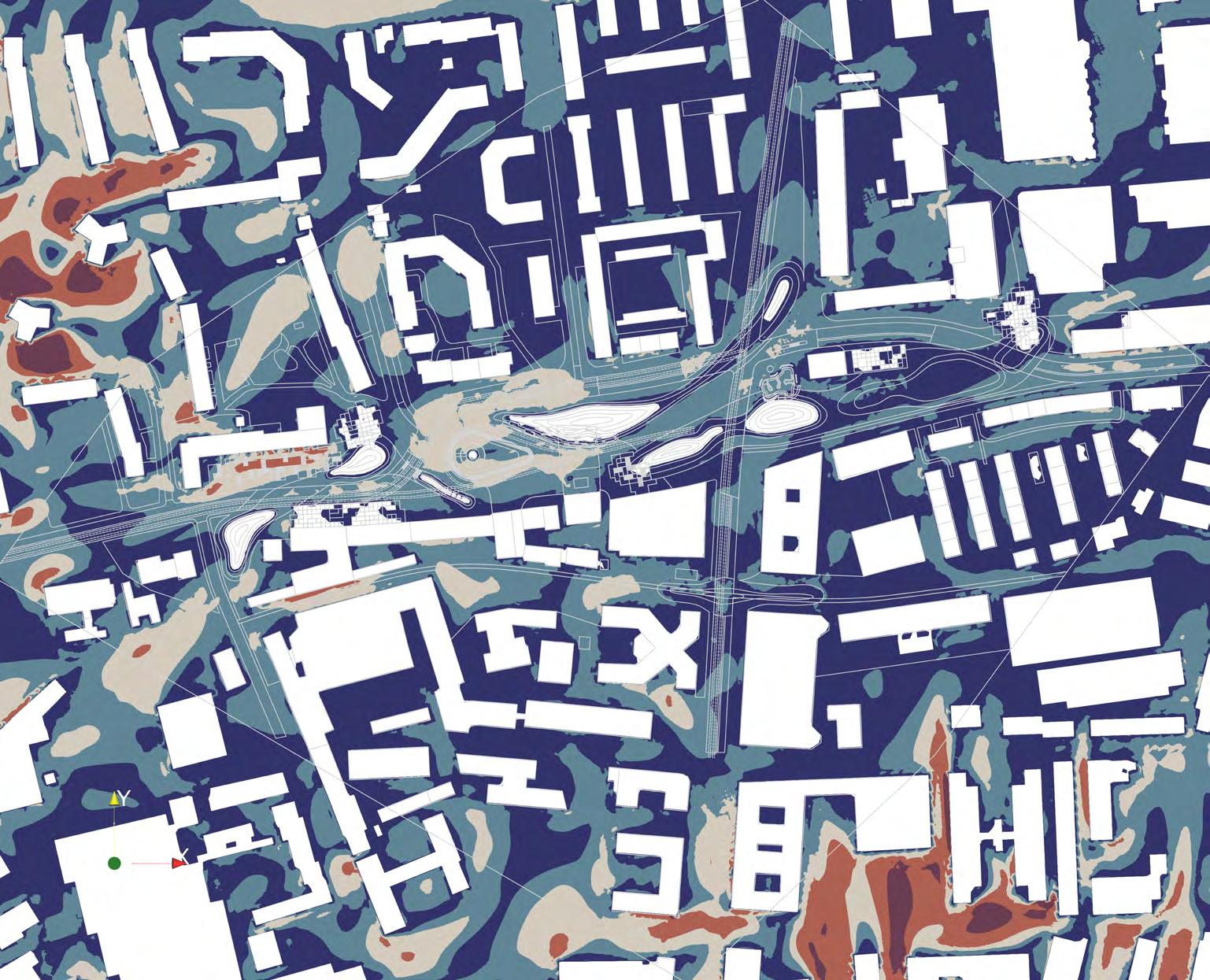
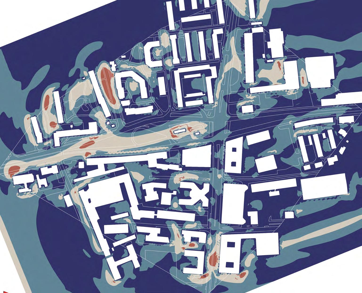
FIGURE 15 FIGURE 16
Wind simulation for prevailing wind in winter after design
Wind simulation for prevailing wind in winter after design
FIGURE 17
Wind simulation for “Alpenpumpe“ wind in summer after design
Considering the design through time the agora is used through the different daytimes and seasons (Figure 10,11,12,13) . The old tramlines are kept and will be used for example as food truck. At night the agora can become a cinema or festivals can take place here. In winter the agora is also a favourite meeting point.
Before the begining of the design, the prevailing wind situation in winter that comes from west and southwest has been analysed (Figure 14) . As it is unprotected from this direction there are uncomfortable zones. The simulation after the design (Figure 15) shows how the topography creates some comfort islands . As it can be seen in the section (Figure 16), fast wind in height can be used for energy. In summer (Figure 17) there is the so called “Alpenpume” that comes from south and creates this wind
situation. For example on the skatepark there is a pleasant wind to cool the area down.
The data has been selected from Google on how the ratzingerplatz is used by people throughout the day and is visualised on a heat map for a workday based on this data.
Through the new design this heat map on ratzingerplatz will be changed extremely because it will be used by people through the whole day.
In conclusion, it can be said that the design addresses the four challenges of the future and creates a basis for a resilient city.
The idea is to apply this strategy to other plazas that are as well surrounded by cars like Pfanzeltplatz.
Data Source: https://clima.cbe.berkeley.edu (12.01.2022)
Simulation: Rninoceros + Grasshopper (Eddy 3D, CDF BlueCore)
Visualisation: Paraview
Categories: Lawson wind comfort criteria - https://www.simscale.com/blog/2020/01/lawson-wind-comfort-criteria/
liubov.kniazeva@tum.de
Technical University of Munich (TUM) Chair of Building Technology and Climate Responsive Design Winter 2021-22