Architecture and Urban Design
Selected works
2018 - 2024
Leopold Pretzel
ISLANDSBERG
Masters Thesis 2024
Academic
Building tectonics
contextual and adaptive architecture and landscape

Architecture and Urban Design
Selected works
2018 - 2024
Masters Thesis 2024
Academic
Building tectonics
contextual and adaptive architecture and landscape
ACE510 Mediated Material Interfaces
Academic - Design Studio
Architecture, Media and Material Practice
biobased architectural design research and practice
Bachelors Thesis 2021
Academic
Institute of structure and design
data-driven, generative architecture
Commissioned Work 2024
Professional
Lysekil municipality
small-scale timber structure for nature-reserve
ACE110 Public Buildings
Academic - Design Studio
Dep. of Architecture and Civil Engineering
high fidelity mass-timber typologies
I am an ambitious and curiosity-driven architect with a Master’s degree in Architecture and Urban Design from Chalmers in Gothenburg, Sweden. My academic journey began with explorations in digital and computational architecture during my bachelor’s thesis and has since grown into a deep commitment to sustainable, datadriven workflows.
In recent years, I’ve integrated GIS into design projects to visualise and manage material and site data, developed digital-twinning workflows paired with CNC fabrication to produce highly accurate architectural models and utilised Grasshopper tools to automate complex geometry creation and streamline the overall design process.
Outside of architecture, I am also a keen photographer and designer. My diverse skill set allows me to approach each project with a fresh perspective, always aiming to push the boundaries of design.
LEOPOLD PRETZEL
leopoldpretzel@gmail.com
+46 734 823500
SE-415 16 Göteborg
LinkedIn-Profile
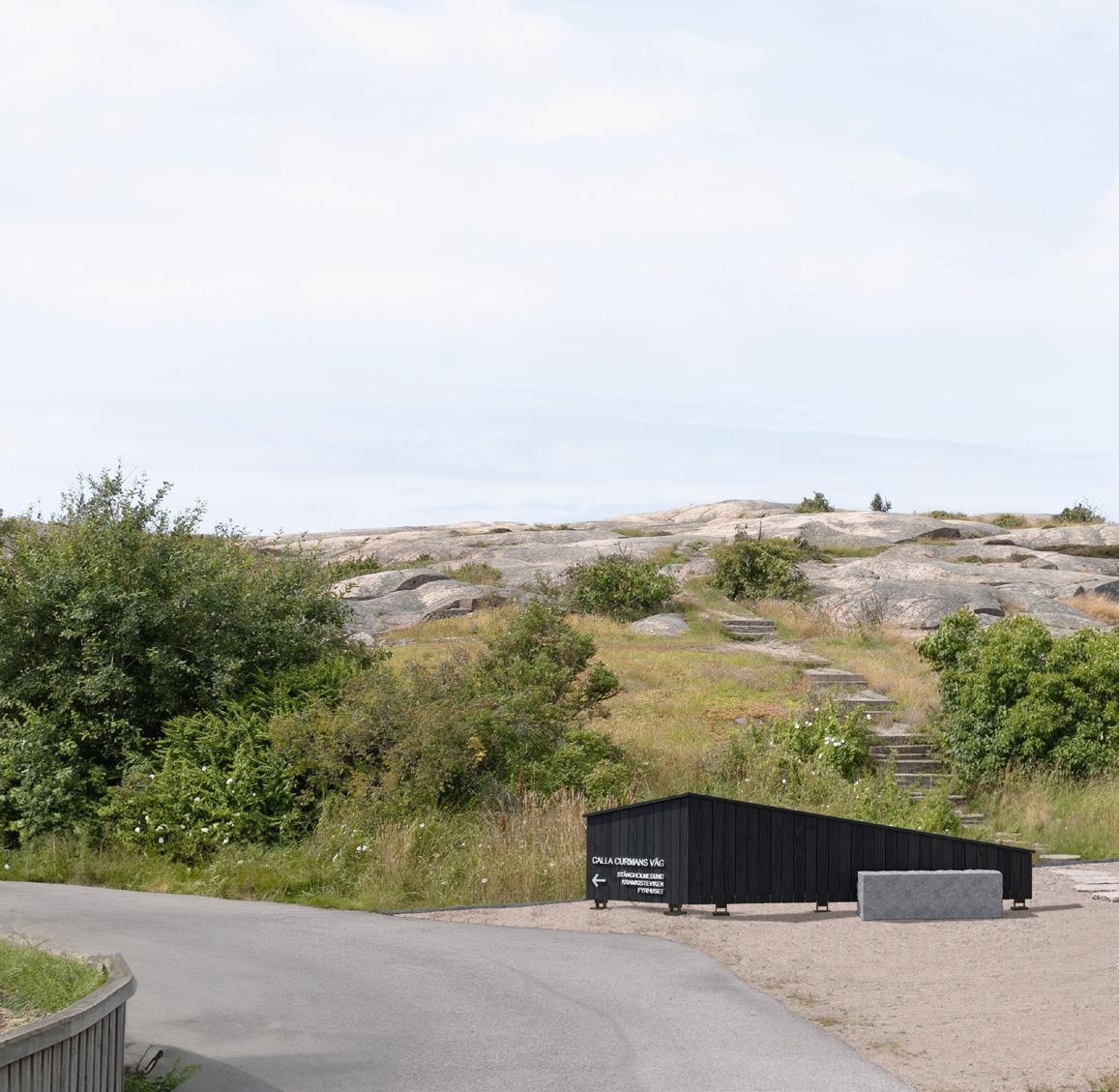
Lysekil municipality - Commissioned project work
07/2024 - 10/2024 | Lysekil, Sweden
• entrance building for Stångehuvud nature-reserve
• public,outdoor, timber-construction
• production of scale drawings, maps, construction details and visualisations
• extensive communication with stakeholders
• time management, cost calculations and project coordination
GP Architektur ZT GmbH - Junior Architect 03/2021 - 06/2022 | Schwaz, Austria
• landscape, residential and commercial office projects
• design, detailing, visualisations, landscaping and submission planning
Premarchitektur ZT GmbH - Internship 02/2020 | Vienna, Austria
• communal competition
• planning work and creation of drawings for a multi-residential project
Premarchitektur ZT GmbH - Internship 08-09/2019 | Schwaz, Austria
• residential healthcare competition
• planning work, creation of drawings and physical models for a multi-residential project
Bollmann Frank Dipl.-Ing. Ingenieurbüro - Internship
07-08/2017 | Rostock, Germany
• Introduction to the civil engineering of residential architecture projects
• static calculations, using mbAEC software
Rhino3D Proficient
Grasshopper Proficient
Adobe Suite Proficient
Blender3D Competent
QGIS Advanced Beginner Revit, ArchiCAD Competent
TM, Enscape, V-Ray Proficient
Komvux - Swedish 09/2024 - Ongoing | Göteborg, Sweden
• SVA Course 4 & SFI Course D
Chalmers University of Technology 08/2022 - 06/2024 | Göteborg, Sweden
• MSc - Architecture and Urban Design
Leopold-Franzens University 10/2018 - 07/2021 | Innsbruck, Austria
• BSc, Architecture
Viktoria Sandor - Senior Scientist, Mag.-Arch. Integratives Design, UIBK & AIT Viktoria.Sandor@uibk.ac.at
Sara Chronvall - Landscape Architect Lysekil municipality Sara.Chronvall@lysekil.se
Tanja Gstrein - Architect Dipl.-Ing. CEO of GP Architektur ZT GmbH t.gstrein@gparchitektur.com
German native English CAE C2 Swedish SVA grund 4 (B1/B2)
Timber craftsmanship
3D Visualisation
Digital design and fabrication
Photography
Model building
Architectural design and detailing Photogrammetry
Project type: Academic
Institution: Building tectonics, Chalmers
Subject: Public / Landscape / Outdoor
Software: Rhino, QGIS, Blender, Photoshop, Illustrator, InDesign
Collaborators: Klara Bolin
Date: Jan 2024 - June 2024

QR-CODE
Archive website
https://odr.chalmers.se/items/cdd97a12-d857-4fd08e11-c2ccd2b86586
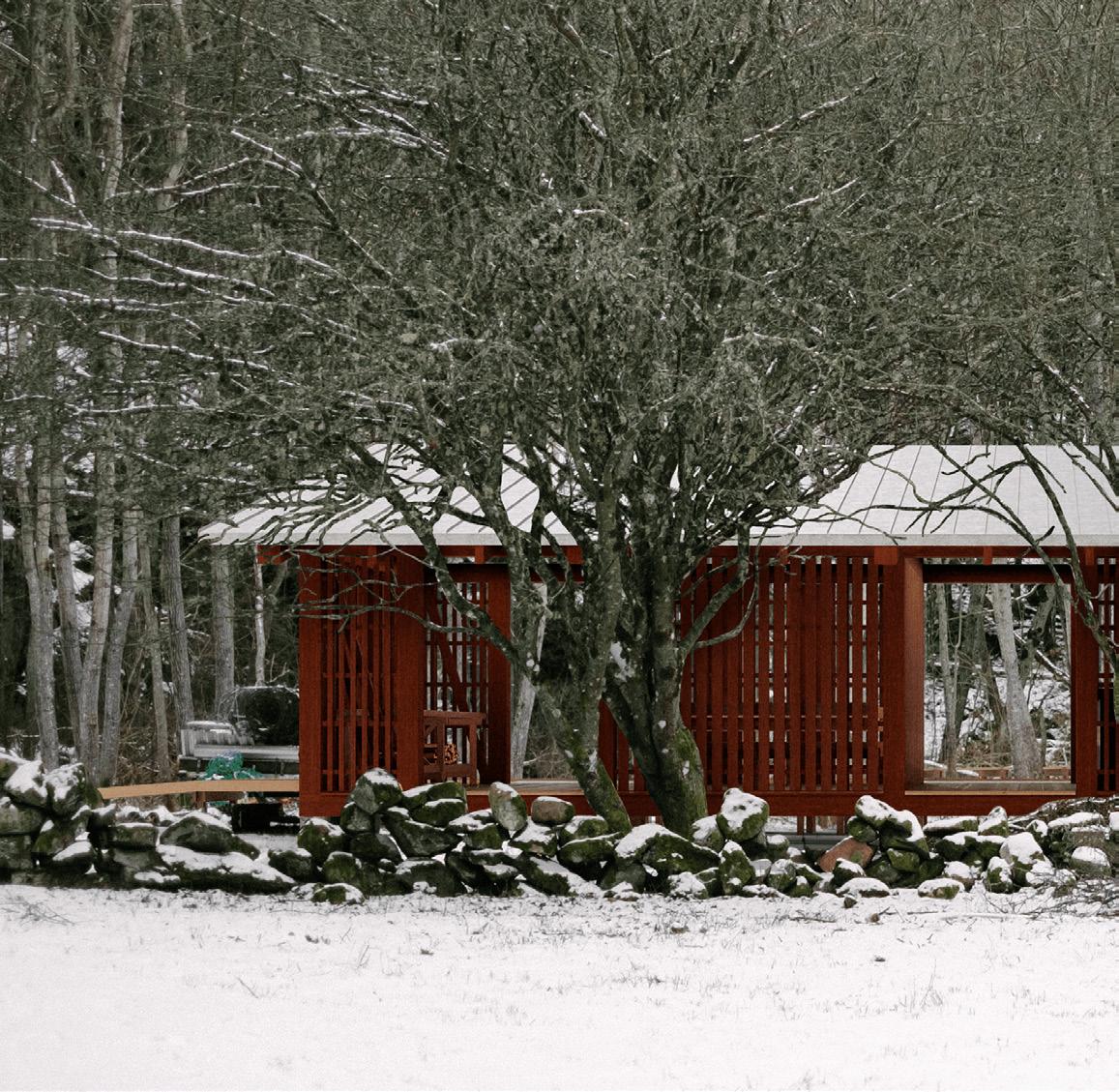
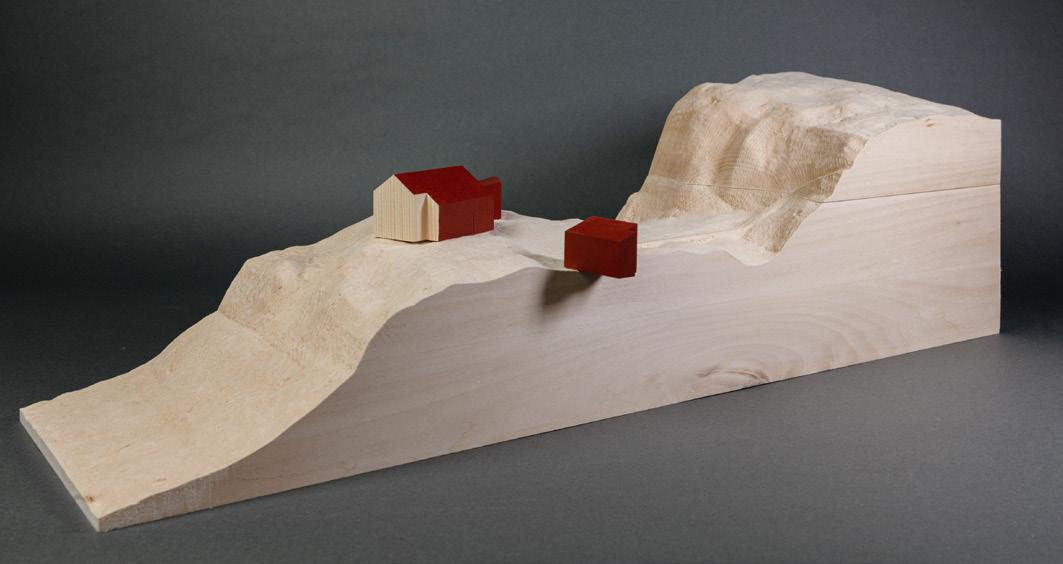
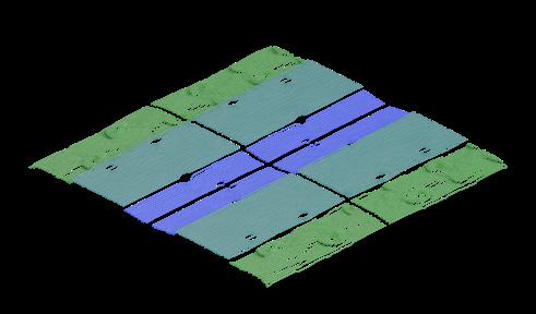
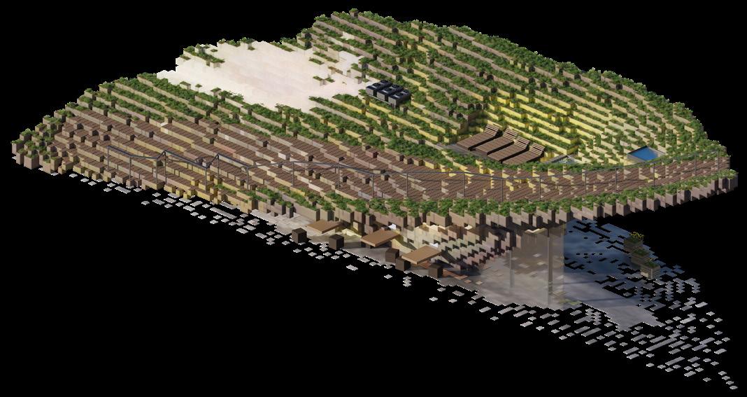
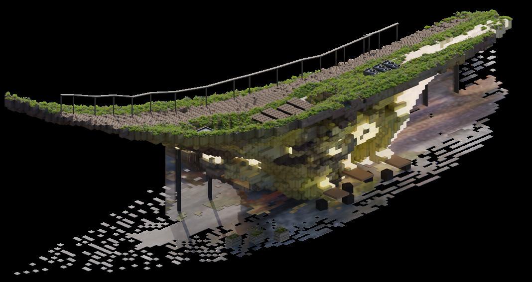
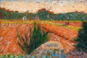
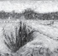
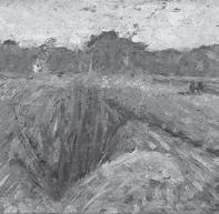
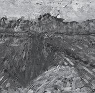
This thesis focuses on Islandsberg, a remote lighthouse site on the Swedish west coast, exploring how contextual values influence design. The project draws on the tradition of timber construction to propose a hiking trail and five small structures, such as bothies, a sheep hut, a wind shelter and an entrance building.
The final design aims to create accessibility, protect ecosystems, and restore the landscape to its historical character.
The thesis was written together with Klara Bolin and the entirety has been created in a joint process, ranging from research until final production.
A major part of the thesis was our deep mapping method. Through the mapping of features such as geological, cultural, historical, nautical and technical elements into a comprehensive deep map, we were able to create highly site-specific structures that have a minimal impact on the surrrounding.
BÖNAN
Sector field
Seamark, Buoys
Underwater cable, electric Pipe
Telecommunication cable
Shallow water
Underwater obstacle Nautical route
Birdprotection area
Strandskydd
ÖSÖ
Sector field
Seamark, Buoys
Underwater cable, electric Pipe
Telecommunication cable
Shallow water
Underwater obstacle
Nautical route
Birdprotection area
Strandskydd
Main road
Village road Private road Gravel road
Established trail Ino cial trail
Stonewalls
Waterbodies
Property Borders
Markings
Sector field
Seamark, Buoys
Underwater cable, electric
Pipe
Telecommunication cable
Shallow water
Underwater obstacle
Nautical route
Birdprotection area
Strandskydd Main
Main road
Village road
Private road
SKUTEVIK
Gravel road
Established trail
Ino cial trail
Stonewalls
Waterbodies
Property Borders
Markings
Buildings
Tectonic development
Moorland
Beach / Reet
Farmland
Forest
Channel / Bridge
Where land meets sea
Cairn
Well
Buildings
Tectonic
Farmland
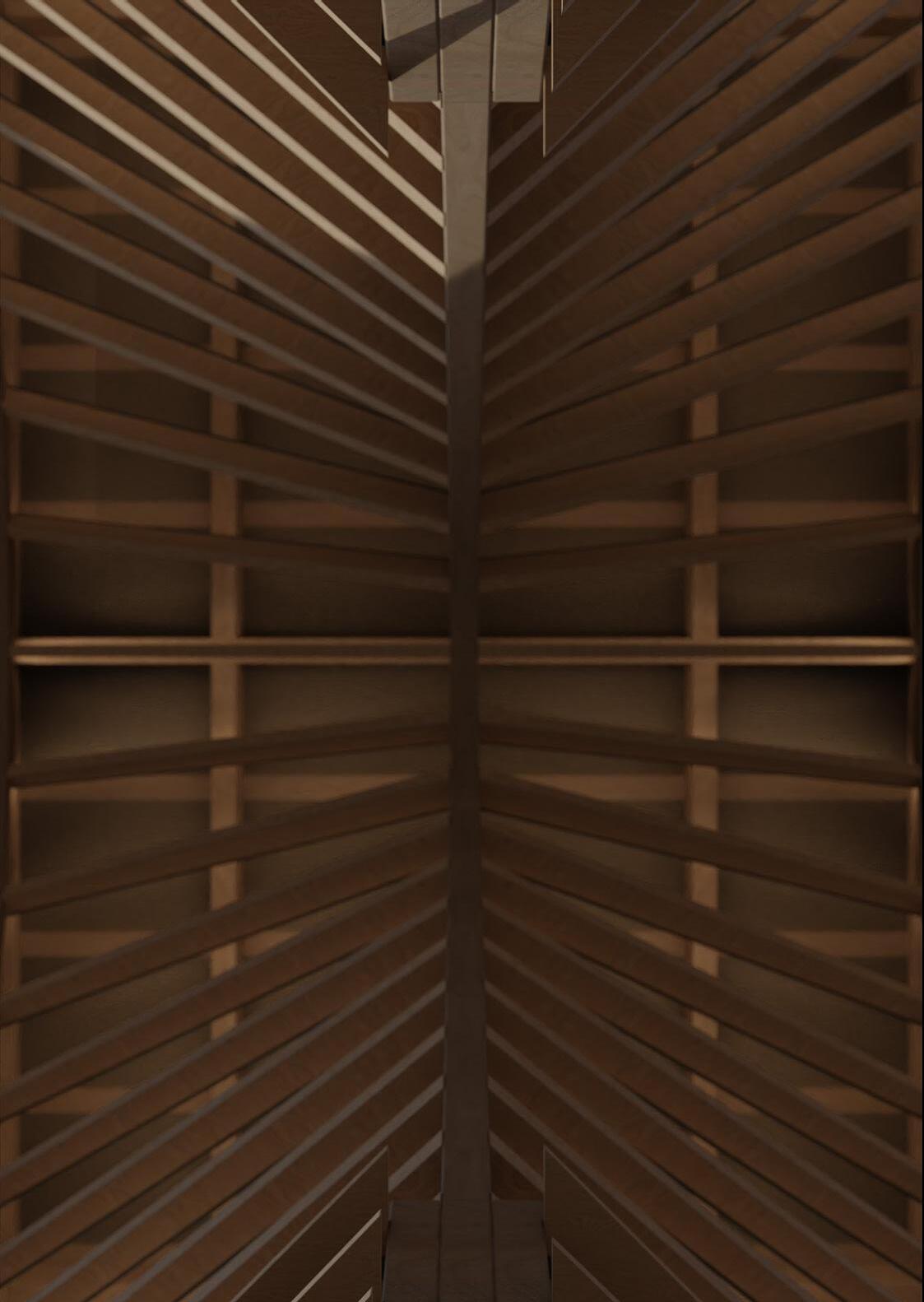
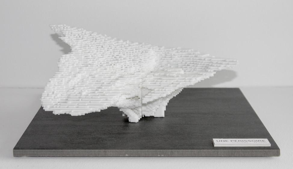
ISLANDSBERG
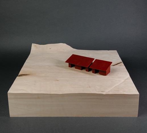
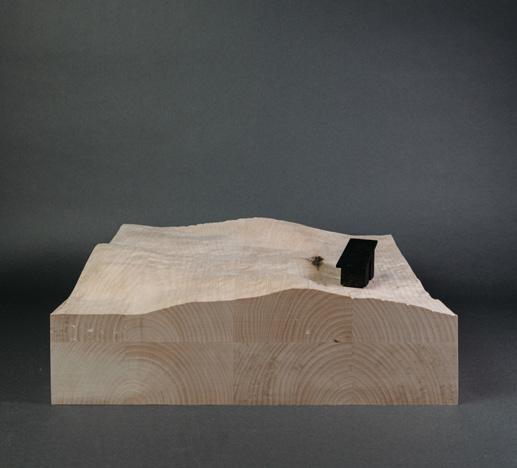
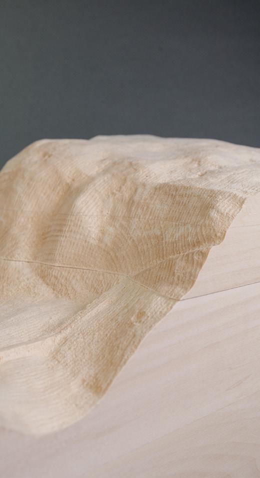
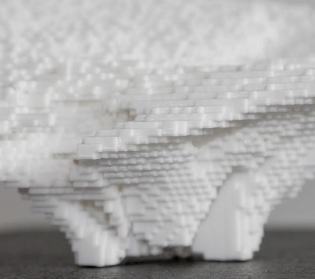
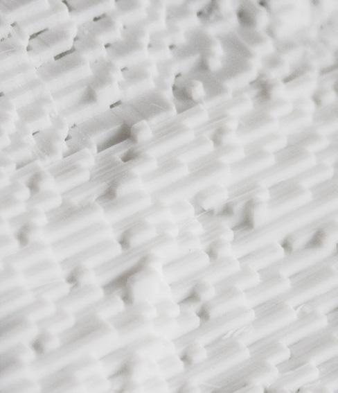
The landscape models both in scale 1:200 and 1:100 used height-data, were cleaned up and curated and finally cnc-milled from solid wood.
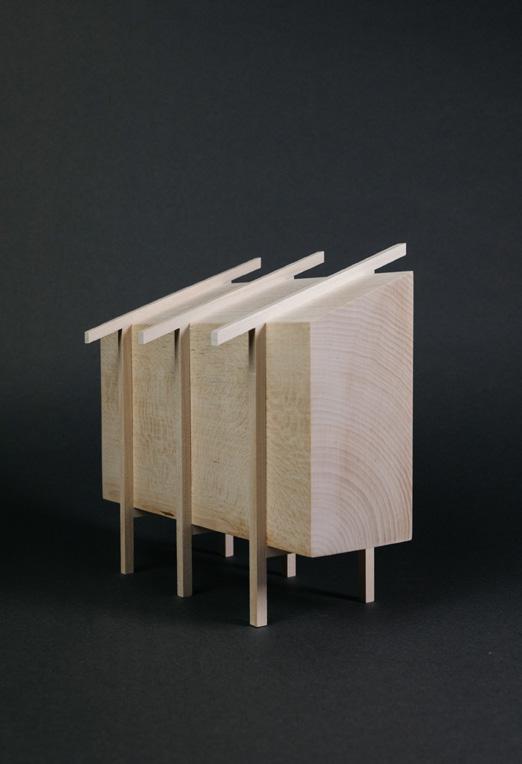
In relation to the strong historical significance of traditional timber craftsmanship, we developed a set of reiterated timber connections.
These joints are based on commonly used joinery techniques and adapted to enable aesthetic qualities, high functionality and constructability.
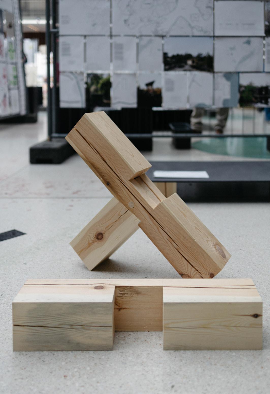
Two timber connections were tested in 1:1 physical models. The models were produced with hand tools and methods commonly applied in the woodworking profession.
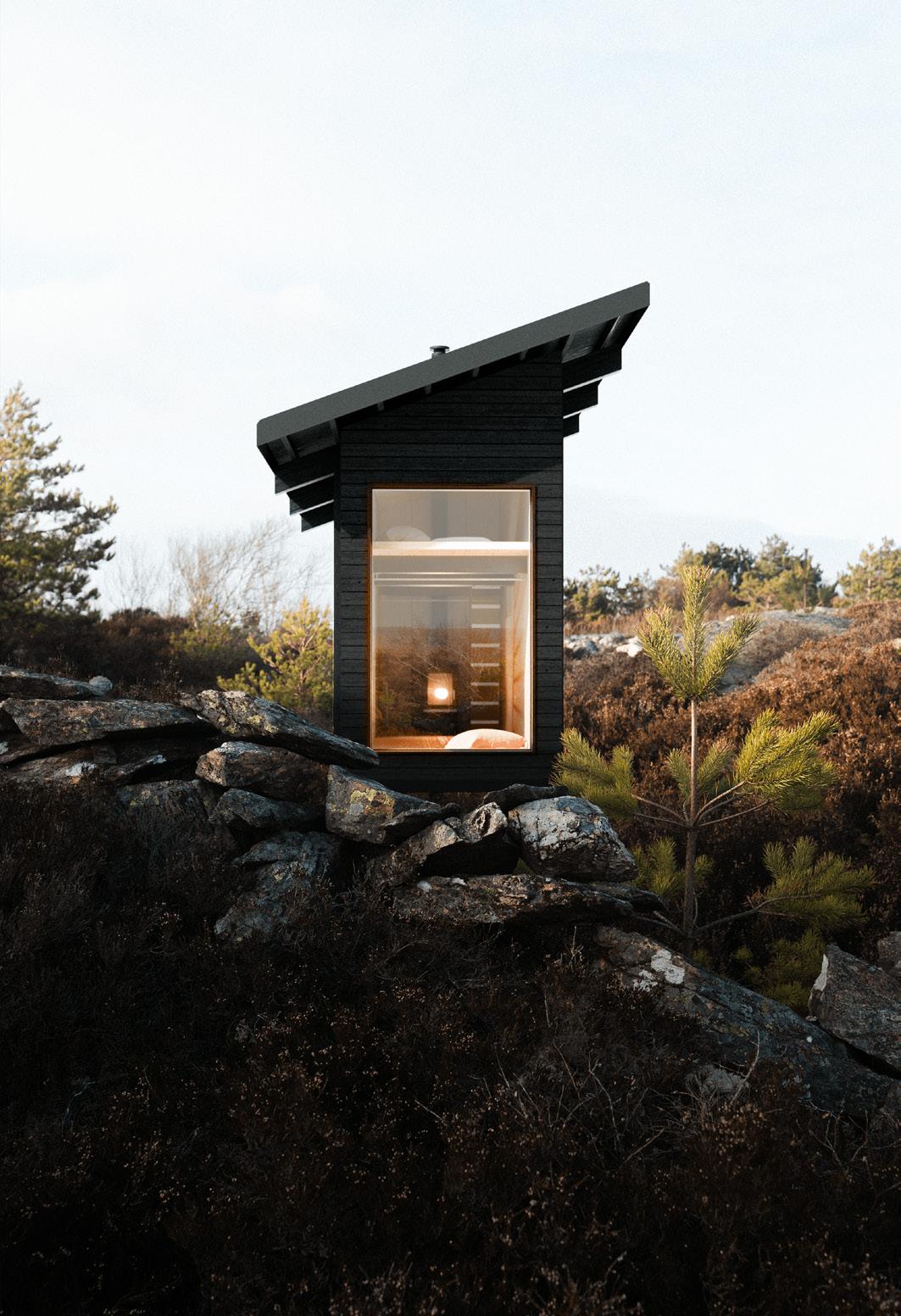
Each building design was explored through a number of different procedures not just as means of presentation but also as a way for us to understand the proposal within its context.
We created detailed drawing sets, realistic visualisations, conceptual models and axonometric sections.
One of our goals was to gain a solid understanding of timber construction, traditional craftsmanship and vernacular architecture.
Therefore, all of our design proposals were conceptualised to be constructable based entirely on the drawings.
We also built a 1:1 mockup model of the facade, which gave us experience and knowledge about the construction process.
Project type: Academic
Institution: ACE510 - Mediated material interfaces
Subject: Research / Digital fabrication / bio-based materials
Software: Rhino, Grasshopper, Agisoft Metashape. GibbsCAM, Blender, Photoshop, Indesign
Collaborators: Jael Kahlenberg Kaso Axel Hägerlund
Date: Fall 23/24

QR-CODE
Sketchfab model viewer: https://skfb.ly/oNwTO
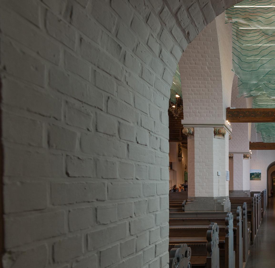
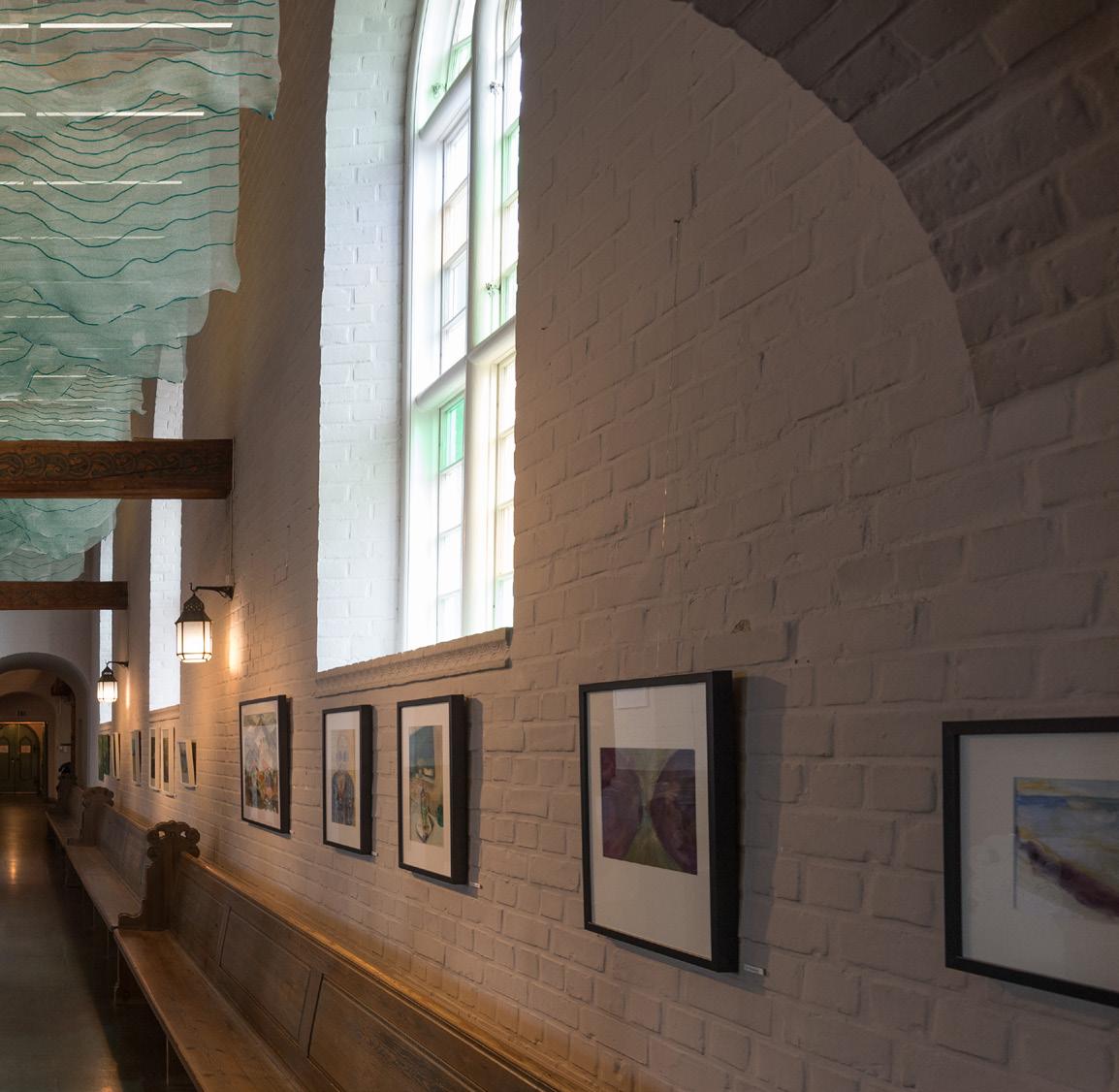
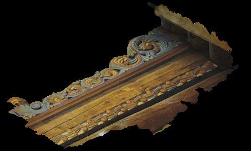
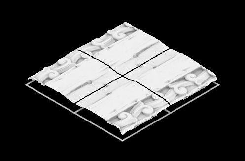
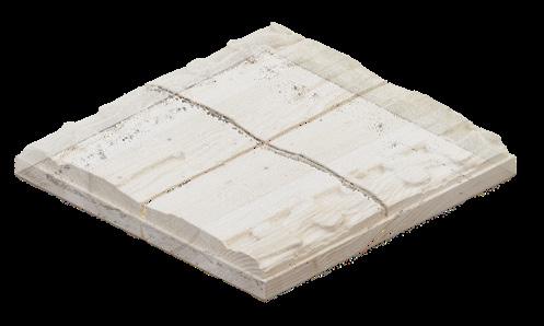
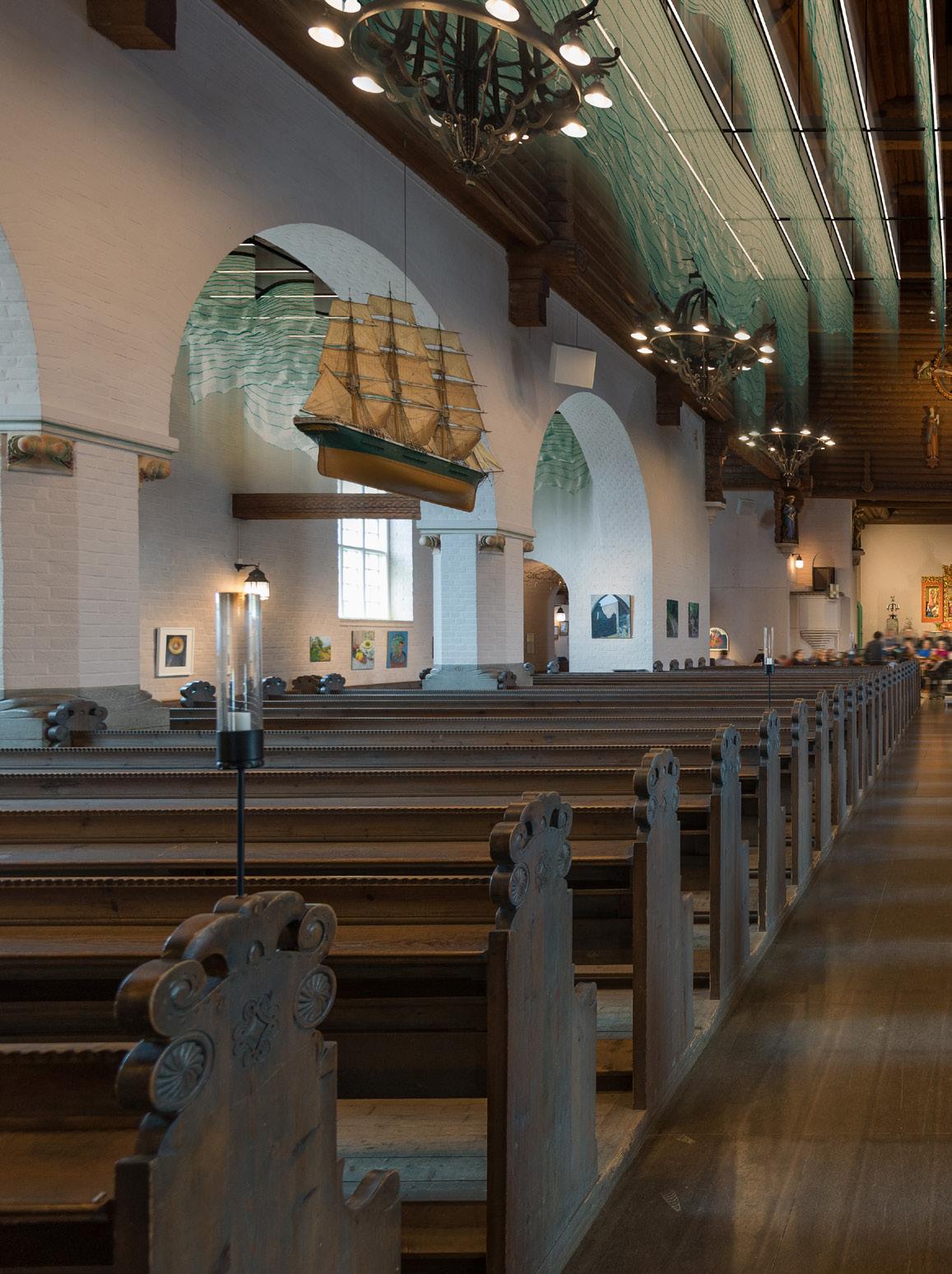
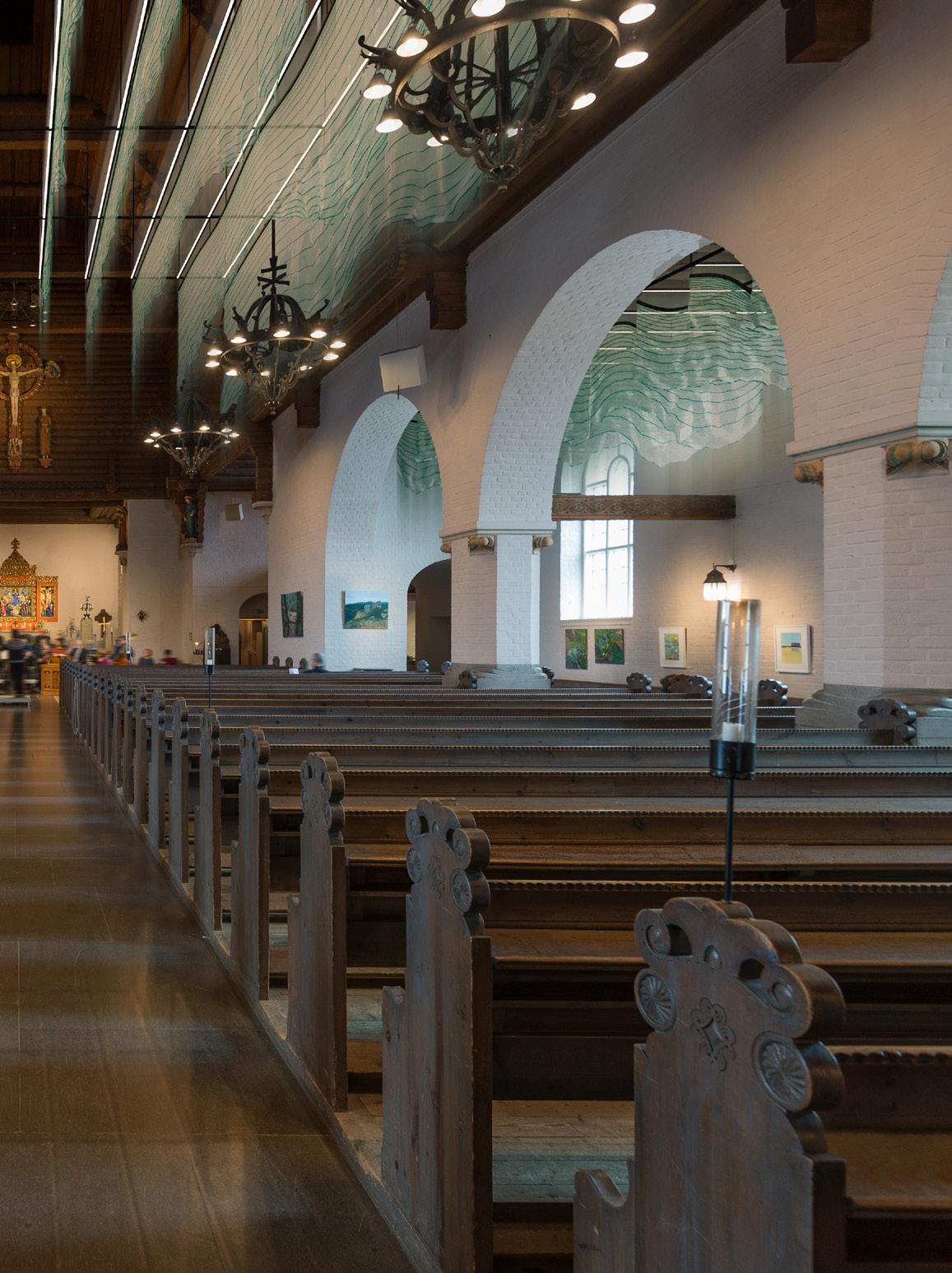
Hydro Veil focuses on conserving culturally significant wood details through digital replicas that were created using photogrammetry and CNC milling. The project explored material behaviour of nano-cellulose hydrogel using colouring, robotic 3D printing and ambient drying. Additionally, the interplay of digital and analogue processes was explored, acknowledging inconsistencies and emergent outcomes, as well as contributing to the discourse on bio-compatible materials, sustainability, and the evolving role of digital fabrication in preserving cultural heritage.
Digitial replicas and the robotic 3D printing were done in a team. The design proposal is my own work.
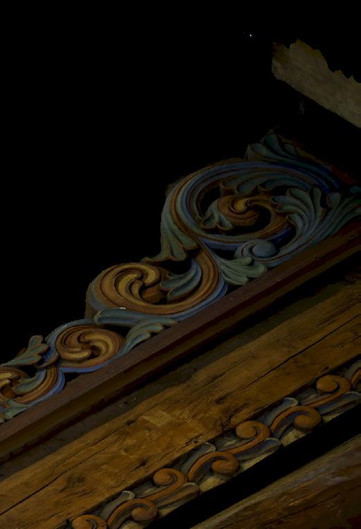
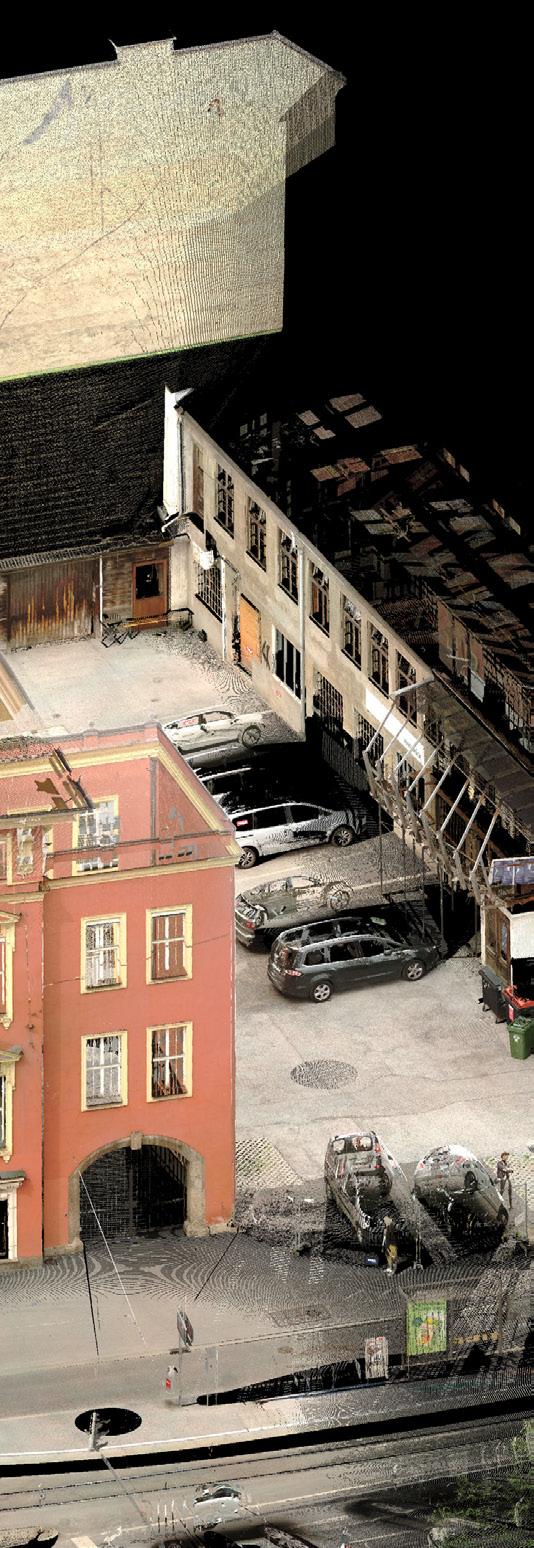
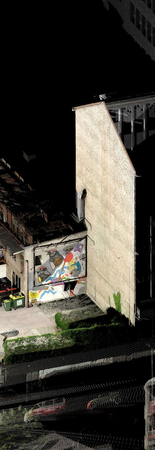
The photo-scan was captured in the Masthuggskyrkan and depicts one of the intricate wooden carvings of the organ. The lighting conditions were not ideal and we were not able to use cross-polarisation.
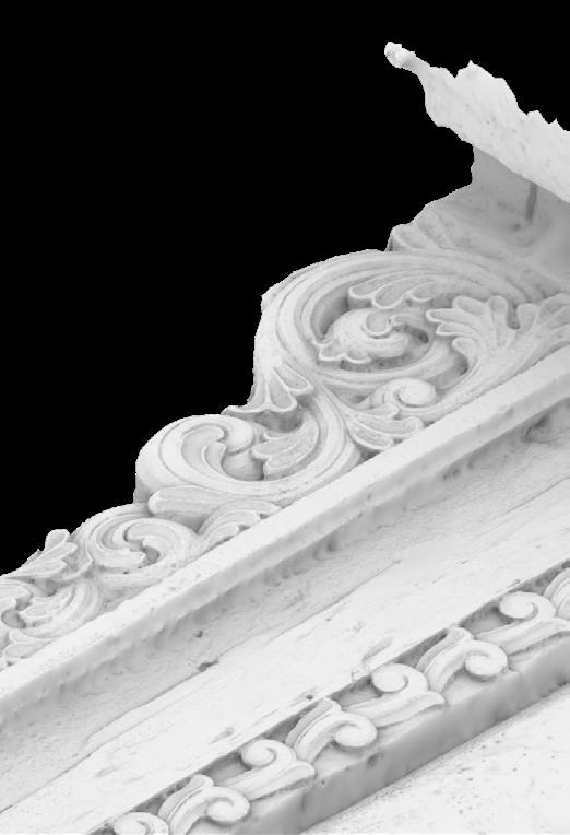
However, the photo-scan retained high detail, minimal artifacts and good colour reproduction. The biggest issue was to eleminate baked in shadows.


Project type: Academic
Institution: Institute of structure and design, University of Innsbruck
Subject: Speculative / Experimental / Public
Software: Rhino, Grasshopper, Blender, Houdini, Photoshop, Illustrator, InDesign
Collaborators: Solo work
Date: Year 02 Bachelor
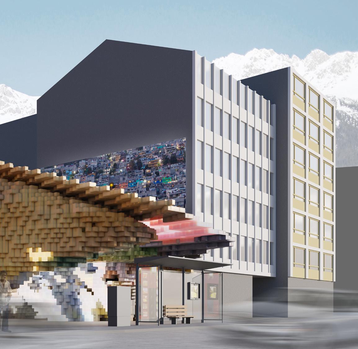
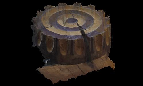
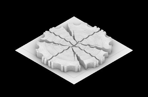
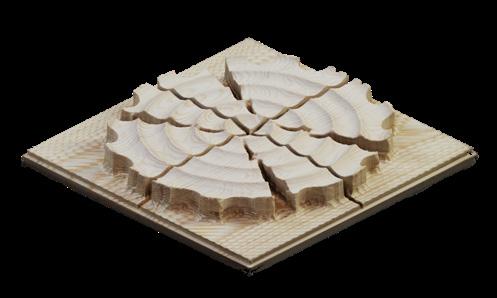
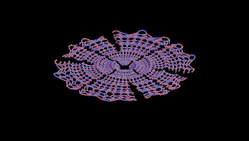
As a result of my research about Pointillism, Point Clouds and generative design, my approach led to a design which tries to convert 2D data in the form of images into 3D configurations, that obey the idea of deepness and vagueness, while still allow a sense of spatiality and architectural value.
The process relied on an automated transformation script and on the curation of data and resulting emergent structures.
QR-CODE
Sketchfab interactive view of Laser-Scan https://skfb.ly/ooVpA

The design tool takes an image and deconstructs it into a definable matrix of colour points. These points get multiplied and extrapolated according to their underlying RGB-values and redistributed in a coordinate system. As a result, a 3D Point Cloud emerges which can then be used as a speculative spatial configuration by itself or be further curated and reshaped by local parameters and design choices into an architectural proposal.
steel framework
translucent plastic panels
LED strips
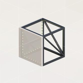
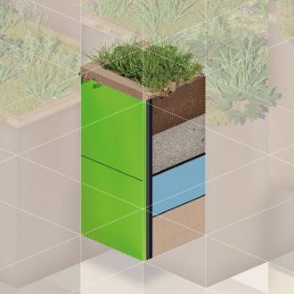
glazed ceramic tiles
steel framework
cross-laminated timber
XPS insulation
bituminous sealing
gravel drainage
soil
plants
wood frame
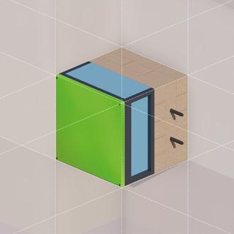
glazed ceramic tiles
steel framework
XPS insulation
cross-laminated timber
RGB-MAPPING:
red-value
[0-255] - z-value [coordinate]
green-value
[0-255] - y-value [coordinate]
blue-value
[0-255] - x-value [coordinate]
col [rgb] - pos [xyz]
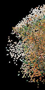
3D-RGB-MAPPING
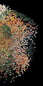
POINT
DATA INTERPOLATION:
-calculating inbetween data of the point cloud
xyz
[0...1] - 0.00...0.14...0.32...0.71...1.00
rgb
[0...255] - 0...121...178...206...234...255
ADJUSTMENTS:
size/scale
density/distribution contextual transformation framework
QR-CODE
Process diagram animation https://vimeo.com/manage/videos/566733385
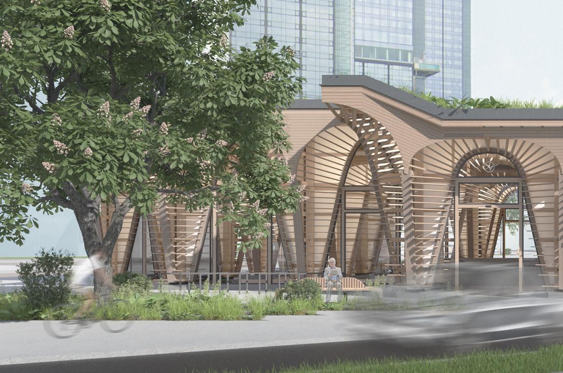
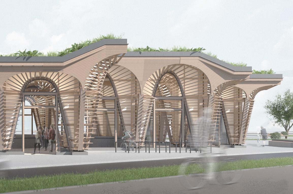
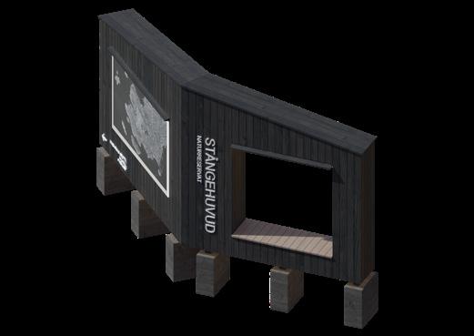
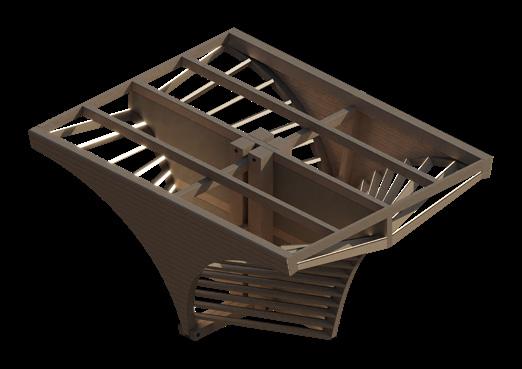
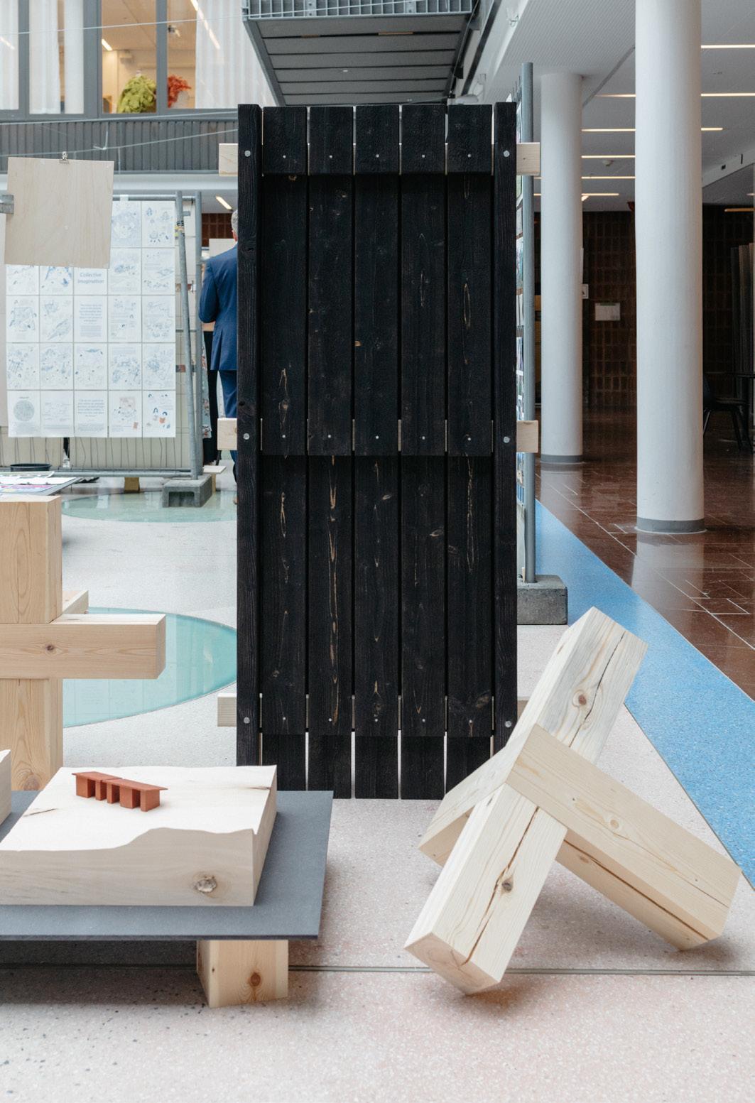
Entrance structure
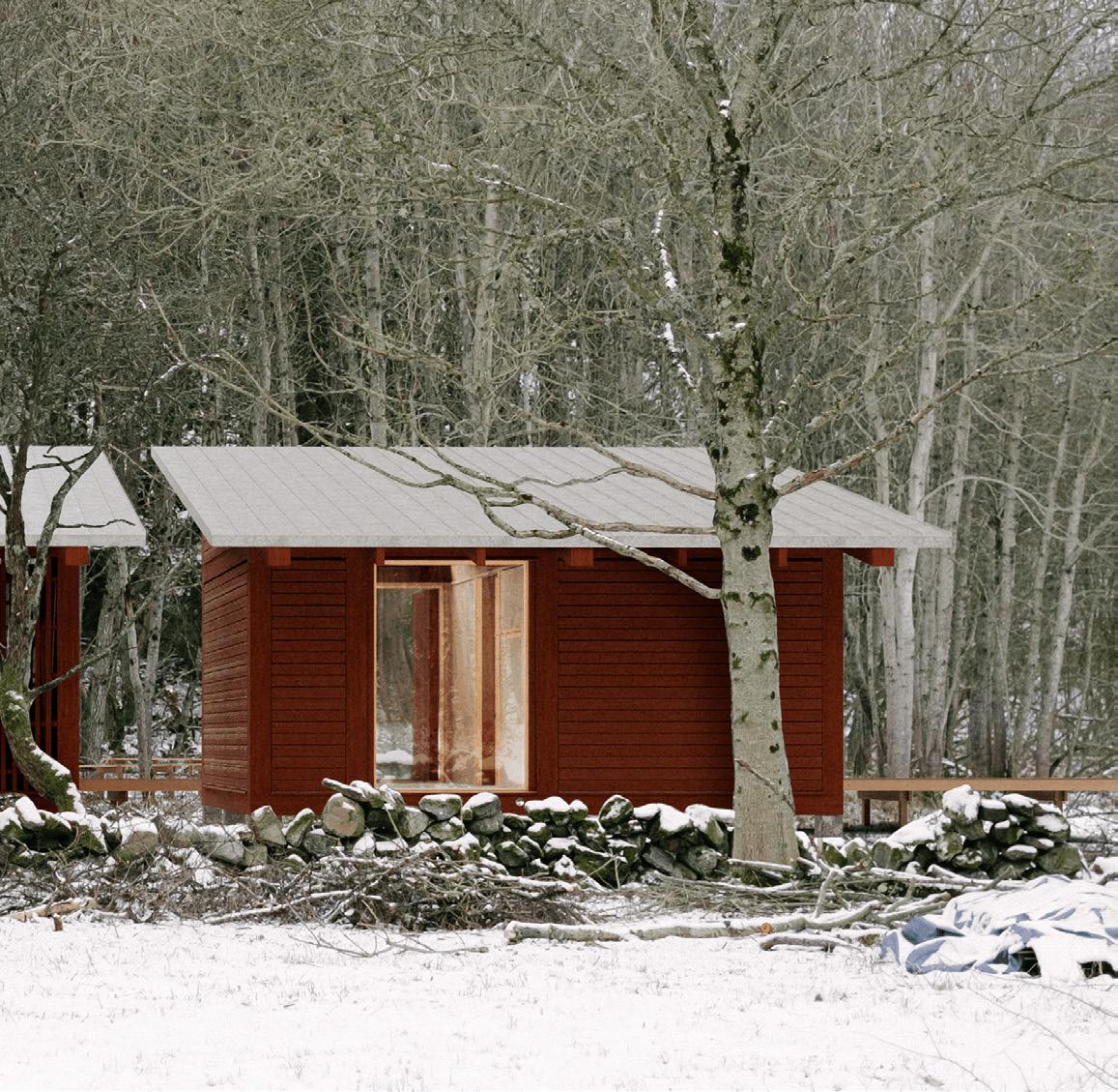
Project type: Professional
Institution: Lysekil municipality / Curmans Foundation
Subject: Public / Landscape / Outdoor
Software: Rhino, QGIS, Blender, Photoshop, Illustrator, InDesign
Collaborators: Klara Bolin
Date: July 2024 - Oct 2024
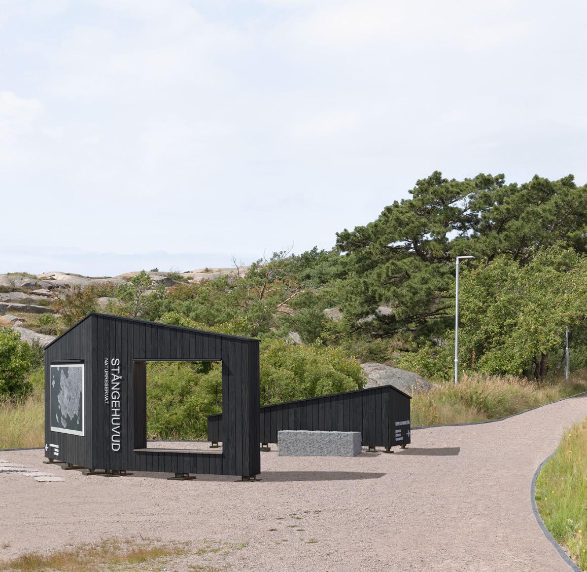
This project is about the design of an entrance for the Stångehuvud nature reserve.The project is planned to be built and completed until October 2025.
We expanded our knowledge on applied timber construction, landscape architecture and public, nature-related design.
Additionally, we were able to gather experience on client meetings, budgeting and project presentation. Throughout the design process, we had multiple meetings with the clients, implemented design revisions and pitched multiple proposals with accurate budget and timeplans to the stakeholders.
As part of the research for the project, we conducted multiple site visits, mapped movements, sightlines and prominent features. This allowed us to get a comprehensive understanding of the context.
3
Design Concept:
Our design concept works with three types of movement in relation to the structure and site.
Alignment, proportions and functions have been curated along the three levels of movement to, from and through the entrance site.
2
1. Access to the nature reserve & visibility from road and parking lot
2. Orientation on site: the angles of the walls together with signage orient the visitor in the right direction
3. Interaction: the walls provide space for informative signs and the seating area provides space for temporary rest. Visitors can move between the walls to take in the character of the different sides. Bicycles can be parked behind the lower walls.
Spikläkt
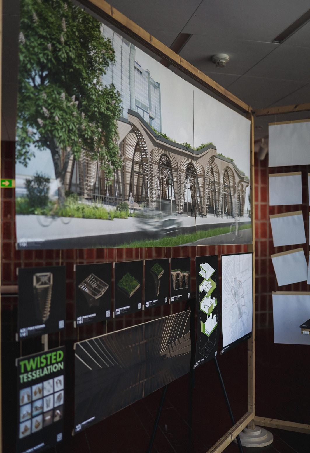
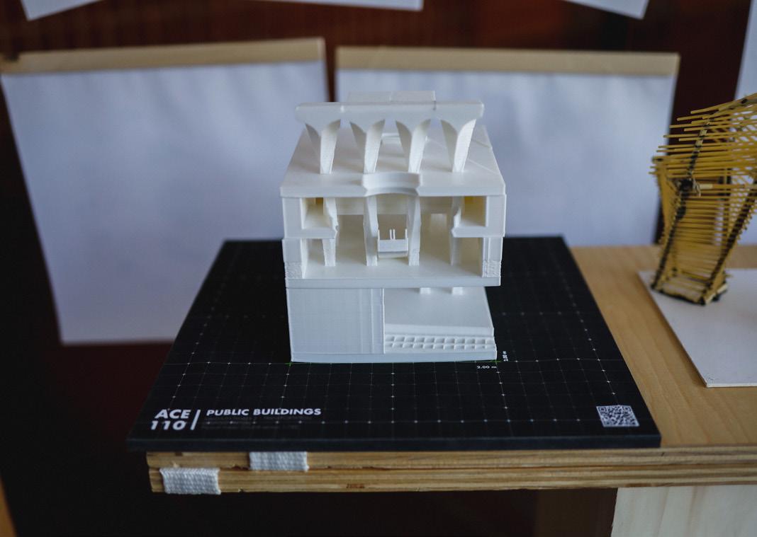
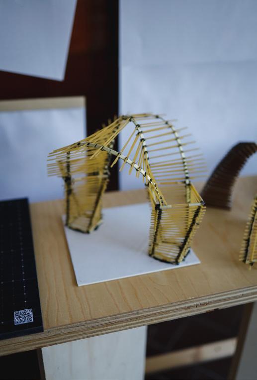
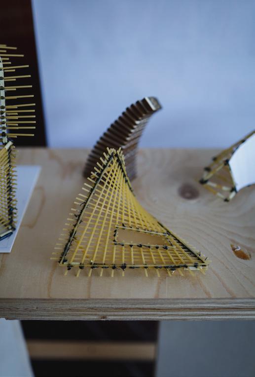
Project type: Academic
Institution: ACE110 Public Buildings
Subject: Public / Infrastructure / Mass-timber
Software: Rhino, Grasshopper, Blender, Photoshop, Cura
Collaborators: Individual
Date: Spring 2023
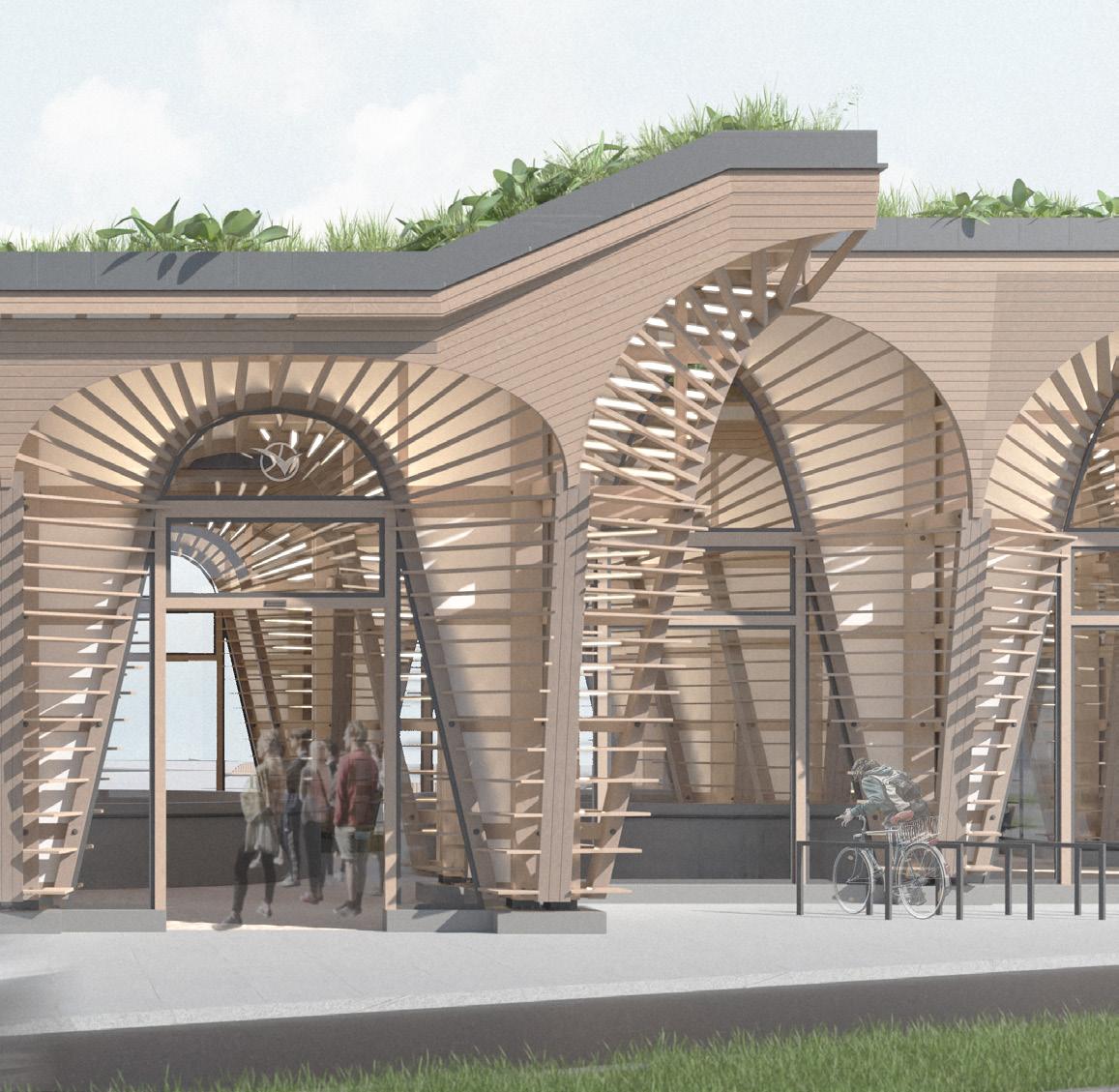
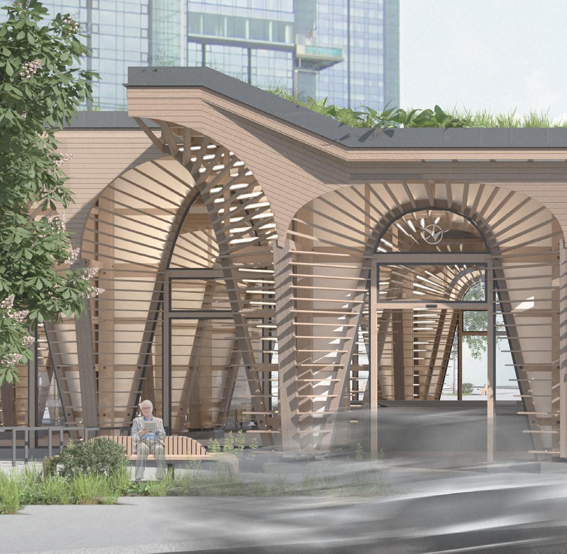
The project is an adaptation of the Korsvägen intersection and proposes to introduce a new and iconic landmark as a traffic hub for the new Västlänken station.
The landmark is constructed out of a series of twisting timber columns that follow simple geometric principles but emerge into a complex and intricate structure.
The main goal was to develop an iconic timber structure, while secondarily introducing a key traffic intersection of Gothenburg. Additionally, the square has been redeveloped to improve wayfinding, enhance pedestrian experience and create recognisability. The proposed structure offers both iconic and striking vistas, as well as improved functionality of the traffic intersection.