

LIVING DRYSTONE
Commoning the Peak District Moorlands through Convivial Wildness
Leela Keshav
How can methods of drystone vernacular construction become part of the repair, stewardship, and multispecies commoning of the Peak District moorlands?
“To design a commons is to see land through the lens of relationships; the points where connection occurs becomes sites of design. This view considers multiple scales at once – the links outward from the project into broader contexts as well as the spaces, devices and rituals that form intersections between landscape systems and everyday life.”
- Jen Lynch, “From Landscape to Commons”
PROJECT INTRODUCTION
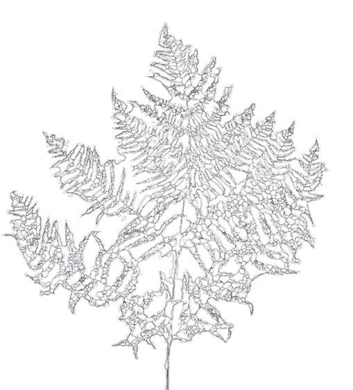
Moss as Method: A Trans-scalar Guide to the Thesis
Project Ambitions
Thesis Strategies: An Overview
Strategy 01: Filmic Mapping
Strategy 02: Critical Mapping
Strategy 03: Imprints
Strategy 4: Making and Testing On-Site as Situated Practice
Strategy 5: Case Studies
Strategy 6: Quantifying Information and Questioning Quantification
An Introduction to the Peak District
The God-Trick Map
Blurring the Map
Dissolving the Picturesque Frame
Enclosing Landscape
Peak District Timeline: Ownership, Access + Conservation
Current Land Ownership
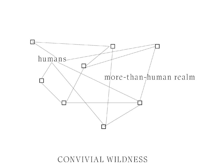
Thesis Terminology: What is “Convivial Wildness”?
Commoning as Experimental Geography Forms of Commoning
Trespass as a Commoning Catalyst
Shifting Stakeholders: Transient Commoners
Region of Focus: Dark Peak Moorlands
Section through the Dark Peak
Fieldwork Site and Area of Focus: Edale Valley and Moors
1993 Edale Boundary Walls Survey
Boundary Wall Emergence
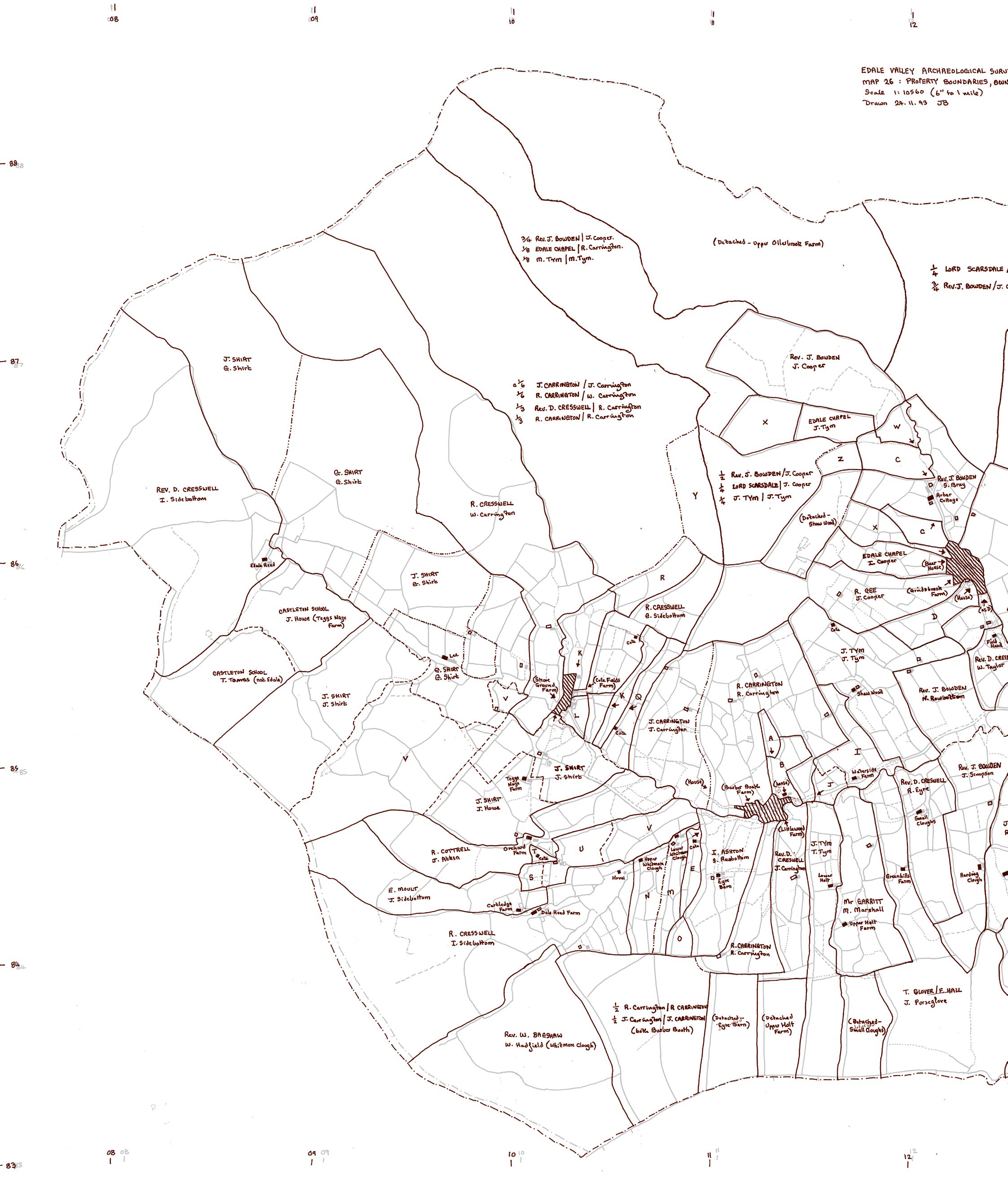
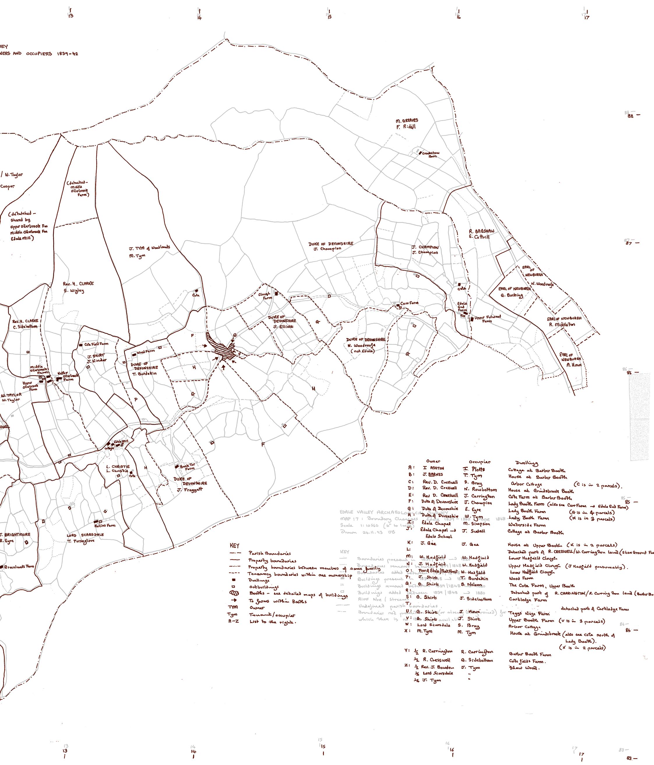
1993 Edale Land Ownership Survey
Fieldwork
GEOLOGY AND ECOLOGY: INTERACTIONS BETWEEN SURFACE AND SUBSURFACE
Preamble: Becoming Geological
Dark Peak Geology
Dark Peak Ecology
Dark Peak Landforms and Lifeforms
Landforms as Windforms
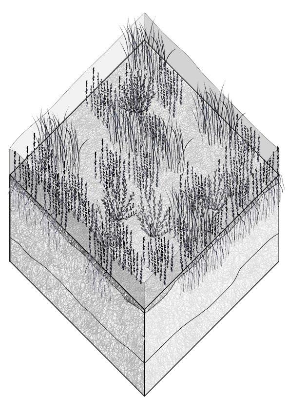
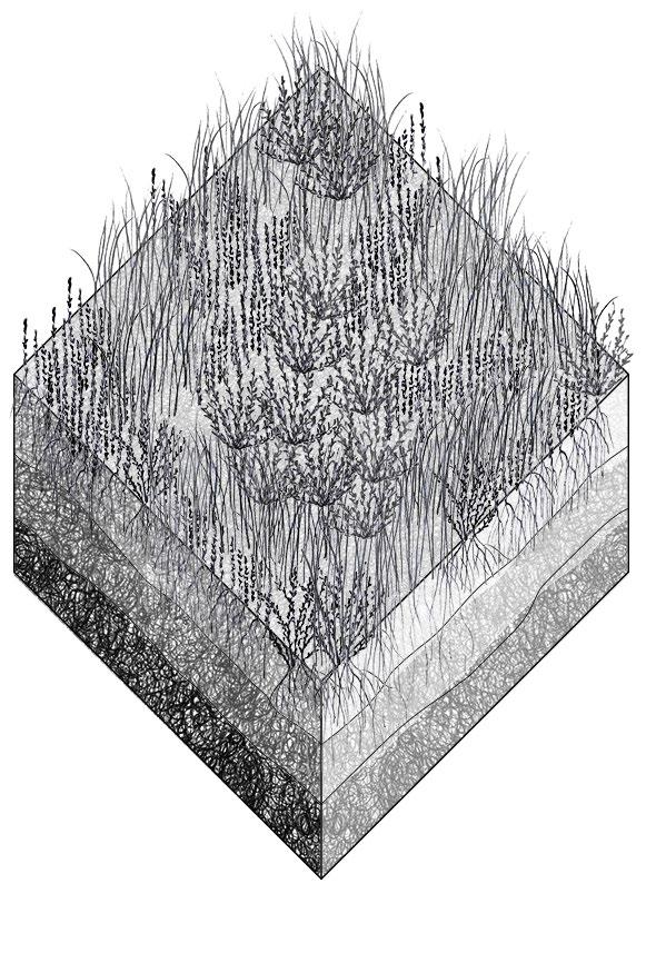
Moorland Peat Ecologies
DRYSTONE CONSTRUCTION
Design Question
Case Studies + Context Analysis
Drystone Analysis
Site Criteria and Analysis
Drystone Construction Tests
Constructing Drystone
Design Scenario
Drystone as . . . A collective design and construction process
Drystone as . . . A continual practice of repair and maintenance
Drystone as . . . A site of multispecies interaction
CONVIVIAL WILDNESS IN DRYSTONE FIELD STATIONS
Drystone Navigation
Navigating drystone by . . . Walking as mapping
Walking as Mapping: Case Studies
Collective Walking as Commoning Practice
Navigating drystone by . . . Imprint-mapping
Drystone as Ecological Repair
Bibliography
Image credits
The thesis has three sections, each using a trans-scalar method to examine aspects of drystone, from the Dark Peak’s geology to the practicalities of construction to its potential to host multispecies inhabitation and invite commoning practices.
The first chapter looks at the geology and ecology of the Peak District, asking how the surface and subsurface interact. Here, geology is architectural, providing the building materials for drystone construction, the topic of the next chapter. This chapter provides an overview of existing stone structures and tests drystone building methods through the construction of three cairns, finally arriving at a 6-stage design for a field station. The final chapter zooms out from the single field station, speculating on commoning the moorlands through new wayfinding methods and forms of ecological repair.
PROJECT INTRODUCTION
This thesis is concerned with processes of commoning the Peak District moorlands, contesting legacies of privatisation toward new forms of embodied, situated, collective, and regenerative conservation practices .
It investigates this through the revival and reimagining of drystone , an ancient mode of construction.
ETS THESIS STATEMENT
Drystone construction has for thousands of years shaped the Dark Peak’s landscape as an architectural embodiment of the region’s geology. Often associated with the straight drystone walls that proliferated during the Enclosures Acts, I propose reimagining drystone as not a divisive force, but one that holds the potential to invite convivial practices of repair, ecological engagement, and landscape ritual. This technical thesis seeks to test new methods of vernacular drystone construction where the landscape and the rocks themselves become active agents in the design process.
The ETS proposal will examine the multi-scalar nature of stones in the Dark Peak, asking how drystone construction can become part of larger-scale ecological restoration practices, include sphagnum moss replanting, soil remediation, and forms of convivial rewilding.
My method is informed by moss, a key non-human agent to whom a drystone wall is not a barrier but a home. Moss teaches us about trans-scalarity, wayfinding, and resilience.
The thesis tests methods of making 1-ingredient structures that constitute a moorland vernacular, focusing on the design of field stations that are both wayfinding devices and temporary inhabitations for transient commoners. The tests— involving both off-site and situated practice—investigate how these structures might:
1. Allow for short-term inhabitation by people as they take part in ecological restoration practices
2. Embrace a convivial construction process that is a collaboration between a group of people, the rocks, and the wider ecology
3. Allow for the cohabitation of people, moss, lichens, and other life forms
4. Register the temporality of the geologic landscape as the stones fall apart, allowing the structures to become sites of constant repair, maintenance, and reconfiguration
Note: As a rule, all colour photographs in the thesis are taken by the author and all black and white photographs are from online research. Image credits can be found at the end of the thesis.
Introduction Geology and Ecology: Interactions between Surface and Subsurface i A
+ How can methods of drystone vernacular construction become part of the repair, stewardship, and multispecies commoning of the Peak District moorlands?
Sub-question A:
+ How can drystone become a collective building practice that takes into account multispecies inhabitation, existing stone infrastructure, and a constantly transforming landscape?


Small scale
Drystone Construction
Convivial Wildness in Drystone Field Stations B
C
Sub-question B:
+ How does the geologic makeup of the moorlands provide the ‘ingredients’ for drystone construction?
Sub-question C:
+ How might an expanding network of drystone field stations create new modes of wayfinding and allow for the ecological repair of the moorlands?

This thesis proposes that drystone—as a craft, structure, and way of being in the landscape—has the potential to:
01. Blur the top-down “God-trick” map.
02. Dissolve the picturesque frame and the fixed view of landscape.
03. Challenge private land ownership regimes.
Additionally, it proposes that:
01. Geology is architecture.
02. Landscape is a construct.
03. Fixity is an illusion; dynamism is constant.
04. Land is living.
05. All matter is entangled and interconnected.
These positions frame and provoke the following research, speculations, and imaginings of commoning the Peak District’s moorlands.
How drystone in this project addresses these critiques:
+ Drystone as wayfinding network + Filmic mapping methodology
+ Embodied and situated construction and maintenance practices that view the reshuffling of stones as inherent to an everchanging landscape
+ Drystone as a living practice and a host for many forms of life.
+ Collective drystone construction as a commoning practice
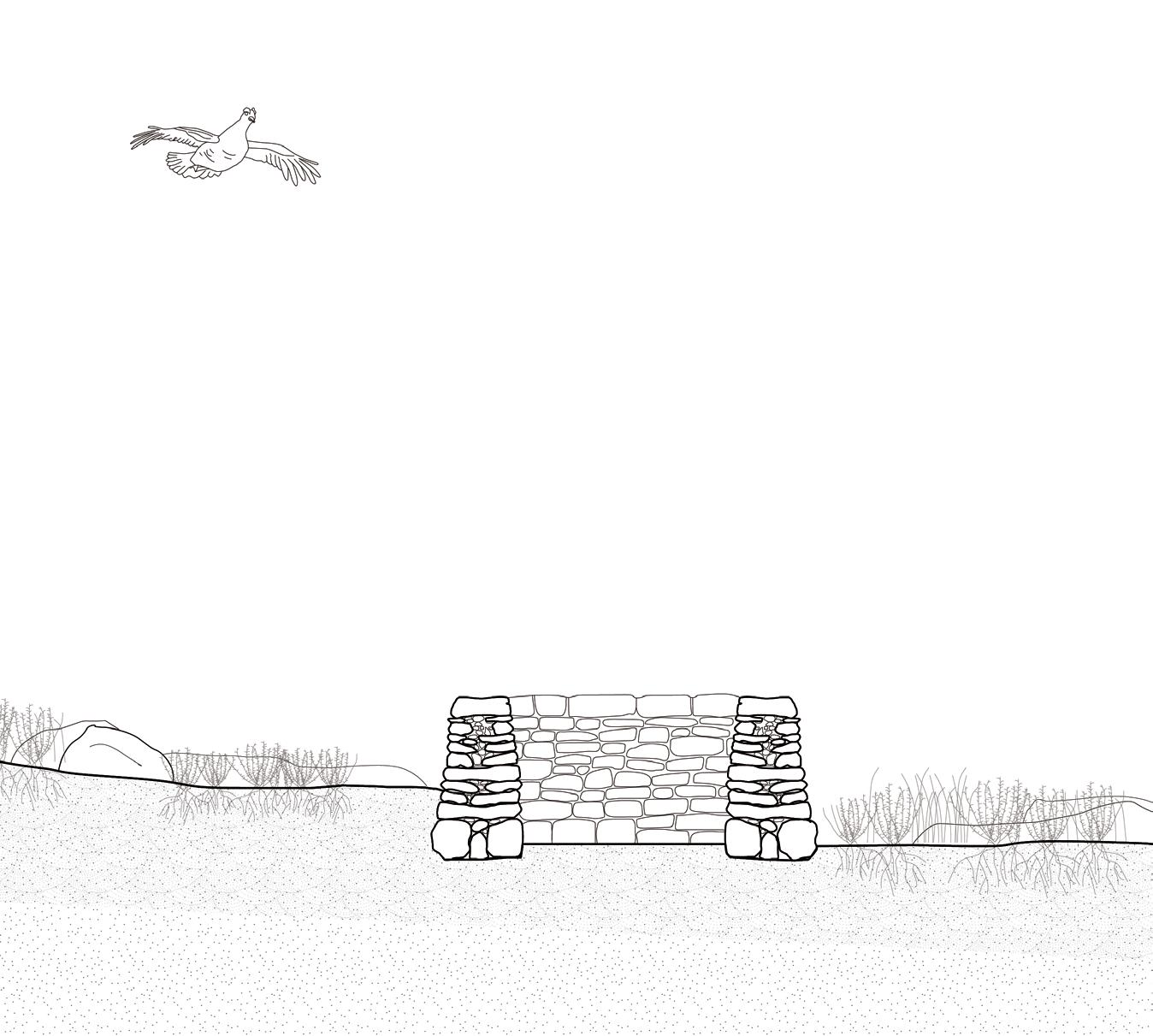
01. Cave Dale by Peveril Castle
Thesis Strategies: An Overview
Strategy 1: Filmic Mapping
Filming landscape as experimental cartography
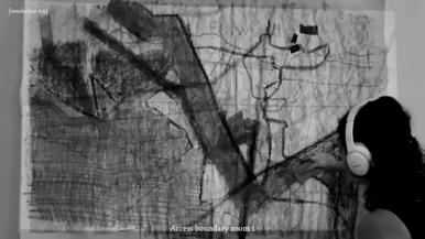
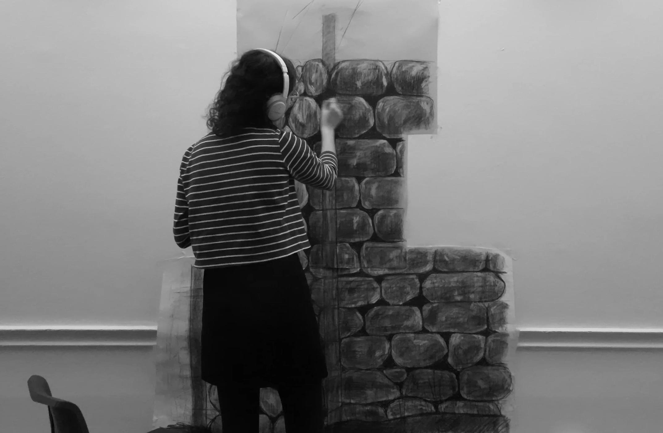
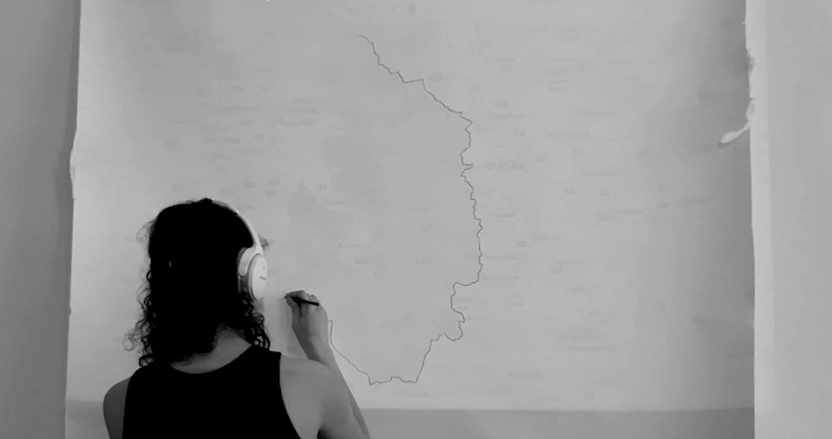
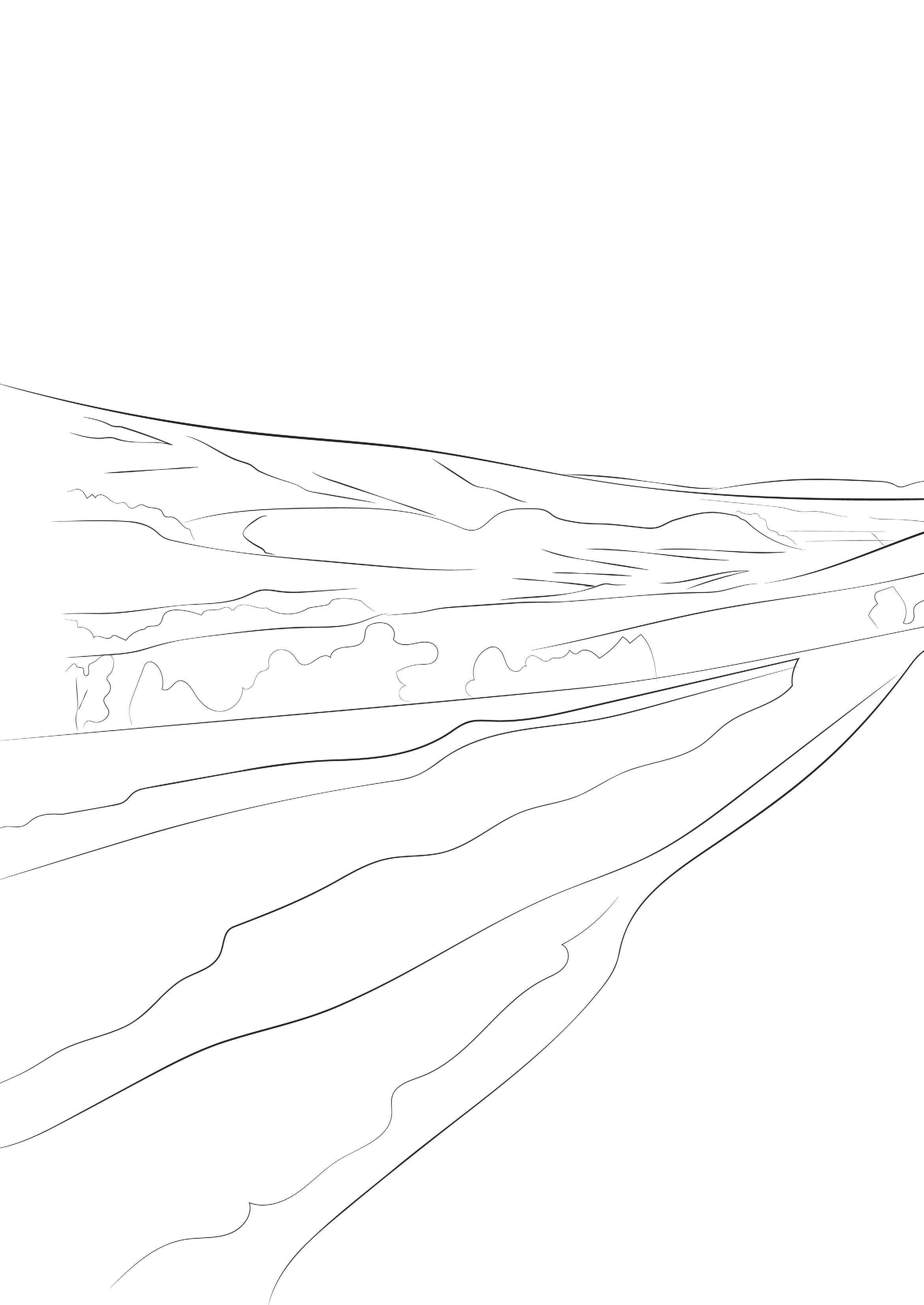
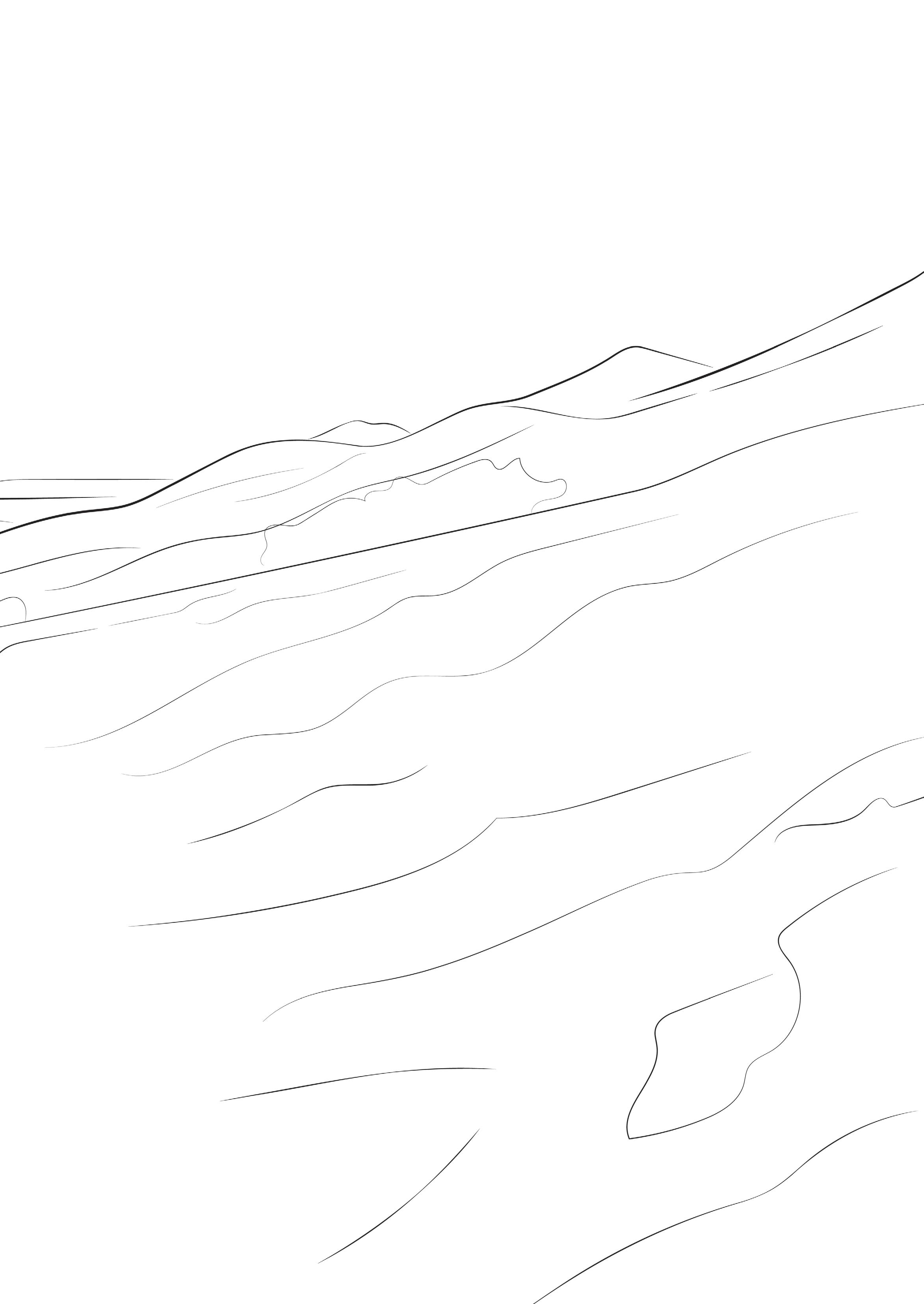
I came across the term ‘filmic mapping’ in Christoph Girot’s Landscript series, and the thesis adopts this way of representing and thinking about landscape. To film a landscape is to establish an embodied relationship to it and to recognise its temporality. To hold a camera and walk is to both affect the landscape and be affected by it. The camera follows the bounce of one’s steps and the disorientation of a rambling walk. It catches the splattering of rain, or in my case, has its lens partially obscured when wrapped in cling film as an attempt to protect it.
To film a drawing in the studio replicates this attention to temporality, but instead of both the camera and the ‘subject’ moving, the camera remains fixed, capturing the movement of making a large-scale drawing.
Both the filmed walk and the filmed drawing become forms of mapping, methods of recording space in time. These maps—unlike the ordnance survey or the satellite image—reject landscape as fixed and subvert the omniscient gaze to the bodily one, fluid and shifting with the charcoal smudged on the page and the walking feet leaving imprints on the peat.
The following six strategies are consistently employed throughout the thesis to provide various modes of understanding and designing within the Dark Peak moorlands.
Above: Filming in the field
Below: Filming in the studio
Strategy 2: Critical Mapping
The thesis can be read as a critique of the top-down, God’s eye map: or as Donna Haraway puts it, “the gaze from above, from nowhere.” As such, mapping is used in a critical manner throughout the thesis. As a tool, the top-down map can be useful in identifying regions or elements of study; thus, some more conventional maps are included. However, these maps should not be read as objective “views from nowhere”: they are situated, drawn from my hand, and up for interpretation and interrogation. Maps are always biased, curated selections of information, and the maps included in this thesis are no exception.
With its interest in new modes of navigation beyond the measured map or the satellite view, and in walking as a form of mapping, the thesis presents a series of alternative mapping strategies. These take into account sensorial and temporal factors, rejecting the fixed, static registration of landscape.
In Chapter B: Drystone Construction, the speculative design strategy presents sectional drawings as maps over six stages of time. By employing a series of mapdrawings, the thesis presents the construction process as continual and ongoing, rather than occurring at a single stage.
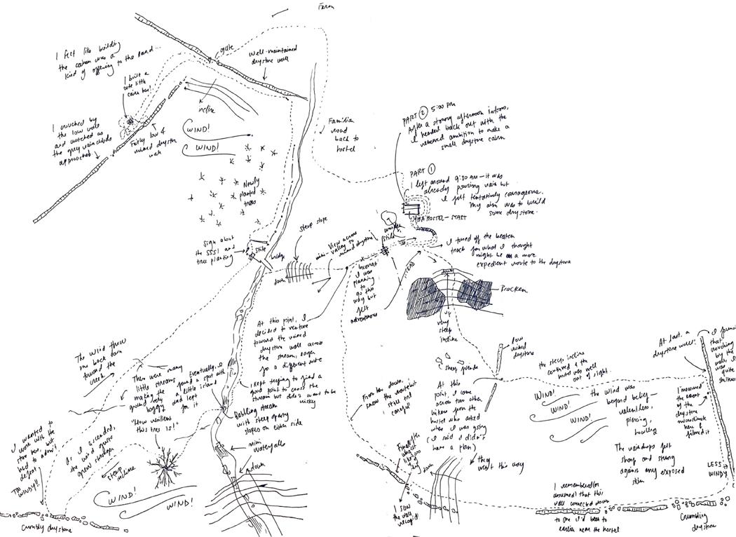
In Chapter C: Convivial Wildness in Drystone Field Stations, I present a series of ‘walked maps,’ mental maps drawn based on my memory of walks just taken. In these temporal and scalar collisions, I note particular moments and affects that remained with me, nearly all of which would be invisible in an ordinary map. Ultimately these mapping methods point to new forms of conservation and caretaking within the landscape through the lens of drystone.
Geological map from Chapter A: Geology and Ecology Walked map from Chapter C: Convivial Wildness in Drystone Field Stations
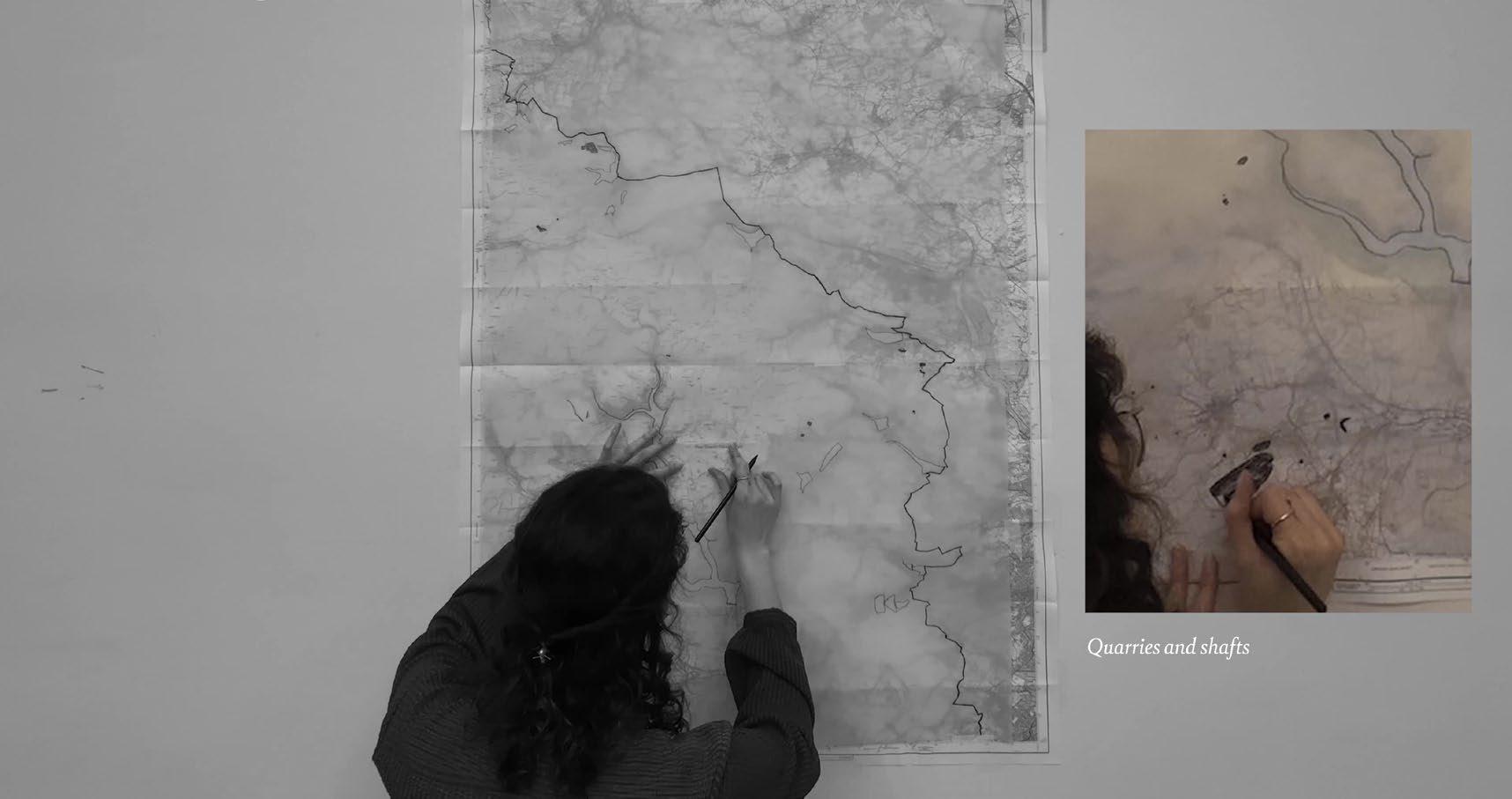
Imprints are another form of critical map that this thesis explores. Viewing landscape as an assemblage of beings and elements shows how different agents are constantly ‘imprinting’ on one another, leaving traces of their presence. For instance, rocks that fall from drystone walls leave imprints in the ground that in turn form habitats for insects.
To visit the landscape for even the shortest period of time leaves imprints: to be in a place is to affect it, and to be in relationship with it. To exhale is to imprint the air with carbon dioxide which may then be taken up by plants; to inhale is to intake the oxygen they create. To walk in a landscape is to compress the earth.
These temporary traces are fleeting and often unrecorded, yet they impact and create what constitutes ‘landscape.’ This thesis presents various strategies of both registering and creating imprints as 1:1 maps.
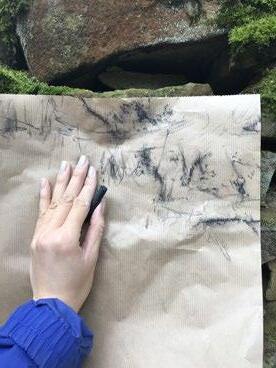
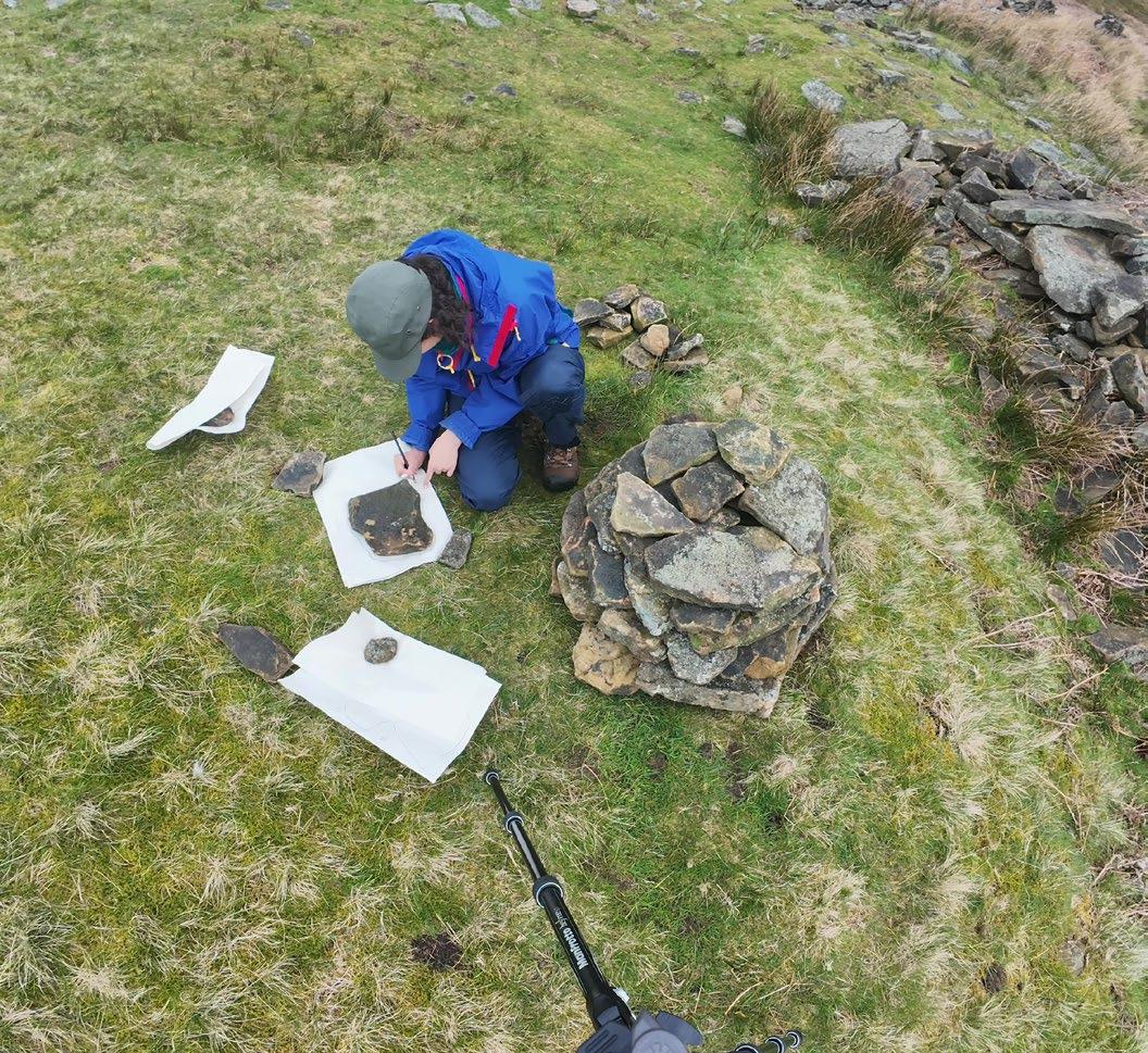
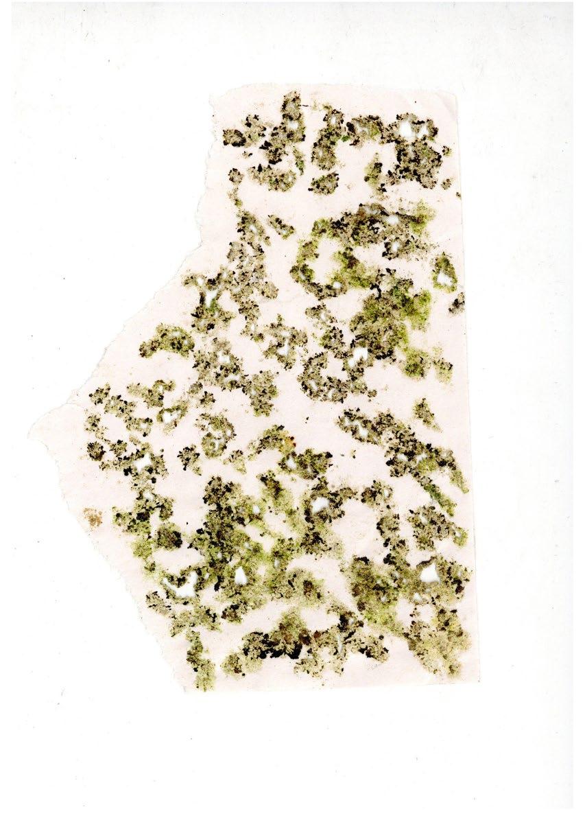
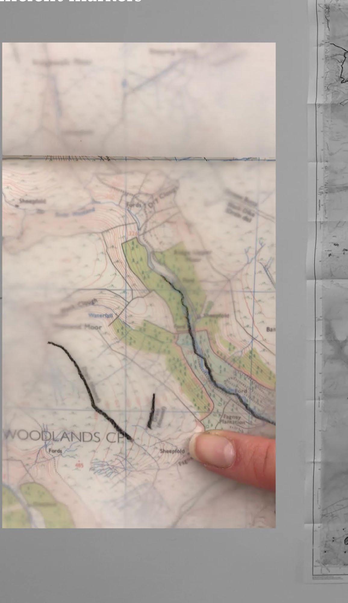
In building a series of small cairns in Chapter B: Drystone Construction, I imprint the landscape with temporary markers. In Chapter C: Convivial Wildness in Drystone Field Stations I further investigate imprint-making methods as maps of drystone walls I encountered, using charcoal rubbings, clay, and hammered paper as media that record imprints differently.
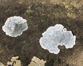
Lichen imprint from Chapter C: Convivial Wildness in Drystone Field Stations
Tracing stones as I build the 100-stone cairn, from Chapter B: Drystone Construction Filming
Strategy 4: Making and Testing On-Site as Situated Practice
Interacting with drystone walls and building cairns, from Chapter B: Drystone Construction

Learning-with drystone and walking in the landscape, from Chapter C: Convivial Wildness in Drystone Field Stations
Situated practice lies between fieldwork, on-site artistic practice, and simply being-in-place. It is a form of intentionally learning-with and becomingwith, to use Haraway’s term, the land and the morethan-human realm to foster situated knowledges. The thesis speculates on forms of ‘living’ conservation as situated practice, undoing the extractive gaze for one of reciprocity and the desire for control for obligations of care.
My five-day trip to the Peak District was a pivotal moment for this thesis: being within the landscape was a process of discovery and wonder, a reckoning with what I thought I knew to form new ideas of the place. Certain elements, such as the wind, became powerful characters within the landscape. In fact,
being immersed in the climatic conditions of Edale valley drove home how variable weather conditions can entirely shift one’s experience of place. These conditions, then, require a different attitude toward design, one that accommodates the unpredictable and makes space for the ambiguous.
Walking in the landscape—and spending hours in single locations in the building of the cairns—put me in relationship with the landscape in a way I had not felt earlier. Even for a moment, I felt part of the place: I cared for it and felt connected to it. This re-orientation to the Dark Peak allowed me to speculate on the design of drystone field stations in a far more realistic manner, making visible the drawbacks as well as the potentials of drystone.
Strategy 5: Case Studies
This thesis employs a series of case studies external to the Peak District region as a tool to learn from the wider context of drystone construction. Given that examples of drystone can be found across the world, in diverse climatic and social environments, there is a rich body of knowledge to draw from. The thesis selects specific studies that directly influence the design of the field stations.
Case studies are useful in providing ideas of the many possible ways of configuring drystone. The Scottish blackhouse, for instance, ingeniously packs peat between two drystone walls to provide thermal mass; this technique could easily be used in the Dark Peak moorlands. The Croatina kazun and the Italian trullo further provide ideas for building corbelled domes, again employing a double layer for durability and weatherproofing.
Strategy 6: Quantifying Information and Questioning Quantification
Quantifying drystone is difficult, given that it is not a standardised material and has no singular construction method. It is a learned craft that takes time and practice, and it is a process of working with rocks of specific and unique shapes, types, and sizes, varying on location. Given these limitations, in certain places within the thesis I attempted to measure or quantify data to give a more realistic idea of working with this material. Any attempt at quantification relies of a series of assumptions that could easily be disproven. For example, in Chapter B: Drystone Construction, I analyse the amount of labour required to construct a field station, estimating how large of a structure could be built over a certain number of days by a certain number of people. This exercise, though useful, shows the impossibilities of quantifying this information with any degree of accuracy. Drystone is necessarily sitespecific and time-specific, and its construction process varies greatly from person to person.
Measuring drystone heights, from Chapter B: Drystone Construction
Kazun case study, from Chapter B: Drystone Construction
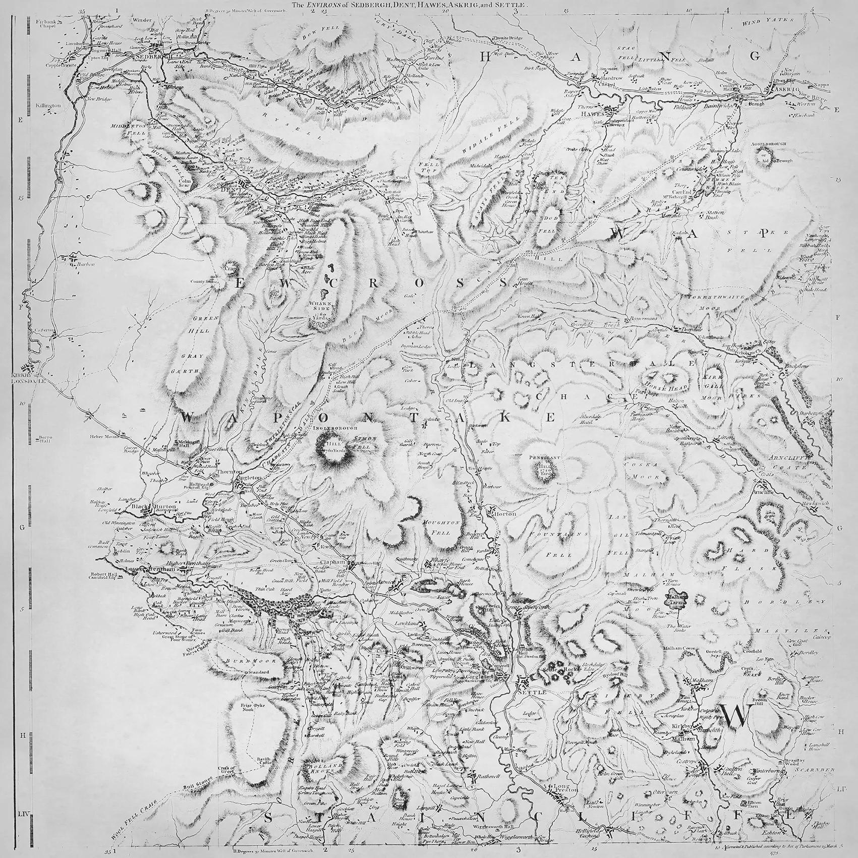
An Introduction to the Peak District
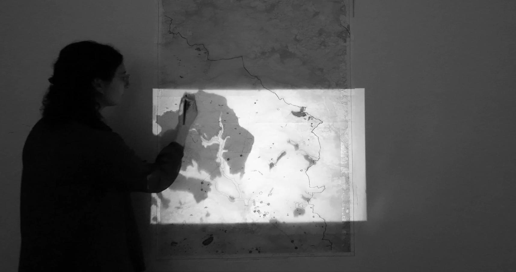
This first filmic mapping exercise enters the Peak District via the ordnance survey. Through this film, I challenge and blur the fixity of the survey by covering it in tracing paper and drawing over it in charcoal. By slowly revealing certain elements called out in the map, I animate the static map to set the scene for the project.
+ The Peak District is Britain’s first national park, officially designated in 1951 after decades of working-class led activism called for recreational access to the privatized countryside. In effect, the national parks attempted to reinstate access without the commons, where legacies of enclosures are prominent in the gritstone walls stitched across the landscape.
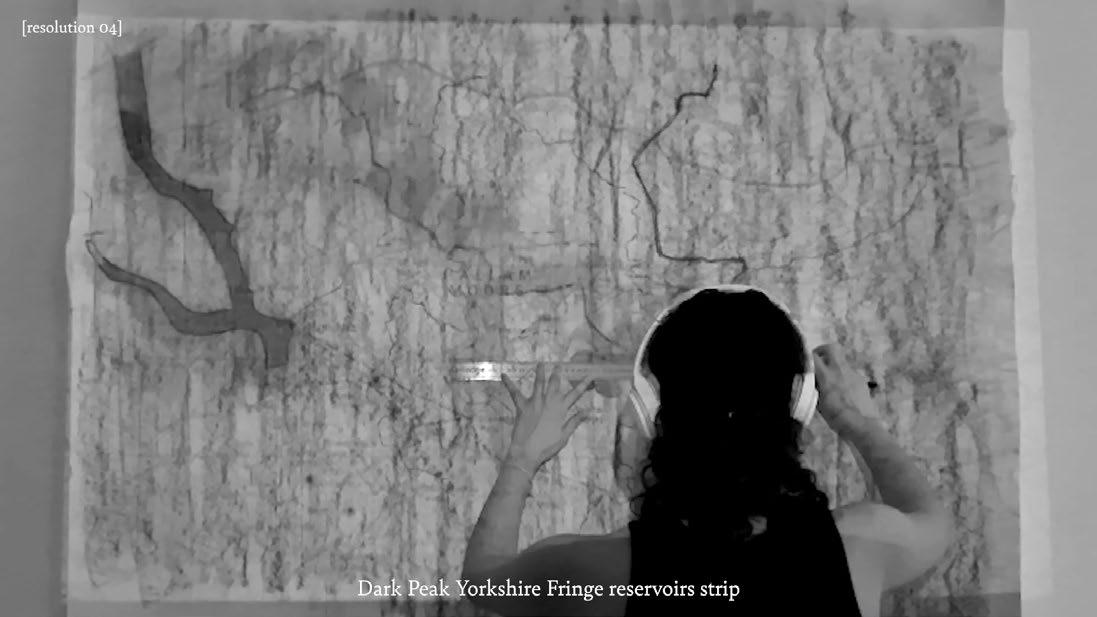
+ The project begins by zooming in to the northeastern region of the Peak District, designated by the National Parks authority as the Dark Peak Yorkshire Fringe landscape character region.
+ This region has been mapped by the Ordnance Survey as the “Dark Peak Region: Kinder Scout, Bleaklow, Black Hill & Ladybower Reservoir”
01. Peak District National Park
02. Dark Peak Yorkshire Fringe Landscape Character Region
03. Ordnance Survey “Dark Peak Region”
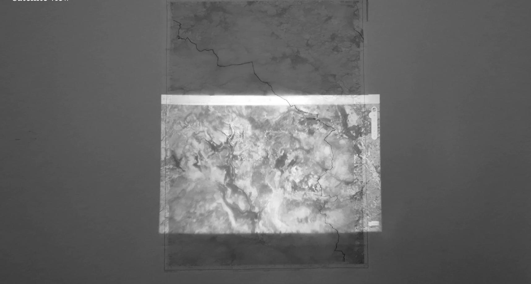
+ The national park boundary cuts through this region, shown as a red dashed line on the OS map.
+ If we switch to a satellite view of the landscape, the park boundary all but vanishes.
+ Situated between Manchester and Sheffield, the Peak District is an industrial landscape riddled with disused quarries, mills, and mineshafts.
04. Peak District National Park Boundary Line 05. Satellite imagery 06. Industrial markers
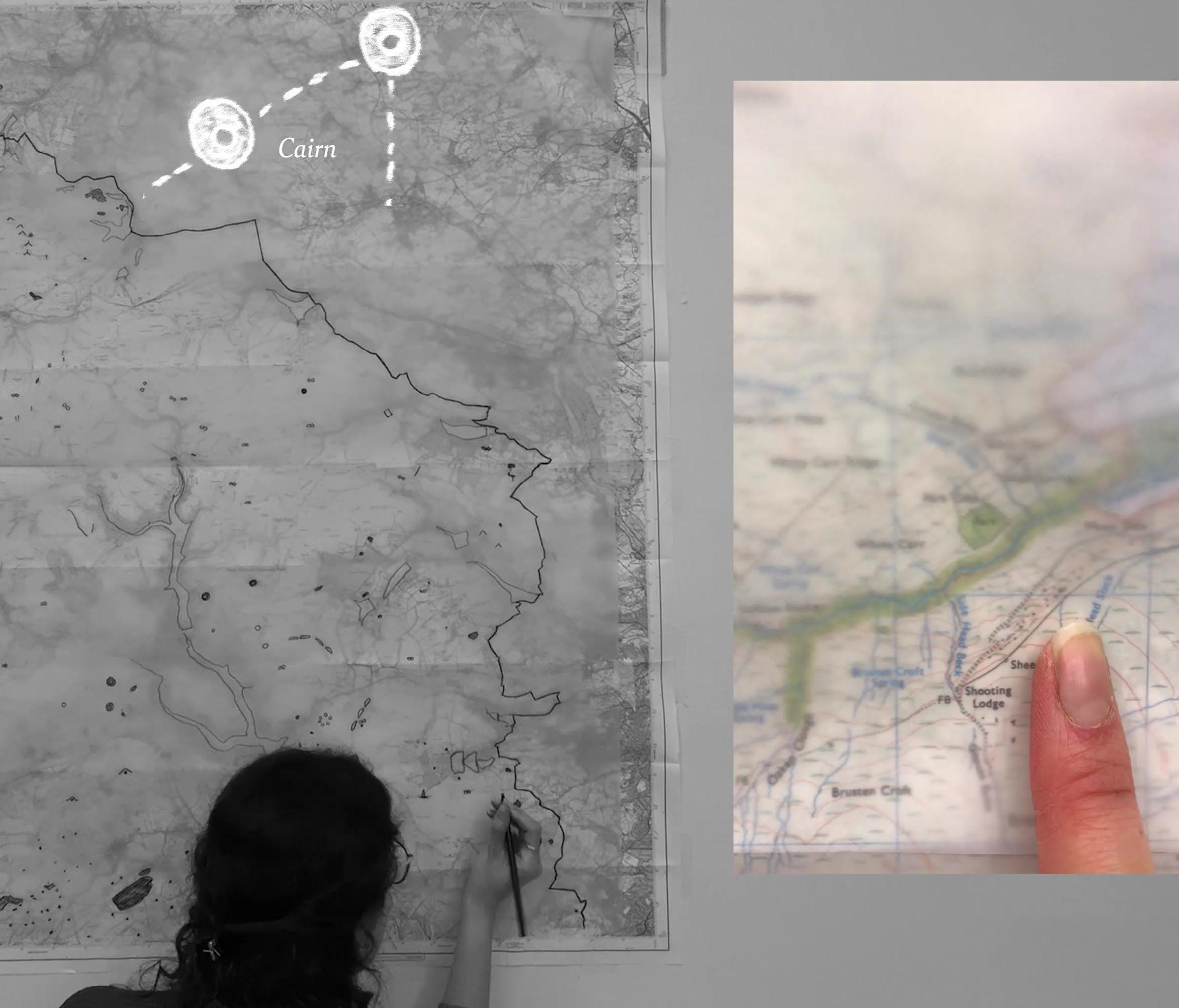
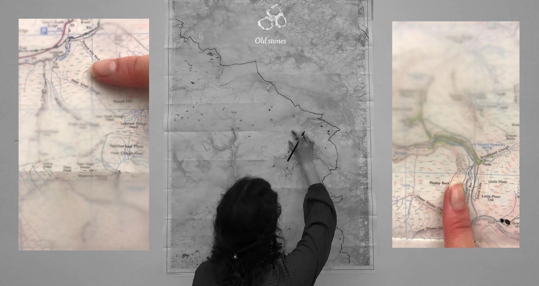
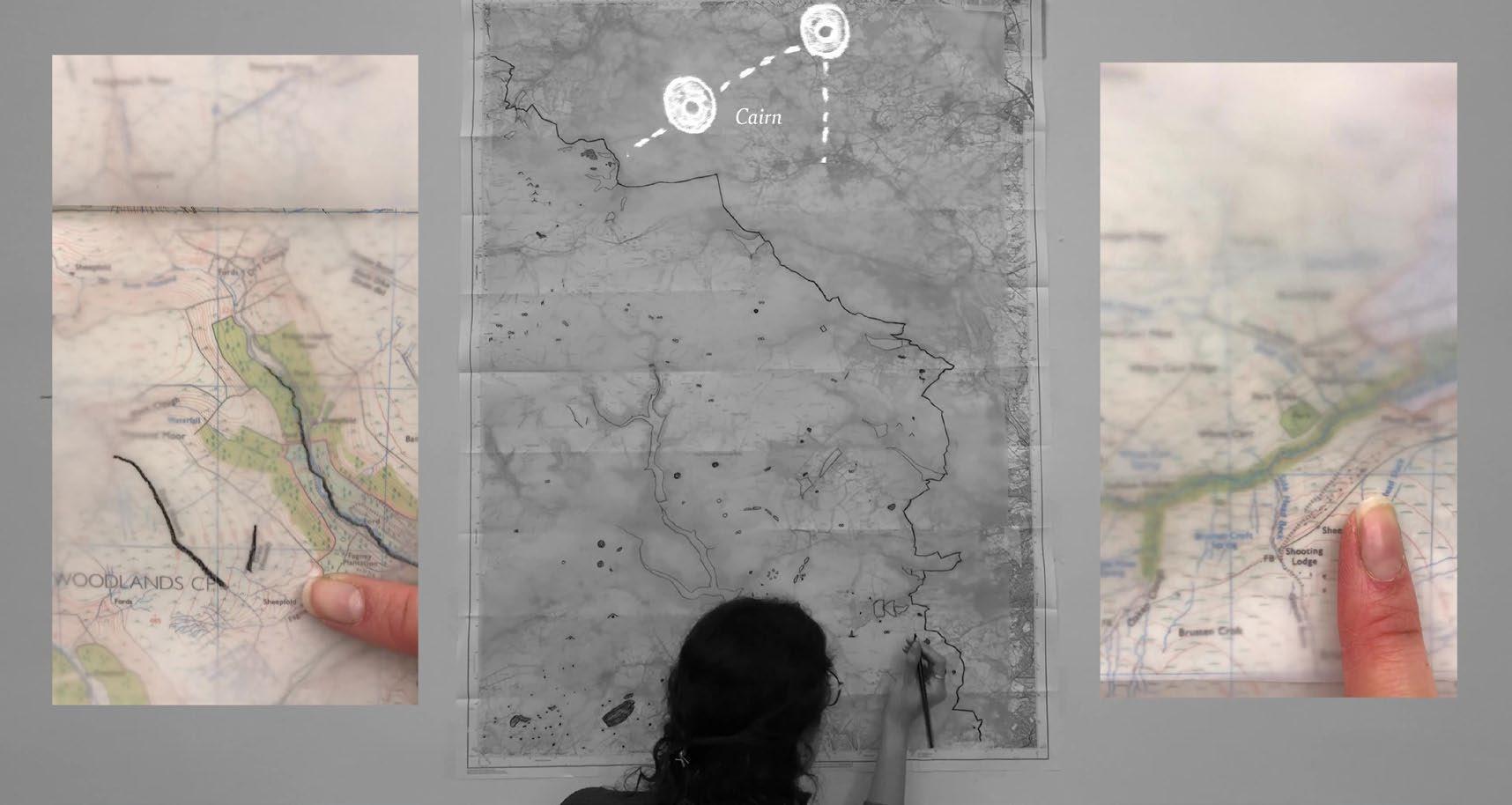
+ Human traces date back millenia in the landscape, where scattered marks on the OS map indicate lost rituals and lifeways in stone circles, burrows, cairns and tumuli.
+ These were olds modes of wayfinding, predating the map’s allknowing view.
+ The picturesque view creates the illusion of access, while in reality the landscape is privatized in a patchwork of enclosures. Much of land is owned by water companies, charitable bodies like the National Trust, grouse hunting estates, and private landholders. Under the private property regime, access to land is fraught territory, leading to ongoing right to roam activism.
07. Ancient markers: old stones
05. Ancient markers: cairns
06. Land ownership
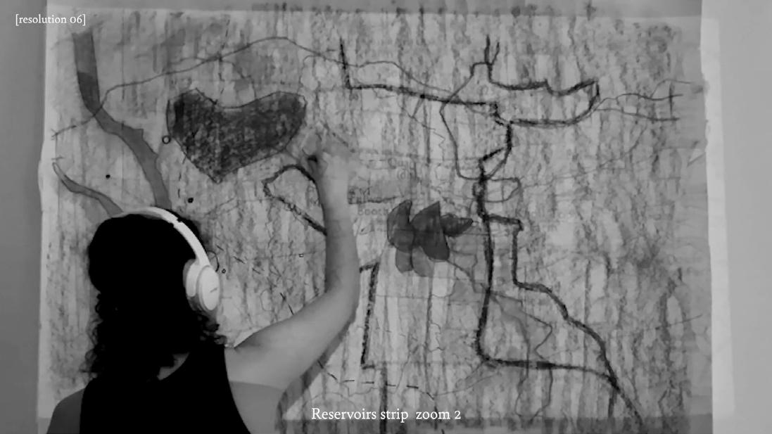
+ Moorland landscapes are scarred by grouse hunting, where slash-and-burn marks are made visible in the satellite view.
+ This is detrimental to the rich peat soil covering much of the region that acts as a carbon sink.
+ Though lending the illusion of a wild landscape, the moorlands are highly maintained and preserved toward a certain image. Much of the peak district is monocultural, a mosaic of grassland, heather, and conifer plantations. With much of the land dedicated to sheep grazing, plant, animal, and insect life is limited.
10. Grouse hunting scars
11. Peat soil
12. Conifer plantation
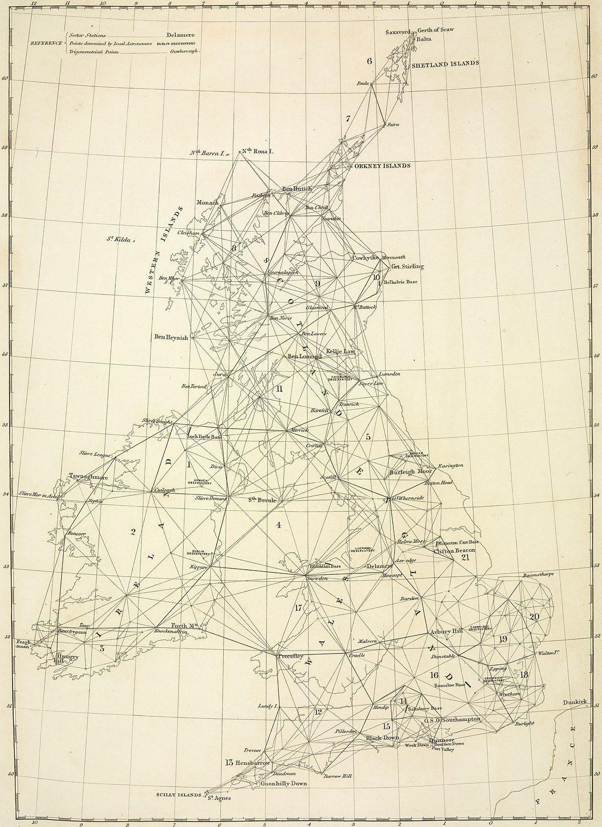
If wilderness is the most unmappable territory, the last British wilderness officially vanished in the mid-19th century when the first standardized mapping of the entire British Isles was completed. The Ordinance Survey, began as a military undertaking, represents the complete objectification of the English landscape.
The survey fabricates a relationship to landscape, one that operates using what Donna Haraway terms the ‘god trick’: the omniscient and objective gaze wearing a mask of neutrality. In its flattened aerial view, the god-trick map projects the division of property and demarcates conservation boundaries, drawing a line between landscapes deemed worthy and unworthy of saving from environmental harm.
In challenging the top-down map, this thesis speculates on alternative forms of mapping landscapes that are embodied, situated, and temporal, rejecting the static for the dynamic, the distant for the tactile, and the measured for the sensed. In doing so, ideas of conserving ‘nature’ shift from an administrative and legalistic approach to a new way of being-with the more-than-human realm, seeing ourselves as part of and with obligations to what we term ‘nature’ and the entanglements it entails. In dissolving the God-trick map, we must see ourselves as part of the land, not removed from it.
01. Ordnanace survey triangulation map
Blurring the Map
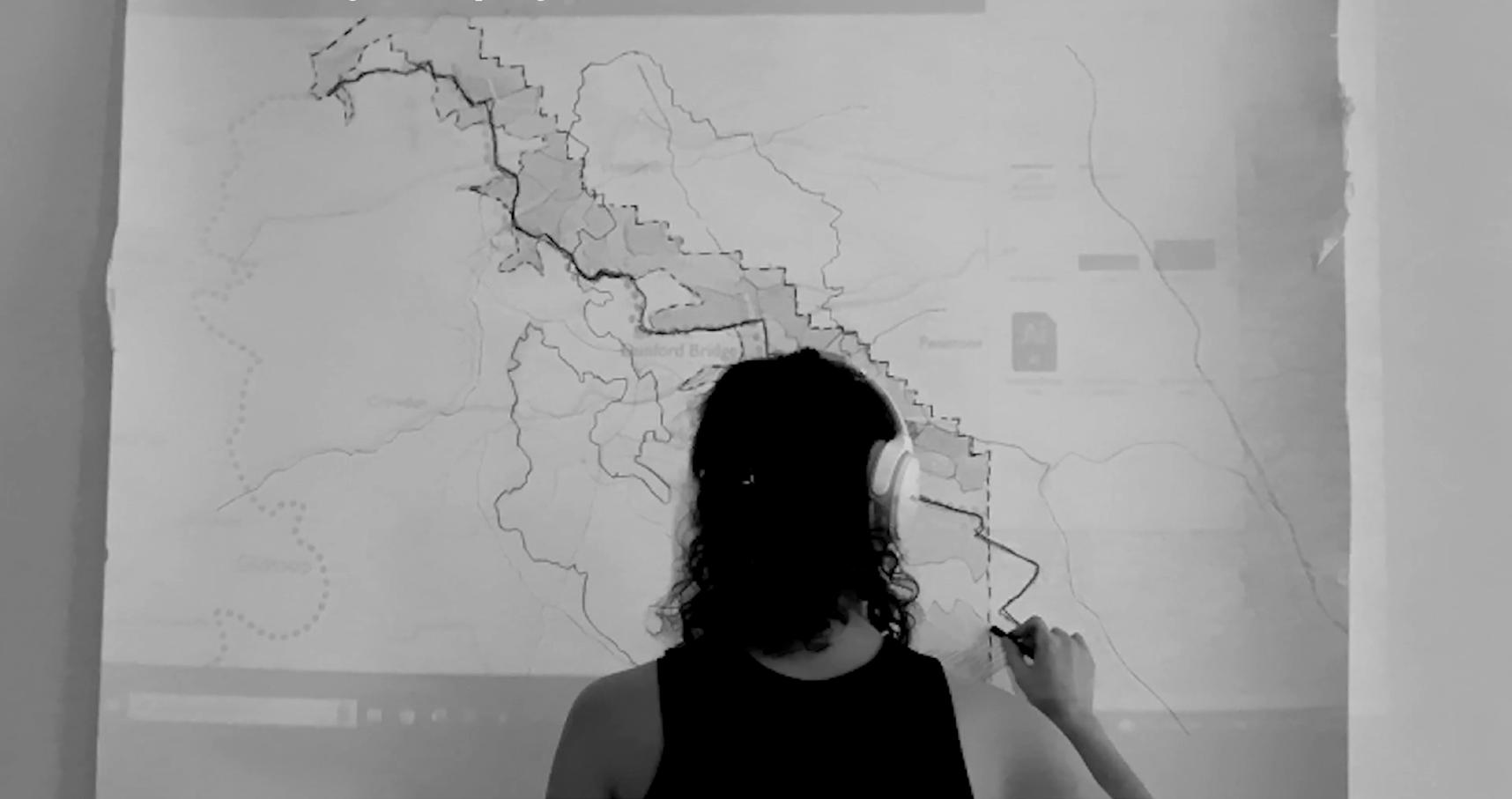
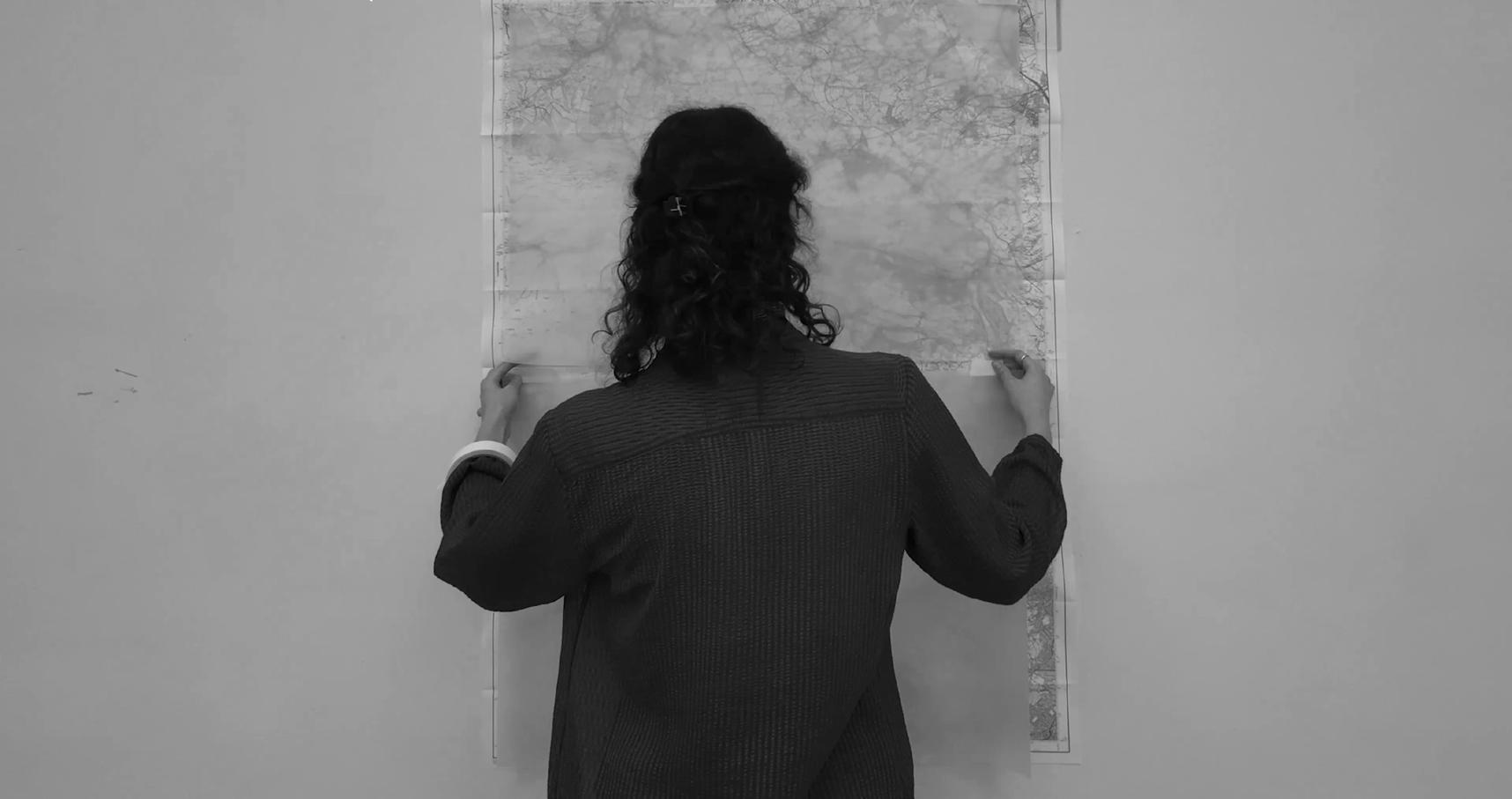
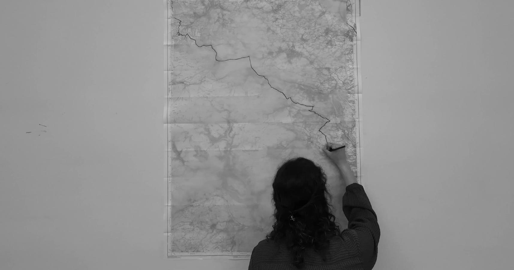
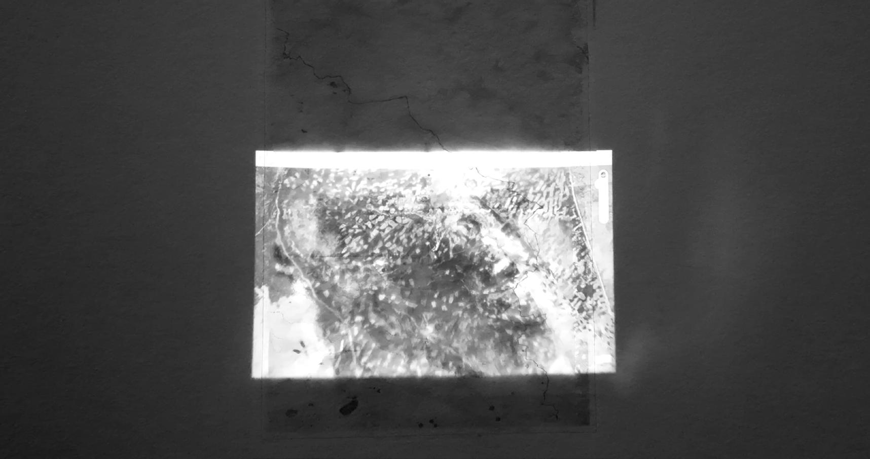
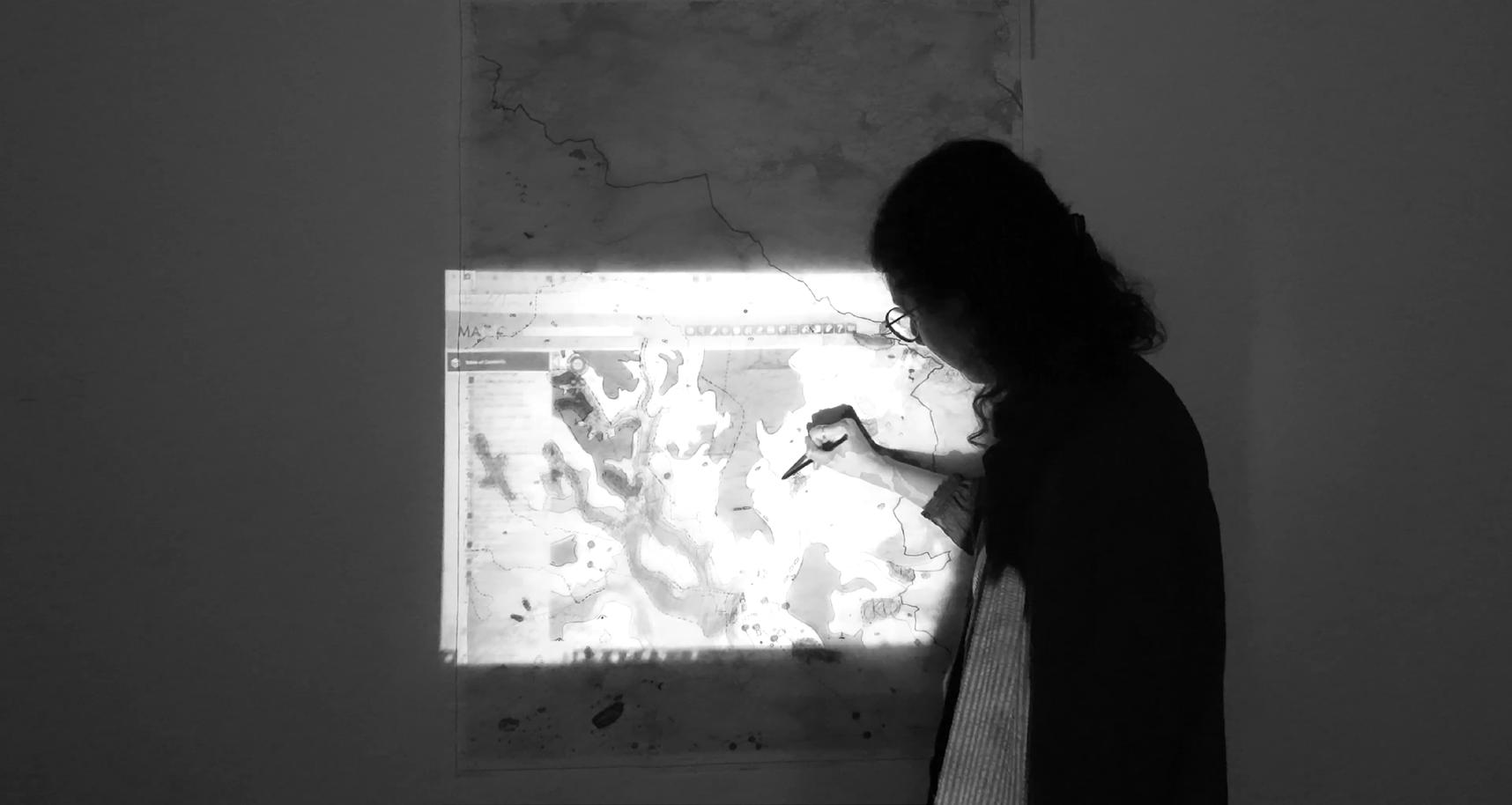
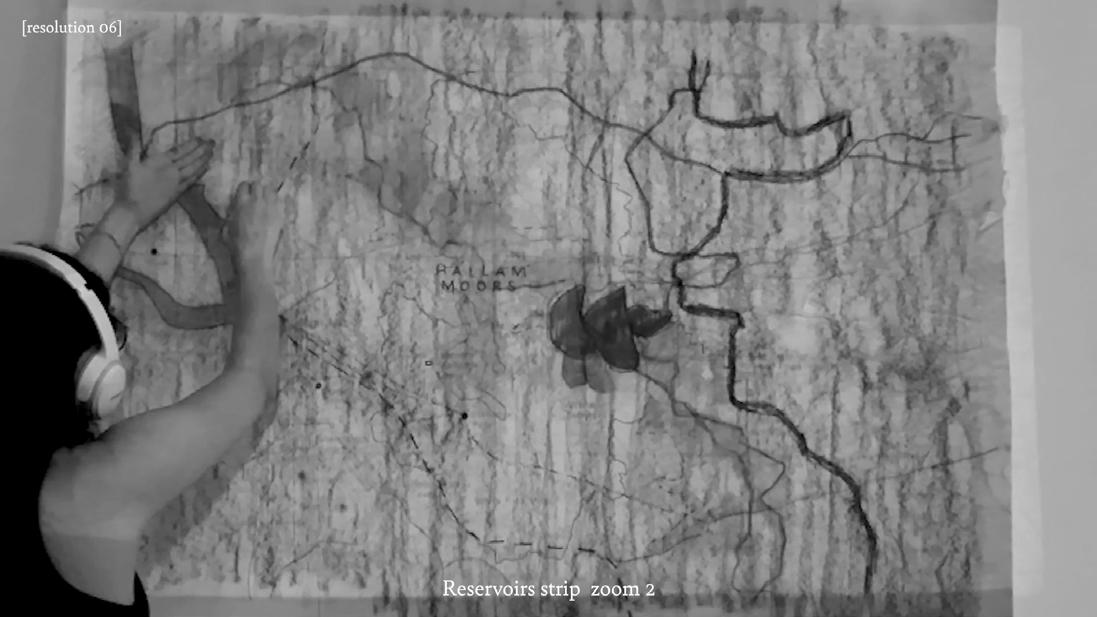
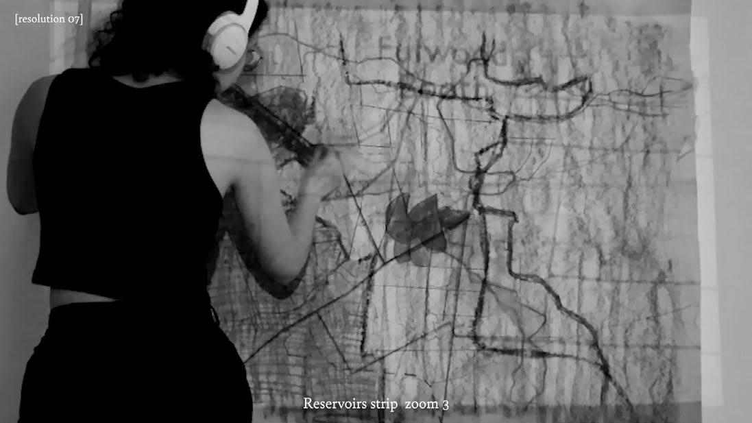
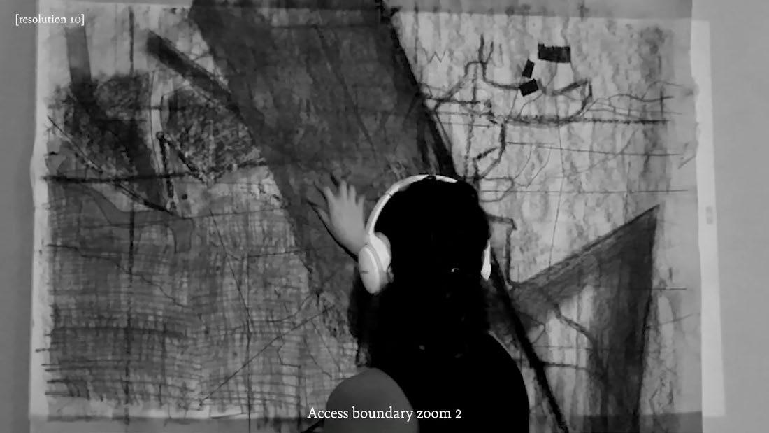
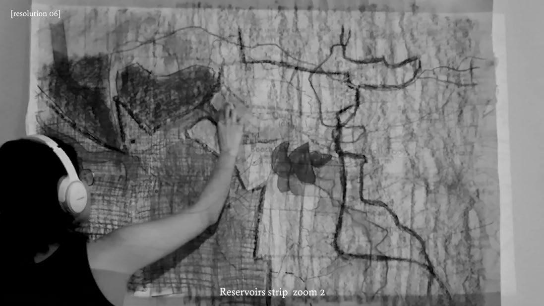
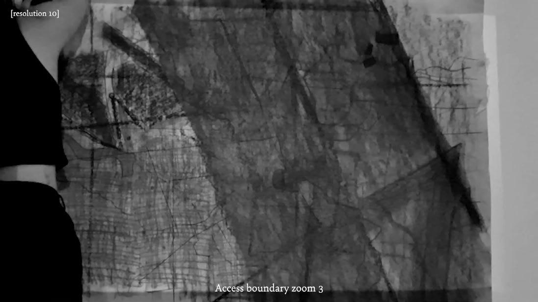
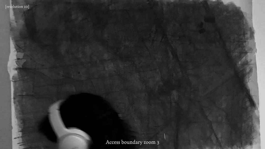
What happens when lineweight meets landscape? I enter the project by exposing the paradox of drawing lines demarcating publicly accessible land. In this filmic mapping exercise, I interrogate the boundaries that appear and disappear when zooming into the ordinance survey.
The projected map meets the fuzzy charcoal line drawn on paper hung in the AA, mirroring the abstracted way in which a map constructs landscape. Through a process of projecting and overlaying the same map as it increases in scale, boundaries begin to blur as they interrupt one another. This is a temporal drawing, which poses a counter-narrative to the god’s eye map, exploring a layered and multi-scalar mapping method.
As we zoom in, the boundary that marks publicly accessible land is revealed as a thick margin measuring 28m, blurring the binary conditions of private and public, trespass and right to roam. This mapping method is projective, exposing landscape as a construction so as to redefine relationships to it.
I start by projecting the ordnance survey map onto a wall in 33 Ground Floor Front on a Sunday in February. I begin by giving the paper a rough
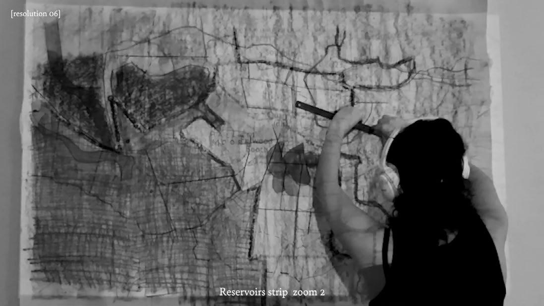
as it appears almost as though I am drawing these lines out of thin air, as if I have somehow internalised the map rather than merely tracing where drawing a charcoal line is fuzzy, thick, and smudgy: an expression of my hand holding charcoal pressing on cartridge paper. I draw the boundary becomes larger and the object of my attention. It gradually grows, dominating the page, before swallowing it entirely. In this dark
rough charcoal texture, then realise that this makes the projected map washed out are hard to see. This adds an unexpected layer to the film,
it. I can’t draw all the lines, so I must select certain ones to focus on. I make clear this process of selection that the God-trick map obscures,
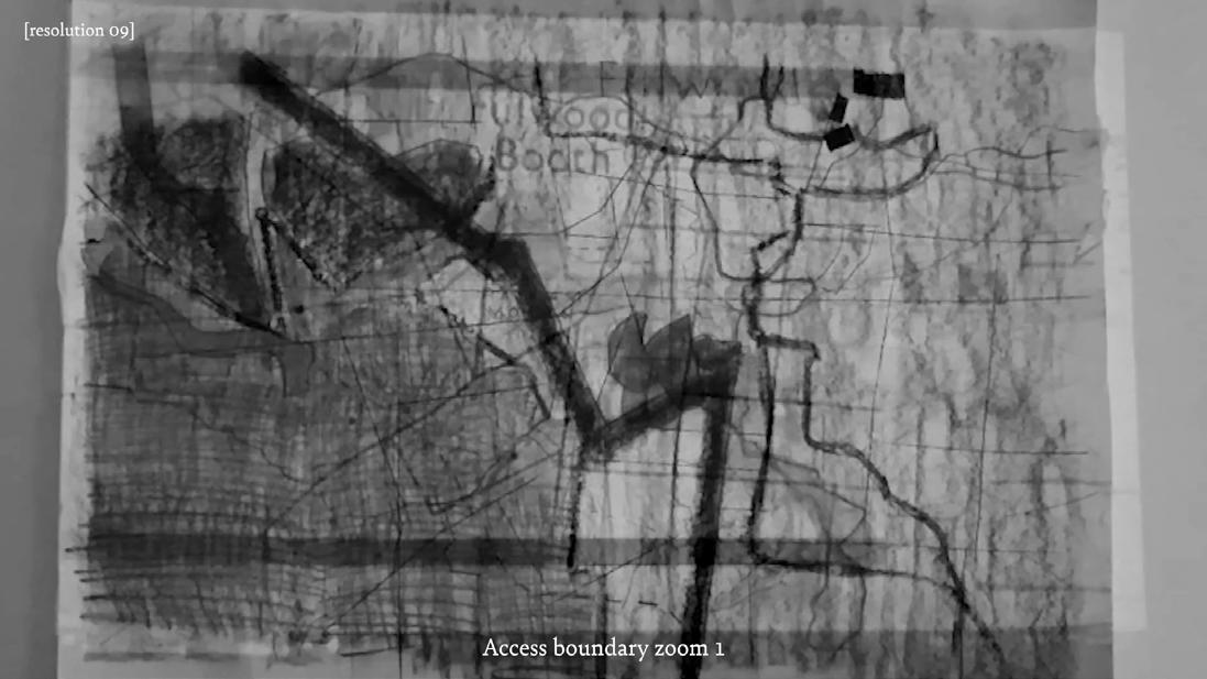

the fine straight lines of the OS quadrants with a ruler, and shade in the reservoirs to indicate their relative depth. As I zoom in, the access
void - inside the lineweight - is a liminal zone, devoid of signifiers, upon which we can begin to project our alternative imaginaries of the
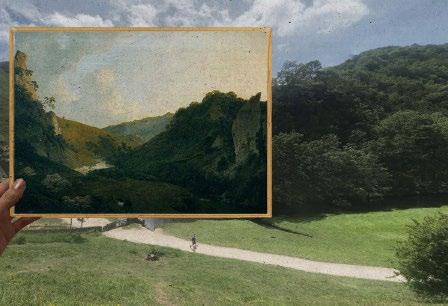
Dissolving the Picturesque Frame:
Representing Landscape and Redefining Wilderness
The 19th century European Romantic movement saw the division of landscape into three categories: the sublime, the picturesque, and the pastoral. These seemingly benign designations emerged from a violent framework of the categorization of people, plants, animals, and land, that was an imperial imperative. Land was categorised in terms of productivity and exploitability, translating into the degree to which they were considered scenic, and thus merited conservation.
The romantic era found beauty in the domesticated agricultural landscape of the English countryside and sublimity in untamed, “wild” landscapes, deemed closer to God and beyond the scope of human comprehension.
The picturesque movement, made popular by artists such as William Gilpin with his 1782 book “Observations on the River Wye,” commodified landscapes for their painterly qualities. In it, he acknowledged the distortions of the picturesque, declaring that nature ”is seldom so correct in composition, as to produce a harmonious whole,” so the role of the painter is to tastefully manipulate the view, for example in “the addition of a few trees; or a little alteration in the foreground.” Though the picturesque view is by instruction an artistic construct, these fabrications continue to inform conservation efforts.
Walking was the ideal way to experience the Romantic landscape. Picturesque tours became a popular activity for the wealthy in the late 18th century, and remain vital to the countryside’s recreational identity, where travellers visit viewpoints painted by the likes of Gilpin.
The picturesque becomes fluid as the image transposes onto the landscape. Watercolour brushstrokes merge into swatches of pastoral land seen through satellite imagery. These Romantic landscape imaginaries were not contained within Europe: they became key to the colonial project of terraforming, where conquered landscapes were transformed into neo-Europes.
In the United States, pre-colonial land was perceived as an entirely wild terra nullius. As land was seized, divided, and rendered property, productive pastoral landscapes emerged, transplanted from the English countryside to create rural America. A hierarchy of landscapes emerged, based on how productive land was assessed to be, and how easily it could be commodified.
The colonial frontier existed within binary conditions of known and unknown, near and distant, conquered and conquerable. The frontier was the domain of the wild; the settled the domain of the pastoral. It was the frontier, then, that fuelled conservation efforts: the desire to preserve – and to frame - remnants of empty terra nullius. The drive to form national parks coincided with the end of the colonial frontier, as Westward expansion extended the nation from coast to coast. As land was charted, measured, and conquered, the wildness defining the frontier dwindled.
What happens when the image meets the landscape?
If we are to take seriously western conservation’s colonial legacy, reject the human-nature dichotomy, and refuse the commodification of land and life, this will radically reshape the meaning of conservation in terms of both representations of and relationships to the land. What happens when the frame becomes a mirror, and we recognise the wilderness within ourselves? landscape?
Here lies a paradox of the wilderness: while the sublime implies a certain degree of humility, where the human is at the mercy of magisterial nature, the wilderness park encloses sublimity, containing the uncontainable within legislated boundaries. This paradox exposes wilderness as an ideal, closer to morality than reality. As William Cronan wrote is his seminal text, “The Trouble with Wilderness,” wilderness is an “impossible geography,” created in large part within the frames of pictorial representations.
Just as photographers, painters, and writers campaigned for their imaginaries of wilderness in the United States, Romantic-era artists were key to the conservation of land in the UK. Poet William Wordworth is famed for his calls to preserve picturesque landscapes, which he described as “a sort of national property, in which every man has a right and interest who has an eye to perceive and a heart to enjoy.” Thus, the construct of property and ownership of land is central to conservationism. This provides an interesting point of comparison between British and American national parks,
where British national parks are primarily privately owned, and American ones are publicly owned. These differing ownership strategies emerged from two border regimes: the frontier on one hand, and enclosure of the commons on the other. Unlike the frontier conservation of wilderness in the United States, the sublime wilderness was never fully separate from inhabited land in England. Moorlands, perhaps, were an exception, deemed untameable and inhospitable. But most moorlands too became swallowed by farmland, mirroring the process of the frontier.
In the National Parks of England, we see the wild and the pastoral merge: the Peak District is made up of a patchwork of privately-owned pastures. Public access to them was not a given: it was fought for, such as in the Kinder Scout mass trespass in 1932.
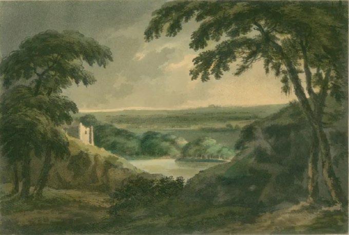
01. Landscape, William Gilpin, 1794
02. Sheffield from Crookesmoor, William Ibbitt, 1856
03. Moorland scene, Derbyshire, Charles Thomas Burt, 1889
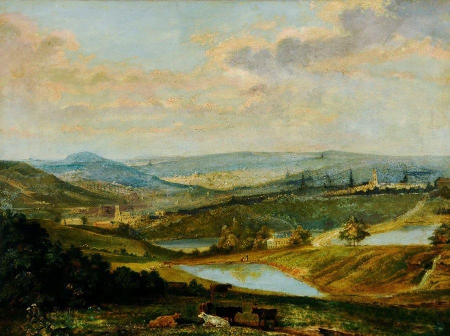
01. George Smith, Peak District Landscape, date unkown (presumed 18th or 19th century) 02. The enclosures act as invisible walls in the landscape, creating barriers to access.
Romantic-era landscape paintings of Derbyshire gave the illusion of far-reaching ‘wild’ landscapes, masking the reality of enclosure and privatisation. The English National Park, then, is an attempt to restore access post-enclosure without the commons , where conservation becomes an authoritative blanket covering a privatised landscape.
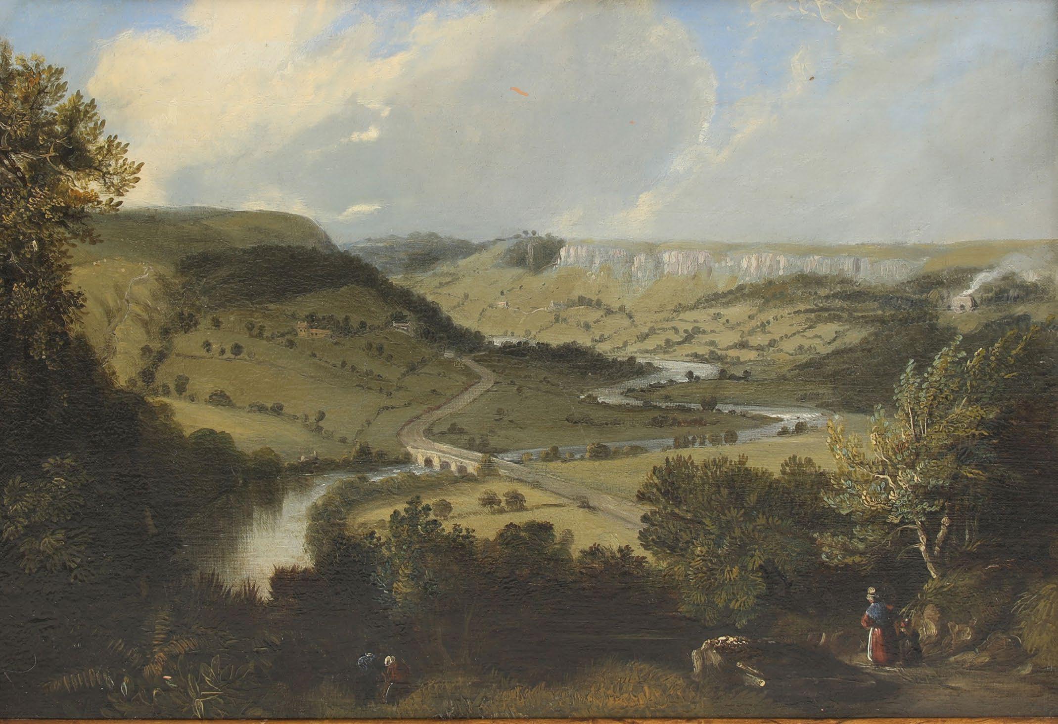
The Enclosures drastically altered the moorland landscape, defining its edges with farmland in clearly parcelled boundaries and changing the open-field pattern of long, thin strips into more regular, larger rectangles. Thomas Jeffrey’s 1772 map of Yorkshire (below) gives a glimpse into a moorland landscape pre-enclosures.
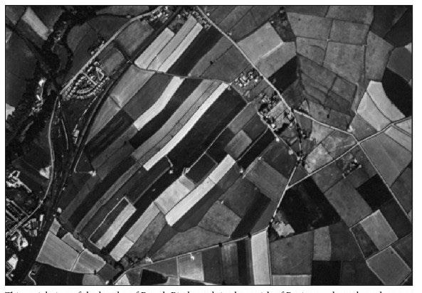
Common opne-field pattern of thin strips compared to larger rectangular fields from the enclosures. Image from History of the Peak District Moors by David Hey
Enclosed fields in the Dark Peak near Hathersage. Image from History of the Peak District Moors by David Hey
Peak District Timeline:
1000 1800
(1600s-1860)
Domesday Book (1086)
1900
Parliamentary Enclosure acts affecting Peak District region (1925) Land
Crown Estate established (1862)
The first attempt to completely record land ownership across Britain (1215)
Common Land first enshrined in Magna Carta (1860)
The Common, Open Spaces and Footpath Preservation Society founded (1760)
The National Trust for Places of Historic Interest and Natural Beauty is founded (1899)
Land Registration Act (1873)
Return of the Owners of the Land / Modern Domesday (1895)
UK Gamekeepers Association founded (1876)
Local Government Act amended, giving some rights of way
Beginning of the right to roam movement (1912)
Society for the Promotion of Nature Reserves founded (1894)
(1919) Forestry Commission woodlands deforested (1926) Council England (1925) Law way
(1925)
Land Registration Act
(1952)
5624 acres owned by Duke of Devonshire on Southern Kinder signed over (1961) Crown Estate Act (1982)
National Parks and Access to the Countryside Act
Kinder Scout Mass Trespass (1939)
Access to the Mountains Act passes (2005)
Sheffield Clarion Ramblers’ Winnat’s mass trespass (1932)
High Peak trail opened (1927)
Law of Property Act gives right of way access to commons (1973)
Council for the Preservation of Rural England formed (1942) Scott Report examines problems in the countryside and makes the case for National Parks (1972)
National Trust buys Kinder estate (1990) Survey shows over 70% Peak District privately owned (2002) Land Registration Act (1990) Rights of Way Act (2000) Countryside and Rights of Way Act
Peak District woodlands designated as open access (1949)
National Environment and Rural Communities Act (2019) Landscapes Review Report published (2021) Nature for Climate Peatland Grant Scheme (2024) Landscape Recovery Scheme (1926)
Peak District National Park’s Ranger Service founded (1968) Countryside Act (1981) Wildlife and Countryside Act (1951)
National Park Authorities created (1986) 4900 acres bought for conservation by NPA (1954)
Commission founded to restore deforested during WW1 (1995) Environment Act (2006)
Peak District designated as England’s first National Park (1925)
Current Land Ownership
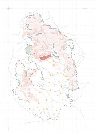
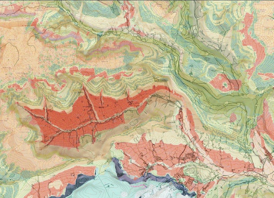
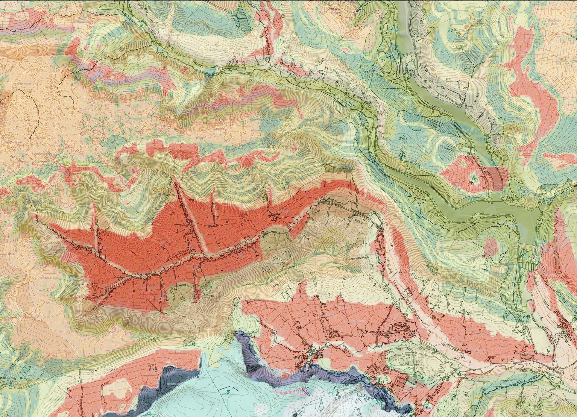
Of the Peak District National Parks’ 1,348 km 2 , 90% of the land is privately owned. This contrasts to the North American national park, which is publicly owned. The British national parks were created nearly a century after the American and Canadian ones, and rather than focusing on conservation, they were formed to give access to the privatised countryside. Though extensive areas of the park are publicly accessible, they remain in the hands of wealthy individuals, water companies, and conservation agencies, among other bodies. The National Trust is currently the largest park landowner, possessing 12%.
As Guy Shrubsole found in his research for Who Owns England?, data on land ownership is highly secretive and hard to come by. This map uses data provided by the National Parks Authority, but much of it is unattributed. These regions are largely held by private individuals and estates.
Land ownership key
National Trust
National Nature Reserve
Derbyshire Dales
Royal Society for the Protection of Birds (RSPB)
Staffs Wildlife Trust Areas
Yorkshire Water
Severn Trent
United Utilities
Peak District National Park region Forestry Commission
National Parks Authority
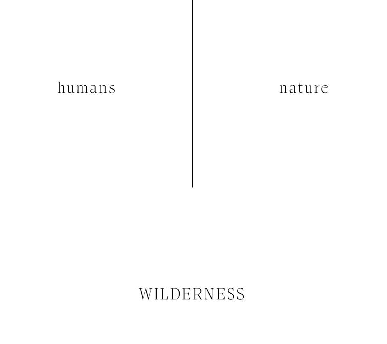
Thesis Terminology: What is Convivial Wildness?
Tools for Conviviality, Ivan Illich Wildness, Kimberley Ward
“I intend [‘conviviality’] to mean autonomous and creative intercourse among persons, and the intercourse of persons with their environment ; and this in contrast with the conditioned response of persons to the demands made upon them by others, and by a man-made environment. I consider conviviality to be individual freedom realized in personal interdependence and, as such, an intrinsic ethical value.”
“In the endeavor of developing more positive and socially-just conservation practice in rewilding we can valorise Wildness, rather than Wilderness to renegotiate our understanding and relationships with non-human nature in ways that are not dualistic, exclusionary, or indeed, loaded with cultural baggage (. . .) Wildness is abiotic, biotic and a social relational achievement within human and more-than-human worlds.
The project addresses a crisis of the imaginary that separates humans from nature, calling for a redefinition of wilderness. Problematized by thinkers such as William Cronan, the idea of wilderness as sublime untouched nature is exposed as construct. Cronan terms this an “impossible geography,” an imaginary fabricated in large part by Romantic-era photographs and paintings.
Instead, the project draws from Ivan Illich’s Tools for Conviviality, where convivial at its root means to live together, and from Kimberley Ward’s notion of wildness as “abiotic, biotic and a social relational achievement within human and more-than-human worlds.” Connecting the two, I propose the term convivial wildness, where wildness is understood not as pristine or remote nature, but as entangled networks of living beings sharing the land.
Commoning within convivial wildness, then, means practicing ways of being collectively with each other and with the morethan-human realm, making space for alterity while recognising our entanglements with one another.
Commoning through convivial wildness is not only a social or ecological question: it is an epistemic one, where landscape is a form of pedagogy that invites situated knowledges to emerge.
In Haraway’s writing on situated knowledge, she calls for the dissolution of the god-trick for “a view from a body, always a complex, contradictory, structuring, and structured body, versus the view from above, from nowhere, from simplicity.”
Commoning as Experimental Geography
Experimental geography, Trevor Paglen
“Experimental geography means practices that take on the production of space in a self-reflexive way, practices that recognize that cultural production and the production of space cannot be separated from each another, and that cultural and intellectual production is a spatial practice. Moreover, experimental geography means not only seeing the production of space as an ontological condition, but actively experimenting with the production of space as an integral part of one’s own practice.”
The project reframes situated practice—as an alternative to top-down neoliberal conservationism—as experimental geography, a form of space-making by being-in-place.
This section investigates various modes of experimental geography and cartography, such as walking and imprintmaking as mapping methods. Commoning is a process, not an event or end destination; it is by necessity experimental and open to change.
Experimental geography posits that geographers, in any sense of the word, do not merely study places, they make places. This sense of agency is absent from the top-down map. Instead, embodied mapping practices—where drystone construction is in itself a form of map-making — embrace the agency of the cartographer.
Walking is space-making; drystone is space-making; simply being in a place is a form of affecting it: these are some of the guiding principles behind the project, and ones that offer a powerful counter-narrative to the distanced view of the picturesque or the omniscient gaze “from nowhere” of the ordnance survey.
Forms of Commoning
What does commoning the English wilderness look like when we redefine wilderness as relational wildness? In wilderness, relationality between humans and the more-than human realm is heightened, because difference is more evident. This sense of difference recognises all beings as distinct and with their own life-worlds. Wilderness, rather than epitomising humans as outside of and other than ‘nature,’ holds the capacity for many life-worlds to co-exist, making space for the unknown and the unknowable. The project reconstructs the Peak District’s wilderness as relational wildness, where wildness is understood not as pristine or remote nature, but as entangled networks of living beings in a landscape assemblage.
Diverse woodland
Re-mossing peatland
Eliminating slash-and-burn
Seasonal rituals
Sharing labour
Collective walking
Negotiation
Acts of care
ECOLOGICAL
Convivial rewilding
Multispecies interactions
Multispecies inhabitation
Agroecology
From monocultures
Situated
Breaking human-nature
Folklore and storytelling
Diasporic imaginaries
Narratival knowledge interactions rewilding monocultures to polycultures inhabitation
Collective building
Learning collaboration
Knowledge of drystone construction as craft
Situated knowledges
human-nature dichotomies
EPISTEMIC
Sharing knowledge
Shifting mindsets: from ownership to obligations
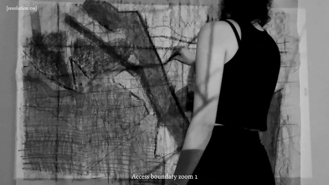
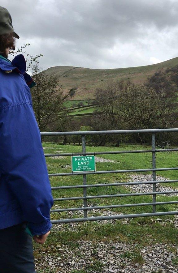
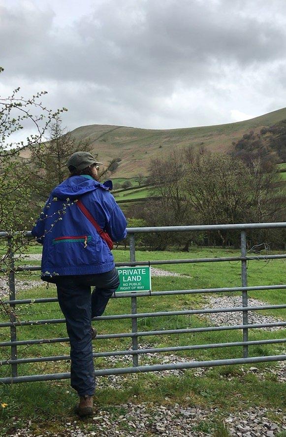
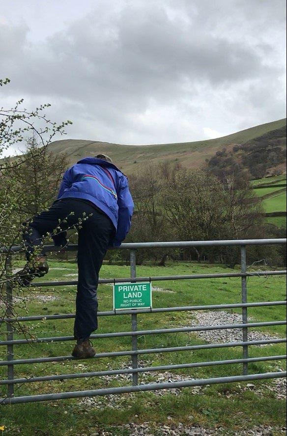
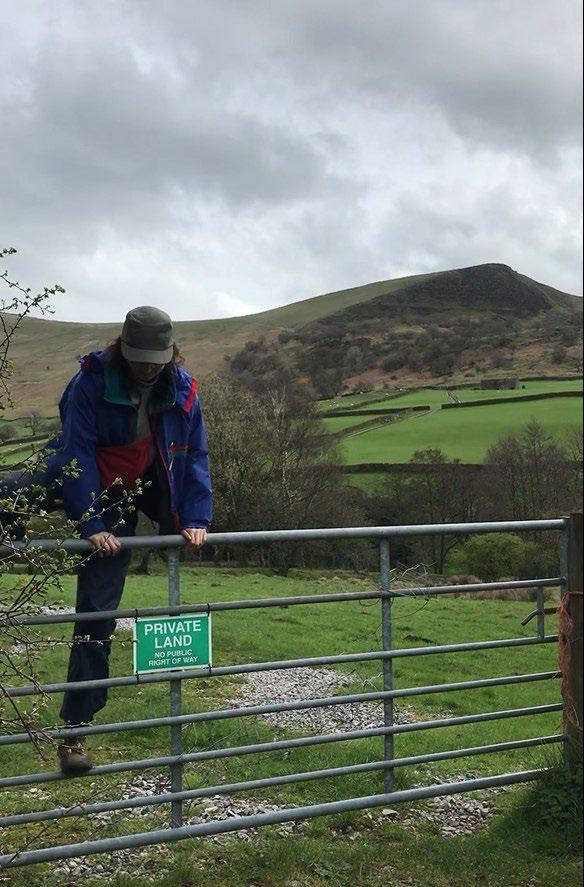
Trespass as a Commoning Catalyst
How can trespass be a tool of direct action that challenges the privatisation of the landscape?
The first catalyst for commoning is trespass as the direct reclamation of land. This is where the act of temporarily inhabiting and building in the landscape becomes a transgressive one. By navigating by stone markers rather than the OS map, access boundaries are rendered illegible.
If property lines drawn on a map make visible private land ownership, and the picturesque view bypasses ownership regimes, this thesis proposes challenging the privatisation of the landscape through convivial rewilding practices, where property lines are illegible to the rocks, mosses, wildlife, and commoners taking part in rituals of repair.
This shift away from ownership structures requires a new paradigm: one of obligations. Through commoning the moorland, visitors to the landscape have a sense of obligation to care for the land and the beings surrounding them. This paradigm shift is incommensurable with a private property regime predicated on viewing land as an inert resource.
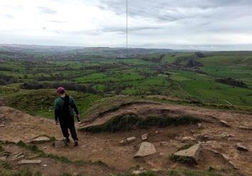
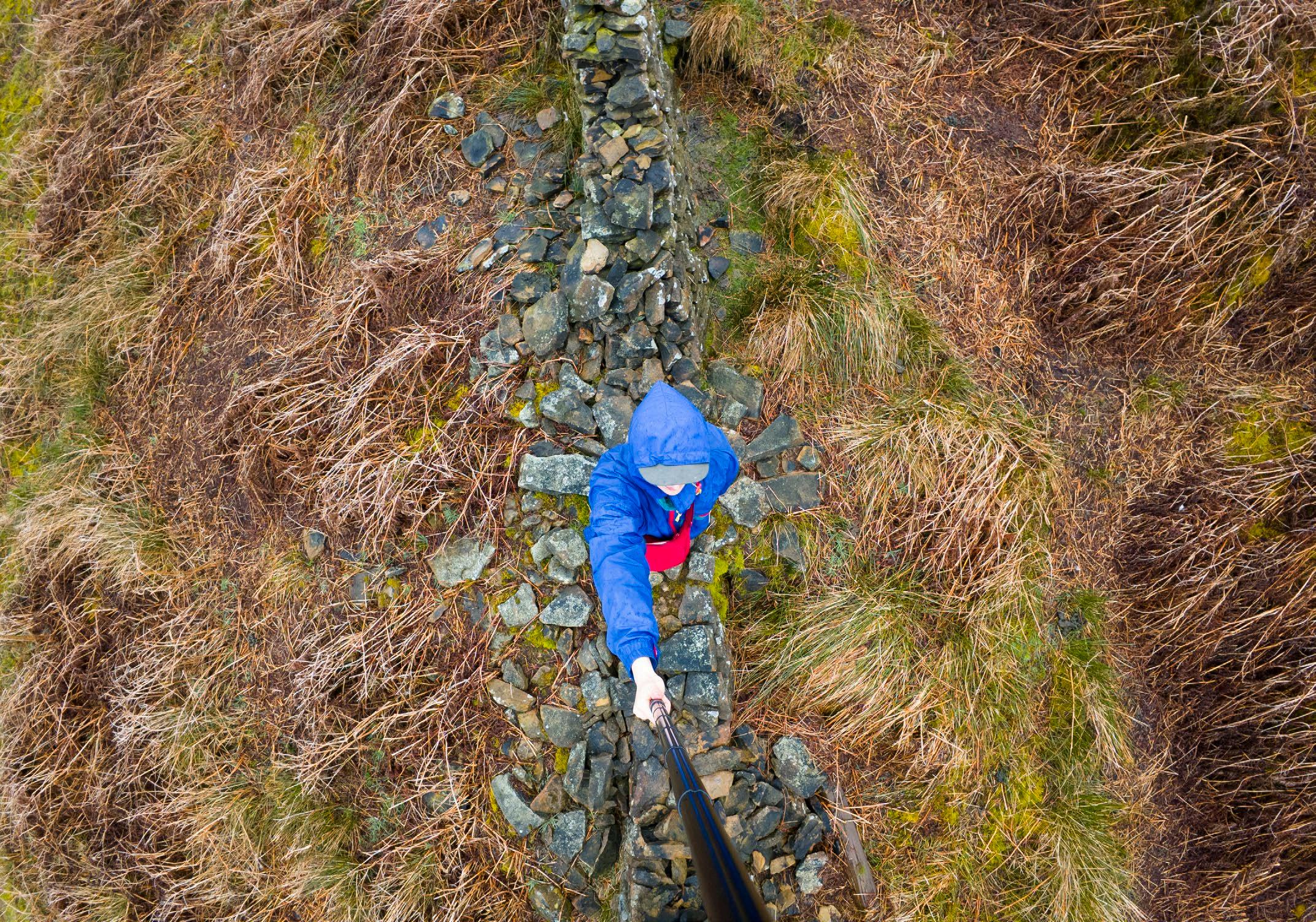
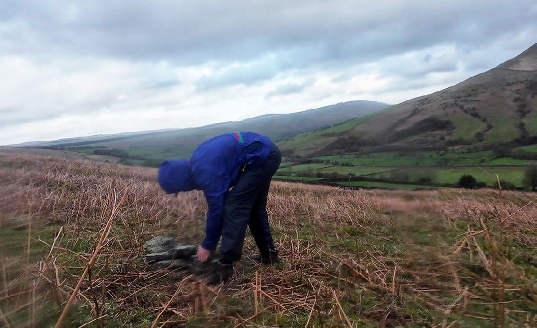
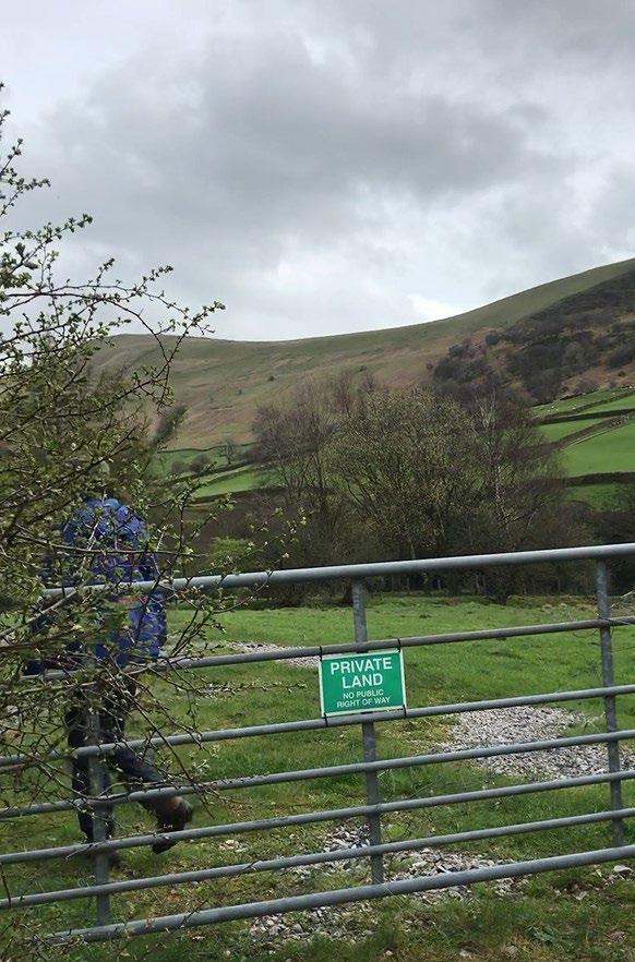
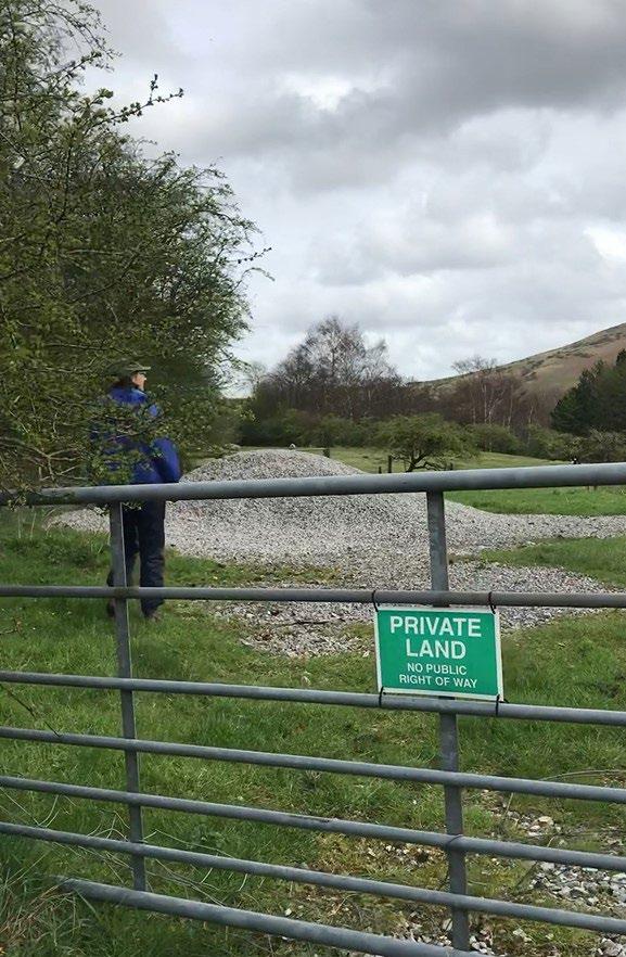
Opposite: The author trespassing in Edale valley, and in doing so taking part in a bourgeoning movement for reclaiming land rights.
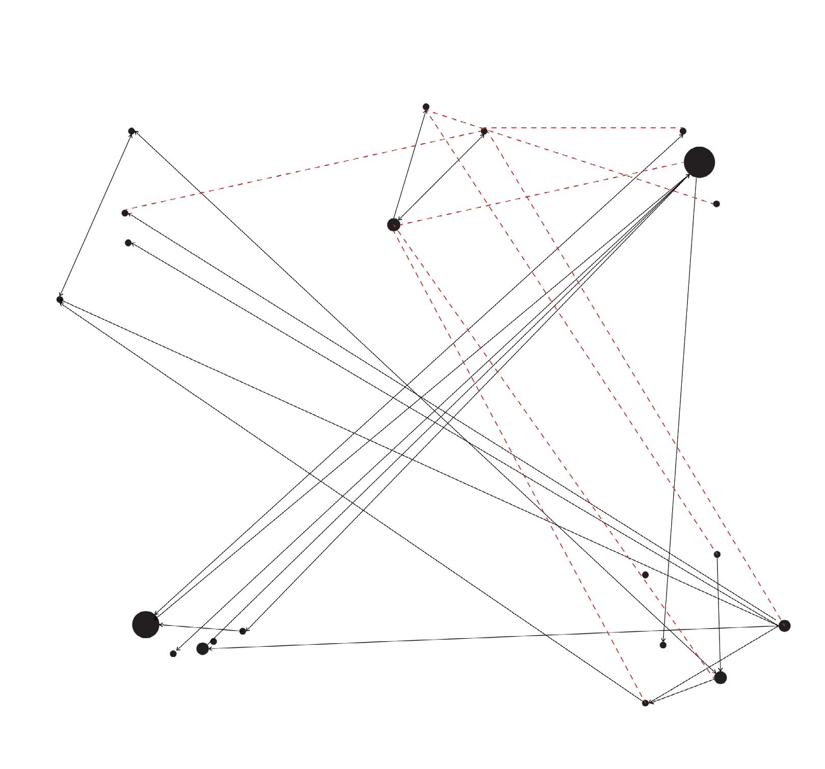
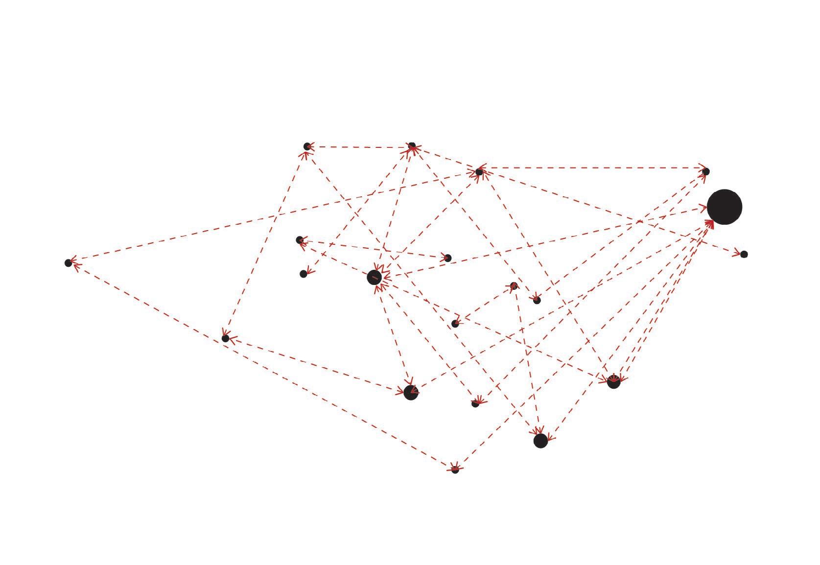
Shifting Stakeholders: Transient Commoners
This series of diagrams shows communication between various stakeholder groups. Transient commoning images how visitors can engage with local actors in ways that are non-extractive, blurring the categories of conservationists and commoners as ecological repair dissolves the grouse hunting industry and challenges the privatization of water.
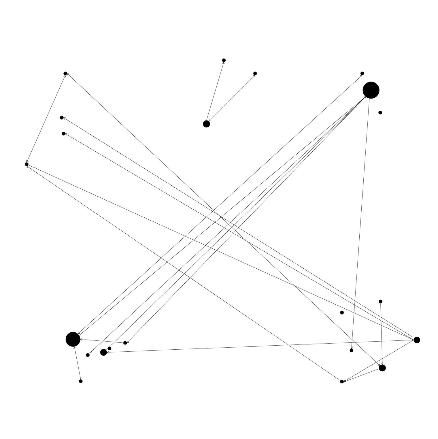
Conservationists
01. Current stakeholder configuration, where the larger the circle means the more people invovled, and the arrows indicate directionality of interactions. Diagram adapted from “Learning from Doing Participatory Rural Research: Lessons from the Peak District National Park” by A. Dougal, E. Fraser, and J. Holden et. al
02. Initial stages of commoning the moorland through engaged visitation, where transient commoners form relationships with other stakeholders
03. Well into the commoning process, the privatisation of land has dissolved, and with it the privatisation of water and the grouse hunting industry. Monocultural and capitalist farming practices are replaced with agroecological ones.
Grouse managers
Water industry
Grouse managers
Transient commoners Agricultural community
Water commons
Transient commoners
Conservationists
Agroecological community
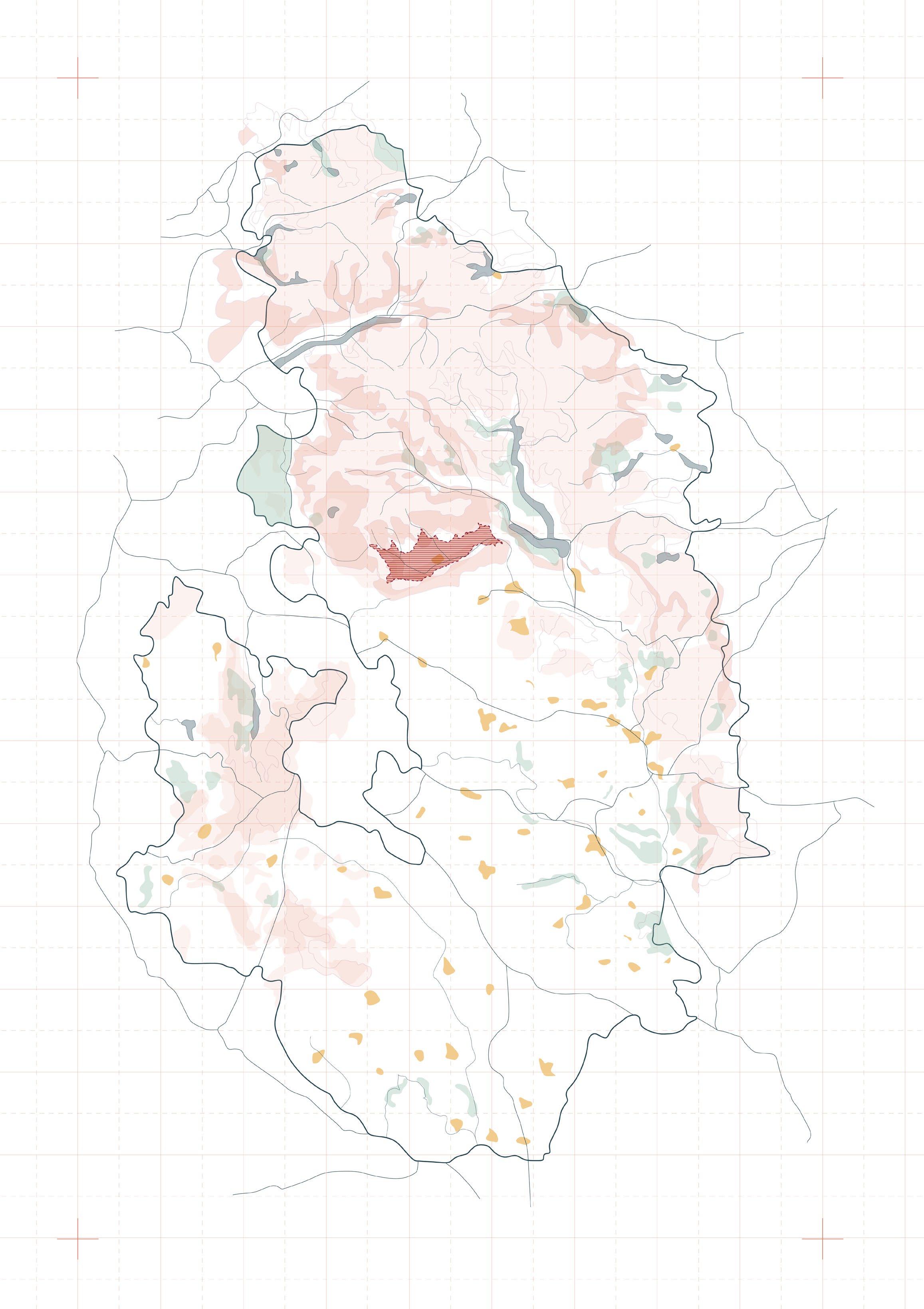
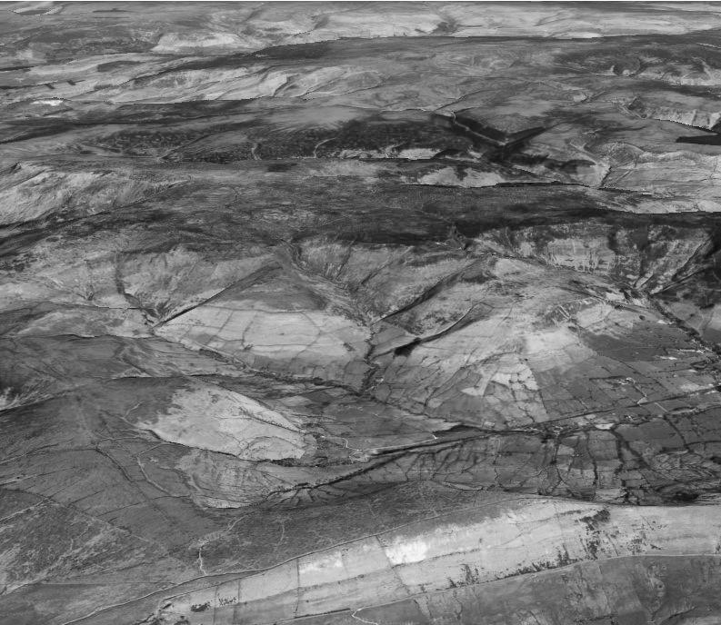
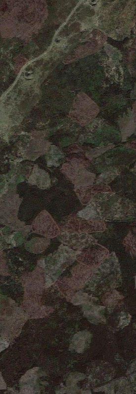
Region of Focus: Dark Peak Moorlands
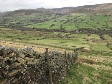
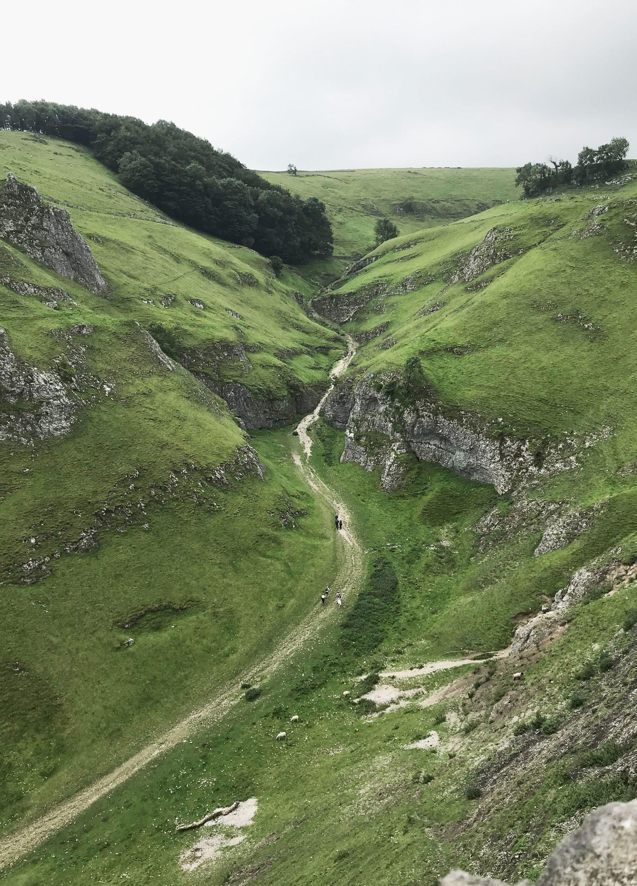
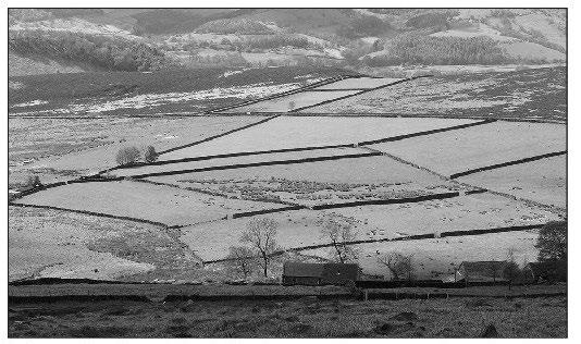
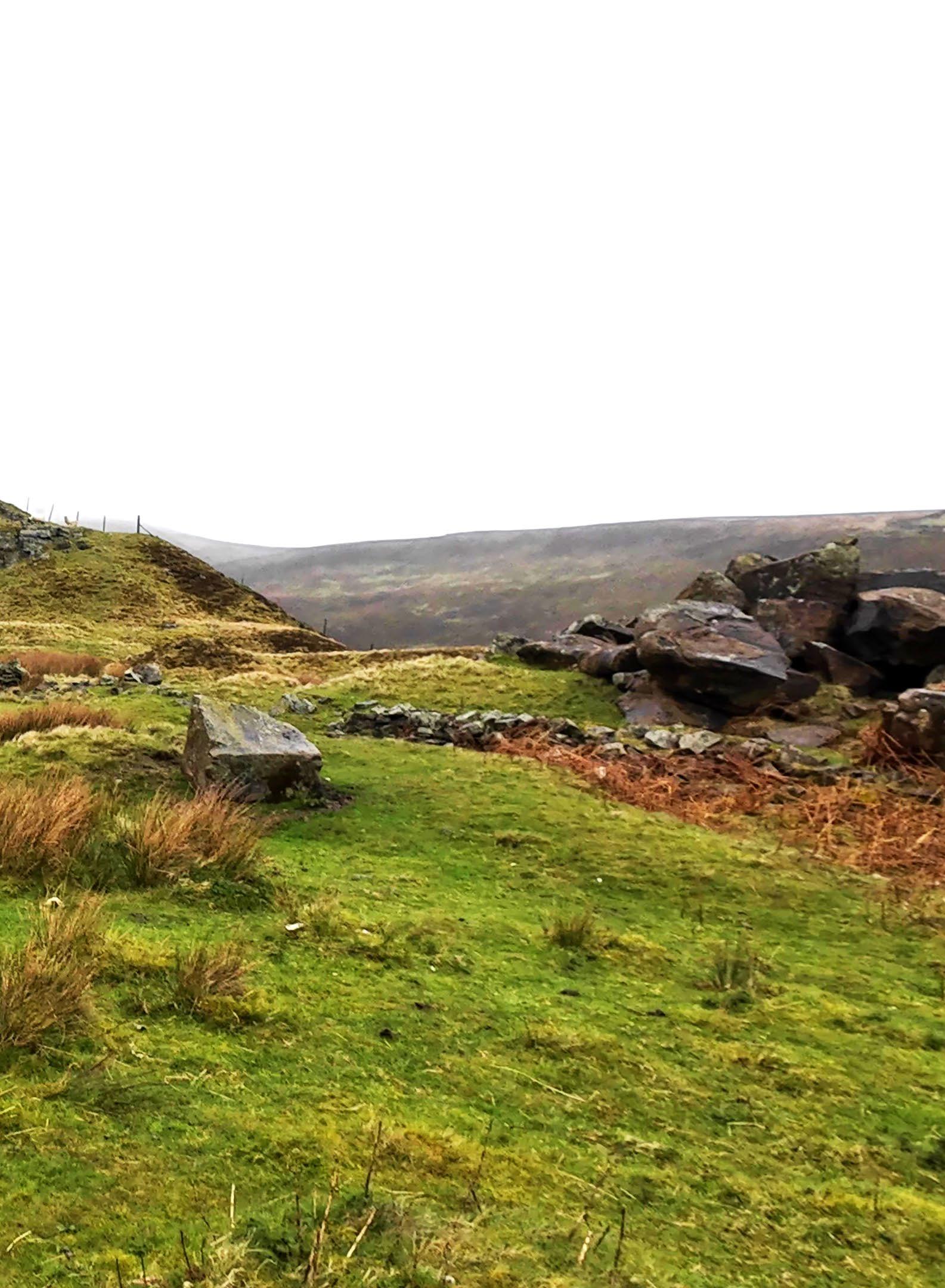
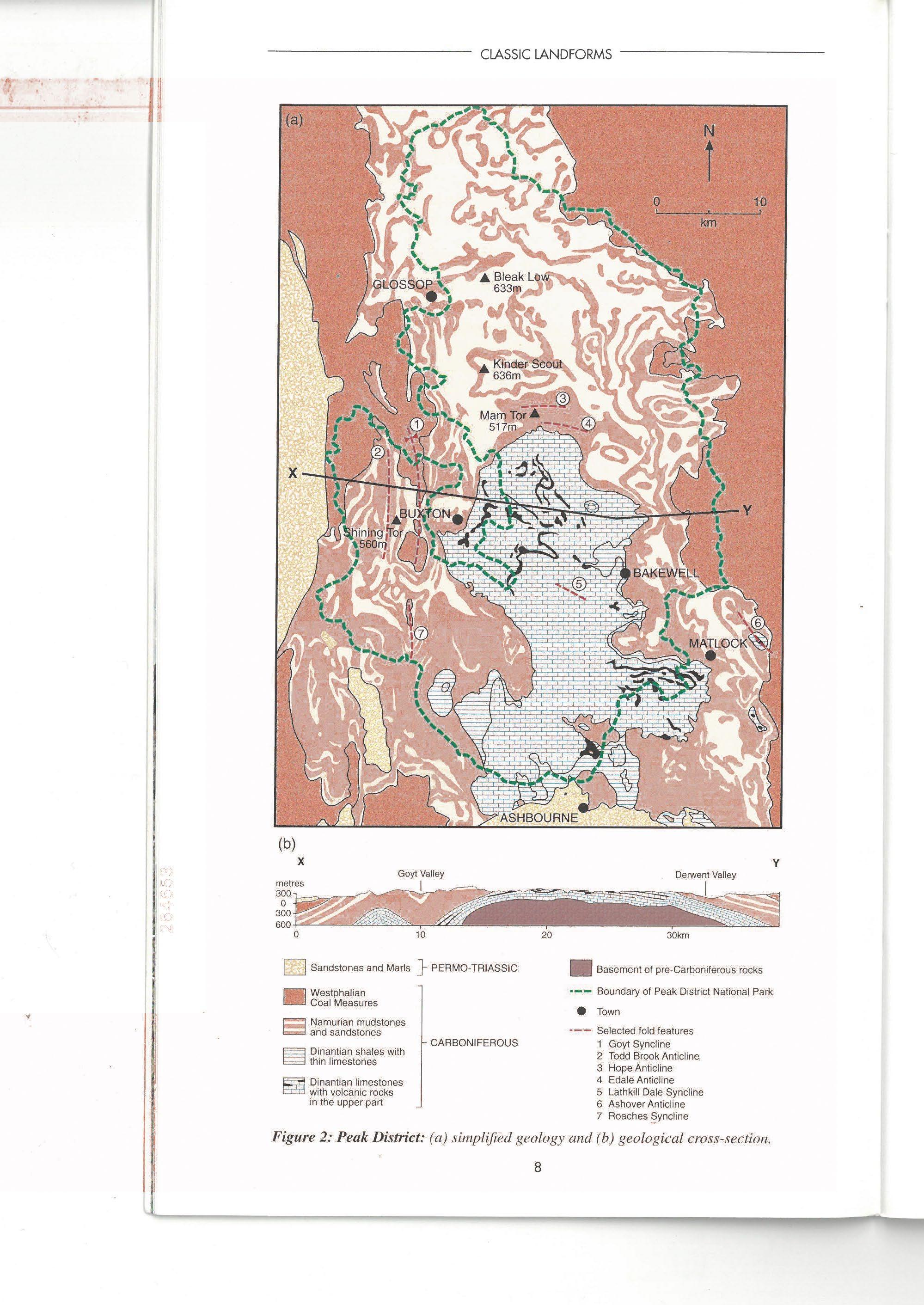
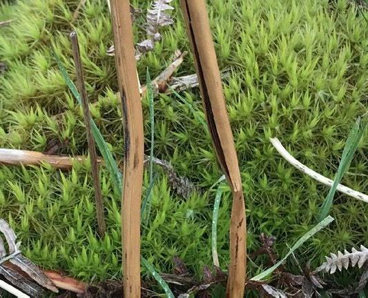
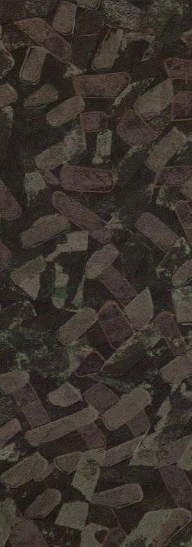
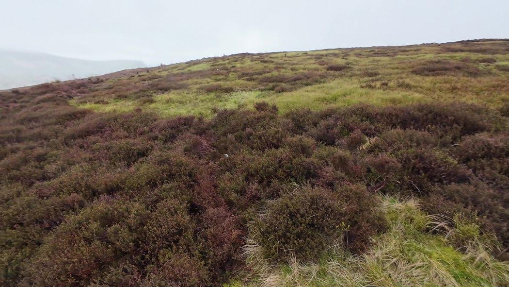
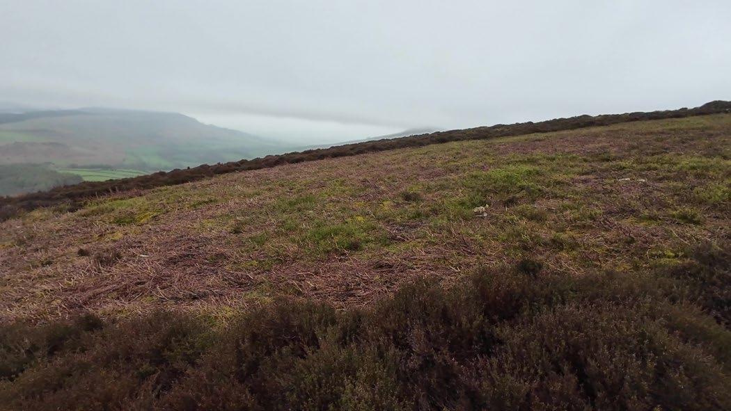
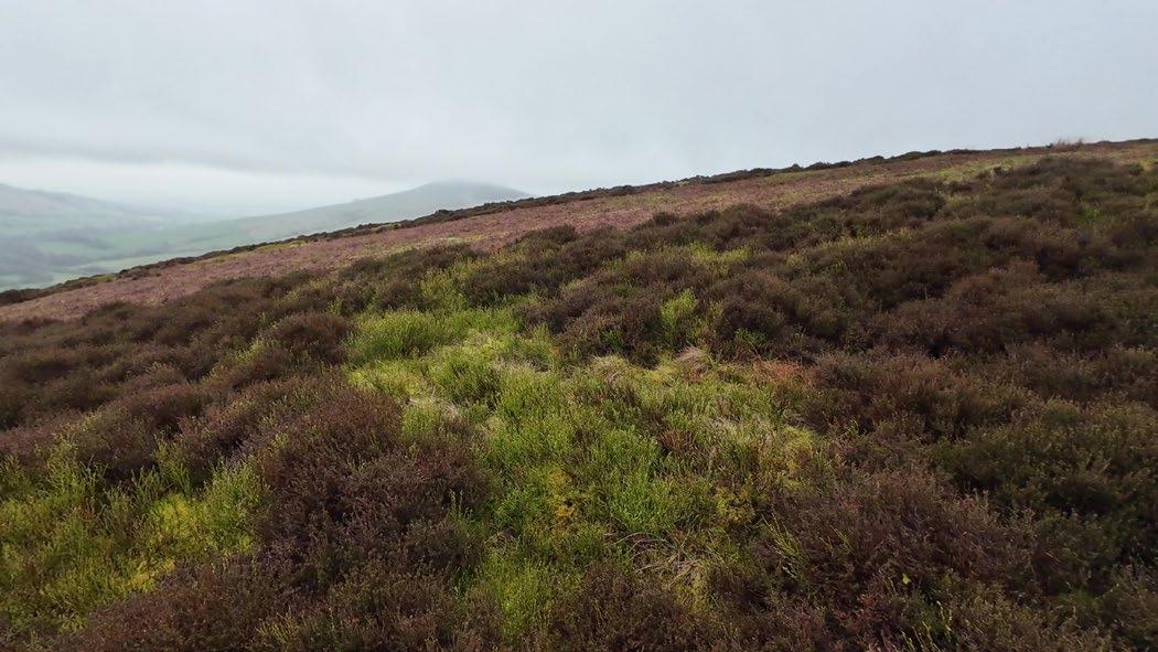
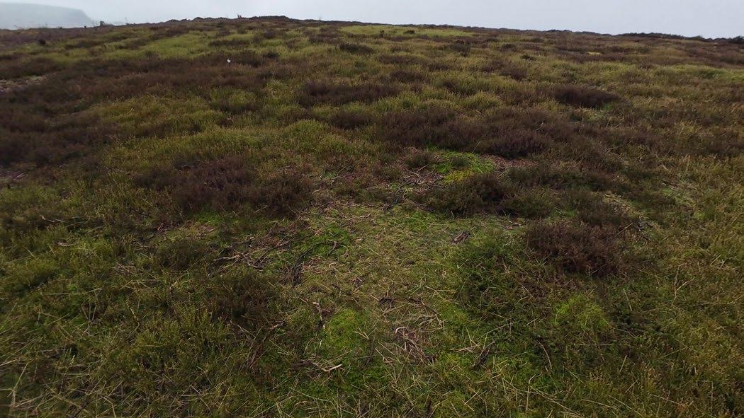
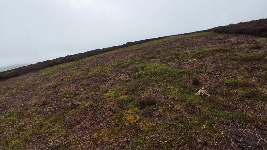
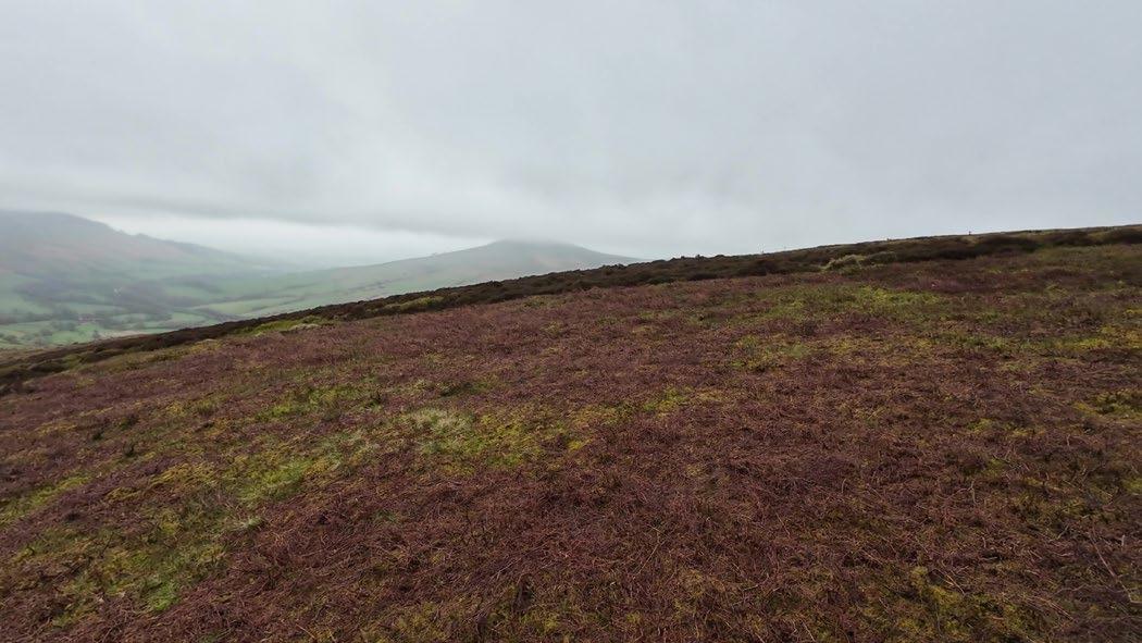
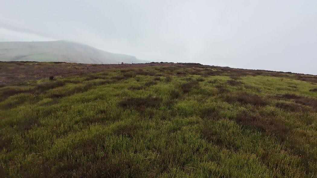
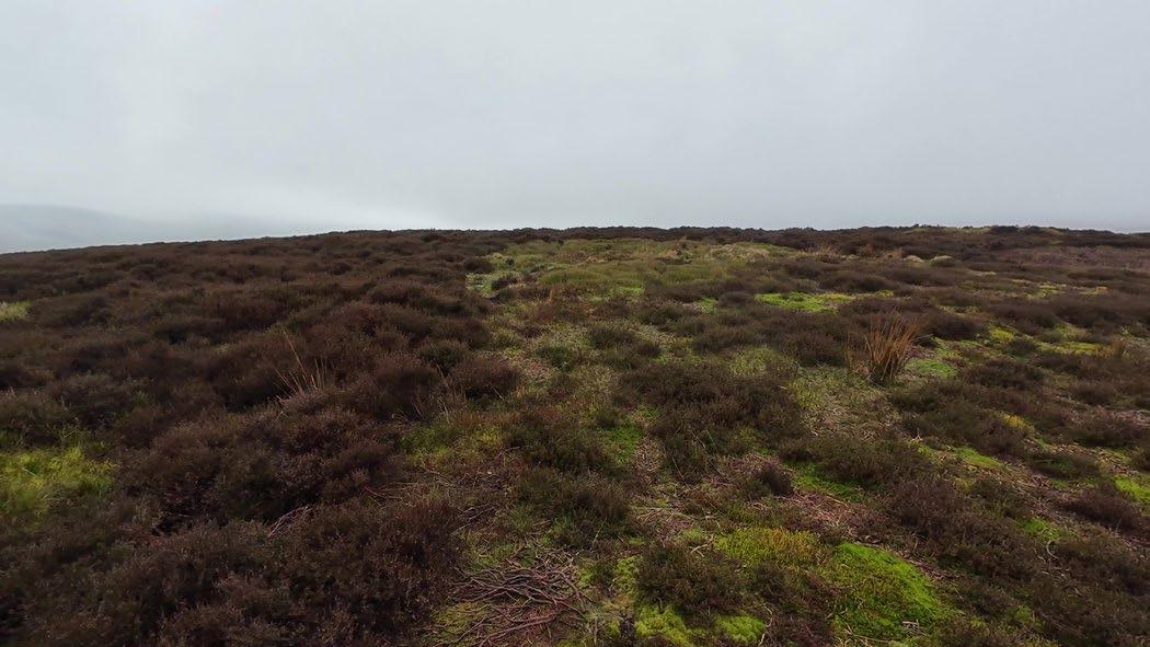
The Peak District is divided into two prominent regions: the Dark Peak and the White Peak. This refers to the geologic makeup of each, where the Dark Peak is primarily gritstone, and the White Peak is predominantly limestone. The dark peat soils of the moorlands are also important features of this area, in places reaching over 4m in depth. The Dark Peak has fewer settlements than the White Peak and fewer enclosed areas, though drystone walls are still ubiquitous. The region is known for its dramatic gritstone tors and high peaks, such as Kinder Scout, which reaches 636m. The landscape is carved by streams into cloughs and valleys, creating fertile environments for mosses, lichens, tree, and bird life.
The landscape has long been shaped by humans, with traces of early stone age settlements still visible in places. Valleys have long been agricultural and used for grazing, while the peaty moorlands have been cut for fuel—one of the rights of the moorland commons, though an ecologically damaging one. Large constructed reservoirs are another definitive element, created in the mid 20th century to provide drinking water to the growing urban centres around the national park.
Dark Peak Landscape Regions
Moorland slopes and cloughs
Open moors
Enclosed gritstone uplands
Upper valley pastures
Dark Peak moorland regions
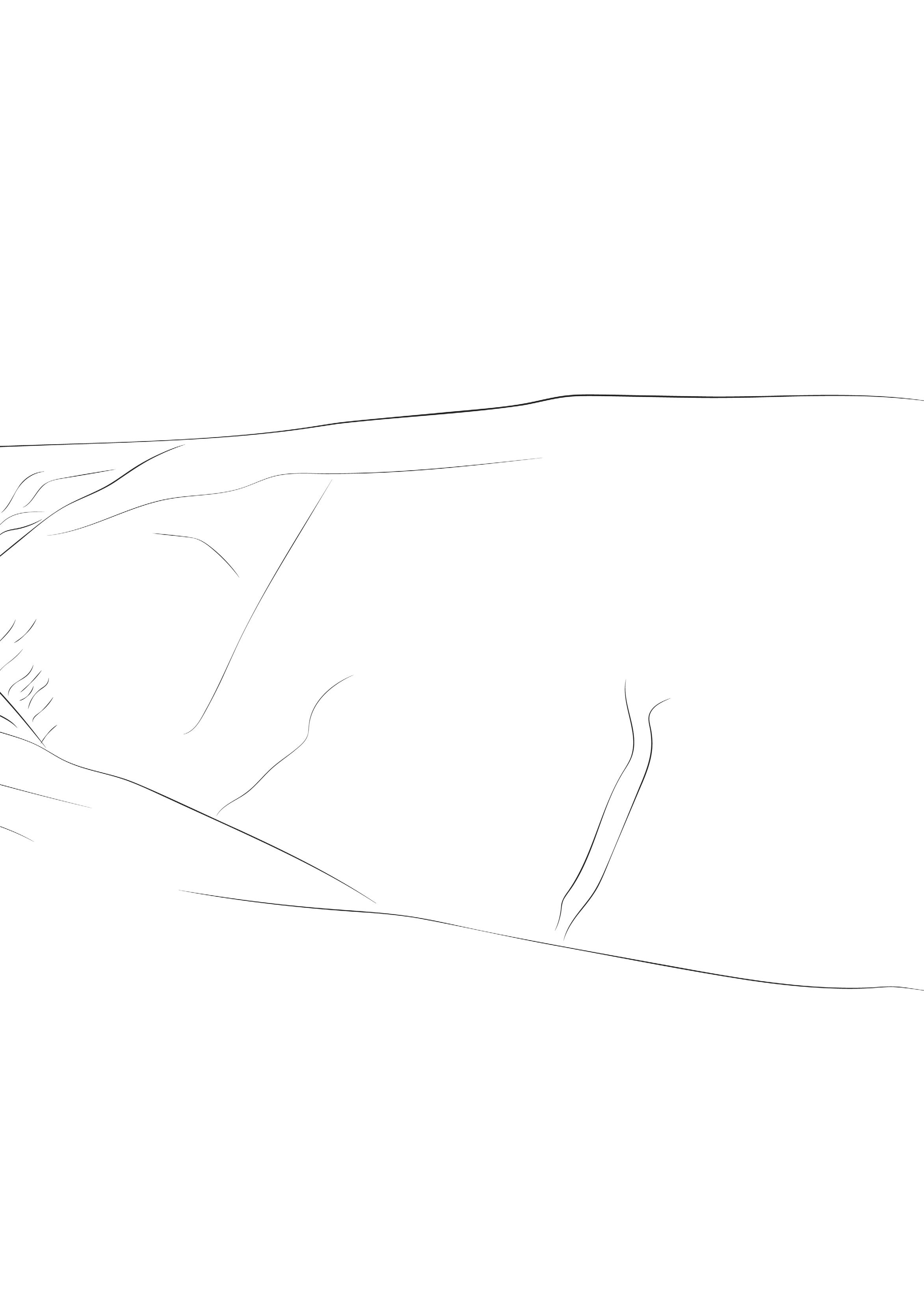
Section through the Dark Peak
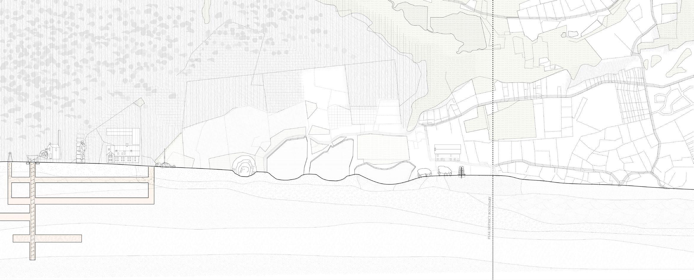
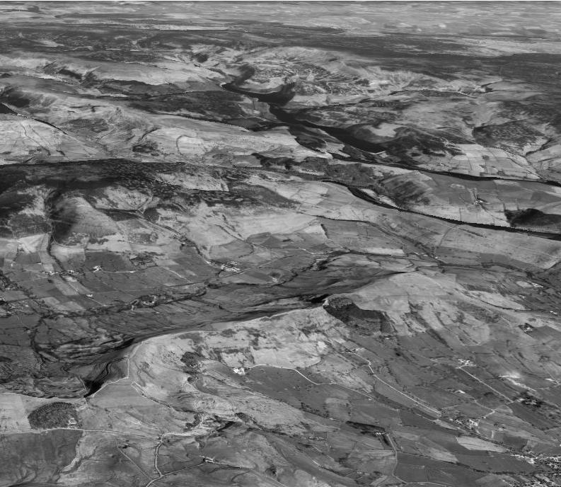
The project is situated in the Dark Peak region in the northern half of the national park. This section analyses some of this area’s most distinctive elements, viewing the landscape as an assemblage of interrelated parts that are in constant dialogue with one another.
01. Vast reservoirs were constructed in the mid 20th century to provide drinking water to the rapidly growing cities surrounding the Peak District. Villages such as Ashopton were flooded and covered during the construction of these fabricated lakes and dams.
02. The landscape is dotted with stone structures both ancient and contemporary 19th- and 20th century grouse shooting butts sit adjacent to prehistoric stone circles.
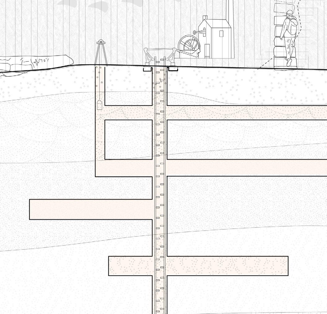
03. The Peak District is an industrial landscape straddled between Manchester and Sheffield, two key cities in the Industrial Revolution. Beneath its surface are extensive mining networks, while quarries scar the rocky hillsides.
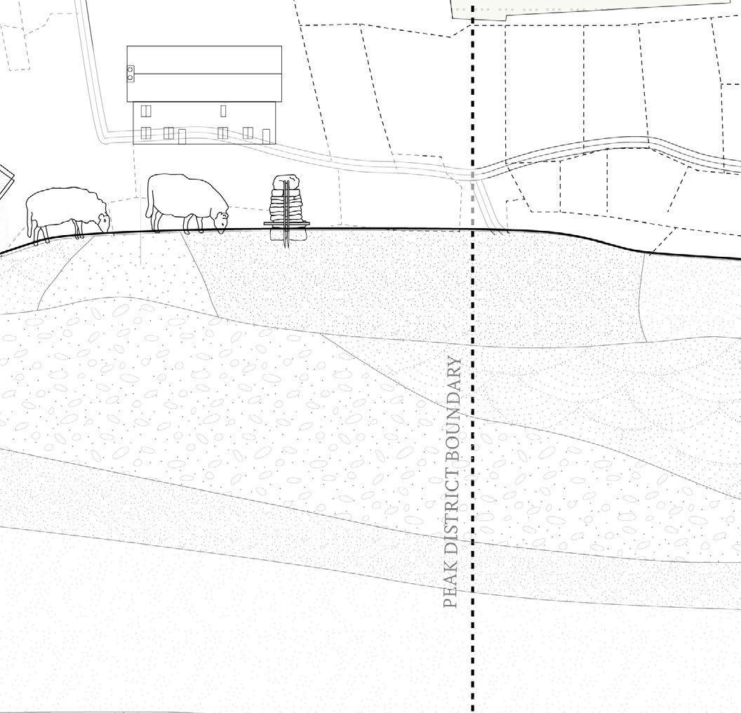
04. The national park boundary, demarcated in maps and legislation, is nearly invisible in the landscape, often passing through farmland.
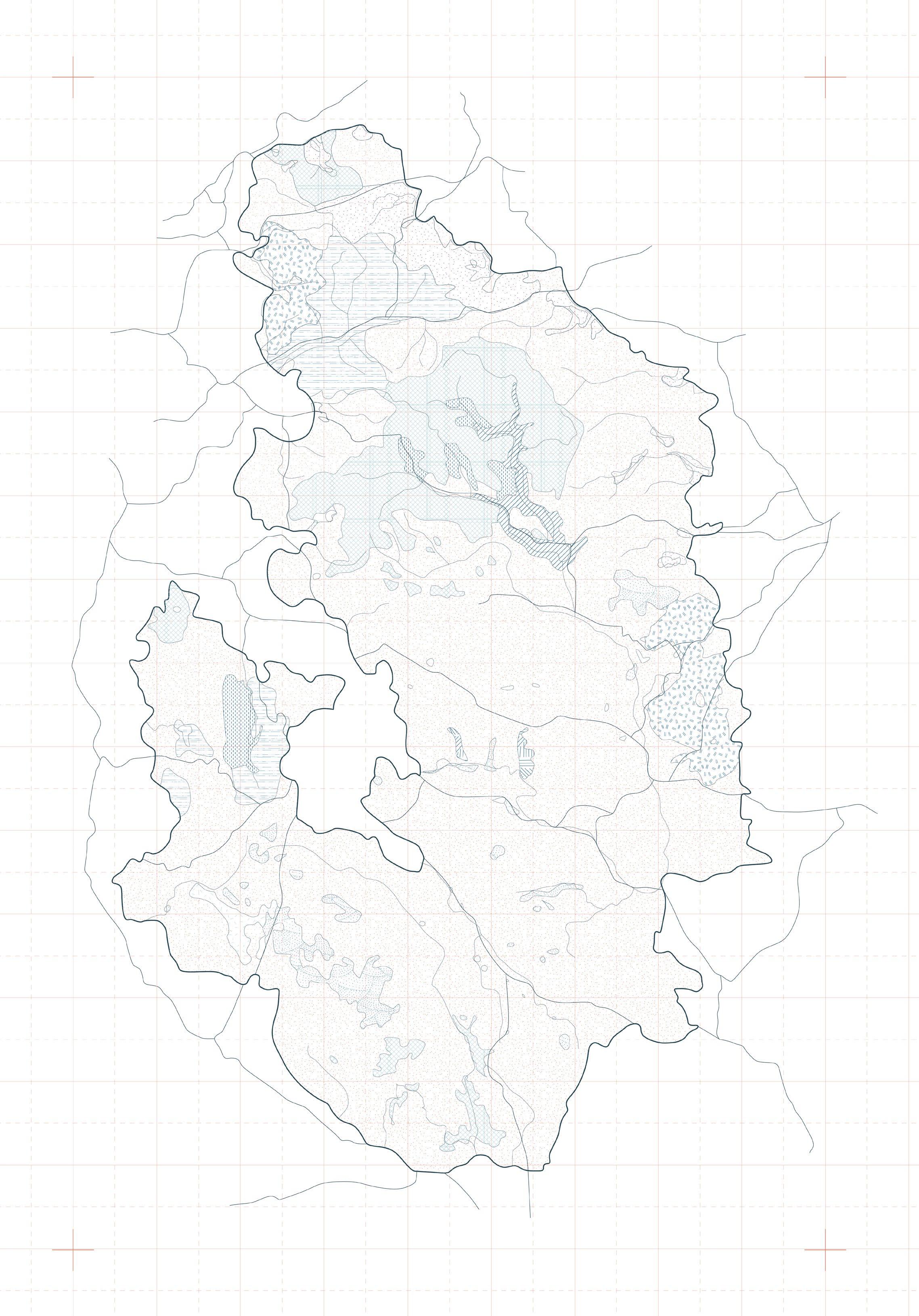
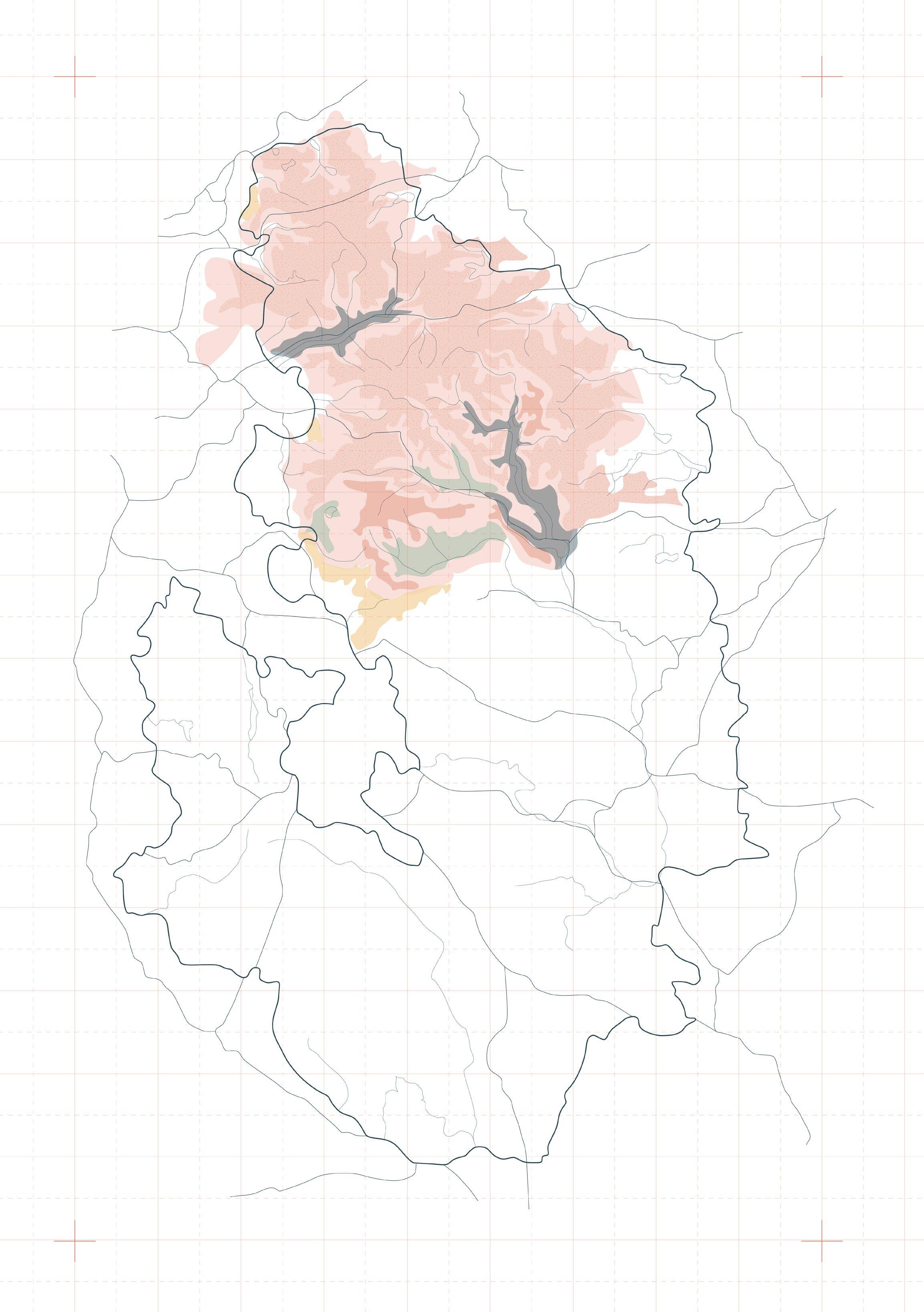
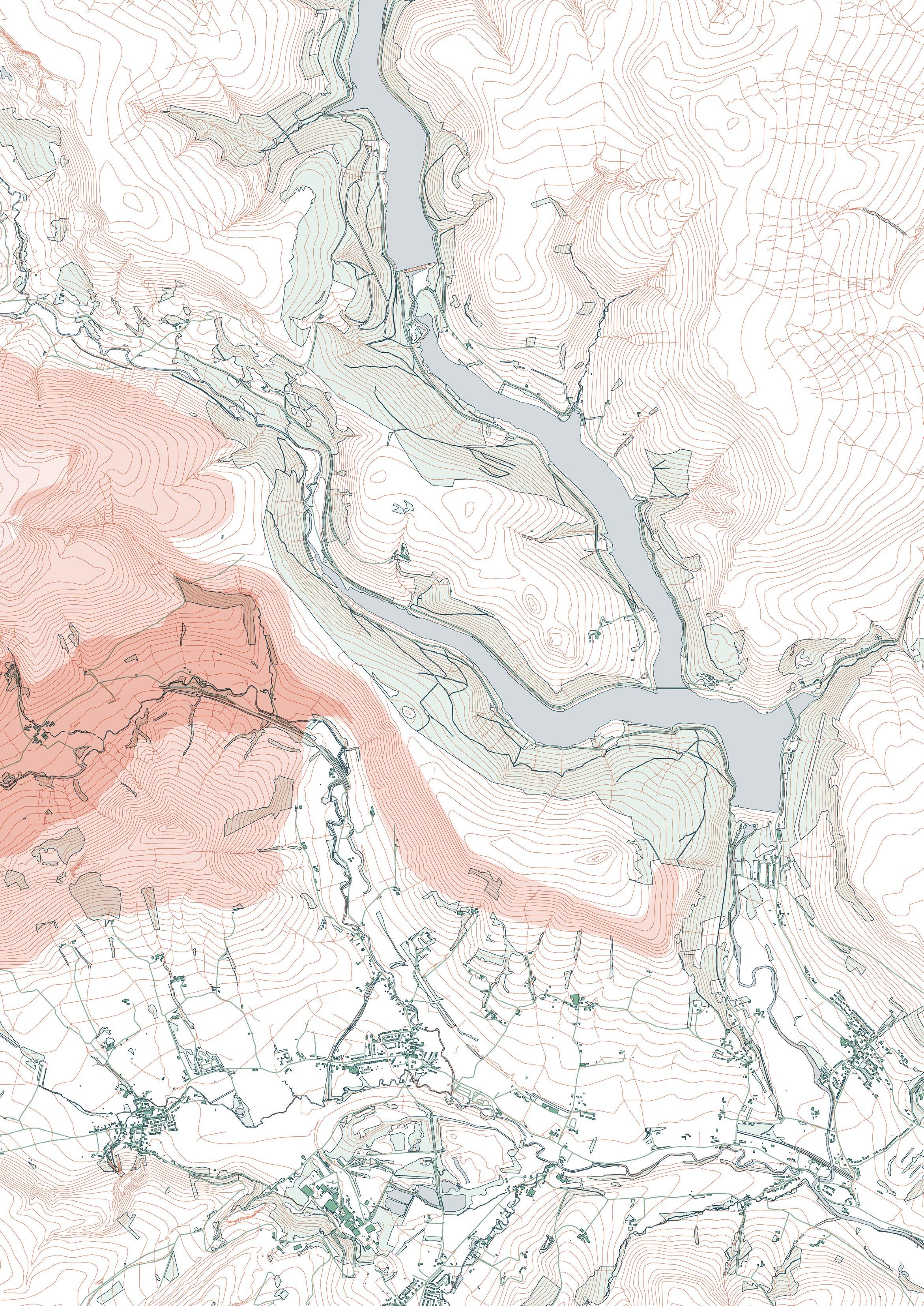
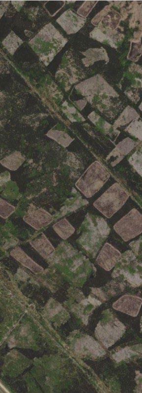
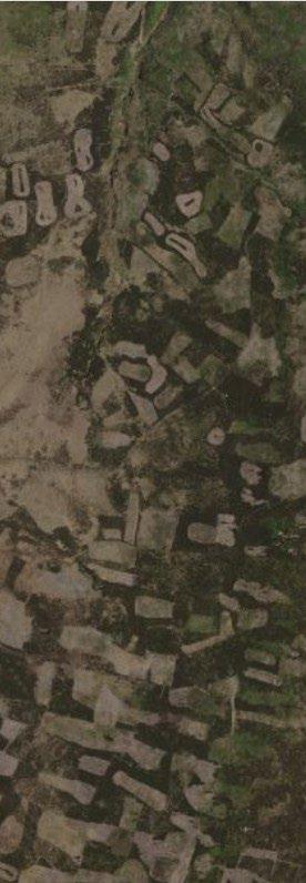
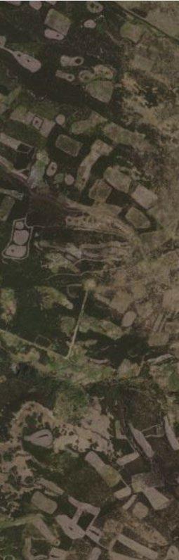
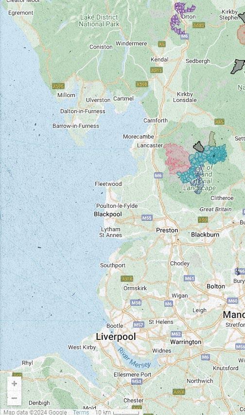
Fieldwork Site and Area of Focus: Edale Valley and Moors
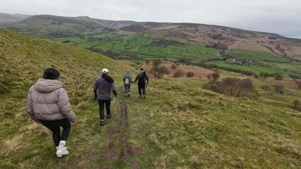
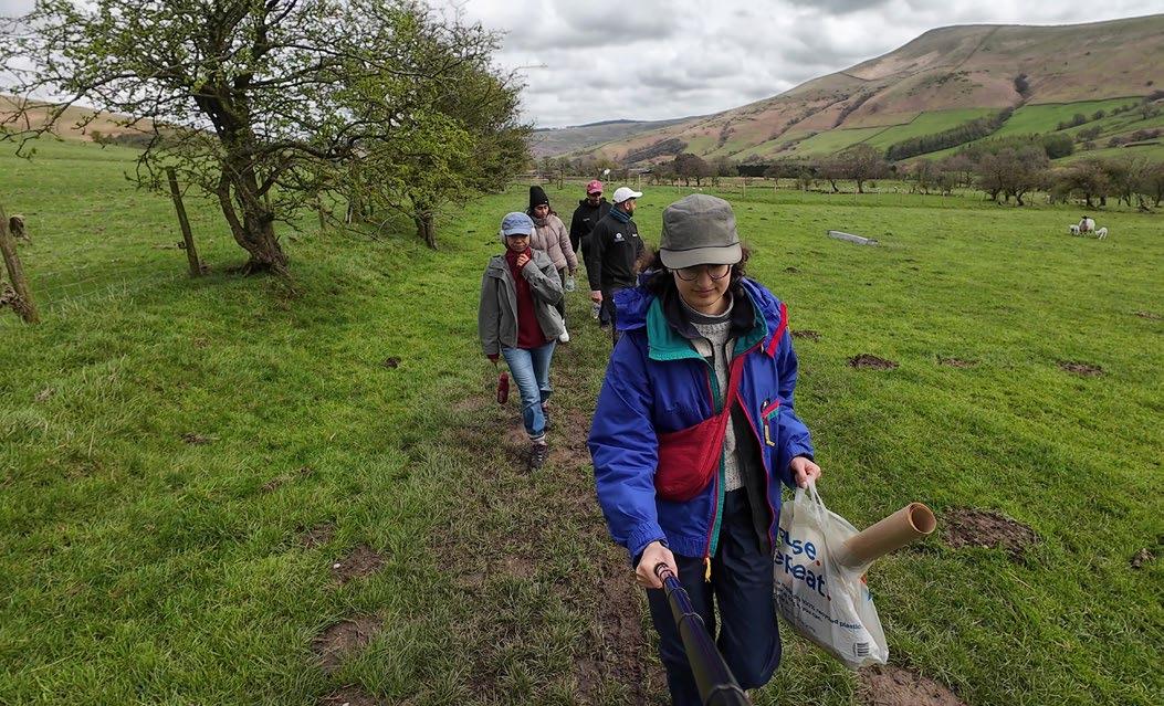
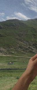
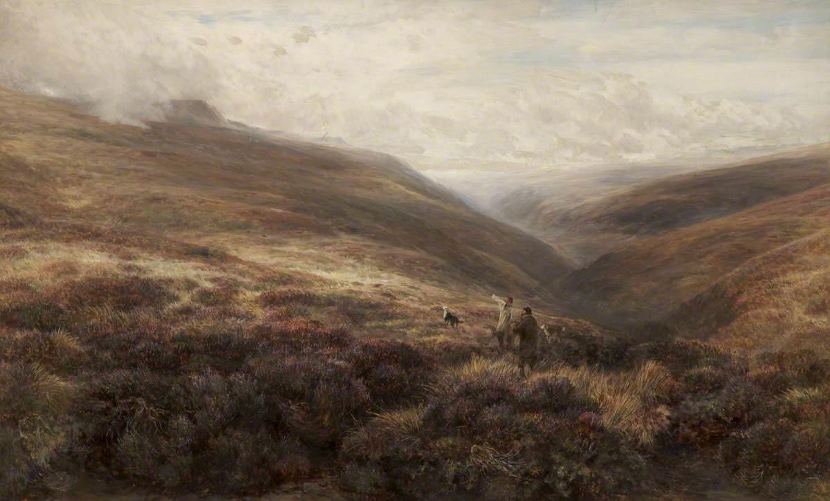
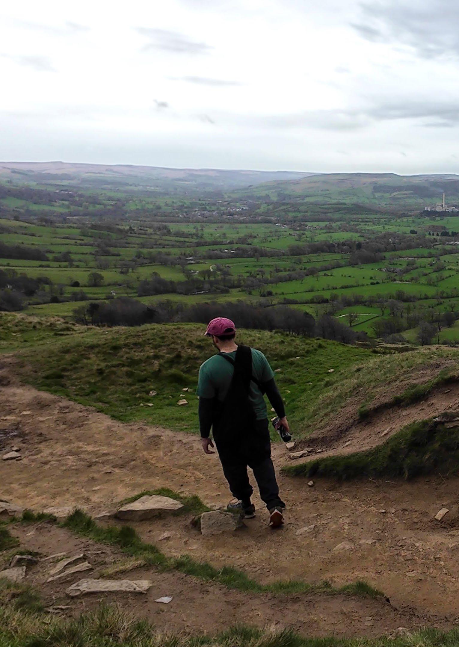
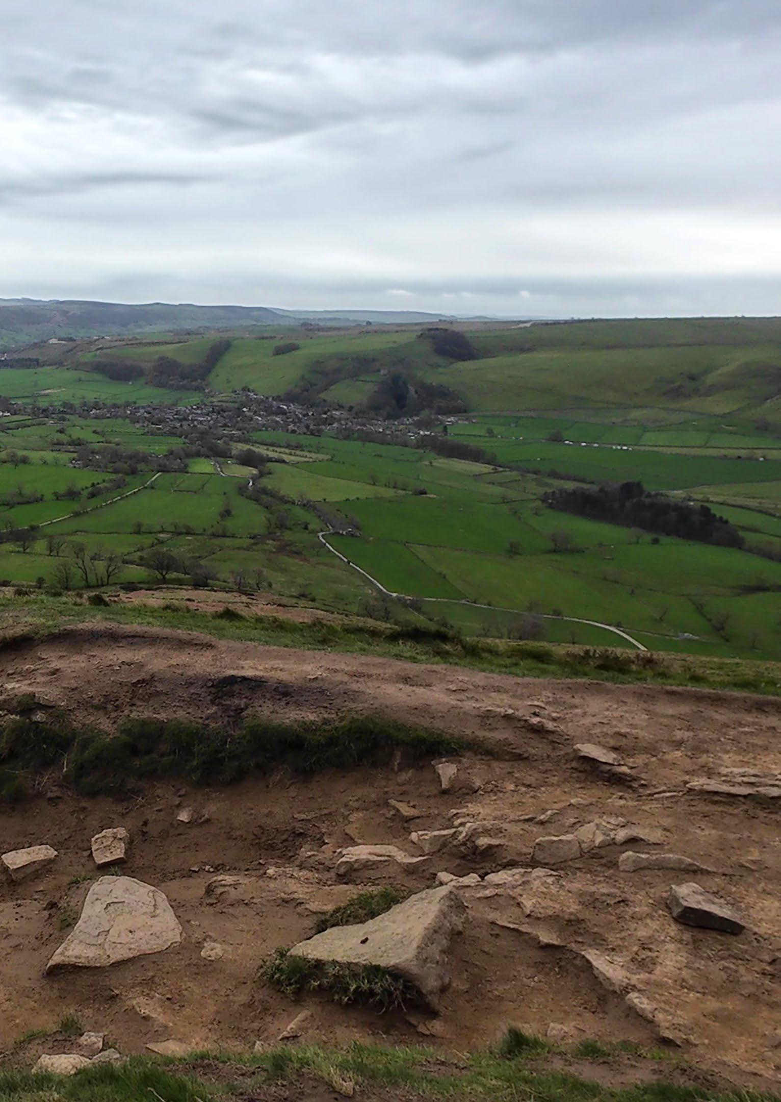
From April 7th- 11th, I stayed in Edale, spending time getting to know this particular landscape in the Dark Peak.
Situated between Kinder Scout and Mam Tor, Edale has long been a popular hiking destination. Human settlement in the valley dates back millennia, but the current landscape has been greatly shaped by agricultural, industrial, and recreational purposes. During the feudal system, sheep farming was the primary economic activity, with land owned by lords or monasteries. Edale was one of the first railway connections into the Peak District, allowing easy access for hikers arriving from urban centres.
Settlements
01. Edale Valley 02. Ladybower Reservoir 03. Manchester 04. Sheffield
Dark Peak moorland
Moorland slopes Forested areas Reservoirs
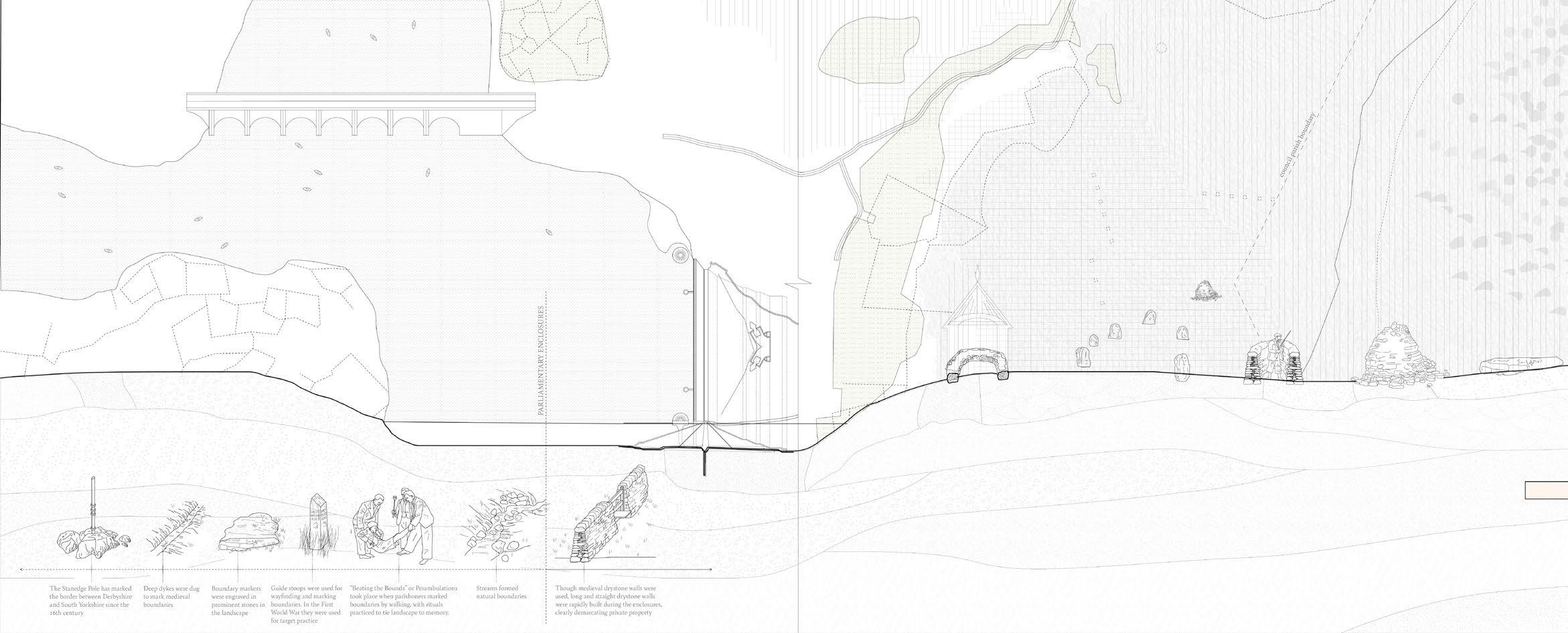
This archaeological survey of drystone walls in Edale valley shows legacies of enclosure and private land ownership clearly demarcated in the landscape. It tracks boundaries present, removed, and added between 1839/1848 and 1880 specifically. This survey clearly shows the implication of the parliamentary enclosures of the 19th century, where common land was parceled into relatively even private farms.
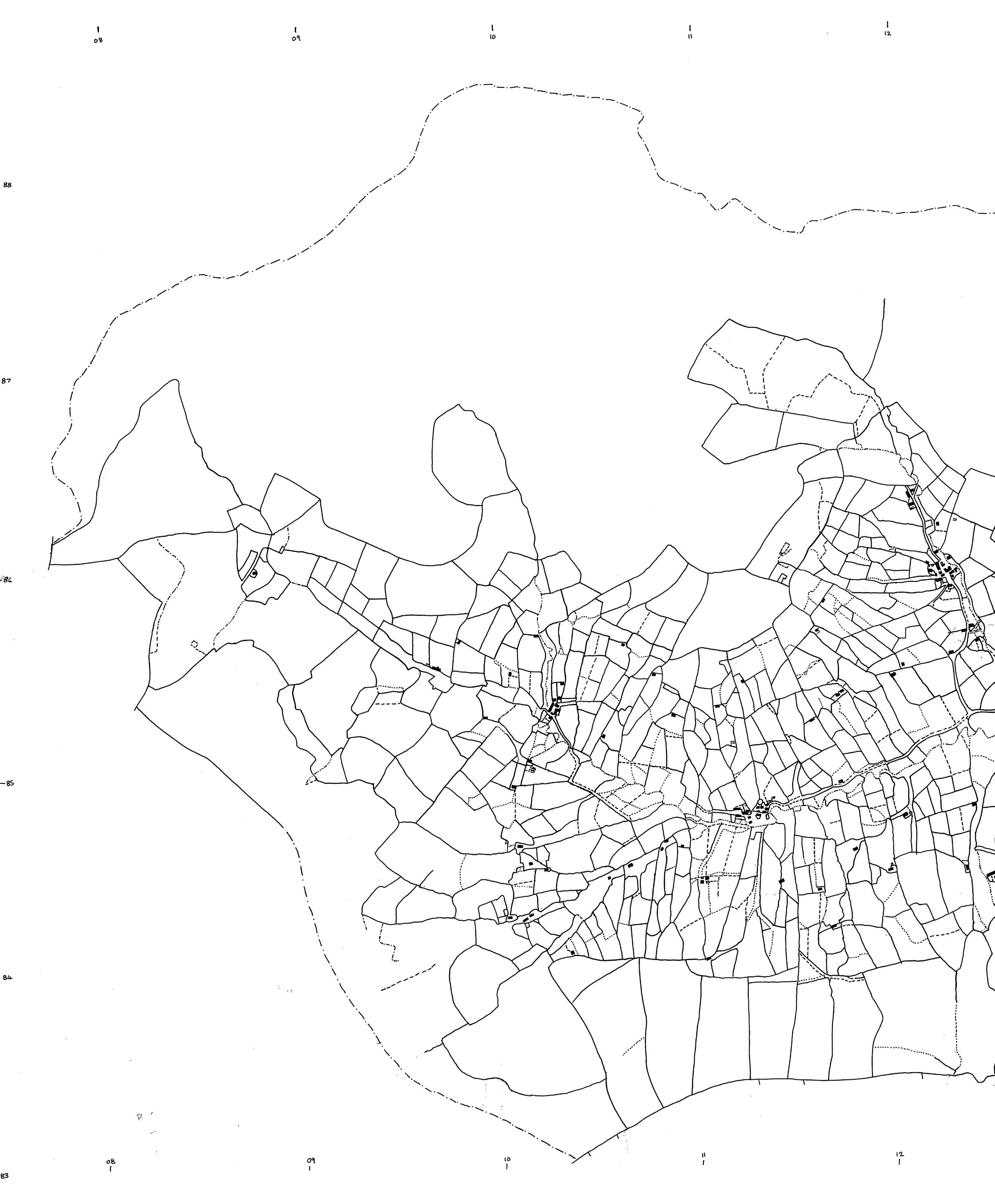
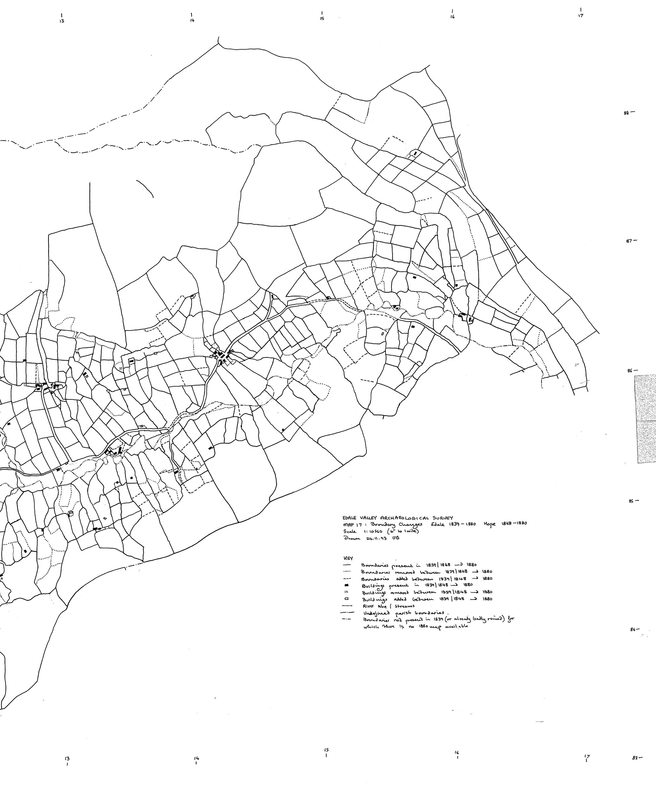
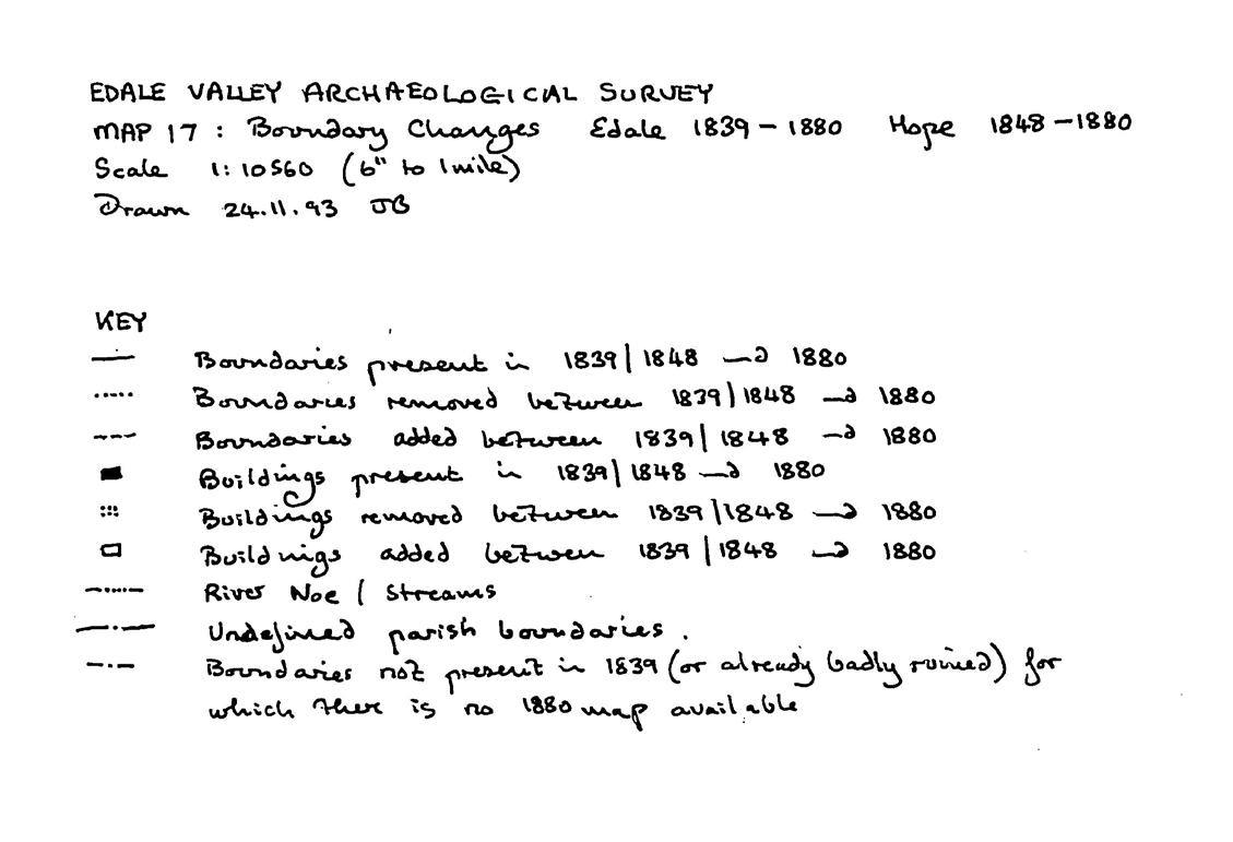
Boundary Wall Emergence
The survey of boundaries present, added, and removed between 1808/1839 and 1839/1848, compared to the previous survey to 1880, shows the rapid increase in wall construction during the Enclosure Acts of the second half of the 19th century.

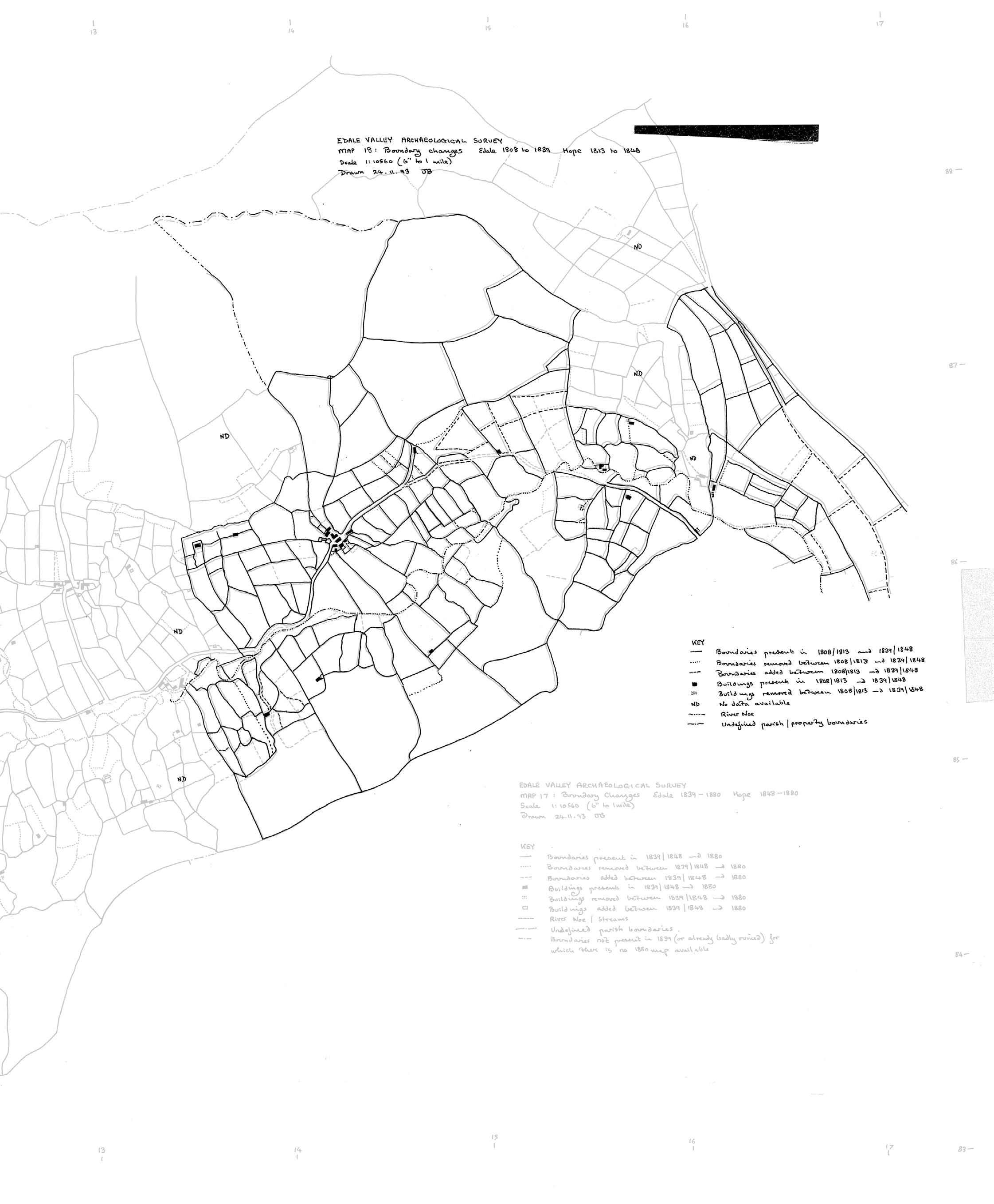
By overlaying the ownership map surveyed in 1993 with the boundaries, we see how each property parcel grew over time, rendering old boundary walls obsolete. These are often the walls that are left to crumble and decay. Given that these surveys were hand drawn, they do not align perfectly.
Fieldwork in Edale Valley and Moors: 07.04.24 - 11.04.24
I stayed in the YHA Edale
02 This circle demarcates my maximum walking radius
Edale valley: open pastures
Moorland slopes and cloughs
Open moors
Reservoir
Woodland
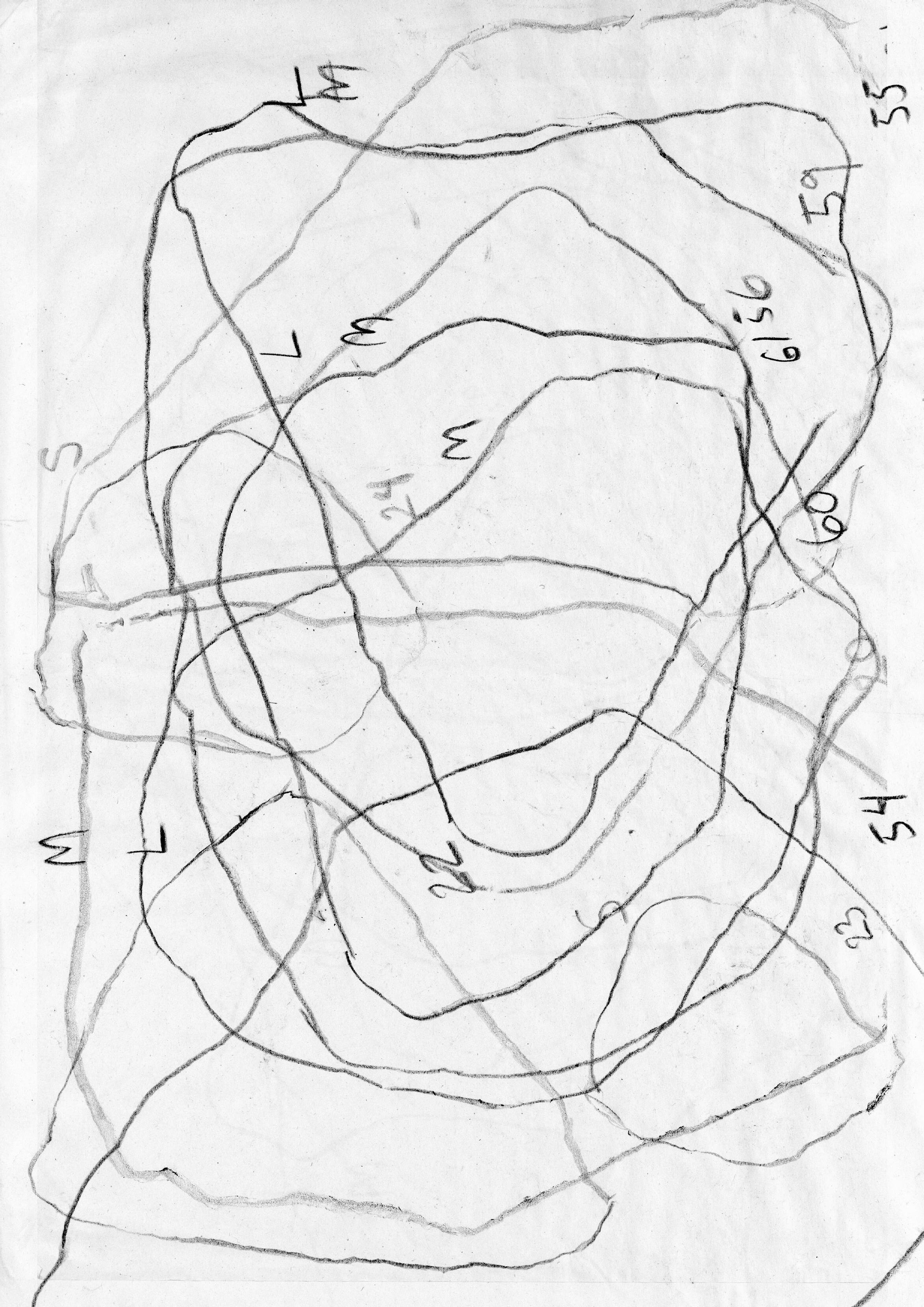
Walking Routes
The lines demarcate the walks I took during my five days in Edale. The density of lines shows that I often didn’t stray far from the hostel, and frequently returned to several locations of interest.
April 11, afternoon Sunny and warm
April 9, morning Windy and rainy
April 7, evening Windy and
April 11, morning Sunny and warm
evening drizzly
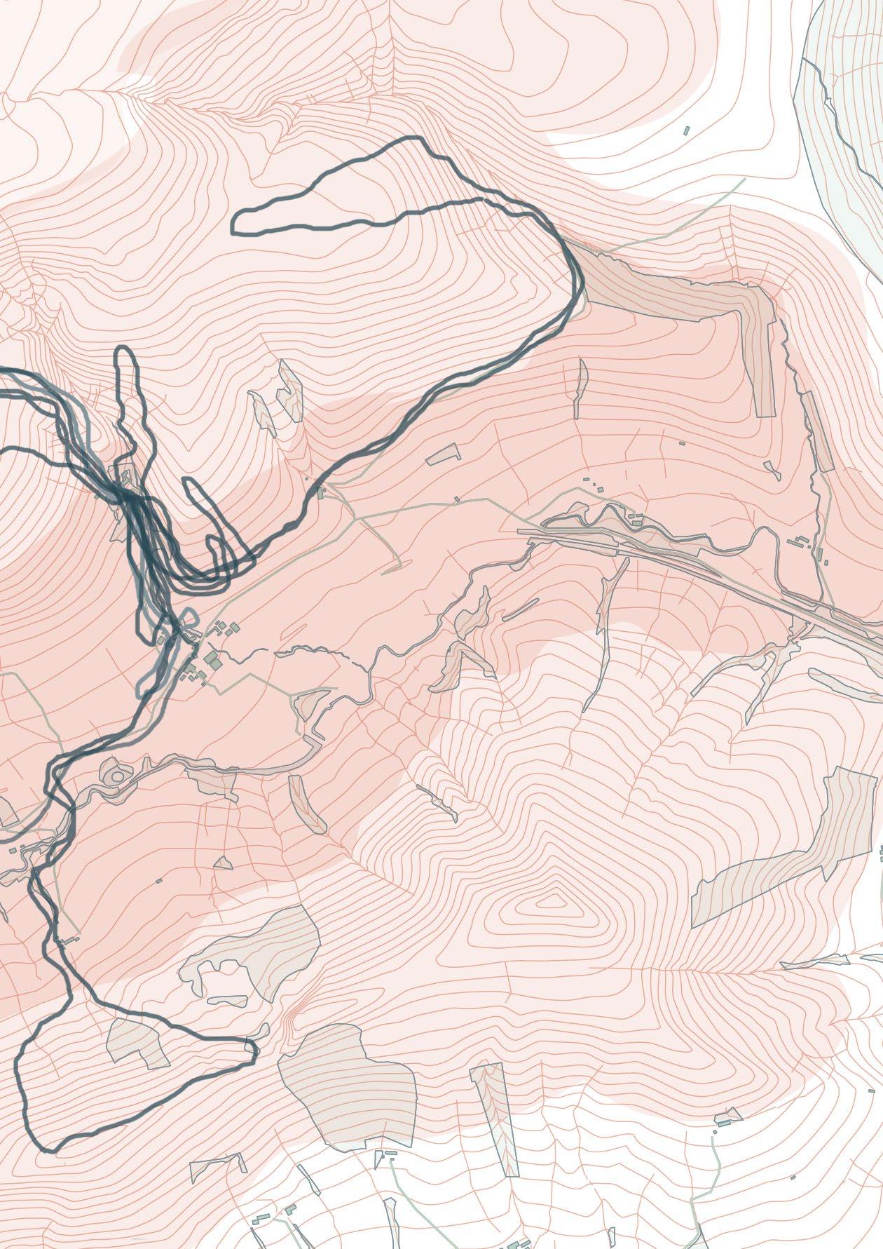
April 8, morning Sunny and cool
April 9, afternoon Windy and rainy
April 8, afternoon Sunny and warm
April 10, morning Cloudy and drizzly
April 9, evening Occaisional clouds
April 7, afternoon Windy and rainy
April 10, afternoon Windy and drizzly
GEOLOGY AND ECOLOGY:
INTERACTIONS BETWEEN SURFACE AND SUBSURFACE
This section examines the geology of the Dark Peak, the northern region of the Peak District where much of the moorland is found.
This thesis views geology as not static but the framework of an ever-shifting landscape. Building with drystone is to build with the fabric of the land itself, a re-assembly of the surface and subsurface conditions as built form. In doing so, humans inevitably encounter the agency of the rocks themselves, and the act of making becomes one of collaboration.
We are all geological.
Sub-question A:
+ How does the geologic makeup of the moorlands provide the ‘ingredients’ for drystone construction?
Preamble: Becoming Geological
Dark Peak Geology
Dark Peak Geologic Timeline
Dark Peak Geology
Gritstone Formation and Properties
Dark Peak Ecology
Dark Peak Flora and Fauna
Dark Peak Mosses and Lichens
Dark Peak Landforms and Lifeforms
Nether Booth Overlooking Upper Moor
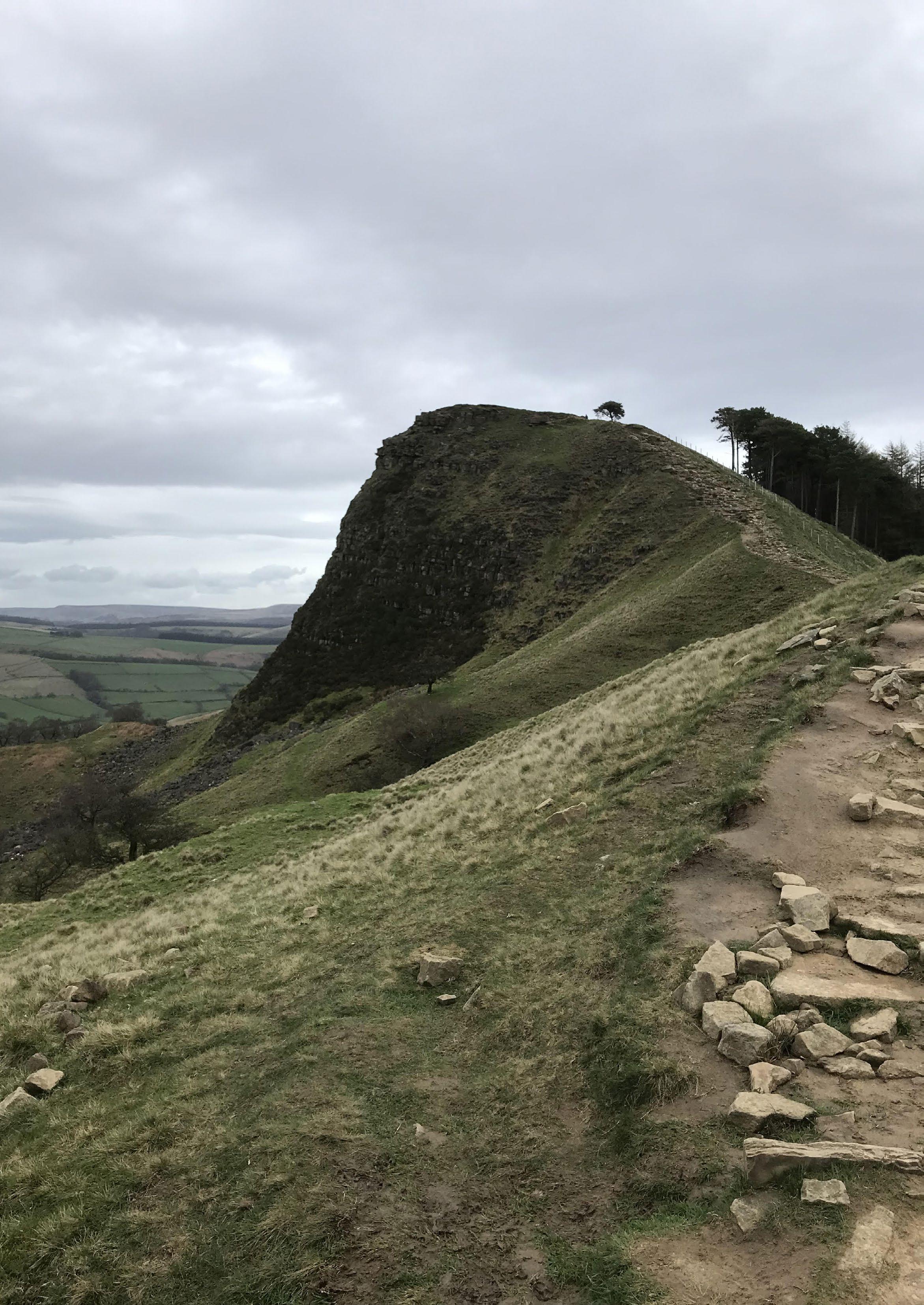
Back Tor
Hollins Cross Overlooking Castleton and Hope Valley
Backtor Farm Overlooking Edale Valley Landforms as Windforms
Moorland Peat Ecologies
Peat Formation and Degradation
Moorland Grouse Industry
Problematising Heather Burning
Moorland Filmic Mapping
Grouse Moors and Land Ownership
Preamble: Becoming Geological
Experiments in Learning-with Stone
“We are in a knot of species coshaping one another in layers of reciprocating complexity all the way down”
“If we appreciate the foolishness of human exceptionalism then we know that becoming is always becoming with, in a contact zone where the outcome, where who is in the world, is at stake.”
- Donna Haraway, “When Species Meet”
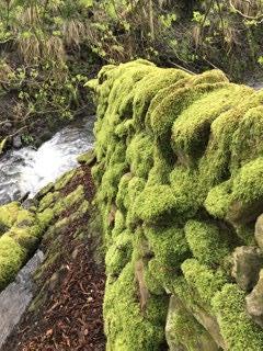
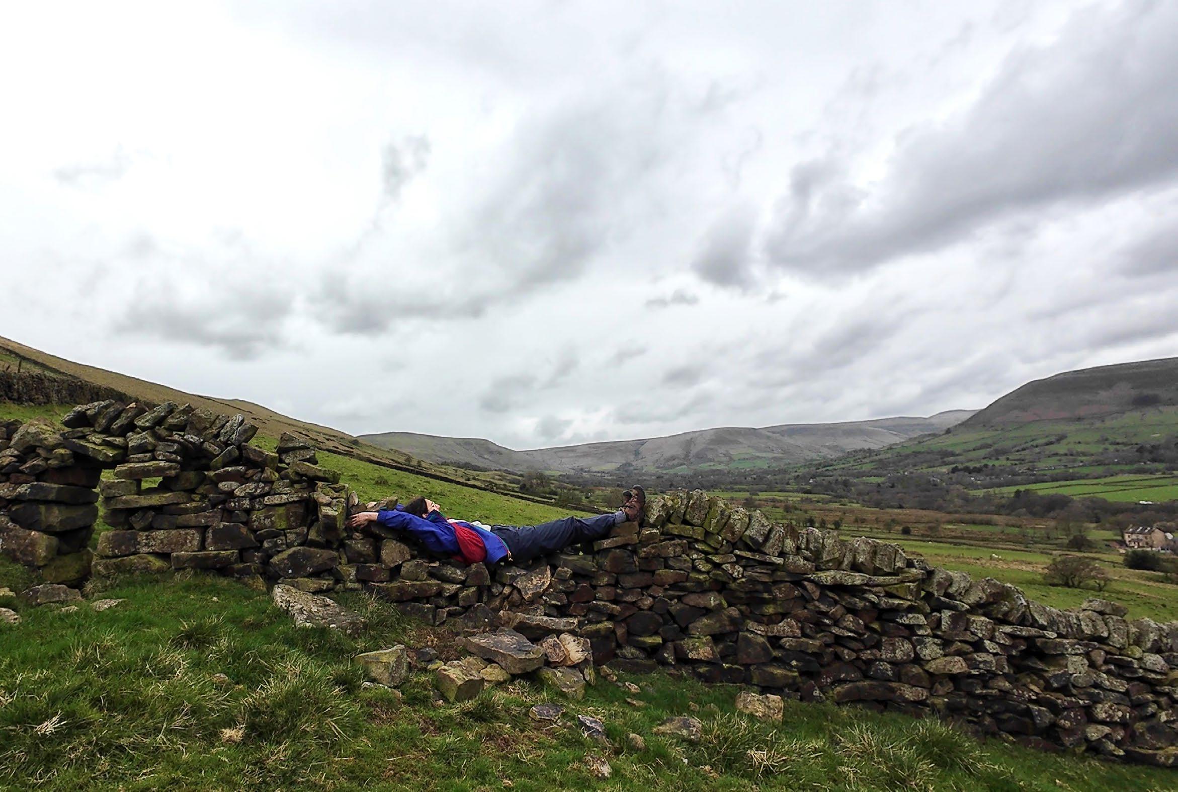
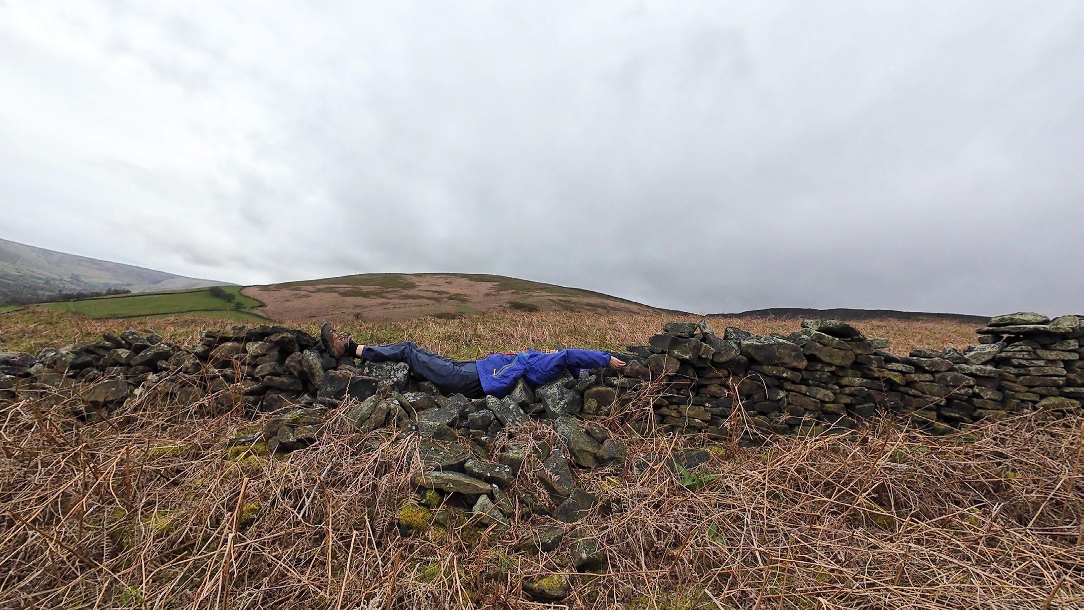
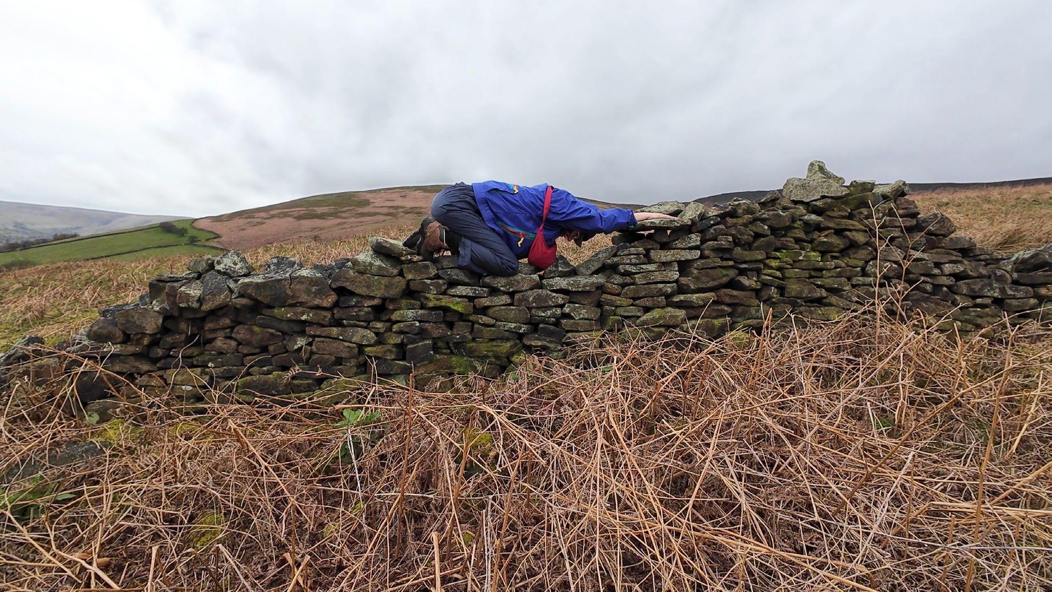
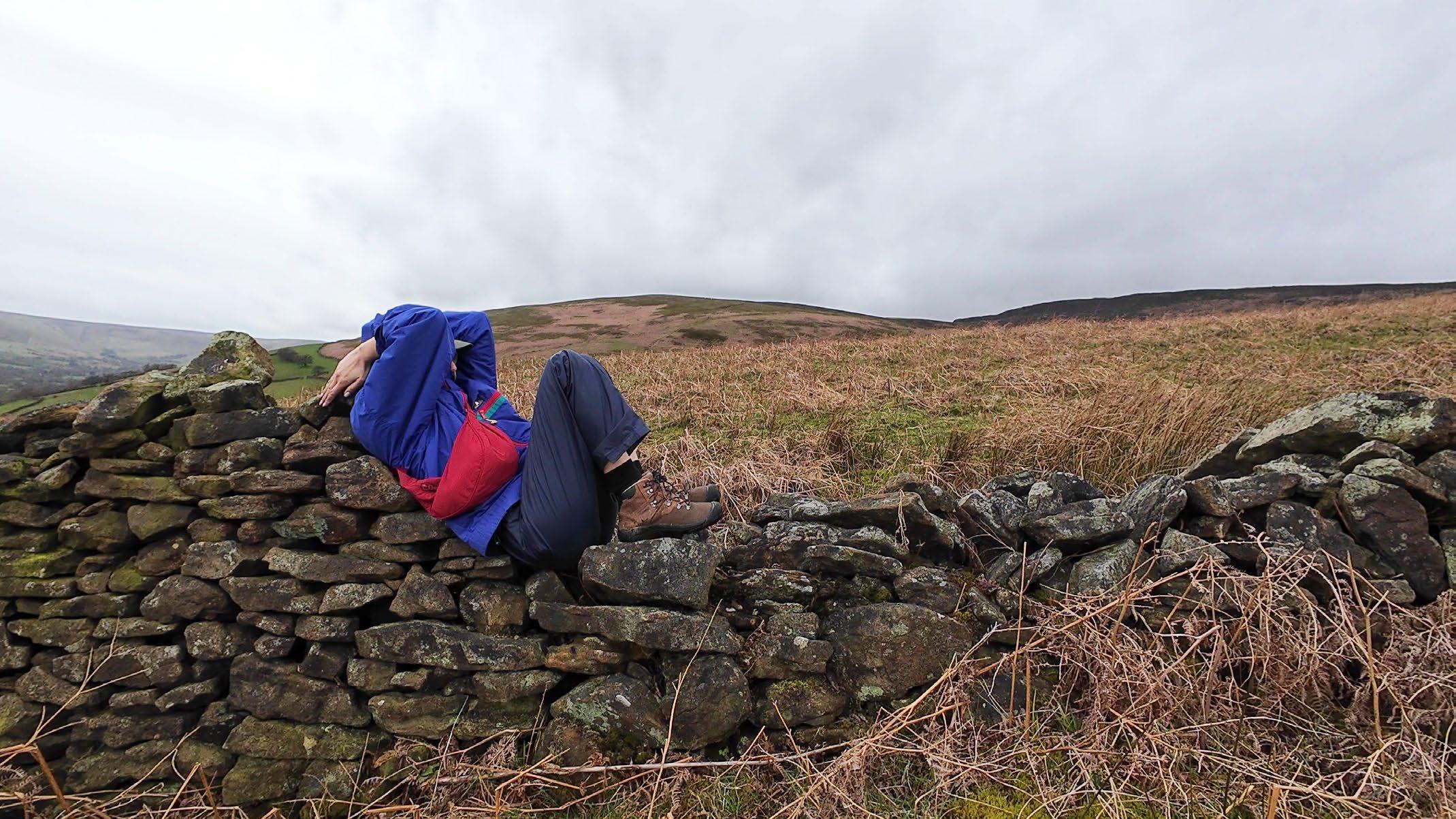
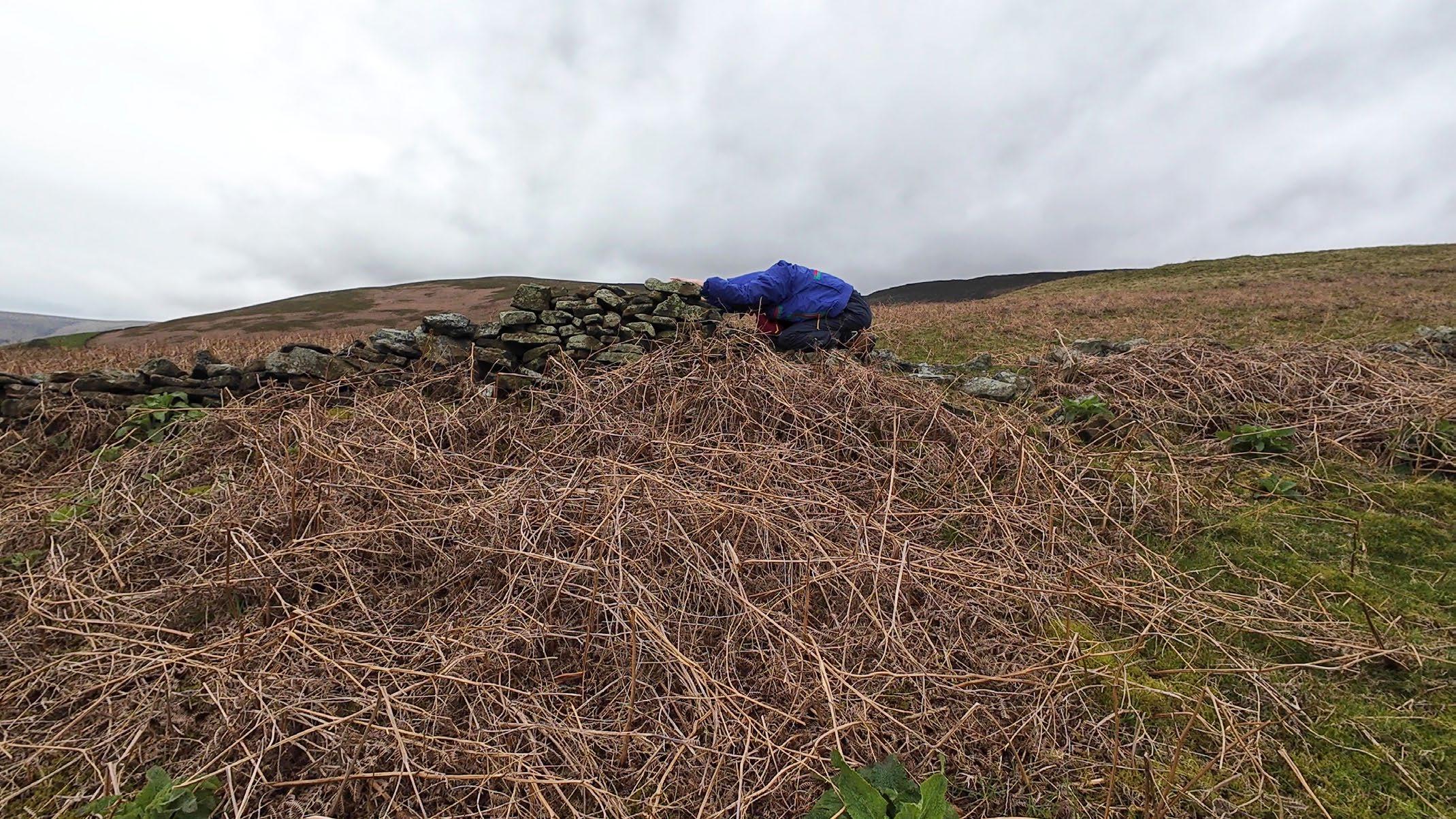
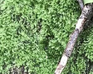
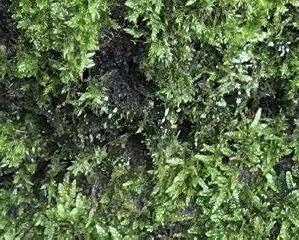
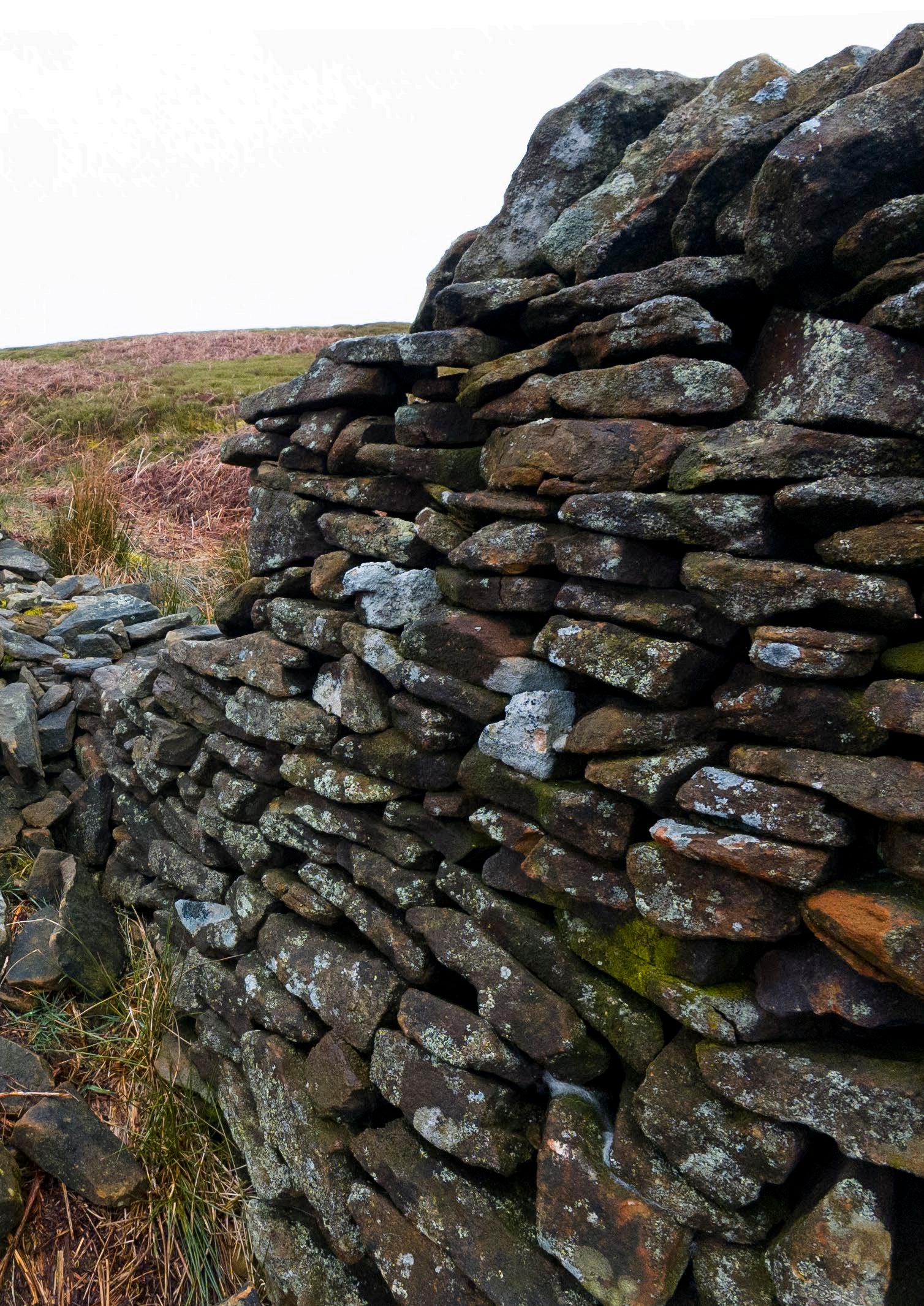
What might it mean to see oneself in relationship to stones? What might the implications be of seeing stones as living beings? Spending time with the drystone walls around Edale, I kept feeling their ‘alive-ness.’ Covered in mosses and infused with lichens, drystone structures are mineral conglomerates, food sources, homes, barriers, geologic entities, and expressions of the evertransforming landscape. Never static, they exist at a slower timescale than the human one, despite being built by human hands. As they crumble, rocks return to the earth’s surface, imprinting the land and confusing the binary condition of “wall” and “not-wall”. In this series of images, I developed a relationship with the stone walls by fitting my body into the gaps left by broken stones, attempting to merge with the wall. These were also attempts in forming situated knowledge, specific ways of knowing that are tactile and collaborative between myself and the stones.
Dark Peak Geologic Timeline
25,000,000BCE 1,800,000BCE 700,000BCE
EARLY PLEISTOCENE
MIDDLE PLEISTOCENE
Carboniferous Period (359-299 million years ago)
A shallow sea covers the Peak District. The remains of the sea creatures eventually form sediment deposits after millions of years
Upland Britain is formed, Carboniferous bedrock is exposed, sediments deposited 150m above current ground level, Peak Distict landmass is gradually uplifted
Uplift continues, pre-Pleistocene landscape erodes, valleys are carved out
Cold and temperate cold period brings bedrock and till patterns are formed; brings about the loose rocks in Deep
Seasonal thawing and freezing (periglacial conditions) cause degradation and weathering, scree and tor formation, landslips, slow flow of saturated soil (solifluction), valley ridges level out, valleys carved out by seasonal streams, glacial ice material (till) deposits, meltwater channels form
Erosion of glacial deposits along valley ridges (interfluves), increased sediment (aggradation) in main valleys, bedrock weathers
Glacial Period
valleys and dales are carved into the landscape
temperate climate fluctuations; brings glacial erosion of till deposits, current drainage formed; temperate period the formation of weathered soil (regoliths)
Stream patterns are re-established between glacial periods, modern floodplains form, soil and vegetation cover develops, slopes stabilise, peat forms
Peat formation
Decayed plant material in wet conditions accumulated to form thick layers of peat in the moorlands,acting as valuable carbon sinks
Bee Low Limestone Formation: Limestone
Bee Low Limestones Formation (apron-reef): Limestone
Millstone Grit Group: Mudstone, siltstone and sandstone
Shale Grit: Sandstone
Mam Tor Beds: Siltstone and sandstone
Millstone Grit Group: Mudstone, siltstone and sandstone
Bowland Shale Formation: Mudstone, siltstone and sandstone
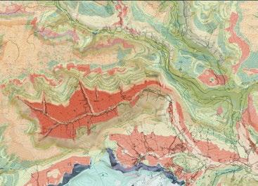
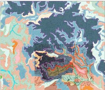
Above: Map adapted from the BGS Geology Viewer, https://geologyviewer.bgs.ac.uk/ Left: Diagram from “Classic Landforms of the Dark Peak” by R. Dalton, H. Fox, and P. Jones
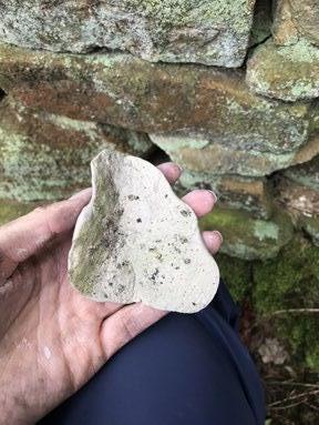
Gritstone Formation and Properties
01. Sedimentation
A shallow tropical sea covered this region during the Carboniferous period, causing sediment to accumulate on the sea floor over millions of years. Rivers, currents, and marine organisms deposited sediments such as sands, silts, and clays.
02. Diagenesis
Diagenesis is a process of sediment compaction that took place over millions of years. The pressure from the overlying sediments causes the grains of sand to become tightly packed and the pore spaces between them to decrease.
03. Cementation
As the sediment compacts, minerals such as quartz, feldspar, and calcite precipitate out of groundwater and fill the remaining pore spaces between the sand grains. These minerals bind the grains together and turn loose sediment into solid rock.
04. Lithification
The previous two processes transformed loose sediment into sedimentary rock. In the case of gritstone, the rock characteristic to the Dark Peak, the sedimentary rock that formed was sandstone. Gritstone can be identified by its coarse grain size, high quartz content, and resistance to weathering.
05. Uplift and Erosion
Over many millions of more years, tectonic activity uplifted sedimentary laryers, raising them to above sea level. Erosion further shaped the landscape into its distinctive valleys and tors, exposing underlying gritstone bedrock.
Qualitative properties
Grain size: coarse grain
Fracture: conchoidal
Streak: white
Porosity : high porosity
Luster: dull
Resistance: heat resistant, pressure resistant, impact resistant
Quantitative properties
Hardness: 6-7 (out of 10)
Compressive strength: 70.00 N/mm 2
Density: 2.2g/cm3
Specific heat capacity: 0.92 kJ/Kg K
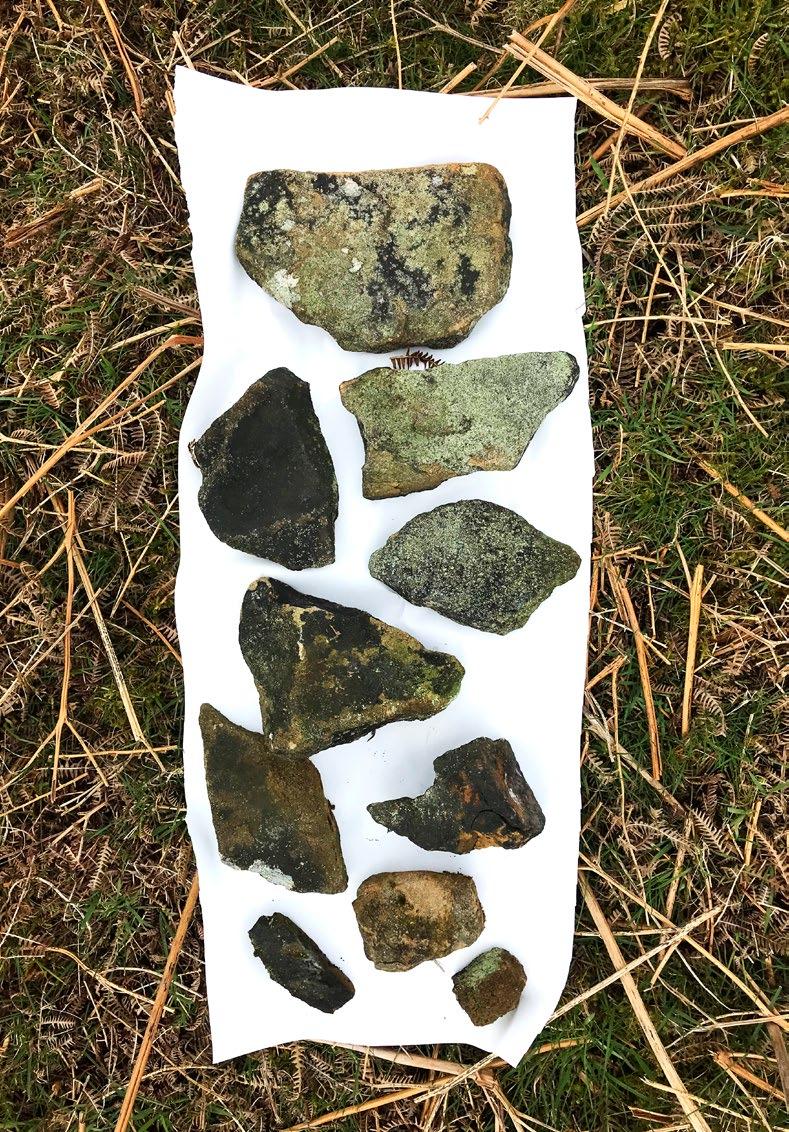
Varied shapes and sizes of gritstone
Gritstone in a broken drystone wall
Dark Peak Flora and Fauna
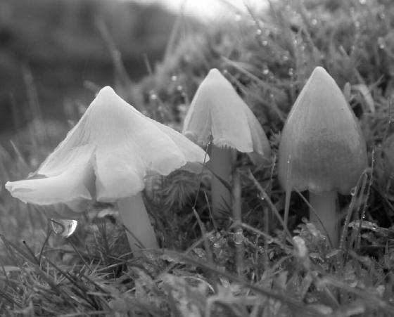
*An asterisk indicates plants and animals I encountered in and around Edale in April
PLANTS
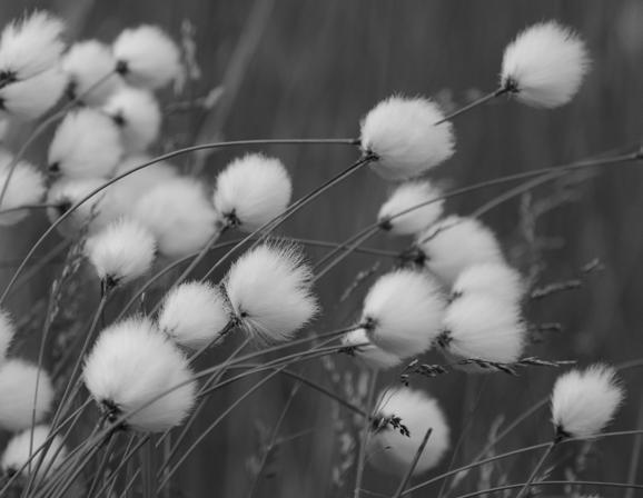
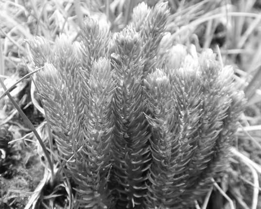
Eriophorum*
Cottongrass
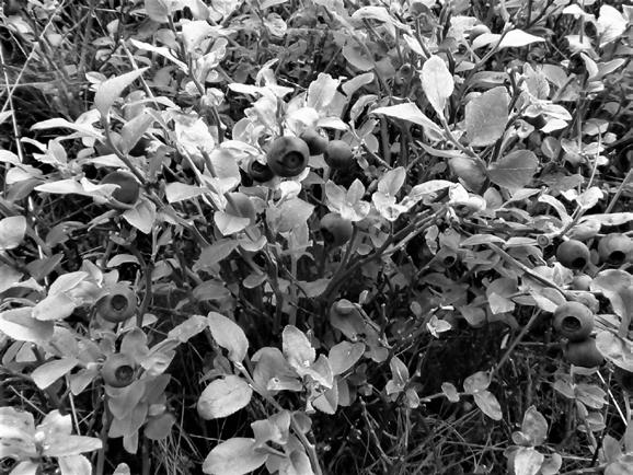
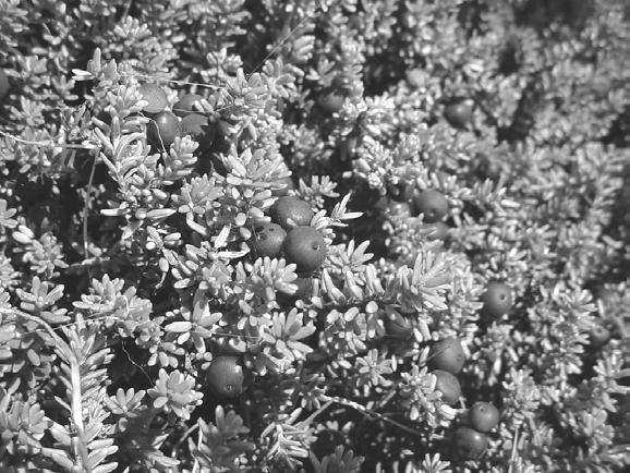
Vaccinium myrtillus
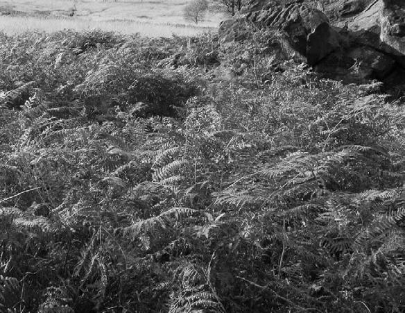
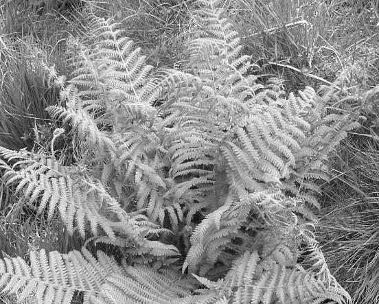
Pteridium aquilinum*
Oreopteris limbosperma
FUNGI
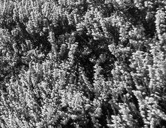
Calluna vulgaris*
Huperzia selago
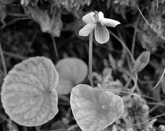
Viola palustris
Empetrum nigrum
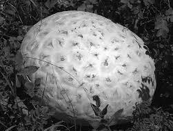
Calvatia booniana
Porpolomopsis calyptriformis
Bracken
Heather Fir clubmoss
Lemon-scented fern
Marsh violet
Bilberry
Sphagum something
Giant puffball
Pink waxcap
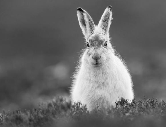
MAMMALS
Lepus timidus
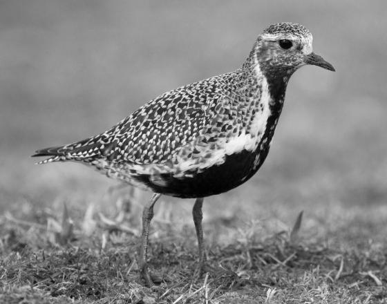
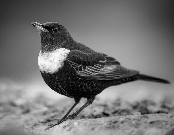
BIRDS
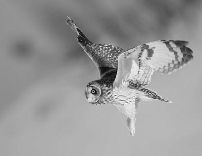
Pluvialis apricaria
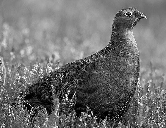
Lagopus lagopus scotica*
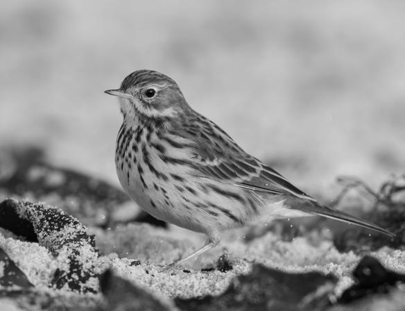
Anthus pratensis
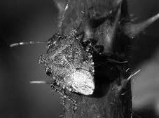
INSECTS
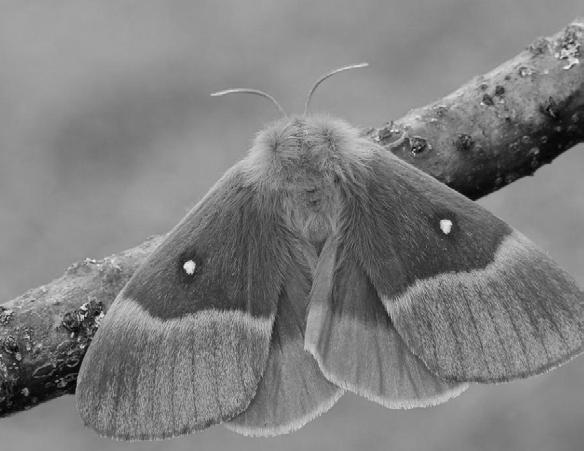
Lasiocampa quercus
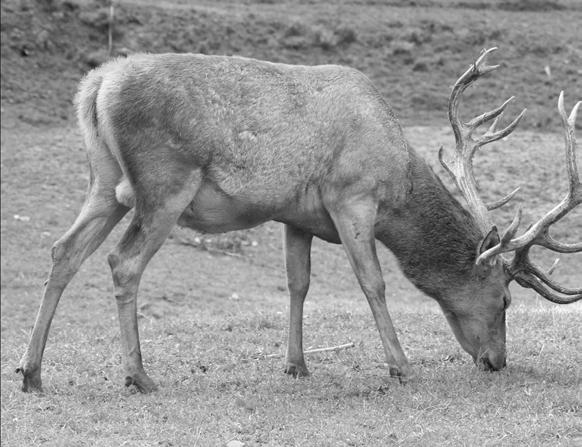
Cervus elaphus
Turdus torquatus*
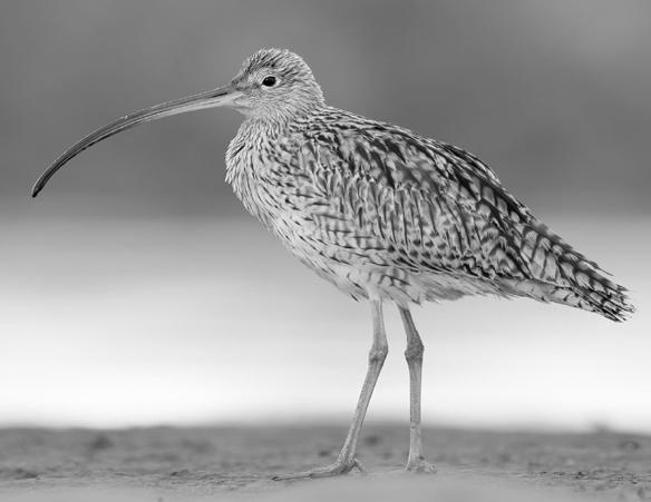
Numenius
Asio flammeus
Troilus luridus*
Red grouse
Golden plover
Curlew
Short-eared owl
Ring ouzel
Red deer
Mountain hare
Meadow pipit
Northern eggar
Bronze shieldbug
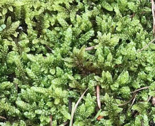
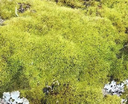
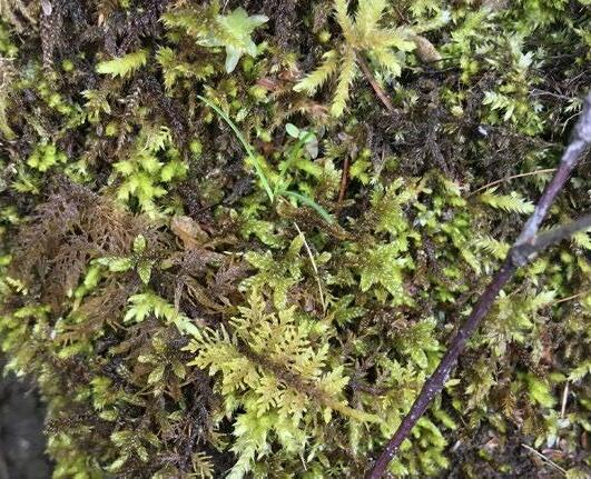
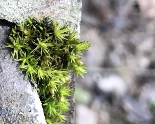
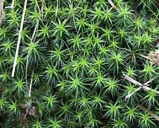
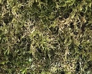
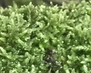
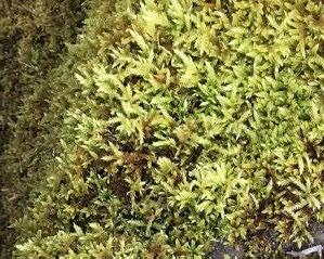
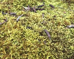
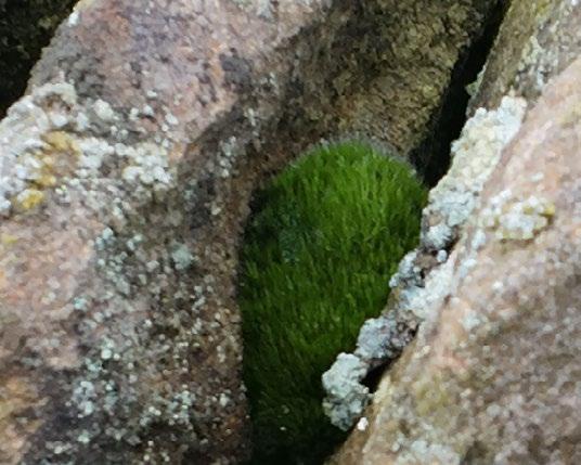
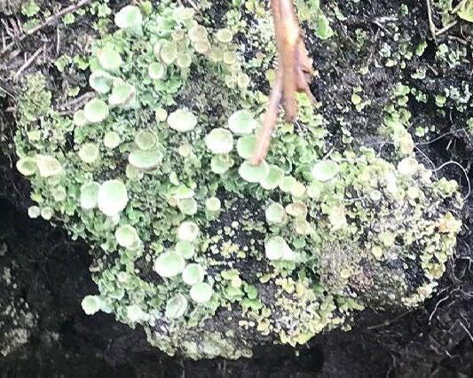
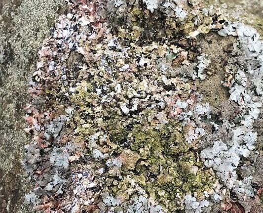
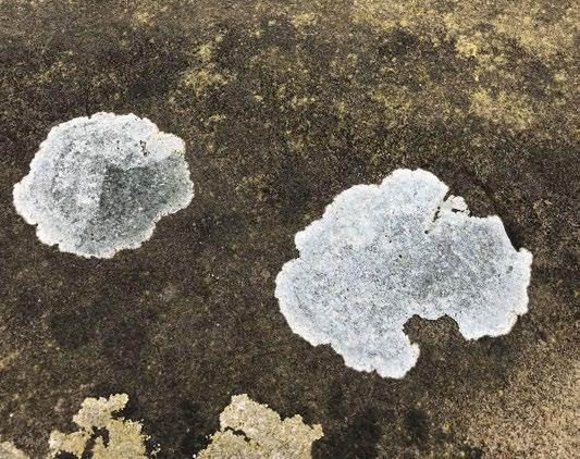
Dark Peak Mosses and Lichens
Hypnum cupressiforme
Sphagum something
Plagiothecium undulatum
Pleurozium schreberi
Sphagum something
Schistidium crassipilum
Sphagum something
Fissidens taxifolius
Sphagum something
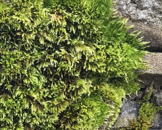
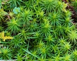
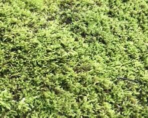
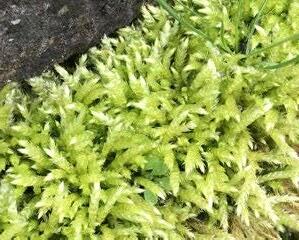
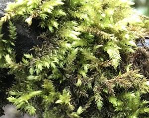
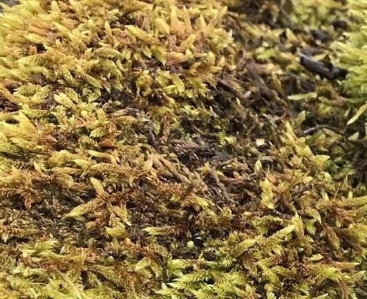
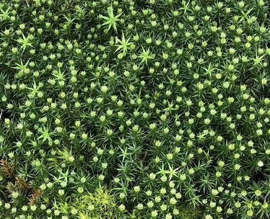
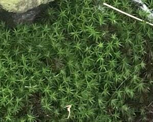
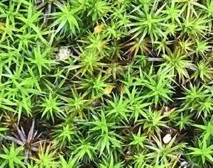
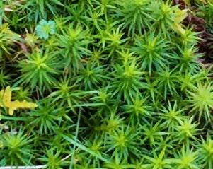
These are the mosses and lichens that I encountered while in and around Edale Valley in April 2024.
Sphagnum austinii
Sphagum something
Polytrichum commune
Sphagum something
Dicranum scoparium
Sphagum something
Sphagum something
Sphagum something
Sphagum something
something
Polytrichum formosum
Parmelia saxatilis
Lecanora muralis
Cladonia chlorophaea
Aspicilia calcarea
Campylopus pyriformis
Sphagum
White crustose lichen
Dark Peak Landforms and Lifeforms
The following series of photographs and illustrations sheds light on the geologic and ecological story of the Edale moorland and valley region.
“The disintegrating rock, the nurturing rain, the quickening sun, the seed, the root, the bird - all are one.”
- Nan Shepherd
Nether Booth Overlooking Upper Moor

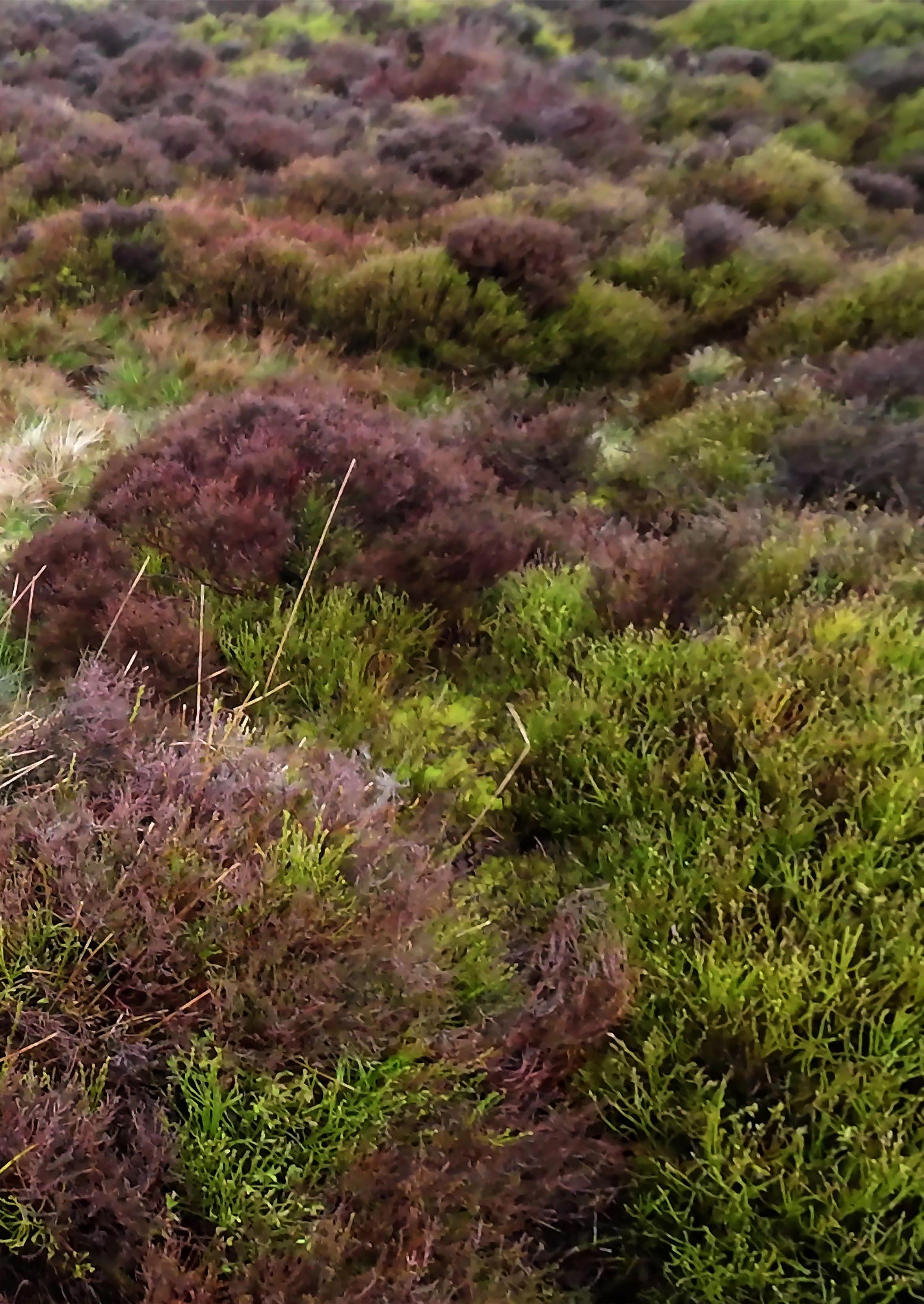
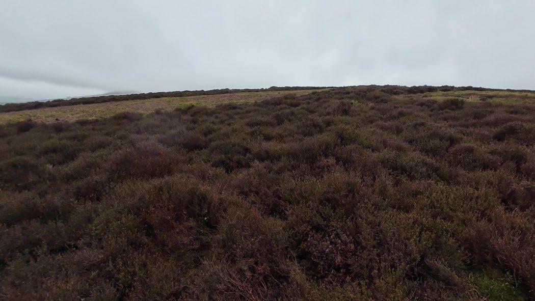
Grasses, Heather, Mosses
The moorlands feature a diversity of plant life, including many types of grasses, sedges, ferns, heather, mosses, and flowering herbs.
Possible Peat Sledway
Sledways were paths cut into sleep slopes to allow for the transportation of cut peat into the valley.
Bracken
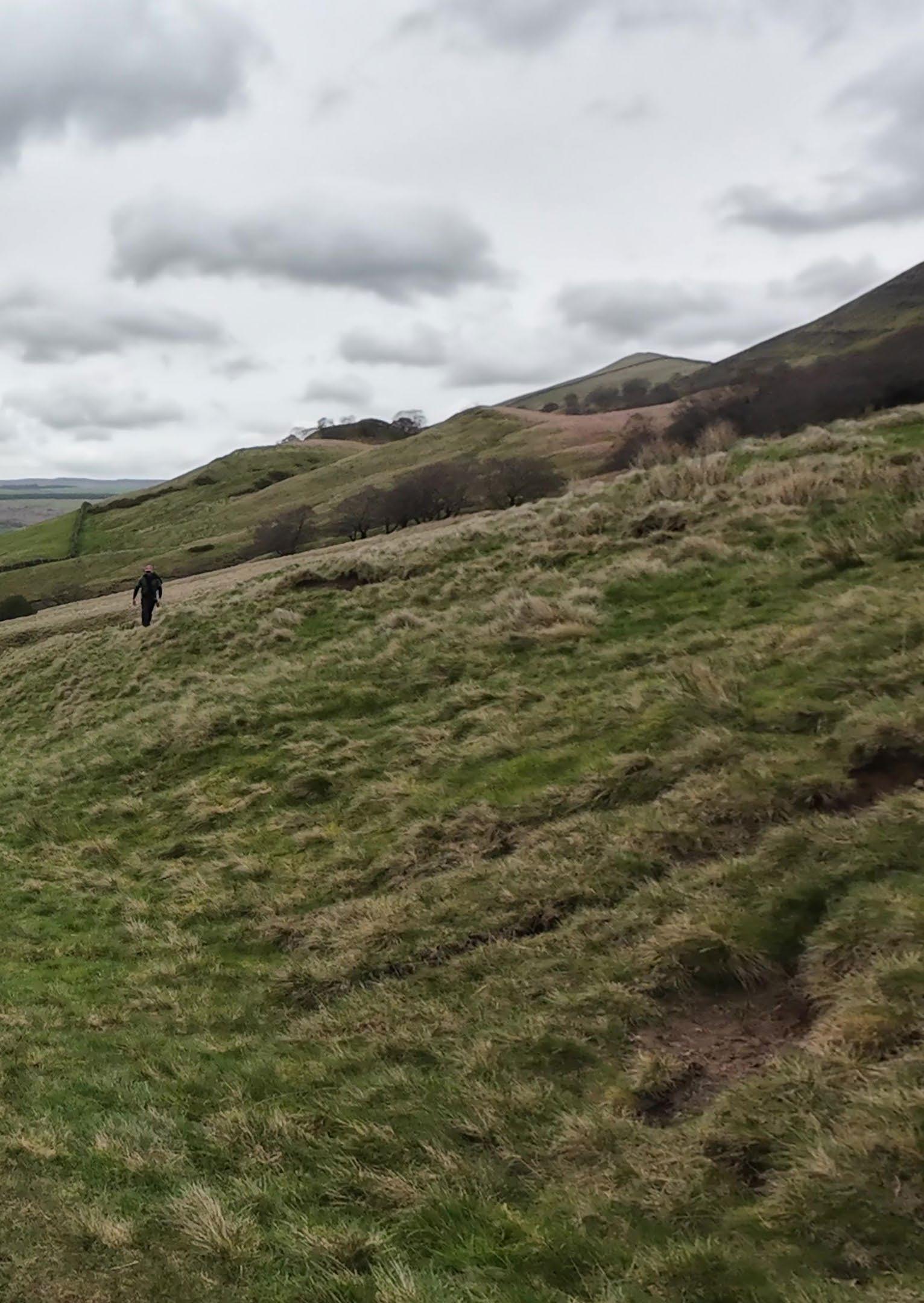
Steep slopes show evidence of landslips, caused by unstable rock strata. This terrain is difficult to navigate and cultivate as agriculture.
Bracken is the most common form of fern that dominates the moorland, turning a reddishbrown colour over winter as it dies back. It is poisonous to livestock and small mammals. A resilient plant, it tends to outcompete other species and spread rapidly across the landscape.
Waterfall and Lady Booth Brooke
A larger, fast-moving brooke cuts through the interfluve, leading into Edale valley. The mountain brookes and streams all lead to the River Noe in Edale valley.
Peat bog
Meandering stream
Small streams cut through peat along the mountainside to reveal bedrock below. These create gullies or cloughs of various depth, carving channels into the steep mountain slopes.
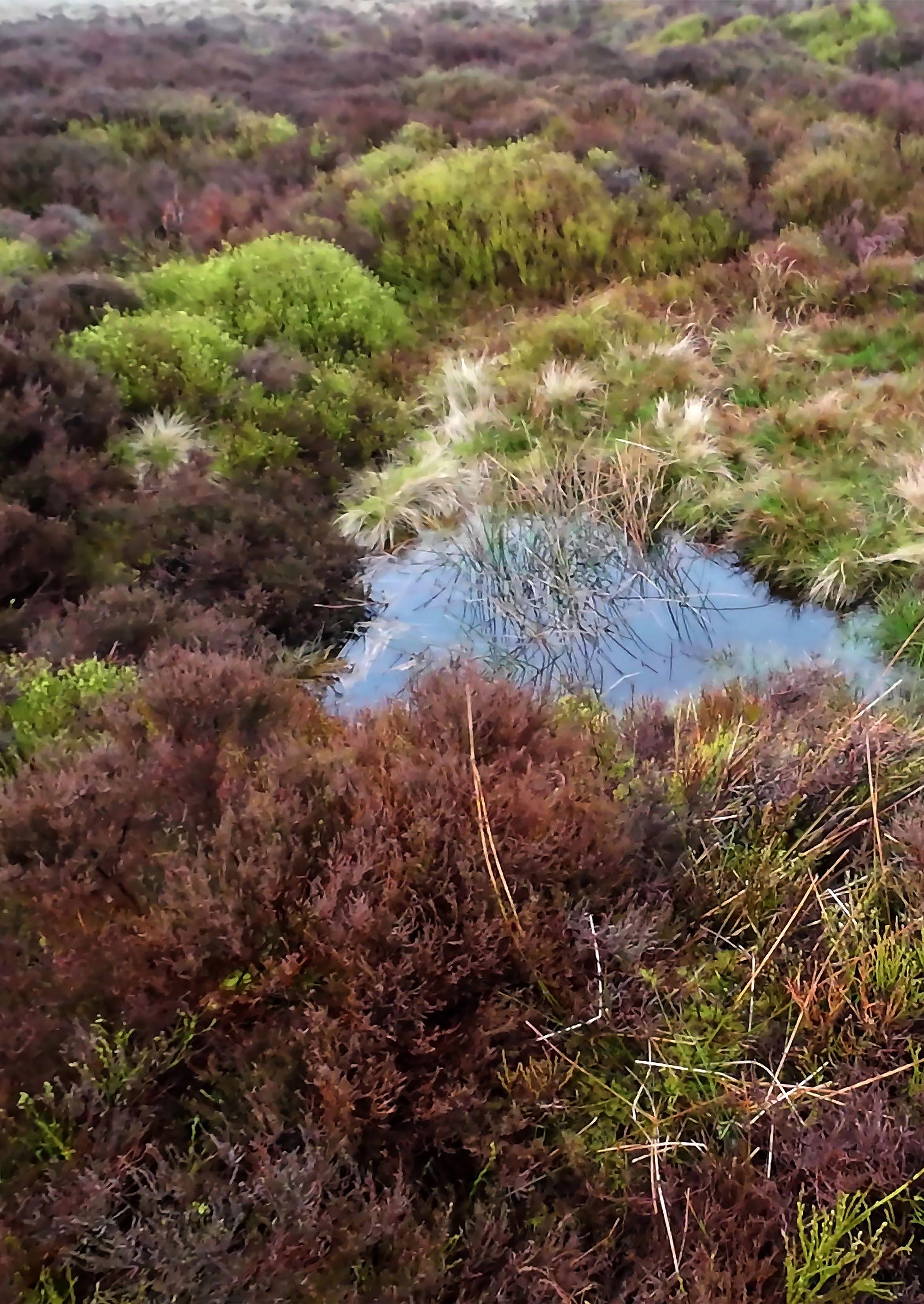
The open upland moors are characterised by peat bogs, possessing thick layers of peat soils created by the continual accumulation of dead plant matter, primarily sphagnum mosses. Blanket bog contains peat of two to three metres deep, and has been cut for fuel from medieval times, though this practice has stopped in recent years.
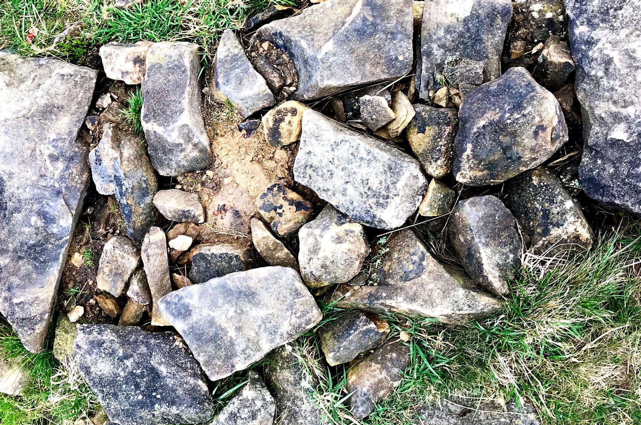
Ruined Drystone Wall
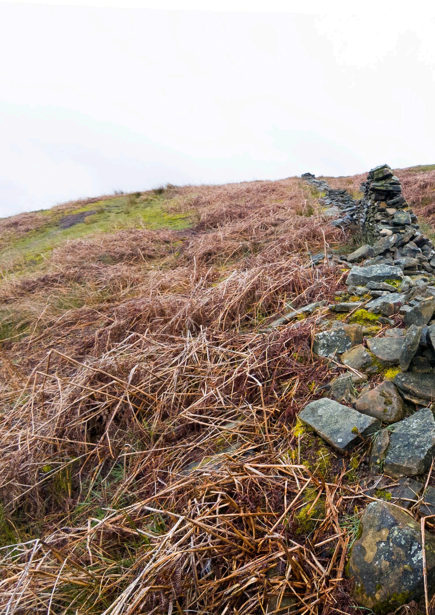
Many moorland drystone walls have fallen into disrepair, no longer maintained or required by the shrinking number of farmers in the region.
Exposed Gritstone Outcropping Conifer Plantation
Back Tor is a gritstone formation developed through the Carboniferous period. Its current form is created by continual erosion and weathering.
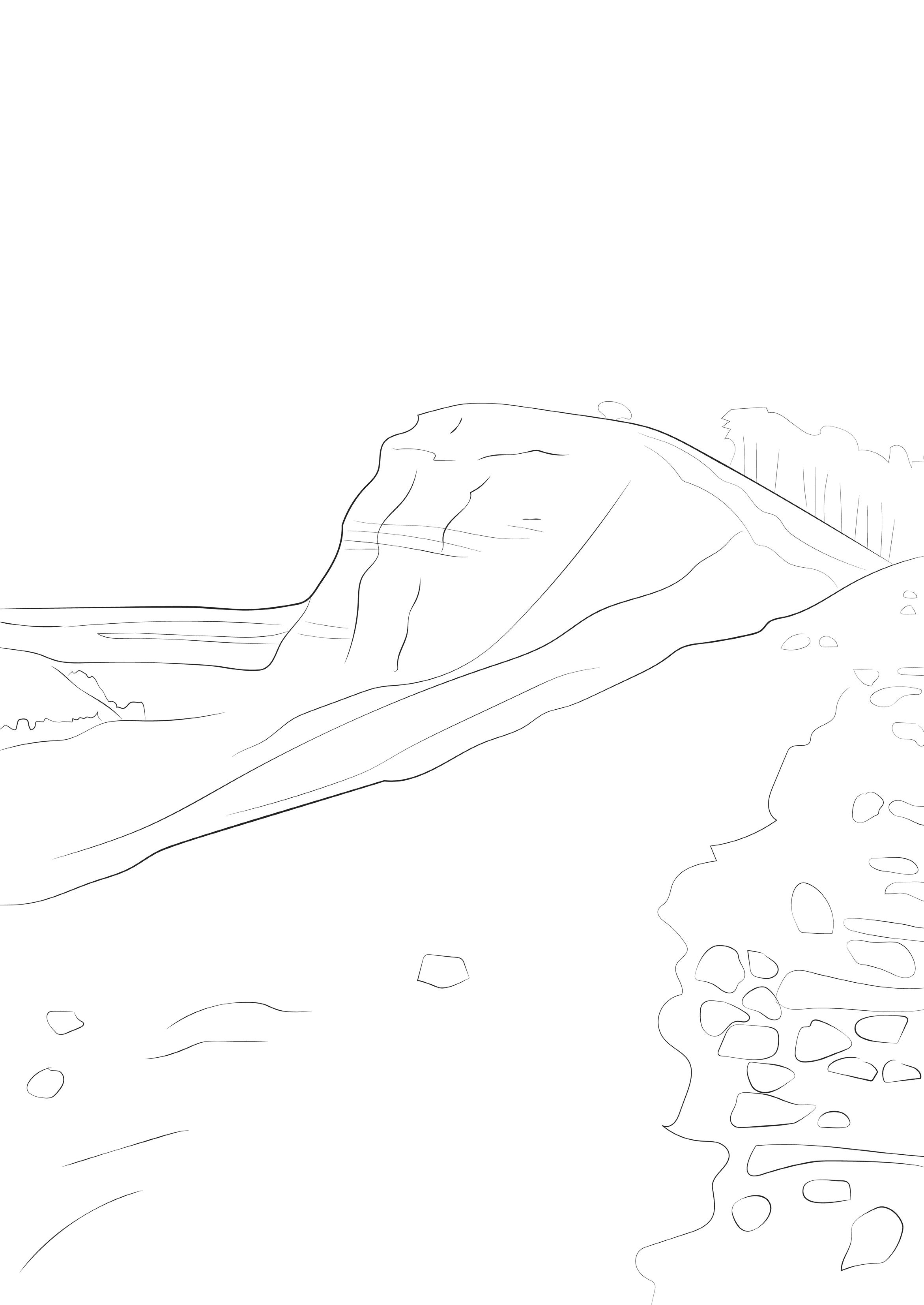
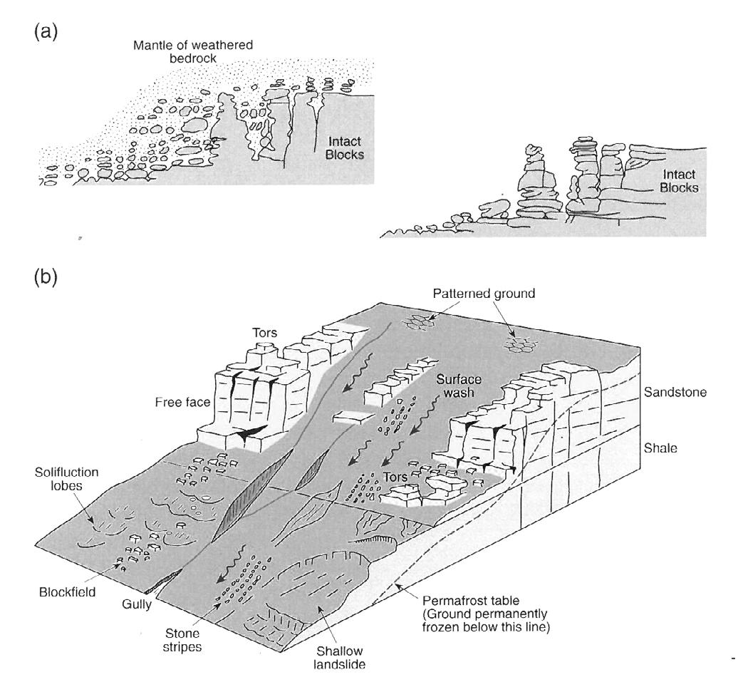
Theories of Tor Formation
01. Resulting from intact blocks emergingsfrom a mantle of weathered bedrock
02. Resulting from the retreat of a free face under periglacial conditions Diagram from “Classic Landforms of the Dark Peak” by R. Dalton, H. Fox, and P. Jones
By the 1950’s, tree cover in the UK reached its lowest of approximately 5%. Postwar reforesting efforts focused on conifer plantations in this region, with monocrops limiting biodiversity and ecological resilience.
Hollins Cross Overlooking Castleton and Hope Valley
Enclosed fields
Drystone walls and rows of trees clearly demarcate the enclosure of the landscape into privatised parcels of agricultural land.
Cultivated Land
Farming in the Edale and Hope valleys was first recorded in the Domesday book. Given relatively poor soil conditions for growing crops, agricultural land is primarily for sheep grazing.
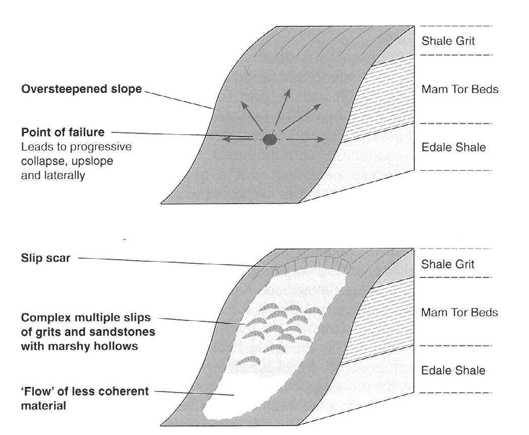
Landslip Formation
Diagram from “Classic Landforms of the Dark Peak” by R. Dalton, H. Fox, and P. Jones
an industrial landscape dotted with mines, and factories. This chimney is a prominent marker in the landscape, belonging to a factory built in 1929.
Castleton Village
Gritstone boulders are scattered across the landscape, dislodged through erosion and human activity. These form the building blocks for drystone construction.
Though Castleton was first settled by the Celts, the village developed alongside Peveril Castle, settled by the Normans arriving in the Royal Forest of the Peak in the 12th century. The Forest of the High Peak was not a dense woodland, but a region of land designated for hunting by royalty.

Backtor Farm Overlooking Edale Valley
Edale Valley Wall as Ecological Border
This deep upland valley was formed by glacial movement and melt water over the Carboniferous period. The River Noe, flowing through the base of the valley, has contributed to carving out the U-shaped landform, and continues to cut into the basin. The valley slopes have fertile land that are continually washed and weathered through slope erosion.
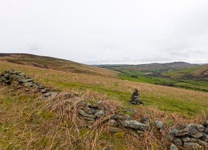
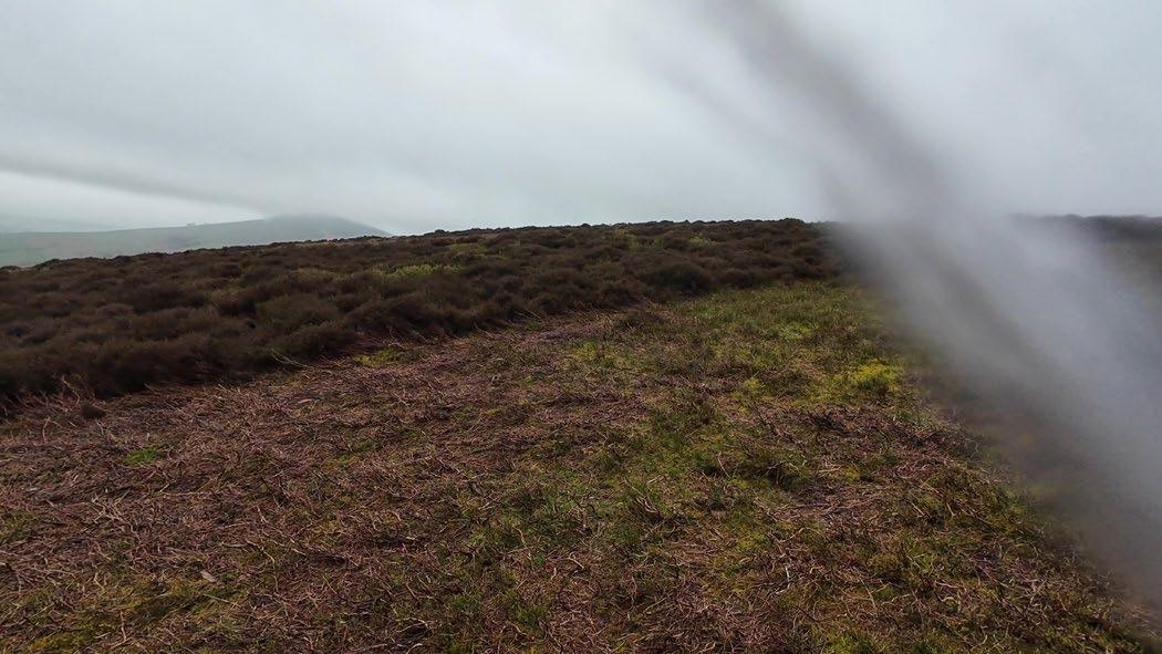
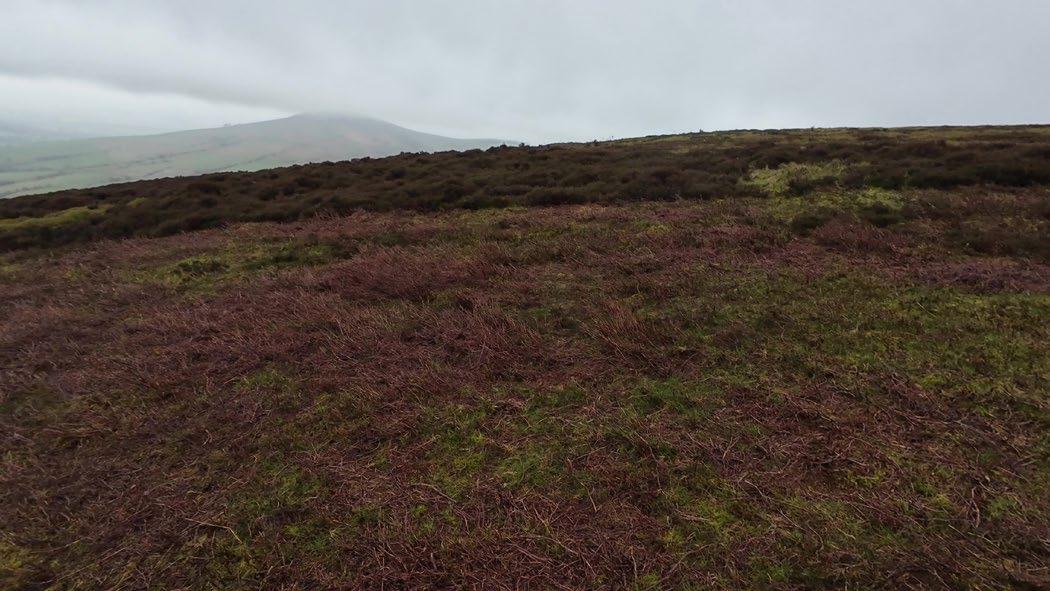
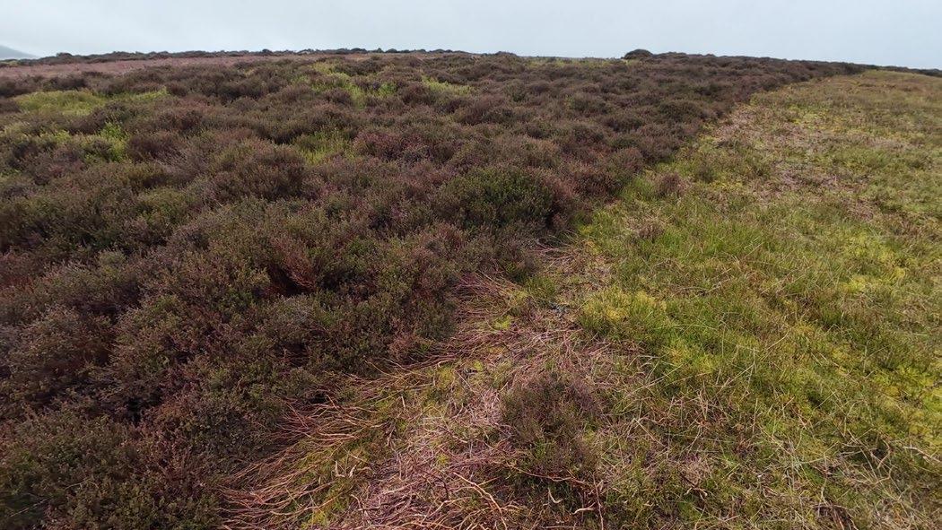
This drystone wall demarcates a clear division between the cultivated, grassy lower slopes and the moorland scrub of the uplands.
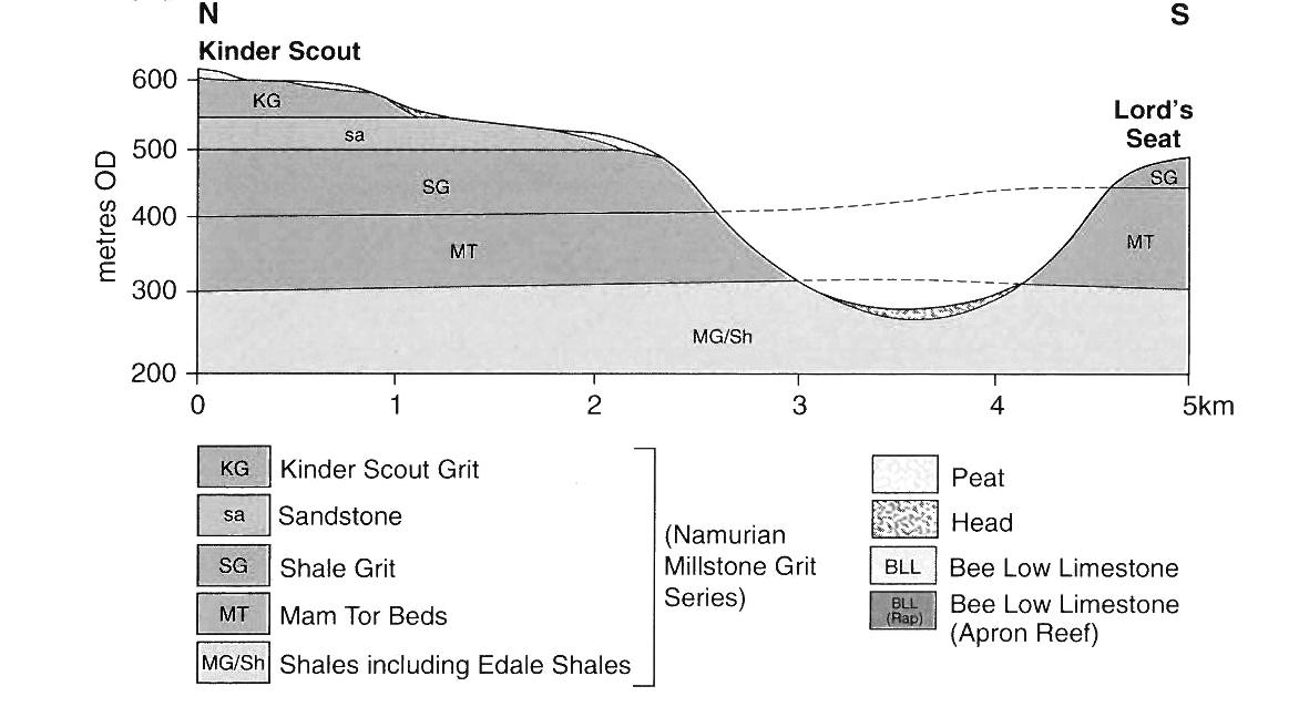
Vale of Edale Stratigraphy
North-south cross section showing layers of rock in the Edale valley.
Diagram from the British Geological Survey, taken from “Classic Landforms of the Dark Peak” by R. Dalton, H. Fox, and P. Jones
This drystone wall is reasonably maintained and demarcates Back Tor Farm. It also prevent them wandering Wall as Demarcating
Demarcating Ownership
reasonably well demarcates land owned by contains sheep to wandering up the slopes.
Acid Grassland
The acid grasslands thrives in nutrientpoor soils. Centuries of sheep grazing has actively shaped both landforms and lifeforms in the Edale valley, creating and maintaining the grassy lower slopes. Overgrazing can cause lack of species diversity.
Small Stream
Streams of various sizes and depth transverse the steep slopes.

Landforms as Windforms
Wind is a constant presence in the Peak District. Though invisible, this force entirely alters and shapes one’s perception of place, and one’s ability to build within it. The Edale valley creates a basin guiding valley and anti-valley winds. The prevalent wind direction is eastward (a further wind analysis can be found in the following section on drystone construction). Topography plays an important role in influencing the direction and speed of wind. These factors should be kept top of mind in the design and construction of drystone. Though drystone acts as a wind break, its porous nature will always let some air through.
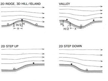
Typical windflow patterns affected by topography. Diagram from Boundary Layer Climates by T. R. Oke
01. Eastward valley wind
02. Edale valley basin
03. Anti-valley wind
Valley cross section showing daytime upslope breezes (anabatic)
Valley cross section shwoing night downslope drainage breezes (katabatic)
Moorland Peat Ecologies
The following section analyses the formation and degradation of peat soils, examining how the grouse hunting industry has drastically shaped moorland ecologies.
The heather, grasses, mosses, and small puddles of the grouse moors form a landscape-within-a-landscape. Looking down is to imagine a forest with the heather as autumnal trees and the puddles as great reflective lakes.
Peat Formation and Degradation
million years ago
5000-8000 years ago: peat formation begins
+ Peat forms over thousands of years under waterlogged and acidic conditions. With no oxygen, bacteria and fungi cannot act to decompose plant matter, so it preserved as it is compressed.
+ Over time, layers of sphagnum mosses and other plant matter accrues. As this accumulation increases in weight, it compacts the material below, and over time, this turns into peat.
Compressive forces compacting dead plant matter
+ Burning heather dries out peat soils and expells sequestered carbon into the atmosphere. This practice is particularly harmful when it occurs on thick peat bogs.
+ Peat cutting is an ancient practice, where cut peat is burned for fuel. It was also one of the “rights to the common” because it was a form of subsistence. Though it is currently illegal to burn ‘deep peat’, this practice continues. Another factor causing peat degredation is pollution from the industrialisation, retaining the Peak District’s industrial history in its very soils.
Several hundred years ago until present
Roman period until past century
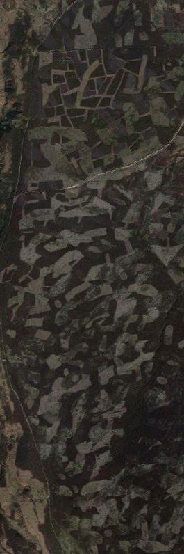
From a satellite view, much of the moorlands registers as a patchwork of irregular lighter rectangles on a darker surface. What causes this intriguing pattern, not unlike paintbrush strokes?
These are the marks left behind by the grouse hunting industry, traces that reveal vast tracts of land still owned by these estates and rooted in elitist and environmentally destructive practices.
Moorland Grouse Industry
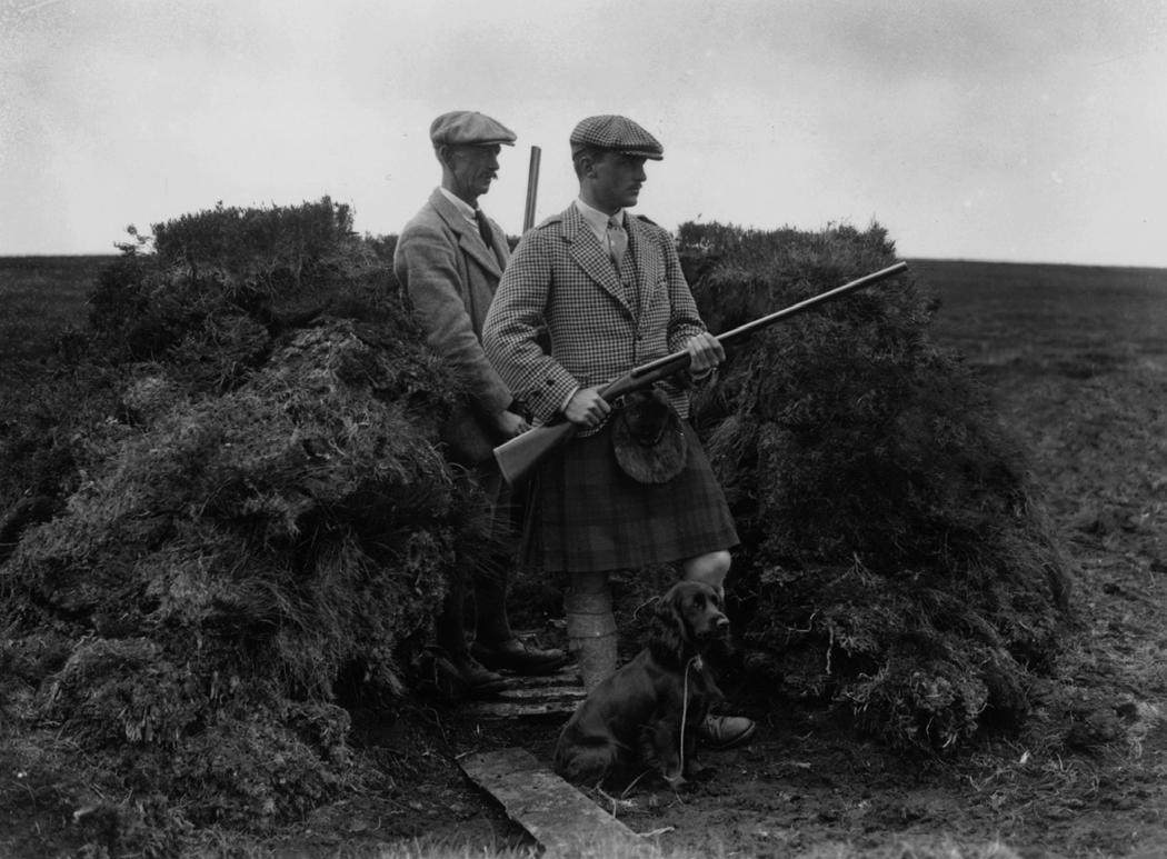
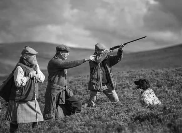
Red grouse are one of the few bird species indigenous to the northern British Isles, having inhabited this landscape for many thousands of years. The grouse hunting industry began in the early 19th century, though it emerged as a popular sport among the aristocracy and landed gentry in the 1880s. With the installment of railways, grouse shooting became ever more popular, and served as a source of income for large moorland estates. Grouse butts—further discussed in the chapter on drystone construction—were built as semi-permanent structures to disguise hunters. The ‘sport’ was commercialised, with wealthy men renting out use of a moor for one or several months at a time.
The annual shooting season runs from August 12th to December 10th, but the grouse moors are managed year-round by gamekeepers. Competitor species such as foxes, stoats, and crows are trapped and killed and new heather growth is encouraged as food for grouse using a slash-and-burn method. Grouse shooting continues to this day, though typically it is paid for by the day. The cost to hunt is expensive, ranging from several hundred to the thousands of pounds. A season of modern shooting typically results in the death of approximately 500,000 grouse, shot for around 75 pounds per bird.
Grouse hunting is contested: animal rights activists, environmentalists, and conservationists alike are calling for its permanent end. I argue that in addition to the concerns outlined by these groups, at the root of the hunting industry and its injustices lie the issue of private property. While large tracts of moorland are owned by private, wealthy individuals, land justice is unachievable.
As Guy Shrubsole notes in his investigation, “Who Owns England?” the grouse industry owns massive tracts of land, a remnant of aristocratic and elitist hunting traditions that are in turn expressions of patriarchal and colonial world-systems.
I go further, placing grouse hunting as not only a crisis of the peat lands, but a crisis of the ecological imaginary. The hunter’s gaze sees the moorland and the other-than-human beings held within it as resources to be extracted, killed, and conquered.
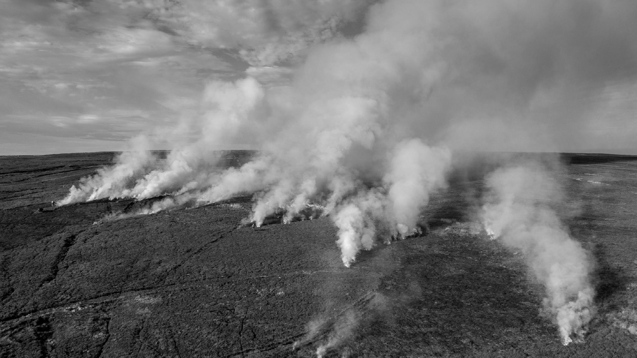
Slash-and-burn is an expression of this mode of landscape management dictated by control. Though it has been banned in many places, the practice continues to shape the Peak District’s landscape, made evident in satellite imagery.
Grouse hunting in the 19th century
Grouse hunting in the 21st century
Problematising Heather Burning
Heather burning is practiced by grouse shooting estates as a way of managing the moorlands to maximise grouse propagation. By cutting back and burning older heather growth, fresh heather is encouraged to grow. This provides food for grouse as well as grazing livestock: it is a practice of cultivating a landscape dedicated to the rearing—and subsequent killing—of a single bird species. As such, diversity of both flora and fauna is undesirable.
Slash-and-burn has severe ecological concequences. In setting fire to heather growing on peat soils, the peat itself dries out, releasing the carbon it stores back into the atmosphere. This is a series issue given the immense carbon sequestration that takes place within peat bogs. According to the government’s Committee on Climate Change, more that 18.5 million tons of carbon are released yearly due to damaged peat: more than the oil industry.
“Grouse moor estates cover an area of England the size of Greater London –some 550,000 acres – and are propped
up by millions of pounds in public farm subsidies.”
- Guy Shrubsole, Who Owns England?
Moorland heather burning
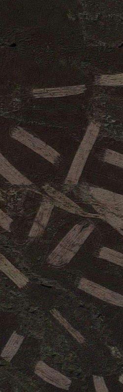
This ‘filmic mapping’ exercise shows frames from a walk in a grouse moor above Nether Booth at 10 second intervals, showing the dynamism and diversity of the landscape. The primary absence in these images is the wind: raging, fierce, relentless, piercing, howling across the open moors.
00:40
01:20
00:10
00:50
01:30
Grouse Moors and Land Ownership
Grouse moors and land ownership by the wealthy few go hand in hand. The project, in ‘commoning the moorland,’ challenges private ownership of land that is predicated on extractivist and capitalist ways of relating to the morethan-human realm.
Multispecies commoning asks, how can we re-orient ourselves as part of the land, holding obligations to it, rather than seeing it as a framed view to be admired from a distance or a resource from which to profit? By centring the entanglements of sphagnum mosses, grouse, and peat soils, we shift perspective away from the human construction of ‘landscape.’
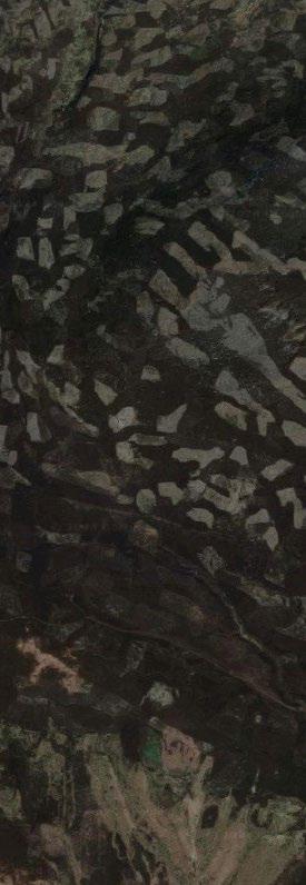
Above: Grouse moors bearing slash-and-burn marks around Edale valley
Below: Grouse moors identified by Guy Shrubsole in northern England
Who Owns the Peak District’s Grouse Moors?
01. Wessenden Head Moor Owned by Yorkshire Water 3,410 acres
02. Buckton Moor Owned by Enville & Stalybridge Estates 3,500 acres
03. Snailsden Moor Owned by Yorkshire Water 2,023 acres
04. Thurlstone Moor Owned by Yorkshire Water 1,349 acres
05. Ladycross & Langsett Moors Owner unknown 3,187 acres
06. Peaknaze Owned by United Utilities 3,237 acres
07. Hope Woodlands
Owned by National Trust 8,876 acres
08. Broomhead Estate Owned by Ben Rimington-Wilson 4,237 acres
09. Hurst & Chunal Moors Owner unknown 2,304 acres
10. Park Hall Owned by National Trust 1,611 acres
11. Moscar Moor Owned by the Duke of Rutland 6,049 acres
12. Coombes Moss Owned by Harris & Sheldon Group Ltd 1,275 acres
13. Goyts Moss Owned by United Utilities
3,113 acres
14. Crag Estate Owned by Lord Derby
6,500 acres
15. High Moor
Owned by Richard & Anne May, Lionlike Ltd
750 acres
Opposite: Grouse moors identified by Guy
in the Peak District
Shrubsole
DRYSTONE CONSTRUCTION
This chapter examines drystone case studies and construction methods—typically used for enclosure walls demarcating property boundaries—in order to imagine new possibilities for drystone construction as a collective practice, a form of “living” conservation, and a site for multispecies inhabitation. Thus, special attention is paid to the way in which mosses, lichen, insects, mammals, and birds interact with stones, and the way in which drystone falls into decay over time, returning to the geologic landscape.
Sub-question B:
+ How can drystone become a collective building practice that takes into account multispecies inhabitation, existing stone infrastructure, design for repair, and the constantly transforming landscape?
Design Question
Case Studies + Context Analysis
Case Studies of Drystone Enclosures
Case Study: Trulli, Italy
Case Study: Kažun, Croatia
Case Study: Blackhouse, Scotland
Stone Structures: The Moorland Vernacular
Drystone Purposes
Sheepfold: A Moss-Eye View
Dark Peak: Stone Architectures
Existing Drystone Wall Forms
Stiles: Building in Access
Geologic Porosity
Drystone Analysis
Drystone Over Time
Structural Analysis
Corbelled Stone Domes
Structural Limitations
The Challenges of Drystone Construction and Inhabitation
Charting Wind Form: Drystone Microclimates
Site Criteria and Analysis
Criteria for Choosing a Site
Design scenario: Crookestone Knoll Field Station
Climate Analysis
Wind Analysis
Edale: Temperature and Precipiatation Analysis
Soil Types
Bird Habitats
Drystone Construction Tests
Design Strategy: Repurposing Broken Drystone
A Landscape of Broken Walls
Fallen Stones as Habitats
Form Follows Rock: Reimagining Construction as Fieldwork
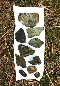
First Cairn: Testing the Ground
Second Cairn: Scaling Up
Third Cairn: An Offering to the Land Template for the 100-Stone Cairn
Constructing Drystone
Drystone as Craft
Building a Drystone Wall
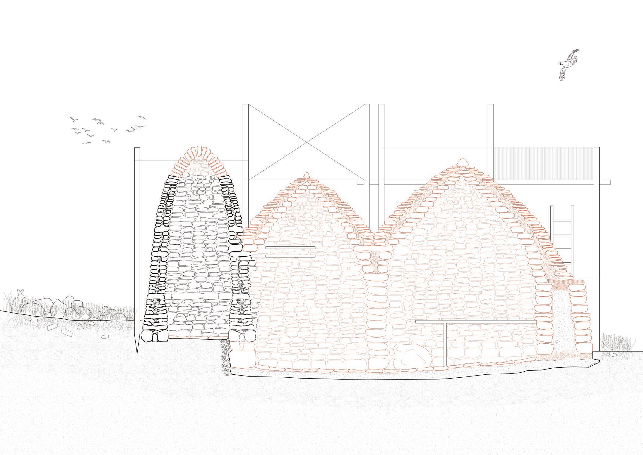
Design Scenario
Design Strategy: Appropriating Grouse Butts
Design Stages 0-6
Drystone as . . . A collective design and construction process
Quantifying Effort: The Labour of Drystone Construction
Collectivising Drystone Construction
Construction Roles
Drystone as . . . A continual practice of repair and maintenance
Drystone Repair and Maintenance as a Commoning Practice
Case Study: Crépissage, Great Mosque, Djenné, Mali
Scaffold for Construction and Repair
Drystone as . . . A site of multispecies interaction
Commoning Cairn
Drystone as a Scaffold for Moss and Lichen
Moss and Lichen Growth on Gritstone
Types of Multispecies Inhabitation
Design Question
How can broken drystone walls and existing stone structures be appropriated as building blocks for the collective construction of drystone enclosures?
This chapter tests construction methods to transform existing drystone into a moorland field station.
It examines collectivising drystone construction, design for repair strategies, and multispecies inhabitation.
Existing drystone structure Broken stones +
Drystone field station
Case Studies + Context Analysis
The following section examines case studies of drystone buildings, using these as precedents for the design strategy.
A context analysis of existing drystone structures in the Dark Peak sets the stage for the design of drystone field stations.
Case Studies of Drystone Enclosures
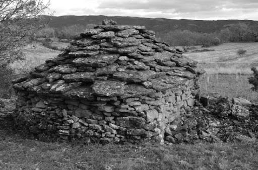
For thousands of years, drystone construction has defined vernacular architectures around the world. From the burial court cairns of Ireland to the pyramids of Giza, drystone makes use of locally found or excavated rock to create durable enclosures whose structural integrity relies on the interplay of stone and gravity. With no other materials required, drystone is perhaps the simplest of building methods, but it is also a skilled craft that takes decades of practice to perfect.
The following case studies examine forms, scales, and methods of drystone construction in a variety of contexts. In understanding the scope and potential of drystone, these case studies give a glimpse into possible trajectories for my own design of drystone field stations in the Peak District moorlands.
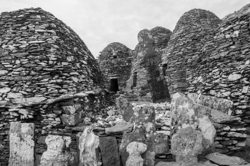
01. Drystone is Sobrarbe-Pirineos UNESCO Global Geopark 02. Drystone monastery at Sceilg Mhichíl, Ireland (6th-13th centuries CE)
Case Study: Trulli, Italy
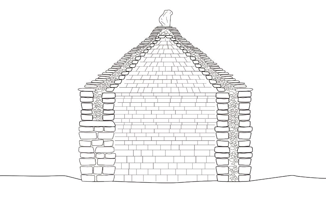
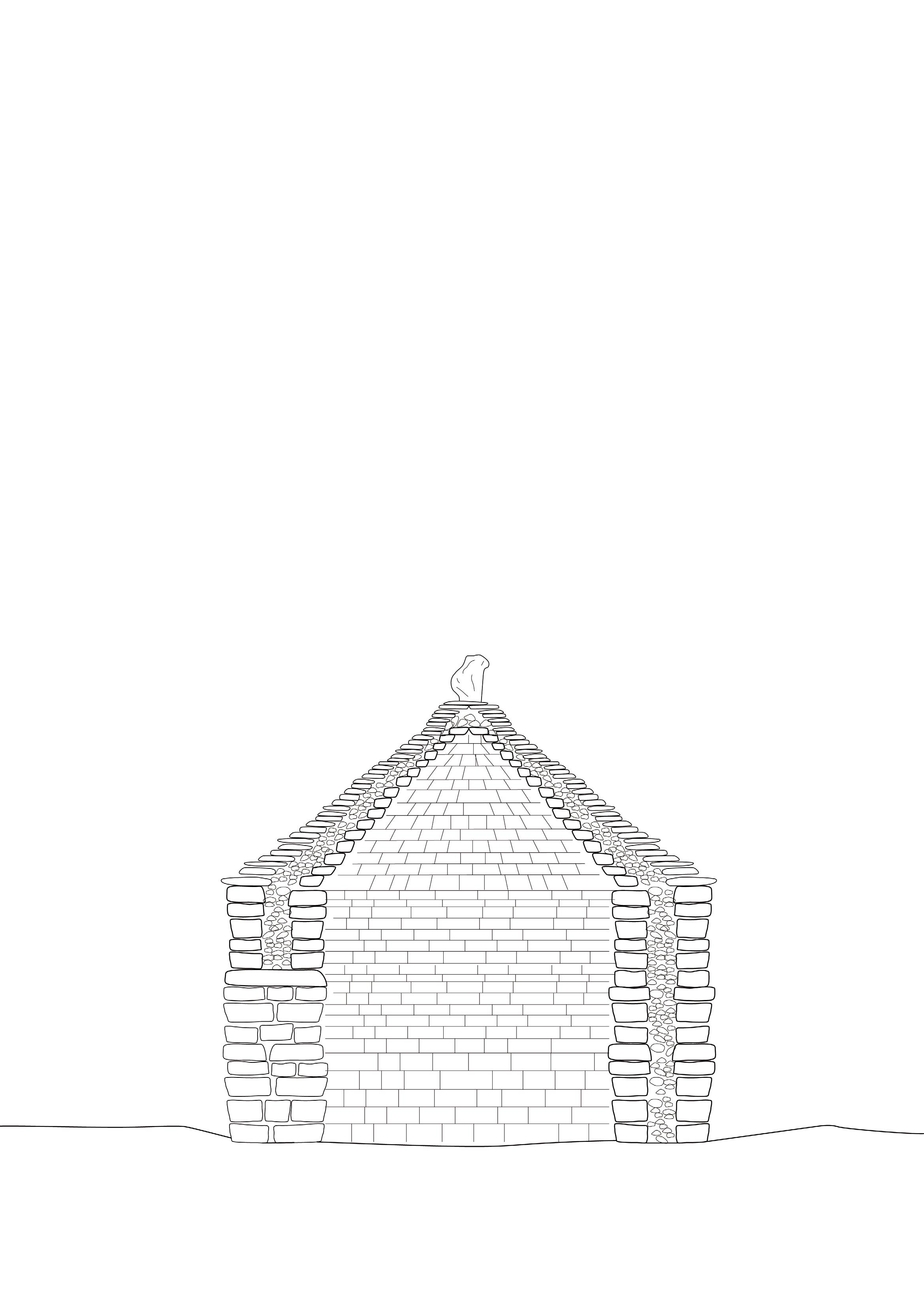
Trulli are drystone enclosures found in the Apulia region of southern Italy. Their high-pitched roofs employ a double layer of drystone with a pebble infill, and the walls are often whitewashed. The roof laying technique is called corbelling, where each layer is successively nudged inward to create a conical and durable form. Trulli may have originated in the medieval period as shelters for farmers or for storage, but they evolved to become permanent dwellings for local residents. The thick stone walls have good insulation properties, providing a cool interior space during the hot summer months. Interestingly, trulli are often adorned with symbols, carrying ritualistic or religious meanings.
Trulli provide a useful case study in understanding the structural properties of drystone. Though the type of stone found in southern Italy is different to the Peak District’s gritstone, a similar method of stacking could be used to create an enclosed, durable, and weather-proof roof.
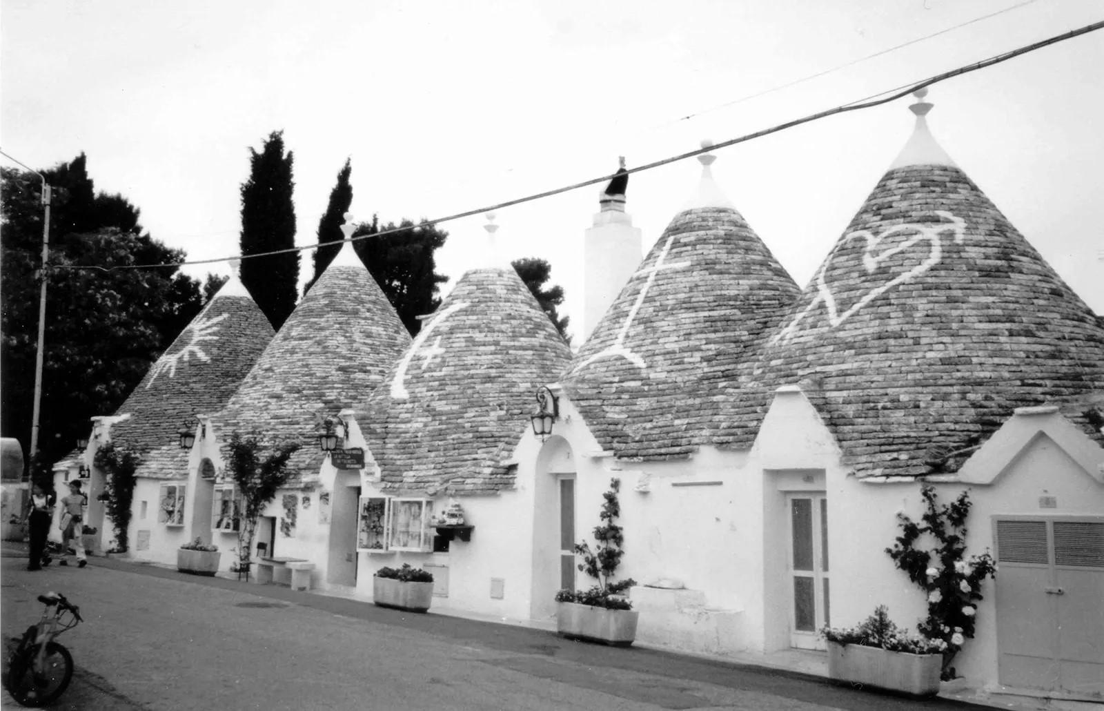
01. Double-layered drystone wall
02. Thin and flat c0rbelled roof tiles
03. Chimney
04. Channel carved from top stone for water drainage
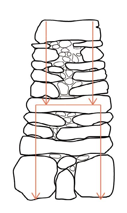
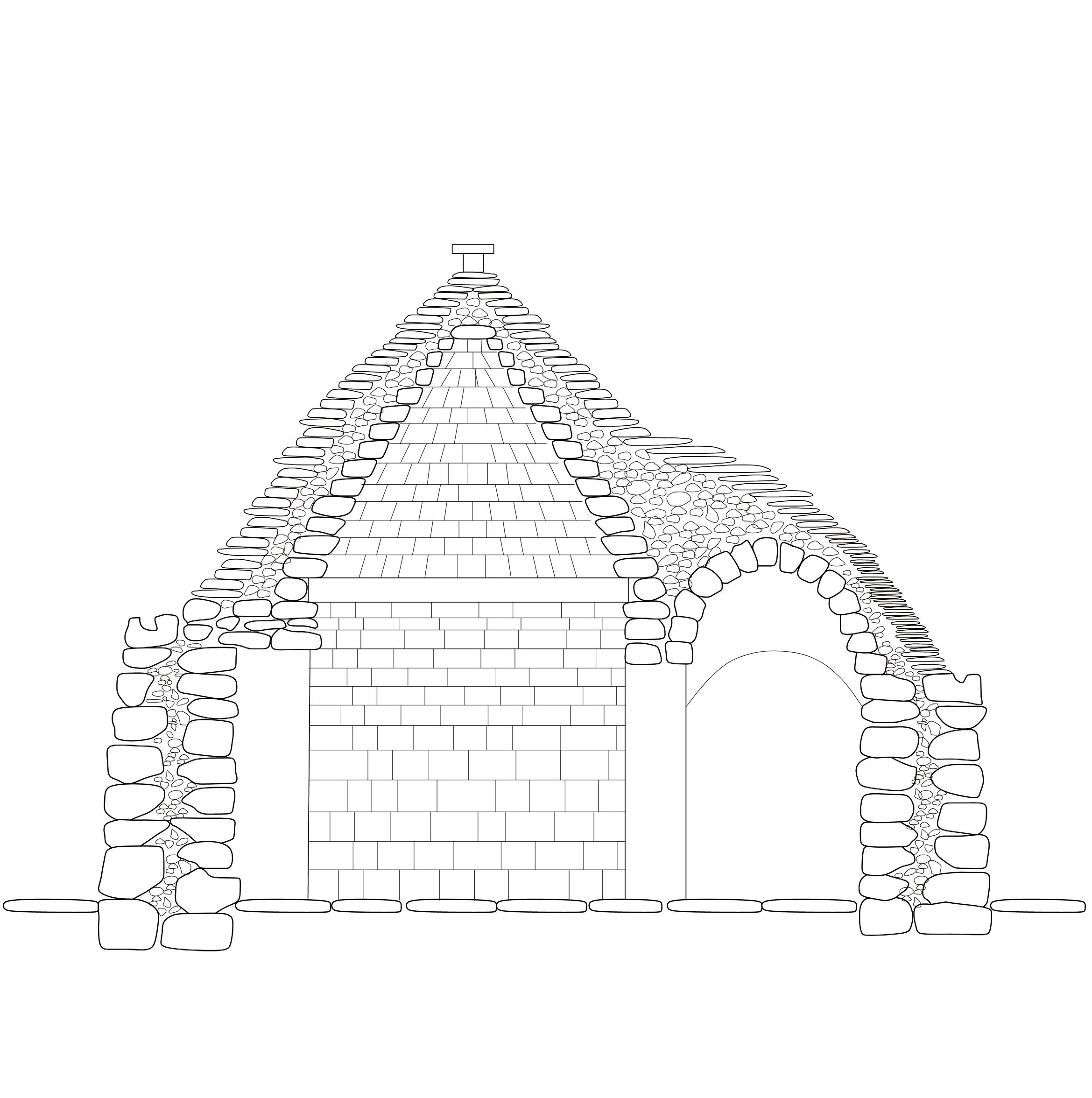
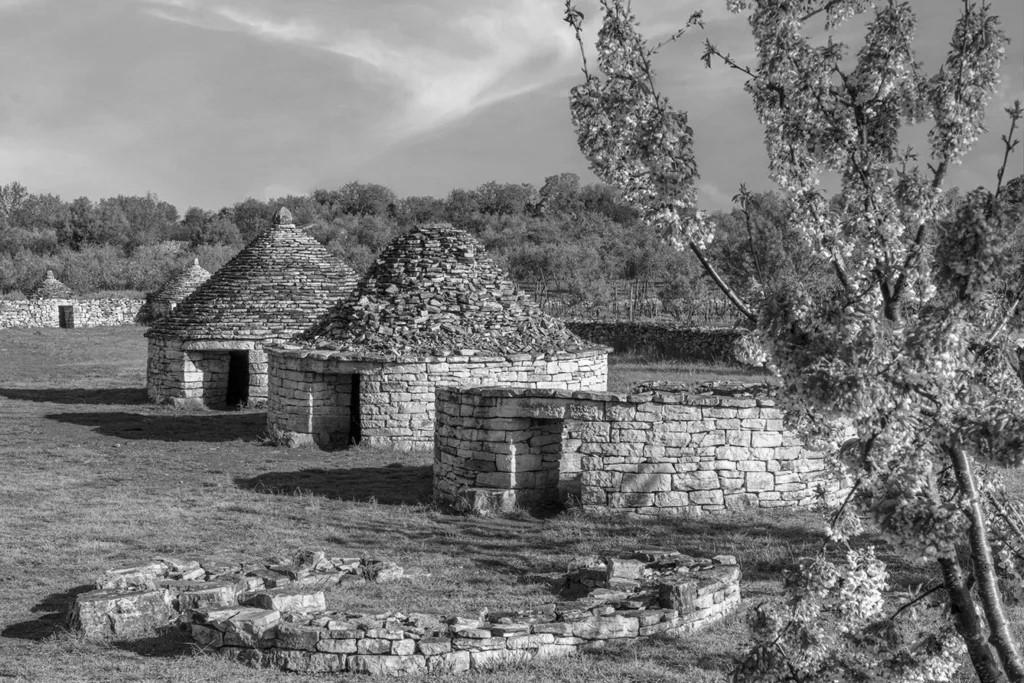
Case Study: Kažun, Croatia
The Kažun is a vernacular building found in the Istria region of Croatia. It is an ancient method of building, predating ancient classical civilisations. Made entirely of drystone, kažuni were built from stone—typically limestone—found when clearing fields for farming. It encloses a single round room, suitable for temporary shelter or storage. Over 3000 huts can still be found in the Vodnjan region.
The kažun shows how ‘waste’ rock—rock found or excavated when clearing land for farming—can be repurposed into a shelter for shepherds, farmers, or passers-by. In the Peak District, farmers often repurposed rocks dug up in clearing the land into enclosure walls. Kažuni ingeniously use a double layer of drystone with a pebble infill to provide both structural support and protection from wind and rain. With a steep incline, the stacked flat rocks create a durable roof structure.
01. Lintel to create door in the drystone wall
02. Double layer of drystone
03.
04. Flat, wide stones are stacked to create an external roofing layer
05.
at the top weighs down and secures the roof
Pebble or small stone infill
Large stone
Case Study: Blackhouse, Scotland
The blackhouse, or Taighean, is a vernacular form of architecture found in Scotland. With drystone walls separated and packed thick with peat, the blackhouse provides protection from cold northern winds. The stones do not extend above the tops of the vertical walls; rather, timber frames support thatching. Blackhouses were built on clay, with a layer of pebbles supporting the weight of the drystone above. The two layers of drystone are topped with clay to prevent water leakage, then finished with a layer of turf, which also helps to absorb water. The timber used on the interior was typically taken from driftwood. In the case of the Peak District, local timber from the conifer plantations could be utilised. Given the windy conditions the blackhouse is built for, a rope net is often placed over the thatch to prevent it from blowing away. This is then weighed down with rocks. Chimneys protrude from the thatch to allow for cooking to take place indoors.
An interior fire would keep the blackhouse warm, but it would also blacken the interior walls, hence the name of this building type. The maintenance of the thatch was completed communally, with thatching and re-thatching a collective activity.
The blackhouse, though found in conditions further north than the Peak District, uses similar materials available in the moorlands, and provides an exceptional degree of shelter from wind and rain that other forms of drystone structures do not. In the following design exercise, I draw from the blackhouse’s layering of peat and thatch to provide additional protection from the moorland rains and winds.
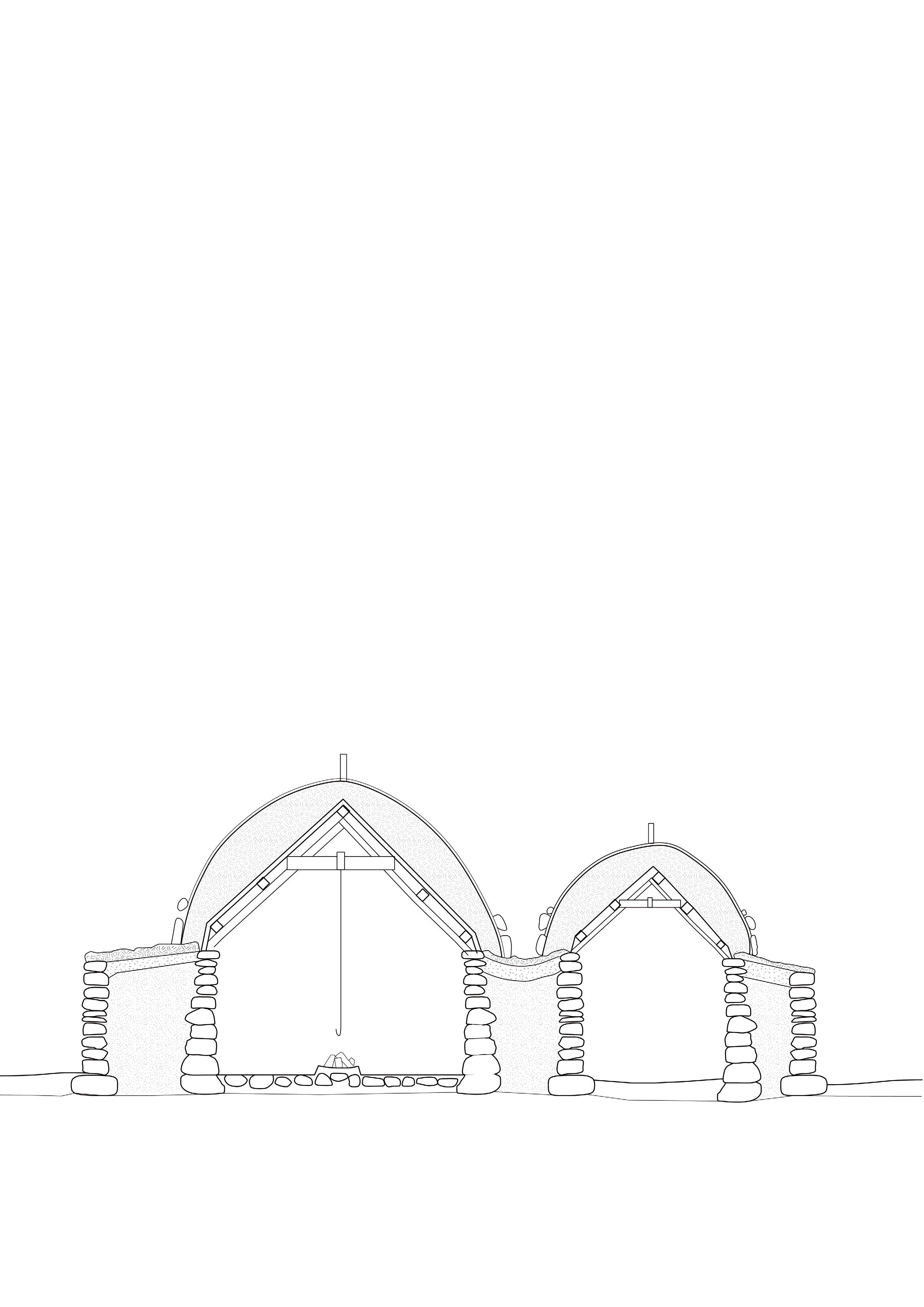
01. Drystone wall
02. Turf roof covering
03. Layer of clay
04. Peat soil to provide insulation between drystone
05. Stones to weight down thatch in heavy wind conditions
06. Rope to tie down thatch
07. Thatching
08. Timber framed interior to support thatch
Stone
Under the moorland’s heather, moss, and peat lies gritstone. Stone structures dotting the landscape reflect a constant process of reshuffling the terrain, an exchange between surface and subsurface. This is where geologic, human, and plant timescales converge.
Drystone construction has for thousands of years shaped the Dark Peak’s landscape as an architectural embodiment of the region’s geology. Some endure for thousands of years while others appear and disappear within days.
This folded drawing explores how stone structures serve different purposes through their configurations, to either act as markers – like the cairn and the trig point, or containers, like the sheepfold or castle, or to conceal, such as the grouse butts that disappear into the landscape as stone walls merge with stone terrain.
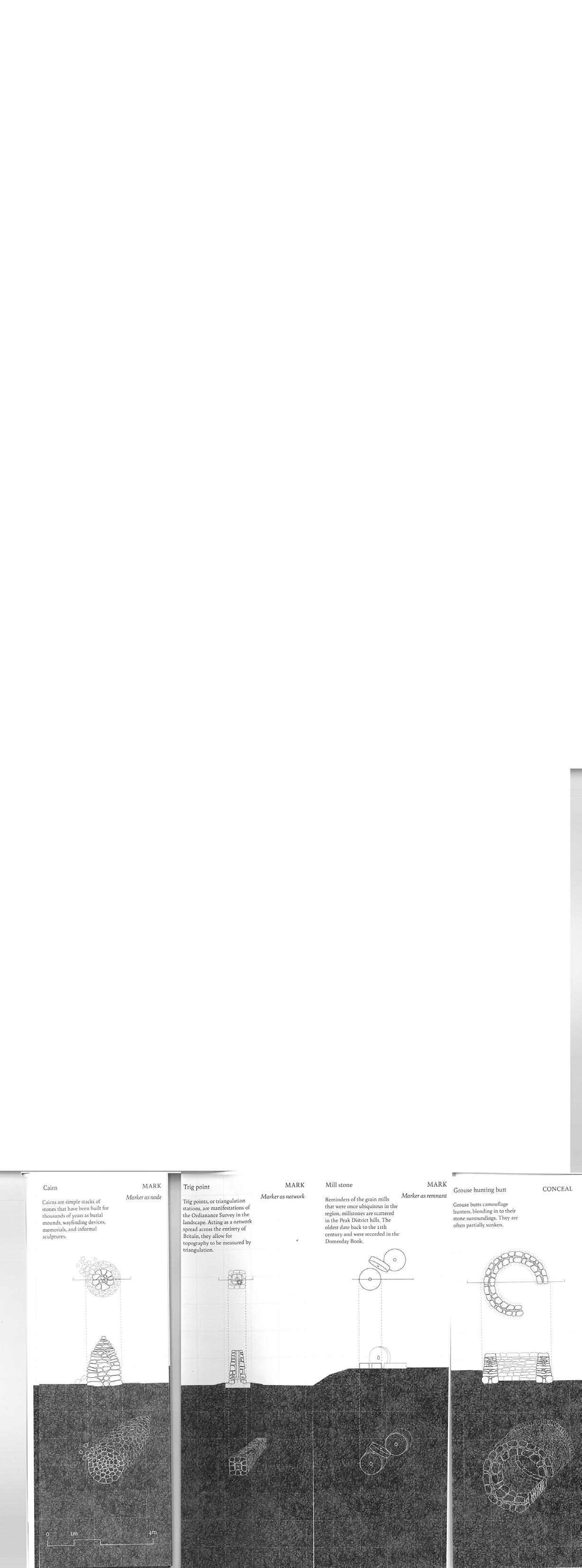
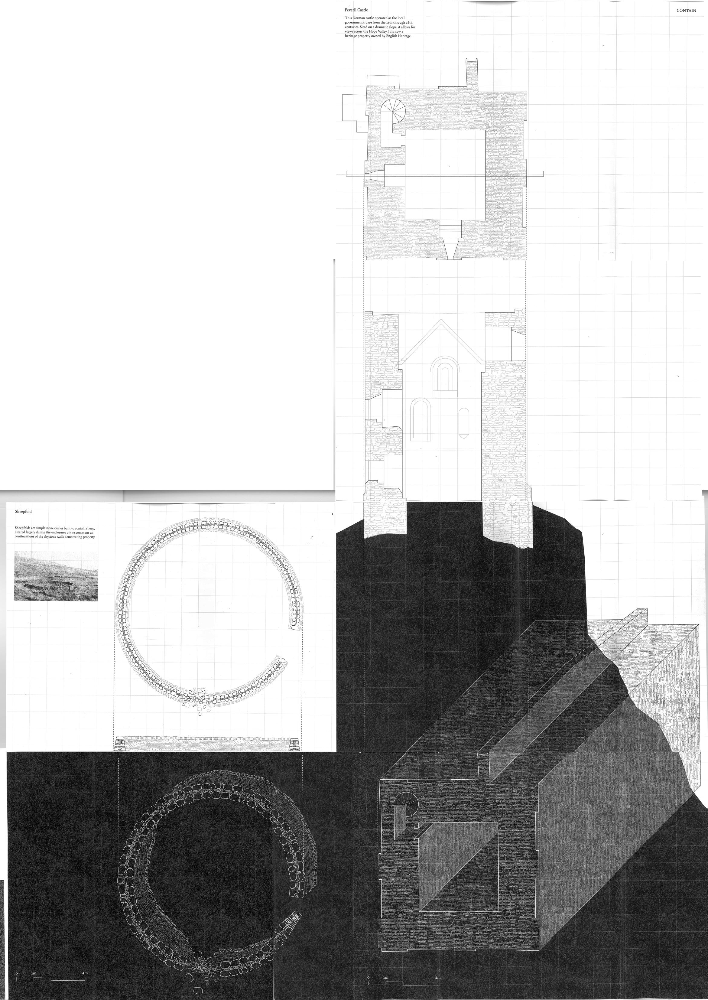
The stone structures that dot the Peak District landscape serve various purposes, and they utilise drystone construction to achieve these. Broadly, the structures either conceal, contain, or mark.
Grouse butts are a good example of using drystone to blend into the landscape, concealing hunters behind the rocky walls. Yet drystone can also act as a marker, such as in the case of the cairn, acting as a wayfinding device. Huts, sheepfolds, and small shelters contain humans and sheep, providing a microclimate.
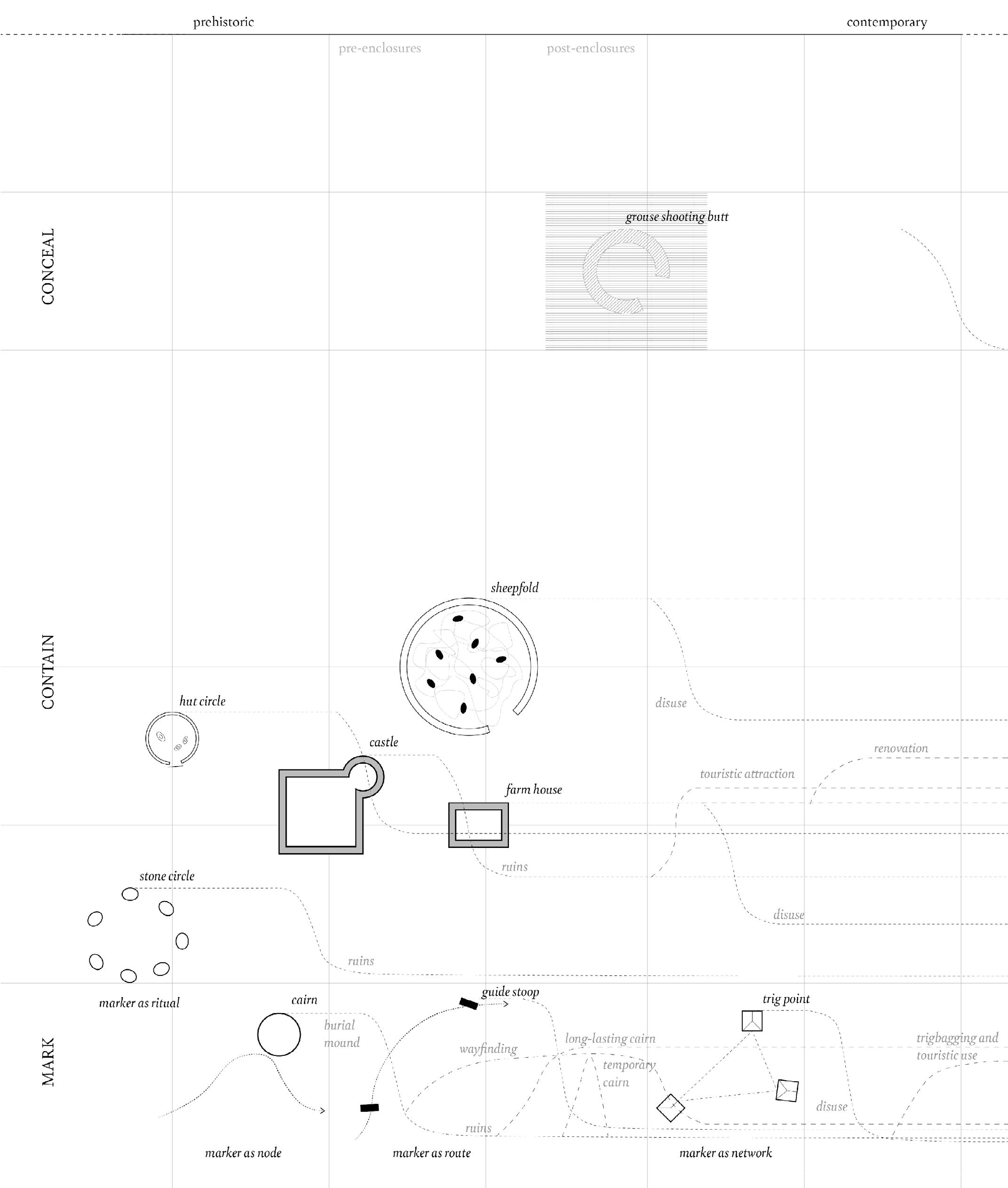
Sheepfold: A Moss-Eye View
A sheepfold is one of the simplest enclosures built from drystone. In building a drystone wall into a circular or rectangular form, space is enclosed to create a room for sheep. Sheepfolds are ubiquitous in moorland and pasture landscapes throughout the British Isles. Many have fallen into disrepair. Peak District sheepfolds are typically ‘single-celled’, but multi-cellular sheepfolds exist elsewhere (see image below). Sheepfolds were particularly used when common grazing took place, but continue to be used under private land ownership in some cases. They can also be found in Switzerland, Croatia, Iceland, and other countries.
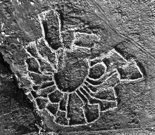
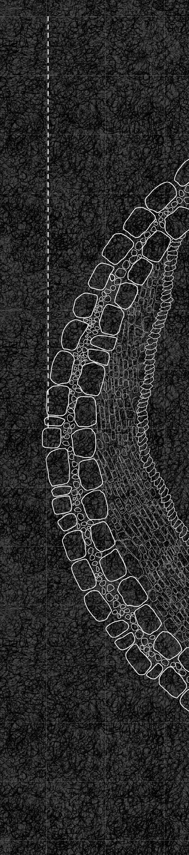
Above: Mulit-cellular sheepfold in Cwm Caseg, Wales Right: Circular sheepfold drawn from a “moss-eye view”
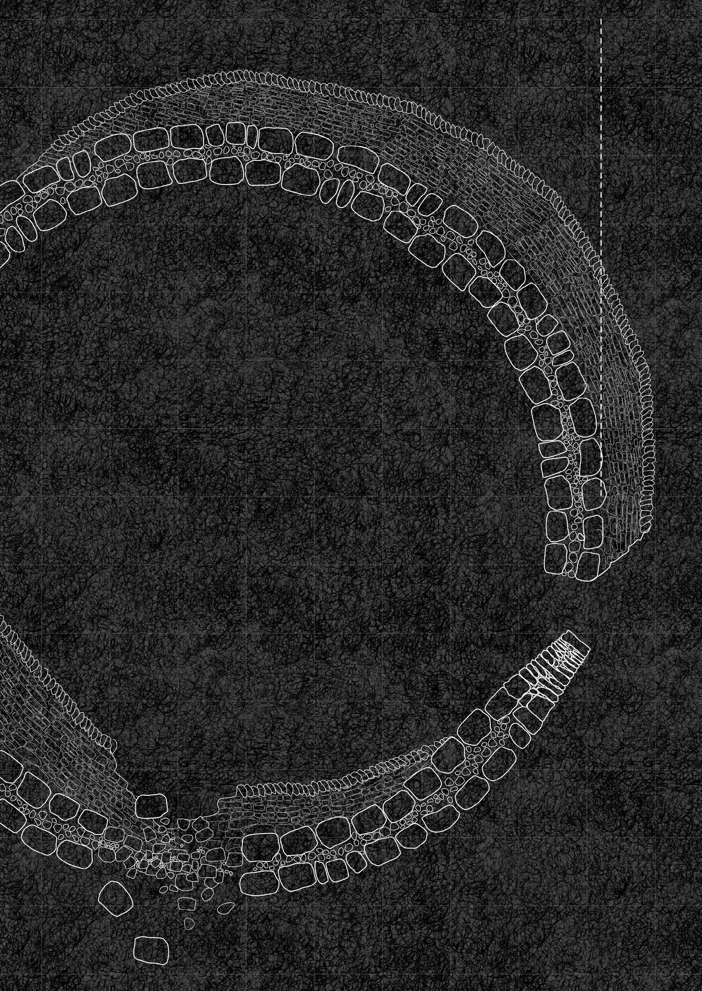
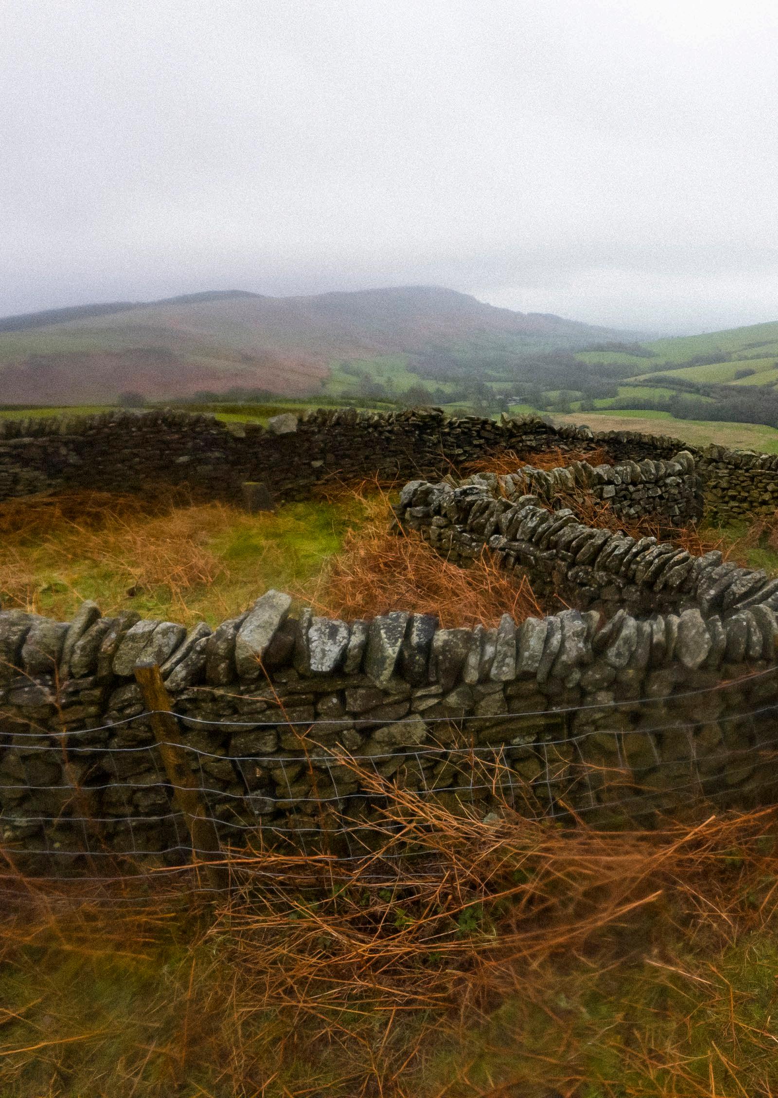
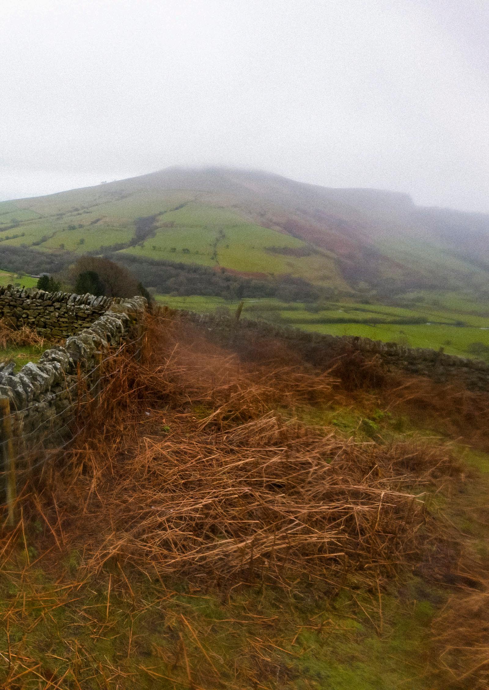
Dark Peak: Stone Architectures
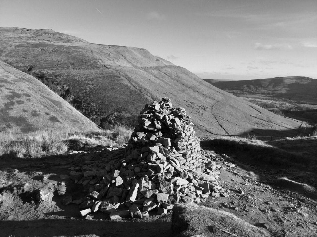
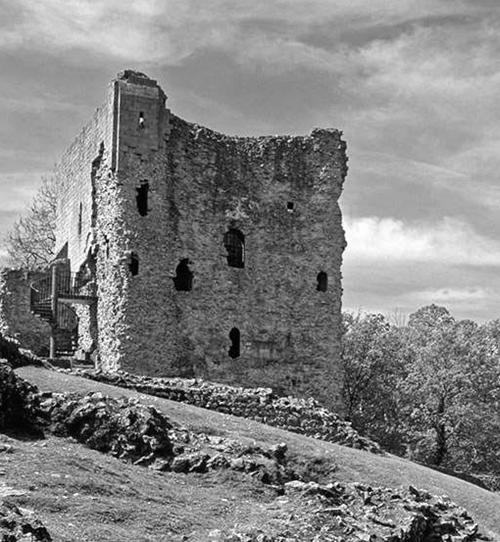
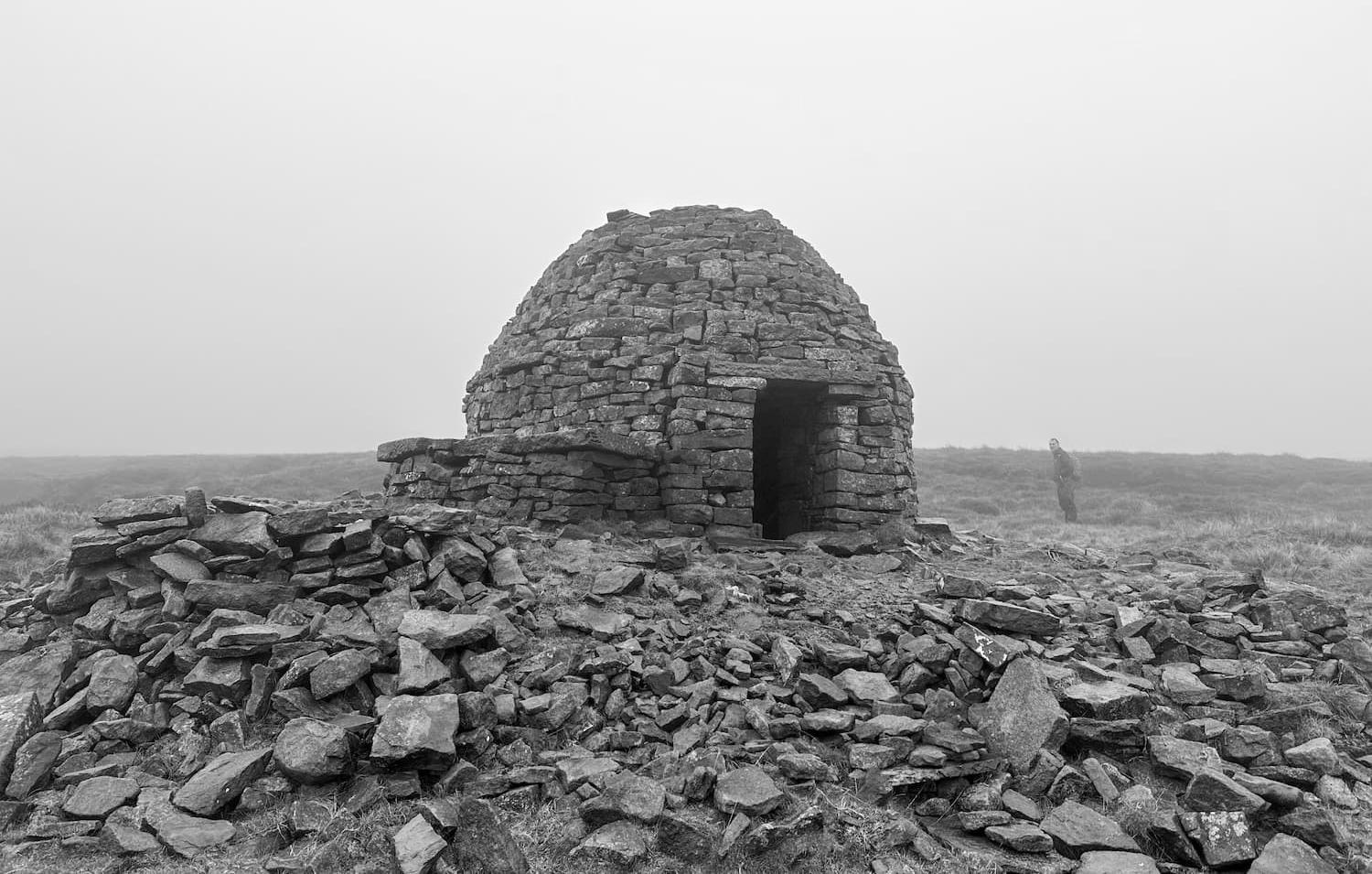
Cairn at the peak of a hill
Stone igloo
Peveril Castle, Castleton
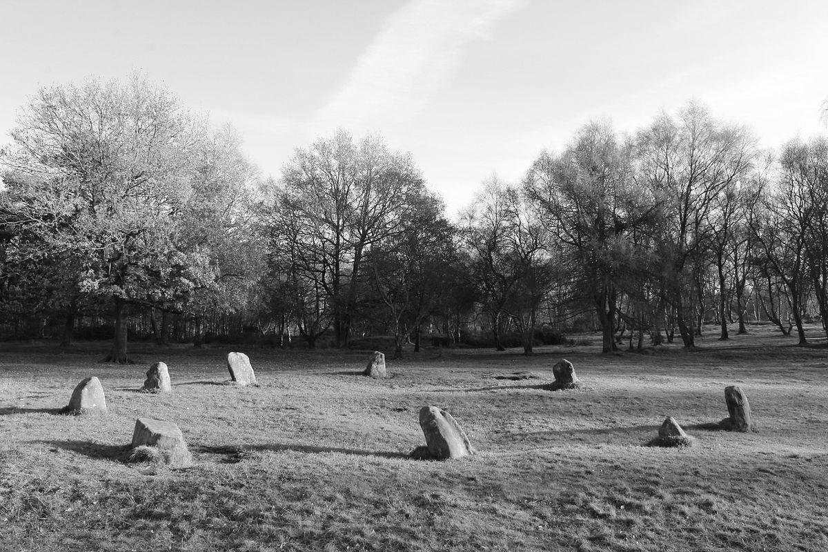
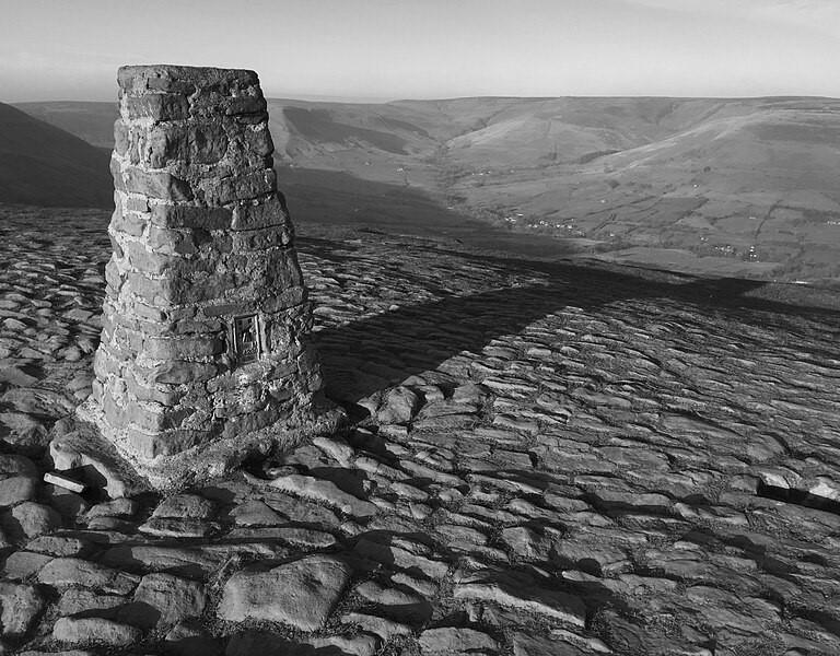
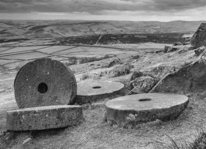
Stone trig point
Mill stones
Nine Ladies stone circle
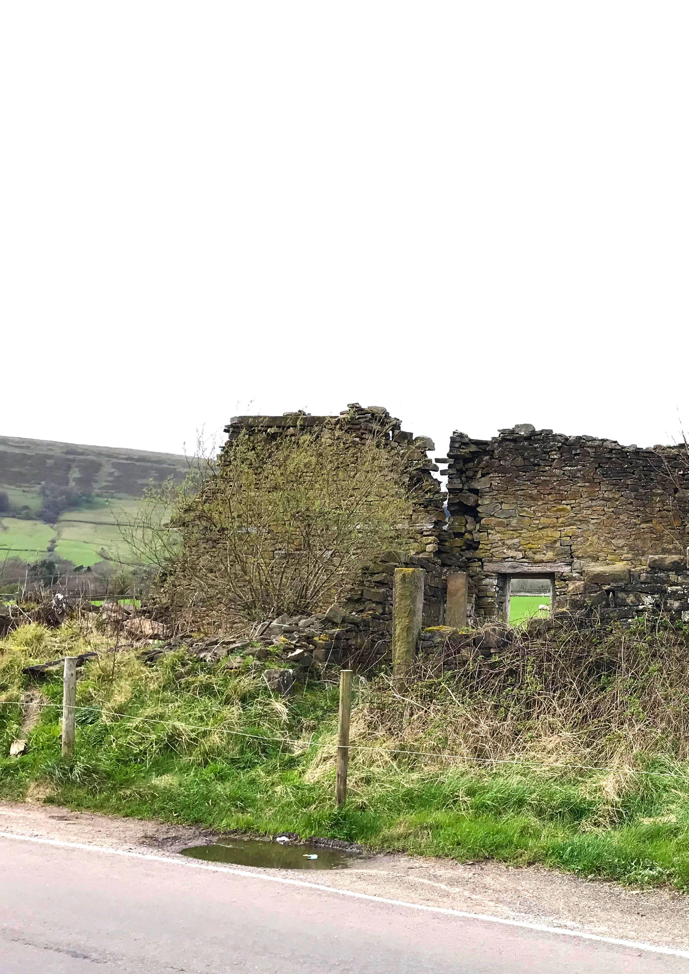
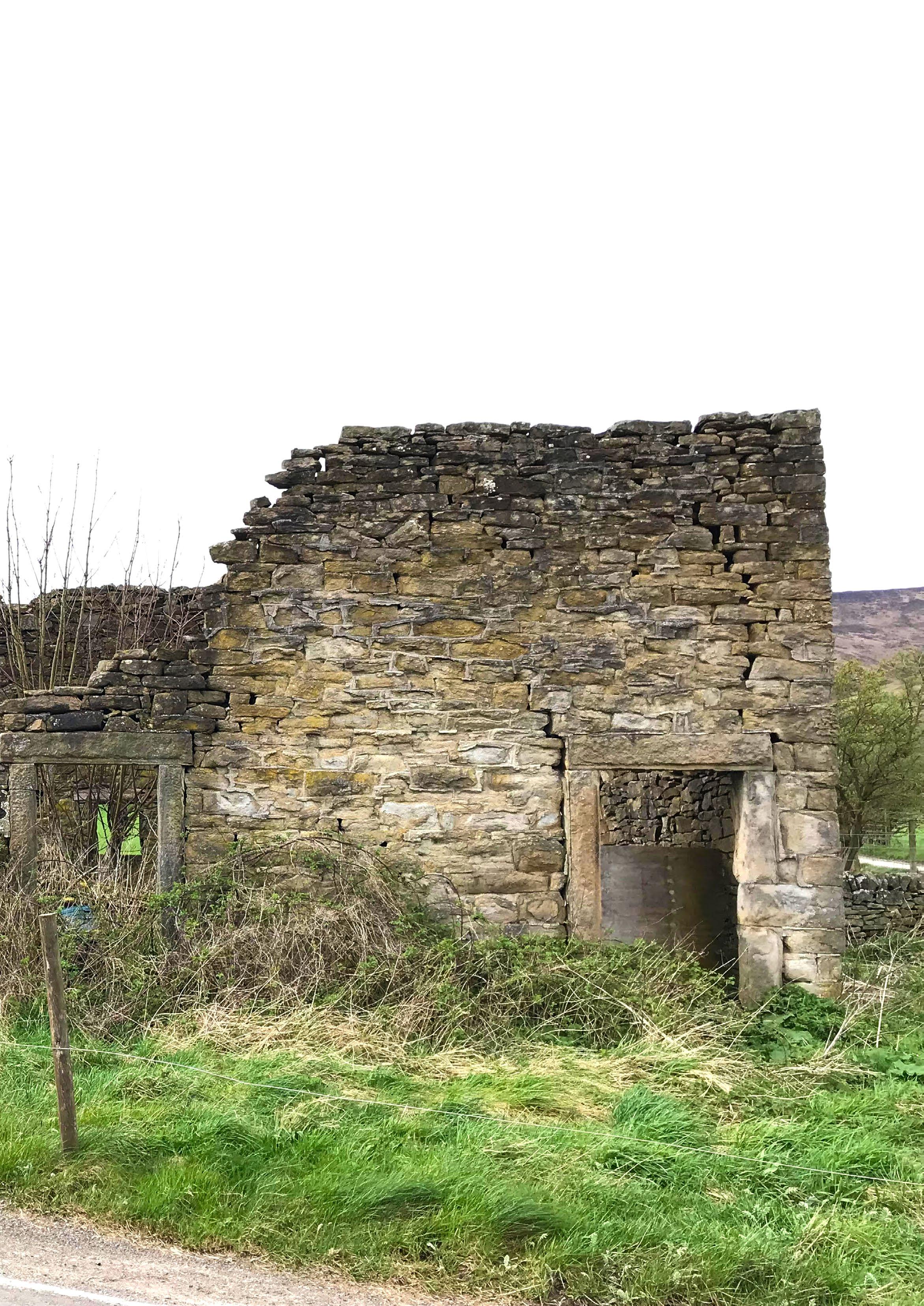
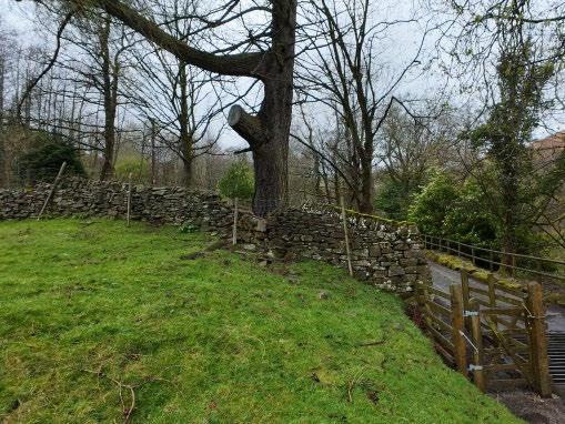
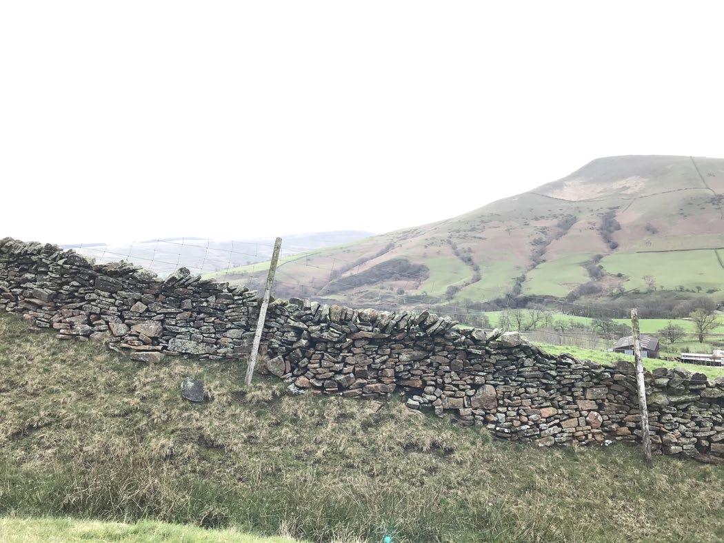
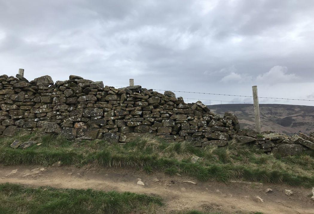
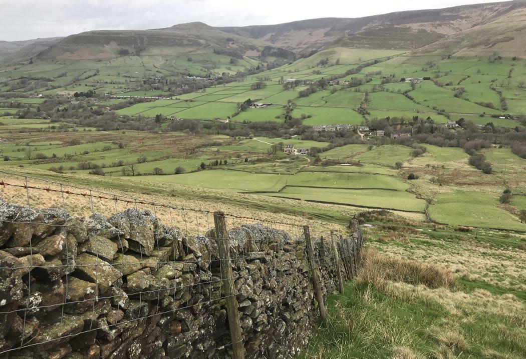
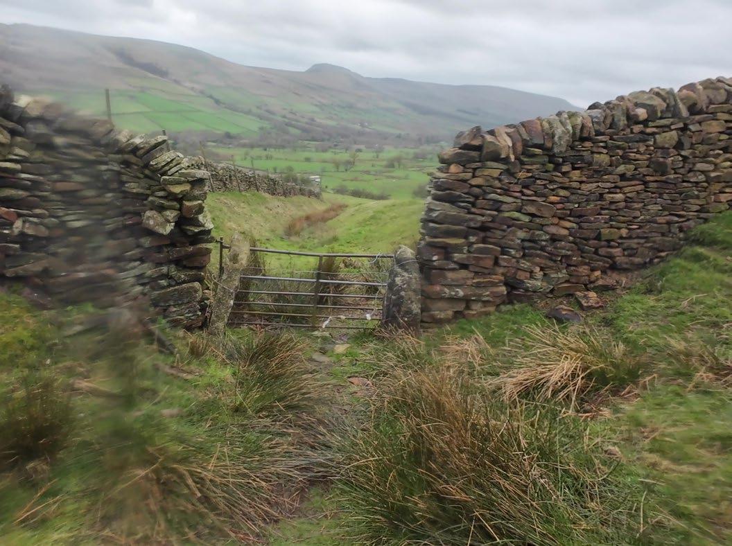
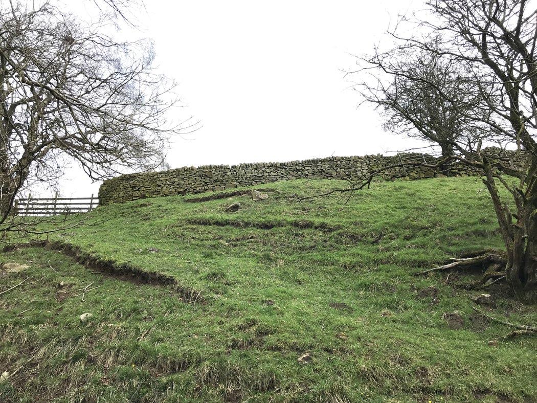
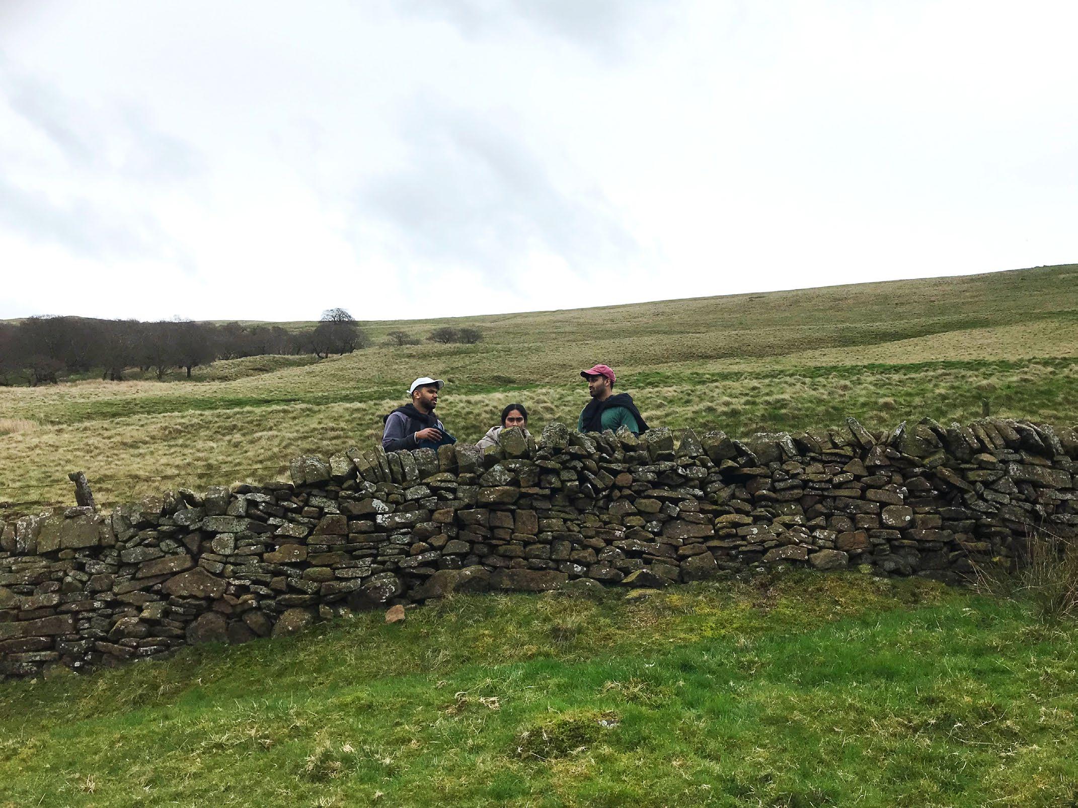
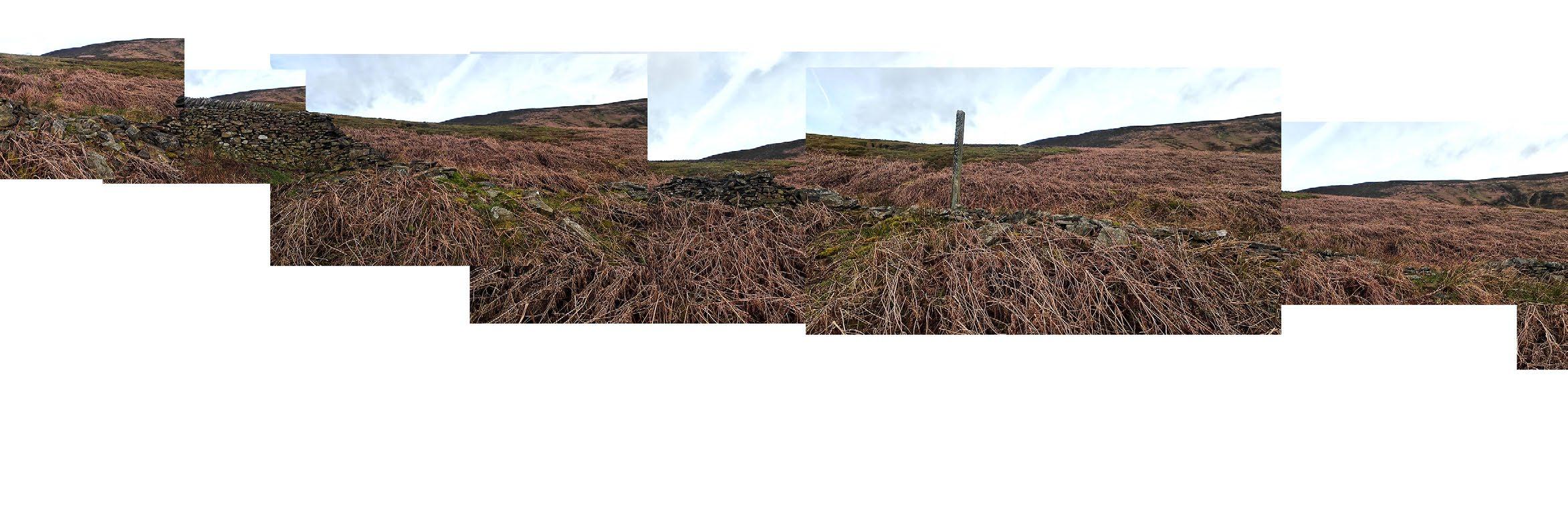
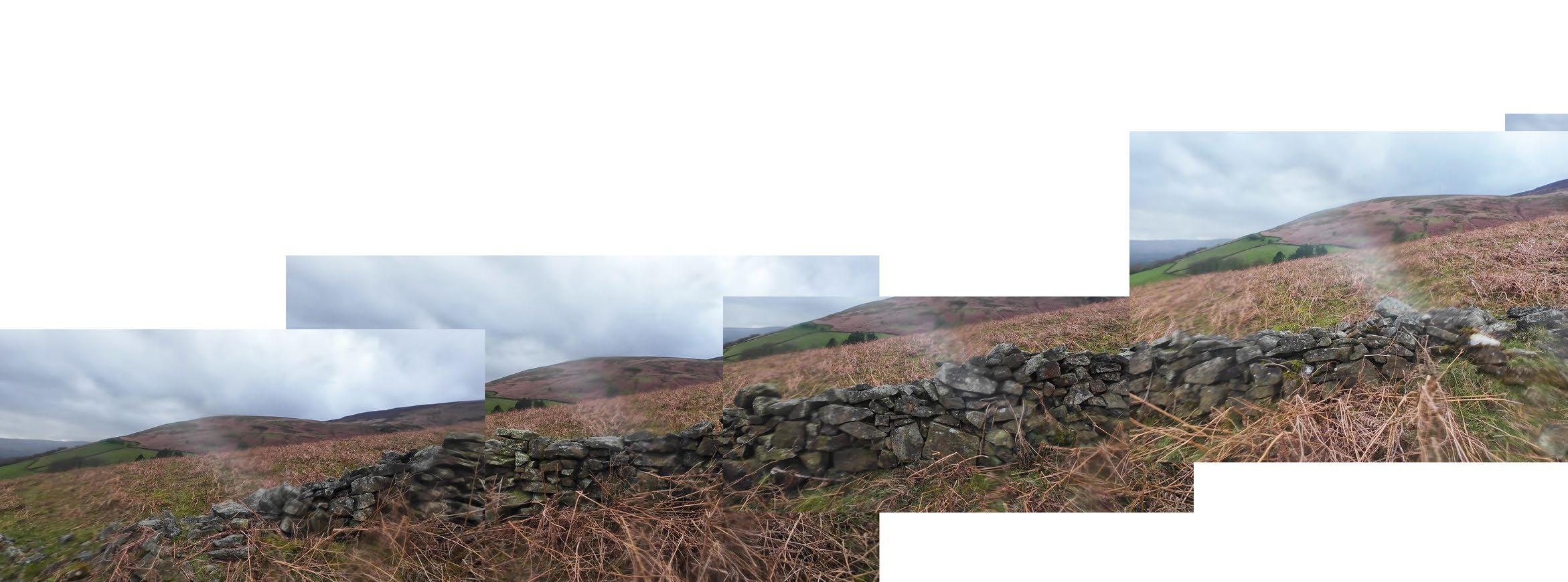
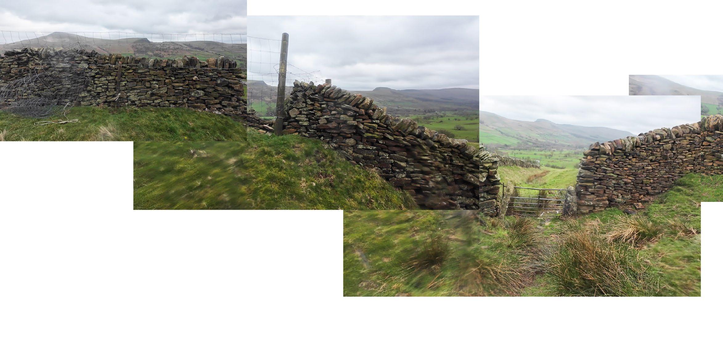
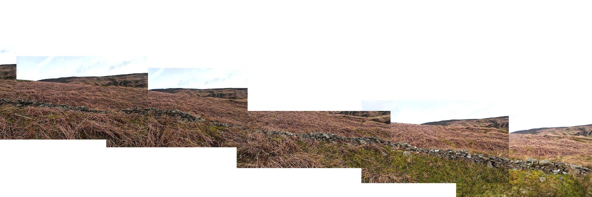
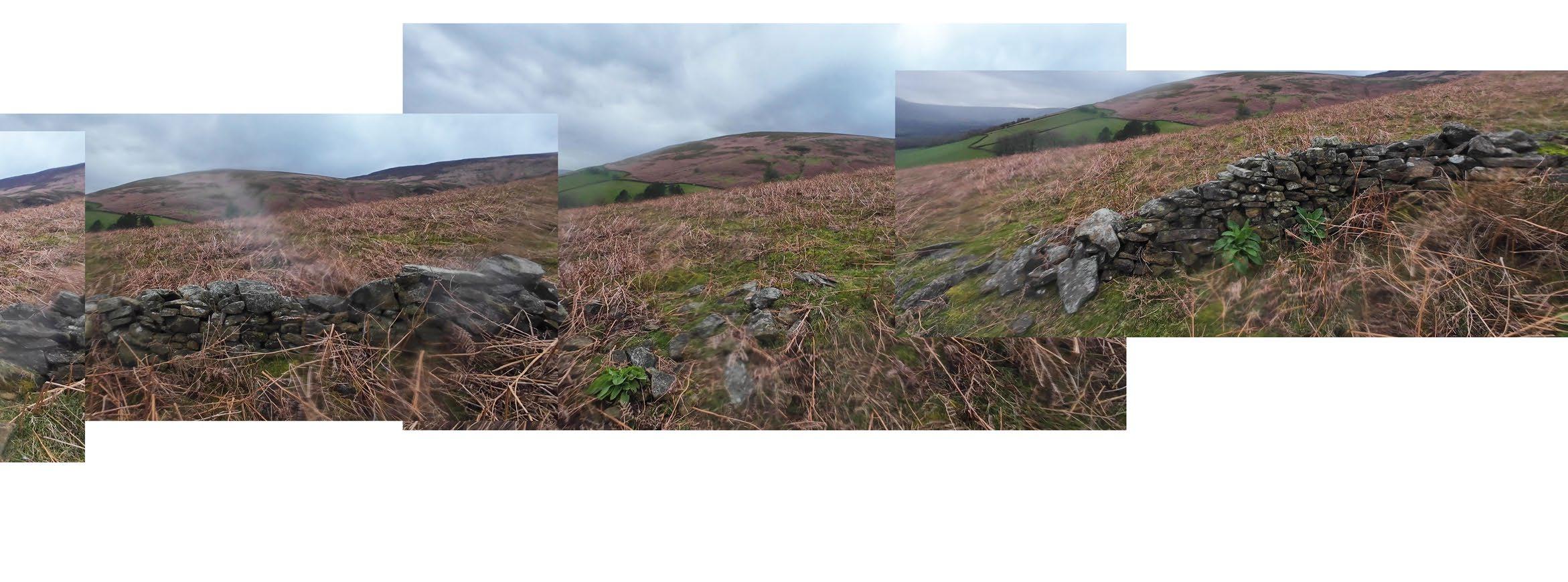
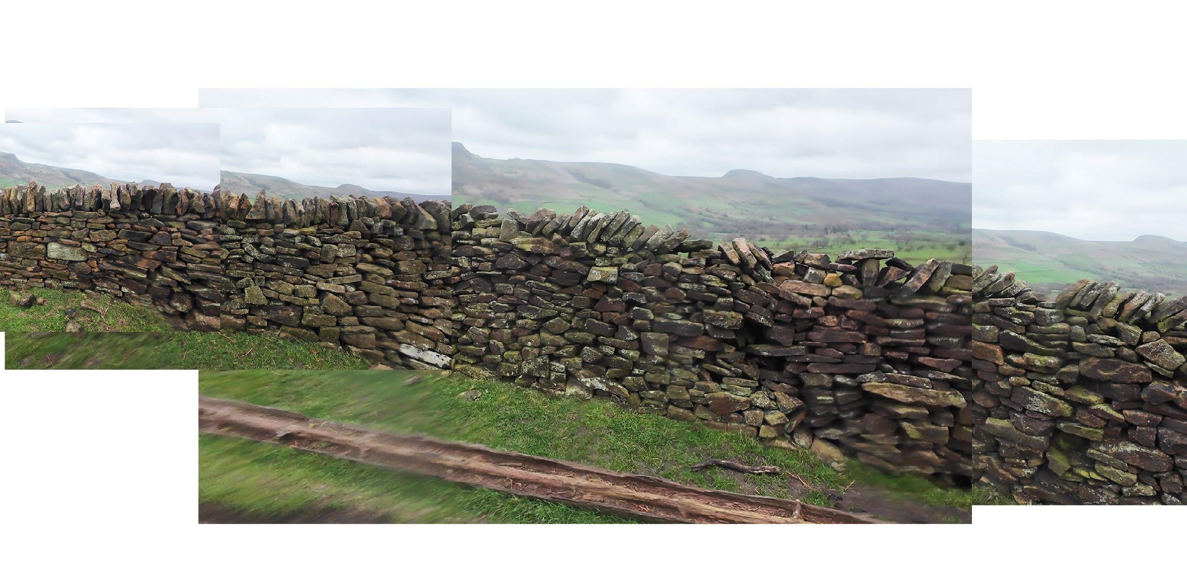
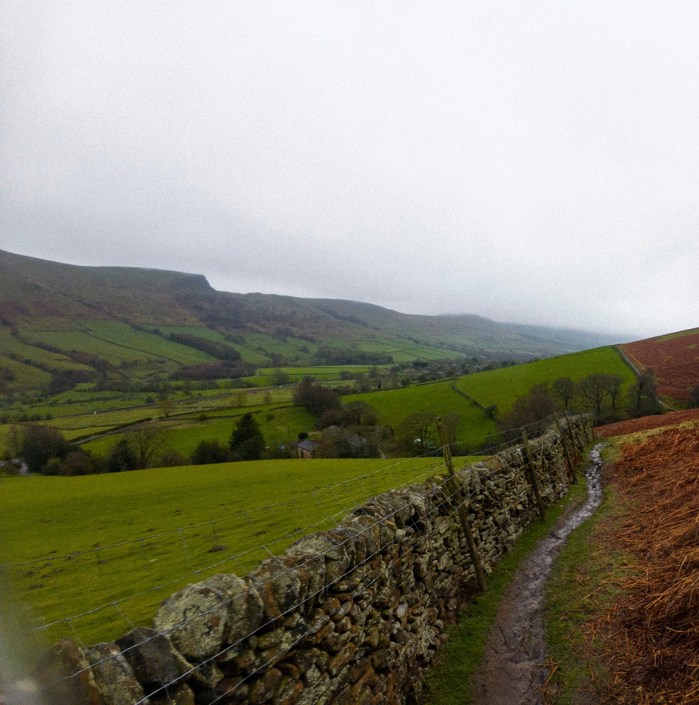
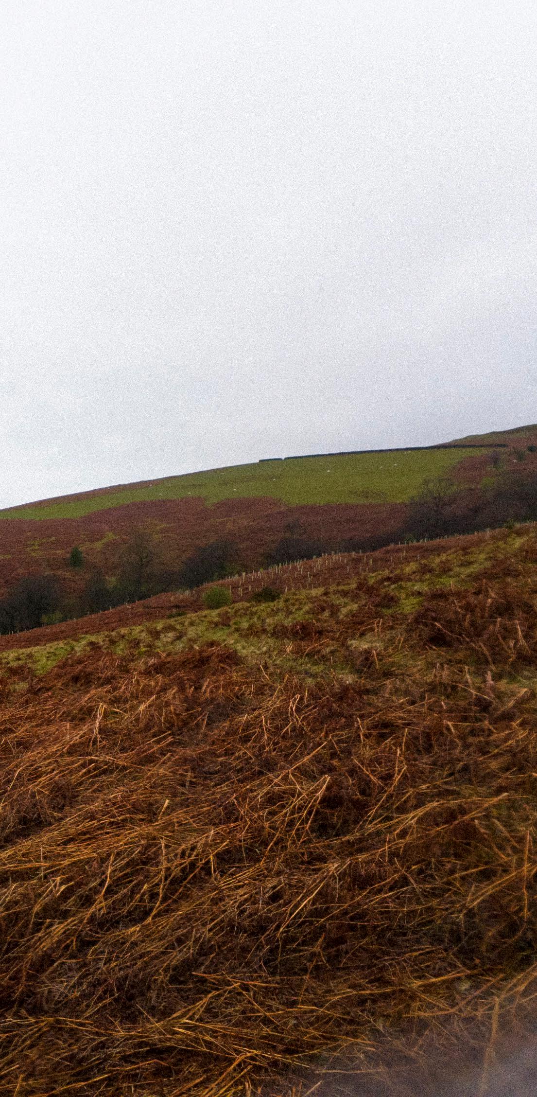
How do drystone walls operate within the landscape?
Here, we see the wall acting as a clear dividing line between the green grazed farmland and the reddishbrown bracken of the moorland.
Stiles: Building in Access
Drystone walls may act as barriers, but they are also porous. One designed feature that is built into drystone walls are stiles: small gates or steps that allow walkers to cross over, but prevent grazing animals such as sheep or cattle to pass through. There are many different types of stiles. Some are made of protruding rocks that act as steps, while others are timber structures that frame the stones and can be shifted as needed.
The image on the following spread shows the porosity of the wall. During my time in the Peak District, the near fragility of the walls struck me. I expected them to seem solid and weighty, but the way in which light shone through them, mosses cropped up in crevices, and water dripped between stones, made them feel incredibly porous—and even alive (see following spread).
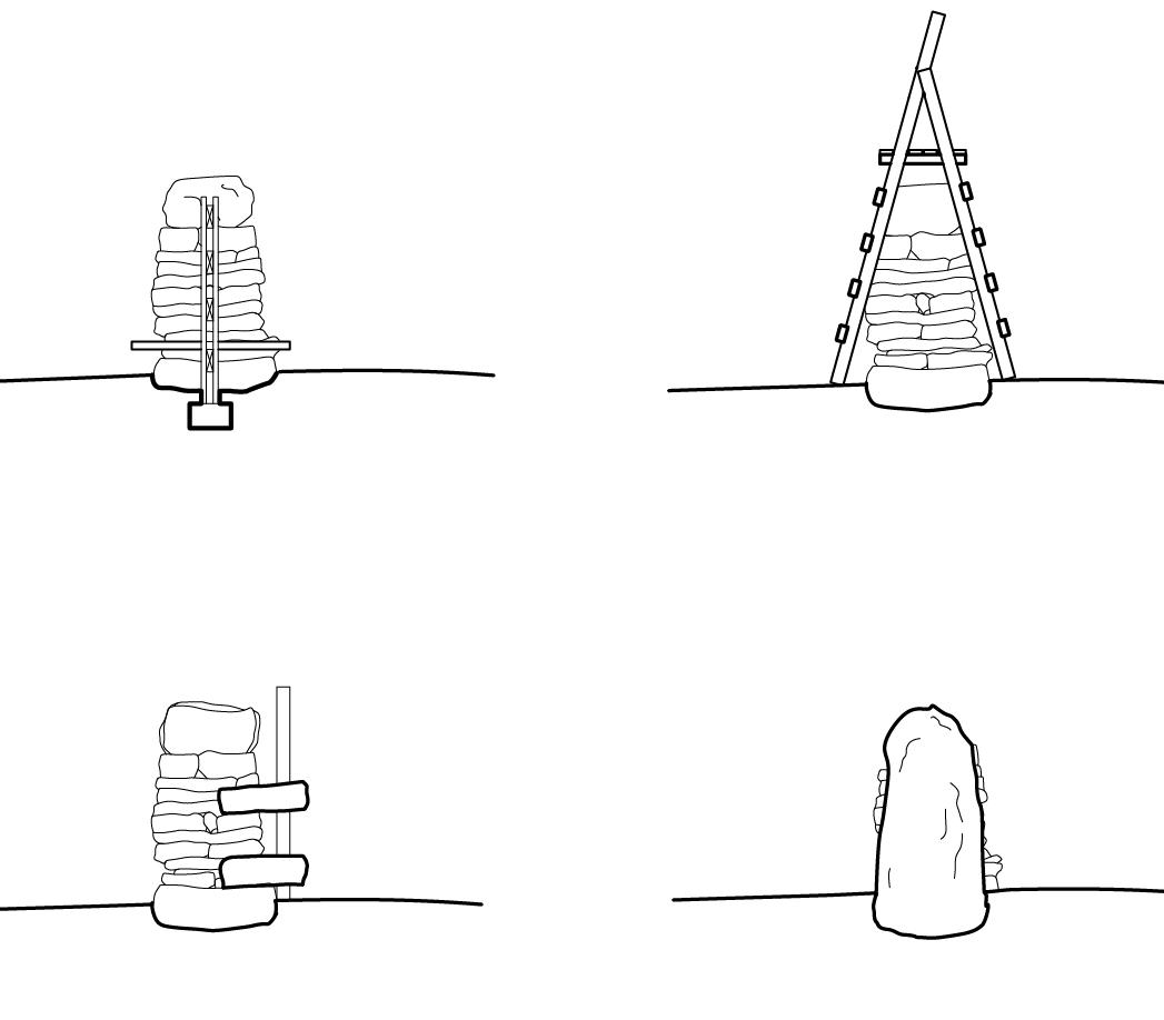
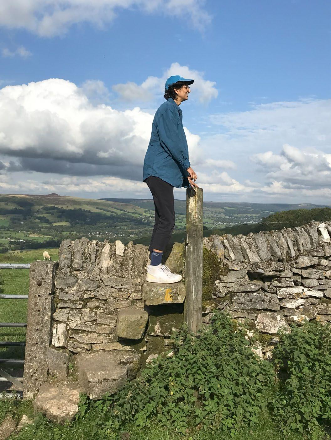
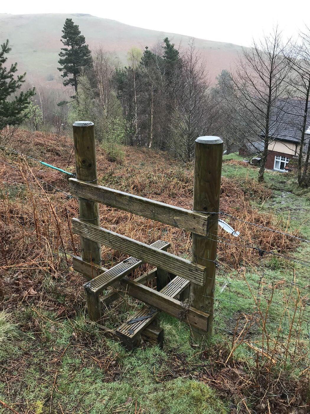
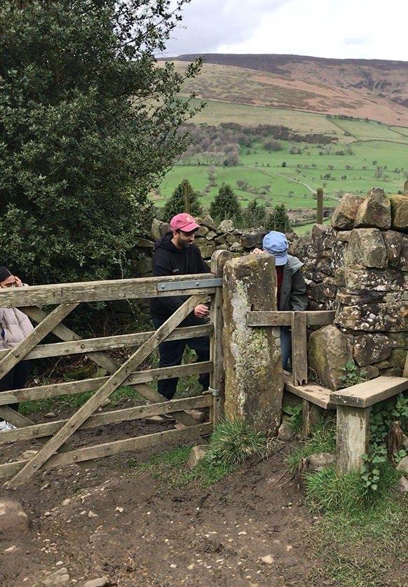
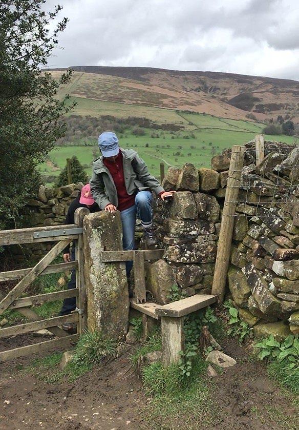
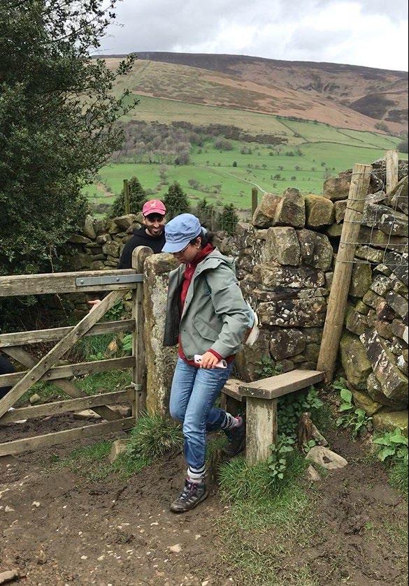
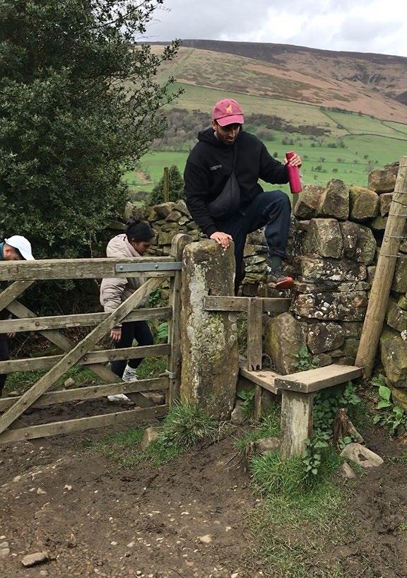
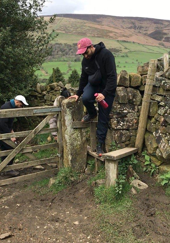
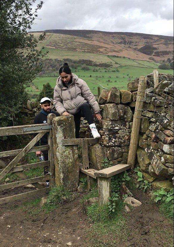
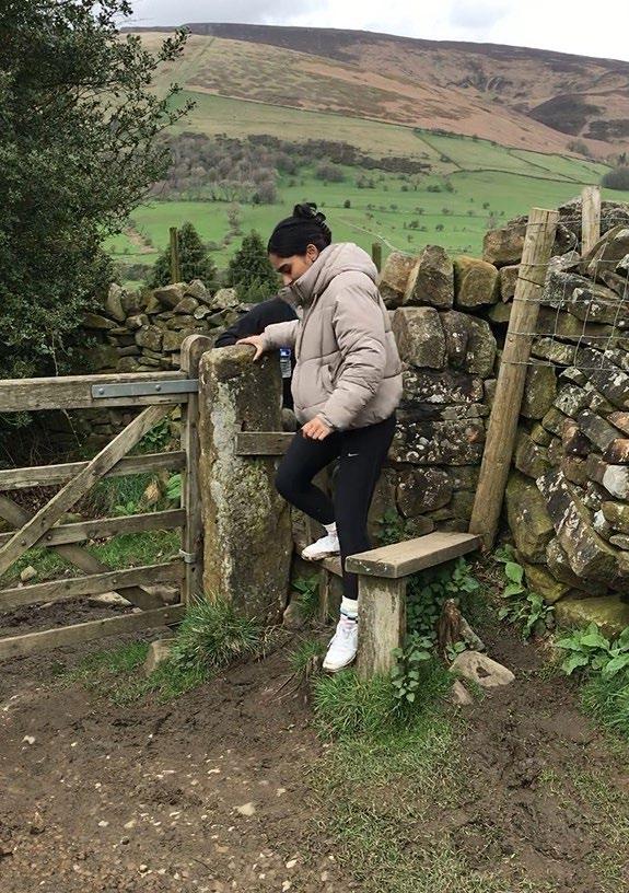
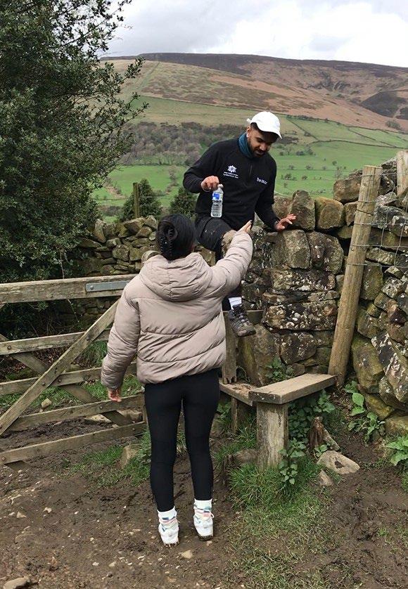
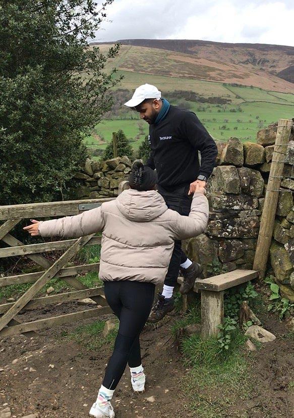
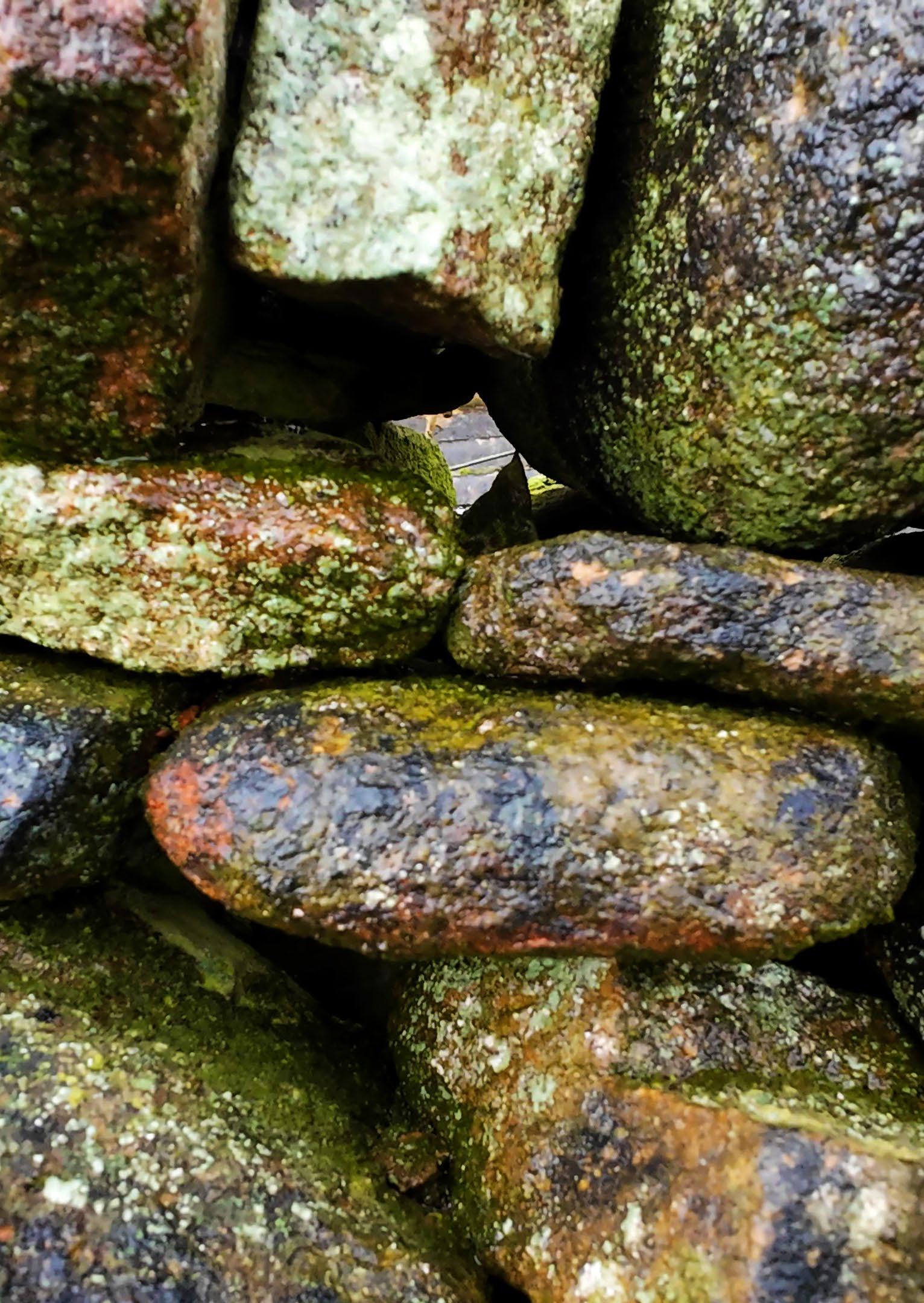
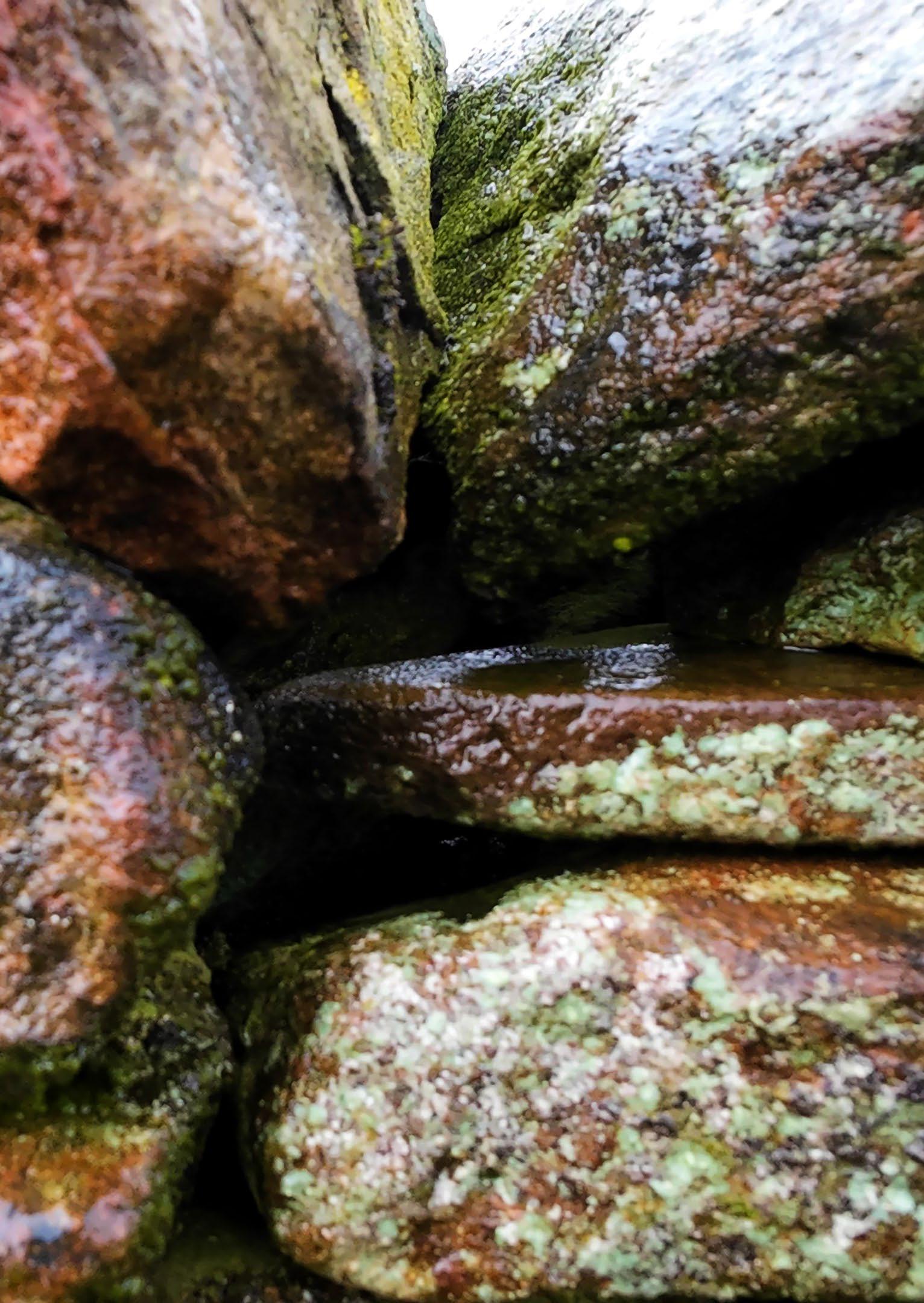
The following section investigates the properties of drystone structures and analyses their structural and climatic performance.
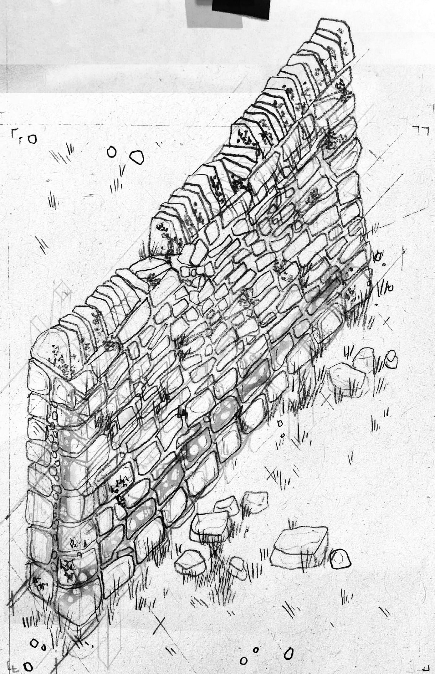
After 50 years, the stones show some sign of wear. Some of the coping stones have fallen to the ground, while lichen growth has caused some crumbling. Mosses thrive on the rocks’ surfaces and crevices.
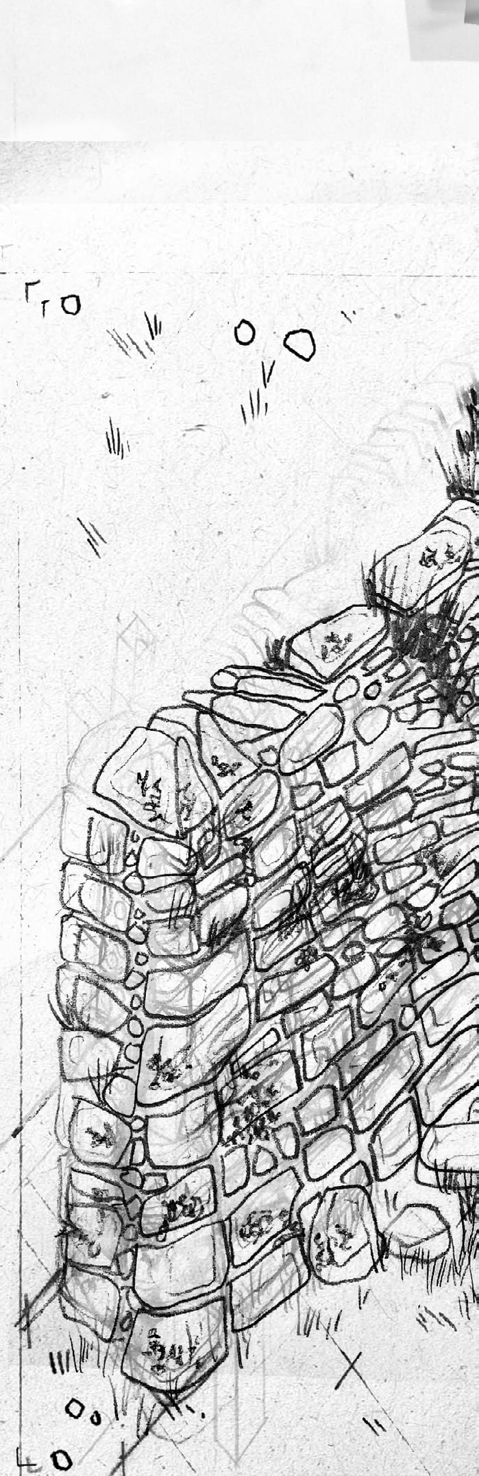
After 100 years, many of the stones have diverse insect life.
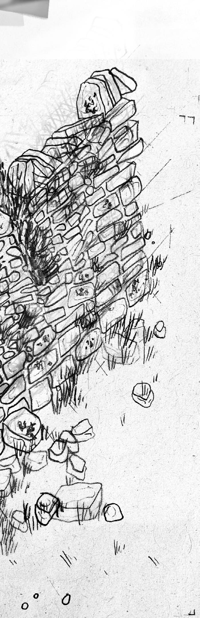
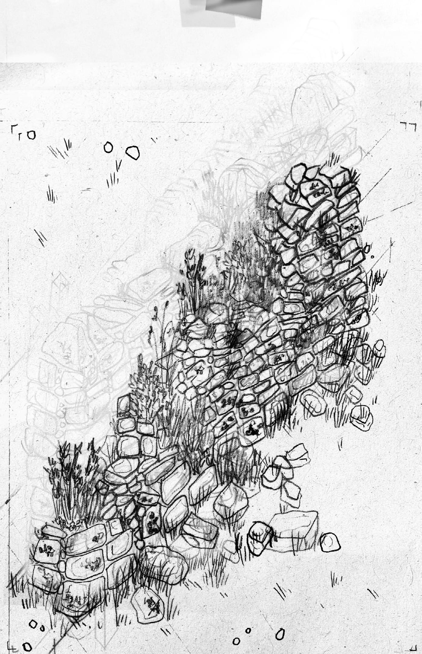
fallen to the ground, forming habitats for After 200 years, much of the wall has returned to the earth. Vegetation thrives between the rocks, causing further degradation.
Structural Analysis
Stone—though it appears static and solid to the human eye—in fact has elastic properties. Drystone construction can thus be analysed in tension and compression similar to other ubiquitous building materials.
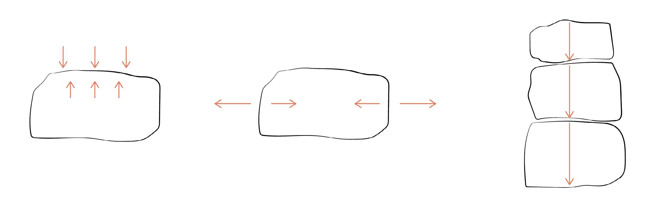
Structural stability depends on how well stones interlock. This is up to the eye of the builder and the stone available; there is no standardised element to facilitate construction. Interlocking stones create friction and hold the structure in place through gravity.
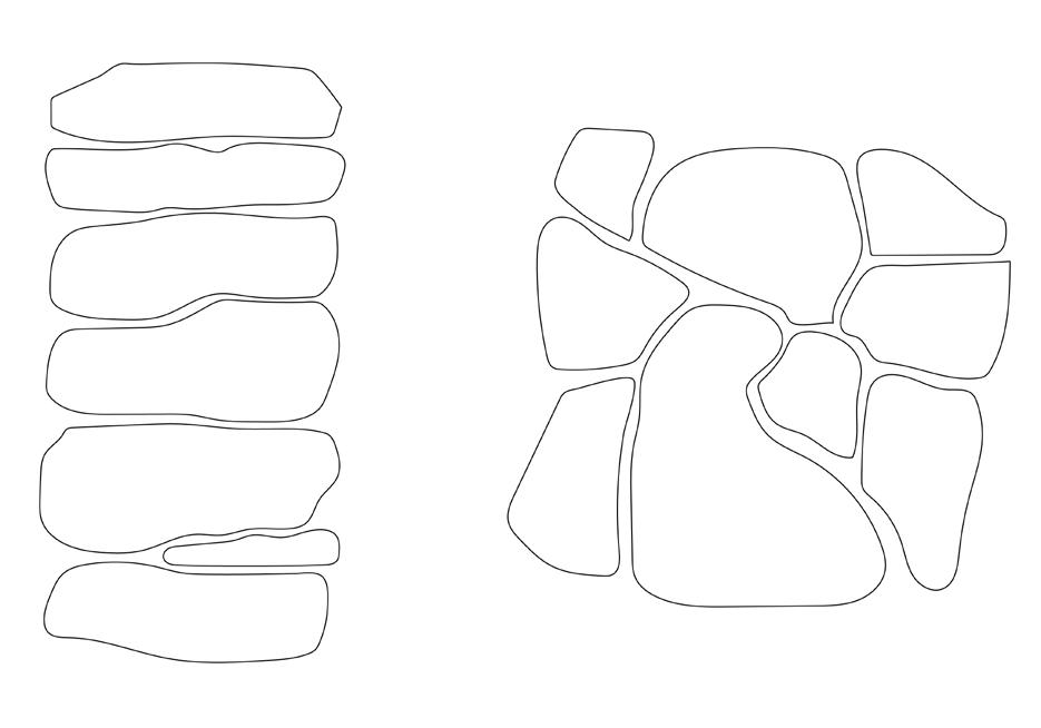
Compression forces
Tension forces
Gravity causes compression through stacked stones
Reaction forces
Reaction forces
Throughstones distribute load across both sides of the wall
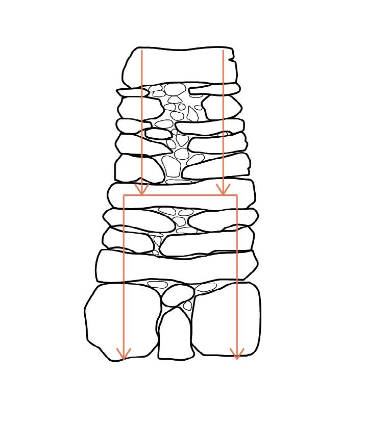
0 0.25m 0.5m 1m

Load distributed through arched structure
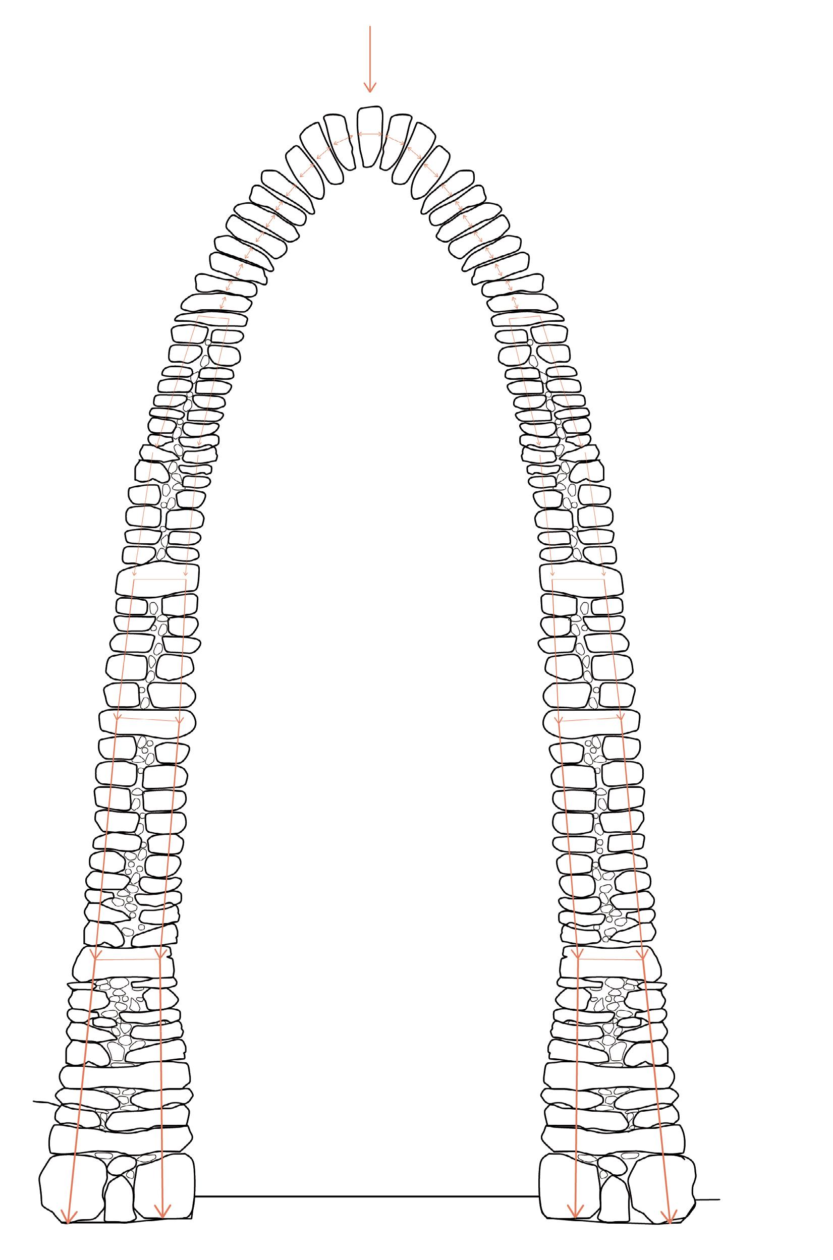
Corbelled Stone Domes
Corbelling is a dry stone technique where each stone is successively stacked in an overlapping manner so as to eventually create a dome form. “Corbelling theory” was developed to understand the structural forces at play in a corbelled dome; however, as Foti et. al make the case, it fails to account for the horizontal distribution of compressive loads, such as friction between the rocks. The following analysis of the trullo dome is a case study that has similar properties to the drystone domes the design proposes later in this chapter.
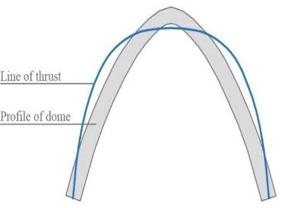
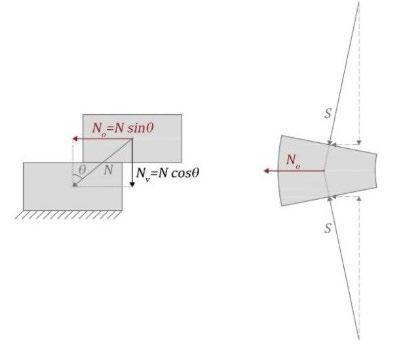
Structural analysis of two blocks in a trullo dome
From
From
Diagram showing the line of thrust and structural profile of the trullo corbelled dome
“On the mechanics of corbelled domes: new analytical and computational approaches,” Pilade Foti et al.
“On the mechanics of corbelled domes: new analytical and computational approaches,” Pilade Foti et al.
Line of thrust
Profile of dome
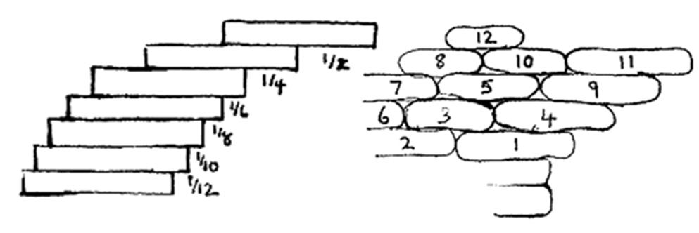
Left: Progressive distance to overhang each rock
Right: Order to lay a dry stone corbelled dome
Diagram by Sean Adcock, https://thestonetrust.org/master-class-masterclass-theory-of-corbelling/
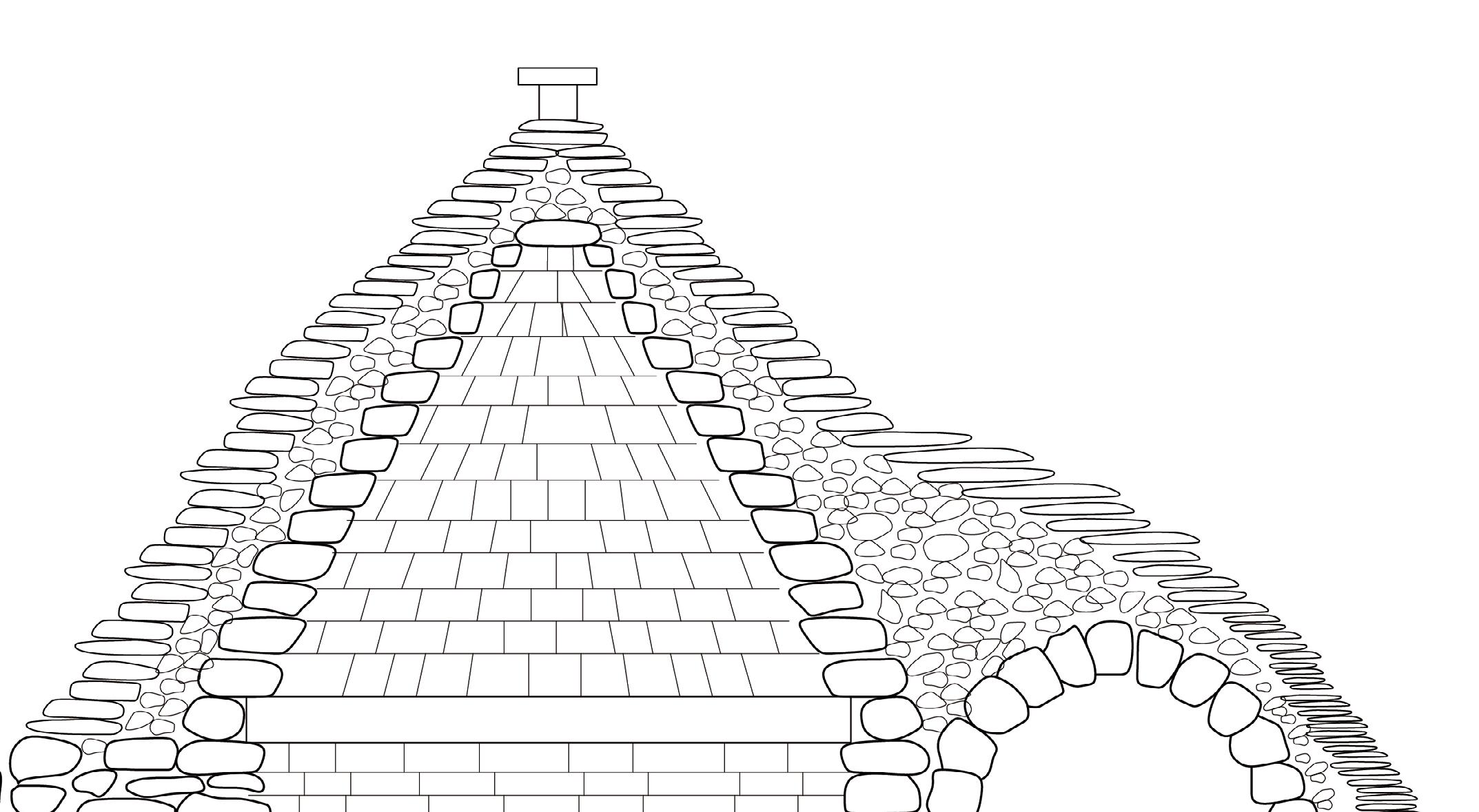
Section of an Italian trullo corbelled double stone dome with infill
01. Inner layer: candela (structural)
Stones of even thickness are stacked in an overlapping mannar (corbelling) to create the pseudo-dome shape
02. Small stones are placed as infill between the inner and outer domes
03. Outer layer: chiancarelle (non-structural)
4-8 cm thick limestone sloping outward to drain water
Structural Limitations
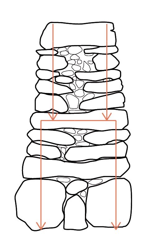
The “batter” is the incline of the drystone wall. A typical batter is between 1:6 and 1:10 (run:rise). A typical wall does not exceed 1.8m in height.
What is the maximum height of a wall given different batter ratios?
Example 1
Base width: 0.5m
Top width: min. 0.2m
Maximum height at 1:6: 1.8m [0.5x6=3; 3/0.5 = x/0.2; x=1.2; height=3-1.2=1.8]
Maximum height at 1:8: 1.6m [0.5x8=4; 4/0.5 = x/0.2; x=1.6; height=4-1.6=2.4]
Maximum height at 1:10: 3m [0.5x10=5; 5/0.5 = x/0.2; x=2; height=5-2=3]
Example 2
Base width: 0.8m
Top width: min. 0.2m
Maximum height at 1:6: 3.6m [0.8x6=4.8; 4.8/0.8 = x/0.2; x=1.2; height=4.8-1.2=3.6]
Maximum height at 1:8: 4.8m [0.8x8=6.4; 6.4/0.8 = x/0.2; x=1.6; height=6.4-1.6=4.8]
Maximum height at 1:10: 6m [0.8x10=8; 8/06 = x/0.2; x=2; height=8-2=6
Example 3
Base width: 1m
Top width: min. 0.3m
Maximum height at 1:6: 4.2m [1x6=6; 6/1=x/0.3; x=1.8; height=6-1.8=4.2]
Maximum height at 1:8: 5.6m [1x8=8; 8/1=x/0.3; x=2.4; height=8-2.4=5.6]
Maximum height at 1:10: 7m [1x10=10; 10/1=x/0.3; x=3; height=10-3-7]
The Challenges of Drystone Construction and Inhabitation
Drystone construction has many positive attributes, but it is also important to recognise its drawbacks. Its simplicity may be its greatest strength as well as its greatest weakness. In employing only locally-sourced rocks held together by gravity, drystone is a labour-intensive process that requires continual maintenance. If built well, it can be incredibly durable and long-lasting, but poorly laid foundations, improper drainage, or mislaid stones can cause collapse. Because of its simplicity, the height and span of drystone is also limited: large structures are either impossible or unwise.
Temporarily inhabiting drystone structures, as proposed in the project, comes with its own dilemmas. In the windy, exposed moorland, drystone provides a reasonable microclimate, but it is by no means wind- or cold-proof. Stone building are famously frigid, requiring other means of comfort and warmth, such as indoor fires, blankets, and extra layers of clothing. Drystone houses have existed for millennia, such as in the Scottish blackhouse. To modern standards, these shelters are far from comfortable; yet for temporary inhabitation they may be adequate for those up for some small sacrifices of comfort.
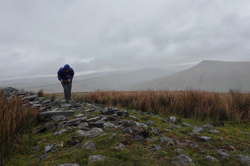
April 9th was a fiercely windy and stormy day. I walked out into the moors, disoriented, and thought I might die. It was strongest wind I’ve ever experienced, frigid and relentless. I was only able to lift a few stones before the cold rendered my fingers numb. Crouching to take shelter by a drystone wall, I felt the cold wet seep through my clothes and skin. Experiencing these conditions made clear the challenges of building in this climate.
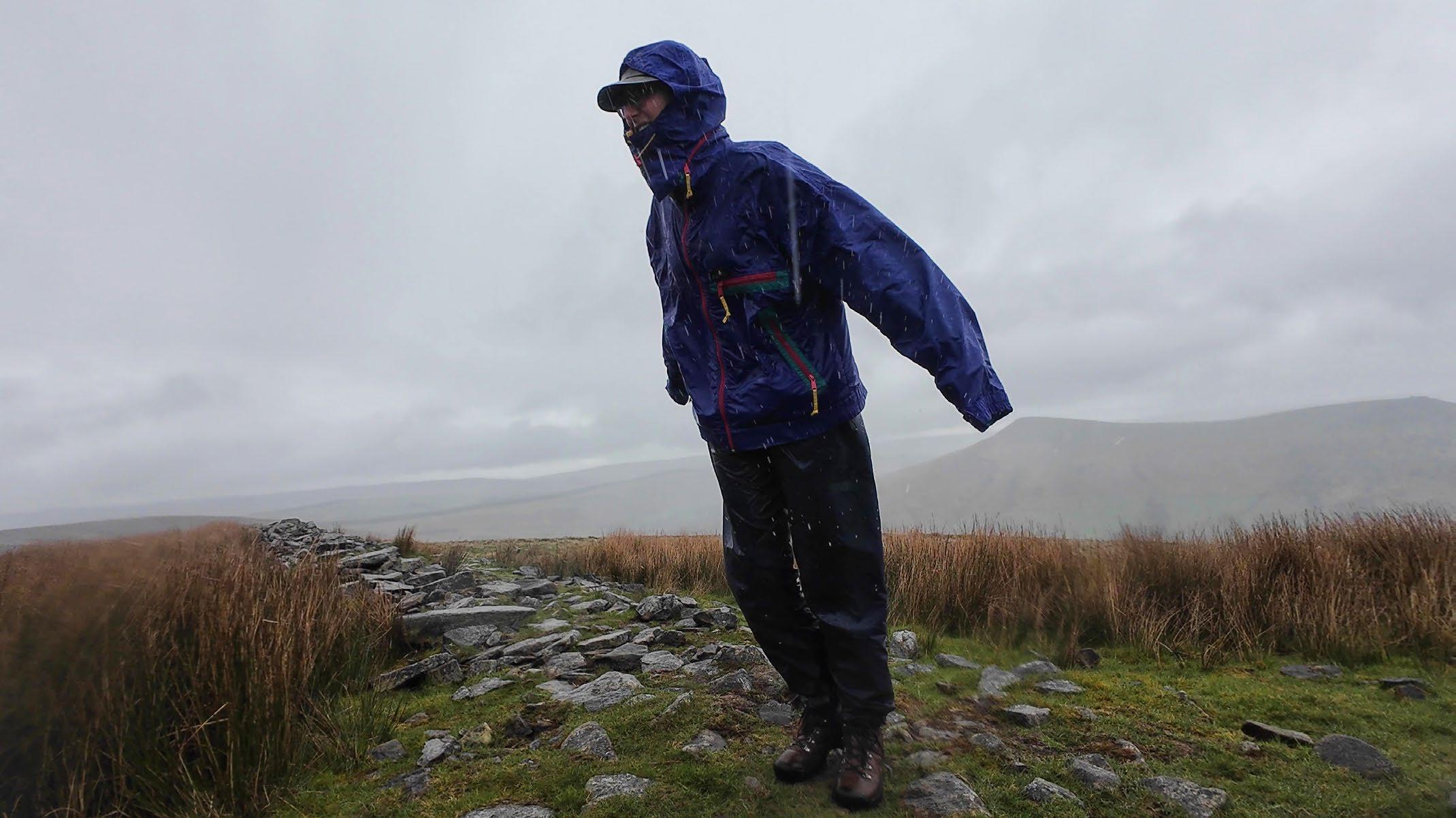
Walking through the moorland on a stormy morning, I was vulnerable to the relentless wind and sheets of rain. The open moorland offered no respite. In the distance, I at last saw a drystone wall curving up the sharp incline. Oriented north-south, it was built perpendicular to the eastward winds, and crouching next to it, I was immediately sheltered.
I tried to measure the threedimensional form of the drystone microclimate. First, I used my body to sense the wind (opposite page). Then, I used a strip of cling film as a wind measuring device, observing where it flew at a horizontal at full wind speed and where it drooped to a vertical when within the microclimate’s reach (pp. 38-41).
This drystone wall, though only 1.2m tall, offered a considerable amount of shelter to the wary rambler or passing sheep. A taller wall or enclosed cairn structure would be an invaluable resting place for those crossing the frequently stormy landscape.
01. Testing wind velocity at the top of the wall
02. The wind skims over the coping stones
03. Testing the angle of the wind
04. Testing the extents of the microclimate
05. Crouching away from the wall, I felt minimal wind
06. Crouching further back, I still felt mostly sheltered
07. Attempting to make the form of the microclimate with my body
08. Second attempt
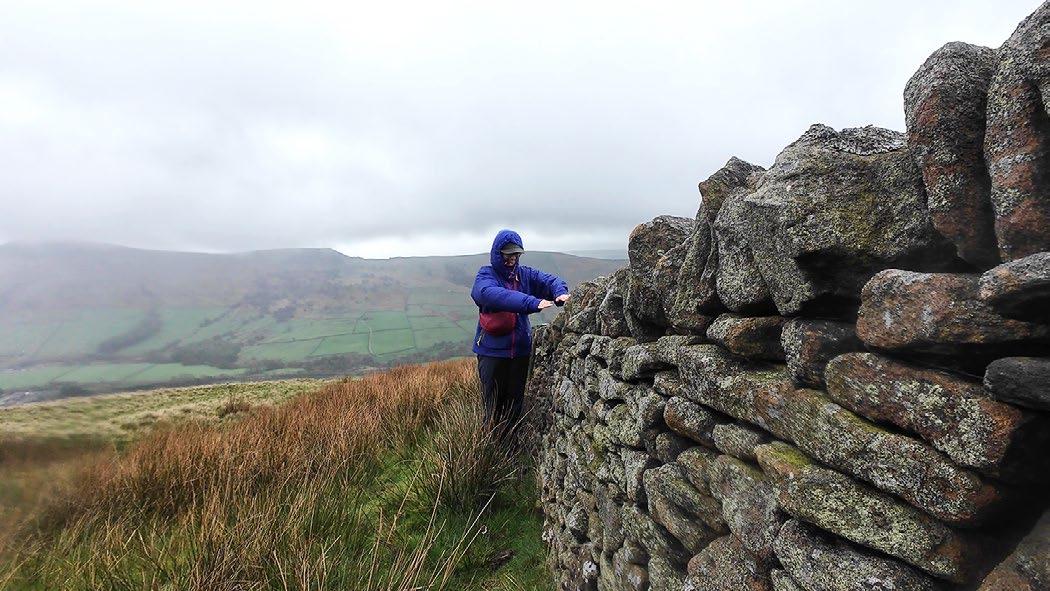
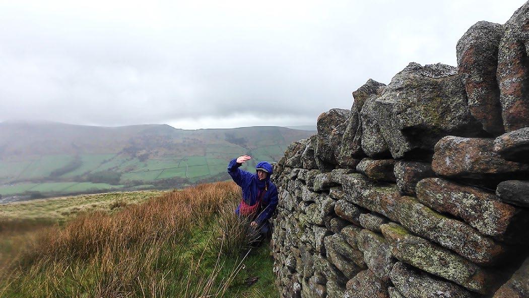
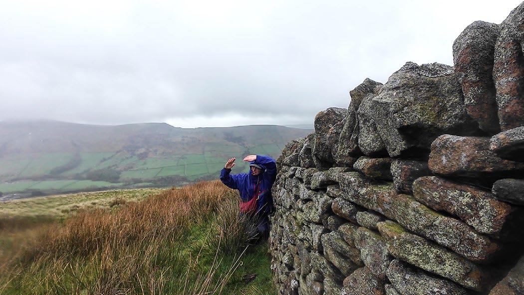

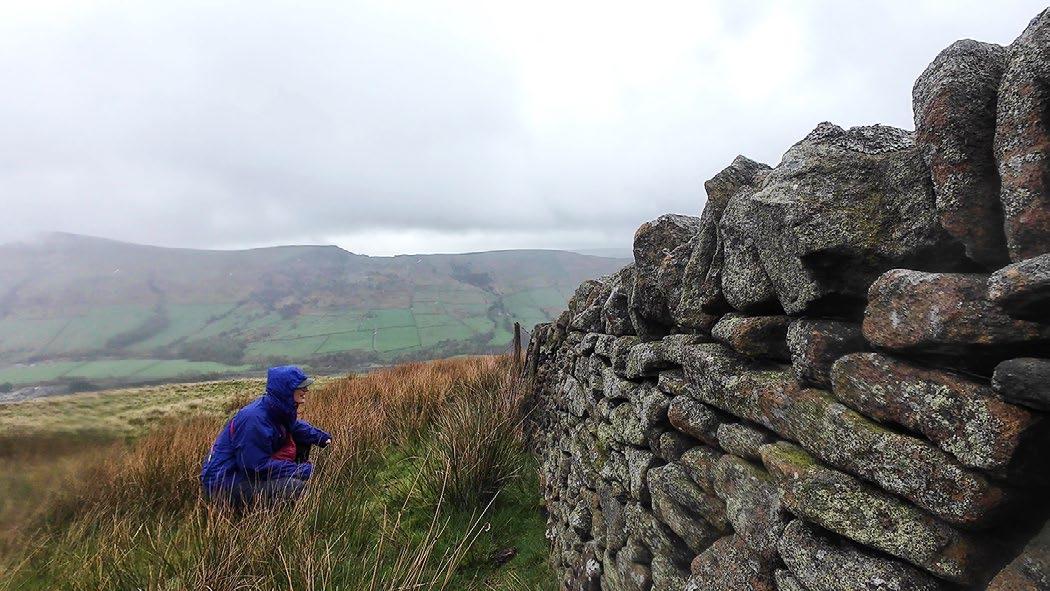
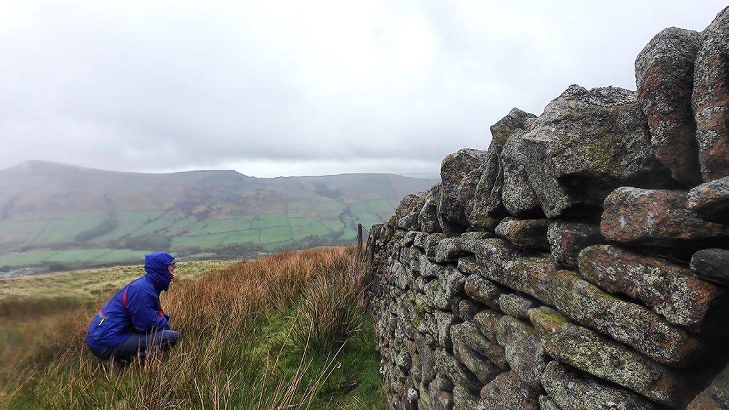
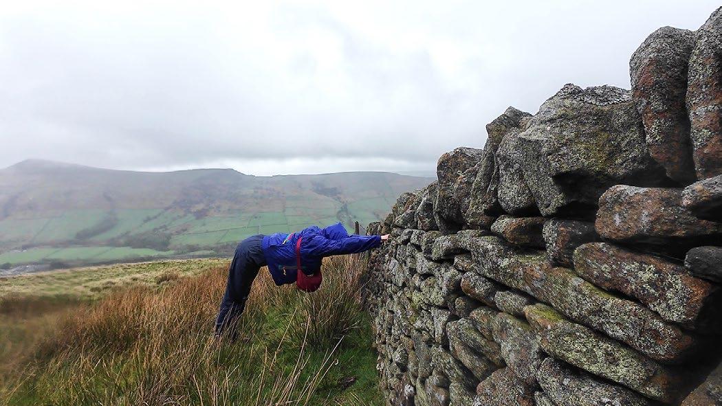

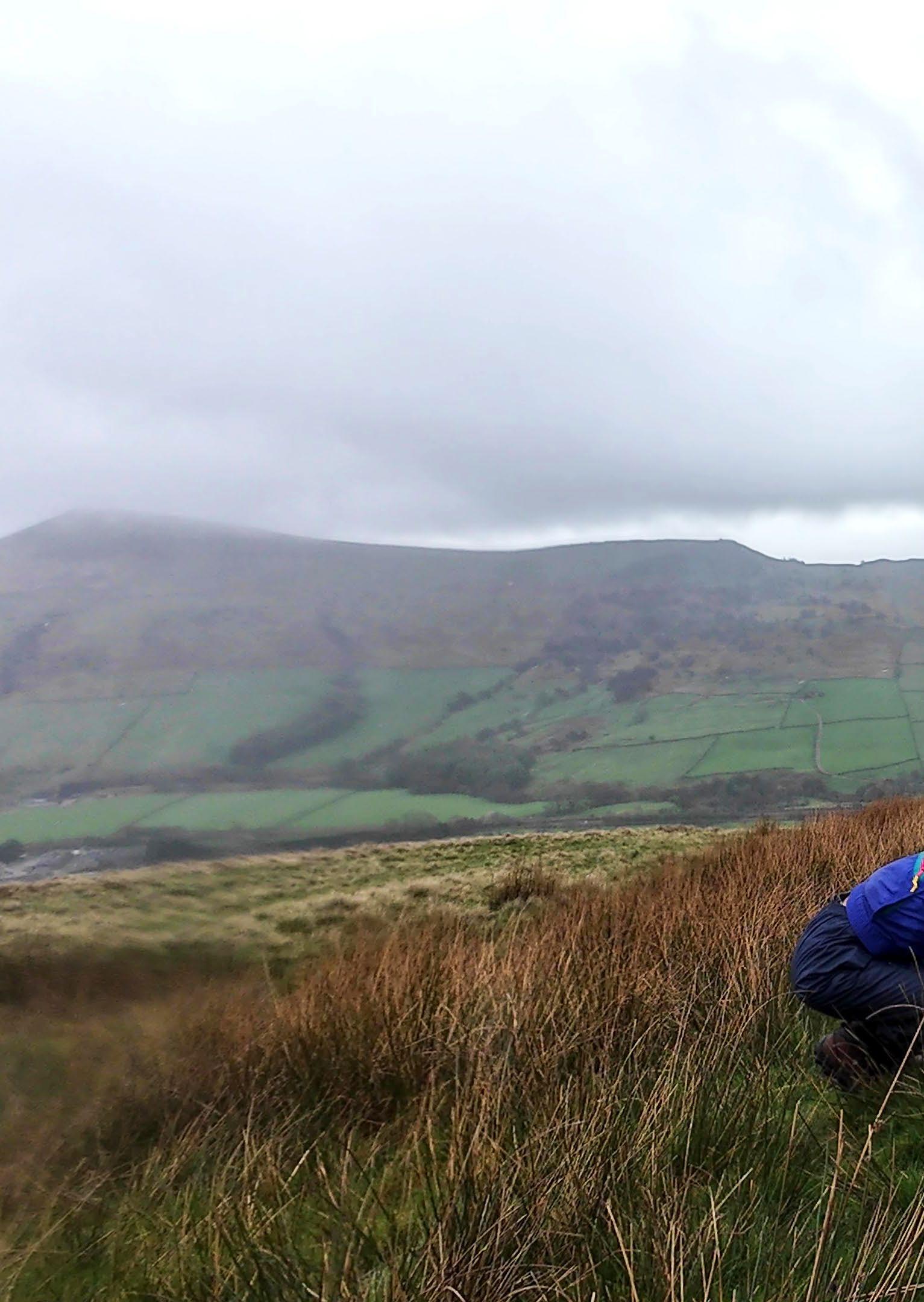
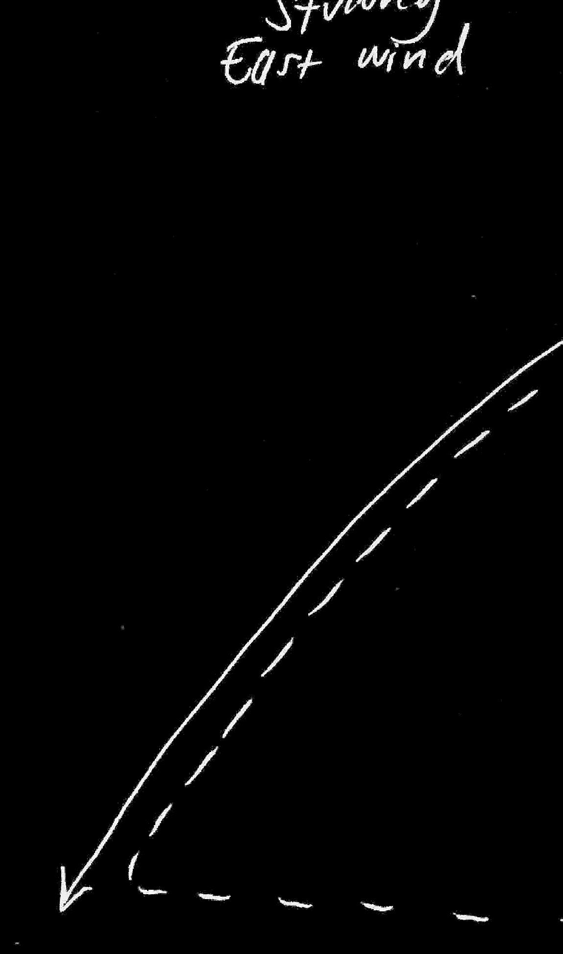
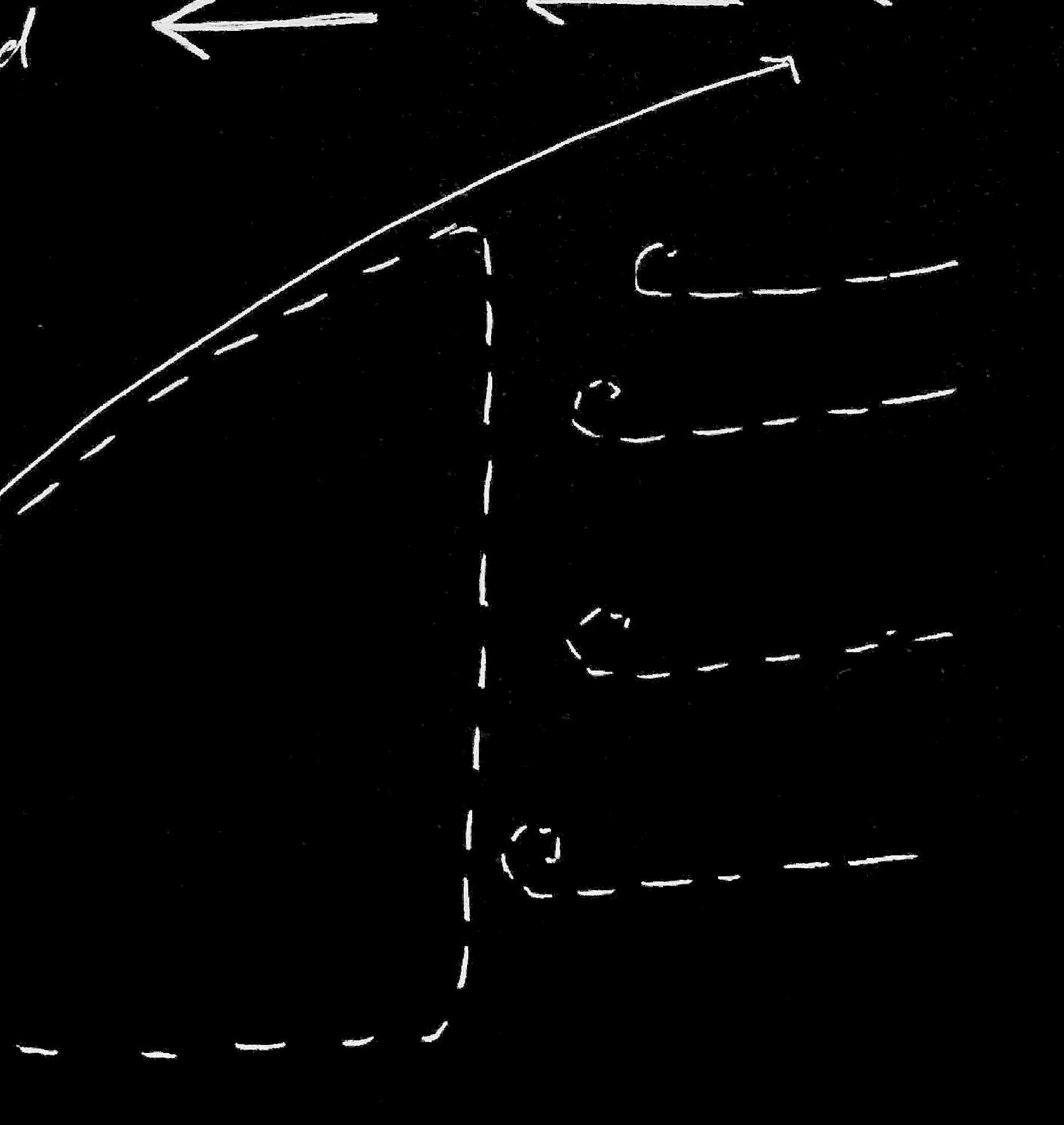
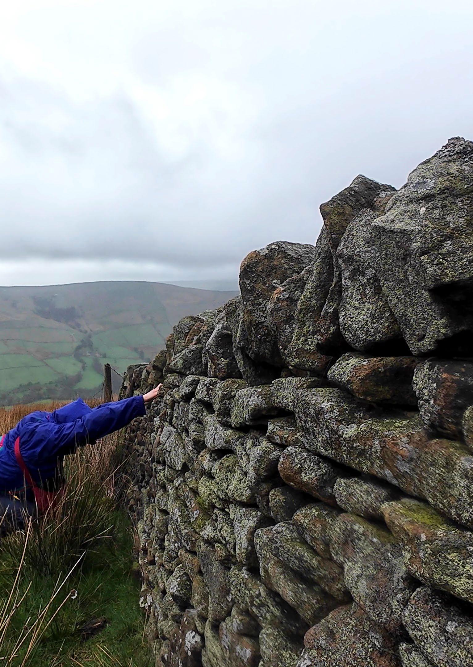
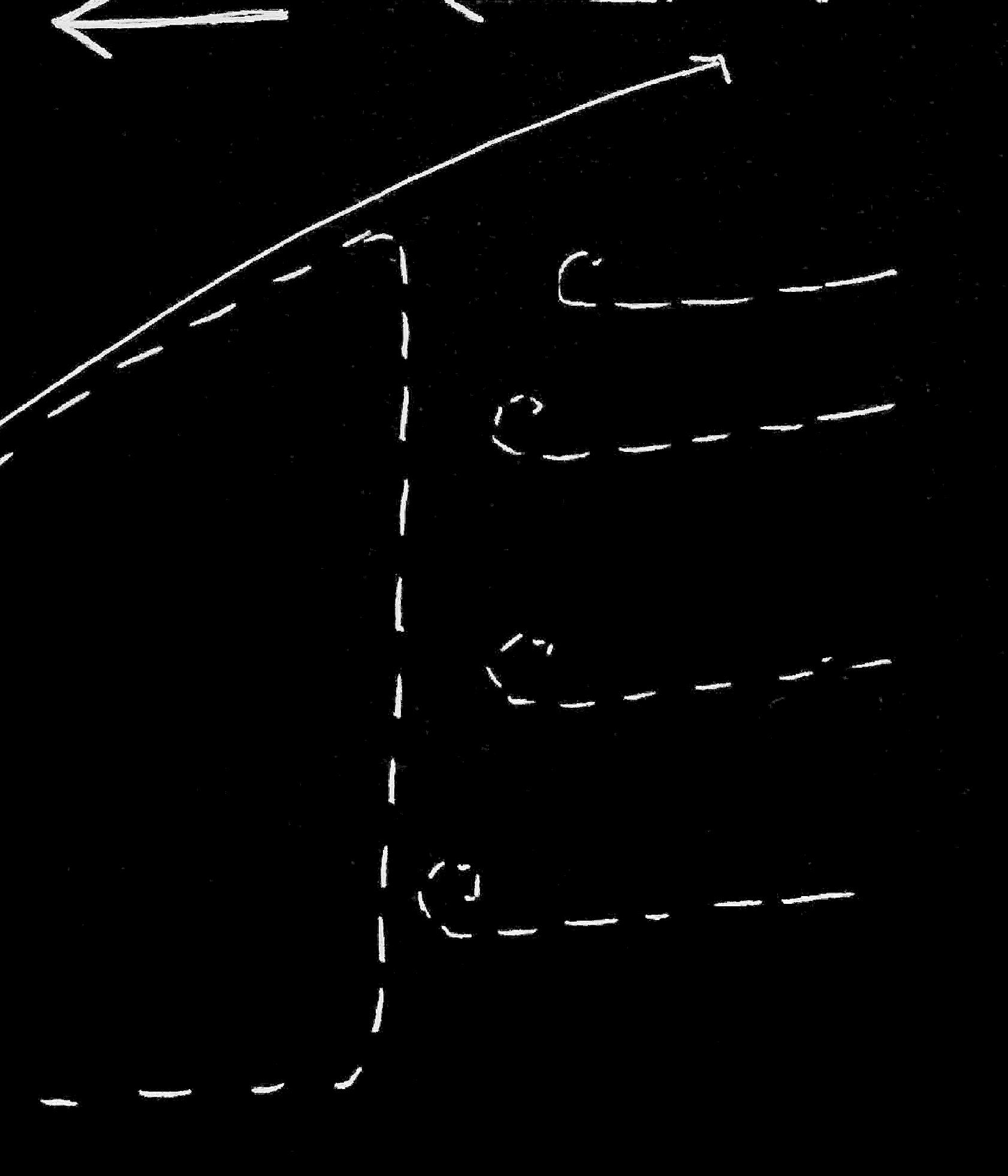
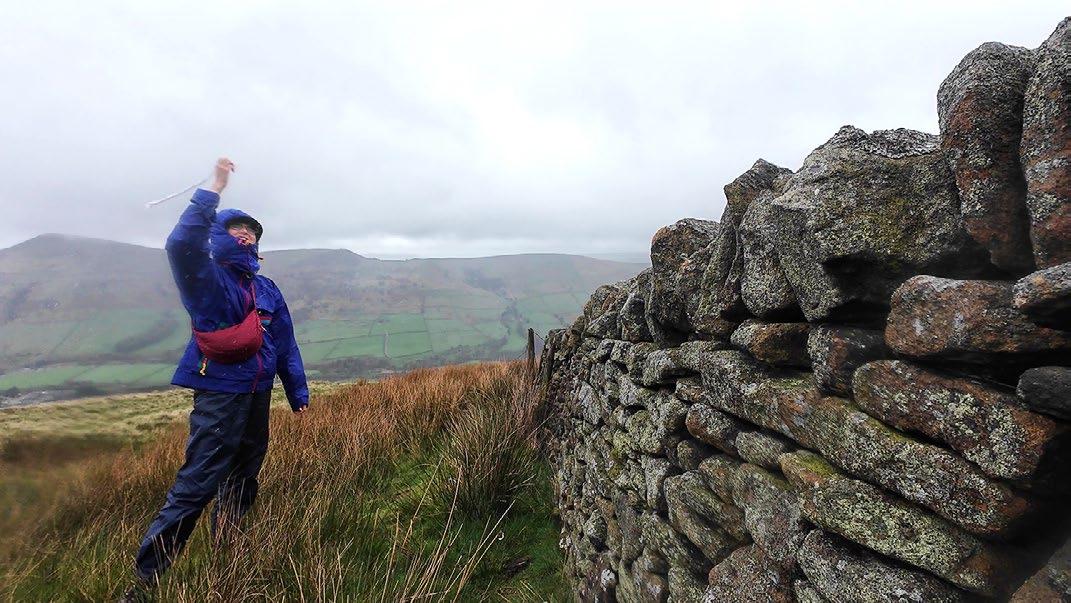
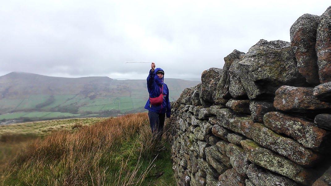
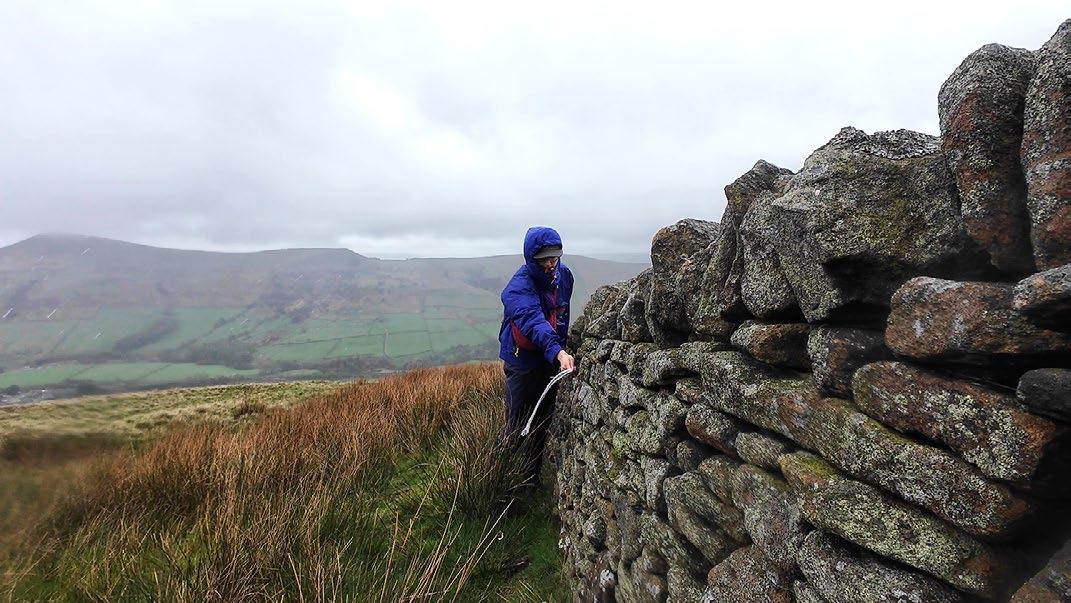
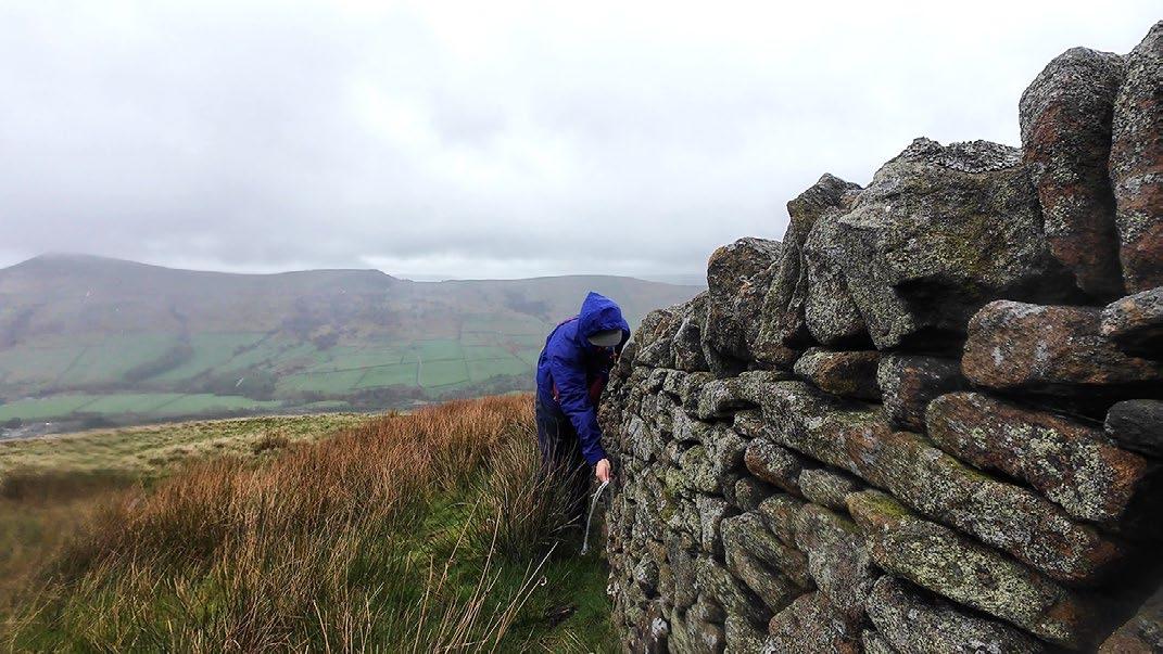
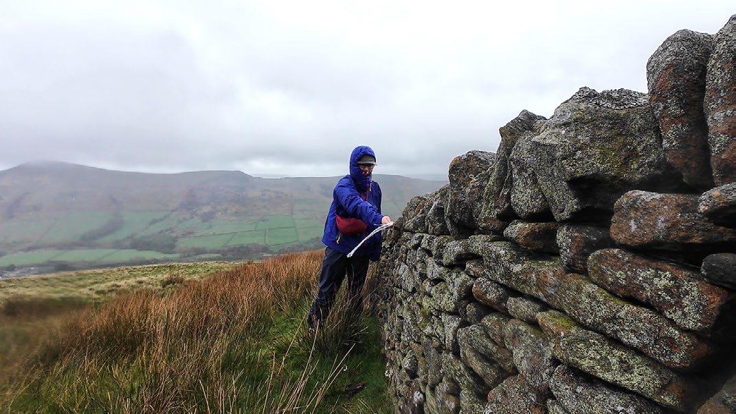
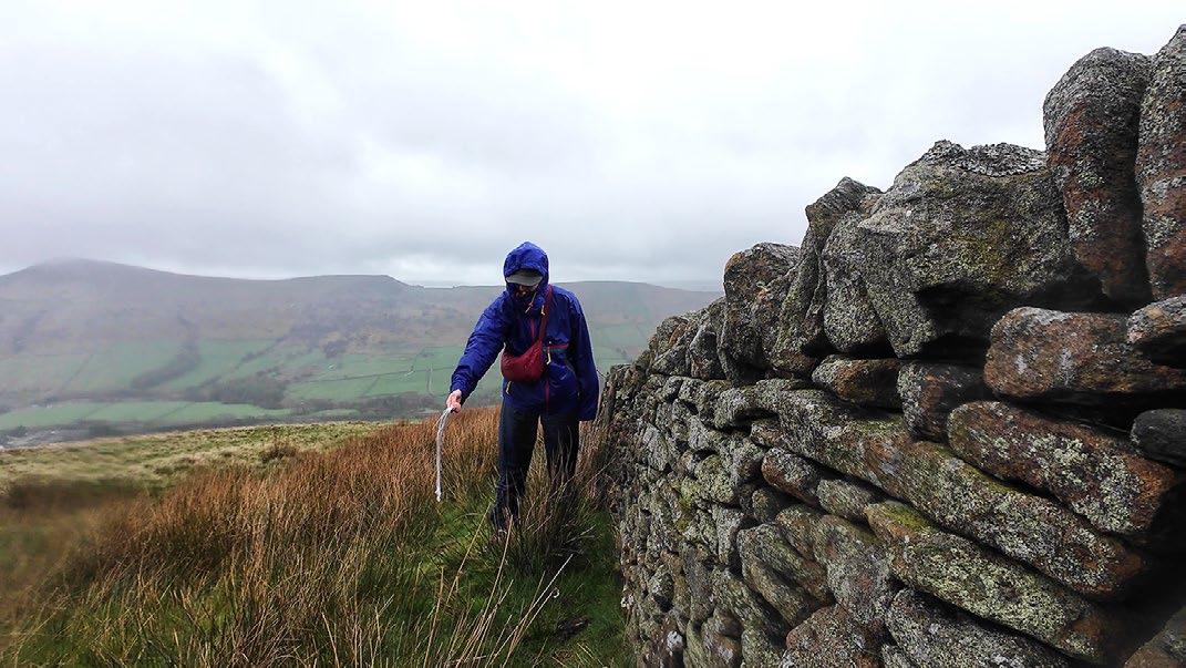
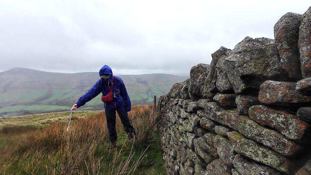
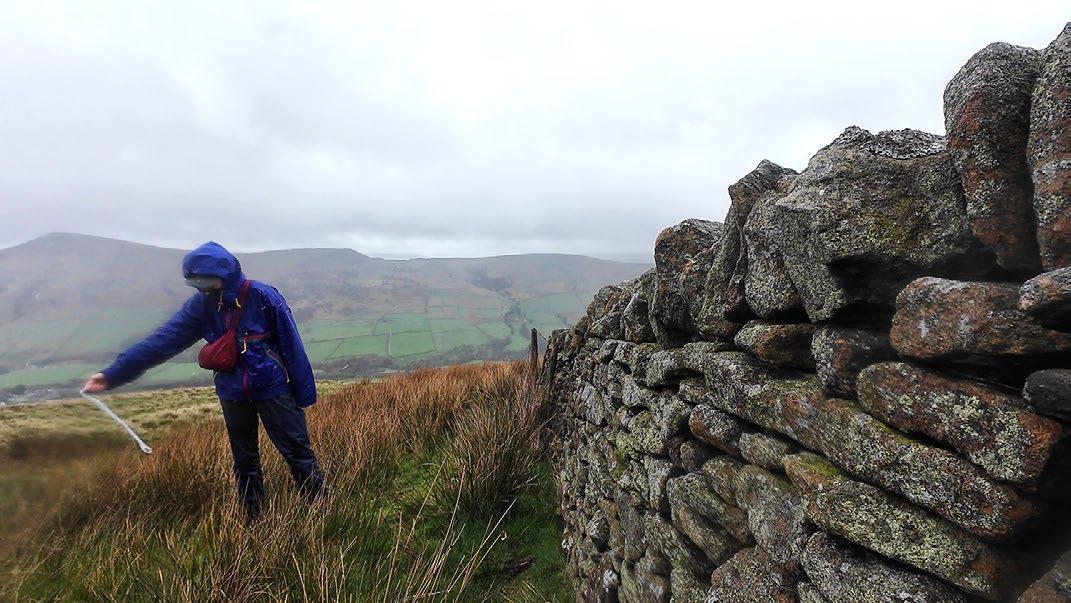
Testing wind velocity using a twisted piece of cling film
The cling film is horizontal in the wind
Minor gusts passing through gaps in the stone wall
Stepping back, the microclimate extends out
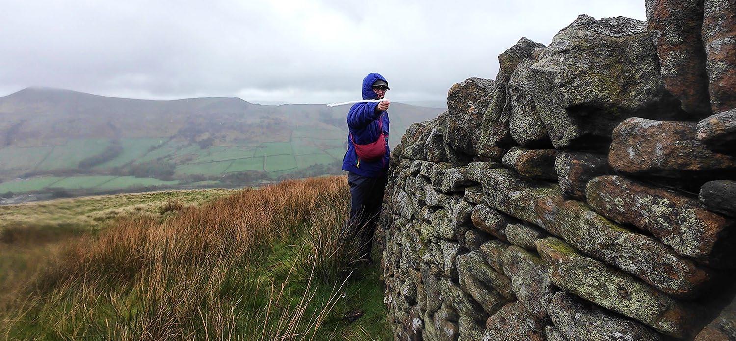
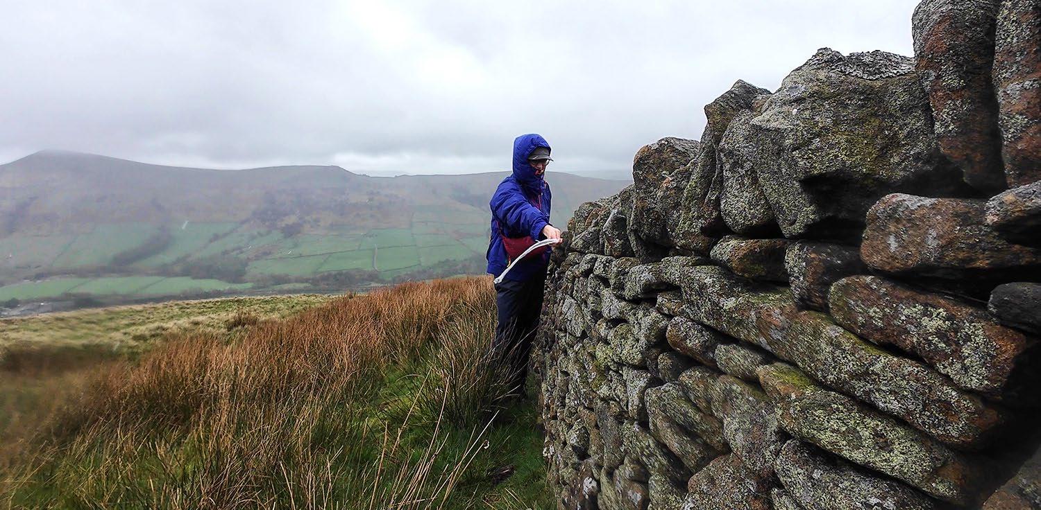
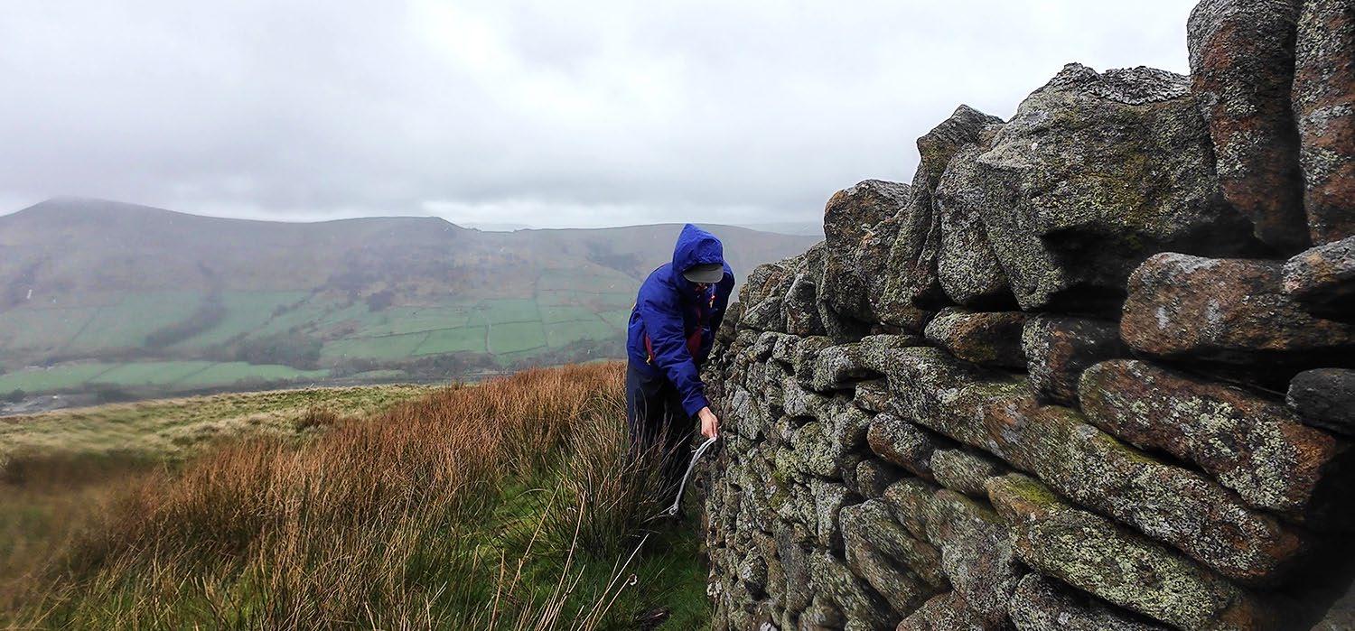
Site
The following section lays out criteria for choosing a site for a drystone field station. It provides a climatic analysis of the chosen site, Crookestone Knoll.
Criteria for Choosing a Site
There are several factors to consider in choosing an appropriate site to build a field station. The opposite page details four of the most important factors: stone availability, ecological conditions, visibility conditions, and wind. The presence of adequate building materials—loose gritstone—is of utmost importance, but the field station’s role in navigation and ecological repair are also key factors that may take precedence depending on the situation and the particular group of transient commoners.
01. Stone availability
The project speculates on the appropriation and reconfiguration of existing drystone structures. Broken drystone walls provide building blocks for field stations with stones already in good shape for stacking. The following design scenario imagines building onto existing grouse butts, using their semi-circular structure as a foundation from which to build an enclosed cairn.
As such, the availability of stone is an important criterion when choosing a site for a field station. Areas with few loose stones require transporting them by foot from a distance, a laborious and time-consuming task.
02. Ecological conditions
The field stations are sites of ecological repair, where transient commoners take part in healing and ‘rewilding’ moorland environments. Thus, field stations are most needed in ecologically degraded areas, such as on grouse hunting moors. A sensitivity to ecological conditions is imperative when selecting a site.
02. Visibility
As will be discussed in Chapter C, the drystone field stations form a wayfinding network where walking becomes a way of mapping the landscape. This means that the field stations need to have some degree of visibility within the landscape; if they are tucked away, they will not succeed in their role as wayfinding markers. This can pose a challenge, however, as areas with higher visibility may also be less sheltered from strong winds.
04. Wind
Although visibility takes precedence over wind conditions, strong winds affect both ease of construction and degree of comfort within the field stations. Given this, wind strength and direction should be taken account when deciding on the field stations’ position, orientation, and height. In extremely windy conditions, digging into the ground for a semi-sunken foundation may provide additional protection, as well as orienting any entrances, windows, or vents away from the prevailing winds.
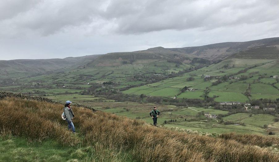
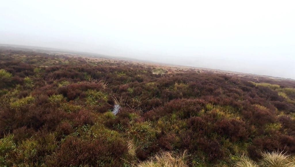

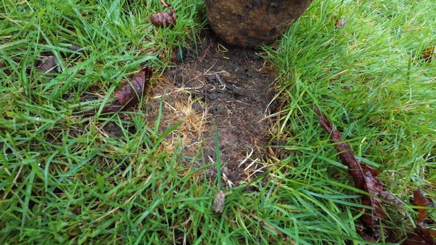
Low visibility conditions in a grouse moor due to fog, rain, and topography
Broken drystone walls provide loose rocks ready for repurposing.
Using rocks on the ground that have created insect habitats should be avoided
The sloping topography allows for wide-reaching views when weather conditions permit them.
Design scenario: Crookestone Knoll Field Station
Design and Construction
The following section imagines the design of a field station that appropriates the existing drystone grouse buts of Crookestone Knoll, an open grouse moor north of Edale valley. Situated on a steep slope, this managed moorland is covered primarily in heather atop relatively deep peat soils. Given that the grouse butts exist in a row, each approximately 50m apart from one another, the project imagines how a series of field stations could form a “commoning axis” along the grouse moor, instigating ecological repair and convivial rewilding practices. This section details the stages of the construction of one field station. Later in this chapter, further speculation occurs on its multispecies inhabitation and role within a drystone wayfinding network.
This site was selected based primarily on 1) the existence of grouse shooting butts that form the base structure for the field station, and 2) the need to repair and remediate the peat soils and ecology in this grouse hunting moor.
Walking path

Trig point
Shallow peat soil
Deep peat soil
Grouse hunting slash-and-burn regions
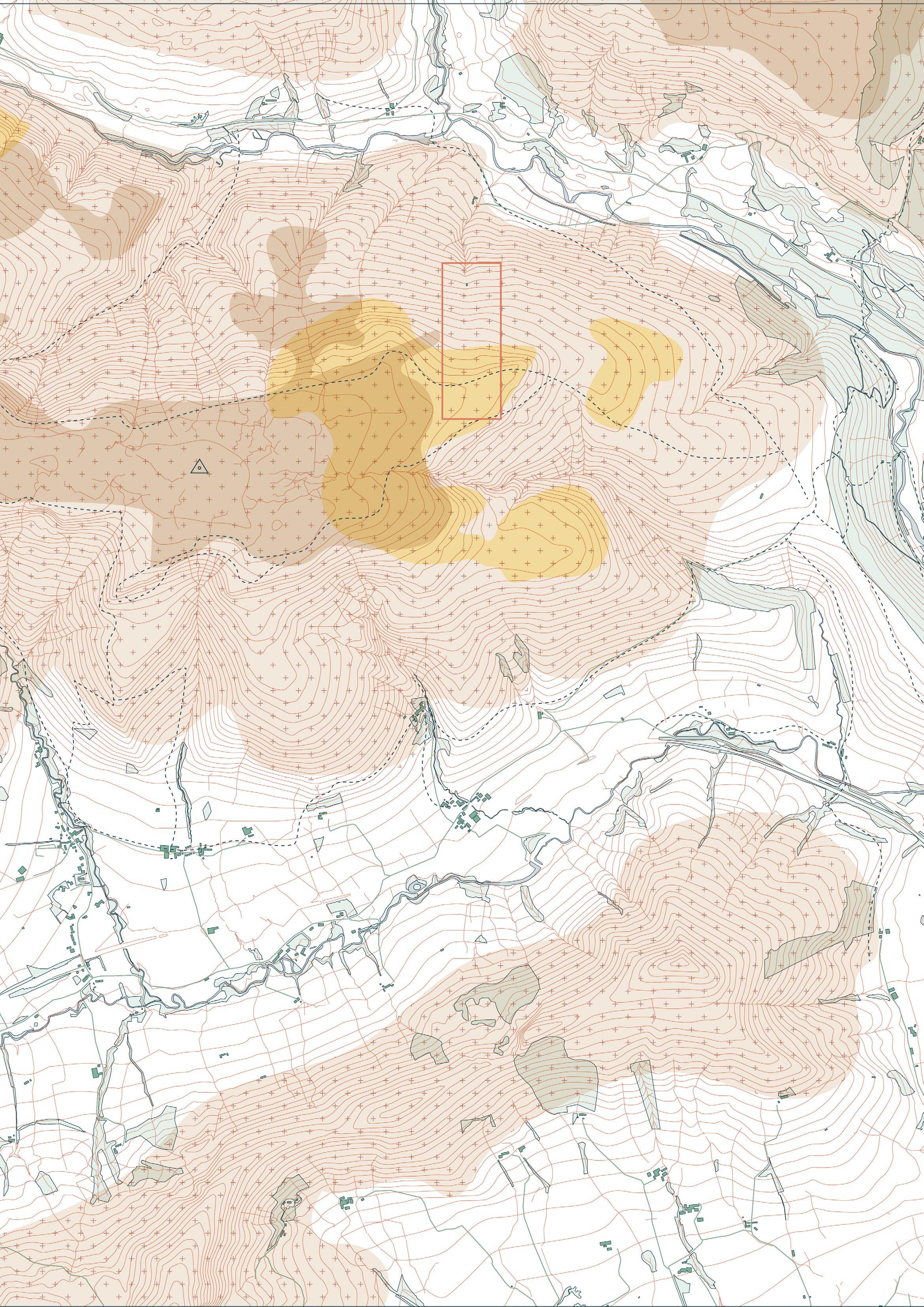
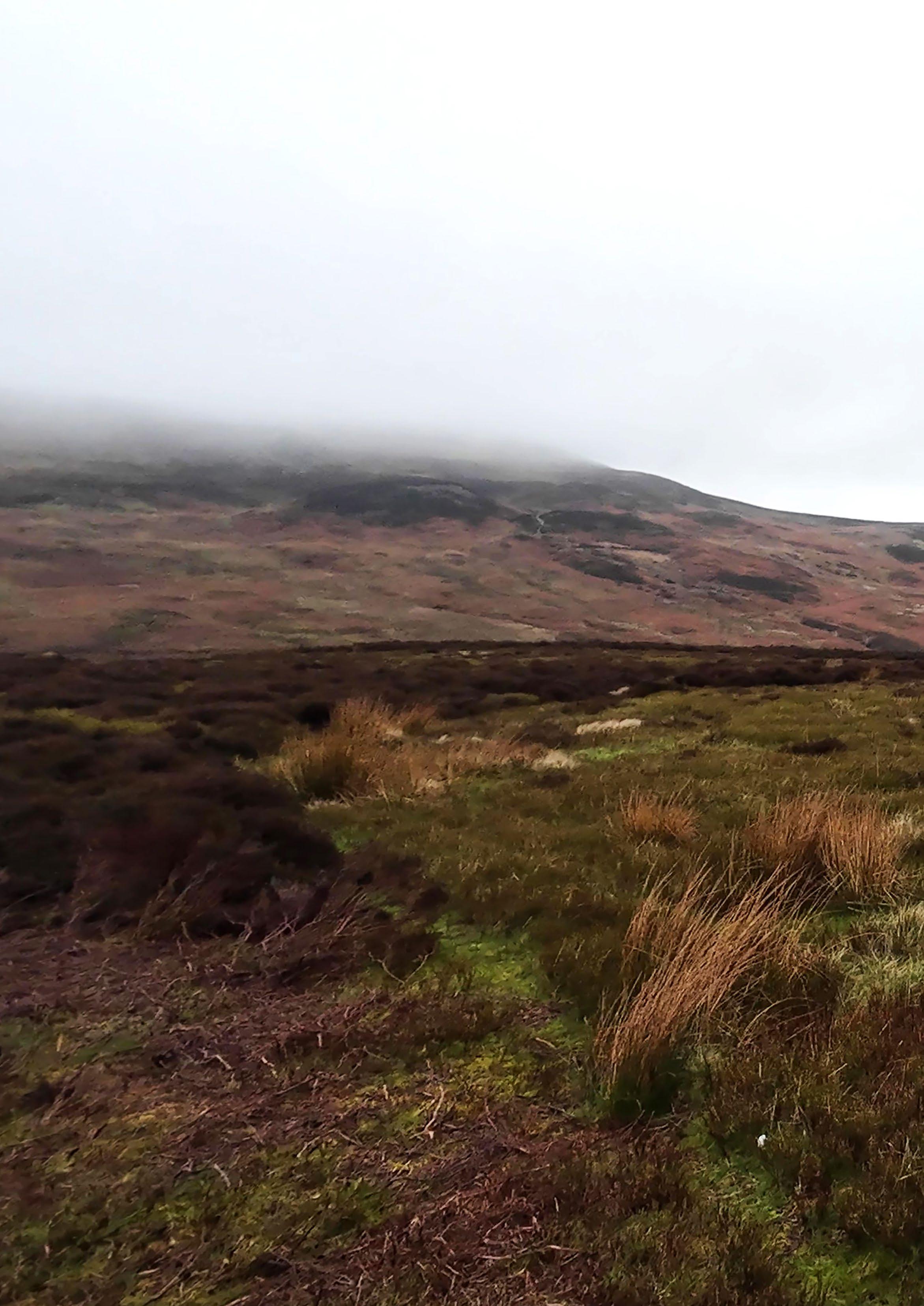
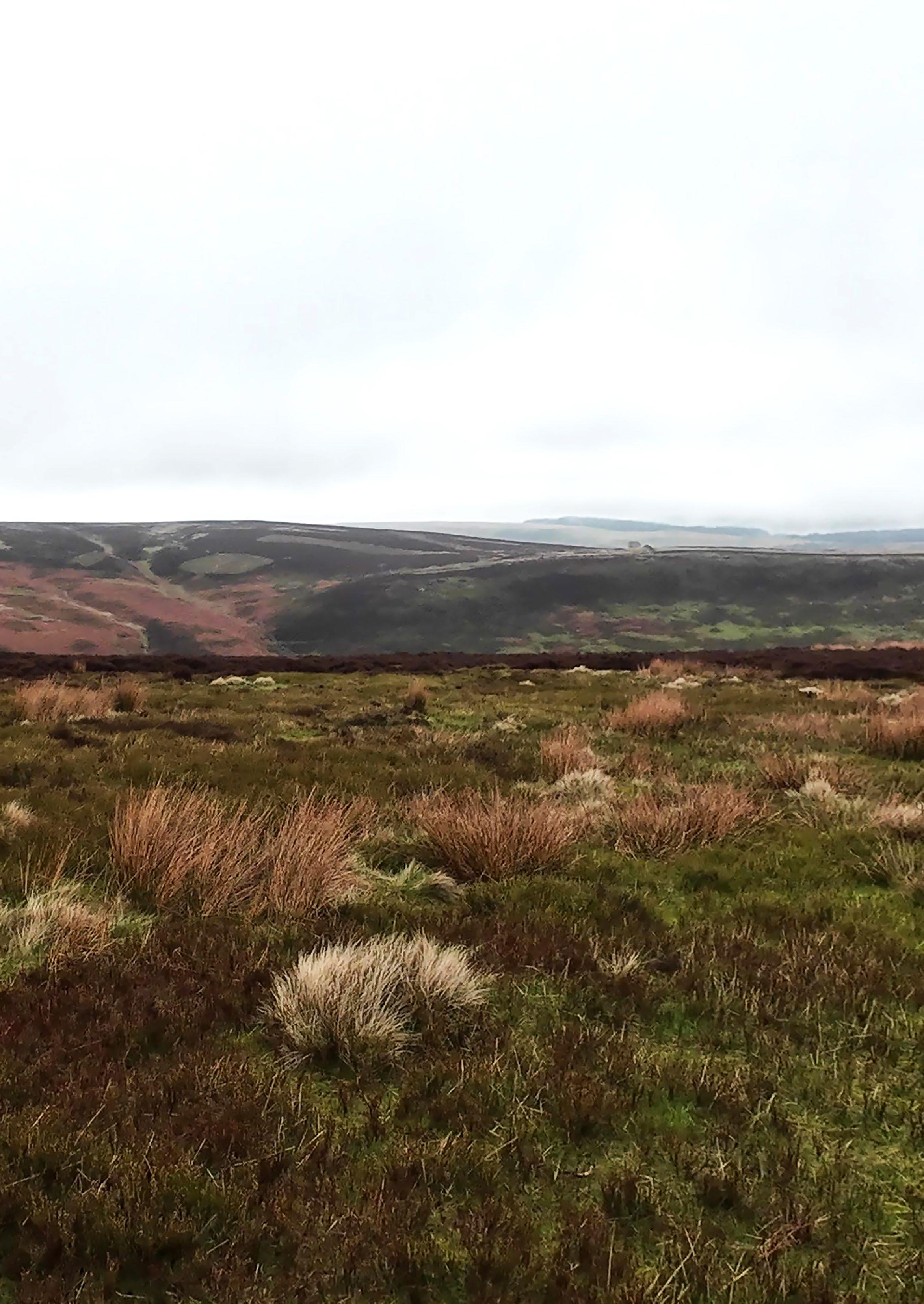
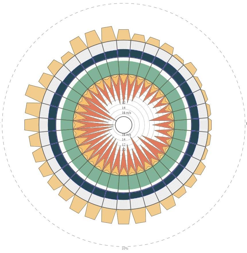
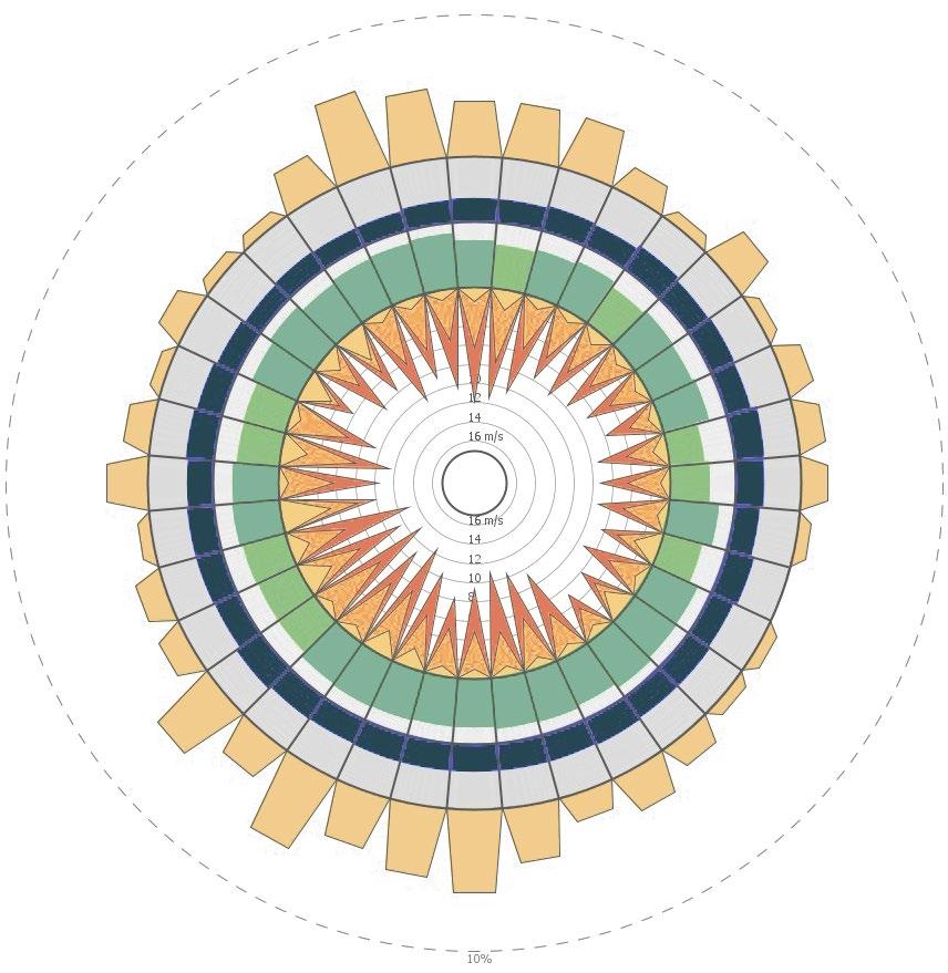
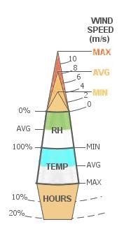
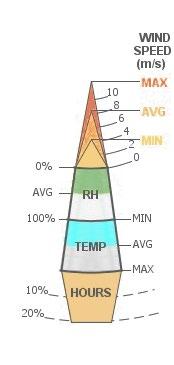
01. Year-round wind wheel
April wind wheel
Wind Analysis
The wind analysis shows strong winds throughout the year, predominantly coming from the west and to a lesser extent from the south. This wind wheel data is for Finningley, a nearby city; however, given the open landscape conditions and higher altitude of the upland moors, it can be assumed that wind conditions would exceed the ones shown here.
Given this analysis, drystone structures need to be built in a stable and secure way so as to prevent wind damage. Clearly, this is possible, given that drystone walls and structures last centuries in the moorland, acting as effective wind breaks, but it means that any amateur or new constructor will need to pay special attention to stability and wind direction.
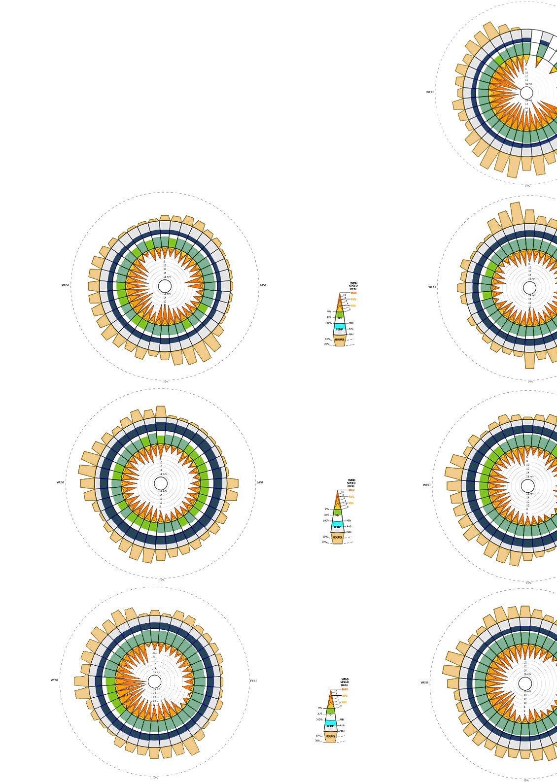
March
July
October
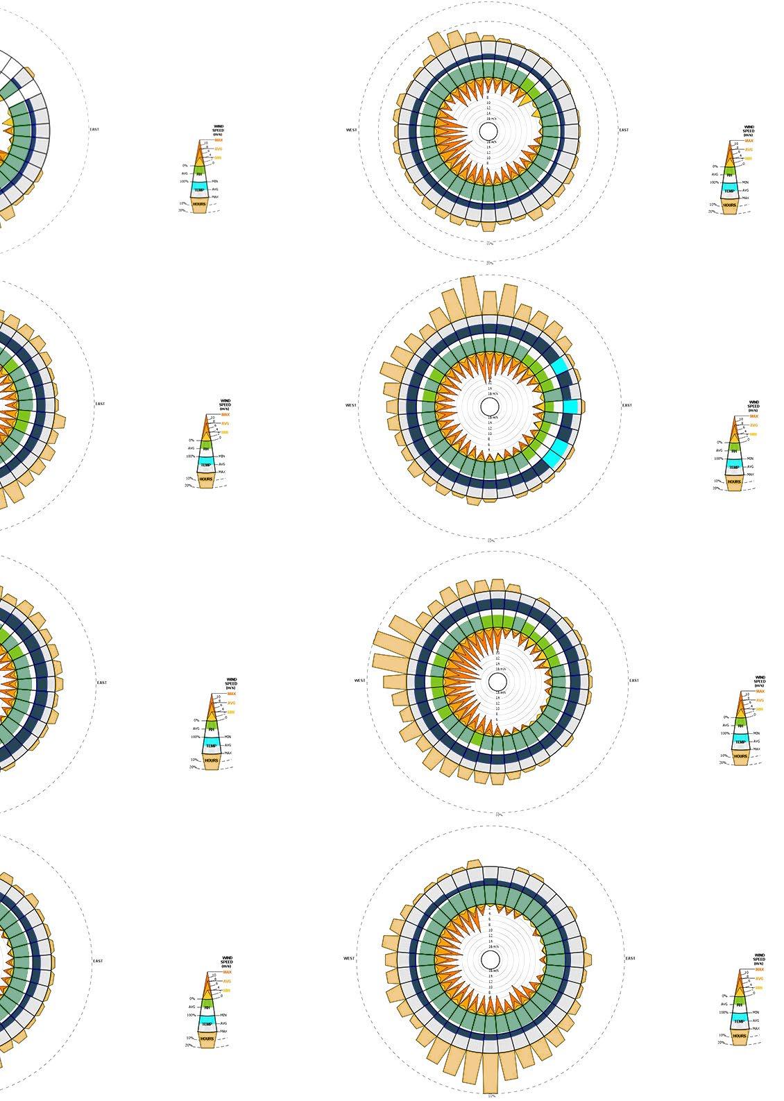
Edale: Temperature and Precipiatation Analysis
The following charts record climate data for Edale, the village in the Peak District where I undertook field work, and the closest settlement to the Crookestone design test site. This maximum temperatures chart reveals a cool year-round climate, with highs rarely exceeding 25 °C. The temperature range is fairly narrow, rarely going below freezing. It should also be noted that wind and other factors such as rain affect the perceived temperature.
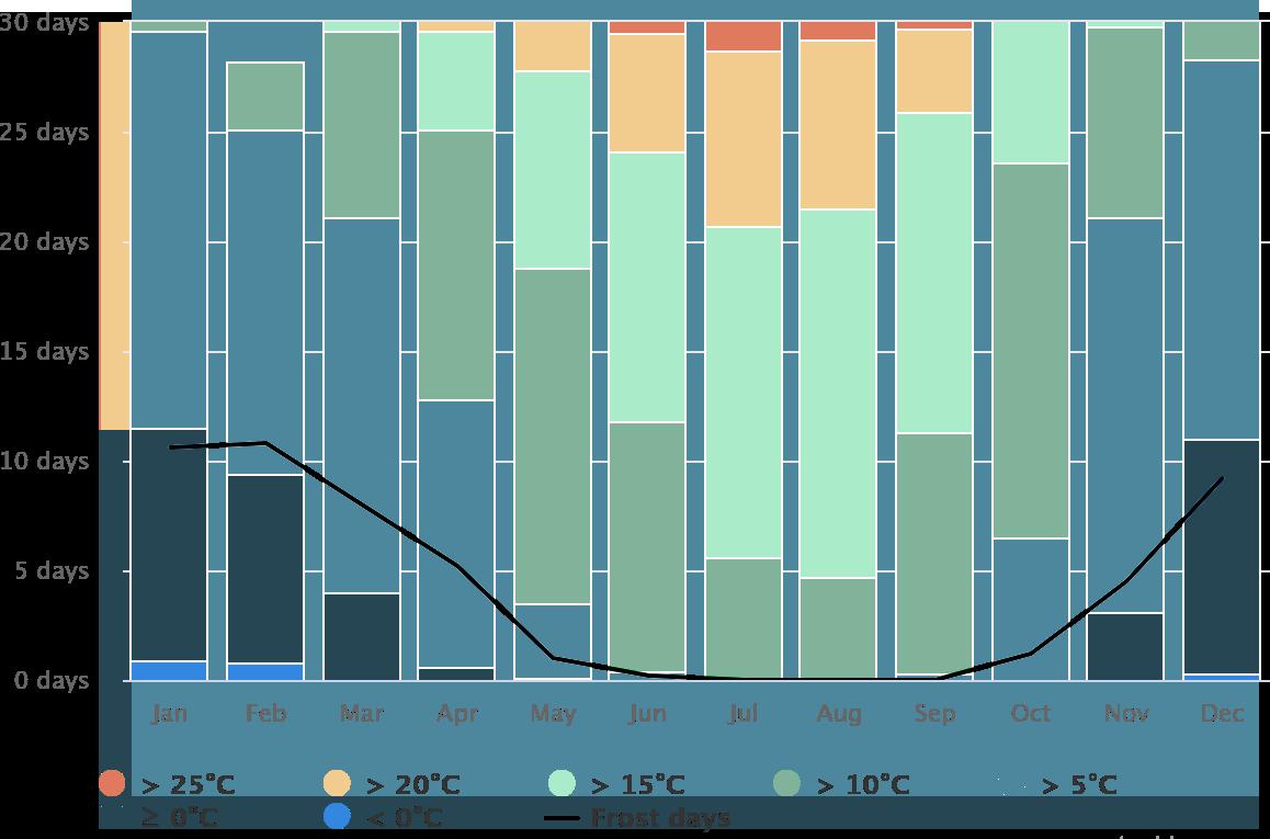
This precipitation chart shows that on average, the amount of rainy days vs. dry days is about half and half, with only a few days per month receiving heavy rainfall. This data correlates with my own experience on site, where there were consistent passing showers and sunny periods: the weather is constantly shifting, and accordingly so do one’s perceptions and experiences of the landscape. I noticed that in heavy rain, the moorland landscape felt entirely different to the same place in sunny conditions. It should also be noted that drystone construction is achievable in the rain, but much more difficult.
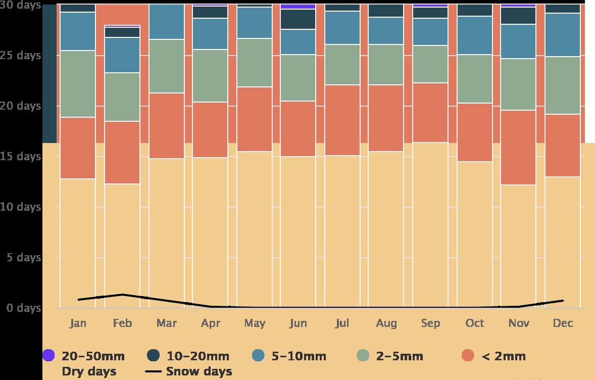
Maximum temperatures chart by month. Data from Metoblue.
Precipitation amounts chart by month. Data from Metoblue.
This chart records the number of cloudy, sunny, and precipitation days throughout the year. This reveals that although about half the days per month are dry—as shown in the precipitation days chart—there are very few fully sunny days each month. The majority are overcast or partly cloudy. It is unclear with this data what constitutes “sunny” vs. “partly cloudy” vs. “overcast”: at what point does each category bleed into the other?
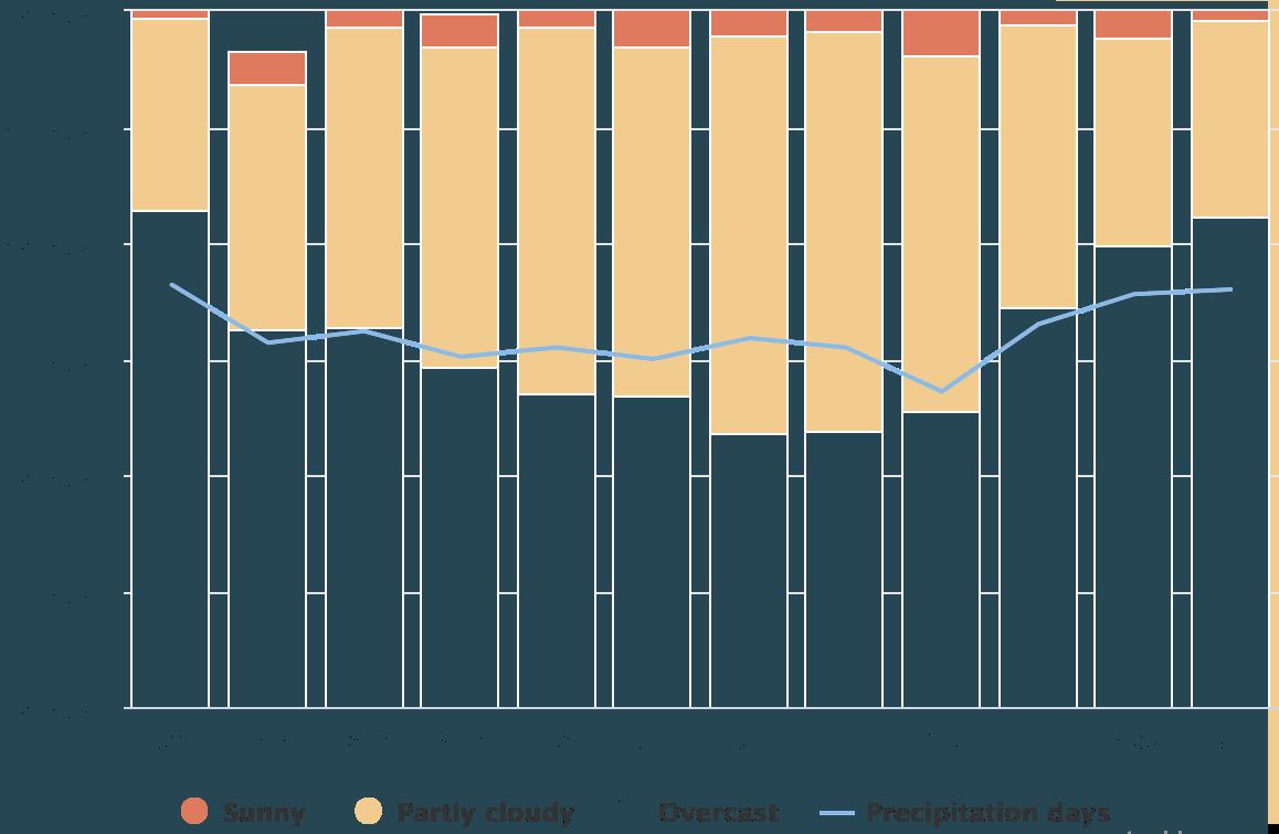
This chart record the average temperatures and precipitation by month. On average, Edale receives between 50 - 75mm of rain per month, with winter months being the rainiest. There is a consistent variation between day and night temperatures, with even the hottest summer months cooling down to approximately 10 °C at night. This is important to note in the design of the field stations, where the thermal properties of stone must provide adequate warmth —including any additional elements such as blankets and fires—for those staying inside them during chilly nights.
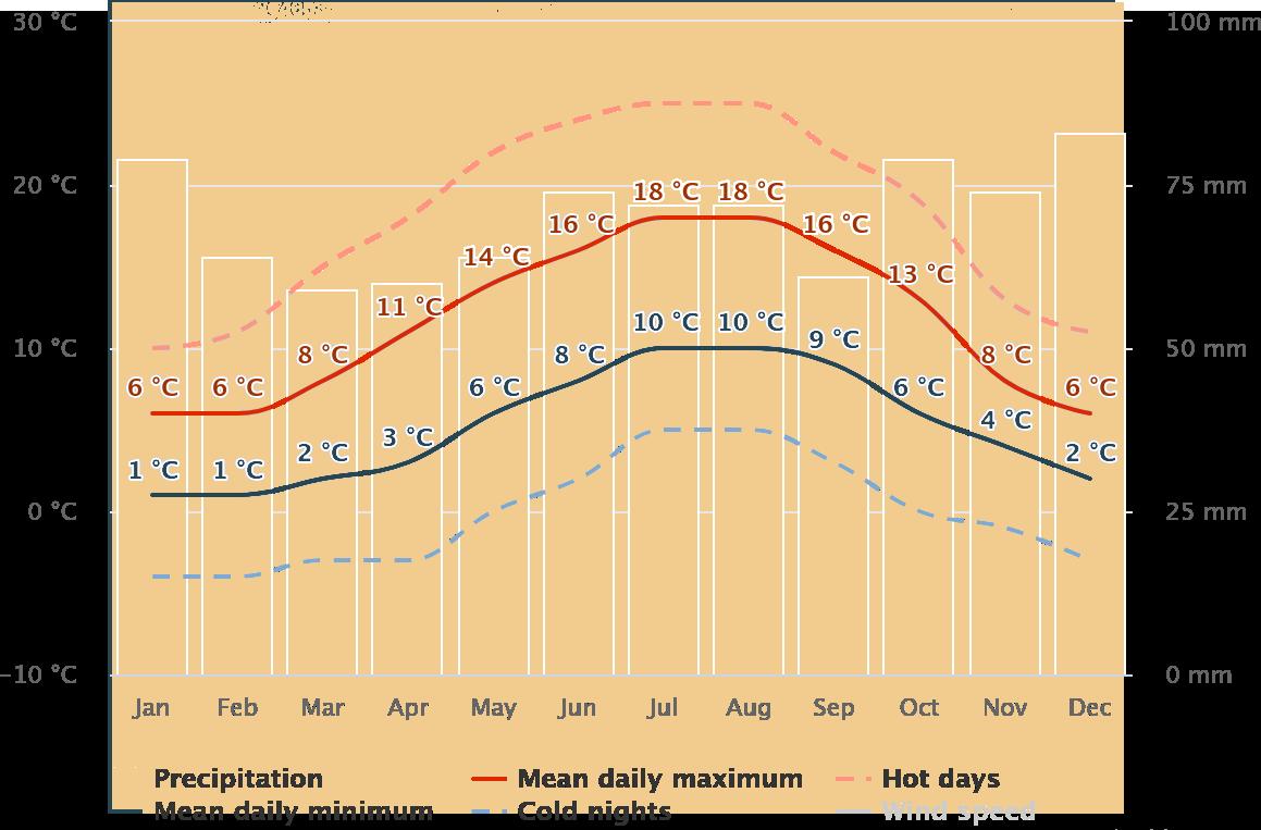
Cloudy, sunny, and precipitation days chart by month. Data from Metoblue.
Average temperatures and precipitation chart by month. Data from Metoblue.
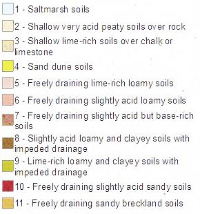
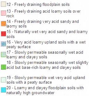
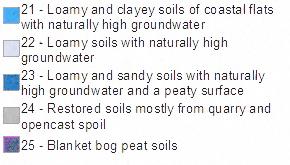
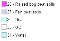


Drystone Construction Tests
How can broken drystone walls and existing stone structures be appropriated as building blocks for the collective construction of drystone enclosures?
The following tests experiment with reconfiguring broken drystone walls into small structures.
Design Strategy: Repurposing Broken Drystone
During my time in the Peak District, I was surprised by the extent of broken drystone walls tracing to topography of both moorland and pastures. Some of these walls remain mostly intact, while others have become piles of rocks dispersed on the ground, grown over with moss. Many walls appeared like broken teeth, jagged lines stitched across rolling hills.
This project proposes that geology—as inseparable from moorland architecture—is a constant process of re-shuffling. Thus, repurposing stones from broken walls into field stations is part of this re-configuring and transformation of the landscape. The following pages document drystone walls I came across and three tests of cairns that I constructed from broken pieces of drystone walls.
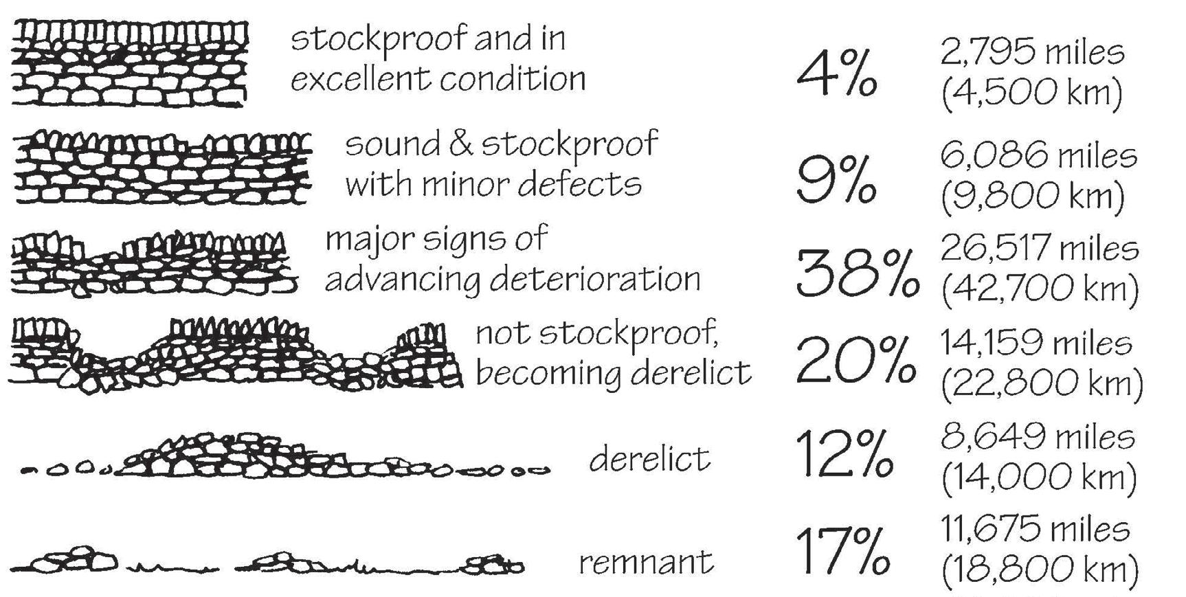
This survey of the state of drystone walls across the UK from the Countryside Commission in 1996 records that the majority of walls are in various states of decay, with only 13% in good condition. It is likely that in 2024 even fewerwalls are well-preserved.
Diagram from https://conservationhandbooks.com/dry-stone-walling/dry-stone-walls-and-conservation/
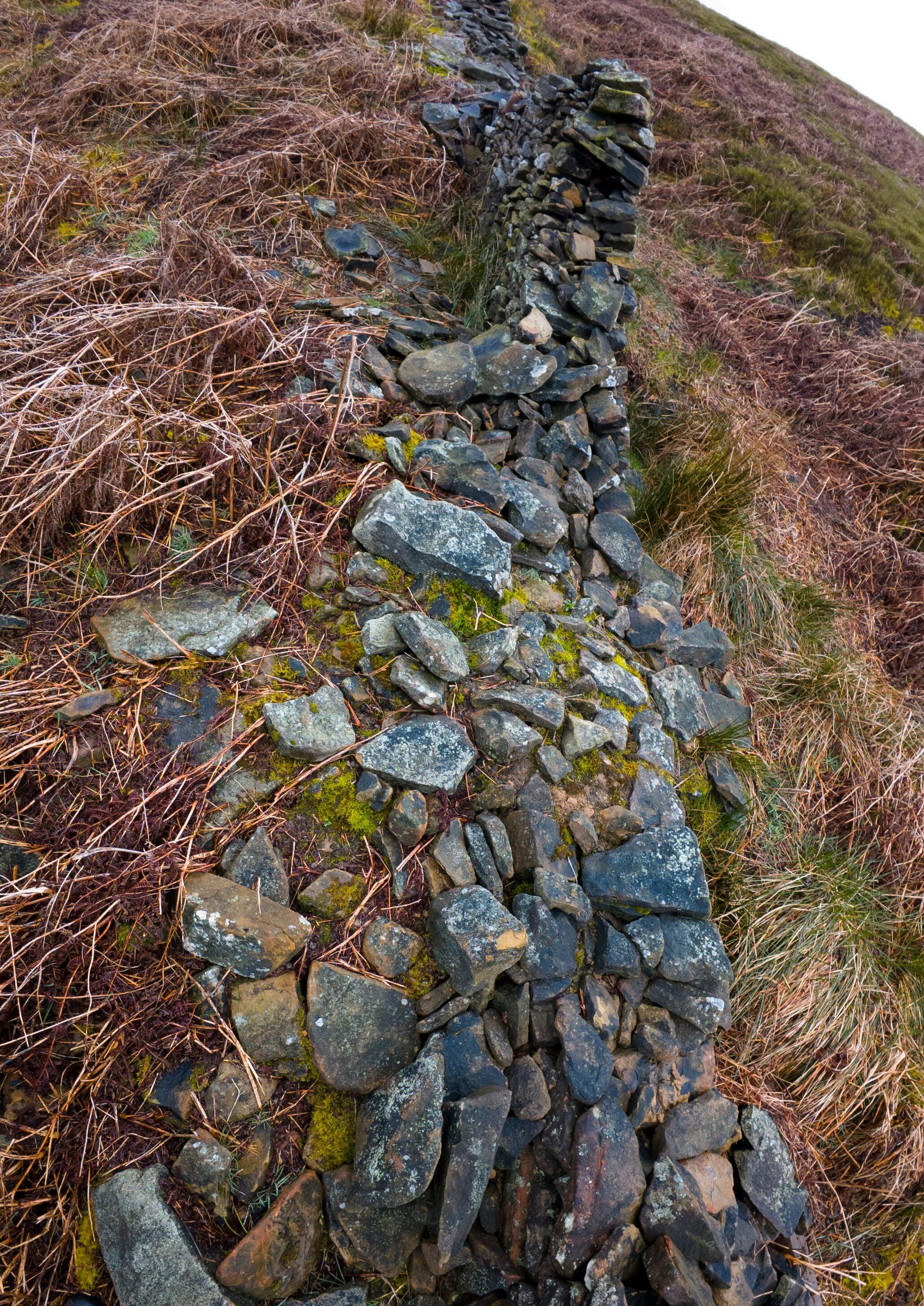
A Landscape of Broken Walls
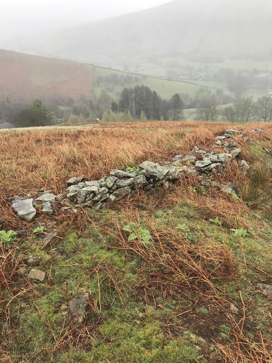
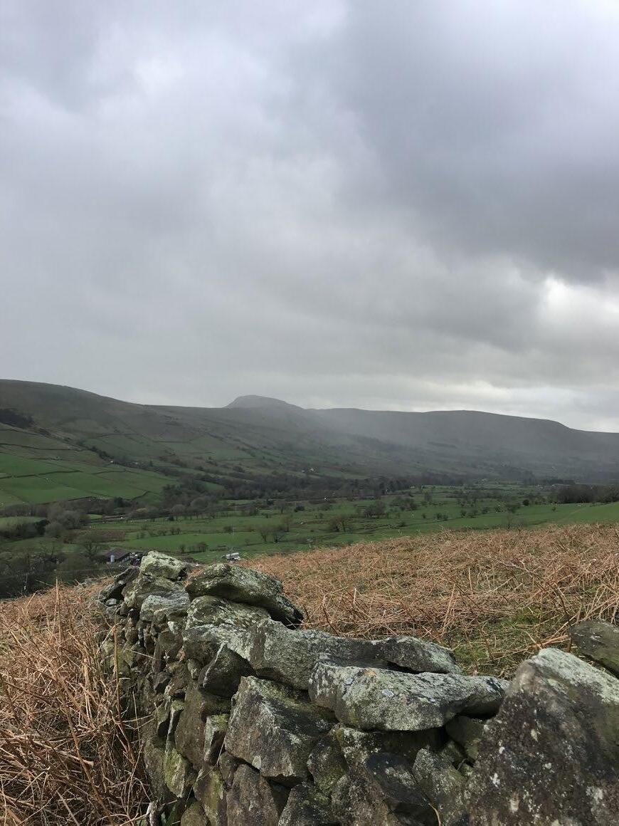
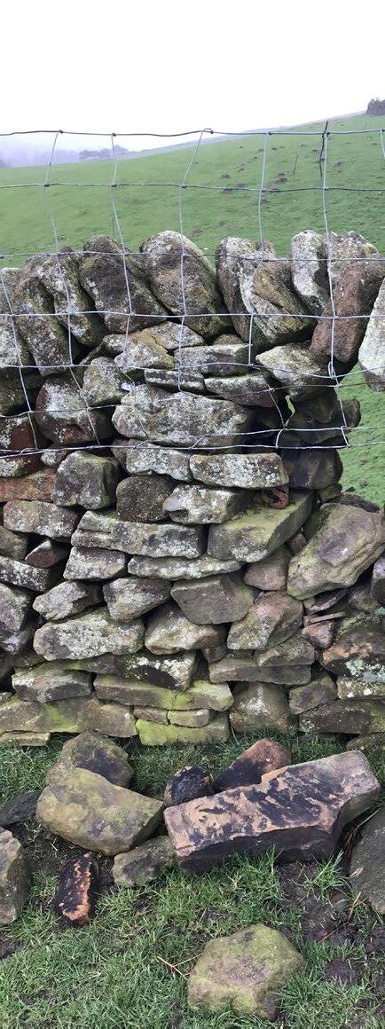
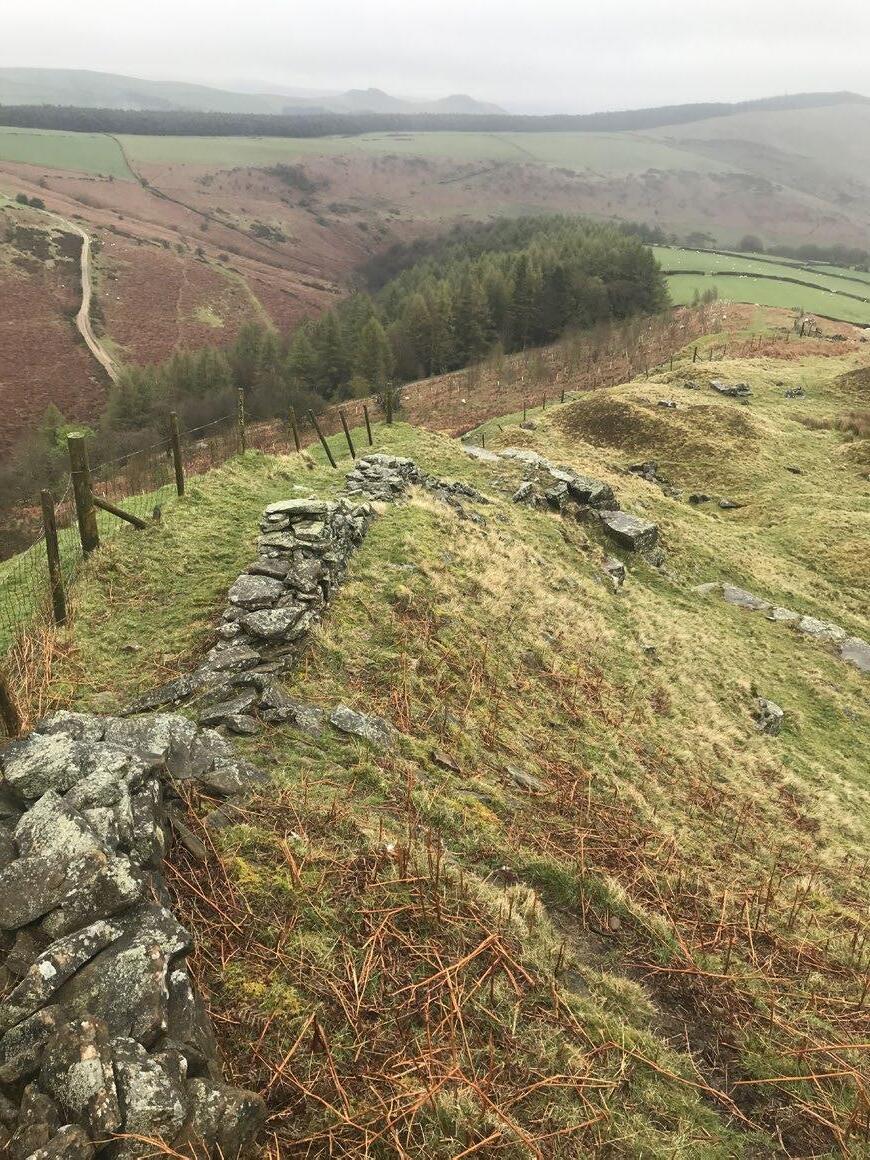
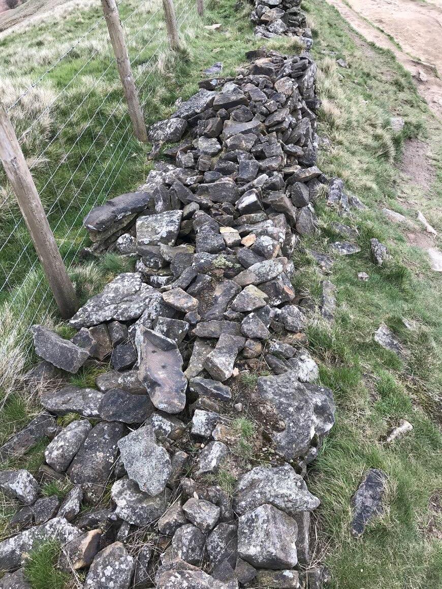
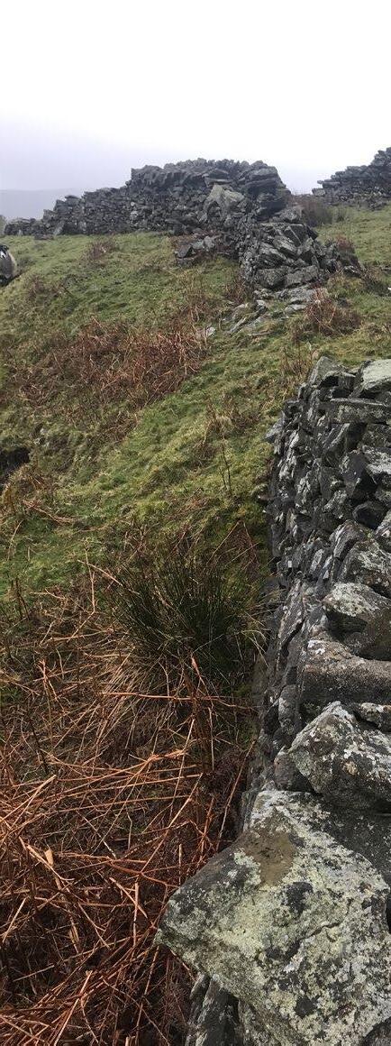
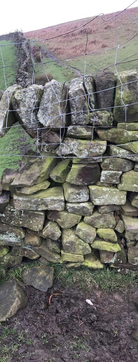
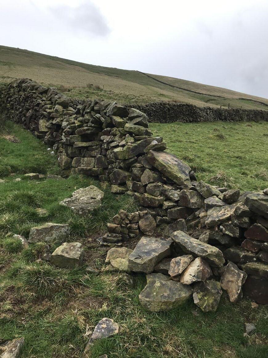
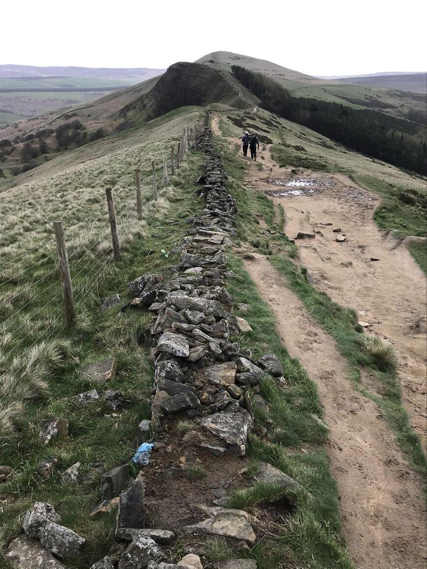
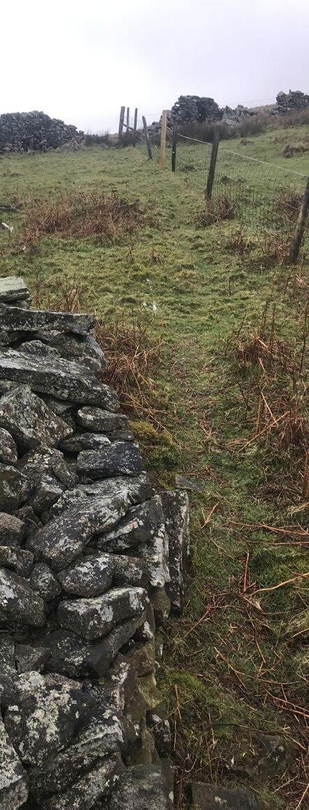
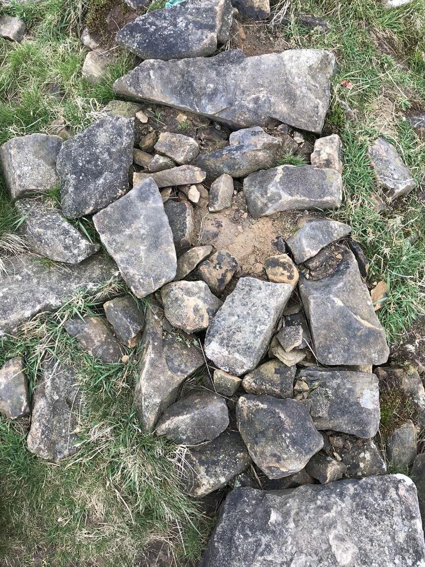
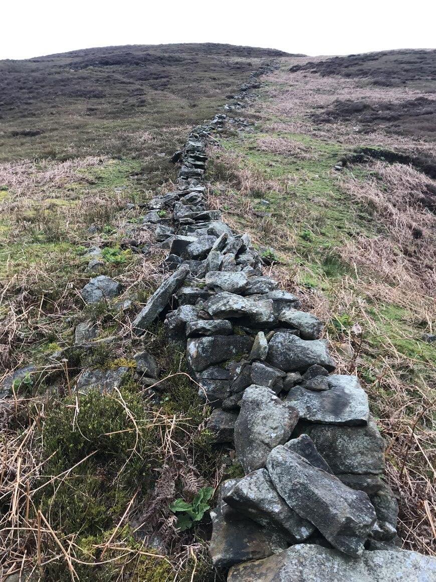
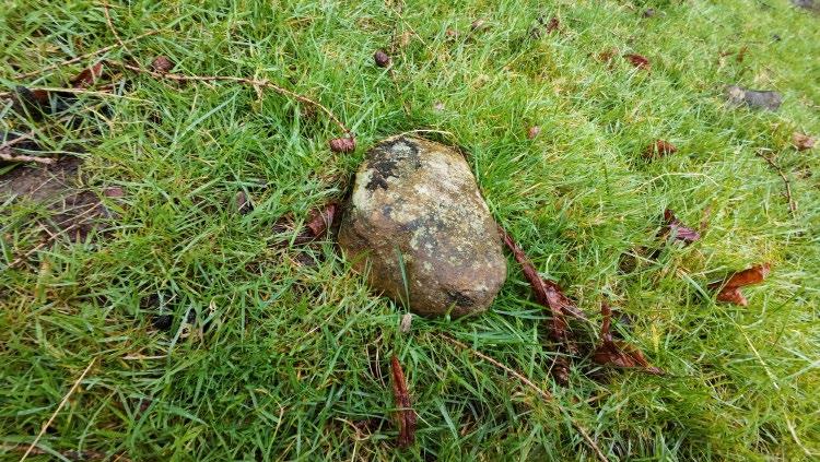
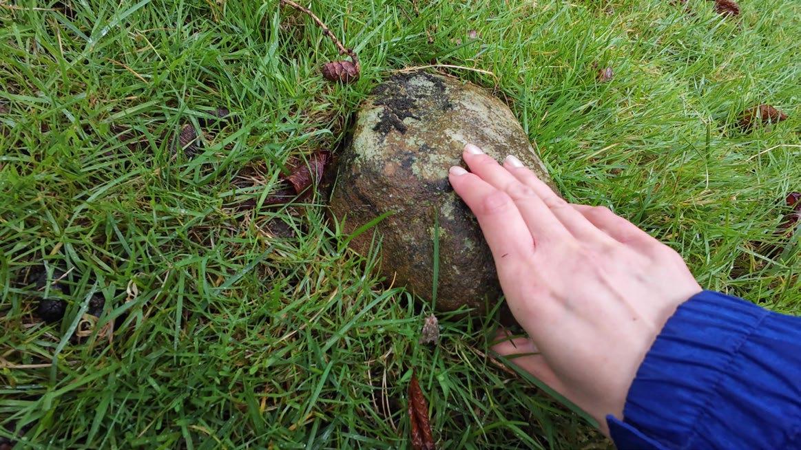

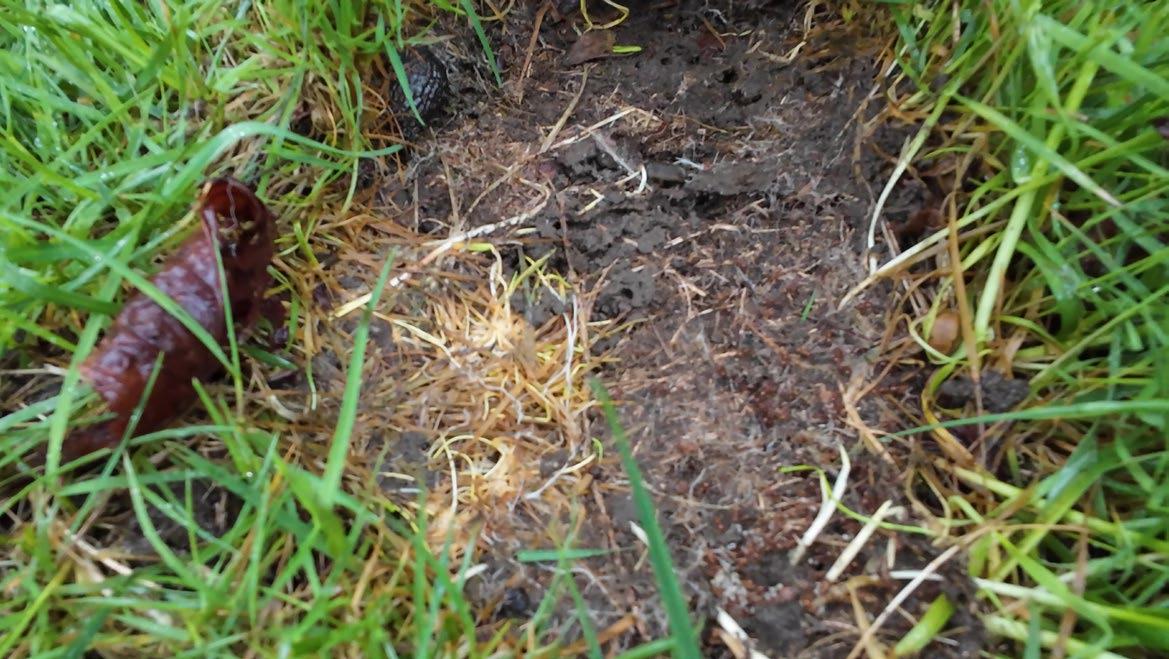
As stones fall from the walls and settle into the earth, they become microcosms of insect life. Even in ruin, the stones continue to act as scaffolds for more-thanhuman inhabitation and interaction.
How can stones be picked up and reconfigured without needlessly disrupting the life they shelter on the ground?
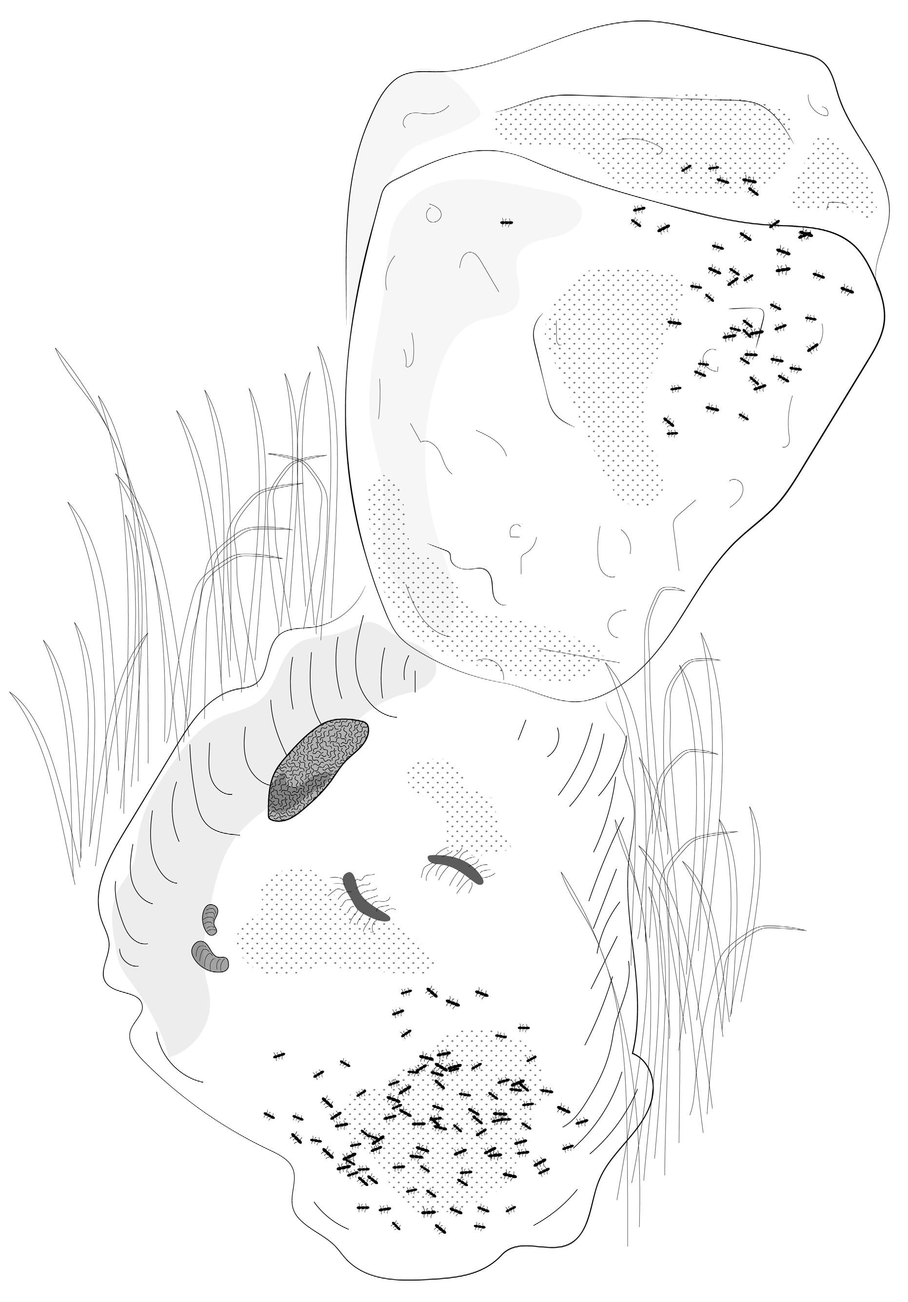
01. Red ants
02. Black slug
03. Brown centipedes
Pill bugs
Form Follows Rock: Reimagining Construction as Fieldwork
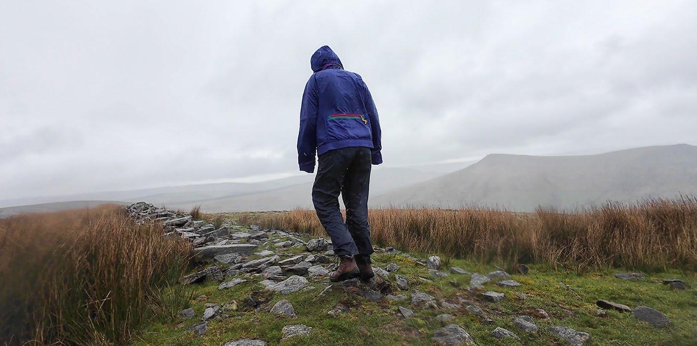
To ‘design’ a drystone structure is by necessity a co-design process, with the rocks themselves having agency in the design decisions made. The design process happens simultaneously with the construction process, while both become a kind of field work: a specific way of interacting with the land.
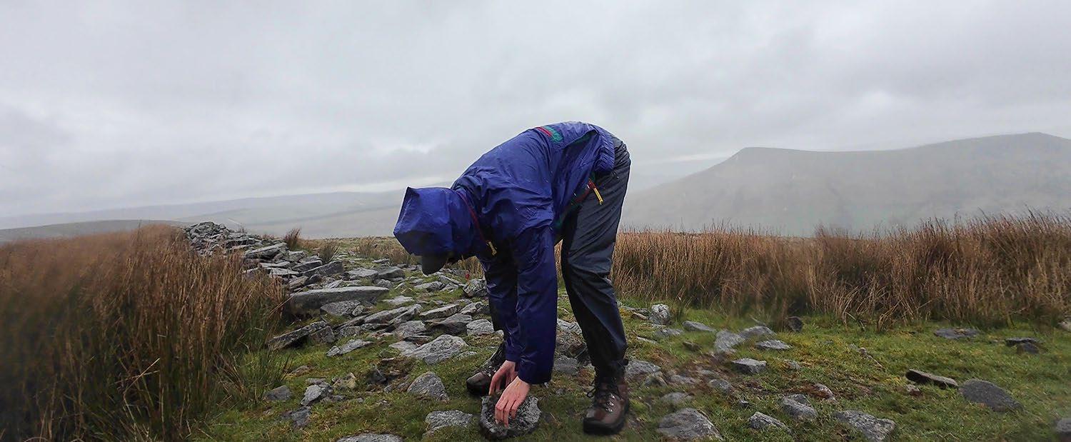
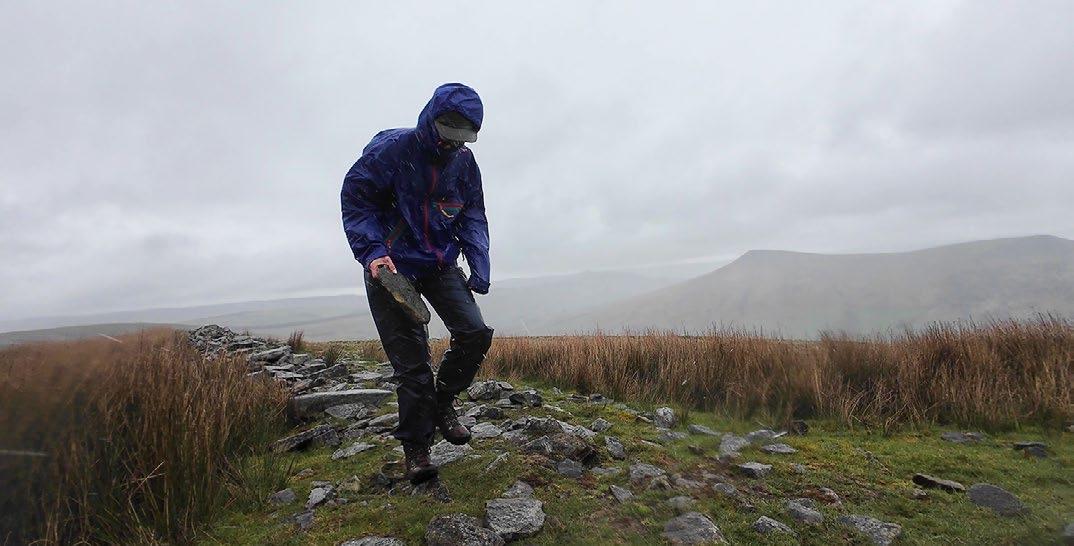
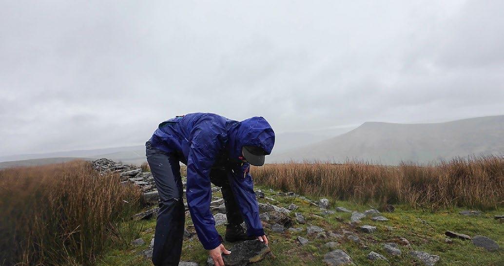
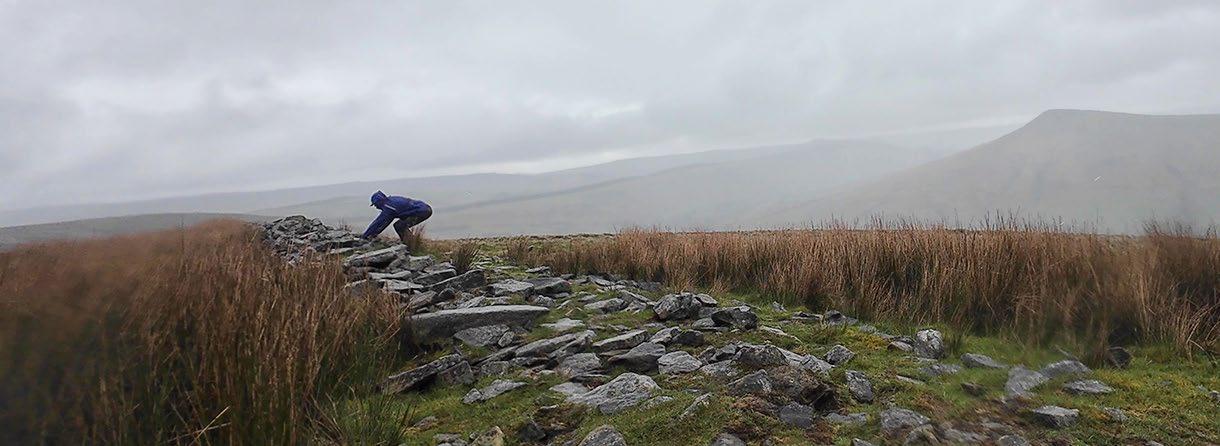
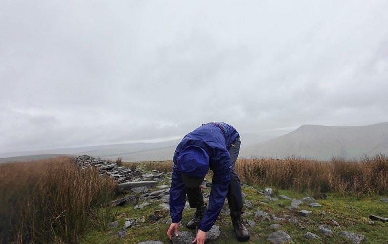
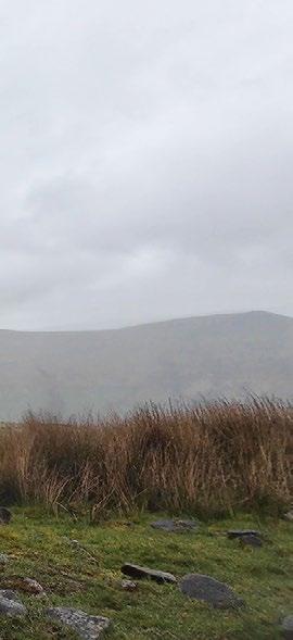
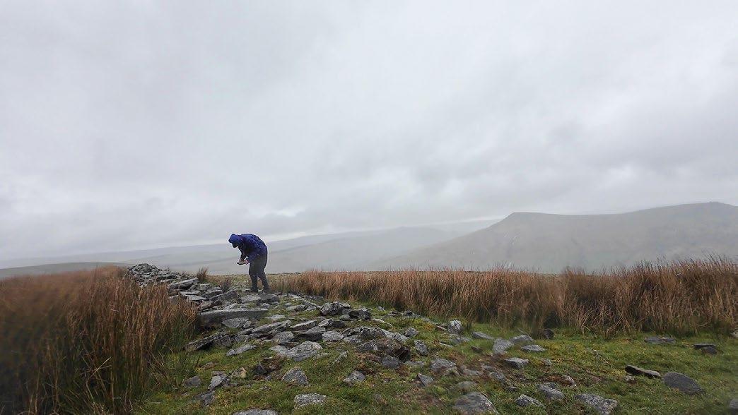
The first step, once a site has been identified, is to look at the rocks at hand. Rocks should be sorted according to size and shape, and care should be taken not to unduly disturb habitats formed by fallen rocks. The process of looking for rocks continues as the ‘design’ and construction proceeds, where it may be necessary to go look for specific rock shapes to interlock with the rocks just laid.
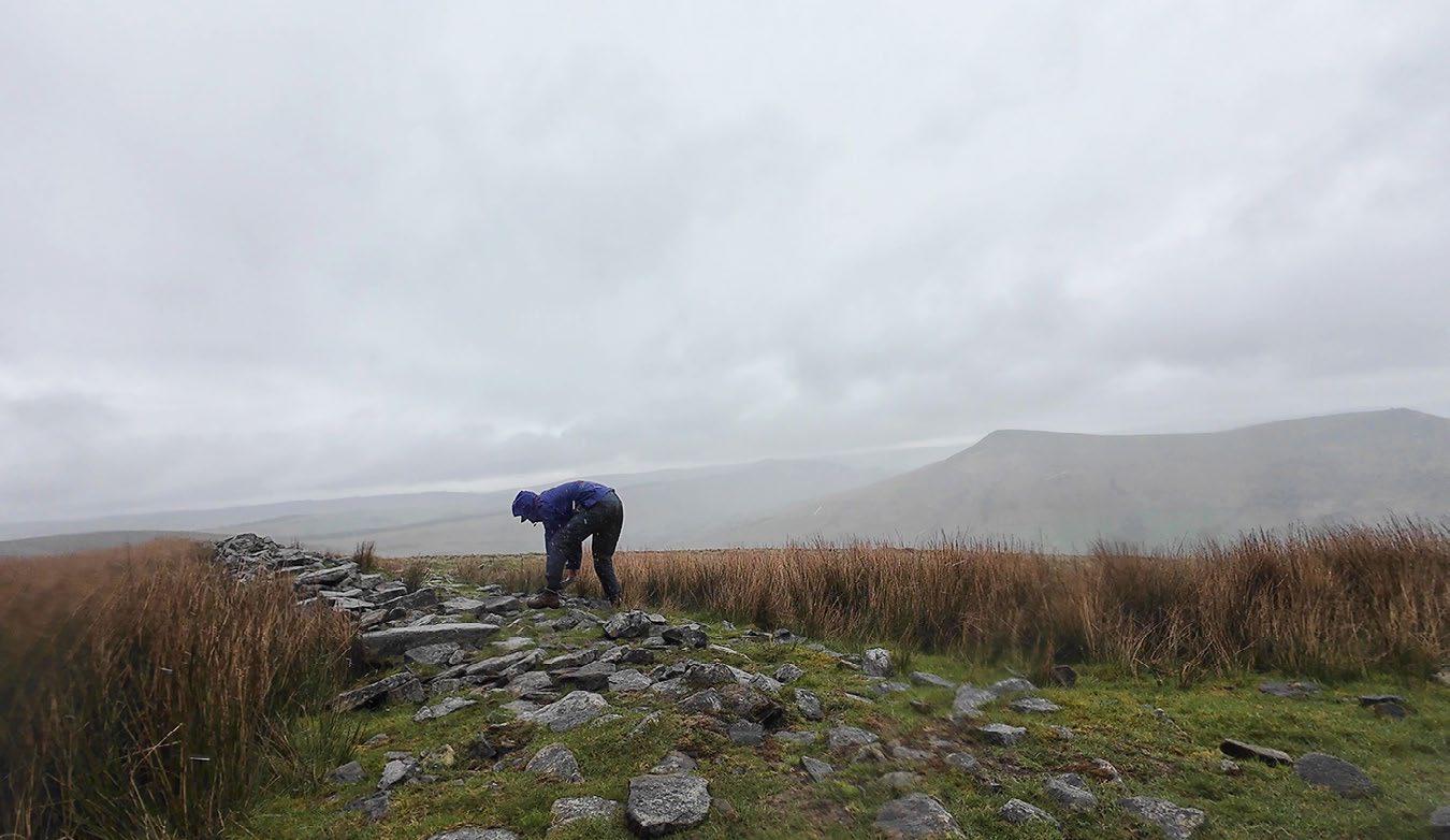
Traditional drystone construction employs tools to break and mold rocks into preferred shapes. The thesis imagines what structural forms might emerge without modifying the rocks, but working simply with what is present at a certain moment in the landscape.
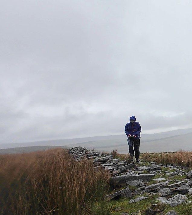
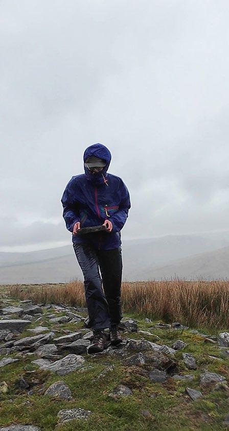
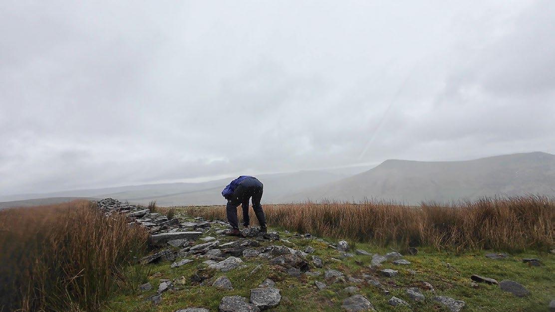
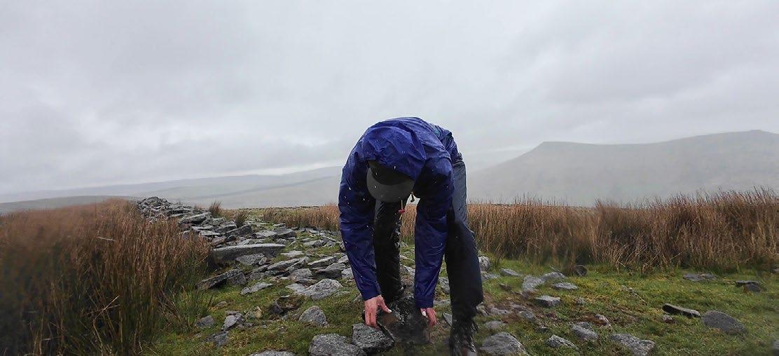
First Cairn: Testing the Ground From Wall to Aggregation
The first cairn was a tentative test in stacking stones taken from a broken drystone wall. This cairn, only about 0.5m in height, was an experiment in ‘testing the ground’ as well as testing my own ideas for the design of field stations from broken walls. The cairn took me about half an hour to build with relative ease. In making a small cairn, I felt confident sizing up in my next attempt. It was satisfying to find rocks that fit well together, and although I do not know how long it will be before it falls apart or is disassembled, my small cairn provides a marker in the landscape and a future habitat for mosses, lichens, and insects.
Right: Laying the foundations of the cairn
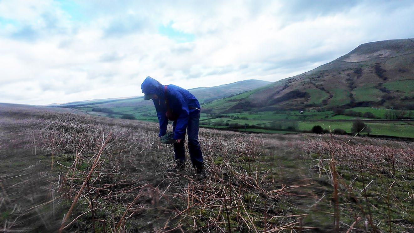
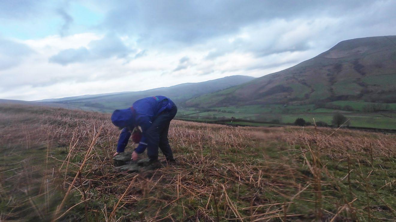
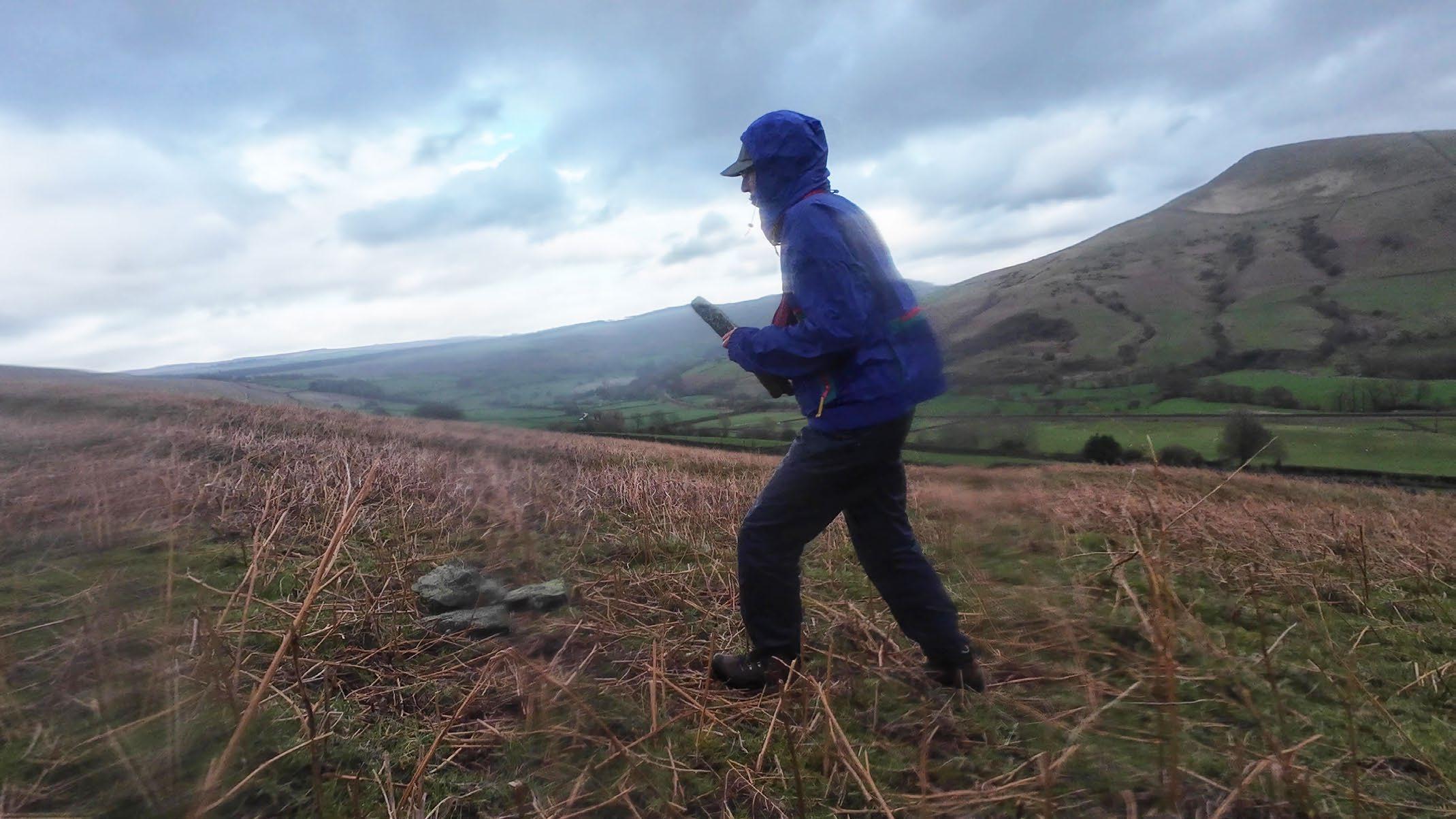
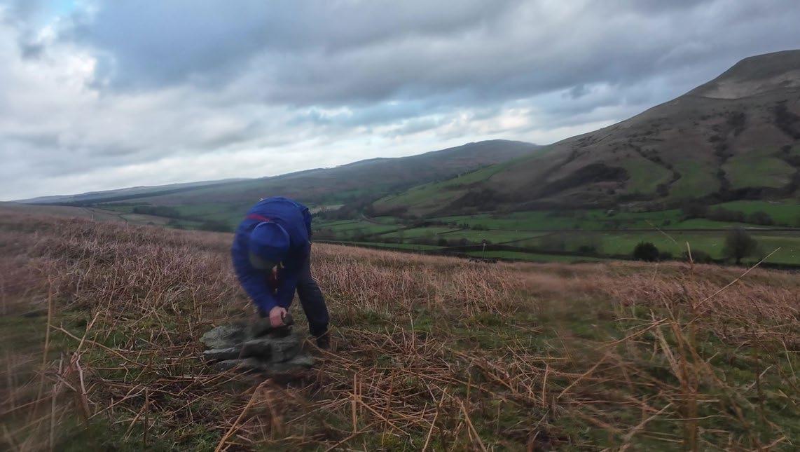
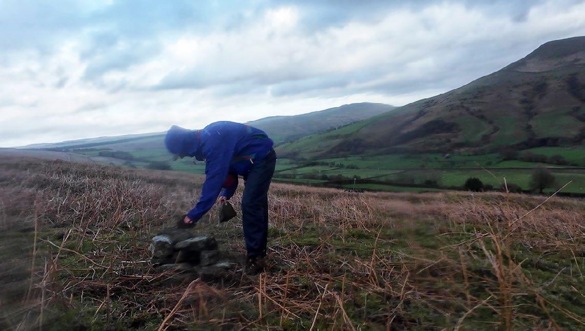
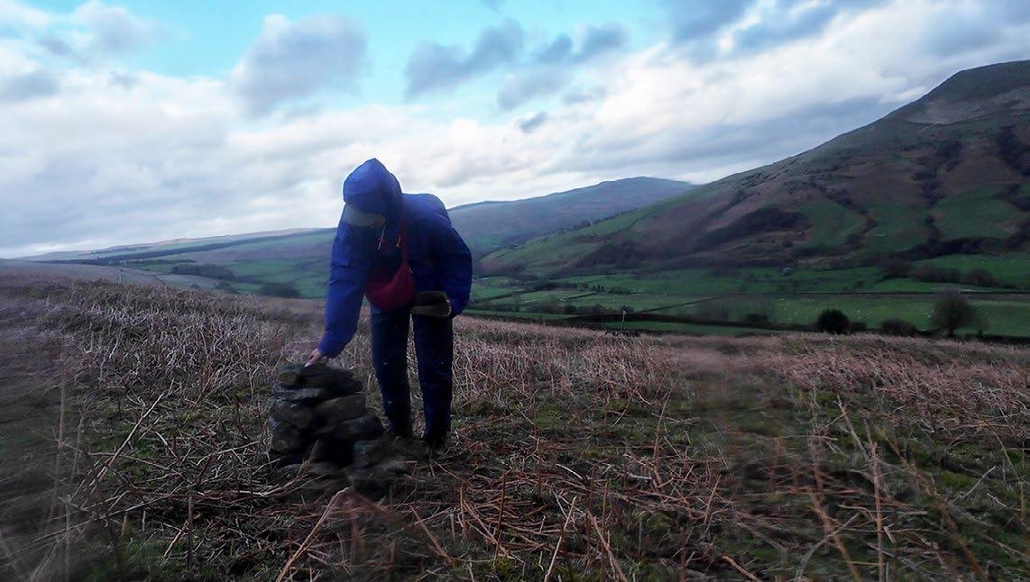
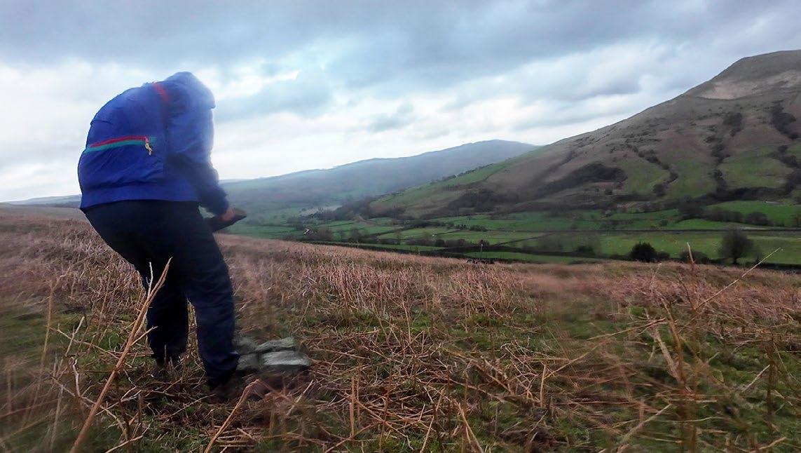
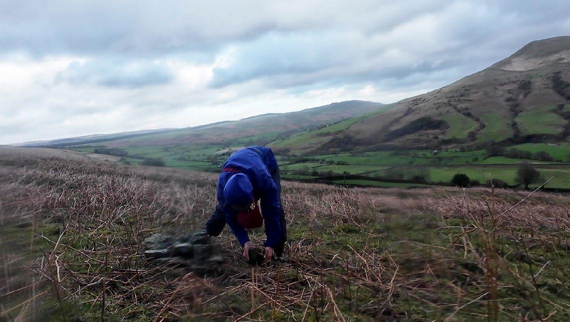
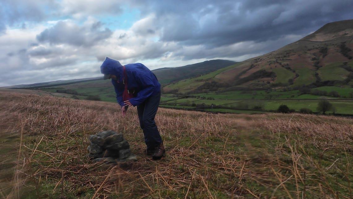
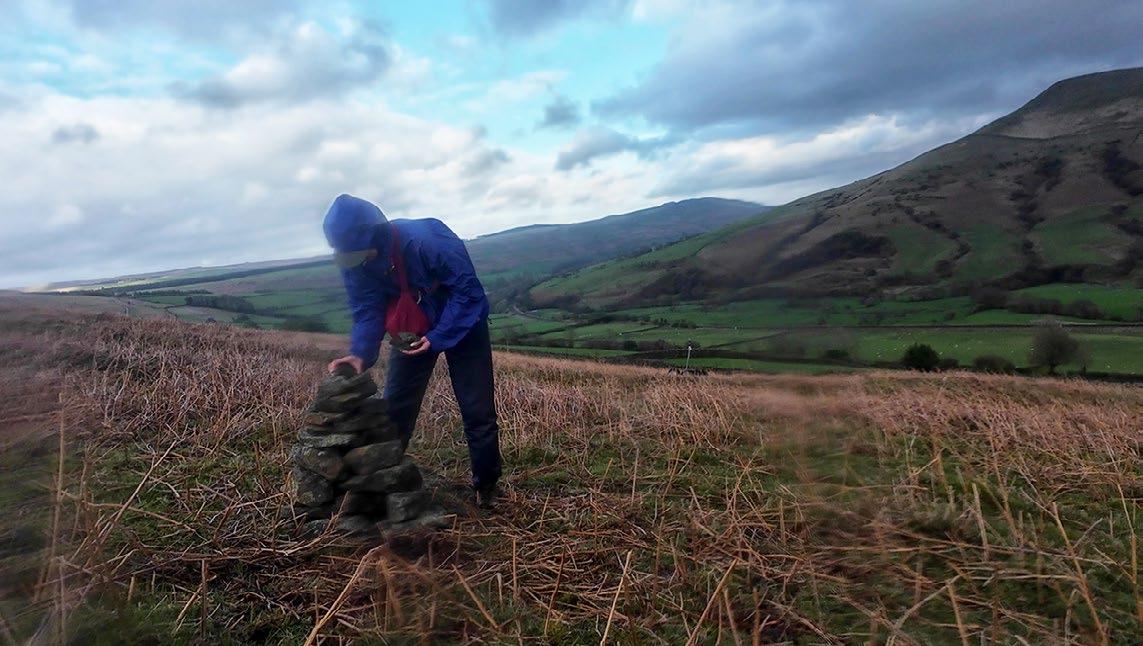
08.
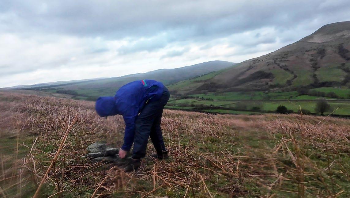
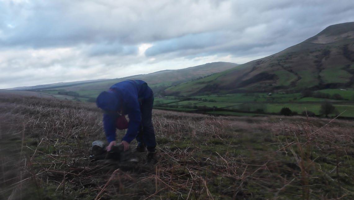
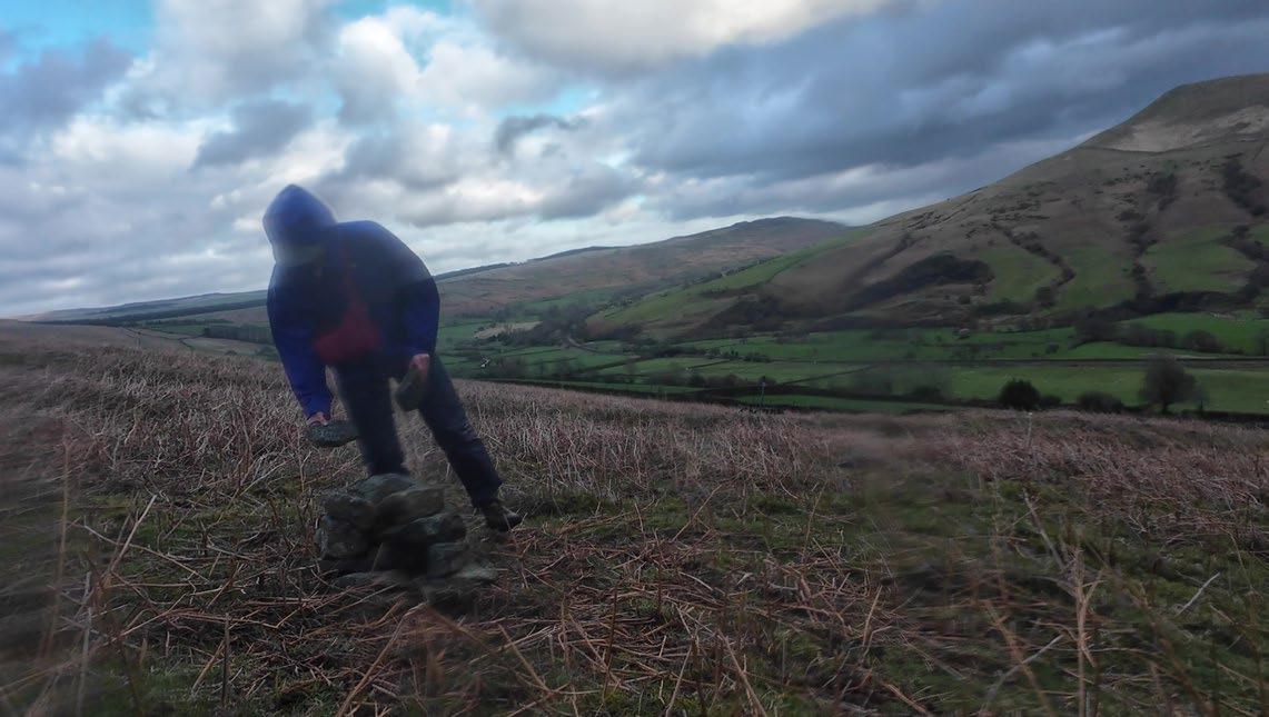
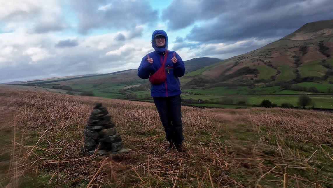
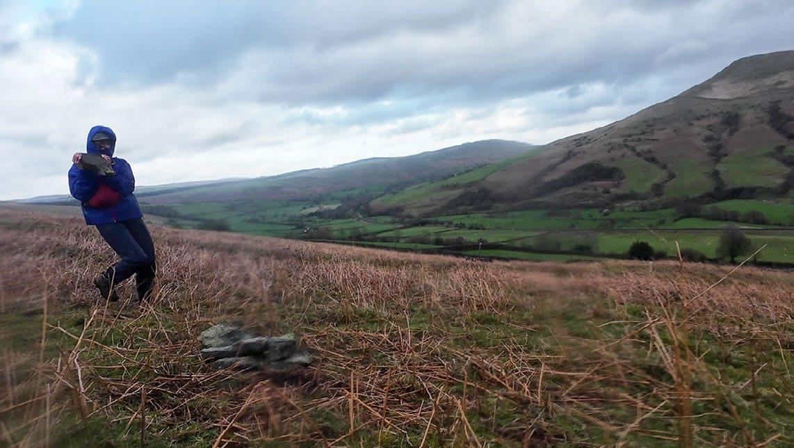
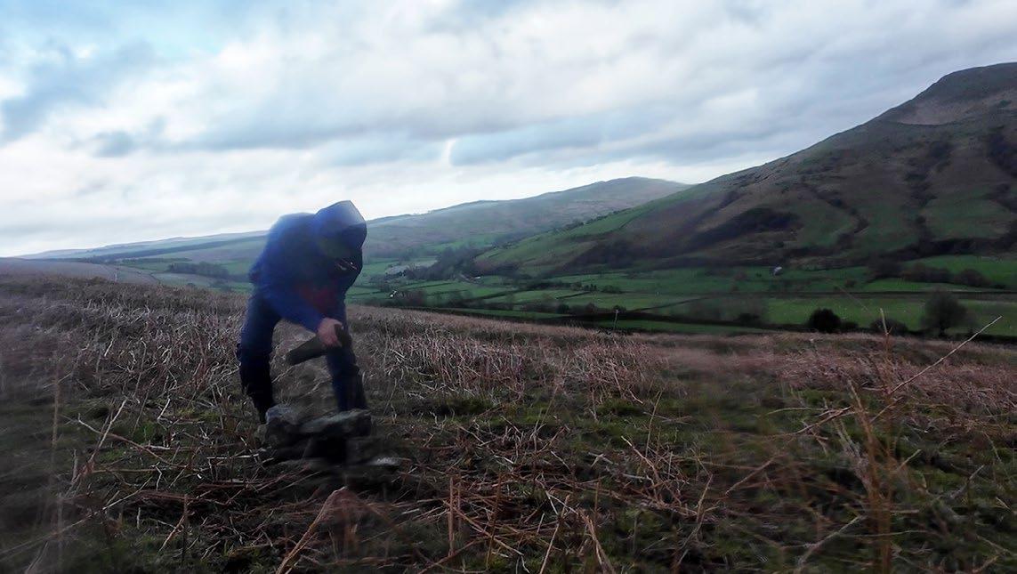
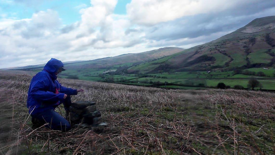
06.
10.
14.
Construction time: 30 minutes
Number of stones: 25
Total height: 0.45m
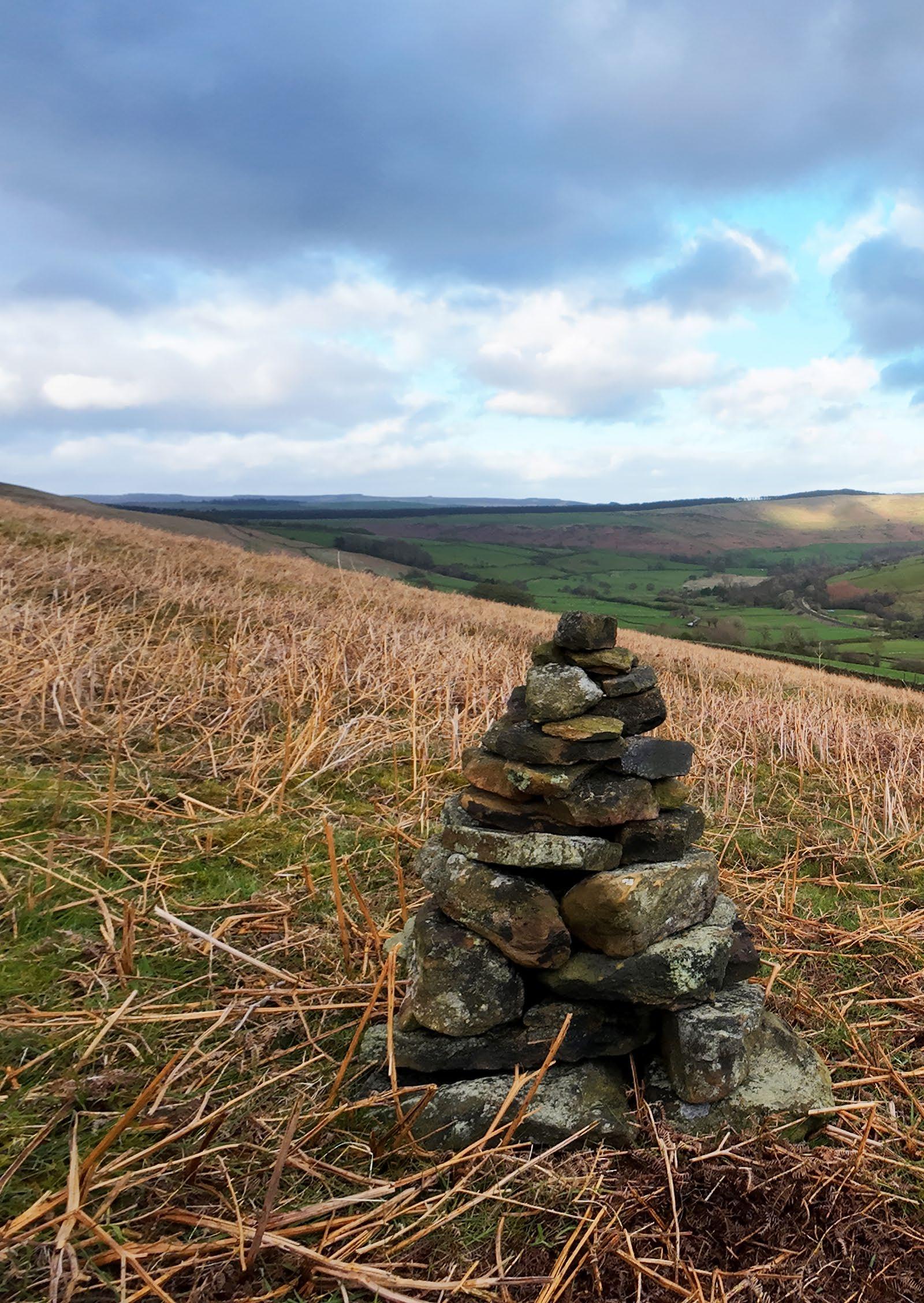
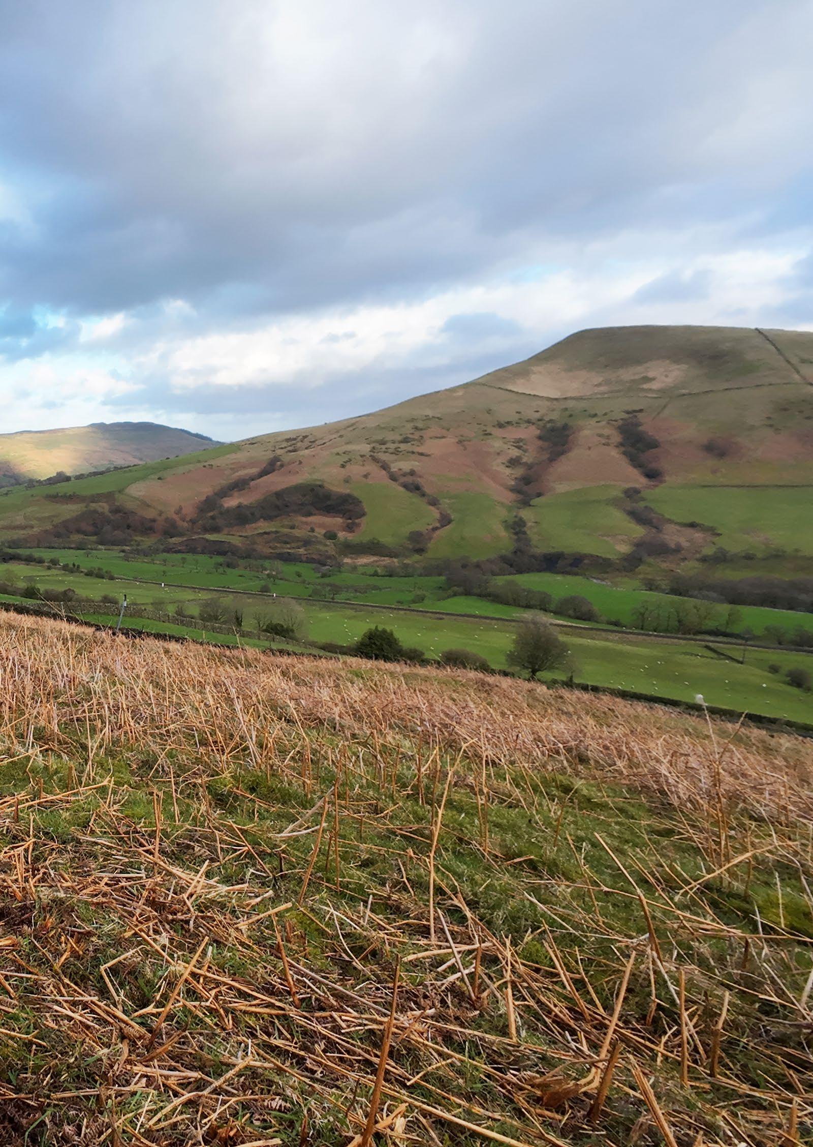
Second Cairn: Scaling Up
Stage 1: Finding stable and level ground
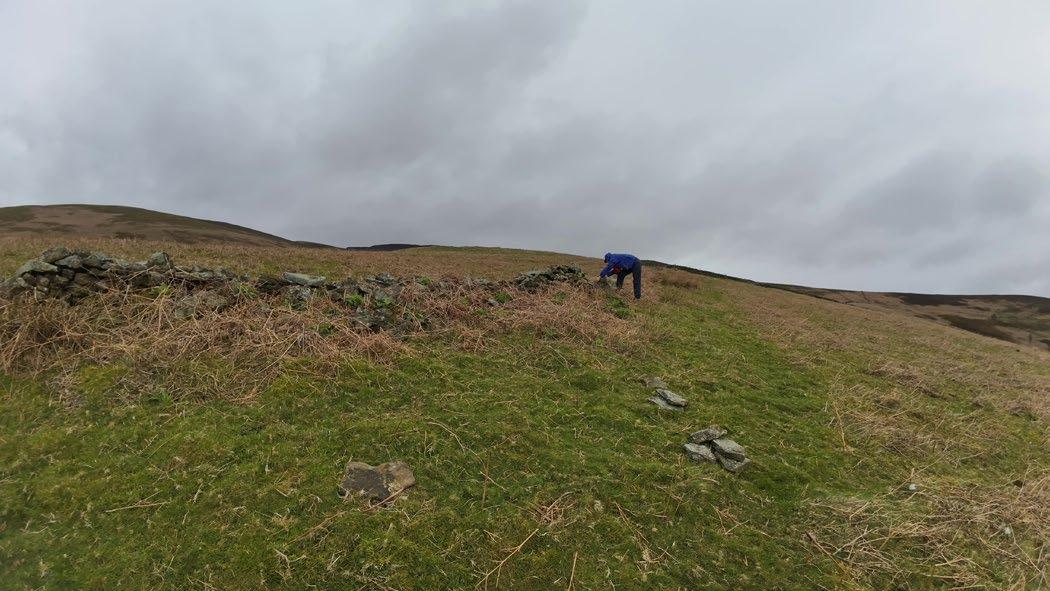
Stage 3: Building up the cairn
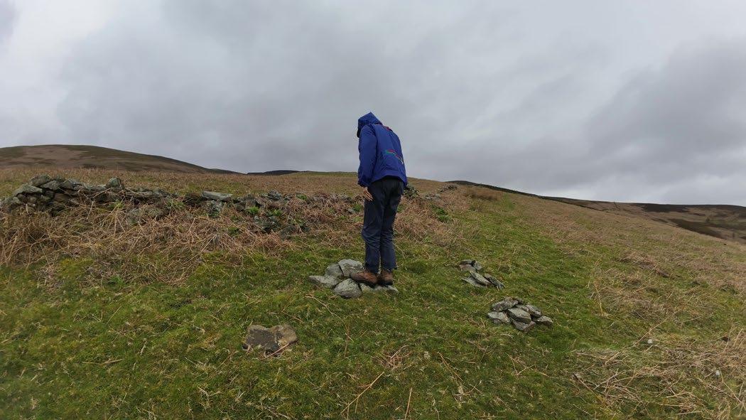
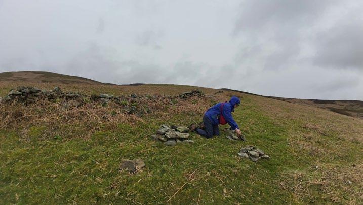
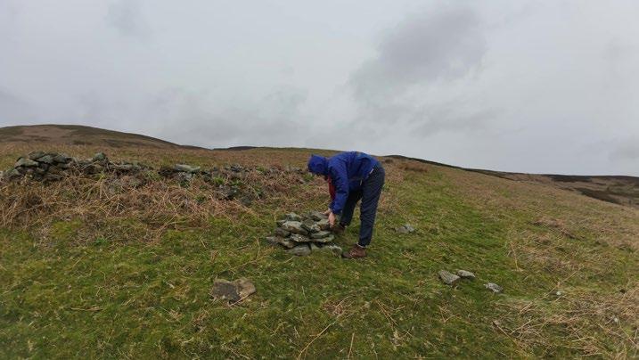
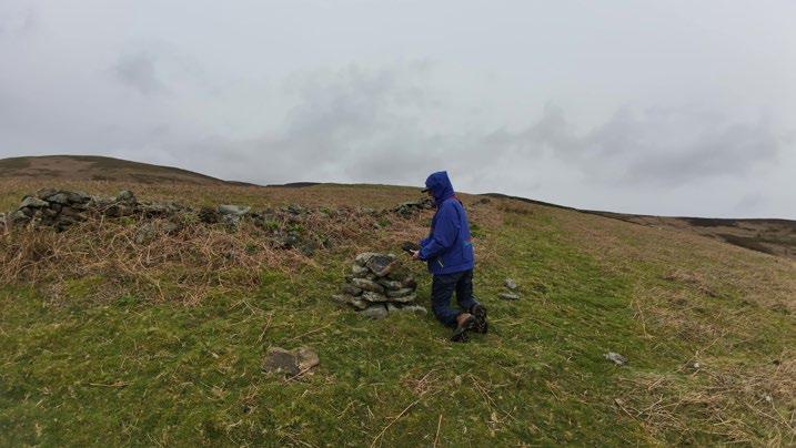
Stage 2: Gathering and sorting rocks
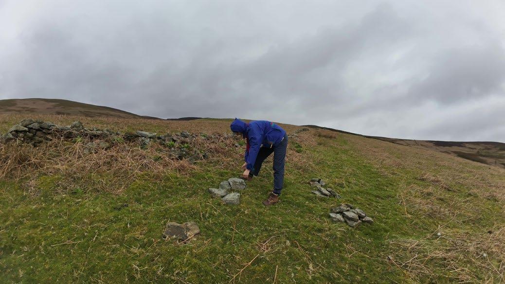
Stage 4: Testing stability
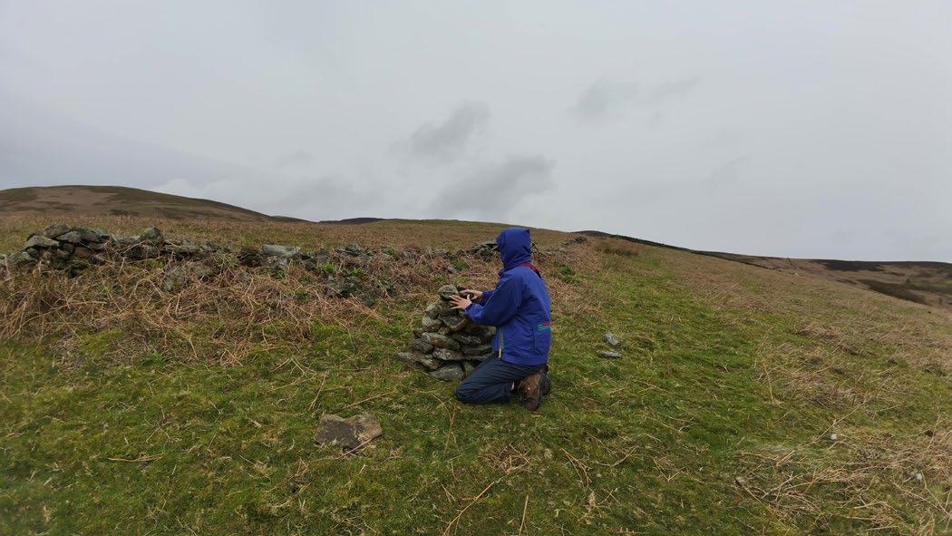
Stage 5: Finishing the top
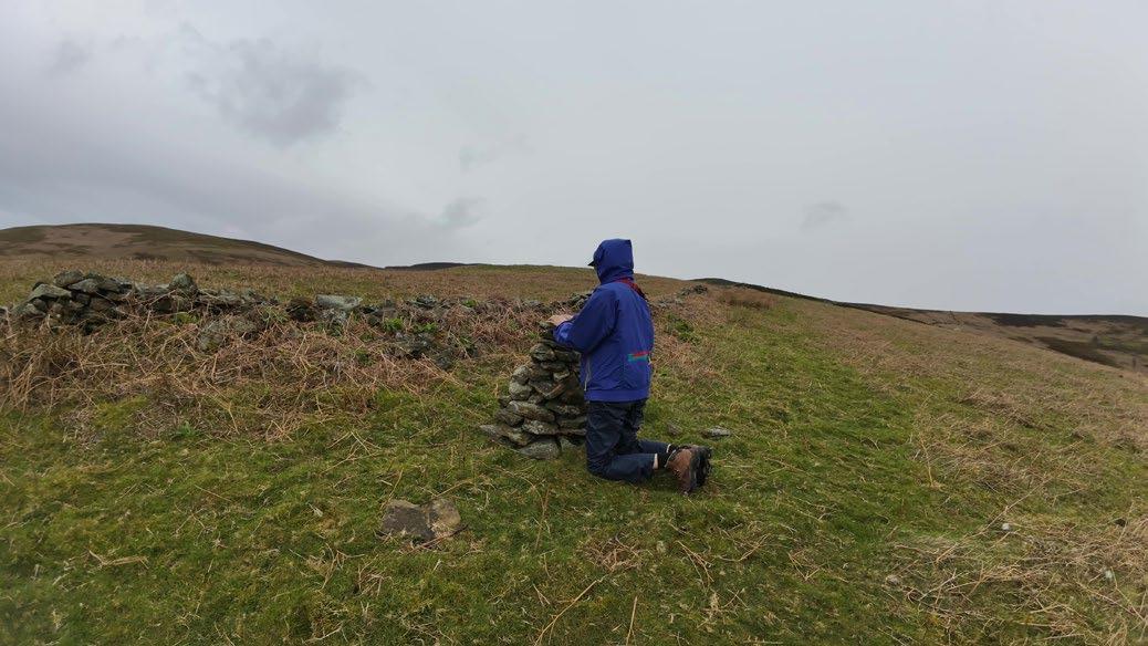
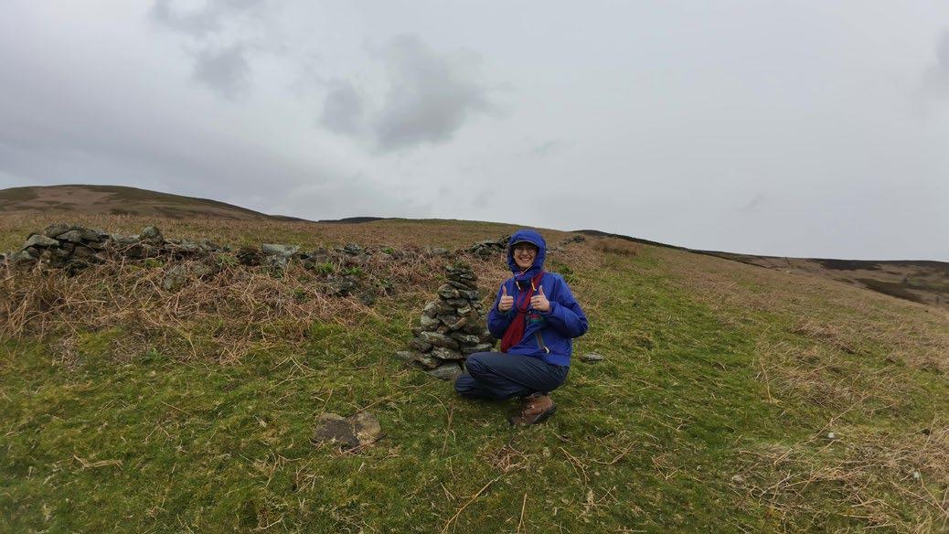
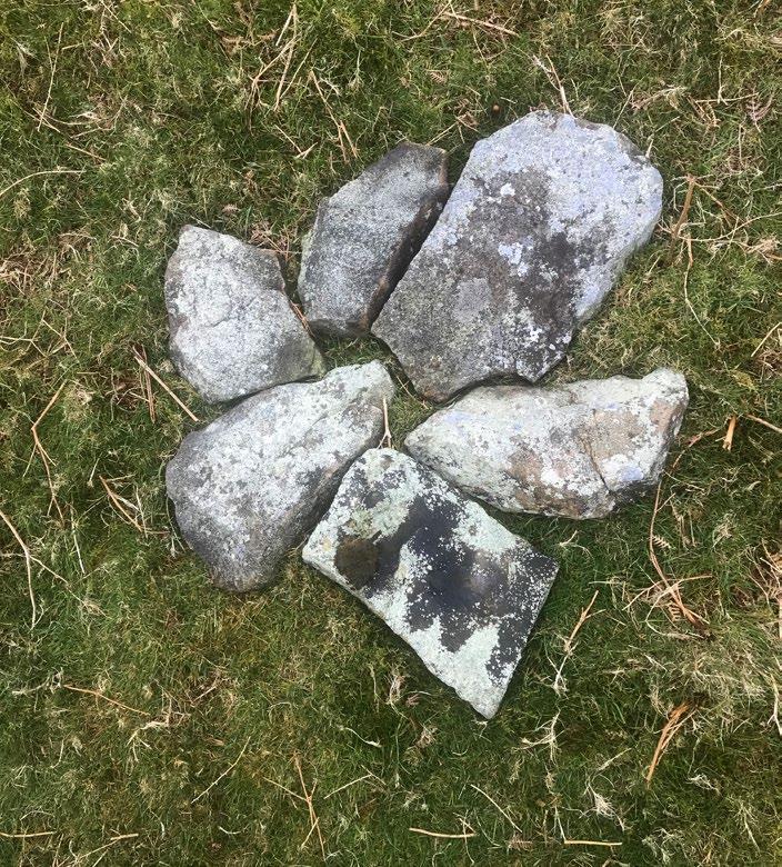
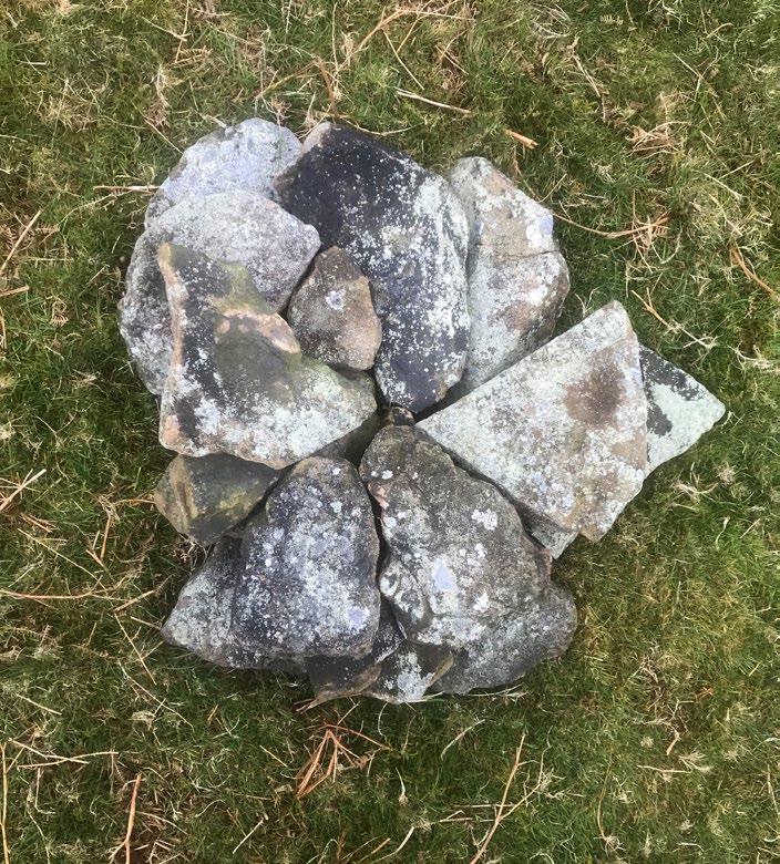
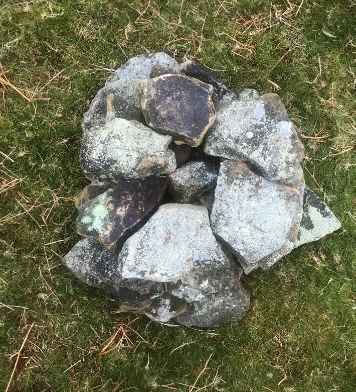
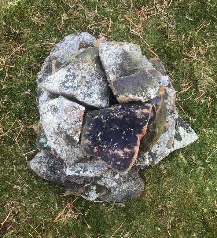
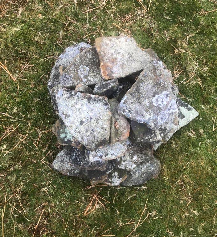
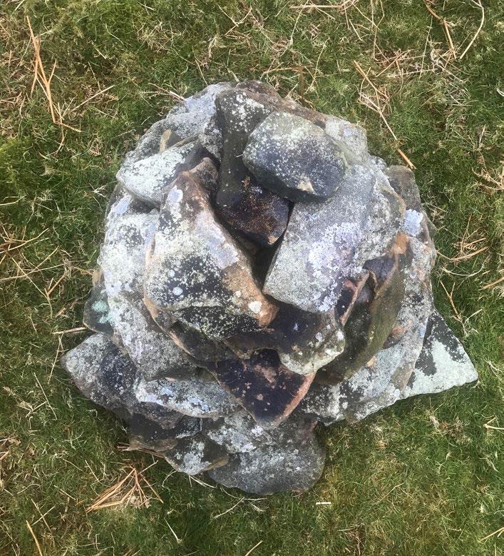
01. 04. 02.
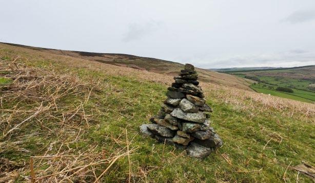
The second cairn, about 0.75m tall, sits a few hundred metres uphill from the first cairn. At a certain part on the slope, about halfway between the two cairns, it is possible to see both, testing my idea of drystone as a wayfinding tool. This cairn was built on a slight slope, causing some difficulty maintaining horizontal surfaces when stacking the layers; however, the end result seemed stable.
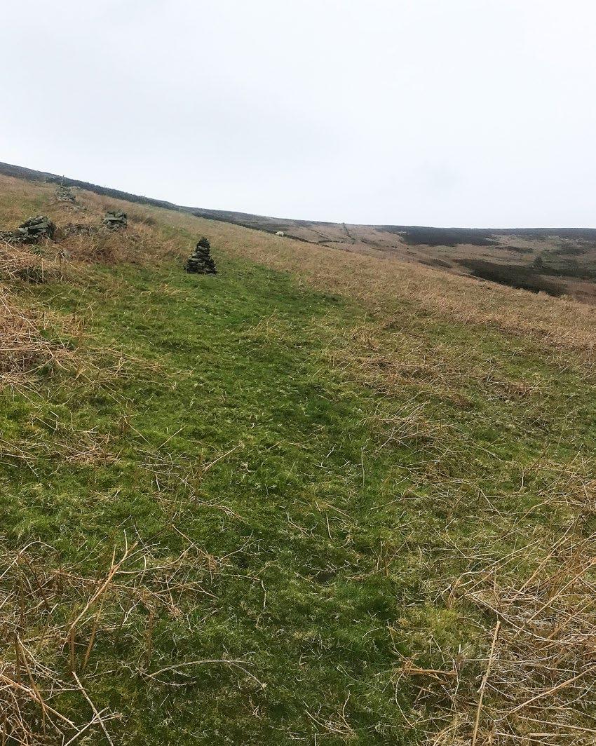
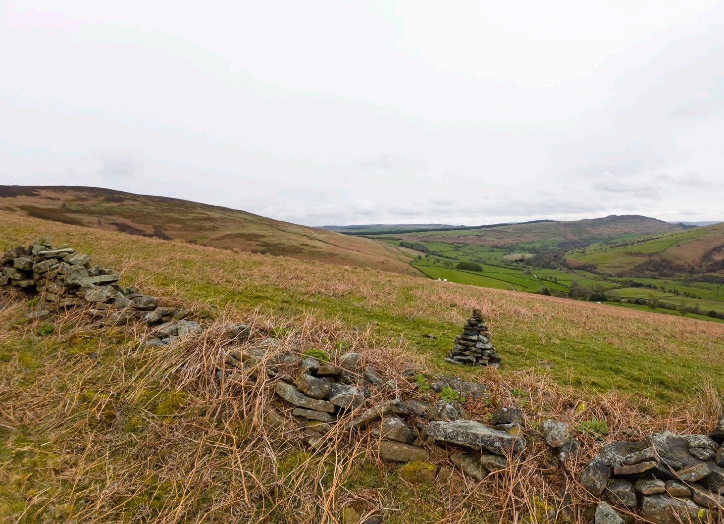
Construction time: 45 minutes
Number of stones: 40
Total height: 0.75m
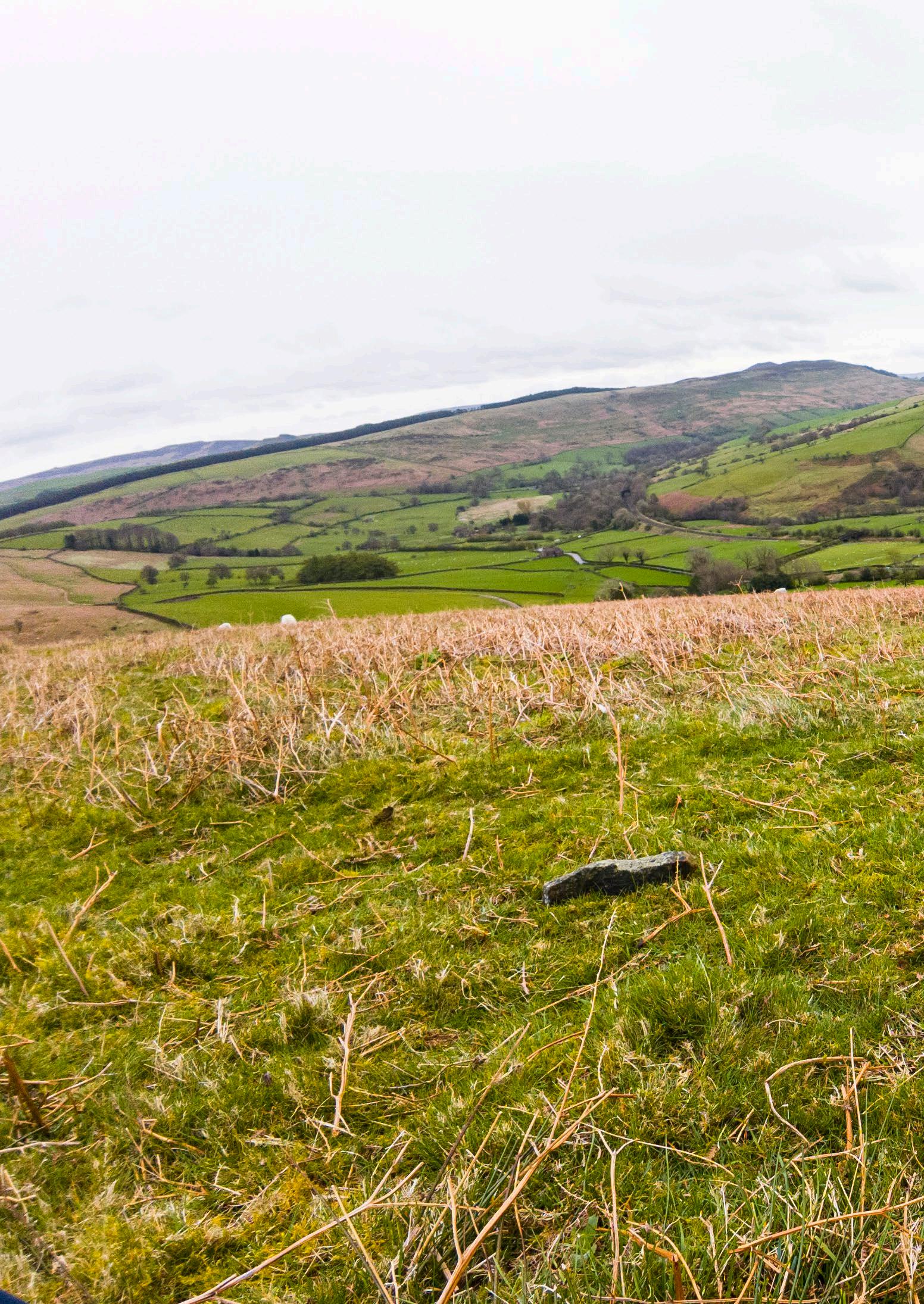
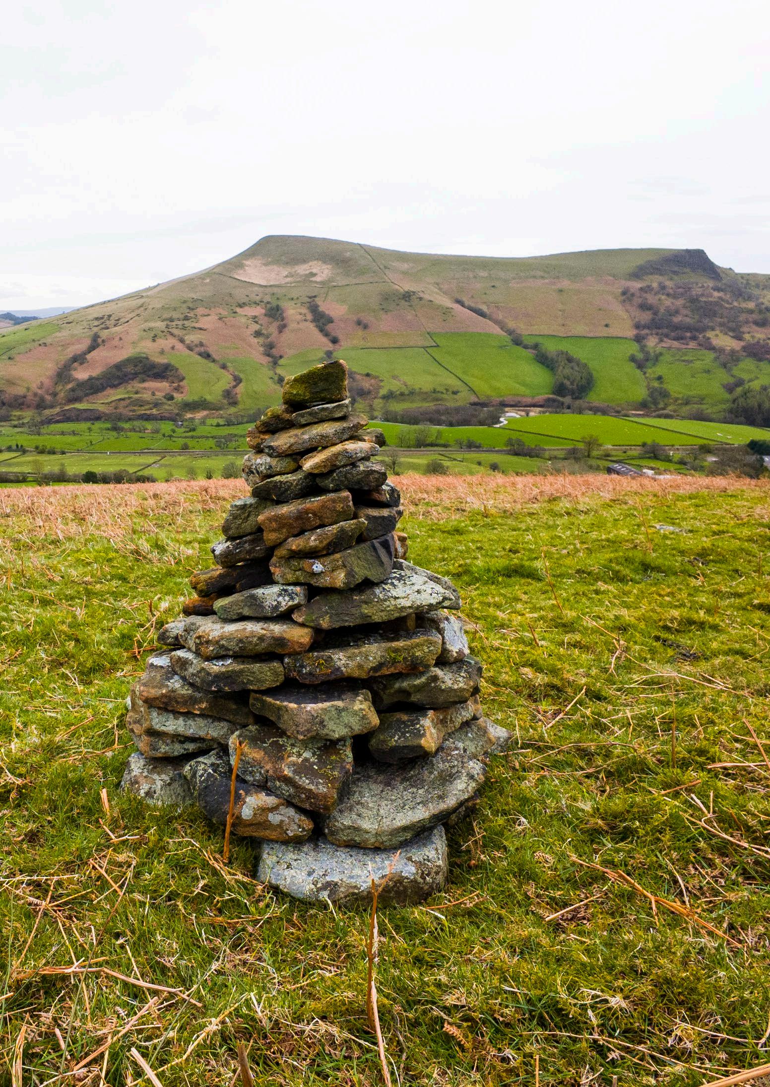
Third Cairn: An Offering to the Land
I built the final cairn on my last morning in Edale on the slopes above the hostel. At last, it was a sunny and warm day. The lack of rain allowed me to trace the stones as I placed them, creating a template or blueprint of the 100-stone cairn. This was my largest attempt, measuring about a metre in height. It was also my most confident drystone assemblage, the stones stacked neatly and at a consistent angle. It took me two to three hours to build.
01. Set up with the timelapse camera on a tripod, gathered stons sorted by size into three piles, and A3 newsprint ready to trace rocks before placing them.
02, 03. Interlocking stones: drystone as jigsaw puzzle
04. The broken wall right beside the cairn from which I gathered most of the stones
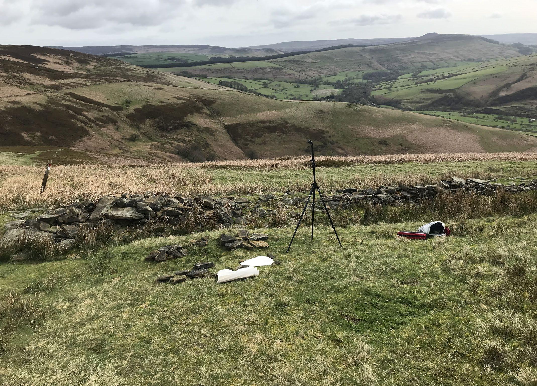
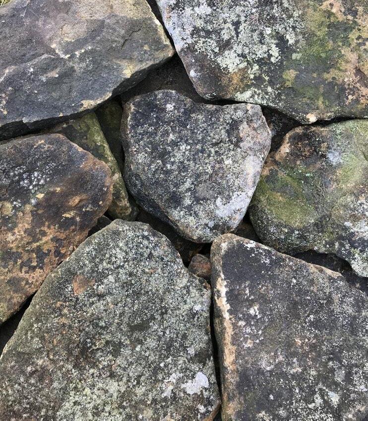
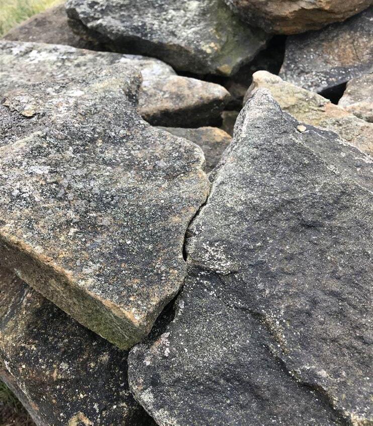
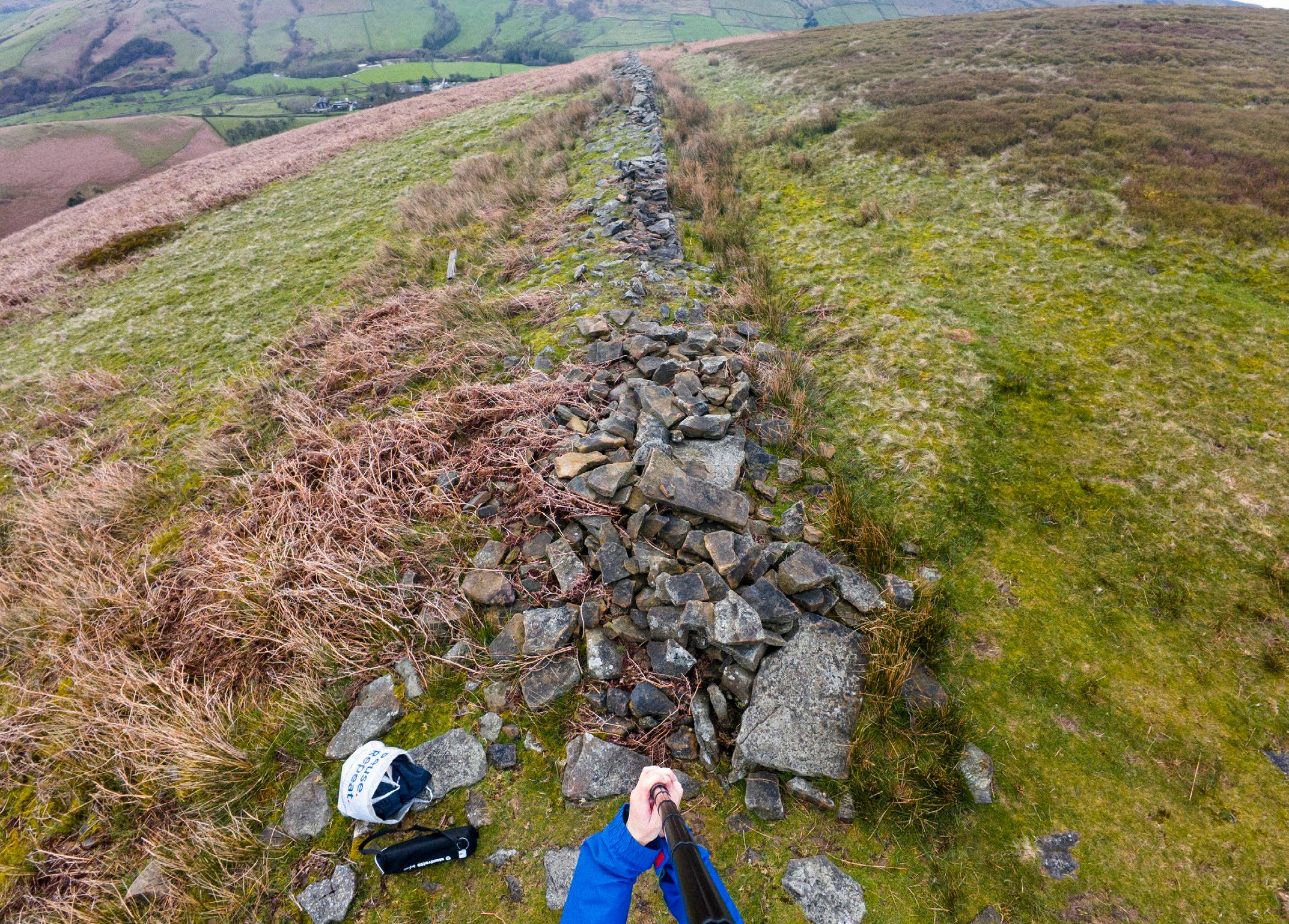
[Transcription from on-site voice recording]
“This is my last cairn, made of 100 stones. It’s been a beautiful, peaceful, and contemplative exercise. I’m just thinking about this idea of the cairn as this ancient practice, where by building two and a half hours in this one plae in the moorland, I’m tapping into that ritual practice that is very much of this place, this geology. There’s something about the time it takes to make such a thing, where you do need a lot of patience and care and just a sensitivity to the surroundings. Paying attention to the rocks, to their form. I was careful not to take rocks that were close to the ground where they were sheltering insects and forming habitats, so I took rocks from the top that were more loose. I got into a rhythm of looking for certain shapes or thicknesses of stone, and I got pretty good at finding the right ones quite quickly. But you have to be attuned to the rocks around you.
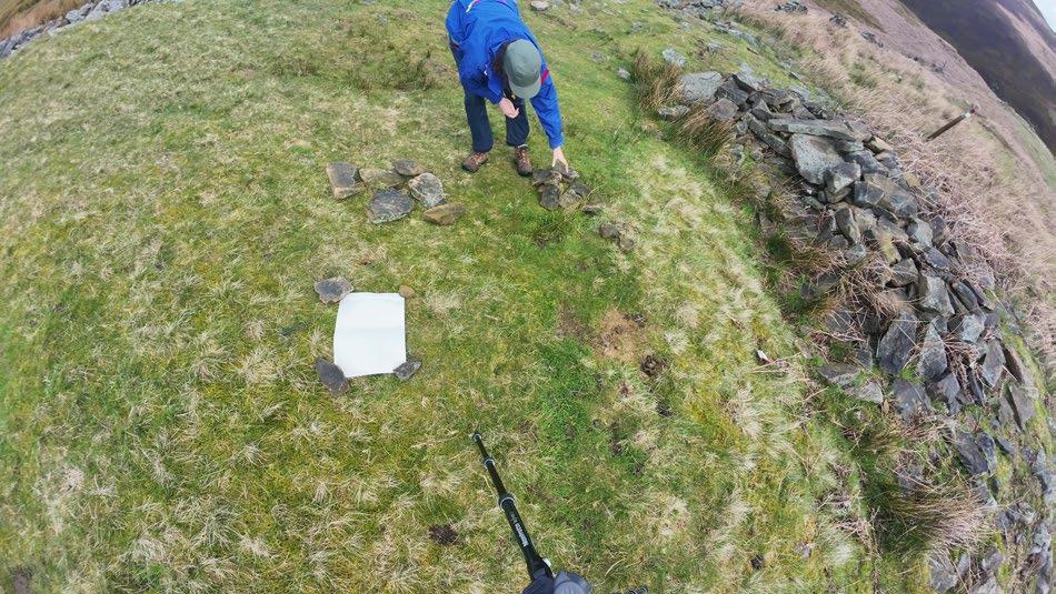
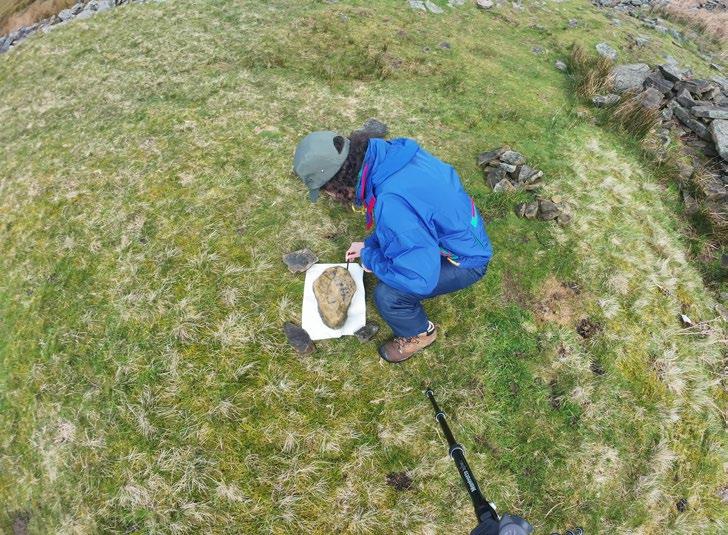
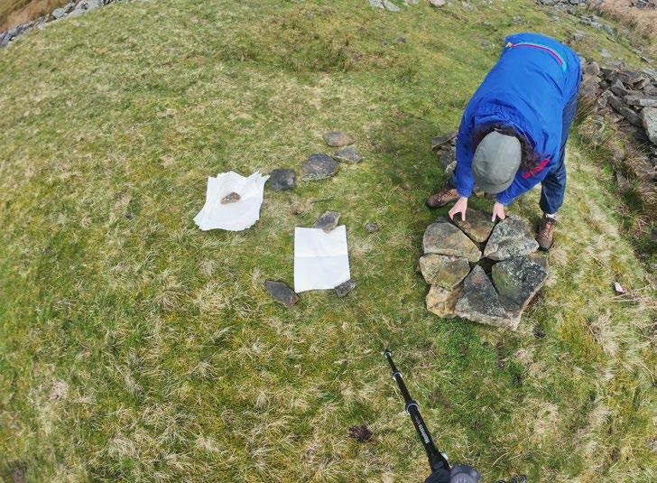
I was thinking about reciprocity: I’m not coming here to take rocks out of this place in an extractive sense. I’m spending time in this place just reshuffling what’s already here, to make something beaituful that other passers-by – people, sheep, insects—can start noticing as well. It acts as a marker or node in the landscape. It’s almost a gift. I’ve spent time making this gift for this particular place. In spending time here, I’ve developed a relationship to this place and to these rocks. I’ve touched each rock, traced each rock on paper. It’s this idea of becomingwith the cairn, where the cairn is being built by my hands, but the rocks themselves also play a role
in how I’m building it. Their shape, the way they respond to one another and interlock, these things inform how I place them. So it’s really about developing a relationship to the rocks, and even asking permission of the rocks. There were some rocks I thought looked really good for the cairn, but then when I reached to take them, I felt like, “oh, this rock doesn’t want me to take them. This rock wants to stay where they are now.” So, I left those rocks where they were. It may sound cheesy, but I think there is this deep
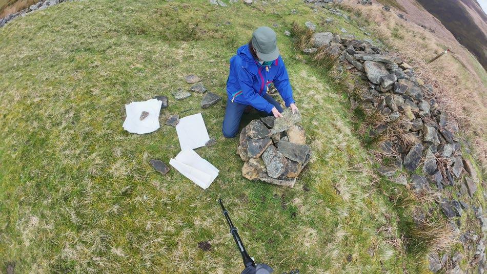
sense of listening to the place, and the place will tell you what is needed, or what needs to stay.
I’m happy with this last cairn. I don’t know how long it will last, but I didn’t create her with a sense of permanence, but as a temporary reconfiguration of the rocks that were already here.”
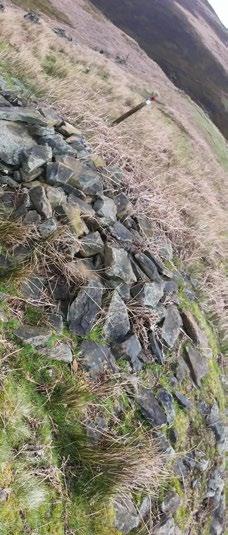
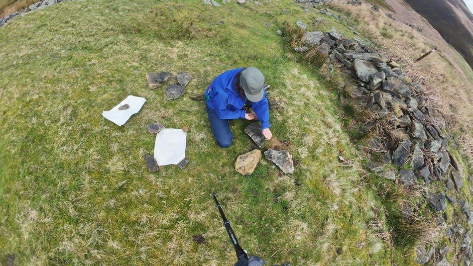
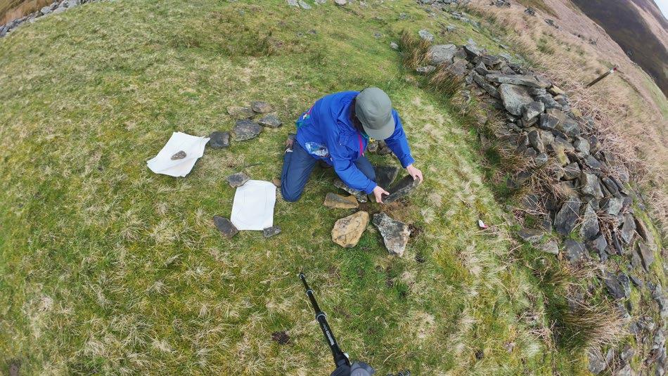
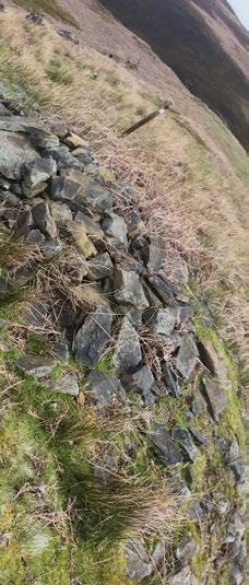
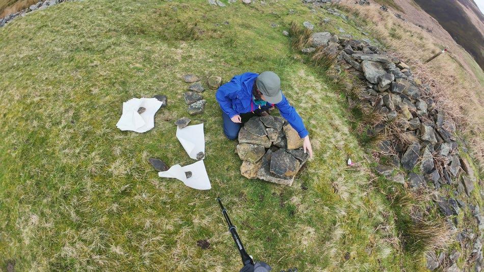
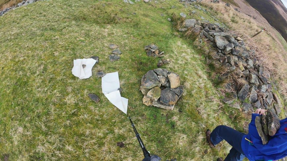

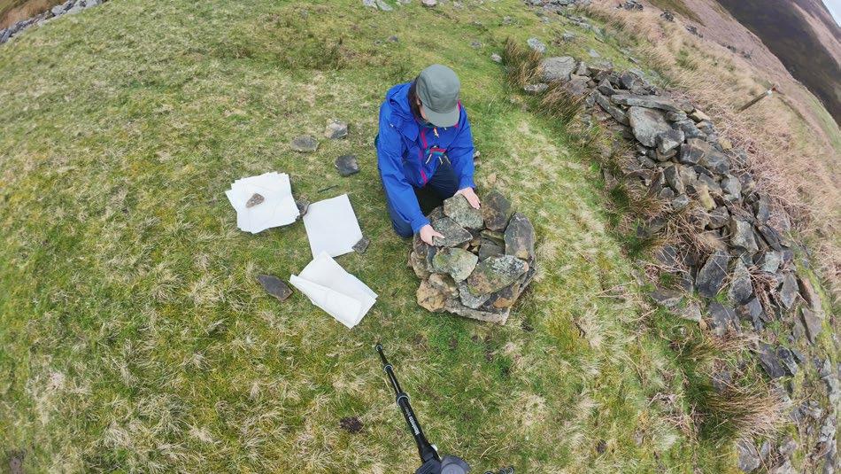
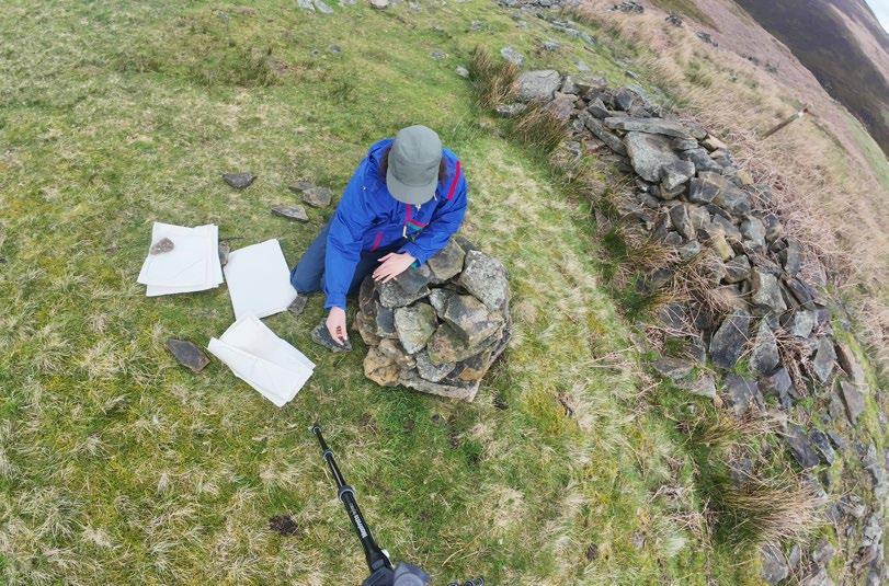
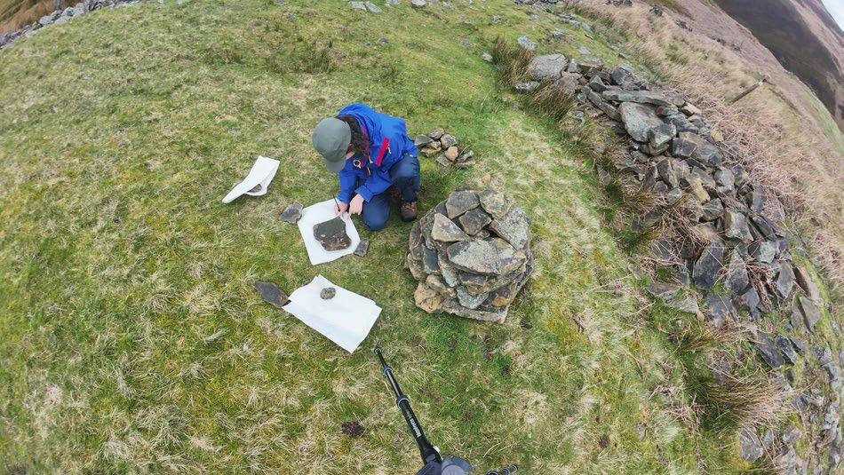
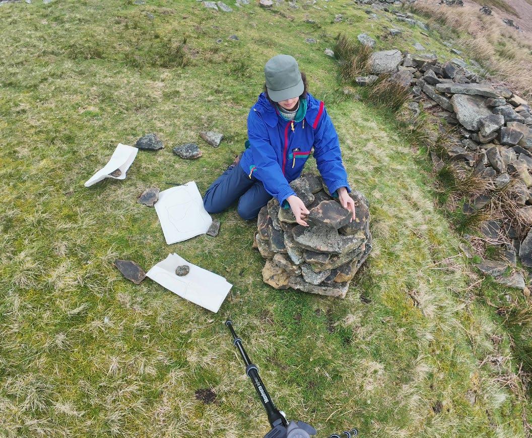
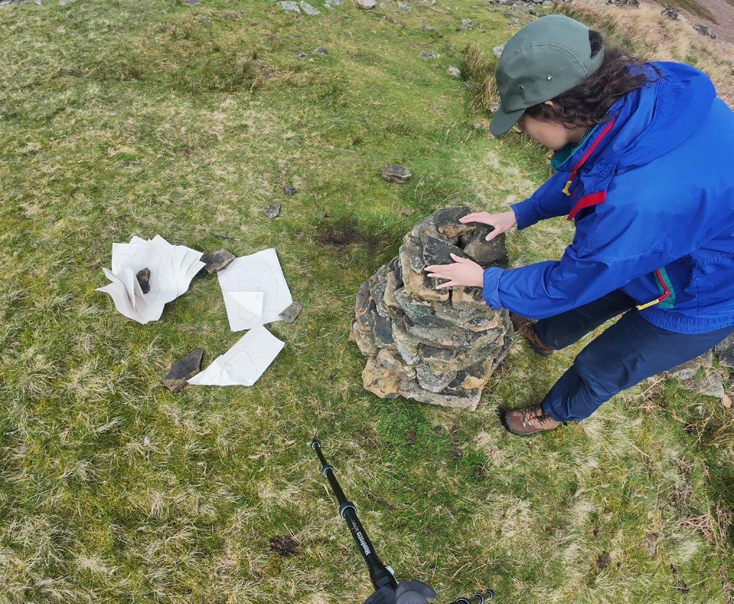
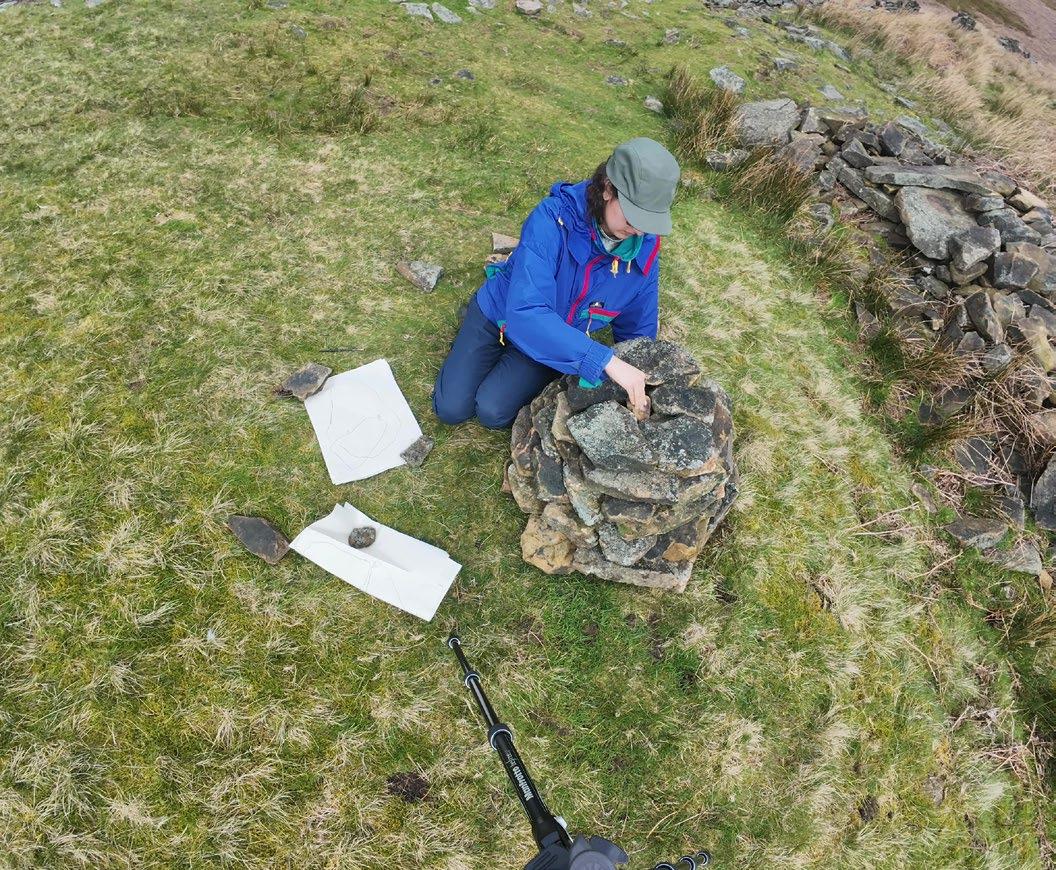
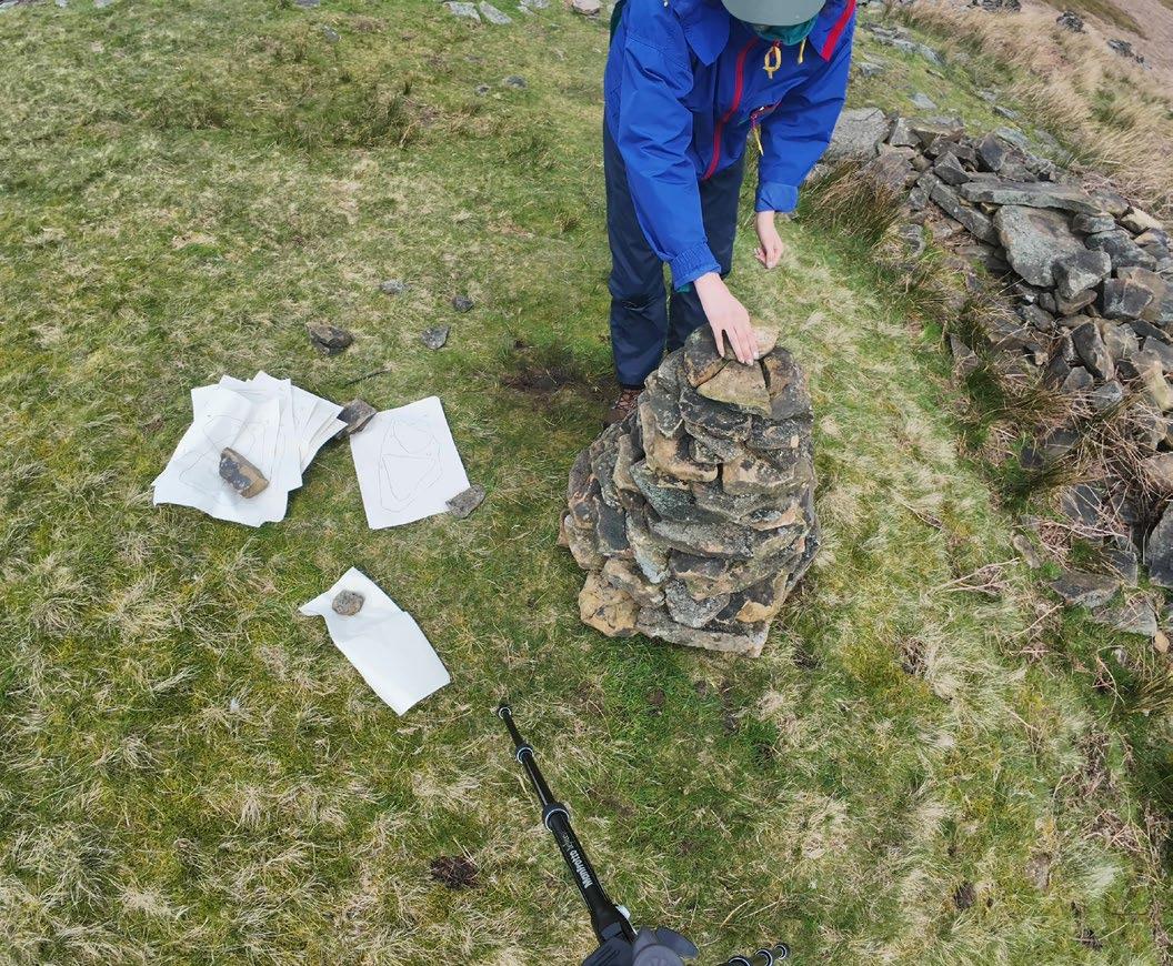
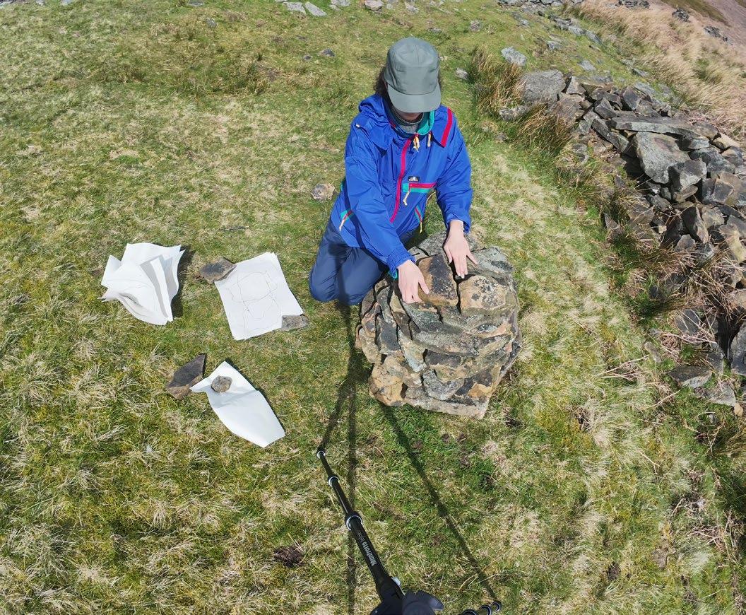
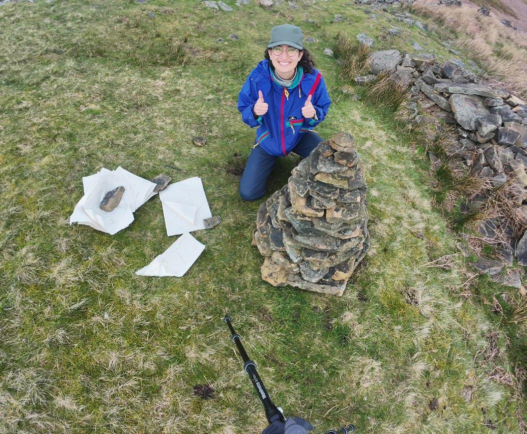
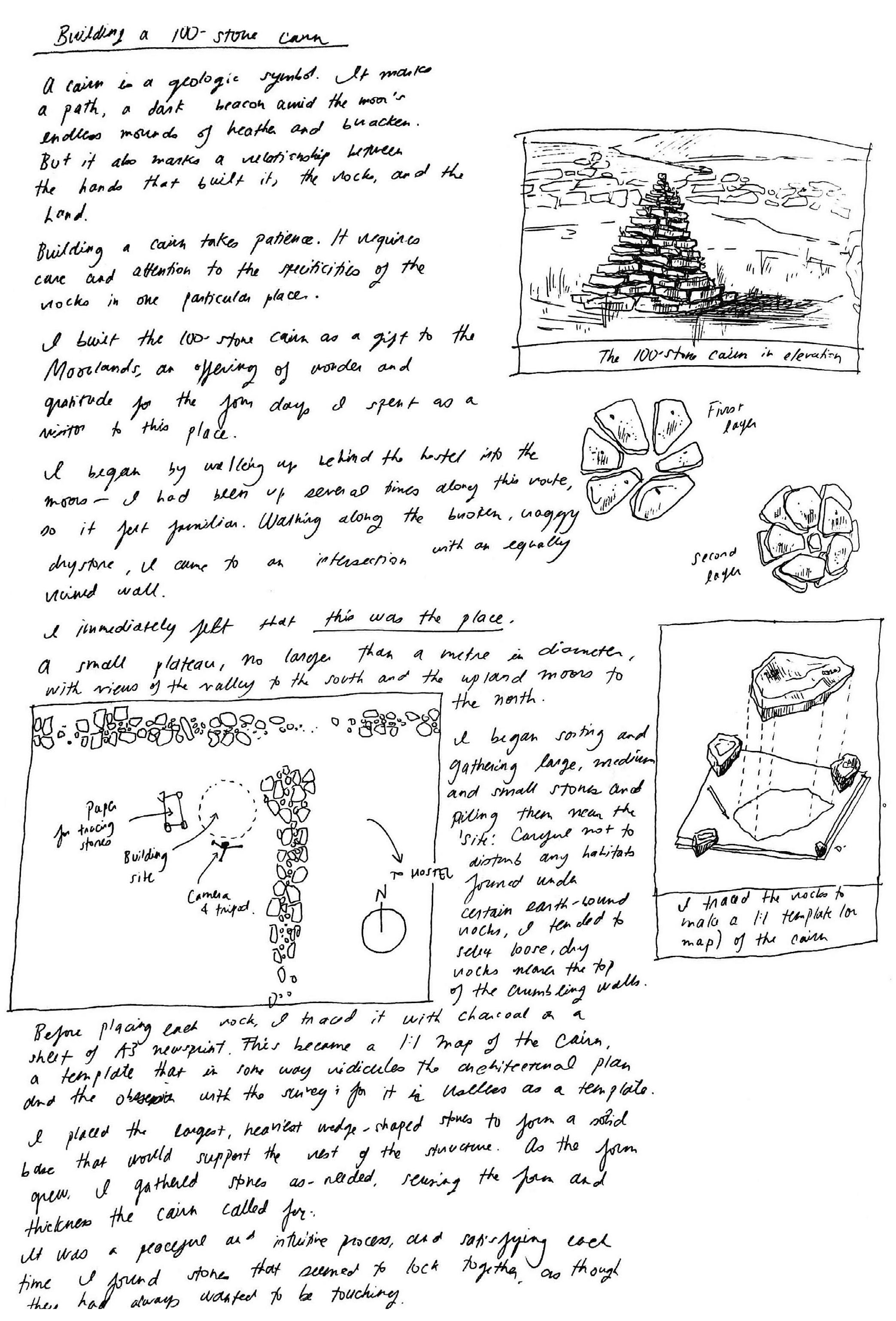
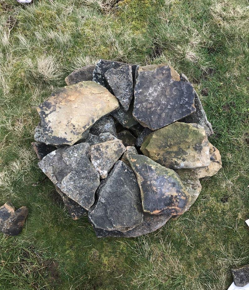
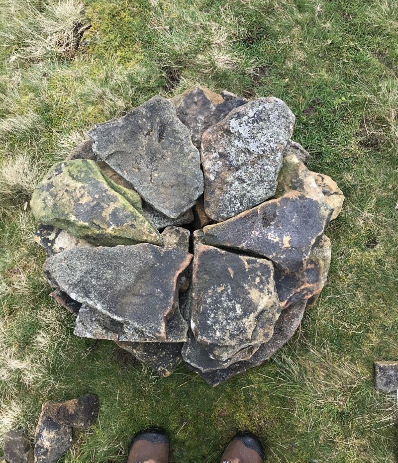
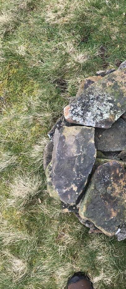
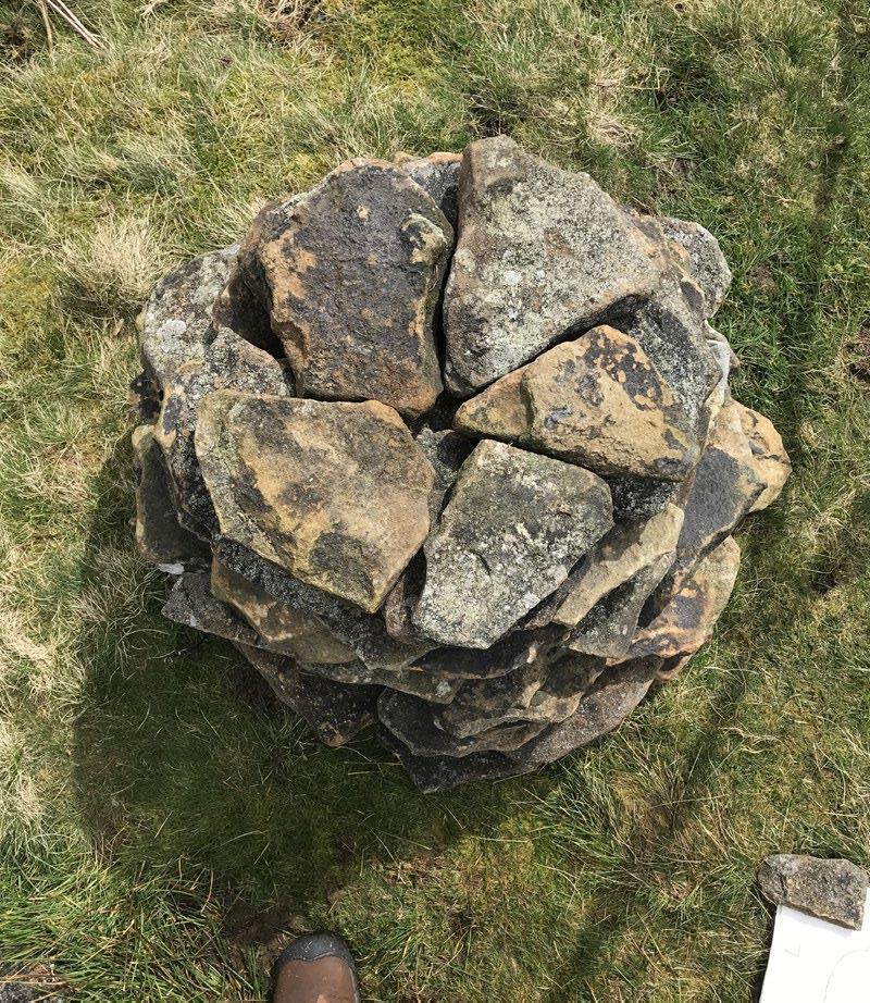
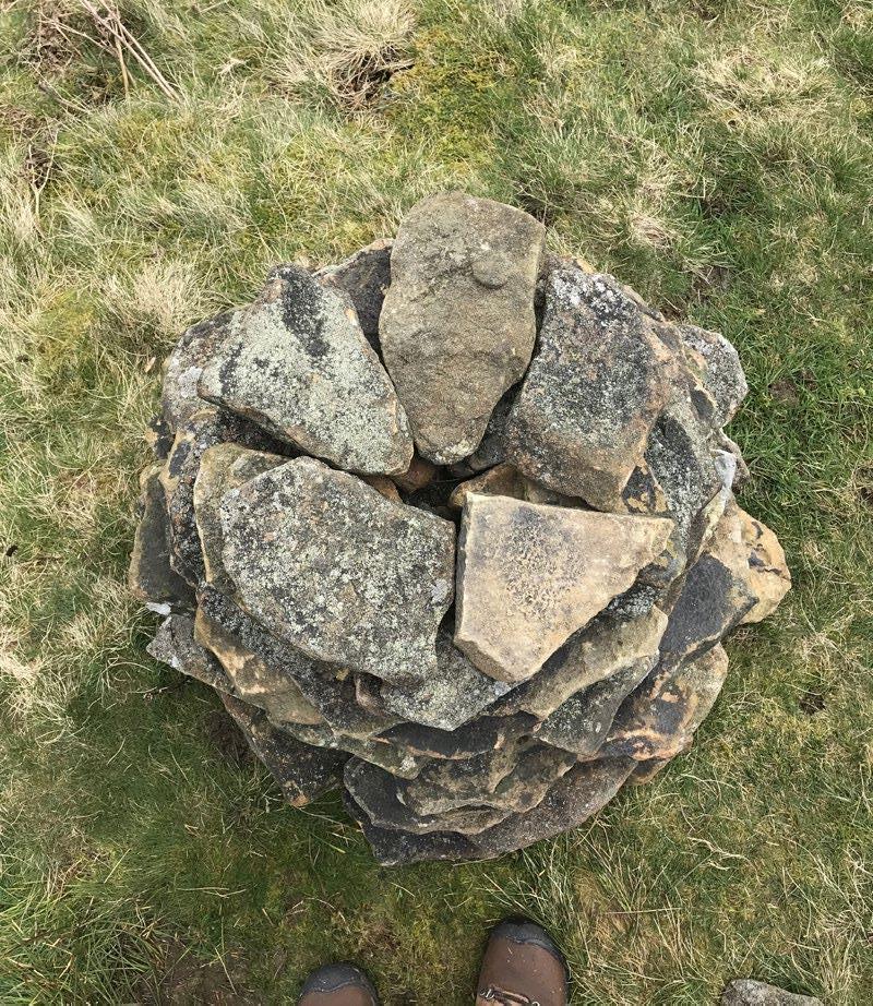
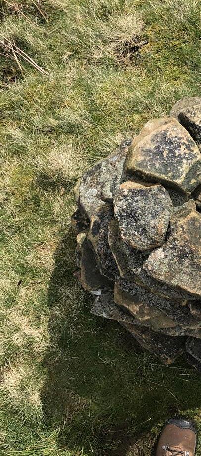
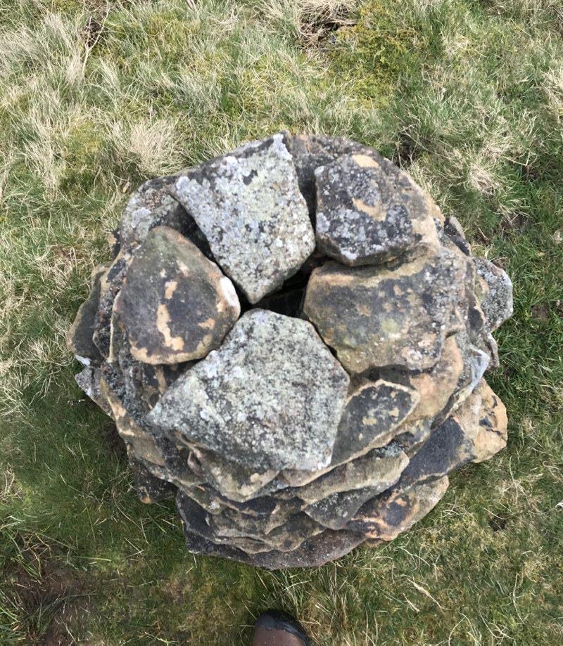
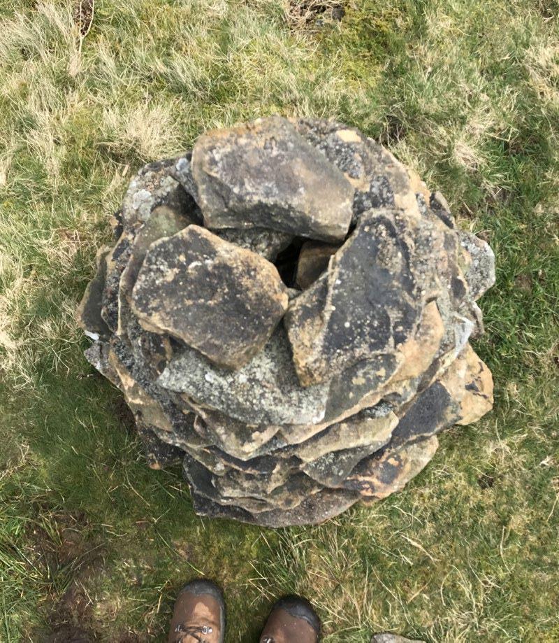
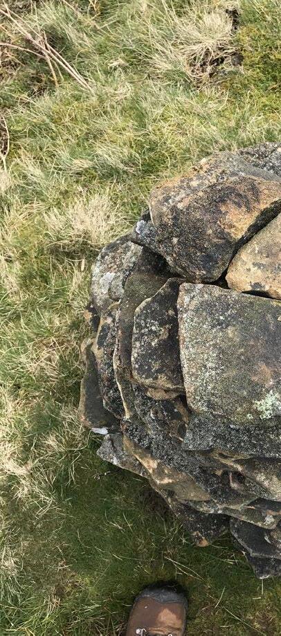
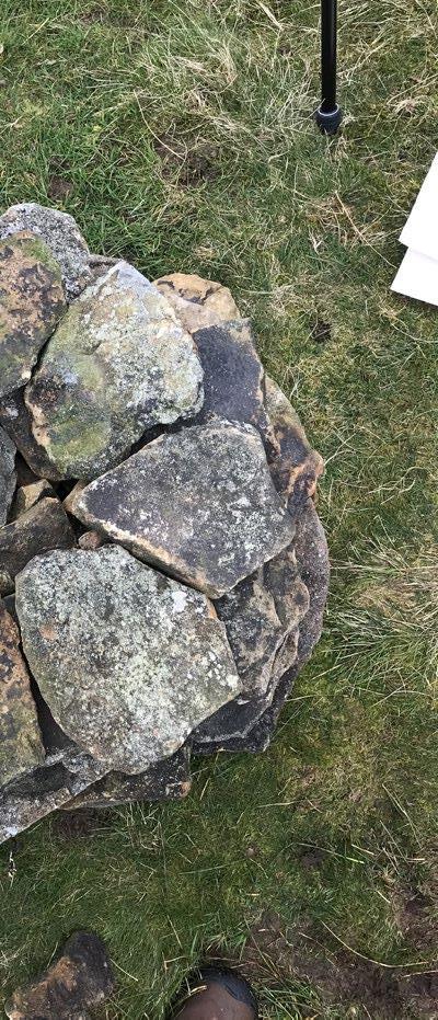
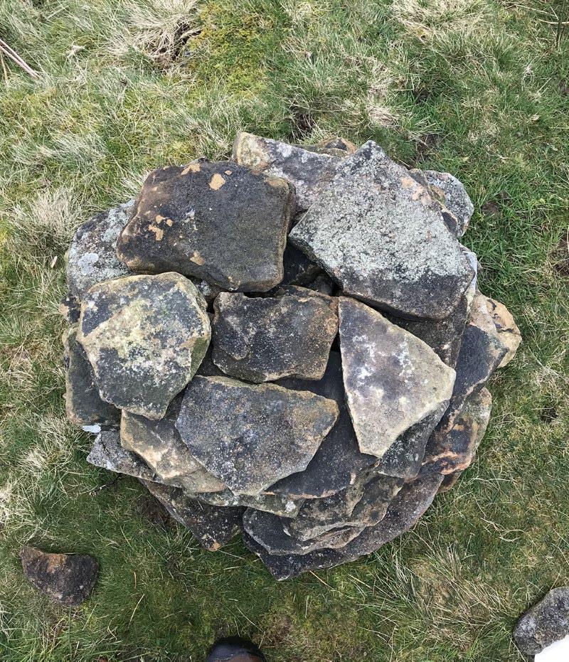
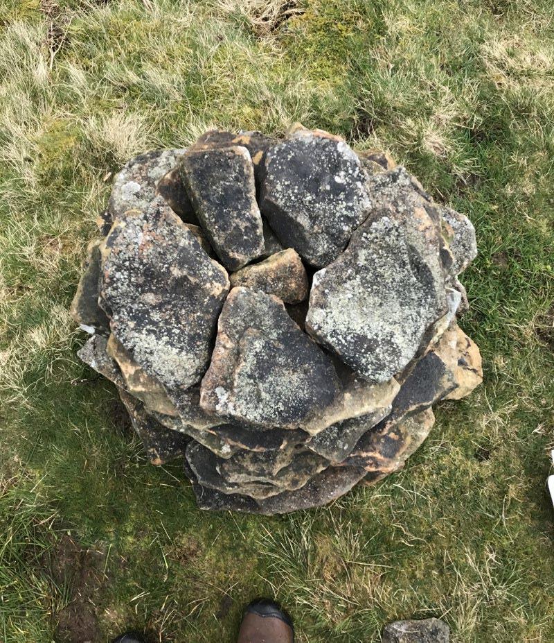
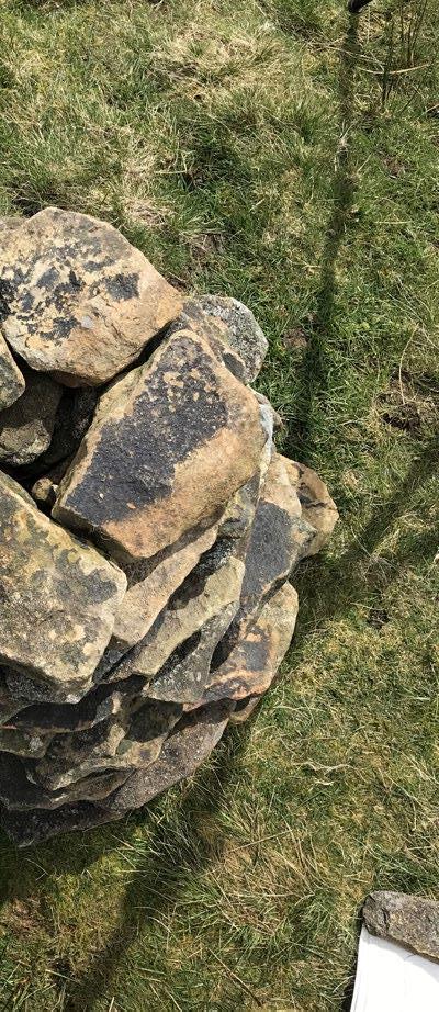
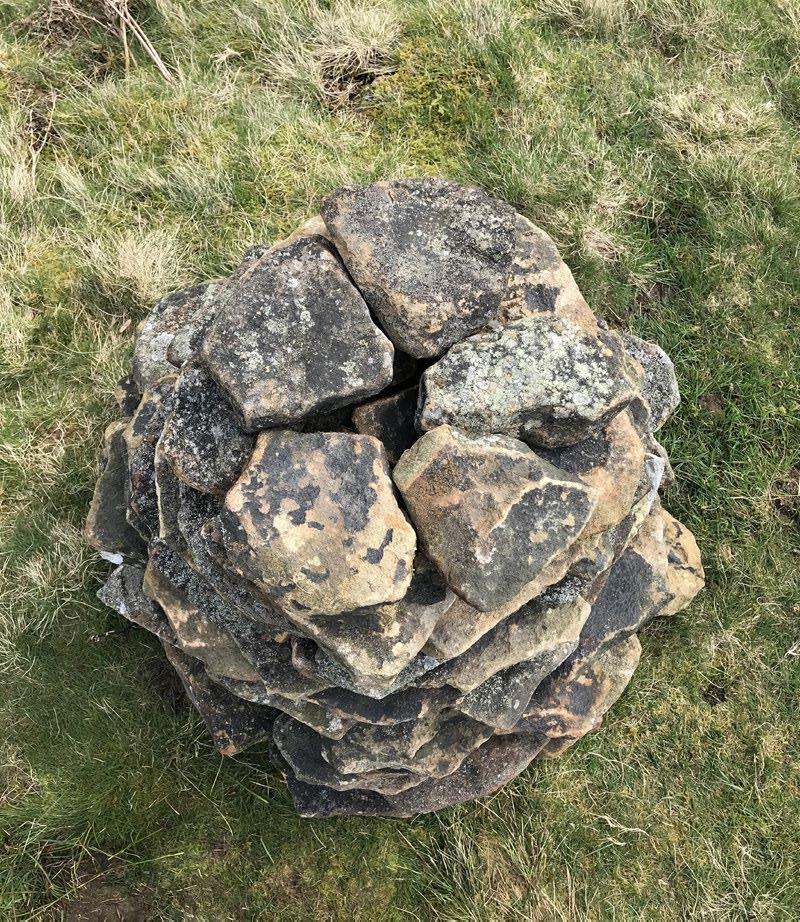
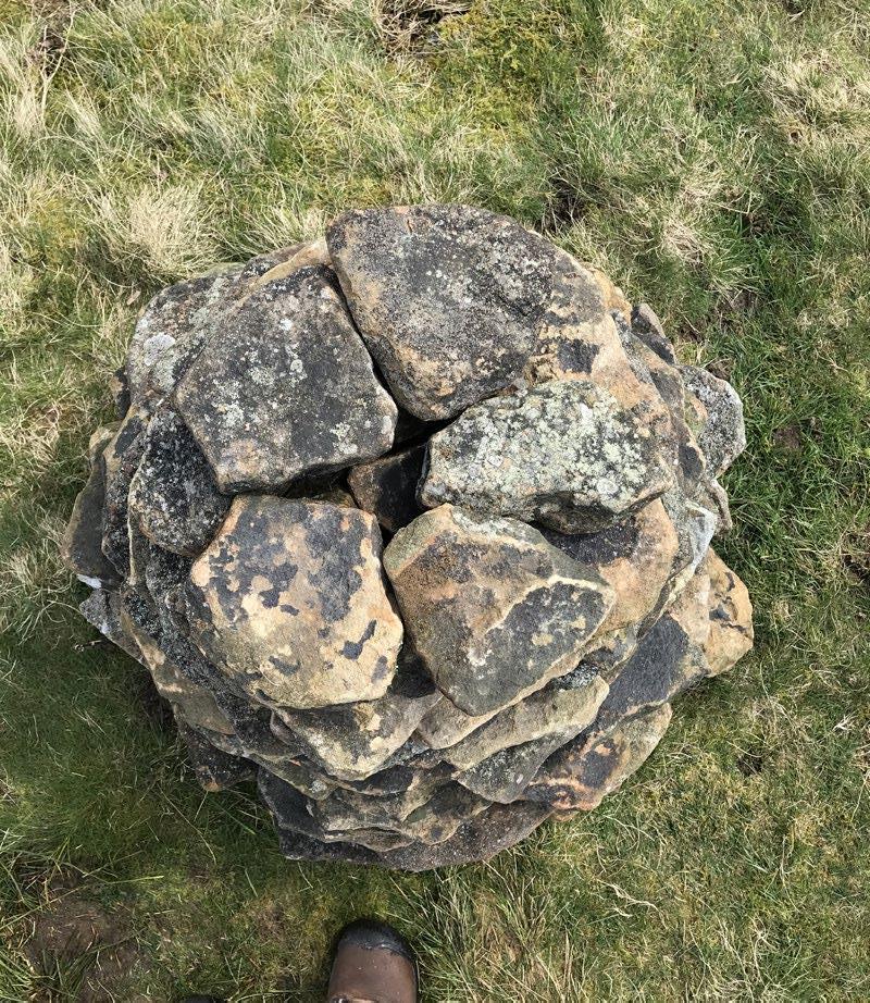
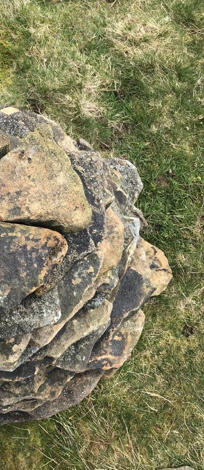
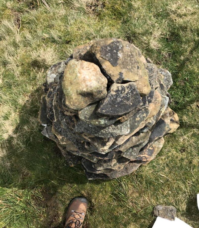
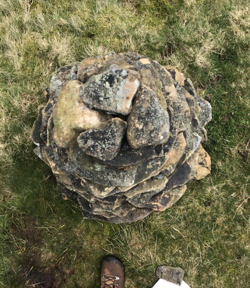
Template for the 100-Stone Cairn
1:1 scale
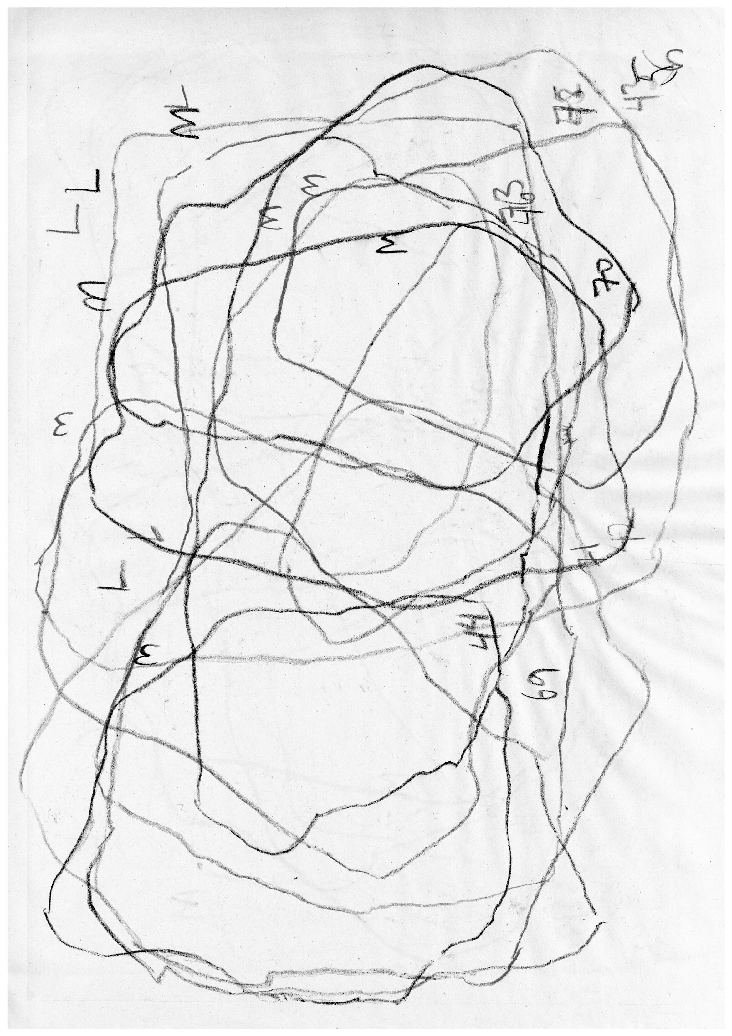
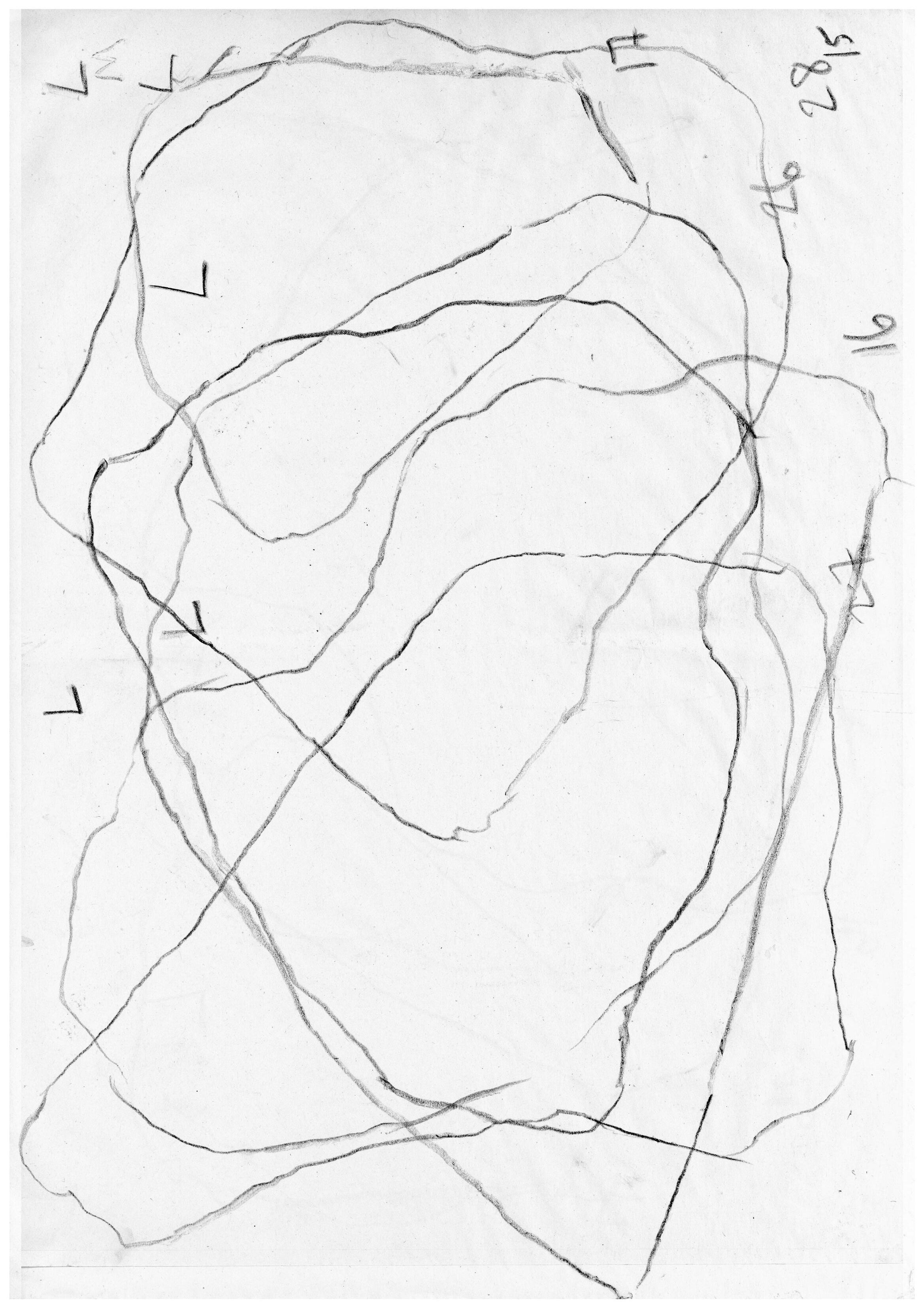
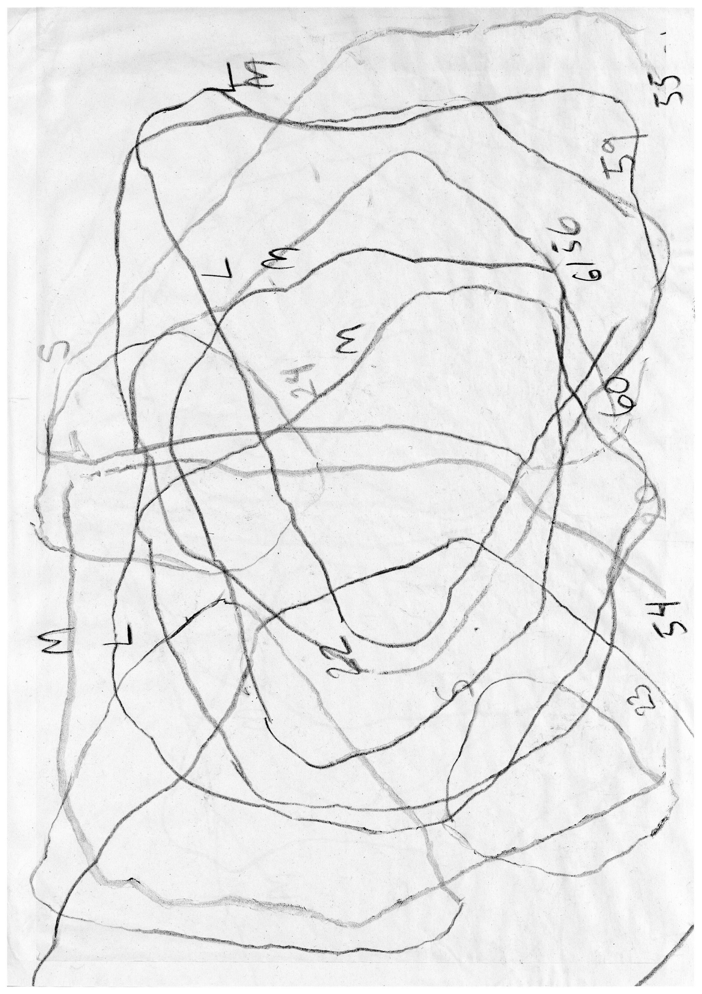
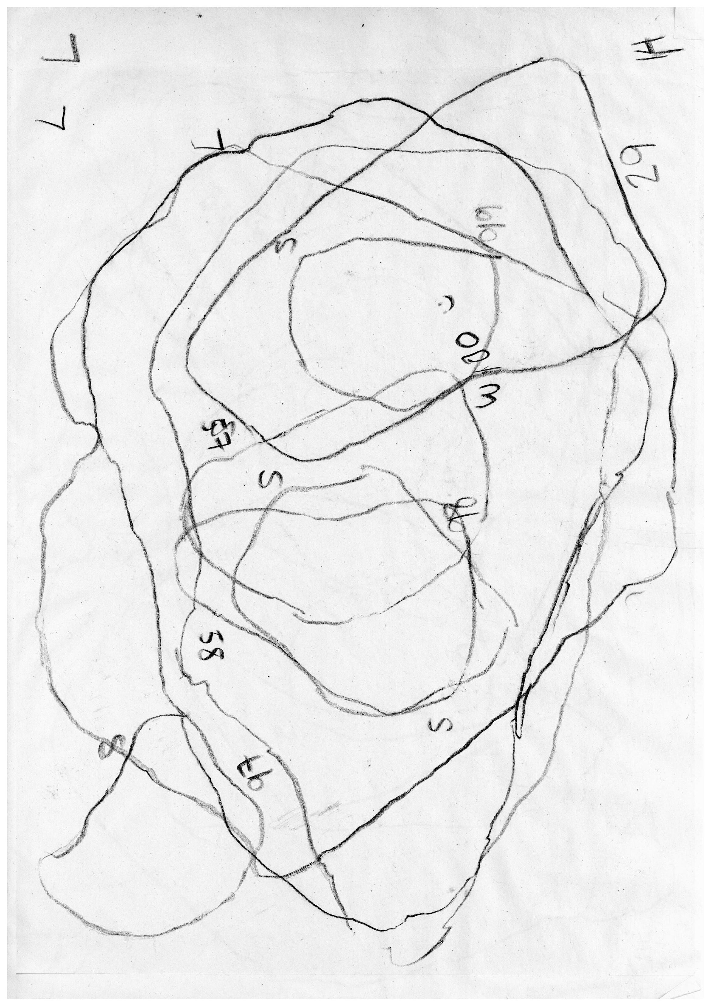
Construction time: 2.5 hours
Number of stones: 100
Total height: 1 m
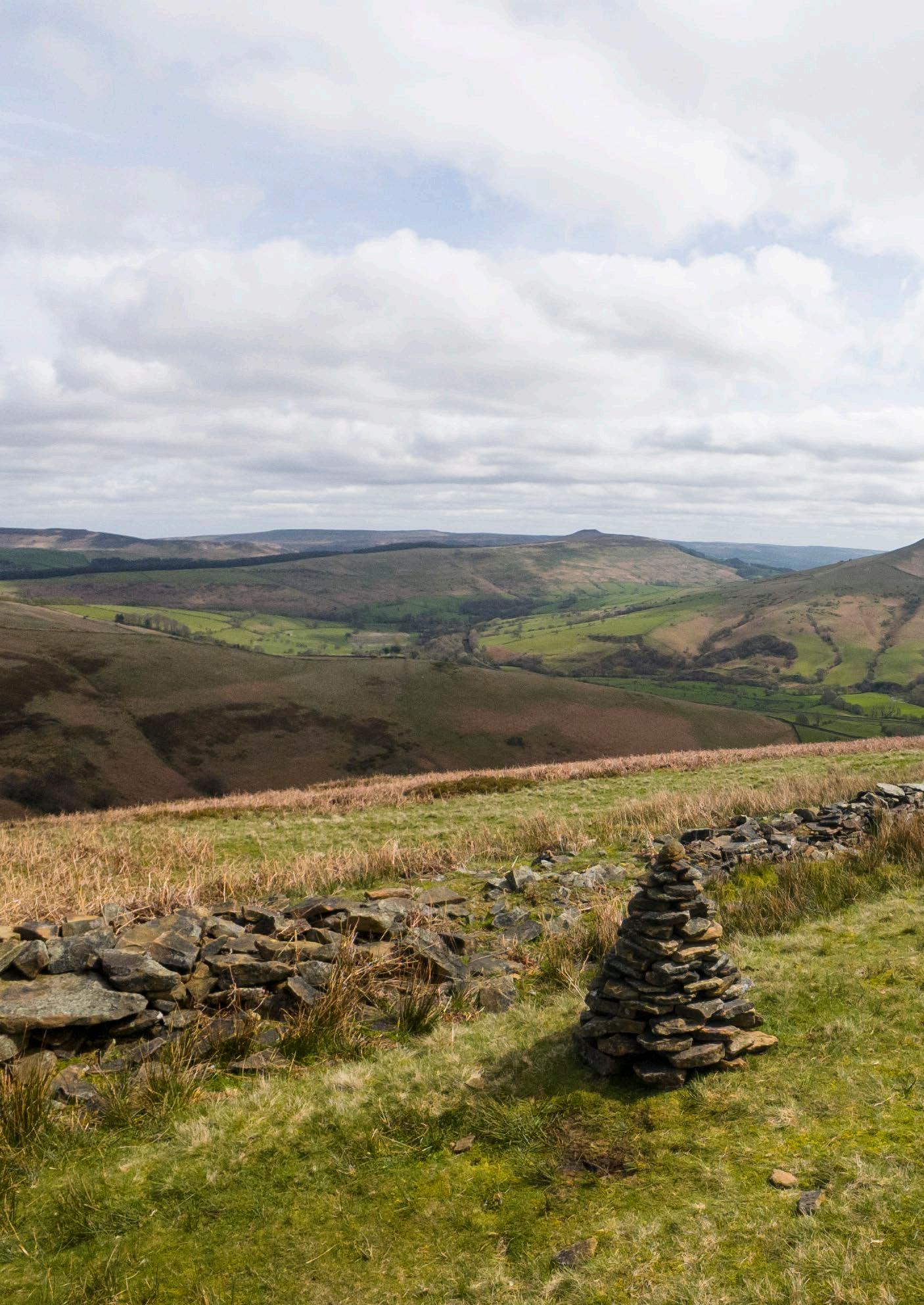
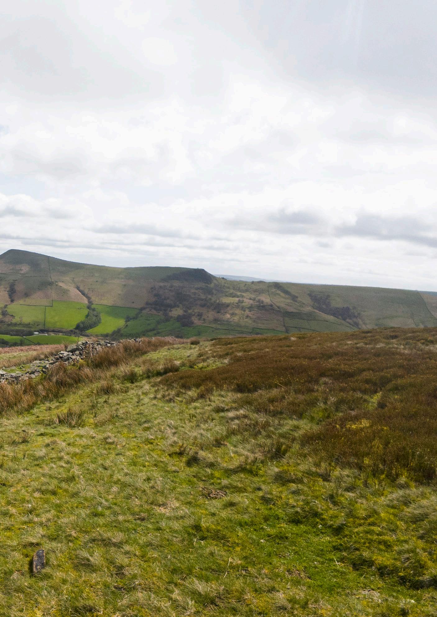
Constructing Drystone
This section examines traditional methods of building with drystone.
The longevity and stability of a drystone wall comes down to the skill with which it is crafted. Anyone can stack a pile of flat stones, but to build a sturdy drystone structure is a craft that takes years of practice. Given that the building material is not standardised, drystone construction is akin to assembling a jigsaw puzzle, of figuring out what piece fits best with another. The better the stones interlock and slope in the correct direction, the better the structural integrity will be. There are far fewer drystone ‘master builders’ than there were a few hundred years ago and some consider it a ‘dying trade,’ but the craft lives on. The Dry Stone Walling Association provides workshops, training, and information sessions, as well as a platform for drystone wallers looking for work. Most demand for work comes from repairing and maintaining existing walls, and most work is undertaken by a single waller. The average skilled waller can complete 1-3m per day. The most common types of drystone construction are double stone walls— outlined in this section—and retaining walls, but single stone walls are also possible.
01. Section
a. Foundation stones
b. Building stones
c. Throughstones
d. Copestones
02. Elevation
a. Wall-head
03. Plan showing throughstones
04. Timber batter frame
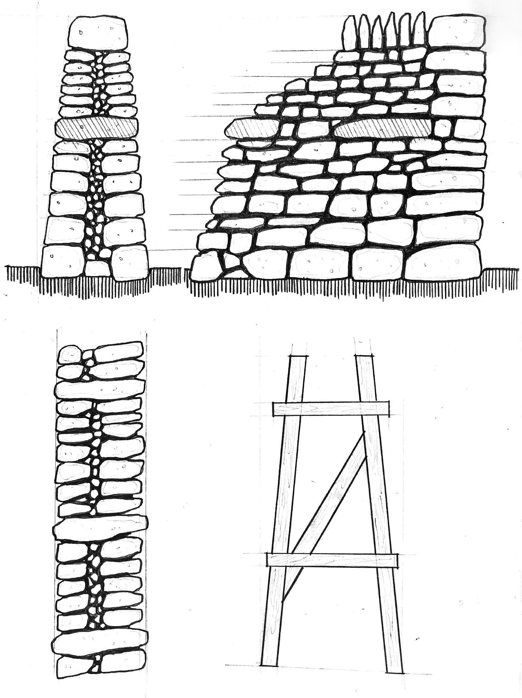
1143mm
01. Gather materials and prepare the ground
a. Sort stones into small, medium, and large pieces
b. Demarcate the region of work with chalk or string
c. Level and clear ground of debris
02. Lay the foundation
a. Use a shovel to dig a foundation trench of approximately 300mm (1 ft)
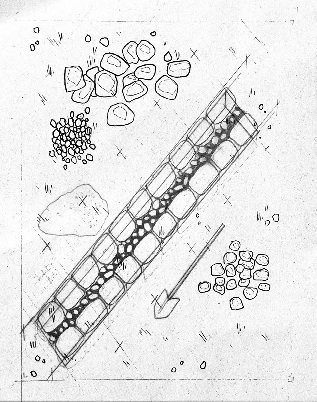
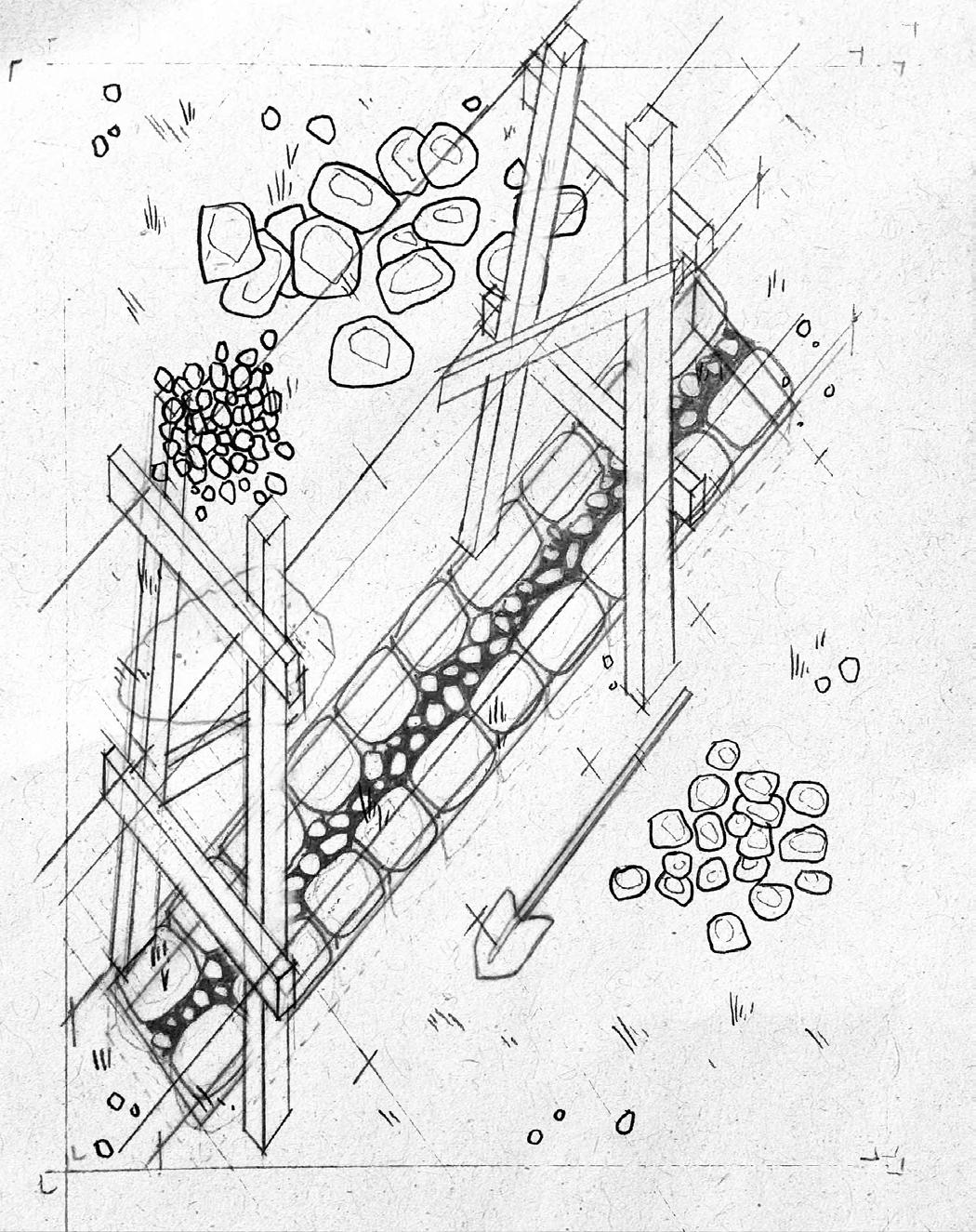
03. Lay foundation stones
a. Lay the largest stones to form the wall’s foundation
b. Place them in two rows with the flattest side down and fill in the gaps with smaller stones called ‘fill’ or ‘hearting’
04. Install a battering frame
a. Battering frames help guide the batter (incline) of the wall as it is built up
b. String is tied between the batter frames to guide construction
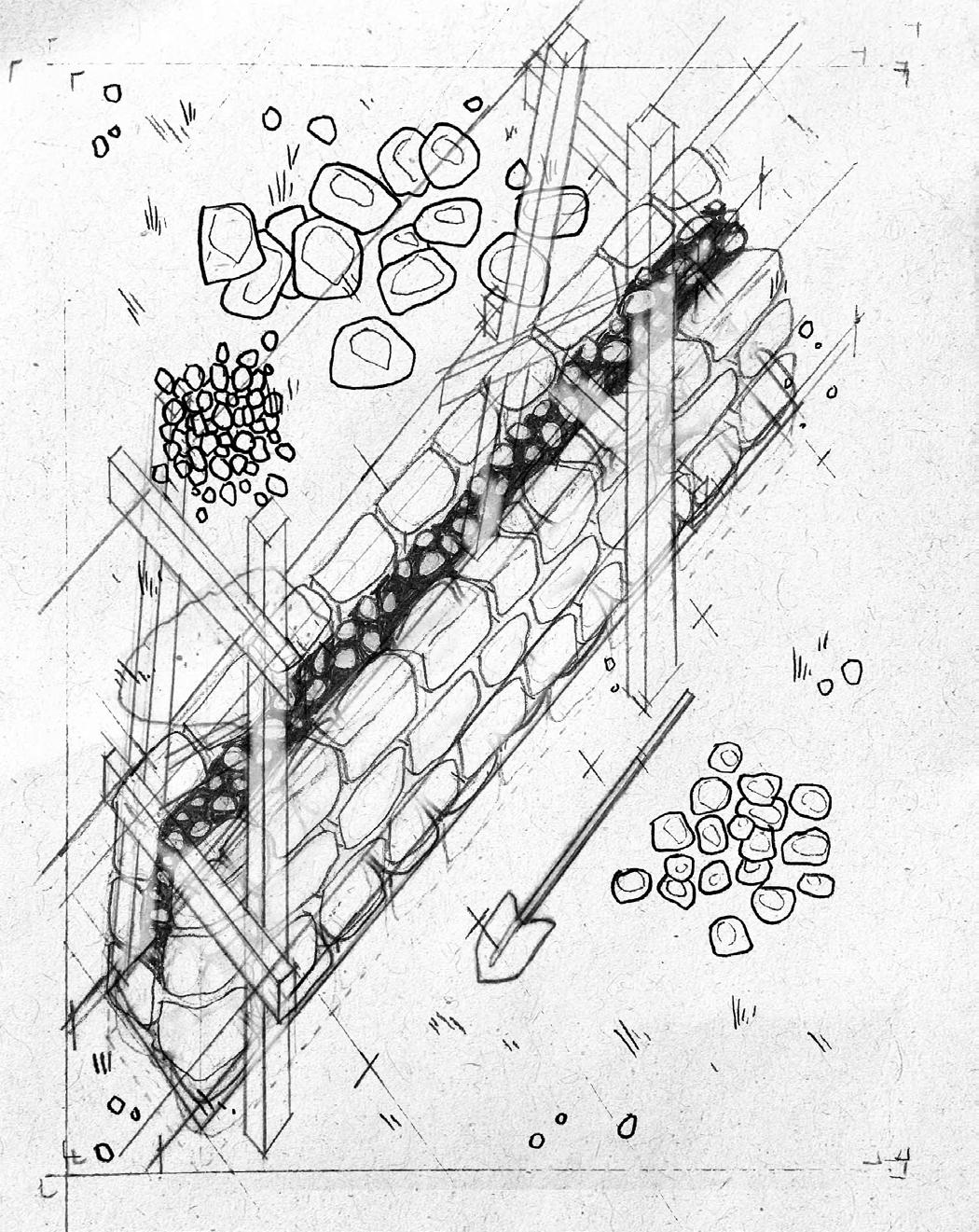
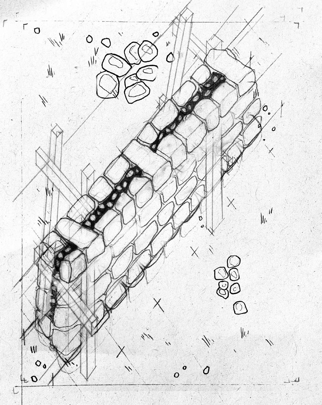
05. Build the first lift
a. Build up the two rows of stone and infill rocks, with each row taping in slightly
b. Ensure that each row is shifted in order to distribute weight, as is done in bricklaying (called ‘breaking’ or ‘covering’ joints)
c. Place flat or vertical ends pointing outward and keep stones lying flat or tilted slightly downward and away from the centre to avoid channeling rainwater into the wall
d. Shape stones using a hammer
06. Lay throughstones
a. Use large stones to cross the entire width of the wall: this ensures stability
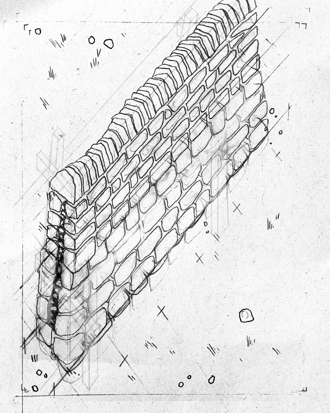
06. Build the second lift and coping
a. Continue to build up the wall using progressively smaller stones
b. Lay the last row, called coping, with narrower flat stones layed vertically; this weighs down the stones below and has aesthetic value
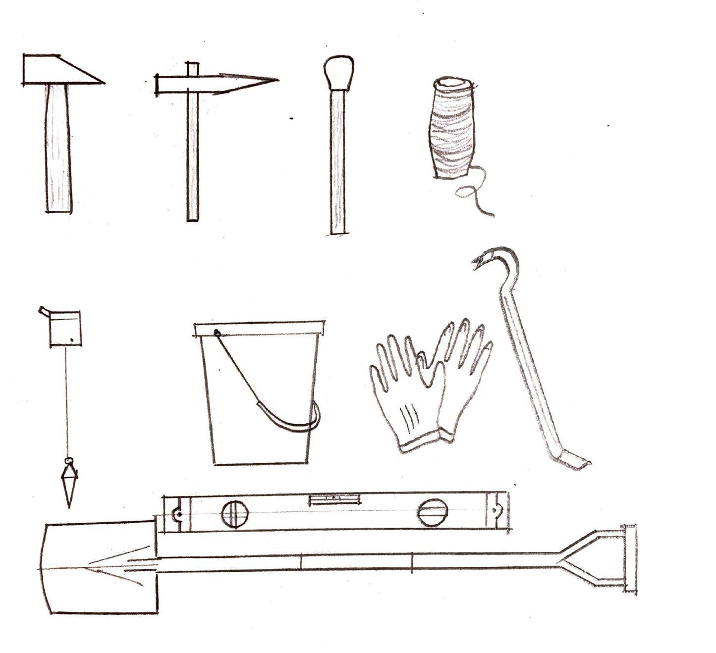
Drystone Tools
a, b. Chisels
c. Mallet
d. String
e. Plumb line
f. Bucket
g. Gloves
h. Crowbar
i. Spirit level
j. Spade
Design Scenario
The following drawings speculate on the construction, repair, and eventual crumbling of a drystone field station built over an existing grouse butt.
Design Strategy: Appropriating Grouse Butts
Grouse shooting butts are small circular or semi-circular drystone walls that dot the moorland landscape, marking regions designated for grouse shooting and owned by wealthy estates who manage these tracts of land. Built from the same stone upon which the structures rest, this typology uses drystone construction as a means of disguise, providing shooters shelter from the wary birds. They are often slightly sunken into the ground and topped with moss or turf.
Grouse butts are typically found in straight lines, each distanced by approximately 50m, though this varies. The project contests the grouse shooting industry as both an elitist sport rooted in colonial and patriarchal legacies and an ecologically destructive practice, where the moorland ecology is maintained to foster prime conditions for grouse hunting. In appropriating the grouse butt as a starting point for field stations, the project sabotages these essential shooting infrastructures and paves the way for ecological—and social—reparations to take place.
Below: Grouse moor slash-and-burn patch
Opposite right: Plan of a grouse butt
Opposite below: Grouse butt in the moorland landscape.
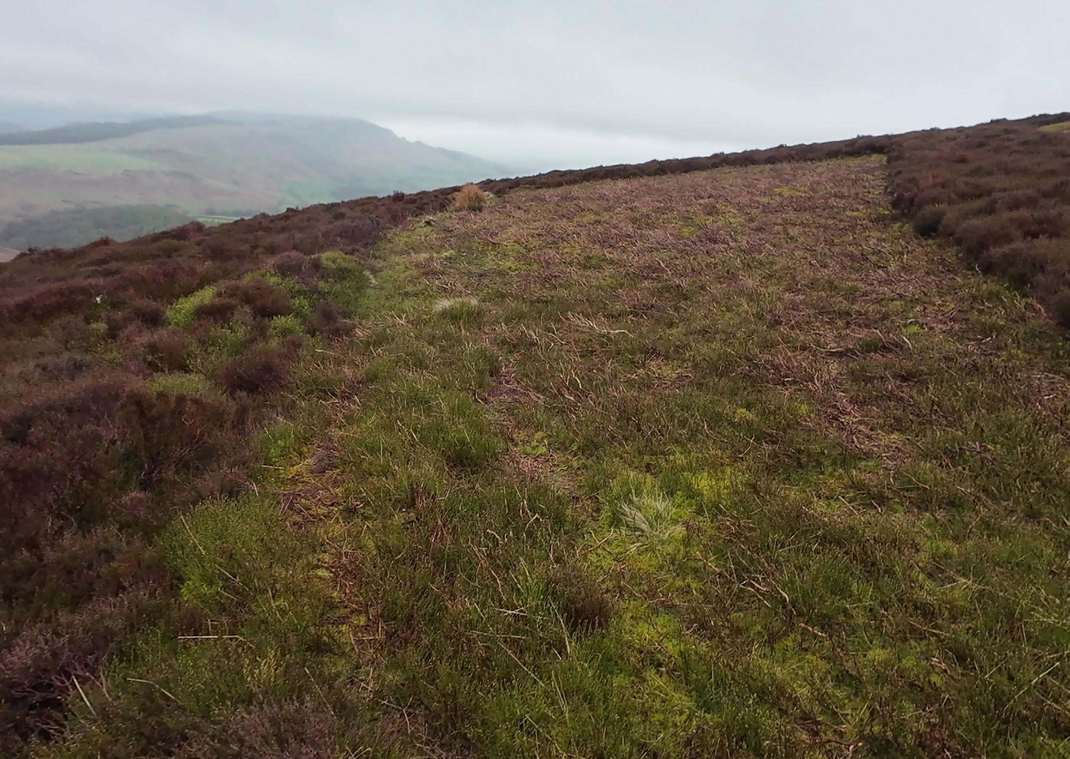

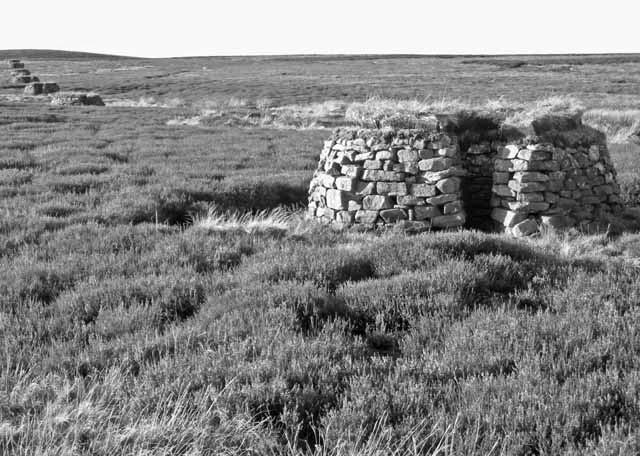
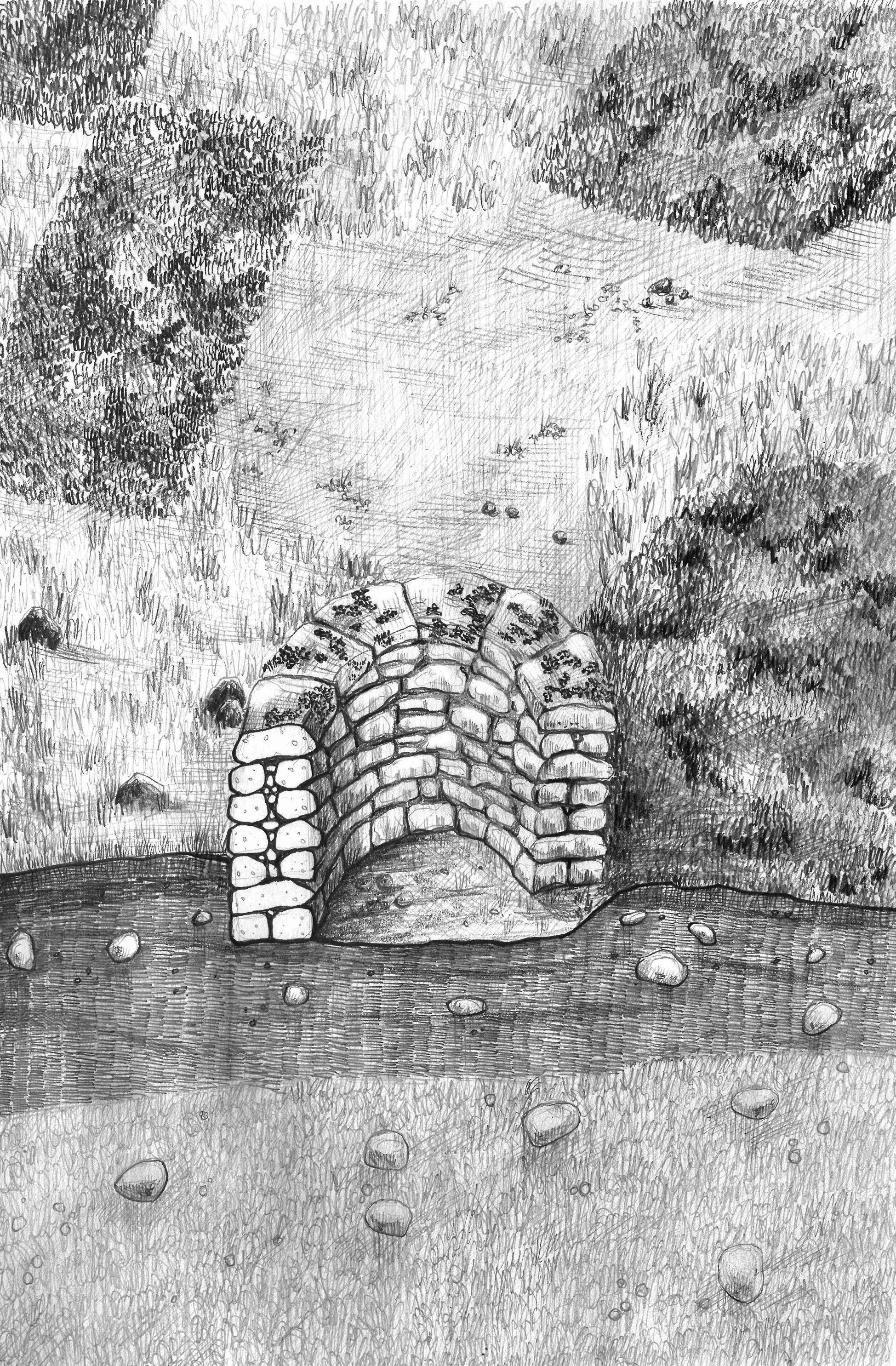
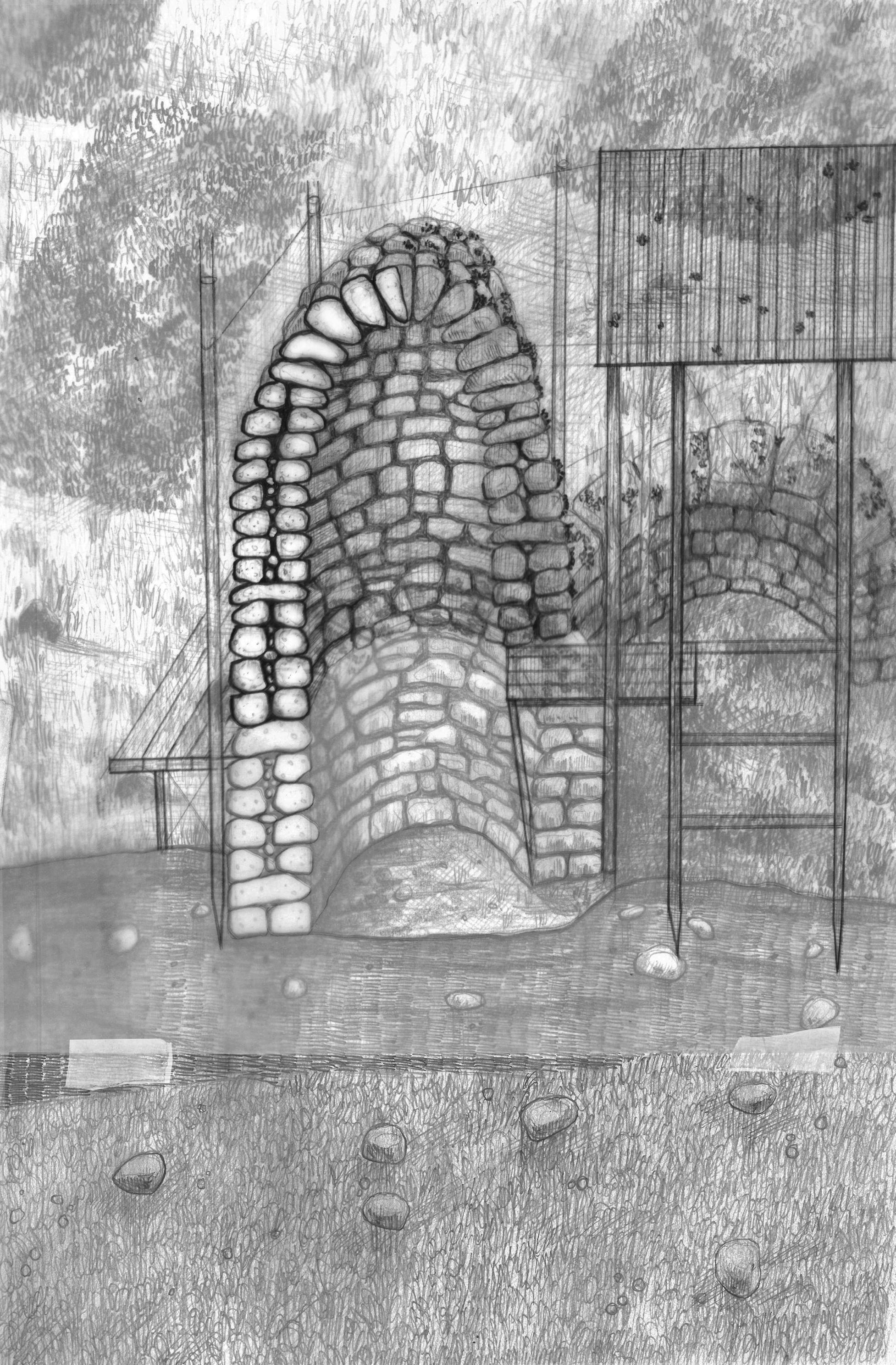
Stage 00
The site as it stands consists of a series of gritstone grouse shooting butts. Slightly sunken into the ground, the drystone blends into the surroundings, hiding the shooters as they aim.
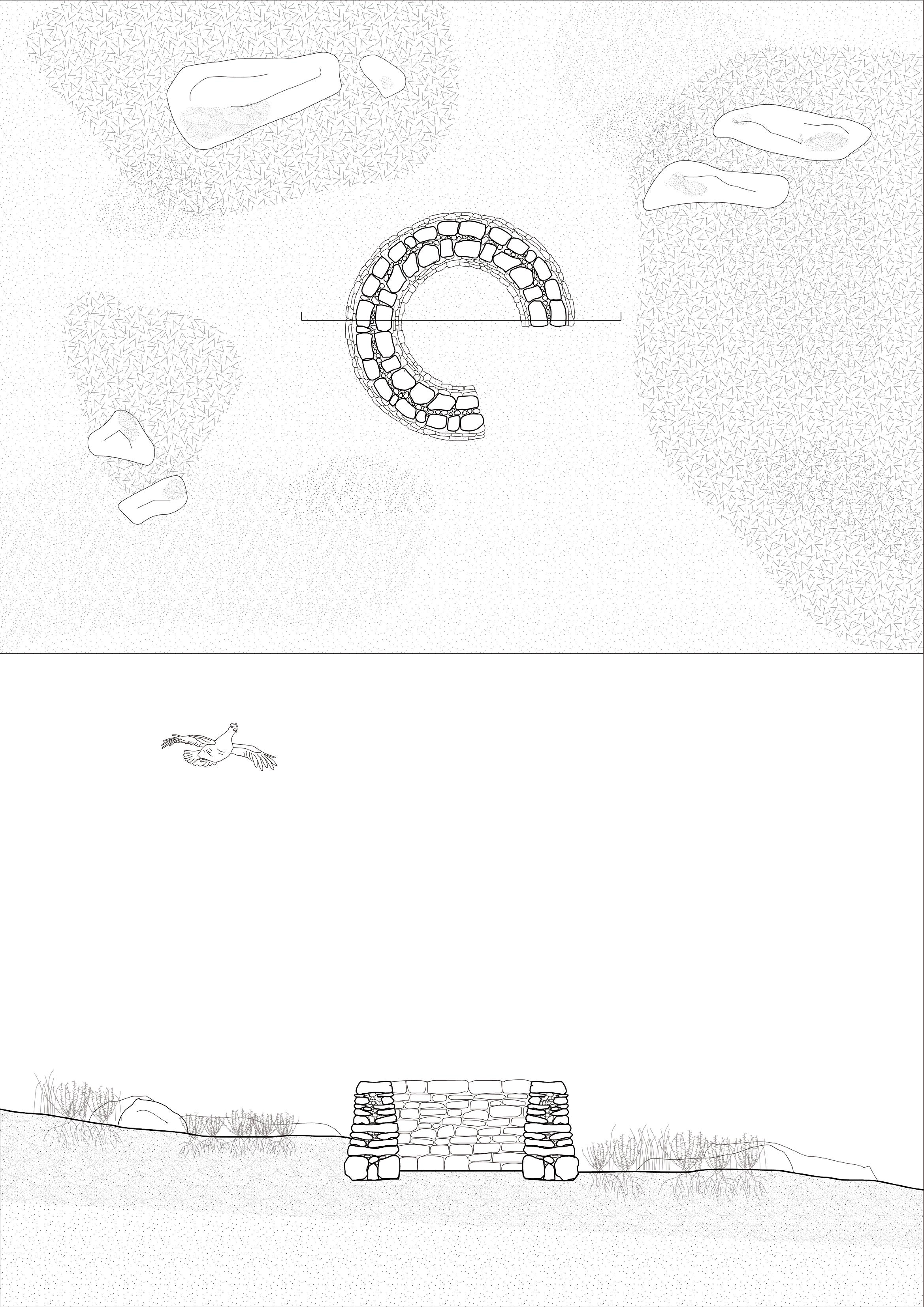
N 0 0.5m 1m 2m 4m
2.4m
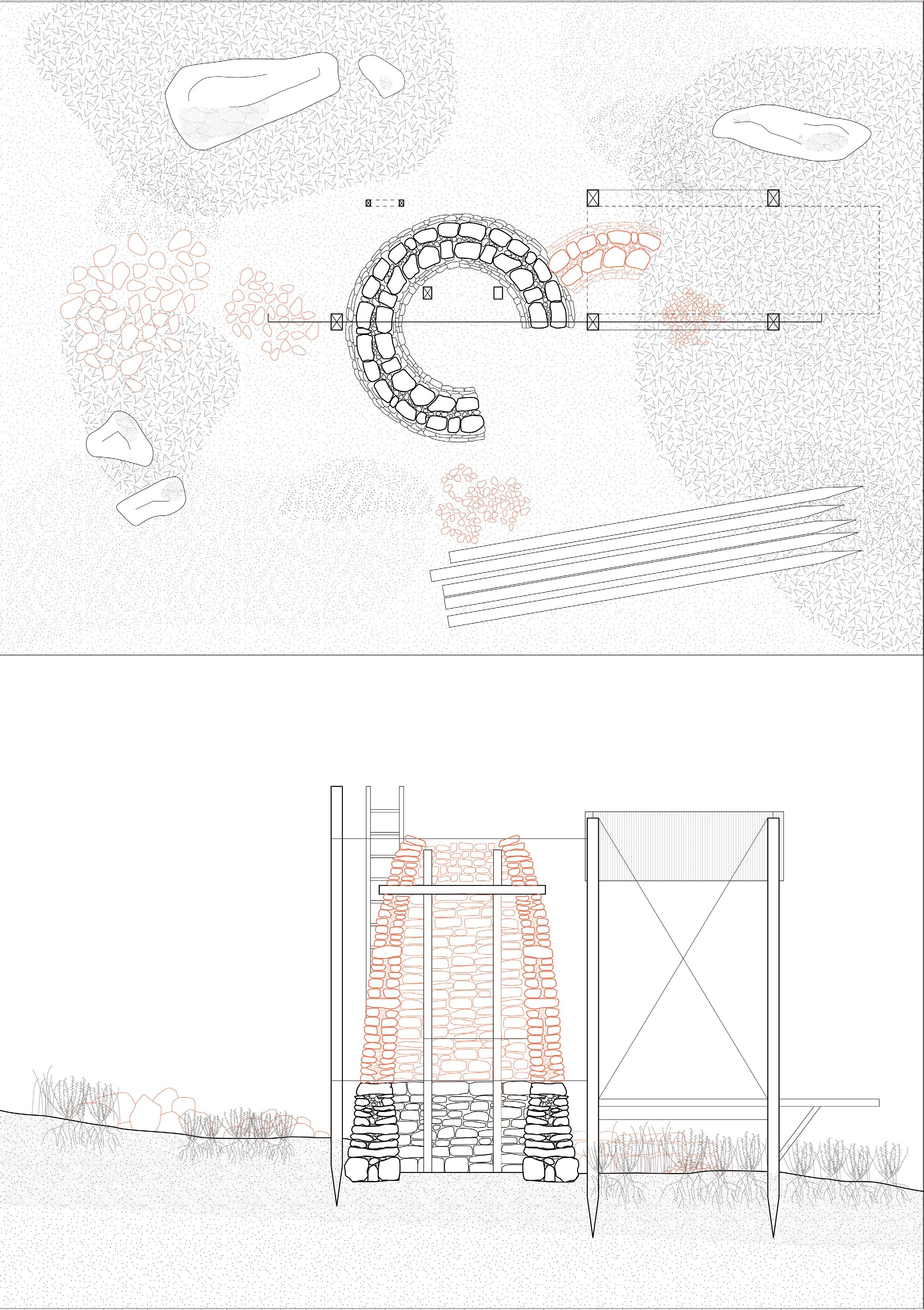
Stage 01
The first group of Transient Commoners arrive at the grouse butts at Crookestone Moor. Gathering and sorting stones, they begin to build up the structure into a hollow cairn, sabotaging its purpose as a guise for grouse hunters. This is the first step in building a field station, but at this stage, it remains but a temporary shelter from the wind and rain.
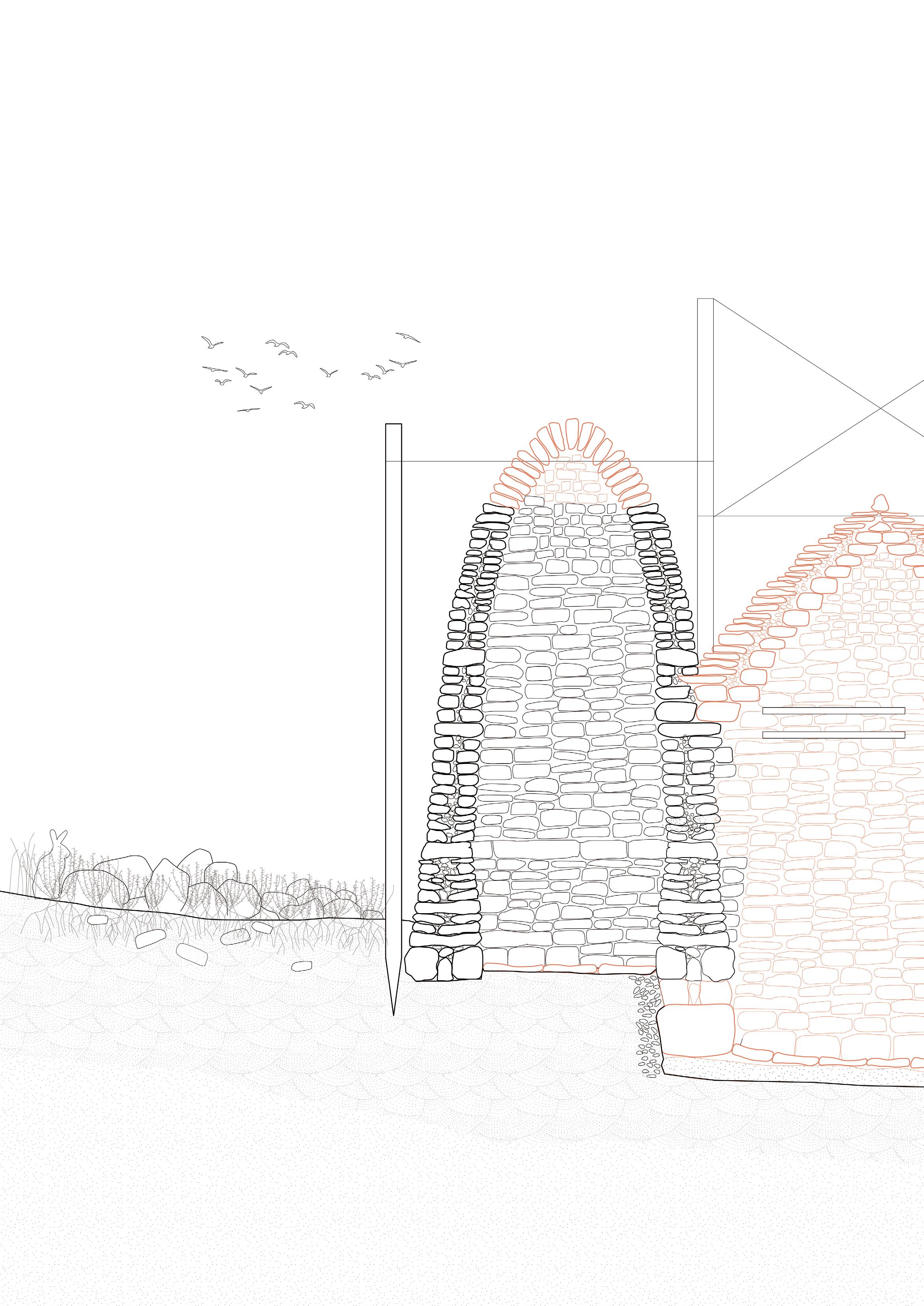
Stage 2
Over time, the field station expands and is built up by groups of transient commoners as they pass through and temporarily inhabit the moorland landscape. The walls are thickened to hold peat, adding insulation to protect those staying for multiple days or even weeks. The ground is dug out about half a metre to add additional shelter and ceiling height. Packed clay provides a solid surface, while flat stones are layed as paving. Small stones and pebbles under new load-bearing walls provide further structural support.
01. Pebble infill to support sunken ground level and step
02. Packed clay
03. Sunken ground and paving
04. Wooden shelves can be slotted into the drystone
05. Wooden table
06. Tulli-style double layer stone roof
07. Turf or heather layer
08. Packed clay layer to protect peat below
09. Blackhouse-style peat infill between double drystone walls
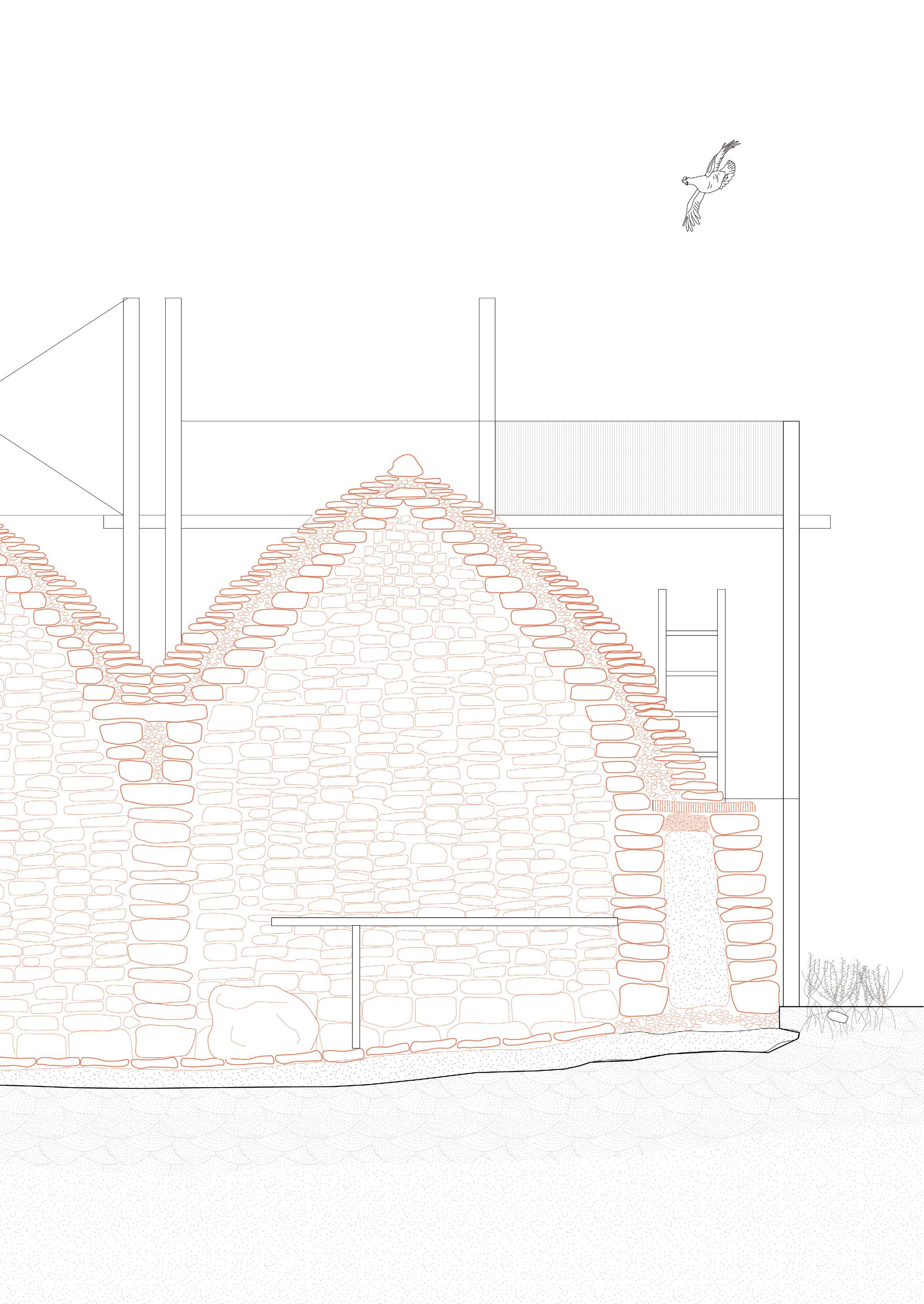
Years pass. The field station continues to grow and be reconfigured according to the transient commoner’s purposes. Surrounding the field station, sphagnum mosses spread over the ground and up the stone walls as the peatland is restored and re-wetted. More field stations appear in the surrounding landscape, creating commoning axes and wayfinding nodes that guide walkers in the landscape.
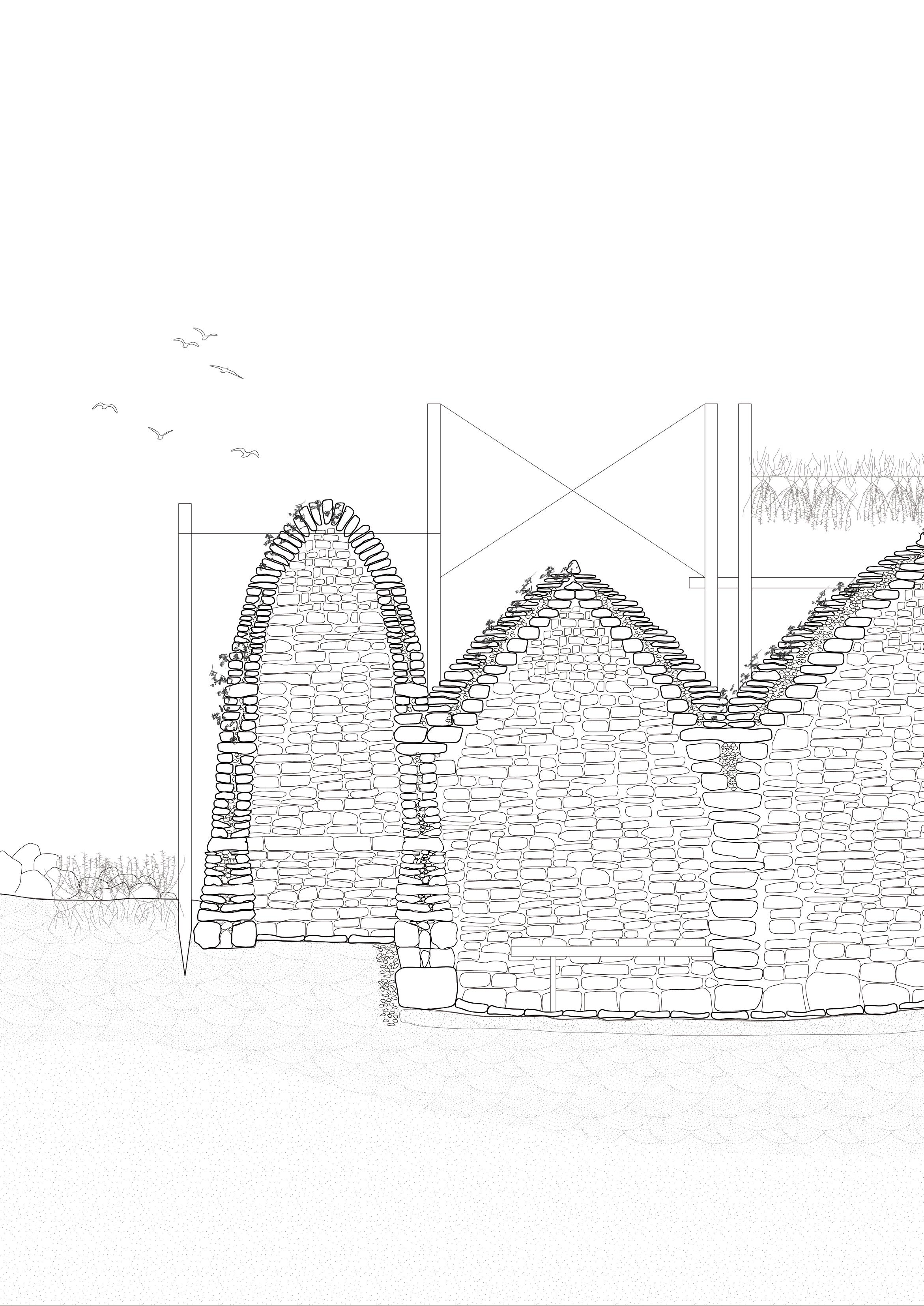
01. Moss growing over the rocks
02. Heather drying to be used for thatching and bedding material
03. Sheep occasionally take shelter in the field stations
04. Loft bed built into the new section of the field station
0 0.5m 1m 2m 4m
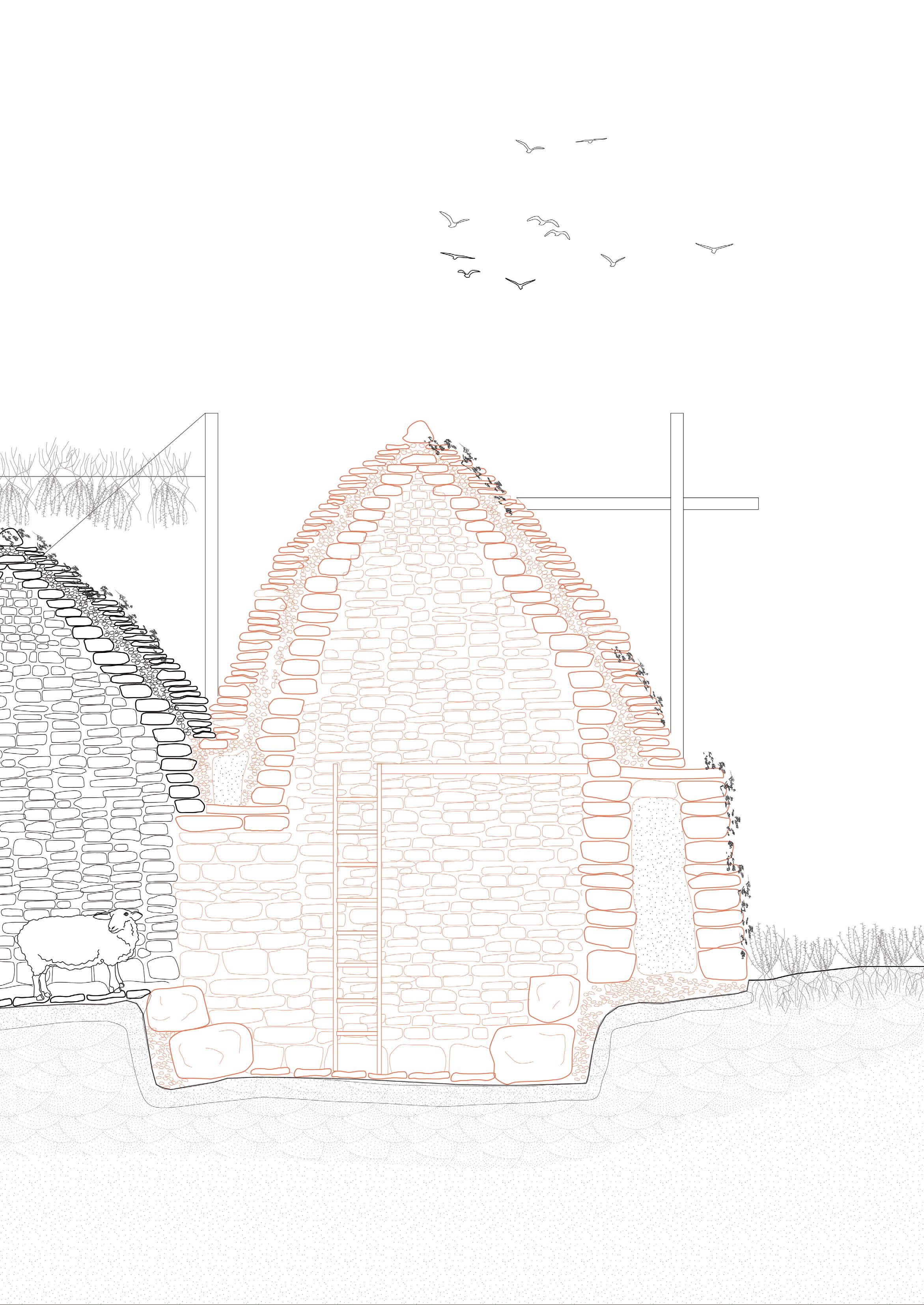
The drystone walls begin to break in places as the field stations become sites of maintenance and repair. The timber scaffold structure shifts around the stones to accommodate its changing form and to allow for access to regions in need of repair. Parts of the roofs are replaced with timber and heather thatch, allowing for a better insulated space below. The thatch is tied together with heather rope and weighed down with stones as in the blackhouse tradition.
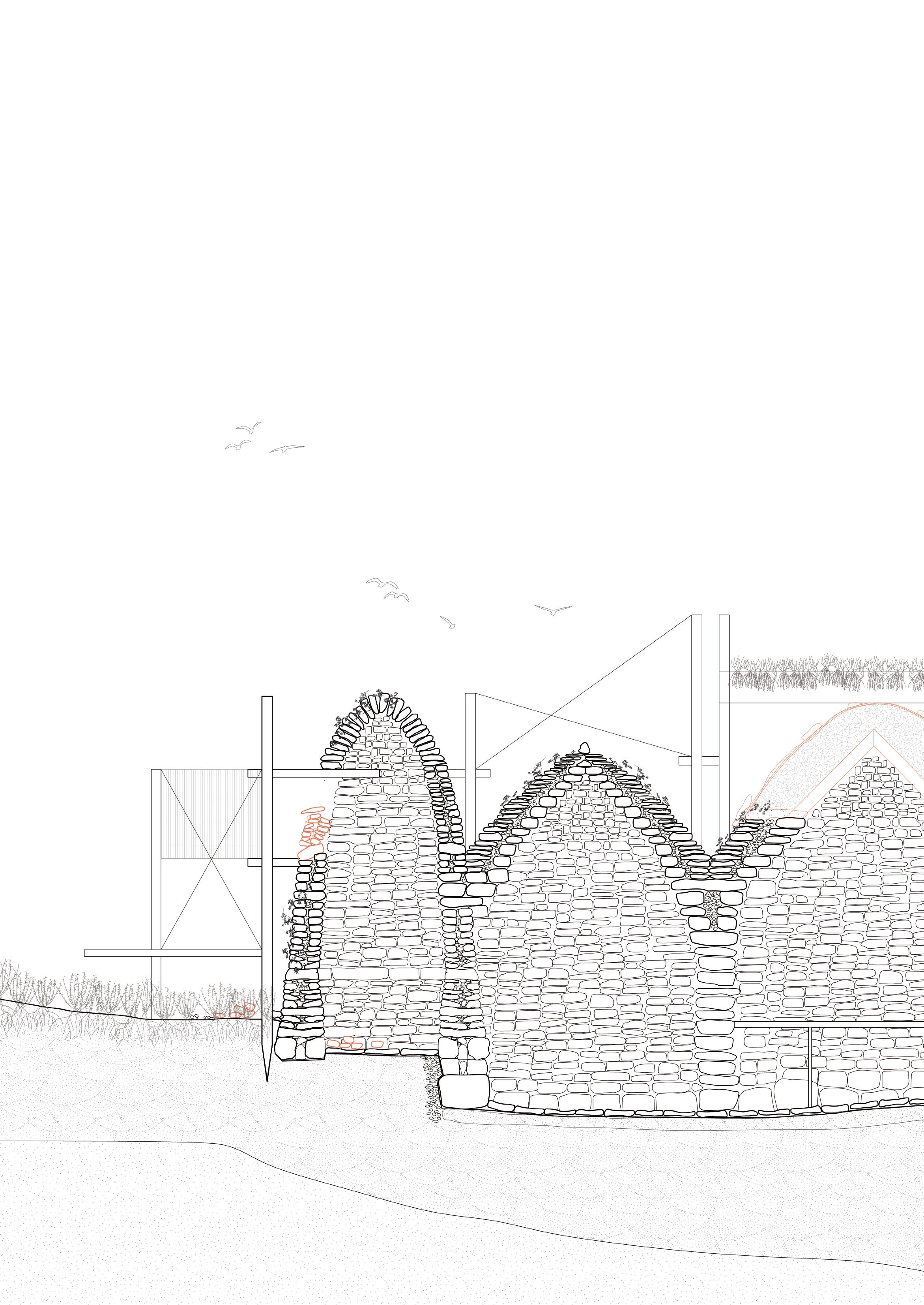
01. Part of the cairn wall in need of repair
02. Heather thatch and timber roof place over drystone walls
03. New entrance with clay and thatch covering
04. As the land is remediated, peat soils and enriched and deepen
0 0.5m 1m 2m 4m
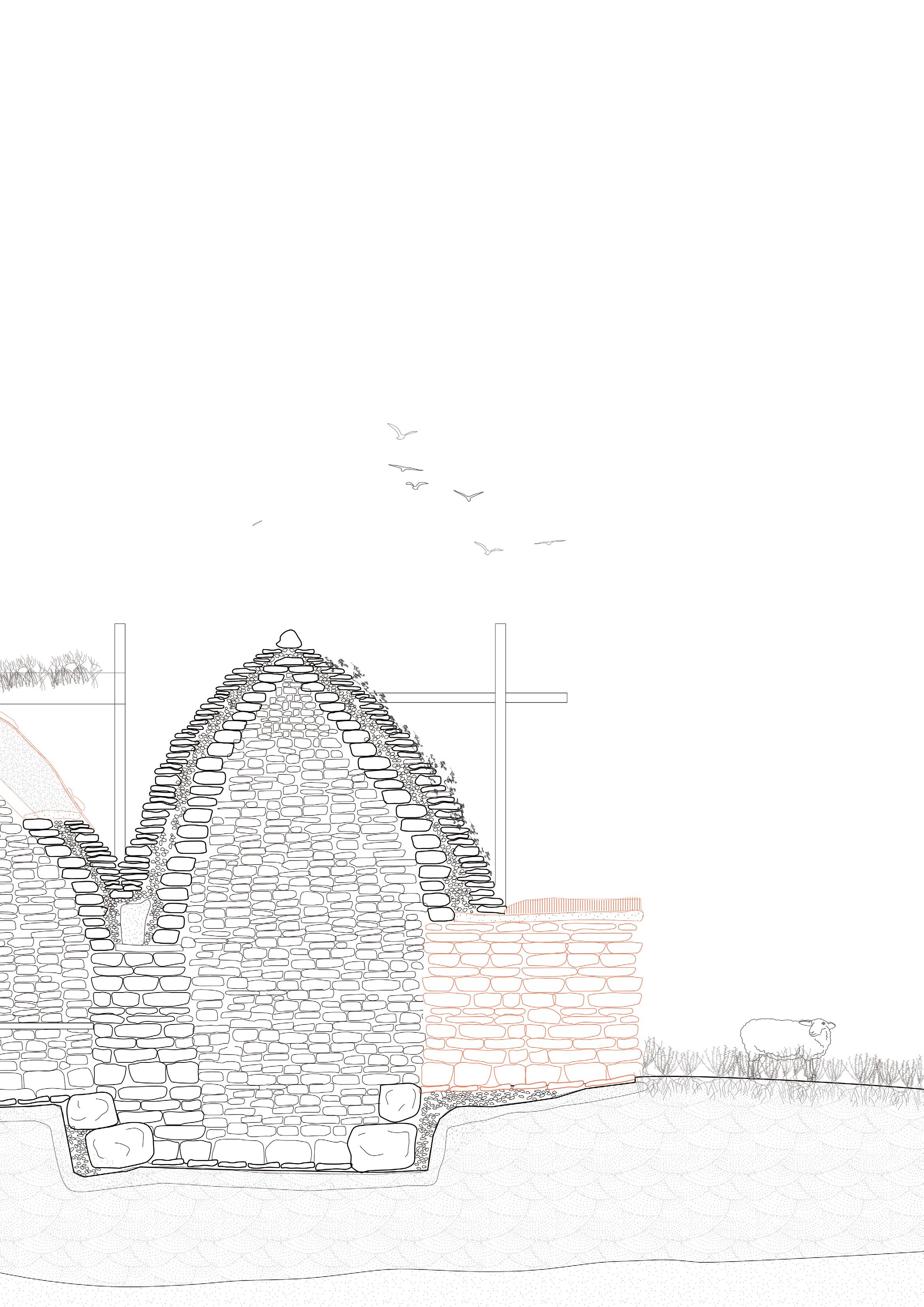
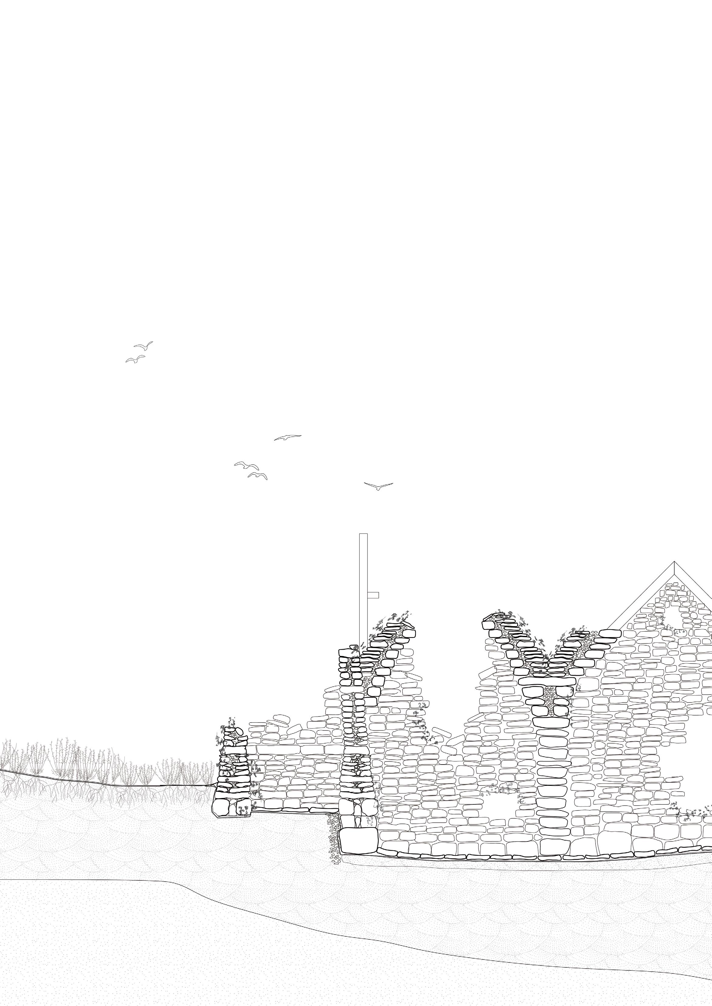
This particular field station has stopped being used in the moorland commons, falling into ruin. As the rocks begin to fall to the earth, they return to the geology from which they were initially excavated. Moss continues to cover their surfaces, and insect, birds, and small mammals inhabit the nooks and crevices between rocks.
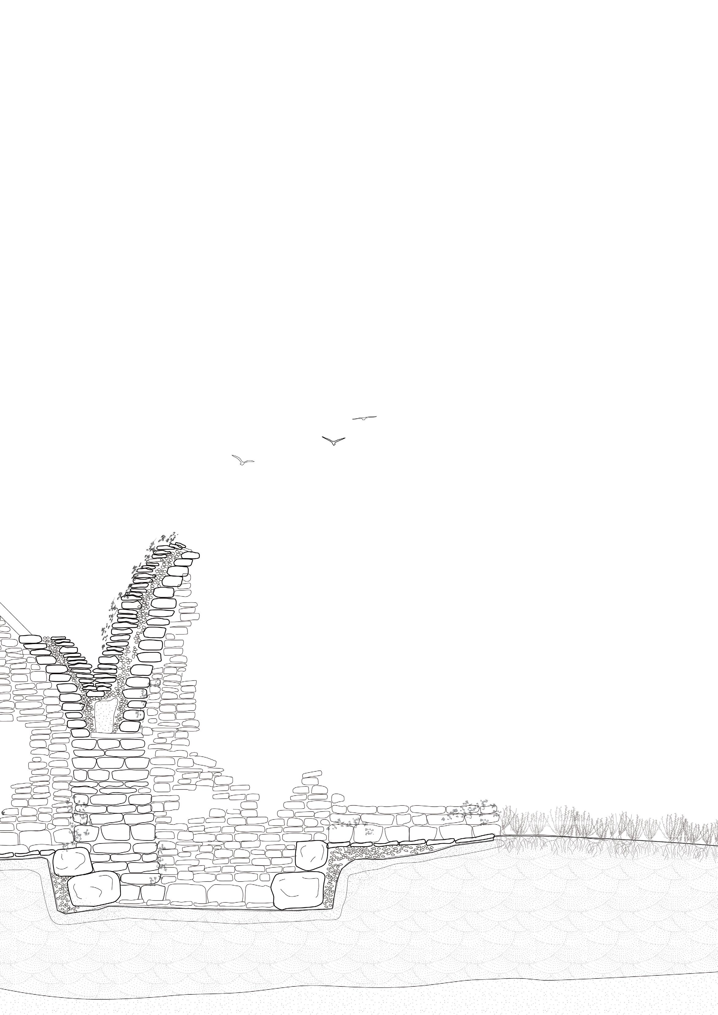
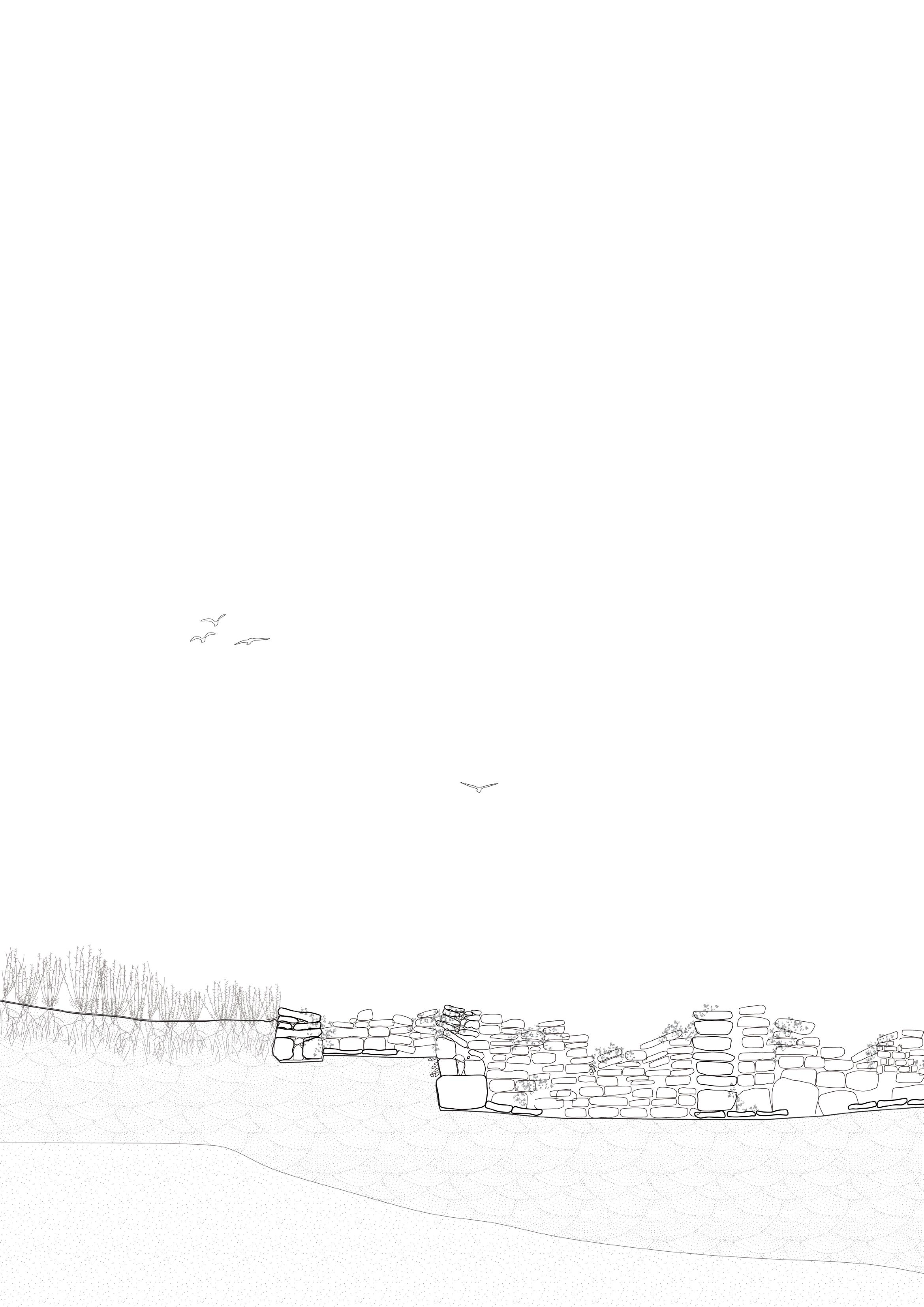
Stage 06
At this stage, most of the field station stones have fallen and returned to soil, providing habitats for insects. Covered in mosses and lichens, they gradually become indistinguishable from the rest of the moorland landscape. Future archaeologists ask, was a field station ever really here?
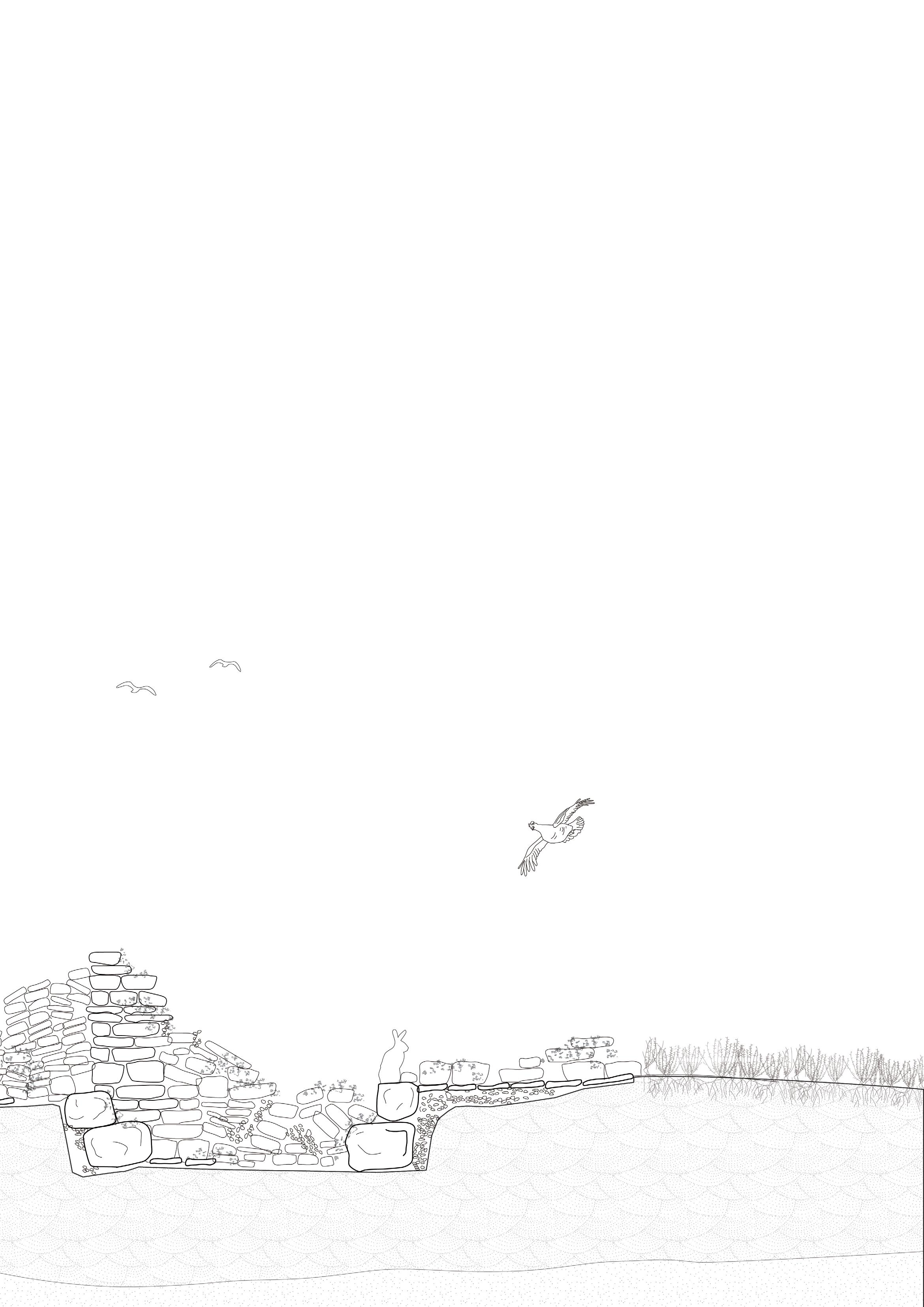
A collective design and construction process.
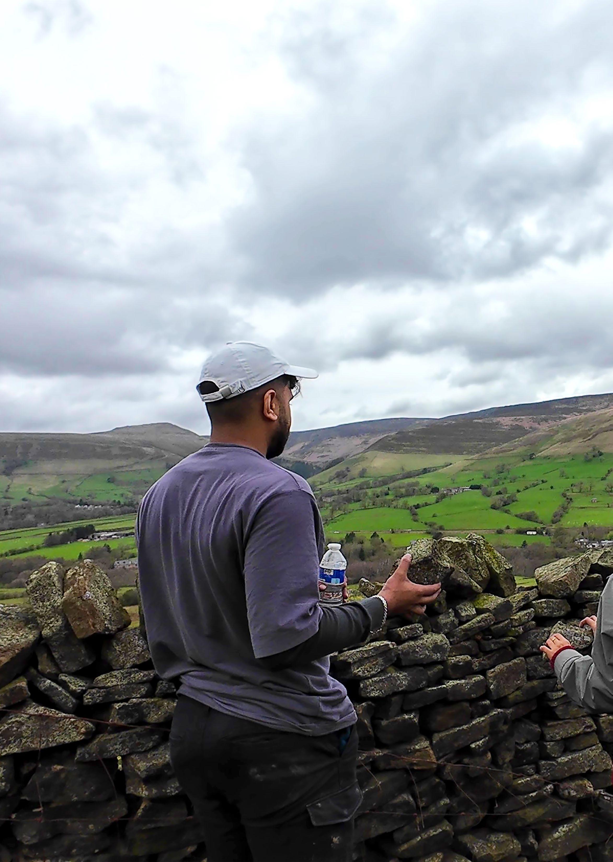
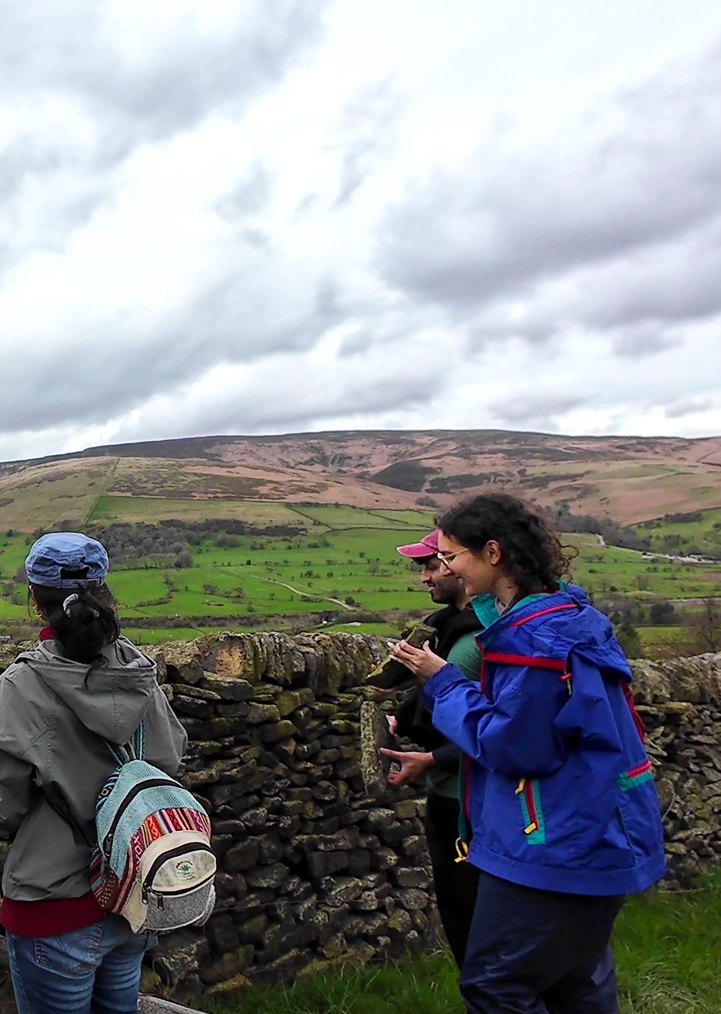
Quantifying Effort: The Labour of Drystone Construction
Assumptions:
Lifting capacity range of an able-bodied adult*: 13kg - 90kg
Lifting capacity range of an able-bodied child*: 0.1kg - 10kg
Length of time building before needing rest: 15 min - 60 min
Other considerations affecting ability to work: Mental fatigue, wind, cold, stress, daylighting
Small stone (up to 0.15m length) weight range: 0.1kg - 0.8kg
Medium stone (0.15-0.25m length) weight range: 0.8kg - 3kg
Large stone (0.25-0.4m length) weight range: 3kg - 10kg
Extra large stone (0.4-0.8m length) weight range: 10kg - 30kg
Time to lay stones on average for an experienced builder (imagining all stones are at-hand)
Small stones: 1 stone per 10-20 seconds
Medium stones: 1 stone per 15-60 seconds
Large stone: 1 stone per 30-180 seconds
Extra large stone: 1 stone per 60-300 seconds
Time to lay stones on average for a new builder (imagining all stones are at-hand)
Small stones: 1 stone per 20-60 seconds
Medium stones: 1 stone per 20-80 seconds
Large stone: 1 stone per 40-300 seconds
Extra large stone: 1 stone per 60-420 seconds
Other considerations affecting building time: Drystone is mental work almost as much as physical, almost like doing a puzzle; it takes different people different amounts of time to work out how to select and lay different stones. More experienced builders will be able to do this more quickly.
*The project recognises that each person involved will have varied capacities and abilities. There is no ‘standard’ body or amount of weight one person can carry; therefore, to calculate the amount of labour involved in a hypothetical drystone structure is impossible. These calculations and speculations are an attempt at understanding one possible outcome and range of requirements that the design for a field station might require.
Approximate number of stones in a 1m x 1m x 0,5m double drystone wall:
Foundation or extra large stones (est. 0.4m length, 0.3m height): 1 course double wall = 5 stones; total height 0.3m
Large stones (est. 0.25m length, 0.15m height): 3 course double wall = 8 stones; total height = 0.45m
Medium stones (est. 0.1m length, 0.1m height): 3 course double wall = 20 stones; total height 0.3m
Small stones for infill (est. 0.05m length, 0.05m height): 40 stones per 1m course; 800 stones to fill 1m height; divide in half due to space between infill rocks = 400 infill stones
Total stones to build a 1m x 1m segment of drystone wall = approximately 33 stones plus 400 infill stones
Design Scenario: Stage 1
In this stage, 2 groups of transient commoners take part in building onto the field station. They build two additional “rooms”, or domed extensions to the initial inhabitable cairn structure.
Group 1
Days spent: 14
Number of people invovled: 10
Number of people building drystone: 8
Number of stones able to be laid:
Assuming all builders can lift up to 10kg per 10 mins and work up to 6 hours per day; so 360kg of stone can be lifted per person per day and 2,880kg can be lifted by 8 people per day. Over 14 days, this is 40,320kg. This translates to:
Large: 4,032-13,440 rocks; or Medium: 13,440-50,400 rocks; or Small: 50,400-403,200 rocks
Group 2
Days spent: 20
Number of people invovled: 15
Number of people building drystone: 12
Number of stones able to be laid:
Assuming all builders can lift up to 10kg per 10 mins and work
up to 6 hours per day; so 360kg of stone can be lifted per day and 4,320kg can be lifted by 12 people per day. Over 20 days, this is 86,400kg.
This translates to:
Large: 8,640-28,800 rocks; or Medium: 28,800-108,000 rocks; or Small: 108,000-864,000 rocks
Totals
Total weight lifted: 126,720kg
Total number of builders involved: 20
Total number of working hours spent: 672 (group 1) + 1440 (group 2) = 2,112 hours
Max. total large or medium stones for stage 1: 42,240; or Max. total small stones for stage 1: 1,267,200
Dividing this according to the 33 large:400 infill ratio, we get:
Total large and medium stones: 3484
Total small stones: 1,394,020
If a 1m 2 wall segment takes 33 stones plust 400 infill stones, then 3483 plus 1,394,020 infill stones can build 105 m 2 of drystone wall
Collectivising Drystone Construction
Apart from training sessions and workshops, drystone construction is typically a solo undertaking. With the project’s ambition of commoning the moorland, it reimagines drystone as a collective practice, a shift that comes with its own benefits and drawbacks.
The early field stations rely heavily on knowledge passed from single ‘master builders’ who teach and advice on their construction. Over time, knowledge of drystone construction is passed on, dispersed and taught widely amongst the transient commoners. This changes the narrative from the single knowledge-keeper to collective learning and teaching: a form of epistemic commoning.
Any collective project comes with frictions. Navigating these frictions requires good communication skills and a willingness to help and support one another in the process. Additionally, not all transient commoners have the ability or desire to participate in the field station construction. The following spread speculates on a variety of roles different people could take on given a diverse range of ages, skills, and abilities.
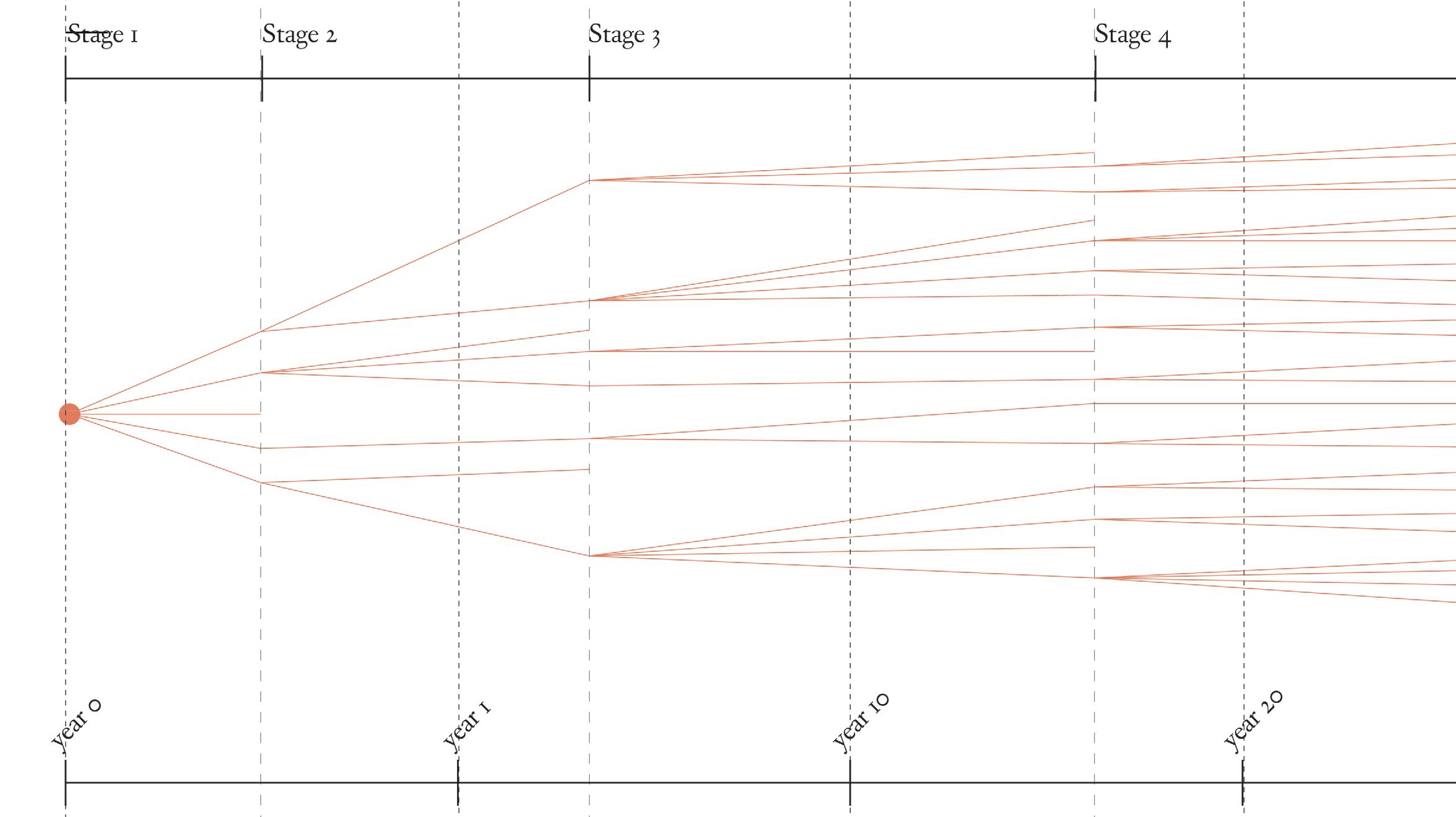
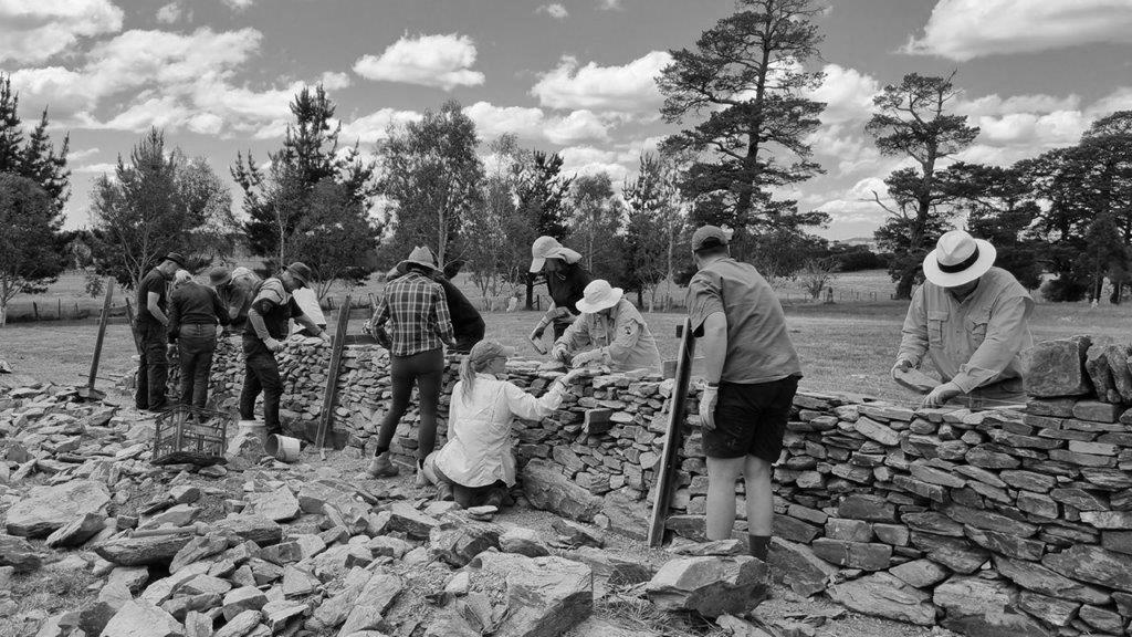
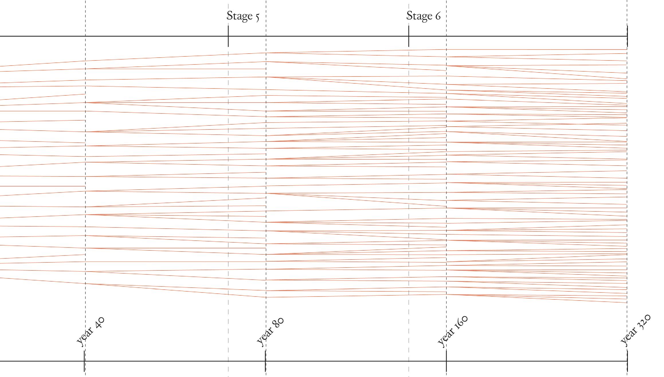
Drystone as a collective effort
Construction Roles
Collectivising the construction process comes with its own benefits and drawbacks. On the whole, the process can proceed more quickly with more hands on deck. It is important to recognise that people with different abilities can take on various roles. Not everyone is able to lift rocks, but when drystone is a collective effort, taking care of each other becomes just as essential as the construction process itself.
The project speculates that different people take on different roles on an as-need basis, with tasks emerging depending on the group of transient commoners. Commoning entails the sharing of knowledge and skills, but it is a fluid process, not a prescriptive one. The following diagrams illustrate possible roles that could be taken on throughout the construction process.
Craftsperson: Knowledge keeper and teacher
The craftsperson maintains the master-builder tradition by carrying in-depth and specific knowledge of drystone construction based on years of practice. These knowledge-keepers play an important role in teaching transient commoners tricks of the trade. Currently, drystone is a craft that very few people are trained in; over time, this knowledge is ‘commoned,’ with more and more people holding at least a basic level of knowledge.
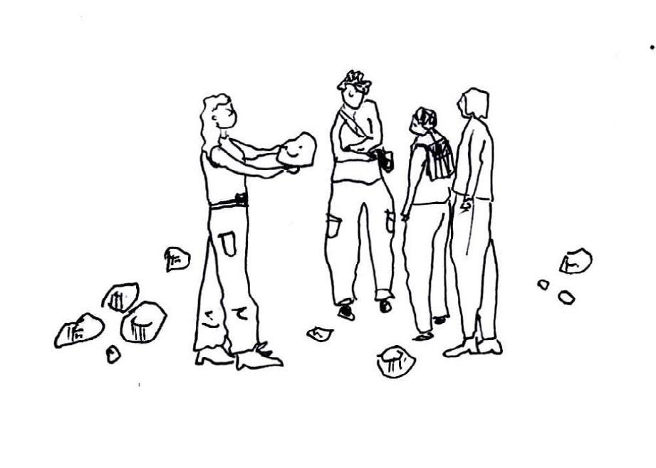
Drystone Builders
The builders are those responsible for the actual construction of the field station. Given the amount of labour required, anyone able to lift and lay stones should take part in this role in shifts, giving everyone plenty of time to rest and recover. The builders are attuned to how each rock shape responds to the other rocks and to gravity. Sometimes they need to reconfigure the stones they have laid several times to find the right fit. Drystone construction is like a jigsaw puzzle: it is mental as well as physical work.
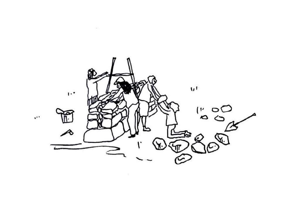
Carers, food preppers, support providers
These support workers may not be able to participate in the actual construction, but they are invaluable to the group. From preparing food and hot drinks to simply having conversations and encouraging everyone to take plenty of breaks, these commoners provide the group with the endurance needed to continue the construction process.
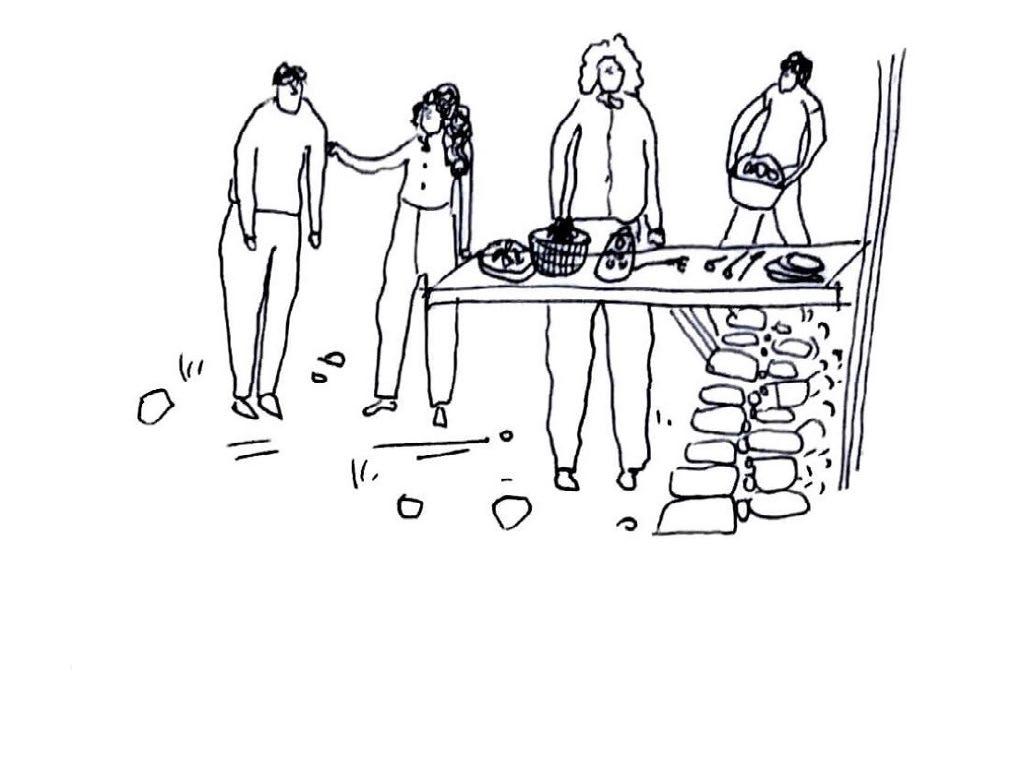
Site finders and ground preppers
Where should field stations be built? The site-finders are highly landscape literate, looking out for old stone walls and sites with many loose small rocks that could be repurposed into new structures. They are attuned to the land and its ecologies, recognising where reparative practices are needed. Working carefully, they prepare the ground for construction to begin, making sure not to disturb other-than-human life in the process.
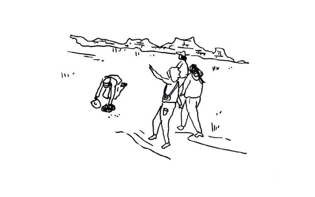
Safety and first aid
Drystone construction can be hazardous: lifting heavy rocks can cause injuries if not done in a safe manner. The commoners responsible for safety are well-versed in the dangers of drystone, keeping an alert eye out for those lifting, carrying, and laying rocks. They give safety briefings as-needed and provide advice to those new to the craft. They carry first aid equipment in case injuries do occur.
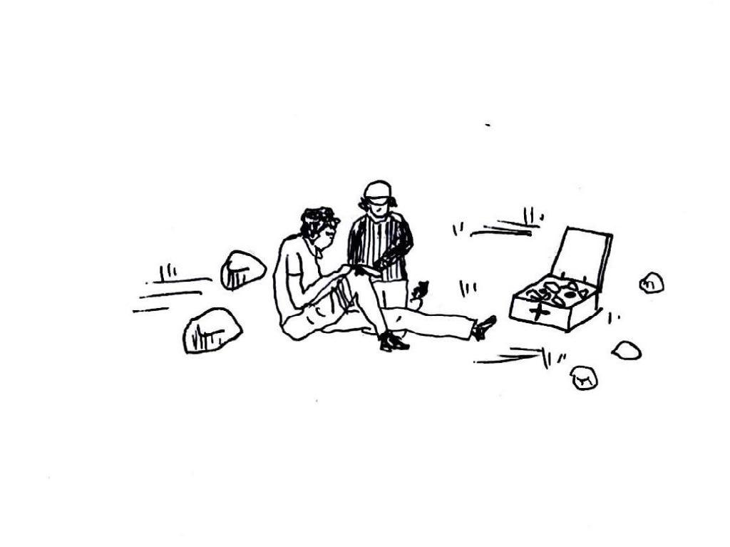
Stone gatherers and sorters
The people tasked with these roles take charge of gathering the materials for construction. Though most rocks will be taken from existing broken stone walls, some rocks might be found elsewhere, or even excavated from below the ground’s surface. They sort the rocks into different sizes, making sure there is a sufficient quantity of each type. They co-ordinate with those laying the stones to look for specific stone shapes and sizes.
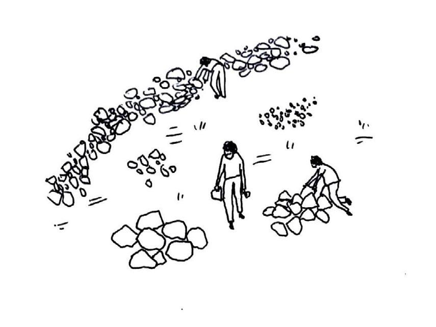
Recording and storytelling
This role is something everyone takes part in to an extent: by participating in commoning the moorlands, each person takes part in rituals and stories held within the landscape. By recording—in any manner of way—the drystone construction process, other commoners passing through might learn from previous groups, and have a sense of the transformation taking place in the landscape.
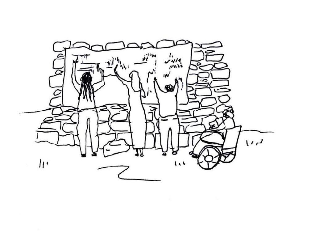
Drystone Repair and Maintenance as a Commoning Practice
Drystone as a material assembly is one of the easiest to repair, given that it is held together by nothing other than gravity. Most drystone wallers currently employed work to repair broken walls rather than build new ones.
The project proposes that the repair and maintenance of drystone—as a form of caretaking and stewardship of the wider landscape—be integral to the design and construction of the buildings, where repair is in-built, anticipating future reconfigurations. As transient commoners pass through the field stations, they take part in maintaining them, replacing fallen stones, shifting stones, and adding or removing stones. Repair is seen as part of the wider ethos of the project, where it is a form of care.
What are some common causes of drystone breaking?
- Large animals rubbing against stones can cause them to dislodge
- Deliberate destruction, for example in expanding a field or passers-by taking stones away
- Small trees or vegetation growing through and dislodging stones
- Bad water drainage leading to foundation collapse
Design for Repair Strategy
The primary design element that supports the repair and maintenance of the field stations is the timber scaffold structure that surrounds it. The scaffold, inspired by the batter frame used in drystone wall construction, can support builders working at heights, protect and store tools, provide a workspace and temporary shelter for the transient commoners, and temporarily support segments of drystone in their construction.
Repair is also a mentality toward the construction process: of viewing it not as the creation of a final product, but as an iterative and creative process. Drystone has the potential for endless reconfiguration; it is infinitely recyclable. Its mortarless assembly allows for the easy reshuffling of stones, although special care must be taken regarding structural integrity to avoid unwanted collapse.
Opposite: Charcoal layered drawing imagining a field station being built and and re-shaped over time.
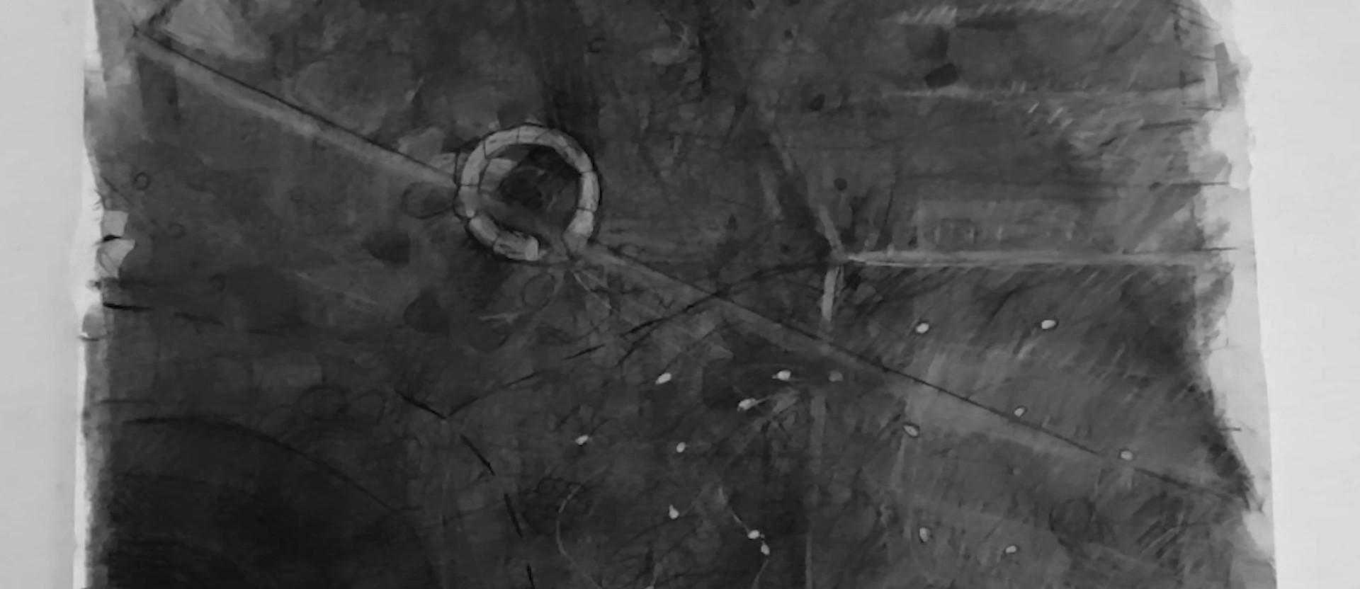
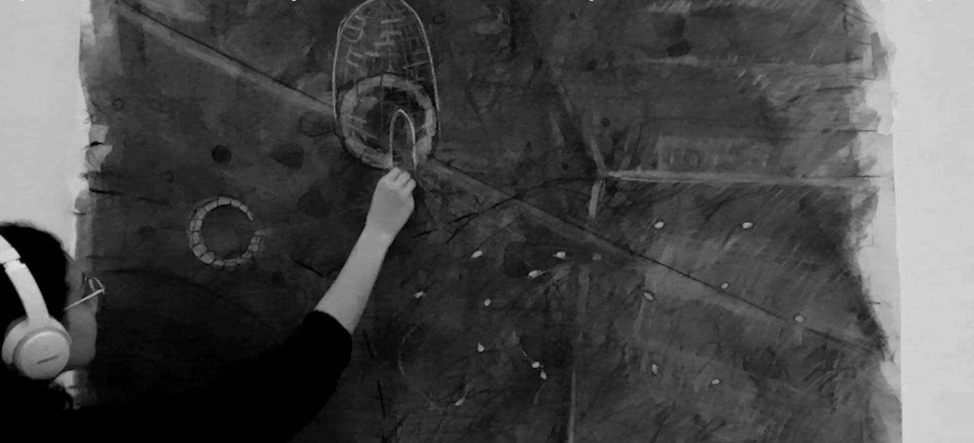
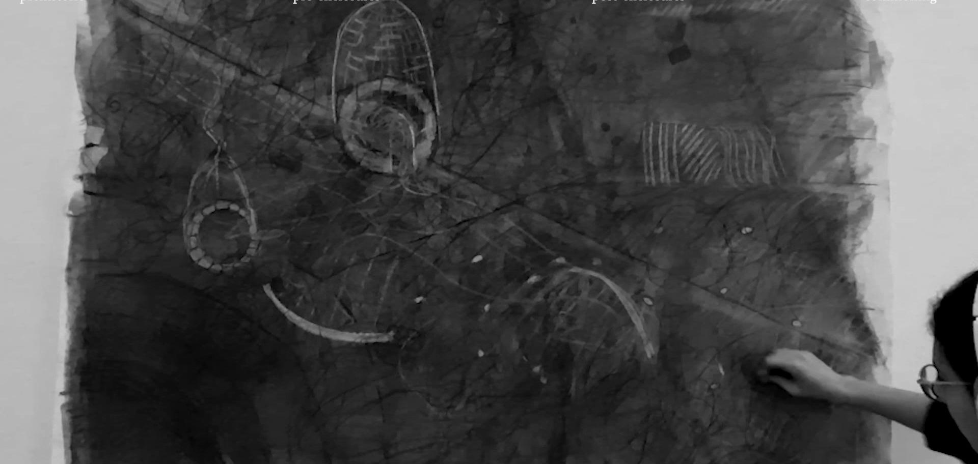
Case Study: Crépissage, Great Mosque, Djenné, Mali
Drawing from file:///D:/10_Masters/AA/2023-24/Dip7/Project/TS/crepissage/Mud-Architecture-The-Great-Mosque-Djenne-elevations.webp
The crepissage is an annual event where community members collectively repair the mud-plastered facade of the Great Mosque. The mosque’s architecture facilitates this through an inbuilt scaffold made of bundled palm fronds, doubling as a decorative feature. This ritual of repair and care for an important sacred building provides an inspiration for the design of the drystone field stations. Although made from a very different material, the notion of designing for collective maintenance practices is one that ensures the longevity of the structure, and for its continual re-adaptation over time. Standing in opposition to the planned obsolescence ubiquitous in modern construction, design-for-repair recognises the beauty of taking care of the place one inhabits.
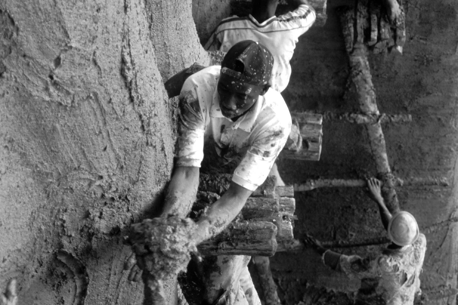
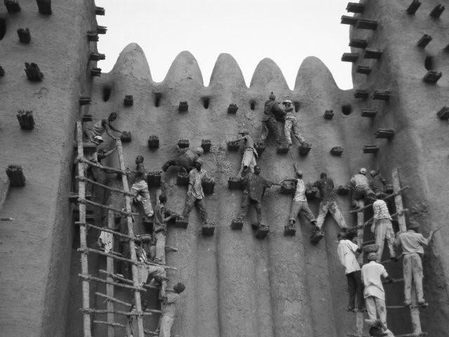
Scaffold for Construction and Repair:
Timber and Stone Interactions
Timber batter frames are frequently used in the construction of drystone walls, providing guidance for builders to gage the incline of the wall. Batter frames are placed over the wall at measured intervals. String is often tied between them to guide stone laying, with the string progressively moved upward as the wall is built up.
The project reimagines the batter frame as a tool of both construction and maintenance, a device that allows for even first-time drystone constructors to build an even, durable wall. Reconceived as a kind of scaffolding structure that wraps around the stone, these timber guides are constantly reconfigured according to the needs of the transient commoners. With sharp pointed ends, they can be easily driven into the ground and removed with ease. They can also be adapted to support small work tables, storage, or small overhangs that provide comfort for the commoners and support the continual reconfiguration and expansion of the field stations.
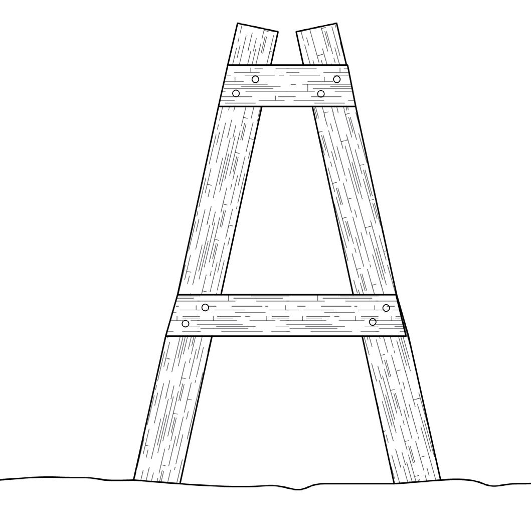
01. Top width
02. Bottom width: sits over lower layers of drystone
03. Tie
04. Leg
05. Height of topstones / coping
06. Height of wall below throughs
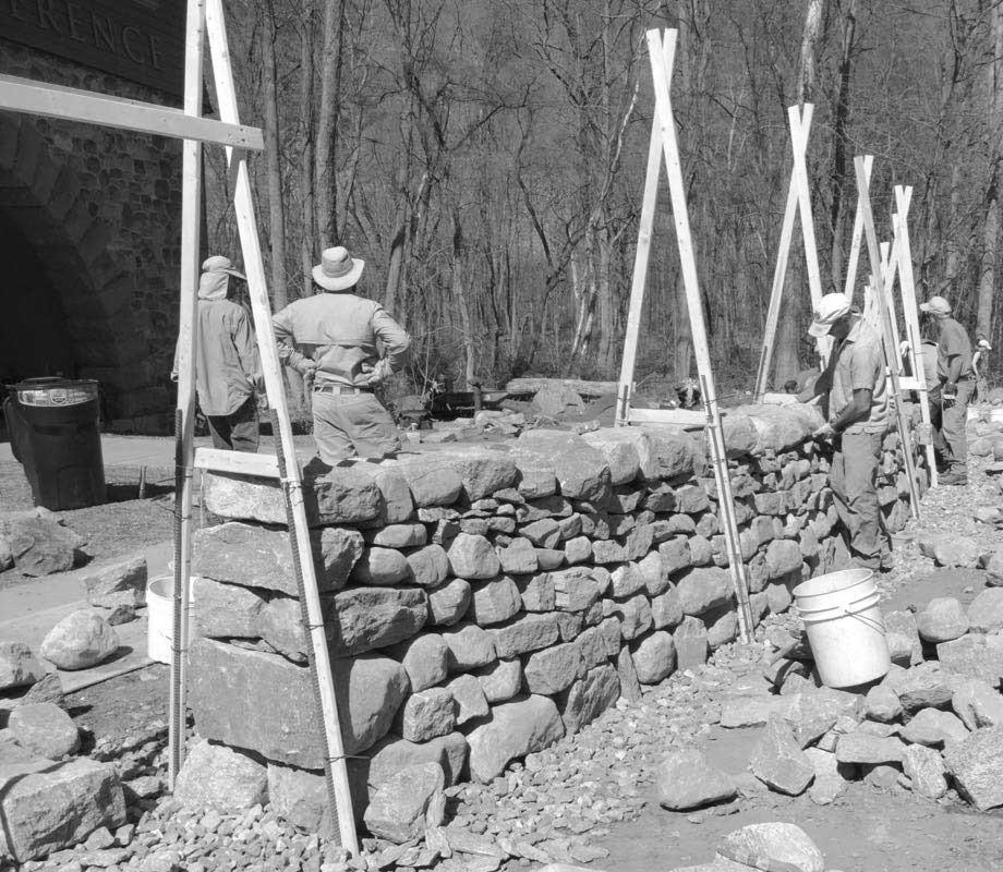
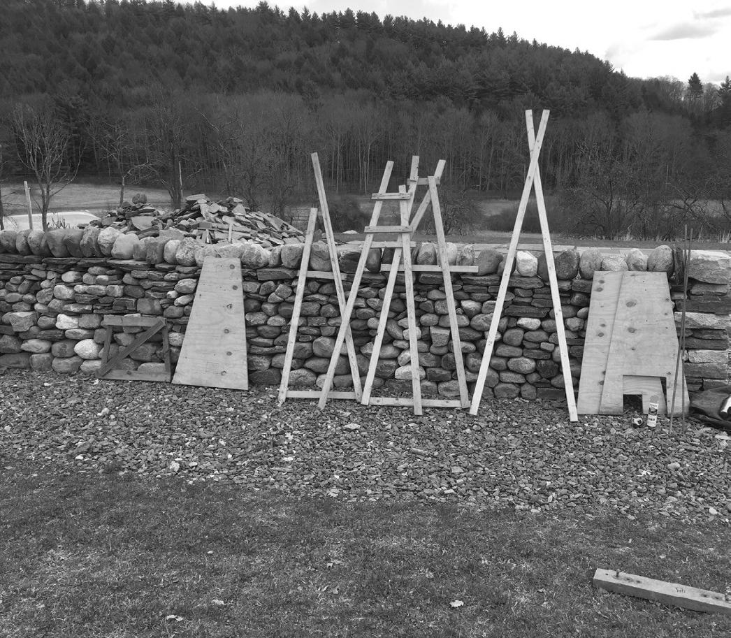
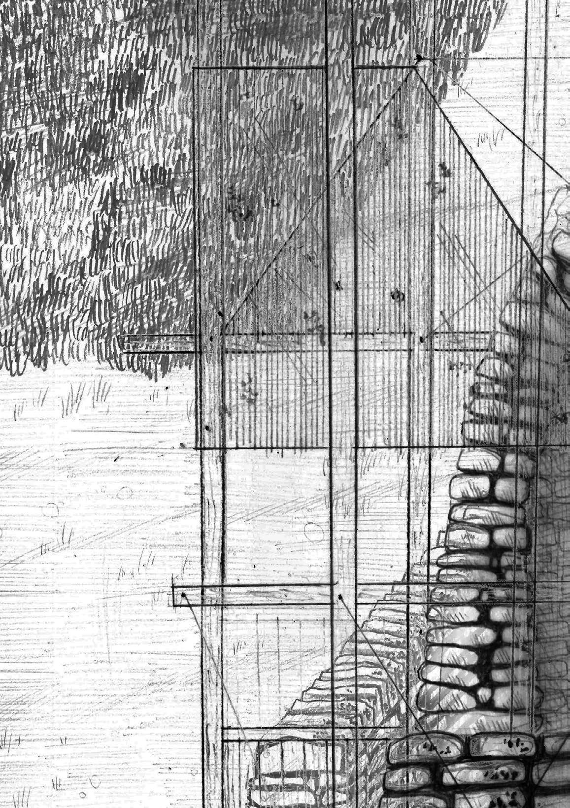
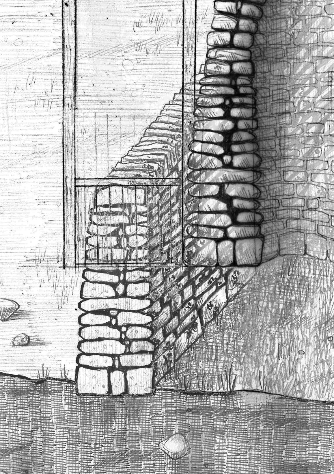
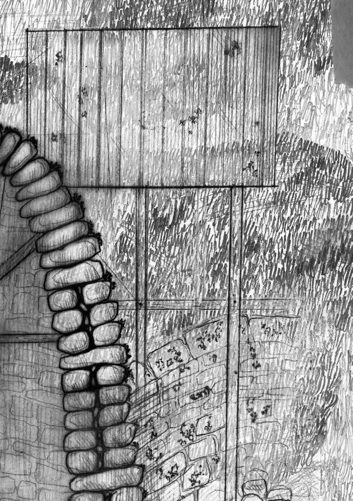
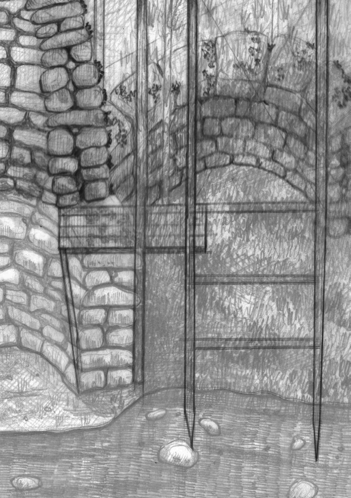
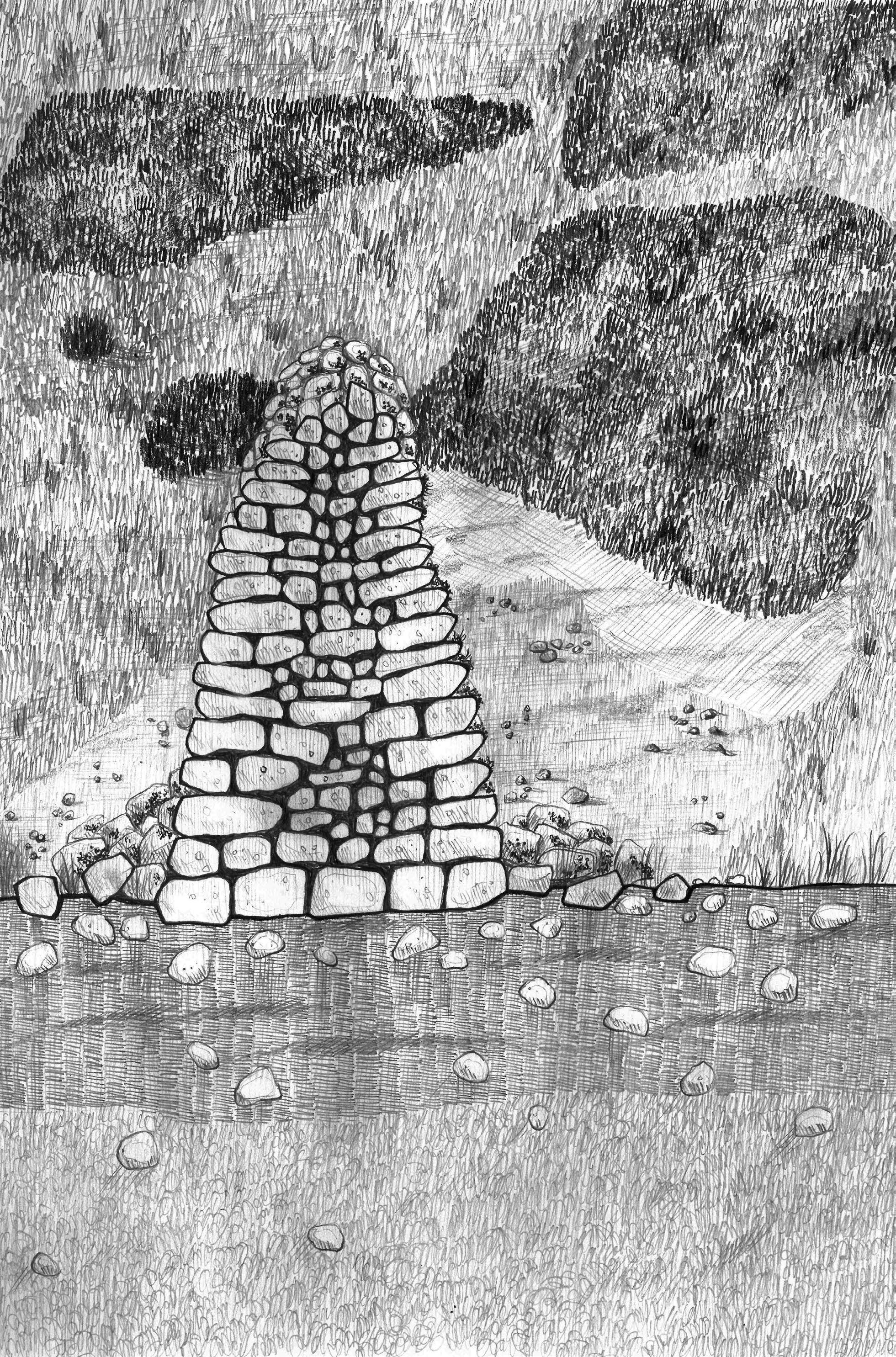
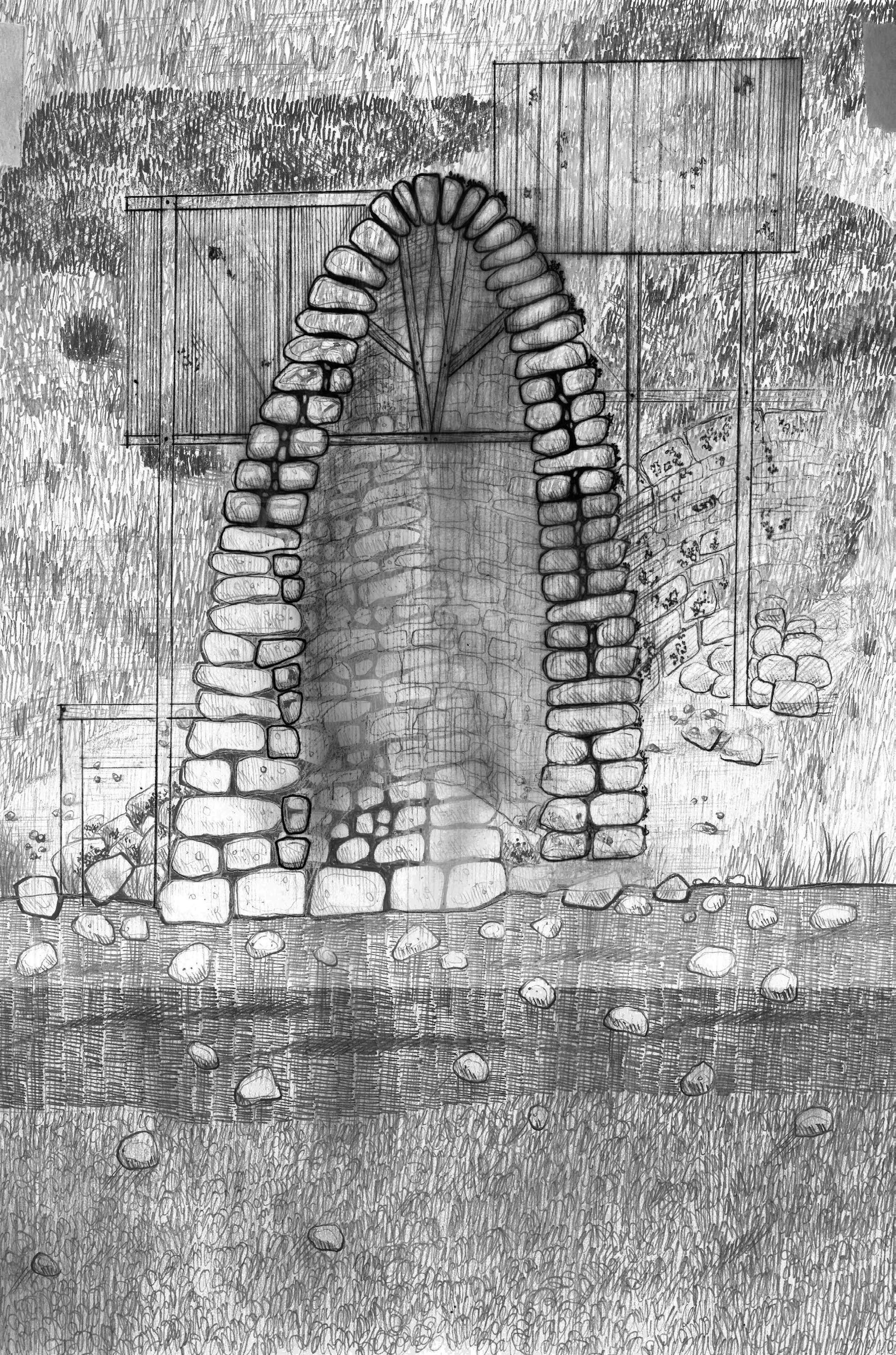
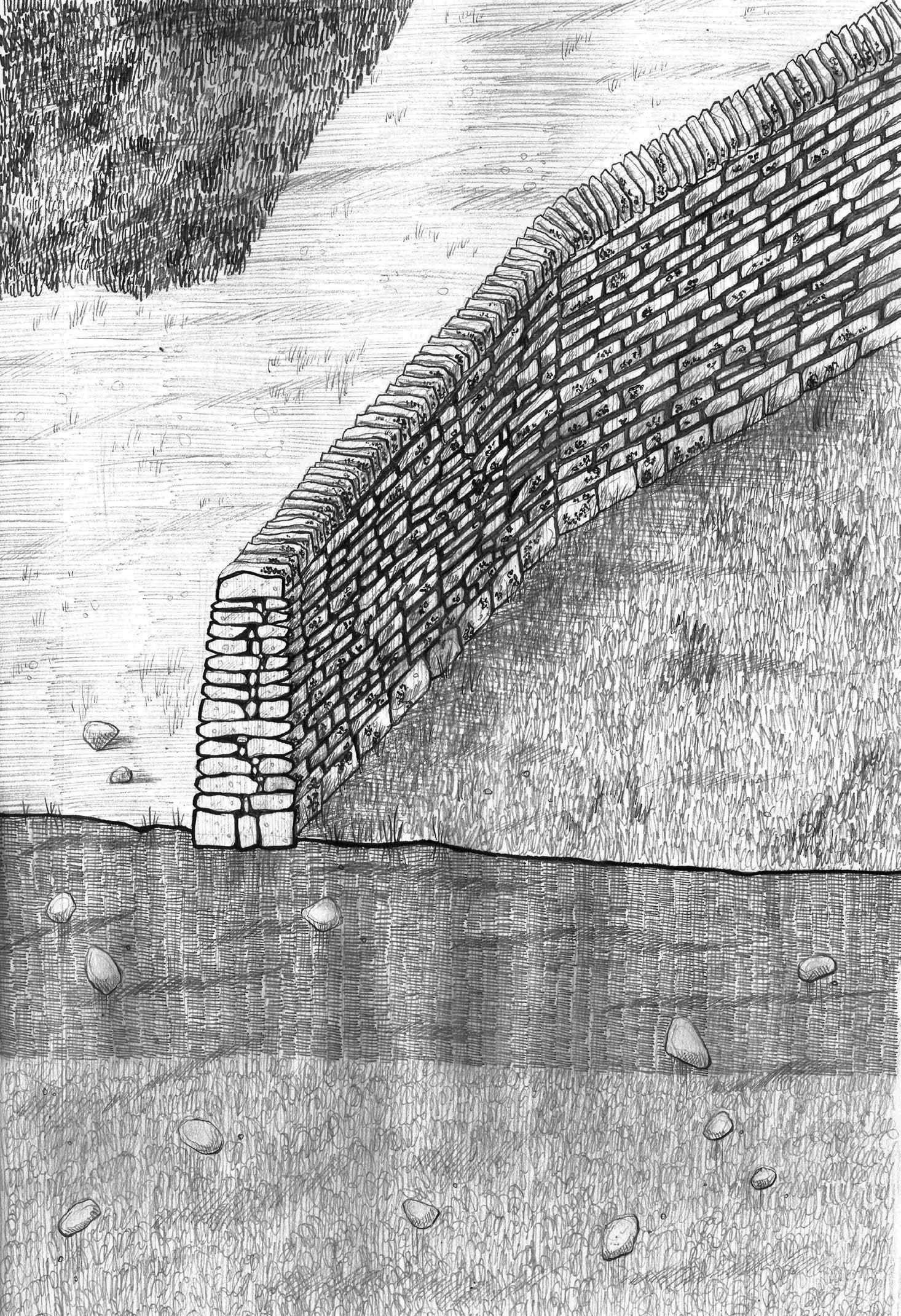
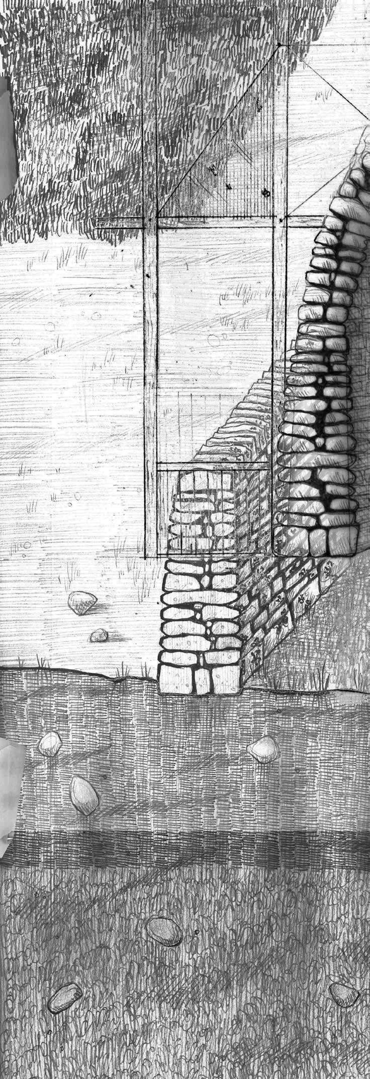
When the wall becomes a shelter. A drystone field station built for repair.
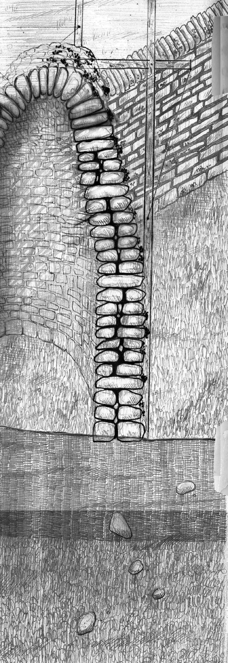
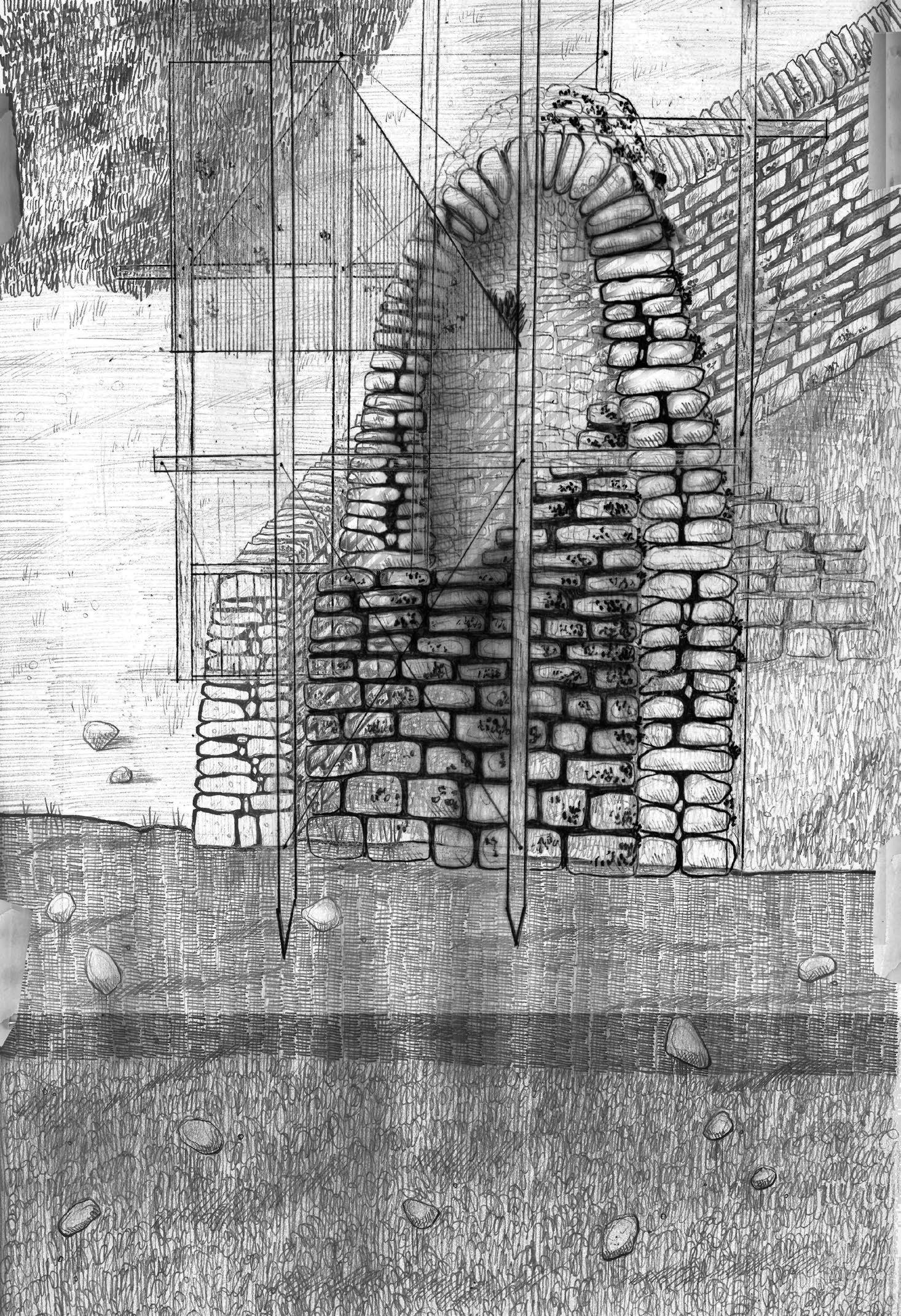
A site for multispecies inhabitation.
I first tested this idea by drawing a “commoning cairn” at a 1:1 scale at the AA. On site, I developed ideas about multispecies inhabitation that I then applied to the Crookestone field station design previously shown.
Commoning Cairn: The Multispecies Inhabitation of a Drystone Field Station
1:1 Drawing Exercise
Transient commoners collectively build field stations where they stay for several weeks or months at a time as they take part in forms of living conservation, such as re-mossing the peatland. Design becomes a process of sorting, shifting, and assembling found rock. They are one-ingredient structures whose forms are guided by the shapes of the rocks themselves.
The 1:1 drawing of an inhabitable cairn field station is an embodied mapping process. In drawing at the scale of my own body, this filmic mapping is subjective and malleable. I build the cairn in section to reveal the porosity of the rock, less of a dividing barrier than a host for many forms of life. The project views stones as solid but not permanent, part of the evershifting landscape morphed by human and non-human agents alike.
The structure itself becomes an object for care and repair, maintained by transient commoners. The stones are scaffolds inviting more-than-human inhabitation: over time, moss, lichens, insects, birds, and mammals begin to dwell and take shelter in their nooks and crevices, thriving in geologic porosity.
The project registers Moss as a key other-than-human agent to whom a drystone wall is not a barrier but a home. Moss teaches us about trans-scalarity, wayfinding, and resilience, informing the project’s methodology.
01. Commoning Cairn, charcoal and chalk on paper
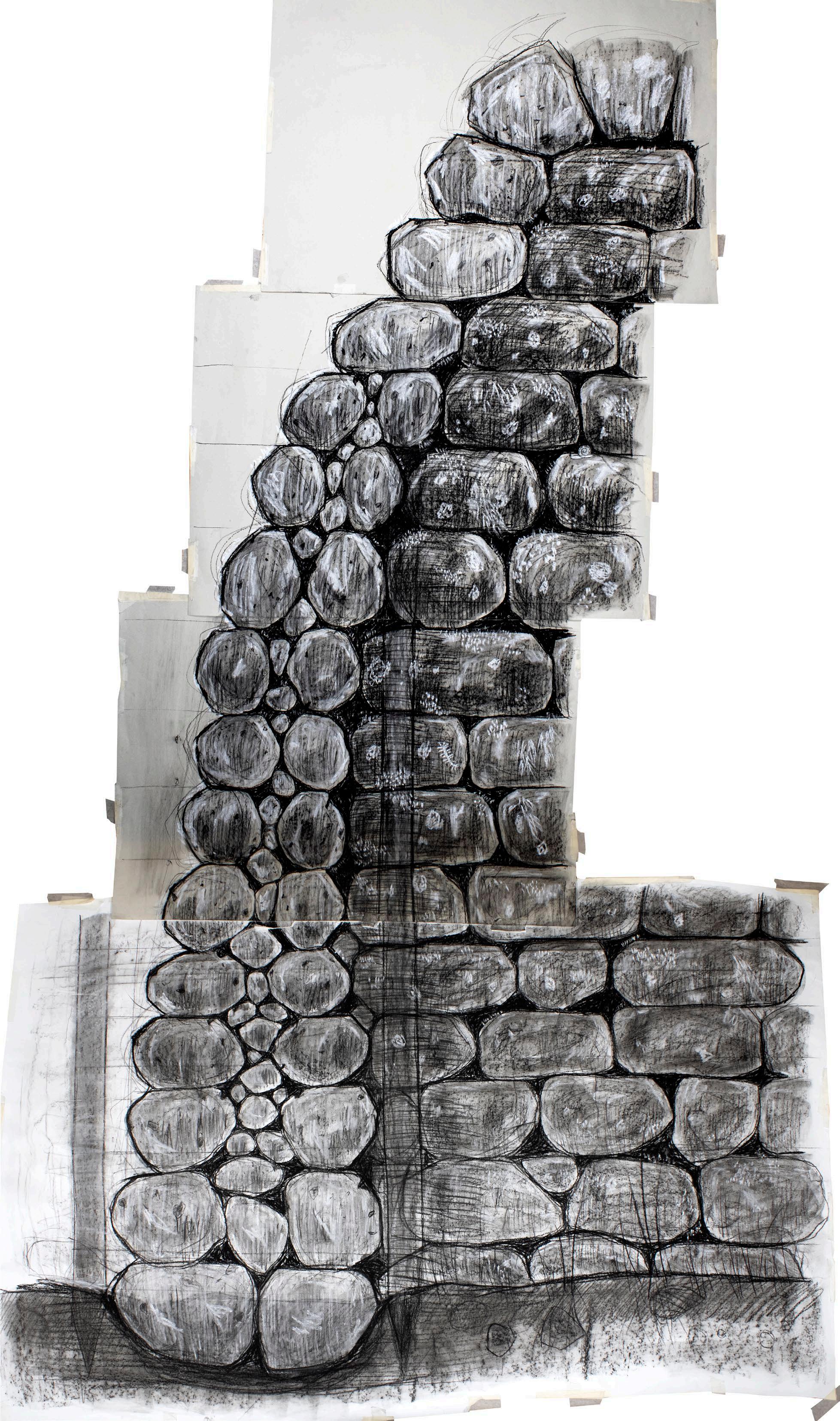

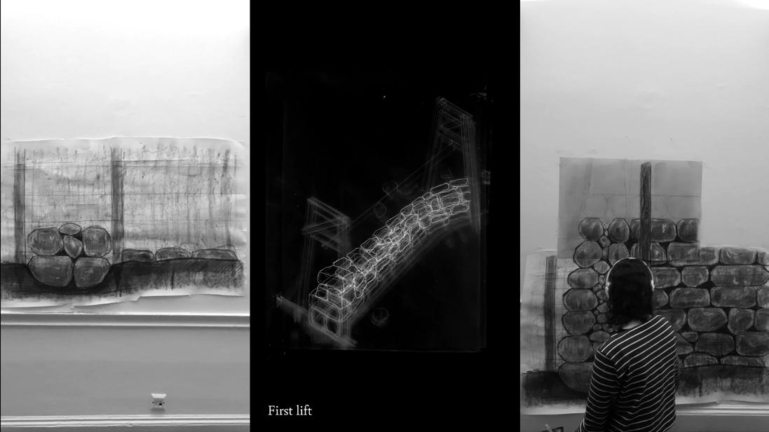
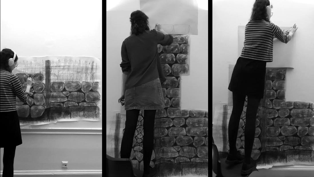
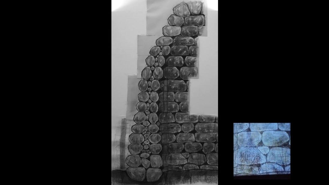
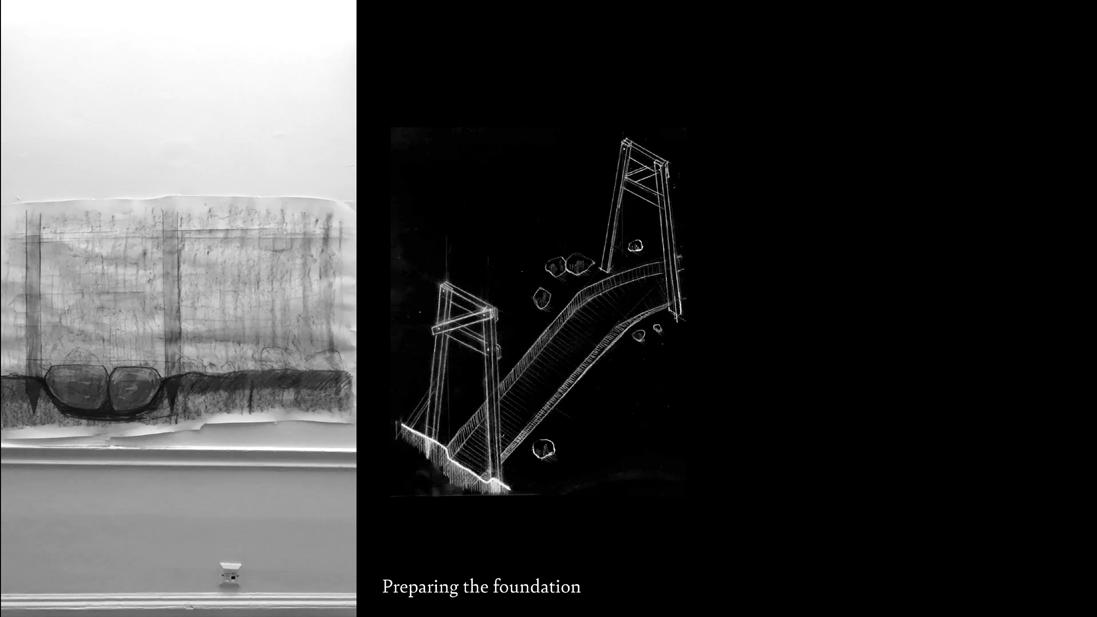
Transient commoners collectively build field stations where they stay for several weeks or months at a time as they take part in forms of living one-ingredient structures whose forms are guided by the shapes of the rocks themselves. The 1:1 drawing of an inhabitable cairn field station in section to reveal the porosity of the rock, less of a dividing barrier than a host for many forms of life. The project views stones as solid but for care and repair, maintained by transient commoners. The stones are scaffolds inviting more-than-human inhabitation: over time, moss, lichens,
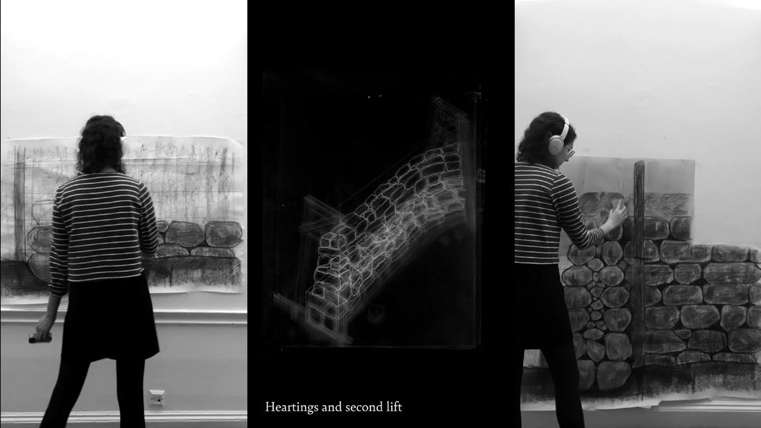
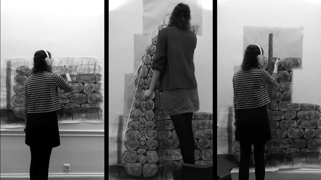
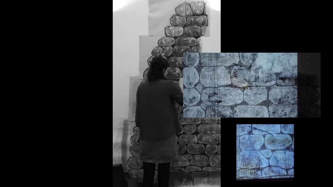
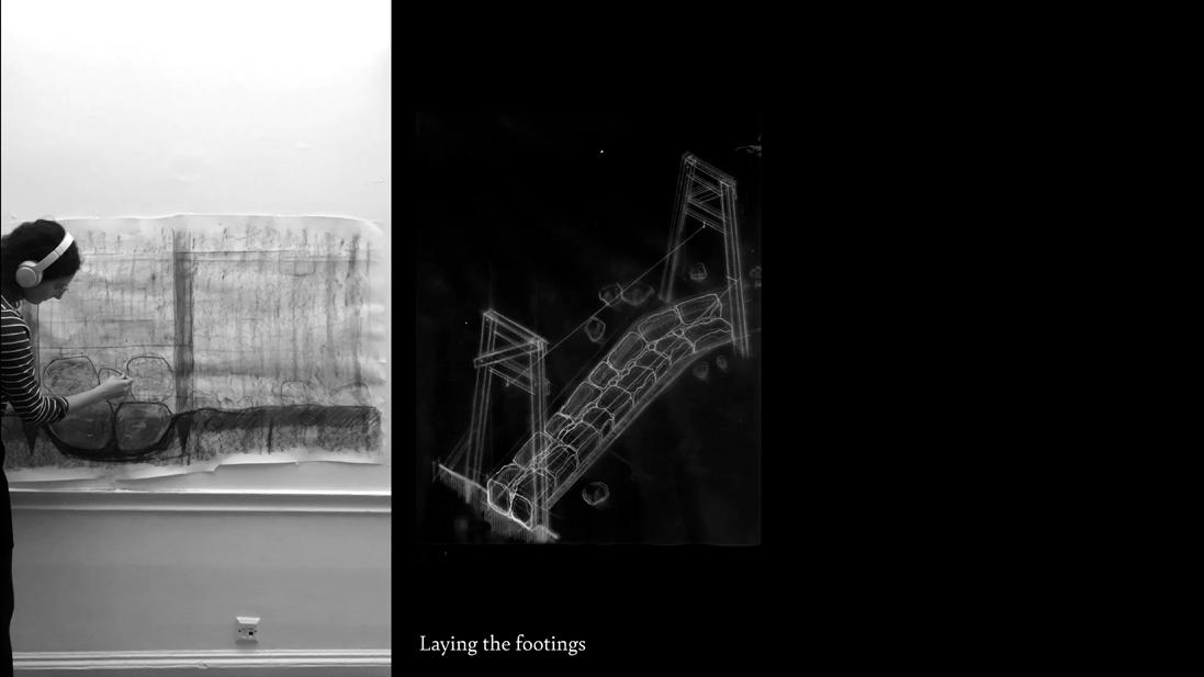
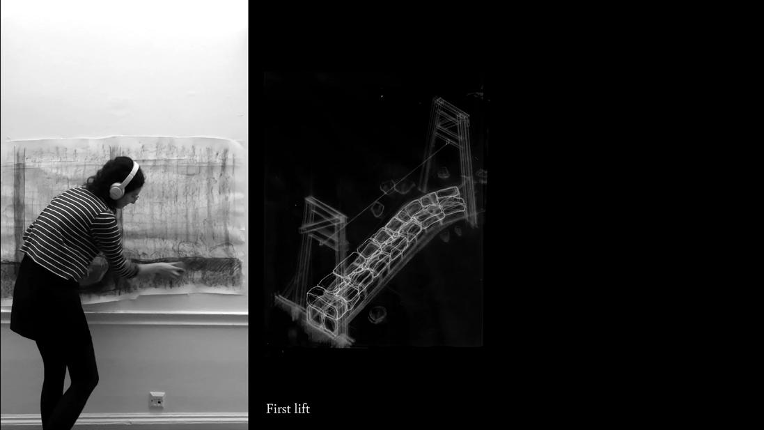
living conservation, such as re-mossing the peatland. Design becomes a process of sorting, shifting, and assembling found rock. They are
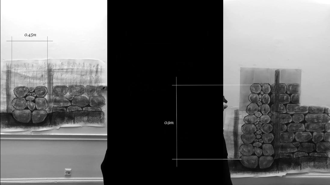
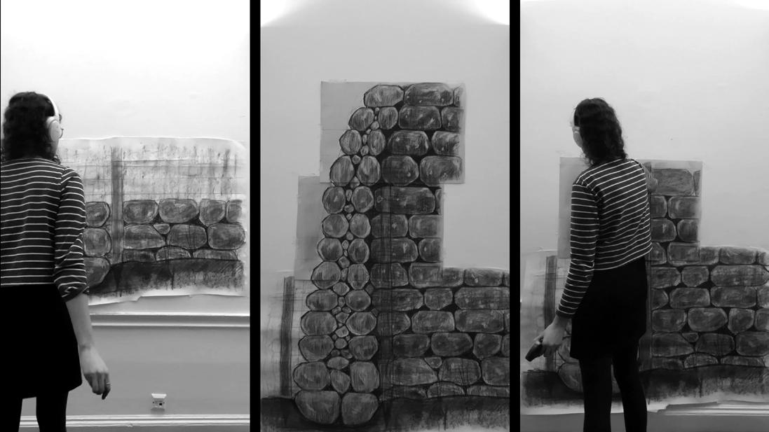
is an embodied mapping process. In drawing at the scale of my own body, this filmic mapping is subjective and malleable. I build the cairn
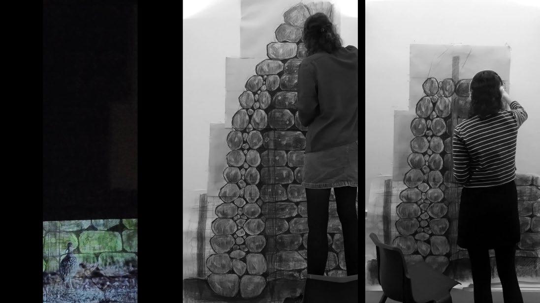
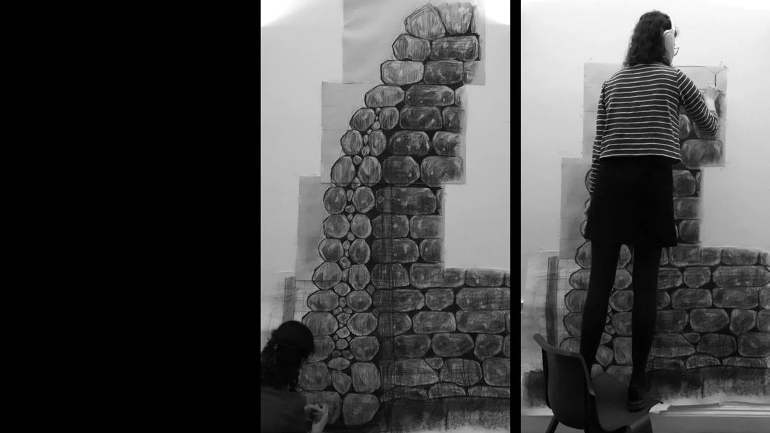
but not permanent, part of the ever-shifting landscape morphed by human and non-human agents alike. The structure itself becomes an object
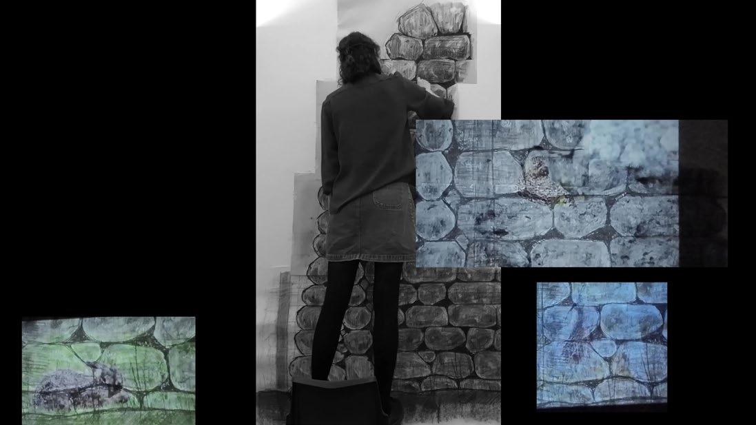
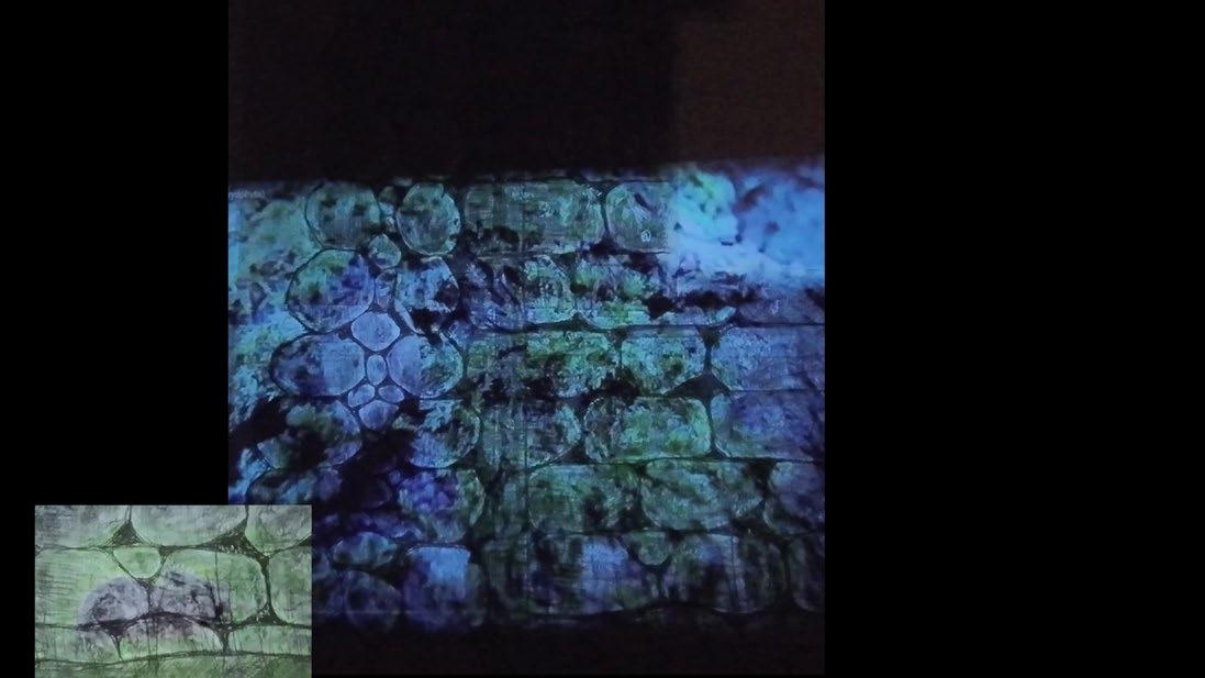
lichens, insects, birds, and mammals begin to dwell and take shelter in their nooks and crevices, thriving in geologic porosity.
Drystone as a Scaffold for Moss and Lichen
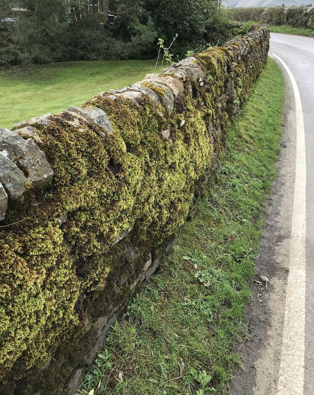
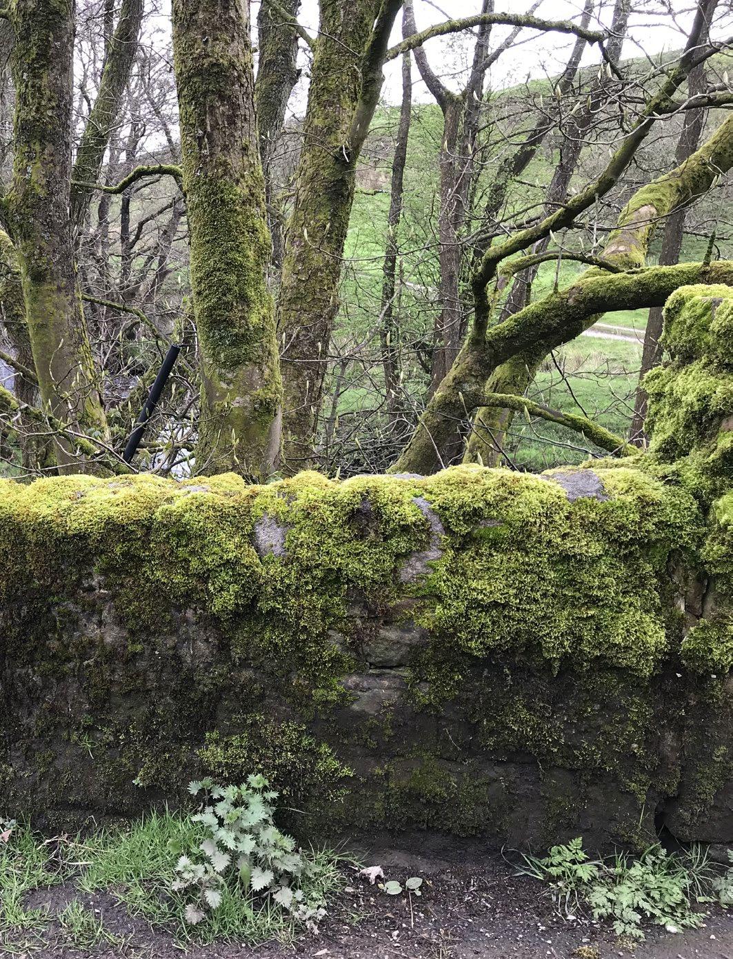
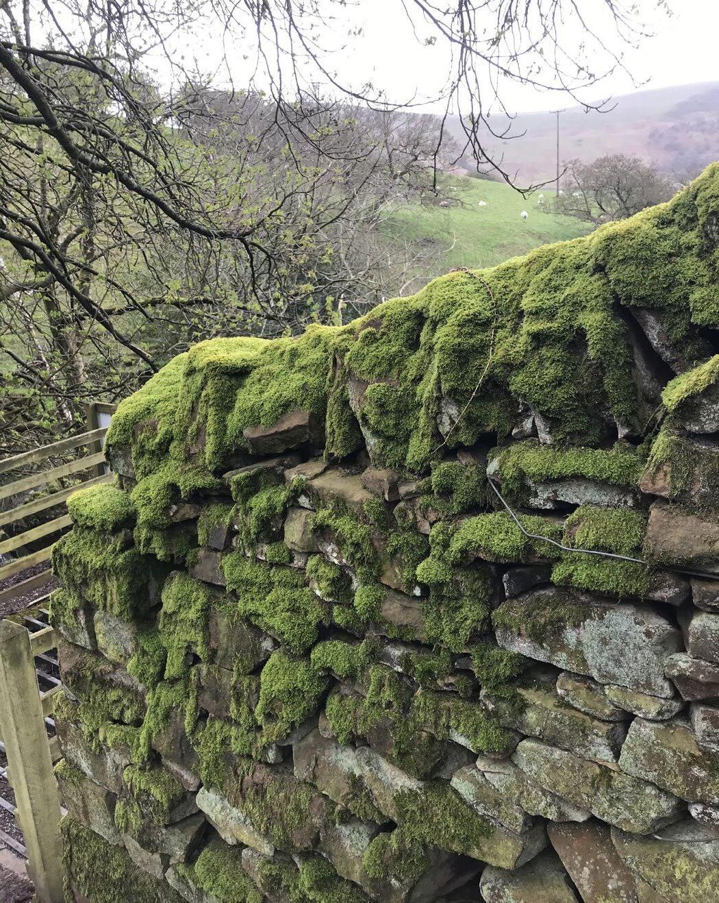
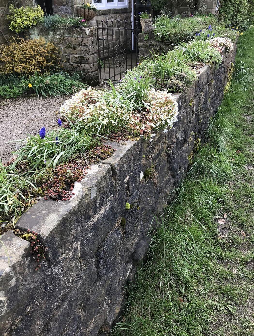
The north and south sides of this drystone wall, situated by a stream, shows moss’s preference for northfacing walls. This also allows for moss to act as a wayfinding device: under ideal conditions, moss can be used as a compass pointing North.
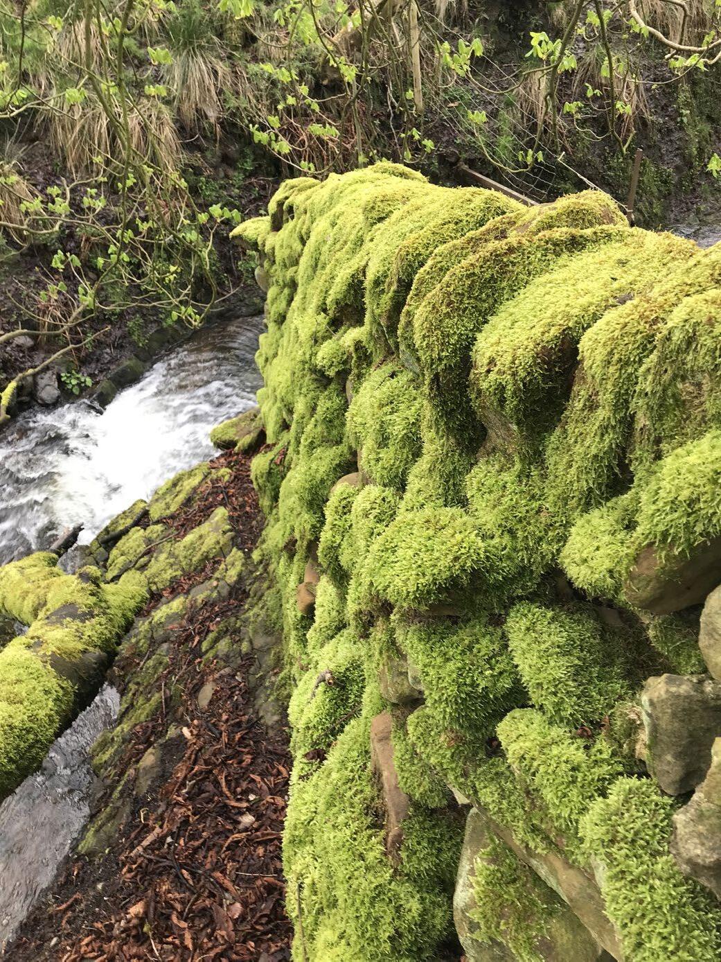
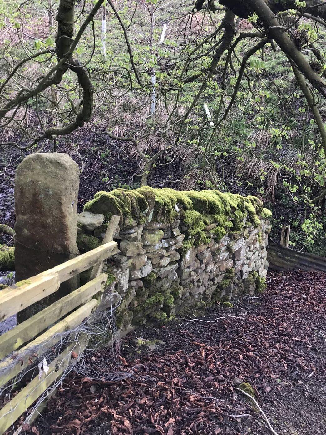
Below left: North side
Below right: South side
Moss and Lichen Growth on Gritstone
Mosses possess rhizoids instead of roots. These are small and hair-like, allowing them to easily grasp onto the textured surface of gritstone. Some mosses absorb nutrients through rhizoids, but mosses typically act as sponges, absorbing water from rain. As they do not have a vascular system, this is their primary life source. As sponges, they also provide and retain moisture in soil below, preserving wet conditions.
Moss also have insulation properties; a drystone wall covered in moss will provide more thermal protection than a drystone wall without moss. Astudy on using peat moss as insulation found that “the thermal conductivity of moss mats with a density of 100 to 250 kg/m3 ranges from 0.039 to 0.065 W/ mK,” making its insulation properties comparable to that of mineral wool.
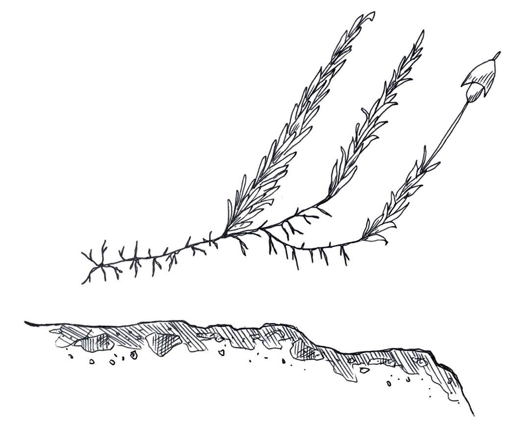
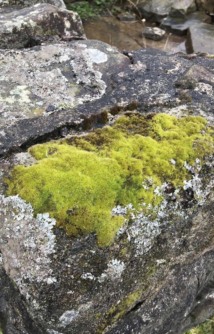
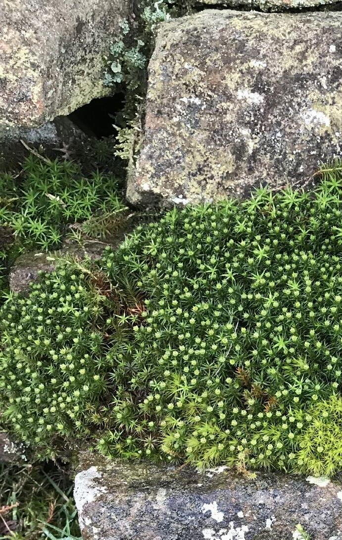
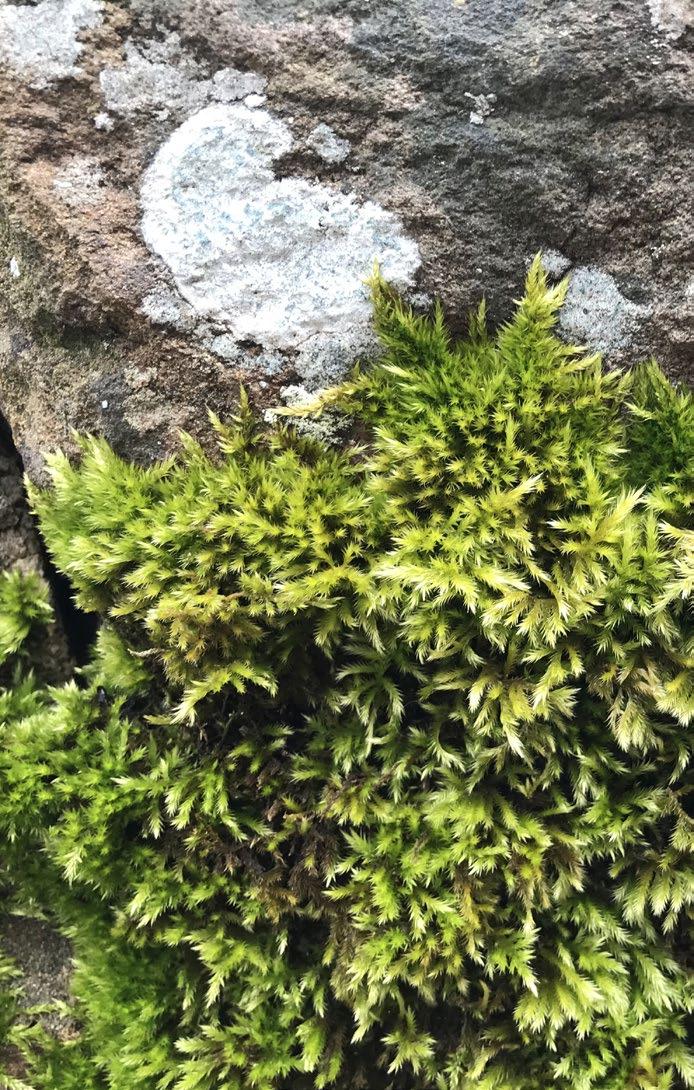
01. Capsule 02. Mature sporophyte
03. Leaves 04. Rhizoids 05. Rock
Lichens are not singular organisms; they are a fascinating example of a mutualistic symbiotic relationship between fungi, algae and/or cyanobacterial. They reproduce by spores spread in the wind, rain, or animals, or vegetatively, from small fragments on the surface of the lichen. These spores need a scaffold on which to lodge themselves and propagate; this is where rocks come into play. In addition to the symbiotic relationship between fungi and algae, rocks can be thought of as another symbiotic partner in this relationship, hosting all forms of lichen life.
Spores and air-borne dust can lodge into porous rock surfaces, proving a scaffold for lichens to grow. Lichens take nutrients from the rocks themselves, with fungal hypaea extending through the rock (see diagram). This can also lead to the gradual crumbling and degradation of the rock.
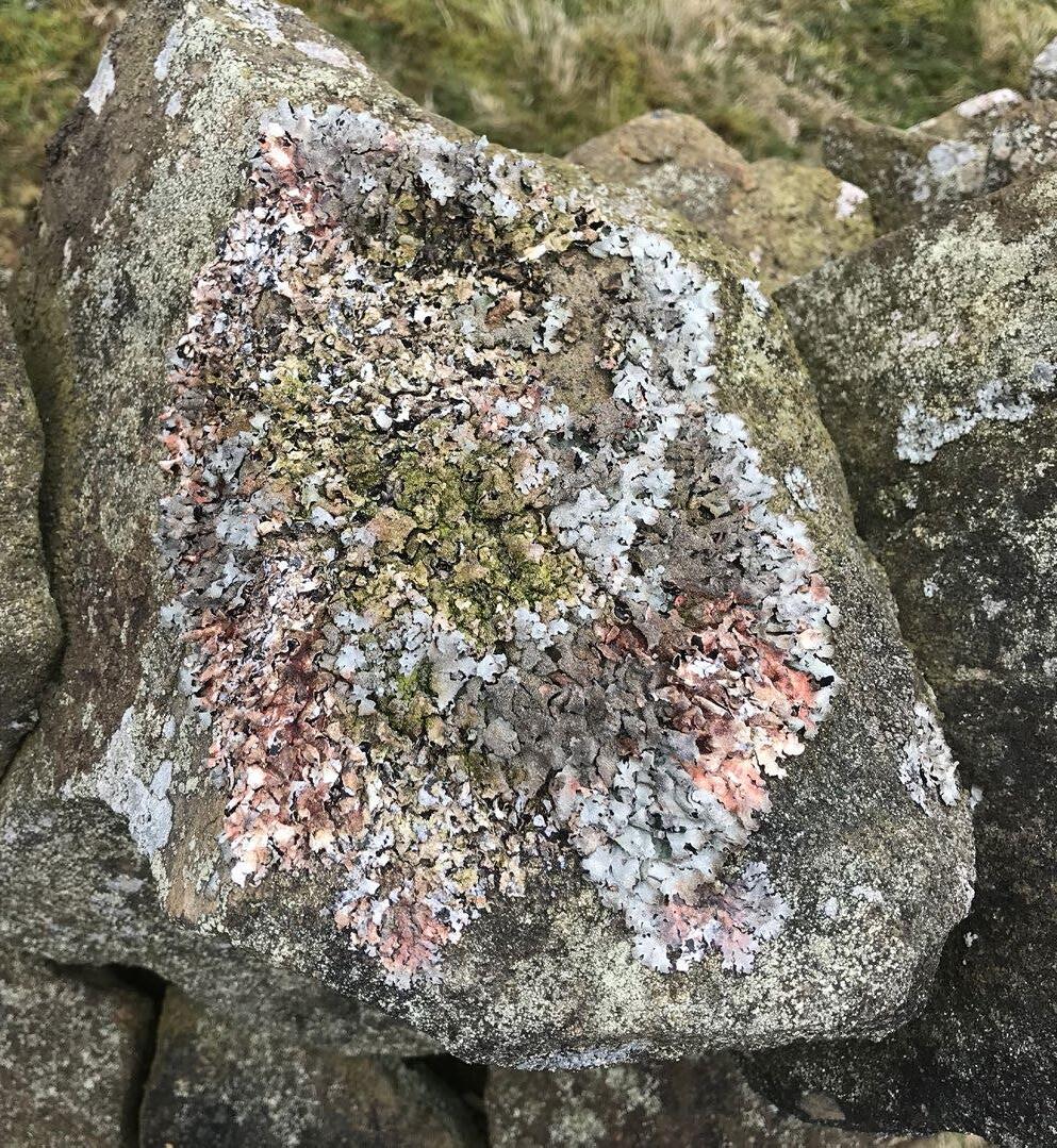
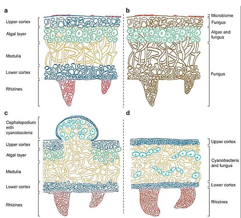
Diagram from: https://www.mdpi.com/2673-8392/2/3/96
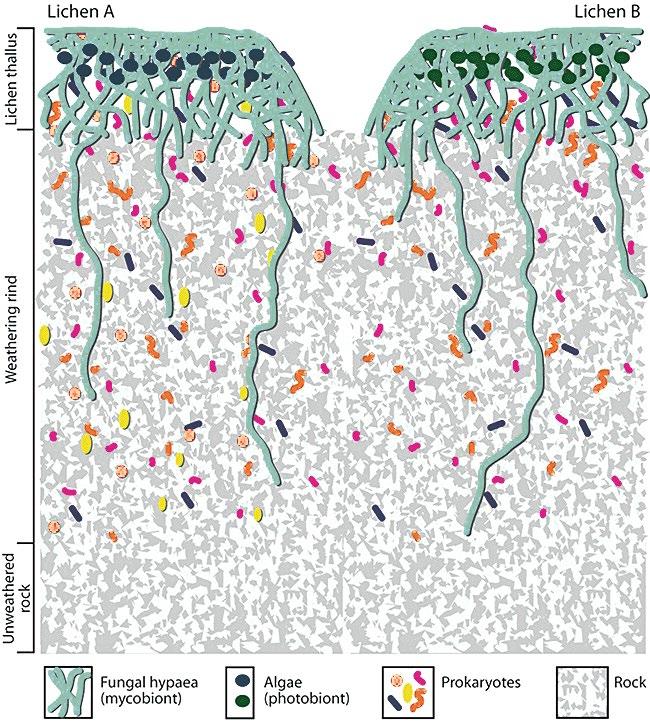
Diagram from: https://www.researchgate.net/figure/Schematicillustration-of-a-transverse-section-through-a-lichen-rock-sample_ fig1_237199993
Multispecies Inhabitation: Bee Boles
Bee boles are nooks carved into drystone walls in which bee hives—straw skeps—are placed. The stone shelters provided protection from wind and rain and typically measured 0.45 x 0.45 x 0.35m. When large stones were available, they could be placed as a kind of lintel above the nook. Otherwise, a small arch could be formed, as seen in the image below.
The project imagines the integration of nooks that could house skeps or nests into the double drystone wall. These nooks could serve different purposes over time and be inhabited by a number of plants and animals.
https://www.beeboles.org.uk/en/page/about-us
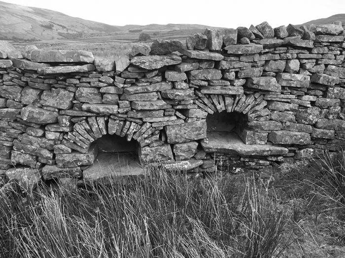
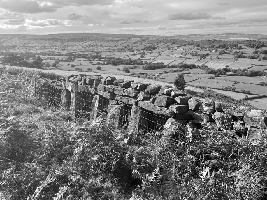
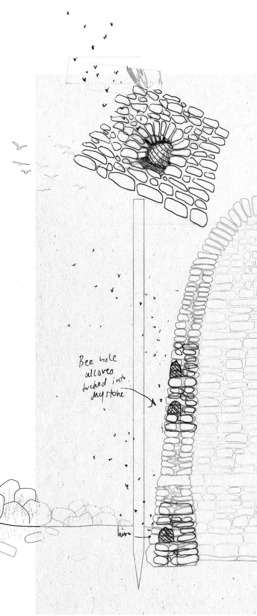
Multispecies Inhabitation: Lunky Holes for
Sheep
Lunky holes are purpose-built gaps in drystone walls tall enough for sheep to pass under, but too small for cattle. Incorporating holes such as these into the field stations is a good way of providing ‘entrances’ for various animals to pass through; however, some kind of flap door or cover moveable by sheep might be required to provide a wind break.
Although sheep will still be ubiquitous in the landscape during the early stages of commoning, their numbers will gradually decrease as grazing land is replanted with diverse plant species and the sheep industry itself transforms. Sheep might inhabit the field stations particularly over winter, when the shelters may prove too cold for humans.
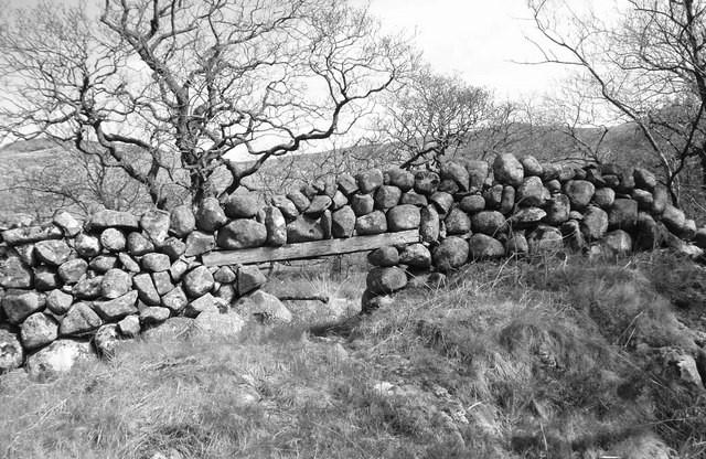
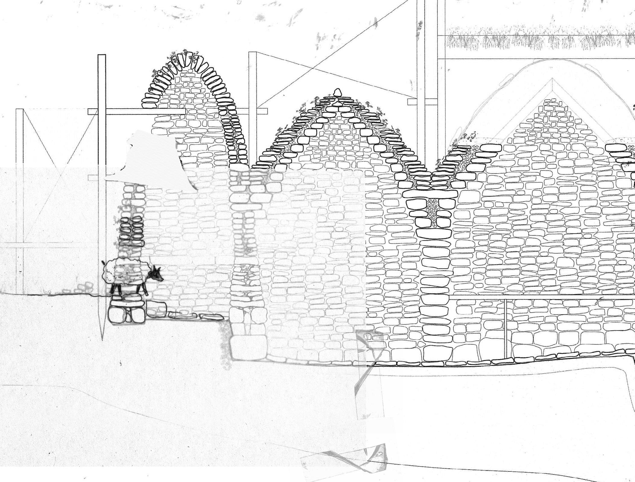
Multispecies Inhabitation: Smoots for Small Mammals
Smoots, like lunky holes, are small gaps at the base of drystone walls, but these are far smaller, allowing only for the passage of small mammals such as mice, shrews, badgers, and foxes. These holes were also occasionally used for trapping. I came across several of these while walking around Edale valley. In the image below, Sharvaree tried to fit her body into a smoot hole but was unable to fully squeeze through.
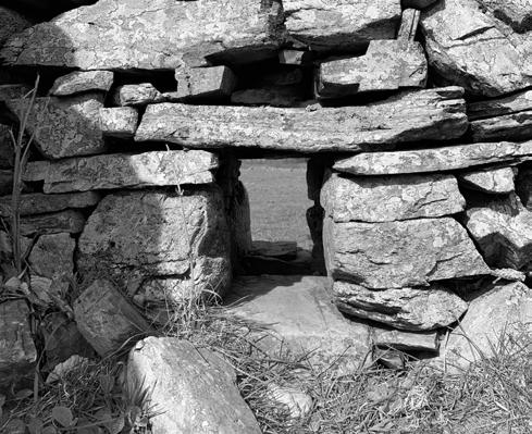
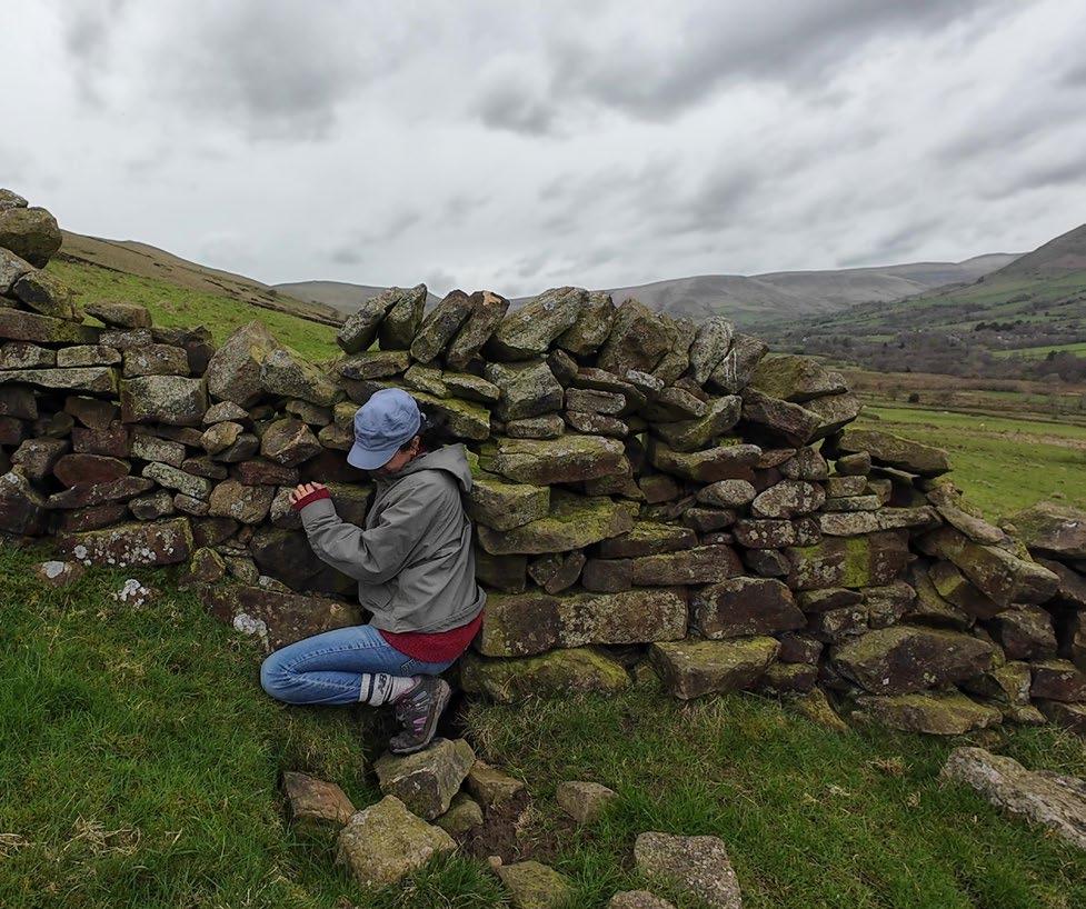
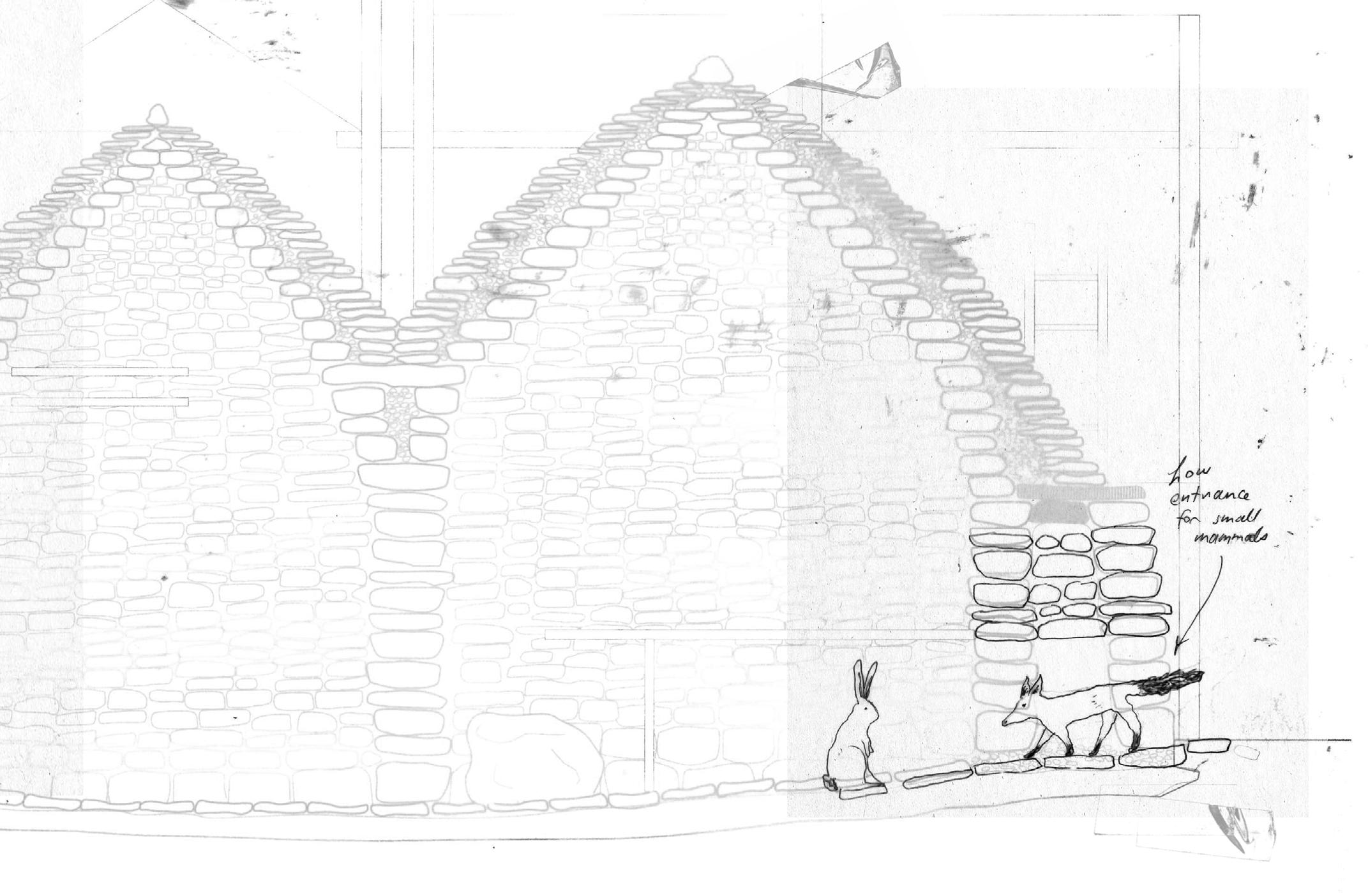
Multispecies Inhabitation: Bird’s Nests
Gaps between stones provide sheltered crevices perfect for small birds’ nests. Though an artistic piece, Andy Goldworthy’s sheepfold lines gaps with grasses, lending an impression of nests. Many bird species such as tits use drystone walls as nest sites; the field stations would act as a nesting scaffold for the diverse birds that inhabit the moorlands.
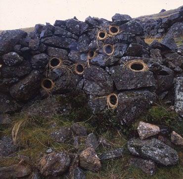
Encouraging Plant Growth
In damp conditions, mosses and lichens have no trouble propagating and flourishing on drystone walls. Plant growth can be further encouraged by spraying a fine layer of soil onto the drystone, allowing it to settle into the crevices between rocks. Following this, seeds can be scattered, growing a mat over the drystone as a kind of green roof. With the moorland’s rainy conditions, a variety of plant species that can withstand wind and cold could flourish. This would also provide additional insulation to the field stations.
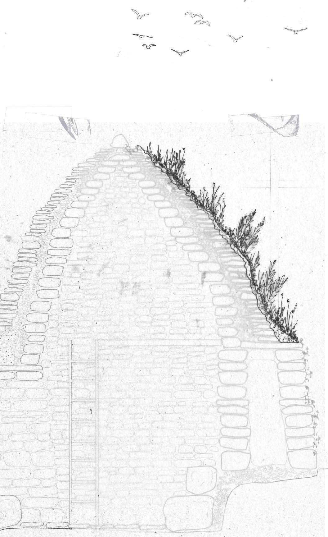
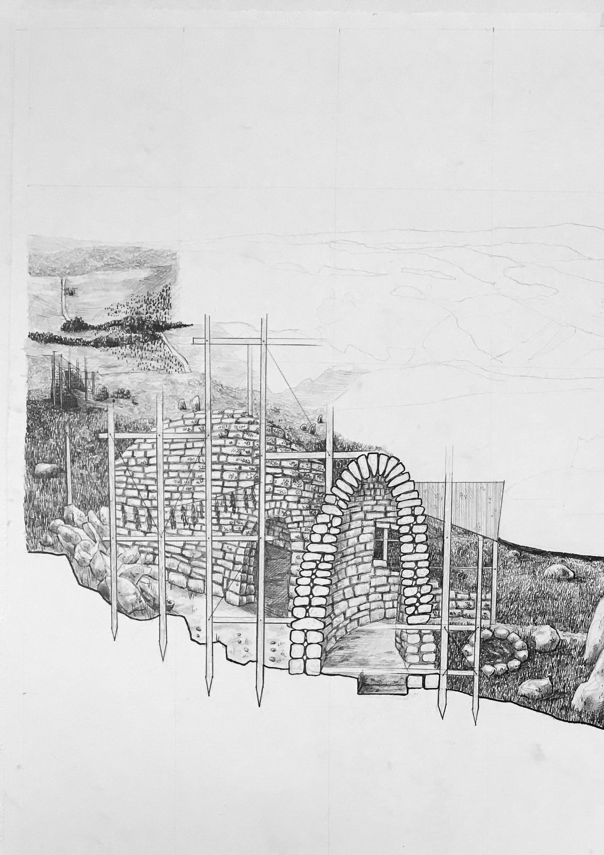
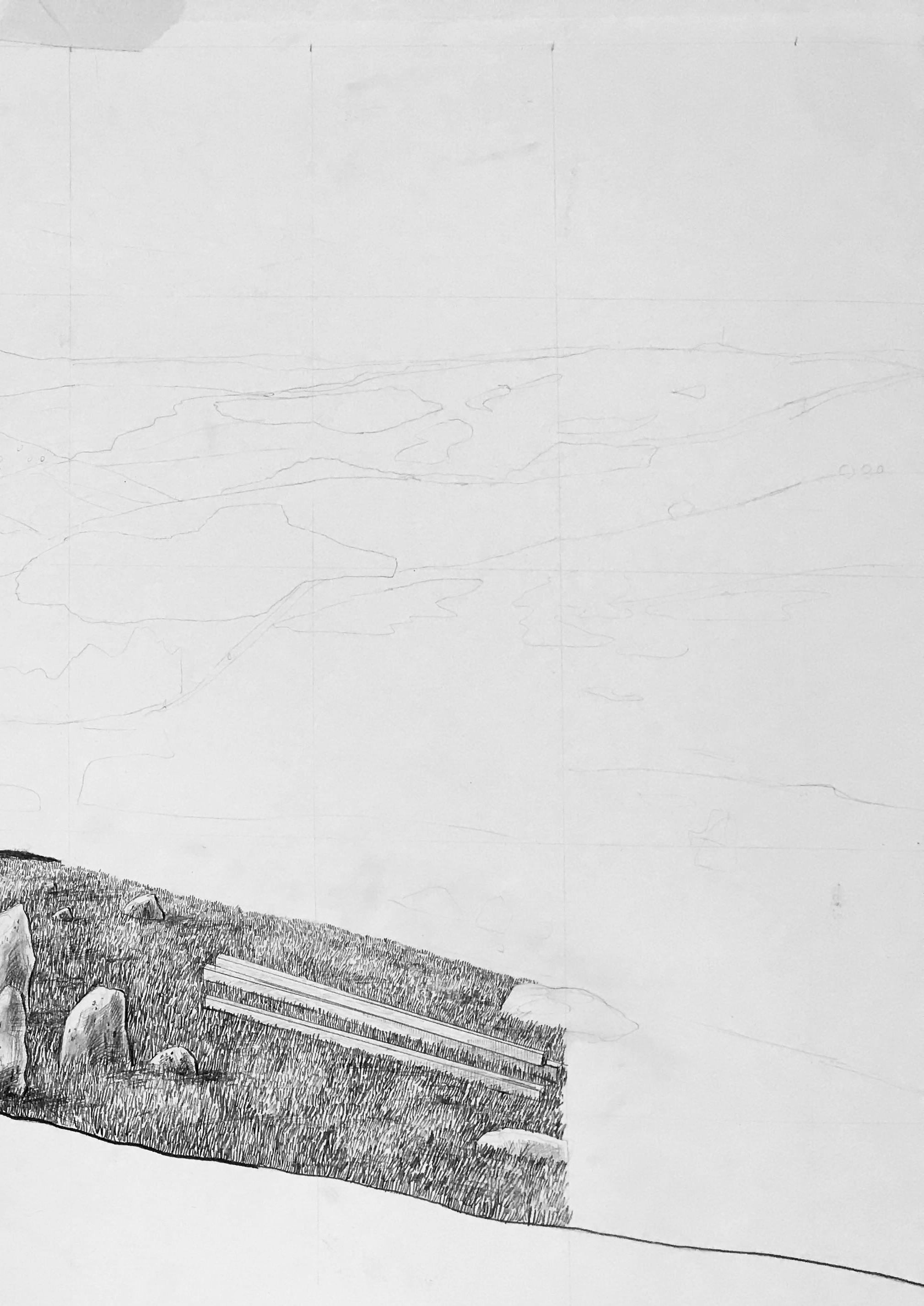
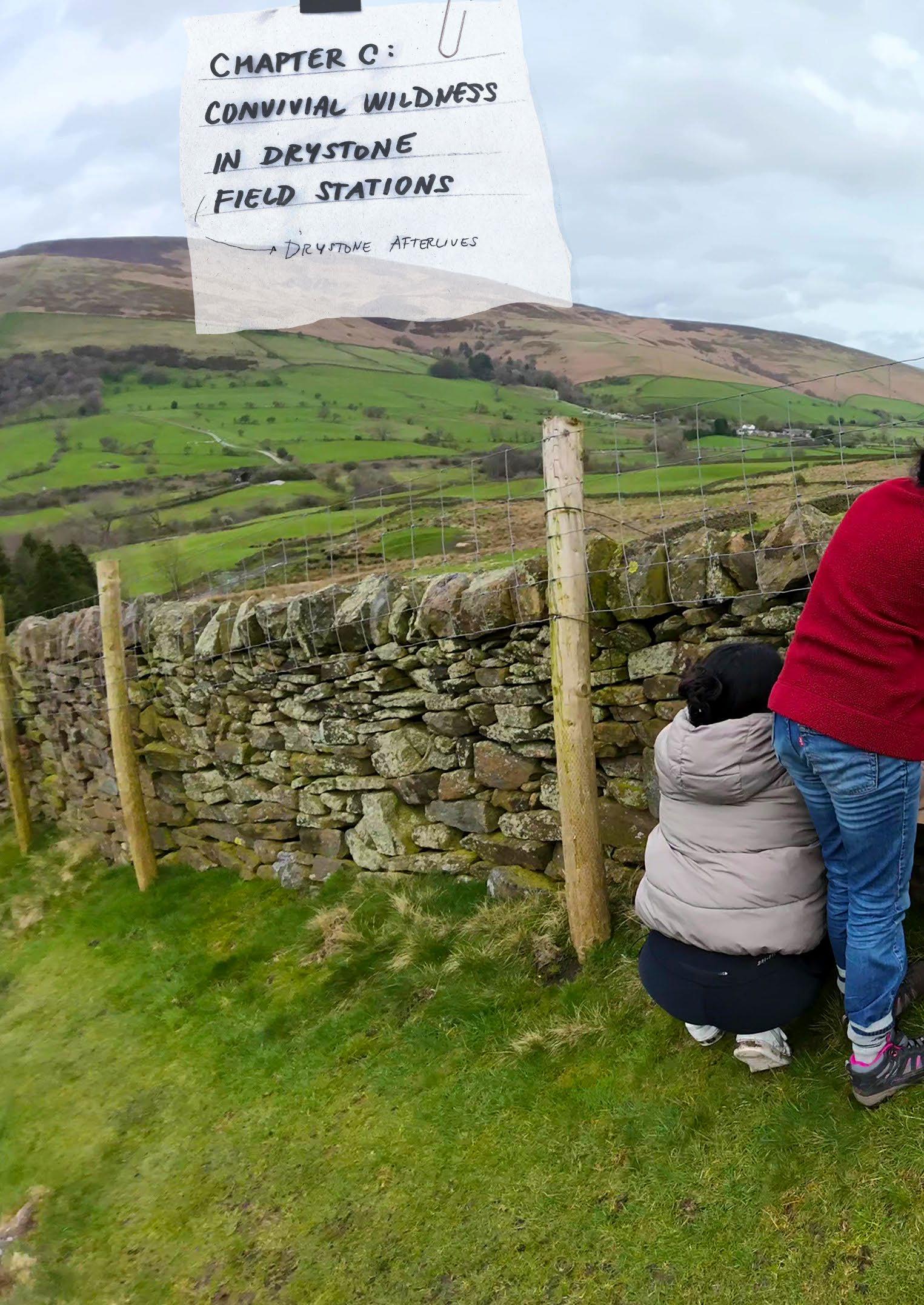
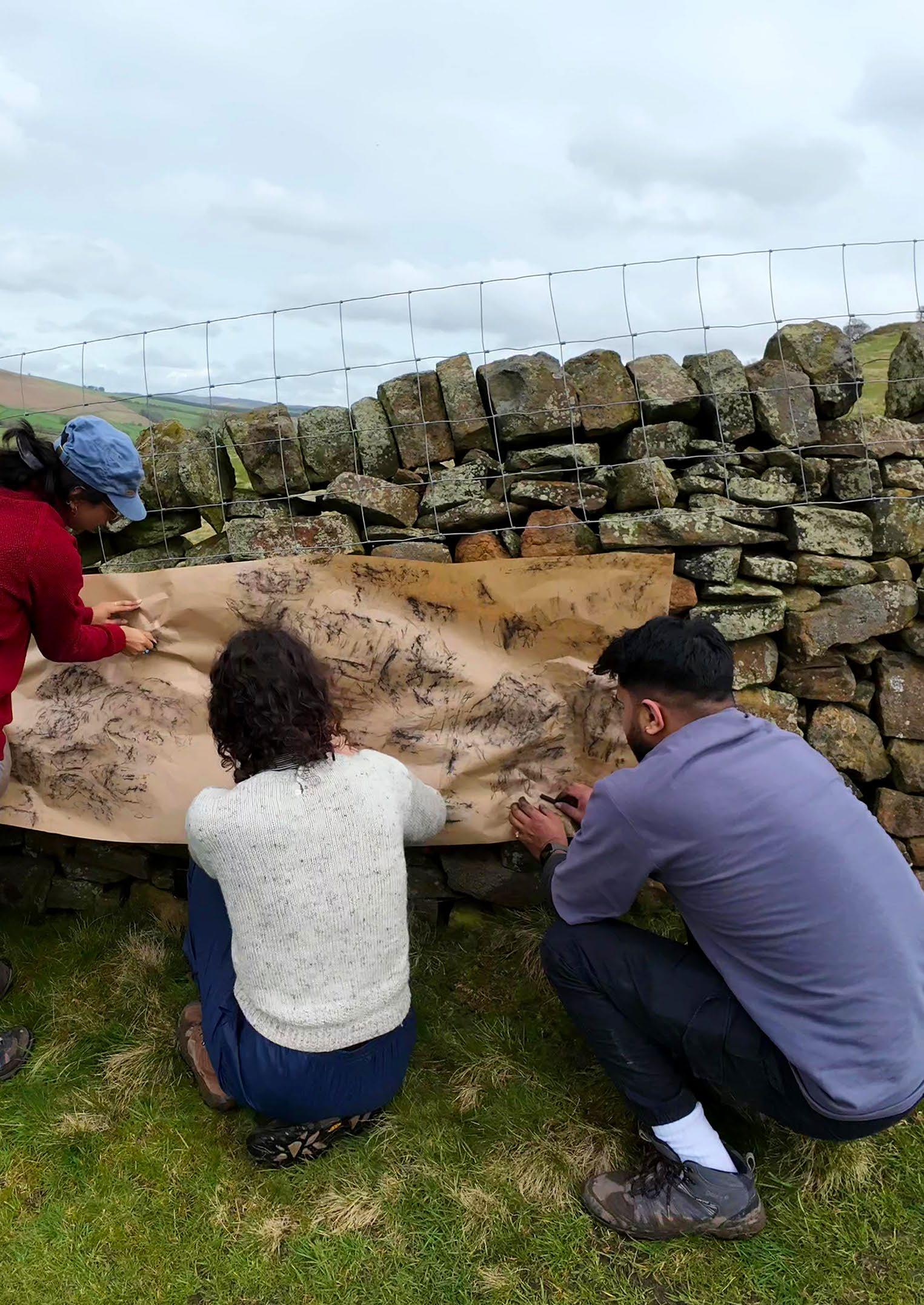
CONVIVIAL WILDNESS IN DRYSTONE
FIELD STATIONS
What is the life of the field stations after their construction? In addition to the construction itself being an ongoing process or reconfiguration and adaptation, this section takes a wider view of the implications of the project, framed by the idea of commoning through convivial wildness.
Framing convivial wildness as a way of situating ourselves within an interdependent web of life— and challenging notions of wilderness as remote and untouched ‘nature’—the project shows how the drystone field stations become sites of ecological repair and form wayfinding networks that counter the God-trick map.
Sub-question C:
+ How might an expanding network of drystone field stations create new modes of wayfinding and allow for the ecological repair of the moorlands?
Drystone Navigation
Marking Landscape: Cairns of the World
Drystone Wayfinding Case Study: Inukshuk and Inunnguaq
Navigating the Moorland: The Trig Point and the Cairn
Peak District Historic Boundaries
Beating the Bounds
Drystone Navigation: New Wayfinding Networks
Navigating drystone by . . . Walking as mapping
Walking as Mapping: Case Studies
Walked Map 01
Walked Map 02
Walked Map 03
Collective Walking as Commoning Practice
Map of the Collective Walk: Leela Map of the Collective Walk: Nikita Map of the Collective Walk: Jay
Map of the Collective Walk: Sharvaree
Map of the Collective Walk: Aditya
Navigating drystone by . . . Imprint-mapping
Imprint-Mapping Test 01: Clay Imprints
Imprint-Mapping Test 02: Drystone Charcoal Rubbing
Imprint-Mapping Test 03: Collective Drystone Charcoal Rubbing
Imprint-Mapping Test 04: Hammering Paper
Drystone as Ecological Repair
Peatland Restoration
Peat Soils and Woodland
Conifer Plantations: Material for Timber Scaffolding
Proposed Woodland Corridors
Drystone as wayfinding device.
This section explores embodied mapping practices from the scale of the rock to the scale of the landscape, where each becomes a new form of orienting onself in and navigating through the landscape.
The project proposes a network of drystone field stations that form a wayfinding network through the moorlands.
Marking Landscape: Cairns of the World
Drystone structures have for millennia been used for wayfinding: an ancient form of landscape communication. Cairns exist in every stoney corner of the world, from the simple stack made by a passing rambler to the complex structure marking the passing of life into a next world. The Scottish word ‘cairn’ translates simply as ‘pile of rocks.’ This is the essence of the cairn: a carefully balanced stack of rocks that hold cultural and spiritual significance. It is interesting to observe how the type of rock found in a specific place plays a role in the cairn form.
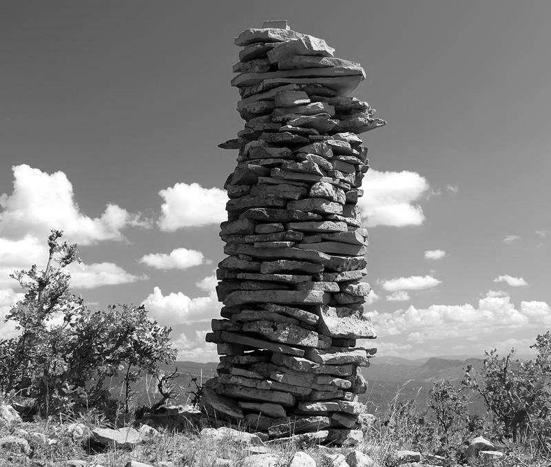
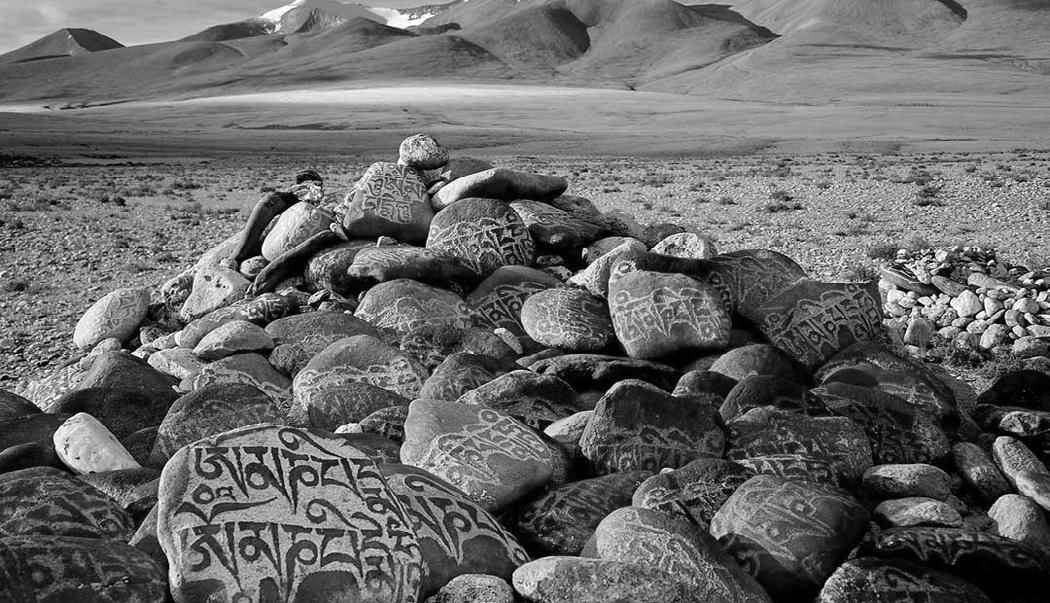
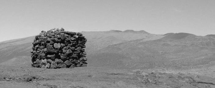
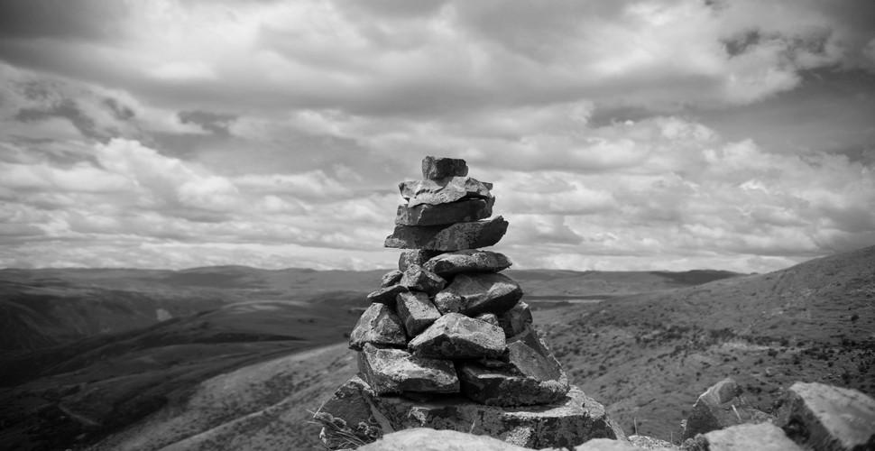
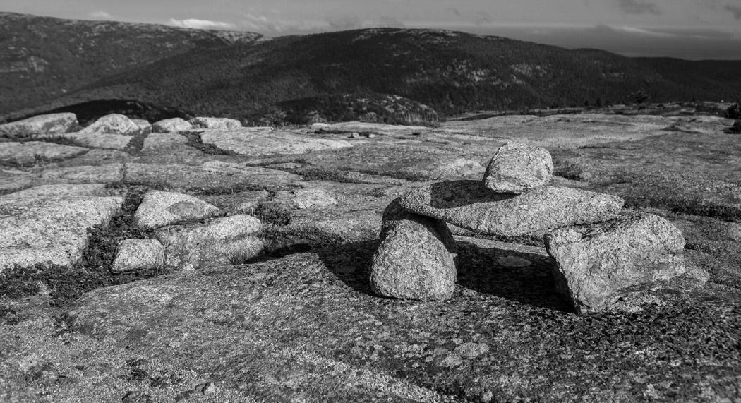
Apacheta, Andean
Bates cairn, Acadian
Isivivane, Zulu
Ovoo, Mongolian
Lele, Hawaiian
Mani stone, Tibetan
Harri mutilak, Basque
Drystone Wayfinding Case Study: Inukshuk and Inunnguaq
In Nunavut, north of so-called Canada, and other northern regions, Inuksuit (plural of Inukshuk) have long been constructed to navigate the snowy landscape and to aid in hunting or herding, for example. They often have a longer ‘arm’ or pointing stone that indicates a certain direction.
The Inunnguaq, often confused with Inukshuk, are stone stacks that take the likeness of a human figure. They carry spiritual and symbolic meanings, embodying ritual and story within the landscape and marking a sacred location.
Above right: Inunnguaq
Below right: Inukshuk in Nunavut
Below: Pudlo Pudlat, Our Mystic Landscape (1990)
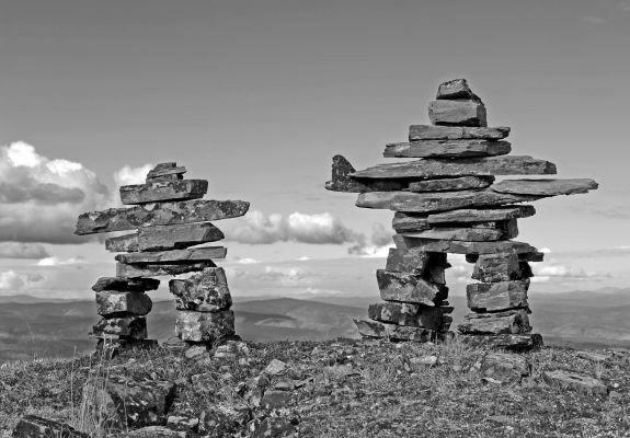
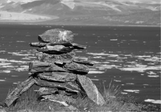
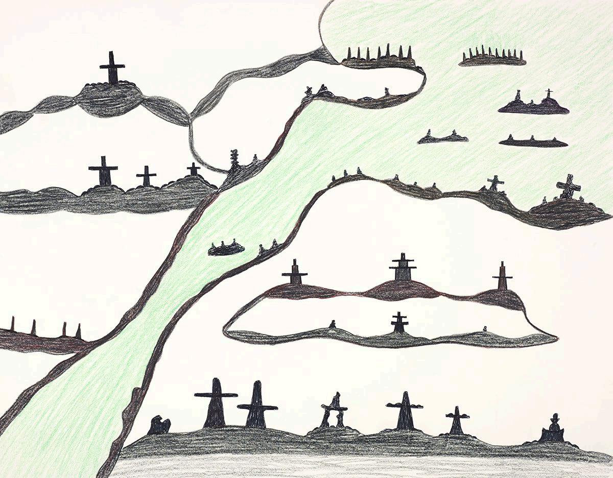
Navigating the Moorland: The Trig Point and the Cairn
Contemporary navigation in the Peak District relies on the God’s-eye map, where access regions are only clearly visible on the ordnance survey. If mapping is a form of registering the visible surface of land through a process of selection, I ask in turn,
how does the map meet the landscape?
When the trig point is seen side by side with the cairn, we can compare the two landscape devices.
The trig point is a fixed size, built to exact measure so as to provide exact topographic data. The cairn varies in size, from a few pebbles stacked on eachother to large markers over a metre tall.
While the trig point marks the OS map, the cairn marks the walked map. The trig points exist only as a network: alone, they are meaningless. Both form a kind of wayfinding network in the landscape, although this is a side-effect for the trig point: in recent years, the activity of “trig-bagging” has become popular, where hikers try to visit and document as many trig points as possible.
The process of accurately measuring a vast territory in the ordnance survey left a grid of markers across Britain. Trig points, or triangulation stations, are concrete or stone markers that give topographic information. With the advent of satellite technology, trig points are functionally obsolete, yet the popular activity of ‘trig-bagging’ has turned them into both wayfinding tools and tourist attractions.
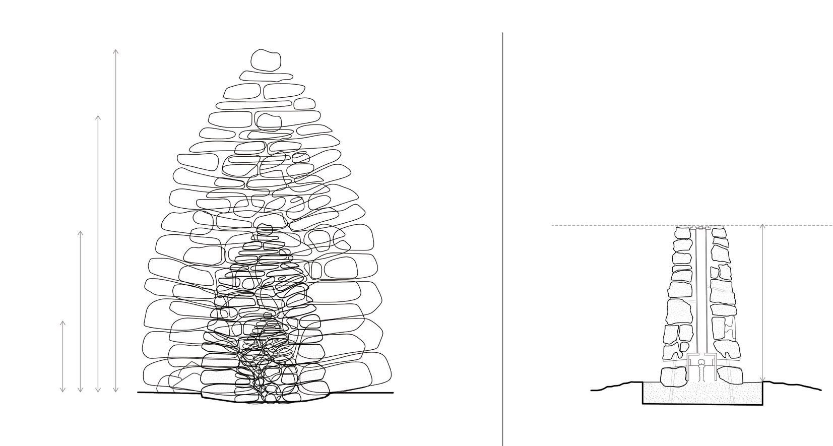
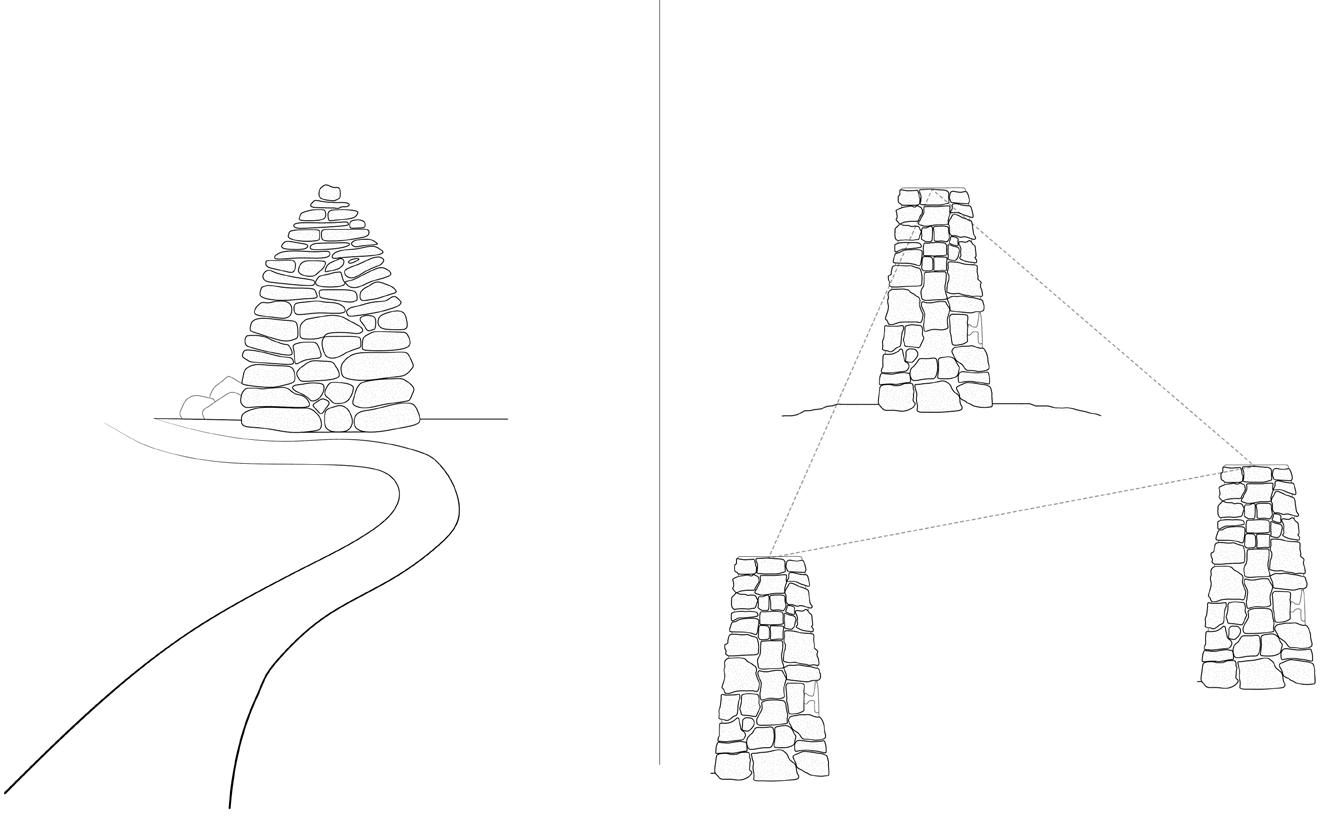
The trig point and cairn can also be compared in terms of temporality. While the cairn falls into ruin - sometimes within days, sometimes after centuries - the trig point remains relatively stable. As it is constructed wtih mortar, it is not a drystone structure; in fact, many trig points are built from concrete. How long will they last, as kinds of technoscientific ruins in the landscape?
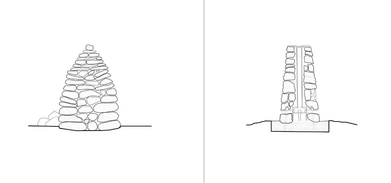
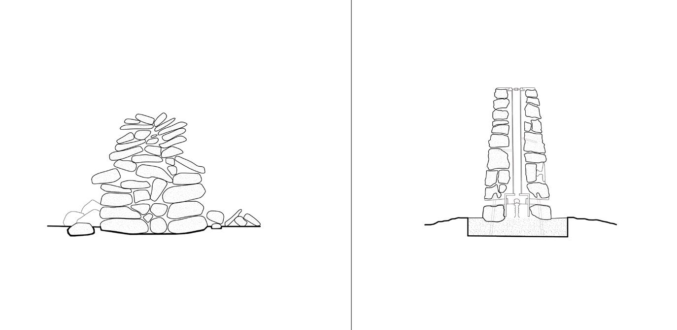
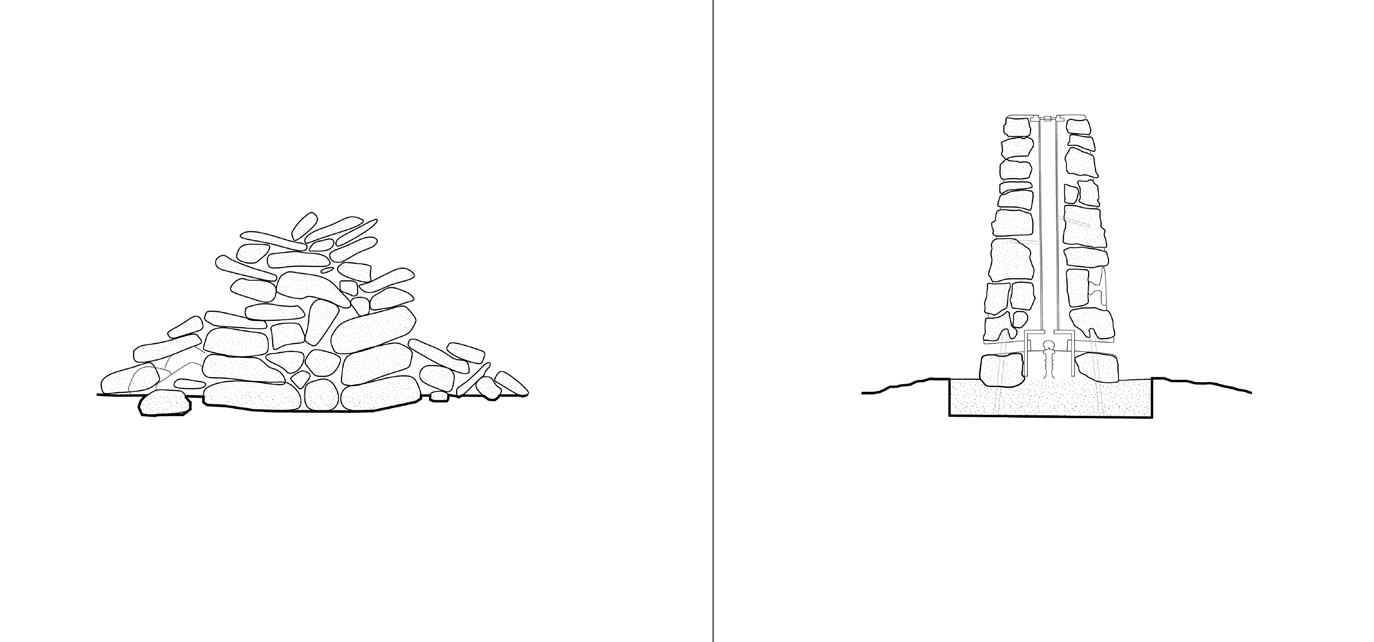
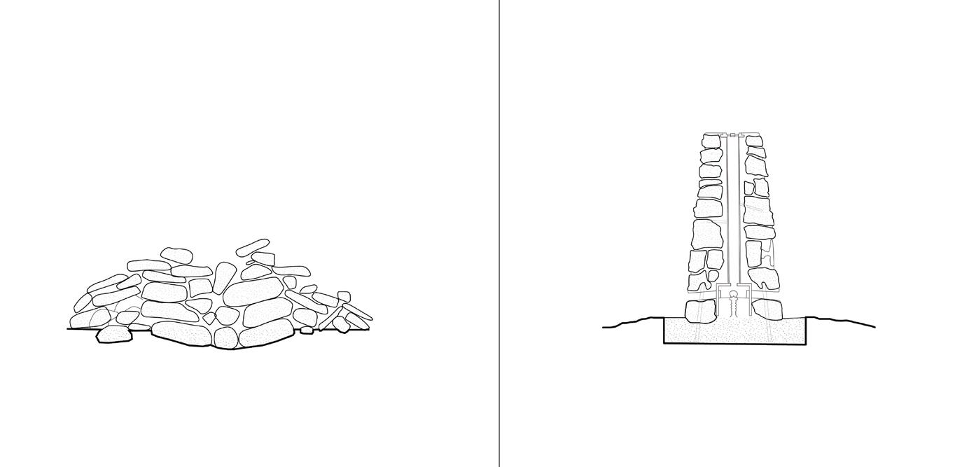
Peak District Historic Boundaries
Boundaries have long been negotiated in the moorland landscape, where markers and elements like stoops, dykes, and prominent rocks became wayfinding devices. Before standardised maps, measured surveys, or satellite imagery, boundaries demarcating ownership were far more fluid and relied on memory, oral tradition, and landmarks. Rocks played an important role in demarcating boundaries, where names were carved into prominent rocks such as the Hurkling Stone (below image). Though these elements no longer convey current ownership, they remain as markers and guides in the landscape, many noted on the ordnance survey.
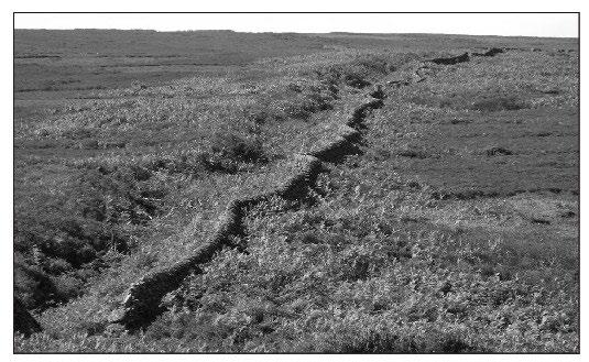
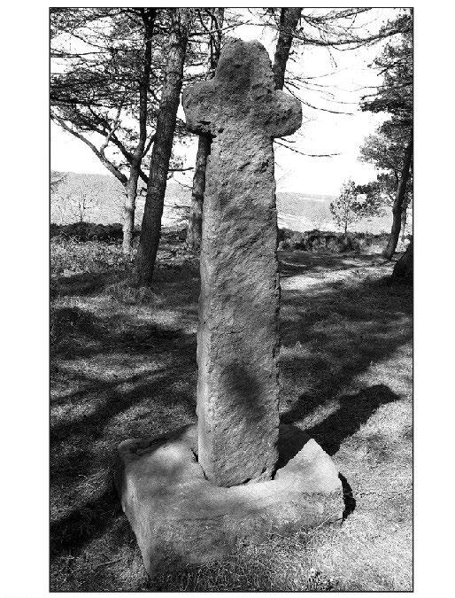
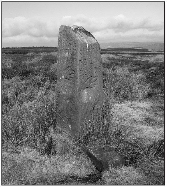
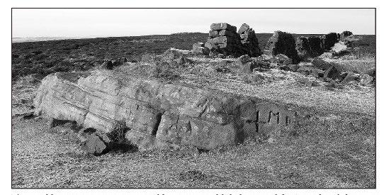
Broomhead Dyke, a medieval ditch marking a hamlet boundary
18th century guide stoop marking a route along the moors
The Hurkling Stone on the Big Moor marked with “MB” and a cross, indicating the manor of Baslow. The ‘T’ marks Totley. Hurkling meant “crousching,” refering to the rock’s form
Shillito Cross, a medieval cross marking moorland boundaries of an estate granted to Cistercian monks
Beating the Bounds: Collective Walking as Mapping
Beating the bounds, or perambulations, were yearly processions where collective walking became a way of mapping the land. During these walks, which took place at Ragationtide, parishioners would perform rituals or tricks that were memorable, imprinting each boundary into the minds of the walkers. Typically, walkers will carry canes to ‘beat’ each boundary. It is still practiced in many parishes as a community tradition.
In his history of the Peak District moors, David Hey notes that “At Rogationtide (the Monday, Tuesday and Wednesday before Ascension Day) it was the custom in many parts of England for parishioners to ‘beat’ or ‘perambulate’ their bounds, with a reading from the Gospels at certain points and amusing pranks at others, such as turning the vicar upside down and threatening to drop him into a well, so that these boundary markers would remain in young people’s memories.”
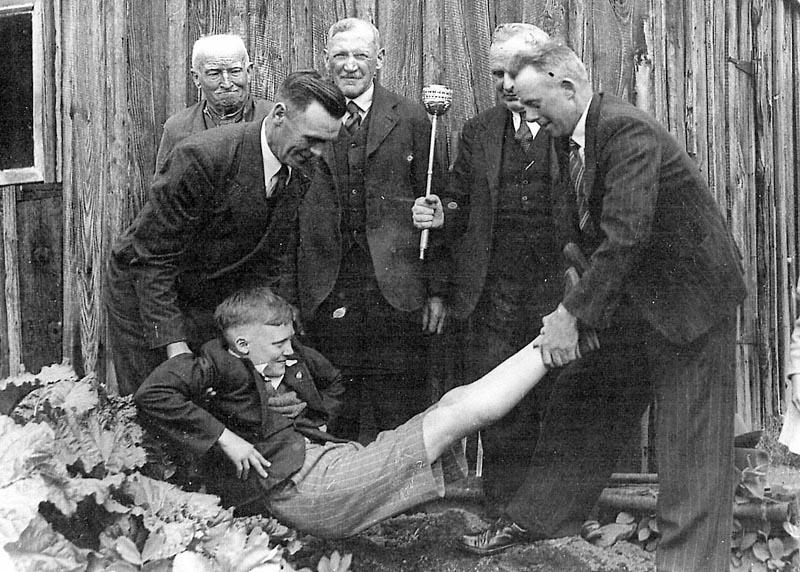
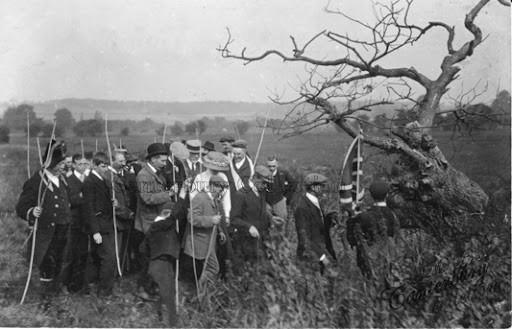
Drystone Navigation: New Wayfinding Networks
Apart from demarking boundaries, drystone walls and structures have long acted as wayfinding tools in the oftendisorienting moorland. Boundary walls form a loose grid over the landscape, providing a sense of orientation and directionality that walkers can follow up close or at a distance. Meanwhile, singular stone assemblages like cairns and stone circles act as nodes that when viewed from a distance guide ramblers. These elements also imbue the landscape with narrative, marking ritualistic or spiritual locations or sites of collective memory.
The project reimagines drystone wayfinding through the design of field stations, where transient commoners make their way through the moorland using visual and other sensorial cues for navigation. Walking between field station is a way of mapping the progressive commoning of the landscape, forming “commoning axes” that guide successive groups of visitors and forms an archive of the moorland’s ecological repair.
Trig point marked on the OS map
Cairn marked on the OS map
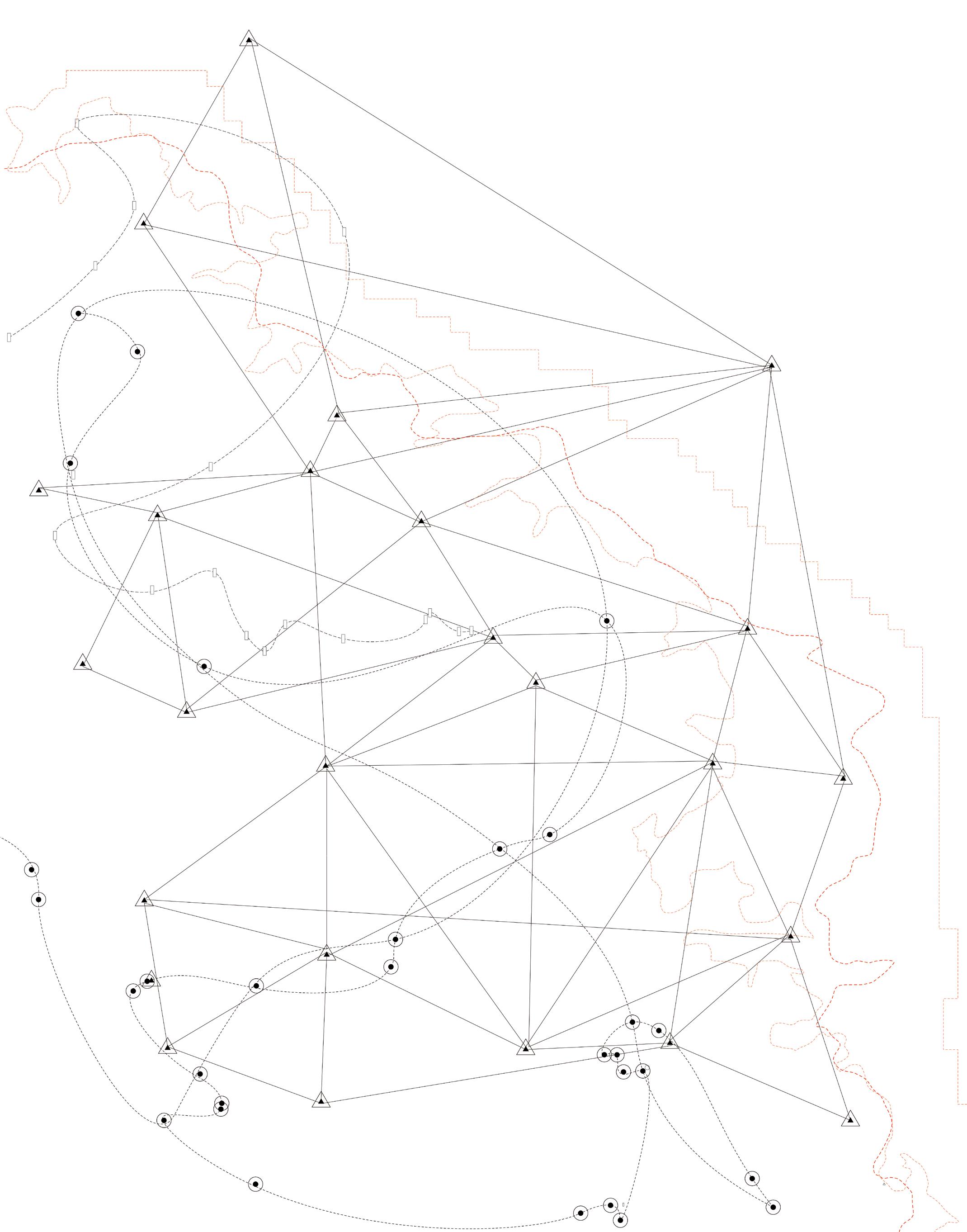
Walking as mapping.
How can walking between moorland field stations provide new forms of landscape navigation that operate beyond the top-down map? To test this, I undertook a series of individual and collective walks, afterward mapping them from memory.
Walking as Mapping, Walking as Artistic Practice: Case Studies
Through the walked map, elements in the visual field become coordinates within a mental image of landscape. This is a subjective and relational form of mapping, where to move through a landscape is to both affect it and be affected by it; it’s an embodied practice. Walking has long been a subject of interest to artists and a form of artistic practice, the most famous of such being the work of the Situationist International and their psychogeographic ramblings of Paris.
With its critique of the top-down map, the project imagines a drystone wayfinding network allowing for the creation of embodied map-making through walking the moorlands. These references, artistic experiments in walking-as-mapping, influence my speculations on the design of drystone field stations and their role as navigational devices, calling for an altered perception of the moorland and new forms of caring for the ecological landscape.
Vito Acconci’s 1969 “Following Piece” communicates his process of following strangers until they entered a building. Although ethically dubious, Acconci’s act of following allowed him to relinquish agency; the artistic piece is kind of unknowing collaboration between him and the subject being followed. The idea of walking by following is interesting to apply to non-human agents, such as drystone walls.
Guy Debord’s 1957 “The Naked City” maps a psychogeographic walk through Paris, or derive, showing how the experience of the walkers was fragmented and discontinuous. The physchogeographic maps made by the Situationist International challenges the omniscient and measured gaze of the top-down map, revealing it as an illusion.
Richard Long’s famous 1967 land art piece, “A Line Made By Walking,” reveals walking as a process of imprinting the landscape: of drawing lines with one’s feet. In this sense, walking is a form of both mental and physical mark-making, both acting temporally. Unlike the line drawn on the measured survey, the line made by walking is a temporary appearance, soon to be grown over and erased.
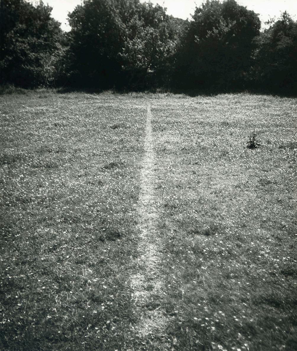
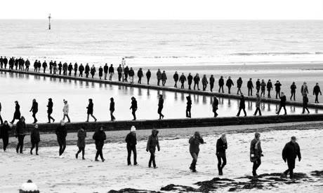
Hamish Fulton is a walking artist: his entire practice exists through walking. As a result, any visual material documenting his walks are peripheral to the process of walking itself. This group walk creates a temporal line across the landscape through the bodies of the walkers.
Fieldwork: Walking Maps
Map-maaking from memory has long been popular with psychogeographers. In charting my routes right after finishing them, I record fleeting and subjective memories, impressions, and observations.
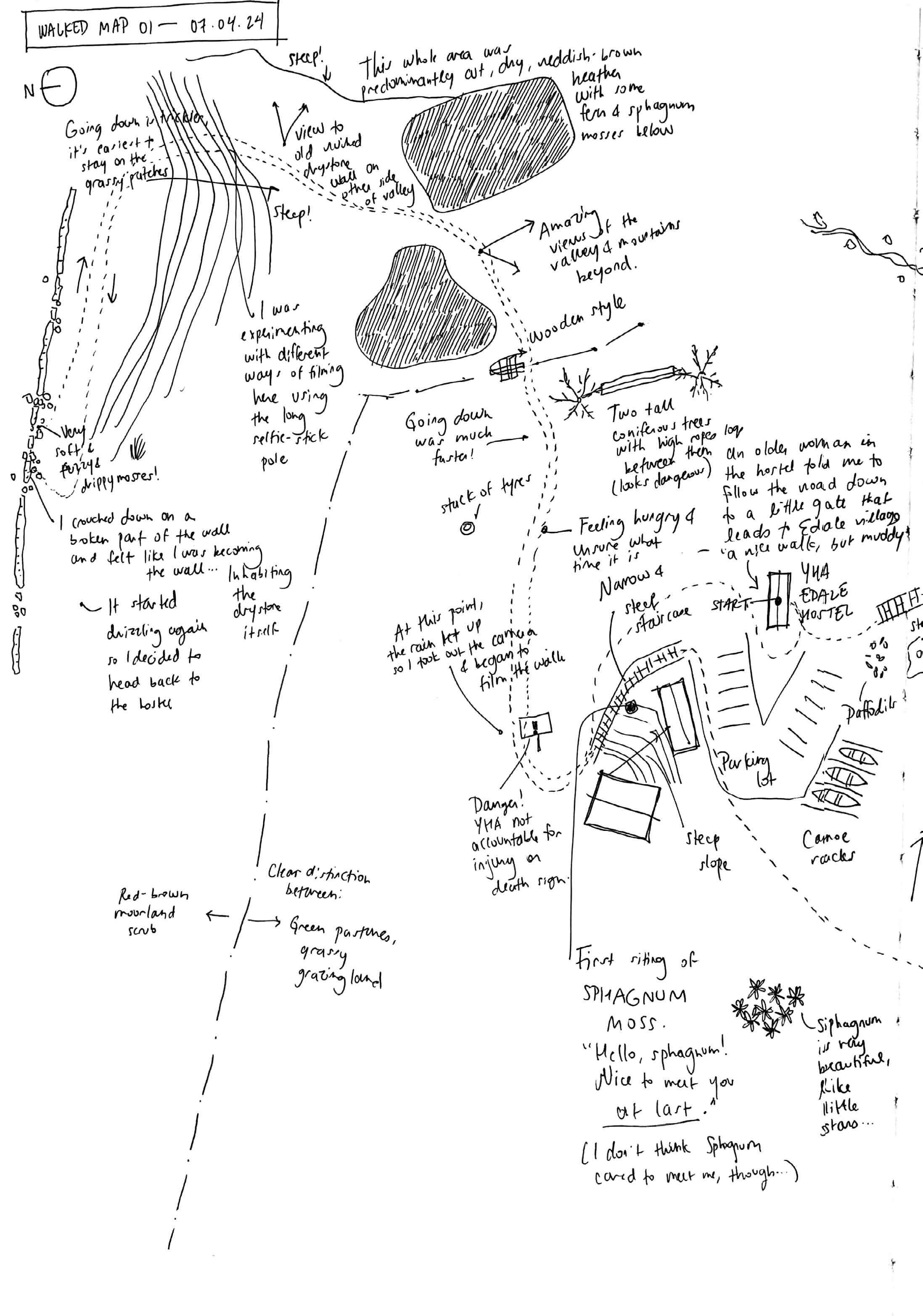
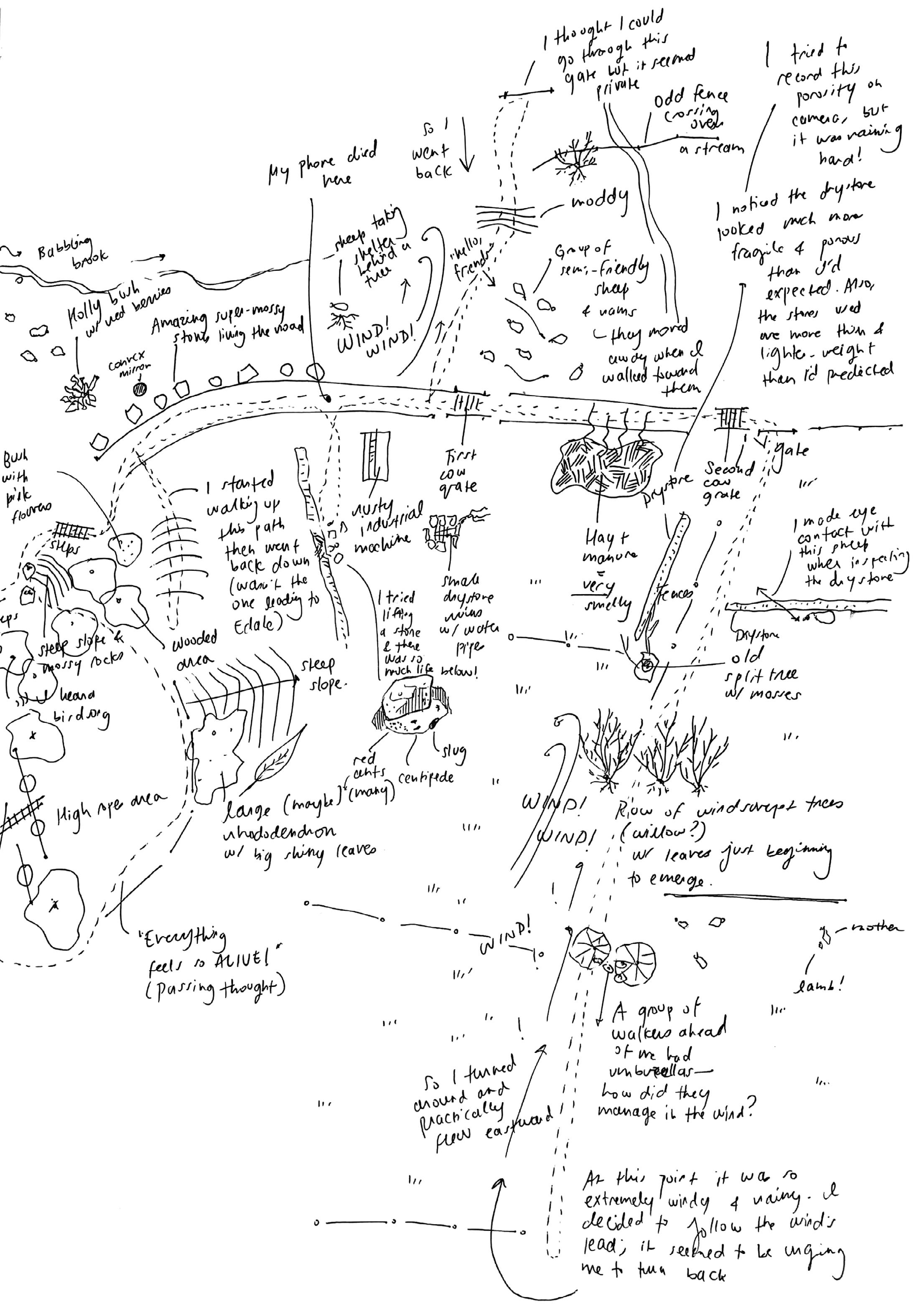

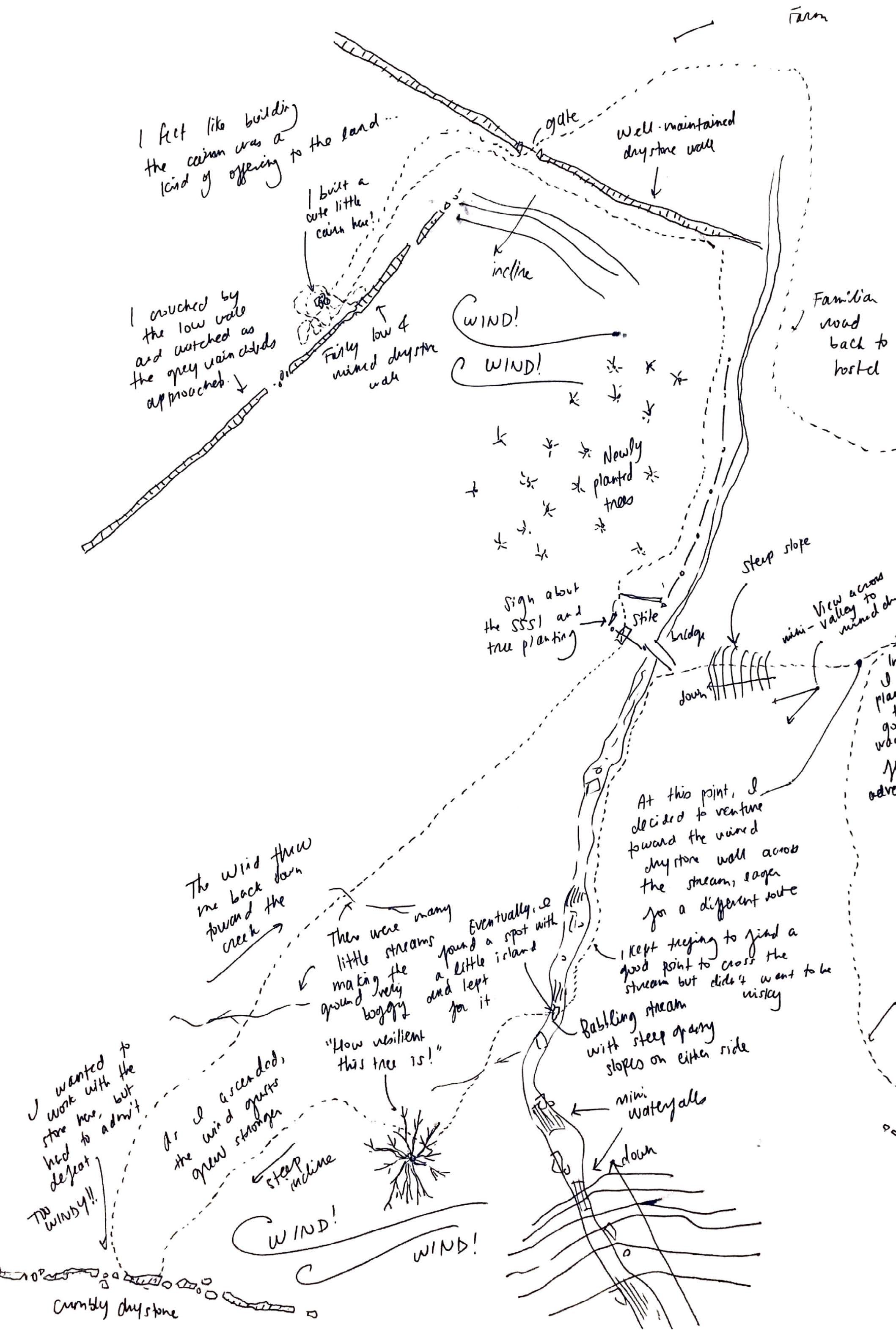
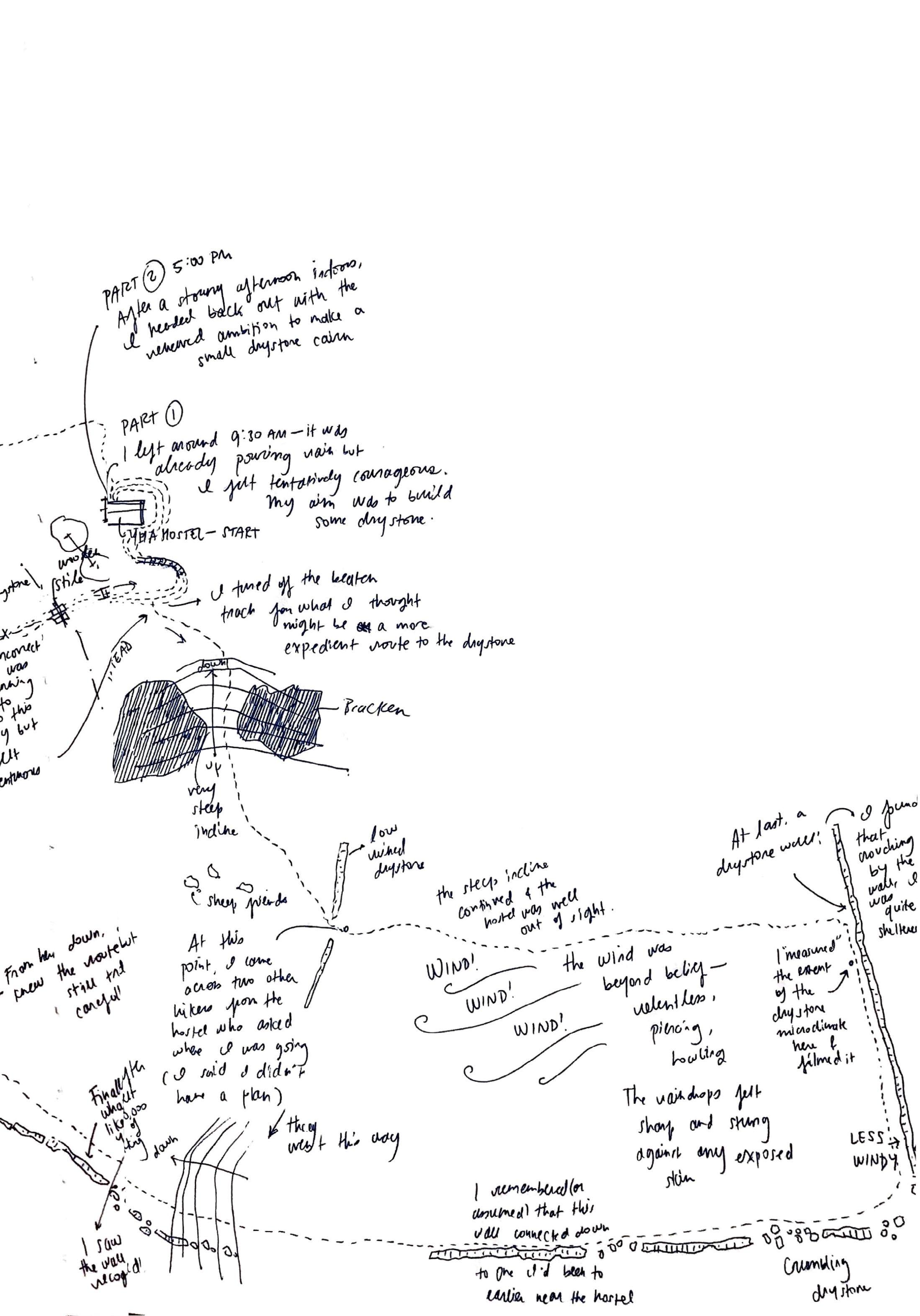

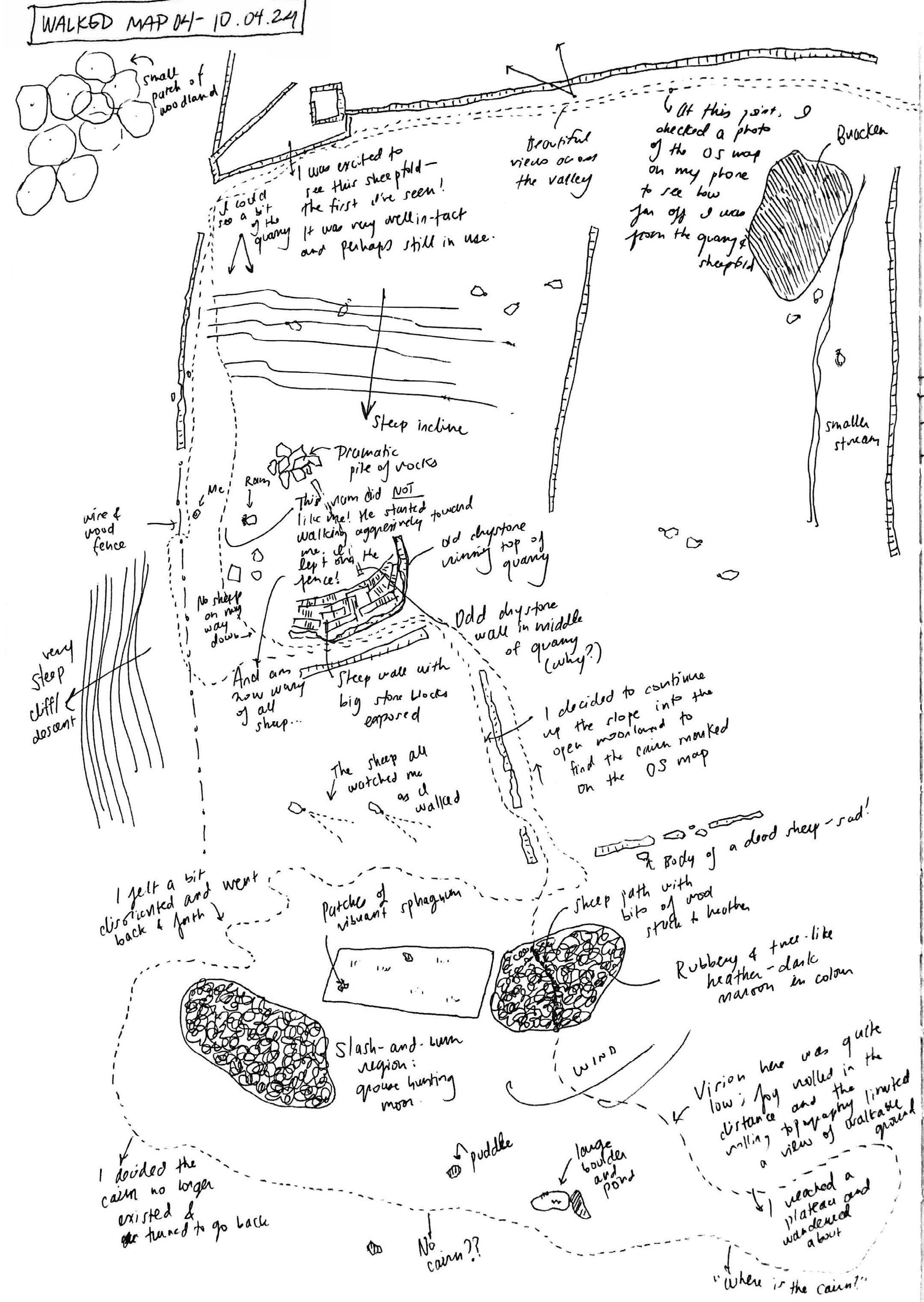
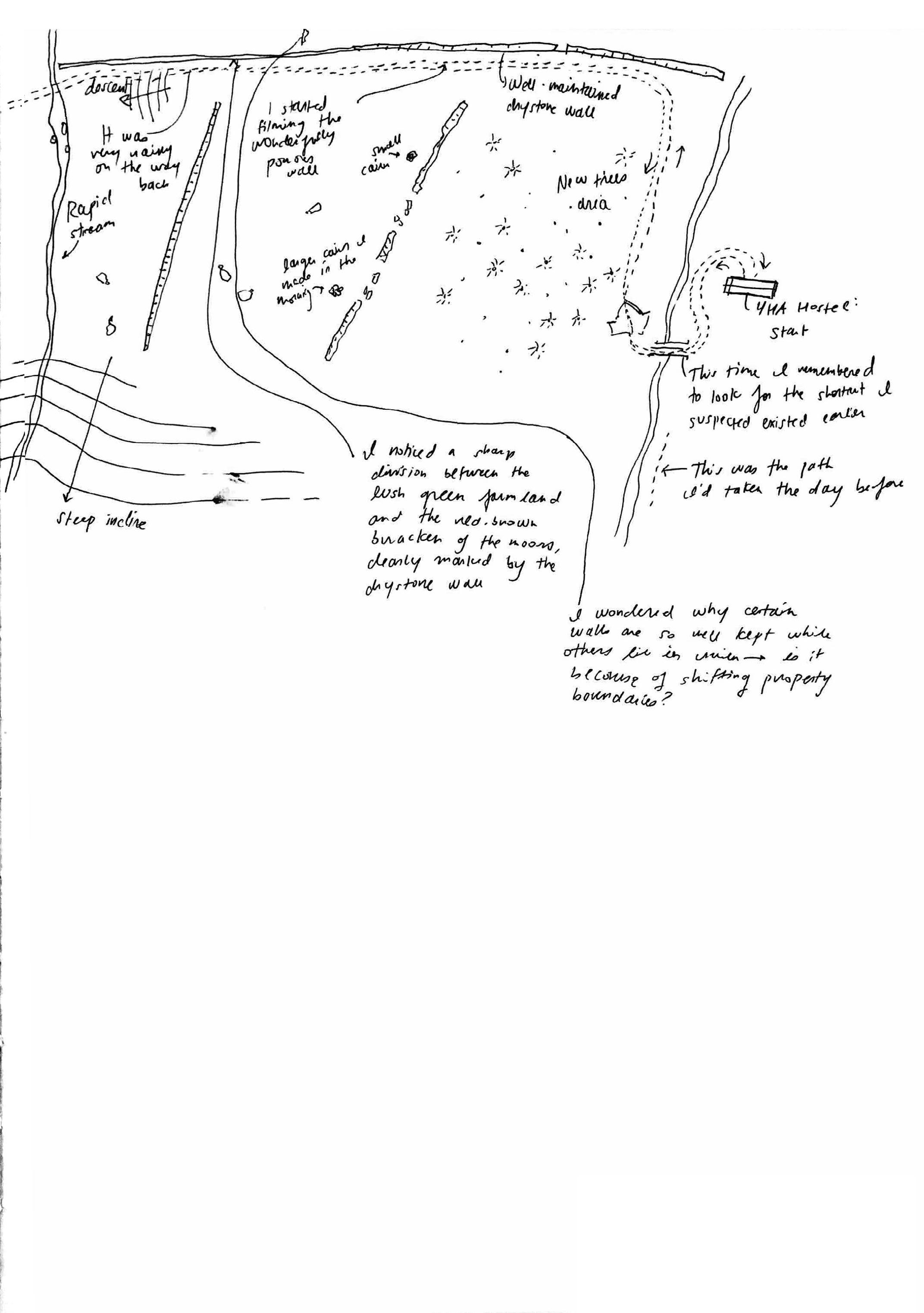
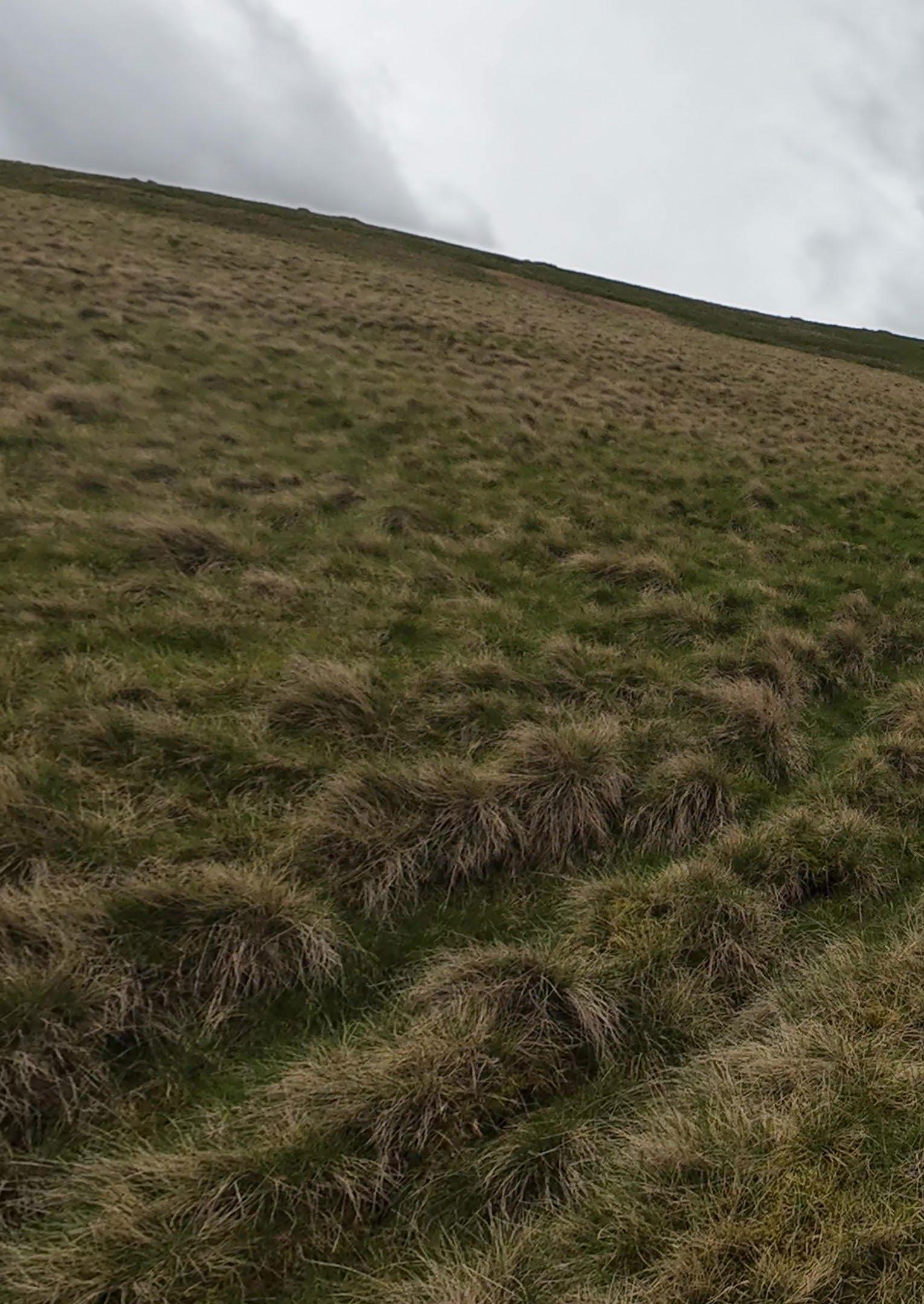
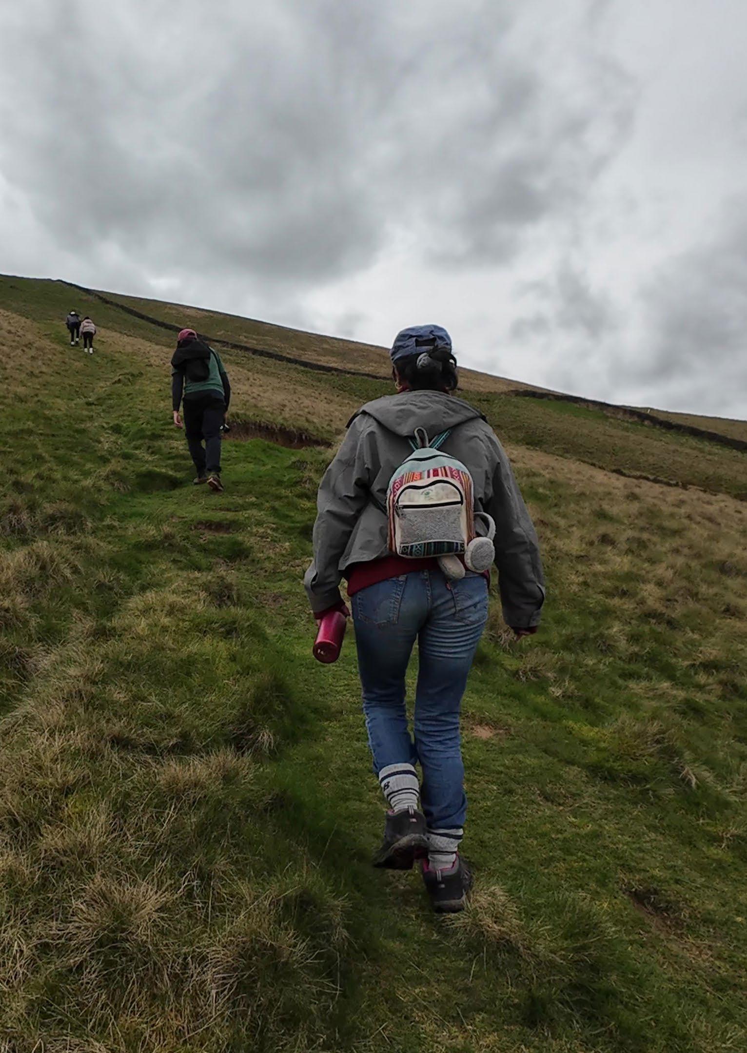
On April 8th, I went on a collective walk with Sharvaree, Jay, Aditya, and Nikita. We walked through fields and up tufty slopes, finally reaching a ridge overlooking two valleys. We stopped frequently and got distracted; we fell over and helped each other rinse muddy knees off in streams; we felt short of breath and took rest stops; we encouraged each other to take the last few steps before reaching the top of a hill. The way we walked—and remembered the walk—became a form of mapping the landscape that is entirely different to the solo walk.
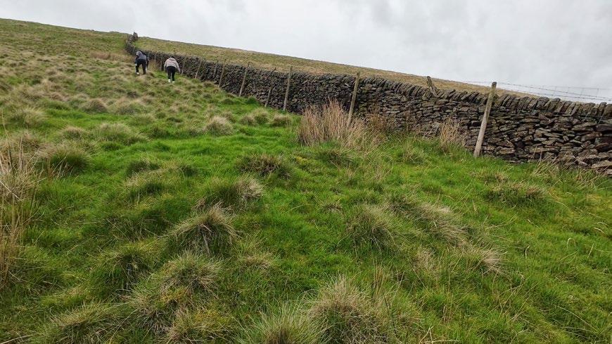
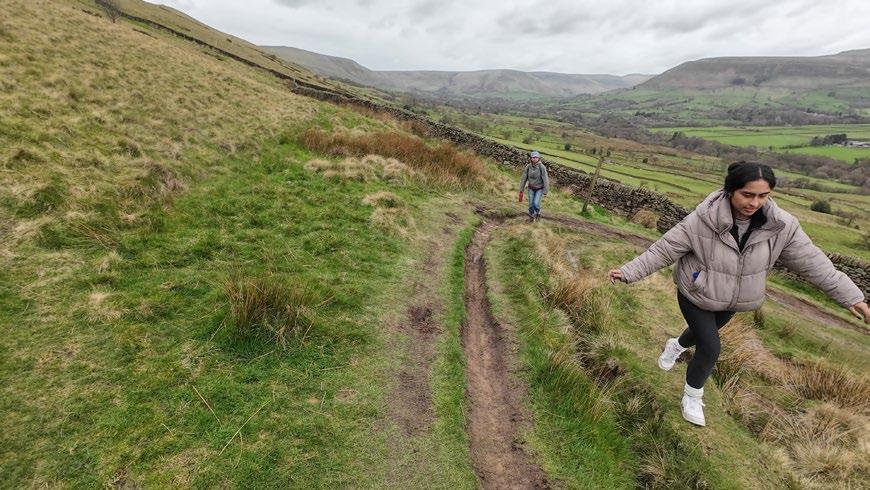
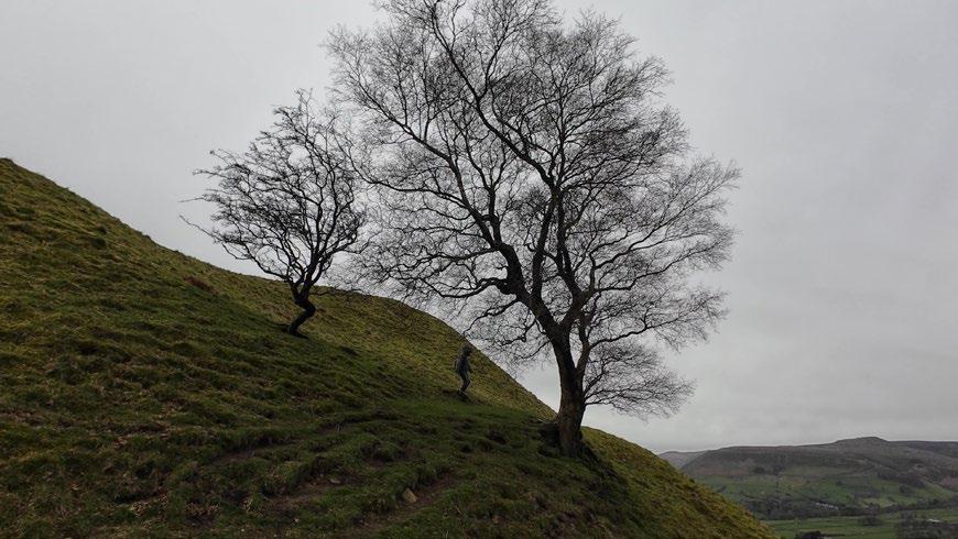
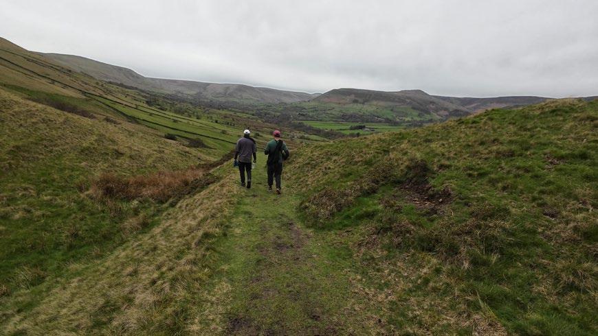
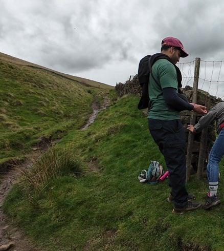
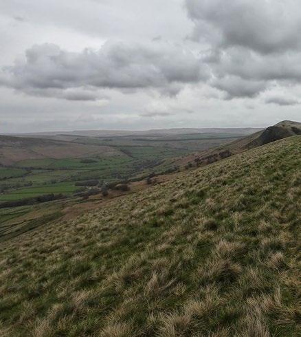
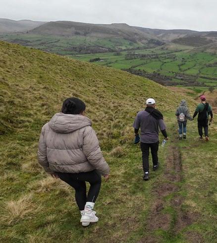
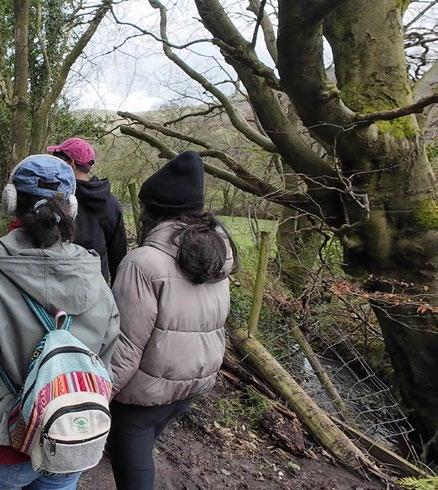
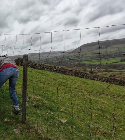
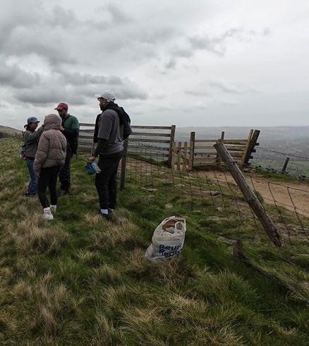
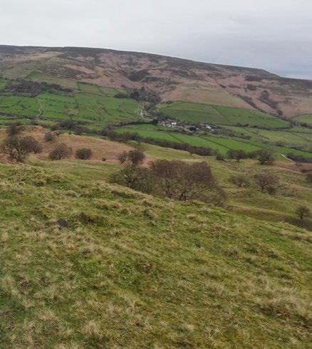
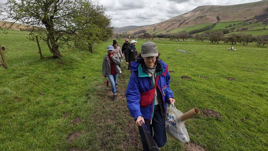
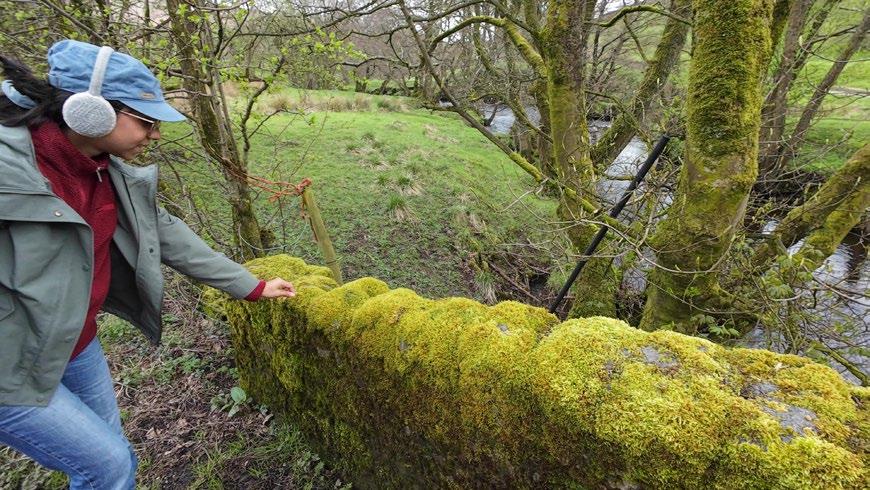
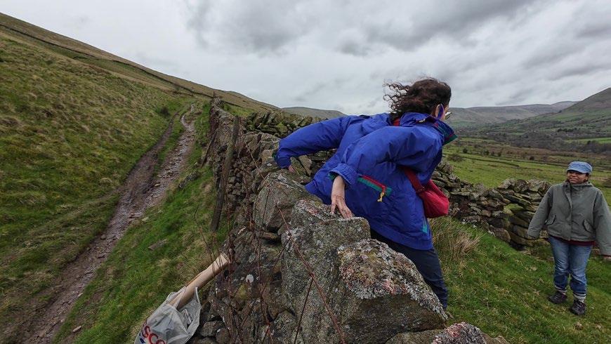
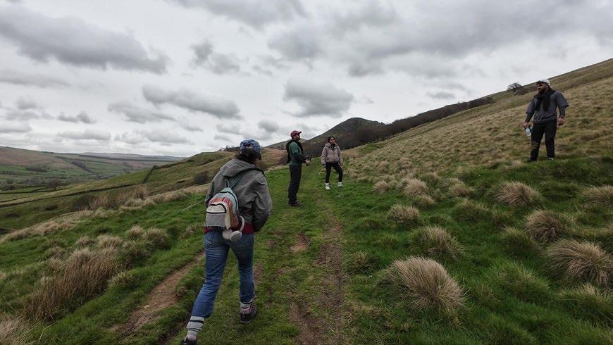
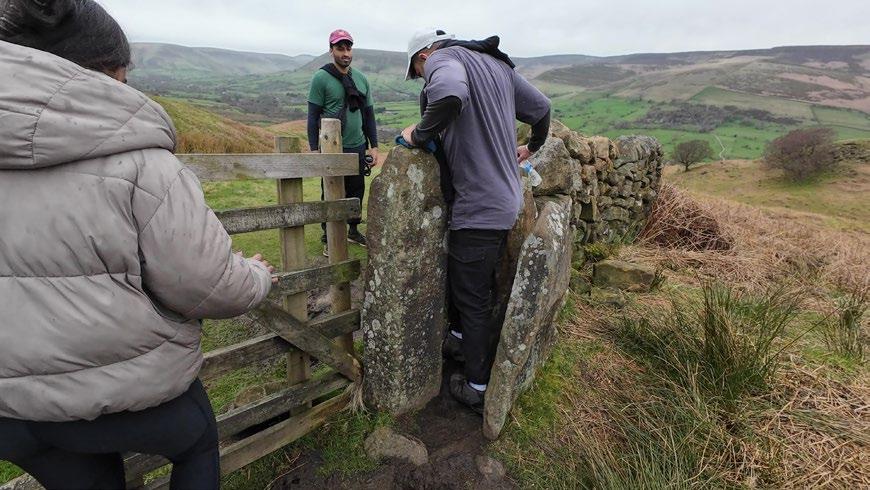
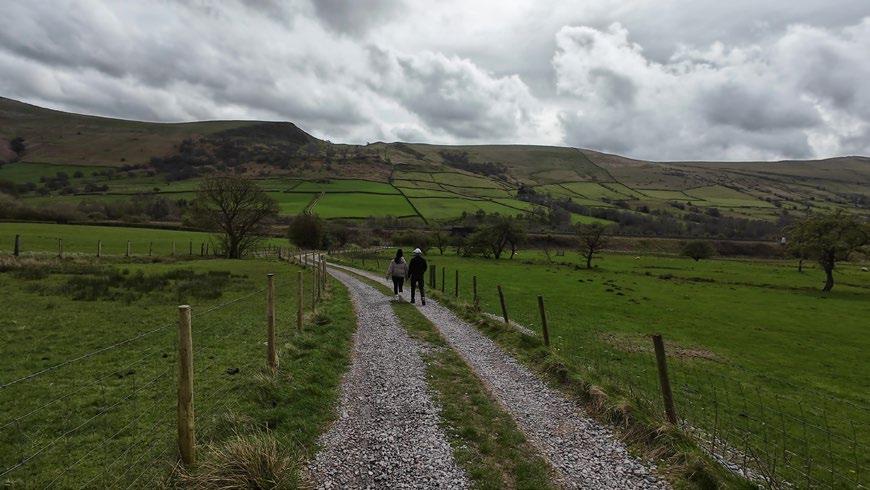
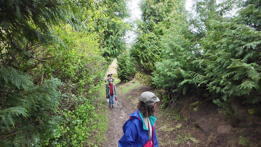
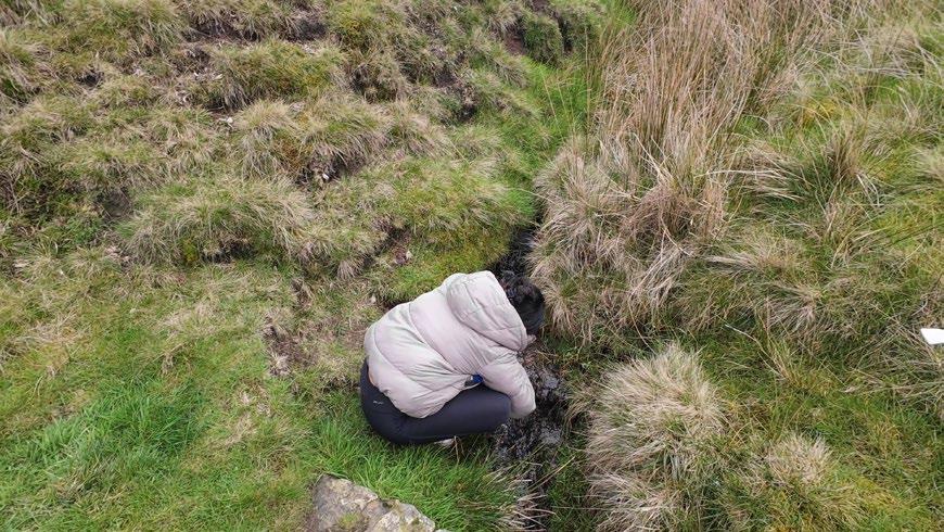
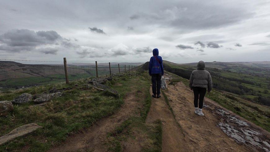
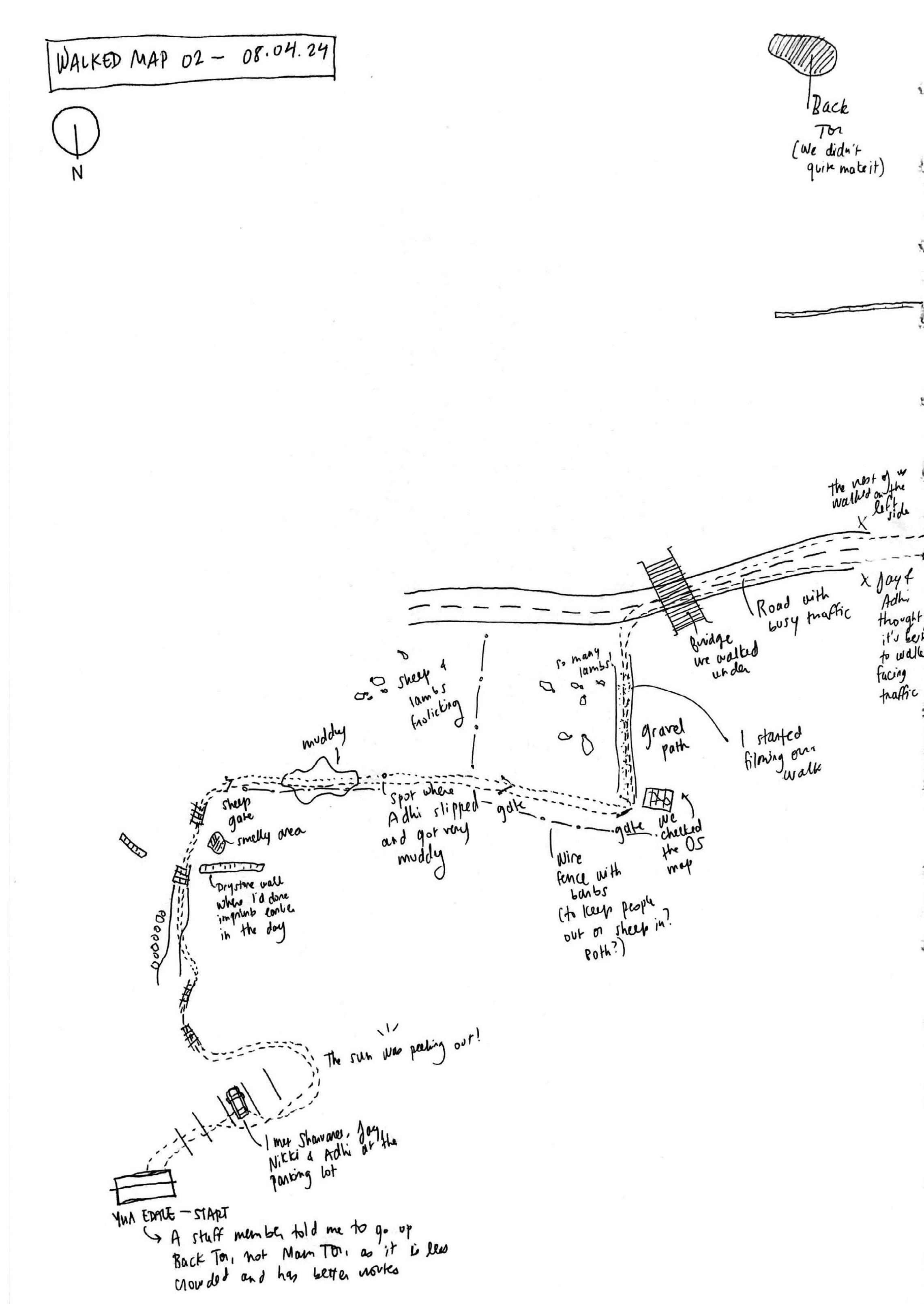
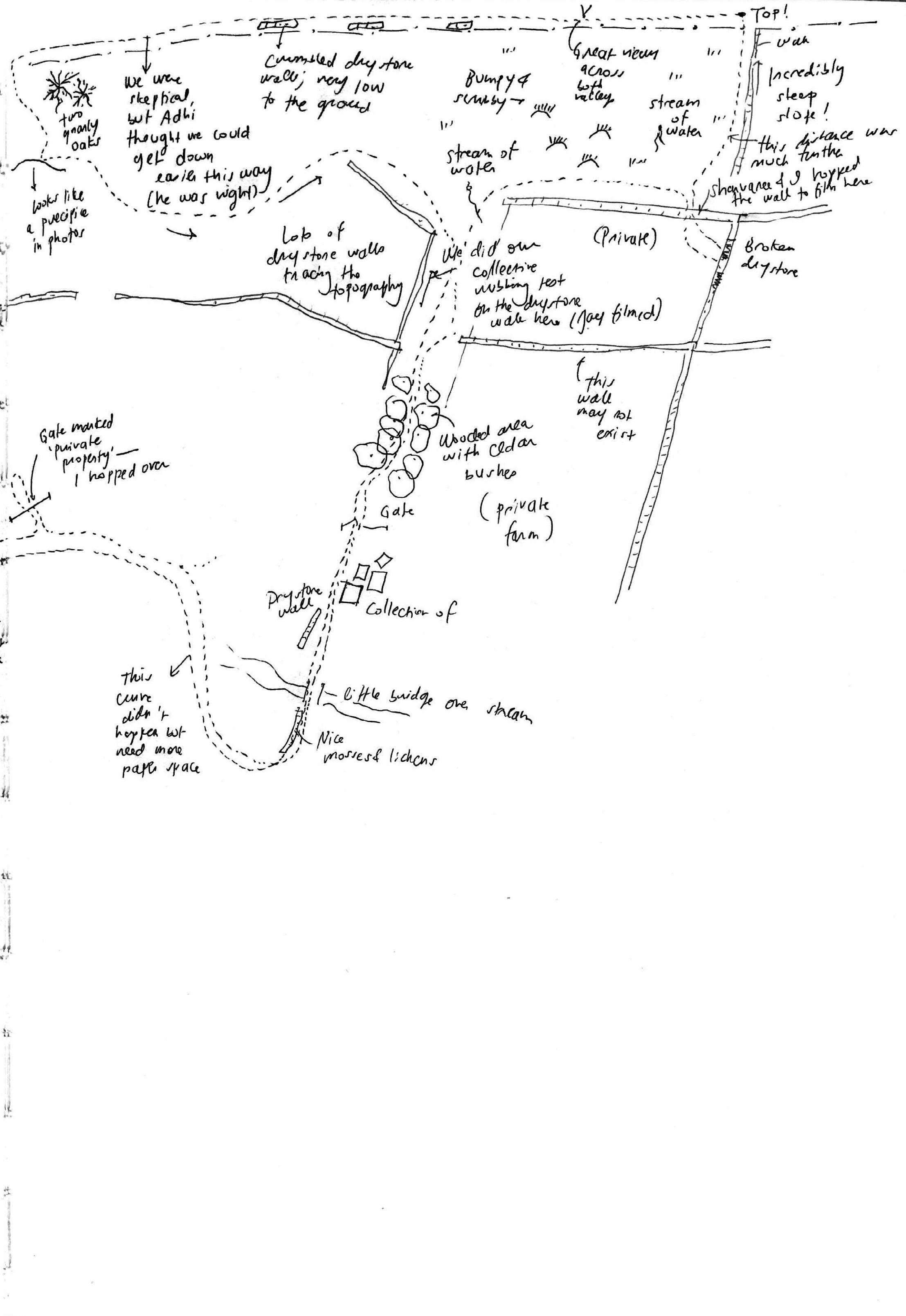
Map of the Collective Walk: Nikita
I asked the others who took part in the walk to draw the route from memory. This is what they came up with.
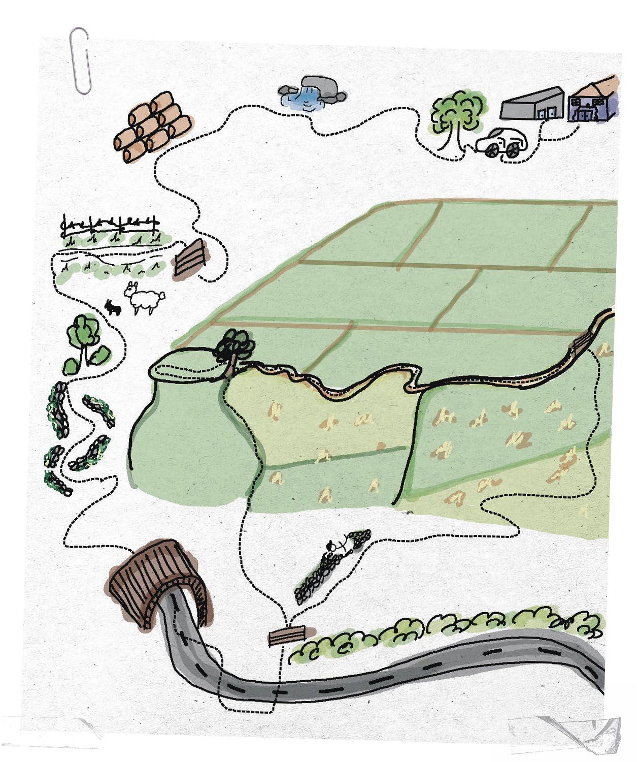
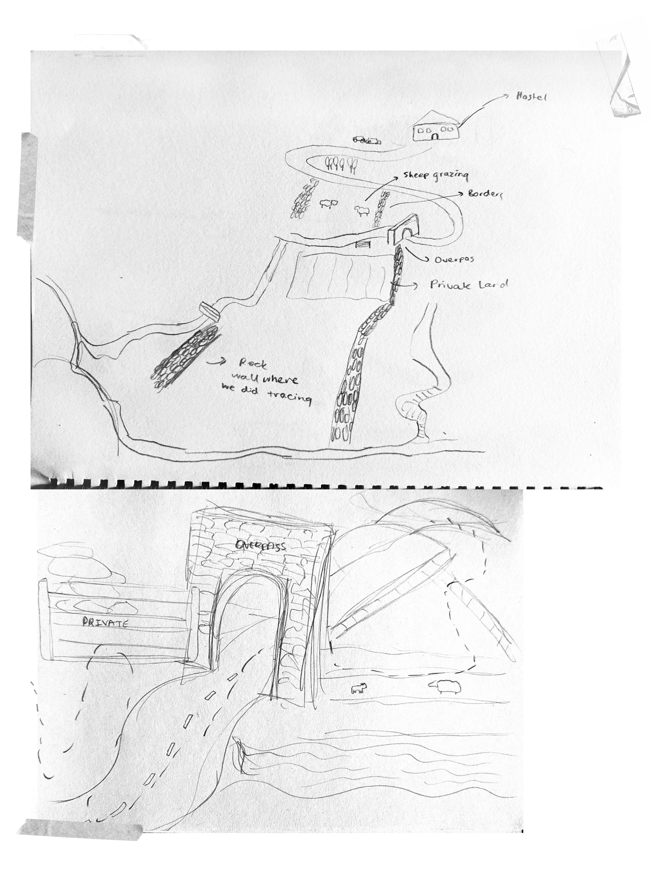
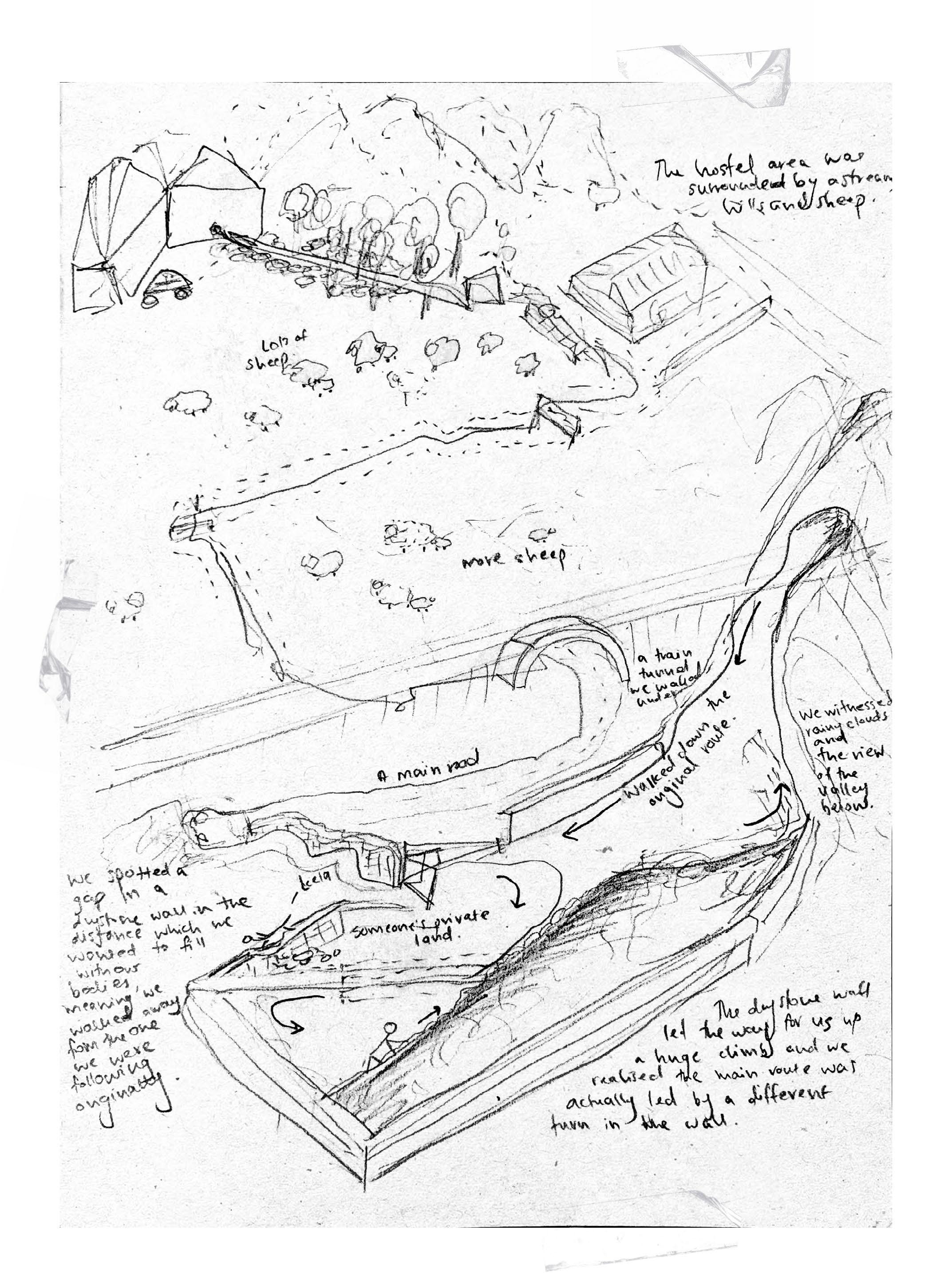
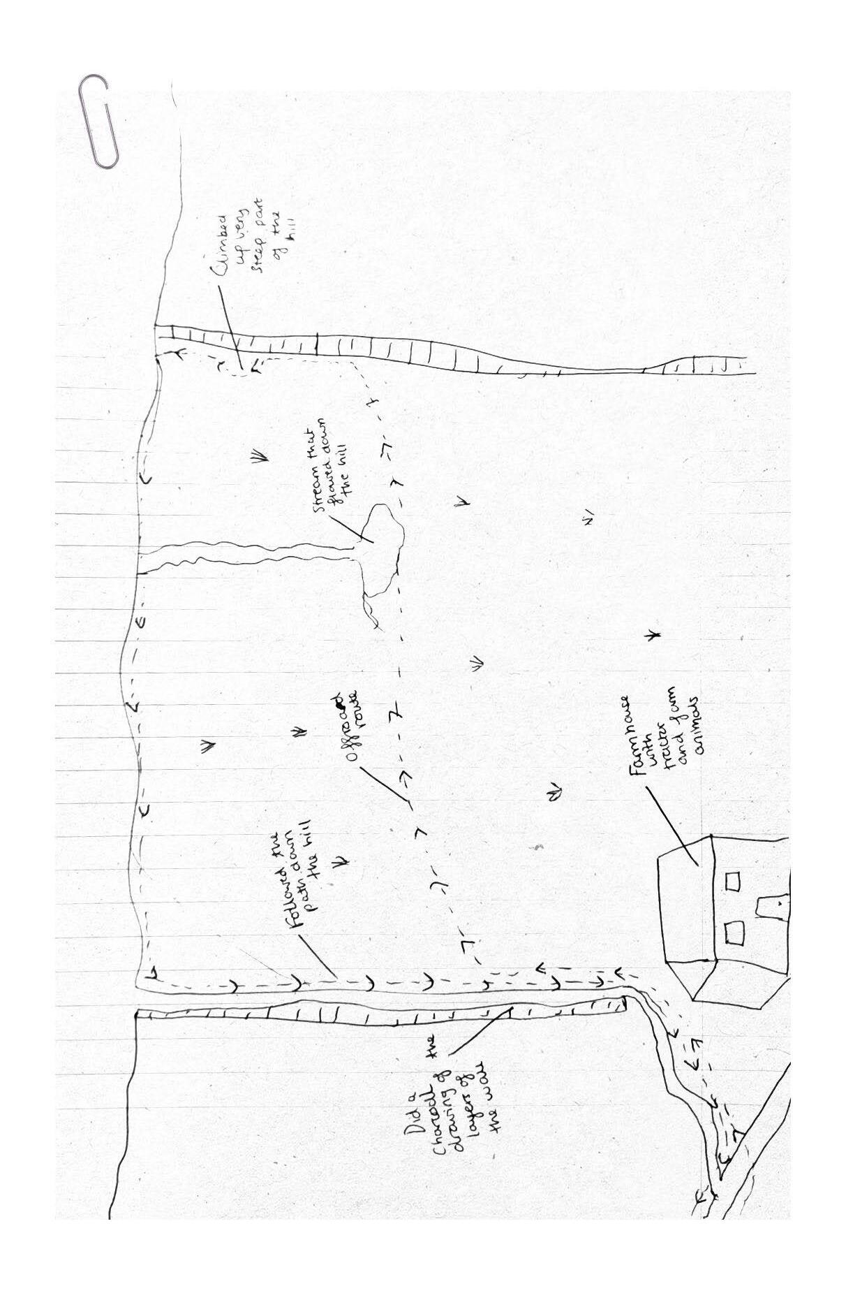
Imprint-mapping.
This series of embodied maps test forms of imprinting drystone at a scale of 1:1. These tactile, ambiguous surfaces become modes of recording drystone and orienting oneself within a geologic landscape.
Imprint-Mapping Test 01: Clay Imprints
The project is interested in forms of situated and embodied mapping that challenges the top-down map view. To test this idea, I made a series of imprints of drystone walls using a variety of materials and techniques. By imprinting fragments of certain walls, I made 1:1 maps that reflect a specific time, material interaction, and way of learning-with rock.
The first series of tests used air-dry clay to imprint small portions of rocks, carrying their texture and small pieces of mosses and lichens. I found it interesting that when pressed
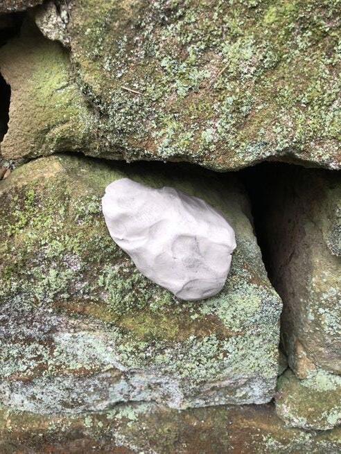
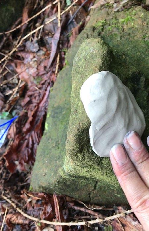
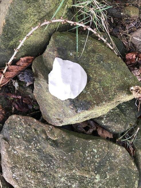

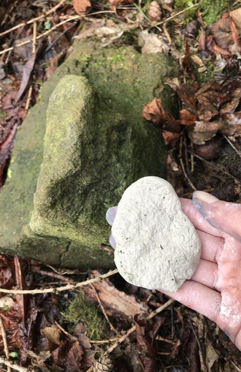
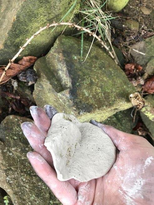
into the stones, the clay looks almost like a lichen; once removed, the fragment is a kind of decontextualised blueprint to the wall. The imprint tests reveal mapping as a necessarily biased and subjective process, situating myself as a mapmaking within the Peak District and countering the God-trick map that presumes objectivity.
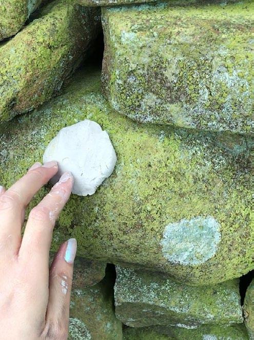
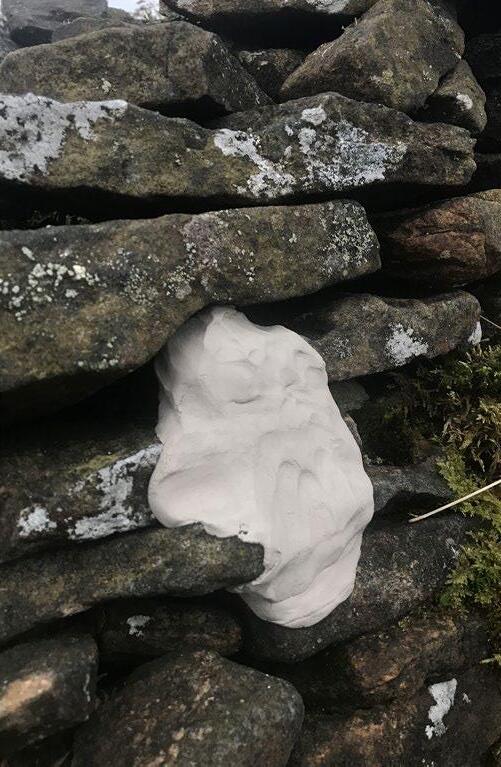
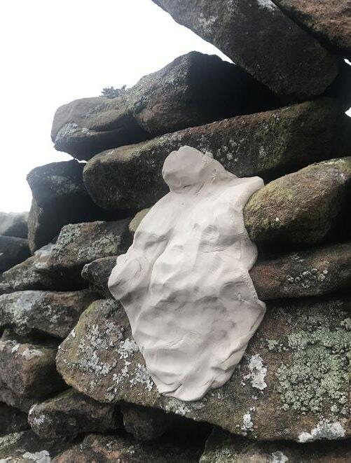
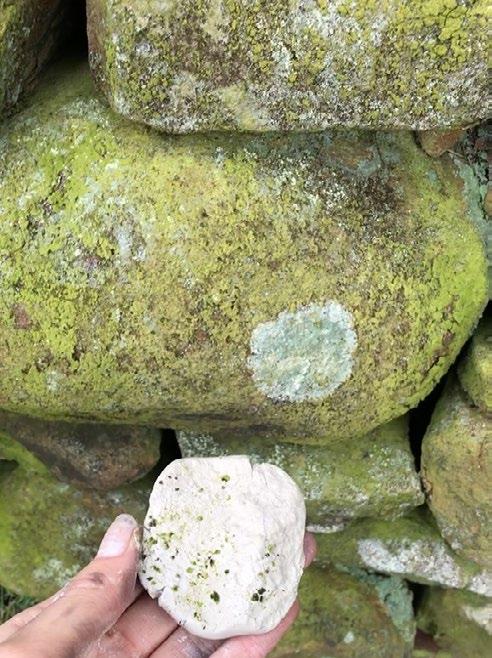
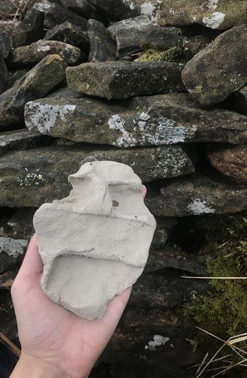
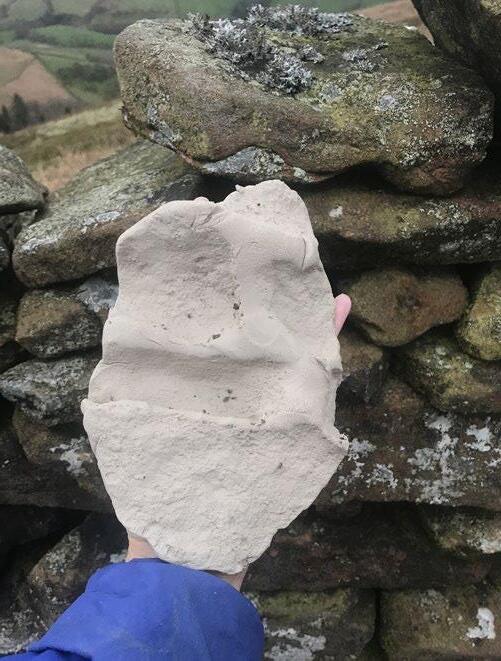
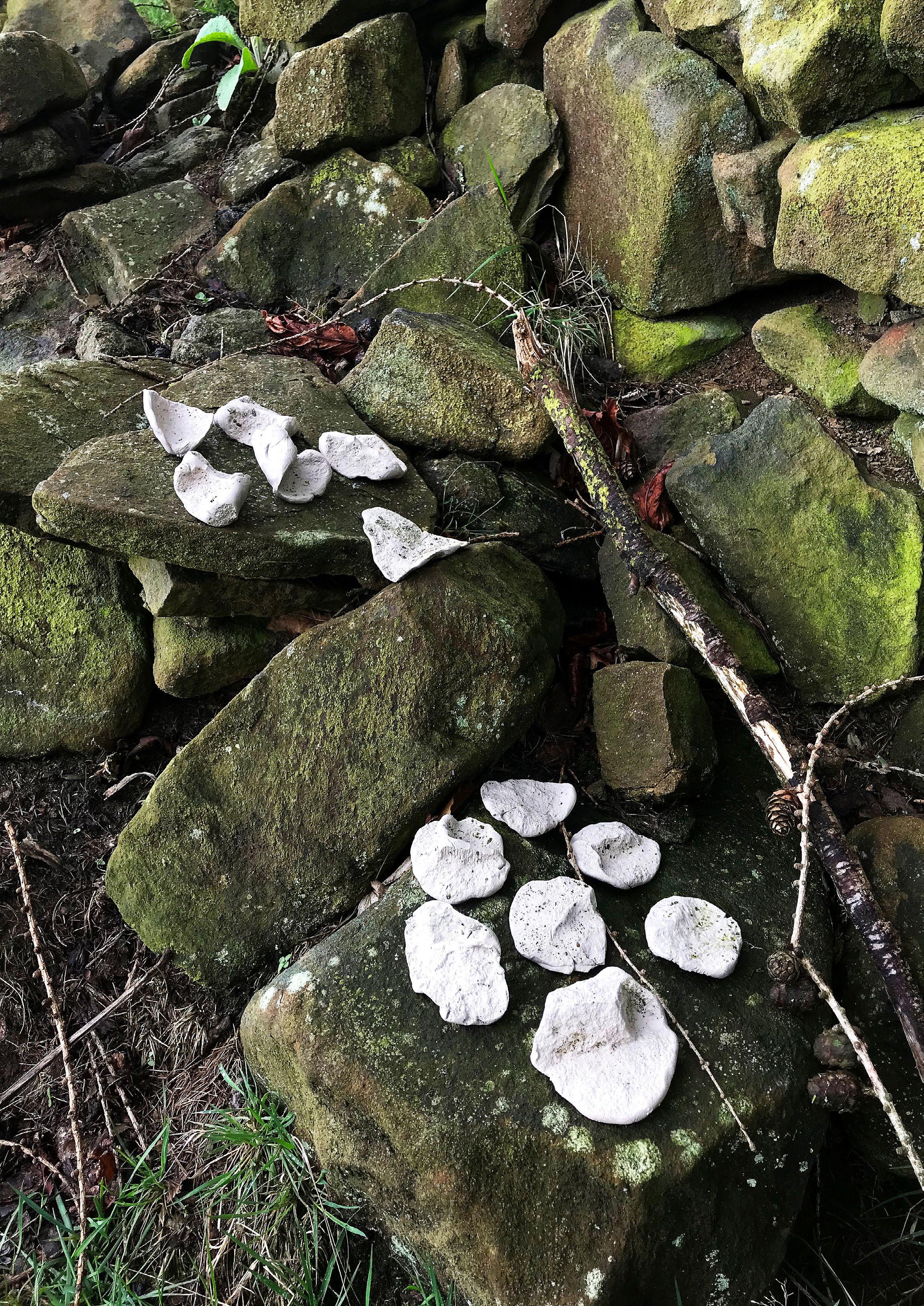
Imprint-Mapping Test 02: Drystone Charcoal Rubbing
To make a rubbing is to imprint a material surface onto paper: an impression of the three dimensional rock caught as a series of two dimension charcoal marks. The rubbing is a kind of 1:1 map of drystone, but it is a fuzzy form of cartography: fluid, smudgy, and subjective. This series of rubbing tests respond to theorist Donna Haraway’s conception of ‘situated knowledges’, where my body in communication with the specific stones form an embodied, site-specific knowledge where I as a human is decentred. The rocks, the moss, the paper, and the charcoal are all agents who act in conjunction with one another in the creation of the rubbing-map.
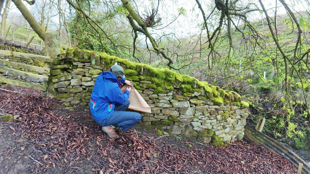
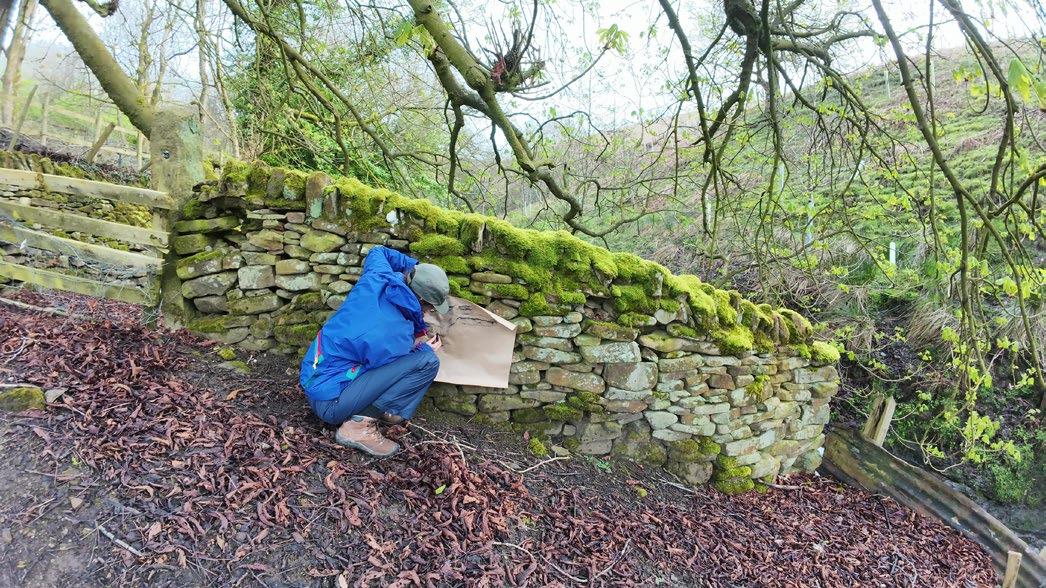
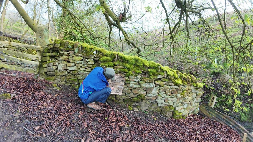
Making these rubbings was surprising challenging and even physically exerting. By covering up the wall with paper, I obscured the pattern of the stones beneath. This pattern was then revealed through the rubbing process, where pressing charcoal against the surface of the paper revealed the edges and textures of the rocks below. This felt like a drawing-with process, a collaborative act of making between myself and the rocks.
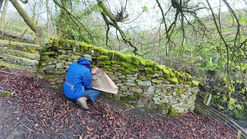
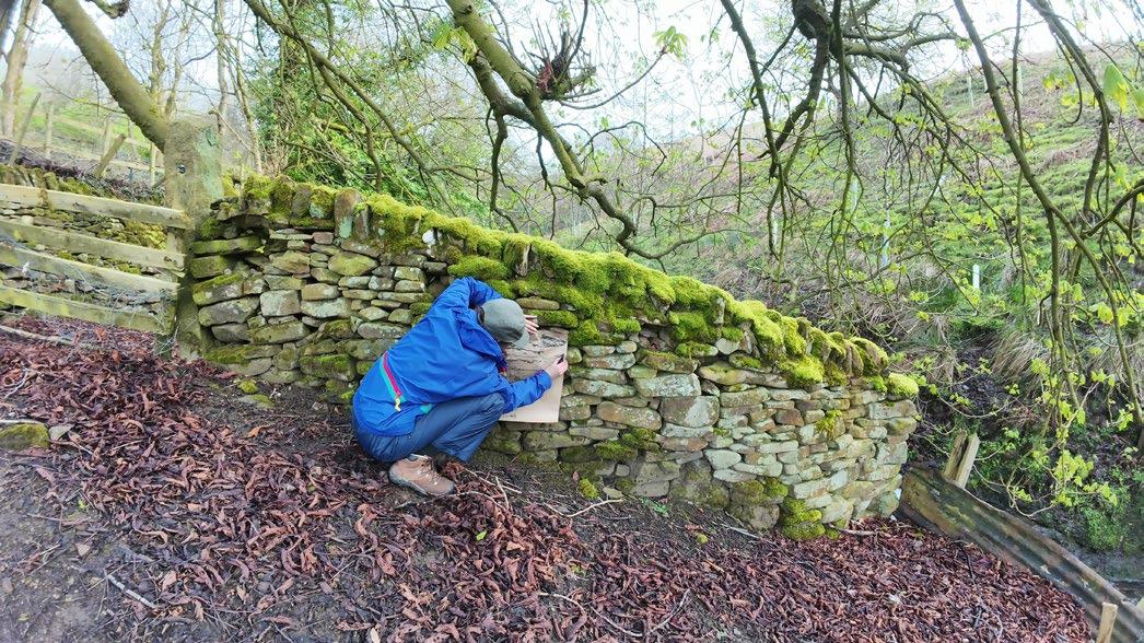
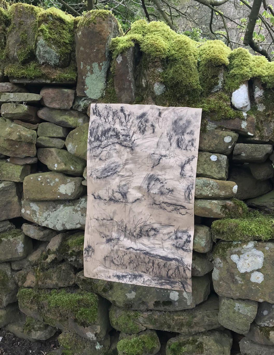
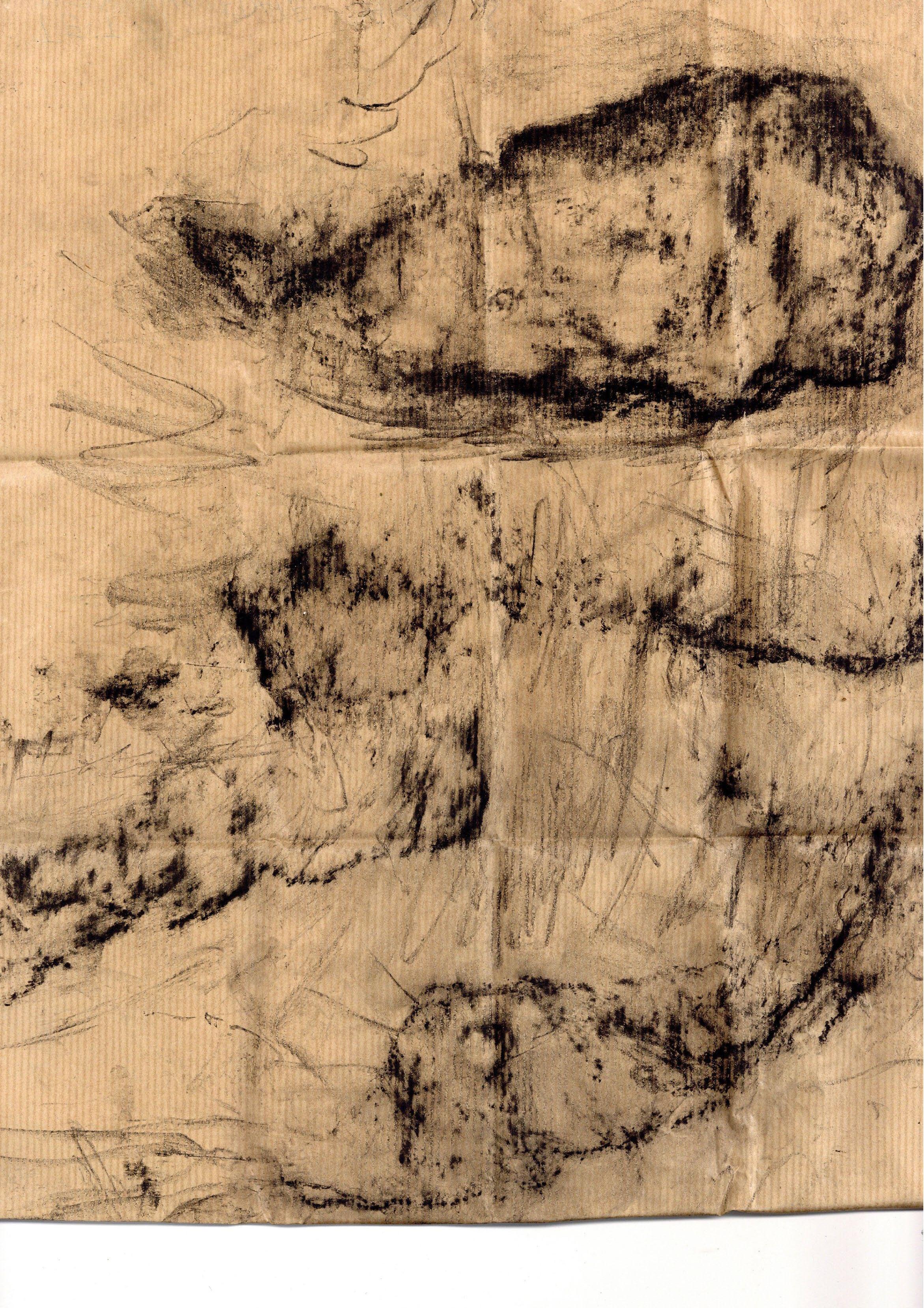
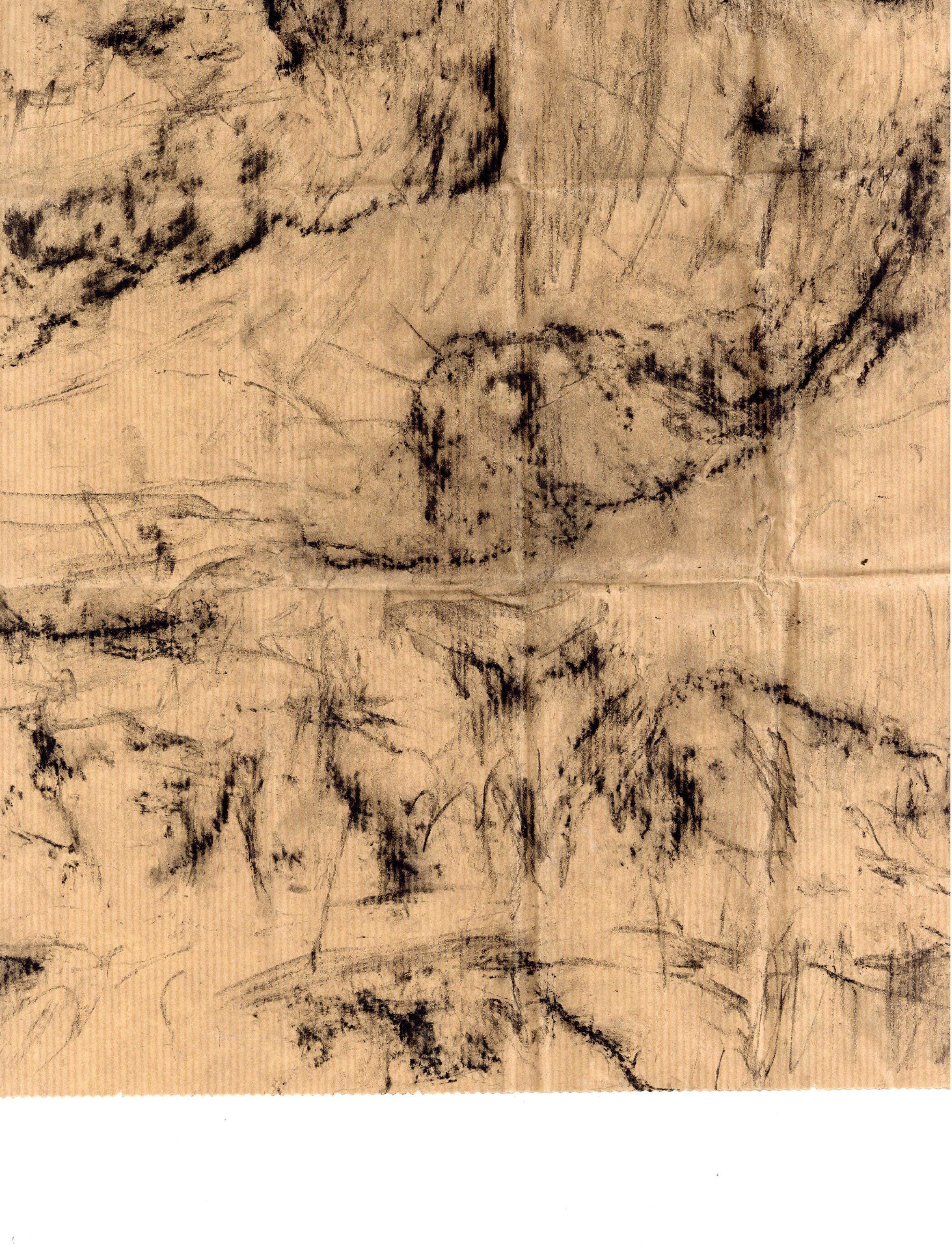
Imprint-Mapping Test 03: Collective Drystone Charcoal Rubbing
To test the idea of “commoning” the map, yet still employing the imprint-mapping technique, I organised the collective rubbing during the group walk. By working together, we were able to make a much larger map. It was interesting to compare the different sections drawn by each person, showing how despite using the same drawing tool and working on the same wall, the textures we achieved were distinct (see following spread).
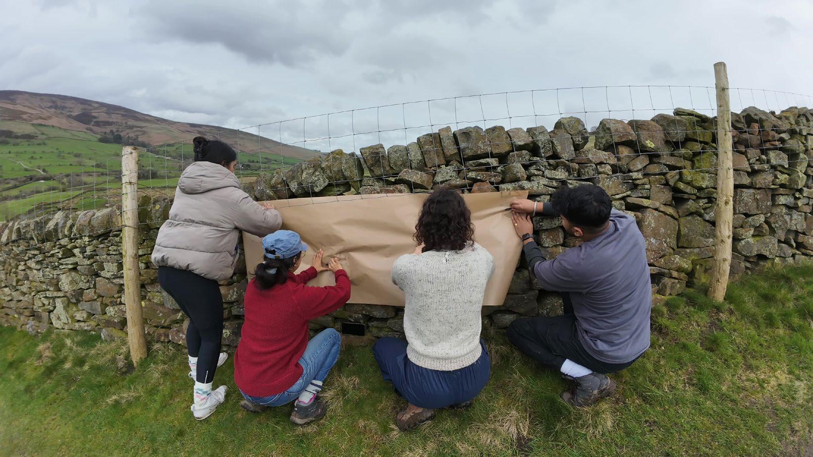
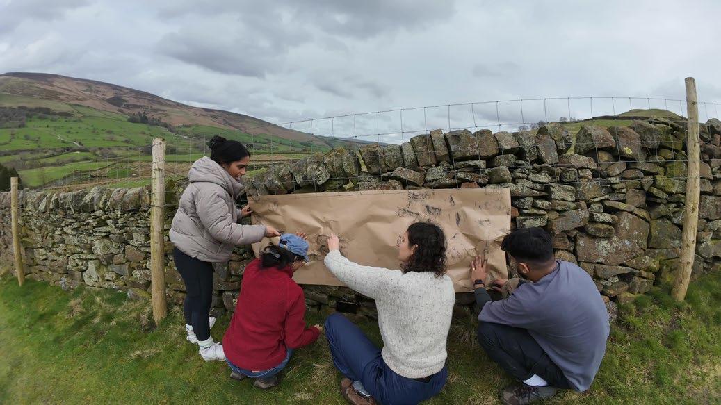
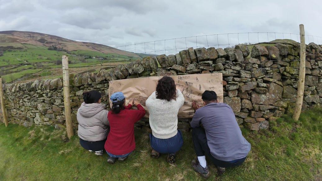
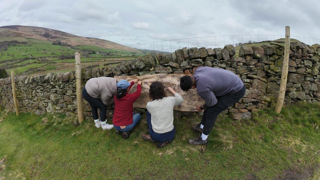
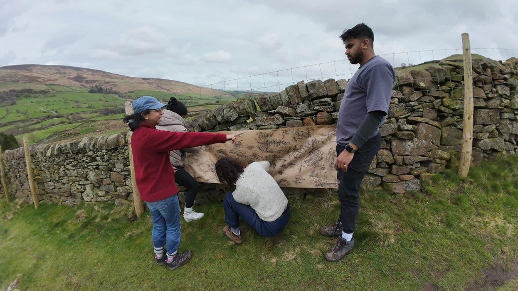
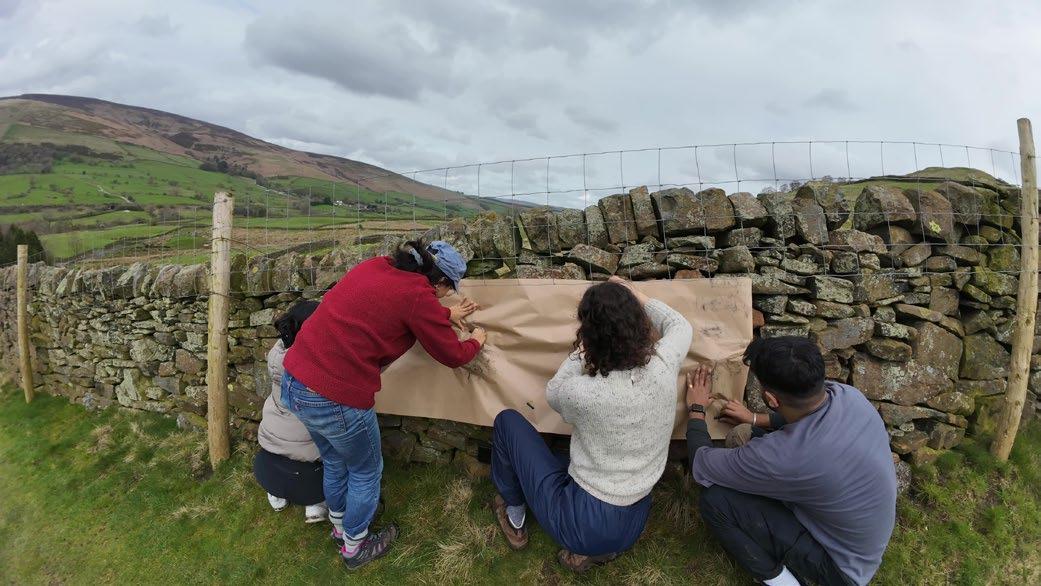
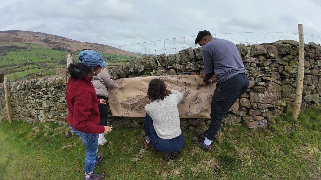
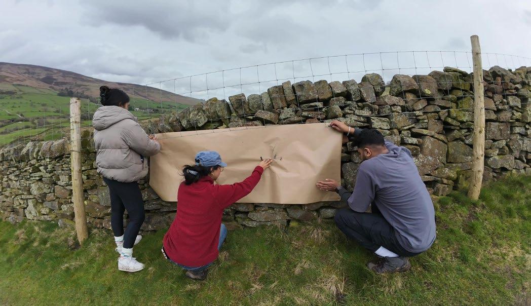
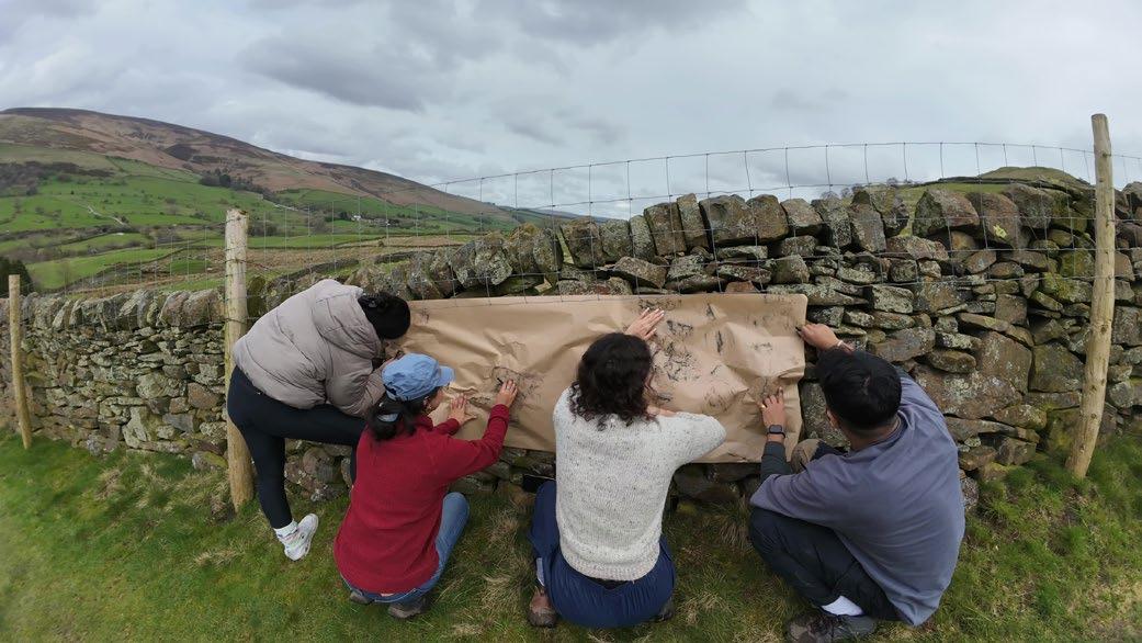
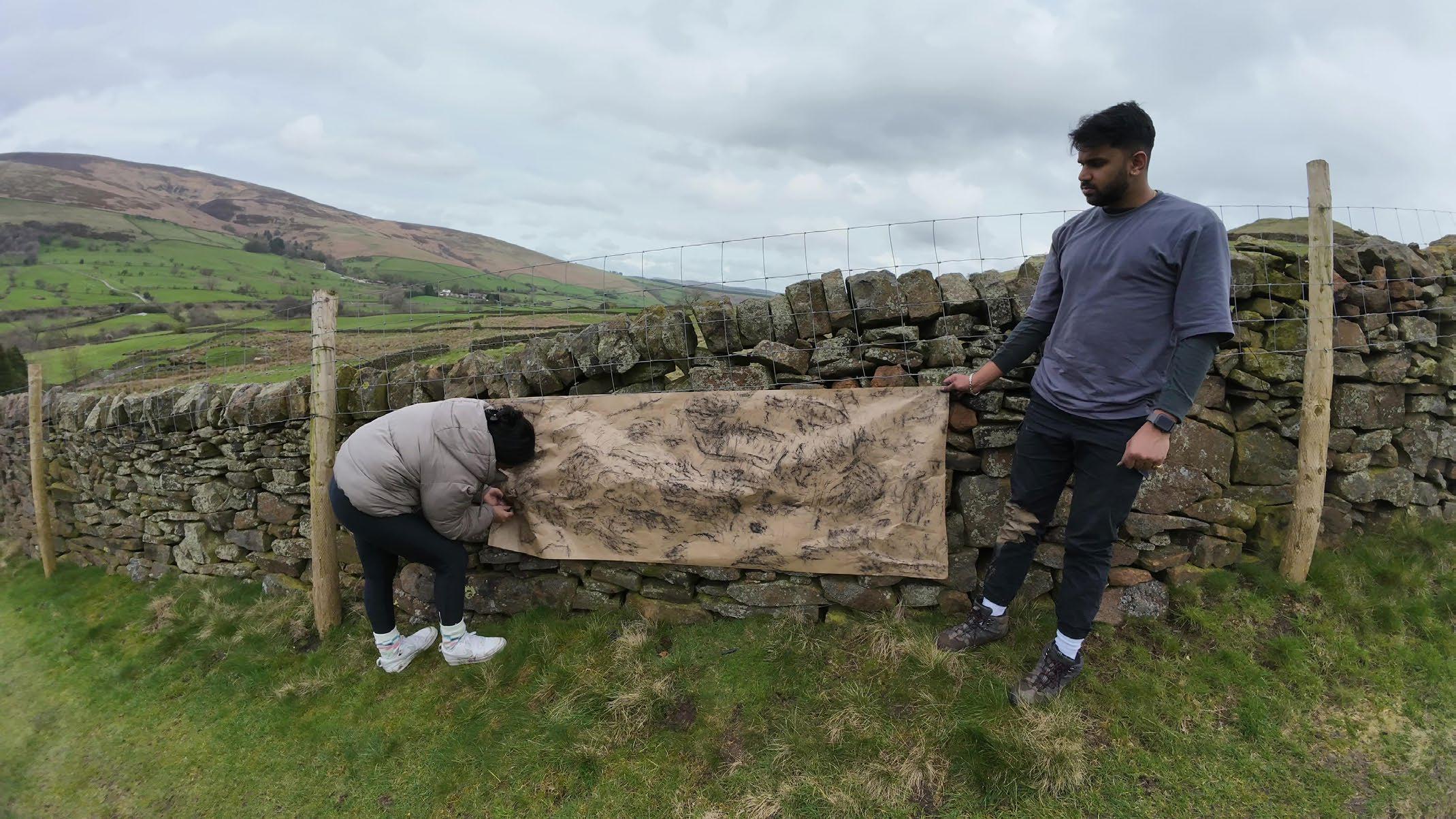
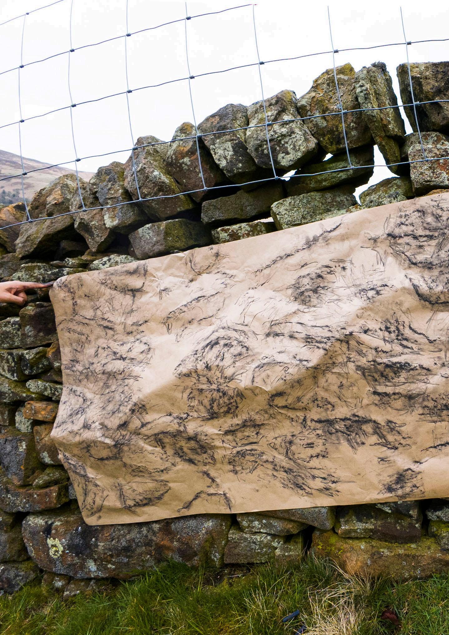
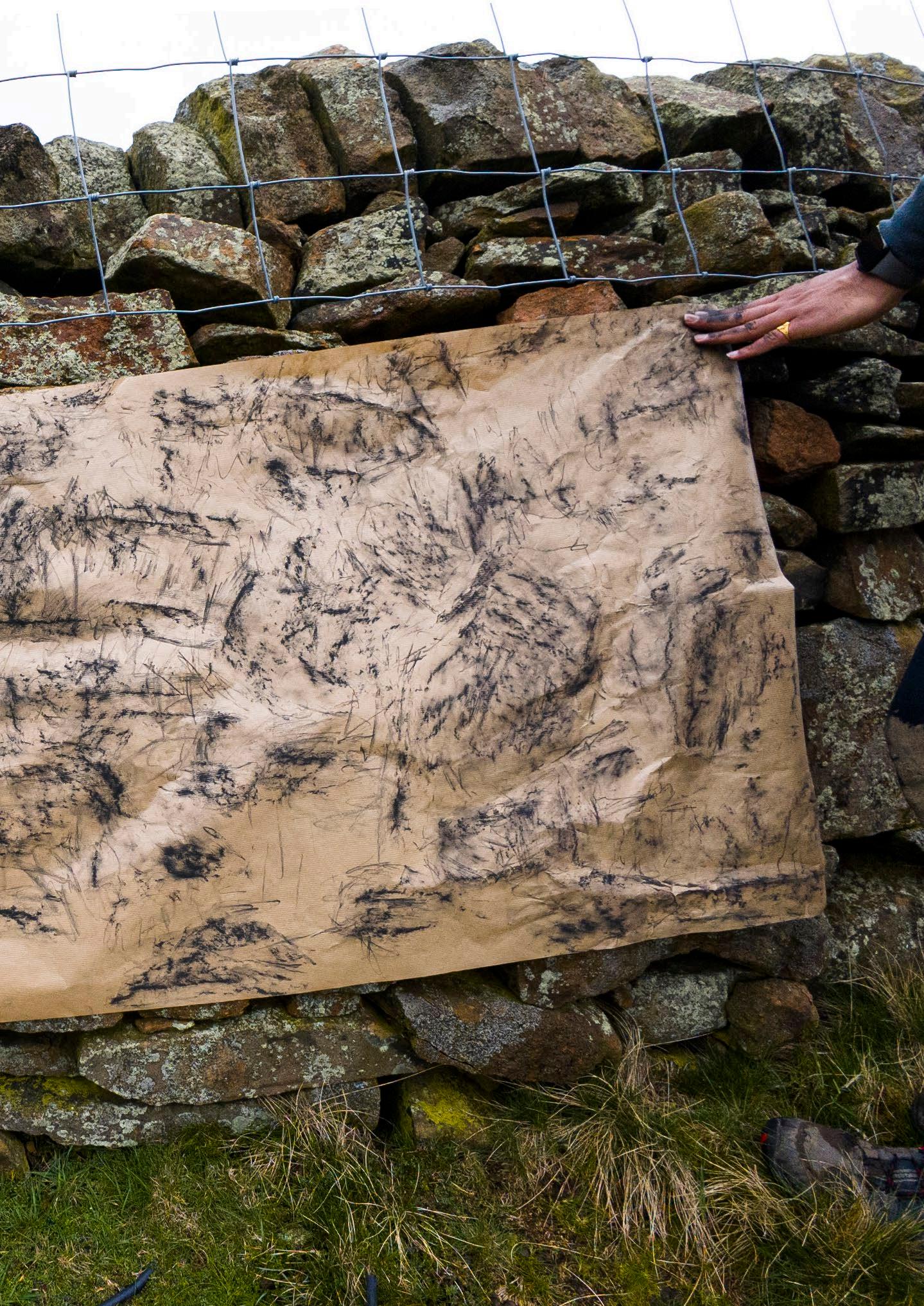
01. Section by Nikita
02. Section by Sharvaree
03. Section by Leela
04. Section by Aditya
The wind blew the paper against the wall, molding it to the rock forms. The imprints are cryptic, at times telling of the placement of the stacked stones, at others a flurry of marks where charcoal grasped for stone edge and found nothing. There are crisp lines that demarcate sharp edges, soft marks that passed over moss, and rough textured patches that caught the surface of the stone below.
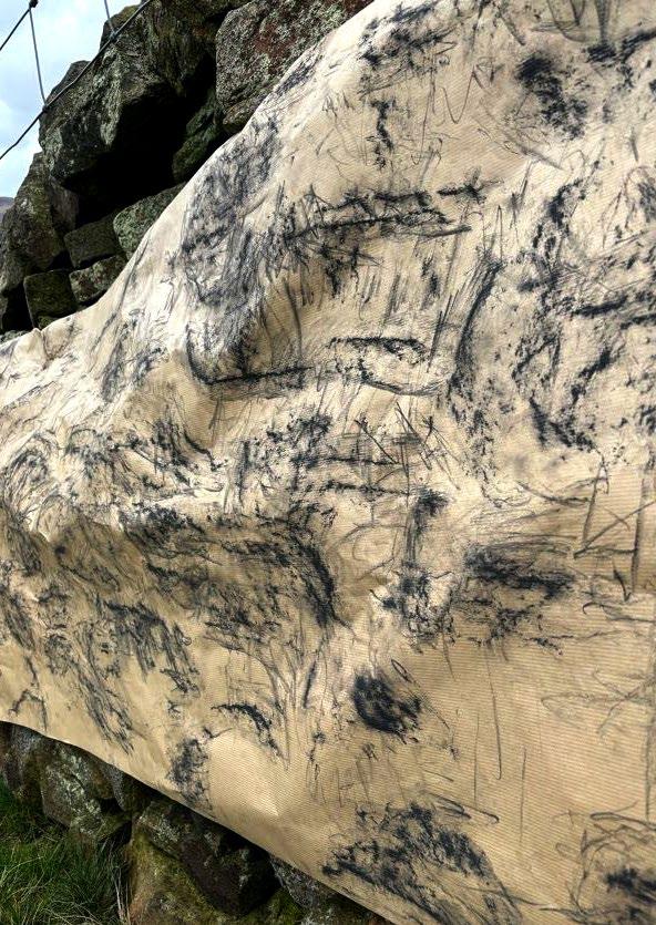
Imprint-Mapping Test 04: Hammering Paper
The final mode of imprinting that I tested was by hammering a smaller stone onto paper to pick up a texture of green and brown plant matter found on the surface of the rocks, primarily lichens. The result looks almost like pointillism, where each dots marks the impact of stone meeting stone, with only the paper creating a barrier between them. Though some of my tests indicate a vague form of the stone below, these tests read more as a map to the lichen landscape that inhabits the drystone walls. The scans on the next two spreads show both the front and back sides of these maps that operate at undefined scales.
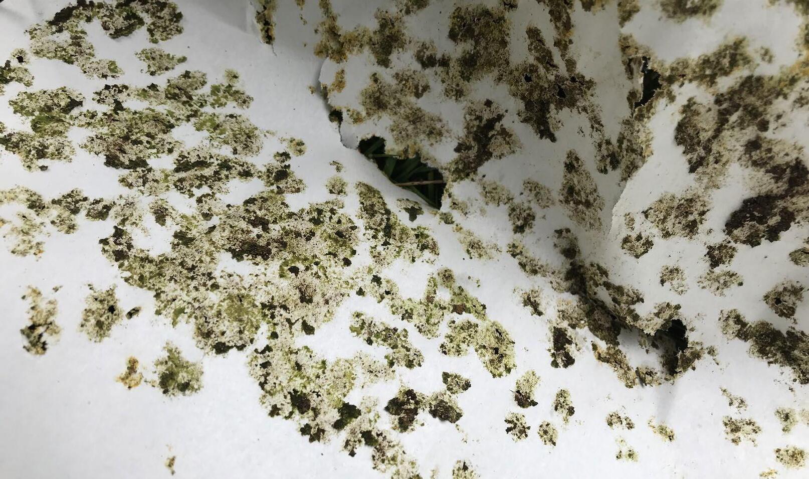
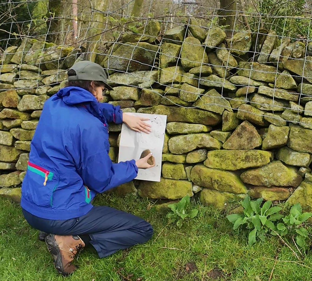
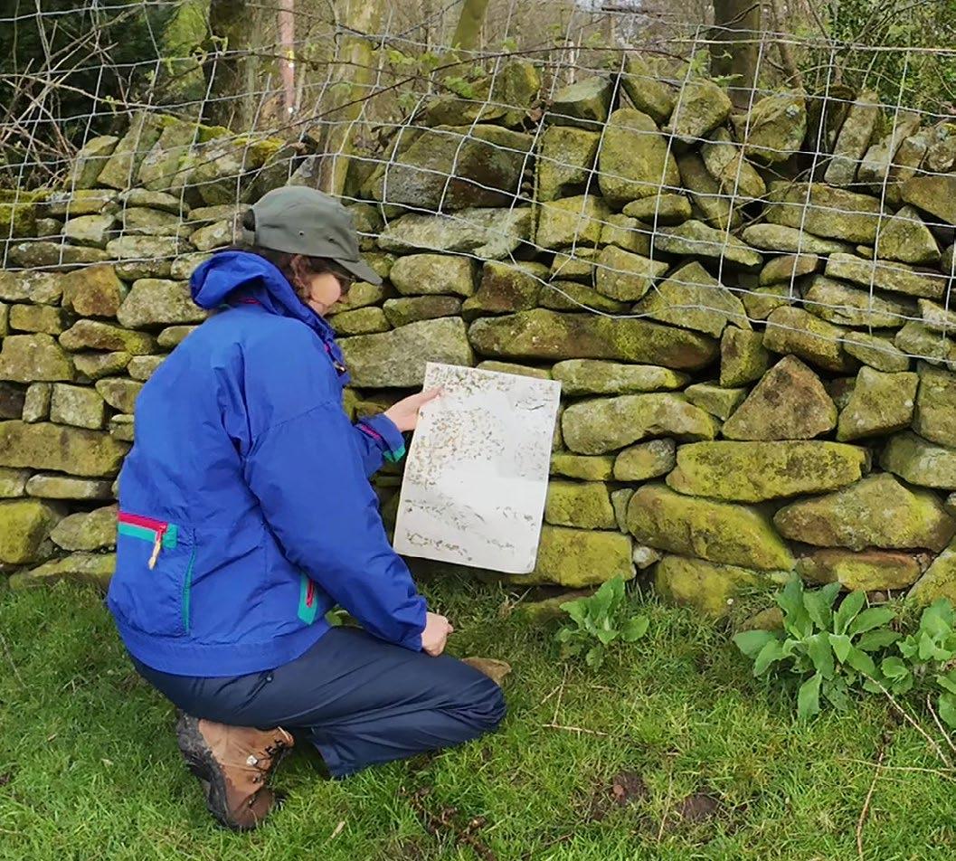
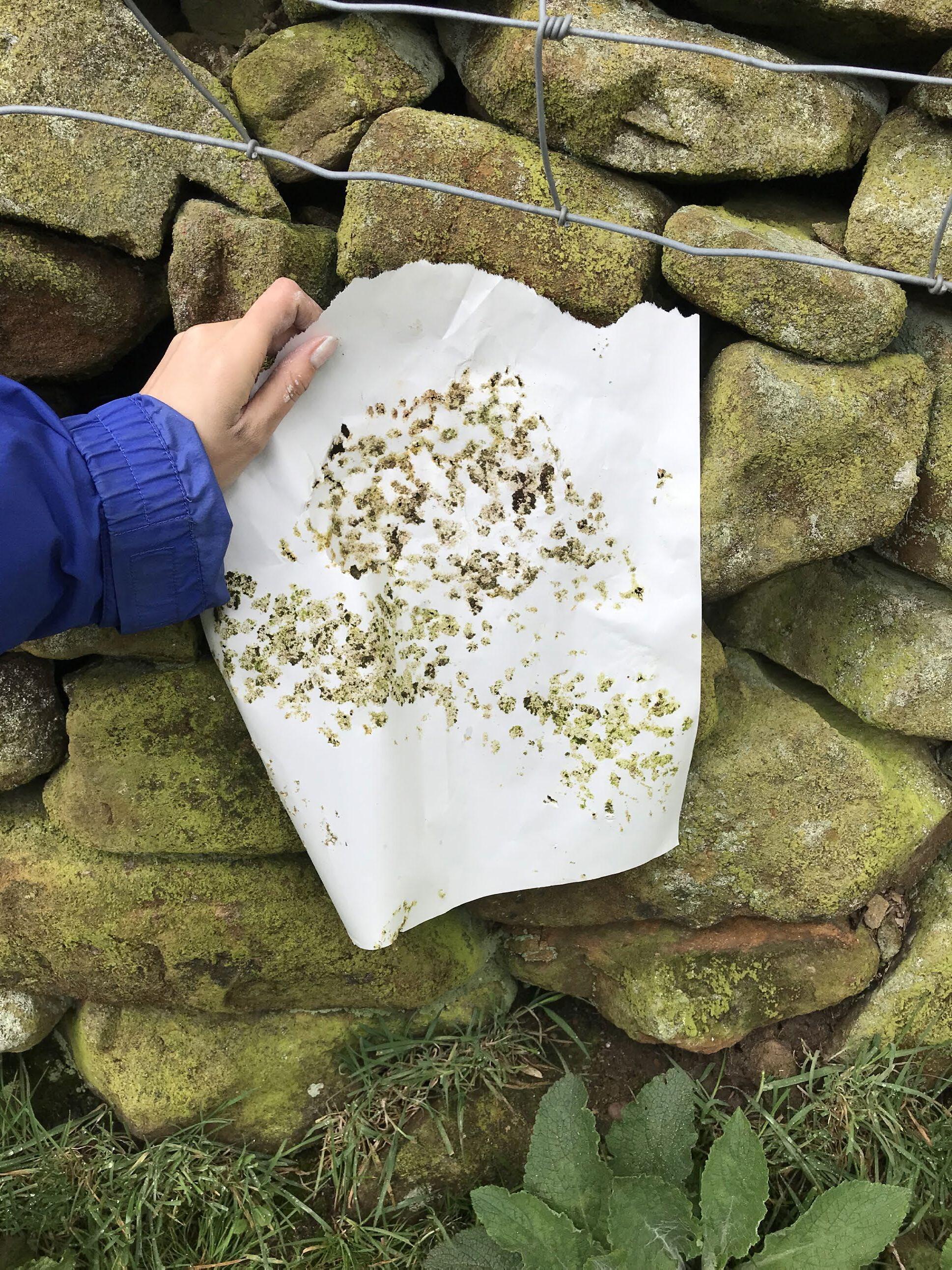
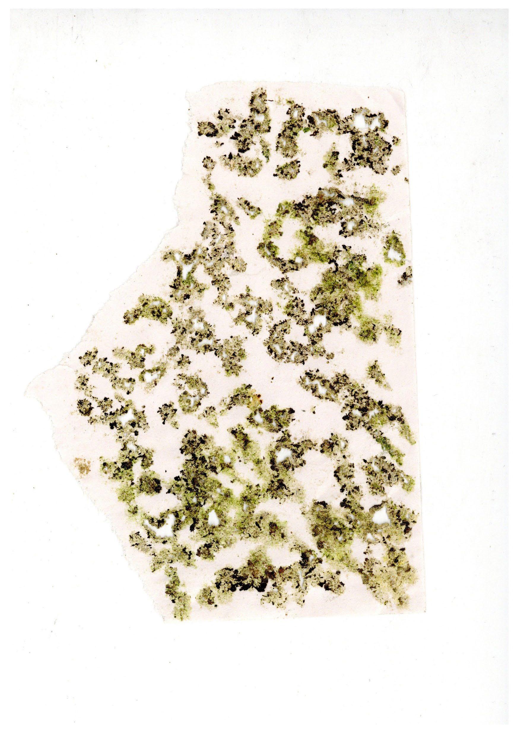
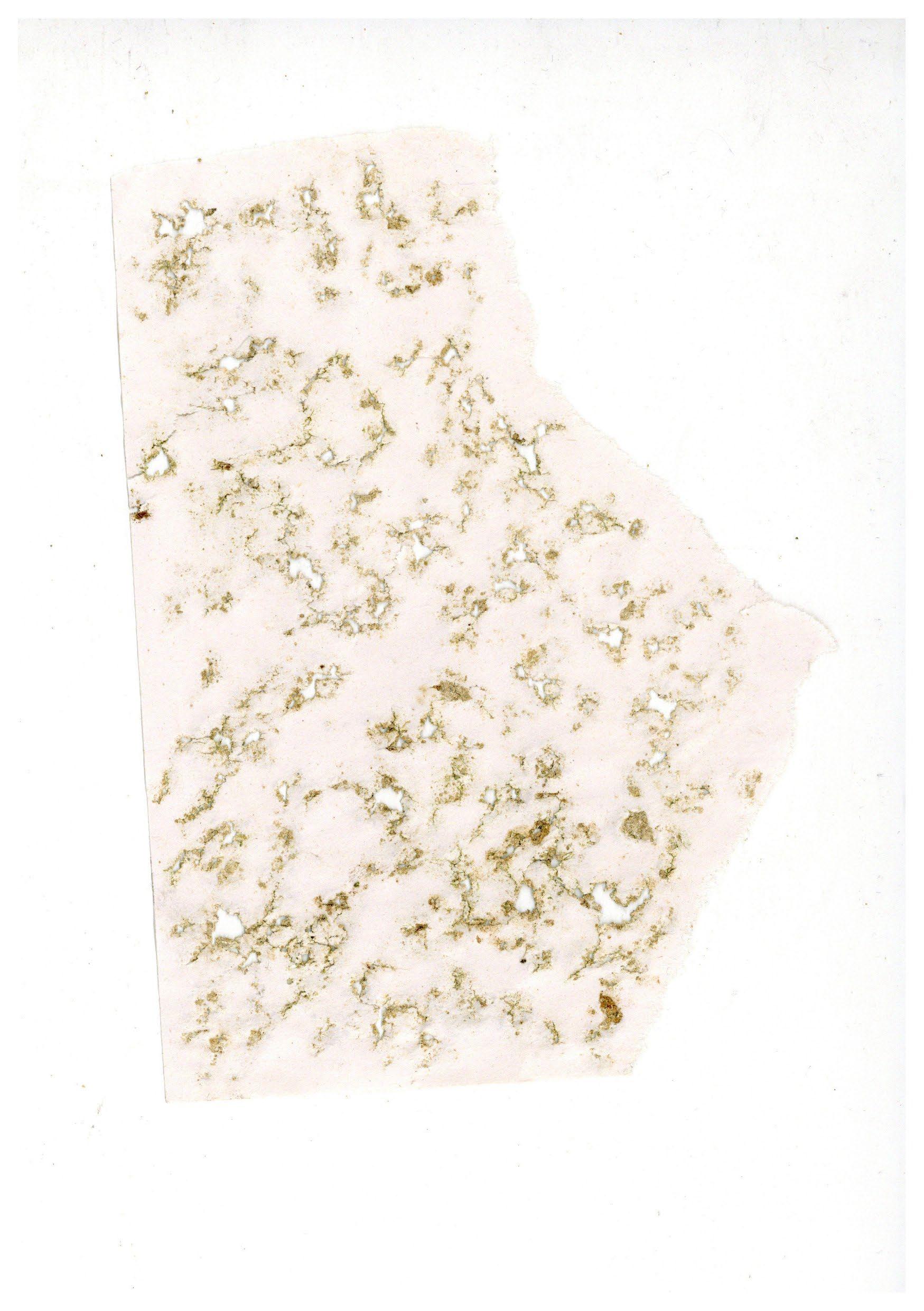
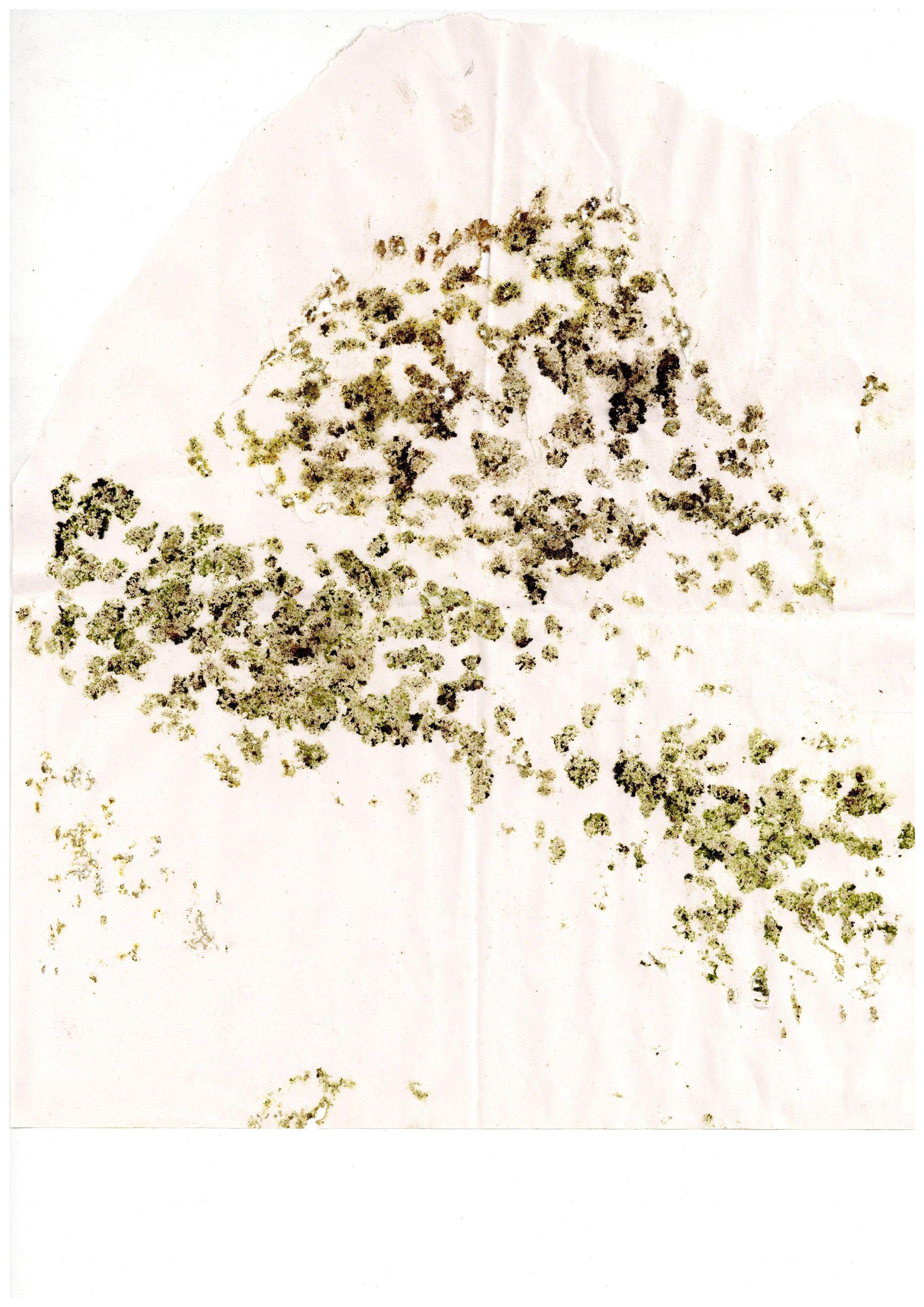
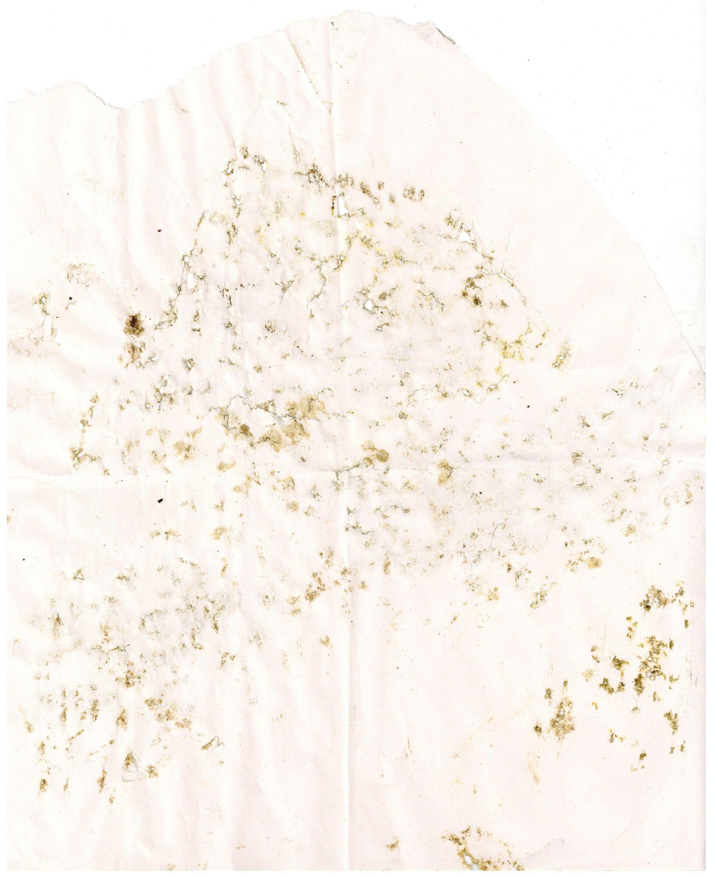
This section zooms out from the singular field station developed in the previous chapter, seeing field stations growing as a network of temporary inhabitants take part in repairing the surrounding moorland ecology.
Peatland Restoration
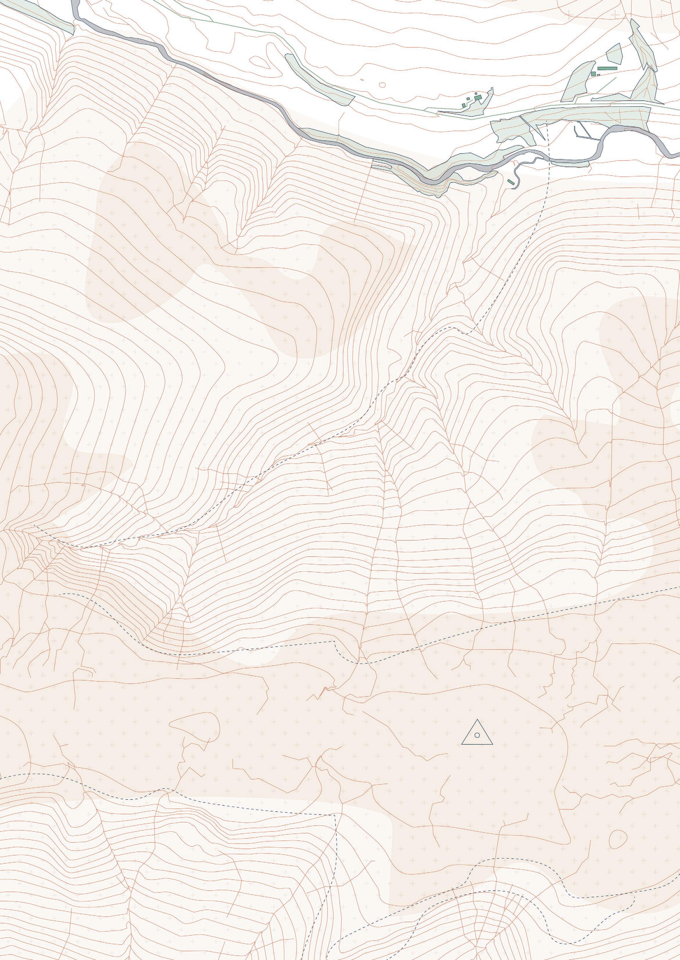
The drystone field stations are places to repair moorland ecologies. Understanding that ecological repair is a long process, field stations are built and re-built over time, recording and archiving the moorland’s transformation. A particularly important element is the remediation and restoration of peat soils. These are incredibly important for carbon sequestration; given the ongoing climate catastrophe, peat bogs and peat lands are invaluable and must be taken care of. Peat has for centuries been cut and burned, a practice that releases vast amounts of carbon into the atmosphere. Furthermore, pollution from industrialisation seeped into peat soils, contaminating them with lead, for instance. Continual heather burning also dries out peat, preventing them from retaining carbon. The following four strategies are examples of actions taken by transient commoners while inhabiting the field stations. As they work to repair peat ecologies around their field stations, the land slowly heals.
01. Stabilising and revegetating bare peat
Exposed peat can dry out and be blown away in the wind; leaving it bare is to make it susceptible to the elements. Vegetation covering peat soils not only protects it, it replenishes and creates now peat as it breaks down and is compressed, continuing the cycle. A current method used on low slopes and flat regions is to lay dried heather brash over the soil, preventing erosion and creating an environment for seeds to take root.
02. Rewetting peat bogs
The draining of much moorland in the Dark Peak was a harmful management strategy that caused peat bogs to dry out. “Grips” were ditches cut for drainage, used for agricultural or shooting purposes. Erosion gullies up to 4m deep also cause peat to continually be washed away. Rewetting peat bogs restores their watery habitat that exists within 10cm of the water table surface, where the fully saturated ground constitutes the water table. This is done by blocking grips and gullies to prevent excess drainage, damming them with both permeable and impermeable material.
03. Propagating sphagnum mosses
Current conservation methods use ‘plug plants’ taken from samples from the Dark Peak to propagate sphagnum mosses and other important moorland plants. Mosses are typically brought in at the last stage, as they thrive when protected by taller plants. Sphagnum mosses, with their ability to retain vast amounts of water, ensure the peat soils remain moist and fertile, covering them as a protecting surface from drought and erosion.
04. Welcoming diversity
Moorland environments are often nearly monocultural, dominated by a single plant species such as heather, bracken, cotton grass, or purple moor grass. Increasing plant diversity makes the moorland ecosystem more resilient and further protects and nourishes peat bogs.
Peat Bogs as Carbon Commons
To own a peat bog is to own an immense area of sequestered carbon. In contesting the private ownership of land, this project proposes reframing peat bogs as “carbon commons.” Rather than leaving the management of these environments to the landowning few or to profit-hungry companies, commoning peat bogs reframes these complex and fragile ecosystems as necessary for our own survival. As such, we are all caretakers of peat, keepers of our interdependence.
01. Drystone field station
02. Commoning axis
03. A circular radius of ecological repair expands concentrically around the field stations over time
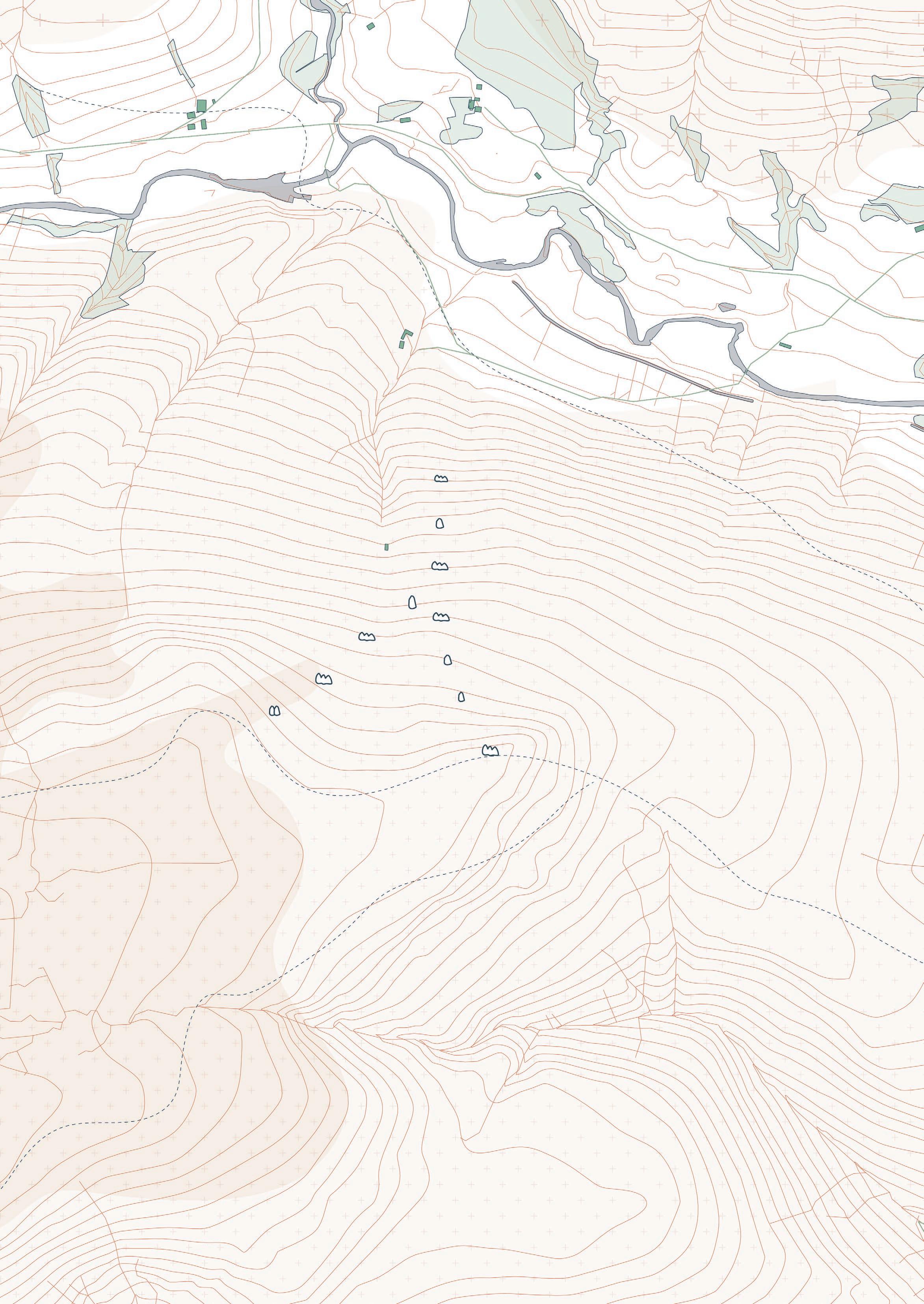
In convivial wildness, how can conservation practices be predicated on orientations of care rather than control?
Peat Soils and Woodland
The moorland peat soils formed due to human activity: over centuries and thousands of years, cleared woodland created the open, boggy conditions necessary for the formation of peat. Moorland must be constantly maintained—by humans or sheep grazing, for example—to prevent their return to woodland. In the rich peat bog, trees struggle to grow; however, tree planting in peatland is an ongoing concern and often practiced as a form of greenwashing. This is detrimental to the peat carbon sinks that are in fact more effective in carbon sequestration than woodland.
This map shows the overlap of peat soils, both shallow and deep, with existing fragments of woodland. The project proposes that woodland should not be planted over peat soils, but diverse woodland should be encouraged in non-peat
regions, and connected with corridors. Fragmented patched of monocultural woodland—the current condition—does not allow for larger, continuous ecologies to form.
The quote from the “Landscape and Identity” text on the opposite page reveals tensions that arise between the “engineering” and the “picturesque” or “preservationist” aesthetic that dominates landscape conservation discourse. Much of the conifer plantations were planted to create the illusion of the picturesque, but they also served a utilitarian purpose for rain catchment and as a barrier protecting the reservoir water supply. This project takes neither approach, instead proposing woodland conservation as a practice of care and reciproity with the more-than-human relam, not an attempt at controlling a landscape through forceful approaches.
“One of the main extensions of the engineering aesthetic, beyond the dam and aqueduct construc- tion themselves, was the bounding of the reservoir edges with continuous coniferous plantations. The rationale for planting was that trees would act as a barrier against both the public and livestock intruding upon the catchment area, stabilize slopes, filter silt and surface runoff in heavy rains and operate as a sponge to even out water flow. Some did not accept this functionalist argument. The Sheffield and Peak District branch of the Council for the Preservation of Rural England (CPRE 1938) sought to
retain what they regarded as a more ‘natural’ and visually harmonious aesthetic by retaining the bare outline of the hills, the subtle varieties of colours in the cloughs and the native hardwoods irregularly interspersed in the dales. This particular attempt at ‘preservationist’ inter- vention in the engineered landscape met with no success.”
- Landscape and Identity at Ladybower Reservoir and Rutland Water, Denis Cosgrove, Barbara Roscoe and Simon Rycroft


Deep peat soil
Shallow peat soil
Conifer Plantations: Material for Timber Scaffolding
Similar to the grouse moors, much of the Peak District woodland is highly maintained as a monoculture to maximise productivity and profitability. Many of these conifer plantations were created alongside the artificial reservoirs in the mid-20th century to simulate the “wild” forests of Scandinavia, as elaborated by Dennis Cosgrove in his text on the construction of the Ladybower Reservoir (shown at the far right of the map below).
To the untrained eye, these woodlands may at first glance appear lush and perfect for a weekend stroll. They are no longer actively used for harvesting, but they remain monocultural. This lack of species diversity is ecologically detrimental and also makes for a less resilient forest ecosystem.
The project proposes the careful repair of woodlands by increasing diversity and creating corridors that allow for connectivity between the existing woodland fragments. It also should be noted that trees are not condusive to peatland soils; thus, the project proposes that woodlands skirt rich peat regions to allow them to act as fertile carbon sinks. Any cut coniferous trees supply wood that the transient commoners use as scaffolding, aiding in the construction and repair of the field stations. This allows for the woodlands to be re-planted and nurtured with diverse coniferous and deciduous trees. As the landscape returns to the commons, forms of agroecology such as agroforestry and silvopasture might also begin to transform the human and more-than-human landscape, shifting away from monocultural and heavy grazing farmland.
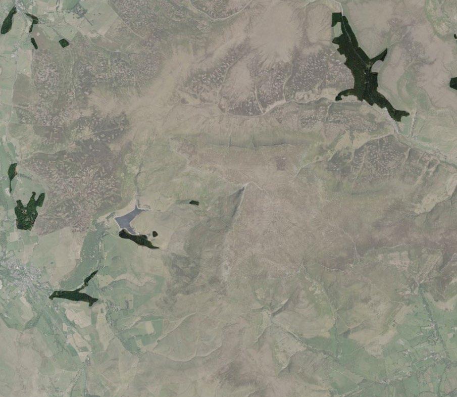
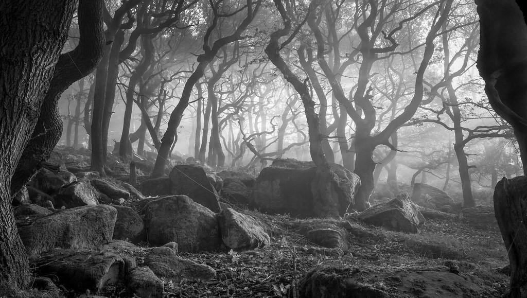
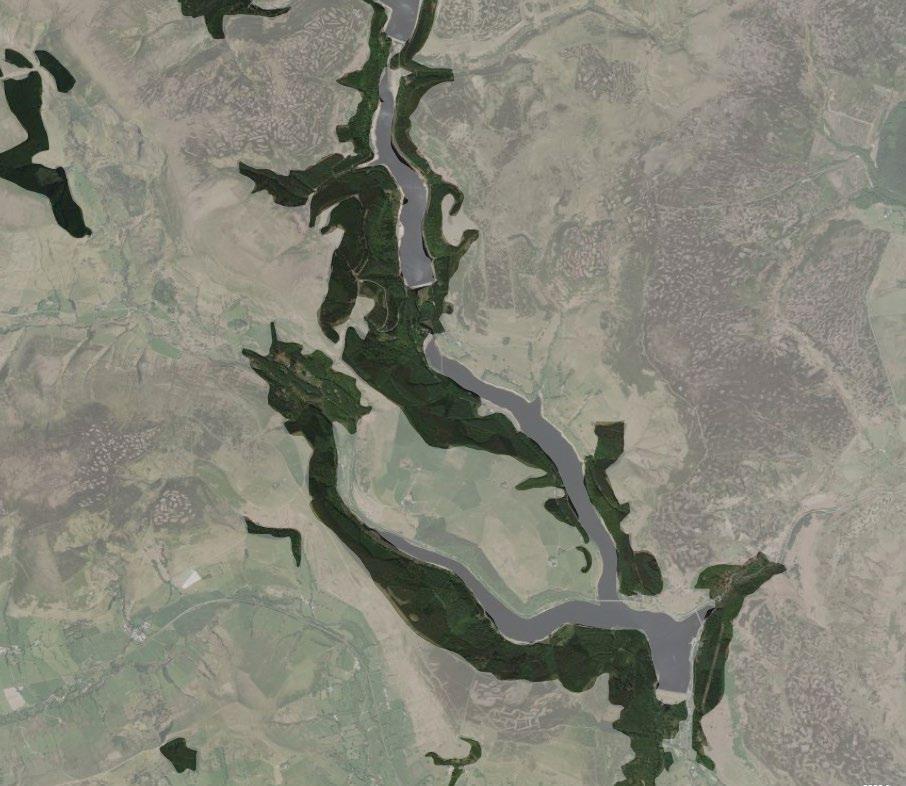
01. Timber sourcing from nearby plantations that could be brought into the moors
02. Site of interest: Crookestone grouse butts
03. Ladybower reservoir
Ancient oak woodland in Padley Gorge in the eastern region of the Peak District
Conifer plantation in the Peak District
Proposed Woodland Corridors
The project proposes the gradual transformation of the Peak District landscape as the land heals and fosters rich, diverse ecological networks. The map below shows how polycultural woodlands might grow around peat soil regions, taking over grass monocultures used for sheep grazing. The project proposes an agroecological framework, where the woodlands might be partially cultivated as food forests. This combination of agriculture and forestry is a regenerative framework that fosters biodiversity and resilience. As transient commoners build field stations in the moorland and restore peat soil environments, they also maintain and care for the woodlands, growing food in the forests.
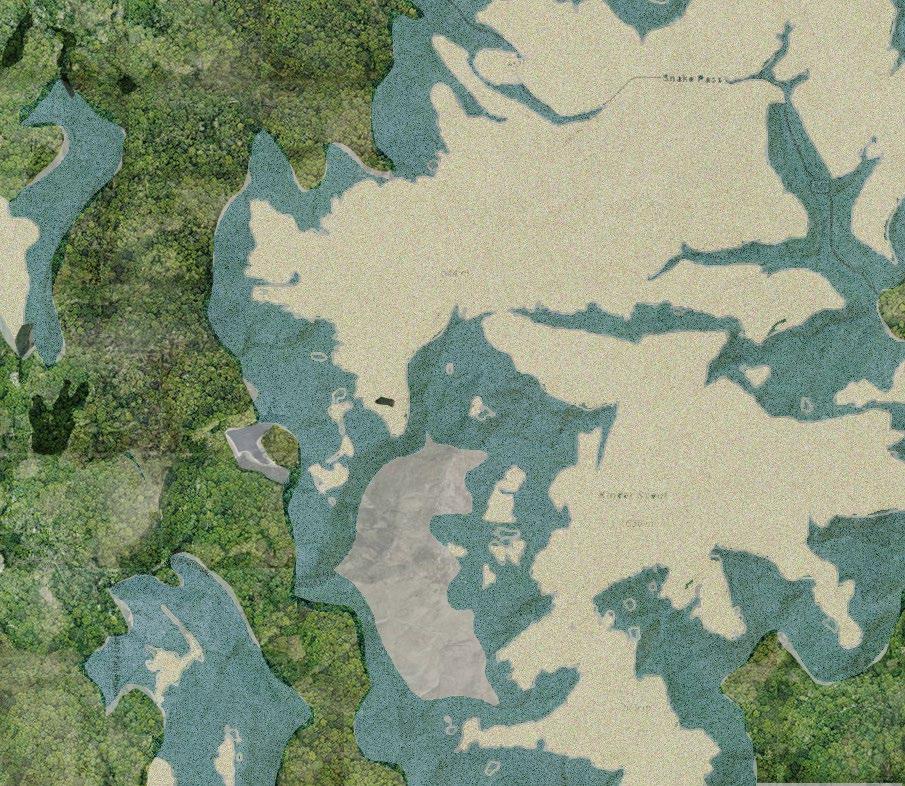

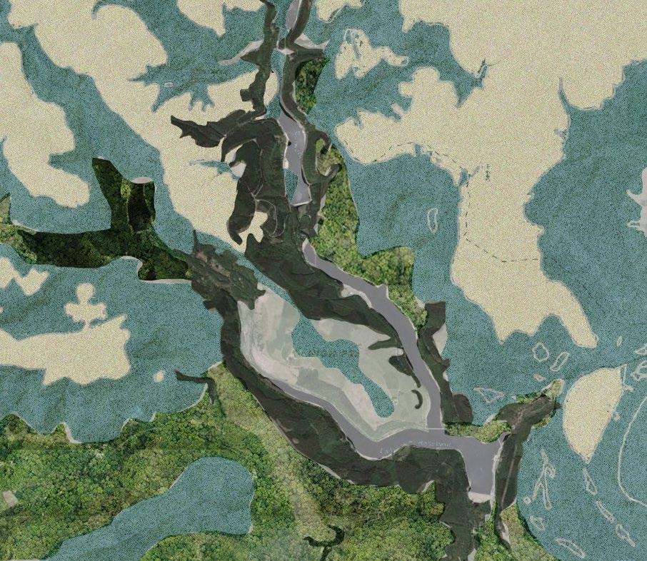
Deep peat soil
New woodland
Shallow peat soil
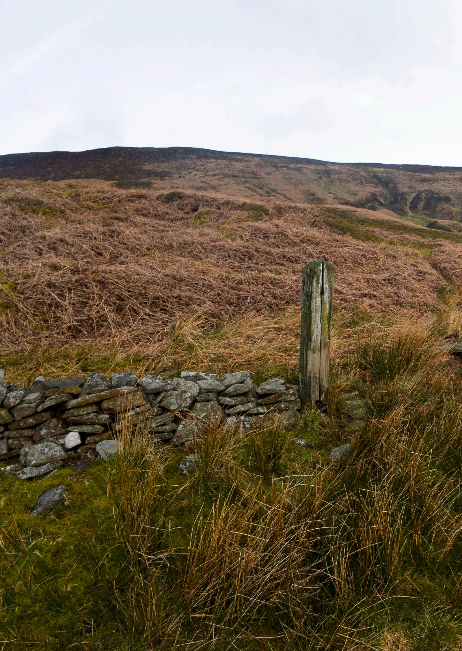
and all the while, drystone points the way
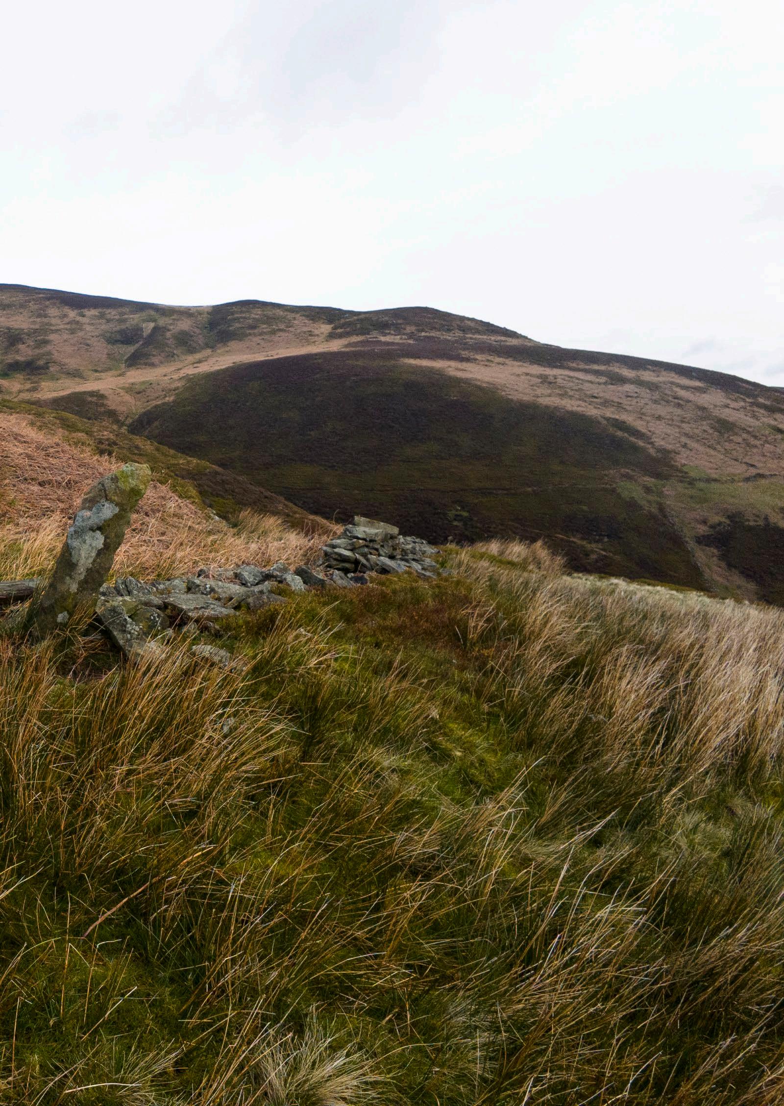
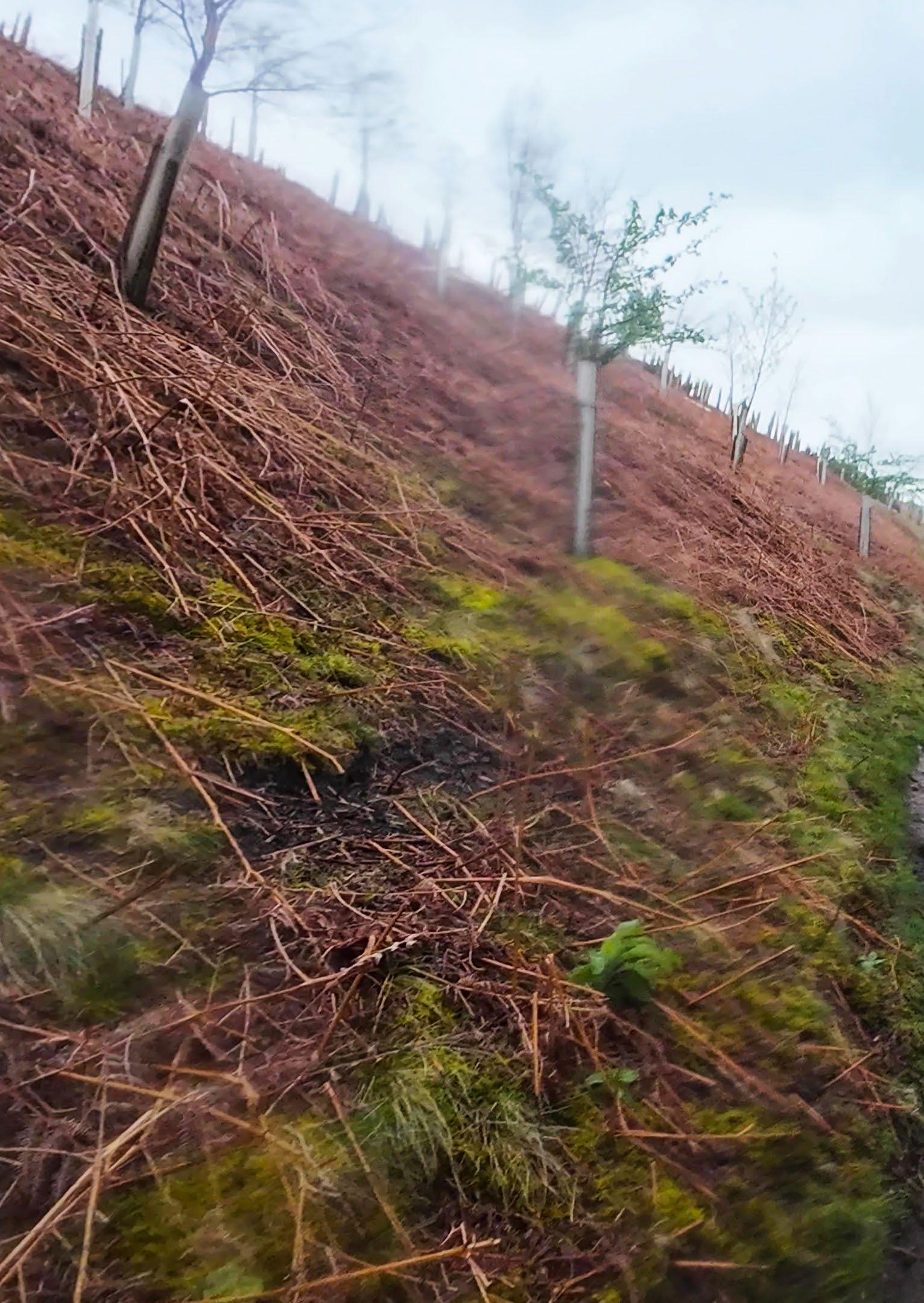
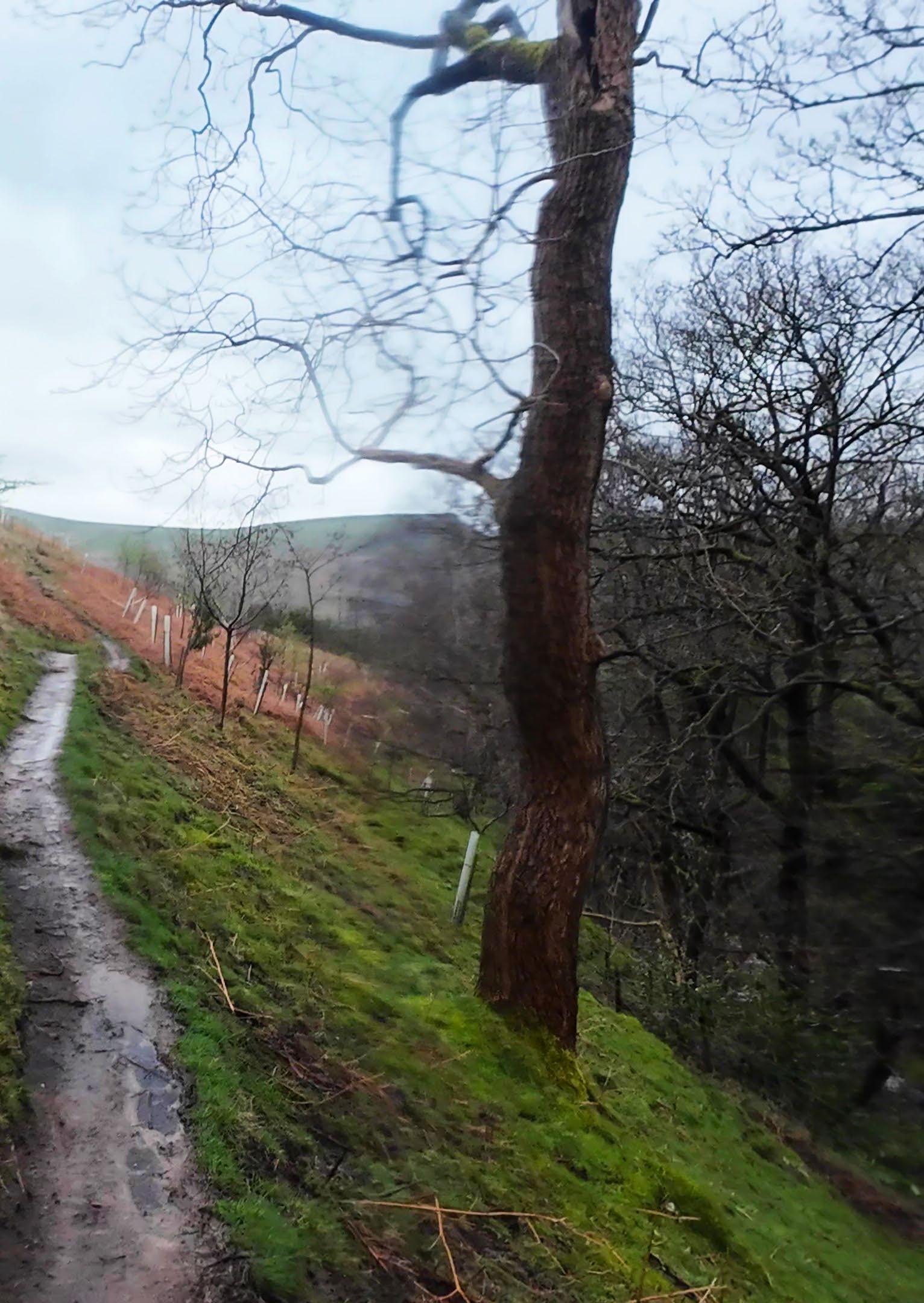
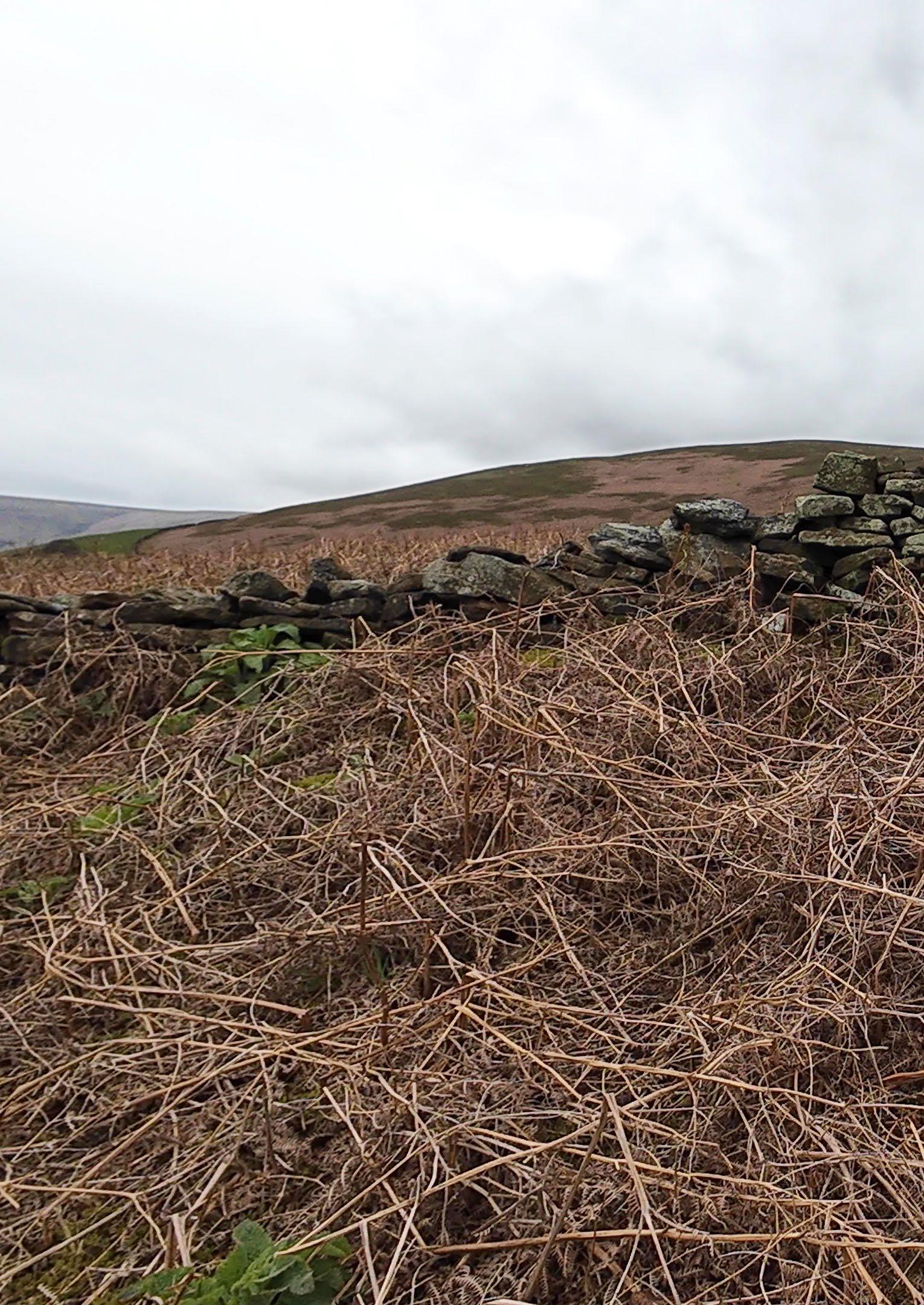
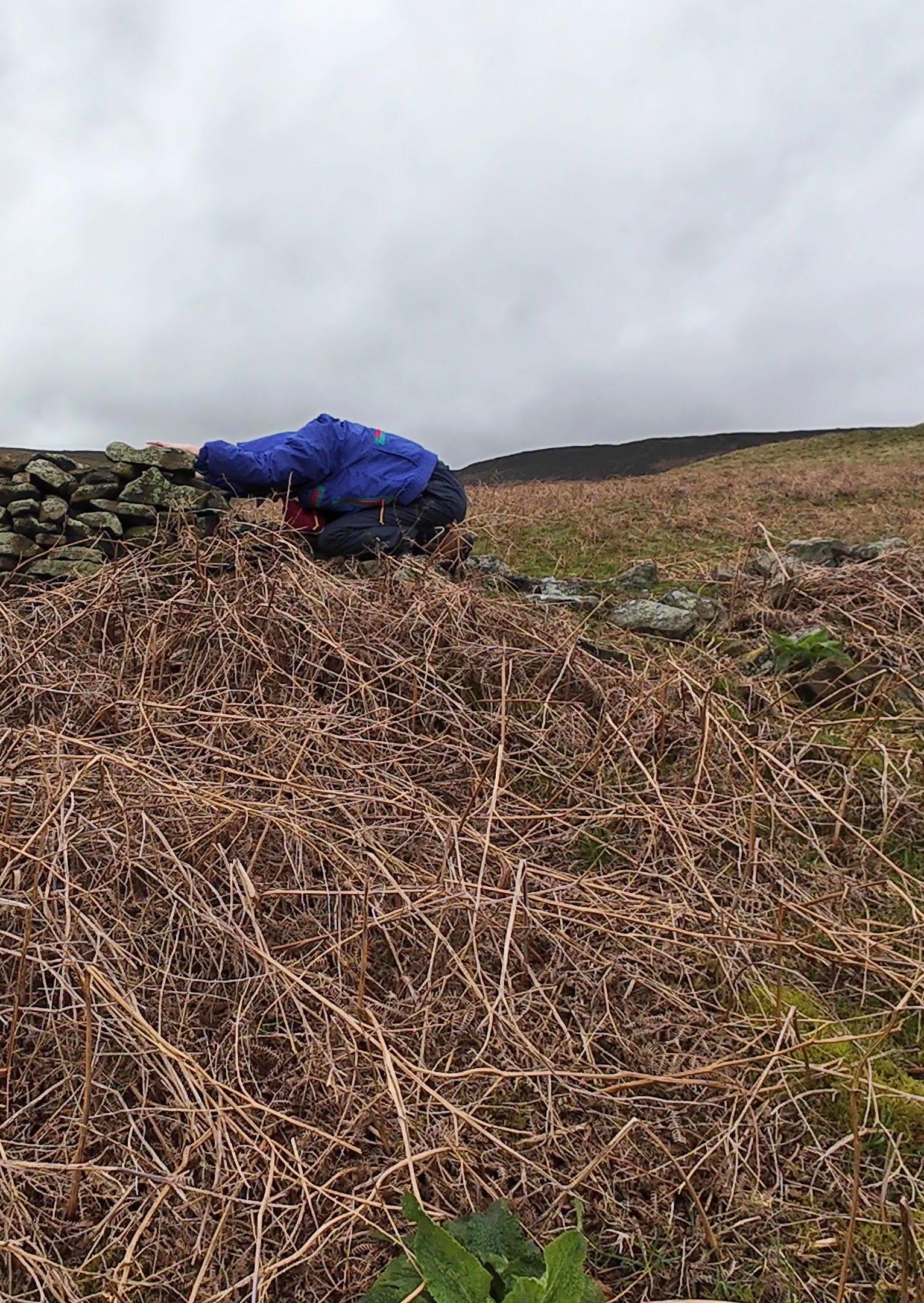
“Action for Habitats.” Peak District National Park. Accessed April 24, 2024. https://www.peakdistrict.gov.uk/looking-after/ biodiversity/action-for-wildlife/action-for-habitats.
Allen, Edward. Stone shelters. Cambridge, MA: MIT Press, 1981. Avery, Mark. “Grouse Shooting: Half a Million Reasons Why Time’s up for This Appalling Victorian ‘Sport.’” The Guardian, August 12, 2017. https://www.theguardian.com/commentisfree/2017/aug/12/grouse-shooting-glorious-twelfth-times-up-for-inglorious-victorian-sport#:~:text=There%20is%20big%20money%20involved,of%20Scotland%20and%20northern%20England.
“Bee Boles.” The Stone Trust. Accessed April 24, 2024. https://thestonetrust.org/wp-content/uploads/2018/02/Bee-boles-updated-2015.pdf.
“BGS Geology Viewer - the Geological Map Viewer of Britain.” BGS Geology Viewer (BETA). Accessed April 24, 2024. https://geologyviewer.bgs.ac.uk/.
Bjelland, Torbjørg, Martin Grube, Solveig Hoem, Steffen L. Jorgensen, Frida Lise Daae, Ingunn H. Thorseth, and Lise Øvreås. “Microbial Metacommunities in the Lichen–Rock Habitat.” Environmental Microbiology Reports 3, no. 4 (August 19, 2010): 434–42. https://doi.org/10.1111/j.1758-2229.2010.00206.x.
“Bracken.” Derbyshire Wildlife Trust. Accessed April 24, 2024. https://www.derbyshirewildlifetrust.org.uk/wildlife-explorer/ ferns-and-horsetails/bracken.
Brookfield, Lucy. “Heritage.” Moors for the Future. Accessed April 24, 2024. https://www.moorsforthefuture.org.uk/enjoythe-moors/heritage.
Brookfield, Lucy. “Planting Sphagnum and Moorland Plants.” Moors for the Future. Accessed April 24, 2024. https://www. moorsforthefuture.org.uk/our-work/restoring-blanket-bog/planting-sphagnum-and-moorland-plants.
Büscher, Bram, and Robert Fletcher. The Conservation Revolution: Radical Ideas for saving nature beyond the anthropocene. London: Verso, 2020.
“The Commoner’s Catalog for Changemaking.” The Commoner’s Catalog for Changemaking | The Commoner’s Catalog for Changemaking. Accessed April 24, 2024. https://www.commonerscatalog.org/books/the-commoners-catalog-for-changemaking?page=86.
“Coniferous Plantation.” The Wildlife Trusts. Accessed April 24, 2024. https://www.wildlifetrusts.org/habitats/woodland/coniferous-plantation.
Cruickshank, Martin. “Royal Forest of the High Peak.” Marple Local History Society. Accessed April 24, 2024. https://www. mlhs.org.uk/our-local-heritage/forest-high-peak.html.
Dalton, Roger, Howard R. Fox, and Peter Jones. Classic landforms of The dark peak. Sheffield: Geographical Association in conjunction with the British Geomorphological Research Group, 1999.
“Dark Peak Landscape Strategy.” Peak District National Park Authority, 2009. https://www.peakdistrict.gov.uk/__data/assets/ pdf_file/0026/46592/landscape-strategy-dark-peak.pdf.
Dougill, A. J., E. D. Fraser, J. Holden, K. Hubacek, C. Prell, M. S. Reed, S. Stagl, and L. C. Stringer. “Learning from Doing Participatory Rural Research: Lessons from the Peak District National Park.” Journal of Agricultural Economics 57, no. 2 (June 20, 2006): 259–75. https://doi.org/10.1111/j.1477-9552.2006.00051.x.
“Dry Stone Walling: A Practical Conservation Handbook from TCV.” TCV Practical Conservation Handbooks. Accessed April 24, 2024. https://conservationhandbooks.com/dry-stone-walling/introduction/.
“Dry Stone Walls.” Historic Scotland. Accessed April 24, 2024. https://www.michaelhornsby.co.uk/assets/Uploads/documents/ dry-stone-walls.pdf.
Fields, Curtis P. The forgotten art of building a stone wall: An illustrated guide to dry wall construction. Dublin, NH: Yankee Books, 1993.
Foti, Pilade, Aguinaldo Fraddosio, Nicola Lepore, and Mario Daniele Piccioni. “On the Mechanics of Corbelled Domes: New Analytical and Computational Approaches.” Research on Engineering Structures and Materials, 2017. https://doi. org/10.17515/resm2016.71st0725.
“Friends of the Earth Sparks Moorland Burning Investigation.” Friends of the Earth. Accessed April 24, 2024. https://friendsoftheearth.uk/climate/friends-earth-sparks-moorland-burning-investigation.
Garner, Lawrence. Dry stone walls. Princes Risborough, Buckinghamshire: Shire Publ., 2005.
Haraway, Donna. “Situated Knowledges: The Science Question in Feminism and the Privilege of Partial Perspective.” Wom-
en, Science, and Technology, September 11, 2013, 489–506. https://doi.org/10.4324/9780203427415-40.
Haraway, Donna Jeanne. When species meet. Minneapolis: University of Minnesota Press, n.d.
Hayes, Nick. The book of trespass crossing the lines that divide us. London: Bloomsbury Publishing, 2021. Hey, David. A history of the Peak District Moors. Barnsley: Wharncliffe, 2014.
“Historical Context for Beating the Bounds.” T H E F R O N T I E R, March 27, 2012. https://thefrontierkc.wordpress.com/ projects/phase-1/beating-the-bounds/historical-context-for-beating-the-bounds/.
“A History of Open Access Land.” Peak District National Park. Accessed April 24, 2024. https://www.peakdistrict.gov.uk/ looking-after/how-we-look-after-access/crow-timeline.
“History of Red Grouse Shooting.” Fieldsports Journal, November 21, 2020. https://fieldsports-journal.com/fieldsports/shoot/ history-of-red-grouse-shooting.
How to build a Blackhouse. Accessed April 24, 2024. http://naturalhomes.org/blackhouse.htm.
Kate Twynham | Moors for the Future. “What to See.” Moors for the Future. Accessed April 24, 2024. https://www.moorsforthefuture.org.uk/enjoy-the-moors/what-to-see-moorland-species.
Kolb, Ronald. “Situated Knowledges and Interdependence in the Exhibitionary-Educational Complex.” ONCURATING. Accessed April 24, 2024. https://www.on-curating.org/issue-53-reader/Situated-Knowledges-and-Interdependence.html. “Leaflets.” Dry Stone Walling Association, January 12, 2024. https://www.dswa.org.uk/leaflets/.
Legge, Ron. “Kažuns of Croatia.” Legging It Travel, December 26, 2015. https://www.leggingit.com.au/kazun-croatia/. Morillas, Lourdes, Javier Roales, Cristina Cruz, and Silvana Munzi. “Lichen as Multipartner Symbiotic Relationships.” Encyclopedia 2, no. 3 (August 3, 2022): 1421–31. https://doi.org/10.3390/encyclopedia2030096.
Oke, T. R. Boundary layer climates. London: Routledge, 1987.
Olstad, Tyra A. “Cairns: An Invitation.” Cairns: An invitation. Accessed April 24, 2024. https://www.focusongeography.org/ publications/articles/cairns/index.html.
“Peatland Programme.” IUCN Peatland Programme. Accessed April 24, 2024. https://www.iucn-uk-peatlandprogramme.org/. “Peat’s Hidden History.” Dark Peak fieldwork - Peat History. Accessed April 24, 2024. https://personalpages.manchester. ac.uk/staff/julia.mcmorrow/peat_history.htm.
Plant Guide. Accessed April 24, 2024. https://www.moorsforthefuture.org.uk/__data/assets/pdf_file/0027/87435/Plant-guideMoorPLANTS-Factsheet.pdf.
Richardson, Iain. “The Science of Dry Stone Walling, Part 1.” The Stone Trust, October 9, 2023. https://thestonetrust.org/ the-science-of-dry-stone-walling-part-1/.
Shrubsole, Guy. “Revealed: English Grouse Moor Estates Got £10million in Subsidies Last Year.” Who owns England?, March 8, 2021. https://whoownsengland.org/2019/08/12/revealed-english-grouse-moor-estates-got-10million-in-subsidies-last-year/. Truniger, Fred. Landscript 2: Filmic mapping. Berlin: Jovis, 2013.
“What Is an Inukshuk?” Arctic Kingdom. Accessed April 24, 2024. https://resources.arctickingdom.com/what-is-an-inukshuk. “Wild Peak - What Is Rewilding?” Derbyshire Wildlife Trust. Accessed April 24, 2024. https://www.derbyshirewildlifetrust. org.uk/wild-peak-natural-processes-and-nature-based-solutions.
Image Credits
Introduction
All images are by the author except:
p.29: https://en.wikipedia.org/wiki/Principal_Triangulation_of_Great_Britain
p. 36: https://www.royalacademy.org.uk/art-artists/work-of-art/landscape-4
p. 37: https://shop.museums-sheffield.org.uk/products/sheffield-from-crookesmoor; https://artuk.org/discover/artworks/moorland-scene-derbyshire-164075
p.38: https://www.mutualart.com/Artwork/Peak-District-landscape-with-Mother-and-/561BE1BFEF992A37853DA725B7948165
p. 40: https://oldmapdownloads.co.uk/products/yorkshire-in-1771-sheet-2-1-shows-the-sedbergh-dent-hawes-askrigg-and-settlearea
p. 41: History of the Peak District Moors, David Hey p.60-65: https://nationaltrusthbsmr.esdm.co.uk/LLWS/LLFiles/157197/original_157197.pdf
Geology and Ecology
All images are by the author except:
p.80: Classic Landforms of the Dark Peak” by R. Dalton, H. Fox, and P. Jones, p. 8 p.84-85: https://cdn.download.ams.birds.cornell.edu/api/v1/asset/46039241/1800; https://species.biodiversityireland.ie/profile. php?taxonId=180522; https://butterfly-conservation.org/moths/oak-eggar/northern-eggar; https://en.wikipedia.org/wiki/Eriophorum; https://en.wikipedia.org/wiki/File:Numenius_madagascariensis_2_-_Stockton_Sandspit.jpg; https://aminoapps.com/c/ wildanimals/page/blog/the-hen-harrier-norwegian-birds-challenge/bN5z_0p5hou81bVnmjdbRwbXnPkXadPdpZj; https://upload. wikimedia.org/wikipedia/commons/thumb/8/8c/Calvatia_booniana.jpg/1200px-Calvatia_booniana.jpg; https://www.mammal. org.uk/2021/03/9924/; https://www.slowfood.org.uk/ark-product/british-red-grouse/; https://cdn.britannica.com/54/122954-05083BC7000/Red-deer.jpg
p.102-103: Google Earth
p.112: https://en.wikipedia.org/wiki/Driven_grouse_shooting; https://twitter.com/wildmoorsuk/status/1631561471694864385 p.113: https://unearthed.greenpeace.org/2021/10/12/fires-peatlands-england-national-parks-grouse-shooting/ pp.116-119: https://www.google.com/maps/d/u/0/viewer?mid=1BGhsQXh2-gJ9n85ZY_5WRgSkdfg2c4_y&ll=53.2819128907148%2 C-1.7917131521358076&z=11
Drystone Construction
All images are by the author except:
p.131: http://www.globalgeopark.org/News/News/11528.htm; https://www.pinterest.ca/pin/477240891742981004/ p.132: https://www.britannica.com/technology/trullo
p.134: https://3seaseurope.com/kazuni-croatias-igloo-shaped-stone-houses/ p.136: https://en.wikipedia.org/wiki/Blackhouse
p.142: https://www.cofnodicorlannau.org/corlannaur-carneddau-sheepfolds/english/structures
p.146: https://www.tripadvisor.co.uk/Tourism-g806083-Edale_Hope_Valley_Peak_District_National_Park_England-Vacations.html; https://www. english-heritage.org.uk/contentassets/8b01c8a521c94d55a143c5e619a2982b/col_peveril_apr23v2.png?w=641&h=600&mode=crop&scale=both&quality=60&anchor=&WebsiteVersion=20231208103628; https://thewanderingwildflower.co.uk/brown-knoll-stone-igloo-walk/ p. 147: https://upload.wikimedia.org/wikipedia/commons/thumb/e/eb/Nine_Ladies_02.jpg/1200px-Nine_Ladies_02.jpg; https://en.m.wikipedia.org/
wiki/File:Trig_point_.jpg; https://letsgopeakdistrict.co.uk/stanage-edge-3/
p.243: https://commons.wikimedia.org/wiki/File:Shooting_butts_on_Wolsingham_Park_Moor_-_geograph.org.uk_-_297727.jpg
p.265: https://www.geogenic.com.au/blog
p.273: https://www.architectural-review.com/essays/on-the-money-the-merits-of-degrowth; https://www.myultimatedecision.info/2019/06/extraordinary-architecture-of-great.html
p.274: https://thestonetrust.org/batter-frames-2017/; https://thestonetrust.org/setting-up-batter-boards/ p.290: https://www.beeboles.org.uk/en/page/about-us; https://twitter.com/i/flow/login?redirect_after_login=%2Fbee_boles
p.291: https://commons.wikimedia.org/wiki/File:%22Lunky_Hole%22_near_Glenhead._-_geograph.org.uk_-_514257.jpg
p.292: https://twitter.com/RobGMacfarlane/status/1122379978329423872
p.293: http://www.sheepfoldscumbria.co.uk/html/info/info00.htm
Convivial Wildness in Drystone Field Stations
All images are by the author except:
P.302: https://www.valenciatravelcusco.com/passion-passport/apachetas-in-peru-what-are-these-mysterious-stone-; https://friendsofacadia.org/story/why-we-care-about-cairns/; https://www.the-journal.com/articles/stone-messengers/; https://af.wikipedia.org/ wiki/Isivivane; https://tibetuniversaltravel.com/tibetan-stone-and-rock-carvings/; https://en.wikipedia.org/wiki/Ovoo; https:// en.m.wikipedia.org/wiki/File:SaddleLele.JPG
P.303: https://www.tumblr.com/theoldstone/147450612960/inuksuk; https://mcmichael.com/event/tukilik-inuksuk-and-inuit-art/ p.306: History of the Peak District Moors, David Hey p.307: https://www.llantrisant.net/index.php/freemen/beating-the-bounds; https://thefrontierkc.wordpress.com/projects/phase-1/ beating-the-bounds/historical-context-for-beating-the-bounds/ p.3112-313: https://medium.com/@eleenakyriacou/the-situationists-drawing-of-the-city-as-a-series-of-situations-b2a8aef3faf3; https://www.artimage.org.uk/news/2015/image-focus-richard-long-describes-a-line-made-by-walking/; https://www.theguardian. com/artanddesign/2012/jan/29/hamish-fulton-walk-turner-margate-review; https://www.moma.org/collection/works/146947