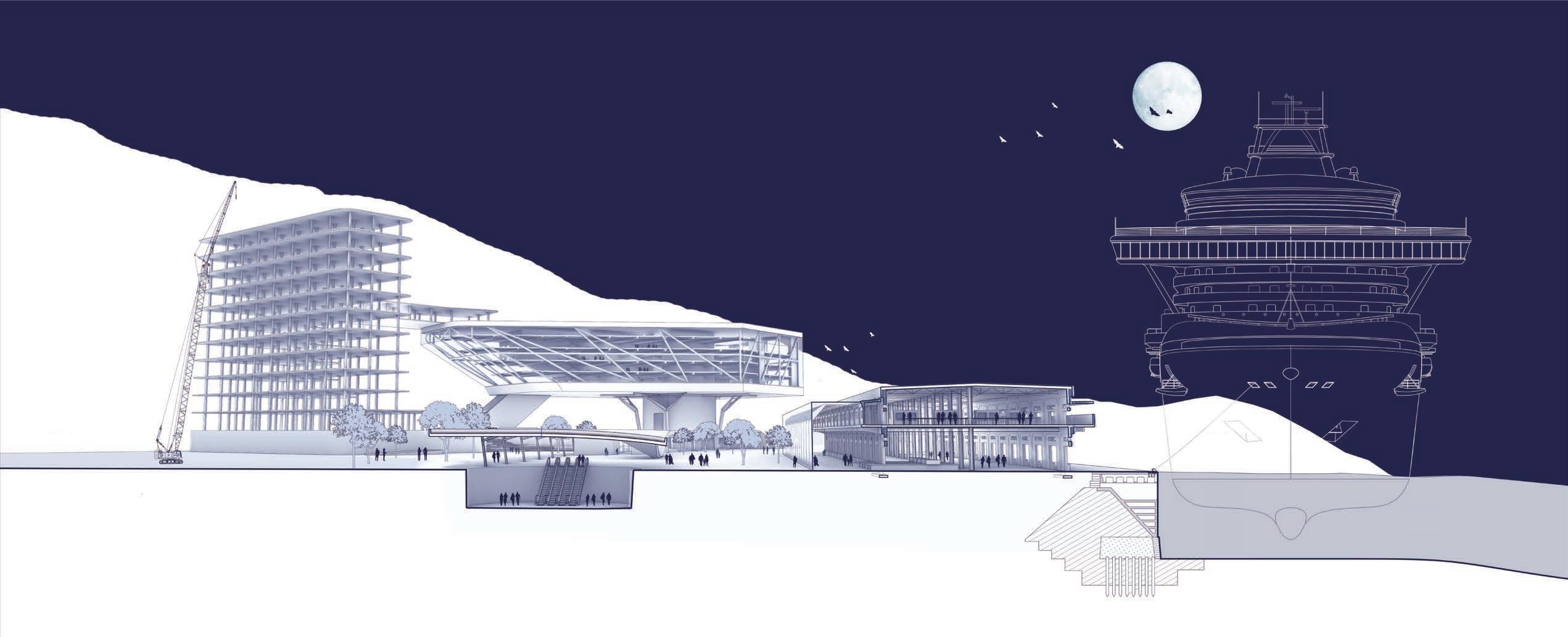
RECEDING WAVESADAPTIVE EMBANKMENT OF TAMSUI RIVER
Issue:
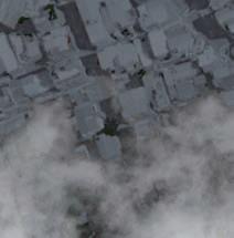
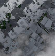
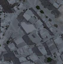
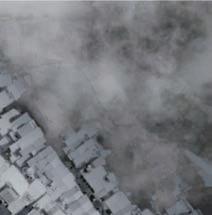
Due to several significant floods that Taipei City experienced in 1959, the Taiwanese government initiated flood control and water management projects in the Taipei metropolitan area from the 1960s to the 1990s. These projects involved constructing embankments, pumping facilities, and diversion channels along the Tamsui River, Xindian Creek, and Keelung River to address the issue of poor drainage.
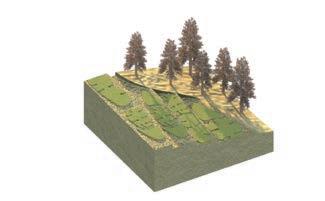
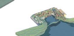
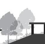
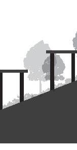
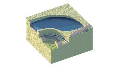
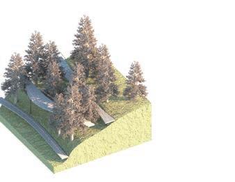
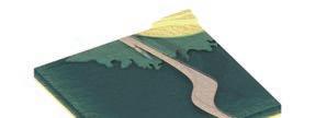
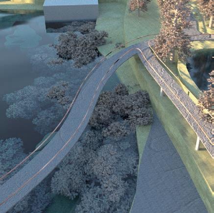
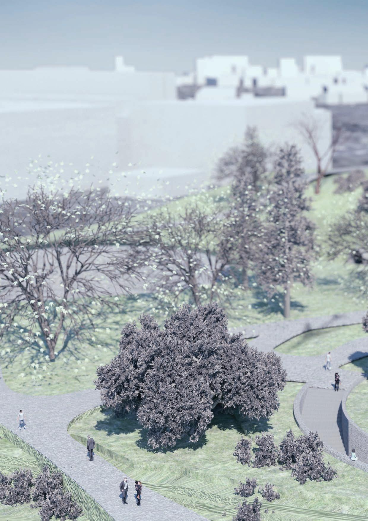
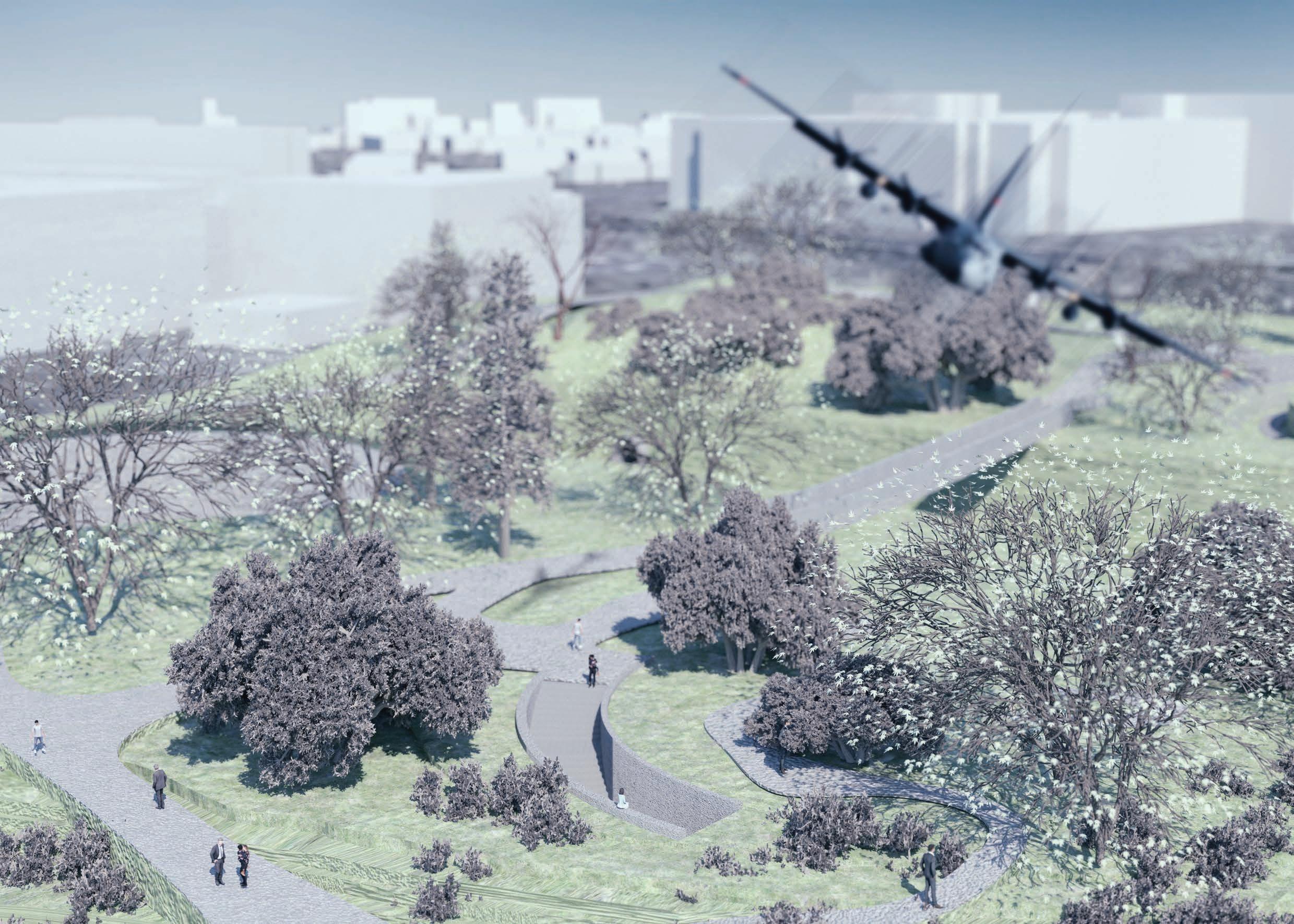
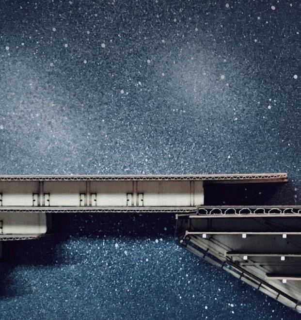
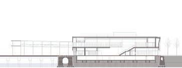
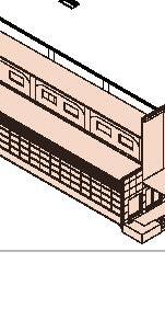
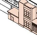
Currently, the riverside areas of Taipei City are surrounded by protective structures, with a standard flood defence height of 9 meters, designed to withstand a 200-year recurrence period flood. While these defences protect Taipei City from flooding, they also create a physical separation between people and the rivers. This design proposal aims to transform the barriers along the Tamsui River into a landscaped area that can be used for various human activities. Different intensities of human engagement are incorporated into the various landscape elevations, encouraging urban residents to interact with and enjoy the waterfront.
NCTU M.Arch I Option Studio 2021 Spring
Site: Taipei City, Taiwan
Director: SHENG-MING WU Solo Work
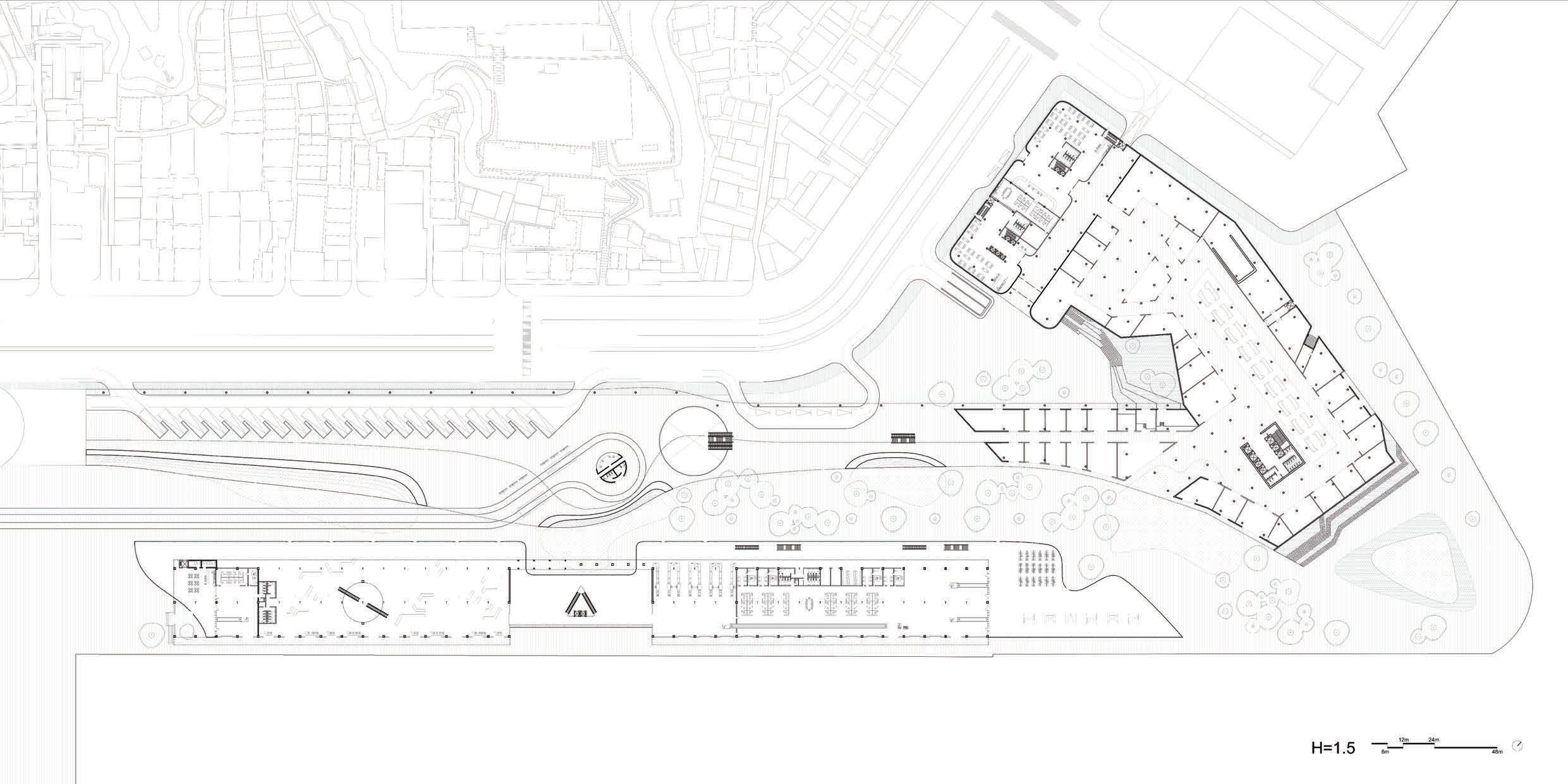
1 2 3 5 4 0102
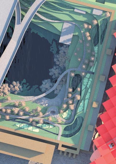
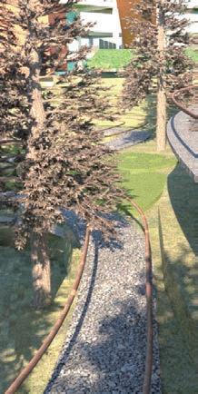
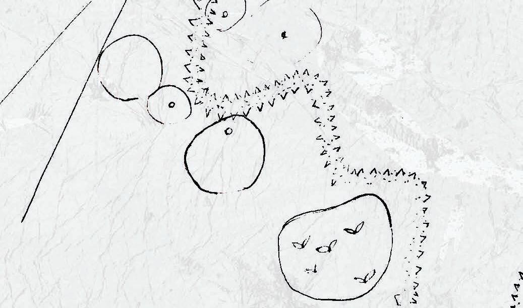
Wall Breaking
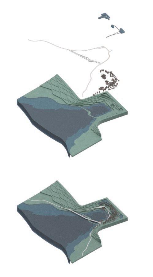
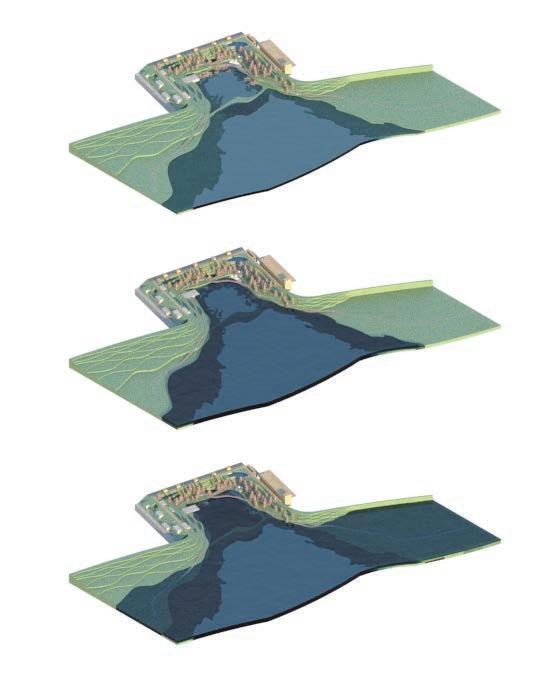
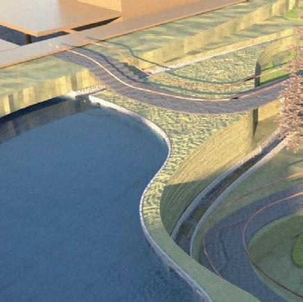
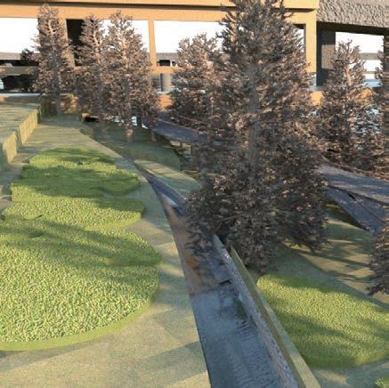
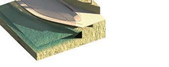
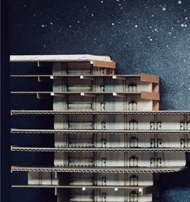
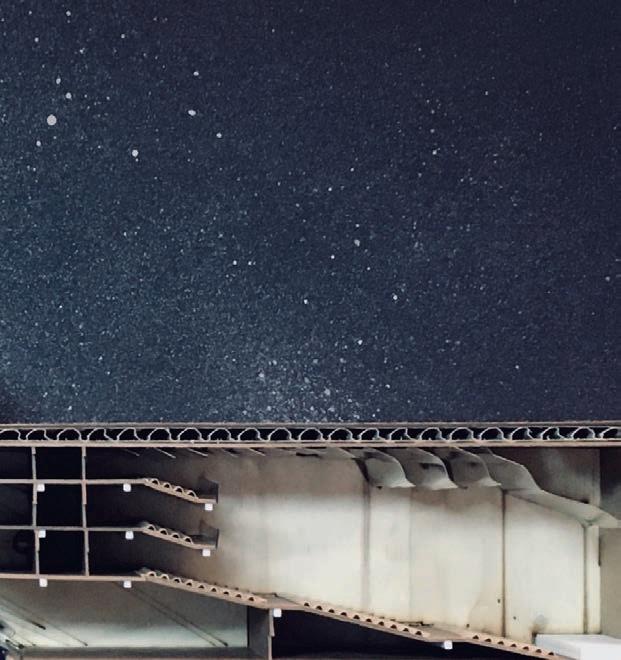
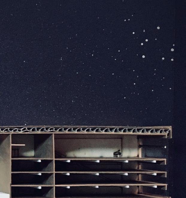
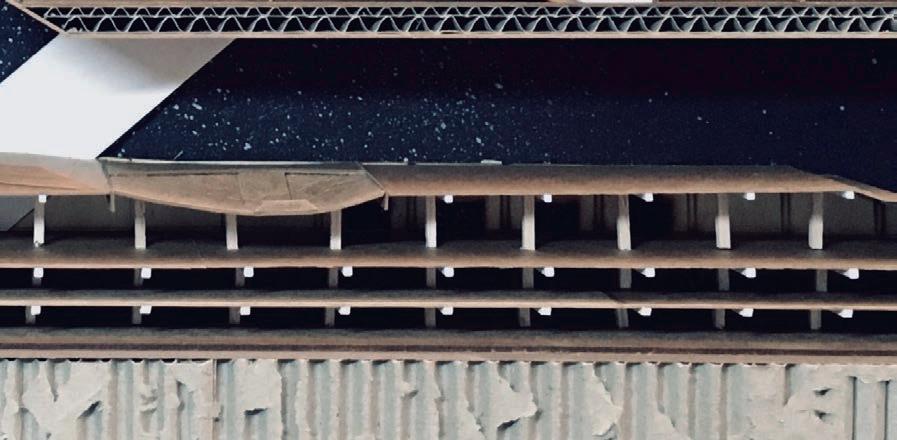
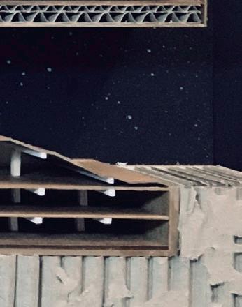
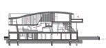
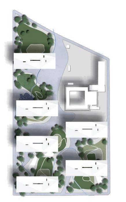
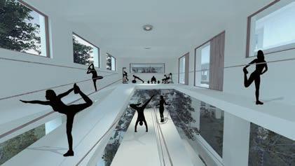
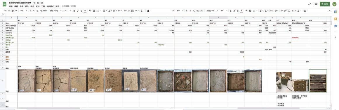
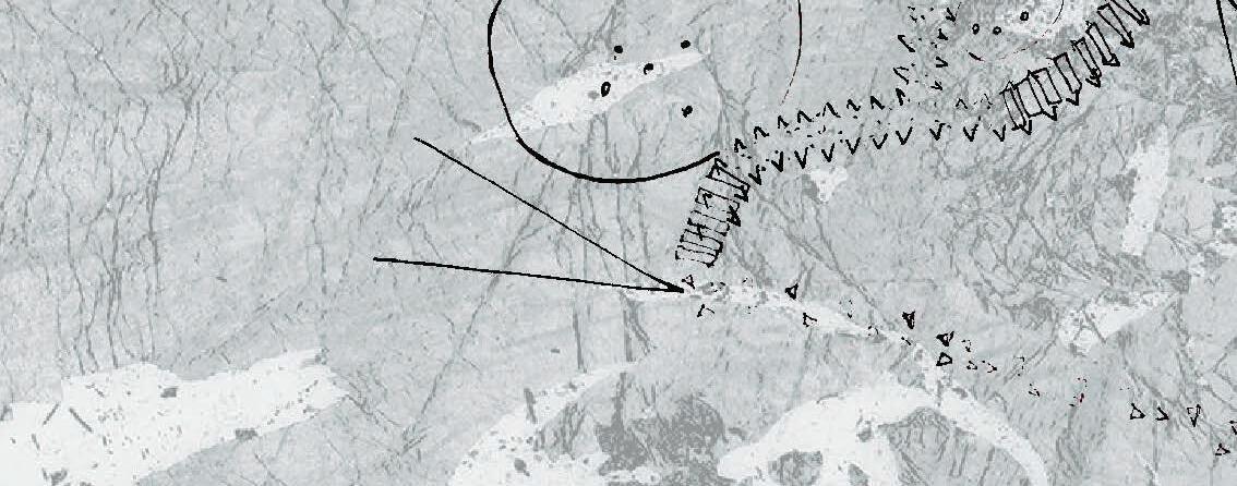
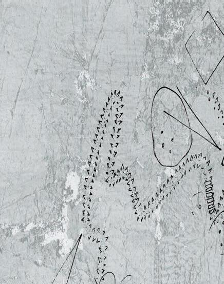
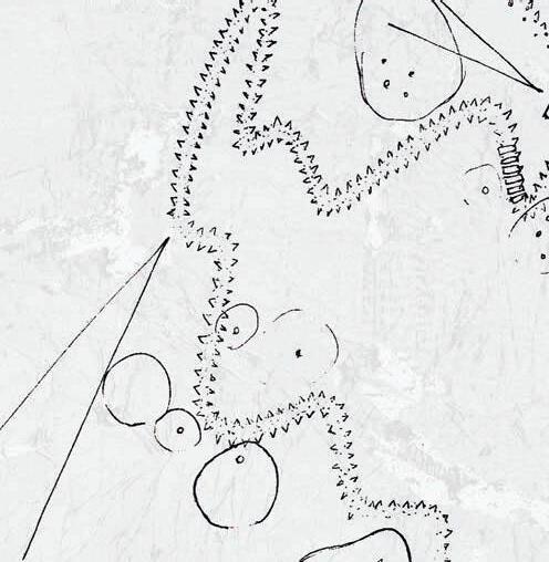
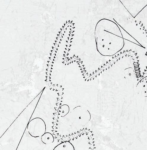
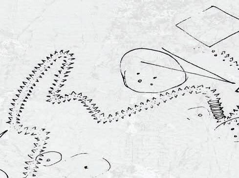
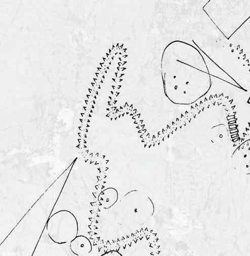
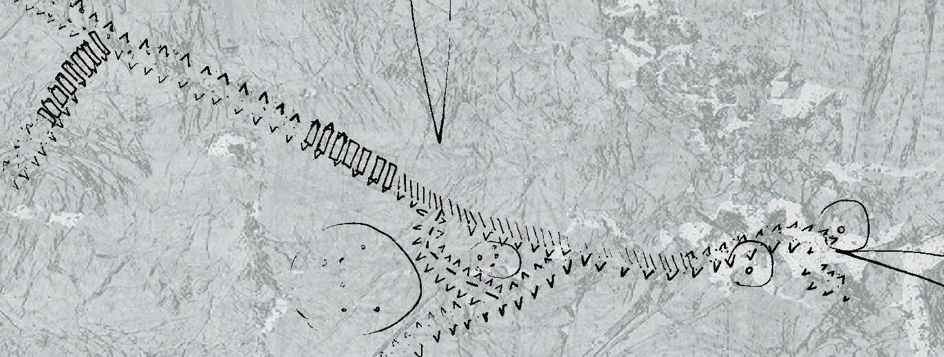
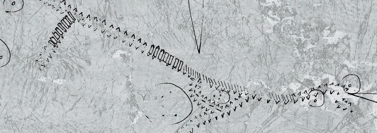
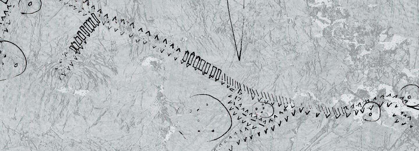
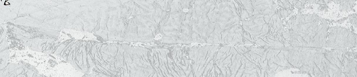
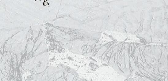
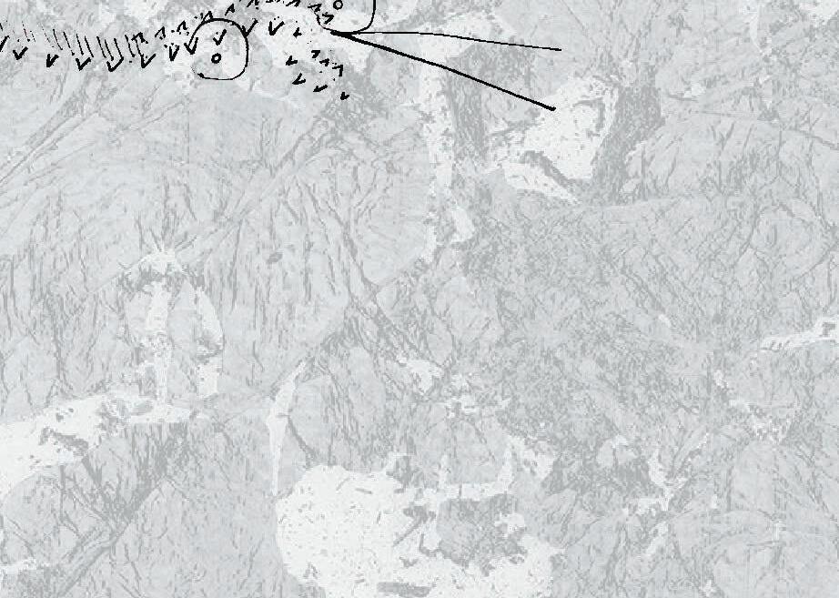
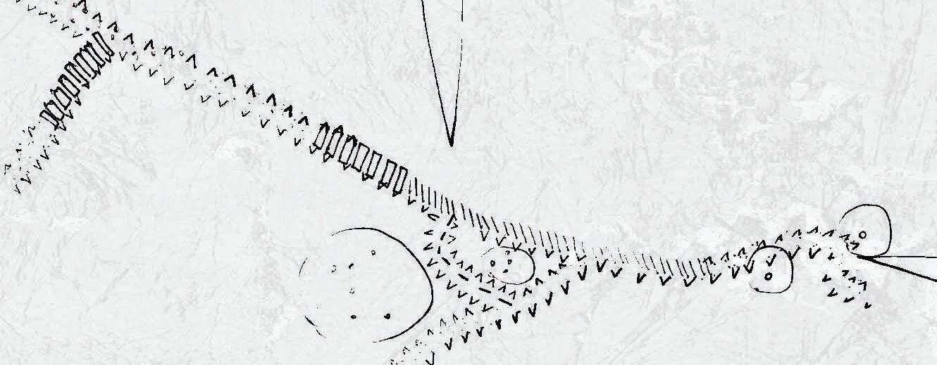
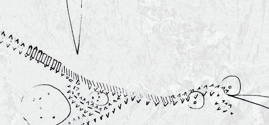
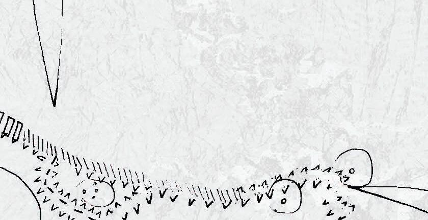
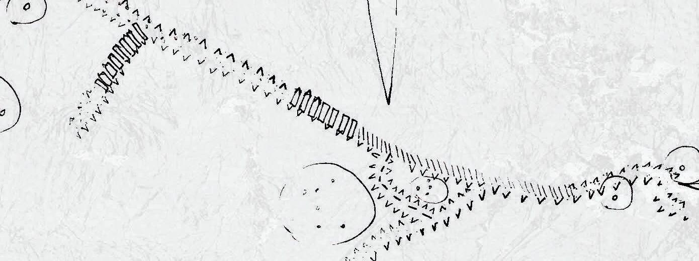
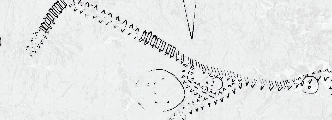
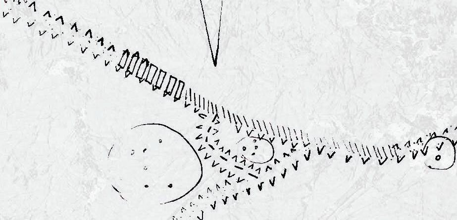
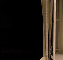
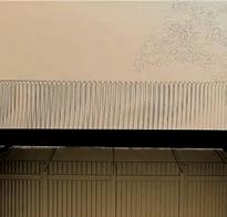
The 9-meter-high walled dike is transformed into a series of stepped and receding wave-like landscapes. Each level offers different landscape combinations, and the intensity of human activities on each level corresponds to different flood recurrence periods. Activities at higher elevations are more fixed, while those at lower elevations are more mobile and flexible. At the same time, the domestic wastewater from the residential areas behind the embankment undergoes primary treatment and is then conveyed outside the embankment for secondary treatment, including filtration and aeration. The treated water is then used for water landscape and irrigation outside the embankment.
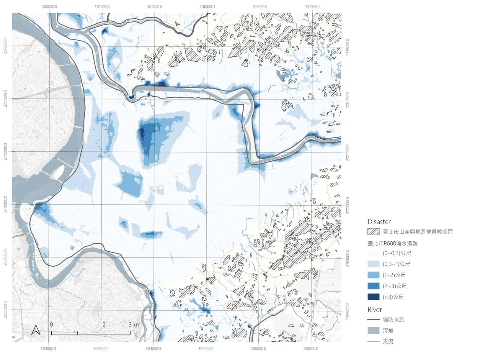
Landslide Mainstream Tributary Dike >3m 2-3m 1-2m 0.3-1m 0-0.3m - Potential Inundation River Geologically Sensitive Area site


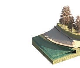


5 4.3 m 10 5 2 20 50 100 200 2.2 m 5 m 3.1 m 6.1 m 7 m 8 m 0 m -2 m -4 m The Heigh of Dike Recurrence Interval Aquifer Agriculture Wetland plants Phytoremediation Swimming Pool Play Ground Second Dike Dwelling Water Collection Primary Treatment: Seperation Secondary Treatment: Filtration & Aeration Overflow Storage Irrigation Artificial Lake Tamsui River First Dike 0304
The intergrated landscape
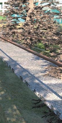
Water, pedestrian pathways, and vegetation are intertwined to create vertical landscapes that facilitate rainwater circulation and soil purification.
Primary Treatment
Secondary Treatment
Irrigation Canal
NORMAL
Bikeway
Footpath
Play Ground
2 YEAR FLOOD
Farm
Phytoremediation
Wetland plants
Floating Island
 Pedestrian Forest
Water
Pedestrian Forest
Water
5 YEAR FLOOD Potential Inundation


Pedestrian Water
0506
Forest
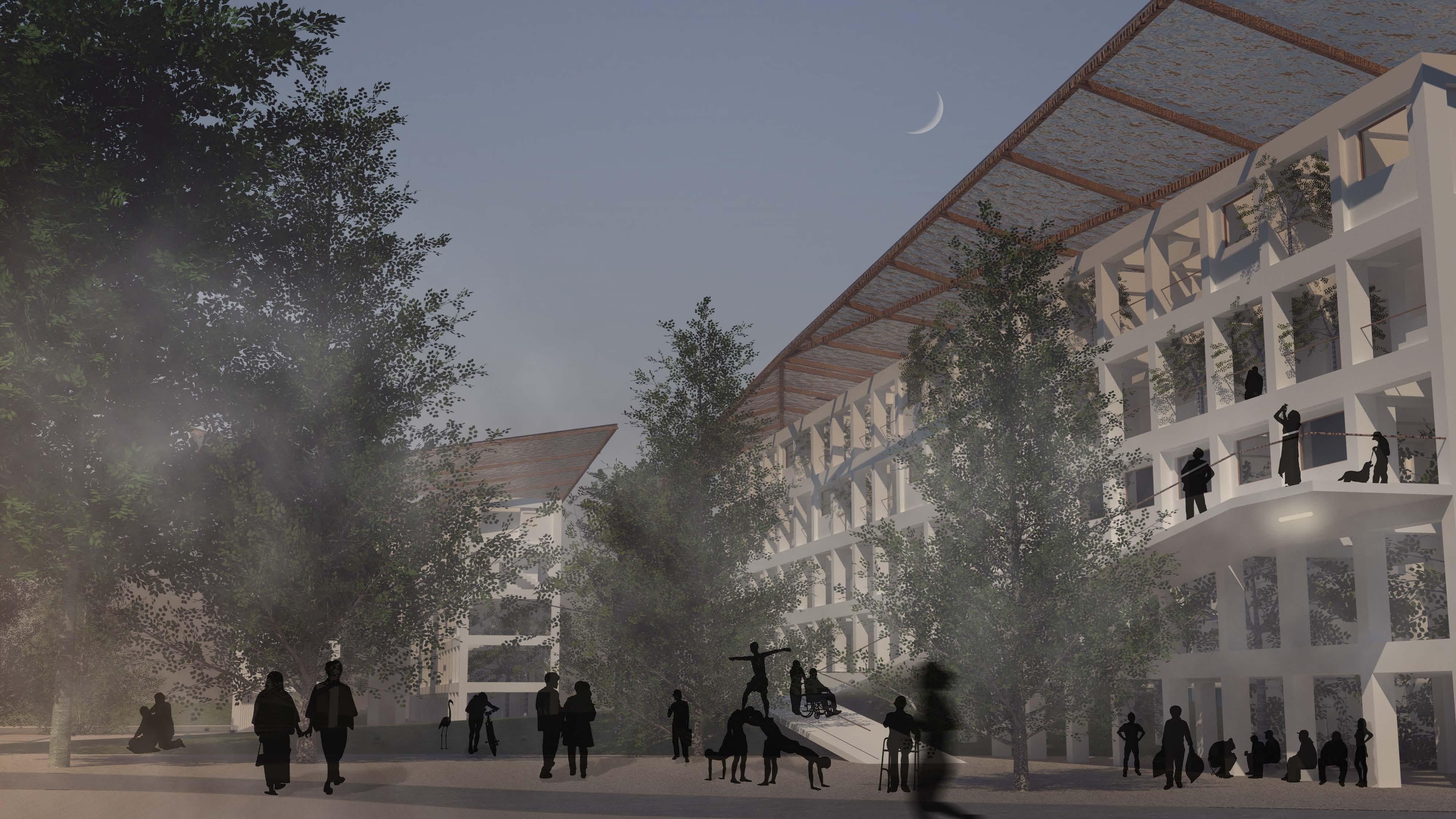
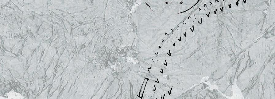
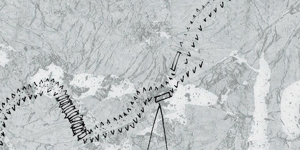
To enhance the accessibility to the waterfront Within this stepped landscape, from high to low, the levels are as follows: 1. Water retention wetland 2. Agriculture 3. Vegetation restoration and elevated walkway 4. Riverside playground 5. the Bridge as a secondary embankment. By doing so, the flood defences that separated the city become infrastructure enabling residents to wander and explore.


1 Aquatic Plants


3
2
Phytoremediation
Farm + Secondary Treatment
+4.3m +3.1m +7m +6.1m +5m +8m +7m HIGH


 Phytoremediation + High Line
4 Wetland + Play Ground
Phytoremediation + High Line
4 Wetland + Play Ground
+3.1m +0.2m +2.2m +0.2m +0m +5m +3.1m LOW 0708
5 Second Dike

0910
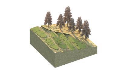
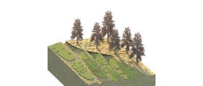
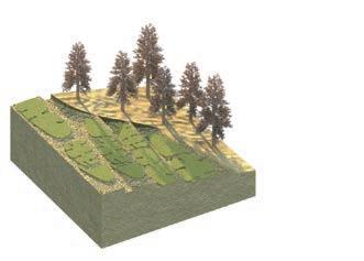
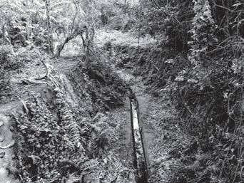
An abandoned military heritage


After the fuel depots were decommissioned, they became desolate. These vast underground depots have a dense forest at the top, including banyan trees, Lianwu trees, and small animals. In addition to the Jiangong River flowing through the depots, the ecological diversity here is very high.


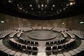
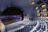
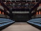
Case studies of building type


 Wild Rice @ Funan
Q Theatre
Aoyama round theatre
Taipei Performing Arts Center
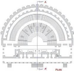
Thrust Stage
Traverse Stage
Proscenium Stage
Arena Stage
THE PROTOTYPES OF STAGES
Wild Rice @ Funan
Q Theatre
Aoyama round theatre
Taipei Performing Arts Center
Thrust Stage
Traverse Stage
Proscenium Stage
Arena Stage
THE PROTOTYPES OF STAGES
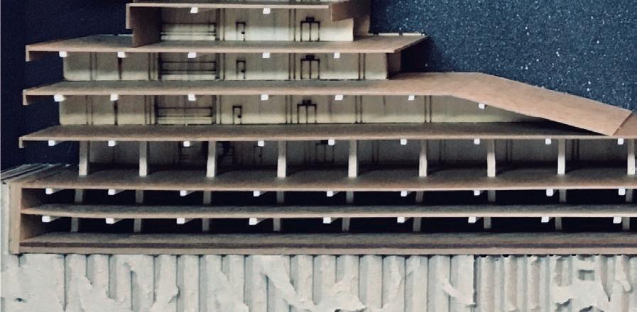
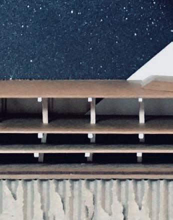
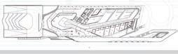
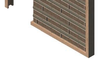
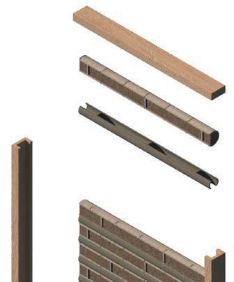
Form analysis & architectural strategy of the warehouses


MASSING STRUCTURE
PARTIAL DISMENTLING
INFILL
The fuel depots
50m 157.52.50 25m Plan Section
Friends House Benevento Roman Theatre 301550
OLD BUILDING NEW CONSTRUCTION
URBAN CONTEXT HERITAGE/
1112


N 2743700 N 2743600
E 250300
E 250200
E 250100 12.5m25m50m
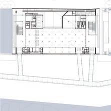
SITE PLAN
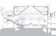
1. Lobby
2. Outdoor Theater
3. Theater_A
4. Theater_B
1.
2.
3.
4.
LOBBY PLAN_1F LOBBY PLAN_2F THEATER_ A PLAN_1F THEATRE SECTION THEATRE_ A PLAN_2F +3 +9 +6 UP UP +1.5 +4.3 +0 Stage Crew RoomDressing CrewProductionLounge CostumeCrafts 4m8m16m PLAN 4m8m16m SECTION 1314
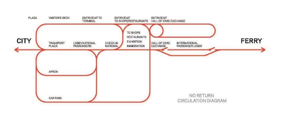
Background:


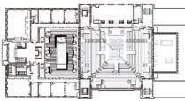
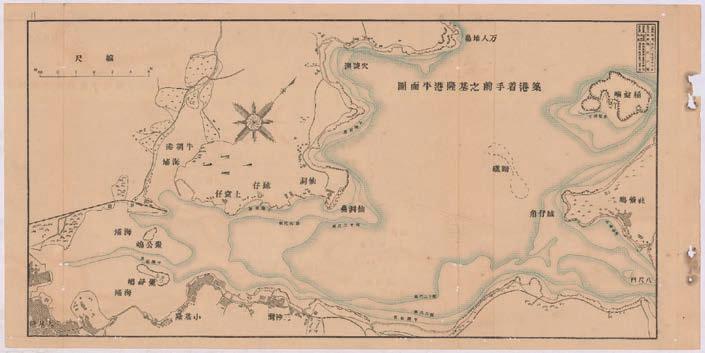
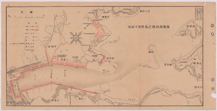
The situation of Keelung port today is influenced by a port construction and urban plan during the Japanese colonial period. Keelung Port is an important transportation node in northern Taiwan. The start point of the first Taiwan railway was set up at the west bank of Keelung Port at the end of the Qing Dynasty. Later, with functions such as commerce, passenger transportation, military affairs, and fishing, Keelung Port was once the most important port in northern Taiwan.
Since the reconstruction of the West Warehouse Nos. 2 & 3 in 1933, there was a separating system for passengers and goods. The cargo in the ship directly entered the indoor storage on the first floor, and then was transported to Keelung Railway Station via the Lingang Line Railway. At the same time, the passengers could enter the service center in the second floor of the West Warehouse Nos. 2 & 3, and connected with Keelung Railway Station seamlessly by the bridge between the West Warehouse No. 2 and the station. The warehouses were featured in the cargo-passenger separating system and seamless transportation, designated as municipal heritage sites by Keelung City’s Cultural Affairs Bureau.
Topic: Maximization of pubic space
As a comprehensive development that integrates business, conferencing, exhibition, and cruise tourism, the design focus on rehabilitating the West Warehouse Nos. 2 & 3 and maximizing public space.
As shown below, A is a black space that is regulated or has a supporting function. A' is an open space at different levels. This project aims to create a maximum and diverse A' above, below, and between A's surface while meeting the volumetric demand of A.
A + A’ A + A’KEELUNG PORT CRUISE TERMINAL AND CONVENTION CENTER
NCTU M.Arch I Core Studio 2020 Spring
Site: Keelung City, Taiwan
Director: SHU-CHANG KUNG, SHU-HSIEN CHOU, CHUN-KAI FANG Solo Work


1516
History
1900
The beginning of the modern construction of Keelung Port

1911
Completion of the first-generation West Warehouse Nos. 2 & 3
1934
Completion of the second-generation West Warehouse Nos. 2 & 3
1921
1904


The settlement before the 20th century was located in the hinterland of the south bank of the harbor.
1921
The Government-General of Taiwan promulgated the Urban Improvement Plan in 1907, and the settlement was transformed into a rectangular pattern.


1945
The U.S. military launched an air-raid bombing on Keelung, targeting the port and ancillary facilities.


Case studies of building type


THE PROTOTYPE OF CRUISE TERMINAL / FOA, 1995 PLAN SECTION
1949


After the Chinese Civil War, the defeated KMT army landed at Keelung Port.


2014.02

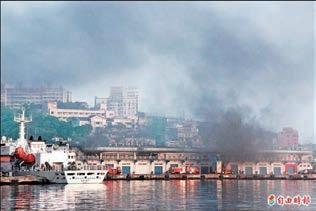
A demolition Crisis of West Warehouses Nos. 2 & 3
2014.04

Fire in the lobby of West Warehouse Nos. 2
1985
Reconstruction after the bombing in World War II

1989
Lots of refugees poured into Keelung after WWI, and the urban area extended to the surrounding hillside.


2014.12
West Warehouses Nos. 2 & 3 were designated as municipal heritage sites.

60 30100 100m 30 1550 50m
1718
SALERNO MARITIME TERMINAL KEELUNG PORT CRUISE TERMINAL LISBON CRUISE TERMINAL
The hillside land in Keelung City accounts for approximately 93% of the city's land, and the 8,900.83 hectares of forest accounts for about 65.2%. However, Keelung lacks an open space located on a flat, public, and highly accessible. Many parks are located along the border between the settlement and the forest. Except for the green belt around the harbor, there are very few flat parks and on difficult accessible places.
The site is situated at the end of the green belt. The most important goal is to maximize the open space and connect the pedestrian loop to the harbor area.


Urban strategy :


 1. A New Promenade around the Port
3. Attractions: Green, Historical Buildings & Open Space
2. Experience in Different Eye Level
1. A New Promenade around the Port
3. Attractions: Green, Historical Buildings & Open Space
2. Experience in Different Eye Level
4. A Landscape without Breaksides
Hillside Park Flatland Park Hillside
Site Hillside School
Hillside
ParkHillside Settlement Settlement Harbor Plaza School
Gateway Plaza Maritime Plaza East Side Cruise Plaza
Tien-Liao River Dawn River
A green city with difficult accessibility
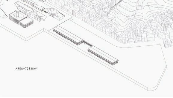
AREA = 72838m2
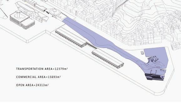
TRANSPORTATION AREA = 12379m2
COMMERCIAL AREA = 15693m2
OPEN AREA = 24313m2
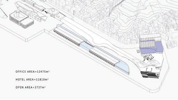
OFFICE AREA = 12475m2
HOTEL AREA = 11810m2
OPEN AREA = 3737m2
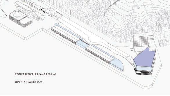
CONFERENCE AREA = 19294m2
OPEN AREA = 8805m2
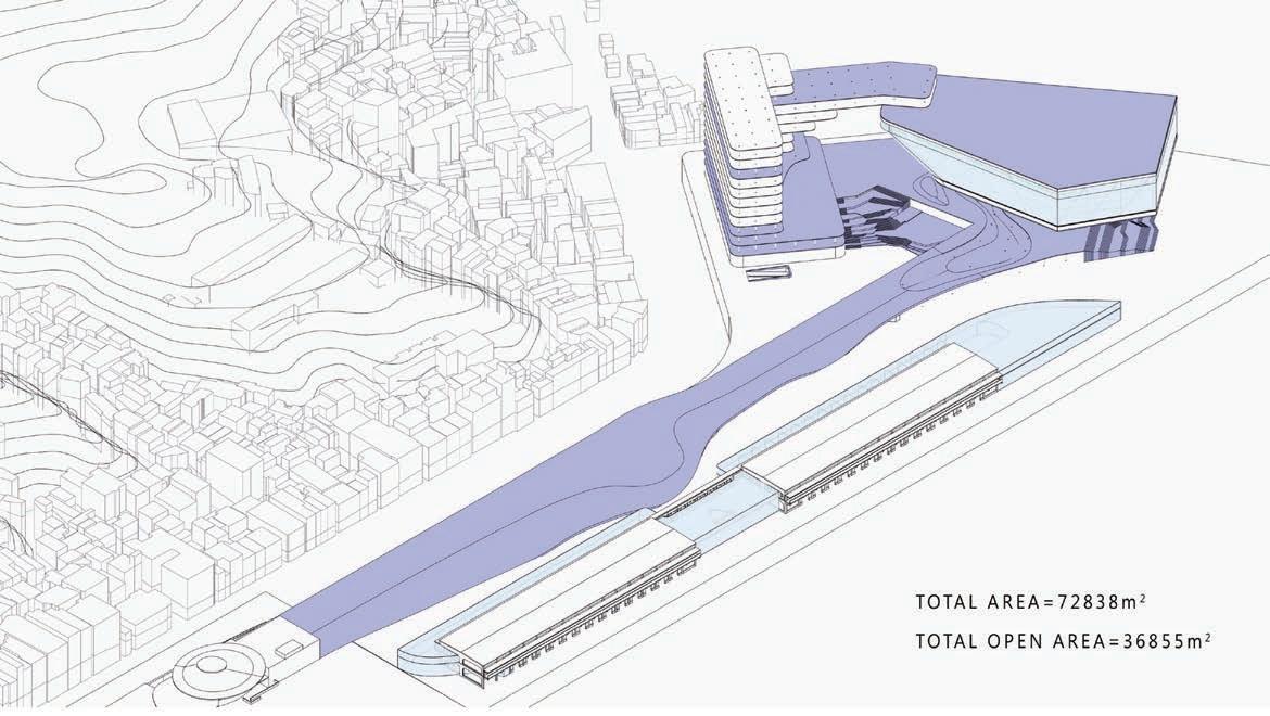
Maximization of pubic space
TOTAL FUNTIONAL AREA = 72838m2
TOTAL OPEN AREA = 36855m2
The space under the purple block is functional A, such as traffic corridors, shopping malls, conference halls, offices, etc. The space above the color blocks is three-dimensional and public A'. After quantitative calculations, the open space increased 50% of the original site area due to the new placement of A.
1 2 3 4 5
1920
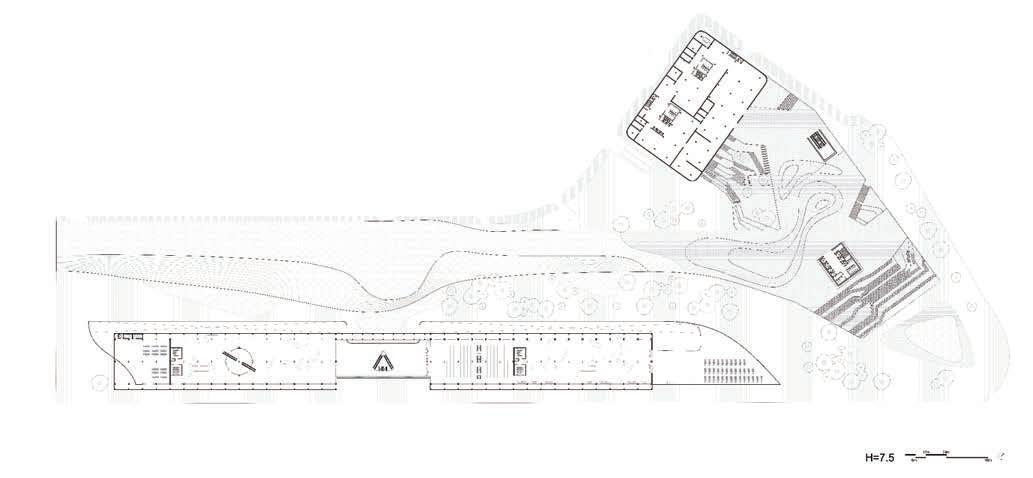
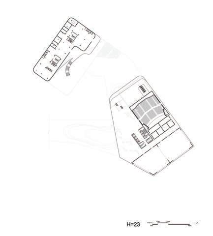
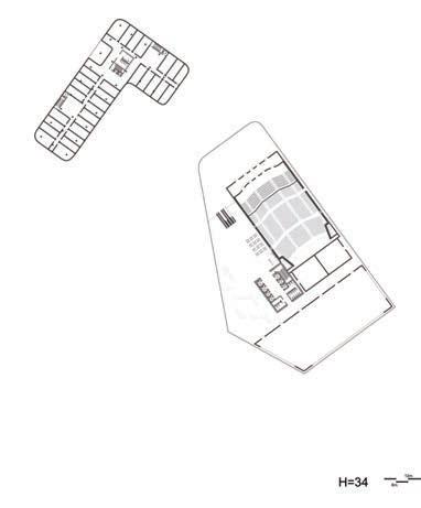
12m24m48m H=7.5 PLAN
12m24m48m H=23 PLAN 12m24m48m H=34 PLAN 6m12m24m H=1.5 PLAN 2122
MASSING
STRUCTURE
RHYTHM SECTION
CIRCULATION
HERITAGE/ OLD BUILDING
PARTIAL DISMENTLING
NEW CONSTRUCTION
HORIZONTAL PROLIFERATION
URBAN CONTEXT

CC’ SECTION 3m6m9m
Form analysis & architectural strategy of the warehouses
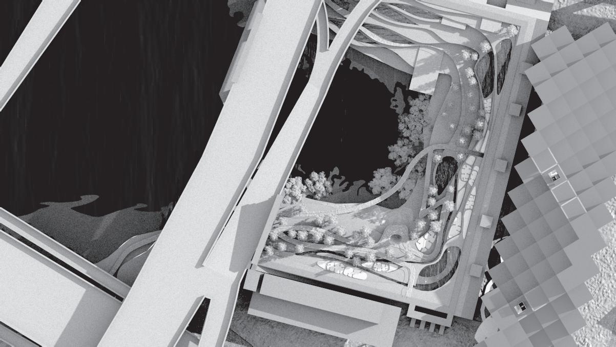
There are four hierarchies of A' in this picture. First of all, passengers on the light rail can feel the hint of arrival through the sunlight after unearthed. Secondly, passengers can read the detailed structure behind the glass while walking between the landscape and the old warehouse.
Then a semi-shaded space for sports and entertainment is under the distant two masses. Finally, the grassy slope above the landscape completes the last piece of the puzzle of the wandering path, bringing the passengers back to the north exit of the railway station.
A A’
BB’
SECTION 12m24m36m
2324

D D’ E E’ SECTION 6m12m18m SECTION 4m8m12m 2526
Issue:
According to Marx (1818-1883), the development of nature is human instinct. Different from the wild, the second nature is socially constructed, transformed through the labor process, and shaped by human technology and values (1981). Ironically, based on the desire for population expansion and development, human beings often develop the first nature for residential use and build the second nature on top of it.
On the other hand, statistics from the International Energy Agency (IEP) indicated that the global growth rate of floor (about 23%) is far greater than the population growth rate (about 9%) in 2018. Besides, the total population of Taiwan has gradually decreased after reaching its peak in 2019. Moreover, the housing supply has surpassed the actual population.
Topic: Rewild
Based on the above statistics, we can assume that the developed land will exceed the actual use range in the future. Returning to nature is the primary task at present. Therefore, this project proposes a new urban renewal model. Through the framework of Open Building, the last residential behavior brings into the second nature, and the developed space finally gets restored.
SUCCESSIONREWILD BY THE LAST DWELLING
NCTU M.Arch I Option Studio 2020 Fall
City, Taiwan
Work
Site: Taipei
Director: PEI-HSIEN HSU Solo
2728
The buildings and construction sector should be a primary target for greenhouse gas emissions mitigation efforts, as it accounted for 36% of final energy use and 39% of energy- and process-related emissions in 2018.


The global growth rate of floor (about 23%) is far greater than the population growth rate (about 9%) in 2018.


residential 17% non-residential 11% construction industry 11% other industry 31% other 7% transport 23% Energy residential 22% non-residential 8% construction industry 6% other industry 32% other 4% transport 28% Emissions 2010 0% 5% 10% 15% 20% 25% Change since 2010 20112012201320142015201620172018 Floor area Population Energy Emission 1 2 3 4
fig1._ Global share of buildings and construction final energy and emissions, 2018
fig2._ Changes in floor area, population, buildings sector energy use and energy-related emissions globally, 2010-18
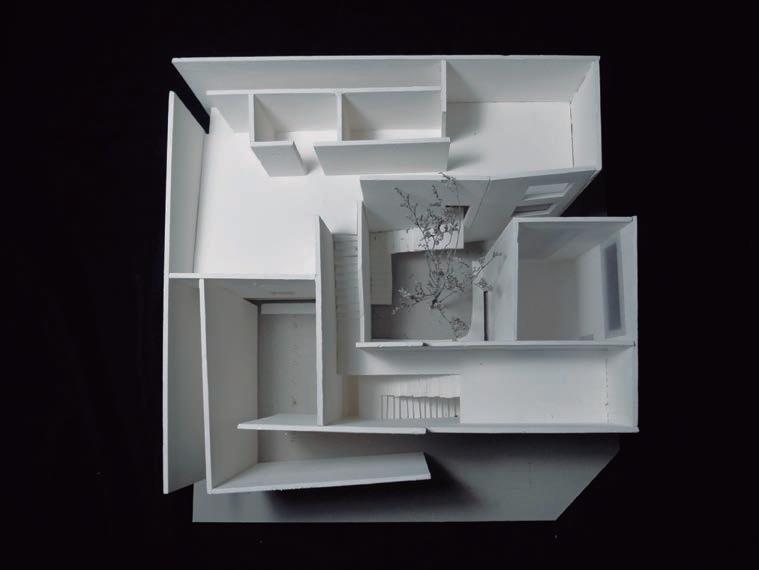
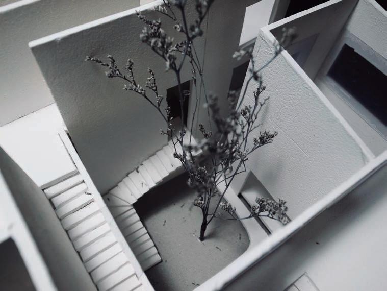
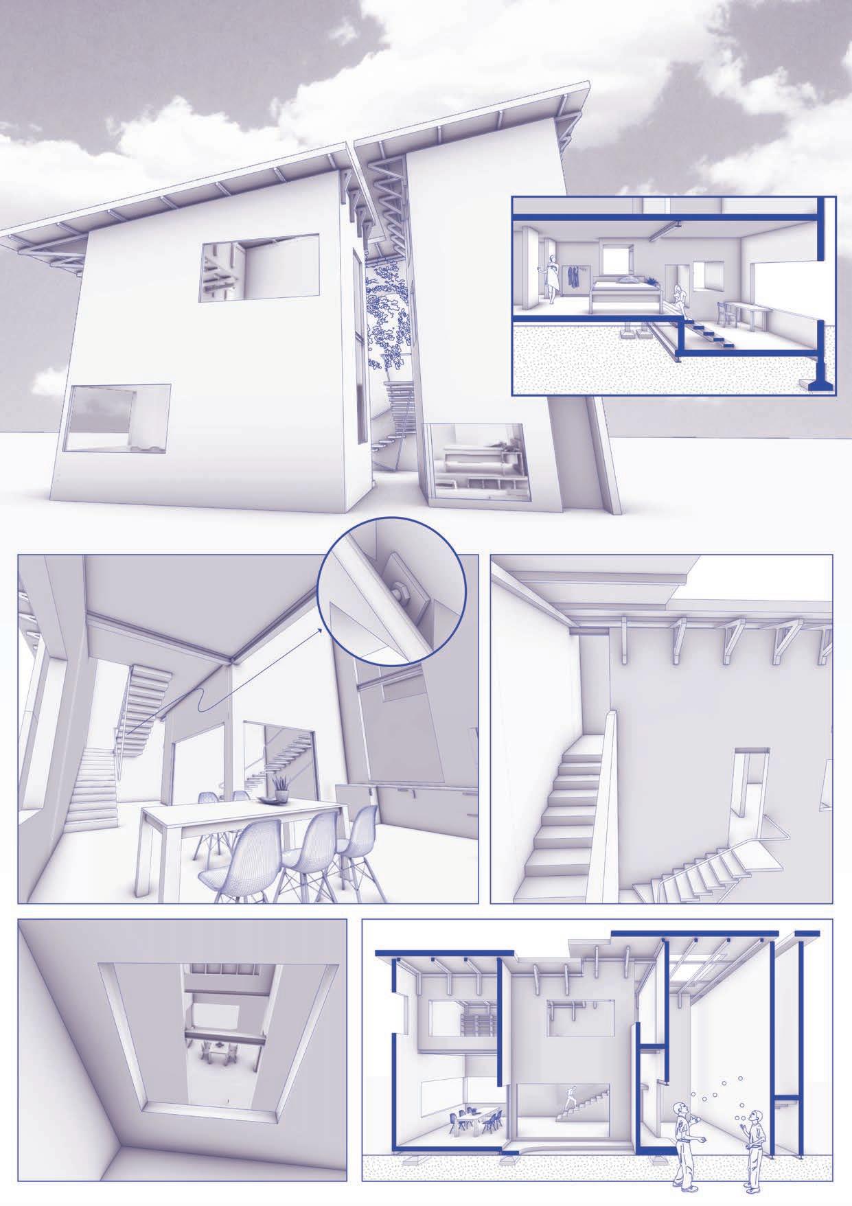
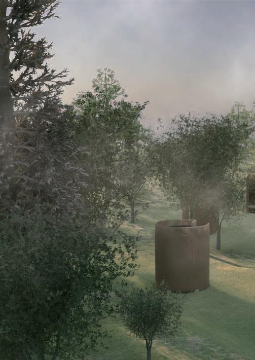
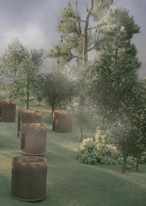
Based on the Open Building, this project keeps the existing skeleton of the Nanjichang Apartment and removes the infill materials such as walls and floor slabs. Also, this project uses construction waste, eco-friendly materials, and on-site construction as the principle to construct a new wall. The interweaving of the new living space and the plant system constitute a huge organism. It will finally transform into a wild park through evolving.
The total population of Taiwan has gradually decreased after reaching its peak in 2019 (about 23.6 M people). Whereas, the housing supply (3.29* 8.79 M ≒ 28.9 M) has surpassed the actual population.

producer primary consumer secondary consumer tertiary consumer apex predator decomposer raw material nature/ producer industrial products buildings user/ decomposer disposal Old Building Remove Old Infill Upcycle Skeleton Input New Infill Greening Second NatureRecovered Nature Biological Weathering Reuse/ Decay Naturally Food Chain : Human as the apex predator Technical Cycle : Human as the decomposer residential households population/unit 20102011201220132014201520162017201820192020 3.29 8.79 million 0 0.5 1 1.5 2 2.5 3 3.5 4 4.5 7.2 (million) 7.4 7.6 7.8 8.0 8.2 8.4 8.6 8.8 9.0
2930
fig3._ Changes in residential households and average population per unit in Taiwan, 2010-20
 PHASE 1
PHASE 2
PHASE 3 PHASE 4
PHASE 1
PHASE 2
PHASE 3 PHASE 4
broccoli brussels sprouts cabbage cauliflower swiss chard(stalks) 。 。 。 。 。 。 。 。 。 。 。 。 。 。 。 beans beets carrots celery celeriac collards pak choy peas radishes rutabagas arugula kale lettuce mizuna spinach swiss chard (leaves) asian greens mesclun mix 5 hours 4 hours 3 hours 2 hours 6 7 8 9 10 11 12 1 2 3 4 5 6 7 8 9 10 11 12 1 2 3 4 5 6 。 。 。 。 。 。 。 。 10m20m40m 4F PLAN 10m20m40m 3F PLAN 10m20m40m ROOFTOP PLAN
PHASE 5
Green inside the dwelling unit Green between neighborhoods Green in the public space
above three perspective drawings show three different hierarchies of green space: in the public space, between neighborhoods, and inside the dwelling unit.


 PHASE 6
PHASE 7
PHASE 8
PHASE 9
2m4m10m
4F DWELLING PLAN
2m4m10m
4F DWELLING PLAN
The
PHASE 6
PHASE 7
PHASE 8
PHASE 9
2m4m10m
4F DWELLING PLAN
2m4m10m
4F DWELLING PLAN
The
3132
As for recycling construction waste, the demolished walls and floor slabs are classified into three levels by size first. The largest ones are used for land grading. The seconds are for street furniture. The smallest gravels are mixed with soil to compose a new wall structure.
There are some recycling targets below:
1. Consuming the most construction waste
2. Processed and assembled on site
3. Portable while processing
1m
10m
Earth Covering
Construction Waste of 30-60cm Diameter
2m
Wood Frame with Slot Joints
Construction Waste of 8-30 cm Diameter
Welded-wire Fabric
Corten Flat Sheets
Brick Asphalt Gravel Concrete
for Land Grading_ for Gardening_
After stepping into the tectonic practice, I first explored the characteristics of the soil. Then I added different additives, fibers, wastes that provide adhesiveness, which provided the basis for subsequent structural experiments.
for Wall Construction__
In the final version, two bamboos filled with soil and construction waste of different diameters were longitudinally sectioned and then clipped to each other.
1m
4cm*9cm Wood Lath
6 cm Diameter Bamboo
6 cm Diameter Bamboo
Mud & Gravels
3334
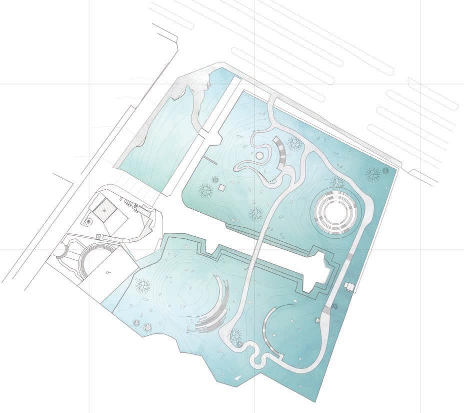
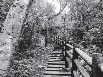
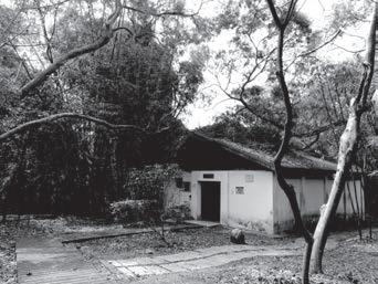
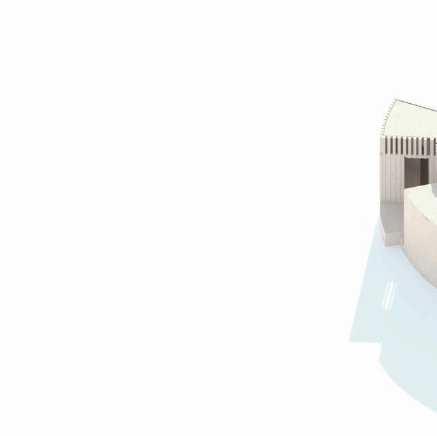
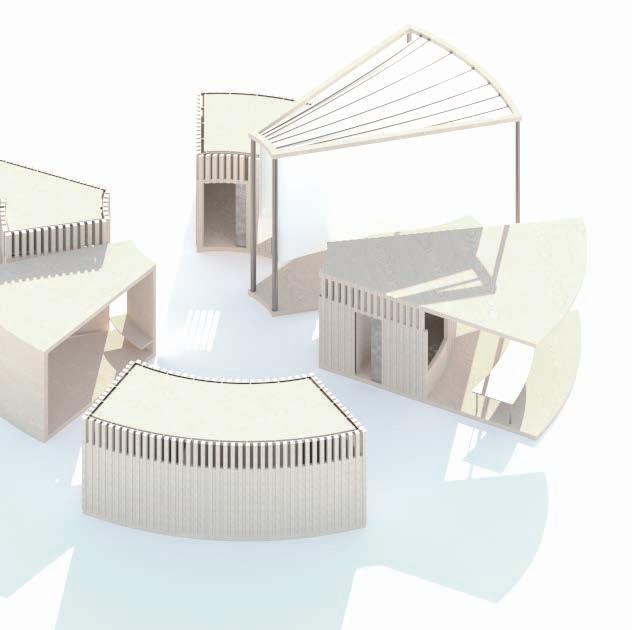
THE BREEZETOURIST CENTER & PUBIC TOILET OF GAOFENG BOTANICAL GARDEN
Gaofeng Botanical Garden is located in the southeastern suburban of Hsinchu City, covering an area of about 35 hectares. In 1932, to promote the usage of the hillside, the Japanese Colonial Government imposed forestry policy which trying to grow various economic forests in Hsinchu. Therefore, the government established Hsinchu Prefecture Akasaki Forestry Nursery which was the predecessor of Gaofeng Botanical Garden. In 1960, it was transformed into a botanical garden and became a leisure and educational place for Hsinchu citizens.
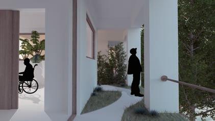
Comparing to the public toilets in business districts, how different should the ones be in wildland?
The design challenge is to strike the balance between visibility and invisibility and helping visitors to enjoy the ambiguous border between artificial landscape and nature. With a hypothesis of privacy, the design aims to help the user to enjoy the breeze and the coolness flying through the bottoms while using the toilet, and on the other hand, create visual lightness and transparency.
NCTU M.Arch I Core Studio 2019 Spring
Site: Hsinchu City, Taiwan

Director: CHUN-CHIEH FANG
Team Work (with SIH-CI YUEH & LU-CHI CHAN )
3536


▼ Rear
* Site1: Tourist Center


▲ Entrance
Exit
Rear
3738
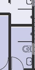
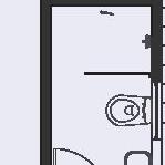
* Site2: Public Toilet
* Site1: Tourist Center

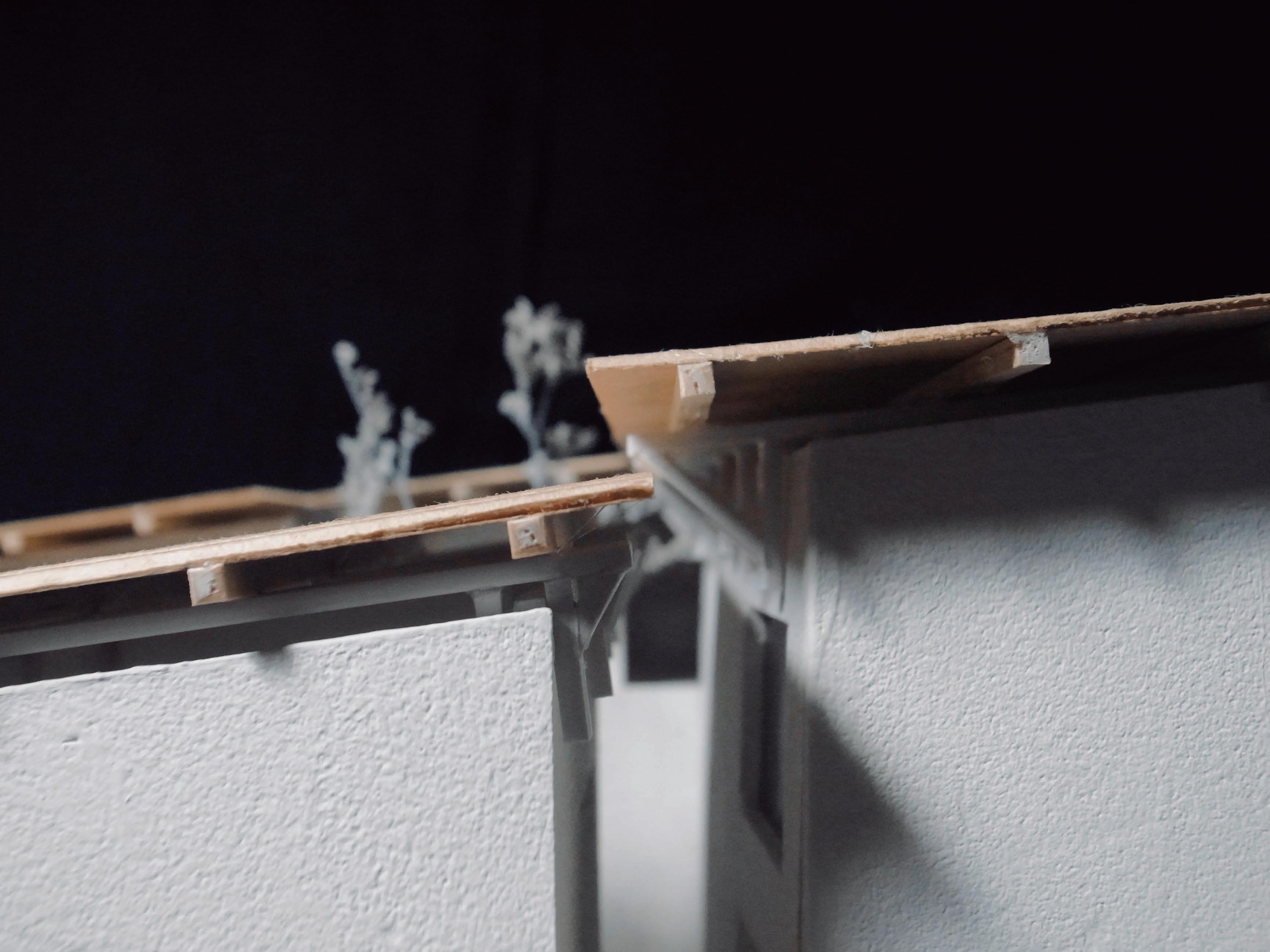
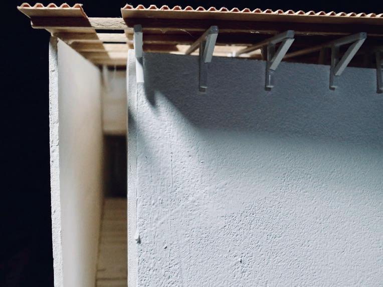
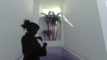
The design includes two parts. The first is a tourist center near the entrance; the other is a cluster of public toilets on the way to the rear exit. The tourist center contains an information stand, several toilets and a pavilion with hanging curtains. Each part is shaped as a circular sector with different radiuses. The walls of toilets are made of long and one short wooden laths, which can make better ventilation in the upper space. For the same reason, the walls are not fully sealed by the roofs. There are small metal components in between.
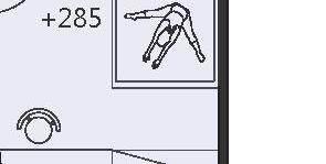
A A’ A’ A Women’s Toilet Men’s Toilet PLAN & SECTION 1m2m3m
Roof Detail Curtain Detail
Toilet Information Center Pavilion 3940
Accessible
* Site2: Public Toilet
Thegoalofthisdesignistoimprovethedelightofurinatinginnature,byenhancing the tactile experience.

First,thestripswhichmakeupthewallarecurvedandtwisted.The180-degree curve creates a double-layered system. The internal one ensures privacy, and the externalonecancreatevisuallightness.Thewindcanlightcanflowin,butthe line of sight is blocked outside on the other hand.

Second,theroofsdon'tcoverthetoiletfully.Likedrizzleslidingdownthe treetops,rainwaterfallsfromthegapbetweentheroofandthewallandthenis thrownbythefendertothewall.Userscanstillfeelthechangesintheexternal environment when they urinating.
GENERAL SECTION TYPE A PLAN TYPE B PLAN PLAN & SECTION 0.5m1m1.5m 4142