


Liveable NEIGHBOURHOODS 2023 Published by: In partnership with:
THANK YOU TO OUR SPONSORS


3 Liveable NEIGHBOURHOODS CONTENTS Published by: Landor LINKS, Apollo House, 359 Kennington Lane London SE11 5QY Editor: Deniz Huseyin Contributing Editor: Juliana O’Rourke Commercial Director: Daniel Simpson Design: Natalie Clarke Printed by: PrintedEasy.com, 1 Meredews, Works Road, Letchworth Garden City, Hertfordshire SG6 1WH © Landor LINKS Ltd. 2023 Liveable NEIGHBOURHOODS 06 13 37 50 Foreword 04 Another 65km of London roads to cut limits 05 to 20mph London’s boroughs to get £63m TfL funding 06 for people-friendly streets Thinking beyond 15 minutes: A new perspective 08 on space, time and travel Esther Kurland, Urban Design London People-centric planning 13 Marta Liut, SYSTRA Strategy to reallocate parking spaces to 18 other uses in Lambeth How to fight misinformation 22 Stefan Rollnick, Lynn Building better streets on the foundations 26 of strong evidence Hirra Khan Adeogun, Possible Greenwich Council unveils plan to transform 29 streetscapes LTNs do not displace traffic and air pollution, 30 Imperial College study finds Have LTNs got an image problem? 32 Sarah McMonagle, Cycling UK Why we need more school streets 34 Claire McDonald, Mums for Lungs Hackney plans to make three-quarters of 37 borough low traffic School street champions vow to roll out 38 more schemes Mete Coban, Louise Krupski & Catherine Rose Paving the way for accessible local streets 40 for disabled people Superloop: Improving bus links in outer London 42 ‘Include buses in plans for people-friendly streets 44 Sian Huston, TfL Green streets will kickstart modal shift 47 Kendra Inman, TfL Urgent action needed to tackle flash floods 48 Philip Glanville, London Councils Turning the grey green 50 Habib Khan, Meristem Cargo bikes aren’t coming - they’re already here 55 ‘Level playing field needed when comparing 57 van and cargo bike deliveries Sponsors directory 61 Cover image courtesy of SYSTRA Liveable NEIGHBOURHOODS 2023 Published by: In partnership with: 34
FITTING TOGETHER THE PIECES TO CREATE A PEOPLE-FRIENDLY VISION
After a period of pandemic-related fiscal uncertainty and stagnation, TfL unveiled an array of funding pledges earlier this year. The aim was to kick-start schemes designed to meet net zero targets, cut car dependency, encourage active travel, and improve air quality and road safety.
This flurry of activity was made possible by a £1.2bn funding settlement with DfT up to March 2024, in the wake of four short-term emergency deals, totalling about £5bn, since the first Covid-19 lockdown in March 2020.
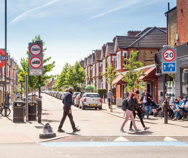
Among the headline announcements was TfL’s award of more than £63m to London councils to deliver cycling routes, new or upgraded pedestrian crossings, bus priority schemes and School Streets.
In 2023/24 nearly £39m will be allocated to outer London boroughs while inner London boroughs will get more than £24m, as part of TfL’s Local Implementation Plan (LIP) funding.
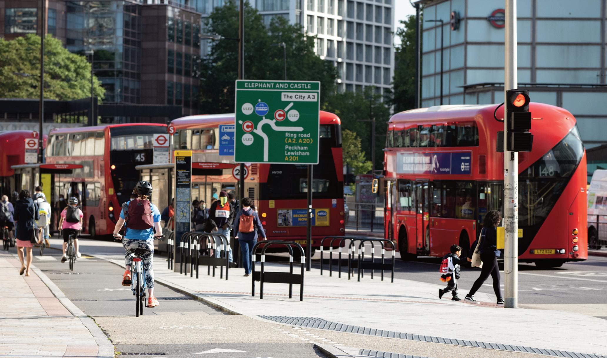
Outer London is to get more than 90 bus priority schemes. This will be complemented by the Superloop bus network that will circle the capital. The full orbital network is due to be in operation by the end of 2024, linking town centres, railway stations, hospitals and transport hubs.
With the Ultra Low Emission Zone (ULEZ) to expand across all the capital’s boroughs on 29 August, mayor Sadiq Khan made Superloop one of his commitments to improve transport links in outer London.
In an effort to improve road safety, meanwhile,
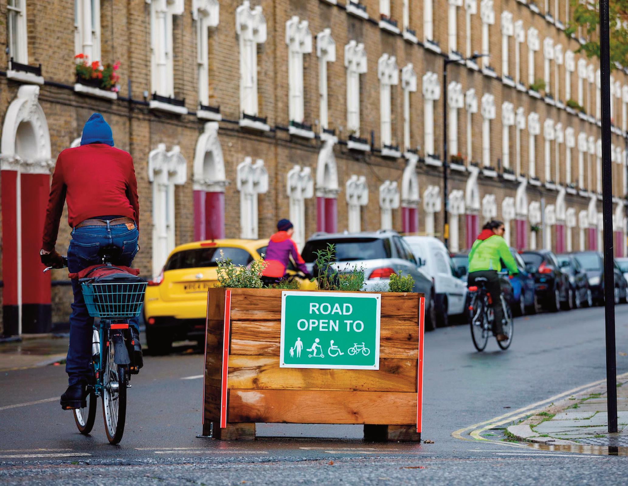
works are due to start in September to roll out lower speed limits. TfL plans to extend 20mph limits across 65km of roads in Greenwich, Kensington & Chelsea, Lewisham, Southwark, Wandsworth, Merton, Bromley and Lambeth. This form’s part of the mayor’s Vision Zero plan, with the aim that no one is killed in or by a London bus by 2030, and there are no deaths and serious injuries from road collisions on London's streets by 2041. You can find out more about these initiatives in this guide. The controversy surrounding Low Traffic Neighbourhoods is addressed in two myth-busting pieces.
There’s also an update on how School Streets are steadily taking root across the capital. Hackney lays claim to leading the way, with 50 School Streets now
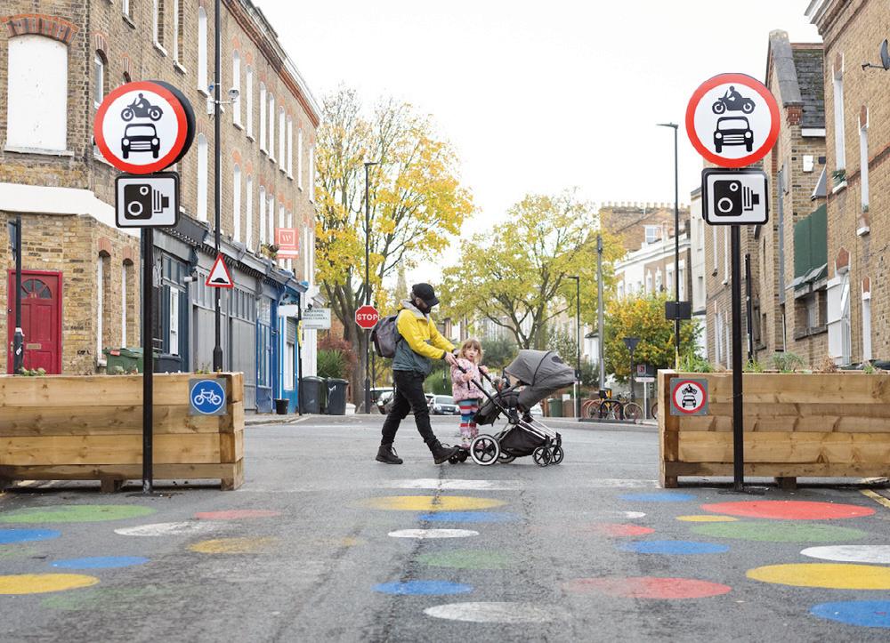
installed. This forms part of Hackney’s strategy to make three-quarters of the borough low traffic. There are plans for another five LTNs in Hackney to add to the 19 already in operation.
Lambeth has also drawn up ambitious plans to transform its streetscape. Currently 94% of kerb space in the borough is allocated to parking vehicles, the council estimates. Under a £31.7m plan, it wants to transfer 25% of kerbside to bus lanes, street trees, rain gardens, parklets and cycle parking.
Within this guide you can also find out how to deal with abuse on social media when challenging the dominance of the car (p22) and why the transition to people-friendly streets must be backed by good data.
Green infrastructure is gaining traction as an effective way of boosting climate resilience, as illustrated by the proliferation of on-street planters, parklets and rain gardens.
Elsewhere in this guide, our expert contributors discuss 15-minute neighbourhoods, 20-minute communities and the rise of cargo bike deliveries. And on the important issue of accessibility for all, the Disabled Citizens’ Inquiry sets out its solutions for making walking and wheeling more inclusive. All the seemingly disparate elements discussed in this guide are actually connected – what ties them together is an ambition for positive change. The aim? Neighbourhoods that are truly people-friendly. It really is as simple as that.
Deniz Huseyin, Editor
4 Foreword
ANOTHER 65KM OF LONDON ROADS TO CUT SPEED LIMITS TO 20MPH
TfL has unveiled plans to extend 20mph speed limits across 65km of roads in Royal Borough of Greenwich, Royal Borough of Kensington and Chelsea, Lewisham, Southwark, Wandsworth, Merton, Bromley and Lambeth.
Works to roll out the lower limit are due to begin in September 2023. New signage and road markings will be the complemented by camera enforcement. Banners attached to streetlamps in the new 20mph areas would also be put in place to increase driver awareness.
TfL said it plans to carry out monitoring to determine whether further measures to reduce vehicle speeds are required.
It will also support the Metropolitan Police to enforce up to one million speeding offences per year by 2024/2025. During this year the police will enforce around 650,000 speeding offences, an increase of around 30% compared with the previous year, said TfL.
Last year, TfL launched plans to introduce 28km of new 20mph speed limit on its roads in the boroughs of Camden, Islington, Hackney, Haringey and Tower Hamlets. TfL is now working to lower speeds on more than 140km of its roads by May 2024 in inner and outer London, after introducing 13.7km of new lower speed limit schemes in February 2022.
Will Norman, London’s walking & cycling commissioner, said: “The facts are clear, a person hit by a vehicle at 20mph is five times less likely to be killed than at 30mph. We are determined to build a safer, greener London for everyone and the continued expansion of the 20mph programme on TfL roads is playing a vital role in making the capital’s roads safer for people to walk, cycle and use public transport. This forms an important part of the Mayor’s Vision Zero plan and we will continue to work with colleagues in boroughs to keep improving the safety of London’s roads.” n
20mph limits will make a large area of south London safer and more attractive and encourage more people to walk, cycle and use public transport more often, says TfL
5 Liveable NEIGHBOURHOODS
FUNDING BOOST WILL PAVE THE WAY FOR MORE PEOPLE-FRIENDLY STREETS
TfL are giving London councils another £63m to enable a range of projects that will make both bus travel and active travel a viable option for more people
London councils have been awarded more than £63m from TfL to deliver cycle routes, School Streets, new or upgraded pedestrian crossings, bus priority schemes and 20mph speed limits on borough roads.
In 2023/24 nearly £39m will be allocated to outer London boroughs while inner London boroughs will get more than £24m, as part of TfL’s Local Implementation Plan (LIP) funding.
Funding for outer London boroughs includes £4m to Barking and Dagenham, £1.8m to Hounslow, £2.5m to Hillingdon and nearly £2m to Sutton. Meanwhile, £24m has been allocated to inner London boroughs, including nearly £1.9m to Islington and nearly £2.3m to Newham.
The £63m is the latest allocation of the £138m made available to boroughs as part TfL’s funding deal with Government last year. Boroughs have already invested £59m in vital schemes improving access to walking, cycling and public transport, said TfL.
More than 90 of the funded bus priority schemes are planned in outer London boroughs. This will contribute to London Mayor Sadiq Khan’s target of building 25km of new bus lanes by March 2025.
The LIP funding will enable a range of schemes:
l Newham to complete construction of a bus priority scheme on the approaches to the junction of Prince Regent Lane and Tollgate Road, including the provision of approximately 600m of new bus lane
l Richmond upon Thames to consult on the conversion of Hail and Ride sections on route 419 to fixed stops
l Barking and Dagenham to complete construction of a bus priority scheme on Wood Lane, introducing 250m of new bus lane and upgrading the existing traffic signals.
The funding will also allow London’s boroughs to develop proposals on a number of additional schemes including:
l Junction and corridor improvement schemes
l Five Liveable Neighbourhood schemes in Holborn (Camden), West Ealing (Ealing), Enfield Town (Enfield), Greenwich Town Centre (RB of Greenwich) and Coppermill Village (Waltham Forest)
l More than 150 proposals for new or upgraded pedestrian crossings
l Cycle training for more than 20,000 adults and 40,000 children
l More than 3,500 secure residential cycle parking spaces
l More 20mph speed limits on borough road networks, as well as continuing a roll-out of School Streets across Barking, Brent, Ealing, Hounslow, Redbridge, Richmond, and Waltham Forest, and more than 50 feasibility schemes for new cycle routes.
6 Funding
Five new LIveable Neighbourhood schemes are planned in Camden, Ealing, Enfield, Greenwich and Waltham Forest
TfL said it will work with the boroughs to expand London’s cycle network, aiming for 70% of Londoners to live within 400m of the network by 2041. New cycle routes are planned between Colliers Wood and Sutton, Leyton and Lea Bridge, Ealing and Greenford and Enfield Town and Broxbourne.
In September 2022 TfL reached a £1.2bn funding settlement with the DfT up to March 2024. This follows four short-term emergency deals, totalling about £5bn, since the first Covid-19 lockdown in March 2020.
TfL said the long-term settlement has enabled it to resume spending on vital projects, with £80m per year to be spent on London’s roads through TfL led schemes on walking and cycling as part of its Healthy Streets Programme.
This includes the start of construction of safer junction schemes at Holloway Road/Drayton Park and Lambeth Bridge, pedestrian and cycling improvements at Streatham High Road and Manor Circus in Richmond, and a further section of Cycleway 9 to connect the cycleway in Watermans Park to Brentford.
Walking and cycling commissioner Will Norman said: “The funding will give boroughs the certainty to deliver improvements to public transport, support Vision Zero and make active travel safer and more appealing.
“The funding will also support more active travel in outer London and help Londoners prepare for expansion of the Ultra Low Emission Zone (ULEZ). Boroughs have an essential role to play as we continue to build a safer, greener London for everyone and the Mayor and I will continue to work closely with them.”
London Councils’ executive member for climate change, transport and environment, and Hackney’s
mayor Philip Glanville, said: “London boroughs are championing active travel solutions for Londoners and are already making changes on the ground to increase healthier and greener travel options across the capital. It is essential that all of London’s diverse communities can benefit from the projects that each borough's Local Implementation Plan programme will deliver.
“We are committed to a strong partnership with TfL to deliver on this ambition, recognising that 95% of London’s streets are managed by the boroughs and City of London. This funding is
hugely welcome as a starting point, but we will continue to work with Government to address the funding backlog to improve London's highways infrastructure, including cycle routes, footpaths, lighting, trees, gullies, bridges and tunnels. Our soon to be launched State of the City Report has revealed this backlog now surpasses £1.5bn.
“We look forward to working alongside TfL and Government to make sure active travel is a sustainable and viable option for all Londoners wanting to make greener choices for themselves and for London's green future.” n
7 Liveable NEIGHBOURHOODS
LIP funding will enable segregated cycle lanes and bus priority schemes
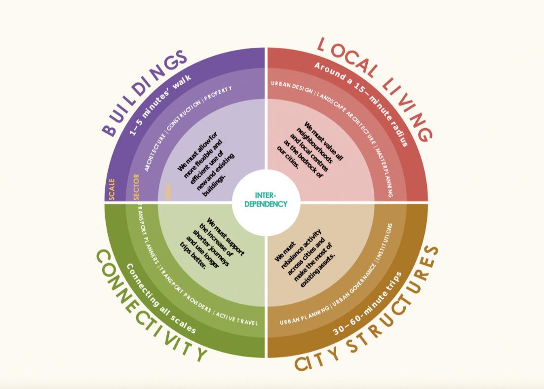
THINKING BEYOND 15 MINUTES: A NEW PERSPECTIVE ON SPACE, TIME AND TRAVEL
Esther Kurland sets out the case for the multi-timed city, which balances the importance and function of different types of journeys
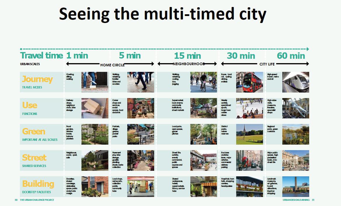
The concept of the 15-minute city has caught the imagination of both urban and transport planners in recent years. It is a great idea, calling for people to live within walking distance of the facilities they need day to day. Though I welcome it, I also see the case for a multi-timed city, which balances the importance and function of different types of journeys that take time spans from one minute to one hour. Establishing policies that recognise the hierarchy of these distinctive elements will help meet environmental, social and economic goals.
The concept helps to reduce dependence on motorised transport and address the exclusion felt by those who cannot use such modes. It also counters the dangerous idea that it is fine to continually raise residential densities without providing all the things that make life worthwhile and productive. Requiring 15-minute neighbourhoods can help ensure we do not increase car dependency and isolation through housing growth.
But even the most complete neighbourhoods cannot successfully exist in isolation, and 15 minutes is not the only time frame we need to keep in mind. At Urban Design London we recently ran an Urban Challenge project looking at how policies and approaches across the transport, planning, housing and architecture sectors all needed to change to meet shared objectives for the future.
The ‘multi-timed city'
Within this work we developed the idea of ‘the multi-timed city’, recognising the importance of spaces and facilities at various distances from homes, and the need to manage the interplay between these.
The multi-timed city is an idea to help ensure the places we plan, design, build and manage can effectively support environmental, social, health and economic objectives. That is, that they facilitate resource-responsible lifestyles and economies, community cohesion and the health and wellbeing of everyone. The Urban Challenge project concluded by calling for policy across all built environment sectors to aim for some core outcomes.
Less miles travelled, but not less journeys
l More flexible and adaptable buildings where the impact of uses, not their existence, is managed
l Local living, encompassing the 15-minute neighbourhood concept
l Polycentric cities with all areas reaching, but not exceeding, their natural carrying capacity for economic activity
These objectives need each other for an overall benefit to arise. None can be successfully delivered without the other three. We cannot achieve less
miles travelled unless we have more complete neighbourhoods, for example. We cannot bring neighbourhoods to life without more flexibility in how buildings are used. Moreover, without rebalancing activity levels across cities, and reducing the dominance of central business districts and activity zones, local high streets and economically active neighbourhoods elsewhere will struggle. Meanwhile, going back full circle, we cannot achieve less miles travelled without reducing the need for commuting within monocentric urban structures. The multi-timed city concept helps us draw these objectives together.
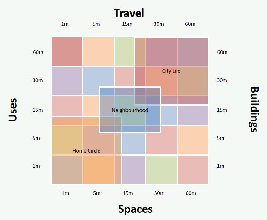
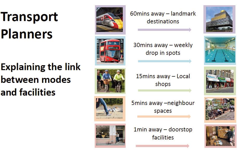
Starting with the 1-minute city, we need to make sure entrances to homes, and the public and shared spaces immediately around them, work well. This is generally down to architects, developers and planners, but can have a significant impact on public safety, and travel and economic behaviours.
Good urban design tells us that front doors should be easy to see, get to and use. Front doors and the windows around them should create eyes and activity for the street and buffer zones such as front gardens between internal private space and public street life, are important too. These issues are now included within national planning design guidance. However, we deal less well with the increasing need for home deliveries for domestic or work purposes, customers visiting home/work
8 15-minute neighbourhoods
environments, the need to manage and store waste responsibly, and the need to ensure active travel options are the closest and easiest to use. All such requirements should be designed into the 1 minute city, whatever the home and building types, if we are to meet the challenges we face.
‘Neighbour space'
Moving to the 5-minute city, this can also sometimes be called ‘neighbour space’ and is vital for community cohesion and our sense of belonging. Within 5 minutes of our front doors are the spaces we share with a few neighbours, whether it be a lobby in a block of flats, or the bit of street in front of ten or so houses. These are the spaces we are likely to be using every day, maybe multiple times.
This is also the area where active travel and shared mobility facilities can be placed front and centre. But also, doorstep play, shared delivery and storage facilities and amenity space should also be made available.
Access to nature, comfortable microclimates and natural climate resilience measures, such as sustainable urban drainage, should form other parts of this 5-minute city. Some have called for everyone to see a tree, or planted bed of growing things, from their home. What a wonderful idea - and how good this would be for biodiversity, reducing urban overheating and for mental health and wellbeing. Achieving it means greening the 5-minute city. Neighbour space is particularly important in higher density areas, where outdoor shared living is an important part of life. Ideally, neighbour spaces should be very flexible, allowing neighbours to mould them to their needs. For example, shared bike storage at this scale, rather than massive impersonal underground bike rooms, may be more appealing. But if people want to store prams instead of bikes,
9 Liveable NEIGHBOURHOODS
Even the most complete neighbourhoods cannot successfully exist in isolation, and 15 minutes is not the only time frame we need to keep in mind
or shared BBQs and garden equipment, the storage areas should be designed to allow for this, so all space is used to its optimum.
Keeping in mind the need for more flexible use of buildings, allowing some home working activities to spill into neighbourhood spaces could be beneficial. This might be ad hoc seating for a home-run food business, space to manage commercial deliveries appropriately, or just the opportunity to advertise what is on offer. Of course, robust management systems would be needed, built into new developments from the start, and retrofitted into existing areas through neighbourly co-operation where this is feasible.
Providing good neighbour spaces could potentially reduce overall site residential densities. But I suggest it would be worth it, helping to ensure all space is used to its optimum, and that the home environment goes beyond the space behind the front door.
Complete neighbourhoods
I will not say too much about the 15-minute city, or complete neighbourhood, as so much has been written about this already elsewhere. The 15-minute city should provide everything people need from one day to the next within a 15 minute easy walk. This should be measured as the foot falls, not as the crow flies, and should not include routes that are difficult or unsafe to use.
It can be useful to aim for three things when looking to create complete neighbourhoods. First see if there are ways to make it physically bigger through increasing or improving walking routes. Simply unlocking a park gate or fixing the lights under a bridge might help do this.
Second, look to get more people and activities into the catchment area. This could be through planning briefs/codes or site assembly work to encourage new housing or other development. Or it could be through supporting more flexible, possibly temporary, activity in underused buildings and spaces.
Lastly, we should look to make the neighbourhood more attractive, developing its unique identity, character and relevance for the local community. Making activities inside buildings more visible will help. We would probably all be amazed at how much hair dressing, cake baking, tutoring, chiropody, curtain making, exercise sessions and other local businesses take placedown what appears to be a quiet residential street. If we knew what things like this we could access within 15 minutes of home, we might not need to travel so far.
Of course, none of this is easy, and retrofitting complete neighbourhoods into existing mono use suburbs or similar is a hard task. But if we don’t pull together across all built environment sectors and aim for the same outcomes, we will never get there.
The 30-minute neighbourhood rarely gets talked about. For many it is the town centre, a place with
10 15-minute
neighbourhoods
The 5-minute city can also sometimes be called ‘neighbour space’ and is vital for community cohesion and our sense of belonging
11 Liveable NEIGHBOURHOODS
facilities that need a larger catchment than the 15minute neighbourhood. We might be happy to travel half an hour to a swimming pool once a week, or a larger park for a long dog walk. Or going to the pub with the Abba tribute band (I am showing my age) or a larger skate park or for comparison shopping.
Demand-responsive transport
Public transport is key for the 30 minute city, particularly buses, or future forms of demandresponsive shared mobility. Service and mobility hubs should be provided to support appropriate access and ensure people do not feel compelled to drive because it is just such a pain to get to and back again with shopping if you don’t.
The quality of public space, buildings and the activities they house need to make the 30 minute journey worthwhile, particularly as many of us can now shop for just about anything online. So the experience we have is key to success at this scale. It isn’t like neighbour spaces that we just have to go through if we leave home – people make a conscious effort to travel this kind of distance, and the destination has to be worth it.
Improvements to high street environments, introduction of walking loops taking in a variety of key destinations, and the downgrading of car dominance are all important. There is an economic chicken and egg issue here – if you reduce car accessibility you might reduce viability of commercial offers (according to those businesses) but if you don’t do this, how can you grow and improve the attractiveness to draw people this distance from home?
The 60 minute city is vital to success at all the other scales, and it should be the icing on the cake. It represents accessing the big ticket draws, the things
people will happily travel for an hour to reach. Those such as major museums, concert venues, specialist shopping areas, the trendiest nightclubs or historic attractions.
Ideally, these should attract lots and lots of people, but they should each not need to use them very often. Train travel is perfect to connect up this kind of catchment area, and the attractions have traditionally tended to be clustered around major stations.
The traditional 60 minute city is also historically designed around commuting, with people traveling long distances day in, day out, to reach central business districts. This model has helped pay for shared mobility infrastructure, in particular trains and metros in some cities, but Covid-19 showed us that the basic model is inefficient and may even now be busted.
The use of longer-distance shared mobility services for occasional work trips, but more often nowadays leisure trips, may be more likely than major fixed track investment to help cities meet future challenges and ensure efficient use of
transport infrastructure.
Demand patterns are changing. In London, in February 2022, overall tube ridership was 60% of pre-pandemic levels, but weekend rates, likely for leisure and entertainment more than office work, were around 75% (https://bit.ly/3W5gVCI).
Against this background of changing behaviour and lifestyle objectives, establishing policies and approaches that strive to create a multi-timed city will help meet environmental, social and economic goals. It will help ensure an efficient use of all land and transport resource, and support people in leading healthier and less stressed lives by making travel opportunities fit better with the locations of the places they want to get to - and how often they want to use the facilities there.
Removing unnecessary, tiring and resourcehungry commuting, whilst filling the travel space this leaves for high value trips, done less often by more people, will be a win-win for everyone.
And alongside this supporting the shorter trips done by less people, but more often, as active rather than car-based travel modes. But all this cannot happen through transport policies alone. It needs the collaboration of all built environment sectors and processes, working in close step, based on a shared understanding of the benefits of an holistic, multi-timed city approach. n
Esther Kurland is Director at Urban Design London. She has been a panel member and chair of a number of design review panels include at CABE, the GLA and a range of local authorities. She is a non executive director of the National Planning Forum and a member of CHITs Urban Design Panel
Urban Design Challenge: https://bit.ly/3Nywpgo
12 15-minute Neighbourhoods
The 15-minute city should provide everything people need from one day to the next within a 15 minute easy walk
PEOPLE-CENTRIC PLANNING
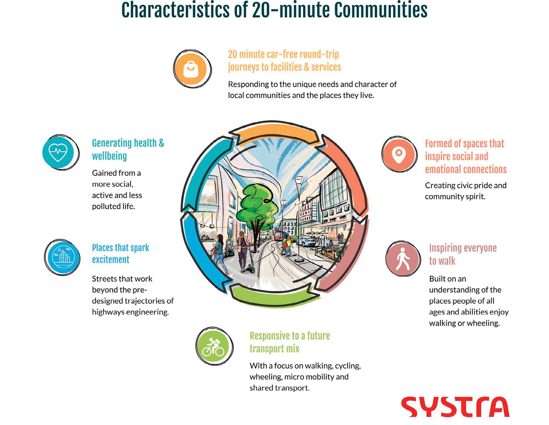
Urban designer Marta Liut from SYSTRA’s Movement and Place team says that a 20-minute community is not a limit on choice, but an expansion of it. It is about giving our cities, towns and neighbourhoods back to the people who form them

‘What is a city?’ asked William Shakespeare in Coriolanus. His answer: ‘the people’. He was right. Cities and towns are not ends in themselves, nor a convenient way to socially organise populations, but an expression of the particular people who live in them, their needs and desires and ways of life. That doesn’t sound like such a radical idea today, in fact it is almost a platitude among urbanists, but a glance at the history of urban planning, especially the errors of the 20th century, makes it obvious that it is an idea that is not always well understood.
13 Liveable NEIGHBOURHOODS
Marta Liut: The 20-minute community doesn’t lock anyone into a single mode of life but adds layers to the fabric
14 20-minute communities
Now that we are faced with a huge new challenge, the existential threat of climate change, we are being forced to think again – and with renewed ambition –about how we make thriving places. It is a good time to ask ourselves whether we have really taken Shakespeare’s insight to heart. Can we decarbonise without dehumanising?
The 20-minute community
The 20-minute community – the idea that in an urban area all residents should be no more than a 20-minute car-free round-trip from essential facilities and services – is the affirmative answer to that question.
But achieving such a vision will require more than deep changes in how planners, policy makers and administrators work and think.
It will mean breaking through walls of suspicion and distrust from people who have reasons to be wary of those with clipboards.
After all, many of the problems in urban design we face today – the things that are driving the carbon crisis such as zoning by function, prioritisation of car travel, parking issues, highways and the centralisation of facilities – are products of past planning decisions that were often imposed on local communities by well-meaning professionals with the best intentions at the time.
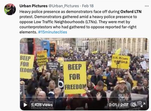
The recent upsurge in anger and protest against interventions such as Low Traffic Neighbourhoods (LTNs) is an indication of the depth of suspicion that exists about planning interventions, and the deep attachment that many people feel towards their cars and the ways of life they have built around them. The media – and social media in particular – is suddenly awash with conspiracy theories about 20minute neighbourhoods and their 10- and 15-minute siblings.
It is tempting to mock the idea that improved
walkability, better connectivity and reduced parking could be the cover for a sinister new world order, but we should not be too quick to dismiss the power and depth of these emotional connections or misunderstand why they matter to people.
When we change how places work, we are changing ways and patterns of life which have deep meanings for the people who live them.
Giving the places back to the people
We need to demonstrate and communicate that a 20-minute community is not a limit on choice but an expansion of it. It is not about removing agency but adding it, giving our cities, towns and neighbourhoods back to the people who form it.
Rachel Kyte, Vice President of the World Bank, has remarked that ‘the question that should shape the debate on climate action [is] how exciting is it going to be to live in low carbon cities?’ The 20-minute community is a return to the excitement of place because it frees us to explore and refine our own urban geographies beyond the pre-designed trajectories of highway engineering.
This presents a difficulty for transport planners dedicated to improving walkability, of course. Although our data on why and where people choose to walk is getting better, walking is still much more unpredictable and contingent than other transport modes – and so harder to plan for – but these are technical challenges that we are well placed to meet.
The more immediate challenge is convincing populations that low-traffic, low-carbon, dense,
decentralised, walkable, active travel towns and cities are what they want.
Quality matters
That means demonstrating that we understand that proximity and availability are not the only defining characteristics of a 20-minute community. Quality matters too. The spaces between where we begin and where we are going is where life happens.
It won’t happen if the place is threatening, polluted or difficult to navigate, no matter how close A is to B. In the past, places developed organically around local facilities and services – church, pub, shop – following the desire lines of homogenous populations over centuries. It gave us places that, hundreds of years later, still attract people with their charm and liveable qualities.
Industrial modernity put a stop to that, and we can’t return to it, but we can do the next best thing which is to identify the needs and desires of communities by engaging with them, understanding that their needs are idiosyncratic and specific. All populations are multi-grained and if we are claiming to put everybody within 20-minute reach of all the services and facilities they need, we had better understand what those are.
Access to a post box, for example, may not be a majority need but is a lifeline for some members of the community. It is the sort of thing that transport planners can find hard to ‘see’ unless we ask carefully and early in the process.
It is undisputedly this type of process which has
Not everything works, and that is OK if there is space to respond, change and learn from the mistakes of the past
Quality matters. The spaces between where we begin and where we are going is where life happens

15 Liveable NEIGHBOURHOODS
Images courtesy of SYSTRA
16 20-minute communities
led to widespread trialling of ‘mobility hubs’ which can bring together alternative transport modes –public transport, e-bikes, scooters, EV charging and active travel options – with community facilities in spaces specifically designed to improve the public realm for all.
SYSTRA’s Movement and Place Team embodies these considerations, recognising that transport and placemaking are aspects of the same activity. When we put transport experts with different strategic backgrounds together – transport planners, urban designers, civil engineers, landscape architects, social scientists, health, environmental and education specialists – we can more easily work towards a concept of planning that keeps the idea of the dynamic person-centred place more firmly in view. This also resists the natural tendency towards treating each aspect of project planning as a separate technical challenge which all too often ignores social and community dimensions.
Creating a visual matrix
Not that technical challenges don’t matter. Of course they do, and we need better tools to solve them. Planning projections that map distance between points of departure and services in an area are widely used in various forms but can be insensitive to the significant difference between ‘crow flies’ approximations of journey length and real on-theground route formations.
SYSTRA’s approach is to respond more directly to the urban fabric and quality, using real journey data, and to represent that information not just as a series of scores but as a visual matrix, a map of interconnectivity by time. This is a far more intuitive approach than just another ‘data-in-data out’ black box. Using the matrix map, all stakeholders can more easily envisage where facilities might need to
be enhanced, a street pattern altered, or a constraint such as a railway line overcome.
It situates transport as part of the fabric of a place rather than just another structure within it. It is a way of thinking about places, not simply a tool for ordering priorities. Tools like these can help address thorny problems such as how to masterplan for 20minute communities in developments that have to scale up in stages, sometimes from an initial development of tens of dwellings to a final development of thousands. They situate the process in a framework that is always focussed on placebuilding no matter how powerful the counter currents of other commercial incentives might be at any stage of the project. It is only by keeping that idea of place alive at all times that we can avoid the mistakes of the past, mistakes that will be paid for the negative impact of climate change.
Jane Jacobs, a journalist, activist and campaigner credited with saving New York’s Greenwich village from the highway-centred developers of the 70s, described cities as ‘immense laboratories of trial and error, failure and success’. Less pithy than Shakespeare, perhaps, but driving at the same thing. Successful cities and towns are formed over time in response to the needs of their populations and that
is where they get their energy and life.
Not everything works; and that is OK if there is space to respond and to change and learn from the mistakes of the past. The 20-minute community builds in that space if we do it right. We all live in our own separate geographies and these are layered and overlapping. The 20-minute community doesn’t lock anyone into a single mode of life but adds layers to the fabric.
The car loses its dominance
The car loses its dominance but doesn’t disappear. In fact, even drivers gain when more people choose to cycle and walk as congestion decreases along with all its stress. Some people will always rely on their car, of course. Yet, how we use cars will change over time, car ownership may reduce outside of cities too as we begin to hire or share cars more, as proven in our larger cities. Electric vehicles and how we charge them will be part of the future transport mix. But if we can build places that tempt people out of their cars instead of only coercing them, we can turn the energies that are currently being wasted on campaigning against LTNs and temporary bike lanes into something positive.
We can open the door to the discovery of advantages that go far beyond the gains in health that a more active and less polluted life brings. We can highlight the deeper social and emotional connection with home. The pleasures and excitement of chance meetings and discoveries. The simple joy of more human connections – and more opportunities to live our lives. n
Marta Liut is an associate urban designer in SYSTRA’s Movement and Place Team. Before SYSTRA Marta was neighbourhood regeneration manager at Lambeth Borough Council and an urban designer at Transport for London
When we change how places work, we are changing ways and patterns of life which have deep meanings for the people who live them

17 Liveable NEIGHBOURHOODS Images courtesy of SYSTRA
STRATEGY TO RE-ALLOCATE PARKING SPACES TO OTHER USES IN LAMBETH
Under a £31.7m plan, Lambeth Council aims to transfer 25% of the kerbside to bus lanes, street trees, rain gardens, parklets and cycle parking as well as car club and disabled bays
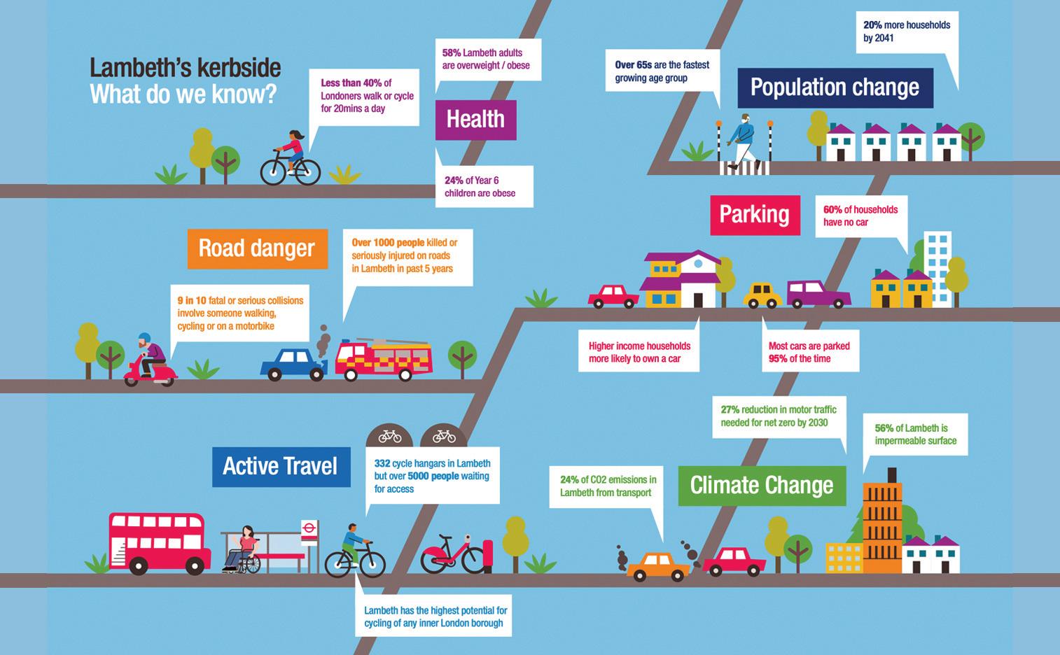
Lambeth Council has pledged to significantly cut onstreet parking as it seeks to meet its net zero target by 2030. Taking out parking space would encourage active travel, create people-friendly places and increase climate resilience, says the Lambeth Kerbside Strategy.
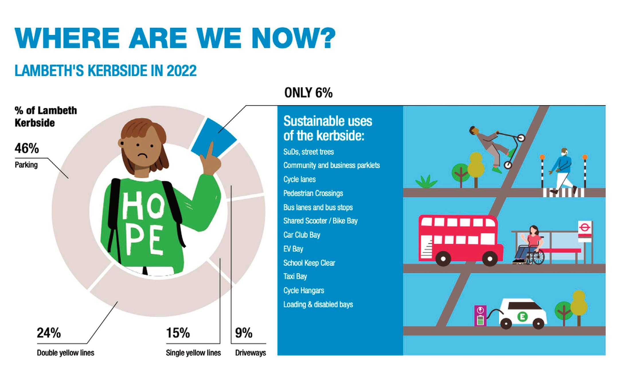
Currently, 94% of kerb space in the borough is allocated to parked vehicles, the council estimates. Under the £31.7m strategy, 25% of kerb space would transfer to “sustainable uses” such as bus lanes, street trees, sustainable drainage systems (SuDS), parklets and cycle parking. But some of this space would also be set aside for car clubs and disabled bays. Cutting parking spaces will result in “fairer and more equal access, community interaction, economic resilience, health and wellbeing ”.
The council has set itself the target of cutting motor traffic by 27% in order to achieve net zero by 2030.
The Lambeth Kerbside Strategy comprises four priorities:
l Enable accessible and active travel – this would involve making pavements clear and accessible, particularly for people with mobility or sensory impairments. This includes minimum commitments for cycle parking and shared bikes, and “high-quality walking networks”. All households would be within 50m of free cycle parking, the strategy states.
l Create Places for People – the council points out that many households do not have outdoor space or a car and can’t make use of the kerbside either. “That will change with this strategy. Local people will be able to apply to use the kerbside for things like small community gardens. Businesses will be able to apply to use the kerbside for outdoor seating. We will build on the successes of pilot schemes over the last few years.”
l Increase climate resilience – the strategy pledges that all streets will have shade from trees and green spaces or other biodiversity that together help protect us from these risks. There will be street trees every 25m on every street in Lambeth, the council said.
l Reduce emissions and traffic – the council predicts its targets for sustainable transport and traffic reduction will result in far fewer motor vehicles on the borough’s streets. “But for those that remain we need to support the shift towards electric vehicles and shared cars as much as possible. We need to provide the infrastructure and incentives to support this shift at a suitable scale and pace.”
More space for bus lanes
The council’s breakdown of the kerbside reveals that 46% of kerbside was for parking, 24% had yellow
lines, 15% single yellow lines while 9% was taken up by driveways. This left just 6% for other uses.
More space will be given over to new bus lanes, states the strategy. “We want to encourage more people to travel by bus, which means they need to be an efficient and reliable form of transport. This means that we need to give buses priority over other traffic, so they have a smooth journey. On bus routes we will ensure that the kerbside facilitates bus journeys by designating more space for bus lanes that allow buses to travel uninterrupted by general traffic.”
The borough has 332 cycle hangars, each holding six bikes, but more are urgently needed as there is a waiting list of more than 5,000 people, the council pointed out. Space will be allocated on the kerbside for dockless scooters and bikes to stop them being left on pavements, said the council.
Cargo bikes will also need kerbside space, with shared cargo bikes available on the kerbside within every neighbourhood across Lambeth, and no more than five minutes’ walk of all households. Under the plans, all local high streets would have access to a shared electric van.
Roll-out of CPZs
Kerbsides should be transformed to “create lively, vibrant local high streets” to support local
18 Space reallocation
THE STRATEGY INCLUDES THE FOLLOWING PLEDGES:
l Free cycle parking every 50 metres on every street
l Secure cycle parking every 100 metres on every street
l Cycle parking spaces should always cheaper than all residential parking permits
l Borough-wide network of bike hire locations, no more than five minutes’ walk from every household in the borough
l Places to stop and rest will be available on every street in Lambeth and dropped kerbs at all junctions
l A new design standard for driveway “crossovers” so they have much less impact on pavements
l Continue to prioritise dedicated Disabled parking bays
l Permeable surfaces including depaving, greening, wildflowers and sustainable drainage make up 10% of Lambeth kerbside
l Kerbside used to maintain 2m footway around existing mature trees
19 Liveable NEIGHBOURHOODS
Lambeth Council says its Kerbside Strategy will help it meet the target of cutting motor traffic by 27% to achieve net zero by 2030
20 Space reallocation
businesses, while residents will be given the opportunity to apply for parklets.
Regulation of the kerbside would encourage a shift towards sustainable, cleaner ways to travel, states the council.
It is planning to introduce more controlled parking zones (CPZs) across the borough. Currently there are large areas of the borough where there is very little regulation of kerbside uses, said the council. “These are areas without Controlled Parking Zones. Where there are limited kerbside controls, motor vehicles dominate by default. Without such controls it will be difficult to balance the different demands for space, or to influence improvements to the vehicle fleet, through variable charges for example.”
Removing kerbside parking will benefit protected groups, including disabled people, because “they are less likely to drive or be driven than the general population”, the council believes.
But it added: “For those people that do continue to rely on cars, access will be maintained, and for disabled people parking will continue to be prioritised through provision of dedicated bays.” Funding for most of the changes to kerb space will come from capital budgets already allocated for transport and related infrastructure, primarily the £31.7m agreed by Cabinet in July 2020 for Sustainable Transport and Public Realm interventions.
In October 2022 the cabinet approved that £15.5m from this budget would be allocated to fund phase 2 and 3 of the transport strategy programme, which funds projects such as the Lambeth Healthy Routes, School Streets and Low Traffic Neighbourhood programmes as well as provision of cycle parking hangars and electric vehicle infrastructure.
According to the council, the Kerbside Strategy
was shaped by extensive public engagement, including Lambeth’s first citizens’ assembly on climate change in 2021. Feedback from the assembly also informed the Lambeth Climate Action Plan (CAP).
The CAP identifies the “essential need” to adapt to the changing climate, including through the provision of green street infrastructure such as trees, planting and SuDS.
“While the CAP target of a 25% allocation of kerbside space to sustainable uses is important, it is vital to also consider the remaining 75% of kerbside to ensure this too works towards the same end goal,” said the council.
“That means protecting essential access for those who will continue to rely on motor vehicles, but at the same time using available powers and controls to promote and incentivise a shift towards cleaner vehicles and more efficient uses, such as car sharing.”
To complement off-street charging facilities, a significant increase in on-street electric vehicle charge points will be needed as the growth in EV ownership “becomes exponential over the coming years”, states the strategy.
Several protected groups, including disabled people, are less likely to drive or be driven than the general population and are therefore expected to benefit particularly from a re-allocation of kerbside space away from car parking, says the council.
“For those people that do continue to rely on cars, access will be maintained, and for disabled people parking will continue to be prioritised through provision of dedicated bays.” n Lambeth
21 Liveable NEIGHBOURHOODS
Kerbside Strategy https://tinyurl.com/2p82ffre
HOW TO FIGHT BACK IN THE MODERN WORLD OF MISINFORMATION
Adopting the right strategies can help transport professionals and councils overcome conflict on social media and connect with their target audience, says Stefan
In an age of rapidly exchanged – and often unchecked and unsubstantiated – information, those involved in transport know as well as most the difficulties this brings. There are new challenges in presenting the public with the full facts and arguments about problems and their potential solutions, and ensuring they are not attacked and misrepresented unfairly.
In recent years, many local authorities have faced particular public fury and indignation when proposing and implementing Low Traffic Neighbourhoods and other traffic management schemes. Often this anger has been fuelled by misinformation – a false alternative narrative which is spread online, in order to mislead.
How best, then, can councils deal with such situations – and is there a proven approach and underlying methodology to apply?
Research shows you need to proceed with caution when publicly challenging misinformation. Whereas the stated purpose of the social media
Rollnick
platforms that facilitate this kind of debate is to connect us, let’s remember that the financial purpose of the companies behind them is to generate revenue for their shareholders by selling advertising space and audience data to digital advertisers.
The more time we all collectively spend scrolling through social media, the more money the platforms can make from advertising space. In order to maximise this time, the algorithms that recommend content to us – by placing it at the top of our news feeds – have to promote material which will draw us in.
Put simply, the result of this tends to prioritise content which generates strong emotion. In practice, this means promoting conflict, toxicity, and quite often – intentionally or not – misinformation.
With all this going on, it is pretty impossible to ignore what is being said, and rather essential to have an appropriate strategy in response.
While academic evidence shows that, in general, correcting misinformation with the facts is useful, we know that: a) it has a limited effect on behaviour change, and b) the academic research is taking place in a really simplified environment (i.e. a lab), and in
reality the system is much more complex. Any time we correct a piece of misinformation publicly it can meanwhile have unforeseen knock on consequences, so we must respond carefully.
As an example, the importance of this is demonstrated in an analysis by academics at Queensland University of Technology on the result of the US Administration’s response to conspiracy theories about bioweapon labs in Ukraine. In its essence, their work shows that in trying to correct the misinformation, they simply exposed more people to it.
So, when should we respond?
Here at Lynn’s The Misinformation Cell, we work closely with the UK Government Cabinet Office to implement their ‘Wall of Beliefs’ model for fighting misinformation. To use this model, you need to be able to answer three questions whenever you’re trying to make a decision about how to respond to a piece of mis or disinformation:
1) What is my definition of harm? To help with this it helps to know the target behaviours that you’re
22 Misinformation

23 Liveable NEIGHBOURHOODS
Stefan Rollnick
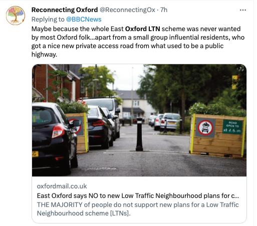
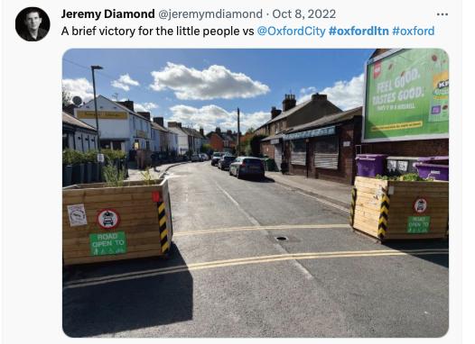
Opponents of East Oxford’s LTN trials have claimed on social media that they represent the views of the majority
concerned about.
2) Does this piece of information cause direct harm to these target behaviours – or is it just designed to sow mistrust in an audience?
3) Is this misinformed belief superficial (i.e. it can be easily replaced) or is part of someone’s core beliefs (i.e. it can’t be easily replaced)?
Using the Wall of Beliefs matrix as a guide, the answers to these questions should help guide any decision about when to respond directly, when to
focus on the underlying narratives, when to focus on managing behaviours or last, but definitely not least, when to simply watch and wait.
When a controversial matter is under discussion it is sadly very likely that ill-intentioned parties will get involved. Their Trolling and disinformation activities will have three core aims:
1) To give the appearance that fringe views are widely believed, using the ‘social proof effect’ to nudge new audiences towards their misleading beliefs.
2) To derail your messaging, moving you away from your key messages and instead forcing you to focus on rebutting theirs.
3) To drain your energy, damaging morale and draining creativity and focus from your team.
Thankfully, aim 2 and to a certain degree aim 3 are within our control. If we can stay on message despite the noise from social media, and we can maintain perspective internally about how unrepresentative
24 Misinformation
An opponent of LTNs turns to Twitter to express his indignation
The spread of misinformation in recent years has been reported in Local Transport Today
some of these determined detractors really are, then we’re halfway to beating them.
To counter the ‘social proof’ that trolling creates, it is important to focus on building immunity within our audiences proactively – not reactively. When it comes to misinformation, proactivity is key because whoever ‘gets there’ first usually wins.
The importance of storytelling
Sometimes the best response to a lie isn’t a fact, it’s a deeper truth. This is a mantra my team and me try to live by, and it’s paraphrased from one of President Obama’s speechwriters. It gets to one of the core truths about fighting misinformation: no fact check can compare to a compelling narrative.
The truth is that all of us mere mortals, regardless of how rational we try to be, make sense of the world through storytelling – and the disinformation spreaders understand this. Strategic communicators are beginning to understand this as well – Joe Biden’s presidential campaign team in 2020 deftly operationalised a storytelling approach to fighting disinformation.
At The Misinformation Cell, we do this in our own way, looking beyond the noise of social media through quantitative surveys to understand which damaging narratives are resonating with the public, and to understand which of our counter narratives might resonate too.
Building the right relationships
Sometimes we think misinformation is an ‘information problem’ when it is actually a ‘relationship problem’.
The most effective misinformation isn’t the wildest lies, but the misinformation that builds upon kernels of objective truth. For example, during the Covid-19
pandemic disinformation spreaders tried to leverage historic distrust between ethnic minority groups and health authorities to spread their harmful lies and propaganda about the safety of the vaccine.
In situations like these, corrective information won’t address the underlying truth that many communities who have been pushed to the fringes of our society have been underserved by government institutions and health authorities. You can’t reverse this with a fact check, you need to think about how to build relationships with these communities instead.
There’s a good chance that this consideration will often be relevant in transport situations – where customers or those affected will be nursing past grievances or remembering bad experiences just as you want to start a new conversation with them.
So try to understand the bigger picture, as when it comes to misinformation narratives, the biggest –and easiest – mistake you can make is to assume you need to respond to something simply because it’s getting traction on social media. This is a mistaken
reaction that trolls are trying to constantly bait you into making: responding to lies that you needn’t respond to, because actually your key audiences haven’t really been exposed to them.
In order to deal effectively with this new world of information, there is thus no substitute for quantitative attitudinal data from your key audiences. It is something that has considerable other benefits in the transport world too, so well worth the effort to obtain and analyse.
Focus on what you can control, accept what you can’t
Changing behaviours and winning people’s confidence that we are doing something to help them isn’t easy. The range of factors that influence our beliefs and behaviours is very large.
And yet in focusing on the narrow scope of what is in our control, and marshalling our data about both our audience’s underlying attitudes, and what our proposals mean to them, means we can focus our energies in a more disciplined and productive way.
With such an approach we should have a fighting chance of getting people on our side, despite all the distractive noise out there these days.
The Wall of Beliefs: A toolkit for understanding false beliefs and developing effective counterdisinformation strategies. n
Stefan Rollnick is the head of The Misinformation Cell at Lynn – a 30-strong Cardiff based consultancy specialising in campaigns, behavioural science and antimisinformation/disinformation strategy and research.
Rollnick was brought in by Lynn to set up The Misinformation Cell in September 2021 after previously working as a disinformation analyst in the Office of the First Minister of Wales.

25 Liveable NEIGHBOURHOODS
LTNs have been compared to ‘Nazi style ghettos (sic)’ on Twitter
BUILDING BETTER STREETS ON THE FOUNDATIONS OF STRONG EVIDENCE
Unlocking cities from car dominance will liberate communities and allow them to thrive, but these transitions must be backed by good data,
writes
Hirra Khan Adeogun
The Covid-19 pandemic turned the spotlight on how our cities might look without cars. Along with the roll-out of incentives to get people engaging in climate-friendly active travel, many policy makers started looking at what more they could do to transform their cities for the better - to become greener, healthier and safer places for people to thrive.
Air pollution, noise pollution, road safety, climate change, restricted mobility are all problems putting pressure on our cities and the people who live there. And breaking car dominance is the only way we’re going to be able to start moving towards solutions.
But, as many policy makers and politicians will know, this is hardly a simple process. Cars have genuinely improved some people’s lives, improving mobility for some disabled people and tradespeople. They also have a certain status in our society as ultimate symbols of freedom and autonomy.
For our cities, breaking up with cars is going to be tough. And for some people, like some disabled people, retaining cars is going to be essential. But as we move towards cities with far fewer cars, we face not only huge resistance to any measure that would see cars deprioritised, but also decades of the existing status quo - a status quo that sees cars as the ‘normal’ way of travel.
A three-pronged solution
So, what will it take to bring about change? How do we make the case for a fundamental shift in how our cities function?
After working on the Car Free Cities campaign for three years, I would argue that the solution is threefold.
The first is a given – good quality data with wellevidenced research that can back up our arguments every step of the way.
We have to explain just how detrimental cars are to our cities. Institutions like Imperial College London demonstrate why toxic air pollution1 a direct result of car dependency, is so dangerous.
But NGOs are also vital in this. Here at climate charity Possible we pride ourselves on looking at these issues from a unique perspective. We’ve made the case for cargo bikes2 shown people just how much parking is subsidised in our cities3 and how our current systems impede the lives of disabled people.
We have to prove the impact of the action we’re taking. For instance, you can collate: impact assessments of London’s ULEZ (Ultra Low Emission Zone); traffic counts before and after interventions; and meta analysis of the impact of low-traffic
neighbourhoods4 It is imperative that we not only prove the problems of motor vehicles, but that our solutions are materially improving people’s lives.
The fervent opponents to these changes will try to find any way to discredit the solutions we’re positing. As such, having a solid foundation of data and evidence, rigorously researched and analysed with a solid methodology, looking both nationally and internationally, can help us make the case for creating positive, sustainable change.
That’s not the only thing we need to do though because, as we’ve learned, evidence and data only gets you so far.
The second part of the solution is to take people on a journey from fear to the future. We are creatures of habit, relying on familiar patterns and routines to navigate our lives, so the prospect of a new and uncertain future can be daunting. It is really important that we work collaboratively to co-design new visions, taking people with us into the safer, cleaner, greener future.
Our Car Free Visions5 project did exactly this. We worked with a diverse group of local residentsmany of them drivers themselves - to co-design new visions of their communities free from car dominance. We polled people to garner support for the before and after images.
26 Low Traffic Neighbourhoods
Possible asked Londoners whether they would support the pedestrianisation of Hyde Park Corner to link it with Green Park. Support for the idea rose from 48% to 72% after co-designed vision was presented as an image
27 Liveable NEIGHBOURHOODS
Low Traffic Neighbourhoods
We asked over 1000 Londoners whether they would support the pedestrianisation of Hyde Park Corner to link it up with Green Park and 49% agreed. We then presented them with the codesigned vision and asked them if they would support or oppose the pedestrianisation of Hyde Park Corner if it looked like the presented imagesupport shot up to 72% agreeing. The results are clear: we have to show people where we’re trying to take them. The final part of the solution is a simple one - bravery.
The true impact of LTNs
When we published our research on the impact on traffic that low traffic neighbourhoods6 were having, the conclusions were remarkable. Traffic within LTNs fell dramatically and there was no consistent impact on boundary roads.
The reaction from staunch opponents was predictable. This rigorous piece of research produced by the foremost academics looking at traffic systems in the UK was dismissed as bias, of using flawed methodologies, misleading averages, and corrupt data.
So, if research and co-designing visions can’t convince naysayers, what can? Well, that’s when we need our political leaders to be brave. We found that Paris’s cycling revolution owes much to Mayor Anne Hidalgo7 and her active travel policies that were emblematic of her mayoralty. We need political leaders across the world to follow her example in setting a bold vision for urban traffic reduction. And we can’t let a vocal minority intimidate political leaders from taking the action necessary to fight climate change. The 2022 local council elections, in which almost every candidate opposing urban traffic reduction lost, shows that most people
Hirra Khan Adeogun: Having a solid foundation of data and evidence, rigorously researched and analysed with a solid methodology, looking both nationally and internationally, can help us make the case for creating positive, sustainable change

actually support these measures.
If there is one thing we can predict, it’s that eventually most sceptics come to love changes like these. Possible produced an international map of cities8 where traffic reduction measures have been implemented. Time and time again we see the same thing; initial opposition is loud and hard to ignore but, if we persevere, people come round and start to fervently defend these measures.
When you unlock cities from car dominance, you liberate communities and allow them to thrive. People are healthier thanks to improved air quality9 businesses start seeing more footfall10 cycles start to appear11 on roads rather than cars, and people take more public transport.12
We need to shift away from car dependency. Data has a role to play - it will help us analyse the impacts of our actions, prove that action we’re taking is right, and allow us to make changes if things start to go wrong. Our opponents are stubborn however, and it’s not a change that’s going to happen overnight but they can be brought on board. Through bold action, we can improve the lives of the vast majority. With time, those vocal opponents might see themselves loving their own local traffic filter. n
1 https://www.imperial.ac.uk/news/190815/thousands-londoners-hospitalisedthree-years-harmful/
2 https://static1.squarespace.com/static/6012c1c8eb0b5837ac26126b/t/6148ec2197 2cf761760e4d7d/1632169008667/The%2BPromise%2Bof%2BLow-Carbon%2BFreig ht.pdf
3 https://static1.squarespace.com/static/5d30896202a18c0001b49180/t/620bd77 ea6a7065a0dec6fe1/1644943920058/Nobody+Left+Behind+Envisioning+inclusive +cities+in+a+low+car+future.pdf
4 https://www.wearepossible.org/latest-news/ltns
5 https://www.wearepossible.org/car-free-visions
6 https://docs.google.com/document/d/13Nsm_GFdH6CpIpPpOZ7hbhLZScgqCAP 7ZGI0xi4qDqA/edit
7 https://www.carfreemegacities.org/latest-news/understanding-paris-cyclingrevolution
8 https://interactive.wearepossible.org/carfreestories/
9 https://www.london.gov.uk/new-report-reveals-transformational-impactexpanded-ultra-low-emission-zone-so-far#:~:text=Report%20shows%20that%20th e%20ULEZ,have%20been%20without%20the%20ULEZ.&text=Each%20day%2C%2 074%2C000%20fewer%20polluting,since%20expansion%20in%20October%202021
10 https://www.justeconomics.co.uk/uploads/reports/Just-Economics-PedestrianPound-Living-Streets.pdf
11 https://www.forbes.com/sites/carltonreid/2023/03/01/cyclists-now-outnumbermotorists-in-city-of-london/?sh=103398c02236
12 https://www.express.co.uk/finance/personalfinance/1754956/free-bus-pass-farecap-England
28
Hirra Khan Adeogun is head of car free cities at the climate charity Possible
GREENWICH UNVEILS PLAN TO TRANSFORM STREETSCAPES
The Royal Borough of Greenwich has pledged £3.1m to improve infrastructure for walking and cycling, tackle congestion and improve air quality
Greenwich’s street improvement plan, including £2.1m from TfL and £1m from the council’s own budget, will support transport priorities over the next year as identified in the council’s new Transport Strategy.
Priorities include:
l 20mph speed limits
l Controlled Parking Zones (CPZs)
l More School Streets
l Emissions-based parking charges
l Free cycle training and a ‘try before you bike’ scheme, run with Peddle My Wheels.
The council says it will also improve public spaces in Greenwich town centre to encourage more walking and cycling, as part of the Liveable Neighbourhoods scheme. This is one of five Liveable Neighbourhoods that TfL has funded this year. The work will complement improvements to cycle routes between Greenwich and Woolwich, said the council.
Improvements are also planned on the boroughs transport network including proposals for the extension of the DLR to Thamesmead, via Beckton Riverside.
This will support new housing and improve access to jobs, said the council, adding that is
working with partners including TfL, the GLA, Newham Council and local landowners to develop a business case for the project.
The council said it is considering options for traffic management measures in west and east Greenwich, “where many local residents have reported concerns about congestion, poor air quality and road safety”. Over 5,000 comments and suggestions have been received from local residents and businesses online and at two public events in the first phase of consultation undertaken in February and March, said the council.
Averil Lekau, deputy leader and cabinet member for climate change, environment and transport, said: “We’re committed to creating a world-class transport network that enables our residents, businesses and visitors to make the most of all the opportunities offered throughout Royal Greenwich – giving people access to housing, jobs, leisure, education and culture.
“How we move through our borough is also key to our long-term health and wellbeing. The easier we make it to walk, cycle and move around, the healthier we will all be. As we reduce traffic and fumes, we'll make our air cleaner to breathe too.
“All the transport projects we have in the pipeline essential to our push to become carbon neutral by 2030.” n
29 Liveable NEIGHBOURHOODS
Top: Greenwich Council is planning to introduce new routes to make it safer to travel around on a bike
Above: Emissions-based parking charges are to be introduced across the borough
‘LTNS DO NOT DISPLACE TRAFFIC AND POLLUTION TO OTHER STREETS’
A study of three Low Traffic Neighbourhoods in Islington challenges the argument that schemes cause an increase in traffic and air pollution on surrounding streets
Low Traffic Neighbourhoods (LTNs) cut traffic and air pollution without displacing the problem to nearby streets, according to research by Imperial College London.
The study looked at three LTNs in Islington to identify their impact on both air pollution and traffic within the zones and in the surrounding area. Many LTNs were installed during 2020, to prevent an increase in vehicle traffic as people avoided public transport through fear of infection during the Covid-19 pandemic. However, they also provoked opposition, with critics claiming that LTNs increased traffic and pollution in surrounding areas.
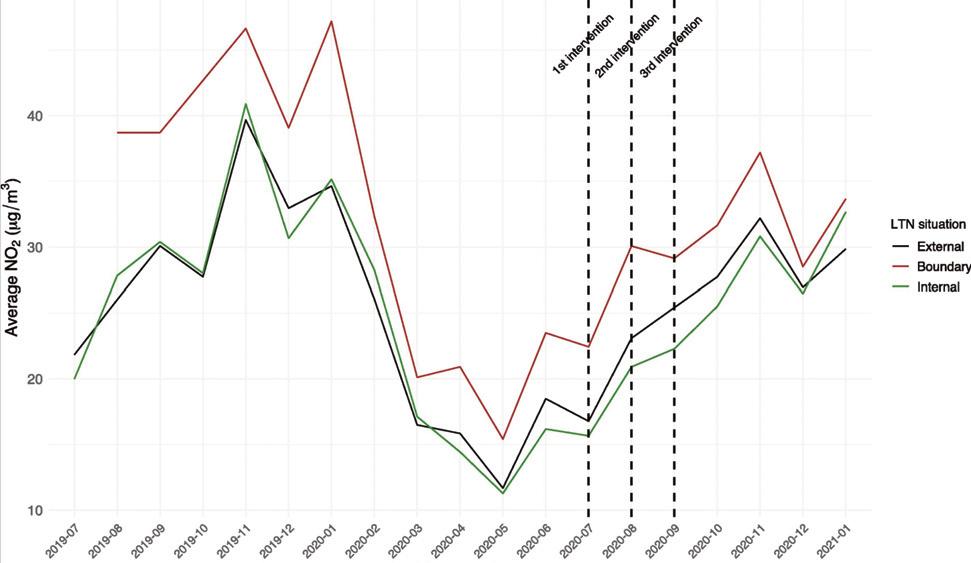
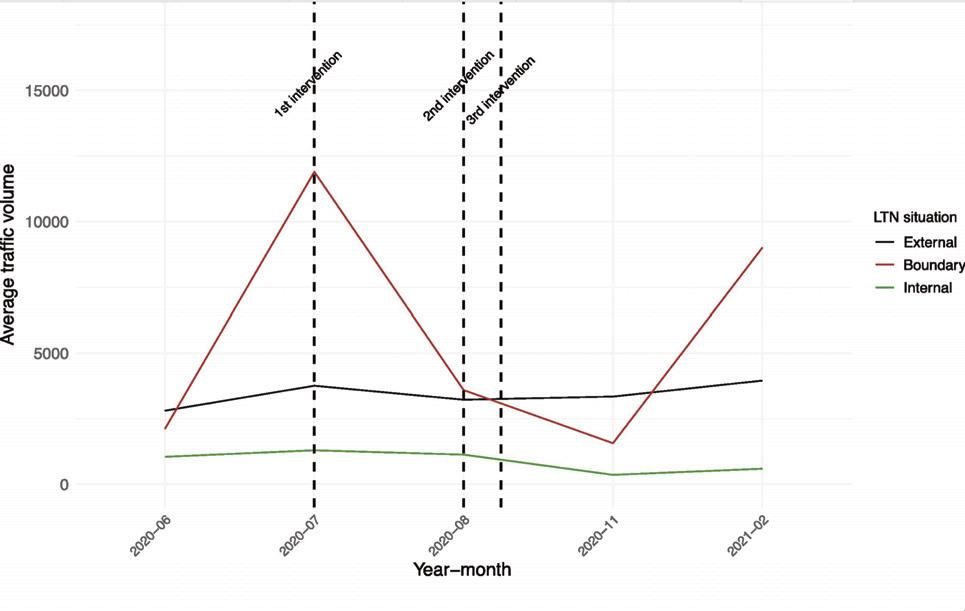
The study was carried out by Xiuleng Yang, Emma McCoy, Katherine Hough and Audrey de Nazelle. They compared pollution and traffic levels at monitoring stations inside the three LTNs, on streets surrounding the zones, and at control sites further away, using data gathered by Islington Borough Council.
The LTNs – in St Peter’s, Canonbury and Clerkenwell – were installed between July and September 2020. The team analysed data gathered from July 2019 to February 2021.
They said that as each LTN was set up at a different time and not all monitoring sites gathered
data continuously, averaging out the results between the three LTNs would not provide an accurate overall picture. For this reason the team said they carried out “a more complex statistical analysis” to ensure other factors that might affect traffic volumes and air pollution at particular times – such as the Covid-19 restrictions in place, school holidays or weather – could be taken into account.
Researchers found that concentrations of nitrogen dioxide fell by 5.7% within the LTNs and by just 9% on their boundaries, compared with the control sites.
They also found that traffic dropped by over half inside the LTNs and by 13% at the boundaries, compared with the controls.
They concluded: “Our findings add to a growing and convincing body of literature making the case for cities to adopt traffic restriction strategies such as LTNs, with minimal risk of unintended and unequal consequences.”
Air pollution is one of the multiple benefits of traffic reduction strategies, “alongside previously documented accounts of improvement in public realm making streets safer from traffic collisions, better suited for social interactions and physical activity, and generally supportive of greater wellbeing”.
30 Low Traffic Neighbourhoods
Average traffic volume in two treatment groups (boundary and internal sites) and control group (external sites) at different time
Average NO2 in two treatment groups (boundary and internal sites) and control group (external sites) at different time
Dr Audrey de Nazelle, from Imperial’s Centre for Environmental Policy, said: “This research effectively disproves the argument that low traffic zones will necessarily cause an increase in traffic and air pollution in neighbouring streets.
“In the three areas we looked at, they reduced both traffic volumes and, significantly, air pollution both inside and on the edges of the zone.
“Alongside the other benefits of LTNs that have been shown in previous research – such as improvements in safety and an increase in walking and cycling – this makes a very strong argument in their favour.”
Co-author, Imperial College London PhD student Xiuleng Yang added: “This is the first study to use a robust statistical approach to show the impact of LTNs on surrounding areas, and the results are really encouraging. We worked with a relatively small data set and further research is now needed to confirm these findings at a larger scale.”
A spokesperson at walking and cycling charity Sustrans said: “This research shows the fundamental benefit low traffic neighbourhoods can have in improving air quality for communities. This should be considered alongside the role LTNs play in creating safer spaces for children, increasing footfall for local businesses, and providing an opportunity for people to travel actively instead of being cardependent.
“However, we must remember that for these schemes to be successful and for everyone, community consultation is essential throughout the planning, delivery and review process. Just as with this research, further evaluation should be a constant, to make sure it continues to work for everyone.
“We should be aiming to replace our car use with
walking, wheeling and cycling as a priority, as it is the number of cars on the roads that is the greatest threat to our environment, whilst our overuse of them is unaffordable for our health and wallets.”
31 Liveable NEIGHBOURHOODS
Evaluation of low traffic neighbourhood (LTN) impacts on NO2 and traffic by Xiuleng Yang, Emma McCoy, Katherine Hough and Audrey de Nazelle
https://tinyurl.com/hrrws8e4 n
Research by Imperial College London analysed data for three LTNs in Islington
DO LTNS HAVE AN IMAGE PROBLEM?
Just the mention of Low Traffic Neighbourhoods appears to provoke feelings of horror and outrage among some people – it has become a tarnished brand, writes Sarah McMonagle. But, she argues, proven and popular schemes similar to LTNs, which limit motor vehicle through-traffic on residential streets, have been around for decades
32 Low Traffic Neighbourhoods
Schemes that restrict through traffic on residential streets –in effect LTNs - are not new in the capital. This scheme in Walthamstow was introduced almost 10 years ago
“What’s in a name?” the bard famously had Juliet ask in Romeo and Juliet. Shakespeare had the starcrossed lover questioning the absurdity of how Romeo’s surname was a barrier to their being together. If Romeo wasn’t a Montague, then there would be no trouble about their relationship and the play would have had a much happier ending… You might be wondering how a tale of doomed love is relevant for active travel, but bear with me. There’s a power in names and what we associate with them. Once a particular view is connected to a name or brand in the public conscience, it can be near impossible to shift – even, and perhaps especially, when the negative views receive huge publicity.
Why is this relevant for active travel? You only need to see the negative coverage Low Traffic Neighbourhoods, better known as LTNs, receive in some areas of the media.
Despite reducing motor traffic, making roads safer, creating more pleasant places to live and seeing significant uptake in cycling and walking for some, these three letters are enough to conjure feelings of horror, outrage and upset.
It’s resulted in reports of councillors who have championed their use facing threats of violence and worse. Such appalling and criminal behaviour must be condemned, but it does show the depth of vitriol for something which, at the heart of it, you would think most people would welcome.
It is also baffling, as the term LTN, while relatively new, is just a rebrand of a proven success story which has existed for decades: limiting motor vehicle through traffic on residential streets. However, the media coverage and noise around this irrational resentment for LTNs has filtered through into political discourse and, on the face of it, is affecting funding decisions.
In May, transport secretary Mark Harper proudly announced that not a penny of Active Travel Funding Tranche 4 would go on LTNs.
Nobody wants other people driving through the street they live as a short cut. It makes them less safe, less attractive and studies have shown that they can also prevent the building of community.
However, a liveable neighbourhood where you feel the roads are safe enough to let your children cycle, where you don’t have to shout above the roar of traffic to be heard by your neighbour - these are benefits we can all appreciate and which a welldesigned LTN can deliver.
Despite their benefits, unfortunately for LTNs, their rapid rollout during the Covid-19 pandemic,
and the perception that people weren’t properly engaged or consulted, has tarnished the brand.
Last year the Centre for London thinktank’s report ‘Street shift – The future of Low-Traffic Neighbourhoods’ comprehensively demonstrated the impact of LTNs for increasing cycling while reducing motor traffic. It debunked the myths that LTNs force motor traffic elsewhere, showing on the whole car use also fell in areas on their periphery. The report also recommended councils try to reach out more effectively to communities ahead of future projects, suggesting using a different term from LTN, such as “healthy neighbourhoods” or “quiet neighbourhoods”.
Funnily enough, in the same announcement the transport secretary made in May, he stated funding would be allocated to some projects promoting “liveable neighbourhoods”.
Now there’s an exercise in rebranding.
Dedicated funding for cycling and walking in England has now drastically been cut by around twothirds for the next two years, while targets to increase these activities have not changed.
The National Audit Office in June confirmed what most people involved in active travel had been saying for years, namely that the Government’s targets to increase walking and cycling weren’t achievable on current levels of investment.
With less funding for the larger scale infrastructure projects, local authorities, as they so often have to, must do more with less to increase cycling and walking levels.
The creation of liveable neighbourhoods could well be one of the most cost-effective tools ways of doing this. But be careful what you call them! n
33 Liveable NEIGHBOURHOODS
Sarah McMonagle is director of external affairs at the charity Cycling UK
A liveable neighbourhood where you feel the roads are safe enough to let your children cycle is something most residents welcome and is something a well-designed LTN can deliver
It’s great when a good thing catches on. School Streets, where the road outside a school is closed to traffic at drop off and pick up times, are an excellent example. First introduced to England in 2018, there are now over 500 in London, and hundreds around the rest of the country. In the world of highway authorities, that’s extremely fast-moving.
Research shows that a School Street not only benefits the targeted school, but also the entire community around that school, as well as nearby local schools that may not be able to implement their own school street. For those reasons we at Mums for
WHY WE NEED MORE SCHOOL STREETS AS QUICKLY AS POSSIBLE
More councils are recognising the benefits of School Streets. Not only do schemes cut air pollution and road danger while encouraging active travel, but are also self-funding, writes Claire
McDonald
Lungs think councils should not hesitate, and should introduce as many as possible as quickly as possible.

Impact of pollution on children
First, it might be helpful to understand the situation around many of the 24,000 plus schools in England. According to research by King's College London,1 school children are exposed to five times more air pollution on the school run than any other time. Research2 in 2021, showed that a quarter of all schools were in areas with levels of pollution higher than what the World Health Organisation deems
safe. Those guidelines have since been tightened, meaning many more schools are now in areas where air pollution targets are exceeded.
In addition to this, we know that air pollution affects children more than grown ups. This is because they breathe more frequently and more deeply than adults, they are closer to the emissions, and their lungs are still developing. Research3 shows that children who grow up 50m from a main road can have lungs stunted by up to 14%.
Fortunately, School Streets go some way to mitigate these terrible statistics. Research4 shows
34 School Streets
Pic: Mark Moran
they reduce traffic as well as air pollution by 23%5. This is obviously reason enough to campaign for them, but we believe their impact is even bigger. Why? Here are a few reasons.
The rush hour and school run
According to research6 the school run accounts for 25% of morning peak traffic. By making it difficult to drive to, or park around a school, it becomes less convenient to drive that journey and research7 shows that traffic falls on school streets and surrounding roads. This traffic reduction benefits everyone.
Parents are more able to walk or cycle to school with less traffic around, making it more likely that the whole family hits their active travel goals. A reduction in traffic outside the school means the teachers don’t have to manage the stressful mayhem of angry parents, honking horns and bewildered children - a common occurrence outside the school gates.
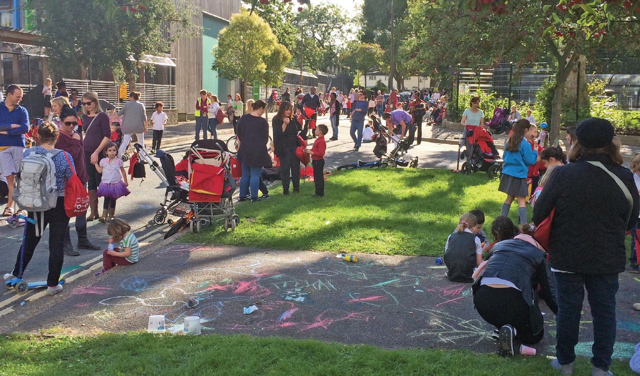
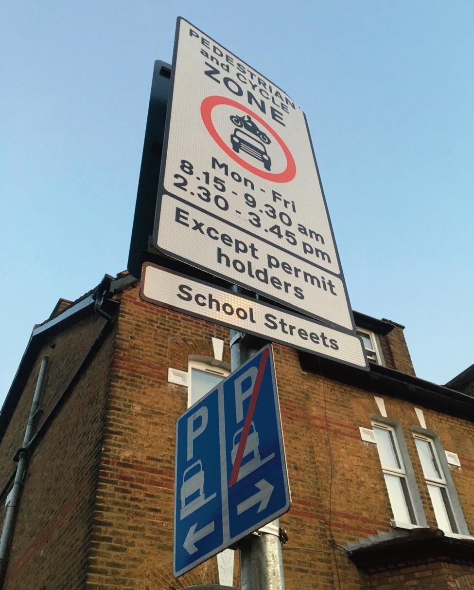
And residents who live around the school also benefit. Even when there is some displacement of traffic, research8 finds that it is not as significant as the original problem and can be managed.
Not all schools equal when it comes to traffic Catchment schools rely on pupils coming from nearby, and if that’s in an urban area, it is usually within easy walking distance. However, noncatchment schools - often independent or faith schools that don’t have a distance criteria - generally have higher driving rates. Department for Transport research9 from 2014 shows that the further a child travels to school, the more likely that journey is to be driven, with 75% of school journeys under a mile being walked, compared to 75% of journeys between 2-5 miles being driven.
35 Liveable NEIGHBOURHOODS
An increasingly common sight outside schools
By challenging the dominance of the car, School Streets change the way people interact with their surroundings and each other
HomeRun10 an app that measures 3.8 million school journeys a year, has data that shows that the average journey to an urban non-catchment primary school is 4.5 miles, compared with 1.2 miles of a catchment school.
Because of this, we think councils should not be reluctant to give non-catchment schools School Streets, as a reduction in driving rates and a more sustainable school run will not only benefit those schools, but also the communities and schools around them.

And it doesn’t need to cost councils…
Our new research11 shows that using Automatic Number Plate Recognition (ANPR) cameras to enforce School Streets means they self-fund before their first year is out.
From the 11 London boroughs with sufficient data to analyse, we found out that setting up a School Street with a multi-camera ANPR scheme costs on average £56,375 (around £20,000 for a singlecamera scheme) and returns £63,113 per year in penalty enforcement notices (on average). This money can be used on measures to reduce air pollution and road danger at schools that can’t implement a school street.
People love them
This is the one traffic reduction measure that is almost universally popular. According to research12 by the Mayor of London, 77% of parents and carers support School Streets being kept. Another survey13 by Transport for London said 81% of people whose school had a School Street wanted to keep it, and a survey14 by charity Sustrans found that residents on and around a School Street felt that the road was much safer with a School Street. These perceptions are overwhelmingly positive. For many people a School Street is the first time they see a low-car
environment, and they find that they like it. There are more than 24,000 schools in England, so we’ve only just touched the surface of what can be done. School Streets mean less traffic, less road danger, less pollution and a better start to everyone’s day. n
Claire McDonald is schools lead at Mums for Lungs, a grassroots campaign organisation, concerned about the impact of air pollution on children’s health
1 https://www.kcl.ac.uk/news/children-exposed-to-five-times-more-air-pollution-onschool-run#:~:text=A%20new%20King's%20report%20has,other%20time%20of%2 0the%20day.
2 https://www.theguardian.com/environment/2021/jun/17/quarter-of-uk-pupilsattend-schools-where-air-pollution-is-over-who-limit#:~:text=The%20research%2 0found%20almost%208%2C000,annual%20average%20limit%20for%20PM2.
3 https://www.kcl.ac.uk/news/living-near-a-busy-road-can-stunt-childrens-lunggrowth
4 https://www.london.gov.uk/programmes-and-strategies/environment-andclimate-change/environment-publications/school-streets-air-quality-study
5 https://static1.squarespace.com/static/61d570b3a2957b5f755587d2/t/ 62cd908d3366e1182aab4125/1657639055691/SUTRANS+School+Streets+Closure+ and+Traffic+Displacement+Literature+Review+FINAL+July+2022.pdf
6 https://www.gov.uk/government/statistical-data-sets/nts06-age-gender-andmodal-breakdown
7 https://www.sustrans.org.uk/our-blog/research/all-themes/all/monitoring-theimpact-of-school-streets-safety-and-traffic-displacement
8 https://www.sustrans.org.uk/our-blog/research/all-themes/all/monitoring-theimpact-of-school-streets-safety-and-traffic-displacement
9 https://assets.publishing.service.gov.uk/government/uploads/system/ uploads/attachment_data/file/476635/travel-to-school.pdf
10 https://www.homerun-app.com
11 https://www.mumsforlungs.org/news/school-streets-camera-costs-research
12 https://www.homerun-app.com
13 https://content.tfl.gov.uk/school-streets-evaluation-report-website.pdf
14 https://www.sustrans.org.uk/our-blog/research/all-themes/all/monitoring-theimpact-of-school-streets-safety-and-traffic-displacement
36 School Streets
Research by King’s College London showed that school children are exposed to five times more air pollution on the school run than any other time
Hackney is planning to add another five LTNs to the 19 schemes already in operation
HACKNEY PLANS TO MAKE THREEQUARTERS OF BOROUGH LOW TRAFFIC
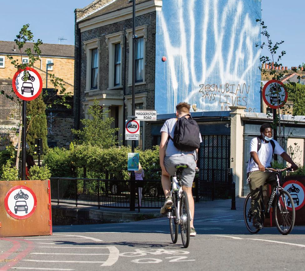
Hackney Council is introducing a raft of measures designed to reduce traffic and pollution and improve road safety.
Consultations are underway on creating Low Traffic Neighbourhoods (LTNs) in five areas, which would add to the 19 LTNs already in operation, most of which use ANPR cameras rather than physical filters to manage traffic. LTNs currently cover about half of the borough, and the new schemes would increase this to three-quarters of streets, the council estimates.
The council says the chief aims of LTNs in the borough is:
l Improved bus journey times with reduced traffic volumes on a local bus route
l Low traffic walking and cycling routes connected to nearby green spaces
l Low traffic walking and cycling routes for secondary school students to travel independently along
l New public spaces created for the community to use, for instance, pocket parks or parklets
l Pedestrians are able to cross the road in a town centre or residential area safely and with ease.
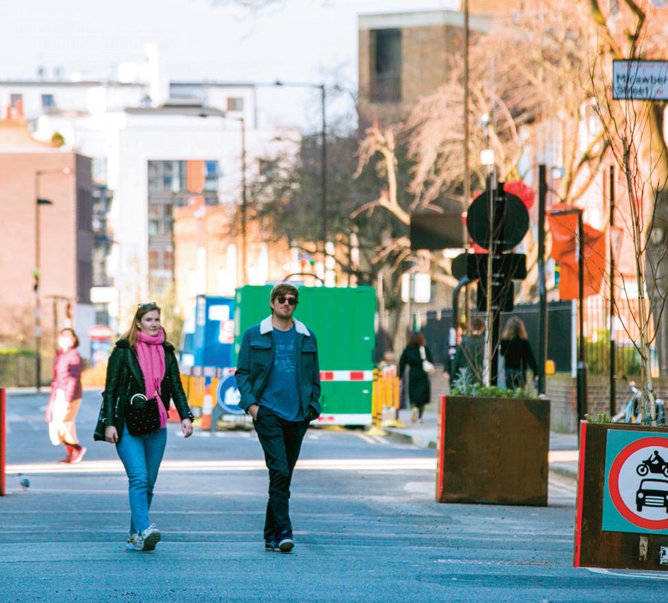
The council’s cabinet has approved the local implementation plan to increase the number of bike
hangars, segregated cycle routes, bike hangars and greened local streets. The council is planning to install another 47 hangars, bringing the total up to 1,322.
Hackney currently has 50 School Streets, which, says the council, is the highest number in the UK. It is planning to install another 16 by 2025, which will mean all primary schools will have a School Street. Schemes are also due to be installed at six secondary schools.
The council is also carrying out feasibility studies to explore reducing traffic through road user charging. In his 2022 manifesto, Mayor of Hackney Philip Glanville committed to cut road traffic by 30.6m vehicle miles (9%) by 2026 through road user charging.
The plan covers the lifetime of the council’s latest funding agreement with Transport for London until March 2025.
The council is seeking to reduce goods traffic by 2.5% with a new freight action plan. It also plans to publish data from its 30 live traffic monitors and improve the availability of air quality monitoring data.
Other schemes include expanding dockless bike hire and car clubs, with 100 new car club vehicles, and implementing more bus lanes and extended operating times. n
37 Liveable NEIGHBOURHOODS
LTNs not only make roads safer for people on foot and on bikes but also improve journey times to create new public spaces, says Hackney Council
SCHOOL STREET CHAMPIONS VOW TO ROLL OUT MORE SCHEMES
Cabinet members from Hackney, Lewisham and Southwark are united in their determination to introduce more School Streets
The implementation of School Streets can help win public support for wider neighbourhood traffic management measures. This is the firm conviction held by cabinet members from three London boroughs who spoke at an event hosted by Lambeth Council and organised by Landor LINKS.
The three are Mete Coban, Hackney’s Cabinet Member for Energy, Waste, Transport and Public Realm; Louse Krupski, Lewisham’s Cabinet Member for Environment and Climate; and Catherine Rose, Cabinet Member for Leisure, Parks, Streets and Clean Air.
Hackney’s Mete Coban announced that the borough now has 50 School Streets, more than any local authority in the UK. He said that School Streets should be seen as one of a “package of interventions” that include Low Traffic Neighbourhoods, 20mph limits and bus travel.
Coban said that after he retained his seat in the local elections in May 2022, it might have been easier for him to avoid contentious schemes such as LTNs. “Yes, I could have just kicked the can down the road and kept things ticking over, but ultimately we are here to do the right thing for our communities.”
Traffic management schemes are interconnected as they all improve road safety and air quality, are good for community cohesion and encourage people
to walk and cycle, said Coban.
School Streets involve traffic controls during children’s arrival and departure times - normally one hour in the morning and an hour in the afternoon. During the event the consensus appeared to be that the most effective way of managing School Street schemes was by deploying camera enforcement rather than closing the roads using temporary barriers.
No traffic management schemes should be viewed in isolation, said Lewisham’s Louise Krupski. “We’re putting in a sustainable streets programme at the moment, which is out to consultation, and we’ve tried to make it more about improving people’s streets and electric charging points, and looking at all the junctions and sight lines, and making streets more safe for people.”
But she admitted that the council is in the midst of a “massive battle” with some residents. Any traffic management measures would be very difficult without the “base line” of controlled parking zones, she pointed out.
“We’re trying to get the basics right, so that we can then build on top of that with further sustainable transport policy.”
Play Streets, where a residential street is closed to through traffic once or twice a month, serve as good starting point for other schemes, said Krupski. “The
point about Play Streets and School Streets is it creates a culture of demand. It makes further intervention easier over time because people can see examples of how these things work.
“Play Streets is a way of showing how School Streets will work in practice.” She told delegates: “Encourage your councillors to get Play Streets up and running. And believe me, you can put in a Play Street pretty much anywhere, including on bus routes.”
Southwark’s Catherine Rose said it is important to use data to show the problems that existed before School Streets were introduced. “We need to highlight the health inequalities and the accident collision data,” she said.
“Political will and strong leadership are really important - it enables what we know the majority of residents want to achieve, and School Streets is a really powerful in shifting the status quo. It is a child’s fundamental right to arrive at school safely and we shouldn’t countenance the idea that any inconvenience [to drivers] should prevent us from doing that.”
Council officers should clearly set out the many benefits of School Streets and draw up bullet points that can be shared with councillors, said Rose. “It’s really important to get the evidence out there and to celebrate the wins.” n
38 School Streets
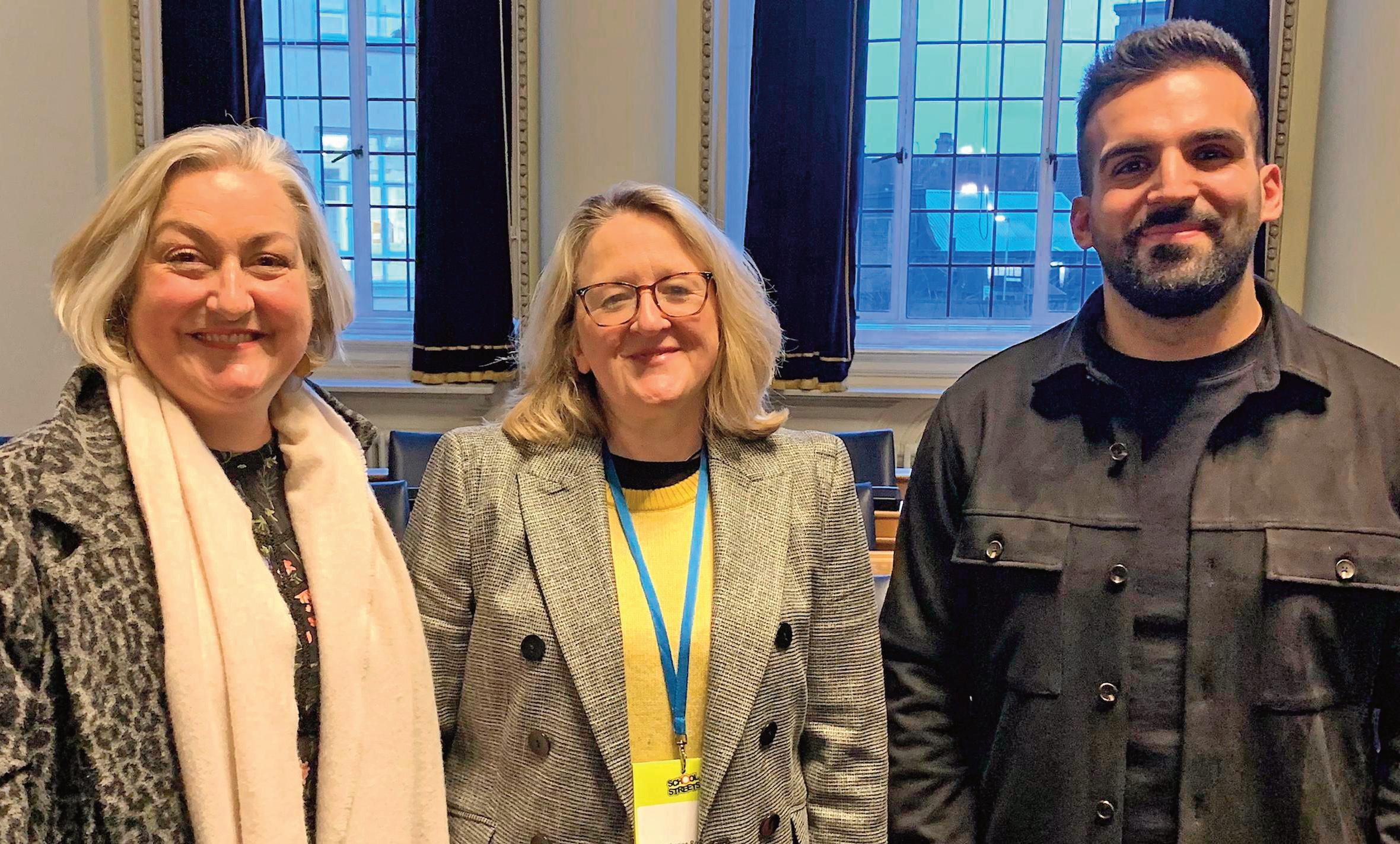
39 Liveable NEIGHBOURHOODS
From left: Louise Krupski, Catherine Rose and Mete Coban
Pic: Mark Moran
PAVING THE WAY FOR ACCESSIBLE LOCAL STREETS FOR DISABLED PEOPLE
An inquiry has highlighted the solutions needed to remove the barriers disabled people experience getting around their neighbourhoods
Solutions designed to make cycling and walking more inclusive have been drawn up following a Disabled Citizens’ Inquiry, which involved surveys and workshops. The solutions include a ban on pavement parking, improving walking and wheeling crossing points across roads and cycle paths and improving integration of walking and wheeling with public transport.
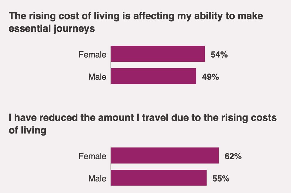
The inquiry is led by the charity Sustrans and the disabled-led group Transport for All, and is being funded by the national disability charity Motability.
The inquiry held four two-day workshops with disabled people across the UK. Disabled people shared their experiences, explored barriers on the street locally, and worked together to suggest and design solutions for change.
Disabled participants across four citizens’ workshops developed nine solutions to make walking and wheeling more inclusive and accessible. These solutions were tested through a UK-wide survey of disabled people to ensure they are representative of disabled people’s views. No significant differences were found in the responses of disabled people between the four UK nations. The solutions were then tested and refined with practitioners from the transport sector and disability
organisations across the UK. Finally, the solutions that disabled people had developed were tested with the wider public through an independent representative survey of disabled people living across the UK.
The nine solutions are:
l Ensure disabled people inform walking and wheeling policy and practice
40 Streets For All
The percentage of disabled men and women who say the costof-living crisis is making mobility and travel more challenging
l Create long-term dedicated pavement funding to maintain and improve pavements
l Stop pavement parking and manage pavement clutter
l Improve walking and wheeling crossing points across roads and cycle paths
l Make wayfinding and journey planning tools work for disabled people
l Ensure disabled people have a choice to live within walking or wheeling distance of services and amenities
l Improve access to mobility aids
l Improve off-road routes
The report states that disabled people have been largely overlooked in discussions about the 20minute neighbourhood. “Disabled participants told us they do not have the same choices. They may walk or wheel more slowly or not be able to walk or wheel as far as non-disabled people. Furthermore, many walking or wheeling routes and destinations are inaccessible making journey times longer. This needs to be better considered by transport and urban planners.”
Walking and wheeling should be the “most equitable mode of travel across the UK”, says the
inquiry. “Everyone should have the freedom to walk or wheel independently and enjoy being out and about in their neighbourhood, feeling safe and comfortable.”
Local and national governments, the third sector and businesses must “work together to make walking and wheeling inclusive and unlock the huge benefits for society, the economy and the environment”.
Disabled people face greater barriers to travel than non-disabled people, resulting in disabled people taking 38% fewer trips than non-disabled people across all modes of transport, the report says.
This pattern is also reflected in walking and wheeling, said the inquiry. It found that in 2021, disabled people in England took 30% fewer walking trips than non-disabled people. “A key reason for this gap is our streets are often inaccessible and unsafe for disabled people to navigate.
“This can prevent disabled people accessing what they need, from essentials like healthcare and food, opportunities in work and education, and social benefits like community and green space. In addition, disabled people often face greater risk of safety issues when using inadequate pavements.”
Xavier Brice, Sustrans’ chief executive, said: “Our

report clearly demonstrates that understanding the barriers disabled people experience getting around their neighbourhoods is imperative in creating an equitable society.
“Putting disabled people at the centre of discussions about how we plan and create spaces where we can all move around easily and safely is vital.
“The UK government must listen and take action to create places planned around people, not cars.”
He added: "In 2020, the DfT consulted on pavement parking. Three years later, nothing has changed. Everyone is equally entitled to rely on safe and inclusive pavements and now is the time to act.” n
41 Liveable NEIGHBOURHOODS
Xavier Brice: Putting disabled people at the centre of discussions about how we plan and create spaces where we can all move around easily and safely is vital
SUPERLOOP: IMPROVING BUS LINKS IN OUTER LONDON
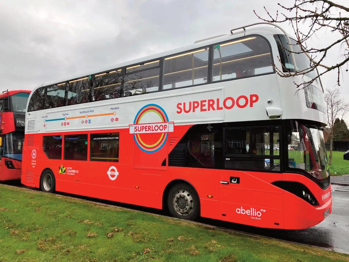
An orbital bus route will see the introduction of express bus routes circumventing the capital and connecting town centres, transport hubs and hospitals
London is to get an orbital bus network circling the capital and linking town centres, railway stations, hospitals and transport hubs.
The service, called the Superloop, will receive £6m funding from London’s mayor Sadiq Khan. It is set to be introduced in stages, with some routes that would become part of the network already in operation. TfL said that it expects the Superloop to be fully introduced over the next 18 months.
Sadiq Khan said: “When I made the tough decision to expand the ULEZ [Ultra Low Emission Zone] London-wide, one of my key commitments to Londoners was to improve transport links in outer London.” He predicted that the Superloop would add over four million additional kilometres to the bus network in outer London.
Alex Williams, chief customer and strategy officer at TfL, said: “For the first time we will be bringing a number of the capital’s town centres together with express orbital routes. We know these kinds of services are hugely popular from what we have seen in the rise in the number of people using the X140 during the week.
“The Superloop is on top of, and complements, a million additional bus kilometres committed by the Mayor in the capital’s outer ring and includes improvements from Sutton in the south to Brent Cross in the north, as well as transformational changes to London’s rail network outside the centre of the city.”
The network includes the X140 connecting Heathrow and Harrow, and a more frequent route X26 connecting Heathrow and West Croydon. A new route will link Harrow with North Finchley, subject to consultation.
Proposed future sections include a limited-stop express link between North Finchley and Walthamstow and between Walthamstow and the
42 Public transport
TfL expects the Superloop network to be fully operational by the end of 2024
Royal Docks via Ilford. Links are also proposed between Bexleyheath, Bromley and Croydon. As part of the Superloop plans, the X26 service is due to double in frequency later this year, so that buses run every 15 minutes instead of every 30 minutes.
The most recently introduced limited-stop express route, the X140, delivered a 10-15% increase in weekday demand, according to TfL data.
The Mayor’s Hopper fare would allow people who started their journeys within 60 minutes to transfer onto local bus services free of charge to complete their journeys where required, said TfL.
In November 2022 during his announcement of the ULEZ expansion, Sadiq Khan pledged to introduce a million extra bus kilometres in outer London. The ULEZ will cover all London boroughs from 29 August 2023.
TfL has launched four consultations seeking to improve bus services in Brent Cross, Harold Wood/Upminster, Stonebridge Park and Tooting. The plans cover extensions of routes to key growth areas or town centres, and more direct and frequent services.
This would complement enhancements already announced, including three new routes in the Sutton and Croydon areas, with improved services to the new Cancer Hub at the Royal Marsden Hospital. New zero-emission cross-river services will also be introduced in east London, subject to consultation.
TfL is also continuing work on plans for further service expansion across outer London, including in Southall and Haringey. These packages of bus enhancements complement other plans to improve the outer London public transport network, including introducing the full peak timetable on the Elizabeth line and introducing new trains on the DLR and Piccadilly line, said TfL.
Alongside the plans for the Superloop, TfL has
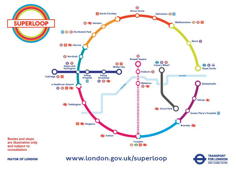
announced £35m funding for outer London boroughs as part of TfL’s Local Implementation Plan funding. The programme will see 29km of bus lane schemes, with £10.6m for London boroughs to deliver bus journey time improvements, said TfL. n
The Superloop is set to add more than four million additional kilometres to the bus network in outer London. It will also provide more frequent links to Heathrow Airport
43 Liveable NEIGHBOURHOODS
‘INCLUDE BUSES IN YOUR PLANS FOR PEOPLE-FRIENDLY STREETS’
If the dominance of the car is to end, then buses must be seen as part of the solution when developing Liveable Neighbourhoods, argues TfL’s Sian Huston
Reliable bus services should be seen as a crucial component of plans to create people-friendly places, believes Sian Huston, senior bus client manager at Transport for London (TfL).
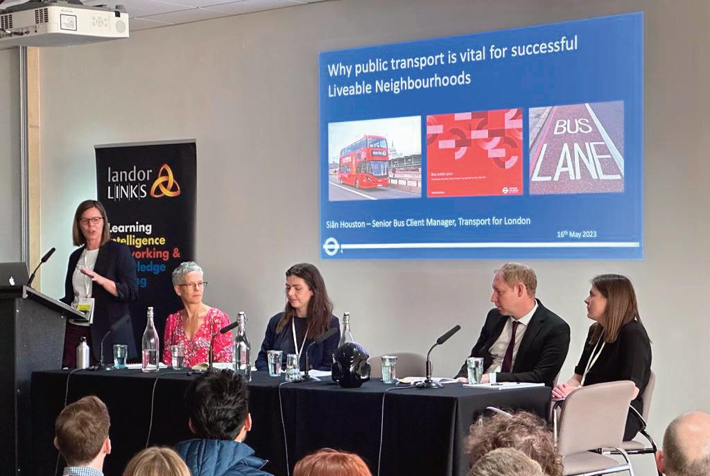
Speaking at Liveable Neighbourhoods 2023, she said: “This should not be about buses against walking and cycling. What it should be about is buses and all these other modes against private car use. Buses have to be seen as part of the bigger picture – no one mode will deliver the changes you need.”
She warned local authorities against excluding buses when introducing Low Traffic Neighbourhood and Liveable Neighbourhood schemes. “The conflict between buses and cycles is a legacy challenge, but it is the wrong challenge. We should be able to work together to balance the benefits and ensure that buses maintain a reliable service when you implement an LTN.”
Buses and other sustainable modes should be seen as complementary, she argued. “The conflict is when you deliver a Liveable Neighbourhood that completely decimates bus services. When that happens, things are no longer complementary.”
Holistic projects
Sometimes it only requires “small engineering tweaks” to incorporate buses within a low traffic scheme, Huston suggested. “Sometimes there are enormous problems that are almost impossible to solve.” But boroughs in the capital should talk to TfL to discuss ways of including public transport.
“I have colleagues across TfL covering traffic signals, managing the network and engineering in a number of different teams that can give you access to that information needed to pull together a holistic project.”
Councils should carefully consider the impact on
44 Public transport
Sian Huston (far left) at Liveable Neighbourhoods 2023 organised by Landor LINKS in partnership with Transport for London
Pic: Daniel Simpson
bus services before trialling low traffic schemes, said Huston. “I know we have to trial these schemes as quickly as we can but just putting things on the ground and seeing if has an impact can be really damaging for buses.”
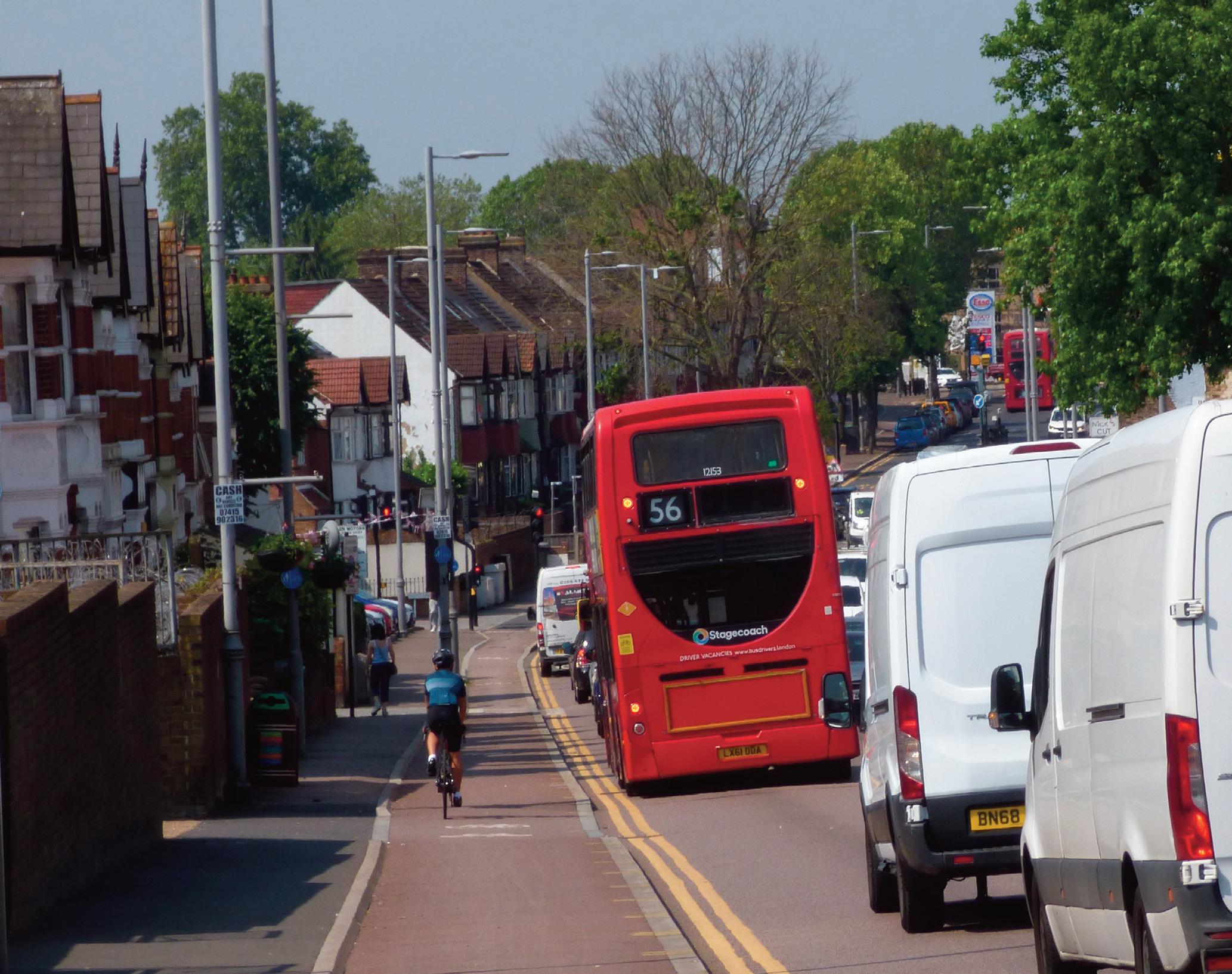
Include bus lanes and ensure bus access through Liveable Neighbourhoods wherever possible, she urged councils.
“When you are closing off certain streets to buses please bear in mind the challenges of putting buses on diversions.” It may be some corners are hard for buses to negotiate or stops cannot be installed on some roads, she pointed out.
Bus priority guidance
A 10% increase in bus journey time can lead to a 6% fall in bus demand, Huston said. “So, if we are trying to get more people travelling sustainably then part of that is to do with reliable bus services.”
TfL will be publishing its new Bus Priority Guidance later this year, which will feature a “suite of measures” to develop reliable bus schedules. Huston also referred to TfL’s Network Operating Strategy. “This represents a complete shift in how we do things – looking at routes from end to end and the fact they traverse borough boundaries. Looking at end to end and sometimes the co-ordination of scheme delivery so you are manage the impacts.
”There is an immense amount of data at TfL, everything from traffic lights to bus telemetrics to general counters across the network. All of those things talking in the same place enables you to understand the impacts you are having and looking at what boroughs can do to get people onto buses.”
London’s boroughs need to talk about buses as a real consideration and “not just something that is always in the background”, said Huston. “If they are not used they will eventually get lost as TfL has not
45 Liveable NEIGHBOURHOODS
Buses are the most accessible public transport option, with 95% of Londoners living within 400m of a bus stop, with accessible buses and bus stops for wheelchair users, says TfL’s Sian Huston
We should be able to work together to ensure that buses maintain a reliable service when you implement an LTN
got the capacity any more to fund those high frequency routes forever.”
Buses are the most accessible public transport option, with 95% of Londoners living within 400m of a bus stop, with accessible buses and bus stops for wheelchair users, said Huston. “The reality is not everyone can walk and cycle the distances they need to travel.”
Another benefit of buses is they are an effective mode of transporting people. “A bus can carry roughly 75 people in the space that three private cars will take up on the road space.”
TfL is seeking to make the capital’s entire bus fleet zero emission by 2030. “This would be game changing environmentally,” said Huston. Bus is also one of the cheapest ways to travel on public transport, with single fares allowing an hour of travel at £1.75 and a daily cap of just over £5, she pointed out.
More must be done to highlight the benefits of travelling by bus, Huston told delegates. “People need to be told about the bus services on their
doorstep – we don’t do this particularly well.
If you are doing a Liveable Neighbourhood as part of a package build in some active promotion of public transport alongside walking and cycling. Build in that extra thread as there will be some people who need buses to facilitate their trip where walking and cycling are not a feasible option.”
Talking to bus users
Consultations on the implementation of peoplefriendly streets should attract feedback from bus customers, Huston said. “When we look at responses we are getting, and we know what proportion that should be bus passengers, it is very rare to get a representative split within that public consultation. Certain groups are very well mobilised to respond to consultations.
The people who respond to consultations are a set group in society – they are not necessarily the people travelling through the area. A lot of bus customers won’t be residents where your Liveable Neighbourhood is.” n

46 Public transport
Sian Huston
GREEN STREETS KEY TO VIRTUOUS CIRCLE THAT WILL ACCELERATE MODAL SHIFT
Introducing green infrastructure in urban areas will set in motion a “virtuous circle”, reducing car use and encouraging more people to actively travel or use public transport, predicts Kendra Inman, principal urban design advisor at Transport for London (TfL).
Speaking at Liveable Neighbourhoods 2023, Inman told delegates: “In terms of modal shift we are on our way. We are seeing more cyclists in London than we were 20 years ago. We need to build on what we have achieved and create more green streets, which will allow us to give over more road space to other uses. It feels closer than it has ever been despite the budgetary challenges.”
The Mayor's Transport Strategy includes the annual target of draining 50,000 square metres of highway catchment into sustainable drainage systems (SuDS), rather than the conventional drainage system.
Mayor Sadiq Khan also wants to a see a 10% increase in London’s tree canopy by 2050. The challenge that boroughs face is that 80% of London’s public realm is actually streets, said Inman. Although local authorities were facing serious budgetary constraints, funding can still be found for green infrastructure, she said. Partnering with water companies and developers could open up new “pots of money” for green infrastructure projects.
Money may also be available from the renewals budget for on-street maintenance. “I have started making friends with my assets colleagues,” she said. “When you are replacing something, why not put in something better, rather than sticking with blacktop?” Even “modest measures” could have a dramatic impact, such as the rain gardens being implemented by the London Borough of Enfield, said Inman. “Enfield has done some great stuff – it’s simple but effective, nothing over-engineered. Our team went
and had a look and were impressed.”
Small on-street measures can make a big difference, Inman insists. This could include rain gardens on build-outs and linear rain gardens alongside cycle lanes. “There are lots of opportunities for SuDS on residential streets.”
After implementation, it is important that green infrastructure is properly maintained, especially in the first few years. “That’s why community buy-in is so important,” said Inman. “You need to engage with local people and co-design with them.”
Good maintenance also requires a multidisciplinary approach involving different council departments, Inman believes. “You need to speak to your drainage engineers,” she told delegates. “Talk to them – they are knowledgeable people. You need to know what will work and what won’t.”
Another way of reducing surface run-off is through the use of more permeable “grey infrastructure”, said Inman. This could be used on cycle lanes and in parking bays, she suggested.
Surplus parking spaces could be replaced with green infrastructure such as parklets on residential streets, said Inman. “Is all that parking space really needed? How many of those parking spaces are in use at the end of the working day? What people say happens and what is really the case don’t always match up.” n
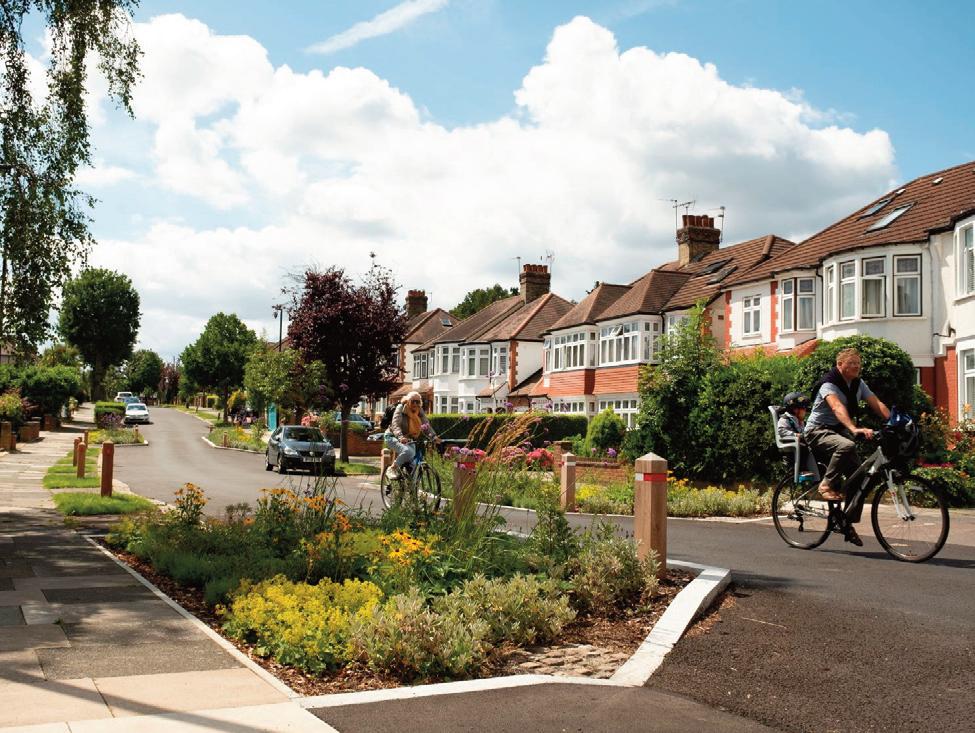
47 Liveable NEIGHBOURHOODS
TfL's Kendra Inman described Enfield's rain gardens as 'greatnot expensive high end, but simple and effective'
TfL’s Kendra Inman highlights the ways that councils can overcome budgetary constraints to introduce rain gardens, parklets and permeable surfacing
‘LET’S ACT NOW TO TACKLE FLASH FLOODS IN CAPITAL’
Councils must work together to tackle the increased threat of flash floods, with a huge amount of investment needed to build a modern infrastructure, says London Councils
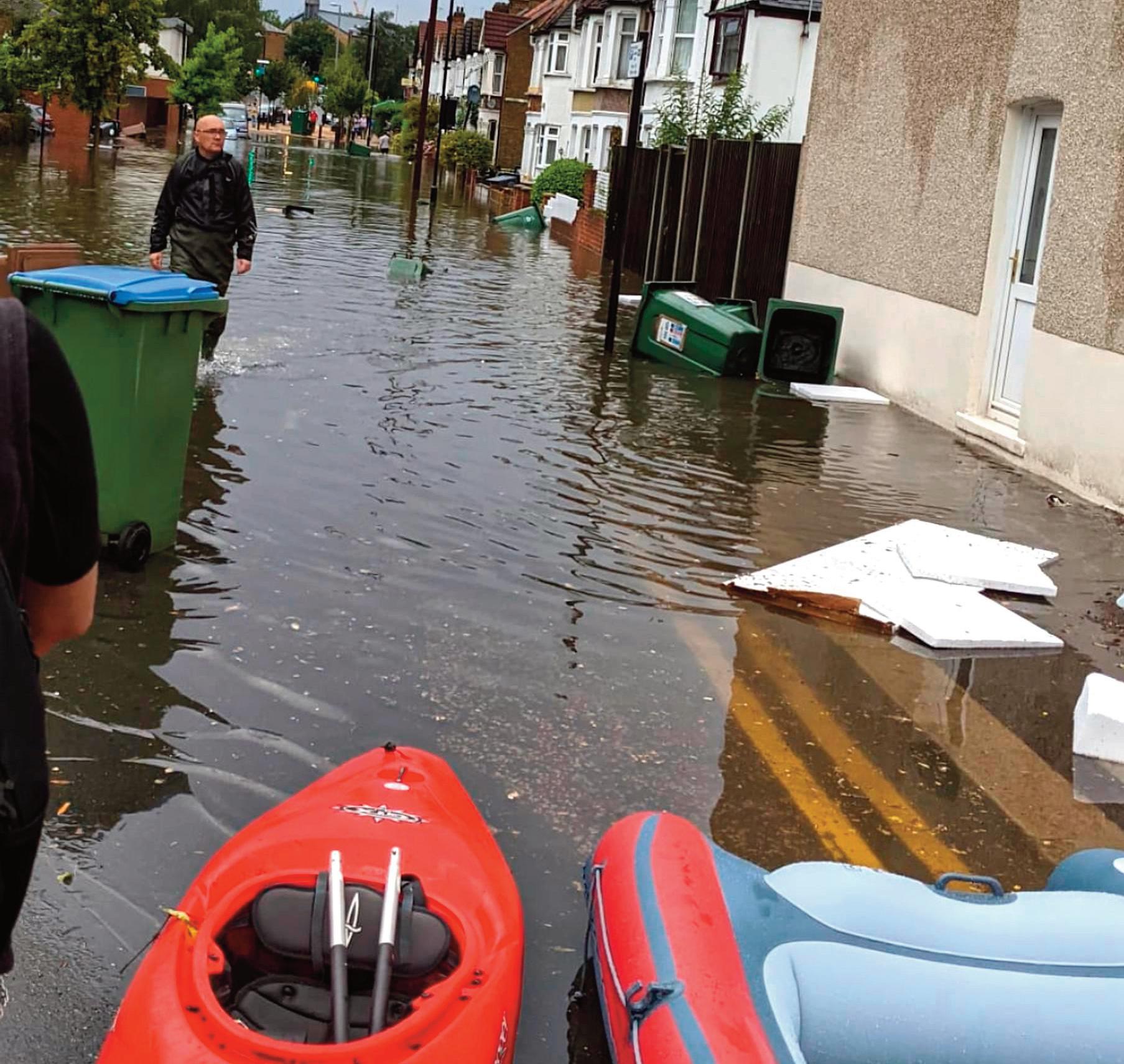
The risk of flash floods in the capital is likely to increase due to the impact of climate change, warns London Council’s Surface Water Flooding Task and Finish Group. This is backed up by the increased frequency with which parts of the capital has been ravaged by flash floods.
On the 12 and 25 July 2021, the capital was hit by intense rainstorms which overwhelmed the drainage systems, resulting in extensive surface water and sewer flooding, affecting homes, businesses, health infrastructure and transport networks. Flash floods affected 24 boroughs, with the worst impacts felt particularly in parts of east and north London.
On 17 August 2022, flooding occurred in Stoke Newington, Stamford Hill and Walthamstow and outside Victoria and St Pancras rail stations. Holland Park, Kentish Town, Earls Court, Turnpike Lane and Loughton tube stations also had to close due to flooding.
48 Climate resilience
Pic: Rossi Heudebourck
A street in Walthamstow, east London, after flash floods in July 2021
And on 3 November 2022 emergency services responded to flooding incidents across London following storms, with properties flooding and a number of calls from people trapped in their cars.
What causes flash floods?
Surface water flooding occurs when the drainage system is overwhelmed, and rain cannot get into local drains, sewers, or watercourses.
London’s built-up infrastructure makes surface water flooding difficult to manage, which is made worse by an increasing area of impermeable surfacing and a Victorian drainage system, which was “not designed to cope with the current and predicted future populations of London”, says the Task and Finish Group.
Also, the unpredictable nature of surface water flooding, makes it hard to provide an accurate warning or alerts system, says the report. While mapping and modelling offers a clue to where flooding may occur, “it is less clear that residents in risk areas understand the level of risk that they face and how to respond”.
It notes that there is no single organisation in overall charge of managing surface water flood risk in London. They also point to insufficient funding to manage the risk and a lack of modelling to show where floods are likely to occur.
Time for a strategic vision

A strategic vision and plan should be developed by a ‘transition group’, with a Surface Water Flooding Strategic Forum launched by next year, said the report.
“These recommendations are ambitious, but the Task and Finish Group members believe them to be in-line with the seriousness of the situation and the level of need,” said the report. “Surface water flooding presents a clear threat to life as well as
significant economic costs due to damage to residential property and businesses.”
London Council's findings were echoed in an independent review for Thames Water which said the July 2021 floods are likely to happen more frequently in the future.
“Consequently, as flooding is not any one organisation’s responsibility, the review notes that the many parties which manage flood risk in the capital must work together to identify solutions to manage multiple sources of flooding and identify potential funding to ensure that the impacts of flooding are managed effectively.”
As proposed by London Councils, the review called for the setting up of a new body. This would take a “strategic view and governance with all parties contributing so that surface water and sewer systems can be assessed together, and investments designed to optimise outcome across different organisational boundaries”.
Hackney’s mayor Philip Glanville, chair of London Councils’ Transport and Environment Committee, welcomed the commitment shown by partners – the Mayor of London, the Chartered Institution of Water and Environmental Management, the Environment Agency, the London Resilience Partnership, the Thames Regional Flooding and Coastal Committee and Thames Water – “to work together to deal with this pressing and critical issue”.
“It is essential we work together to improve cohesion and collaboration around flooding, which will only get worse due to climate change. However, currently there is not one single organisation responsible for dealing with surface water flooding, which makes solving problems more complex.
“Looking towards the future, a huge amount of investment will be needed to build a modern infrastructure that protects Londoners from flooding. Although we are looking at an investment model for achieving net zero more generally, the capital is already facing a backlog of over £1bn in road maintenance work alone and boroughs need considerable funding in order to deal with this backlog and establish new sustainable drainage solutions.” n
49 Liveable NEIGHBOURHOODS
Philip Glanville: It is essential we work together to improve cohesion and collaboration around flooding, which will only get worse due to climate change
TURNING THE GREY GREEN
Many cities around the world are adopting green infrastructure plans and policies that aim to promote the use of nature-based solutions in climate resilient urban development, writes
Habib Khan

Meristem Design is on a mission to bring more greenery into our urban centres. We’ve been working with local authorities to transform urban centres into desirable destinations for people to visit and socialise in. Last year alone we installed more than 1,000 planters, 120 on-street parklets, 700 SuDS (sustainable drainage systems) planters and 4,000 square metres of rain gardens. We help to transform neighbourhoods from cardominated streets into low carbon places using planters, parklets, rain gardens, trees, green roofs, green walls, living pollution screens and SuDS solutions. Embedding urban greenery into the design and management of built environments can enhance their capacity to adapt to climate change impacts such as floods, heatwaves, and droughts. Research has also shown that green infrastructure, including parklets, can increase the revenue of local businesses by 30 per cent in the first year. One of the key benefits of green infrastructure is its ability to reduce the urban heat island effect whereby urban areas experience higher temperatures than surrounding rural areas due to the absorption and retention of heat by hard buildings and surfaces. Green infrastructure can mitigate this effect by providing shading, evapotranspiration and cooling through natural processes. Green roofs and walls absorb solar

radiation and reduce heat gain in buildings, while trees and vegetation can shade pavements, streets, buildings and provide cooling through transpiration. Another benefit of green infrastructure is its ability to reduce the risk and severity of urban flooding, which is becoming a common issue in built-up urban areas. Interventions such as SuDS schemes, which capture and store stormwater, can prevent flooding and enhance water quality. Rain gardens and our SuDS planters are examples of green infrastructure practices that can reduce stormwater runoff and promote infiltration, thereby reducing the load on the urban drainage system.
In addition to these benefits, green infrastructure offers positive environmental effects such as carbon sequestration, air purification, and biodiversity conservation. Trees and vegetation can absorb and store carbon dioxide, thereby reducing greenhouse gas emissions and mitigating climate change. They can also filter pollutants from the air, improving air quality and human health. Green infrastructure also provides habitats for wildlife and so enhances biodiversity, which can have positive impacts on ecosystem functioning and human well-being.
Green infrastructure has the potential to help build climate resilience into cities. However challenges remain, for example a lack of funding and poor awareness of the importance of ongoing
maintenance. Having at least two years of maintenance for green infrastructure projects planned into any project, in order to help get planting established, is key for the long-term success of projects. n
50 Climate resilience
Habib Khan is founder and director of Meristem Design, an award-winning urban design company
WALTHAM FOREST RAIN GARDENS: MANAGING FLOODING IN OUR TOWNS AND CITIES
One area that can be badly affected by flooding is the London Borough of Waltham Forest. Following extreme weather in the past years, in which a month’s worth of rain fell in a few hours causing flash flooding, Meristem has been working with Waltham Forest Council, Thames Water, the Department for Education and local residents to develop a scheme that will help to reduce risk in flood-prone areas and so protect local homes, schools and businesses.
One of the main causes of urban flooding is the use of many non-permeable materials for roads and pavements. Nonpermeable materials prevent water from draining naturally through the ground. To manage this, Meristem has developed sustainable drainage systems that redirect rain water, through rain gardens, into sewers. Rain gardens modify surface water flow to more natural rates, reducing the impact of urban flooding by allowing vegetation and plants to absorb the majority of the rainwater.
The London Borough of Waltham Forest was successful in securing funding from TfL as part of its Liveable Neighbourhoods programme. Their aim was to enhance the borough and make it easier and safer for people to get around on foot, by bike or by public transport. More than 5,000 homes in the area, as well as schools and more than 100 businesses, are set to benefit from the programme.
Meristem’s first SuDS scheme in Waltham Forest was installed in October 2021 with a total of 22 rain gardens planted over a combined area of over 280 square metres. This was the first phase of many across the borough, aiding in the reduction of flooding. Meristem says that it has successfully installed 63 rain gardens in Waltham Forest, bringing the combined coverage to more than 1,300 square metres.
l The Coppermill scheme
l The BLEN green link in Leytonstone
l The Markhouse scheme
l Forest Road rain gardens: 600 square metres of rain gardens between Tottenham Hale and Black Horse Road stations
Alongside the SuDs, new bike paths were added, creating a safe route for commuters and those accessing the canals from the Haringey area. A variety of flowering species from Verbena to Crocosmia were planted, as well as herbs and many different species of trees.
Local residents and schools helped with the planting, and learned about the species planted and the importance the rain
gardens can bring to their local area. The borough is also working closely with the residents to assign gardening ‘stewards' to care for the gardens in the future.
The schemes’ main benefits have been to target and improve both roads and homes that are known to flood. Rain gardens are also used as wildlife corridors, biodiversity boosters, barriers to cars and other vehicular traffic outside schools, to soften traffic noise and to slow traffic.
Meristem says it is delighted that its Coppermill Community Rain Gardens were recognised by the Construction Industry Research and Information Association (Ciria), who specialise in SuDS, and that our rain gardens across the UK picked up a Global Energy Award.
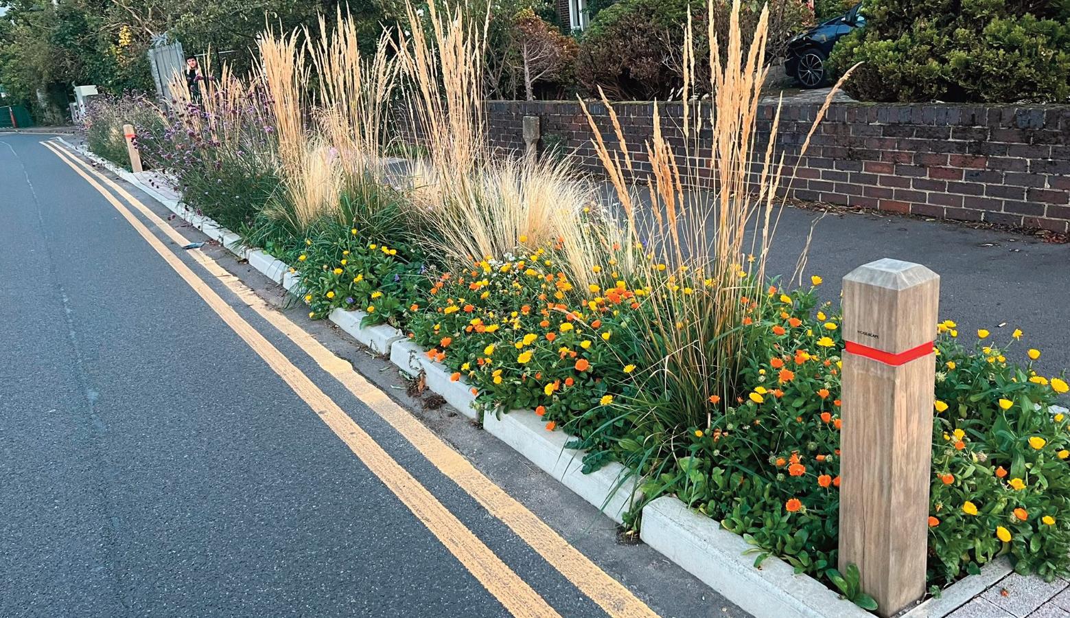
51 Liveable NEIGHBOURHOODS
DELIVERING SUDS PLANTERS TO 100 OF LONDON’S MOST FLOOD-PRONE SCHOOLS
More than a fifth of all London schools suffer from rainwater flooding, often causing playing fields to be waterlogged, according to the Greater London Authority. When rain water enters buildings it can cause a school to close down completely and have a major impact on pupils and staff.
Due to the ever-increasing volatility of our climate we are experiencing heavier and more frequent rainfall. Across the UK, in one year alone, flooding in schools cost more than £12m in damages and resulted in 400,000 lost pupil days. “These latest figures are from 2007, and we expect today's figures to be much higher,” says Meristem’s Habib Khan. Meristem’s Rain Garden SuDS planters (also known as gutter
or stormwater planters) are a sustainable flash flood and stormwater management solution with an internal water reservoir and slow-release drainage system that collects, stores and uses roof runoff. “They effectively enhance the capacity of the surface water piped drainage network by capturing and storing rainfall, allowing it to soak into the ground or be released slowly back into the piped network,” says Khan.
“The plants help to remove pollutants and improve water quality through natural processes such as phytoremediation and bioretention. In addition, SuDS planters can provide other benefits such as improved air quality, increased biodiversity, and aesthetic value.”
The planters are a low-maintenance, cost effective alternative to expensive and higher maintenance SuDS groundwork alternatives, he explains.
“They are particularly useful where space is limited and in areas where a significant amount of rainwater travels from rooftops directly into drains.”
Last year, Meristem were awarded the Climate Resilient Schools contract by the Greater London Authority to design, build and install approximately 700 planters across London's 100 most flood-prone schools. The measures also included educating children on the importance of nature in combating global warming.
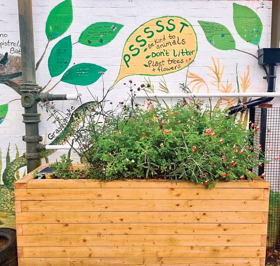
52 Climate resilience
LIVING GREEN SCREENS AS EFFECTIVE POLLUTION BARRIERS
Living green screens are becoming an increasingly popular solution to roadside air pollution. In particular, many primary schools situated on main roads in the most polluted areas of busy cities need a solution to harmful levels of air pollution close to playgrounds.

PM10 particles consist of a mixture of particle solids and droplets that are less than or equal to 10 micrometres in diameter. They are so small that they can easily get into lungs and the bloodstream. Most PM10 particles around our schools come from traffic emissions.
As part of London Mayor Sadiq Khan’s plans to improve pollution, 50 ‘air quality audits’ for primary schools in the worst polluted areas of London took place to identify hardhitting measures to protect the children from toxic air. Prior Weston Primary School, located in the Barbican, was the first school to be audited. Living Green Screens have been used around the perimeter of its playground to help absorb PM10 particulates. An automatic drip line irrigation system keeps maintenance simple. The planters were built on site from
sleepers and are lined with a membrane, creating lots of seating. The lush ivy screens have refreshed the school playground, bringing green to a grey space.
Living Greens Screens have proven particularly effective when placed along highly polluted streets with buildings on both sides (street canyons),” says Meristem’s Habib Khan. “At these locations the air pollution is higher at street level than the area above the surrounding buildings,” he explains. “Greens Screens are therefore ideal for use in street planting schemes, forming a roadside barrier for highly localised protection from polluted air.”
A recent study by Defra and the GLA shows that the use of our pre-grown Green Screens successfully reduced air pollution
by “up to 36% and 41% for NO2 and PM10" when they were placed between a busy road and a school playground.
Meristem says it has worked with hundreds of schools across London to install thousands of metres of Green Screens. “Not only do the screens help combat air pollution, they also improve the appearance of buildings and outdoor spaces by adding much needed greenery and texture,” says Khan. “Exposure to nature has been shown to have positive effects on mental health and wellbeing at schools, including reduced stress levels, increased happiness, and improved concentration. These green walls also help to improve biodiversity by providing a habitat and food source for wildlife such as birds and insects.”
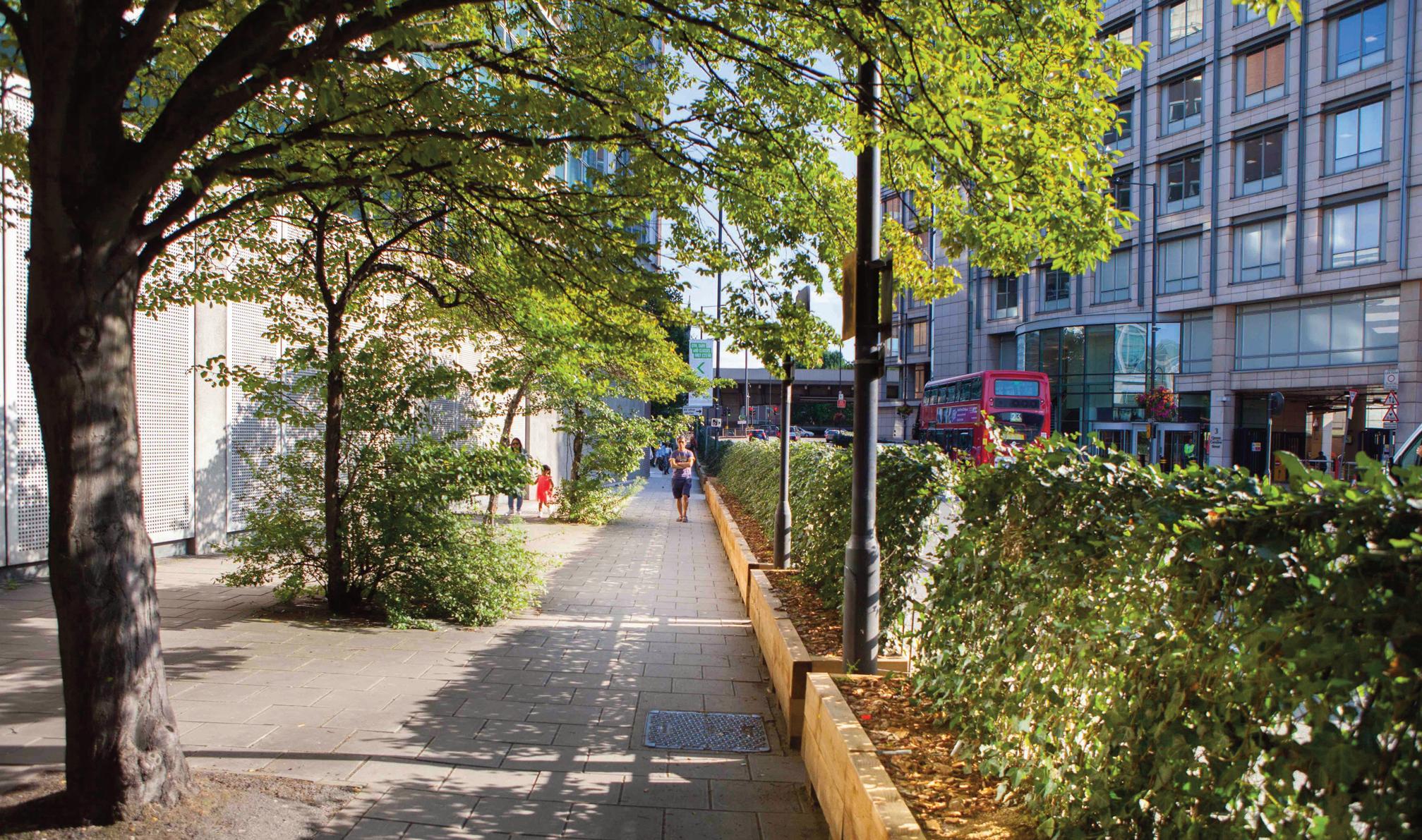
53 Liveable NEIGHBOURHOODS
MOBILITY HUBS: THE FUTURE OF INTEGRATED TRANSPORT
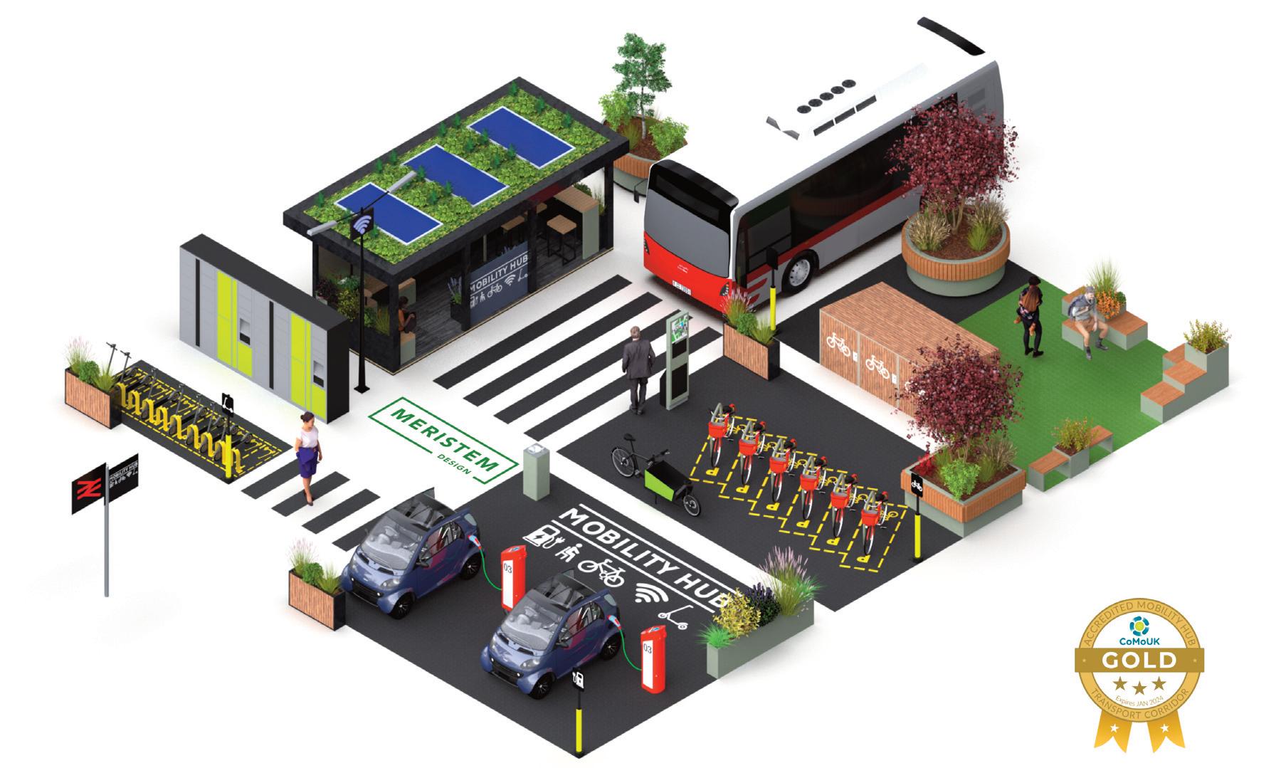
Mobility hubs bring together shared and public transport with active travel in spaces designed to improve the public realm for all. The concept is widely applied in many European and North American cities, and mobility hubs are now increasingly popping up across the UK. These include those installed by Meristem, including one in Redbridge which has been awarded the UK's 1st Gold Accredited Mobility Hub by CoMoUK, and the Enfield Solar Panel-powered parklet which enables people to charge up devices such as mobile phones and tablets on site. The Redbridge hub is the first in the UK to meet the standards recently set by the national shared transport charity
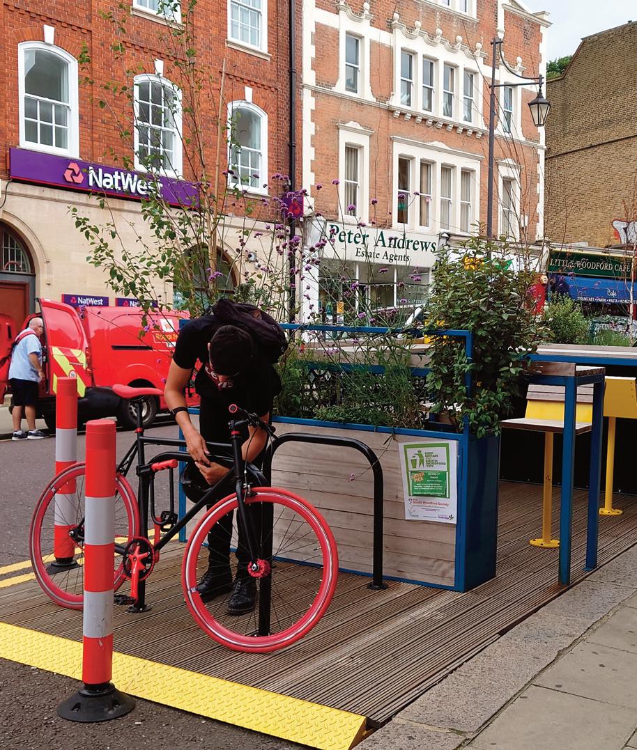
Collaborative Mobility UK (CoMoUK). The idea behind the hub was to use existing parking spaces to offer something new to the community; a place to meet, rest and refresh or interchange between cycling, car club hire and taking the Underground. The space is enjoyed by young families, over 60s walking groups, cyclists connecting with the train, dog walkers and anyone who cares about their High Street. It offers an electric car club bay, a community-led café, an outdoor seating area with bar stools, a water fountain, cycle parking, coffee tables, trees and plants. It provides wider transport connections via local underground stations and bus stops a few metres away.
In the UK, the switch from combustion engine to electric vehicles is moving fast, and there is a real need to provide more on-street car charging points. While drivers wait for their cars to be charged, hubs equipped with charging facilities offer the opportunity to grab a coffee or a bite to eat from the local shops and relax in the parklet, surrounded by plants and greenery.
Meristem Design provide a full service including design, fabrication, installation and maintenance: For more information email: info@meristemdesign.co.uk or call (0) 20 31376971
54 Climate resilience
CARGO BIKES AREN'T COMING –THEY ARE ALREADY HERE
In the UK, the private sector is steaming ahead with developing the cargo bike ecosystem. But where is the Government support, asks
With the exception of public health funding, local authority cupboards are bare. The Air Quality Grant run by the Department for Environment, Food & Rural Affairs (Defra) is the main funding that is currently helping councils to take forward cargo bike schemes. Air quality grants are now funding more cargo bike schemes than those given by transport authorities.
In March this year, Will Norman, London's walking and cycling commissioner, launched a plan – the London Cargo bike Action Plan – to help councils, businesses and the freight and servicing industry switch to cargo bikes. Norman launched the plan at the National Cargo Bike Summit in central London, organised by Landor LINKS and hosted by the City of London Corporation.
“Cargo bikes are no longer a niche concept, and they can be real game changers when it comes to delivering freight and servicing trips,” Norman said. “Not only do they provide environmental benefits by not contributing to air pollution, they also make journeys more efficient, and present a much lower risk of danger to people walking and cycling than vans and HGVs.”
The London Cargo bike Action Plan was quickly followed by a further report, published by London Assembly Economy Committee, which said that the “the Mayor should provide further funding to local authorities in London for cargo bike sharing
Juliana O'Rourke
schemes and cargo bike training, to help businesses pedal their way to net zero”.
The London Assembly report explored how businesses in the capital can be incentivised to make a shift away from diesel vans and towards using cargo bikes for their deliveries and other jobs.
Said Hina Bokhari AM, Chair of the Economy Committee: “Cargo bikes and e-cargo bikes can be the greener alternative to diesel vans, not only for deliveries, but also for tradespeople and small businesses that need to transport equipment, tools, and goods around the city.”
Cargo bikes are booming
The Royal Mail is trialling cargo bikes. London van hire service Tipper Hire is renting out e-cargo bikes, as are many other van hire firms nationally. Cargo bike libraries gave are already available in London and Norfolk. Bicycle repairs and servicing business fettle has paired up with Kwik-Fit to help ensure that the UK has the right servicing infrastructure to support changing modes of transport. The partnership will be open to serve all cyclists, but the initial focus will be on supporting fleets using ebikes and cargo bikes for the last mile.
Also in March, Barclays invested £5m to roll out Zedify's e-cargo bike delivery network. Zedify seeks to normalise hyper-local micro hubs and zero emission delivery vehicles within UK cities.
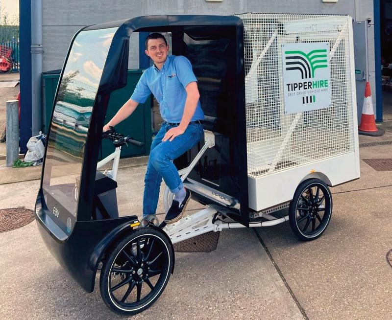
Last year, British electric cargo bike manufacturer Electric Assisted Vehicles (EAV) appointed Halfords as its key UK fleet service, maintenance, and repair partner, ensuring EAV's Fleet customers have access to qualified Halfords Mobile Expert technicians anywhere in the UK.
And, to show that cargo bikes are here to stay, this year Amazon unveiled a £300m investment in the electrification and decarbonisation of the company’s UK transportation network, stating that e-cargo bikes and walkers are now expected to make more than two million deliveries a year.
All in all, much has happened in the cargo bike world lately – and it’s all positive – except for the lack of public funding. Let's hope that the Department for Transport's Future of Freight plan, the first-ever cross-modal and cross-government plan for the UK freight transport sector, has some good news for this very promising industry. n
55 Liveable NEIGHBOURHOODS
London van hire service Tipper Hire is renting out e-cargo bikes, as are many other van hire firms nationally
56 Cargo Bikes
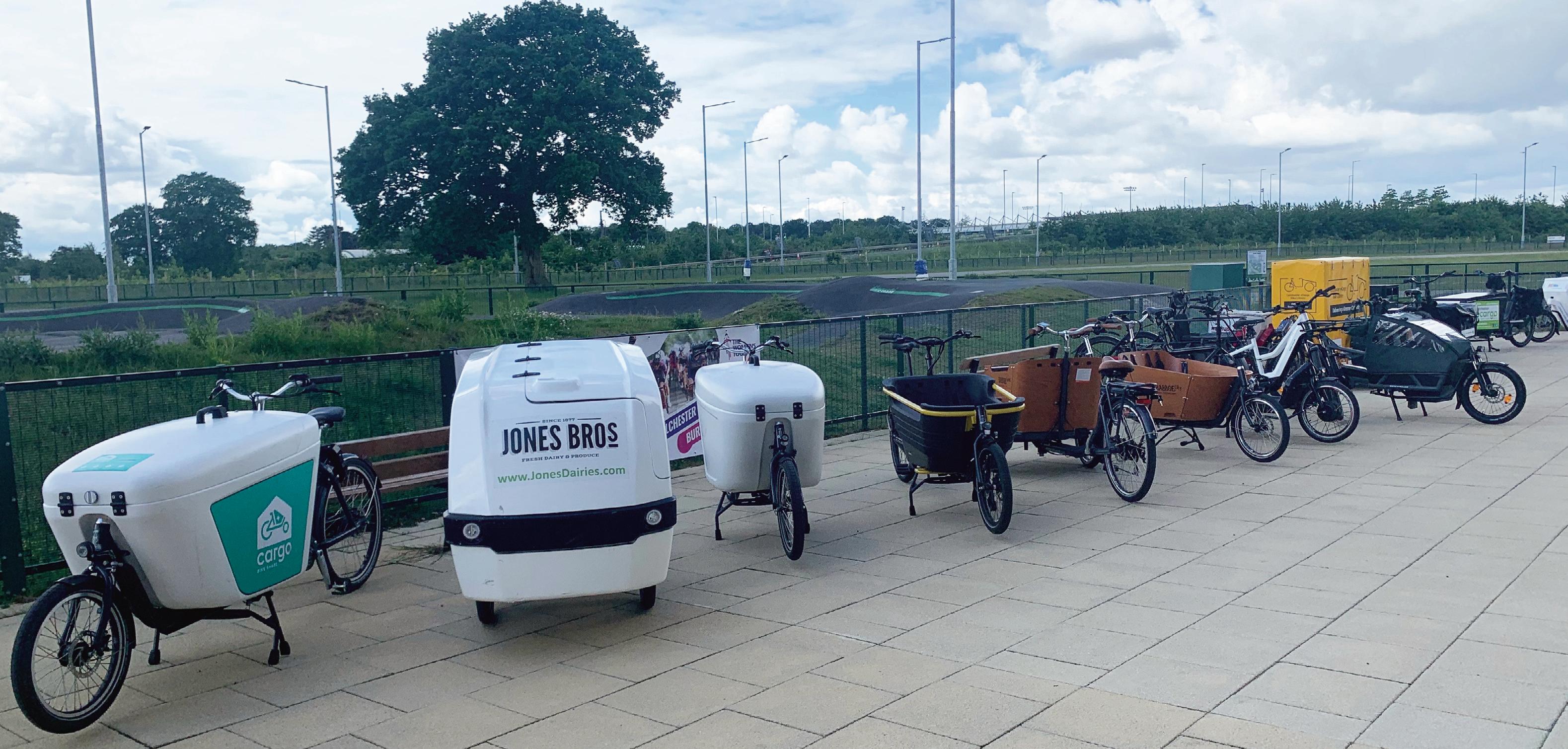
JustEconomics calculated that the cost per mile for a diesel van was eight times higher than the same mileage for a cargo bike
‘LEVEL PLAYING FIELD' NEEDED WHEN COMPARING VAN AND CARGO BIKE DELIVERIES
Analysis by JustEconomics has revealed the myriad hidden costs behind van deliveries including noise, pollution, infrastructure costs and the impact of congestion on the economy, writes Mark
Sutton
The social and environmental costs of diesel van deliveries is often not factored in when comparing their value against cargo bike deliveries, suggests analysis by research and evaluation company JustEconomics.
Its analysis, published in the report Delivering Value considered the positive and negative externalities of diesel and electric vans, plus cargo bikes, to determine which represents the best all round value. Speaking at the National Cargo Bike Summit, director Eva Neitzert sought to understand businesses’ reluctance to switch delivery from vans to cargo bikes.
https://www.justeconomics.co.uk/health-andwell-being/delivering-value
The research was commissioned by Business Improvement District (BID) Team London Bridge and funded by Impact on Urban Health. Feedback received from businesses often centre on “we love the idea and we love possibly lowering our environmental footprint, but we can’t justify the cost”, said Neitzert at last week’s event, hosted by City of London Corporation and organised by Landor LINKS.
Some traders said that quotes had come in at up to a 50% greater premium. In the course of interviews, Neitzert discovered some quotes coming in at just £2 per delivery.
“Somebody else is absorbing an additional £4.42 in cost. Usually that’s the driver, which explains why gig economy drivers are working long hours and driving fast to compete,” she said. This, of course, has the added negative of increasing road dangers.
What is the true cost, all things considered?
Neitzert and her team sought to understand this, putting a figure on each delivery method for comparable jobs. In their methodology
JustEconomics factored in the hidden social costs of choosing bulky and polluting vans, considering the
noise, pollution, infrastructure costs, congestion burden on the economy, the health of drivers and riders and plenty more.
What they found was that van users are largely independent contractors with their labour costs externalised, thus the true operational costs are not being borne by the companies. In contrast to this, ecargo bike riders were typical holding an employed status with costs borne by the courier firm parent.
When it came to pricing, that meant that many customers were incentivised to make the worst choice, the JustEconomics analysis suggests. Understanding this, a true cost per mile calculation was made for each delivery format.
Accounting for all the positive and negative externalities, Just Economics put a fair value price on each method, calculated around an equivalent
job. The tallied for that job by ‘fair price’ were:
l Diesel van £6.42
l EV van £5.68
l Ecargo bike £4.98
What’s more, it was calculated that the cost per mile for a diesel van was eight times higher than the same mileage for a cargo bike; 66 pence per mile versus 7.8 pence per mile. That is, in large part, down to the environmental cost of a diesel van being 67 times greater than that of a cargo bike.
So, how do you solve an age-old problem?
JustEconomics suggests to local and national governments to put smart road pricing changes in place to recognise and charge vehicle types appropriately. That also means investing in infrastructure for bikes to drive this revolution in the logistics economy.
“I think we fundamentally do need subsidies,” said Neitzert. “Businesses are largely on board with the idea, but there remains an instinct to just buy an electric van.” JustEconomic’s research showed that cargo bikes are better for the environment, she told delegates.
“We need to be encouraging toward e-cargo’s development and have it become an integral part of transport decarbonisation. That means thinking about the work to be done with private sector on buildings, such as better loading bays. There’s cultural things to work out with landlords, such as who is allowed access.
“At a national level road pricing should reflect how polluting a vehicle is. A scrappage scheme nationally for cargo bike buying should follow London’s. As for standards, in the Bikes for Business research large courier firms didn’t know whether the thing they were investing in counted as cargo bike in view of
57 Liveable NEIGHBOURHOODS
JustEconomics director Eva Neitzert speaking at the National Cargo Bike Summit
58 Cargo Bikes
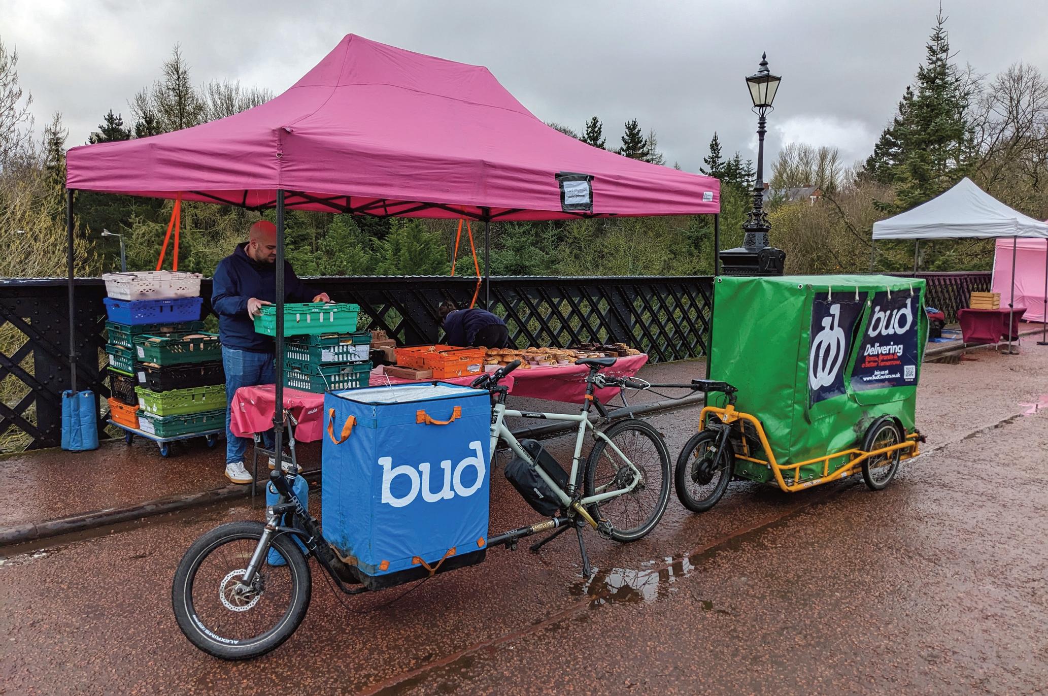
legislation very much catching up to the pace of innovation. So, clarity from Government is needed to give that regulatory confidence to invest.” Ultimately, JustEconomics’ research demonstrated that the freight industry’s investments should now be one-way traffic, albeit with some hurdles still to be brushed aside on infrastructure and policy.
More than 20% of London’s roads are taken up by freight, deliveries and commercial vehicles at any
one time, a figure that has only grown since Covid19’s ripple effects accelerated online shopping trends. Panellists at the National Cargo Bike Summit agreed that this trend must now include adaptation of vehicle types to be sustainable.
Neitzert concluded that “the hidden social costs and environmental costs with diesel van delivery in London totalled £2.46bn annually. We need action to level the playing field, it’s not fair van couriers externalise costs.” n
Cargo bikes come in all shapes and sizes, but all make good business sense, says JustEconomics
ARE NEW LAWS NEEDED TO POLICE THE SAFE USE OF CARGO BIKES?
As the use of cargo bikes become more popular, legislation may be required to enforce their safe and responsible use, writes Mark
Sutton
London’s Metropolitan Police are among UK forces pondering how to police inappropriate cargo bike use, where, for example, vehicles are excessively or poorly loaded.
Currently there is no relevant legislation in place, arguably bar Section 40a of the Road Traffic Act of 1948, which thus far is tilted toward addressing poorly loaded motor vehicles or trailers. While most cargo bikes on the road are loaded in a reasonable way, there are always exceptions to the rule and what has until now been a self-governing trade may soon have a more trained eye on it from the law.
Speaking at the National Cargo Bike Summit, Mike Daly of the Met’s Cycle Safety Team offered examples of what could illustrate tested boundaries. Daly showed images of cargo bike use where it could be argued the rider’s view would be obscured from the road, or where loads looked either unsteady or poorly secured, or unevenly balanced. The issue is no different in many respects to a hastily loaded trailer or van presenting a danger to other road users, which means a law could come to apply to both tradesfolk and consumers carting goods.
The summit, organised by Landor LINKS and hosted by the City of London Corporation, discussed the growing confidence in the bustling cargo bike sector. It is among the fastest growing of all bicycle and electric bike sectors, according to market data from the Bicycle Association. Panellists also touched
on the appropriate design standards for such diverse vehicles, which presents variables in levels of safety.
Around 10,000 cargo bike units were sold in 2022, around half were believed to have been bought with commercial use in mind, according to Bicycle Association’s executive chairman Phillip Darnton OBE. But this figure was “insignificant” compared with “our friends in Europe, who expect to do 400,000 this year”. This, Darnton added, would save “300,000 tonnes of co2 versus using vans for the same journeys”.
Opening the session on safety, security and standards, the Bicycle Association’s Peter Eland asked: “How will so many people in our cargo biking future have confidence that we will operate as other professional forms of transport do? Will the company using us for deliveries have confidence? Will our riders too? Is all of this backed up by professional training and insurance?”
The Met’s Mike Daly told the audience of cargo bike industry, local authority planners and logistics professionals that the “DVSA issues guidance on the motor side and that could be potentially be mirrored”.
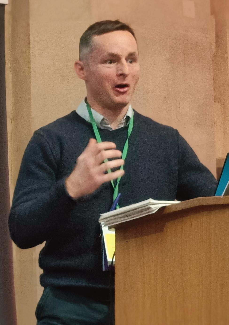
Daly alluded to assessments of a vehicle’s size, weight, shape, where a load is placed, appropriate methods to secure the load and how that load affects the vehicle’s handling.
So, what is the solution?
This subject is for now only a periphery discussion for the Department for Transport to think on and there are no firm proposals, only a willing industry that hopes to self-regulate. Noting this, the Met’s cycle safety officer mooted the following solutions:
l Use of cameras
l Self-reporting of road crime
l Greater levels of GPS tracking
l Collision detection technology
59 Liveable NEIGHBOURHOODS
The Met`s Mike Daly: Our legislation could be out of date
60 Cargo Bikes
l Use of two-way communication devices
l Staff training, including training on load handling by operators
l A promotion amongst staff to have the confidence to push back on using unsafe or unkept vehicles
l Regular, planned maintenance
l Logbooks with a service history
Where do the problems primarily exist?
The cargo bike business is, for the most part, well behaved, said Mike Daly. Pedicabs were raised as one sector that had drawn concerns, though sometimes for differing reasons. In the wake of a spate of headlines to do with modified electric bikes causing fires, concern was expressed at the DIY
nature of some pedicabs on London’s roads. “There’s no legislation for Pedicabs, currently we most often use noise complaint laws to deal with a situation and while investigating we often find car batteries linked to lots of exposed wires, sometimes no earthing,” Daly said. “We have to shrug at it at the moment. As soon as motor is found to have power above 250W we can deal with it. Another concern is the low level of restraints, such as seatbelts for passenger.”
A video from Germany’s DEKRA showing a longtail cargo bike, illustrated the difference a seatbelt makes under heavy breaking. Thankfully, it was only a crash dummy flying forwards from the bucket of the non-seatbelt clad cargo bike, but the
difference was nonetheless stark.
As a final point, Daly cast the audience’s mind back to the Charlie Alliston court case. Riding a fixie bike with only a backpedal, Alliston tragically collided with and ultimately caused the death of Kim Briggs. In this instance the archaic charge of ‘wanton and furious driving’ was the only appliable law on which an 18-month sentence could be passed.
This, concluded Daly, could reflect the immature stage of laws surrounding this sector and potential ramifications of any incident where, for example, a cargo bike rider ended up the cause of a person’s death due to irresponsible behaviour. “Our legislation could be out of date,” he said. n
 The National Cargo Bike Summit was hosted by the City of London Corporation and organised by Landor LINKS
Liveable NEIGHBOURHOODS DIRECTORY
Meristem Design is an award-winning design company creating bespoke green solutions for the commercial, public realm and residential spaces through green screens, living walls, parklets, custom planters, rain gardens, SuDS and biophilic design. Our team of designers and horticulturists is driven by a passion for plants and provides a full 360 service including design, fabrication, installation, and maintenance. We aim to bring more green into our world by “turning the grey, green”, whether it be at home, in the office, or on the commute.
We work with local authorities, town centre managers and community groups, to transform run-down local areas into liveable communities and to rejuvenate our High Streets into desirable, destination places for people to visit and socialise. Research has shown that green infrastructure such as parklets can increase revenues of local businesses by an average of 30% in the first year.
Last year alone, we installed over 1000 planters, 120 on-street parklets, 700 SuDS planters, and over 2000 square metres of rain gardens.
At Meristem Design, we believe that incorporating green solutions into our built environments is crucial to creating a sustainable and healthy future.
The company's commitment to creating sustainable and green environments has earned us numerous accolades and recognition in the industry.
Find out more:
www.meristemdesign.co.uk

Project Centre is a design, engineering and landscape architecture consultancy whose highly talented people are passionate about creating places that are attractive, innovative, sustainable and safe.
Led by a forward-thinking management team, we work together in multi-disciplinary teams that provide services that are well thoughtout and inclusive. Our approach to integrated design has produced award-winning results with international recognition.
We have a wealth of experience in creating community-centred places that incorporate identity, biodiversity and active travel into urban spaces. By using data and community led design processes, we’re able to create spaces that are better connected, inclusive and sustainable.
With the Biodiversity Net Gain strategy coming in November, Levelling-Up opportunities and active travel funds, now is the time to look to our neighbourhoods to increase their liveability. Through community engagement, clean air monitoring, traffic reduction and urban design, Project Centre create spaces that bring people together in safer, healthier environments.
We were CIHT’s Employer of the Year in 2021 and have been shortlisted for numerous awards focused on diversity and inclusion, showing our commitment to supporting and developing our people.
Find out more:
www.marstonholdings.co.uk/projectcentre

SYSTRA is one of the world’s leading transport planning and engineering companies specialising in the development of holistic future transport systems and mobility solutions from concept to operation. For 65 years, we have been creating sustainable, liveable communities through efficient and sustainable transport networks, encompassing all transport modes, that contribute to the economic development and regeneration of urban and rural areas.
We approach each project by developing an understanding of the needs and requirements of specific communities and creating, improving and modernising transport infrastructure and systems to achieve liveable and resilient places - creating opportunity and freedom to move. We are currently utilising our collective experience to innovate and imagine the future of mobility that addresses the challenges of climate change focusing on new technologies, digital solutions, and designing infrastructure that is effective, sustainable, resilient and designed to meet the needs of the places it supports.
For more information visit our website: www.systra.co.uk
61 Liveable NEIGHBOURHOODS
Liveable NEIGHBOURHOODS
