2025 - 2026


2025 - 2026
BEST ENGAGEMENT
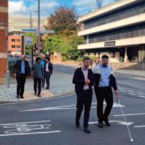
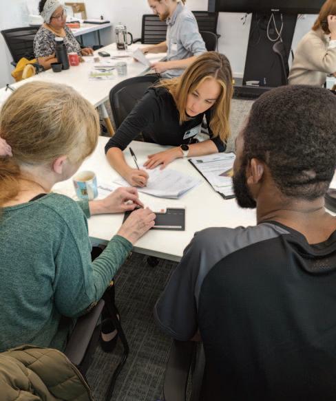
Essex Highways is developing accessible active travel schemes by working closely with a group of blind and partially sighted people
BEST ENGAGEMENT
Hounslow Council’s Transport Strategy is being shaped by a diverse group of stakeholders through workshops and forums
BEST INFRASTRUCTURE
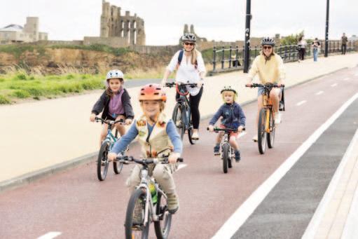
A new route on North Tyneside’s coastline offers access to popular attractions and enables everyday active travel journeys
BEST INFRASTRUCTURE
Collecting a wide range of data has demonstrated the benefits of implementing a liveable neighbourhood in the Leith district of Edinburgh
BEST INFRASTRUCTURE
A new walking, wheeling and cycling link through Edinburgh city centre has proved popular
BEST INFRASTRUCTURE
Assessing the impact of A50 Fiveways and Granby Street improvement schemes in Leicester
MOST AMBITIOUS STRATEGY
City of York Council has set out its vision to create healthy and climate-resilient places, improve active travel infrastructure and bus services
BEST ACCESSIBILITY
Lambeth Council and MP Smarter Travel have formed a working group to ensure that street layouts do not present barriers for disabled people
BEST ACCESSIBILITY
The National Centre for Accessible Transport on how it is working with disabled people to remove barriers to transport
BEST ACCESSIBILITY
Removing Old Street’s gyratory system has seen a traffic-dominated area transformed into a network of people-friendly links and public spaces
BEST NETWORK STRATEGY
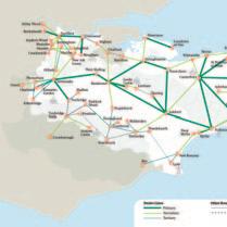
Kent is developing a 10-year active travel network plan to create priority routes, fill gaps, and integrate with district-level strategies
BEST NETWORK STRATEGY
A network of routes in Buckinghamshire are set to improve access to education and employment, public transport, shops and leisure
BEST BEHAVIOUR CHANGE
Revealing the positive impact of a social prescribing project run by Bath and North East Somerset Council
Community evidence, business needs and local policy have come together to create an active travel route in Northamptonshire
BEST COMMUNITY PROJECT
A range of measures at a once car-dominated junction in Wokingham have cut speeds and made the area safer

Removing vehicular traffic from outside St Mark’s Primary in Lambeth has set the template for a new kind of street
Once the site of traffic accidents, the road outside an Ipswich primary school is now people-friendly at drop-off and pick-up times
Cyclehoop hangars in Glasgow, which can be accessed via a smartphone app, are providing a secure bike parking option in the city centre
Kris Radley is spearheading Essex Highways’ aim to become a leader in sustainable transportation
Jan Hudson has won plaudits as Leicester’s active travel advocate, managing cycle corridors and running a social inclusion programme
A team led by the Active Travel Academy at the University of Westminster is studying the impact of Low Traffic Neighbourhoods
Essex’s Active Travel Team is running a range of schemes including free bikes and repair, cycle training, and implementing school travel plans
The Active Travel Academy sees high quality research and knowledge exchange as central to its mission
Welcome to the new look Active Travel Directory & Yearbook, which serves up a veritable smorgasbord of case studies. For the first time we are showcasing examples of best practice in the active travel universe. As the following pages illustrate, there is impressive work being done out in the field. If you’re looking for inspiring narratives then you’re in the right place!
Take, for example, North Tyneside’s 8km Seafront Sustainable Route (pictured right), which has a separate safe space for different modes, removing the conflict that once existed when there were shared footpaths. This £11m scheme is at the heart of North Tyneside Council’s mission to encourage more people to take up active travel and adopt a healthier lifestyle.
Over in York, meanwhile, the city council’s Movement and Place Plan aims to create connected networks for all modes of travel. This will seek to balance the needs of streets as travel corridors and as places where people live, shop, go to school and spend leisure-time. Changes to the streetscape are set to be implemented over the next two years. We will be watching with interest how the plan develops. Edinburgh is another medieval city undergoing transition. It now has a walking, wheeling and cycling link, which runs through the city centre. The £23m City Centre West to East Link (CCWEL) connects transport interchanges, businesses, neighbourhoods and the wider cycle network. Data has revealed a big rise in cycling in the city as well a significant increase in pedestrian satisfaction on key streets. Scotland Director for Sustrans Karen McGregor describes the scheme as an “absolute game-changer within the world of active travel”.
The same could be said about Leicester’s transformative schemes. Featured here is the £10.4m Fiveways scheme, which has simplified the junction and reallocated roadspace, making it safer for pedestrians and cyclists, and it’s no longer a pinch point for buses. Leicester’s Granby Street has also changed for the better. The busy shopping street now has wide, high quality footpaths, with space for outdoor café areas, as well as improved pedestrian links between the city centre and the railway station.
Change is happening in rural areas too, with projects such as the Greenway in Buckinghamshire and the Griffin Trail in Northamptonshire. Both have attracted community support, with the latter involving an alliance between North Northants Council, a landowner and a brewery. What is becoming apparent, beyond all the well documented benefits of active travel, is that these schemes are also good for rural tourism.
Perhaps the most eye-catching project featured here, up against stiff competition, is California Crossroads in Wokingham, Berkshire. The once people-unfriendly junction has been re-configured, with footway paving, carriageway leaf patterns, new planting, bespoke bollards, improved drainage and totems co-designed with local schools. Analysis of the first six months of operation reveals that the space has become an inclusive environment, safer for pedestrians and cyclists.
Inclusivity is a key consideration at Hounslow Council, with workshops and forums organised to ensure the needs of a diverse
group of stakeholders are recognised in the borough’s Transport Strategy.
Essex Highways is taking a similar approach, working with a group of blind and partially sighted people to make active travel schemes as accessible as possible. And Lambeth Council has teamed up with MP Smarter Travel to ensure that the layout of roads, parks and transport facilities take into account the needs of people with disabilities.
Lambeth is also making steady progress in rolling out School Streets, with 90% of the borough’s primary schools set to have schemes in place by November. The council has gone a step further at St Mark’s Primary School, which is now permanently closed off to motorised traffic. This offers a glimpse of what the space outside schools could look like.
For those just starting to deliver School Streets, see Suffolk County Council’s account of its first scheme at Ranelagh Primary School.
Good monitoring is key to raising awareness of the myriad benefits of School Streets and other active travel schemes. A case in point is the work carried out by AECOM and City of Edinburgh Council using traffic counts, air quality measurements, pedestrian and cycle monitoring, as well as community surveys to back up the case for a Liveable Neighbourhood in Leith.
See also the report from the Active Travel Academy at the University of Westminster, which is leading a team to research the impact of Low Traffic Neighbourhoods.
Elsewhere in this publication you can discover what happened after the removal of Old Street’s gyratory system; the exploits of Essex Council’s ‘Fab 14’; Kent’s 10-year active travel network plan; Cyclehoop’s app-based hangar booking system in Glasgow city centre; and the achievements of our two Active Travel Champions.
To the practitioners that shared their stories with us: thank you –your hard work, skill and dedication is clearly making a difference. We look forward to hearing where your journeys take you next. And, for anyone else out there, if you’d like to raise awareness of a project you’re working on do let us know!
Deniz Huseyin, Editor deniz.huseyin@landor.co.uk
Essex Highways has been working with a group of blind and partially sighted people to ensure that active travel schemes are as accessible as possible, writes Gareth Burton
A partnership between Essex Highways and Essex Sight Loss Council is helping champion the importance of inclusive design.
Community engagement is essential in achieving positive outcomes for any active travel project.
It is vital in securing planning consent (where required), enhancing reputation, demonstrating genuine community involvement and, ultimately, delivering solutions which best meet the varying needs of local people.
To be truly effective, both engagement and schemes should be inclusive and accessible to all. That is why Essex Highways has forged strong ties with the Essex Sight Loss Council.
Sight Loss Councils (SLCs), funded by national sight loss charity Thomas Pocklington Trust (TPT), are regional groups led by blind and partially sighted people. Together, SLCs work with organisations to ensure what they do is accessible and inclusive. While engaging with such groups and organisations has always been an important part of Essex Highways’ engagement strategy, the partnership with Essex Sight Loss Council has significantly raised awareness among its staff of the importance of inclusive design and created an army of advocates.
Almost 65,000 people in Essex are living with a vision impairment and the collaboration is helping ensure their specific needs are considered during the development of the county’s active travel and other transport projects.
Essex Highways has already worked closely with Essex Sight Loss Council to help shape the development of various schemes, and is now collaborating with them on a number of wider initiatives, including organising and delivering two separate in-person workshops for its stakeholder engagement and design teams.
The sessions provided staff with a valuable insight and deeper understanding of the barriers faced by blind and partially sighted people, with representatives and volunteers sharing their own personal stories, experiences and expertise.
At both workshops, attendees were given the opportunity to try specially designed glasses which simulated different eye conditions. The design team were also taken on guided site walks in Chelmsford city centre while wearing the simulation glasses, providing a unique insight into the challenges navigating the built environment.
One of the designers who attended the workshop remarked: “I thought it was really excellent and has raised some great questions and challenged my perception of inclusive design. I look forward to working with Thomas Pocklington Trust to ensure we provide even better schemes in the future.”
Samantha Leftwich, SLC Engagement Manager (East) at
Thomas Pocklington Trust, said: “Collaboration and engagement is key to ensuring development and active travel schemes are as accessible to blind and partially sighted people as possible. The work we have done over the past year with Essex Highways has been great and highlights how effective engagement with people with lived experience is.
“They have listened to feedback and made changes to schemes to better support the needs of our local blind and partially sighted communities across Essex and ultimately making our county a more inclusive place to live and work. Our collaboration will continue and we look forward to working with them moving forward.”
Plans to embed best practice even further include co-developing a specific new highways practice note about designing schemes to best meet the needs of people who are blind or partially sighted.
With a clearer blueprint now firmly set for engagement with people who are blind and partially sighted, Essex Highways has ensured its values of equality and inclusion are right at the heart of its schemes.
Essex Highways is a partnership between Essex County Council and Ringway Jacobs, with access to its shareholders Jacobs and Eurovia.
n Gareth Burton is an Associate Director, Stakeholder Engagement and Communications, at Jacobs and works on the Essex Highways contract.

Through workshops, forums and other events, a diverse group of stakeholders were involved in the development of Hounslow Council’s Transport Strategy, writes Katherine Dunne
Over the past year Hounslow Council has been talking to residents, schools, stakeholder groups and strategic partners to understand priorities, opportunities, and challenges for sustainable travel in the borough. The council consulted on an update to its Transport Strategy in two phases between July and September 2024 and October 2024 and January 2025.
One key aim of the consultation was to engage with young people as they are not typically involved in decision-making despite their views being key in delivering for the future. In phase 1 of the consultation, which was informal and more exploratory in nature, the team held a workshop with Hounslow Youth Council, a group made up of 11–18-year-olds from different secondary schools in the borough. A range of activities were delivered to get the group’s feedback, including an exercise to identify how best to engage with their cohort more broadly.
The Youth Council’s recommendations were reviewed and applied to the formal consultation on the draft Transport Strategy (phase 2). For example, the team prioritised engagement at places
of worship, on LinkedIn and digital billboards which were some of the ideas that came from the group. A follow up workshop was held to update them on progress, demonstrate how their feedback was used and to showcase the draft strategy. The Youth Councillors provided further commentary on the vision, objectives and targets and shared more ideas to help with outreach.
To invite feedback from other young people across the borough, a Schools Transport Forum was hosted at Hounslow House during the consultation. Headteachers were invited and encouraged to bring student reps along to take part in school travel planning activities linked to the strategy. Both primary and secondary school pupils were in attendance and Hounslow Youth Council also helped facilitate an activity which got people to think about what they wanted the borough to be like in 2050 (see panel).
The forum also doubled as a celebration event with certificates presented to schools accredited by TfL as part of the Travel for Life programme.
Another key group of stakeholders included the council’s
Equality Networks which comprised of:
l Disability and Age Partnership
l Learning Disability and Autism Partnership
l LGBTQ+ Network
l Racial Equality and Ethnic Diversity Network
l Right to Sensory Equality Partnership
l Women’s Network
All the subgroups were involved in the development of the Transport Strategy, providing valuable input into the document in addition to the borough’s new action plans for walking, wheeling, and cycling. Sessions were tailored for individuals, from those with visual and hearing impairments to those with mobility needs. Some representatives of the Disability and Age Partnership attended walking and wheeling audits to provide officers with a user perspective of different routes to help inform improvement plans.
In the second phase of consultation, a joint Equalities Transport Forum was organised for all participants to hear more about the strategy and how their prior feedback was applied. The event was helpful in bringing the groups together in one place so that representatives could listen to different perspectives and better understand the council’s responsibility to balance the needs of multiple stakeholders. A prioritisation exercise helped bring this to life for attendees who were asked what interventions they would deliver with a limited budget.
Throughout the consultation, the team employed a range of collaborative design principles in working with young people and equalities groups, co-creating the strategy with them and other partners. More broadly, the council’s online platform received over 5,500 hits with 600+ contributions made to the map of priorities and surveys. Complimenting these digital channels, the team attended over 60 events to engage with residents, schools, and
wider stakeholders to collect feedback on the draft strategy and on travel more generally in Hounslow. This approach helped make the final document more accessible to the public and communicated its aims clearly, helping more people understand the varied work of the transport team.
n Cllr Katherine Dunne is Cabinet member for Environment, Climate and Transport at Hounslow Council.
Efforts to engage with young people have been far reaching with input received from over 1,800 individuals aged 11-18 who study and/or live in Hounslow. Individuals who took part in the process shared the following feedback: Mohammed, Year 12: “I wanted to say a massive thank you on behalf of the entire Youth Council. It was amazing to attend the Transport Consultations, giving us the opportunity to express our views on critical issues.”
Sahaba, Year 13: “I thought it was really informative to learn something from the people who make change happen. The transport plan in particular isn’t something I’m familiar with like many other young people, so it was enlightening getting to see the intricacies of how everything was thought out. It also really felt like I was making a difference, so the workshop was really enjoyable!”
Hafsa, Year 12: “I found it engaging and conversational, I also learned a lot about the effects of transport. It felt nice to see that what we said directly influenced decisions made.”
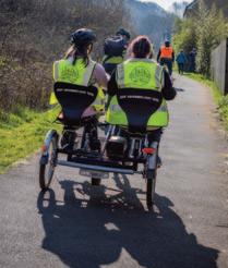
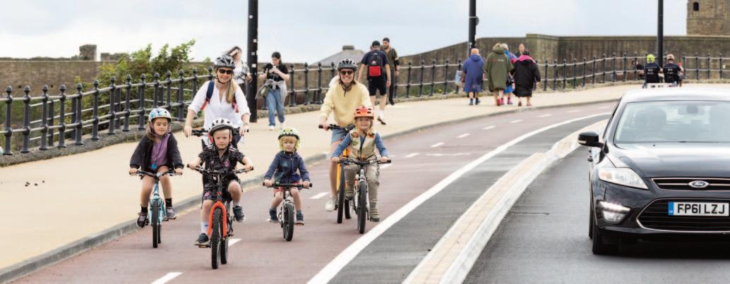
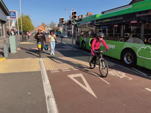
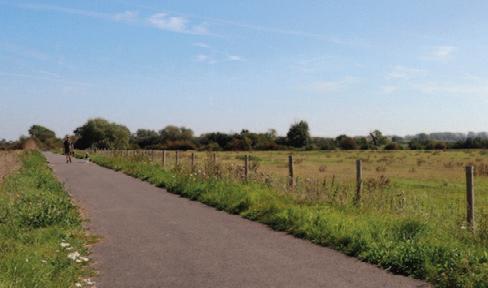
An 8km two-way route for pedestrians and cyclists along North Tyneside’s coastline is offering a safe, healthy and enjoyable way to access popular attractions as well as enabling everyday active travel journeys, writes Phil Freestone
The Seafront Sustainable Route (SSR) is more than just an infrastructure project. It represents a commitment to creating a cleaner, greener, and more connected community, celebrating the history of Tynemouth whilst providing high quality and inclusive connectivity for everyday active travel journeys for residents and visitors.
The 8km SSR was identified as a priority in the North Tyneside Local Cycling and Walking Infrastructure Plans (LCWIP) and included in the region’s Active Travel Strategy (NT01). It runs along the seafront from St Mary’s Lighthouse in Whitley Bay to Front Street in Tynemouth, connecting to Tynemouth Priory site and its 2,000 years of history on the headland.
From pop-up to permanent £11m of funding was secured from the previous Government’s Active Travel Fund and the charity Sustrans after a successful temporary pop-up scheme was implemented in 2020 during the Covid-19 pandemic. This formed part of social distancing measures, to deliver a revised, permanent scheme providing separate space for cyclists, walkers and wheelers, creating a permanent, segregated, continuous two-way safe space along the seafront.
North Tyneside Council and its design partner WSP have incorporated feedback from consultations to ensure the SSR design meets the needs of different stakeholders along the route. Almost 7,000 consultation responses in favour of the scheme were received, including a letter of support signed by over 50 doctors and health professionals recognising that the route will play a key role in promoting health and wellbeing – a key local and national priority and priority goal of the North East CA’s Strategic Transport Plan.
North Tyneside Council has worked with Sustrans and coastal emergency services to address access requirements. Rosslyn Colderley, the then Director for Sustrans in the North of England, said last year: “This is a fantastic example of how the local community led the campaign for a permanent, safe traffic-free route for walking, wheeling and cycling and were actively involved in the design process.”
North-East Mayor Kim McGuiness has publicly shared support for the scheme stating that the SSR is “such an exciting project that will help to make walking, wheeling and cycling safer and more enjoyable along our amazing coastline. The Route will be transformative for local people – boosting tourism in the area,
improving air quality and creating a well-designed space for active travel”.
Phase One of the scheme was completed in early summer 2024 and extends approximately 2km from Tynemouth town centre – a key hub for residential, employment, retail, leisure and tourism, to Beach Road. This provides a sustainable route to King Edwards Bay, Longsands beach and Tynemouth Park.
The scheme includes a permanent, safe, two-way route for pedestrians and cyclists, upgraded crossing points, and a permanent northbound one-way system for motorists from Tynemouth Front Street to Longsands beach to reduce risks for vulnerable road users, and introducing side road priority crossings throughout the route.
Phase Two is expected to be completed by July 2025, extending the route to Cullercoats, Whitley Bay and St Mary’s Lighthouse at its northern extent. It will support active travel access to key destinations including Spanish City, Whitley Bay Playhouse, The Links and local schools. The routes run in close proximity to Tynemouth, Cullercoats, Whitley Bay and Monkseaton Tyne and Wear Metro stations, supporting end-to-end sustainable journeys.
A 20mph limit has been introduced along the entire stretch between Whitley Bay and Tynemouth, supported by traffic safety measures to enhance route safety. Cyclists will have a dedicated section of the promenade between Grant’s Clock at Central Lower
Promenade and Spanish City, retaining the existing high-quality surfacing. NCN1 past Spanish City will be modified to tie into the widened and segregated path above the promenade.
The route features LTN 1/20 compliant segregated cycle paths with high-quality pedestrian facilities, within a 20mph traffic calmed zone. The previous shared-use path has reverted to a dedicated pedestrian footpath, with pedestrians retaining priority when crossing to/from the Sea Front footpath. Additional zebra crossings and new cycle stands further improve pedestrian and cycling facilities.
The scheme has received praise from Active Travel England (ATE), which were engaged throughout design development stages, acknowledging the close compliance with LTN 1/20 requirements throughout.
ATE Chief Executive Danny Williams said: “The SSR is a fantastic scheme that will create safer, seamless active travel options for thousands of residents and visitors to use for years to come. Enabling more people to walk, wheel or cycle to where they need to be is one of the most effective actions we can take to help build a happier, healthier and greener nation. We will continue to invest in great infrastructure projects like this one as we work to improve lives across the country.”
The SSR provides a major step forward for North Tyneside’s elected Mayor Norma Redfearn and the Cabinet’s pledge to create a cleaner, greener borough as part of its declaration of a climate emergency.
Creating segregated space for people of all ages to enjoy safely on forms of sustainable and active transport, such as bikes, skateboards and scooters, along North Tyneside’s beautiful coastline will further increase its appeal to visitors, supporting the local economy.
The scheme reduces conflicts between pedestrians and cyclists on shared footpaths and on-road cyclists and drivers along the seafront by creating a separate safe space for different modes.
It supports North Tyneside Council’s commitment to encourage more people to take up active travel and adopt a healthier lifestyle, improving health across the borough, as well as contributing to a shift to more sustainable modes of transportation. This scheme demonstrates a positive impact through:
l Increased trips made by sustainable travel modes for shorter journeys.
l Improved health outcomes through increased levels of active travel.
The scheme makes it easier for people to safely access popular attractions like St Mary’s Lighthouse, Spanish City and Tynemouth Priory as well as award-winning beaches, supporting local businesses as part of the recovery from the Covid-19 pandemic.
Mark Newlands, North Tyneside Council’s Senior Manager, said: “Amongst many other things, this project improves air quality, and promotes a healthier environment. Whilst it is a little early for analysing official usage data, the feedback has been overwhelmingly positive so far and our observations are that the new infrastructure is being well used.
“WSP worked collaboratively with the authority from initial concept through to the finished project to accomplish the objectives of the scheme. A challenging programme and site constraints were overcome through consistent and regular communication and a talented and committed team all working toward shared goals. ”
The SSR enhances the existing coastal section of the National Cycle Route 1 and improves access from other parts of the borough, serving local schools, workplaces. A future phase of work will also see it link to the new transport interchange recently completed at North Shields.
Scheme designs and results of the consultation exercise can be viewed here: https://tinyurl.com/mrytwvpb
A video of the SSR scheme can be found at: https://tinyurl.com/5ddjzzjc
n Phil Freestone is Technical Director at WSP.
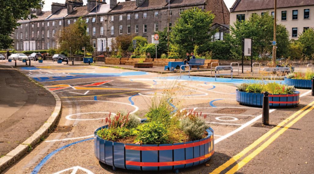
Traffic counts, air quality measurements, pedestrian and cycle monitoring, as well as community surveys, is producing a body of evidence outlining the benefits of a liveable neighbourhood in Edinburgh’s Leith district, writes Steven Blacklaw and Miles Wilkinson
Changes to traffic operations and the street environment in the Leith district of Edinburgh have achieved overall reduction in vehicle traffic across the area.
The Leith Connections project has also improved air quality and reduced noise pollution while increasing pedestrian and cyclist mode share and safety. Surveys undertaken have shown high levels of public support for the changes introduced.
All of this can be clearly demonstrated as a result of comprehensive monitoring and evaluation carried out by City of Edinburgh Council and its partners.
The project was implemented in 2023 in response to concerns from the community about the level of traffic in the area. Leith Connections was shaped by two years of extensive community engagement. The aim of the project was to improve streets and make it safer and easier for people to walk, wheel and cycle.
Monitoring and evaluation data strongly contributed to a decision by Edinburgh councillors to make the trial permanent in February 2025.
Leith - a vibrant and dynamic community
Leith is a historic and vibrant district in Edinburgh known for its rich maritime heritage, dynamic cultural scene, and strong sense of community. It remains one of the most densely populated parts of Edinburgh and has undergone considerable transformations in recent years including a new tram route. This growth, along with planned new housing and business developments, has driven the need to redesign infrastructure to accommodate historic, present and future pressures on the local network.
Walking, wheeling and cycling already represent a practical choice for everyday journeys for many residents of Leith, with large areas of employment, local centres, and amenities close to densely populated residential areas.
Compared with other areas of Edinburgh, Leith has low levels of car ownership and higher rates of use of active and public transport to travel. Building further connections to buses, trams and the city’s cycling network improve access to employment and leisure as well as attracting visitors to Leith’s attractions.
Cycle segregation and the associated pedestrian improvements on main arterial routes in the area are currently being designed and constructed to connect to the city’s existing cycle network.
Alongside the transport objectives of improving safety and attractiveness of active travel, the project is improving the overall streetscape and creating a more attractive environment with new public realm spaces.
Specific measures introduced included motor prohibitions and new bus gates to reduce through-traffic across the project area. These supported existing School Streets at two local primary
schools. Contraflow cycling was introduced on six one-way streets to expand the cycle network. Changes to junctions were made by reducing turning radii and implementing priority give-go operation to encourage slower, calmer driving.
New pedestrian crossing pavement buildouts and several dropped kerb and tactile improvements were also implemented to improve the pedestrian environment. Changes were made to street furniture, with footway decluttering of unnecessary signage and new public and secure residential cycle parking. In a number of areas additional seating was installed alongside planting in raised planters.
On-street artwork, inspired by themes of Leith’s industrial and cultural history and the maritime environment, was painted at each of the primary schools and an area of reallocated carriageway space.
Monitoring has been comprehensive and has gathered both quantitative and qualitative data. This included traffic counts, air quality measurements, acoustic surveys and pedestrian and cycle monitoring, as well as community surveys, market research, focus groups and discussions with key stakeholder groups.
This approach ensured a robust dataset that accurately reflected the neighbourhood’s dynamics. Data collection was strategically timed to capture variations across different times of the day and week, providing a comprehensive view of the project’s impact.
Traffic operation changes were made under an experimental Traffic Regulation Order allowing a trial period of up to 18 months. We monitored a range of data sets collected before implementation and then at 6 and 12 months to assess the impact of the proposals.
Across project monitoring locations pedestrian numbers increased by a total of 20% and cyclist numbers by 77% between the baseline and 12-month monitoring counts. Sandport Place Bridge over the Water of Leith was made accessible to pedestrians and cyclists only and continuous automatic monitoring has been undertaken for almost two and a half years. Counts for comparable months show a year-to-year monthly increase of up to
17% for pedestrians and up to 69% in people on cycles since closure to motor traffic. A large increase in “Buggy” classification covering wheelchairs, prams, cargo bikes/ trailers were also counted by the counter.
Motor traffic surveys have found an overall reduction in motor traffic since pre-pandemic levels on boundary and internal streets and also a reduction in traffic levels post-implementation of the changes made in 2023. Streets monitored that are no longer usable as through traffic routes recorded an overall reduction in traffic of 79.2% and a reduction in weekday average 85th percentile speeds at seven out of 10 monitored sites.
Representative independent market research showed that by the end of the trial 74% of residents support the project changes and 6% oppose, with 20% either saying they are neutral or don’t know. This shows an increase in support from the previous surveys.
Community engagement was key in the early development and also evaluation process. Initial engagement work involved co-design workshops to identify local issues at an early stage and gain public buy-in for the process and project.
We held public meetings to gather feedback and address concerns, ensuring transparency and empowering residents to actively shape their environment. This feedback loop was instrumental in making iterative improvements to the liveable neighbourhood design, ensuring that the project met the community's needs and expectations.
Traffic modelling also played a crucial role in the design process. The design team simulated various scenarios and used these to predict potential outcomes of different traffic management strategies.
Following implementation, market research by an accredited organisation showed upward trends in positive views of walking, wheeling and cycling conditions is also evident but importantly also increases in support for views that people “regularly stop and talk to people in this neighbourhood”, that there are “enough places to sit and relax within the streets”, and that “it’s pleasant and safe to cycle in this neighbourhood”.
The initiative aligns with broader urban development and City of Edinburgh Council goals by promoting sustainable transport, enhancing public spaces and fostering economic growth. The project is key in helping to deliver the city’s ambition to achieve a net zero, climate ready Edinburgh by 2030 by implementing the City Mobility Plan. The project's success demonstrates the importance of integrating environmental, social, and economic considerations into urban planning. By doing so, cities can create environments that are not only liveable but also resilient and adaptable to future challenges.
The extensive monitoring and evaluation data clearly shows that the project has reduced and slowed down traffic through the neighbourhood, as well as improving conditions for walking, wheeling and cycling, all helping mode shift for local journeys. The opportunity created by reducing motor vehicle dominance and reallocation of carriageway space has created a better street environment for all residents, businesses, and visitors providing new places to spend time and spaces where children can play.
n Steven Blacklaw is Associate Director, Transportation, EURUK & Ireland at AECOM. Miles Wilkinson is Senior Project Manager, City of Edinburgh Council.
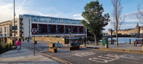
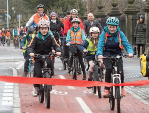
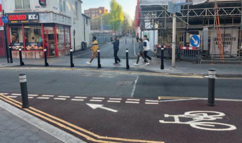
The opening of a walking, wheeling and cycling link through Edinburgh city centre has resulted in a dramatic increase in people travelling by bike while also proving popular with pedestrians, writes Neil Brownbridge
The CEC / AECOM design team closely adhered to the aspirational design standards set out in Edinburgh Street Design Guidance to genuinely prioritise active travel and safety through the city centre. Examples of the step-change infrastructure to facilitate increased walking and cycling include:
l 2.4km of segregated cycle tracks
l 4.1km of resurfaced footways
l 13 new and 10 improved pedestrian-only crossings
l 8 new and 9 improved pedestrian and cycle crossings
l 10 new ‘continuous footway’ side road crossings, giving pedestrians and cyclists priority crossing side roads
l The creation of large new public realm spaces at Roseburn (Rejuvenating Roseburn) and Melville Crescent
l An innovative Taxi Rank Call-Forward system at Haymarket Train Station.
A safe, direct and largely segregated cycle route through the heart of Edinburgh is changing travel behaviour, with a significant rise in cycling among residents living near the scheme.
The £23m project, which was completed last year, has also resulted in a significant increase in pedestrian satisfaction on key streets in the city centre.
City Centre West to East Link (CCWEL) connects transport interchanges, businesses, neighbourhoods and the wider cycle network while enhancing nearby public spaces. The scheme has transformed the streets for those walking, wheeling and spending time there, with demonstrable positive outcomes.
The new route is suitable for both regular and less confident cyclists, providing protection from busy traffic along key streets and filling a critical gap in the city’s cycle network. The project has also provided significant improvements for pedestrians including new and upgraded pedestrian crossings, footway upgrades and ‘placemaking’ improvements developed in close collaboration with the local community.
Why is CCWEL needed?
Transport is the single biggest contributor to greenhouse gas emissions in Scotland and one of the largest contributors in Edinburgh. With the city’s population projected to reach nearly 600,000 by 2040, pressure on urban infrastructure and the need for sustainable travel options will only continue to increase.
CCWEL has been delivered by City of Edinburgh Council (CEC), funded by the Scottish Government, supported by partners including Sustrans and Transport Scotland, designed by AECOM, and constructed by Balfour Beatty. It represents a crucial step towards transforming how people move across the city, contributing to modal shift as set out in CEC’s City Mobility Plan.
The project corridor runs through Edinburgh’s UNESCO world heritage site and the scheme designs were carefully tailored to celebrate and enhance the city’s unique built environment. This included restoring setted streets, replacing faded modern street furniture with historically accurate features, and protecting special aspects of the built environment, enabling residents and visitors to enjoy the amazing sights that Edinburgh has to offer by walking, wheeling and cycling.
Mitigating delivery risk, in particular utilities and a network of Georgian underground vaults, were identified early as a high risk to programme and budget. A dedicated Utility Liaison Engineer led the interface with providers, arranging comprehensive site investigations and coordinating revised designs and construction strategies to mitigate cost and impact.
Positive outcomes
Monitoring and evaluation of the CCWEL project is ongoing with very positive initial results published at the end of January 2025. Key findings include a significant increase in cycling of between 29% and 99% on affected streets; a significant increase in pedestrian satisfaction on key streets; a 50% increase in the proportion of residents living near the scheme who cycle as their main mode of travel to work (up from 8% to 12%); and an almost doubling of children at Roseburn Primary School indicating they were more likely to cycle to school (up from 13% to 24%).
Karen McGregor, Scotland Director for Sustrans, said: “[CCWEL] is an absolute game-changer within the world of active travel. For the first time ever in Scotland, we’ve delivered a fully segregated walking, wheeling and cycling connection that cuts through the heart of the city centre.”
https://www.edinburgh.gov.uk/ccwel/
n Neil Brownbridge is a Regional Director at AECOM.
The A50 Fiveways scheme in Leicester has been simplified to re-route through-traffic, improve bus movements as well as making it easier and safer for pedestrians and cyclists, Andy Salkeld reports
A £10.4m scheme has been introduced on one of Leicester’s busiest arterial routes with the aim of cutting traffic levels. It is anticipated that the project will help reduce the amount of traffic using Woodgate and Frog Island – at the heart of the Waterside development – by up to 30% in coming years, helping to significantly improve traffic flow and cut congestion.
The A50 Fiveways Improvement Scheme, completed in autumn 2024, involves A-road route reassignment and roadspace reallocation to improve the busy route for all road users including work to revamp the main junction linking Blackbird Road, Woodgate, Fosse Road North, Groby Road and Buckminster Road.
Complementary work on Woodgate, Northgate Street and Abbey Gate was completed in January 2025.
The A50/Fiveways improvement scheme was paid for through a mix of Enterprise Zone funding through the Leicester and Leicestershire Enterprise Partnership (LLEP), and the Transforming Cities Fund delivering an ambitious package of work focused on major sustainable transport and active travel improvements for walking, cycling and buses.
Leicester City Mayor Peter Soulsby said: “For many years, Fiveways had been one of the most confusing junctions in the city. It was complicated for motorists, daunting for people walking, wheeling & cycling and a pinch point causing delays for local bus services. This major investment has simplified the key junction & corridor for drivers, made it much safer for pedestrians and cyclists, allows buses to move more quickly as well as making the area more attractive place for residents.”
Martin Fletcher, Leicester City Council director of highways, described Fiveways as “a complex and ambitious improvement scheme. Delivered on schedule”.
Wider footpaths, safer cycleways and outdoor café seating areas on a busy shopping street in Leicester has improved the route between the city centre and the railway station, writes Andy Salkeld
A major revamp of Granby Street, a busy shopping street in Leicester, has seen the widening of footpaths to create more space for pedestrians.
This has seen a new layout on the stretch of Granby Street between the inner Ring Road and Rutland Street/Belvoir Street. Former pay and display parking bays along Granby Street, which were taken out of use during the Covid-19 pandemic, have been converted into wider, high-quality footpaths with space for outdoor cafe seating areas and to help improve the route between the pedestrian priority zone and the railway station.
The works are part of wider, ongoing investment to improve the street scene and shopping environment of Granby Street. This includes the restoration of the landmark Grand Hotel building facade and its historic shopfronts, funded through the city councils successful bid for High Street Heritage Action Zone funding from Historic England.
Cllr Geoff Whittle, assistant city mayor for environment and transport, said: “Granby Street is an important gateway into the city centre and a busy shopping street.
“These ongoing improvements will help create a more attractive route for walkers, wheelers and cyclists with more space for shoppers and cafe-style seating. Alongside the major heritage led investment in restoring landmark buildings, this work will help make Granby Street feel safer and more welcoming to all.”
A final phase of work – recently completed – permanently closed the junction of Dover Street and Granby Street to motor vehicles, to help further improve pedestrian safety. A new turning facility on Dover Street will be created to ensure that vehicles can continue to access nearby businesses and attractions including The Little Theatre.
Council.
York’s transport strategy includes plans to repair, maintain and improve pavements and cycle paths across the city
City of York Council is working to reduce car dependency; improve walking, wheeling and cycling infrastructure; create healthy and climate-resilient places; and deliver regular, reliable bus services, all of which are core aims in its Movement & Place Plan, says Kate Ravilious
Transport touches everybody’s lives. It’s an emotive topic, and all too often our travel experiences are a source of frustration and stress. York is no stranger to these problems. The city’s 200,000 residents and 9 million annual visitors find their movement around the city dictated by the roads and networks that dominate our city. Whether nipping to the shops, sitting in congestion on the outer ring road, visiting the Christmas market or getting to work on time, our streets constrain our lives, creating traffic congestion, poor air quality, noise pollution and acting as artificial barriers that influence how we connect with our neighbours and live our lives.
Developing York’s transport strategy started by recognising the problems we face and drawing up a vision centred around four key council priorities: Equalities, Affordability, Climate and Health.
Our vision
We want to create a York that is open and accessible to everyone, with affordable and healthy transport options no matter where you live. We also want our transport networks to enhance our wonderful city and its villages by actively improving the health of residents, supporting a thriving economy, enhancing green spaces and respecting York’s heritage. And all of this needs to happen with an eye to the future; ensuring that our transport systems are resilient to the changes ahead and help to tackle climate change.
Core to our strategy is the understanding that transport is not simply about getting people from A to B; it’s about what happens along the way. Rethinking how we move around gives us an opportunity to create valuable new public spaces, highlight our
heritage, bring birdsong to our neighbourhoods and help our city to prosper.
But fine words and wishes only get you so far.
We knew that delivering real transformation would require clear objectives and targets, and that these would need to tie in to our other council strategies so that everyone across the entire organisation was pulling together towards the same goals. We also knew that we would need the support of our residents and businesses and that we needed to understand their needs and listen to their concerns.
With this in mind we went out to the city and sought their views on ten proposed transport policy areas. It was one of the largest public engagement exercises on transport in York in over a decade, gathering the views of 2,500 people. We held over 50 consultation events across York and its villages and made a particular effort to reach out to groups who are often under-represented in public consultations, including schoolchildren, students, disabled advocacy groups and older people.
Reassuringly, the results of the consultation confirmed that the majority of York’s citizens shared our vision, with over 70% support for all of the ten policy focus areas: accessibility; improving walking, wheeling and cycling; shaping healthy places; improving public transport; safeguarding our environment; creating a Movement & Place Plan for the city; reducing car dependency; improving freight and logistics; effective maintenance
and enforcement; and monitoring the transport network and financing the changes.
We also used interactive maps to enable people to highlight where they faced the greatest challenges in moving around the city and this gave us hugely valuable data, with people able to share their local knowledge and help us understand the barriers to travel in different neighbourhoods.
In many ways the findings from our engagement were not surprising, and we know that many other urban areas face similar challenges. Part of our consultation asked people which cities they felt managed traffic and transport better than York. Although respondents identified some cities which are perhaps different to York – for example capitals like London or Amsterdam which are bigger and better resourced than York – many people identified cities which are broadly similar to York in terms of their size and character or location – such as Oxford, Cambridge, Bath, Chester, Copenhagen and Ghent. We recognised that there was no need to reinvent the wheel, and that other cities can serve as an inspiration for York. For example, in Ghent a new traffic circulation system reduced city centre traffic by 20%.
As well as listening to residents and businesses, we also recognised that a transport strategy has to consider how the city is changing and take into account the needs of people travelling from outside the city’s boundaries. Tourism is a mainstay of our economy and we welcome over 9 million visitors every year. Nearly a third of the vehicle trips in York either start or end outside the City of York Council area. One in five vehicle trips in York is merely passing through and not stopping in the city at all..
We also needed to create a transport strategy that was futureproofed, to accommodate the planned growth of the city. Our recently approved Local Plan includes some significant development sites and we are likely to see our city’s population grow by over 7% in the next decade.
And our strategy also needed to be able to adapt to changing governance arrangements, with York recently becoming part of the York and North Yorkshire Mayoral Combined Authority. This brings new opportunities but also challenges, as well as a need to think at a different scale.
Finally, our strategy needed to help make York more resilient to
all modes of travel
the challenges posed by climate change. We are already a city that is experienced in dealing with the disruption caused by flooding, but we recognise that greater challenges lie ahead and our transport strategy needs to reduce our city’s carbon footprint and help us adapt to better cope with extreme weather.
In 2019 City of York Council pledged to become carbon neutral by 2030, through a 71% reduction in transport carbon emissions. We know that we can’t simply rely on the adoption of electric vehicles to achieve this. Instead, our climate change strategy has demonstrated that to achieve our carbon targets by 2030 we need to increase the number of people travelling by bus and train by 50% and double the number of trips taken on foot or by cycle by 2030. At the same time, we need to reduce the number of miles driven by 20% by 2030.
Pulling all of these threads together enabled us to develop a strategy that is centred around making better use of the infrastructure we already have. Widening roads and enlarging junctions is often impossible in York, and even in the locations where this is an option it is rarely a solution for traffic congestion, with clear evidence that road expansion leads to more vehicle traffic (a term known as induced demand). Instead, our transport strategy reallocates road space to make our existing infrastructure work harder for us.
Bus priority measures will produce regular, reliable bus services for York and beyond, cutting through congestion and providing a genuine alternative to taking the car.
Reviewing speed limits will cut the number of deaths and serious injuries on our roads.
Implementing a parking strategy will make best use of our highways, providing residents with car parking and encouraging visitors to use our Park & Ride.
Defining a freight network will improve air quality, protect our heritage buildings and reduce the wear and tear on our roads.
And repairing, maintaining and improving our many miles of pavements and cycle paths will create year-round safe, connected routes for walking, wheeling and cycling, giving independence to those who don’t have access to a car.
Central to the strategy is the Movement and Place Plan – a citywide circulation plan, which will map out connected networks for all modes of travel and identify how best to balance the needs of streets as travel corridors and as places where people live, shop, go to school and enjoy their leisure.
Our transport strategy was adopted in the summer of 2024 and has been well received. Since then, we’ve developed an implementation plan for the next two years and started to bring forward some of the schemes and measures that will help to underpin our Movement and Place Plan.
We know that we need to be bold and that we can’t please everyone. But we also recognise that doing nothing is not an option. We’re excited to be embarking on a transport strategy that will be transformative for the city, giving everyone greater access to opportunities, healthier places to live and safeguarding our city’s future.
n Kate Ravilious is Executive Member for Transport at City of York Council.
MP Smarter Travel has been working with Lambeth Council to develop a strategy that ensures that the layout of roads, parks and transport facilities are inclusive and take account of the needs of disabled people. The London borough is seeking to reimagine street space so everyone can experience the freedom to move and travel about more actively and independently.
Over the past 20 plus months MP Smarter Travel and Lambeth Council have formed an Accessibility Working Group (AWG). Lambeth Council asked MP Smarter Travel to form the group to help their planners design infrastructure that makes walking, wheeling and cycling around the borough easier for everyone.
The group is made up of ten Lambeth residents living with a range of disabilities, including visual and mobility impairments as well as neurodivergence.
Using the group’s feedback, the council has been able to address common accessibility barriers. This includes ensuring bins and street furniture are put in the right place so they do not obstruct the pavement.
To ensure inclusivity is embedded in Lambeth Council’s planning process well into the future, officers at the council attend the AWG sessions to learn about accessibility and common barriers that prevent many disabled people from travelling independently. These learnings will be integral to how Lambeth Council makes the borough’s street environment inclusive and a place where everyone is able to travel freely.
Our team facilitates monthly AWG meetings and site visits. Members of the group give invaluable insight into issues such as why certain junctions are problematic to navigate for wheelchair users.
Other design aspects we have looked at with the AWG include colourful crossings and where colour can work positively and negatively for some disabled people. Signage, continuous footway design, Low Traffic Neighbourhood design and positioning of benches and bins are other issues that the group has given their
Lambeth Council and MP Smarter Travel have formed an Accessibility Working Group to ensure that new street layouts do not present barriers for disabled people who want to get around independently, writes Lauren James
People with disabilities often don’t feel like they’re involved. It is nice to feel useful, included and involved in decision making.
It’s good to know that Lambeth are taking on board what we are saying and it’s good to see that some of the changes have already been implemented. It makes me feel like some people are listening.
feedback on. The group has also given valuable insight into bench design, for example, how armrests and a back to the bench can make life easier for some people to sit down and take the weight off their feet.
We collate all the feedback and ideas from the AWG and have it reviewed by a highways engineer so that the design ideas adhere to planning guidance and legislation. Finally, we present the findings and recommendations to Lambeth Council for them to progress through the usual democratic process.
As the council continues to create a borough where it’s easy for everyone to walk, wheel and cycle their everyday journeys, disabled people, along with all their fellow residents, will increasingly be able to benefit from the associated health, wellbeing and economic upsides to active travel.
n Lauren James is Head of Engagement and Behaviour Change at MP Smarter Travel.
The National Centre for Accessible Transport aims to close the ‘transport accessibility gap’ by working with disabled people and the transport sector to remove barriers such as parked cars, poorly designed pavements and kerbs, say Natasha Healey and Indigo Ayling
Right now, disabled people make 38% fewer journeys than nondisabled people – a figure that hasn’t changed in the last decade. This ‘transport accessibility gap’ tells us that change is needed so that disabled people can travel with ease. Nearly a quarter of the UK’s population are disabled, which means the transport accessibility gap impacts millions of people.
In 2023, the National Centre for Accessible Transport (ncat) was set up to help reduce this transport accessibility gap. By working with disabled people and the transport industry, ncat aims to drive change.
ncat’s recent Understanding and Identifying Barriers to Transport report explored the barriers disabled people face when travelling on different modes of transport, based on feedback from 1,195 disabled people. Some 92% of disabled people experience barriers when travelling, which makes it difficult for disabled people to access services, information or physical spaces. The report shows that the needs of disabled people using active travel and streets have long been overlooked:
l Pavement and kerbs are poorly designed. Inaccessible streets and pavements are the biggest barrier to disabled people when travelling. This impacts 65% of disabled people who walk, wheel, cycle or scoot.
l Things on the street get in the way, such as advertising signs and parked cars. This impacted 59% of respondents.
As one disabled person shared: “I have experienced ongoing problems with shopkeepers placing their signs on the footpath,
just giving enough space for pram users and pedestrians just enough space to get past, but not enough for mobility scooter, and then [the shopkeepers] stand laughing.”
These barriers have a ripple effect on disabled people’s lives. Disabled people travel less, and journeys take longer. Some 77% of disabled people said that transport barriers have a negative effect on their wellbeing and 3 in 4 disabled people said that they make them feel stressed.
While the Government’s Integrated National Transport Strategy and its vision to put people at the heart of transport is welcome, disabled people must be part of this. We all must embed accessibility into our transport decisions from the start. By giving disabled people a voice in how our streets and active travel services are run, we can ensure everyone can enjoy the benefits of active travel.
ncat’s research is based on feedback from ncat’s Community for Accessible Transport (CAT) Panel. This panel is open to anyone with an interest in accessible transport to share views about what transport is like and what improvements could make things better. Sign up to the panel and find out more about ncat by scanning the QR code below.

n Natasha Healey is Associate Director - Future Mobility at WSP. and Indigo Ayling is Associate Director of Research at the Research Institute for Disabled Consumers.
ncat is delivered by a consortium of organisations that includes Coventry University, Policy Connect, The Research Institute for Disabled Consumers (RiDC), Designability, Connected Places Catapult and WSP. It is funded for the period 2023 - 2030 by the Motability Foundation.
Understanding and Identifying Barriers to Transport https://tinyurl.com/mvrzx83m
The Transport Accessibility Gap - Motability https://tinyurl.com/4kfuzkum
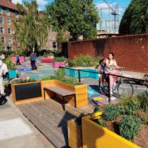
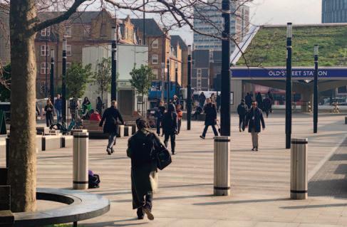
The removal of Old Street’s gyratory system has seen a traffic-dominant area transformed into pedestrian and cyclist-friendly links and public spaces, according to Paul Tagliarini
The Old Street Public Realm Project emerged from Transport for London’s ‘Better Junctions’ initiative, transforming the roundabout island into a two-way junction by removing traffic from the northwest section. This reclaimed public space and naturally extended an existing tree-lined ‘Promenade of Light’, serving as a gateway to the new London Underground station entrance.
A key objective of the design was to make significant improvements for non-motorised users. The new layout incorporates segregated cycle lanes with an early release arrangement at signalled junctions to prioritise cyclists ahead of other vehicles, enhancing cycle safety. This is complemented by several bicycle repair stations to help keep cyclists on the move. Additionally, 40 new cycle parking stands have been installed, along with the integration of 34 Santander Cycle Docks, providing a variety of options to encourage and support cycling in the vicinity.
The generous new pedestrian space, created as a consequence of the gyratory removal, leads directly from the new station entrance, and provides a safe, seamless, comfortable and attractive pedestrian environment. Previously access to the station was via much less appealing underpasses. The old underpass network has been replaced with wide street-level crossings, creating a more friendly environment for cyclists and pedestrians, making travel to and from the station much more inviting. Some of the underpass voids have also been repurposed as rain gardens with tree and ground cover planting.
The seating arrangements in the public realm provide opportunities for social interaction. This features enclaved seating and urban picnic tables, spaces for wheelchairs, and seats with armrests, backs, and various heights to ensure a fully inclusive environment. Hostile Vehicle Mitigation measures have been incorporated seamlessly, without cluttering the overall space and creating a safer environment.
Further enhancing the environment for users, a variety of planting has been incorporated, which also has the added benefit of being part of a comprehensive drainage management system, featuring permeable paving, 115m³ sub-pavement water storage, and rain gardens. These elements work together to filter, and in heavy rainfall events store water in the ground so it can be discharged into the drainage network at a controlled rate, significantly reducing surface water flood risk. The site, once heavily constrained, is now recognised by TfL as a flagship project for SuDS (Sustainable Urban Drainage Systems), winning TfL’s
Outstanding Environmental Initiative Award.
Approximately 195m² of the paving is photocatalytic, removing harmful nitrogen oxide from the environment, converting it to nitrate and providing fertiliser to the plants via surface water runoff into the rain gardens. The planting within the scheme has been carefully selected for its air-purifying properties.
The project enhances biodiversity with tree planting, rain gardens, and a vibrant 165m² green roof for the main station entrance. A mix of native and non-native tree and shrub species, as well as herbaceous perennials have been planted.
The tree species have been chosen for their successful establishment in the local area addressing the lack of vegetation in this part of central London. This commitment to greening increases the site’s overall biodiversity value, providing habitat diversity and supporting wildlife. This aligns with the Healthy Streets initiative and London Plan guidelines (G5 Urban Greening).
The project has repurposed the existing site to cater to the diverse needs of local people, transforming a vehicle-oriented area into a network of welcoming and dynamic pedestrian and cyclistfriendly links and public spaces.
This project was led by TfL, with Morgan Sindall and WSP contributing to its construction and design, respectively.
n Paul Tagliarini is Landscape & Urban Design Associate Director at WSP.
A 10-year active travel network plan has been developed in Kent that identifies priority routes, fills gaps, and integrates with existing district-level strategies, report Elena Kuskova and Emmet Ruxton
The Kent Cycling and Walking Infrastructure Plan (KCWIP) has laid the foundations for funding and future investment, helping to accelerate the delivery of key cycling and walking schemes across the county.
Infrastructure consulting firm AECOM worked with Kent County Council (KCC) to develop KCWIP, an ambitious, countywide strategy designed to transform active travel across Kent. While most Local Cycling and Walking Infrastructure Plans (LCWIPs) focus on individual towns and cities, KCC recognised the need for a more connected approach, linking rural and urban communities to ensure safe and accessible walking and cycling routes for all residents.
Our team led the development of the KCWIP from inception to completion, creating a 10-year plan that identifies priority routes, fills network gaps, and integrates with existing district-level LCWIPs.
Covering 1,368 square miles and serving a population of over 1.5 million, the KCWIP provides a strategic framework for improving active travel connectivity across the county, linking key destinations such as transport hubs, employment sites, schools, and hospitals.
A major challenge was adapting the standard LCWIP methodology, which is typically geared toward dense urban areas, to a county-wide scale.
We developed a bespoke approach that ensured rural areas were not overlooked, prioritising connections between towns, villages and transport interchanges. Additionally, we ensured that the KCWIP complemented and enhanced existing district LCWIPs, creating a seamless, joined-up network across Kent and beyond, with strategic links to London, Medway, Surrey, and Sussex.
Stakeholder engagement was at the heart of this process. AECOM led extensive consultation, including a six-week public engagement period that gathered more than 1,000 comments from residents, businesses and local organisations. This valuable input helped shape the final plan, ensuring it reflects local needs and priorities.
LCWIPs have emerged as a key tool for local bodies in identifying investment opportunities in active travel infrastructure, the preparation of funding bids and the preparation of documents such as Local Transport Plans. Alongside this, they represent a significant step-change towards a commitment to the provision of comprehensive networks of high-quality, safe and coherent walking and cycling networks across the UK.
The KCWIP provides a strong foundation for securing funding and guiding future investment, helping to accelerate the delivery of key cycling and walking schemes across the county. By setting out a clear and ambitious action plan for the next decade, KCC has demonstrated its commitment to delivering a high-quality, joinedup active travel network that connects people and places.
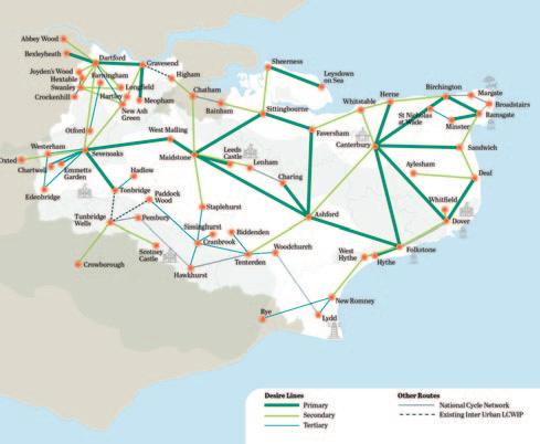
The strategic framework for Kent improves active travel connectivity across the county, linking key destinations such as transport hubs, employment sites, school and hospitals
We have noticed that following the development of the KCWIP, borough councils have begun incorporating its proposed routes into their own LCWIPs, further strengthening Kent’s active travel network. In some cases, local authorities have even expanded on the KCWIP’s proposals, developing additional routes along key corridors identified as desire lines in the KCWIP. This will help to unlock new funding opportunities and accelerate the delivery of strategic cycling and walking infrastructure across the county.
AECOM continues to support KCC in taking the KCWIP forward, helping to prioritise interventions, secure investment, and move towards implementation. The delivery of this strategic network will provide significant benefits, offering people better travel choices, supporting public health and safety, and addressing gaps in active travel provision.
AECOM delivers professional services throughout the project lifecycle – from advisory, planning, design and engineering to program and construction management.
On projects spanning transportation, buildings, water, new energy, and the environment, our public and private-sector clients trust us to solve their most complex challenges.
n Elena Kuskova is Principal Consultant, Masterplanning & Urban Space and Emmet Ruxton is Regional Director, Technical Excellence Lead at AECOM.
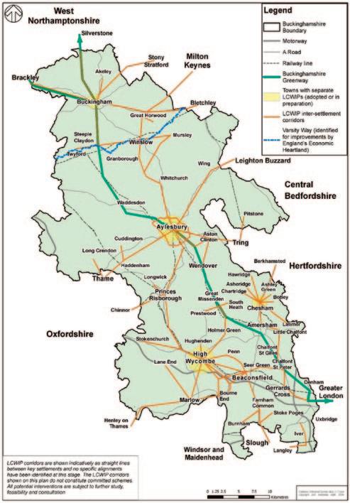
A network of routes is planned for Buckinghamshire to improve access to education and employment, public transport links, shops and leisure and tourist sites, writes Jonathan Fuller
Buckinghamshire Council has developed and published an ambitious plan for active travel routes across the county.
Its vision is for an active travel network that improves access to education and employment; connect to local bus and rail networks, enabling multi-modal low-carbon trips; and serve as a local leisure asset, linking key tourist destinations.
At the core of this network is the Buckinghamshire Greenway. Running from Buckingham and Silverstone in the north to the Colne Valley and the Grand Union Canal (NCN6) in the south, the Greenway will be split into discrete route sections to enable progressive delivery as and when necessary funding and consents are secured. Each section acts as a key inter-settlement link, as well as forming part of the wider countywide route.
Buckinghamshire is a predominantly rural authority in the South East. The Chiltern Escarpment runs through the centre of the county, marking the point where the undulating landscape in the north gives way to the Chiltern Hills, which extend southwards to the Thames Valley. With an abundance of villages and dispersed settlements, Buckinghamshire Council has a vision to deliver a network of Greenways to help link its communities to employment, education and key transport links and leisure and tourism opportunities. This vision has informed the council’s recently adopted Buckinghamshire Local Cycling and Walking Infrastructure Plan (LCWIP), which sets out the blueprint for a countywide active travel network with the Greenway at its heart.
The first section of the Greenway was delivered in 2018 between Aylesbury Vale Parkway Station and Waddesdon Manor (Waddesdon Greenway), with the section between Wendover Dean and Great Missenden (Misbourne Greenway) due to open in 2025. This route section is being delivered by Sustrans in partnership with the council and the Chiltern Society.
The alignment of HS2 intersects with the Buckinghamshire Greenway in several locations. The council has secured agreement with the Department for Transport (DfT) and HS2 Ltd to ensure that HS2 designs incorporate the Greenway alignment at each of these interface points in order to futureproof the route.
Traditional business case appraisal methods are often unable to capture the full benefits offered by rural active travel schemes. The Council has been working with consultants PJA to develop highlevel strategic business cases for discrete route sections of the Greenway which illustrate the range of benefits that they can generate.
The Greenway forms the core spine of the Buckinghamshire LCWIP network and provides opportunities for connectivity with surrounding settlements.
Working with consultants WSP, Buckinghamshire Council has developed and adopted an ambitious countywide LCWIP. The Buckinghamshire LCWIP supports progress on the council’s Climate Change & Air Quality Strategy. It sits alongside existing town LCWIPs adopted for Aylesbury, Buckingham and High Wycombe and will support the Council’s emerging Local Plan for Buckinghamshire (LP4B) and Local Transport Plan 5 (LTP5).
The Buckinghamshire LCWIP represents a strategic approach to planning walking, wheeling and cycling improvements that:
l Seeks to recognise and build upon the networks and proposals contained in the Council’s existing and emerging town LCWIPs
l Identifies priorities across the wider Council area not covered by LCWIPs, focusing on connections (‘corridors’) between settlements – links ‘to and through’ towns and villages, providing new or improved connectivity
l Indicates where local settlements and networks could connect with the Buckinghamshire Greenway
l Considers connections that could support walking, cycling and wheeling
l Considers places in neighbouring authority areas close to the county border, which generate travel demand into and out of the county
The Buckinghamshire LCWIP outlines a proposed network that has been shaped by a tailored methodology, which blends data and engagement with councillors and local stakeholders and residents. Firstly, digital software was used to calculate the likely scale of
trips by active travel, which could be enabled between locations if high-quality infrastructure was in place. This data analysis was informed by national and local insight. It considered links from towns and villages to key journey destinations including community facilities; employment; education; public transport (rail/bus); shops; and leisure and tourism sites.
To calculate journey demand, consideration was given to existing homes and allocated development sites in existing adopted local plans.
Secondly, input was invited on local aspirations for active travel improvements, resulting in an extensive list of aspirations across Buckinghamshire.
These aspirations were added into the digital mapping software and analysis. A series of local workshops we held with councillors identified priority corridors, which would enable high numbers of active travel journeys and were aligned to local aspirations for improvements. This analysis and engagement was completed at defined local geographical levels to ensure that the Buckinghamshire LCWIP took into account local active travel priorities.
Thirdly, the draft Buckinghamshire LCWIP was progressed to consultation in Autumn 2024. The consultation results indicated more than 80% of respondents were supportive of the proposed Buckinghamshire Greenway and Buckinghamshire LCWIP network.
The adopted Buckinghamshire LCWIP network proposes over 60 corridors, incorporating the Buckinghamshire Greenway spine and improvements to the Varsity Way being promoted by England’s Economic Heartland. The corridors identified within the LCWIP will now be taken forward for further development and will be subject to further design work and engagement, subject to funding availability.
The council is working closely with partner organisations across Buckinghamshire to bring the Greenway and LCWIP to life. This includes work with other public bodies, neighbouring local authorities, town and parish councils, local and national charities, third-party landowners, local businesses and developers where relevant.
An example of this partnership working is the St Peter’s Greenway in Aylesbury, whereby the council worked with the Buckinghamshire Conservation Trust to design and deliver a 1.7km off-road Greenway route between new development areas,
passing a scheduled ancient monument and crossing land on a flood plan with farming use and nature conservation interests. Partnership working ensured consideration was given to how, through the design and location of gates, the site would be protected and enable sheep grazing to continue unimpeded while allowing the free flow of pedestrians and cyclists. The St Peter’s Greenway has been highlighted by Active Travel England as a case study of good practice in rural active travel infrastructure design.
n Jonathan Fuller is Principal Transport Strategy Officer, Planning, Growth and Sustainability at Buckinghamshire Council.
Buckinghamshire LCWIP: https://tinyurl.com/3sunwz9p
Buckinghamshire Greenway: https://tinyurl.com/p8c5buzr
St Peter’s Greenway, Aylesbury: https://tinyurl.com/yuxj28dj
Initial feedback to a social prescribing project has revealed a wide array of positive impacts for those taking part. Those given referrals have reported: pain reduction, weight loss, improvements in mental health; increased physical activity levels; new social connections and opportunities; confidence to use public transport; and returning to employment or find their first job.
The Active Way is Bath and North East Somerset Council’s Active Travel Social Prescribing Project is a three-year pilot, which has increased in demand since starting to deliver activities in March 2023
The pilot, which is funded through Active Travel England and the UK Government, has delivered more than 1,600 activities in its first year.
Strategic Transport and Public Health teams within the authority are working together to offer walking, wheeling and cycling activities through health settings and social prescribing link workers. The aim is to improve people’s lives through positive interventions.
Bath and North East Somerset were one of 11 local authorities awarded funding to:
l Address local community identified need relating to underrepresented groups, high levels of deprivation and health inequalities
l Actively promote increased levels of physical activity through cycling and walking
l Demonstrate clear links between infrastructure development and the proposed social prescribing schemes
l Support modal shift to active travel providing people with travel choices and supporting changes in behaviour
The project also aims to:
l Promote social prescribing into a range of active travel interventions
l Offer a broad cycling, walking and wheeling offer with interventions for all age groups and needs
l Emphasise building people’s confidence, motivation, knowledge and skills to engage with walking and cycling activities long-term
The pilot is in the Somer Valley, an area to the south of Bath. Compared with other areas in the district it has a higher level of
Participants of a social prescribing project run by Bath and North East Somerset Council are reporting significant boosts to activity levels, wellbeing and quality of life, writes Timothy Rawlings
deprivation and health inequalities, and lower than average levels of physical activity. Alongside this, the area has high car ownership and limited public transport options., making it a good location for the pilot.
What has helped is the area has an abundance of accessible green spaces, a good network of traffic free routes and the potential to make a big difference with well-connected communities and established local organisations.
The project set out to meet the needs of specific target groups:
l People living in deprived areas with low levels of physical activity
l People with long term conditions
l Under-represented groups
l People with multiple morbidity
l People with disabilities
l People suffering from anxiety and lack of confidence
l People not in education, training or (well paid) employment
l Ethnic minority groups (Global Majority)
We manage a wide range of activities (see panel) which are offered through a referral process. This includes being part of a primary and secondary care partnership, along with a community and voluntary sector network through a Community Wellbeing Hub. We have an online referral process and management system, which enables us to triage participants and help identify their specific needs, ability and recommend the most appropriate and suitable activity. We also hire a space in the local health centre three days a week to be accessible to drop-ins and be on the doorstep of health professionals and other referrers.
An evaluation conducted by the Centre for Transport and Society at the University of the West of England found “the Active Way is succeeding in reaching its target demographic groups” and “evidence of behaviour change towards more physical activity and more active travel among participants is emerging”.
The report went on to say: “The Active Way is creating a legacy by: building a foundation for future active travel and social prescribing programmes.”
While targets and KPIs were hard to determine at the start due
to the nature of the target demographics, an untested method and unknown receptiveness, we have been able to deliver over 6,100 activities through 6,300 referrals since October 2023. We receive referrals across all our interventions, each having a different impact and outcome for participants.
Our interventions are engaging with a wide range of people from different backgrounds, all age groups and a range of complex physical and mental health needs.
While the long-term outcomes are still yet to be realised, the early indications are that interventions are having a positive effect on levels of inactivity, wellbeing and the quality of life in participants. We are also seeing a sustained shift in behaviours, beyond intervention.
KiActiv is one provider, whose impact report showed that 82% of people were able to improve their daily physical activity. They also reported that 61% of their participants increased their mental wellbeing and 67% improved their quality of life.
While there are many case studies, a good example to demonstrate the Active Way’s effectiveness is through the e-bike hires and loans. Participants have hired a bike from us free of charge while they take part in a programme (confidence and ability building through Active Steps), this has helped them with their mental and physical health. Some participants have then gone on to buy their own e-bike locally and now use it to commute to work regularly, continuing their health improvement.
The testimony from participants is particularly powerful, in some cases life changing. Participants are reporting:
l Pain reduction, weight loss, improvements in mental health and prevented visits to their GP
l Increasing physical activity levels
l Creating new social connections and opportunities
l Developing confidence to get out and use public transport
l Going on to return to employment or find their first job
l Providing a reason to socialize, preventing deteriorating mental health
l Rehabilitation, physically and mentally
l Opened the local area for many people through identifying new routes, promoting existing ones or improving signposting and wayfinding
We received a particularly powerful message from a participant that taking part has saved their life, bringing her back from a mental health crisis.
Other impacts include the commercial connections being made, not only through the range of commissioned providers, but the investments made in the community, providing a legacy and a lasting resource for people to travel more sustainably. We have supported local organisations and empowered small groups and individuals to deliver their own interventions through training and tailored support.
The team have used the opportunity to be as effective as possible, learning along the way. Promoting the benefits of joined up approaches, meet people where they are more receptive in both physical and psychological ways and have set out a course to carry on delivering valuable interventions to improve people’s lives into the future.
n Tim Rawlings is Project Manager at The Active Way, Bath and North East Somerset Council.
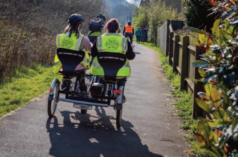
Interventions for the Active Way pilot have been designed to be attractive, with no or minimal requirements to join and are in places and at times that people could make easily. The offer extends to:
Walking Activities
l Wellbeing walks (walk and talk sessions, buggy walks, sensory walks and other targeted group led walks)
l Snap and Stroll (creative walks)
l Go Jauntly routes (new step free and accessible routes around the area)
l Nordic Walking
Cycling Activities
l 1-2-1 and family cycle training
l Inclusive cycling using adapted bikes
l Active Steps group confidence rides
l Chat-E-Cycle (side by side e-tandem wellbeing taxi service)
l Dr Bike events
l DIY bike maintenance workshops
l Balanceability sessions
l Bike and E-Bike hire (inc trailer and pannier hire)
l E-Cargo bike trials
l E-Bike taster sessions
l Other targeted group led rides
Other Activities
l KiActiv (understanding personal physical activity data through a tracked wearable device and mentoring)
l Seated exercise and dance (foundational strength and coordination)
l Cycling data, behavioural insights and feedback
l 10 separate grant funded projects
l Wayfinding and interpretation board improvements
l Beat the Street (mass participation game)
l Walk leader training
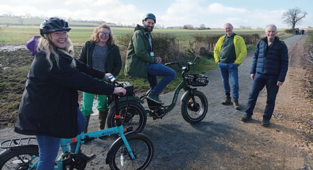
A 2.3km active travel route that connects to the scenic Brampton Valley in Northamptonshire, serves as an exemplar of how to use community evidence, business needs and local policy to deliver a project, believes Lucy Hawes
The Griffin Trail offers walkers, wheelers and cyclists a safe, allweather route between Braybrooke, Northamptonshire, and Market Harborough, Leicestershire. Completed in February 2025, the trail connects the local community to one of the area’s most scenic walking and cycling routes – the Brampton Valley Way.
Besides improving accessibility, the route also represents a lasting resource for everyone. The trail will provide hundreds of users with easier access to and from Market Harborough, Braybrooke and the Taproom each year, benefiting locals and visitors alike.
Additionally, it’s a critical step toward building a broader network of safe walking and cycling routes in the area. Now completed, the trail will serve as a model for further collaboration with local landowners and a foundation for future expansion of the Greenway project, potentially extending the route south toward Desborough.
The journey from Braybrooke to Market Harborough currently involves navigating unsafe roads, which has been a significant concern for residents. According to the Braybrooke Neighbourhood Plan, a staggering 41% of locals expressed the need for better footpaths and cycle routes to Market Harborough, a sentiment that has shaped the creation of the Griffin Trail. With
overwhelming community support, this new route aims to address these concerns by providing a safer, more accessible travel option.
Key Features of the Griffin Trail
l Length & Accessibility: The new route spans approximately 2.3km, extending the local footpath network from 1.56km. Designed with a gentle gradient and an all-weather surface, the trail will be usable year-round, barring exceptional weather conditions. The route will also be accessible, via permissive access granted by the landowner to cyclists.
l Improved Connectivity: By diverting footpath GC13 to a new field edge route, the Griffin Trail will directly connect to the Brampton Valley Way. This popular route is a favourite for walkers, wheelers and cyclists, providing a safe and scenic passage between the two locations.
l Health and Wellbeing: The trail promotes healthy and active lifestyles, encouraging residents to explore the surrounding countryside and engage in sustainable travel. It will also enhance access to education, work, and local services for the younger generation, supporting both physical and mental wellbeing.
l Community Involvement: The project comes as part of the Braybrooke Neighbourhood Plan, which actively involves local residents in shaping their community’s future. The community
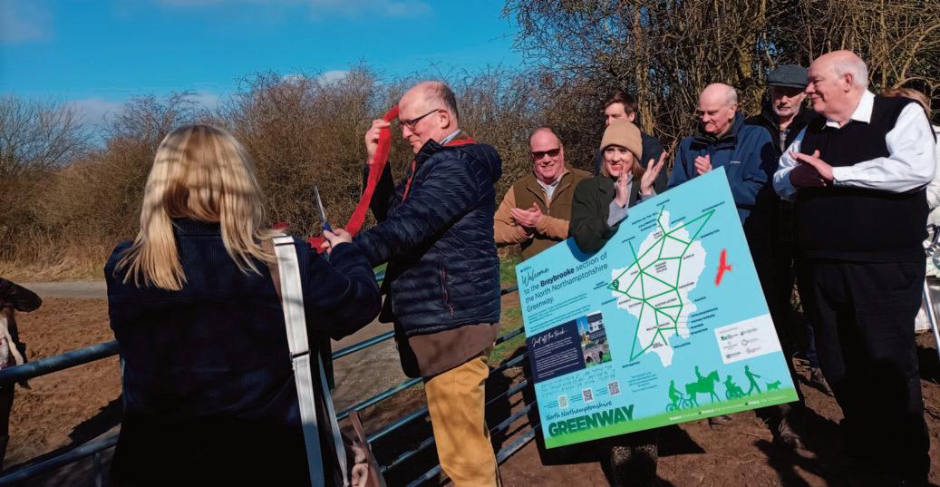
has shown strong interest in creating safer, more accessible paths, and many have already volunteered to support the project, including offering help with litter picking and general upkeep.
l Rural Business: Braybrooke Beer Co is opening a new Taproom and wished to work with the Parish Council to encourage access to this new business venture.
The total cost of the Griffin Trail project has exceeded £100,000, with contributions coming from a mix of funding sources. The Griffin Trail was developed and funded in partnership with Braybrooke Parish Council and Braybrooke Beer Co. aligning their vision and applying to different funding pots to enable the route to be delivered.
The two organisations each applied for funding from North Northamptonshire Council. They were successful with their separate applications to the Shared Prosperity Fund - one for rural business for the Brewery and one for rural communities and accessibility for the parish council.
The parish council then received other awards from Northamptonshire Community Foundation, National Lottery Awards for All, the Maud Elkington Trust and donations from local businesses. Braybrooke Beer Co. further donated an additional amount and had to pay 50% to match the Rural Business Fund.
The project also benefits from the backing of local councillors and organisations like the North Northamptonshire Greenway Project, which have seen the potential of the trail for improving the community’s infrastructure and wellbeing.
The grand opening of the Griffin Trail happened on 28 February 2025, with over 80 people attending. The attendees were made up
of the local community, local councillors, and councillors from neighbouring Leicestershire and Market Harborough.
There were also active travel practitioners from the relevant authorities, along with representatives from Northamptonshire Sport, Northamptonshire Ramblers and Local Access Forum, West Northamptonshire Council, representatives from Hanwood Park – a Sustainable Urban Extension who have active travel at the heart of their development, local funders and members of North Northants Council’s Culture, Heritage and Tourism team.
Braybrooke Beer Co. hosted the event with a selection of their fine beers and their excellent food served from the Airstream trailer onsite.
The landowner was driven by the need for accessible connection to his brewery and Taproom to enable visitors to arrive sustainably. Compounded with Braybrooke Parish Council’s Neighbourhood Plan and the need for safe routes to Market Harborough, and the North Northamptonshire Greenway Strategy, it is a win-win for everyone involved. A landowner who was invited described the scene as, “like no other he has seen in the UK. This is the sort of thing you would find in Australia or the US, and this type of rural business does show much for our rural tourism offer.”
This collaboration would not have been as successful if the three priorities did not align, and the funding through the Shared Prosperity Fund at North Northants Council did not align with rural community needs and rural businesses. The added bonus of funds from Northamptonshire Community Foundation, the National Lottery and local sponsors makes it even more exciting. It is an exemplar project and blueprint of how to connect communities using local evidence, business needs and local policy.
n Lucy Hawes is Greenway Project Officer at North Northants Council.
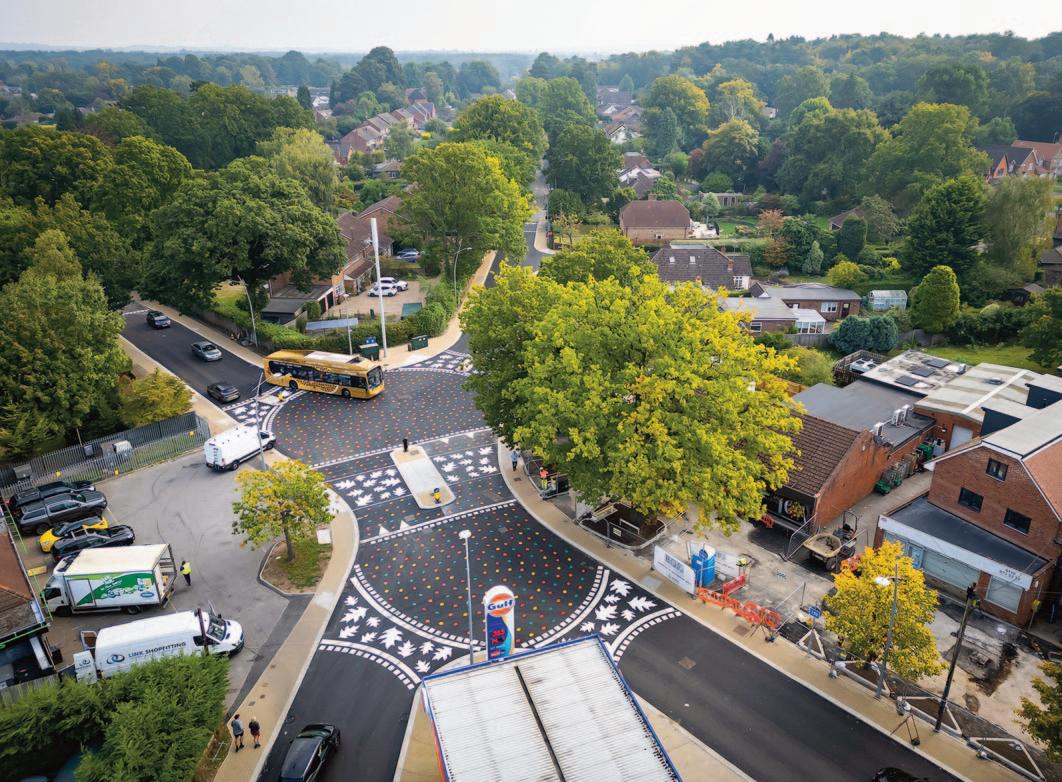
Re-configuring a once car-dominated junction has reduced vehicular speeds and made the area safer and more pleasant for pedestrians and cyclists, reports Malcolm Pinto
A junction in Wokingham, Berkshire, has been turned into a safer, pedestrian-friendly environment with stylish carriageway and crossings. These improvements include new direct crossings and encourage drivers to be more considerate.
California Crossroads, which was previously dominated by motorised traffic, has become a more inclusive environment, contributing to improved pedestrian priority and public health through drivers being more aware of pedestrians by use of a placefocused design.
Changes to the junction formed part of the Arborfield Strategic Development Location planning application. This sought to respond to the additional development pressures faced in the village of Finchampstead from the new development location, and to provide a space where pedestrians, cyclists, and vehicle traffic could better coexist.
The main objectives were:
1. Creating a sense of place for the community
2. Enhancing non-motorist movement around the two mini
roundabouts by adding crossing points, using contrasting designs to encourage drivers to give way, removing traditional road markings and signs, and providing right-angle crossing points for visually impaired users.
3. Slowing vehicle movements with raised tables at the edges and centre.
4. Encouraging drivers to give way
5. Improving non-motorist movement at Avery Corner, the shopping parade, and school access by levelling the carriageway and other areas, prioritizing non-motorized users, and enhancing wheelchair access.
6. Engaging the entire community in the design process
In early 2015, a project working group was formed, consisting of Wokingham Borough Council, Finchampstead Parish Members, local business owners, and a representative from The Nine Mile Ride school. The group met periodically to identify the scope and purpose of the project.
The vision statement was developed from the working group
meetings. This aimed to deliver an attractive environment and a vibrant local centre at the heart of the Finchampstead community, with a focus on high-quality and imaginative design, materials, landscaping, and attention to detail.
The scheme encouraged access by walking and cycling, user safety, and a distinct design character that allowed for pedestrians and traffic to better coexist, to respond to planned traffic volumes once the new Development Location was built.
The vision that was set out in 2015 was: “Our vision for California Cross is to deliver an attractive environment and a vibrant and viable local centre at the heart of the community. The scheme will be high in quality and imaginative in design with a focus on materials, landscaping, and attention to detail. It will encourage access by walking and cycling, safety for users and a distinct design character that identifies innovative ways to allow for pedestrians and traffic to co-exist.”
Based on this vision, the working group set out to: create a greater sense of place; accommodate existing and expected traffic volumes; improve provisions for pedestrians and cyclists; enhance the shopping environment; ensure safety for all users; engage the community in the design process; and improve car parking provision.
Key outcomes of the project were to create a strong sense of place with a design suitable for all users. Other aims were: improved visual quality; traffic accommodation; better access by walking and cycling to key land uses like shops and schools; and improved car parking areas in terms of layout, usage, and controls.
The project went through several stages, including presentations and reports by Wokingham Borough Council staff and consultants. WSP developed concept designs in partnership with WBC, which were then presented to residents receiving positive feedback, and the design development continued. The scheme concepts were subject to extensive public consultation and engagement, before finally being approved and signed off by members
A working group was set up by the council, including borough and parish councillors, local businesses and schools. In 2017, with input from this group, the council created options for the improvement project, which were consulted on the following year. The scheme concepts underwent extensive public consultation and engagement before approval by members. Originally planned to start in 2019, construction was delayed by a nine-month road closure, the Covid-19 pandemic, a landslip and gas works.
Post-pandemic, conversations continued in 2020/21 with technical group members, including representatives of the partially sighted group, leading to the implementation of courtesy crossings with distinct patterning to encourage drivers to give way to pedestrians.
Two test panels were produced to assess the innovative design’s durability and its effect on horses, to respond to the challenge of a nearby equestrian centre. Co-design activities with local schools included a design competition at Nine Mile Ride school for bollard silhouettes and for totem design markings.
The project included high-quality environmental features including new footway paving, carriageway leaf patterns, high-quality lighting, new planting, bespoke bollards, improved drainage, and totems co-designed with local schools.
The re-design has slowed vehicular speeds and made the area safer for cycling
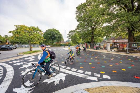
Construction began in February 2024, with the works completed on time in September 2024. The scheme has attracted a high level of stakeholder interest due to its striking design.
Stakeholders were kept up to date throughout the implementation phase via weekly newsletters emailed to those who had signed up to it and it was also posted on the council website.
A data exercise assessed the degree to which the California Crossroads project objectives have been achieved. Video footage before and after scheme implementation was assessed and a bespoke WSP Video Survey Tool was used to allow transport planners/engineers to review the video and translate observed events into quantifiable data.
Within six months of opening, analysis of the scheme showed it was already meeting objectives by making it easier for pedestrians to move around, creating a more inclusive environment, and contributing to improved safety and public health through reduced vehicle speeds. At six-month post implementation, three of the four objectives have been already realised:
Objective 1: The analysis found that less time was required to cross the road after the scheme was implemented for all scenarios (12-39% time reduction) which indicates that it is easier for pedestrians to move around, creating improved ease of movement for pedestrians and a more inclusive environment.
Objective 2: Drivers appear to give way to pedestrians more often after scheme implementation. In one direction 90% of first vehicles gave way to pedestrians after scheme implementation vs 35% before the scheme. In the other direction 80% of first vehicles gave way to pedestrians after scheme implementation vs 40% before-scheme implementation, creating improved ease of movement for pedestrians and a more inclusive environment.
Objective 3: The analysis found that slower vehicle movements were observed across the junction albeit less than a 10% reduction. This could help contribute to improved safety and health of the public.
Objective 4: There has been no noticeable difference in congestion around Avery Corner after scheme implementation.
The data analysis exercise will be repeated in future to understand the long-term impact of the scheme against its objectives.
n Malcolm Pinto is Head of Engineering, Development and Delivery at Wokingham Borough Council.
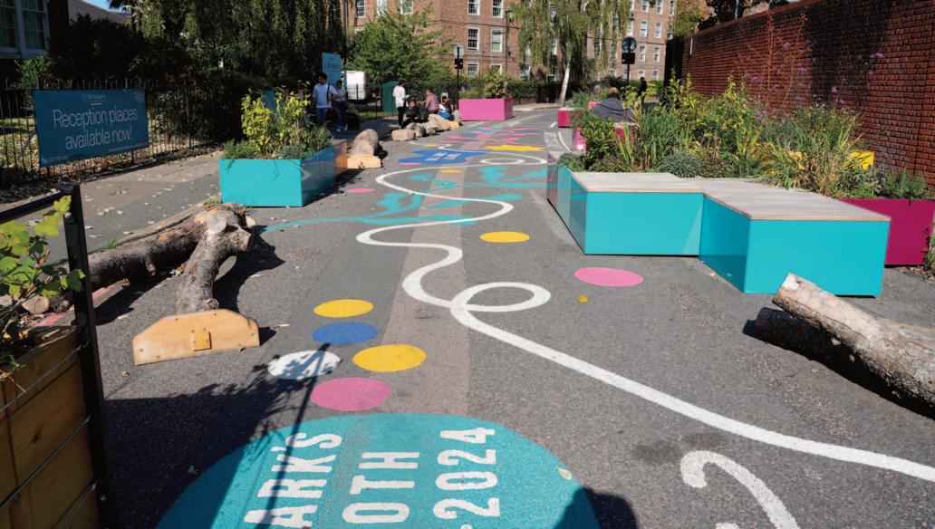
The quick delivery and minimal infrastructure changes of the St Mark’s scheme make it a scalable and cost-effective model for other boroughs
Building on the success of its School Streets, Lambeth Council went a step further with St Mark’s Primary by removing motorised traffic. This has set the template for a new kind of street that will not need to be enforced by cameras, say Samuel Dillon and Tash Hartke
Lambeth’s School Streets Programme is a pioneering initiative aimed at making streets outside schools safer, healthier, and more child-friendly by restricting motor vehicle access during drop-off and pick-up times.
By reducing road danger, congestion, and air pollution, the programme encourages active travel. Since its inception in 2019, School Streets in Lambeth have achieved a reduction in traffic and 23% lower nitrogen dioxide levels, significantly improving air quality and children’s health. Building on this success, the £1.7m School Streets Expansion Programme is delivering 33 new School Streets by November 2025, ensuring that 90% of Lambeth’s primary schools benefit from safer environments. The remaining 10% will be assessed for main road treatment to reduce road danger.
Kennington Oval Reimagined
This project looked at making Kennington Oval and the surroundings streets a place where people can meet, play and travel actively.
Lambeth Councils wants these streets to be climate resilient, celebrate local history, champion inclusivity, child play, creativity and accessibility.
Reducing Traffic has many benefits, including:
l Cleaner air and less noise
l Fewer emissions contributing to climate change
l Safer streets, which is especially important for pupils of the
three schools within the project area
At the heart of this scheme was two School Streets - St Mark’s Primary and Henry Fawcett Primary.
These were ‘typical’ School Streets that were enforced by signs and cameras. The Kennington Oval Reimagined scheme presented an opportunity to rethink what the space outside a school could look like.
Lambeth’s Kerbside Strategy and School Streets
Reimaging Lambeth’s School Streets aligns with our Kerbside Strategy and Climate Action Plan. In order to achieve our Climate Action Plan targets of reaching Net Zero, Lambeth Council has committed to reducing traffic by 27% and to reallocate 25% of our kerbside to sustainable uses by 2030.
Lambeth’s Kerbside Strategy has four key priorities to guide how we will use our kerbside (the space typically used for car parking):
1. Enable accessible and active travel
2. Create places for people
3. Increase our resilience to climate change
4. Helping to reduce traffic and emissions
This Kennington Oval Reimagined trial removed parking across the whole area, but specifically outside both schools and replaced them with sustainable things such as planting, seating, playful features, cycle parking, e-bike and e-scooter bays.
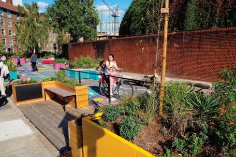
These changes are in line with our kerbside strategy and are supported by the low levels of parking stress within the project area (which is as low as 20% on Kennington Oval on some weekdays).
Census data shows that 68% of local residents in the Kennington Oval Reimagined area do not own a car.
The scheme saw a full closure to motor vehicles outside St Mark’s Primary. Outside Henry Fawcett, meanwhile, parking was removed, with the carriageway reduced to one lane and a one-way introduced.
Making the space Child Friendly helps with Lambeth Council’s ambition of becoming ‘UNICEF UK Child Friendly’ community. As part of the programme, one of Lambeth’s goals is Place - children can move freely in the city and their neighbourhood; they feel welcome in public spaces; feel connected to their neighbourhood.
Currently, accessing the main nearby spaces with greening and playful features involves crossing a busy and dangerous road to Kennington Park. Creating spaces for children on the streets close to the schools will grant children greater freedom and nurture their physical and cognitive development in a safer space.
As part of our Child Friendly Lambeth objectives of including children's voices in decisions that affect them, Lambeth Council hosted school workshops where we asked the children for their input on the designs.
Healthy Routes and journeys to school
Kennington Oval proposals create streets that are healthy, accessible and sociable. This has been guided by the Mayor of London’s Healthy Streets Approach ( www.healthystreets.com), putting human health and experience at the heart of planning the city. Lambeth Council has developed its own Healthy Routes network - www.lambeth.gov.uk/streets-roads-transport/cyclingwalking/lambeth-cycle-routes-map
There are two existing Healthy Routes in the project area and one proposed route. The Kennington Oval Reimagined focuses on those routes as already identified in Lambeth’s Transport Strategy.
St Mark’s School Street
Following on from this success of the initial launch of the School Street, the spaces outside have been reimagined as vibrant community spaces. This includes playful features and seating, greenery, and public art, transforming these areas into welcoming places for children, parents, and local residents throughout the day - not just at school hours.
St Mark’s Primary School in Kennington Oval, acting as a pilot for what the space outside schools could look like, has undergone full pedestrianisation. Previously enforced only by signage and cameras, the space is now completely car-free, allowing children to
The transformation of St Mark’s School Street is delivering significant benefits beyond the immediate school drop-off and pick-up periods.
1. Safer, Healthier Environments
l Over 90% reduction in vehicle traffic at drop-off and pick-up times across the whole School Street.
l No through-road traffic, eliminating road danger outside the school.
l Children no longer need to be hyper-aware of cars, reducing anxiety and stress.
2. Improved Air Quality & Noise Reduction
l With no vehicles passing through, pollution levels are reduced throughout the entire day, not just during school hours.
l Lower noise pollution has created a calmer, more pleasant environment for children and the community.
3. New Public Space for the Community
l The pedestrianised area serves as a meeting place for parents in the morning and afternoon.
l Outside of school hours, it is a welcoming public space for residents, encouraging community interaction.
l The addition of seating, greening, and playful features has transformed a functional road into a space for people.
4. A Model for Future School Streets
l St Mark’s demonstrates the power of permanent street transformation, setting a new standard for School Streets in Lambeth and beyond.
l Its quick delivery and minimal infrastructure changes make it a scalable and cost-effective model for other boroughs.
enjoy a safe, engaging environment outside their school.
Unlike conventional School Streets, St Mark’s has removed all parking spaces and cars, creating a public space. This transformation was delivered within 10 months, without major civil engineering works, making it a cost-effective, replicable model for other schools.
The space now features seating, greening, playful features, and colourful designs, making it more inviting and enjoyable for both schoolchildren and the wider community. The project aligns with Lambeth’s Kerbside Strategy, ensuring that children have safe, accessible environments outside their schools while promoting active, sustainable travel.
n Samuel Dillon is School Streets Manager and Tash Hartke is Kerbside Strategy Programme Manager at London Borough of Lambeth.
Once the site of traffic disputes and accidents, the road outside an Ipswich primary school is now people-friendly at drop-off and pick-up times thanks to the introduction of motor vehicle restrictions, resulting in a big rise in pupils walking, cycling or scooting, writes Christopher Grover
Suffolk’s first School Street has proved hugely popular and encouraged more pupils and their parents to walk, cycle and scoot. Launched in January 2024, Ranelagh Primary School on Paul’s Road in Ipswich involved the introduction of restricted access to motor vehicles during drop-off and collection times. The launch of the scheme followed a period of extensive consultation with the school and local communities.
There has been a 35% increase in the number of pupils walking, cycling or scooting. A big majority (85%) of parents/carers support the scheme saying that Paul’s Road feels safer, with 92% commenting that it is a more pleasant place to be.
Research also showed that 60% of pupils feel that the air quality has improved while 96% of staff support the scheme and want to see it continue.
The bad old days
Ranelagh Primary School is located on a busy, narrow road which junctions with a main route into the centre of Ipswich and is also used as a short-cut to avoid traffic lights. Heavy congestion during school drop-off and collection times was a daily occurrence and resulted in numerous traffic disputes, accidents and near misses. In addition, the school staff regularly reported receiving verbal abuse from drivers during these busy periods.
Post pandemic, the school’s senior management team became fully committed to improve road safety outside the school and worked with Suffolk County Council to investigate the viability of introducing a healthy school street scheme. The proposed scheme focused on temporarily restricting access during drop-off and collection times. Mindful of the local community, the school were keen not to simply “shift” the problem of parent/carer parking to a different, neighbouring road so very early on liaised with the businesses on the retail parks opposite where it was hoped that parents/carers could park their cars and then walk with their children to the school gates (‘Park and Stride’).
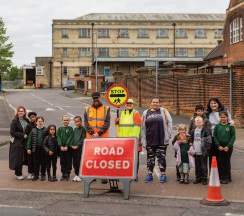
Following consultations with the school and local communities, the school felt that the scheme was viable and recruited ten volunteers who were trained along with staff before the scheme was formally launched. Suffolk County Council arranged for a temporary Traffic Regulation Order (TRO) to be introduced allowing temporary barriers to be installed daily between 0815 and 0900, and 1445 and 1530, Monday through to Friday, termtime only. Using a temporary order allowed SCC to assess the impact of the scheme and measure how parents and traffic would adapt to the closures.
Since the scheme has been in operation, local businesses said they have not been negatively affected at all - with one saying that the scheme was straightforward and access had been given straightaway when they needed it.
The team of volunteer marshalls said they are willing to carry on in their roles, adding that they have received regular thanks from parents, carers and the local businesses.
The scheme continues to be supported, with feedback revealing that there had been a 29% reduction in the average daily number of vehicles using Paul’s Road between 7am and 7pm. During the 90 minutes of traffic free time, levels of harmful particulate matter has dropped significantly by between 10 and 15%. No incidents, accidents or near misses had been reported. This is a great example of partnership working between the school community, county and borough councils, the police and local businesses.
Head teacher Nicky Ling said: “We’re really pleased with how well the launch of School Street has gone. It has made a real difference with families being able to walk to school safely - families now have space to walk on the pavement without the fear of cars mounting the pavements to park or get by.”
n Christopher Grover is Behaviour Change Team Manager, Transport Strategy at Suffolk County Council.
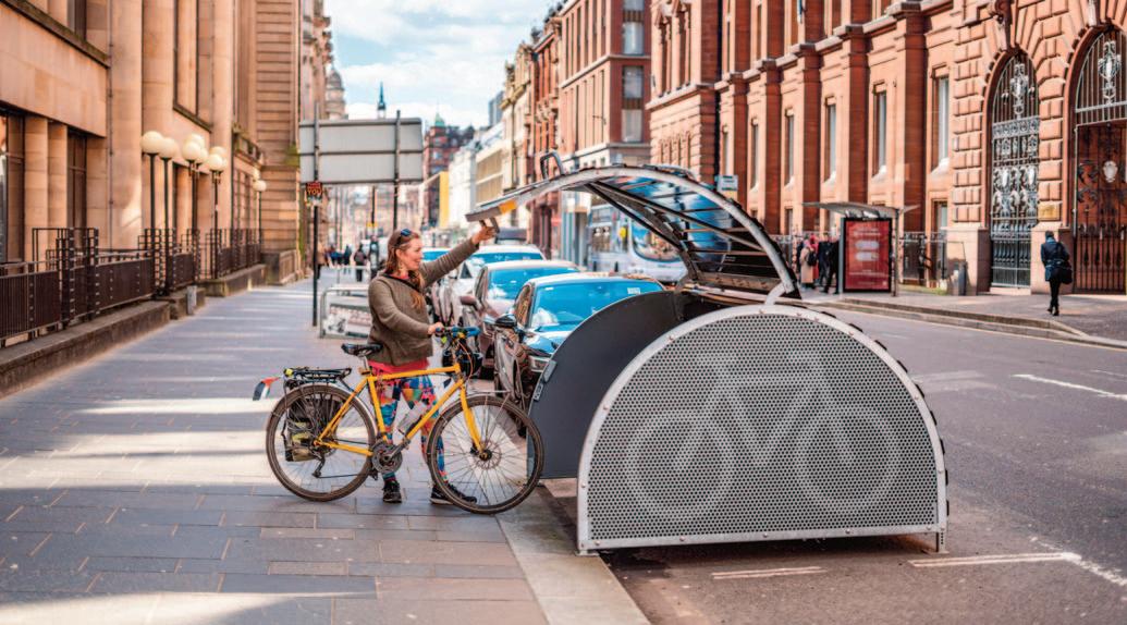
Data
A network of Cyclehoop Bikehangars in Glasgow, which can be accessed via a bespoke smartphone app, is giving users a secure bike parking option when riding into the city centre. The Trips system allows the public to park their bikes securely while visiting town centres, transport hubs and other destinations. 20 units have been installed in the city centre, in collaboration with Glasgow City Council, Sustrans and Transport for Scotland.
Two years after the launch of the system in Glasgow, Cyclehoop assessed the impact of the system.
Though cycle lanes and other active travel infrastructure exists in Glasgow, many people are reluctant to park their bikes at their destination due to the risk of theft. We faced the challenge of informing residents that a new, secure parking option exists.
As service providers of Glasgow’s residential cycle parking scheme, we were able to inform existing subscribers about the new secure cycle parking in the city centre. Alongside this, we ran an inperson launch event with free Dr Bike servicing, a billboard advertising campaign featuring Glasgow residents and a direct mail campaign targeting addresses close to cycling routes, combined with data from the Scottish Index of Multiple Deprivation. As a result, the userbase has grown to 1,123 and counting.
As the scheme continues to grow, we are constantly looking for ways to adapt the platform and serve the user in the best way possible. Initially, Trips was designed to help people choose cycling for short ad hoc journeys including shopping, appointments and leisure. However, we found that a high proportion of bookings were made by commuters: The average booking duration being 7 hours and 12 minutes, and 38% of bookings being between 7 and 10 hours. This suggests that a subscriptions model would help
commuters by guaranteeing availability, reducing cost and reducing transactions. The challenge will be to make the system flexible to accommodate a range of work patterns.
Our analysis also highlights the importance of location; 65% of bookings were concentrated in 21% of locations. Though the high security of the Bikehangar helps users feel comfortable parking their bike further from their destination, convenience is king. Locations with close proximity to shops, workplaces and services are far more likely to have high traffic.
With floating internal racking and no requirement for additional groundwork, the Bikehangar is fast and cost effective to relocate. This allows new locations to be trialled with ease. Working with Glasgow City Council, we identified 11 new locations with improved access to shops, restaurants, rail and subway connections. Installed in January 2025, the new locations will help boost cycling journeys into the centre for new and existing users alike.
Our vision for Trips is to create a nationwide secure cycle parking network, all accessible via the Cyclehoop app. The technology can be applied to any lockable entry, meaning the network can comprise of single user lockers through to hundred-space cycle hubs. With schemes already in place in Maidstone and Peterborough, and many more slated for installation in 2025, the network is growing fast.
In the long term, our goal is to integrate our innovative smart lock and app with our residential Bikehangar service, for a fully connected secure cycle parking experience at both ends of the journey.
n Charmian Beedie is Head of Marketing at Cyclehoop.

Kris Radley is clearly on a mission to transform active travel infrastructure in Essex. And judging from his track record, he has made significant headway since taking the role of Active Travel Programme Manager for Essex Highways. His remit involves dealing with political aspects of working for a high-profile local authority client while making a significant contribution to their aspirations to be ‘best in class’.
Kris, who is an Associate Director, Transport Planning, at Jacobs, has over 20 years of experience working in the sustainable transport industry, with extensive knowledge of active travel and mobility. He is a Fellow of the Chartered Institute of Highways and Transportation.
In 2024 Kris managed a wide range of complex active travel projects with a focus on highways development, master planning, urban regeneration and greenways. He informed and influenced over 220 active travel projects across the county.
Kris said that managing Essex Highways’ Active Travel programme means being “highly agile” to keep pace with the regular shaping and re-shaping of programmes by central government. This is evident with the successful delivery of Essex’s Active Travel Fund 4 programme including Local Cycling and Walking Infrastructure Plan (LCWIP) 9, a £1.8m 2.5km asset renewal programme which was delivered six weeks ahead of schedule and ~£75,000 below budget. This has been acknowledged and celebrated by Essex.
Tracey Vickers, Head of Sustainable Transport, Essex County Council, said: “Harlow LCWIP 9, part of the Active Travel Fund 4, is a shining example of teamwork at its best! From the initial planning stages to the nitty-gritty of design and construction, everyone involved has worked together seamlessly.
“Thanks to their collaborative spirit and hard work, we’ve managed to complete this high-profile project ahead of schedule and under budget. A huge thank you to the entire team for their
With over 20 years of experience, Kris Radley is spearheading Essex Highways’ ambitious active travel initiatives, balancing political challenges while driving the county towards becoming a leader in sustainable transportation
dedication and for truly embodying the ‘one team’ approach.”
Kris has also played a key role in developing a strategic pipeline, helping Essex secure over £40m in transformational funding for active travel and, for a second year in a row, he helped secure an Active Travel England (ATE) Level 2 Self-Assessment.
This showcases the positive influence Kris has had while building confidence in the active travel programme across Essex.
Kris’s ability to effectively communicate and build long-term, positive and collaborative relationships has been key to the success of the 2024 programme of active travel interventions. He has an in-depth knowledge of the highways industry and has forged close and effective working relationships with key stakeholders.
Through his role he has helped Essex County Council (ECC) manage relationships with other local authorities, third sector organisations, National Highways, ATE, and the Department for Transport.
Kris has helped harness new and disruptive active travel trends and technologies such as road space re-allocation, Liveable Neighbourhoods, and Place and Movement. In addition, he is responsible for helping shape and deliver health, transport, place shaping and localities policies.
To improve efficiencies, identify/address risks and to allow for informed decision-making, Kris has worked with colleagues across Essex Highways to establish critical elements of an active travel pipeline. This ensures that over 250 projects in the active travel programme deliver against ECC strategic objectives and follow a pre-determined path from inception to delivery.
To maintain consistent programme management, Kris has introduced new and innovative tools such as an active travel reporting tool and related online ‘live status reporting’ mapping both of which provide consistency, drive cross organisation collaboration and identify efficiencies.
The Essex Active Travel Technical Advisory Group (EATTAG),
Kris carries out his multiple roles with expertise, enthusiasm and passion. The recognition of his work at regional and national awards evidences his technical ability
which Kris set up in 2020, is a crucial forum for Essex Highways. EATTAG provides critical reviews of live and proposed active travel infrastructure projects, guiding teams to solutions and ensure the network is enhanced in the most beneficial manner. As the chair of EATTAG, Kris ensures the forum regularly reviews programmes across Essex Highways to identify efficiencies in the delivery of high-quality active travel infrastructure and measures. The forum also brings together experts from across disciplines to act as critical friends on proposed designs and strategic active travel plans.
The group has reviewed, analysed and discussed over 35 high profile active travel schemes.
Nicola Foster, Group Manager Road Safety, Essex Highways, said: “Kris does and is doing so much good with EATTAG, we can all see huge improvements in scheme design and transfer of knowledge and information at these meetings and thereafter. “Kris leads a brilliant forum which examines schemes from different viewpoints to provide advice (which doesn’t have to be taken!) to designers of schemes involving cycling. This helps us explore how the current guidelines for provision do, or don’t meet the needs of cyclists and also seeks compromises where there are limitations or conflicts.”
Throughout 2024 Kris has worked to raise the profile for sustainable and active travel such as championing local-led campaigns, directing local initiatives and as a key advocate for active travel across Essex. This included Essex Pedal Power, a bike loan to giveaway project that makes cycling accessible for everyone providing access to employment, training and educational opportunities or key local services. Kris was instrumental in the inception, creation and expansion of the project and, in 2024, helped celebrate a new milestone of over 3,500 bikes distributed. Kris has been a key driver in determining, establishing, and delivering a new approach to Social Value for Essex Highways Active Travel Programme. Through collaboration with Essex Highways Stakeholder Engagement team, the Active Wellbeing Society and ECC, Kris delivered the first in a series of volunteer days working in one of the county’s most disadvantaged communities. This involved clearing sand from essential active travel routes, building bikes for giveaways and hosting think tanks to bring together consultancy staff, community groups and volunteers to resolve project challenges. As this social value initiative gains momentum, Kris hopes to run more volunteer days and explore how these can link with national and international
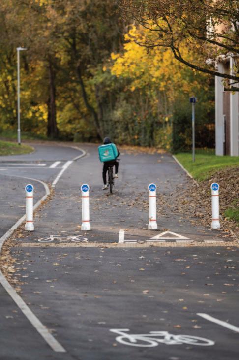
programmes to benefit communities.
Throughout 2024, Kris has also embraced training and mentoring to colleagues and clients. In his current role as an Active Travel Programme Manager and Champion of Active Travel, Kris is responsible for supervising and mentoring colleagues, holding them accountable to deliver high-quality schemes and helping shape a cultural shift and mindset towards more Active and Sustainable transport. Through numerous 1:1 sessions, group training and online seminars, Kris has directly informed and influenced over 200 colleagues in 2024.
Emma Hext, Divisional Director, Jacobs, said: “Kris has proven himself in both technical achievement and management of highprofile projects, particularly across the active travel market. Trusted by our local authority clients to deliver major programmes of work on their behalf and coupled with a key role within our business to develop and mentor members of the team, Kris carries out his multiple roles with expertise, enthusiasm and passion.
“The recognition of his work at regional and national awards evidences his technical ability, and it’s been a pleasure to work with him on active travel schemes to benefit from his knowledge and general approach to delivery. He is a trusted and effective member of the team.” n
Essex Highways is a partnership between Essex County Council and Ringway Jacobs, with access to its shareholders Jacobs and Eurovia

Jan Hudson has been delivering groundbreaking active travel projects in Leicester since 2009, initially as Regional Partnership Manager for British Cycling and since 2019 as Behaviour Change Manager at Leicester City Council.
As Event Manager for Sky Ride Leicester for 10 years, Jan delivered the largest family-friendly cycle rides in UK provincial cities, with participant numbers of up to 14,000. She initiated key partnerships delivering exciting pitchside routes through King Power Stadium with Leicester City FC, past Leicester Castle with De Montfort University and across Curve theatre main stage.
Before the Covid-19 pandemic, Jan integrated Leicester Castle Classic into British Cycling’s national race series and added sportive and sprint triathlon events for local amateurs. She established Leicester Women’s Velo social club and Breeze Champions training to share confidence, skills and selforganisation alongside a social inclusion programme as part of Leicester Bike Share Project.
In response to the pandemic, Jan established Bike Aid to support Leicester’s Covid-19 Recovery Transport Plan, providing cycle donations, bike-fix and rider support for essential workers.
The entrepreneurial and inspirational Jan Hudson has won plaudits for her work as Leicester’s active travel advocate, project managing new cycle corridors and running a social inclusion programme
Along with a cargo-bike delivery service for food parcels and library services to enage vulnerable and isolated residents through the pandemic. Since 2021 she has project managed permanent citywide Key Worker Corridor Infrastructure and Melton Road Heritage Cycle Track Project, featuring some of the oldest and newest cycle tracks in the city.
In 2022, Janet re-established a citywide social inclusion delivery programme with ‘Learn to Ride’, ‘Women’s Confidence Rides’ and ‘Led Rides’. These rides enabled more than 1,000 participants to enjoy and explore their city walking, wheeling and cycling. She has given presentations about social inclusion and infrastructure at the Leicester Active City conference, Active Travel England’s ‘Social Inclusion’ webinar and to the All Party Parliamentary Walking & Cycling Group. Jan also chairs monthly Cycle City stakeholder meetings.
Jan is a hardworking, tenacious, resilient and innovative active travel advocate. One of few active travel practitioners with holistic experience of both infrastructure and behaviour change programmes. Janet has shown herself to be innovative, entrepreneurial and inspirational within Leicester and increasingly well beyond it. n
A team led by the Active Travel Academy at the University of Westminster is studying the impact of Low Traffic Neighbourhoods, and exploring a range of issues including road safety, accessibility for disabled people and air pollution, writes Ersilia Verlinghieri
Over a three-year period, a research team led by the Active Travel Academy at the University of Westminster has been working to understand the impact of Low Traffic Neighbourhoods (LTNs). We have assessed the health benefits from these schemes, such as reduced road injury risk and whether they cause harms, such as congestion and air pollution on boundary roads. We also researched how local people experience and respond to LTNs, and how policymakers navigate controversy surrounding these schemes, and make them more inclusive.
The team has undertaken research pre- and postimplementation for five new LTNs in London, each with a matched control area to account for background changes in travel patterns. We have used novel quantitative data-collection methods, including sensors to detect changes to numbers of pedestrians and cyclists, pixelated videos to understand age and gender diversity among people walking, wheeling, and cycling; and Google travel time data to monitor congestion on boundary roads and changes to journey times to key destinations.
Combining walking and cycling, injuries, and pollution data, we are in the process of modelling the health and health economic impacts of LTNs. Our final findings will be published in Autumn 2025.
To understand the experiences of those living in or near LTNs, and how policymakers navigate controversy, we used walking & wheeling interviews with residents, focus group discussions with disabled people, and interviews with officers and councillors who implemented/sought to implement LTNs in 12 councils in England.
Our quantitative analysis work is ongoing. One early set of findings relates to road safety. In our analysis of the impact of all LTNs in Greater London implemented between 2015 and 2024 on road traffic injuries, we found clear evidence that injuries were reduced. There was a 35% drop in all injuries and a 37% drop in people killed or seriously injured (KSI) on roads inside the LTN areas.
On boundary roads, there was no evidence of an overall impact on the number of injuries – a reassuring finding given concerns that have previously been raised that LTNs could adversely affect safety due to traffic displacement. In fact, we found a statistically significant reduction in injuries for cyclists and motorcyclists on boundary roads.
In terms of resident experiences, those who drove were generally less satisfied with LTNs, compared with those who walked, wheeled and cycled who reported enjoying more pleasant conditions and perceived improvement in safety, noise, and air quality. Boundary roads remained a concern. Those who
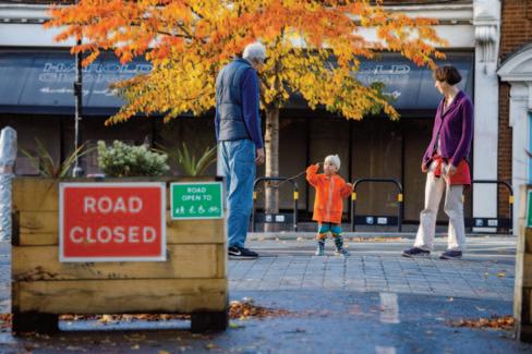
Research showed that those that walked, wheeled and cycled enjoyed more pleasant conditions and perceived improvement in safety, noise and air quality in LTNs
supported the LTN sought additional changes to increase efficacy, including upgrades to footways.
Working with disabled people, we identified the access frictions that emerge between disabled people in relation to LTNs because of different individual experiences. We recognised that no access experience can be 100%, and provided recommendations on how to improve inclusive communication and maximizing benefits for disabled people whilst delivering schemes.
Interviews with those implementing LTNs across the UK highlighted engagement and delivery challenges tied to austerity and local authorities’ reliance on scarce funding.
The LTNs in London research team is led by the Active Travel Academy at the University of Westminster, in partnerships with London School of Hygiene and Tropical Medicine, University of Cambridge, Imperial College London. The team is made up of expert qualitative and quantitative transport and health academics and professionals. Some of the team are from Transport for All (TfA), the only disability group in the UK focusing exclusively on transport. To ensure timely dialogue with policymakers, we have a Stakeholder Advisory Group which has met and provided feedback since project outset.
To ensure impact, we have an extensive dissemination process involving the Department for Transport, Active Travel England, local authorities, active travel practitioners and other organisations.
n Ersilia Verlinghieri is Senior Research Fellow, Active Travel Academy at University of Westminster.
Formed just three years ago, Essex County Council’s Active Travel Team has made remarkable progress encouraging behaviour change through a range of schemes including free bikes and repair, cycle training and e-scooter rides, and implementing school travel plans and School Streets, writes Helen Akpabio
The Essex Active Travel Team has set itself the ambitious target of ensuring that everybody in in the county has the opportunity to cycle, walk or wheel, either for shorter journeys or as part of a longer trip.
Since its formation three years ago, the 14-strong team has worked tirelessly to put Essex on the active travel map. Their work is always inclusive and achieved within budget. They’ve built - and continue to build - solid partnerships with other organisations such as Living Streets, Sustrans, GoJauntly and Love to Ride.
Over the last 12 months the team has reached a number of key milestones including:
l Providing all the cycle training for Essex Pedal Power, a multiaward-winning project that supplies free bikes and bike fix maintenance to over 3,500 residents in Clacton and Jaywick, Harwich and Dovercourt, Colchester, Basildon and Canvey Island and thereby removing financial barriers to cyclingultimately changing lives.
l Facilitating over 3 million e-scooter rides since the trial began in December 2020 with an average travel distance of 2.07km. This equates to 593,508 car trips collectively being replaced covering a distance of 1,163,276km and displacing 109 tons of CO2.
l Training over 6,560 children to become confident cyclists as part of the Bikeability training programme across 256 Essex schools. As part of the programme, they’ve sourced a fleet of bikes to loan to children who would not otherwise have been able to participate in the cycle training including delivery and pick-up of all the bikes.
l The cycle training team also offers adult and family training to promote cycling for people of all abilities, ages, and backgrounds and their efforts have been widely recognised and appreciated by local schools and organisations. 173 adults have been trained in the last 12 months
l Growing the membership of the STEN business network to 25 member organisations and hosting two successful networking events to encourage sharing of best practice.
l Working with 70 schools helping them to develop and implement their own school travel plans with 35 of them having achieved national accreditation.
l Supporting community groups with financial contributions of approximately £120,000 for a variety of cycling projects as part of the Essex Cycle Grant programme.
l Implementing two healthy streets for schools in Brentwood and Braintree. This included installing new ‘pencil’ bollards to deter pavement parking, putting up 20mph signs, repainting road markings and painting temporary street art on the roads, making the areas safer for the whole school community.
Looking ahead, the team is planning an enhanced and more robust approach to residential travel planning for large development sites and garden communities, new tools and resources for residents to plan their own journeys from new housing developments and piloting a new app for schools to encourage active travel and reduce the cost of the council’s school transport bill.
n Helen Akpabio is Active Travel Manager at Essex Highways.
The ATA sees high quality research and knowledge exchange as central to its mission, both sharing its own findings and fostering discussion and debate

For the researchers at the Active Travel Academy (ATA), increasing access to quality evidence is of pivotal importance. This, it believes, will allow a proper assessment of complex issues such as the impacts of Low Traffic Neighbourhoods, the potential of cargo cycles to decarbonise the freight sector and the equity impacts of various transport policies.
The ATA, based at University of Westminster in London, conducts research and knowledge exchange on all things active travel. It focuses on walking, wheeling and cycling, also exploring how active travel connects to other modes (e.g. public transport and micromobility) and to reducing car use.
The team describes itself as the opposite of the ivory tower. Its members are in continual dialogue with practitioners, policymakers, advocates and the wider public, engaging them in research, sharing findings, and trying to make sure future projects answer the most pressing questions.
And the ATA, which recently celebrated its fifth birthday, is passionate about increasing access to evidence to active travel policy.
Led by Professor Rachel Aldred, the ATA has established a reputation for doing high quality research on walking, wheeling and cycling. Other core ATA staff members include Dr Tom Cohen, Dr David Fevyer, Dr Jamie Furlong, Dr Faye Shortland, Dr Harrie Larrington-Spencer and Dr Ersilia Verlinghieri. They are supported by doctoral and other researchers working on a range of research contracts and projects.
The largest research project carried out by the ATA to date has been about Low Traffic Neighbourhoods in London, funded by the National Institute for Health and Care Research (NIHR). The team is now gearing up to carry out detailed research into the impacts of cycling infrastructure outside London, also NIHR-funded. Other project funders include the Road Safety Trust, the Department for Transport, Impact on Urban Health, the Foundation for Integrated Transport, Transport for London, and the KR Foundation.
Current and recent projects include:
l Evaluations of the Department for Transport’s Active Travel Fund and Fix Your Bike scheme
l Evaluation of TfL’s ‘mini-Hollands’ programme in outer London
l Exploring how roadspace reallocation could work better for local businesses
l The potential of cargo bikes to decarbonise urban freight
l The behavioural impacts of School Streets
l Analyses of road injury risk, from developing new metrics to measure risk-to-others, to studying near-misses, to exploring how the media present road collisions
l Experiences of minoritised communities when cycling, including Black men in London, Women of Colour in England, and refugees in Bristol
l Planning for active travel in Old Oak and Park Royal
l Measuring the quality of the cycling environment across Greater London and its associations with cycling frequency and perceptions of cycling
l Supporting inquiries by the All-Party Parliamentary Group for Cycling and Walking on CWIS2, road justice, and social justice
The ATA team sees knowledge exchange as central to its mission, both sharing its own research with the active travel community and fostering discussion and debate on behalf of others.
The ATA hosts the fully open-access journal Active Travel Studies, making the most recent research on active travel available to all for free. It has recently launched a series of lay summaries of some the journal’s most widely read papers, giving those with limited time a digest that can be read in a few minutes. These summaries have been translated into French, Spanish, Arabic and Chinese, to extend further the reach of the research. n


2025 - 2026


Glasdon have 65 years’ experience as leading designers and manufacturers of road safety equipment used extensively throughout the UK on Local Authority Highways, Local Authority Street Lighting and trunk road schemes.
The Glasdon range includes traffic calming and hazard marking bollards, cycle route bollards, retroreflective self-righting bollards, LED traffic bollards, LED sign lights, Gateways, chevron systems and verge marker posts.
www.uk.glasdon.com

Hardscape have been inspiring visionary urban spaces for over 30 years, and now our Active Travel Kerbs solution is helping delivery safety and accessibility for cyclists and pedestrians, the most flexible solution on the market today, supported by our in-house team to help craft your design proposals into functional plans.
Contact:
Matt Sier
msier@hardscape.co.uk
+44 7541 100 305
www.hardscape.co.uk

As the leading UK manufacturer with over 30 years of experience and knowledge we have been able to offer an extensive range of Traffic Calming, Cycle Separation and Site Safety Products, which has been the result of extensive research and development.
Our range includes our Traficop Speed Cushions, RediPave Island & Splitters, Orca cycle Lane products, Site Safety Products, Passive Safe Jislon Pole Cones, Surface Kerbing and Tactile Surfaces. www.rediweldtraffic.co.uk

We design and manufacture quality solar lighting products with Northern European weather conditions in mind. This means they will illuminate throughout the night in the UK, even following the shortest day of the year.
Our headline product, the Solareye80 ground light is the go-to for walking and cycling infrastructure to delineate paths and walkways around the world. They fit almost flush with the ground and are skid resistant, making them the perfect solution for waymarking cycle paths and pedestrian walkways. www.rediweldtraffic.co.uk
Streetwise Technology www.streetwise.technology


At Mott MacDonald we are passionate about creating sustainable, liveable communities enabling people to choose active travel to meet their everyday needs. Our transport planning and engineering expertise, combined with our behavioural change approach (putting the user at the centre of everything) means that we are trusted across the UK and internationally to deliver positive social outcomes. We work through the entire project lifecycle, from strategy and business case into design, delivery and monitoring. Our breadth and depth of in-house talent enables us to continually provide a complete wrap around active travel offering to our clients.
Contact:
Lucy Millier
lucy.millier@mottmac.com
+44 20 7651 0134
www.mottmac.com

AECOM is excited to support the Active Travel Directory to showcase our projects, advisory, planning and design capabilities. We pride ourselves in working collaboratively with our clients and project stakeholders to deliver quality schemes with a positive legacy for community, environment and economy. Always happy to have a chat.
Contact: Christian Bode christian.bode@aecom.com
+44 7436 176960
www.aecom.com

Ansons Consulting is a boutique transport consultancy with a reputation for excellence. We have been helping clients solve complex transport and mobility problems since 2011.
We specialise in understanding and influencing travel behaviour, and particularly, reducing the impact of large numbers of people travelling by car, whether to workplaces, education or health facilities, events, leisure facilities, tourist attractions, or new developments.
Our core services are:
l Research and insights: We generate valuable insights from social research, and systematic literature reviews.
l Strategy: We develop sustainable travel strategies.
l Outreach: We create compelling communication content.
Contact us today to discuss how we can help!
Contact:
John Pinkard
john@ansonsconsulting.com
+44 (0)131 208 1553 www.ansonsconsulting.com

Clearview Intelligence has led innovation in traffic management and intelligent transport systems for over 50 years. From pioneering the first automatic traffic counter and solar-powered road studs to advancing Insight AI computer vision and smart solar stud technology, our journey is defined by constant evolution and invention.
Contact:
Ashley Morrell Swain
ashley.morrell-swain@clearview-intelligence.com +44 1908 088008 www.clearview-intelligence.com

Our mission is to transform how school travel impact is understood, analysed, and acted upon, enabling central and local authorities to increase active travel, reduce traffic, and decarbonise road transport.
Our new platform, HomeRun STEP AI, provides rich data and intelligence on the school-run, without the need for costly school engagement. Authorities can utilise this tool to analyse existing journey patterns and realistic behaviour change potential, enabling them to transform school run behaviours and maximise value for money. Early pilots have demonstrated that STEP AI generates up to 10times the impact of current approaches.
www.homerun-app.com


Specialising in cycling behaviour change, Love to Ride are a Bristol-based global team who believe that life is better when more people ride bikes. Their popular online platforms, year-round local programmes and engaging seasonal campaigns have successfully encouraged, supported and monitored cycling since 2007.
www.lovetoride.net

MP Smarter Travel was founded in 2012. We are a small active travel consultancy offering a personalised service to a diverse range of clients including local authorities, business improvement districts and sustainability organisations. Through our work with our clients, we help create healthier and happier towns and cities across England.
Contact:
Lauren James info@mpsmartertravel.co.uk +44 20 7960 2553 www.mpsmartertravel.co.uk
Beccy Marston Services - Cycling Consultancy www.linkedin.com/in/beccy-marston-517996150
BetterPoints Limited www.betterpoints.ltd
Citisense www.citisense.com
GO Travel Solutions www.go-travel-solutions.com

At Mott MacDonald we are passionate about creating sustainable, liveable communities enabling people to choose active travel to meet their everyday needs. Our transport planning and engineering expertise, combined with our behavioural change approach (putting the user at the centre of everything) means that we are trusted across the UK and internationally to deliver positive social outcomes. We work through the entire project lifecycle, from strategy and business case into design, delivery and monitoring. Our breadth and depth of in-house talent enables us to continually provide a complete wrap around active travel offering to our clients.
Contact:
Lucy Millier
lucy.millier@mottmac.com
+44 20 7651 0134
www.mottmac.com
AECOM is excited to support the Active Travel Directory to showcase our projects, advisory, planning and design capabilities. We pride ourselves in working collaboratively with our clients and project stakeholders to deliver quality schemes with a positive legacy for community, environment and economy. Always happy to have a chat.
Contact: Christian Bode christian.bode@aecom.com +44 7436 176960
www.aecom.com
Ansons Consulting is a boutique transport consultancy with a reputation for excellence. We have been helping clients solve complex transport and mobility problems since 2011.
We specialise in understanding and influencing travel behaviour, and particularly, reducing the impact of large numbers of people travelling by car, whether to workplaces, education or health facilities, events, leisure facilities, tourist attractions, or new developments.
Our core services are:
l Research and insights: We generate valuable insights from social research, and systematic literature reviews.
l Strategy: We develop sustainable travel strategies.
l Outreach: We create compelling communication content.
Contact us today to discuss how we can help!
Contact:
John Pinkard
john@ansonsconsulting.com +44 131 208 1553
www.ansonsconsulting.com

At AtkinsRéalis, we are committed to our vision of “Engineering a better future for our planet and its people”.
We have a dedicated national team of experts in active travel, with unique specialisms that enable us to create better places for everyone. We actively foster a culture of continuous learning and improvement through active travel technical groups, knowledge sharing and training services for staff, clients and stakeholders.
www.atkinsrealis.com

ITP is a UK-based sustainable transport planning consultancy dedicated to helping clients develop and implement innovative solutions to complex transport challenges. Our expertise in active travel encompasses everything from route identification and feasibility studies to infrastructure design, behaviour change campaigns and evaluation.
www.itpworld.net

SYSTRA keeps the world moving through connecting people and places. By enabling mobility, our work strengthens communities, increases social inclusion, fosters economic prosperity and supports environmental improvement. We deliver consultancy, engineering, development and specialist technical services that enable the safe and efficient movement of people and goods.
www.systra.com

Our teams strive to create healthy, happy, prosperous places, equipped to flourish for generations to come. Many places live with the legacy of decisions that have not put people first, and that have led to a high dependence on cars for everyday travel. Our drive to address the challenges means we apply a fresh approach to planning and design to better understand what kind of places we want to create, for whom and why. We take a holistic approach to planning communities that are equitable, in balance with nature and future-ready, while always taking care to preserve what makes each place unique.
www.wsp.com
BDP www.bdp.com
City Infinity www.cityinfinity.co.uk
Gattaca Projects www.gattacaplc.com
Matchtech www.matchtech.com
Sustrans www.sustrans.org.uk


Tracsis are the largest and longest established transport data collection specialists in the UK and are part of an award-winning transport systems and software business undertaking projects throughout the UK and internationally. We utilise the best and most appropriate technology, techniques, skills and experience available to help deliver data solutions for our customers.
Tracsis provide data for the largest and most complex transport modelling projects in the UK ranging from data derived from standard collection methods such as digital video and pneumatic tube, to Al video analytics, advanced ANPR and area-wide mobile phone network data.
Tracsis can provide temporary or permanent data collection in any traffic environment. This includes data on motor vehicle types, cyclists and pedestrians and public transport. We capture this data using a range of Traffic Surveys including:
l Active Travel
l Public Transport
l Traffic Counts
l Origin-Destination Surveys
l Parking Surveys
l Vehicle Speed Surveys
l Queue Surveys
l Drone Surveys
l Market Research
Please visit our website for more information and for our national and regional contact details
Contact:
Nick Mather
nick.mather@tracsis.com
+44 1937 833 933
www.tracsis.com


Millions of people will benefit from 300 miles of new walkways and cycle lanes thanks to almost £300 million in funding to boost walking, wheeling and cycling in England.

The funding package announced in February 2025 by the government and Active Travel England (ATE) will also allow the construction of improved crossings and junctions to make walking, wheeling and cycling easier, safer and better across the country. The investment will also help fund cycle training for hundreds of thousands of children.
Tracsis can offer the complete package to monitor, report and add insights into active travel movements.
Talk to our team today

Clearview Intelligence has led innovation in traffic management and intelligent transport systems for over 50 years. From pioneering the first automatic traffic counter and solar-powered road studs to advancing Insight AI computer vision and smart solar stud technology, our journey is defined by constant evolution and invention.
Contact:
Ashley Morrell Swain ashley.morrell-swain@clearview-intelligence.com +44 1908 088008 www.clearview-intelligence.com

We are a team of experts in urban transport, electronics, machine vision, specialising in extracting data on movement within urban environments using vision-based methods. Our services include video surveys and permanent installations to capture movement and behaviour data, helping clients make informed decisions. .
www.streets.systems

Our mission is to be the trusted global partner for traffic, transport and movement data. Our guiding principles are:
l Data quality is driven by informed decision-making
l Honesty and dependability build partnerships
l Accountability builds trust
l Curiosity should be rewarded
l Positivity enhances working culture and performance www.intelligentdatacollection.com

TagMaster UK – Pioneering Sensor Technology for Smart and Sustainable Mobility. With over 40 years of industry expertise, we deliver cutting-edge solutions to inspire and enable active travel.
www.uk.tagmaster.com
At VivaCity we recognise that demands on our road networks and urban infrastructure are rapidly changing and that traditional traffic monitoring is outdated.To achieve Active Travel, Road Safety and Environmental targets, it’s essential that planning and decision-making is informed with high quality data insights.
Utilising cutting edge AI-powered computer vision, our sensors capture anonymised multimodal dataincluding data on walking, cycling and e-scootersdesigned to provide cities with the most accurate, reliable and scalable insights.
www.vivacitylabs.com
Idaso Ltd www.idaso.co
Matatika www.matatika.com
See.Sense www.seesense.cc
Strava
www.metro.strava.com
27 March 2026


Are you pioneering decarbonisation in the active travel sector?
Professionals promoting active travel have the most important and influential role in shaping a better world. Every time we reimagine a car-dominated street as a thriving place for people or reduce emissions from road infrastructure, we are making decisions that will greatly enhance the lives of future generations. Swapping 40% of car journeys under 5km to active travel could reduce carbon emissions by 9-11%.
The Decarbonising Transport Awards are organised to recognise the individuals, teams, partnerships and innovations that are delivering genuine leadership to reduce carbon across the transport industry.

Keep up to date:

Award Entries Open: Register interest today Awards Ceremony: Award Entry Deadline:


December 5 October 6

March 27


We create, deliver and manage innovative cycle parking, making places more cycle-friendly.
Our award-winning products are designed by cyclists, to encourage people to experience the benefits of riding a bike. Since launching in 2008 we have worked with public and commercial organisations across all sectors in the UK and internationally, providing a high-quality range of products.
Our cycle parking network - created in partnership with local authorities and offering long- and short-term secure parking in managed on-street Bikehangars® – is the largest in the world.
Cyclehoop’s consultation service applies our knowledge and experience to the needs of districts, towns and cities.
Contact:
Charmian Beedie charmian@cyclehoop.com +44 20 8057 1766
www.cyclehoop.com
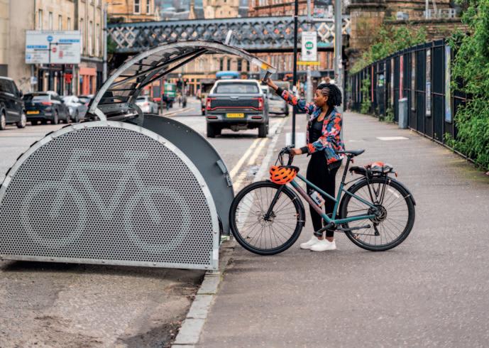


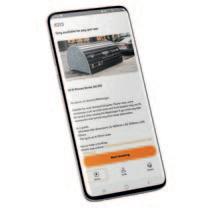
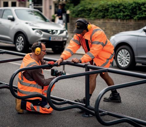


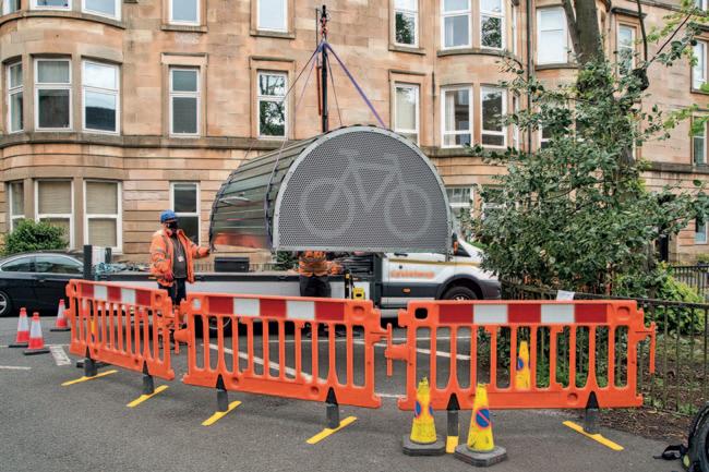
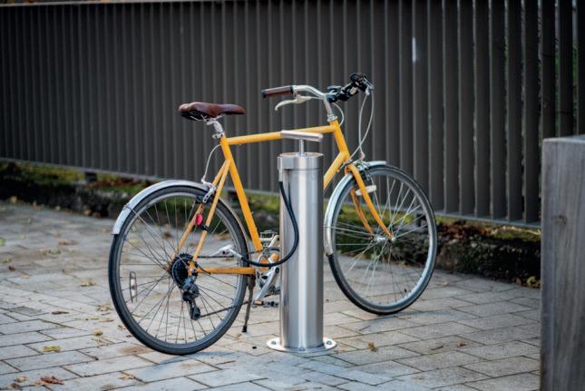

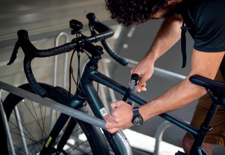

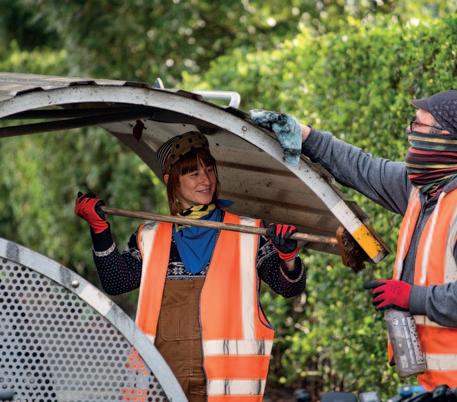

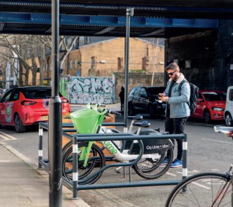
Secure Cycle Storage & Infrastructure
Design, create, operate & maintain excellent & sustainable active travel solutions.
Born over a decade ago through the needs of hardy British cyclists, we focus on delivering the highest quality, sustainable products and services to clients worldwide. All of our solutions are designed for maximum safety, security and usability for the wider community. Manufactured in the UK and built to last using the highest quality components and skill, our solutions are tested to ensure the longest possible lifespan, therefore reducing waste. All individual components are designed to be repaired, refurbished, reused, or eventually recycled.
Contact:
Susan Laidlaw
susan@greasemonkey.cc +44 7921 256066
www.greasemonkey.cc

Introducing Bikedok – a revolutionary solution in secure, smart cycle storage that is transforming the way we think about bike parking. Designed and manufactured in the UK, Bikedok redefines convenience, security, and sustainability for cyclists and communities alike.
Whether you're looking to reduce congestion, meet sustainability goals, or simply offer better facilities for your community, Bike Dok is the ultimate plugand-play solution. Join the movement toward safer, smarter cycling – and make Bike Dok part of your infrastructure today.
www.bikedok.co.uk

Spokesafe is a UK-based platform that helps automate the management of secure cycle parking facilities. Our app supports councils, train operators and landowners in making the best use of cycle parking at stations, car parks and destinations like shopping districts. We manage access, provide 24/7 customer support and capture real-time usage data to improve operations. From communal hubs to individual lockers, Spokesafe creates reliable infrastructure that’s easy to run and open to all. www.spokesafe.com
We’re proud to be an independent consultancy delivering active travel support, for councils and other clients, for 20 years. TI focuses on innovative projects, from policy and audits to detailed design. We provide expert advice on planning walking and cycling networks and routes as well as wayfinding, bike share and much more.
Contact:
Mark Strong info@transport-initiatives.com +44 7725 466840
www.transport-initiatives.com


Pindar Creative is a leading specialist in creating bespoke mapping and travel information solutions designed to promote active and sustainable travel. Our award-winning custom maps are tailored for a variety of locations, from mobility hubs, park-andride sites, and local transport interchanges to wider regional networks for local authorities and transport bodies.
We also offer wayfinding solutions, roadside displays, public transport timetables, onward travel information, and responsive interactive mapping platforms. Our innovative automated solutions streamline the creation of travel information for our clients, enhancing efficiency and accuracy.
www.pindarcreative.co.uk
Passageway www.passage-way.com


For over 30 years, Counter Context has supported local and combined authority project teams to successfully deliver active travel and transport infrastructure. We make complex communications, consultation and engagement simple. We take the pressure off, freeing you to deliver positive change.
Backed by our in-house research, our approach identifies and gives voice to support through targeted community and stakeholder engagement. We communicate with confidence to make the case for investment. Our support runs through the entire project lifecycle, from Strategic Outline Case to construction comms and scheme completion. Through our services, we build understanding and trust in a world that increasingly lacks both. www.countercontext.com
Brand My Thingy (part of Brightwayz) www.brandmythingy.com
Brightwayz www.brightwayz.co.uk
London Cycling Campaign www.lcc.org.uk

Launched in Australia and New Zealand in 2024, Ario represents the next generation of shared transport designed in-house by leading e-mobility experts and shaped by insights from industry leaders locally and globally. More than just a ride, Ario is a commitment to community and safety. In response to calls from cities for safer, incident-free travel, Ario has developed smarter, more reliable vehicles that exceed current safety and operational standards. With Australian-first technologies and ongoing collaboration with local stakeholders, we’re redefining how the sector engages with communities. Ario is Safer. Smarter. Different. And we’re just getting started.
www.ario.com

Beryl is the UK’s leading micro-mobility company, providing innovative bike, e-bike, and e-scooter share solutions that make sustainable transport more accessible and convenient. We design, build, and operate our own vehicles and technology platform, enabling seamless, data-driven services for riders and city partners. With the largest footprint of shared mobility assets across the UK, Beryl partners with local authorities to deliver tailored, safe, and reliable transport options that reduce congestion and improve air quality.
www.beryl.cc
Micromobility Partners
www.micromobilitypartners.com

We create, deliver and manage innovative cycle parking, making places more cycle-friendly.
Our award-winning products are designed by cyclists, to encourage people to experience the benefits of riding a bike. Since launching in 2008 we have worked with public and commercial organisations across all sectors in the UK and internationally, providing a high-quality range of products.
Our cycle parking network - created in partnership with local authorities and offering long- and short-term secure parking in managed on-street Bikehangars® – is the largest in the world.
Cyclehoop’s consultation service applies our knowledge and experience to the needs of districts, towns and cities.
Contact:
Charmian Beedie charmian@cyclehoop.com
+44 20 8057 1766
www.cyclehoop.com

Meristem Design is an award-winning design company creating bespoke green solutions for commercial, public realm and residential spaces through green screens, living walls, parklets, custom planters, rain gardens, SuDS and biophilic design.
Our team of designers and horticulturists, driven by a passion for plants, are on a mission to bring more green into our world, whether it’s at home, in the office or on our commute. We are committed to making the grey green.
Parklets can serve as an important focal point when transforming streets from car dominated environments to community hubs, says Habib Khan – Founder and Director at Meristem Design. This shift towards outdoor spaces has paved the way for more parklets, with hundreds being installed in London alone over the past year. We were delighted that two of our installations were awarded the UK's 1st Accredited Mobility Hubs by COMO. We need to adapt the space for low carbon Mobility Hubs containing seating, planting, electric charge points for cars and e-bikes and cycle parking. We are working with several organisations to roll out more Hubs across the UK.
We believe the future of sustainable transport is the Mobility Hubs and Meristem Design is on a mission to lead the way.
Contact:
Habib Khan info@meristemdesign.co.uk +44 (0)20 3137 6971 www.meristemdesign.co.uk

At Mott MacDonald we are passionate about creating sustainable, liveable communities enabling people to choose active travel to meet their everyday needs. Our transport planning and engineering expertise, combined with our behavioural change approach (putting the user at the centre of everything) means that we are trusted across the UK and internationally to deliver positive social outcomes. We work through the entire project lifecycle, from strategy and business case into design, delivery and monitoring. Our breadth and depth of in-house talent enables us to continually provide a complete wrap around active travel offering to our clients.
Contact:
Lucy Millier
lucy.millier@mottmac.com
+44 20 7651 0134
www.mottmac.com
Hardscape have been inspiring visionary urban spaces for over 30 years, and now our Active Travel Kerbs solution is helping delivery safety and accessibility for cyclists and pedestrians, the most flexible solution on the market today, supported by our in-house team to help craft your design proposals into functional plans.
Contact: Matt Sier msier@hardscape.co.uk +44 7541 100 305 www.hardscape.co.uk
Oxfordshire Liveable Streets www.oxfordshireliveablestreets.org
Rosehill Highways www.rosehillhighways.com
We’re proud to be an independent consultancy delivering active travel support, for councils and other clients, for 20 years. TI focuses on innovative projects, from policy and audits to detailed design. We provide expert advice on planning walking and cycling networks and routes as well as wayfinding, bike share and much more.
Contact:
Mark Strong info@transport-initiatives.com +44 7725 466840 www.transport-initiatives.com
Go Jauntly www.gojauntly.com
Walking Projects Plus www.walkingprojects.com


Welcome to BetaStreets a street design tool for anyone.
BetaStreets is a purpose-built software design platform, made to change the way people design streets and places.
Combine photos of the present, with assets from the library of things to create your perfect vision of the future in minutes.
www.betastreets.co.uk
City Science exist to help you find the most effective ways to solve your problems through data. City Science is creating next generation products and services that capture, analyse and interpret city data.
We enable data-driven decision making, providing insights and tools to make cities fit for the demands of modern living. Working with our partner cities we use data to develop new solutions, identify efficiency opportunities and inform policy options. www.cityscience.com

At UrbanTide, our mission is to make a sustainable world with AI. We help organisations unlock data and build sustainable communities with integrated and open travel data.
Our uMove data platform integrates real-time and historic travel data from any source to help communities better understand usage and predict travel patterns with AI. We integrate and standardise transport-monitoring data alongside additional data to provide a single-source, centralised evidence base, informing transport strategies, monitoring progress and supporting funding applications. www.urbantide.com
City Science - Cadence www.cadence360.cityscience.com
City Science www.cityscience.com
CycleStreets Ltd www.cyclestreets.org
QRoutes Ltd www.qroutes.co.uk

MP Smarter Travel was founded in 2012. We are a small active travel consultancy offering a personalised service to a diverse range of clients including local authorities, business improvement districts and sustainability organisations. Through our work with our clients, we help create healthier and happier towns and cities across England.
Contact:
Lauren James info@mpsmartertravel.co.uk +44 20 7960 2553 www.mpsmartertravel.co.uk
Beate Kubitz Associates www.beatekubitz.com
Everybody’s Cycling www.everybodyscycling.org.uk
International Cargo Bike Festival www.cargobikefestival.com

Secure Cycle Storage & Infrastructure
Design, create, operate & maintain excellent & sustainable active travel solutions.
Born over a decade ago through the needs of hardy British cyclists, we focus on delivering the highest quality, sustainable products and services to clients worldwide. All of our solutions are designed for maximum safety, security and usability for the wider community. Manufactured in the UK and built to last using the highest quality components and skill, our solutions are tested to ensure the longest possible lifespan, therefore reducing waste. All individual components are designed to be repaired, refurbished, reused, or eventually recycled.
Contact:
Susan Laidlaw
susan@greasemonkey.cc +44 7921 256066 www.greasemonkey.cc
Accell UK & Ireland Ltd - Raleigh UK www.raleigh.co.uk
Beate Kubitz Associates www.beatekubitz.com
Fettle Bike Repair www.fettle.cc
Outspoken Cycles www.outspokencycles.co.uk
The Green TLC www.thegreentlc.uk
The Sustainable Travel Collective Ltd (operating as RideWise) www.ridewise.org.uk