Pharos magazine 1 Special Edition December 2024 v2
SHARE YOUR THEORIES: NATURAL PHILOSOPY ALTERNATIVE FACTUAL HISTORY PHYSICS...AND MORE IN THIS EDITION 10+ articles/ 200+ pages And all the information needed for you to contribute
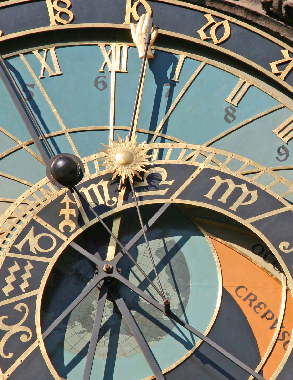
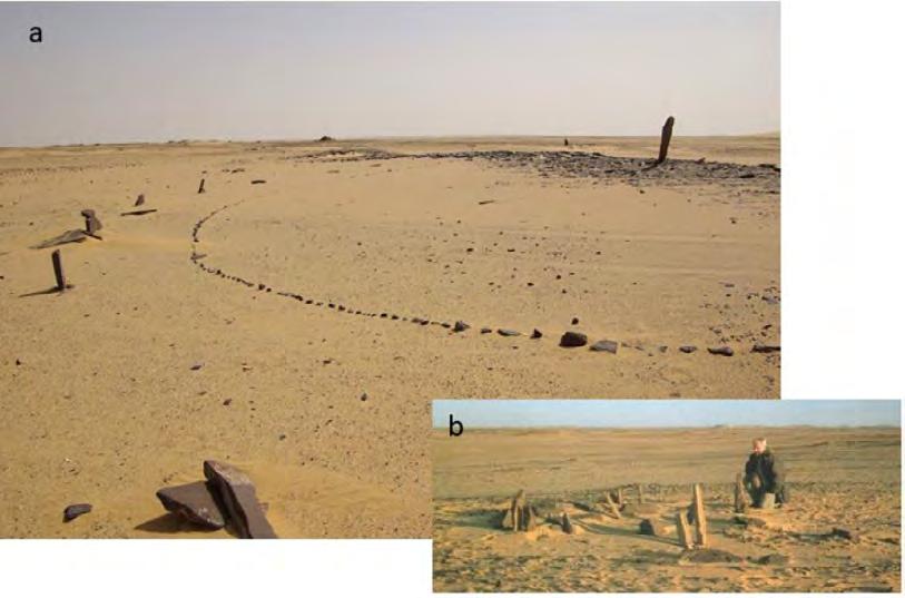
The Prague astronomical clock or Prague Orloj (Czech: Pražský orloj [praʃskiː orloj]) is a medieval astronomical clock attached to the Old Town Hall in Prague, the capital of the Czech Republic. The clock was first installed in 1410, making it the third-oldest astronomical clock in the world and the oldest clock still in operation.
Photo by L. Ascending, Flickr.com
Pharos magazine | Nº 1 | December 2024
"To give birth to the ancient in a new time is creation. This is the creation of the new, and that redeems me. Salvation is the resolution
The
of the task.
task is to give birth to the old in a new time."
- ~Carl Jung, The Red Book
Pharos magazine · Institute for Natural Philosophy · Research Center for Ancient History @NaturalPhiInst
Legal Notice
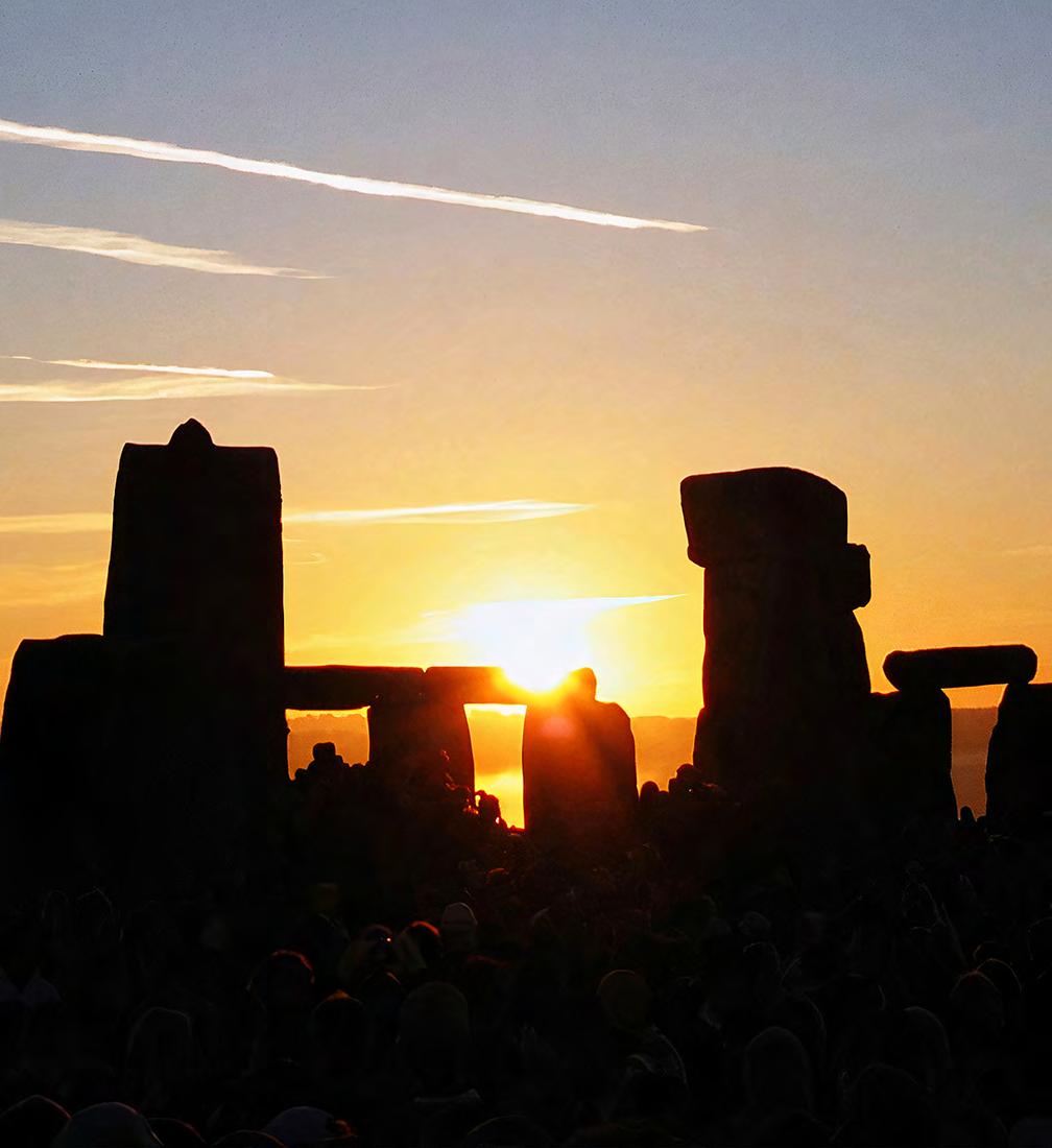
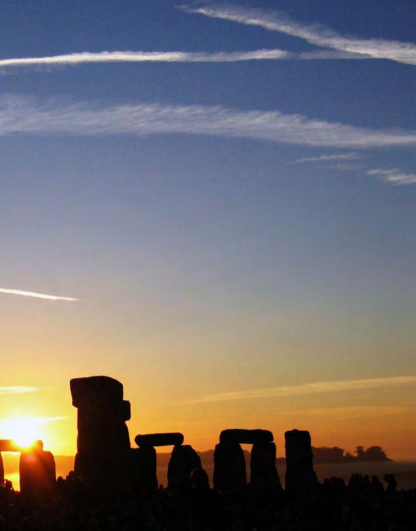
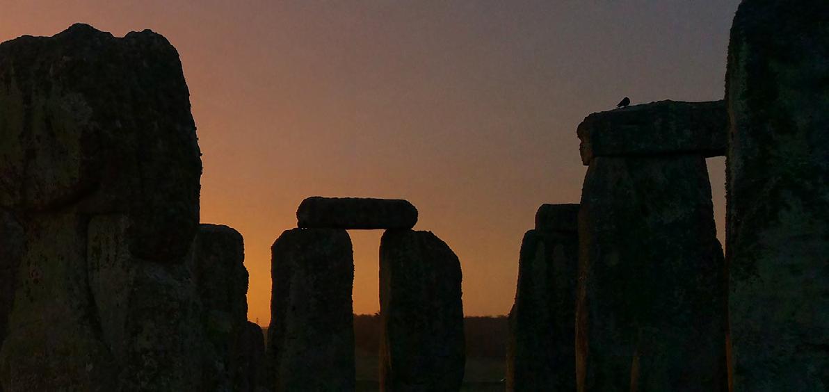
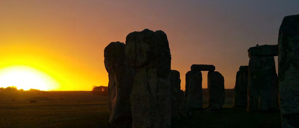
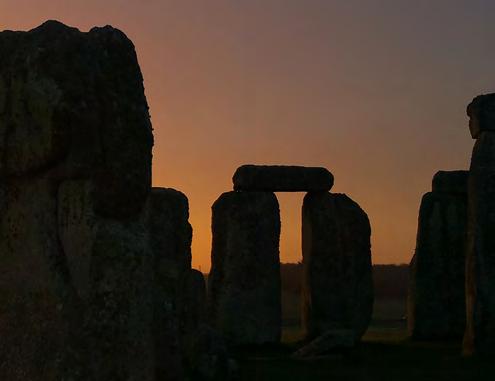
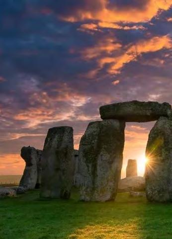
Cover photo: The Sun rising over Stonehenge in southern England on the June solstice | CC BY-SA 2.0, https://commons. wikimedia.org/w/index.php?curid=195581/ Photograph by Andrew Dunn, 21 June 2005/ website: http://www. andrewdunnphoto.com/
Cover - and magazine design by Jeffrey van der Lugt Website: https://www.institutefornaturalphilosophy.org
The views expressed in the articles reflect the respective authors opinions and are not necessarily the views of the publisher. The published material, advertisements, editorials and all other content is published in a good faith. Institute for Natural Philosophy cannot guarantee and accepts no liability for any loss or damage of any kind caused by information in this publication from errors or for the accuracy of claims made by the authors or advertisers. The material and content in the articles is for informational and educational uses only. All photo's that haven't been taken by Pharos magazine, have either been purchased, used with permission, credited and linked back to their original sources or believed to be in public domain. Articles may contain copyrighted material, the use of which has not been specifically authorized by the copyright owner. Should you come across unauthorized images or material for which you hold copyright, please contact us! All Rights Reserved. Content is subject to international copyright laws. Content can not be reprinted or reproduced in any format, partially or in whole, without written consent of the publisher.
EDITOR'S NOTE
Over the past 20 years, I've tried to take the pulse of our ancient pasts' general accepted knowledge. I've been dedicated to exploring the forgotten history of humanity and ancient architecture ever since. A lack of satisfying explanations in many scientific fields had me triggered to dive into as much information as possible, and out of curiousity I entered 'the world of social media' about year ago in search people with the same interests and I guess, for some answers too...
It was with great pleasure that I was 'seen' on X and contacted by the founders of the Institute for Natural Philosophy. I was asked to contribute to their hub of independent thinkers and researchers who are, like myself, passionate about ancient (factual) history and the ancient world. Since working as a graphic designer being one of my passions, another one would be to somehow bring this community together. So, why not doing so by expressing 'thoughts', ideas and information into a brandnew magazine
It is my pleasure to present you this first, special and free issue of Pharos magazine. A new medium that will cover every angle from ancient worlds, to distant futures, but above all, your input and feedback.
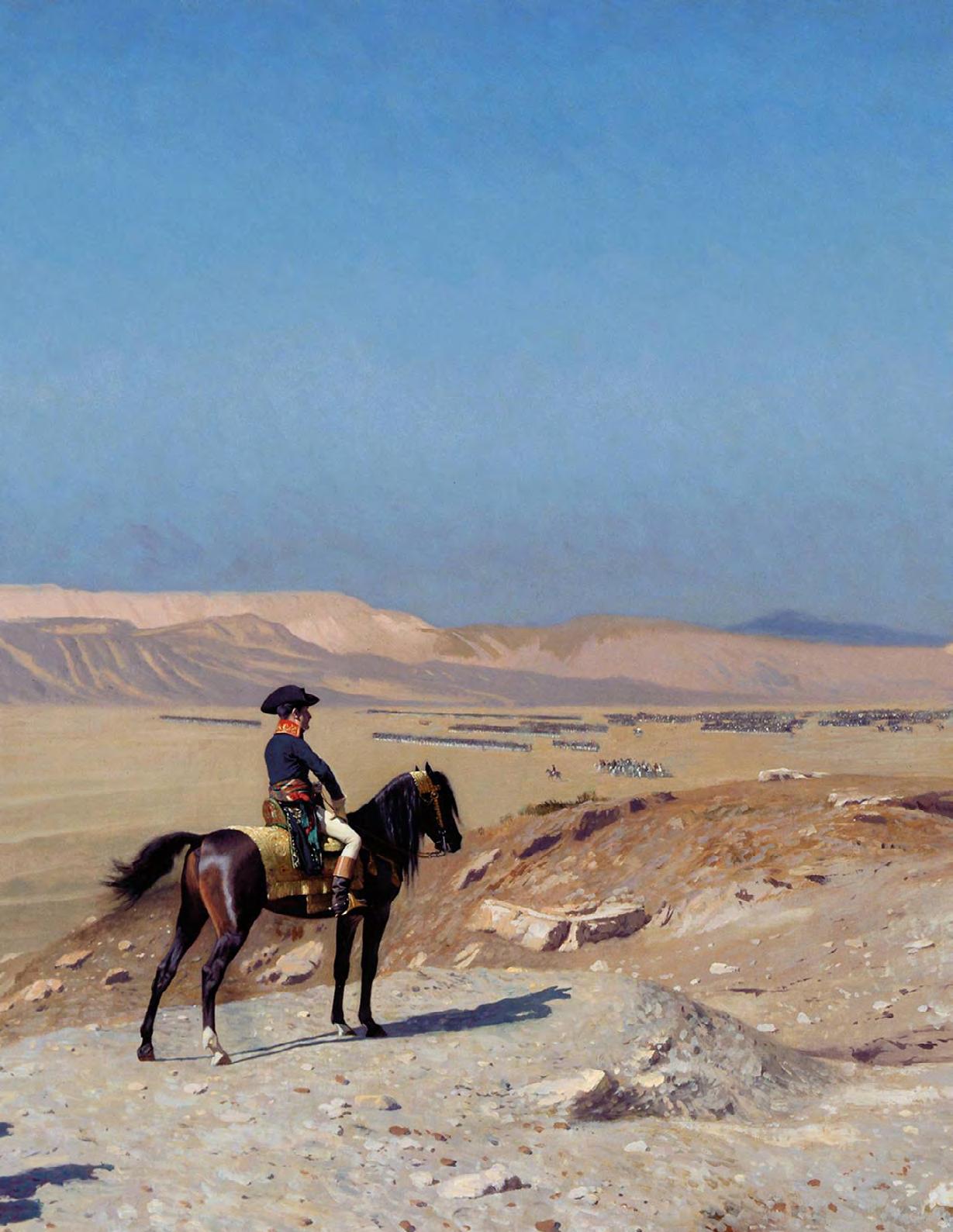
Image: Bonaparte Before the Sphinx (French: Bonaparte devant le Sphinx) is an 1886 painting by the French artist Jean-Léon Gérôme. It is also known as Oedipus (Œdipe). It depicts Napoleon Bonaparte during his Egyptian campaign, positioned on horseback in front of the Great Sphinx of Giza, with his army in the background. By Jean-Léon Gérôme - Fuente, Public Domain,
114
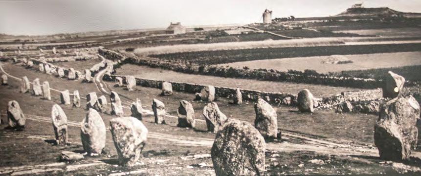
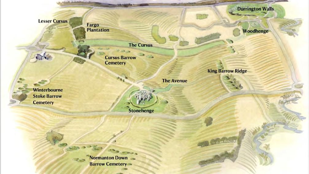
New discoveries of the connections between pre-Columbian Americas and other regions of the world
Vi Duo
Views from an Amateur Philosopher
Yiorgos Sakelaris
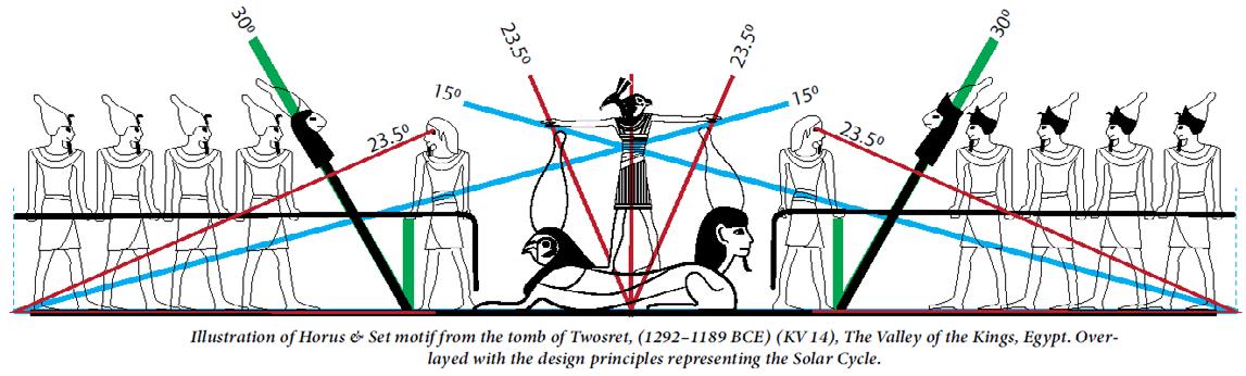
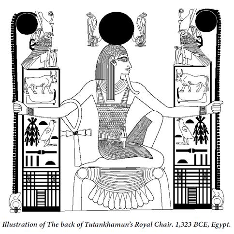
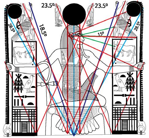
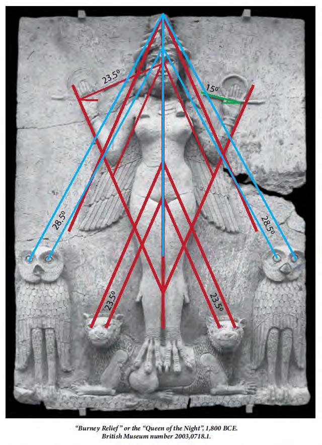
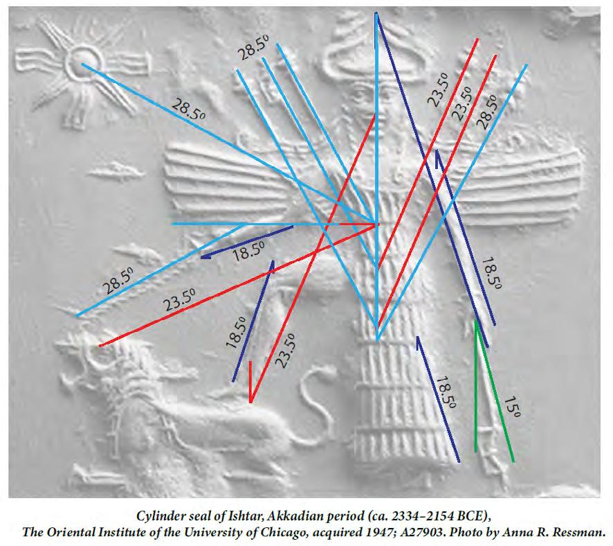
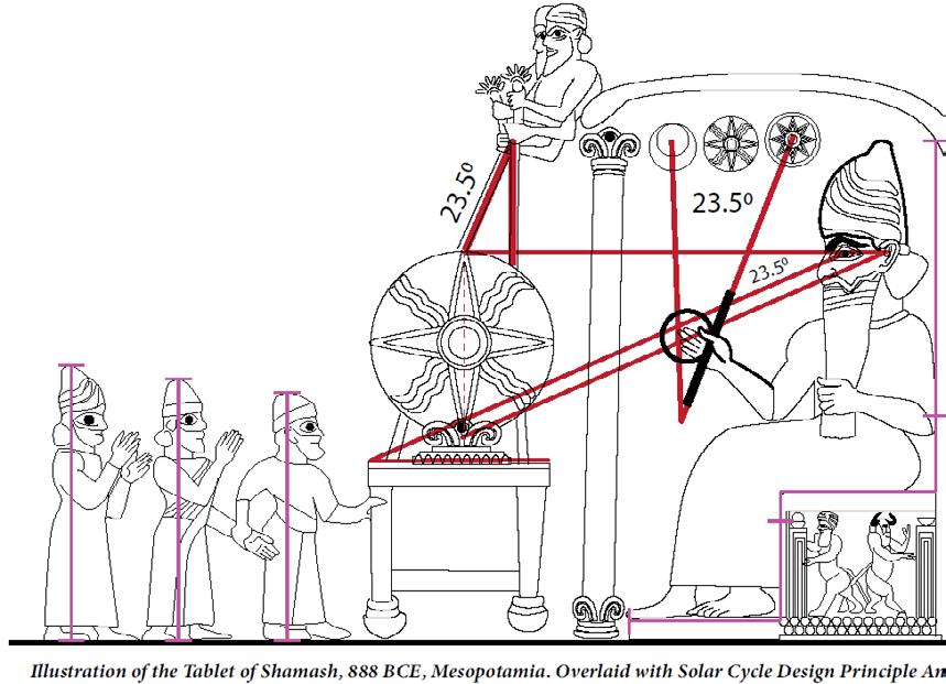
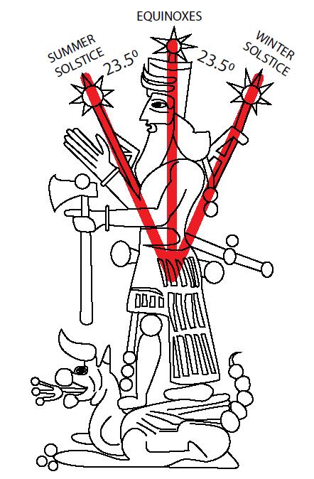
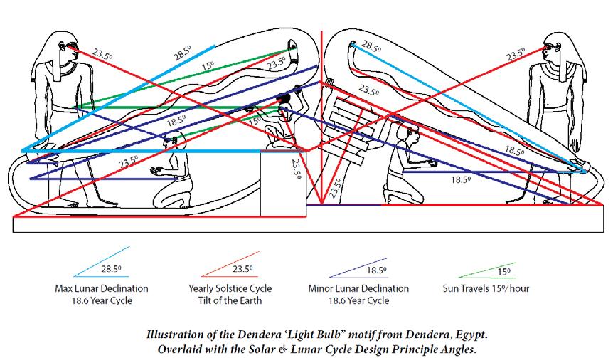
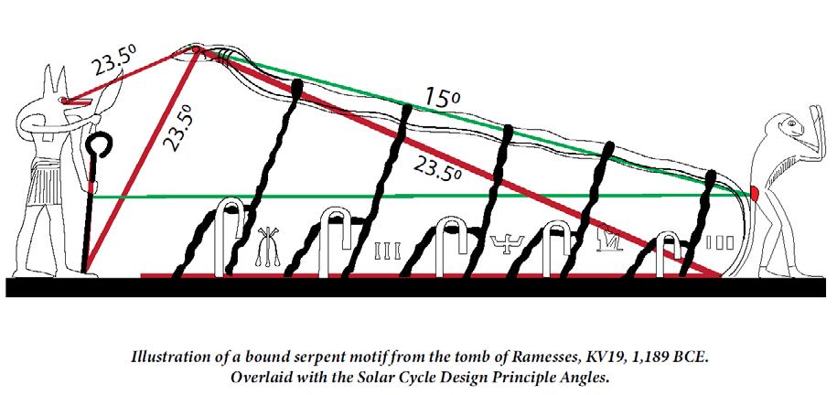
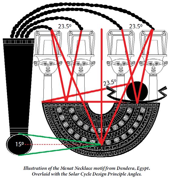
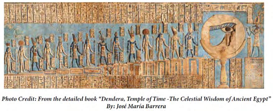
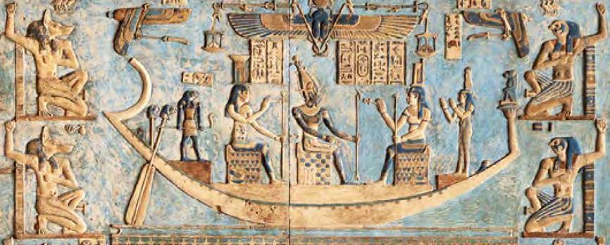
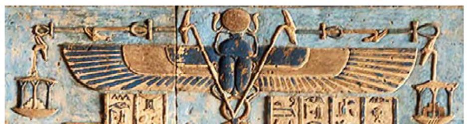
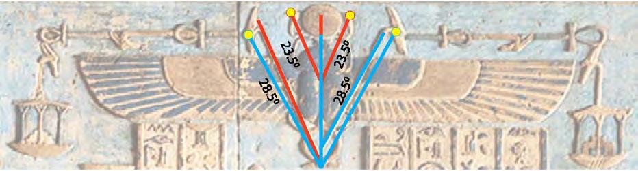
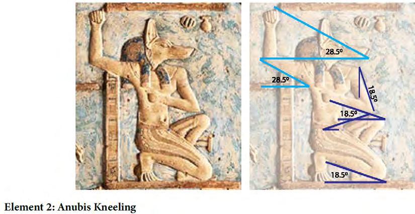
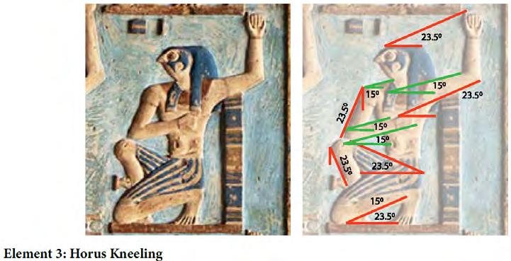
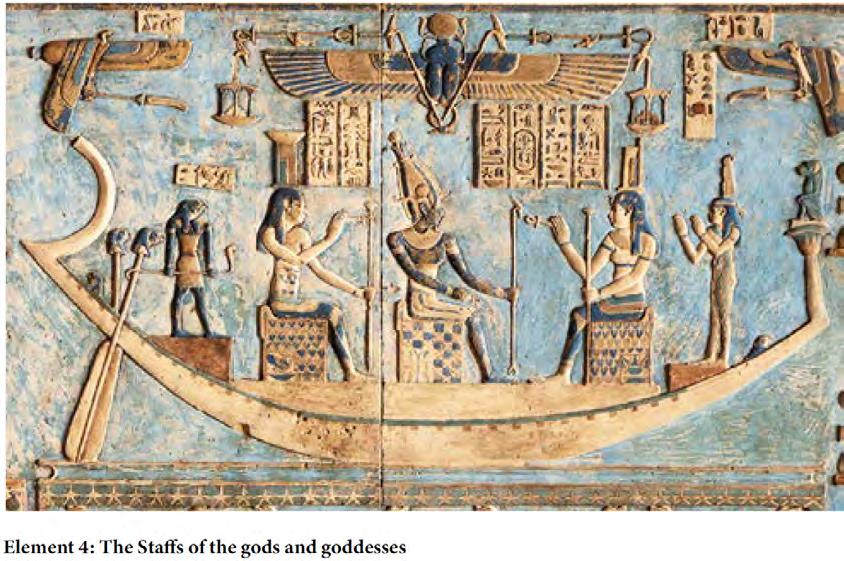
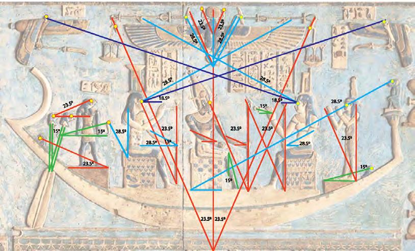
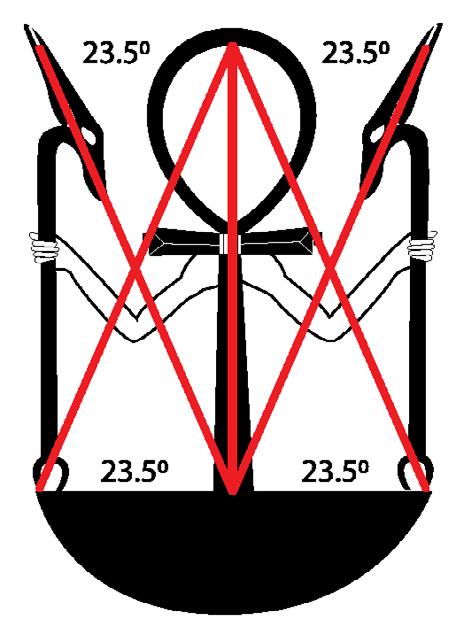
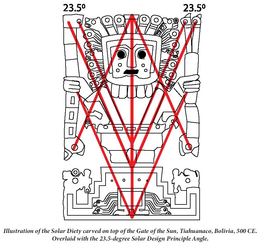
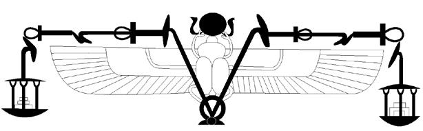
Advanced celestial measurements and astrological cycles within the geometric design principles of the ancient gods and goddesses
Jason Quitt
Steven Moore
central public space
your input here
The agora (/ˈæɡərə/; Ancient Greek: ἀγορά, romanized: agorá, meaning "market" in Modern Greek) was a central public space in ancient Greek city-states. It is the best representation of a city-state's response to accommodate the social and political order of the polis. The literal meaning of the word "agora" is "gathering place" or "assembly". The agora was the center of the athletic, artistic, business, social, spiritual, and political life in the city. The Ancient Agora of Athens is the best-known example.
INSTITUTE for NATURAL PHILOSOPHY
The goal of the Institute for Natural Philosophy is to be a hub for researching and sharing new theories on the fields of natural philosophy, alternative history, physics and more. We believe that together, we can build a brighter future of free and informed individuals with a common goal: unraveling the mystery of existence and discovering the truth.
Submit a paper, research, theory or idea that you want us to review, investigate or publish. There is no fee to submit and you do not have to be a member. Visit the form for all the details.
Get involved and sign up as a future volunteer or paid employee. Work in the public view or behind the scenes and contribute your knowledge, skillset or provide general help. There is a variety of positions available to choose from. Visit forms for all the details.
Be sure to stop by our store and check out all the options. We offer unique and rare books and maps as printed replicas or downloads, a history research service with optional written paper and logo merchandise.
Principal Architect / Founder
Guilherme Reis
Ricardo Calvário
Independent Researcher / Founder
Jeffrey van der Lugt
Graphic Designer
Steve Wilbur
Logistics
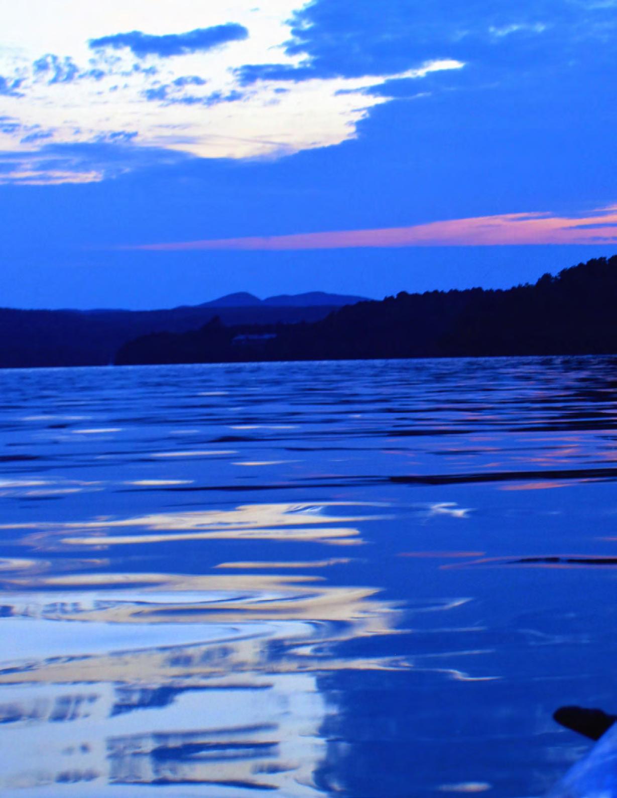
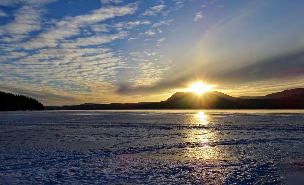
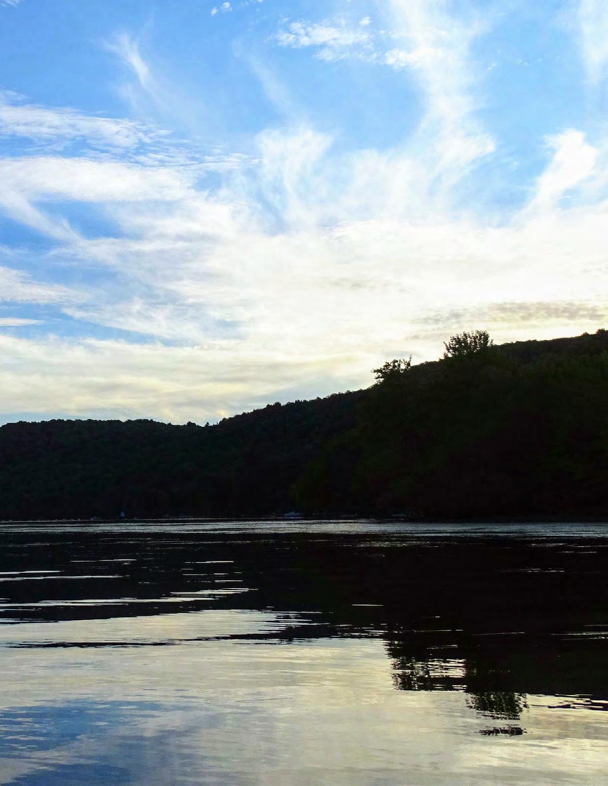
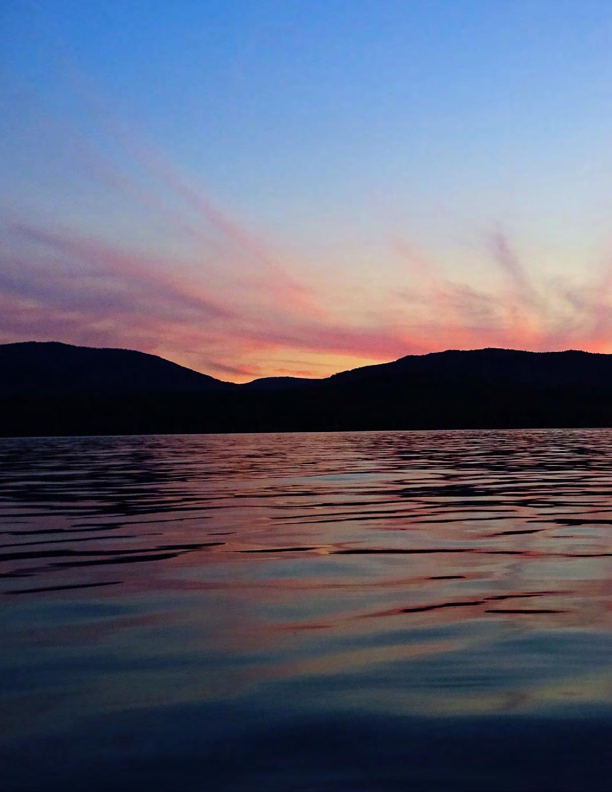
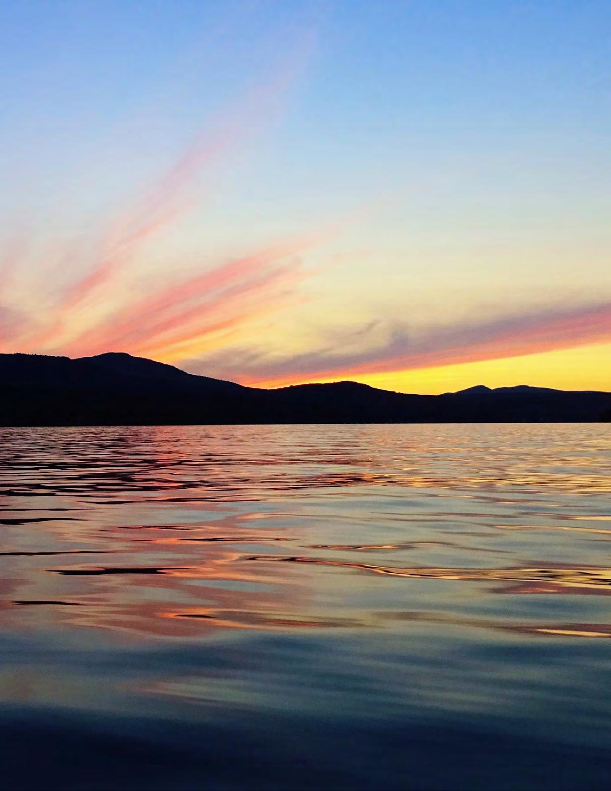
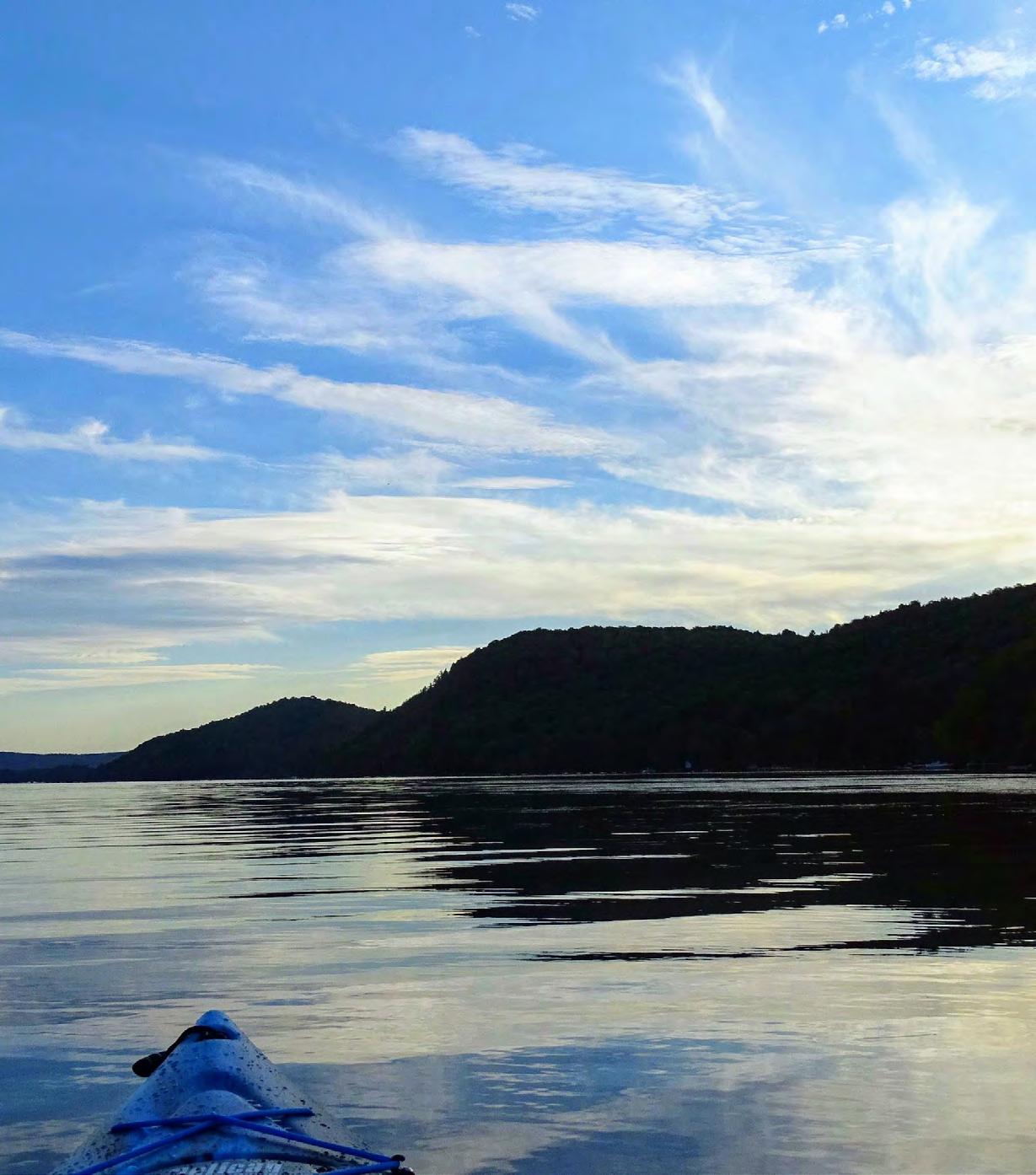
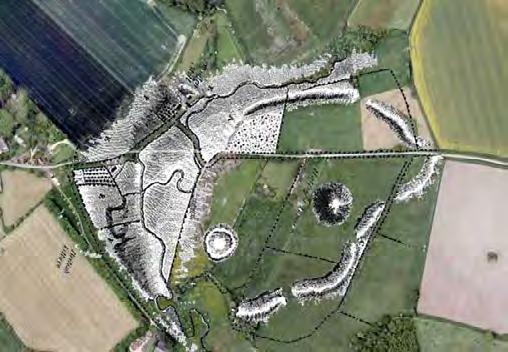
Lake Memphremagog
"The shimmering pearl of the northern Appalachians"
Located in the south eastern part of the province of Quebec in Canada, in the heart of the Eastern Townships region, lies the vast and picturesque Lake Memphremagog.
By Yann Biron
"shimmering pearl..."
It is approximately 1,5 to 3 km wide for most of its length and surrounded by beautiful hills and mountains. With a surface area spanning just over 100 square kilometers, including 25 square kilometers across the U.S. border, it offers plenty of space to enjoyed numerous activities such as fishing, water skiing, paddleboarding, kayaking, and the list goes on.
The body of water sits at the core of the Eastern Townships. The geographical area runs along the American border for 35 km and covers the territory of seventeen municipalities grouped into four regions: Magog-Orford, the border region, the Massawippi valley and finally, the Missisquoi valley. The Eastern Townships is distinguished by its concentration of rolling hills, breathtaking mountains and lakes.
The best way to discover the magic of the Memphremagog county, is to take a random road and just contemplate the scenic beauty of the countryside. As the northern chain of the Appalachians cuts through the region, no matter where you travel, you can always feel their formidable presence.
First settlers
The Memphremagog regional county has been occupied by the First Nations people all the way back to the Paleo-Indian period. In fact, a little more than 20 years ago, a team of archeologists discovered artifacts in the neighboring region of Mégantic. These artifacts confirmed that there were human occupation here more than 12 000 years ago.
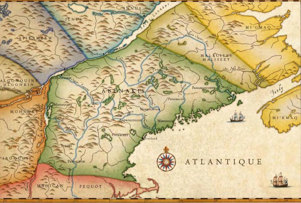
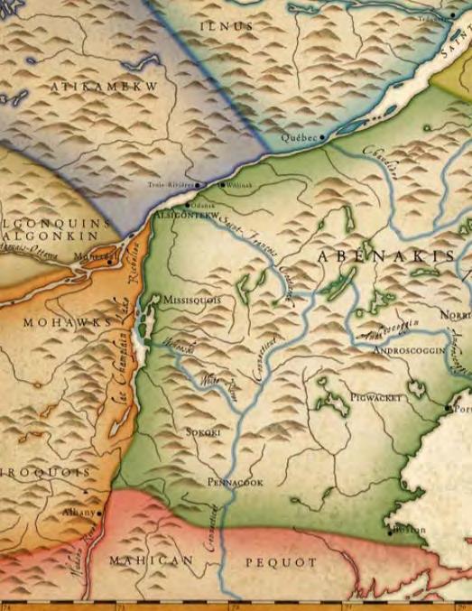
When European explorers first set foot in the region, in the 16th and 17th century, the land was inhabited by the Abenaki people. Please note, chances are more than very likely, foreigners from the Old World traveled through this land hundreds of years earlier than the 1500s and 1600s, but we will stick to these "official" dates for the time being.
Map of Abenakis land
“The lake is defined as a glacial lake, or elongated finger lake, and extends about 44 kilometers from Magog, Quebec, all the way to Newport,Vermont, United States. ”
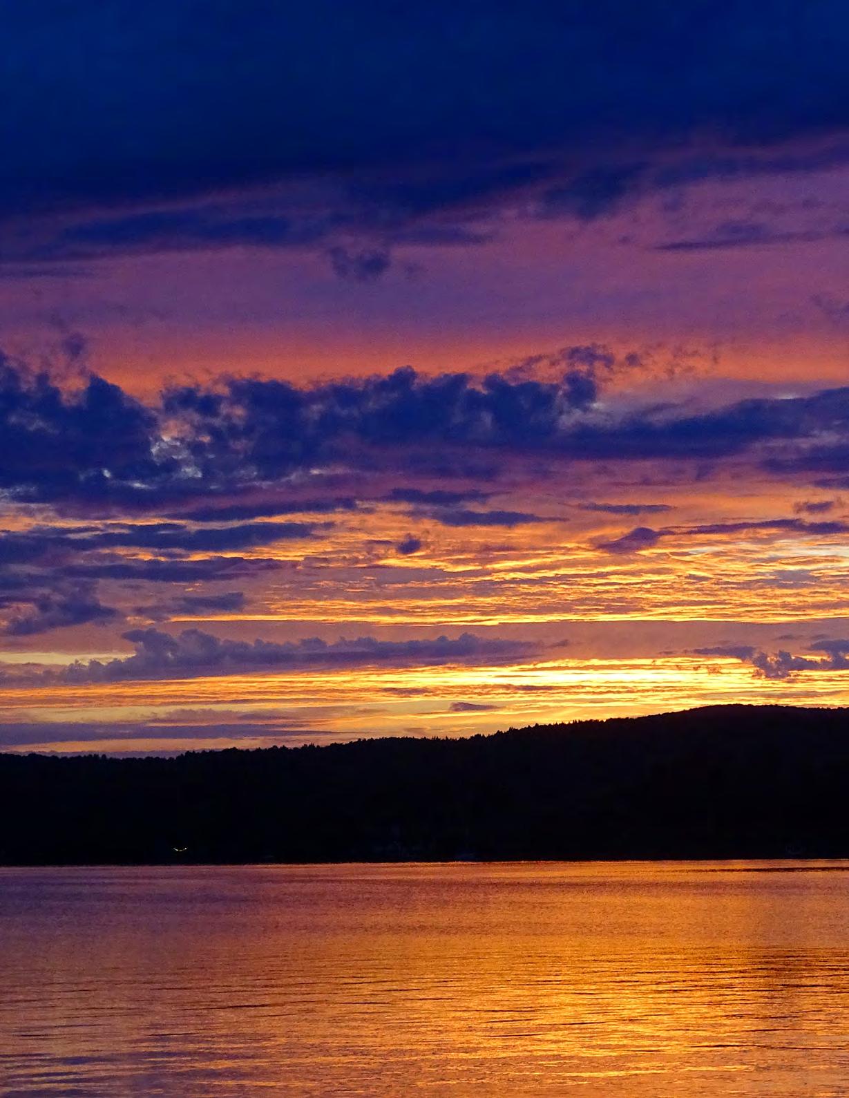
Mother
Nature's incommensurable beauty on full display once again on the Lake
Official settlement of the region truly began in the late 1700s. Under the terms of the Constitutional Act of 1791, the Eastern Townships were open to settlement and a land rush followed. Most of the 3000 or so settlers came from the United States. A few were Loyalists, at least in spirit, but most simply wanted land, and had no strong feelings about nationality.
British, Irish and Scottish settlers followed in the early nineteenth century, and finally, after the mid-nineteenth century, Francophone from the St-Lawrence valley.
By the mid-1800s, Memphremagog was already becoming a vacation resort for travelers from both sides of the border. At first, the lake was the giant playground of wealthy folks who bought large estates along the eastern shore, especially around the sleepy hamlet of Georgeville and along the northeast shore of Newport in Vermont. Subsequently, the arrival of the railroads at both ends of the lake brought a constant flux of passengers from Montreal and all over New England.
Back in the days, Lake Memphré was known to have had up to 10 lighthouses in total. (originally established in 1878). Unfortunately, none of the original lighthouses have survived to modern time. It's quite fascinating to realized that this beautiful body of water has been a popular tourist attraction for at least 175 years.
First Nations heritage "The Dawn-land People"
The Abenaki tribe is one of the lesser known Native American groups. Abenaki refers to the collection of several different tribes, including the Ossipee, Sokoki, Winnipesaukee, Penacook, Pigwacket, and Cowasuck. Although each individual tribe had their own slightly different dialect, they technically spoke the same language and were known as the Abenaki people.
The Abenakis, also known as "Abnaki", had inhabited North America for many thousands of years before European exploration. Even though very little is known about them before the 16th century and their exact origins are still shrouded in mysteries, their own oral history and other evidences seems
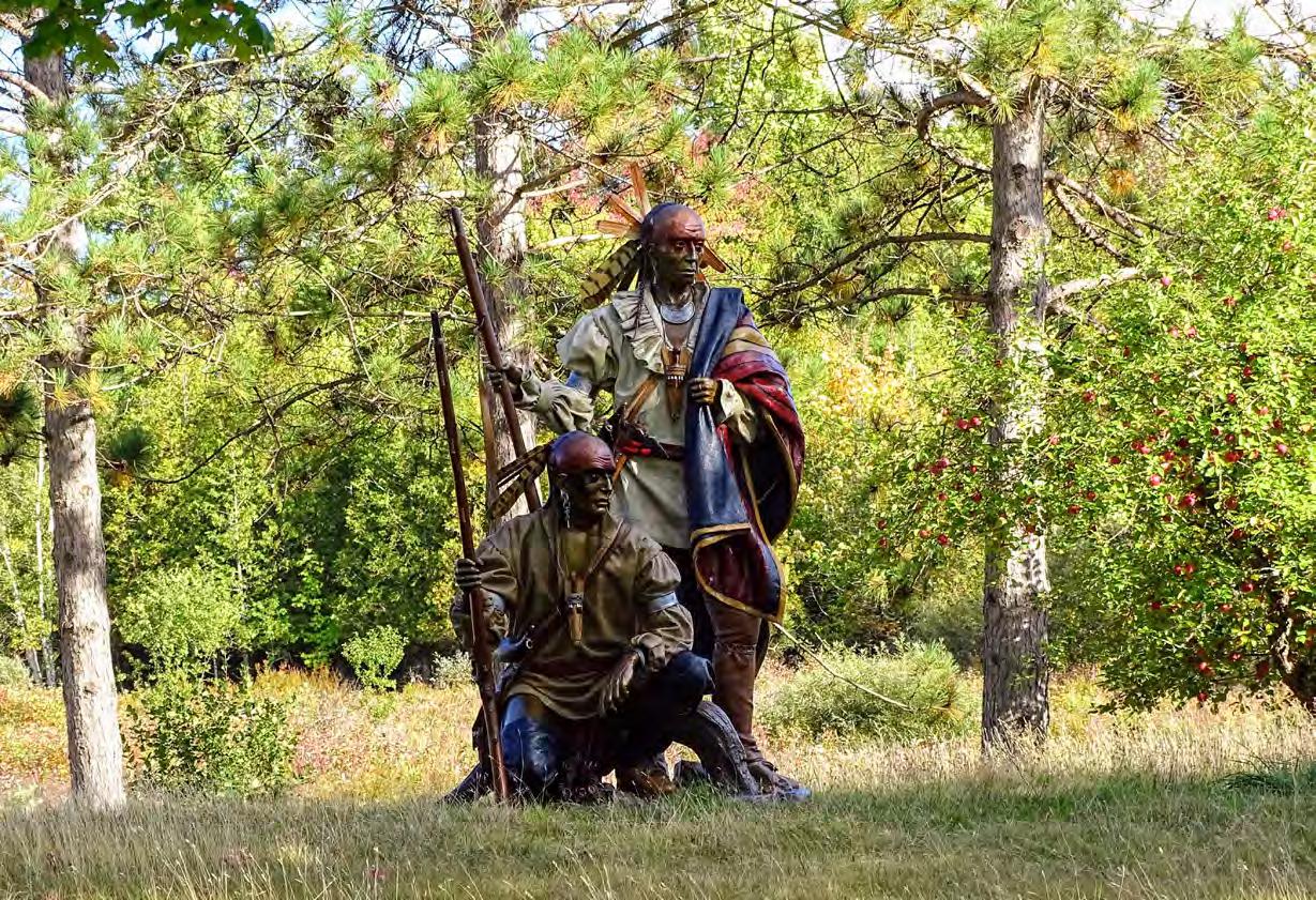
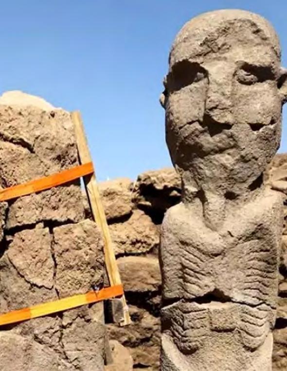
Exquisite statues of two Native Americans that can be seen on "Chemin de l'Est", a lonely dirt road near the village of Georgeville. A great reminder of the First Nations heritage which is strongly present throughout the whole region.
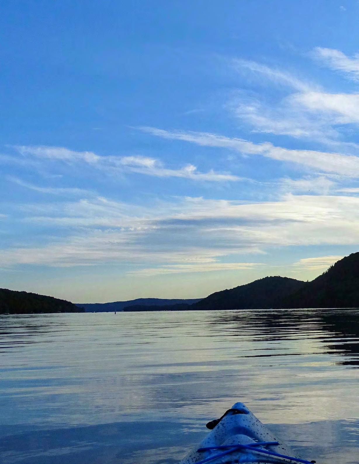
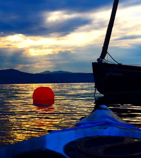
Contemplating a magnificent colourful sunset
to point to the fact that they have always been here, or at least, been here since the end of the last ice age. The name Abenaki, or Abnaki, is derived from the name "Wabanaki", which when translated into English means "People of the Dawnland", because of their eastern origins.
When Europeans came to the New World in the 1500s, they had little impact on the Abenaki tribe. However, while they didn't intentionally do anything at first to push the Abenakis out of New England states, they inadvertently brought European diseases along with them.
Because the Natives didn't have any natural immunity to these diseases, primarily smallpox and measles, it's estimated that 98% of the entire population perished. In addition to diseases, Native American tribes were also forced to pick sides in wars between European countries on American soil.
At the height of their power in the 1500s and 1600s, there were an estimated numbering upwards of 40 000 people stretching across two provinces and five states. Nowadays, there are fewer than 8000 individuals of Abenaki descent.
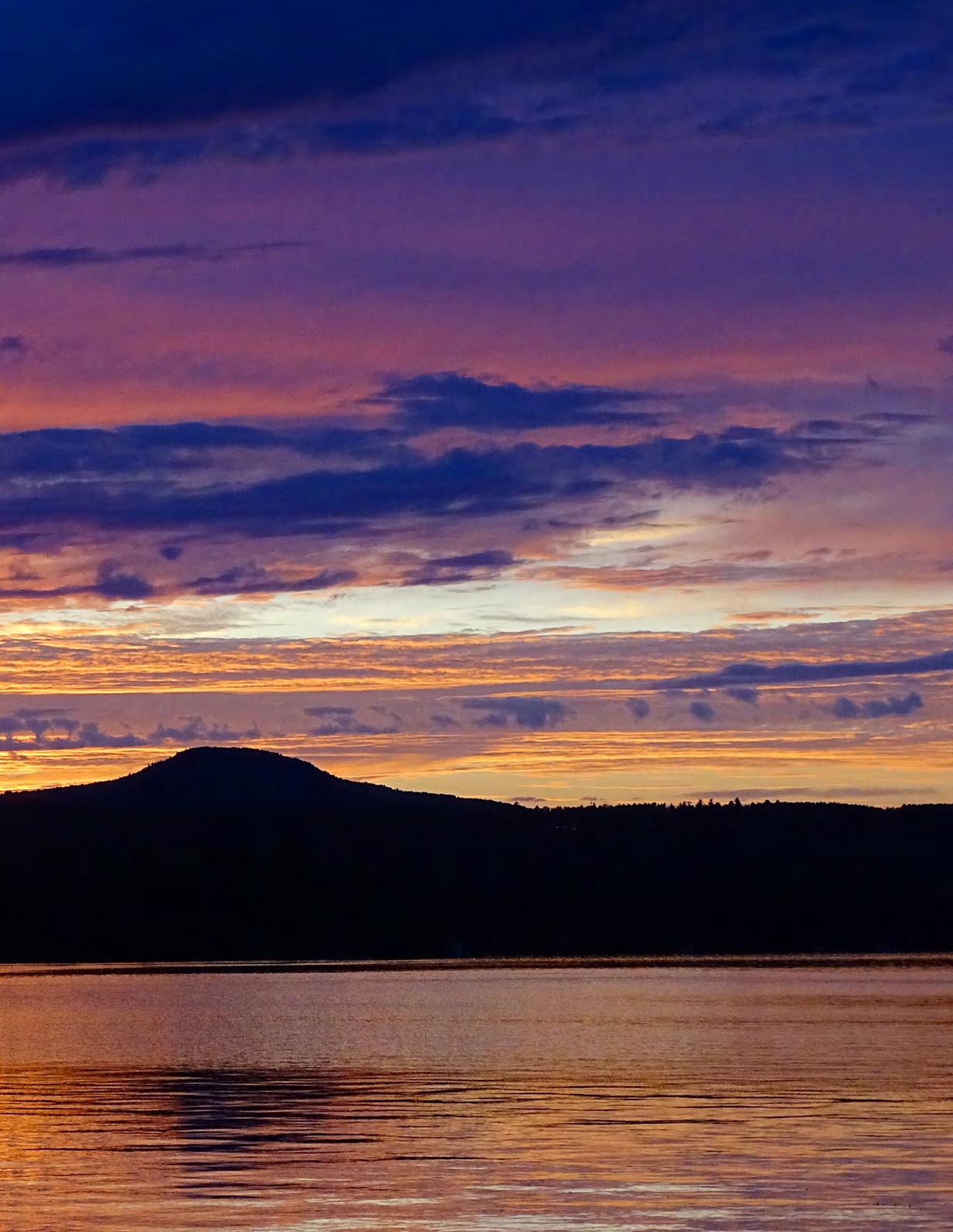
Kayak outing near the small village of Georgeville, enjoying the magical beauty of the fading sunset.
The Abenakis call themselves "Alnôbak", which translates as "Real People", and their homeland, known to them as "Ndakinna", meaning our land, extended across most of northern New England, southern Quebec, and the southern Canadian Maritimes.. To this day, echoes from the Abenakis are still being heard throughout the whole Eastern Townships. Mainly through the numerous names of towns, lakes, rivers, as well as different geological features which are of Native origins. For example, the lake's name, Memphremagog, which was also pronounced "Mamphremagog" and came from the Abenakis' "Mamlawbagak", which signifies "a long and large sheet of water".The prefix "mamlaw" denotes largeness or abundance. The particule "baga" denotes water and "k" marks the name as given in local term.There are countless other examples, like the city of Magog, "Nmagok", at the north end of the lake, the nearby town of Coaticook, lake Massawippi, the Tomifioba river, and so on and so forth.
Local folklore, or something more profound...
Aside from the beauty of its landscapes, and the many attractions it has to offer, Lake Memphremagog is also famous for something a little more peculiar, the legendary lake monster known as "Memphré". At the end of 2001, the International Society of Dracontology", which was created by the well-known businessman and professional diver Jacques Boisvert (1933-2006), had compiled 223 sightings
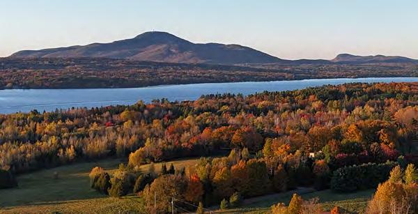
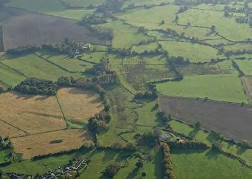
Drone photo's taken on the western side of the lake looking southward, autumn 2024
involving at least 465 persons. Interesting to note, one of the oldest written report of a lake monster was featured in the Stanstead Journal on the 20th of August 1868.The article stated that a group of men working in a field along the bank near Lord island, witnessed a creature with its head sticking a couple of feet out of the water and with a body the size of a big log covered in brilliant scales.
The origins of the Memphremagog lake monster phenomenon are, interestingly enough, much older. When the first settlers began colonizing the region, they were told by the Abenakis that their people wouldn't bathe or swim in the lake, due to the fact that "anacondas" or very large serpent-like creatures roamed the water dephts. The Natives undoubtedly implied that there were a multitude of these huge aquatic creatures, not a simple solitary monster like we hear in modern time.
Today, like many other lakes with alledged monster, Memphré is considered by most as nothing more than a local mascot and a tourist attraction. Nonetheless, when one takes the time to listen to the many credible eyewitness testimonies, while at the same time taking in consideration the wisdom and beliefs of the First Nations people, the phenomenon is almost impossible to dismissed.
Final words
For anyone who's an outdoor enthusiast and nature lover, Lake Memphré should definitely be on your bucket list if you ever traveled to Quebec. As a lifelong resident of the Memphremagog county, and as someone who went on his first boat excursion on the lake at the age of only three weeks old, i might be a little buyest...
So don't take my word for it, come and visit!
Yann Biron
AD FROM THE PAST
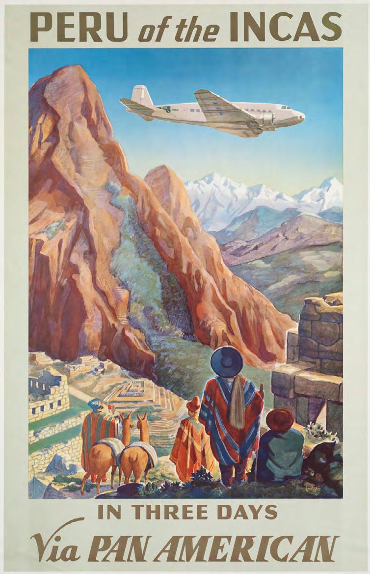
Travel Poster for Peru | Pan American | Paul George Lawler, Public domain, via Wikimedia Commons
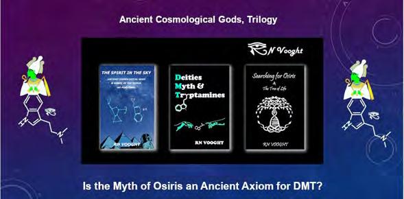
RN Vooght
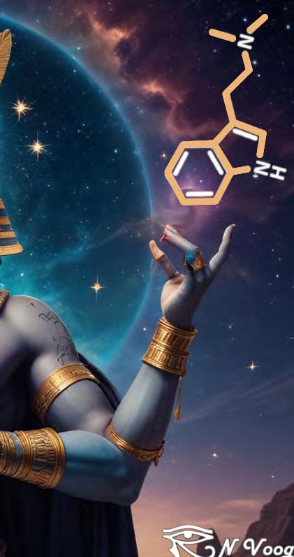
ENTHEOGENIC ARTISANS IN ANTIQUITY
GRAHAM HANCOCK: “RN’s books explore the oldest surviving reference to the notion of ‘resurrection’ and the ‘Tree of Life’ — The Myth of Osiris.
Vooght investigates the connections these ancient ideas have to the cosmologies of a plethora of civilisations, and what this might contribute to our understanding of the human story and even reality itself.”
Media Contacts: YouTube Channel: RN Vooght | Twitter: @Vooghtrn | Instagram: @RNVooght DMT-SHIRTS web link: https://dmtees-2.teemill.com/
What a time to be alive! In the 21st century, along with the advent of artificial intelligence, we stand upon the cusp of sending a manned mission back to the moon with a view of potentially colonising the Red Planet and beyond. But what if space isn’t necessarily the final frontier? What if inner space holds the key to future generations of the human story? What if we’re not the greatest after all? Imagine a world where society understood the nature of human consciousness, whereby science and religion were united in the exploration of both the unfathomable vastness of the cosmos and the somewhat untapped
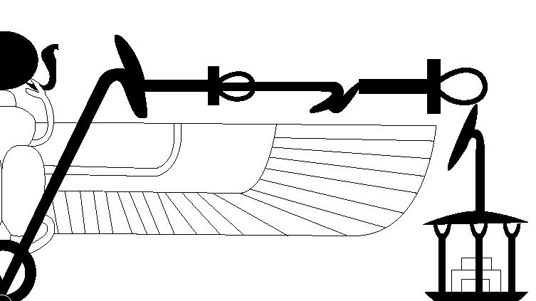
acacia and further immortalised as the constellation of Orion. Legend has it that Osiris was tricked by his evil nemesis and brother Set to lay down inside a beautifully ornate coffer while Set and his followers fastened the casket before tossing it into the Nile. The coffer, we are told, came to rest upon the coastal banks of Byblos in modern-day Lebanon where it became further entangled within the trunk of a Tamarisk tree. After a number of years the King of Byblos ordered the felling of the tree which was to be carved into resplendent pillar and hung upon the walls of his palace. In time Osiris’ sister and wife Isis learns of her lover's
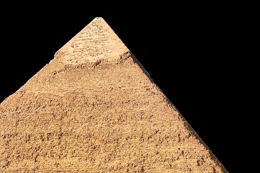
“Why would such an archaic Ancient Egyptian society, supposedly capable of constructing the Great Pyramid, go to such extreme lengths to be certain that the Myth of Osiris like the Great Pyramid itself, stood the test of time?”
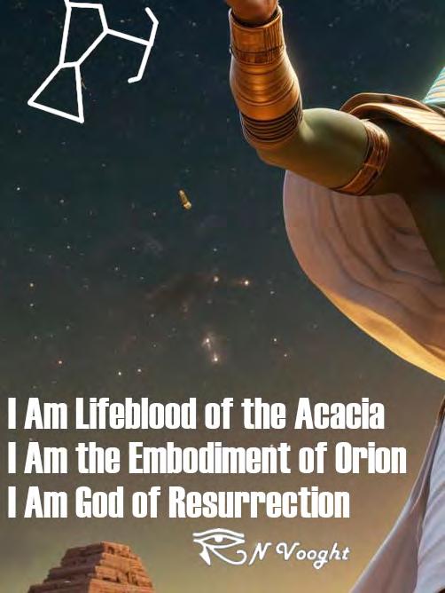
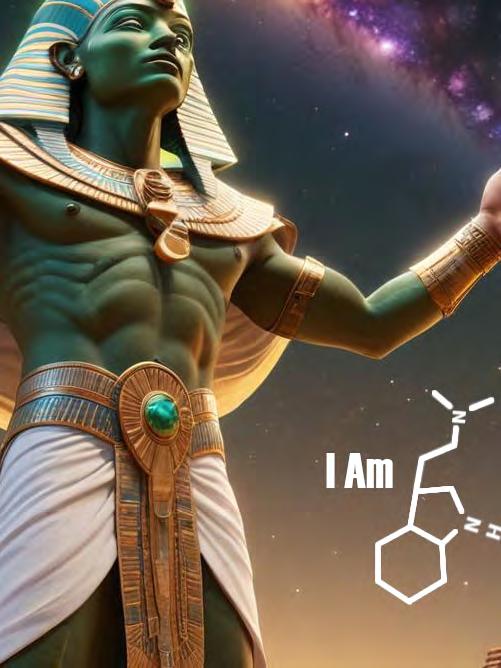
inner realms of the human experience. It is my contention that someone somewhere lost to the traditional chronology of the historical narrative, may have rather ingeniously inserted a strikingly profound, albeit allegorical mythology into the zeitgeist of a wholly-connected global society. The oldest recorded reference to the so-called Tree of Life arrives via the Ancient Egyptian Myth of Osiris. Osiris, we find, is also the original God of Resurrection; an otherwise bizarre green-skinned deity synonymous with the Lifeblood of a botanical variety known as the
fate and bargains with the king who duly sets
him free. Set, however, is enraged by this and dispatches of his brother once and for all and divides his body parts, and scatters them across the land. The mythology then dictates that Osiris was assimilated to the cosmos and forever remembered as the constellation of Orion. An absurdity in the extreme. It’s a tale to which modern-day Egyptologists like to refer, but without any real understanding. But could there be more to this ill-fitting misunderstanding than first meets the eye? Absolutely!
Why would such an archaic Ancient Egyptian society, supposedly capable of constructing the Great Pyramid, go to such extreme lengths to be certain that the Myth of Osiris like the Great Pyramid itself, stood the test of time?
In 1994 fellow researcher and writer Robert Bauval introduced
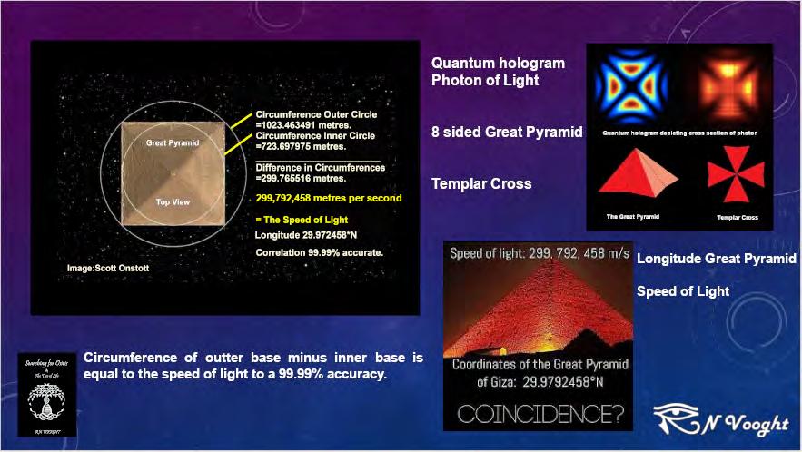
Circumference of the outer base minus the inner base is equal to the speed of light to a 99,99% accuracy
N. Hughes
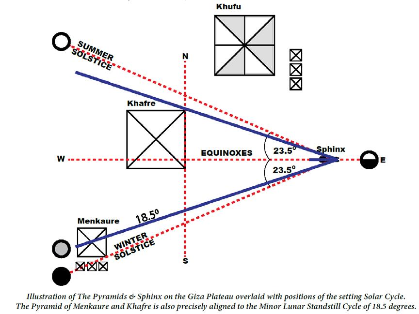
the world to his so-called Orion correlation with the publication of The Orion Mystery. For all intends and purposes, Bauval suggested that the pyramids of the Giza Plateau were quite possibly constructed to reflect the belt stars of Orion. As Above So Below.
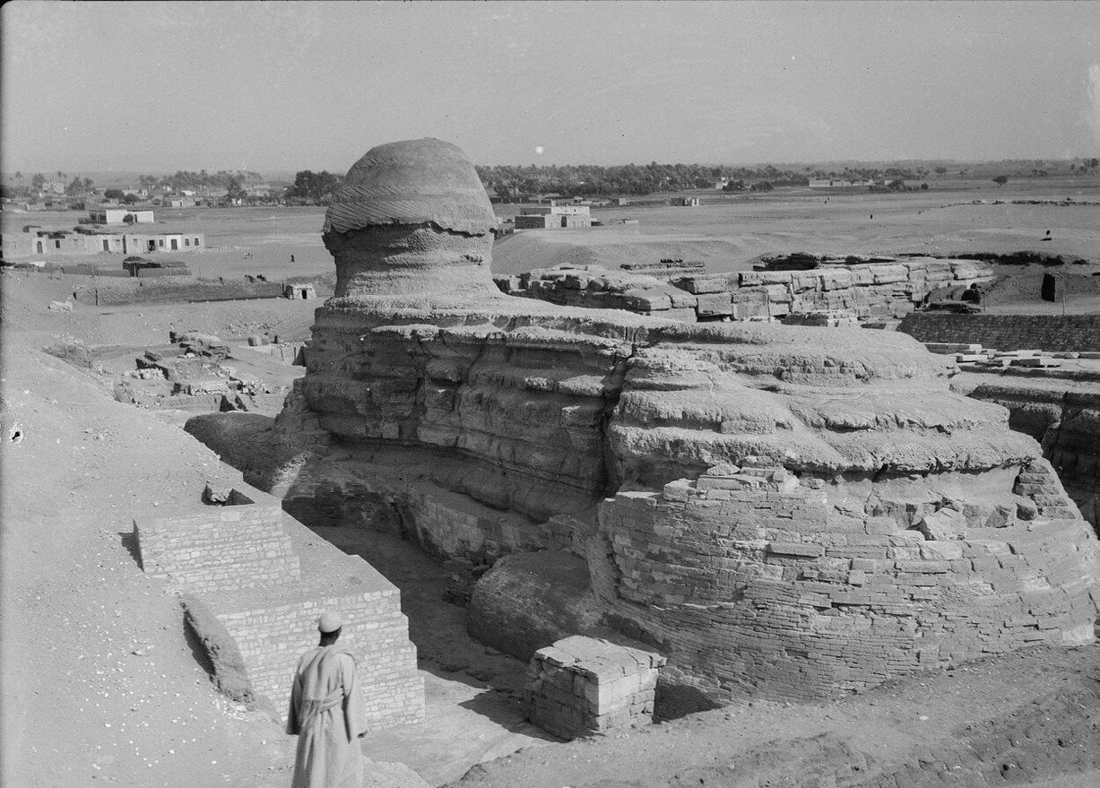
Bauval’s argument contests that the Great Pyramid and those of Khafre and Menkhaure were built sometime around 10,500 BCE. This particular date in time would also appear to witness the Great Sphinx gazing westward to its cosmic counterpart, the constellation of Leo. On the face of it, it would seem somewhat unfeasible due to the current and vastly accepted chronology of Ancient Egypt. However, the Ancient Egyptians themselves refer to an otherwise undocumented historical record known to them as Zep Tepi dating to the unknowable era sometime around 36,000 years ago. Zepi Tepi translates as the First Time. The first time civilised society seeded the cultivation of agriculture and animal husbandry? Well, according to the archaic scribes themselves – yes! But the question remains, why? Why indeed?
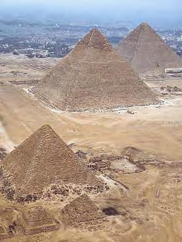
Today, the Great Pyramid is still considered a tomb constructed for nothing more than housing the body of a deceased pharaoh – regardless of the fact not a single mummified body has ever been found inside a pyramid! As far as we understand, almost every royal Ancient Egyptian burial took place in the Valley of the Kings – not the Giza Plateau. In fact, the Ancient Egyptians were known to document everything – everything except the impossible task of erecting the world’s last remaining wonder, the Great Pyramid!
“Traditional Egyptology remains steadfast and continues to parrot overused citations including ‘coincidence’ and ‘nothing to see here’...”
It is believed that this mysterious edifice was dedicated to the solar deity Amun Ra, a God of Light. Should it surprise us then to find that the geodetic longitude coordinates of 29.9792458 N appear to reflect the speed at which light travels in a vacuum 299,792,458 meters per second? The latitudinal coordinates of 31.1342 divided by 360 is equal to 0.0864 (the scientifically accepted diameter of the sun being 864,000 miles)!
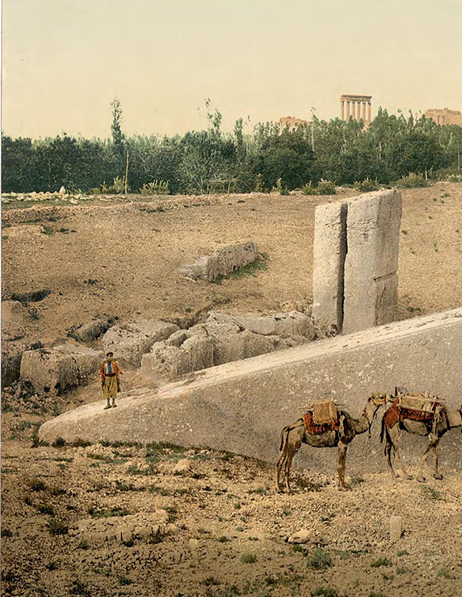
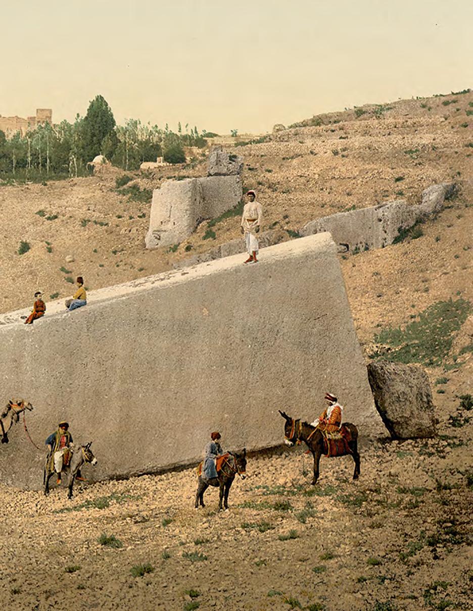
and continues to parrot overused citations including ‘coincidence’ and ‘nothing to see here’, yet offer nothing to rebuff the all-toclear evidence built into the proportions of the greatest construction known to humanity! The last remaining casing interlocking stones of the pyramid of Menkhaure appear to share a plethora of commonalities with the almost impossible craftsmanship we find at Sacsayhuaman in Cusco, Bolivia. The pyramid itself is considered to be dedicated to the falcon-headed deity and son of Osiris, Horus.
“Even more astonishing, however, the distance between these Horus-identifiable sites is precisely 7,920 miles – the mean diameter of the Earth!”
Furthermore, if we endeavour to measure a circle in meters from within the base of the Great Pyramid and subtract it from a circle drawn around its base perimeter we also arrive at the speed of light! If this wasn’t evidence enough, however, an ariel view of the structure upon the equinox draws many a comparison with a theorised cross-section of a photon of light! With this in mind, it’s certainly not beyond the realms of plausibility to suggest that whoever constructed the Great Pyramid may have been privy to a scientific understanding way beyond that of a culture considered archaic and without the invention of the wheel. Traditional Egyptology remains steadfast
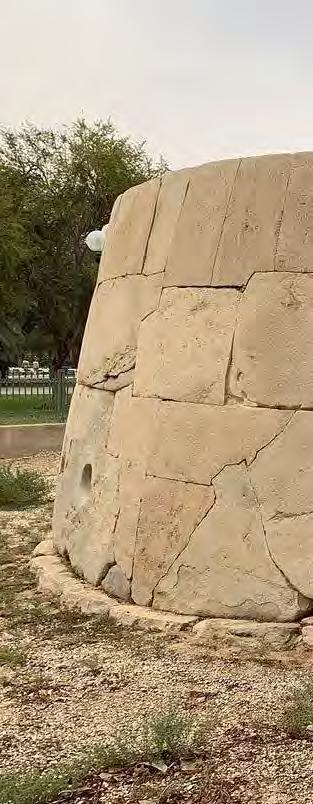
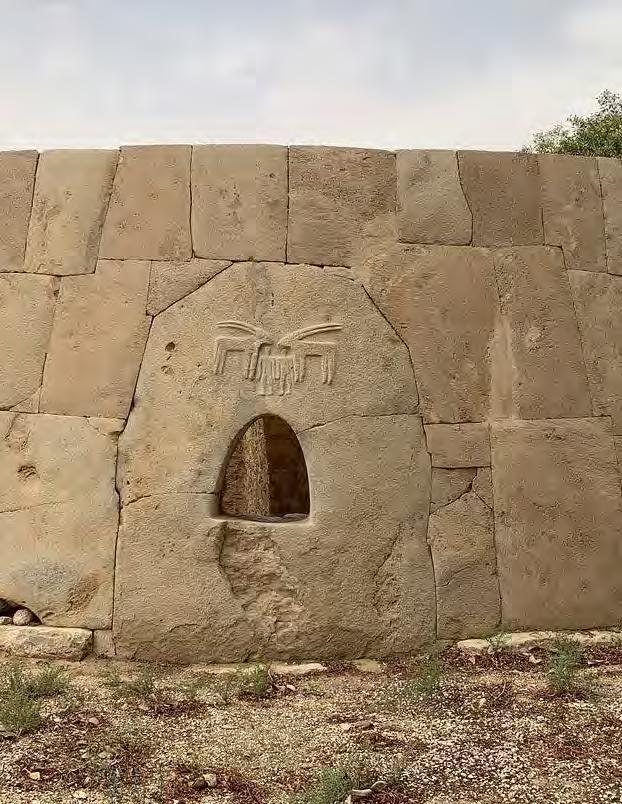
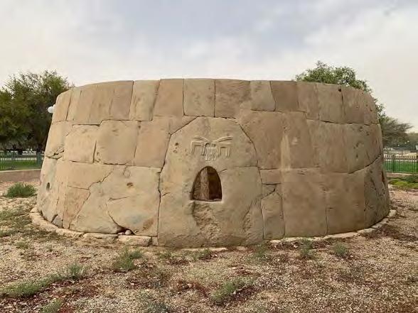
And rather intriguingly, Sacsayhuaman translates directly as ‘Place of the Satisfied Falcon’. Even more astonishing, however, the distance between these Horus-identifiable sites is precisely 7,920 miles – the mean diameter of the Earth! Obviously, nothing to see here! The measurements continue to astound should we decide to draw a line from the corner of the Pyramid of Menkaure through the apex of the Pyramid of Khafre and that of the Great Pyramid, and continue in a North Easterly direction we arrive at the oldest temple known to man – Gobekli Tepe! It is understood that Gobekli Tepe was intentionally buried, if not preserved, for the benefit of future generations.
Discovered in 1963 Gobekli Tepe appears to be a vast and sprawling site of archaeologist's interest yet still remains only 5% excavated. And for reasons unknown, the Turkish authorities have decided to halt excavation and plant olive trees in and around the area. Gobekli Tepe, oriented to the constellation of Orion also goes by an ancient Armenian namesake – Portasar, which translates directly as Umbilical of Osiris. Here’s where it gets extremely interesting. The oldest Osiris-identifiable temple accredited to the Ancient Egyptians is the Osireion in Abydos.
The distance between these sites is 864 miles. The midpoint is Soloman’s Temple in Jerusalem which has several namesakes including Temple Mount, Luz, Peniel and the Naval of the World which rather concisely unites the so-called umbilical with the metaphoric naval. It’s recognised as the location whereupon Jesus and Muhammad were said to have ascended to the heavens, and where Jacob witnessed the face of God. Luz, somewhat ‘coincidentally’ translates as Light, and the pineal gland
is considered the light receptor of the body. Connotations abound! The pineal glands role is to facilitate the secretion of essential chemical hormones needed by the body during the cycles of day and night. During daylight
“The initial ‘breathrough’, however, only takes place after an extremely terrifying death-like state of mind as the DMT takes hold.”
hours the pineal gland secretes serotonin which is key to the feeling of joyfulness and general well-being; and during the onset of darkness the pineal is responsible for secreting melatonin which induces REM patterns and stabilises sleep. It is also theorised that the
pineal gland secretes N, N-dimethyltryptamine, an extremely potent yet highly-illicit psychedelic compound also known as DMT or The Spirit Molecule! DMT is described as an entheogen, the etymology of which describes, albeit causes, the effect of feeling ‘God to be within the individual’. The terminology of a DMT experience is spoken of as a ‘breakthrough’ by which the individual would seemingly appear to leave this three -dimensional terrestrial plane of existence by entering a realer-than-real mindscape which is littered with highly-intelligent and sentient beings who for all intends and purposes, appear to recognise and welcome you! The initial ‘breathrough’, however, only takes place after an extremely terrifying death-like state of mind as the DMT takes hold. The individual is subject to what is described as a mini-death
whereby the brain momentarily tricks itself with an all too real death state before the euphoria that lies beyond. It is also of note that once the experience is over (usually between some 8 to 25 minutes) the individual returns uplifted, unscathed and somewhat ‘resurrected’ with new eyes to view the world.
Classic effects of sub-breakthrough doses of DMT would see the individual witness a series of impossibly beautiful visuals likened to sacred geometry and the so-called Flower of Life.
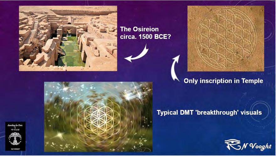
It’s here where we return to the Osireion in Abydos which lies below the bedrock of Seti 1st temple and is believed to pre-date Ancient Egyptian construction prowess by possibly thousands of years. The Egyptians were akin to inscribing their temples with innumerable
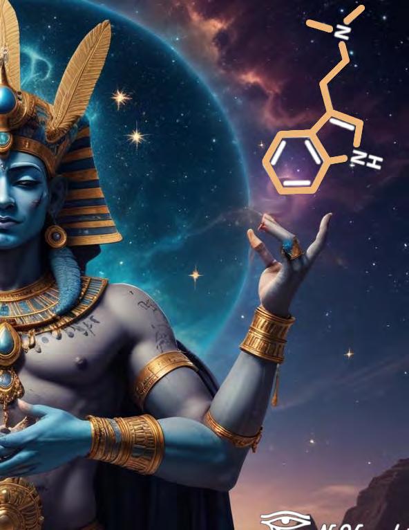
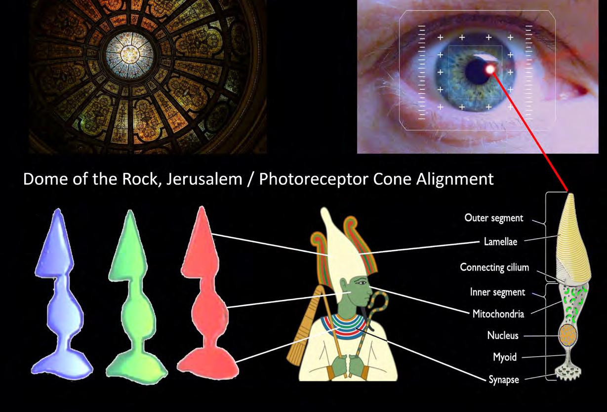
hieroglyphic carvings, however, the Osireion remains almost naked in comparison. The only inscription throughout this colossal construction is the Flower of Life! Osiris, God of Resurrection, appears to be wholly allegorical of the DMT experience. Osiris’ rather ill-fitting green skin and headdress share a wealth of commonalities with the photoreceptors of the human eye and pineal gland. In the modern era, the etymology of Osiris is extremely revealing also. The prefix ‘Os’ has several meanings including ‘God’ and ‘Open’, and ‘Iris’ being overwhelmingly obvious regarding the human eye. With this in mind, however, the accompanying hieroglyphic inscriptions that make up this God of Resurrection translate as ‘Seat of Perception’! And thus, the Myth of Osiris continues.
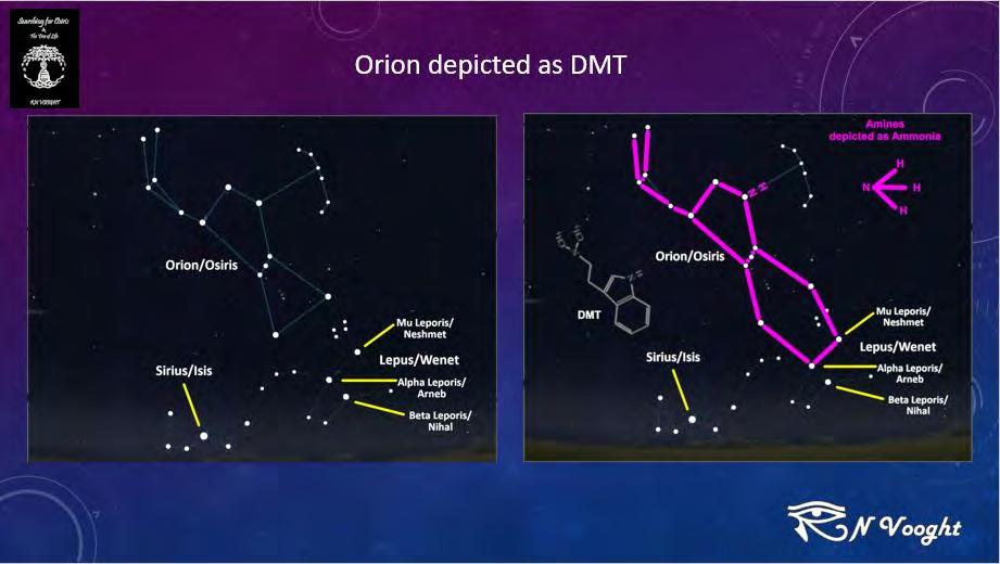
Is it beyond plausibility to suggest that the original myth whereby Isis rescuing Osiris from within the confines of the acacia may be looked upon as an entheogenic extraction process? A simple 2D rendition of DMT shares a plethora of commonalities with Osiris’ macrocosmic constellation of Orion. Either, Isis really did rescue her lover from inside a tree before becoming synonymous with the constellation of Orion, or there’s an extremely profound and scientific explanation of what’s in all likelihood going on here! At first glance, the naysayers may have an argument regarding the notion of pareidolia – pattern recognition and so-called faces in the clouds; but once again the myth
continues to astound.
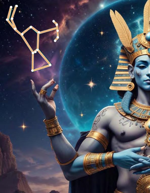
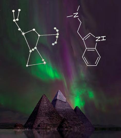
The Mysteries of Abydos is a tale still largely recalled throughout Egypt in the modern era. The celebration exposes Osiris’ journey across the Nile to Abydos, a tale that is also played out across the cosmos. It’s understood that Osiris/ Orion set foot upon the Cosmic Barge known as the Neshmet. Within the constellation directly below Osiris/Orion there is a constellation known today as Lepus which the Ancient Egyptians called Wenet – a rabbit/hare-headed deity synonymous with Osiris. Within the head of this deified constellation is a star we identify as Mu Leporis which the Egyptians referred to as the so-called cosmic barge, Neshmet. And by endeavouring to connect to the proverbial dots in the sky via the foot of Osiris and that of the rabbits head (Lepus/Wenet) we create the complete 2D molecular structure of our Spirit Molecule, DMT! And coincidences aside, by connecting Beta Leporis, the 2nd brightest star within the constellation to this macrocosmic chemical compound we appear to create serotonin in the sky! Furthermore, the star that makes this all possible is called Nihal which is an ancient Sanskrit name that translates as joyfulness, no less! Moreover, the star that makes all this possible is synonymous with the functionality of the neurotransmitter it is depicting! As Above So Below. The Ancient Egyptians, however, appear to have been extremely thorough regarding this particular train of thought. Osiris is also synonymous with
the overriding creator deity known as Sahu – Father of the Gods. Sahu also goes by a number of aliases including The Hidden One, The Incorruptible Soul, and Beautiful Renewal. As we have already discovered, DMT is somewhat hidden within the acacia or Lifeblood of Osiris. Those who are privy to a breakthrough dose of freebase DMT will testify to the overwhelming feeling that life, albeit spirit or consciousness, does go on after death which may well be likened to an incorruptible soul. Furthermore, by way of confirming this somewhat sophisticated sentiment, DMT is scientifically accepted as promoting neurogenesis within the human brain! Beautiful renewal indeed.
Ancient art transcends language and there are many arte-facts for us to reconsider.
RN Vooght
The continuing research better describes an in-depth rhetoric regarding this ongoing hypothesis can be found via the trilogy of books subtitled Ancient Cosmological Gods & Where in the World We Find Them. In order of publication The Spirit in the
ORTELIUS WORLD MAP TYPVS ORBIS TERRARVM, 1570 | THE LIBRARY
Cody McDonald
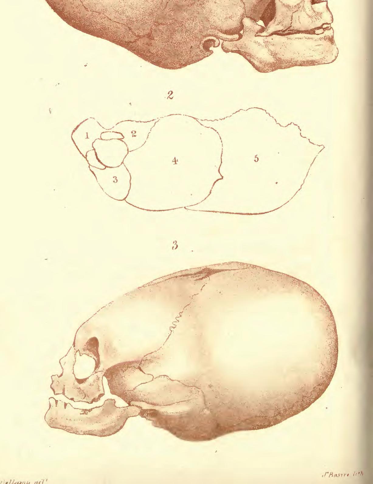
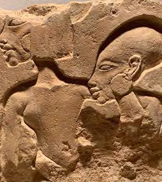
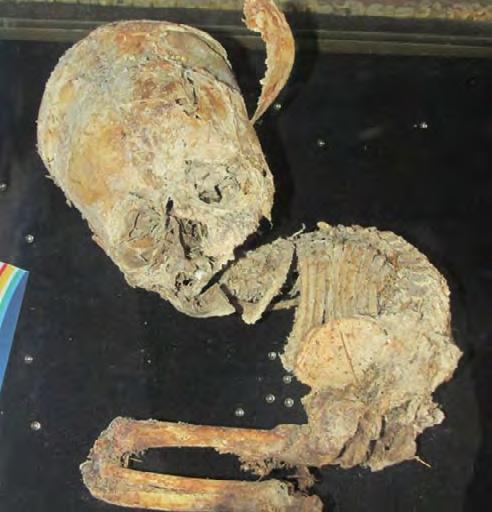
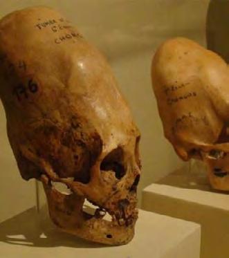
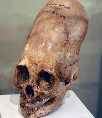
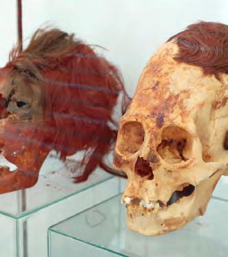
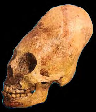
By lithographs of the skulls by J. Basire from Bellamy, P. F. A brief Account of two Peruvian Mummies in the Museum of the Devon and Cornwall Natural History Society. in ‘Annals and Magazine of Natural History’. Vol. X, October 1842. - Bellamy, P. F. A brief Account of two Peruvian Mummies in the Museum of the Devon and Cornwall Natural History Society. in ‘Annals and Magazine of Natural History’. Vol. X, October 1842., Public Domain, https://commons.wikimedia.org/w/index.php?curid=36660035
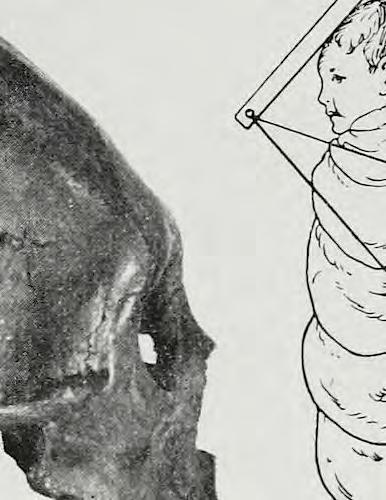
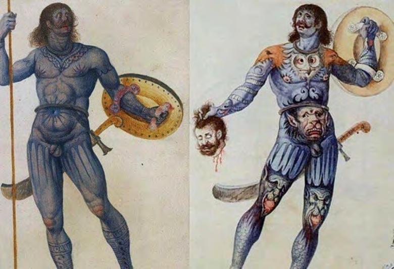
Humans are an artistic and expressionative species. Since the dawn of time, we have found various mediums in which to express our wants, desires, status, beauty, etc. Arguably the most interesting of the potential canvases we could use in which to express our creativity is our own body. But it's never been enough to simply adorn ourselves in our preferences. No, we tend to take it one step further and try some sort of body augmentation. And that is a thought and a trend that has persisted throughout all of time and a myriad of different cultures. From tattoos found on Egyptian mummies dating back to 2000 BC,
to "Otzi the Iceman" who was found frozen in the Alps with stretched ears dating back to 3,300 BC, people love to express themselves through various means of augmentation. Some body modification is for religious ritual observance, some is as a rite of passage, and some is just as a preference. No matter the reason though, it seems to be something we have always been into, and likely always will. Some of the more curious trends to present themselves over time would be the elongation of the neck and the head. More than most of the other body modifications, these ones seem especially painful and not particularly attractive. It does make one Wonder how such
By Ethan Doyle White - Own work,
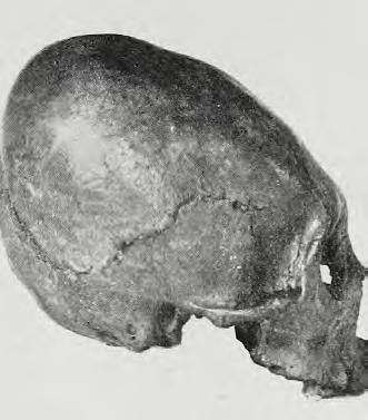
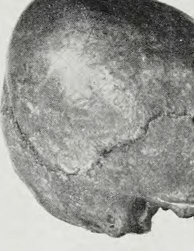
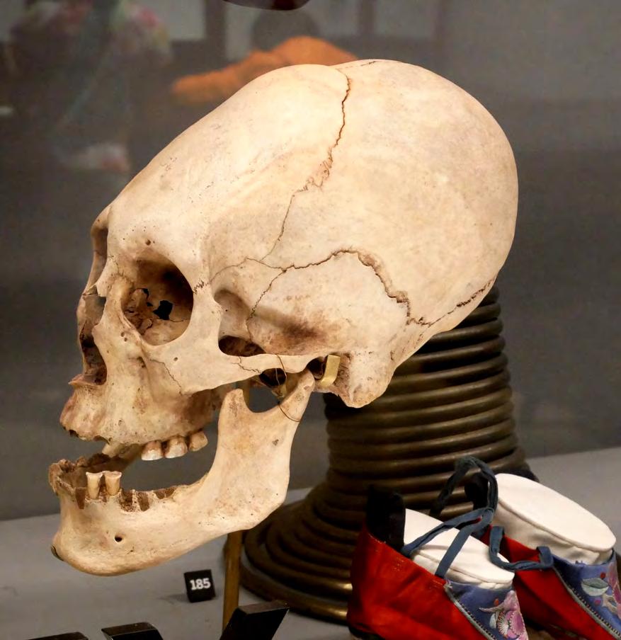
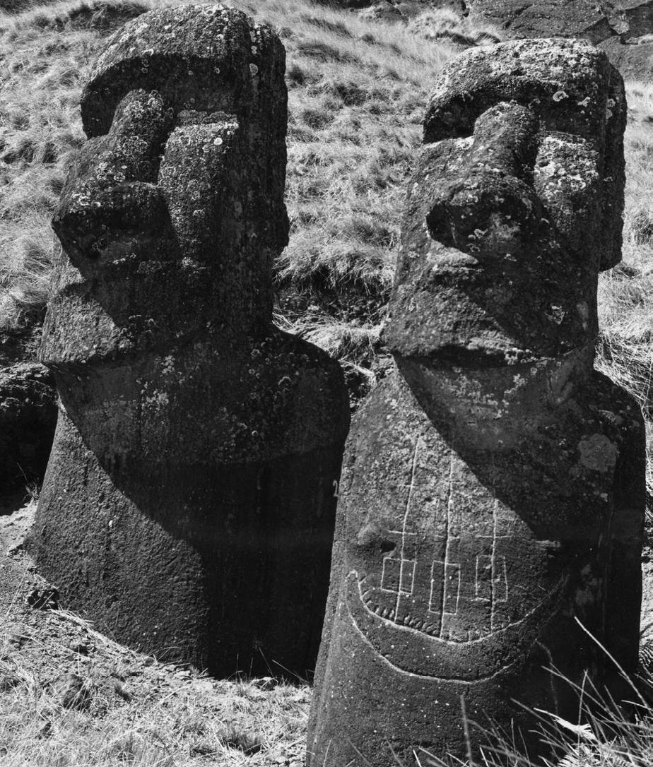
things gained a cultural foothold and where they came from. And of those two curious practices, one of them in particular especially mystifies me as it was practiced around the world amongst cultures with no academically accepted relation or interaction. That of course is head binding or cranial deformation, resulting in the elongation of the skull.
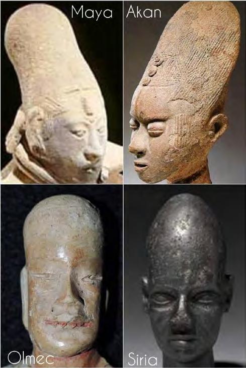
It's hard to understate how prolific the practice was around the world. The archaeological record bares evidence of it being found in Africa with the Mangbetu People. In Europe and Asia with the Alchon Huns, Sarmatians, Avars, Alans, Ancient Germans, and Ancient French. It has been found in China and Japan. In the Philippines with the Visayans and Bikolano people. From Australia
to the Pacific Islands. To North America, most notably with the Chinookan People. And then South America of course, you had the Maya, the Inca, and the legendary Paracas cultures all actively practising it. It was literally happening in all of the inhabited regions of Earth we have exhumed bodies from. But one must ask themselves; with what we know about the potential damage that could be caused as a result of cranial deformation, why would so many people risk their infants vision, cognition, and even life, to practice head binding? Well, a quick examination of the ancient worlds art paints a pretty clear picture, for those with eyes to see.
No matter where you travel, the oldest examples of art generally contain a few similarities. The first overarching similarity is a fascination with the Stars and the sky. To the ancient world this was their movie theatre. They knew it like the back of their hand, their lives depended on it after all. The second similarity is simplicity. They used symbolism to simply convey a message where written word was lacking. The third is deity veneration. It's natural and obvious that they would depict their deities. But what is less natural and obvious is the similarities between depicted deities and very different cultures. Often times the deities are depicted with unusual features. Sometimes they're anthropomorphic and an unusual mix of human and animal body parts. Most interesting to me though, is sometimes deities are depicted with an elongated skull or eyes.
And it is with these examples that we start to see why the practice of head binding was so common and widespread.
So the practice of ritual head binding (cranial deformation) really just comes down too deity veneration, and that's that. They simply imagined their gods to have these features, and then altered their bodies permanently to look like these imagined gods for generations upon generations. Right? Well, there's one problem with this idea. And no, it isn't the fact that humans are willing to
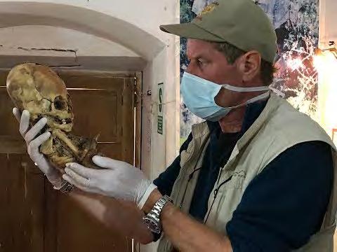
do crazy things in observance of a particular deity or faith. After all, a large portion of our world still practices circumcision which is itself an archaic religious tradition. No, humans have no issue altering their body for divine favour, that certainly isn't the issue. What becomes problematic is what has been found on a number of the skulls that is particularly anomalous in the context of ritual head-binding. That is the fact that some of these skulls never had to be bound at all. Indeed there is a number of consistent genetic anomalies that has been found in many examples around the world, most notably the Paracas culture.
Thanks to the work of Brien Forester and his team of archaeologists, anthropologists, and other assorted academics, there is documentation of something a bit more peculiar. What has been found, and documented, is a set of traits that seem to be specific genetic accommodations for being born with a naturally elongated skull. These traits include, a displaced Foramen Magnum, a missing Sagittal Suture line, increase to overall skull and eye socket volume, and veins running to the back
of the skull to compensate for increased blood flow being needed, and an additional skull bone referred to as the "Inca bone". These are not things that can be changed through any form of head binding, they are genetic in nature and irregular by usual Homo-Sapien standards. What is more fascinating about these anomalies is the fact that they are consistent through multiple examples of documented specimens. Let's look a little closer at these, and what is particularly anomalous about each of these genetic adaptation.
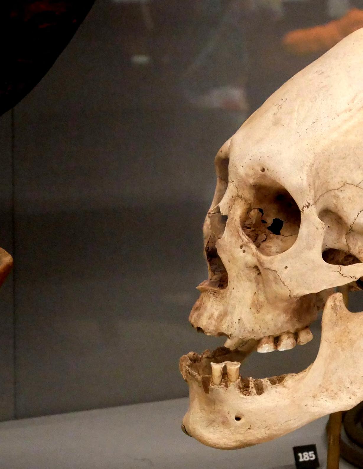
Displaced Foramen Magnum: The Foramen Magnum is defined in Merriam Websters as, "the opening in the skull through which the spinal cord passes to become the medulla oblongata". It can come in a variety of shapes, being oval or more circular. The position of it greatly determines an individual or animals posture. In humans, an upright species, it's found almost perfectly in the center of the skull. This helps us balance our head
in an upright and forward position while standing erect. In the elongated skulls that appear to be natural, the position of the Foramen Magnum is displaced, being located more towards the back of the skull. This would account for the displaced center of mass that they would no doubt have, and as an evolutionary trait makes complete sense. The evidence also suggests, from the sizes of the openings in relation to the overall skull size, that they would have had a skinnier neck vertebrae then we tend to as Homo-Sapiens. The overall shape is generally not what we see in most humans as well, but as mentioned previously, those can vary wildly.
Missing Suture Lines: A Sagittal Suture is described in the dictionary as, "the deeply serrated articulation between the two parietal bones in the median plane of the top of the head". Essentially, it is where the plates of the skull fuse together on a vertical axis at the back of the skull. There is a
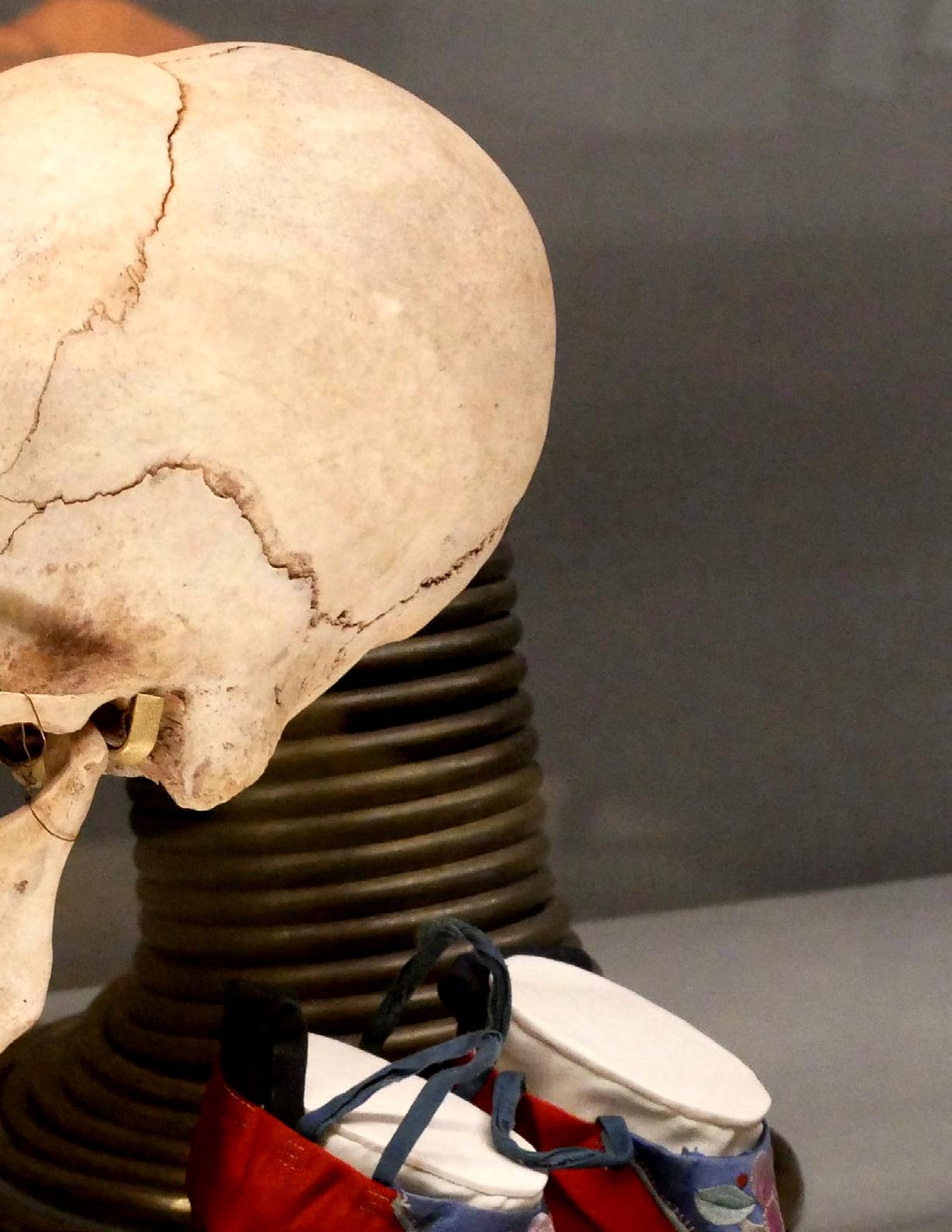
Tiwanaku deformed skull from Bolivia, on display in the Horniman Museum. Object number 112706.
- Own work, CC BY-SA 4.0, https://commons.wikimedia.org/w/index.php?curid=115237653
A
Photo by Ethan Doyle White
second suture line, known as the Coronal Suture which runs horizontal, and a third known as the Metopic Suture which runs vertical at the front of the skull. Amongst many of the elongated skulls that show signs of natural elongation, many of them are missing their Sagittal Suture line completely. Some are missing their Coronal Suture line as well. It's important to note that suture lines can fill in overtime and calcify, but signs remain of that when it happens. These, in contrast, appear to have never been present at all. It suggests the fetus would develop differently in the womb. It also suggests that the skull would form and fuse differently in the immediate moments, months, and years following birth.
Increase To Skull & Eye Socket Volume: One of the more interesting things that separate the Natural Elongated Skulls from ones that have
been through a process of cranial deformation, is the overall skull volume, and oftentimes, the eye socket volume as well. When the human head is put through a head binding process, the shape can be manipulated, but the overall volume of the skull can not be. More bones are not just magically added, nor is more brain mass. On many documented specimens there is a very clear, and obvious, difference in size when placed next to a Homo-Sapiens skull of the same age. Often times, the naturally elongated skulls are almost twice the size. The Orbit, or eye socket, is also much larger when compared to a standard Homo-Sapien's, which no form of cranial manipulation could alter. The size of the orbit would have also affected the pupillary distance. On a standard human, the range is 54-74 mm, however on the Elongated Skull People it would have been more narrow (roughly ≥45 mm).
Some of the most compelling evidence for the case of there being a natural race of elongated skull people, comes in the most minor of differences to physiology. Although there are multiple, we are going to discuss two of them. The first is the so called "Inca Bone". It is a dermal bone found in the neurocranium of the human skull, and it is located between the parietal and supraoccipital bones, and is fused to the supraoccipital. Considered a variant of what is normal, it can be found consistently amongst many documented specimens. It is likely that it was introduced to the royal Inca bloodline through the Paracas people
who predated the Inca culture. The next difference is subtle, but big in its significance. The human skull is littered with infiltration points know as "Foramen" (a small opening, perforation, or orifice). They exist as pathways for nerves, veins, and tissue to the skull. We discussed the displacement of the Foramen Magnum to the posterior of the skull, but it is not the only anomalous foramen. There appears to also be a number of blood flow foramen located in different places then we would expect to find them usually. For instance, there are foramen that feed our cheek muscle structure that allow us to make animated facial expressions. These appear to be missing or rerouted from the naturally Elongated Skull People, and are instead found in the back of the skull. Seemingly, this would feed the increase in mass at the top of the head.
These anomalous physical differences are truly astonishing, and clearly visible for all with eyes to see. A simple comparison of these anatomical differences between a Naturally Elongated Skull and a normal Homo-Sapiens skull reveals as much to even a layman. So it begs the question, why is academia so hesitant as a whole to look into these? Entire species have been declared "missing links" based off fragmentary bone evidence, but a thorough and serious examination of these enigmatic hominids has yet to occur, outside of Brien's collaborative efforts.
It makes one wonder, why? Especially when you consider how profoundly important these people
were in the old world. The art and writings of the time all indicate these people were nobility and the ruling class, and people were willing to literally risk the life of their infant to try and replicate the aesthetic. So why the hesitation to explore them more deeply with all of our modern capabilities? It certainly makes a curious mind wonder. At the end of the day, sometimes that's half the intrigue of the Ancient World. The almost sexy and romantic allure of a time and people seemingly alien to us in every way, shape, and form.
Whoever, or whatever, these people were, we may not be able to currently say. But what we can say, is they weren't purely humans like you and I are today. We can say there are skulls out there that are not the result of any sort of head binding, nor are they the results of a rare physical abnormality. Most of all, we can say they deserve much more exploration by both academia and the wider public. It's an important lesson from the past, an almost eerie shadow cast over everything, that there is so much more we have to understand.
Keep an open mind, a raised eyebrow, and stay curious.
by Jeffrey van der Lugt
Search America's historic newspaper pages from 1756-1963 or use the U.S. Newspaper Directory to find information about American newspapers published between 1690-present.
Evening (Washington, Nov. America: American Lib. <https://chroniclinga merica.loc.gov/lccn/ sn83045462/1934-1111/ed-1/seq-76/
Imperial Valley press. (El Centro, Calif.), 21 March 1937. Chronicling America: Historic American Newspapers. Lib. of Congress.<https://chroniclingamerica.loc.gov/lccn/sn92070146/1937-03-21/ed-1/ seq-13/>
Detroit evening times. (Detroit, Mich), 23 Sept. 1945. Chronicling America: Historic American Newspapers. Lib. of Congress. <https:// chroniclingamerica.loc.gov/lccn/ sn88063294/194509-23/ed-1/seq-72/>
Lib. of Congress. https://chroniclingamerica.loc.gov/lccn/ sn83045462/1934-1111/ed-1/seq-76/>
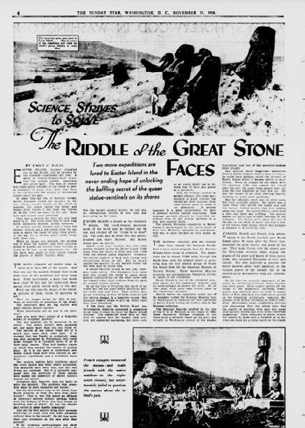
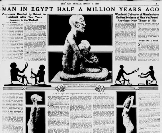
The sun. [volume] (New York [N.Y.]), 07 March 1915. Chronicling America: Historic American Newspapers. Lib. of Congress. <https://chroniclingamerica.loc.gov/lccn/ sn83030272/1915-03-07/ed-1/seq-39/>
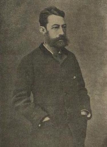
Brian Cory Dobbs
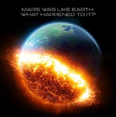
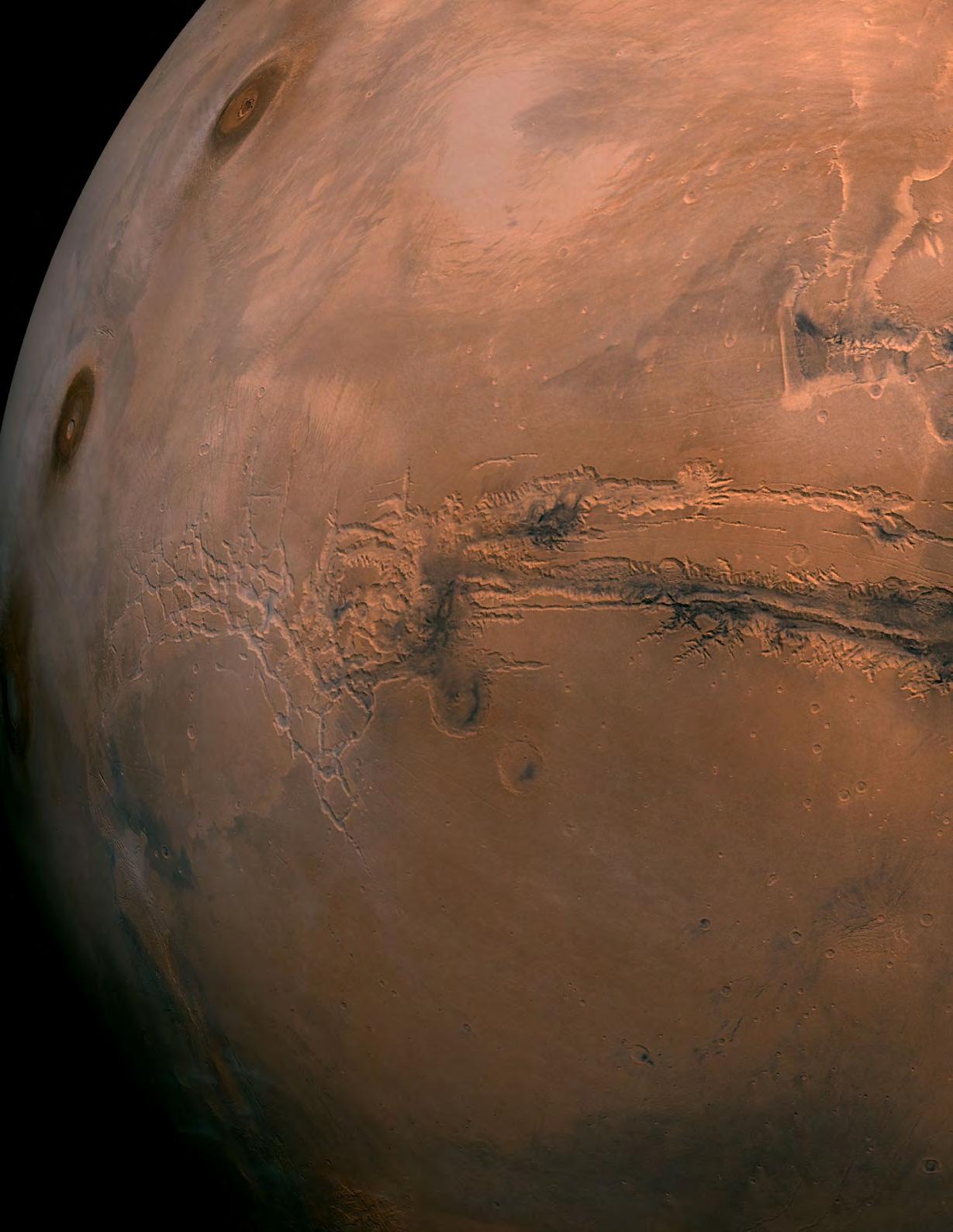
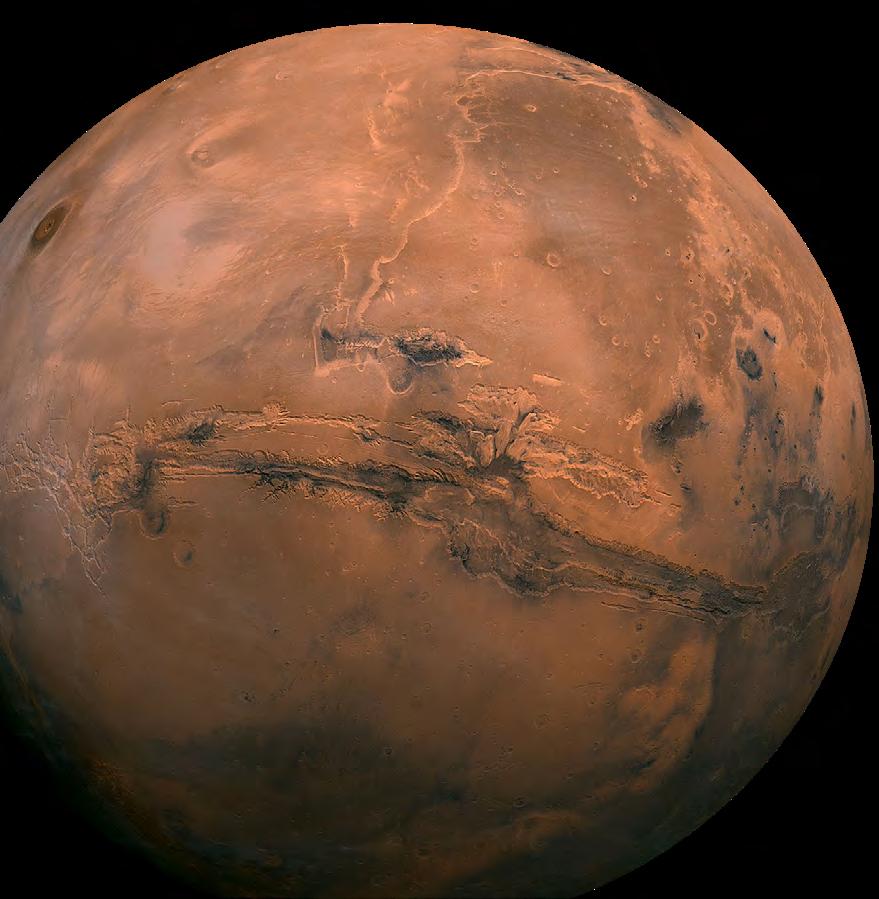
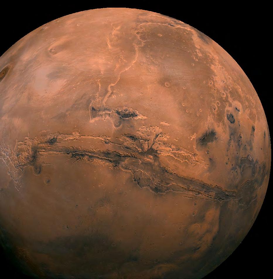
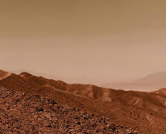
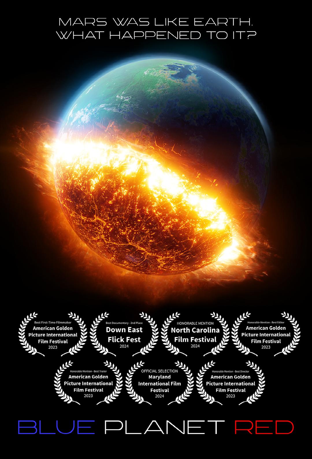
Blue Planet Red The Terrifying Reason Why Mars is Red
Strap in. This isn’t another boring examination about Mars geology. If you’ve ever wondered if there’s water, life, pyramids, or UFOs on Mars, this article is for you.
Mars used to be a blue planet, like Earth.
Think about that for a moment. What’s commonly accepted by mainstream planetary scientists is that oceans, lakes, and rivers covered the surface of our neighboring planet in the ancient past. It used to have a thick atmosp here with oxygen, just like Earth. It has a 24-hour day and even tilts to wards the Sun, just like Earth.
If it used to be like Earth, was there ever any life on the planet? What about intelligent life?
“NASA frequently explains how the planet’s magnetic field is weak and how it doesn’t offer the atmosphere much protection from the Sun’s solar wind.
And why is a desert wasteland now? Answer - because its atmosphere is less than 1% as dense as the Earth’s. Without a thick atmosphere you can’t have large amounts of liquid water. But that doesn’t answer the other important question. What turns a blue planet red? Answer – the destruction of the planet’s atmosphere.
Soo…what destroyed the atmosphere of Mars?
NASA frequently explains how the planet’s magnetic field is weak and how it doesn’t offer the atmosphere much protection from the Sun’s solar wind. This is true. The problem is, the nearly complete loss of the atmosphere cannot be fully attributed to the solar wind alone. It simply isn’t stripping away enough of it to cause such a catastrophic loss to the atmosphere.
So if it wasn’t the solar wind, what was it?
The answer is arguably so shocking, so devastating, and so tragic, that most people might think it’s easier just to look the other way.
We call Mars the ‘red’ planet today for the same reason we say ‘red heads’ when referencing someone with orange hair. It’s just easier.
Technically what we see is a planet covered in rust. Rust is formed when iron is exposed to water and oxygen.
This is one of the reasons scientists know there was a lot more of each in the
distant past.
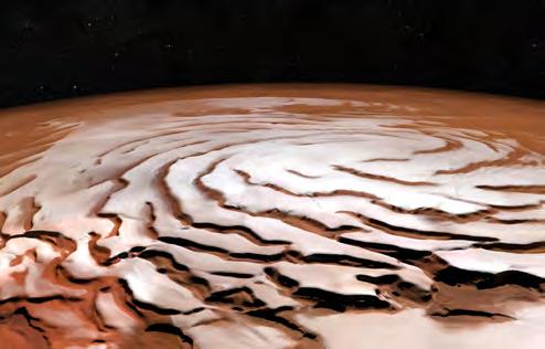
There is still a little oxygen in the Mars atmosphere but interestingly there is still a lot of water ice all over the planet.
Not only does Mars have polar ice caps like Earth, but there is ice all over the rest of the planet just centimeters beneath the surface. Even more interesting, Mars also has frost, clouds, and snow.
Transient liquid water will appear and flow down hills from time to time as well.
While the atmospheric pressure doesn’t currently allow for large bodies of liquid water, one has to ask – what is the probability that life exists on Mars today?
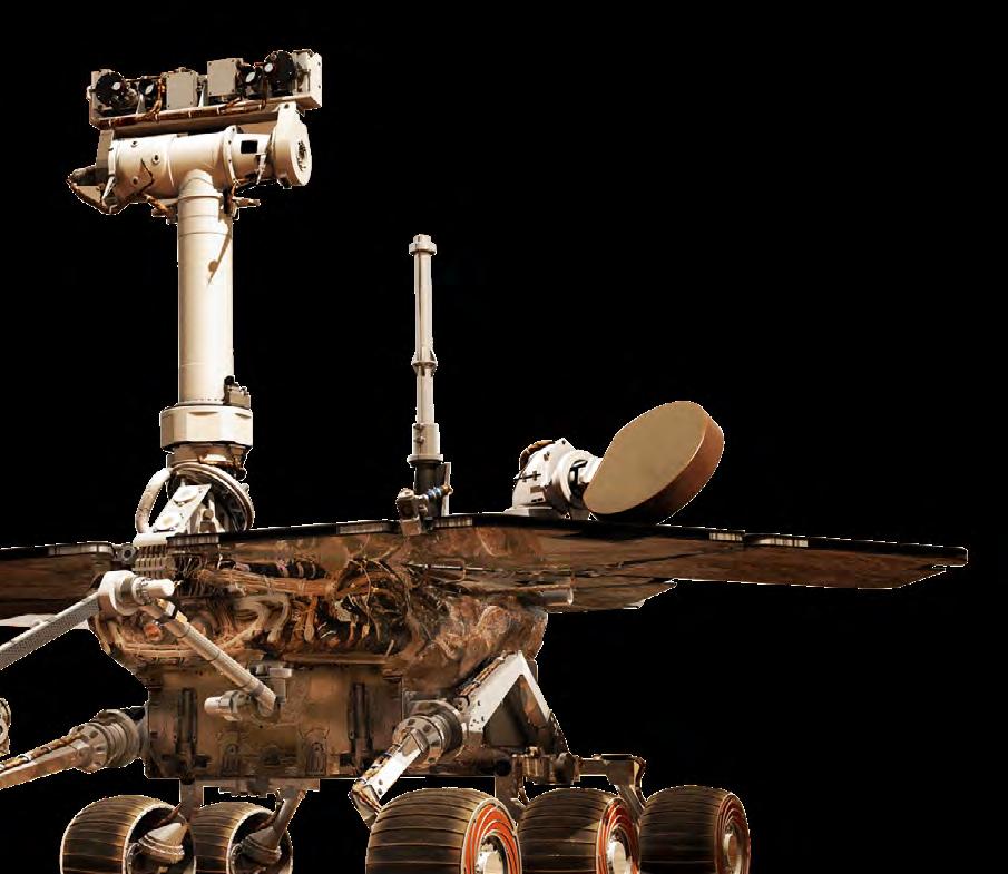
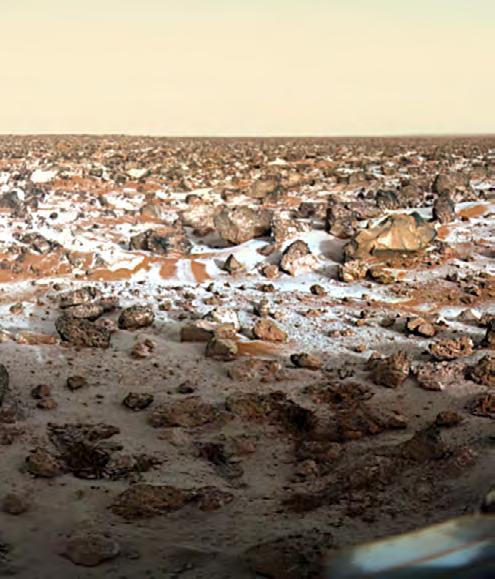
In 1976 NASA sent the Viking 1 and 2 missions to Mars, each equipped with a lander and an orbiter. Aboard each Viking lander were three life detection experiments, all of which tested positive for autotrophic microbial metabolism. But there was one problem. Another test, designed to look for organic matter in the soil, came up negative. NASA thought, how can you have active microbes on Mars without any organic matter in the soil? NASA ultimately said the results were inconclusive and has since taken the position that there is absolutely no evidence for current microbial life on Mars.
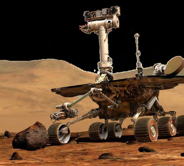
But guess what? Decades later, the Curiosity Rover found organic matter in the soil. Not only that, but it also detected an organic substance known as dimethyl sulfide. Scientists, including those at NASA, know of only one way dimethyl sulfide is produced – through active microbial activity.
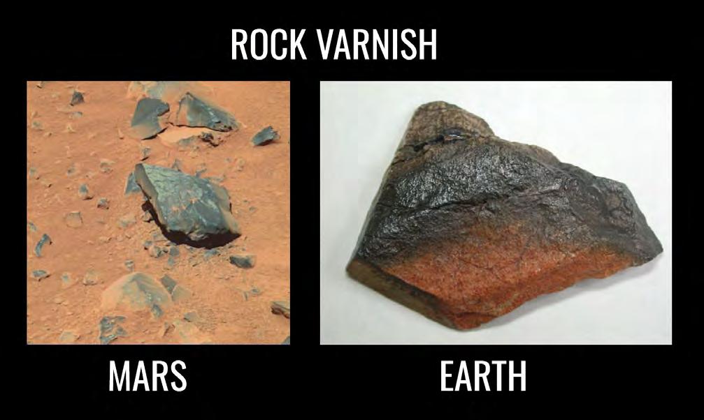
On top of that, NASA scientist Dr. Carol Stoker found evidence of chlorophyll on Mars through the use of spectroscopy. There’s also photographic evidence for what appears to be something known as Desert Varnish (a.k.a Rock Varnish), a black coating on rocks that can only be produced by living microbes.
Has NASA reversed course and claimed there is now evidence for life on Mars?
No, and unfortunately the narrative of ‘no evidence of life on Mars’ still exists today.
What makes this whole matter confusing is that while NASA discovered evidence for microbial life on Mars multiple times, to date they’ve only sent life detection equipment on the Viking missions in 1976. All the landers and rovers they’ve sent since would test for organics, or “signs” of life, or “ancient signs” of life. But not life itself.
For nearly 50 years NASA has not tried to clear any of this up. They have neglected to send any life detection experiments to Mars to definitively prove the existence of microbial life on Mars. We can only speculate why.
Professor Richard B. Hoover, D.Sc., h.c. led the astrobiology research department at NASA’s Marshall Space Flight Center from the late 90s until his retirement in 2012. An expert on microbes, he wagers there is a 100% chance of finding microbial life on the polar ice caps of Mars. Microbes, as he has observed himself, can live directly in ice. By using a natural antifreeze, they can melt the ice around them to extract nutrients for survival.
Microbes can live practically everywhere. In the deepest parts of the Earth’s crust to the vacuum of space. Is it too hard to imagine that there could be living microbes on Mars? They’ve been shown to adapt to most every type of environment, even extremely hot, cold, high pressure or low pressure environments.
There’s even a term for these microbes – extremophiles.
Given that Mars was a blue planet in the ancient past, what are the chances multicellular life emerged? There’s evidence for it, but the reader needs to understand something about NASA photographs.
NASA is legally obligated to publish all the photos their landers and rovers take. However, they leave it to the public to go through thousands of them and discover things. They take a ‘hands-off’ approach towards publicizing their discoveries.
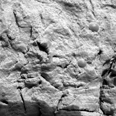
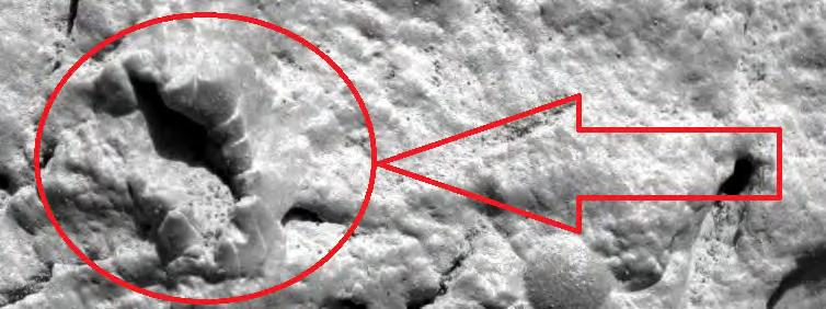
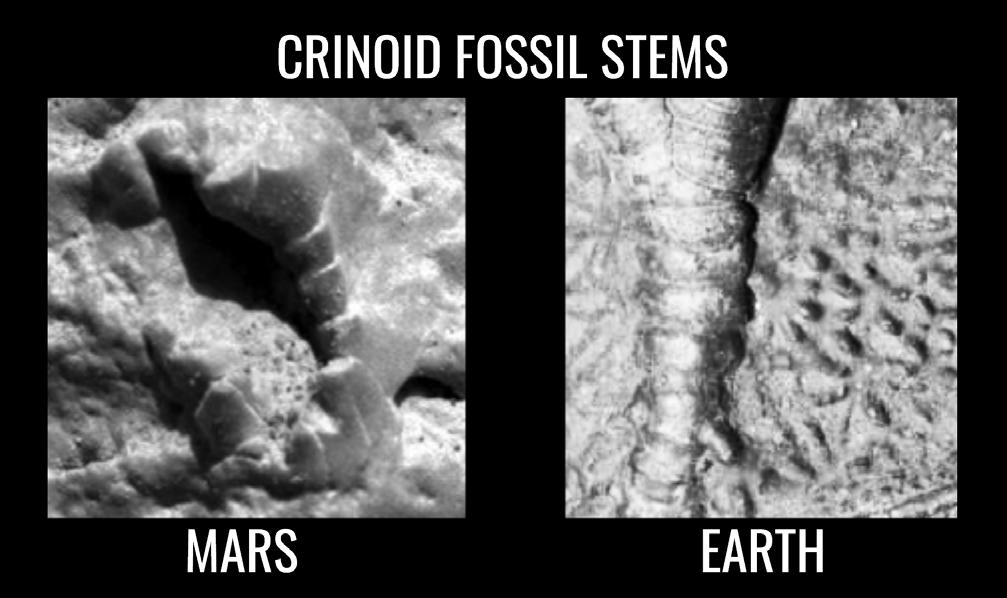
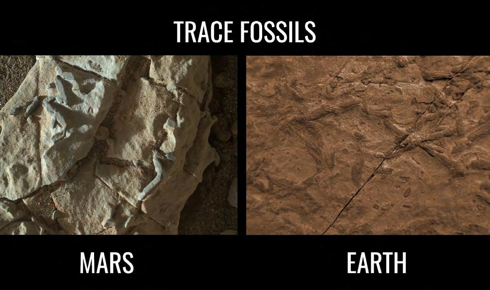
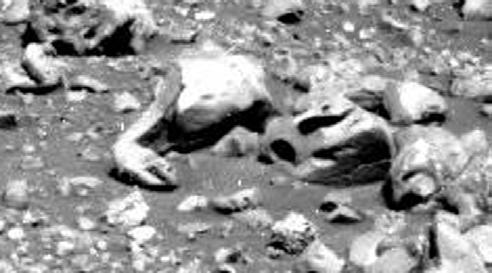
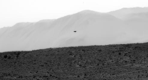
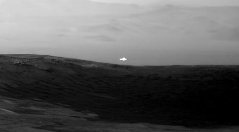
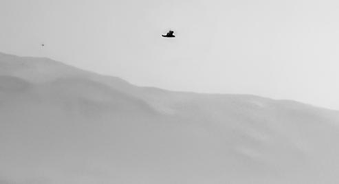
▲ In the early 2000s, the Opportunity Rover took this photograph.
▲ Seen here in this photo's is thought by some paleontologists to be the fossil of a sea creature known as a stalked crinoid.
You might think NASA dropped everything when they saw this to study it further. Unfortunately, they did the exact opposite. They used the rover’s rock abrasion tool and completely destroyed it.
The reason? They wanted to see if it contained any carbon. Richard Hoover says this is a “nonsense answer” and likened it to smashing open a dinosaur skull to see if it has any brains inside. In other words, NASA deliberately performed scientific malpractice. Paleontologists do not do this.
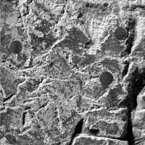
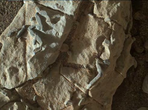
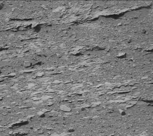
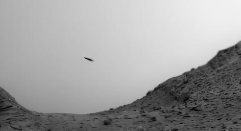
A decade later, the Curiosity Rover took this photograph ▼
Astrobiologist Barry DiGregorio says the short squiggly lines here resemble what’s known as trace fossils. Trace fossils are the tracks or burrows a creature makes when they move around. These particular ‘squiggles,’ found in Gale crater on Mars, resemble trace fossils here on Earth known to have been produced by ancient worm-like creatures. In essence, the footprints of worms.
“They used the rover’s rock abrasion tool and completely destroyed it.”
NASA is convinced they’re crystals. DiGregorio says, “If they were crystals why weren’t they found all over the Gale crater lake floor? They aren’t.”
While these photos aren’t absolute proof, one has to question why NASA didn’t get a team of paleontologists to study these further and at
least discuss the possibility of these features being legitimate fossils. Isn’t that what NASA is supposed to do? Seek out all possible forms of life? Large or small? Current or extinct? Intelligent or not?
NASA has taken thousands of images of Mars for over a half-century, from orbiting satellites, landers, and rovers.
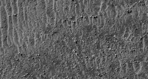
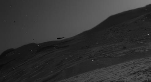
The rover images reveal a desolate and mostly uninteresting landscape at first glance. But upon closer inspection, some peculiar shapes start to emerge. Unfortunately, most of these shapes are far away from the camera, and present poorly when zooming into them.
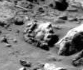
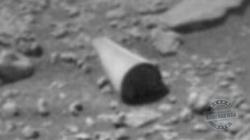
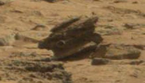
Here’s an example of a rover image we commonly see. Rocks and debris scattered amongst a desert landscape.
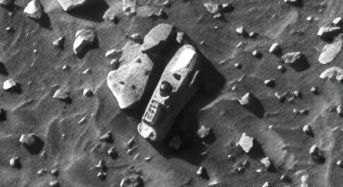
But zooming in, we find this strange rock, described as looking similar to a gear.
Are these rocks? Or something else?
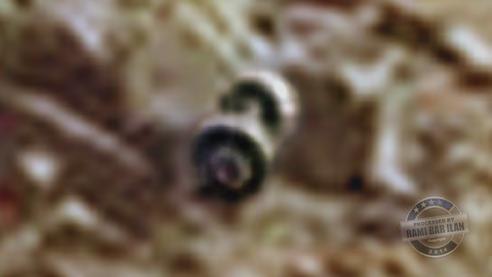
Independent Mars researcher and image specialist Rami Bar-Ilan takes rover images like this…
…zooms in on something that catches his eye, and enhances the resolution to produce… this▼.
Does that look like a rock to you?
Shouldn’t we take a closer look at something like this?
If a curious individual were in charge of operating a Mars rover, wouldn’t they naturally want to get closer to some of these funny-looking rocks? NASA might say they don’t want the rovers to get stuck on the rocky landscape, but aren’t these rovers designed to literally drive over rocks? Wouldn’t it be nice to get a closer look? Do Mars rocks really form into these strange shapes…or are they something more?
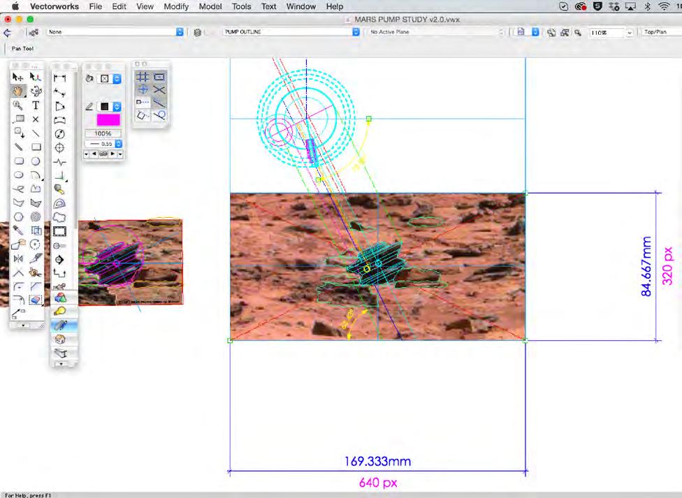
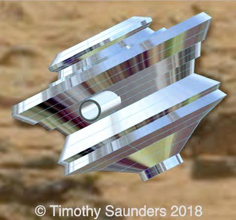
Tim Saunders thinks there’s more to them. Saunders studied Transportation Industrial Design at Coventry University and currently runs an independent studio designing mega-yachts. This particular object caught his eye.
Saunders reverse engineered the object and worked up a 3D model in his design software ▼
He says, “this rock really caught my eye because not only is it geometric in form, it also has more than one axis of symmetry about it. I'm fairly convinced it is not a natural rock.”
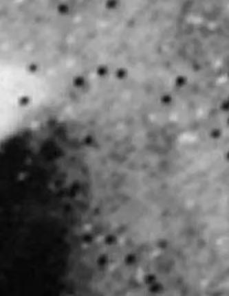
On first glance, NASA’s orbiter images also give the impression of a desolate planetary surface. But again, on closer inspection, anomalous features that defy geological explanation start to emerge.
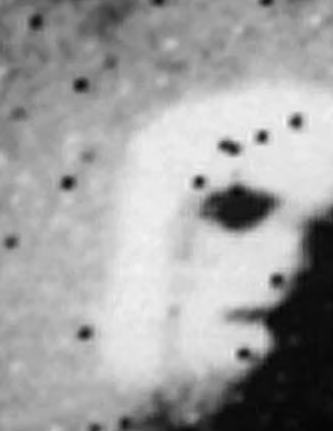
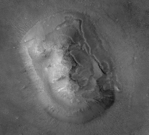
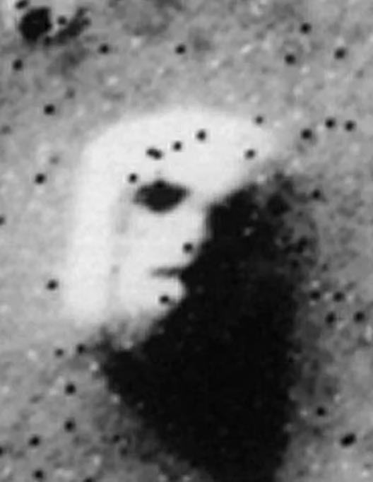
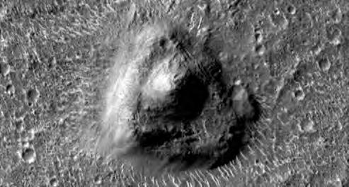
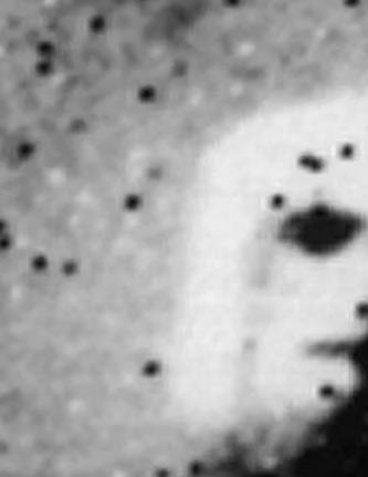
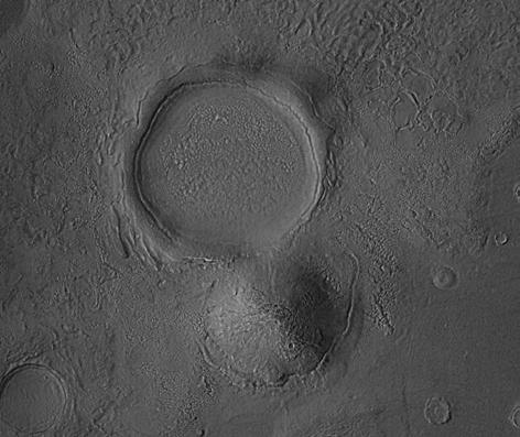
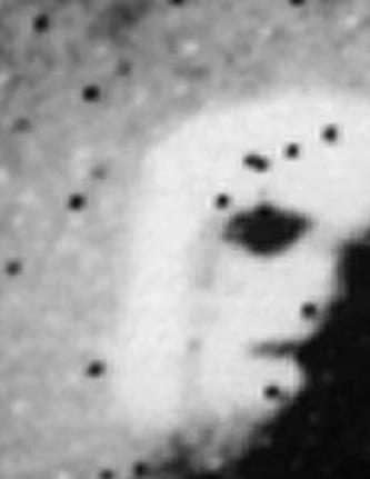
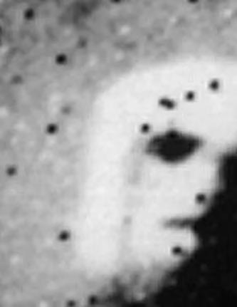
The most infamous feature, known as the Face on Mars, was originally discovered by the late Dr. Tobias Owen in 1976 while working as part of NASA’s imaging team. A haunting photo, NASA initially dismissed the feature as having no significance and worse, merely a trick of light and shadow.
An updated photo decades later revealed more detail, but still the controversy remained. Is
this a natural landform or a deliberate construction of a mile-long humanoid face from an ancient civilization?
Skeptics are quick to claim this is nothing more than pareidolia, which is the tendency to perceive a specific, often meaningful image in a random or ambiguous visual pattern, but aerospace engineer Dr. Mark Carlotto disagrees.
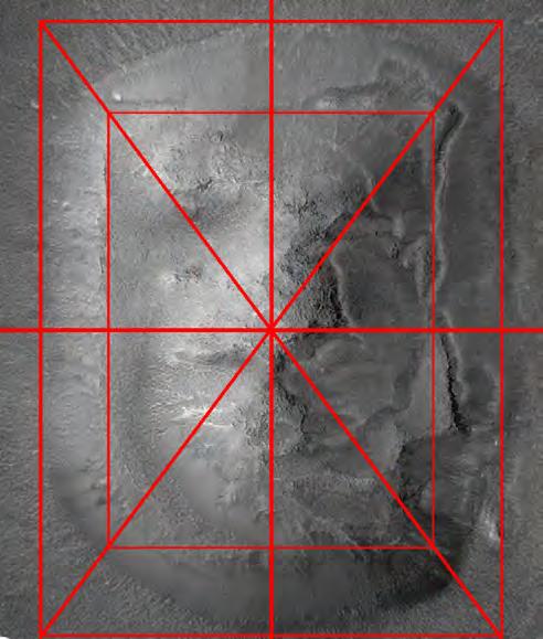
In his paper, Symmetry and Geometry of the Face on Mars Revealed: A New Analysis Based on the April 2001 Image, Carlotto offers three quantitative analyses of the Face.
'The most infamous feature, known as the Face on Mars'...Photo taken by Viking 1
Credit: NASA/JPL
To summarize, it’s symmetrical, demonstrates repeated expressions of pythagorean 3-4-5 right triangles, and fractally distinguished from the surrounding landscape upon analysis via specialized software used in military satellite image applications. In other words, there ain’t nothing else like i
As you can see here, the outer ‘frame’ of the face and the inner ‘face’ itself are identified by the large and small 3-4-5 right triangles.
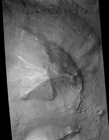
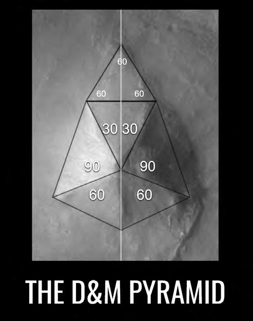
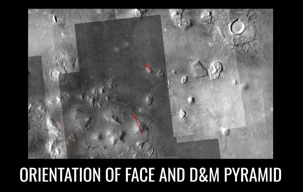
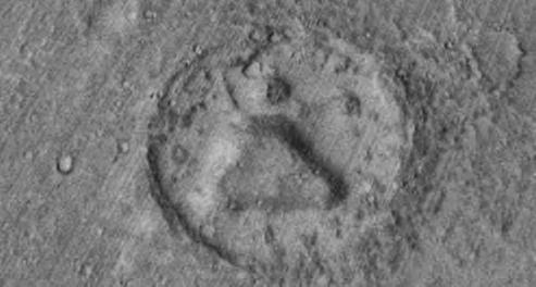
What makes the Face even more peculiar is its proximity to another anomaly – a five sided pyramid.
Most commonly referred to as the D&M pyramid, this nearly 3-mile long structure is also symmetrical. It also has repeated expressions of 30, 60, and 90 degree angles.
It’s also geographically aligned in the same direction as the Face ▼
Carlotto says it’s statistically unlikely that “nature would conspire in so many ways” to produce these two features, a mere 12 miles away from one another. Since the original discovery of the Face, the D&M Pyramid, and other oddities in the late 1970s and 1980s, an often maligned community of independent researchers from around the world have found a variety of interesting surface features taken from satellite images orbiting the planet.
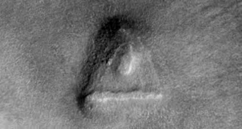
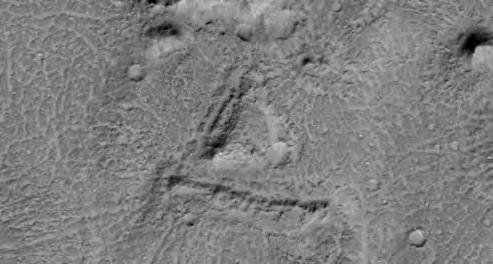
Independent Mars researcher and image specialist Gary Leggiere, has found a series of similar triangular features, ranging from a half-mile to one-and-a-half miles long, scattered across the surface of Mars.
Some have lines underneath.
The question is, what natural process could be responsible for making these formations?
Another Mars researcher and image specialist Jean Ward has found a variety of anomalies in NASA orbiter photographs. Ward, like all other Mars ‘treasure hunters,’ spends many hours of his week sifting through hundreds of photographs. Sometimes he’ll spend up to 4 hours looking at a single photo. The ultra-high resolution photographs are quite huge, sometimes hundreds of megabytes in size.
Take this photo for example. One of thousands of boring orbiter photographs.
But upon closer inspection, this oddity stands out. It’s around 16 meters long. What is it?
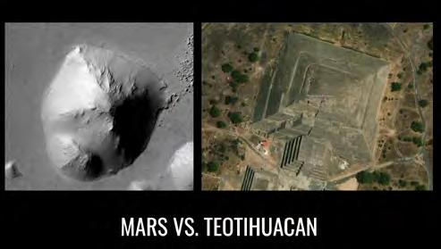
Ward has arguably found what appears to be the Mars analogue to the Pyramid of the Moon located in the ancient Mexican city of Teotihuacan. It’s not pristine, but what structure would be after millions of years of erosion and sediment deposition, or perhaps billions of years?
Most independent Mars researchers and image specialists ‘clean-up’ the raw NASA images. NASA posts photos as-is, without correcting brightness, contrast, or digital noise. Careful not to introduce anything new to the image, they often produce stunning results. Most of them even cite exactly where the image was obtained on the NASA websites so that you can go look these up for yourself.
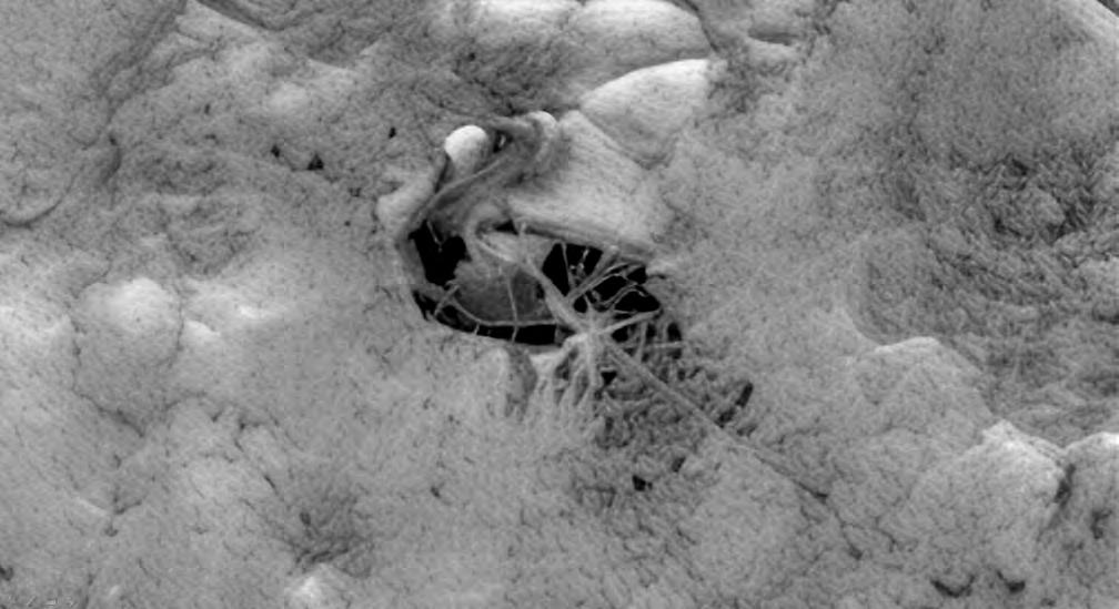
Like other image specialists, Ward has cleaned up images of features that defy conventional geological explanation, including this bizarre sinuous-like structure, about 100 meters long.
And while the UFO phenomenon is all the rave here on Earth, Ward has done a remarkable job discovering and cleaning up a few different rover images of what are either flying rocks or… something else? NASA will say these are imaging artifacts or dust on the lens. Trouble is, while
“...even the late Carl Sagan showed photographs and spoke of pyramids on Mars in his 1980s television series Cosmos”
imaging artifacts and dust on the lens is possible, neither one produces this result. What does this all amount to? Is it possible these images are depicting archeological ruins of an ancient civilization that once lived on Mars?
Even the late Carl Sagan showed photographs and spoke of pyramids on Mars in his 1980s television series Cosmos.
What is so incredibly interesting is that in the early 1970s the CIA and the United States Army took a specific interest in Mars. Regardless of what your opinion might be of their investigative tactics, the fact remains that from 1977 to 1995 the United States Army ran a Psychic Spying Program, otherwise known as Remote Viewing. One of the original officers was Joe McMoneagle, now a retired Army Chief Warrant Officer.
In the year 2000, the CIA declassified a transcript from one of Joe McMoneagle’s remote viewing sessions in 1984. Each session had two people, a subject and a monitor. The session began with a sealed envelope coupled with geographic coordinates. Officer McMoneagle, the subject, did not look at the information inside, which read…
'The planet Mars. Time of interest – approximately 1 million years B.C.'
He spoke aloud to his monitor saying, “I’m looking at an after effect of a major geologic problem.” His monitor directs him to “Go back to the time before the geologic problem.” McMoneagle continues and says that he sees “large flat surfaces, very smooth, angles, walls, really large, megalithic, pyramids, they’re huge. They’re like shelters from storms.”
Army Intelligence Officer Tom McNear, a Lieutenant Colonel, now retired, was recruited into the Army’s counterintelligence and counterespionage program for 22 years, and a member of the Army’s remote viewing program from 1981 to 1985. After that, he worked as an Army Civilian Intelligence Officer for 23 years. He never worked at the same
time with Joe McMoneagle on Mars specifically, but decades later realized a number of similarities between their remote viewing sessions, including the odd feature known as crater pyramid.
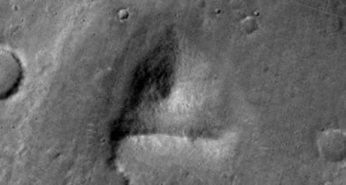
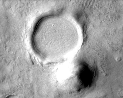
Take a close look at this raw photograph currently available on NASA’s website (image 1).
Image 2 shows a processed version by Gary Leggiere, correcting for brightness and contrast. It shows what appears to be a pyramidal structure directly adjacent to a 2.5 mile-wide impact crater. If this is in fact a pyramid, any sharp angles typically characteristic of such a feature are buried underneath
Image 1
Image 2
millions of years of sediment and dust deposited over top by the winds.
The question is, how could any pre-existing structure survive a meteor impact at such a close proximity? If that structure were there before the impact, it would have been destroyed. At the very least, damaged. Logic dictates the structure had to be created after the impact.
The McMoneagle transcript continues by describing what he viewed in his session, telling his monitor that they’re “very tall, very large,” that “they’re ancient people, dying, past their time or age. They’re looking for a way to survive and they just can’t.” His monitor asked, “What is it they’re waiting for?” McMoneagle answers, “a group or a party of them that went to find a new place to live” due to the “corruption of their environment. It’s failing very rapidly and this group went somewhere, like a long way to find another place to live.”
It doesn’t matter if you take remote viewing seriously. Again, the fact is, our military had a specific interest in Mars. The question is why? We don’t know for certain, but a terrifying hypothesis put forth by plasma physicist Dr. John Brandenburg might give us a clue.
Dr. John Brandenburg was most recently Senior Scientist at Kepler Aerospace in Midland, Texas. He earned his Ph.D. in Theoretical Plasma Physics at the UC Davis and Lawrence Livermore National Laboratory in Livermore, California.
In the early 1990s he worked on NASA’s Clementine mission, a space probe that was sent to map the moon. Clementine also detected enough water in the polar craters to support a human colony and a rocket fueling station.
He was a part-time instructor of Astronomy, Physics and Mathematics at Madison College, Wisconsin and most recently at Cal State Fullerton.
He holds eight patents, including one for an electric rocket engine called the Microwave Electrothermal Thruster. It uses microwaves to heat water into a plasma state for propellant, which is then exhausted as water vapor for thrust. Today, you can find one of these thrusters currently in use up in outer space.
He developed something called the Colliding Micro-Tori eXperiment for NASA, which is a fancy way of saying he developed a nuclear fusion experiment.
When he was eleven years old, he asked his father what he should do when he grew up. His father suggested, as fathers typically do, that he work on unifying gravity with electromagnetism. So he did. It’s called the Grandis Et Medianis Field Unification Theory.
The Defense Advanced Research Projects Agency, otherwise known as DARPA, took notice of Brandenburg’s work, and funded Kepler Aerospace to develop the theoretical model of gravity modification even further.
In 1987 Dr. Brandenburg was the first to publish his other theory on Mars once having an ocean. Most scientists rejected the idea at the time but it is commonly accepted today.
Arguably, his most important research relates to his hypothesis on how Mars lost its atmosphere. He calls it a large, planetary climate altering, R-process event.
This is scientific language used to describe an instantaneous global catastrophe. His research relies on data collected by NASA. Published in scientific journals and his books, it outlines in exquisite detail a few points that will now be summarized for the reader.
There are three radioactive hotspots on the surface of Mars.
Glassy residue, akin to trinitite, has been found to cover the surface at the hotspot locations and elsewhere.
Element 54 on the periodic table is Xenon. Elevated levels of atomic isotope Xenon-129 have been measured in the atmosphere of Mars.
What creates elevated levels of Xenon-129?
R-Process.
What is R-Process?
R-Process stands for rapid neutron-capture process, and is basically a set of nuclear reactions responsible for the creation of approximately half of the atomic nuclei heavier than iron.
How does R-Process occur?
R-Process occurs in two different ways. The first is when a star goes supernova.
The question is asked – Did a star go supernova and ‘place’ elevated levels of Xenon-129 on Mars? - No.
“...his most important research relates to his hypothesis on how Mars lost its atmosphere. He calls it a large, planetary climate altering, R-process event”
If it had, the same levels of Xenon-129 would have been measured elsewhere in our solar system. They aren’t seen elsewhere in our solar system. Additionally, had a relatively nearby star gone supernova, capable of ‘placing’ Xenon-129 on a planetary body within our solar system, the shockwave of the supernova would have also simultaneously destroyed the solar system.
What else causes elevated Xenon-129 levels to occur? There is only one other way – the detonation of thermonuclear weapons.
To this date, no one has adequately refuted Dr. Brandenburg’s hypothesis.
In case the reader is wondering, S-Process is the physics that happens in a nuclear power plant, and does not produce Xenon-129.
There are no craters at these hotspots, just like there are no craters at Hiroshima and Nagaski in Japan.
The reader might recall the scene in Christopher Nolan’s blockbuster 2023 film Oppenheimer, where Matt Damon’s character asks Cillian Murphy’s Oppenheimer about the risk of igniting the Earth’s atmosphere upon detonating the first atomic weapon at the Trinity test site in New Mexico. The answer? There was a “near zero” chance the test would ignite the atmosphere.
Turns out, doing so would have required a lot more energy.
What the Mars data is indicating is that sometime in the ancient past its atmosphere was ignited by a thermonuclear explosion at least 10 times more powerful than the energy output of the meteor impact that killed the dinosaurs. For those keeping track, that’s 10^25 joules of energy.
Mars was destroyed. Given the data, isn’t it important to ask not only “how?” but “by whom?”
The history of our solar system might be different from what we expect, which understandably makes some people uncomfortable.
When we look at the red planet today, we see a desert wasteland. The question is, should we now think of Mars differently?
The question is, what do we do now? There’s only one thing we can do. We need boots on the ground to verify this extraordinary evidence.
Was Mars another blue ocean planet? Primed for life? Rich in promise?
Is it possible there were others who stood on the shores of Mars? Others who played or savored the Martian sunset?
If there were others, maybe they weren’t that different from us. Maybe the question isn’t “what turns a blue planet red?,” but rather, how do we avoid the same fate?
Author’s note
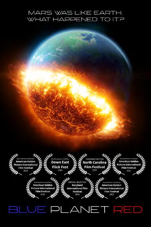
In 2022, I asked myself, “How come no one has made a documentary about this?” Being a filmmaker myself, I was compelled to act. In 2023, with the help of independent Mars researcher M.J. Craig, we released our two-hour documentary titled Blue Planet Red.
NASA has not adequately addressed the Xenon-129 anomaly. While making Blue Planet Red, NASA declined my request for an on-camera interview to answer questions regarding Dr. Brandenburg’s discovery. Jet Propulsion Laboratory, Lawrence Livermore National Laboratory, and a nuclear expert from Georgia Tech also declined to participate in an on-camera interview.
The film is just shy of two hours long, and has won awards from Film Festivals for directing and editing. Even the film trailer won an award.
While the film extensively features the work of Dr. John Brandenburg, Ph.D., it also includes interviews with Professor Richard Hoover
D.Sc., h.c., the former head of the astrobiology department at NASA’s Marshall Space Flight Center from the late 1990s until his retirement in 2012.
It also includes interviews with Harvard astrophysicist Professor Avi Loeb, Ph.D., Boston University geologist Professor Robert Schoch
Ph.D., UCLA planetary scientist David Paige
Ph.D., Penn State astrophysicist Jason Wright
Ph.D., University of Buckingham astrobiologist and panspermia pioneer Chandra Wickramasinghe, MBE, Ph.D., Sc.D., Litt.D., and retired
U.S. Army Intelligence Officer Lieutenant Colonel Tom McNear.
Other independent researchers and professionals in the aerospace industry and academia are included, which presents the history of Mars unlike any other documentary to date. The film also presents cinematic sequences shot in the Alvord desert in eastern Oregon with actress Cypher Fox, that provide an eerie similarity to the barren wasteland of Mars we see today.
Brian Cory Dobbs
For those with a good sound system, the dark electronic music of Florida-based composer known as Swarm provides a haunting, yet subwoofer-taxing soundtrack to accompany the tragic tale of Mars.
To watch the film, please visit BluePlanetRed.net.
Since the film’s release, Blue Planet Red now continues as an online series on my YouTube channel. https://www. youtube.com/@briancorydobbs
Follow me on Twitter / X here. @BrianCoryDobbs
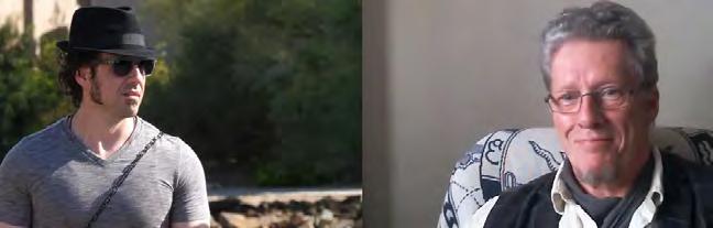
Pictured here is the filmmaker Brian Cory Dobbs along with producer M.J. Craig
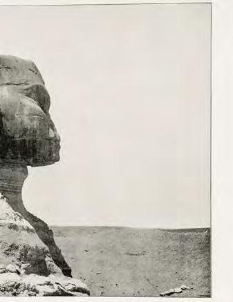
' The Sphinx--Standing 2,719 years when Solomon took Pharaoh's daughter and brought her to the city of David ' | Bain, Robert E. M. 1858-1932 | Lenkin Family Collection of Photography at the University of Pennsylvania Library, The Pritzker Family National Photography Collection, The National Library of Israel
Vitrification at Ancient Sites: A New Perspective on Historical Mysteries
By Nikki Milavec
Vitrification is the process of high heat transforming rock and mineral into a glass-like state. It requires temperatures reaching approximately 1,800°C. Supposedly the surface of the Sun is 5,600°C, so one third the heat of the Sun. While this phenomenon is well-documented in modern contexts like nuclear testing sites, its presence at ancient megalithic structures raises compelling questions about our understanding of historical events.
From Peru's Zona X to Egypt's Elephantine Island and New Mexico's Three Rivers Petroglyphs site (just to name a few) evidence of extreme heat-induced transformation of stone surfaces presents an archaeological mystery. There are scorched stones, a glass like surface on certain blocks and places that look “melted”. These sites exhibit characteristics that seem to surpass even the destructive power witnessed at known nuclear incident locations like Hiroshima and Nagasaki. Where depending on the quality of the reinforced concrete, some walls withstood even within 2 miles of the X spot where the bombs were dropped.
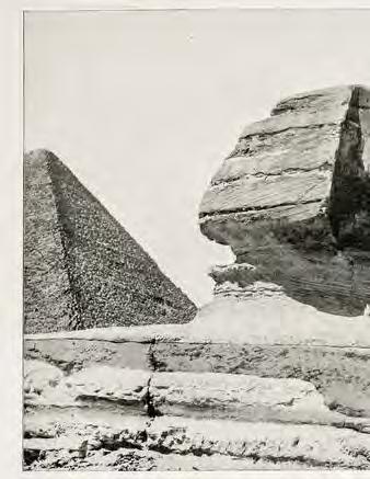
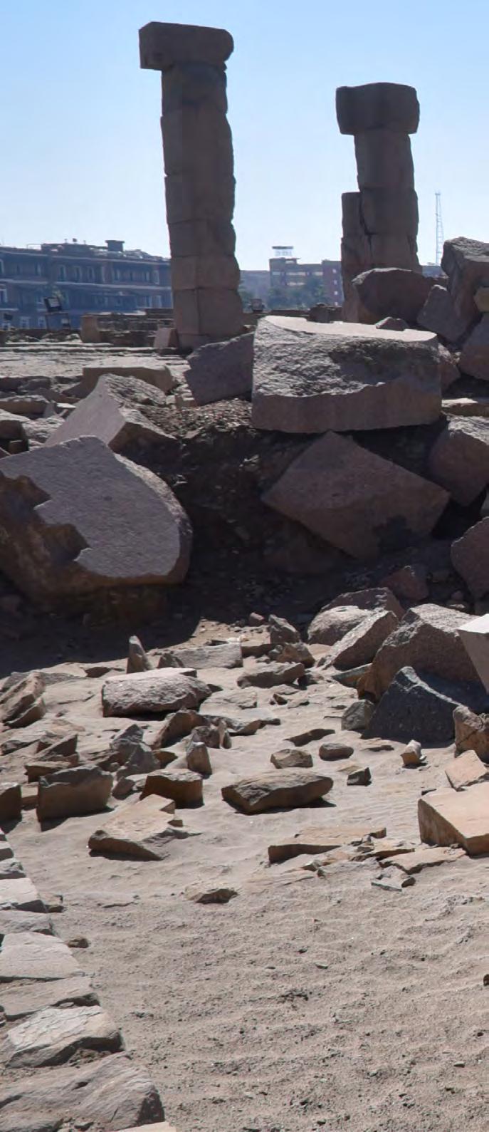
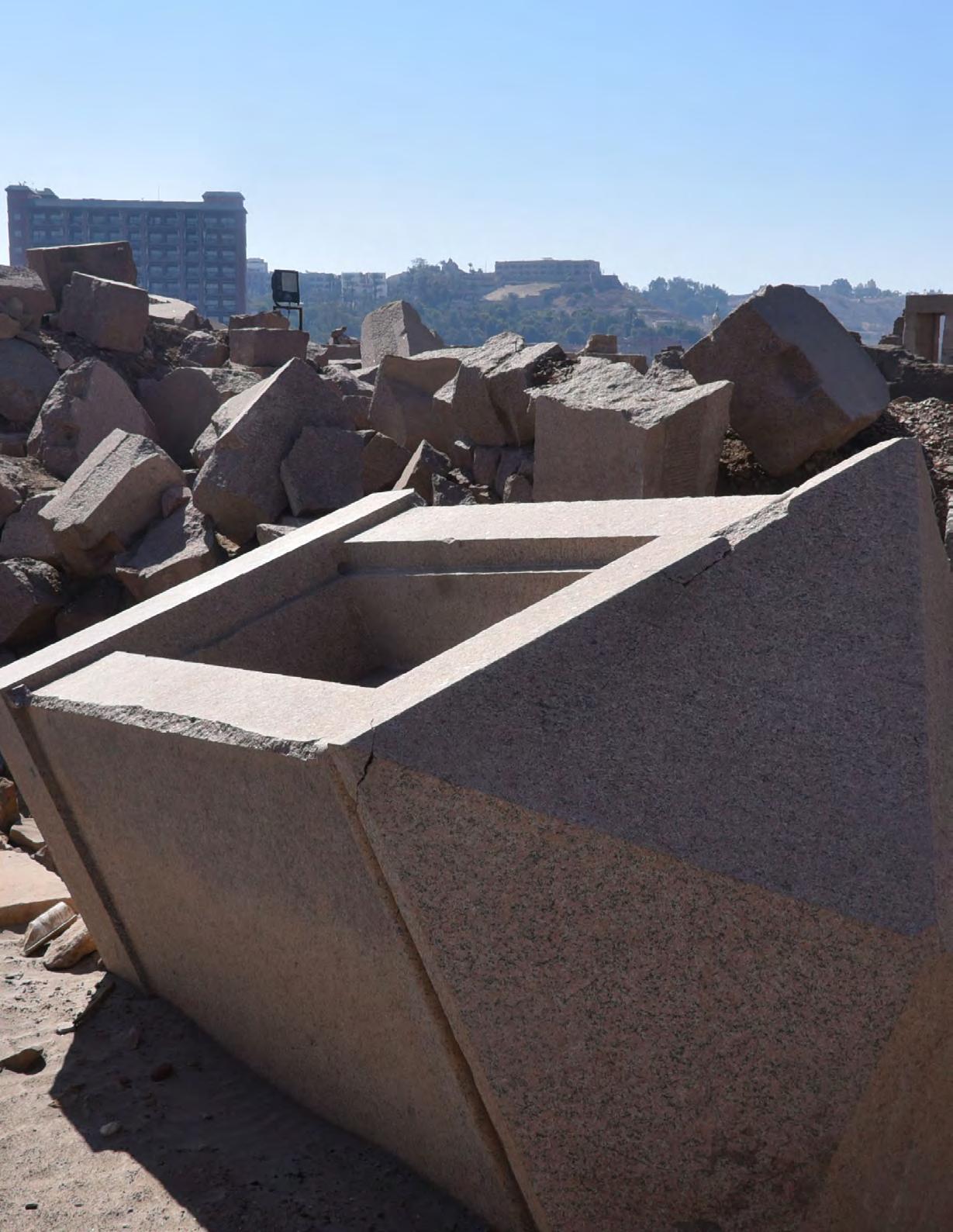
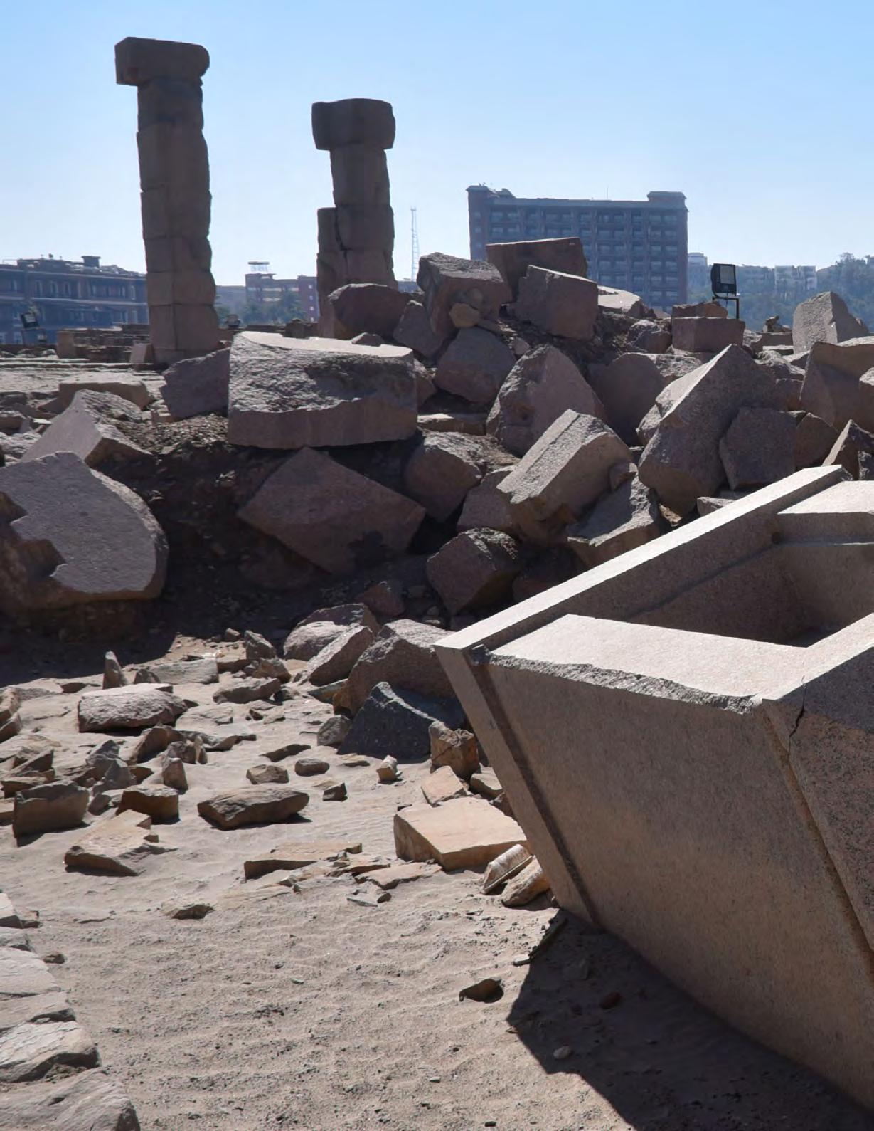
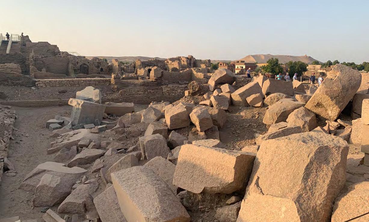
Elephantine Island, a fortified settlement located just before the First Cataract of the Nile, Aswan, Egypt. Photo by Carole Raddato
The theory of asteroid or comet impacts has long been used to explain catastrophic events like the Carolina Bays formation and the mysterious Younger Dryas period. However, despite these historical claims, we have yet to witness a truly city-destroying cosmic event in modern times. The closest we've come are incidents like the 1908 Tunguska event in Serbia, which dramatically flattened 80 million trees without leaving a single impact crater, and the 2013 Chelyabinsk meteor in Russia—a spectacular air burst that primarily made headlines for shattering windows through its intense shockwave. These examples invite a critical question: If cosmic impacts were as frequent and devastating as some theories suggest, why is there such a surprising lack of conclusive crater evidence on our planet? Despite countless narratives explaining historical destructions through celestial impacts, the physical proof remains frustratingly elusive.
Let’s consider Tektites. Traditional scientific explanations attribute tektites, that are natural glass formations found in "strewn fields" across the globe, to meteorite impacts. These objects, varying in colour from black and brown to green, grey, and gold, have long been considered extraterrestrial in origin.
However, microscopic analysis reveals intriguing similarities to other forms of vitrified materials:
• The presence of distinctive eye-shaped micro bubbles
• Compositional similarities to iron ore composites
• Questionable distribution patterns, particularly in oceanic locations
• Structural parallels to volcanic glasses like obsidian
The study of trinitite, the nuclear glass formed at the Trinity test site in New Mexico, provides an important modern reference point. Microscopic examination at 10x magnification reveals striking similarities between trinitite and various tektite samples. The formation of "Hiroshimaites", these being glassified materials created during the atomic bombing of Hiroshima, demonstrates how extreme temperatures can transform ordinary materials into vitrified substances.
nikkimilavec
nikkimilavec
nikkimilavec
nikkimilavec
nikkimilavec
Zona X Cusco where the rock lols melted or fused together
What sets ancient site vitrification apart from modern nuclear incidents is both its scale and precision. While Hiroshima, Nagasaki, and Chernobyl show localized destruction patterns, ancient sites often display:
• More extensive vitrification zones covering entire regions
Several ancient texts, including the Bhagavad Gita and various religious documents, reference powerful weapons capable of widespread destruction. While meteorite impacts and natural disasters have been proposed as explanations, the evidence at these sites suggests possibly different mechanisms:
• Targeted rather than random destruction patterns
• Consistent vitrification characteristics across global locations
• Preservation of certain structures amid widespread damage
• Technological signatures distinct from modern nuclear weapons
“...If cosmic impacts were as frequent and devastating as some theories suggest, why is there such a surprising lack of conclusive crater evidence on our planet? ”
Vitrified surface that is glass-like, notice the reflection, Cheqtaqaqa in Cusco, Peru nikkimilavec
Charred stones at Three Rivers Petroglyph site in New Mexico
nikkimilavec
nikkimilavec
nikkimilavec
nikkimilavec
While this analysis raises more questions than answers, the microscopic similarities between known nuclear glass and ancient vitrified materials warrant further investigation. Whether these sites bear witness to ancient conflicts, natural catastrophes, or unknown technological applications remains uncertain. What do we really know about meteorites, tektites and vitrification?? I have no definitive answers but I want us to start thinking in new ways untold to us about of what happened here? It might benefit us to unlearn much of what we think we know about history.
Nikki Milavec
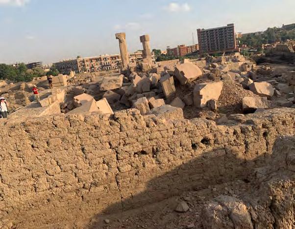
Ruins of Elephantine Island in Egypt where it looks like a bomb went off and blow up giant rose granite structures
nikkimilavec
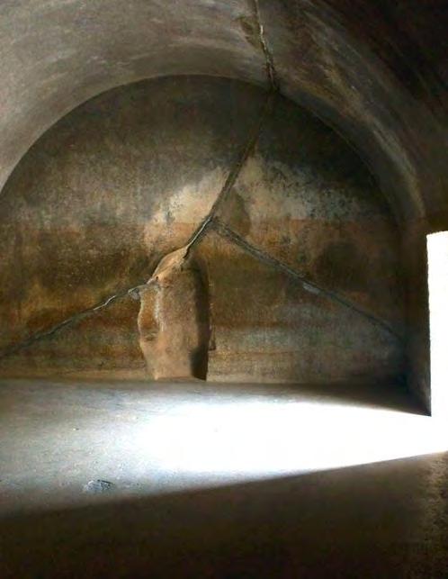
PIC FROM THE PAST
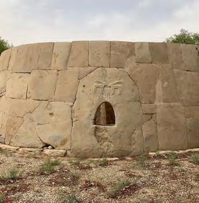
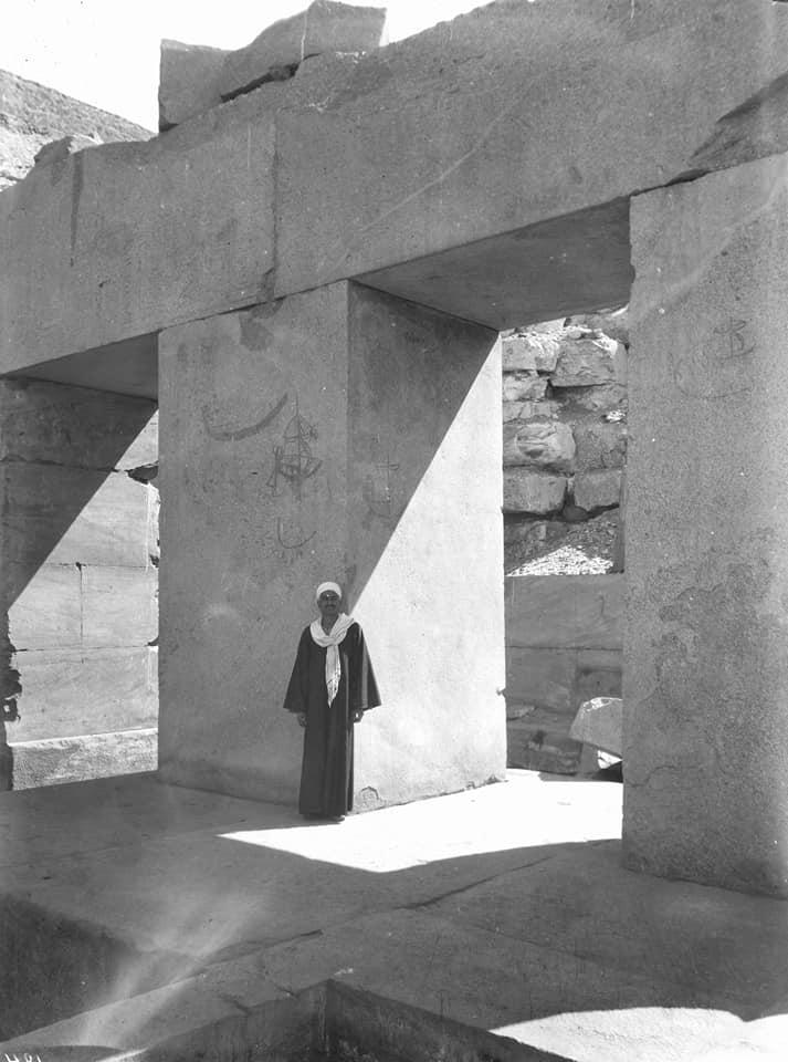
The Osirion, Abydos, Egypt, ca. 1914s–1925s. Source: Early Archaeological Projects Associated with Thomas Whittemore, Image Collections and Fieldwork Archives, Dumbarton Oaks Research Library and Collection.
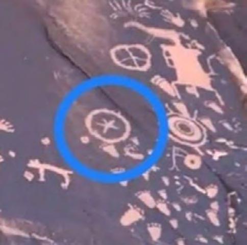
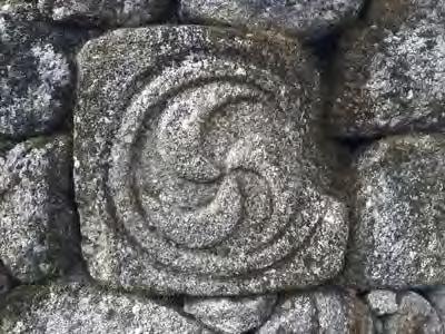
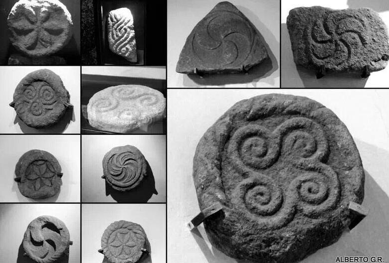
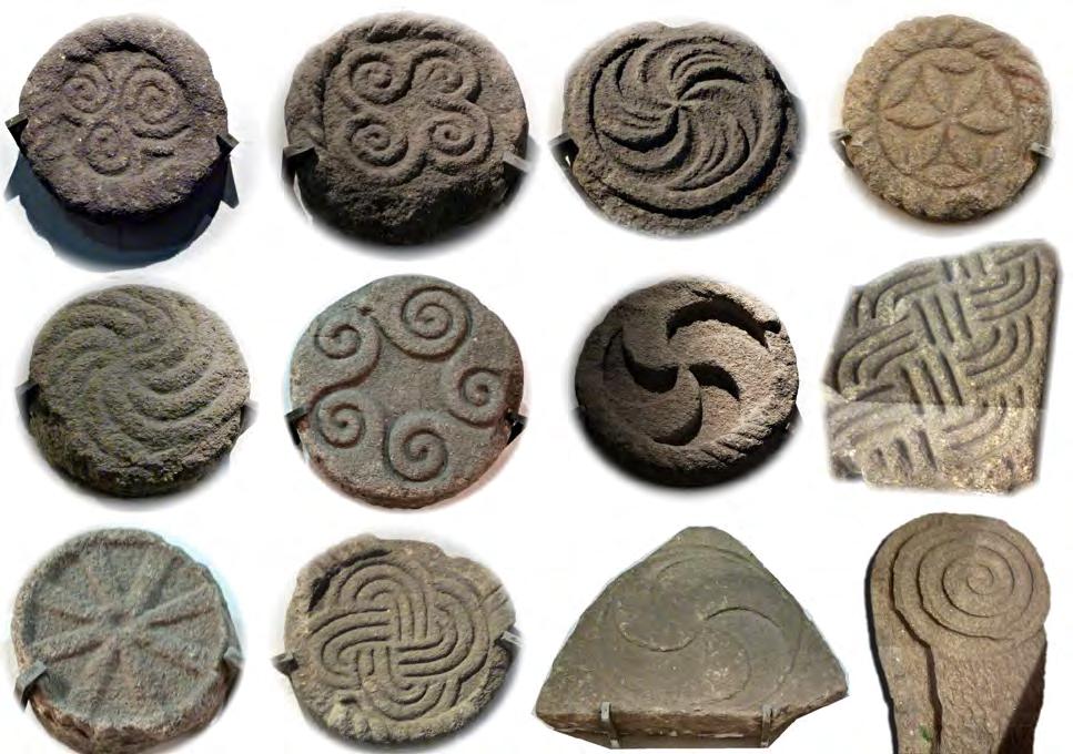
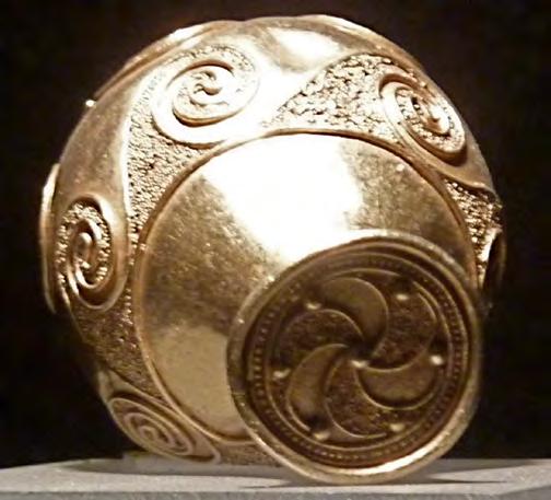
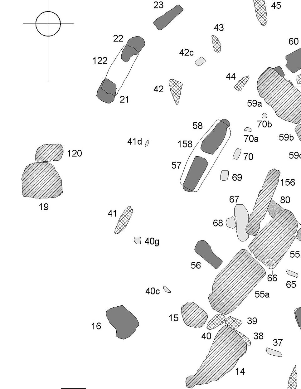
New discoveries of the connections between pre-Columbian Americas and other regions of the world
as demonstrated by petroglyphs, pottery scripts, and artifacts
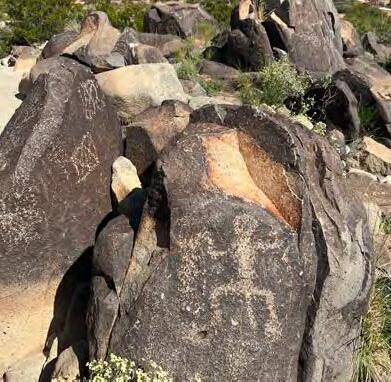
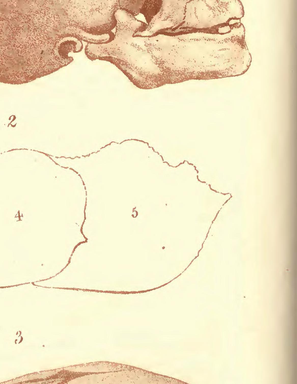
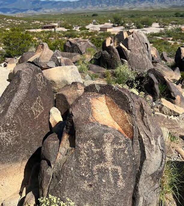
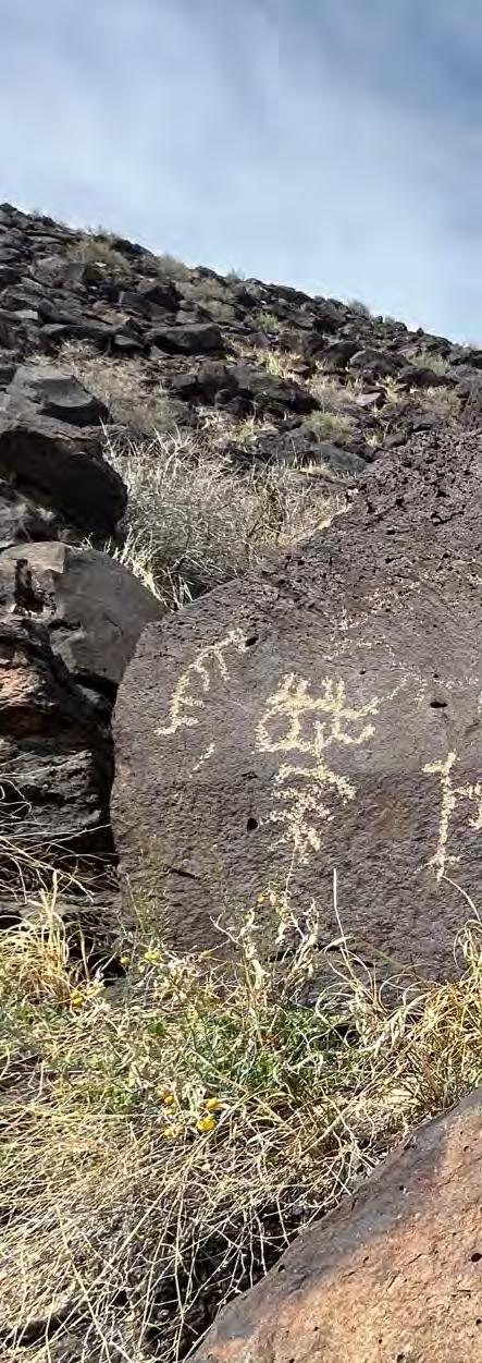
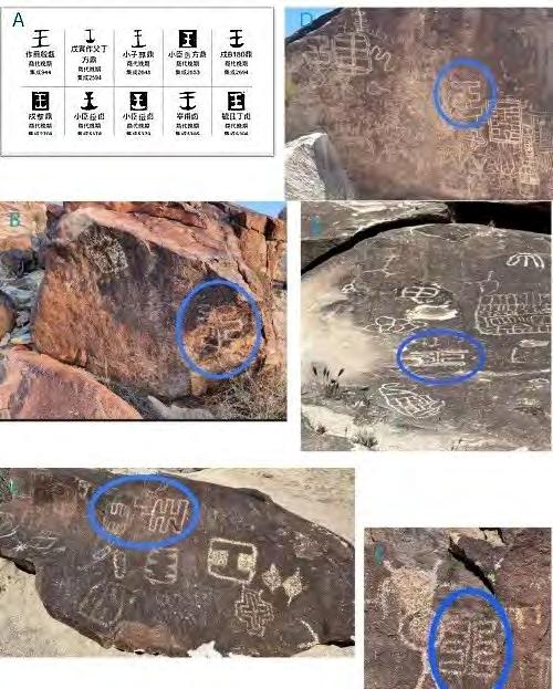
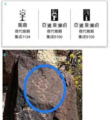
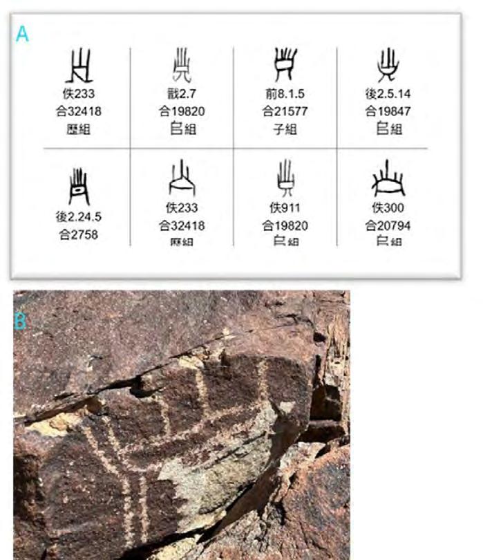
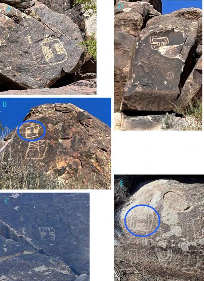
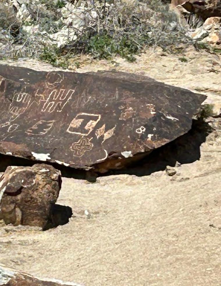
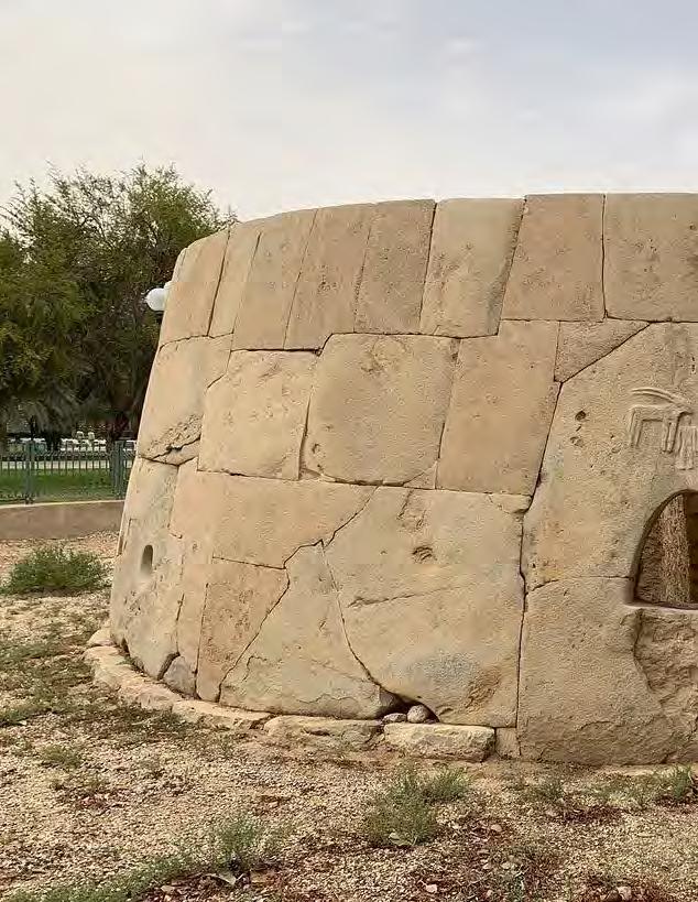
Petroglyphs can be found all over the world, and the American Southwest is one of the regions with the highest concentration of petroglyphs on the globe. During my research in 2023, I discovered systemic Shang Dynasty scripts at two petroglyph sites in the American Southwest (one is in New Mexico, and the other is in Nevada). The Shang dynasty, dated to approx. 3600-3000 years ago, was the second dynasty recorded in ancient Chinese historical documents.
BY
VI DUO
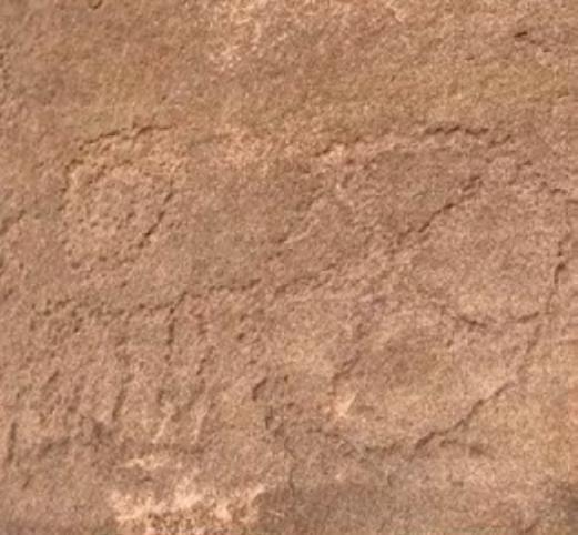
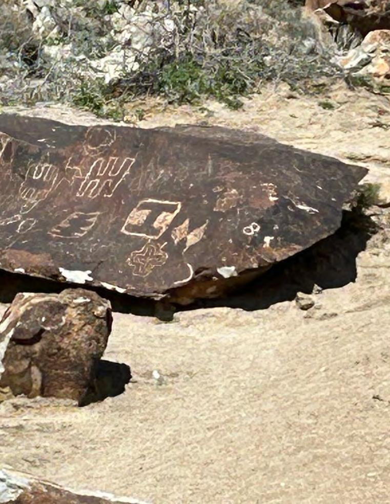
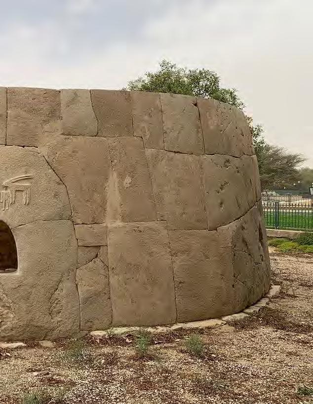
A boulder with Shang dynasty scripts at the petroglyph site in New Mexico, depicting a sacrifice offering scene from the fifth Shang dynasty king “Geng” to his diseased father, the third Shang dynasty king “Da Jia”. Photo taken by the author.
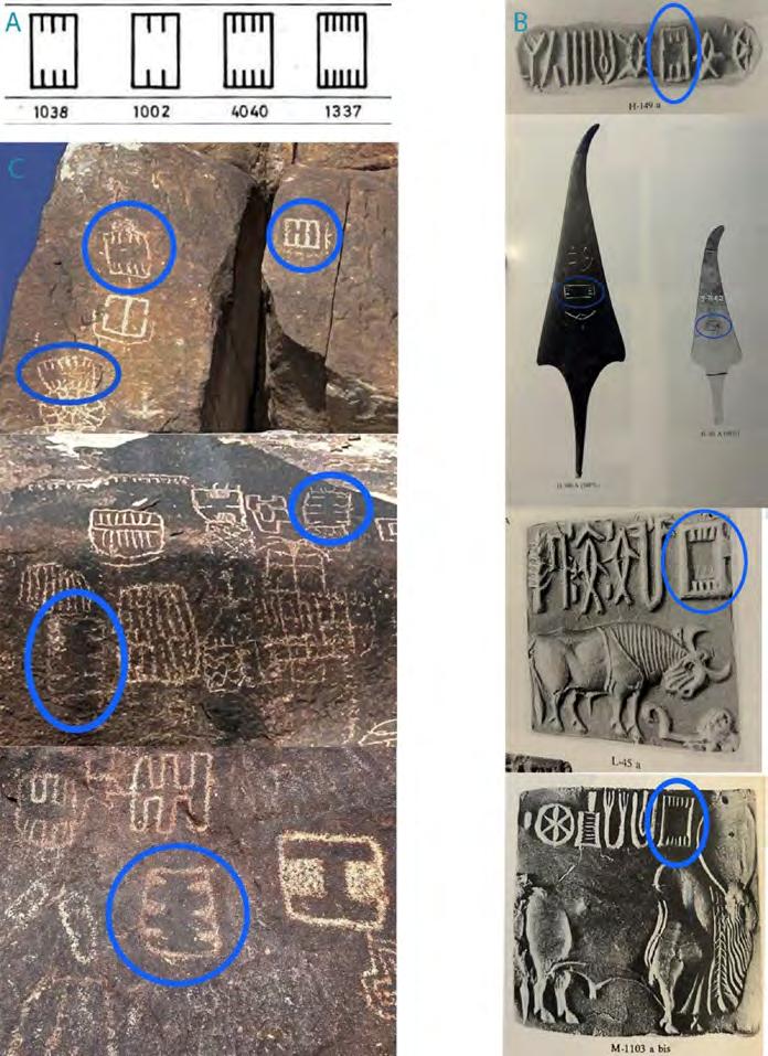
Tremendous oracle-bone inscriptions and bronze artifacts have been unearthed in its last capital city Yin (modern day Anyang, China). Moreover, I also discovered that many ancient symbols in the American petroglyphs and on the American artifacts are identical or similar to some ancient symbols excavated from the neolithic or bronze age sites in Mesopotamia, Egypt, Europe, Indus Valley, and China.
The discovered Shang dynasty scripts at the two petroglyph sites in the American Southwest can be categorized into three types: The royal titles of four consecutive Shang dynasty kings; Characters associated with the Shang dynasty kings such as “King”, “Royal”, and their surname “Zi”; Characters related to sacrifice and divination which stand for the notable cultural traits of the Shang dynasty.
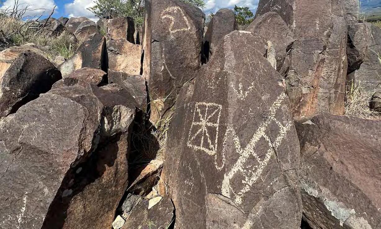
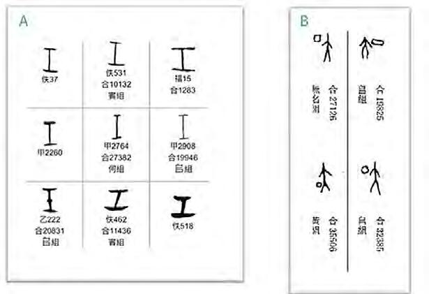
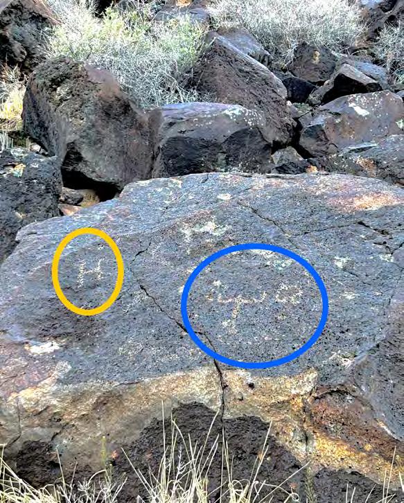
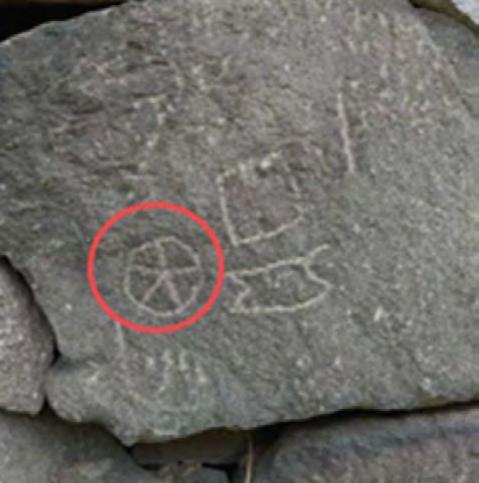
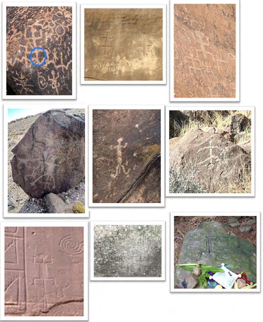
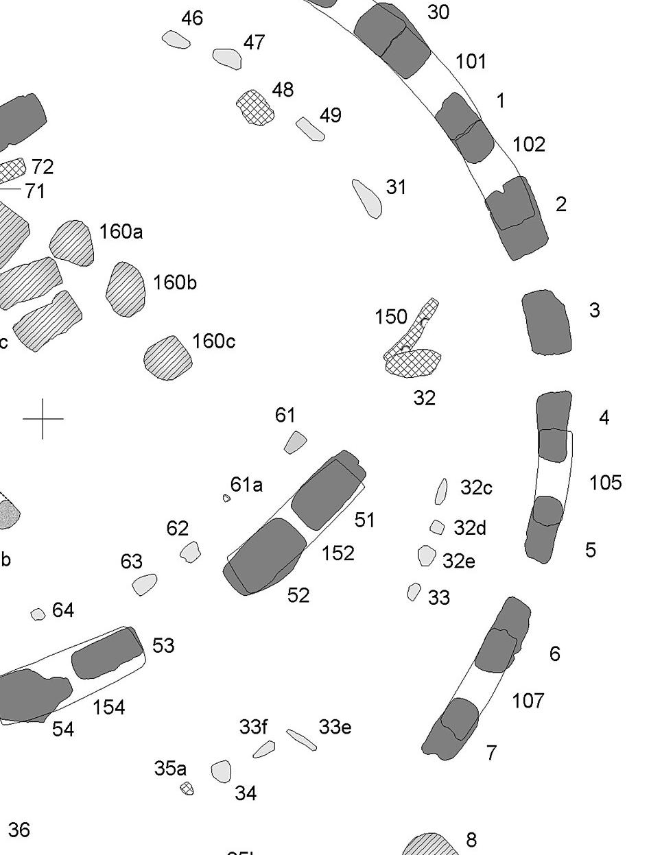
A) The second Shang dynasty king’s title “Ren” in a Shang dynasty script database (each grid contains a form of the character and its code; source: https:// xiaoxue.iis.sinica.edu.tw).
B) The title “Da Ding”, the father of the third Shang dynasty king, in a Shang dynasty script database (source: http:// jgw.aynu.edu.cn).
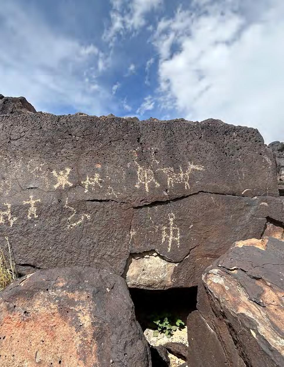
C) A boulder with “Da Ding” (circled in blue) and “Ren” (circled in yellow) at the petroglyph site in New Mexico. Photo taken by the author.
A boulder with the Shang dynasty scripts at the petroglyph site in Nevada, depicting three consecutive Kings’ titles “Ding”, “Ren”, and “Jia”. Photo taken by the author.
A) The second Shang dynasty king’s title “Ren” in a Shang dynasty script database (each grid contains a form of the character and its code; source: https:// xiaoxue.iis.sinica.edu. tw).
B, C, D, E & F) Multiple boulders with the Shang dynasty script “Wang” at the petroglyph site in Nevada. Photo B posted on Google maps by Mark, all the other photos taken by the author.
A) Characters of “Huang”, meaning royal, in a Shang dynasty script database (each grid contains a form of the character and its code; source: https://xiaoxue.iis. sinica.edu.tw).
B) A boulder with “Huang” (circled in blue) at the petroglyph site in Nevada. Photo taken by the author.
A) Characters of “Zi”, Shang dynasty kings’ surname, in a Shang Dynasty’s script database (each grid contains a form of the character and its code; source: https://xiaoxue.iis. sinica.edu.tw).
B) A boulder with “Zi” (circled in blue) at the petroglyph site in Nevada. Photo taken by the author.
More interestingly, at the petroglyph site in Nevada, mingled with the Shang dynasty script petroglyphs, I also discovered what appears to be Indus Valley scripts in the same design as the Shang dynasty scripts, i.e. some scripts have decoration of lights or crowns, leading to the conclusion that they were highly likely created by the same individual or group of people.
“Ren” petroglyphs with decoration at the petroglyph site in Nevada (circled in blue in B & E). Photos taken by the author.
A) A series of Indus Valley Civilization symbols.
B) The Indus symbols (circled in blue) in two corpus books (Joshi & Parpola 1987; Mustafa & Parpola 1991).
C) Symbols with decoration at the petroglyph site in Nevada (circled in blue). Photos taken by the author.
The universal ancient symbols discovered in the American petroglyphs and on the American artifacts are: Symbols related to ancient astronomy and calendar such as spirals, Cross, Swastika, the Squatterman, calendar symbols, the markers of solstices, equinoxes, and lunar movements; Other ancient universal symbols include the symbols of the leaf stem the shaman, the character Huan, the twisted flax, the ancient number “n”, the entanglement, the sun’s return, the three branches, the eye in hand, the birth scene, the double-headed eagle, the double-headed dragon, handprints and footprints, and many others.
A spiral at a petroglyph site in New Mexico. Photo taken by the author.
PHAROS
Left: The symbol of native American Yuchi tribe. Photo taken from “Travel Oklahoma”.
Middle: A symbol excavated from a Florida sand mound. Photo taken from the book “Path of Souls” written by Gregory Lit le (Little 2014).
Right: An Indus Valley civilization seal. Photo taken from the book “Corpus of Indus Seals and Inscriptions 2: Collections in Pakistan” (Mustafa et al 1991).
A jade artifact excavated from Linjiatan neolithic site, China. Photo taken from the internet.
Petroglyphs in Utah. Photo on the left taken by the author; photo on the right taken from Carl the crusher’s YouTube video.
Left: Petroglyphs in Japan. Photo posted by @tatkba a_ason on X. Right: Egyptian artifact. Photo taken from the internet.
Bronze artifact excavated from Sanxingdui, China. Photo taken from the internet.
The Squatting-man images are characterized by having their arms bent up or down and a phallic-like object in between their squatting legs. Other than in theAmerican southwest, these images can also be seen around the world. Why are the squatting man images a global phenomenon? What is the origin of it?
Petroglyphs in the Americas. Bottom middle photo posted on the internet by Julio Campos, bottom right photo posted on the internet by Yohana Dela Rosa. Top right photo taken from the internet. All the other photos taken by the author.
According to Chinese scholar Daofeichang’s (X account: @LD_daofeichang) research on ancient astronomy, the image of ancient Egyptian god Bes originates from the image of Orion. The comparison of them is as follows:
Top left: Dao Feichang’s interpretation (X account: @LD_daofeichang) of the astronomical origin of Bes images in a post on X./ Top right and bottom left: Ancient Egyptian god Bes, photo taken from the internet/ Bottom right: Amplified image of Dao Feichang’s interpretation.
I believe Orion is the origin of the global Squatting- man images as well as some of its variations such as a squatting- man with a snake, or a weapon, or a stick, next to him.
Top row (starting at the page on the left): Petroglyphs in the American Southwest. Left photo taken by the author; Middle photo taken from the internet. Right photo taken from “storiesbyalex” YouTube channel.
Second row. Left: Ancient pottery scripts excavated from a Neolithic site in West Asia, photo taken from the book “苏美尔,埃及及中国古文字比较研究 (Comparative Study of Ancient Sumerian, Egyptian, and Chinese Script” (Gong et al 2009). Right: Pictographs in Tanum, Sweden, dating to 3000 years ago, photo taken from the internet.
Third row. Left: Petroglyphs in the American Southwest. Photo taken from the internet. Right and fourth row: Images taken from the book “In Plain Sight” (Farley 1994).
Last row. left: Gene Giant petroglyphs in Britain, picture taken from the book “America B.C “(Fell 1989). Right: Geoglyph found in Australia. Photo taken from dailymail.co.uk.
By extension, I believe that the image of “a man facing a bull” on the ancient relief in Karahan Tepe, Turkey, dated to 11000 years ago, is the depiction of the constellations of Orion and Taurus, so is the image of “a man fighting a bull” on an artifact of the Indus Valley civilization.
Orion is also the origin of many phalluses depicted on the statues discovered in the region of Gobekli Tepe and Karahan Tepe.
Top: Reliefs found at Karahan Tepe, Turkey. Photos taken from the internet.
Bottom: Orion and Taurus, picture taken from the internet.
Top: Statues and reliefs discovered at Karahan Tepe. Bottom: A Statue discovered at Urfa, Turkey. Photos taken from the internet.
There are also many other universal ancient symbols worthy of detailed discussion, however, this article merely serves as a brief overview of my research for the readers, with the hope of guiding you to delve deeper into our marvelous and illustrious past.
Title: 'Temple of the Sun, center stone, Baalbek, Holy Land, (i.e., Ba'labakk, Lebanon)' | "Stone of the Pregnant Woman". Source: Library of CongressCatalog: http://lccn.loc.gov/2002724960, Public Domain https://commons.wikimedia.org/w/index.php?curid=33409294
Within the infinite vastness, nothingness of the universe there is light and life you can see and love that you can feel. They exist in a most infinitesimal form in comparison to the impressive infinite baron grandeur. Hidden within what we describe as nothing exists everything. You can float in the universal darkness and be consumed by it, or you can focus on the most distant light, recognize that life exists and feel the love. It is nothing more than perception provided you allow yourself to accept it as truth and as a reality that you create. A deep understanding of the darkness in order to truly appreciate the light. If you choose to allow yourself to be consumed by that darkness then there is no light to appreciate because you fail to accept an equal balance of the physical, mental and metaphysical. The conscious and subconscious aspects of the ALL. Perception of what is or even what could be. Hidden within what is described as nothing exists everything.
Much of what is, is in fact described as nothingness
Emptiness
The space between
The furthest point is often unseen
Yet there is existence
The smallest part of existence presents itself in that which is not
Life in the midst of the void contained in one blue dot
Love alone is the everything
Light alone in the midst of the nothing
One piece of a puzzle consumed by darkness
Present is the light that shines in its brightness
That which exists beyond that what is easily noticed is to be appreciated just as much as it is also truth if you will only allow yourself to consider, theorize philosophize and eventually believe that it truly exists. It is a willingness and a mental allowance of the potential existence of something not easily seen that gives you true ability to reason. Allowing yourself to believe in that which exists beyond and understand how powerful you truly are will give you the mental ability to dismantle a complexity and simplify the pieces which ultimately will provide true understanding, true reasoning and a quest for truth with the end result of internal peace thus raising
your frequency and vibration. A method that resonates. Formed as a feeling as opposed to merely seeing and observing but a feeling of understanding and what that truly means. Allowing yourself to question this directs you to a true understanding of yourself and why, who and what you are. Simple levels of practicing true understanding as an example is noticing that the growing level of societal frustration derives from the expanding levels of complexity and confusion unnaturally injected into a process or procedure. Further levels of frustration derive from the corruption of such truth for power and material. This then resonates as a feeling of frustration which
eventually equates to misunderstandings or worse. Allowing yourself to see beyond something as a common frustration will give you the power to break apart that complexity into pieces of simplicity. From experience and my perception, there is a small but growing consort of society that has begun to accelerate their questioning, to put it simply they understand something is not quite right with the basics of what has been commonly communicated and accepted. Whether they have raised their vibration and frequency to recognize the propaganda promoted under the auspices of the control mechanism or just simply feel that something exists beyond the ubiquitous influences. In the quest for truth you must seek wisdom from true knowledge without perception or judgement in a layered understanding of identity. It is the perception that changes the outcome.
Knowledge + perception = reality
Knowledge - perception = truth
Creation is life’s ultimate purpose. The energy, frequency and vibrations already exist and using those elements to create becomes the purpose. Using free will to create an experience to gain knowledge and wisdom to fulfill that purpose. The purpose of life is creation because you are a creator of your own experience. You are given the free will to create every aspect of your own reality. Creationism is the ultimate purpose, and not just to create life but to create out of your own infinite energy and consciousness. The human
contains the consciousness which lives forever as they are the creator of their own experience and have free will to create every aspect of their own reality. They can create a positive experience or a negative experience. A positive experience to change someone’s negative reality or a negative experience to change someone’s positive reality. They use free will to choose and they must choose between the positive or negative or as it echoes throughout time, the good versus the evil. They are that which lives forever but not in the physical because humans possess one thing that separates us from all the rest of the creatures on this planet at least, the free will to create every aspect of reality which then translates into physical, mental and spiritual existence. The true essence of what you are isn’t any attribute that you can put on a piece of paper. You are the bundle of sensory experiences that manifest within you and that is what truly shapes your life and defines who you really are. A bundle of sensory experiences contained within the conscious, subconscious and soul. A learned and shared experience of existence. By using free will that you inherit, you can then begin the process of dismantling the negative aspects of the future and deeply understand that nothing does not exist, luck does not exist, coincidence does not exist and as such the effect of a change of reality is from a linkable cause. The effect is seen heard and often felt but that doesn’t mean there is no cause especially if that cause is not apparent or easily calculated. The future only exists in minds vibration so if you
can tune into that vibration, you can understand what the intent is, what the plan is and or what the agenda is. You can focus to understand and recognize the propaganda and feel that something just isn’t quite right. Love peace and happiness versus hate hurt and pain are effects. The need to recognize and accept that the negativity or evil exists in order to defeat it and provide a positive experience. It seems as if the awakening process is in fact in direct relation to experiencing a level of consciousness shift which leads to altered states of reason, logic and the quest for real truth from the societal constructs and the corruption of it. It is a direct result of the insertion and adoption of unnatural elements into such things as medicine, food, water and manufactured products. Complexity of what was never supposed to be
complex. Nature is complex yet it functions in a natural state of what seems as uncomplicated and not complex. The unnatural elements injected into it make it much more complex to the point where you can notice it. It changes the complexity and adapting to the change becomes a source of contention and confusion. It’s the unnatural elements injected into every system, every structure and everyday life that leads to this modern form of frustration, confusion and anger.
The importance of creating enough internal space to allow all parts to coexist without contradiction now become necessary so that you can expand your mental capacity to receive the fullest amount of energy by transforming and absorbing the remnants of all the vibration, frequency and light that fade away into the night. Once you allow yourself to think deeply enough about the things that aren’t easily noticed you become more aware of the possibilities that truly exist. What can exist, provided you allow yourself to be open to hearing and experiencing other possibilities will give you extra levels of perception such as when people question the existence of God because the initial argument is mainly that you cannot see God. You can see intelligent design in the creationism contained in life, in nature and in the infinite vastness of unknown universe. The intricacies of nature and complexity of the human body are physical aspects of intelligent design. You cannot see GOD. This becomes the most obvious argument against the existence of. In the same respect you cannot see love. Nevertheless, you can see the effects and physical aspects of love through creative displays and actions. You do not randomly find love as it is something created. It isn’t something you can see. It is invisible yet it exists as feelings that accumulate in the invisible subconscious within the intelligently created complexity that is the human.
We live in the past
We prepare for our future last
We observe in the present
We have lost our methods and realizations of why we should repent
Tracing time along paths scattered with remnants of old
Basking in rays broken by trees and the stories left untold
To be much more than a simple observer
Participate in life’s challenge and spread the positive light further It isn’t enough to listen and observe from afar
Understand the lessons learned from experiences of old will allow you to be a true shining star
The construct of time serves as the tool to have these certain lessons and experiences recorded and catalogued as a measurement or to access for knowledge past present and future. It is time that serves as the tool to have these certain lessons and experiences recorded and catalogued as a measurement or to access for knowledge past present and future. If we look at the physical realm and state that time passes as fast as it does, and we experience the effects of aging as quickly as we have then the most important part of the life we have is to create the most positive peaceful loving experiences and focus on this aspect of the reality we choose.
You can go
back to the past in your mind
You can go to the future in time You can see yourself in the mirror to remind And be the verse of spirit in rhyme
Within the written historical constraints of the passing millennium are noticeable periods of time where the most ethical, moral, smartest and overall great people were held in the highest regards. Held to the standards of idolization or looked up to for guidance based on these outlining qualities. Understanding and realizing this when we revisit history and read through past philosophical writings and teachings is not a priority or even spoken about. Not many people even figure this out when comparing to the idols or people looked up to in the present. Today’s highest regarded are the ones who have the most money or hold the highest positions. The richest, most successful in business, politics, movie stardom and sports are
the ones who are to become targets of interest, who are written about and who are asked to be followed and asked for quotes of motivation and inspiration. Why? Is it because we have become a society where money is the idol and those who possess it are to be held in the highest regards? I speak generally because reading this you may agree or even have realized this and I may not be the only one to understand this construct. Majority may not and most likely do not. Not to say that those who are being held to the highest today are not moral or ethical and overall great people as I have met some that are. However, it has become a constant tone echoing throughout the world that those with such virtues are the ones who should
be followed and looked up to. If it is that history repeats itself will history repeat itself in this way? Will our future society be looking for the philosophers, artists, poets, and creative thinkers to lead us into the future and become the ones to be admired?
The way we choose to see and feel the world creates the world that we see and feel. If you change your perception the things you perceive will change. This is the part of a true experience hidden in the depths of the universe that you connect with, and these experiences influence your subconscious which ultimately affects the conscious. You’re the architect of your own reality so design a life that resonates with your true self and embrace your uniqueness and let it illuminate those around you. In a sense it is belief in that which exists, and the power of belief should never be taken for granted or ignored. What you believe is what you will experience so if you believe and think about the negative then the odds are in the favor of the negative experience. If you believe in the power of positive then in fact the odds play in your favor as that is the experience you will desire and will eventually create. The power contains the influence which will affect your life significantly and this will be your present and future.
Reflections of the crepuscular
Setting sun lost in thought contemplating the parallel and perpendicular
The moon now becomes the thief in the night
It does what it can to share the stolen light
It only takes one person to spread the light to all. In order to appreciate and accept the light you must recognize and understand the darkness. Understand and truly accept the construct of creation and appreciate the grand architect of the universe so that you choose to highly value the thief that illuminates in the simplest yet most elegant of ways. A reflection from the source of life to provide enough light to guide you on a path deep into the night.
Creationism and truth through real perception
Within yourself from your acts to your direction
Never truly lost
It’s a true understanding of you that matters most
The truest level of understanding comes in deeply understanding yourself and one way is to not use definitive words such as “complete or completely” because there is always more to learn. It begins with who you think are and what you think you are then progresses to who you know you are and what you realize you have become from the how and why. Much of the what’s and why’s from a journey of self-discovery will be eventually realized from being able to access the part of you that isn’t readily available in the forms of recollection. If you want truth from others then determine what it is that is true within you and why. If you want peace, love and or happiness then the same applies and even further the why of the actions and decisions you make. But how? How would you even realize or understand any of this and if it is in fact true and what you think you want versus what you truly need and don’t want to admit. Allowing yourself to accept and admit it now becomes the challenge because now the process of the journey becomes in your ability to be able
Understand the who and what and not the where because where you are is only relevant to how you use your free will and what type of experience you have chosen to create and include yourself in. An answer to the questions related to yourself and solving these questions can be addressed provided you allow yourself to believe it and accept it. It’s a journey of accessing the subconscious as that is where everything is stored from the physical, mental and beyond. Once you can truly recognize and understand the parts of you that you believe do not exist because you cannot readily access them, see or feel them is when you go through the journey of discovering the real truth about yourself, as it is often not the one you think you understand. It is simply cause and effect as there are no coincidences only ways to coincide provided you allow yourself to perceive it.
Mentally standing on the megalithic building blocks and marble columns from Egypt
to Greece
Theories, ideas and philosophies from
Title: 'Temple of the Sun, center stone, Baalbek, Holy Land, (i.e., Ba'labakk, Lebanon)' Image by Library of CongressCatalog: http://lccn.loc.gov/2002724960, Public Domain, https://commons.wikimedia.org/w/index.php?curid=33409294
ADVANCED CELESTIAL MEASUREMENTS AND ASTROLOGICAL CYCLES WITHIN THE GEOMETRIC DESIGN PRINCIPLES OF THE ANCIENT GODS AND GODDESSES.
By Jason Quitt
In this article, I will demonstrate a lost and forgotten ancient practice of using precise celestial geometric angles to encode ancient works of art with knowledge of the sun, moon, and Earth cycles.
According to our historical worldview, the first person to measure the Earth’s Axial Tilt, which is the angle between the Earth’s equator and its orbital plane, has been credited to the ancient Greek astronomer Pytheas of Massalia (350 BCE), who first recorded the measurement of the angle of the shadow cast from a sundial on the summer solstice.
This discovery was later established by Eratosthenes of Cyrene (276-194 BCE), who was the first to accurately calculate the circumference of the Earth and its Axial Tilt of 23.5-degrees. Three hundred years later, the famous Greek astronomer and mathematician Ptolemy (100 - 170 CE) popularized these measurements, first discovered by Eratosthenes, giving him credit for the discoveries.
What if this knowledge was known further in our remote history, recorded and passed down through works of architecture, artwork, symbolism, and even the design motifs depicting the ancient gods and goddesses?
It is well-established that ancient cultures worldwide built monuments, buildings, sacred sites, and mounds aligned with celestial cycles. Sacred sites spanning ancient Asia, Egypt, Europe, and the Americas have all been purposefully aligned to the cycles of the sun, moon, and stars. These sites would mark the astronomical times of the rising and setting of the sun during its yearly cycles of solstices and equinoxes, the rising and setting of the lunar standstill cycles of 18.6 years, and even the heliacal rising of Sirius, which the ancient Egyptians used would align with the solar cycle every 1,461 years.
How many millennia of dedicated observations did it take humanity to map the precise movements of the celestial bodies before they were able to apply this knowledge practically?
How would these revelations of celestial cycles be transmitted from generation to generation?
Was there an unbroken method of preserving this astrological knowledge through an undiscovered design principle recorded in the great works of art throughout the ancient world?
I first encountered this practice of the celestial angles by tracing the artwork found on the walls of ancient Egypt. Located in the tomb of Twosret, from the 19th Dynasty (1292–1189 BCE) in the Valley of the Kings, are the stunning reliefs of the Book of Gates that follows the deceased Pharaoh’s journey into the underworld. On this wall, we find a notable motif of a composite image of the gods Horus and Set sharing one body, standing on the back of a double-headed sphinx. The heads of the Sphinx are two of the four children of Horus, Qebhsennuf and Imseti. In this motif, five figures are standing on either side of Horus and Set, each side holding a rope.
We can break down this motif from a strictly symbolic interpretation of this image. Horus and Set represent polarizing gods: Horus, the solar god of light, and Set, the god of chaos and darkness. Both possess a singular body, with outstretched arms horizontally positioned to their sides. This dual figure stands on the back of a double-headed Sphinx, represented as the children of Horus, Qebhsennuf on the side of Set, with the head of the Falcon representing the direction of the West, and Imseti on the side of Horus, with the head of a man, representing the direction of the South. Both children of Horus adorn the Hedjet crown, signifying the crown of Upper Egypt.
On either side of this image, five individuals hold a rope in their respective directions. The group on the side of Set wears the Hedjet crown of Upper Egypt, while the four individuals on the side of Horus wear the Pschent double crown, representing the union of Upper and Lower Egypt.
As a dual solar deity, Horus and Set mark the time of the year when the days of light and dark are equal, symbolizing the solar equinox. The body of the dual solar deity is positioned in the direction of Set and Qebhsennuf, representing the side of darkness and the West, the setting or death of the sun entering the underworld. We can then interpret this image as the setting sun on the Autumn Equinox moving toward the Winter Solstice. The rope pullers symbolize the forces that pull the sun across the horizon from the southern winter to the northern summer position.
In Egypt, on December 21, the shortest day of the year (Winter Solstice) lasts about ten hours. On June 21, the year’s longest day (Summer Solstice) lasts about 14 hours. During the solar cycle from Winter to Summer Solstice, there is a total of 4 hours of light that is either gained or lost. Symbolically, this eternal tug of war is represented by the four figures standing on either side of Set and Horus, waiting to pull the rope in their direction. (Pulling the sun across the horizon from its most southern position to its most northern position.)
This solar motif physically plays out yearly on the Giza Plateau with the positioning of the Pyramids and the Sphinx. The Sphinx has a man’s face, just as the motif of Horus’ child Imseti. Could it be possible that the Sphinx does not represent the face of Khufu but rather Horus’s son Imseti?
Each year, on the day of the Autumn Equinox, the sun sets directly behind the left side of the middle Pyramid of Khafre. From the perspective of standing in front of the Sphinx, the sun visually sets (stands) on the back of the Sphinx. On this day, the hours of light and darkness are equal, mirroring the motif of Horus and Set sharing one body. From this day forward, the darkness of night takes over, shortening the days until the sun reaches its furthest southernly declination of the Winter Solstice, setting behind the left side of the Menkaure Pyramid.
Another play of shadow and light occurs on the Great Pyramid of Khufu during the Equinox. This particular Pyramid is not four-sided but, in actuality, eight-sided. Each face is divided in half by a degree of concave. This slight distortion allows a faint shadow to be cast on one side while the other side is illuminated, dividing the face of the Pyramid into half light and half dark. This effect occurs only on the days of the Equinox, mirroring the motif of the dual face of Horus and Set in one body.
The artistic motif found in the tomb of Twosret matches the physical celestial motif that plays out with the Sphinx and the Pyramids, marking the positions of the sun during the Equinoxes and Solstices. But is there another layer that can cement the symbolic nature into a working knowledge of the celestial cycles and movements? Let us examine this image more closely.
The concept is straightforward: If the image follows a solar motif, the angles representing the sun will be used as the design principle to map out the image’s composition.
If we draw a line down the center of Horus and Set’s body and connect the bottom line through his palms, what angle is generated if the center line has a value of 0 degrees?
We come to an angle of 23.5 degrees.
If we draw a line from the base edge of the motif into the eyes of the figures holding the rope standing in front of the double-headed Sphinx, we also get an angle of 23.5 degrees.
If you draw a line from the base edge of the motif through the tiny space between the Hedjet crowns and the palms of Set and Horus, you get an angle of 15 degrees.
If you measure the angled position of the poles, you get an angle of 30 degrees.
What significance do these specific numbers have with the correlation of the cycles of the sun?
23.5 degrees is the approximate angle of the Earth’s Axial Tilt, which produces the cycles of the Equinoxes and Solstices, giving us the changing of our seasons. This angle creates the visual effect of the sun moving across the horizon from its most southern declination to its northern declination. During this cycle, the suns position gains or loses altitude in the sky, gaining or losing strength, symbolically representing the gods kneeling or sitting when the sun is low during winter and standing upright when the sun is high during the summer months.
15 degrees represents the movement of the sun through the sky per hour, dividing the sky into 24 hours, 360 degrees. Spacing out the figures holding the rope gives them the value of ‘the hours’.
The poles at either side are set to an angle of 30 degrees, representing 2 hours and the division of the heavens into the 12 zodiacal constellations. 12 x 30 = 360 degrees. The 2 hours also represent the loss of daylight from the Autumn Equinox to the Winter Solstice and the gaining of 2 hours from Spring Equinox to the Summer Solstice.
Once this design principle is understood, it can be applied to other ancient works of art. As we will soon see, this knowledge extends far beyond Egypt and even further back into history. But let us continue moving forward on this discovery thread.
Tutankhamun’s Royal Chair
An illustrious gold leaf-covered chair, stylized with beautiful artistic elements, was discovered in the tomb of Tutankhamun, dating to 1323 BCE. The back of the chair is intricately carved with the Egyptian kneeling god of eternity, Heh, holding two palm stems outstretched to either side, following the popular ancient staff gods motif repeated through many cultures worldwide. Above the central figurehead sits the solar disc, with each palm incorporating a solar/lunar disc at the staff’s height for three distinct positions of the eternal solar and lunar cycle.
At the bottom of the motif, two gates of the gods sit on either side of the figure, with hieroglyphics of birds, bulls, and snakes. When we apply the celestial design angles of the Solar and Lunar cycles, the image’s composition comes to life. The 23.5-degree angle, drawn from the base of the opposing gates of the gods and the solar disc above Heh’s head, intersects directly through the eyes of the snakes and falcon to the center points of the sun at the top of the palm stems. Running up the length of each palm are 72 circular notches. The number 72 refers to the 72 hours (3 days and 3 nights) the sun stands still at the furthest declination on the southern and northern points of the horizon during the solstices.
From the bottom center of the image to the edges of the discs on the palm stems, we get an angle of 28.5 degrees, which is the Major Lunar Standstill cycle of 18.6 years. If we measure the spiral that extends from Hour’s Pschent double crown, representing the union of Upper and Lower Egypt, we get an angle of 18.5 degrees, the Minor Lunar Standstill cycle of 18.6 years.
The kneeling god Heh represents the personification of the eternal cycles of time. Holding palms at each side represents the standstill points on the horizon during the Solstices and the moon’s Major and Minor declination cycles. The staff god motif can then be interpreted as a solar and lunar cycle map depicting the positions of the rising or setting points on the horizon. Depending on which position the figure is facing determines the path of the sun’s direction to either the Winter or Summer Solstice.
In this particular motif, we can deduce that Heh represents the Autumn Equinox moving towards the Winter Solstice. He holds the symbol of life, the Ankh, positioned on his arm behind him, signifying the moving away from the spring and summer seasons, the time of the year that gives life and revitalizes the cycles of nature.
On either side of the figure are hieroglyphs of the Bull, representing the constellation of Taurus, which appears in the Northern Hemisphere from October to March and disappears behind the sun during the Spring Equinox. Below the Bull is an arm holding a knife, symbolizing the harvest and the death of nature, coinciding with the Hieroglyph of a cut and harvested bundle of grain.
In the illustration of the Chair of Tutankhamun, you will see another key that unlocks a solar design principle. The 23.5-degree line intersects the “EYES & HANDS” of the motif. In Egyptian mythology, the eyes of Ra and Horus represent the sun. There is also another correlation between the eyes, arm, hand, sun, and horizon in relation to timekeeping. When you hold your outstretched arm to the horizon, the perspective from your eye to your hand to the sun represents 15 degrees of the sky. This method of timekeeping allows our body to be the measuring tool capable of dividing the sky into 1-hour divisions.
Horus The Saviour Motif
Popularized in the New Kingdom of Egypt around 1570 -300 BCE, Horus The Saviour motif follows the theme of the staff gods. Horus, pictured as a young child with the Uraeus on his forehead, stands naked on the heads of two crocodiles, holding two upright serpents in each of his hands. In his left hand, he holds a lion. In his right hand, he holds a scorpion and an Oryx. Above his head is Bes, the dwarf god who fiercely protects children from harm. On either side of Horus stands a staff with the symbols of Horus and Amun. Horus’ hair is braided to the side of his head, representing the scorpion’s tail and the constellation Scorpius.
“The back of your head is that of Dwn-cnwy, your braid is that of the scorpion.”
- Coffin Texts, Spell 531
In Horus’ right hand, he holds a scorpion and an Oryx, representing Scorpius and Auriga’s constellations. The constellation Auriga (the Sheppard) is directly above the horns of the bull of heaven, located in the constellation of Taurus. Scorpius and Auriga (Taurus) are directly opposed on the wheel of the Zodiac. Auriga and Scorpius are also the asterisms of the Crook and the Flail carried by the gods and pharaohs, symbolizing Kingship (Crook-Auriga) and land fertility (Flail-Scorpius).
In his left hand, Horus holds a lion, representing the constellation Leo, the summer solstice. Horus represents Aquarius, the water bearer of the winter solstice, in the form of the naked child. These occulted zodiac signs continued throughout biblical and hermetic texts as the four-headed Cherubs, famously depicted in the vision of Ezekiel with the heads of a man, a lion, a bull, and an eagle. Again, symbolically representing the constellations of Aquarius, Leo, Taurus, and Scorpius, in their four cardinal points on the Zodiac, marking the equinoxes and solstices during the age of Taurus (4,300 BCE - 2,150 BCE).
Above Horus’ head sits the face of Bes, the god that fiercely protects mothers and children from harm. Bes is the counterpart of Taweret, the fierce maternal goddess in the form of the hippo-crocodile-lion. Taweret is the great guardian of the northern sky, connected to the constellations Draco, Ursa Major, and
Ursa Minor. In this asterism, Bes could take the role of the north star, which at this time of history would be the star Kochab, or the guardian of the north star, Polaris, both located in the constellation Ursa Minor.
In this highly stylized motif, Horus is the solar deity, holding the solar cross of the constellations of the Zodiac. When applying the 23.5-degree celestial cycle design principle to this image, the top of the staff and Horus’s eye intersect with the Solstices’ lines. Measuring from the image’s base and the crocodiles’ heads align with the serpents’ eyes at 18.5 degrees, signifying the Minor Lunar Standstill cycle of 18.6 years.
Horus the Saviour motif is an astrological motif of the sun’s yearly cycle through the four fixed constellations of the Zodiac, representing the solstices, equinoxes, and the Minor Lunar Standstill cycle of 18.6 years.
The Queen of the Night, Burney Relief, 1,800 BCE
If we go back further in time, we see the same design principle utilized by the Babylonians in Mesopotamia. The terracotta plaque known as ‘The Queen of the Night’ depicts Ishtar standing naked with owl wings and zygodactyl owl feet perched on the backs of two lions.
She holds a rod and a circle in each of her hands, referenced in the Descent of Inanna tablet as her “lapis measuring rod and line.” These are tools of the gods that measure the heavens and the earth. The tools in each hand are angled to 23.5 degrees and 15 degrees.
Her arms and wings are also aligned to 23.5 degrees. From her navel and womb, the angles of 23.5 degrees connect to the eyes of the lions.
Ishtar’s crown connects to the owl’s eyes at 28.5 degrees, the degrees of the major lunar standstill cycle that occurs every 18.6 years. In this lunar motif, Ishtar, like the owl, can navigate the sky and hunt in the dark.
As the fertility goddess, Ishtar represents the astrological cycles of the Spring Equinox. She stands on the backs of two lions, in the same style motif as we see in Egypt of Horus standing on the heads of two crocodiles. Horus represents the location in space inhabited by the winter water constellations of Aquarius, standing on the backs of Pisces Austrinus and Cetus, the dark water monster asterisms.
Ishtar, the virgin asterism of the constellation Virgo, is visible in the northern hemisphere’s night sky during the spring and summer months next to the constellation of Leo the lion.
During the months of spring, from March to June, the most notable stars in the sky are called the ‘Spring Triangle,’ which are made out of the three brightest stars of Arcturus, located in the constellation Boötes; Spica, situated in the constellation of Virgo, the virgin; and Regulus, located in the constellation Leo, the lion. Just as Horus was an astrological time marker of the winter, Ishtar represented the spring.
The Cylinder seal of Ishtar from 2334-2154 BCE follows the exact same Solar and Lunar Cycle Design Principle Angles dating back over 4,000 years. This shows that these artists knew the celestial cycles of the Earth, Moon, and Sun, preserving this knowledge for future generations.
In this depiction, the ‘weapons’ on Ishtar’s back are angled to the Major Lunar Standstill Cycle of 28.5 degrees on the left side and 23.5 degrees Solstice angles on her right. She holds a rope to a lion at 28.5 degrees; her right arm is angled to 18.5 degrees, the Minor Lunar Standstill Cycle, while her left arm is bent to both the Major and Minor Lunar Cycle.
The Tablet of Shamash
Ishtar’s twin brother Shamash was the sun god, representing the sun’s heat, allowing the plants to grow during the summer. In this motif, a giant-sized Shamash sits on his throne, holding the lapis astrological measuring tool and line. The measuring rod is the exact length of Shamash’s arm and hand, from his elbow to the tip of his middle finger, making this rod a Cubit. In front of him is a pillar and a table that holds his symbol, the solar disc of Shamash. The disc of Shamash is being held up by two figures by ropes. If you measure the angles of the ropes, they are set to 23.5 degrees. These figures play the same role as the rope pullers depicted in the first motif of this article, from the tomb of Twosret. This role is to pull the sun across the horizon from Summer to Winter Solstice. Three smaller figures are standing on the opposite side of the table, facing Shamash. If you add the
heights of the three figures, they equal the measurements of Shamash’s body on this throne, symbolizing the three aspects of the solar deity. Above Shamash are the three symbols of Nanna, Shamash, and Ishtar. Shamash’s rod is pointing directly to the star of Ishtar at 23.5 degrees. Shamash’s line of sight to the sun’s disc creates another 23.5 degrees. From the edge of the table that holds the disc of Shamash to his pupil is also angled to 23.5 degrees. Shamash represents the sun during the astrological season of Summer and Summer Solstice.
Marduk Cylinder Seal, 800 BCE
The Babylonian Cylinder Seal of Marduk shows the Earth’s Axial Tilt with the Sun in three positions, marking the Solstices and Equinoxes. Marduk is depicted holding his weapons and standing on top of a hybrid beast with wings and a scorpion’s tail.
Rising out of Marduk’s back are three polls with the symbols of the Sun at the top of each. These polls are perfectly aligned to 23.5 degrees, making this image the most obvious solar motif that depicts its purpose. The beast with the scorpion tail can be an asterism of the summer constellations of Sagittarius and Scorpius, most visible in the northern hemisphere night sky during the Summer months of July and August. As the solar deity travels across the sky through the twelve zodiac constellations, its character changes to reflect the cycles experienced on Earth and what is observed in the Heavens.
Dendera Light Bulbs
Constructed during the Greco-Roman period of Egypt between 54 BCE and 14 CE, the Hathor Temple of Dendera is one of the most exquisite examples of celestial motifs, architecture, and art, from columns carved with the faces of Hathor to the walls and ceiling covered with intricate scenes telling the story of the celestial bodies, gods, and goddesses, recording the celestial design principles for future generations. Many reliefs still hold onto their mysteries, while various interpretations have gained modern popularity
One such motif is known as the ‘Dendera Light Bulb,’ seemingly because the image depicted resembles the shape of a modern lightbulb, with an encased serpent rising out of a lotus flower.
The lotus flower was connected to the goddess Hathor, symbolizing creation, rebirth, and healing.
In the form of Neheb-Kau, the serpent represents the double of Ra and his Ka body. Neheb-Kau was responsible for bestowing life to the world by granting the Ka body at birth and retrieving it at death. The serpent is birthed into the world through the lotus flower in this motif. The two figures holding the lotus flower are depicted as double, signifying the physical and Ka bodies.
Ra and Hathor are the supreme solar and lunar deities that birthed the creator gods. The Dendera light bulb motif does not depict a light bulb; it is a highly stylized astronomical calendar that utilizes the design principle angles to illustrate the sun’s and moon’s life cycles.
The ‘Light Bulbs’ are composed of the angles of the Sun and Moon cycles. The left bulb uses the 18.5-degree angle below the serpent, signifying the Minor Lunar Declination cycle. The serpent is angled perfectly to 23.5 degrees, connecting directly to its eye. The top of the bulb is angled to 28.5 degrees, the Maximum Lunar Declination cycle. From the belly button, the line enters the serpent’s eye at 15 degrees, signifying the sun’s movement into hourly divisions.
The serpent on the left side displays the solar cycle, with the moon in its Minor Lunar Standstill cycle, while the serpent to the right depicts the solar cycle with the moon in its Major Lunar Standstill cycle.
The wall of Ramesses’ tomb, which predates the Temple of Hathor by over 1,000 years, also depicts a similar motif of the solar serpent rising. Not only is it similar, but it also follows the same solar cycle design principles.
The sun’s path is fixed in the sky on its yearly cycle, symbolized as a serpent bound by a rope hooked to the earth. This scene from the Book of the Dead, found on the walls of Ramesses tomb (KV19, 1,189 BCE), depicts this perfectly. Anubis stands facing the serpent while Thoth, in his baboon form (moon), stands behind him and turns away. The serpent is tied to the ground by five hooks holding five ropes. From the base of its tale to its eye, it is set to the angle of 23.5 degrees, while the body to its eye is set to 15 degrees. Anubis’s eye and staff also intersect the serpent’s eye at an angle of 23.5 degrees.
During the festival dedicated to Osiris, ropes symbolically raised the Djedd pillar. The raising of the Djedd pillar symbolized the resurrection of life returning to earth. Osiris, the god of the dead, was also the god of vegetation and agriculture, linked to the yearly inundation of the Nile River and the start of the new year cycle.
Menat of Hathor
Another relief in the Temple of Hathor that deserves our attention is the Menat motif. This motif is in the style of the Menat necklace, which is also a symbol of the goddess Hathor. The Menat necklace is known for its counterweight on the back that holds the front in balance.
In this scene, four strands of knotted rope extend from the Menat counterweight, each affixed to the top of houses in the style of the Babylonian gates of the gods. The gates sit on top of four pillars with the face of the goddess Hathor. Two pillars stand on the right side, and two on the Menat necklace’s left side. Between the two pillars on the right side rests the solar boat carrying the setting sun. The vessel that holds the setting sun is the solar barque that symbolically carries the deceased into the western horizon, the gate of the underworld, where the goddess Hathor greets and protects the path of the dead. If you count the knots on each rope, you get 93 knots. It takes 93 days from Spring Equinox to enter the gate of Summer Solstice. From the pillar’s base to the rope at the top of the neighboring gate, it is aligned to 23.5 degrees. The Menat’s counterweight depicts the sun at 15 degrees, signifying ‘the hours.’ Here, we can also interpret the two pillars on the right as gaining 2 hours from the Spring Equinox to the Summer Solstice.
The Menat relief symbolizes the sun’s movement through the gates of the season between spring and summer. Hathor is Ra’s counterpart, and his balance is like the Menat necklace. She is the mother goddess of heaven and earth, who births the sun each morning and the moon each night.
Celestial Boat of the gods and goddesses
Located on the ceiling of the Temple of Hathor, we find a complex scene with a celestial boat motif rich with solar and lunar symbolism. I will attempt to simplify the elements.
On the left side of the motif stands the eight Ogdoad, who represent the primal forces that existed before creation and are tasked to oversee and maintain the balance of creation. In the next scene, we have three kneeling gods in the form of Anubis at the back of the boat and three kneeling gods in the form of Horus
at the front. Anubis is the son of Osiris and Nephthys, who is seated behind Osiris on the boat, and Horus is the son of Osiris and Isis, sitting in front of Osiris. This scene retells the story of the death of Osiris and how Isis and Nephthys reassembled his body after his brother Set cut him into 14 pieces. In the next scene, we see the 14 gods (aspects of Osiris’ body) being resembled in the form of the full moon, with god Thoth standing at the front overseeing. Symbolically, Set (the darkness) cuts Osiris (in the form of the moon) into 14 pieces (it takes 14 days for the shadow of the earth to cover the moon in
darkness). Isis and Nephthys collect the 14 pieces and reassemble him so he can be resurrected. (It takes 14 days for the sun’s light to illuminate the full moon’s face entirely).
Let’s work through the elements that make up the celestial boat motif from the perspective of “If the image follows a solar and lunar motif, the angles representing the sun and moon will be used as the design principle to map out the image’s composition.”
Element 1: Winged Khepri Solar Disc with the symbols of the Shen, Was Scepter and Ankhs. The Was Scepters, a symbol of royal authority, are angled to express the solar and lunar design principles of 23.5 degrees of the solstices and 28.5 degrees of the major lunar standstill cycle. The scepters are coming out of the Shen symbol, representing eternity and completeness. The solar disc above Khepri features two cobras facing opposite directions. From the “V” shape on Khepri’s back to the cobras, eyes are also aligned to 23.5 degrees.
Element 2: Anubis Kneeling
Anubis, the son of Osiris and Nephthys, was the god who protects the deceased on their journey through the underworld. He is also the god of the dead, funerary rites, and mummification. In this composition, Anubis is designed with the principles of the 18.6-year moon cycle of 28.5 degrees major lunar standstill and 18.5 degrees minor lunar standstill. Anubis is a hybrid composite of a man with the head of a Jackal, a wolf-like dog found in Egypt. The Jackal is connected to the night and the moon, as they are nocturnal hunters who are heard howling in e ht, symbolically linking them to the night, the dead, and the moon.
Element 3: Horus Kneeling
Horus, the son of Osiris and Isis, was the god of the sky, kingship, and the sun. In this composition, Horus is designed with the principle angles of the solar cycle of the solstices and equinoxes, representing the 23.5-degree axial tilt of the earth. His body is also designed with a 15-degree angle, the amount of time the sun travels through the sky per hour, dividing the sky into 24 hours, 360 degrees, and the earth’s shape. As the hybrid composite of a human with the head of a falcon, Horus was symbolically connected to the movement of the sun traveling across the sky,
Element 4: The Staffs of the gods and goddesses
By connecting the main elements of the motif to the celestial design principles of the sun and moon cycle angles, the entire motif comes to life with a geometric display of knowledge connecting the gods and goddesses to their respective solar or lunar qualities.
The staff and thrones are the guides that link to each element’s eyes to tell the story of what they represent. Encoded within this motif is the dead god Osiris, who is on the celestial boat of the heavens awaiting to be resurrected as the full moon. His body is designed with the celestial measurements of 23.5 degrees Axial Tilt of the Earth, the sun’s position during solstices and equinoxes, and the 15-degree movement of the sun per hour in the sky. The base angle of Osiris’s throne, 28.5 degrees of the Major Lunar Standstill cycle connects through the eyes of the goddess Maat, who represents truth, order, and the laws of nature, and the god Thoth in his baboon form, who represents wisdom, knowledge, and the moon.
Osiris holds a Was staff and Ankh in each hand, while Nephthys behind and Isis in front have a staff with a lotus flower on top. Osiris’s and Nephthys’s staff connect directly into their eyes at 23.5 degrees, while Isis’s staff aligns with Osiris Was staff at 23.5 degrees.
The eyes of Nephthys and Isis are aligned to the eyes of the Vulture goddess Nekhbet at 18.5 degrees, connecting them to the Minor Lunar Standstill cycle. Nekbet was the goddess tasked with protecting the dead pharaoh and all the children of Egypt. Nephthys and Isis’s eyes are also aligned to the heads of the Was Scepters located on the Winged Solar Disc at 28.5 degrees, the angle of the Major Lunar Standstill cycle.
Behind Nephthys stands Horus, holding a serpent and steering the celestial boat through the heavens. Horus is also designed to incorporate the 23.5 and 15-degree solar principle angles and the hours the sun travels the sky. Lastly, from the base of the stars under the boat to the heads of the Was Scepters that balance the Winged Solar Disc, another perfect 23.5 degrees is created.
Basket of Life - Ankh holding Was Scepters
Carved onto the walls of the Temple of Karnak (1971 BCE), are symbols of the motif of the staff gods in the style of the pharaonic symbols of the key to life and authority, the Ankh and the Was Scepter. In this motif, the Ankh is holding the Was Scepters out to its sides, standing on top of the basket that carries the water of life. This symbol is designed entirely on the blueprint of 23.5 degrees. The Ankh represents the gate of the Spring Equinox, the time of year life returns to the world, while the two Was Scepters represent the furthest declination of the sun on the northern and southern points on the horizon that mark the Solstices.
Gate of the Sun - Bolivia
Discovered on the other side of the planet, at the site of Tiahuanaco, Bolivia, is a beautifully carved solar deity sitting on the top of a 10-ton monolithic stone gate. These ruins are credited to the Tiwanaku culture, who inhabited the area around 500 AD. The solar deity has 24 elements around his head, signifying the 24 hours a day. He holds a staff in each hand, following the staff god motif. The deity is carved to precisely integrate the design principle of 23.5 degrees through the entire work of art. How does an artifact found at two opposite ends of the earth, separated by thousands of years, create the identical Solar Design Principle motif?
Conclusion
Knowledge of astrological and celestial cycles has been encoded within the works of architecture, art, symbols, myths, gods, and goddesses since at least 4,500 BCE. Examples demonstrating this knowledge have been preserved through an advanced design principle incorporating a geometric language of angles found cross-culturally and throughout the ancient world.
“If the image follows a solar or lunar motif, the angles representing the sun and moon will be used as the design principle to map out the image’s composition.”
23.5 degrees - Axial Tilt of the Earth, creating the seasons, Solstices and Equinox.
15 degrees - Distance the Sun travels the sky per hour, dividing the day into 24 hours, 360 degrees.
28.5 degrees - Major Lunar Standstill Cycle occurring every 18.6 years.
18.5 degrees - Minor Lunar Standstill Cycle occurring every 18.6 years.
By recognizing these ancient methods of persevering precise celestial calculations, we can finally start to decode and understand the incredible wisdom left to us by our ancestors.
Jason Quitt
ADVERTISEMENT
PIC FROM THE PAST
"Whether an island such as Easter Island can be considered remote is simply a matter of perspective. Those who live there, the Rapa Nui, call their homeland Te Pito Te Henua, 'the navel of the world'. Any point on the infinite globe of the Earth can become a centre."
Judith Schalansky
Photo: Circa 1955: Two ancient statues of uncertain origin on Easter Island, in the South Pacific Ocean. (Photo by Richard Harrington/ Three Lions/Getty Images)
Using Math to Study Neolithic Sites
BY STEVEN MOORE
Using Math to Study Neolithic Sites
Megalithic sites are scattered across the globe and have long captured the human imagination, standing as enigmatic testaments to a distant past. While countless multidisciplinary studies have examined these structures, much remains a mystery What if these ancient marvels holds unimaginable secrets far deeper than anticipated?
Figure 1: Composite survey of four circles. Four independent sites superimposed. “…difficult to believe that this could occur by chance…” Thom, 1955. Image credit: Thom, 1955
This journey begins using a purely mathematical perspective—not footed in the complexities of calculus or irrational numbers, but starting with the simplicity of geometry using points, lines, and planes. It marks the start of a long path toward discovering how ancient sites hold complex datasets, capable of bridging gaps in our knowledge, uniting diverse interpretations, challenging and perhaps dismissing many existing hypotheses, and ultimately transforming our understanding of history.
“What if these ancient marvels holds unimaginable secrets far deeper than anticipated?”
Paleolithic humans used stone hand axes found in nature, giving them a simple cutting edge. They used tree branches, leaves, and stones to create simple shelters. They may have scavenged the flesh of dead animals left behind by larger predators, and gathered food from plants, such as nuts and berries. They created fire by striking stones together and used it to roast meat.
By the Mesolithic era, humans had developed more sophisticated stone technologies for hunting and looked for stones such as flint that were harder and could be sharpened easily. They started to settle in one place but still maintained a hunter-gatherer lifestyle based on meat, fish, berries, nuts, and fruits.
During the Neolithic era, humans began to experiment with freshwater agricultural cultivation. At first, they collected wild crops and domesticated wild animals. By 10,000 years ago, they had started to produce grains, fruits, and vegetables from seeds. They made stone-weighted ploughs out of antlers and wood and started to cultivate the land with the help of herded animals. They used stone mortars and pestles to grind cereals and grains.
To discover something truly new, we must first be willing to let go of what we believe we already know. Imagine uncovering a methodology where Neolithic stone architecture (figure 1) generates verifiable data with precision of modern astrophysics. Thus far, well documented astronomical alignments have been discovered but these focus almost exclusively on these being related to timekeeping or calendar tools which is not considered in appropriate, but rather only part of the picture.
Figure 2: Stone Age timeline
Figure 2: Stone Age timeline
As we push boundaries, common biases such as researcher, confirmation, and selection biases, must be addressed. Confirmation bias occurs when evidence supporting preconceptions is prioritized, limiting critical thinking and new ideas. Researcher bias arises when personal beliefs influence study design or conclusions, potentially compromising objectivity. In its extreme, it avoids rigorous questioning or testing of hypotheses. Selection bias happens when data is chosen to favor specific outcomes, skewing results. In this article, examples were chosen for clarity, not randomness, akin to starting with one book from a library or line of code from a program rather than presenting all its content at once. Mathematics is neutral and consists of facts offering a foundation for rigorous unbiased analysis.
In personal correspondence, archaeologists that study human activity have suggested that the pursuit of using math, as well as statistics, in the study of Neolithic sites is inappropriate when considering hypothesized timelines, human migration patterns, human knowledge, and so on. This is a tremendously effective bias that removes neutrality from science. Archaeology studies only human artifacts, an inherent bias with boundaries and limitations that can introduce researcher and even selection biases often difficult to recognize. In contrast, mathematics is neutral and works with numerical facts. A point, a line, and a plane remain universally consistent, regardless of who described them or in what text or region they were first documented. Mathematical findings are largely independent of archaeological research, except for surveys and records of astronomical alignments, but findings can be used to test existing archaeological hypotheses.
Modern physics has shifted away from straight Euclidean geometry, utilizing non-Euclidean geometry to describe the universe. Theories of relativity and quantum mechanics remain challenging to unify because they rest on fundamentally different frameworks for describing the universe, both utilize continuums when time can not equal zero. What if a path of discovery beginning from Neolithic sites can unfold a novel way to describe the universe using Euclidean geometry? Can a model using points, lines, and planes express dimensionally accurate information of a real-world system? If this is possible, it would need to unlock a novel approach to model the universe.
To start from the basics, we must agree that Neolithic stone sites (Figure 1) can be geometrically analyzed using fundamental elements: stones as points, the distances between them as lines that can be measured, and arc-like features to identify the center of a circle, thereby determining an equivalent radius. This approach uses Euclidean geometry, taught in early school systems. Simple in nature, but core to the methodology being discussed. Is such a fundamental understanding of geometry invented by humans or is it universal to any advanced civilization? At this moment in the journey, we can not answer that question beyond speculation a lack of an answer should not hinder research into this question.
Introducing a proposal that contradicts established and agreed upon history of established infrastructures will undoubtedly
be met by well funded and structured opposition. But as Gandhi suggested “truth alone will endure; all the rest will be swept away in the tide of time.”
Unveiling Hidden Technology: Unlocking a World of Information
According to the Oxford English Dictionary, megalithic is defined as relating to “very large stones that were put in a place that was used for ceremonies in ancient times.”[2] Coming from the Greek roots “megas,” meaning large, and "lithos," meaning stone, the word “megalithic” came into use in the mid-nineteenth century, its usage peaking in the 1930s and somewhat in decline since then.1 Recent work provides new tools and data that will require this definition to be re-addressed, as the role of megalithic sites in the cultures that built them.
Some of the largest megalithic stones measure over 20 metres high and can weigh hundreds of megagrams (also known as tonnes). Megalithic stones can often be found in groups or circles; the latter can either be regular or oddly shaped, sometimes like an egg or arcs connected to lines. The purpose of these structures has not hitherto been proposed beyond finding bones and classifying them as burial sites. A few of these sites have had their geometry described.[3-8]
1 Usage information according to Google Books Ngram Viewer.
Some stones, called menhirs or monoliths, seem to stand upright by themselves, or did stand upright, with no obvious physical connection to other nearby structures.
Sometimes these menhirs have been found to align with celestial events, such as sunrise on the summer solstice. Some have carvings on their faces. Beyond this, little is known about them.
Other megalithic stones are laid out one after another in a line or row, as part of an arrangement known as an alignment. These alignments are found either in parallel rows, or with several alignments converging to an apparent point. In other cases, the alignments seem to follow a wave arrangement. The purpose, direction, angle, convergence, parallel rows, wave nodes, and representation of these alignments has thus far remained a mystery. There are even myths from more recent times that stone alignments at Carnac in Brittany, France were once pagan soldiers of the first century CE, turned to stone by Pope Cornelius as they pursued him. Recent twenty-first century findings are beginning to uncover geometrical patterns associated with the spacing and layout of these stone alignments; however, what they represented has remained a mystery up until now.
Some of the more intricate, house-like megalithic stone structures are called dolmens, and these can also be associated with celestial events such as summer solstices. Given archeological evidence of burial artifacts,
dolmens have long been identified as burial structures. However, I propose that they were only repurposed as burial structures, having originally had a different intention: a representational function that now stands revealed. Like a church with a catacomb, there's more to the story.
Megalithic sites have captured our imagination over the centuries and are among some of the top tourist destinations for travellers. Their forgotten meanings and technologies have puzzled and intrigued scholars and visitors alike since recorded history began. The Académie Celtique was founded with the approval of Napoleon in 1804 by prefect Jacques Cambry, Jacques-Antoine Dulaure, and Jacques Le Brigant, kicking off modern investigations into these sites. In the twentieth century, modern technologies promoted further research, with broader scientific techniques and technologies beginning to be used. Tremendous amounts of detail were surveyed and recorded, allowing researchers to rediscover the fact that these stones are not random structures, but are arranged with mathematical precision.
Dating these megalithic structures has challenges. Archaeological dating has relied mostly on context until recently. Context dating focuses on the artifacts or skeletons found at the sites, on the assumption that these items were situated in these locations when the stone formations were constructed. Another dating technique involves looking at the layers of soil that built up around the
stones after they were erected. Radiocarbon dating began to be used in the late twentieth century, but problems in dating still persist.[9] Attempts to link archaeological interpretations to radiocarbon dating are made by consolidating new technologies with archaeological context.[9] In the twenty-first century, our understanding of the galaxy expands, and with findings from research on ancient sites still awaiting publication, new findings generate new hypotheses that can be explored. While archaeological evidence supports humans did not possess advanced mathematical knowledge, discovery of neutral facts from mathematical methodologies is still possible. It is argued as ben presumptuous to dismiss the possibility that ancient civilizations might have had such knowledge, a possibility that has been acknowledged in a SETI (Search for Extraterrestrial Intelligence) report on interstellar communication.[1] Without embracing this broader perspective, biases close valuable paths for rigours study.
photo by Anthony O'Neil
The Neolithic transitions
Traditional definitions of the Mesolithic era began about 12,000 to 15,000 years ago, as the last glacial period was ending. At this time our ancestors’ technology included advances in the manufacture and use of items such as blade scrapers, flints, and bladelets.[10] The timing of the Mesolithic era is different for different regions. A similar regional variation in timing holds for transition from the Mesolithic to the Neolithic era, and current evidence is beginning to trace these advances to specific epicentres.
Transition into the Neolithic era is marked initially by localized technological revolutions. Ranging from 9,000 to 11,000 years ago, modern humans began to transition from roaming
hunter-gatherer bands to settled communities, featuring agriculture, megalithic construction projects, rudimentary trade and commerce, and even the beginning of marine travel.[10] Australian archaeologist V. Gordon Childe coined the term “Neolithic Revolution” in 1935 to cover these new developments.[11] His research points to the conclusion that the onset of the Neolithic was a radical and important period of change linked to the technology and knowledge innovations of the period.
Megalithic sites began to appear around the world around 11,000 years ago, the earliest so far discovered being Göbekli Tepe (“Potbelly Hill”) in modern Turkey, dated back to 9,000 BCE. When these sites began to appear, as in Europe for example, there was a dispersion or migration of sites spreading throughout the region. Correlating to this timeline, the active stages of megalithic construction projects typically lasted about two to three thousand years.[12]
By Szilas - Own work, photo by Szilas in Carnac, CC BY-SA 4.0, https://commons.wikimedia.org/w/index.php?curid=82393097
This was also an explosive time for human development in the areas surrounding these construction locales. Groups of our ancestors were leaving stone-age patterns behind and entering a rapid technological revolution. There is genetic evidence, tied to archaeological observations, for a mixing of two forms of cultures during this time: genetics associated with a culture that still hunted and gathered food, and with those who belonged to growing sedentary communities, such as the first farmers.[13]
The transition away from a hunter-gatherer way of life was a first step before the comparatively rapid cultural evolution into the subsequent Bronze and Iron ages. Archeologi-
Narrowing from this general perspective, let us consider this transitional early Neolithic period in terms of a single site within a larger single region, such as Carnac within Europe. Twenty-first century literature on the subject suggests that, early on, only a few groups of people began to abandon the hunter-gatherer way of life in favour of developing focal communities (Figure 2).
What we do know is that these quickly forming communities were learning and using revolutionary new technologies such as farming and marine travel, technologies built upon and in use even to this day. The advent of agriculture separated Neolithic people from their Paleo- and Mesolithic ancestors. Inte-
“Megalithic sites began to appear around the world around 11,000 years ago, the earliest so far discovered being GöbekliTepe”
cal evidence from a time corresponding to the initiation of these megalithic stone sites does not include any traces of advanced, metallurgically produced tools or machines. Skeletons, ritual items, pottery, decorative beads, DNA, cave drawings, and perhaps weaved clothing, but not much more, have been discovered dating from this time period. If there was a forgotten technology or educational system to build the knowledge necessary for the multi-generational construction of these stone sites, no physical evidence of these has been discovered to date.
restingly, work published in 2019 by Dr. Schulz Paulson combined radiocarbon dating with statistical (Bayesian) modelling to positively correlate migration of megalithic construction projects with the diffusion of maritime travel technology as these projects spread across Europe.[12]
Preliminary data and observations suggest the hypothesis that there was a trigger event, focal in nature, that occurred for some hunter-gatherers, but seemingly not all simultaneously. The intermingling and patchy advances are suggestive evidence of this hypothesis.
The evidence of two intermingling cultures provides clues that this trigger acted relatively fast rather than causing a gradual evolution across an entire region over time. In addition to a quick event, there are also data to suggest a relatively slower, but still biologically rapid evolution of the human brain, taking place over tens of thousands of years.[14] Alternatively, another group of evolutionary anthropologists have studied endocranial sizes and concluded that brain organization evolved more gradually, remaining more or less unchanged over at least the last 35,000 years.[15] So it can not be dismissed that a combination of a focal trigger and the final stages of our neurological evolution could have been important in transitioning humanity into the Neolithic Revolution. Taking a global perspective, humanity was spread out around the world at this time, roaming the land in Africa, the Middle East, Asia, Russia, Europe, Australasia and eventually even the Americas. When combining findings from multiple disciplines, I noticed a correlation between the locations of megalithic sites and epicentres of new technologies. In some notable examples there is a very precise match between megalithic sites and the established epicentres for a region’s first recorded marine travel and agriculture foci.
There are several hypotheses for this rapid advancement in technology, but most focus on regional rather than global explanations. Megalithic sites and epicentres for advances in marine travel, agriculture, and other technologies seem to arise over just a few millennia, rather than tens of thousands of years. In Europe, for example, megalithic sites are thought to have been erected over a period of approximately 2,500 years.[12] In Britain, settlements and communities developed near Stonehenge within a few hundred years as the construction project began and first camps in the area were established.[16]
Megalithic structure commonalities
Even though humans began as hunter-gatherers dispersed all over the world, the megalithic structures constructed in a regional Neolithic revolution were nearly identical, indistinguishable in many cases, with a precision of measurement unprecedented on the planet. In many cases, if not all, findings suggest a similar system of measurement that can be found across different continents within these ancient construction projects.[17] A globally coordinated investigation into Neolithic unit technology is needed to understand this better. Megalithic sites use several different types of stone structures, which have been categorized to help describe similar features. Dolmens have been seen in several continents, erected by what are termed “ancient builders” separated by oceans and built in different millennia.
The structure, design, and architecture are arguably identical (figure 3).
Current archaeological thinking holds that dolmens were constructed as tombs. This hypothesis is based on local, region-specific contextual findings such as skeletal remains and ritualistic artifacts found at these structures. Until now, no other explanation or perspective has been published that could be supported by quantitative empirical evidence.
One of the most notable scientists to investigate the megalithic sites in the twentieth century was Dr. Alexander Thom, professor and chair of engineering science at Brasenose College, Oxford. Born in Argyllshire in 1894, Thom enjoyed a successful academic career in science and engineering, which saw him involved in the design of a wind tunnel for the Royal Aircraft Establishment and other military assets in World War II. During this time, he became interested in ancient megalithic sites across Britain and made some revolutionary discoveries.
In 1955, Thom published “A Statistical Examination of the Megalithic Sites in Britain” in the Journal of the Royal Statistical Society after visiting nearly 250 megalithic sites in England and Scotland to conduct accurate surveys.[3, 18] He was one of the first people to pay particular attention to the orientation of the Neolithic ground plans relative to observations of the Sun.
Figure 3: Global dolmen design. (A) Pshada Dolmens, Russia (B) Lanyon Quoit, West Cornwall, United Kingdom (C) Gochang Dolmen, UNESCO World Heritage site, Korea (D) Al-Maysara, Syria
In his 1955 paper, Thom proposed three different ideas: (1) the geometry of the “circles,” (2) the possibility that a common unit of length was used, and (3) the possibility that the alignments and the outliers had an astronomical significance. This work was validated by statistical experts of the day.
Over his career, Thom provided survey results for over 500 megalithic sites and argued that a tremendous amount of work is still needed to understand them. He began to see that circles were sometimes the exact same size, thus for the first time suggesting that these sites were built to a common plan.
Realizing that many megalithic sites have astronomical alignments, Thom proposed that they could be used to predict eclipses in advance. His discoveries suggested to him that these sites were a type of “computer” that could calculate the rising and setting of the Moon. This Neolithic-computer suggestion was also made in 1964 by Dr. Gerald Hawkins about Stonehenge.[19]
At this time, Thom was limited to on-site measurements. There were no mathematical or geometrical analyses that could guide his work surveys. He was effectively starting from the stone-cold beginning. Only through his pioneering work could glimpses into the geometry of the sites he studied begin to unfold [3, 18, 20], a revolutionary area of discovery.
Basic Neolithic stone findings
Observations of lunar, solar, and celestial alignments at ancient sites around the world have been recorded for centuries and continue to this day. These alignments are common if you know what to look for. For instance, a very recent example was published in Nature about a newly discovered ancient site, buried in Mexico, aligned to sunrise on the summer solstice and sunset on the winter solstice from a set viewpoint.[21]
The first layer of information within Neolithic stone sites we have uncovered in context of Western science was their alignment with lunar and solar events, this has been studied for many decades. Decoding the second layer, geometric forms, has begun more recently. For instance, some work of Howard Crowhurst introduced a detailed geometric layout for Carnac.[22] His findings continue to support hypotheses that these two aspects – solar/ lunar alignment and geometry – are linked and part of an overall site design. Alexander Thom began to record finding mathematical evidence of Pythagorean triangles2 at megalithic sites in the mid-twentieth century, but his findings were not initially understood. His work was not widely accepted by a mainstream academic community that also followed a conventional view of history for the “discovery” timeline of the Pythagorean Theorem for right triangles and the understood history of the Neolithic period.
2 Certain right-angled triangles, called Pythagorean triangles, have sides in whole-number ratios, for instance 3:4:5 or 5:12:13. This is possible (and remarkable) because the Pythagorean Theorem equation, , has whole-number solutions: for example, 25+ 144 = 169, so . See Appendix B for more information.
The megalithic yard and other units
In 1962, Thom expanded on his prediction of a single standardized unit of measurement based on findings in Neolithic sites. He utilized statistical analysis and averages to proposed a consistent unit, which he termed the "megalithic yard" (MY), had been used in the construction of megalithic sites.[18] This unit is equal to 0.82967 m [18] and was used in halves and quarters (but never thirds) within the sites he investigated.[20] Thom’s work was supported by putting together the analysis of 152 well-conserved megalithic circles. However, his work has been mostly forgotten by mainstream archaeologists.[23]
Like many other new discoveries that contradict long-held beliefs, Thom’s work was not greeted with open arms. Archaeologists critical of his findings had different interpretations of megalithic sites, and so no matter the extent of the quantitative evidence he amassed, including hundreds of sites averaged with detailed methodical site survey measurements, key experts of the day began to slowly dismiss his work, publicly criticizing it and shifting peer support away from supporting his research.[24] There were also findings of spacings that were not precise to his proposed unit, he noted them in his work but often thought errors were made in the sites rather than considering additional units could also used.
At this time in history, international travel or satellite measurement technologies were not possible to counter this criticism, most people relied upon the word of academic leaders of the day since the ability to self validate was more difficult at that time. Interestingly, Thom’s methods to use architectural proportions of the Neolithic sites to study structure and measurement were not new, the same methods were introduced by Sir Isaac Netwon’s published work Principia [25], reconstruction of the Temple of Solomon using measurements built “…exactly as the proportions of architecture demands”. Since Sir Newton’s work in the 1600-1700’s published work, several archeologists used the same methods to define the Royal Cubit in Egypt and other ancient measurements units around the world. For this article, a similar methodology was used, but it became evident quickly rather than using statistical averages to obtain a single standard unit of measure, a much more advanced system and modular object-oriented methodology was being revealed.
If a modular system is used to derive object-specific units, then a single system can derive multiple ratio unit lengths, yet each translatable by a standard unit of measure. This is an interesting crossing road in thought as it can be seen as a paradox if not understood. If I have two rods, one is 4.9 meters long and another is 1.3 meters long, both rods be separate units of measure, both being one for each unit system yet also measurable by a shared standard unit system (e.g., meters) defined on any local frame of reference.
A novel geometric based technology
Inspired by findings at global Neolithic and pyramid sites, a new approach to geometrically modeling matter, space, time, and change is emerging. The developing theory of rishta (rt) relationalism [26-28] introduces a novel framework that focuses solely on collecting data in the "here and now." Rt relationalism was found to align with many ancient approaches of Euclid, Descartes geometric analytics, ancient (pre-Greek) Egypt, Vedic/ Hindu, Mohist canon, and later Leibniz in the 1700s, all of which helped harmonize context and evolution of definitions for rt relationalism. Thus far, the approach uses Euclidean (straight) geometry and not require use of irrational numbers, like Pi, or an x, y, z Cartesian coordinate system.
Relationalism expands upon a concept of relationships. Where here describes a privileged point, the extension of space is the relationship, or distance, between privileged points. Points of here are indivisible, lines between two indivisible point locations is divisible to the limits of dimensional based matter, analogous to Planck limits. An instant of now is when there is no change, only location is expressed, a place as Aristotle described it. A measure of time is the duration perceived between two now instants, which create an observed change in spatial relations between privileged points. This approach complements, rather than excludes, modern definitions of the dimensions of length [L] and time [T] from a single fixed frame of reference, creating a synergistic framework.
It introduces a novel perspective in physics, one that will require time to fully grasp its nuances and to establish its validity through further exploration and external validation in the scientific literature.
Modern physics is focused on continuous motion, time, and states of matter, relationalism includes this however focuses instead on the indivisible points that frames divisible continuums. A zero-dimensional point does not remove a continuum, it defines its boundaries. Rt relationalism is more closely aligned with quantum phenomena and computer theory applications that can be applied for both large slow-moving objects and objects in a quantum state. Consistent with object-oriented discrete event simulation, and definitions of Aristotle, change does not occur within the present state,
or a state of now. Continuous change can only occur with the passage of time. In relationalism, there is no twin paradox or block universe where past, present, and future co-exist as we see when considering the theory of relativity.
[28] Representations are a scaled physical geometric models of a real-world system that describe relationships in the universe.
Relationalism uses universal linear time [28] which is in a way similar to global time as described by Einstein.[29-31] Einstein's concept of global time remains a topic of debate, as an alternative framework consistent with both relativity and this concept has been notably absent—until its proposal in 2024 within peer-reviewed literature. Drawing inspiration from quantum mechanics, these models incorporate object positions, indivisible point locations, and divisible line magnitudes to define time, distance, and discrete spatiotemporal motion within their framework.
One component of relationalism is a unit system that is based on ratios, and or scales, that can be measured by any standard unit of measure and within any local frame of reference. Ratio units are object-oriented, plane specific, and ordered and can be used in physical architectural designs. Consider a ratio unit as being a part of a whole geometric line segment. A line segment defined as the relational distance, or duration, between indivisible non-dimensional points. A divisible line element is scalable or divisible, divided and subdivided into ordered parts or ratio units by a shared formula. Each ratio unit can be
measured by a standard unit of measure such as meters, feet, or even standardized cubits. The simplicity of the approach allows time and space to be layered and mapped in ways not yet considered for geometric modeling.
As one example, the Earth’s polar radius is 6,356.7523 km (Figure 4), which can be considered the line segment between two points, the North (or South) pole and the centroid, or geometric center of the planet (FIG). Taking this as a geometric line, we can divide it into N = 360(60)(60) = 1,296,000 equal parts where each part equals ~4.9049 m. This formula isn’t anything new, currently we use this to divide the spatial circumference of a circle into 360 degrees, 21,600 arc minutes, and 1,296,000 arc seconds, a practice used since the Sumerian period. Using the same formula, but a different object, we can use the Moon’s polar radius (1746.0 km) divided into 1,296,000 equal parts and have a Moon ratio unit be ~1.3395 m.
In practice, ordered geometric parts of an object-oriented whole element (Figure 4) can be used for construction while still allowing the output to be expressed in any standard unit of measurement. For instance, the length of 147.6 m corresponds to 30 Earth equatorial ratio units (30 of 1,296,000), similar to proposed stone height(s) of the Pyramid of Khufu [147.6 m; 146.5 m to 148.2m, 230 royal cubits (146.7 m)].[32] In isolation this is only a note of interest. Again, in isolation, the height of the Statue of Liberty in New York, from ground to the tip of the torch (93.0 m), is close to 19
of 1,296,000 Earth ratio units (93.3 m). Additionally, the distance between the tips of the Statue of Liberty in New York and its sister statue in Paris is approximately 5,852,432.5 m (as estimated with Google Earth), which is comparable to 1,190,000 of 1,296,000 Earth’s equatorial ratio units, at a difference of 0.06%. Lastly, numerical parallels are also observed in structures like the 111 West 57th Street tower in New York, whose height of 435.3 m corresponds to 325 Moon polar radius ratio units when N = 1,296,000 (435.3 m).
These examples only illustrate how ratio
units, specific to an object in these cases, can be applied in construction and measured by standard unit systems. With what is provided, there is insufficient evidence to introduce a hypothesis suggesting a direct connection between the ratio units and the architectural structures given in these limited examples. The concept of multiple unit ratios in ancient architectural structures is a novel concept to consider for ancient metrology.
4. Object-oriented (Earth) spatial ratio units on polar and equatorial plane. Numerical comparisons between structures and distances in reference to Earth ratio units (variances not shown). Each whole line element of polar radius (white) and equatorial radius (yellow). Image credit (NASA image of Earth)
Figure
The approach opens the possibility that differing scholarly interpretations of measurement standards may hold validity when considered within the context of the structures from which they are derived. However, efforts to standardize a common ancient unit of measure by modern terms using averages creates a risk of obscuring important insights and overlooking more intricate geometric modeling methodologies. The use of statistical averages is, however, understandable, as prior to 2023, there was no precedent in the literature for considering object-oriented ratio unit technologies that could conceptualize this possibility.
Every journey begins at a point
We now have a novel mathematical object-oriented system, combined with modern celestial datasets at our fingertips to study placement of megalithic stones, Neolithic structures, stone circles, pyramids, monuments. We acknowledge the need for more detailed exploration and additional sites as well as a robust statistical framework in open collaboration. The true value of a lesson lies not in instantly receiving all the information, but in the journey of discovery it inspires.
At the start of something new, any good scientist would remain critical, emphasizing that questions outweigh answers—a natural part of transitioning into something new. Simple ideas are often dismissed too quickly, yet simplicity holds more power than complexity ever could. In context of an in-
troduction, showing some data points like a geometric shape, a measurement, or alignment for example, is merely a solitary data point that does not constitute a hypothesis or a conclusion. Consider it like reading a cell on a spreadsheet, or a line of code in a software program, in many ways only shown to inspire rather than convince.
During deciphering Neolithic sites, mistakes are made, and findings sometimes can not be understood in the moment given the advanced and often unprecedented geometric analytic methodologies used. If an assumption— such as an angle or alignment spacing—is mistakenly seen as an error and alternatives measurements are used, the integrity of the entire puzzle eventually breaks down or stagnates. In such cases, the puzzle must be dismantled back to the point of the flawed assumption. With more knowledge at hand greater clarity is created, assumptions removed, biases revealed, and reconstruction can begin anew. Fixing assumptions and gaining trust in the process ultimately makes the model stronger which leads to further discoveries. This iterative process is ongoing, and while the puzzle continues to grow larger and more intricate, each step brings us closer to uncovering its full meaning with new techniques in geometric analytics being discovered along the way.
Studying ancient sites is like assembling a complex 3D puzzle and it requires every piece to fit together. Through tens of thousands of hours of work in geometric modeling, it has become a well supported hypothesis that there are no mistakes in the original designs. Designs sometimes are lost due to human interference or shifted due to continental drift. But thus far slight deviations from what is assumed to be correct have consistently been found to be incorrect assumptions.
For one minor example, using the previous example, one of many measures of Khufu’s height, 147.6 m (e.g., 30 Earth equatorial ratio, N = 1 296 000, or 2 Earth ratio, N = 86 400; both a 1 : 43,200 scale) is compared to a 146.7 m measured height led to a question about if something is missing on the top, which upon research history suggests there may have been a cap stone providing findings that support such a hypothesis. Ongoing work also found data to support other geometric elements are involved in the height, building a layered network of information using different
Figure 5. Carnac sites of Le Menec and Kermario overlayed with two grid systems with unique spacing. Kermario section showing Moon ratio unit spacing (white) and Le Menec showing f ratio unit spacing (yellow) aligned with site specific stone markers.
scale invariances. Insight into a potentially ancient global puzzle is only in its infancy of discovery. To note, a perceived association with a temporal scale of Khufu, 1 : 43,200 [33] is much more integrated into something larger than modern definitions for 86,400 seconds in a solar day. This scale is not unique to Khufu (unpublished) and referred to as common geometric magnitudes that are incommensurable (same magnitude but different common unit measures).[26]
Geometry of sites
To explore ancient stone sites, it is helpful to imagine them on a global scale—as a network of scaled models representing object relationships within a real-world system, capturing different moments in time. Sites are linked to a larger grid, which itself contains overlapping sub-grids. These sub-grids, when analyzed with technologies like square lattices using ratio-based spacing, can reveal valuable insights. This is not an arbitrary perspective, but one that came from various findings that will take tremendous effort to publish given the novelty in the dimensional geometric analytics being used.
We start at Carnac in France, where construction began in approximately 4,850 BCE.[12] Tremendous preliminary work has already been done at this site with previous work of Crowhurst. An illustration represents an updated geometric representation that was expanded upon from an original lattice proposed by Crowhurst.[22] Crowhurst identified various features and the use of a
base unit for spacing, but the source or method of determining this unit remained undescribed. Utilizing both units in the overarching system created increased accuracy to the measured distances on the site within the accuracy limited to both his on site calculations and Google Earth measurement tools (Figure 5).
For now, we introduce two ratio unit for grid spacings, the first using the Moon’s (M) ratio unit (MRt(p) = 1.3395 m; shown in white). The second using another unit ratio that is more complicated to present as it is the combination of dataset from two sites with validation studies from several datasets beyond that. This novel ratio unit is not associated with a fully characterized celestial body, but one that is predicted from findings to be located 12 light years from Earth.
Predictions for the celestial object are taken from Carnac and tested against published astrophysics datasets found to be within published error bars of known orbital distances and periods. The second ratio unit is also predicted to be scaled, which helps with global grid framework that includes unprecedented application of Pythagorean triple triangles that requires stand alone introductions. In short, this unit ratio measures 3.870 m and referred to as fRt(p), f to designate the hypothesized object, Rt for ratio unit and p for polar axis. In both cases, a whole radius polar distance is divided into parts, where parts are N = 360(60) (60) = 1,296,000.
To further illustrate the concept, we expanded on a grid initially created by Crowhurst at Tumulus Saint Michael. Crowhurst reported seven squares (septuple), each being five units squared, he totaled these to 19 m in favor of rounding to the nearest 1 m, averaged to 3.8 m per unit (figure 6E; white outline squares) [22].
By independent methodologies, we propose that 1 fRt(p) is equal to 3.87 m per unit for 5 fRt(p) = 19.3 m total length. This enhanced precision was applied to extend the distance in Crowhurst’s work from Carnac (figure 5), raising new questions about exploring an expanded grid infrastructure.
Figure 6: Exploratory grid pattern with theoretical, actual, and closest fRt(p) measures. (A) Connection between Carnac’s Tumulus Saint Michel and Le Grand Menhir Brisé (B-D) Connection between Barnenez and Le Grand Menhir Brisé. (E) Close up of Carnac’s Tumulus Saint Michel recreated from Crowhurst’s work, connected to Le Grand Menhir Brisé.
An exploratory 1 by 5 rectangle scaling was expanded to include a nearby menhir, the largest in Europe. Le Grand Menhir Brisé stood 18.5 m high when erected (20.4 m including a small mound of the Earth), 3 m wide, and an estimated mass of 280 tonnes (Figure 6A, 6D). [34] Findings show similarities to a theoretical diagonal also showing Google Earth estimated distances (variance of 0.1%). A larger scaled unit square grid was also explored by extending to Barnenez from Menhir Brisé (Figure 6B, 6C, 6D).
These exploratory investigations are aimed at sparking curiosity and encourage further research. For instance, it remains unclear whether improving the accuracy of fRt(p) or could an alternative methodology or unit achieve greater accuracy between actual and theoretical distances. Additional examples would be necessary to substantiate any correlation of findings beyond chance.
The Northwestern corner of this triangle (2,400 by 480 fRt(p)) aligns precisely using Google Earth measurement tools with a location Crowhurst describes as “two central chambers” of the Tumulus.
Figure 7. Object-oriented interrelationships; Earth–Moon polar geometric model. (A) Current orbital angles and 2D model of Earth–Moon system rotated to Earth’s northern orientation. (B) Separated Moon geometric model that can move as needed for model. (C) Earth geometric model, showing small rotation, 4° clockwise, which may also affect Moon geometric model.
The distance is numerically aligned with a quintuplet square with the square aligning with both fRt(p) natural units with defined subcomponent distances in metres calculated by Google Earth measurement tools (Figure 3). This creates a matching geometric methodological proposed link spanning over 9 km, and well beyond line of site. It was noticed this line of sight aligns to a theoretical angles of December equinox (using theoretical angles from Crowhurst’s reported celestial event alignments) that are yet to be confirmed by site observations. It is proposed that the angles can be used without the necessity of on site synchronization to real-world events.
Stonehenge, Nabyt Playa, and Kerlescan
Beyond a grid system, sites include geometric objects such as stone circles or cromlechs. We introduce in part Stonehenge in Britain and Nabta Playa in Egypt, selected for their historical significance. I also present two brief examples from Carnac, a single scale from Kermario and a cromlech of Kerlescan in France—a lesser-known site of particular interest to the author. Kerlescan plays a minor role in an extensive celestial and dimensional geometric analysis project underway in Carnac.
From points to lines and 2D shapes
In models, there are layers of relationships that conserves properties of a real-world system. An example would be conservation of relative orbital planes and tilts consistent for a particular layer or model application. The data include conserved obliquities for a planet and an orbiting satellite, which necessitates conserving both relative angular orbital planes and the north-south axis for each celestial object in the model. Alignment may or may not align in the real-world grid North alignment which appears dependent upon the model’s intent.
As an example, if the Earth/Moon geometric relationship is modelled within a particular layer, if one object, like the Moon, is rotated, an interrelated Earth’s representation (or celestial details) within this layer also requires rotation of the same degree and direction (Fig 7 A-C). Figure 7. Object-oriented interrelationships; Earth–Moon polar geometric model. (A) Current orbital angles and 2D model of Earth–Moon system rotated to Earth’s northern orientation. (B) Separated Moon geometric model that can move as needed for model. (C) Earth geometric model, showing small rotation, 4° clockwise, which may also affect Moon geometric model.
Stonehenge and related sites in southwest England
Stonehenge is located on Salisbury Plain in Wiltshire, England. Construction, which proceeded in several stages, is thought to have begun in 2800 BCE, with some of the final components proposed to have been put in place as recently as 1100 BCE.[35] As part of the initial construction phase, the first period dated from 2800 BCE, an outer structure and ditch were constructed. Construction, which proceeded in several stages, is thought to have begun in 2800 BCE, with some of the final
components proposed to have been put in place as recently as 1100 BCE.[35]
Figure 8. Stonehenge diagram with concentric 2D object-oriented polar circular constructs using related ratio units. Model of Earth’s north-south axis aligned with 1D line segment formed by connecting (stone 94 to stone 92) *Estimate from Google Earth. Smaller 2D model (inner transparent green circle) superimposed over the sarsen megaliths. The modelled Earth orbital plane is at a bearing of 49°, corresponding to line of sight for sunrise on summer solstice. *Google Earth measure. Modified image from Darvill, 2012.[35]
The site shows structures with similarities to ratio units for the Earth and the Moon as well as various synchronizations with lunar and solar events. We show an Earth polar view model with relevant axial, obliquity, and orbital plane details overlapped on the structure. The size of the circles is defined by structure ratio units compared to published datasets, rotation of the model creates synchronization between both the Earth orbital plane aligning with sunrise on the summer solstice as well as the north-south axis aligning with two station stones, 94 and 92 (figure 8).
Using Stonehenge as a 2D template, Earth (E) ratio units where E = 1,296,000 and resulting illustrative 2D Earth models are consistent with astronomical alignments. Circle constructs are illustrations prepared using ratio units as radii measures in conjunction with published measurements and/or supported by Google Earth approximated tools. Specific stones at each of the south and north barrows mark the edges of the 2D model and offer a diameter and a north-south axis reference 18 ERt(p) = 88.3 m, or radius of 9 ERt(p) where 1 Ert(p) = 4.9049 m, a discrepancy of 0.5% to approximate Google Earth measurements (88.2 m). The circle construct visually intersects with the circular arrangement of 56 documented Aubrey holes (not shown) from construction stage I.
The inner sarsen circle (named for the massive sarsen megaliths that comprise it) aligns to a diameter of 6 ERt(p) = 29.4 m, radius of 3 Ert(p) or 14.71 m, construct with a variation to a published diameter [35] (29.6 m) of ~0.2 m, consistent with the inside face of the stones using approximate Google Earth measures (Green circle; FIG 8). The sarsen circle diameter is also similar to 22 Moon(M) Rt(p) ratio units (29.5 m), or a radius of 11 MRt(p) where N = 1,296,000) which cannot at this point be dismissed for model testing, variation of ~0.1 m from published data.
Using this example for inspiration, combined with the proposed geometric system modelling methodology, it is possible to construct a scaled model of a New Moon conjunction event (figure 9). This approach demonstrates various methods for constructing geometric celestial data models that can be physically represented at a site, using object-oriented ratio units and celestial alignments to deepen understanding of the modeled data. Discoveries at Stonehenge inspire the idea of constructing a similar physical model to represent a total solar eclipse observed from a specific location on Earth, where the site may be modeled to align with a summer solstice at the longitude and latitude of maximum when a conjunction occurs (FIG 9). This approach could be employed to construct a physical model of a rare real-world celestial signal synchronization event, serving as a reference point to anchor the construction start date of a site.
The broader site associated with Stonehenge is not limited to the single stone structure, which is one part of a much larger complex of structures and keystones. In 2020, a large circular ring of shafts, or pits, was discovered at the nearby Durrington Walls site (with at least 20 shafts that may have served as a circular boundary).[36] The Durrington Walls themselves have a diameter of approximately 500 m, the exact measure is not well conserved making estimates to ratio units difficult. The newly discovered Durrington shafts are arranged in a circle or ring reported as approximately 1.9 km in diameter.
This measure is also rather large and approximate to compare by ratio units alone. The shaft themselves are of interest given they have 3D attributes reported as approximately 9.8 m (32 feet) in diameter and 4.9 m (16 feet) in depth.[36] The shafts align to a modelled sphere or spheroid for 1 unit scale of Earth using orthogonal planes. The model would represent a geometric construct of the lower half of a scaled hemisphere below ground. The shafts’ diameter would on the ground and be a diameter of 2 Earth ratio units, or a radius of 1 Earth ratio unit, giving the shaft 9.8 m across.
Figure 9. New Moon conjunction seen from two different viewpoints. (A) Earth-Moon-Sun conjunction event on summer solstice providing umbra cone and shadow in Northern hemisphere. (B) Perspective of the same conjunction event from the view of the Sun. Image credit: NASA
Kerlescan
A subsite within the larger Carnac network, chosen for this article, demonstrates that Neolithic structures may provide opportunities to consider not only Earth and Moon alignments but potentially other celestial relationships as well. Work from Thom on the northern cromlech structure of Kerlescan provides published measurements and inner triangles, seen to align with points of circular constructs from a stone circle survey. Thom’s measures used his megalithic yard and rod measures which can be converted into modern standard units of meters. One megalithic rod (MR) defined by Thom’s statistical averages is
approximately 2.075 m. Thom often rounded calculations to the nearest megalithic yard or rod to calculate radius of circles which is somewhat logical given his unit was derived from averages from site measures.
The northern structure of Kerlescan is a cromlech with several stone arcs, one of which has a reported radius distance of 38 MR, approximately 78.9 m (Figure 10). In the model we tied this overall site and the one measure to 170 Venus ratio units using the equatorial radius as the input (where N = 360×60×60·10 = 12,960,000) providing a radius of approximately 79.4 m, a 0.06% difference from Thom’s site survey reported in Megalithic Rods.
with first five planets of solar system. Circle construct centers utilize equatorial ratio units overlayed with Thom survey datasets shown. N = North Pole of planet, or physical site reference. Image credits: Thom, 1973 (modified by superimposing circle constructs)
Figure 10. Neolithic northern cromlech of Kerlescan; superimposed
The rational for studying these objects at this cromlech is tied to a larger site that contains additional information logically tied to this cluster of data.
To expand the study of the cromlech, we constructed illustrative geometric circles using equatorial ratio units for Mercury, Venus, Earth, Mars and Jupiter superimposed over the cromlech. The circles overlap with Thom’s published survey of this Neolithic stone circle (Fig 19). This preliminary example demonstrates how entity-specific Rt unit circle constructs can use physical boundaries and reference triangles from Thom’s work. As of this publication, using a triangle point as the center for three object-oriented circle constructs appears novel in the literature.
This exercise created a predicted radii of the illustrated circles for Mercury (60.26 m), Venus (79.38 m), Earth (113.18 m), Mars (81.92 m), and Jupiter (386.145 m) that aligns with Thom’s survey. However, the approach uses calculated ratio units using published NASA datasets. Follow-up onsite interrogation of these predicted distances has not been conducted. These predictions are exceptionally precise, for example one single JupiterRt(eq) unit equals 55.16 meters, so 7 JupiterRt(eq) units appear to align well. Rational for these particular natural number of ratio unit counts and the equatorial plane model is yet to be considered.
The geometric constructs on Kerlescan's northern cromlech are intriguing but raise more questions than answers. Without statistical studies or onsite validation of the predictions, the role of chance remains unexplored. As part of Carnac's interconnected network, statistical analysis could be expanded to include additional data and multiple sites across the 10 by 13-kilometer area.
Nabta Playa
Nabta Playa, a 5,000 square-kilometer section of land a little way to the west of the Nile River in modern southern Egypt, is home to a remarkable Neolithic site. The Neolithic stone sites within Nabta Playa, located in Egypt’s Nubian desert is one of the world’s earliest still-extant Neolithic sites, a miniature stone circle (figure 11) dating as far back between as 5000 and 4700 BCE.[37] It was begun around the same time as Carnac, but finished earlier.
Extensive research has been done on this site, especially on the topic of agricultural technology, and it marks one of the earliest known permanent human settlements, with evidence dating to the tenth and the eighth millennia BCE. Fred Wendorf has presented data that suggests a sub-Saharan African origin for the site’s inhabitants.[38]
To begin to offer global applicability of the Earth–Moon geometric relationship models, an ancient Neolithic sites outside of Europe was studied. In 1998, a survey was published of the Neolithic stone formations found at Nabta Playa in Egypt, which continues to be
studied.[39, 40] As already seen in several sites connected over a large distance, the Nabta Playa megalithic site is also spread out over a very large area.[37] One group of authors refer to several structures, including a circle, menhirs, and a tumulus. This short example focuses on the isolated stone circle survey.
In 1998, a survey was published of the Neolithic stone formations found at Nabta Playa.[41] This survey was the source used for investigating the celestial dimension and determining that a celestial pattern fits with a 2D representation for the Earth–Moon system using ratio units (figure
12). The 2D Earth/Moon model is not novel to this site, but identical in all but scale to a model derived in Carnac from Le Menec’s Eastern cromlech.
Based on preliminary analysis of one of the sightlines was reported as a north-south line of sighting, at a bearing of 358° (just two degrees west of north).[41] Earth’s angle of obliquity 7,000 years ago was 24.3°; today it is 23.4°, a 1.1° difference. The inner stone alignments are however believed by Brophy to represent the Milky Way Galaxy, an interesting report for further investigation.
Figure 11: Nabta Playa stone circles. Image credits: (a) https://www.pinterest.ca/pin/488640628301580306/ (b) https://knittingittogether.com/2015/12/17/nabta-playa-mapping-distances-to-the-stars/ (both accessed August 19, 2020).
12: Megalithic circle
southern
2D site survey of Neolithic circle (B) Overlap of Earth–Moon 2D model, orbital planes, sizes, and tilts are conserved. Model rotated so north axis is in line with site north. Image credit: A – unmodified, B – modified with superimposed Earth/Moon model, Malville, 1998.
In the site survey, Malville reported a series of standing megaliths in three separate lines represented in the alignments that radiate outwards from the largest of the megalithic structures; these included reported azimuthal angles of 24.3°, 25°, and 28°.[41] Perhaps these alignments could inform orbital information, time through parallel alignments, or other celestial information. Interestingly, the first angle coincides with Earth’s obliquity 7,000 years ago of 24.3° [42], although further investigation is certainly needed.
The authors unfortunately do not report the diameter of the circle in detail, instead quoting it simply as “less than 4 meters,” and also fail to indicate the angle at which they are measuring: perhaps the long portion of the egg (south-west to north-east) is the assumption given the included scale of the figure. Using the scale of the survey image,[37] it appears that the north-south diameter of the circle representation for Earth in the 2D model is approximately 3 m, could this be a radius of 15 Earth ratio units (where N = 360×60×60·10 = 12,960,000) giving a radius of 1.47 m and a diameter of 2.95 m? Therefore, the site can be tested as a scaled model 1/100th the scale for a 2D/3D structural model for the pyramid of Khufu. Since additional stones within the circle have already been hypothesized to align temporally to the sub constellation of Orion’s Belt, [43] indications are that this subspace model contains additional data.
Figure
at Nabta Playa in
Egypt. (A)
Unveiling models at Ancient Sites: A Path to Discovery
This introduction only begins to reveal the advanced geometric discoveries hidden within ancient stone sites, leaving much unexplored and undescribed. Developing advanced geometric analytic techniques innovative within the literature requires dedication and time for development. Mathematics offers a non-biased approach to examining ancient stone sites which fosters objectivity and removes potential for biases such as researcher, selection, and confirmation biases. Novel object-oriented geomietric based measurement tools and intial findings support earlier suggestions of an advanced geometric based mathematics [1] that has thus far remained a mystery for researchers. Hidden within ancient stone structures we are beginning to find hints at a wealth of advanced geometric principles waiting to be uncovered and defined for modern day applications. For those trained, skilled, and inspired by geometry, these sites hold a wealth of potential discoveries, groundbreaking research, and scientific advancements—readily accessible until further human activity threatens their preservation.
These advancements have the potential to transform our understanding of mathematics, history, and the remarkable ingenuity of early civilizations. Emerging technologies inspired by these discoveries are already driving new theories in physics and practical innovations for synchronizing time across vast distances in space. Could ancient Neolithic geometry hold the key to addressing modern challenges, aiding in the unification of classical and quantum physics, and advancing our efforts for coordinating time for space exploration?
Steven Moore
Luxor, Egypt
Triskellion-like symbolism in ancient Iberia
By Guilherme Reis
You need to acquire a new set of eyes
“Mainstreamology” has corrupted academic organizations. It is a byproduct of giving individuals with university degrees authority over the narrative. Turns out you don’t need an university degree on the information age, this will only become more evident as time goes on. But for the time being, truth has been put on hold, as a subset of scholars have complete control of what new theories are worthy of recognition, and what theories belong in the “pseudo” shame hall.
The word “pseudo” comes from the greek pseudés meaning false, so the term pseudo-science is used as a weapon to defend against theories that are not generally accepted, it is a very smart way of attacking opposite views. A variety of communities have developed on the last few years that pose a direct threat to the current system, be it crypto as an attack vector for old-world financial systems, to the research being done in para-psychological circles that confirms non-locality, to the new “AI whisperers” that aim to bootstrap new kinds of xenointelligence, every single vector of consensus reality is under attack. For me and many others, our research focuses on ancient anomalies and alternative historical timelines.
I want to talk about a specific phenomenon that I and others have experienced that is related to photographs of ancient sites. This is probably a well documented phenomenon on psychology, but I want to talk about my personal experience with it. From a mainstream point of view, most of these sites pose no questions at all. All the questions have an explanation, and that explanation is the responsibility of the authority figures in charge of the sites, so why should I question it? This happens with psychology, physics, history and many other disciplines. Why pose questions when they have more apt individuals looking for the solution? I feel that by renouncing the role of the generalist in exchange for the specialist, we have given the opportunity to nuanced thinking and perspectives to not be necessary anymore. Grey zones are no longer a valid area of research, and we should ignore them.
Given this point of view, there is a membrane, a filter, that has become normal to have when looking at these sites, where nothing is really special or mysterious, because it need not to be as such. But the rise of the internet in the late 90s has created an explosion of data, and has given birth to the information age as we know it. With this, an ungodly amount of data in the form of pictures, videos and reports have become available to the general public, and the inconsistencies in the mainstream explanation of these sites can no longer stand to scrutiny.
Polygonal-style masorny at Hili Archeological Park, Abu Dhabi, UAE
What we find are common architectural, stylistic and manufacturing hallmarks that are present in the majority of ancient sites, from small temples in remote India, to the megalithic ruins of Great Britain, to the Great Pyramids themselves. Though they use the same stylistic patterns, the same symbols, my specific area of research focuses on the masonry of the blocks that are seen in these structures, specifically their shape, characteristics, composition, erosion and function, as well as their structural configuration.
So the big question goes something like this: How can sites in different continents, that were built in different centuries, have the same style of blocks, the same polygonal configuration, the same protrusions, and perhaps more importantly why did no one ever tell me anything about this?
After that realization, the membrane dissolves, and the filter is lifted, and what happens next is quite magical. Suddenly all sites have a new light, details start popping up where before they would go ignored, certain characteristics start being common between sites, and once you notice it, there is no “unnoticing”.
Now once the veil is removed, new authority figures usually come in to direct you to the “right” opinion to have. I usually call this the first layer of alternative history, where very shallow thinking researchers will act as authority, and thus the cycle repeats itself. It usually consists of people who are smarter than the average Joe, but not smart enough to realize they are falling in the same mistake that got them to “filter up” in the first
Nubs and polygonal masorny at Ollantaytambo, Peru
Nubs on the casing stones of the Menkaure Pyramid, Egypt
place. They usually scream “ancient aliens!” or “geopolymer!” in hopes of bringing you to their side and validating their predefined ideas. Like my great friend Ricardo Calvário usually says: “The lie is different at every level”. The advice I usually give is be comfortable with not knowing, do not fear what you do not know, and question everything.
With that being said, I truly believe the Overton window has shifted, and as a positivist, I believe that the future holds unimaginable fortune, but we have a responsibility to steer ourselves into the right direction, avoiding asteroids and black holes. Sometimes it feels like the worst of the Kali Yuga has passed, and that we are on our way to thousands of years of success.
The future will be a weird mess for as long as we hold on to outdated conceptions of consensus reality, instead of recognizing it for what it is, a beautiful and exciting unveiling of complexity.
Triskellion-like symbolism in Iberia
In the summer of 2022 I visited an ancient site in Portugal, specifically in the mountains between Braga and Guimarães, called Citânia de Briteiros. It has features that would identify it as a Castro culture settlement, but what fascinated me was the polygonal style, mortar-less, tight-fitting block walls that are present in many other sites in Portugal, Peru, Turkey, Japan, and more.
Citânia de Briteiros
My friend Henrique from One-Eyed Giant Building Walls has some incredible videos on the subject of polygonal walls in Portugal. With that being said, my favorite part of the site is not the polygonal walls, but the so-called Roman bath-house or Pedra Formosa (literally the "handsome stone"). This fascinating monolith is surrounded by some seriously heavy blocks, either on the floor, walls or ceiling, but what is most interesting is the engravings that we find on the monolith. These stood out to me the first time I looked at them, and were my main motivator for visiting the site. On the bottom-left side the swirling vortex is rotating clockwise, at the top it rotates counter-clockwise and intriguingly, on the bottom-left side, there is no engraving at all. Or is there?
If we take a closer look, the only part of the stone that is carved on the other two is the negative space of the symbol, so there seems to be a deliberate reason for this configuration, especially when looking at the last engraving, since they did
not forget to draw the triskellion, it was intentionally left out.
Now, before we move on to symbolically significant connections on other continents, like the Tomoe in Japan, I want to mention that there are multiple other “Pedras Formosas” in Portugal and Spain, specifically on the Galicia region of Spain, and the same symbol can be found on other sites like Castro das Eiras and Sanfins. This spiked my interest, since whoever is responsible for these megaliths, definitely found that same symbol of importance.
Pedra Formosa, Citânia de Briteiros, Portugal
Castro das Eiras, modern reconstruction Citânia de Sanfins
The symbol can take other configurations as well, and some call it the Galaecian Swastika.
Different configurations of the symbol found in Santa Tegra, Spain
Citânia de Sanfins
Citânia de Sanfins
Some other configurations found in Santa Tegra
Torc terminal from the oppidum of Santa Tegra
It is also pertinent to mention the main scholar responsible for studying Briteiros: Martins Sarmento. He extensively researched Briteiros and Castro Sabroso, helping identify Castro das Eiras. He was an independent researcher and free thinker, with ideas that were against the commonly accepted academic standards of the time, namely he was against the presence of the Celts in the north or Portugal, as he defended the idea of a pre-celtic culture in that region, possibly the Ligures. His claims were backed by his research into classical literary works like "Ora Maritima" of Avieno, and with his archaeological excavations, particularly with the Castro Culture. Against his there were two linguistics professors, Leite de Vasconcelos and Adolfo Coelho, that said the Portuguese language was clearly Celtic in origin. Sarmento also defended a connection between this Castro Culture and the Mycenaean Civilization.
Dr. Francisco Martins de Gouveia Moraes Sarmento
In the ancient world, the Ligurians were a powerful indigenous people with an extensive territorial presence. Their settlement sprawled across multiple regions of what are now parts of Italy, including Liguria, Piedmont, northern Tuscany, western Lombardy, western Emilia-Romagna, and northern Sardinia. Their reach extended to islands like Elba and Sicily, and they also inhabited parts of southern France, such as Provence and Corsica.
“...The future will be a weird mess for as long as we hold on to outdated conceptions of consensus reality, instead of recognizing it for what it is, a beautiful and exciting unveiling of complexity.”
Historians believe that around 2000 BC, the Ligurians' territory was even more expansive, potentially stretching as far as northeastern Spain in the Catalonian region. The precise origins of these ancient people remain somewhat mysterious, with growing evidence suggesting they might be indigenous to the area.
Notably, the Ligurians were so significantly influenced by Celtic culture that they were often referred to in antiquity as Celto-Ligurians.
Another culture that seems to have the same symbol are the Picts.
The Picts were a group of peoples in what is now Scotland north of the Firth of Forth, in the Early Middle Ages. Where they lived and details of their culture can be gleaned from early medieval texts and Pictish stones. They are assumed to have been descendants of the Caledonii and other northern Iron Age tribes. Their territory is referred to as "Pictland" by modern historian.
“...The future will be a weird mess for as long as we hold on to outdated conceptions of consensus reality, instead of recognizing it for what it is, a beautiful and exciting unveiling of complexity.”
Picts
Norrie's Law hoard is a sixth century silver hoard discovered in 1819 at a small mound in Largo, Fife, Scotland.
Tomoe commonly translated as "comma", is a comma-like swirl symbol used in Japanese mon. It closely resembles the usual form of a magatama.
Going back to Pedra Formosa, I can’t seem to shake the similar feeling that specific variant of the triskellion has with the Japanese Tomoe symbol, not only that, the so called bath-house itself resembles the kofuns we find all over Japan.
Another similar symbol can be found in the rock reliefs of Raqsh-e Rajab, in the Fars province of Iran.
Iki Kofun-gun, Japan
Naqsh-e Rejab, Iran
Symbols found in the Naqsh-e Rajab reliefs.
Yet another example is the triskellion in Modhera Sun Temple.
I’m not going to state that coincidence if off the table, but it does seem strange that we find the same triad triskel-like vortex on multiple different cultures that are distant in space and time. Another great quote from my friend and colleague Ricardo goes like this: "Coincidence takes planning"
Overall this article is not stating facts, or presenting a conclusion to the problem, I am merely showing you similar symbolism and architectural hallmarks that are present in different cultures that should not be connected, the conclusion if for you, dear reader, to decide. May we find the resources to uncover the mysteries of the ancient past.
Guilherme Reis
December 2024
Modhera Sun Temple (Surya Mandir) in Gujarat, India
Barabar caves, India
ADVERTISEMENT
Sarsen Stones Ricardo Calvário
Sarsen stones, also known as silcretes, are incredibly interesting geological formations composed primarily of quartz sand grains cemented by silica. They formed during the Cenozoic era through complex geological processes involving groundwater movement and silica precipitation.
There are many aspects and sides of Science, not to mention metaphysical characteristics, required to understand the edifications of our distant ancestors of the Neolithic. We must keep in mind all the efforts required to make the sites that we now see all over the world sharing many of their traits, purposes and functionalities. As I mentioned many times, it all starts with a profound knowledge of Earth's Telluric currents (see my paper Places of Power, Places of Magic), a discipline that would tell them where to build. Then we have the mineralogy, exactly what we are seeing in this exercise of thought, where the right type of stone was chosen accordingly to what was intended. Following that the architecture would not only be design to follow Sacred Geometry principles, it would also be aligned to either astronomical or terrestrial markers, many times both. Finally the shape would reflect its requirements to work as intended. The complexity of this “primitive” Engineering is, even today, mind-boggling, and nigh impossible to replicate in real time, nor we are in possession of all the data these ancients clearly had. With this said, I believe no further reference to the importance of mineralogy is necessary. So lets continue.
Their most famous use of Sarsen stone is at Stonehenge, where they form the iconic outer circle and trilithons. But they were also used extensively in other Neolithic monuments across southern Britain, particularly in Wiltshire and the Marlborough Downs.
Some key scientific aspects:
• Composition: Typically 99%+ silica (SiO2)
• Formation: Created through natural cementation processes during warmer climates of the Cenozoic
• Distribution: Mainly found in southern England, with significant concentrations in Wiltshire
• Physical properties: Extremely hard and durable, which explains their survival
Recent research has revealed some fascinating details about these stones. In 2020, a study published in Science Advances revealed the origin of Stonehenge's Sarsens, indicating that most came from West Woods in Wiltshire. This was determined through detailed geochemical analysis.
The cultural significance of these stones extends from prehistoric times to modern day. They've been used in many different, but always significant or purposeful ways, like in megalithic monuments or as boundary markers. Why then, were these stones chosen, why going so far, when closer quarries could have provided the same metric tons of needed stone. This, to me personally is a fascinating question that touches on multiple aspects of prehistoric decision-making. Let me guide you though the steps I took to analyse this thoughtfully.
First we have the physical properties, that as my research revealed from all the academic work I could find, Sarsens have exceptional durability and strength that made them ideal for monumental construction, their natural columnar jointing made them pre-disposed to being used as vertical elements, but most important of all, since there are other types of stones that would be similar, Sarsens have a much richer crystalline structure that may have had specific properties that Neolithic people recognized as significant. Those that reject the last point, state that there were cultural or social reasons behind this choice.
Among their arguments, that the Quarrying location may have held special significance in it itself, that maybe, it was considered sacred or spiritually significant or, that the journey and effort
required to transport these massive stones, might have been part of their ritual importance. These sceptics also say that their choice is the result
Sarsen Stone Plaque, Littleton by Alex McGregor, CC BY-SA 2.0,
of practical knowledge, meaning that Neolithic builders may have had specific understanding about these stones' properties, and that it was what made them worth the extra effort. In this regard, its
pointed that they might have observed how these stones weathered compared to other local options, and Sarsen stones weather much less. However,
that either shows a high degree of understanding the process of erosion over different materials, as also that knowledge was passed down through many generations. Both last points go against academic recognition of their understanding of the Natural World, and how far back in time these populations reach, after all, erosion on rock is a slow process.
There are also arguments saying that it was the natural surface patterns and textures that may have dictated their choice. Finally, among those that reject any knowledge of the properties of Sarsen stones from the neolithic people, report that the choice of stones and their source wasn't just about the physical material, but about connecting different landscapes. About creating a symbolic geography. The very effort required to move them might have been part of the point, they say, a demonstration of organizational ability, communal effort, and technological skill.
A geological study of the Altar Stone, Stonehenge shows it likely came from Orcadian Basin, Scotland, at least 466 miles (750km) from Stonehenge. So I ask, we are told these Hunter gatherers, went far and wide, but still, that is way to far on a land of many tribes that we are told were quite particular about their “owned” land. Not so different from Native American Indian Tribes before their extermination, sorry, colonization.
I hope you now can understand why I was/am particularly intrigued by this pattern of choosing distant stone sources when closer ones were available. A phenomenon that isn't unique to Stonehenge. It's seen across many Neolithic monuments in Europe, suggesting there was something more complex at play than just practical considerations. The intersection of practical necessity and ritual significance in prehistoric decision-making is, as I hope you can see, particularly fascinating.
To facilitate the understanding of my fascination, I will here give a bit more information about the properties of Sarsen stones, that because of their almost pure crystalline structure are superior to other mineralogical stones in their:
• Thermal stability
• Natural resonance characteristics
• Durability against weathering
• High compressive strength
• Light-reflecting properties
By John Constable - Web Gallery of Art: Image Info about artwork, Public Domain, https://commons.wikimedia.org/w/index.php?curid=15416504
Taking this in consideration, and associating it to the current archaeological evidence of knowledge from the Neolithic people, we can say in confidence that they had a clear understanding of various types of Stone acoustics, a knowledge demonstrated by the way several sites were built, of astronomical alignments by they recurrent application to their edifications, but also of the natural material properties and of course, of Engineering principles, as clearly demonstrated though their monumental architectural projects.
Academics know this because or the obvious, undeniable, observable patterns, as this megalithic sites show a careful stone selection based on its natural shapes and forms, their Sound-reflecting properties, their light-catching characteristics and how easily they can be perfectly aligned with one another
In order to help us make up our minds towards possible answers, I will now explore the scientific properties of Sarsen Stones in detail, focusing on their verifiable physical characteristics. To start, we have to contend with its Crystalline Structure:
• The high quartz content (>99% silica) creates a very specific crystalline matrix
• The silica cement between quartz grains creates exceptional durability
Then we have its physical properties that include:
• Extremely high density, contributing to their acoustic properties
• Exceptional compressive strength (which explains their longevity)
• A thermal conductivity that is lower than many other stones
• Natural jointing patterns that aid in sound transmission
• High reflectivity due to quartz content
After that, we must look into their remarkable environmental response and decay rate:
• Remarkable resistance to weathering
• Thermal stability across temperature ranges
• Minimal water absorption
• Natural expansion/contraction cycles
Last but not least, and my favourite, its scientifically recognized acoustic properties:
• Naturally resonant to frequencies due to their crystalline structure
• Excellent sound reflection and transmission characteristics
• Ideal density-related acoustic properties
• Ability to carry vibrations over distance
These unique characteristics create an interesting combination that makes them uniquely suitable for both construction and acoustic purposes. Since they were used again and again, and not without great effort, often involving a high degree of logistic organization, I state with little doubt that our distant ancestors where well aware of their amazing properties.
Here is a comprehensive list of known sites in Britain that utilize sarsen stones:
Stonehenge - Salisbury Plain, Wiltshire: One of the most famous sites globally, with its massive sarsen stones forming both the outer ring and central horseshoe.
Avebury Stone Circle - Wiltshire: A massive circle constructed entirely with Sarsen stones, part of a broader ritual landscape.
West Kennet Long Barrow - Wiltshire: A Neolithic burial mound near Avebury, lined with Sarsen stones, forming one of the largest and most significant barrows in Britain.
Wayland’s Smithy - Oxfordshire: A chambered tomb made of Sarsen stones, associated with Neolithic burial practices and legendary folklore.
Silbury Hill - Wiltshire: Although primarily an earth mound, Sarsens were found in the vicinity and might have been part of its construction.
Fyfield Down - Wiltshire: This natural landscape is one of the primary sources for sarsen stones and contains many scattered boulders used in ancient constructions.
Coldrum Long Barrow - Kent: A chambered long barrow incorporating Sarsen stones, representative of similar Neolithic barrow sites across the region.
Devizes White Horse Quarry - Wiltshire: Known for scattered Sarsens, this area was likely quarried historically for building materials.
Arbor Low - Derbyshire: Known as the "Stonehenge of the North," Arbor Low features a stone circle set within an earthen bank, with many stones now recumbent.
Marden Henge - Wiltshire: Although not a typical Sarsen circle, Marden has some sarsen stones associated with nearby monuments, showing their regional presence.
Ashdown House - Oxfordshire: This site contains Sarsens within a historical context, linking prehistoric materials with later construction phases.
However, on the other side of the world, within ancient Egypt, a different type of high quartz content stone was also being procured and used, Academics call it silicified sandstones, and these also have interesting properties, its composition being slightly inferior to Sarsens, but still way above normal stone.
Stonehenge
West Kennet Long Barrow
Wayland’s Smithy
Silbury Hill
Fyfield Down
Coldrum Long Barrow
The mineral composition of silicified sandstone (quartzite) used in ancient Egyptian construction primarily consists of:
1. Quartz (SiO₂): Often makes up 90-99% of the stone. The high quartz content is due to the cementing of quartz grains over millions of years, creating a dense, durable rock suitable for architectural use.
2. Silica Cement: Usually around 1-5% of the composition, formed from additional silica deposition binding the quartz grains.
3. Iron Oxides: Present in trace amounts, typically <1%, which can impart red, brown, or yellow hues, depending on the specific oxidation state of iron minerals like hematite or goethite.
4. Other Trace Minerals: Including clay minerals or feldspar, which may account for less than 1% in total. These are rare but can add subtle variations to the stone’s texture or colour.
As we can see, although it has a very different geological origin, both in place and process of formation, it is still very much like a Sarsen Stone. Its is not a coincidence that the so called Singing Statues, like the Colossi of Memnon, are indeed made from quartzite, a silicified sandstone similar to British Sarsens. Its becoming clearer an clearer that there was a time when this knowledge was gathered and then spread around the planet. This acknowledgement has yet to be pronounced by the academic world that insists on a individual realization of the same physical and metaphysical principles at work in these sites, populations and their technological prowess.
Ricardo Calvário
...and wishing you a wonderful 2025
The
Pharos magazine/ Institute for Natural Philosophy Team
Ricardo Calvário, is a 48 years old writer, both of Fictional Mythology, Cosmology and Consciousness, factual investigative History research papers and articles. He is also an archivist, a teacher and researcher with 30+ years of dedicated investigation.
Guilherme Reis
Principal Architect / Founder
Gui, also known as Nebiru, is a 24 year old Computer Scientist and Ancient History passionate, responsible for the IT infrastructure of the institute.
Steve Wilbur
Logistics
Steve Wilbur has always had an analytical mind. He eventually became fully self-employed in 2000 launching two companies simultaneously: Specialized Labor Services and Our 3 Scents. He is also fascinated and confused by world ancient history.
Jeffrey van der Lugt
Graphic Designer/ Archivist Content creator and independent historical researcher. Passionate about ancient architecture and the ancient world. Favorite quote: "Science at its best is an open-minded method of inquiry, not a belief system". - Rupert Sheldrake.
Background imagea sources: 'Classical ingenuity : the legacy of Greek and Roman architects, artists, and inventors' by Baker, Charles F., III; Baker, Rosalie F, Publication date