PREPARED BY Code Property Group Unit 4, 9 Capital Place Birtinya QLD 4575 www.codepg.com.au INFORMATION MEMORANDUM Nambour Local Town Area 11 Lamington Terrace, Nambour

BEN WILSON sales and marketing manager proudly presented by 0407 584 378 ben.wilson@codepg.com.au codepg.com.au b
TABLE OF CONTENTS 1.0 Introduction 1 2.0 Executive Summary 2 3.0 Location Details 2 3.1 Location Map 3 4.0 Property Details 4 5.0 The Opportunity 5 6.0 Method of Sale 6 Appendix 1 - Floorplan 7 Appendix 2 - Photographs 10 Appendix 3 - Title Search 14 Appendix 4 - Property Report 15 Appendix 5 - Site Reports Location Map 16 Contour Map 16 Water & Sewer Infrastructure 17 Growth Management 18 Local Plan Area 18 Easements & Covenants Map 19 Storm Water Network 20 Zones 21 Land Subject to Airport Environs 22 Defined Flood Event 23 State Assessment Referral Agency (SARA) DA Mapping 24 Road & Pathway Hierarchy + Proposed Trunk Transport Corridor Upgrades 25 Local Government Infrastructure Plan 26 Land subject to Regional Infrastructure 27 Land Subject to Scenic Amenity 27 Land Subject to Landslide Hazard & Steep Land Overlay 28 Height of Buildings and Structures 29 Appendix 6 - Location Aerial View 30 Appendix 7 - Lease Summary 31 Appendix 8 - Water Rates 32 Appendix 7 - Rates Notice 33 DISCLAIMER 35
INTRODUCTION
Ben Wilson, Sales Manager at CODE PROPERTY GROUP has been engaged to represent the owners with the property located on at 11 Lamington Terrace NAMBOUR, to facilitate a sale in keeping with current council planning and zoning for the area.
The offering is an 1,614m² (approx.) parcel of land located in the Medium Density Residential Zone within the Nambour Local Area Plan, and is Nambour Town Centre and local amenities.
CODE PROPERTY GROUP presents this opportunity for your consideration.
For further enquiries, please contact:
Ben Wilson
m: 0407 584 378
e: ben.wilson@codepg.com
1
1.0
2.0 EXECUTIVE SUMMARY
Brief Description: 1,614m² — 1 title
The building is currently tenanted—refer attached lease agreement.
Property Address: 11 Lamington Terrace, Nambour
Property Description:
L1 RP155629
Land Area: 1,614m² approx.
Features:
• Located in highly sought after suburb of Nambour
• Close proximity to Local Town Centre
• Easy Access to Sunshine Coast CBD
• Easy Access to Sunshine Coast beaches
• Easy Access to Noosa and Brisbane
Zoning:
Medium density residential land use
Current Use: Residential Local Authority: Sunshine Coast Regional Council.
Method of Sale: Tender – Closing 15th September at 4pm.
2
3.0 LOCATION DETAILS
Nambour, a captivating town in Queensland, Australia, harmoniously blends history, modern living, and natural beauty. Boasting a population of around 11,000, Nambour nurtures a close-knit community renowned for its hospitality.
The town is a comprehensive service hub, catering to residents and visitors alike. Exceptional healthcare, education, and retail amenities are readily accessible, fostering an environment of convenience and growth. The local markets and businesses contribute to a thriving economy, embodying innovation and local entrepreneurship.
Nambour’s allure transcends its functional services, making it a coveted tourist destination. Nestled within the Sunshine Coast Hinterland, the town offers a gateway to explore the region’s natural treasures. Its proximity to the stunning Glass House Mountains, lush rainforests, and pristine beaches appeals to nature enthusiasts. The annual Nambour Festival showcases art, music, and local flavours, drawing tourists to participate in the vibrant celebration.
Housing options in Nambour are diverse, catering to various preferences and lifestyles. From historic homes reflecting the town’s heritage to modern apartments, the real estate market accommodates individuals and families. Nambour’s affordability relative to urban centers makes it an enticing choice for those seeking a tranquil yet connected environment.

Founded in the late 1800s, Nambour is steeped in history showcased through architecture and cultural landmarks. The Nambour Heritage Tramway offers an interactive glimpse into the past, while the Old Court House stands as a colonial gem, underscoring Nambour’s significance in Queensland’s development.
Culinary enthusiasts are spoilt for choice in Nambour. Cafes serving aromatic coffee and eateries offering international cuisine reflect the town’s diverse community, tantalizing taste buds with an array of flavours.
Nambour’s strategic location, a short drive from the bustling Sunshine Coast, ensures easy access to urban amenities without sacrificing the tranquility of a regional lifestyle. Well-connected transportation networks further enhance its appeal, making Nambour a viable option for commuters.
In summary, Nambour embodies a harmonious life balance. With its welcoming community, comprehensive services, and blend of history and culture, it offers a distinctive blend of rural charm and modern convenience. Its role as a gateway to the Sunshine Coast’s natural wonders adds an extra layer of allure. Whether you seek a serene home, cultural exploration, or a slice of Queensland’s natural beauty, Nambour exemplifies the vibrant spirit of regional Australia.
3
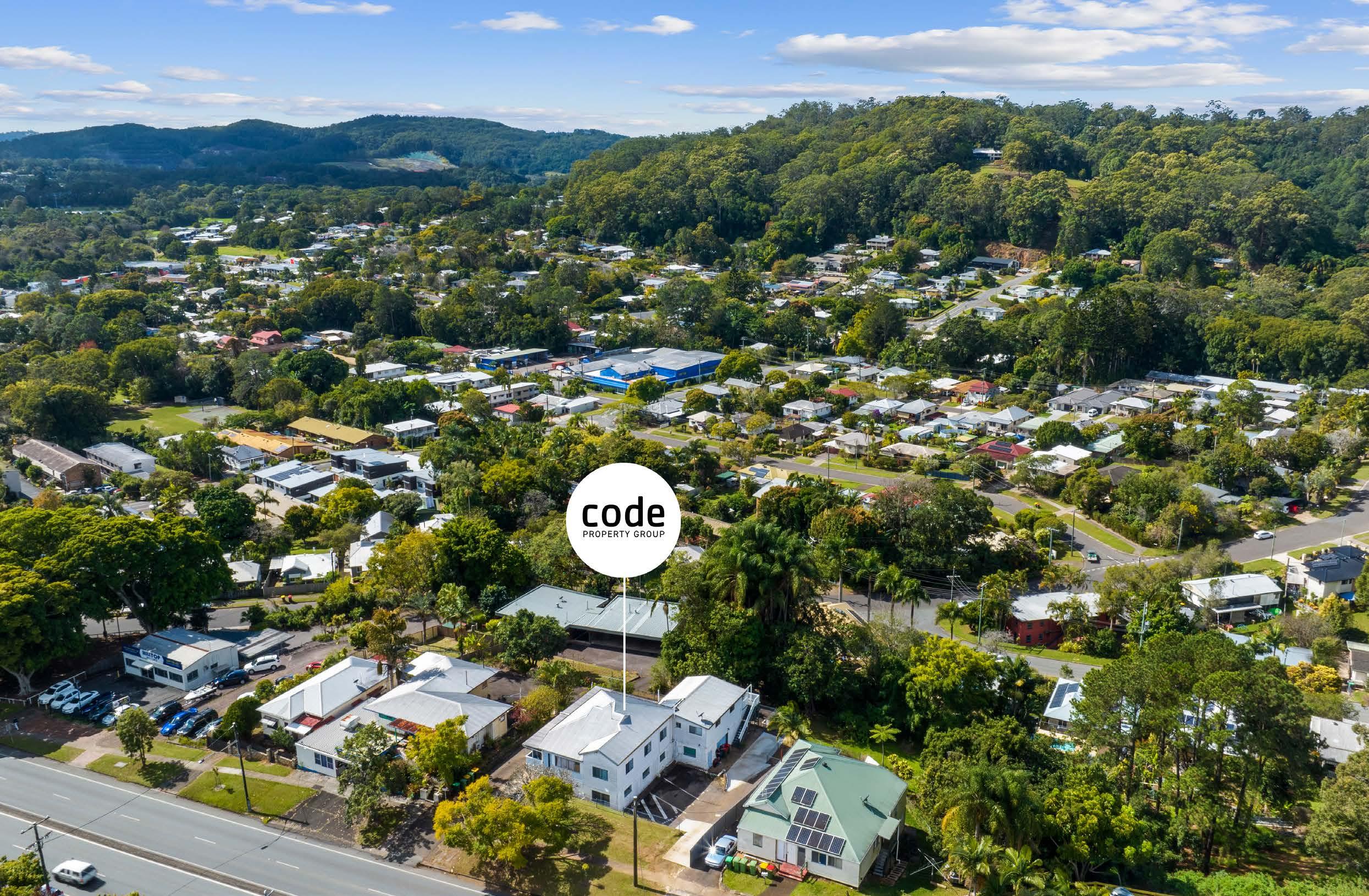
3.1 LOCATION MAP
This truly unique property on the Sunshine Coast is located in the perfect position as a fully tenanted investment property or for medium density redevelopment.
This property offering is located to the entry of Nambour and is close to the town centre precinct.
The site is within easy walking distance to all public transport, amenities and facilities.
Nambour is situated in the Heart of the Nambour Local Area and boasts is the entry to some of the Sunshine Coasts popular Hinterland regions. This along with strong infrastructure including the Nambour Hospital and Public train Stations access to and from this
region is forever improving in order to accommodate the future growth of the area.
Brisbane CBD and International Airport is an easy 1 hour drive South and major Sunshine Coast Centres and beaches are on your doorstep only a 25minute drive away (approx.), including the new Sunshine Coast Airport and new Sunshine Coast University Hospital.
This site is within the Urban Growth Management Boundary and falls into the Local Nambour plan Area.

4

4.0 PROPERTY DETAILS
The subject site includes 1 property on a single title, comprising of a total of 1,614 m² (approx.)
The property fronts onto Lamington Terrace with access down the sides of the property.
The following features are present:
The existing Lamington Terrace residence comprises a traditional large dwelling split into three tenancies.
A summary of the property within the overall site is in Appendix 4 (page 15).
6
Street Locality Legal Description Area Postcode Current Land Use Zoning 11 LAMINGTON TERRACE NAMBOUR L1 RP155629 1,614m² 4560 SINGLE UNIT DWELLING MEDIUM DENSITY RESIDENTIAL ZONE
THE OPPORTUNITY
Under the current Planning Scheme the site allows for the following:
With regard to the allotment fronting Lamington Terrace:
• Local Centre Zone
• Nambour Local Area Plan
• Max 8.5m height limit.
The property is located in the Medium Density Residential Zone, so multi-unit housing is permitted, subject to meeting code requirements. There are also some specific requirements in Nambour for medium density housing.
We have provided the Multi-unit Residential Uses Code and Nambour Local Plan Code links below:
Multi-Unit Residential Uses Code
Nambour Local Plan Code
Overall yield will need to be determined based on a design which addresses all of the site specific issues to determine the best outcome.
We also recommend the potential buyer discuss any development proposal with Council and/or their preferred specialist town planning consultants.
Please refer to the Annexures for supporting Council Information.
7
5.0
TENDER—Closing September 15th at 4pm.
All Tenders to be presented in the form of a contract or Letter of Offer. Any offers presented on Letter of Offer are deemed final and no post negotiations changes will to be made if agreed to by the seller.
 Mr Ben Wilson CODE PROPERTY GROUP
P.O Box 1124
M:
0407 584 378 Or via email: ben.wilson@codepg.com.au
8
Buddina QLD 4575 6.0
METHOD OF SALE
APPENDIX 1 FLOORPLAN

9
APPENDIX 2 PHOTOGRAPHS


10
APPENDIX 2 PHOTOGRAPHS


11
APPENDIX 2 PHOTOGRAPHS


12
APPENDIX 2 PHOTOGRAPHS


13
APPENDIX 3 TITLE SEACH
Current Title Search
EASEMENTS, ENCUMBRANCES AND INTERESTS
1. Rights and interests reserved to the Crown by Deed of Grant No. 10917137 (POR 135)

14
Queensland
ABN
Title Reference: 15613026 Search Date: 28/07/2023 14:39 Date Title Created: 15/02/1977 Request No: 45199700 Previous Title: 11535004 13706010 Estate
Local Government: SUNSHINE COAST ESTATE AND LAND INTEREST Dealing No: 715666267 20/03/2014 ON THE LAWYERVINE PTY LTD A C N 090 627 179 TRUSTEE 1/2 UNDER INSTRUMENT 715666267 ON THE LAWYERVINE PTY LTD A C N 090 627 179 TRUSTEE 1/2 UNDER INSTRUMENT 715666267 AS TENANTS IN COMMON REGISTERED OWNER
Titles Registry Pty Ltd
23 648 568 101
in Fee Simple LOT 1 REGISTERED PLAN 155629
NIL ADMINISTRATIVE ADVICES NIL UNREGISTERED DEALINGS ** End of Current Title Search ** COPYRIGHT QUEENSLAND TITLES REGISTRY PTY LTD [2023] Requested by: D-ENQ CREDIT WORKS AUSTRALIA www titlesqld com au Page 1/1
11


LAMINGTON TCE, NAMBOUR, QLD 4560
APPENDIX 4 PROPERTY REPORT 11


LAMINGTON TCE, NAMBOUR, QLD 4560
Property Details
Property Details


Sales History
Sales History
15
RPD: L1 RP155629 Valuation Amount: $255,000 - Site Value on 30/06/2022 Valuation Amount: $230,000 - Site Value on 30/06/2019 Property Type: House - Freehold [Issuing] Land Use: SINGLE UNIT DWELLING Zoning Low Density Residential Zone Area: 1,614 m² Council: SUNSHINE COAST (MAROOCHY) Water/Sewerage: Features: Deck, Built in Robes, Close to Schools, Close to Transport, Improvements: Close to Shops $279 Area $/m2: 2 1 2 Sale Amount: Sale Date: Sale Type: Related: Area: Vendor: $ 450,000 25/02/2014 Normal Sale No 1,614 m² ANDREWS; ANDREWS; ANDREWS $ 412,000 30/07/2010 Normal Sale No 1,614 m² ST VINCENT DE PAUL SOCIETY QUEENSLAND $ 136,000 09/08/2001 Normal Sale No 1,614 m² REX $ 130,000 20/11/1997 Normal Sale No 1,614 m² LALLEY; LALLEY
Property ID: 1380256 / QLD291746 UBD Ref: 056 E20 UBD Ref: Prepared on 14/08/2023 by Ben Wilson, 0407 584 378 at Greenhouse Property. © Property Data Solutions Pty Ltd 2023 (pricefinder.com.au) The materials are provided as an information source only. © The State of Queensland (Department of Natural Resources, Mines and Energy) August/2023. Based on or contains data provided by the State of Queensland (Department of Natural Resources, Mines and Energy) 2023. In consideration of the State permitting use of this data you acknowledge and agree that the State gives no warranty in relation to the data (including accuracy, reliability, completeness, currency or suitability) and accepts no liability (including without limitation, liability in negligence) for any loss, damage or costs (including consequential damage) relating to any use of the data. Data must not be used for direct marketing or be used in breach of the privacy laws; more information at www.propertydatacodeofconduct.com.au.
Lot Plan 1RP155629
Land Area 1614 SQ METRES
More Information View in MyMaps. View in Development.i.
APPENDIX 5 SITE REPORTS
View in State Assessment Referral Agency (SARA) DA mapping (External Site).
View in State Planning Policy Interactive Mapping System (External Site).
View in Google Street View (External Site).
https://maps.scc.qld.gov.au/sitereport/index.html?report=da_public&land_no=619570#


17/07/2023, 11:13 Site Report Contour Map ⤢ 20 m + –
Location Map Contour Map
1/20 Change location For more information about community feedback received during the preliminary consultation, Council's plans for progressing the drafting process, or to sign up to receive project updates, visit haveyoursay.sunshinecoast.qld.gov.au/newplanningscheme
Site Information Property Address Desmond House 11 Lamington Tce NAMBOUR QLD 4560
Location Map ⤢ 20 m + –
17/07/2023, 11:13
APPENDIX 5 SITE REPORTS
Site Report
Water & Sewer Infrastructure Map
The following information has been provided and maintained by Unitywater Please contact Unitywater directly for any errors or omissions. Limited layers have been displayed for the purpose of this report. Go to Unitywater ’s Web Mapping Application for more information. Usage in agreement with © Unitywater 2017 terms and conditions.
Water and Sewer Infrastructure Map
Water Hydrant - Bulk Supply Point
Water Hydrant - Hydrant
Sewer Gravity Main - Trunk Main
Sewer Gravity Main - Reticulation Main
Sewer Gravity Main - Overflow Main
Sewer Gravity Main - Siphon Main
Water Main - Raw Water Main
Water Main - Trunk Main
Water Main - Reticulation Main

Sewer Manhole - Flume Pit
Sewer Manhole - Maintenance Shaft
Sewer Manhole - Manhole
Sewer Manhole - Vacuum Collection Pit
Water Network Meter - Network Meter
Sewer Pressure Main - Pressure Sewer
Sewer Pressure Main - Rising Main
Sewer Pressure Main - Vacuum Main
17/07/2023, 11:13
Water & Sewer Infrastructure Map
Site Report
The following information has been provided and maintained by Unitywater Please contact Unitywater directly for any errors or omissions. Limited layers have been displayed for the purpose of this report. Go to Unitywater ’s Web Mapping Application for more information. Usage in agreement with © Unitywater 2017 terms and conditions.
17
⤢ 20 m + –
⤢ + –
APPENDIX 5 SITE REPORTS


18
Growth Management 17/07/2023, 11:13 Site Report Growth Management Area ⤢ 1000 m + –Urban Growth Management Boundary Rural Residential Growth Management Boundary 17/07/2023, 11:13 Site Report Local Plan Area: View Tables of Assessment View Local Plan Codes ⤢ 1000 m + –Local Plan Area Boundary 17/07/2023, 11:13 Site Report Local Plan Area: View Tables of Assessment View Local Plan Codes ⤢ 1000 m + –Local Plan Area Boundary 17/07/2023, 11:13 Site Report Growth Management Area ⤢ 1000 m + –Urban Growth Management Boundary Rural Residential Growth Management Boundary
APPENDIX 5 SITE REPORTS
17/07/2023, 11:13
Easements and Covenants Map
Site Report
Acoustic Geotechnical Report
Agricultural Buffer
Protective Mechanism
Vegetation Protection
Voluntary Conservation Agreement
Other Covenant Type Easements
Applications Associated with Site Development & Building applications lodged to Sunshine Coast Council since 2007 and searchable on Development.i. To check if applications or approvals exist over site prior to 2007, it is recommended that you contact council
Note: This list does not include applications lodged under the provisions of the Economic Development Act 2012 with respect to the Caloundra South Priority Development Area (Aura) and Maroochydore City Centre Priority Development Area. Visit the web links to get an overview of the approval process for these areas and how to get further information.
Lodged over current land parcel (Decided or Past):

PC12/3011 - ADDITIONS TO DWELLING & REPAIR RETAINING WALLS - 11 lamington Terrace Nambour - Ref: 1111347 - Saint Consulting, Received: Wed Aug 08 2012
PC02/1551 - CLASS 1A DWELLING TO ACCOMMODATION FOR HOMELESS / HOSTEL CLASS 1B - 11
Lamington Tce NAMBOUR Lot 1 RP 155629 REF: SBA02-0766 - Society Of St Vincent De Paul, Received: Wed Dec 17 2003
Other Approval Information
Key residential and industrial approvals varying the effect of a Planning Scheme; or Master Plan details for land within Development Control Plan 1 – Kawana Waters
19
⤢ 20 m + –
17/07/2023, 11:13
APPENDIX 5 SITE REPORTS
Site Report

Stormwater Network
Box Culvert
BoxCulvertCauseway
Pipe Culvert
PipeCulvertCauseway
Allotment
Box
Pipe
Stormwater Open Drain (Non Council)
Stormwater End Structure (Non Council)
CatchPit
EndCap
FieldInlet
Manhole
Stormwater Open Drain (Council)
Stormwater End Structure (Council)
20
⤢ 20 m + –
17/07/2023, 11:13
APPENDIX 5 SITE REPORTS
Zones: View Tables of Assessment
Low Density Residential Zone
Medium Density Residential Zone

High Density Residential Zone
Tourist Accommodation Zone
Principal Centre Zone
Major Centre Zone
District Centre Zone
Local Centre Zone
Sport and Recreation Zone
Open Space Zone
Environmental Management and Conservation Zone
Low Impact Industry Zone
Medium Impact Industry Zone
High Impact Industry Zone
Waterfront and Marine Industry Zone
Community Facilities Zone
Emerging Community Zone
Limited Development (Landscape Residential) Zone
Rural Zone
Rural Residential Zone
Specialised Centre Zone
Tourism Zone
Site Report
21
⤢ 20 m + –
View Zone Codes
APPENDIX 5 SITE REPORTS
17/07/2023, 11:13
Land Subject to Airport Environs Overlay:
View Tables of Assessment
View Overlay Code
Site Report
Note: Please refer to the State Planning Policy 2017 (SPP) Interactive Mapping System for updated mapping layers for the Sunshine Coast Airport (updated on 3 March 2021) The SPP mapping layers prevail over the Sunshine Coast Planning Scheme 2014 Airport Environs Overlay Map for the Sunshine Coast Airport The assessment benchmarks relating to strategic airports and aviation facilities in the SPP will apply to assessable development to the extent of any inconsistency with the current provisions in the Sunshine Coast Planning Scheme 2014
17/07/2023, 11:13
Land Subject to Airport Environs Overlay:


View Tables of Assessment
View Overlay Code
Site Report
Note: Please refer to the State Planning Policy 2017 (SPP) Interactive Mapping System for updated mapping layers for the Sunshine Coast Airport (updated on 3 March 2021) The SPP mapping layers prevail over the Sunshine Coast Planning Scheme 2014 Airport Environs Overlay Map for the Sunshine Coast Airport The assessment benchmarks relating to strategic airports and aviation facilities in the SPP will apply to assessable development to the extent of any inconsistency with the current provisions in the Sunshine Coast Planning Scheme 2014
2 km
https://maps.scc.qld.gov.au/sitereport/index.html?report=da_public&land_no=619570#
22
11/20
⤢
+ –
⤢ 2 km + –3km 6km 8km 13km
APPENDIX 5 SITE REPORTS

17/07/2023, 11:13
Defined Flood Event
20 m
Defined Flood Event
Defined Overland Flow Event
Potential Flooding outside of modelled extents Recent Development Area
Site Report
Sunshine Coast Council acknowledges the Sunshine Coast Country, home of the Kabi Kabi peoples and the Jinibara peoples, the Traditional Custodians, whose lands and waters we all now share.
We commit to working in partnership with the Traditional Custodians and the broader First Nations (Aboriginal and Torres Strait Islander) community to support self-determination through economic and community development.
Terms of use and privacy © Sunshine Coast Regional Council 2008 - 2023
Council offices
General contacts
Councillor contacts
Development contacts
Follow us
Site help & accessibility
Website support
Accessibility
SCC App
23
⤢
+ –
17/07/2023, 11:13
APPENDIX 5 SITE REPORTS
Site Report

State Assessment Referral Agency (SARA) DA Mapping
Locally refined koala habitat area
Core koala habitat area
Koala priority area
Regulated Vegetation Management (Category A & B)
Urban Footprint
Regional Landscape and Rural Production Area
Rural Living Area
24
⤢ 20 m + –
APPENDIX 5 SITE REPORTS
17/07/2023, 11:13
2016-2021
2021-2026
2026-2031
2031-2036
Existing Pathways, Regional Existing Pathways, District Existing Pathways, Local Future Pathways, Regional Future Pathways, District Future Pathways, Local Highway/Motorway, Current Highway/Motorway, Future Arterial, Current Arterial, Future Arterial Main Street, Current Distributor, Current Distributor, Future
Controlled Distributor, Current Controlled Distributor, Future
Sub-arterial Main Street, Current Sub-arterial Main Street, Future District Collector Street, Current District Collector Street, Future District Main Street, Future
Neighbourhood Collector Street, Current Neighbourhood Collector Street, Future Local, Current Local, Future

20 m
2016-2021
2021-2026
2026-2031
2031-2036
Existing Pathways, Regional Existing Pathways, District Existing Pathways, Local Future Pathways, Regional Future Pathways, District Future Pathways, Local Highway/Motorway, Current Highway/Motorway, Future Arterial, Current Arterial, Future
Arterial Main Street, Current Distributor, Current Distributor, Future Controlled Distributor, Current Controlled Distributor, Future Sub-arterial Main Street, Current Sub-arterial Main Street, Future District Collector Street, Current District Collector Street, Future District Main Street, Future Neighbourhood Collector Street, Current Neighbourhood Collector Street, Future Local, Current Local, Future
Highway/Motorway, Subject to Investigation
Arterial, Subject to Investigation
Distributor, Subject to Investigation
Controlled Distributor, Subject to Investigation District Collector, Subject to Investigation
https://maps.scc.qld.gov.au/sitereport/index.html?report=da_public&land_no=619570#
25
Site Report
⤢
+ –
Road and Pathway Hierarchy + Proposed Trunk Transport Corridor Upgrades
20 m
Road and Pathway Hierarchy + Proposed Trunk Transport Corridor Upgrades
+ –
APPENDIX 5 SITE REPORTS

26 17/07/2023, 11:13 Site Report Local Government Infrastructure Plan: View Local Government Infrastructure Plan View Local Government Infrastructure Plan (LGIP) Maps ⤢ 20 m + –Priority Infrastructure Area
APPENDIX 5
SITE REPORTS


27 17/07/2023, 11:13 Site Report
15/20 Land Subject to Regional Infrastructure Overlay: View Tables of Assessment View Overlay Code Land Subject to Scenic Amenity Overlay: View Tables of Assessment ⤢ 20 m + –Major Road Corridor and Buffer 20 m Scenic Route 17/07/2023, 11:13 Site Report https://maps.scc.qld.gov.au/sitereport/index.html?report=da_public&land_no=619570# 15/20 Land Subject to Regional Infrastructure Overlay: View Tables of Assessment View Overlay Code Land Subject to Scenic Amenity Overlay: ⤢ 20 m + –Major Road Corridor and Buffer 20 m Scenic Route 17/07/2023, 11:13 Site Report
15/20 Land Subject to Regional Infrastructure Overlay: View Tables of Assessment View Overlay Code Land Subject to Scenic Amenity Overlay: View Tables of Assessment View Overlay Code ⤢ 20 m + –Major Road Corridor and Buffer ⤢ 20 m + –Scenic Route
https://maps.scc.qld.gov.au/sitereport/index.html?report=da_public&land_no=619570#
https://maps.scc.qld.gov.au/sitereport/index.html?report=da_public&land_no=619570#
https://maps.scc.qld.gov.au/sitereport/index.html?report=da_public&land_no=619570#


28 17/07/2023, 11:13 Site Report
14/20 Land Subject to Landslide Hazard and Steep Land Overlay: View Tables of Assessment View Overlay Code ⤢ 20 m + –Slope 15-20% Slope 20-25% Slope greater than 25% 17/07/2023, 11:13 Site Report Land Subject to Landslide Hazard and Steep Land Overlay: View Tables of Assessment View Overlay Code ⤢ 20 m + –Moderate Hazard Area High Hazard Area Very High Hazard Area
APPENDIX 5 SITE REPORTS
APPENDIX 5 SITE REPORTS

29 17/07/2023, 11:13 Site Report Height of Buildings and Structures Overlay: View Tables of Assessment View Overlay Code ⤢ 20 m + –8.5 metres 10 metres 12 metres 15 metres 18 metres 21 metres 25 metres 30 metres 37.5 metres 40 metres 45 metres Unspecified maximum height 17/07/2023, 11:13 Site Report https://maps.scc.qld.gov.au/sitereport/index.html?report=da_public&land_no=619570# 12 Height of Buildings and Structures Overlay: View Tables of Assessment View Overlay Code ⤢ 20 m + –8.5 metres 10 metres 12 metres 15 metres 18 metres 21 metres 25 metres 30 metres 37.5 metres 40 metres 45 metres Unspecified maximum height
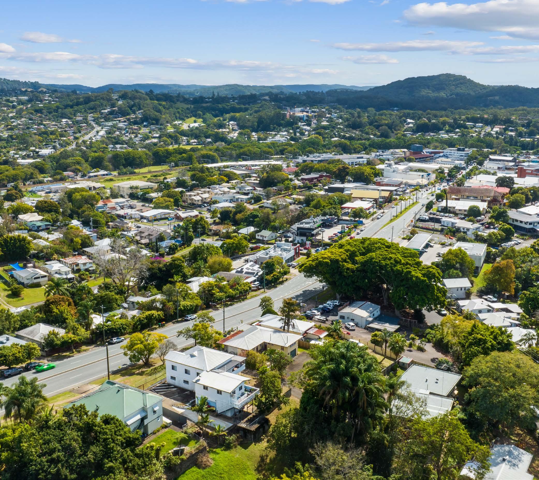
APPENDIX 6 LOCATION AERIAL VIEW


30 30
APPENDIX 7 LEASE SUMMARY DOCUMENTS
Annexure A – Tenancy Details
Unit 1
Tenant: Haana Hunt
Lease Start: 04/02/2023 Lease End: 02/02/2024
Rent per week: $290 Bond Held: $1,160
Unit 2
Tenant: Jairah Laygo & Sam Apolinar
Lease Start: 21/09/2022 Lease End: 18/09/2024
Rent per week: $350 Bond Held: $1.400
*Rent increases to $380 per week on 21/09/2023
Unit 3
Tenant: Jessie Praest & Beau Bullivant
Lease Start: 09/11/2022 Lease End: 08/11/2023
Rent per week: $370 Bond Held: $1,480
31
xxxx
xxxx xxxxxx xxxx xxxxxx
1301011221110030202130322213303222013


32 APPENDIX
WATER RATES Easy ways to pay For other payment options - see over BPAY WATER AND SEWERAGE YOUR BILL 1300 086 489 Emergencies and faults 24 Hours, 7 days Account enquiries 8am-5pm Mon-Fri unitywater.com ABN 89 791 717 472 Account number 99718464 Payment reference 0997 1846 43 Property 11 Lamington Tce, NAMBOUR, QLD Bill number 7120951717 Billing period 13 Aug 2020 96 days to 16 Nov 2020 Issue date 18 Nov 2020 Approximate date 12 Feb 2021 of next meter reading
8
Your account activity Your last bill $730.71 Payments/ adjustments $730.71 Balance $0.00 New charges $790.55 Total due $790.55 Due date 21 Jan 2021 No interest charges will apply to overdue amounts on bills issued during 12-month period ending 31 March 2021 Compare your average daily usage over time 2500 2000 1500 1000 500 Nov 19 849 Feb 20 915 May 20 856 Aug 20 876 Nov 20 865 Litres 0 JOIN THEM TODAY WAT ER L O C A L LEG E N DS Noel knows a half flush saves twice the water As we head into the warmer months, we can all make small changes to save water and stay H2OK! For more water saving tips, visit unitywater.com/legends Biller Code: 130393 Ref: 0997 1846 43 Contact your bank or financial institution to pay from your cheque, savings, debit, credit card or transaction account. Find out more at bpay.com.au ® Registered to BPAY Pty Ltd ABN 69 079 137 518 Direct Debit Login to My Account at unitywater.com to set up automatic payments from your bank account or credit card or call us for assistance. Smooth out your bill payments across the year with regular fortnightly or monthly payments, interest free. Find out more at unitywater.com/smoothpay 211855_128UW02_Email_661/001346/004043
APPENDIX 9 RATES NOTICE

33

DISCLAIMER
This property report has been prepared by CODE PROPERTY GROUP. This report is based on historical records of the property. This report does not constitute an offer or contract of sale or any part of an offer of contract of sale. It is intended only as a guide and an aid to further investigation by potential purchasers. Potential purchasers accept this report on the condition that they will make their own enquiries and obtain their own independent advice in order to verify the accuracy of information presented in this report.
Interested parties acknowledge that:
> they do not rely on any statement, representation, warranty, condition or other conduct which may have been made by CODE PROPERTY GROUP, any agents or consultants of CODE PROPERTY GROUP, any of their respective employees or any person purporting to act on behalf of them; and
> no representation is given by CODE PROPERTY GROUP, any of their respective employees and any person purporting to act on behalf of them, about the accuracy of any information in this report or the property and they do not express an opinion on the financial data relating to the properties (whether in this report or not) and no warranty or representation of accuracy or reliability is given; and
> the property is sold in an “as is/where is” condition (that is, in its present condition and subject to all legal and physical defects). Interested parties must satisfy themselves about the property by doing their own inspections, surveys, verifications, tests and searches; and if an offer to buy the property is made, that person will be taken to have made their own enquiries about the property and not to have relied on any information in this report or any other representations made by CODE PROPERTY GROUP, any of their respective employees and any person purporting to act on behalf of them; and
> CODE PROPERTY GROUP, any of their respective employees and any person purporting to act on behalf of them, accept no personal liability to any interested party whatsoever in relation to any aspects of the operation and sale of the property; and
> no claim or demand will be made against CODE PROPERTY GROUP, any of their respective employees or any person purporting to act on behalf of them, for any liability whatsoever for or in relation to any aspect of this report and the sale of the property.
> subject to any law to the contrary, all terms, conditions, warranties and statements, whether express, implied, written, oral, collateral, statutory or otherwise, relating to this report and the sale of the property are excluded and CODE PROPERTY GROUP, any of their respective employees and any person purporting to act on behalf of them, disclaim all liability in relation to the maximum extent permitted by law.
> This report is for the sole use of persons directly provided with it by CODE PROPERTY GROUP and is not to be re supplied to any other person without the prior written consent CODE PROPERTY GROUP. Use by, or reliance upon this report by any other person is not authorised and CODE PROPERTY GROUP, any of their respective employees or any person purporting to act on behalf of them, are not liable for any loss or damage of any kind whatsoever arising from such unauthorised use or reliance.
Important Prospective purchasers conduct due diligence investigations of the property strictly at their own expense and risk, and the vendor will have no liability in relation to such expenses. Consent by the vendor to conduct, by any potential purchaser, due diligence activities or investigation will not in any circumstance be construed as a representation that the vendor will be exercising or refraining from exercising its rights to deal with the property or any representations that the vendor intends to contract with that buyer, or at all.
35
BEN WILSON
m: 0407 584 378
07 5438 3444
codepg.com.au
e: ben.wilson@codepg.com
codepg.com.au
36
Code Property Group, our people are our brand. Our culture is created simply from a united team and their passion for delivering the ultimate customer experience. We engage in the relentless pursuit of ever changing customer satisfaction and enable our team with the tools and freedom to excel.
OUR PEOPLE OUR PASSION YOUR BRAND At
